REGION J J. 1 OCEAN INDIEN SEPTENTRIONAL NORTH INDIAN OCEAN. Coordinator : India. Coordonnateur : Inde
|
|
|
- Cecily Ford
- 6 years ago
- Views:
Transcription
1 J. 1 PART B PARTIE B REGION J NORTH INDIAN OCEAN Coordinator : India OCEAN INDIEN SEPTENTRIONAL Coordonnateur : Inde
2 J. 2 Page intentionally left blank Page laissée en blanc intentionnellement


3 LIMITS OF INDEXES Catalogue of International Charts J. 3 LIMITES DES INDEX Limits of Region J / Limites de la région J


4 SMALL SCALE INT CHARTS Catalogue of International Charts J. 4 CARTES INT A PETITES ECHELLES
5 SMALL SCALE INT CHARTS Catalogue of International Charts J. 5 CARTES INT A PETITES ECHELLES INT Prod. National TITLE / TITRE CHART LIMITS / LIMITES DE LA CARTE Scale / Echelle Date Format Printer South/Sud North/Nord West/Ouest East/Est 1 : Lat 1st Ed/NE (Nat. Date NE) 703 GB 4703 Gulf of Aden to Maldives et Seychelles S N E E 'N 75/11 IN ( ) 704 GB 4704 Red Sea N N E E 'N 73/12 DE (295 03), FR ( ) IN ( ) 705 IN 7705 Aramian Sea N N E E 'N 96/ GB ( ) 706 IN 7706 Bay of Bengal N N E E 'N 96/ GB ( ) 707 GB 4707 Maldives to Sumatera 12º20.00 S 09º06.20 N 72º15.00 E 105º55.40 E 'N 74/11 IN ( ) 714 See/Voir L See/Voir I See/Voir I IN 22 Bombay to Cape Comorin N N E E /04 98 x GB 709 Maldives to Sri Lanka S N E E (91)/(94) 102 x IN 32 Cochin to Vishakhapatnam N N E E N 02/ 98 x IN 33 Bay of Bengal-Southern Part N N E E (80)/ 102 x IN 31 Bay of Bengal-Northern Part N N E E (76)/ 106 x IN 41 Andaman Sea N N E E / 98 x GB 2964 Gulf of Aden and Approaches N N E E N 06/ x 63 ( ) published as national chart / publiée en tant que carte nationale
6 RED SEA NORTHERN PART Catalogue of International Charts J. 6 MER ROUGE PARTIE NORD INT Prod. National TITLE / TITRE CHART LIMITS / LIMITES DE LA CARTE Scale / Echelle Date Format Printer South/Sud North/Nord West/Ouest East/Est 1 : Lat 1st Ed/NE (Nat. Date NE) 7006 See/Voir J GB 158 Berenice (Barnīs) to Masamirit N N E E º00 N 01/ x 74 FR( ) 7010 GB 159 Suez to Berenice (Barnīs) N N E E º00 N 01/ x 75 FR( ) 7128 GB 82 Outer App. to Port Sudan N N E E / 98 x 65 Plan A Sanganeb Anch N N E E 7129 GB 3492 App. to Port Sudan N N E E / x 64 Plan A Port Sudan N N E E Plan B Marsa Gwiyai N N E E 7131 GB 3043 Anchorages in Egypt Various 97/ x 65 Plan A Safaga (Būr Safājah) N N E E Plan B Hurghada (Al Ghardaqah) N N E E Plan C Approaches to Safaga (Būr Safājah) N N E E º44 N Plan D Approaches to Berenice (Barnīs) N N E E º51 N Plan E Berenice (Barnīs) N N E E Plan F El Quseir (Al Qusayr) N N E E º06 N 7132 GB 2375 Juzur Ashrāfī to Safaga (Būr Safājah) and N N E E N 97/ x 75 Strait of Tiran 7134 GB 2374 Egypt, Gulf of Suez, Ra s Sharātib to Juzur N N E E N 97/ x 74 Ashrāfī Plan A Zeit Terminals N N E E GB 333 Offshore Installations in the Gulf of Suez N N E E / x 71 including Ra s Shuqayr (Ra s shukhēir) 7136 GB 2373 Suez Bay (Baḩr Al Qulzum) to Ra s Sharātib N N E E N 97/ x GB 2132 Ports in the Gulf of Suez 02/ 110 x 75 Plan A Ain Sukhna North Port (Sokhna N N E E Port) and Oil Terminal Plan B Râs Budran Terminal N N E E Plan C Wâdi Feirân Terminal N N E E Plan D Râs Ghârib N N E E Plan E Sharm el Sheikh N N E E 7139 GB 2133 App. to Suez Bay (Bahr al Qulzum) N N E E / x GB 3214 Bur El Suweis (Port of Suez) N N E E x 65 ( ) published as national chart / publiée en tant que carte nationale


7 RED SEA NORTHERN PART Catalogue of International Charts J. 7 MER ROUGE PARTIE NORD
8 RED SEA NORTHERN PART (cont.) Catalogue of International Charts J. 8 MER ROUGE PARTIE NORD (suite)
9 RED SEA NORTHERN PART (cont.) Catalogue of International Charts J. 9 MER ROUGE PARTIE NORD (suite) INT Prod. National TITLE / TITRE CHART LIMITS / LIMITES DE LA CARTE Scale / Echelle Date Format Printer South/Sud North/Nord West/Ouest East/Est 1 : Lat 1st Ed/NE (Nat. Date NE) 7141 GB 233 Suez Canal Various 08/ x 67 FR ( ) Plan A Port Said (Būr Sa īd) to KM N N E E Plan B KM 50 to KM N N E E Plan C KM 75 to KM N N E E Plan D Great Bitter Lake (Al Buḩayrah al Murrah N N E E al Kubrá) to Suez Bay (Bahr Al Qulzum), (Km 95 to Km 162) Plan E Lake Timsah (Buḩayrat at Timsāḩ) N N E E Plan F Al Kibrīt N N E E 7142 GB 12 Gulf of Aqaba N N E E º30 N 99/ x 75 Plan A Ash Sharma N N N E º50 N Plan B App. to Duba N N E E º20 N Plan C Port of Duba N N E E Plan D Duba Bulk Terminal N N E E GB 801 Plans in the Gulf of Aqaba 93/ x 67 Plan A App. to Eilat and Al Aqaba N N E E º50 N Plan B Eilat and Al Aqaba N N E E Plan C Port of Al Aqaba N N E E Plan D Royal Jordanian Naval Base N N E E Plan E Al Aqaba Industrial Port N N E E Plan F App. to Strait of Tīrān N N E E º02 N Plan G Strait of Tīrān N N E E EG R11 Port of Suez N N E E º54 N X98 GB( ) 7145 GB 327 Northern App. to Yanbu N E E E / 110 x 64 Plan A Yanbu Al Bahr N N E E 7146 GB 326 Southern Approaches to Yanbu N N E E (96)/ 110 x GB 328 Madinat Yanbu As Sinaiyah, Mina Al Malik Fahd N N E E / 102 x GB 2659 Shi b Nazar to Qiţa Kidan N N E E º30 N 13/ 98 x GB 2658 Outer App. to Mīnā Al Jiddah N N E E º30 N 13/ 98 x GB 2599 App. to Mīnā Al Jiddah N N E E / 98 x GB 2577 Mīnā Al Jiddah N N E E / 109 x GB 63 Approaches to King Abdullah Port N 22º39.00 N 38º47.18 E 39º09.00 E / 110 x EG SC01 Suez Canal (Port Said to Great Bitter Lakes) N N E E GB (233A-16) Plan A: Port Said (Bur Said to Al Teenah) N N E E 2015 km 0 to km 33 Plan B: Al Kaab to Al Kantara (Km28 to Km 57) N N E E 2015 Plan C: New Expansion Channel (Km 52 to Km N N E E ) Plan-D: Al Temsah Lake(Buhayrat al Temsah) N N E E
10 RED SEA NORTHERN PART (cont.) Catalogue of International Charts J. 10 MER ROUGE PARTIE NORD (suite) 7159 EG SC02 Suez Canal (Great Bitter Lakes to Gulf of Suez) N N E E X77 GB (233B-16) Plan-E: Great Bitter Lakes(Al Buhayrat Al Morrah) N N E E 2015 Plan-F: Kabret to Suez Bay(Km 120 to Hm 24.0) N N E E 2015 Plan-G: Port Taufiq to Gulf of Suez (Km 160 to Hm 80.5) N N E E 2015 ( ) published as national chart / publiée en tant que carte nationale


11 RED SEA NORTHERN PART (cont.) Catalogue of International Charts J. 11 MER ROUGE PARTIE NORD (suite)
12 RED SEA SOUTHERN PART AND GULF OF ADEN J. 12 MER ROUGE PARTIE SUD ET GOLFE D ADEN
13 J. 13 RED SEA SOUTHERN PART AND GULF OF ADEN MER ROUGE PARTIE SUD ET GOLFE D ADEN INT Prod. National TITLE / TITRE CHART LIMITS / LIMITES DE LA CARTE Scale / Echelle Date Format Printer South/Sud North/Nord West/Ouest East/Est 1 : Lat 1st Ed/NE (Nat. Date NE) 7001 See/Voir J See/Voir J FR 6987 Partie Ouest du Golfe d Aden Bal el Mandeb N N E E N 88/10 A0 Plan A Berbera N N E E N 7005 GB 143 Jazīrat aţ Ţā ir to Bab el Mandeb N N E E º20 N 01/13 98 x 63 Plan A Jazā ir Az Zubayr N N E E 15º00 N 7006 GB 157 Masamirit to Bab el Mandeb N N E E N 01/ x See/Voir J See/Voir J GB Outer App. to Berbera N N E E GB 3530 App. To Berbera N N E E (89)/ 98 x 64 Plan A Berbera N N E E 7114 FR 7519 Bab El Mandeb et Golfe de Tadjoura N N E E N 00/12 Plan A Mouillage de Tadjoura N N E E N Plan B Entrée du Ghoubbet et Kharâb N N E E N Mouillage des Boutres Plan C - Port d Obock N N E E N 7115 FR 7547 Abords de Djibouti N N E E N / x 75 GB (264 15) 7116 GB 453 Jāzirat Jabal Zuqar to Muhabbaka Islands N N E E N 85/ x GB 452 Al Mukhā to Bab el Mandeb N N E E N 02/ x 75 Plan A Mayyūn Harbour N N E E FR 7518 De Al Hudaydab à Al Mukha N N E E N 00/12 75 x GB 1926 Aseb Bay N N E E º00 N 11/ 98 x 64 Plan A Aseb N N E E 7120 FR 7546 Port de Djibouti 11º35.15 N 11º39.21 N 43º03.49 E 43º09.54 E º37 N 10/14 110x75 GB (263-15) 7122 GB 171 Southern App. to Massawa N N E E º15 N 02/ 110 x GB 164 North and North-East Approaches to Massawa N N E E º30 N 06/13 98 x 64 (Mits iwa) 7125 GB 460 Massawa (Mits iwa) and approaches N N E E / x 75 Plan A Massawa Harbour N N E E 7128 See/Voir J GB 15 Approaches to Jīzān N N E E / x GB 16 Jīzān N N E E x GB 548 Approaches to Maḑīq Kamarān and Al Luhayyah N N E E x 64 ( ) published as national chart / publiée en tant que carte nationale
14 RED SEA SOUTHERN PART AND GULF OF ADEN (cont.) J. 14 MER ROUGE PARTIE SUD ET GOLFE D ADEN (suite) INT Prod. National TITLE / TITRE CHART LIMITS / LIMITES DE LA CARTE Scale / Echelle Date Format Printer South/Sud North/Nord West/Ouest East/Est 1 : Lat 1st Ed/NE (Nat. Date NE) 7158 GB 542 Madiq Kamarān to Al Hudaydah N N E E / 98 x 65 Plan A Approaches to Port of Hudaydah N N E E Plan B Port of Hudaydah N N E E GB 1955 Ports in the Yemen Various (84)/13 93 x 64 Plan A Al Mukha N N E E Plan B Southern Entrance to Maḑīq Kamarān N N E E GB 3661 Bab el Mandeb to Aden Harbour N N E E º00 N 03/ 98 x GB 7 Aden Harbour and Approaches N N E E (84)/13 98 x GB 3660 Aden Inner Harbour N N E E (84)/ 102 x GB 434 Balhaf Terminal and Little Aden Oil Harbour N N E E (83)/13 64 x 46 ( ) published as national chart / publiée en tant que carte nationale


15 RED SEA SOUTHERN PART AND GULF OF ADEN J. 15 MER ROUGE PARTIE SUD ET GOLFE D ADEN


16 ARABIAN SEA WESTERN PART Catalogue of International Charts J. 16 MER D ARABIE PARTIE OUEST
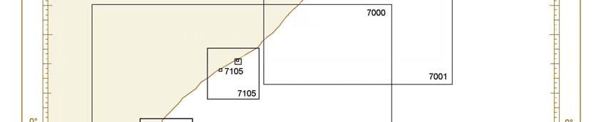
17 J. 17 ARABIAN SEA WESTERN PART MER D ARABIE PARTIE OUEST INT Prod. National TITLE / TITRE CHART LIMITS / LIMITES DE LA CARTE Scale / Echelle Date Format Printer South/Sud North/Nord West/Ouest East/Est 1 : Lat 1st Ed/NE (Nat. Date NE) 7000 GB 2968 Lamu Bay to Cadale (Itala) S N E E N 03/ 98 x GB 2969 Cadale (Itala) to Raas Xaafuun N N E E º00 N 03/ 98 x GB 2970 Eastern Approaches to the Gulf of Aden N N E E º00 N 03/ x See/Voir J GB 3784 Ras Al Kalb to Ras Al Marbat N N E E º00 N 12/ 98 x 65 Plan A - Ash Shihr Terminal N N E E Plan B - Al Mukalla N N E E Plan C - Nishtun N N E E 7015 See/Voir I See/Voir H GB 1052 App. to Kismaayo S S E E (89)/ 100 x 65 Plan A - Kismaayo S S E E 7105 GB 671 Outer App. to Muqdisho and Marka Anch N N E E (90)/ 102 x 64 Plan A - App. To Muqdisho N N E E Plan B - Muqdisho N N E E Plan C - Marka Anch N N E E 7110 GB 100 Ras Durbo to Ras Binnah N N E E (94)/ 98 x See/Voir I See/Voir I See/Voir I.21 ( ) published as national chart / publiée en tant que carte nationale
18 ARABIAN SEA EASTERN PART Catalogue of International Charts J. 18 MER D ARABIE PARTIE EST INT Prod. National TITLE / TITRE CHART LIMITS / LIMITES DE LA CARTE Scale / Echelle Date Format Printer South/Sud North/Nord West/Ouest East/Est 1 : Lat 1st Ed/NE (Nat. Date NE) 7019 See/Voir I IN 292 Dwārka to Mumbai N N E E N 03/ 98 x IN 293 Mumbai to New Mangalore N N E E / 99 x See/Voir I IN 251 Sir Creek to Dwarka N N E E N 96/12 98 x 65 GB ( ) 7319 IN 203 Gulf of Kachchh N N E E N 03/ 106 x 64 GB (682 12) Plan A Extension to Navlakhi N N E E IN 2018 Approaches to Kandla N N E E / IN 2059 Kandla - Sogal Channel N N E E /15 Plan A Kandla Creek N N E E IN 2013 Gulf of Kachchh - Port of Okha N N E E / 48 x 63 GB (523-14) 7325 IN 252 Okha to Veraval N N E E /13 98 x 64 GB ( ) 7326 IN 2031 Okha Harbour N N E E /13 99 x 64 GB (524-14) 7327 IN 2017 Navlakhi and Approaches N N E E (08)/ 98 x IN 253 Veraval to Pipavav N N E E 'N 00/13 98 x 64 GB ( ) 7329 IN 2079 Approaches to Mundra Port N N E E (10)/14 98 x IN 254 Approaches to Gulf of Khambhāt N N E E / 98 x IN 2060 Approaches to Salaya and Pathfinder Inlet N N E E (10)/ 106 x 64 Plan A : Pathfinder Inlet N N E E IN 2051 Salaya Harbour N N E E (09)/15 64 x IN 255 Approaches to Mumbai N N E E 'N 97/14 98 x IN 2016 Inner Approaches to Mumbai N N E E /13 98 x 64 GB ( ) 7337 IN 2015 Port of Mumbai N N E E / x 64 GB ( ) 7338 IN 2076 Jawaharlal Nehru Port and Trombay N N E E /15 99 x 63 GB ( ) 7339 IN 2083 Approaches to Sikka Reliance Tanker Berths N N E E /12 68 x IN 256 Murud-Janjira Hr to Malvan N N E E / 98 x IN 2033 Sikka Creek, Sikka Channel 22º28.00 N 22º32.40 N 69º45.30 E 69º52.50 E (04)/14 99 x IN 2081 Approaches to Ports from Diu to Pipavav N N E E (11)/ 106 x 64 Plan A : Diu and Nawabandar Anchorages N N E E IN 257 Malvan to Coondapoor N N E E N 02/ 100 x IN 2100 Approaches to Port Pipavav N N E E (09)/14 98 x 65 Plan A: Port Pipavav N N E E IN 2022 Approaches to Mormugao N N E E /11 98 x IN 2078 Port of Mormugao N N E E /15 98 x IN 2101 Approaches To Hazira N N E E (01)/ 64 x IN 258 Kundapura to Badagara N N E E / x IN 2034 Hazira Port N N E E / x 67 GB ( ) 7350 IN 2052 Approaches to Port of New Mangalore N N E E /10 98 x 64 GB ( ) 7351 IN 2002 Ports of New Mangalore and Mangalore N N E E / x 64 GB ( ) 7352 IN 2036 Dighi Harbour (Murud Janjira) And Approaches N N E E /14 99 x See/Voir J See/Voir J.27 ( ) published as national chart / publiée en tant que carte nationale


19 J. 19 ARABIAN SEA EASTERN PART MER D ARABIE PARTIE EST

20 J. 20 INDIAN OCEAN FROM LACKSHADWEEP TO CHAGOS ARCHIPELAGO OCEAN INDIEN DE LAKSHADWEEP A CHAGOS ARCHIPELAGO
21 INDIAN OCEAN FROM LACKSHADWEEP TO CHAGOS ARCHIPELAGO J. 21 OCEAN INDIEN DE LAKSHADWEEP A CHAGOS ARCHIPELAGO INT Prod. National TITLE / TITRE CHART LIMITS / LIMITES DE LA CARTE Scale / Echelle Date Format Printer South/Sud North/Nord West/Ouest East/Est 1 : Lat 1st Ed/NE (Nat. Date NE) 7348 See/Voir J IN 268 Central Lakshadweep N N E E 'N 96/09 98 x IN 259 Badagara to Kochi (Cochin) N N E E / x IN 2029 Approaches to Kochi (Cochin) N N E E N 01/11 98 x IN 2004 Kochi (Cochin) Harbour N N E E /15 98 x 63 GB (61 11) 7360 IN 2045 Port of Kochi (Cochin) N N E E /14 98 x IN 260 Kochi (Cochin) to Cape Comorin N N E E / 100 x See/Voir J GB 1014 S. Maalhosmadulu Atoll to N N N E E (93)/ 98 x 67 Thiladhunmathee Atoll 7371 GB 1013 Mulaku Atoll to S. Maalhosmadulu Atoll N N E E (93)/ 98 x GB 3323 Male Atoll N N N E / x 64 Plan A Male Anchorage and App N N E E 7374 GB 1012 N. Huvadhoo Atoll to Mulaku Atoll N N E E (92)/ 98 x GB 1011 Addoo Atoll to N. Huvadhoo Atoll S N E E (92)/ 98 x GB 2067 Addoo Atoll S S E E (93)/ 98 x GB 3 Chagos Archipelago S S E E (98)/ x GB 920 Diego Garcia S S E E (71)/ x See/Voir J.22 ( ) published as national chart / publiée en tant que carte nationale
22 BAY OF BENGAL WESTERN PART Catalogue of International Charts J. 22 GOLFE DU BENGALE PARTIE OUEST INT Prod. National TITLE / TITRE CHART LIMITS / LIMITES DE LA CARTE Scale / Echelle Date Format Printer South/Sud North/Nord West/Ouest East/Est 1 : Lat 1st Ed/NE (Nat. Date NE) 7362 See/Voir J IN 262 Cape Comorin to Pamban N N E E (77)/14 98 x IN 2075 Approaches to Tuticorin N N E E /08 98 x 64 GB (576 09) Plan A Tuticorin Harbour N N E E IN 263 Cape Comorin to Colombo N N E E /04 98 x GB 813 Colombo to Sangama Kanda Point N N E E º00 N x GB 1655 Colombo and approaches N N E E / x 65 Colombo Harbour N N E E GB 1583 Little Basses Reef to Pulmoddai Roads N N E E (84)/(09) 98 x 64 Plan A Pulmoddai Roads N N E E Plan B Batticaloa Roads N N E E 7390 GB 819 Approaches to Galle Harbour N N E E / 64 x 98 Plan A Galle Harbour N N E E 7391 GB 815 Approaches To Trincomalee N N E E (78)/(09) 98 x GB 816 Trincomalee Hr N N E E (78)/(09) 98 x IN 358 Approaches to Palk Bay N N E E /09 99 x IN 357 Point Calimere to Chennai (Madras) N N E E N 02/ x 65 GB ( ) 7400 IN 356 Chennai (Madras) to Rāmāypatnam N N E E / x 65 GB (317 11) 7402 IN 3001 Approaches to Chennai (Madras) N N E E N /15 64 x 98 GB (573 15) 7403 IN 3004 Chennai Harbour N N E E /12 98 x 63 GB (571 14) 7404 IN 3028 Ports of Ennore 13º11.00 N 13º17.60 N 80º19.35 E 80º24.00 E / 69 x IN 355 Rapaypatnam to Sacramento Shoal N N E E / x 65 GB (318 11) 7407 IN 3009 Kakinada Port Approaches to Kakinada 16º48.50 N 17º09.00 N 82º13.60 E 82º32.00 E /14 98 x 63 Plan A Kakinada Anchorage N 17º02.50 N 82º16.00 E 82º22.00 E IN 354 Sacramento Shoal to Kalingapatnam N N E E º00 N 01/ x 65 GB (319 10) 7409 IN 308 Outer Approaches to Vishakhapatnam 17º17.00 N 18º N 82º43.00 E 84º08.00 E (08)/ 101 x IN 3002 Approaches to Vishakhapatnam N N E E /11 99 x 63 GB (243 11) 7411 IN 3012 Vishākhapatnam Harbour N N E E /15 98 x 63 GB (244 11) 7413 See/Voir J.22 ( ) published as national chart / publiée en tant que carte nationale


23 BAY OF BENGAL WESTERN PART Catalogue of International Charts J. 23 GOLFE DU BENGALE PARTIE OUEST


24 BAY OF BENGAL NORTHERN PART J. 24 GOLFE DU BENGALE PARTIE NORD
25 BAY OF BENGAL NORTHERN PART J. 25 GOLFE DU BENGALE PARTIE NORD INT Prod. National TITLE / TITRE CHART LIMITS / LIMITES DE LA CARTE Scale / Echelle Date Format Printer South/Sud North/Nord West/Ouest East/Est 1 : Lat 1st Ed/NE (Nat. Date NE) 7408 See/Voir J IN 353 Kalingapatnam to Gopalpur N N E E / x 63 GB (320-11) 7416 IN 352 Gopālpur to Pārādip N N E E º00 N 02/ x 63 GB (321-10) 7418 IN 3010 Pārādip Anchorage N N E E N 93/14 99 x 65 GB (538-11) Plan A Pārādip Port N N E E IN 351 Pārādip to Pussur River N N E E / 102 x IN 3011 Hugli River Gasper Channel to Haldia N N E E /10 99 x IN 3013 Hugli River Haldia to Kukrāhātti Reach N N E E / 99 x IN 3006 Part 1 Hugli River Kukrāhātti reach to Kolkata N N E E / 100 x 63 GB (135 08) (Calcutta) Docks Part 2 Royāpur Crossing to Calcutta Docks N N E E Plan A Calcutta Docks N N E E BD Malancha River to Saint Martin s Island N N E E º30 N 01/ x BD 5001 Approaches to Hiran Point N N E E º30 N 75x110 GB (732-11) 7427 BD 3001 Chittagong Harbour N N E E º05 N 01/ x BD 7510 App. To Chittagong N N E E º05 N 01/ x98 GB (84-15) 7429 BD 7511 Elephant Point to Matarbari Island 'N 'N 'E 'E º30 N 01/ x98 (Proposed Sonadia Deep Sea Port Area) 7451 BD 2508 Plan A Pussur River-Monkey Point to Jayman N N E E º30 N 98x75 Reach Plan B Pussur River-Jayman Reach to Mongla N N E E º30 N Port 7452 BD 3004 Plan A Pussur River-Tinkona Island to N N E E º30 N 98x75 Ghusaingaria Khal Plan B Pussur River-Ghusaingaria Khal to N N E E º30 N Monkey Point 7453 BD 3002 Payra Harbour 'N 'N 'E 'E º30 N 65x BD 7504 Approaches to Payra Harbour 'N 'N 'E 'E º30 N 75x110 ( ) published as national chart / publiée en tant que carte nationale
26 BAY OF BENGAL EASTERN PART AND ANDAMAN SEA J. 26 GOLFE DU BENGALE PARTIE EST ET MER DES ANDAMAN INT Prod. National TITLE / TITRE CHART LIMITS / LIMITES DE LA CARTE Scale / Echelle Date Format Printer South/Sud North/Nord West/Ouest East/Est 1 : Lat 1st Ed/NE (Nat. Date NE) 5070 See/Voir K See/Voir K IN 473 Andaman Islands N N E E N 03/03 99 x IN 472 Nicobar Islands N N E E N 02/02 98 x See/Voir J GB 817 Elephant point to Manaung (Cheduba) Island N N E E 'N 09/ 75 x GB 818 Burma, Cheduba Island to Cape Nagrais N N E E 'N 99/ x IN 401 Preparis Island To Landfall Island 13º37.10 N 14º56.60 N 92º57.40 E 93º50.00 E (03)/ 64 x IN 402 Landfall I. To Stewart Sound 12º57.00 N 13º48.00 N 92º15.00 E 93º35.00 E (03)/ 97 x IN 403 Stewart Sound to Elphinstone Hr. 12º15.00 N 13º06.00 N 92º10.00 E 93º30.00 E / 97 x GB 823 Burma, Cape Nagrais to Rangoon River N N E E 'N 99/ x IN 404 Eliphinstone Harbour To Port Blair 11º33.00 N 12º24.00 N 92º05.00 E 93º25.00 E (03)/ 97 x IN 405 Port Blair To Little Andaman Island 10º52.00 N 11º43.00 N 92º05.00 E 93º37.00 E (03)/ 112 x GB 826 Yangon (Rangoon) River to Heinze Islands N N E E 'N 99/ x GB 833 Yangon (Rangoon) River and Approaches N N E E º30 N 09/ x 64 Plan A Port of Yangon (Rangoon) N N E E IN 406 Little Andaman I. to Ten Degree Channel 09º45.40 N 11º05.00 N 92º08.40 E 93º00.00 E (03)/ 98 x GB 824 Heinze Islands to Myeik (Mergui) N N E E N 99/09 98 x IN 407 Ten Degree Channel To Chowra Island 08º27.00 N 09º47.00 N 92º26.00 E 93º18.00 E (03)/15 98 x IN 408 Chowra Island To Nancowry Harbour 07º48.00 N 08º40.00 N 92º44.00 E 94º04.00 E (02)/ 97 x GB 216 Myeik Archipelago N N E E º00 N (75)/(10) 115 x IN 409 Nancowry Hr. To Great Nicobar Island 06º37.00 N 08º02.00 N 93º20.00 E 94º11.00 E (03)/ 62x IN 4006 Port Blair 11º38.00 N 11º43.20 N 92º39.80 E 92º48.50 E (07)/ x 64 ( ) published as national chart / publiée en tant que carte nationale


27 J. 27 BAY OF BENGAL EASTERN PART AND ANDAMAN SEA GOLFE DU BENGALE PARTIE EST ET MER DES ANDAMAN
28 J. 28 Page intentionally left blank Page laissée en blanc intentionnellement
UNITED KINGDOM NATIONAL REPORT
 UNITED KINGDOM NATIONAL REPORT TO THE 9 TH NORTH INDIAN OCEAN HYDROGRAPHIC COMMISSION MEETING PORT VICTORIA, SEYCHELLES 25 TH - 26 TH FEBRUARY 2009 NOTE: This report supplements the UK Generic National
REGION H H. 1 SOUTH-EAST ATLANTIC AND SOUTH-WEST INDIAN OCEAN ATLANTIQUE SUD-EST ET SUD-OUEST DE L OCEAN INDIEN. Coordonnateur : Afrique du Sud
 H. 1 PART B PARTIE B REGION H SOUTH-EAST ATLANTIC AND SOUTH-WEST INDIAN OCEAN Coordinator : South Africa ATLANTIQUE SUD-EST ET SUD-OUEST DE L OCEAN INDIEN Coordonnateur : Afrique du Sud H. 2 Page intentionally
CATALOGUE OF INDIAN PAPER CHARTS ELECTRONIC NAVIGATIONAL CHARTS AND PUBLICATIONS INDIAN. Published by National Hydrographic Office, Dehradun INP - 10
 INP - 10 NATIONAL HYDROGRAPHIC OFFICE I N DIA INDIAN Nautical Publications CATALOGUE OF INDIAN PAPER CHARTS ELECTRONIC NAVIGATIONAL CHARTS AND PUBLICATIONS Published by National Hydrographic Office, Dehradun
CATALOGUE OF INDIAN PAPER CHARTS (UPDATED AS ON 16 JAN 2018)
") Sl Chart INT No. No. No. CATALOGUE OF INDIAN PAPER CHARTS (UPDATED AS ON 16 JAN 2018) Chart Title Scale 1: Date of Publication / New Edition 1 20 Persian Gulf and Gulf of Oman 15,00,000 15-Jul-2017 2 21
Sl Chart INT No. No. No. CATALOGUE OF INDIAN PAPER CHARTS (UPDATED AS ON 16 JAN 2018) Chart Title Scale 1: Date of Publication / New Edition 1 20 Persian Gulf and Gulf of Oman 15,00,000 15-Jul-2017 2 21
REGION B B. 1 MESO-AMERICA AND CARIBBEAN SEA MESO-AMERIQUE ET MER CARAÏBES. Coordonnateur : USA (National Ocean Service)
") Catalogue of International Charts B. 1 PART B PARTIE B REGION B MESO-AMERICA AND CARIBBEAN SEA Coordinator : USA (National Ocean Service) MESO-AMERIQUE ET MER CARAÏBES Coordonnateur : USA (National Ocean
Catalogue of International Charts B. 1 PART B PARTIE B REGION B MESO-AMERICA AND CARIBBEAN SEA Coordinator : USA (National Ocean Service) MESO-AMERIQUE ET MER CARAÏBES Coordonnateur : USA (National Ocean
REGION C1 C1. 1 SOUTH-WEST ATLANTIC ATLANTIQUE SUD-OUEST. Coordonnateur : Brésil. Coordinator : Brazil
 C1. 1 PART B PARTIE B REGION C1 SOUTH-WEST ATLANTIC Coordinator : Brazil ATLANTIQUE SUD-OUEST Coordonnateur : Brésil C1. 2 Page intentionally left blank Page laissée en blanc intentionnellement C1. 3 LIMITS
INTERNATIONAL HYDROGRAPHIC ORGANIZATION MESO AMERICAN & CARIBBEAN SEA HYDROGRAPHIC COMMISSION. MACHC Letter 01 / January 2010
 INTERNATIONAL HYDROGRAPHIC ORGANIZATION MESO AMERICAN & CARIEAN SEA HYDROGRAPHIC COMMISSION MACHC Letter 01 / 2010 15 January 2010 To: International Hydrographic ureau Att. Capt. Robert Ward, Director
REGION H H.3 SOUTH-EAST ATLANTIC AND SOUTH-WEST INDIAN OCEAN ATLANTIQUE SUD-EST ET SUD-OUEST DE L OCEAN INDIEN. Coordonnateur : Afrique du Sud
 H.3 PART B PARTIE B REGION H SOUTH-EAST ATLANTIC AND SOUTH-WEST INDIAN OCEAN Coordinator : South Africa ATLANTIQUE SUD-EST ET SUD-OUEST DE L OCEAN INDIEN Coordonnateur : Afrique du Sud V Catalogue of International
1. Hydrographic Office: General,
 MARINE NATIONALE Saint-Mandé, the 12 th of February 2007 N 67 SHOM/EG/NP SERVICE HYDROGRAPHIQUE ET OCEANOGRAPHIQUE DE LA MARINE Bureau études générales Dossier suivi par ICETA Yves Guillam : 01 53 66 97
12 th Meeting of the Hydrographic Commission on Antarctica (HCA) Montevideo, Uruguay, October 2012 INT CHART SCHEME AND PRODUCTION STATUS
 Montevideo, Uruguay, October 2012 INT CHART SCHEME AND PRODUCTION STATUS") M. 1 HCA12-07.1A 12 th Meeting of the Hydrographic Commission on Antarctica (HCA) Montevideo, Uruguay, 10-12 October 2012 INT CHART SCHEME AND PRODUCTION STATUS PART B PARTIE B REGION M ANTARCTIC WATERS
M. 1 HCA12-07.1A 12 th Meeting of the Hydrographic Commission on Antarctica (HCA) Montevideo, Uruguay, 10-12 October 2012 INT CHART SCHEME AND PRODUCTION STATUS PART B PARTIE B REGION M ANTARCTIC WATERS
INDIA CALLING 2009 RAHUL ASTHANA MUMBAI PORT TRUST, CHAIRMAN, BRUSSELS, 1st OCTOBER 2009 PORT LOGISTICS AND INFRASTRUCTURE DEVELOPMENT IN INDIA
 INDIA CALLING 2009 PORT LOGISTICS AND INFRASTRUCTURE DEVELOPMENT IN INDIA By RAHUL ASTHANA CHAIRMAN, MUMBAI PORT TRUST, BRUSSELS, 1st OCTOBER 2009 India Giant Strides Sustained high GDP growth 9% in 2007-08.
Ports in India 2014 Dredging in India 2014
 Two New Reports Ports in India 2014 Dredging in India 2014 Sector Analyses and Market Opportunities These reports are published by, a sister division of Indian Infrastructure magazine. publishes reports
Most Wanted MCQs About Oceans and Seas for Competitive Exams
 1. What is average depth of oceans? (a) 5,730 metres (Correct) (b) 3,760 metres (c) 4,690 metres (d) 2,930 metres 2. Which of following is the largest ocean that covers about one-third of the surface of
[25/17] ADMIRALTY Charts affected by the Publication List
![[25/17] ADMIRALTY Charts affected by the Publication List](/thumbs/78/77715688.jpg "[25/17] ADMIRALTY Charts affected by the Publication List") ADMIRALTY Charts affected by the Publication List [25/17] ADMIRALTY Chart International Chart 194 INT 3554 1335 INT 6881 1371 INT 7336 1466 INT 7337 2009 INT 7338 2094 INT 7358 2123 INT 7360 2408 2435
ADMIRALTY Charts affected by the Publication List [25/17] ADMIRALTY Chart International Chart 194 INT 3554 1335 INT 6881 1371 INT 7336 1466 INT 7337 2009 INT 7338 2094 INT 7358 2123 INT 7360 2408 2435
Chart Availability List
 Chart Availability List 2 10001 160 British Isles 1500000 7/23/2015 5195\2016 41-2016 Edition No BF6 - - 3 10002 7380 Chagos Archipelago 360000 6/21/2012 - - Edition No BF38 - - 5 10004 - `Abd Al Kuri
PORTS. November 2010
 PORTS November 2010 PORTS November 2010 Contents Advantage India Market overview Industry infrastructure Investments Policy and regulatory framework Opportunities Industry associations 2 ADVANTAGE INDIA
NATIONAL REPORT OF BANGLADESH
 NATIONAL REPORT OF BANGLADESH 16 TH NORTH INDIAN OCEAN HYDROGRAPHIC COMMISSION (NIOHC) CONFERENCE Chittagong, Bangladesh 14-16 March 2016 1 BANGLADESH NATIONAL REPORT TO 16 TH NIOHC MEETING 1. Hydrographic
SOUTH AFRICA INDIA & SOUTHEAST ASIA. a w a r d -w i n n i n g v o y a g e s w i n t e r p r e v i e w
 land tours, Hotel stays and safaris included SAVE UP TO $7,000 PER STATEROOM LOW SINGLE FARES SOUTH AFRICA INDIA & SOUTHEAST ASIA a w a r d -w i n n i n g v o y a g e s w i n t e r 2 0 1 8-2 0 1 9 p r
THE GRAND. Odyssey. december 6, 2018 april 13, india southeast asia south africa. an epic voyage to the world s most iconic destinations
 ESCAPE THE BRITISH WINTER ON THE VOYAGE OF A LIFETIME land tours, stays and safaris included THE GRAND Odyssey december 6, 2018 april 13, 2019 india southeast asia south africa an epic voyage to the world
THE GRAND. Odyssey. december 5, 2018 april 13, india southeast asia south africa europe. an epic voyage to the world s most iconic destinations
 land tours, stays and safaris included FLY FREE^ TO EUROPE for the voyage of a lifetime THE GRAND Odyssey december 5, 2018 april 13, 2019 india southeast asia south africa europe an epic voyage to the
SOUTH AFRICA INDIA & SOUTHEAST ASIA SAVE UP TO $8,387 AWARD-WINNING VOYAGES. land tours, hotel stays and safaris included LOW SINGLE FARES
 BOOK EARLY SAVE UP TO $8,387 AWARD-WINNING VOYAGES land tours, stays and safaris included LOW SINGLE FARES PER CABIN SOUTH AFRICA INDIA & SOUTHEAST ASIA advance announcement december 2018 - april 2019
BANGLADESH NATIONAL HYDROGRAPHIC REPORT FOR THE 13 TH NIOHC MEETING
 BANGLADESH NATIONAL HYDROGRAPHIC REPORT FOR THE 13 TH NIOHC MEETING YANGON, MYANMAR 19-22 FEBRUARY 2013 1 CONTENTS 1. Hydrographic Office 2. Surveys 3. New Charts & Updates 4. New Publications & Updates
2019 JOURNEY. Kochi, Japan. Northwest Passage. Calvi, Corsica
 2019 Journey 2019 JOURNEY Kochi, Japan Northwest Passage Begin 2019 on the stunning shores of South Africa before embarking on an exhilarating Expedition in Madagascar, one of the most biodiverse islands
SUMMARY OF OUTWARD OCEAN FREIGHT RATES GUIDE BY PORTS IN 2010
 SUMMARY OF OUTWARD OCEAN FREIGHT RATES GUIDE BY PORTS IN 2010 CONTAINER BASIC FREIGHT RATE ROUTE PORT TYPE Average Minimum AMERICA BALTIMORE FEU 2, 2, AMERICA CHARLESTON RF 4,860.00 4,860.00 AMERICA CHARLESTON
Kakinada (Cocanada) bay (Andhra Pradesh-E India)
 bay (Andhra Pradesh-E India)") Sea - Seek Ebook Sailing guide / Guide nautique Kakinada (Cocanada) bay (Andhra Pradesh-E India) Indian Ocean - Bay of Bengal - East Coast of India November 2018 http://www.sea-seek.com November 2018 Kakinada
Sea - Seek Ebook Sailing guide / Guide nautique Kakinada (Cocanada) bay (Andhra Pradesh-E India) Indian Ocean - Bay of Bengal - East Coast of India November 2018 http://www.sea-seek.com November 2018 Kakinada
Coral Reef status in South Asian Seas Region and its possible restoration partnering with other Agencies
 Coral Reef status in South Asian Seas Region and its possible restoration partnering with other Agencies Dr. Sivaji Patra Senior Programme Officer (Regional) South Asian Seas Programme-SACEP 06 th December,
Which current trends are your best friends?
 Monday 9 October Which current trends are your best friends? Rear Admiral M. Khaled Iqbal Chairman Chittagong Port Authority Co-located with: Powered by: Created and produced by: Ocean the great connector
REGION F F. 1 MEDITERRANEAN AND BLACK SEAS MEDITERRANEE ET MER NOIRE. Coordonnateur : France. Coordinator : France
 Catalogue of International Charts F. 1 PART B PARTIE B REGION F MEDITERRANEAN AND BLACK SEAS Coordinator : France MEDITERRANEE ET MER NOIRE Coordonnateur : France F. 2 Catalogue of International Charts
SUEZ CANAL REBATES (Summary) As of December, 2018
 As of December, 2018") SUEZ CANAL REBATES (Summary) As of December, 2018 1 INDEX 1. Dry bulk vessels from/to South Africa to/from Mediterranean. 3 2. Dry bulk vessels from/to Australia to/from North West Europe. 4 3. Containerships
SUEZ CANAL REBATES (Summary) As of December, 2018 1 INDEX 1. Dry bulk vessels from/to South Africa to/from Mediterranean. 3 2. Dry bulk vessels from/to Australia to/from North West Europe. 4 3. Containerships
REGION F F. 1 MEDITERRANEAN AND BLACK SEAS MEDITERRANEE ET MER NOIRE. Coordonnateur : France. Coordinator : France
 Catalogue of International Charts F. 1 PART B PARTIE B REGION F MEDITERRANEAN AND BLACK SEAS Coordinator : France MEDITERRANEE ET MER NOIRE Coordonnateur : France F. 2 Catalogue of International Charts
INLAND WATERS List of Lights, Buoys and Fog Signals. Focal Height in m. above water. Nominal. Range GREAT SLAVE LAKE
 in meters ground 1671.7 Taltson River Entrance On small island at river entrance. 61 27 0 2 4 00 l 4s 18.9 1672 Grant Point Reef light buoy EG3 Off reef, NE. of Grant Point. 61 30 48.0 2 3 12.0 l G 4s
[47/18] ADMIRALTY Charts affected by the Publication List. denotes chart available in the ADMIRALTY Raster Chart Service series. 1.
![[47/18] ADMIRALTY Charts affected by the Publication List. denotes chart available in the ADMIRALTY Raster Chart Service series. 1.](/thumbs/92/110112707.jpg "[47/18] ADMIRALTY Charts affected by the Publication List. denotes chart available in the ADMIRALTY Raster Chart Service series. 1.") ADMIRALTY Charts affected by the Publication List [47/18] ADMIRALTY Charts International Charts 87 INT 1156 89 INT 1195 91 INT 1200 142 INT 1206 272 INT 1238 541 INT 1416 774 INT 1642 798 INT 1643 820
ADMIRALTY Charts affected by the Publication List [47/18] ADMIRALTY Charts International Charts 87 INT 1156 89 INT 1195 91 INT 1200 142 INT 1206 272 INT 1238 541 INT 1416 774 INT 1642 798 INT 1643 820
OUR COUNTRY INDIA L OCATIONAL SETTING
 7 India is a country of vast geographical expanse. In the north, it is bound by the lofty Himalayas. The Arabian Sea in the west, the Bay of Bengal in the east and the Indian Ocean in the south, wash the
MPSEZ Operational Achievements
 Presentation To Board of Directors Mundra Port and Special Economic Zone Ltd. 59th Board Meeting 07 th February, 2011 MPSEZ - Recent Highlights 2 MPSEZ Operational Achievements Sr. No Particulars Unit
EGYPTIAN HYDROGRAPHIC DEPARTMENT ENHD. The ENHD following by the chain of command the Egyptian Naval HQ.
 ENHD gvt 4/7/2015 1 ENHD The ENHD following by the chain of command the Egyptian Naval HQ. Considered one of the oldest and the most experienced hydrographic office in the region (since 1920). ENHD is
INDIAN OCEAN TO UK COMMERCIAL CONTACTS: Weekly Service (+44) NIKOLAOS (+44) MICHAEL. Revised 23/11/18, version 65
 NIKOLAOS (+44) MICHAEL. Revised 23/11/18, version 65") INDIAN OCEAN TO UK Weekly Service COMMERCIAL CONTACTS: MICHAEL (+44) 1473 278814 NIKOLAOS (+44) 1473 278829 MICHAEL WHITEHEAD - IMPORT TRADE DEVELOPMENT MANAGER E: m.whitehead@msc.com M: (+44) 7436799909
INDIAN OCEAN TO UK Weekly Service COMMERCIAL CONTACTS: MICHAEL (+44) 1473 278814 NIKOLAOS (+44) 1473 278829 MICHAEL WHITEHEAD - IMPORT TRADE DEVELOPMENT MANAGER E: m.whitehead@msc.com M: (+44) 7436799909
Alexandria Port, Egypt
 Alexandria Port, Egypt Source: This information has been extracted from the WFP Logistics Capacity Assessment for Egypt. This LCA is a work in progress and not all sections are complete. This material
[36/18] ADMIRALTY Charts affected by the Publication List. denotes chart available in the ADMIRALTY Raster Chart Service series. 1.
![[36/18] ADMIRALTY Charts affected by the Publication List. denotes chart available in the ADMIRALTY Raster Chart Service series. 1.](/thumbs/87/95731777.jpg "[36/18] ADMIRALTY Charts affected by the Publication List. denotes chart available in the ADMIRALTY Raster Chart Service series. 1.") ADMIRALTY Charts affected by the Publication List [36/18] ADMIRALTY Charts International Charts 241 INT 1174 845 INT 1234 934 INT 1327 1777 INT 1670 2531 INT 1849 2573 INT 3500 2578 INT 3548 2654 INT 3550
ADMIRALTY Charts affected by the Publication List [36/18] ADMIRALTY Charts International Charts 241 INT 1174 845 INT 1234 934 INT 1327 1777 INT 1670 2531 INT 1849 2573 INT 3500 2578 INT 3548 2654 INT 3550
winter 2017/18 preview Canary Islands South Africa Namibia Mozambique Indian Ocean Sri Lanka India Middle East Egypt Greece
 winter 2017/18 preview Canary Islands South Africa Namibia Mozambique Indian Ocean Sri Lanka India Middle East Egypt Greece fantastic early booking offers * save up to 20%* the award-winning Small Ship
INDIAN OCEAN TO UK COMMERCIAL CONTACTS: Weekly Service (+44) HARRISON (+44) MICHAEL. Revised 16/08/17, version 51
 HARRISON (+44) MICHAEL. Revised 16/08/17, version 51") INDIAN OCEAN TO UK Weekly Service COMMERCIAL CONTACTS: MICHAEL (+44) 1473 278814 HARRISON (+44) 1473 278829 MICHAEL WHITEHEAD - IMPORT TRADE DEVELOPMENT MANAGER E: m.whitehead@msc.com HARRISON BOOTE -
INDIAN OCEAN TO UK Weekly Service COMMERCIAL CONTACTS: MICHAEL (+44) 1473 278814 HARRISON (+44) 1473 278829 MICHAEL WHITEHEAD - IMPORT TRADE DEVELOPMENT MANAGER E: m.whitehead@msc.com HARRISON BOOTE -
[10/18] Admiralty Charts affected by the Publication List. denotes chart available in the Admiralty Raster Chart Service series. 1.
![[10/18] Admiralty Charts affected by the Publication List. denotes chart available in the Admiralty Raster Chart Service series. 1.](/thumbs/92/110644921.jpg "[10/18] Admiralty Charts affected by the Publication List. denotes chart available in the Admiralty Raster Chart Service series. 1.") Admiralty Charts affected by the Publication List [10/18] ADMIRALTY Charts International Charts 447 INT 1132 857 INT 1316 858 INT 1317 1283 INT 1366 1581 INT 1846 1799 INT 9159 2167 INT 9160 2469 INT 11321
Admiralty Charts affected by the Publication List [10/18] ADMIRALTY Charts International Charts 447 INT 1132 857 INT 1316 858 INT 1317 1283 INT 1366 1581 INT 1846 1799 INT 9159 2167 INT 9160 2469 INT 11321
Ports & Maritime Industry of Gujarat Gateway to India
 Ports & Maritime Industry of Gujarat Gateway to India Indian Ports & Maritime Industry at a glance Snapshot of Ports in India 7517 Km long coastline. 13 Major Ports; More than 200 Non Major Ports, Jetties
TABLE 4. CITYPAIRWISE INTERNATIONAL PASSENGER AND FREIGHT (SCHEDULED) STATISTICS TO AND FROM THE INDIAN TERRITORY DURING THE QUARTER APR-JUN 2016 (P)
 STATISTICS TO AND FROM THE INDIAN TERRITORY DURING THE QUARTER APR-JUN 2016 (P)") TABLE 4. CITYPAIRWISE INTERNATIONAL PASSENGER AND (SCHEDULED) STATISTICS TO ( IN NUMBER AND IN TONNES) 1 ABUDHABI AHMEDABAD 18792 24983 75.1 98.9 2 ABUDHABI BENGALURU 36376 34271 125.3 342.0 3 ABUDHABI
TABLE 4. CITYPAIRWISE INTERNATIONAL PASSENGER AND (SCHEDULED) STATISTICS TO ( IN NUMBER AND IN TONNES) 1 ABUDHABI AHMEDABAD 18792 24983 75.1 98.9 2 ABUDHABI BENGALURU 36376 34271 125.3 342.0 3 ABUDHABI
Harrison Liu (305)
") MEDIA CONTACTS: Tracy Quan (305) 539-6577 tquan@rccl.com Harrison Liu (305) 982-2363 hliu@rccl.com AZAMARA CLUB CRUISES ANNOUNCES 2012 VOYAGES SEASON More Late Night and Overnight Stays Offer Guests More
MEDIA CONTACTS: Tracy Quan (305) 539-6577 tquan@rccl.com Harrison Liu (305) 982-2363 hliu@rccl.com AZAMARA CLUB CRUISES ANNOUNCES 2012 VOYAGES SEASON More Late Night and Overnight Stays Offer Guests More
REPORT. Direction des missions institutionnelles et des relations internationales Division Relations extérieures
 REPORT Direction des missions institutionnelles et des relations internationales Division Relations extérieures Dossier suivi par l IC2ETA Vincent Lamarre Tél. +33 (1) 53 66 97 81 Mail : vincent.lamarre@shom.fr
INTERNATIONAL JOURNAL OF DESIGN AND MANUFACTURING
 INTERNATIONAL JOURNAL OF DESIGN AND MANUFACTURING Proceedings of the International Conference on Emerging Trends in Engineering and Management TECHNOLOGY (ICETEM14) (IJDMT) 30-31,December, 2014, Ernakulam,
SEGMENTATION OF EXPECTED 155 HOSTED BUYERS
 Featuring 7-9 MAY 2018 DICEC, DUBAI, U.A.E SEGMENTATION OF EXPECTED 155 HOSTED BUYERS 15% 2% 3% 3% 2% 5% 3% 3% 2% 4% 2% 2% 8% 1% 15% 1% 9% 7% 12% 1% 1% 2% 2% 9% 4% TARGETED COUNTRIES ALGERIA JORDAN PAKISTAN
MALDIVES. Maldives, officially the Republic of Maldives, is an island nation in the Indian Ocean Arabian Sea area.
 MALDIVES MALDIVES Maldives, officially the Republic of Maldives, is an island nation in the Indian Ocean Arabian Sea area. GEOGRAPHICAL LOCATION: It is consisting of a double chain of twenty-six atolls,
AUGUST 2016 YOUR WINTER 2017/18 PREVIEW SAVE UP TO FA N TA S T I C E A R LY 25% OFFERS THE AWARD-WINNING SMALL SHIP DISCOVERY CRUISE SPECIALISTS
 AUGUST 2016 YOUR WINTER 2017/18 PREVIEW FA N TA S T I C E A R LY BOOKING S UP TO 25% THE AWARD-WINNING SMALL SHIP DISCOVERY CRUISE SPECIALISTS MUST-SEE SIGHTS THIS SON Pamplemousses Botanical Gardens,
MIDANPIRG ATM SG/4 Meeting Amman, Jordan, 29 April 3 May 2018
 MIDANPIRG ATM SG/4 Meeting Amman, Jordan, 29 April 3 May 2018 Republic of Yemen Presented by YEMEN ATM SG/4, Amman, Jordan 29 April-3 May 2018 1 Presentation Outline ATS Routes improvements implemented
Nautical Institute Terrorism, Piracy & War Risks. ICC International Maritime Bureau Cyrus Mody 06 November 2009
 Nautical Institute Terrorism, Piracy & War Risks Global Piracy an update ICC International Maritime Bureau Cyrus Mody 06 November 2009 Topics IMB definition / function Facts and Figures Piracy who, what,
Civil Aviation. LTI The Trusted Training Institute for Competitive Exams (www.lticareer.com)
") Civil Aviation International Airports of India A Complete List Airports in India are managed by Airports Authority of India (AAI). It works under the Ministry of Civil Aviation and it is responsible for
Civil Aviation International Airports of India A Complete List Airports in India are managed by Airports Authority of India (AAI). It works under the Ministry of Civil Aviation and it is responsible for
Paper 10: Tourism Products of India Module 32: Indian Islands THE DEVELOPMENT TEAM. Vice Chancellor, Indira Gandhi University, Rewari
 Paper 10: Tourism Products of India Module 32: Indian Islands THE DEVELOPMENT TEAM Principal Investigator Co-Principal Investigator Paper Coordinator Content Writer Content Reviewer Prof. S. P. Bansal
The Next International Cruise Tourism Hub
 The Next International Cruise Tourism Hub Contents Market Scenario and Projections Demand & Supply Factors Current Scenario in India Vision & Formulation of Task Force Standard Operating Procedures Ministry
A COMPARATIVE STUDY OF EMPLOYEES JOB SATISFACTION IN V.O.CHIDAMBARANAR AND CHENNAI PORT TRUSTS. INTERVIEW SCHEDULE Part -I
 A COMPARATIVE STUDY OF EMPLOYEES JOB SATISFACTION IN V.O.CHIDAMBARANAR AND CHENNAI PORT TRUSTS INTERVIEW SCHEDULE Part -I Personal Profile 1. Age A) Below 30 years B)30-40 years C)40-50 years D) Above
INDIA Port Schedules Exported on Monday, April 01, 2019 at 23:02
 Port Name Vessel Name Voyage Local Voyage ETA ETD Terminal Port cut off date Doc Cut off Date CHENNAI, KAILASH D9SL2NAPL 6W/E Japan Korea CHENNAI, OEL SHRAVAN 040GRAPL 903 CHENNAI SHUTTLE CHENNAI, KAILASH
Back kgrounder Cruise Tourism Global overview
 Backgrounder Cruise Tourism Global overview The cruise industry has been one of the most successful hospitality sectors over the past three decades. According to Cruise Industry News Annual, the overall
Around the World. with P&O and Cunard FREE ipad and FREE Excursions! (On Bookings made before 30th September) CALL US FREE ON
 CALL US FREE ON") Around the World with P&O and Cunard 2014 SEE US ON SKY ChaNNEl 284 FREE ipad and FREE Excursions! (On Bookings made before 30th September) CALL US FREE ON 0800 655 6552 www.liverpoolcruiseclub.com 02
Around the World with P&O and Cunard 2014 SEE US ON SKY ChaNNEl 284 FREE ipad and FREE Excursions! (On Bookings made before 30th September) CALL US FREE ON 0800 655 6552 www.liverpoolcruiseclub.com 02
TRAVELING TOGETHER. YOUR COMPANION, HALF OFF. Book a voyage by June 30, 2015, and receive 50% off the cruise fare of the second guest.
 The offer for those who love TRAVELING TOGETHER. QUALIFYING 20 AZAMARA JOURNEY VOYAGES DATE NIGHTS VOYAGE 21-OCT ACROPOLIS TO ROME, FLORENCE & MONACO MONTE-CARLO, MONACO 1-NOV 9 SOUTH OF FRANCE, PROVENCE
BROADCAST WARNINGS. Messages in force Z March 2017:
 BROADCAST WARNINGS Details concerning the particulars of the broadcasting of radio navigational warnings may be found in Radio Navigational Aids, Pub. 117. NAVAREA IV The summary of all NAVAREA IV messages
AT A GLANCE ANDAMAN AND NICOBAR ISLANDS AND TROPICAL ISLAND NATIONS
 Geographical Information CHAPTER 19 AT A GLANCE ANDAMAN AND NICOBAR ISLANDS AND TROPICAL ISLAND NATIONS Name of island Ocean where located Longitude Latitude No. of islands Andaman and Nicobar Bay of Bengal
Editorial. Development of an Oil Spill Contingency Plan for the Sudan. The Republic of Djibouti joins PERSGA 2. Marine Resources in Djibouti 3
 Editorial The Republic of Djibouti joins PERSGA 2 Dear Reader, We were hoping to have this issue of Al-Sambouk in its new format with a coloured cover and glossy paper as we promised earlier, however,
UK TO FAR EAST COMMERCIAL CONTACTS: Weekly Export Service (+44) (+44) KERRY JULIE (+44)
 (+44) KERRY JULIE (+44)") UK TO FAR EAST COMMERCIAL CONTACTS: JULIE (+44) 1473 277722 KERRY (+44) 1473 277949 JULIE EVANS - TRADE DEVELOPMENT MANAGER E: julie.evans@msc.com M: (+44) 7423467649 KERRY CORNWELL - INSIDE SALES EXECUTIVE
UK TO FAR EAST COMMERCIAL CONTACTS: JULIE (+44) 1473 277722 KERRY (+44) 1473 277949 JULIE EVANS - TRADE DEVELOPMENT MANAGER E: julie.evans@msc.com M: (+44) 7423467649 KERRY CORNWELL - INSIDE SALES EXECUTIVE
Our routes start either in Marsa Alam Port Ghalib or Hurghada.
 Routes with Ocean Window Ltd. Our routes start either in Marsa Alam Port Ghalib or Hurghada. All routes are possible. Most are 7 days from Thursday to Thursday. On request we can also arrange 10 or 14
Your agency in Egypt
 Your agency in Egypt www.consultnavigation.com Over 30 years experience navigating the Egyptian Ports & Suez Canal Consult Navigation Agency Since our foundation in 1984, Consult Navigation Agency has
Asia & Arabia ASIA Nowhere else in the world will you find. Favorite Cruise Line Condé Nast Traveler 2016 Gold List
 ASIA 2017-2018 9,975 grt 212 guests 153 crew members Star Legend Asia & Arabia All-Suite Yachts Nowhere else in the world will you find such a stunning juxtaposition of ancient traditions and contemporary
GEOPOLITICAL INDICATORS OF THE OCEANS. World Percentage Earth 29,6 Percentage oceans 36,2. 0,009 million km²
 EXCLUSIVE ECONOMIC ZONE (EEZ) World Percentage Earth 29,6 Percentage oceans 36,2 Highest and lowest value United States Jordan 12,2 million km² 0,009 million km² EEZ by developement level Number of countries
Copyright(C) 2014 JETRO, All rights reserved. 禁無断転載. Content. Who We Are Economic Situation Dynamic Economy Foreign Direct Investment in Egypt
 2014 JETRO, All rights reserved. 禁無断転載. Content. Who We Are Economic Situation Dynamic Economy Foreign Direct Investment in Egypt") Content Who We Are Economic Situation Dynamic Economy Foreign Direct Investment in Egypt Asian Investments in Egypt Japanese Investment in Egypt The Way Forward Mega Projects Suez Canal Project North Coast
Content Who We Are Economic Situation Dynamic Economy Foreign Direct Investment in Egypt Asian Investments in Egypt Japanese Investment in Egypt The Way Forward Mega Projects Suez Canal Project North Coast
Solace Global Maritime Summary
 Solace Global Maritime Summary HIGH RISK AREA MARITIME PIRACY ARMED CONFLICT TERRORISM HIGH HIGH HIGH HIGH 22 Sep 17: Suspicious Vessel reported. 28 Sep 17: Vessel reports being attacked. 26 Sep 17: Five
GUESS WHAT OR WHO 4 WATERS Manus: Amy Bruford Producent: Claes Nordenskiöld Sändningsdatum: Längd: 9'20
 1 GUESS WHAT OR WHO 4 WATERS Manus: Amy Bruford Producent: Claes Nordenskiöld Sändningsdatum: Längd: 9'20 "Guess What or Who Theme Song Introduction" (Red Hot Chili Peppers "I Like Dirt" and Public Enemy
The AIVP Days Malaga - Spain June 2016
 THE WORLDWIDE NETWORK OF PORT CITIES The AIVP Days Malaga - Spain 23-25 June 2016 WWW.MALAGA.AIVP.COM General Assembly and the AIVP Days Mega-Ships: Impacts on port cities Programme In partnership with:
[08/18] WMO SURVEY. Admiralty Charts affected by the Publication List. denotes chart available in the Admiralty Raster Chart Service series. 1.
![[08/18] WMO SURVEY. Admiralty Charts affected by the Publication List. denotes chart available in the Admiralty Raster Chart Service series. 1.](/thumbs/75/71648144.jpg "[08/18] WMO SURVEY. Admiralty Charts affected by the Publication List. denotes chart available in the Admiralty Raster Chart Service series. 1.") Admiralty Charts affected by the Publication List [08/18] ADMIRALTY Charts ADMIRALTY Charts International Charts 497 B 6656 INT 1132 518 B 6960 INT 1366 1025 B 6961 INT 3172 1283 B 6962 INT 4182 1581 B
Admiralty Charts affected by the Publication List [08/18] ADMIRALTY Charts ADMIRALTY Charts International Charts 497 B 6656 INT 1132 518 B 6960 INT 1366 1025 B 6961 INT 3172 1283 B 6962 INT 4182 1581 B
AL-SANBOUK REDUCING NAVIGATION RISK AND MARITIME POLLUTION PERSGA. A Quarterly Newsletter of PERSGA
 PERSGA The Regional Organization for the Conservation of the Environment of the Red Sea & Gulf of Aden REDUCING NAVIGATION RISK AND MARITIME POLLUTION AL-SANBOUK A Quarterly Newsletter of PERSGA ISSUE
COUNTRY RISK. Somalia, Gulf of Guinea and Malay Peninsula Piracy Update October 2018
 COUNTRY RISK Somalia, Gulf of Guinea and Malay Peninsula Piracy Update October 2018 John Cochrane, Independent Risk Advisor +442082764711 John.Cochrane@ihsmarkit.com Somalia One unsuccessful piracy incident
Model Answer Paper Max. Marks : 40
 07...... 00 MT MT SOCIAL SCIENCE (73) GEOGRAPHY & ECONOMICS SEMI PRELIM I PAPER V (E) Time : Hours Model Answer Paper Max. Marks : 0 A.. (A) Complete and write the following statements by choosing appropriate
MEETINGS & INCENTIVES
 A True Original Dotted with coconut trees that are the island s namesake, Kurumba was the first private island resort in the Maldives. Lush tropical gardens, white sandy beaches, and a vibrant House Reef
Sagarmala Development Company (SDC)
") Sagarmala Development Company (SDC) Sagarmala Programme moving from planning to implementation stage Projects under Sagarmala will be implemented by Central Ministries, State Governments, Ports / Agencies
Sagarmala Development Company (SDC) Sagarmala Programme moving from planning to implementation stage Projects under Sagarmala will be implemented by Central Ministries, State Governments, Ports / Agencies
Domestic Cruise Tourism in India: An Assessment
 http://www.maritimeindia.org/ Domestic Cruise Tourism in India: An Assessment Introduction Author: Vasudha Chawla* Date: 09 October, 2017 The advent of domestic cruise tourism in India is a relatively
India-Japan-China Trilateralism. Vijay Sakhuja, PhD Director (Research) Indian Council of World Affairs New Delhi
 Indian Council of World Affairs New Delhi") India-Japan-China Trilateralism Challenges and Opportunities Vijay Sakhuja, PhD Director (Research) Indian Council of World Affairs New Delhi Enhanced economic dynamism Geoeconomic construct : trade and
India-Japan-China Trilateralism Challenges and Opportunities Vijay Sakhuja, PhD Director (Research) Indian Council of World Affairs New Delhi Enhanced economic dynamism Geoeconomic construct : trade and
VENETIAN WORLD ODYSSEY 2016 aboard Silver Whisper
 VENETIAN WORLD ODYSSEY 2016 aboard Silver Whisper January 5 April 30, 2016 115 Days. 6 Continents. 31 Countries. 51 Ports. Mysteries, Marvels & Masquerades No doubt there are other world cruises that can
SriLankan Airlines FlySmiLes oneway Upgrade Chart (UL Marketed and Operated Flights only)
") SriLankan Airlines FlySmiLes oneway Upgrade Chart (UL Marketed and Operated Flights only) Effective from 01 st May 2014 Colour Glossary Economy (X Class) Higher Economy (M Class) Business (U Class) The
SriLankan Airlines FlySmiLes oneway Upgrade Chart (UL Marketed and Operated Flights only) Effective from 01 st May 2014 Colour Glossary Economy (X Class) Higher Economy (M Class) Business (U Class) The
AIR TRAVEL AND ITS POTENTIAL FOR DEVELOPMENT OF THE SAARC REGION
 AIR TRAVEL AND ITS POTENTIAL FOR DEVELOPMENT OF THE SAARC REGION Amal S. Kumarage Professor of Civil Engineering, University of Moratuwa Chairman, National Transport Commission Sri Lanka Seminar, University
COUNTRY RISK. Somalia, Gulf of Guinea and Malay Peninsula Piracy Update September 2018
 COUNTRY RISK Somalia, Gulf of Guinea and Malay Peninsula Piracy Update September 2018 John Cochrane, Independent Risk Advisor +442082764711 John.Cochrane@ihsmarkit.com Somalia No piracy incidents were
139-night 2021 Viking World Discoveries Cruise
 Tammy McDaniel 850-243-3809 tammy@tammysjourneys.com Itinerary: Los Angeles/London (Greenwich) Cruise Line: Viking Cruises Ship: Viking Sun Departure: 01/04/2021 Voyage Number: OSU210104G Offer ID: 1331598
WORLD CRUISE MYTHS, MARVELS & MONUMENTS: A CULTURAL MOSAIC
 WORLD CRUISE MYTHS, MARVELS & MONUMENTS: A CULTURAL MOSAIC ONE SHIP ONE WORLD CRUISE FIVE CONVENIENT EMBARKATION/DISEMBARKATION CHOICES 86 TO 116 NIGHTS AZORES ISLANDS, PORTUGAL CIRCUMNAVIGATE THE WORLD
FEEL FREE. CRUISE WITH FREEDOM AND FLEXIBILITY
 FEEL FREE. CRUISE WITH FREEDOM AND FLEXIBILITY Norwegian Star Asia, Australia & New Zealand 2016/2017 Norwegian s Free at Sea Bonus + - Hurry offer ends 10 April 2016 CHASE THE SUN WITH NORWEGIAN STAR
For particular shipment information please discuss directly with our customer service representatives.
 From: Walter Futschik Sent: Thursday, 1 March 2012 6:47 AM Subject: FW: Bulletin : Oceanfreight + airfreight carrier surcharges Please find attached our current guides to both ocean and air carrier surcharges.
FEEL FREE CRUISE WITH FREEDOM AND FLEXIBILITY
 2 ND EDITION FEEL FREE CRUISE WITH FREEDOM AND FLEXIBILITY Norwegian Star Asia, Australia & New Zealand 2016/2017 Includes FREE AT SEA BONUS + - Hurry, offer ends 31 July 2016! CHASE THE SUN WITH NORWEGIAN
IHS COUNTRY RISK. Somalia, Gulf of Guinea and Malay Peninsula Piracy Update. Information Analytics Expertise APRIL 2015
 Information Analytics Expertise APRIL 2015 IHS COUNTRY RISK Somalia, Gulf of Guinea and Malay Peninsula Piracy Update John Cochrane, Independent Risk Advisor +44 20 8276 4711 John.Cochrane@ihs.com / ALL
SHERAKHAN DESTINATIONS
 SHERAKHAN WORLD TOUR 2015 NETHERLANDS ST MARTIN COSTA RICA COLON PUERTO PLATA SAN JUAN ROAD TOWN COLOMBIA MAHAJANGA BURMA INDIA THAILAND PORT BLAIR SRI LANKA IRIAN MALDIVES KUALA LUMPUR SINGAPORE VICTORIA
Content. Suez Canal Project North Coast Development Project Golden Triangle Project
 Content Political situation Economic Situation Dynamic Economy Foreign Direct Investment in Egypt Company Establishment Doing Business in Egypt The Way Forward Mega Projects Suez Canal Project North Coast
SILVERSEA S ALL-INCLUSIVE LIFESTYLE
 ALL IN ADVENTURE SILVERSEA S ALL-INCLUSIVE LIFESTYLE During your voyage, we aim to surprise and delight you. Below are just a few ways how. Spacious, ocean-view suites Butler service in every suite and
An Analysis of Intra-Regional Air Travel in SAARC Region
 An Analysis of Intra-Regional Air Travel in SAARC Region Prof. Amal S Kumarage, Ms D Piyathilaka, Ms K C S Ekanayake Department of Transport & Logistics Management University of Moratuwa Annual Sessions
FACTS AND FIGURES COMMITTEE Piracy The Figures
 FACTS AND FIGURES COMMITTEE Piracy The Figures Paul TOURRET ISEMAR Institut Supérieur d Economie Maritime Nantes Saint-Nazaire / France 26/09/2011 1 500 450 400 350 300 250 200 150 100 50 0 The Piracy
131-night Navigate the World - Full World Cruise from $69,599. Tammy McDaniel
 Tammy McDaniel 850-243-3809 tammy@tammysjourneys.com Itinerary: Departure: Roundtrip 01/06/2020 Miami Voyage Cruise Number: Line: MAR200106F Regent Seven Offer SeasID: Cruises 1277119 Ship: Seven Seas
A paradise for scuba diving, snorkelling or a perfect beach holiday, enjoy the unique desert atmosphere plus the amazing sandy bay of Sirena beach.
 El Quseir Egypt explore Seemingly part of the natural environment between sandy mountains and the blue seas is Mövenpick Resort El Quseir. Following traditional Nubian style, this resort will make you
8/10/2016 WINTER 2016/17 WINTER 2016/17 WINTER
 Updated 8/10/2016 WINTER 2016/17 WINTER 2016/17 WINTER 2016/17 Day Date Cruise Name Thomson Celebration Arr Dept Cruise Name Cruise Name Thomson Celebration Arr Dept Cruise Name Thomson Dream Arr Dept
New Oil & Gas Awards in Myanmar Possible Timeline
 New Oil & Gas Awards in Myanmar Possible Timeline - PSC Contract Signing may be end of this year, 2014. - Then, EIA and SIA, etc. - Exploration is expected to be after the 2015 Monsoon, i.e., after Oct
OCEANUSLIVE PIRACY & ROBBERY AT SEA JUNE 2012
 OCEANUSLIVE PIRACY & ROBBERY AT SEA JUNE 2012 Please acknowledge the source when using the information provided ForbesWallace Ltd Contents Summary... 3 Horn of Africa/Indian Ocean... 4 HoA/IOR Piracy and