FOOTPRINTS February 2015 Newsletter of the Border Bushwalking Club Inc.
|
|
|
- Kathleen Simpson
- 5 years ago
- Views:
Transcription


1 FOOTPRINTS February 2015 Newsletter of the Border Bushwalking Club Inc. affiliated with Bushwalking Victoria President Vice President Secretary Treasurer Warwick McLachlan Paul Schirmer Brett Coster Tim Weyland COMMITTEE General Committee: David Graf, Sandy Kaitler, Rosemary McConnell, Liz Nilbett, Ira Robinson CLUB NIGHT Tuesday February 3rd 7:30 pm. Our guest speaker this month is Dave Breeden, "The Canoe Guy". Dave will be speaking on all things canoe and kayak related from safety issues to the variety of options available to the keen or novice paddler be it short or overnight ventures.. Club Nights are regularly held on the first Tuesday of the month (except December and January) at 7:30pm. The room is opened half an hour beforehand so that members may socialise. Where : Senior Citizens Meeting Room, Civic Centre Complex, Hovell Street, Wodonga (Havelock Street end of car park) Visitors are always welcome at meetings and supper is served afterwards. WELCOME We extend a warm welcome to the following new members : Jenni & Wolfgang Huber Catherine Byrne Mary Vanderwal We trust that you will enjoy all that the Club and its members have to offer. CONTRIBUTIONS TO FOOTPRINTS. Your contributions are keenly sought. If you have been on a club trip please send a short, or indeed long, report to the editor. Members love reading about the club outings. No talent required! Photos of outings are also greatly appreciated. Send to: enilbett@gmail.com Deadline for next Footprints is 17/02/15 FOOTPRINTS FEBRUARY 2015 Page 1
2 PRESIDENT'S REPORT. Loose screws from the Presidential tool bin Loose fauna There is a mother and daughter thing going on in my backyard. Its relevance to bushwalking is the relevant mammals are kangaroos and people whose houses don t back on nature reserves must go walking to see the native fauna lying about and scratching themselves (I thought that was exclusively a male thing). Marie ran over a brown snake on Nail Can Hill on her mountain bike. A young goanna refuses to move off the path. The tiger snake on the way back from Wheelers Hut reared its head and debated its next move. These things can t happen unless you are out and about. If your maximum interaction with other species is swatting flies on your porch at sunset, then I suggest you re missing out on another world and the Bushwalking Club activities provide your pathway to it. Let me find a way Wodonga Institute of TAFE 2015 Short Course Guide includes Basic bush GPS skills (ongoing Feb Nov at Wodonga). $100. The blurb says This knowledge is useful for Landcare projects like planting, fencing and habitat monitoring, or when you are bushwalking. Absolutely there is a place for formal training but every time you go out with the club you can learn Basic bush GPS skills for free! You might even assist the leader in moving from lost to knowing! The club has two GPS ( GPS-eses?) on free loan to members (one is a little dodgy) so the opportunity is there. All that s needed now is the motivation. Apropos that, I learnt navigation after the leader of an overnight walk accidentally lead us back to where we had come from so it remains the longest, heaviest pack carry day walk in my 36 years of bushwalking. Goodbye trust in leader s skills - hello self-help to use map, compass, GPS and brains! Gnu Time Which leads me to wonder - can you get lost in a canoe? (I m sometimes asked to get lost but rarely is a canoe involved unless used as a batter). I am referring to the river on which the canoe sits and which, like a trusted leader, always knows the way, except in flood and ultimately exits on coastal beach, through gulf or estuary or over massive rock overhang to the pool below. One can drift mindlessly past willow and gum, rising bank and under bridge to a sun speckled spot where grapes are peeled and lunch is taken. I have seen pictures of kayaks plunging over waterfalls but at either pace or place it seems navigation is not a problem. Rule number 1 stay in the river. Rule No.2 - Do not canoe overland. How hard is that to follow? All right - there are other issues with canoeing (canoodling?) and February s guest speaker will set us to rights (and how to stay upright) with canoe or kayak). Trakking in the daks Staying with the watery theme nature is a book written in mathematics. Professor Brian Cox tells me (or more exactly his TV audience of several million) a pattern emerges in the twists the river makes and which is uniform be the river on earth, Mars or a methane ditch on distant Jupiter. There are patterns in nature the spots on the leopard, the stripes on the zebra, the contour path walked by animals around a hill. So it is with us walkers where we follow tracks made by brumbies, High Plains cattle and hobbits (judging by the low growth over the track well, I suppose it could be wombats). The law seems to be immutable that if there is a track the walker will follow it. We fit the pattern, and conform to the beauty and simplicity of the underlying laws of nature (Brian, again). I never really thought of it that way when getting to the Beechworth Bakery after a tough day walk but the local immutable law is that all walks near Beechworth finish at the bakery. I think the conclusion is that bushwalking conforms to the natural laws of survival, arrival and food. In this century we don t have to carry spears so that s a slight change. Babes in the woods It is a pity this heading might lead readers to contemplate an idyll of Norman Lindsay nymphs ( either gender) dancing in mid summer s twilight before the fantastical dreaming begins. No, the heading refers to inexperienced walkers, on their way to grandma s cottage, oblivious to the perils skulking in the scrub. Our March meeting will cater to those new people as the committee members demonstrate what to take (gingerbread?) (or more exactly what not to take), how to take it and who to trust with your two feet and a heartbeat. More details in the next newsletter Last quote. No one looks stupid when they re having fun Amy Poehler FOOTPRINTS FEBRUARY 2015 Page 2


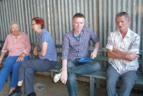


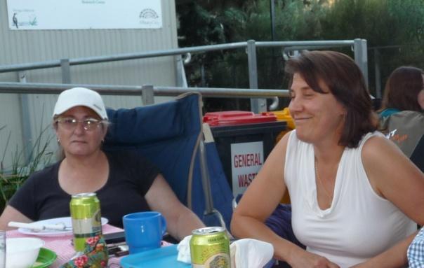
3 CHRISTMAS BBQ. CHRISTMAS BBQ. Ian Trevaskis. Our very worthy Club Member of the Year. FOOTPRINTS FEBRUARY 2015 Page 3


4 TRIP REPORTS Mt. Hotham to Falls Creek Cross Over Walk. For the 4 th year in a row the Mt Hotham to Falls Creek cross over walk has been a success. Despite predictions of high temperatures in the valleys, relatively milder conditions prevailed up "The Hills". Eleven club members enjoyed a day in the great outdoors doing what BBC does best; walking and enjoying each others company. Usually we meet groups from other parts of the state. This year we meet a group of students and teachers from a Singaporean High School, who were on a 9 day trek that would allow each student to challenge their ability and perception of the real world. Thanks to this walk now being a commercial undertaking for some, the track down Swindlers Spur and up to Cobrungra Gap, is much improved. This however didn t mean it was easy for everyone and one leader (the author of this report) found the going challenging as the temperature rose on the ascent to the High Plains. Wildflowers were in abundance and even the brumbies were curious about these two legged companions, coming very close to check us out. Thanks to all who participated, especially David for competently leading the group from Falls to Hotham. Put the 2 nd last weekend in your diaries for next year, it s a great walk. Deb Kahn. FANTASTIC, FANTASTIC, FANTASTIC, FANTASTIC! Bike ride from Everton to Beechworth. On a warm, sunny summer's morning four of us headed the 16 kilometres UP the rail trail from Everton to beautiful Beechworth. It's a fantastic ride. The scenery is varied and interesting. We saw a few 'roos and heard plenty of birds - even had to give way to some sheep! It's a bit of a grind going up but the return trip is a dream! On arriving at Beechworth, Trisha, (all the way from Finley with her friend Laura because they like hills), suggested a great place for lunch and as you will see by the photo, leader Cindy really needed a good feed! We had fantastic weather, a fantastic ride, fantastic food and fantastic company. Ed. Cindy was a bit rusty but she came good. FOOTPRINTS FEBRUARY 2015 Page 4


5 Split rock - Lake Buffalo Road. 13th - 14th December. On Saturday night, we travelled down to Bright and stayed overnight in a home across the road from our destination, three kilometres before the Lake Buffalo wall. Four club members, three friends from Paul's work, and our two hosts set out early Sunday morning. Following an easy stroll down a lane and across some paddocks, the reality of the day ahead set in when the path quickly disappeared. It was replaced by an assortment of old animal tracks through the thick undergrowth. After a brief stop at stream to fill our water bottles, we started the long climb up the hill. While the scrub thinned out in patches, our relief was always brief. Fortunately our hosts had the foresight to bring a roll of toilet paper (Aldi, large roll) to mark our way in order to assist in the return journey. Our progress was slowed even further as we negotiated our way up several barren rock sheets. Finally we made it to the top of the split rock for lunch, however we were unable to enter the cave as climbing equipment would be needed to abseil down into it. Our way down was little less challenging than going up. Nine and a half hours after setting off, we made it back to our start point. A special thanks to our hosts Sharon and Peter, and to Paul for leading the walk. David Graf. Lake Buffalo Arrow points to split in rock. Mt. Hotham Huts Walk December 13th - 14th. I have never had the chance to explore the Mount Hotham area on foot so when I saw Bernadette's "Hut's Walk" advertised I thought... "Yep! What a great way to start my annual holidays." Six of us drove our way to the Machinery Spur car park where our hike started and beautiful weather greeted us. From the car park, we ambled under the Hull Bridge and into Hotham Village. I always find it somewhat eerie walking through the ski villages out of season when there are only a handful of people in a place that is designed to support thousands. After walking through the remainder of Hotham Village on bitumen we came to the turn off point for the Davenport access track into Swindler's Valley. It turned out that the track led through a restricted construction site due to a new pipeline being installed and was therefore closed. This meant that we would have to give the reportedly beautiful Silver Brumby Hut a miss. We considered misreading the sign which, as pointed out by Bernadette, would then have read "Donut Enter" (very much a double positive). Still being a bit concerned we asked ourselves what would our President do in this circumstance? Our inner voices begrudgingly ignored the answer and we took the alternate FOOTPRINTS FEBRUARY 2015 Page 5


6 route down the Edelweiss Link track which sadly cut a few kilometres off the day's walk. Once on the Cobungra Ditch track we descended even further into the valley to reach the lowest point in altitude for the day at Swindler's Creek footbridge. Our new member, Shaun, thought that the creek looked so appealing that he needed to take a dip. It was probably not a bad idea as the next section of the walk was a hot trek up the Golden Point spur to Spargo's Hut where we had a pleasant lunch break. The next leg was a walk at the edge of the Hotham resort area along an old mining track which led us to the relatively new Derrick Hut built in After a good break we made our way to the Machinery Spur track via the Australian Alps Walking track. It was decided to add a short detour to Mount Loch as we were ahead of time due to the earlier track section being closed. Mount Loch gave us some great views of Razorback ridge all the way to Feathertop and beyond. Some of our party quickly realised that they knew the other hikers on top of the mountain and had a good chat before we descended and walked the couple of kilometres back to the vehicles. We finished the day well exercised but not exhausted and the views from Mount Loch gave me a fair idea of what I'm in for on the upcoming Razorback walk in January - can't wait. Tim Weyland. Swindler's Creek Lunch at Spargo. Feathertop from Mt. Loch. Derrick's Hut. (The one on the left I hope). Bungalow Spur Harrietville to Federation Hut Mt. Hotham 17th - 18th January. It was a perfect weekend for a walk up Bungalow Spur to Federation Hut - sunny and mild. Eleven of us from Melbourne to Wagga and a few places in between entrusted ourselves to Bernadette's care. The track wound about 10.5 kms constantly upward but at a comfortable incline. From the moment we commenced the walk we were in the bush surrounded by magnificent gums and great vistas. Recent rains provided us with a variety of flowers and colours to enjoy. Upon reaching Federation hut we set up camp, re fuelled ourselves then headed the extra 2 kilometres to the top of Mt. Feathertop. Such great and far reaching views awaited us. Five energetic souls then headed over to the Melbourne University hut (MUMC). We had a great weekend. I shall let the pictures tell the rest of the story. Ed. FOOTPRINTS FEBRUARY 2015 Page 6


7 Powered by baked beans Cindy leads the way. Spring water along the track. Look at us all getting on so well! Mt. Feathertop from Little Feathertop. The Razorback - the other way in to Federation Hut. FOOTPRINTS FEBRUARY 2015 Page 7

8 If you are into Facebook, this may appeal to you. BUSHWALKING VICTORIA ON FACEBOOK. Find us on Facebook at Help Bushwalking Victoria to get a total of 500 'Likes' on our Facebook page. I have recently been given responsibility for managing and maintaining Bushwalking Victoria's Facebook page and have been posting content of specific interest to bushwalkers, as well as covering activities Bushwalking Victoria undertakes such as Bush Tracks and Conservation track clearing, annual Federation walk event, leadership forum and leadership training. Individual members and members of our affiliate and associate members clubs are encouraged to head to our page and 'Like Us'. Also welcome are images from club walks, and news and information on club/member activities to be shared on our page. Let's see how quickly we can reach the target of 500 'Likes'. Patsy Scales Bushwalking Victoria Office Manager NOTICES Leaders - Emergency Contact Person (ECP). Leaders are reminded to inform their participants who the ECP for their event is and provide them with relevant contact details at the time of booking into a walk. EMERGENCY CONTACT DETAILS FORM You never know when you are going to be in trouble and for this reason all Border Bushwalking Club members are asked to please make sure that they have a completed Emergency Contact Details form with them in an external pocket of their pack. A copy of the form can be downloaded from the BBC website, printed, filled in and carried in an external pocket (either in a small zip lock bag or an old film canister) at all times. FOOTPRINTS FEBRUARY 2015 Page 8

9 OFF TO TASSIE OR THE HIGH COUNTRY? Check your gear Packing the right equipment makes the difference between a good experience and a bad one. If your pack is full of unnecessary stuff you ll be carrying a heavy load and you won t enjoy your walk. (As a general rule, around one-third of your body weight, depending on fitness, is a comfortable carrying load for most people.) But if you leave essential gear behind to save weight, you risk discomfort and danger when weather conditions change. Correct bushwalking equipment is also important to help minimise your impact on the environment. If travelling from mainland Australia, please also be aware that many food items are not allowed into Tasmania. The above information is from Parks and Wildlife Service Tasmania ( For a comprehensive list, follow the links. FOOTPRINTS FEBRUARY 2015 Page 9


10 Photo credits this issue: Tim Weyland David Graf Liz Nilbett Deb Kahn Sandy Kaitler *Rusty Cindy comment by Trisha Jackson. *"Look at us getting on so well" comment by Bernadette Cromarty. LEADERS WANTED For easy or difficult local walks. No experience necessary. Please contact Cindy Marsh who will assist you with all aspects involved. Next Committee meeting is Tuesday, 11th November. If you have any matters you wish to be discussed please contact a Committee member. Activities for the next Footprints to the Activities Coordinator activities@borderbushwalkingclub.com.au FIRST AID KITS Leaders are reminded to take first aid kits on all activities. The club has a number for use. Contact David Graf. GEAR HIRE Members are advised that the Club equipment we have available for hire is located at... Adventure Gear Albury 479 Dean Street, Albury phone : website THANK YOU The Committee wishes to acknowledge and thank Frances Dryden at Java@Yack, Yackandandah, for the printing of the monthly edition of Footprints. We appreciate the ongoing support. MARCH CLUB NIGHT IS NEW MEMBERS NIGHT. Let interested friends/family know now! Disclaimer All statements and opinions expressed in articles published in Footprints are those of the respective authors and do not necessarily represent the views of the Editor, the Committee or members of the Border Bushwalking Club Activities on the website... don't forget to keep an eye on our website for upcoming activities. New processes mean some activities put on at short notice don't make it in to the newsletter. FOOTPRINTS FEBRUARY 2015 Page 10


11 Dear friends, We're just starting up this year's habitat restoration work and thought it might be good to send out dates for our 2015 activities. The nest box weekends are: Mar 21/22 Apr 18/19 May 16/17 The planting weekends are: Aug 1/2 Aug 15/16 Aug 29/30 Sept 12/13 Sept 26/27 Best wishes and thanks, Ray Thomas. Regent Honeyeater Project Co-ordinator (03) (0427) FOOTPRINTS FEBRUARY 2015 Page 11
12 ACTIVITIES PROGRAM LEADERS reserve the right to change the activity route on the day depending on prevailing conditions and altered circumstances. A walk leader can refuse permission for any person to take part in his/her activity. A list of trip participants must be prepared and the non-member fee (currently $5) should be collected before the start of the trip. This is a requirement of our insurance policy. Without this list participants may not be covered by insurance. EMERGENCY CONTACT PERSONS (ECPS): Leaders must leave trip details, including a list of participants and their contact numbers with a family member, or if none available, with an ECP. In the event of a delay, the ECP will contact families and decide on the next course of action. PARTICIPANTS (members and visitors) must check with the leader that their fitness and experience suit the walk. Follow the leader s instructions at all times. Pay own ambulance costs insurance is recommended (but accidents are rare). BOOKINGS: If you intend participating in any of the activities listed below you are required to personally speak to the Leader no later than the Wednesday prior to a day activity or 7 days prior to an overnight activity or unless otherwise indicated. SMS bookings are not appropriate. Please be aware that leaders have the right to decide the size of the group they will accept for their activities. Activities may become fully subscribed before the general cut-off date. By contacting the leader early you may avoid missing out. FIRST AID KITS: are to be taken by leaders on each walk. BIVY BAGS: The club has bivy bags available for activities where extreme cold may be an issue. GRADING Grade 1 (Easy) Opportunity for large number of participates, including those with reduced ability to walk/cycle on well- marked and even formed tracks. Formed tracks may have a few steps. Should not be steep. Suitable for beginners. Distance should not exceed about 10km. Grade 2 (Easy-Medium) Easy activity, mostly on tracks of low gradient. Opportunity to walk/cycle easily in natural environments on well-marked tracks. Tracks should not be steep. Distance should not exceed about 15km. Grade 3 (Medium) Medium activity with some hilly sections and/or rougher terrain. Opportunity to walk/cycle on de- fined and distinct tracks with some steep sections requiring a moderate level of fitness. Suitable for fit beginners. Distance should not exceed about 20km. Grade 4 (Medium-Hard) Steeper, rougher terrain and may have off-track sections (no more than one quarter of the walk) or a longer distance track walk. Opportunity to explore and discover relatively undisturbed natural environments mostly along defined and distinct tracks. Tracks can be steep. There may be short sections of rock scrambling involved. Leaders should have map reading abilities and/or ability to use a compass. Distance depending on circumstances. Not suitable for most beginners. Grade 5 (Hard) Off-track or difficult terrain. Opportunity for walkers with advanced outdoor knowledge and skills to find their own way along often indistinct tracks or off track in remote locations. May include steep sections of unmodified surfaces. There may be rock scrambling, creek walking and crossing involved. Distance should not exceed 30km, but may be short and difficult. Not suitable for beginners. Grade 6 (Very Hard) Strenuous off-track walk or very long distance. Opportunity for highly experienced walkers to exploratory remote and challenging natural areas without reliance on managed tracks. Terrain may be steep, uneven and no track. There may be rock scrambling, creek walking and crossing involved. Distance covered is unlimited, but may be short and difficult. Only for experienced walkers and not suitable for beginners. Exploratory Is unknown to leader and while every effort has been made to grade the activity appropriately, there may be some unexpected aspects which may increase the difficulty of the walk. FOOTPRINTS FEBRUARY 2015 Page 12
13 Canoeing Every Wednesday after Work Canoeing Leader: Sasho Dillow Phone: after 7:00 pm Or Minimum of 6 canoeist for this event to go ahead Be Inspired and Get active. Every Wednesday in February and March. Come and paddle with us from the Donkey Farm down to Noriuel Park. This will be the first after work canoeing trip for the summer The cost will be $12 covers canoe hire and transport. We will meet at the Cumberoona Wharf at Noriuel Park at 5:30 pm. Bring a change of clothes and let me know if you want to join us for the BBQ at $3 cost. Bring your own cutlery, plate and salad to share.the activity is suitable for experienced and not inexperienced paddlers. The expected finish time for the canoe trip is approx. 7.30, followed by a BBQ finishing around Blue Rag Range Bushwalking Leader: Deb Kahn Phone: (02) before 8pm Bookings by: Wednesday 11th February Saturday 14th February Grade 4 16 kms approximately This walk starts from a car park on the Dargo High Plains Road. Whilst it is all on 4WD track it is one of the most spectacular ridgeline walks in Victoria. Unfortunately its exposed location means that the last few years it has been cancelled. So fingers crossed this year will be different. The Razorback Bushwalking Leader: Deb Kahn Phone: (02) before 8pm Bookings by Wednesday 18th February Saturday, 21st February Grade 4 22 kms This iconic walk has it all; elevation, distance, views, exposure to the elements, snakes, huts and more. There will be an option to summit Mt Feathertop or laze in the grass; the choice will be yours to make. West Peak via Granite Spur and Michelle Hut Bushwalking Leader: Dick Wellard Phone: Bookings by: Tuesday 17th February Saturday 21st February - Sunday 22nd February Grade 4 The vision splendid is to Back Pack to Michelle Hut from Granite Spur car park (approx 2km), drop packs and proceed to West Peak via Mt Bogong, (approx 10 km return). We plan to camp overnight at Michelle Hut, allowing the walk to West Peak to take place either PM Saturday or AM Sunday depending on weather/time. The possibility exists to return from Michelle Hut to Mountain Creek car park via the Staircase for all but the drivers. Access to Granite Spur car park is limited to 4 wheel drive vehicles, hence the number of participants will be limited to the availability of such vehicles. At the time of writing, only one extra passenger spot is available. Main Range Walk, Kosciusko National Park Bushwalking Overnight camping Leader: Ron Hammond Phone: places available Bookings by Sunday, 22nd February Friday, 27th February - Monday, 2nd March Grade 4 Leaving Friday afternoon for Geehi camp ground, where we will camp the night. Saturday morning, travel to Thredbo and take the first chair lift. Start walking to our first camp site below Seamans Hut on the Snowy River, with a side trip to Mt Kosciusko on the way. Sunday follow the Snowy River, off track if possible, to Charlottes Pass then up the fire track to Blue Lake and on to our camp at Wilkinson s Creek. Monday return to Thredbo via Mt Kosciusko (chair lift down) then back to Albury. FOOTPRINTS FEBRUARY 2015 Page 13
14 Wandiligong, Morses Creeek Bushwalking Leader: Paul Schirmer Phone: Bookings by Wednesday, 25th February. Sunday, 1st March Grade 3 We start at Alpine Park in Wandiligong and follow the Morses Creek walk down stream to Dougherty s Bridge. There we will put on our waders or old sand shoes and walk in the creek back to Alpine Park. There is at least one section in the creek where the going will be a little difficult but mostly it will be easy walking. If we have any energy left after that we can do the Diggings Walk and the Historic Town Walk. The Diggings Walk is 2 km on a flat track with some steps. It takes us past The Adit, The Diggings Picnic Area, the Junction Mine, the Chinese Pavilion and over the Chinese Bridge. It should take about 1 hour. The Historic Town Walk is about 3 km and should take about 1.5 hours. This walk is on a well formed track with some small hills. Places of interest we will see include the Wandi Pub (1864), Post Office (1885), General Store (1860s), Public Library (1878) and the State School (1877). Overnight to Tali Karng and Mt. Wellington Bushwalking Overnight camping Leader: Rosemary McConnell Phone: Bookings by Monday, 2nd March Friday, 6th March - Monday, 9th March Grade 4 This walk is graded as moderate and is on open snow plains with mountain views and a lake. Overall distance is 37 km (47 with side trip). We will camp at McFarlane Saddle on the first night and the second and third will both be at Millers Hut. The walk is mostly on good tracks although on day three there is a small section which requires basic navigational skills. As it is a long drive there and back we will need to leave on Friday morning and it will probably be a late return on Monday evening. Mt. Buffalo The Big Walk Bushwalking Leader: Deb Kahn Phone: before 8pm Bookings by Wednesday, 11th March Saturday, 14th March Grade 4 22 kms This is the most amazing walk for variety of vegetation, views from many vantage points and bang for your buck in terms of quality. We will start at the Rangers station and follow the track all the way up to the Gorge and Chalet. After lunch taken on the chalet verandah we will retrace our tracks back down to the cars. I would be happy to have a co-leader who would like to do the Not So Big Walk option, starting at Rollasons Falls, as this would allow us to cater for more people. Port Davey Track Walk Tasmania Bushwalking, Overnight camping. Leader: Bill Krautz Phone: or krautz@bigpond.net.au Saturday, 14th March - Sunday, 22nd March Grade 5 Scots Peak Dam to Melaleuca. Walking to the southern extremity of an island at worlds end, this is wilderness Watson's Hut Bushwalking Leader: David Graf Phone: after 8pm Bookings by: Wednesday, 11th March Sunday 15th March Grade: 3 16 kms Weston s Hut is a relatively new hut. This will be a typical Bogong High Plains walk, starting from Pretty Valley pondage. There are excellent views across to Mount Feathertop. There are a couple of gradual rises, but they are not long or steep and the track is good. However there is a drop of about 200m down in the last kilometer into the treeline and Weston s hut. We will return by the same route. This is a good walk for new members to the club as it is not a particularly long walk and we get great views across the high plains. FOOTPRINTS FEBRUARY 2015 Page 14
15 Overland Track Tasmania Bushwalking - 70+km Leader: Cindy Marsh Phone (after 7pm) Friday, 20th March -Sunday 29th March 2015 Grade 4 (Med-Hard) Having recently completed the Overland Track. I consider it is an Australian iconic must-do long-distance bushwalk. Normally, it s a 65 km, six-day trek through the heart of the Cradle Mountain-Lake St Clair National Park, part of the magnificent Tasmanian Wilderness World Heritage Area. However, with travel and a rest day, plus taking in Pine Valley Hut, our trip length will be 9 nights- 10 days. The stunning scenery and the physical challenge of the Overland Track have assured it a national and international reputation as one of the great wilderness bushwalks. Grade 4: Steeper, rougher terrain and may have off-track sections (no more than one quarter of the walk) or a longer distance track walk. Opportunity to explore and discover relatively undisturbed natural environments mostly along defined and distinct tracks. Tracks can be steep. There may be short sections of rock scrambling involved. Leaders should have map reading abilities and/or ability to use a compass. Distance depending on circumstances. Not suitable for most beginners. Contact Cindy by phone or cindy.bushwalking@gmail.com for an information sheet and also refer to the website by clicking here South Buffalo View Point - Dickson's Falls Bushwalking Leader: Deb Kahn Phone: before 8pm Bookings by Wednesday, 25th March Saturday, 28th March Grade 4 18 kms The South Buffalo Viewpoint walk is one of the most picturesque walks on the Buffalo Plateau. Starting at Cresta and meandering to a rocky outcrop that overlooks Lake Buffalo, it goes through bog, heath and grassy plains. Ideally suited to a picnic lunch, participants will be asked to bring a share plate to contribute to lunch. After returning to the car park, those who wish to can then walk out to Dickson Falls, that looks across the other side of the National Park. Cobungra Gap and beyond Leader: Deb Kahn Phone: before 8pm Bookings by Wednesday, 1st April Saturday, 4th April Grade 4 23 kms approximately I haven t done this exact walk before but have done most of the bits as part of other walks. The plan is to walk a loop from Pretty Valley Pondage via Basalt Temple and Cobungra Gap to Blairs Hut. From there it will be a bit steep up to Westons Hut and finally back to the cars via the green tree. I would be interested in hearing from anyone who has done this walk before and would love to have them on the walk as a co-leader. Jatbula Trail from Katherine N.T. to Edith Falls Leader: Dick Wellard Phone: Monday, June 1st is the commencement date of this walk. Situated amongst the stunning ancient landscape of Nitmiluk National Park, the Jatbula Trail follows the route travelled by generations of Jawoyn people, from Nitmiluk (Katherine Gorge) to Leliyn (Edith Falls). Following the western edge of the Arnhem Land Escarpment, the trail traverses sandstone plateau scrub, woodlands, open forest, sandstone monsoon forest and riverine landscapes. The trail was named after Jawoyn Traditional Owner Peter Jatbula who was instrumental in securing land rights for his people and who walked the route of the trail with his family. Experiencing the Jatbula Trail is a must, however it is essential to be well prepared to safely enjoy the walk. FOOTPRINTS FEBRUARY 2015 Page 15
16 Morocco Leader: Deb Kahn Phone: before 8pm September/October 2015 Ungraded I am planning on going with Intrepid Travel to Morocco in Sept/Oct. The plan is to join two of their trips together; 8 Day -Trek Mount Toukbal (Morocco s highest mountain. FOOTPRINTS FEBRUARY 2015 Page 16
Podcast 31 - The Australian Alps - A Trip to Thredbo
 Podcast 31 - The Australian Alps - A Trip to Thredbo by Rob McCormack - Friday, January 03, 2014 http://slowenglish.info/?p=918 Learn English while learning about daily life in Australia, with Rob McCormack
Getting there and away
 It s a case of brawn vs. beauty with these two Victorian mountains. Mt Bogong is the state s highest peak while Mt Feathertop is one of the prettiest, and quite unlike the others in its sharp, rugged formation.
Charnley Explorer June 24 - July 15, 2018 Bachsten Creek and the Charnley River. Second draft: 14 November 2017
 Charnley Explorer June 24 - July 15, 2018 Bachsten Creek and the Charnley River. Second draft: 14 November 2017 The best part of the original section one is now part of out Gibb Road Gorges trip. The dates
THE THREE PEAKS OF TANZANIA
 THE THREE PEAKS OF TANZANIA Longido, Mt Meru, and Kilimanjaro in 13 days Day 1 Arrival Longido approx 10kms trekking FBA can arrange your flights to Nairobi or Kilimanjaro. If booking your own flights,
Erskine Creek via Pisgah Rock and Jack Evans
 Erskine Creek via Pisgah Rock and Jack Evans 4 hrs 30 mins 7.1 km Circuit Very experienced only 6 421m This walk visits some great lookouts and explores the lower section of Erskine Creek. Most of the
Overnight Guided Walks
 Overnight Guided Walks Day One Climb through a forest of snow gums from Dead Horse Gap, before following the ridge line toward Mount Kosciuszko. Head for our base camp and enjoy the hospitality of our
KEY. Physical Activity Levels. Low Medium High
 Program Calendar July December 2017 Physical Activity Levels KEY Low Medium High Seq = Sequential The sequential program provides participants with a different medium for learning and developing skills
FOOTPRINTS Newsletter of the Border Bushwalking Club Inc. August 2016
 FOOTPRINTS Newsletter of the Border Bushwalking Club Inc. August 2016 affiliated with Bushwalking Victoria President Vice President Secretary Treasurer Ian Trevaskis Paul Schirmer Marie McGuire David Graf
Guthega to Mt Twynam. 2183m. 1583m. 6 hrs 45 mins 14.8 km Return. Experienced only. 913m
 Guthega to Mt Twynam 6 hrs 45 mins 14.8 km Return Experienced only 5 913m This walk starts from Guthega and makes its way along the Snowy River to the Illawong Lodge, via the Blue Cow Creek flying fox.
FOOTPRINTS April 2015 Newsletter of the Border Bushwalking Club Inc.
 FOOTPRINTS April 2015 Newsletter of the Border Bushwalking Club Inc. affiliated with Bushwalking Victoria President Vice President Secretary Treasurer Warwick McLachlan 02 60251323 Paul Schirmer Brett
KEY. Physical Activity Levels. Low = Medium = Creative = High = Accommodation Types. = Camping (Tents) = Hard Top
 = Hard Top") Program Calendar July December 2018 KEY Physical Activity Levels Low = Medium = High = Creative = Accommodation Types = Camping (Tents) = Hard Top JULY Tuesday 5 Yarra River Walk - Ideal for new participants
Program Calendar July December 2018 KEY Physical Activity Levels Low = Medium = High = Creative = Accommodation Types = Camping (Tents) = Hard Top JULY Tuesday 5 Yarra River Walk - Ideal for new participants
FOOTPRINTS December 2017 Newsletter of the Border Bushwalking Club Inc. affiliated with Bushwalking Victoria
 FOOTPRINTS December 2017 Newsletter of the Border Club Inc. affiliated with Victoria President Vice President Treasurer & Website Secretary COMMITTEE Ian Trevaskis 0425 782 983 Ralph David Sue S president@borderbushwalkingclub.com.au
TRAVEL WITH CHRIS BROWN
 TRAVEL WITH CHRIS BROWN ARKABA STATION In South Australia's magnificent Flinders Ranges, one eco tourism company is doing their bit to protect native wildlife. Arkaba Station was once a sheep station but
Victoria Falls Lookout to Blue Gum Forest
 Victoria Falls Lookout to Blue Gum Forest 8 hrs Experienced only 13.8 km One way 5 112m This long day-walk follows a remote track down from Victoria Falls lookout, passing the waterfall, and into the Grose
Little Grand Canyon near Pomona, Illinois
 Little Grand Canyon near Pomona, Illinois Below: View of the trail and the terrain created using the Map My Hike app Below: Summary of the hike created using the Map My Hike app Presented by: Jennifer
Below is an example of a well laid-out template of a route card used by the Sionnach Team which is a good format to begin with.
 Route Card A route card is used as a navigational aid to hill walkers by setting out a step by step plan for an intended hike. It is good practice to make out a route card before every hike you or your
TREK THE ROCKIES ABOUT THE CHALLENGE TREK THE ROCKIES FOR HIGHLAND HOSPICE CANADA TREK DEMANDING
 TREK THE ROCKIES CANADA TREK DEMANDING ABOUT THE CHALLENGE The Canadian Rockies are justifiably world-famous for their magnificent scenery: the combination of impressive, jagged mountains, bright turquoise
The rewards more than make up for the efforts of seeing the country this is a truly unforgettable trek.
 MADAGASCAR TREK ORANGE 2 ABOUT THE CHALLENGE This exciting trek takes us to remote Madagascar, where spectacular scenery and amazing wildlife awaits! From canyons and gorges to bush-covered plains and
HB/VS-078 Üssers Barrhorn
 HB/VS-078 Üssers Barrhorn Paul HB9DST, August 23, 2015 Summary: This was a HB9SOTA club project, an activation of the highest summit in Europe you can hike up without ropes or other equipment. The headline
Backpacking Trip Planning. Presenters: Dana Perry Christine Fogarty
 Backpacking Trip Planning Presenters: Dana Perry Christine Fogarty 1 Agenda New to planning trips? Location and physical trail Common terminology Trip selection & research The Trip Flow Plan What is it
Merritts Traverse. 1928m
 Merritts Traverse 3 hrs Hard track 5.8 km Circuit 4 167m This walk starts with a scenic journey to the top of the hill on the chairlift. Starting along Merritts Nature walk, this walk soon detours down
TASMANIAN TIGER:A SELF GUIDED MOTORCYCLE TOUR
 TASMANIAN TIGER:A SELF GUIDED MOTORCYCLE TOUR E S T A D V I C E - B E S T T O U R S - B E S T B I K E S B E S T A D V I C E - B E S T T O U R S - B E S T B I K E S B The Bay of Fires The Bay of Fires The
KILIMANJARO 2018 RUN & TREK February 28 March 12
 KILIMANJARO 2018 RUN & TREK February 28 March 12 Wednesday 28 Feb Depart USA to Kilimanjaro International Airport, Tanzania, Africa Thursday 01 March Arrive Kilimanjaro. Met upon arrival at the Kilimanjaro
Walking Track Classification System Parks and Wildlife Service
 Appendix A Walking Track Classification Specifications Walking Track Classification System Parks and Wildlife Service This Walking Track Classification System is the outcome of a review of the track classifications
Adventure Travel Trip Itinerary
 Adventure Travel Trip Itinerary Mt. Kilimanjaro & Mt. Meru Climbs, Tanzania July 8 23, 2017 Leader: Bill Blazek Date Activity (distances are approximate) Accommodation, Notes Meals 1 Saturday July 8, 2017
Foreword. Loch Ness from the summit of the High Route
 Foreword 4 The Great Glen Way runs for just over 77 miles (125 km) from Fort William to Inverness. It starts beside Britain s highest mountain, Ben Nevis; follows its greatest geological fault along the
Leura Cascades to Gordon Falls Reserve
 Leura Cascades to Gordon Falls Reserve 1 hr 15 mins 1.8 km One way Moderate track 200m From Leura Park to Gordon Falls Park, this diverse walk offers fantastic views of the Jamison Valley, as well as two
Illawarra Escarpment State Conservation Area Walking Tracks
 Illawarra Escarpment State Conservation Area Walking Tracks NPWS Illawarra Area Office Ground Floor, Government Office Block 84 Crown Street Wollongong NSW 2500 02 4223 3000 (Mon-Fri) Royal National Park
Prince Regent National Park
 Prince Regent National Park 23 rd June- 14 th July 2019 Garimbu Creek, Moran and Roe River Area Notes written by Cassie Newnes This area has something for everyone, magnificent scenery, stunning waterfalls,
Sunraysia Bushwalkers October 2013
 00 President Dick Johnstone 50220030 Vice President Russell Shallard Secretary Roger Cornell 50257325 Treasurer Barb Cornell 50257325 Quarter Master Roger Cornell 50257325 News Letter Editor Barb Cornell
Peak to Peak Mega Challenge FAQs
 Peak to Peak Mega Challenge FAQs Friday 27- Sunday 29 April 2018 1 The Peak District The itinerary Arrive on the Friday evening to spend the night at Losehill Youth Hostel. Your leaders will be there to
Trek2Kili P.O. Box 2112 Moshi TZ Whatsapp
 Trek2Kili P.O. Box 2112 Moshi TZ Whatsapp +255 673 360 trek2kili@gmail.com MT. KILIMANJARO MACHAME 7 DAY 6 NIGHT TREK Known as the Whisky Route, this is one of the most scenic and therefore popular routes
Dadder Cave and Jack Evans track
 Dadder Cave and Jack Evans track 2 Days 10.3 km Circuit Very experienced only 535m This fairly short overnight walk is a great way to explore Erskine Creek. The walking along Erskine creek is mostly off
Russell s Jatbula Trail Maintenance Special: March - April 2013
 Russell s Jatbula Trail Maintenance Special: March - April 2013 After walking the Jatbula Trail just after Christmas, I began to wonder if there might be some way to give something back to the park. I
Kakadu Highlights No. 9: September 23 - October 6, 2018
 Kakadu Highlights No. 9: September 23 - October 6, 2018 Section 1: Barramundi Creek: September 23-26 We begin with a four to six hour, 350 kilometre drive from Darwin. The last 45 kilometres is on a 4WD
FOOTPRINTS November 2017 Newsletter of the Border Bushwalking Club Inc. affiliated with Bushwalking Victoria
 FOOTPRINTS November 2017 Newsletter of the Border Club Inc. affiliated with Victoria President Vice President Treasurer & Website Secretary COMMITTEE Ian Trevaskis 0425 782 983 Paul David Sue S president@borderbushwalkingclub.com.au
May
 May 2016 From The Editor Welcome to the Jayco Jaybirds SA club newsletter. Many thanks this month to Peter & Pauline for their photos from the Clare Rally. Alison and I would like to very much thank Wayne
(west) onto Charleston Boulevard. Drive 16 miles on Charleston and turn right into Red Rock
 onto Charleston Boulevard. Drive 16 miles on Charleston and turn right into Red Rock") Hike: North Peak and Ice Box Overlook up and back Trailhead: 2.5 miles up the Rocky Gap Road not mark Distance: 5 miles round trip Elevation gain: 2,694 feet Elevation Peak: 7,094 feet Time: 3 to 5 hours
Hike: North Peak and Ice Box Overlook up and back Trailhead: 2.5 miles up the Rocky Gap Road not mark Distance: 5 miles round trip Elevation gain: 2,694 feet Elevation Peak: 7,094 feet Time: 3 to 5 hours
Oman Trek Trek the dramatic and beautiful scenery of Oman
 Oman Trek Trek the dramatic and beautiful scenery of Oman Discover Oman on this breath taking 5 day challenge. The mountain ranges and deserts of Oman offer spectacular trekking, and enables you to experience
Out and about at Geehi
 Geehi Geehi Flats is a large area of flat floodplain on the banks of the Swampy Plains River. Located within Kosciuszko National Park, it is home to a popular campsite in summer for people wanting to enjoy
Main Range Track - Loop from Charlotte Pass camping near Mt Townsend
 Main Range Track - Loop from Charlotte Pass camping near Mt Townsend 2 Days Experienced only 27.7 km Circuit 5 1260m This great overnight walk starts from Charlotte Pass and provides access to some of
SOEC Field Studies Programmes Examples at Belmont Centre
 SOEC Field Studies Programmes Examples at Belmont Centre Belmont Centre is ideally located for intensive, Geography field studies trips. Whether it s a study on sand dune succession or fluvial processes
MOUΝTAIN SEAS RETREAT & WILDERNESS PROGRAM
 RETREAT & WILDERNESS PROGRAM Imagine stunning scenery with easy access to rugged wilderness, a wellequipped Arts Centre, and cozy comfortable rooms, all with ocean views. Flinders Island s extraordinary
Note: Coordinates are provided as Universal Transverse Mercator UTM Zone U21, North American Datum 1983 (NAD 83).
.") Northern Traverse Route Description The Northern Traverse (formerly the North Rim Traverse) is an unmarked and rugged backcountry hiking route. It is known be a demanding hike, because of its terrain and
Northern Traverse Route Description The Northern Traverse (formerly the North Rim Traverse) is an unmarked and rugged backcountry hiking route. It is known be a demanding hike, because of its terrain and
Dades Gorge TREK DESCRIPTION LOGISTICS HIGH ATLAS MOUNTAINS
 TREK GUIDE MOROCCO Dades Gorge HIGH ATLAS MOUNTAINS PEAK Adventure Travel Marrakech t: + 212 (0) 668 468 595 t: + 212 (0) 524 334 770 e: Redouane.ElMouatasim@peakdmc.com www.peakdmc.com TREK DESCRIPTION
Berowra Waters to Cowan Station
 Berowra Waters to Cowan Station 3 hrs 30 mins 7.2 km One way Hard track 597m This is a hilly walk out of the beautiful Berowra Waters valley to Cowan Station. There are many wide views across Berowra Creek
Hiking. Lesson 4.1. Fitness. Hiking
 Lesson 4.1 By Carone Fitness If you enjoy walking, you will probably enjoy hiking. The main difference between hiking and fitness walking is the change in terrain. is typically done in a forest, wilderness,
Grizzly Peak A - East Ridge July 15, 2012
 Grizzly Peak A - East Ridge July 15, 2012 Difficulty: Difficult Class 2/Class 3 Upper Elevation: 13,995 feet Trailhead Elevation: 11,360 feet Elevation Gain: 3,000 feet Round-trip Length: 6.0 miles Trailhead:
WORDS BY LUKE ARNOLD, PHOTOGRAPHY BY MATT HAWKE
 Southern SECRETS The scenery, history and 4WDing of this lesser-known region of the Victorian High Country will blow you away WORDS BY LUKE ARNOLD, PHOTOGRAPHY BY MATT HAWKE 038 038-043 Sth Alpine.indd
Itinerary Overview. Continental Divide Alpine Backpacking 22 days Ages Course Description
 Itinerary Overview Continental Divide Alpine Backpacking 22 days Ages 16-18 Course Description Welcome, you re in for an experience of a lifetime! Imagine hiking through rolling forests, sharing alpine
CLASSIC COLS OF THE ALPS
 FRANCE, SWITZERLAND CYCLE RED 1 ABOUT THE CHALLENGE KING OF THE MOUNTAINS CYCLES This short but intensely demanding cycle challenge takes us through the heart of the French Alps, tackling a series of classic
King George Area: May 5-18, 2019
 King George Area: May 5-18, 2019 Section 1: Faraway Bay airstrip to Twin Falls: May 5-12 We fly to the Faraway Bay airstrip where we leave the food for the second section, don our packs and head toward
Main Range Walk - Charlotte Pass to Mount Kosciuszko
 Main Range Walk - Charlotte Pass to Mount Kosciuszko 9 hrs Hard track 21.9 km Circuit 4 920m This full day walk explores some of the greatest alpine country on offer in NSW. The walk grants views of Blue,
CRAZY HORSE TRAIL GUIDE
 CRAZY HORSE TRAIL GUIDE Abridged Version: July 2016 This is a short form of our interpretive trail guide for the Crazy Horse Trail. The full version of the guide has a more detailed description of the
Transylvanian Trek Discover Romania on this amazing weekend challenge
 Transylvanian Trek Discover Romania on this amazing weekend challenge On this unique trekking challenge we will discover some of the hidden sights of Transylvania, and step back in time to experience rural
BELIEVE ACHIEVE INSPIRE
 TRIP NOTES BELIEVE ACHIEVE INSPIRE DORSET 3 PEAKS CHALLENGE UK Sat 29 Sep Sat 29 Sep 2018 OVERVIEW DORSET 3 PEAKS CHALLENGE UK 2 In aid of Diverse Abilities 29 Sep 29 Sep 2018 1 DAYS UK CHALLENGING Join
TREK TO TABLE MOUNTAIN
 SOUTH AFRICA TREK CHALLENGING ABOUT THE CHALLENGE South Africa is a land of incredible contrast and beauty. It possesses a vast array of landscapes, from dense tropical bush to open desert. Our trek takes
The Message Stick November 2018
 The Message Stick November 2018 Mackay Bushwalkers Club Inc. PO Box 1313, Mackay, 4740 Web: http://www.mackay.bwq.org.au Email: mackay.bushwalkers@gmail.com Future Events Blacks Beach Social Walk and BBQ...4
Congewai Track Head (East) to Watagan Headquarters
 to Watagan Headquarters") Congewai Track Head (East) to Watagan Headquarters 7 hrs Hard track 17.2 km One way 4 973m This full day walk starts from the Congewai valley trackhead (east) and follows the Great North Walk up into the
Congewai Track Head (East) to Watagan Headquarters 7 hrs Hard track 17.2 km One way 4 973m This full day walk starts from the Congewai valley trackhead (east) and follows the Great North Walk up into the
Victoria Falls and Grose Valley to Blackheath Station
 This walk explores a fantastic section of the Grose Valley. Starting above Victoria Falls, the walk explores the cascades before dropping into the valley for the first nights rest at Burra Korain campsite.
Access Statement for RSPB South Stack Cliffs
 Introduction This access statement does not contain personal opinions as to our suitability for those with access needs, but aims to accurately describe the facilities and services that we offer all our
County Line trail - Miller Peak to Little Navaho
 County Line trail - Miller Peak to Little Navaho 7-17-2008 This hike features a portion of the County Line trail in the Teanaway that receives extremely little use despite offering a spectacular ridge-run
ADVENTURE. Activities Offerings ADVENTURE
 Activities Offerings ADVENTURE ADVENTURE Situated on 4,200 acres with 5,000 additional acres of private wilderness, Blackberry Farm is its own unique piece of private wilderness, but surrounding the farm
Survey of Deadwater Fell and Peel Fell
 4 December 2014 Survey of Deadwater Fell and Peel Fell Team: John Barnard, Chris Crocker, Richard Cooper and Graham Jackson 1) Introduction Deadwater Fell (Hill 3542, Section 33, OS 1:50000 Map 80, OS
PERUVIAN ANDES ADVENTURES. ARTESONRAJU CLIMB 6025m (19767 ft) Grade: D+ to TD/ Technical. Routes: The two routes to climb Artesonraju are;
 Grade: D+ to TD/ Technical. Routes: The two routes to climb Artesonraju are;") PERUVIAN ANDES ADVENTURES ARTESONRAJU CLIMB 6025m (19767 ft) Grade: D+ to TD/ Technical Routes: The two routes to climb Artesonraju are; *Via the Paron Valley South East Ridge 5 days (option for 6 with
PERUVIAN ANDES ADVENTURES ARTESONRAJU CLIMB 6025m (19767 ft) Grade: D+ to TD/ Technical Routes: The two routes to climb Artesonraju are; *Via the Paron Valley South East Ridge 5 days (option for 6 with
Location: Height: Access: Distance: Elevation: Season: Difficulty: Lat/Long: Directions:
 Upper Eagle Falls Upper Eagle Falls (~20 ft.) is a short hike up from the roadside at the Eagle Falls picnic area. It is very difficult to get a parking spot here during the day, so it is recommended to
Itinerary Overview. Sangre de Cristo Alpine Backpacking 22 days Ages Course Description
 Itinerary Overview Sangre de Cristo Alpine Backpacking 22 days Ages 16-18 Course Description Welcome, you re in for an experience of a lifetime! Imagine hiking through rolling forests, sharing alpine meadows
Staples Lookout to Mt Wondabyne loop
 Staples Lookout to Mt Wondabyne loop 4 hrs 3 mins 1.8 km Circuit Hard track 337m This walk starts and finishes at Staples Lookout, on Woy Woy Rd. The walk follows sections of the Great North Walk around
Horseback riding in Peuma Hue
 Horseback riding in Peuma Hue Peuma Hue has several riding options, according to the level of expertise and interest. The rides can be as long as you prefer, from a short ride within the property to half
Our 7 Unique Day Rides. *Ride times tailored for each group
 Our 7 Unique Day Rides *Ride times tailored for each group Ride 1 Sheep Station Creek Ramble Arrive at approx 9:30AM at the Wool Shed. The ride departs from here at around 10.00am. It begins with riding
Located in the northeastern part of WA, the Gibb River Road is ready for adventure. Photo: Aaron Schubert
 Australia has some world class camping destinations, and the Gibb River Road in the northern part of Western Australia is a prime example of this. Located in the Kimberley, the Gibb River Road is a spectacular
Trek the highest mountain in Africa. Mt Kilimanjaro. for a trip of a life time!
 Trek the highest mountain in Africa Mt Kilimanjaro for a trip of a life time! Trip outline The expedition offers you the challenge of trekking the highest free standing mountain in the world and Africa
Kirigalpoththa Nature Trail Horton Plains National Park
 Kirigalpoththa Nature Trail Horton Plains National Park Trail Difficulty: Easy Moderate Strenuous Tough Trail Head: Horton Plains Visitor Centre Nearest Town: Pattipola Nearest City: Nanu-Oya Access to
Trail Phasing Plan. Note: Trails in the Clear Creek Canyon area (Segments will be finalized in the future to minimize wildlife impacts
 Note: Trails in the Clear Creek Canyon area (Segments 2 5 and a future JCOS connection) will be finalized in the future to minimize wildlife impacts Trail Phasing Plan P Parking 3 Easy Trail Intermediate
JATBULA TRAIL 6 DAYS 62 KM
 JATBULA TRAIL 6 DAYS 62 KM THE ARNHEM LAND ESCARPMENT COUNTRY IS A VAST WILDERNESS AREA IN THE TOP END OF AUSTRALIA. THE JATBULA TRAIL TAKES US DEEP INTO THIS WILD REGION. The Jatbula trail follows an
Guthega to Thredbo camping overnight at Wilkensons Creek
 Guthega to Thredbo camping overnight at Wilkensons Creek 2 Days Experienced only 25.8 km One way 5 1364m This great overnight walk explores the Kosciusko National Park between Guthega and Thredbo, visiting
Countryside Trails Dunkeld
 R A N G E R S E RV I C E Countryside Trails Dunkeld WELCOME Welcome to this southern end of Atholl Estates. The countryside here is a wonderful blend of lochs, woodland and heather moor. There is a large
HORSEBACK RIDING. All rates are subject to service charges
 HORSEBACK RIDING The Local Loop Ride - A family-friendly 45-minutes to one hour ride around Dunton s east property. Perfect for children and adults who are new to riding. Easy terrain and beautiful views.
Non-Violent Communication Bushwalking Retreat
 Non-Violent Communication Bushwalking Retreat Wilderness and Connection 25 th August- 1 st September 2018 The Ampitheatre, Twin Falls Creek This walk is both an exploration of magnificent country filled
Mount Daly a Most Prominent Peak via South Ridge
 Mount Daly a Most Prominent Peak via South Ridge Difficulty: Class 3 Exposure: Exposed in places along the ridge Summit Elevation: 13,305 Elevation Gain: 4100 from trailhead; 1800 from Capitol Lake camp
Chapter 7 Geography and the Early Settlement of Egypt, Kush, and Canaan
 Chapter 7 Geography and the Early Settlement of Egypt, Kush, and Canaan How did geography affect early settlement in Egypt, Kush, and Canaan? Section 7.1 - Introduction RF/NASA//Corbis This satellite photograph
GOLDEN EARS PROVINCIAL PARK
 GOLDEN EARS PROVINCIAL PARK Trail Information as of October 10 th 2015 Do not underestimate the mountainous wilderness of Golden Ears Provincial Park. The combination of rugged terrain and rapidly changing
1. Waterfall Gully Mt Lofty. 5 Of the Best Hikes in Adelaide
 Adelaide is a beautiful city, and one of the most incredible things about Adelaide is the quality of bushwalking available on the suburban fringe. It is surrounded by the Mt Lofty Ranges, and much of the
Chapter 7. Geography and the Early Settlement of Egypt, Kush, and Canaan
 Chapter 7 Geography and the Early Settlement of Egypt, Kush, and Canaan Chapter 7 Geography and the Early Settlement of Egypt, Kush, and Canaan How did geography affect early in Egypt Kush, and Canaan?
Nature Track. 900m. 789m. 2 hrs 3.1 km Circuit. Hard track 238m. Blue Mountains National Park
 Nature Track 2 hrs 3.1 km Circuit Hard track 238m Largely following the ridges around the top edge of Wentworth Falls, this track is incredibly beautiful. After taking in the great views at Edinburgh Castle
New Zealand Hiking & Kayaking Trip
 TRIP DURATION 7 days, 6 nights GRADE Moderate Hikes - Overnight hikes, some uneven terrain, you need to be reasonably fit and enthusiastic. Suitable for women who walk 2-3 times per week (regular walkers)
Hiking California's Trinity Alps Wilderness: A Guide To The Area's Greatest Hiking Adventures (Regional Hiking Series) By Dennis Lewon READ ONLINE
 By Dennis Lewon READ ONLINE") Hiking California's Trinity Alps Wilderness: A Guide To The Area's Greatest Hiking Adventures (Regional Hiking Series) By Dennis Lewon READ ONLINE With over 600 miles of trails and 500000 acres of wilderness
Hiking California's Trinity Alps Wilderness: A Guide To The Area's Greatest Hiking Adventures (Regional Hiking Series) By Dennis Lewon READ ONLINE With over 600 miles of trails and 500000 acres of wilderness
Kenya. Walking with Warriors. 14 Days. t: e: w:
 Kenya Walking with Warriors 14 s This incredible journey takes us through the spectacular scenery of the Great Rift Valley as we take part in game safaris and trek 70km through the plains guided by local
HIGHLIGHTS. Malawi Expedition Guide
 MALAWI 28 DAYS Expect an enthusiastic welcome in the warm heart of Africa where you will be bowled over by the hospitality and friendliness of the locals. Conquer the dramatic peaks of Mount Mulanje, locally
Tiger Mountain State Forest:
 98 60 hikes within 60 miles: SEATTLE 20 Tiger Mountain State Forest: West Tiger Mountain Three Loop i KEY AT-A-GLANCE INFORMATION Length: 5.1 miles round-trip Configuration: Loop Difficulty: Moderate difficult
Itinerary Overview: What you will be doing Maroon Bells Alpine Backpacking 22 days
 Itinerary Overview: What you will be doing Maroon Bells Alpine Backpacking 22 days 0BCourse Description Welcome, you re in for an experience of a lifetime! Imagine hiking through rolling forests, sharing
Kuruwita Erathna Trail to Sri Pada (Adam s Peak)
") Kuruwita Erathna Trail to Sri Pada (Adam s Peak) Trail Difficulty: Easy Moderate Strenuous Tough Trail Head: Adevikanda, Erathna (near entrance to mini-hydro power plant) Nearest Town: Erathna Nearest
Kuruwita Erathna Trail to Sri Pada (Adam s Peak) Trail Difficulty: Easy Moderate Strenuous Tough Trail Head: Adevikanda, Erathna (near entrance to mini-hydro power plant) Nearest Town: Erathna Nearest
Mobile Safari Laikipia to Western Kenya 10 Nights
 Mobile Safari Laikipia to Western Kenya 10 Nights This is a private guided safari led by Steve Carey or another highly experienced guide. The safari is by road in a custom-made Toyota Landcruiser focusing
Hike at Pico Blanco Labor Day Weekend!
 Hike at Pico Blanco Labor Day Weekend! The Pico Blanco Hymn Here among the trees majestic Pleasures you will find On the trails of Pico Blanco With your friends and mine Trail the Eagle ever onward This
Trek2Kili P.O. Box 2112 Moshi TZ Whatsapp
 Trek2Kili P.O. Box 2112 Moshi TZ Whatsapp +255 673 360 trek2kili@gmail.com MT. KILIMANJARO MARANGU 6 DAY 5 NIGHT TREK Marangu Route, commonly known as the Coca Cola route is more popular because it can
L U N C H C R E E K T R A I L GLACIER NATIONAL PARK
 D I R T I N M Y S H O E S L U N C H C R E E K T R A I L GLACIER NATIONAL PARK Lunch Creek "Secret" Hike This short hike on the Lunch Creek Trail will knock your socks off! It's the perfect mix of length,
Marangu 6 Days 5 Nights
 Marangu 6 Days 5 Nights Marangu Route is also known as the Coca Cola or tourist route. It is the easiest and shortest route to the summit. This is also the only route with the comforts of sleeping huts
Trek2Kili P.O. Box 2112 Moshi TZ Whatsapp
 Trek2Kili P.O. Box 2112 Moshi TZ Whatsapp +255 673 360 trek2kili@gmail.com MT. KILIMANJARO RONGAI 6 DAY 5 NIGHT TREK Less crowded because of its remote location the route offers trekkers a unique wilderness
Lava Mountain Trail Distance: Elevation Range: Trail Type: Difficulty: Season: Driving Distance: Driving Time: USGS Maps: Pros Cons
 Lava Mountain Trail Distance: 13.4 miles (including the side trip to North Star Lake) Elevation Range: 5900'-8330' Trail Type: singletrack Difficulty: moderate Season: late June-October Driving Distance:
Mt. Kilimanjaro Trek. WanderTours P.O. Box Seattle WA Itinerary dates: January 23 - February 1, 2019 Tour Escort: Beth Whitman
 WanderTours P.O. Box 16102 Seattle WA 98116 Mt. Kilimanjaro Trek Itinerary dates: January 23 - February 1, 2019 Tour Escort: Beth Whitman HIGHLIGHTS The six-day Machame Route to Uhuru Peak, considered