Transport Monitoring Report
|
|
|
- Ruby Waters
- 5 years ago
- Views:
Transcription

1 Transport Monitoring Report 2015 April 2016 Transport Policy Team Environment and Economy
2 Transport Monitoring Report 2015 Contents Page 1. Introduction 1 2. Growth of Traffic 2 3. Countywide Growth 3 4. Rural Traffic Growth 5 5. Rural Traffic Flows 8 6. Lincoln Screenline Surveys Traffic Growth in Lincoln, Boston and Grantham Automatic Traffic Counters Cycle Flow Monitoring Local Area Walking and Cycling Statistics Bus Patronage Concessionary Bus Travel Rail Passenger Usage Port Tonnages Vehicles Licensed Car Ownership Mode of Travel to Work Average Vehicle Speeds Transport Related Carbon Emissions Other Useful Information Contacts 46
3 1. Introduction 1.1 There is a wide range of transport statistics available at the county level from a variety of sources including: data collected by the various groups within Environment and Economy on a regular basis, and information collected by central government both through the national census carried out every 10 years and annually by the Department for Transport (DfT). 1.2 The data collected has a wide range of uses including: monitoring general trends monitoring progress against a range of indicators and targets strategic planning identifying and justifying a range of improvement schemes traffic management road maintenance accident investigation supporting various bids for funding 1.3 The aims of this report are: to pull together the varying data sources and summarise the findings, to compare trends in Lincolnshire with those regionally and nationally where appropriate (although some regional and national data for 2015 will not be available from DfT until later in 2016), and to give an indication as to the type and scope of data available and where further information can be found. 1
4 2. Growth of Traffic 2.1 Producing a definitive single figure for the growth of traffic across a county the size of Lincolnshire, with approaching 9,000 kilometres of highway, is fraught with difficulty. However, various types of monitoring are carried out which give an indication of traffic growth across either all or part of the network and with varying levels of statistical reliability. 2.2 Ongoing monitoring includes: an estimation by DfT of total million vehicle kilometres travelled each year across the county as a whole, published in June each year, monitoring of rural traffic flow levels at all A and B class roads crossing three screenlines (two east-west and one north-south) since 1985, general monitoring of flows of the rural strategic road network on a five year rota, monitoring of traffic flows across the rail/river screenline in Lincoln since 1985, and monitoring of inbound traffic flows crossing a cordon in Lincoln, Boston and Grantham since 2006/ The results of these are outlined in the following chapters. 2
5 3. Countywide Growth 3.1 In order to monitor traffic growth nationally, the Department for Transport (DfT) carry out a variety of traffic surveys across the country to arrive at an estimate of the number of billion vehicle kilometres travelled each year. Annual traffic estimates are based on some 8, hour manual counts carried each year across the network, with the most important major roads counted annually. Elsewhere, other major roads are surveyed every 2 years, 4 years or 8 years depending on the level of traffic and its variability. Minor roads (B class and below) are monitored using a representative sample, with some 4,500 sites surveyed each year. 3.2 In addition to the manual counts, the DfT have some 200 automatic traffic counter sites monitoring flows continuously at sites across the country. By combining the manual and automatic count data, DfT produce an estimate of annual average daily flow at each site, which when combined with information about road lengths, gives an estimate of the total number of kilometres travelled each year. 3.3 This information is released by DfT at the local authority level. However, they do highlight issues around the reliability of the data at this level due to the relatively low levels of minor road sample points in some authorities. Hence the local authority traffic estimates are not recognised as a National Statistic set. 3.4 Table 1 overleaf shows the recent data for Lincolnshire, the East Midlands and England, whilst Figure 1 shows the information from 1993 graphically. Key Points: Between 1993 and 2007, the number of vehicle kilometres travelled in Lincolnshire rose by 33.6%, greater than that for the East Midlands (28.8%) and for England (21.9%) over that same period. However, since the peak in 2007, the number of vehicle kilometres travelled in the county fell noticeably between 2007 and 2009 (by some 2.5%) before levelling off in recent years. However, in 2013 flows rose slightly for the first time in six years. Following the increase in vehicle kilometres travelled in 2013, a further increase of 2.8% occurred in 2014, meaning the total has returned to close to its peak in This may be partly due to the fact that during 2014, petrol and diesel prices dropped by some 20 pence per litre, allied to an upturn in the economy. 3
6 Index (1993 = 100) Lincolnshire 4,487 5,199 5,760 5,880 5,996 5,910 5,841 5,832 5,830 5,791 5,843 5,962 East Midlands 32,658 37,477 40,917 41,587 42,050 41,573 41,169 40,853 40,775 40,843 41,053 41,953 England 355, , , , , , , , , , , ,215 Table 1 Million Vehicle Kilometres Travelled Note: Figures for 2015 will not be available from DfT until later in the year Lincolnshire East Midlands England Figure 1 Annual Vehicle Kilometres Travelled 4
7 4. Rural Traffic Growth 4.1 Since 1985, rural traffic flows have been monitored annually on all A and B roads where they are crossed by three screenlines running through the county (two east west and one north south). The screenlines and the locations of the counts are shown in Figure 2 and listed in Table 2 below. 4.2 Each year, 12 hour ( ) manual classified counts are carried out on a weekday in both a neutral month (April, May, June, September or October) and in late July or August. The results of these surveys are then combined to give an estimate of the 24 hour Annual Average Daily Traffic (AADT) flow using the method set out in the DfT s Traffic Appraisal Manual. 4.3 The results of the screenline surveys are summarised in Table 3 and shown graphically in Figure 3. Site Ref. Road Number Location Site Ref. Road Number Location East West (Northern) Screenline North South Screenline SL01 A159 Thonock SL14 B12105 Waddingham SL02 B1398 Willoughton SL15 A63 Glentham SL03 A15 Bishop Norton SL16 A46 Snarford SL04 A46 Usselby SL17 A158 Langworth SL05A B1225 Bully Hill SL18 B1190 Potterhanworth SL05B B1203 Bully Hill SL19 B1191 Martin SL06 A16 Utterby SL20 A153 Billinghay SL07 A1031 Saltfleetby SL21 A17 East Heckington East West (Southern) Screenline SL22 A52 Donington SL08 B6403 Colsterworth SL23 B1397 Gosberton Clough SL09 A1 Colsterworth SL24 A151 Pinchbeck West SL10 B1176 Corby Glen SL25 A16 Deeping St Nicholas SL11 A15 Morton SL26 B1166 Deeping St James SL12A A16 Surfleet SL 12B A16 Spalding Bypass SL13 A17 Fosdyke Bridge Table 2 Location of Screenline Survey Sites 5

8 Figure 2 Location of Screenline Surveys 6
9 Thousands E-W(S) 47,168 61,918 71,937 78,483 82,921 84,056 84,656 85,389 86,419 88,868 91,509 E-W(N) 24,383 32,957 35,888 33,885 42,211 45,628 46,246 43,979 44,704 46,480 48,473 N-S 41,437 58,124 64,271 66,096 74,609 76,203 74,466 73,671 72,665 76,148 77,805 Total 112, , , , , , , , , , ,787 Figures are Total 24 hr AADT flow across Screenlines Table 3 Screenline Surveys Results Summary 250 Total 24 Hour - AADT Flow 2-Way E-W(S) E-W(N) N-S Total Figure 3 Rural Screenline Results 7
10 Key Points: Total flow across the three screenlines has grown by some 92.75% over the 30 year period. Growth was at its highest during the late 1980s when it averaged some 6.5% per annum. However, in recent years, traffic levels have seen a levelling out across the screenlines in total, although there has been a noticeable increase since There is a slight variation in growth between the three screenlines with an 87% increase across the North South screenline compared with 98% for the East West (Northern) and 94% for the East West (Southern) screenlines. 8

11 5. Rural Traffic Flows 5.1 In addition to the rural screenline surveys outlined previously, routine monitoring of traffic flows on the county s strategic road network is also carried out at some 117 sites on a 5 year rota. The sites are shown on Figure 4 and are a mixture of link counts and turning counts carried out over the normal 12 hour period in a neutral month and also in late July or August. As with the Screenline surveys, the results are combined to produce an estimate of 24 hour Annual Average Daily Traffic (AADT) flow in line with DfT guidance. 5.2 Figure 5 shows estimated hour AADT flows on the county strategic road network in the form of band widths. It is based upon the results of both the surveys described above and the results of the screenline surveys. Figure 4 Rural Monitoring Sites 9

12 Figure 5 Traffic Flows on the Strategic Road Network 10

13 6. Lincoln Screenline Surveys 6.1 Since 1985, monitoring of traffic flows has been carried out across a screenline following the rail/river corridor across central Lincoln. In the first year, this comprised just Brayford Wharf East, High Street and Pelham Bridge. In 1986 the Lincoln Relief Road was added (having opened in December 1985) and in 1997, the newly constructed Brayford Way was included. The monitoring comprises a single 12 hour survey on each road carried out annually on a weekday in October. 6.2 The locations of the surveys are shown in Figure 6 and the results are summarised in Table 4 and shown graphically in Figure 7. Site Location LS1 A46 Lincoln Bypass - 18,943 20,957 22,119 30,235 31,670 31,072 30,018 32,430 30,569 31,571 LS2 B1003 Brayford Wharf East 9,205 8,440 12,340 4,203 4,521 3,740 2,938 3,504 3,425 3,117 4,480 LS3 B1262 High Street 12,828 12,376 14,441 9,178 7,635 6,015 5,092 5,854 5,298 4,845 1,842 LS4 A15 Pelham Bridge 25,687 30,933 30,351 31,249 30,694 32,457 31,856 31,714 29,582 31,154 31,412 LS5 B1273 Brayford Way Opened in ,561 22,232 23,101 23,443 22,916 23,171 23,231 24,510 Total 47,720 70,692 78,089 84,310 97,322 96,983 94,401 94,006 93,906 92,916 93,815 Table 4 Lincoln Screenline Survey Results Figure 6 Lincoln Screenline Surveys 11
14 A46 Lincoln Bypass B1003 Brayford Wharf East B1262 High Street A15 Pelham Bridge B1273 Brayford Way Total Figure 7 Lincoln Screenline Results Note: Data was not collected in 2002 due to long term roadworks on both the A46 Lincoln Bypass and B1003 Brayford Wharf East Key Points: Since monitoring started, total flows across the screenline have increase by some 97%. After strong growth in the earlier years, flows have levelled off since 2004 and remained relatively constant since then. Flows on the A46 Lincoln Bypass have risen from some 11,800 in 1986 to over 30,000 in recent years. Since its opening in 1997, flows on Brayford Way have almost doubled, up from 11,700 in 1997 to just over 24,500 in However, flows since 2003 have remained reasonable steady. Flows on Pelham Bridge have risen from 25,700 in 1985 to over 31,000 in recent years, although again flows have been relatively constant since Flows on High Street peaked in 1995 at around 14,400 (before Brayford Way was opened) but have since dropped down to around 4,800 in In 2015 a further reduction to 1,800 was recorded. However, this significant reduction is due to one lane being permanently closed due to the construction of the new footbridge over the railway on Lincoln High Street. 12
15 Flows on Brayford Wharf East had dropped to about a third of those before the Brayford Way opened. The increase recorded in 2015 is due to the introduction of the one-way restriction on High Street mentioned above. 13
16 Inbound Flows Traffic Growth in Lincoln, Boston and Grantham 7.1 As part of the monitoring process for the 2 nd Local Transport Plan, cordon counts were established in Lincoln, Boston and Grantham in line with guidance published by DfT. Although there is no longer a requirement from DfT for this monitoring, it has continued since it provides an indication of traffic changes in these important urban areas. 7.2 The surveys comprise inbound counts carried out between 7:00 am and 10:00 am on a typical weekday. These are repeated on 5 different weekdays (10 prior to 2011) and then averaged. The surveys started in 2006 in Lincoln and 2007 in Boston and Grantham. The cordons and count sites are shown in Figures 9, 10 and 11 and the results are summarised in Table 5 and Figure Lincoln Boston Grantham Table 5 Inbound Flows Crossing Urban Cordons Lincoln Boston Grantham Figure 8 Urban Traffic Growth 14

17 Key Points: There has been no strong trend up or down in Grantham since monitoring started in In Boston, there has been no discernible trend until 2013, when there was a noticeable increase. In 2014, however, the flows have returned to the previous levels, only to slightly increase again in In Lincoln, there appears to have been a slight downturn in overall flow levels until However in 2014 and 2015, flows increased slightly. OS Licence No Figure 9 - Lincoln Cordon Survey Locations 15

18 OS Licence No Figure 10 - Boston Cordon Survey Locations 16

19 OS Licence No Figure 11 - Grantham Cordon Survey Locations 17
20 8. Automatic Traffic Counters 8.1 Automatic traffic counters are used to monitor traffic flows over long periods of time. Using inductive loops cut into the road surface and connected to electronic counters in small cabinets at the roadside, these sites collect data 24 hours a day, 365 days a year. 8.2 There are currently some 74 sites across the county currently in use, operated by both the County Council and the Lincolnshire Road Safety Partnership. Their locations are shown in Figure 12 below. 18

21 Figure 12 ATC Map - Lincolnshire 19
22 8.3 To highlight the type of information available, this year s report has looked at the traffic flows recorded at the four automatic traffic counters at a variety of location around the county. 8.4 The site locations (shown on Figure 13 below) are: 1. A15 - Langtoft 2. A158 - Burgh Le Marsh 3. A15 - Waddington 4. A16 - Boston South 8.5 As a starting point, average hourly traffic flows at these four sites were compared in June 2015 a typical neutral month with no school or bank holidays 8.6 The data captured is two-way flow over an average 24 hour period for the month. The results for each site are shown below: A15 Langtoft 1800 A15 Langtoft - Average Hourly Traffic Flow :00 07:00 08:00 09:00 10:00 11:00 12:00 13:00 14:00 15:00 16:00 17:00 18:00 Mon-Fri Average Saturday Average Sunday Average Figure 13 Average Hourly Traffic Flows for June 2015 at A15 Langtoft 20
23 Key Points: The counter at Langtoft is situated to the south of the village on the 15 north of Market Deeping in the south of the county. As the main north/south commuter route from Lincolnshire to Peterborough, the A15 is well used. As can been seen from the graph above traffic peaks strongly between and in the morning. This slightly early peak can be ascribed to early morning traffic heading south towards Peterborough which is 13km south of the counter. During this period nearly 3000 vehicles pass this point. Similarly, there is a strong pm peak is between and hrs, reflecting traditional work leaving times. There is a slightly higher peak at this time than in the morning but figures indicate a similar number of vehicles passing the counter point at this time. Weekend flows are more regular in shape, substantially lower in numbers, but indicating a gradual increase up to lunchtime. A158 Burgh Le Marsh 1800 A158 Burgh Le Marsh - Average Hourly Traffic Flow :00 07:00 08:00 09:00 10:00 11:00 12:00 13:00 14:00 15:00 16:00 17:00 18:00 Mon-Fri Average Saturday Average Sunday Average Figure 14 Average Hourly Traffic Flows for June 2015 at A158 Burgh Le Marsh 21
24 Key Points: The counter is situated to the east of Burgh Le Marsh on the A158 in the east of the county on the main road to Skegness. The A158 is one of the main tourist traffic routes into Skegness carrying traffic entering Lincolnshire from the East Midlands. As a tourist route to the coast, the traffic is generally higher at the weekends, with traffic peaking at around 10:00/11:00am at around 1200 vehicles per hour During the week, traffic flows are generally level during the day, with only slight peaks at 07:00am and 15:00pm. During the day the traffic stays fairly steady at around 1000 vehicles per hour. A15 - Waddington 1800 A15 Waddington - Average Hourly Traffic Flow :00 07:00 08:00 09:00 10:00 11:00 12:00 13:00 14:00 15:00 16:00 17:00 18:00 Mon-Fri Average Saturday Average Sunday Average Figure 15 Average Hourly Traffic Flows for June 2015 at A15 Waddington Key Points: The counter is situated to the south of Bracebridge Heath on the A15 east of Waddington. 22
25 It is on the main north/south commuter route between Lincoln and Sleaford. As is common with a commuter route, there are two distinct am and pm peaks, although they are earlier than normal, being at 07:00 and 16:00 hrs respectively. A16 Boston (South) 1800 A16 Boston - Average Hourly Traffic Flow :00 07:00 08:00 09:00 10:00 11:00 12:00 13:00 14:00 15:00 16:00 17:00 18:00 Mon-Fri Average Saturday Average Sunday Average Figure 16 Average Hourly Traffic Flows for June 2015 at A16 Boston (South) Key Points: The counter is situated to the south of Boston on the A16 between Wyberton and Kirton The A16 is the main route into Boston from the south, and as such is a commuter route into the town The traffic into the town peaks at around 08:00hrs, with 1200 vehicles passing over the counter. The peak is at 17:00hrs with nearly 1300 vehicles being counted at this point. 23
26 Index (2001 = 100) 9. Cycle Flow Monitoring 9.1 As part of the Local Transport Plan monitoring process, some 31 automatic cycle counters have gradually been installed across the county. Of these we generally use about 20 of these sites for our analysis. These are primarily within the larger urban areas, although there are some sites on more rural, tourist routes operated in partnership with Sustrans. They are all listed in Table Year on year growth is estimated by comparing a selection of those sites where there is at least 8 months comparable date with the previous year. This is then converted to an index where the base year of 2001 = 100. The graph below shows the recorded growth Figure 17 Cycling Growth in Lincolnshire Key Points: Cycle flows across the county have shown a period of growth up to the middle of the decade, peaking in 2005 with a 17% increase in cycling. However, figures in recent years have shown substantial variation. Some of the large decrease in 2009 and 2010 is likely to be due to poor weather during the year, in particular the two periods of heavy snow and frosts during the winters. 24
27 Since 2005, there was a steady decline in cycle flows to 2010, where it returned to the 2001 level. Since then however there has been a steady increase in usage to the point where it is now 22% higher than in There have been changes to the particular counters used, as two have been removed from Grantham due to regular vandalism, and an additional one installed in North Hykeham on Station Road as part of the Access LN6 project. This has had some impact on the annual figure, however they will now form part of the annual analysis. There have been some problems with the analysis of the sites this year due to some issues with the on-line collection of data, but these issues are being addressed on an ongoing basis. Site No Town Location 1 & 2 Not used 3 Grantham Queen Elizabeth Park 4 Grantham Bottom of Allotments 5 Grantham North Parade 6 Not Used 7 Lincoln Witham Park - Stamp End 8 Lincoln Riverside Walk - By Firth Road Bridge 9 Lincoln Tritton Road - Near Chieftain Way 10 Lincoln Doddington Road - Near Tritton Road Junction 11 Lincoln Sustrans - Skellingthorpe 12 Boston A52 Sleaford Road - Northside Cycleway 13 Boston A52 Sleaford Road - Southside Cycleway 14 Spalding Pinchbeck Road - Near West Elloe Ave Junction 15 Spalding Riverside - Parallel to Double Street 16 Spalding Near Balmoral Avenue 17 North Hykeham Station Road - East 18 Not Used 19 Not Used 20 Sleaford Eastgate at Cogglesford Mill - South Pavement 21 Sleaford Eastgate at Cogglesford Mill - North Pavement 22 Sleaford Grantham Road - Level Crossing 23 Spalding Halmergate 24 Skegness Burgh Road 25 Louth New Bridge Hill 25
28 26 Lincoln Tritton Road - Morrisons, Eastside Pavement 27 Not Used 28 Lincoln Brant Road - Lakeside 29 Fosdyke Sustrans - East of Bridge 30 Washingborough Sustrans - East of Station 31 Bardney Sustrans - Station Road 32 Woodhall Spa Sustrans - Kirkstead Bridge 33 Boston Anton s Gowt Bridge 34 North Hykeham A46 Newark Road 35 Leasingham A15 Sleaford Bypass 36 Sleaford Galley Hill 37 North Hykeham Station Road - West Table 6 Current Automatic Cycle Counter Locations 26
29 Percenatge 10. Local Area Walking and Cycling Statistics 10.1 In recent years, the Department of Transport has been looking to use data collected through the Active People Survey to monitor walking and cycling at the local authority level. The Active People Survey is an annual survey (running October to October) administered by Sport England aimed at measuring participation in sport and active recreation and also includes questions on cycling and walking, for both recreational and general travel purposes. The standard sample size is at least 500 persons per lower authority area, giving a total sample of some 160,000 nationwide Various data is collected about number of cycle trips, duration, distance and reason for travel. By way of example, Figure 18 below shows the proportion of adults cycling at least once a week, irrespective of distance or duration, for 2010/11 to 2013/ Walking data has also been collected over the last five years, however, the criteria used to illustrate this data has changed from a 5 minute to a 10 minute figure. As such only the last two years data is shown below in Figure / / / /14 Figure 18 Percentage of Adults Cycling at least once a Week 27
30 Percentage / /14 Figure 19 Percentage of Adults Walking at least once per week Key Points: When compared to the national and regional figures, over the last four years Lincolnshire has a higher proportion of once a week cyclists, typically some 3% higher in 2013/14. Overall, across the county the proportion of adults cycling at least once a week appears to be increasing. However, this fluctuates across the Districts, with increases in usage in East Lindsey, Lincoln and South Kesteven, whilst cycling has reduced in all the other districts. In four of the Districts walking levels have increased slightly, whilst in Lincolnshire (76%) as a whole the percentage of people walking is marginally less than in the East Midlands (77.6%) and England (78.9%). 28
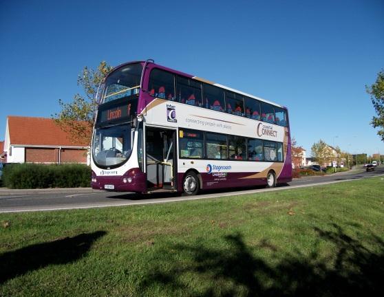
31 11. Bus Patronage 11.1 Between 2002/03 and 2009/10, information on passenger numbers was collected directly from all operators by the Council in line with guidance issued by DfT for monitoring the Local Transport Plan. However, since 2009/10 this has been replaced by data collected by DfT using returns from operators. Hence, longer term comparison for this period is not possible, but the overall trends hold true. Table 7 and Figure 19 below summarise the data since 2002/03. Year Passenger Journeys 2002/03 14,746, /04 14,782, /05 13,582, /06 13,464, /07 15,578, /08 17,482, /09 17,571,978 Change in data source 2009/10 16,300, /11 16,900, /12 16,400, /13 15,600, /14 16,100, /15 16,300,000 Table 7 Bus Passenger Journeys in Lincolnshire Key Points: The number of passenger journeys in Lincolnshire grew by almost 31% between 2005/06 and 2008/09. The growth in England over the same period was just 8%. An element of this growth was no doubt due to the introduction of the national concessionary fares scheme, but the extent of its impact is unclear. 29
32 Million Passenger Journeys However, since 2008/09 there has been a slight downturn, in line with the trend nationally outside of London, although some improvements have been made in 2013/14, and again in 2014/ Figure 20 Bus Passenger Journeys 30
33 12. Concessionary Bus Travel The English National Concessionary Bus Travel Scheme is a national scheme managed by the Department for Transport in conjunction with Local Authorities across England. Anyone reaching the State Pension age or have a relevant disability is eligible for free bus travel within Lincolnshire on the production of a valid pass; no restrictions are put on the time of travel On the 1 st April 2011, Lincolnshire County Council took over the administration of the National Concessionary Travel Scheme across Lincolnshire from the District Councils. Annual statistics on the use of the scheme are produced each year by the DfT. Figure 20 below shows the number of journeys completed in Lincolnshire over the last four years. 6,000,000 Bus Travel - Lincolnshire 5,800,000 5,600,000 5,400,000 5,200,000 5,000, / / / /15 Concessionary Fare Holder Journeys Figure 21 Bus Travel in Lincolnshire 12.3 The split between Non-Concessionary and Concessionary journeys in Lincolnshire is shown below in Figure 21. Figure 22 shows the number of users of the scheme split categorised by age and disability. 31
34 18,000,000 16,000,000 14,000,000 12,000,000 10,000,000 8,000,000 6,000,000 4,000,000 2,000,000 0 Bus Travel - Lincolnshire 2011/ / / /15 Non-Concessionary Fare Holder Journeys Concessionary Fare Holder Journeys Figure 22 Journey Breakdown 135,000 Number of Passes Issued - Lincolnshire 130, , , , , , ,000 95, / / /15 Older passes Disabled passes Figure 23 Concessionary Passes Issued 32
35 12.4 As Table 8 below shows, currently each pass holder uses the service about once per week and the percentage of eligible residents taking up a pass has risen from 56% to 64% over the last three years. 2012/ / /15 Average journeys per pass Older passes as a proportion of the eligible population 56% 61% 64% Table 8 Journeys/Eligibility Key Points: The number of concessionary fare journeys in Lincolnshire has remained fairly constant over the last three years Concessionary fare journeys represent approximately a third of all bus journeys in the county Pass holders use their pass approximately once per week 33
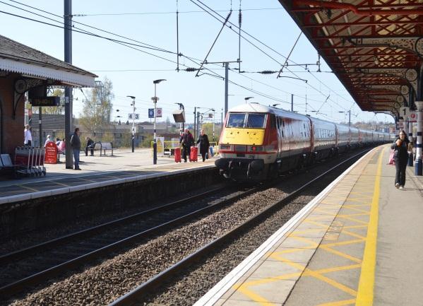
36 13. Passenger Rail Usage 13.1 Information relating to the number of people using stations in Lincolnshire is produced annual (by financial year) by the Office of Rail Regulation (ORR). Table 9 below shows the figures since 2006/ / / / / / / / / /15 Lincoln Central 1,417,517 1,315,410 1,379,412 1,477,752 1,461,738 1,656,748 1,609,794 1,585,386 1,649,584 Grantham 999,186 1,032,641 1,054,634 1,033,374 1,071,320 1,132,740 1,152,280 1,198,197 1,259,632 Skegness 395, , , , , , , , ,134 Sleaford 340, , , , , , , , ,888 Stamford 260, , , , , , , , ,606 Boston 208, , , , , , , , ,618 Gainsborough Spalding 176, , , , , , , , ,274 Stations 139, , , , , , , , ,386 Metheringham 122, , ,090 98,722 98, , ,224 91,088 94,750 Ruskington 109,696 89,428 92,412 80,838 81,646 91,832 85,204 76,012 83,240 Wainfleet 65,618 69,529 64,186 67,960 64,676 41,580 42,548 56,554 58,578 Saxilby 55,128 44,954 48,966 55,024 54,100 59,030 55,916 48,145 57,298 Heckington 53,265 57,551 54,678 55,022 61,234 64,682 66,618 67,388 74,804 Market Rasen 44,531 43,149 44,254 57,390 57,746 59,440 61,092 60,572 60,486 Hykeham 17,564 21,745 21,162 23,262 25,508 34,568 34,244 40,064 49,972 Ancaster 6,109 5,238 4,652 3,764 4,388 4,042 7,408 8,878 9,910 Swinderby 5,351 4,358 4,760 7,200 11,544 16,814 20,482 21,134 15,022 Thorpe Culvert Havenhouse Swineshead 838 1,015 1,028 1,312 2,378 2,260 3,192 3,294 3,886 Rauceby ,788 1,970 1,822 1,828 2,350 1,898 2,420 Hubberts Bridge Total 4,421,746 4,267,485 4,362,052 4,468,220 4,517,418 4,806,876 4,735,940 4,726,088 4,958,262 Table 9 Usage of Lincolnshire Rail Stations 13.2 The above data from the ORR is based primarily on ticket sales. However, there is concern regarding data at some of the smaller stations in the county in recent years, most notably at Swinderby. Discussions with the train operator suggest that this is most likely due to "ticket splitting" where users purchase two tickets for their journey rather than one since this can work out cheaper (e.g. Nottingham - Swinderby and Swinderby - Lincoln rather than Nottingham - Lincoln). Hence this data must be treated with caution at the individual station level. However, county-wide the total journeys at the affected stations represent less that 1% of all journeys so will have minimal effect on the overall trend as shown in Figure 24 below. 34
37 Combined Entries and Exits to Stations Millions / / / / / / / / / /15 Figure 24 Rail Usage Key Points: The trend is the number of people using Lincolnshire s rail stations over recent years has been generally upwards. Based on the data available, passenger rail usage grew by some 17.4 % between 2005/06 and 2014/15, with a slight decrease in 2012/13 which continued into 2013/14 before rising again in 2014/15. However, the picture varies widely at individual stations as shown in Table 9. 35
38 Tonnes (000s) 14. Port Tonnages 14.1 Lincolnshire has the only ports in the East Midlands the Port of Boston and Port Sutton Bridge. Information on the volume of cargo handled by the ports is published annually by DfT. The table and graphs below show recent trends at the Lincolnshire ports Port of Boston Port Sutton Bridge Table 10 Port Tonnages (thousand tonnes) Port of Boston Port Sutton Bridge Figure 25 Lincolnshire Port Tonnages Port of Boston Port Sutton Bridge Table 11 Port Usage - Vessels 36
39 Number of Vessels - Yearly Boston Sutton Bridge Figure 26 Port Usage Vessels Key points: The tonnages handled at both ports have generally fallen since At the Port of Boston during 2014, a total of 668,000 tons were imported and 156,000 tons were exported, with the port handling a total of 382 vessels At Port Sutton Bridge, a total of 353,000 tons were imported and 49,000 tons exported during 2014, with the port handling a total of 168 vessels. In line with the steady decline in tonnages, the number of vessels using the ports has also declined 37
40 Index (2001 = 100) 15. Vehicles Licensed 15.1 Annual statistics on the number of vehicles licensed at the county level are produced by the Department of Transport. The following table and graph show the recent trend in Lincolnshire Lincolnshire East Midlands 2,274 2,534 2,617 2,654 2,655 2,645 2,663 2,689 2,739 2,799 2,859 England 25,332 28,022 28,798 29,114 29,081 28,939 29,069 29,275 29,692 30,361 31,047 Table 12 Vehicles Licensed (000's) Lincolnshire East Midlands England Figure 27 Vehicles Licensed Key Points: Following a slight fall in the number of vehicles licensed in the county during 2010, growth has resumed in recent years. The number of vehicles licensed in the county has grown by 29% between 2001 and This is higher than that both nationally (22.6%) and in the East Midlands (25.7%). 38
41 16. Car Ownership 16.1 Information on car ownership rates is collected every 10 years by the Office of National Statistics as part of the National Census. The table and graph below summarise the data from the 1981, 1991, 2001 and 2011 censuses for Lincolnshire and the most recent data for the East Midlands and England. Lincs 1981 Lincs 1991 Lincs 2001 Lincs 2011 East Midlands 2011 England 2011 No cars 31.1% 25.1% 20.0% 18.0% 22.1% 25.8% 1 car 51.9% 49.5% 47.5% 44.8% 42.5% 42.2% 2 cars 14.3% 20.9% 26.0% 28.4% 27.4% 24.7% 3 or more cars 2.7% 4.4% 6.5% 8.7% 8.0% 7.4% Table 13 Lincolnshire Car Ownership Rates 100% 90% 80% 70% 60% 50% 40% 30% 20% 10% 0% Lincs 1981 Lincs 1991 Lincs 2001 Lincs 2011 East Midlands 2011 England 2011 No cars or vans 1 car or van 2 cars or vans 3 cars or vans or more Figure 28 Lincolnshire Car Ownership Rates 39
42 Key Points: The proportion of households in Lincolnshire without a car has fallen steadily from 31.1% in 1981 to 18.0% in 2011, with the proportion of 1 car households also falling from 51.9% to 44.8% Over the same period, the proportion of households in the county with 2 cars almost doubled from 14.3% to 28.4%, whilst households with three or more cars rose from 2.7% to 8.7%. In 2011, the proportion of non-car households in Lincolnshire (18.0%) was lower than that in both the East Midlands (22.1%) and England (25.8%) Information is also made available at the district level and data for 2011 is shown below. 100% 90% 80% 70% 60% 50% 40% 30% 20% 10% 0% Boston East Lindsey Lincoln North Kesteven South Holland South Kesteven West Lindsey No cars or vans 1 car or van 2 cars or vans 3 or more cars or vans Figure 29 Car Ownership by District Key Points: The City of Lincoln has the highest proportion of non-car owning households at 29.6%, substantially higher than the average of 18.0% The proportion of households with access to a single car is fairly constant, lying between 42% and 47% 40
43 17. Mode of Travel to Work 17.1 Information on the normal mode of travel to work is also collected every 10 years by the Office for National Statistics as part of the National Census. The table and graph below show the data from the last four censuses for Lincolnshire as a whole, compared with the most recent regional and national data. Lincs 1981 Lincs 1991 Lincs 2001 Lincs 2011 East Midlands 2011 England 2011 Car Driver Car Passenger Bus Rail Cycle Motorcycle Foot Work from Home Other Table 14 Mode of Travel to Work in Lincolnshire (%) 100% 90% 80% 70% 60% 50% 40% 30% 20% 10% 0% Lincs 1981 Lincs 1991 Lincs 2001 Lincs 2011 East Midlands 2011 England 2011 Car Driver Car Passenger Bus Rail Cycle Motorcycle Foot Work from Home Other Figure 30 Mode of Travel to Work in Lincolnshire 41
44 Key points: The proportion of people travel to work by car (either as a driver or passenger) in Lincolnshire has risen from 54.0% in 1981 to 72.4% in This is slightly higher than the figure for the East Midlands (71.4%) and substantially above the national figure (62.1%). At the same time, the percentage of people walking to work has fallen from 16.7% to 12.2% (although this latter figure is up slightly on the 2001 figure of 10.9%) and those cycling have fallen from 9.6% to 4.1%. Bus use has also declined steadily (from 6.6% to 2.5%) Data is also available at the district level. The results for 2011 are summarised in Figure 31 below. 100% 90% 80% 70% 60% 50% 40% 30% 20% 10% 0% Boston East Lindsey Lincoln North Kesteven South Holland South Kesteven West Lindsey Car Driver Car Passenger Bus Rail Cycle Motorcycle Foot Work from Home Other Figure 31 Mode of Travel to Work by District Key points: Not surprisingly, Lincoln City shows the lowest car use at 62.3% compared with the county average of 72.4%. It also has the highest proportion of people walking to work (19.6%), but the lowest working from home (3.4%). 42
45 18. Average Vehicle Speeds 18.1 In recent years, the Department of Transport has produced data relating to the average vehicle speeds and journey times on the highway network. The data is based upon information provided by in-vehicle global positioning systems (GPS) installing in a fleet of some 70,000 vehicles nationally This data is used to estimate speed/journey times both on the trunk road network and on A Roads that are managed by local authorities. It is currently reported for the morning peak hour (defined as ) over an academic year (September to July) excluding all school holidays. It is also weighted by flow using the traffic data highlighted in Chapter The relevance of a single figure representing the average vehicle speed on A roads within a large and varied county such as Lincolnshire is questionable. Traffic conditions vary considerably from highly congestion stretches in the larger urban areas (such as the A15 through Lincoln, the A52/A607 through Grantham and the A16/A52 through Boston) to quieter more free-flowing section on rural parts of the network. Hence the data that follows below (although of some general interest) must be treated with caution Table 15 below shows the average vehicle speeds recorded over the last 8 years for Lincolnshire, the East Midlands and England. Mar 08 Mar 09 Mar 10 Mar 11 Mar 12 Mar 13 Mar 14 Mar 15 England East Midlands Lincolnshire Table 15 Average Speed (Miles per Hour) Key Points: As can be seen from the data, during the peak hours traffic speeds in Lincolnshire are somewhat higher than in the East Midlands and England, reflecting the predominantly rural nature of much of the A road network In general, average speeds have shown little change over the eight year period at the county, regional and national levels. 43
46 tonnes CO 2 per person 19. Transport Related Carbon Emissions 19.1 Since 2005, the Department of Energy and Climate Change (DECC) have produced estimates of carbon dioxide (CO 2 ) emissions at a local authority level. This includes an estimate of emissions due to road transport in the area Table 16 below shows DECC estimates of CO 2 emissions for Lincolnshire since 2005 broken down into general categories. Figure 32 shows the same data graphically Industry and Commercial Domestic Transport Table 16 - Estimated CO 2 Emissions for Lincolnshire (tonnes per capita) Industry and Commercial Domestic Transport Figure 32 Estimated CO 2 Emissions for Lincolnshire (tonnes per capita) 44
47 t CO2 per person 19.3 Figure 33 below compares 2012 CO 2 emissions for Lincolnshire with those for the East Midlands and nationally. 9.0 Per capita Local CO2 emission estimates Lincolnshire Total East Midlands Total England Total Industry and Commercial Domestic Transport Figure 33 Comparison of 2012 CO 2 Emissions Key Points: Road transport emissions in Lincolnshire (per capita) have fallen slightly since 2005, mirroring the picture for total emissions. Transport emissions per capita in Lincolnshire (2.0 tonnes) are lower than those in the East Midlands (2.3) and are slightly higher than nationally (1.9). 45
48 20. Other Useful Information a) Population and Area District Mid 2001 Population Mid 2014 Population Density (persons per hectare) Boston 55,800 65, City of Lincoln 85,600 96, East Lindsey 130, , North Kesteven 94, , South Holland 76,700 90, South Kesteven 124, , West Lindsey 79,600 91, Lincolnshire 647, , Table 17 b) Road Lengths (at 1 st April 2012) Type Length (kms) Trunk 62 Principal A Roads 1046 B Roads 788 C Roads 2933 Unclassified Roads 4103 Total 8932 Table 18 46
49 21. Contacts Traffic Flow Information For information on traffic flows, please contact: LincsLab Data Collection Team Tel: Other Information and Analysis For further information on other topics and analysis, please contact: Ian Kitchen Transportation Tel: Or Mark Lancaster Transportation Tel:
Transport Monitoring Report
 Transport Monitoring Report 2017 April 2018 Transport Policy Environment and Economy Transport Monitoring Report 2017 Contents Page 1. Introduction 1 2. Growth of Traffic 2 3. Countywide Growth 3 4. Rural
CONGESTION MONITORING THE NEW ZEALAND EXPERIENCE. By Mike Curran, Manager Strategic Policy, Transit New Zealand
 CONGESTION MONITORING THE NEW ZEALAND EXPERIENCE 26 th Australasian Transport Research Forum Wellington New Zealand 1-3 October 2003 By, Manager Strategic Policy, Transit New Zealand Abstract New Zealand
Open Report on behalf of Executive Director for Environment & Economy. Highways and Transport Scrutiny Committee
 Agenda Item 9 Policy and Scrutiny Open Report on behalf of Executive Director for Environment & Economy Report to: Date: 13 June 2016 Subject: Summary: Highways and Transport Scrutiny Committee Rail Update
Report of. Transport Key Performance Indicators
 Report of Transport Key Performance Indicators August 2008 CONTENTS 1) INTRODUCTION 2 2) RELIABILITY OF SHETLANDS TRANSPORT NETWORK 3 3) STANDARD OF ROAD MAINTENANCE 5 4) FUEL CONSUMPTION LEVELS 6 5) MARKET
Don t stress over. 20 July 25 August. Pick up this leaflet for all the information you need to travel during the re-signalling works
 Don t stress over DISRUPTIONS AT NOTTINGHAM STATION 20 July 25 August Pick up this leaflet for all the information you need to travel during the re-signalling works We re helping you stay on the move TRAVEL
Transport Statistics for Somerset 2013 update
 Transport Statistics for Somerset 2013 update Introduction This document brings together a range of facts and figures relating to transport and accessibility within Somerset. All the data comes from public
Regional summary - Wellington
 Regional summary Wellington Regional summary - Wellington This is a summary of data relevant to transportation in this region, viewed from a Land Transport NZ perspective. It s purpose is to inform the
TRANSPORT AFFORDABILITY INDEX
 TRANSPORT AFFORDABILITY INDEX Report - March 2018 AAA 1 AAA 2 Table of contents Foreword 4 Section One Overview 6 Section Two Summary of Results 8 Section Three Detailed Results 14 Section Four State by
Rail Sta s cs Compendium Great Britain Annual
 Rail Stascs Compendium Great Britain 2017-18 Annual Publicaon Date: 4th December 2018 Next release: November 2019 Background This annual compendium publication contains a summary of the statistical releases
TRANSPORT AFFORDABILITY INDEX
 TRANSPORT AFFORDABILITY INDEX Report - December 2016 AAA 1 AAA 2 Table of contents Foreword 4 Section One Overview 6 Section Two Summary of Results 7 Section Three Detailed Results 9 Section Four City
Summary Proof of Evidence Traffic
 Adran yr Economi a r Seilwaith Department for Economy and Infrastructure The M4 Motorway (Junction 23 (East of Magor) to West of Junction 29 (Castleton) and Connecting Roads) and The M48 Motorway (Junction
Saighton Camp, Chester. Technical Note: Impact of Boughton Heath S278 Works upon the operation of the Local Highway Network
 Technical Note: Impact of Boughton Heath S278 Works July 2013 SAIGHTON CAMP CHESTER COMMERCIAL ESTATES GROUP TECHNICAL NOTE: IMPACT OF BOUGHTON HEATH S278 WORKS UPON THE OPERATION OF THE LOCAL HIGHWAY
East West Rail Consortium
 East West Rail Consortium EWR Wider Economic Case: Refresh 18 th November 2015 Rupert Dyer Rail Expertise Ltd Rail Expertise Ltd. Tel: 01543 493533 Email: info@railexpertise.co.uk 1 Introduction 1.1 The
Population analysis of North West London for John Lyon s Charity
 Population analysis of North West London for John Lyon s Charity This note summarises the findings of our population analysis for the eight north west London boroughs in which John Lyon s Charity is active.
Produced by: Destination Research Sergi Jarques, Director
 Produced by: Destination Research Sergi Jarques, Director Economic Impact of Tourism North Norfolk District - 2016 Contents Page Summary Results 2 Contextual analysis 4 Volume of Tourism 7 Staying Visitors
Produced by: Destination Research Sergi Jarques, Director
 Produced by: Destination Research Sergi Jarques, Director Economic Impact of Tourism Norfolk - 2016 Contents Page Summary Results 2 Contextual analysis 4 Volume of Tourism 7 Staying Visitors - Accommodation
2011/12 Household Travel Survey Summary Report 2013 Release
 6.8 % 5.1 % 3.4 % 1.2 Household Travel Survey Summary Report 2013 Release Bureau of Transport Statistics Household Travel Survey Summary Report, 2013 Release Bureau of Transport Statistics The Bureau of
Produced by: Destination Research Sergi Jarques, Director
 Produced by: Destination Research Sergi Jarques, Director Economic Impact of Tourism Epping Forest - 2014 Economic Impact of Tourism Headline Figures Epping Forest - 2014 Total number of trips (day & staying)
Produced by: Destination Research Sergi Jarques, Director
 Produced by: Destination Research Sergi Jarques, Director Economic Impact of Tourism Oxfordshire - 2015 Economic Impact of Tourism Headline Figures Oxfordshire - 2015 Total number of trips (day & staying)
land transport at a glance
 ISSN 77-3723 land transport at a glance land transport at a glance Westland District Map of the West Coast Region What is Land Transport At A Glance? Land Transport At A Glance provides a brief overview
Produced by: Destination Research Sergi Jarques, Director
 Produced by: Destination Research Sergi Jarques, Director Economic Impact of Tourism Oxfordshire - 2016 Economic Impact of Tourism Headline Figures Oxfordshire - 2016 number of trips (day & staying) 27,592,106
Lincolnshire Pharmacy Easter Opening Hours
 Lincolnshire Easter Opening Hours - 2015 Friday Sunday Monday Good Friday Easter Sunday Easter Monday 03/04/2015 05/04/2015 06/04/2015 Asda Sleaford Road Boston 01205 316050 09:00-18:00 Closed 09:00-18:00
HEATHROW COMMUNITY NOISE FORUM
 HEATHROW COMMUNITY NOISE FORUM 3Villages flight path analysis report January 216 1 Contents 1. Executive summary 2. Introduction 3. Evolution of traffic from 25 to 215 4. Easterly departures 5. Westerly
CAA Passenger Survey Report 2005
 Economic Regulation Group CAA Passenger Survey Report 2005 Survey of passengers at Aberdeen, Bournemouth, Durham Tees Valley, Edinburgh, Gatwick, Glasgow, Heathrow, Inverness, Leeds Bradford, Luton, Manchester,
Auckland Transport Quarterly Indicators Report 2018/19
 Attachment 1 Auckland Transport ly Indicators Report 218/19 September 218 Table of Contents Page 2. 1. Executive summary 2. External indicators 3. Performance by Key Priority 3.1 Deliver an efficient and
Produced by: Destination Research Sergi Jarques, Director
 Produced by: Destination Research Sergi Jarques, Director Economic Impact of Tourism Norfolk - 2017 Contents Page Summary Results 2 Contextual analysis 4 Volume of Tourism 7 Staying Visitors - Accommodation
LOCAL AREA TOURISM IMPACT MODEL. Wandsworth borough report
 LOCAL AREA TOURISM IMPACT MODEL Wandsworth borough report London Development Agency May 2008 CONTENTS 1. Introduction... 3 2. Tourism in London and the UK: recent trends... 4 3. The LATI model: a brief
Economic Impact of Tourism. Norfolk
 Economic Impact of Tourism Norfolk - 2009 Produced by: East of England Tourism Dettingen House Dettingen Way, Bury St Edmunds Suffolk IP33 3TU Tel. 01284 727480 Contextual analysis Regional Economic Trends
Petrofin Research Greek fleet statistics
 Petrofin Research 2 nd part of Petrofin Research : Greek fleet statistics In this 2 nd part of Petrofin research, the Greek Fleet Statistics, we analyse the composition of the Greek fleet, in terms of
Scrappage for Equality
 Scrappage for Equality Calls continue to be made for the Government to sponsor a vehicle scrappage scheme to remove the most polluting vehicles from the parc. Previous RAC Foundation research has revealed
This report is PUBLIC [NOT PROTECTIVELY MARKED] Board Meeting. Councillor Roger Lawrence Transport
![This report is PUBLIC [NOT PROTECTIVELY MARKED] Board Meeting. Councillor Roger Lawrence Transport](/thumbs/85/92100595.jpg "This report is PUBLIC [NOT PROTECTIVELY MARKED] Board Meeting. Councillor Roger Lawrence Transport") Agenda Item No. 5.4 Board Meeting Date 17 February 2017 Report title Cabinet Member Portfolio Lead Accountable Managing Director Accountable Employee Report has been considered by West Midlands Bus Alliance
Agenda Item No. 5.4 Board Meeting Date 17 February 2017 Report title Cabinet Member Portfolio Lead Accountable Managing Director Accountable Employee Report has been considered by West Midlands Bus Alliance
Estimates of the Economic Importance of Tourism
 Estimates of the Economic Importance of Tourism 2008-2013 Coverage: UK Date: 03 December 2014 Geographical Area: UK Theme: People and Places Theme: Economy Theme: Travel and Transport Key Points This article
2017/2018 Q3 Performance Measures Report. Revised March 22, 2018 Average Daily Boardings Comparison Chart, Page 11 Q3 Boardings figures revised
 2017/2018 Q3 Performance Measures Report Revised March 22, 2018 Average Daily Boardings Comparison Chart, Page 11 Q3 Boardings figures revised Contents Ridership & Revenue... 1 Historical Revenue & Ridership...
HOUSEHOLD TRAVEL SURVEY
 HOUSEHOLD TRAVEL SURVEY Household Travel Survey i TABLE OF CONTENTS Page 1.0 INTRODUCTION... 1 2.0 SUMMARY OF TRAVEL... 2 2.1 All-Day Travel Patterns... 2 2.1.1 Automobile Availability... 2 2.1.2 Trip
The impact of investments & storms on the economic benefits provided by the South West Coast Path National Trail to the region between 2010 and 2014
 Cumulatve increase since 2010 The impact of investments & storms on the economic benefits provided by the South West Coast Path National Trail to the region between 2010 and 2014 Key findings Between 2010
Major Scheme Business Case Summary Report for Programme Entry
 Paper A Heart of South West Local Transport Board Major Scheme Business Case Summary Report for Programme Entry M5 Junction 25, Taunton July 2016 1 SCHEME SUMMARY Scheme Name M5 Junction 25, Taunton Date
Transport Indicators Report June 2018
 Transport Indicators Report June 2018 Board Meeting 21 August 2018 Recommendation That the Board: i. Receives this report. Executive summary 1. The attached Monthly and Quarterly Indicator Reports provide
Bus Statistics for Ireland
 Statistical Bulletin Number: 03/2014 June 2014 Statistics for Ireland State Funded Services Bulletin Topics: Total number of passenger journeys patronage and general economic data Total operated kilometres
The Economic Impact of Tourism Brighton & Hove Prepared by: Tourism South East Research Unit 40 Chamberlayne Road Eastleigh Hampshire SO50 5JH
 The Economic Impact of Tourism Brighton & Hove 2013 Prepared by: Tourism South East Research Unit 40 Chamberlayne Road Eastleigh Hampshire SO50 5JH CONTENTS 1. Summary of Results 1 1.1 Introduction 1 1.2
NHS Dental Commissioning Statistics for England June 2016
 NHS Dental Commissioning Statistics for England June 2016 Published 4 th August 2016 Background This release provides information about the amount of NHS dental activity that has been commissioned, measured
VALUE OF TOURISM. Trends from
 VALUE OF TOURISM Trends from 2005-2015 March 2017 TABLE OF CONTENTS 1. Overview... 2 Key highlights in 2015... 2 2. Contributions to the economy... 4 TOURISM REVENUE... 5 Total revenue... 5 Tourism revenue
AVSP 7 Summer Section 1: Executive Summary
 AVSP 7 Summer 2016 Section 1: Executive Summary Introduction AVSP Overview The Alaska Visitor Statistics Program (AVSP) is a statewide visitor study periodically commissioned by the Alaska Department of
Visual and Sensory Aspect
 Updated All Wales LANDMAP Statistics 2017 Visual and Sensory Aspect Final Report for Natural Resources Wales February 2018 Tel: 029 2043 7841 Email: sw@whiteconsultants.co.uk Web: www.whiteconsultants.co.uk
DISTRICT EXPRESS LANES ANNUAL REPORT FISCAL YEAR 2017 JULY 1, 2016 JUNE 30, FloridaExpressLanes.com
 DISTRICT EXPRESS LANES ANNUAL REPORT FISCAL YEAR 2017 JULY 1, 2016 JUNE 30, 2017 FloridaExpressLanes.com This page intentionally left blank. TABLE OF CONTENTS List of Figures... ii List of Tables.... ii
East Dunbartonshire Area Profile
 East Dunbartonshire Area Profile May 2014 Contents Executive Summary.. page 3 Introduction.. page 6 Population page 7 Age Structure. page 9 Population Projections page 11 Life Expectancy page 12 Ethnicity.
5 Rail demand in Western Sydney
 5 Rail demand in Western Sydney About this chapter To better understand where new or enhanced rail services are needed, this chapter presents an overview of the existing and future demand on the rail network
Aviation Trends. Quarter Contents
 Aviation Trends Quarter 3 215 Contents Introduction... 2 1. Historical overview of traffic... 3 a. Terminal passengers... 4 b. Commercial flights... 5 c. Cargo tonnage... 6 2. Terminal passengers at UK
Chapter 1: The Population of NHS Greater Glasgow and Clyde
 Population Estimate (thousands) Chapter 1: The Population of NHS Greater Glasgow and Clyde Population Trends and Projections National Records of Scotland estimated (NRS SAPE) 1 the 2013 NHS Greater Glasgow
Interstate 90 and Mercer Island Mobility Study APRIL Commissioned by. Prepared by
 Interstate 90 and Mercer Island Mobility Study APRIL 2017 Commissioned by Prepared by Interstate 90 and Mercer Island Mobility Study Commissioned by: Sound Transit Prepared by: April 2017 Contents Section
August Briefing. Why airport expansion is bad for regional economies
 August 2005 Briefing Why airport expansion is bad for regional economies 1 Summary The UK runs a massive economic deficit from air travel. Foreign visitors arriving by air spent nearly 11 billion in the
National Rail Performance Report - Quarter /14
 A London TravelWatch report The voice of transport users National Rail Performance Report - July 2014 London TravelWatch is the official body set up by Parliament to provide a voice for London s travelling
REPORT. VisitEngland Business Confidence Monitor Wave 5 Autumn
 REPORT VisitEngland Business Confidence Monitor 2011 5-7 Museum Place Cardiff, Wales CF10 3BD Tel: ++44 (0)29 2030 3100 Fax: ++44 (0)29 2023 6556 www.strategic-marketing.co.uk Page 2 of 31 Contents Page
Road Traffic Reduction Report
 Road Traffic Reduction Report Annex to LTP This section contains an assessment of existing levels of traffic on roads for which Milton Keynes Council is highway authority. Following this assessment, estimates
Devonport-Takapuna Local Board Profile
 Devonport-Takapuna Local Board Profile - Initial results from the Census February 2014 Social and Economic Research Team Research, Investigations and Monitoring Unit Auckland Council Map of Devonport-Takapuna
Appendix 15.2: Pasha Dere Beach Usage Survey
 Appendix 15.2: Pasha Dere Beach Usage Survey URS-EIA-REP-22375 Table of Contents 15.2 Pasha Dere Beach Usage Survey... 1 15.2.1 Introduction... 1 15.2.2 Beach Surveys... 1 15.2.2.1 Survey Dates, Times
LINCOLNSHIRE PARKING POLICY DRAFT
 LINCOLNSHIRE PARKING POLICY DRAFT Draft 23/05/11 1 of 7 1. Introduction This document sets out and explains the County Councils Parking Policy. The County Council is planning to apply for powers to take
According to FAA Advisory Circular 150/5060-5, Airport Capacity and Delay, the elements that affect airfield capacity include:
 4.1 INTRODUCTION The previous chapters have described the existing facilities and provided planning guidelines as well as a forecast of demand for aviation activity at North Perry Airport. The demand/capacity
The forecasts evaluated in this appendix are prepared for based aircraft, general aviation, military and overall activity.
 Chapter 3: Forecast Introduction Forecasting provides an airport with a general idea of the magnitude of growth, as well as fluctuations in activity anticipated, over a 20-year forecast period. Forecasting
6 Road infrastructure
 6 Road infrastructure 51 ƨƨsummary New Zealand does not score highly for its road infrastructure when compared to other developed nations. This may partly be due to geography and population size, which
Mainline Description
 Mainline Description The Mainline component of Florida s Turnpike extends for 320 miles and consists of five distinct sections as shown in the figure above. These sections are the SR 821 (HEFT), Southern
MEMORANDUM. for HOV Monitoring on I-93 North and the Southeast Expressway, Boston Region MPO, November, 2011.
 MEMORANDUM Date: January 12, 2012 To: Congestion Management Process Files From: Seth Asante, Ryan Hicks, and Efi Pagitsas MPO Staff Re: Historical Trends: Travel Times and Vehicle Occupancy Levels for
3. Aviation Activity Forecasts
 3. Aviation Activity Forecasts This section presents forecasts of aviation activity for the Airport through 2029. Forecasts were developed for enplaned passengers, air carrier and regional/commuter airline
Auckland Transport - Transport Indicators Report June 2013
 Thousands Auckland Transport Transport Indicators Report June 213 Economic Indicators 5 4 3 2 1 % 1 2 3 4 9 8 3 2 1 Auckland Economic Activity Composite index of Economic Activity Auckland Source : ANZ
London Area Travel Survey National Rail Results
 London Area Travel Survey National Rail Results An Introductory Report Strategic Rail Authority Statistics Team February 2005 LONDON AREA TRANSPORT SURVEY - FOREWORD This Introductory Report to the London
Wellington $312 $49 $456 OVERVIEW WELLINGTON REGIONAL SUMMARY
 National Land Transport Programme 2015 18 Wellington WELLINGTON REGIONAL SUMMARY OVERVIEW The Wellington region is made up of a number of cities, urban areas and supporting rural hinterland. The city is
2017/ Q1 Performance Measures Report
 2017/2018 - Q1 Performance Measures Report Contents Ridership & Revenue... 1 Historical Revenue & Ridership... 1 Revenue Actual vs. Planned... 3 Mean Distance Between Failures... 5 Maintenance Cost Quarter
Economic Impact of Tourism. Cambridgeshire 2010 Results
 Economic Impact of Tourism Cambridgeshire 2010 Results Produced by: Tourism South East Research Department 40 Chamberlayne Road, Eastleigh, Hampshire, SO50 5JH sjarques@tourismse.com http://www.tourismsoutheast.com
July 2016 Employment and Skills Briefing
 The following information summarises the DWP: (Central England Group) State of the Group Report (July 2016) and provides a focus on East Midlands through District level, local authority, and LEP data.
CHRISTCHURCH MOTORWAYS. Project Summary Statement February 2010
 CHRISTCHURCH MOTORWAYS Project Summary Statement February 2010 Table of Contents 1. Purpose of Document 2. Strategic Context 3. Benefits 4. Project Scope and Economics 5. Implementation Plan 1 ROADS OF
Caravan & Camping Park Sector Annual Report 2011
 W Scottish Accommodation Occupancy Surveys Caravan & Camping Park Sector Annual Report 211 211 TNS UK Limited JN218761 May 212 211 TNS UK Ltd P a g e Contents Executive summary p. 1 Survey method p. 3
APPENDIX 8. Leeds Socio-Economic Baseline Report. Report. July Metro and Leeds City Council
 APPENDIX 8 Leeds Socio-Economic Baseline Report Report July 2009 Prepared for: Prepared by: Metro and Leeds City Council Steer Davies Gleave West Riding House 67 Albion Street Leeds LS1 5AA +44 (0)113
Oxted Parking Review 17/02/2017 Reference number /12 PARKING BASELINE STUDY
 Oxted Parking Review 17/02/2017 Reference number 104380/12 PARKING BASELINE STUDY OXTED PARKING REVIEW PARKING BASELINE STUDY IDENTIFICATION TABLE Client/Project owner Project Study Type of document Tandridge
Aviation Trends. Quarter Contents
 Aviation Trends Quarter 3 2014 Contents Introduction... 2 1. Historical overview of traffic... 3 a. Terminal passengers... 4 b. Commercial flights... 5 c. Cargo tonnage... 6 2. Terminal passengers at UK
CHESTNUT HOMES LTD PROPOSED MIXED USE DEVELOPMENT AT THE QUADRANT, Q1, BOSTON TRANSPORT ASSESSMENT
 CHESTNUT HOMES LTD PROPOSED MIXED USE DEVELOPMENT AT THE QUADRANT, Q, BOSTON TRANSPORT ASSESSMENT May4 apk/8/v Northern Transport Planning Ltd Suite 7, Vincent House, 6 Westgate, Wakefield, WF 9SR Tel:
East Midlands and Domestic Tourism
 East Midlands and Domestic Tourism East Midlands East Midlands comprises the counties of Nottinghamshire, Derbyshire, Leicestershire, Rutland, Northamptonshire and most of Lincolnshire. It has a population
Date: 11/6/15. Total Passengers
 Total San Diego Metropolitan Transit System POLICY 42 PERFORMANCE MONITORING REPORT Page 1 of 6 OBJECTIVE Develop a Customer-Focused and Competitive System The following measures of productivity and service
Aviation Trends Quarter
 Aviation Trends Quarter 4 214 Contents Introduction... 2 1. Historical overview of traffic see note 5 on p.15... 3 a. Terminal passengers... 4 b. Commercial flights... 5 c. Cargo tonnage... 6 2. Terminal
Borders Railway: What is the impact two years on?
 STAR 2018 Borders Railway: What is the impact two years on? Rachel Thomas, Peter Brett Associates, Scott Leitham, Peter Brett Associates, and Rebecca Rossi, Transport Scotland 1 INTRODUCTION The Borders
Commissioned by: Economic Impact of Tourism. Stevenage Results. Produced by: Destination Research
 Commissioned by: Produced by: Destination Research www.destinationresearch.co.uk December 2016 Contents Page Introduction and Contextual Analysis 3 Headline Figures 5 Volume of Tourism 7 Staying Visitors
Perth and Kinross Economic Journal Quarter (April - June 2016)
") For more information regarding the content of this publication, please contact: Marek Styczen, Project Officer - Enterprise Planning & Development The Environment Service Perth & Kinross Council Pullar
For more information regarding the content of this publication, please contact: Marek Styczen, Project Officer - Enterprise Planning & Development The Environment Service Perth & Kinross Council Pullar
Economic Impact of Tourism. Hertfordshire Results. Commissioned by: Visit Herts. Produced by:
 Commissioned by: Visit Herts Produced by: Destination Research www.destinationresearch.co.uk December 2016 Contents Page Introduction and Contextual Analysis 3 Headline Figures 5 Volume of Tourism 7 Staying
Trail Count Report. For period: Oct March By: Mandy Kennedy for the Board of Trustees. Date: 03 April 2017
 Trail Count Report For period: Oct 18 2012 March 31 2017 By: Mandy Kennedy for the Board of Trustees Date: 03 April 2017 Executive Summary A total 1,294,144 trail journeys and 5,758,941 total trail movements
Partnership railway s transformation in numbers
 Partnership railway s transformation in numbers Dataset on rail industry finances, performance and investment since 1997-98 December 2017 The economic benefits of rail The railway is vital to the economic
IATA ECONOMIC BRIEFING DECEMBER 2008
 ECONOMIC BRIEFING DECEMBER 28 THE IMPACT OF RECESSION ON AIR TRAFFIC VOLUMES Recession is now forecast for North America, Europe and Japan late this year and into 29. The last major downturn in air traffic,
HEATHROW COMMUNITY NOISE FORUM. Sunninghill flight path analysis report February 2016
 HEATHROW COMMUNITY NOISE FORUM Sunninghill flight path analysis report February 2016 1 Contents 1. Executive summary 2. Introduction 3. Evolution of traffic from 2005 to 2015 4. Easterly departures 5.
Aviation Trends. Quarter Contents
 Aviation Trends Quarter 1 Contents Introduction... 2 1. Historical overview of traffic... 3 a. Terminal passengers... 4 b. Commercial flights... 5 c. Cargo tonnage... 6 2. Terminal passengers at UK airports...
Tourist Traffic in the City of Rijeka For the Period Between 2004 and 2014
 Tourist Traffic in the City of Rijeka For the Period Between 2004 and 2014 Rijeka, February 2015. Table of Contents Pg No. 1. Introduction 3 2. Physical indicators on an annual level 4 2.1. Structure and
KING STREET TRANSIT PILOT
 KING STREET TRANSIT PILOT Update toronto.ca/kingstreetpilot #kingstreetpilot HIGHLIGHTS TRANSIT RIDERSHIP TRANSIT CAPACITY To respond to this growth in ridership, the TTC has increased the capacity of
Bus and Rail Statistics for Ireland State Funded Services
 Statistical Bulletin Number: 02/2017 July 2017 Bus and Rail Statistics for Ireland State Funded Services Bulletin Topics: Total Number of PSO Passenger Journeys PSO Passenger Journeys by Region Total Operated
Visit Wales Research Update
 Visit Wales Research Update 19 January 21 This update summarises tourism performance by drawing upon Visit Wales own research and information from other relevant sources. It is based upon information available
Aviation Trends. Quarter Contents
 Aviation Trends Quarter 3 217 Contents Introduction... 2 1. Historical overview of traffic... 3 a. Terminal passengers... 4 b. Commercial flights... 5 c. Cargo tonnage... 6 2. Terminal passengers at UK
LINCOLNSHIRE PARKING POLICY DRAFT
 LINCOLNSHIRE PARKING POLICY DRAFT Draft 17/11/11 1 of 7 1. Introduction This document sets out and explains the County Councils Parking Policy. The County Council is planning to apply for powers to take
Future Economy. Future Econo. Conditions for Growth. Conditions for Growth. Growth for Business. Growth for Business. Isles of Scilly.
 Isles of Scilly Evidence Base Future Economy Future Economy Conditions for Growth Conditions for Growth Growth for Business Growth for Business Future Econo CONTENTS Introduction... 3 Economic Overview...
COUNTRY CASE STUDIES: OVERVIEW
 APPENDIX C: COUNTRY CASE STUDIES: OVERVIEW The countries selected as cases for this evaluation include some of the Bank Group s oldest (Brazil and India) and largest clients in terms of both territory
National Passenger Survey TOC Report for East Midlands Trains Spring 2011
 National Passenger Survey TOC Report for 11 Contacts: David Greeno Passenger Focus 1 Drummond Gate London, SW1V QY Tel: 13 83 Email: david.greeno@passengerfocus.org.uk David Chilvers BDRC Continental Kingsbourne
Word Count: 3,565 Number of Tables: 4 Number of Figures: 6 Number of Photographs: 0. Word Limit: 7,500 Tables/Figures Word Count = 2,250
 Katherine F. Turnbull, Ken Buckeye, Nick Thompson 1 Corresponding Author Katherine F. Turnbull Executive Associate Director Texas Transportation Institute Texas A&M University System 3135 TAMU College
The resignalling scheme
 & Nottingham Resignalling scheme The resignalling scheme What work is being carried out? s well as redeveloping the station, Network Rail is rebuilding the rail infrastructure around the city. The 100m
STUDY DESCRIPTION MEMORANDUM. DATE April 20, 2011
 DATE April 0, 0 TO FROM RE MEMORANDUM Congestion Management Program Files Ariel Godwin, CMP Manager Boston Region MPO Staff Limited-Access Highway Counts and Traffic Volumes, Summer 00 This memorandum
Employment and Skills Briefing (March 2015)
") Neil Brown Policy and Intelligence Officer t: 0115 854 1313 e: neilb@emfec.co.uk The following information summarises the DWP (Central England Group) State of the Group Report March 2015 and provides a
Neil Brown Policy and Intelligence Officer t: 0115 854 1313 e: neilb@emfec.co.uk The following information summarises the DWP (Central England Group) State of the Group Report March 2015 and provides a
February 2016 Employment and Skills Briefing
 The following information summarises the DWP (Central England Group) State of the Group Report (February 2016) and provides a focus on East Midlands through District level, local authority, and LEP data.