7. Description. - good ruins -altered -moved date -fair - unexposed
|
|
|
- Kristian Thornton
- 5 years ago
- Views:
Transcription

1

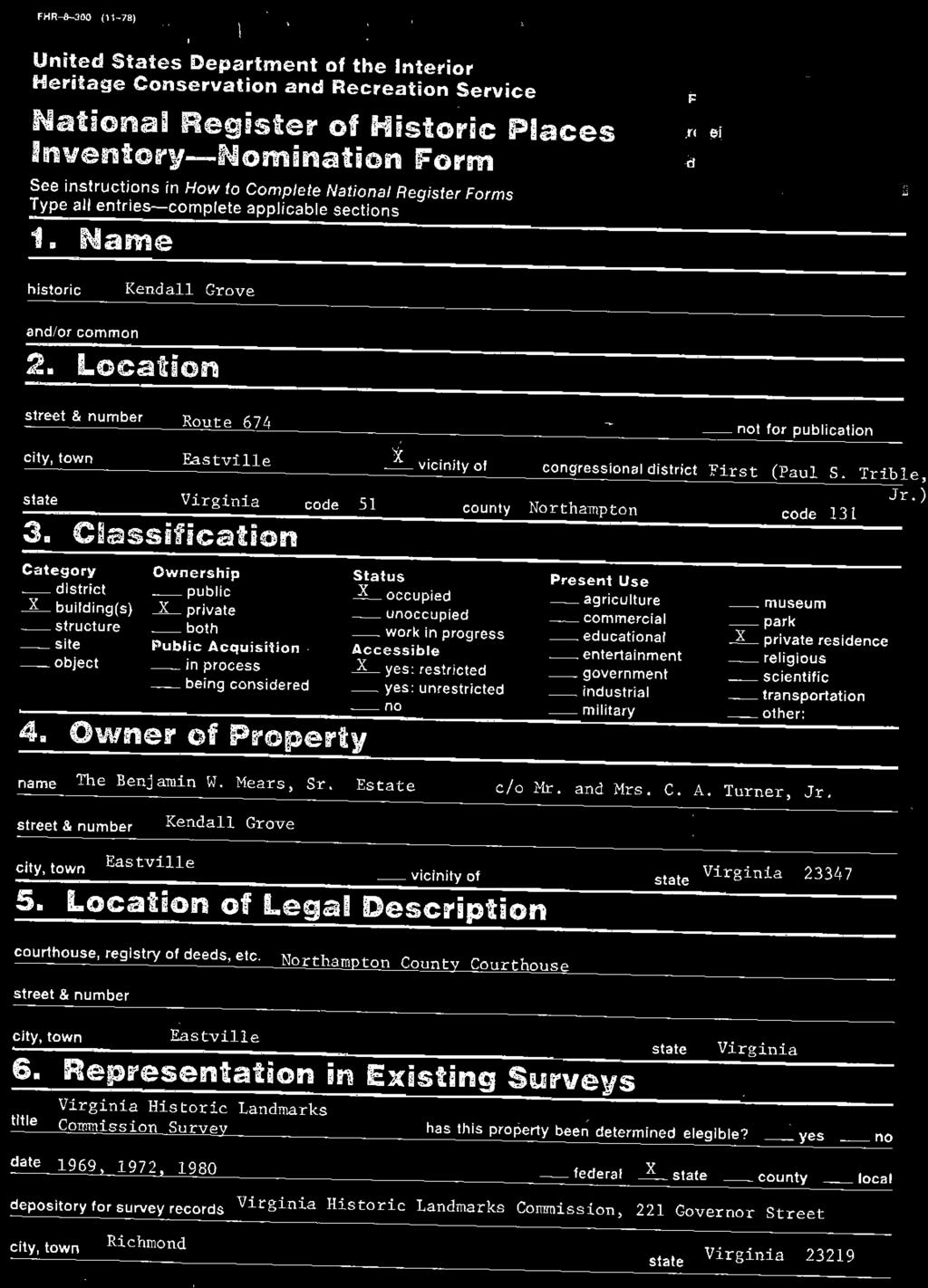
2 7. Description Condition Check one Check one X- excellent - deteriorated _X_ unaltered 2 original site - good ruins -altered -moved date -fair - unexposed Describe the present and original (if known) physical appearance A Northampton County residence, Kendall Grove is located off Route 674 approximately 2.5 miles northwest of Eastville on Mattawoman Creek. The 'Federal-style residence was built ca with improvements made to the property ca Cross-shaped in plan, the two-story, wood-frame house has two-story projecting pavilions on the front and the rear and smaller two-story wings on each end. The main house is joined by a long passage to a wood-frame kitchen-laundry. A small complex of original outbuildings also includes a dairy, storage shed, and smokehouse. Two necessaries are parallel to the kitchen. The main house is constructed on a brick foundation and is covered with weatherboarding. The principal entrance is located on the main (east) elevation of the projecting center pavilion. A replacement glass and wood-paneled front door is contained within a simply executed architrave. The entry is sheltered by the original flat-roof porch which consists of four slender Doric columns on a brick podium supporting an entablature with modillions and applied stylized decoration. A ca photograph shows a Chinesestyle lattice railing above the porch, which has since been removed. The original marble steps remain in place. The treatmant of the entrance and portico is repeated on the rear (west) elevation; where the portico has been glassed in. The main.entrance is flanked by entrances on each of the end wings, added to the house as part of the 1840 improvements. Replacement glass and wood-paneled doors topped by three-light transoms are contained within a simply executed architrave. The entrances are sheltered by dwarf pedimented porticos that are distinguished by modillions and applied star decoration. Similar porticos are on the rears of the wings. Modillions and applied star decoration are also found on the main cornices. Fenestration consists of 919 hung sash on the ca block and 616 hung sash on the later wings. Louvred shutters flank the windows. The cross gables in the main block have semicircular fan windows in rectangular frames with fanlike spandrels. The house features interior end chimneys, one at each end of the original section and one on the end of the rear pavilion. Kendall Grove has a distinguished interior in an excellent state of preservation. At the time of the improvements, ca. 1840, modifications werem?.de to the principal firstfloor rooms, resulting in Greek Revival detailing. A lateral entrance passage on the first floor provides access to the parlor, dining room, and a former bed chamber now used as a study. The entrance passage contains a lateral stair to the second floor. The curved, open-well stair has a scroll newel, a rounded handrail, scroll-sawn brackets, and square balusters, three to a tread. The door frames are embellished with symmetrically molded architrave trim with turned corner blocks. The ceiling is also bordered with symmetrically molded trim and turned corner blocks executed in plaster. The woodwork in the hall is completed by a paneled pedestal-type wainscot and a molded chair rail. The parlor, dining room, and former bed chamber have early Greek Revival-style mantels. Applied Wellford ornamentation and King of Prussia marble surrounds enhance the mantels. The rooms also have pedestal-type wainscots, symnetrically molded architrave trim with turneh corner blocks,'and molded ceiling cornices. The 1840 wings include cross passages, small sitting rooms,'and each a school room and pantry. The rooms are less elaborately treated than those in the main block of the house. The second floor contains the bed chambers. The mantels on the second floor are executed in a Federal style. The rooms have symmetrically molded architrave trim, turned corner blocks, and paneled pedestal-type wainscoting. (See Continuation Sheet ill)

3 8. Significance Period - prehistoric X Areas of Significance--Check and justify below - archeology-prehistoric community planning - landscape architecture- religion - archeology-historic conservation - law - science - agriculture -economics - literature - sculpture X architecture -education -military - social1 -art - engineering - music humanitarian - commerce - explorationlsettlement - philosophy -theater - communications -industry politics/government - transportation - invention - other (specify) Soecific dates 1813: ca BuilderIArchitect unknown Statement of Significance (in one paragraph). STAT,IENT OF Kendall Grove was built ca by George Parker, a member of the Virginia Convention of 1788 and later judge of the Virginia General Court. The house is one of a group of prominent Federal-style houses on Virginia's Eastern Shore that includes Grapeland, Wharton Place, Kerr Place, and Brownsville. Kendall Grove's notable interior, which features fine plaster moldings, King of Prussia marble fireplace surrounds, Wellford ornamentation, and Greek Revival mantels, illustrates how the Eastern Shore gentry adapted styles and.fashions from the metropolitian centersof Boston, Baltimore,and Philarlelphia to make architecturally,sophisticated countryyesidences. '&'he long, low passage connecting the dwelling house to the kitchemisan indigenous feature of the Shnrels vernacular architecture, as is the organization of its outbuildings...kendall Grove is also significant as the home of George Farker's only.child,,,general,severn E. Parker, a delegate and senator to the Virginia General Assembly and a member of the U.S. Congress, HISTORICAL BACKGROUND Kendall Grove was built on property owned by George Kendall, who died in his twenties in The land was eventually inherited by his fiancee, Margaret Eyre, daughter of Severn Eyre of Eyre Hall. She married George Parker in 1786, and they erected their house on the Kendall property, naming it in honor of George Kendall. The Kendalls, who were one of the Eastern Shore's leading colonial families, had settled in the region by the mid-17th century. Although not among the original patentees of the county, they owned substantial tracts of land in both Accomack and Northampton counties by the beginning of the 18th century. According to tradition, George Kendall was engaged to Margaret Eyre when he contracted a fever and died, and it was because of his great affection for her that he left her his property, after the death of his mother. George Kendall's will, recorded 14 December 1784, states: "I give unto my loving mother the use of all my lands and slaves...i heretofore bequeath the same after my mother's death to Margaret Eyre Daughter of Severn Eyre dec. to be enjoyed in fee simple." Kendall's gravestone on the property records that he died on November 22, 1784, at the age of 25 years and that the stone was erected "by his friend George Parker," who would marry Kendall's fiancee two years later. George Parker, the builder of Kendall Grove, was a member of an old and prominent Eastern Shore family. Parker's father,also named George, headed the Revolutionary committee for Accomack and was an active layman of St. George's parish. The younger George Parker is first recorded in an act of the legislature dated October 11, 1786, as one of the trustees who were authorized to establish an academy on the Eastern Shore to be named the Margaret Academy. It appears that nothing came of this effort, but it is interesting to note that on the following day Parker krried Margaret Eyre, suggesting that the proposed academy may have been named for her. Parker voted in favor of the Federal constitution as a member of the Virginia Convention of 1788 and was elected a judge of the Virginia General Court in December (See Continuation Sheet ill)
. \"Severn Eyre Parker\", Biographical Dictionary of the American Congress, 1774-1971. ton, D.C.: U.S. Government Printing Office, P.")
4 Major Biblioara~hical References Benjamin, Asher. Practical House Carpenter. Boston, Forman, H. Chandlee. The Virginia Eastern Shore and Its British Origins. Easton, Northampton County Tax Books, W i l l Books, Deed Books ( ). "Severn Eyre Parker", Biographical Dictionary of the American Congress, ton, D.C.: U.S. Government Printing Office, P (See Continuation Sheet #2) 10. Geographical Data Acreage of nominated property 34 acres Quadrangle name Franktown, Virginia UMT References Quadrangle scale : Washing- A Zone [411~317~6191~~ LliLJ Easting Northing (7,610~, )411~317(31810~ Zone Easting Northing Verbal boundary description and justification Beginning at a point on E side of SW inlet of Mattawoman Creek, about 550' W of NW termination of State Route 674; thence extending about 2100' NW along shoreline of said creek (N side of peninsula); thence continuing about 1900' NE along shoreline (N side of peninsula); thence continuing about 1300' S along shoreline (E side of peninsula) to a point about 700' NE of NU termination of Route 674; thence extending about 1250' SW across neck of peninsula to point of origin. state code county code state code county code 1 Form Prepared By nameitltle Virginia Historic Landmarks Commission Staff Virginia Historic Landmarks Commission date October 1980 street 221 Governor Street telephone (804) city or town Richmond state Virginia State Historic Preservation Officer Certification The evaluated significance of this property wlthln the state is: -national 2- state -local As the designated State Historic Preservation Officer for the National Historic Preservation Act of 1966 (Public Law 8% In the National Register and certify that it has been evaluated accordi by the Heritage Conservation and Recreation Servlce.
5 United States Department of the Interior Heritage Conservation and Recreation Service National Register of Historic Places Inventory-Nomination Form Kendall Grove. Northampton County... Virginia - Continuation sheet Item number 7,8 Page 1 7. DESCRIPTION Kendall Grove retains many of its original ca outbuildings. The long, low passage or "colonnade" extends from the north wing of the main house to the kitchenlaundry. Although now rare, it was at one time an indigenous feature of Eastern Shore architecture. The wood-frame structure is set on a brick foundation that is composed of multiple brick round arches. The floor consists of bricks laid in a herringbone pattern. Sliding sash as well as louvred shutters mark the fenestration. An original storage closet is found on the west wall. A covered walkway connects the passage to the kitchenlaundry which is also a wood-frame structure set on a brick foundation. The interior has a wood floor and wide horizontal pine sheathing. The building is covered by a gable roof. The dairy, storage shed, and smokehouse are wood-frame edifices, all with shiplap siding, set on brick piers, and covered by pyramidal roofs. Their linear plan is suggestive of a plantation "street." Kendall Grove preserves a well-landscaped garden to the rear (west) of the main house. The family cemetery is located to the north of the lawn and contains the gravestones of Severn Eyre Parker, his wife, Catherine Godden Purnell, and later generations of the Costin family. Open fields off Route 674 and an unencumbered Mattawoman Creek preserve the house's 19th-century setting. BOUNDARY JUSTIFICATION RCC The nominated property consists of thirty-four acres that encompass a small peninsula of land bordered by Mattawoman Creek and its inlets. The acreage is a small fraction of the original holdings of George Parker who built Kendall Grove on his 370-acre tract in The nominated property includes the main house, all original outbuildings, the cemetery, and the landscaped lawn. A modern house sits at the end of the point and constitutes an intrusion. 8. SIGNIFICANCE Evidence for the ca construction date of the house is given in the county land tax books for The records of 1812 and preceding years listed no white tithable on the property, which suggests that George Parker was not then a resident. Since the county tax records list a white tithable on the property in 1813 and in every year thereafter until Parker's death, it would seem Parker and his wife took up residence at Kendall Grove in that year, presumably at the house's completion. Parker expanded operations at this plantation in 1814, increasing the number both of his slaves, from eight to nineteen, and of his horses, from six to fifteen. The most detailed portrait of Kendall Grove is given in the personal property tax records for George Parker in The portrait is also significant as a statement of Parker's wealth and prominence. Valued at $1,500 in 1815, the house was furnished with two chests of drawers, two mahogany wardrobes, three mahogany dining tables, one sideboard with mahogany doors, a mahogany tea table, two mahogany bedsteads, one mahogany chair, a carpet, one portrait in oil, four mirrors, four plated candlesticks, a mahogany sofa, a silver coffee pot and silver teapot, two silver tankards, and one silver cup. (See Continuation Sheet 12)
6 United States Department of the Interior Heritage Conservation and Recreation Service National Register of Historic Places Inventory-Nomination Form Kendall Grove, Northampton County, Virginia Continuation sheet ij2 Item number SIGNIFICANCE Judge Parker died in July 1826 and was buried in St. Paul's graveyard in Baltimore. According to his will the property was left to his third wife, Susan Parker, who granted the property to Parker's son,severn Eyre Parker, on January 10, 1827, for the price of $150 per year. The grant is the first reference of record to "Kendall Grove," but it is clear from the context that it had been so named for quite a while. Severn E. Parker, born in 1787, studied law, was admitted to the bar, and served as deputy clerk of the Northampton County court. He was a member of the state House of Delegates, , and sewed in the state Senate from In 1819 he was elected to the 16th Congress, where he made one notable speech in opposition to Northern efforts to prohibit slavery in the new state of Missouri. He was again elected to the House of Delegates in 1828, 1834, and Having briefly seen military action in the War of 1812, he was five times commissioned as a general of Virginia militia from He died in Northampton County on October 21, 1836, and was interred at Kendall Grove, which had served as his dwelling place since From 1837 to 1844, the property was listed in the tax books as part of the Severn E. Parker estate. Land tax records indicate substantial additions or renovations to the property ca. 1840, by whom it is unclear. In 1839 the house was valued at $1,60O,and by 1840 it was recorded at twice that value. It was at this time that the house came into its present form. Substantial improvements were made to the interior, the end wings were added, and the outbuildings and long passage were built. The quality and style of the interior architectural treatment demonstrate that the Eastern Shore was quick to imitate the latest architectural trends, due to its location within the commercial shipping radius of Philadelphia and Baltimore. In 1844 the property was listed under the name of Catherine G. Parker, widow of Severn Parker. It later descended to Catherine P. Parker, who inherited it upon her mother's death in 1848 but could not take full possession until she reached her majority in In that year it was valued at $2,500. Following her marriage to Robert S. Costin in 1853, Kendall Grove became taxed as the property of her husband. Since that time, the property has remained in the possession of Costin descendants and is now owned by the estate of Benjamin Mears. 9. MAJOR BIBLIOCRAPHICAL REFERENCES Shippen, Rebecca. "The Parker Family of Northampton and ~ccomackcounties", Virginia Magazine of History and Biography Vol. VI, pp Whitelaw, Ralph. ~irginia's Eastern Shore, A History of Northampton and Accomack Counties. Gloucester, Mass., 1968, Vol. 1, pp

7
301 7½ Street SW
 301 7½ Street SW 104-0213-0072 Primary Resource Information: Single Dwelling, Stories 2.00, Style: Other, ca 1890 July 2006: This late-19th-century, 3-bay, 2-story, hip-roofed frame I-house features projecting
National Register of Historic Places Inventory Nomination Form
 NPS Form 10-900-a Exp. 10-31-84 Continuation sheet 4 5 item number 7 Page 45 NAME: Knight Estate LOCATION: 486 East Avenue,,--v..u^-^ OWNER: State of Rhode Island Department of Education Board of Regents
Maryland Historical Trust Inventory No. 15/6 Maryland Inventory of Historic Properties Form
 Inventory No. 15/6 Maryland Inventory of 1. Name of Property (indicate preferred name) historic Becraft Farm other 2. Location street and number 28500 Ridge Road not for publication city, town Mount Airy
Maryland Historical Trust Inventory No. PG: 86A-026 Maryland Inventory of Historic Properties Form
 Inventory No. PG: 86A-026 Maryland Inventory of 1. Name of Property (indicate preferred name) historic other 2. Location street and number 12811 Croom Road not for publication city, town Naylor vicinity
DESIGNATION REPORT KENNEDY-BAKER-WALKER-SHERRILL HOUSE (1849) 9320 KINGSTON PIKE (CLT ) KNOXVILLE, TENNESSEE July 12, 2007
 9320 KINGSTON PIKE (CLT ) KNOXVILLE, TENNESSEE July 12, 2007") DESIGNATION REPORT KENNEDY-BAKER-WALKER-SHERRILL HOUSE (1849) 9320 KINGSTON PIKE (CLT 132-027) KNOXVILLE, TENNESSEE July 12, 2007 Description The Kennedy-Baker-Walker-Sherrill House is located on the south
DESIGNATION REPORT KENNEDY-BAKER-WALKER-SHERRILL HOUSE (1849) 9320 KINGSTON PIKE (CLT 132-027) KNOXVILLE, TENNESSEE July 12, 2007 Description The Kennedy-Baker-Walker-Sherrill House is located on the south
Maryland Historical Trust Inventory No. PG: 86A-003 Maryland Inventory of Historic Properties Form
 Inventory No. PG: 86A-003 Maryland Inventory of 1. Name of Property (indicate preferred name) historic other 2. Location street and number 12005 Duley Station Road not for publication city, town Upper
Maryland Historical Trust Inventory No. PG: 81B-008 Maryland Inventory of Historic Properties Form
 Maryland Historical Trust Inventory No. PG: 81B-008 Maryland Inventory of 1. Name of Property (indicate preferred name) historic other 2. Location Dyson Farmhouse (preferred) street and number 13010 Piscataway
808 Cherry Avenue
 808 Cherry Avenue 104-0213-0059 Primary Resource Information: Single Dwelling, Stories 2.00, Style: Other, ca 1900 July 2006: This 2-story, 3-bay frame I-house features a central-front gable, a brick pier
Maryland Historical Trust Inventory No. PG: 75A-007 Maryland Inventory of Historic Properties Form
 Inventory No. PG: 75A-007 Maryland Inventory of 1. Name of Property (indicate preferred name) historic other 2. Location street and number 3101 Ritchie Road not for publication city, town Forestville vicinity
NPS Form OMB No Exp Status occupied X unoccupied work in progress Accessible yes: restricted yes: unrestricted _5Lno
 NPS Form 10-900 OMB No. 1024-0018 Exp. 10-31-84 United States Department of the Interior National Park Service National Register of Historic Places Inventory Nomination Form See instructions in How to
1 Gildersleeve Wood (DHR # )
") GILDERSLEEVE WOOD 1 Gildersleeve Wood (DHR # 104-5092-0012) STREET ADDRESS: 1 Gildersleeve Wood MAP & PARCEL: 11-20 PRESENT ZONING: R-1U ORIGINAL OWNER: Lindsay Family ORIGINAL USE: PRESENT USE: PRESENT
GILDERSLEEVE WOOD 1 Gildersleeve Wood (DHR # 104-5092-0012) STREET ADDRESS: 1 Gildersleeve Wood MAP & PARCEL: 11-20 PRESENT ZONING: R-1U ORIGINAL OWNER: Lindsay Family ORIGINAL USE: PRESENT USE: PRESENT
The George Rieley home place, built 1852, from bricks molded and baked on the premises.
 The George Rieley home place, built 1852, from bricks molded and baked on the premises. 1. SUBJECT: Old Riley [sic] Place. 2. LOCATION: 1/16 mile east of Blue Ridge Va. on Route /460. House on north side
First Floor Plan. Second Floor Plan
 The Flint Homestead was built by 1709 for Ephraim Flint (1641 1723) and his wife Jane Bulkeley. They did not have any children. In 1723 he willed his mansion house to his nephew, John Flint, and to John
THE BARNACLE 3485 MAIN HIGHWAY
 THE BARNACLE 3485 MAIN HIGHWAY Designation Report City of Miami REPORT OF THE CITY OF MIAMI PLANNING AND ZONING DEPARTMENT TO THE HISTORIC AND ENVIRONMENTAL PRESERVATION BOARD ON THE POTENTIAL DESIGNATION
500 Preston Place. Garages PRESENT USE: Garages PRESENT OWNER: Preston Court Limited Partnership ADDRESS:
 PRESTON PLACE 500 Preston Place STREET 500 Preston Place MAP & PARCEL: 5-116 Garages Garages PRESENT OWNER: Preston Court Limited Partnership 413 7 th Street NE Charlottesville, Va. 22902 DATE/ PERIOD:
Maryland Historical Trust Inventory No. PG: Maryland Inventory of Historic Properties Form
 Inventory No. PG: 62-012 Maryland Inventory of 1. Name of Property (indicate preferred name) historic other 2. Location street and number 11205 Old Baltimore Pike not for publication city, town Beltsville
HENNIGAN PLACE. This photograph is circa November Name, address, and telephone number of the present owner and occupant of the property:
 HENNIGAN PLACE This report was written on November 7, 1979 This photograph is circa November 2006. 1. Name and location of the property: The property known as the Hennigan Place is located at 3503 Tilley
- - CITY. TOWN CONGRESSIONAL DISTRICT. Princeton, VICINITY OF. STATE CODE COUNTY CODE West Virginia 54 Mercer 055
 UNITtD S DEPAKTMkNT OF THE IN1 EKIOR NATIONAL PARK SERVICE NATIONAL REGISTER OF HISTORIC PLACES INVENTORY -- NOMINATION FORM NAME HISTORIC AND/OR COMMON SEE INSTRUCTIONS IN HOW TO COMPLETE NATIONAL REGISTER
3. Classification -- Category Ownership Status Present Use
 United States Department of the Interior National Park Service?htbn~! Register of klkt~rk Places For HPS UM only received Inventory-Nomination Form date entered See instructions in How to Complete National
OR THEMATIC NOMINATION. STREET & NUMBER W side of SR l48s, 1.S mil. N of Muddy Creek _N()T FOR PUBLICATION CITY, TOWN. CONGRESSIONAL DISTRICT Arcadia
T FOR PUBLICATION CITY, TOWN. CONGRESSIONAL DISTRICT Arcadia") _--..,""'-"-_""-""- COUNTY xx::.c...- MULTIPLE RESOURCE OR THEMATIC NOMINATION HISTORIC Hampton House STREET & NUMBER W side of SR l48s, 1.S mil. N of Muddy Creek _N()T FOR PUBLICATION CITY, TOWN CONGRESSIONAL
_--..,""'-"-_""-""- COUNTY xx::.c...- MULTIPLE RESOURCE OR THEMATIC NOMINATION HISTORIC Hampton House STREET & NUMBER W side of SR l48s, 1.S mil. N of Muddy Creek _N()T FOR PUBLICATION CITY, TOWN CONGRESSIONAL
Maryland Historical Trust Inventory No Maryland Inventory of Historic Properties Form
 Inventory No. 15 28 Maryland Inventory of 1. of Property (indicate preferred name) historic Luther Moore Farm other 2. Location street and number 7201 Damascus Road not for publication city, town Gaithersburg
Town: Sharon Place (neighborhood or village): Sharon. ame of Area: Present Use: Date (month / year): July 2008
: Sharon. ame of Area: Present Use: Date (month / year): July 2008") FORM A - AREA MASSACHUSETTS HISTORICAL COMMISSION MASSACHUSETTS ARCHIVES BUILDING 220 MORRISSEY BOULEVARD BOSTON, MASSACHUSETTS 02125 Photograph Assessor s Sheets USGS Quad Area Letter Form Numbers in
FORM A - AREA MASSACHUSETTS HISTORICAL COMMISSION MASSACHUSETTS ARCHIVES BUILDING 220 MORRISSEY BOULEVARD BOSTON, MASSACHUSETTS 02125 Photograph Assessor s Sheets USGS Quad Area Letter Form Numbers in
THE CORPORATION OF THE TOWN OF NIAGARA-ON-THE-LAKE. BY-LAW NO (214 Four Mile Creek Road)
") THE CORPORATION OF THE TOWN OF NIAGARA-ON-THE-LAKE BY-LAW NO. 4807-15 (214 Four Mile Creek Road) A BY-LAW TO DESIGNATE THE PROPERTY KNOWN MUNICIPALLY AS WOODBOURNE, 214 FOUR MILE CREEK ROAD, IN THE TOWN
THE CORPORATION OF THE TOWN OF NIAGARA-ON-THE-LAKE BY-LAW NO. 4807-15 (214 Four Mile Creek Road) A BY-LAW TO DESIGNATE THE PROPERTY KNOWN MUNICIPALLY AS WOODBOURNE, 214 FOUR MILE CREEK ROAD, IN THE TOWN
National Register of Historic Places Inventory-Nomination Form. I. Name. 5. Location of Lesal Descri~tion
 United States Department of the Interior National Park Service National Register of Historic Places Inventory-Nomination Form See instructions in How to Complete National Register Forms Type all entries-complete
Architectural Inventory Form
 OAHP1403 Rev. 9/98 COLORADO CULTURAL RESOURCE SURVEY Architectural Inventory Form Official eligibility determination (OAHP use only) Date Initials Determined Eligible- NR Determined Not Eligible- NR Determined
Commonwealth of Massachusetts Massachusetts Historical Commission 220 Morrissey Boulevard, Boston, Massachusetts
 Inventory No: Historic Name: Common Name: Address: HRV.165 Blood, Joseph House Farnsworth, Jonathan - Beaman, Jonathan House 74 Poor Farm Rd City/Town: Village/Neighborhood: Local No: 9-17 Year Constructed:
National Register of Historic Places received 9 Inventory Nomination Form date entered M/W 9 I9S
 NPS Form 10-900 0MB No. 1024-0018 (3-82) Exp. 10-31-84 For NPS use only National Register of Historic Places received 9 Inventory Nomination Form date entered M/W 9 I9S See instructions in How to Complete
 Page 1 Original Update HISTORICAL STRUCTURE FORM FLORIDA MASTER SITE FILE Consult Guide To Historical Structure Forms for detailed instructions Site # 8OR9844 Recorder # 26 Recorder Date 2/20/08 Site Name
National Register off Historic Places received NOV U 1985 Inventory Nomination Form date ante** DEC j 2 BBS
 NPS Form 10400 042) 0MB No. 1024-0018 Exp. 10-31-84 United States Department off the Interior National Park Service For NFS us* only National Register off Historic Places received NOV U 1985 Inventory
United States Department of the Interior National Park Service NATIONAL REGISTER OF HISTORIC PLACES REGISTRATION FORM
 NPS Form 10-900 (Rev. 8-86) OMB No. 1024-0018 United States Department of the Interior National Park Service NATIONAL REGISTER OF HISTORIC PLACES REGISTRATION FORM other name/site number: "Maple Shadows:"
3. Classification. 5. Location of Legal Description. 6. Representation in Existing Surveys
 N~~ Form 10.900 (382) OMB No. 10240018 Exp. 103164 United States Department of the Interior National Park Service National Register of Historic Places InventoryNomination Form See instructions in How to
National Register of Historic Places Registration Form
 NPS Form 10-900 OMB No. 10024-0018 (Oct. 1990) United States Department of the Interior National Park Service National Register of Historic Places Registration Form 1. Name of Property historic name Hickory
Address 347 Whitney Street. East elevation, camera facing southwest.
 FORM B BUILDING Assessor s Number USGS Quad Area(s) Form Number MASSACHUSETTS HISTORICAL COMMISSION MASSACHUSETTS ARCHIVES BUILDING 220 MORRISSEY BOULEVARD BOSTON, MASSACHUSETTS 02125 Town Northborough
FLAGLER WORKER S HOUSE FORT DALLAS PARK S.E. 4 STREET
 FLAGLER WORKER S HOUSE FORT DALLAS PARK 60-64 S.E. 4 STREET Designation Report City of Miami REPORT OF THE CITY OF MIAMI PLANNING DEPARTMENT TO THE HERITAGE CONSERVATION BOARD ON THE POTENTIAL DESIGNATION
Status occupied unoccupied work in progress Accessible yes: restricted _X-_ yes: unrestricted no. Jackson County Courthouse
 NPS Form 10-900 (3-82) OMB No. 1024-0018 Exp. 10-31-84 United States Department of the Interior National Park Service National Register of Historic Places Inventory Nomination Form See instructions in
ADDENDUM. Chain of Title. Block C, Lot 8-9. Adrian I. Velthuis and Floyd T. Grant to Lottie Thompson
 Chain of Title Block C, Lot 8-9 NLP 5175:842 October 18, 1979 NLP 4979:58 October 5, 1977 NLP 4763:448 May 11, 1977 Adrian I. Velthuis and Floyd T. Grant to Lottie Thompson Gentlemens II Properties, Inc.,
CHRONOLOGY & DEVELOPMENT BOUDINOT-SOUTHARD PROPERTY BASKING RIDGE, NJ OF THE
 CHRONOLOGY & DEVELOPMENT OF THE BOUDINOT-SOUTHARD PROPERTY BASKING RIDGE, NJ Elias Boudinot 1740 Elias Boudinot born May 2 in Philadelphia, where his family was a neighbor of Benjamin Franklin. 1760 Boudinot
NATIONAL REGISTER OF HISTORIC PLACES REGISTRATION FORM
 (Rev. 10-90) NPS Form 10-900 OMB No. 1024-0018 NATIONAL REGISTER OF HISTORIC PLACES REGISTRATION FORM This form is for use in nominating or requesting determinations for individual properties and districts.
Status XX occupied unoccupied work in progress Accessible XX yes: restricted yes: unrestricted no. Zorn Farms, Inc., and Henry Zorn Estate
 FHR-8-300 (11-78) United States Department of the Interior Heritage Conservation and Recreation Service National Register of Historic Inventory Nomination Form See instructions in How to Complete National
Intensive Level Historic Resources Survey 5.0 ANNOTATED LIST OF PROPERTIES
 Intensive Level Historic Resources Survey 5.0 ANNOTATED LIST OF PROPERTIES CBCA PN 05-012A May 2009 Photo Location Description 10760 Bodine Road Date: 1811 Historic addition of side block to the rear;
Hudson Valley Vernacular Architecture Dutch Barn Preservation Society Field Trip to the Palatine Region of the Mohawk Valley May 18, 2013
 Hudson Valley Vernacular Architecture Dutch Barn Preservation Society Field Trip to the Palatine Region of the Mohawk Valley May 18, 2013 Trip Schedule Site Arrive Depart Old Palatine Church 10:30 am 11:15
- - National Register of Historic Places Inventory-Nomination Form. 3. Classification. 6. Representation in Existing Surveys. 4.
 United States department of the lnterior ' Heritage Conservation and Recreation Service National Register of Historic Places Inventory-Nomination Form I!--"""""""""""" t x,.,for HCRS use only rece lved
Places state West Virginia code county Marion
 NPS Form 1W0 csaa, United States Department of the lnteria? National Park Service National Register of Historic Inventory-Nomination Form See instructions in How to Complete National Register Forms Type
National Register of Historic Places Registration Form
 NPS Form 10-900 OMB No. 10024-0018 (Oct. 1990) United States Department of the Interior National Park Service National Register of Historic Places Registration Form This form is for use in nominating or
SURVEY OF PUBLIC HOUSES WESTON TURVILLE
 BUCKINGHAMSHIRE ARCHAEOLOGICAL SOCIETY HISTORIC BUILDINGS GROUP SURVEY OF PUBLIC HOUSES IN THE PARISH OF WESTON TURVILLE BUCKINGHAMSHIRE A record of extant buildings that are currently or were formerly
Houses on the east side of River Street, camera facing northeast. Date (month/year) March 2009
 March 2009") FORM A - AREA MASSACHUSETTS HISTORICAL COMMISSION MASSACHUSETTS ARCHIVES BUILDING 220 MORRISSEY BOULEVARD BOSTON, MASSACHUSETTS 02125 Assessor s Sheets USGS Quad Area Letter Form Numbers in Area Shrewsbury
FORM A - AREA MASSACHUSETTS HISTORICAL COMMISSION MASSACHUSETTS ARCHIVES BUILDING 220 MORRISSEY BOULEVARD BOSTON, MASSACHUSETTS 02125 Assessor s Sheets USGS Quad Area Letter Form Numbers in Area Shrewsbury
6733 Lee Highway. Albert Prescott Eastman
 /0, I. J-: (p. May 2, 1979 l. 2. 3. 4. s. 6. Building Name: Address: Original Owner: Original Use: Present Owner: Present Use: Eastman - Fenwick House 6733 Lee Highway Albert Prescott Eastman Dwelling
National Register of Historic Places Registration Form
 NPS Form 10-900 OMB No. 1024-0018 (Rev. 10-90) United States Department of the Interior National Park Service National Register of Historic Places Registration Form 1. Name of Property historic name Newcomer
THE WILLIAM GRIER HOUSE
 THE WILLIAM GRIER HOUSE This report was written on February 1, 1978 1. Name and location of the property: The property known as the William Grier House is located on Steele Creek Rd. opposite from its
ate: AR County: Pulaski Code: AR Zip Code: Noncontributing buildings sites structures objects Total
 Mims-Ereedlove-Priest-Weatherton House Name of Property Little Rock, AR County and State ~- -,s Form 10-900 'V. 8-86) OMB No. 1024-0018 United States Department of the Interior National Park Service NATIONAL
MEDIA ADVISORY. FOR IMMEDIATE RELEASE November 12, 2012
 MEDIA ADVISORY FOR IMMEDIATE RELEASE November 12, 2012 Niagara-on-the-Lake On Monday, November 19, 2012, the Lord Mayor and members of the Town s Municipal Heritage Committee and War of 1812 Bicentennial
Maryland Historical Trust Inventory No. PG: 74B-030 Maryland Inventory of Historic Properties Form
 Inventory No. PG: 74B-030 Maryland Inventory of 1. Name of Property (indicate preferred name) historic other 2. Location street and number city, town county 15504 Hall Road Bowie Prince George's not for
National Register of Historic Places Inventory Nomination Form. 1. Name. 2. Location. 3. Classification. 4. Owner of Property
 NFS Form 10-900 (3-82) 0MB No. 1024-0018 Expires 10-31-87 United States Department of the Interior National Park Service National Register of Historic Places Inventory Nomination Form See instructions
NATIONAL REGISTER OF RIGTORfC PLACES REGISTRATION FORM
 NPS Form 10-900 (Rev. 8-86) Pnited States Department of the Interior National Park Service NATIONAL REGISTER OF RIGTORfC PLACES REGISTRATION FORM 3. Warm of Property +-----------------------------------------------------------------------
BLOCK LOT QUAD. _ CITY: Houston _ UTM: STYLE: THEME:
 (/I NAME. ADDRESS: 1537 Tulsne COUNTY CITY QUAD ARCHITECT/BUILDER: nwnifr- Elroy Kuehn etax 1510 Ashland Houston^ TX 77008 BLOCK LOT _ COUNTY:. Harri _ CITY: Houston _ UTM: STYLE: THEME: s PERIOD:. nf«;rriptinv-
Cranberry Lake Farm. By Alicia McCullough for the Oakland Township HDC
 Cranberry Lake Farm By Alicia McCullough for the Oakland Township HDC Cranberry Lake Farm s History Cranberry Lake Farm was purchased by Seymour Fletcher in 1837 from the Federal Government. The development
Robert Dawson Senior
 Robert Dawson Senior Dawson Family 85.13.1 DBP3B (cropped) The man sitting on the right of the photograph with the tall hat is Robert Dawson Sr. Standing to his left is his wife, Martha, and Robert Jr.,
9 Illustrations. Barrett Farm Historic Structure Report April 17, Historic Maps and Views. New England Landmarks Save Our Heritage, Inc.
 Barrett Farm Historic Structure Report April 17, 2009 63 9 Illustrations 9.1 Historic Maps and Views Figure 23 Barrett Farm Lossing c.1848 The earliest view of the house with west ell much as it is today.
NE¼ of NE¼ of NE¼ of NE¼ of section Roof configuration (enter one): Gabled Roof / Front Gabled Roof
: Gabled Roof / Front Gabled Roof") OAHP1403 Rev. 9/98 COLORADO CULTURAL RESOURCE SURVEY Official Eligibility Determination (OAHP use only) Date Initials Determined Eligible - National Register Architectural Inventory Form Determined Not
OAHP1403 Rev. 9/98 COLORADO CULTURAL RESOURCE SURVEY Official Eligibility Determination (OAHP use only) Date Initials Determined Eligible - National Register Architectural Inventory Form Determined Not
CITY OF MURFREESBORO HISTORIC ZONING COMMISSION. Regular Meeting June 19, :30 PM, Council Chambers, City Hall
 CITY OF MURFREESBORO HISTORIC ZONING COMMISSION Regular Meeting June 19, 2018 3:30 PM, Council Chambers, City Hall I. Call to Order and determination of a quorum II. Approve Minutes of the Regular Meeting
National Register of Historic Places Registration Form
 NPS Form 10-900 OMB No. 10024-0018 (Oct. 1990) United States Department of the Interior National Park Service National Register of Historic Places Registration Form 1. Name of Property historic name other
TYPE ALL ENTRIES -- COMPLETE APPLICABLE SECTIONS. Elsenhower Memorial Chapel (unofficially)
") Form No 10-306 (Rev 10-74) UNlTEDSTATtS DEPARTMENT OK THt INTERIOR NATIONAL PARK SERVICE NATIONAL REGISTER OF HISTORIC PLACES INVENTORY - NOMINATION FORM FOR FEDERAL PROPERTIES SEE INSTRUCTIONS IN HOW
Form No 10-306 (Rev 10-74) UNlTEDSTATtS DEPARTMENT OK THt INTERIOR NATIONAL PARK SERVICE NATIONAL REGISTER OF HISTORIC PLACES INVENTORY - NOMINATION FORM FOR FEDERAL PROPERTIES SEE INSTRUCTIONS IN HOW
Society Member to Supervise the Building of James Monroe s Birthplace House Charles Belfield, a councilor of the War of 1812 Society in the
 Society Member to Supervise the Building of James Monroe s Birthplace House Charles Belfield, a councilor of the War of 1812 Society in the Commonwealth of Virginia has been designated as the supervisor
56 QUEEN STREET. Neo-Classic. architectural description. Architect Merwin Austin, Rochester, N.Y. Port Hope Town Hall circa
 Architect Merwin Austin, Rochester, N.Y. Date Designated: June 27, 1994 to By-Law No. 21/94, SCHEDULE B-1 Lot Description: PT 51 (PART OF ORIGINAL TOWN LOTS S 48, 49, 50 architectural description S et
Friends Meeting House, Leicester. 16 Queens Road, Leicester, LE2 1WP. National Grid Reference: SK Statement of Significance
 Friends Meeting House, Leicester 16 Queens Road, Leicester, LE2 1WP National Grid Reference: SK 59852 02815 Statement of Significance A meeting house purpose-built on a new site in 1955 and slightly enlarged
EDGEWOOD FARMHOUSE. This report was written on Oct. 3, 1984
 EDGEWOOD FARMHOUSE This report was written on Oct. 3, 1984 1. Name and location of the property: The property known as the Edgewood Farmhouse is located at 11124 Eastfield Road in Mecklenburg County. 2.
Portway Farm, Twyford
 Portway Farm, Twyford Buckinghamshire Archaeological Society HISTORIC BUILDING REPORT / April 2011 Including HS2 high-speed rail line Impact Assessment SURVEY AND REPORT: Sue Fox and John Brushe Report
PROJECT: Rehabilitate Historic Bathhouses for Adaptive Use
 LOCATION: Hot Springs National Park, Hot Springs Arkansas SIZE: Approximately 105,000 sf among six buildings DATE: 2003-present ROLE: Project Manager for Historic Structure Reports, pre-design through
N/A not for publication city or town : Hillsboro - X vicinity state: West Virginia code: WV countv: Pocahontas code: 075 zip code: 24946
 United States Department of the Interior National Park Service historic name : other nameslsite number : NIA. -.- 2. Location street & number : HC 64. Box 147loff County Road 3 1 on Kyle Beard Road N/A
"The Stone House;" Parker Family Residence; Slosn, Richard, House. Route 50 approximately 314 mile east of Junction
 Form No. 10300 (Rev. 1074) UNITED STATES DEPARTMENT OF THE INTERIOR NATIONAL PARK SERVICE NATIONAL REGISTER OF HISTORIC PLACES INVENTORY NOMINATXON FORM @NAME HISTORIC SEE INSTRUCTIONS IN HOW TO COMPLETE
Proposed East Sanford Historic District DRAFT
 Proposed East Sanford Historic District DRAFT Inventory List The following inventory list provides basic information for all properties in the East Sanford Historic District. Included are each property
Cross Street Walking Tour
 Cross Street Walking Tour 1. 33 King Street West: Collins Hotel: 1840 s This impressive building was constructed in 1841 by Bernard Collins. The gallery and Greek style portico were built in the 1850 s
CJheck one original s ite moved date
 FHR-8-300 (11-78) United States Department off the Interior Heritage Conservation and Recreation Service National Register of Historic Places Inventory Nomination Form See instructions in How to Complete
Survey and Research Report On The Sherrill-Robbins House
 Survey and Research Report On The Sherrill-Robbins House 1. Name and location of the property: The property known as the Sherrill-Robbins House is located at 19726 Zion Avenue in Cornelius, N.C. 2. Name
National Register of Historic Places Registration Form
 NPS Form 10-900 OMB No. 10024-0018 (Oct. 1990) Registration Form This form is for use in nominating or requesting determinations for individual properties and districts. See instructions in How to Complete
National Register of Historic Places Registration Form
 NPS Form 10-900 OMB No. 10024-0018 (Oct. 1990) Registration Form This form is for use in nominating or requesting determinations for individual properties and districts. See instructions in How to Complete
- vicinity of. Status. Present Use. occupied agriculture A!- museum t -L structure - both - work in progress - educational private residence
 Unitad States Department of the Interior - National Park Service - ational Register of Historic Places -- - inventory-nomination Form See instructions in How to Complete National Register Forms Type all
National Register of Historic Places Registration Form
 NPS Form 10-900 OMB No. 1024-0018 (Rev. 10-90) United States Department of the Interior National Park Service National Register of Historic Places Registration Form 1. Name of Property historic name Strode-Morrison-Tabler
ATTACHMENT C ARLINGTON COUNTY REGISTER OF HISTORIC PLACES HISTORIC DISTRICT DESIGNATION FORM
 1. NAME OF PROPERTY ARLINGTON COUNTY REGISTER OF HISTORIC PLACES HISTORIC DISTRICT DESIGNATION FORM Historic Name: Other names: Reevesland Torreyson Farm 2. LOCATION OF PROPERTY Street and Number: 400
 ~. ',. ( NPS Form 10-900 (Rev. 8-86) NR I ;s+eca Cf/ S /q~ OMB No. 1024-0018 United States Department of the Interior National Park Service NATIONAL REGISTER OF HISTORIC PLACES REGISTRATION FORM ------------------------------------------------------------------------
MASSACHUSETTSHISTORICAL COMMISSION Office of the Secretary, State House, Boston. 1. Town Marlborough. Name Josiah Stow Homestead.
 FORM B - BUILDING In Area no. Form no. MASSACHUSETTSHISTORICAL COMMISSION Office of the Secretary, State House, Boston / ;;L. 1. Town Address Spoonhill Ave. Name Josiah Stow Homestead 2. Present use Residence
United States Department of the Interior National Park Service NATIONAL REGISTER OF HISTORIC PLACES REGISTRATION FORM
 NPS Form 10-900 (Oct. 1990) OMB NO. 10024-0018 United States Department of the Interior National Park Service NATIONAL REGISTER OF HISTORIC PLACES REGISTRATION FORM As the designated authority under the
Town. Place (neighborhood or village) Address. Source. Style/Form. Foundation. Wall/Trim. Roof. Condition. Acreage. Setting
 Address. Source. Style/Form. Foundation. Wall/Trim. Roof. Condition. Acreage. Setting") FORM B BUILDING MASSACHUSETTS HISTORICAL COMMISSION Photograph Assessor s Number USGS Quad Area(s) Form Number 077005 Cotuit E 22 Town Barnstable Place (neighborhood or village) Address 3600 Falmouth Road/Route
FORM B BUILDING MASSACHUSETTS HISTORICAL COMMISSION Photograph Assessor s Number USGS Quad Area(s) Form Number 077005 Cotuit E 22 Town Barnstable Place (neighborhood or village) Address 3600 Falmouth Road/Route
East and north elevations, camera facing west. Condition Good
 FORM B BUILDING MASSACHUSETTS HISTORICAL COMMISSION MASSACHUSETTS ARCHIVES BUILDING 220 MORRISSEY BOULEVARD BOSTON, MASSACHUSETTS 02125 Assessor s Number USGS Quad Area(s) Form Number Town Northborough
Langley Register of Historic Places Nomination Form
 FOR OFFICE USE ONLY Langley Register of Historic Places Nomination Form Received Type all entries 1. Name of Property Historic: Jacob Anthes Bunkhouse/Cookhouse And/or common: South Whidbey Historical
June 23, The Clayton Historic District is bounded by Mulberry Street, West Barnes Street, Mill Street, South Lombard Street and Blanche Street.
 June 23, 2010 This is the Clayton Historic District nomination to the National Register of Historic Places prepared by National Register Consultant Nancy Van Dolsen of Wilson, NC. The presentation was
MID-ATLANTIC HISTORIC BUILDINGS AND LANDSCAPE SURVEY. Polk-Atkinson House Appoquinimink Hundred New Castle County, Delaware
 MID-ATLANTIC HISTORIC BUILDINGS AND LANDSCAPE SURVEY Polk-Atkinson House Appoquinimink Hundred New Castle County, Delaware Center for Historic Architecture and Design Newark, Delaware 197 16 2005 MID-ATLANTIC
0 0bi.c~ 0 Both a sing Cmnsidsnd Pnrrrvation rrwk - OWNER'S N *ME. ./*{J. I Arkansas Columbia r 027 ]
![0 0bi.c~ 0 Both a sing Cmnsidsnd Pnrrrvation rrwk - OWNER'S N *ME. ./*{J. I Arkansas Columbia r 027 ]](/thumbs/88/114838021.jpg "0 0bi.c~ 0 Both a sing Cmnsidsnd Pnrrrvation rrwk - OWNER'S N *ME. ./*{J. I Arkansas Columbia r 027 ]") - 14- o[d -- Woo5-6!./*{J /' I 1. gor r Fbm 10-340. UNITED STATES DEPARTMENT 05 THE INTERIOR \ dl IMP1 NAflONAL 'PARK SERVICE NATIONAL REGISTER OF kujt.drlr Pf ACES INVEHTORY - HOMINATION FORM Froq LezI
- 14- o[d -- Woo5-6!./*{J /' I 1. gor r Fbm 10-340. UNITED STATES DEPARTMENT 05 THE INTERIOR \ dl IMP1 NAflONAL 'PARK SERVICE NATIONAL REGISTER OF kujt.drlr Pf ACES INVEHTORY - HOMINATION FORM Froq LezI
AH pp. I Ti. Nov 7 I) I I y
 I I y") ..------------------------------------------ ------------ - - -- - NPS Form 10-900 (Rev. 8-86) United States Department of the Interior ~a tional Park Service NATIONAL REGISTER OF HISTORIC PLACES REGISTRATION
..------------------------------------------ ------------ - - -- - NPS Form 10-900 (Rev. 8-86) United States Department of the Interior ~a tional Park Service NATIONAL REGISTER OF HISTORIC PLACES REGISTRATION
Friends Meeting House, Warwick. 39 High Street, Warwick, CV34 4AX. National Grid Reference: SP Statement of Significance
 Friends Meeting House, Warwick 39 High Street, Warwick, CV34 4AX National Grid Reference: SP 28071 64737 Statement of Significance Warwick Meeting House has exceptional heritage significance as a fine
Commonwealth of Massachusetts Massachusetts Historical Commission 220 Morrissey Boulevard, Boston, Massachusetts
 Inventory No: Historic Name: Common Name: Address: NWB.3010 Colonial Beacon Oil Company Shed Blue Frontier Yacht Services Office 115 Water St City/Town: Newburyport Village/Neighborhood: Local No: 20-10
National Register of Historic Places Registration Form
 NPS Form 10-900 OMB No. 1024-0018 (Rev. 10-90) United States Department of the Interior National Park Service National Register of Historic Places Registration Form 1. Name of Property historic name Evans,
Commonwealth of Massachusetts Massachusetts Historical Commission 220 Morrissey Boulevard, Boston, Massachusetts
 Inventory No: Historic Name: Common Name: Address: HRV.173 Rand, Jonathan House and Farm Taylor, William Jr. - Barnard, Ephraim House 44 Littleton County Rd City/Town: Village/Neighborhood: Local No: 23-20,21
The Anthony Spengler Home (Spengler Hall or Matin Hill)
") The Anthony Spengler Home (Spengler Hall or Matin Hill) Location: On the western edge of Strasburg, Virginia, on the west side of Route 11 Built: circa 1800 Owners: At a Commissioner's sale, Isaac Hite,
The Anthony Spengler Home (Spengler Hall or Matin Hill) Location: On the western edge of Strasburg, Virginia, on the west side of Route 11 Built: circa 1800 Owners: At a Commissioner's sale, Isaac Hite,
Late-nineteenth-century view of the Macy house on Liberty Street GPN2044. Nantucket Historical Association
 MACY-CHRISTIAN OLDEST HOUSE HOUSE Late-nineteenth-century view of the Macy house on Liberty Street GPN2044 10 Nantucket Historical Association MACY-CHRISTIAN» OLDEST HOUSE Macy-Christian House In the early
Seaforth Walking Tour
 Seaforth Walking Tour 1: Victoria Park The land for Victoria Park was donated to the Town by Dr. William Gouinlock in 1875, (one year after Seaforth was officially incorporated). The bandshell was constructed
Type of Building. By-law
 1 2-2-storey frame house on stone rubble foundation. - Built by Mead - "Ontario " plan. - Centred gable with arched window in gable. Meads 202 John Plan 20, Part Lot 20 1895 Residence - Shutters on the
National Register of Historic Places Inventory-Nomination Form. 3. Classification. 5. Location of Legal Description. 1. Name. 4.
 OM8 Ha. 1024-0018 EXP. 10-31-64 United States Department of the Interior National Park Service National Register of Historic Places See instructions in How to Complete National Register Forms Type all
BROOKLAND. (CHARLES EDMONDSTON HOUSE) 299 Balsam Road Hendersonville, North Carolina. Landmark Designation Report
 299 Balsam Road Hendersonville, North Carolina. Landmark Designation Report") BROOKLAND (CHARLES EDMONDSTON HOUSE) 299 Balsam Road Hendersonville, North Carolina Landmark Designation Report Prepared by Sybil Argintar Southeastern Preservation Services Asheville, North Carolina November
BROOKLAND (CHARLES EDMONDSTON HOUSE) 299 Balsam Road Hendersonville, North Carolina Landmark Designation Report Prepared by Sybil Argintar Southeastern Preservation Services Asheville, North Carolina November
SEE INSTRUCTIONS IN HOWTO COMPLETE NATIONAL REGISTER FORMS TYPE ALL ENTRIES - COMPLETE APPLICABLE SECTIONS NAME VICINITY OF CODE STATUS
 Form No. 10-300 ^ \Q- UNITED S DEPARTMENT OF THE INTERIOR NATIONAL PARK SERVICE NATIONAL REGISTER OF HISTORIC PLACES INVENTORY -- NOMINATION FORM SEE INSTRUCTIONS IN HOWTO COMPLETE NATIONAL REGISTER FORMS