Content for this educational program provided by: CIMC
|
|
|
- Terence Kelly
- 5 years ago
- Views:
Transcription


1 Destinations Oklahoma Content for this educational program provided by: CIMC
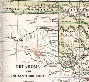
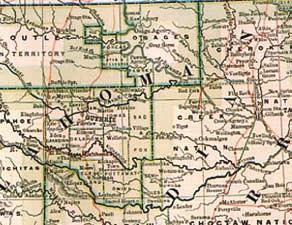
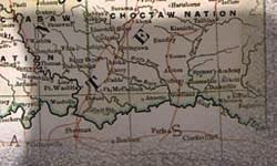
2 Students of All Ages: Your adventure is about to begin! Within these pages you will become a Geo-Detective exploring the six countries of Oklahoma. Yes, countries! Within Oklahoma you ll be traveling to unique places or regions called countries. Maybe you ve heard of Green Country with its forests and specialty crops, or Red Carpet Country, named for the red rocks and soil formed during the ancient Permian age. Each region or country you visit will have special interesting themes or features, plus fun and sometimes challenging activities that you will be able to do. You will notice each country or region can be identified by natural, economic, historic, cultural, geographic and geological features. The three maps you see on this page are examples of maps you might need for future GeoExplorations. As a Geo-Detective having fun with the following activities, you ll experience being a geographer and a geologist at the same time! So for starters, visit these websites and enjoy your Geo-Adventure: Gary Gress, Geographer Oklahoma Alliance for Geographic Education Neil Suneson, Geologist Oklahoma Geological Survey Indian Nations of Oklahoma Before and after the Civil War, tribal boundaries were constantly changing due to U.S. government policies. Eventually the Eastern and Western tribes merged into a state called Oklahoma, meaning (land of) red people. Oklahoma's 10 Geographic Regions - These regions reflect both physical features (topography) and soils. Oklahoma is one of few states with so many special areas. Geological Resources Map of Oklahoma - Oil and gas have been produced in Oklahoma for more than 100 years and coal has been mined for more than 125 years. In 2008, Oklahoma produced more gypsum than any other state in the country. 2


3 Destinations Oklahoma: Arbuckle Country old rocks, such as 1.4-billion-year-old Tishomingo Granite. The Arbuckles reach approximately 35 miles east-west and 10 to 15 miles north-south. Much of the mountain range is located in northern Carter County and southern Murray County. Geologists and students from around the world travel here to study these unique formations and their rich fossil beds. Arbuckle Country includes 10 of Oklahoma s 77 counties. Arbuckle Country also lies within the historic boundaries of the Chickasaw and the Choctaw Nations. The Washita River, the Red River and the Blue River flow through Arbuckle Country. This country also includes the Chickasaw National Recreation Area. Located near Sulphur, it is the only national recreation area in Oklahoma. The Chickasaw National Recreation Area is an ecotone, or meeting place, where two different ecosystems overlap. Here, the eastern deciduous forest meets mixed-grass prairie. Interstate 35 runs north and south through Arbuckle Country. Atoka, the county seat of Atoka County, was once a stop on the historic Butterfield Overland Stage Road the route of the first transcontinental United States mail. Today, U.S. 69 takes a southwest to northeast course from the Red River the southern boundary of Arbuckle Country through Atoka on its way to southeast Kansas. U.S. 77 parallels Interstate 35 throughout its course in Arbuckle Country. The 17-mile Chickasaw Turnpike offers a shortcut between Ada and the Sulphur/Davis area. Visitors to Arbuckle Country can experience four distinct ecoregions, ranging from the central great plains in the north to forests in the southeast. Roughly in its center lie Oklahoma s Arbuckle Mountains, containing some very Further to the west, Arbuckle Country also encompasses some of Oklahoma s rich heritage in oil and gas production. Within the boundaries of Arbuckle Country are sites that echo the state's energy heritage and history. Healdton, in western Carter County, was the site of the Healdton field. At its peak in 1916, it produced some 95,000 barrels of crude oil per day. Coalgate is the county seat of Coal County, named for the former major industry in the county. Turner Falls in the Arbuckle Mountains near Davis. (CIMC photo) 3

 Some of the cities and towns in Arbuckle Country include: Ada Lone Grove Ardmore Madill Atoka Pauls Valley Coalgate Stratford Davis Stringtown Durant Sulphur Healdton Tishomingo Lindsay Wynnewood")
4 Talk of the Towns Oklahoma has a combined shoreline that is longer than the Atlantic seaboard. Lakes, lakeside parks and resorts and recreation areas characterize Arbuckle Country. Some of Oklahoma s most popular lakes for swimming, boating and fishing are here, including Lake Texoma, Lake Murray and Lake of the Arbuckles. Lake Texoma is one of the two largest lakes between the Gulf of Mexico and the Great Lakes. (The second lake also is in Oklahoma. It is Lake Eufaula in Green Country and Kiamichi Country.) Some of the cities and towns in Arbuckle Country include: Ada Lone Grove Ardmore Madill Atoka Pauls Valley Coalgate Stratford Davis Stringtown Durant Sulphur Healdton Tishomingo Lindsay Wynnewood Speaking of... Arbuckle Country When you hear these words, you know someone is talking about Arbuckle Country: Arbuckle Mountains Stratford peaches Turner Falls Toy & Action Figure Museum Lake Texoma Brickfest Fort Washita Arbuckle Wilderness National Striper Festival Magnolia Festival Chickasaw National Recreation Area Oklahoma Shakespeare Festival Chickasaw Nation Gene Autry Lake Murray Choctaw Nation Tucker Tower Arbuckle-Simpson Aquifer Alfalfa Bill Murray Falls Creek Lincoln Bridge, Chickasaw National Recreation Area. (CIMC photo) Using the information found at the Chickasaw National Recreation Area website at design a brochure for water activities in Arbuckle Country. What types of water activities could you promote for the Chickasaw National Recreation Area? Why is this area known as a transition zone and why does that make this area unique? Look for additional activities in Destinations Oklahoma Lesson 1 in The Oklahoman! 4

, Pawnee, Sac & Fox and Seminole tribes, as well as the Alabama Quassarte, Kialegee")
5 Destinations Oklahoma: Frontier Country the commercial district was booming in the 1910s, Boley s growth was cut short by crop failures in the 1920s and the Great Depression in the 1930s. Many town residents left and did not return. Boley now has about 1,000 residents. Frontier Country includes 12 of Oklahoma s 77 counties. Frontier Country also encompasses all or part of multiple tribal jurisdictions. They include the Absentee Shawnee, Cheyenne-Arapaho, Chickasaw, Citizen Potawatomi, Iowa, Kickapoo, Muscogee (Creek), Pawnee, Sac & Fox and Seminole tribes, as well as the Alabama Quassarte, Kialegee and Thlopthlocco tribal towns. Several counties in this area are named for tribes, including Pottawatomie County (in honor of the Potawatomi tribe) and Seminole County (originally a part of the Seminole Nation). A part of Oklahoma's African-American heritage also is on view in Frontier Country. In Langston, visitors to Beulah Land Cemetery will see grave markers of town founders and former slaves reminders of the town s early history as one of the all-black towns in Oklahoma Territory. The community of Boley, on U.S. 62 in Okfuskee County, was one such all-black town. It was founded in 1903 by African-American railroad workers. The town attracted residents from other southern states who saw the community as a refuge from oppression. Although Major transportation routes of the past and present crisscross Frontier Country. The central stretch of historic Route 66 in Oklahoma reaches east to west across Lincoln, Oklahoma and Canadian Counties. Interstates 35 (north-south) and 40 A vintage sign along historic Route 66 in Stroud (CIMC photo) (east-west) intersect in Oklahoma City, making Frontier Country the crossroads of America. The historic Chisholm Trail cattle drive route of the frontier West today s U.S. 81 runs through Canadian and Grady counties. Oklahoma has some 220 miles of the historic trail between the Red River in the south and the Kansas border in the north. Tourist Information Centers in Frontier Country are located on Interstate 40 in Midwest City and on Interstate 35 north of Oklahoma City. Frontier Country s Oklahoma County is where the Oklahoma State Capitol sits. The site was chosen in 1915, on land donated by William Freemont Harn, an early developer of Oklahoma City and John James Culbertson. 5

6 It is the only state capitol with an oil well on its grounds. Although Governor Robert Williams moved into the capitol building in 1917, construction of the state capitol dome was not started until 2001 due to the cost. The dome was finally completed in time for Statehood Day on November 16, Visitors to Frontier Country encounter a landscape having features of both the central great plains and the cross timbers ecoregions. It is a landscape of prairie grasses and scattered hills between the less rugged regions to the west and the more hilly oak savanna to the east. Oil and gas wells are common. The Canadian, North Canadian and Cimarron Rivers traverse the landscape of Frontier Country. (The name Cimarron means wild or unruly in Spanish.) Talk of the Towns Some of the cities and towns in Frontier Country include: Boley Chandler Chickasha El Reno Guthrie Holdenville Norman Okemah Oklahoma City Purcell Seminole Shawnee Stillwater Wewoka Speaking of... Frontier Country When you hear these words, you know someone is talking about Frontier Country: Bricktown National Weather Center Route 66 Oklahoma City National Memorial State Capitol National Cowboy & Western Heritage Museum Stockyards City State Fair of Oklahoma Chisholm Trail Rush Springs watermelon Tinker Air Force Base National Softball Hall of Fame Boley Rodeo Run of 1889 Rose Rocks One of the Centennial Crossing sculptures in the land run monument, south of Bricktown in Oklahoma City. (CIMC photo) What is Route 66 and why is it important in Oklahoma and U.S. history? Using the website route66university.com/maps/oklahoma.php, can you name the three counties in Frontier Country that are home to historic Route 66? In what city is the Route 66 Museum located? Look for additional activities in Destinations Oklahoma Lesson 2 in The Oklahoman! 6


7 Destinations Oklahoma: Great Plains Country flats characteristic of the central great plains ecoregion. Traveling toward the east, the landscape becomes the wooded low hills, ridges and plains of the crosstimbers region. Heading west, visitors encounter the more rugged hills, canyons, plains and mesas of the southwestern tablelands. The Wichita Mountains are located in Great Plains Country. The Washita River and the Red River traverse the landscape of Great Plains Country. Besides the Red River itself, three of its tributaries the Elm Fork, the Salt Fork and the North Fork of the Red River flow through Great Plains Country. Great Plains Country includes 14 of Oklahoma s 77 counties. Great Plains Country also encompasses all or part of multiple tribal jurisdictions. They include the Apache, Arapaho, Caddo, Cheyenne, Chickasaw, Comanche, Delaware, Kiowa and Wichita & Affiliated tribes. Three high spots rise above Great Plains Country. Each is over 2,400 feet high. These spots are Antelope Hills in northern Roger Mills County, Mount Scott in the Wichita Mountains of northern Comanche County and Quartz Mountain in Greer and Kiowa Counties. The Antelope Hills once marked the boundary between the United States and Mexico. Major transportation routes of the past and present form the rough boundaries of Great Plains Country in the north and east. Historic Route 66 and Interstate 40 shadow one another across the north. The Chisholm Trail cattle drive route U.S. 81 runs along the eastern edge. The southern boundary of Great Plains Country is the Red River and its western edge is the Texas state line. Tourist Information Centers in Great Plains Country are located on Interstate 40, between the Texas state line and Sayre, in Beckham County; and on Interstate 44, north of Walters, in Cotton County. The landscape of the Great Plains Country is also the perfect setting for some of Oklahoma's numerous ghost As visitors enter Great Plains Country, they most often see a landscape of scattered hills, low mountains and sandy Scenery within the Wichita Mountains. (CIMC photo) 7

8 towns. A ghost town is a town that has disappeared completely or has suffered a drastic drop in its population. In Great Plains Country, places like Binkman in Greer County, Cornish in Jefferson County and Meers in Comanche County fit that definition. Still identified on the official state map, these communities today are mostly reminders of the lives once lived there. Meers remains well-known for its hamburgers and an Oklahoma Geological Survey seismograph station. Speaking of... Great Plains Country When you hear these words, you know someone is talking about Great Plains Country: Wichita Mountains Route 66 museums Bison Southwest Oklahoma Black Kettle Ft. Sill Battle of the Washita Geronimo U.S. Army Field Artillery Center and School Oklahoma spaceport Meers burgers Chisholm Trail museums Quartz Mountain Quanah Parker Prairie dog towns Texas Longhorn cattle Rattlesnake round-ups Indian City USA George Armstrong Custer Mount Scott Altus Air Force Base Red Rock Canyon Meers Store Talk of the Towns Some of the cities and towns in Great Plains Country include: Altus Anadarko Cheyenne Clinton Cordell Duncan Elk City Frederick Hobart Hollis Lawton/Ft. Sill Lone Wolf Mangum Meers Sayre Walters Waurika Weatherford Bison in the Wichita Mountains. (OKAGE photo) Using the index page of the Web Atlas of Oklahoma at you will see that the geology of the Great Plains dates back many years. Find the maps that allow you to answer the following questions. 1. Rocks of which four geologic ages (periods) occur in Great Plains country? 2. Describe a geologic fold and fault. Are there any faults in Great Plains Country? If so, in what counties are they located? Look for additional activities in Destinations Oklahoma Lesson 3 in The Oklahoman! 8

, Osage, Ottawa, Pawnee, Peoria, Quapaw, Seneca-Cayuga, Shawnee, United Keetoowah Band of Cherokees and Wyandotte tribes.")
9 Destinations Oklahoma: Green Country Verdigris are major rivers in Green Country. The Illinois River is a designated scenic river. The historic Cimarron River of the frontier West briefly enters Green Country before it joins with the Arkansas River north of Mannford. Green Country includes 18 of Oklahoma s 77 counties. Green Country also encompasses all or part of multiple tribal jurisdictions. They include the Cherokee, Eastern Shawnee, Modoc, Miami, Muscogee (Creek), Osage, Ottawa, Pawnee, Peoria, Quapaw, Seneca-Cayuga, Shawnee, United Keetoowah Band of Cherokees and Wyandotte tribes. Visitors will encounter seven ecoregions in Green Country, giving this region one of the most diverse landscapes in Oklahoma. A mixture of rolling plains, low hills, tallgrass prairie and oak-hickory forest characterize the center of Green Country from north to south. To the west, visitors will encounter a more rugged landscape as the plains and prairies give way to the eastern red cedar and oak forests of the crosstimbers region that characterizes much of central Oklahoma. A wedge of the grasslands and stony soils of the Flint Hills dips down from Kansas to the north. To the east, visitors experience more of Green Country s natural oak-hickory and oakhickory-pine forests, wooded hills and ridges and native bottomland forest. The Arkansas, Canadian, Illinois and The landscape of Green Country includes features that are unique in Oklahoma and in America. The Tallgrass Prairie Preserve, in Osage County, covers more than 39,000 acres and represents the largest protected remnant of tallgrass prairie on Earth. With over 600 miles of shoreline, Lake Eufaula in McIntosh County is the largest lake located entirely in Oklahoma. Green Country is also home to the head of navigation along Oklahoma s waterway to the world. A skyward view of Price Tower in Bartlesville, designed by Frank Lloyd Wright. (CIMC photo) From the Port of Catoosa, northeast of Tulsa one of the largest and most inland river ports in America the McClellan-Kerr Arkansas River Navigation System is a 440-mile route for shipping all the way to the Gulf of Mexico and beyond. Completed by the U.S. Army Corps of Engineers in 1971, the McClellan- Kerr uses 18 locks and dams along the Verdigris River, Arkansas River, Arkansas Post Canal and the White River. This system creates a staircase of water to move barges, usually in blocks of eight barges (each barge being 35 feet wide and 195 feet long), to the Mississippi River. Named for Arkansas Senator John McClellan and Oklahoma Senator Robert S. Kerr, the McClellan-Kerr handles an average of 13 million tons of cargo each year. Its location allows the waterway to remain operational all year. The landscape of Green Country also encompasses the Ozark Plateau National Wildlife Refuge. The refuge 9
, became the East Shawnee Trail in 1866 and was one of the")
10 was formerly called the Oklahoma Bat Caves National Wildlife Refuge because of the number of endangered bat species found there. Talk of the Towns Some of the cities and towns in Green Country include: The old Texas Road, used heavily during the Civil War ( ), became the East Shawnee Trail in 1866 and was one of the first cattle trails to cross the area. Today, a network of state and U.S. highways, historic routes and turnpikes crisscross Green Country. Major east-west routes across Green Country include State Highway 10 and U.S. 60 in the north and Interstate 40 in the south. Major north-south routes include U.S. 75, U.S. 59, U.S. 69 and U.S. 169, as well as State Highways 48, 99 and 82. Speaking of... Green Country When you hear these words, you know someone is talking about Green Country: Bartlesville Claremore Eufaula Jay Miami Muskogee Nowata Okmulgee Pawhuska Pryor Sallisaw Sapulpa Stilwell Tahlequah Tulsa Vinita Wagoner Philbrook Museum of Art U.S.S. Batfish Tallgrass Prairie Oklahoma Music Hall of Fame and Museum Sequoyah Will Rogers Memorial Frank Lloyd Wright Lake Eufaula Oklahoma State Championship Chili Cook-Off Woolaroc Tom Mix Gilcrease Museum Five Civilized Tribes Museum Pawnee Bill Art Deco Oklahoma Jazz Hall of Fame Frank Phillips Nellie Johnstone No. 1 Glenn Pool The Tulsa Union Depot in downtown Tulsa, an example of PWA-style Art Deco and now home to the Oklahoma Jazz Hall of Fame. (CIMC photo) Caves in Oklahoma are found in karst topography and have very specialized ecosystems, including endangered species. What is karst topography? Where in Green Country do you find karst topography? How did the karst topography develop in Green Country and what is the age of the rocks found in the formation? What do you know about caves and their inhabitants? Look for additional activities in Destinations Oklahoma Lesson 4 in The Oklahoman! 10


11 Destinations Oklahoma: Kiamichi Country Kiamichi Country includes 7 of Oklahoma s 77 counties. Visitors will experience three ecoregions in Kiamichi Country. In the north, the landscape may be the most diverse, presenting a mosaic of plains, floodplains, hills, terraces and scattered mountains. At the heart of Kiamichi Country lie the Ouachita Mountains. These low, forested mountains of oak, hickory and pine include the largest remaining tract of unharvested old growth oak-shortleaf pine habitat in America. The red-cockaded woodpecker, an endangered species, also lives here. The Ouachita Mountains are one of the few mountain ranges in America that run east and west. Hernando De Soto s party of explorers from Spain crossed these rugged yet scenic mountains in French expeditions came later, leaving behind their language in the names of places in the region. (The name Ouachita is the French spelling of a Native American word meaning good hunting ground. ) In the shadow of the Ouachita Mountains, Cavanal Hill near Poteau is often called the world s tallest hill at 1,999 feet. To the south, visitors encounter the edge of the southern coniferous forest belt. This region is the home of the bald cypress tree, a relative of the redwood. These trees, which can grow to heights of 80 to 100 feet and live for hundreds of years, provided a raw material for drums, canoes and housing to the early Choctaws. Kiamichi Country s Muddy Boggy Creek and the Blue River in Arbuckle Country are the only uncontrolled waterways in Oklahoma that flow into the Red River on their way to the Gulf of Mexico. As a result, estuarine fish and the American eel are found here. The lower Red River in Kiamichi Country flows that direction but is impeded by Lake Texoma. The Poteau River is the only Oklahoma river that flows northward. Looking up from below a cliff in Robbers Cave State Park. (CIMC photo) Long before statehood, Kiamichi Country was a transportation crossroads and a witness to America s westward expansion. The Butterfield Overland Mail Route from St. Louis to San Francisco began after a contract was signed in 1857 for delivering the mail. The route was one of the first transcontinental links between east and west. It cut through what is today Kiamichi Country, where stops included the homes of prominent members of the Choctaw Nation in places like Skullyville, in present-day LeFlore County and in Red Oak, now in Latimer County. These stops allowed for meals and changes of horses. Local blacksmiths also kept the horses, mules and wagons on the move. The Spiro Mounds Archaeological Center, north of Poteau in LeFlore County, is Oklahoma's only archaeological park. 11

12 Its 150 acres encompass 12 southern mounds containing evidence of the ancient inhabitants who occupied the site from the years 850 to The area was the center of a culture that influenced the entire American southeast. Many people consider the Spiro Mounds one of the most important archaeological sites in America. The Spiro Mounds Archaeological Center conducts special guided tours during the summer solstice in June, the winter solstice in December and the vernal equinox in March. Archaeologists explain the history of the mounds excavation and why some of the mounds line up for the solstice and equinox sunsets. Talk of the Towns Some of the cities and towns in Kiamichi Country include: Antlers Broken Bow Hartshorne Heavener Hugo Idabel Krebs McAlester Pocola Poteau Stigler Spiro Valliant Wilburton Today, Kiamichi Country remains a crossroads. The Indian Nation Turnpike crosses north to south along its western edge. State Highway 1, entering Kiamichi Country from west of McAlester, continues to the Arkansas state line. State Highway 3, which reaches northwest all the way to the Colorado state line, travels through Kiamichi Country from west of Antlers to the very southeastern tip of the state, just east of Tom. U.S. 70 reaches across the southern edge of Kiamichi Country and heads west across much of southern Oklahoma. Speaking of... Kiamichi Country When you hear these words, you know someone is talking about Kiamichi Country: Alligators Fall foliage Italian Festival Talimena Drive Jack Fork Mountains Cavanal Hill Acrocanthosaurus Choctaw Nation Runestone Swamp rabbit Robbers Cave Ouachita Uplift Bald Eagles Winding Stair Mountains Fishing in Beavers Bend Resort Park near Broken Bow. (CIMC photo) Kiamichi Country is well known for its mountains and forests. Perform an Internet search on the term Little Dixie in Oklahoma. Why is that term used today for Oklahoma s Kiamichi Country? Look for additional activities in Destinations Oklahoma Lesson 5 in The Oklahoman! 12


13 Destinations Oklahoma: Red Carpet Country Red Carpet Country includes 16 of Oklahoma s 77 counties. When Oklahoma Territory was established in 1890, numbers designated the first seven counties and counties added later were designated by letters. For example, Blaine County originally known as County C takes its name from James G. Blaine, a U.S. senator and presidential candidate. Another Red Carpet Country county, Cimarron County, is the only county in America that is bordered by four states: Colorado, Kansas, New Mexico and Texas. Kenton, in the far northwest of the county, is the only town in Oklahoma within the Mountain Time Zone (one hour earlier than the rest of the state, which is within the Central Time Zone). Red Carpet Country encompasses all or part of multiple tribal jurisdictions. They include the Arapaho, Caddo, Cheyenne, Delaware, Kaw, Otoe-Missouria, Ponca, Tonkawa and Wichita & Affiliated tribes. Visitors will encounter three ecoregions in Red Carpet Country. Most of Red Carpet Country has the landscape of the central great plains. Red rocks of the Permian Age, low mountains and scattered hills and salt plains and sand dunes characterize this landscape. The Glass (or Gloss) Mountains, which formed millions of years ago, rise just south of the Cimarron River in Major County. Heading west toward the Panhandle, the scenery changes to the high plains and to the more rugged southwestern tablelands of canyons, buttes and mesas. This scenery rivals that of New Mexico and Arizona, without being as massive. Three major rivers the Cimarron River, the North Canadian River and the Canadian River cross the landscape of Red Carpet Country. Black Mesa, in the northwest corner of Cimarron County, is the highest point in Oklahoma at 4,973 feet. The salt plains near Jet in Alfalfa County are an unusual geological area. The 11,000-acre area is nearly flat with a thin crust of salt. This formed when waters from ancient Permian formations evaporated, depositing thick layers of salt. Groundwater travels through the salt-saturated sand and reaches the surface, where it evaporates, leaving the crust of salt. Little Sahara State Park, south of Waynoka, has more than 1,600 acres of sand dunes between 25 and 75 feet high. (OKAGE photo) The concentrated saline solution combines with gypsum to promote selenite crystal growth in a portion of the salt flats. Selenite crystals in the Salt Plains National Wildlife Refuge have a dark design that resembles an hourglass in their centers. This shape is only found at the Salt Plains in Oklahoma's Red Carpet Country, earning the hourglass selenite the title of state crystal. 13

14 Talk of the Towns Indispensable to the early settlers in Red Carpet Country was the windmill. The windmill brought a scarce resource water to the surface using an abundant resource the prairie winds. The Shattuck Windmill Museum and Park in Shattuck displays dozens of rare and restored windmills from 1870 to State Highway 3 crosses Red Carpet Country east to west from Kingfisher to the Colorado state line. U.S. 64 travels along the northern edge of Red Carpet Country. A state tourist welcome center is located on Interstate 35 near Blackwell in Kay County. Local tourist information centers are located in Guymon, Woodward and Enid. Some of the cities and towns in Red Carpet Country include: Alva Arnett Beaver Blackwell Boise City Buffalo Enid Fairview Fort Supply Freedom Guymon Kingfisher Ponca City Slapout Tonkawa Waynoka Watonga Woodward Speaking of... Red Carpet Country When you hear these words, you know someone is talking about Red Carpet Country: Black Mesa Alabaster Caverns Northwest Passage Selenite crystal Chisholm Trail Great Salt Plains Cow chip throwing Little Sahara Rattlesnake round-ups Land Run of 1893 Harvey House Bat flights Pioneer Woman Panhandle Coronado Santa Fe Trail Roman Nose Cherokee Strip Glass Mountains E.W. Marland 101 Wild West Rodeo Buffalo wallows Ogallala aquifer Sod House Museum Part of Oklahoma s frontier heritage on display in Ellis County. (courtesy Shattuck Windmill Museum and Park) Imagine you are going on a scavenger hunt around Red Carpet Country. Mark on a map where you would have to go to find these souvenirs. 1. The only U.S. city to be bombed during World War II. 2. Tracks made by a dinosaur with a hip height of about 6 feet and body length of about 25 to 30 feet. 3. A picture or autograph of George Armstrong Custer. 4. The dairy sample that is the main product from a festival in this Red Carpet Country town. 5. About 14,000 of 22 different species of bats that hibernate here. Look for additional activities in Destinations Oklahoma Lesson 6 in The Oklahoman! 14


15 Destinations Oklahoma was developed by: CareerTech Curriculum and Instructional Materials Center Craig Maile, Manager Melinda Hawk, Electronic Documents Specialist Oklahoma Geological Survey Randy Keller, Director Connie Smith, Information Specialist Neil Suneson, Geologist Oklahoma Alliance for Geographic Education Gary Gress, Coordinator and Geographer Eugene Earsom, Program Director Brooke Barnett, Communications and Development Specialist Jayne Marley, Teacher Consultant from Yukon Public Schools Robin Plumb, Teacher Consultant from Oklahoma State Regents for Higher Education Helen Chaney, Teacher Consultant from Wilson Public Schools


16 Oklahoma Department of Career and Technology Education To learn more about Oklahoma s CareerTech System, including the Technology Center nearest you, visit: CIMC Curriculum and Instructional Materials Center Oklahoma Department of Career and Technology Education To learn more about the CIMC s Touring Oklahoma curriculum, plus Cyber Tour Routes for each Country area, visit: Oklahoma Alliance for Geographic Education Teacher Training Curriculum Development Outreach Programs and More! Our Mission OKAGE is helping to spread geographic literacy through the prek-16 curriculum by providing high-quality professional development opportunities and classroom-ready materials for teachers. Our Programs Through a year-round series of workshops, training institutes, field studies and conferences, OKAGE is the primary source of information and professional development opportunities for geography educators in Oklahoma. Help Your Students Become Globally Aware Membership in OKAGE and most of our programs are free. Visit today and click Become an OKAGE Member to get started. 100 East Boyd, SEC 442 Norman, OK Tel: Toll Free x 5832 okage@ou.edu
Frequently Called Numbers
 Frequently Called Numbers OKDHS: Main number............. 405-521-3646 Aging Services Division......... 405-521-2281 In-Home Personal Care/ ADvantage Program.. 1-800-435-4711 Child Care, Division of 405-521-3561
OKLAHOMA HISTORY OKLAHOMA S GEOGRAPHY
 OKLAHOMA HISTORY OKLAHOMA S GEOGRAPHY BOARD QUESTIONS 1) HOW BIG IS OKLAHOMA? 2) HOW MANY COUNTIES ARE IN OKLAHOMA? 3) HOW FAR IS IT FROM OKC TO LAS ANGLES, CALIFORNIA? 4) HOW MANY STATE BORDER OKLAHOMA?
Oklahoma Enterprise Zones
 Oklahoma Enterprise Zones 2007-2008 Last Updated: November 9, 2007 For further information, please contact: Oklahoma Department of Commerce Steven Barker Email: steven_barker@okcommerce.gov Phone: 1-405-815-5182
Oklahoma State Department of Health
 Oklahoma State Department of Health Nurse Aide Registry List of Approved Training Programs as of: February 15, 2018 ( see last page for Legend) CEP Headmasters (D & S Diversified) 3701179 3310 McHugh Dr
APPROVED TRAINING FACILITY CODE
 APPROVED TRAINING FACILITY CODE Rev. 12/22/15 (RED: Facility closed but can test students through date listed in Comments.) Type Facility Name Facility Code # Address City State Zip Phone Approval Date
Oklahoma State Department of Health
 Oklahoma State Department of Health Nurse Aide Registry List of Approved Training Programs as of: February 10, 2016 ( see last page for Legend) ADC CEP DAILY LIVING CENTERS 3701557 3000 N. ROCKWELL AVE
Oklahoma State Department of Health
 Oklahoma State Department of Health Nurse Aide Registry List of Approved Training Programs as of: March 10, 2017 ( see last page for Legend) CEP Headmasters (D & S Diversified) 3701179 3310 McHugh Dr Helena
Native American Heritage in GRAND CENTRAL USA!
 Native American Heritage in GRAND CENTRAL USA! Day 1 Lawton OK Sulphur OK - Oklahoma City OK We begin our day with a tour of Fort Sill National Historic Landmark & Museum, a 19 th century frontier army
Ada Arts and Heritage Center Ada 4. Chickasaw Cultural Center Ada 4. City of Ada Park Department Ada 4
 Members of the Association appear in bold; those accredited by the American Association of Museums are designated by an asterisk. District numbers appears after the city. Ada Arts and Heritage Center Ada
***NEW RESTRICTIONS***
 STATE HWY START DATE CITY/AREA COUNTY D TURNPIKE INTERSTATE US HWY DESCRIPTION ***NEW S*** START DATE CITY/AREA COUNTY D TURNPIKE INTERSTATE US HWY STATE HWY DESCRIPTION PER TITLE 47:14-103C STATE WIDE
Bartlesville Area History Museum Bartlesville 1. Bartlesville Community Center Bartlesville 1
 Members of the appear in bold; those accredited by the American Alliance of Museums are designated by an asterisk. District numbers appears after the city. Bartlesville Area History Museum Bartlesville
[Artspace] at Untitled Oklahoma City th Meridian Museum Erick Ranch Old-Timers Association Ponca City Contemporary Tulsa 1
![[Artspace] at Untitled Oklahoma City th Meridian Museum Erick Ranch Old-Timers Association Ponca City Contemporary Tulsa 1](/thumbs/78/77687567.jpg "[Artspace] at Untitled Oklahoma City th Meridian Museum Erick Ranch Old-Timers Association Ponca City Contemporary Tulsa 1") Members of the appear in bold; those accredited by the American Alliance of Museums are designated by an asterisk. District numbers appears after the city. [Artspace] at Untitled Oklahoma City 5 100th
Members of the appear in bold; those accredited by the American Alliance of Museums are designated by an asterisk. District numbers appears after the city. [Artspace] at Untitled Oklahoma City 5 100th
Restricted Use Pesticide List. Name Address City State Zip Phone Fax Attention Contact Remarks
 Page 1 of 15 Name Address City State Zip Phone Fax Attention Contact Email Printed DT FEE County Region Owner ID Status Branch NELSON FEED AND SEED INC (918) 689-2632 - 200 N FRONT ST EUFAULA OK 74432-2625
Bartlesville Area History Museum Bartlesville 1. Bartlesville Community Center Bartlesville 1
 Members of the appear in bold; those accredited by the American Alliance of Museums are designated by an asterisk. District numbers appears after the city. Bartlesville Area History Museum Bartlesville
Tulsa County (72G) DHS 6128 E 38th St Line Rd. PO BOX Stilwell 74960
 DHS 6128 E 38th St Line Rd. PO BOX Stilwell 74960") County/# Licensing Specialist Supervisor Regional Program Manager Adair 01 Nancy Wolf Sandra Coleman Adair County (01) Craig County (18) V RR1 BOX 42 310 N Wilson HWY 100 & Section Vinita 74301 Line Rd
County/# Licensing Specialist Supervisor Regional Program Manager Adair 01 Nancy Wolf Sandra Coleman Adair County (01) Craig County (18) V RR1 BOX 42 310 N Wilson HWY 100 & Section Vinita 74301 Line Rd
There are actually six geographic sub-regions, three in both the uplands and the lowlands.
 6 Regions of AR Although Arkansas is most easily divided into two distinct geographical regions, the northwestern uplands and the southeastern lowlands, this description does not accurately portray the
Choctaw Locations for Recycling Containers
 Choctaw Locations for Recycling Containers District County Name of facility Address District 9 Bryan Choctaw Recycling Center 3408 Wes Watkins Blvd. Durant, OK District 4 LeFlore Choctaw Recycling Center
What Is An Ecoregion?
 Ecoregions of Texas What Is An Ecoregion? Ecoregion a major ecosystem with distinctive geography, characteristic plants and animals, and ecosystems that receives uniform solar radiation and moisture Sometimes
Region 1 Piney Woods
 Region 1 Piney Woods Piney Woods 1. This ecoregion is found in East Texas. 2. Climate: average annual rainfall of 36 to 50 inches is fairly uniformly distributed throughout the year, and humidity and temperatures
OVERVIEW. Starting in the fall of 2015, the Oklahoma Aeronautics Commission (OAC), in partnership with the Federal Aviation Administration (FAA)
, in partnership with the Federal Aviation Administration (FAA)") OVERVIEW The State of Oklahoma has an extensive system of public airports and a vast array of aviation and aerospace-related activities. Aviation is essential to the state s transportation network and
OVERVIEW The State of Oklahoma has an extensive system of public airports and a vast array of aviation and aerospace-related activities. Aviation is essential to the state s transportation network and
Fluoridation Census SEPTEMBER -1993
 Fluoridation Census SEPTEMBER -1993 U.S. DRTMENT OF HEALTH & HUMAN SERVICES Public Health Service Centers for Disease Control and Prevention National Center for Prevention Services Division of Oral Health
17951(05) 4 IS , ,705 IMY (369) 132 IR COMMISSION ACTION DATE: 07/ (05) 4 IS , ,705
 4 IS , ,705 IMY (369) 132 IR COMMISSION ACTION DATE: 07/ (05) 4 IS , ,705") 04/25/2002 OKLAHOMA DEPARTMENT OF TRANSPORTATION PAGE: 1 07:41:05 DELETIONS AND ADDITIONS TO PREVIOUSLY APPROVED BID OPENINGS JBPDC031 COMMISSION MEETING MAY 6, 2002 PROJECTS DELETED FROM APRIL 2002 BID
04/25/2002 OKLAHOMA DEPARTMENT OF TRANSPORTATION PAGE: 1 07:41:05 DELETIONS AND ADDITIONS TO PREVIOUSLY APPROVED BID OPENINGS JBPDC031 COMMISSION MEETING MAY 6, 2002 PROJECTS DELETED FROM APRIL 2002 BID
2014 OKLAHOMA CLASS C FOOTBALL PLAYOFFS
 2014 OKLAHOMA CLASS C FOOTBALL PLAYOFFS @ CHEROKEE CHIEFS - 62 MOUNTAIN VIEW-GOTEBO TIGERS - 12 @ CAVE SPRINGS HORNETS - 36 DEER CREEK-LAMONT EAGLES - 63 @ BLUEJACKET CHIEFTANS - 56 WEBBERS FALLS WARRIORS
OKLAHOMA HISTORIC BRIDGE SURVEY Phase 1 A Re-Evaluation of Spans of Time: Oklahoma Historic Highway Bridges
 OKLAHOMA HISTORIC BRIDGE SURVEY Phase 1 A Re-Evaluation of Spans of Time: Oklahoma Historic Highway Bridges Verdigris River 1925 Mixed Truss, Wagoner County Bird Creek 1912 Stone Arch, Osage County Oklahoma
OKLAHOMA'S HISTORIC ROUTE 66 AUDIO TOUR
 OKLAHOMA'S HISTORIC ROUTE 66 AUDIO TOUR Oklahoma s Historic Route 66 Audio Tour, created by the Oklahoma Historical Society, is an informative online audio tour that showcases the state's heritage and
02/21/2013 OKLAHOMA DEPARTMENT OF TRANSPORTATION PAGE: 2 09:04:10 FINAL MAY 2013 BID OPENING JBPRC068 JOB PIECE CD HIGHWAY MILES ADV.
 02/21/2013 OKLAHOMA DEPARTMENT OF TRANSPORTATION PAGE: 1 09:04:10 FINAL MAY 2013 BID OPENING JBPRC068 24832(04) 6 CO RD 5.000 0 0 0 3,657,000 3,657,000 ALFALFA CO. RD. ON EW-25 FROM 1.0 MI. W. OF ALFALFA
Resource & Relocation Guide
 County Ok 2017-2018 Resource & Relocation Guide Table Of Contents 4-5 Newcomer Information 6 Health & Hospitals 7 Local Education 9 Things To Do 10 State Information 11 County History 12-13 Tulsa County
4th Grade Third 9 Weeks Test
 4th Grade Third 9 Weeks Test Multiple Choice Identify the choice that best completes the statement or answers the question. 1 A waterway for ships that is dug across land is called a. A port C river B
South Texas Plains. Texas, Our Texas
 South Texas Plains This is a region characterized by considerable variety. Climatically, the South Texas Plains region is sub-humid to dry. The in the north part of the South Texas, erosion of the Edwards
***NEW RESTRICTIONS***
 STATE HWY CITY/AREA COUNTY D TURNPIKE INTERSTATE US HWY DESCRIPTION ***NEW S*** START DATE CITY/AREA COUNTY D TURNPIKE INTERSTATE US HWY STATE HWY DESCRIPTION 7.1.13 ALL ALL NA NA NA NA PLEASE READ ******
OKLAHOMA (Route 66 Mother Road s Glory Days)
") OKLAHOMA (Route 66 Mother Road s Glory Days) Little Rock to Fort Smith 159 mi. / 2 hr. 30 min. / I-40 Fort Smith to Oklahoma City - 182 miles / 2 hr. 53 min. / I-40 Oklahoma City to Erick (last city before
OKLAHOMA (Route 66 Mother Road s Glory Days) Little Rock to Fort Smith 159 mi. / 2 hr. 30 min. / I-40 Fort Smith to Oklahoma City - 182 miles / 2 hr. 53 min. / I-40 Oklahoma City to Erick (last city before
Physical Regions of the U.S.
 Physical Regions of the U.S. Quickly use this map to label the map on your paper Pacific Coast The coast from southern California to Alaska The region of the Pacific Northwest has a long history that was
Oklahoma Airport System Plan. Executive Summary
 Oklahoma Airport System Plan Executive Summary System Planning Process System Planning Process The airport system planning process consists of seven primary activities: maintaining inventories of airport
Flying W Guest Ranch. Oklahoma - Beckham County - Elk City
 Flying W Guest Ranch Oklahoma - Beckham County - Elk City 2 Flying W Guest Ranch is a well-known guest ranch in a historic location about 90 miles west of Oklahoma City near Elk City, Oklahoma. Situated
2019 OKLAHOMA BOYS CLASS 3A BASKETBALL
 2019 OKLAHOMA BOYS CLASS 3A BASKETBALL #1 REDSKINS 58 3:30 PM at Southern #17 HERITAGE CRUSADERS 48 #5 SEQUOYAH INDIANS 56 REDSKINS 55 SEMIFINALS Friday PM at Southern Nazarene University REDSKINS 60 8:30
Bratt ") 4. % F l o r i d a D e s i g n a t e d P a d d l i n g T r a i l s ") 164 «97 ") 99. Barrineau Park. M a p 1. M a p 2.
 4. % F l o r i d a D e s i g n a t e d P a d d l i n g T r a i l s ) 164 «97 ) 99. Barrineau Park. M a p 1. M a p 2.") F l o r i d a D e s i g n a t e d P a d d l i n g T r a i l s Bratt ") 4 Bluff Springs «4 Jay ") P e r d i d o R i v e r P e r d i d o CR R99A i v Walnut e r Hill ") 164 ") 97A «89 «97 ") 197 Barrineau
F l o r i d a D e s i g n a t e d P a d d l i n g T r a i l s Bratt ") 4 Bluff Springs «4 Jay ") P e r d i d o R i v e r P e r d i d o CR R99A i v Walnut e r Hill ") 164 ") 97A «89 «97 ") 197 Barrineau
University of Oklahoma Libraries Western History Collections. Earl C. Russell Collection
 University of Oklahoma Libraries Western History Collections Earl C. Russell Collection Russell, Earl C. Records, 1939 1953. 4 feet. Collector. Correspondence (1949 1953); membership reports and rosters
CONTRACTED PHARMACIES PHARMACY AND DME PROVIDERS TABLE OF CONTENTS SEPTEMBER 25, 2018 OKLAHOMA HEALTH CARE AUTHORITY
 CONTRACTED PHARMACIES AND DME PROVIDERS TABLE OF CONTENTS SEPTEMBER 25, 2018 Oklahoma Health Care Authority's provider directories are for reference purposes only. Every effort is made to ensure that we
26 Utah s Patchwork Parkway SCENIC BYWAY CORRIDOR MANAGEMENT PLAN (SR 143)
") Natural Natural Quality applies to those features in the visual environment that are in a relatively undisturbed state. These features predate the arrival of human populations and may include geological
Natural Natural Quality applies to those features in the visual environment that are in a relatively undisturbed state. These features predate the arrival of human populations and may include geological
CONTRACTED PHARMACIES PHARMACY AND DME PROVIDERS TABLE OF CONTENTS JANUARY 24, 2018 OKLAHOMA HEALTH CARE AUTHORITY
 CONTRACTED PHARMACIES AND DME PROVIDERS TABLE OF CONTENTS JANUARY 24, 2018 Oklahoma Health Care Authority's provider directories are for reference purposes only. Every effort is made to ensure that we
OKLAHOMA DEPARTMENT OF TRANSPORTATION
 PROJECT NO.: STPY-0C()SS CALL ORDER: 00 COUNTY: ALFALFA DESCRIPTION: BID OPENING OF September 8, 0 September 8, 0 GRADE, DRAIN, SURFACE, AND BRIDGE J.P. NUMBER 0 PROPOSAL NUMBER: 0 HIGHWAY NO: US- US-:
Curriculum Pacing Guide Grade/Course 5 Th Grade Geography Grading Period 1 st Nine Weeks
 2013-2014 Curriculum Pacing Guide Grade/Course 5 Th Grade Grading Period 1 st Nine Weeks Time Frame Unit/ photographs, pictures, and tables to Locate and identify: Continents and Oceans -North America
AGENDA FOR THE SPECIAL TRANSPORTATION COMMISSION MEETING HELD IN THE ODOT BUILDING COMMISSION MEETING ROOM OKLAHOMA CITY, OKLAHOMA
 AGENDA FOR THE SPECIAL TRANSPORTATION COMMISSION MEETING HELD IN THE ODOT BUILDING COMMISSION MEETING ROOM OKLAHOMA CITY, OKLAHOMA DATE: Monday, October 12, 2015 TIME: 11:00 a.m. PLACE: Commission Meeting
Section 1: Vocabulary. Be able to determine if the word in bold is used correctly in a sentence.
 Section 1: Vocabulary. Be able to determine if the word in bold is used correctly in a sentence. Hardships: difficult conditions or situations that cause discomfort and/or suffering Pioneers: the people
A History of West Chicago
 A History of West Chicago The Prairie Prairie Inhabitants Winfield Mounds Dickson Mounds, near Lewistown, in southern Illinois. An example of what Native burial mounds look like. First Permanent Settlers
DATE : July 23, 2008
 PROJECT NO.: BRF-110C(117)CO J.P. NUMBER: 2047204 CALL ORDER: 060 PROPOSAL NUMBER: 080076 COUNTY: CARTER HIGHWAY NO.: COUNTY ROAD EW-200 DESCRIPTION: BRIDGE & APPROACHES LOCATION : COUNTR ROAD (EW-200):
BIRDING Lake Fayetteville
 BIRDING Lake Fayetteville Lake Fayetteville is an impoundment of Clear Creek, created as a water supply for Fayetteville in 1949. With development of other water supplies, especially Beaver Lake, Lake
FOR PRESENTATION AT THE COMMISSION MEETING OF DECEMBER 7, 2015
 FOR PRESENTATION AT THE COMMISSION MEETING OF DECEMBER 7, 2015 AGENDA ITEM NO. 176 SUBJECT: COUNTY: BID OPENINGS STATEWIDE This item consists of the final February 2016 bid opening for $154,221,475, the
2015 Brain Wrinkles. SS8G1b
 SS8G1b Georgia is a geographically diverse state that is divided into five regions. The first three regions (Appalachian Plateau, Valley and Ridge, and Blue Ridge) are in the mountains and foothills of
UNIQUE REASONS to WRITE about OKLAHOMA. UNIQUE REASONS to WRITE about OKLAHOMA.
 46 UNIQUE REASONS to WRITE about OKLAHOMA 46 UNIQUE REASONS to WRITE about OKLAHOMA In 1907, Oklahoma became the 46 th state in the Union. This book highlights a few of the remarkable communities and attractions
Missouri, Kansas & Texas Railway
 Missouri, Kansas & Texas Railway MISSOURI-KANSAS-TEXAS RAILROAD................................................. November 1, 1921 FD 1250 and FD 2511 Approved 12/4/1922 To control Missouri-Kansas-Texas
4th Grade Social Studies 2nd Nine Weeks Test
 4th Grade Social Studies 2nd Nine Weeks Test Multiple Choice Identify the choice that best completes the statement or answers the question. 1 Which is the largest city in the United States? A Philadelphia,
INTRODUCTION 250,000
 INTRODUCTION The United States of America has over 250,000 rivers, with a total of about 3,500,000 miles of rivers. The main stems of 38 rivers in the United States are at least 500 miles (800 km) long.
Bat Cave Canyon Ranch 2,920 acres Jeff Davis County, Texas
 Bat Cave Canyon Ranch 2,920 acres Jeff Davis County, Texas James King, Agent Office 432.426.2024 Cell 432.386.2821 James@KingLandWater.com Bat Cave Canyon Ranch 2,920 acres Jeff Davis County, Texas James
OKLAHOMA DEPARTMENT OF TRANSPORTATION DATE : August 21, 2002 BID OPENING OF August 22, 2002
 PROJECT NO.: BRFY-NBIP(210) J.P. NUMBER: 1942904 CALL ORDER: 010 PROPOSAL NUMBER: 020395 COUNTY: ADAIR HIGHWAY NO.: SH-51 DESCRIPTION: BRIDGE PAINTING LOCATION : SH-51 OVER EVANSVILLE CREEK, 2.9 EAST OF
The Palmetto Trail: Linking the Mountains to the Sea
 The Palmetto Trail: Linking the Mountains to the Sea Jana Locklair Pine Ridge Middle School jlock794@aol.com Overview Students will be given the opportunity to become familiar with the landform regions
SS8G1 The student will describe Georgia with regard to physical features and location.
 SS8G1ab Standards SS8G1 The student will describe Georgia with regard to physical features and location. a. Locate Georgia in relation to the region, nation, continent, and hemispheres. b. Describe the
Ak-Chin Indian Community. Est. 1912
 Ak-Chin Indian Community Population: 575 (related to Tohono O odham and Akimel O'odham people) Size: 22,000 acres (34 sq miles) Industry: Agriculture, industrial park, ranching Attractions: Harrah s Ak-Chin
Pinellas County Environmental Lands
 Pinellas County Environmental Lands In addition to traditional parks and recreation facilities, Pinellas County owns and manages a system of environmental lands that provides specialized resource-based
njt Iow Your personalised ebrochure call Not Just Travel Isle of Wight direct on: created: 19 March 2016
 njt Iow Your personalised ebrochure created: 19 March 2016 call Not Just Travel Isle of Wight direct on: 01983716727 Route 66 Motorcycle Tour Travel Dates - Other dates are available Flights economy class
Chapter 20. The Physical Geography of Africa South of the Sahara
 Chapter 20 The Physical Geography of Africa South of the Sahara Chapter Objectives Identify the major landforms, water systems, and natural resources of Africa south of the Sahara. Describe the relationship
Welcome to the Midwest!
 Welcome to the Midwest! Why do we call the Midwest "America's Heartland"? 5 9 7 4 2 Farm State 6 8 1 St. Louis 3 St. Louis, Missouri "Gateway to the West" Frontier: the beginning of unexplored land Pioneers:
OKLAHOMA DEPARTMENT OF TRANSPORTATION DATE : August 24, 2000 BID OPENING OF August 24, 2000
 PROJECT NO.: E-SAP-102B(30) J.P. NUMBER: 1859604 CALL ORDER: 010 PROPOSAL NUMBER: 000407 COUNTY: ALFALFA HIGHWAY NO.: SH-11 DESCRIPTION: BRIDGE REPAIR LOCATION : ON SH-11 OVER THE SALT FORK RIVER OVERFLOW
OKLAHOMA DEPARTMENT OF TRANSPORTATION DATE : February 20, 2013 BID OPENING OF February 21, 2013
 PROJECT NO.: NHPPY-203N(012)3P J.P. NUMBER: 2972604 CALL ORDER: 040 PROPOSAL NUMBER: 130075 COUNTY: ATOKA HIGHWAY NO.: SH-7/SH-3 DESCRIPTION: RESURFACE (UTBWC) LOCATION : SH-3/SH-7: SH-3, BEGIN AT US-69,
Saratoga, Wyoming RIVERBEND LODGE. page 1
 Saratoga, Wyoming RIVERBEND LODGE page 1 A BRIEF HISTORY OF THE AREA Wyoming s rich history is laced with tales of transportation and trails as first the Native Americans, then the fur traders, mountain
*Based on annual projected sales tax revenue of $615 million provided by Yes for 779.
 STATE QUESTION 779 PROJECTED FINANCIAL IMPACT* County ALFALFA ALFALFA ALFALFA BEAVER BEAVER BEAVER BEAVER BECKHAM BECKHAM BECKHAM BECKHAM BLAINE BLAINE BLAINE BLAINE District CAVE SPRINGS DAHLONEGAH GREASY
Education Job Funds Award Number S410A CFDA A
 01 ADAIR C001 SKELLY 16,693 01 ADAIR C019 PEAVINE 41,320 01 ADAIR C022 MARYETTA 117,974 01 ADAIR C024 ROCKY MOUNTAIN 40,119 01 ADAIR C028 ZION 66,286 01 ADAIR C029 DAHLONEGAH 28,514 01 ADAIR C032 GREASY
Overland Stagecoach Service through Tucson If it weren t for stagecoaches, Tucson wouldn t have developed to be the town we see today!
 Ring s Reflections by Bob Ring Overland Stagecoach Service through Tucson 1857-1880 If it weren t for stagecoaches, Tucson wouldn t have developed to be the town we see today! Let s set the stage (sorry).
National Clandestine Laboratory Register - Oklahoma
 ADAIR BUNCH 26676 EAST 888 ROAD 7/10/2006 ADAIR BUNCH rt 1 235 2/17/2004 ADAIR STILWELL 120 NORTH 7TH STREET 7/2/2007 ADAIR STILWELL 120 SOUTH SEVENTH 8/22/2007 ADAIR STILWELL 6 RURAL ROUTE 1605 9/6/2007
Utah Studies DOMINGUEZ AND ESCALANTE
 Utah Studies THE WORLD IN THE 1400 S In the 1400 s merchants in Europe wanted to buy and sell goods with people in faraway places. Some of the reasons for this desire to trade with the world were: the
U.S. National Forest Campground Guide
 U.S. National Forest Campground Guide Southwestern Region Arizona, New Mexico, Oklahoma and Texas National Forests and Grasslands in the Southwestern Region NF = National Forest NG = National Grassland
Treaty Oaks Ranch 323+/- Acres Hood County, Texas $1,776,500
 Bret Polk Mobile: (254) 965-0349 Office: (214) 361-9191 Treaty Oaks Ranch 323+/- Acres Hood County, Texas $1,776,500 LOCATION: The ranch is located in a desirable area 10+/- miles south of Granbury, Texas,
The Santa Cruz Valley National Heritage Area. National Heritage Area. A heritage-based economic development strategy
 The Santa Cruz Valley National Heritage Area National Heritage Area A heritage-based economic development strategy Santa Cruz Valley Heritage Alliance Our Mission: Connect people to the cultural, historic,
PHOTOGRAPHS WRITTEN HISTORICAL AND DESCRIPTIVE DATA
 Spanning Coon Creek Hulah Vicinity Osage County Oklahoma PHOTOGRAPHS WRITTEN HISTORICAL AND DESCRIPTIVE DATA HISTORIC AMERICAN ENGINEERING RECORD Submitted to: Oklahoma State Historic Preservation Office
Subject to Sale, Withdrawal or Error
 We are proud to offer an exclusive listing on a ranch in a very highly desired part of Northeast New Mexico. This ranch truly expresses the long understood real estate requirements of location, location,
Increase or. Midyear adjusted State Aid. County School/District Name Initial State Aid
 Increase or County School/District Name Initial State Aid Midyear adjusted State Aid decrease in dollars ADAIR PEAVINE 604,820 604,070 ($750) ADAIR MARYETTA 2,997,016 2,995,042 ($1,974) ADAIR ROCKY MOUNTAIN
University of Oklahoma Libraries Western History Collections. Works Progress Administration Historic Sites and Federal Writers Projects Collection
 University of Oklahoma Libraries Western History Collections Works Progress Administration Historic Sites and Federal Writers Projects Collection Works Progress Administration (WPA) Historic Sites and
The Natchez Trace The DAR and its Tishomingo County Connection
 The Natchez Trace The DAR and its Tishomingo County Connection Presented By Cindy Whirley Nelson, Chapter Regent, 2006-2008, Chief Tishomingo Chapter DAR Since the time pre-historic tribes roamed the hills
OKLAHOMA DEPARTMENT OF TRANSPORTATION DATE : February 14, 2007 BID OPENING OF February 15, 2007
 PROJECT NO.: BRO-103D(059)CO J.P. NUMBER: 2110304 CALL ORDER: 020 PROPOSAL NUMBER: 070001 COUNTY: ATOKA HIGHWAY NO.: COUNTY ROAD DESCRIPTION: BRIDGE & APPROACHES LOCATION : COUNTY ROAD; OVER DELAWARE CREEK,
G R E E N R I V E R - W Y O M I N G - S W E E T W A T E R C O U N T Y
 G R E E N R I V E R - W Y O M I N G - S W E E T W A T E R C O U N T Y Minor Ranch All information contained herein is taken from sources considered reliable, but is not guaranteed by either seller nor
APPENDIX 19-II. Ontario Trail Network Trailheads EAST-WEST TIE TRANSMISSION PROJECT AMENDED ENVIRONMENTAL ASSESSMENT REPORT
 EAST-WEST TIE TRANSMISSION PROJECT AMENDED ENVIRONMENTAL ASSESSMENT REPORT APPENDIX 19-II Ontario Network heads Report. 1536607/2000/2219 Ontario Network heads in the n-commercial Land and Resource Use
Please send corrections or changes to
 Please send corrections or changes to ajbain@lawtonps.org 100 Meters 1 Standokes Duncan Ada 10.74 2 Blades Glenpool Skiatook 10.84 3 Smith East Central Tulsa Washington 10.86 4 Johnson II East Central
2.0 PARK VISION AND ROLES
 2.0 PARK VISION AND ROLES 2.1 Significance in the Protected Area System Marble Range and Edge Hills provincial parks protect 6.8% of the Pavillion Ranges Ecosection, which is located in the Southern Interior
Mills Pecos River Ranch 7800 Acres Val Verde County, Texas Situated along both sides of the Pecos River
 Mills Pecos River Ranch 7800 Acres Val Verde County, Texas Situated along both sides of the Pecos River James King, Agent Office 432-426-2024 Cell 432-386-2821 James@KingLandWater.com King Land & Water
University of Oklahoma Libraries Western History Collections. Burrell Tibbs Collection
 University of Oklahoma Libraries Western History Collections Burrell Tibbs Collection Tibbs, Burrell. Printed materials, 1898 1918. 1.50 foot. Collector. Scrapbooks containing newspaper stories and clippings
Driving Time: 3 hours (allow extra time for stops)
") Scenic Byways loop This journey takes visitors through the eastern edge of Mt. Rainier National Park and along two of Washington s most beloved scenic byways, the Chinook Byway and the White Pass Scenic
Scenic Byways loop This journey takes visitors through the eastern edge of Mt. Rainier National Park and along two of Washington s most beloved scenic byways, the Chinook Byway and the White Pass Scenic
Saturday, June 17 to Sunday June 25, Stampede to Cody
 Saturday, June 17 to Sunday June 25, 2017 Stampede to Cody Wind River Canyon Wind River Canyon is a scenic Wyoming canyon carved out by the Wind River. It is located between the cities of Shoshoni and
Moving West with the Forts: Using an Interactive Map Mary S. Black
 Moving West with the Forts: Using an Interactive Map Mary S. Black Subject: Texas history Grade level: 7 Rationale or Purpose: Students will read a map of Texas forts and analyze westward movement from
Get Your Kicks on Route 66
 Get Your Kicks on Route 66 This week, we go for a ride through the colorful history of Route 66, a road that has been called "The Main Street of America. The idea for Route 66 started in Oklahoma. Citizens
Northwest Arkansas Heritage Trail Plan
 Northwest Arkansas Heritage Trail Plan A regional network of bicycle and pedestrian facilities that connects Northwest Arkansas citizens and visitors to our rich heritage, our recreational and cultural
EXPLORING EARTH S SURFACE. Lesson 4
 EXPLORING EARTH S SURFACE Lesson 4 Introduction Lewis and Clark In 1804, an expedition set out from near Saint Louis to explore the land between the Mississippi River and the Pacific Ocean, The United
IOWA ORNITHOLOGISTS' UNION - Birding Sites in Linn County
 IOWA ORNITHOLOGISTS' UNION - Birding Sites in Linn County Printed on 6/15/2018 Bever Park (ebird Hotspot) GPS Coordinates: 41.9851219,-91.6269125 Restrooms Parking Trails ADA Accessible Trails Boyson Trail
Physical. and. Human-made. Features
 Directions for Making a Geographic Features Vocabulary Book 1. Cut the photographs boxes out of page 2 and sort the them into two groups: physical features and human-made features. 2. Correctly match each
Secretary Directory 11/28/2011
 Secretary Directory 11/28/2011 Oklahoma State University Cooperative Extension Service Cimarron Texas Beaver Harper Ellis Woodward Woods Alfalfa Major Grant Noble Garfield Pawnee Dewey King- Payne Tulsa
2015 Brain Wrinkles. SS8G1b
 SS8G1b Standards SS8G1 The student will describe Georgia with regard to physical features and location. b. Describe the five geographic regions of Georgia; include the Blue Ridge Mountains, Valley and
Leasing Brochure. Park Plaza Shopping Center 1150 N. Federal Highway, Pompano Beach, Florida Under Construction - Coming Very Soon
 Park Plaza Shopping Center 1150 N. Federal Highway, Pompano Beach, Florida 33062 Leasing Brochure Under Construction - Coming Very Soon Exclusive Leasing Broker 2048 East Sample Road, Lighthouse Point,
SAN MIGUEL CREEK RANCH. q Trinidad, Las Animas County, Colorado q
 SAN MIGUEL CREEK RANCH q Trinidad, Las Animas County, Colorado q 2 s San Miguel Creek Ranch is a scenic well-balanced cattle and trophy hunting ranch that showcases the very best of Southern Colorado.
Presidential Proclamation -- Establishment of the Castle Mountains National Monument
 Presidential Proclamation -- Establishment of the Castle Mountains National Monument ESTABLISHMENT OF THE CASTLE MOUNTAINS NATIONAL MONUMENT - - - - - - - BY THE PRESIDENT OF THE UNITED STATES OF AMERICA
Introduction to Africa
 Introduction to Africa Did you know? Africa has more countries than any other continent. The Sahara is a desert that is the size of the U.S. It s the world's largest desert. Most of the world s gold and
FRONTIER TRAILS Tour groups cruising through the
 on location: midwest randy mink NEBRASKA S FRONTIER TRAILS Tour groups cruising through the heart of Nebraska don t have to stray far from the superhighway to get a taste of early life on the prairie.