The ACT Government is committed to making its information, services, events and venues, accessible to as many people as possible.
|
|
|
- Kerrie Simpson
- 5 years ago
- Views:
Transcription

1
2 The ACT Government is committed to making its information, services, events and venues, accessible to as many people as possible. If you have difficulty reading a standard printed document and would like to receive this publication in an alternative format such as large print or audio please telephone (02) If English is not your first language and you require the translating and interpreting service please telephone If you are deaf or hearing impaired and require the TTY typewriter service please telephone (02)
3 Contents Executive summary 1 1 Introduction Why review planning for the town centre? Study area 5 2 Background: Gungahlin past and future History of Gungahlin Town Centre Gungahlin Town Centre today The future Gungahlin District 9 3 Public consultation The consultation process The community s key issues 10 4 The planning report in detail Design concept Commercial issues Community and recreation land needs Public realm and precincts Residential and mixed-use development Transport Environment and heritage issues 45 5 Recommendations Recommended changes to the Territory Plan Form of proposed draft variation 52 6 References 53 Attachments 53 Attachment A: The Territory Plan Maps 54 Attachment B: Land availability comparison 57 Attachment C: Comments received in initial public consultation 58
4 Tables Table 1: Office floorspace in other town centres 2010 (NLA) 18 Table 2: Shopping and services floorspace in other town centres 21 Table 3: Possible future community and recreation facilities 26 Table 4: Proposed zone changes to the Territory Plan 49 Figures Figure 1: Study area 5 Figure 2: Development status of land 8 Figure 3: Street and block pattern 14 Figure 4: Open space network 15 Figure 5: Proposed land use 16 Figure 6: Inter-town public transport 17 Figure 7: Proposed office precincts 19 Figure 8: Proposed shopping and services areas 21 Figure 9: Proposed entertainment precinct 23 Figure 10: Proposed zoning for community and recreation facilities 28 Figure 11: Block pattern and structure 32 Figure 12: Open space network 33 Figure 13: Retail core cross section a 36 Figure 14: Retail core cross section b 36 Figure 15: Business core cross section a 37 Figure 16: Business core cross section b 37 Figure 17: Active frontages on Hibberson Street 38 Figure 18: Proposed ring road system 44 Figure 19: Location of proposed zone changes 48
5 Executive summary Gungahlin Town Centre has developed rapidly over the last seven years with about half the land in the town centre already developed or committed to development. The results of almost two decades of planning are being seen. It is timely to review progress and to assess whether the current planning framework is producing the town centre that Gungahlin residents desire. This planning report reviews the overall design of the town centre and considers requirements for shops, offices, community facilities, transport, structure of the town centre and building design. Its focus is to ensure there is enough land for commercial and community purposes for a centre serving a town that will ultimately have a population of about 100,000 people. The report s objectives are: to identify key planning, transport and urban design issues to review existing planning frameworks and planning controls, including zoning and building heights to recommend actions that address the key issues identified and guide future development, such as a strategy for land use and transport. Extensive consultation has been undertaken, both within the ACT Government and with the community. This included a round of public consultation, presentations to Gungahlin Community Council public meetings and meetings with major commercial lessees. The following key issues were identified: more space required for future offices and employment traffic planning, particularly in improving the way traffic and shoppers mix on Hibberson Street planning for future bus stations planning for future entertainment and recreation facilities. In developing the proposed land use and transport changes, the following principles have been applied: build on the existing built form rather than aiming for radical re-invention. This includes maintaining the main street approach a number of mid-sized retail centres on Hibberson Street, rather than one large enclosed retail centre; and continuing to allow a mix of land uses, where this does not compromise the ability of the town centre to grow as the population grows provide long term flexibility in planning, and encourage it in the design of the built form this is critical as the town centre will need to change and adapt as Gungahlin s population grows emphasise the significance of the public spaces between the buildings, for example by minimising overshadowing this is critical to a main street type of centre where people use these spaces to recreate, socialise and walk to work, shops and services promote environmentally sustainable development, e.g. by maximising convenient access to public transport. 1
6 Based on these principles and issues identified during consultation, the ACT Planning and Land Authority (ACTPLA) has developed key land use actions in the town centre including: provide land for future offices to the east of the existing shopping centres, along the spine of Hibberson Street provide additional land for future retail expansion immediately around the existing retail core retain the existing community facility precincts, but encourage future community facilities to be integrated with other uses create mixed-use residential areas to the northern and southern edges of the town centre to encourage after-hours activity in the town centre and provide a transitional buffer to surrounding areas maintain the existing grid street pattern, and extend it to undeveloped areas to the east of the current shopping centres to create a town centre that is easy for pedestrians to navigate and encourages walking co-locate the entertainment precinct with the major shopping centres to encourage after hours activity in the retail core. The current restriction on building heights is generally four storeys. This is reviewed in the planning report and changes to the building height controls are proposed to promote a more compact urban form that provides for taller buildings, while limiting overshadowing to public spaces and protecting the human scale to the street that exists. Some of the changes to the building height controls include: maintain a consistent built form edge to the street (street wall) to reduce the opportunity for overshadowing to main pedestrians areas and promote a scale that is balanced to the road reserve width introduce building envelopes that allow heights of approximately five storeys at the perimeter of sections (blocks) while allowing taller buildings towards the centre of blocks (reducing overshadowing to main pedestrian areas and allowing for greater densities within the town centre). Co-location of complementary activities and land uses can be effective in reducing the number of trips people need to make and the distance of trips. Fewer and shorter trips will contribute to lower levels of carbon emissions and lower private transportation costs. Co-location and higher densities can promote improved access and use of public transport and a shift from use of private cars to other modes of transport including walking, bicycles and public transport. 2

7 In consultation with the Department of Territory and Municipal Services (TAMS the ACT Government s key transport system deliverer), changes to the transport system for the town centre have been developed as follows: The road hierarchy will be changed to a ring road system to divert the main flow of traffic away from Hibberson Street. This is supported by other measures such as requiring retail activity, pedestrian movement and public transport as the primary design criteria for future upgrades of Hibberson Street. This report includes an extension of The Valley Ave to Gundaroo Drive, which will reduce the impact of future traffic growth on Burgmann School, while reinforcing the ring road system. This road extension will cross an area currently zoned as urban open space, but which is not currently used for active recreational purposes. This report proposes that in the long term, public transport will remain on Hibberson Street, from the eastern edge of the town centre to Gozzard Street; and that several stops will be located in the town centre, rather than a single public transport interchange. This approach is similar to the new bus stations in the Belconnen town centre. ACTPLA understands that planning changes of this scale will attract community interest. To give the community an opportunity to have their voices heard another major round of public consultation will be held with the release of this planning report and the accompanying draft variation to the Territory Plan. This will give the Community Council, commercial lessees and the broader community the opportunity to comment on detailed wording of proposed planning changes. 3
8 1 Introduction 1.1 Why review planning for the town centre? Gungahlin Town Centre has developed rapidly over the last seven years and the results of almost two decades of planning are being seen. It is timely to review progress so far and assess whether the current planning framework is producing the desired outcomes for the town centre. In 2008, the ACT Government allocated funding for a planning study to consider planning issues in Gungahlin Town Centre. During the planning study, ACTPLA commissioned a transport study of the town centre and a bushfire risk assessment to the Mulanggari Grassland Nature Reserve to inform this report. While developing this report and the accompanying draft variation to the Territory Plan, ACTPLA talked to a broad range of stakeholders. During these discussions there was widespread support for the distinctive urban village character of the town centre, which is quite different to Canberra s other town centres. However, the community also identified a number of areas where it would like to see changes to the planning of the centre, including: reserving more space for future offices and employment traffic planning, particularly in improving the way traffic and shoppers mix on Hibberson Street planning for future bus stations planning for future entertainment and recreation facilities. The report and draft variation include a detailed plan that considers a wide range of issues important to the future of the town centre, protects the positive aspects of the centre and addresses changes the community would like to see. Some of the key issues are: commercial space needs, such as sites for future offices community space needs, such as sites for churches and child care centres transport needs, such as reservations for public transport routes and facilities existing and future character of development, such as building heights planning provisions used to guide development in the town centre. 1.2 Study area This report has focussed on the commercial part of the suburb of Gungahlin and the undeveloped land directly adjacent. This area runs from Gundaroo Drive in the west to the edge of the new suburb of Franklin in the east; and from the Mulanggari Grasslands in the south to the undeveloped area behind the Emergency Services Centre in the north (Figure 1). This report does not include immediately adjacent areas such as Yerrabi, Palmerston, Franklin or the Mulanggari Grasslands. However, the impacts of the proposal on these areas have been considered. These are discussed in part four of this report. 4

9 Figure 1 Study area 5
10 6
11 2 Background: Gungahlin past and future 2.1 History of Gungahlin Town Centre Canberra s planning is based on a series of new towns, each with a town centre that is a major hub for employment, shopping, social activities and public transport. Gungahlin is the fourth of these towns, after Woden/Weston Creek, Belconnen and Tuggeranong. A town centre for Gungahlin has been planned, close to the current location, since the Y Plan was developed by the National Capital Development Commission in The Y Plan proposed an urban settlement pattern that involved a series of new towns with separate town centres, However the form of the Gungahlin Town Centre and the transport network to support it have changed greatly over time. The biggest change came in the early 1990s. Increasing awareness of environmental issues led to a review of Gungahlin s central area. The Mulanggari Grasslands area was declared prohibited for development due to its status as native grassland with high ecological value. Changes were implemented through Territory Plan variation No. 53 in 1995 which modified the location of the town centre and formally adopted the urban village design for the town centre. This approach includes the following features: different land uses mixed together, including commercial and residential a mix of building types and heights transit-oriented, with direct public transport connections to other centres open-air shopping fronting onto a main street a street network designed to keep vehicle speeds low and encourage walking and cycling, but still provide easy access by car small enough for easy walking but large enough to support a wide range of activities and facilities public spaces and street network designed to encourage pedestrian movement buildings designed to encourage home-based employment capacity for change and adaptation over time smaller rather than larger-scale development an open space spine from north to south (Gungahlin Place) a north-south/east-west grid street pattern. In 1996, responsibility for the town centre was handed to the former government s Gungahlin Development Authority. Its master plan for the town centre proposed major changes to the design of the town centre. While it was never formally adopted, some elements of this plan were implemented. For example, the commercial and community facility development north of Anthony Rolfe Avenue was largely converted to residential development without providing alternative land for commercial and community uses elsewhere in the town centre. This led to potential undersupply of commercial and community land in the town centre. As an interim measure to address this undersupply, the restructured Territory Plan introduced in March 2008 rezoned undeveloped land to the east of the town centre for commercial and community uses. 7

12 2.2 Gungahlin Town Centre today The town centre, consistent with the urban village approach, has a cluster of four medium-sized retail developments rather than a single large mall. Each is based on one large supermarket or discount department store that functions as an anchor for each retail development block. These centres have street frontages generally consisting of shops, cafes and restaurants. Immediately west of this retail core are a number of fast food outlets, restaurants and the Canberra Raiders Club. Further west are lower-rent developments for shopping and services including Magnet Mart, service stations and a veterinary clinic. The area north of Anthony Rolfe Avenue and east of Gozzard Street is largely developed and is almost entirely residential, with a small number of shops under dwellings on Anthony Rolfe Avenue. In addition to the areas of the town centre that are already built, a number of sites are committed or sold but not yet built on including: the Government secondary college, library, aquatic centre and oval sites south of Hibberson Street, some of which are under construction most of the land adjacent to Magnet Mart which has recently seen major earthworks (sold for a homemaker shopping centre) the Woolworths car park (sold for expansion of the Woolworths shopping centre). The remaining uncommitted land is mostly east of the retail core between Hinder Street and Franklin residential estates and south of the retail core between Gribble Street and the Mulanggari Grasslands. Figure 2 shows the current status of land in the town centre. Figure 2 Development status of land 8

13 2.3 The future Gungahlin District At the last Census, the population of Gungahlin District was estimated to be 32,550 (Australian Bureau of Statistics 2007). By 2019, the district is expected to accommodate around 55,000 people. When fully developed, the population is likely to be between 90,000 and 100,000; similar to the current populations of Belconnen and Tuggeranong. When this population is reached depends on overall growth of Canberra region, and how much of the growth goes to other parts of Canberra and surrounding NSW. New housing is currently being developed in Franklin, Forde, Bonner, Crace and Casey. Over the period to 2019, these suburbs will be completed and new suburbs started or commenced, including Moncrieff (north of Ngunnawal) and Kenny (south of Harrison). Outside the town centre a number of new commercial centres will be built in Gungahlin. Other districts contain group centres such as Erindale in Tuggeranong and both Kippax and Jamison in Belconnen, which have one or two major supermarkets suitable for weekly grocery shopping. Gungahlin does not have a group centre yet, but will eventually have four at Amaroo, Casey, Moncrieff and Kenny. Future suburbs of Gungahlin will also have access to local centres. These are smaller shopping centres such as those already operating at Palmerston, Ngunnawal and Nicholls. 9
14 3 Public consultation 3.1 The consultation process Initial consultation for this report was undertaken in May and June Most submissions supported the direction of ACTPLA s draft concept for the town centre. Since then, ACTPLA has conducted a number of consultation meetings with key stakeholders to help find out how the community would like to see the town centre grow and improve, and to set a strong planning framework for the centre as it grows over the next thirty years. Public consultation has included: a major round of public consultation on an issues paper and draft design concept in May/June Almost 130 surveys and submissions were received four presentations to Gungahlin Community Council public meetings, plus extensive ongoing contact with the council s executive four presentations to ACTPLA s Commercial Advisory Committee a number of additional meetings with major commercial lessees, including two workshops looking at draft planning controls in December 2008 and ACT Government agencies consultation This report has been guided by a working group which includes Land Development Agency (LDA) and the Department of Territory and Municipal Services transport experts. ACT Government agencies were included in the initial public consultation in May June ACTPLA has also worked closely with various ACT Government project teams on a number of major projects underway in the town centre including the leisure centre, enclosed oval and college. This ensures the report s outcomes will facilitate rather than hinder these projects. This report is one way ACTPLA is informing the community of the proposed changes. The accompanying draft variation provides further information on proposed changes to the Territory Plan. The draft variation public consultation period offers a major opportunity for community comment. 3.2 The community s key issues An issues paper and concept report was released for public comment in May and June Since then ACTPLA has held several public consultation meetings and workshops. Both positive and negative comments were made about the centre. Some of the key issues include: Commercial issues: submissions and surveys strongly supported more employment in the town centre. Many of the submissions indicated a desire to reserve sites for offices with only one response against offices coming to Gungahlin Town Centre. Entertainment: many submissions and survey replies wanted more entertainment activities in the town centre, particularly cinemas and pubs or bars. Many were also positive about having restaurants and activities with longer business hours in the main shopping area. 10
15 Community and recreation land needs: many submissions and survey replies called for more community facilities. Some of the facilities suggested included a larger library and health centre or aquatic centre, which are already planned in the town centre by the ACT Government. Most people thought these facilities should be in the town centre rather than other parts of Gungahlin District. Active frontage: during the retailers workshop in December 2009, concern was expressed about the commercial viability of mandatory active frontages on blocks in Gozzard Street and Hibberson Street (east of Hinder Street) as the topography may discourage foot traffic. Hibberson Street and Gungahlin Place: several submissions indicated there is too much traffic on Hibberson Street. Some suggestions included diverting traffic through other streets and closing off Hibberson Street to all cars. Gungahlin Place linear park was seen by many people as being too exposed to weather conditions, too wide and not having enough green areas. Retailers raised concern that the traffic and limited weather protection hindered people from moving across Gungahlin place to adjacent shopping centres. Consequently, this could make shopping in the town centre unpleasant and make people shop elsewhere. Protecting neighbouring homes: a small number of submissions and survey responses raised issues with having a town centre close to houses, such as traffic and noise. Car parking: although parking was a popular issue during consultation, views about it were very mixed. Some submissions said there was not enough parking with others being happy with the amount of parking provided in the town centre. Some suggested basement parking as the preferred parking as it is undercover, while others preferred ground-level parking areas. Walking and cycling: footpath and cycle path connections were frequently raised during consultation. Retailers and shopping centre owners emphasised the importance of providing an opportunity for people to walk from one centre to another as easily as possible. Traffic: Hibberson Street traffic was an issue that was raised at all levels of consultation. Other major traffic issues raised were the amount of traffic passing the Burgmann School and the need for upgrades on Gundaroo Drive. Several people mentioned the need to plan for future growth in traffic as the town centre grows. Public transport: many submissions and surveys called for more frequent public transport with more stops, a bus interchange and the need to reserve a site for an interchange. Bushfires: two submissions called for this report to consider bushfires entering the town centre from the Mulanggari Grasslands.. Mulanggari Grasslands and nearby protected heritage sites: a very small number of submissions were received on the Mulanggari Grasslands Nature Reserve. Several sought improved pedestrian and cycling access through the nature reserve. One was strongly opposed to any changes to the nature reserve and was concerned about the possible impact of the town centre. The ACT Government s environment and heritage agencies have advised that heavy recreation activities through the grasslands and heritage sites could degrade the grasslands. However, the grasslands can be visited by the public on designated mown trails. 11

16 Retail provision in the town centre was a key issue raised. The submissions and surveys received on this issue were quite mixed. In the short term, some wanted additional shops and longer business hours, but others said there should not be any more major shops until the population of the district has grown. In the longer term, there was a mix of views on how shopping should grow. Many of the submissions and surveys wanted the current style of smaller shopping centre with street-front cafes and shops. A smaller number of people preferred one large centre similar to Belconnen and Woden town centres. In the retail core, centre owners and some others preferred expansion on the existing four sites over new sites. Another key issue was the design of the retail core. ACTPLA has had a number of detailed discussions on these issues with centre owners, retailers and the Gungahlin Community Council executives. Generally, these groups would like a detailed master plan developed for the town centre which will allow the centre owners to make investment decisions with a high level of certainty. The master plan would need to cover issues such as locations of entrances to shopping centres, landscape design, location of on-street retailing, street design, bus stop locations and so on. In response to the key issues and suggestions raised, ACTPLA has made a number of planning and urban design changes, which are detailed in the following sections. Note: Please refer to Attachment B for a summary of comments received during the initial public consultation in
17 4 The planning report in detail 4.1 Design concept Goals and objectives The goals and objectives for the town centre aim to reinforce the positive characteristics of the centre and improve its structure. They are overarching urban design considerations for the centre that take into account access and movement, built form, public realm, streetscape, structure, parking, safety, adaptability and sustainability. The goals and objectives for the town centre are: value and build on the urban village approach adopted in earlier planning provide opportunities for people to live, work and recreate provide a mix of land use types and densities provide a structure to the town centre that is robust, while recognising the changing needs of the centre continue the main street character to Hibberson Street that promotes quality of public realm and a human scale to the built form provide opportunity for a variety of public transport modes provide a street network designed for low vehicle speeds that allows for convenient pedestrian and cycle access balance and protect residential amenity with the commercial uses promote social inclusion by providing accessible commercial and community facilities build on the distinct public domain character and provide opportunity for variety and change in the public realm encourage flexibility and innovation in design of the built form and open space. 13
18 4.1.2 Key features of the design concept The design concept applies the goals and objectives to the structure of the town centre. The key features of the design concept include: Enhance the street and block pattern The proposed street layout will provide a clear hierarchy of individual streets that are easy to navigate and that contribute to the overall structure of the town centre. This includes extending the existing street grid pattern to the east. A ring road system, using The Valley Avenue and Anthony Rolfe Avenue, is introduced to direct most of the through traffic off Hibberson Street along the edge of the town centre. Parking and loading areas are to be provided to the rear of development allowing private vehicles to access parking from lanes. The proposed road structure promotes Hibberson Street as a pedestrian friendly environment. The street and block pattern is illustrated below in Figure 3. Figure 3 Street and block pattern 14

19 Extend the existing landscape features The new road structure allows for the open space network to better connect to surrounding suburbs and access routes. The proposed open space network connects significant landscape features next to the town centre and will provide opportunities for convenient cycle and pedestrian access routes into the centre. The proposed open space network provides a hierarchy of open space that embraces the environmental qualities that were started for the public domain, such as solar access and water management. It protects and values the Mulanggari Grasslands south of the town centre and the open space west of the enclosed oval. A wide open space spine has been introduced to the east of the town centre that provides a significant north-south access route and links the grasslands to the north and south of the town centre. The proposed open space network is illustrated below in Figure 4. Figure 4 Open space network 15

20 Define land use and precincts The land use considers and builds on existing precincts with retail uses along the main street, residential uses along the access corridor, and the introduction of an office precinct to the east of the town centre. The design concept maintains and reinforces the urban village approach and lifestyle, and the main street style of development. The proposed land uses encourage activity in the existing retail core and provide opportunities for significant employment. This reinforces a pedestrian focus for Hibberson Street and Gungahlin Place. The retail core and office precinct are flanked by mixed-use residential, providing opportunities for increased retail development and residential intensification. Land for community facilities is located throughout the town centre and it is intended these will be incorporated into other developments. The proposed land use is illustrated below in Figure 5. Figure 5 Proposed land use 16
21 Improve way-finding including parking and public transport Several measures are proposed to help people find their way around and through the centre. These include an entry address at key locations to signify arrival to the centre, with clear sign posts at arterial roads and entry gates at the edge of the centre. A more legible street pattern and road hierarchy will define a border around the edge of the centre. The grid street pattern will also help to improve access in and around the town centre along new streets, open space networks, footpaths, cycle ways and public transport routes. The Inter-town Public Transport (ITP) route is to be realigned along the main street (Hibberson Street) to provide convenient and accessible public transport stations, close to the retail centre. The current ITP route along Anthony Rolfe Avenue is to be retained as an alternative route. This is illustrated below in Figure 6. Figure 6 Inter-Town Public Transport 17
22 4.2 Commercial issues This section outlines proposals for commercial activity (e.g. shops and offices) in the town centre. Gungahlin Town Centre will be the major commercial centre for Gungahlin District. Town centres traditionally have a department store (e.g. Myer or David Jones), discount department stores (e.g. Big W, Kmart or Target), major supermarkets, hardware stores and various small retailers. The other town centres also have a number of large offices which provide employment close to homes and boost retail spending Offices What is the issue? Office developments at town centres bring major benefits, including reducing travel times to work, boosting retail spending in the town centre and increasing public transport use. However, it has been very difficult to attract offices to Gungahlin Town Centre. Office development at the earlier town centres was facilitated by the Commonwealth Government, which instructed agencies where to locate. This was stopped in the early 1990s. Now Gungahlin Town Centre needs to compete for tenants in the commercial property market. The Government has recently sold office sites to try to attract offices to the town centre. Given the uncertainty about Commonwealth office location, it is difficult to estimate an amount of land to set aside for office space. The location of offices in the centre is also an issue. Offices can have a large impact on the areas around them. They bring large amounts of business for nearby shops, services and cafes. However, an area dominated by offices usually has little activity at night and on weekends. This can cause public safety risks if it is not well managed. Large offices also bring large amounts of traffic (Section 4.6). Response This report responds to the community s strong views in support of offices by reserving enough land for up to 200,000m 2 of office space 1 sufficient to accommodate 10,000 office jobs. This is similar to the space developed at the Belconnen and Woden town centres and greater than office development at the Tuggeranong Town Centre (Table 1). Table 1 Town Centre Office floorspace in other town centres 2010 (NLA) Current Floorspace Belconnen Town Centre 164,935m 2 Woden Town Centre 165,800m 2 Tuggeranong Town Centre 122,879m 2 Source: Property Council of Australia (2010) 1 It is likely that less than this amount will actually be built, but space is available for this amount if demand arises. 18
23 To make the town centre as attractive as possible to potential office users this report: includes two separate office precincts designed to appeal to different types of tenants the Gungahlin Business Park in the north-west corner and the office mall at the eastern end of the town centre (Figure 7) includes sites large enough for government departments includes flexible planning provisions for the office precincts to allow a wide range of activities that bring employment, including scientific research and defence facilities allows offices above shops as part of mixed-use residential buildings. This will cater for smaller offices that do not need an entire building. Figure 7 Proposed office precincts Finding the proposed provisions The office precincts are shown in Figure 19 as CZ2 Business zone. The planning provisions to allow offices in shopping and mixed-use residential areas are contained in the draft variation to the Territory Plan. 19
 indicates that by 2036, retail sales in Gungahlin Town Centre will be higher than in Belconnen and Tuggeranong town centres.")
24 4.2.2 Shopping and services allowing for growth What is the issue? Gungahlin Town Centre is going to be one of Canberra s larger retail centres. The ACT Retail Model (2007) indicates that by 2036, retail sales in Gungahlin Town Centre will be higher than in Belconnen and Tuggeranong town centres. This means more space will be required for: two additional department/discount department stores (e.g. Myer, Target or Kmart respectively) entertainment such as cinemas, bars and restaurants (Section 4.2.3) many more speciality shops, especially types not common at present such as clothing and footwear many more services such as car services, accountants and medical facilities. Most of this demand will require identifying additional retail sites. Some of the demand may be met by expanding existing retail developments (for example, the Woolworths centre can expand into the carpark next door), although the scope is limited by current planning provisions, the sizes of the sections and in some cases, the design of the existing buildings. The proximity of Gungahlin Town Centre to Mitchell means sites for large land-take uses such as government depots, self-storage centres and car sales do not need a location in the town centre. While there is no vacant unleased land in Mitchell, over time a number of current activities in Mitchell could be expected to move to other industrial areas such as Hume and be replaced by higher value activities with more need to be close to customers. Response The intention of this report is to create three types of shopping and services areas, as shown in Figure 8: a core of six major shopping centres on Hibberson Street, that includes the four current centres (Woolworths, Big W, Aldi and Coles), with flexibility for offices to be built above the centres two areas of smaller shopping and entertainment centres immediately west and south of this core which can cater for a large number of smaller shops and offices that don t need to be in a major centre, such as hair and beauty, real estate and accountants a large area at the western end of the town centre that includes Magnet Mart and the service stations suitable for shopping and services that need cheaper sites. 20
25 Figure 8 Proposed shopping and services areas This report allows for up to 100,000m² of major shopping centre floorspace and 90,000m² of other retailing and services 2. This is similar to current floorspace at the Belconnen Town Centre, but more than Woden or Tuggeranong Town Centres (Table 2). As Mitchell can accommodate large land take activities, the amount of actual floorspace required may be able to be met from a lower amount of land than other town centres. Table 2 Shopping and services floorspace in other town centres Town Centre Belconnen Town Centre Major shopping centre floorspace ,000m 2 with major expansion planned Current other retailing and services ,000m 2 Woden Town Centre 69,000m 2 101,000m 2 Tuggeranong Town Centre 69,000m 2 73,000m 2 Source: ACTPLA data 2 Less than this amount may be developed, but space is available for this amount if demand arises. 21
26 Response major shopping centres This report identifies two additional sites for large shopping developments immediately east of the Aldi and Coles developments, between Hinder Street and Kate Crace Street (Figure 19). However, as sought by the major commercial lessees, it also includes changes that require greater flexibility to expand retailing in future. This includes: protecting the retail core from being broken into small parcels modifying a number of the current planning requirements on development parts of sites immediately to the rear of the retail core will be reserved for car parking, which will mean less room taken by car parking in the retail core, see sub-section for more detail. Response intermediate retailing This report proposes the existing leisure and accommodation zone (except Gungahlin section 1 block 37 for Gungahlin Leisure Centre which is discussed in section 4.3) be rezoned to a broader commercial zoning (Figure 19), which would enable future redevelopment for retail and commercial purposes see Table 4 list of zone changes in section 5 of this report. This land has been chosen for rezoning to meet the need for additional future retail space because it is close to the existing major shopping centres. It is also between the major shopping centres and one of the future office precincts. This report also includes land for small shopping developments immediately to the south of the major shopping areas, on the northern side of The Valley Avenue. These sites already have appropriate zoning and are currently owned by the ACT Government. These areas need to be protected to ensure they are not developed entirely for residential use; however apartments would be restricted to the second floor and above see draft variation to the Territory Plan proposed Precinct Code for Gungahlin Town Centre Part C(2) Retial core mixed use, element 1 restrictions on use. Response lower value retailing A small increase in the current services zoning is also proposed between existing development around O Brien Place and the proposed extension of The Valley Avenue Entertainment What is the issue? Entertainment is a key function of a town centre. Future entertainment facilities may include cinemas, additional clubs, restaurants, pubs and bars and nightclubs. Traditionally, separate areas of each town centre have been zoned for these activities, e.g. Emu Bank in Belconnen Town Centre. However, many of these areas have struggled to find tenants. Entertainment activities have instead moved elsewhere in the town centre, e.g. cinemas in the large shopping centres. Currently, Gungahlin Town Centre has a small area zoned for entertainment that includes the Canberra Raiders Club and McDonalds. However, many of the town centre s restaurants have instead located in the main shopping area. 22
27 Response This report proposes that the entertainment precinct is co-located with the major shopping centres (Figure 9). This: recognises that new cinemas are typically only viable in many-screen formats associated with large shopping centres (e.g. Dendy in Civic, Limelight at Tuggeranong and Hoyts in the other town centres) recognises that restaurants are locating in Hibberson Street will bring more people into the centre out-of-hours, making it a livelier destination and providing support for existing shops. A recent ACTPLA survey showed that there is widespread support in the Gungahlin community for clubs. To kick-start the entertainment precinct, the ACT Government is planning to sell a site in the entertainment precinct for a second club. Finding the proposed provisions This report proposes: including planning provisions to support the future entertainment precinct: see the relevant sections in the draft structure plan and precinct code the zoning of this precinct shown in Figure 19 will allow a wide range of entertainment facilities including cinemas, restaurants and pubs the co-location of entertainment precinct with the existing retail area to allow a broader range of commercial uses. The detail of these changes and, including Territory Plan map changes and the proposed precinct code and structure plan, can be found in the draft variation to the Territory Plan. Figure 9 Proposed entertainment precinct 23
28 4.2.4 Retail core design issues What is the issue? The main street approach of several mid-sized retail centres around Hibberson Street has resulted in several positive outcomes. For example, responses to the ACTPLA survey indicated support for the appearance of the on-street retailing and outdoor cafes. From a business perspective, it can also be a point of difference to other centres, which can potentially create a competitive advantage. However, it also brings challenges for retailing. Firstly, the main street (Hibberson Street) needs to work like the corridors inside a shopping centre, with entrances to the major stores convenient to each other, and the street easy to walk along and cross. Secondly, coordination between the different shopping developments is a challenge. With one large shopping centre, one company has control of the building and will have a management plan to address issues such as spreading the anchor stores around the shopping centre to make sure the smaller shops get passing trade. In Gungahlin Town Centre, there is no one entity which is able to provide overall management of the centre. Response ACTPLA may support a management plan being developed and also the creation of a Civic-style landowners committee. However, it does not believe this report should include a detailed management plan since it is the basis for planning provisions in the town centre. Instead, ACTPLA is proposing a number of flexible planning provisions that will help to coordinate development in the retail core. These include: planning provision for shopping centres primarily fronting Hibberson Street to ensure the main street character is maintained; see the relevant sections in the draft precinct code planning provision for major public entrances of shopping centres to be easily accessible and visible from each other; see the relevant sections in the draft precinct code design criteria to guide future changes to Hibberson Street and Gungahlin Place; see sub-section of this report for more details planning provision for retail anchors to be spread around the retail core (one per section) to ensure activity across the retail core changes to active frontage (on-street retailing) requirements, to focus on Hibberson Street and Gungahlin Place as the core retail streets; see sub-section for more details. In developing these provisions, ACTPLA met with shopping centre owners and a representative of the Gungahlin Community Council to seek comments on the draft requirements. 24
29 25 25
30 4.3 Community and recreation land needs What is the issue? A significant amount of land (in two main clusters) in the town centre is already zoned for community and recreation facilities. However, most of this land is committed to facilities that have either been developed or under construction. These include a secondary college and new public library (under construction), a major ACT Government health centre (design studies underway) and a leisure centre (design studies underway). Once these facilities are completed, little land will remain to meet future demand. This raises two issues: how much additional land is required for community and recreation facilities, and how much of it needs protective zoning to prohibit other types of development. To estimate how much future land is required, ACTPLA wrote to possible community service and recreation providers to find out their site needs for Gungahlin. Table 3 shows a list of possible future facilities. Table 3 Possible future community and recreation facilities Sites already committed or established ACT Government health centre Aquatic centre Child care centre Churches (2) CIT centre Community theatre Family and Community centre Library Licensed clubs x2 Major oval Secondary college Youth centre No site allocated Arts centre More child care centres More places of worship More youth facilities Seniors club Third licensed club 26
31 The identified possible requirements raise the following issues: Timing and site requirements are uncertain, e.g. demand for places of worship is driven by the religious communities, not by the ACT Government, so it is hard to forecast when sites will be needed. Many of the facilities would not benefit from co-location, e.g. there are not many people needing to go to a child care centre, a youth centre and a seniors centre. Instead, a child care centre would benefit from being near workplaces or schools, a youth centre may benefit from being near recreation activities and a seniors centre may benefit from being near shops so users can make a single trip for multiple activities. This suggests that another community precinct is not needed. Instead, future community facilities would be better mixed-in with other activities like shops and offices. Some facilities have particular site needs such as being close to public transport (e.g. a seniors club) or not being close to residential zones (e.g. a third licensed club). No single community precinct could meet all of these needs. Some of the facilities cannot compete commercially for sites and will need to have land with a zoning that provides for the development of community facilities. There is also the issue that it will be many years before the Gungahlin population peaks. Over that time, the mix of ages, cultures and community needs will change. There needs to be space set aside for the long term to meet the community and recreation facility needs of the second and third generations of residents, not just today s residents. Response As shown in Figure 10, this report: retains the cluster of community and recreation facilities around the Gungahlin college and future major oval, though various zoning changes (including minor expansion of the community facility zone) are proposed to better reflect community facilities being developed by the ACT Government retains the cluster of community facilities north of the main shopping centres on Gungahlin Place in recognition of the issues raised above, rather than creating a third precinct for future community facilities, this report sets up a system to make sure sites are allocated for community facilities across the town centre as it grows over time. The system for allocating sites for community facilities in future includes: a requirement that subdivision in certain precincts takes account of demand for community and recreation facilities by requiring a certain amount of land to be reserved for community facilities along the northern and southern edge of the town centre indicative areas of community facility zoning in undeveloped parts of the town centre, shown in Figure 19 allowing community facilities to be located in various precincts. 27
 for the major oval and aquatic centre and light green (PRZ1 urban open space zone) south of the oval. 4.")
32 Figure 10 Proposed zoning for community and recreation facilities Finding the proposed provisions Community Facility (CFZ) zoning is shown in yellow in Figure 19. The western cluster also includes areas in dark green (PRZ2 restricted access recreation zone) for the major oval and aquatic centre and light green (PRZ1 urban open space zone) south of the oval. 4.4 Public realm and precincts Active frontage What is the issue? Active shopfronts enliven the street and provide for a safe pedestrian environment that supports an active day and night street environment. This is particularly important along Hibberson Street, Gungahlin Place and main pedestrian areas and routes. Concern has been expressed that the topography / slope of land in Gozzard Street and Hibberson Street (east of Hinder Street) was likely to discourage shopper movement within the town centre. Restrictions on the active frontage provisions were suggested. 28

33 Response To facilitate a safe pedestrian environment for shoppers, residents and workers within the town centre, it is vital to provide a framework that has the ability to provide for active shopfronts. Three levels of active frontages are proposed that recognise the town centre is in a new growth area. There are mandatory active frontages, adaptable built form and opportunities for active frontages. This is designed to ensure that the built form which is constructed in the short term, can adapt in the future to allow for active uses if and when more pedestrian activity is experienced along a particular street. Analysis of the topography in the town centre indicates the overall slope of land is no greater 5%. Active frontages have been proposed for main pedestrian areas in the town centres. Retail activity in the core area is to be supported by the realignment of the public transport route and the distribution of public car parking sites in the town centre which support accessibility while minimising walking distances. When developed, the office precinct in the east of the town centre is expected to generate significant pedestrian traffic for retailers at the eastern end of the core area Hibberson Street and Gungahlin Place What is the issue? Hibberson Street and Gungahlin Place are critical to the way the town centre works and are: important for shoppers and retailers that move between shopping centres and access the on-street shops important public places, being used for public events, markets and recreation (such as enjoying a coffee in an outdoor café) important routes for people walking around the town centre, and these will get busier as more land is developed to the east and south Hibberson Street is also the town centre s public transport route and it must allow buses to travel along it quickly and reliably. There must also be space for major bus stations. 29
34 Response This report retains the current approach of Hibberson Street as a main street surrounded by a small number of medium-sized shopping centres. However, it includes a number of changes to the planning provisions including: Traffic on Hibberson Street: This report changes the traffic planning for Gungahlin Town Centre to a ring-road system designed to divert traffic around Hibberson Street: see sub-section for more detail. It also includes a requirement that would prevent future driveways gaining access to Hibberson Street and Gungahlin Place: see the relevant sections in the draft structure plan and precinct code. Planning provisions for future upgrades: Both streets are likely to be upgraded over the next few decades. Planning provisions are needed to make sure these changes improve the streets function and quality of the public realm. This report therefore includes weather protection and the ease of shoppers moving between centres as main priorities, see the relevant sections in the draft structure plan and precinct code. Gungahlin Place zoning: This report proposes the rezoning of Gungahlin Place from PRZ1 Urban Open Space to CZ1 Core, the same zoning as Hibberson Street (Figure 19). This will give more flexibility for options including permanent cafes and kiosks in the linear park. This report does not include a detailed re-design of the streets. Planning provisions tend to remain in place for long periods and be time consuming and resource intensive to change. Where very detailed design provisions have been included in the Territory Plan in the past, ACTPLA has found that they quickly become outdated and start to get in the way of improvements Precincts/activity nodes, barriers and pedestrian movement Land use precincts or activity nodes are areas with a cluster of similar activities. These areas often develop a distinctive character as buildings have similar height, appearance and patterns of use. A number of distinct land use precincts and activity nodes have developed and been identified in the town centre (e.g. the business park precinct). Retail core The retail core is formed by a cluster of four medium-sized retail developments rather than a single large mall. Each is anchored by one supermarket or discount department store. These centres have ground floor speciality retail shops and first floor commercial space. Street frontages generally consist of shops, cafes and personal service businesses abutting the footpath, with awnings above. Immediately west of the retail core, there are a number of fast food outlets and the Canberra Raiders Club. This area will eventually form a link between the retail core and several other precincts. Secondary retailing and services precinct Existing activities in the area west of the retail core are a hardware shop (Magnet Mart), petrol and car services, and a veterinary hospital. A large homemakers retail development is proposed east of Magnet Mart. This area is not currently easily accessible from the retail core due to the undeveloped land between the two on both sides of Hibberson Street. However, this connection will improve when the proposed college precinct is developed (Figure 19). 30
35 Proposed business park precinct An area northwest of the retail core is proposed for a business park precinct with campus style development. The precinct has a site area of 6.5ha and provides up to 78,000m 2 of office space over 2-7 storeys with a range of block sizes to allow flexible development for office and business accommodation. Education, culture and recreation precinct This precinct will be immediately east of the oval and will include a secondary college, shared college/ community facilities, a relocated library and a new town park. A site in the precinct has been reserved for an indoor recreation facility, potentially incorporating indoor swimming pools and basketball courts and associated change rooms, café, crèche, meeting room etc. Development of this precinct will improve links between the retail core, the secondary retailing and services precinct and development on the southern side of The Valley Avenue. Residential precincts The town centre is surrounded by residential land on three sides, much of which is already developed. Land north and east of the town centre across Anthony Rolfe Avenue has been developed primarily for residential purposes. The proposed Franklin stage 3 residential estate is located south and west of Flemington Road, adjacent to the undeveloped edge of the town centre. It is likely to be developed before the other undeveloped areas of the town centre. These residential areas will impact on the type and scale of development that can be established on the fringe of the town centre. Transitional areas need to be considered where the commercial developments are designed to minimise any negative effects on residents. For example, an area of larger apartment buildings could be a buffer between single-storey homes and commercial development. Barriers between the town centre and surrounding areas Barriers around the town centre that prevent integration with surrounding areas include: Gundaroo Drive to the north is a busy road that could make access to the centre difficult for all modes of transport while Anthony Rolfe Avenue potentially could cause similar problems in the future if it becomes a major route for through-traffic the homemakers precinct to the west of the town centre is an environment that is designed for the car and is not pedestrian friendly undeveloped land to the east is a barrier between the town centre and the surrounding edge of residential development Gungahlin Drive, Mulanggari Grasslands and the Burgmann Anglican School act as a strong barrier on the southern edge of the town centre, for example Palmerston residents who want to visit the town centre the small residential estate in the south-western part of the town centre and The Valley Avenue, which will be a busy road in future, may act as a barrier to the town centre from the south-west. 31
36 4.4.4 Street, block and section structure The proposed road layout in the undeveloped areas around the retail core was originally designed for medium density residential uses, and may not provide appropriately configured commercial sites. The proposed sections are reconfigured to remove the laneways with the resulting street pattern similar to that of the existing town centre. Block sizes will depend largely on the level of car parking required and the efficiencies in establishing basement parking. There are opportunities to release land in the short to medium term for surface car parking. Figure 11 Block pattern and structure 32
37 4.4.5 Open space network As shown in Figure 12, the town centre has over 19ha of land zoned for open space including Section 19, kick around space at Section 16, enclosed oval site at Section 17, linear town park (along Gungahlin Place), and other open space parkland (Sections 51 and 409). Nearby are Yerrabi Pond District Park and Mulanggari Grasslands, located west and south of the town centre, respectively. Figure 12 Open space network The linear park (open space spine) along Gungahlin Place was intended to link the town centre and Yerrabi foreshore. Due to development, road layout and ground surface levels this open space spine is not identifiable as open space. New open space/s at the eastern end of town centre are introduced to balance the proposed oval and town park (at the corner of Hibberson and Gozzard Streets as part of the college precinct) at the western end. The new linear park to the east of the town centre will improve cycle and pedestrian access from surrounding suburbs, particularly into the future office core. 33

38 4.4.6 Built form Style of office development How floorspace translates into the amount of land required depends on the style of development. A low-density development like Brindabella Business Park at Canberra International Airport requires a substantial area of land as the building heights are low, parking is generally at ground level and more land is used for landscaping. Higher density options need to consider taller office buildings, either stand-alone or above a shopping development. This option is more likely to take a smaller area of land (e.g. as car parking structures are developed), but this urban form may result in traffic congestion and overshadowing of surrounding areas. A development of this style could be incorporated on sites already allocated for future retail development (see above). Relationship of a Brindabella Business Park-style As an example of the amount of land required for commercial space in the town centre, a 100,000m² office development at four storeys high would require a 14ha site. The style of office development is also closely related to urban design issues and can be a major determinant of the character of a place. These issues are addressed in detail in sub-section Building Heights. Heights and setbacks As shown in sub-section 4.4.7, the former Territory Plan permitted building heights of between two and four storeys in the town centre. Building setbacks are generally zero (i.e. built to front block boundary). Most existing retail buildings have awnings over walkways. The low scale urban village approach and controls of the former Territory Plan have led to a fairly homogenous built form. Maintaining the existing four-storey building heights for new development would preclude several types of development and make use of the available commercial land less efficient. Only a limited number of commercial activities (e.g. office and residential uses) would use buildings of more than four storeys. Plot ratios for uses in the proposed retail core and office precincts are unlikely to be higher than 4:1. 34
39 4.4.7 Building heights In exploring increased height limits there is a need to consider: where to locate higher buildings gateway statements to identify the town centre at key points, e.g. along Hibberson Street, Anthony Rolfe Avenue and The Valley Avenue other models, e.g. with Woden Town Centre, the original design intent was for higher building heights near the middle of the centre developing options for increasing building heights possible increased overshadowing of public spaces by taller buildings the impact on key view corridors, both from the town centre and horizon vantage points increased traffic generation and consequential traffic management issues the interface of higher buildings within residential zones and open space, e.g. Mulanggari Grasslands. Development intensity (density) In considering the appropriate development intensity there is a need to consider: what is an appropriate plot ratio for the precincts to achieve the desired character what would be the effect of any intensification, e.g. higher land values, increased rents, increased traffic and demand for parking should specific sites have higher plot ratios and/or building heights, e.g. corner blocks, street edges and other key locations how does higher densities and taller buildings impact upon the existing character of the town centre how do density and building height impact upon the quality of the public realm? Response The main street style of development in the town centre means the public realm essentially acts as the glue between buildings. This makes the public realm a significant component in the success of the town centre when considering taller buildings and higher densities. Solar access to public spaces and the bulk and scale of development onto the street are therefore some of the more critical considerations for the built form. To address these issues, it is proposed that building envelopes are applied to block and/ or sections to reduce the potential for taller buildings to overshadow public spaces and protect the quality of the public realm. The building envelopes apply a greater emphasis on protecting public spaces such as Hibberson Street, Gungahlin Place, open spaces and main pedestrian routes. Figures 13, 14, 15 and 16 illustrate conceptually how the building envelopes are applied to allow for the flexibility of taller development towards the centre of blocks or sections for the retail and business core areas in the town centre 35


40 Figure 13 Retail core cross section a Figure 14 Retail core cross section b 36


41 Figure 15 Business core cross section a Figure 16 Business core cross section b 37

42 Building frontages and entries Active frontages are required at ground floor level building frontages along streets in the retail core. There are opportunities to improve use of the public realm by considering if the existing planning controls promote this outcome, and if active uses on the ground floor should be mandated. Figure 17 shows an example of a part of the town centre that has active building frontages facing onto the street. The street frontages shown in red indicate the proposed mandatory active frontage to activate Hibberson Street, Gozzard Street and Gungahlin Place. The orange indicates the built form should provide an appropriate floor to ceiling height on the ground floor level that give the flexibility for active shopfronts in the long term. The yellow indicates areas that allow for some active shopfronts such as cafés close to office building entrances. It is not expected that the areas indicated with yellow in Figure 17 be continuous shopfronts. Figure 17 Active frontages on Hibberson Street 38
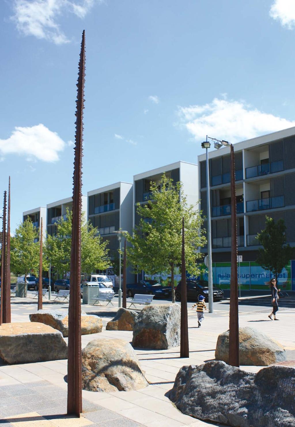
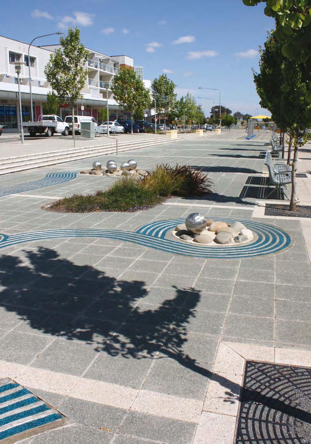
43 4.4.8 Character The town centre is developing its own distinct character, partly due to the original urban village approach taken to planning and design. The town centre has a main street style of development, with a core of four retail centres, each with an anchor store and active ground floor retail uses. This main street style of development, as opposed to the retail mall model of Canberra s other town centres, gives Gungahlin a point of difference; retaining and enhancing this in the future is considered important. The town centre has a fairly homogeneous built form, with no higher buildings to contribute as landmarks or for orientation purposes due to the height limit of four storeys under the previous planning controls. Buildings heights were limited to four stories to allow sunlight into the streets, though there are other ways of achieving this (e.g. increased setbacks at upper stories with building envelope controls). With the recent mixed-use developments in the retail core, a bustling, thriving, street-based town centre is beginning to emerge. People are coming together to shop, work, live, socialise and do business during the week and on weekends. Street frontages along major pedestrian routes with cafes and restaurants, particularly along the southern edge of Hibberson St, have contributed to this activity and vibrancy. However, the precincts that are developing around the edges of the town centre due to the collocation of related land uses, such as the service trades area, are disparate and not highly accessible or well connected to the retail core. Many of the public spaces (streets and parks) in the town centre, particularly in the eastern part, are not yet fully constructed. Streets constructed to date are mostly planted with street trees. However, the tree species selection does not contribute to the character or hierarchy of the streets in the town centre. Footpaths will mostly be like those constructed to date; wide enough to cater for high pedestrian traffic, with additional space for on-street cafes provided in the retail core. A number of community suggestions for improving the design of public spaces include: providing better weather protection for people moving between buildings in the retail core, for example, sails over Hibberson Street at key crossing points diverting or slowing traffic along Hibberson Street to improve pedestrian movement across the street (sub-section 4.6.3) improving footpaths, particularly at points where wheelchairs and prams cross the street, or where they are unfinished due to land being undeveloped. 39
44 4.5 Residential and mixed-use development Residential mixed-use development As discussed above, planning for the town centre was guided by an urban village approach with an emphasis on mixed-use development including residential uses. Residential mixed-use development comes in a wide variety of forms, including small-scale two or three storey shop-top housing, flexible zoning that allows office buildings next to apartments but not in the same building or mixing of activities such as apartments and offices in a single large development. Currently, there are two types of residential mixed-use development allowed in and around the town centre. North of Anthony Rolfe Avenue and along Flemington Road, the mixed use zoning allows for small scale leisure, recreation, community and commercial activity in addition to residences. However, land developed to date has been primarily built for residential purposes and provides very little commercial space. Residential mixed-use development in the town centre has been in the form of apartments above large retail developments (Big W and Aldi). This was encouraged by planning controls which restricted commercial activities above the first floor. Mixed-use development has been encouraged as it contributes to an urban form that is flexible, compact and walkable. The inclusion of residential uses contributes to pedestrian activity, safety, social interaction, diversity of character and a wider variety of housing types. For example, offices are not used in evenings and on weekends. Areas purely of offices become unoccupied dead zones out of office hours. Including apartments in these areas potentially reduces this problem. Residential mixed-use development can also reduce the need for travel. Most trips are not made for enjoyment, but rather to access employment, shops, services and friends. Dwellings close to shops, services and employment provide residents with good access to things they need and potentially reduce their need to travel Protecting neighbouring homes What is the issue? Gungahlin Town Centre will bring many benefits to surrounding households as it grows (better services, entertainment and jobs close to home). However, it will also bring traffic and noise into the night and on weekends. Buildings will be higher density than surrounding suburbs, with some tall buildings. Unless these issues are planned for, some residents would find the town centre s growth unwelcome. On its southern boundary, the town centre joins the Mulanggari Grasslands Nature Reserve. This also requires protection from some aspects of the town centre. This is discussed at sub-section for more detail. 40
45 Proposed response Measures to reduce the impact of the town centre on neighbouring homes are listed below. On the northern edge along Anthony Rolfe Avenue, the rezoning includes a strip of mixed-use residential and community buildings (Figure 19). This zoning allows smaller-scale commercial activities, but buildings must be mostly residential or community facilities. Anthony Rolfe Avenue is also a wide street, which provides a buffer between the town centre and homes to the north. On the eastern edge of the town centre between Anthony Rolfe Avenue and Flemington Road, the rezoning includes a new strip of urban open space between the town centre and houses (Figure 19). This will protect the line of large native trees along Hamer Street and provide an additional buffer for residents. On the eastern edge of the town centre south of Flemington Road, the design of Franklin already includes a buffer strip of urban open space on the eastern side of Manning Clark Street. The height limit controls (see the relevant sections in the precinct code contained in the draft variation to the Territory Plan) will restrict buildings to four or five stories on the northern and eastern edges of the town centre. This is only slightly taller than many of the new buildings being built to the north of Anthony Rolfe Avenue and in Franklin. The proposed traffic planning will keep traffic growth on the major streets, such as Anthony Rolfe Avenue, away from the smaller residential streets; see sub-section for more detail Housing affordability Through its Affordable Housing Action Plan, the ACT Government (2007a) has made a significant commitment to improving housing affordability. The actions have included increasing the supply of residential land and a requirement that 15 per cent of house and land packages should be priced between $200,000 and $300,000. While the purpose of this report is primarily to review commercial and community facilities, housing affordability goals should be considered in any future residential development. 4.6 Transport Car parking What is the issue? As the town centre grows, the quantity of car parking will need to increase. This raises issues about the best locations, the balance of public parking to private parking and basements versus multi-storey car parks. Proposed response As there were no clear community views, most parking issues for Gungahlin Town Centre can be dealt with through the standard process of assessing development against the parking and vehicular access general code in the Territory Plan. 41
46 For some land uses (e.g. offices), the code requirements include the use of off-site parking. This relies on off-site parking being available. Other town centres have traditionally had a large number of sites set aside for off-site parking, but Gungahlin Town Centre does not have many sites allocated. This report proposes allocating a number of sites, in locations which: support the parking needs of the major shopping areas allow parking to be shared between land uses to minimise the overall amount of car parking required assist on-street retailers in nearby streets. The sites allocated and requirements at subdivision are shown in the draft variation to the Territory Plan in the precinct code. The structure plan contained in the draft variation also has provisions to ensure these sites will be kept for car parking for the long term Walking and cycling What is the issue? ACT Government policy seeks to promote walking and cycling as a means of transport because of the health, environment and cost benefits this can bring (ACT Government 2004). A main street style of town centre also needs a high number of people walking to work because of the benefits this can provide, e.g. to business for on-street shops, bringing people to public spaces and keeping internal car traffic low. Thirdly, it is much more expensive to retro-fit this infrastructure later. This issue is also closely related to the design of Hibberson Street and Gungahlin Place, which will be the busiest pedestrian areas of the town centre. These streets are addressed in their own section: see sub-section for more detail. Proposed response At times, people have raised specific pedestrian and cycle path gaps and problems with ACTPLA. These have been passed on to TaMS, which is responsible for such infrastructure. Work has been undertaken to address some of these issues, including the repainting of pedestrian crossings on Hibberson Street and construction of a footpath from Kate Crace Street to the eastern edge of the town centre along Flemington Road. Responses have been considered for the long-term planning of the town centre, including the following: planning for a comprehensive trunk path network that will link the town centre to surrounding areas requirements that all new streets other than laneways have footpaths on both sides requirements for new subdivisions to provide paths from day one, and to minimise gaps. This is included because previous developments have often left gaps in the path network that make it hard to walk and cycle around the town centre, and to reach it from neighbouring areas. Finding the proposed provisions The draft structure plan and precinct code each have a section on walking and cycling. 42
47 4.6.3 Traffic What is the issue? The last full review of traffic planning for Gungahlin Town Centre was in the 1990s and many of the major developments since have not occurred where they were originally planned. Traffic issues, particularly for Hibberson Street, were one of the top issues raised with ACTPLA during the consultation process. Because of this, this report has included a major review of traffic planning in the town centre, Gungahlin Town Centre Transportation Study (the transport study). Current traffic arrangements for the town centre are complicated by a number of issues. For example: the design of the town centre funnels traffic from an arterial road (Flemington Road) into Hibberson Street, which primarily serve as the main street of the town centre for shopping the areas that bring large amounts of traffic are away from the arterial road network the Mulanggari Grasslands on the southern edge of the town centre rule out several road options for getting traffic to the town centre from Gungahlin Drive. Proposed response Based on the conclusion from the transport study, this report recommends a new traffic system that is designed to increasingly divert traffic around Hibberson Street as the town centre grows. It also includes changes such as a new entry road and wider road reservations in some places to allow for future road upgrades. These will ensure Gungahlin Town Centre can grow to provide as many jobs and services as the other town centres provide. The road system is shown in Figure 18. The proposed changes include the following: the road system will be changed to a ring road system that will divert traffic away from Hibberson Street and other retail streets as it is constructed over time the extension of The Valley Avenue to Gundaroo Drive, which will reduce the impact of future traffic growth on the Burgmann School and also provide extra capacity on the ring road system setting road reservations which allow for the major road upgrades that will be needed as activity in the town centre doubles, and possibly triples. Finding the proposed provisions There is a traffic section in both the draft structure plan and precinct code contained in the draft variation to the Territory Plan. Other planning provisions for Hibberson Street and Gungahlin Place are discussed in sub-section for more detail. 43
48 Figure 18 Proposed ring road system Public transport What is the issue? Currently, buses are the only public transport mode available in the Gungahlin District. In the town centre, Gozzard Street and Hibberson Street are the streets taking the most buses, though this varies depending on the time of day. According to the transport study, current bus service arrangements for Gungahlin Town Centre are constrained from providing public transport in a quick and efficient manner since the design of the town centre naturally funnels traffic from an arterial road (Flemington Road) directly into Hibberson St, which causes private traffic to hinder the bus services. The central interchange point for bus routes in Gungahlin is on Gozzard Street between the Canberra Raiders Club and the Woolworths car park. To accommodate the town centre s growth, purpose built major stops and/or an interchange will be needed to enable large numbers of people to move around in a safe and convenient manner and be large enough to accommodate a number of buses at once. 44
49 Proposed response As the town centre grows, more and frequent bus services will be needed. A one-interchange system in the town centre would mean many people would have to walk a long distance to get to the public transport since the town centre will be over 1.4km in length. The transport study recommended that a system with several major stops common to all routes would be preferable. The preferred option is that the design of Hibberson Street includes locating three major public transport stops to centrally service the town centre. Instead of three stand-alone major stops, they could be designed into the surrounding developments to increase customer flows into these developments and at same time provide people with a pleasant and convenient place to wait for public transport, particularly at night. In the long term, provision is made for a dedicated inter-town public transport route from Civic to Gungahlin. The planned route currently runs down Anthony Rolfe Avenue and land has been reserved in the road width to enable its construction. However, this takes public transport further away from the main street, which many people use. Alternatively, under ACTPLA s proposal, it would remain on Hibberson Street from the eastern edge of the town centre to Gozzard Street. This could bring more people to the town centre and increase passing trade, particularly to the retail core. Traffic in Hibberson Street was the key issue raised by the community during the consultation process because traffic from an arterial road (Flemington Road) flows directly into Hibberson Street and destroys its primary function as a circulation space for shoppers. A ring road system is proposed to divert traffic away from Hibberson Street and other retail streets. This has been discussed in detail in sub-section Traffic. 4.7 Environment and heritage issues Bushfires What is the issue? The southern edge of the town centre joins an extensive area of grasslands which has the potential to carry a grass fire to the town centre. A bushfire risk assessment conducted for this report identified three particular factors as contributing to the fire risk: the grasslands immediately south of the town centre will usually have enough fuel to carry a fire because of the terrain of Gungahlin district, the town centre can be exposed to strong, hot, dry winds during the major bushfire season there is an upward slope towards the town centre, which could make a fire move more rapidly. The Strategic Bushfire Management Plan (SBMP) for the ACT version 2 commenced on 1 October 2009 which was after the bushfire risk assessment report was finalised. Proposed response To manage the bushfire risk, the following measures will be adopted: identify bushfire buffer areas along the southern edge of the town centre these areas are largely zoned as urban open space, which prevents most types of development require bushfire risk assessments to be prepared for future development on the southern edge of the town centre addressing buffer areas, special building requirements and access for fire fighting. 45
50 Finding the proposed provisions Following consultation with ACT Fire Brigade about SBMP version 2, the Conservator of Flora and Fauna and the relevant land managers of public land, provisions were included in the draft structure plan and precinct code contained in the draft variation to the Territory Plan Mulanggari Grasslands and nearby protected heritage sites What is the issue? Mulanggari Grasslands Nature Reserve is a 64 hectare reserve immediately to the south of Gungahlin Town Centre. Most of the reserve is natural temperate grassland, a nationally endangered ecological community. Since European settlement more than 90 per cent of this ecological community has been lost to agricultural and urban development. Mulanggari is one of a series of grassland reserves in the ACT that help to conserve this community. In addition Mulanggari provides key habitat for two nationally threatened species, the striped legless lizard (Delma impar) and the golden sun moth (Synemon plana). The perunga grasshopper (Perunga orachea), which is threatened in the ACT is also found at Mulanggari. This collection of species make Mulanggari Grassland Nature Reserve a key part of grassland conservation at a national level, as well as for the ACT. There are two significant heritage sites near the reserve an Aboriginal chert quarry complex and the remains of The Valley, a former rural homestead. These sites both need to be protected under heritage legislation. Proposed response ACTPLA s proposed changes take advantage of the scenic appeal of the grasslands and the views over them to the Brindabellas and Black Mountain, while including measures to protect the sites from the impacts of development. The urban edge is zoned urban open space (Figure 19) to allow for a recreational trail this area also acts as a buffer between urban activities and the protected areas. Development immediately next to this area will be required to upgrade the boundary fencing to both protect the grasslands (e.g. from roaming dogs) and improve access for walkers. Development north of that is a residential and community mixed use precinct that will allow housing with excellent views. However, the proposed changes also include a requirement that will protect the grasslands from overshadowing; see the relevant sections in the draft structure plan and precinct code. 46
51 4.7.3 Well Station Track What is the issue? Much of the southern boundary of the town centre follows the alignment of the Well Station Track, a former unsealed rural road which provided access to farming properties While the track alignment is not protected by heritage legislation, it may be of interest to the community in future as a reminder of the area s rural past. It can also fulfil a useful recreation function in providing an off-road walking and cycling route in a pleasant location that provides views across the grasslands to Black Mountain and Palmerston. Proposed response This report proposes zoning the entire track (which currently has a mix of zonings) as urban open space. Finding the proposed provisions The proposed zoning is shown in Figure 19. The requirement to upgrade the track would normally be included in a land management plan prepared by the land custodian Climate change The ACT Government is committed to working with the community to create a more sustainable city. The Intergovernmental Panel on Climate Change has confirmed that the world s climate is changing, and the changes are being caused by humans releasing greenhouse gases such as carbon dioxide. It also states that greenhouse gases are usually released when fossil fuels such as coal and petrol are burnt, for example in making electricity or powering cars and trucks. The ACT emits 4.18 million tonnes of greenhouse gas emissions. The ACT Government is establishing a solid platform for a low carbon economy by setting greenhouse gas reduction targets for the ACT in legislation. Climate Change and Greenhouse Gas Reduction Act 2010 (effective from November 2010) has a principal target of the ACT achieving zero net emissions by 2060 and an interim target for 2020 whereby the ACT has 40 per cent less emissions than the amount of emissions in This report aims to address, where possible, climate change and recognise that the future Gungahlin Town Centre should minimise greenhouse gas emissions and be able to adapt to climate change with as low a cost to the community as possible. Climate change presents significant opportunities as well as challenges to the planning and design of urban areas. While many planning issues such as orientation of blocks, urban density and connection with sustainable transport are important in early planning stages, other decisions such as insulation of buildings are made during building design and are covered by various ACT Government policies and standards outside of the scope of this report. Planning for a sustainable territory can make a significant contribution to reducing energy use and promoting energy efficiency, increasing uptake of renewable energy and building the ACT s capacity to respond to climate change. 47

52 5 Recommendations 5.1 Recommended changes to the Territory Plan A series of zoning changes are proposed in this report. The proposed zoning changes are shown in Figure 19 and outlined in Table 4. An explanation of the recommendations are also included in this section. Figure 19 Location of proposed zone changes 48
53 Table 4 Proposed zone changes to the Territory Plan Number Location Current zoning Proposed zoning changes TSZ1 Transport 1 Urban open space at the northern end of The Valley Ave PRZ1 Urban Open Space To extend The Valley Avenue to Gundaroo Drive and to reduce the impact of future traffic growth on Burgmann School and provide extra capacity on the proposed ring road system CZ3 Services To allow a small increase in the current services zoning 2 Area surrounded by Hibberson St, Gozzard St and The Valley Ave and east to the Oval CFZ Community Facility, CZ6 Leisure and Accommodation, PRZ1 Urban Open Space CFZ Community Facility, PRZ1 Urban Open Space and PRZ2 Restricted Access Recreation CZ6 rezoned CFZ area which has been expanded to reflect Gungahlin college and community uses. An area on the southern side of the block is to be PRZ2 for Gungahlin leisure centre. PRZ1 has been retained for the town park 3 Northern end of Gozzard St CZ5 Mixed Use and CZ6 Leisure and Accommodation CZ1 Retail Core with specific precinct controls To accommodate a large number of smaller shops and offices that don t need to be in a major centre CZ1 Core 4 Hibberson St TSZ1 Transport To give more flexibility for options like permanent cafes and kiosks along Hibberson Street and reflect the desired pedestrian nature of the street 5 Gungahlin Place PRZ1 Urban Open Space CZ1 Core To give more flexibility for options like permanent cafes and kiosks in the linear park CZ5 Mixed Use 6 North of the Retail Core CFZ Community Facility Land is rezoned CZ5 to provide for a mix of uses which may include community facilities. CFZ land is to be rezoned CZ5 7 Sites south along Anthony Rolfe Avenue and sites south along The Valley Avenue CZ2 Business and CZ5 Mixed Use Yellow circles indicate the approximate location of sites available for future zoning as CFZ Community Facility To identify land available to meet future needs for community facilities 49
54 Number Location Current zoning Proposed zoning changes CZ5 Mixed Use 8 Corner of Anthony Rolfe Avenue and Hamer Street CZ2 Business To permit mixed-use residential and community buildings and allow smaller-scale commercial activities with majority of the development for residential or community facilities 9 East of Hamer Street TSZ1 Transport RZ3 Urban Residential PRZ1 Urban Open Space TSZ1 Transport RZ3 Urban Residential Land is to be rezoned PRZ1 and TSZ1 (road reserve reduced) to protect a stand of native trees along Hamer PRZ1 Urban Open Space A new linear park to provide urban open space within the new office precinct and an access link for pedestrians and cyclists to adjoining suburbs to the north 10 Undeveloped area to the east of the town centre CZ2 Business TSZ1 Transport A new road to connect The Valley Ave and Manning Clark Crescent CZ5 Mixed Use To permit mixed-use residential and community buildings and allow smaller-scale commercial activities with majority of the development for residential or community facilities. 11 Well Station Track RZ3 Urban Residential and CFZ Community Facility PRZ1 Urban Open Space To protect it from any future development and to provide a recreation track that enables access for fire fighting vehicles CZ5 Mixed Use 12 Western end of The Valley Ave RZ3 Urban Residential To permit mixed-use residential and allow smallerscale commercial activities with majority of the development for residential. 50
55 Changes of provision for office This report proposes that the undeveloped land to the east of the town centre is allocated for offices and other uses in the town centre to promote a large employment precinct and activity at different times of the day and week. Although it leads to an overall reduction of office space available in the town centre, the land allocated for offices is large enough for Government departments. The proposed building height controls allow taller buildings to be built in the town centre. This will recoup the area lost for other uses in the town centre and provide similar amount of floorspace for office use as other town centres currently offer. Changes of provision for community facility Most land zoned for community facilities in the town centre are committed for such use and have been built. The restructured Territory Plan has rezoned some of the land primarily for residential use to community facility to reflect community facility uses on the ground. Due to uncertainty on the timing and site requirements for different community facilities and changes of demography over time, locking certain sites may not meet future community needs. Provision for community facility uses in the town centre should have long-term flexibility. In achieving this, this report recommends setting aside a certain size of land in the town centre for the long term to meet the community and recreation facility needs and at same time encourage community facility uses amongst other uses. Changes of provision for retail core The retail core area before and after 2008 has remained at the similar level. This report proposes an area immediately west of the retail core (approximately 5 ha), where a number of fast food outlets and the Canberra Raiders Club are located, be rezoned as the retail core because the area naturally forms a link between the retail core and the business park and service precincts identified in the precinct code contained in the draft variation to the Territory Plan. Changes of provision for entertainment Entertainment is a key function of a town centre. Traditionally, separate areas had been zoned for future entertainment facilities in town centres. Often many of these areas have struggled. Entertainment activities have instead moved elsewhere in the town centre, e.g. cinemas in the large shopping centres. Currently, Gungahlin Town Centre has a small area zoned for entertainment that includes the Canberra Raiders Club and McDonalds. However, many of the town centre s restaurants have instead located in the main shopping area along Hibberson Street. This report proposes the entertainment precinct is co-located with the major retail anchors along Hibberson Street to recognise that new cinemas are typically only viable in many-screen formats associated with large shopping centres and in areas with most restaurants. These will also bring more people into the centre out-of-hours, make it a livelier destination and provide support for existing shops. 51
56 Changes of provision for urban open space The proposed changes in this report slightly increase the amount of urban open space due to the rezoning of Well Station Track and the rezoning of eastern side of Hamer Street. The rezoning of Well Station Track will give the track alignment one zoning. This will allow it to be upgraded to a standard that could be used as a recreational cycling and walking path, which provides views across the grasslands to Black Mountain and Palmerston. The rezoning of eastern side of Hamer Street to urban open space is to protect the line of large native trees along Hamer Street and function as an additional buffer to reduce the impact of the town centre on neighbouring homes. Traffic arrangement While enhancing the existing street and block pattern, this report recommends a ring road system to divert traffic away from pedestrian friendly core retail areas in the town centre by encouraging most of the through traffic along the edge of the town centre. Public transport To bring more people to the town centre and increase passing trade, this report recommends a dedicated inter-town public transport route through main street, Hibberson Street. Bushfire protection The town centre is alongside the Mulanggari Grassland, which has the potential to carry a grass fire to the town centre. As a result, this report recommends bushfire measures to any developments in the bushfire protection zones. 5.2 Form of proposed draft variation The recommendations in this planning report are to be included a draft variation to the Territory Plan, which together with this report will be released by ACTPLA for public consultation. The draft variation is expected to incorporate the following elements: 52 changes to the Territory Plan map Territory Plan map for land in Gungahlin Town Centre is to be changed in accordance the list of changes in Table 4 of this report. inserting a structure plan for the Gungahlin Town Centre Gungahlin Town Centre Structure Plan, which applies to future urban area (FUA) in the town centre, will replace the town centre parts of the existing Gungahlin Town Centre and Central Area Structure Plan. establishing a precinct code for Gungahlin Town Centre Gungahlin Town Centre Precinct Code is to be established which contains provisions that guide development of all land within the town centre including land with an FUA overlay. making consequential changes to the written document, including revisions to the Gungahlin Town Centre and Central Area Structure Plan. Parts of the existing Gungahlin Town Centre and Central Area Structure Plan for the town centre are to be removed and the document will be renamed the Gungahlin Central Area Structure Plan to ensure planning for suburbs around the town centre is unaffected.
57 6 References Australian Bureau of Statistics 2007, Census 2006 QuickStats, Gungahlin-Hall Statistical Subdivision, Australian Bureau of Statistics, Canberra. Property Council of Australia 2009, Office Market Report, July 2009 release, Property Council of Australia, Sydney. ACT Government 2004, The Sustainable Transport Plan for the ACT, ACT Government, Canberra. ACT Government 2007a, Affordable Housing Action Plan 2007, ACT Government, Canberra. ACT Government 2007b, Weathering the Change: the ACT Climate Change Strategy , ACT Government, Canberra. ACTPLA 2006, Bicycle Parking Guidelines, ACTPLA, Canberra. ACTPLA 2007a, unpublished data from an inventory of commercial floorspace in the ACT, ACTPLA, Canberra. ACTPLA 2007b, Structure Plan: Gungahlin Town Centre and Central Area, draft for consultation, ACTPLA, Canberra. ACT Planning and Land Management 1999, Provision of Community Facility Sites in Gungahlin, ACT Government, Canberra. Brown Consulting 2004, Ten Year Master Plan for Trunk Cycling and Walking Path Infrastructure , ACTPLA and RoadsACT, Canberra. Intergovernmental Panel on Climate Change 2007, Summary for Policymakers of the Synthesis Report of the IPCC Fourth Assessment Report, 16/11/07 draft, Intergovernmental Panel on Climate Change, Geneva. National Capital Development Commission 1989, Gungahlin Policy Plan, National Capital Development Commission, Canberra. 53

58 Attachments Attachment A: The Territory Plan maps The territory plan map before 31 march Areas shown in the map above are approximate and used only for the purpose of indication. 54

59 The current Territory Plan map 4 4 Areas shown in the map above are approximate and used only for the purpose of indication. 55

60 The proposed Territory Plan Map 5 5 Areas shown in the map above are approximate and used only for the purpose of indication. 56
GUNGAHLIN TOWN CENTRE
 GUNGAHLIN TOWN CENTRE PLANNING REFRESH SNAPSHOT NOVEMBER 2018 CONTENTS INTRODUCTION....1 Australian Capital Territory, Canberra 2018 This work is copyright. Apart from any use as permitted under the Copyright
Concept Gungahlin Precinct Map and Code Includes Gungahlin Town Centre
 Concept Gungahlin Precinct Map and Code Includes Gungahlin Town Centre Proposed changes from the Gungahlin Town Centre Planning Refresh-snapshot recommendations Disclaimer: This document is intended to
21.07 ECONOMIC DEVELOPMENT AND EMPLOYMENT 19/03/2015 C323 Proposed C Key issues and influences. Economic Role and Function
 21.07 ECONOMIC DEVELOPMENT AND EMPLOYMENT 19/03/2015 C323 Proposed C347 21.07-1 Key issues and influences 14/10/2010 C168 Economic Role and Function Geelong is the largest regional city in Victoria and
5 Rail demand in Western Sydney
 5 Rail demand in Western Sydney About this chapter To better understand where new or enhanced rail services are needed, this chapter presents an overview of the existing and future demand on the rail network
Concept Curtin Precinct Map and Code
 Concept Curtin Precinct Map and Code Proposed changes from the revised Curtin Group Centre Draft Master Plan recommendations Disclaimer: This document is intended to show the proposed changes to the existing
TOWN PLANNING SUBMISSION TO THE GREATER SYDNEY COMMISSION LANDS AT ARTARMON
 TOWN PLANNING SUBMISSION TO THE GREATER SYDNEY COMMISSION LANDS AT ARTARMON March 2017 TABLE OF CONTENTS 1.0 INTRODUCTION 3 2.0 THE SUBJECT SITE 4 3.0 STRATEGIC PLANNING CONTEXT 6 4.0 SUMMARY AND CONCLUSIONS
CITY RAIL LINK. New Public Transport Stations and Development Opportunities at Karangahape Road, Newton and Aotea Quarter
 134 AC_BEU_CCMP_3_TM5_8_FD.indd 134 20/07/12 12:30 PM 05 CITY RAIL LINK New Public Transport Stations and Development Opportunities at Karangahape Road, Newton and Aotea Quarter 5 MO VE 0 1 2 8 KEY 1 Britomart
Gold Coast. Rapid Transit. Chapter twelve Social impact. Chapter content
 Gold Coast Rapid Transit Chapter twelve Social impact Chapter content Social impact assessment process...235 Existing community profile...237 Consultation...238 Social impacts and mitigation strategies...239
TERMINAL DEVELOPMENT PLAN
 5.0 TERMINAL DEVELOPMENT PLAN 5.0 TERMINAL DEVELOPMENT PLAN Key points The development plan in the Master Plan includes the expansion of terminal infrastructure, creating integrated terminals for international,
URBAN DESIGN REPORT. Proposed Residential Development, Old Church Road, Caledon East
 Proposed Residential Development, Old Church Road, Caledon East TABLE CONTENTS: 1.0 DEVELOPMENT 1.1 Introduction-Analysis of Guiding Principles and Documents 1.2 Community Design and Architectural Design
PSP 75 Lancefield Road. Northern Jacksons Creek Crossing Supplementary Information
 PSP 75 Lancefield Road Northern Jacksons Creek Crossing Supplementary Information September 2017 The northern crossing of Jacksons Creek proposed within the Lancefield Road PSP is a key part of the ultimate
Mawson Group Centre. Master Plan NOVEMBER 2015
 Mawson Group Centre Master Plan NOVEMBER 2015 ISBN 978-1-921117-42-8 Australian Capital Territory, Canberra 2015 This work is copyright. Apart from any use as permitted under the Copyright Act 1968, no
Bloor Street West Rezoning Application for a Temporary Use By-law Final Report
 STAFF REPORT ACTION REQUIRED 3741 3751 Bloor Street West Rezoning Application for a Temporary Use By-law Final Report Date: June 12, 2007 To: From: Wards: Reference Number: Etobicoke York Community Council
This economic statement provides analysis with respect to land at Tarneit North, and has been prepared on behalf of Amex Corporation.
 Memorandum To: From: Amex Corporation c/- Greg Wood, Tract Consultants Matthew Lee Cc: Date: 12 June 2013 Subject: Economic Statement for Amex site Tarneit North PSP Dear Greg, This economic statement
PLANNING THE SUNBURY GROWTH CORRIDOR
 SUNBURY GROWTH CORRIDOR NOVEMBER 2016 PLANNING THE SUNBURY GROWTH CORRIDOR Sunbury Planning Background The Victorian Planning Authority, in consultation with Hume City Council, is undertaking a number
Kilometres. Blacktown. Penrith. Parramatta. Liverpool Bankstown. Campbelltown
 0 5 10 15 20 Kilometres Penrith Blacktown Parramatta Liverpool Bankstown Campbelltown accessibility outcomes Legend Outcomes targeted in Western Sydney are: public transport that is accessible throughout
Draft Greater Sydney Region Plan
 Draft Greater Sydney Region Plan Submission_id: 31392 Date of Lodgment: 14 Dec 2017 Origin of Submission: Online Organisation name: Greenfields Development Company No. 2 Pty Limited Organisation type:
REVIEW OF PERTH AIRPORT Noise Abatement Procedures
 REVIEW OF PERTH AIRPORT Noise Abatement Procedures Contents SUMMARY... 3 Summary of Review Findings... 3 BACKGROUND... 4 Noise Abatement Procedures... 4 Perth Airport Noise Abatement Procedures... 4 Noise
Sustainable Urban Development. Presentation to WVCC 1 December 2010
 Sustainable Urban Development Presentation to WVCC 1 December 2010 Introduction Paul Carmody Hindmarsh (Consultation Manager) Tony Adams CB Richard Ellis (Planners) Simon Parsons PTW (Architects) Brett
PCAL Case Study Retail Areas: Rouse Hill Town Centre
 PCAL Case Study Retail Areas: Rouse Hill Town Centre Introduction Rouse Hill Town Centre is a new mixed use development on a greenfield site in Sydney s North West. It has been planned to be a major hub
CANNING CITY CENTRE. the new energy of the southeast
 CANNING CITY CENTRE the new energy of the southeast 2 INTRODUCTION From early beginnings as an important cultural and recreation place for the Beeloo Nyoongar people, to being a trading post connecting
Spadina Avenue Built Form Study Preliminary Report
 STAFF REPORT ACTION REQUIRED Spadina Avenue Built Form Study Preliminary Report Date: July 9, 2014 To: From: Wards: Reference Number: Toronto and East York Community Council Director, Community Planning,
Submission to. Queenstown Lakes District Council. on the
 Submission to Queenstown Lakes District Council on the Queenstown Lakes District Proposed District Plan, Section 32 Evaluation, Stage 2 Components October 2017, for Visitor Accommodation Date: 23 Feb 2018
New free City connector bus service
 The Adelaide City Council invites engagement from the community about New free City connector bus service 99C City Loop and Adelaide Connector free bus services to merge: Project Summary Adelaide City
PO Box 257 PO Box 257 PARRAMATTA NSW 2124 PARRAMATTA NSW 2124
 31 March 2017 Sean O Toole Sheridan Dudley District Commissioner - West District Commissioner - South West Greater Sydney Commission Greater Sydney Commission PO Box 257 PO Box 257 PARRAMATTA NSW 2124
The implementation of this Master Plan will be undertaken in logical stages to meet passenger and workforce demands.
 The implementation of this Master Plan will be undertaken in logical stages to meet passenger and workforce demands. Connecting People Building Opportunities 198 Brisbane Airport Corporation CHAPTER 10
Gold Coast. Rapid Transit. Chapter content. Chapter four Route selection and staging
 Chapter four Route selection and staging Gold Coast Rapid Transit Chapter four Route selection and staging Chapter content Route selection...73 Section one: Helensvale to Griffith University...74 Section
Memorandum of Understanding with ACT Government
 MEDIA RELEASE 8 April 2015 Memorandum of Understanding with ACT Government The ACT Government and Canberra Airport today entered into a new Memorandum of Understanding (MoU) on key areas of common interest
CAIRNS RECTANGULAR PITCH STADIUM NEEDS STUDY PART 1 CAIRNS REGIONAL COUNCIL DRAFT REPORT SEPTEMBER 2011
 CAIRNS RECTANGULAR PITCH STADIUM NEEDS STUDY PART 1 CAIRNS REGIONAL COUNCIL DRAFT REPORT SEPTEMBER 2011 CAIRNS RECTANGULAR PITCH STADIUM NEEDS STUDY PART 1 Cairns Regional Council September 2011 Coffey
JOINT CORE STRATEGY FOR BROADLAND, NORWICH AND SOUTH NORFOLK EXAMINATION MATTER 3C EASTON/COSTESSEY
 Matter 3C Easton/Costessey Representor No. 8826 JOINT CORE STRATEGY FOR BROADLAND, NORWICH AND SOUTH NORFOLK EXAMINATION MATTER 3C EASTON/COSTESSEY SUBMISSION ON BEHALF OF TAYLOR WIMPEY DEVELOPMENTS AND
E08. Kaufland Stores in Victoria Advisory Committee Epping. Request to be heard?:
 Kaufland Stores in Victoria Advisory Committee Epping E08 Request to be heard?: Yes Full Name: Organisation: Affected property: Attachment 1: Attachment 2: Attachment 3: Comments: Bernard McNamara BMDA
Draft Western District Plan
 Powered by TCPDF (www.tcpdf.org) Draft Western District Plan Submission_id: 31732 Date of Lodgment: 15 Dec 2017 Origin of Submission: Online Organisation name: APP Corporation Pty Ltd Organisation type:
Sunshine Coast Council Locked Bag 72 Sunshine Coast Mail Centre QLD Submitted via online portal. 2 June 2017.
 Sunshine Coast Council Locked Bag 72 Sunshine Coast Mail Centre QLD 4560 Submitted via online portal 2 June 2017 Dear Sir /Madam, RE: DRAFT ENVIRONMENTAL AND LIVEABILITY STRATEGY The Green Building Council
9.1 INTRODUCTION 9.2 EXISTING DEVELOPMENT. Southern Cross University
 Property Strategy The property strategy delivers improved legibility, responds to the locational attributes of the site, and facilitates essential operational efficiencies. 9.1 INTRODUCTION Non-aviation
2433 Dufferin Street Zoning By-law Amendment Application - Preliminary Report
 STAFF REPORT ACTION REQUIRED 2433 Dufferin Street Zoning By-law Amendment Application - Preliminary Report Date: July 22, 2014 To: From: Wards: Reference Number: North York Community Council Director,
Public Submissions in response to the Bill closed on 2 July 2015 and Council lodged a copy of the submission provided as Attachment 1.
 54 PLANNING AND ECONOMIC COMMITTEE 8 JULY 2015 3 SUSTAINABLE PORTS DEVELOPMENT BILL Neil Quinn 1/58/14 #4771706 RECOMMENDATION: That Council endorses the Submission made to the Infrastructure, Planning
Amendments C207 & C208
 Amendments C207 & C208 Hume Planning Scheme Julia Bell August 2017 Instructed by KING&WOOD MALLESONS On behalf of Hume City Council Amendments C207 & C208 Hume Planning Scheme Contents 1.0 Introduction...
City of Sydney Convenience Store Development Control Plan 2004
 City of Sydney Convenience Store Development Control Plan 2004 Table of Contents 1 Introduction 1 1.1 Citation 1 1.2 Area to which the plan applies 2 1.3 Commencement 1 1.4 Relationship to other environmental
The Sunshine Coast is part of the global community and generates wealth through export, high-value industries and new investment.
 3.2 Strategic intent 3.2.1 Shaping growth an overview In 2031, the Sunshine Coast is renowned for its vibrant economy, ecological values, unique character and strong sense of community. It is Australia
EAST-WEST STITCH. Connecting the Western Edge of the City to the Centre
 98 AC_BEU_CCMP_2_TM1_4 _FD.indd 98 20/07/12 12:06 PM 02 EAST-WEST STITCH Connecting the Western Edge of the City to the Centre 01 02 Northern Motorway Daldy Street Fanshawe Street Nelson Street Hobson
SOUTH INTERCHANGE AREA
 Santaquin City General Plan 1 Location and Characteristics The South Interchange Area of Santaquin is located west of Interstate 15 and south of 500 South (Figure 1). It includes properties already annexed
Draft Planning Controls Planning Scheme Amendment GC81
 Draft Planning Controls Planning Scheme Amendment GC81 Peita Tapper Senior Planner, Planning Services What the planning controls do? The draft planning controls translate the objectives and strategies
CORPORATE ACCOMMODATION SOLUTIONS
 CORPORATE ACCOMMODATION SOLUTIONS TABLE OF CONTENTS EXECUTIVE SUMMARY 3 THE LOCATION 4 KEY FEATURES 5 MASTERPLAN 8 TRANSPORT & PARKING 9 EAST VILLAGE 10 INDICATIVE SCHEME 11 ABOUT THE DEVELOPER 14 2 EXECUTIVE
TRANSPORT CANBERRA. LIGHT RAIL NETWORK Delivering a modern transport system for a growing city
 TRANSPORT CANBERRA LIGHT RAIL NETWORK Delivering a modern transport system for a growing city LIGHT RAIL NETWORK A modern transport system for a growing city INTRODUCTION Minister Mick Gentleman The ACT
TORONTO TRANSIT COMMISSION REPORT NO. SUBJECT: TORONTO-YORK SPADINA SUBWAY EXTENSION STATION NAMES IN THE CITY OF VAUGHAN
 TORONTO TRANSIT COMMISSION REPORT NO. MEETING DATE: February 29, 2011 SUBJECT: TORONTO-YORK SPADINA SUBWAY EXTENSION STATION NAMES IN THE CITY OF VAUGHAN ACTION ITEM RECOMMENDATIONS It is recommended that
IMPACT HOMES Introducing The Meadows Estate 3
 IMPACT HOMES Introducing The Meadows Estate 3 4 IMPACT HOMES Introducing The Meadows Estate INTRODUCTION The purpose of this guide is to introduce The Meadows, a residential community developed by Leda.
Parkland County Municipal Development Plan Amendment Acheson Industrial Area Structure Plan
 Parkland County Municipal Development Plan Amendment Acheson Industrial Area Structure Plan New Plan Acheson Industrial Area Structure Plan Amendment Parkland County Municipal Development Plan Board Reference
Consultation on Draft Airports National Policy Statement: new runway capacity and infrastructure at airports in the South East of England
 Tony Kershaw Honorary Secretary County Hall Chichester West Sussex PO19 1RQ Telephone 033022 22543 Website: www.gatcom.org.uk If calling ask for Mrs. Paula Street e-mail: secretary@gatcom.org.uk 22 May
Sport Capital Improvement Plan. Paul Borci Manager, Campus Planning Property & Campus Services
 Sport Capital Improvement Plan Paul Borci Manager, Campus Planning Property & Campus Services What is SCIP? Property and Campus Services (PCS) in collaboration with Melbourne University Sport (MU Sport)
GUNGAHLIN TOWN CENTRE PLANNING REFRESH
 GUNGAHLIN TOWN CENTRE PLANNING REFRESH COMMUNITY ENGAGEMENT REPORT - STAGE 1 MAY 2018 Australian Capital Territory, Canberra 2018 This work is copyright. Apart from any use as permitted under the Copyright
Response to the London Heathrow Airport Expansion Public Consultation
 Response to the London Heathrow Airport Expansion Public Consultation Summary This report sets out the response to the Heathrow Airport s consultation on airport expansion and airspace change. The consultation
A Master Plan is one of the most important documents that can be prepared by an Airport.
 The Master Plan A Master Plan is one of the most important documents that can be prepared by an Airport. A Master Plan is a visionary and a strategic document detailing planning initiatives for the Airport
Terms of Reference. Canberra Airport Community Aviation Consultation Group
 Canberra Airport Community Aviation Consultation Group February 2014 1. Name The name of the Group is Canberra Airport Community Aviation Consultation Group. 2. Background Canberra Airport was established
12, 14 and 16 York Street - Amendments to Section 16 Agreement and Road Closure Authorization
 REPORT FOR ACTION 12, 14 and 16 York Street - Amendments to Section 16 Agreement and Road Closure Authorization Date: April 27, 2018 To: Toronto and East York Community Council From: Senior Strategic Director,
Located on the banks of the Pine River, Griffin Pocket is part of a region that has been rated as one of Brisbane s greenest suburbs.
 Location Griffin Pocket is perfectly positioned for a family-friendly lifestyle at the doorstep of Moreton Bay. Located on the banks of the Pine River, Griffin Pocket is part of a region that has been
Schedule of Planning Applications Committee Date: 23 May Reference: 06/18/0064/F Great Yarmouth Officer: Mr J Beck Expiry Date:
 Schedule of Planning Applications Committee Date: 23 May 2018 Reference: 06/18/0064/F Great Yarmouth Officer: Mr J Beck Expiry Date: 24-04-2018 Applicant: Proposal: Site: Mr Mavroudis Clear weather hoardings
NSW PRE-BUDGET STATEMENT FUTURE ECONOMY FUTURE JOBS
 2017-18 NSW PRE-BUDGET STATEMENT FUTURE ECONOMY FUTURE JOBS Executive Summary The 2017-18 NSW State Budget presents an opportunity for the NSW Government to future-proof the tourism and transport sectors.
Llandudno Junction. Regeneration Proposals for the Future. December 2009
 Llandudno Junction Regeneration Proposals for the Future December 2009 Llandudno Junction - Vision Statement 1 Purpose 1.1 The purpose of this document is to describe key priorities to support the regeneration
MARKET OUTLOOK. 01 Walkability & Accessibility 02 Infrastructure & Employment 03 Population & Demographics 04 Residential Market 05 Rental Market
 MARKET OUTLOOK BRAYBROOK Close to the city in Melbourne s growing west, access to jobs, services and relative affordability are attracting new residents to Braybrook and driving price growth. 01 Walkability
Town of Markham Yonge and Steeles Corridor Study and City of Vaughan Yonge Street Area Study
 STAFF REPORT ACTION REQUIRED Town of Markham Yonge and Steeles Corridor Study and City of Vaughan Yonge Street Area Study Date: August 14, 2009 To: From: Wards: Reference Number: North York Community Council
Arlington County Board Meeting Project Briefing. October 20, 2015
 Arlington County Board Meeting Project Briefing October 20, 2015 Project Map 2 Project Context Only Interstate in the Country limited to HOV only traffic during rush hours Stoplight at the end of I-66
Mango Hill/North Lakes
 Investment Pack QSA WEALTH & WELLBEING MANAGEMENT 2015 Mango Hill/North Lakes Investment Pack Location This location is 25 kilometres north of Brisbane and is dominated by a series of tranquil lakes. But
Sunshine Coast Airport Master Plan September 2007
 Sunshine Coast Airport Master Plan September 2007 Contents CONTENTS... I ACKNOWLEDGEMENT... II DISCLAIMER... III 1 EXECUTIVE SUMMARY...IV 1 INTRODUCTION... 1 2 AVIATION DEMAND FORECAST... 5 3 AIRCRAFT
West of England. Priority Places Requiring Public Investment
 West of England Priority Places Requiring Public Investment Development Urban Regeneration & Suburban Intensification Bristol Central Area Bristol Central Area; Stokes Croft, Temple Meads & St Philips
SOUTH WORCESTERSHIRE DEVELOPMENT PLAN - PREFERRED OPTIONS 2011: SCHEDULE OF ISSUES AND RECOMMENDED RESPONSES Row No.
 1. Inadequate justification Existing retail floor space is underused so no point in extending retail floor space. Instead, would prefer to have sympathetic housing development in the City Centre to attract
Communication and consultation protocol
 Communication and consultation protocol Airservices Australia 2011 This work is copyright. Apart from any use as permitted under the Copyright Act 1968, no part may be reproduced by any process without
LYNDHURST NEW URBAN DEVELOPMENT AREA STRUCTURE PLAN. Lyndhurst New Urban Development Area Structure Plan OUTCOMES AND PERFORMANCE STANDARDS
 APPENDIX 15.1-3 LYNDHURST NEW URBAN DEVELOPMENT AREA STRUCTURE PLAN Purpose of the Structure Plan Lyndhurst New Urban Development Area Structure Plan OUTCOMES AND PERFORMANCE STANDARDS LSP-P1 The District
Date: 11 th January, From: Plaistow & Ifold Parish Neighbourhood Plan - Steering Group. Plaistow & Ifold Parish Council
 Date: 11 th January, 2017 From: Plaistow & Ifold Parish Neighbourhood Plan - Steering Group To: Plaistow & Ifold Parish Council Re: Neighbourhood Plan Report to Parish Council Meeting 17 Jan 2017 The Steering
LEASING OPPORTUNITIES AUSTRALIAFAIR.COM.AU
 YOUR OPPORTUNITY IS NOW LEASING OPPORTUNITIES AUSTRALIAFAIR.COM.AU AUSTRALIA FAIR EVOLUTION With the evolution of the official Southport CBD and an associated boost in local economic indicators, Australia
Draft Greater Sydney Region Plan
 Powered by TCPDF (www.tcpdf.org) Draft Greater Sydney Region Plan Submission_id: 31119 Date of Lodgment: 12 Dec 2017 Origin of Submission: Online Organisation name: Serapark Pty Ltd Organisation type:
CHRISTCHURCH MOTORWAYS. Project Summary Statement February 2010
 CHRISTCHURCH MOTORWAYS Project Summary Statement February 2010 Table of Contents 1. Purpose of Document 2. Strategic Context 3. Benefits 4. Project Scope and Economics 5. Implementation Plan 1 ROADS OF
October 23, 2017 Council Workshop
 MAPLEWOOD VILLAGE CENTRE AND INNOVATION DISTRICT IMPLEMENTATION PLAN & DESIGN GUIDELINES October 23, 2017 Council Workshop COMMUNITY PLAN Purpose of Council Workshop Highlight What We Heard Phase 3 & Key
PERTH CITY SWAN PERTH AIRPORT CURTIN UNIVERSITY WESTFIELD CAROUSEL TANGNEY CITY OF CANNING JANDAKOT AIRPORT SWAN TANGNEY
 THE CITY OF CANNING CITY OF CANNING PERTH CITY SWAN PERTH AIRPORT CURTIN UNIVERSITY WESTFIELD CAROUSEL TANGNEY CITY OF CANNING JANDAKOT AIRPORT SWAN TANGNEY UNTAPPED POTENTIAL The Canning City Centre,
Revision of the Hunters Hill Development Control Plan (DCP) Chapter 4
 Chapter 4") P R E S E R V I N G A U S T R A L I A ' S O L D E S T G A R D E N S U B U R B 5 August 2015 General Manager Hunters Hill Council NSW 2111 P.O. BOX 85, HUNTERS HILL, N.S.W. 2110 Cc: Clr Richard Quinn, Clr
P R E S E R V I N G A U S T R A L I A ' S O L D E S T G A R D E N S U B U R B 5 August 2015 General Manager Hunters Hill Council NSW 2111 P.O. BOX 85, HUNTERS HILL, N.S.W. 2110 Cc: Clr Richard Quinn, Clr
CHAPTER FIVE PROSPECTS FOR FUTURE ECONOMIC DEVELOPMENT
 CHAPTER FIVE PROSPECTS FOR FUTURE ECONOMIC DEVELOPMENT 5.1 GENERAL The recommended type and location of future land uses in Alpine should, in part, consider potential opportunities for future economic
Community Sports Hub
 The Adelaide City Council invites engagement from the community about Project Summary Council is seeking your feedback on a draft agreement to enable the South Australian Cricket Association (SACA) to
SUBURBPROFILE POPULATION TO DOUBLE OV E RVIE W CITY OF WY ND H AM FORECAST POPULATION WYNDHAM CITY COUNCIL
 TA R NI E T 1 SUBURBPROFILE The suburb is located within the boundaries of the City of Wyndham which is one of the fastest growing municipalities in Victoria and the third fastest in Australia. OV E RVIE
To apprise Council of the process and timeline for the preparation of the Final Concept Plan and report; and
 Corporate NO: R243 Report COUNCIL DATE: November 20, 2006 REGULAR COUNCIL TO: Mayor & Council DATE: November 15, 2006 FROM: Acting General Manager, Planning and Development FILE: 0850-20 (CF) SUBJECT:
Creating a High Quality Business District
 Date Month Date Month Friday 7 November 2014 Nine Elms on the South Bank A Bilfinger Real Estate company Creating a High Quality Business District New London Architecture Introduction Nine Elms Vauxhall
Toga has appointed Urbis to assist in developing a Toga response to the draft District Plans. Urbis has
 DRAF 31 March 2017 Greater Sydney Commission Draft District Plans PO Box 257 Parramatta NSW 2124 By email: engagement@gsc.nsw.gov.au Dear Sir/Madam We write on behalf of our client, Toga Property Group,
National Health Workforce Innovation and Reform Strategic Framework for Action
 The Council of Ambulance Authorities Inc. PROVIDING LEADERSHIP FOR THE PROVISION OF AMBULANCE SERVICES The Council of Ambulance Authorities Inc. Submission National Health Workforce Innovation and Reform
Washington Township MASTER PLAN. Addendum: Washington Township Master Plan
 Washington Township MASTER PLAN Addendum: Washington Township Master Plan CHAPTER XI RECREATION CORE DISTRICT Introduction The Recreation Core District generally encompasses the areas north of 30 Mile
Team London Bridge Response to the Department for Transport Consultation on the combined Thameslink, Southern and Great Northern franchise
 Team London Bridge Response to the Department for Transport Consultation on the combined Thameslink, Southern and Great Northern franchise 23 August 2012 Table of Contents 1. Executive Summary 2. Introduction
STONES CORNER SUBURBPROFILE. Situated three kilometres from the Brisbane CBD, Stones Corner is located within one of Brisbane s key growth areas.
 1 SUBURBPROFILE Situated three kilometres from the Brisbane CBD, Stones Corner is located within one of Brisbane s key growth areas. OVERVIEW Situated three kilometres from the Brisbane CBD, Stones Corner
Macleod Trail Corridor Study. Welcome. Macleod Trail Corridor Study Open House. Presentation of Proposed Design Concepts
 Macleod Trail Corridor Study Welcome Macleod Trail Corridor Study Open House Presentation of Proposed Design Concepts Study Purpose Develop a corridor plan for Macleod Trail that aligns with The City s:
Submission on Draft Ingleburn Structure Plan. Prepared for: Ingleburn Chamber of Commerce & Industry Inc. 6 February 2015
 Submission on Draft Ingleburn Structure Plan Prepared for: Ingleburn Chamber of Commerce & Industry Inc. GLN Planning Pty Ltd ABN 39 585 269 237 Level 10, 66 King Street Sydney NSW 2000 GPO Box 5013 Sydney
LIVE. WORK. PLAY. STATUS OF DEVELOPMENT FALL Produced for information by the Town of Markham
 LIVE. WORK. PLAY. STATUS OF DEVELOPMENT Produced for information by the Town of Markham Community TOWN OF MARKHAM CIVIC CENTRE 101 TOWN CENTRE BOULEVARD Completed in 1989. East of Town Centre Boulevard,
Seek the Board s approval for the Donald Place kerb and channel renewal to progress to final design, tender and construction; and
 3. DONALD PLACE - KERB AND CHANNEL RENEWAL General Manager responsible: General Manager City Environment Officer responsible: Transport and City Streets Manager Author: Michelle Flanagan, Streets Capital
places Mooloolaba s heart five
 five places the mooloolaba heart 1 Flexible community event use of school oval 2 Enhanced streetscape District cycle route Future cross-block pedestrian link 5 Existing school buildings New signalised
Resort Municipality Initiative Annual Report 2015
 Resort Municipality Initiative Annual Report 2015 Submitted by: City of Rossland in association with Tourism Rossland Prepared by: Deanne Steven Acknowledgements The City of Rossland would like to thank
Your Transport Levy Your Transport Future. Sunshine Coast Council Transport Levy Annual Report
 Your Transport Levy Your Transport Future Sunshine Coast Council Transport Levy Annual Report 2016-2017 www.sunshinecoast.qld.gov.au T 07 5475 7272 F 07 5475 7277 Locked Bag 72 Sunshine Coast Mail Centre
PLANNING STATEMENT FORMER HSBC BANK, 18 HIGH STREET, AMESBURY
 PLANNING STATEMENT FORMER HSBC BANK, 18 HIGH STREET, AMESBURY 21 Dec 17 Introduction Amesbury has a vibrant nightlife with three public houses, two hotel bars and a nightclub within the town centre as
Airport Planning Area
 PLANNING AREA POLICIES l AIRPORT Airport Planning Area LOCATION AND CONTEXT The Airport Planning Area ( Airport area ) is a key part of Boise s economy and transportation network; it features a multi-purpose
NEWBORO AND PORTLAND HARBOUR REDVELOPMENT PLANS
 INTRODUCTION The Municipal docks in both Newboro and Portland were transferred to the Township of Rideau Lakes by Parks Canada in 2002. Little has been done to improve the docks physical condition or role
https://gsc-public-1.s3-ap-southeast-2.amazonaws.com/s3fs-public/draft-eastern-city-district-plan.pdf
 GSC Sydney East Rev Draft -references Port Botany - 30 https://gsc-public-1.s3-ap-southeast-2.amazonaws.com/s3fs-public/draft-eastern-city-district-plan.pdf Pages 6. The District s freight routes, particularly
The Challenges for the European Tourism Sustainable
 The Challenges for the European Tourism Sustainable Denada Olli Lecturer at Fan S. Noli University, Faculty of Economy, Department of Marketing, Branch Korça, Albania. Doi:10.5901/mjss.2013.v4n9p464 Abstract
SUMMARY OF MEETING 1. Curtin Group Centre Master Plan. Community Panel - 25 July Attendees. Tuesday 25 July 2017, 6.30pm 8:30pm.
 SUMMARY OF MEETING 1 Curtin Group Centre Master Plan Community Panel - 25 July 2017 Attendees Date Location Tuesday 25 July 2017, 6.30pm 8:30pm St James Uniting Church, 40 Gillies Street, Curtin Attendees
St. Patrick s Street Development Brief
 St. Patrick s Street Development Brief Bardas Chorcai Cork Corporation August 2001 Contents Introduction and background The Development Brief Area Protected and valuable buildings Urban context Objectives
20 th January Ms Kate Weatherley Senior Strategic Planner Strategic Planning & Design City of Whittlesea. Dear Kate
 20 th January 2015 Ms Kate Weatherley Senior Strategic Planner Strategic Planning & Design City of Whittlesea Dear Kate Re: Wollert Social and Community Infrastructure Assessment As requested, please find
Council Briefing Minutes
 1 Council Briefing Minutes Date: Time: Location: In Attendance Not in Attendance Wednesday, 24 October, 2018 2:30 p.m. Council Chamber Forum North, Rust Avenue Whangarei Cr Greg Innes (Chairperson) Cr