Scenes from the Border Route Trail. Where is the BRT?
|
|
|
- Beverley Park
- 5 years ago
- Views:
Transcription
 and Grand")
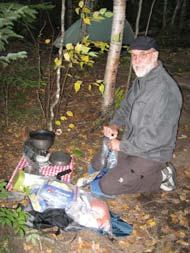
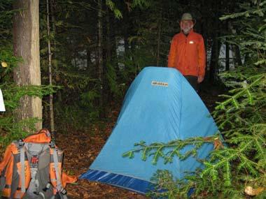
1 Scenes from the Border Route Trail NCTA s Group Hike of the Border Route Trail (BRT) September 21-26, 2010 Where is the BRT? The BRT is located in the Arrowhead region of Minnesota in Cook County The closest towns to the BRT are Grand Marais (west end) and Grand Portage (east end) 1
2 West trailhead Kekekabic Trail Gunflint Trail BWCAW boundary Stairway Portage Long Portage Long Portage BWCAW boundary Pigeon River 270 view Superior Hiking Trail East trailhead What is the BRT? The BRT is a wilderness footpath extending 65- miles East-West from the Gunflint Trail to Otter Lake Rd. About 35 miles of the BRT pass through the BWCAW It is part of the NCT s Arrowhead Re-route 2

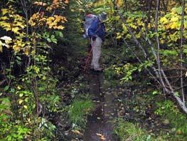
3 The NCTA is currently pursuing legislation in Congress to make the Arrowhead Re-route the official route of the NCT Who manages the BRT? Just like other sections of the North Country Trail, the BRT was built and is maintained primarily by volunteers It was the first long backcountry trail built by volunteers in Minnesota primarily the Minnesota Rovers Outing Club Volunteers from the Border Route Trail Association currently maintain the Trail with assistance from the U.S. Forest Service and Conservation Corps Minnesota 3
4 Special considerations Inside the wilderness volunteers cannot use motorized maintenance equipment Hiking the BRT within the BWCAW requires obtaining a permit and making reservations with the U.S. Forest Service for your entry point. A permit quota and user fee system is in force for entry points for ALL overnight use between May and September During October-April a free, self-issued permit is required for overnight hiking use For all day use, a free, self-issued permit is required Permits, reservations, or fees are not necessary for hiking on the sections outside the BWCAW 4

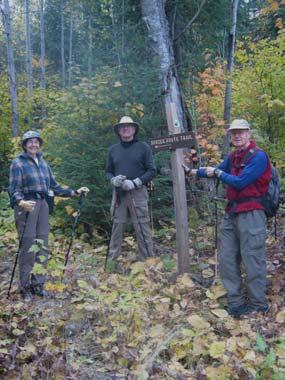
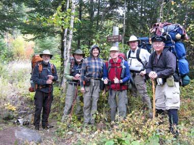
5 Special considerations, cont. The BRT is not blazed in the BWCAW There are side trails that intersect with the BRT on the western half.these form great loop day/weekend hike opportunities for those unwilling to hike the entire 65 miles Mucker Lake Trail Bryce-Breon Trail Crab Lake Trail South Lake Trail Daniel s Lake Trail Caribou Rock/Split Pines Trail The 2010 hike group Bruce Johnson Tom Moberg Mike Doyle Florence & Carter Hedeen Harlan Liljequist 5


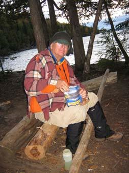
6 Sunday: travel up to Grand Marais & Heston s Resort Our hike s itinerary Our plan was to dayhike the far western and far eastern ends, which fall outside the BWCAW, and backpack the middle portion inside the BWCAW The group stayed at Heston s Resort on Gunflint Lake on 9/19 and 9/20 Heston s shuttled vehicles to McFarland Lake & the eastern trailhead for us. 6


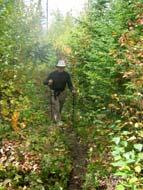
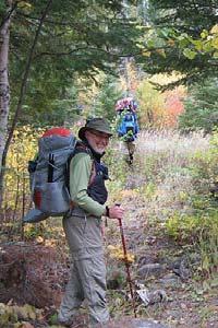
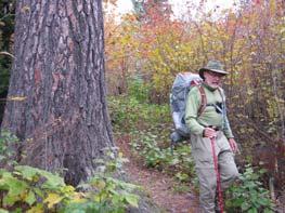
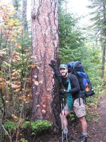
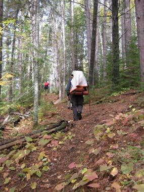
7 Day 1: Gunflint Trail to Loon Lake Rd. Start Heston s End The day s hike included Magnetic Rock, traversing part of the 99 blowdown & Ham Lake fire area, navigating the extensive XC ski trail system, and enjoying fantastic overlooks of Gunflint Lake 7


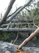
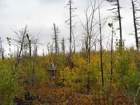
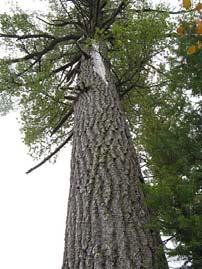
8 The BWCAW has been shaped by wind and fire 8


9 9

10 10


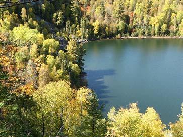
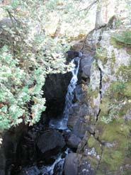
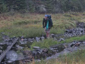
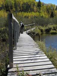
11 Day 2: Loon Lake Rd. to South Lake Trail campsite Breidal Veil Falls End Start BWCAW boundary The day s hike included traversing part of the Ham Lake fire burned area, Bridal Veil Falls, entering the BWCAW, Topper Lake, and Mucker Lake 11


12 12


13 13


14 14


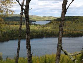
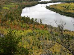
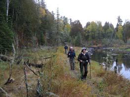
15 Day 3: South Lake Trail campsite to E. Rose Lake campsite Start Stairway portage End Rose Lake cliffs The day s hike included Stairway portage, Rose Lake cliffs, and unbelievable old-growth above Rose Lake 15


16 16


17 17

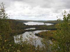
18 18


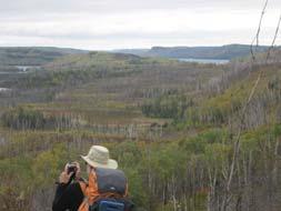
19 Day 4: E. Rose Lake campsite to Clearwater Lake campsite Start Long portage Watap Lake vistas End The day s hike included Long portage, a constant battle with hypothermia, a quick visit to Canada, and fantastic views above Watap Lake 19


20 20

21 21


22 Day 5: Clearwater Lake campsite to Pine Lake campsite Start Gogebic Lake End The day s hike included a constant battle with hypothermia, a quick visit to Canada, and fantastic views above Watap Lake 22


23 Day 6: Pine Lake campsite to McFarland Lake Start Woods campsite BWCAW boundary End The day s hike included the storm clouds departing, great views of John Lake, leaving the BWCAW, and a great campsite at McFarland Lake 23


24 24


25 25


26 Day 7: McFarland Lake to Otter Lake Rd. Start Pigeon River 270 Vista End The day s hike included early morning frost, fog over the lakes, numerous great vistas, and the end of the hike 26


27 27


28 28


29 29


30 30

31 31


32 Day 8: Grand Marais We stayed on Sunday night in Grand Marais at Lund s, ate at My Sister s Place, and then did some sightseeing on Monday morning. 32


33 For more info Obtain a copy of the BRT guidebook Look for an article about our hike in the next North Star Visit the Border Route Trail Association s website Visit the Insight blog post about our hike - Visit Tom Moberg s BRT hike photo gallery - Visit Todd McMahon s BRT hike photo galleries
Purpose of tonight s presentation. The North Country Trail in ND, MN, and WI: what's new in our neighborhood on the nation's longest hiking trail?
 The North Country Trail in ND, MN, and WI: what's new in our neighborhood on the nation's longest hiking trail? Matthew Davis North Country Trail Association Regional Trail Coordinator for MN & ND Midwest
The Intrepid Group of 7. Sunday, May 17th. A little about the. Monday, May 18 th. Fall Lake Campground. Kekekabic Trail Adventure
 Kekekabic Trail Adventure May 17 th 22 nd, 2009 The Intrepid Group of 7 Hikers (and their trail name aliases): Carter Doc Camera Shy Hedeen Park Rapids, MN Florence Ma Hedeen Park Rapids, MN Bruce Pace
PlansMatter. Welcome! Gunflint Lake Cabin
 PlansMatter Welcome! Gunflint Lake Cabin 1 Essential Information 2 House Truths + Rules 3 Operating Instructions 4 Local Eats, Drinks + Provisions 5 Local Activities 2418 Bryant Avenue South Minneapolis
THE REGION LAKE SUPERIOR THE GITCHI-GAMI TRAIL & THE NORTH SHORE
 LAKE SUPERIOR THE GITCHI-GAMI TRAIL & THE NORTH SHORE 7 LAKE SUPERIOR: Water covers 70% of the earth s surface area, but only 3% of it is freshwater. Saltwater makes up 97% of the earth s water supply.
Clearwater Lake Provincial Park. Draft Management Plan
 Clearwater Lake Provincial Park Draft Management Plan Clearwater Lake Provincial Park Draft Management Plan Table of Contents 1. Introduction... 3 2. Park History... 4 3. Park Attributes... 4 3.1 Location/Access...4
Martin Kubik BWA Committee, President, On behalf of the Coalition to Bring Back the Pow Wow Trail
 January 24, 2012 Timothy A. Dabney, Acting Forest Supervisor Duluth, MN 55808-1122 Dear Mr. Dabney, This letter is to let you know that on January 12, 2012 the Izaak Walton League of America, Minnesota
Call of the North. of the North
 Call of the North Fall/Winter2014 75 people hike the entire 75-mile Dakota Prairie Chapter trail section to celebrate the first ever NCNST Day by Tom Moberg, Dakota Prairie Chapter V.P. September 27th
FAQ: HR 799 & S. 403: North Country National Scenic Trail Route Adjustment Act
 FAQ: HR 799 & S. 403: North Country National Scenic Trail Route Adjustment Act Exactly what does HR 799/S. 403 call for? These bills simply amend the National Trails System Act (16 U.S.C. 1244(a)(8)) by:
National Park Service U.S. Department of the Interior
 North Country National Scenic Trail North Dakota, Minnesota, Wisconsin, Michigan, Ohio, Pennsylvania, New York Draft Northeastern Minnesota Route Assessment And Environmental Assessment National Park Service
 Located on Northern Minnesota s Gunflint Trail Complete & Partial Outfitting for Boundary Waters and Quetico Wilderness Canoe Trips Housekeeping Cabins on the Shore of Round Lake Who we are Provide a private
beach. Make the ford and follow the trail out to the junction with Red Creek Tr in an open grassy area.
 Description: This is a moderate to slightly strenuous 22.8 mile backpack (add 2.6 miles if you do the packless out and back to the Lion s Head) that will have you exploring nearly every thing that is The
Vision Statement. The NCTA will. develop a corridor of consistently and clearly marked treadways, blending with local character acte appropriate.
 Vision Statement The North Country Trail Association (NCTA) will be the primary organization charged with developing, maintaining, protecting, and promoting the North Country National Scenic Trail (NCNST).
Call of the North. Itasca Moraine Chapter completes the new Lake 21 loop trail working with Americorps-NCCC crew by Bruce Johnson
 Fall / Winter2013 Call of the North Volunteer Contacts for Minn. & North Dakota: Sheyenne River Valley Ch. Pres. Bobby Koepplin Valley City, ND (701) 845-2935, srv@northcountrytrail.org Dakota Prairie
BOUNDARY WATERS CANOE AREA WILDERNESS T R I P P L A N N I N G G U I D E. Your BWCAW Adventure Starts Here... What s Inside
 BOUNDARY WATERS CANOE AREA WILDERNESS T R I P P L A N N I N G G U I D E Your BWCAW Adventure Starts Here... GREAT GLACIERS carved the physical features of what is today known as the Boundary Waters Canoe
Continental Divide National Scenic Trail Legislative History and Planning Guidance
 Continental Divide National Scenic Trail Legislative History and Planning Guidance Legislation, Policy, and Direction Regarding National Scenic Trails The National Trails System Act, P.L. 90-543, was passed
Sign Library. Florida Trail Association
 310: FTA SIGN LIBRARY December 2015 Sign Library Florida Trail Association Trail signs are used to inform the motoring public and/or trail users that they are approaching, or are on, the Trail. When blazes
Call of the North Volume 16 ~ Issue 3 Fall/Winter 2010
 Call of the North Volume 16 ~ Issue 3 Fall/Winter 2010 Contacts for Minnesota Star of the North Ch. President Brian Pavek Maple Grove (763) 425-4195, itm@northcountrytrail.org Itasca Moraine Ch. President
Greater Minnesota Regional Parks and Trails Commission Designation Application
 Greater Minnesota Regional Parks and Trails Commission Designation Application General Section Designation Application #: 15-059D Date Submitted: 06/16/2015 Park or Trail Name: Mesabi Trail District #:
Affected Environment and Environmental Consequences
 Chapter 3. Affected Environment and Environmental Consequences 3.1 Introduction This chapter evaluates key issues involved in the route alternatives for a snowmobile trail between McFarland Lake and South
Trail Report for KOKANEE GLACIER PROVINCIAL PARK and other Kootenay Lake Area parks (including west side of Purcell Wilderness Conservancy)
") Updated: October 23, 2017 Please call 250-354-6333 if you have new trail conditions to report. PARK AREA ROADS TRAILS ADDITIONAL INFORMATION Kokanee Creek SPECIAL NOTICE: Trail from Gibson Lake to drainage
Updated: October 23, 2017 Please call 250-354-6333 if you have new trail conditions to report. PARK AREA ROADS TRAILS ADDITIONAL INFORMATION Kokanee Creek SPECIAL NOTICE: Trail from Gibson Lake to drainage
If you guessed any state but our good neighbor to the north - Ohio - you would be wrong.
 1 of 5 12/6/2018, 10:02 AM http://www.herald-dispatch.com/features_entertainment/ohio-hiker-chronicles-first-solo-thru-hike-of-buckeyetrail/article_cb28bc33-5c42-56da-86e7-e38c12a97727.html By DAVE LAVENDER
Hiking and kayaking/canoeing in the Boundary Waters
 Hiking and kayaking/canoeing in the Boundary Waters Boundary Waters, Minnesota May 24 th May 27 th, 2013 Comprehensive guide and packing list Trip at a glance: Enjoy your Memorial Day weekend in the wilderness
Zion National Park/Gooseberry Weekend
 WATCH THE VIDEO Zion National Park/Gooseberry Weekend LENGTH: 3 Days / 2 Nights ACCOMMODATIONS: Camping FITNESS LEVEL: Intermediate For up-to-date pricing and dates, please visit our website. This fun-filled
Backpacking Trip Planning. Presenters: Dana Perry Christine Fogarty
 Backpacking Trip Planning Presenters: Dana Perry Christine Fogarty 1 Agenda New to planning trips? Location and physical trail Common terminology Trip selection & research The Trip Flow Plan What is it
System Group Meeting #1. March 2014
 System Group Meeting #1 March 2014 Meeting #1 Outcomes 1. Understand Your Role 2. List of Revisions to Existing Conditions 3. Information Sources Study Area The Purpose of Mountain Accord is to Preserve
CHAPTER 5. Chapter 5 Recreation Element
 CHAPTER 5 Recreation Element Chapter 5 Recreation Element The Recreation Element of the Meyers Area Plan is a supplement to the Recreation Element of the TRPA Regional Plan and the El Dorado County General
PROUDLY BRINGING YOU CANADA AT ITS BEST. Management Planning Program NEWSLETTER #1 OCTOBER, 2000
 PROUDLY BRINGING YOU CANADA AT ITS BEST VUNTUT NATIONAL PARK Management Planning Program NEWSLETTER #1 OCTOBER, 2000 INTRODUCTION This newsletter launches the development of the first management plan for
North Woods Wilderness Canoe Adventure
 Canoeing Portaging Fishing Live Wolf Study Photography Exploration TLS Voyages North Woods Wilderness Canoe Adventure Boundary Waters, Minnesota e 22- July 6, 2015 Offered this summer through TLS Voyages
We came with the expectation for our incoming freshman to get connected and that happened.
 Bible Camp offers a unique program designed to give groups the ultimate in adventure camping trips. The purpose is to impact lives for Christ. Our mission is to provide planning, outfitting, and guides
Other Agencies and Organizations
 Daniel Boone National Forest 1700 Bypass Road WInchester, KY 40391 859-745-3100 Location Northern terminus is near Morehead, Kentucky. Southern terminus is located in the Big South Fork NRRA in Tennessee.
LOCAL PLAN FOR THE MANAGEMENT OF THE APPALACHIAN TRAIL IN MAINE. (GRAFTON NOTCH TO KATAHDIN) 1 January 2013 (Revised 5 February 2014)
 1 January 2013 (Revised 5 February 2014)") LOCAL PLAN FOR THE MANAGEMENT OF THE APPALACHIAN TRAIL IN MAINE (GRAFTON NOTCH TO KATAHDIN) 1 January 2013 (Revised 5 February 2014) The Appalachian Trail is a way, continuous from Katahdin in Maine to
LOCAL PLAN FOR THE MANAGEMENT OF THE APPALACHIAN TRAIL IN MAINE (GRAFTON NOTCH TO KATAHDIN) 1 January 2013 (Revised 5 February 2014) The Appalachian Trail is a way, continuous from Katahdin in Maine to
NEPOSS. 131 Parks 11/8/2010. The Niagara Escarpment Parks and Open Space System Ken Whitbread, Manager, Niagara Escarpment Commission
 The Niagara Escarpment Parks and Open Space System Ken Whitbread, Manager, Niagara Escarpment Commission NEP approved in 1985 Reviewed in 1994 & 2005 Plan has land use designations and identifies Public
Next Membership Meeting
 Volume 20 Month 11 ember 2014 Next Membership Meeting Please join us on ember 5th for Cody Magill's presentation on the history of the former Rock Point Park near Ellwood City. Cody will discuss the rise
Wallace Lake Provincial Park. Management Plan
 Wallace Lake Provincial Park Management Plan 2 Wallace Lake Provincial Park Table of Contents 1. Introduction... 3 2. Park History... 3 3. Park Attributes... 4 3.1 Natural... 4 3.2 Recreational... 4 4.
THE SETTING REGION COMMUNITY ANALYSIS
 THE SETTING REGION COMMUNITY ANALYSIS REGION Historical Setting The Crane Lake waterway pre-dates the American Indians who traveled its waters for generations before it became a fur-trading route for the
New Backcountry Campsites along the Pine Mountain Trail
 New Backcountry Campsites along the Pine Mountain Trail In early 2012 two new backcountry campsites were presented for consideration to the managers of FDR State Park, who endorsed the presented sites..
Wyoming Public Lands Initiative in Carbon County
 Wyoming Public Lands Initiative in Carbon County THE CARBON COUNTY WPLI ADVISORY COMMIT TEE WANTS YOUR INPUT Wilderness Study Area: A special designation that applies to lands managed to protect wilderness
Great Eastern Trail Newsletter
 Great Eastern Trail Newsletter Volume 1, Number 1, January 2011 By Timothy A. Hupp Please feel free to print out or copy and distribute this newsletter Note this is the first newsletter of the Great Eastern
THOMAS FLINT CANOE TRIP PROGRAM
 THOMAS FLINT CANOE TRIP PROGRAM FINAL REPORT - SEPTEMBER 2016 The Thomas Flint Canoe Trip program works to foster the next generation of wilderness advocates and stewards by sponsoring youth on canoe trips
KETTLEBOWL - Distance: Approximately 13 miles Highway 52 to Polar at Highway 64.
 LANGLADE COUNTY ICE AGE NATIONAL SCENIC TRAIL CONDITIONS (As of September 7, 2017) Due to situations beyond the control of the Langlade County Chapter of the Ice Age Trail Alliance, conditions are constantly
Best of the Rockies - Jasper Wilderness 7 Days/6 Nights - Detailed Itinerary
 Published on White Mountain Adventures (https://www.whitemountainadventures.com) Home > Best of the Rockies - Jasper Wilderness 7 Days/6 Nights - Detailed Itinerary Best of the Rockies - Jasper Wilderness
Marchand Provincial Park. Management Plan
 Marchand Provincial Park Management Plan 2 Marchand Provincial Park Table of Contents 1. Introduction... 3 2. Park History... 3 3. Park Attributes... 4 3.1 Natural... 4 3.2 Recreational... 4 3.3 Additional
The Superior and Des Moines lobes largely shaped Polk and Burnett counties.
 olk & Burnett Counties Trail miles: 57.1 Connecting route miles: 7.3 The Superior and Des Moines lobes largely shaped olk and Burnett counties. First, the Superior Lobe came from the northeast. Later,
RE: Access Fund Comments on Yosemite National Park Wilderness Stewardship Plan, Preliminary Ideas and Concepts
 September 30, 2016 Superintendent Yosemite National Park Attn: Wilderness Stewardship Plan P.O. Box 577 Yosemite, CA 95389 RE: Access Fund Comments on Yosemite National Park Wilderness Stewardship Plan,
Hermosa Area Preservation The Colorado Trail Foundation 4/11/2008
 Hermosa Area Preservation The Colorado Trail Foundation 4/11/2008 Legend d o Tr ail NPA - National Protection Area ra NCA - National Conservation Area o e C Th The Colorado Trail lo FS inventoried Roadless
Call of the North Volume 16 ~ Issue 2 Summer 2010
 Call of the North Volume 16 ~ Issue 2 Summer 2010 Come to the 4th Annual North Country Hiking Fest @ Itasca! By Matthew Davis, Regional Trail Coordinator Contacts for Minnesota Star of the North Ch. President
South Colony Basin Recreation Fee Proposal
 South Colony Basin Recreation Fee Proposal Purpose and Need for Collecting Fees in South Colony Basin: Forest Service appropriated funds have not been sufficient to maintain current recreational services
DOWNLOAD OR READ : UTAH NATIONAL PARKS MAP PACK BUNDLE ADVENTURE MAP PDF EBOOK EPUB MOBI
 DOWNLOAD OR READ : UTAH NATIONAL PARKS MAP PACK BUNDLE ADVENTURE MAP PDF EBOOK EPUB MOBI Page 1 Page 2 utah national parks map pack bundle adventure map utah national parks map pdf utah national parks
Public Review on Proposed Changes to Trapping Policy
 Public Review on Proposed Changes to Trapping Policy in Manitoba s Provincial Parks and Other Crown Lands With Recreational Developments In December 2012, two dogs were killed in traps while they were
Grand Canyon, Sedona, Lake Powell, Bryce & Zion 8 Days from $1395
 1 800 422 3727 Grand Canyon, Sedona, Lake Powell, Bryce & Zion 8 Days from $1395 Itinerary Day 1 Phoenix, Arizona See the greatest national parks of America's Southwest! Spend four nights in national park
Featuring North America s Leading Travel Destinations. Great American Roads
 Featuring North America s Leading Travel Destinations Great American Roads The Alaska Highway, U.S. 395 in California, Colorado s Million Dollar Highway, The Natchez Trace, Parkersburg-Staunton Turnpike,
GIFFORD PINCHOT NATIONAL FOREST
 GIFFORD PINCHOT NATIONAL FOREST 9341 Wright Meadow 93 Spencer Meadow Spencer Butte 4247' 30 30A 19 24 80 31C Lewis River Lower Falls 5 Quartz Creek 90 Taidnapam Falls Upper Falls 31 Spencer Peak 3861'
Garibaldi Provincial Park Trail Conditions
 Garibaldi Provincial Park s August 2, 2018 Garibaldi Park is located in the coast mountain wilderness and the weather can be severe and unforgiving. Be well prepared, properly equipped and informed before
Southwest Family Adventure. 7 Days
 Southwest Family Adventure 7 Days Southwest Family Adventure See three amazing National Parks Grand Canyon, Bryce, and Zion on this epic camping trip designed with families in mind. Every day offers magnificent
Stein Valley Nlaka pamux Heritage Park
 Stein Valley Nlaka pamux Heritage Park - Trail Information Update and Winter Advisory November 2017 March 2018 Welcome to Stein Valley Nlaka pamux Heritage Park! **This trail update is to inform park users
A Publication of Friends of Sleeping Bear Dunes
 A Publication of Friends of Sleeping Bear Dunes 2014, Friends of Sleeping Bear Dunes, P.O. Box 545, Empire, MI 49630 www.friendsofsleepingbear.org info@friendsofsleepingbear.org Learn more about the Friends
Oregon Section F - Page 1 WGS84 Zone 10T m
 08 N. 07 N. 06 N. Oregon Section F - Page 1 WGS84 Zone 10T LavaCampLakeTR - Lava Camp Lake Trail #4060 junction. - mi 1982.6-5287 ft LavaCampLake - Lava Camp Lake, campground, outhouse, 1/2 mile NE of
Rogue Gorge (Mt. Stella) Roadless Area-- T30S R3E (primarily in portions of Sections 23, 26, 33, 34 & 35)
 Roadless Area-- T30S R3E (primarily in portions of Sections 23, 26, 33, 34 & 35)") Rogue Gorge (Mt. Stella) Roadless Area-- T30S R3E (primarily in portions of Sections 23, 26, 33, 34 & 35) Rogue River-Siskiyou National Forest--High Cascades Ranger District Upper, higher elevation trail
Rogue Gorge (Mt. Stella) Roadless Area-- T30S R3E (primarily in portions of Sections 23, 26, 33, 34 & 35) Rogue River-Siskiyou National Forest--High Cascades Ranger District Upper, higher elevation trail
New Bridge Opens Along the Enoree Passage
 New Bridge Opens Along the Enoree Passage Palmetto Conservation Foundation (PCF) hosted a ribbon-cutting ceremony for the new state-ofthe-art pedestrian bridge across Indian Creek on the Enoree Passage
APPENDIX 19-II. Ontario Trail Network Trailheads EAST-WEST TIE TRANSMISSION PROJECT AMENDED ENVIRONMENTAL ASSESSMENT REPORT
 EAST-WEST TIE TRANSMISSION PROJECT AMENDED ENVIRONMENTAL ASSESSMENT REPORT APPENDIX 19-II Ontario Network heads Report. 1536607/2000/2219 Ontario Network heads in the n-commercial Land and Resource Use
4.0 OUTDOOR RECREATION 4.1 PUBLIC LANDS
 4.0 OUTDOOR RECREATION 4.1 PUBLIC LANDS Public lands provide a wide range of recreational opportunities and are considered a valuable community asset. There may be seasonal and/or other use restrictions
Secret-Lamoille Trail Project
 Secret-Lamoille Trail Project Historical Background Over the years, the US Forest Service and a variety of Forest users have routed and constructed trails in the Ruby Mountains. Many of those trails have
Crew Chief: Start Date: Completion Date: T & A Code:
 Completed Work Data Work order # Crew Chief: Start Date: Completion Date: T & A Code: Work Complete Comments: Personnel Service: Equipment: Item ID# Hours/Miles Rental Cost Supplies & Materials: Item Invoice#
CIEC 9 PEAKS AWARD SUPPLEMENT POSSIBLE ROUTES FOR THE 9 PEAKS AWARD TRIP
 CIEC 9 PEAKS AWARD SUPPLEMENT POSSIBLE ROUTES FOR THE 9 PEAKS AWARD TRIP As you plan your trip, be aware of 3 regulations in this wilderness: 1. Camp only in designated campsites. 2. No campfires allowed.
Explore your Town With The Kingston Area Trail Passport
 Explore your Town With The Kingston Area Trail Passport Don t forget to stop at the children's room in the library for your prize when you collect 5 Passport Stamps! For more natural resource related information,
Choose Your Adventure!
 Choose Your Adventure! The Schuylkill Center s Summer Adventure Treks challenge pre-teens and teens to improve their outdoor knowledge and skills in a comfortable and supportive setting. Participants learn
ONTARIO TRAILS COUNCIL FAQ
 Trail Facts Ontario has some of the most treasured and protected outdoor areas in the world with: 329 Provincial Parks 400 Conservation Areas 292 Conservation Reserves Many people link trails with recreation
top rated rocky mountain pdf Rocky Mountain Cycle Bike Touring and Cycling Adventure Rocky Mountain Maps NPMaps.com - just free maps, period.
 DOWNLOAD OR READ : TOP RATED ROCKY MOUNTAIN ADVENTURES INCLUDES COLORADO IDAHO MONTANA NEW MEXICO UTAH WYOMING ALBERTA BRITISH COLUMBIA SASKATCHEWAN YUKON TERRITORIES TOP RATED OUTDOOR SERIES PDF EBOOK
Frizzell Creek Ranch Summerville, OR $1,400, ± Acres
 Frizzell Creek Ranch Summerville, OR $1,400,000 165± Acres 1 Introduction The Frizzell Creek Ranch is a beautiful 165± acre ranch located in northeast Oregon at the base of the Wallowa Whitman National
OMINEACA PROVINCIAL PARK
 OMINEACA PROVINCIAL PARK AND PROTECTED AREA PURPOSE STATEMENT AND ZONING PLAN March 2003 OMINECA PROVINCIAL PARK AND PROTECTED AREA Purpose Statement and Zoning Plan Omineca Park and Omineca Protected
APPENDIX 5: JUNEAU NORDIC SKI CLUB MEMO
 APPENDIX 5: JUNEAU NORDIC SKI CLUB MEMO To all participants in the McDowell Eaglecrest nordic long-range planning meeting: It was good to meet with all of you last month and talk about our vision for the
Non-motorized Trail Plan & Proposal. August 8, 2014
 Town of Star Valley Ranch, Wyoming and the Star Valley Ranch Association in partnership with the USDA Forest Service, Bridger-Teton National Forest, Greys River Ranger District Non-motorized Trail Plan
West Coast Trail Information
 West Coast Trail Information Updated October 26, 2016 1) Overview What Every Hiker Should Know... Challenges of the West Coast Trail Park Description Orientation Session Fees Maps Dates and Reservations
Marvine Creek Trail BCM Course Area Guide Backcountry. Trip Code Team Leader
 Marvine Creek Trail BCM Course Area Guide Backcountry Trip Code Team Leader Table of Contents Trail Summary... 3 Trail Information... 3 Trail Description... 4 Route Description... 5 Trail Distances...
Whitemouth Falls Provincial Park. Draft Management Plan
 Whitemouth Falls Provincial Park Draft Management Plan Whitemouth Falls Provincial Park Draft Management Plan Table of Contents 1. Introduction... 3 2. Park History... 3 3. Park Attributes... 4 3.1 Natural...
APPALACHIAN TRAIL THROUGH GEORGIA. Long Distance YRE 2018/Y2289, rated 4D. Table of Contents. HOW TO HIKE THE AT IN GEORGIA THE BASICS Page 2
 Table of Contents HOW TO HIKE THE AT IN GEORGIA THE BASICS Page 2 THE SUGGESTED 8 DAY HIKES PLUS APPROACH Page 3 OPTIONAL A AWARD Page 4 HIKING GUIDELINES Page 4 AFTER YOU HAVE COMPLETED THE HIKE Page
ABOUT THE PARKS NANTAHALA NATIONAL FOREST MOUNTAINS NATIONAL PARK CHEROKEE NATIONAL FOREST PISGAH NATIONAL FOREST GREAT SMOKY HIKING TRAILS
 ABOUT THE PARKS GREAT SMOKY MOUNTAINS NATIONAL PARK NANTAHALA NATIONAL FOREST CHEROKEE NATIONAL FOREST PISGAH NATIONAL FOREST GREAT SMOKY MOUNTAINS NATIONAL PARK Straddling the border between North Carolina
Exploring the Natural Wonders of Arizona
 5 Days / 4 Nights DEVELOPED FOR Couples and Families HIGHLIGHTS Full Day Private Tour of Grand Canyon National Park Shared Helicopter Flightseeing Tour over the Canyon 2-Hour Private 4x4 Jeep Tour on the
Wildfire. When you think of firefighters, HEROES. naturalists. firefighters rush to help. Young. When forests or grasslands go up in flames, these
 By Joe Albert Young naturalists Wildfire HEROES When forests or grasslands go up in flames, these firefighters rush to help. COURTESY OF TYLER FISH When you think of firefighters, you might picture them
2015 USA Pro Challenge (Stages 3 and 4) State Highway 82 Spectator Guide to Parking and Camping on Independence Pass
 State Highway 82 Spectator Guide to Parking and Camping on Independence Pass") 2015 USA Pro Challenge (Stages 3 and 4) State Highway 82 Spectator Guide to Parking and Camping on Independence Pass Stage 3 Copper Mountain Resort to Aspen, Wednesday, August 19 Racers will head south
2015 USA Pro Challenge (Stages 3 and 4) State Highway 82 Spectator Guide to Parking and Camping on Independence Pass Stage 3 Copper Mountain Resort to Aspen, Wednesday, August 19 Racers will head south
Section 7: Pick Up Where You Left Off! S-Tree Road over the Todd Road
 2018 TRACE NOTES Helpful information for your adventure on Section 7 of the Hiker Challenge. Start Point S-Tree Rd. End Point Intersection Todd Rd. / Hale Ridge Rd. WEATHER DECISION Weather Alert!!!! Potential
Trail Phasing Plan. Note: Trails in the Clear Creek Canyon area (Segments will be finalized in the future to minimize wildlife impacts
 Note: Trails in the Clear Creek Canyon area (Segments 2 5 and a future JCOS connection) will be finalized in the future to minimize wildlife impacts Trail Phasing Plan P Parking 3 Easy Trail Intermediate
F. Forest Recreation Management
 F. Forest Recreation Management F.1) Park and Recreation Management F.1.A. Program Overview. The park and recreation program has been in existence since 1980. With ever increasing outdoor recreation demands
Proposed Scotchman Peaks Wilderness Act 2016 (S.3531)
") 1 Proposed Scotchman Peaks Wilderness Act 2016 (S.3531) Frequently Asked Questions PLACE Where is the area that would be designated as Wilderness? The lands outlined in S.3531 lie within Idaho along its
1 Proposed Scotchman Peaks Wilderness Act 2016 (S.3531) Frequently Asked Questions PLACE Where is the area that would be designated as Wilderness? The lands outlined in S.3531 lie within Idaho along its
Ladder Ranch House and Sierra Grande Lodge Sample Itineraries
 TRAVEL OPTIONS Ladder Ranch House Guests: Regional Commercial Flight Arrivals: Albuquerque, NM (ABQ), or El Paso, TX (ELP). *El Paso offers options for connecting with international flights to and from
Beaver Creek Provincial Park. Management Plan
 Beaver Creek Provincial Park Management Plan 2 Beaver Creek Provincial Park Table of Contents 1. Introduction... 3 2. Park History... 3 3. Park Attributes... 4 3.1 Natural... 4 3.2 Recreational... 4 4.
Whitefish Range Partnership Tentatively Approved by WRP 11/18/2013!Rec. Wilderness Page 1
 Whitefish Range Partnership Tentatively Approved by WRP 11/18/2013!Rec. Wilderness Page 1 Recommended Wilderness Background The Whitefish Range has a long management and legislative history associated
Pine Mountain Double Loop Trail Long Leaf Trail and Big Popular Trail common access point of Fox Den Cove parking
 Pine Mountain Double Loop Trail Long Leaf Trail and Big Popular Trail common access point of Fox Den Cove parking Departure Destination: Big Popular Loop Trail and Long Leaf Trail, single trailhead. Fox
CWCS. Court hearing held on Chain of Lakes issue
 CWCS Conservationists with Common Sense Preserving access to and multiple-use of public lands & waters SPRING 2004 NEWSLETTER CWCS P.O. BOX 1046 VIRGINIA, MN 55792-1046 www.cwcs.org Why CWCS continues
Sasagiu Rapids Provincial Park. Draft Management Plan
 Sasagiu Rapids Provincial Park Draft Management Plan 2 Sasagiu Rapids Provincial Park Table of Contents 1. Introduction... 3 2. Background and Park Attributes... 3 2.1 Park History.... 3 2.2 Natural Features...
Preferred Recreation Recommendations Stemilt-Squilchuck Recreation Plan March 2018
 Preferred Recreation Recommendations Stemilt-Squilchuck Recreation Plan March 2018 Below are the recommended recreation ideas and strategies that package together the various recreation concepts compiled
Trailhead Ambassadors 2018 Latourell Falls: Alternative Hikes
 Trailhead Ambassadors 2018 Latourell Falls: Alternative Hikes General Note: The Historic Highway is closed from the Bridal Veil exit to its eastern end near Wyeth i.e., the Waterfall Alley section. The
Birch Point Provincial Park. Management Plan
 Birch Point Provincial Park Management Plan 2 Birch Point Provincial Park Table of Contents 1. Introduction... 3 2. Park History... 3 3. Park Attributes... 4 3.1 Natural... 4 3.2 Recreational... 4 4. Park
TRAIL DATABASE SCHEMA (8/26/2014)
") Trail Data Model for LINES Source Data Source Agency dataagency Agency or entity that created the dataset where the original line was sourced from. Source Date of Last Data Used to Update sourcedate Publication
Trail Data Model for LINES Source Data Source Agency dataagency Agency or entity that created the dataset where the original line was sourced from. Source Date of Last Data Used to Update sourcedate Publication
Greater Minnesota Regional Parks and Trails Commission Designation Application
 Greater Minnesota Regional Parks and Trails Commission Designation Application General Section Designation Application #: 15-050D Date Submitted: 06/30/2015 Park or Trail Name: Perham to Pelican Rapids
Pacific Crest Trail: Northern California By Jeffrey P. Schaffer READ ONLINE
 Pacific Crest Trail: Northern California By Jeffrey P. Schaffer READ ONLINE The Pacific Crest National Scenic Trail (PCT) is a 2,600-mile. While the PCT portion of this celebrated Northern California landmark
LANGLADE COUNTY ICE AGE NATIONAL SCENIC TRAIL CONDITIONS (As of May 18, 2017)
") LANGLADE COUNTY ICE AGE NATIONAL SCENIC TRAIL CONDITIONS (As of May 18, 2017) Due to situations beyond the control of the Langlade County Chapter of the Ice Age Trail Alliance, conditions are constantly
LANGLADE COUNTY ICE AGE NATIONAL SCENIC TRAIL CONDITIONS (As of May 18, 2017) Due to situations beyond the control of the Langlade County Chapter of the Ice Age Trail Alliance, conditions are constantly
Tracy Ridge Shared Use Trails and Plan Amendment Project
 Tracy Ridge Shared Use Trails and Plan Amendment Project Scoping Document Forest Service Allegheny National Forest Bradford Ranger District McKean, County, Pennsylvania In accordance with Federal civil
The Moose Call. The Newsletter of the Friends of Mt. Spokane State Park. From the President by Cris M. Currie
 The Moose Call The Newsletter of the Friends of Mt. Spokane State Park March 2006 From the President by Cris M. Currie The combined Mt. Spokane State Park Friends Group and Advisory Committee had eight
16 June Conservation. Education
 16 June 2017 Conservation Education Recreation Since 1922 Member Services 814 Goggins Rd. Lake George, NY 12845-4117 Phone: (518) 668-4447 Fax: (518) 668-3746 e-mail: adkinfo@adk.org website: www.adk.org