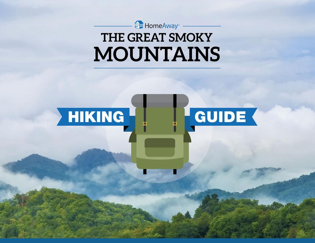
ABOUT THE PARKS NANTAHALA NATIONAL FOREST MOUNTAINS NATIONAL PARK CHEROKEE NATIONAL FOREST PISGAH NATIONAL FOREST GREAT SMOKY HIKING TRAILS
|
|
|
- Andrew Singleton
- 6 years ago
- Views:
Transcription
1
2 ABOUT THE PARKS GREAT SMOKY MOUNTAINS NATIONAL PARK NANTAHALA NATIONAL FOREST CHEROKEE NATIONAL FOREST PISGAH NATIONAL FOREST
3 GREAT SMOKY MOUNTAINS NATIONAL PARK Straddling the border between North Carolina and Tennessee, Great Smoky Mountains National Park is America s most-visited national park. This UNESCO World Heritage Site is known for its diversity of plant and animal life where 65 species of mammals including the most widely advertised, the black bear and 5,500 species of plants call home. Other popular residents include elk, deer, beavers, raccoons, squirrels, opossums, snakes, skunks, fox, otter, rabbits and wild hogs. In addition, there are more types of plant life in the 815 square miles of the park than the entire continent of Europe. This place is recognized as an International Biosphere Preserve, boasting one of the most complex ecosystems in U.S.

4 NANTAHALA NATIONAL FOREST The Nantahala National Forest covers much of the southwestern corner of North Carolina. It is the largest forest in the region, encompassing more than a half million acres of mountain land. Important: Hunting is allowed in the national forests at certain times of the year, so you should be sure to wear blaze orange during these times!

5 CHEROKEE NATIONAL FOREST Situated in the Southern Appalachian Mountains of east Tennessee, Cherokee National Forest is split into northern and southern sections by Great Smoky Mountains National Park. The park stretches across 655,598 acres, making it the largest tract of public land in the state. Visitors can explore more than 600 miles of trails including 150 miles of the Appalachian National Scenic Trail, hundreds of miles of cold water streams, seven whitewater rivers and three large lakes.
6 PISGAH NATIONAL FOREST Pisgah National Forest


7 HIKING THE TRAILS EASY TRAILS MEDIUM TRAILS DIFFICULT TRAILS ABOUT THE PARKS
8 EASY Pigeon Forge/Gatlinburg/Mt. LeConte Area Grotto Falls (14 miles from Pigeon Forge) Baskins Creek Falls This is the only waterfall in the Smokies where you can stand behind the wall of water as it cascades down. Moreover, the Trillium Trail offers old -growth forests that include many large hemlocks trees. Complete with a short easy climb, small creeks and decent views of the mountains toward the west, this 3 mile hike is one of easiest in the region. Elevation Gain: 585ft. Elevation Gain: 953ft.
9 EASY Gatlinburg, Tennessee Bridal Veil Falls Wahyah Bald You barely have to get out of the car to see the falls here. Located in Macon County about 2.5 miles west of Highlands on Highway 64, Bridal Veil Falls is part of a tributary of the Cullasaja River. Though it s easy to spot this one from the car, visitors can get an intimate nature experience by walking under the massive boulders curling over the road. Take an easy walk to Wayah Bald for a 5,300 foot vantage point where, on a clear day, you can see the Great Smoky Mountains National Park in Tennessee to the north and the rolling hills of Georgia to the south. Height of Falls: 210ft. Elevation Gain: 30ft.
10 EASY High Country & Blue Ridge Mountains, NC Appalachian National Scenic Trail #1 at Osborne Farm Rhododendron Trail #332 Bask in pastoral mountain views of Shady Valley. Want to see the world famous Ocoee River? This is your chance. This relaxing 0.5-mile hike is where Cross Mountain bridges Holston Mountain and Iron Mountain. The 1.6-mile hiking/biking trail runs along the river, connecting Ocoee Whitewater Center and Thunder Rock Campground.
11 MEDIUM Pigeon Forge/Gatlinburg/Mt. LeConte Area Brushy Mountain (via Trillium Gap Trail) Husky Gap (via Newfound Gap Found) The path spans 6.8 miles toward the top elevation of 1,745 feet. Hikers follow a gentle climb along a wide, well worn path that passes through Grotto Falls on its way to Brushy Mountain. Elevation Gain: 1,745ft. Elevation Gain: 1,240ft.
12 MEDIUM Gatlinburg, Tennessee Whiteside Mountain High Falls The 2-mile loop takes hikers along the ridge of the mountain and grants breathtaking vistas to the east, south and west. As one of the favorite hikes in Nantahala National Forest, Whiteside Mountain rises more than After the initial 0.5-mile trail, the hike up to the falls is a fairly steady uphill trek. You can take a respite at Blue Cove Falls, which is about 40 feet high in two levels, before climbing to the 150-foot-tall High Falls. Elevation Gain: 600ft. This is a Medium/Difficult trail.
13 MEDIUM High Country & Blue Ridge Mountains, NC Indian Boundary Lake Trail #129 Pinnacle Tower Hike Indian Boundary Lake is regarded as the crown jewel of Cherokee National Forest s South Zone. Whether you want to hike or bike, the trail stretches just over 3 miles, serving up spectacular mountain views, glimpses of wildlife and a peaceful setting. Soak up some of the best views of the region s highest peaks at Pinnacle Mountain Fire Tower, located atop Buffalo Mountain at 3,520 feet above sea level. The tower has served as sentinel for nearby forests for the past 75 years.

14 DIFFICULT Pigeon Forge/Gatlinburg/Mt. LeConte Area Mt. LeConte (via Bullhead Trail) Located along Roaring Fork Motor Nature Trail, LeConte is far-and-away the most strenuous in the area. Choose between the Rainbow Falls Trail or Bullhead. After taking an old gravel path, you ll continue straight on through the Rainbow Fall Trail Junction, with a tough hike to reach the top of Mt. LeConte. The payoff - besides a good workout - is astounding vistas. Elevation Gain: 3,993ft.

15 DIFFICULT Gatlinburg, Tennessee Upper Buck Creek Falls You ll hear Buck Creek before you see it. Although the hike is less than 0.5-mile, this downward trek is not meant for the average traveler. The descent is steep and the paths are full of overgrowth. The woods past the old road will open up to the top of the 100-foot cascade.
16 DIFFICULT High Country & Blue Ridge Mountains, NC Rock Creek Falls This path has a number of creek crossings, so plan on getting your feet wet. The 3-mile hike lies in the congressional designated Unaka Mountain Wilderness.
17 TRAIL ELEVATION CHART Mt. LeConte Brushy Mtn. Huskey Gap Baskins Creek Falls Whiteside Mtn. Grotto Falls Bridal Veil Falls Wayah Bald
18 Water Attraction Plant/Nature Attraction Floral Attraction Hemlock Trees Trail Roadside Attraction Bike Paths Available Multiple Paths Steep Climb Campgrounds Avaliable Wildlife Attraction Mountain Views Scenic Views Path May Not Be Clear Downward Climb ABOUT THE PARKS

19 Sources: fs.usda.gov/cherokee/ nps.gov/grsm/index.htm hikinginthesmokys.com/location.htm ncwaterfalls.com/bull_cove_high1.htm summitpost.org/great-smoky-mountains/ hikewnc.info/trailheads/nantahala-national-forest/ fs.usda.gov/recarea/nfsnc/recarea/?recid=48114 stayandplayinthesmokies.com/vendor/wayah-bald-lookout-tower/ fs.usda.gov/activity/cherokee/recreation/hiking/?recid=34864&actid=50
Asheville & WNC Hikes
 Asheville & WNC Hikes Amazingly, we have 3,000+ miles of free public hiking trails near Asheville, including 1,600 miles in the Pisgah and Nantahala National Forests, 850 miles in Great Smokey Mountains
Covenant Health presents
 Covenant Health presents www.covenanthealth.com 1. 2. 3. 4. 5. 6. 7. 8. 9. 10. 11. Trail Guidelines Wear proper hiking shoes. Please be on time. Make sure that you understand & have signed the waiver.
Blue Ridge Hiking Club Hike List July- September 2016
 Blue Ridge Hiking Club Hike List July- September 2016 Saturday, July 2, Elk Knob: 3.8 mile round trip with 900 ft. gain in elevation. Spectacular views at the summit. The trails are mostly moderate, but
ROAD SCHOLAR SPRING HIKING ADVENTURE Tentative Schedule April 9-14, 2017
 ROAD SCHOLAR SPRING HIKING ADVENTURE Tentative Schedule April 9-14, 2017 Sunday, April 9 PM 3:00-5:00 Arrival, registration and move in to the dorm. 6:00 Supper EVE 7:15 Welcome & Orientation, Sign Ups
ROAD SCHOLAR SPRING HIKING ADVENTURE Tentative Schedule April 8-13, 2018
 Sunday, April 8 ROAD SCHOLAR SPRING HIKING ADVENTURE Tentative Schedule April 8-13, 2018 PM 3:00-5:00 Arrival, registration and move in to the dorm. 6:00 Supper EVE 7:00 Welcome & Orientation, Sign Ups
Suggested Day Hikes. Mount Greylock State Reservation 3, 4 1, 2. Take a Hike! Things to remember:
 Suggested Day Hikes Mount Greylock State Reservation Take a Hike! This guide offers suggested day hike routes in two parts: 1) Year-round Hikes and 2) Seasonal Hikes (late-may to Nov.1). Use this guide
Whiteside Mountain Land Owned by: Location: Trails:
 Whiteside Mountain Latitude: 35 05.123 N Longitude: 083 07.933 W Elevation: 1,503m Land Owned by: US Forest Service Nantahala Ranger District 828-524-6441 Location: Jackson County, NC Turn off of US Highway
GREAT SMOKY MOUNTAINS FAMILY CAMP!
 GREAT SMOKY MOUNTAINS FAMILY CAMP! July 10-15, 2017 SCHEDULE OF EVENTS Monday PM 3:00-5:00 EVE 5:45 WELCOME! Arrival, registration and move in to the dorm. Supper 6:45 Welcome & Orientation & Sign Up for
Swan Valley Farms. 523 acres for sale in Bonneville County, ID JIMMY ROUMANIS. JOHN STARR
 Swan Valley Farms JOHN STARR 208 472 2838 john.starr@colliers.com 523 acres for sale in Bonneville County, ID JIMMY ROUMANIS 208 472 2840 jimmy.roumanis@colliers.com Swan Valley Farms- 523 acres for sale
proof Northwest District
 1 Northwest District The Northwest Florida Water Management District is the most rural of all five water management districts. From just east of Tallahassee west to the Florida/Alabama line, and from the
Peak to Peak MST Segment 1A
 1 Mountains-to-Sea Trail Last Updated 1/1/2017 Peak to Peak MST Segment 1A View from the Mountains-to-Sea Trail at Clingmans Dome Photo by Danny Bernstein CLINGMANS DOME TO WATERROCK KNOB ALTERNATE ROUTE
Location: Height: Access: Distance: Elevation: Season: Difficulty: Lat/Long: Directions:
 Upper Eagle Falls Upper Eagle Falls (~20 ft.) is a short hike up from the roadside at the Eagle Falls picnic area. It is very difficult to get a parking spot here during the day, so it is recommended to
Visitor s Center 110 E. Meeting Street Morganton, NC
 5 unique trails worth checking out! Cross-Country skiing! No snakes! Don t sweat it! www.discoverburkecounty.com Visitor s Center 110 E. Meeting Street Morganton, NC Photo of Table Rock by Justin Costner
playwinterpark.com Off The Beaten Path Hikes Hiking Recommendations for the Adventurous Hiker
 playwinterpark.com Off The Beaten Path Hikes Hiking Recommendations for the Adventurous Hiker Hike: Devil s Thumb (difficult) Length: 3.93 miles one-way Elevation: Trailhead 9609 Destination 12,236 Trailhead
Fixed Anchors. Non-Wilderness Management Areas
 Access Fund-Carolina Climbers Coalition Proposals Submitted for Consideration and Support to the National Forest Forum and Nantahala- Pisgah Forest Partnership July 25, 2017, Updated July 28, 2017 Fixed
Hiking Trail Descriptions
 Hiking Trail Descriptions For ye shall go out with joy. And be led forth with peace. The mountains and the hills shall break forth before you in singing. And all the trees of the fields shall clap their
Walking Main Street. 63 North Main Street, Waynesville, NC 28786, United States. The Blue Ridge Parkway
 Walking Main Street 63 North Main Street, Waynesville, NC 28786, United States Waynesville has a fantastic and classic small town downtown- its Main Street offers a variety of stores including the Mast
beach. Make the ford and follow the trail out to the junction with Red Creek Tr in an open grassy area.
 Description: This is a moderate to slightly strenuous 22.8 mile backpack (add 2.6 miles if you do the packless out and back to the Lion s Head) that will have you exploring nearly every thing that is The
Rogue Gorge (Mt. Stella) Roadless Area-- T30S R3E (primarily in portions of Sections 23, 26, 33, 34 & 35)
 Roadless Area-- T30S R3E (primarily in portions of Sections 23, 26, 33, 34 & 35)") Rogue Gorge (Mt. Stella) Roadless Area-- T30S R3E (primarily in portions of Sections 23, 26, 33, 34 & 35) Rogue River-Siskiyou National Forest--High Cascades Ranger District Upper, higher elevation trail
Rogue Gorge (Mt. Stella) Roadless Area-- T30S R3E (primarily in portions of Sections 23, 26, 33, 34 & 35) Rogue River-Siskiyou National Forest--High Cascades Ranger District Upper, higher elevation trail
MAJESTIC HIGHLANDS OF ASHEVILLE
 MAJESTIC HIGHLANDS OF ASHEVILLE Asheville s Premier, High-Elevation, Mountain-Top Property 795 ± Acres Buncombe County Western North Carolina SEALED BID AUCTION Followed by a live auction on June 21st
GIFFORD PINCHOT NATIONAL FOREST
 GIFFORD PINCHOT NATIONAL FOREST 9341 Wright Meadow 93 Spencer Meadow Spencer Butte 4247' 30 30A 19 24 80 31C Lewis River Lower Falls 5 Quartz Creek 90 Taidnapam Falls Upper Falls 31 Spencer Peak 3861'
BLUE RIDGE. Mountain Club. The Best of North Carolina s High Country. Top East Coast Luxury Real Estate
 LUXURY REAL ESTATE BLUE RIDGE Mountain Club The Best of North Carolina s High Country T he Appalachian region in western North Carolina is steeped in a sort of textbook American history. The Cherokee used
CIEC 9 PEAKS AWARD SUPPLEMENT POSSIBLE ROUTES FOR THE 9 PEAKS AWARD TRIP
 CIEC 9 PEAKS AWARD SUPPLEMENT POSSIBLE ROUTES FOR THE 9 PEAKS AWARD TRIP As you plan your trip, be aware of 3 regulations in this wilderness: 1. Camp only in designated campsites. 2. No campfires allowed.
Featuring North America s Leading Travel Destinations. Great American Roads
 Featuring North America s Leading Travel Destinations Great American Roads The Alaska Highway, U.S. 395 in California, Colorado s Million Dollar Highway, The Natchez Trace, Parkersburg-Staunton Turnpike,
KSNH SPRING CONFERENCE GREAT SMOKY MOUNTAINS April 10-13, 2014
 KSNH SPRING CONFERENCE GREAT SMOKY MOUNTAINS April 10-13, 2014 ALL TRIPS LEAVE FROM THE QUALITY INN UNLESS OTHERWISE STATED All meals are on your own. Quality Inn full breakfast opens at 6 am daily. PLEASE
Hiking Las Vegas.com
 Hike: Mt. Wilson via First Creek Canyon route Trailhead: First Creek marked Distance: 10 miles up and back Elevation gain: 3,400 feet Elevation of Peak: 7,070 feet Time: 7 to 9 hours (up and back) Difficulty:
Crystal Lake Area Trails
 Lake Area Trails Welcome to the Lake area of the Big Snowy Mountains! This island mountain range in central Montana features peaks reaching to 8,600 feet and long, high ridges from which vistas of the
C E N T R A L C A T S K I L L S
 120 C E N T R A L C A T S K I L L S Central Catskills Once out of the southern parts of the Catskills, the Long Path enters the more well traveled and civilized regions. The trail joins the Devil s Path,
Seven Ponds Nature Center's Great Wildflowers of the Great Smoky Mountains April 15-20, 2018
 Seven Ponds Nature Center's Great Wildflowers of the Great Smoky Mountains April 15-20, 2018 Introduction The Southern Appalachians contain some of our country's most impressive natural features. The area
BRYCE CANYON COUNTRY Boulder Mountain Scenic backways itinerary
 BRYCE CANYON COUNTRY Boulder Mountain Scenic backways itinerary Boulder Mountain Area The high plateaus of the Aquarius Plateau (Boulder Mountain), are heavily forested and covered in countless winding
S H A W A N G U N K R I D G E T R A I L
 214 Shawangunk Ridge Trail The Shawangunk Ridge Trail was originally conceived as a relocation of the Long Path from Harriman State Park to Minnewaska State Park. Now part of the Long Path system, the
Day 7 Grandfather Mountain
 Day 7 Grandfather Mountain MOTEL Grandfather Mountain. See exit for Highway 221. Motel is in Banner Elk on Highway 194. Linville Falls is a backup scenic area for us. Welcome to Day 7 Final Day of Our
Trail Beginning Elevation: 7553 ft The Poison Creek Trailhead is located at the end of National Forest Road 646E (NF-646E).
.") West Mountain Trails Poison Creek Trail #134 Length: 2.9 miles (4.7 km) Difficulty Horseback: A good trail for the first time west mountain rider, some steep sections Hiking: Most Difficult USGS Maps:
West Mountain Trails Poison Creek Trail #134 Length: 2.9 miles (4.7 km) Difficulty Horseback: A good trail for the first time west mountain rider, some steep sections Hiking: Most Difficult USGS Maps:
Blue Ridge Hiking Club - First Quarter 2018 Hikes
 Blue Ridge Hiking Club - First Quarter 2018 Hikes Monday, Jan 1: Trout Lake to Manor House & Figure 8 Trail: Meet at Trout Lake parking lot, at 9:30. (1st exit left off Parkway just south of Cone Manor
U.S.D.A. FOREST SERVICE KETCHUM RANGER DISTRICT 206 SUN VALLEY ROAD P.O. BOX 2356 KETCHUM, ID (208)
") U.S.D.A. FOREST SERVICE KETCHUM RANGER DISTRICT 206 SUN VALLEY ROAD P.O. BOX 2356 KETCHUM, ID 83340 (208) 622-5371 Road and Trail Report 05/8/2015 More trails opened in Greenhorn this week. Only high elevation
U.S.D.A. FOREST SERVICE KETCHUM RANGER DISTRICT 206 SUN VALLEY ROAD P.O. BOX 2356 KETCHUM, ID 83340 (208) 622-5371 Road and Trail Report 05/8/2015 More trails opened in Greenhorn this week. Only high elevation
Driving Time: 3 hours (allow extra time for stops)
") Scenic Byways loop This journey takes visitors through the eastern edge of Mt. Rainier National Park and along two of Washington s most beloved scenic byways, the Chinook Byway and the White Pass Scenic
Scenic Byways loop This journey takes visitors through the eastern edge of Mt. Rainier National Park and along two of Washington s most beloved scenic byways, the Chinook Byway and the White Pass Scenic
Cuyahoga Valley National Park Ohio
 Cuyahoga Valley National Park Ohio Brandywine Falls The Ledges The Beaver Marsh Temperate Deciduous Forest How To Get There... Located between Cleveland & Akron, Ohio Cuyahoga Valley National Park can
TREK THE ROCKIES ABOUT THE CHALLENGE TREK THE ROCKIES FOR HIGHLAND HOSPICE CANADA TREK DEMANDING
 TREK THE ROCKIES CANADA TREK DEMANDING ABOUT THE CHALLENGE The Canadian Rockies are justifiably world-famous for their magnificent scenery: the combination of impressive, jagged mountains, bright turquoise
Cycle OrEgon Hells Canyon/wallowas
 Cycle OrEgon 215 Hells Canyon/wallowas Live to Ride. Ride to Give. We may be born to be wild, but we live to do good things. From mountain bike trails near Baker City to a renovated city park in Cambridge,
April 10, Mark Stiles San Juan Public Lands Center Manager 15 Burnett Court Durango, CO Dear Mark,
 Mark Stiles San Juan Public Lands Center Manager 15 Burnett Court Durango, CO 81301 Dear Mark, We are pleased to offer the following comments on the draft San Juan Public Lands Center management plans
 Hike date Exertion Destination/ Leader(s) Description and Contact info Rating Hike Name 7/8-12/10 S+ Extreme Pleinair Sandy Compton Contact info: 208-290-1281 or sandy@scotchmanpeak.org This hike is nearly
BRR Leg 1 (4.0 miles, Easy)
") BRR Leg 1 (4.0 miles, Easy) Min 3881 Max 4948 Ascent +36 Descent -1027 0.0 Start (Grayson Highlands State Park Visitor Center) 4.0 Grayson Highlands State Park Office & Gate, on L (EZ 1) Leg Notes: Minimal
BRR Leg 1 (4.0 miles, Easy) Min 3881 Max 4948 Ascent +36 Descent -1027 0.0 Start (Grayson Highlands State Park Visitor Center) 4.0 Grayson Highlands State Park Office & Gate, on L (EZ 1) Leg Notes: Minimal
ADVENTURE. Activities Offerings ADVENTURE
 Activities Offerings ADVENTURE ADVENTURE Situated on 4,200 acres with 5,000 additional acres of private wilderness, Blackberry Farm is its own unique piece of private wilderness, but surrounding the farm
Date Name Trail Segment Conditions, Hazards and General Notes on Trails
 Trail Reports for Sawtooth NRA ***Unless otherwise reported-expect high creeks, snow levels at 7500 ft. and trees on trails. Due to high winds in the area, if trees were previously reported removed there
The High Peaks and Asheville MST Segment 3. PISGAH INN TO BLACK MOUNTAIN CAMPGROUND By Jim Grode
 1 Mountains-to-Sea Trail Last Updated 1/1/2017 Approaching Blackstock Knob Photo by Jeff Clark www.internetbrothers.org The High Peaks and Asheville MST Segment 3 PISGAH INN TO BLACK MOUNTAIN CAMPGROUND
Hike at Pico Blanco Labor Day Weekend!
 Hike at Pico Blanco Labor Day Weekend! The Pico Blanco Hymn Here among the trees majestic Pleasures you will find On the trails of Pico Blanco With your friends and mine Trail the Eagle ever onward This
Climbing Oak and Brushy Top Mountains
 Climbing Oak and Brushy Top Mountains Story and photographs by Vann Helms www.blueridgeimpressions.org Brushy Top Mountain- February 2, 2014 Brushy top summit After a January of record breaking cold weather,
The Cherokee Hiker. JUNE 2018 Volume 35, Issue 6. Cherokee Hiking Club, Inc. 198 Crews Drive Benton TN
 The Cherokee Hiker JUNE 2018 Volume 35, Issue 6 Cherokee Hiking Club, Inc. 198 Crews Drive Benton TN 37307 www.cherokeehikingclub.org CHC Hike and Events Calendar JUNE 2, 2018 SATURDAY BMT MUDD GAP TO
Wildlife and Wonder. Exploring Yellowstone and Grand Teton National Parks. 6 Days / 5 Nights DEVELOPED FOR. Couples and Families HIGHLIGHTS
 6 Days / 5 Nights DEVELOPED FOR Couples and Families HIGHLIGHTS Full Day Private Guided Tour of Yellowstone National Park Jackson Lake Lodge One-hour horseback ride Private Morning Wildlife Tour of Grand
Explore Montana s Glacier National Park!
 Explore Montana s Glacier National Park! Sat-Sat, July 13-20 or July 20-27, 2019 1 P a g e Trailbound Trips Explore. Dream. Discover. Discover: * Stunning hikes * Glacier-studded mountain peaks * Wildlife
BRR Leg 1 (3.9 miles, Easy)
") BRR Leg 1 (3.9 miles, Easy) Min 3901 Max 4919 Ascent +21 Descent -1031 0.0 Start (Grayson Highlands State Park Visitor Center) 3.9 Grayson Highlands State Park Office & Gate, on R (EZ 1) Leg Notes: Minimal
BRR Leg 1 (3.9 miles, Easy) Min 3901 Max 4919 Ascent +21 Descent -1031 0.0 Start (Grayson Highlands State Park Visitor Center) 3.9 Grayson Highlands State Park Office & Gate, on R (EZ 1) Leg Notes: Minimal
Wildlife Tour (10 Days)
") Multi-Sport Camping Adventures Small Groups (10 max) Great Guides Top of the line Equipment Excellent Meals Active Experiences Wildlife Tour (10 Days) For those with wildlife viewing as a primary objective
Multi-Sport Camping Adventures Small Groups (10 max) Great Guides Top of the line Equipment Excellent Meals Active Experiences Wildlife Tour (10 Days) For those with wildlife viewing as a primary objective
Spring 2018 Hiking Schedule All Hikes Depart From SEE LOCATION IN RED Pace Codes: Leisurely Moderate Brisk Fast Terrain Codes: Paved Easy
 Spring 2018 Hiking Schedule All Hikes Depart From SEE LOCATION IN RED Pace Codes: Leisurely: Nature or historical walk; frequent stops for observation Moderate: Steady, 1 to 2 miles per hour Brisk: Steady,
Your Guide to Mountainbiking around Atlin (yes, you can hike these trails as well)
") Your Guide to Mountainbiking around Atlin (yes, you can hike these trails as well) Foreword Thanks to the rich mining history in Atlin, the historic mining roads have become the perfect trails for recreational
Your Guide to Mountainbiking around Atlin (yes, you can hike these trails as well) Foreword Thanks to the rich mining history in Atlin, the historic mining roads have become the perfect trails for recreational
Family Hiking Day on the Appalachian Trail
 Family Hiking Day on the Appalachian Trail September 30, 2017 Guided Hikes and Trail Celebrations In celebration of National Public Lands Day, September 30th is Family Hiking Day on the Appalachian Trail!
On The Trail. Twelve Mile Run and Kunes Camp Trail ---splendid solitude! By Gary Thornbloom
 On The Trail Twelve Mile Run and Kunes Camp Trail ---splendid solitude! By Gary Thornbloom Twelve Mile Run is about as isolated as you can get in the Quehanna Wild Area. You will find solitude and silence
Koroc River Palmer River Loop
 parkscanada.gc.ca Multi-Day Hiking Route Koroc River Palmer River Loop Torngat Mountains National Park T. Knight, Parks Canada 425000m.E. 64 15'0"W 30 64 10'0"W 35 64 5'0"W 40 64 0'0"W 45 63 55'0"W 50
Leg 1 (4.0 miles, Easy)
") Leg 1 (4.0 miles, Easy) Leg Description: Steady, but controlled downhill (paved). Leg Notes: Great views of the Grayson Highlands balds and mountains. Watch for wild ponies. 0.0 Grayson Highlands State
Leg 1 (4.0 miles, Easy) Leg Description: Steady, but controlled downhill (paved). Leg Notes: Great views of the Grayson Highlands balds and mountains. Watch for wild ponies. 0.0 Grayson Highlands State
Massanutten Mountain Cluster
 Massanutten Mountain Cluster Signal Knob Catback Mountain Southern Massanutten Mountain Five areas of almost 49,000 acres on the Lee Ranger District compose the Massanutten Mountain Cluster of Mountain
TENNESSEE MOUNTAIN LIVING
 NOVEMBER 2016 Featuring Jasper Highlands TNLand.com END of the YEAR December 26th to Land Sale December 31st See back cover for more info... TENNESSEE MOUNTAIN LIVING JASPER HIGHLANDS - TENNESSEE'S MOST
The gorges of Mohican Park in Ohio create a hiker's paradise Sunday, May 22, 2011 By Bob Downing, Akron Beacon Journal
 Pittsburgh Post-Gazette The gorges of Mohican Park in Ohio create a hiker's paradise Sunday, May 22, 2011 By Bob Downing, Akron Beacon Journal Bob Downing Big Lyons Falls drops 80 feet into a shady U-shaped
Trailhead Ambassadors 2018 Latourell Falls: Alternative Hikes
 Trailhead Ambassadors 2018 Latourell Falls: Alternative Hikes General Note: The Historic Highway is closed from the Bridal Veil exit to its eastern end near Wyeth i.e., the Waterfall Alley section. The
(west) onto Charleston Boulevard. Drive 16 miles on Charleston and turn right into Red Rock
 onto Charleston Boulevard. Drive 16 miles on Charleston and turn right into Red Rock") Hike: North Peak and Ice Box Overlook up and back Trailhead: 2.5 miles up the Rocky Gap Road not mark Distance: 5 miles round trip Elevation gain: 2,694 feet Elevation Peak: 7,094 feet Time: 3 to 5 hours
Hike: North Peak and Ice Box Overlook up and back Trailhead: 2.5 miles up the Rocky Gap Road not mark Distance: 5 miles round trip Elevation gain: 2,694 feet Elevation Peak: 7,094 feet Time: 3 to 5 hours
Fall 2017 Hiking Schedule All Hikes Depart From Pavilion Across From White Pine and Hemlock Lodges
 Pace Codes: Fall 2017 Hiking Schedule All Hikes Depart From Pavilion Across From White Pine and Hemlock Lodges Leisurely: Nature or historical walk; frequent stops for observation Moderate: Steady, 1 to
Cataloochee. Fishing Species Rainbow Trout and Brook Trout. Recreation
 Cataloochee River Information The Cataloochee River is located in the historic Cataloochee Valley--a relatively remote part of Smoky Mountain National Park. The campground is a secluded setting and offers
TAYLOR CANYON RANCH COLORADO - ROUTT COUNTY - STEAMBOAT SPRINGS
 TAYLOR CANYON RANCH COLORADO - ROUTT COUNTY - STEAMBOAT SPRINGS Tucked up against the steep valley shaped by Mt. Pau and rising to the Routt National Forest, Taylor Canyon Ranch is an easily accessible,
APPENDIX 19-II. Ontario Trail Network Trailheads EAST-WEST TIE TRANSMISSION PROJECT AMENDED ENVIRONMENTAL ASSESSMENT REPORT
 EAST-WEST TIE TRANSMISSION PROJECT AMENDED ENVIRONMENTAL ASSESSMENT REPORT APPENDIX 19-II Ontario Network heads Report. 1536607/2000/2219 Ontario Network heads in the n-commercial Land and Resource Use
Date Name Trail Segment Conditions, Hazards and General Notes on Trails
 Trail Reports for Sawtooth NRA ***Unless otherwise reported-expect high creeks, snow levels at 7900 ft. and trees on trails. Due to high winds in the area, if trees were previously reported removed there
HIKING IN THE CANADIAN ROCKIES
 HIKING IN THE CANADIAN ROCKIES Distance Time Elevation y MORAINE LAKE TRAILS THE ROCKPILE 0.8 km (0.5 mi) 20 min 30 m (98 ft) Located adjacent to the Lodge, the short interpretive trail up the Rock Pile
Tsize group. The Lodge at Fontana has 91 inn rooms.
 The Lodge at Fontana Cabins in the Forest Riverside Camping Accomodations here are a variety of accommodations available throughout the 400 acre valley to fit any budget or Tsize group. The Lodge at Fontana
Trail Phasing Plan. Note: Trails in the Clear Creek Canyon area (Segments will be finalized in the future to minimize wildlife impacts
 Note: Trails in the Clear Creek Canyon area (Segments 2 5 and a future JCOS connection) will be finalized in the future to minimize wildlife impacts Trail Phasing Plan P Parking 3 Easy Trail Intermediate
Top Trails: Great Smoky Mountains National Park: 50 Must-Do Hikes For Everyone By Johnny Molloy
 Top Trails: Great Smoky Mountains National Park: 50 Must-Do Hikes For Everyone By Johnny Molloy Slide 43 of 51: Located in the Great Smoky Mountains, the Located in the heart of Rocky Mountain National
$850,000 Awarded to 20 Organizations
 $850,000 Awarded to 20 Organizations The Conservation Alliance is pleased to fund the following organizations to support their efforts to protect wild lands and waterways for their habitat and recreation
Mountain High Hikers Newsflash August 26, 2009
 Mountain High Hikers Newsflash August 26, 2009 One Club, Many Parts Lake Winfield Scott Hike, Picnic, and Short Membership Meeting this Saturday, August 29 th 9:00 until Come one, come all! Hikes begin
Weston County, Wyoming
 The Sweet 200-Acre Property Weston County, Wyoming A unique opportunity to own a little piece of the old West, where one can experience unparalleled scenery, adventure and history walk in the footsteps
Management Direction Statement
 Management Direction Statement Rocky Fork State Park 4/18/2017 Table of Contents Rocky Fork State Park Introduction 4 Purpose of Management Direction Statements Setting and Context Park Themes Mission
Canadian Rockies and Glacier Park 9 Days from $1695
 1 800 422 3727 Canadian Rockies and Glacier Park 9 Days from $1695 Itinerary Day 1 Calgary, Alberta, Canada Your vacation begins in Calgary, where the foothills of the Rocky Mountains meet the Great Plains.
Cruel Jewel 50 Mile. Course Description
 Cruel Jewel 50 Mile Course Description The Cruel Jewel 50 is a 56-mile foot race deep within the beautiful Chattahoochee National Forest of the North Georgia Mountains. It consists of 49 miles of trails,
Date Name Trail Segment Conditions, Hazards and General Notes on Trails
 Trail Reports for Sawtooth NRA ***Unless otherwise reported-expect high creeks, snow levels at 7900 ft. and trees on trails. Due to high winds in the area, if trees were previously reported removed there
HIKING/BIKING IN MERRITT AREA
 HIKING/BIKING IN MERRITT AREA Coquihalla Lakes: Just inside the southern boundary of BC Park's Coquihalla Summit Park, a nice little twin lakes paddle with a private campground & lodge is the Coquihalla
Nature is for everyone to enjoy, so let your followers experience the beauty.
 POCKET GUIDE WHILE YOU RE HIKING For your safety, please watch for loose rocks, tree roots, and other obstacles along the trails. Please park in designated parking areas only. Stay on the marked trail;
9 December 2016 Maxwell Wolckenhauer NYS DEC State Highway 10, Suite 1 Stamford, NY Conservation.
 Conservation Education Recreation Since 1922 9 December 2016 Maxwell Wolckenhauer NYS DEC 65561 State Highway 10, Suite 1 Stamford, NY 12167 r4.ump@dec.ny.gov RE: Windham-Blackhead Range Wilderness UMP
Date Name Trail Segment Conditions, Hazards and General Notes on Trails
 Trail Reports for Sawtooth NRA ***Unless otherwise reported-expect high creeks, snow levels at 7900 ft. and trees on trails. Due to high winds in the area, if trees were previously reported removed there
Stephens State Park Trails
 TRAILS OF ALLAMUCHY MOUNTAIN & STEPHENS STATE PARKS Allamuchy Mountain and Stephens State Parks contain 28 marked trails providing access to diverse landscapes for walking, hiking, biking, bird-watching,
CAMP ROCK RANCH JACK KAVANAUGH RMABROKERS.COM
 CAMP ROCK RANCH JACK KAVANAUGH 303.909.1706 JACK@RMABROKERS.COM RMABROKERS.COM CAMP ROCK RANCH COLORADO - CLEAR CREEK COUNTY - UPPER BEAR CREEK ROAD, EVERGREEN The 162±-acre Camp Rock Ranch is surprisingly
San Luis Obispo. Bishop Peak Felsman Loop Eagle Rock Maino Open Space Poly Canyon Poly P Other Areas
 San Luis Obispo Bishop Peak Felsman Loop Eagle Rock Maino Open Space Poly Canyon Poly P Other Areas 1 JCT. ELEV. 72 400 00 0 FELSMAN LOOP GATE LOOP RIDGE 600 FENCE JCT. ELEV. 860 1000 1200 BISHOP PEAK
Happy Creek Development 2467 Happy Creek Rd. Sevierville, TN 37876
 DEVELOPMENT FOR SALE - REDUCED PRICE 2467 Happy Creek Rd. Sevierville, TN 37876 PROPERTY DESCRIPTION PROPERTY OVERVIEW One of the most private and natural settings at the base of the Great Smoky Mountains,
Little Grand Canyon near Pomona, Illinois
 Little Grand Canyon near Pomona, Illinois Below: View of the trail and the terrain created using the Map My Hike app Below: Summary of the hike created using the Map My Hike app Presented by: Jennifer
Sothern Appalachian Plant Society Back Country Horsemen of Blue Ridge
 Sothern Appalachian Plant Society Back Country Horsemen of Blue Ridge December 7, 2015 James Melonas, Interim Forest Supervisor National Forests in North Carolina 160 Zillicoa St. Suite A Asheville, NC
CHIMNEY ROCK ARCHEOLOGICAL AREA
 CHIMNEY ROCK ARCHEOLOGICAL AREA Phone U.S. Forest Service, Pagosa Springs, Colorado at (303) 264-2268 for tour reservations and information SAN JUAN NATIONAL FOREST PAGOSA RANGER DISTRICT, ARCHULETA COUNTY,
Three Sisters Wilderness Oct. 2009
 Three Sisters Wilderness Oct. 2009 I was in Bend, OR and had the whole day to travel back to Boise so I decided to take a hike to the popular Green Lakes and summit the South Sister in Three Sisters Wilderness.
Allegheny Trail to Pine Swamp
 16.5 miles, Strenuous, $5.00 carpool fee 62 miles from Roanoke Allegheny Trail to Pine Swamp The hike will start in Monroe County, West Virginia. It begins on WV CR15 at the parking lot for the Hanging
Bryce Canyon Country.
 Bryce Canyon Country Backways Itinerary - Grand Staircase, Capitol Reef Region Grand Staircase/Capitol Reef/Henry Mountains Adventure off the beaten path and revel in the beauty of Utah s scenic backways.
Marilla Reservoir to Chestnut Ridge via Marilla Trails and Bullis Hollow Trail east to west
 USGS topographic maps useful to this hike are the Bradford and Stickney 7.5 minute sectionals. These notes are designed to assist in identifying distance and location using geophysical and man-made characteristics
Friday October 3. Lower Javelina Trail - Level D. about 3 miles, less than 500. Hike Contact: Joel Tormoen
 Friday October 3 Lower Javelina Trail - Level D. about 3 miles, less than 500 Hike Contact: Joel Tormoen joeltormoen@gmail.com Depart WB trailhead 8:00 am - return before 11:00 am This quite easy hike
HAVE A GREAT HIKE AND ENJOY!
 BAKER LAKE HIKE #5634 & #234 (Moderate to Strenuous walking sticks recommended) DIRECTIONS TO TRAILHEAD: From Triple Creek s driveway, turn left on West Fork Road and drive about 1.3 miles (just past mile
Sevierville, Tennessee
 Interstate 40 at Exit 407 Sevierville, Tennessee Type Open Air Center with entertainment and mixed use components (retail, hotel & restaurant) Location Interstate 40 and Exit 407 (Snyder Road) Owner, LLC
HUNTING PROPERTIES Bearpaw Trail Hand constructed with reclaimed timbers from a historic Stagestop.
 $4,500,000 #139289 428.0 AC $2,500,000 #138964 113.5 AC $24,9500,000 #137591 9,000.0 AC 8855 Bearpaw Trail Includes a 3 acre lake and borders Routt National Forest. 8925 Bearpaw Trail Hand constructed
Other Agencies and Organizations
 Daniel Boone National Forest 1700 Bypass Road WInchester, KY 40391 859-745-3100 Location Northern terminus is near Morehead, Kentucky. Southern terminus is located in the Big South Fork NRRA in Tennessee.
Kuruwita Erathna Trail to Sri Pada (Adam s Peak)
") Kuruwita Erathna Trail to Sri Pada (Adam s Peak) Trail Difficulty: Easy Moderate Strenuous Tough Trail Head: Adevikanda, Erathna (near entrance to mini-hydro power plant) Nearest Town: Erathna Nearest
Kuruwita Erathna Trail to Sri Pada (Adam s Peak) Trail Difficulty: Easy Moderate Strenuous Tough Trail Head: Adevikanda, Erathna (near entrance to mini-hydro power plant) Nearest Town: Erathna Nearest