UAS to GIS Utilizing a low-cost Unmanned Aerial System (UAS) for Coastal Erosion Monitoring
|
|
|
- Hope Kennedy
- 5 years ago
- Views:
Transcription
 for Coastal Erosion")
1 UAS to GIS Utilizing a low-cost Unmanned Aerial System (UAS) for Coastal Erosion Monitoring

2 Agenda Scope of today s presentation Demonstration Objectives Wrightsville Beach Test Area Masonboro Inlet Jetties Eagle Island Disposal Site Conclusions


3 McKim & Creed Company Background Founded in Employees 21 Office Locations McKim & Creed has completed projects in 38 US states Staff with survey and/or engineering licensure in 29 states Can deploy data assets to any region of US and beyond One of the top engineering, design and geomatics firms in the country


4 McKim & Creed s UAS Focus Small Drones, Big Sensors Imagery for orthophtography and photogrammetric extraction Autocorrelation for point cloud generation Adapting our current mapping production processes to UAS collected data Applications Small/Medium site mapping Volumetric Measurements Inspections Construction Site Monitoring Damage assessment


5 UAS as a tool for Survey and Mapping Clients expect to receive mapping products that are familiar and consistent with their design process - Planimetric and topographic mapping - Orthophotography - Classified point clouds - DTM/DEM - Contours - Video


6 Demonstration Objectives Wrightsville Beach Demonstration Evaluate the use of low-cost commercial drones for: Production of accurate high-resolution 2D and 3D geospatial products Specifically evaluate the use of drones for: - Beach Renourishment Surveys - Volumetric Measurements - Construction Site Monitoring Better understand UAS operational use patterns Environmental/community impacts of using drones


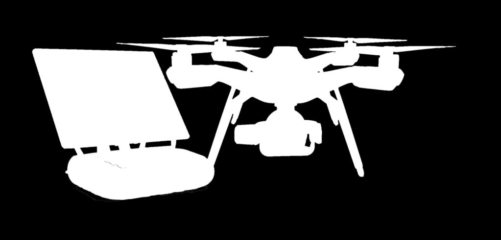


7 Hardware and Software


8 Wrightsville Beach Summary Total Area Processed Ground Control Used Photos Collected Output Parameters Oceanic Pier to Masonboro Inlet Acres 14 Points Fully Surveyed Sony R10C Total 195 / 1.25GB Collection Time < 1hr / 2flts Horizontal GSD 1.21 in 3D Points / Meter Processing Time: 4 hrs 32 mins Products Produced: Orthos, DSM, Point Cloud, 3D Mesh Overall Accuracy: Mean RMS 1.27 inches
9 Wrightsville Beach Flight McKim & Creed placed 14 survey targets on the beach 22 Blind check shots were collected randomly 2 Flights were flown with the Solo / R10C setup (400 Ft. AGL 1.21 Inch GSD) 1 Flight was flown using the Solo / GoPro setup (400 Ft. AGL 2.44 Inch GSD) 1 Flight was flown with a Phantom 4 (200 Ft. AGL 1.01 Inch GSD)

10 Accuracy Reporting After Dense Image Matching (DIM), the Point clouds were compared to the blind checkpoints to verify accuracy. A TIN model was created in the ArcGIS extension LP360 to calculate the DeltaZ of each point. This is the same method used for verifying LiDAR point clouds.

11 Results DJI Results GoPro Results R10C Results


12 Distortion Plots DJI Phantom 4 GoPro Hero 4 Black R10C 16mm


13 Terrestrial LiDAR Analysis Terrestrial LiDAR was collected the same day by the Charleston USACE district The Terrestrial LiDAR was off by almost the same amount as the R10C data from the blind checkpoints. The error however was in the opposite direction creating an offset between the two datasets by 3 5 tenths By normalizing the terrestrial LiDAR surface to the UAS surface we were able to compare the overall fit of the two surfaces relative to each other The two surfaces matched well in most areas. The terrestrial data extended further out than the UAS data due to time of collection. Green +/- 0.3 FT. Purple < 0.3 FT. or No Overlap


14 Beach Profiles Transects were collected of the beach earlier in the year. Beach profiles are spaced at 1,000 ft. To each other and 3 ft. downline. Both profiles and UAS data match well.
 Profile Lines 7,589 4207225.611 2016795.")

15 Beach Profiles Surface # Points Cut (Cu. Ft.) Fill (Cu. Ft.) Net Diff. (Cu. Ft.) Profile Lines 7, Drone2Map 445,492, Variance % 49.40% % %

16 Business Comparison 5 mile Beach Profile: UAS vs. Conventional Survey - Accuracy - UAS is within 4 cm on control points - Cost - UAS is 30% less expensive for competitive project - Time - UAS captures greater detail in less time UAS vs. Terrestrial LiDAR - Accuracy - UAS is within 2 cm of LiDAR specifications - Cost - UAS is 15% less expensive for competitive project - Time - Similar mobilization & coverage, faster collect & processing UAS vs. Aerial LiDAR - Accuracy - UAS is within 2 cm of LiDAR specifications - Cost - UAS is 60% less expensive for competitive project - Time - Similar coverage, faster mobilization & processing


17 Masonboro Inlet N. Jetty Summary Total Area Processed Ground Control Used Photos Collected Masonboro Inlet North Jetty Acres No Surveyed Points 3 Map Derived Points X,Y Only Sony R10C Total 123 /.89 GB Collection Time < 1hr / 1 flts Processing Time: 21 mins Products Produced: Orthos, DMS Overall Accuracy: N/A

18 Masonboro Inlet N. Jetty

19 Masonboro Inlet N. Jetty No Control was collected for the Masonboro Inlet Jetties however LiDAR had been collected previously. Due to lack of control, the two scans did not line up however similar features could be identified in both scans.

20 Masonboro Inlet N. Jetty


21 Business Comparison Jetty Profile: UAS vs. Conventional Survey - Accuracy - Unattainable through conventional survey methods - Cost - N/A - Time - N/A UAS vs. Terrestrial LiDAR on a Survey boat - Accuracy - UAS is within 2 cm of LiDAR specifications - Cost - UAS is ~300% less expensive for competitive project - Time - Similar coverage, faster mobilization, collect & processing UAS vs. Aerial LiDAR - Accuracy - UAS is within 2 cm of LiDAR specifications - Cost - UAS is ~400% less expensive for competitive project - Time - Similar coverage, faster mobilization & processing


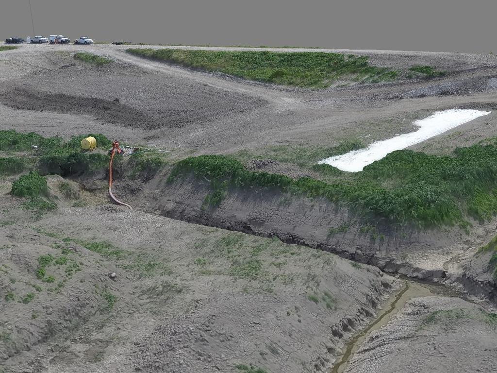
22 Eagle Island Disposal Site Summary Total Area Processed Ground Control Used Photos Collected Output Parameters Partial Cells 1 & Acres 7 Points Fully Surveyed Sony R10C Total 214 / 1.34GB Horizontal GSD 1.32 in 3D Points / Meter Processing Time: 5 hrs 7 mins Products Produced: Orthos, DSM, Point Cloud, 3D Mesh Overall Accuracy: Mean RMS 2.64 inches


23


 Irregularities in the")

24 Traditional Survey Data Cell 1 ( 280 Acres approx.) was previously surveyed using conventional individual survey shots were collected (2 weeks of work approx.) Irregularities in the surface model existed due to either bad elevations or incorrect triangulation


 104 points per square meter")
25 UAS Survey Portions of Cell 1 and Cell 2 were collected in two 15 minute flights. 5 flights would be required to collect all of Cell 1 (half a day of flight and target survey approx.) 104 points per square meter vs (averaged from survey)

26 Accuracy Reporting No blind checkpoints were collected only control points. UAS and survey lined up very well on the dikes. The volume inside had changed however since the survey.


27 Surface Comparison The difference between data collections were normalized to visualize differences between datasets Most locations on the dike were less than 0.1 ft. up to 0.02 ft. difference between surfaces. In Places where the survey did not triangulate well, the differences were greater.

28 Business Comparison Cell Profile: UAS vs. Conventional Survey - Accuracy - UAS is within 4 cm on control points - Cost - UAS is 80% less expensive for competitive project - Time - UAS captures greater detail in less time UAS vs. Terrestrial LiDAR with internal setups - Accuracy N/A (Inadequate ground stability) - Cost N/A - Time N/A UAS vs. Aerial LiDAR - Accuracy - UAS is within 2 cm of LiDAR specifications - Cost - UAS is ~200% less expensive for competitive project (size) - Time - Similar coverage, faster mobilization & processing


29 Conclusions Business Cost - Quality - Speed Esri s Drone2Map coupled with 3DR s Solo and Site Scan equate to a business paradigm shift that allows civil engineering and land surveyors to take advantage of the advancing drone industry. Advantages: - Less people - Greater safety - More accurate - Faster deliverable

30 Community Effort Corps, City of Wrightsville Beach, UNC-W, NC Coastal Land Trust, Audubon
31 Thank You!
 can provide coastal communities with a faster, more costeffective way to produce beach monitoring surveys.")
32 ACEC/NC Engineering Excellence Awards The Grand Conceptor Award was presented for a proof of concept (POC) by McKim & Creed and Esri. The purpose was to determine if unmanned aerial system technology (UAS/drones) can provide coastal communities with a faster, more costeffective way to produce beach monitoring surveys. These surveys are typically conducted twice a year before and after hurricane season and are used to 1) analyze a beach s performance in terms of erosion and accretion, 2) plan and predict maintenance and renourishment activities and 3) secure emergency funding for restoration. The POC showed that municipalities can save up to 60% in time and money by using UAS for data collection.
GEOMATIC ASSESSMENT Membership Directory & Buyers Guide 97th Annual Conference Recap WINTER 2017/18
 WINTER 2017/18 GEOMATIC NC AWWA-WEA 3725 National Drive, Suite 217 Raleigh, NC 27612 ADDRESS SERVICE REQUESTED 2018 Membership Directory & Buyers Guide 97th Annual Conference Recap The official publication
How to Use Drones in Stormwater Management January 17, :30 a.m. 11:30 a.m. (Eastern)
") Webinar Training Series How to Use Drones in Stormwater Management January 17, 2019 10:30 a.m. 11:30 a.m. (Eastern) www.seswa.org Today s Presenters Robert Gecy Application Programmer Beaufort County,
Webinar Training Series How to Use Drones in Stormwater Management January 17, 2019 10:30 a.m. 11:30 a.m. (Eastern) www.seswa.org Today s Presenters Robert Gecy Application Programmer Beaufort County,
DRONING FOR INFORMATION
 DRONING FOR INFORMATION Opportunity of Drones for Surveying and Mapping Practices By: Adam Smith, CP Matt Aguirre, PLS Overview Introduction Background Problem and Opportunity Issues and Mitigations Implementation
OWEA Woolpert UAS Operations
 OWEA 2016 Woolpert UAS Operations UAS Rules and Regulations How Woolpert is Handling This The Exemption In December 2014 Woolpert received approval from the FAA regarding an exemption seeking relief from
RISING PERFORMANCE. Civil aviation is an outlier. It s BY ERIK DAHLBERG
 RISING PERFORMANCE Compact mobile mapping systems can be installed on small passenger cars. Civil aviation is an outlier. It s among the few industries where tight government regulations are widely accepted
AUGUST 2017 GNSS REVIEW. Survey Economics Chances of success. Mobile Mapping Airport scanning. Stag s Leap Winery Pre-construction plan
 AUGUST 2017 GNSS REVIEW Survey Economics Chances of success Stag s Leap Winery Pre-construction plan Mobile Mapping Airport scanning RISING PERFORMANCE» ERIK DAHLBERG Civil aviation is an outlier. It s
UAV Flight Services Company. What We Do. What Sets us Apart
 UAV Flight Services Company A dedicated team of aviators, technologists, and engineers. What We Do UAV flight services for data collection, mapping, and inspection What Sets us Apart Extensive field experience,
Drones in Construction: Beyond Pictures Capturing and Exploring Actionable Data
 Drones in Construction: Beyond Pictures Capturing and Exploring Actionable Data Hunter Cole & Jesse Creech Virtual Design + Construction Brasfield & Gorrie General Contractors Join the conversation #AU2016
UNMANNED AIRCRAFT SYSTEMS (UAS) IN UTILITIES
 IN UTILITIES") UNMANNED AIRCRAFT SYSTEMS (UAS) IN UTILITIES Presented by: Dan Carbone Avion Unmanned Why Drones? Why Drones? Cost Effective Entire cost of a UAS program can be recouped in first-year man-hour savings
UNMANNED AIRCRAFT SYSTEMS (UAS) IN UTILITIES Presented by: Dan Carbone Avion Unmanned Why Drones? Why Drones? Cost Effective Entire cost of a UAS program can be recouped in first-year man-hour savings
Mapping with Unmanned Airborne Systems (UAS)
") Mapping with Unmanned Airborne Systems (UAS) February 13, 2014 Engineering Architecture Design-Build Surveying GeoSpatial Solutions Today s Agenda Introductions / Objectives Current UAS Regulations (FAA)
Mapping with Unmanned Airborne Systems (UAS) February 13, 2014 Engineering Architecture Design-Build Surveying GeoSpatial Solutions Today s Agenda Introductions / Objectives Current UAS Regulations (FAA)
UAS Regulations and Usage. July 14, 2016 Presenter: David Day, CP, GISP Keystone Aerial Surveys, Inc.
 UAS Regulations and Usage July 14, 2016 Presenter: David Day, CP, GISP Keystone Aerial Surveys, Inc. Keystone Aerial Surveys, Inc. Based in Philadelphia, PA with offices in Los Angeles, Tucson and Tyler,
Coeur d Alene Tribe GIS Unmanned Aerial System (UAS) Program JAMES TWOTEETH BERNE JACKSON GIOVAN ALCALA SABINE KRIER
 Program JAMES TWOTEETH BERNE JACKSON GIOVAN ALCALA SABINE KRIER") Coeur d Alene Tribe GIS Unmanned Aerial System (UAS) Program JAMES TWOTEETH BERNE JACKSON GIOVAN ALCALA SABINE KRIER What is an Unmanned Aerial System (UAS)? Small, unmanned aircraft under 50 lbs. remotely
Coeur d Alene Tribe GIS Unmanned Aerial System (UAS) Program JAMES TWOTEETH BERNE JACKSON GIOVAN ALCALA SABINE KRIER What is an Unmanned Aerial System (UAS)? Small, unmanned aircraft under 50 lbs. remotely
LAUNCHING YOUR UNMANNED AIRCRAFT PROGRAM
 LAUNCHING YOUR UNMANNED AIRCRAFT PROGRAM THE DARTDRONES TEAM UNMANNED AIRCRAFT APPLICATIONS AERIAL INSPECTIONS AERIAL INSPECTIONS Safer and faster alternative to visual inspection by an individual Damage
USE OF 3D GIS IN ANALYSIS OF AIRSPACE OBSTRUCTIONS
 USE OF 3D GIS IN ANALYSIS OF AIRSPACE OBSTRUCTIONS A project by by Samuka D. W. F19/1461/2010 Supervisor; Dr D. N. Siriba 1 Background and Problem Statement The Airports in Kenya are the main link between
UAV systems for cultural heritage HERICT ERASMUS IP Technical lecture 2
 UAV systems for cultural heritage HERICT ERASMUS IP Technical lecture 2 Dr. Dimitrios Skarlatos Lecturer Cyprus university of Technology Photogrammetric Vision Lab Dept. of Civil Eng. & Geomatics Dipl.
Using LiDAR for Precise Vegetation Management
 Using LiDAR for Precise Vegetation Management Quantum Spatial is a proven partner to airport planners, engineers, facility managers, and contractors whose objective is to build, expand, and make improvements
Unmanned Aerial Vehicles for Environmental Applications
 Unmanned Aerial Vehicles for Environmental Applications John Rankin, President, J.R. Canadian Mapping Ltd. 10 th Annual Professional Biology Conference April 23 rd, 2015 UAVs Our System Suitable Sites
Launching a New Surveying Perspective
 Launching a New Surveying Perspective >> By Mary Jo Wagner A 3 km2 orthomosaic shows the entire construction site and surroundings. On the upper part of the mosaic are the Bristol Channel; the existing
2011 Nags Head Beach Nourishment Project Update. Tim Kana & Haiqing Kaczkowski
 2011 Nags Head Beach Nourishment Project Update Tim Kana & Haiqing Kaczkowski NCBIWA Conference 3 April 2017 Outline of the Presentation 1 Review 2011 Nourishment Project Post-project monitoring efforts
KTRK Flight Tracking System, VNOMS, Altitudes and Positional Calculations
 KTRK Flight Tracking System, VNOMS, Altitudes and Positional Calculations Prepared by: Joseph A. LaMacchia August 17, 2015 Proprietary Information 1 Noise Complaint Details VNOMS Data and Flight Path Flight
2018 ENGINEERING EXPO Jon Thies NUAIR Director of Consulting
 2018 ENGINEERING EXPO Jon Thies NUAIR Director of Consulting Agenda Operating Under Current FAA Regulations suas Program Development Considerations suas Use Case Examples Quiz Regulations Small Unmanned
What is a UAS (Drone)
") UAS KCSI Aerial Patrol KCSI is Based in Bakersfield CA Established in 1993 Operates in 15 States KCSI has over 20 fulltime pilots Currently fly: Over 40,000 miles of pipeline a month 700 hours of production
UAS KCSI Aerial Patrol KCSI is Based in Bakersfield CA Established in 1993 Operates in 15 States KCSI has over 20 fulltime pilots Currently fly: Over 40,000 miles of pipeline a month 700 hours of production
EXAMPLE FLIGHT PLAN. Project Information UBC PRODUCTIONS APEX^ZERO. Prepared for: Paul Hodges Vice President, SFG Productions
 UBC PRODUCTIONS APEX^ZERO FLIGHT PLAN EXAMPLE Project Information Prepared for: Paul Hodges Vice President, SFG Productions Prepared by: Roger Apolinar & Eric Carpenter Remote Pilots in Command, APEX^ZERO
Adventures in UAS: Experiences of a UAS Operator. Paul Beckwith, PE, CCM, LEED AP bd+c Navigator CS, LLC, President. Presented by:
 Adventures in UAS: Experiences of a UAS Operator Presented by: Paul Beckwith, PE, CCM, LEED AP bd+c Navigator CS, LLC, President Paul Beckwith, PE, CCM, LEED AP bd+c BA in Architectural Engineering from
DRONE SIGHTINGS ANALYSIS AND RECOMMENDATIONS
 DRONE SIGHTINGS ANALYSIS AND RECOMMENDATIONS UNMANNED AIRCRAFT SAFETY TEAM DRONE SIGHTINGS WORKING GROUP DECEMBER 12, 2017 1 UNMANNED AIRCRAFT SAFETY TEAM DRONE SIGHTINGS WORKING GROUP EXECUTIVE SUMMARY
Questions to Answer: The Rules. Unmanned Aerial Systems (UAS): What You Need to Know. 1. Should we be leveraging UAS?
: What You Need to Know. 1. Should we be leveraging UAS?") Unmanned Aerial Systems (UAS): What You Need to Know Colorado SWANA Annual Conference September 13, 2017 Questions to Answer: 1. Should we be leveraging UAS? 2. Should we self-perform UAS work? 3. If we
Unmanned Aerial Systems (UAS): What You Need to Know Colorado SWANA Annual Conference September 13, 2017 Questions to Answer: 1. Should we be leveraging UAS? 2. Should we self-perform UAS work? 3. If we
We're not spying on you; it's more interesting watching grass grow-
 We're not spying on you; it's more interesting watching grass grow- Using Unmanned Aircraft Systems in Rangeland Monitoring Connie Maxwell USDA Agricultural Research Service Jornada Experimental Range
UAS Unmanned Aircra: Systems in Forest Management
 UAS Unmanned Aircra: Systems in Forest Management UAS What are they? Unmanned Aircra: Systems (UAS) fill niche built upon military UAV technologies Most common plahorms Fixed Wing Rotorcra: Primary uses
1.0 OUTLINE OF NOISE ANALYSIS...3
 Table of Contents 1.0 OUTLINE OF NOISE ANALYSIS...3 2.0 METHODOLOGY...3 2.1 BACKGROUND...3 2.2 COMPUTER MODELING...3 3.0 EXISTING NOISE ENVIRONMENT...4 3.1 EXISTING SANTA MONICA MUNICIPAL AIRPORT NOISE...4
Potential Uses and Considerations Regarding the Use of UAS Technology in Assessment. January 2015 Frank Giuffrida
 Potential Uses and Considerations Regarding the Use of UAS Technology in Assessment January 2015 Frank Giuffrida Table of Contents Current climate surrounding UAS use... 2 Assessing the value of properties
Lidar Imagery Reveals Maine's Land Surface in Unprecedented Detail
 Maine Geologic Facts and Localities December, 2011 Lidar Imagery Reveals Maine's Land Surface in Unprecedented Detail Text by Woodrow Thompson, Department of Agriculture, Conservation & Forestry 1 Introduction
A Drone s Eye View on Public Works Applications
 A Drone s Eye View on Public Works Applications APWA Construction Inspection Conference Parker, CO Jason Caldwell, VP of Business Development and Sales 2013, The Sanborn Map Company, Inc. Agenda Sanborn
Regional implementation of Electronic Terrain and Obstacle data (e-tod) (Presented by Jeppesen)
 (Presented by Jeppesen)") International Civil Aviation Organization SAM/IG/13-WP/39 South American Regional Office 5/04/14 Thirteenth Workshop/Meeting of the SAM Implementation Group English only (SAM/IG/13) - Regional Project
International Civil Aviation Organization SAM/IG/13-WP/39 South American Regional Office 5/04/14 Thirteenth Workshop/Meeting of the SAM Implementation Group English only (SAM/IG/13) - Regional Project
LOW DOWN ON THE HIGH UP: USING DRONES FOR LAND CONSERVATION
 LOW DOWN ON THE HIGH UP: USING DRONES FOR LAND CONSERVATION TEXAS LAND CONSERVATION CONFERENCE MARCH 3, 2017 STEPHEN RAMIREZ STEWARDSHIP DIRECTOR TEXAS LAND CONSERVANCY RAY RENNER, RPLS, PMP MANAGER OF
UNMANNED AIRCRAFT SYSTEMS (UAS) FOR PUBLIC POWER OPERATIONS AN OVERVIEW ON HOW DRONES ARE IMPACTING THE ENERGY INDUSTRY
 FOR PUBLIC POWER OPERATIONS AN OVERVIEW ON HOW DRONES ARE IMPACTING THE ENERGY INDUSTRY") UNMANNED AIRCRAFT SYSTEMS (UAS) FOR PUBLIC POWER OPERATIONS AN OVERVIEW ON HOW DRONES ARE IMPACTING THE ENERGY INDUSTRY ABOUT CHRISTOPHER TODD Founder and president of Airborne Response, Miamibased UAS
UNMANNED AIRCRAFT SYSTEMS (UAS) FOR PUBLIC POWER OPERATIONS AN OVERVIEW ON HOW DRONES ARE IMPACTING THE ENERGY INDUSTRY ABOUT CHRISTOPHER TODD Founder and president of Airborne Response, Miamibased UAS
Light UAS for forestry applications an Operational experience
 Light UAS for forestry applications an Operational experience European High Level Unmanned Aircraft Systems (UAS) Conferencen Lars Björk Swedish Forest Agency 1 Swedish Forest Agency Swedish Forest Agency
The Past, Present, and Future of Nortek and Glider Measurements
 The Past, Present, and Future of Nortek and Glider Measurements Peter J. Rusello Scientist Nortek Since 2005, Nortek has collaborated with leading researchers to develop specialized acoustic Doppler current
Using UAS Technology for Invasive Plant Management
 Using UAS Technology for Invasive Plant Management Adam Benjamin, P.S.M. UF/IFAS Fort Lauderdale R.E.C. May 8, 2018 2018 Aquatic Weed Control Short Course Coral Springs, FL Using UAS Technology for Invasive
UAS Implementation at Duke Energy
 UAS Implementation at Duke Energy Cross-Functional Team Approach Aviation Corporate Communications Emerging Technology External Counsel Insurance/Risk Internal Counsel Supply Chain Various BU Stakeholders/SME
Unique Challenges of Unmanned Air Systems (UASs) Test and Evaluation
 Test and Evaluation") Unclassified 2008 Annual NDIA International Symposium Unclassified Unique Challenges of Unmanned Air Systems (UASs) Test and Evaluation Presented By: RDML David Dunaway Assistant Commander, Test and Evaluation,
Unclassified 2008 Annual NDIA International Symposium Unclassified Unique Challenges of Unmanned Air Systems (UASs) Test and Evaluation Presented By: RDML David Dunaway Assistant Commander, Test and Evaluation,
Excelsior Blanket Plus Granular vs. Dissolved PAM. What s On The Horizon? Richard A. McLaughlin, Ph.D. Professor and Extension Specialist 12/14/2015
 Excelsior Blanket Plus Granular vs. Dissolved PAM What s On The Horizon? Richard A. McLaughlin, Ph.D. Professor and Extension Specialist 1 Runoff Results: Turbidity No runoff Event 1 Rest period Event
Using UAVs for Aerial Mapping, Surveying and Photography
 Using UAVs for Aerial Mapping, Surveying and Photography Prepared for: Central Florida GIS Workshop 18 September 2013 Kevin Shortelle System Dynamics International, Inc kevinshortelle@bellsouth.net Presentation
AUTHORITATIVE AIRPORT DATA FOR CRITICAL FLIGHT SAFETY AND AUTOMATED SITUATIONAL AWARENESS MEETS FAA (USA) AND ICAO (INT'L) REQUIREMENTS
 AND ICAO (INT'L) REQUIREMENTS") AUTHORITATIVE AIRPORT DATA FOR CRITICAL FLIGHT SAFETY AND AUTOMATED SITUATIONAL AWARENESS MEETS FAA (USA) AND ICAO (INT'L) REQUIREMENTS H. Howard a, P. Hummel b a CompassData, Inc, Centennial, Colorado,
AUTHORITATIVE AIRPORT DATA FOR CRITICAL FLIGHT SAFETY AND AUTOMATED SITUATIONAL AWARENESS MEETS FAA (USA) AND ICAO (INT'L) REQUIREMENTS H. Howard a, P. Hummel b a CompassData, Inc, Centennial, Colorado,
Federal Aviation Administration Early Implementation Experiences
 Early Implementation Experiences Presented by: Don Walker Presented to: Aircraft Electronics Association Date: February 2011 Outline 1 Errors Seen In Early Implementations 1.1 Software related 1.2 GPS
UPDATING THE SURFACE AREA AND VOLUME EQUATIONS OF LAKE NASSER USING MULTIBEAM SYSTEM
 UPDATING THE SURFACE AREA AND VOLUME EQUATIONS OF LAKE NASSER USING MULTIBEAM SYSTEM Nader M. Shafik Researcher, Nile Research Institute, E-mail: shafik_nader@yahoo.com ABSTRACT Lake Nasser is the main
PROSPECCIÓN ARQUEOLÓGICA A TRAVÉS DE LIDAR Y ORTOFOTOGRAMETRIA EN EL TAJÍN, VERACRUZ
 PLAN DE MANEJO INTEGRAL DE LA ZONA DE MONUMENTOS RQUEOLOGICOS EL TAJIN PROSPECCIÓN ARQUEOLÓGICA A TRAVÉS DE LIDAR Y ORTOFOTOGRAMETRIA EN EL TAJÍN, VERACRUZ Archaeological Survey through LiDAR and Orthophotogrammetry
Presentation: UAS Helicopter Waran -1-
 Presentation: UAS Helicopter Waran -1- The unique design features of the Waran provide a superior payload capacity, prolonged endurance, stable flight patterns and a high degree of safety features. Technical
Using Geospatial Data in the Oil & Gas Industry. Dr. Stacey D. Lyle, RPLS
 Using Geospatial Data in the Oil & Gas Industry Dr. Stacey D. Lyle, RPLS Outcomes A Geospatial Data Science Center is an advanced database of information organized and accessible using multiple software
Airspace Encounter Models for Conventional and Unconventional Aircraft
 Airspace Encounter Models for Conventional and Unconventional Aircraft Matthew W. Edwards, Mykel J. Kochenderfer, Leo P. Espindle, James K. Kuchar, and J. Daniel Griffith Eighth USA/Europe Air Traffic
DEFINITIONS DEFINITIONS 2/11/2017 REQUIREMENTS AND LIMITATIONS OF DRONE USE IN FORENSIC ACCIDENT RECONSTRUCTION
 REQUIREMENTS AND LIMITATIONS OF DRONE USE IN FORENSIC ACCIDENT RECONSTRUCTION ROGER BURGMEIER BURGMEIER CONSULTING INC. DEFINITIONS Aircraft: device that is used, or intended to be used, for flight. Drone:
POST-IMPLEMENTATION COMMUNITY IMPACT REVIEW
 POST-IMPLEMENTATION COMMUNITY IMPACT REVIEW RNAV STAR updates and RNP AR approaches at Winnipeg James Armstrong Richardson International Airport NAV CANADA 77 Metcalfe Street Ottawa, Ontario K1P 5L6 November
ONE PLATFORM, MULTIPLE APPLICATIONS: SURVEYING CONSTRUCTION FORESTRY AGRICULTURE ENVIRONMENT POWER ENGINEERING BIRDIE YOUR TAILOR-MADE UAV
 UAV BIRDIE BIRDIE YOUR TAILOR-MADE UAV ONE PLATFORM, MULTIPLE APPLICATIONS: SURVEYING CONSTRUCTION FORESTRY AGRICULTURE ENVIRONMENT POWER ENGINEERING BIRDIE UAV is the complete mapping solution, made for
UAV/Drone Uses and Laws
 UAV/Drone Uses and Laws Robert Moorhead Director of Geosystems Research and Northern Gulf Institutes Professor of Electrical & Computer Engineering Unmanned Aerial Systems (UASs) 3 components to the system:
Platform and Products
 International Partnership Space Programme Earth Observation for the Preservation of Ecological Bacalar Corridor Platform and Products Terri Freemantle, Raffaella Guida, Paula Marti, Pasquale Iervolino
1/23/2019 SOARING TO NEW HEIGHTS COURSE AGENDA THIS IS MURICA! I CAN FLY ANY TIME!
 SOARING TO NEW HEIGHTS UAV FUNDAMENTALS FOR LAND SURVEYORS STEPHEN C. CHINO, JR., PLS 1 COURSE AGENDA WHAT TO KNOW BEFORE BECOMING A LICENSED UAV/UAS OPERATOR LAND SURVEYING AND REAL WORLD EXAMPLES WITH
Establishing a Risk-Based Separation Standard for Unmanned Aircraft Self Separation
 Establishing a Risk-Based Separation Standard for Unmanned Aircraft Self Separation Roland E. Weibel, Matthew W.M. Edwards, and Caroline S. Fernandes MIT Lincoln laboratory Surveillance Systems Group Ninth
Getting off the Ground: Implementing a Drone Program
 Getting off the Ground: Implementing a Drone Program November 2017 Steve Goldman, GISP GIS Manager / UAS Coordinator California Department of Fish and Wildlife http://www.wildlife.ca.gov Drones (UAS) What
PDC Members. Charter Members. Technology & Honorary Members. There is clearly a cross over 5/31/2017
 UAS A Tool for Commercial and Government Application Partnership SCARC 2017 Charles Mondello Eagleview Stategist & President Property Drone Consortium 1 The PDC is a consortium among insurance carriers,
TIMS & PowerSchool 2/3/2016. TIMS and PowerSchool. Session Overview
 TIMS and PowerSchool TIMS & PowerSchool Kevin R. Hart TIMS and PowerSchool Kevin R. Hart TIMS Project Leader UNC Charlotte Urban Institute Session Overview What is TIMS? PowerSchool Data in TIMS PowerSchool
Photopoint Monitoring in the Adirondack Alpine Zone
 Photopoint Monitoring in the Adirondack Alpine Zone Julia Goren (PI) and Seth Jones Adirondack High Peaks Summit Steward Program Adirondack Mountain Club summit@adk.org PO Box 867, Lake Placid, NY 12946
Airport Imagery and Geospatial Data Collection Through the use. of UAS
 Airport Imagery and Geospatial Data Collection Through the use of UAS Figure 1: Members of the team and advisers at Kit Carson County Airport Design Category: Airport Operation and Maintenance Design Challenge:
2017/ Q1 Performance Measures Report
 2017/2018 - Q1 Performance Measures Report Contents Ridership & Revenue... 1 Historical Revenue & Ridership... 1 Revenue Actual vs. Planned... 3 Mean Distance Between Failures... 5 Maintenance Cost Quarter
PREFACE. Service frequency; Hours of service; Service coverage; Passenger loading; Reliability, and Transit vs. auto travel time.
 PREFACE The Florida Department of Transportation (FDOT) has embarked upon a statewide evaluation of transit system performance. The outcome of this evaluation is a benchmark of transit performance that
Net of Innovation. July 2015 Dave Finger, Mark Foster
 Net of Innovation July 2015 Dave Finger, Mark Foster Table of Contents The Challenges and Solutions to Safe Outdoor Testing... 2 Types of Testing a Netted Enclosure Enables... 4 Flight Plan Testing...
Benefits Assessment for Tailored Arrivals
 Benefits Assessment for Tailored Arrivals A Year at San Francisco (Dec 3 rd 2007 Dec 31 st 2008) 2009 Environmental Working Group Operations Standing Committee July 28 29, 2009 Kevin Elmer BOEING is a
Operational Evaluation of a Flight-deck Software Application
 Operational Evaluation of a Flight-deck Software Application Sara R. Wilson National Aeronautics and Space Administration Langley Research Center DATAWorks March 21-22, 2018 Traffic Aware Strategic Aircrew
small Unmanned Aircraft Systems Arlington Police Department June 28, 2011
 suas small Unmanned Aircraft Systems Arlington Police Department June 28, 2011 1. Overview of APD suas program to date 2. Discuss the C.O.A. (FAA certificate of authorization to fly) and restrictions
OPERATIONAL EVALUATION OF UNMANNED AIRCRAFT SYSTEMS FOR CRASH SCENE RECONSTRUCTION
 AOS-17-0078 January 2017 OPERATIONAL EVALUATION OF UNMANNED AIRCRAFT SYSTEMS FOR CRASH SCENE RECONSTRUCTION Operational Evaluation Report Version 1.0 Prepared for: National Institute of Justice Prepared
The Commercial UAS Symposium San Diego, CA June 16 17, 2015
 The Commercial UAS Symposium San Diego, CA June 16 17, 2015 http://www.ttcus/com @Techtrain Linkedin/Group: Technology Training Corp NAS Safe Integration & Use of UAS Civil & Commercial Unmanned Aircraft
Unmanned Aerial Vehicles or How I learned to stop worrying and love drones!
 Unmanned Aerial Vehicles or How I learned to stop worrying and love drones! Dr. Charles O Neill Aerospace Engineer, UA Professor, Pilot charles-oneill.com or aero.ua.edu Brief History of Drones German
SFO Tailored Arrivals Environmental Analysis
 Advanced Air Traffic Management SFO Tailored Arrivals Environmental Analysis by Kevin Elmer, Rob Mead, Louis Bailey, Brad Cornell, Jesse Follet (Boeing) Richard Lanier (NASA Ames Research Center / FAA)
Program. - Flight Operations (VRI) Motivation. The Aircraft / Sensors. Unmanned Aircraft Systems 8/1/17
 Motivation. The Aircraft / Sensors. Unmanned Aircraft Systems 8/1/17") Program Unmanned Aircraft in Agriculture: Flight Operations and FAA Certification Process * 1) Background. Wayne Woldt, Ph.D., P.E. Department of Biological Systems Engineering School of Natural Resources
Program Unmanned Aircraft in Agriculture: Flight Operations and FAA Certification Process * 1) Background. Wayne Woldt, Ph.D., P.E. Department of Biological Systems Engineering School of Natural Resources
Short Term Monitoring Program NSW, Caringbah Report. February 2013
 NSW, Caringbah Report February 2013 Version Control Version Number Date Detail 1.0 February 2013 Initial Release. 2.0 May 2013 Updated formatting for table 2. 3.0 January 2014 Figure 5 and L90 values updated
2018 WSGC WISCONSIN COLLEGIATE ROCKET DESIGN COMPETITION
 2018 WSGC WISCONSIN COLLEGIATE ROCKET DESIGN COMPETITION 11-NOV-2017 1 Welcome WSGC 2018 CRL 2 Agenda Who is competing? What is the challenge? When and where will events be taking place? When are the important
The role of Unmanned Aircraft System (AUS) in search and rescue (SAR) operations
 in search and rescue (SAR) operations") The role of Unmanned Aircraft System (AUS) in search and rescue (SAR) operations Captain: Abdelkhalik Kamaleldin Soliman Selmy College of Maritime Transport & Technology Arab Academy for Science, Technology
The role of Unmanned Aircraft System (AUS) in search and rescue (SAR) operations Captain: Abdelkhalik Kamaleldin Soliman Selmy College of Maritime Transport & Technology Arab Academy for Science, Technology
Geospatial Data Collection for the FAA Airports GIS Program
 Geospatial Data Collection for the FAA Airports GIS Program A Change in Direction Dr. Michael T. McNerney, P.E. FAA Office of Airports Office of Airport Safety and Standards Assistant Manager, Airport
Needs for UAS in Response
 UAS Potential Uses and Limitations October 21, 2015 Michele Jacobi Office Response and Restoration 10/27/2015 1 Needs for UAS in Response Limited access to areas of interest (distance, safety concerns,
Short Term Monitoring Program NSW, Carlingford Report. February 2013
 NSW, Carlingford Report February 2013 Version Control Version Number Date Detail 1.0 February 2013 Initial Release. 2.0 May 2013 Updated formatting for table 2. 3.0 January 2014 Figure 5 and L90 values
-News Release- September 7, 2011
 -News Release- September 7, 2011 KOKUSAI KOGYO to release first GIS-based Area Marketing Platform Service for Chinese Market Product supports corporate clients expanding in Chinese market by identifying
Optimizing trajectories over the 4DWeatherCube
 Optimizing trajectories over the 4DWeatherCube Detailed Proposal - SES Awards 2016 Airbus Defence and Space : dirk.schindler@airbus.com Luciad : robin.houtmeyers@luciad.com Eumetnet : kamel.rebai@meteo.fr
Potential Application of. Shore-Stabilizing Structures along an Open-Coast Shoreline. Christopher G. Creed, P.E. 23 rd Annual National Conference on
 23 rd Annual National Conference on Potential Application of Beach Preservation Technology February 3-5, 2010 Indialantic, FL Shore-Stabilizing Structures along an Open-Coast Shoreline Christopher G. Creed,
EXECUTIVE SUMMARY COMMONWEALTH OF PUERTO RICO FY 2004-FY2009 MAP MODERNIZATION BUSINESS PLAN. Page i
 EXECUTIVE SUMMARY I. Introduction The Commonwealth of Puerto Rico will support the Federal Emergency Management Agency s (FEMA s) Multi-Hazard Flood Map Modernization Program (MHFMMP) by contributing to
NASA s Automatic Dependent Surveillance Broadcast: ADS-B Sense-and-Avoid System
 NASA s Automatic Dependent Surveillance Broadcast: ADS-B Sense-and-Avoid System October 30, 2014 Ricardo Arteaga NASA Armstrong Flight Research Center is a world class leader in cutting-edge Systems Engineer
along a transportation corridor in
 Rockfall hazard and risk assessment along a transportation corridor in the Nera Valley, Central Italy Presentation on the paper authored by F. Guzzetti and P. Reichenbach, 2004 Harikrishna Narasimhan Eidgenössische
Spatio-temporal Data Analysis and Visualization in Enterprise Level Automated Application
 Spatio-temporal Data Analysis and Visualization in Enterprise Level Automated Application Sept 29 - Oct 1, 2015 Kualal Lumpur Shyam Parhi Washington DC What is driving Airports GIS? Reduce costs to Airports,
Development and Testing of an Unmanned Aircraft Safety Beacon for Aerial Application Safety
 Development and Testing of an Unmanned Aircraft Safety Beacon for Aerial Application Safety Wayne Woldt, Ph.D., P.E., and Jacob Smith Biological Systems Engineering and School of Natural Resources University
FROM 40 HOURS TO 15 MINUTES, 15 YEARS OF EXPERIENCE WITH CFD
 FROM 40 HOURS TO 15 MINUTES, 15 YEARS OF EXPERIENCE WITH CFD NORBERT BULTEN WARTSILA PROPULSION THE NETHERLANDS 1 / 15 Wärtsilä 23 March 2011 Doc.ID: Revision: Status: Topics Introduction Wärtsilä Propulsion
FUTENMA REPLACEMENT FACILITY BILATERAL EXPERTS STUDY GROUP REPORT. August 31, 2010
 FUTENMA REPLACEMENT FACILITY BILATERAL EXPERTS STUDY GROUP REPORT August 31, 2010 MANDATE AND SCOPE OF WORK: In order to achieve the earliest possible relocation of Marine Corps Air Station Futenma, the
Unmanned Aerial Systems for Ozarks Agriculture
 Unmanned Aerial Systems for Ozarks Agriculture UAS, UAV, drone Next High Tech Tool for Agriculture and Beyond by Bob Schultheis Natural Resource Engineering Specialist Photo credit: http://modernfarmer.com/2014/01/precision
Unmanned Aerial Systems for Ozarks Agriculture
 Unmanned Aerial Systems for Ozarks Agriculture by Bob Schultheis Natural Resource Engineering Specialist for Webster County Cattle Producers Inc. Marshfield, MO February 11, 2016 1 UAS, UAV, drone Next
POST-IMPLEMENTATION COMMUNITY IMPACT REVIEW
 POST-IMPLEMENTATION COMMUNITY IMPACT REVIEW RNAV STAR updates and RNP AR approaches at Edmonton International Airport NAV CANADA 77 Metcalfe Street Ottawa, Ontario K1P 5L6 January 2018 The information
Introduction and Company Overview
 Introduction and Company Overview Multi-discipline consulting firm Founded in 1950 - HQ in Laurel, Maryland Local WPB Office Survey, Utility Coordination, Roadway Design, Environmental and CEI Past Port
Runway Roughness Evaluation- Boeing Bump Methodology
 FLIGHT SERVICES Runway Roughness Evaluation- Boeing Bump Methodology Michael Roginski, PE, Principal Engineer Boeing Airport Compatibility Engineering ALACPA X Seminar, Mexico City, Mexico September 30-
Juneau Household Waterfront Opinion Survey
 Juneau Household Waterfront Opinion Survey Prepared for: City and Borough of Juneau Prepared by: April 13, 2004 TABLE OF CONTENTS Executive Summary...1 Introduction and Methodology...6 Survey Results...7
Runway Roughness Evaluation- Boeing Bump Methodology
 FLIGHT SERVICES Runway Roughness Evaluation- Boeing Bump Methodology Michael Roginski, PE, Principal Engineer Boeing Airport Compatibility Engineering ALACPA X Seminar, Mexico City, Mexico September 3-
Intra-Urban Land Cover Classification in High Spatial Resolution Images using Object-Oriented Analysis: trends and challenges
 Intra-Urban Land Cover Classification in High Spatial Resolution Images using Object-Oriented Analysis: trends and challenges Carolina Moutinho Duque de Pinho carolina@dpi.inpe.br Introduction What is
UAS Program. Todd Graetz Director, Technology Services UAS Program / Advanced Train Operations 1
 UAS Program Todd Graetz Director, Technology Services UAS Program / Advanced Train Operations 1 The elements of the program Business requirements Line of Sight (LOS) Implementation Applications Data/product
BETTER AIRPORT. London Luton, Dublin, and Geneva Airports are moving to next generation. Will you be next?
 BETTER AIRPORT London Luton, Dublin, and Geneva Airports are moving to next generation. Will you be next? R Introduction Copenhagen Optimization Solution provider within planning of airport operations
5 Day Operator Course. 1.0 AIRSPACE CLASSROOM ONLINE EXECUTIVE VO Terms X X Classification
 5 Day Operator Course 2 Day Executive Training 2 Day VO Training 0.1 INTRODUCTION CLASSROOM ONLINE EECUTIVE VO About Avion Solutions Purpose of the course Learning objectives Course outline and schedule
Título ponencia: Introduction to the PBN concept
 Título ponencia: Introduction to the PBN concept Organizado por: Index Introduction Background PBN Concept PBN Operations Conclusions Introduction Subject This presentation addresses the Performance-Based