UAV systems for cultural heritage HERICT ERASMUS IP Technical lecture 2
|
|
|
- Clinton Sanders
- 5 years ago
- Views:
Transcription

1 UAV systems for cultural heritage HERICT ERASMUS IP Technical lecture 2 Dr. Dimitrios Skarlatos Lecturer Cyprus university of Technology Photogrammetric Vision Lab Dept. of Civil Eng. & Geomatics Dipl. Eng. NTUA, MSc Univ. London (UCL), PhD NTUA vision.com


2 Technical lecture layout Definitions and categories Brief flashback and problems Commercial Systems Planning and navigating the flight Applications


3 Photogrammetry and deliverables Vector plots Digital Elevation Models [3D] Orthophotomosaics
4 UAV: Definition and categories RC vs Autonomous Fixed wings vs multi rotors
5 UAV Definition Unmanned aerial vehicle (UAV), are to be understood as uninhabited and reusable motorized aerial vehicles (Blyenburgh, 1999). Developed mainly for military applications Reusable (excluding missiles) Flight using an engine and aerodynamics (excluding balloons and kites) May be categorized in RC, assisted, autonomous

6 Following the definition
7 More categories UASystems RPAS (Remotely Piloted Aircraft Systems)
8 Brief flashback and problems Radio controlled flights Improvements by using UAVs
9 Examples of photo coverage's from standard aerial photography


10 Examples of photo coverage's from kite, balloon and RC helicopter Not vertical Coverage completeness Height scale variations
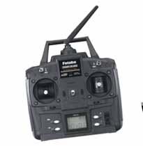
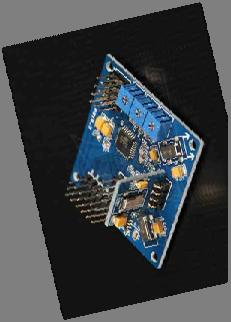
11 GPS/INS systems for UAVs Position awareness GPS for global positioning L1 (most cases) L1/L2 RTK (weight) INS or IMU for relative positioning 3 gyroscopes 3 accelerometers 3 axis magnetometer LSQ Kalman filter RT and/or PP Additional navigation sensors Barometer Laser/Sonar height measurement Wind speedometer Compass


12 Advantages of using GPS/INS Autonomous flight Program the flight No flight and camera operator Guaranteed coverage Signal loss Autonomous return Flight on dangerous areas Flight stability Vertical photography Guaranteed % of coverage Flight altitude fixation Meta data for post processing and A/T

13 Disadvantages GPS/INS and camera eccentricity Obstacle avoidance Legal aspects not fully addressed different among countries
14 Inherent advantages of AUAVs Low cost (buy and maintain) Low flying heights (small groundel) No need for operators Pin point photography Flexibility on programming and execution of flights Small response time Vertical, oblique or horizontal shooting Meta data recording Real time data link Use in emergencies and hostile environment Educational use
15 Inherent disadvantages of AUAVs Low payloads Low flying roof height (up to 300m) Data links are usually up to 5km, more typically to 1 km Legal background
16 Aviation legislation Depends on the country 1) Stand by operator 2) Within visual range 3) Take off and landing by operator 4) Need to get testify flight plan and ask for permission from local civil aircraft authority for every flight above 150m 5) Combinations The article 8 of the Convention on International Civil Aviation, about the Pilotless aircraft says : No aircraft capable of being flown without a pilot shall be flown without a pilot over the territory of a contracting State without special authorization by that State and in accordance with the terms of such authorization. Each contracting State undertakes to insure that the flight of such aircraft without a pilot in regions open to civil aircraft shall be so controlled as to obviate danger to civil aircraft.

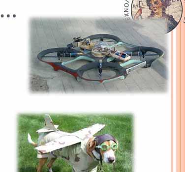
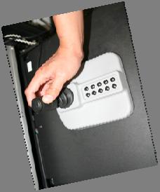
17 CUT s AUAV SwingletCam by SensFly


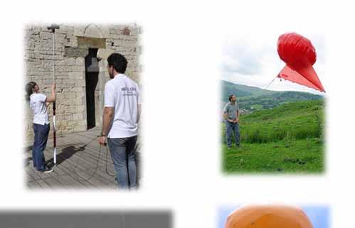
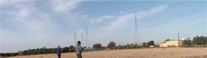
18 Navigation


19 Typical base station Emergency Operator Antenna RT Video & Data link Flight control computer

20 WePilot 1000 Flight stability [rotations]

21 WePilot 1000 Flight stability [speed]


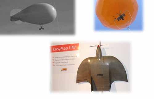
22 Speed: Design vs Execution WePilot 1000
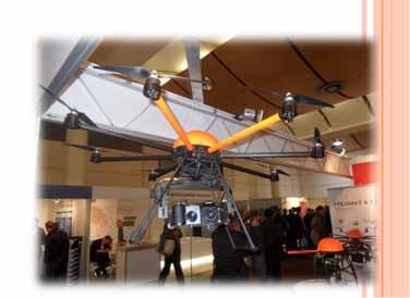
23 Fixed wings Vs multi rotor Flight planning Assisted control Base station Meta data
24 Major category Fixed wings Much better range Cover large areas (1km 2 or more) Fully autonomous Multi rotor Lower flying height Wind endurance Smaller take off and landing space


25 Take off by hand Mavinci Lehmann Aviation Swinglet Zephyr


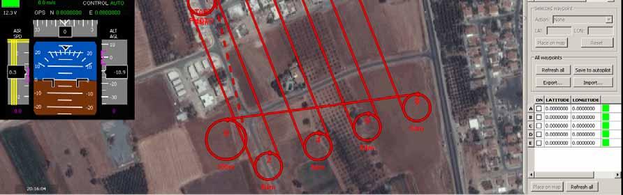
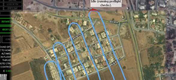
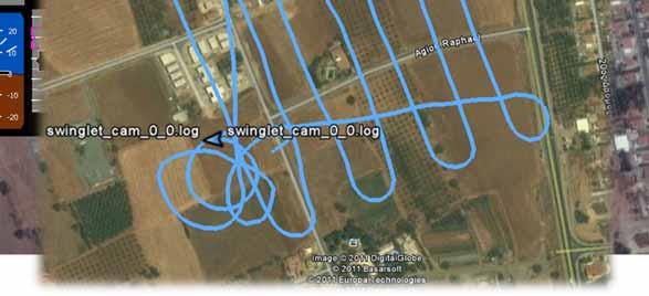
26 Take off and landing in a single short video
27 Take off


28 Best landing ever

 AVI")

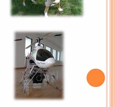
29 Take off with catapult (some may land using parachute) AVI system C ASTRAL Gatewing Pteryx


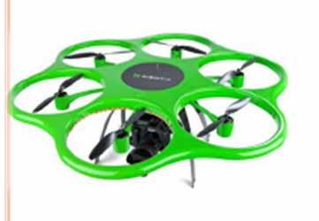
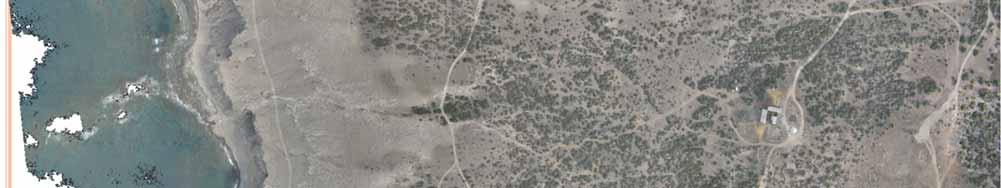
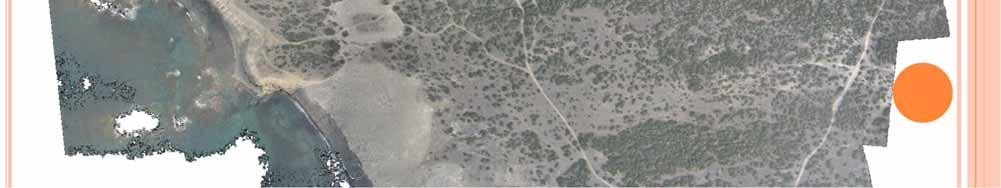
30 Multi rotor Aibotix Dragonfly Microdrones High Tech
31 Microdrones


32 Aibotix


33 Flight planning s/w

34 Planning vs Excecution
35 Photo triggering Manual through video link Automatically using on board GPS With time interval Hovering above the exact location and manual triggering [only multi rotor]
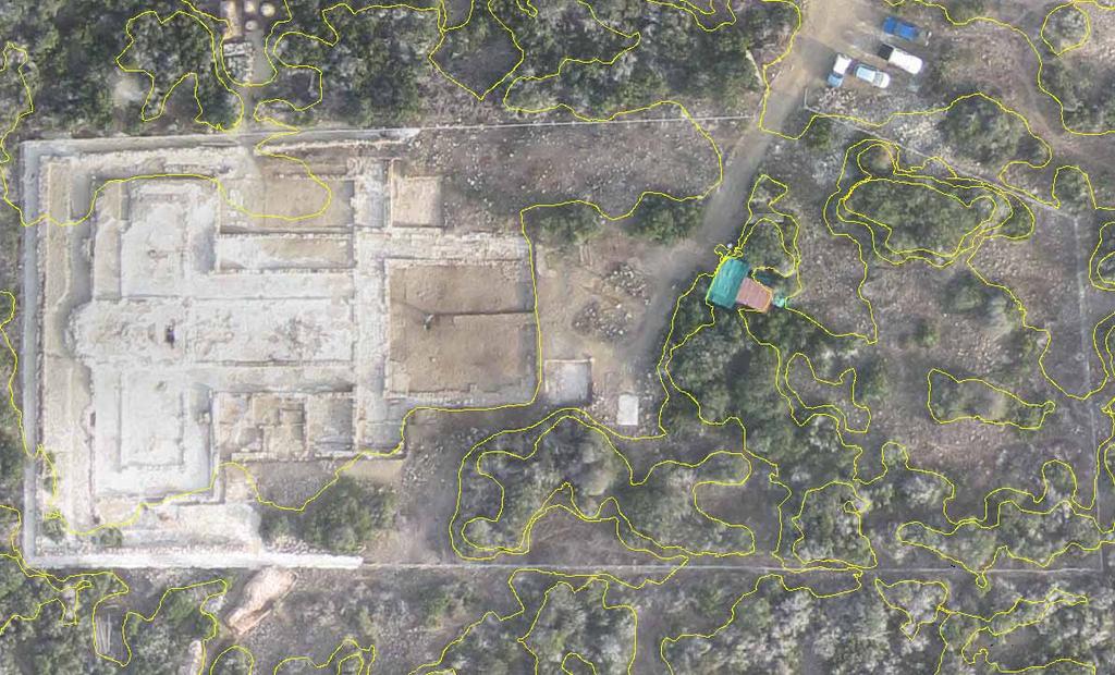
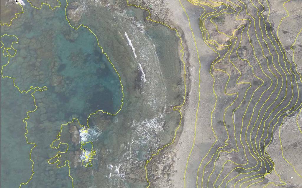
36 Archaeological applications & examples


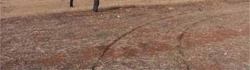
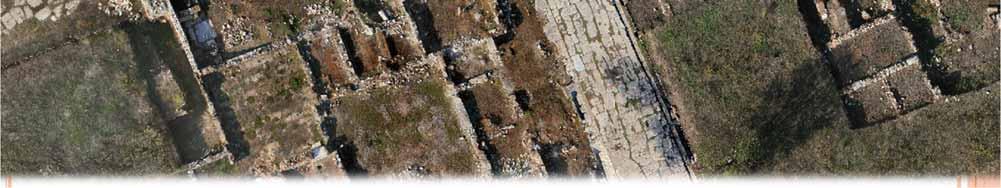
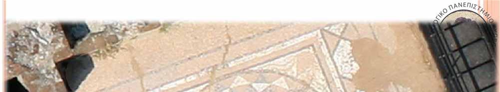
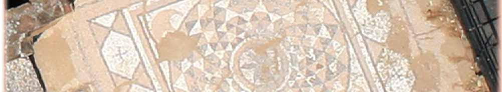
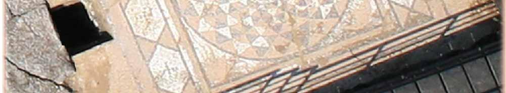
37 3D color point cloud RC Helicopter (8 high resolution full frame photos) 945 K points
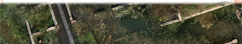
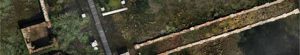
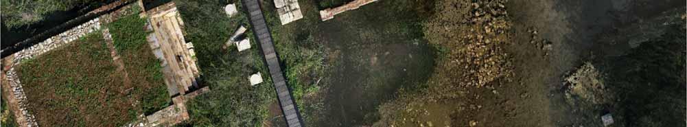
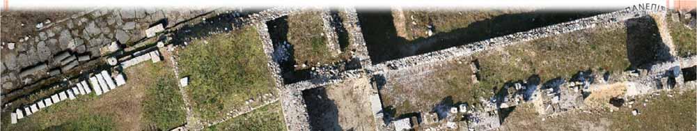
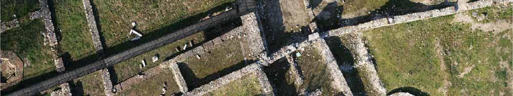
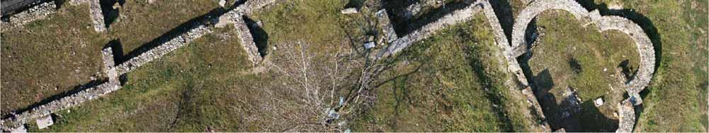
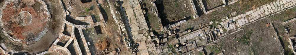
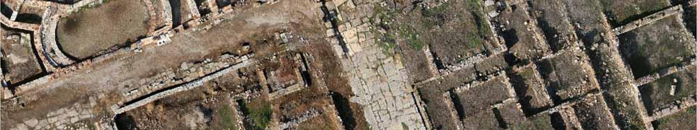
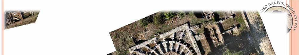
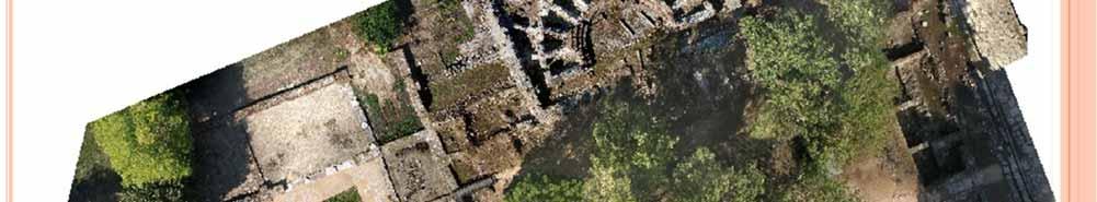
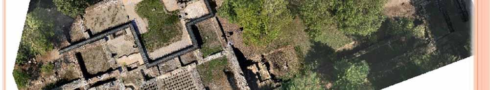
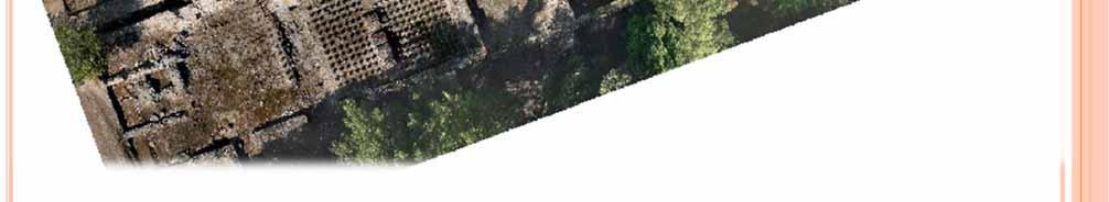
38 Orthophotomap in Akrotiri arcaeological site AUAV flights under permission from SBA Total on site time for flight preparation and flight = 40min Control point collection with GPS (3 hr) Fully automated processing Aerial triangulation 20cm and contour creation Orthophotomosaic with 10cm pixel size Final result and assessment RMSE on check points = 0.12 m RMSE using direct georeferencing = 0.80 m
39 Flight and Α/Τ Flight height 260 m Ground pixel 0,10 m 70% 50% coverage 72 photos


40

41 Orthophoto with 1m contours
42
43 Λεπτομέρεια


44 Detail ortho & DEM
45 Low flight 42m flight height (minimum) m ground pixel size
46 Ancient DION
47 acres in total RC helicopter Full frame camera 25 35m flying height 120 acres ortho with 0.01m pixel size Separated to sub areas

48

49

50

51

52
53
54 Improvements to be anticipated Obstacle avoidance Automation improvements towards a fully functional and autonomous cartographic tool Payload increase Incorporation of more sensors (LiDAR & Linear Array Cameras) Sensor calibration SLAM using the optical sensors onboard Swarm of AUVs to map larger areas Increased navigational accuracy Open source code New applications
55 Thanks Presentation will be available at
56 References Eisenbeib, H., UAV Photogrammetry. PhD thesis, ETH Zurich, Diss. ETH No Everaerts, J., New platforms. EuroSDR. Blyenburgh, Unmanned aircraft systems: The current situation. Presentation in EASE UAS Workshop, Paris. Pteryx flyer & specification pricelist Geoanalysis S.A. flyer A. Gruen, 2011, Advances in UAV Photogrammetry, International Scientific and Technical Conference From imagery to map: digital photogrammetric technologies, Sept. 2011, Spain Remondino F., presentation in UAV photogrammetry: Current status and future perspectives
LAUNCHING YOUR UNMANNED AIRCRAFT PROGRAM
 LAUNCHING YOUR UNMANNED AIRCRAFT PROGRAM THE DARTDRONES TEAM UNMANNED AIRCRAFT APPLICATIONS AERIAL INSPECTIONS AERIAL INSPECTIONS Safer and faster alternative to visual inspection by an individual Damage
P310 VTOL UAV Operation Manual
 P310 VTOL UAV Operation Manual February, 2017 1 Shanghai Huace Navigation Technology Ltd. Contents 1.1 SYMBOLS DEFINITIONS... 4 1.2 TECHNICAL SUPPORT... 5 2.1 WARNING... 5 2.2 NOTICE... 5 4.1 GENERAL SPECIFICATIONS...
High Precision Mapping From Long Endurance UAS. Gabe Ladd 4/10/14
 High Precision Mapping From Long Endurance UAS Gabe Ladd 4/10/14 Outline Test Missions Flown UAS Used For This Project Direct Mapping System Payload Data produced April 10, 2014 2014 American Aerospace
Mapping with Unmanned Airborne Systems (UAS)
") Mapping with Unmanned Airborne Systems (UAS) February 13, 2014 Engineering Architecture Design-Build Surveying GeoSpatial Solutions Today s Agenda Introductions / Objectives Current UAS Regulations (FAA)
Mapping with Unmanned Airborne Systems (UAS) February 13, 2014 Engineering Architecture Design-Build Surveying GeoSpatial Solutions Today s Agenda Introductions / Objectives Current UAS Regulations (FAA)
Program. - Flight Operations (VRI) Motivation. The Aircraft / Sensors. Unmanned Aircraft Systems 8/1/17
 Motivation. The Aircraft / Sensors. Unmanned Aircraft Systems 8/1/17") Program Unmanned Aircraft in Agriculture: Flight Operations and FAA Certification Process * 1) Background. Wayne Woldt, Ph.D., P.E. Department of Biological Systems Engineering School of Natural Resources
Program Unmanned Aircraft in Agriculture: Flight Operations and FAA Certification Process * 1) Background. Wayne Woldt, Ph.D., P.E. Department of Biological Systems Engineering School of Natural Resources
small Unmanned Aircraft Systems Arlington Police Department June 28, 2011
 suas small Unmanned Aircraft Systems Arlington Police Department June 28, 2011 1. Overview of APD suas program to date 2. Discuss the C.O.A. (FAA certificate of authorization to fly) and restrictions
Commit to Safety: Professional Pilots Always Use a Checklist INITIAL EQUIPMENT SETUP
 Commit to Safety: Professional Pilots Always Use a Checklist INITIAL EQUIPMENT SETUP READ THE MANUAL Familiarize yourself with all aspects of your suas before you even consider going out for your first
Airworthiness considerations for UAVs
 A general overview about the approach to a UAV System under current regulations for operation, airspace and certification Presentation by : STN ATLAS ELEKTRONIK Klaus Wohlers, LMP Airborne Systems Type
UAS to GIS Utilizing a low-cost Unmanned Aerial System (UAS) for Coastal Erosion Monitoring
 for Coastal Erosion Monitoring") UAS to GIS Utilizing a low-cost Unmanned Aerial System (UAS) for Coastal Erosion Monitoring Agenda Scope of today s presentation Demonstration Objectives Wrightsville Beach Test Area Masonboro Inlet Jetties
UAS to GIS Utilizing a low-cost Unmanned Aerial System (UAS) for Coastal Erosion Monitoring Agenda Scope of today s presentation Demonstration Objectives Wrightsville Beach Test Area Masonboro Inlet Jetties
ICAO. Here is how the ICAO legal framework for drones is developed.
 ICAO Here is how the ICAO legal framework for drones is developed. The development of the legal framework for international civil aviation started with the Paris Convention of 13 October 1919. The Protocol
Civil Remotely Piloted Aircraft System (RPAS) Regulations in Australia
 Regulations in Australia") Civil Remotely Piloted Aircraft System (RPAS) Regulations in Australia Cees Bil School of Engineering RMIT University Melbourne AUSTRALIA bil@rmit.edu.au ICAS Workshop: Intelligent and Autonomous Technologies
Civil Remotely Piloted Aircraft System (RPAS) Regulations in Australia Cees Bil School of Engineering RMIT University Melbourne AUSTRALIA bil@rmit.edu.au ICAS Workshop: Intelligent and Autonomous Technologies
Development and Testing of an Unmanned Aircraft Safety Beacon for Aerial Application Safety
 Development and Testing of an Unmanned Aircraft Safety Beacon for Aerial Application Safety Wayne Woldt, Ph.D., P.E., and Jacob Smith Biological Systems Engineering and School of Natural Resources University
OWEA Woolpert UAS Operations
 OWEA 2016 Woolpert UAS Operations UAS Rules and Regulations How Woolpert is Handling This The Exemption In December 2014 Woolpert received approval from the FAA regarding an exemption seeking relief from
Unmanned Aerial Vehicles for Environmental Applications
 Unmanned Aerial Vehicles for Environmental Applications John Rankin, President, J.R. Canadian Mapping Ltd. 10 th Annual Professional Biology Conference April 23 rd, 2015 UAVs Our System Suitable Sites
What is a UAS (Drone)
") UAS KCSI Aerial Patrol KCSI is Based in Bakersfield CA Established in 1993 Operates in 15 States KCSI has over 20 fulltime pilots Currently fly: Over 40,000 miles of pipeline a month 700 hours of production
UAS KCSI Aerial Patrol KCSI is Based in Bakersfield CA Established in 1993 Operates in 15 States KCSI has over 20 fulltime pilots Currently fly: Over 40,000 miles of pipeline a month 700 hours of production
Managing small RPAS/UAV operations in developing countries- a Bangladesh Experience. Presented by Bangladesh
 Managing small RPAS/UAV operations in developing countries- a Bangladesh Experience Presented by Bangladesh Managing small RPAS/UAV operations a) Background b) Some Definitions c) Challenges to some article
National Regulatory Profile
 National Regulatory Profile Finland NOTE : In this form the following terms are used Drone = Remotely Piloted Aircraft (RPA) = Unmanned Aircraft (UA) = See definition below Drone Pilot = Remote Pilot (RP)
ONE PLATFORM, MULTIPLE APPLICATIONS: SURVEYING CONSTRUCTION FORESTRY AGRICULTURE ENVIRONMENT POWER ENGINEERING BIRDIE YOUR TAILOR-MADE UAV
 UAV BIRDIE BIRDIE YOUR TAILOR-MADE UAV ONE PLATFORM, MULTIPLE APPLICATIONS: SURVEYING CONSTRUCTION FORESTRY AGRICULTURE ENVIRONMENT POWER ENGINEERING BIRDIE UAV is the complete mapping solution, made for
Australian Association for Unmanned Systems
 Australian Association for Unmanned Systems Industry Guidance on the Amended CASR 1998 Part 101 Version: 1.1 27 th May 2016 Background and Scope On the 30 th of March 2016 the Civil Aviation Safety Authority
UAS Unmanned Aircra: Systems in Forest Management
 UAS Unmanned Aircra: Systems in Forest Management UAS What are they? Unmanned Aircra: Systems (UAS) fill niche built upon military UAV technologies Most common plahorms Fixed Wing Rotorcra: Primary uses
TABLE OF CONTENTS 1.0 INTRODUCTION...
 Advisory Circular Subject: General Safety Practices Model Aircraft and Unmanned Air Vehicle Systems Issuing Office: Civil Aviation, Standards Document No.: AC 600-02 File Classification No.: Z 5000-31
GUIDANCE FOR THE SAFE OPERATION OF MODEL AIRCRAFT, SMALL-UNMANNED AIRCRAFT AND SMALL UNMANNED SURVEILLANCE AIRCRAFT IN GUERNSEY AND ALDERNEY
 GUIDANCE FOR THE SAFE OPERATION OF MODEL AIRCRAFT, SMALL-UNMANNED AIRCRAFT AND SMALL UNMANNED SURVEILLANCE AIRCRAFT IN GUERNSEY AND ALDERNEY 1 Introduction 1.1 This document has been produced by Guernsey
International Civil Aviation Organization. Satellite spectrum to support the safe operation of Unmanned Aircraft Systems
 International Civil Aviation Organization Satellite spectrum to support the safe operation of Unmanned Aircraft Systems Loftur Jónasson, Air Navigation Bureau, ICAO 23 May 2012 Convention on International
 Presented by: Lt. Michael J. Magda Team Leader, Firefighter, EMT -P, Hazardous Material Specialist, Private Pilot, Airframe & Power plant Mechanic Western Wayne County HMRT, Livonia Fire & Rescue And
Air Law. Iain Darby NAPC/PH-NSIL IAEA. International Atomic Energy Agency
 Air Law Iain Darby NAPC/PH-NSIL International Atomic Energy Agency Aviation Regulations International Civil Aviation Organisation (ICAO) Convention on International Civil Aviation also known as the Chicago
The Legal Framework for RPAS/UAS Suitability of the Chicago Convention and its Annexes
 The Legal Framework for RPAS/UAS Suitability of the Chicago Convention and its Annexes 27 May 2013 Page 1 Non-Lawyers 27 May 2013 Page 2 Lawyers 27 May 2013 Page 3 Is the Chicago Convention Suitable? م
Safety in prototype flight
 Safety in prototype flight Sikkerhedskonference Trafikstyrelsen Associate Professor M.Sc. Math, PhD Anders la Cour-Harbo Sikkerhedskonference, October 31, 2013 1 Sikkerhedskonference, October 31, 2013
GEOMATIC ASSESSMENT Membership Directory & Buyers Guide 97th Annual Conference Recap WINTER 2017/18
 WINTER 2017/18 GEOMATIC NC AWWA-WEA 3725 National Drive, Suite 217 Raleigh, NC 27612 ADDRESS SERVICE REQUESTED 2018 Membership Directory & Buyers Guide 97th Annual Conference Recap The official publication
Montreal, 15. (Presented SUMMARY
 DGP-WG/2011-IP/4 18/10/12 DANGEROUS GOODS PANEL (DGP) MEETING OF THE WORKING GROUP OF THE WHOLE Montreal, 15 to 19 October 2012 Agenda Item 6: Other business REGULATORY FRAMEWORK FOR REMOTELY PILOTED AIRCRAFT
THAT REGULATES THE USE AND OPERATION OF THE SYSTEMS OF PILOTED AIRCRAFT AT DISTANCE (RPA) or DRONES IN THE NATIONAL TERRITORY.
 or DRONES IN THE NATIONAL TERRITORY.") THAT REGULATES THE USE AND OPERATION OF THE SYSTEMS OF PILOTED AIRCRAFT AT DISTANCE (RPA) or DRONES IN THE NATIONAL TERRITORY. RNC: National Registry of Taxpayers. VLO: Visual line of sight. VMC: Visual
THAT REGULATES THE USE AND OPERATION OF THE SYSTEMS OF PILOTED AIRCRAFT AT DISTANCE (RPA) or DRONES IN THE NATIONAL TERRITORY. RNC: National Registry of Taxpayers. VLO: Visual line of sight. VMC: Visual
Planning for RPAS Operations
 Planning for RPAS Operations Tom Wade, Facility Manager, University of Edinburgh Image courtesy of Simon Gibson-Poole (UoE/SRUC) at Introduction Terminology Strengths and Limitations is this the tool for
DRONECON Presented by: Simon Segwabe Executive: Aviation Safety Operations 16 th MAY 2018 VODACOM WORLD MIDRAND, JHB
 Presented by: Simon Segwabe Executive: Aviation Safety Operations 16 th MAY 2018 VODACOM WORLD MIDRAND, JHB SACAA s PART 101 BEYOND 2018 The Flight Path 1. PURPOSE 2. SOUTH AFRICAN AVIATION LEGISLATION
The role of Unmanned Aircraft System (AUS) in search and rescue (SAR) operations
 in search and rescue (SAR) operations") The role of Unmanned Aircraft System (AUS) in search and rescue (SAR) operations Captain: Abdelkhalik Kamaleldin Soliman Selmy College of Maritime Transport & Technology Arab Academy for Science, Technology
The role of Unmanned Aircraft System (AUS) in search and rescue (SAR) operations Captain: Abdelkhalik Kamaleldin Soliman Selmy College of Maritime Transport & Technology Arab Academy for Science, Technology
Título ponencia: Introduction to the PBN concept
 Título ponencia: Introduction to the PBN concept Organizado por: Index Introduction Background PBN Concept PBN Operations Conclusions Introduction Subject This presentation addresses the Performance-Based
Light UAS for forestry applications an Operational experience
 Light UAS for forestry applications an Operational experience European High Level Unmanned Aircraft Systems (UAS) Conferencen Lars Björk Swedish Forest Agency 1 Swedish Forest Agency Swedish Forest Agency
Re: Exemption Request Section 333 of the FAA Reform Act and Part 11 of the Federal Aviation Regulations
 September 04, 2014 U. S. Department of Transportation Docket Management System 1200 New Jersey Ave., SE Washington, DC 20590 Re: Exemption Request Section 333 of the FAA Reform Act and Part 11 of the Federal
JOINT AUTHORITIES FOR RULEMAKING OF UNMANNED SYSTEMS. Julia Sanchez on behalf of WG 1 Leader Benny Davidor 1
 JOINT AUTHORITIES FOR RULEMAKING OF UNMANNED SYSTEMS Julia Sanchez on behalf of WG 1 Leader Benny Davidor 1 WORKING GROUPS STRUCTURE CONOPS OPS + FCL AMC UAS. 1309 ORG WG 7 AIRWORTHINESS COMMAND CONTROL
MODEL AERONAUTICAL ASSOCIATION OF AUSTRALIA
 MODEL AERONAUTICAL ASSOCIATION OF AUSTRALIA GENERAL RULES AND GUIDELINES FOR THE OPERATION OF MODEL AIRCRAFT MOP014 APPROVED: MAAA PRESIDENT Date: 31/10/2017 Paragraph 2.0 Definitions Brief description
In-field and Remote Sensing for Precision Agriculture. John Nowatzki Extension Ag Machine Systems Specialist North Dakota State University
 In-field and Remote Sensing for Precision Agriculture John Nowatzki Extension Ag Machine Systems Specialist North Dakota State University UAS in Precision Agriculture In-field Sensors Selecting UAS Equipment
Using Geospatial Data in the Oil & Gas Industry. Dr. Stacey D. Lyle, RPLS
 Using Geospatial Data in the Oil & Gas Industry Dr. Stacey D. Lyle, RPLS Outcomes A Geospatial Data Science Center is an advanced database of information organized and accessible using multiple software
Helicopter Vector IFR
 Helicopter Vector IFR Gerry Wiseman IFR Survey Manager Contents What is IFR? Land IFR Method Dynamic IFR Survey Helicopter IFR Survey Northern Alberta Project MWD Relies on the Earth s Magnetic Field MWD
INTERNATIONAL STANDARDS
 Annex or Recommended Practice INTERNATIONAL STANDARDS DEFINITIONS When the following terms are used in the s for Aircraft Nationality and Registration Marks, they have the following meanings: Civil Aviation
A Drone s Eye View on Public Works Applications
 A Drone s Eye View on Public Works Applications APWA Construction Inspection Conference Parker, CO Jason Caldwell, VP of Business Development and Sales 2013, The Sanborn Map Company, Inc. Agenda Sanborn
Launching a New Surveying Perspective
 Launching a New Surveying Perspective >> By Mary Jo Wagner A 3 km2 orthomosaic shows the entire construction site and surroundings. On the upper part of the mosaic are the Bristol Channel; the existing
Using UAVs for Aerial Mapping, Surveying and Photography
 Using UAVs for Aerial Mapping, Surveying and Photography Prepared for: Central Florida GIS Workshop 18 September 2013 Kevin Shortelle System Dynamics International, Inc kevinshortelle@bellsouth.net Presentation
We're not spying on you; it's more interesting watching grass grow-
 We're not spying on you; it's more interesting watching grass grow- Using Unmanned Aircraft Systems in Rangeland Monitoring Connie Maxwell USDA Agricultural Research Service Jornada Experimental Range
Appendix A REQUEST FOR AUTHORIZATION FORM
 Appendix A REQUEST FOR AUTHORIZATION FORM Note. For details on completing this form, and for definitions of acronyms and abbreviations, see section on Information Required for the Assessment of Authorization
UAV/Drone Uses and Laws
 UAV/Drone Uses and Laws Robert Moorhead Director of Geosystems Research and Northern Gulf Institutes Professor of Electrical & Computer Engineering Unmanned Aerial Systems (UASs) 3 components to the system:
Unmanned Aircraft System (UAS): regulatory framework and challenges. NAM/CAR/SAM Civil - Military Cooperation Havana, Cuba, April 2015
: regulatory framework and challenges. NAM/CAR/SAM Civil - Military Cooperation Havana, Cuba, April 2015") Unmanned Aircraft System (UAS): regulatory framework and challenges NAM/CAR/SAM Civil - Military Cooperation Havana, Cuba, 13 17 April 2015 Overview Background Objective UAV? Assumptions Challenges Regulatory
Unmanned Aircraft System (UAS): regulatory framework and challenges NAM/CAR/SAM Civil - Military Cooperation Havana, Cuba, 13 17 April 2015 Overview Background Objective UAV? Assumptions Challenges Regulatory
Lone Star UAS Center. of Excellence and Innovation
 Lone Star UAS Center LSUASC Introduction of Excellence and Innovation Bringing UAS to America s Skies NASAO 85 th Annual Convention and Tradeshow UAS Emerging Technologies & Utilizations September 13,
Part 101, Amendment 7. Gyrogliders and Parasails, Unmanned Aircraft (including Balloons), Kites, and Rockets Operating Rules.
, Kites, and Rockets Operating Rules.") Part 101, Amendment 7 Gyrogliders and Parasails, Unmanned Aircraft (including Balloons), Kites, and Rockets Operating Rules Docket 14/CAR/3 Contents Rule objective... 3 Extent of consultation... 3 Summary
Part 101, Amendment 7 Gyrogliders and Parasails, Unmanned Aircraft (including Balloons), Kites, and Rockets Operating Rules Docket 14/CAR/3 Contents Rule objective... 3 Extent of consultation... 3 Summary
Airworthiness Regulatory Framework for Military Civil RPAS. Lt Col (Eng) Georgios Kokkalas
 Georgios Kokkalas") Airworthiness Regulatory Framework for Military Civil RPAS Lt Col (Eng) Georgios Kokkalas Cranfield University Alumni Event and Defence Education Conference Athens War Museum, 1 st June 2017 Scope Understand
Airworthiness Regulatory Framework for Military Civil RPAS Lt Col (Eng) Georgios Kokkalas Cranfield University Alumni Event and Defence Education Conference Athens War Museum, 1 st June 2017 Scope Understand
Industria, Innovazione e Ricerca: Le nuove frontiere del volo a pilotaggio remoto
 Industria, Innovazione e Ricerca: Le nuove frontiere del volo a pilotaggio remoto Aniello Cozzolino Head of Research & Technology Development, Piaggio Aerospace University of Naples Federico II, June,
Legal Supplement Part B Vol. 55, No th November, REGULATIONS
 Legal Supplement Part B Vol. 55, No. 132 16th November, 2016 835 LEGAL NOTICE No. 175 REPUBLIC OF TRINIDAD AND TOBAGO THE CIVIL AVIATION ACT, CHAP. 49:03 REGULATIONS MADE BY THE TRINIDAD AND TOBAGO CIVIL
Unmanned Aerial Vehicles or How I learned to stop worrying and love drones!
 Unmanned Aerial Vehicles or How I learned to stop worrying and love drones! Dr. Charles O Neill Aerospace Engineer, UA Professor, Pilot charles-oneill.com or aero.ua.edu Brief History of Drones German
MINIMUM FLIGHT ALTITUDES
 MINIMUM FLIGHT ALTITUDES 1. Introduction Minimum flight altitudes are created first to ensure safety, awareness and adequate radio navigation reception for aircraft flying at the same time in specific
Drone Technology: What Works for Industry & Landowners. Michael J. Buschermohle Interim Assistant Dean UT Extension
 Drone Technology: What Works for Industry & Landowners Michael J. Buschermohle Interim Assistant Dean UT Extension So You Want to Fly FAA Regulations UAS Platforms Cameras Applications in Forestry Current
CHAPTER 6:VFR. Recite a prayer (15 seconds)
") CHAPTER 6:VFR Recite a prayer (15 seconds) ATM TOPIC 1. INTRODUCTION TO AIR TRAFFIC MANAGEMENT,TYPE OF CONTROL AREAS & FLIGHT PLAN 2. AERODROME CONTROL 3. AREA CONTROL 4. APPROACH CONTROL --------------------------------------mid-term
CHAPTER 6:VFR Recite a prayer (15 seconds) ATM TOPIC 1. INTRODUCTION TO AIR TRAFFIC MANAGEMENT,TYPE OF CONTROL AREAS & FLIGHT PLAN 2. AERODROME CONTROL 3. AREA CONTROL 4. APPROACH CONTROL --------------------------------------mid-term
DEFINITIONS DEFINITIONS 2/11/2017 REQUIREMENTS AND LIMITATIONS OF DRONE USE IN FORENSIC ACCIDENT RECONSTRUCTION
 REQUIREMENTS AND LIMITATIONS OF DRONE USE IN FORENSIC ACCIDENT RECONSTRUCTION ROGER BURGMEIER BURGMEIER CONSULTING INC. DEFINITIONS Aircraft: device that is used, or intended to be used, for flight. Drone:
5 Day Operator Course. 1.0 AIRSPACE CLASSROOM ONLINE EXECUTIVE VO Terms X X Classification
 5 Day Operator Course 2 Day Executive Training 2 Day VO Training 0.1 INTRODUCTION CLASSROOM ONLINE EECUTIVE VO About Avion Solutions Purpose of the course Learning objectives Course outline and schedule
Part 101 Unmanned aircraft and rockets
 Part 101 Unmanned aircraft and rockets Part 101 Unmanned aircraft and rockets Table of contents Subpart 101.A Preliminary 101.005 Applicability of this Part 101.010 Application to rocket-powered unmanned
CHECKLIST DJI MAVIC PRO
 CHECKLIST DJI MAVIC PRO BEFORE GOING OUT 1. Verify NOTAM 2. Airspace clearance CLEARED 3. Mission accepted by HFO ACCEPTED 4. Weather forecast 5. Airworthiness 6. Onboard battery voltage 7. RC-control
ESA-EDA: Paving the Way for New UAS Capabilities in Europe
 ESA-EDA: Paving the Way for New UAS Capabilities in Europe Dr. Stefan Gustafsson, ESA Jens Fehler, EDA Noordwijk, 11 th 12 th May 2010 Integrated Application Promotion Earth Observation Telecommunication
GCAA GUYANA CIVIL AVIATION AUTHORITY
 GCAA GUYANA CIVIL AVIATION AUTHORITY DIRECTIVE No: GCAA/ASR/DIR/2017-01 Issued: 26 th February, 2017 AUTHORITY DIRECTIVE TO OWNERS AND OPERATORS OF UNMANNED AERIAL VEHICLES (UAVs) The Guyana Civil Aviation
Addendum: UAV Avionics
 Addendum: UAV Avionics Dr. Bérénice Mettler University of Minnesota Jan. 29, 2012 (v.1/24/13) Dr. Bérénice Mettler (University of Minnesota) Addendum: UAV Avionics Jan. 29, 2012 (v.1/24/13) 1 / 8 Overview
UAV Flight Services Company. What We Do. What Sets us Apart
 UAV Flight Services Company A dedicated team of aviators, technologists, and engineers. What We Do UAV flight services for data collection, mapping, and inspection What Sets us Apart Extensive field experience,
Sam Houston State University UAS Use Checklist
 Sam Houston State University UAS Use Checklist The FAA Part 107 of the Code of Federal Regulations and the Sam Houston State University President s Office Policy PRE-27 determine the minimum requirements
SYLLABUS INTRODUCTION TO ROTARY WING FLYING QUALITIES AND PERFORMANCE
 22783 Cedar Point Road, Building 2168 Patuxent River, MD 20670 Phone: 301 757 5049 301 757 2731 Fax: 301 342 5003 www.navair.navy.mil/nawcad/usntps SYLLABUS INTRODUCTION TO ROTARY WING FLYING QUALITIES
Enabling Civilian Low-Altitude Airspace and Unmanned Aerial System (UAS) Operations. Unmanned Aerial System Traffic Management (UTM)
 Operations. Unmanned Aerial System Traffic Management (UTM)") Enabling Civilian Low-Altitude Airspace and Unmanned Aerial System (UAS) Operations By Unmanned Aerial System Traffic Management (UTM) Parimal Kopardekar, Ph.D. UTM Principal Investigator and Manager,
Enabling Civilian Low-Altitude Airspace and Unmanned Aerial System (UAS) Operations By Unmanned Aerial System Traffic Management (UTM) Parimal Kopardekar, Ph.D. UTM Principal Investigator and Manager,
CIVIL AVIATION REMOTE PILOT AIRCRAFT OPERATION REGULATIONS. SCAA Progress through collective solutions
 CIVIL AVIATION REMOTE PILOT AIRCRAFT OPERATION REGULATIONS SCAA Progress through collective solutions BACKGROUND Rapid growth globally in the development and use of unmanned aircraft such as Remotely Piloted
How to Use Drones in Stormwater Management January 17, :30 a.m. 11:30 a.m. (Eastern)
") Webinar Training Series How to Use Drones in Stormwater Management January 17, 2019 10:30 a.m. 11:30 a.m. (Eastern) www.seswa.org Today s Presenters Robert Gecy Application Programmer Beaufort County,
Webinar Training Series How to Use Drones in Stormwater Management January 17, 2019 10:30 a.m. 11:30 a.m. (Eastern) www.seswa.org Today s Presenters Robert Gecy Application Programmer Beaufort County,
DRONING FOR INFORMATION
 DRONING FOR INFORMATION Opportunity of Drones for Surveying and Mapping Practices By: Adam Smith, CP Matt Aguirre, PLS Overview Introduction Background Problem and Opportunity Issues and Mitigations Implementation
Regional implementation of Electronic Terrain and Obstacle data (e-tod) (Presented by Jeppesen)
 (Presented by Jeppesen)") International Civil Aviation Organization SAM/IG/13-WP/39 South American Regional Office 5/04/14 Thirteenth Workshop/Meeting of the SAM Implementation Group English only (SAM/IG/13) - Regional Project
International Civil Aviation Organization SAM/IG/13-WP/39 South American Regional Office 5/04/14 Thirteenth Workshop/Meeting of the SAM Implementation Group English only (SAM/IG/13) - Regional Project
CHC P310 Operation Procedure
 CHC P310 Operation Procedure 1. GCS-202 Ground Control System Preparation a. Fix the location of GCS-202 b. Power on the GCS-202 and wait for the DGPS signal lock-in. Note: 1. if external power supply
Unmanned Aerial Systems for Agriculture
 Unmanned Aerial Systems for Agriculture by Bob Schultheis Natural Resource Engineering Specialist for Greene County Soils & Crops Conference Springfield, MO March 18, 2014 Special thanks to Bill Wiebold,
Unmanned Aerial Systems
 Unmanned Aerial Systems SIRIUS UAS Solar Farm Forestry Surveying Mines Stone Quarries Crop Damage Meadows Construction Sites Monitoring Mapping Documentation Peat Land Volume Calculation Innovation Made
Commercial UAS & the Impact of State Regulations Southern Legislative Conference July 20, 2015
 Commercial UAS & the Impact of State Regulations Southern Legislative Conference July 20, 2015 * Meet Ben 01 Currently the CEO of AgriSource Data; he was formerly the COO of VSG- Unmanned & has held leadership
The Flying Donkey Challenge
 The Flying Donkey Challenge Mission, rules, judging & rewards V1.2, 6th January 2014 (subject to regular updates and change) Contact details Fondation Bundi-Afrotech QIE.0 EPFL 1015 Lausanne Suisse fly@flyingdonkey.org
The DFS perspective on safe and fair integration of UAS into the national airspace system
 The DFS perspective on safe and fair integration of UAS into the national airspace system Eurocontrol Workshop on RPAS ATM Integration Brussels, 06 April 2017 Angela Kies (0) Contents The DFS perspective
PHOENIX AIR UNMANNED, LLC
 PHOENIX AIR UNMANNED, LLC A COMMITMENT TO EXCELLENCE IN UNMANNED AVIATION Based north of Atlanta in Cartersville, Georgia, Phoenix Air Unmanned, LLC (PAU) is a sister company of the internationally recognized
Presentation: UAS Helicopter Waran -1-
 Presentation: UAS Helicopter Waran -1- The unique design features of the Waran provide a superior payload capacity, prolonged endurance, stable flight patterns and a high degree of safety features. Technical
Part 101. CAA Consolidation. 10 March Gyrogliders and Parasails, Unmanned Aircraft (including Balloons), Kites, and Rockets Operating Rules.
, Kites, and Rockets Operating Rules.") Part 101 CAA Consolidation 10 March 2017 Gyrogliders and Parasails, Unmanned Aircraft (including Balloons), Kites, and Rockets Operating Rules. Published by the Civil Aviation Authority of New Zealand
Part 101 CAA Consolidation 10 March 2017 Gyrogliders and Parasails, Unmanned Aircraft (including Balloons), Kites, and Rockets Operating Rules. Published by the Civil Aviation Authority of New Zealand
2017 PLSO Fall Seminar. UAV s Flying to Finished Product
 2017 PLSO Fall Seminar UAV s Flying to Finished Product Scott D. Kraner, P.E. Subject Matter Expert Civil Infrastructure Session Outline UAV Overview and Applications How to obtain a remote pilot certificate?
2019 NYSAPLS Conference Becoming a Licensed UAS Pilot. George Southard GSKS Associates LLC
 2019 NYSAPLS Conference Becoming a Licensed UAS Pilot George Southard GSKS Associates LLC Introduction George Southard: Master s Degree in Photogrammetry and Cartography 40+ years working in the mapping/surveying
2018 ENGINEERING EXPO Jon Thies NUAIR Director of Consulting
 2018 ENGINEERING EXPO Jon Thies NUAIR Director of Consulting Agenda Operating Under Current FAA Regulations suas Program Development Considerations suas Use Case Examples Quiz Regulations Small Unmanned
UNMANNED AIRCRAFT SYSTEMS (UAS) IN UTILITIES
 IN UTILITIES") UNMANNED AIRCRAFT SYSTEMS (UAS) IN UTILITIES Presented by: Dan Carbone Avion Unmanned Why Drones? Why Drones? Cost Effective Entire cost of a UAS program can be recouped in first-year man-hour savings
UNMANNED AIRCRAFT SYSTEMS (UAS) IN UTILITIES Presented by: Dan Carbone Avion Unmanned Why Drones? Why Drones? Cost Effective Entire cost of a UAS program can be recouped in first-year man-hour savings
RISING PERFORMANCE. Civil aviation is an outlier. It s BY ERIK DAHLBERG
 RISING PERFORMANCE Compact mobile mapping systems can be installed on small passenger cars. Civil aviation is an outlier. It s among the few industries where tight government regulations are widely accepted
PBN Syllabus Helicopter. Learning Objective. phase Theoretical PBN concept. in ICAO Doc 9613)
") PBN Syllabus Helicopter Training Topic phase Theoretical PBN concept training (as described in ICAO Doc 9613) PBN principles PBN components PBN scope Navigation specifications RNAV and RNP Navigation functional
PBN Syllabus Helicopter Training Topic phase Theoretical PBN concept training (as described in ICAO Doc 9613) PBN principles PBN components PBN scope Navigation specifications RNAV and RNP Navigation functional
Report of the CIAM UAV Working Group Bruno DELOR - Chairman of the CIAM UAVWG
 Edition 1.1-20 September 2014 Annex: Report of the CIAM UAV Working Group Bruno DELOR - Chairman of the CIAM UAVWG 1- Terms of Reference of the UAVWG (Version 1.0 - June 2014). 2- Terminology and definitions.
AIRPROX REPORT No PART A: SUMMARY OF INFORMATION REPORTED TO UKAB
 AIRPROX REPORT No 2015052 Date: 20 Apr 2015 Time: 1010Z Position: 5324N 00211W Location: 4nm NE Manchester Airport PART A: SUMMARY OF INFORMATION REPORTED TO UKAB Recorded Aircraft 1 Aircraft 2 Aircraft
The Freedom of Flight
 The Freedom of Flight Authors: Nicco Bugarin, Keith Kaplan and Wilhelm Cashen Date: May 20 2014 Safe Flight System The Commercialization of UAVS Safe Flight TM System is a Trademark of the Tesla Foundation
Air Navigation Bureau ICAO Headquarters, Montreal
 Performance Based Navigation Introduction to PBN Air Navigation Bureau ICAO Headquarters, Montreal 1 Performance Based Navigation Aviation Challenges Navigation in Context Transition to PBN Implementation
The Legal Environment for Commercial Unmanned Aircraft
 The Legal Environment for Commercial Unmanned Aircraft Overview The Legal Environment Who can fly them? A history of FAA policy to the present Asking for permission 2 Today s Legal Framework 3 Today s
Adventures in UAS: Experiences of a UAS Operator. Paul Beckwith, PE, CCM, LEED AP bd+c Navigator CS, LLC, President. Presented by:
 Adventures in UAS: Experiences of a UAS Operator Presented by: Paul Beckwith, PE, CCM, LEED AP bd+c Navigator CS, LLC, President Paul Beckwith, PE, CCM, LEED AP bd+c BA in Architectural Engineering from
Unmanned Aircraft Systems (UAS) 101
 101") Unmanned Aircraft Systems (UAS) 101 Presented to: The American Association of State Highway and Transportation Officials Presented by: Dave May, FAA UAS Integration Office Date: What is a UAS? A UAS is
Unmanned Aircraft Systems (UAS) 101 Presented to: The American Association of State Highway and Transportation Officials Presented by: Dave May, FAA UAS Integration Office Date: What is a UAS? A UAS is
Remote Controlled Aircraft Permit Instructions
 The use of remote controlled aircraft is regulated within State Parks by WAC 352-32-130 (5) which allows for the flying of remote controlled aircraft with written permission of the Director, or designee.
Unmanned Aircraft Systems (UAS) at the Jornada Experimental Range
 at the Jornada Experimental Range") Unmanned Aircraft Systems (UAS) at the Jornada Experimental Range Al Rango and the Jornada UAS Flight Team: Connie Maxwell, Amy Slaughter, Andrea Laliberte, Chris Pierce, Dave Thatcher, Jim Lenz, and Craig
Unmanned Aircraft Systems (UAS) at the Jornada Experimental Range Al Rango and the Jornada UAS Flight Team: Connie Maxwell, Amy Slaughter, Andrea Laliberte, Chris Pierce, Dave Thatcher, Jim Lenz, and Craig
Hazard Identification Questionnaire
 Hazard Identification Questionnaire OVERVIEW This questionnaire is designed to help identify potential risks and help identify areas of risk exposure. It is not an exhaustive list. This questionnaire is
PBN Airspace Design Workshop. Area Navigation. Asia and Pacific Regional Sub-Office Beijing, China. 5 May 2016 Page 1 APAC RSO BEIJING
 PBN Airspace Design Workshop Area Navigation Asia and Pacific Regional Sub-Office Beijing, China 5 May 2016 Page 1 APAC RSO BEIJING Learning Objectives By the end of this presentation, you will be: Aware
Airworthiness Criteria: Special Class Airworthiness Criteria for the FlightScan
 This document is scheduled to be published in the Federal Register on 11/16/2017 and available online at https://federalregister.gov/d/2017-24866, and on FDsys.gov [4910-13] DEPARTMENT OF TRANSPORTATION