Creating a User-Driven Long-Distance OHV Trail Through Partnering
|
|
|
- Silvia Riley
- 5 years ago
- Views:
Transcription


1 Joseph Raffaele Outdoor Recreation Planner U.S. Bureau of Land Management Yuma, Arizona Creating a User-Driven Long-Distance OHV Trail Through Partnering


2 BLM is a multiple-use land management agency within the U.S. Department of the Interior whose mission is to sustain the health, diversity, and productivity of the public lands for the use and enjoyment of present and future generations.

3 BLM Arizona Districts
 1 Area of Critical Environmental Concern")
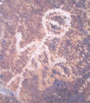
4 BLM Yuma Field Office YFO manages 1.2 million acres in SW Arizona and SE California including 155 miles of Lower Colorado River 4 wilderness areas (Muggins, Trigos, New Waters, & Eagletails) 1 Area of Critical Environmental Concern Significant archeological and historic sites Juan Bautista de Anza National Historic Trail Betty s Kitchen National Recreation Trail and Watchable Wildlife Area

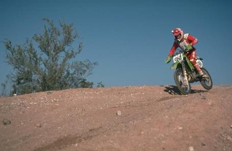
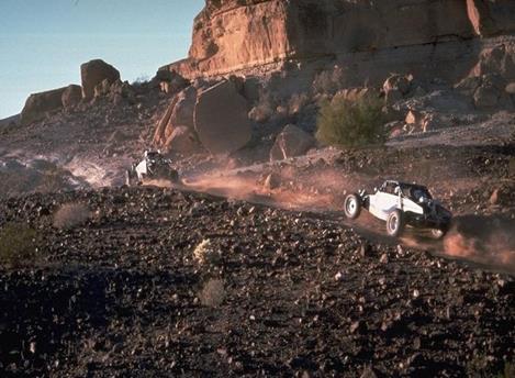
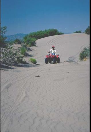
5 BLM s LaPosa Long -Term Visitor Area (LTVA) in Quartzsite, AZ 11,400 acre BLM LaPosa Long-Term Campground located 2 miles south of Quartzsite, AZ Thousands of winter visitors (snowbirds) spend up to 7 months each winter OHV s are very popular with the winter campers Quartzsite is famous for its large rock and car shows Rock collectors love the surrounding desert geology Wild horses and burros, deer, bighorn sheep, and coyotes can be seen in the surrounding area 5


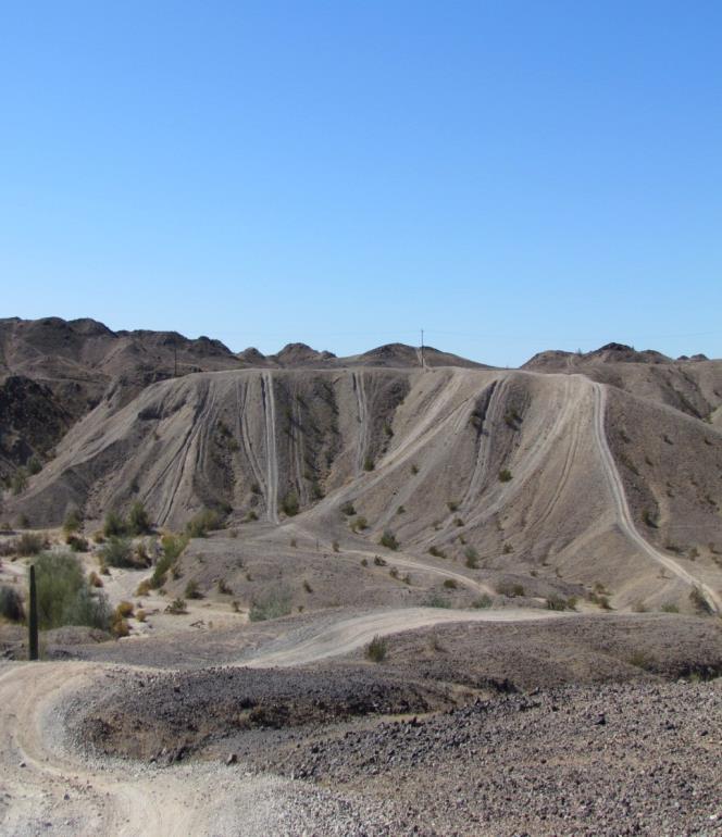
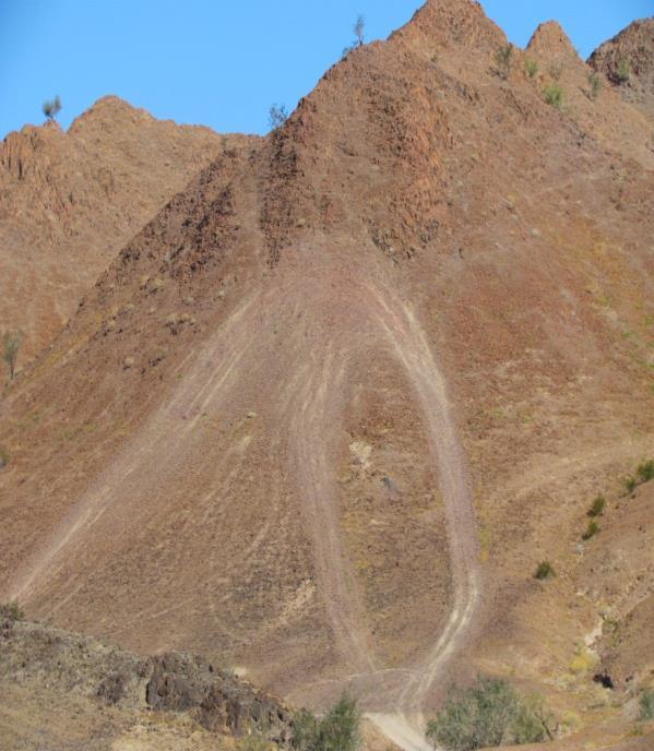
6 Numerous Resource Issues are created from Thousands of Long-Term Campers and OHV Users
7 Introduction to Travel Management BLM is currently moving from an existing roads and trails travel policy to a limited to a designated roads and trails travel policy across the western U.S. BLM s Comprehensive Travel Management Planning covers both motorized and non-motorized uses of the public lands. Each road and trail will be systematically evaluated to ensure that all resource values, resource uses, and resource conflicts are considered.
8 Introduction to Travel Management Development of travel management plans is a collaborative process and the BLM will consider all reasonable alternatives proposed from any interested stakeholder. End result is a better signed and mapped road and trail network that provides safe trail-based recreation opportunities. Opportunity to develop partnerships and volunteerism to establish, manage, monitor, and maintain an environmentally compatible road and trail network.
9 National BLM Travel Management Policies Federal Lands Policy and Management Act of 1976 Executive Orders and 11989: Use of off-road vehicles on the public lands Code of Federal Regulations, Title 43, Part 8340: Off-road vehicles BLM Land Use Planning Handbook Appendix C: Program/ Resource-Specific Guidance BLM Instruction Memorandum No
10 Executive Orders and 11989: Use of Off-Road Vehicles on Public Lands (codified at 43 CFR 8340) Areas and trails shall be located to minimize damage to soil, watershed, vegetation, and other resources of the public lands; harassment of wildlife or significant disruption to wildlife habitats; conflicts between off-road vehicle use and other existing or proposed recreational uses of the same or neighboring public lands, and to ensure the compatibility of such uses with existing conditions in populated areas, taking into account noise and other factors.
11 Travel Management Plan Objectives Systematically evaluate each route to ensure that all resource values, resource uses, and resource conflicts are considered Sensitive resources Public access needs Commercial activities Administrative uses Recreation activities User conflicts Hazards and safety concerns

12 BLM Arizona Travel Management Areas

13 La Posa Travel Management Area 384,600 acres (600 square miles) of BLM land in La Paz and Yuma Counties Urban-interface lands around Quartzsite, Arizona Bisected by Interstate 10 and Highway 95

14 La Posa Travel Management Area Borders the BLM Lake Havasu Field Office, Colorado River Indian Reservation, Kofa National Wildlife Refuge, and U.S. Army-Yuma Proving Ground Includes private property and Arizona State Trust Land inholdings Numerous authorized and maintained roads
15 La Posa Travel M anagement Plan Objectives Designate all routes in the planning area as open, closed, or limited to motorized and non-motorized uses. Provide consideration for all modes of recreational travel, including off-highway vehicle use, hiking, mountain biking, and horseback riding. Identify and authorize specific route monitoring, maintenance, and mitigation needs.
16 BLM s Travel Management Planning Process Route Inventory Route Evaluation Route Designation Implementation Monitoring

17 LaPosa TMA Route Inventory from 2010 Yuma Resource Management Plan

18 LaPosa TMA Sub -Units Used for Route Evaluations
19 Route Evaluation Tree Process Systematic and objective route-by-route analysis of beneficial and negative impacts from motorized and non-motorized travel Data from scientific research, GIS databases, inventories, lands and realty documents, interagency input, and public comment is compiled for planning area Interdisciplinary team inputs data into software pertaining to individual route location, including any monitoring, maintenance, and other mitigation needs

20 Every Route is Examined by a Multi-Disciplinary and Multi-Agency Team and a Route Report is Generated (Average 4 Pages)
 D.")
21 A NEPA Analysis is then Conducted by the I nterdisciplinary Team F o u r D i f f e r e n t A l t e r n a t i v e s w e r e E x a m i n e d Four Alternatives A. No Action B. Least Restrictive C. In-Between (Proposed) D. Most Restrictive
22 A Partner Proposes a Trail: A local OHV user group (partner) called the Arizona Sunrider s requests that BLM develop a long-distance OHV trail as part of the LaPosa TMP They presented a map of their proposed trail route with backing by local government officials Their idea is to bring economic prosperity based on increased OHV use on the trail and national marketability for tourism Their proposed route crosses multiple federal, state, and local jurisdictions Their Concept is based on a similar multi-jurisdictional trail in Utah called the Paiute Trail


23 The Paiute Trail is an extensive trail developed primarily by the Forest Service and the BLM and which crosses multiple public and private jurisdictions

24 BLM took the Sunrider s Complete Trail Proposal and Overlaid it onto USGS Topo s and added a land ownership/ management layer

25 The Trail Proposal was then layered onto to a Colorado River District BLM Boundary Map

26 The Decision: The Sunriders Trail Proposal will be Signed Upon Implementation of the TMP as a Distinct Trail with Unique Identifying Signage
27 Q. Who are BLM s Partners in this Complicated Process? A. Anyone that wants to be part of it!!! There are numerous federal, state, and local agencies involved due to the extensive amount of land involved. Also user groups like the AZ Sunriders and even individual volunteers Local agencies are very interested in the process due to the possibility of route closures leading to decreased tourism dollars In this case we expect to see economic improvements due to a marketable long-distance OHV trail being developed

28 Q. What are the roles of the partners? The federal agencies are assisting in the process as cooperators and adjacent land managers because the trails don t know boundaries The state of Arizona is helping in numerous ways by providing: 1. grant money from the AZ OHV registration sticker fund, 2. the AZ OHV Ambassadors volunteer management Umbrella program, and 3. a representative from the AZ Game and Fish Department to be at all route evaluations which averages 3 full work weeks per year The local government agencies are very interested in economic benefits and potential impacts and are involved in helping BLM reach out to the public and providing locations for public meetings The trail users will help to implement and manage the plan implementation by becoming Ambassadors and trail stewards
29 W hat is the AZ Ambassadors Program? The Arizona OHV Ambassador program is a newly developed volunteer program that provides a means for private citizens to work with a variety of federal, state, and local land managers and public safety officials in Arizona to promote responsible OHV recreation on public, state, and private lands It is administered by the AZ state parks and provides an umbrella for managing volunteers and cooperative partners working on travel management plan implementation statewide The program provides money from the AZ OHV registration sticker fund for TMP route evaluations and plan implementation including signage and volunteer coordination Thank You Arizona!!!!
30 A g r e e m e n t s U s e d t o G u i d e t h e P a r t n e r s h i p s 1. Grants Agreement with Arizona State Parks Department for grant funding from their OHV registration sticker fund, $113,000 in 2013 Paid for route evaluation assistance from a renowned TMP development contractor - Advanced Resource Solutions. Also paid for sign purchases and a variety of other implementation costs 2. Cooperative Agreement with the AZ State Parks Ambassadors program to enroll and oversee organized OHV groups which are 501(3)(c) compliant to implement and monitor the plan and trails 3. Volunteer agreements between the BLM and individual OHV enthusiasts who choose not to join the organized OHV groups working with the Ambassadors program
31 Lessons Learned 1. A project this extensive and complicated requires extensive public outreach and communications. 2. User groups and public buy-in of the plan is critical for it to succeed. If they are not on board they will still travel wherever they want because it is not feasible to physically close the routes, and there is not enough law enforcement to adequately cover such large areas 3. The public and local governments will never feel adequately included in the process if they are not taken seriously and included in all phases of the planning process

32 Please Tread Lightly and Stay On Existing Roads and Trails Before
33 After

34 Questions?
FINAL TESTIMONY 1 COMMITTEE ON RESOURCES UNITED STATES HOUSE OF REPRESENTATIVES. July 13, 2005 CONCERNING. Motorized Recreational Use of Federal Lands
 FINAL TESTIMONY 1 STATEMENT OF DALE BOSWORTH CHIEF Of the FOREST SERVICE UNITED STATES DEPARTMENT OF AGRICULTURE Before the SUBCOMMITTEE ON FORESTS AND FOREST HEALTH And the SUBCOMMITTEE ON NATIONAL PARKS,
UNITED STATES DEPARTMENT OF THE INTERIOR BUREAU OF LAND MANAGEMENT MANUAL TRANSMITTAL SHEET
 Form 1221-2 (June 1969) UNITED STATES DEPARTMENT OF THE INTERIOR BUREAU OF LAND MANAGEMENT MANUAL TRANSMITTAL SHEET Release 8-83 Date Subject 8353 Trail Management Areas Secretarially Designated (Public)
Rogue River Access and Management Plan Draft Alternatives
 Rogue River Access and Management Plan Draft Alternatives The Rogue River Access and Management Plan was initiated in December, 2011 and is being led by Jackson County Parks (JCP) and Oregon Department
TRAIL USER PERMIT FEE NATURAL RESOURCES, AGRICULTURE AND ENVIRONMENT INTERIM COMMITTEE
 TRAIL USER PERMIT FEE NATURAL RESOURCES, AGRICULTURE AND ENVIRONMENT INTERIM COMMITTEE Chris Haller Off-highway Vehicle Program Manager and Recreation Why? Motorized (Off-highway Vehicle-OHV) community
March 14, SUBJECT: Public input to the Bureau of Land Management, Gunnison Field Office, Travel Management Plan
 March 14, 2019 Delivered via email to ewaters@blm.gov Elijah Waters Field Manager BLM Gunnison Field Office Gunnison, CO 81230 SUBJECT: Public input to the Bureau of Land Management, Gunnison Field Office,
BACKCOUNTRY TRAIL FLOOD REHABILITATION PROGRAM
 BACKCOUNTRY TRAIL FLOOD REHABILITATION PROGRAM Backcountry Trail Flood Rehabilitation A June 2013 Flood Recovery Program Summary In June 2013, parts of Southern Alberta were devastated from significant
Steve Holdsambeck District Ranger Spring Mountains National Recreation Area
 EXHIBIT C1 TESTIMONY ON RESOURCE MANAGEMENT ACTIVITIES ON THE SPRING MOUNTAINS NATIONAL RECREATION AREA HUMBOLDT-TOIYABE NATIONAL FOREST FOR THE LEGISLATIVE COMMITTEE ON PUBLIC LANDS May 28, 2004 Steve
Securing Permanent Protection for Public Land
 Securing Permanent Protection for Public Land Tools for Wyoming Advocates Paul Spitler* The Wilderness Society * I am a wilderness policy expert, not a powerpoint expert! Platform and Resolutions of the
System Group Meeting #1. March 2014
 System Group Meeting #1 March 2014 Meeting #1 Outcomes 1. Understand Your Role 2. List of Revisions to Existing Conditions 3. Information Sources Study Area The Purpose of Mountain Accord is to Preserve
Kelly Motorized Trails Project Proposed Action
 Kelly Motorized Trails Project Proposed Action November 28, 2011 The Flagstaff Ranger District of the Coconino National Forest is seeking public input on the proposed Kelly Motorized Trails Project (formerly
Proposed Action. Payette National Forest Over-Snow Grooming in Valley, Adams and Idaho Counties. United States Department of Agriculture
 United States Department of Agriculture Forest Service January 2012 Proposed Action Payette National Forest Over-Snow Grooming in Valley, Adams and Idaho Counties Payette National Forest Valley, Adams
General Aviation Land Use Planning
 Our team. General Aviation Land Use Planning PURDUE ROAD SCHOOL - 2017 Presented by: Maria Muia, Ph.D., Senior Aviation Planner Woolpert, Inc. Brian Payne, Director Columbus Airport Nick Isenberg, Project
Paiute Trail Hatfield-McCoy Highwood Mountains
 Paiute Trail Hatfield-McCoy Highwood Mountains Located in Central Utah Main trail is 238 miles 550 miles of designated side trails Links 16 communities in 4 counties Ranges from 5,200 to 11,500 feet Great
RE: Access Fund Comments on Yosemite National Park Wilderness Stewardship Plan, Preliminary Ideas and Concepts
 September 30, 2016 Superintendent Yosemite National Park Attn: Wilderness Stewardship Plan P.O. Box 577 Yosemite, CA 95389 RE: Access Fund Comments on Yosemite National Park Wilderness Stewardship Plan,
Preferred Recreation Recommendations Stemilt-Squilchuck Recreation Plan March 2018
 Preferred Recreation Recommendations Stemilt-Squilchuck Recreation Plan March 2018 Below are the recommended recreation ideas and strategies that package together the various recreation concepts compiled
White Mountain National Forest Saco Ranger District
 United States Department of Agriculture Forest Service White Mountain National Forest 33 Kancamagus Highway Conway, NH 03818 Comm: (603) 447-5448 TTY: (603) 447-3121 File Code: 1950 Date: February 26,
Daisy Dean Trail 628/619 ATV Trail Construction
 Background and Purpose and Need The Daisy Dean ATV Trail Construction Project is located in the Little Belt Mountains, Musselshell Ranger District, Lewis and Clark National Forest approximately 32 miles
Wilderness Areas Designated by the White Pine County bill
 Wilderness Areas Designated by the White Pine County bill SEC. 321. SHORT TITLE. This subtitle may be cited as the `Pam White Wilderness Act of 2006'. SEC. 322. FINDINGS. Congress finds that-- The White
DOWNLOAD OR READ : THESE AMERICAN LANDS PARKS WILDERNESS AND THE PUBLIC LANDS REVISED AND EXPANDED EDITION PDF EBOOK EPUB MOBI
 DOWNLOAD OR READ : THESE AMERICAN LANDS PARKS WILDERNESS AND THE PUBLIC LANDS REVISED AND EXPANDED EDITION PDF EBOOK EPUB MOBI Page 1 Page 2 these american lands parks pdf The National Parks and Federal
U.S. Forest Service - Pacific Southwest Region Dispersed Camping & Game Retrieval Guidance
 U.S. Forest Service - Pacific Southwest Region Dispersed Camping & Game Retrieval Guidance V1.2 May 3, 2007 1 Introduction For many National Forest visitors the use of motor vehicles on roads, trails and
EXECUTIVE SUMMARY PROGRAM DEVELOPMENT REPORT PURPOSE EXISTING SETTING EXPANDING PARKLAND
 EXECUTIVE SUMMARY PROGRAM DEVELOPMENT REPORT PURPOSE As the culmination of the first phase of the master planning process, this Program Development Report creates the framework to develop the Calero County
Blueways: Rivers, lakes, or streams with public access for recreation that includes fishing, nature observation, and opportunities for boating.
 Parks, Open Space and Trails PRINCE WILLIAM COUNTY 2008 COMPREHENSIVE PLAN TRAILS PLAN CONTENTS The components of the trails plan are: Intent Definitions Goals, Policies, and Action Strategies Trails Map
H. R IN THE HOUSE OF REPRESENTATIVES
 I 113TH CONGRESS 1ST SESSION H. R. 1776 To establish the Clear Creek National Recreation Area in San Benito and Fresno Counties, to designate the Joaquin Rocks Wilderness in such counties, to designate
TABLE COUNTY REGIONAL PARKS AND COMMUNITY PARKS IN THE DESERT REGION
 The purpose of this Section is to identify existing recreation opportunities within the Project area, analyze potential impacts to recreation associated with the development of the proposed Project, and
City of Durango 5.8 FUNDING TRAILS DEVELOPMENT
 5.8 FUNDING TRAILS DEVELOPMENT The City has been successful in establishing dedicated local funding sources as well as applying for grants to develop the City s trail system, having received nearly $2.4
Lecture 08, 22 Sep 2003 Role Playing. Conservation Biology ECOL 406R/506R University of Arizona Fall Kevin Bonine
 Lecture 08, 22 Sep 2003 Role Playing Conservation Biology ECOL 406R/506R University of Arizona Fall 2003 Kevin Bonine 1. Role Playing Exercise 2. Exam Wed -group portion outside - ~40 minutes individual,
ANAGEMENT P LAN. February, for Elk Lakes and Height of the Rockies Provincial Parks. Ministry of Environment, Lands and Parks BC Parks Division
 M ANAGEMENT P LAN February, 1999 for Elk Lakes and Height of the Rockies Provincial Parks Ministry of Environment, Lands and Parks BC Parks Division Elk Lakes & Height of the Rockies Provincial Parks M
Hermosa Area Preservation The Colorado Trail Foundation 4/11/2008
 Hermosa Area Preservation The Colorado Trail Foundation 4/11/2008 Legend d o Tr ail NPA - National Protection Area ra NCA - National Conservation Area o e C Th The Colorado Trail lo FS inventoried Roadless
To: Cam Hooley From: Trails 2000 Date: September 30, 2016 Re: Hermosa Comments. Dear Cam:
 ! To: Cam Hooley From: Trails 2000 Date: September 30, 2016 Re: Hermosa Comments Dear Cam: Trails 2000 is commenting on the Forest Service Management Plan for the Hermosa Creek Watershed Management Plan
2016 Regional Transportation Alternatives Program (TAP) Grant Application
 Grant Application") 2016 Regional Transportation Alternatives Program (TAP) Grant Application PROJECT TITLE: Yelm-Tenino Trail Extension Feasibility Study TRPC use only GENERAL PROJECT INFORMATION Agency or Organization City
2016 Regional Transportation Alternatives Program (TAP) Grant Application PROJECT TITLE: Yelm-Tenino Trail Extension Feasibility Study TRPC use only GENERAL PROJECT INFORMATION Agency or Organization City
HIGHWAY 17 WILDLIFE and REGIONAL TRAIL CROSSINGS
 HIGHWAY 17 WILDLIFE and REGIONAL TRAIL CROSSINGS Agenda and Meeting Format 7:00-7:15 Welcome 7:15-8:00 Presentation 8:00-8:30 Open House 8:30 Recap 9:00 Conclusion 2 Meeting Goals: Introduce the project
112th CONGRESS. 1st Session H. R. 113 IN THE HOUSE OF REPRESENTATIVES
 HR 113 IH 112th CONGRESS 1st Session H. R. 113 To provide for additions to the Cucamonga and Sheep Mountain Wilderness Areas in the Angeles and San Bernardino National Forests and the protection of existing
Decision Memo Broken Wheel Ranch Equestrian Outfitter Special-Use Permit Proposed Action
 Decision Memo Broken Wheel Ranch Equestrian Outfitter Special-Use Permit USDA Forest Service Mississippi Bluffs Ranger District, Shawnee National Forest Jackson and Union Counties, Illinois Proposed Action
Proposed Scotchman Peaks Wilderness Act 2016 (S.3531)
") 1 Proposed Scotchman Peaks Wilderness Act 2016 (S.3531) Frequently Asked Questions PLACE Where is the area that would be designated as Wilderness? The lands outlined in S.3531 lie within Idaho along its
1 Proposed Scotchman Peaks Wilderness Act 2016 (S.3531) Frequently Asked Questions PLACE Where is the area that would be designated as Wilderness? The lands outlined in S.3531 lie within Idaho along its
GRAND JUNCTION FIELD OFFICE. Travel Management Plan U.S. Department of the Interior Bureau of Land Management
 Travel Management Plan U.S. Department of the Interior Bureau of Land Management Land Status by County Mesa Garfield Montrose Rio Blanco Total BLM Surface Lands 721,700 322,600 17,100 0 1,061,400 Federal
Special Recreation Management Areas Extensive Recreation Management Areas Public Lands Not Designated as Recreation Management Areas
 From the Proposed RMP: Special Recreation Management Areas SRMAs are an administrative unit where the existing or proposed recreation opportunities and recreation setting characteristics are recognized
Decision Memo Sun Valley Super Enduro & Cross-Country Mountain Bike Race. Recreation Event
 Decision Memo 2015 Sun Valley Super Enduro & Cross-Country Mountain Bike Race Recreation Event USDA Forest Service Ketchum Ranger District, Sawtooth National Forest Blaine County, Idaho Background The
APPENDIX. Alberta Land Stewardship Act AMENDMENTS TO THE SOUTH SASKATCHEWAN REGIONAL PLAN
 APPENDIX Alberta Land Stewardship Act AMENDMENTS TO THE SOUTH SASKATCHEWAN REGIONAL PLAN 1 All references to Alberta Environment and Sustainable Resource Development, Environment and Sustainable Resource
Continental Divide National Scenic Trail Legislative History and Planning Guidance
 Continental Divide National Scenic Trail Legislative History and Planning Guidance Legislation, Policy, and Direction Regarding National Scenic Trails The National Trails System Act, P.L. 90-543, was passed
5.0 OUTDOOR RECREATION OPPORTUNITIES AND MANAGEMENT
 5.0 OUTDOOR RECREATION OPPORTUNITIES AND MANAGEMENT 5.1 Introduction This section describes the range of recreational activities that currently take place in Marble Range and Edge Hills Parks, as well
USGS Efforts to Consolidate Geospatial Data in the Federal Government
 ++ 1 USGS Efforts to Consolidate Geospatial Data in the Federal Government An overview of USGS trails collaborations and updates. Date 5/31/2017 Greg Matthews + Introduction USGS The following slides provide
Logo Department Name Agency Organization Organization Address Information 5700 North Sabino Canyon Road
 Logo Department Name Agency Organization Organization Address Information United States Forest Coronado National Forest 5700 North Sabino Canyon Road Department of Service Santa Catalina Ranger District
National Forests and Grasslands in Texas
 United States Department of Agriculture Forest Service National Forests and Grasslands in Texas Sam Houston NF 394 FM 1375 West New Waverly, Texas 77358 Phone 936-344-6205 Dear Friends, File Code: 1950
F. Forest Recreation Management
 F. Forest Recreation Management F.1) Park and Recreation Management F.1.A. Program Overview. The park and recreation program has been in existence since 1980. With ever increasing outdoor recreation demands
Flow Stand Up Paddle Board Parkway Plan Analysis
 Regional Parks Department Jeffrey R. Leatherman, Director County of Sacramento Divisions Administration Golf Leisure Services Maintenance Rangers Therapeutic Recreation Services Flow Stand Up Paddle Board
LEAVE NO TRACE CENTER FOR OUTDOOR ETHICS CONSULTING SERVICES
 LEAVE NO TRACE CENTER FOR OUTDOOR ETHICS CONSULTING SERVICES LEAVE NO TRACE PURPOSE Americans love the outdoors. Today, more than 300 million people visit America s national parks and another 150 million
Existing Resource Information
 Botanical and Wildlife Vegetation alliances/wildlife habitats Grasslands annual/perennial Chaparral mixed/montane/chamise-redshank Riparian montane/valley foothill riparian Sierran mixed conifer Montane
MONTEREY REGIONAL AIRPORT MASTER PLAN TOPICAL QUESTIONS FROM THE PLANNING ADVISORY COMMITTEE AND TOPICAL RESPONSES
 MONTEREY REGIONAL AIRPORT MASTER PLAN TOPICAL QUESTIONS FROM THE PLANNING ADVISORY COMMITTEE AND TOPICAL RESPONSES Recurring topics emerged in some of the comments and questions raised by members of the
PROPOSED ACTION South 3000 East Salt Lake City, UT United States Department of Agriculture
 United States Department of Agriculture Forest Service Uinta-Wasatch-Cache National Forest Salt Lake Ranger District 6944 South 3000 East Salt Lake City, UT 84121 801-733-2660 File Code: 1950/2300 Date:
Lakes Landscape Travel Management
 Decision Notice & Finding of No Significant Impact Lakes Landscape Travel Management USDA Forest Service Columbine Ranger District, San Juan National Forest Archuleta, Hinsdale, and La Plata Counties,
Emily to Blind Lake Trail PROPOSED TRAIL DEVELOPMENT APPLICATION SUMMARY
 Emily to Blind Lake Trail PROPOSED TRAIL DEVELOPMENT APPLICATION SUMMARY Township 137 Range 26 (Fairfield Township) sections 2 & 3 Township 138 Range 26 (City of Emily) sections 27, 34, 35, & 36 Township
MUNICIPALITY OF ANCHORAGE
 MUNICIPALITY OF ANCHORAGE ANCHORAGE PARKS & RECREATION Memorandum PRC 08-56 DATE: 5 August 2008 TO: FROM: SUBJECT: Parks & Recreation Commission Holly Spoth-Torres, Park Planner PRC 08-56 Far North Bicentennial
SOCIAL CONFLICT BETWEEN MOTORIZED AND NON-MOTORIZED RECREATIONAL ACTIVITIES.
 SOCIAL CONFLICT BETWEEN MOTORIZED AND NON-MOTORIZED RECREATIONAL ACTIVITIES. There is a great disparity in opinions about the effects on a person s recreational experience when they encounter others on
METROPOLITAN COUNCIL 390 North Robert Street, St. Paul, MN Phone (651) TDD (651)
 TDD (651)") DATE: March 27, 2012 METROPOLITAN COUNCIL 390 North Robert Street, St. Paul, MN 55101 Phone (651) 602-1000 TDD (651) 291-0904 TO: Metropolitan Parks and Open Space Commission FROM: Arne Stefferud, Planning
DATE: March 27, 2012 METROPOLITAN COUNCIL 390 North Robert Street, St. Paul, MN 55101 Phone (651) 602-1000 TDD (651) 291-0904 TO: Metropolitan Parks and Open Space Commission FROM: Arne Stefferud, Planning
Outdoor Recreation Opportunities Management
 Outdoor Recreation Opportunities Management Introduction A major role of a management plan is to provide direction regarding the types of recreation that are appropriate, and to outline the steps that
The Chu property is a 6.57 acre parcel located in the Town of Superior on the west side of McCaslin Boulevard. In 2014, the Town of Superior acquired
 1 The Chu property is a 6.57 acre parcel located in the Town of Superior on the west side of McCaslin Boulevard. In 2014, the Town of Superior acquired the Chu property for open space with a contribution
French Fire Recovery and Restoration Project Wilderness Resource Impact Analysis
 French Fire Recovery and Restoration Project Wilderness Resource Impact Analysis This Wilderness Resource Impact Analysis for the French Recovery and Restoration Project (Project) includes a review of
National Wilderness Steering Committee
 National Wilderness Steering Committee Guidance White Paper Number 1 Issue: Cultural Resources and Wilderness Date: November 30, 2002 Introduction to the Issue Two of the purposes of the National Wilderness
Thank you for the opportunity to comment on the proposed action to add trails and trailheads to the Red Rock District trail system.
 July 14, 2010 Jennifer Burns Red Rock Ranger District PO Box 20429 Sedona, AZ 86341 Flagstaff Biking Organization PO Box 23851 Flagstaff, AZ 86002 Dear Jennifer- Thank you for the opportunity to comment
DECISION MEMO. Rawhide Trail #7073 Maintenance and Reconstruction
 Page 1 of 6 Background DECISION MEMO USDA Forest Service Jefferson Ranger District Jefferson County, Montana Rawhide Trail #7073 is located in the Elkhorn Mountain Range approximately 10 miles east of
Decision Memo Ice Age Trail Improvement (CRAC 37)
") Decision Memo Ice Age Trail Improvement (CRAC 37) U.S. Forest Service Chequamegon-Nicolet National Forest, Medford-Park Falls Ranger District Taylor County, Wisconsin T32N, R2W, Town of Grover, Section
Decision Memo Ice Age Trail Improvement (CRAC 37) U.S. Forest Service Chequamegon-Nicolet National Forest, Medford-Park Falls Ranger District Taylor County, Wisconsin T32N, R2W, Town of Grover, Section
As outlined in the Tatshenshini-Alsek Park Management Agreement, park management will:
 Management Strategy General Strategy The priority management focus for the park is to ensure that its internationally significant natural, cultural heritage and recreational values are protected and that
Chapter 6: POLICY AND PROCEDURE RECOMMENDATIONS
 Chapter 6 POLICY AND PROCEDURE RECOMMENDATIONS FOR SRRA Below are seven policy elements that should be considered for adoption by the Southwest Regional Recreation Authority of Virginia: 1. Develop strategies
Dumont Dunes Special Recreation Management Area (SRMA)
") Dumont Dunes Special Recreation Management Area (SRMA) RMA/RECREATION MANAGEMENT ZONE (RMZ) OBJECTIVE(S) DECISIONS Objective Statement: Designate this area as a Special Recreation Management Area. To manage
Dumont Dunes Special Recreation Management Area (SRMA) RMA/RECREATION MANAGEMENT ZONE (RMZ) OBJECTIVE(S) DECISIONS Objective Statement: Designate this area as a Special Recreation Management Area. To manage
AGENCY SCOPING MEETING
 AGENCY SCOPING MEETING Environmental Impact Statement (EIS) Conducted for the Friedman Memorial Replacement Airport in the Wood River Region of South Central Idaho December 4, 2007 1:00 p.m. 4:00 p.m.
Lassen National Forest Over-snow Vehicle Use Designation
 United States Department of Agriculture Over-snow Vehicle Use Designation Revised Draft Environmental Impact Statement Volume II. Appendices Forest Service September 2017 Cover photo: Jonohey In accordance
A. GENERAL COMMENTS:
 COMMENTS ON THE MONTICELLO FIELD OFFICE BLM DRAFT RESOURCE MANAGEMENT PLAN AND ENVIRONMENTAL IMPACT STATEMENT (NOVEMBER 2007) Submitted by: Jean Binyon on behalf of the Glen Canyon Group of the Utah Chapter
Buffalo Pass Trails Project
 Buffalo Pass Trails Project Hahns Peak/Bears Ears Ranger District, Medicine Bow-Routt National Forests and Thunder Basin National Grassland Routt County, Colorado T6N 83W Sections 3-5, 8; T6N 84W Sections
GREENWOOD VEGETATION MANAGEMENT
 APPENDIX G GREENWOOD VEGETATION MANAGEMENT PROJECT RECREATION RESOURCE REPORT Prepared by: Laurie A. Smith Supervisory Forester Stearns Ranger District Daniel Boone National Forest August 4, 2016 The
10/25/2013. What is the SCORP?! 2013 Local Government Survey 2013 Statewide Public Survey Advisory Group Priority Areas Your Suggestions!
 COLORADO OUTDOOR RECREATION TRENDS RESULTS FROM THE SCORP AND STATEWIDE Colorado Outdoor Recreation Resource Partnership September 2013 PRESENTATION What is the SCORP?! 2013 Local Government Survey 2013
COASTAL CONSERVANCY. Staff Recommendation December 2, 2004 COYOTE HELLYER COUNTY PARK BAY AREA RIDGE TRAIL
 COASTAL CONSERVANCY Staff Recommendation December 2, 2004 COYOTE HELLYER COUNTY PARK BAY AREA RIDGE TRAIL File No. 04-057 Project Manager: Amy Hutzel RECOMMENDED ACTION: Authorization to disburse up to
Longmont to Boulder Regional Trail Jay Road Connection DRAFT FINAL REPORT
 Longmont to Boulder Regional Trail Jay Road Connection DRAFT FINAL REPORT December 2018 Project Summary Boulder County, Colorado, in partnership with the City of Boulder, is evaluating options for multi-use
Project Planning, Compliance, and Funding
 Project Planning, Compliance, and Funding The plans above offer high level guidance to ensure that the A.T. is managed effectively as a whole unit in a decentralized management structure. Cooperative management
WORKSHEET 1 Wilderness Qualities or Attributes Evaluating the Effects of Project Activities on Wilderness Attributes
 WORKSHEET 1 Wilderness Qualities or Attributes Evaluating the Effects of Project Activities on Wilderness Attributes Date: 3/7/2017 Roadless Area: Ruby South Description of Project Activity or Impact to
FEASIBILITY CRITERIA
 This chapter describes the methodology and criteria used to evaluate the feasibility of developing trails throughout the study areas. Land availability, habitat sensitivity, roadway crossings and on-street
Chambers of Commerce and Lake Groups advertised this NCWRPC created online survey that was : Opened: August 22, 2012; and Closed: October 4, 2012.
 Vilas County Outdoor Recreation Survey Chambers of Commerce and Lake Groups advertised this NCWRPC created online survey that was : Opened: August 22, 202; and Closed: October 4, 202. Q What Vilas County
3.7 BLM Land Designations, Classifications, Allocations, and Wilderness Inventory
 3.7 BLM Land Designations, Classifications, Allocations, and Wilderness Inventory 3.7.1 Regulatory Setting, Planning, and Policy Guidance 3.7.1.1 Federal Land Policy and Management Act of 1976 Enacted
Appendix 1: Best Management Practices For Hang Gliding and Paragliding in Jasper National Parks
 Appendix 1: Best Management Practices For Hang Gliding and Paragliding in Jasper National Parks Name of Best Management Practice Best Management Practices for Hang Gliding and Paragliding in Jasper National
LOCAL PLAN FOR THE MANAGEMENT OF THE APPALACHIAN TRAIL IN MAINE. (GRAFTON NOTCH TO KATAHDIN) 1 January 2013 (Revised 5 February 2014)
 1 January 2013 (Revised 5 February 2014)") LOCAL PLAN FOR THE MANAGEMENT OF THE APPALACHIAN TRAIL IN MAINE (GRAFTON NOTCH TO KATAHDIN) 1 January 2013 (Revised 5 February 2014) The Appalachian Trail is a way, continuous from Katahdin in Maine to
LOCAL PLAN FOR THE MANAGEMENT OF THE APPALACHIAN TRAIL IN MAINE (GRAFTON NOTCH TO KATAHDIN) 1 January 2013 (Revised 5 February 2014) The Appalachian Trail is a way, continuous from Katahdin in Maine to
Chapter 1 Introduction and Project Overview
 EPHRATA MUNICIPAL AIRPORT Chapter 1 Introduction and Project Overview The Port of Ephrata in cooperation with the Federal Aviation Administration (FAA) is updating the Airport Master Plan for Ephrata Municipal
Mississippi River Parkway Commission of Minnesota
 Mississippi River Parkway Commission of Minnesota Metro Region (Elk River to Hastings) October 27, 2016 2:00 3:30 p.m. Historic Fort Snelling 200 Tower Avenue, St. Paul, MN Metro Region Agenda I. Welcome
Shelf Road Recreation Area 2015 BLM Annual Report of Rocky Mountain Field Institute Stewardship Under BLM Agreement L12AC20483 November 19, 2015
 Summary Shelf Road Recreation Area 2015 BLM Annual Report of Rocky Mountain Field Institute Stewardship Under BLM Agreement L12AC20483 November 19, 2015 Managed by the BLM Royal Gorge Field Office, Shelf
Arizona National Scenic Trail
 1 The Arizona National Scenic Trail is an 800 mile recreation trail from Mexico to Utah that connects mountain ranges, canyons, deserts, forests, wilderness areas, historic sites, trail systems, points
Section II. Planning & Public Process Planning for the Baker/Carver Regional Trail began in 2010 as a City of Minnetrista initiative.
 Section II Planning & Public Process Planning for the began in 2010 as a City of initiative. city staff began discussions with the Park District on the possibility of a north/south regional trail connection
Chatsworth Branch Library Devonshire Street, Chatsworth, CA Thursday, November 16, :00-8:00 pm
 Chatsworth Branch Library 21052 Devonshire Street, Chatsworth, CA 91311 Thursday, November 16, 2017 6:00-8:00 pm Project Team County of Los Angeles Department of Parks and Recreation Kathline King Chief
RIM TRAIL EXTENSION PROJECT
 DECISION MEMO For RAINBOW RIM TRAIL EXTENSION PROJECT Located on National Forest System Lands USDA Forest Service, Southwest Region Kaibab National Forest - North Kaibab Ranger District T.35 N, R.1 E,
Tahoe National Forest Over-Snow Vehicle Use Designation
 Tahoe National Forest Over-Snow Vehicle Use Designation USDA Forest Service Tahoe National Forest February 20, 2015 Introduction The Forest Service, U.S. Department of Agriculture will prepare an Environmental
NON-MOTORIZED TRAIL RECREATION IN IDAHO
 Idaho Department of Parks and Recreation 5657 Warm Springs Avenue, Boise, Idaho 83716 Tel 208.334.4199 www.parksandrecreation.idaho.gov NON-MOTORIZED TRAIL RECREATION IN IDAHO 2016 This report contains
Land Management Summary
 photo credit: ANGAIR Anglesea Heath Land Management Summary The Anglesea Heath (6,501 ha) was incorporated into the Great Otway National Park in January 2018. This provides an opportunity to consider the
PLANNING COMMISSION AGENDA REPORT May 10, Members of the Planning Commission. Joyce Parker-Bozylinski, Contract Planner
 PLANNING COMMISSION AGENDA REPORT May 10, 2007 TO: FROM: PROPOSAL: APPLICANT: RECOMMENDATION: Members of the Planning Commission Joyce Parker-Bozylinski, Contract Planner Approval of the Calabasas Trails
Wilderness Process #NP-1810: Your letter ID is NP September 5, 2018
 Wilderness Process #NP-1810: Your letter ID is NP-1810-2602-96 September 5, 2018 RE: GMUG Wilderness Evaluation Revised Evaluation Criteria and Draft Report Forest Revision Planning Team: The Continental
Stevenson Ranch Library The Old Road, Stevenson Ranch, CA Thursday, November 9, :00-8:00 pm
 Stevenson Ranch Library 25950 The Old Road, Stevenson Ranch, CA 91381 Thursday, November 9, 2017 6:00-8:00 pm Project Team County of Los Angeles Department of Parks and Recreation Kathline King Chief of
St. Joe Travel Management EA CULTURAL RESOURCES
 St. Joe Travel Management EA CULTURAL RESOURCES Bruce Gibson May 2015 Regulatory Framework Forest Plan The Idaho Panhandle National Forests (IPNF) Forest Plan requires systematic cultural resource inventory
USDI, BUREAU OF LAND MANAGEMENT BURNS DISTRICT HINES, OREGON 97738
 USDI, BUREAU OF LAND MANAGEMENT BURNS DISTRICT HINES, OREGON 97738 FINDING OF NO SIGNIFICANT IMPACT AND DECISION RECO/FINAL DECISION FOR STEENS MOUNTAIN TRAVEL MANAGEMENT PLAN ENVIRONMENTAL ASSESSMENT
County of Sonoma Agenda Item Summary Report
 Revision No. 20170501-1 of Sonoma Agenda Item Summary Report Agenda Item Number: 37 (This Section for use by Clerk of the Board Only.) Clerk of the Board 575 Administration Drive Santa Rosa, CA 95403 To:
September 14, Comments of the Colorado Trail Foundation On the USFS Scoping Notice of August 13, 2010 RE: the relocation of the CDNST/CT Page 1
 THE COLORADO TRAIL FOUNDATION Comments on the U.S. Forest Service Scoping Notice of August 13, 2010 Regarding the Relocation of THE COLORADO TRAIL AND CONTINENTAL DIVIDE NATIONAL SCENIC TRAIL From La Garita
ECONOMIC PROFILE. Tourism
 ECONOMIC PROFILE Tourism Park City & Summit County Utah Prepared by Park City Chamber of Commerce Convention & Visitors Bureau P.O. Box 1630 ~ Park City, UT 84060-1630 800.453.1360 ~ 435.649.6100 ~ fax
AIRPORT LAND USE COMPATILIBILTY AIRPORT LAND USE COMPATIBILIITY
 CHAPTER 7 AIRPORT LAND USE COMPATILIBILTY CHAPTER 7 AIRPORT LAND USE COMPATIBILIITY 7.0 INTRODUCTION On airport aviation related development is typically compatible with aircraft operations. On airport
Thank you for this third opportunity to comment on the proposed revisions to the Coconino National Forest Management plan.
 March 19, 2014 Flagstaff Biking Organization PO Box 23851 Flagstaff, AZ 86002 Vern Keller Coconino National Forest Attn: Plan Revision 1824 South Thompson Street Flagstaff, Arizona 86001 coconino_national_forest_plan_revision_team@fs.fed.us
LESSON 9 Recognizing Recreational Benefits of Wilderness
 LESSON 9 Recognizing Recreational Benefits of Wilderness Objectives: Students will: study, analyze, and compare recreation visitor days (RVD s) for Wilderness areas adjacent to their homes or nearest state,