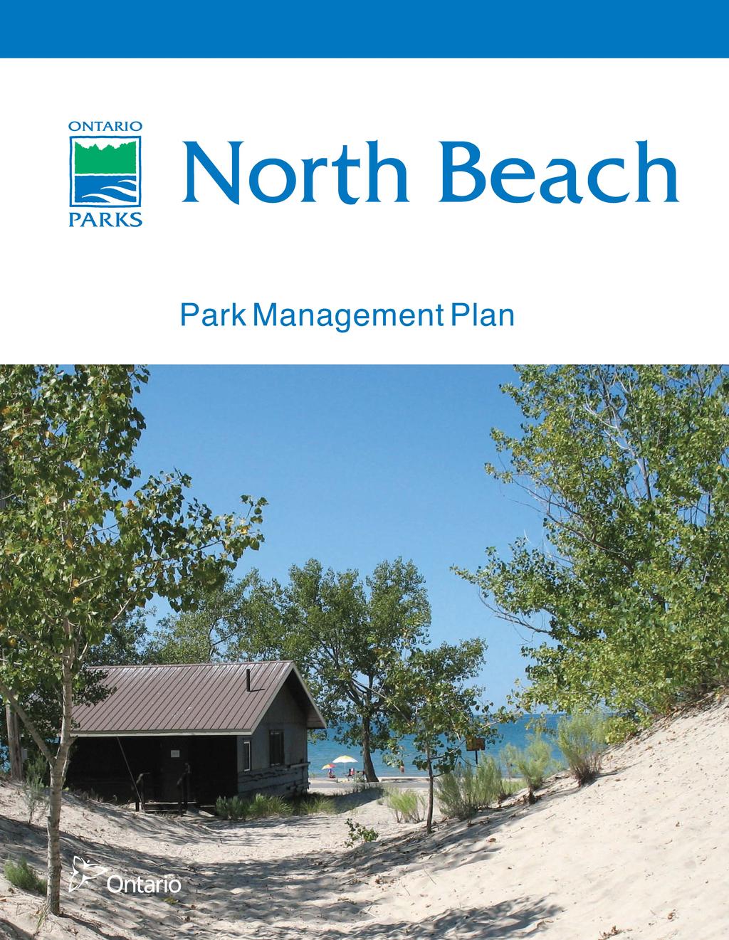
2015, Queen s Printer for Ontario. Printed in Ontario, Canada. Cover photo: A view to Lake Ontario Photo taken by: C. Bonta
|
|
|
- Britton Grant
- 5 years ago
- Views:
Transcription
1
2 2015, Queen s Printer for Ontario Printed in Ontario, Canada Cover photo: A view to Lake Ontario Photo taken by: C. Bonta Additional copies of this publication are available from the Ministry of Natural Resources and Forestry from: Sandbanks Provincial Park R.R. 1 Picton, Ontario K0K 2T0 Telephone: (613) (Print) (PDF) ISBN (Print) ISBN (PDF) Printed on recycled paper
3
4 TABLE OF CONTENTS 1.0 CONTEXT Legislation and Policy Basis for Management Aboriginal Communities Planning Context Summary of Significant Management Concerns INTRODUCTION PARK CLASSIFICATION BOUNDARY Adjacent Crown Land Park Management within the Greater Ecosystem PURPOSE AND VISION OBJECTIVES Protection Life Sciences Earth Sciences Cultural Heritage Resources Recreation Heritage Appreciation Scientific Research ZONING AND ZONE MANAGEMENT POLICIES Development Zone... 8 Zone D1 Day Use Area Access Zone Zone A1 Pleasant Bay Parking Area Natural Environment Zone Zone NE1 North Beach and Dunes (approximately 83 ha) Zone NE2 Pleasant Bay Lands PARK POLICIES Industrial and Commercial Uses Resource Management Policies Land Management Additions to the Park Water Management Waste Management Alien and Invasive Species... 13
5 8.2.5 Extirpated Native Species Insects and Disease Pesticide Application and Use Fire Management Species at Risk Vegetation and Landform Management Hazard Trees Dune Vegetation Management Fisheries Management Cultural Heritage Resources Research Inventory and Monitoring Coastal Sandbar System Recreation Management Policies Hunting Recreational Fishing Motorized and Mechanized Travel Other Recreational Uses Operations Policies Natural Heritage Education Partnerships Development Policies Internal Roads Parking Areas Day Use Areas Trails Maintenance and Administrative Areas IMPLEMENTATION PRIORITIES PLAN EXAMINATION AND ADJUSTMENT REFERENCES APPENDIX: OPPORTUNITIES FOR INVOLVEMENT FIGURE 1: REGIONAL SETTING... 3 FIGURE 2: PARK BOUNDARY, ZONING, AND DEVELOPMENT... 9
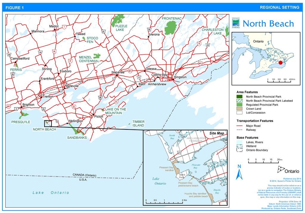
6 1.0 CONTEXT 1.1 Legislation and Policy Basis for Management North Beach Provincial Park is managed according to the purpose, principles and objectives of the Provincial Parks and Conservation Reserves Act, 2006 (PPCRA) and related provincial policies (available on the Internet at The PPCRA has two guiding principles for planning and management: 1) Maintaining ecological integrity shall be the first priority and restoring ecological integrity shall be considered. 2) Opportunities for consultation shall be provided. 1.2 Aboriginal Communities North Beach Provincial Park is located within traditional Mississauga First Nation territory and within an area of interest to the Mohawks of the Bay of Quinte. Archaeological assessment has been carried out in some areas of the park but has not revealed any pre-contact resources (Heritage Quest Inc. 2005). Cultural heritage values are summarized in Section Planning Context This management plan has been prepared consistent with all relevant legislation and provincial policies. Additionally, North Beach Provincial Park will be managed to protect any species at risk and their habitat in a manner consistent with the Endangered Species Act, The implementation of projects in this provincial park will comply with the requirements of A Class Environmental Assessment for Provincial Parks and Conservation Reserves (Class EA-PPCR). This may include further opportunities for consultation, as required. 1.4 Summary of Significant Management Concerns Together, Sandbanks Provincial Park and North Beach Provincial Park encompass a significant portion of the largest freshwater baymouth sandbar system in the world. The remainder of this dune system, which contains globally and provincially rare coastal wetland habitat known as panne, is present at Wellers Bay to the north and in three Crown-owned parcels south of North Beach Provincial Park (Figure 1, inset). These Crown dunes are separated by privately-owned lands. Earlier in the planning process, the three Crown dunes were identified as potential additions to North Beach Provincial Park. The Crown dunes are currently used mostly by local residents for picnicking, camping, walking and recreational vehicle use. 1
7 Garbage is a problem, and unauthorized all-terrain vehicle (ATV) use has caused considerable damage to dune vegetation and structure in some areas. Adding the Crown dunes to the park would enable these areas to be operated as part of the park and subject to regulations under the PPCRA and could afford greater protection through increased enforcement. The three Crown dunes are further described in Section INTRODUCTION North Beach Provincial Park is a 94 ha park located within the Municipality of Prince Edward County, approximately 15 km south of Trenton and 60 km west of Kingston (Figure 1). The park, offering day use facilities and regularly attracting 25,000 to 30,000 visitors annually, has long been a regular destination for local residents but is becoming increasingly popular with out of town visitors. Nearby, Sandbanks Provincial Park provides camping facilities that attract visitors from a wider geographic area. The park is within the western portion of Ecodistrict 6E-15, which is characterized by Lake Ontario coastal shoreline and wetlands (Crins et. al. 2009). North Beach Provincial Park is one of several biologically significant sandbars that stretch along the western shore of Prince Edward County, sheltering nearby bays and their associated coastal wetlands. The park also supports panne habitat, which is globally and provincially rare. This management plan provides the long term direction for managing North Beach Provincial Park, including the park s purpose and vision, permitted uses, zoning and implementation priorities. This plan is written with a 20-year perspective in mind. Management plan examination and adjustment is addressed in Section PARK CLASSIFICATION Through park classification, Ontario s provincial parks are organized into broad categories, each of which has particular purposes and characteristics. North Beach Provincial Park is a recreational class park. Recreational class parks provide a wide variety of compatible outdoor recreation opportunities in attractive natural surroundings. North Beach Provincial Park, located on a sandbar that is approximately 1400 m long and 260 m wide, is a high quality beach that provides opportunities for swimming, picnicking, boating and fishing, while offering scenic views of Lake Ontario. 2
8
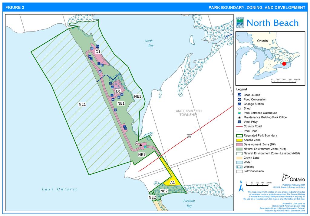
9 4.0 BOUNDARY North Beach Provincial Park was established in This 94 ha park (Figure 1) consists of 30 ha of upland along a baymouth sandbar and 64 ha of adjacent lakebed, with 11 ha extending approximately 92 m into North Bay to the east and 53 ha extending approximately 402 m into Lake Ontario to the west. The park s northern and southern boundaries are roughly defined by the end of the sandbar, although to the south the boundary extends onto the adjacent limestone plain at the official park entry point off County Road 27. In 1973, Ontario Parks acquired 4 ha of private land to link North Beach Provincial Park to the Pleasant Bay sandbar in the event of future park expansion. This property was added to the park in 2014 through regulation under the PPCRA. 4.1 Adjacent Crown Land The park is part of a system of dunes that, to the south, includes 18 ha of Crown land in three parcels at Pleasant Bay and Huycks Bay: the Pleasant Bay sandbar (locally referred to as the South Beach dunes), the Pleasant Bay pebble/sand beach and the Huycks Bay sandbar and pebble beach. The park and adjacent Crown dunes are surrounded and interspersed by privately-owned rural agricultural land on limestone plain. The Crown land sandbar parcel at Pleasant Bay links Pierson Point with Island Point (referred to locally as Alexander s Island or Huyck s Island). This 900 m (of which 800 m is Crown land and 100 m is privately owned) stretch of sandbar rivals those at North Beach and Sandbanks. However, the dunes and pannes are being degraded by motorized vehicle use; both features are in need of restoration. A historic 40-foot wide road allowance, described in Road By-Laws of Quarter Sessions, Prince Edward County, , follows the county s western shoreline of Lake Ontario. This road allowance currently provides sole access to the privately-owned Island Point via the acquired property and the Pleasant Bay sandbar. Ontario Parks interest in adding the Pleasant Bay sandbar Crown parcel to North Beach Provincial Park is conditional on establishment of an alternate road access route to Island Point. The two other Crown land parcels to the south have little value for provincial park purposes: South of Island Point, the Pleasant Bay pebble/sand beach Crown dune is 400 m long. In some years, a narrow channel toward the centre of the parcel is open from late fall through to early spring, allowing water exchange between Pleasant Bay and Lake Ontario. 4
10 The Huycks Bay sandbar and pebble beach is a narrow sandbar with small dunes that extend approximately 800 m after which the substrate becomes pebble beach that continues another 650 m south along the shore to Huyck s Point. County Road 20 provides good access to the point for recreational use. 4.2 Park Management within the Greater Ecosystem Ontario Parks is committed to a landscape approach to park planning and management. The PPCRA, which governs activities within provincial parks, pertains only to lands and waters within regulated park boundaries. A landscape approach allows park management to consider the relationship between the park and the surrounding environment. At North Beach Provincial Park, the greater ecosystem includes adjacent wetlands, as well as the complete sandbar system along Lake Ontario. Life science information for North Beach Provincial Park is based on research and investigation of the sandbar system and adjacent coastal wetlands, making it difficult to discuss the park in isolation of the greater ecosystem. Park management plan policies apply only to the area within the regulated boundary of the park. Within the park boundary, park values and features will be protected through appropriate zoning, managing land use and activities, education, and by monitoring ecological impacts. 5.0 PURPOSE AND VISION The purpose of North Beach Provincial Park is: To protect and inspire appreciation for the biologically and geologically significant sandbar system, while continuing to offer visitors high-quality compatible, ecologically sustainable recreational opportunities in a scenic setting. The vision for the park is that it will be a place where both the natural and recreational values of a great lakes coastal sandbar are preserved for visitors to experience. 6.0 OBJECTIVES 6.1 Protection Ontario s provincial parks play an important role in representing and conserving the diversity of Ontario s natural features and ecosystems across the broader landscape. Protected areas include representative examples of life and earth science features and cultural heritage features within ecologically or geologically defined regions. Ontario s 5
11 Ecological Land Classification system (Crins et. al. 2009) provides the basis for the life science feature assessment, and the geological themes provide the basis for earth science assessment. The protection objective for North Beach Provincial Park is: To contribute to the provincial protected areas system by protecting and enhancing the park s ecologically sensitive dune, panne and coastal wetland habitats. Protection will not be limited to significant features. Park management will be directed toward maintaining a healthy, diverse and sustainable natural environment, which will enhance achievement of the park s other objectives Life Sciences Recognized for their contribution to the complete sandbar system (Section 1.5), the dunes of North Beach Provincial Park, and those along Pleasant and Huycks bays, have been identified as sites of biological significance (Ecological Services 2001). All freshwater coastal dunes in Ontario are provincially significant vegetation communities, including those found at North Beach Provincial Park (Natural Heritage Information Centre Elements Database report for EO ID 66524). Both open and shrub dune habitats are present at North Beach Provincial Park, however the dunes were best classified as little bluestem switchgrass beachgrass dune grassland type. This community is considered imperiled (ranked S2) because there are few locations in Ontario. The North Beach dunes and Pleasant Bay sandbar historically contained low, wet habitats known as pannes. Panne wetlands are a globally and provincially rare vegetation community, and in Ontario they are confined to coastal sandbars along the Great Lakes. Although remnant panne is present at both North Beach and Pleasant Bay, this habitat has been negatively impacted by recreational use and exists in a highly disturbed form. The 56 ha North Bay wetland was evaluated as not provincially significant in 2011 under the Ontario Wetland Evaluation System (Rudy and Norris, 2011). Outside the park at Pleasant Bay to the south, the sandbar contains several regionally rare or uncommon plant species, while the provincially significant wetland is an important stopover for migrating waterfowl (Mosquin Bio-Information 1985) Earth Sciences Prince Edward County is a 104,500 ha limestone plain of the Lindsay Formation extending into Lake Ontario (Chapman and Putnam 1984). North Beach Provincial Park, particularly the baymouth sandbar that encloses North Bay, is part of one of the largest freshwater baymouth bar sand dune systems in the world. This system was formed by the erosion and transport of glacial deposits. Landforms in the park include dunes, pannes and beaches. 6
12 6.1.3 Cultural Heritage Resources A Stage 1 and 2 archaeological assessment of the dunes within North Beach Provincial Park identified that the park has high potential for precontact archaeological resources given its location along Lake Ontario (Heritage Quest Inc. 2005). Although no precontact archaeological resources were found, evidence may remain concealed due to the highly dynamic nature of the sandbars. Other than possible traces of roads, no built heritage resources are apparent. Recommendations from the assessment are listed in Section This assessment also investigated the nearby Pleasant Bay and Huycks Bay sandbars, but no archaeological heritage resources were found. See section for policy regarding any new cultural resources discovered. 6.2 Recreation The park s recreation objective is: To offer day use visitors high quality beach and water based recreational opportunities that are compatible with the park s natural values, such that impacts to ecological processes are reduced. Established for the purpose of providing beach recreational opportunities, North Beach Provincial Park now offers a wide range of day use facilities, including opportunities for picnicking, canoeing, boating and fishing. Swimming along the sandy beach is a very popular activity at the park. On good-weather weekends through the height of summer, park attendance often reaches capacity and visitors are turned away. The park is only staffed during the peak summer months. In the off-season, visitors are permitted to stroll along the beach or partake in winter activities such as snowshoeing and cross-country skiing. 6.3 Heritage Appreciation The park s heritage appreciation objective is: To inspire appreciation of the sandbar system by balancing heritage protection with recreational enjoyment. Informal footpaths connect the lake and bay sides of the park, allowing exploration and appreciation of the North Beach dune. The Lake Ontario shoreline offers scenic views over the lake toward Nicholson and Scotch Bonnet islands and the Presqu ile peninsula. 7
13 P 6.4 Scientific Research The park s scientific research objective is: To facilitate ecological monitoring within the park so as to better understand the effects of recreation on the park s natural heritage. Dune and wetland features within and adjacent to the park are significant components of the broader landscape from both a natural heritage appreciation and recreational use perspective. Understanding the natural processes occurring within the park will guide use, operations and resource management toward maintaining and improving the ecological integrity of North Beach Provincial Park. 7.0 ZONING AND ZONE MANAGEMENT POLICIES Lands within North Beach Provincial Park are zoned according to their natural and cultural values, as well as their requirement for protection. Permitted activities in each type of zone are derived from Ontario Provincial Parks: Planning and Management Policies (1992 update). Three zoning categories development, access and natural environment are 1 designated for North Beach Provincial Park (Figure 2)P0F. Zones differentiate the sensitivity of the natural and cultural values, and the permissible degree of development, recreational uses and management practices within the park. 7.1 Development Zone Development zones contain areas of the park geared to supporting intensive day use activities, and constitute a relatively small portion of most parks. Development may include roads, visitor control structures, beaches, picnic areas and maintenance facilities. At this time, the specific location and footprint of proposed development within the park remains to be determined through site planning. The development zone boundaries identified in this plan (Figure 2) reflect the flexibility required to accommodate proposed development in suitable areas. 1 Should the Pleasant Bay sandbar be regulated as part of the park, the intent would be to place this area in a nature reserve zone, a category that recognizes significant earth and life science features or ecosystems which require management to ensure their integrity. The sandbar would remain undeveloped. 8
14
15 25T Zone D1 Day Use Area25T (approximately 7 ha) This zone includes all existing intensive development within the park: the paved road (20 m width), gatehouse area, maintenance building and yard, canteen, three parking areas and a boat launch to North Bay. There is no dock at the boat launch. The old pumphouse will be removed from its current location following construction of a new water system within the maintenance area. The existing boat launch will remain gravel-based and will not be hardened. A picnic shelter is needed within the park, and would be developed within the existing picnic grounds of this zone (Section 8.5.3). 7.2 Access Zone Access zones serve as staging areas. Generally development is limited to roads and visitor control structures. Provisions may be made for self-use orientation, interpretive or educational facilities. Limited facilities for research and park management may also be present. 25T Zone A1 Pleasant Bay Parking Area25T (approximately 1 ha) These lands are currently undeveloped, and consist of regenerating agricultural field overgrown with buckthorn. A dirt laneway connects County Road 27 to the Pleasant Bay sandbar. This zone may continue to be used for pedestrian access to the Pleasant Bay sandbar. It will serve as a staging area for access to the Pleasant Bay sandbar, should the sandbar be added to North Beach Provincial Park in the future. A gravel parking area may be developed and serviced by either the park gatehouse or an on-site fee collection station (Section 8.5.2). Limited washroom facilities may also be developed in this zone. 7.3 Natural Environment Zone Natural environment zones include natural landscapes which permit the minimum level of development required to support low-intensity recreational activities. Development is generally limited to necessary signs and minimal interpretive facilities. The remainder of the park, outside the development and access zones, is zoned natural environment. 10
16 Zone NE1 North Beach and Dunes (approximately 83 ha) Zone NE1 encompasses the dunes and beach and extends into the adjacent lake beds: approximately 90 m into North Bay and 400 m into Lake Ontario. The wooded area near the park entrance is also included within zone NE1. Development in zone NE1 is limited to vault privies and change stations. 25T Zone NE2 Pleasant Bay Lands25T (approximately 3 ha) Zone NE2 encompasses the non-developed portion of the park south of County Road 27. A small clearing will accommodate boat access to Pleasant Bay. Zone NE2 may be used by visitors year-round to access the Pleasant Bay sandbar and wetland for recreational purposes such as nature appreciation, hiking and waterfowl hunting. 8.0 PARK POLICIES This section provides site specific management policies and any associated actions required to effectively manage North Beach Provincial Park in accordance with applicable legislation and provincial policies. 8.1 Industrial and Commercial Uses The following industrial and commercial uses are not permitted within the park: - prospecting, staking of mining claims, developing mineral interests and working mines; - extraction of sand, gravel or topsoil; and - commercial trapping. Electricity generation is not permitted, except for in-park use. Active commercial fishing and bait harvesting licenses for Lake Ontario fall outside the jurisdiction of the park. 8.2 Resource Management Policies North Beach Provincial Park will be managed in accordance with the PPCRA, policies for recreational class parks and all other relevant legislation and provincial policies. MNRF will consider adaptive management approaches when managing park resources. 11
17 8.2.1 Land Management Land management will be directed toward sustaining natural ecological processes on the landscape. Effects of existing facilities and infrastructure on coastal processes will be considered and, as structures or services are replaced or phased out, attempts will be made to reduce impacts (e.g., by consolidating buildings and services; redesigning roads, parking and trails). Ontario Parks will obtain all aggregate required for use in the park from sources located outside the park. Aggregates include gravel, sand, stone or other prescribed material under the Aggregate Resources Act. Additions to the Park Ontario Parks will support, in principle, adding property to the park, provided the addition is anticipated to enhance park values. If suitable lands within, nearby or adjacent to the park become available for addition they will be evaluated with regard to their contribution to park objectives, willing seller/willing buyer and other factors including available funding. Any park addition would require a change to regulation and an amendment to the Crown Land Use Policy Atlas Water Management There are no water control structures in the park. No dams or weirs will be built in the park. The park s sandbar forms a natural water-level control for North Bay. However, if waters in the bay become artificially high, park staff may take action, such as clearing the culvert or dredging the outflow creek between North Bay and Lake Ontario, to help manage water levels in the bay. Any actions taken will follow appropriate provincial, municipal and conservation authority procedures and approvals. Where possible, new development or redevelopment will be undertaken so as not to disrupt natural drainage. If possible, natural drainage will be restored where it has been disrupted by previous or existing development Waste Management All sewage and solid waste will be disposed of in accordance with Ministry of Environment and Climate Change regulations. 12
18 8.2.4 Alien and Invasive Species Alien species are plants, animals and micro-organisms that have been unintentionally or deliberately introduced by human activity into areas outside their natural past or present distribution. Invasive species are those alien species whose introduction or spread threatens the environment, the economy and/or society, including human health. Alien species will not be deliberately introduced into the park. Where invasive alien species threaten natural or cultural values, a control program may be undertaken if feasible and practical. Invasive plant species control will be in compliance with any existing best management practices or strategies, and will be undertaken in such a way as to have minimal effects on the park environment. Actions to prevent invasive species introductions will be identified and implemented based on an assessment of risk and feasibility. Such actions may include increasing visitor awareness of invasive species through signage and regular monitoring to enable early detection. Where possible, Ontario Parks will assist MNRF Peterborough District and other partners in monitoring invasive alien species at North Beach Provincial Park Extirpated Native Species Existing populations may be augmented, and extirpated native species may be reintroduced, if biologically feasible and desirable for perpetuating park values Insects and Disease The occurrence of native insects and diseases is recognized as an integral component of the park s ecology. Native insects and diseases will normally be allowed to progress naturally, except where a safety hazard results or park values become threatened. If outbreaks of alien or native insect and disease species threaten park values, visitors or adjoining private lands, the outbreak will be controlled, where feasible, using biological and species-specific controls whenever possible. Where control is undertaken, it will be directed as narrowly as possible to the specific insect or disease, so as to have minimal effects on the surrounding park environment. 13
19 8.2.7 Pesticide Application and Use Pesticides may be used to protect park values and to ensure park visitor safety. Typical uses include: - natural resource management projects to control invasive species, protect or restore the habitat of native species, or to protect or restore rare ecosystems; and - control of poison ivy. Where pesticides provide the only feasible option for control, chemicals having low or no soil activity and for which environmental impacts have been tested and shown to be minimal will be selected and used in accordance with integrated pest management principles. All pesticide use must be in accordance with park policy, Ontario s Pesticides Act and regulations, as well as any additional Ministry of the Environment requirements Fire Management North Beach Provincial Park consists mostly of semi-open sand dune habitat, with very limited tree cover. It has been suggested that natural fire regimes for sand dunes included a combination of drought and frequent fires (Catling and Catling 1993, in Van Sleeuwen 2006). The Forest Fire Management Strategy for Ontario (2004) provides strategic direction for managing wildfire across Ontario. North Beach Provincial Park is in the Southern Ontario Fire Management Zone according to this provincial strategy. This fire management zone is located outside the fire region of Ontario; therefore, municipalities have a mandate to provide forest fire protection. The Municipality of Prince Edward County fire department is responsible for fire protection and response in the park area. Fire management within North Beach Provincial Park will help to restore and maintain ecological integrity while preventing personal injury, loss of values and social disruption. Fuel caches are not permitted in the park. Prescribed burning is the deliberate, planned and knowledgeable application of fire by authorized personnel to a specific land area to accomplish predetermined objectives. Funding permitting, prescribed burning may be used to restore and maintain the park s semi-open sand dune habitat. Plans for any prescribed burning will be developed in accordance with MNRF policy in cooperation with MNRF fire management staff and/or the municipal fire department. 14
20 8.2.9 Species at Risk Species at risk and their habitats will be protected in a manner consistent with the Endangered Species Act, 2007 and associated regulations and the PPCRA. Actions identified in a recovery strategy, implementation plan, or government response statement may be implemented Vegetation and Landform Management Vegetation management will be directed toward promoting the health and diversity of natural vegetation communities, particularly within natural environment zones. Where planting or seeding is necessary, use will be made of species native to the park and sources of these species that originate in or near the park. Hazard Trees Safety will take precedence when dead limbs or standing trees pose a risk to the public or park staff. Dead standing trees provide important habitat for wildlife and contribute to ecological processes; these will only be removed when necessary, based on an assessment of the risk they pose. As much as possible, fallen trees and brush will be left to deteriorate naturally, unless they pose a threat to health or safety, or interfere with regular park operations. Dead or dying trees that are infested with damaging insects or disease regardless of whether the infestation is native or non-native may be cut, chipped and removed from the park and disposed of at local landfills to reduce or eliminate the spread of infestation to the greater park area. Dune Vegetation Management The dunes at North Beach Provincial Park have become degraded due to vegetation loss from trampling and erosion. Dune restoration may be undertaken by physically directing pedestrian traffic along designated paths and restoring native vegetation to degraded areas. Restoration methods may include: - erecting fences to funnel pedestrians to specific paths; - installing snow fencing to manage sand drift, deposition and erosion - building boardwalks along eroding paths; and - planting local-stock marram grass within trampled areas and within the footprints of former park infrastructure. 15
21 Dune restoration projects will take into consideration the natural sand movement of the dunes Fisheries Management An ecological framework for recreational fisheries management in Ontario, developed in 2005, guides fisheries management at the provincial level. North Beach Provincial Park is within Fisheries Management Zone 20. Fisheries management decisions for Lake Ontario and for North Bay are led by MNRF Lake Ontario Management Unit. Wherever possible, the park will support efforts to maintain and/or enhance native, self-sustaining fish populations in park boundary waters. Park visitor education will be used to increase awareness of good angling practices, as outlined in the annual Ontario Recreational Fishing Regulations Summary. Park infrastructure development and other permitted activities will consider potential impacts on fish and fish habitat Cultural Heritage Resources Cultural heritage values will be protected, maintained, used and disposed of in accordance with the protected areas mandate (legislation and policies) and the evaluation process developed by MNRF consistent with the Standards and Guidelines for Conservation of Provincial Heritage Properties (Ontario Heritage Act). Recommendations from a Stage 1/2 archaeological assessment of the park and adjacent lands (Heritage Quest Inc. 2005) will be considered: - Areas exposed by significant wind storms may be investigated for potentia l archaeological resources; and - The mainland area along the Pleasant Bay shoreline will be subject to Stage 2 investigation in advance of any proposed modifications of the landscape. If cultural heritage values are discovered, decisions on activities that may affect them shall be based on appropriate studies and research (including analysis of physical, documentary and oral evidence) aimed at understanding the cultural heritage value, including its level of significance (e.g., local, regional, provincial), the impact of proposed activities on the value, and measures to mitigate these impacts. 16
22 Research MNRF encourages scientific research by qualified individuals contributing to the knowledge of natural and cultural heritage and to environmental management. Proposed research is reviewed to ensure adequate consideration of potential impacts on protected area resources, features, staff and visitors. Research activities require authorization issued under the PPCRA, consistent with relevant policies. Research must meet all requirements under applicable provincial and federal legislation, and may require additional permits or approval (e.g., MNRF Wildlife Scientific Collector authorization or Endangered Species Act, 2007 permits). Ontario Parks may consider allowing temporary facilities in support of approved research and monitoring activities. Sites altered by research activities must be rehabilitated as closely to their previous condition as possible, except where the specific intent of the research activities is disturbance for the purpose of ecological enhancement or restoration. Research initiatives specific to North Beach Provincial Park may include: - evolution of the park s landscapes in relation to natural processes (e.g., dune formation and dynamics); - ecological restoration and management in the park; - status of invasive species; and - reducing the effects of park uses and operations on ecological integrity of the dunes. Ontario Parks will especially encourage research that involves monitoring ecological changes of the park s natural and recreational landscapes over time. Ontario Parks may collaborate with MNRF Field and District staff on research involving dune ecology and restoration Inventory and Monitoring Ontario Parks will ensure that decisions are made with the best available information. Where this information is lacking, Ontario Parks may conduct inventories and monitoring to provide this information. Such efforts will be undertaken based on established methodologies and best practices. Avian diseases (e.g., avian botulism, a re-occurring problem on the Great Lakes) will continue to be monitored, as required. Fish and bird mortalities will continue to be reported to the appropriate authorities as per existing policies and protocols. 17
23 Coastal Sandbar System A detailed life science inventory of North Beach Provincial Park may be considered. Prior to further consideration for addition to the park, an inventory of the Crown sandbar at Pleasant Bay would be required to identify valuable natural heritage features and to confirm panne significance. Ontario Parks will encourage and support inventory of the life science features and values of the regulated park and of the Pleasant Bay sandbar south of the park by MNRF Peterborough District staff and partners. If feasible, inventory and evaluation of the complete sandbar system from Sandbanks in the south to Wellers Bay in the north would provide a holistic perspective of this biologically significant system, and would be a valuable management tool for protecting the park s role within the greater park ecosystem. 8.3 Recreation Management Policies Hunting Hunting is not permitted within the park Recreational Fishing Recreational fishing is permitted at North Beach Provincial Park in accordance with provincial and federal fisheries regulations (i.e., the Fish and Wildlife Conservation Act, 1997 and the federal Fisheries Act) as outlined in the Ontario Recreational Fishing Regulations Summary Motorized and Mechanized Travel ATV travel is prohibited in the park. Visitors arriving via ATV will not be permitted to bring their vehicles into the park. Currently, ATVs are illegally entering the park and damaging fragile dune habitat. To protect the dunes, public education and enforcement action will be taken to terminate this activity. Waters within the park boundary accommodate motorized boating of any horsepower rating. Boating on Lake Ontario and North Bay is subject to federal and provincial regulations, which include limiting speeds to 10 km/hr within 30 m of shore. Snowmobiling is not permitted within the park. 18
24 8.3.4 Other Recreational Uses Although swimming is permitted within the park, swimmers are warned through signage of a potential strong undertow in the waters of Lake Ontario. Picnicking, scenic viewing and nature appreciation are encouraged. Other recreational activities permitted within the park include: - canoeing and kayaking; - wind-powered sports such as windsurfing and sailing (except in designated swimming areas); and - cross-country skiing and snowshoeing. Horseback riding will not be permitted within North Beach Provincial Park. Activities which are not specifically addressed in this management plan may be considered. New activities must be reviewed to determine if they are consistent with legislation, regulations and policies. An adjustment to the management plan may be required. 8.4 Operations Policies The park operations plan provides staff with the necessary direction required to operate the park on a day to day basis. The park operations plan will include such topics as budget, staffing, maintenance schedules, natural heritage education, enforcement and emergency services. The provisions of the park operations plan will be consistent with the approved Ontario Parks Minimum Operating Standards (1992 revision), and will be reviewed and updated as required. Where possible, park operations will minimize environmental impacts. This could be accomplished in part by reducing energy use, noise and light pollution and vehicle emissions. Facility development and maintenance, along with heavy recreational use, has negatively affected the park s dune vegetation and communities and interfered with natural sand movement (Davidson, 1990). Managing facilities and recreational use so as to restore and protect the park s natural heritage values is necessary at North Beach Provincial Park Natural Heritage Education The goal of Natural Heritage Education (NHE) is to develop visitor awareness and appreciation of Ontario Parks natural and cultural heritage, fostering a commitment to 19
25 its protection for future generations. An NHE program has three components: information, interpretation and outdoor recreation. At North Beach Provincial Park, the NHE program is designated as self-use; there is no outdoor recreation component. The park receives NHE support from staff at Sandbanks Provincial Park, with program direction being a component of the Sandbanks Provincial Park NHE Operating Plan. The interpretive theme for North Beach Provincial Park is the biologically significant sandbar system and its associated coastal wetlands, including the globally and provincially rare panne habitat. Park information and interpretation will be delivered through printed materials, signage, panels or displays, and informal communications with park staff. Partnerships with local tourism authorities to relay information to park visitors and potential park visitors may be pursued Partnerships Partnerships will be essential to achieving the park s protection, recreation, scientific research and heritage appreciation objectives. When implementing the approved park management plan, Ontario Parks may explore and pursue opportunities for new or continuing partnerships, involving other agencies and groups, through formal and informal partnership agreements. Partners may represent the local community, local and provincial interests or the private sector. Partners may work with Ontario Parks to assist with implementing the approved park management plan (e.g., dune restoration methods), as per provincial park policies and regulations. 8.5 Development Policies All development undertaken by Ontario Parks, or by third parties on its behalf, will be subject to the Class EA-PPCR and will be carried out in accordance with approved site and development plans that meet development standards for provincial parks. Areas proposed for development will require prior assessment for cultural heritage resources or natural heritage features to ensure these values are identified and protected at the site. The location, design and materials of all facilities will, as much as possible, reflect the natural character of the park. Durable, low maintenance and energy efficient designs and materials will be used whenever possible. 20
26 To the extent possible, new utility corridor development will avoid the regulated area of the park. There is a need to upgrade and consolidate some of the existing development within the park. Drifting sand has effects on facilities and infrastructure (e.g., annual burying of the road, parking lots and buildings (privies, change stations and canteen)). Future development and infrastructure replacement will investigate options for reducing ecological impacts of park operations and visitor use. New development will be designed and located so as to minimize impact on coastal processes Internal Roads North Beach Provincial Park has one approximately 1.3 km-long internal, paved road that can accommodate two-way traffic. This road leads past the canteen to the boat launch, servicing three parking areas along the way. A 0.25 km section of gravel road previously extended north beyond the paved road to the park s boundary at the Township road allowance but is no longer maintained; this location is currently used as an unauthorized point of entry to the park. A dirt laneway crosses the acquired property, linking County Road 27 to the Pleasant Bay sandbar. This laneway is currently closed to traffic. There will be no new roadways developed in the park. Existing roads may be improved and will be maintained to provincial park operating standards within a 20 m right of way. Roads will occupy only as much of the right of way as required to meet those standards. Access into North Beach Provincial Park from the Township road allowance at the north end of the park will be closed through signage and/or barriers to further decommission the former gravel road section extending from the existing paved park road Parking Areas No new parking lots will be developed within the park area north of County Road 27 (zone D1). A small, gravel parking lot may be developed within the access zone A1 (Section 7.2). This gated lot would provide overflow parking and accommodate park visitors. A fee collection station and washroom facility may be installed. 21
27 8.5.3 Day Use Areas At present there is demand for a sheltered picnic area within the park. This structure will be constructed on an existing, grassy picnic area in the middle parking lot north of County Road 27. Existing vault privies will be replaced based on demand and as funding permits. As privies and change stations are replaced, consideration will be given toward fewer, more effective units (e.g., two-unit comfort stations) to reduce their overall footprint in the park. Services that will continue to be available to park visitors, subject to available resources, include a small canteen serving food and beverages, and a boat launch into North Bay. Additional services may be provided, based on sufficient demand and subject to financial and staff resources, if: - they meet the vision and objectives of the park; and - it can be demonstrated that there will be no negative impacts to natural values and ecological processes Trails There are no existing trails within the park, although trampling and erosion have resulted in footpaths where park visitors frequently cross the dunes. To minimize dune impacts, physical structures may be used to direct and restrict pedestrian traffic to selected existing footpaths (Section ) Maintenance and Administrative Areas The gatehouse is the official entry point into the park, providing minimal administrative services. The maintenance building is located nearby and also functions as the park office. The park gatehouse, maintenance building and other park facilities or structures may be upgraded or replaced as required. The existing water system will be fully replaced, dependent on available resources. Upon development of a parking lot within access zone A1 (Section 8.5.2), the park gatehouse may be moved closer to County Rd. 27 to provide a more central location between the two park entry points. 22
28 9.0 IMPLEMENTATION PRIORITIES Park development, operations and resource management will be contingent upon funding and resource availability and unforeseeable changes in priorities or policy, and will be undertaken in accordance with the requirements of the Class EA-PPCR. The following proposals will be phased in over a 20 year period: Restore native vegetation to degraded areas through marram grass planting (Section ). Complete the new water system, including installing associated water lines and removing the old pumphouse (Section 8.5.5). Replace existing vault privies (Section 8.5.3). Close and/or further decommission former section of park road (Section 8.5.1). Construct a picnic shelter within the existing picnic area of the middle parking lot in zone D1 (Section 8.5.3). Construct a small gravel parking lot and washroom facility within access zone A1 (Section 8.5.2) PLAN EXAMINATION AND ADJUSTMENT This management plan will be examined in accordance with the provisions of the PPCRA to determine whether the management direction is still relevant, effective and current, or if an adjustment is required. In circumstances where this plan is not providing sufficient direction, it can be examined prior to the next scheduled examination. External requests for adjustments to address specific concerns may be considered. Ontario Parks can provide further guidance to external parties on the process for requesting an adjustment to this plan and whether specific requests can/will be considered. 23
29 REFERENCES Chapman, L.J. and D.F. Putnam The Physiography of Southern Ontario, 3rd Edition. Ontario Geological Survey Special Volume 2. MNR. 270 pp. Crins, William J., Paul A. Gray, Peter W.C. Uhlig, and Monique C. Wester The Ecosystems of Ontario, Part I: Ecozones and Ecoregions. Ontario Ministry of Natural Resources, Peterborough Ontario, Inventory, Monitoring and Assessment, SIB TER IMA TR- 01, 71pp. Davidson, R. J Protecting and Managing Great Lakes Coastal Dunes in Ontario. In: Proceedings of the Canadian Symposium on Coastal Sand Dunes. pp Ecological Services Life Science Areas of Natural and Scientific Interest in Site District 6E-15: A Review and Assessment of Significant Natural Areas in Site District 6E-15 (Unpublished Draft). Prepared March 2001 for the MNR, Kingston Area Office. 58 pp. + appendices. Heritage Quest, Inc Stage 1/2 Archaeological Assessment: North Beach Provincial Park, Pleasant and Huycks Bay Transverse Bars, Hillier Township, Prince Edward County. Prepared for Ontario Parks, Southeast Zone. 46 pp. + appendices. Mosquin Bio-Information Wetland Data Record for Pleasant Bay. Prepared for the Ministry of Natural Resources, Napanee District. 16 pp. Ontario Ministry of Natural Resources update. Ontario Provincial Parks: Planning and Management Policies. Ontario Parks. 90 pp. + appendices. Ontario Ministry of Natural Resources Forest Fire Management Strategy for Ontario. Queens Printer for Ontario. Toronto, ON. 64 pp. Ontario Ministry of Natural Resources A Class Environmental Assessment for Provincial Parks and Conservation Reserves. Queen s Printer for Ontario. Toronto, ON 47 pp. + appendices. Ontario Ministry of Natural Resources Technical Guideline for Cultural Heritage Resources for Projects Planned under the Class Environmental Assessment for MNR Resource Stewardship and Facility Development Projects and the Class Environmental Assessment for Provincial Parks and Conservation Reserves. Queen s Printer for Ontario. Toronto, ON. 45 pp. Ontario Ministry of Natural Resources Our Sustainable Future: A Renewed Call to Action, Ministry of Natural Resources Strategic Directions. Queen s Printer for Ontario. Toronto, ON. 51 pp. 24
30 Ontario Ministry of Natural Resources Biodiversity: It s In Our Nature. Ontario Government Plan to Conserve Biodiversity, Queen s Printer for Ontario. Toronto, ON. 42 pp. Natural Heritage Information Centre Element Summary Report for Ontario Ministry of Natural Resources, Peterborough, Ontario. Available Ontario Parks revision. Minimum Operating Standards. Operations and Development Section. 101 pp. + appendix. Ruddy, L and T. Norris North Bay Wetland Evaluation Southern Ontario Weland Evaluation, Data and Scoring Record. Ontario Ministry of Natural Resources- unpublished. Van Sleeuwen, M Natural Fire Regimes in Ontario. Ontario Ministry of Natural Resources. 130 pp. + appendices. 25
31 APPENDIX: OPPORTUNITIES FOR INVOLVEMENT Summary and Results of Aboriginal Involvement Aboriginal involvement is a very important part of park management planning. There were opportunities for local Aboriginal community involvement throughout the stages of the planning process. Notice and information on park management planning for North Beach Provincial Park was provided to one local Aboriginal community and two provincial treaty organizations at the terms of reference and background information stages. An opportunity to review and provide input and comment on the final draft preliminary management plan was provided to the Mohawks of the Bay of Quinte and to the Mississauga First Nation communities. No comments or concerns were received during the preliminary management plan stage. Summary and Results of Public Consultation Public consultation is a very important part of the North Beach park management planning process. Ontario Parks was committed to consultation with government agencies, other ministries, interest groups and the public throughout this management process. Consultation methods included: direct mailings, advertisement in local newspapers and policy proposal notices on the Environmental Registry. Direct mailing recipients include individuals, groups and agencies that responded to the invitation to participate, residents and corporate managers of adjacent lands, and new individuals requesting addition to the mailing list (ongoing during the planning process). Public consultation opportunities were provided at each stage of the management planning process, as outlined below. Responses throughout this period were considered in determining the proposed policy Stage 1 Terms of Reference: A combined management planning process for North Beach and Lake on the Mountain provincial parks began in August 2004, following release of the approved terms of reference. An invitation to participate was advertised to the public and interested participants were given 30 days to review the terms of reference. Stage 2 Background Information: In 2006, the terms of reference were amended to remove the requirement for a management options (formerly issues and plan alternatives ) document from the planning process. At the same time, a background information file on the two parks was made available for public review. A 47-day public consultation period followed, from which three detailed responses (one individual and two interest groups) were received concerning North Beach Provincial Park. These comments expressed support for potential park expansion and the continuation of traditional activities such as waterfowl hunting and non-motorized recreation. 26
Marchand Provincial Park. Management Plan
 Marchand Provincial Park Management Plan 2 Marchand Provincial Park Table of Contents 1. Introduction... 3 2. Park History... 3 3. Park Attributes... 4 3.1 Natural... 4 3.2 Recreational... 4 3.3 Additional
Nakina Moraine Provincial Park. Interim Management Statement. Ontario. Ministry of Natural Resources
 Nakina Moraine Provincial Park Interim Management Statement Ontario Ministry of Natural Resources 1999, Queen's Printer for Ontario Printed in Ontario, Canada Additional copies of this publication can
A GUIDE TO MANITOBA PROTECTED AREAS & LANDS PROTECTION
 A GUIDE TO MANITOBA PROTECTED AREAS & LANDS PROTECTION Manitoba Wildands December 2008 Discussions about the establishment of protected lands need to be clear about the definition of protection. We will
Ouimet Canyon Provincial Nature Reserve. Management Plan
 Ouimet Canyon Provincial Nature Reserve Management Plan NOTE: This document has been scanned and formatted, and therefore is slightly different from the original version. -March 2002 Additional copies
PROUDLY BRINGING YOU CANADA AT ITS BEST. Management Planning Program NEWSLETTER #1 OCTOBER, 2000
 PROUDLY BRINGING YOU CANADA AT ITS BEST VUNTUT NATIONAL PARK Management Planning Program NEWSLETTER #1 OCTOBER, 2000 INTRODUCTION This newsletter launches the development of the first management plan for
Whitemouth Falls Provincial Park. Draft Management Plan
 Whitemouth Falls Provincial Park Draft Management Plan Whitemouth Falls Provincial Park Draft Management Plan Table of Contents 1. Introduction... 3 2. Park History... 3 3. Park Attributes... 4 3.1 Natural...
Port Bruce. Interim Management Statement
 Port Bruce Interim Management Statement Port Bruce Interim Management Statement August 3, 1999 This Port Bruce Provincial Park Interim Management Statement provides direction for the custodial management
Wallace Lake Provincial Park. Management Plan
 Wallace Lake Provincial Park Management Plan 2 Wallace Lake Provincial Park Table of Contents 1. Introduction... 3 2. Park History... 3 3. Park Attributes... 4 3.1 Natural... 4 3.2 Recreational... 4 4.
Watchorn Provincial Park. Management Plan
 Watchorn Provincial Park Management Plan 2 Watchorn Provincial Park Table of Contents 1. Introduction... 3 2. Park History... 3 3. Park Attributes... 3 3.1 Natural... 4 3.2 Recreational... 4 3.3 Additional
Policy PL Date Issued February 10, 2014
 Subject RENEWABLE ENERGY ON CROWN LAND Compiled by Renewable Energy Program, Biodiversity Branch Replaces Policy Directives Waterpower Site Release Crown Land Onshore Windpower Development - Crown Land
Yard Creek Provincial Park. Management Plan
 Yard Creek Provincial Park Management Plan Draft January 2010 Yard Creek Provincial Park Management Plan Approved by: telàlsemkin/siyam/chief Scott Benton Bill Williams Squamish Executive Director ation
Rule Governing the Designation and Establishment of All-Terrain Vehicle Use Trails on State Land
 Rule Governing the Designation and Establishment of All-Terrain Vehicle Use Trails on State Land 1.0 Authority 1.1 This rule is promulgated pursuant to 23 V.S.A. 3506. Section 3506 (b)(4) states that an
As outlined in the Tatshenshini-Alsek Park Management Agreement, park management will:
 Management Strategy General Strategy The priority management focus for the park is to ensure that its internationally significant natural, cultural heritage and recreational values are protected and that
Birch Point Provincial Park. Management Plan
 Birch Point Provincial Park Management Plan 2 Birch Point Provincial Park Table of Contents 1. Introduction... 3 2. Park History... 3 3. Park Attributes... 4 3.1 Natural... 4 3.2 Recreational... 4 4. Park
Bayview Escarpment. Interim Management Statement
 Bayview Escarpment Interim Management Statement Bayview Escarpment Provincial Nature Reserve Interim Management Statement January 15, 1995 REGIONAL DIRECTOR'S APPROVAL STATEMENT This Interim Management
FILE: /PERM EFFECTIVE DATE: May 16, 2014 AMENDMENT:
 APPROVED AMENDMENTS: Effective Date Briefing Note /Approval Summary of Changes: FILE: 11000-00/PERM EFFECTIVE DATE: May 16, 2014 AMENDMENT: Table of Contents 1. POLICY APPLICATION... 1 2. PRINCIPLES AND
Criddle/Vane Homestead Provincial Park. Management Plan
 Criddle/Vane Homestead Provincial Park Management Plan 2 Criddle/Vane Homestead Provincial Park Table of Contents 1. Introduction... 3 2. Park History.... 3 3. Park Attributes.... 4 3.1 Natural.... 4 3.2
Sand Lakes Provincial Park. Draft Management Plan
 Sand Lakes Provincial Park Draft Management Plan 2 Sand Lakes Provincial Park Table of Contents 1. Introduction... 3 2. Background... 3 3. Park Purpose... 5 4. Park Management Guidelines... 6 Appendix...
Numaykoos Lake Provincial Park. Management Plan
 Numaykoos Lake Provincial Park Management Plan 2 Numaykoos Lake Provincial Park Table of Contents 1. Introduction... 3 2. Background... 3 3. Park Purpose... 5 4. Park Management Guidelines... 6 Appendix...
MANAGEMENT DIRECTION STATEMENT June, 1999
 Thompson River District MANAGEMENT DIRECTION STATEMENT June, 1999 for Roche Lake Provincial Park Ministry of Environment Lands and Parks BC Parks Division Table of Contents I. Introduction A. Setting
Wallace Lake Provincial Park. Draft Management Plan
 Wallace Lake Provincial Park Draft Management Plan Wallace Lake Provincial Park Draft Management Plan Table of Contents 1. Introduction... 3 2. Park History... 3 3. Park Attributes... 4 3.1 Natural...
 March 25, 1994 To: Re: MEMO TO FILE MINOR AMENDMENT - PINERY PROVINCIAL PARK MANAGEMENT PLAN The following paragraph from page 5 of the Pinery Provincial Park Management Plan (ISBN 0-7729-0290-9) lnsects
Land Management Summary
 photo credit: ANGAIR Anglesea Heath Land Management Summary The Anglesea Heath (6,501 ha) was incorporated into the Great Otway National Park in January 2018. This provides an opportunity to consider the
Proposed Action. Payette National Forest Over-Snow Grooming in Valley, Adams and Idaho Counties. United States Department of Agriculture
 United States Department of Agriculture Forest Service January 2012 Proposed Action Payette National Forest Over-Snow Grooming in Valley, Adams and Idaho Counties Payette National Forest Valley, Adams
Beaver Creek Provincial Park. Management Plan
 Beaver Creek Provincial Park Management Plan 2 Beaver Creek Provincial Park Table of Contents 1. Introduction... 3 2. Park History... 3 3. Park Attributes... 4 3.1 Natural... 4 3.2 Recreational... 4 4.
Ontario. Tide Lake Provincial Nature Reserve. Interim Management Statement. Ministry of Natural Resources
 Ontario Tide Lake Provincial Nature Reserve nterim Management Statement Ministry of Natural Resources Tide Lake Provincial Nature Reserve nterim Management Statement Ontario Ministry of Natural Resources
Appendix A BC Provincial Parks System Goals
 Appendix A BC Provincial Parks System Goals The British Columbia Provincial Parks System has two mandates: To conserve significant and representative natural and cultural resources To provide a wide variety
Continental Divide National Scenic Trail Legislative History and Planning Guidance
 Continental Divide National Scenic Trail Legislative History and Planning Guidance Legislation, Policy, and Direction Regarding National Scenic Trails The National Trails System Act, P.L. 90-543, was passed
Clam Harbour Provincial Park
 Clam Harbour Provincial Park Public Engagement Session Thursday, September 14 th, 2017 5:30pm 7:30pm Webbers Store 11470 Nova Scotia Trunk 7 Lake Charlotte, NS Agenda Overview of the Provincial Parks System
BACKCOUNTRY TRAIL FLOOD REHABILITATION PROGRAM
 BACKCOUNTRY TRAIL FLOOD REHABILITATION PROGRAM Backcountry Trail Flood Rehabilitation A June 2013 Flood Recovery Program Summary In June 2013, parts of Southern Alberta were devastated from significant
Criddle/Vane Homestead Provincial Park. Draft Management Plan
 Criddle/Vane Homestead Provincial Park Draft Management Plan 2 Criddle/Vane Homestead Provincial Park Table of Contents 1. Introduction... 3 2. Park History.... 3 3. Park Attributes.... 3 3.1 Natural....
Michipicoten Island Regional Plan
 Michipicoten Island Regional Plan This is one of twenty Regional Plans that support implementation of the Lake Superior Biodiversity Conservation Strategy (Strategy). The Strategy, prepared and overseen
 AGREEMENT Between Director of the Białowieża National Park, based in Białowieża (Poland) and Director of the National Park Bialowieża Forest, based in Kamieniuki (Belarus) and Head Forester of the Białowieża
KANANASKIS COUNTRY PROVINCIAL RECREATION AREAS MANAGEMENT PLAN DRAFT TERMS OF REFERENCE - November 20, 2007
 KANANASKIS COUNTRY PROVINCIAL RECREATION AREAS MANAGEMENT PLAN DRAFT TERMS OF REFERENCE - November 20, 2007 BACKGROUND There are 42 Provincial Recreation Areas (PRAs) within Kananaskis Country located
Decision Memo Ice Age Trail Improvement (CRAC 37)
") Decision Memo Ice Age Trail Improvement (CRAC 37) U.S. Forest Service Chequamegon-Nicolet National Forest, Medford-Park Falls Ranger District Taylor County, Wisconsin T32N, R2W, Town of Grover, Section
Decision Memo Ice Age Trail Improvement (CRAC 37) U.S. Forest Service Chequamegon-Nicolet National Forest, Medford-Park Falls Ranger District Taylor County, Wisconsin T32N, R2W, Town of Grover, Section
Welcome to the future of Terwillegar Park a Unique Natural Park
 Welcome to the future of Terwillegar Park a Unique Natural Park 1 Introduction The Terwillegar Park Concept Plan study will develop an overall concept plan, management objectives and development guidelines
Pembina Valley Provincial Park. Draft Management Plan
 Pembina Valley Provincial Park Draft Management Plan 2 Pembina Valley Provincial Park Table of Contents 1. Introduction... 3 2. Park History... 3 3. Park Attributes... 3 3.1 Natural... 3 3.2 Recreational...
Establishing a National Urban Park in the Rouge Valley
 STAFF REPORT ACTION REQUIRED Establishing a National Urban Park in the Rouge Valley Date: March 29, 2012 To: From: Wards: Reference Number: Executive Committee Deputy City Manager, Cluster B All p:\2012\cluster
Pinawa Provincial Park. Draft Management Plan
 Pinawa Provincial Park Draft Management Plan Pinawa Provincial Park Draft Management Plan Table of Contents 1. Introduction... 3 2. Park History... 3 3. Park Attributes... 4 3.1 Natural... 4 3.2 Recreational...
MacMurchy Township End Moraine. Interim Management Statement
 MacMurchy Township End Moraine Interim Management Statement 2006 Approval Statement I am pleased to approve this Interim Management Statement for MacMurchy Township End Moraine Provincial Park (P1591).
112th CONGRESS. 1st Session H. R. 113 IN THE HOUSE OF REPRESENTATIVES
 HR 113 IH 112th CONGRESS 1st Session H. R. 113 To provide for additions to the Cucamonga and Sheep Mountain Wilderness Areas in the Angeles and San Bernardino National Forests and the protection of existing
Daisy Dean Trail 628/619 ATV Trail Construction
 Background and Purpose and Need The Daisy Dean ATV Trail Construction Project is located in the Little Belt Mountains, Musselshell Ranger District, Lewis and Clark National Forest approximately 32 miles
Theme: Predominately natural/natural appearing; rustic improvements to protect resources. Size*: 2,500 + acres Infrastructure**:
 Recreation Opportunity Spectrum (ROS) Classes The Recreation Opportunity Spectrum (ROS) provides a way to describe the variations in the degree of isolation from the sounds and influences of people, and
Clearwater Lake Provincial Park. Draft Management Plan
 Clearwater Lake Provincial Park Draft Management Plan Clearwater Lake Provincial Park Draft Management Plan Table of Contents 1. Introduction... 3 2. Park History... 4 3. Park Attributes... 4 3.1 Location/Access...4
TRAILS WHERE TO FIND TRAILS IN NOVA SCOTIA
 TRAILs SIGNAGE Know the Signs............................ 44 WHERE YOU CAN RIDE Roads and Highways........................ 46 Designated Trails........................... 47 Established Trails...........................
Cavern Lake Provincial Nature Reserve. Management Plan
 Cavern Lake Provincial Nature Reserve Management Plan NOTE: This document has been scanned and formatted, and therefore is slightly different from the original version. - March 2002 Additional copies of
APPENDIX. Alberta Land Stewardship Act AMENDMENTS TO THE SOUTH SASKATCHEWAN REGIONAL PLAN
 APPENDIX Alberta Land Stewardship Act AMENDMENTS TO THE SOUTH SASKATCHEWAN REGIONAL PLAN 1 All references to Alberta Environment and Sustainable Resource Development, Environment and Sustainable Resource
Alternative 3 Prohibit Road Construction, Reconstruction, and Timber Harvest Except for Stewardship Purposes B Within Inventoried Roadless Areas
 Roadless Area Conservation FEIS Summary Table S-1. Comparison of Key Characteristics and Effects by Prohibition Alternative. The effects summarized in this table A would occur in inventoried roadless areas
Hawke s Bay Regional Parks Network. Pekapeka Regional Park Individual Park Plan
 Hawke s Bay Regional Parks Network Pekapeka Regional Park Individual Park Plan 2015-2024 Hawke s Bay Regional Council 159 Dalton Street Private Bag 6006 Napier 4110 Hawke s Bay New Zealand Telephone: 0800
Appendix 1: Best Management Practices For Hang Gliding and Paragliding in Jasper National Parks
 Appendix 1: Best Management Practices For Hang Gliding and Paragliding in Jasper National Parks Name of Best Management Practice Best Management Practices for Hang Gliding and Paragliding in Jasper National
5.0 OUTDOOR RECREATION OPPORTUNITIES AND MANAGEMENT
 5.0 OUTDOOR RECREATION OPPORTUNITIES AND MANAGEMENT 5.1 Introduction This section describes the range of recreational activities that currently take place in Marble Range and Edge Hills Parks, as well
MAIN LAKE PROVINCIAL PARK
 MAIN LAKE PROVINCIAL PARK PURPOSE STATEMENT AND ZONING PLAN March 2003 MAIN LAKE PROVINCIAL PARK Purpose Statement and Zoning Plan Primary Role The primary role of Main Lake Park is to protect a biologically
Approval Statement. Brian Pfrimmer, Central Zone Manager Ontario Parks
 Approval Statement I am pleased to approve this Interim Management Statement for Dividing Lake Provincial Nature Reserve. This Nature Reserve contains biological features of provincial significance and
Procedure for the Use of Power-Driven Mobility Devices on Mass Audubon Sanctuaries 1 September 17, 2012
 Procedure for the Use of Power-Driven Mobility Devices on Mass Audubon Sanctuaries 1 September 17, 2012 Background As part of Mass Audubon s mission to preserve the nature of Massachusetts for people and
Committee. Presentation Outline
 CW-33-15 11/9/2015 Community and Corporate Services Committee November 10, 2015 1 Presentation Outline Background Vision and Objectives Study Process and Timeline Public and Stakeholder Engagement Organization
Dividing Lake Provincial Nature Reserve
 - Do Not Remove i, '" i ' Dividing Lake Provincial Nature Reserve I!.' Interim Management Statement Amendment 2001-001 Park Boundary Amendment Approved: r.in'r entral Zone, Ontario Parks PJ Date 2. ()/
Order of the Minister of Environment #39, August 22, 2011 Tbilisi
 Registration Code 360050000.22.023.016080 Order of the Minister of Environment #39, August 22, 2011 Tbilisi On preparatory stages and procedure of the methodology for Elaborating structure, content and
PURPOSE AND NEED. Introduction
 Public Scoping: Allocation of Recreation Capacity for Commercial Outfitter Guide Services on North Kruzof Island Trails (Kruzof Island Outfitter Guide) PURPOSE AND NEED Introduction The U.S. Department
Flow Stand Up Paddle Board Parkway Plan Analysis
 Regional Parks Department Jeffrey R. Leatherman, Director County of Sacramento Divisions Administration Golf Leisure Services Maintenance Rangers Therapeutic Recreation Services Flow Stand Up Paddle Board
Proposal to Redevelop Lower Kananaskis River-Barrier Lake. Bow Valley Provincial Park
 Frequently Asked Questions Proposal to Redevelop Lower Kananaskis River-Barrier Lake Bow Valley Provincial Park Frequently Asked Questions What has been decided? What are the details of the plan? What
MANAGEMENT DIRECTION STATEMENT June, 1999
 Thompson River District MANAGEMENT DIRECTION STATEMENT June, 1999 for Clearwater River Corridor (Addition to Wells Gray Park) Ministry of Environment Lands and Parks BC Parks Division ii Table of Contents
ISBN c 1988 Government of Ontario Printed in Ontario, Canada
 Single copies of this publication are available for $2.00 from the Ontario Ministry of Natural Resources, Espanola District Office, P.O. Box 1340, 148 Fleming Street, Espanola, Ontario, POP 1CO, telephone:
SELF-ASSESSMENT CHECKLIST
 Tourism and Mountains A Practical Guide to Managing the Environmental and Social Impacts of Mountain Tours Using this Self-Assessment Checklist This checklist has been developed to help mountain-based
Coastal Dune Locations of Ontario
 Coastal Dune Protection along Ontario s Great Lakes Coast Great Lakes Dune Conference, Traverse City, Michigan Oct 3 4, 2006 J. Childs, WLU Dunes in Ontario Coastal very small % of coastline Located: At
Proposal to Redevelop Lower Kananaskis River-Barrier Lake. Bow Valley Provincial Park. Frequently Asked Questions
 Proposal to Redevelop Lower Kananaskis River-Barrier Lake Bow Valley Provincial Park Frequently Asked Questions What is being proposed? What are the details of the proposal? Where is the project area located?
South Atikaki Provincial Park. Draft Management Plan
 South Atikaki Provincial Park Draft Management Plan South Atikaki Provincial Park Draft Management Plan Table of Contents 1. Introduction... 3 2. Park History... 3 3. Park Attributes... 3 3.1 Natural...
WORKSHEET 1 Wilderness Qualities or Attributes Evaluating the Effects of Project Activities on Wilderness Attributes
 WORKSHEET 1 Wilderness Qualities or Attributes Evaluating the Effects of Project Activities on Wilderness Attributes Date: 3/7/2017 Roadless Area: Ruby South Description of Project Activity or Impact to
Norris Lake Provincial Park. Draft Management Plan
 Norris Lake Provincial Park Draft Management Plan 2 Norris Lake Provincial Park Table of Contents 1. Introduction... 3 2. Park History... 3 3. Park Attributes... 4 3.1 Natural... 4 3.2 Recreational...
camping means the temporary occupation of Crown land using a camping unit, but does not include commercial tourism occupations;
 Ontario Ministry of Natural Resources Subject FREE USE POLICY Compiled by - Branch Lands & Waters Section Land Management Policy PL 3.03.01 Replaces Directive Title Same title Number Same number Dated
Conservation Area Management Statement
 Conservation Area Management Statement Miller Creek Wildlife Area Resolution #: Approval: Issue Date: Date of Last Revision: Table of Contents 1. Purpose....... 1 2. Property Description...... 1 2.1. Legal
TOURISM & PUBLIC SERVICES RURAL SIGNAGE POLICY
 Policy and Procedures Subject Title: Tourism and Public Services Rural Signage Policy Corporate Policy (Approved by Council): X Policy Ref. No.: ROADS-01-07 Administrative Policy (Approved by CAO): By-Law
MONTEREY REGIONAL AIRPORT MASTER PLAN TOPICAL QUESTIONS FROM THE PLANNING ADVISORY COMMITTEE AND TOPICAL RESPONSES
 MONTEREY REGIONAL AIRPORT MASTER PLAN TOPICAL QUESTIONS FROM THE PLANNING ADVISORY COMMITTEE AND TOPICAL RESPONSES Recurring topics emerged in some of the comments and questions raised by members of the
A Master Plan is one of the most important documents that can be prepared by an Airport.
 The Master Plan A Master Plan is one of the most important documents that can be prepared by an Airport. A Master Plan is a visionary and a strategic document detailing planning initiatives for the Airport
Dumont Dunes Special Recreation Management Area (SRMA)
") Dumont Dunes Special Recreation Management Area (SRMA) RMA/RECREATION MANAGEMENT ZONE (RMZ) OBJECTIVE(S) DECISIONS Objective Statement: Designate this area as a Special Recreation Management Area. To manage
Dumont Dunes Special Recreation Management Area (SRMA) RMA/RECREATION MANAGEMENT ZONE (RMZ) OBJECTIVE(S) DECISIONS Objective Statement: Designate this area as a Special Recreation Management Area. To manage
SUMMER VILLAGE OF SILVER SANDS. Municipal Development Plan
 SUMMER VILLAGE OF SILVER SANDS Municipal Development Plan Bylaw 253-2014 Adopted August 22, 2014 Summer Village of Silver Sands Municipal Development Plan Bylaw No. 253-2014 Page 2 1 INTRODUCTION 1.1 SETTING
communication tower means a tower or structure built to support equipment used to transmit communication signals;
 Ontario Ministry of Natural Resources Subject Communication Tower Sites on Crown Land Compiled by - Branch Lands & Waters Section Land Management Policy PL 4.10.02 Replaces Directive Title Communication
Connie Rudd Superintendent, Black Canyon of the Gunnison National Park
 National Park Service U.S. Department of the Interior Black Canyon of the Gunnison National Park and Curecanti National Recreation Area Information Brochure #1 Wilderness and Backcountry Management Plan
Sasagiu Rapids Provincial Park. Draft Management Plan
 Sasagiu Rapids Provincial Park Draft Management Plan 2 Sasagiu Rapids Provincial Park Table of Contents 1. Introduction... 3 2. Background and Park Attributes... 3 2.1 Park History.... 3 2.2 Natural Features...
White Mountain National Forest Saco Ranger District
 United States Department of Agriculture Forest Service White Mountain National Forest 33 Kancamagus Highway Conway, NH 03818 Comm: (603) 447-5448 TTY: (603) 447-3121 File Code: 1950 Date: February 26,
Finn Creek Park. Management Direction Statement Amendment
 Finn Creek Park Management Direction Statement Amendment November 2013 Management Direction Statement Amendment Approved by: Jeff Leahy Regional Director, Thompson Cariboo BC Parks November 12, 2013 Date
Global Sustainable Tourism Destinations Criteria
 Global Sustainable Tourism Destinations Criteria Draft destination level Global Sustainable Tourism Criteria as proposed after Destinations and International Standards joint working group meeting and follow-up
Pillar Park. Management Plan
 Pillar Park Management Plan January 2014 Pillar Park Management Plan Approved by: Jeff Leahy Regional Director Thompson Cariboo Region BC Parks January 9, 2014 Date Brian Bawtinheimer Executive Director
Boyne Valley Provincial Park. Interim Management Statement
 Boyne Valley Provincial Park Interim Management Statement January 20, 1995 REGIONAL DIRECTOR'S APPROVAL STATEMENT This Interim Management Statement will provide interim direction for the management of
Cat Island Chain Background & Access Guide
 Cat Chain Background & Access Guide Brown County Port & Resource Recovery Department 2561 S. Broadway, Green Bay, WI 54304 (920) 492-4950 www.portofgreenbay.com January 2018 1 Restoration of the Cat Chain
APPENDIX 3-I-B. Alternative Route Assessment Around Provincial Parks and Conservation Reserves
 EAST-WEST TIE TRANSMISSION PROJECT ENVIRONMENTAL ASSESSMENT REPORT APPENDIX 3-I-B Alternative Route Assessment Around Provincial Parks and Conservation Reserves Report No. 1536607/2000/2018 TABLE OF CONTENTS
Ontario s Approach to Wilderness: A Policy May 1997 (Version 1.0)
") Ontario s Approach to Wilderness: A Policy May 1997 (Version 1.0) 1.0. Introduction Wilderness is important to Ontarians, important to the sustained, healthy functioning of Ontario s ecosystems. The Ministry
Ontario s Approach to Wilderness: A Policy May 1997 (Version 1.0) 1.0. Introduction Wilderness is important to Ontarians, important to the sustained, healthy functioning of Ontario s ecosystems. The Ministry
Preferred Recreation Recommendations Stemilt-Squilchuck Recreation Plan March 2018
 Preferred Recreation Recommendations Stemilt-Squilchuck Recreation Plan March 2018 Below are the recommended recreation ideas and strategies that package together the various recreation concepts compiled
OMINEACA PROVINCIAL PARK
 OMINEACA PROVINCIAL PARK AND PROTECTED AREA PURPOSE STATEMENT AND ZONING PLAN March 2003 OMINECA PROVINCIAL PARK AND PROTECTED AREA Purpose Statement and Zoning Plan Omineca Park and Omineca Protected
ETOBICOKE CREEK NORTH TRAIL PROJECT. May 18, 2017 at Michael Power High School 105 Eringate Drive, Etobicoke ON M9C 3Z7
 ETOBICOKE CREEK NORTH TRAIL PROJECT May 18, 2017 at Michael Power High School 105 Eringate Drive, Etobicoke ON M9C 3Z7 1 Purpose of Open House The purpose of today s open house is to present the design
Logo Department Name Agency Organization Organization Address Information 5700 North Sabino Canyon Road
 Logo Department Name Agency Organization Organization Address Information United States Forest Coronado National Forest 5700 North Sabino Canyon Road Department of Service Santa Catalina Ranger District
Draft LAW. ON SOME AMENDAMENTS IN THE LAW No.9587, DATED ON THE PROTECTION OF BIODIVERSITY AS AMENDED. Draft 2. Version 1.
 Technical Assistance for Strengthening the Capacity of the Ministry of Environment, Forests and Water Administration in Albania for Law Drafting and Enforcement of National Environmental Legislation A
Parkland County Municipal Development Plan Amendment Acheson Industrial Area Structure Plan
 Parkland County Municipal Development Plan Amendment Acheson Industrial Area Structure Plan New Plan Acheson Industrial Area Structure Plan Amendment Parkland County Municipal Development Plan Board Reference
White Lake Peatlands. Interim Management Statement
 White Lake Peatlands Interim Management Statement 2007 APPROVAL STATEMENT I am pleased to approve this Interim Management Statement for White Lake Peatlands Provincial Park. This park was regulated under
NOV UPPER MADAWASKA RIVER PROVINCIAL PARK INTERIM MANAGEMENT STATEMENT. Ontario
 NOV 1 3 2001 UPPER MADAWASKA RIVER PROVINCIAL PARK INTERIM MANAGEMENT STATEMENT Ontario . BACKGROUND INFORMATION NAME: Upper Madawaska River REGIONAL SETTING MAP PROPOSED CLASS: U.N.R. DISTRICT: U.N.R.
MANAGEMENT DIRECTION STATEMENT
 Lower Mainland District MAAGEMET DIRECTIO STATEMET January 2001 for Liumchen Ecological Reserve Ministry of Environment Lands and Parks BC Parks Division Table of Contents Page Introduction... 1 Purpose
UNITED STATES DEPARTMENT OF THE INTERIOR BUREAU OF LAND MANAGEMENT MANUAL TRANSMITTAL SHEET
 Form 1221-2 (June 1969) UNITED STATES DEPARTMENT OF THE INTERIOR BUREAU OF LAND MANAGEMENT MANUAL TRANSMITTAL SHEET Release 8-83 Date Subject 8353 Trail Management Areas Secretarially Designated (Public)
TOWARDS SUSTAINABLE MANAGEMENT OF MARINE AND COASTAL HABITATS ASIA- PACIFIC DAY FOR THE OCEAN
 TOWARDS SUSTAINABLE MANAGEMENT OF MARINE AND COASTAL HABITATS WANNAKIAT THUBTHIMSANG PHUKET MARINE BIOLOGICAL CENTER, DMCR, THAILAND ASIA- PACIFIC DAY FOR THE OCEAN 20 NOVEMBER 2018, CONFERENCE ROOM 4,
Bloor Street West Rezoning Application for a Temporary Use By-law Final Report
 STAFF REPORT ACTION REQUIRED 3741 3751 Bloor Street West Rezoning Application for a Temporary Use By-law Final Report Date: June 12, 2007 To: From: Wards: Reference Number: Etobicoke York Community Council
NATIONAL AIRSPACE POLICY OF NEW ZEALAND
 NATIONAL AIRSPACE POLICY OF NEW ZEALAND APRIL 2012 FOREWORD TO NATIONAL AIRSPACE POLICY STATEMENT When the government issued Connecting New Zealand, its policy direction for transport in August 2011, one
RE: Access Fund Comments on Yosemite National Park Wilderness Stewardship Plan, Preliminary Ideas and Concepts
 September 30, 2016 Superintendent Yosemite National Park Attn: Wilderness Stewardship Plan P.O. Box 577 Yosemite, CA 95389 RE: Access Fund Comments on Yosemite National Park Wilderness Stewardship Plan,