Monarch Butterflies and Their Habitat across North America
|
|
|
- Raymond West
- 6 years ago
- Views:
Transcription

1 Monitoring Monarch Butterflies and Their Habitat across North America Inventory and Monitoring Protocols and Data Standards for Monarch Conservation
2 Please cite as: CEC Monitoring Monarch Butterflies and Their Habitat across North America: Inventory and Monitoring Protocols and Data Standards for Monarch Conservation. Montreal, Canada: Commission for Environmental Cooperation. 48 pp. This publication was prepared by Holly Holt of Monarch Joint Venture (University of Minnesota) for the Secretariat of the Commission for Environmental Cooperation. The information contained herein is the responsibility of the author and does not necessarily reflect the views of [the CEC, or] the governments of Canada, Mexico or the United States of America. Reproduction of this document in whole or in part and in any form for educational or non-profit purposes may be made without special permission from the CEC Secretariat, provided acknowledgment of the source is made. The CEC would appreciate receiving a copy of any publication or material that uses this document as a source. Except where otherwise noted, this work is protected under a Creative Commons Attribution Noncommercial NoDerivative Works License. Commission for Environmental Cooperation, 2017 ISBN: (e-version) Disponible en français ISBN: (e-version) Disponible en español ISBN: (e-version) Legal deposit Bibliothèque et Archives nationales du Québec, 2017 Legal deposit Library and Archives Canada, 2017 Publication Details Document category: Project publication Publication date: December 2017 Original language: English Review and quality assurance procedures: Final Party review: November 2017 QA323 Project: Operational Plan / Monarch Butterfly Flyway: Communication, Participatory Conservation, and Education Programs throughout the Migratory Route For more information: Commission for Environmental Cooperation 393, rue St-Jacques Ouest, bureau 200 Montreal (Quebec) H2Y 1N9 Canada t f info@cec.org /

3 Monitoring Monarch Butterflies and Their Habitat across North America
4
5 Table of Contents Abstract Acknowledgements Executive summary vi vi vii 1. Summary of monarch reproduction and migration 1 2. Inventory and monitoring priorities established for North America 3 3. Estimating monarch overwintering density 5 4. Identifying the monarch s natal origins 7 5. Evaluating the status and trends of monarchs and their habitat, and setting prioritized, spatially balanced site selection methodology and common data standards 11 Appendix A: Toluca monarch workshop, 4 5 March Appendix B: Monarch Data Blitz 23 Appendix C: Current status of national monitoring programs and analyses 25 Bibliography 37 National monitoring protocols for Canada, Mexico and the United States 43
6 List of Figures Figure 1. Monarch migration 2 Figure 2. Annual monarch life cycle, threats and associated priority trinational monitoring questions 13 Figure 3. Structure of Monarch Butterfly National Monitoring Network Mexico (Red Nacional de Monitoreo de la Mariposa Monarca, México) 33 Figure 4. Examples of regional and local monitoring network structures 33 List of Tables Table 1. Monitoring organizations contributing data to national monitoring efforts 15 Table 2. MCSP Integrated Monitoring Framework Implementation activities, by year 31 Table 3. Mexican national monitoring activities, by year and program 35 Table 4. Additional contacts and online resources for Mexico 36 iv Commission for Environmental Cooperation
7 List of Abbreviations and Acronyms AGOL C CEC CMCSP Conabio Conanp CRP ECCC GRTS H IA IUCN LiDAR MCSP MI MJV MLMP MW NFWF NRCS NWR Oe PNAMP PROFAUNA SD Semarnat SOP Sr SSA SWMS TAP TMCSP TX UMN UNAM UNC US FWS USGS WI WMCSP WMTC WSSU WWF Mexico ArcGIS (Geographic Information System) Online carbon Commission for Environmental Cooperation Canadian Monarch Conservation Science Partnership Comisión Nacional para el Conocimiento y Uso de la Biodiversidad (National Commission for the Knowledge and Use of Biodiversity) (Mexico) Comisión Nacional de Áreas Naturales Protegidas (National Commission of Protected Natural Areas) (Mexico) Conservation Reserve Program (US) Environment and Climate Change Canada generalized random tessellation stratified hydrogen Iowa International Union for the Conservation of Nature light detection and ranging Monarch Conservation Science Partnership (focused on eastern monarch population) (US) Michigan Monarch Joint Venture Monarch Larva Monitoring Project Monarch Watch National Fish and Wildlife Foundation (US) Natural Resources Conservation Service (US) National Wildlife Refuge (US) Ophryocystis elektroscirrha Pacific Northwest Aquatic Monitoring Partnership Protección de la Fauna Mexicana AC (Protection of Mexican Fauna AC) South Dakota Secretaría de Medio Ambiente y Recursos Naturales (Ministry of the Environment and Natural Resources) standard operating procedure strontium species status assessment Southwest Monarch Study Texas Advisory Panel Trinational Monarch Conservation Science Partnership Texas University of Minnesota Universidad Nacional Autónoma de México (National Autonomous University of Mexico) University of North Carolina United States Fish and Wildlife Service United States Geological Survey Wisconsin Western Monarch Conservation Science Partnership (focused on western monarch population) Western Monarch Thanksgiving Count Winston-Salem State University World Wildlife Fund Mexico Monitoring Monarch Butterflies and Their Habitat across North America v
8 Abstract As part of the Commission for Environmental Cooperation s project Monarch Butterfly Flyway: Communication, Participatory Conservation, and Education Programs throughout the Migratory Route, a workshop entitled Monitoring Monarch Butterflies and their Habitat across North America was held in Toluca, Mexico, on 4 5 March Monitoring experts from Canada, Mexico and the United States gathered to identify trinational inventory and monitoring priorities. The main objectives were to: 1) identify shared monitoring priorities for Canada, Mexico and the United States, 2) discuss inventory and monitoring protocols for monarch butterflies and their habitat that are currently being implemented, compare, and where appropriate, outline steps for aligning monitoring activity methodology and reporting standards, and 3) establish shared monitoring action plans and set timelines. Shared monitoring priorities were identified and challenges, recommendations and next steps discussed. Acknowledgements We are grateful to all workshop attendees whose dedication to monarch conservation made this workshop a success. In particular, we would like to thank Gloria Antúnez and Teresa Flores for expert interpretation services. All participants are deeply appreciative of the ejidos San Antonio and San Francisco for their generosity in sharing the Las Palomas Colony with workshop attendees. Words cannot express the depth of our gratitude for this transformative experience. We also would like to thank Felipe Martínez for a field demonstration of measuring overwintering colony area, and Alfonso Alonso, Marco Castro, Greg Mitchell and Maxim Larrivée for their contributions. Finally, we wish to acknowledge the many citizen scientists who have contributed invaluable data to numerous monitoring programs; these data have formed the foundation of national monitoring efforts and analyses in progress. vi Commission for Environmental Cooperation
9 Executive summary Monitoring both habitat availability to a species and its response to threats enables conservation professionals to evaluate and improve their conservation actions. However, establishing the status and population trends of a species requires capturing complex information, at large temporal and spatial scales. Therefore, it is a challenge to develop comprehensive monitoring strategies for migratory species when those species traverse ecological and political boundaries. In North America, monarch butterflies (Danaus plexippus) embark on an annual migration cycle that spans up to three countries, involving four generations of the species. We owe much of our understanding of monarch life-history to a rich array of citizen-science and other monitoring programs that have collectively unraveled this migratory phenomenon. Data gathered by these programs indicate that monarchs have significantly declined in the last 20 years. This decline has sparked trinational concern and highlighted the need for additional monitoring data to generate sciencebased conservation recommendations. To address this need, topic experts from Canada, Mexico and the United States gathered in Mexico City (February 2016) and formed the Trinational Monarch Conservation Science Partnership (TMCSP), which is focused on shared research and monitoring priorities, as part of the Commission for Environmental Cooperation s (CEC) project Monarch Butterfly Flyway: Communication, Participatory Conservation, and Education Programs throughout the Migratory Route. Following its inaugural meeting, a subset of the TMCSP convened in Toluca, Mexico (March 2017) to discuss shared monitoring priorities. Workshop goals included: 1) identifying trinational monitoring priorities, 2) discussing inventory and monitoring protocols for monarch butterfly life stages, and monarch habitat, and 3) determining monitoring action plans across North America. This report compiles products of the workshop, including trinational monitoring priorities, an inventory of monitoring protocols produced to date, initial steps toward coordinating trinational monitoring efforts, and recommendations for anticipated challenges. Monitoring Monarch Butterflies and Their Habitat across North America vii
10
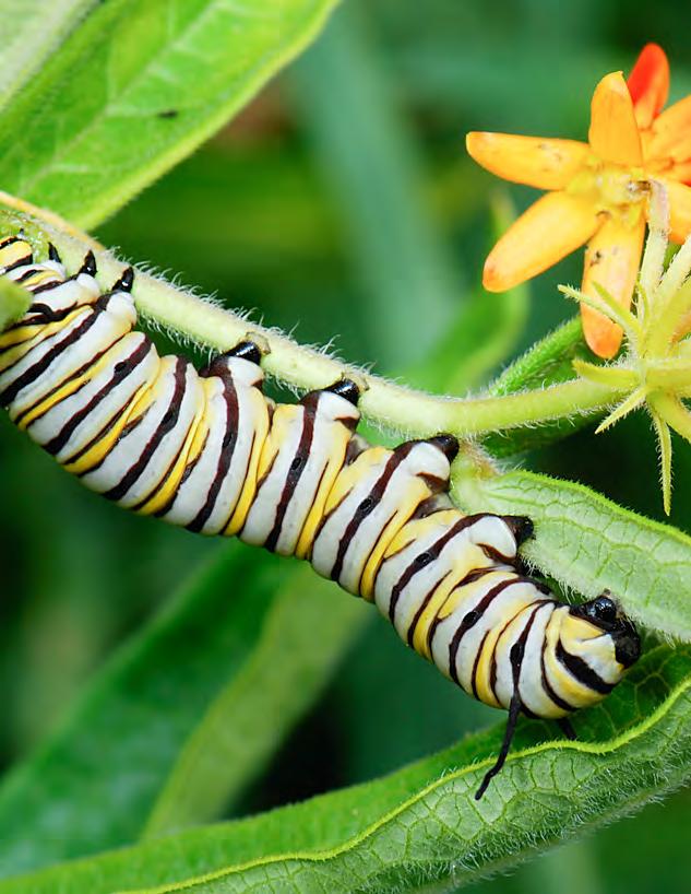
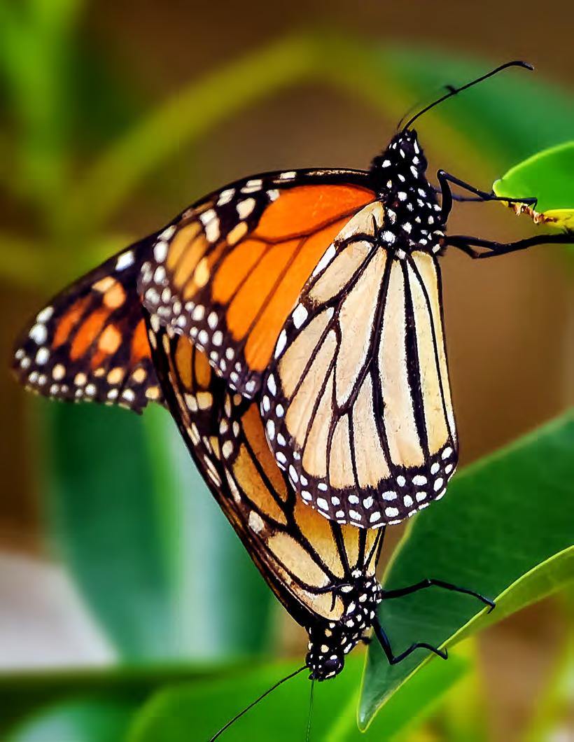
11 Summary of monarch reproduction and migration 1Monarch butterfly reproduction and migration in North America are tightly interwoven. After emerging as adults, nonmigratory monarchs mature for 3 8 days before mating (with the exception of the generations that overwinter in Mexico). Mated female monarchs will immediately seek out and begin laying their eggs on milkweed plants. To avoid competition between offspring, a female usually lays only one egg per milkweed plant. Females lay an average of ~700 eggs during their adult lifespan (2 5 weeks). After 3 8 days (depending on temperature), the eggs hatch and the caterpillars feed on the milkweed plant tissue, passing through five growth stages (instars), with a molt between each stage. After completing its 5 instar stages (9 14 days), each monarch caterpillar generally crawls away from its host milkweed plant and seeks a sheltered location (frequently the underside of a leaf or stem of another plant) to pupate. Leaving their host plant to pupate may offer some protection against predators and parasitoids, though this requires further study. After approximately 1 2 weeks as a chrysalis, the adult butterfly emerges. Butterflies feed on nectar from a variety of blooming plants, and their adult life-span and migratory behavior depend on the time of year (UMN Monarch Lab 2016). Though genetic studies demonstrate that the North American monarch population is panmictic (Lyons et al. 2012), monarchs can generally be partitioned into eastern and western groups (segregated by the Rocky Mountains). For the purposes of this report, we will refer to them as eastern and western populations (Figure 1). East of the Rocky Mountains, monarch butterflies overwinter in dense colonies in the oyamel fir forests of central Mexico (UMN Monarch Lab 2016). In the spring, butterflies depart from their overwintering grounds and migrate into the north of Mexico and southern United States, seeking milkweed. The subsequent generation migrates into the northern half of the United States and southern regions of Canada. There, the monarch population is amplified by a 3 rd generation, and finally a 4 th generation, which emerges in the late summer to early fall. Shortening days and other cues trigger physiological and behavioral changes in these adults, which do not mate but instead begin migrating south. On their approximately 4,000-kilometer (2,500-mile) flight to Mexico, these butterflies feed on nectar plants, building the majority of their fat reserves near the end of their migration (Brower et al. 2006). Upon reaching overwintering grounds in Mexico in the fall, butterflies form dense colonies that expand and contract with temperature (Thogmartin et al. 2017). Monarchs do not feed while overwintering, but clusters may temporarily disband when butterflies seek water. Lengthening days and warmer temperatures signify the arrival of spring and availability of milkweed, releasing monarchs from their overwintering state and beginning the annual cycle anew (UMN Monarch Lab 2016). West of the Rocky Mountains, monarchs overwinter in groves along the California coastline, with spring and summer breeding activity in areas to the north, east and south (Pelton et al. 2016). Studies indicate that a small percentage of monarchs from the southwest United States may migrate to Mexico as opposed to California, but additional research is needed (Morris et al. 2015). Monitoring Monarch Butterflies and Their Habitat across North America 1

12 Figure 1. Monarch migration CANADA UNITED STATES MEXICO 2 Commission for Environmental Cooperation
13 2Inventory and monitoring priorities established for North America Newly established in response to declining monarch populations, the Trinational Monarch Conservation Science Partnership (TMCSP) held its first meeting in February 2016, in Mexico City. Recognizing that monarch biology and ecology vary according to spatial and temporal factors, topic experts established seven shared priorities to inform trinational conservation efforts: five priority research topics and two operational priority actions. 2.1 Trinational Research Priorities 1. Estimate overwintering monarch density/abundance 2. Identify monarch natal origins 3 Evaluate threats posed by climate change 4. Evaluate threats posed by pesticide exposures 5. Evaluate the availability of nectar resources 2.2 Trinational Operational Priorities 1. Implement integrated or compatible monitoring protocols, using appropriate sampling schemes to address data gaps 2. Design compatible databases to host and share data Monitoring efforts have the potential to inform, directly or indirectly, all research priorities. Furthermore, both operational priorities are germane to establishing integrated monitoring practices that ensure collected data are compatible across geographic regions and are accessible to all parties. In 2017, a subgroup of the TMCSP met in Toluca, Mexico, to discuss ongoing monitoring efforts that relate to priority research topics and operational actions. Two research topics were discussed: estimating overwintering monarch density, and identifying monarch natal origins. These monitoring efforts require access to state-of-the-art technology. Operational actions necessary to share monitoring protocols and to set data standards for these research priorities are relatively straightforward. Additional monitoring efforts to evaluate the status and trends of monarchs and their habitat across their trinational range, including estimation of summer monarch breeding population sizes, were also discussed. Because gathering spatially representative data about monarchs and their habitat across their North American range requires the participation of many partners, including citizen scientists, operational actions required to standardize monitoring protocols and sampling designs and to develop compatible data management and sharing of practices are more complex. Key meeting decisions along with anticipated challenges and recommendations for next steps and timelines are included in Appendix A. Monitoring Monarch Butterflies and Their Habitat across North America 3

14 Monarch butterfly experts during a visit to an overwintering site in Mexico in February Key workshop decisions Monitoring protocols will be shared. The three countries will share existing monitoring protocols and identify points of contact for protocols. Common data standards will be adopted and data will be made available. As protocols are further developed and data collection infrastructures are built, common data standards must be adopted for shared monitoring attributes, to ensure data compatibility across monitoring efforts. The Darwin Core standards developed by Biodiversity Information Standards are recommended (Biodiversity Information Standards 2009). Properly formatted data should be uploaded to publically accessible databases or made available for download from program websites. Additional communication between protocol developers from each country will be necessary for establishing these standards and ensuring database compatibility. A trinational, spatially balanced sampling scheme will be made available. A prioritized, spatially balanced sampling framework (generalized random tessellation stratified [GRTS] draw) is important for interpreting collected monitoring data. The United States Geological Survey (USGS) will work with identified topic experts from each country to identify appropriate monarch strata and expand the current US-based GRTS draw to the monarch s full trinational range. A trinational Monarch Data Blitz will be launched. To address data gaps, Canada, Mexico and the United States will promote a citizen science based Monarch Data Blitz campaign (see Appendix B). Intensively gathering additional breeding data at critical windows of time across the monarch s range will provide a valuable snapshot of monarch population status, something that has never been done at a continental scale. It will also engage thousands of citizens, reconnecting them with nature and raising awareness of the migratory monarch s situation in North America. Additional communication among identified parties will be necessary to coordinate this effort. Mexico will form a joint venture: Mexico is currently evaluating opportunities to form a joint venture. 4 Commission for Environmental Cooperation
15 3Estimating monarch overwintering density Monarchs annually migrate to overwintering grounds in central Mexico and along California s coastline (see Section 1 and Figure 1). There, monarchs seek out forested microclimates and form dense clusters or colonies on trees. This annual gathering presents not only a beautiful visual spectacle but also a regular opportunity to estimate monarch population size, since individuals formerly scattered across vast North American tracts coalesce in small and generally predictable locations. Starting in 1993, the Comisión Nacional de Áreas Naturales Protegidas (Conanp) and World Wildlife Fund Mexico (WWF) began estimating colony sizes in Mexico by measuring the area (hectares) occupied by each colony (Appendix C). Likewise, the citizen science driven Western Monarch Thanksgiving Count (WMTC) began estimating California colony sizes in 1997 (Xerces Society for Invertebrate Conservation 2017). WMTC participants estimate colony size by counts because monarchs overwinter in smaller numbers in California than in Mexico. Records from both overwintering monitoring programs indicate that monarchs have declined over the last 20 years, and these data have significantly contributed to published and ongoing population viability assessments (PVAs) for eastern and western monarchs (Pelton et al. 2016; Schultz 2016; Semmens et al. 2016). However, while extremely valuable, these data have limitations. Since eastern colony sizes are estimated by measuring occupied areas, these values do not provide density information. Over the course of a single winter, monarch colonies may expand or contract depending on abiotic factors such as temperature. Furthermore, as the monarch population declines, it is unknown whether density within colonies has remained constant (Thogmartin et al. 2017). Potential interactions between monarch colony size and density limit interpretation of existing population extinction probability and habitat conservation targets (Pleasants 2016; Semmens et al. 2016) (Appendix C). Though western colony sizes are estimated by counts, variation in annual monitoring effort also complicates interpretation of results. To obtain more accurate data on overwintering colony density, the TMCSP has collaborated with researchers from the Winston-Salem State University (WSSU) to explore the use of terrestrial light detection and ranging (LiDAR) and other innovative technologies, like thermography and high-resolution videography, to estimate the volume of monarch clusters and link volume estimates to individual object-based models. LiDAR is a remote sensing technology that scans object surfaces with a pulsed laser. Laser pulses are reflected from target surfaces back to a sensor; temporal delays in laser pulse emission and return can be used to measure distances between the target surface and the laser (Heidemann 2014). Resulting point clouds are used to create three-dimensional digital images of scanned surfaces. These data can be evaluated alongside thermal imagery and slow-motion videography to evaluate behavioral patterns and model complex geometry at various scales. 3.1 Key points Feasibility of scanning monarch overwintering colonies with LiDAR was tested at select locations in both Mexico and California in Preliminary results suggest that monarch spectral properties allow digital separation of monarchs from underlying substrate. Monitoring Monarch Butterflies and Their Habitat across North America 5

16 Automated computer vision and metrological analytical approaches will be developed to either estimate colony volume and/or count individual monarchs within clusters. 3.2 Main challenges and recommendations In order to obtain accurate LiDAR readings, colonies must be calm. Any disturbance, such as motion caused by wind, distorts data collection. Other environmental conditions (e.g., fog) may also interfere with readings. o This challenge is not easily addressed. The best solution thus far has been to scan colonies on windless, clear mornings when monarchs are not active (as temperatures rise during the day, monarchs may become active). While individual monarchs can be distinguished from background substrate, the best analytical approach to estimating colony volume and/or individual counts must be developed. Potential mathematical approaches include: o Subtractive volume estimation: Using this methodology, LiDAR colony scans are compared with reference scans (underlying strata when monarchs are absent) and differences in surface area allow estimation of colony volume. This analytical approach may need to account for different positions of underlying strata in space when monarchs are present versus absent. For example, large clusters of monarchs may weigh down branches, which will rebound to former heights when monarchs depart. Metrics will be needed to convert colony volume estimates to monarch count estimates. o Geometric approach: Using this methodology, LiDAR colony scans are fused with digital camera imagery, and recognition software is used to count individuals. LiDAR equipment and data processing are expensive. o Though funding availability was not addressed in this workshop, it was generally felt that if LiDAR could yield high-quality density information, then the expense may be justified. At minimum, LiDAR and other technologies may help to validate assumptions and/or evaluate variability of densities; whether such applications will be feasible as a census tool is unknown. 3.3 Points of Contact Ryan Drum (US FWS, United States) Nickolay Hristov (WSSU, United States) Leonel Ruiz Paniagua (Conanp, Mexico) Gloria Tavera (Conanp, Mexico) 6 Commission for Environmental Cooperation
17 4Identifying the monarch s natal origins To identify effective conservation actions and strategically allocate limited conservation funds for monarchs, it is important to know which portions of the monarch s breeding range support the largest portion of the overwintering monarch population (see Section 1, above). Historically, two different monitoring methods have been used to determine the natal origins of successful migrants: tagging and isotopes. Today, there are two major citizen-science tagging programs in North America: Monarch Watch (MW) tracks eastern monarchs, while the Southwest Monarch Study (SWMS) tracks movement of the migratory generation emerging in the southwestern United States (University of Kansas 2017; Southwest Monarch Study 2010). Monarch tagging involves either rearing or capturing a migratory monarch and placing a sticker with a unique code on one of the monarch s wings before release. The location of the tagging event and the sticker code are recorded and reported. If the tagged monarch is sighted or recovered at a later point en route to a colony or at a colony, the monarch s unique code and location are reported. Comparing the number of tagging events in breeding grounds to tag recoveries at overwintering grounds can reveal information about monarch migratory pathways and relative contributions of different breeding regions to overwintering colonies. Monarch tagging studies have yielded valuable information about successful migratory monarchs natal origins and migratory corridors and have highlighted knowledge gaps where more information is needed. For example, data from the SWMS indicate that some monarchs from Arizona migrate to California while others migrate to Mexico (Morris et al. 2015). Additional studies are needed to further characterize factors (including wind) that influence individual migrants trajectories and to quantify the volume of exchange between western and eastern monarchs through southwest migratory corridors. Isotope analysis offers a complementary, chemical approach to determining monarch natal origins, with the added benefits of only having to capture an adult monarch once and being able to glean information from adult monarchs that have died. Stable isotopes ( atomic versions of the same element with different numbers of neutrons) occur in documented gradients across North America. Organisms naturally incorporate isotopes of select elements into their biological tissue, imprinting that tissue with that geographic region s isotope signature. Thus, chemical determination of isotopes ratios present in an organism s tissues can reveal information about the geographic origins of where the tissue was grown (Hobson 1999; Rubenstein and Hobson 2004). For example, inert hydrogen isotopes present in monarch wing tissues reflects the hydrogen isotope signature in the plant tissue on which the caterpillar developed and fed, which in turn reflects the hydrogen isotope signature of the ground water, which varies predictably with latitude across North America. A seminal isotope analysis published in the late 1990s indicated that approximately 50% of monarchs collected from an overwintering colony in Mexico originated from the US Corn Belt region, pointing to the importance of breeding habitat in the north-central United States (Wassenaar and Hobson 1998). However, since Wassenaar and Hobson s analysis, the advent of herbicide-tolerant crops has significantly reduced milkweed prevalence in the north central United States. This loss of milkweed from the Corn Belt landscape has been linked to declines in annual overwintering colony sizes in Mexico (Pleasants and Oberhauser 2013; Flockhart et al. 2015). Monitoring Monarch Butterflies and Their Habitat across North America 7
 since Wassenaar and Hobson s study. Researchers recently analyzed H and C isotopes from monarchs collected in Mexico over 40 years (Flockhart et al. 2017).")
18 In addition to changes in agricultural practices, land development and climate change may have also affected the distribution and availability of monarch habitat (including milkweed and blooming nectar plants) since Wassenaar and Hobson s study. Researchers recently analyzed H and C isotopes from monarchs collected in Mexico over 40 years (Flockhart et al. 2017). Interestingly, their results indicate that overall, despite large-scale changes in land-use practices and land cover, the US Corn Belt region still produces the largest number of monarchs overwintering in Mexico, relative to the number from other breeding regions, and that while there is significant inter-annual variation in the contribution of eastern breeding regions to overwintering colonies in Mexico, annual variation is primarily explained by climate patterns. However, this study was conducted with a limited number of samples. Furthermore, most samples were collected from one colony, limiting inference about natal origins at other colonies and our understanding about potential shifts in the relative contribution of breeding monarchs from different regions on the wintering grounds as a whole. Further research is needed. 4.1 Key points Protocols should be established for the annual collection of monarchs at overwintering locations throughout the wintering period. o Questions that can be answered by collecting these samples include the following: Do the relative proportions of monarch natal origins as determined from monarchs collected at overwintering colonies remain constant through time? Are the relative proportions of monarch natal origins constant across wintering colonies? Is there an interaction between monarch natal origins, sex and mortality? 8 Commission for Environmental Cooperation
19 o Suggested protocol steps are as follows: A minimum of 200 dead monarch samples should be collected from the two or three colonies that are monitored for the entire winter by Conanp (i.e., samples per year). 50 samples (half males and half females) should be collected during the last week of monitoring in each month (50 samples collected once a month * 4 months * 3 colonies = 600 samples). The collection of more than 200 samples is encouraged. For example, collecting 100 samples every month would reduce variability in assignments of breeding origins. Catastrophic mortality events due to weather for example should be exploited opportunistically. Samples can be collected in bulk (i.e., without any individual sorting or in envelopes and later sorted prior to shipment). At all other colonies visited by Conanp for estimates of wintering area, a minimum of 100 samples are collected per year. All analyses of monarch wing tissue for isotope ratios should be conducted using compatible standards (CBS, KHS 1 ) the comparative equilibration approach to reporting data, and be measured using high temperature glassy carbon combustion (~1350 to 1450 o C). If other approaches are used, it will result in non-comparable data across studies. Future isotope analyses have the potential to address fundamental questions about monarch natal origins that are germane to developing conservation strategies. These questions include the following: o What is the relative contribution of different breeding regions in North America and how have these contributions changed through time? o How will the contribution of geographic regions change in the future, due to climate change? o Do monarchs natal origins correspond to other physiological attributes potentially linked to survival (e.g., monarch size, coloration, parasite loads, fat content, sex ratios, genetic traits, etc.)? Long-term data collection will support collaborations across Canada, Mexico, and the United States. As the relative contributions of different geographic regions to overwintering populations are clarified by future isotope analyses, it may be possible to make inferences about the amount of breeding habitat (milkweed) present on the landscape. Combined with other monitoring procedures, these inferences might aid in the Species Status Assessment (SSA) process. 4.2 Main challenges and recommendations Permits are needed in order to collect monarchs from overwintering grounds in Mexico. (Mexico is prepared to help obtain required permits for dead butterflies.) Additional communication between Canada and Mexico is needed to devise a representative sampling scheme within and between overwintering colonies and to delineate a collection protocol in the case of severe weather events. In the meantime, Canada will share proposed methodology with Mexico. Incorporation of additional stable isotopes (e.g., strontium [Sr]) can improve the resolution of natal origin inferences. (However, before Sr can be incorporated into the analyses, its gradients across the landscape must be established. Furthermore, additional calibration tests must be conducted to determine the relationship between Sr concentration in milkweed and in the tissue of caterpillars feeding on milkweed.) 4.3 Points of contact Greg Mitchell (ECCC, Canada) Keith Hobson (ECCC and Western University, Canada) Gloria Tavera (Conanp, Mexico) Ryan Drum (US FWS, USA) 1. CBS (also known as EC-01) Caribou hoof standard and KHS (also known as EC-02) Kudu horn standard. Monitoring Monarch Butterflies and Their Habitat across North America 9

20 Monterey Bay, California, USA - December 5, An orange monarch butterfly caution sign alerts visitors at the Pacific 10 Grove Commission forest where for thousands Environmental of Cooperation migrating monarch butterflies cluster together.
 and identifying the natal origins of migratory monarchs through isotope analyses (see Section 4) will aid in")
21 5Evaluating the status and trends of monarchs and their habitat, and setting prioritized, spatially balanced site selection methodology and common data standards Refining estimates of monarch overwintering population sizes by gathering colony density information (see Section 3) and identifying the natal origins of migratory monarchs through isotope analyses (see Section 4) will aid in developing trinational, science-based conservation recommendations. However, both overwintering-population size measurements and isotope analyses focus on the migratory monarch generation produced each year, and as such do not focus on place-based threats throughout migration flyways or on threats and population bottlenecks that might be occurring in earlier generations. To better explain inter-annual variation in monarch overwintering numbers, it is important to understand the distribution and abundance of monarchs and their habitat throughout the monarch s entire annual cycle (see Section 1). Tracking the status and trends of monarchs and their habitat across their North American range, however, is logistically challenging. Monarchs are iconic pollinators with fascinating life histories, and thus are well represented by citizen-science programs in Canada, Mexico, and the United States. Different programs track different aspects of monarch life history and habitats. Together, these monitoring programs offer a collective portrait of monarch biology and population health and have made significant contributions to peer-reviewed literature (Ries and Oberhauser 2015). Monitoring Monarch Butterflies and Their Habitat across North America 11
22 However, there are limitations to collecting data through current programs. First, sampling is not random; participants frequently monitor where they are likely to encounter monarchs, complicating extrapolation of data across relevant geographies that are not subject to equal observational scrutiny. Second, these programs do not monitor all attributes pertinent to monarchs and their habitat. For example, existing citizen-science programs do not rigorously monitor relative abundance of blooming nectar plants, or additional threats such as fire ants. Finally, depending on data collection methods, it may be difficult to combine data across programs, limiting interpretation of results. Canada, Mexico, and the United States have each launched national-level efforts to address these data gaps (see Appendix C). However, since both the biogeographical and the pre-existing citizen-science landscapes vary between and within countries, selected monitoring attributes, associated protocols, and sampling schemes are not always standardized. Furthermore, different means of reporting and storing data are available, depending on the monitoring program. In order to align trinational monitoring efforts, it is important that the three countries adopt compatible protocols and data standards for shared monitoring attributes, utilize a spatially balanced sampling framework and, finally, maintain compatible and accessible databases. 5.1 Key points Ongoing national monitoring efforts: During the workshop, a representative from each country made a presentation on the current status of national monitoring programs and associated analyses. Summaries of national monitoring activities and analyses for each country are given in Appendix C. A comprehensive summary focused on the rich contributions of all active monitoring programs and ongoing analyses in each country is beyond the scope of this report. These status summaries focus only on analyses and monitoring activities related to national monitoring efforts. Priority monitoring questions: During presentations and following conversations, each country identified key questions that could be addressed with additional monitoring data (summarized in Figure 2). Spatially balanced sampling: The United States is currently testing the application of a spatially balanced, prioritized sampling scheme (GRTS draw) for sampling monarch-relevant strata base on their attributes. Because GRTS draw sampling schemes assign weights to all possible monitoring sites, data from any location designated as habitat can be incorporated into an analysis, though data collected from priority sites will strengthen results. The United States has generated a GRTS draw for the eastern monarch range (incorporating six strata: protected grasslands, unprotected grasslands, CRP lands, cultivated fields/ orchards, right-of-way habitats, urban/suburban spaces) and is currently consulting topic experts to identify additional strata for the western monarch range. The GRTS draw can be expanded internationally if relevant land-cover strata are identified; all three countries agreed to explore the possibility of expanding the draw in Mexico and Canada (supported by USGS). Additional communication among the three countries will be necessary to coordinate this effort. Monarch Data Blitz: Intensively gathering monarch breeding data at critical time windows across their range will provide a valuable snapshot of monarch population status. Canada successfully promoted a Monarch Data Blitz (through the Mission Monarch platform) in 2016 and suggests expanding this effort trinationally (see Appendix B). Additional communication among identified parties will be necessary in order to coordinate this effort. The annual monarch life cycle is depicted in the outer ring of Figure 2. In the spring, adult monarchs depart from their overwintering grounds (A). Adult monarchs mate either as they leave their overwintering grounds or en route to spring breeding grounds (B). Adult females lay eggs on milkweed plants (C). Caterpillars emerge from the eggs (D) and pupate (develop) into adults (E). Additional generations of adult monarchs emerge, depending on habitat resources, climate, and other environmental factors (F). In late summer to fall, adult monarchs migrate (G), sometimes forming roosts en route (H) to their overwintering grounds in California (I) and Mexico (J). Stressors, including monarch natural enemies [K] parasites, [L, M] parasitoids, [N, O] predators and [P] man-made threats (habitat destruction and pesticide application, [Q] traffic collisions, [R] invasive species, [S] climate change may affect the survival and fitness of monarchs across time and space. 12 Commission for Environmental Cooperation


; (O) Praying mantis with captured adult monarch (Charlie Gatchell); (P) Cultivated field (Holly Holt); (Q) Trucks (and")
23 Figure 2. Annual monarch life cycle, threats and associated priority trinational monitoring questions G F Fall migration Habitat resources H 1-3 North Central and Northeast US, Canada D Roosts en route 16 Western US South Central US, Northern Mexico E C I Central Mexico B Spring and summer breeding Overwintering California J A Overwintering Mexico Spring and summer movement and migration Monarch s natural enemies Man-made threats K L M N O P Q R S Source: CEC workshop summary notes. Images reproduced with permission. (K) Protozoan parasite (Ophryocystis elektroscirrha) spores (Sonya Altizer); (L) Tachinid fly larvae emerging from monarch caterpillar (Cindy Stone); (M) Adult parasitoid wasp (UMN Monarch Lab); (N) Grosbeak eating adult monarch in Mexican overwintering colony (Hayley Schroeder); (O) Praying mantis with captured adult monarch (Charlie Gatchell); (P) Cultivated field (Holly Holt); (Q) Trucks (and other vehicles which may cause adult monarch roadside mortality) (Holly Holt); (R) Red imported fire ant (Solenopsis invicta) mound (Kristen Baum); and (S) Climate change (Holly Holt). Monitoring Monarch Butterflies and Their Habitat across North America 13
24 The geographic location of priority monitoring questions is indicated within the central Venn diagram in Figure 2, with full questions listed below. This list of monitoring questions is not comprehensive; rather, it reflects priority national and trinational monitoring questions. 1. What is the distribution and abundance of eggs, caterpillars and adult monarchs and how do these vary with season, habitat, climate, landscape context and land-use practices? 2. What is the distribution and phenology of monarch habitat resources (e.g., milkweed, blooming nectar plants, riparian corridors) and how do they affect monarch migration, breeding and survival? Where are habitat-resource limiting factors and when do they occur? 3. What is the prevalence and incidence of monarch natural enemies and man-made threats and how do these factors interact with season, habitat and resource availability, to affect monarch survival and fitness? 4. What are the regional contributions of Canadian-born and US-born monarchs to overwintering colonies in Mexico? 5. When and where is milkweed a limiting factor for monarch reproduction? 6. How does the abundance and timing of monarch arrival and departure in these regions change on an annual basis? 7. Is there potential for phenological mismatches between habitat resource availability and monarch spring and summer movement, breeding, and fall migration? 8. Is there potential to expand the northern range of milkweeds and monarchs? Is there a northern limit or maximum distance from the overwintering grounds for summer-breeding individuals? 9. What are the distribution, abundance and phenology of milkweed species (native and non-native) and where and when does milkweed contribute to spring and/or fall breeding, especially in Northern Mexico 10. What are the migratory pathways for spring and fall migrants? 11. Which plant species are used for roosts by fall migrants? What portions of the plants do monarchs roost on? 12. What is the magnitude of predation pressures and man-made threats (e.g., traffic collisions, pollution) in migratory corridors and on the overwintering grounds? 13. How can we estimate overwintering monarch colony size and density? 14. How can we increase monitoring efforts to capture data for new overwintering monarch colonies or colonies that we are not yet monitoring? 15. How much exchange is there between eastern and western populations? 16. What are the natal origins of monarchs overwintering in California? Based on priority monitoring questions symbolized in Figure 2, each country listed attributes that it is currently monitoring, with associated monitoring organizations and protocols (Table 1). An initial inventory of monitoring protocols and associated materials is included on page 43. Countries agreed to adopt or adapt existing protocols, as appropriate. Attributes of greatest trinational interest included: adult monarch density and phenology, monarch egg and larval density, nectar plant availability (by species), and milkweed presence and/or density (by species). 14 Commission for Environmental Cooperation
25 Table 1. Monitoring organizations contributing data to national monitoring efforts Monitoring organizations Attribute Canada Mexico United States Adult monarch density and phenology ebutterfly, Bird Studies Canada Monarch Butterfly National Monitoring Network (Red Nacional de Monitoreo de la Mariposa Monarca); coordinated by Conanp MCSP Monitoring Activity 2, North American Butterfly Association 4 th of July Counts, Journey North first occurrence counts, ebutterfly Monarch egg and larval density Mission Monarch Monarch Butterfly National Monitoring Network (Red Nacional de Monitoreo de la Mariposa Monarca); coordinated by Conanp MCSP Monitoring Activity 3, MLMP Nectar plant availability and adult feeding preferences Mission Monarch* Monarch Butterfly National Monitoring Network (Red Nacional de Monitoreo de la Mariposa Monarca); coordinated by Conanp, WWF Mexico* MCSP Monitoring Activity 3, MLMP Milkweed presence and/or density Mission Monarch, University of Ottawa Monarch Butterfly National Monitoring Network (Red Nacional de Monitoreo de la Mariposa Monarca); coordinated by Conanp (currently records distribution only, interested in density*) MCSP Monitoring Activity 3 Natal origins (tagging) Monarch Watch Conanp*, WWF Mexico* (tagging spring migrants) Monarch Watch, Southwest Monarch Study Natal origins (isotopes) ECCC, University of Guelph, Western University Conanp, WWF Mexico* Overwintering population area or count Conanp, WWF Mexico Western Monarch Thanksgiving Count Overwintering mortality ECCC, University of Guelph, Western University Conanp, WWF Mexico Overwintering population density (LiDAR) Conanp, WWF Mexico University of North Carolina, US FWS, MCSP Overnight roost observations and preferred host plant ebutterfly Monarch Butterfly National Monitoring Network (Red Nacional de Monitoreo de la Mariposa Monarca); coordinated by Conanp Journey North Monarch egg and caterpillar survival MLMP Monarch Butterfly National Monitoring Network (Red Nacional de Monitoreo de la Mariposa Monarca); coordinated by Conanp MCSP Monitoring Activity 4, MLMP Parasitism (Oe) prevalence Project Monarch Health Conanp* (northern Mexico), Correo Real* MCSP Monitoring Activity 4, Project Monarch Health Threats (e.g., road collisions, climate, pesticides) Monarch Butterfly National Monitoring Network (Red Nacional de Monitoreo de la Mariposa Monarca); coordinated by Conanp Predation Monarch Butterfly National Monitoring Network (Red Nacional de Monitoreo de la Mariposa Monarca); coordinated by Conanp Fire ant density MCSP Monitoring Activity 5 Data management ebutterfly Monarch Butterfly National Monitoring Network (Red Nacional de Monitoreo de la Mariposa Monarca); coordinated by Conanp MCSP Monitoring Activity 6 Note: * Indicates an organization that is not currently monitoring designated attribute, but is interested in adapting protocols currently in use in other countries. Monitoring Monarch Butterflies and Their Habitat across North America 15
26 5.2 Main challenges and recommendations Sharing existing protocols and setting compatible data standards: Since monarchs have a complex life history (Figure 2) and many monitoring programs already exist, it is not possible to generate protocols that will be universally applicable. Instead, as each country develops monitoring protocols, we need to ensure that monitoring programs are compatible and to reference each other where appropriate. o Protocols: Each country will share existing national monitoring protocols in their current form (recognizing that these protocols will evolve with future testing). o Data standards: Protocol and database developers from each country will identify required data fields and standards for each shared attribute. Adopting Darwin Core standards (TDWG, 2009) is recommended. Developing new, compatible protocols: Monarchs utilize diverse ecosystems. Thus, existing monitoring protocols may not be equally suited for monitoring in each ecosystem. For example, the importance of riparian corridors has been recognized in the western and southern United States and in Mexico. o Representatives from WWF Mexico and the Monarch Conservation Science Partnership (MCSP) have already held preliminary discussions for modifying an existing MCSP protocol, which was developed for use in eastern strata, for use in riparian corridors. As this protocol is developed, it will be shared with all parties, including the Western Monarch Conservation Science Partnership (WMCSP) and the Texas Advisory Panel (TAP). Establishing a common prioritized, spatially balanced, sampling scheme (GRTS): Monarchs exploit resources in diverse land strata, and therefore, representatively sampling all relevant strata is a challenge. o Trinational GRTS draw: The United States will expand its prioritized, spatially balanced GRTS draw to Mexico and Canada. Topic experts have already begun communicating with the USGS to identify appropriate strata and land-cover data for incorporation into the draw. Sharing data: Data for different programs is currently kept in different databases. Data access will be important for collaborative trinational analyses. o Once appropriate data standards have been adopted, formatted data for relevant attributes (e.g., species occurrence) should be uploaded to nationally accessible databases (Mexico National Biodiversity Information System (SNIB) and Mexico National Biodiversity Monitoring Network [SNMB]). o Alternatively, appropriately formatted data should be made available for download from an individual program s website (e.g., ebutterfly). In the meantime, individuals may request data from program contacts. Implementing monitoring programs: More data are needed to inform monarch conservation. Gathering these data across the monarch s North American range will require participation of citizen scientists. There are a number of logistical, financial and social challenges to implementing monitoring at this scale. o Participant recruitment and training: Recruiting participants and providing training require coordination and funding. Each country is working with limited resources and existing recruitment networks. o Participation engagement and retention: Retaining participants from one season to the next and motivating participants to monitor at key periods is critical. This requires coordination and communication as well as careful identification of critical monitoring periods. For example, asking citizens to monitor at times when they are unlikely to make any observations can lead to program attrition. Some aspects of engagement communication can be automated through app design (e.g., Mission Monarch plans to incentivize data reporting by encouraging participants to reach monitoring targets). o Data integrity and validation: Submitting photographs and observations to crowd-sourcing and validation by experts can improve data integrity. Explaining to participants the importance of not omitting to report when the finding is 0 is also crucial. 16 Commission for Environmental Cooperation
27 Coordinating the Monarch Data Blitz: Additional communication is needed to coordinate intensive data collection amongst citizen scientists during key monarch breeding windows. o Identified parties will communicate about selected monitoring attributes (monarch egg and larval density in a selected milkweed patch, plus random walks to identify additional milkweed plants), timeframes (windows of 3 4 days, as appropriate for each geographic type), data platforms/monitoring programs (likely Mission Monarch, MLMP, Monarch Butterfly National Monitoring Network; Red Nacional de Monitoreo de la Mariposa Monarca) and citizen-science engagement (Appendix C). Increasing stakeholder coordination and communication, and addressing misconceptions: Monarchs have become a flagship pollinator conservation species, drawing the attention of funding agencies, industry, and conservation professionals from federal and state agencies, NGOs and academics. Coordinating research and monitoring, educational outreach, and on-the-ground habitat conservation among veterans and newcomers is challenging. o Joint Ventures: Coordinating bodies like the Monarch Joint Venture (MJV) for the United States (Appendix C) have an obligation to reduce conservation effort redundancies, and publicize and promote correct information (especially in response to media misinterpretations). Mexico is working on forming its own joint venture and will leverage resources and experiences from existing organizations, including Red Monarca (Red Monarca 2017) (Appendix C). o Partner engagement: When appropriate, the TMCSP should engage representatives from existing citizenscience programs. 5.3 Points of contact Monarch Butterfly National Monitoring Network; Red Nacional de Monitoreo de la Mariposa Monarca: Marco Castro (Conanp, Mexico) MCSP Monitoring Protocol: Karen Oberhauser (MJV, United States), Wendy Caldwell (MJV, United States) Mission Monarch and ebutterfly: Maxim Larrivée (Montreal Insectarium, Canada) Monarch Data Blitz coordination: Maxim Larrivée and Sonya Charest (Montreal Insectarium, Canada), Michael Gale (US FWS, United States), Karen Oberhauser (MJV, United States) and Rocío Treviño (Correo Real, Mexico) GRTS draw: Emily Weiser (USGS, United States), Wayne Thogmartin (USGS, United States), Greg Mitchell (ECCC, Canada), Francisco Botello (UNAM, Mexico) Joint Venture formation: Gloria Tavera (Conanp, Mexico), Rocío Treviño (Correo Real, Mexico), Karen Oberhauser (MJV, United States), Wendy Caldwell (MJV, United States) Monitoring Monarch Butterflies and Their Habitat across North America 17

28 18 Commission for Environmental Cooperation Expert discussion during the Monitoring Monarch Butterflies and Their Habitat across North America Workshop, Toluca, Mexico March 2017.
29 A Toluca Appendix monarch workshop, 4 5 March 2017 Workshop agenda Monitoring Monarch Butterflies and Their Habitat across North America 4 5 March Toluca, Estado de México México Agenda As part of the Commission for Environmental Cooperation s (CEC s) project Monarch Butterfly Flyway: Communication, Participatory Conservation, and Education Programs throughout the Migratory Route (Project 13), this workshop will gather monitoring experts from the Trinational Monarch Conservation Science Partnership to identify priorities for the monitoring and inventorying of monarch butterfly life stages and monarch habitat at geographic scales relevant to the conservation of the species. The objectives of this workshop are as follows: 1. Identify key monitoring priorities in Canada, Mexico and the United States. 2. Discuss inventorying and monitoring protocols for the life stages of the monarch butterfly across North America. 3. Determine inventorying and monitoring priorities and action plans across North America. Monitoring Monarch Butterflies and Their Habitat across North America 19
30 Saturday, 4 March :00 09:30 Coffee and registration 1. 09:30 10:00 Introductions, ongoing work and priorities, desired meeting outcomes Presentation of participants (10 min) Introduction of CEC projects 12 and 13, and meeting objectives; Georgina O Farrill (10 min) Introduction and update, Trinational Monarch Science Partnership; Michael Gale (10 min) 10:00 10:15 Coffee break 2. 10:15 12:30 Presentations, including brief description of current monitoring protocols and monitoring proposals (2h15 min) Priorities for monitoring and inventorying monarchs in Canada, Maxim Larrivée & Greg Mitchell (45 min presentation, including questions) Priorities for monitoring and inventorying monarchs in Mexico, Gloria Tavera & Marco Antonio Castro (45 min presentation, including questions) Priorities for monitoring and inventorying monarchs in the United States, Holly Holt & Wayne Thogmartin (45 min presentation, including questions) 3. 12:30 13:00 Facilitated discussion: Priorities for monitoring and inventorying monarchs in North America (30 min) Key monitoring and inventorying priorities Establishing trinational priorities Future steps and agreements 13:00 14:00 Lunch break 4. 14:00 15:30 Facilitated discussion: Priorities for monitoring and inventorying monarchs in North America (1h30 min) Identifying monitoring goals in North America Suggested trinational monitoring protocols Databases required Implementation, sampling, communication 15:30 15:50 Coffee break 5. 15:50 17:30 Conclusions (1h40 min) Next steps and collaborations Identification of goals for practical session Sunday, 5 March :00 09:00 Travel to Colonia de Hibernación Oxtotilpan, Temascaltepec, Estado de México 09:00 Arrival at Colonia de Hibernación Oxtotilpan 6. 09:00 13:00 Practical session at Colonia de Hibernación Oxtotilpan 13:00 14:00 Lunch 14:00 16:00 Travel to Toluca 7. 17:00 18:30 Overview and questions from practical session General comments Main challenges Action plan and timeline Next steps 20 Commission for Environmental Cooperation
 LiDAR team will attempt to return to Mexico and California following monarch departure")
31 Identifying trinational monitoring priorities during the Monitoring Monarch Butterflies and Their Habitat across North America Workshop, Toluca, Mexico March Next steps and timelines identified during the workshop: April 2017: The Winston-Salem State University (WSSU) LiDAR team will attempt to return to Mexico and California following monarch departure from overwintering grounds, to scan vacated substrate. 29 July to 6 August 2017: Identified parties will communicate and set next steps. These are the projected implementation dates for the Monarch Data Blitz. August 2017: Greg Mitchell will compile and to Gloria Tavera recommendations for a monarch collection protocol. May 2017 December 2017: Gloria and Greg will work with appropriate parties to collaboratively devise a representative sampling scheme for collecting monarchs within overwintering colonies and to delineate a collection protocol in the case of severe weather events. Gloria will obtain necessary sampling permits. January 2018: Pending analytical results, more LiDAR testing in monarch overwintering grounds may be warranted. If methods are successfully developed, LiDAR and associated high-resolution photography may have future applications not only in annually estimating overwintering density, but also in tracking mortality throughout the course of each winter. May 2017 August 2018: The WSSU LiDAR team will develop and evaluate analytical approaches (subtractive volume estimation and/or geometric) to estimate monarch colony volume and/or individual counts. GRTS draw: Identified parties have begun and will continue to exchange information. Monitoring protocol coordination: o Monarch egg and larval density: Identified parties (MJV, Maxim Larrivée and Marco Castro) will identify common data fields. o Nectar plant availability: MJV will share protocols with other identified parties. Monitoring Monarch Butterflies and Their Habitat across North America 21
32 Workshop attendees Attendee Country Title Organization Maxim Larrivée Canada Head of Entomological Collections and Research Montreal Insectarium Gregory Mitchell Canada Research Scientist Environment and Climate Change Canada Alfonso Alonso Mexico Field Studies Program Director Smithsonian Institution Francisco Botello Mexico Investigador, Instituto de Biología (Investigator, Bilology Institute) Marco Antonio Castro Martínez Diana Caterine Forero Díaz Felipe Martínez Meza Mexico Coordinador Regional de Iniciativas nacionales e internacionales, Conanp (Regional Coordinator of National and International Initiatives, Conanp) Universidad Nacional Autónoma de México (National Autonomous University of Mexico) Comisión Nacional de Áreas Naturales Protegidas (National Commission of Protected Natural Areas) dcforero@wwfmex.org Mexico Coordinadora de Ciencia (Science Coordinator) World Wildlife Fund Mexico fmartinez@conanp.gob.mx Mexico Director de la Reserva de la Biosfera Mariposa Monarca (Director of the Monarch Butterfly Biosphere) Eduardo Rendón erendon@wwfmex.org Mexico Coordinador del Programa Mariposa Monarca (Coordinator of the Monarch Butterfly Program) Gloria Tavera gtavera@conanp.gob.mx Mexico Directora, Regional Centro y Eje neovolcánico (Director, Central Region and Neovolcanic Artery) Rocío Treviño correo.monarca@gmail.com Mexico Coordinador, Programa Correo Real (Coordinator, Royal Mail Program) Comisión Nacional de Áreas Naturales Protegidas (National Commission of Protected Natural Areas) World Wildlife Fund Mexico Comisión Nacional de Áreas Naturales Protegidas (National Commission of Protected Natural Areas) Correo Real (Royal Mail), Profauna AC Michael Gale michael_gale@fws.gov USA Special Assistant, Branch of Policy US Fish and Wildlife Service Holly Holt hholt@umn.edu USA Science Coordinator Monarch Joint Venture Karen Oberhauser oberh001@umn.edu USA MJV Steering Committee Co-Chair, UMN Professor of Fisheries, Wildlife and Conservation Biology Monarch Joint Venture, University of Minnesota Monarch Lab Wayne Thogmartin wthogmartin@usgs.gov USA Research Ecologist US Geological Survey Emily Weiser eweiser@usgs.gov USA Biologist US Geological Survey Georgina O Farrill gofarrill@cec.org Senior Project Coordinator CEC Additional project contacts Attendee Country Title Organization Sonya Charest scharest@ville.montreal.qc.ca Canada Staff Montreal Insectarium Keith Hobson khobson6@uwo.ca Canada Professor & Research Scientist Western University, Environment and Climate Change Canada Leonel Ruiz Paniagua lpaniagua@conanp.gob.mx Mexico Department head Comisión Nacional de Áreas Naturales Protegidas (National Commission of Protected Natural Areas) Wendy Caldwell monarchs@monarchjointventure.org USA Coordinator Monarch Joint Venture Ryan Drum ryan_drum@fws.gov USA Strategic Habitat Conservation Coordinator US Fish and Wildlife Service Nickolay Hristov hristovni@wssu.edu USA Associate Professor Winston-Salem State University 22 Commission for Environmental Cooperation

33 Appendix BMonarch Data Blitz Material developed for the 2017 Monarch Data Blitz. Why a North American Monarch Blitz? Data collected by this effort will offer a unique opportunity to estimate the size of the summer breeding population of migratory monarchs across North America. Intensively gathering monarch breeding data at critical time windows across their range will provide a valuable snapshot of the summer monarch population status, something that has never been done at a continental scale. How to participate in the Blitz? Go out in as many milkweed patches as possible to count the number of caterpillars you can find on up to 100 milkweed plants. What s the protocol? It s easy: Between 29 July and 5 August, anywhere in North America, go to many different types of habitat where you can find milkweed, look for caterpillars on milkweed plants, and tell us how many you found and how many milkweed plants you looked at. Report all your missions on the Mission Monarch website: < (Montreal Insectarium, Ottawa University, et al. 2016). Monitoring Monarch Butterflies and Their Habitat across North America 23

34 24 Commission for Environmental Cooperation
35 Appendix CCurrent status of national monitoring programs and analyses C.1 Canada Introduction The Canadian Monarch Conservation Science Partnership (CMCSP) was formed in 2016 and comprises representatives from the academic, nongovernmental, and government sectors across Canada, including the University of Guelph, the University of Ottawa, the University of Calgary, Bird Studies Canada, the Montreal Insectarium, and Environment and Climate Change Canada. The CMCSP finalized its list of current Canadian research and monitoring priorities in Monitoring of monarchs in Canada is primarily achieved through citizen-science programs, including Mission Monarch and ebutterfly, which are coordinated through the Montreal Insectarium. The Committee on the Status of Endangered Wildlife in Canada (COSEWIC) recommended at the 2017 Species Assessment Meeting that monarchs be uplisted from Species of Special Concern to Endangered. ECCC is currently evaluating this recommendation. Key findings Major publications describing ongoing analyses and highlighting key findings for Canada s national monarch conservation efforts include: Flockhart et al., 2013, 2015 and 2017; Hobson et al. 1999, 2017; Soto et al. 2017; and Meier-Augenstein et al (see bibliography for full references). Analyses in progress Comprehensive analyses of the distribution of milkweed and monarch breeding range in Canada are underway, in conjunction with ECCC, the Mission Monarch project (Montreal Insectarium, Ottawa University, et al. 2016) and ebutterfly (Montreal Insectarium, Vermont Center for Ecostudies, University of Arizona, and Ottawa University 2016), to identify and map regional and landscape-level breeding hotspots. Analyses of the spatio-temporal and regional changes in monarch migration and reproduction (from citizen-science programs) in relation to co-occurrence patterns of co-occurring local and migrant species are also in progress. Finally, analyses to characterize relationships between summer population size in Canada vs. previous and next overwintering population size in Mexico are underway. Current monitoring programs Protocols and sampling design: ebutterfly (<www. and Mission Monarch (< are the two main citizen-science programs gathering georeferenced occurrences of monarch and co-occurring butterflies; milkweed density; and other monitoring-site data in Canada. Monitoring Monarch Butterflies and Their Habitat across North America 25
36 Implementation status: The national monitoring program for monarch breeding trends and milkweed density distribution was launched in 2016 through the Mission Monarch project, while the ebutterfly project has been monitoring adult monarch distribution in conjunction with co-occurring butterfly species in Canada since The current focus of both initiatives is to expand the human network of participants and partners across Canada. Future needs and opportunities for national and trinational collaboration: Major challenges for monitoring program implementation in Canada, and opportunities for trinational collaboration include the following: Increasing coordination capacity to standardize data collection across Canada and expand the human network of citizen scientists and partners. Dedicating resources to analyze and publish monitoring data on breeding habitat productivity and other research priorities as outlined by the Canadian Monarch Conservation Science Partnership (CMCSP). C.2 United States Noting declines in the eastern monarch population, the MCSP held its inaugural meeting in 2009 and originally named itself the Powell Center Working Group (after the USGS John Wesley Powell Center for Analysis and Synthesis, which hosted the group s first and subsequent meetings). This consortium of scientists and conservation professionals from government, academia and NGOs focuses on: 1) modelling monarch population trends and assessing the impact of threats, 2) establishing population targets and habitat goals and 3) developing conservation tools to guide decision making. To better reflect research priorities, the group s name was changed to the Monarch Conservation Science Partnership in 2014, the same year that the US FWS was petitioned in a joint report to list monarchs as threatened (Center for Biological Diversity, Center for Food Safety, Xerces Society for Invertebrate Conservation, and Brower 2014). The positive US FWS 90- day finding released at the end of 2014 triggered the SSA process under the Endangered Species Act, and a listing decision is due in June Because the eastern monarch population is larger than the western monarch population, MCSP studies to date (listed below) have primarily focused on the eastern population (see Section 1). Previous and ongoing MCSP analyses and monitoring efforts continue to contribute to the US FWS SSA process and conservation recommendations. MCSP Analyses 1. Eastern monarch population conservation target estimated through a population viability analysis (Semmens et al. 2016): Using overwintering (WWF Mexico and Reserva de la Biosfera Mariposa Monarca) and citizen-science (MLMP) data, this study found that the eastern monarch population stochastically fluctuates, but overall is in decline. Furthermore, according to International Union for the Conservation of Nature (IUCN) standards, the eastern monarch population is endangered (it has a >20% risk of extinction over the next 20 years). To reduce the chances of the eastern population dropping to such a low level that it will be unable to recover, this analysis suggests boosting the eastern overwintering population to a cumulative size of 6 hectares to buffer it against stochastic events. Because loss of milkweed from the United States landscape is a large contributor to monarch declines (Pleasants and Oberhauser 2013; Stenoien et al. 2016), this study recommends adding milkweed to the United States landscape, especially to the north-central and northeastern United States. 2. Milkweed conservation target estimate: In aid of meeting the eastern monarch population target of 6 hectares of overwintering monarchs in Mexico, the MCSP has used a variety of methods to estimate how much milkweed needs to be added to the United States landscape to support monarch breeding: a) Bottom-up approach: Pleasants (2016) used historical data to estimate how much milkweed used to be on the landscape in the north-central and northeastern United States before widespread adoption of glyphosate and how much milkweed is present now, from current data sets. The difference between the amount that used to be present and current levels reflects how much milkweed should be added to the United States landscape (Pleasants 2016). 26 Commission for Environmental Cooperation
37 b) Top-down approach: Thogmartin et al. (2017) combined data from a variety of studies to estimate how many monarchs are present in a hectare. Other studies have estimated how many milkweeds it takes to produce one overwintering monarch (Nail et al. 2015). Thus, Thogmartin and colleagues multiplied the desired number of hectares covered with monarchs number of monarchs/hectare number of milkweeds/monarch, to estimate how much milkweed is needed. The USGS also created a land-cover map and applied current estimates of milkweed to the north-central and northeastern regions, to determine how much milkweed is present. Subtracting estimates of existing milkweed from estimates of the total amount of milkweed needed to achieve six hectares of overwintering monarchs yields an estimate of how much milkweed should be added to the landscape. Though these and other extrapolations have limitations, taking both bottom-up and top-down approaches has helped the MCSP to hone in on estimated number of milkweeds needed to reach the 6-hectare monarch population target. These studies estimate that an additional billion stems of milkweed need to be added to the United States landscape to reach this population target (with 85% of the stems added to the north-central United States, and 15% to the northeast). 3. Conservation Storylines Analysis (manuscript in progress): Researchers created a land-cover map of the United States and applied estimated milkweed densities across different land-cover types (e.g., grasslands, Conservation Reserve Program [CRP] acreage, marginal croplands, urban/suburban spaces, right-of-way habitats), to model how much milkweed is currently present on the United States landscape. Next, different conservation scenarios, or storylines, were considered, in which different land-sectors or combinations of sectors added milkweed to the landscape. This analysis had two salient findings: 1) participation from the agricultural sector is germane to meeting the US milkweed target, and 2) even with modest participation from the agricultural sector, if all other sectors participate we can get close to an additional 1 billion stems of milkweed on the United States landscape. Thus, the MCSP advocates for comprehensive conservation participation across sectors or an All hands on deck approach. 4. Demographic model (Oberhauser et al. 2016): The MCSP developed a spatially explicit model that simulates the annual and multi-generational monarch life cycle in North America. Considering different management actions that address monarch population stressors (increasing floral nectar resources, increasing milkweed, decreasing insecticide use, etc.) across different regions, researchers simulated expected increases in the eastern monarch population. Results indicated that employing regionally-specific conservation actions across the entire eastern population s continental range would best support the monarch population, as opposed to focusing conservation efforts on select regions. 5. Desktop and online support tools to help in conservation planning for the imperiled monarch butterfly (USGS 2016): These tools were produced by Jason Rohweder and Wayne Thogmartin (USGS), in support of the MCSP. Tools were developed with a python scripting library, with ESRI ArcGIS software version 10.3, and include: a) a County Ranking Tool, which can be used for national, regional, or local prioritization of conservation activity; c) a Milkweed Calculator, to tabulate the amount of current and expected milkweed in a particular area of interest; and d) a County Area Adjustment Tool, which can tabulate consequences of land change (a tool which has utility well beyond monarchs and the resources that sustain them). Online and desktop versions of these tools, an instructional video, and an associated user s manual are available at: < 6. Threats analysis: Beyond loss of milkweed from the United States landscape (Pleasants and Oberhauser 2013; Stenoien et al. 2016), monarchs are also threatened by climate change, loss of blooming nectar plants, and exposure to agrichemicals and disease. The MCSP is developing a threats model, to better assess the impact of these abiotic and biotic stressors and identify the best strategies to mitigate negative pressures. Monitoring Monarch Butterflies and Their Habitat across North America 27
38 MCSP Integrated Monitoring Strategy Protocols and sampling design: As previously discussed, monarchs are the subject of numerous North American citizenscience programs, and these monitoring efforts jointly provide valuable information about the health of the monarch population. However, information gathered by current monitoring programs has important limitations, including nonrandom data collection, and data gaps in key monitoring attributes. The MCSP Integrated Monitoring Strategy aims to build on the strengths of existing monitoring programs while addressing programmatic shortcomings in sampling design and monitoring attributes. This Monitoring Strategy will engage multiple partners (citizen-science, federal, state, NGO, etc.) in monitoring key monarch and habitat attributes, using a broad-scale, spatially-balanced sampling scheme (GRTS draw). Resulting surveillance data will be used to populate MCSP models that inform eastern monarch population and habitat targets, identify and quantify the relative magnitude of potential threats, and inform strategies for implementing habitat enhancement. Combined with concurrent monitoring of habitat management, resulting surveillance data may also be used for assessing the effectiveness of local projects on an opportunistic and case-by-case basis, if correct study designs are adopted. This monitoring framework has six protocols designated as standard operating procedures (SOPs), or activities, that provide instructions on how to: 1. ground-truth sites; 2. monitor adult monarchs through modified Pollard Walks and identify preferred adult nectar plants; estimate milkweed species diversity and density, as well as per-plant density of monarch eggs and caterpillars, and estimate relative abundance of blooming nectar plants; 3. estimate monarch survival to adulthood (this protocol requires monarch caterpillar collection and rearing, testing successfully emerged adults for a protozoan parasite, and recording instances of parasitism); 4. estimate abundance and biomass of fire ants, where geographically appropriate; and 5. enter and review data for quality control and assurance. Wherever possible the MCSP has used or modified existing citizen-science monitoring protocols. These were developed for programs such as the Monarch Larva Monitoring Project (MLMP) (UMN Monarch Lab 2017), Project Monarch Health (University of Georgia Odum School of Ecology 2015), and the Illinois Butterfly Monitoring Network (IBMN 2004). Tailored instructions for monitoring across different land strata designated as potential monarch habitat (protected grasslands, unprotected grasslands, CRP lands, cultivated fields/orchards, right-of-way habitats, urban/suburban spaces) are provided on page 43. Site selection, governed by the GRTS draw, works by incorporating all possible sites within strata into a prioritized list. Data from priority sites (sites near the top of the ranked list) are weighted more heavily than data from lower-priority sites, in the final analysis. This weighting process allows citizens and other monitoring participants to submit data from any eligible location (it must fall into one of the six strata incorporated into the GRTS draw for the eastern monarch range) without introducing bias. However, to increase the impact of submitted data, priority sites should be monitored. While collecting data on all attributes at every site is encouraged, it is not necessary for program participation. Currently the GRTS draw focuses on the eastern monarch range, and the USGS is consulting topic experts to identify additional strata for expansion of the draw to the western monarch range (see Section 5.1, third bullet). Implementation status: Because executing this project at large scale will require communications, engagement and technological infrastructures, the MCSP aims to implement this project in phases, with each phase building on the progress of previous years. Monitoring protocols, site selection, site access, and data management procedures were pilot-tested in 2016 at selected (non-priority) locations by US FWS biological technicians and other academic, NGO and agency partners. Protocols were edited based on feedback, and the US FWS and other partners, including the MJV, will test revised versions in Commission for Environmental Cooperation
39 The MJV is a science-based and partner-driven organization that operates in three monarch conservation arenas, namely: 1) research and monitoring, 2) habitat restoration, and 3) education and outreach. The MJV functions as a communications hub servicing diverse stakeholders, and has extensive experience in training broad audiences (citizen scientists, practitioners, researchers, etc.) in citizen-science monitoring protocols. Furthermore, the UMN Monarch Lab, a close MJV partner, offers a train-the-trainer program that will serve as a template for building monitoring capacity for the MCSP Monitoring Strategy. Since the MCSP Integrated Monitoring Strategy ultimately aims to engage citizen scientists and other audiences in monitoring priority GRTS sites, the MJV will leverage its connections and training expertise to recruit citizen scientists through a series of workshops in Participants will be encouraged to monitor priority GRTS sites within self-designated travel radiuses, but may elect to monitor any site of their own choosing (as long as it falls within a GRTS stratum). In addition, the US FWS will hire biotechnicians to monitor priority GRTS sites in the southwest and midwest (US FWS Regions 2 and 3). Results from the 2017 field season will inform future implementation stages. Table 2 summarizes MCSP Integrated Monitoring Program implementation activities to date. Future MCSP Integrated Monitoring Strategy needs, and opportunities for national and trinational coordination: Development and implementation of the Integrated Monitoring Strategy has, to date, been funded primarily by the US FWS. To ensure future program success, the MCSP and other partners are working to diversify funding support and have applied for a National Fish and Wildlife Foundation (NFWF) grant (NFWF 2017). In order to successfully expand the Integrated Monitoring Strategy, the United States must build scalable communications infrastructures, accessible databases, and online coordination platforms. The anticipated needs summarized below also present opportunities for national and trinational collaboration: 1. Protocols (and data standards): All countries agree to adopt compatible monitoring methodology and data standards, where appropriate. Future discussion is needed to align methodology and data standards across North America. 2. Site selection (GRTS): The USGS has agreed to create a trinational GRTS draw. Future discussions between the USGS and topic experts are necessary, to identify unique strata in Canada and Mexico. 3. Citizen-science coordination: To gather data at the scale necessary to inform analyses, increased capacity is needed to recruit, train, support and retain citizen scientists. In addition to ongoing national efforts to engage citizen scientists in monitoring, Canada, Mexico and the United States will launch trinational, citizen science driven monitoring efforts, including a Monarch Data Blitz. Additional communication among identified parties is necessary to coordinate this effort. 4. Other participant coordination: Beyond citizen scientists, the MCSP Integrated Monitoring Strategy envisions engaging multiple entities (NGOs, other federal and state agencies, etc.) in the monitoring of priority GRTS sites. TMCSP partners have a shared obligation to build these strategic partnerships nationally and internationally. 5. Site access: Monarchs use diverse ecosystems, and consequently, GRTS-draw strata reflect a variety of land-use types and ecosystems. Because some strata are privately owned (e.g., unprotected grasslands, CRP lands, agricultural lands and urban-suburban spaces), obtaining permission to monitor at priority sites within these strata is logistically complicated. Furthermore, individuals may need to seek permission from appropriate authorities to monitor on public strata (protected grasslands and right-of-way habitats). Site access will continue to be a challenge to future completion of a trinational GRTS draw. 6. Data management and access: All countries agree that data should be made accessible to TMCSP parties and partners. However, since different monitoring programs operating at different scales (regional to trinational) have already developed separate databases, it is unlikely that a single platform or repository will serve all monitoring program needs. Rather, participating parties agree to format data to trinational standards and either make data accessible from individual monitoring databases or upload properly formatted data to internationally accessible databases (Section 5.2). Monitoring Monarch Butterflies and Their Habitat across North America 29

40 7. Data analysis: As data are gathered, TMCSP members will need to analyze results and iteratively update monitoring and conservation recommendations. 8. Online coordination platforms/portals: To realize the long-term vision of the MCSP Integrated Monitoring Strategy, a platform that can automate aspects of site selection and track participant activities across time and space relative to the GRTS draw is needed. This tool would greatly enhance coordination of future monitoring activities. The Pacific Northwest Aquatic Monitoring Partnership (PNAMP) has developed an analogous tool for the North American Bat Monitoring Program (Pacific Northwest Aquatic Monitoring Partnership 2017). The MJV, PNAMP and other partners have applied for 2017 NFWF funding to adapt the existing platform to support MCSP monitoring activities. With completion of the trinational GRTS draw and pending funding, this platform could, potentially, be expanded trinationally. Western Monarch Conservation Science Partnership As previously discussed, the MCSP s research and conservation tools have primarily focused on the eastern monarch migratory population. However, the western monarch population is also in decline (Pelton et al. 2016). Accordingly, experts on the western monarch population and collaborators gathered at the Asilomar Conference Grounds, California, in December 2016, and formed the Western Monarch Conservation Science Partnership (WMCSP). The WMCSP is developing parallel models and conservation recommendations that take unique aspects of western monarchs into account. As in the east, monitoring data will support development and parameterization of these models. However, since western strata differ from eastern strata, current MCSP monitoring protocols and attributes may not be appropriate for all habitat types used by western monarchs. Evaluating and improving the applicability of MCSP protocols for western monarchs and associated strata is essential if the MCSP Integrated Monitoring Strategy is to be expanded beyond monarchs in the east. To facilitate evaluation of protocol applicability for the western strata, the MJV has sought funds to host a Development Workshop in Boise, Idaho, where MCSP Monitoring Coordinators will demonstrate protocols. Topic experts in attendance will provide feedback and recommendations for adjusting protocols for western strata. Furthermore, topic experts may elect to continue testing and/or implementing MCSP protocols (or relevant variations) as part of their monitoring activities in Other recommended United States resources Monarch Joint Venture. Implementation plan: The MJV implementation plan summarizes priority research gaps related to monarch conservation (Monarch Joint Venture 2016a). This plan is updated annually by MJV partners. 30 Commission for Environmental Cooperation
41 Table 2. MCSP Integrated Monitoring Framework Implementation activities, by year Year Coordinating organizations Protocols implemented 1 Site selection methodology Strata tested Monitoring participants Geographic locations Database US FWS UMN Monarch Lab The Chicago Field Museum Activities 1 6 Activities 1 and 3 Miniature GRTS draws 3 and convenience Stratified, random Protected grasslands Biotechnicians Unprotected grasslands CRP lands Agricultural lands Right-of-way habitats (roadsides) US FWS Region 2: Washita NWR and surrounding area,oklahoma US FWS Region 3: Neal Smith NWR and surrounding area, IA US FWS Region 6: Waubay NWR and surrounding area, SD Urban-suburban spaces Biotechnicians Minneapolis St. Paul metropolitan area, MN US FWS AGOL repository Chicago Field Museum repository UMN Monarch Lab NRCS Activities 1 and 3 Convenience CRP lands Biotechnicians IA, MN and WI UMN Monarch Lab repository 2017 US FWS MJV Activities 1 4 Activities 1 4 and 6 GRTS draw 4 GRTS draw 4 Protected grasslands Unprotected grasslands CRP lands Agricultural lands Right-of-way habitats (roadsides) Protected grasslands Unprotected grasslands CRP lands Agricultural lands Right-of-way habitats (roadsides) Urban-suburban spaces Biotechnicians Citizen scientists US FWS Region 3: 200-mile radius US FWS around Lamoni, IA and Necedah, WI. AGOL repository US FWS Region 2: 150-mile radius around Balconies Canyonlands National Wildlife Refuge, Neches National Wildlife Refuge and Hagerman National Wildlife Refuge, TX. Minneapolis-St. Paul and surrounding area, MN Neal Smith NWR and surrounding area, IA Lansing and surrounding area, MI Madison and surrounding area, WI MJV repository 1. See page 43 for current protocols (June 2017). 2. Information from these databases is not yet publically accessible. 3. These GRTS draws drew priority sites from NWR and surrounding lands. A separate draw was conducted for each US FWS Region. Due to limited capacity to obtain permission to monitor in private strata, some sites in unprotected grasslands, CRP lands and agricultural lands were selected based on convenience. 4. This GRTS draw includes 6 strata for the eastern monarch range. Due to limited capacity to obtain permission to monitor in priority private strata, some sites in unprotected grasslands, CRP lands, agricultural lands and urban-suburban strata may be selected based on convenience. Webinars: In collaboration with the National Conservation Training Center, the MJV periodically produces and publishes webinars related to monarch biology, ecology and conservation, given by leading monarch biologists, conservation professionals and educators (Monarch Joint Venture, and National Conservation Training Center 2016). Handouts: The MJV has produced several informational handouts, including one summarizing different citizenscience programs. These are available online through the MJV site s Resources tab (Monarch Joint Venture 2016b). MonarchNet houses general information about monarch biology, recommended conservation actions, and a directory of monarch-related publications and citizen-science programs (< Library database: MonarchNet maintains a searchable library of peer-reviewed literature related to monarch biology, ecology and conservation (MonarchNet 2016a). Citizen-Science Programs: MonarchNet maintains a directory of citizen-science programs focused on monarchs and other butterfly species (MonarchNet 2016b). US FWS provides information about monarch butterfly conservation (< and updates on the Species Status Assessment (US FWS 2016). Monitoring Monarch Butterflies and Their Habitat across North America 31
42 C.3 Mexico Introduction The monarch butterfly was listed as Under Special Protection in 2001, according to the Species at Risk Standards of the Ministry of the Environment and Natural Resources (Secretaría de Medio Ambiente y Recursos Naturales Semarnat). Mexico seeks to collect field information about this species throughout its migratory routes and areas used for hibernation. Goals include protecting priority sites important to monarch migration and overwintering, and learning more about the biological and ecological aspects of the species, to benefit its conservation. During the last four years, monitoring activities have intensified, involving actors from civil society, government and academia. Currently, there are 22 participating states, which constitute the northwest, northeast and center of the country: Baja California Norte Baja California Sur Sonora Sinaloa Chihuahua Coahuila Nuevo León Tamaulipas San Luis Potosí Zacatecas Aguascalientes Jalisco Nayarit Durango Querétaro Guanajuato Hidalgo Tlaxcala Puebla Estado de México Michoacán Ciudad de México Monarch Butterfly National Monitoring Network (Red Nacional de Monitoreo de la Mariposa Monarca); coordinated by Conanp in Mexico Beginning in October 2014, Conanp promoted the consolidation of the Monarch Butterfly National Monitoring Network (Red Nacional de Monitoreo de la Mariposa Monarca) in protected natural areas that are part of the migratory route and wintering habitat in Mexico. Currently, this monitoring network includes personnel assigned to 44 Protected Natural Areas, 3 Priority Conservation Regions and 29 State Protected Natural Areas. Personnel represent groups from civil society, federal, state and municipal governments, and academia. The national network (Figure 3) is organized hierarchically through regional and local networks (Figure 4). Local networks operate at a city or provincial scale, and together, several local networks from the same geographic area constitute a regional network. Each network, either local or regional, is responsible for coordinating monitoring activities in addition to organizing and disseminating information. All actors involved in the monitoring network share standardized monitoring protocols and information, moving toward national coverage. Key partners that have supported the Monarch Butterfly National Monitoring Network (Red Nacional de Monitoreo de la Mariposa Monarca) from its origins are: Conanp, Correo Real Profauna, Conabio, UNAM, and state governments (Coahuila, Tamaulipas, Guanajuato and Baja California, Hidalgo y Estado de México). Important results Over 4,000 records have been submitted along the migratory route. In 2017, the Monarch Butterfly National Monitoring Network (Red Nacional de Monitoreo de la Mariposa Monarca) registered a new, small, overwintering colony in Tijuana, Baja California. The Monarch Butterfly National Monitoring Network (Red Nacional de Monitoreo de la Mariposa Monarca) created a National Data Base (Excel file format). 32 Commission for Environmental Cooperation
43 Figure 3. Structure of Monarch Butterfly National Monitoring Network Mexico (Red Nacional de Monitoreo de la Mariposa Monarca, México) National Monitoring Network LOCAL NETWORK Sonora LOCAL NETWORK Coahuila LOCAL NETWORK Baja California REGIONAL NETWORK Northwest Monarch Butterfly NATIONAL NETWORK IN MEXICO REGIONAL NETWORK Center LOCAL NETWORK Guanajuato REGIONAL NETWORK Northeast LOCAL NETWORK Nuevo Leon LOCAL NETWORK Tamaulipas Source: Marco Castro (Conanp) Figure 4. Examples of regional and local monitoring network structures Monarch Butterfly NATIONAL NETWORK IN MEXICO Regional Monitoring Network REGIONAL NETWORK Northwest Proesteros A.C Arizona Sonora Museum Citizens of Ensenada Tijuana, etc. 3 Natural Protected Areas Government State of Baja California Ejidos and Comunities Baja California University Source: Marco Castro (Conanp) LOCAL NETWORK Monitoring Monarch Butterflies and Their Habitat across North America 33
44 Key publications Information for the general public: Dirección General de Vida Silvestre 2010; Galindo-Leal and Rendón Salinas 2005; Galindo-Leal and Rendón-Salinas 2007; Urquhart 1976; Commission for Environmental Cooperation Monitoring: Brower et al. 2004; Comisión Nacional de Áreas Naturales Protegidas 2015; García Serrano et al. 2004; Rendón-Salinas and Galindo-Leal 2004; Rendón-Salinas et al. 2006a,b; Rendón-Salinas et al. 2008a; Rendón-Salinas et al. 2008b; Rendón-Salinas et al. 2009; Rendón-Salinas et al. 2010; Rendón-Salinas et al. 2011; Rendón-Salinas and Tavera Alonso 2012; Rendón-Salinas and Tavera Alonso 2013; Rendón-Salinas et al. 2014; Rendón-Salinas et al. 2015; Rendón- Salinas et al Management and Conservation of the Monarch Butterfly Biosphere Reserve: Comisión Nacional de Áreas Naturales Protegidas Milkweed: Luna and Dumroese Population decline: Barve et al. 2012; Brower 1999; Brower et al. 2011; Flockhart et al. 2015; Honey-Roses et al. 2009; Hoth Deforestation: Alvarado-Flores 2009; López-García 2007; Ramírez 2006; Romeau 2000; Ruiz-Lopez 2009; Vidal et al. 2014; WWF 2004, 2006a, 2006b. Biology and ecology of the monarch butterfly: Alonso-Mejía et al. 1997; Bonan 1997; Brower et al., 2004; Calvert et al. 1986; Calvert 2004; Dingle et al. 2005; Dockx 2003; Dockx et al. 2004; FCMM 2008; Frey and Schaffner 2004; Hobson and Wassenaar 1999; Howard and Davis 2004; Leong et al. 2004; Loveland and Acevedo 2007; Malcolm and Brower 1989; Ramírez and Zubieta 2005; Solensky 2004; US Department of Agriculture 2000; White 1996; Wilkins et al Connectivity and climate change: Sánchez-Cordero et al Tourism: Esquivel-Ríos et al. 2014; Granet and Fonfrede Overview of current monitoring programs and select protocols for Mexico Several organizations have been working together to standardize and nationally implement standardized monarch monitoring protocols (Table 3). Protocol from the Monarch Butterfly National Monitoring Network (Red Nacional de Monitoreo de la Mariposa Monarca): This protocol implemented by the Monarch Butterfly National Monitoring Network Protocol (Red Nacional de Monitoreo de la Mariposa Monarca) was standardized by experts from across the country and collects information on: 1) the life cycle of the monarch, 2) geographic data of priority sites, 3) threats, and 4) types of ecosystems, see page 43. Monitoring, location, and measurement of monarch butterfly overwintering colonies: Each overwintering season, field expeditions are carried out, beginning 1 December, to locate overwintering colonies. Boundary measurements of the forest surface covered by each colony are recorded. Subsequently, the area occupied by each colony is determined, using ArcView 3.3 spatial analysis software, see page 43. Monarch Butterfly Mortality in Overwintering Colonies Protocol: The protocol subsamples forest floor quadrants within overwintering colonies. In each quadrant, five 1-m 2 (square-meter) sampling units are defined and the remains of dead butterflies are collected. Sampling is carried out in selected colonies which are generally the largest colonies, with the longest occupancy records. Correo Real: This program is an active initiative that Profauna AC has promoted for over 25 years. Correo Real (Royal Mail) works with citizen scientists to monitor the monarch butterfly and with social groups to raise conservation awareness. Sightings were historically documented in letters, and today are recorded in reports. Observations include numbers of observed butterflies, caterpillars, and site characteristics where monarchs were spotted. inaturalist: This virtual platform is coordinated by Conabio to register biodiversity sightings by citizen scientists. inaturalist currently supports a special user-interface to gather data for monarch butterflies, including observations of monarch life stages and associated geographic data, collector information, and images (Naturalista 2017). At time of writing, the platform houses over 4000 observations for Mexico. 34 Commission for Environmental Cooperation
45 Table 3. Mexican national monitoring activities, by year and program Year Coordinating organizations Protocols implemented Site selection methodology Strata tested Monitoring participants Geographic locations Database 2016, 2017 Monarcas en el oeste Conanp National Park Sierra San Pedro Martir Monarch Butterfly National Monitoring Network (Red Nacional de Monitoreo de la Mariposa Monarca); Monitoring Protocol Random selection Protected natural areas Urban-suburban spaces Students Rangers Citizen scientists Northwest (Baja California, Baja California Sur, Sonora, Sinaloa, Chihuahua) National database 2015 to 2017 Monarcas en camino Conanp, State Government of Tamaulipas Monarch Butterfly National Monitoring Network (Red Nacional de Monitoreo de la Mariposa Monarca) Monitoring Protocol Random selection Protected natural areas Urban-suburban spaces Students Rangers Citizen scientists Communities Tamaulipas and Nuevo León National database 2015 to 2017 inaturalist Conabio, Conanp Monarch Butterfly National Monitoring Network (Red Nacional de Monitoreo de la Mariposa Monarca) Monitoring Protocol Random selection Protected natural areas Urban-suburban spaces Citizen scientists All country inaturalist database 1992 to 2017 Correo Real Profauna Monarch Butterfly National Monitoring Network (Red Nacional de Monitoreo de la Mariposa Monarca) Monitoring Protocol Random selection Protected natural areas Urban-suburban spaces Citizen scientists Northeast and center of Mexico Correo Real database 20 years WWF Mexico, Conanp Protocolo de hibernación Random selection Natural protected areas Technical personnel Reserva de la Biosfera Mariposa Monarca WWF Mexico and Conanp database Future needs and opportunities for national and trinational collaboration: Challenges for the implementation of monitoring programs in Mexico and opportunities for trinational collaboration include: increasing monitoring efforts in northern Mexico; designating key, fixed sites to document monarch occurrence changes through time; monitoring monarch reproduction along the migratory route and establishing its relationship to availability of native and non-native milkweed plant species; adjusting protocols as necessary to meet data standards; increasing the area of protected habitats for monarchs; restoring winter habitats; and establishing permanent financial support for monitoring. Recommended resources Additional contacts and online resources are given in Table 4. Monitoring Monarch Butterflies and Their Habitat across North America 35

46 Table 4. Additional contacts and online resources for Mexico Institution Name Web Site WWF Mexico María José Villanueva Naturaleza y Cultura Internacional Lydia Lozano llozano@natureandculture.org Conanp Conabio Carlos Galindo n/a 36 Commission for Environmental Cooperation
47 Bibliography Alonso-Mejía, A., E. Rendón-Salinas, E. Montesinos-Patiño, and L.P. Brower Use of lipid reserves by monarch butterflies (Danaus plexippus L.) overwintering in Mexico: Implications for conservation. Ecological Applications 7: Alvarado-Flores, M.I Deforestación y tiempo climático: Reserva de la Biosfera Mariposa Monarca México, Thesis for degree in biology. Universidad Michoacana de San Nicolás de Hidalgo, Morelia, Michoacán. Barve, N., A.J. Bonilla, J.Brandes, J.C. Brown, N. Brunsell, F.V. Cochran, R.J. Crosthwait, J. Gentry, L.M. Gerhart, T. Jackson, A.J. Kern, K.S. Oberhauser, H.L. Owens, A.T. Peterson, A.S. Reed, J. Soberón, A.D. Sundberg, and L.M. Williams Climate change and mass mortality events in overwintering monarch butterflies. Revista Mexicana de Biodiversidad 83(3). Bonan, G.B Effects of land use on the climate of the United States. Climatic Change 37: Brower, L Para comprender la migración de la mariposa Monarca ( ). Instituto Nacional de Ecologia, 85pp. Online at: < Brower, L.P., D.R. Kust, E. Rendón-Salinas, E. García-Serrano, K.R. Kust, J. Miller, C. Fernández del Rey, and K. Pape Catastrophic winter storm mortality of monarch butterflies in Mexico during January In The Monarch Butterfly: Biology and conservation, K. Oberhauser and M.J. Solensky (eds.). Ithaca, New York: Cornell University Press, pp Brower, L.P., Fink, L.S. and Walford, P., Fueling the fall migration of the monarch butterfly. Integrative and Comparative Biology, 46(6), pp Brower, L.P., O.R. Taylor, E.H. Williams, D.A. Salyback, R.R. Zubieta, and M.I. Ramirez Decline of monarch butterflies overwintering in Mexico: Is the migratory phenomenon at risk? Insect Conservation and Diversity 5: Calvert, W.H Two methods estimating overwintering monarch population size in Mexico. In The Monarch Butterfly: Biology and conservation, K.S. Oberhauser and M.J. Solensky (eds.). Ithaca, New York: Cornell University Press. Calvert, W.H., and L.P. Brower The location of monarch butterfly (Danaus plexippus L.) overwintering colonies in Mexico in relation to topography and climate. Journal of the Lepidopterists Society 40: Center for Biological Diversity, Center for Food Safety, Xerces Society for Invertebrate Conservation, and Brower, L Petition to protect the monarch butterfly (Danaus plexippus plexippus) under the Endangered Species Act. Washigton, DC. Available at: < Petition.pdf>. Comisión Nacional de Áreas Naturales Protegidas (Conanp) Programa de Manejo de la Reserva de la Biosfera Mariposa Monarca. Semarnat. México. 138 pp Monitoreo de Mariposa Monarca en sus áreas de hibernación en los Estados de Michoacán y México, temporada Final report. Semarnat. México. 24 pp. Commission for Environmental Cooperation (CEC) North American monarch conservation plan. Montreal, Canada: Commission for Environmental Cooperation. Online at: < >. Dingle, H., M.P. Zalucki, W.A. Rochester, and T. Armijo-Prewitt Distribution of the monarch butterfly, Danaus plexippus (L.) (Lepidoptera: Nymphalidae), in western North America. Biological Journal of the Linnean Society 85: Dirección General de Vida Silvestre Plan de manejo tipo para la Mariposa Monarca (Danaus plexippus). Semarnat. México. 42 pp. Monitoring Monarch Butterflies and Their Habitat across North America 37
48 Dockx, C Migration of the North American monarch Danaus plexippus to Cuba. Ph.D. thesis. University of Florida. Dockx, C., L.P. Brower, L.I. Wassenaar, and K.A. Hobson Do North American monarch butterflies travel to Cuba? Stable isotope and chemical tracer techniques. Ecological Applications 14(4): Esquivel-Ríos, S., G. Cruz-Jiménez, C. Cadena-Inostroza, and L. Zizumbo-Villareal El turismo como instrumento de política ambiental en el Santuario de la Mariposa Monarca El Rosario. Economía, Sociedad y Territorio: 14(44). Online at: < Flockhart, T., L. Brower, I. Ramirez, K. Hobson, L. Wassenaar, S. Altizer, and R. Norris Regional climate on the breeding grounds predicts variation in the natal origin of monarch butterflies overwintering in Mexico over 38 years. Global Change Biology 23(7): Online at: < Flockhart, T., J. Pichancourt, D.R. Norris, and T.G. Martin Unravelling the annual cycle in a migratory animal : Breeding-season habitat loss drives population declines of monarch butterflies. Journal of Animal Ecology 84: Online at: < Flockhart, T., L.I. Wassenaar, T.G. Martin, K.A. Hobson, M.B. Wunder, and D.R. Norris Tracking multigenerational colonization of the breeding grounds by monarch butterflies in eastern North America. Proceedings of the Royal Society B: Biological Sciences 280(1768). Fondo para la Conservación de la Mariposa Monarca (FCMM) Deforestación y degradación forestal en la Reserva de la Biosfera Mariposa Monarca México DF: Fondo para la Conservación de la Mariposa Monarca, 3pp. July Online at: < monarca_2007_2008.pdf>. Frey, D., and A. Schaffner Spatial and temporal pattern of monarch overwintering abundance in western North America. In The Monarch Butterfly: Biology and conservation, K.S. Oberhauser and M.J. Solensky (eds.). Ithaca, New York: Cornell University Press, pp Galindo-Leal, C., and E. Rendón-Salinas The marveolus monarch butterflies. Special Publication No 1. México DF: WWF Mexico Telcel. Online at: < García Serrano, E., J. Lobato Reyes, and X. Mora Locations and area occupied by Monarch butterflies overwintering in Mexico from In The Monarch Butterfly: Biology and conservation, K.S. Oberhauser and M.J. Solensky (eds.). Ithaca, New York: Cornell University Press, pp Granet, A., and H. Fonfrede Desarrollo turístico en la región de la mariposa monarca. Situación actual y propuestas. Semarnat, INE. Morelia, Michoacán. Heidemann, H.,L Lidar base specification (ver 1.2, November 2014): U.S. Geological Survey Techniques and Methods, 11(B4): 67pp. Hobson, K.A Tracing origins and migration of wildlife using stable isotopes : A review. Oecologia 120: Hobson, K.A., L.I. Wassenaar, and O. Taylor Stable isotopes (d2h and d13c) are geographic indicators of monarch butterfly natal origins in eastern North America. Oecologia 120: Hobson, K.A., T. Plint, E. Garcia Ramirez, X. Mora Alvarez, I. Ramirez and F. J. Longstaffe Within-wing isotopic (δ 2 H, δ 13 C, δ 15 N) variation of monarch butterflies: implications for studies of migratory origins and diet. Animal Migration, DOI /ami Honey-Roses, J., J. López-García, E. Rendón-Salinas, A. Peralta-Higuera, and C. Galindo-Leal To pay or not to pay? Monitoring performance and enforcing conditionality when paying for forest conservation in Mexico. Environmental Conservation 36(2): Hoth, J Mariposa Monarca, mitos y otras realidades aladas. Ciencias 37: Commission for Environmental Cooperation
49 Howard, E., and A.K. Davis Documenting the spring movements of Monarch butterflies with Journey North, a citizen science program. Pp In The Monarch Butterfly: Biology and Conservation, K.S. Oberhauser and M.J. Solensky (eds.). Ithaca, New York: Cornell University Press. Illinois Butterfly Monitoring Network (IBMN). (2004). Illinois Butterfly Monitoring Network Guidelines. Retrieved 17 April 2017, at: < Leong, K.L.H., W.H. Sakai, W. Bremer, D. Feuerstein, and G. Yoshimura Analysis of the pattern of distribution and abundance of monarch overwintering sites along the California coastline. In The Monarch Butterfly: Biology and conservation, K.S. Oberhauser and M.J. Solensky (eds.). Ithaca, New York: Cornell University Press, pp López-García, J Análisis de cambio de la cobertura forestal en la Reserva de la Biosfera Mariposa Monarca ( ). México DF: Fondo para la Conservación de la Mariposa Monarca (WWF and FMCN), 36 pp. August Online at: < Loveland, T.R., and W. Acevedo Land cover changes in Eastern United States, Land Cover Trends Project,. USGS, at: < Luna, T., and R.K. Dumroese Monarchs (Danaus plexippus) and milkweeds (Asclepias species): The current situation and methods for propagating milkweeds. Native Plants 14(1): Lyons, J.I., A.A. Pierce, S.M. Barribeau, E.D. Sternberg, A.J. Mongue, and J.C. de Roode Lack of genetic differentiation between monarch butterflies with divergent migration destinations. Molecular Ecology 21: Online at: < Malcolm, S.B., and L.P. Brower Evolutionary and ecological implications of cardenolide sequestration in the monarch butterfly. Experientia 45: Meier-Augenstein, W., K.A. Hobson and L.I. Wassenaar Critique: Measuring hydrogen stable isotope abundance of proteins to infer origins of wildlife, food and people. Bioanalysis 5: Monarch Joint Venture. 2016a Monarch Conservation Implementation Plan. Online at: < org/images/uploads/documents/2016_monarch_conservation_implementation_plan.pdf> b. Downloads and Links. Retrieved 26 December 2016, at: < downloads-and-links/>. Monarch Joint Venture, and National Conservation Training Center Monarch Butterfly Conservation Webinar Series. Retrieved 26 December 2016, at: < MonarchNet. 2016a. Library. Retrieved 26 December 2016, at: < 2016b. Monitoring Programs. Retrieved 26 December 2016, at: < Montreal Insectarium, Ottawa University, Rimouski University, Calgary University, Canada Environment, Research Institute of Plant Biodiversity, and ebutterfly Mission Monarch. Retrieved 12 May 2017, at: < Montreal Insectarium, Vermont Center for Ecostudies, University of Arizona, and Ottawa University ebutterfly. Retrieved 12 May 2017, at: < G.M., C. Kline, and S.M. Morris Status of Danaus plexippus population in Arizona. Journal of the Lepidopterists Society 69(2): Nail, K.R., C. Stenoien, K.S. Oberhauser, K.R. Nail, C. Stenoien, and K.S. Oberhauser Immature monarch survival: Effects of site characteristics, density, and time. BioOne 108(5): Available at: < org/ /aesa/sav047>. National Fish and Wildlife Foundation (NFWF) Monarch Butterfly Conservation Fund: 2017 Request for proposals. Spring Online at: < Monitoring Monarch Butterflies and Their Habitat across North America 39
50 Naturalista Mariposa monarca. Retrieved 12 May 2017, at: < Oberhauser, K.S., R. Wiederholt, J.E. Diffendorfer, D.J. Semmens, L. Ries, W.E. Thogmartin, L. Lopez-Hoffman and B. X. Semmens A trans-national monarch butterfly population model. Ecological Entomology (August 2014): Available at: < Pacific Northwest Aquatic Monitoring Program. (2017). Monitoring resources. Retrieved 17 April 2017, at: <www. monitoringresources.org/>. Pelton, E., S. Jepsen, C. Schultz, C. Fallon, and S.H. Black State of the monarch butterfly overwintering sites in California. Online at: < XercesSoc_web.pdf>. Pleasants, J Milkweed restoration in the Midwest for monarch butterfly recovery: Estimates of milkweeds lost, milkweeds remaining and milkweeds that must be added to increase the monarch population. Insect Conservation and Diversity 10(1): Online at: < Pleasants, J., and K. Oberhauser Milkweed loss in agricultural fields because of herbicide use : Effect on the monarch butterfly population. Insect Conservation and Diversity Online at: < /j x>. Ramírez, I Vegetación y cubiertas del suelo. Reserva de la Biosfera Mariposa Monarca. Instituto de Geografía. Online at: < Ramírez, M.I., and R. Zubieta Análisis regional y comparación metodológica del cambio en la cubierta forestal en la Reserva de la Biosfera Mariposa Monarca. Technical report prepared by the Fondo para la Conservación de la Mariposa Monarca. México DF. 52 pp. September Online at: < mmonarca_analisis_cambio_forestal.pdf>. Red Monarca Red Monarca. Retrieved 14 April 2017, at: < Rendón-Salinas, E., and C. Galindo-Leal Monitoreo de las colonias de hibernación de la mariposa monarca, diciembre 2004: Reporte preliminar. World Wildlife Fund Programa México. 9 pp. Rendón-Salinas, E., A. Valera-Bermejo, M. Cruz-Piña, S. Rodríguez-Mejía, and C. Galindo-Leal. 2006a. Monitoreo de las colonias de hibernación de mariposa monarca: Superficie forestal de ocupación en diciembre Report of the WWF. México DF. 6 pp. Rendón-Salinas, E., S. Rodríguez-Mejía, M. Cruz-Piña, and C. Galindo-Leal. 2006b. Monitoreo de las colonias de hibernación de mariposa Monarca: Superficie forestal de ocupación en diciembre Report of the WWF. México DF. 6 pp. Rendón-Salinas, E., N. Acevedo-Hernández, S. Rodríguez-Mejía, and C. Galindo-Leal. 2008a. Monitoreo de las colonias de hibernación de mariposa monarca: Superficie forestal de ocupación en diciembre Report of the WWF. México DF. 8 pp. Rendón-Salinas, E., C.A. Valera-Bermejo, and F. Martínez-Meza. 2008b. Monitoreo de las colonias de hibernación de mariposa monarca: Superficie forestal de ocupación en diciembre Report of the WWF and Reserva de la Biosfera Mariposa Monarca. Conanp. México DF. 8 pp. Rendón-Salinas, E., C.A. Valera-Bermejo, S. Rodríguez-Mejia, and F. Martínez-Meza Monitoreo de las colonias de hibernación de mariposa monarca: Superficie forestal de ocupación en diciembre Report of the WWF and Reserva de la Biosfera Mariposa Monarca. Conanp. México DF. 8 pp. Rendón-Salinas, E., C.A. Valera-Bermejo, M. Cruz-Piña, and F. Martínez-Meza Monitoreo de las colonias de hibernación de mariposa monarca: Superficie forestal de ocupación en diciembre Report of Alianza WWF- Telcel and Reserva de la Biosfera Mariposa Monarca. Conanp. México DF. 7 pp. 40 Commission for Environmental Cooperation
51 Rendón-Salinas, E., M. Cruz-Piña, S. Rodríguez-Mejía, C.A. Valera-Bermejo, and F. Martínez-Meza Monitoreo de las colonias de hibernación de mariposa monarca: Superficie forestal de ocupación en diciembre Report of Alianza WWF-Telcel and Reserva de la Biosfera Mariposa Monarca. Conanp. México DF. 5 pp. Rendón-Salinas, E., and G. Tavera Alonso Monitoreo de la superficie forestal ocupada por las colonias de hibernación de la mariposa monarca en diciembre de Report of Alianza WWF-Telcel and Reserva de la Biosfera Mariposa Monarca. Conanp. México DF. 6 pp Monitoreo de la superficie forestal ocupada por las colonias de hibernación de la mariposa monarca en diciembre de Report of Alianza WWF-Telcel and Reserva de la Biosfera Mariposa Monarca. Conanp. México DF. 6 pp. Rendón-Salinas, E., A. Fajardo-Arroyo. and G. Tavera-Alonso Monitoreo de la superficie forestal ocupada por las colonias de hibernación de la mariposa monarca en diciembre de WWF Mexico. México DF. 4 pp. Rendón-Salinas E., F. Martínez-Meza, and A. Fajardo-Arroyo Superficie forestal ocupada por las colonias de hibernación de la mariposa monarca en México en Diciembre WWF Mexico. Mexico D.F. 3pp Rendón-Salinas E., F. Martínez-Meza, M. Cruz-Piña, and A. Fajardo-Arroyo Superficie forestal ocupada por las colonias de hibernación de la mariposa monarca en México en la temporada Unpublished report. WWF Mexico. México DF. 4 pp. Ries, L., and K. Oberhauser A citizen army for science: Quantifying the contributions of citizen scientists to our understanding of monarch butterfly biology. BioScience 65(4): Online at: < biv011>. Romeau, E Mariposas mexicanas: Los insectos más hermosos. Biodiversitas 28: Rubenstein, D.R., and K.A. Hobson From birds to butterflies: Animal movement patterns and stable isotopes. Trends in Ecology and Evolution 19(5): Online at: < Ruiz-López, R Deforestación y clima: Aproximación al análisis regional y modelado local en la región de la mariposa monarca. Master s thesis in geography. México DF: Universidad Nacional Autónoma de México. Sánchez-Cordero, V., E. Martínez, F. Botello, J.J. Flores Martínez, A. Ibarra, G.F. García, A.M.C. Lira, A. Espinosa Lucas, E. Moreno Juárez, and A.H. Hernández Urban Identificación de los sitios prioritarios para la conservación de la ruta migratoria y su conectividad de hibernación de la mariposa monarca en México. Proyecto Fortalecimiento de la efectividad del manejo y la resiliencia de las Áreas Protegidas para proteger la biodiversidad amenazada por el cambio climático. México DF: Conanp, Ibunam-Conbiodes. 107 pp. Schultz, C Population viability analysis. Western Monarch Conservation Science Partnership Meeting. Aisolomar, CA. Semmens, B.X., D.J. Semmens, W.E. Thogmartin, R. Wiederholt, L. López-Hoffman, J.E. Diffendorfer, and O.R. Taylor Quasi-extinction risk and population targets for the Eastern, migratory population of monarch butterflies (Danaus plexippus). Scientific Reports 6(February): Online at: < Solensky, M.J Overview of monarch migration. In The Monarch Butterfly: Biology and conservation, K.S. Oberhauser and M.J. Solensky (eds.). Ithaca, New York: Cornell University Press, pp Soto, D.X., G. Koehler, L.I. Wassenaar and K.A. Hobson Determination of stable hydrogen isotopic compositions of complex organic materials: contrasting the role of exchangeable hydrogen and residual moisture. Rapid Communications in Mass Spectrometry 31: Southwest Monarch Study Southwest Monarch Study. Retrieved 19 April 2017, at: < Stenoien, C., K.R. Nail, J.M. Zalucki, H. Parry, K.S. Oberhauser, and M.P. Zalucki Monarchs in decline: A collateral landscape-level effect of modern agriculture. Insect Science 24(3): Online at: < Monitoring Monarch Butterflies and Their Habitat across North America 41
52 TDWG Darwin Core. Biodiversity Information Standards-Taxonomic Databases Working Group (Retrieved 14 April 2017, at: < Thogmartin, W.E., J.E. Diffendorfer, L. López-Hoffman, K. Oberhauser, J. Pleasants, B.X. Semmens, and R. Wiederholt Density estimates of monarch butterflies overwintering in central Mexico. PeerJ 5(e3221): Online at: < United States Department of Agriculture (USDA) Summary Report: 1997 National Resources Inventory (revised December 2000). Natural Resources Conservation Service, Washington, DC, and Statistical Laboratory, Iowa State University, Ames, Iowa. 89 pp. United States Fish and Wildlife Service (US FWS). (2016). Assessing the status of the monarch butterfly. Retrieved 26 December 2016, at: < United States Geological Survey (USGS) Monarch Conservation Science Partnership Map Viewer and Tools. Retrieved 26 December 2016, at: < Vidal, O., J. López-García, and E. Rendón Salinas Trends in deforestation and forest degradation after a decade of monitoring in the Monarch Butterfly Biosphere Reserve in Mexico. Conservation Biology 28(1): doi: /cobi University of Georgia Odum School of Ecology Project Monarch Health. Retrieved 12 May 2016, at: < University of Kansas Monarch Watch. Retrieved 19 April 2017, at: < University of Minnesota (UMN) Monarch Lab Monarch biology and natural history. Retrieved 12 May 2017, at: < The Monarch Larva Monitoring Project. Retrieved 17 April 2017, at: < Urquhart, F Found at last. The monarch s winter home. National Geographic 150(2). Online at: < nationalgeographic.com/1976/08/monarch-butterflies/urquhart-text >.0 Wassenaar, L., and K. Hobson Natal origins of migratory monarch butterflies at wintering colonies in Mexico: New isotopic evidence. PNAS 95(26): White, D.J The milkweeds of Canada (Asclepias spp.). Status, distribution, and potential impact from noxious weed legislation. R.R. #3 Report prepared for the Canadian Wildlife Service, Ottawa. Wilkins, N., A. Hays, D. Kubenka, D. Steinbach, W. Grant, E. Gonzalez, M. Kjelland, and J. Shackelford Texas Rural Lands: Trends and conservation implications for the 21st century. Texas A&M University, and American Farland Trust. World Wildlife Fund (WWF) La tala ilegal y su impacto en la Reserva de la Biosfera Mariposa Monarca. WWF. México DF. 37 pp. Online at: < 2006a. Pérdida y deterioro de los bosques en la Reserva de la Biosfera Mariposa Monarca Report. 8 pp. Online at: < 2006b. Forest loss and deterioration in the Monarch Butterfly Biosphere Reserve Report. 8 pp. Online at: < Xerces Society for Invertebrate Conservation Western Monarch Count Resource Center. Retrieved 12 May 2017, at: < 42 Commission for Environmental Cooperation
53 National monitoring protocols for Canada, Mexico and the United States Canada As discussed in Appendix C, Section C.1, ebutterfly (Montreal Insectarium, Vermont Center for Ecostudies, University of Arizona, and Ottawa University 2016) and Mission Monarch (Montreal Insectarium, Ottawa University, et al. 2016) are the two main citizen-science programs gathering georeferenced occurrences of monarch and co-occurring butterflies, milkweed density and other monitoring-site data in Canada. Protocols are not attached to this report but are available online (< The Long-term Monitoring of Natal Origins of Monarchs Overwintering in Mexico: Butterfly Collection Protocol is attached. Mexico Mexico, through the Monarch Butterfly National Monitoring Network (Red Nacional de Monitoreo de la Mariposa Monarca), has put together the National Monarch Butterfly Monitoring Protocol (Protocolo de Monitoreo de Mariposa Monarca), which includes the description of all fields included in the Monitoring Datasheet (Ficha de Monitoreo). In addition, Mexico has developed a protocol for the monitoring of monarch butterflies in their overwintering sites (Monitoreo de colonias de mariposas monarca en sus áreas de hibernación en México). Protocols are attached and can also be found online at: <www. conanp.gob.mx/acciones/fichas/mariposa/info/info.pdf>. United States MCSP protocols for biotechnicians and citizen scientists are accessible. The current versions of protocols for citizen scientists (as of 5 June 2017) follow (see attached Monarch Monitoring Protocols: Monarch Conservation Science Partnership Integrated Monitoring Strategy and MCSP Citizen Science datasheets). This document includes monitoring protocols for activities mentioned in Table 2. As these protocols will continue to evolve over time, for updates and more information about the protocols, please visit: < Monitoring Monarch Butterflies and Their Habitat across North America 43
54

55 Canada
56
57 Long-term Monitoring of Natal Origins of Monarchs Overwintering in Mexico: Butterfly Collection Protocol Greg W. Mitchell, D.T. Tyler Flockhart, Keith A. Hobson Background In order to develop effective conservation strategies for migratory animals, understanding migratory connectivity between their breeding and wintering grounds is critical (Webster et al. 2002; Runge et al. 2014; Mazor et al. 2016). For example, knowledge of the proportion of a breeding population that inhabits a specific location on the wintering grounds (i.e., a measure of the strength of migratory connectivity), can provide direct insights into how management strategies on the wintering grounds will affect breeding population densities, and vice versa (Martin et al. 2007). Thus, understanding the strength of migratory connectivity has direct implications for allocating scarce resources to conservation actions (Martin et al. 2007). In the case of the eastern North American population of monarch butterflies, knowledge of the natal origins of wintering individuals allows the identification of key zones of origin (production), resulting in direct recruitment to the adult population. Stable isotope analysis provides an effective and proven means for determination of approximate geographic origins of migratory animals at continental scales (Hobson and Wassenaar 2008). Wassenaar and Hobson (1998) first demonstrated that the measurement of stable hydrogen (δ 2 H) and carbon (δ 13 C) isotope ratios in monarch wing chitin could be used to infer natal origins of overwintering monarchs in Mexico. That study used monarchs raised throughout their eastern breeding range as well as captive-rearing studies (Hobson, Wassenaar, and Taylor 1999) to create an isotopic basemap, or isoscape, which was used to assign wintering individuals to approximate natal origin. This approach was based primarily on the well-known continental pattern of deuterium ( 2 H) in precipitation in North America that shows an impressively strong latitudinal gradient with higher concentrations of this heavy isotope at low latitudes and lower values at higher latitudes. The pattern found for δ 13 C was not expected but has added to our ability to resolve origins and is likely based on the isotopic response of milkweed to patterns of relative humidity. Regardless, we now have a well-established isotopic tool to that allows us to infer origins of monarchs and how they might change through time: forming the basis of a powerful monitoring tool in the conservation of eastern monarchs (e.g., Flockhart et al. 2017). An important consideration in the design of an isotopic monitoring tool is to ensure strict laboratory protocols for the measurement of δ 2 H in wing chitin. This is because a significant 1
58 fraction of H in chitin can exchange with ambient water vapor in the laboratory. Because ambient vapor deuterium concentration varies seasonally and with geography, unless this exchange is controlled for, laboratories measuring the same sample or the same laboratory making measurements at different seasons will produce different values (Meier-Augenstein et al. 2013). Fortunately, Wassenaar and Hobson (2003) developed a comparative equilibration approach that corrects for this problem by using organic standards of known non-exchangeable H composition. This solves the analytical problem but it is crucial that all measurements be made using an identical protocol that also accounts for other sources of isotopic variation, such as the effects on δ 2 H of differential wing pigments (Hobson et al. 2017). Purpose of protocol The original isotopic work of Wassenaar and Hobson (1998) surprisingly demonstrated that the majority of overwintering monarchs at 13 known roost sites in Mexico originated from the American Midwest or corn belt. This immediately focused concern on the use of genetically modified crops that could withstand herbicide treatment or which could produce the toxin from the Bacillus thuringiensis serotype kurstaki (Btk), which is lethal to lepidoptera. While the controversy is still unresolved, it is important to monitor putative origins of monarchs and, especially, the relative importance of this zone, which historically produced the majority of adult recruitment. Since the original isotope study, populations of monarchs have crashed and there are now far fewer wintering roost sites in which to conduct isotopic monitoring. Recently, Flockhart et al. (2017) used monarch wing tissue collected from the wintering colony Sierra Chincua to examine possible shifts in natal origins through time. They found that on average the Midwest region of the US still supported the largest proportion of overwintering monarchs (38%), however, there was quite a bit of year-to-year variability in relative proportions. While part of this variability was accounted for by temperature and precipitation during the breeding season, sample sizes for many years were extremely low; suggesting further monitoring of natal origins is needed with higher sample sizes per year. Also, because samples were collected from a single colony, there is also a need to understand how the relative proportions of monarchs from different breeding regions changes across different wintering colonies. A long-term monitoring protocol of monarch wing tissues from multiple wintering colonies would allow us to answer the following questions: 1) How does the proportion of monarchs from different breeding regions at a wintering colony change through time with respect to different environmental factors, including climate change? 2) To what extent does the contribution of a specific breeding region to wintering population densities vary across wintering colonies? 2
59 Answering both of these questions will allow the Trinational Monarch Conservation Science Partnership to make informed recommendations regarding conservation actions and remediation both on the breeding and wintering grounds. Methods Stable isotope analysis requires that the butterfly is collected and preserved so it can be transferred to the laboratory for preparation. Previous analyses have used natural overwinter mortality and in general this will be appropriate since wing chitin locks in the isotope signatures. Individual (whole) samples should be stored dry, preferably in paper envelopes. Colony location, date of collection, sex (if known), and name of collector/organization should be written on the outside of each envelope. There is no need to freeze or preserve the samples in any way but plastic bags should not be used as they do not allow air movement to keep samples dry. A minimum of 200 dead monarch samples should be collected from the two or three colonies that are monitored for the entire winter by Conanp (i.e., samples per year). 50 samples (half males and half females) should be collected during the last week of monitoring in each month (50 samples collected once a month * 4 months * 3 colonies = 600 samples). The collection of more than 200 samples is encouraged. For example, collecting 100 samples every month would reduce variability in assignments of breeding origins. Catastrophic mortality events due to weather for example should be exploited opportunistically. Samples can be collected in bulk (i.e., without any individual sorting or in envelopes and later sorted prior to shipment). At all other colonies visited by Conanp for estimates of wintering area, a minimum of 100 samples are collected per year. This protocol can also be easily adapted for monitoring natal origins for monarchs collected at staging sites in northern Mexico during fall migration. For example, 50 monarchs per site can be collected (balanced between sexes) from each staging site where migration monitoring is being carried out. Samples should be shipped under appropriate permits to the National Wildlife Research Centre, Environment and Climate Change Canada, or to another agreed-upon 3
60 government facility, as determined by the Trinational Monarch Conservation Science Partnership. All isotopic data should be archived at Environment and Climate Change Canada or at another agreed upon government facility as determined by the Trinational Monarch Conservation Science Partnership. Ultimately, this long-term monitoring project will provide invaluable information on migratory connectivity for the monarch butterfly and will help with the spatial prioritization of conservations efforts now and into the future. References Flockhart, D.T., Brower, L.P., Ramirez, M.I., Hobson, K.A., Wassenaar, L.I., Altizer, S. and Norris, D.R., Regional climate on the breeding grounds predicts variation in the natal origin of monarch butterflies overwintering in Mexico over 38 years. Global Change Biology 23(7): Hobson, K.A., Plint, T., Serrano, E.G., Alvarez, X.M., Ramirez, I. and Longstaffe, F.J., Within-wing isotopic (δ2h, δ13c, δ15n) variation of monarch butterflies: implications for studies of migratory origins and diet. Animal Migration 4(1): Hobson, K.A., Wassenaar, L.I. and Taylor, O.R., Stable isotopes (δd and δ13c) are geographic indicators of natal origins of monarch butterflies in eastern North America. Oecologia 120(3): Martin, T.G., Chadès, I., Arcese, P., Marra, P.P., Possingham, H.P. and Norris, D.R., Optimal conservation of migratory species. PLoS One 2(8): e751. Mazor, T., Beger, M., McGowan, J., Possingham, H.P. and Kark, S., The value of migration information for conservation prioritization of sea turtles in the Mediterranean. Global Ecology and Biogeography 25(5): Meier-Augenstein, W., Hobson, K.A. and Wassenaar, L.I., Critique: measuring hydrogen stable isotope abundance of proteins to infer origins of wildlife, food and people. Bioanalysis 5(7): Runge, C.A., Martin, T.G., Possingham, H.P., Willis, S.G. and Fuller, R.A., Conserving mobile species. Frontiers in Ecology and the Environment 12(7): Wassenaar, L.I. and Hobson, K.A., Natal origins of migratory monarch butterflies at wintering colonies in Mexico: new isotopic evidence. Proceedings of the National Academy of Sciences 95(26):
61 Wassenaar, L.I. and Hobson, K.A., Improved method for determining the stable-hydrogen isotopic composition (δd) of complex organic materials of environmental interest. Environmental Science & Technology 34(11), : Wassenaar, L.I. and Hobson, K.A., Comparative equilibration and online technique for determination of non-exchangeable hydrogen of keratins for use in animal migration studies. Isotopes in Environmental and Health Studies 39(3): Webster, M.S., Marra, P.P., Haig, S.M., Bensch, S. and Holmes, R.T., Links between worlds: Unraveling migratory connectivity. Trends in Ecology & Evolution 17(2):
62


63 Mexico
64

65 Mariposa Monarca

66 DATOS GENERALES Mariposa Monarca


67 ciclo de vida: ADULTO Mariposa Monarca Los MACHOS son un poco más grandes que las hembras y tienen en cada ala trasera una mancha negra formada por escamas de androconia que producen feromonas. Estas sustancias se suelen utilizar en especies emparentadas para atraer a las hembras. Además las venas de las alas son más delgadas que en las hembras. Las HEMBRAS no poseen la mancha de androconia, sino escamas ligeramente más marrones en las zonas color naranja de sus alas, y más escamas negras sobre las vetas de las alas, lo que hace que las vetas parezcan más anchas.


 Son plantas (hierbas) perennes que contienen savia lechosa (de ahí su nombre en inglés: milkweed) contiene alcaloides y otros compuestos complejos como los cardenólidos que")
68 ciclo de vida: HUEVO Mariposa Monarca Características: Los huevos de la monarca son de forma cónica con una base plana. Miden aproximadamente 1.2 mm de alto por 0.9 mm de diámetro en la parte más ancha y son de color amarillo-crema claro con bordes o costillas desde la punta hasta la base. Las monarca sólo ponen huevos en plantas llamadas asclepias. Las hembras adultas ponen solas sus huevos y secretan una sustancia pegajosa que los adhiere a las plantas. En estado silvestre, las hembras probablemente ponen de 300 a 400 huevos durante su ciclo de vida, aunque las hembras en cautiverio pueden poner un promedio de 700 huevos en un periodo de dos a cinco semanas (Oberhauser, 2004). Normalmente,las larvas emergen dentro de los siguientes tres a cinco días, pero cuanto más altas son las temperaturas, menores los periodos de desarrollo. Asclepias (algondicillos) Son plantas (hierbas) perennes que contienen savia lechosa (de ahí su nombre en inglés: milkweed) contiene alcaloides y otros compuestos complejos como los cardenólidos que son toxicos, de ahí el nombre de venenillo, debido a su naturaleza tóxica y algodoncillo a la apariencia de sus semillas. Se encuentran regularmente en zonas perturbadas como zonas de cultivo. Asclepia glaussences


69 ciclo de vida: ORUGA Mariposa Monarca Las larvas de la monarca (orugas) son blancas con rayas negras y amarillas; tienen dos pares de filamentos negros en los segmentos larvales dos y once, y pasan por cinco fases larvarias durante un lapso de nueve a trece días. Los patrones de colores vivos en las larvas de monarca probablemente representen una coloración aposemática o de advertencia. Sus principales características son que solo cuentan con 4 antenas, 2 en la parte de enfrente y 2 en la parte de atrás, además que los anillos de coloración si cubren todo el cuerpo, estas larvas las podemos encontrar desde 5 mm hasta 5 cm que es cuando llega a ala fase adulta. Larvas con menos de 1 cm de longitud. Su coloración no se logra apreciar del todo y tienden a ser muy blancas con delgadas líneas amarillas y negras. Aun no presentan antenas anteriores y posteriores. Oruga en quinta etapa larvaria alcanzando la madurez. Las larvas en esta etapa abandonan la asclepia hospedera para ir en busca de un sitio elevado y generalmente bien escondido donde efectuar su transformación en crisálidas. Proceso de transformación de oruga a crisálida.


70 ciclo de vida: PUPA o CRISALIDA Mariposa Monarca Las crisálidas de la monarca miden aproximadamente 3 cm de largo y son de color verde turquesa vivo con manchas doradas. Estas manchas de apariencia metálica, típicas de las Danainae, son producto de capas densas y transparentes que se alternan en la endocutícula y que reflejan y transmiten la luz de diferente forma, causando una interferencia constructiva de la luz que es lo que les da una apariencia metálica brillante. La etapa de crisálida dura de nueve a quince días en condiciones veraniegas normales. Pupa durante el periodo de incubación. Pupa con mariposa a punto de emerger. En la etapa final de la incubación la crisálida se torna color cristalina, logrando observar las alas de la mariposa. Proceso de la mariposa saliendo de la crisálida.
, D. eresimus (la mariposa soldado), D.")


71 Mariposa Monarca OTRAS ESPECIES PARECIDAS A las monarca adultas se les confunde en ocasiones con especies emparentadas, por ejemplo con D. gilippus (la mariposa reina), D. eresimus (la mariposa soldado), D. erippus (la monarca meridional o de América del Sur) y Limenitis archippus (la mariposa virrey de América del Norte). También podemos encontrar los casos de confusión al momento de observar fases larvarias. Como lo es el caso con la falsa monarca. Larvas de Falsa monarca Características: Esta larva presenta tres pares de antenas, dos anteriores, dos centrales y dos posteriores. El patrón de sus colores es similar al de las monarca, sin embargo las distribución y formas son diferentes. MONARCA (Danaus plexippus) SOLDADO (Danaus eresimus) REINA (Danaus gilippus)


 REINA")
")
72 Falsas Monarca: Mariposa Monarca Estas mariposas son las especies más comunes que se logran confundir con las mariposas monarca: MONARCA (Danaus plexippus) SOLDADO (Danaus eresimus) REINA (Danaus gilippus) VIRREY (Limenitis archippus) FRITILARIA (Agraulis vanillae)
73 Mariposa Monarca Este protocolo ha sido consensuado con diferentes especialistas en el monitoreo de la mariposa monarca a lo lago de la ruta migratoria y el hábitat de hibernación guía tiene la finalidad de describir los campos con los que cuenta la ficha de monitoreo de mariposa Monarca, la información que debe ser incluida en cada uno de ellos y los estándares de monitoreo para la toma de los datos en campo. ESTÁNDARES DE MONITOREO Periodo de monitoreo: se recomienda que se haga lo más frecuente posible (al menos una vez a la semana), o bien con el apoyo de las personas de las comunidades que ya tiene identificadas para monitorear. Área para el sitio de muestreo para el registro de huevos, larvas y pupas: 10 m x 10 m ó 100 m2 Para el conteo de mariposas volando Tiempo de observación de mariposas volando: 20 minutos Contar únicamente las mariposas que lleven un vuelo direccional, especialmente en época de migración, por la mañana temprano y en la tarde (5pm) las mariposas dan vuelta en círculos esperando las termales para elevarse y por la tarde buscando un sitio donde pernoctar. Se recomienda definir una línea entre dos objetos de30-50 metros y que los observadores, si es que hay más de uno, estén a una distancia uno de otro de por lo menos 100 metros. Se recomienda que la observación se haga de preferencia en un área grande y abierta sin árboles o edificios cercanos y que revisen con cuidado si las mariposas no les están pasando muy alto, fijando la vista por un momento hacia una nube. Densidades de árboles ocupados por mariposas: 20 % 40 % Por lo regular solo equivale a la punta cubierta del árbol Poco menos de la mitad del árbol cubierto 20% 40% 60% 60 % Más de la mitad del árbol 80 % Casi por completo 100 % El árbol cubierto por completo 80% 100% Para obtener el promedio: % promedio = %A1 + %A2 + %A3. = 40% + 20% + 80% = 46.6%, lo que se considera como un 40% aprox. # de árboles 3 Si es posible, realice el conteo del número de racimos que identifique en el árbol. Un racimo se considera cuando se agrupan 12 o más mariposas. La observación puede anotarla en el apartado de observaciones.

74 Mariposa Monarca
75 Mariposa Monarca CAMPO DESCRIPCION Nombre Nombre completo de la persona que está realizando el monitoreo Fecha Ponerla como en el siguiente ejemplo 25/09/2015 Lugar Indicar el estado, municipio y localidad (ejido, comunidad, pueblo, ciudad, etc.) N Coordenadas geográficas latitud norte (grados, minutos, segundos). Ejemplo: WO Coordenadas geográficas longitud oeste (grados, minutos, segundos). Ejemplo: Hora de observación Deberán están escritas en formato de 24 horas. Por ejemplo 21:14 hrs. Condiciones del clima Indicar si esta nublado, soleado, con viento, lluvia. Huevo Señalar el rango en el que se contabilicen el total de huevecillos en una planta. Si no se registran huevos al momento del monitoreo, indicar 0 (cero). Larva Señalar el rango en el que se contabilicen el total de larvas en una planta. Si no se registran larvas al momento del monitoreo, indicar 0 (cero). Pupa Señalar el rango en el que se contabilicen el total de pupas encontradas dentro del sitio de muestreo. Si no se registran pupas al momento del monitoreo, indicar 0 (cero). # de plantas Indicar el total de plantas que se identificaron con presencia de huevos y larvas en el sitio de muestreo. Indicar el total de mariposas que se observen alimentándose de agua o flores e indicar Mariposa cuál de estas dos opciones registran. Si no se registran mariposas al momento del alimentándose monitoreo, indicar 0 (cero). Mariposa volando Mariposa perchadas En que planta o árbol (si aplica) Tipo de ecosistema Cuerpos de agua visibles Fauna de compañía Amenazas Depredación Observaciones Indicar el total de mariposas volando durante un tiempo de 10 minutos (ver estándares de monitoreo). Si no se registran mariposas al momento del monitoreo, indicar 0 (cero). Indicar el número de árboles que estén ocupando las mariposas dentro del sitio de muestreo. Indicar el promedio de la densidad de árboles ocupados por las mariposas dentro del sitio de muestreo. Por ejemplo 40% Indicar el nombre (común o científico) de la planta donde se observaron los huevecillos o las larvas. Indicar el nombre del árbol o árboles que están ocupados por las mariposas perchadas. Señalar o indicar (en su caso) el tipo de ecosistema donde se está realizando el monitoreo. Señalar o indicar (en su caso) el tipo de cuerpo de agua que se observa en el lugar o cerca (distancia no mayor a 50 metros) del sitio del monitoreo. Señalar o indicar (en su caso) el tipo de fauna que se observe volando junto con las mariposas durante la migración, donde se está realizando el monitoreo. Por ejemplo: cuando se observan libélulas volando junto a las mariposas. Señalar o indicar (en su caso) el tipo de amenaza que se observe en el sitio donde se está realizando el monitoreo. Señalar o indicar (en su caso) el tipo de depredación que se observe en el sitio donde se está realizando el monitoreo. Indicar cualquier otra observación adicional, que no esté mencionada en la ficha de monitoreo. Indicar N/O = no observación, cuando no se haya podido realizar el monitoreo por mal clima, ocupación, etc.
76 Programa Nacional para la Conservacion del Fenómeno Migratorio de la Mariposa Monarca FICHA DE MONITOREO DATOS DEL OBSERVADOR COORDENADAS HORA DE OBSERVACION FASE REPRODUCTIVA Actividad Cantidad observada Nombre: Lugar: N: WO: hrs. Referencia: CONDICIONES DEL CLIMA Soleado HUEVO LARVA PUPA MARIPOSA Puestos por planta Más de 10 # de plantas: Alimentándose por planta Más de 10 # de plantas: Fijadas por planta Más de 10 Alimentándose Agua / Flores Medio nublado Fecha: Volando (durante 20 minutos) Número estimado: Nublado Frío Viento Lluvia Nevando Calor Perchadas Número de árboles ocupados: Densidad promedio del grupo de árboles: En que planta o árbol (si aplica) Nombre común: Nombre científico: TIPO DE ECOSISTEMA FAUNA DE COMPAÑIA AMENAZAS DEPREDACIÓN Bosque Pastizal Otro: Otras mariposas Avispas Zona Industrial Ciudad Aves Hormigas Desierto Matorral Río Arroyo Lago CUERPOS DE Selva Localidad Laguna Presa Charco AGUA VISIBLES Otro: Libélulas Que especie o nombre común (si se la sabe): Otro: Carretera Indique alguna otra amenaza: Cultivo Avispas Que especie o nombre común (si se la sabe): Otro: OBSERVACIONES Programa Nacional para la Conservacion del Fenómeno Migratorio de la Mariposa Monarca FICHA DE MONITOREO DATOS DEL OBSERVADOR COORDENADAS HORA DE OBSERVACION FASE REPRODUCTIVA Actividad Cantidad observada Nombre: Lugar: N: WO: hrs. Referencia: CONDICIONES DEL CLIMA Soleado HUEVO LARVA PUPA MARIPOSA Puestos por planta Más de 10 # de plantas: Alimentándose por planta Más de 10 # de plantas: Fijadas por planta Más de 10 Alimentándose Agua / Flores Medio nublado Fecha: Volando (durante 20 minutos) Número estimado: Nublado Viento Lluvia Nevando Perchadas Número de árboles ocupados: Densidad promedio del grupo de árboles: En que planta o árbol (si aplica) Nombre común: Nombre científico: TIPO DE ECOSISTEMA FAUNA DE COMPAÑIA AMENAZAS DEPREDACIÓN Bosque Pastizal Otro: Otras mariposas Avispas Zona Industrial Ciudad Aves Hormigas Desierto Matorral Río Arroyo CUERPOS DE Selva Localidad Laguna Presa AGUA VISIBLES Otro: Libélulas Que especie o nombre común (si se la sabe): Otro: Carretera Indique alguna otra amenaza: Cultivo Avispas Que especie o nombre común (si se la sabe): Otro: OBSERVACIONES
77 CROQUIS DE UBICACIÓN Área de muestreo para huevos, larvas y pupas: 100 m 2 Tiempo de observación de mariposas volando: 20 mins. Densidades de mariposas perchadas por árbol: 20% 40% Por lo regular solo equivale a la punta cubierta del árbol Poco menos de la mitad del árbol cubierto 60% Más de la mitad del árbol 80% Casi por completo 100% El árbol cubierto por completo Para obtener el promedio: % promedio = %A1 + %A2 + %A3. 3 = 40% + 20% + 80% 3 = 46.6%, lo que se considera como un 40% aprox. CROQUIS DE UBICACIÓN Área de muestreo para huevos, larvas y pupas: 100 m 2 Tiempo de observación de mariposas volando: 20 mins. Densidades de mariposas perchadas por árbol: 20% 40% Por lo regular solo equivale a la punta cubierta del árbol Poco menos de la mitad del árbol cubierto 60% Más de la mitad del árbol 80% Casi por completo 100% El árbol cubierto por completo Para obtener el promedio: % promedio = %A1 + %A2 + %A3. 3 = 40% + 20% + 80% 3 = 46.6%, lo que se considera como un 40% aprox.
78 Monitoreo de colonias de mariposas Monarca en sus áreas de hibernación en México. Ubicación y medición de colonias de hibernación de mariposa Monarca: Durante cada temporada a partir del 1 de diciembre se realizan recorridos de campo, en ocasiones hasta el 31 de marzo del siguiente año. Los recorridos se realizan en 11 microrregiones montañosas, conocidos localmente por la presencia histórica de una o más colonias de hibernación de mariposa Monarca. Al respecto se visitan cada quince días 11 sitios (1 por día con excepción de las colonias de Valle de Bravo, Oxtotilpan y Palomas, ya que su muestreo se hace de manera conjunta, en virtud de su cercanía y para lo cual se conformaban dos equipos de trabajo). Para ubicar geográficamente las colonias, se visitan todos aquellos predios o núcleos agrarios (ejidos, comunidades indígenas y pequeñas propiedades) en donde se han documentado históricamente colonias de mariposa. Las coordenadas geográficas de cada colonia se registran mediante el uso de un geoposicionador Garmin en proyección UTM y con base en el datum WGS 84, tomando como base el punto periférico superior de la colonia con respecto a la pendiente. Los recorridos de campo se realizan usualmente al amanecer con hora de conclusión indistinta, toda vez que ello depende de las condiciones ambientales prevalecientes, del número de integrantes participantes y de las distancias de los sitios en que se ubiquen las colonias de mariposas, ya que estas conforme avanza la temporada de hibernación van cambiando de lugar. Usualmente participaron en los recorridos de campo de 2 a 4 gentes de la Reserva de la Biosfera Mariposa Monarca (RBMM) y del Fondo Mundial para la Naturaleza (WWF). Para las colonias de Oxtotilpan, Piedra Herrada y Palomas, se cuenta con el apoyo en campo de personal adscrito a las Áreas de Protección de Flora y Fauna Nevado de Toluca y Protección de Recursos Naturales Valle de Bravo, Malacatepec, Tilostoc y Temascalatepec. Durante cada visita a las colonias de hibernación registradas, se mide el perímetro de cada una de ellas utilizando brújula y cintas topográficas, usando los árboles periféricos ocupados por mariposas como vértices de un polígono. Como punto inicial se utiliza un árbol georreferenciado (Fig. 1). El perímetro de las colonias se marca con cintas plásticas
79 de colores, con el número de árbol y la fecha de medición. Posteriormente se determina la superficie ocupada por cada colonia utilizando el software de análisis espacial ArcView 3.3. Registro de GPS Tiempo 1 a. Distancia entre árboles b. Ángulo azimut Tiempo 2 N b a Fig 1.- Medición de superficie forestal ocupada por mariposa Monarca Mortalidad de mariposas Monarca: Se determinan de tres a cinco cuadrantes de 10 x 10m dependiendo del tamaño de la colonia. En cada uno de estos cuadrantes se definen cinco unidades de muestra de 1m2 c/u. Siempre con orientación norte- sur (Fig. 2). En cada unidad de muestra (1 m 2 ) y cada tercer día, se realizan colectas de los restos de mariposas que se encuentren dentro. Los muestreos se realizan en las colonias más representativas en materia de superficie forestal ocupada y constancia de ocupación. En la colecta de mariposas participan pobladores locales, previa capacitación, quienes se trasladan al amanecer para llevar a cabo la revisión de los cuadrantes establecidos y tomar las muestras respectivas utilizando para ello bolsas de plástico en las que se señala con marcador, la fecha y sitio de colecta. Las muestras, una vez entregadas al personal técnico de la reserva, son analizadas cada 14 días con el objeto de cuantificar y determinar la causa de muerte, por parte de personal adscrito a la Reserva y al Fondo Mundial para la Naturaleza (WWF, por sus siglas en inglés).

80 Fig. 2. Muestreo de mortalidad de mariposa Monarca Las mariposas que presentan rastros claros de haber sido atacadas por aves y ratones son diferenciadas de aquellas que no presentan señales de algún tipo de afectación física, a las que se los denomina Muertas Sin Causa Aparente (MSCA). Es importante señalar que las colectas realizadas y el manejo de ejemplares, son soportadas con un permiso expedido por la Dirección General de Vida Silvestre. Una vez concluido el análisis de mortalidad, los individuos colectados son regresados a los sitios originales de colecta.


81 United States
82
83 Monarch Monitoring Protocols: Monarch Conservation Science Partnership Integrated Monitoring Strategy Table of Contents Introduction 2 What is the Monarch Conservation Science Partnership? 2 Monarch Monitoring 2 What is the Integrated Monitoring Strategy? 2 Steps to Begin Monitoring 3 Getting Started: Site establishment 4 Activity 1: Counting Adult Monarchs 7 Activity 2: Counting Milkweed, Nectar Plants and Monarchs 11 Sites Larger than 4 Acres 12 Sites 1-4 Acres 14 Roadside Sites 16 Recording Data 18 Activity 2: Counting Milkweed, Nectar Plants and Monarchs in Small Sites (<1 acre) 22 Activity 3: Tracking Parasitism and Monarch Survival 25 Sampling Checklist Sheet 31 Appendix A: Milkweed and Plant Identification 32 Appendix B: Monarch egg, larvae, and adult identification 40 Appendix C: Using a GPS Unit (designed for Garmin products and PC computers) 48 References 51 MCSP Integrated Monitoring Strategy Protocols Version For more information, please visit:
84 Introduction What is the Monarch Conservation Science Partnership? The Monarch Conservation Science Partnership (MCSP) is a group of scientists and conservation professionals from government, academia and NGOs. They have been working together since 2009 to: 1. Model monarch population trends and assess the impact of threats, 2. Establish population targets and habitat goals, and 3. Develop conservation tools to guide conservation decision-making. Monarch Monitoring Monarchs have been the focus of a rich array of citizen science and other monitoring programs for decades. Together, these monitoring programs offer a collective portrait of monarch biology and population health and have made significant contributions to monarch science (Ries & Oberhauser, 2015). However, with the dramatic decline of the monarch population in recent years, more monitoring data are needed for two reasons. 1. People frequently monitor high quality habitat where they are likely to encounter monarchs, making extrapolating information across the U.S. landscape difficult. Spatially representative data are needed to improve models so conservation efforts can use limited resources to have the greatest possible impact. 2. As conservation actions take place over time, ongoing monitoring will help determine if these actions are having the desired outcomes. The Integrated Monitoring Strategy is a way to address these challenges, and your participation is needed What is the Integrated Monitoring Strategy? The Integrated Monitoring Strategy is a program to monitor key monarch and habitat characteristics across the monarch s U.S. range. Your results will inform monarch population habitat targets, help scientists understand the threats monarchs face, and inform habitat enhancement strategies. The Integrated Monitoring Strategy consists of three activities: Monitoring adult monarchs and identifying preferred adult nectar plants Estimating milkweed species diversity and density, per plant density of monarch eggs and caterpillars, and relative abundance of blooming nectar plants Estimating monarch survival to adulthood by raising collected monarchs You can also choose which activities to do. While doing all activities is encouraged, it is not required Instructions for monitoring in different land types (protected grasslands, unprotected grasslands, CRP (Conservation Reserve Program) lands, cultivated land, rightof-way habitats, urban/suburban spaces) are provided. 2
85 Your monitoring coordinator will provide a list of priority (public) sites near you. Priority sites are where monitoring is most needed, however, you may also monitor a site of your own choice. This is the second year of the project, and your contributions this year will help the MCSP to implement and improve the project in the future. With help from people like you across the U.S., we will be able to address important gaps in our knowledge about monarchs and their habitat Steps to Begin Monitoring 1. Select a site to monitor (either adopt a high priority site or choose a site). 2. Delineate your site edges by walking it in the field or by looking at aerial imagery (such as in Google Earth), and then send this site location and boundary information to your monitoring coordinator, along with information about which activities you d like to partake in. 3. Your monitoring coordinator will send you sampling maps. 4. Start monitoring (return to the site every 3 weeks). 3
86 Getting Started: Site establishment Before you can start sampling, you will need to 1) Choose a site, 2) Delineate site boundaries, and 3) Describe the site. A site is defined as the area in which you will conduct these monitoring activities. Sites will vary in size, shape, and land cover depending on your location. Sites are contiguous areas of the same type of habitat (such as grassland, park, garden, or roadside right-of-way), bounded by edges of other habitats, or by roads or field edges. 1) Choose a Site You can choose either to adopt a high priority site (made available by the monitoring coordinator), or define a site of your own. Adopt a High Priority Site: High priority sites come from a spatially balanced, random sample provided by program coordinators. Data from randomly selected sites will be weighted more heavily in the analysis than data from sites selected by participants. Randomly selecting locations is essential in order to obtain an accurate representation of monarch habitat and monarch distribution throughout the US. To adopt a high priority site, the monitoring coordinator will provide site options based on your location and willingness to travel. Once you ve selected a site from the options list, you will visit it to verify its suitability for monitoring and delineate the site boundaries. Define your own site: A site can be any large open space to which you have access. It could be part of a public location, a property that you own, or a location where you know the owner/manager and can obtain permission. If you have a site in mind already, contact your monitoring coordinator and provide details on the location and approximate size. The following land cover types are appropriate for monitoring: Grassland or prairie: Restored or remnant prairies are excellent monitoring sites. If you are not the landowner, make sure you have permission to be on the land. Roadsides: Roadsides should be at least 6 meters wide. Try to select an area without bends or curves, which can make it difficult to lay out your transect. Even though right-of-ways are public lands, bear in mind that you usually need to seek permission to monitor from your local transportation authority. Public Parks: Many city, county, state, and federal parks have monarch resources such as milkweed and nectar plants. Remember, most milkweed grows in sunny areas You should reach out to the park s manager or land care office and let them know that you would like to monitor the monarch habitat so that they will expect to see you regularly in the park. 4
/'5*&&)8/'(.&)('(88)$,,&)*&&)8/'(.$,39(./.68$('89&'5/.68$47&).#$9&*(./&'@&6X89/C$.&:&'/.&)3,$$U22$'8/S+4?`(.$);(7.$)-$5$.(./&' :&'/.&)/'5;@&6B/992)&-/8$.#$*&&)8/'(.$,7)&:.")
87 (? >&).'+.('GK6$.&.#$/)9/'$()'(.6)$;7&))&(8,/8$,/.$,;\6,.,$'8.#$ :&'/.&)/'5*&&)8/'(.&),'$$8(:(2&7.#$,/.$A&6'8()/$,?a&99&B.#$,$ *&&)8/'(.&);B#&B/99:(C$(,(:29/'5:(2? $4.(D%1$(0$-&;-$*"%("%(97(E$-B)#+(*'1(9";#6$%)1.(":(*'1(.)*1(;.)#+($(?,3;#)*F & ;$(-5&)"%&<##5,%&='4$&>1%'&',2/,')#1?&& & H? <(-/5(.$.&.#$7&99&B/'5B$A2(5$G#..2,G[[BBB?8(7.9&5/*?*&:[2)&\$*.,L5&&59$L :(2,L()$(L*(9*69(.&)L.&&9?#.: D? J? &6.9/'$&7.#$,/.$()$(3,$$/:(5$$S(:29$4? (? A(*C;&6.9/'$.#$&A,.(*9$('8,$'86,(A&.#7/9$,? ]? I
88 5. Click the Download KML File Here link that appears below the pink buttons. 6. Save the file using the naming system: lastname_city_state_yyyy.mm.dd a. Here is an example: hancock_philadelphia_pa_ the saved KML file to your monitoring coordinator at Using a GPS unit: Walk the perimeter of the site using the track function on your GPS to obtain a polygon of your site. Then download the locations and send them to the monitoring coordinator. For information about how to use a GPS unit and how to send the GPS information to your monitoring coordinator, see Appendix C. 3) Describe the Site: Each time you visit your site, your first task will be to describe the site on the Site Summary datasheet. On your first visit write a brief description of the site and surrounding landscape, in particular noting the adjacent land uses (including what type of crops if you can tell, etc). You will also want to carefully document any disturbances (such as mowing, grazing, burning) on your site. If you d like, take four photos from various angles in order to document as much of the site as possible. You may also take additional photos to document the disturbances on your site. For each subsequent visit throughout the sampling season, you will note any changes to the surrounding landuse or site such as new disturbances (different from those noted during your last visit) on the Site Summary datasheet. If nothing has changed from your first visit, it is fine to leave the Site Notes section of the datasheet blank. What is considered a disturbance? Any recent management or natural disturbances that have changed the structure or composition of the vegetation over at least 10% of the monitoring site. Most observable disturbances will have occurred within the last year. Some disturbances, such as tree blowdowns, may be visible much longer than two years and should be documented. If there is no observable change to the expected structure or composition of the vegetation (even if records indicate management took place; e.g. burning or grazing), then put a check next to No Disturbance on the Site Summary datasheet. 6
89 Activity 1: Counting Adult Monarchs If you are doing both Activity 1 and 2, Activity 1 should always be completed first. This is because monarchs you would count during Activity 1 will be disturbed by the transect and subplot layout required in Activity 2. Purpose In this Activity, you will 1) Count adult monarchs, and 2) Document their behaviors. Attributes Measured Number of adult monarch butterflies Adult behavior Plant species used by adults for nectaring Temperature in the shade (ambient F) Equipment and Materials (* = optional) Paper map (provided by monitoring coordinator) Datasheets, clipboard, pen/pencil Compass GPS or smartphone* 5m-long string* Monarch identification materials (see Appendix B)* Overview Roadside areas take approximately 20 minutes to monitor. For other sites, this activity takes minutes to complete, depending on the size of the site. Monitoring should be completed every three weeks throughout the growing season (May-September in the Midwest). Conducting this activity more frequently, such as once per week, would provide additional data if your schedule allows, but is not required. The data gathered will help evaluate monarch use of the habitat. Ideally, surveys should only be conducted: Between 10:00am and 4:00pm, On sunny, warm days with temperatures ranging between about F During mild winds (less than 30 mph) Do not conduct this activity if it is raining, if wind speeds are continuously above 30 mph, or if temperatures are below 60 F; these are not prime conditions for viewing butterflies. Since strong winds occur frequently in open prairies and are sometimes unavoidable, wind conditions up to 30 mph are allowable, but low wind speeds are preferred for spotting flying adults. To give you an idea of how wind speeds compare, the Beaufort wind scale describes a 30 mph winds a strong breeze (just under a moderate gale) and notes that, at 30 mph, large branches move and umbrellas are difficult to control. 7
/'5*&&)8/'(.&)3a/56)$H4?a&) )&(8,/8$,/.$,;@&6B/99B(9C(JEE:$.$).)(',$*.62.#$:/889$&7.#$)/5#.L&7LB(@ *&))/8&)&'&'$,/8$&7.#$)&(8('8.#$')$2$(.&'.#$&.#$),/8$&7.#$)&(83a/56)$D4? K6)/'5$(*#.)(',$*.B(9C;@&6B/99*&6'.")

90 *&))/8&)&'&'$,/8$&7.#$)&(8('8.#$')$2$(.&'.#$&.#$),/8$&7.#$)&(83a/56)$D4? Figure 1. Map depicting route to walk across the longest portion of a grassland or prairie site for butterfly counts. ( Figure 2. Map depicting route to walk (indicated by red dashed arrows) when counting butterflies along a roadside. You will walk a 300m transect on each side of the road, totaling 600m. J
91 Conducting the Count 1) Walk to the starting location indicated on your sampling map provided by the monitoring coordinator. a. Using the map: Locate the start point for the butterfly walk on your map. Use your best judgment to determine where the point is located based on landscape features pictured on the map. b. Using a mobile device: Enter latitude and longitude coordinates into the Google Maps app or similar mapping program. To do this, open the app, enter the coordinates for the start point into the search box as they are listed on your sampling map. Walk, following the device guidance until you arrive at the point. c. Using a GPS: Enter the coordinates for the start point as listed on your sampling map and begin walking, following the arrow and directions on your GPS until you arrive at the point 2) From the starting point, use a compass to find the directional bearing listed on your map and slowly walk in that direction across the site. Keep a pace of 30 meters per minute (or one meter every two seconds, similar to a wedding walk down the aisle). For roadsides, walk 300 meters parallel to the road in the center of the rightof-way area, and then repeat on the opposite side of the road. In a roadside, a 300 meter transect at this pace should take 10 minutes. 3) Report the location of all monarchs observed in front of or to the sides of you, including butterflies not moving. When you first observe a monarch, write an A in the column for the distance it is first observed. This is the perpendicular distance away from the imaginary line that you are walking, and will either be meters, meters or Incidental (meaning it is outside of this sampling range). This also pertains to vertical distances, so you are essentially recording data relative to a box around the transect. 4) For each monarch, on the same line, record a corresponding A based on their behavior when first sighted: flying, resting, ovipositing (egg laying), mating or nectaring (See Appendix B). If a monarch is observed nectaring, record the blooming species the monarch is nectaring from (if you know it). 5) If the same butterfly moves into a different distance category, on the same line, write a B under the new distance and another B under the column for observed behavior. 9
92 Figure 3. Monarch adult counting frame. In this example, if each M is a monarch, there are 7 monarchs (M1-M7) within the 5-m counting frame at this moment. M8-M12 are outside of the counting frame and are not counted. M3-M5 are within 2.5 m of the transect line. M1, M2, M6, and M7 are between m from the transect line. The observer (smiley face) is moving along the transect from left to right. As the observer walks, the counting frame moves forward and some of the butterflies, such as M11 and M12, may move into the frame and be counted. The counting box extends 5 m vertically so monarchs flying within 5 m of the ground within the 5 x 5 m horizontal counting area are included in the count. P+/'6&3C&87,+71H&7)3C%'.83+71,%(,3)7'(C,9)<A V7@&62(6,$.&)$*&)88(.(;4$;.1(:$&)#+(*'1(6)%1&*)"#(7";(E)--(&"#*)#;1(E$-B)#+; )$*&)8@&6)&A,$)-(./&',;('8.#$'*&'./'6$.#$,6)-$@(.(,9&B2(*$? ")@.&C$$2.)(*C&7A6..$)79/$,.#(.@&6#(-$(9)$(8@*&6'.$8;('88&'&.*&6'..#$:.B/*$?(V7('(869.:&'()*#*&:$,/'.&@&6))('5$('8@&6()$'X.,6)$B#$.#$) &)'&.@&6*&6'.$8.#(.A6..$)79@A$7&)$;@&6,#&698*&6'./.?((K&'&.*&6'.(869., A$#/'8@&6? "&$,./:(.$8/,.('*$,62.&P:;B$,655$,.2)(*./*/'5,&@&6()$:&)$*&:7&).(A9$ :(C/'5.#$,$$,./:(.$,/'.#$7/$98?T,/'5(:$.$),./*C&).(2$:$(,6)$;:$(,6)$&77 #(97B(@2&/'.A@8&6A9/'5/.&-$)('8.@/'5(C'&./'.#$:/889$3:()C/'5D?P :$.$),4?^$7&)$@&6)*&6'.;6,$.#$,.)/'5.&5$.(,$',$&7D?P('8P:/'7)&'.('8.&.#$,/8$&7@&6? 85
93 Activity 2: Counting Milkweed, Nectar Plants and Monarchs Purpose In this Activity, you will 1) Find and walk transects, 2) Note the abundance of milkweed and nectar plant species, and 3) Look for monarch eggs, larvae, and adults. The method for laying out transects differs slightly depending on whether your site is: 1. Larger than 4 acres acres 3. A roadside 4. Less than an acre This activity will be completed at a site every three weeks throughout the growing season (May-September). Each visit will take 2-4 hours, depending on the site. The data gathered will help quantify the availability of food plants for monarchs, evaluate habitat quality and use by monarchs, and estimate monarch survival rates. There are two levels of difficulty for this activity to account for varying ability to identify blooming plant species. In Level A you will have the option to identify blooming plants to the species-level. In Level B, you will only note the presence or absence of blooming plants. Habitat Attributes Measured Blooming nectar plants o Level A: Frequency and diversity o Level B: Frequency Per milkweed plant density of monarch eggs and larvae Milkweed density and diversity Temperature in shade (ambient F) Abundance and behavior of adult monarchs Equipment and Materials (* = optional) Paper map (provided by monitoring coordinator) Datasheets, clipboard, pen/pencil Subplot frame Compass Spooled tape measure* GPS or smartphone* Plant identification materials (see Appendix A)* Monarch identification materials (see Appendix B)* Hand lens or magnifying glass* 11
94 Sites Larger than 4 Acres To sample a site, you will use a series of transects, or designated pathways, for collecting data. Your monitoring coordinator will determine transect placement on the site you delineated and will provide a map illustrating the transect placement (Fig. 4). 1. Navigate to the starting location of your first transect (Figure 4): 2. Using the map: Locate Point 1 on the map provided by the monitoring coordinator. Use your best judgment to determine where the point is located using landscape features pictured on the map. 3. Using a smartphone: Enter latitude and longitude coordinates into the Google Maps app or another mapping program. To do this, open the app, enter the coordinates for Point 1 as you would for a regular address, and follow the directions until you arrive at the point. 4. Using a GPS: Enter the coordinates for Point 1 and follow the arrow and directions on your GPS until you arrive at the point. 5. If using a measuring tape, secure the stake at the 0 meter mark of the tape at Point Using a compass, walk in the directional bearing indicated on your sampling map (and extend the measuring tape if you are using one). 7. Place your subplot frame at 0 meters (see Figure 5) and sample the subplot for nectar plants, milkweed, and immature monarchs using the instructions in Section II Data recording. 8. Place your second subplot 7 meters from the first (see Figure 5). Move along the transect placing each subplot 7 meters from the previous one. 9. Stop recording data when you reach either: a. The boundary of your site b. 50 subplots on one transect 10. Move to your second transect at Point 2 using the methods described in step 1 above. 11. When you reach Point 2, start your transect in the bearing indicated on your map. 12. Walk your second transect following the same instructions as steps Continue finding subsequent points and walking transects following the above instructions until you reach a total of 150 subplots sampled within the site. 12
*+%, B\"#$%&'()*+, Figure 4. Transect placement within grasslands larger than 4 acre. ( Figure 5. Subplot placement along transects.")
95 ( ( ( ( ( ( "#$% "#$%&'() ( ( ( ( ( ( ( ( ( ( ( ( ( ( ( ( ( " "#$%&'" "# ""#$%&'() "#$ ( ( ( ( ( ( ( ( ( ( ( ( ( ( ( ( ( ( ( "#$%&"' "#$%&'($)"#$)"#$%&' "##$%&'($ "#$"%&'()*+%, B"#$%&'()*+, Figure 4. Transect placement within grasslands larger than 4 acre. ( Figure 5. Subplot placement along transects. ""#$%&'() "#$ 8G
96 Sites 1-4 Acres To sample a site, you will use a series of transects, or designated pathways, for collecting data (Figure 7). Your monitoring coordinator will determine transect placement on the site you delineated during Activity 1 and will provide a map illustrating the transect placement. 1) Navigate to the starting location of your first transect: a. Using the map: Locate the start point on the map provided by the monitoring coordinator. Use your best judgment to determine where the point is located using landscape features pictured on the map. b. Using a smartphone: Enter latitude and longitude coordinates into the Google Maps app or another mapping program. To do this, open the app, enter the coordinates for the start point as you would for a regular address, and follow the directions until you arrive at the point. c. Using a GPS: Enter the coordinates for the start point and follow the arrow and directions on your GPS until you arrive at the point. 2) Using your compass, orient yourself according to the directional bearing indicated on your sampling map. If using a measuring tape, secure the end at 0 meters and walk the tape out in the directional bearing. 3) Place your subplot frame at 0 meters (see Figure 5), and sample the subplot for nectar plants, milkweeds, and monarchs using the instructions in section II. 4) Place your second subplot 7 meters from the first (see Figure 5) and record observations as you did in the first plot. Move along the transect placing each subplot 7 meters from the previous one and recording data. 5) A transect is complete when you reach the boundary of the site. At this point, you should start the next transect. 6) The distance between transects will vary based on the size of your site (see Table 1). This allows you to sample across the entirety of your site. To find the start of your next transect, measure the appropriate distance from the end point of your last transect along the boundary (e.g. 4 meters for a 1.5 ac site). All transects should be parallel to each other. Table 1: Distance between transects (m) for each site size category. Site Size (acres) Distance (meters) ) When you reach the start of your next transect, walk the transect using the bearing indicated on the map provided by your monitoring coordinator. 8) Sample along your second transect like you did for Transect 1 until you reach the opposite boundary of the site. 14

97 9) Repeat steps 6-8 for the remaining transects, until you ve sampled 150 subplots. If you run out of space before reaching 150 subplots, stop sampling and contact your monitoring coordinator. Figure 7. Transect placement in 1-4 acre grasslands. The distance between transects is variable depending on site size. 15
98 Roadside Sites Roadside sampling consists of fifteen 75-meter transects spaced 5 meters apart (8 transects on one side of the road and 7 transects on the opposite side). Each transect starts where the roadside vegetation begins (including mowed areas) and extends diagonally across the full length of the right-of-way so that it spans 75 meters from edge to edge. Along each transect you will gather data at 10 subplots spaced 7 meters apart. Transects and subplot layout are visualized in Figures 10 and 11. 1) Navigate to the coordinates for transect one (provided by the monitoring coordinator): a. Using a mobile device: Enter latitude and longitude coordinates into the Google Maps app or a similar mapping program. To do this, open the app, enter the coordinates for transect one into the search box as written on the sampling map, and begin walking. Follow the directions until you arrive at the starting point. b. Using a GPS: Enter the coordinates for transect one and begin walking, following the arrow and directions on your GPS until you arrive at the starting point. 2) If using a measuring tape, secure the end of the tape to the edge of the road where the vegetation begins. 3) Measure and record the width of the mowed vegetation, the width of the entire roadside (including mowed vegetation), and the height of the mowed vegetation on the top of Activity 2 Nectar Plants datasheet. 4) Flip a coin to choose a random direction in which you will run your transects (either to the left or right of the starting point). This will be consistent on the first side of the road and you will run the transects in the opposite direction when monitoring the other side. 5) Walk the tape in a diagonal line (based on the coin flip) through the vegetation towards the opposite edge of the roadside right-of-way (i.e. the agricultural field, fence line, etc.) (see Figure 10). 6) When you have laid out 75 meters of tape, adjust your 75-meter diagonal line so that one end is at the edge of vegetation adjacent to the road (your original anchor point), and the other is at the edge of the vegetation adjacent to the fence or other right-of-way boundary (see Figure 10). If there is no boundary, do not extend your transect more than 30 meters away from the road. 7) Place your subplot frame at 7 meters and sample the subplot for nectar plants, milkweed, and immature monarchs (see section II Data recording). 8) Place your second and subsequent subplots 7 meters from the plot before (see Figure 11). 9) Stop recording data when you reach the 70-meter mark (after sampling 10 subplots). 10) Walk in a straight line back to the road. Move 5 meters down the road. This will be the start of your second transect. 16
&(8,/8$ 8/77$),A$.B$$'@&6).)(',$*.,;$6V;.*(7\";%(91$%)#+(:\"%(121%7(*%$#.1&*(.\"(*'$*()*().(UO(@1*1%.(-\"#+H($#6(*\";&'1.(9\"*'(*'1(%\"$6.)61($#6(*'1( 16+1(\":(*'1($+%)&;-*;%$-(:)1-6(\"%(:1#&1(-)#1?")
 is randomly determined by flipping a coin.")
99 HH4 (? 9&'5/.68$*&&)8/'(.$,7&).#(.$'82&/'.?<&.$GV7B/8.#&7.#$)&(8,/8$ 16+1(":(*'1($+%)&;-*;%$-(:)1-6("%(:1#&1(-)#1? Figure 10. Transect placement in a roadside site. Transects are 75 meters long and run diagonally from the road to an edge (i.e. agricultural field or fence line shown above). The angle will differ depending on the roadside width and the direction (left or right side of the starting point) is randomly determined by flipping a coin. You will run 15 transects to sample 150 subplots: 8 on the first side of the road and 7 on the other. Figure 11. Subplot placement along roadside transects. The first subplot should be placed at the 7-meter mark, rather than at 0 (to avoid sampling the gravel buffer). Place each subsequent subplot 7 meters from the previous. The last subplot on each transect should be placed at 70 meters, totaling 10 subplots per transect. ( 8:
100 Recording Data While sampling each subplot, you will measure four attributes simultaneously: 1) Blooming nectar plants 2 a. Level A: Identify the species of all blooming plants present b. Level B: Record presence or absence of blooming plants 2) Density and diversity of milkweed 3) Density of monarch eggs and larvae 4) Adult monarch abundance and behavior 2 If you are able to identify nearly all blooming plants to the species level, follow data recording instructions for Level A. If you will only note the presence or absence of blooming plants, follow data recording instructions for Level B. Blooming nectar plants Level A: Identify all blooming species 1) Place the subplot frame so that it is on the left side of the transect. 2) Check section A of the sampling frame (Figure 6) for blooming nectar plants (with at least one open, accessible flower) and record all the species you see on the Nectar Plants datasheet for Activity 2 Level A. You do not need to count individual plants, just record that the species is in the section. 3) Look at section B, and record any new blooming plant species. Do not record a species that you found in section A. 4) Flip the sampling frame to the right side of the transect to create section C. 5) In section C, record any new blooming plant species. Do not record a species that you found in sections A or B. Level B: Presence or absence of blooming plants 1) Place the subplot frame so that it is on the left side of the transect (sections A and B, see Figure 6). 2) Check section A of the sampling frame (Figure 6) for blooming nectar plants (with at least one open, accessible flower). If there are blooming plants present, record A on the Nectar Plants datasheet for Activity 2 Level B. If nothing is blooming in section A, look at Section B of the sampling frame and record B if there are blooming plants present. 3) If there are no blooming plants in A or B, then flip the sampling frame to the right side of the transect to create section C. Record C if there are blooming species present. If no blooming plants were found throughout sections A, B, or C, then record zero. 18
101 Milkweed Count 1) Count all the milkweed plants (or stems that originate from the ground) that you find in the subplot. (You will not record the number of plants in each section A, B, or C, but rather, the total number per subplot or sum of A, B, and C.) If a plant has multiple stems, like Asclepias viridis or A. tuberosa, only record it if the majority of the stems are growing from soil within the subplot (see Appendix A). 2) Record the number of milkweed plants by species on the Activity 2 Milkweed and Monarchs datasheet. If milkweed was blooming and therefore recorded as a nectar plant, record it a second time here. Monarch eggs and larvae 1) Check all the milkweed plants within each subplot (Figure 6) for monarch eggs and larvae. Record the number of monarch life stages that you see on the Activity 2 Milkweed and Monarchs datasheet. For more information about how to search for monarch eggs and larvae, see Appendix A. 2) Continue along the transect and check any milkweed plants between subplots for monarch eggs and larvae 3. Monitor all milkweed plants within 1 meter (width of your sampling frame) on each side of the transect line. Record location information for these plants by noting the two subplot numbers straddling the milkweed plant observed. For example, any milkweeds checked between subplots 1 and 2 on a transect get labeled as 1.2, milkweed between subplots 64 and 65 as 64.65, and so on. 3 Note: If you reach 100 milkweed plants monitored, you can stop counting and monitoring milkweed between subplots. However, you should continue to count and monitor milkweed within subplots. If you see a monarch egg or larvae on a plant outside of the 1-meter swath to either side of the transect, do not record these observations. Looking at a plant just because you saw a monarch on it is not a random observation, and will skew the data you collect. However, if you see a monarch larva that is NOT on a milkweed plant, but it is in a subplot or an area between subplots that you are searching for milkweed, you can record it in the section for that subplot or area. Because older larvae often crawl off plants to molt or cool down, this may happen. Always record the number of milkweed plants that you examine. This includes milkweeds on which you do not observe monarchs. 19
102 I. ( E?P: D( >( H?E: II. ")(',$*.9/'$ 3:$.$).(2$4 D G( >( 0( H?E: Z(9C/'58/)$*./&' H?E: T)+;%1(WF(%$(,6)/'57)(:$3V4('829(*$:$'.&7,6A29&.,&'.)(',$*.,3VV4?%$(,6)/'5 7)(:$,()$E?P:SH?E:3V4('88/-/8$8/'.&.B&()$(,?06A29&.,()$H: D ;('8*&',/,.&7.B&:$(,6)/'57)(:$29(*$:$'.,3VV4?"#$,$*&'8:$(,6)/'57)(:$29(*$:$'.3J )8 ()$(4/, 7&):$8B#$'.#$E?P: D 7)(:$/,79/22$8&-$)?Z#$'29(*/'5.#$:$(,6)/'57)(:$;.#$,6A8/-/8$8*&6'.,#&698(9B(@,A$,.().$8.&.#$9$7.&7.#$.)(',$*.?"#$B#&9$7)(:$*&6'. 3J )8 ()$(4,#&698A$7/'/,#$8.&.#$)/5#.&7.#$.)(',$*.9/'$? ( D6;-*(@"#$%&'($9;#6$#&1($#6(91'$2)"%( V7@&6,$$('(869.:&'()*#B#/9$@&6()$:&'/.&)/'5:/9CB$$8('8'$*.()29('.,;'&.$/., 2)$,$'*$('8A$#(-/&)/'.#$%/,*?U869.%&'()*#>A,$)-(./&',,$*./&'(..#$A&..&:&7 U*./-/.@D%/9CB$$8('8%&'()*#,8(.(,#$$.?^$#(-/&),/'*968$79@/'5;)$,./'5;&-/2&,/./'5; :(./'5;('8'$*.()/'5?V7'$*.()/'5;)$*&)8.#$(,,&*/(.$829('.,2$*/$,.#$@()$'$*.()/'5 7)&:?0$$>44%-0(L&F7&)/'7&):(./&'&'#&B.&8/,./'56/,#A$.B$$'A$#(-/&),? 1$#61%)#+(<$-B( U7.$)@&6#(-$,(:29$8HPE,6A29&.,;B(9C.#)&65#@&6),/.$('8'&.$('@(88/./&'(9 '$*.()29('.('8:/9CB$$8,2$*/$,:/,,$8A@@&6),6A29&.,&'@&6)0/.$06::()@ K(.(,#$$.? 95
103 Summary of data recording steps (Level A): 1) At 0 meters, place the subplot on the left side of the transect line. 2) Record all blooming species present in section A. 3) Record all the new blooming species present in section B. 4) Count all the milkweed plants in sections A and B, and check them for monarch eggs and larvae. 5) Flip the subplot to the right side of the transect line. 6) Mark the new blooming species present in section C. 7) Count all the milkweed plants in section C, and check them for monarch eggs and larvae. 8) Pick up the subplot. 9) Between the first and second subplot, count and check all milkweed plants for monarch eggs and larvae within 1 meter of each side of the transect line. a. If you reach 100 milkweed plants, you can stop doing step 9. 10) At every 7 meters, place the subplot on the left of the transect and begin again at step 2. Summary of data recording steps (Level B): 1) At 0 meters, place the subplot on the left side of the transect line. 2) Record the first section (A, B, or C) in which you observe a blooming plant. 3) Count all the milkweed plants in sections A, B, and C and check them for monarch eggs and larvae. Record what you observe on the Milkweed Counts and Larva datasheet. 4) Pick up the subplot. 5) Between the first and second subplot, observe and record all milkweed plants for monarch eggs and larvae within 1 meter of each side of the transect line. a. If you reach 100 milkweed plants, you can stop doing step 9. 6) At every 7 meters, place the subplot on the left of the transect and begin again at step 2. 21
104 Activity 2: Counting Milkweed, Nectar Plants and Monarchs in Small Sites (<1 acre) Purpose In this Activity, you will 1) Note the presence or absence of plant species, and 2) Look for monarch eggs, larvae, and adults. This activity will be completed at a site every three weeks throughout the growing season (May-September in the Midwest). Each visit will take minutes, depending on the site. The data gathered will help quantify the availability of food plants for monarchs, evaluate habitat quality and use by monarchs, and estimate monarch survival rates. There are two levels of difficulty for this activity to account for varying participant ability to identify blooming plant species. In Level A, you will have the option to identify blooming plants to the species level. In Level B, you will only note the presence or absence of blooming plants. Habitat Characteristics Measured Blooming nectar plants o Level A: Presence/absence and diversity o Level B: Presence/absence Density of monarch eggs and larvae Density and diversity of milkweed Temperature in shade (ambient F) Abundance and behavior of adult monarchs Equipment and Materials (* = optional) Datasheets, clipboard, pen/pencil Plant identification materials (see Appendix A)* Monarch identification materials (see Appendix B)* Hand lens or magnifying glass* Sampling the site For sites smaller than 1.0 acre, monitor blooming nectar plants, milkweed, and monarchs comprehensively. To do this, walk through the site using a pattern similar to what is shown in Figure 9 to reach all areas of the plot. The tightness of the curves should be adjusted as needed to ensure the site is monitored in its entirety. 22
 Blooming nectar plants 6 a. Level A: Presence/absence and diversity b.")
105 Figure 9. Monitoring path for sites smaller than 1 acre. Start from one edge and walk back and forth in order to monitor all areas of the site. Recording data Data for four attributes will be recorded simultaneously on Activity 2 Small Site datasheet. These are: 1) Blooming nectar plants 6 a. Level A: Presence/absence and diversity b. Level B: Presence/absence 2) Density and diversity of milkweed 3) Density of monarch eggs and larvae 4) Adult monarch abundance and behavior 6 If you are able to identify blooming plants to the species level, follow data recording instructions for Level A. If you will only note the presence or absence of blooming plants, follow data recording instructions for Level B. Level A: Identify all blooming plant species 1) As you walk, record all blooming flower species that you see at the site. To be considered a blooming plant there must be at least one open, accessible flower Do not count individual plants, just record each new species you encounter. Individual blooming species should only be recorded once, even if you encounter the same blooming plant species several times. 2) Count all the milkweed plants at the site and note how many species of milkweed there are, regardless if they are blooming. 3) Check all the milkweed plants within the site for monarch eggs and larvae. For more information about how to search for eggs and larvae, see Appendix B. 23
106 Note: If you reach 100 milkweed plants, you can stop checking them for monarchs. You should, however, continue counting and recording all milkweed plants observed at the site. 4) Record the presence of milkweed, blooming nectar plants, and monarchs on the Activity 2 Small Sites datasheet. Note: If you encounter more than 1000 milkweed plants at your site, contact your monitoring coordinator for assistance devising a different sampling method. Level B: Presence or absence of blooming plants 1) Record whether or not there are blooming plants at your site (Yes/No). To be considered a blooming plant there must be at least one open, accessible flower. 2) Count all the milkweed plants at the site, and note how many of each species there are. 3) Check all the milkweed plants within the site for monarch eggs and larvae. For more information about how to search for eggs and larvae, see Appendix B. Note: If you reach 100 milkweed plants, you can stop checking them for monarchs. You should, however, continue counting and recording all milkweed plants observed at the site. 4) Record the presence of milkweed, blooming nectar plants, and monarchs on the Activity 2 Small Sites datasheet. Note: If you encounter more than 1000 milkweed stems at your site, contact your monitoring coordinator for assistance devising a different sampling method. Adult monarch abundance and behavior If you see an adult monarch while you are monitoring milkweed and nectar plants, note its presence and behavior in the lower portion of the Activity 2 Small Site datasheet. Behaviors include: flying, resting, ovipositing, mating, and nectaring. If nectaring, record the associated plant species they are nectaring from. See Appendix B for information on how to distinguish between behaviors. 24
107 Activity 3: Tracking Parasitism and Monarch Survival Overview Monarchs often die of causes that are difficult to diagnose, or they may be parasitized by fly or wasp parasitoids that kill them (Monarch Larva Monitoring Project, 2016). This activity will help to estimate monarch larva and pupa survival in addition to the prevalence of some monarch natural enemies, including parasites (especially the protozoan parasite Ophryocystis elektroscirrha or Oe) and parasitoids (wasps and flies that lay their eggs inside immature monarchs). If you choose to participate in the Oe study, you ll need to contact project coordinators at the University of Georgia to obtain a free sampling kit (see instructions below, Project Monarch Health, 2015). The activity takes 2-5 hours a week depending on the number of late-instar larvae collected. Only do this activity if you have the time and facilities to raise monarchs collected from your monitoring sites. Collect any 4th or 5th instars each week during your site surveys while conducting any of the other activities. You may collect larvae from your monitoring site or other locations (if you collect them from locations other than assigned monitoring sites, keep track of when and where you collected them and note all relevant information on Datasheet 4). Rear larvae indoors and record whether they survive to adulthood, and, if not, what caused their death (including if the cause of death is unknown). If you choose to test butterflies for the OE parasite, do this before releasing them. Preserve the adult parasitoids (and the pupal cases) of flies that emerge from the monarchs and mail them to the University of Minnesota for identification. Equipment and Supplies Rearing monarchs Containers in which to put larvae (see Detailed Instructions, Step 3 below) Disinfectant (20% bleach-water solution) Markers or tape for labeling cages Markers Paper towels or filter paper Screen-sized mesh, cloth, or other porous material for containers (they need air flow) Milkweed to feed caterpillars (collected locally) Cooler for collecting larvae on hot days Collecting parasitoid flies Monarch Larva Monitoring Project label (Figure 5) Small containers (e.g. pill bottles) Tissues 25
3+71S)3E)(,&P3)CA*83E+E)< ( ( H4 +&99$*./'5].# ('8P.# /',.(),B/99:/'/:/M$.#$(:&6'.&7./:$)$R6/)$8.&*()$7&).#$:?+()/'57&)9()-($.(C$,./:$3oJEL_E:/'6.$,2$)8(@8$2$'8/'5&'.")
108 P%$)(-5&7#1&N%& N%&.$,./'5C/.)$R6$,.$87)&:1)&\$*.%&'()*#Q$(9.#3,$$$'8&72)&.&*&94 K/,2&,(A9$59&-$, 5(,)+<(.R7',38C,+&7'6&3>()3+71S)3E)(,&P3)CA*83E+E)< ( ( H4 +&99$*./'5].# ('8P.# D4 V7/./,&-$)lPia&'(:&'/.&)/'58(@;(-&/8*&99$*./'5:&'()*#$55,&)9()-($;&) A)/'5(*&&9$)7&).#$:?I-$'/7/./,*&&9$);29(,./*&)59(,,*&'.(/'$),(*.(,,:(99 5)$$'#&6,$,;,&*&'.(/'$),B/.#:&'()*#,,#&698A$C$2.&6.&7.#$,6';/'(*&&9$); *9&.#A(5;&)&.#$)&2(R6$*())/$)?U,@&6*&99$*..#$:&'()*#,;$',6)$.#(.@&6*&99$*..#$:/9CB$$89$(7&'B#/*#@&67/'8.#$:;('8$'&65#(88/./&'(9:/9CB$$8.&9(,..#$ )$,.&7.#$8(@?V7.#$*(.$)2/99()/,&'(,.$:;5$'.9@)$:&-$/.7)&:.#$29('.('85/-$/. (9$(77)&:.#$29('.&'B#/*#@&67&6'8/.?>**(,/&'(99@*(.$)2/99(),()$9&*(.$8&' -$5$.(./&''$()(:/9CB$$829('.;/'B#/*#*(,$@&6*('*&99$*..#$*(.$)2/99()('8 9$(-$,7)&:.#$'$()$,.:/9CB$$8? J4 c$$2/'8/-/86(99()-($/'(\();r6().l,/m$88$9/*&'.(/'$);&)('&.#$)*&'.(/'$)? Z#$'.#$@()$,:(99$);.#$@*('A$/',:(99$)*&'.(/'$),3a/56)$HJ4?+&'.(/'$),,#&698 A$$(,@.&&2$'h#(-$,*)$$'&)*9&.#*&-$)/'5,;&)#&9$,7&)(/)79&Bh('8A$9()5$ $'&65#7&).#$(869..&$S2('8/.,B/'5,B#$'/.$:$)5$,?c$$2/.&6.&7.#$,6'&) &.#$)#&.29(*$,?c$$2&'9@&'$9()-(/'$(*#*&'.(/'$).&*&:A(.8/,$(,$,2)$(8;('8.& (99&B(**6)(.$.)(*C/'5&7/'8/-/86(99()-($? Figure 13. Example of rearing set-up (Photo courtesy of Ilse Gebhard). ]4 +9$('\(),8(/9@?I:2.@&6..#$*(.$)2/99()7)(,,3$S*)$:$'.4('8&98:/9CB$$8? Z(,#@&6)*&'.(/'$)A$7&)$6,/'5/.7&)('&.#$)*(.$)2/99()6,/'5(DEnA9$(*#LB(.$),&96./&'? 96
![P4 =/-$9()-($7)$,#:/9CB$$88(/9@?Y&6*('2/*C,$-$)(98(@,XB&).#&7:/9CB$$8; B(,#/.;('8C$$2/./'(29(,./*A(5/'()$7)/5$)(.&)?V.,.(@,7)$,#$)/7@&626.(8(:2 2/$*$&72(2$).&B$9&'.#$A&..&:&7@&6):/9CB$$8A(5? _4 ].](/docs-images/79/79275049/images/109-0.jpg "# ('8P.# /',.(),B/999/C$9@262(.$B/.#/'(B$$C?\"#$@X99*)(B9.&.#$.&2&7.#$/) *(5$('87&):(2)$L262(9bpdA$7&)$,#$88/'5.#$/),C/'7&).#$9(,../:$3a/56)$H]4?^$ *()$769.&'&.\&,.9$.#$*&'.(/'$)B#/9$9()-($()$262(./'5?V7.")
'8()C$).#$8(@A$7&)$A6..$)79/$,$:$)5$; ('89&&CA9(*C&'.#$8(@.#$@$:$)5$3a/56)$HP4?U..#/,2&/'.;.#$B/'5,()$-/,/A9$? \"#$A6..$)79/$,6,6(99@$:$)5$/'.#$:&)'/'5?\"#$/)B/'5,B/99A$,&7.")
![('879$S/A9$ B#$'.#$@$:$)5$;A6..#$@X99A$)$(8@.&79@/'o]#&6),?V7.#$@7(99;*()$7699@2/*C.#$: 62A@#&98/'5.#$.#&)(S;('8#&98.#$/)9$5,'$S..&.#$.&2&),/8$&7.#$*(5$?"#$@ '$$8.&#('5B/.#.#$/)B/'5,2&/'.$88&B'?U262(.](/docs-images/79/79275049/images/109-2.jpg "#(.#(,A$$'-$)@8()C7&):&)$.#('(7$B8(@,/,(9:&,.(9B(@,8$(8?Z/.#/'(8(@&7('(869.A6..$)79@$:$)5/'5; )$9$(,$/.;(7.$))$*&)8/'5/'7&):(./&'&'K(.(,#$$.];('8;/72&,,/A9$;.$,./'5/.7&)N% 3,$$A$9&B4? L M Figure 15.")
109 P4 _4 ].# ('8P.# *(5$('87&):(2)$L262(9bpdA$7&)$,#$88/'5.#$/),C/'7&).#$9(,../:$3a/56)$H]4?^$ *()$769.&'&.\&,.9$.#$*&'.(/'$)B#/9$9()-($()$262(./'5?V7.#$262(A$*&:$, ('8.(2$/..&.#$.&2&7.#$*(5$? Figure 14. Pupation sequence (Photos courtesy of Siah St. Clair). f4 )$9$(,$/.;(7.$))$*&)8/'5/'7&):(./&'&'K(.(,#$$.];('8;/72&,,/A9$;.$,./'5/.7&)N% 3,$$A$9&B4? L M Figure 15. Monarch pupae (A) early stage chrysalis/pupa and (B) mature monarch chrysalis/pupa about to eclose. Note that wings are visible through the chrysalis wall (Photos courtesy of Siah St. Clair). 9:
?\"#$(869.79/$,$:$)5$(A&6.fLHE8(@,9(.$)?Z(,2,$:$)5$(,(869.,7)&:.#$/)#&,.262(? L M # Figure 16. Tachinid fly parasitoids of monarchs.")
 Three tachinid fly larvae (maggots) from parasitized caterpillar (Photo courtesy of Jaap de Roode).")
(,/.&/8,$:$)5$7)&:.#$:? K/,2&,$&7.#$:&'()*#9()-($*()$7699@3B(,#/'5@&6)#('8,(7.$)#('89/'5.#$:('8 8/,2&,/'5&7.#$:/'(8/77$)$'.)&&:7)&:B#$)$9/-/'59()-($()$C$2.4?0$()*#.")
*#4;26..#$79/$,&)B(,2,)7.262( *(,$,/',:(99*&'.(/'$),3$?5?2/99A&..9$,;,:(99A&S$,;q/29&*,.&)(5$*&'.(/'$),4;B/.#./,,6$.&2)$-$'..#$:A&6'*/'5()&6'8?K&'&.6,$*&..&'A(99,;(,.#$*&..&'7/9(:$'., A$*&:$(.")
110 l4 &6.&7.#$#&,.&'(,/9CL9/C$.#)$(83a/56)$H_U4;('8262(.$&'.#$A&..&:&7.#$ L M # Figure 16. Tachinid fly parasitoids of monarchs. (A) Monarch pupae with silk-like thread from tachinid fly parasitoids (Photo courtesy of Sonia Altizer). (B) Three tachinid fly larvae (maggots) from parasitized caterpillar (Photo courtesy of Jaap de Roode). (C) Soon after emerging, the flies pupate, turning reddishbrown (Photo courtesy of Sonia Altizer). (D) Adult tachinid fly (Photo courtesy of UMN Monarch Lab). F4 V7:&'()*#9()-($8/$;B(/.(7$B8(@,.&,$$/72()(,/.&/8,$:$)5$7)&:.#$:? K/,2&,$&7.#$:&'()*#9()-($*()$7699@3B(,#/'5@&6)#('8,(7.$)#('89/'5.#$:('8 8/,2&,/'5&7.#$:/'(8/77$)$'.)&&:7)&:B#$)$9/-/'59()-($()$C$2.4?0$()*#.#$ 8)/$8:/9CB$$89$(-$,7&)79@262($? HE4 19$(,$,$'8(869.2()(,/.&/879/$,&)B(,2,.#(.*&:$7)&::&'()*#,@&6)$().&.#$ %&'()*#`()-(%&'/.&)/'51)&\$*.3%`%14?U7.$).#$).8<,6<+('$:$)5$7)&:.#$/) 262($3fLHE8(@,(7.$).#$@$:$)5$7)&:.#$:&'()*#4;26..#$79/$,&)B(,2,)7.262( *(,$,/',:(99*&'.(/'$),3$?5?2/99A&..9$,;,:(99A&S$,;q/29&*,.&)(5$*&'.(/'$),4;B/.#./,,6$.&2)$-$'..#$:A&6'*/'5()&6'8?K&'&.6,$*&..&'A(99,;(,.#$*&..&'7/9(:$'., A$*&:$(..(*#$8.&2().,&7.#$79@.#(.()$6,$87&)/8$'./7/*(./&'26)2&,$,?V7'&( /$,&)B(,2,$:$)5$;29$(,$,$'8.#$262($3B/.#.#$,(:$/'7&):(./&'&'.#$9(A$94 A$*(6,$B$:(@A$(A9$.&/8$'./7@.#$79@5$'6,&),2$*/$,7)&:.#$262()/6:?J)C% C&7,)+7(3'%&8<.%&<.)<<&6,%(/)3)'+,&+.',%),(H(31(.63&HOTJH&7)3C%Q16..#$:/'(7)$$M$)6'./9@&6#(-$,$-$)(9&)6'./9.#$$'8&7.#$,$(,&'?I/.#$)9(A$9$(*# *&'.(/'$)B/.#.#$/'7&):(./&''&.$8&'.#$*&'.(/'$)9(A$9A$9&B3a/56)$Hf4;&) '6:A$).#$*&'.(/'$),('8B)/.$.#$/'7&):(./&'&'(,$2()(.$.(A9$,$'.B/.#.#$ *&'.(/'$),?+&'.(*./'7&g:&'()*#9(A?&)5.&'&./7@6,B#$'(2(*C(5$&779/$,,#&698A$ $S2$*.$8?0$'8.#$,2$*/:$',.&G ( ( "#$%&'(M$%2$("#)*"%)#+(,%"V1&*(((((( Z#)21%.)*7(":()##1."*$ S14*(":(T<0> KPPY(Z441%(>;:"%6(0)%&-1H(GYO(3B"B([$-- 3*F(,$;-(L(OOGP\( N 9J
111 N,()<.',+1BO,31.22)1()-A $(,*).=<.',+1B,(1.22)1(/.'A "/2PO))-3?)1/)3.'OB/1B<.',+1BO,31.22)1()-A Q.1,(/.'.=1.22)1(/.'A R.==2/)3,'--,())<)+*)-=+.<<.',+1BSA Figure 17. Label for container. R7',38C,+&7'6&3P(',+71I&7)3C%-.8<,'6&3O(L&/,+&7)<# H4 >A.(/'(,(:29/'5C/.7)&:1)&\$*.%&'()*#Q$(9.#?"&)$R6$,.(7)$$C/.;$:(/9G 8(.(,#$$..&%&'()*#Q$(9.#3,$$(88)$,,A$9&B4? D4 &'$:&'()*#.&('&.#$)? J4 ]4 1)$,,8&B',&.#(./.B)(2,()&6'8('8,./*C,.&.#$,/8$,&7.#$(A8&:$'3a/56)$Hl^4? P4 _4 *&'.(/'$)B/.#DEnA9$(*#,&96./&'('8*9$('(99,6229/$,('8.&&9,B/.#A9$(*#A$7&)$ )$()/'5('&.#$)B/98:&'()*#? f4 &_"(3"#)$(D-*)R1%( Z#)21%.)*7(":(?1"%+)$( D*'1#.H(?D(YPWPK( 9K

 Hold the monarch gently with")
 Gently")
 Example")
112 ( L M ( ( ( ( ( ( # N ( ( ( ( ( ( Figure 18. Sampling adult monarch for Oe. (A) Hold the monarch gently with gloved hands (B) Wrap tape around the abdomen (C) Gently peel the tape off and stick it to the Oe index card (D) Example of labeled Oe index card. ( G5
113 0"I1HG K(.(,#$$. 8/,.6)A('*$,4 0"I1DG %(.$)/(9, *&&)8/'(.&)4 K(.(,#$$.,;*9/2A&()8;2$'[2$'*/9 0(:29/'57)(:$ +&:2(,, N&2$&),2&&9$8.(2$:$(,6)$j =10&),:().2#&'$j 19('.VK:(.$)/(9,3,$$U22?U4j %&'()*#VK:(.$)/(9,3,$$U22?^4j 0"I1JG 3)*1.(M$%+1%(*'$#(N(D&%1.( &).#$,6))&6'8/'5 T,$.#$A$()/'5 &6.&7.(2$ 19(*$.#$,(:29/'5 )$*&)8/'5'$*.() 29('.,;:/9CB$$8;('8 :&'()*#,3(9,& )$*&)8:/9CB$$8('8 :&'()*#,A$.B$$',6A29&.,4 3)*1.(GQN(D&%1.( &).#$,6))&6'8/'5 T,$.#$A$()/'5 19(*$.#$,(:29/'5 )$*&)8/'5'$*.() 29('.,;:/9CB$$8;('8 :&'()*#,3(9,&)$*&)8 :/9CB$$8('8 :&'()*#,A$.B$$',6A29&.,4 U..#$$'8&7.#$.)(',$*.;:$(,6)$ $/.#$)];f&)hh:$.$), A"$6.)61.( %$(,6)$.#$B/8.#&7.#$ )&(8,/8$('8.#$ B/8.#[#$/5#.&7:&B$8 -$5$.(./&'&'.#$7/),..)(',$*.,&'$(*#,/8$&7.#$ )&(8 N6'(fPL:.)(',$*. )$*&)8/'5'$*.()29('.,; :/9CB$$8;('8:&'()*#, 3(9,&)$*&)8:/9CB$$8('8 :&'()*#,A$.B$$',6A29&.,4 U..#$$'8&7.#$.)(',$*.;,#/7.&-$)PL:('8)6' ('&.#$)fpl:.)(',$*. N6'l.)(',$*.,&'&'$,/8$ &7.#$)&(8('8f&'.#$ &.#$) 0"I1]G G8
. Figure 20. Asclepias tuberosa (butterfly weed) plant.")
114 Appendix A: Milkweed and Plant Identification Counting Milkweed Plants Figure 19. A. syriaca (common milkweed) plants. Above-ground stalks (ramets) could be from different or the same plant. Count each individual stalk as an individual plant unless there is no soil separating stalks (Photo courtesy of Denise Gibbs). Figure 20. Asclepias tuberosa (butterfly weed) plant. If the stems originate from the same central place (similar to the example above), count each bush of stems as one plant (Photo courtesy of Chip Taylor). 32


115 T),+E(I+<A9((.*/(C+('$&HH&7<4U&87.+7,%(I+.9(', & >$2,%4('$&$61('2';+&::&':/9CB$$8 ^)&(89$(-$,;,&:$./:$,B/.#)$88/,#-$/' a9&b$),2/'c('87)(5)('. 1"*$*'%-*D,$('8%*F%(+78%.#E7H(EE% & & & & & & & & & & & & & & & & & & & & & & & & & & & & & GG
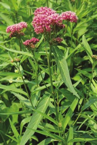
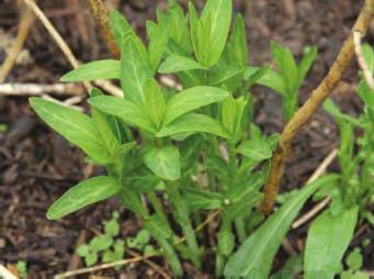
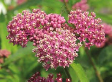
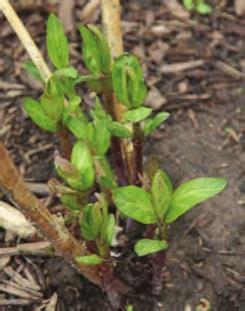
116 >$2,%4('$&(-2'1-')';0B(:2:/9CB$$8 `$(-$,&22&,/.$('8.(2$)$8.&(2&/'. a9&b$),2/'c('87)(5)('. 1"*$*'%-*D,$('8%*F%(+78%.#E7H(EE% & & GH
, a9(..&22$8*96,.$),&7&)('5$79&b$), K&$,'&.")

#&2#/1)%$6&\"(4&P'6,#1&& & & &")
117 a9(..&22$8*96,.$),&7&)('5$79&b$), `$(-$,()$,./77;2&/'.$8('8,$,,/9$3#(-$'&9$(7,.(9C4 a9&b$),#(-$'&'&./*$(a9$,*$'. & & & GI
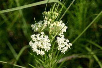

118 >$2,%4('$&:%1)(2(,,')';Z#&)9$8:/9CB$$8 @"#)#$&2#/1)%$6&S%-06&',08%,,& & & & & & & & & & & & & & & & & & & & & & G6
,g `$(-$,,:&&.#('89(*C/'5,.")

119 >$2,%4('$&$/,,(:'-)((*&0699/-('.X,:/9CB$$8 `$(-$,,:&&.#('89(*C/'5,.(9C, G:
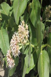
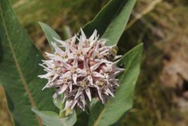
120 `$(-$,B/.#A)&(8A(,$('82&/'.$8./2 N$8:/8L-$/' & & 1"*$*'%-*D,$('8%*F%(+78%.#E7H(EE% GJ
(*.$),g `$(-$,9()5$;A)&(8('8.")
,8)&&2@b/.#.#$#&)',,.")

121 >$2,%4('$&%L',)')';1&C$:/9CB$$8 `$(-$,9()5$;A)&(8('8.(2$)$8.&(2&/'. `$(7,.$:,r.&('/'*#9&'5 `$(7(..(*#:$'.&22&,/.$ GK
$7699@(.(992().,&7.#$29('.;/'*968/'5.#$A&..&:,&7.#$9$(-$,;.#$()$( B/.#/'.#$,:(999$(-$,(..#$.&2&7.#$29('.;('8A68,('879&B$),?")
$,&7.#$$55,('8P9()-(9/',.(),A$9&B? %&'()*#A6..$)79@$55,('89()-($3*(.$)2/99(),4('8()$7&6'8&',2$*/$,&7:/9CB$$8 29('.,3>$2,%4('$,22?")
$.#('H :/99/:$.$).(99?Q@\"#)#&2#/1)%$6& E6-0'&>-01%8$R( 0-\".1Q;4(\":(@\"#$%&'(1++s<&.$.#$ 2&/'.$8,#(2$;.#$59&,,@*&9&);('8.")
-BE116(I%)+'*JFQ@\"#)#& 2#/1)%$6&>-/1'5&>51'8',R M)21(@\"#$%&'(1++($9\";*(*\"('$*&'F")
122 D441#6)a(>/("#$%&'(1++H(-$%2$1H($#6($6;-*()61#*):)&$*)"#(( J11')7.$),(3/+<<)3' N$:$:A$).#(.:&'()*#$55,('8*(.$)2/99(),*('A$#()8.&7/'8W B/.#/'.#$,:(999$(-$,(..#$.&2&7.#$29('.;('8A68,('879&B$),? T,$.#$2/*.6)$,&7.#$$55,('8P9()-(9/',.(),A$9&B? 29('.,3>$2,%4('$,22?4?%&'()*#*(.$)2/99(),5&.#)&65#P,.(5$,&78$-$9&2:$'.*(99$8 /',.(),3/996,.)(.$8A$9&B4? ( ( "#$%&'(1++("#(@)-BE116(-1$:s "#$$55/,(9/..9$:&)$.#('H :/99/:$.$).(99?Q@"#)#&2#/1)%$6& E6-0'&>-01%8$R( 0-".1Q;4(":(@"#$%&'(1++s<&.$.#$ 2&/'.$8,#(2$;.#$59&,,@*&9&);('8.#$ -$)./*(9)/85$,? Q@"#)#&2#/1)%$6&=(2"%,,%&A#,%-$B6R& "#$%&'(1++(I-1:*J($#6(.$4(9;99-1( :%"@(@)-BE116(I%)+'*JFQ@"#)#& 2#/1)%$6&>-/1'5&>51'8',R M)21(@"#$%&'(1++($9";*(*"('$*&'F %&'()*#$55,B/998$-$9&2(8()C,2&.B#$'*9&,$.&#(.*#/'5?Q@"#)#& 2#/1)%$6&U',%1(%&V:'-$#-R& H5
#&2#/1)%$6&U',%1(%&V:'-$#-R G.* ( )#.*$%( &\"#.;@)#+( 1++.'1--? a/),. /',.")
&'.('8A(*C.$'.(*9$,.#(. ()$ 8/77/*69..&,$$ B/.#.#$ '(C$8 $@$?")
' /, (' /'8/*(./&'.#(. ( :&'()*# 7/),. /',.() B(, &'.#$ 29('.? <&.$.#(.,.)/2/'5 (22$(), (7.")
9()-($#(-$( 8/,./'*. 2(..$)' &7 A9(*C; B#/.$; ('8 @$99&BA('8;('8.#$A&8@'&9&'5$) (22$(),.")
123 1++? <&.$.#$ b26889$d &78$(89()-(/'.#$A&..&:&7.#$$55? G.* ( )#.*$%( &"#.;@)#+( 1++.'1--? a/),. /',.(), ()$ )$$'/,#L5)$@ B#$'.#$@ 7/),.$:$)5$7)&:.#$$55;('8#(-$(8()C A9(*C#$(8?"#$@#(-$./'@7)&'.('8A(*C.$'.(*9$,.#(. ()$ 8/77/*69..&,$$ B/.#.#$ '(C$8 $@$? Q@"#)#& 2#/1)%$6& #7& ='16& W#,,'-0R& G.* ()#.*$%(:116)#+(6$@$+1F"#/,*/)*69() 7$$8/'5 2(..$)' /, (' /'8/*(./&'.#(. ( :&'()*# 7/),. /',.() B(, &'.#$ 29('.? <&.$.#(.,.)/2/'5 (22$(), (7.$).#$ *(.$)2/99()A$5/',.&$(.?Q@"#)#&2#/1)%$6& #7&P#9&#,,(-$R& K #6 ()#.*$%?0$*&'8/',.()9()-($#(-$( 8/,./'*. 2(..$)' &7 A9(*C; B#/.$; (22$(),.)(',2()$'. ('8,#/'@ Q@"#)#& 2#/1)%$6&=#-'12"&E'.R3 H8
$(,$/',/M$('8.#$/),.)/2$,A$*&:$:&)$ 8/,./'*.?\"#$7)&'..$'.(*9$,$S.$'8.&.#$./2&7.")
'(9*#('5$,; /'*968/'5.#$ 8$-$9&2:$'. &7 )$2)&86*.")
 9()-($ #(-$ A)/5#. @$99&B; A9(*C ('8 B#/.$,.)/2/'5 ('8.#$ 7)&'..$'.(*9$, ()$ (A&6.")
*#,9(,.,7)&:FLH]8(@,6'8$) '&):(9.$:2$)(.6)$,?\"#$,2$$8&7:&'()*# 8$-$9&2:$'./,.$:2$)(.6)$8$2$'8$'.")
124 Y %6 ( )#.*$%? "#/,.#/)8 /',.() :&'()*# #(, \6,. :&9.$8? U, :&'()*# 9()-($ 8$-$9&2;.#$@ /'*)$(,$/',/M$('8.#$/),.)/2$,A$*&:$:&)$ 8/,./'*.?"#$7)&'..$'.(*9$,$S.$'8.&.#$./2&7.#$ #$(8 A6. '&. 2(,. /. 3@"#)#& 2#/1)%$6& #7& =#-'12"&E'.4? N *' ( )#.*$%F "#$ 7)&'..$'.(*9$, '&B $S.$'8 A$@&'8.#$./2 &7.#$ #$(8? V'.$)'(9*#('5$,; /'*968/'5.#$ 8$-$9&2:$'. &7 )$2)&86*./-$,.)6*.6)$,; A$5/'.& &**6) /' 9(.$ /',.() :&'()*#,Q@"#)#&2#/1)%$6&=#-'12"&E'.R3 O *' ()#.*$%F>98$) 9()-($ #(-$ A9(*C ('8 B#/.$,.)/2/'5 ('8.#$ 7)&'..$'.(*9$, ()$ (A&6. H *:? 9&'5 Q@"#)#& 2#/1)%$6&O(2"'10&W(2B$R3 "#$%&'()#.*$%.F"#$$'./)$9()-(9,.(5$/' :&'()*#,9(,.,7)&:FLH]8(@,6'8$) '&):(9.$:2$)(.6)$,?"#$,2$$8&7:&'()*# 8$-$9&2:$'./,.$:2$)(.6)$8$2$'8$'. Q@"#)#&2#/1)%$6&=#-'12"&E'.R3 H9
C$).#(':(9$,('8#(-$B/8$)-$/',&'.#$/) B/'5,?")
79/$,()$/'79/5#. U9/5#.$8&'(29('.B/.#'&,/5'&7:(./'5;&-/2&,/./'5;&)'$*.()/'5 ]2)4\".)*)#+( U7$:(9$(869.:&'()*#()*#/'5.#$(A8&:$'('88$2&,/./'5$55,3&' :/9CB$$829('.")
125 -.8<,I&7)3C%' ( %(9$:&'()*#,#(-$(A9(*C,2&.3/'8/*(.$8A@()$8())&B4&'(-$/'&'$(*##/'8B/'5.#(./,'&.2)$,$'.&'.#$7$:(9$?"#$$'8,&7.#$(A8&:$',()$(9,&,#(2$88/77$)$'.9@/' :(9$,('87$:(9$,;('87$:(9$,&7.$'9&&C8()C$).#(':(9$,('8#(-$B/8$)-$/',&'.#$/) B/'5,? ( & $-1("#$%&'(>;**1%:-7Q@"#)#& 2#/1)%$6&=(2"%,,%&A#,%-$B6R& & T1@$-1("#$%&'(>;**1%:-7Q@"#)#& 2#/1)%$6&F'1.'1'&@#8%1$R& & I&7)3C%).8<,D(%)E+&3: T-7)#+( A1.*)#+( V'8/-/86(9A6..$)79/$,()$/'79/5#. U9/5#.$8&'(29('.B/.#'&,/5'&7:(./'5;&-/2&,/./'5;&)'$*.()/'5 ]2)4".)*)#+( U7$:(9$(869.:&'()*#()*#/'5.#$(A8&:$'('88$2&,/./'5$55,3&' :/9CB$$829('.,4 $*)#+( %(9$('87$:(9$(869.,()$&A,$)-$8*&269(./'5 L1&*$%)#+( U869.,()$(9/5#.$8&'(29('.('8(*./-$9@$S.$'8/'5.#$2)&A&,*/,/'.&( 79&B$).&&A.(/''$*.() HG
 Two monarchs flying, (circled in red; photo courtesy of Holly Holt), (B) Resting (photo courtesy of Chuck Patterson), (C) Mating (photo courtesy of Holly")
126 44 Figure 21. Monarch behavior: (A) Two monarchs flying, (circled in red; photo courtesy of Holly Holt), (B) Resting (photo courtesy of Chuck Patterson), (C) Mating (photo courtesy of Holly Holt), (D) Ovipositing (photo courtesy of Candy Sarikonda), and (E) Nectaring (note that monarch s proboscis is extended into flower; photo courtesy of Candy Sarikonda).
*#, /'.#$9()-(9;262(9;('8[&)(869.,.(5$,? t/*$)&@;e(9%-()($&'12\"(44/$& %B.(.3.E+1)A((?")
('8,/:/9() B/'52(..$)',?\"&8/77$)$'./(.$A$.B$$'.#$:;9&&C(..#$9&B$)B/'5?")
',(9,&.$'8.&A$7(,.$)('8:&)$$))(./*.")
127 I&7)3C%=8,,(36<4I+H+C' /'.#$9()-(9;262(9;('8[&)(869.,.(5$,? %B.(.3.E+1)A((?3ACC)'7O/P/?)-/,7.+*CO/P/C4/1)+.0WXYE(()+=20Z "#$%&'(")"'()*&+#',-).&#/012 HI
 have white spots scattered on the upper forewing (as shown above) (Photos courtesy of Journey North). Queen larvae have three sets of tentacles.")
128 Queen, Danaus gilippus Both queen and monarch caterpillars feed on milkweed. You can tell adults apart by looking at the forewings. Queen adults (left) have white spots scattered on the upper forewing (as shown above) (Photos courtesy of Journey North). Queen larvae have three sets of tentacles. Monarchs only have two (front and back, no middle set) (Photo courtesy of Hayley Schroeder). 46
-($#(-$@$99&B,2&.,('89(*C.#$B#/.$,.)/2$,&7:&'()*#9()-($?\"#$@$(. 29('.,/'.#$*())&.7(:/9@32(),9$@;8/99;*())&.,;$.*;4?")
129 B((?3ACCO/31.'3/'YE(()+=2/)37.+*CYE(()+=20C3?)1/)3CGFY2,1PF3O,22.O(,/2 H:
130 Appendix C: Using a GPS Unit (designed for Garmin products and PC computers) If you have access to a GPS unit, we encourage you to use it to delineate site boundaries. These instructions cover how to walk with the GPS in the field to record spatial information about your site, and download and send this information to your monitoring coordinator. We recommend practicing these steps near home before going to your field site. How to Walk with the GPS A few things to note before beginning your walk with the GPS: The GPS will track its movement wherever it goes, so make sure that you only walk along the outside boundary of the site. The GPS collects data continuously, so if you stand at the same location for a long time, it will collect multiple points at that point. Try to move at a constant, steady pace. Keep the GPS held out in front of you so you know where it is recording. Remember, it only tracks its own location, not the location of your body. Delineating Site Boundaries **Directions are for Garmin etrex 10, but most Garmin products are similar** 1) Proceed to a starting point somewhere on your site s boundary. 2) Press and hold the LIGHT button to turn on the device. 3) Ensure that it has acquired a satellite signal by checking the map. It should show where you are. You can zoom in or out using the ( ) or ( ) keys 4) Press the MENU key twice to display the Main Menu screen. 5) Highlight the Track Manager option using the toggle. 6) Press the ENTER (press the toggle straight down) to display the Tracks screen. 7) Press the ENTER on Current Track. 8) Toggle to Clear Current Track and press ENTER. Then select Yes 9) Toggle down to View Map and press ENTER. 10) Begin walking around your site (see How to Walk with the GPS directions above). You can zoom in or out to view your track. 11) Finish at the same point you started. 12) Press MENU, and return to the Track Manager page. 13) Press ENTER on Current track, then toggle up to Save Track and press ENTER. 14) Delete the default name, and enter a name that you will remember later. When the name is entered, hit Done at the bottom of the screen. 15) The GPS will ask you if you want to Clear the current track and associated trip data. This just means that it will stop recording your movement. Select Yes to save your track. 16) You can view your track by selecting it from the menu in Track Manager. 17) Turn off the GPS by pressing and holding the LIGHT button. Downloading GPS data (only compatible with PC) 48
 Search DNR GPS on your web browser, and select the link to the Minnesota DNR. Alternatively type, in the following web address: http://www.dnr.state.mn.")
 To download only tracks (aka Polygons), select the track menu along the top bar, then click Download (Track => Download). 3) Select the file (whatever you named it in the GPS) and click OK.")
131 **These directions describe one free program for downloading GPS information. If you are more comfortable with a different program, please feel free to use it.** 1. Download and install DNR GPS 1) Search DNR GPS on your web browser, and select the link to the Minnesota DNR. Alternatively type, in the following web address: 2) Scroll down until you find DNRGPS , and click on the link to download the zip file. 3) Open the zip file, and run the dnrgps Application. 2. Download data from the GPS 1) Connect the GPS to your computer using the cable it came with. 2) To download only tracks (aka Polygons), select the track menu along the top bar, then click Download (Track => Download). 3) Select the file (whatever you named it in the GPS) and click OK. Your track data should now appear in the table like this: 49
 Back in DNRGPS, go to File => Save To => File. 3) Change your save to location to the folder you just created on your desktop.")
132 3. Save data to a file 1) Create a folder on your desktop using the naming system lastname_city_state_yyyy.mm.dd. This will be empty for now, but you will save files to it later. For example: hancock_philadelphia_pa_ ) Back in DNRGPS, go to File => Save To => File. 3) Change your save to location to the folder you just created on your desktop. 4) Use dropdown menu to change Save as type to ESRI Shapefile. 5) Change the File name using the same system (lastname_city_state_yyyy.mm.dd). 6) Click Save. At the pop-up box, select Shape Type as Polygon and click OK. 4. Sending data to your monitoring coordinator 1) Files can be sent like a normal attachment, but first, they need to be compressed. 2) Address your as you would normally, and click attach files. 3) Navigate to the folder on your desktop named hancock_philadelphia_pa_ and right-click on the folder. 4) In the right-click menu, find 7-Zip=>Add to hancock_philadelphia_pa_ zip. Click OK. 5) The new.zip file is now compressed enough to send. Find it in your files, attach it in your , and send it to your monitoring coordinator 50
ECOSYSTEM CONSERVATION WORKING TABLE ACTION ITEM REPORT XX Trilateral Committee Meeting San Diego, California April 13 17, 2015
 The Working Table conducted its working session on April 13-16, 2015. The following Items were agreed upon and address the current priorities of the Trilateral Committee. o Climate Change with a Focus
Saving the Monarch Butterfly
 Saving the Monarch Butterfly Lauren Bennett September 2018 The migration of Monarch Butterflies is so spectacular that it attracts international tourism to regions of the U.S., Canada and Mexico every
Lake Manyara Elephant Research
 Elephant Volume 1 Issue 4 Article 16 12-15-1980 Lake Manyara Elephant Research Rick Weyerhaeuser World Wildlife Fund - U.S. Follow this and additional works at: https://digitalcommons.wayne.edu/elephant
Project Concept Note
 North-East Asian Subregional Programme for Environmental Cooperation (NEASPEC) 1. Overview 1. Project Title 2. Goals Project Concept Note Study on Transborder Movement of Amur Tigers and Leopards using
The new Avian Knowledge Network
 The new Avian Knowledge Network Leo Salas Point Blue Conservation Science Katie Koch U.S. Fish & Wildlife Service Chris Eberly Department of Defense Partners in Flight Outline Brief history of the AKN
The Design of Nature Reserves
 The Design of Nature Reserves Goals Maintenance of MVP s for targeted species Maintenance of intact communities Minimization of disease Considerations of reserve design 1. Disturbance regime Fire Insect
Spatial Distribution and Characteristics of At-Risk Species in the Southeast U.S.
 Nicholas Institute for Environmental Policy Solutions Scoping Document Part 2 Exploratory Analysis of Characteristics and Trends of At-Risk Species in the Southeast U.S. Spatial Distribution and Characteristics
PPCR/SC.4/5 October 9, Meeting of the PPCR Sub-Committee Washington, D.C. October 28, REVIEW OF ON-GOING WORK OF THE MDBs IN DJIBOUTI
 PPCR/SC.4/5 October 9, 2009 Meeting of the PPCR Sub-Committee Washington, D.C. October 28, 2009 REVIEW OF ON-GOING WORK OF THE MDBs IN DJIBOUTI Proposed Sub-Committee Decision The Sub-Committee reviewed
A Proposed Framework for the Development of Joint Cooperation On Nature Conservation and Sustainable Tourism At World Heritage Natural sites.
 Introduction: A Proposed Framework for the Development of Joint Cooperation On Nature Conservation and Sustainable Tourism At World Heritage Natural sites Between The tourism industry and the UNESCO, World
Voices of Mexico /July September, The monarch butterfly in the paintings of Carmen Parra
 Voices of Mexico /July September, 1995 87 The monarch butterfly in the paintings of Carmen Parra 88 VOiCes of MexiCO /July September, 1995 The monarch butterfly The monarch butterfly (Danaus plexippus
JOURNAL OF THE LEPIDOPTERISTS' SOCIETY. Volume Number 3
 JOURNAL OF THE LEPIDOPTERISTS' SOCIETY Volume 30 1976 Number 3 THE OVERWINTERING SITE OF THE EASTERN POPULATION OF THE MONARCH BUTTERFLY (DANAUS P. PLEXIPPUS; DANAIDAE) IN SOUTHERN MEXICO F. A. URQUHART
Monarch misconceptions?
 Monarch misconceptions? An entomological assessment of a popular press news article. BIO 3323 Dr. Jon Houseman February 9 th 2004 University of Ottawa In the article Butterflies face climate threat, Julianna
Dr. Melissa Grigione And Kurt Menke. Jaguar -Arturo. Jaguarundi -Arturo. Ocelot -Arturo. Caso. Caso. Caso
 Identifying Priority Conservation Areas in the U.S.- Mexico Border Region for America s Neotropical Cats, the Jaguar, Jaguarundi and Ocelot: An International Effort Dr. Melissa Grigione And Kurt Menke
THIRTEENTH AIR NAVIGATION CONFERENCE
 International Civil Aviation Organization AN-Conf/13-WP/22 14/6/18 WORKING PAPER THIRTEENTH AIR NAVIGATION CONFERENCE Agenda Item 1: Air navigation global strategy 1.4: Air navigation business cases Montréal,
Biosphere Reserves of India : Complete Study Notes
 Biosphere Reserves of India : Complete Study Notes Author : Oliveboard Date : April 7, 2017 Biosphere reserves of India form an important topic for the UPSC CSE preparation. This blog post covers all important
Labrador - Island Transmission Link Target Rare Plant Survey Locations
 27-28- Figure: 36 of 55 29-28- Figure: 37 of 55 29- Figure: 38 of 55 #* Figure: 39 of 55 30- - east side Figure: 40 of 55 31- Figure: 41 of 55 31- Figure: 42 of 55 32- - secondary Figure: 43 of 55 32-
Backgrounder Plains Bison Reintroduction to Banff National Park
 Backgrounder Plains Bison Reintroduction to Banff National Park Introduction The five-year reintroduction project is a small- scale initiative that would inform future decisions regarding the feasibility
MONTEREY REGIONAL AIRPORT MASTER PLAN TOPICAL QUESTIONS FROM THE PLANNING ADVISORY COMMITTEE AND TOPICAL RESPONSES
 MONTEREY REGIONAL AIRPORT MASTER PLAN TOPICAL QUESTIONS FROM THE PLANNING ADVISORY COMMITTEE AND TOPICAL RESPONSES Recurring topics emerged in some of the comments and questions raised by members of the
Sizing up Australia s eastern Grey Nurse Shark population
 Image: David Harasti A new estimate of adult population size for Australia s eastern Grey Nurse Shark drew on widespread genetic sampling and forensic exploration of family trees. Grey Nurse Sharks are
Underwater Acoustic Monitoring in US National Parks
 Underwater Acoustic Monitoring in US National Parks Megan F McKenna 1, Christopher Garsha 2, Erik Stabenau 1, Christine Gabriele 1, Timothy Clark 1, Clayton Pollock 1, Brinnen Carter 1, Samantha Bietsch
Species: Wildebeest, Warthog, Elephant, Zebra, Hippo, Impala, Lion, Baboon, Warbler, Crane
 INTRODUCTION Gorongosa National Park is a 1,570-square-mile protected area in Mozambique. Decades of war, ending in the 1990s, decimated the populations of many of Gorongosa s large animals, but thanks
JOSLIN FIELD, MAGIC VALLEY REGIONAL AIRPORT DECEMBER 2012
 1. Introduction The Federal Aviation Administration (FAA) recommends that airport master plans be updated every 5 years or as necessary to keep them current. The Master Plan for Joslin Field, Magic Valley
ACTION PLAN FOR THE PERIOD concerning the STRATEGY ON IMPLEMENTATION OF THE FRAMEWORK AGREEMENT ON THE SAVA RIVER BASIN
 Doc. 1S-26-O-11-5/1-2 ACTION PLAN FOR THE PERIOD 2011-2015 concerning the STRATEGY ON IMPLEMENTATION OF THE FRAMEWORK AGREEMENT ON THE SAVA RIVER BASIN April 2011 Table of Contents INTRODUCTION... 5 1.
Twelve Apostles Marine National Park Australia
 EVALUATION REPORT Twelve Apostles Marine National Park Australia Location: Victoria, Australia coastal waters Global Ocean Refuge Status: Nominated (2017), Evaluated (2017) MPAtlas.org ID: 7703885 Manager(s):
Northern Rockies District Value of Tourism Research Project December 2007
 Northern Rockies District Value of Tourism Research Project December 2007 Project Partners: Northern Rockies Regional District, Tourism British Columbia, Northern Rockies Alaska Highway Tourism Association,
TWENTY-SECOND MEETING OF THE ASIA/PACIFIC AIR NAVIGATION PLANNING AND IMPLEMENTATION REGIONAL GROUP (APANPIRG/22)
") INTERNATIONAL CIVIL AVIATION ORGANIZATION TWENTY-SECOND MEETING OF THE ASIA/PACIFIC AIR NAVIGATION PLANNING AND IMPLEMENTATION REGIONAL GROUP (APANPIRG/22) Bangkok, Thailand, 5-9 September 2011 Agenda
INTERNATIONAL CIVIL AVIATION ORGANIZATION TWENTY-SECOND MEETING OF THE ASIA/PACIFIC AIR NAVIGATION PLANNING AND IMPLEMENTATION REGIONAL GROUP (APANPIRG/22) Bangkok, Thailand, 5-9 September 2011 Agenda
Aquatic insect surveys at Mount Magazine State Park and Hobbs State Park Conservation Area with implementation of an educational component
 Aquatic insect surveys at Mount Magazine State Park and Hobbs State Park Conservation Area with implementation of an educational component Arkansas is home to a relatively large number of endemic invertebrates
Conservation Partners for the National Reserve System Program: a Western NSW focus
 Conservation Partners for the National Reserve System Program: a Western NSW focus Cooper, N. 1, Webber, L. 2, Nicolson, K. 3 1 Department of Environment, Climate Change and Water NSW, PO Box 788 Broken
Silvia Giulietti ETIS Conference Brussels An EEA reporting mechanism on tourism and environment and ETIS
 Silvia Giulietti ETIS Conference Brussels 28.01.2016 An EEA reporting mechanism on tourism and environment and ETIS Main content Why tourism and environment? Why a reporting mechanism on tourism and environment
ALBERTA S GRASSLANDS IN CONTEXT
 ALBERTA S GRASSLANDS IN CONTEXT GLOBAL GRASSLANDS 1 Temperate grasslands, located north of the Tropic of Cancer and south of the Tropic of Capricorn, are one of the world s great terrestrial biomes 2.
2004 SOUTH DAKOTA MOTEL AND CAMPGROUND OCCUPANCY REPORT and INTERNATIONAL VISITOR SURVEY
 2004 SOUTH DAKOTA MOTEL AND CAMPGROUND OCCUPANCY REPORT and INTERNATIONAL VISITOR SURVEY Prepared By: Center for Tourism Research Black Hills State University Spearfish, South Dakota Commissioned by: South
ENVIRONMENT ACTION PLAN
 ENVIRONMENT ACTION PLAN 2015 16 Airservices Australia 2015 This work is copyright. Apart from any use as permitted under the Copyright Act 1968, no part may be reproduced by any process without prior written
Factors Influencing Visitor's Choices of Urban Destinations in North America
 Factors Influencing Visitor's Choices of Urban Destinations in North America Ontario Ministry of Tourism and Recreation May 21, 2004 Study conducted by Global Insight Inc. Executive Summary A. Introduction:
Participant Presentations (Topics of Interest to the Meeting) GASP SAFETY PERFORMANCE INDICATORS. (Presented by the Secretariat) EXECUTIVE SUMMARY
 GASP SAFETY PERFORMANCE INDICATORS. (Presented by the Secretariat) EXECUTIVE SUMMARY") PA RAST/31 WP/03 19/02/18 Thirty First Pan America Regional Aviation Safety Team Meeting (PA RAST/31) of the Regional Aviation Safety Group Pan America (RASG PA) South Florida, United States, 20 to 22
PA RAST/31 WP/03 19/02/18 Thirty First Pan America Regional Aviation Safety Team Meeting (PA RAST/31) of the Regional Aviation Safety Group Pan America (RASG PA) South Florida, United States, 20 to 22
(Also known as the Den-Ice Agreements Program) Evaluation & Advisory Services. Transport Canada
 Evaluation & Advisory Services. Transport Canada") Evaluation of Transport Canada s Program of Payments to Other Government or International Agencies for the Operation and Maintenance of Airports, Air Navigation, and Airways Facilities (Also known as the
Evaluation of Transport Canada s Program of Payments to Other Government or International Agencies for the Operation and Maintenance of Airports, Air Navigation, and Airways Facilities (Also known as the
FLIGHT PATH FOR THE FUTURE OF MOBILITY
 FLIGHT PATH FOR THE FUTURE OF MOBILITY Building the flight path for the future of mobility takes more than imagination. Success relies on the proven ability to transform vision into reality for the betterment
GCRMN: An evolving approach for coral reef monitoring to support ICRI, management & policy
 GCRMN: An evolving approach for coral reef monitoring to support ICRI, management & policy Jeremy B.C. Jackson, Science Director, GCRMN Andy Hooten Global Coordinator, GCRMN Vivian Lam Deputy Coordinator,
Country Report of the Democratic People s Republic of Korea
 Country Report of the Democratic People s Republic of Korea (22 nd Session of MAB-ICC) MAB National Committee of the DPRK 2010. 4 1. Activities of the MAB National Committee The DPR Korea MAB National
Baseline results of the 5 th Wild Dog & 3 rd Cheetah Photographic Census of Greater Kruger National Park
 Baseline results of the 5 th Wild Dog & 3 rd Cheetah Photographic Census of Greater Kruger National Park H. T. Davies-Mostert 1, M. Burger 1, M.G.L. Mills 2, M. Somers 3, M. Hofmeyr 4 & S. Ferreira 5 1
PERTH ZOO S RECONCILIATION
 PERTH ZOO S RECONCILIATION ACTION PLAN 2011 2013 PERTH ZOO RECONCILATION ACTION PLAN 2011 2013 introduction At Perth Zoo we recognise, appreciate and respect the contribution of Aboriginal and Torres Strait
Agritourism Industry Development in New Jersey
 Agritourism Industry Development in New Jersey Brian J. Schilling Associate Director, Rutgers Food Policy Institute Delaware Valley Regional Planning Commission, Land Use and Housing Committee The Delaware
Monitoring the Environmental Status of the Heart of Borneo
 Monitoring the Environmental Status of the Heart of Borneo By: Stephan Wulffraat The Heart of Borneo conservation initiative has been going on now for several years and has gained increasing support from
The Challenges for the European Tourism Sustainable
 The Challenges for the European Tourism Sustainable Denada Olli Lecturer at Fan S. Noli University, Faculty of Economy, Department of Marketing, Branch Korça, Albania. Doi:10.5901/mjss.2013.v4n9p464 Abstract
What is Pimachiowin Aki? What is The Land that Gives Life?
 What is Pimachiowin Aki? What is The Land that Gives Life? Pimachiowin Aki is Canada s newest and first mixed (cultural and natural) World Heritage Site. In Anishaabemowin, the Ojibwe language, Pimachiowin
June 29 th 2015 SOS LEMURS SPECIAL INITIATIVE
 June 29 th 2015 SOS LEMURS SPECIAL INITIATIVE 1 SUMMARY FOREWORD...3 SOS LEMURS HELP US SAVE MADAGASCAR S ICONS...3 EMERGENCY ACTION PLAN...4 WHY PROTECT LEMURS?... 4 THE IUCN ACTION PLAN!... 5 GENERAL
DOWNLOAD OR READ : CORAL REEFS OF THE WORLD VOLUME 2 INDIAN OCEAN RED SEA AND GULF PDF EBOOK EPUB MOBI
 DOWNLOAD OR READ : CORAL REEFS OF THE WORLD VOLUME 2 INDIAN OCEAN RED SEA AND GULF PDF EBOOK EPUB MOBI Page 1 Page 2 coral reefs of the world volume 2 indian ocean red sea and gulf coral reefs of the pdf
Biodiversity Studies in Gorongosa
 INTRODUCTION Gorongosa National Park is a 1,570-square-mile protected area in Mozambique. Decades of war, ending in the 1990s, decimated the populations of many of Gorongosa s large animals, but thanks
BABIA GÓRA DECLARATION ON SUSTAINABLE TOURISM DEVELOPMENT IN MOUNTAIN AREAS
 BABIA GÓRA DECLARATION ON SUSTAINABLE TOURISM DEVELOPMENT IN MOUNTAIN AREAS The participants of the International Workshop for CEE Countries Tourism in Mountain Areas and the Convention on Biological Diversity",
Sawtooth National Forest Fairfield Ranger District
 United States Department of Agriculture Forest Service Sawtooth National Forest Fairfield Ranger District P.O. Box 189 Fairfield, ID. 83327 208-764-3202 Fax: 208-764-3211 File Code: 1950/7700 Date: December
Bon Portage Island Conservation Campaign
 Bon Portage Island Conservation Campaign Protecting a Coastal Treasure Final Report to Nova Scotia Habitat Conservation Fund September 2012 Protection of Bon Portage Island Over the course of this two-year
Ministry of Parks, Culture and Sport. Plan for saskatchewan.ca
 Ministry of Parks, Culture and Sport Plan for 2018-19 saskatchewan.ca Table of Contents Statement from the Minister... 1 Response to Government Direction... 2 Operational Plan... 3 Highlights... 7 Financial
4) Data sources and reporting ) References at the international level... 5
 Data sources and reporting ) References at the international level... 5") D- 1: Protected areas (PA) 1) General description... 2 1.1) Brief definition... 2 1.2) Units of measurement... 2 1.3) Context...2 2) Relevance for environmental policy... 2 2.1) Purpose... 2 2.2) Issue...
D- 1: Protected areas (PA) 1) General description... 2 1.1) Brief definition... 2 1.2) Units of measurement... 2 1.3) Context...2 2) Relevance for environmental policy... 2 2.1) Purpose... 2 2.2) Issue...
PROUDLY BRINGING YOU CANADA AT ITS BEST. Management Planning Program NEWSLETTER #1 OCTOBER, 2000
 PROUDLY BRINGING YOU CANADA AT ITS BEST VUNTUT NATIONAL PARK Management Planning Program NEWSLETTER #1 OCTOBER, 2000 INTRODUCTION This newsletter launches the development of the first management plan for
Submission to NSW Koala Strategy Consultation Process. March 2017
 Submission to NSW Koala Strategy Consultation Process March 2017 Table of contents Opening 3 Response 3 Whole-of-government NSW koala strategy 3 State Environment Planning Policy (SEPP) 44 3 The draft
Terms of Reference (ToR) for a Short-Term assignment
 for a Short-Term assignment") Terms of Reference (ToR) for a Short-Term assignment Technical assistance requested Expert for climate change mitigation and adaptation Project Title Outline of the Climate Adaptation Strategy and basin-wide
Terms of Reference (ToR) for a Short-Term assignment Technical assistance requested Expert for climate change mitigation and adaptation Project Title Outline of the Climate Adaptation Strategy and basin-wide
The results of the National Tourism Development Strategy Assessments
 The results of the National Tourism Development Strategy Assessments - 2012 (I) The assessment tool In 2012 the Sustainable Tourism Working Group of the CEEweb for Biodiversity prepared a guidance for
Protected Areas & Ecotourism
 Protected Areas & Ecotourism IUCN Best Practice Guidelines, tools & protected area/ecotourism highlights from around the world Kathy Zischka, Director Annual General Meeting Australian 2 November Committee
Parkland County Municipal Development Plan Amendment Acheson Industrial Area Structure Plan
 Parkland County Municipal Development Plan Amendment Acheson Industrial Area Structure Plan New Plan Acheson Industrial Area Structure Plan Amendment Parkland County Municipal Development Plan Board Reference
Tourism and Wetlands
 CONVENTION ON WETLANDS (Ramsar, Iran, 1971) 43 rd Meeting of the Standing Committee Gland, Switzerland, 31 October 4 November 2011 DOC. SC43-27 Tourism and Wetlands Action requested. The Standing Committee
A GUIDE TO MANITOBA PROTECTED AREAS & LANDS PROTECTION
 A GUIDE TO MANITOBA PROTECTED AREAS & LANDS PROTECTION Manitoba Wildands December 2008 Discussions about the establishment of protected lands need to be clear about the definition of protection. We will
ICAO Young Aviation Professionals Programme
 ICAO Young Aviation Professionals Programme In partnership with and The International Civil Aviation Organization (ICAO), in partnership with the International Air Transport Association (IATA) and Airports
AURORA WILDLIFE RESEARCH
 AURORA WILDLIFE RESEARCH Kim Poole 2305 Annable Rd. Nelson, BC, V1L 6K4 Canada Tel: (250) 825-4063; Fax: (250) 825-4073 e-mail: klpoole@shaw.ca 27 April 2005 Mike Gall Conservation Specialist and Glenn
Global Sustainable Tourism Destinations Criteria
 Global Sustainable Tourism Destinations Criteria Draft destination level Global Sustainable Tourism Criteria as proposed after Destinations and International Standards joint working group meeting and follow-up
Destination Orkney. The Orkney Tourism Strategy Summary
 Destination Orkney The Orkney Tourism Strategy Summary Introduction Adopted by Destination Orkney (formerly Orkney s Area Tourism Partnership), the strategy rocket is a one-page summary of the strategy
Last updated: July 22 nd, 2015
 I. Background TOTOABA (TOTOABA MACDONALDI) AND VAQUITA PORPOISE (PHOCOENA SINUS): TWO ENDANGERED SPECIES ENDEMIC TO MEXICO Last updated: July 22 nd, 2015 1. Totoaba (Totoaba macdonaldi) is a fish endemic
Appalachian Trail Sustainability Research Study
 Appalachian Trail Sustainability Research Study Appalachian National Scenic Trail 2,175 mile footpath from Maine to Georgia Crosses 14 states, 6 NPS units, and 8 National Forests, Managed by the NPS A.T.
National Wilderness Steering Committee
 National Wilderness Steering Committee Guidance White Paper Number 1 Issue: Cultural Resources and Wilderness Date: November 30, 2002 Introduction to the Issue Two of the purposes of the National Wilderness
REPORT ON THE PHOTOGRAPHIC COMPARISON OF THE SAKHALIN ISLAND AND KAMCHATKA PENINSULA WITH THE MEXICAN GRAY WHALE CATALOGUES.
 LSIESP May 2013 REPORT ON THE PHOTOGRAPHIC COMPARISON OF THE SAKHALIN ISLAND AND KAMCHATKA PENINSULA WITH THE MEXICAN GRAY WHALE CATALOGUES. J. Urbán R. 1, D. Weller 2, O. Tyurneva 3, S. Swartz 4, A. Bradford
TURTLE SURVIVAL ALLIANCE EXECUTIVE DIRECTOR
 Transforming passion for turtles into effective conservation action through a global network of living collections and recovery programs. TURTLE SURVIVAL ALLIANCE BACKGROUND TURTLE SURVIVAL ALLIANCE EXECUTIVE
ECORREGIONAL ASSESSMENT: EASTERN CORDILLERA REAL ORIENTAL PARAMOS AND MONTANE FORESTS
 ECORREGIONAL ASSESSMENT: EASTERN CORDILLERA REAL ORIENTAL PARAMOS AND MONTANE FORESTS The Nature Conservancy, EcoCiencia y Fundación AGUA. 2005. Evaluación Ecorregional de los Páramos y Bosques Montanos
MRO 2017 Stakeholder Survey
 MRO 2017 Stakeholder Survey Summary Results Conducted in October 2017 MIDWEST RELIABILITY ORGANIZATION 380 St. Peter Street, Ste.800 St. Paul, MN 55102 P: 651.855.1760 F: 651.855.1712 www.midwestreliability.org
SHIP MANAGEMENT SURVEY. January June 2018
 CENTRAL BANK OF CYPRUS EUROSYSTEM SHIP MANAGEMENT SURVEY January June 2018 INTRODUCTION The Ship Management Survey (SMS) is conducted by the Statistics Department of the Central Bank of Cyprus and concentrates
UNEP/CMS/MS3/Doc.5/Annex ANNEX: CONSERVATION AND MANAGEMENT PLAN
 CMS/Sharks/MOS1/Inf.10 UNEP/CMS/MS3/Doc.5/Annex ANNEX: CONSERVATION AND MANAGEMENT PLAN The objectives and actions described in this Annex are non-binding and are included for the consideration of the
FRANCE : HOW TO IMPROVE THE AVALANCHE KNOWLEDGE OF MOUNTAIN GUIDES? THE ANSWER OF THE FRENCH MOUNTAIN GUIDES ASSOCIATION. Alain Duclos 1 TRANSMONTAGNE
 FRANCE : HOW TO IMPROVE THE AVALANCHE KNOWLEDGE OF MOUNTAIN GUIDES? THE ANSWER OF THE FRENCH MOUNTAIN GUIDES ASSOCIATION ABSTRACT : Alain Duclos 1 TRANSMONTAGNE Claude Rey 2 SNGM The French Mountain Guides
ASSEMBLY 39TH SESSION
 International Civil Aviation Organization WORKING PAPER 22/6/16 ASSEMBLY 39TH SESSION EXECUTIVE COMMITTEE Agenda Item 31: Other high-level policy issues to be considered by the Executive Committee THE
Workshop on Guiana Shield Biodiversity Corridor to streamline support for the achievement of the Aichi Biodiversity Targets
 Workshop on Guiana Shield Biodiversity Corridor to streamline support for the achievement of the Aichi Biodiversity Targets ACTION PLAN Preamble: We, the participants of the workshop called, Guiana Shield
REDD+ IN YUCATAN PENINSULA
 REDD+ IN YUCATAN PENINSULA JOINING FORCES TO PRODUCE AND PRESERVE 2 3 Campeche, Yucatan, and Quintana Roo combat deforestation together in the Yucatan Peninsula and build a new path for growth A peninsular
Draft LAW. ON SOME AMENDAMENTS IN THE LAW No.9587, DATED ON THE PROTECTION OF BIODIVERSITY AS AMENDED. Draft 2. Version 1.
 Technical Assistance for Strengthening the Capacity of the Ministry of Environment, Forests and Water Administration in Albania for Law Drafting and Enforcement of National Environmental Legislation A
Partial Report. Project Leader: Nicolás Lagos. Executive Summary
 Partial Report Understanding the relationship between the Andean cat and its habitat in the high Andes plateau: Implications for its long term conservation Project Leader: Nicolás Lagos Executive Summary
Environment and Natural Resources Trust Fund 2017 Request for Proposals (RFP)
") Project Title: Total Project Budget: $ Environment and Natural Resources Trust Fund 2017 Request for Proposals (RFP) Floating Classroom: Connecting 20,000 Youth to Minnesota Waterways Category: Proposed
Project Title: Total Project Budget: $ Environment and Natural Resources Trust Fund 2017 Request for Proposals (RFP) Floating Classroom: Connecting 20,000 Youth to Minnesota Waterways Category: Proposed
RE: Access Fund Comments on Yosemite National Park Wilderness Stewardship Plan, Preliminary Ideas and Concepts
 September 30, 2016 Superintendent Yosemite National Park Attn: Wilderness Stewardship Plan P.O. Box 577 Yosemite, CA 95389 RE: Access Fund Comments on Yosemite National Park Wilderness Stewardship Plan,
Northern Pacific Sea Star
 Northern Pacific Sea Star The Northern Pacific Seastar http://www.marine.csiro.au/leafletsfolder/01npseastar.html Reproduced with permission of Craig Macaulay, CSIRO http://www.marine.csiro.au/leafletsfolder/01npseastar.html
What is an Marine Protected Area?
 Policies, Issues, and Implications of Marine Protected Areas Kara Anlauf University of Idaho Before the House Subcommittee on Fisheries Conservation, Wildlife and Oceans April 29, 2003 What is an Marine
DRONE SIGHTINGS ANALYSIS AND RECOMMENDATIONS
 DRONE SIGHTINGS ANALYSIS AND RECOMMENDATIONS UNMANNED AIRCRAFT SAFETY TEAM DRONE SIGHTINGS WORKING GROUP DECEMBER 12, 2017 1 UNMANNED AIRCRAFT SAFETY TEAM DRONE SIGHTINGS WORKING GROUP EXECUTIVE SUMMARY
Quarterly Newsletter for WWF Caucasus and CEPF jointly supporting biodiversity conservation in the Caucasus
 Newsletter Hot in this issue: Black Sea Sturgeon October-December 2008 Quarterly Newsletter for WWF Caucasus and CEPF jointly supporting biodiversity conservation in the Caucasus Highlighted in issue:
STEM 1/22/2014 DRAFT COPY 1. STEM careers exist across all 16 CTE career clusters. Stimulate School Field Trips with STEM
 Introduction Objectives: Develop a better understanding of STEM Develop a closer connection to state standards Outline resources to help link enhance your program Stimulate School Field Trips with STEM
The Conservation Contributions of Ecotourism Cassandra Wardle
 The Conservation Contributions of Ecotourism Cassandra Wardle PhD Candidate, Gold Coast, Australia Supervisors: Ralf Buckley, Aishath Shakeela and Guy Castley State of the Environment State of the Environment
Mapping the Snout. Subjects. Skills. Materials
 Subjects Mapping the Snout science math physical education Skills measuring cooperative action inferring map reading data interpretation questioning Materials - rulers - Mapping the Snout outline map and
Barents Euro-Arctic Council Tenth Meeting of the Ministers of the Environment 9 November 2011 Umeå. Declaration
 Barents Euro-Arctic Council Tenth Meeting of the Ministers of the Environment 9 November 2011 Umeå Declaration Environment Ministers and senior representatives of Finland, Norway, the Russian Federation,
Keeping Wilderness Wild: Increasing Effectiveness With Limited Resources
 Keeping Wilderness Wild: Increasing Effectiveness With Limited Resources Linda Merigliano Bryan Smith Abstract Wilderness managers are forced to make increasingly difficult decisions about where to focus
Kosovo Roadmap on Youth, Peace and Security
 Kosovo Roadmap on Youth, Peace and Security Preamble We, young people of Kosovo, coming from diverse ethnic backgrounds and united by our aspiration to take Youth, Peace and Security agenda forward, Here
W2B Koala Management Case Study
 W2B Koala Management Case Study Scott Lawrence Environment Manager Pacific Highway Woolgoolga to Ballina Pacific Highway Upgrade Located northern NSW, Australia 155km in length high speed dual carriageway
Spatial Assessment for the revised Mpumalanga Biodiversity Expansion Strategy. Mervyn Lotter Scientific Services 8 June 2016
 Spatial Assessment for the revised Mpumalanga Biodiversity Expansion Strategy Mervyn Lotter Scientific Services 8 June 2016 Mpumalanga Protected Area Expansion Strategy (MPAES) Developed our first MPAES
HOTFIRE WILDLIFE MANAGEMENT MODEL A CASE STUDY
 1 HOTFIRE WILDLIFE MANAGEMENT MODEL A CASE STUDY Sub-theme: Economics / business venture, livelihood strategies Format: Poster Bruce Fletcher Hotfire Hunting and Fishing Safaris P O Box 11 Cathcart 5310
COMMUNICATION AND AWARENESS-RAISING STRATEGY
 MEMORANDUM OF UNDERSTANDING ON THE CONSERVATION OF MIGRATORY SHARKS CMS/Sharks/Outcome 3.5 14 December 2018 3 rd Meeting of the Signatories (Sharks MOS3) Monaco, 10 14 December 2018 COMMUNICATION AND AWARENESS-RAISING
MAPPING UNSHELTERED HOMELESSNESS IN INDIANAPOLIS ISSUE C17-20 NOVEMBER 2017
 MAPPING UNSHELTERED HOMELESSNESS IN INDIANAPOLIS ISSUE C17-20 NOVEMBER 2017 AUTHOR Chris Holcomb, Graduate Student, School of Public and Environmental Affairs, IUPUI 334 N. Senate Avenue, Suite 300 Indianapolis,
Saving Sharks Proposing a New Marine Protected Area
 Saving Sharks Proposing a New Marine Protected Area What would be the ideal characteristics of a marine protected area designed to conserve white sharks in the Pacific Ocean? Learning Objectives Describe
Iceland. Tourism in the economy. Tourism governance and funding
 Iceland Tourism in the economy Tourism has been among the fastest-growing industries in Iceland in recent years and has established itself as the third pillar of the Icelandic economy. Domestic demand
International Civil Aviation Organization SECRETARIAT ADMINISTRATIVE INSTRUCTIONS ON THE IMPLEMENTATION OF THE ICAO CIVIL AVIATION TRAINING POLICY
 International Civil Aviation Organization SECRETARIAT ADMINISTRATIVE INSTRUCTIONS ON THE IMPLEMENTATION OF THE ICAO CIVIL AVIATION TRAINING POLICY 1. INTRODUCTION (22 July 2015) 1.1 These administrative
Federal Outdoor Recreation Trends Effects on Economic Opportunities
 United States Department of Agriculture Federal Outdoor Recreation Trends Effects on Economic Opportunities The Forest Service National Center for Natural Resources Economic Research is assisting the Federal