Mawson Group Centre. Master Plan NOVEMBER 2015
|
|
|
- Leona Johnson
- 5 years ago
- Views:
Transcription

1 Mawson Group Centre Master Plan NOVEMBER 2015
2 ISBN Australian Capital Territory, Canberra 2015 This work is copyright. Apart from any use as permitted under the Copyright Act 1968, no part may be reproduced by any process without written permission from: Director-General, Environment and Planning Directorate, ACT Government, GPO Box 158, Canberra, ACT Telephone: Website: Printed on recycled paper Accessibility The ACT Government is committed to making its information, services, events and venues as accessible as possible. If you have difficulty reading a standard printed document and would like to receive this publication in an alternative format, such as large print, please phone or the Environment and Planning Directorate at epd_communications@act.gov.au If English is not your first language and you require a translating and interpreting service, please phone If you are deaf, or have a speech or hearing impairment, and need the teletypewriter service, please phone and ask for the ACT Government on For speak and listen users, please phone and ask for ACT Government on For more information on these services visit
3 Contents Definitions ii Executive summary 1 1. Introduction Master plan study area Block and section map What a master plan does Master plan process 8 2. Planning context Strategic planning Statutory planning Spatial context Planning history Background and analysis Community engagement Character and heritage Demographics Land use Transport and movement Public domain Athllon Drive Yarralumla Creek Environmental sustainability Challenges and opportunities Challenges Opportunities The master plan Master plan structure Vision Character statement Planning principles Spatial framework Planning strategies Recommendations for implementation The process of change Territory Plan Variation Land release Public domain upgrades Further studies Commercial opportunities Endnotes 84 planning.act.gov.au i
4 Definitions Active frontages occur when people can interact between the buildings and the streets and public spaces, such as shop fronts, building entrances and transparent building facades. Active travel is travel that involves physical activity such as walking and cycling. Active travel can also include the walking and/or cycling involved when using public transport. Active uses are uses that generate activity at the ground floors. Active uses include cafes, shop fronts and building entrances. Blocks and Sections are how areas of land are identified in the ACT. The city is divided into divisions, suburbs, sections and blocks. The Territory Plan zoning determines what activities/uses can occur on the blocks. Blocks are usually leased to one entity. Built form relates to the buildings, associated structures and surrounding public spaces. Human scale reflects a sympathetic proportional relationship between the built form and human dimensions where people are not overwhelmed by the built form. Human scale contributes to a person s perception of buildings or other features in the public domain. It is typically referred to when discussing the bulk and scale of development. Land use zones are allocated by the Territory Plan to all land within the ACT that define what land uses can or cannot occur on a piece of land. Zone categories are residential (RZ), commercial (CZ), community facility(cfz), industrial (IZ), parks and recreation (PRZ), transport and services (TSZ), and non urban (NUZ). Sub-categories provide more specific controls, for example RZ1 is a residential zone for low density housing in suburban areas while RZ5 is a residential zone for high density housing in urban centres and along major transport routes. See more about the zoning system at Mixed-use involves a development that includes a mix of complementary land uses. This can include a horizontal and vertical mix. Podium or building base refers to the lower storeys of a tall building that people passing by see and interact with. It is designed to present an appropriate human scale to the streets and public spaces. Podiums can be used to transition down to lower-scale buildings, and minimise the impact of parking and servicing areas. Shared-use path is a path that is restricted to nonmotorised transport with the exception of motorised wheelchairs and power assisted pedal cycles. Both pedestrians and cyclists share these paths. Shared zone/shared spaces is a road or place where the road space is shared safely by vehicles, pedestrians and cyclists. A shared zone may include the removal of traffic lights, pedestrian barriers, road markings and kerbs to give equal priority to all users and require negotiation between users. Solar access is the ability of a building or public space to receive sunlight without obstruction from other buildings. Surveillance or passive surveillance is the eyes on the street from residents and people going about their daily activities to create a sense of safety onto streets and public spaces. Urban grain is the street pattern, size and distribution of blocks, scale of buildings and their relationship to each other. Urban grain includes the hierarchy of streets, the pedestrian connections, public places and linkages to public transport. Water sensitive urban design is the planning, design or construction of the built environment to minimise water runoff and ensure any runoff causes the least amount of damage. It is also about the wise use of that water to improve our urban environment. Main street is often the primary retail street of a centre. It is usually a focal point for shops, retailers and socialising.

5 Mawson centre artwork

6 Aerial photograph looking towards the centre,
7 Executive summary The ACT Government has prepared master plans for Woden town centre and Mawson group centre, including the Athllon Drive corridor between these centres. While both centres have been considered together throughout the master plan process, two master plans have been prepared as each area has its own community interests, characteristics, opportunities and challenges. This master plan for the Mawson group centre (the centre) sets out a vision, planning principles, spatial framework and planning strategies to guide growth and development in the centre over time. This master plan has been produced in response to actions outlined in the ACT Planning Strategy (2012). The relevant actions identified the need to review the Woden Master Plan (2004) and prepare a master plan for Mawson group centre, inclusive of the Athllon Drive corridor, to initiate development that will support strategies for active travel and rapid public transport along Athllon Drive. Preparation of this master plan involved extensive background research and analysis, including: consideration of strategic planning directions and policies responding to outcomes from two stages of community and stakeholder engagement activities that were undertaken as part of the master plan process, and consideration of background research, reports and analysis. The key findings for the Mawson group centre include: it benefits from the rapid transport which runs along the Athllon Drive corridor it could become a significant public transport hub for Canberra the centre is highly convenient and accessible due to its proximity to rapid public transport and the availability of surface car parking there is potential for residential development to be introduced in the centre in general it has poor pedestrian and cyclist connections which could be improved pedestrian and cycle connections from the centre to the existing public transport facilities on Athllon Drive need improvement, and it has limited after-hours activity. In response to these findings, this master plan outlines a vision which captures what is valued about the Mawson group centre and sets out what it could become in the future. Mawson group centre will be an attractive, accessible, convenient centre offering a diverse range of goods, services and transport and housing options. It will be a centre that is able to evolve in the future as the community s needs and demands change. The vision is supported by six planning principles, which inform the planning strategies. The principles and strategies provide direction and guidance for the future development of the centre over the long term, considering the broad range of issues identified during community engagement and in the background research and analysis. Some of the key recommendations proposed by this master plan include: supporting the establishment of the centre as a public transport hub improving pedestrian and cyclist connections to and through the centre and in particular from public transport facilities on Athllon Drive into the centre encouraging the introduction of a mix of uses, particularly residential, which will increase activity at all times of the day, and reserving land for an additional supermarket and structured car parking if demand for these facilities is identified in the future. planning.act.gov.au 1

8 Cafe and shops in the centre core
9 1. Introduction In 2012, key strategic planning documents for the ACT were introduced, including the ACT Planning Strategy, Transport for Canberra and AP2: A New Climate Change Strategy and Action Plan for the ACT. The ACT Planning Strategy encourages a more compact city by focusing urban intensification in town centres, around group centres and along the major public transport routes. The ACT Planning Strategy identified Mawson group centre and Woden town centre for investigation in association with the Athllon Drive rapid transit corridor. This master plan and the Woden Town Centre Master Plan have been prepared as a result. As part of the master planning process, in February 2014 the ACT Government released a discussion paper outlining some of the key planning issues for both Mawson and Woden centres to help generate discussion and draw out the community s concerns and ideas. Considering the centres together allowed for comprehensive analysis of a diverse range of strategic planning issues and consideration of the relationship between the two centres. Because each centre has its own community interests, characteristics, opportunities and challenges, a seperate master plan has been prepared for each centre. The plans were guided by the ACT Planning Strategy, Transport for Canberra, the climate change strategy, extensive background analysis and, where appropriate, the issues and ideas raised during community engagement. The ACT Government released the Mawson Group Centre Draft Master Plan for community engagement in January Feedback received from the draft master plan engagement has been used to prepare this final plan. The Mawson Group Centre Master Plan sets out a vision, planning principles, spatial framework and planning strategies that will guide growth and development in the Mawson group centre (the centre) over time. 1.1 Master plan study area The study area covered by the Mawson Group Centre Master Plan is illustrated by the dashed red line shown in Figure 1 and 2. The study area for the review of the 2004 Woden Town Centre Master Plan is illustrated by the dashed blue line in Figure 1. Situated in the suburb of Mawson in the Woden Valley, the area is bound to the west by Athllon Drive (an arterial road connecting the Woden town centre to Tuggeranong town centre in the southwest), to the north by Mawson Drive, to the east by Mountevans Street and to the south by Beasley Street. This master plan considers the impact on, and connections to surrounding residents, facilities, transport and public spaces although they lie outside the master plan area. Since the draft master plan was released, the Mawson District Playing Fields have been added to the master plan study area as they provide important pedestrian and cyclist connections to the centre. The centre is approximately 2 kilometres south of the Woden town centre, and approximately 1 kilometre south of the Phillip service trades area. The suburb of Farrer is to the south and Torrens to the west. There are views from the centre to Mount Taylor in the west. 1.2 Block and section map Under the Territory Plan, Canberra is divided into divisions, suburbs, sections and blocks, with blocks usually leased to one entity. Blocks and sections are referred to in this document. Figure 3 provides a quick reference to help the reader identify blocks and sections within the master plan area. Figures 1 and 2 illustrate the master plan study areas. planning.act.gov.au 3
 O MALLEY PEARCE MAWSON Mawson study area Mawson group centre TORRENS metres 0 100 200 300 400 500 FARRER 4")
10 Athllon Drive Figure 1: The Woden and Mawson master plan study areas HUGHES LYONS Phillip Oval Yamba Drive Eddison Park Woden study area GARRAN Woden town centre Westfield The Canberra Hospital Canberra CIT Hindmarsh Drive CHIFLEY Phillip service trades area SWINGER HILL (PHILLIP) O MALLEY PEARCE MAWSON Mawson study area Mawson group centre TORRENS metres FARRER 4 Mawson Group Centre Master Plan

11 Athllon Drive Figure 2: The Mawson Group Centre Master Plan study area PEARCE MAWSON Mawson Drive Park and Ride Mawson group centre Mawson study area Supermarket Southlands Tennis Club TORRENS Mawson District Playing Fields Beasley Street metres FARRER planning.act.gov.au 5
12 Figure 3: Block and section map LEGEND Section boundary 10 Section number Block boundary 10 Block number 9 Hurley Street PEARCE Athllon Drive Mawson Drive Mawson Place MAWSON Yarralumla Creek Heard Street 25 Wilkins Street TORRENS 12 Beasley Street BLOCK AND SECTION MAP FARRER Scale: 3.5:1 6 Mawson Group Centre Master Plan

13 1.3 What a master plan does A master plan defines what is important about a place and identifies opportunities for preserving and enhancing the quality of that place. A master plan offers town and group centres long-term planning frameworks for urban renewal and is guided by key actions and strategies identified in the ACT Planning Strategy for a more compact and efficient city by focussing urban intensification in these areas. This master plan provides a vision, a spatial framework and strategies to guide the development of the Woden town centre over the next 20+ years. A master plan is a non-statutory planning document that can recommend the following: Planning policies Potential changes and inclusions in the Territory Plan take the form of a new precinct code. The Territory Plan is the key ACT statutory planning document that provides the policy framework for the administration of land use and planning in the ACT. It specifies what can and cannot happen on each block of land. A precinct code sits within the Territory Plan and provides place-specific planning controls. This master plan is informed by community input and makes recommendations for a new precinct code for the Mawson group centre about appropriate land use, building heights, building setbacks and location of active frontages. Opportunities for land release Land release is the sale of Territory-owned land. The supply and release of land in the ACT considers factors such as forecast population changes, household changes, demand for land and the capacity to cost effectively deliver key infrastructure and services. Public domain upgrades Infrastructure and public space improvements are required to realise the vision and some of the strategies of this master plan. There are opportunities for the private sector to contribute to the public domain through partnerships with the government or as part of off-site works. Works undertaken by the ACT Government will involve further investigations by various government agencies and funding consideration through future government budget bids. Public domain upgrades that are undertaken by the ACT Government are based on a number of considerations including population growth, the age of existing assets and infrastructure and the wider budget context within the Territory. Further studies These may be required to progress some strategies that are either outside of what a master plan can achieve or that may take more time to investigate. Aerial photograph of the Mawson group centre, planning.act.gov.au 7
14 1.4 Master plan process The master plan process includes three main stages as illustrated in Figure 4, with opportunities for stakeholders and the public to provide input during stages 1 and 2 of the master plan process. The process commenced with Stage 1, which involved the gathering and analysis of information, including community engagement, to help inform the preparation of the draft master plan. The draft master plan represented Stage 2 of the process. Feedback on the draft master plan was sought from stakeholders and the community and used to inform Stage 3, the development of this final master plan. The implementation of the master plan may include new planning controls in the form of a precinct code in the Territory Plan, potential land release, public domain upgrade recommendations and potential further studies. Figure 4 shows how the preparation of a precinct code runs concurrently with the master planning process Community engagement Community engagement forms a critical part of the analysis in the early stages of the master planning process and in refining recommendations in the draft master plan. The background and analysis section of this master plan and the community engagement reports for stages 1 and Stage 2 provide details of how community engagement has been undertaken and a summary of feedback received. The community engagement reports, which include a summary of messages heard from each stage of community engagement, can be seen at: wodenandmawson Figure 4: The master plan process Stage 2 Stage 1 Stage 3 Engagement with key stakeholders and directorates Master Plan Process Background analysis and scope project Project launch and discussion paper. Seek community input for 6 weeks Prepare draft Master Plan Community engagement on draft Master Plan, for 6 weeks Prepare final Master Plan considering input from stakeholders and community Final Master Plan Preparation of draft Precinct Code and variation to the Territory Plan Implementation Precinct code, land release, further studies and public domain upgrades which will be subject to future government budget processes. 8 Mawson Group Centre Master Plan

15 Meet the planners session at the Mawson group centre

16 Shops in the centre core
17 2. Planning context 2.1 Strategic planning The Mawson Group Centre Master Plan is a strategic policy document that seeks to translate the ACT Government s broader metropolitan policies at a local level. Figure 5: ACT Planning Strategy focuses growth in town centres, around group centres and along transport corridors The following section outlines the policy context that applies to the Mawson group centre ACT Planning Strategy The ACT Planning Strategy (2012) was prepared in response to changes in the ACT s economic, demographic and environmental circumstances. The strategy outlines a series of directions that will create a more sustainable city: focusing urban intensification in town centres and group centres supported by public transport to improve the vibrancy of centres improving the urban quality and liveability of Canberra managing the land and natural resources of the area to conserve where appropriate and to manage growth to ensure a prosperous region, and supporting convenient access to a range of facilities, services and opportunities for social interaction by reinforcing the role of group centres as community hubs. The ACT Planning Strategy s first direction is of particular relevance to this process and promotes a more compact and efficient city by focussing urban growth in town centres, around group centres and along main transit corridors, as illustrated in Figure Transport for Canberra Transport for Canberra (2012) is a companion policy to the ACT Planning Strategy. It seeks to integrate urban planning and transport to improve services in Canberra over the next 20 years. Key policy directions include: integrating land use and transport through the Frequent Network of public transit corridors making walking and cycling the easiest travel options to encourage active travel, and strategically managing the road network and parking. In addition the importance of building an Integrated Transport Network will help to improve the efficiency and effectiveness of Canberra s transport network. Integrated transport networks generate economic opportunities and jobs. They are also a catalyst for creating vibrant and attractive urban environments Climate change action plan AP2: A New Climate Change Strategy and Action Plan for the ACT (2012) is the ACT Government s strategic policy on climate change. AP2 guides the Territory s strategy to reduce greenhouse gas emissions by 40% of 1990 levels by 2020 and to transition the ACT to zero net emissions by AP2 provides a pathway to achieve emission reductions through energy efficiency and increased use of renewable energy. It also identifies opportunities for improved environmental performance of buildings and infrastructure. planning.act.gov.au 11
18 The projections for the ACT and region are for an increasingly hotter and drier climate with more extreme weather events. Since 2009 the ACT Government has been taking mitigation actions and assisting the community to increase its resilience. Examples of significant mitigation measures are: legislating emission reduction targets for the ACT in 2010: zero by 2060; 80% by 2050; 40% by 2020 (based on 1990 levels) investing in renewable energy sources (solar and wind) to meet the ACT s renewable energy target of 90% by 2020 (introduced in 2013) introducing the Energy Efficiency Improvement Scheme obliging ACT electricity retailers to help customers save energy adopting the Carbon Neutral ACT Government Framework with its target of zero net operational emissions by 2020, and investing in public transport, including Capital Metro light rail, and improving the cycle and pedestrian networks ACT water strategy The ACT Water Strategy : Striking the Balance was endorsed by the ACT Government in July The strategy incorporates three themes and a detailed implementation plan. It will guide the management of the Territory s water supply, water resources and catchment practices over the next 30 years. It builds on the original ACT Water Strategy, Think Water, Act Water. While the emphasis on the original strategy was on water security following the 2003 bushfires and the Millennium Drought, the new strategy will also focus on improved water quality in lakes and streams and greater community participation in a number of key components, such as improving catchment health. 2.2 Statutory planning National Capital Plan The National Capital Plan is the strategic plan for the ACT that is managed by the National Capital Authority. It ensures that Canberra and the Territory are planned and developed in accordance with their national significance. The National Capital Plan includes designated areas, which are areas considered to be of national importance and include the central national area, national institutions, diplomatic areas, Lake Burley Griffin, approach routes to the city and hills, ridges and buffers. While there is no designated land within the master plan area, the Woden Valley has large areas, such as the hills, ridges and buffers that separate the Woden Valley from other districts. There is also designated land within the suburb of O Malley to the north-east of the master plan study area Territory Plan The Territory Plan is the key statutory planning document in the ACT, providing the policy framework for the administration of land use and planning in the ACT. The purpose of the Territory Plan is to manage land use change in a manner consistent with strategic directions set by the ACT Government, Legislative Assembly and the community. The centre is mostly zoned as Commercial Zone 1: Core Zone (CZ1: Core Zone), Commercial Zone 2: Business Zone (CZ2: Business Zone) and Commercial Zone 3: Services Zone (CZ3: Services Zone) as shown in Figure 11. Land directly north of Mawson Drive is zoned as Parks and Recreation Zone 1: Urban Open Space (PRZ 1: Urban Open Space). A Territory Plan variation to implement a new precinct code into the Territory Plan will be an outcome of this master plan. A precinct code outlines place specific planning controls such as land use, building heights, building design elements, building setbacks and where active frontages should be located. 12 Mawson Group Centre Master Plan
19 2.3 Spatial context Canberra is a planned city. In the 1960s the National Capital Development Commission, through the Metropolitan Plan for Canberra, identified several districts outside the central area for development. Woden was the first district to be developed under this approach. Canberra has a clearly defined centre hierarchy of town, group and local centres. Each district was planned taking this hierarchy of commercial centres into consideration. This structure was intended to help develop strong communities that have good access to services and jobs, and to reinforce Canberra s relationship with its setting. Town centres generally serve their wider district as the main commercial focus. Group centres provide shops and services for a group of suburbs and traditionally cater for the weekly shop. Group centres were introduced in the early 1960s in response to the emergence of supermarket retailing in Australia. Group centres of this era are often located near high schools and district playing fields and community facilities such as libraries and churches. Local centres typically cater for a single suburb. The ACT Planning Strategy (2012) supports the centres hierarchy approach, which encourages a more compact city by focusing urban intensification in town centres, around group centres and along the major public transport corridors. The Mawson group centre is situated in Woden Valley, in the suburb of Mawson. The centre is one of two group centres (Mawson and Curtin) in the Woden Valley District (Figure 6). 2.4 Planning history Initially, development of the centre was planned for However, following a slowdown in development in Woden Valley at that time, the National Capital Development Commission delayed the centre s development until Original planning saw the principle function of the centre being to provide weekly grocery shopping to the surrounding suburbs of Mawson, Farrer, Torrens and Pearce. The centre is also the closest group centre for the suburbs of Isaacs and O Malley. In size and function the centre was anticipated to compare with the Dickson group centre. The first shop opened in 1971 and the Woolworths supermarket opened in December At that time it was the largest supermarket in the ACT. planning.act.gov.au 13

20 Figure 6: Spatial context for the Mawson group centre National Aboretum Canberra City Centre Molonglo Valley Curtin Group Centre Parliament House Red Hill Kingston Foreshore Fyshwick Light Industrial Area Weston Creek The Canberra Hospital Woden town centre Mt Taylor Isaacs Ridge Mawson group centre 5 Kilometres Erindale group centre Hume Industrial Area Tuggeranong town centre kilometres Mawson Group Centre Master Plan

21 Aerial photograph looking over the Mawson group centre towards the Woden town centre,

22 Courtyard in the centre core
23 3. Background and analysis 3.1 Community engagement Community engagement for the Mawson Group Centre Master Plan included two main stages. Each stage informed the master plan as it evolved Stage 1 February to April 2014 For the first stage of community engagement, Mawson group centre and Woden town centre were investigated concurrently. This allowed for comprehensive analysis and consideration of metropolitan transport and land use relationships, and infrastructure for the area. Stage 1 community engagement activities included stakeholder interviews, information displays and meet the planners sessions, presentations to the Woden Valley Community Council and lessee and traders meetings. These activities helped identify key issues, challenges and opportunities for each of the centres. Approximately 300 people participated. Key messages from Stage 1 of community engagement for the Mawson group centre included: generally, there was broad support for more residential and mixed-use development and increasing building heights at the edges of the centre, with a focus on good quality built form outcomes residential infill within the centre core received a lower level of support, with respondents preferring that the current low scale of the buildings in this area be retained the convenient shopping, diversity of shops and smaller-scale character of the centre is greatly valued and attracts people to this centre the centre looks tired, untidy and dated. Its central spaces and public facilities are in need of modernisation improvements to the public domain including furnishings, landscaping, pavement, community gathering spaces, children play spaces and shelter from the weather would be beneficial safety and night-time lighting needs to be addressed in the centre pedestrian and cycle access needs to be improved to and within the centre including along Mawson Place, Heard Street, Mawson Drive and Athllon Drive, as well as through the surface car parks, and improved traffic management is needed for Mawson Place and Heard Street to slow down traffic, improve lines of sight and make it safer for pedestrians and cyclists to cross the streets. Further information on community feedback can be found in the Community Engagement Report Stage 1 available at Where appropriate, these key messages and relevant background information informed the development of the draft master plan Stage 2 January to March 2015 Stage 2 of community engagement sought community feedback on the draft master plan over a six week period. Engagement activities included stakeholder interviews, a presentation to the Woden Valley Community Council, information displays and meet the planner sessions and completion of feedback forms. Approximately 215 people attended the meet the planner sessions, held in the courtyard at Southlands Shopping Centre, Mawson and 85 feedback forms were completed. Twenty individual submissions were also received on the Mawson Group Centre Draft Master Plan. Key messages from Stage 2 of community engagement for the Mawson group centre included: general support for the proposals in the draft master plan pedestrian and cycle connections to and throughout the centre require improvement, with some comments suggesting the master plan required more detail on this the public spaces within the group centre require enhancement and maintenance there was concern over solar access, public amenity and privacy if building heights in the centre were allowed to increase there were mixed views regarding the proposed building heights in the draft master plan, with particular concerns raised regarding proposals for new development up to six storeys and a proposed landmark building of eight storeys. Some comments suggested that development over four storeys was too high, while others indicated their support for the proposed heights, and planning.act.gov.au 17
24 Athllon Drive Figure 7: Current character precincts Yarralumla Creek Centre core precinct Hurley Street PEARCE Mawson Drive Mawson group centre Clubs precinct Mawson Place precinct Mawson Place MAWSON Southlands Tennis Club Yarralumla Creek Mawson District Playing Fields Heard Street Open space and sports precinct TORRENS Wilkins Street Scale: 3.5:1 18 Mawson Group Centre Master Plan Beasley Street FARRER CURRENT CHARACTER PRECINCTS
25 there was a diversity of views regarding the potential provision of an additional full-line supermarket within the centre. Some people suggested it was not necessary while others suggested a smaller format supermarket provider would be more appropriate. Further information on community feedback from the engagement can be found in the Community Engagement Report Stage 2 available at Where appropriate, these key messages informed the development of this master plan Further engagement Community engagement will also be undertaken on any variation to the Territory Plan through a separate community consultation process. 3.2 Character and heritage Character The Mawson group centre is made up of four distinct character precincts as shown in Figure 7. These precincts are identifiable by their location, land use, built form, street address and streetscapes: The Mawson Place precinct is a mix of service trades uses (such as service stations), on-street dining, office and back of house activities. There are many small tenancies along Mawson Place with low scale buildings of one to two storey buildings. The centre core precinct is a diverse range of commercial spaces which face onto internal (pedestrian only) walkways and courtyards. Like Mawson Place, tenancies in the centre core are generally small and buildings are one or two storeys. The clubs precinct is characterised by four clubs, one of which is closed, and an office building which fronts onto a large surface car park. This precinct is subject to significant level changes, with three clubs sitting higher than the surface car park, making their scale feel more imposing. Tenancies are larger than elsewhere in the centre. The open space and sports precinct is composed of the Southlands Tennis Club and Mawson District Playing Fields. The playing fields are heavily used by the broader community Heritage The buildings in the centre do not exhibit a high standard of architectural interest. Following a study of buildings, places and artworks to assess the potential for new heritage nominations, no buildings, places or artworks with heritage significance were identified. 3.3 Demographics Population Growth and change in Canberra s population will generate demand for housing, offices, retailing, services, community facilities and associated infrastructure. At September 2014 the population of the ACT was estimated to be 387,000 1 and projected to reach 430,400 by 2021 and 493,500 by Currently there are no dwellings or residents living in the master plan area. 3 Data for the suburb of Mawson shows the population is slowly growing 4 and is expected to continue to do so. 5 With an estimated median age of 40.7 years, Mawson has an older population than the rest of the ACT, which has an estimated median age of 34.5 years. 6 Historic trends to date suggest Mawson will continue to age (Table 1). Table 1: Changes in percentage of population aged over 65 years 7 Percentage of population aged over 65 years Year Mawson ACT Australia % 6.1% 11.3% % 7% 12% % 8.3% 12.6% % 9.7% 13.3% % 10.7% 14% planning.act.gov.au 19
26 Figure 8: Snap shot of Mawson group centre POPULATION Travel to work Population in ACT , , ,500 Population in Mawson , , ,075 40% of employees who work in Mawson live in Woden Valley MEDIAN AGE 40.7 Median age in Mawson 40.2 Median age in Woden Valley 34.5 Median age in ACT Employment 750 Approximate jobs in Mawson 11% of employees work in accommodation and food services 16% of employees work in health care 28% of employees work in retail 36% of employees who work in Mawson travel from Tuggeranong Car ownership 9.3% of Mawson residents own no car 6.2% of ACT residents own no car 41.1% of Mawson residents own one car 36.7% of ACT residents own one car 20 Mawson Group Centre Master Plan
27 The need to support an older population has implications for the provision of facilities and services and the design of the public domain, which will need to meet the needs of a diverse population and respond to issues such as mobility and access. Providing housing close to services and facilities is another way an ageing population can be supported Employment Employment data relating specifically to the Mawson group centre is not available. However, on the 2011 Census night there were 751 people employed in Mawson. It is assumed many of these jobs are based in the group centre. Of these 751 people, 28% were employed in retail trade, 16% in health care and social assistance and 11% in accommodation and food services. Of those working in Mawson, 2011 Census data found 40% live in the Woden Valley. As the Woden Valley is approximately 7 kilometres north to south and 4 kilometres east to west, many people who work in Mawson live within walking or cycling distance of their jobs. 3.4 Land use Land custodianship The centre is leased by a mix of private leaseholders and the ACT Government (Figure 9). A key function of this master plan is to provide opportunities for private leaseholders to redevelop and contribute to a better public domain. This master plan identifies where it is appropriate to sell unleased Territoryowned land and what type of land use should occur on those blocks. Unleased land is managed by the ACT Government; in the centre it is mainly in the form of three large surface car parks (Figure 10) Commercial and retail The centre serves the surrounding suburbs of Mawson, Farrer, Torrens, Pearce, O Malley and Isaacs. This catchment has a population of approximately 14,750 people. The centre currently has three different commercial zones (Figure 11). The centre core, zoned as CZ1: Core Zone, is primarily occupied by a variety of commercial activities including a full-line supermarket, smaller food shops, delicatessens, butchers, bakeries, cafes and takeaway shops, post office, newsagent, chemists, a gym and travel agents. Land to the east of the centre core, zoned as CZ2: Business Zone, includes the Mawson Club, Masonic Club, Austrian Australia Club and now closed Serbian Club, which is no longer being used as a public building. The car park adjoining Woolworths to the south and the land to the west of Mawson Place is zoned as CZ3: Services Zone. Existing uses within this zone include cafes, takeaways, two service stations, offices and a surface car park. In 2011 the centre had approximately 19,500 m 2 of retail floor space. 8 There are a number of vacant tenancies in the centre core, particularly towards the northern end. The amount of retail floor space supportable at the centre in the future is dependent on a number of variables including: population growth in the centre s catchment the growth in per capita retail expenditure, and new retail development in other centres. Having regard to these factors, economic analysis anticipates that an additional supermarket could be viable in the longer term. This could be a full-line supermarket or one of a smaller size. The variables listed above will need to be monitored to ensure an additional supermarket of an appropriate size is not developed before the demand exists. 8 planning.act.gov.au 21
28 Figure 9: Land custodianship Yarralumla Creek LEGEND Leased Territory land Private Lease - Public Land TAMS - Public Land TAMS - Public Places TAMS - Other Unleased Assets TAMS - Vacant (other) TAMS - Roads PEARCE Athllon Drive Mawson Place Hurley Street Mawson Drive MAWSON Yarralumla Creek Heard Street Wilkins Street TORRENS Beasley Street LAND CUSTODIANSHIP FARRER 22 Mawson Group Centre Master Plan

29 Figure 10: A surface car park in the centre Residential There is currently no residential development in the centre. This absence of residential development currently contributes to limited night-time activity and passive surveillance, which means the centre can feel unsafe at night. There is no land within the centre specifically zoned for the purposes of residential development. However, CZ1: Core Zone, CZ2: Business Zone and CZ3: Services Zone do allow for residential development. Given the centre s proximity to frequent public transport services and the variety of facilities and services available, the centre is considered an ideal location for new residential development. Feedback during community engagement generally supported this type of development Community facilities There is currently no land zoned as Community Facilities Zone: Community Facility (CFZ1: Community Facility) in the master plan study area. However, there are two general practitioner surgeries in the commercial zones. Community facilities in the wider suburb of Mawson include child care centres, schools and places of worship (Figure 12). Melrose High School and Marist College sit to the north-west of the centre on the opposite side of Athllon Drive. Woden town centre plays an important district and regional role in providing essential services. planning.act.gov.au 23
30 Figure 11: Territory Plan Land Use Zones LEGEND CZ1: Core CZ2: Business CZ3: Services PRZ1: Urban Open Spaces TSZ1: Services Intertown Public Transport Route 9 Mawson Place Hurley Street PEARCE Athllon Drive Mawson Drive MAWSON Heard Street 25 Wilkins Street TORRENS Beasley Street FARRER TERRITORY PLAN LAND USE ZONES 24 Mawson Group Centre Master Plan
31 Figure 12: Community facilities MAWSON LEGEND Aged care Childcare Community services Education Licensed clubs Medical facilities Places of worship Outdoor recreation facilities Playgrounds Community facility zoned land PEARCE Mawson Drive Athllon Drive Mawson group centre Wilkins Street MAWSON Southlands Tennis Club Heard Street TORRENS Mawson District Playing Fields COMMUNITY FACILITIES Beasley Street FARRER planning.act.gov.au 25

32 Figure 13: Mawson District Playing Fields Sport and recreation facilities Land to the south of the centre, currently zoned as PRZ1: Urban Open Space, accommodates the Southlands Tennis Club and Mawson District Playing Fields. Southlands Tennis Club is a not-for-profit, community operated club with four synthetic courts and a club house. The Mawson District Playing Fields, one of the most heavily used in Canberra, are used for soccer, cricket and softball and are home to the Woden Valley Soccer Club and the Woden Valley Softball Club. The playing fields can be accessed by vehicle off Beasley Street and Heard Street. Two sealed surface car parks and two pavilions, both with a canteen, change rooms and toilets, service the playing fields (Figure 13). 3.5 Transport and movement Public transport The centre is situated alongside Athllon Drive, a major public transport corridor serviced by the Blue Rapid, a high frequency bus link between town centres in Canberra. There are Blue Rapid bus stops just to the north and south of the Athllon Drive Mawson Drive/Beasley Street intersection. Park and Ride and Bike and Ride facilities adjoin the bus stop to the south of Mawson Drive (Figures 14 and 15), with the Park and Ride being one of Canberra s most heavily used. However, the facilities have poor passive surveillance and are considered unsafe after dark. The facilities were upgraded in 2011 and 2012 to provide additional car spaces and a bike cage. The Park and Ride facility is accessed via a connecting road from Mawson Place. Pedestrian access between the centre and the Park and Ride and bus stops on Athllon Drive is unpleasant and indirect. Many pedestrians use an informal path that crosses Yarralumla Creek and passes through the service station (Figure 16). A number of bus routes run through the Mawson group centre. The only bus stops in the centre are located on Heard Street opposite the Mawson Club (Figures 14 and 19). 26 Mawson Group Centre Master Plan
33 Athllon Drive Figure 14: Public transport Yarralumla Creek LEGEND Rapid transit route Local services Rapid Bus Stops Local Bus Stops P P Bike and Ride Park and Ride Hurley Street PEARCE P P Mawson Drive Mawson Place Mawson group centre 6 min 500m MAWSON Southlands Tennis Club Heard Street Yarralumla Creek Mawson District Playing Fields Wilkins Street TORRENS Beasley Street PUBLIC TRANSPORT FARRER planning.act.gov.au 27
.")
34 Figure 15: Park and Ride and Bike and Ride facilities Light Rail Master Plan The Light Rail Master Plan is currently investigating the potential for the expansion of a light rail network across Canberra. The outcomes of the Light Rail Master Plan will inform future decision making about extensions to Capital Metro Stage 1 (between the city centre and Gungahlin). The master plan builds on work already undertaken on light rail and integrated land use and transport planning, and delivers on government policies including Transport for Canberra and the ACT Planning Strategy Active travel Travel that involves physical activity such as walking and cycling is referred to as active travel. Census data from 2011 indicates that relative to the rest of the ACT, Mawson has a higher proportion of households that either do not own a vehicle or have only one vehicle (Figure 8). This indicates a higher reliance on active travel and public transport than the average household in Canberra. Table 2: New 2016 mode share target (journey to work) from Transport for Canberra 2012 Mode 2006 actual 2011 target NEW 2016 target 2026 target Walking 5% 6% 6.5% 7% Cycling 2.5% 5% 6% 7% Public transport 7.9% 9% 10.5% 16% Within the centre core, pedestrians are well provided for with pedestrian crossings in accessible locations (Figure 17). Cyclist access from northern and southern suburbs is via a shared-use path that runs along Athllon Drive. Cyclists also benefit from Bike and Ride facilities in the form of bicycle lockers and cages located at the Park and Ride (Figure 17). Provision for future pedestrian and cycling infrastructure must cater to this higher reliance and respond to the targets set within Transport for Canberra (2012) (Table 2) and encourage a diverse range of the community to easily access the centre by walking or cycling. 28 Mawson Group Centre Master Plan

35 Figure 16: Informal pedestrian access to the centre from public transport facilities on Athllon Drive Access to the centre is difficult and unpleasant for both pedestrians and cyclists. This is despite pedestrians being well provided for once they are within the centre and cyclists having access to cycling infrastructure next to the centre. Significant barriers to access include: Large road reserves for Athllon Drive and Mawson Drive make it difficult and unsafe for those coming from the west and north to access the centre (Figure 18). The vital north south shared-use path does not connect, with the path ending on the northern side of Mawson Drive and not starting again until the eastern side of the Mawson District Playing Fields just off Heard Street (Figure 18). This makes it difficult, particularly for cyclists, to navigate through and around the centre. The Mawson District Playing Fields offer no passive surveillance or activation and no formalised paths for people with disabilities or limited mobility (Figure 18). Yarralumla Creek, which has been converted to a concrete channel, runs parallel to the west of the centre and acts as a considerable barrier to pedestrians and cyclists coming from the Park and Ride and western suburbs such as Torrens. The creek has very few constructed crossing points, but several informal dirt tracks cut between the centre and suburbs to the west, indicating where people naturally walk. In heavy rains these crossing points are impassable and dangerous (Figure 16 and 18). There is one path running alongside the Masonic Club and the Mawson Club but due to stairs is not appropriate for cyclists or those with limited mobility. planning.act.gov.au 29
36 Figure 17: Pedestrian and cyclist movement PEARCE Yarralumla Creek Hurley Street LEGEND P Car-free squares Pedestrian crossing Bike and Ride On-road cycle lanes Formal pedestrian paths Shared-use path (pedestrian and cyclist path) Shared-use path (pedestrian and cyclist path) ends Underpass Pedestrian bridge Mawson Drive P Mawson group centre MAWSON Athllon Drive Mawson Place 6 min 500m Southlands Tennis Club Yarralumla Creek Mawson District Playing Fields Heard Street TORRENS Wilkins Street Beasley Street FARRER PEDESTRIAN AND CYCLIST MOVEMENT 30 Mawson Group Centre Master Plan
37 Mawson Place Figure 18: Pedestrian and cyclist barriers Yarralumla Creek LEGEND Arterial and local roads Yarralumla Creek concrete channel Informal dirt tracks Level changes A Apartment block barrier Existing service stations Hurley Street PEARCE Mawson Drive Mawson group centre A A MAWSON A Athllon Drive Southlands Tennis Club Yarralumla Creek Mawson District Playing Fields Heard Street TORRENS Wilkins Street Beasley Street FARRER PEDESTRIAN AND CYCLIST BARRIERS planning.act.gov.au 31

38 3.5.3 Road network and traffic Mawson group centre is convenient for people to drive to by private car. The 2011 Census data 9 shows that approximately 90% of people travelling to the centre were either car drivers or passengers. Feedback from community engagement found that there is a need to improve traffic management on Mawson Place, Mawson Drive and Heard Street by slowing traffic and improving lines of sight so it is safer for pedestrians and cyclists to cross these roads Car parking Community engagement confirmed that existing parking in the centre works well as it is free, easy to access and makes access to the centre very convenient. A parking inventory prepared for the centre identified 1086 car parking spaces, including parking in the Park and Ride facility. 9 Parking surveys were conducted 7am 7pm on a Thursday and Saturday of a pension payment week in June Table 3 outlines the occupancy of parking across the centre. The key findings of the surveys found: no medium-term (3 to 6 hours) parking in the centre parking demand peaked with a demand of 636 spaces (68% occupancy) at 1pm on Thursday, and a demand of 532 spaces (57% occupancy) at 2pm on Saturday high demand for very short-term parking (less than 1 hour) on Thursday (93% occupancy) high demand for short-term parking (1 to 2 hours) on Thursday (85% occupancy), and moderate demand for long-term parking (unrestricted hours) on Thursday and Saturday (50% occupancy). Figure 19: Bus stop on Heard Street 32 Mawson Group Centre Master Plan
39 Athllon Drive Figure 20: Active frontages LEGEND Active frontage Inactive frontage Yarralumla Creek Hurley Street PEARCE Mawson Drive Mawson group centre Mawson Place MAWSON Southlands Tennis Club Yarralumla Creek Mawson District Playing Fields Heard Street Wilkins Street TORRENS Beasley Street ACTIVE FRONTAGES FARRER planning.act.gov.au 33
 and permit parking Other (bus stops, loading zones, accessible parking) Thursday demand (occupancy) Saturday demand (occupancy) 93% 76% 85% 45% - - 52% 50% 90% 55% 44% 32% TOTAL 68% 57%")
40 Table 3: Current parking demand in the Mawson group centre Parking restriction Less than 1 hour (very short-term) 1 to 2 hour (short-term) 3 to 6 hour (medium-term) Unrestricted (long-term) Reserved (private) and permit parking Other (bus stops, loading zones, accessible parking) Thursday demand (occupancy) Saturday demand (occupancy) 93% 76% 85% 45% % 50% 90% 55% 44% 32% TOTAL 68% 57% NOTE: Typically, parking demand in publicly available parking areas greater than 85% for on-street areas and 90% for off-street areas represents a situation where drivers cannot easily find vacant parking spaces. 3.6 Public domain Streets, parks and public spaces Key public spaces and streets in the centre include Mawson Place, the centre core and bus stops on Athllon Drive and the associated Park and Ride facilities. Generally, a good level of active frontage currently exists in the centre as shown in Figure 20. This is a sign the centre is functioning well. However, most of the shops are typically open during the day, with the centre quieter in the evenings and after hours on weekends. This means public spaces and streets can feel isolated and unsafe after hours. Mawson Place Mawson Place functions include: access to on-street parking vehicular, pedestrian and cyclist access to the Park and Ride facilities on Athllon Drive access to two service stations access to the car park south of Woolworths and back of house access and frontage for a number of shops. Figure 21: Courtyard in the centre core 34 Mawson Group Centre Master Plan

41 The verge on the western side of Mawson Place is approximately 6 metres wide and benefits from plenty of sunshine, which facilitates the on-street dining already occurring there. The eastern side of Mawson Place, where a number of shops have back of house activity and access, has a narrow verge. This has resulted in an untidy and unpleasant place for pedestrians. Figure 22: Courtyard in the centre core Mawson Place generally has poor pedestrian amenity. As it has no formal crossing points it is currently a barrier to pedestrians and cyclists trying to access the centre core and eastern side of the centre. During community engagement participants were asked if they supported the idea of making Mawson Place into a main street. Feedback from Stage 1 and 2 of community engagement indicated that respondents generally support making Mawson Place into a main street. Centre core The centre core benefited from public domain upgrades in 2003, yet this area is now considered tired and run down. The centre core has extensive internal (pedestrian only) walkways and courtyards. Two of these courtyards are considered particularly significant as meeting places (Figures 21 and 22). Many small retail tenancies face onto these walkways and courtyards, which creates activity. The courtyards benefit from plenty of sunshine in winter and tree shade in summer, making them attractive spaces to spend time in and helping to create a village atmosphere in the centre core. During community engagement, 87% of respondents said they use the courtyards in the centre core. Of these, 15% use these courtyards daily and 34% weekly, indicating these spaces are well used. There are a number of blank walls, hidden corners and vacant tenancies in the centre core which reduce the feeling of safety. Bus stops on Athllon Drive, Park and Ride and Bike and Ride The bus stops on Athllon Drive and the associated Park and Ride and Bike and Ride are between 50 and 100 metres to the west of the centre. This distance is enough that these public transport facilities are isolated and may feel unsafe at night. In addition, walking between the bus stops and the centre is indirect and unpleasant. planning.act.gov.au 35

42 3.6.2 Green spaces The main green space benefiting the centre is the Mawson District Playing Fields to the south. Considering the proximity and size of these playing fields and the informal recreation spaces along Athllon Drive, formal green space is not essential in the centre. However, public spaces within the centre such as courtyards and streets could benefit from improved landscaping Building design and height Buildings in the centre core were constructed in the early to mid-1970s and have a particular look and feel typical to that era. Many buildings have porticos (a roof structure over a walkway supported by columns), giving a consistent theme throughout the centre core. This building design provides shelter for pedestrians (Figure 23). Buildings throughout the centre are generally one to two storeys, consistent with the Territory Plan provisions that only allows for buildings of two storeys in the centre (Figure 24). Feedback forms for Stage 2 of community engagement asked if respondents supported the building heights proposed in the draft master plan. The proposed heights ranged from two to eight storeys. Of the 85 feedback forms completed, 51% agreed with the proposed heights, 37% disagreed and 12% were neutral. Additional comments regarding building heights found: a diversity of views regarding appropriate building heights for the centre. Some comments suggested the centre should be limited to two storeys or up to six storeys while other comments indicated support for increased building heights greater concern over solar access, privacy and public amenity rather than building heights themselves further agreement with the proposed building heights, particularly if any redevelopment is designed sensitively, and some concern about allowing eight storeys to be developed on the southern corner of Athllon Drive and Mawson Drive intersection Public safety A Community Safety Assessment undertaken in 2013 to inform this master planning process found the key safety issues are: major barriers which restrict safe access to the centre i.e. Athllon Drive, Mawson Drive and Mawson District Playing Fields unsafe open spaces with no passive surveillance i.e. Mawson District Playing Fields unsafe pedestrian access and connectivity to adjoining residential areas such as Mawson, Farrer, Torrens and Pearce unsafe public transport facilities with no nearby land uses to provide passive surveillance poor maintenance and management of the public domain, and lack of land use mix which means the centre lacks activity after business hours. These safety issues discourage pedestrian and cyclist movement to and through the centre, particularly at night when activity is limited. Figure 23: Porticos and columns in the centre core 36 Mawson Group Centre Master Plan
43 Figure 24: Existing building heights LEGEND 1 Storey * 2 Storey Yarralumla Creek Hurley Street PEARCE Mawson Drive * * Mawson group centre Athllon Drive Mawson Place * * * * * * MAWSON Southlands Tennis Club Yarralumla Creek Mawson District Playing Fields Heard Street Wilkins Street TORRENS Beasley Street EXISTING BUILDING HEIGHTS FARRER planning.act.gov.au 37
44 3.7 Athllon Drive The Athllon Drive corridor is identified in the ACT Planning Strategy as an area to be investigated for residential urban intensification. Currently the corridor is a rapid transit route lined mostly with residential land use zoning (RZ2: Suburban Core). Figure 25 illustrates the existing land use zones and key landscape elements along the corridor. Some key elements in the Athllon Drive corridor include the north south shared-use path, Yarralumla Creek, existing large stands of trees and several bus stops as shown in Figure 25. The Blue Rapid bus service runs along Athllon Drive. The existing Residential Zone 2: Suburban Core land use zone along the corridor does not provide a sufficient housing density to support rapid transit. This master plan considers opportunities for higher density residential development along the corridor and how it could be integrated with the existing informal recreation spaces, trunk cycle routes and public transport stops. If the Athllon Drive corridor is developed, it is important that essential elements are retained and enhanced, including: the shared-use path keeping high quality trees where possible providing a green buffer between the existing residential areas and any new development enhancing the open space, and improving the Yarralumla Creek waterway. 3.8 Yarralumla Creek In February 2014, the Australian Government signed an agreement with the ACT Government for funding to improve the water quality in Canberra s lakes and waterways. As part of this agreement, Yarralumla Creek was identified as one of six priority sub-catchments that can provide the greatest improvements in water quality at a local, regional and national level. Currently the creek exists as a constructed channel. A comprehensive options study will identify recommended water quality improvement measures for design and implementation. A business plan outlining recommendations will be submitted to ACT and Commonwealth Governments in late 2015, seeking approval of substantial funding. Funding, if approved by the Commonwealth, would be available for design and construction from May 2016 until early Flooding Areas close to the Yarralumla Creek stormwater channel, including development, have the potential to be impacted by flooding. Planning for areas close to the creek line, including along Athllon Drive, will need to ensure no buildings are built below the 1 in 100 year flood line or 1% annual exceedance probability (1% AEP) flood. Because floods greater than 1% AEP can occur, an additional 500 millimetres is recommended to be added to the 1% AEP level for residential development. Predicted flood levels can change from time to time due to changes in development areas within catchments and as climate change data and modelling is improved. The ACT Government has recently completed a flood study for Yarralumla Creek. Options to reduce flooding impacts along the creek line are now being investigated and include flood mitigation benefits of a wetland or pond within the Athllon Drive corridor (Figure 25) and use of the Mawson District Playing Fields for detention of stormwater. 38 Mawson Group Centre Master Plan
45 Hurley Street Figure 25: Athllon Drive land use and landscape Melrose Drive Hindmarsh Drive PHILLIP Service Trades Ainsworth Street LEGEND Yarralumla Creek Shared-use path (pedestrian and cyclist path) Pedestrian connections Existing stands of trees Underpass Pedestrian bridge Existing residential zoning Existing open space zoning Existing bus stop Townshend Street Road ends CHIFLEY Parramatta Street Woden study area Wide road reserve is a pedestrian barrier PEARCE Potential site for wetland/ offline pond MAWSON Athllon Drive Mawson Drive TORRENS Mawson group centre LAND USE AND LANDSCAPE Wilkins Street Mawson study area planning.act.gov.au 39
46 3.9 Environmental sustainability Sustainability is critical to the landscaped and built environment. ACT Government policies and strategies provide guidance for integrating sustainability measures into our urban environment. The following are key environmental sustainability principles to be considered in master plans and their implementation. Climate Change Responding to climate change takes two forms: Mitigation reduce greenhouse gas emissions by minimising use of fossil fuels for heating, cooling and transport, and increase the efficiency of energy use. Adaptation is taking action to be resilient to the risk of a changing climate. Resources consumption Reduce the amount of land used for the growing city through urban renewal and intensification. Reduce the amount of energy and water used in urban environments and invest in living (green) infrastructure. Respect and conserve natural and cultural heritage. Respect and conserve the significant landscapes and its features. Enhance biodiversity with habitat connectivity. Buildings Improve the design and construction of buildings. Increase choice in housing to meet diverse needs. Urban planning and design Reduce reliance on private vehicles. Create opportunities for social interactions. Integrate passive solar design principles into building and site design. Reduce the heat island effect in urban areas and improve microclimate through landscape design. Master plans provide opportunities to address climate change adaptation at a place-specific scale. The projections for the ACT and region are for an increasingly hotter and drier climate with more extreme weather events. The place-based risks to people and assets from a hotter and drier climate are heat, severe storms (flash flooding) and bushfire. Options to address these risks may include: 1. Reduce city heat and increase amenity in outdoor spaces for healthy living Increase shade trees to roadways and car parks. Use light coloured pavements. Increase shade to pathways and parklands for human comfort and wellbeing. Include seats and drinking fountains with water bottle recharge taps. Increase use of vegetation. 2. Reduce city heat and achieve cooler buildings Design buildings, streets and parks to be climate wise. This means improving the design and choice of materials for the built environment that can lessen the effects of climate change. Use solar passive design. Use light coloured materials. Introduce green infrastructure such as green roofs and walls. 3. Intense rain events Reduce runoff from impermeable surfaces within the sub-catchment. Capture and use rainwater/stormwater in redevelopment projects. Retrofit roadside kerb and gutter systems using water sensitive urban design. 4. Reduce the risk of bushfire in urban areas Initiate an asset protection zone. Ensure no continuity of fuel from the ground to the crown of the tree. Plan for emergency service access. The following opportunities were identified to incorporate environmental sustainability measures in the master plan. 40 Mawson Group Centre Master Plan
47 3.9.1 Energy The ACT Sustainable Energy Policy stated objectives are to achieve: reliable and affordable energy; smarter use of energy; cleaner energy; and growth in the clean economy. A district energy system could contribute to achieving these objectives and could be commercially viable with a commercial/residential development or expansion. District energy systems produce electrical energy locally and use waste heat from electricity generation to heat and cool buildings. Electricity and/or thermal energy are generated close to where it is used. Energy systems such as co-generation (electricity and heat) or trigeneration (electricity, heat and cooling) need the combination of commercial and residential uses to be efficient as the load for commercial is during the day and the load for residential is generally out of hours. The use of such energy systems can achieve social, economic and environmental benefits. A district energy system in Mawson could provide an alternative cleaner energy for the centre and contribute to a sustainable future. Further investigations would be required to determine if a district energy system would be viable, how it could be delivered and in context of future budgets processes Heat island effect An urban heat island is a metropolitan area which is significantly warmer than its surrounding areas. The main cause of the heat island effect is from the use of materials which store and radiate heat in to the surrounding areas such as concrete and bitumen. Thermal comfort can significantly change the way we use outdoor areas. Urban environments, such as the Mawson group centre, contain significant areas of concrete and asphalt in the roads and footpaths. Higher temperatures may be acceptable in the cooler months, but some urban environments can become uncomfortable in summer. The built environment can be designed to reduce the urban heat island effect with the use of lighter building materials, shade structures and permeable surfaces. Large canopy trees can provide shade in the warmer months and cooling through transpiration Water Water is an important natural resource that is under significant pressure from population growth and climatic conditions. There is also a need to reduce broader social, economic and environmental costs associated with potable water distribution. The irrigation for a number of playing fields in the ACT has been switched off due to water restrictions for potable water. The potable water consumption for domestic or commercial use could be minimised if other solutions were investigated such as the use of stormwater and rainwater. planning.act.gov.au 41

48 Cafes on Mawson Place
49 4. Challenges and opportunities The main challenges and opportunities identified for the centre are outlined below. This list is not exhaustive, but provided a basis for the development of this master plan. 4.1 Challenges Poor pedestrian and cyclist connections Major roads, Yarralumla Creek, the Mawson District Playing Fields, level changes, gaps in the north south shared-use path, existing apartment blocks and the layout of the shops along Mawson Place make it difficult and unpleasant for pedestrians and cyclists accessing the centre from the surrounding suburbs of Mawson, Farrer, Torrens, Pearce and beyond (Figure 26). Access from the centre to the public transport facilities on Athllon Drive is limited due to Yarralumla Creek and the location of a service station Multiple building lessees A number of buildings in the centre have multiple lessees. This makes redevelopment challenging as all lessees need to agree before a site can be redeveloped Limited after-hours activity There is little to no night-time activity or presence in the centre core as: businesses tend to operate only during daylight hours and there is no residential development in the centre. There is some limited night-time activity associated with the clubs along the eastern side. Limited night-time activity and a lack of passive surveillance can create streets and public spaces that are perceived to be unsafe at night Vacant tenancies There are a number of vacant tenancies in the centre core, particularly towards the northern end near Mawson Drive (Figure 26). This is partially due to the major anchor store, Woolworths, being located at the southern end of the centre core. Major anchor stores tend to attract the most foot traffic, which then passes nearby tenancies and makes them attractive to prospective tenants. More distant tenancies do not benefit from this passing trade so are less attractive to potential tenants An ageing population As identified in section 3.3.1, the suburb of Mawson has an older population than the rest of the ACT and is expected to continue to age in the future. Catering for an ageing population introduces a number of matters for consideration, including: accessibility to services, facilities and transport ensuring those with mobility issues are well provided for, and ensuring provision of residential development which allows for ageing in place. 4.2 Opportunities Establish a public transport hub The demand analysis undertaken for the Light Rail Master Plan to date indicates there is potential demand for light rail in Mawson. In the future, light rail could help build on the centre s developing role as a public transport hub (Figure 27). All future development and redevelopment should be supportive of establishing the centre as a public transport hub. This will involve: protecting future public transport alignments ensuring sufficient space is left for additional Park and Ride facilities allowing residential development to provide the population density necessary to support potential future light rail allowing for a diverse range of businesses that support pedestrian movements to and from the public transport facilities at all hours, and ensuring new development and redevelopment improves pedestrian and cyclist connections to and from public transport facilities through building design and by introducing mid-block pedestrian links in strategic locations Maintain convenience and accessibility The centre is highly accessible due to the availability of adequate surface car parking and Blue Rapid bus services along Athllon Drive. As the centre develops and redevelops, it will be critical to maintain a level of short, medium and long-term car parking for convenience and accessibility. There is also an opportunity to introduce structured parking into the centre (Figure 27). planning.act.gov.au 43
50 Figure 26: Challenges PEARCE Yarralumla Creek Hurley Street Mawson Drive LEGEND Pedestrian and cyclist barriers Major intersection Poor connections Inactive frontages Limited night-time surveillance Some vacant tenancies Yarralumla Creek Playing fields Level changes Shared-use path (pedestrian and cyclist path) ends Mawson group centre Athllon Drive Mawson Place MAWSON Southlands Tennis Club Yarralumla Creek Mawson District Playing Fields Heard Street Wilkins Street TORRENS Beasley Street CHALLENGES FARRER Scale: 3.5:1

51 Pedestrian connections to and from the public transport facilities on Athllon Drive should also be improved to allow people to safely and easily access the centre Allow for residential development Many sites in the centre offer the opportunity for residential development in the form of apartments. The ACT Planning Strategy supports the introduction of residential development into Canberra s commercial centres to encourage activity in the evenings, provide new commercial opportunities and housing choice, and improve the city s sustainability Improve pedestrian and cyclist connections Many sites in the centre are suitable for development and redevelopment (Figure 27). There is an opportunity to improve pedestrian and cyclist connections to and through the centre by requiring new development to: incorporate or reinforce pedestrian and cyclist links overlook pedestrian and cyclist links to improve passive surveillance to address safety concerns, and provide safe and direct pedestrian and cyclist links from the centre core to major attractors such as public transport facilities near the centre. There is also opportunity for future projects, such as public domain upgrades, to improve pedestrian and cyclist access into the centre and to ensure the north south shared use path is connected Sustainable development and design to reduce energy, water and car use Features like Yarralumla Creek have the potential to provide new recreation spaces and better connections to the centre. Benefits include encouraging people to walk and cycle, improving water quality and reducing impacts of major flood events along the creek line. Opportunities for water sensitive urban design in the public spaces of the centre could help filter pollution out of stormwater and support new plantings. The built environment can be designed to reduce the urban heat island effect with the use of lighter building materials and permeable paving materials, and by increasing shade for summer with shading structures and trees on main pedestrian routes and in public places. Improvements to the bus stops will make public transport more accessible to a wider range of the community to help provide improved transport choice to the centre and the wider city. This could have flow-on effects to reduce private vehicle use and traffic congestion, and to improve air quality. Shops in the centre core planning.act.gov.au 45
52 Athllon Drive Figure 27: Opportunities PEARCE Yarralumla Creek Hurley Street Mawson Drive LEGEND Allow for new residential and mixed-use development Allow for new parking structure Connect existing shared-use path (pedestrian and cyclist path) Improve pedestrian and cyclist connections Improve public domain Enhance recreational space Establish transport hub Mawson group centre Mawson Place MAWSON Southlands Tennis Club Yarralumla Creek Mawson District Playing Fields Heard Street Wilkins Street TORRENS Beasley Street OPPORTUNITIES FARRER 46 Mawson Group Centre Master Plan

53 Centre core

54 Courtyard in the centre core
55 5. The master plan 5.1 Master plan structure The master plan structure indicates how the planning strategies and policies support achievement of the vision and principles (Figure 28). 5.2 Vision The vision for the Mawson group centre was developed with feedback from the community. It captures what is valued about the centre and sets out what the centre could be in the future. Mawson group centre will be an attractive, accessible, convenient centre offering a diverse range of goods, services and transport and housing options. It will be a centre that is able to evolve in the future as the community s needs and demands change. Figure 28: Master plan structure Vision Character statement Planning principles Spatial framework Planning strategies and policies Implementation planning.act.gov.au 49
56 Athllon Drive Figure 29: Proposed character precincts Yarralumla Creek LEGEND 1 Mawson Place precinct 2 Centre core precinct 3 Mixed-use precinct 4 Public transport precinct 5 Open space and sports precinct Car parking Yarralumla Creek Hurley Street PEARCE 4 Mawson Drive 1 Mawson group centre 3 4 Mawson Place 2 MAWSON Southlands Tennis Club Yarralumla Creek 5 Mawson District Playing Fields Heard Street TORRENS Wilkins Street Scale: 3.5:1 50 Mawson Group Centre Master Plan Beasley Street FARRER PROPOSED CHARACTER PRECINCTS
57 5.3 Character statement The Mawson group centre is a busy centre nestled in the Woden Valley. It provides a diversity of services, including access to shopping, employment, entertainment, recreation and public transport. It is well located on a major public transport corridor. The centre has four existing, well-defined character precincts (Figure 7). As the centre evolves and as the community s needs and demands change, there is an opportunity to establish and reinforce the following five precincts (Figure 29), as follows: The Mawson Place precinct will evolve into a main street. New development along both sides will allow for active uses on the ground floor and either residential apartments or offices above. Proposals for new development will be required to provide pedestrian links through blocks in strategic locations to improve access to public transport facilities on Athllon Drive and suburbs to the west. Servicing and loading areas of new development should not impact on pedestrians. The centre core precinct will largely be retained in its current form and function. The mix of uses and maximum allowable building height of two storeys will be retained to ensure the human scale of this area is protected and solar access to courtyards preserved. It is recommended the internal walkways and courtyards be investigated for public domain improvements. The mixed-use precinct, which is the existing clubs precinct, will be encouraged to evolve to a mix of land uses including residential and large-scale retail (for a supermarket in the event it is needed in the future). Entertainment uses, such as the clubs, will continue to be allowed. Development will be designed to ensure views from existing apartments to the east of Mountevans Street are considered. The public transport precinct will be a new precinct sitting to the north and south of Mawson Drive alongside Athllon Drive. It will be established to allow for the centre s growing role as a public transport hub. New development will be designed in such a way that connections from public transport facilities to the centre are improved and safety of pedestrians and cyclists is increased. This precinct will ensure there is scope for expanding the Park and Ride facilities when demand increases in the future. This expanded Park and Ride may be in the form of a surface car park, structured parking or integrated into new development as basement or podium parking, depending on demand. The open space and sports precinct will retain its current role as a significant sport, recreation and open space facility for the broader Canberra community. The interface of this precinct with the Mawson Place precinct will be carefully considered. Safe and accessible pedestrian and cyclist connections are to be provided through this precinct to the southern suburbs. 5.4 Planning principles The following planning principles are applied to guide the implementation of this master plan, its vision and strategies. The principles reflect the future desired outcomes for the centre. Table 4 shows how the planning principles are supported by the planning strategies. Figure 30 indicates some of the key master plan assumptions that were used to develop the principles and planning strategies Establish five distinct character precincts To allow the centre to evolve as the community s needs and demands change, create and strengthen five precincts as illustrated in Figure 29 and described in section Encourage activity in the centre, both day and night Allow for a mix of residential and business uses in the centre, which will encourage both day and night activity. New buildings will be required to be designed to activate the street and to allow for passive surveillance of public spaces. planning.act.gov.au 51

58 Figure 30: Master plan assumptions POPULATION Population in Mawson , ,075 Population in Woden Valley , ,350 Population in ACT , ,500 DWELLINGS Number of dwellings required to accommodate projected population growth by * *This is based on 1.8 people per dwelling ENVIRONMENT 0.7% increase in temperature in the near future ( ) ACT Climate Change Snapshot (2014) Reduce greenhouse gas emissions 40% from 1990 levels, by 2020 AP2 (2012) 52 Mawson Group Centre Master Plan
59 5.4.3 Ensure the centre is well connected to surrounding suburbs and is easy and safe to access and move around Ensure the centre is easy to get to from surrounding suburbs by foot, bicycle, public transport and car. The design of new buildings and mix of land uses will help create safe, direct, legible pedestrian and cyclist connections both to and through the centre. Sufficient car parking will be retained and provided to ensure the centre s convenience and viability Ensure the centre is attractive to a diverse range of new businesses and to investment Permit a diverse range of uses such as residential, commercial, retail, entertainment and services in the centre to enable it to adapt as needs and demands change. Private investment will be encouraged by increasing development opportunities in the centre Establish the centre as a public transport hub Ensure development in the centre supports public transport by allowing for and encouraging residential development and requiring development which supports safe, direct and pleasant connections from public transport facilities on Athllon Drive to the centre Encourage Mawson to be a peoplefriendly place Create an environment where people will gather, interact and spend time at leisure. Mawson will perform functions beyond just convenience shopping; it will be a hub for the existing and new community and a destination for pedestrians and cyclists. It will also be an age-friendly place for young and older residents. These functions can be encouraged by creating spaces in the public domain where people can gather and sit, converse and eat. planning.act.gov.au 53
60 Figure 31: Spatial framework PEARCE Athllon Drive Yarralumla Creek Mawson Place Hurley Street Mawson group centre Southlands Tennis Club Mawson Drive LEGEND Landmark site On-road cycle lanes Existing shared-use path (pedestrian and cyclist path) Proposed shared-use path (pedestrian and cyclist path) Key laneways and pedestrian routes Yarralumla Creek Mawson Place as a main street Proposed new road Potential redevelopment opportunities Mixed-use development supportive of public transport Mawson District Playing Fields Proposed transport hub Potential structured parking Existing surface car parks to remain Potential service station site Potential Bridge MAWSON Yarralumla Creek Mawson District Playing Fields Heard Street Wilkins Street TORRENS Beasley Street SPATIAL FRAMEWORK FARRER 54 Mawson Group Centre Master Plan
61 5.5 Spatial framework The spatial framework (Figure 31) sets out how the broad structure of the centre could be arranged in the long term. The spatial framework shows how land use, public domain and connections could be arranged and delivered. The spatial framework recognises the challenges in the centre and brings together the opportunities, vision and planning principles to illustrate how Mawson group centre could adapt over the lifetime of this master plan. 5.6 Planning strategies These planning strategies are informed by the vision and planning principles in the previous section. They provide direction and guidance for the future development of the centre over the long term, considering the broad range of issues identified in the background and analysis. The planning strategies identify opportunities for private sector investment and will be achieved through provisions to be included in the precinct code, land releases, public domain upgrades (which will be subject to consideration by the ACT Government through future budget processes) and completion of further studies. Table 4: Summary of planning principles and planning strategies Planning Principles Planning strategies that support the planning principles Establish five distinct character precincts Encourage activity in the centre, both day and night Ensure the centre is well connected to surrounding suburbs and is easy and safe to access and move around Ensure the centre is attractive to a diverse range of new businesses and to investment Establish the centre as a public transport hub Encourage Mawson to be a people-friendly place Encourage a high-quality public domain Enhance the existing environment Encourage a vibrant mixed-use centre with an emphasis on introducing residential development Encourage development and redevelopment at a human scale that contributes positively to the public domain and streets Create a well-connected and accessible centre Encourage a vibrant mixed-use centre with an emphasis on introducing residential development Encourage a high-quality public domain Encourage a vibrant mixed-use centre with an emphasis on introducing residential development Create a well-connected and accessible centre Encourage development and redevelopment at a human scale that contributes positively to the public domain and streets Encourage a vibrant mixed-use centre with an emphasis on introducing residential development Create a well-connected and accessible centre Encourage a high-quality public domain Enhance the existing environment Encourage development and redevelopment at a human scale that contributes positively to the public domain and streets planning.act.gov.au 55
62 5.6.1 Encourage development and redevelopment at a human scale that contributes positively to the public domain and streets The ACT Planning Strategy (2012) identifies the Woden town centre, Mawson group centre and the Athllon Drive corridor as presenting an excellent opportunity for urban intensification that provides for a range of development opportunities adjacent to public transport. While community engagement indicated that there are mixed views on building heights for the centre, it is important to recognise that the Mawson group centre, and in particular the proposed new public transport precinct, provides an opportunity to support existing and future public transport facilities and services. Allowing for redevelopment to cater for an increase in population and commercial activity is vital to growing Canberra s economy and strengthening our community. Permitting higher buildings will also encourage the development and redevelopment of blocks in the centre. Any development and redevelopment is an opportunity for new buildings that contribute positively to public spaces and streets, and improved pedestrian connections. In addition encouraging development and redevelopment will further boost the centre s economy, provide employment opportunities and a wider diversity of businesses and services. Figure 36 shows the building heights proposed by this master plan. In response to some concerns about potential overshadowing from higher buildings, shadow diagrams have been prepared (Figure 35). These indicate that overshadowing on existing development and the public domain will be minimal. These heights have been tested for impact on public spaces, that is, how buildings meet the street, sunlight access and views. These heights can be broken into three different types. Medium rise marker buildings: Several sites on the corner of major roads are considered appropriate for signifying arrival at the Mawson group centre. Buildings of six to eight storeys on these sites will contribute to creating a sense of arrival and making the presence of the centre obvious from surrounding main roads. Low to medium rise areas: These areas will support the introduction of a range of new uses into the centre but will assist with the introduction of residential uses into the centre. Buildings of four to six storeys are supported. Buildings in these areas will have great potential to contribute positively to the public domain. Low rise areas: The low rise area aims to support what is currently working in the Mawson group centre. Buildings of up to two storeys are supported in these areas. Below is a description of the heights proposed for each precinct and justification for these heights. Allowing these increased building heights will mean approximately 1200 new dwellings (about 2200 new residents) could be accommodated in the centre. This would be the ultimate capacity of the centre if the master plan recommendations are fully realised. The number of new dwellings and residents provided will depend on uptake of land release opportunities by the ACT Government and the private sector realising new opportunities for development and redevelopment. Ultimately the master plan recommendations support the population and dwelling numbers expected for Mawson and as shown in Figure Mawson Group Centre Master Plan

63 Public transport precinct Buildings of four, six and eight storeys (up to 16, 22 and 30 metres respectively) are to be permitted in this precinct for the following reasons: The location of this precinct adjacent to public transport facilities and next to a thriving centre makes it ideal for a significant residential development. Residents will benefit from living close to businesses, services, facilities and public transport. Residents living in this location will be less car dependant and thus support the goal to reduce greenhouse gas emissions by 40% from 1990 levels by Residential development in this location will support existing and future public transport. Eight storeys (up to 30 metres) on the southern corner of Athllon Drive and Mawson Drive will increase visibility of the centre to those travelling along Athllon Drive and transform the centre with an identifiable landmark. The increased height may also offset the costs of:»» integrating the Park and Ride into the development»» providing a new access road, and»» establishing an open public plaza on the southern corner of Mawson Drive and Athllon Drive. An artist s impression shows how a privately developed eight-storey building on the southern corner of Mawson Drive and Athllon Drive could look (Figure 34). This artist s impression also shows how the road corridor could be reserved for the purposes of public transport, including potential future light rail. In the draft master plan building heights of four to six storeys were indicated for blocks 10 and 11 of Section 58. The six-storey component was indicated to face Athllon Drive only. This final master plan indicates the six-storey component wrapping around the corner to also face Mawson Drive. Figure 32: Artist s impression of the centre, looking south-west along Mawson Drive planning.act.gov.au 57

64 Figure 33: Cross-section of the public transport precinct and Mawson Place Existing low-density residential Potential develo Existing open space Athllon Drive public transport corridor Figure 34: Artist s impression of the Mawson group centre from Athllon Drive LONG SECTION - CROSS SECTION ALONG A 58 Mawson Group Centre Master Plan
65 mixed-use pment Potential mixed-use development Existing shopping centre Access road Existing open space and drainage channel Mawson Place THLLON Mawson Place DRIVE precinct AND MAWSON PLACE Mawson Place is to become a main street. This master plan recommends encouraging redevelopment along the street by allowing buildings up to six storeys on the western side and buildings up to four storeys on the eastern. These proposed building heights will also ensure a transition from the six storeys on the western side of Mawson Place to four storeys on the eastern side and then two storeys in the centre core. Some community concerns have been raised about servicing and loading. This will need to be managed via a series of loading and unloading bays. Buildings on the western side of Mawson Place will generally be permitted up to six storeys (up to 22 metres). Increasing the permitted building heights from the current maximum of two storeys will encourage redevelopment and provide an opportunity to improve pedestrian connections from western suburbs and public transport into the centre. Buildings fronting Mawson Place will continue to be built to the site boundary to create an urban edge to the proposed main street and be stepped back at higher levels to ensure Mawson Place retains its human scale. A cross-section showing Mawson Place can be seen in Figure 33. Existing services will need to be considered as part of any new development including the position of overhead power lines that exist on Mawson Place. The existing maximum building height of two storeys will be retained on Block 23 Section 47 to ensure service trades uses can be maintained in this area of the centre. Centre core precinct Permitted building heights in the centre core are currently a maximum of two storeys (up to 8 metres). This maximum is to be maintained to ensure: the human scale of this precinct is protected and the courtyards in this precinct continue to benefit from solar access. planning.act.gov.au 59
66 Mixed-use precinct Building heights in this precinct are to be a mix of: two storeys (up to 8 metres) on Block 6 Section 57 four storeys (up to 16 metres) on blocks 1, 2, 5, and 10 Section 57, and six storeys (up to 22 metres) on blocks 8 and 9 Section 57. This range of heights will ensure: Views to Mount Taylor from existing apartment blocks on the eastern side of Mountevans Street are preserved. In this regard any development on blocks 1, 2, 5, 9 and 10 Section 57 will need to be carefully considered and designed. The centre will not be overwhelmed or overshadowed by buildings. This is of particular concern for blocks 2, 5, 9 and 10 Section 57 which, for reasons of topography, sit much higher than the rest of the centre. Testing of heights show that a maximum of four to six storeys on these blocks will ensure this does not happen (Figure 35). Blocks 8 and 9 Section 57, located on the corner of Mawson Drive, Heard Street and Mountevans Street, can accommodate six-storey (up to 22 metres) buildings that signify arrival at the centre. Block 6 Section 57 can eventually develop without impacting views or solar access of development on blocks 1, 2, 5, 9 and 10 Section 57. These heights vary slightly from what was proposed in the draft master plan. The draft master plan recommended Block 9 Section 57 could go up to four storeys (up to 16 metres). Further analysis of this site found that six storeys (up to 22 metres) is appropriate for the following reasons: The site is situated on a major corner intersection and is considered appropriate as a landmark site, a continuation of Block 8 Section 57. Six storeys will still allow for views to Mt Taylor from existing apartment blocks on the eastern side of Mountevens Street to be preserved. A requirement will be included in the precinct code ensuring views are protected. Allowing six storeys on this site will increase the site s viability for redevelopment. The recommendations listed below will encourage development and redevelopment at a human scale that contributes positively to the public domain and streets. Recommended planning policies Permit maximum building heights as shown in Figure 36. Require buildings to contain a maximum podium height of three storeys so the centre retains a human scale (Figure 37). Require individual development proposals to demonstrate how solar access to public spaces and surrounding developments will be provided. Require residential development to be oriented and designed to maximise the benefits of passive solar design and solar access to living spaces in winter and shade in the summer months through landscaping and sun-shading (Figure 40). 60 Mawson Group Centre Master Plan


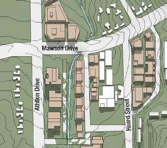
67 Figure 35: Shadow diagrams Summer - December 21 at 9am Winter - June 21 at 9am Summer - December 21 at 12pm Winter - June 21 at 12pm Summer - December 21 at 3pm Winter - June 21 at 3pm planning.act.gov.au 61
68 Athllon Drive Figure 36: Proposed building heights PEARCE Yarralumla Creek Hurley Street LEGEND Medium rise marker buildings Medium rise areas (8 storeys) Low to medium rise areas (6 storeys) Low to medium rise areas (4 storeys) Low rise areas (2 storeys) 4 storey parking structure with active frontage Mawson Drive Mawson group centre Mawson Place MAWSON Southlands Tennis Club Yarralumla Creek Mawson District Playing Fields Heard Street TORRENS Wilkins Street Beasley Street PROPOSED BUILDING HEIGHTS FARRER 62 Mawson Group Centre Master Plan
69 5.6.2 Encourage a vibrant mixed-use centre with an emphasis on introducing residential development As community needs and demands change it will be important that buildings can be adapted to accommodate a variety of uses i.e. from commercial to residential uses to community uses. The recommendations described below will ensure adaptable reuse can be achieved by ensuring floor to ceiling heights in new buildings can accommodate a range of uses. Recommended planning policies Require a minimum residential floor to ceiling height of 2.7 metres (with an average floor to floor height of 3 metres) throughout the centre (Figure 37). Require a minimum ground floor level floor to ceiling height of 3.9 metres throughout the centre (Figure 37). Require a minimum podium floor to ceiling height of 3.2 metres throughout the centre (Figure 37). Commercial and retail The centre will expand to the current Park and Ride facility site. This expansion will integrate with the existing centre to improve connections between the centre, public transport facilities and suburbs to the west. Any development that occurs on this site will be required to locate uses that generate activity on the ground floor facing the key pedestrian routes, as shown in Figure 38. Uses that generate activity will improve passive surveillance to address safety concerns for users of public transport. The western side of Mawson Place (blocks 1, 2, 3, 13 and 14 Section 47) is proposed for active uses such as shops, restaurants, cafes and community uses on the ground floor level. Commercial and residential uses will be permitted above ground floor. The centre core (Section 46) is currently working well; it is proposed to keep the land use mix as it is. In 2013, Draft Variation 304 proposed Block 25 Section 46 in the centre core (the surface car park to the south of Woolworths) be rezoned from Commercial Zone 3: Services Zone to Commercial Zone 1: Core Zone. The remainder of Section 46 is currently zoned as Commercial Zone 1: Core Zone. The proposal was withdrawn to allow land uses to be considered as part of this master planning process. As the surface car park is considered to be critical to the success of the centre, permitted land uses and heights on Block 25 Section 46 are to be maintained as they are. Section outlines that additional supermarket space could be viable in the centre in the longer term. Block 6 Section 57 (currently a large surface car park) should be reserved for the purposes of a supermarket (full-line or smaller depending on the demand). This block is currently owned by the ACT Government. When a clear demand for a second supermarket is identified, Block 6 Section 57 may be released by the ACT Government for development. Blocks 8 and 9 Section 57 (on the corner of Mawson Drive, Heard Street and Mountevans Street) are to be reserved for landmark buildings. Any new development on these sites will need to signify arrival at the centre. The continued presence of licensed clubs along the eastern edge of the centre (blocks 2, 5, 9 and 10 Section 57) is supported. In addition to licensed clubs, residential, retail, entertainment and commercial uses will also be permitted on these sites. This master plan aims to encourage a vibrant mix of commercial land uses by: permitting a mix of commercial and retail uses throughout the centre requiring active uses on the ground floor in strategic locations to assist with activation of the centre and increase passive surveillance permitting development of strategically located sites to support public transport, and reserving a site for an additional supermarket should the demand arise. These aims can be achieved through the following recommendations and opportunities. Recommended planning policies Zone land as outlined in Figure 39. Require active uses such as shops, restaurants and cafes on the ground floor of locations identified in Figure 38. planning.act.gov.au 63
70 Opportunities for land release Reserve Block 6 Section 57 as a long-term land release for an additional supermarket if there is demand in the future. Any future development proposal for the existing surface car park would need to consider opportunities for temporary parking arrangements during construction, replacement public parking as well as provide for the development s parking needs. Reserve the Park and Ride site for short to medium-term land release. When this site is released by the Territory for sale, the Park and Ride will be either integrated within the development as podium, basement or rooftop parking or provided as a surface car park in close proximity to the bus stop on Athllon Drive. Services and trades There are currently two service stations within the centre on the western side of Mawson Place (Block 1 Section 47 and Block 23 Section 47). The service stations are the only service and trade providers within the master plan area. Background analysis indicates pedestrians are making their way to and from public transport on Athllon Drive through the northern service station. To achieve a direct, safe and more attractive connection between public transport and the centre, it is proposed that Block 1 Section 47 be rezoned to allow for mixed-use development. A potential alternative site for the second service station is identified in the Spatial Framework Plan (Figure 31). The appropriate provision and location of services and trades will: support establishment of a direct, safe and attractive connection between public transport facilities by encouraging redevelopment in strategic locations, and ensure some services and trades uses are retained in the centre. The appropriate provision and location of service trades can be achieved through the following recommendations. Recommended planning policies Zone land as outlined in Figure 39. Zone Block 1 Section 47 to allow for a mixed-use development. Permit building heights of six storeys (up to 22 metres) on Block 1 Section 47 to encourage redevelopment of this site. Maintain Block 23 Section 47 s existing zoning of Commercial Zone 3: Services Zone and the existing permitted building height of two storeys. Recommended further studies Investigate the possibility of introducing a new service station alongside Athllon Drive at the southern end of the public transport precinct. Residential A number of sites in the centre are appropriate for mixed-use residential development. In accordance with the recommendations of the ACT Planning Strategy to increase density around group centres, this master plan proposes increasing opportunities for more housing on: blocks 1, 2, 3, 13 and 14 Section 47 along the western side of Mawson Place blocks 1, 2, 5, 6, 8, 9 and 10 Section 57 where the existing Mawson Club, Masonic Centre, Austrian Australian Club, Serbian Club and adjoining surface car park are currently located blocks 10 and 11 Section 58 on the northern corner of Mawson Drive and Athllon Drive, and the site where the current Park and Ride facility is located. When this site is released by the Territory for sale it may be a condition of sale that the Park and Ride be either integrated within the development as podium, basement or rooftop parking or provided as a surface car park in close proximity to the bus stop on Athllon Drive. Encouraging residential development in the centre will provide residents with convenient access to the range of facilities and services on offer and support goals to reduce greenhouse gas emission. It will also provide an opportunity to include housing options for an ageing population, particularly independent living for over 55s, as the development would be close to services and facilities offered by the centre and have convenient access to public transport. In addition, locating additional residents close to an existing rapid public transport service will increase the viability of this service. 64 Mawson Group Centre Master Plan

71 Supporting an increasing residential population in the centre, including older people, can be achieved through the recommendations and opportunities described below. Recommended planning policies Zone land as outlined in Figure 39. The proposed land use boundaries shown in Figure 39 for the northern corner of Athllon Drive and Mawson Drive are indicative only and may be subject to change to ensure a landscape buffer and shared-use path are provided between the new development and existing residential development in Swinger Hill and Mawson. Opportunities for land release Reserve blocks 10 and 11 Section 58 as a longterm land release for residential development once the current Park and Ride site is developed. Community facilities There is no Community Facility zoned land in the Mawson group centre. It is not proposed to introduce community facility land uses in the centre. A range of community uses are already permitted in commercial zones, such as the existing general practitioner surgeries. New development could include adaptable spaces that could accommodate a range of uses. The Woden town centre also provides a range of essential community facilities for Woden Valley residents. Recreation uses Land to the south of the centre is currently zoned as PRZ1: Urban Open Space. This land accommodates the existing Southlands Tennis Club and Mawson District Playing Fields. These recreation land uses are recommended to be retained. It is not proposed to expand recreation land uses in the centre. Figure 37: Maximum podium height and floor to ceiling height planning.act.gov.au 65
72 Mawson Place Figure 38: Proposed key pedestrian routes and active frontages Yarralumla Creek LEGEND Primary active frontage Secondary active frontage Key pedestrian routes Potential urban grain Improved pedestrian and cyclist crossing points Shared zone Bridge Hurley Street PEARCE Mawson Drive Mawson group centre MAWSON Southlands Tennis Club Athllon Drive Yarralumla Creek Mawson District Playing Fields Heard Street Wilkins Street TORRENS Beasley Street FARRER PROPOSED KEY PEDESTRIAN ROUTES AND ACTIVE FRONTAGES 66 Mawson Group Centre Master Plan
73 Athllon Drive Figure 39: Proposed land uses PEARCE Yarralumla Creek Hurley Street LEGEND Mixed-use: residential, retail, commercial Mixed-use: retail, large scale retail, commercial Mixed-use: residential, commercial, entertainment Service trades Parking structure with active frontages Residential apartments Mawson Drive Mawson Place Mawson group centre MAWSON Southlands Tennis Club Yarralumla Creek Mawson District Playing Fields Heard Street Wilkins Street TORRENS Beasley Street PROPOSED LAND USES FARRER planning.act.gov.au 67

74 Figure 40: Cross-section showing how building design can take advantage of microclimate Create a well-connected and accessible centre Public transport and active travel Physical activity such as walking, cycling and using public transport is referred to as active travel. Active travel is a healthy option that also helps reduce greenhouse gas emissions. It is critical the Mawson group centre supports active travel and public transport for the following reasons: Historic trends suggest the suburb of Mawson will continue ageing. This ageing population can be assisted by creating a supportive environment for age-friendly living, which includes providing safe, direct and pleasant pedestrian environments and connections to public transport. Car ownership in the suburb of Mawson is lower than in the rest of Canberra, which means residents are more reliant on active travel and public transport to move around. Public transport and active travel can be supported in the centre by: improving pedestrian and cyclist connections to, through and around the centre improving pedestrian and cyclist connections from the centre and existing paths to the public transport infrastructure on Athllon Drive improving safety of pedestrians and cyclists through building design, land use location, location of major pedestrian and cyclist paths and upgrades to major crossing points, and supporting existing and future public transport services by allowing for residential development. 68 Mawson Group Centre Master Plan
75 Recommendations and opportunities to achieve the above are outlined below. Recommended planning policies Require redeveloping blocks to provide mid-block pedestrian links as shown in Figure 41:»» in the form of 6 metre wide laneways with active frontages, and»» which are publicly accessible at all times. Support establishment of a direct, safe and more attractive connection between the public transport facilities and the centre by permitting increased development rights (building heights) on Block 1 Section 47 to encourage its redevelopment. Zone the existing Park and Ride site so that it allows for a range of uses which will improve safety and convenience for those using public transport. This will be subject to further studies including flooding and vehicular access. When Part Block 10 Section 47 is developed as a structured car park it will require a 15 metre setback from the boundary of the Southlands Tennis Club to ensure a strong physical and visual connection to the Mawson District Playing Fields. Maximum building heights are permitted as shown in Figure 38. Recommended public domain upgrades Provide improved pedestrian and cyclist crossing points on Mawson Drive as shown in Figures 38 and 42. This access should be direct, safe and connect the shared-use path into the centre. Provide a pedestrian connection across Athllon Drive from Torrens as shown in Figure 38. It is recommended that this should be constructed at the same time the new road shown in Figure 43 is constructed. Convert Mawson Place into a shared zone so it becomes a place for people and easier and safer for pedestrians to cross, particularly to allow for easy access to the public transport precinct. Provide a new shared-use path as shown in Figure 42. This new path will connect the existing shared-use paths, which currently do not connect to one another (Figure 42). This new shared-use path will provide a route where cyclists will not need to dismount. It will run past existing public transport infrastructure (bike lockers and bus stops) and will provide cyclists using the path with the opportunity to access the centre core from either the north or south. Establishment of this shared-use path will be dependent on the land release of the adjoining blocks and construction of the road connecting Mawson Place to Athllon Drive. Introduce a formalised pedestrian connection through the Mawson District Playing Fields as shown in Figure 38. Recommended further studies Investigate the potential for converting Mawson Place into a shared zone to reduce traffic speeds and improve east west pedestrian movement and pedestrian connections from public transport infrastructure on Athllon Drive into the centre. Road network and traffic It is easy to access the centre by public and private transport; this is part of what makes the centre successful. This accessibility needs to be retained to ensure the centre s viability, therefore this master plan aims to: ensure traffic movement occurs in a way that supports pedestrian and cyclist movement to and through the centre establish Mawson Place as a low speed vehicle environment that provides for private vehicles accessing the centre and the Park and Ride ensure access to the centre continues to be easy and convenient, and provide safe access roads to all new development blocks. planning.act.gov.au 69
76 Opportunities for land release Reserve the Park and Ride site for short to mediumterm land release. When this site is released by the Territory for sale it may be a condition of sale that new roads (Figure 43) may be constructed as part of the development. These new roads have been subject to preliminary modelling to determine their feasibility. This preliminary modelling indicates that the new roads would not only provide access to the new development blocks but also improve traffic conditions along Mawson Place and support it being established as a shared zone. Further investigation will be required to determine if a leftin left-out arrangement or four-way intersection with traffic lights would be a more appropriate on Athllon Drive. Parking Parking in the centre peaks at 68% occupancy at 1pm on a Thursday, indicating the centre still has some parking capacity. Adoption of the recommendations of this master plan will increase parking demands on the centre over the long term; however, a majority of the generated parking demand is likely to be accommodated in individual developments. Given the nature of the mixed-use environment, it can be difficult to accurately estimate the extent of future development and parking generated by those developments. There are several ways to manage parking in the centre, such as managing existing spaces, providing new parking, allowing for structured parking and encouraging alternative modes of transport by making it easier for people to walk, cycle or catch public transport to the centre. This master plan aims to create a well-connected and accessible centre by: providing sufficient parking to ensure the viability of the centre. ensuring parking does not detract from the amenity of the centre, and providing a mix of short, medium and long-term parking to ensure users with different needs are met. Recommendations and opportunities to achieve the above are outlined below. Recommended planning policies Require use of high-quality architectural elements and landscaping to screen any structured parking or podium parking. Require structured parking to have active uses on the ground floor where it adjoins Mawson Place and faces the Mawson District Playing Fields. Require pedestrian and cycle access to and from parking areas that is clearly visible and well lit. Provide convenient short-term on-street parking throughout the centre where possible. Ensure planning controls allow development to accommodate required parking on-site, such as via podiums or basements. Opportunities for land release Reserve part of Block 25 Section 47 (Figure 39) as a long-term land release for publicly available structured parking. Eventually, structured parking in the centre will be required to provide for long-term parking. A number of sites have been assessed for their potential to accommodate structured parking. Block 25 Section 47 (Figure 39) has been assessed as the most appropriate site considering proximity to surrounding development, potential car parking yield, walkability to nearby employment, vehicular accessibility and good urban design outcomes. 70 Mawson Group Centre Master Plan
77 Athllon Drive Figure 41: Proposed mid-block pedestrian and cyclist links LEGEND Mid-block pedestrian and cyclist links Potential urban grain Yarralumla Creek Hurley Street PEARCE Mawson Drive Mawson Place Mawson group centre MAWSON Southlands Tennis Club Yarralumla Creek Mawson District Playing Fields Heard Street Wilkins Street TORRENS Beasley Street FARRER PROPOSED MID-BLOCK PEDESTRIAN AND CYCLIST LINKS planning.act.gov.au 71
78 Figure 42: Proposed cyclist connections PEARCE Yarralumla Creek Hurley Street Mawson Drive LEGEND Key access path into centre Proposed shared-use path (pedestrian and cyclist path) Proposed on-road cycle lane Investigate potential for pedestrian and cyclist crossing Potential bridge Existing shared-use path (pedestrian and cyclist path) Existing underpass Existing pedestrian bridge Mawson Place Mawson group centre MAWSON Southlands Tennis Club Athllon Drive Yarralumla Creek Mawson District Playing Fields Heard Street TORRENS Wilkins Street Scale: 3.5:1 72 Mawson Group Centre Master Plan Beasley Street FARRER PROPOSED CYCLIST CONNECTIONS
79 Athllon Drive Mawson Place Figure 43: Proposed roads LEGEND Proposed roads Proposed road ends Yarralumla Creek Hurley Street PEARCE Mawson Drive Mawson group centre MAWSON Southlands Tennis Club Yarralumla Creek Mawson District Playing Fields Heard Street Wilkins Street TORRENS Beasley Street PROPOSED ROADS FARRER planning.act.gov.au 73

80 Figure 44: Artist s impression of Mawson Place as a main street, looking north Encourage a high-quality public domain The design of the public domain contributes to the amenity of the centre and its enjoyment. Public spaces and streets in the centre should enhance the character, vitality and connections of the centre. Streets and public spaces should also be designed to be supportive of an ageing population. Active frontages The design of individual buildings contributes to the overall safety and vitality of public spaces. Active frontages at ground floor level will improve the quality of key pedestrian connections. Figure 38 identifies key pedestrian routes through the centre and where primary and secondary active frontages should occur so these pedestrian routes are supported and enhanced. Encouraging active frontages in key locations to support pedestrian and cyclist movement can be achieved through the following recommendations. Recommended planning policies Where new buildings front primary active frontages they (as shown in Figure 38) will:»» be oriented towards the street»» be required to have largely transparent frontages, at least 70%»» be required to have active uses such as shops, restaurants, cafes, community facilities fronting the primary active frontage»» not have residential uses on the ground floor, and»» be required to provide awnings designed to provide shelter and a sense of human scale and enclosure. 74 Mawson Group Centre Master Plan
81 Where new buildings front secondary active frontages as shown in Figure 38, they:»» will be fronted by buildings which are oriented towards the street»» will be fronted by buildings that are able to be adapted at the ground floor for a new use as market demand changes i.e. new buildings will have a floor to ceiling height that is suitable for commercial use (Figure 37), and»» can have residential uses on the ground floor provided there are many individual entries at street level and allow for visual interaction and passive surveillance of the street. Street hierarchy Street hierarchy refers to the function and character of the street. Function refers to the movement types, the number of vehicles, pedestrians and bikes and a street s function i.e. whether it is an arterial road or residential street. The elements that contribute to the street character are the width of the footpath, tree planting, number of traffic lanes, and type of parking, cycle lanes, building height, street furniture and street lighting. Mawson Place will be reinforced as a main street for activity and pedestrian use. Figure 44 is an artist s impression showing Mawson Place as a main street. Other streets in the centre will continue to carry traffic and public transport as primary traffic roads. Through the recommendations listed below Mawson Place can be established as a main street with a high-quality public domain. Recommended planning policies Continue to require buildings fronting Mawson Place to be built to the site boundary to create an urban edge to the main street and be stepped back at higher levels to ensure Mawson Place keeps its human scale. Require active frontages along Mawson Place in accordance with Figure 38. Recommended further studies Investigate the potential for converting Mawson Place into a shared zone to reduce traffic speeds and establish the street as a main street. Establish a landscaping theme for Mawson Place. Complete further investigations of flood mitigation strategies to ensure the centre s existing developed areas and future areas for development are not impacted by flooding. Green space The master plan study area already includes significant amounts of green space as a result of the Mawson District Playing Fields. Consequently, introduction of a park into the centre is not seen as necessary. However greenery should be brought into the centre through the use of landscaping, including additional tree planting. In particular, the four key public spaces identified in Figure 45, provide an opportunity to introduce greenery into the centre. Introducing more landscaping, trees and greenery into the centre will be vital to reduce the impact of the 0.7% increase in temperature expected to occur between 2020 and Trees will play an important role in improving the amenity and comfort of the centre as they provide shade in summer and reduce the heat island effect. Where possible, the centre s existing trees should be retained and additional trees planted throughout the centre. A water sensitive urban design strategy may also be prepared for the Mawson group centre to consider the requirements of the broader catchment as well as the master plan study area. As the centre develops and redevelops, the master plan aims to establish pockets of green spaces which: improve amenity make the centre a more attractive destination provide places for people to gather, sit, converse and eat reduce the heat island effect, and make it easier for pedestrians and cyclists to find their way through the centre.
82 The following opportunities and recommendations will ensure these pockets of green space can be established. Opportunities for land release Reserve the Park and Ride site for short to medium-term land release. When this site is released by the Territory for sale it may be a condition of sale that the developer creates an open public plaza on Block 8 and Section 47 and the land adjoining the new development block on the corner of Athllon Drive and Mawson Drive. Trees and other landscaping should be included for shade, cooling and amenity. This public plaza should act as a safe, direct and pleasant pedestrian connection from public transport facilities to the centre. Landscaping should support this purpose. Reserve Block 6 Section 57 as a long-term land release for an additional supermarket if there is demand in the future. When this site is released by the Territory for sale it will be a condition of sale that a publicly accessible green space may be required on the rooftop. Screening of the rooftop plant room and service infrastructure will be required. Recommended public domain upgrades Develop a public domain and lighting design standard for the centre that provides a consistent, functional and attractive public domain which is also age-friendly, considering lighting, street furniture, street trees and pavement types. When Blocks 3 and 13 Section 47 redevelop it will be appropriate to undertake landscaping of the proposed mid-block pedestrian and cyclist link (Figure 41) connecting Mawson Place to the new development block on the existing Park and Ride site. This space should become a green link which also caters for children. To ensure creation of a child-friendly space, this mid-block pedestrian link should allow for incidental play through the use of landscaping and/or high quality public art. Figure 46 is a cross-section showing what this link could look like. The existing internal courtyards identified in Figure 45 should be subject to upgrades. Recommended further studies Consider preparing a water sensitive urban design strategy for the centre. 76 Mawson Group Centre Master Plan
83 Figure 45: Proposed green space LEGEND Proposed green space Potential green roof Yarralumla Creek Hurley Street PEARCE Public plaza Mawson Drive Mawson Place Mawson group centre Existing internal courtyard Mid-block pedestrian link Athllon Drive MAWSON Southlands Tennis Club Yarralumla Creek Existing internal courtyard Mawson District Playing Fields Heard Street Wilkins Street TORRENS Beasley Street PROPOSED GREEN SPACE FARRER planning.act.gov.au 77

84 Figure 46: Cross-section indicating a mid-block pedestrian link/green link between Mawson Place and Athllon Drive 78 Mawson Group Centre Master Plan
85 5.6.5 Enhance the existing environment Built form describes the mass, form and scale of buildings that create and define public spaces. New development will be designed to complement and enhance the existing environment and create places that people can relate to and enjoy. Enhancing the existing environment will involve the following: ensuring the character of each precinct is reinforced and enhanced retaining a sense of human scale in the centre and contributing to a pedestrian environment ensuring all new development is integrated within the existing urban fabric of the centre, and requiring development on strategic corner sites to become landmark buildings. Recommendations to achieve the above are outlined below. Recommended planning policies Require new development on the corner of Mawson Drive, Heard Street and Mountevans Street (blocks 8 and 9 Section 57), and the southern corner of Mawson Drive and Athllon Drive (the new development block on the current Park and Ride site) to address their respective intersections and provide architectural interest and variety to the building design. Require pedestrian entrances to common areas for residential buildings to provide strong visual connections to the street and ensure a high level of passive surveillance. Require new building design to incorporate sun shading for high exposed facades i.e. west facing. Require development adjacent to public spaces to provide opportunities for passive surveillance of public spaces, including open spaces. For example, courtyards with pool-style fencing and upper-level balconies. Require awnings along all primary active frontages as shown in Figure 38. Awnings are designed to provide shelter and a sense of human scale and enclosure. Require the front and rear setback as shown in Table 5. Table 5: Front and rear setbacks Require the following front and rear setbacks Storeys Up to 3 Front setbacks 0 metres metres planning.act.gov.au 79

86 Mawson group centre
GUNGAHLIN TOWN CENTRE
 GUNGAHLIN TOWN CENTRE PLANNING REFRESH SNAPSHOT NOVEMBER 2018 CONTENTS INTRODUCTION....1 Australian Capital Territory, Canberra 2018 This work is copyright. Apart from any use as permitted under the Copyright
Curtin Group Centre. Draft Master Plan NOVEMBER 2015
 Curtin Group Centre Draft Master Plan NOVEMBER 2015 HAVE YOUR SAY The Environment and Planning Directorate (EPD) welcomes comments on this draft master plan. You can make comments on the Curtin draft master
5 Rail demand in Western Sydney
 5 Rail demand in Western Sydney About this chapter To better understand where new or enhanced rail services are needed, this chapter presents an overview of the existing and future demand on the rail network
Gold Coast. Rapid Transit. Chapter twelve Social impact. Chapter content
 Gold Coast Rapid Transit Chapter twelve Social impact Chapter content Social impact assessment process...235 Existing community profile...237 Consultation...238 Social impacts and mitigation strategies...239
TRANSPORT CANBERRA. LIGHT RAIL NETWORK Delivering a modern transport system for a growing city
 TRANSPORT CANBERRA LIGHT RAIL NETWORK Delivering a modern transport system for a growing city LIGHT RAIL NETWORK A modern transport system for a growing city INTRODUCTION Minister Mick Gentleman The ACT
Sustainable Urban Development. Presentation to WVCC 1 December 2010
 Sustainable Urban Development Presentation to WVCC 1 December 2010 Introduction Paul Carmody Hindmarsh (Consultation Manager) Tony Adams CB Richard Ellis (Planners) Simon Parsons PTW (Architects) Brett
TARLO-WODEN.COM.AU EASTY STREET, WODEN. Developed by
 TARLO-WODEN.COM.AU EASTY STREET, WODEN Developed by A TOWNHOUSE LIFESTYLE IN THE HEART OF WODEN Form, Function, Proximity. Tarlo ticks all the boxes, providing a townhouse lifestyle in the heart of the
Kilometres. Blacktown. Penrith. Parramatta. Liverpool Bankstown. Campbelltown
 0 5 10 15 20 Kilometres Penrith Blacktown Parramatta Liverpool Bankstown Campbelltown accessibility outcomes Legend Outcomes targeted in Western Sydney are: public transport that is accessible throughout
TOWN PLANNING SUBMISSION TO THE GREATER SYDNEY COMMISSION LANDS AT ARTARMON
 TOWN PLANNING SUBMISSION TO THE GREATER SYDNEY COMMISSION LANDS AT ARTARMON March 2017 TABLE OF CONTENTS 1.0 INTRODUCTION 3 2.0 THE SUBJECT SITE 4 3.0 STRATEGIC PLANNING CONTEXT 6 4.0 SUMMARY AND CONCLUSIONS
Communication and consultation protocol
 Communication and consultation protocol Airservices Australia 2011 This work is copyright. Apart from any use as permitted under the Copyright Act 1968, no part may be reproduced by any process without
Community Sports Hub
 The Adelaide City Council invites engagement from the community about Project Summary Council is seeking your feedback on a draft agreement to enable the South Australian Cricket Association (SACA) to
The Sunshine Coast is part of the global community and generates wealth through export, high-value industries and new investment.
 3.2 Strategic intent 3.2.1 Shaping growth an overview In 2031, the Sunshine Coast is renowned for its vibrant economy, ecological values, unique character and strong sense of community. It is Australia
A Master Plan is one of the most important documents that can be prepared by an Airport.
 The Master Plan A Master Plan is one of the most important documents that can be prepared by an Airport. A Master Plan is a visionary and a strategic document detailing planning initiatives for the Airport
PLANNING THE SUNBURY GROWTH CORRIDOR
 SUNBURY GROWTH CORRIDOR NOVEMBER 2016 PLANNING THE SUNBURY GROWTH CORRIDOR Sunbury Planning Background The Victorian Planning Authority, in consultation with Hume City Council, is undertaking a number
Sunshine Coast Council Locked Bag 72 Sunshine Coast Mail Centre QLD Submitted via online portal. 2 June 2017.
 Sunshine Coast Council Locked Bag 72 Sunshine Coast Mail Centre QLD 4560 Submitted via online portal 2 June 2017 Dear Sir /Madam, RE: DRAFT ENVIRONMENTAL AND LIVEABILITY STRATEGY The Green Building Council
The Strategic Commercial and Procurement Manager
 Item 3 To: Procurement Sub Committee On: 8 June 2016 Report by: The Strategic Commercial and Procurement Manager Heading: Renfrewshire Council s Community Benefit Strategy 2016 1. Summary 1.1. The purpose
SANDY BAY RETAIL PRECINCT STREETSCAPE REVITALISATION - PALM TREES AND BANNER POLES - RESPONSE TO PETITION
 Page 41 REPORT TITLE: SANDY BAY RETAIL PRECINCT STREETSCAPE REVITALISATION - PALM TREES AND BANNER POLES - RESPONSE TO PETITION REPORT PROVIDED BY: Road Services Engineer Director City Infrastructure 1.
9.1 INTRODUCTION 9.2 EXISTING DEVELOPMENT. Southern Cross University
 Property Strategy The property strategy delivers improved legibility, responds to the locational attributes of the site, and facilitates essential operational efficiencies. 9.1 INTRODUCTION Non-aviation
Draft Greater Sydney Region Plan
 Powered by TCPDF (www.tcpdf.org) Draft Greater Sydney Region Plan Submission_id: 31119 Date of Lodgment: 12 Dec 2017 Origin of Submission: Online Organisation name: Serapark Pty Ltd Organisation type:
ENVIRONMENT ACTION PLAN
 ENVIRONMENT ACTION PLAN 2015 16 Airservices Australia 2015 This work is copyright. Apart from any use as permitted under the Copyright Act 1968, no part may be reproduced by any process without prior written
Consultation on Draft Airports National Policy Statement: new runway capacity and infrastructure at airports in the South East of England
 Tony Kershaw Honorary Secretary County Hall Chichester West Sussex PO19 1RQ Telephone 033022 22543 Website: www.gatcom.org.uk If calling ask for Mrs. Paula Street e-mail: secretary@gatcom.org.uk 22 May
places Mooloolaba s heart five
 five places the mooloolaba heart 1 Flexible community event use of school oval 2 Enhanced streetscape District cycle route Future cross-block pedestrian link 5 Existing school buildings New signalised
The ACT Government is committed to making its information, services, events and venues, accessible to as many people as possible.
 The ACT Government is committed to making its information, services, events and venues, accessible to as many people as possible. If you have difficulty reading a standard printed document and would like
JOINT CORE STRATEGY FOR BROADLAND, NORWICH AND SOUTH NORFOLK EXAMINATION MATTER 3C EASTON/COSTESSEY
 Matter 3C Easton/Costessey Representor No. 8826 JOINT CORE STRATEGY FOR BROADLAND, NORWICH AND SOUTH NORFOLK EXAMINATION MATTER 3C EASTON/COSTESSEY SUBMISSION ON BEHALF OF TAYLOR WIMPEY DEVELOPMENTS AND
SUMMARY OF MEETING 1. Curtin Group Centre Master Plan. Community Panel - 25 July Attendees. Tuesday 25 July 2017, 6.30pm 8:30pm.
 SUMMARY OF MEETING 1 Curtin Group Centre Master Plan Community Panel - 25 July 2017 Attendees Date Location Tuesday 25 July 2017, 6.30pm 8:30pm St James Uniting Church, 40 Gillies Street, Curtin Attendees
Proposals for the Harrogate Road / New Line Junction Improvement Scheme. August / September Supported by:
 Proposals for the Harrogate / New Line Junction Improvement Scheme August / September 2016 Supported by: Introduction Key Benefits Proposals are currently being developed for changes to the junction of
New free City connector bus service
 The Adelaide City Council invites engagement from the community about New free City connector bus service 99C City Loop and Adelaide Connector free bus services to merge: Project Summary Adelaide City
NATIONAL AIRSPACE POLICY OF NEW ZEALAND
 NATIONAL AIRSPACE POLICY OF NEW ZEALAND APRIL 2012 FOREWORD TO NATIONAL AIRSPACE POLICY STATEMENT When the government issued Connecting New Zealand, its policy direction for transport in August 2011, one
This economic statement provides analysis with respect to land at Tarneit North, and has been prepared on behalf of Amex Corporation.
 Memorandum To: From: Amex Corporation c/- Greg Wood, Tract Consultants Matthew Lee Cc: Date: 12 June 2013 Subject: Economic Statement for Amex site Tarneit North PSP Dear Greg, This economic statement
The implementation of this Master Plan will be undertaken in logical stages to meet passenger and workforce demands.
 The implementation of this Master Plan will be undertaken in logical stages to meet passenger and workforce demands. Connecting People Building Opportunities 198 Brisbane Airport Corporation CHAPTER 10
Memorandum of Understanding with ACT Government
 MEDIA RELEASE 8 April 2015 Memorandum of Understanding with ACT Government The ACT Government and Canberra Airport today entered into a new Memorandum of Understanding (MoU) on key areas of common interest
The Challenges for the European Tourism Sustainable
 The Challenges for the European Tourism Sustainable Denada Olli Lecturer at Fan S. Noli University, Faculty of Economy, Department of Marketing, Branch Korça, Albania. Doi:10.5901/mjss.2013.v4n9p464 Abstract
CITY OF MELBOURNE 10 Year Financial Plan People s Panel Report. 8 November 2014
 CITY OF MELBOURNE 10 Year Financial Plan People s Panel Report 8 November 2014 The Panel s Decision Making Principles 1. SMART (Specific, Measurable, Achievable, Realistic, Timely) 2. Sustainable 3. Forward
Concept Curtin Precinct Map and Code
 Concept Curtin Precinct Map and Code Proposed changes from the revised Curtin Group Centre Draft Master Plan recommendations Disclaimer: This document is intended to show the proposed changes to the existing
Public Transport for Perth in 2031
 South West Group Submission Public Transport for Perth in 2031 October 2011 South West Group Vision and Mission Local Governments in South Metropolitan Perth, through cooperation with industry, community
GUNGAHLIN TOWN CENTRE PLANNING REFRESH
 GUNGAHLIN TOWN CENTRE PLANNING REFRESH COMMUNITY ENGAGEMENT REPORT - STAGE 1 MAY 2018 Australian Capital Territory, Canberra 2018 This work is copyright. Apart from any use as permitted under the Copyright
PLANNING STATEMENT FORMER HSBC BANK, 18 HIGH STREET, AMESBURY
 PLANNING STATEMENT FORMER HSBC BANK, 18 HIGH STREET, AMESBURY 21 Dec 17 Introduction Amesbury has a vibrant nightlife with three public houses, two hotel bars and a nightclub within the town centre as
Sport Capital Improvement Plan. Paul Borci Manager, Campus Planning Property & Campus Services
 Sport Capital Improvement Plan Paul Borci Manager, Campus Planning Property & Campus Services What is SCIP? Property and Campus Services (PCS) in collaboration with Melbourne University Sport (MU Sport)
Draft City Centre Transport Proposals
 Draft City Centre Transport Proposals Introduction This draft position paper provides an overview of the current City Centre transport issues, including concepts of the possible future City Centre transport
October 23, 2017 Council Workshop
 MAPLEWOOD VILLAGE CENTRE AND INNOVATION DISTRICT IMPLEMENTATION PLAN & DESIGN GUIDELINES October 23, 2017 Council Workshop COMMUNITY PLAN Purpose of Council Workshop Highlight What We Heard Phase 3 & Key
Part four. In this part you will find: The next steps to deliver the master plan
 Part four NEXT STEPS In this part you will find: The next steps to deliver the master plan 6. How COULD the Master Plan be delivered? There are a number of steps required to take the proposals in the master
CANNING CITY CENTRE. the new energy of the southeast
 CANNING CITY CENTRE the new energy of the southeast 2 INTRODUCTION From early beginnings as an important cultural and recreation place for the Beeloo Nyoongar people, to being a trading post connecting
Schedule of Planning Applications Committee Date: 23 May Reference: 06/18/0064/F Great Yarmouth Officer: Mr J Beck Expiry Date:
 Schedule of Planning Applications Committee Date: 23 May 2018 Reference: 06/18/0064/F Great Yarmouth Officer: Mr J Beck Expiry Date: 24-04-2018 Applicant: Proposal: Site: Mr Mavroudis Clear weather hoardings
TAYplan SDPA. Main Issues Report. Options for Scotland s s SusTAYnable Region (Strategic Development Planning Authority)
") TAYplan SDPA (Strategic Development Planning Authority) Main Issues Report Options for Scotland s s SusTAYnable Region 2012-2032 2032 Content 1. The Development Plan System in Scotland 2. TAYplan in Context
TAYplan SDPA (Strategic Development Planning Authority) Main Issues Report Options for Scotland s s SusTAYnable Region 2012-2032 2032 Content 1. The Development Plan System in Scotland 2. TAYplan in Context
CAIRNS RECTANGULAR PITCH STADIUM NEEDS STUDY PART 1 CAIRNS REGIONAL COUNCIL DRAFT REPORT SEPTEMBER 2011
 CAIRNS RECTANGULAR PITCH STADIUM NEEDS STUDY PART 1 CAIRNS REGIONAL COUNCIL DRAFT REPORT SEPTEMBER 2011 CAIRNS RECTANGULAR PITCH STADIUM NEEDS STUDY PART 1 Cairns Regional Council September 2011 Coffey
WELLINGTON $422 MILLION $614 MILLION $83 MILLION 22% SPEND $1.9 BILLION
 WELLINGTON WELLINGTON $1.9 BILLION FORECAST TOTAL WELLINGTON INVESTMENT The Wellington region s transport challenges are dominated by the region s concentration of population in the metropolitan cities,
Committee. Presentation Outline
 CW-33-15 11/9/2015 Community and Corporate Services Committee November 10, 2015 1 Presentation Outline Background Vision and Objectives Study Process and Timeline Public and Stakeholder Engagement Organization
A NEW BUS NETWORK FOR CANBERRA
 A NEW BUS NETWORK FOR More buses, more often, 7 days a week What s happening? Canberra is Australia s fastest growing city. In less than 15 years the population is expected to reach more than 500 000.
Securing a Sustainable Future: Implementing the 30-Year Plan for Greater Adelaide
 Planning Institute of Australia (SA) State of Renewal Conference Securing a Sustainable Future: Implementing the 30-Year Plan for Greater Adelaide Donna Ferretti - Director Statutory Planning Branch, Planning
PERTH AND KINROSS COUNCIL. Housing and Health Committee. 25 May Perth and Kinross Local Housing Strategy
 PERTH AND KINROSS COUNCIL 7 16/234 Housing and Health Committee 25 May 2016 Perth and Kinross Local Housing Strategy 2016-2021 Report by Director (Housing and Social Work) PURPOSE OF REPORT This report
A TRANSPORT SYSTEM CONNECTING PEOPLE TO PLACES
 THE MAYOR'S VISION FOR TRANSPORT A TRANSPORT SYSTEM CONNECTING PEOPLE TO PLACES VISION We will build a transport system that works for everyone, connecting people to the places they want to go within the
PO Box 257 PO Box 257 PARRAMATTA NSW 2124 PARRAMATTA NSW 2124
 31 March 2017 Sean O Toole Sheridan Dudley District Commissioner - West District Commissioner - South West Greater Sydney Commission Greater Sydney Commission PO Box 257 PO Box 257 PARRAMATTA NSW 2124
FEDERATION SQUARE MELBOURNE, AUSTRALIA CORPORATE PLAN
 FEDERATION SQUARE MELBOURNE, AUSTRALIA CORPORATE PLAN 201619 MELBOURNE S INSPIRATIONAL PUBLIC PLACE Federation Square is Melbourne s heartbeat, an inspirational precinct which concentrates community, cultural
Spadina Avenue Built Form Study Preliminary Report
 STAFF REPORT ACTION REQUIRED Spadina Avenue Built Form Study Preliminary Report Date: July 9, 2014 To: From: Wards: Reference Number: Toronto and East York Community Council Director, Community Planning,
PSP 75 Lancefield Road. Northern Jacksons Creek Crossing Supplementary Information
 PSP 75 Lancefield Road Northern Jacksons Creek Crossing Supplementary Information September 2017 The northern crossing of Jacksons Creek proposed within the Lancefield Road PSP is a key part of the ultimate
REVIEW OF PERTH AIRPORT Noise Abatement Procedures
 REVIEW OF PERTH AIRPORT Noise Abatement Procedures Contents SUMMARY... 3 Summary of Review Findings... 3 BACKGROUND... 4 Noise Abatement Procedures... 4 Perth Airport Noise Abatement Procedures... 4 Noise
North District Plan OVERVIEW
 OUR GREATER SYDNEY 2056 Revised Draft North District Plan OVERVIEW Hornsby Hunter's Hill Ku-ring-gai Lane Cove Mosman Northern Beaches North Sydney Ryde Willoughby Snapshot of the North District today
FUTURE TRANSPORT STRATEGY AND GREATER SYDNEY SERVICES AND INFRASTRUCTURE PLAN. Western Parkland City
 FUTURE TRANSPORT STRATEGY AND GREATER SYDNEY SERVICES AND INFRASTRUCTURE PLAN Western Parkland City 2 Transport for NSW Future Transport Strategy and Greater Sydney Services and Infrastructure Plan Western
MAPLEWOOD VILLAGE CENTRE AND INNOVATION DISTRICT IMPLEMENTATION PLAN & DESIGN GUIDELINES. November 6, 2017 Regular Meeting of Council
 MAPLEWOOD VILLAGE CENTRE AND INNOVATION DISTRICT IMPLEMENTATION PLAN & DESIGN GUIDELINES November 6, 2017 Regular Meeting of Council Recommendation THAT Council: Approve the Maplewood Village Centre and
Public Submissions in response to the Bill closed on 2 July 2015 and Council lodged a copy of the submission provided as Attachment 1.
 54 PLANNING AND ECONOMIC COMMITTEE 8 JULY 2015 3 SUSTAINABLE PORTS DEVELOPMENT BILL Neil Quinn 1/58/14 #4771706 RECOMMENDATION: That Council endorses the Submission made to the Infrastructure, Planning
Draft Planning Controls Planning Scheme Amendment GC81
 Draft Planning Controls Planning Scheme Amendment GC81 Peita Tapper Senior Planner, Planning Services What the planning controls do? The draft planning controls translate the objectives and strategies
Draft Greater Sydney Region Plan
 Draft Greater Sydney Region Plan Submission_id: 31392 Date of Lodgment: 14 Dec 2017 Origin of Submission: Online Organisation name: Greenfields Development Company No. 2 Pty Limited Organisation type:
Bloor Street West Rezoning Application for a Temporary Use By-law Final Report
 STAFF REPORT ACTION REQUIRED 3741 3751 Bloor Street West Rezoning Application for a Temporary Use By-law Final Report Date: June 12, 2007 To: From: Wards: Reference Number: Etobicoke York Community Council
FUTURE AIRSPACE CHANGE
 HEATHROW EXPANSION FUTURE AIRSPACE CHANGE UPDATE SEPTEMBER 2018 On 25 June 2018, Parliament formally backed Heathrow expansion, with MPs voting in support of the Government s Airports National Policy Statement
Seek the Board s approval for the Donald Place kerb and channel renewal to progress to final design, tender and construction; and
 3. DONALD PLACE - KERB AND CHANNEL RENEWAL General Manager responsible: General Manager City Environment Officer responsible: Transport and City Streets Manager Author: Michelle Flanagan, Streets Capital
West of England. Priority Places Requiring Public Investment
 West of England Priority Places Requiring Public Investment Development Urban Regeneration & Suburban Intensification Bristol Central Area Bristol Central Area; Stokes Croft, Temple Meads & St Philips
Pre-application submission for Committee: Phase 4 development at West Hendon
 Pre-application submission for Committee: Phase 4 development at West Hendon 1. Development Details Phase 4 of the West Hendon Estate Regeneration. 2. Background The redevelopment of the West Hendon Estate
PRACTICE PROFILE. Shop 76 Hyperdome Tuggeranong Shopping Centre, Anketell St Cnr Reed St, Greenway ACT 2900
 PRACTICE PROFILE Address: Shop 76 Hyperdome Tuggeranong Shopping Centre, Anketell St Cnr Reed St, Greenway ACT 2900 Proudly owned and operated by: HEAR FROM OUR DOCTORS https://www.youtube.com/watch?v=cce1n0dzkni
Creating a High Quality Business District
 Date Month Date Month Friday 7 November 2014 Nine Elms on the South Bank A Bilfinger Real Estate company Creating a High Quality Business District New London Architecture Introduction Nine Elms Vauxhall
Date: 11 th January, From: Plaistow & Ifold Parish Neighbourhood Plan - Steering Group. Plaistow & Ifold Parish Council
 Date: 11 th January, 2017 From: Plaistow & Ifold Parish Neighbourhood Plan - Steering Group To: Plaistow & Ifold Parish Council Re: Neighbourhood Plan Report to Parish Council Meeting 17 Jan 2017 The Steering
DEVELOPMENT MANAGEMENT COMMITTEE. 23 August 2011
 DEVELOPMENT MANAGEMENT COMMITTEE Agenda item 15 23 August 2011 APPLICATION NUMBER : CA//11/00883/VAR PROPOSAL : Variation of conditions 02 (drawings numbers); alterations in respect of internal layout
WESTERN SYDNEY PARKLANDS PLAN 2020 CORPORATE
 WESTERN SYDNEY PARKLANDS 2020 CORPORATE PLAN March 2015 Table of Contents Message from the Chairman and Director 1 What is the Western Sydney Parklands? 4 The Western Sydney Parklands Trust 4 The Corporate
21.07 ECONOMIC DEVELOPMENT AND EMPLOYMENT 19/03/2015 C323 Proposed C Key issues and influences. Economic Role and Function
 21.07 ECONOMIC DEVELOPMENT AND EMPLOYMENT 19/03/2015 C323 Proposed C347 21.07-1 Key issues and influences 14/10/2010 C168 Economic Role and Function Geelong is the largest regional city in Victoria and
Llandudno Junction. Regeneration Proposals for the Future. December 2009
 Llandudno Junction Regeneration Proposals for the Future December 2009 Llandudno Junction - Vision Statement 1 Purpose 1.1 The purpose of this document is to describe key priorities to support the regeneration
Green Fields Leppington
 Green Fields Leppington CONNTENTS 1.0 URBAN GROWTH - SYDNEY 2.0 MACRO CONTEXT 3.0 LOCAL ENVIRONMENTAL PLAN - LEPPINGTON 4.0 CONCEPT 5.0 GREEN ROOFS 6.0 APARTMENT REALISATION SCHEDULE 7.0 INFRASTRUCTURE
401, and 415 King Street West - Zoning Amendment Application - Preliminary Report
 STAFF REPORT ACTION REQUIRED 401, 407-409 and 415 King Street West - Zoning Amendment Application - Preliminary Report Date: January 27, 2011 To: From: Wards: Reference Number: Toronto and East York Community
HARBOUR EDGE STITCH. Uniting the Waterfront with the City Centre
 78 AC_BEU_CCMP_2_TM1_4 _FD.indd 78 20/07/12 12:04 PM 01 HARBOUR EDGE STITCH Uniting the Waterfront with the City Centre 01 VISION OUR 2032 VISION IS: Quay Street as a high-quality Harbour Edge space that
NSW PRE-BUDGET STATEMENT FUTURE ECONOMY FUTURE JOBS
 2017-18 NSW PRE-BUDGET STATEMENT FUTURE ECONOMY FUTURE JOBS Executive Summary The 2017-18 NSW State Budget presents an opportunity for the NSW Government to future-proof the tourism and transport sectors.
Submission on Draft Ingleburn Structure Plan. Prepared for: Ingleburn Chamber of Commerce & Industry Inc. 6 February 2015
 Submission on Draft Ingleburn Structure Plan Prepared for: Ingleburn Chamber of Commerce & Industry Inc. GLN Planning Pty Ltd ABN 39 585 269 237 Level 10, 66 King Street Sydney NSW 2000 GPO Box 5013 Sydney
HOUSEHOLD TRAVEL SURVEY
 HOUSEHOLD TRAVEL SURVEY Household Travel Survey i TABLE OF CONTENTS Page 1.0 INTRODUCTION... 1 2.0 SUMMARY OF TRAVEL... 2 2.1 All-Day Travel Patterns... 2 2.1.1 Automobile Availability... 2 2.1.2 Trip
2433 Dufferin Street Zoning By-law Amendment Application - Preliminary Report
 STAFF REPORT ACTION REQUIRED 2433 Dufferin Street Zoning By-law Amendment Application - Preliminary Report Date: July 22, 2014 To: From: Wards: Reference Number: North York Community Council Director,
Your Transport Levy Your Transport Future. Sunshine Coast Council Transport Levy Annual Report
 Your Transport Levy Your Transport Future Sunshine Coast Council Transport Levy Annual Report 2016-2017 www.sunshinecoast.qld.gov.au T 07 5475 7272 F 07 5475 7277 Locked Bag 72 Sunshine Coast Mail Centre
Response to the London Heathrow Airport Expansion Public Consultation
 Response to the London Heathrow Airport Expansion Public Consultation Summary This report sets out the response to the Heathrow Airport s consultation on airport expansion and airspace change. The consultation
CHRISTCHURCH MOTORWAYS. Project Summary Statement February 2010
 CHRISTCHURCH MOTORWAYS Project Summary Statement February 2010 Table of Contents 1. Purpose of Document 2. Strategic Context 3. Benefits 4. Project Scope and Economics 5. Implementation Plan 1 ROADS OF
Co-ordinated and Orderly Growth A Suite of Infrastructure and Public Assets for the Future... 1
 Co-ordinated and Orderly Growth... 1 A Suite of Infrastructure and Public Assets for the Future... 1 Funding Sources, Revenues and Prioritising Expenditure... 2 Stage 1 Short Term Growth Sunbury to 50,000...
SUSTAINABLE DEVELOPMENT PLAN 2015
 LAND USE SUSTAINABLE DEVELOPMENT PLAN 2015 EAST MINILANDS EAST MINILANDS SUSTAINABLE DEVELOPMENT SUSTAINABLE DEVELOPMENT DHL eastmidlandsairport.com OUR AIRPORT FOREWORD by Andy Cliffe Managing Director
ASCOT SUBURB PROFILE
 ASCOT SUBURB PROFILE CONTENTS SUBURB HIGHLIGHTS 2 3 4 4 5 5 ASCOT & SURROUNDS LOCATION & LIFESTYLE DEMOGRAPHICS EMPLOYMENT FUTURE INFRASTRUCTURE WA MARKET TRENDS ACCESSIBILITY ENTERTAINMENT & RECREATION
Review of Government Secondary School Requirements within the Sunbury South Precinct Structure Plan
 Review of Government Secondary School Requirements within the Sunbury South Precinct Structure Plan Expert Witness Statement August 11 th, 2017 Prepared by Robert Panozzo Director, ASR Research Pty Ltd
FEDERAL BUDGET PRIORITIES FOR THE SOUTH WEST METROPOLITAN REGION 2018 TO 2022
 A Co-operative venture of the municipalities of: Cockburn, East Fremantle, Fremantle, Kwinana, Melville & Rockingham Tuesday, 5 December 2017 Enquiries: Mick McCarthy 9364 0631 Our Ref: Federal Budget
Airport Planning Area
 PLANNING AREA POLICIES l AIRPORT Airport Planning Area LOCATION AND CONTEXT The Airport Planning Area ( Airport area ) is a key part of Boise s economy and transportation network; it features a multi-purpose
REAUTHORISATION OF THE ALLIANCE BETWEEN AIR NEW ZEALAND AND CATHAY PACIFIC
 Chair Cabinet Economic Growth and Infrastructure Committee Office of the Minister of Transport REAUTHORISATION OF THE ALLIANCE BETWEEN AIR NEW ZEALAND AND CATHAY PACIFIC Proposal 1. I propose that the
SUBURBPROFILE POPULATION TO DOUBLE OV E RVIE W CITY OF WY ND H AM FORECAST POPULATION WYNDHAM CITY COUNCIL
 TA R NI E T 1 SUBURBPROFILE The suburb is located within the boundaries of the City of Wyndham which is one of the fastest growing municipalities in Victoria and the third fastest in Australia. OV E RVIE
City of Sydney Convenience Store Development Control Plan 2004
 City of Sydney Convenience Store Development Control Plan 2004 Table of Contents 1 Introduction 1 1.1 Citation 1 1.2 Area to which the plan applies 2 1.3 Commencement 1 1.4 Relationship to other environmental
Beveridge North West PSP Retail and Needs Assessment
 Beveridge North West PSP 1059 Retail and Needs Assessment Prepared for Metropolitan Planning Authority by Essential Economics Pty Ltd A u g u s t 2 0 1 4 Authorship Report stage Author Date Review Date
Report to: Greater Cambridge Partnership Joint Assembly 18 January A10 Foxton level crossing bypass and travel hub
 Report to: Greater Cambridge Partnership Joint Assembly 18 January 2018 Lead officer: Chris Tunstall GCP Director of Transport A10 Foxton level crossing bypass and travel hub 1. Purpose 1.1 The list of
URBAN DESIGN REPORT. Proposed Residential Development, Old Church Road, Caledon East
 Proposed Residential Development, Old Church Road, Caledon East TABLE CONTENTS: 1.0 DEVELOPMENT 1.1 Introduction-Analysis of Guiding Principles and Documents 1.2 Community Design and Architectural Design
Terms of Reference. Canberra Airport Community Aviation Consultation Group
 Canberra Airport Community Aviation Consultation Group February 2014 1. Name The name of the Group is Canberra Airport Community Aviation Consultation Group. 2. Background Canberra Airport was established
CITY RAIL LINK. New Public Transport Stations and Development Opportunities at Karangahape Road, Newton and Aotea Quarter
 134 AC_BEU_CCMP_3_TM5_8_FD.indd 134 20/07/12 12:30 PM 05 CITY RAIL LINK New Public Transport Stations and Development Opportunities at Karangahape Road, Newton and Aotea Quarter 5 MO VE 0 1 2 8 KEY 1 Britomart
TALLAWONG STATION PRECINCT SOUTH CONCEPT PROPOSAL STATE SIGNIFICANT DEVELOPMENT APPLICATION
 TALLAWONG STATION PRECINCT SOUTH CONCEPT PROPOSAL STATE SIGNIFICANT DEVELOPMENT APPLICATION ENVIRONMENTAL IMPACT STATEMENT OVERVIEW Through great partnerships, great things can happen. That s why we re
Macleod Trail Corridor Study. Welcome. Macleod Trail Corridor Study Open House. Presentation of Proposed Design Concepts
 Macleod Trail Corridor Study Welcome Macleod Trail Corridor Study Open House Presentation of Proposed Design Concepts Study Purpose Develop a corridor plan for Macleod Trail that aligns with The City s: