PACIFIC-AUSTRALASIA- ANTARCTICA
|
|
|
- Randolph Bryant
- 6 years ago
- Views:
Transcription


1 DoD FLIGHT INFORMATION PUBLICATION AP/3 AREA PLANNING PACIFIC-AUSTRALASIA- ANTARCTICA EFFECTIVE 0001L 22 JUN 2017 TO 0001L 7 DEC 2017 PCN NR 1 EFFECTIVE 0001L 17 AUG 2017 INCLUDED PCN NR 2 EFFECTIVE 0001L 12 OCT 2017 Consult NOTAMS for latest information. Published by NATIONAL GEOSPATIAL-INTELLIGENCE AGENCY ST. LOUIS, MISSOURI NGA Aeronautical Services is an ISO 9001:2008 certified organization. Copyright 2017 by the United States Government No copyright claimed under Title 17 U.S.C. * * NSN NGA REF. NO. PLANXAP3 *17173* EFF. DATE 17173
2 SPECIAL NOTICE ELECTRONIC FLIP NOTICE The Aeronautical Content Exploitation System (ACES) is an enhanced web planning tool within NIPRNET and on the Internet that allows users to access the full suite of NGA s aeronautical products, including AAFIF, DAFIF, DoD FLIP, and the Aeronautical Mobile Application, as well as Nav Plan charts and imagery. See /aerodata.nga.mil/aerobrowser/ OR for graphics-based access to DoD FLIP and other aeronautical products, and links to Host Nation FLIP. See for direct access to Host Nation FLIP. Don t have internet access? NGA s FLIP products are available on the FLIP DVD using NSN , and NGA s Aeronautical Mobile Application is available on DVD using NSN APRIL 2015 REMOVAL OF ELECTRONIC DATE STAMPS Beginning Effective 2 April 2015, all Terminal, Supplement, and Planning electronic products available on the ACES and Aerospatial websites, Aeronautical FLIP DVD, and the Aeronautical Mobile Application will no longer be stamped with the RED effective date stamps located at the bottom of the electronic pages. This is to prepare for EFB applications in change detection. Please utilize hard-copy cover page, DVD label covers, or website banners for effective dates. 21 AUGUST 2014 COUNTRY CODE MIGRATION FROM FIPS TO GENC Beginning effective 21 August 2014, the FIPS country codes annotated at the top of the terminal procedures in parenthesis will be replaced by CIV for civil and MIL for military on an as revised basis. During this transition both FIPS and (CIV/MIL) will be intermixed throughout the FLIP Terminal publications. For translation between FIPS and GENC country codes during this transition reference page A-4, Item 3 of the FLIP Enroute Supplement.
3 INTRODUCTION INTRODUCTION 1 GENERAL - AP/3 contains aeronautical data for Pacific-Australasia-Antarctica and supplements the data in General Planning (GP), and select data in the Enroute Supplements and Flight Information Handbook. Refer to Chapter 3 of GP for a complete description of the FLIP Planning document. Textual entries shall have a Source Reference entry following the paragraph or paragraphs to which they apply. REVISION CYCLE - AP/3 is revised every 24 weeks. The schedule including cutoff and effective dates is listed in GP Chapter 11, paragraph 11-6a. INTERNET - DAFIF ; E-CHUM; Enroute and Planning Charts, Planning Documents and Planning Change Notices (PCN); Enroute Supplements, Enroute Change Notices (ECN) and Terminal Procedures are available at CUSTOMER HELP - For questions concerning NGA aeronautical products or services, please phone the NGA Aeronautical Help Desk at or DSN aeronautical questions to aerohelp@nga.mil. AMENDMENTS - AP/3 is amended by two (2) scheduled Planning Change Notices (PCNs)published 8 and 16 weeks after the effective date of AP/3. Since these PCNs are non-cumulative they must be retained until the new issue of the basic product is received. NEW OR MODIFIED DATA - A vertical line appearing in the margin identifies data added or modified since publication of the last book. REVISIONS AND QUALITY REPORTS - Call the appropriate military/civilian operating agencies listed FLIP General Planning Book, Chapter 11. ARRANGEMENT OF DATA NOTE: Theater, ICAO Region, and National listings will include eleven entries if information is available and/or is required, i.e., (1) Regional/National Procedures (7) Enroute (2) Visual Flight Rules (8) Terminal (3) Instrument Flight Rules (9) Aerial Refueling (4) Operational Air Traffic (Europe and Africa only) (10) Bird/Wildlife Hazard Data (5) Flight Planning (11) Additional Information (6) Flight Hazards 1. Chapter 1 - Theater information applicable to the entire Europe-Africa-Middle East Theater is published in Chapter 1. Information for each ICAO Region in the theater and national data is published in the subsequent chapters. 2. Chapter 2 - ICAO Regional Data - This data is presented in three regional sections: Section A. Africa/Indian Ocean Section B. Middle East/Asia Section C. Pacific Each section contains supplementary data applicable to the specific ICAO Region. 3. Chapter 3 - National Procedures and requirements sorted alphabetically. The National Procedures entry will explain the area of coverage and include a list of FIRs/UIRs within a country. If FIR/UIR entries cover more than one country, a note will be provided to see the applicable country(s) for additional information. Entries may be published to accommodate procedures and notices determined to be of interest to DoD aircrews. a. The following is an example of the Table of Contents for each National listing. The index includes the eleven entries and a listing of those subject areas that could be expected to be located under the respective entry. NOTE: The listed entries should not be construed as being all-inclusive. Also, this is a representation of the type of information that can be expected beneath an entry. Entries will only be depicted if information is available and/or required. NATIONAL PROCEDURES GENERAL INFORMATION/FIR/UIR COVERAGE DIMENSIONAL UNITS AIRSPACE STRUCTURE ALTIMETER SETTING PROCEDURES VERTICAL SEPARATION POSITION REPORTING SECONDARY SURVEILLANCE RADAR
4 2 INTRODUCTION MINIMUM NAVIGATION & COMMUNICATIONS EQUIPMENT INTERCEPT PROCEDURES RIGHT OF WAY AIR TRAFFIC AT A CONTROLLED AERODROME AIRSPACE WITH DESIGNATION HX VISUAL FLIGHT RULES AIRSPACE EXCEPTIONS DAY VFR FLIGHTS NIGHT VFR FLIGHTS VFR FLIGHTS ABOVE CLOUD LAYERS MAXIMUM AIRSPEEDS MINIMUM HEIGHTS FOR VFR OPERATIONS CHANGE OF FLIGHT RULES FROM VFR TO IFR INSTRUMENT FLIGHT RULES FM IMMUNITY MINIMUM SAFE HEIGHTS ALTIMETER SETTING AND CRUISING LEVELS ON IFR FLIGHTS CHANGE OF IFR TO VFR IFR OPERATIONS IN CLASS F FORMATION FLIGHTS TRANSMISSION OF EXPECTED APPROACH TIMES RVSM RULES RNP REQUIREMENTS ADDITIONAL RADIO EQUIPMENT REQUIREMENTS TO INCLUDE E-TCAS, ACAS, ETC OPERATIONAL AIR TRAFFIC (Europe and Africa ONLY) GENERAL/COUNTRY FILING FLIGHT PLANS CLEARANCE INFORMATION IFR/VFR LOW LEVEL FLIGHT PLANNING GENERAL AIR TRAFFIC AIR DEFENSE FLIGHTS FILING FLIGHT PLANS. (DAY/NIGHT) CLEARANCE INFORMATION SUPERSONIC FLIGHTS LOW LEVEL FLYING SUPPLEMENTARY AIRPORT INFORMATION LANDING FEES FLIGHT HAZARDS ASCENTS OF CAPTIVE BALLOONS AND FREE FLYING SONDES ELECTRONIC WARFARE RANGE INFORMATION HIGH INTENSITY RADIO TRANSMITTER AREAS HIGH MIDAIR COLLISION POTENTIAL AREA OVER FLIGHT OF NUCLEAR REACTORS AND HIGH RISK INDUSTRIAL PLANTS ENROUTE FLIGHTS IN BORDER AREAS AIRWAY/ROUTES INCLUDING CONDITIONAL ROUTE INFORMATION TACAN ROUTES TERMINAL NOISE ABATEMENT PROCEDURES TERMINAL AREA PROCEDURES AERIAL REFUELING AERIAL REFUELING TRACKS/ANCHOR AREAS
5 BIRD/WILDLIFE HAZARD DATA INTRODUCTION 3 BIRD/WILDLIFE CONCENTRATIONS/AREAS ADDITIONAL INFORMATION RADAR ASSISTED FLIGHT INFORMATION SERVICES b. The word "Standard" will be shown under the eleven entries when the rules applicable within that area are the same as the worldwide ICAO Rules and Procedures published in Chapters 5 and 6 of General Planning, and (for Position Reporting) the Flight Information Handbook. If the rules or procedures are not standard, the differences are explained. c. ICAO Rules and Procedures are modified to some degree within each Region. These differences are explained in the eleven entries for each Region. The phrase "Same as Regional Procedures" will be shown under FIR/UIR or National procedure entries when in agreement with the regional procedures. d. ICAO CODES - ICAO, FAA or Host Country identifications are included adjacent to each airport name, i.e., Ramstein AB, GM (ETAR). 4. Daylight Saving Time - A ++ symbol following Z time effective or operating hours indicates that during periods of daylight saving time, hours will be one hour earlier than shown. Consult the applicable Enroute Supplement for areas and dates daylight saving time is observed.
6 4 TABLE OF CONTENTS TABLE OF CONTENTS SPECIAL NOTICES Inside Front Cover INTRODUCTION TABLE OF CONTENTS PAGE CHAPTER 1 - THEATER SUPPLEMENTARY PROCEDURES GENERAL THEATER PROCEDURES/NOTICES NATIONAL PROCEDURES DIMENSIONAL UNITS AIRSPACE STRUCTURE ALTIMETER SETTING PROCEDURES POSITION REPORTING MINIMUM NAVIGATION & COMMUNICATIONS EQUIPMENT VISUAL FLIGHT RULES NIGHT VFR FLIGHTS INSTRUMENT FLIGHT RULES RVSM RULES FLIGHT PLANNING CLEARANCE INFORMATION ADDITIONAL INFORMATION CHAPTER 2 - ICAO REGIONAL DATA SECTION A - AFRICA/INDIAN OCEAN (AFI) REGIONAL CHART SECTION A - AFRICA/INDIAN OCEAN REGIONAL SUPPLEMENTARY PROCEDURES NATIONAL PROCEDURES GENERAL INFORMATION/FIR/UIR COVERAGE DIMENSIONAL UNITS ALTIMETER SETTING PROCEDURES VERTICAL SEPARATION POSITION REPORTING VISUAL FLIGHT RULES INSTRUMENT FLIGHT RULES SECTION B - MIDDLE EAST/ASIA (MID/ASIA) REGIONAL CHART PAGE SECTION B - MIDDLE EAST/ASIA (MID/ASIA) REGIONAL SUPPLEMENTARY PROCEDURES NATIONAL PROCEDURES GENERAL INFORMATION/FIR/UIR COVERAGE DIMENSIONAL UNITS ALTIMETER SETTING PROCEDURES VERTICAL SEPARATION POSITION REPORTING VISUAL FLIGHT RULES INSTRUMENT FLIGHT RULES RNP REQUIREMENTS FLIGHT PLANNING CLEARANCE INFORMATION ENROUTE SUPPLEMENTARY PROCEDURES SECTION C - PACIFIC (PAC) REGIONAL CHART SECTION C - PACIFIC (PAC) REGIONAL SUPPLEMENTARY PROCEDURES NATIONAL PROCEDURES DIMENSIONAL UNITS ALTIMETER SETTING PROCEDURES POSITION REPORTING VISUAL FLIGHT RULES INSTRUMENT FLIGHT RULES FLIGHT PLANNING CLEARANCE INFORMATION ENROUTE AIRWAY/ROUTES INCLUDING CONDITIONAL ROUTE INFORMATION
7 TABLE OF CONTENTS 5 PAGE CHAPTER 3 - NATIONAL SUPPLEMENTARY PROCEDURES ANTARCTICA NATIONAL PROCEDURES GENERAL INFORMATION/FIR/UIR COVERAGE DIMENSIONAL UNITS ALTIMETER SETTING PROCEDURES VERTICAL SEPARATION POSITION REPORTING VISUAL FLIGHT RULES INSTRUMENT FLIGHT RULES FLIGHT PLANNING GENERAL AIR TRAFFIC LOW LEVEL FLYING SUPPLEMENTARY AIRPORT INFORMATION ADDITIONAL INFORMATION OTHER AUSTRALIA NATIONAL PROCEDURES GENERAL INFORMATION/FIR/UIR COVERAGE DIMENSIONAL UNITS ALTIMETER SETTING PROCEDURES VERTICAL SEPARATION POSITION REPORTING VISUAL FLIGHT RULES INSTRUMENT FLIGHT RULES RNP REQUIREMENTS FLIGHT PLANNING GENERAL AIR TRAFFIC TERMINAL NOISE ABATEMENT PROCEDURES ADDITIONAL INFORMATION OTHER BANGLADESH NATIONAL PROCEDURES GENERAL INFORMATION/FIR/UIR COVERAGE DIMENSIONAL UNITS ALTIMETER SETTING PROCEDURES VERTICAL SEPARATION POSITION REPORTING PAGE VISUAL FLIGHT RULES INSTRUMENT FLIGHT RULES FLIGHT PLANNING ENROUTE ROUTE AND AREA RESTRICTIONS AIRWAY/ROUTES INCLUDING CONDITIONAL ROUTE INFORMATION BRUNEI NATIONAL PROCEDURES GENERAL INFORMATION/FIR/UIR COVERAGE DIMENSIONAL UNITS AIRSPACE STRUCTURE ALTIMETER SETTING PROCEDURES VERTICAL SEPARATION POSITION REPORTING VISUAL FLIGHT RULES INSTRUMENT FLIGHT RULES RVSM RULES FLIGHT PLANNING GENERAL AIR TRAFFIC BURMA NATIONAL PROCEDURES GENERAL INFORMATION/FIR/UIR COVERAGE DIMENSIONAL UNITS ALTIMETER SETTING PROCEDURES VERTICAL SEPARATION POSITION REPORTING VISUAL FLIGHT RULES INSTRUMENT FLIGHT RULES RVSM RULES RNP REQUIREMENTS FLIGHT PLANNING FILING FLIGHT PLANS (DAY/NIGHT) ENROUTE AIRWAY/ROUTES INCLUDING CONDITIONAL ROUTE INFORMATION CAMBODIA NATIONAL PROCEDURES GENERAL INFORMATION/FIR/UIR COVERAGE DIMENSIONAL UNITS ALTIMETER SETTING PROCEDURES VERTICAL SEPARATION POSITION REPORTING
8 6 TABLE OF CONTENTS PAGE VISUAL FLIGHT RULES INSTRUMENT FLIGHT RULES RVSM RULES FLIGHT PLANNING SUPPLEMENTARY AIRPORT INFORMATION CHILE NATIONAL PROCEDURES GENERAL INFORMATION/FIR/UIR COVERAGE DIMENSIONAL UNITS ALTIMETER SETTING PROCEDURES VERTICAL SEPARATION POSITION REPORTING VISUAL FLIGHT RULES INSTRUMENT FLIGHT RULES FLIGHT PLANNING COOK ISLANDS NATIONAL PROCEDURES GENERAL INFORMATION/FIR/UIR COVERAGE DIMENSIONAL UNITS AIRSPACE STRUCTURE ALTIMETER SETTING PROCEDURES VERTICAL SEPARATION POSITION REPORTING MINIMUM NAVIGATION & COMMUNICATIONS EQUIPMENT INTERCEPT PROCEDURES AIR TRAFFIC AT A CONTROLLED AERODROME VISUAL FLIGHT RULES DAY VFR FLIGHTS NIGHT VFR FLIGHTS VFR FLIGHTS ABOVE CLOUD LAYERS MAXIMUM AIR SPEEDS MINIMUM HEIGHTS FOR VFR OPERATIONS CHANGE OF FLIGHT RULES FROM VFR TO IFR INSTRUMENT FLIGHT RULES MINIMUM SAFE HEIGHTS CHANGE OF IFR TO VFR FLIGHT PLANNING FILING FLIGHT PLANS (DAY/NIGHT) LANDING FEES EASTER ISLAND SEE CHILE PAGE FIJI NATIONAL PROCEDURES GENERAL INFORMATION/FIR/UIR COVERAGE DIMENSIONAL UNITS AIRSPACE STRUCTURE ALTIMETER SETTING PROCEDURES VERTICAL SEPARATION POSITION REPORTING MINIMUM NAVIGATION & COMMUNICATIONS EQUIPMENT AREA NAVIGATION (RNAV) AIR TRAFFIC AT A CONTROLLED AERODROME VISUAL FLIGHT RULES AIRSPACE EXCEPTIONS DAY VFR FLIGHTS VFR FLIGHTS ABOVE CLOUD LAYERS MAXIMUM AIRSPEEDS MINIMUM HEIGHTS FOR VFR OPERATIONS INSTRUMENT FLIGHT RULES MINIMUM SAFE HEIGHTS ESTABLISHED MAXIMUM SPEEDS RVSM RULES RNP REQUIREMENTS FLIGHT PLANNING GENERAL AIR TRAFFIC FILING FLIGHT PLANS (DAY/NIGHT) CLEARANCE INFORMATION LANDING FEES FLIGHT HAZARDS ASCENTS OF CAPTIVE BALLOONS AND FREE FLYING SONDES CONDITIONAL AREAS ENROUTE AIRWAY/ROUTES INCLUDING CONDITIONAL ROUTE INFORMATION TERMINAL NOISE ABATEMENT PROCEDURES TERMINAL AREA PROCEDURES FRENCH POLYNESIA NATIONAL PROCEDURES GENERAL INFORMATION/FIR/UIR COVERAGE DIMENSIONAL UNITS AIRSPACE STRUCTURE ALTIMETER SETTING PROCEDURES VERTICAL SEPARATION POSITION REPORTING
9 TABLE OF CONTENTS 7 PAGE VISUAL FLIGHT RULES AIRSPACE EXCEPTIONS DAY VFR FLIGHTS NIGHT VFR FLIGHTS VFR FLIGHTS ABOVE CLOUD LAYERS MAXIMUM AIRSPEEDS MINIMUM HEIGHTS FOR VFR OPERATIONS CHANGE OF FLIGHT RULES FROM VFR TO IFR INSTRUMENT FLIGHT RULES ALTIMETER SETTING AND CRUISING LEVELS ON IFR FLIGHTS RVSM RULES FLIGHT PLANNING FILING FLIGHT PLANS (DAY/NIGHT) FLIGHT HAZARDS ASCENTS OF CAPTIVE BALLOONS AND FREE FLYING SONDES ENROUTE AIRWAY/ROUTES INCLUDING CONDITIONAL ROUTE INFORMATION TERMINAL NOISE ABATEMENT PROCEDURES HONG KONG NATIONAL PROCEDURES GENERAL INFORMATION/FIR/UIR COVERAGE DIMENSIONAL UNITS ALTIMETER SETTING PROCEDURES VERTICAL SEPARATION POSITION REPORTING MINIMUM NAVIGATION & COMMUNICATION EQUIPMENT VISUAL FLIGHT RULES AIRSPACE EXCEPTIONS NIGHT VFR FLIGHTS INSTRUMENT FLIGHT RULES FLIGHT PLANNING GENERAL AIR TRAFFIC FILING FLIGHT PLANS (DAY/NIGHT) LOW LEVEL SUPPLEMENTARY AIRPORT INFORMATION PAGE FLIGHT HAZARDS ENROUTE AIRWAY/ROUTES INCLUDING CONDITIONAL ROUTE INFORMATION TERMINAL NOISE ABATEMENT PROCEDURES INDIA NATIONAL PROCEDURES GENERAL INFORMATION/FIR/UIR COVERAGE DIMENSIONAL UNITS ALTIMETER SETTING PROCEDURES VERTICAL SEPARATION POSITION REPORTING VISUAL FLIGHT RULES AIRSPACE EXCEPTIONS MAXIMUM AIRSPEEDS INSTRUMENT FLIGHT RULES RVSM RULES FLIGHT PLANNING GENERAL AIR TRAFFIC CLEARANCE INFORMATION SUPPLEMENTARY AIRPORT INFORMATION ENROUTE AIRWAY/ROUTES INCLUDING CONDITIONAL ROUTE INFORMATION BIRD/WILDLIFE HAZARD DATA BIRD/WILDLIFE CONCENTRATIONS/AREAS INDONESIA NATIONAL PROCEDURES GENERAL INFORMATION/FIR/UIR COVERAGE DIMENSIONAL UNITS ALTIMETER SETTING PROCEDURES VERTICAL SEPARATION POSITION REPORTING VISUAL FLIGHT RULES INSTRUMENT FLIGHT RULES RVSM RULES RNP REQUIREMENTS FLIGHT PLANNING GENERAL AIR TRAFFIC
10 8 TABLE OF CONTENTS PAGE JAPAN NATIONAL PROCEDURES GENERAL INFORMATION/FIR/UIR COVERAGE DIMENSIONAL UNITS ALTIMETER SETTING PROCEDURES VERTICAL SEPARATION POSITION REPORTING SECONDARY SURVEILLANCE RADAR VISUAL FLIGHT RULES AIRSPACE EXCEPTIONS INSTRUMENT FLIGHT RULES NONSTANDARD CIRCLING APPROACH MANEUVERING RADIUS ESTABLISHED MAXIMUM SPEEDS RVSM RULES RNP REQUIREMENTS FLIGHT PLANNING GENERAL AIR TRAFFIC AIR DEFENSE FLIGHTS CLEARANCE INFORMATION SUPPLEMENTARY AIRPORT INFORMATION FLIGHT HAZARDS ROUTE AND AREA RESTRICTIONS OVER FLIGHT OF NUCLEAR REACTORS AND HIGH RISK INDUSTRIAL PLANTS TURBULENCE NEAR MT. FUJI VOLCANIC ACTIVITY AIRCRAFT TRAINING/TEST AREAS ENROUTE FLIGHTS IN BORDER AREAS AIRWAY/ROUTES INCLUDING CONDITIONAL ROUTE INFORMATION TERMINAL NOISE ABATEMENT PROCEDURES AERIAL REFUELING AERIAL REFUELING TRACKS/ANCHOR AREAS BIRD/WILDLIFE HAZARD DATA BIRD/WILDLIFE CONCENTRATIONS/AREAS PAGE KIRIBATI NATIONAL PROCEDURES GENERAL INFORMATION/FIR/UIR COVERAGE DIMENSIONAL UNITS AIRSPACE STRUCTURE ALTIMETER SETTING PROCEDURES VERTICAL SEPARATION POSITION REPORTING MINIMUM NAVIGATION & COMMUNICATIONS EQUIPMENT AIR TRAFFIC AT A CONTROLLED AERODROME VISUAL FLIGHT RULES AIRSPACE EXCEPTIONS DAY VFR FLIGHTS NIGHT VFR FLIGHTS VFR FLIGHTS ABOVE CLOUD LAYERS MAXIMUM AIRSPEEDS MINIMUM HEIGHTS FOR VFR OPERATIONS INSTRUMENT FLIGHT RULES MINIMUM SAFE HEIGHTS ALTIMETER SETTING AND CRUISING LEVELS ON IFR FLIGHTS CHANGE OF IFR TO VFR ESTABLISHED MAXIMUM SPEEDS RNP REQUIREMENTS ADDITIONAL RADIO EQUIPMENT REQUIREMENTS TO INCLUDE E-TCAS, ACAS, ETC FLIGHT PLANNING GENERAL AIR TRAFFIC FILING FLIGHT PLANS (DAY/NIGHT) SUPPLEMENTARY AIRPORT INFORMATION ENROUTE AIRWAY/ROUTES INCLUDING CONDITIONAL ROUTE INFORMATION TERMINAL TERMINAL AREA PROCEDURES KOREA (NORTH) NATIONAL PROCEDURES GENERAL INFORMATION/FIR/UIR COVERAGE DIMENSIONAL UNITS ALTIMETER SETTING PROCEDURES VERTICAL SEPARATION VISUAL FLIGHT RULES AIRSPACE EXCEPTIONS INSTRUMENT FLIGHT RULES RVSM RULES ADDITIONAL RADIO EQUIPMENT REQUIREMENTS TO INCLUDE E-TCAS, ACAS, ETC
11 TABLE OF CONTENTS 9 PAGE ENROUTE AIRWAY/ROUTES INCLUDING CONDITIONAL ROUTE INFORMATION KOREA (SOUTH) NATIONAL PROCEDURES GENERAL INFORMATION/FIR/UIR COVERAGE DIMENSIONAL UNITS ALTIMETER SETTING PROCEDURES VERTICAL SEPARATION POSITION REPORTING MINIMUM NAVIGATION & COMMUNICATIONS EQUIPMENT VISUAL FLIGHT RULES AIRSPACE EXCEPTIONS INSTRUMENT FLIGHT RULES RVSM RULES FLIGHT PLANNING GENERAL AIR TRAFFIC FILING FLIGHT PLANS (DAY/NIGHT) LOW LEVEL FLYING SUPPLEMENTARY AIRPORT INFORMATION FLIGHT HAZARDS HIGH MIDAIR COLLISION POTENTIAL AREA OVER FLIGHT OF NUCLEAR REACTORS AND HIGH RISK INDUSTRIAL PLANTS HIGH INTENSITY RADIO TRANSMITTER AREAS ENROUTE AIRWAY/ROUTES INCLUDING CONDITIONAL ROUTE INFORMATION TERMINAL NOISE ABATEMENT PROCEDURES AERIAL REFUELING AERIAL REFUELING TRACKS/ANCHOR AREAS BIRD/WILDLIFE HAZARD DATA BIRD/WILDLIFE CONCENTRATIONS/AREAS LAO PEOPLE S DEMOCRATIC REPUBLIC (LAOS) 3-99 NATIONAL PROCEDURES GENERAL INFORMATION/FIR/UIR COVERAGE DIMENSIONAL UNITS AIRSPACE STRUCTURE ALTIMETER SETTING PROCEDURES VERTICAL SEPARATION SECONDARY SURVEILLANCE RADAR PAGE VISUAL FLIGHT RULES INSTRUMENT FLIGHT RULES RVSM RULES FLIGHT PLANNING GENERAL AIR TRAFFIC MADAGASCAR NATIONAL PROCEDURES GENERAL INFORMATION/FIR/UIR COVERAGE DIMENSIONAL UNITS ALTIMETER SETTING PROCEDURES VERTICAL SEPARATION POSITION REPORTING VISUAL FLIGHT RULES INSTRUMENT FLIGHT RULES FLIGHT HAZARDS TERMINAL TERMINAL AREA PROCEDURES MALAYSIA NATIONAL PROCEDURES GENERAL INFORMATION/FIR/UIR COVERAGE DIMENSIONAL UNITS ALTIMETER SETTING PROCEDURES VERTICAL SEPARATION VISUAL FLIGHT RULES INSTRUMENT FLIGHT RULES ALTIMETER SETTING AND CRUISING LEVELS ON IFR FLIGHTS RVSM RULES RNP REQUIREMENTS FLIGHT PLANNING FILING FLIGHT PLANS (DAY/NIGHT) CLEARANCE INFORMATION SUPPLEMENTARY AIRPORT INFORMATION ENROUTE FLIGHTS IN BORDER AREAS AIRWAY/ROUTES INCLUDING CONDITIONAL ROUTE INFORMATION ADDITIONAL INFORMATION OTHER
12 10 TABLE OF CONTENTS PAGE MALDIVES NATIONAL PROCEDURES GENERAL INFORMATION/FIR/UIR COVERAGE DIMENSIONAL UNITS ALTIMETER SETTING PROCEDURES VERTICAL SEPARATION VISUAL FLIGHT RULES INSTRUMENT FLIGHT RULES RVSM RULES MAURITIUS NATIONAL PROCEDURES GENERAL INFORMATION/FIR/UIR COVERAGE DIMENSIONAL UNITS AIRSPACE STRUCTURE ALTIMETER SETTING PROCEDURES VERTICAL SEPARATION POSITION REPORTING MINIMUM NAVIGATION & COMMUNICATIONS EQUIPMENT VISUAL FLIGHT RULES MINIMUM HEIGHTS FOR VFR OPERATIONS INSTRUMENT FLIGHT RULES MINIMUM SAFE HEIGHTS IFR OPERATIONS IN CLASS F RVSM RULES RNP REQUIREMENTS ENROUTE AIRWAY/ROUTES INCLUDING CONDITIONAL ROUTE INFORMATION BIRD/WILDLIFE HAZARD DATA BIRD/WILDLIFE CONCENTRATIONS/AREAS NAURU NATIONAL PROCEDURES GENERAL INFORMATION/FIR/UIR COVERAGE DIMENSIONAL UNITS AIRSPACE STRUCTURE ALTIMETER SETTING PROCEDURES VERTICAL SEPARATION POSITION REPORTING INSTRUMENT FLIGHT RULES RVSM RULES RNP REQUIREMENTS FLIGHT PLANNING GENERAL AIR TRAFFIC PAGE NEPAL NATIONAL PROCEDURES GENERAL INFORMATION/FIR/UIR COVERAGE DIMENSIONAL UNITS ALTIMETER SETTING PROCEDURES VERTICAL SEPARATION POSITION REPORTING VISUAL FLIGHT RULES INSTRUMENT FLIGHT RULES RVSM RULES FLIGHT PLANNING NEW CALEDONIA NATIONAL PROCEDURES GENERAL INFORMATION/FIR/UIR COVERAGE DIMENSIONAL UNITS AIRSPACE STRUCTURE ALTIMETER SETTING PROCEDURES VERTICAL SEPARATION POSITION REPORTING MINIMUM NAVIGATION & COMMUNICATIONS EQUIPMENT RIGHT OF WAY AIR TRAFFIC AT A CONTROLLED AERODROME VISUAL FLIGHT RULES AIRSPACE EXCEPTIONS NIGHT VFR FLIGHTS VFR FLIGHTS ABOVE CLOUD LAYERS MAXIMUM AIRSPEEDS MINIMUM HEIGHTS FOR VFR OPERATIONS INSTRUMENT FLIGHT RULES MINIMUM SAFE HEIGHTS ALTIMETER SETTING AND CRUISING LEVELS ON IFR FLIGHTS IFR OPERATIONS IN CLASS F FORMATION FLIGHTS RNP REQUIREMENTS FLIGHT PLANNING FILING FLIGHT PLANS (DAY/NIGHT) LANDING FEES FLIGHT HAZARDS ASCENTS OF CAPTIVE BALLOONS AND FREE FLYING SONDES FLYING OVER FOREST FIRES TERMINAL TERMINAL AREA PROCEDURES AERIAL REFUELING AERIAL REFUELING TRACKS/ANCHOR AREAS
13 TABLE OF CONTENTS 11 PAGE NEW ZEALAND NATIONAL PROCEDURES GENERAL INFORMATION/FIR/UIR COVERAGE DIMENSIONAL UNITS ALTIMETER SETTING PROCEDURES VERTICAL SEPARATION POSITION REPORTING VISUAL FLIGHT RULES AIRSPACE EXCEPTIONS INSTRUMENT FLIGHT RULES RVSM RULES RNP REQUIREMENTS ENROUTE AIRWAY/ROUTES INCLUDING CONDITIONAL ROUTE INFORMATION FLIGHT PLANNING GENERAL AIR TRAFFIC TERMINAL NOISE ABATEMENT PROCEDURES TERMINAL AREA PROCEDURES NIUE NATIONAL PROCEDURES GENERAL INFORMATION/FIR/UIR COVERAGE AIRSPACE STRUCTURE MINIMUM NAVIGATION & COMMUNICATIONS EQUIPMENT INSTRUMENT FLIGHT RULES MINIMUM SAFE ALTITUDE FLIGHT PLANNING LANDING FEES PAPUA NEW GUINEA NATIONAL PROCEDURES GENERAL INFORMATION/FIR/UIR COVERAGE DIMENSIONAL UNITS ALTIMETER SETTING PROCEDURES VERTICAL SEPARATION POSITION REPORTING INSTRUMENT FLIGHT RULES RVSM RULES ENROUTE AIRWAY/ROUTES INCLUDING CONDITIONAL ROUTE INFORMATION PAGE PHILIPPINES NATIONAL PROCEDURES GENERAL INFORMATION/FIR/UIR COVERAGE DIMENSIONAL UNITS ALTIMETER SETTING PROCEDURES POSITION REPORTING VISUAL FLIGHT RULES INSTRUMENT FLIGHT RULES RVSM RULES RNP REQUIREMENTS FLIGHT PLANNING GENERAL AIR TRAFFIC FILING FLIGHT PLANS (DAY/NIGHT) CLEARANCE INFORMATION SUPPLEMENTARY AIRPORT INFORMATION FLIGHT HAZARDS HIGH MIDAIR COLLISION POTENTIAL AREA ENROUTE AIRWAY/ROUTES INCLUDING CONDITIONAL ROUTE INFORMATION TERMINAL NOISE ABATEMENT PROCEDURES TERMINAL AREA PROCEDURES BIRD/WILDLIFE HAZARD DATA BIRD/WILDLIFE CONCENTRATIONS/AREAS REUNION NATIONAL PROCEDURES GENERAL INFORMATION/FIR/UIR COVERAGE DIMENSIONAL UNITS ALTIMETER SETTING PROCEDURES VERTICAL SEPARATION POSITION REPORTING VISUAL FLIGHT RULES INSTRUMENT FLIGHT RULES RVSM RULES SEYCHELLES ISLAND NATIONAL PROCEDURES GENERAL INFORMATION/FIR/UIR COVERAGE DIMENSIONAL UNITS ALTIMETER SETTING PROCEDURES VERTICAL SEPARATION POSITION REPORTING
14 12 TABLE OF CONTENTS PAGE VISUAL FLIGHT RULES AIRSPACE EXCEPTIONS INSTRUMENT FLIGHT RULES FLIGHT PLANNING LOW LEVEL FLYING SUPPLEMENTARY AIRPORT INFORMATION ENROUTE TERMINAL NOISE ABATEMENT PROCEDURES SINGAPORE NATIONAL PROCEDURES GENERAL INFORMATION/FIR/UIR COVERAGE DIMENSIONAL UNITS ALTIMETER SETTING PROCEDURES VERTICAL SEPARATION POSITION REPORTING VISUAL FLIGHT RULES MAXIMUM AIRSPEEDS INSTRUMENT FLIGHT RULES RVSM RULES RNP REQUIREMENTS STRATEGIC LATERAL OFFSET IN OCEANIC AIRSPACE FLIGHT PLANNING GENERAL AIR TRAFFIC FILING FLIGHT PLANS (DAY/NIGHT) SUPPLEMENTARY AIRPORT INFORMATION FLIGHT HAZARDS ASCENTS OF CAPTIVE BALLOONS AND FREE FLYING SONDES ENROUTE FLIGHTS IN BORDER AREAS TERMINAL NOISE ABATEMENT PROCEDURES PAGE SOLOMON ISLANDS NATIONAL PROCEDURES GENERAL INFORMATION/FIR/UIR COVERAGE DIMENSIONAL UNITS AIRSPACE STRUCTURE ALTIMETER SETTING PROCEDURES VERTICAL SEPARATION POSITION REPORTING MINIMUM NAVIGATION & COMMUNICATIONS EQUIPMENT RIGHT OF WAY AIR TRAFFIC AT A CONTROLLED AERODROME VISUAL FLIGHT RULES DAY VFR FLIGHTS NIGHT VFR FLIGHTS MAXIMUM AIRSPEEDS INSTRUMENT FLIGHT RULES MINIMUM SAFE HEIGHTS ALTIMETER SETTING AND CRUISING LEVELS ON IFR FLIGHTS CHANGE OF IFR TO VFR RVSM RULES RNP REQUIREMENTS FLIGHT PLANNING GENERAL AIR TRAFFIC OPERATIONAL AIR TRAFFIC FILING FLIGHT PLANS (DAY/NIGHT) CLEARANCE INFORMATION LANDING FEES FLIGHT HAZARDS ENROUTE FLIGHTS IN BORDER AREAS TERMINAL NOISE ABATEMENT PROCEDURES TERMINAL AREA PROCEDURES SRI LANKA NATIONAL PROCEDURES GENERAL INFORMATION/FIR/UIR COVERAGE DIMENSIONAL UNITS ALTIMETER SETTING PROCEDURES VERTICAL SEPARATION POSITION REPORTING VISUAL FLIGHT RULES INSTRUMENT FLIGHT RULES ALTIMETER SETTING AND CRUISING LEVELS ON IFR FLIGHTS RVSM RULES RNP REQUIREMENTS
15 TABLE OF CONTENTS 13 PAGE FLIGHT PLANNING GENERAL AIR TRAFFIC ENROUTE AIRWAY/ROUTES INCLUDING CONDITIONAL ROUTE INFORMATION TAIWAN NATIONAL PROCEDURES GENERAL INFORMATION/FIR/UIR COVERAGE DIMENSIONAL UNITS ALTIMETER SETTING PROCEDURES VERTICAL SEPARATION POSITION REPORTING MINIMUM NAVIGATION & COMMUNICATIONS EQUIPMENT VISUAL FLIGHT RULES MAXIMUM AIRSPEEDS INSTRUMENT FLIGHT RULES FLIGHT PLANNING CLEARANCE INFORMATION SUPPLEMENTARY AIRPORT INFORMATION FLIGHT HAZARDS ASCENTS OF CAPTIVE BALLOONS AND FREE FLYING SONDES HIGH MIDAIR COLLISION POTENTIAL AREA ENROUTE FLIGHTS IN BORDER AREAS AIRWAY/ROUTES INCLUDING CONDITIONAL ROUTE INFORMATION TERMINAL NOISE ABATEMENT PROCEDURES THAILAND NATIONAL PROCEDURES GENERAL INFORMATION/FIR/UIR COVERAGE DIMENSIONAL UNITS AIRSPACE STRUCTURE ALTIMETER SETTING PROCEDURES VERTICAL SEPARATION VISUAL FLIGHT RULES INSTRUMENT FLIGHT RULES RVSM RULES RNP REQUIREMENTS FLIGHT PLANNING PAGE ENROUTE AIRWAY/ROUTES INCLUDING CONDITIONAL ROUTE INFORMATION TERMINAL NOISE ABATEMENT PROCEDURES TERMINAL AREA PROCEDURES TIMOR-LESTE NATIONAL PROCEDURES GENERAL INFORMATION/FIR/UIR COVERAGE DIMENSIONAL UNITS ALTIMETER SETTING PROCEDURES VERTICAL SEPARATION POSITION REPORTING VISUAL FLIGHT RULES INSTRUMENT FLIGHT RULES FLIGHT PLANNING GENERAL AIR TRAFFIC ENROUTE AIRWAY/ROUTES INCLUDING CONDITIONAL ROUTE INFORMATION TONGA NATIONAL PROCEDURES GENERAL INFORMATION/FIR/UIR COVERAGE DIMENSIONAL UNITS AIRSPACE STRUCTURE ALTIMETER SETTING PROCEDURES VERTICAL SEPARATION MINIMUM NAVIGATION & COMMUNICATIONS EQUIPMENT VISUAL FLIGHT RULES AIRSPACE EXCEPTIONS NIGHT VFR FLIGHTS MAXIMUM AIRSPEEDS INSTRUMENT FLIGHT RULES RNP REQUIREMENTS FLIGHT PLANNING FLIGHT HAZARDS CONDITIONAL AREAS ENROUTE AIRWAY/ROUTES INCLUDING CONDITIONAL ROUTE INFORMATION FILING FLIGHT PLANS (DAY/NIGHT) CLEARANCE INFORMATION
16 14 TABLE OF CONTENTS PAGE TUVALU NATIONAL PROCEDURES GENERAL INFORMATION/FIR/UIR COVERAGE DIMENSIONAL UNITS AIRSPACE STRUCTURE ALTIMETER SETTING PROCEDURES VERTICAL SEPARATION POSITION REPORTING MINIMUM NAVIGATION & COMMUNICATIONS EQUIPMENT AIR TRAFFIC AT A CONTROLLED AERODROME VISUAL FLIGHT RULES DAY VFR FLIGHTS VFR FLIGHTS ABOVE CLOUD LAYERS MAXIMUM AIRSPEEDS MINIMUM HEIGHTS FOR VFR OPERATIONS INSTRUMENT FLIGHT RULES MINIMUM SAFE HEIGHTS ALTIMETER SETTING AND CRUISING LEVELS ON IFR FLIGHTS CHANGE OF IFR TO VFR IFR OPERATIONS IN CLASS F ESTABLISHED MAXIMUM SPEEDS RVSM RULES RNP REQUIREMENTS ADDITIONAL RADIO EQUIPMENT REQUIREMENTS TO INCLUDE E-TCAS, ACAS, ETC FLIGHT PLANNING GENERAL AIR TRAFFIC FILING FLIGHT PLANS (DAY/NIGHT) SUPERSONIC FLIGHTS ENROUTE AIRWAY/ROUTES INCLUDING CONDITIONAL ROUTE INFORMATION UNITED STATES AND US TERRITORIES ALASKA NATIONAL PROCEDURES GENERAL INFORMATION/FIR/UIR COVERAGE DIMENSIONAL UNITS ALTIMETER SETTING PROCEDURES VERTICAL SEPARATION POSITION REPORTING VISUAL FLIGHT RULES INSTRUMENT FLIGHT RULES RVSM RULES RNP REQUIREMENTS FLIGHT PLANNING ENROUTE PAGE AMERICAN SAMOA NATIONAL PROCEDURES GENERAL INFORMATION/FIR/UIR COVERAGE AIRSPACE STRUCTURE FLIGHT PLANNING CLEARANCE INFORMATION SUPPLEMENTARY AIRPORT INFORMATION TERMINAL TERMINAL AREA PROCEDURES GUAM NATIONAL PROCEDURES GENERAL INFORMATION/FIR/UIR COVERAGE DIMENSIONAL UNITS ALTIMETER SETTING PROCEDURES VERTICAL SEPARATION POSITION REPORTING VISUAL FLIGHT RULES INSTRUMENT FLIGHT RULES RVSM RULES FLIGHT PLANNING GENERAL AIR TRAFFIC LOW LEVEL FLYING SUPPLEMENTARY AIRPORT INFORMATION FLIGHT HAZARDS TERMINAL NOISE ABATEMENT PROCEDURES TERMINAL AREA PROCEDURES AERIAL REFUELING AERIAL REFUELING TRACKS/ANCHOR AREAS HAWAII NATIONAL PROCEDURES GENERAL INFORMATION/FIR/UIR COVERAGE DIMENSIONAL UNITS AIRSPACE STRUCTURE ALTIMETER SETTING PROCEDURES VERTICAL SEPARATION POSITION REPORTING VISUAL FLIGHT RULES AIRSPACE EXCEPTIONS INSTRUMENT FLIGHT RULES RVSM RULES FLIGHTS IN BORDER AREAS
17 TABLE OF CONTENTS 15 PAGE FLIGHT PLANNING GENERAL AIR TRAFFIC CLEARANCE INFORMATION SUPPLEMENTARY AIRPORT INFORMATION FLIGHT HAZARDS TERMINAL NOISE ABATEMENT PROCEDURES AERIAL REFUELING AERIAL REFUELING TRACKS/ANCHOR AREAS BIRD/WILDLIFE HAZARD DATA MARSHALL ISLANDS NATIONAL PROCEDURES GENERAL INFORMATION/FIR/UIR COVERAGE DIMENSIONAL UNITS ALTIMETER SETTING PROCEDURES VERTICAL SEPARATION VISUAL FLIGHT RULES INSTRUMENT FLIGHT RULES RVSM RULES FLIGHT PLANNING GENERAL AIR TRAFFIC FILING FLIGHT PLANS (DAY/NIGHT) CLEARANCE INFORMATION SUPPLEMENTARY AIRPORT INFORMATION FLIGHT HAZARDS HIGH INTENSITY RADIO TRANSMITTER AREAS WAKE ISLAND NATIONAL PROCEDURES GENERAL INFORMATION/FIR/UIR COVERAGE DIMENSIONAL UNITS ALTIMETER SETTING PROCEDURES VERTICAL SEPARATION VISUAL FLIGHT RULES INSTRUMENT FLIGHT RULES RVSM RULES PAGE BIRD/WILDLIFE HAZARD DATA VANUATU NATIONAL PROCEDURES GENERAL INFORMATION/FIR/UIR COVERAGE DIMENSIONAL UNITS AIRSPACE STRUCTURE ALTIMETER SETTING PROCEDURES VERTICAL SEPARATION POSITION REPORTING MINIMUM NAVIGATION & COMMUNICATIONS EQUIPMENT AIR TRAFFIC AT A CONTROLLED AERDROME VISUAL FLIGHT RULES MINIMUM HEIGHTS FOR VFR OPERATIONS CHANGE OF FLIGHT RULES FROM VFR TO IFR INSTRUMENT FLIGHT RULES MINIMUM SAFE HEIGHTS ALTIMETER SETTING AND CRUISING LEVELS ON IFR FLIGHTS CHANGE OF IFR TO VFR RVSM RULES RNP REQUIREMENTS FLIGHT PLANNING GENERAL AIR TRAFFIC FILING FLIGHT PLANS (DAY/NIGHT) LANDING FEES VIETNAM NATIONAL PROCEDURES GENERAL INFORMATION/FIR/UIR COVERAGE DIMENSIONAL UNITS ALTIMETER SETTING PROCEDURES VERTICAL SEPARATION POSITION REPORTING VISUAL FLIGHT RULES INSTRUMENT FLIGHT RULES RVSM RULES RNP REQUIREMENTS ADDITIONAL RADIO EQUIPMENT REQUIREMENTS TO INCLUDE E-TCAS, ACAS, ETC BIRD/WILDLIFE HAZARD DATA BIRD/WILDLIFE CONCENTRATIONS/AREAS FLIGHT PLANNING GENERAL AIR TRAFFIC SUPPLEMENTARY AIRPORT INFORMATION
18 16 TABLE OF CONTENTS PAGE WALLIS & FUTUNA NATIONAL PROCEDURES GENERAL INFORMATION/FIR/UIR COVERAGE DIMENSIONAL UNITS AIRSPACE STRUCTURE ALTIMETER SETTING PROCEDURES VERTICAL SEPARATION MINIMUM NAVIGATION & COMMUNICATIONS EQUIPMENT RIGHT OF WAY AIR TRAFFIC AT A CONTROLLED AERODROME VISUAL FLIGHT RULES AIRSPACE EXCEPTIONS NIGHT VFR FLIGHTS VFR FLIGHTS ABOVE CLOUD LAYERS MAXIMUM AIRSPEEDS MINIMUM HEIGHTS FOR VFR OPERATIONS INSTRUMENT FLIGHT RULES MINIMUM SAFE HEIGHTS ALTIMETER SETTING AND CRUISING LEVELS ON IFR FLIGHTS IFR OPERATIONS IN CLASS F FORMATION FLIGHTS RNP REQUIREMENTS FLIGHT PLANNING FILING FLIGHT PLANS (DAY/NIGHT) FLIGHT HAZARDS ASCENTS OF CAPTIVE BALLOONS AND FREE FLYING SONDES ENROUTE FLIGHTS IN BORDER AREAS TERMINAL TERMINAL AREA PROCEDURES PAGE WESTERN SAMOA NATIONAL PROCEDURES GENERAL INFORMATION/FIR/UIR COVERAGE DIMENSIONAL UNITS AIRSPACE STRUCTURE ALTIMETER SETTING PROCEDURES VERTICAL SEPARATION POSITION REPORTING AIR TRAFFIC AT A CONTROLLED AERODROME VISUAL FLIGHT RULES AIRSPACE EXCEPTIONS MAXIMUM AIRSPEEDS MINIMUM HEIGHTS FOR VFR OPERATIONS CHANGE OF FLIGHT RULES FROM VFR TO IFR INSTRUMENT FLIGHT RULES MINIMUM SAFE HEIGHTS ALTIMETER SETTING AND CRUISING LEVELS ON IFR FLIGHTS CHANGE OF IFR TO VFR FORMATION FLIGHTS RVSM RULES RNP REQUIREMENTS ADDITIONAL RADIO EQUIPMENT REQUIREMENTS TO INCLUDE E-TCAS, ACAS, ETC FLIGHT PLANNING FILING FLIGHT PLANS (DAY/NIGHT) SUPERSONIC FLIGHTS LANDING FEES ENROUTE FLIGHTS IN BORDER AREAS AIRWAY/ROUTES INCLUDING CONDITIONAL ROUTE INFORMATION TERMINAL TERMINAL AREA PROCEDURES
19 Chapter 1 NATIONAL PROCEDURES 1-1 THEATER SUPPLEMENTARY PROCEDURES GENERAL THEATER PROCEDURES/NOTICES NATIONAL PROCEDURES DIMENSIONAL UNITS - ICAO, Blue, SI or Non-SI Table (see FLIP GENERAL PLANNING, Chapter 7) or as specified by National Authority. For exceptions refer to the individual Flight Information Region/Upper Flight Information Region or National Supplementary Procedures. AIRSPACE STRUCTURE - 1. GENERAL - Terminal Control Areas (TCAs) have been established at selected high density airfields within the Pacific Area. Radar sequencing and separation service for all aircraft is in effect in the established TCAs. 2. OPERATING RULES - No person may operate an aircraft within a TCA except in compliance with the following rules: a. No person may operate an aircraft within a TCA unless he has received an appropriate authorization from Air Traffic Control prior to the operation of that aircraft in that area. b. Unless otherwise authorized by Air Traffic Control, each person operating a large turbine-powered aircraft to or from a primary airport should operate at or above the designated floors while within the lateral limits of the TCA. c. No person may operate an aircraft in the airspace beneath the lateral limits of a TCA at an indicated air speed of more than 200 Kt (230 mph). However, if the minimum safe airspeed for any particular operation is greater than the maximum speed prescribed in this section, the aircraft may be operated at that minimum speed. ALTIMETER SETTING PROCEDURES - Refer to the individual Flight Information Region/Upper Flight Information Region or National Supplementary Procedures. (See FLIP GENERAL PLANNING, Chapter 7, for Standards). NOTE - Where applicable, Altimeter Change Over Points are shown on the Enroute Charts. POSITION REPORTING - Standard except, refer to the individual Flight Information Region/Upper Flight Information Region or National Supplementary Procedures. MINIMUM NAVIGATION & COMMUNICATIONS EQUIPMENT - 1. EQUIPMENT REQUIREMENTS - Unless otherwise authorized by Air Traffic Control in the case of inflight VOR, TACAN, or two way radio failure; or unless otherwise authorized by Air Traffic Control in the case of a transponder failure occurring at any time, no person may operate an aircraft within a TCA unless that aircraft is equipped with: a. An operable VOR or TACAN receiver (except in the case of helicopters). b. An operable two-way radio capable of communicating with Air Traffic Control on the appropriate frequencies for the TCA. c. An operable Coded Radar Beacon Transponder having at least a Mode A/3 64 code capability, replying to A/3 interrogation with the code specified by Air Traffic Control. This requirement is not applicable to helicopters operating within the TCA, or to Instrument Flight Rules flights operating to or from a secondary airport located within the TCA, or to Instrument Flight Rules flights operating to or from an airport outside the TCA but which is in close proximity to the TCA, when the commonly used transition, approach or departure procedures to such airports require flight within the TCA. VISUAL FLIGHT RULES Standard except, refer to the individual Flight Information Region/Upper Flight Information Region or National Supplementary Procedures. NIGHT VFR FLIGHTS - ISLAND BASES WITHOUT AIR TRAFFIC CONTROL FACILITIES - Visual Flight Rule operations in ICAO areas are not authorized at night or within controlled airspace. The specific limits for each area must be checked. Further, Visual Flight Rule is prohibited in FAA Pacific Region Controlled Airspace at or above FL55 except in the immediate vicinity of island bases and the Hawaiian Airways Area. Obtain Air Traffic Control clearance from the controlling agency serving the base of departure prior to entering controlled airspace. (AFFSA/USAF/IFC FIL 37) INSTRUMENT FLIGHT RULES Refer to the individual Flight Information Region/Upper Flight Information Region or National Supplementary Procedures. RVSM RULES - Standard. (See individual Regional & Country listings for exceptions) 1. An essential part of the implementation of RVSM is the ability to monitor aircraft height to ensure the aircraft height keeping performance standard is being met. The Asia Pacific Approvals Registry and Monitoring Organization (APARMO) will process the results of monitoring. For further information on RVSM monitoring the APARMO web site is: standards/parmo/ (AFFSA-A3OF/AFFSA-A3OF FIL ) 2. RVSM a. RVSM approval is required for aircraft to operate within RVSM airspace. The operator must determine the appropriate State authority has approved the aircraft and will meet the RVSM requirements for the filed route of flight and any planned alternate routes. The letter "W" shall be inserted in item 10 (Equipment) of the ICAO standard flight plan to indicate RVSM approved aircraft.
20 1-2 INSTRUMENT FLIGHT RULES b. Non-RVSM Compliant Aircraft - Non-RVSM civil aircraft may not flight plan between FL290 and FL410 inclusive within RVSM airspace, except non-rvsm civil aircraft unable to fly to an appropriate destination at or below FL280 and unable to fly at or above FL410 may flight plan at RVSM flight levels in the RVSM stratum provided the aircraft (Refer to other FIRs for other FLs): (1) is being initially delivered to the State of Registry or Operator; or (2) was formerly RVSM approved but has experienced an equipment failure and is being flown to a maintenance facility for repair in order to meet RVSM requirements and/or obtain approval; or (3) is being utilized for mercy or humanitarian purposes. c. Aircraft operators requesting approval as above shall: (1) obtain approval from the appropriate Oceanic Control Center normally not more than 12 hrs and not less than 4 hrs prior to the intended departure time; or (2) notify the appropriate Oceanic Control Center after approval is received from the first affected Center and prior to departure. (note filing of the flight plan is not appropriate notification), and (3) include the remarks "APVD non-rvsm" in Field 18 of the ICAO Flight Plan. d. Contact details for approval request or notification are as specified in Chapter 3, National Supplementary Procedures. e. Non-RVSM aircraft operating in the RVSM stratum will be separated from all other aircraft by a minimum 2000 ft vertical separation. f. This approval process is intended exclusively for the purposes indicated above and not as a means to circumvent the normal RVSM approval process. 3. State aircraft a. Operators of State aircraft (military, customs or police service) may flight plan within RVSM airspace in accordance with the requirements of paragraph 8.a. (Note filing of the flight plan is not appropriate notification.) b. The requirements of 7.b.(2) may not be applicable in other Flight Information Regions for State aircraft, dependent on requirements for those Flight Information Regions. c. Advance notification is no longer required in the Pacific, Western Pacific and South China Sea FIRs. Filing of a flight plan will suffice for the advance notification of non-rvsm equipped aircraft. This will not eliminate the aircrew's option to contact the air traffic service provider to coordinate and deconflict with RVSM compliant aircraft and meet fuel or flight planning requirements as necessary. Accommodation of non-rvsm state aircraft to the extent practicable will be based on existing traffic and safety. Operators of military aircraft shall insert "M" in Item 8 of the ICAO Flight Plan non-approved and intending to operate within RVSM airspace. Additionally, operators shall insert "STS/MILITARY NON RVSM" in Item 18 of the ICAO Flight Plan. To meet critical flight planning requirements, coordination should be accomplished not more than 72 hours and not less than 4 hours prior to intended departure or arrival at the affected FIR boundary utilizing the RVSM Notification Form. (See form at the end of Chapter 1). Form is also available on the FAA web site. ervice_units/enroute/rvsm/documents/state_ac_approval_fo RM.doc. The first Air Route Traffic Control Center (ARTCC) will effect all coordination with adjacent ARTCC's. Consult FIR and National procedures in this document for exact requirements. Note: All DoD FLIP Planning Documents are available on the NGA www web site (AFFSA-A3OF/AFFSA-A3OF FIL ) (1) This form is designed to assist the aircraft in the advance approval procedures for the Western Pacific and South China Sea region. Complete this form in its entirety and fax it to the appropriate Flight Information Region or center not more than 72 hours and not less than 4 hours prior to the intended departure time. (2) No advance approval is required. Optional notification and advanced coordination for non-rvsm compliant aircraft may be accomplished by contacting appropriate ACCs. Anchorage Telephone: FAX: Bali ACC Telephone: AFTN: WRRRZQZX FAX: Bangkok Telephone: AFTN: VTBBZRZX FAX: Hanoi Telephone: or AFTN: VVNBZRZX FAX: or norats@hn.vnn.vn Ho Chi Minh Telephone: AFTN: VVTSZRZX FAX: or sorats@hcm.vnn.vn Hong Kong Telephone: AFTN: VHHKZQZX FAX: Jakarta Telephone: or AFTN: WIIIZQZX FAX: untung-w@centrin.net.id Kota Kinabalu Telephone: AFTN: WBFCZQZX FAX: Kuala Lumpur Telephone: AFTN: WMFCZQZX FAX: Manila Telephone: or AFTN: RPHIZRZX
21 FAX: Naha Telephone: AFTN: RORGZQZX FAX: Oakland Telephone: FAX: Phnom Penh Telephone: AFTN: VDPPZRZX FAX: Sanya ACC Telephone: AFTN: ZJSYZRZX FAX: Singapore Telephone: AFTN: WSJCZRZX FAX: Taipei Telephone: AFTN: RCTPZRZX or RCTPZQZX FAX: Tokyo Telephone: AFTN: RJTGZQZX FAX: Ujung Pandang/Makassar ACC Telephone: AFTN: WAAAZRZX FAX: Vientiane Telephone: AFTN: VLVTZIZX or VLVTZRZX FAX: FLIGHT PLANNING (AFFSA/USAF FIL 83/02) 1. Visual Flight Rule ADVISORY INFORMATION - Visual Flight Rule advisory information is provided by numerous radar and non-radar Approach Control facilities to those pilots intending to land at an airport served by an Approach Control tower. This information includes: wind, runway, traffic and NOTAM information. Such information will be furnished upon initial contact with concerned Approach Control facilities. The pilot will be requested to change to the tower frequency at a predetermined time or point to receive further landing information. Where available, use of this procedure will not hinder the operation of Visual Flight Rule flights by requesting excessive spacing between aircraft or devious routing. Radio contact points will be based on time or distance rather than on landmarks. Compliance with this procedure is not mandatory but pilot participation is encouraged. a. RADAR TRAFFIC INFORMATION SERVICE - When Visual Flight Rule advisory information is provided by Approach Control facilities, pilots are advised of information on any aircraft observed FLIGHT PLANNING 1-3 on the radar scope, which, in the judgment of the controller, appears to constitute a potential conflict to the operation of their aircraft. (1) PURPOSE OF THE SERVICE - Radar traffic information service is not intended to relieve the pilot of the responsibility for continual vigilance to see and avoid other aircraft. It is provided to aid in visual surveillance by calling attention to a specific direction in which radar indicates possible conflicting traffic to exist. Pilots are reminded the surveillance radar utilized by the controller does not provide altitude information. (2) PROVISION OF THE SERVICE - The provision of this service is not mandatory. Many factors (such as limitations of the radar, volume of traffic, controller workload and communications frequency congestion) could prevent the controller from providing this service. The controller possesses complete discretion for determining whether he is able to provide or continue to provide this service in a specific case. His reason against providing or continuing to provide the service in a particular case is not subject to question nor need it be communicated to the pilot. In other words, the provisions of this service are entirely dependent upon whether the controller believes he is in a position to provide it, subject to the foregoing limitations. (a) Traffic information is routinely provided to all aircraft operating on Instrument Flight Rules flight plans except when the pilot advises he does not desire the service. (b) Traffic information may be provided for flights not operating on Instrument Flight Rules flight plans when requested by pilots of such flights. NOTE - Participation by Visual Flight Rule pilots in formal programs implemented at certain terminal locations (see Special Notices) constitutes pilot request. This also applies to participating pilots at those locations where arriving Visual Flight Rule flights are encouraged to make their first contact with the tower on the Approach Control frequency. (3) ISSUANCE OF TRAFFIC INFORMATION - Traffic information will include the following concerning the "target" constituting traffic: hour clock, (a) Azimuth from the aircraft, in terms of the twelve (b) Distance from the aircraft in nautical miles, and (c) Direction in which the "target" is proceeding. Example: "Traffic 10 o'clock, 3 miles, westbound". The pilot may, upon receipt of traffic information, request a vector (heading) to avoid such traffic. The vector will be provided to the extent possible as determined by the controller. 2. HAZARDOUS MATERIALS - The policies and procedures as set forth in AFJI /AR95-27/OPNAVINST c must be complied with for all aircraft carrying hazardous materials. PPR can be obtained through airport operations. Phone numbers are located in the Enroute Supplement, Remarks section. (FCC/AFFSA) 3. NOTAM coverage within the Africa-Indian Ocean (AFI) and Middle East/Asia (Mid/Asia) regions may be limited. If enroute Area Control Center (ACC/FIR), intended destination, or alternate does not have NOTAM coverage in the DoD Internet NOTAM Distribution System (DINS), contact the nearest civil Air Traffic Control (ATC) agency or the United States Defense Attaché Office (USDAO) for NOTAM information. (AFFSA/USAF FIL 92)
22 1-4 FLIGHT PLANNING 4. Controller to Pilot Data Link (CPDLC) a. GENERAL - Controller Pilot Data Link Communications (CPDLC) allows for the digital transfer of Air Traffic Services information. CPDLC procedures have been adopted in all oceanic airspace. b. PRE-FLIGHT PROCEDURES (1) ICAO FLIGHT PLAN ANNOTATION. ATS systems use Field 10 (equipment) of the standard ICAO flight plan to identify an aircraft s data link capabilities. Operators of aircraft shall insert the following items into the ICAO flight plan form: (a) Field 10 (radio communication, navigation and approach equipment) - insert the letter J to indicate data link equipment. (b) Field 10 (surveillance equipment) - insert the letter D to indicate ADS-C capability. (c) Field 18 (other information) - insert the characters DAT/ followed by one or more letters as appropriate to indicate the type of data link equipment carried when the letter J is inserted in field 10. S - Satellite data link, H - HF data link, V - VHF data link. NOTE: Pilots should not annotate block 10 with letter J until they received approval to use CPDLC, have received appropriate training, and have read the regional operations manual (see para d.(3)). Additionally, data link equipment must be available and serviceable. (2) NOTIFICATION OF OUTAGES: PRE-FLIGHT AND ENROUTE - Oceanic Centers will issue NOTAMS for planned or predicted system outages. Pilots should inform the active Oceanic Center if system outages are noted enroute (requiring reversion to back-up voice communication). Data link service providers will inform affected ATS units if a system outage is noted or planned for the network. Oceanic Centers will inform all affected aircraft and their Aeronautical Operations Control Centers of an unplanned outage and its expected duration. c. FLIGHT PROCEDURES (1) CPDLC OPTION FOR COMM - CPDLC use in oceanic airspace is currently optional and can provide enhanced communication capability and are beginning to show economic and safety benefits. CPDLC and ADS-C are NOT currently required for operation in any region with the exception of route L-888 in Western China over the Tibetan Plateau. (2) HF COMMUNICATIONS - High Frequency radio (HF) is required in every PACIFIC OCEANIC FIR and must be operative for departure to remote and oceanic areas. As directed by the transfer of control uplink, contact or monitoring is required with each general purpose (GP) radio facility providing communications services with ATS in each of the FIRs through which the flight operates. When using CPDLC, this requirement is met by calling the GP radio facility serving the FIR the flight is entering, determining the primary and secondary HF frequency assignments, and obtaining a SELCAL check. If this is not accomplished, required communications may be compromised. (3) SOURCE FOR CPDLC OPERATING PROCEDURES - For standardization purposes, operating procedures have been adopted in all oceanic airspace. These procedures are detailed in the ICAO Global Operational Data Link Document (GOLD). This document may be downloaded at select Aircrew Data Link Documents link, under Transitional Flight Related Information at the right of page. (4) DATA-LINK LOGON - Successful logon is required for CPDLC. Log on between 15 and 45 minutes before entering a CPDLC area from an area where CPDLC is not in use. If a logon attempt is not successful, wait at least 5 minutes before making a second attempt. NOTE - The flight identification used for CPDLC logon must be exactly the same as that filed in the ICAO flight plan (field 7). (5) CPDLC USE FOR WEATHER DEVIATION MESSAGES - CPDLC has enhanced weather deviation request responses. Priority will be given to aircraft appending DUE TO WEATHER to requests or which use the message REQUEST WEATHER DEVIATION. Basic procedures are published in the Pacific Chart Supplement and in individual state-published Aeronautical Information Publications (AIPs). As noted in the Supplement, aircraft with Satellite Communications (SATCOM) voice capability may utilize published General Purpose Radio telephone numbers to expedite weather deviation clearances if CPDLC response is not timely. NOTE: The use of SATCOM voice should be reserved only for emergencies, it is not intended to be used for routine communications. Aircraft with SATCOM voice capability may utilize published General Purpose Radio telephone numbers to expedite weather deviation clearances if CPDLC response is not timely. (6) WAYPOINT SEQUENCING WHEN NOT OPERATING IN LNAV AND AIRCRAFT DISPLACED 21 NM OR MORE - Pilots must be within 21 NM to have the FMC position report page automatically sequence to the next waypoint when passing abeam the current waypoint. Pilots shall know the procedures to follow when this requirement is not met. (AFFSA-A3OF/FAA NEW YORK CPDLC NOTAM FIL ) CLEARANCE INFORMATION - 1. ADHERENCE TO AIR TRAFFIC CONTROL APPROVED ROUTE - If an aircraft on a long over water flight has inadvertently deviated from the routes specified in its AIR TRAFFIC CONTROL clearance, it shall immediately take action to regain such route within 200 NM from the position of which the deviation was observed. (SPEC/DOC 7030/4 PARA 5.1.1) 2. PROCEDURES FOR ALTITUDE RESERVATIONS (ALTRVs) a. Requests for altitude reservations (ALTRVs) for flights originating or operating within U.S. Pacific Command area of responsibility (AOR) will be in accordance with USPACOMI and FAA Handbooks , In those areas where host country air traffic control authorities have consummated a Memorandum and Understanding (MOU) with PACMARF, deviations from the above prescribed directives may be utilized. b. USPACOMI establishes policy, procedures and criteria for requesting and coordinating ALTRVs in the Pacific, Asia, and Indian Ocean ares except as specifiec in paragraph e. below. It applies to all DoD units in planning and executing the ALTRV concept of flight operations within the U.S. Pacific Command AOR. c. Pacific Military Altitude Reservation Function (PACMARF), located at Joint Base Pearl Harbor-Hickam AFB (JBPH-Hickman), Hawaii, is designated as the single manager for coordinating altitude reservation approval requests (ALTRV- APREQs) for the DoD in accordance with USPACOMI
23 PACMARF will provide an altitude reservation approval (ALTRV APVL) for all ALTRV APREQs originating in the PACMARF AOR, which is the PACOM AOR less CARF AOR. d. Direct filing of ALTRV APREQs with PACMARF may be accomplished via DSN /9. Additional information and guidance for submitting ALTRV APREQs can be found on the PACMARF Sharepoint: Cautioncs3.eis.af.mil/sites/23057/A3TA/PACMARF/Home.aspx e. If proposing to conduct an ALTRV that will depart from a base within the jurisdiction of the FAA, units will submit an ALTRV APREQ with Central Altitude Reservation Function (CARF), Washington DC. This may be accomplished via 7-awacarf@faa.gov; DSN: /13/11, COMM: /13/11. In accordance with FAA Handbook FAA/CARF coordinates as necessary and will issue the altitude reservation approval (ALTRV APVL). (HQ PACAF/A3TA USAF FIL ) ENROUTE 1. Establish communications with and alert nearby aircraft. a. Maintain a watch for conflicting traffic both visually and by reference to ACAS (TCAS) (if equipped); b. Turn on all aircraft exterior lights (commensurate with appropriate operating limitations); c. Keep the SSR transponder on at all times; d. Take action as necessary to ensure the safety of the aircraft; and 2. Special procedures to mitigate wake turbulence encounters and distracting aircraft system alerts. a. The following special procedures are applicable to mitigate wake turbulence or distracting aircraft system alerts (e.g., ACAS, Ground Proximity Warning System (GPWS)) in Asia and Pacific airspace where RVSM is applied: NOTE: In the contingency circumstances below, ATC will not issue clearances for lateral offsets and will not normally respond to actions taken by the pilots. b. An aircraft that encounters wake vortex turbulence or experiences distracting aircraft system alerts shall notify ATC and request a flight level, track or speed change to avoid the condition. However, in situations where such a change is not possible or practicable, the pilot may initiate the following temporary lateral offset procedure with the intention of returning to center line as soon as practicable: ENROUTE 1-5 (1) the pilot should establish contact with other aircraft, if possible, on the appropriate VHF inter-pilot air to air frequency; and (2) one (or both) aircraft may initiate lateral offset(s) not to exceed 2 NM from the assigned track, provided: (a) as soon as practicable to do so, the offsetting aircraft notify ATC temporary lateral offset action has been taken and specify the reason for doing so (ATC will not normally respond); and (b) the offsetting aircraft notify ATC when reestablished on assigned route(s) or track(s) (ATC will not normally respond). (SPEC/RVSM/TF/10-WP/7) 3. MILITARY AIRCRAFT - Flights of military aircraft within the U.S. Pacific Command will be conducted in accordance with instructions of the military services and appropriate FAA Air Traffic Control Handbooks. In areas where FAA or U.S. Military Air Traffic Directives do not apply, flights will normally be conducted in accordance with International Civil Aviation Organization (ICAO), "Procedures for Air Navigation Services" (Rules of Air and Air Traffic Services), as modified by the ICAO "Regional Supplementary Procedures" (ICAO Document 7030). (AFFSA/USAF FIL 23) 4. OCEANIC PLOTTING CHART PROCEDURES a. Aircrew will perform a gross navigation error check of position prior to coast out using ground based navaids, and verify altimetry for entry into RVSM airspace. TACAN updates, if required, shall be accomplished. After loading ARTCC-CLEARED ROUTE, use of master document and OCEANIC PLOTTING CHART (or equivalent will be used to plot all ARTCC-CLEARED OCEANIC ROUTE CROSSINGS. As a minimum: (1) Perform gross nav check prior to entry and after exit from OTS track (or random track). (2) Plot ARTCC-CLEARED OCEANIC ROUTE and draw route from entry point to exit point. (3) Ten minutes after each waypoint, plot present position (position hold feature). (4) Annotate time, track heading, latitude/longitude and source (INERTIAL, GPS, FME). (5) Compare plot, track heading, time to route drawn on the OPC. (6) Verify position and next waypoint with the master document and FMC / FMS. (AFFSA/FIL ) ADDITIONAL INFORMATION
24 1-6 ADDITIONAL INFORMATION NOTIFICATION FORM FOR OPERATION OF STATE-OWNED AIRCRAFT NOT RVSM APPROVED TO: FROM: PHONE NUMBER: FAX NUMBER: OPERATION OF STATE-OWNED AIRCRAFT NOT RVSM APPROVED ACFT CALL SIGN: TYPE AIRCRAFT: DEPARTURE AIRPORT: OCEANIC ENTRY FIX: FIX NAME or LAT/LONG DATE/TIME: UTC REQUESTED OCEANIC ALTITUDE: ROUTE: OCEANIC EXIT FIX: FIX NAME or LAT/LONG ENSURE AIRCREWS INCLUDE THE REMARK: STS/MILITARY NON RVSM IN FIELD 18 OF THE FLIGHT PLAN.
 REGION AFRICA/INDIAN OCEAN SUPPLEMENTARY PROCEDURES NATIONAL PROCEDURES GENERAL INFORMATION/FIR/UIR COVERAGE - Flight Information Region/Upper Flight Information Region and")
25 AFRICA/INDIAN OCEAN SUPPLEMENTARY PROCEDURES 2-1 Chapter 2 ICAO REGIONAL DATA SECTION A. AFRICA/INDIAN OCEAN (AFI) REGION SECTION A. AFRICA/INDIAN OCEAN (AFI) REGION AFRICA/INDIAN OCEAN SUPPLEMENTARY PROCEDURES NATIONAL PROCEDURES GENERAL INFORMATION/FIR/UIR COVERAGE - Flight Information Region/Upper Flight Information Region and country listings herein are limited to the area of coverage of the associated FLIP Enroute Chart Series (PAA). For other Flight Information Regions, Upper Flight Information Regions and countries of this region refer to AP/2 and AP/4. DIMENSIONAL UNITS - Refer to appropriate Flight Information Region/Upper Flight Information Region or National Supplementary Procedures ALTIMETER SETTING PROCEDURES - Standard. VERTICAL SEPARATION - Refer to individual Flight Information Region/Upper Flight Information Region or National Supplementary Procedures. POSITION REPORTING - Standard except:
26 2-2 AFRICA/INDIAN OCEAN SUPPLEMENTARY PROCEDURES VISUAL FLIGHT RULES 1. Whenever possible, flights should be authorized to fly direct between any two intermediate or terminal points of the AFI Air Traffic Service route network. In this case, flight progress reports should be made in relation to the significant points defining the basic route. (SPEC/ICAO DOC 7030/4 AFI/RAC ) 2. All aircraft on Visual Flight Rule flights, and aircraft on Instrument Flight Rules flights outside controlled airspace, shall maintain a watch on a radio station furnishing communications for the unit providing flight information service in the Flight Information Region and file with that station information as to their position unless otherwise authorized by the state overflown. (SPEC/ICAO DOC 7030/4 AFI/RAC 3.1.1) Standard except: Visual Flight Rule flights to be operated within a control zone established at an airport serving international flights and in specified portions of the associated terminal control area used by international Instrument Flight Rules flights in association with approach holding departure and noise abatement procedures shall have two-way radio communications, obtain permission from the appropriate Air Traffic Control unit and report position as required. (SPEC/ICAO DOC 7030/4 AFI/RAC 1.1.1) INSTRUMENT FLIGHT RULES 3. Position reports additional to those required by the general position reporting procedures shall be made when entering or leaving controlled or advisory airspace. (SPEC/ICAO DOC 7030/4 AFI/RAC 3.2.1) 4. The last position report before passing from one Flight Information Region to an adjacent Flight Information Region shall also be made to the Air Traffic Service unit serving the airspace about to be entered. (SPEC/ICAO DOC 7030/4 AFI/RAC 3.3.1) 5. ALERTING AND SEARCH AND RESCUE SERVICES - For all flights over mountainous or sparsely populated areas, including sea areas, aircraft equipped with suitable two-way communications shall report during the period twenty to forty minutes following the time of last contact, whatever the purpose of such contact, merely to indicate the flight is progressing according to plan. The above report will consist of aircraft identification and the words Operations normal. (SPEC/ICAO 4444-RAC/501/12 VI, 2.1) Standard except: 1. Flights shall be conducted in accordance with Instrument Flight Rules, even when not operating in Instrument Meteorological Conditions, when operated above FL150. (SPEC/ICAO DOC 7030/4 AFI/RAC ) 2. All Instrument Flight Rules flights shall comply with the procedures for Air Traffic Advisory Service when operated in advisory airspace. (SPEC/ICAO DOC 7030/4 AFI/RAC 1.4.1) 3. All changes of flight levels required by transition from the system of designated cruising levels for flights along controlled routes to the semicircular system of cruising levels, or vice versa, shall be made at points within controlled airspace. The specific points to be used for the changes of flight levels shall be the subject of coordination between the Air Traffic Service units concerned, bearing in mind the need to avoid border points or other points where transfer of communications/ transfer of responsibility would be adversely affected. (SPEC/ICAO DOC 7030/4 AFI/RAC 1.3.1, 1.3.2)

27 MIDDLE EAST/ASIA REGIONAL SUPPLEMENTARY PROCEDURES 2-3 SECTION B. MIDDLE EAST/ASIA (MID/ASIA) REGION
28 2-4 MIDDLE EAST/ASIA REGIONAL SUPPLEMENTARY PROCEDURES SECTION B: MIDDLE EAST/ASIA (MID/ASIA) REGION MIDDLE EAST/ASIA REGIONAL SUPPLEMENTARY PROCEDURES NATIONAL PROCEDURES GENERAL INFORMATION/FIR/UIR COVERAGE - Flight Information Regions/Upper Flight Information Regions and country listings herein are limited to the area of coverage of the associated FLIP enroute Chart Series (PAA). For other Flight Information Regions/Upper Flight Information Regions and countries of this region refer to AP/2 and AP/4. DIMENSIONAL UNITS - Refer to individual Flight Information Region/Upper Flight Information Region or National Supplementary Procedures. ALTIMETER SETTING PROCEDURES - Standard VERTICAL SEPARATION - Refer to individual Flight Information Region/Upper Flight Information Region or National POSITION REPORTING - Standard except: 1. The last position report before passing from one Flight Information Region to an adjacent one shall also be made to the Air Traffic Services unit serving the airspace about to be entered. (SPEC/ICAO DOC 7030/4 MID/ASIA RAC ) 2. All aircraft on Visual Flight Rule flights, and those on Instrument Flight Rules flights outside controlled airspace, shall maintain a watch on a radio station furnishing communications for the unit providing Flight Information Service in the Flight Information Region and file with that station information as to their position unless otherwise authorized by the state overflown. (SPEC/ICAO DOC 7030/4 MID/ASIA RAC 3.1.1) 3. Within the Manila (east of the Philippines), Naha, Incheon, Taipei and Tokyo (excluding the area west of a line 100 NM seaward from the east coastline of Japan) Flight Information Regions, position reports shall be provided as follows: (SPEC/ICAO DOC 7030/4 MID/ASIA RAC 3.2.1) a. If operating on a fixed route, report over designated reporting points using the specified name of such points. (SPEC/ICAO DOC 7030/4 MID/ASIA RAC 3.2.1) b. If operating on a route without designated reporting points, report at intervals of 5 or 10 of latitude or longitude (latitude if the route is predominantly north-south, longitude if east-west) north or south of the Equator or east or west of the 180 meridian. 10 will be used if the aircraft traverses 10 in one hour and 20 minutes or less, 5 for slower aircraft. (SPEC/ICAO DOC 7030/4 MID/ASIA RAC 3.2.1) 4. Aircraft shall be exempted from making, recording and reporting routine meteorological observations when flying over Continental Asia and Japan, except aircraft within the Baghdad, Bahrain, Jeddah, Kabul and Tehran Flight Information Regions, shall make and record routine observations at the Air Traffic Service/meteorological reporting points indicated in the Regional Plan. (SPEC/ICAO DOC 7030/4 MID/ASIA MET 1.1, MET 1.2) 5. Aircraft flying on routes between Tokyo and Hong Kong, Tokyo and Taipei, Hong Kong and Taipei, Hong Kong and Bangkok, Hong Kong and Singapore, Hong Kong and Kuala Lumpur, Bangkok and Kuala Lumpur, Bangkok and Singapore shall be required to make routine observations at the designated Air Traffic Service/meteorological reporting points only when requested by the appropriate authorities. (SPEC/ICAO DOC 7030/4 MID/ASIA MET 1.4) 6. All flights conducted wholly in the vicinity of an airport when exempted by the appropriate Air Traffic Control unit. (SPEC/ICAO DOC 7030/4 MID/ASIA RAC ) VISUAL FLIGHT RULES Standard except: (SPEC/ICAO DOC 7030/4 MID/ASIA RAC 1.1.1) 1. Visual Flight Rule flights to be operated within a control zone established at an airport serving international flights and in specified portions of the associated terminal control area used by international Instrument Flight Rules flights in association with approach, holding, departure and noise abatement procedures shall have two-way radio communications, obtain permission from the appropriate Air Traffic Control unit and report position as required. 2. Application of Instrument Flight Rules is mandatory as indicated under Instrument Flight Rules below. Standard except: INSTRUMENT FLIGHT RULES 1. Flights shall be conducted in accordance with the Instrument Flight Rules, even when not operating in Instrument Meteorological Conditions when operated more than 100 NM seaward from the shoreline within controlled airspace or above FL150. (SPEC/ICAO DOC 7030/4 MID/ASIA RAC ) 2. All Instrument Flight Rules flights shall comply with the procedures for Air Traffic Advisory Service when operating in advisory airspace. (SPEC/ICAO DOC 7030/4 MID/ASIA RAC 1.3.1) RNP REQUIREMENTS - 1. RNP 10 NAVIGATION REQUIREMENTS: Within the BANGKOK FIR, HOCHIMINH FIR, HONG KONG FIR, MANILA FIR, KUALA LUMPUR FIR, and SINGAPORE FIR, ATC will apply 60 NM lateral separation minima to aircraft which are approved for RNP 10 operations on approved RNAV routes. Pilots of aircraft meeting RNP 10 navigation requirements must indicate /R in item 10 of the DD Form 1801 (ICAO flight plan). 2. OPERATIONS BY AIRCRAFT NOT MEETING RNP 10 REQUIREMENTS: An aircraft unable to meet the minimum navigational requirements for RNP 10 must file for FL280 or below. Operations above FL280 for these aircraft will be subject to ATC approval. Pilots of aircraft wishing to operate at or above FL290 must indicate their flight level requirements in Item 18 of the DD Form 1801 (ICAO flight plan). (AFFSA/SN SUP 42/01/VM SUP A01/01/TH SUP A9/01/RP SUP A040/01/MY SUP 6/01/HK SUP A12/01)
29 MIDDLE EAST/ASIA REGIONAL SUPPLEMENTARY PROCEDURES 2-5 FLIGHT PLANNING ENROUTE CLEARANCE INFORMATION - 1. If an aircraft on a long over water flight has inadvertently deviated from the route specified in its Air Traffic Control clearance, it shall immediately take action to regain such route within 200 NM from the position of which the deviation was observed. (SPEC/ICAO DOC 7030/MID-ASIA , PAC ) SUPPLEMENTARY PROCEDURES - For aircraft operating at or above FL 290 within the flexible Pacific Organized Track Systems (PACOTS), North Pacific (NOPAC) route system between the United States and Japan and the route system between Hawaii and the west coast of the United States, within the Fukuoka, Oakland Oceanic and Anchorage Oceanic FIRs, composite separation consisting of a combination of at least 93 km (50 NM) lateral and 300 m (1000 ft) vertical separation may be applied. (SPEC/ICAO DOC 7030/MID/ASIA , PAC )

30 2-6 PACIFIC REGIONAL SUPPLEMENTARY PROCEDURES SECTION C. PACIFIC (PAC) REGION
31 PACIFIC REGIONAL SUPPLEMENTARY PROCEDURES 2-7 SECTION C. PACIFIC (PAC) REGION PACIFIC (PAC) SUPPLEMENTARY PROCEDURES NATIONAL PROCEDURES DIMENSIONAL UNITS - Refer to individual Flight Information Region/Upper Flight Information Region or National Supplementary Procedures. ALTIMETER SETTING PROCEDURES - Standard. VERTICAL SEPARATION - Refer to individual Flight Information Region/Upper Flight Information Region or National Supplementary Procedures. For aircraft operating at or above FL290 on the organized route systems between the west coast of the United States and Hawaii within the Honolulu and Oakland CTA/Flight Information Regions, and between Japan and the United States within the Tokyo and Anchorage Oceanic CTA/Flight Information Regions composite separation consisting of a combination of at least 50 NM lateral and 1000 feet vertical separation may be applied. This type of separation may be applied between aircraft operating in the same or opposite directions. (SPEC/ICAO DOC 7030/4 PAC RAC 6.3.1, 6.3.2) POSITION REPORTING - Standard except: 1. The last position report before passing from one Flight Information Region to an adjacent one shall also be made to the Air Traffic Service unit serving the airspace about to be entered. (SPEC/ICAO DOC 7030/4 PAC RAC 3.3.1) 2. All aircraft on Visual Flight Rule flights, and those on Instrument Flight Rules flights outside controlled airspace, shall maintain a watch on a radio station furnishing communication for the unit providing Flight Information Service in the Flight Information Region and file with that station information as to their position unless otherwise authorized by the state overflown. (SPEC/ICAO DOC 7030/4 PAC RAC 3.1.1) 3. All flights operated more than 100 NM from the shoreline and all flights within the Auckland Oceanic, Easter Island and Nadi Flight Information Regions except those conducted wholly in the vicinity of an airport when exempted by the appropriate Air Traffic Control unit. (SPEC/ICAO DOC 7030/4 PAC RAC ) 4. Within the Anchorage Oceanic, Auckland Oceanic, Honolulu (excluding the Honolulu domestic area), Nadi, Oakland Oceanic and Tahiti Control Areas/Flight Information Regions, flights shall provide position reports as follows: (SPEC/ICAO DOC 7030/4 PAC RAC 3.2.1) a. If operated on a fixed route, report over designated reporting points using the specified name of such points. b. Aircraft traversing 10 degrees of latitude or longitude in one hour and 20 minutes or less should normally be required to report only at 10 degree intervals. Slower aircraft should normally be required to report at 5 degree intervals. c. If operating on a route without designated reporting points, report at intervals of 5 degrees or 10 degrees of latitude or longitude (latitude if the route is predominately north-south, longitude if east-west) north or south of the Equator or east or west of the 180 degree Meridian. 10 degrees will be used if the aircraft traverses 10 degrees in one hour and 20 minutes or less. 5. Air Traffic Service may require any flight to report at any intermediate parallel of latitude or meridian of longitude when deemed necessary. (SPEC/ICAO DOC 7030/4 PAC RAC ) VISUAL FLIGHT RULES Standard except outside the Honolulu Flight Information Region, Visual Flight Rule flights to be operated within a control zone established at an airport serving international flights and in at least those portions of the associated TCA used by international Instrument Flight Rules flights in association with approach, holding, departure and noise abatement procedures shall have two-way radio communications, obtain clearance from the appropriate Air Traffic Control unit and report position as required. (SPEC/ICAO DOC 7030/4 PAC RAC 1.1.1) Standard except: INSTRUMENT FLIGHT RULES 1. Flights shall be conducted in accordance with instrument flight rules when operated more than (100NM) seaward from the shoreline within controlled airspace. (SPEC/ICAO DOC 7030/PAC 1.2.1) 2. All changes of flight levels required by transition from the system of designated cruising levels for flights along controlled routes to the semicircular system of cruising levels, or vice versa, shall be made at points within controlled airspace. (SPEC/ICAO/DOC 7030/PAC 1.2.2) FLIGHT PLANNING CLEARANCE INFORMATION - 1. The ATC-approved true Mach Number shall be included in each clearance given to subsonic turbo-jet aircraft operating within the Anchorage Oceanic and Oakland Oceanic FIRs, when Mach number technique is to be applied. (SPEC/ICAO DOC 7030/PAC 6.1.1) 2. If an aircraft on a long over water flight has inadvertently deviated from the route specified in its Air Traffic Control clearance, it shall immediately take action to regain such route within 200 NM from the position of which the deviation was observed. (SPEC/ICAO DOC 70303/PAC 6.1.2) ENROUTE AIRWAY/ROUTES INCLUDING CONDITIONAL ROUTE INFORMATION - 1. PACIFIC ORGANIZED TRACK SYSTEM (PACOTS) GUIDELINES. The demand for air travel in the Asia Pacific Region has grown at a rapid rate. In order to meet this demand the PACOTS and Flex Track System (FTS) were developed utilizing Air Traffic Control system user and provider input. These systems
32 2-8 PACIFIC REGIONAL SUPPLEMENTARY PROCEDURES were designed to improve airspace utilization while providing the most efficient routes considering all variables. The original term FTS has been replaced with the new term PACOTS since they are the same in concept. individual routes within these systems are specifically identified as unusable in NOTAMs. (1) Participating Aircraft. 2. GENERAL INFORMATION a. GEOGRAPHICAL BOUNDARY. PACOTS tracks may be established within the Oakland Oceanic, Fukuoka, and Anchorage FIRs. b. TRACK DEFINITION MESSAGE (TDM). Oakland ARTCC is using the TDM format for PACOTS tracks. Questions regarding published PACOTS tracks should be directed to Oakland ARTCC Traffic Management Unit (TMU), at (510) c. NUMBER AND DESIGNATOR OF PACOTS Tracks. Oakland ARTCC or Fukuoka Air Traffic Management Center (ATMC) may develop more or fewer tracks according to user needs, military activity, significant weather, or other limitations. (1) Hawaii to Japan A (2) Hawaii to Japan B (optional) (3) Japan to Hawaii 11 (4) Japan to Hawaii 12 (optional) (5) North American West Coast to Japan C (6) North American West Coast to Japan D (optional) (7) North American West Coast to Japan E & F (8) Japan to North American West Coast 1, 2, & 3 (9) Japan to North American West Coast 4 (optional) (10) Texas to Japan M (11) Japan to Texas 8 (12) North American West Coast to Asia H & I (optional) (13) North American West Coast to Asia J & K (14) Asia to North American West Coast 14 (15) Asia to North American West Coast 15 (optional) d. USABLE FLIGHT LEVELS. All IFR flight levels at or above FL290 except the Westbound North America-Japan PACOTS which also includes FL280 in the Oakland OCA/FIR. The Westbound North America-Japan PACOTS are included in the Track Advisory Program. Certain restrictions may apply for non- PACOTS traffic operating in the opposite direction to the published PACOTS system. e. LATERAL SPACING OF TRACKS (1) PACOTS Tracks are established at least 50 NM apart. Tracks are defined using latitude/longitude or named waypoints with the exception of FIR crossing points. f. FLIGHT PLANNING. The following flight planning restrictions and rules only apply within the oceanic control areas of the respective FIRs. Furthermore, these restrictions do not affect aircraft filing on ATS routes in the Central East Pacific Composite Route System or the NOPAC Composite Route System unless (a) Aircraft requesting altitudes at or above FL280 may file via route published in the daily NOTAM or track message. (b) Aircraft may file to leave or join an outer PACOTS track at any reporting point. Aircraft leaving an outer track should file routes that diverge, within 10 degrees of longitude, to at least 50 NM from the nearest PACOTS track. Flight level assignment for aircraft joining an outer track will be based on traffic. (c) Operators must file appropriate SIDs and STARs associated with the departure/arrival airports. airspace. (d) Operators must file plan to avoid active military (2) Non-participating aircraft. Random routes under the PACOTS at FL270 and below are permitted, unless otherwise prohibited by NOTAM. Higher Altitude may be approved if traffic permits. g. AIR TRAFFIC CONTROL PROCEDURES. (1) For flight planning and initial clearances, crossing between PACOTS tracks at FL280 and above will not be permitted. Once established on the PACOTS track, changes may be approved as traffic permits. (2) Aircraft should not expect to climb into the PACOTS traffic unless filed on a route corresponding to a PACOTS track. In this case, climb into the PACOTS will be approved as traffic permits. (3) The minimum longitudinal separation between aircraft crossing the Fukuoka FIR boundary on the same track at the same flight level will be 10 minutes using Mach Number Technique or applicable ADS C distance-based separation standard. h. POSITION REPORTING. Within the Oakland and Anchorage oceanic control areas position reports shall be made using latitude/longitude coordinates or named fixes as specified in the TDM. Position reports shall comprise information on present position, estimated next position, and ensuing position in accordance with ICAO procedures. Rounding off geographical coordinates is prohibited. (SPEC/FAA CHART SUPPLEMENT PACIFIC, PACIFIC ORGANIZED TRACK SYSTEM (PACOTS) GUIDELINES FIL ) 3. EASTBOUND JAPAN-HAWAII PACOTS a. TIME FRAME. Effective daily Z for aircraft crossing 160 degrees east longitude between 1200 and 1600Z. b. NOTIFICATION OF JAPAN-HAWAII PACOTS. Notification of the geographical coordinates of Track 11 and optional Track 12 will be transmitted by TDM and NOTAM at approximately 2200Z daily by Fukuoka ATMC. c. FLIGHT PLANNING. Participating eastbound aircraft departing from or traversing Central West Japan and crossing 160 degrees east longitude between 1200 to 1600Z should flight plan as described in the daily TDM and NOTAM. d. USER PREFERRED ROUTES (UPR)
33 (1) Aircraft Operators have the option of flight planning a UPR instead of utilizing the Japan-Hawaii PACOTS. (2) No altitude penalties will be incurred by aircraft flight planning a UPR that conflicts with PACOTS Track 11 or 12. (3) The details and procedures for flight planning Japan-Hawaii UPRs are detailed below in Section 8 USER PREFERRED ROUTES GUIDELINES. (SPEC/FAA CHART SUPPLEMENT PACIFIC, EASTBOUND JAPAN-HAWAII PACOTS FIL ) 4. WESTBOUND HAWAII-JAPAN PACOTS. PACIFIC REGIONAL SUPPLEMENTARY PROCEDURES 2-9 (3) The details and procedures for flight planning PACOTS Track 1, 3, 14 and 15 UPRs are detailed in Section 8 USER PREFERRED ROUTES GUIDELINES. e. SEE Chapter 3, JAPAN; FLIGHT PLANNING (SPEC /FAA CHART SUPPLEMENT PACIFIC, EASTBOUND JAPAN-NORTH AMERICA PACOTS FIL ) 6. WESTBOUND NORTH AMERICA-JAPAN PACOTS. a. TIME FRAME. Effective daily from Z for aircraft crossing 160 degrees east longitude between 0000 and 0600Z should flight plan as described in the daily TDM. a. TIME FRAME. Effective daily Z for aircraft crossing 160 degrees east longitude between 2300 and 0600Z. b. NOTIFICATION OF THE HAWAII-JAPAN PACOTS. Notification of the geographical coordinates of Track A and optional Track B will be transmitted by TDM and NOTAM at approximately 1100Z daily by Oakland ARTCC. c. FLIGHT PLANNING. Participating westbound aircraft departing Hawaii to Japan and crossing 160 degrees east longitude between 2300Z and 0600Z should flight plan as described in the daily TDM and NOTAM. d. USER PREFERRED ROUTES (UPR) (1) Aircraft Operators have the option of flight planning a UPR instead of utilizing the Hawaii-Japan PACOTS. (2) No altitude penalties will be incurred by aircraft flight planning a UPR that conflicts with PACOTS Track A or B. (3) The details and procedures for flight planning Hawaii-Japan UPRs are detailed below in Section 8 USER PREFERRED ROUTES GUIDELINES. (SPEC /FAA CHART SUPPLEMENT PACIFIC, WESTBOUND HAWAII-JAPAN PACOTS FIL ) 5. EASTBOUND JAPAN-NORTH AMERICA PACOTS a. TIME FRAME. Effective daily from 0700Z to 2300Z; applies to traffic crossing 160 degrees east longitude between 0900Z and 1400Z. b. NOTIFICATION OF THE JAPAN-NORTH AMERICA PACOTS. Notification of the geographical coordinates of the selected PACOTS tracks will be transmitted by TDM and NOTAM at approximately 2200Z daily by Fukuoka ATMC. Number will designate tracks with the northernmost being referred to as TRACK 1. c. FLIGHT PLANNING. Participating aircraft from or over Japan to North America and crossing 160 degrees east longitude between 0900Z and 1400Z should flight plan as described in the daily TDM and NOTAM. d. USER PREFERRED ROUTES (UPR) (1) Aircraft Operators have the option of flight planning a UPR instead of utilizing the PACOTS Track 1, 3, 14 or 15. (2) No altitude penalties will be incurred by aircraft flight planning a UPR that conflicts with PACOTS Track 1, 3, 14 or 15. b. NOTIFICATION OF TRACKS. Notification of selected PACOTS tracks will be transmitted by TDM and NOTAM at approximately 1100Z daily by Oakland ARTCC. The number of tracks each day will be determined by the position of the jet stream. c. FLIGHT PLANNING. Participating aircraft flying from North America to the Fukuoka FIR and crossing 160 degrees east longitude between 0000Z and 0600Z should flight plan as described in the daily TDM and NOTAM. (SPEC /FAA CHART SUPPLEMENT PACIFIC, WESTBOUND NORTH AMERICA-JAPAN PACOTS FIL ) 7. WESTBOUND NORTH AMERICA-ASIA PACOTS. Westbound PACOTS tracks serving destinations in Asia are published twice daily. a. TIME FRAME (1) Tracks H and I are applicable for traffic crossing 160 degrees east longitude between 0200Z and 0600Z. (2) Tracks J and K are applicable for traffic crossing 160 degrees east longitude between 1400Z and 2100Z. b. NOTIFICATION OF TRACKS (1) Notification of PACOTS H and I will be transmitted by TDM and NOTAM at approximately 1100Z. (2) Notification of PACOTS J and K will be by TDM and NOTAM at approximately 0000Z. c. FLIGHT PLANNING. Participating aircraft flying between North America and Asia should flight plan as described in the daily TDM and NOTAM. d. USER PREFERRED ROUTES (UPR) (1) Aircraft Operators have the option of flight planning a UPR instead of utilizing PACOTS Tracks 1, 3, 11/12, 14/15, A/B, H/I, J or K. (2) No altitude penalties will be incurred by aircraft flight planning a UPR that conflicts with the tracks listed in d.(1) above when the appropriate guidelines are followed. (SPEC /FAA CHART SUPPLEMENT PACIFIC, WESTBOUND NORTH AMERICA-ASIA PACOTS FIL ) 8. USER PREFERRED ROUTE (UPR) GUIDELINES a. Geographical Boundary. Utilize UPRs within the specified FIRs as detailed in the Oakland ARTCC website. units/air_traffic_services/artcc/oakland/
34 2-10 PACIFIC REGIONAL SUPPLEMENTARY PROCEDURES b. UPR GENERAL GUIDELINES (1) Planned UPR must avoid military special use airspace when active. (2) UPR must utilize a published STAR where appropriate. (3) Conditions that may not allow the use of UPRs: (a) Operators will be informed whenever a condition exists that does not allow the use of UPRs within a particular FIR. (b) Conditions that may not allow the use of UPRs include large-scale military operations and typhoons. (c) For further information or questions regarding UPRs, contact the Oakland Oceanic Supervisor at (510) c. Specific Guidelines for filing UPRs associated with PACOTS Tracks or between specified City Pairs are listed on the Oakland ARTCC Website: units/air_traffic_services/artcc/oakland/
35 Chapter 3 ANTARCTICA 3-1 NATIONAL SUPPLEMENTARY PROCEDURES ANTARCTICA NATIONAL PROCEDURES GENERAL INFORMATION/FIR/UIR COVERAGE - 1. MCMURDO CENTER provides air traffic control and flight guard advisory for aircraft operating within the AUCKLAND FIR south of a line joining S60 E163, S60 W174, S73 30 W131. AUCKLAND OCEANIC AREA CENTER (OAC) is the control authority for flights operating north of this area. 2. SPECIAL AUSTRAL WINTER PROCEDURES (approx 1 March to 15 Sep) a. Flights operating within the AUCKLAND OCEANIC FIR south of a line joining S60 E163, S60 W174, and S73 30 W131, during the Austral winter are requested to provide advance flight notice to SPAWAR SYSTEMS CENTER, Charleston, for coordination procedures. b. Prior arrangements are required for Austral winter services. Normally, flight following and flight forecasting from McMurdo are the only services available. c. Address messages with flight itineraries and request for Austral winter service to: SPAWARSYSCEN CHARLESTON, Attn: Code 671/SOPP Support, P.O. Box , North Charleston, SC For additional information contact SOPP, Operations and Maintenance Branch DSN or C(813) Temporary change or other NOTAM information related to airfields are published on (click cancel to enter website). (AFFSA/A3IF USAF FIL ) DIMENSIONAL UNITS - Blue Table except: 1. AIRPORT/SHORT DISTANCES - Feet. 2. WIND DIRECTION - Degrees Grid. 3. VISIBILITY/RUNWAY VISUAL RANGE - Meters. 4. ALTIMETER SETTING - Inches of Mercury. 5. WEIGHT - Pounds. (NAVY LETTER 20 MAY 03) ALTIMETER SETTING PROCEDURES - Standard except: Outside 100 NM from McMurdo or at or above 19,500 MSL, all aircraft will set altimeter to inches. (NAVY LETTER 20 MAY 03) CAUTION: When using Hg in areas of extremely low pressures over the Antarctic continent, actual altitude may be critical for obstruction clearance. The lack of reported altimeter settings combined with extremely low pressure over the Antarctic continent may require an adjustment to the minimum usable flight levels. (NAV/FIL 96-11) VERTICAL SEPARATION - Semicircular except: REDUCED VERTICAL SEPARATION MINIMA (RVSM) in effect FL410 and below which reduces vertical separation to 1000 for aircraft meeting capability requirements. Aircraft must annotate on flight plan in order to receive RVSM separation minima. (NAVY LETTER 20 MAY 03) POSITION REPORTING - Standard except: 1. Fixed-wing Instrument Flight Rule (IFR) and Visual Flight Rule (VFR) aircraft will report at hourly intervals. 2. All helicopters shall report at half-hour intervals. 3. USAP aircraft operating between McMurdo Station and Christchurch, NZ shall report the following information to MCMURDO CENTER as soon as practical after initial contact: Aircraft Callsign Departure Station Actual Time of Departure (ATD) Altitude Estimated Time of Arrival (ETA), next point ETA, destination Point of Safe Return (PSR) Time ETA, 60 South Endurance Cargo Pax Remarks (NAVY LETTER 20 MAY 03) Standard. VISUAL FLIGHT RULES INSTRUMENT FLIGHT RULES Standard except: RNP-10 designated routes between McMurdo and South Pole. RNP REQUIREMENTS - REQUIRED NAVIGATION PERFORMANCE 10 (RNP-10) operation is designated as all airspace bounded by a line joining S60 E163, S60 W174, S73 30 W131 and S90 E00 (South Pole). Lateral separation is reduced to 50 NM on designated routes within this boundary. Upper limit: FL600. Lower limit: FL195 for aircraft meeting capability requirements. Aircraft must annotate on flight plan in order to receive RNP-10 separation minima. (NAVY LETTER 20 MAY 03)
36 3-2 AUSTRALIA FLIGHT PLANNING GENERAL AIR TRAFFIC - 1. All flights shall be on an approved flight plan appropriate for the intended operation. The following requirements shall be met: a. Operations conducted between McMurdo Station and New Zealand shall file the DD Form 1801, DoD International Flight Plan or similar form. (1) Flights departing McMurdo Station will file with MCMURDO CENTER. (2) Flights departing New Zealand will file with Christchurch Deep Freeze Base Operations, AUCKLAND FSS or AUCKLAND OAC. (3) Same-day turnaround flights departing New Zealand for Antarctica will file their return flight plan with Christchurch Base Operations when filing their southbound flight plan. b. Operations solely conducted on the continent of Antarctica (intra-continent) will use a locally prepared flight plan for flights using published stereo routes or operating VFR. Other intra-continent operations will use DD Form 1801 or similar form. 2. Continental weather services are provided by the McMurdo Weather Office at McMurdo station. Flight weather service for intercontinental flights from Christchurch, New Zealand to McMurdo airfields are provided by the SPAWAR Office of Polar Programs (SOPP) Remote Operations Facility (ROF) in Charleston, South Carolina, USA. Flights Requiring weather product information and Horizontal Weather Depiction (HWD) charts should make request 4 hours in advance. (AFFSA/A3IF USAF FIL ) LOW LEVEL FLYING - RESTRICTED AREA: 1. No fixed-wing aircraft shall over-fly McMurdo Station, Heliport or Scott Base below 1500 AGL within 1 NM. 2. Aircraft will avoid disturbing concentrations of birds and animals. Flights shall not approach within 915 meters of these concentrations. 3. A flight restriction brief concerning Special Protected Areas (SPA) and Sites of Specific Scientific Interest (SSSI) may be obtained in McMurdo from the National Science Foundation Representative. (NAV/FIL 98-20) SUPPLEMENTARY AIRPORT INFORMATION - Daylight is almost continuous from October to March. Accumulation of snow combined with strong winds cause whiteout conditions and deep snowdrifts. Overcast skies contribute to poor surface and horizon definition. (NAV/FIL 98-20) OTHER - ADDITIONAL INFORMATION 1. CLEARANCE FOR PASSENGERS a. All passengers will be cleared through the National Science Foundation prior to embarking on any flight to or within the continent of Antarctica. (NAV/FIL 96-09) b. Passengers authorized for flight will furnish appropriate Antarctic survival clothing. AUSTRALIA NATIONAL PROCEDURES GENERAL INFORMATION/FIR/UIR COVERAGE - This entry includes Brisbane and Melbourne Flight Information Regions. DIMENSIONAL UNITS - Blue Table. ALTIMETER SETTING PROCEDURES - Standard except: The transition layer for the Australian Flight Information Regions is between a transition altitude of 10,000 and a transition level of FL110 to FL125 depending on QNH to separate aircraft using QNH from those using HPA as a datum. (SPEC/FIH AUSTRALIA ENR 1.7) VERTICAL SEPARATION - Standard. (SPEC/FIH AUSTRALIA ENR 1.1) Refer to Chapter 1 for Theater Procedures for Reduced Vertical Separation Minimum (RVSM) implementation information. POSITION REPORTING - Standard. VISUAL FLIGHT RULES Standard except: Visual Flight Rule flights are not authorized above FL200 or at night without special authorization. (SPEC/FIH AUSTRALIA ENR 1.2) INSTRUMENT FLIGHT RULES Standard except: Instrument Flight Rules flights are required above FL200 or at night. (SPEC/FIH AUSTRALIA ENR 1.3) RNP REQUIREMENTS - 1. REQUIRED NAVIGATIONAL PERFORMANCE 10 (RNP-10) is implemented throughout Australian administered airspace. a. BACKGROUND: (1) ICAO member states are beginning to implement Required Navigation Performance (RNP) as part of a worldwide Future Air Navigation Systems (FANS), Communication/Navigation/Surveillance (CNS) and Air Traffic Management (ATM) concept. To support this effort, the Informal Pacific Air Traffic Service Coordinator Group (IPACG) developed plans to implement 50 Nautical Mile (NM) lateral separation on the Tasman Sea routes based on approval of an aircraft s RNP-10 capability for the total route of the flight. Effective 23 Apr 98, aircraft and crews must have appropriate approval for RNP-10 operations in order to utilize these routes. Each branch of service will establish procedures for issuing RNP-10 approval.
37 (2) Following the start of 50 NM lateral separation based upon an RPN-10 capability, many states will implement additional separation reductions based on more stringent parameters. The implementation of more stringent RNP capability, as well as other CNS elements, is also part of a worldwide ICAO-coordinated effort to improve ATM and CNS services. These first steps are necessary to provide early benefits to users in terms of efficient use of airspace, more optimum routings, reduced delay, increased traffic flow capacity, increased flexibility, reduced costs, appropriately adjusted aircraft-toaircraft separation standards and increased safety. b. APPLICABILITY - This guidance applies to all aircraft operating on the Tasman Sea structured routes. Aircraft and/or crews that do not meet the requirements for RNP-10 operations can expect route and/or altitude restrictions when operating in this airspace and should plan accordingly. c. RNP-10 REQUIREMENTS - All aircraft operating in RNP- 10 airspace shall have the navigation capability to maintain cross track error of less than 10 NM 95% of the time. All aircraft shall also have navigational capability so as to maintain along-track error of less than 10 NM 95% of the time. d. RNP-10 QUALIFICATIONS: The following are listed for informational purposes and do not constitute approval for RNP-10 operations. Aircrews must verify they and their aircraft have been approved for RNP-10 operations by the appropriate approval authority. When operating in RNP-10 airspace, Aircraft Commanders will ensure they comply with the time limits listed below (or those issued by the approval authority) based on their specific aircraft navigation equipment. (1) Aircraft which Qualify for the /R Suffix as Defined in General Planning, Chapter 4 Aircraft equipped with Inertial Navigation Systems (INS), Inertial Reference Units (IRU), Radio Navigation Positioning Updating and Electronic Map Displays, that qualify for the /R equipment suffix as defined in GP Chapter 4 and AIM Chapter 5, are considered to meet all of the RNP-10 requirements for up to 6.2 hours of flight time. This time starts when the system is placed in the navigation mode. If systems are updated enroute, the 6.2 hour RNP-10 time limit must be adjusted after the update to account for the accuracy of the update (see paragraph XX below for adjustment factors for the systems that are updated enroute). (2) Aircraft Equipped with INS s or IRU s that have been Approved in Accordance with 14 CFR Part 121, Appendix G. Inertial systems approved in accordance with part 121, appendix G, are considered to meet RNP-10 requirements for up to 6.2 hours of flight time. This time starts when the system is placed in the navigation mode. If systems are updated enroute, the 6.2 hours RNP-10 time limit must be adjusted to account for the accuracy of the update (see paragraph XX below for adjustment factors for systems that are updated enroute). (3) Aircraft Equipped with INS s or IRU s Approved for Australian RNAV Operations. Aircraft equipped with dual INS s or IRU s approved for Minimum Navigation Performance Specifications (MNPS) operations or RNAV operations in Australia can be considered to meet RNP-10 requirements for up to 6.2 hours after the system is placed in the navigation mode (see paragraph XX below for adjustment factors for systems that are updated enroute). (4) Aircraft Equipped with Global Positioning Systems (GPS) Approved to Primary Means of Navigation Standards. Aircraft approved to use GPS as a primary means of navigation for oceanic and remote operations in accordance with the appropriate FAA documents, or equivalent, are considered to AUSTRALIA 3-3 meet the RNP-10 requirements without time limitations. The Aircraft Flight Manuals should indicate if a particular GPS installation meets the appropriate documents requirements. As specified in the appropriate documents, at least dual GPS equipment is required, and an approved dispatch Fault Detection and Exclusion (FDE) availability prediction program must be used. The maximum allowable time for which FDE capability is projected to be unavailable is 34 minutes. (5) Multisensor Systems Integrating GPS (with GPS Integrity Provided by Receiver Autonomous Integrity Monitoring (RAIM)). Multisensor systems integrating GPS with RAIM or FDE that are approved using the guidance of AC A, Airworthiness Approval of Navigation or Flight Management Systems Integrating Multiple Navigation Sensors, or equivalent, can be considered to meet RNP-10 requirements without time limitations. In this case, the INS or IRU must be approved in accordance with part 121, appendix G. e. XX ENROUTE UPDATES: (1) As part of issuing RNP-10 approval, the appropriate approval authority will issue procedures for enroute updating of navigation equipment. Aircrews will comply with the procedures contained in aircraft flight manuals or other appropriate publications. (2) Types of Updates: (a) Automatic position updating is any updating of navigation systems that does NOT require crews to manually insert coordinates. Automatic updating may be considered acceptable for operations in airspace where RNP-10 is applied provided: 1 Procedures for automatic updating are included in aircrew procedures and training programs and, 2 Crews are knowledgeable of the updating procedures and the effect of the update on the navigation solution. (b) Manual position updating is any updating that requires crews to manually insert coordinates. Manual position updates are not permitted in RNP-10 operations unless specifically included in the RNP-10 approval issued by the appropriate approval authority. Therefore, crews should not use manual updates to increase RNP-10 time limitations without authorization from the approval authority (e.g. USAF MAJCOMs). (3) Effect of Enroute Updates - Operators may extend their RNP-10 navigation capability time by updating navigation systems. Extensions in RNP-10 baseline capability time are based on the updating procedure used. Following an update, RNP-10 capability time may be extended using the time factors shown below. (a) Automatic updating using DME/DME = Baseline minus 0.3 hours (e.g., an aircraft that has been approved for 6.2 hours can gain 5.9 hours following an automatic DME/DME update). (b) Automatic updating using DME/VOR = Baseline minus 0.5 hours (e.g., an aircraft that has been approved for 6.2 hours can gain 5.7 hours following an automatic DME/VOR update). (c) Manual updating using only procedures specifically published/approved by RNP-10 approval authority = Baseline minus one hour (e.g., an aircraft that has been approved for 6.2 hours can gain 5.2 hours following a manual update).
38 3-4 AUSTRALIA f. OPERATING PRACTICES AND PROCEDURES: (1) FLIGHT PLAN DESIGNATION. Operators should use the appropriate flight plan designation specified for the RNP-10 route flown. The letter "R" should be placed in Block 10 of the DD Form 1801, International Flight Plan, or ICAO International Flight Plan to indicate the Aircraft Commander has reviewed the planned route of flight to determine RNP-10 requirements and the aircraft and operator have been approved by the appropriate approval authority to operate in areas or on routes where RNP-10 is a requirement for operation. (2) FLIGHT PLANNING. During flight planning, the flight crew should pay particular attention to conditions which may affect operations in RNP-10 airspace (or on RNP-10 routes). These include, but may not be limited to: operations, (a) verifying the aircraft is approved for RNP- 10 (b) verifying the RNP-10 time limit has been accounted for (see paragraph XX above), (c) verifying the letter "R" is annotated in Block 10 (Equipment) of the DD Form 1801, International Flight Plan, or ICAO International Flight Plan, (d) verifying the requirements for GPS, such as FDE, if appropriate for the operation; and (e) if required for a specific navigation system, accounting for any operating restriction related to RNP-10 approval/compliance. (3) PREFLIGHT PROCEDURES AT THE AIRCRAFT FOR EACH FLIGHT. The following actions should be completed during preflight: (a) Review maintenance logs and forms to ascertain the conditions of equipment required for flight in RNP-10 airspace or on an RNP-10 route. Ensure maintenance action has been taken to correct defects to required equipment. (b) During the external inspection of aircraft, particular attention should be paid to the condition of navigation antenna and the condition of the fuselage skin in the vicinity of each of these antenna (this check may be accomplished by a qualified and authorized person other than the pilot, e.g., a flight engineer or maintenance personnel). (c) Emergency procedures for operations in RNP-10 airspace or on RNP-10 routes are no different than normal oceanic emergency procedures with one exception: crews must be able to recognize and advise ATC when the aircraft is no longer able to navigate to its RNP-10 approval capability. (4) ENROUTE is updated, the proper procedures should be followed with the aid of a prepared checklist. (c) Operator in-flight operating drills shall include mandatory cross-checking procedures to identify navigation errors in sufficient time to prevent aircraft from inadvertent deviation from ATC cleared routes. (d) Crews shall advise ATC of any deterioration or failure of the navigation equipment below the navigation performance requirements or of any deviations required for a contingency procedure. (AFFSA/XOI) (5) REQUIRED NAVIGATIONAL PERFORMANCE 4(RNP-4) 30/30 SEPARATION is implemented in the Australian Eastern Oceanic Area to accord with ICAO and regional agreements. (a) BACKGROUND: 1 On 25 Nov 04, Australia, New Zealand and Fiji simultaneously implemented 30 NM lateral and 30 NM longitudinal separation minima (30/30) in Australian Eastern Oceanic Area, and the Honiara, Nauru, Fiji and New Zealand FIRs, to accord with ICAO regional agreements. 2 30/30 Separation may be applied in the Brisbane OCA east of Australian mainland, and the Honiara and Nauru FIRs. 3 The requirements and standards in this RNP- 4 will apply in airspace administered by Australia in the Honiara and Nauru FIRs. Refer to Honiara, Nadi, Nauru and New Zealand FIR within Chapter 3 and 4. (b) OPERATING PRACTICES AND PROCEDURES 1 FLIGHT PLANNING: a Aircraft must be suitably equipped and approved for RNP-4 operations for these separation minima to be applied. b To be eligible for the application of 30/30 separation, aircraft must be: (1) RNP-4 operationally approved; (2) Equipped with FANS-IA; and (3) The crew trained in the use of ADS Contract (ADS-C) and CPDLC (refer to Australian AIP GEN 3.4 Section 6) c Operators wishing to access 30/30 separation minima must annotate the following on the flight plan: (a) At least two Long Range Navigation systems capable of navigating to the RNP should be operational at the oceanic entry point. If this is not the case, then the pilot should consider an alternate routing which does not require equipment or diverting for repairs. Equipment; and Equipment; and (1) 1, R and Z in Field 10, (2) D in Field 10, Surveillance (b) Before entering oceanic airspace, the aircraft s position should be checked as accurately as possible by using external Navigation Aids (NAVAIDS). This may require distance measuring equipment DME/DME and/or DME/VHF Omnidirectional Range (VOR) checks to determine navigation system errors through displayed and actual positions. If the system (3) NAV/RNP-4 in Field 18 NOTE: This information allows ATC systems to determine aircraft navigational capacity 2 ENROUTE:
39 a The minimum lateral and longitudinal separation between RNP-4 operationally approved aircraft is 30 NM, as permitted by ICAO Regional Supplementary Procedures (DOC 7030) b Aircraft meeting 30/30 Separation criteria my be afforded priority in order to provide an operational advantage. c Pilots must advise ATC when aircraft receive an indication of loss of ADS or CPDLC operability, or are unable to meet the flight-planned RNP. (SPEC/USAF FIL NR ) FLIGHT PLANNING GENERAL AIR TRAFFIC - 1. A position report is required for all aircraft with True airspeed less than 300KT and for other aircraft on request, at all reporting points. 2. Foreign registered aircraft which have received approval from the Civil Aviation Safety Authority (CASA) are permitted to operate on RNAV routes. Such approved aircraft must insert "NAV/AUSEP" at "OTHER INFORMATION" (Field 18) of the international flight plan to identify the aircraft as being eligible to operate on RNAV routes. 3. Autopilot coupling to the RNAV system, if available, should be used whenever practicable. 4. Flight Information Region boundary communications/ clearance requirements: a. All aircraft inbound to Australian Flight Information Regions are to establish contact at least 20 minutes prior to Flight Information Region boundary. b. Aircraft entering the Australian Flight Information Regions above FL245 or on ATS Routes B335, B344, B340, A209, and A463 require an airways clearance 15 minutes prior to entry. Clearances are available from Perth on INO-1 frequencies if not received from primary guard station. 5. All military low level flights shall be planned and operated in accordance with RAAF FLIP, Part 1. Requests for approval to conduct low level flights over Australian territory are to be addressed to Air Headquarters Australia (AHQAUST), Attention PLANSATC for information to SOATC. Headquarters Australian Defense Force (HQADF), for Attention to JOPSDIPA is to be included as an information addressee. Requests are to be submitted a minimum of two weeks prior to the planned activity. AHQAUST will forward requests to relevant Air Traffic Control agencies for review and initiation of NOTAM action. Established procedures are to be followed in obtaining diplomatic clearance for specific flights. Aircrews must file a flight plan on the day of the flight. (SPEC/FIH AUSTRALIA ENR 1.10) 6. MILEAGE BREAKDOWN POINTS - Within the Brisbane FIR (YBBB) and Melbourne FIR (YMMM) mileage breakdown points are established as turning points and are not part of any ATS route and will not appear in the FMS display. However, if a route change is desired at one of these mileage breakdown points and it is used in field 15 of the flight plan, it will appear in the FMS display and a position report is required. (SPEC/GPA GEN 3.2) AUSTRALIA SPECIAL REQUIREMENT - WOOMERA (YPWR) and RESTRICTED AREA YMR266. a. Prior permission is required for landing at Woomera 48 hours in advance of ETD. Arrivals are required to quote landing approval number obtained from airfield operator. When YMR266 is active (by NOTAM) 48 hour approval to transition it is required. Landing approval at Woomera does not constitute a clearance into YMR266. For arrival/departure at Woomera provide the following information: (1) Aircraft type and call sign. (2) Place of departure, destination, intermediate stops. (3) Estimated time of departures/arrival. (4) Requested altitudes/flight levels. (5) Names of crew and names of passengers. (6) Reason for flight. (7) When security clearances have to be obtained for passengers, it is advisable to make requests seven or more days in advance. b. Message Addresses. Message requests for clearance into Woomera (YPWR) should be addressed to: DEFSUPCEN WOOMERA (Attn: ACO WTR). Phone requests at C should only be made when message facilities are not available. (SPEC/ERSA) TERMINAL NOISE ABATEMENT PROCEDURES - 1. GENERAL - Noise abatement procedures shall normally apply to all jet propelled aircraft and other aircraft having a maximum take-off weight exceeding 5,700 kilograms. (12,500 pounds). NOTE: A subsonic jet propelled aircraft having a maximum takeoff weight of 34,000 kilograms (74,956 lbs) or more, will not be permitted to operate in Australia unless it meets the requirement of ICAO ANNEX 16, VOL 1, Chapter 2 or Chapter 3. a. Air Traffic Control will nominate a preferred runway appropriate to the operation, and aircraft will normally be required to conform with the resultant traffic pattern. Noise abatement will not be a determining factor in runway nomination under the following circumstances: (1) In conditions of low clouds, thunderstorms and/or poor visibility; (2) For runway conditions that are completely dry: (a) When the crosswind component, including gusts, exceeds 20 knots; (b) When the downwind component, including gusts, exceeds 5 knots; (3) For runway conditions that are not completely dry: (a) When the crosswind component, including gusts, exceeds 20 knots;
40 3-6 AUSTRALIA (b) When there is any downwind component, including gusts; (4) When wind shear has been reported; (5) When, in the opinion of the Pilot-in- Command, safety would be prejudiced by runway conditions or any other operational consideration. b. Preferred flight paths for arriving and departing aircraft are depicted for particular locations. For departing aircraft they may be in the form of a Standard Instrument Departure (SID). Arriving aircraft must not make approaches to land below the visual or electronic glide paths for the runway in use. The requirement to follow the noise abatement flight paths shall be subject to a specific Air Traffic Control clearance or instruction and may be varied by Air Traffic Control for operational reasons; e.g., weather, traffic complexity. c. Aircraft operating outside tower hours of operation (at locations which do not have continuous tower services) must comply with relevant noise abatement procedures only where they do not conflict with circuit direction requirements for that location. d. Noise abatement climb procedures are required for operations by jet propelled aircraft from the locations and runways identified in paragraph 3. AIRFIELD PROCEDURES. e. On identified runways, departing jet propelled aircraft must: (1) Climb at V2+10 knots to V2+20 knots, or body angle limit speed; and (2) Maintain take-off power to a height above the airport of 1500 ; (3) Then reduce thrust to not less than climb power/thrust and maintain a speed of V2+10 knots to V2+20 knots to a height above the airport of 3000 ; and (4) Accelerate smoothly to enroute climb speed with flap retraction on schedule. (5) Maintain runway heading unless required to do otherwise in accordance with a SID or specific Air Traffic Control instruction. f. As an alternative to the procedures detailed in paragraph (5), operators of aircraft which have engines with a bypass ratio greater than 3.5:1 may use the procedure detailed below: (1) Climb at V2+10 knots to V2+20 knots, or body angle limit speed; and (2) Maintain take-off power to a height above the airport of 1000 ; (3) Then maintaining a positive rate of climb, accelerate to zero flap minimum safe maneuvering speed retracting flaps on schedule; (4) Then reduce to normal climb power/thrust, and NOTE: For aircraft with slow flap retraction, reduce power/thrust at an intermediate flap setting. (5) Continue climb at not greater than safe maneuvering speed +10 knots to a height above the airport of 3000 ; (6) Accelerate smoothly to enroute climb speed. (7) Maintain runway heading unless required to do otherwise in accordance with a SID or specific Air Traffic Control instruction. (SPEC/FIH AUSTRALIA ENR 11.1) 2. CURFEWS - There are curfews on some operations at Adelaide (YPAD), Melbourne/Essendon (YMEN), and Sydney (YSSY) airports. For details see paragraph 4.c. AIRFIELD PROCEDURES. 3. AIRFIELD PROCEDURES a. ADELAIDE INTERNATIONAL (YPAD) (1) PREFERRED RUNWAYS (a) Between the hours Z++ the preferred runways are: 1st - Runway 23 2nd - Runway 05 When Runway 23 is the active runway aircraft may land Runway 05. When Runway 05 is the active runway aircraft may take-off Runway 23. (b) In the event of non-availability of Runway the preferred runways are: 1st - Runway 30 2nd - Runway 12 When Runway 30 is the active runway aircraft may land Runway 12. When Runway 12 is the active runway aircraft may take-off Runway 30. (c) Jet Noise Abatement climb procedures apply on Runways 05, 12, and 30. (d) During the hours Z++ and Z++ shoulder periods exist. During these times: 1 When Runway 23 is the active runway non-jet aircraft below 25,000 kilograms (55,115 lbs) MTOW may land on runways other than Runway When Runway 05 is the active runway non-jet aircraft below 25,000 kilograms (55,115 lbs) MTOW may take-off on runways other than Runway 05. (e) Between Z++ preferred runways may be waived for non-jet aircraft below 25,000 kilograms (55,115 lbs) MTOW. (2) PREFERRED FLIGHT PATHS NOTE: Preferred flight paths do not apply to aircraft less than 3,800 lbs. MTOW and may be waived for non-jet aircraft less than 55,000 lbs. MTOW between Z++. (a) Arriving Aircraft 1 Runway 23 - From the east - Intercept the Runway 23 LLZ at or beyond MBY locator or the AD VOR/DME 047 radial at or beyond 10 NM. Aircraft shall not be cleared below 3000 until passing MBY or 10 NM. From the West - Right circuit/base. 2 Runway 05 - From the east - Track via LUNGA to intercept runway centerline at or beyond 5 NM jets and 3 NM non-jets, (AD 215 radial for instrument approach). Aircraft will not be descended below 3000 until west of the coast. From the West -
41 Intercept runway centerline at or beyond 5 NM jets and 3 NM nonjets, (AD 215 radial for instrument approach). 3 Runway 12 - From the East - Intercept the 10 DME arc then intercept runway centerline at or beyond 5 NM jets and 3 NM non-jets, (AD 304 radial for instrument approach). Aircraft will not be descended below 3000 until west of the coast. From the West - Intercept runway centerline at or beyond 5 NM jets and 3 NM non-jets (AD 304 radial for instrument approach). 4 Runway 30 - From the East - Intercept runway centerline at or beyond 10 NM (AD 110 radial for instrument approach). From the West - As determined by traffic management requirements. (b) Departing Aircraft. 1 Runway 23 - East: Jets maintain runway heading/track until at least 6 NM then via SULLY. Non-jets maintain runway heading/track until at least 3 NM, then seawards of the coast and then via SULLY. West: Maintain runway heading/track until at least 3 NM. AUSTRALIA 3-7 Learjet 31A/35/36/45/60 Mitsubishi MU-300 Westwind 1124 These aircraft meet ICAO Chapter 3 noise certification requirements, and comply with the noise level rule. (c) Runway Selection 1 Landings by approved international aircraft should be on Runway 05, unless meteorological conditions require the aircraft to land on another runway. These aircraft should not use reverse thrust greater than idle reverse thrust. 2 Approved low noise heavy freight aircraft must depart Runway 05 and land on Runway 23 unless meteorological conditions require otherwise. Aircraft should not use reverse thrust greater than idle reverse thrust. 3 When an approved international aircraft or an approved low noise heavy aircraft lands on a runway other than Runway 05, the operator of the aircraft must within 7 days provide Airservices Australia a return that states: 2 Runway 30 - Maintain runway heading/track until at least 3 NM. 3 Runways 05 and 12 - No requirements. occurred; and a b the date and time of the landing; and the runway on which the landing (c) Aircraft departing Runway 23 or 30 for tracks to the east of the coastline will be required to be at or above 3000 for non-jets or 5000 for jets before crossing the coastline eastbound. (d) Preferred flight paths may be waived for non-jet aircraft less than 25,000 kilograms (55,115 lbs) MTOW between Z++. (3) CURFEW (a) Z++. An administrative curfew is in place at Adelaide Intl Airport (YPAD) based on arrangements which rely on voluntary adherence by aircraft operators. There is no statutory basis for the curfew at Adelaide Intl Airport (YPAD). (b) The following aircraft may take off or land at Adelaide Intl Airport (YPAD) during curfew. 1 A maximum of 8 international aircraft landings during curfew shoulder periods may be permitted with prior approval through the Department of Transport and Regional Services. 2 A maximum of 25 landings and 15 takeoffs per week by low noise, heavy, freight aircraft may be permitted with prior approval from DoTRS. 3 Propeller driven aircraft with a MTOW of 34,000 kgs (74,956 lbs) or less, that meet specified ICAO noise standards. 4 The following types of jet aircraft with a MTOW of 34,000 kgs (74,956 lbs) or less: BAe B BAe Beech 400A Canadair Challenger 601/604 Cessna Citation 500/525/550/560/650/750 Falcon 10/50EX/200/900/2000 Gulfstream IV HS B c the aircraft s registration mark, it s operator, and it s type, and d the reason for landing on a runway other than Runway 05, including the wind conditions at the time, and e the downwind limits for landing specified in the aircraft s flight manual. 4 During the curfew the preferred runways are: Arrivals - Runway 05 Departures - Runway 23 When Runway 23 is the active runway for arrivals, non-jet aircraft less than 25,000 kilograms (55,115 lbs) MTOW may land Runway 12. When Runway 05 is the active runway for take-off, non-jet aircraft less than 25,000 kilograms (55,115 lbs) MTOW may take-off Runway In the event of the unavailability of Runway the preferred runways are: Arrivals - Runway 12 Departures - Runway 30 (d) During the curfew, the preferred flight paths in paragraph 4.c.(1) (b) PREFERRED FLIGHT PATHS will apply to all arriving and departing aircraft except single engine aircraft of less than 1750 kilograms (3,858 lbs) MTOW. (e) Exemptions - Curfew restrictions do not apply to a flight under the following circumstances: 1 When it is engaged in a flight for urgent medical, flood or fire relief, search and rescue, police (POLAIR) operations or flights related to natural disasters. Such flights shall be planned as a special requirements flight. emergency. 2 When it has declared an in-flight medical 3 When it has declared an emergency.
42 3-8 AUSTRALIA 4 Mercy flights. 5 An aircraft may take off during a curfew period if it received taxi clearance before the start of the curfew period. (f) Use of Adelaide Intl (YPAD) as an alternate. 1 Adelaide Intl Airport (YPAD) may be nominated and used as a planned or unplanned alternate airport during the curfew. In the case of international operations, landings and subsequent takeoffs are permitted during the curfew. For domestic operations, only landings during the curfew are permitted. 2 The use of Adelaide Intl Airport (YPAD) as an alternate during the curfew relates to situations where there is an urgent need for an aircraft to land. If an aircraft uses Adelaide Intl Airport (YPAD) as an alternate, wherever plausible, the Noise Abatement Procedures for Adelaide Intl Airport (YPAD) set out in this section should be followed. (g) Dispensations - Applications for dispensations from the curfew may be directed to: Assistant Secretary Aviation Environment Department of Transport and Regional Services GPO Box 594 CANBERRA ACT 260 AUSTRALIA Fone requests to or by to: transport.security@dotars.gov.au. For information fone (SPEC/DAP WEST) b. AMBERLY (YAMB) (1) HIGH SPEED LOW LEVEL FLIGHTS (a) No attacks or high speed (>350 KIAS), low level flight below 1,500FT AGL within 10 NM YAMB without prior approval from SADFO Amberley or OC 82WG IAW AMB SI(OPS) Aircraft are not to overfly the base built-up area below 1,500FT AGL at high speed. (055 /2.4). (b) Pilots are to avoid overflying Ipswich Hospital c. AVALON (YMAV). (SPEC/ERSA) (1) PREFERRED RUNWAYS Between the hours 1300 and 2000Z++ the preferred runways will be: (a) Arrival - Runway 36 (b) Departure - Runway 18 (2) PREFERRED FLIGHT PATHS (a) Whenever possible, aircraft are to avoid the noise sensitive areas of Lara, Little River and Geelong Grammar School. (Geelong Grammar located AV VOR Rad 233/3NM, or brg 229 mag/3.5 NM from Avalon ARP.) (b) Circuit training after 1100Z++ is to be conducted to the East of the airport. (c) If low level circuits are conducted to the West of the airport, the downwind leg shall not be further than 2.15 NM from the runway. (SPEC/DAP EAST) d. BRISBANE INTERNATIONAL (YBBN) (1) For Noise Abatement purposes Airservices Air Traffic Control will facilitate over water operations and maximize the use of preferred flight paths wherever possible. Noise abatement shall not be a determining factor in runway selection under the following circumstances: (a) During thunderstorms and low visibility procedures. (b) MEDEVAC priority aircraft. (c) Where traffic management procedures are required to safely manage ATC workload. (2) RECIPROCAL RUNWAY OPERATIONS (a) During Mode 2 operations Reciprocal Runway Operations are the preferred runway mode. (b) Where safety requirement permits, airborne holding and engine start clearances will be employed to enable Reciprocal Runway Operations. (c) Reciprocal Runway Operations require tailwind component does not exceed 10 knots and a completely dry runway surface. (SPEC/DAP EAST) (3) PREFERRED RUNWAYS (a) Mode 1 Operations. Jet noise abatement procedures apply H24 for Rwy 19. Mode 1 operation times are Z++ MON-FRI AND Z++ ON SAT AND SUN. For Mode 1 operations, when Reciprocal Runway Operations are not possible, the preferred runways are: LANDING TAKEOFF Rwy 01 Rwy 01 Rwy 14/32 Rwy 14/32 Rwy 19 Rwy 19 Rwy 19 - Intersection departures are not permitted for aircraft exceeding 66,000 lbs. AUW. (b) Mode 2 Operations. Mode 2 operation times are Z++ MON FRI AND Z++ SAT AND SUN.. During Mode 2 operations Reciprocal Runway Operations are the most preferred procedures: LANDING TAKEOFF Rwy 19 Rwy 01 Rwy 32 Rwy 14 Rwy 14 Rwy 32 Rwy 01 Rwy 19 Rwy 19 - Intersection departures are not permitted at night. (4) PREFERRED FLIGHT PATHS (a) During Mode 1 operations all jet aircraft will not normally be descended below 3000 ft until east of the coast to avoid noise sensitive areas. 1 Landing Rwy 19 a During day operations all jet aircraft will not normally be decended below 3000 ft until east of the coast to avoid noise sensitive areas.
43 b During night operations ( Z++ Mon-Fri and Z++ Sat and Sun), for all jet aircraft, descent below 5000 ft is not permitted until east of the coast. c During Mode 2 operations for non-jet aircraft, descent below 3000 ft is not permitted until east of the coast. 2 Landing Rwy 32 a During night operations all aircraft will normally be tracked for a right base. 3 Landing Rwy 14 a During night operations all aircraft will normally be tracked for left base. 4 Landing Rwy 01 a Jet aircraft arriving from the north on the SMOKA V ARRIVAL will be routed via RIVER TRACK from waypoints BIPUD for a visual approach. During Mode 2 operations all aircraft shall not descend below 3000 ft until aligned with the runway. (b) During Mode 2 operations for all jet aircraft descent below 5000 ft is not permitted until east of the coast. procedural SID. a SID RADAR. 1 Departing Rwy 19 a b Jet aircraft will normally be assigned a Non-jet aircraft will normally be assigned 2 Departing Rwy 14 or 32 a All aircraft will be assigned a SID RADAR. b Jet aircraft will normally be contained within a sector over water until above 5000 ft. c During night operations all aircraft will be contained within a sector over water until above 5000 ft. procedural SID. a SID RADAR. 3 Departing Rwy 01 a b Jet aircraft will normally be assigned a Non-jet aircraft will normally be assigned c During Mode 2 operations all aircraft will normally be contained within a sector over water until above 5000 ft. (SPEC/AIP SUP H85/13) e. BROOME INTL (YBRM) (1) PREFERRED RUNWAYS (a) Arrival - ATC will nominate preferred runway. (b) Departure - ATC will nominate preferred runway. (2) PREFERRED FLIGHT PATHS AUSTRALIA 3-9 (a) Arrivals - Piston and Turboprop Aircraft and Twin Engine Helicopters. 1 Landing Runway 10. All aircraft are to be established on final while over water. 2 Landing Runway 28 (All aircraft except twin engine helicopters). All aircraft are to be established on final approach while over water (Dampier Creek). 3 Landing Runway 28 - Twin Engine Helicopters. Flight crew are to conduct an oblique final approach north of the shopping center for a landing midway on the runway. (b) Departures - Piston and Turboprop Aircraft and Twin Engine Helicopters. 1 Take off Runway 10 (All aircraft except twin engine helicopters). Flight crew are to climb on runway heading until over water (Dampier Creek). Right turns - Should not be commenced below 1500 ft. Left turns - Flight crews are to remain clear of the built up area. 2 Take Off Runway 10 - Twin Engine Helicopters. Flight crews are to pass north of the shopping center and not to commence a turn until the town area can be avoided. 3 Take off Runway 28. Flight crew are to maintain runway heading until established over water. Right turns should not be commenced below 1500 ft. Left turn traffic are to remain clear of the built up area. (c) Circuit training - Piston Engine and Turboprop Aircraft and Twin Engine Helicopters. 1 Piston Engine and Turboprop Aircraft make left circuits. Circuits not permitted between Z. 2 Twin engine helicopters make all circuits to the south of airport in accordance with airport procedures. Night circuits - oblique departures and arrivals to runways 10 and 28 respectively. Night circuits not permitted Sunday and Monday nights. (SPEC/ESRA) f. CAIRNS INTL (YBCS) (1) PREFERRED RUNWAYS (a) Arrival - Runway 15 (b) Departing Runway 15 - Jet Noise Abatement climb procedures apply. NOTE: Intersection departures Runways 15 and 33 are not permitted Z by aircraft exceeding 23,000KG (50,700 lbs) MTOW. (2) PREFERRED FLIGHT PATHS (a) Arriving Aircraft 1 Arriving aircraft will be routed clear of populous areas until seawards of the coastline or established on their final approach course. To assist with noise reduction on final approach course, pilots are requested to delay flap deployment until as late as is operationally practicable. 2 Landing Runway 15. Expect to be tracked via STAR. When VMC exists below 3000 FT by day, turbojets of
44 3-10 AUSTRALIA 136,000 KG (300,000 LBS) MTOW or below will be cleared to maneuver visually from BENJI to cross the coast at the mouth of Richter s Creek: the Creek Corridor, or Approved aircraft may be cleared via the RNAV (RNP) P day or night. NOTE: The Creek corridor is established to minimize noise at, and north of, Yorkeys Knob and Holloways Beach. 3 Landing Runway 33. Expect to be tracked via a Runway 33 LLZ approach, or if weather conditions are suitable, join a visual right circuit seawards of the coastline. (b) Departing Aircraft - Turbojets. Follow the requirements of the Standard Instrument Departure (JETS) and then be routed clear of populous areas. (c) Training Flights 1 Circuit training by jet propelled aircraft and other aircraft exceeding 5700KG (12,500 lbs) MTOW is not permitted Z. 2 Circuit training preferred directions: Runway 15 and Runway 12 Left hand circuits Runway 33 and Runway 30 Right hand circuits (d) Other Restrictions 1 All aircraft between the hours of Z, unless associated with the normal preparation for flight, are not permitted to conduct engine runs, including idle power, without prior permission from Cairns Port Authority, telephone C (H24). 2 All engine runs other than short duration idle power runs are to be conducted in designated runup bays only, except that subject to requirements of Civil Aviation Order 20.9 Section 5, Non-Turbine propeller driven aircraft below 5700KG (12,500 lbs) MTOW may undertake short duration low power engine runs within leased areas. 3 Operators are requested to use Ground Power Units in lieu of aircraft Auxiliary Power units where possible, especially on the International Apron between the hours Z. 4 Operators and pilots of jet aircraft are requested to cooperate in limiting the use of reverse thrust when landing between the hours of Z. (SPEC/DAP EAST) g. CANBERRA (YSCB) (1) PREFERRED RUNWAYS (a) 1000 to 2100Z++ Arrival Departure 1st - Runway 17 1st - Runway 35 2nd - Runway 35, 30 2nd - Runway 17 3rd - Runway 12 3rd - Runway 30, 12 (b) 2100 to 1000Z++ Arrival Departure 1st - Runway 35 or 17 or 30 1st - Runway 35 2nd - Runway 12 2nd - Runway 17 3rd - Runway 30, 12 (2) PREFERRED FLIGHT PATHS (a) Arriving Aircraft 1 During ATC hours of operation 1st Runway 35 - By night, jet aircraft will be radar vectored to be established on final no closer than Church Creek Locator (CCK). 2nd Runway 17 - In VMC, aircraft on right base will be vectored to intercept final no closer than 4 DME CB. 3rd Runway 30 - No specific procedures apply. 4th Runway 12 - Only available when operationally required by the pilot in command. In VMC, aircraft will be radar vectored to remain clear of the Noise Abatement Areas until established on final. 2 Outside ATC hours of operation. Runway 35 or 17, All IFR aircraft landing are required to conduct a straight-in instrument approach. Aircraft may track via a DME arc to intercept the final approach track. (b) Departing Aircraft NOTE: ATC will route departing aircraft (including below 12,566 lbs MTOW in some situations) over less noise sensitive areas. 1 During ATC hours of operation 1st Runway 35 - Jet aircraft departing shall normally be assigned a heading of 350 Jet aircraft turning to the right are required to reach 4,500 ft prior to the commencement of a turn. Jet aircraft turning to the left must pass abeam Mt Majura prior to the commencement of a turn. 2nd Runway 17 - Aircraft shall normally be assigned a heading of 180 until clear of the Noise Abatement Area. 3rd Runway 30 - Only available if operationally required by the pilot in command. By day, when the aircraft can be flown in VMC below 4,500 (MVA), aircraft shall normally be assigned runway heading until clear of the Noise Abatement Area. 4th Runway 12 - Only Available when operationally required by the pilot in command. 2 Outside ATC hours of operation 1st Runway 35 - (all aircraft over 12,500 lbs MTOW) Track 353 mag (SID RADAR initial track). At or above 5,000 turn left or right to intercept flight plan route. 2nd Runway 17 (all aircraft over 12,500 lbs MTOW). Track 168 mag (SID RADAR initial track). At or above 5,000 turn left or right to intercept flight plan route. 3rd Runway 30 or 12. Only available when operationally required by the pilot in command. (SPEC/DAP EAST) h. COFFS HARBOUR (YSCH) (1) PREFERRED RUNWAYS (a) When tower is manned. LANDING or TAKE OFF 1 Runway 03 2 Runway 21 NOTE: If traffic conditions permit, RWY 21 may be nominated as first preference for aircraft inbound from the north, northwest, and east. (b) When tower unmanned Arrival Departure Runway 21 Runway 03 (2) PREFERRED FLIGHT PATHS (a) ATC will avoid approving flights over built-up
45 areas whenever weather and traffic conditions permit. (SPEC/DAP EAST) i. DARWIN INTERNATIONAL (YPDN) (1) PREFERRED RUNWAYS (a) Arrival - Runway 11 for arrival tracks within the sector 200 through north to 020 Runway 29 for arrival tracks within the sector 021 through south to 199. (b) Departure - Runway 11 for departure tracks within the sector 021 through south to 199 Runway 29 for departure tracks within the sector 200 through north to 020. (2) PREFERRED FLIGHT PATHS. (a) ARRIVING AIRCRAFT 1 Preferred runway requirements apply. 2 Landing Runway 29: All JET and TURBOPROP aircraft above 12,500 lb arriving from the west to land Runway 29, or arriving from the east to land Runway 11, can expect radar vectoring north of built up areas or south over water sunset-sunrise. 3 Military Strike/Fighter Aircraft: In VMC, military aircraft can expect straight-in visual approach. VTOL OPS are not permitted. Initial and break/pitch not permitted. In case of visual overshoot or go-round, maintain runway heading until 2000 AMSL, proceed for further straight-in approach. If fuel limited - make circuit south of Runway (b) DEPARTING AIRCRAFT 1 All Runways: IFR category aircraft can expect to be instructed by ATC to track via Standard Instrument Departure (SID). 2 Unless cleared via SID, all JET and TURBOPROP aircraft above 55,000 lb are to maintain runway heading until 2000 AMSL and: a) 2 DME (GPS)/3 TAC off Runway 11 b) 5 DME (GPS)/3 TAC off Runway Military Strike/Fighter Aircraft: Rolling take-offs are preferred. Aircraft are to minimize use of afterburner. VTOL OPS not permitted. NOTE: These procedures are additional to and take precedence over the requirements contained in Darwin SID Darwin...DEPARTURE - ALL Runways. Runway 11: High Level Sorties shall maintain runway heading until above 5000 AMSL, then turn. Low Level Sorties (below 5000 ) if approved by 321 ABW due to operational requirements shall maintain runway heading until HWS L/10TAC/9DME, then turn and remain outside 10TAC/9DME to intercept outbound track. Runway 29: Aircraft shall maintain runway heading until above 2000 AMSL and established over water, then turn. (3) CURFEW - Australian registered jet propelled aircraft which are noise certified under the applicable standards AUSTRALIA 3-11 specified in ICAO Annex 16 may conduct operations using Runway (SPEC/DAP WEST) (4) MILITARY AND MILITARY CHARTER - 72 HR PN RQR. All military and military charter (including foreign military) aircraft requiring handling at RAAF Darwin (YPDN) are to contact the Base Command Post to advise intentions and requirements. Telephone (H24). CTC Base Operations on when INBD. (SPEC/AS - ERSA ) j. EDINBURGH (YPED) (1) OPERATIONS (a) For noise abatement, operations between Z++ are limited to operationally essential flights only. (2) FLIGHT PATHS (a) For noise abatement, unless otherwise directed by ATC the following procedures are adopted. 1 Aircraft departing runways 36 or 04 on track between 090 and 179 MAG are to turn LEFT and set course overhead not BLW 3,000 FT. 2 Aircraft departing runways 18 or 22 on track between 360 and 179 MAG are to turn RIGHT and set course overhead not BLW 3,000 FT. (SPEC/ERSA) k. GOLD COAST (YBCG) (1) PREFERRED RUNWAYS (ALL HOURS) (a) Arriving Aircraft - Runway 14 (b) Departing Aircraft - Runway 14. Jet Noise Abatement climb procedures apply. (2) INTERSECTION DEPARTURES - Restrictions apply to intersection departures: (a) Aircraft are to use Taxiway Kilo intersection departure for Rwy 32 (7,680 ). Full length departure Rwy 32 available if operationally required after approval from airport operator. (b) Taxiway intersection departures other than Kilo may only be authorized by Tower to enhance traffic management. (c) Outside Tower hours of duty, all aircraft must use the full length Rwy 14, or Rwy 32 Taxiway Kilo intersection departure for all departures. (3) PREFERRED FLIGHT PATHS (During BRISBANE Approach hours of duty). (a) Arriving Aircraft - Maximum use of over water tracking will be utilized until aircraft are established on their final approach course. To assist with noise reduction on final approach, pilots of jet aircraft are requested to delay flap deployment until as late as is operationally practicable. JETS 1 Landing Runway 32 - From the north - expect to track east of the coast for right circuit and in IMC expect radar
46 3-12 AUSTRALIA vectors to join final of RWY 32 instrument approach, or in VMC expect radar vectors to join centerline RWY 32 by 10 CG. From the east - in IMC expect radar vectors to join final of RWY 32 instrument approach, or in VMC expect radar vectors to join centerline Rwy 32 by 10 CG. From the south or southwest - expect to join final of Rwy 32 via STAR on either a visual or instrument approach. 2 Landing Runway 14 - From the north - not below 5,000 until established over water to join final on either a visual or Runway 14 instrument approach. From the east - expect to join final over water on either a visual or Runway 14 instrument approach. From the south or southwest - not below 5,000 until established over water to join final on either a visual or Runway 14 instrument approach. NON-JETS 3 Landing Runway 32 - From the north - in visual conditions, expect to track east of the coast for right circuit and turn right base south of Point Danger and over the Ukerebagh Island. From the south or southwest - in visual conditions, expect a left base to join a 2 NM final. 4 Landing Runway 14 - From the north - not below 3,000 until established over water to join final on either a visual or Runway 14 instrument approach. From the east - over water to join final on either a visual or Runway 14 instrument approach. From the south or southwest - not below 3,000 until established over water to join final on either a visual or Runway 14 instrument approach. (b) Departing Aircraft JETS - Jet Noise Abatement climb procedures apply to Runway 14 and Runway 32. Pilots can expect to follow SID Radar procedures. 1 Departing Runway 32* - To the north - expect a right turn to become established over water. To the east - expect a right turn to become established over water. To the south or southwest - expect a right turn to become established over water until south of Kingscliff (CG 130/7 NM) and above 5, Departing Runway 14 - To the north - expect a left turn to become established over water. To the east or southeast - expect a left turn to become established over water. To the south or southwest - expect a minor right turn until passing 5 DME. NON-JETS - 3 Departing Runway 32* - To the north - expect a minor right turn to become established over water until above 3,000. To the south or southwest - expect a right turn to become established over water until above 3, Departing Runway 14 - To the north - expect a left turn to become established over water until above 3,000. (A right turn may be required for traffic management purposes.) To the east - expect a left turn. To the south or southwest - expect a minor right turn until passing 3,000. (A left turn may be required for traffic management purposes.) *NOTE: In order to avoid as much as possible the built up areas to the north of the airport, crews are required to commence the SID turn as soon as possible above 600. (4) CURFEW (a) Aircraft movement at Gold Coast (YBCG) is restricted between Z. Only the following aircraft may take off or land between Z: 1 Propeller driven aircraft with a MTOW of 74,900 lbs or less. 2 Jet aircraft with a MTOW of 74,900 lbs or less, which meet special low noise standards specified in the regulations. 3 Passenger and freight jet aircraft that have been permitted to operate under specific quota provisions in the regulations. (b) Use as an alternate airport 1 Aircraft engaged in an international air service diverted to Gold Coast Airport (YBCG) may land and take off during the curfew period without prior approval. 2 Aircraft engaged in a domestic air service diverted to Gold Coast airport (YBCG) may land during the curfew period without prior approval. Take offs may be undertaken only outside the curfew hours. (c) These restrictions to operate do not apply to a flight under the following circumstances: 1 The aircraft is being used in connection with: a b c search and rescue operation medical emergency natural disaster 2 The pilot of the aircraft has declared an inflight emergency 3 The aircraft has insufficient fuel to be diverted to another airport land or take-off a aircraft or any person 4 There is an urgent need for the aircraft to b to ensure the safety or security of the to avoid damage to property (d) An operator may apply to the Department of Infrastructure and Regional Development for a dispensation to land at, or take off from, Gold Coast Airport during the curfew. All dispensation requests should be made through tel. no (24 hours) or by to: chapter2@infrastructure.go.au l. LAUNCESTON (YMLT) (1) PREFERRED RUNWAY (a) Departure - Runway 14R, least preferred runway is Runway 32L - Jet Noise Abatement climb procedures apply. (2) TRAINING FLIGHTS (a) When conducting circuit training, aircraft will avoid overflying the township of Evandale. (SPEC/DAP EAST)
47 m. MACKAY (YBMK) (1) PREFERRED RUNWAYS. (a) Arrival - Runway 32 (b) Departure - Runway 14 (2) PREFERRED FLIGHT PATHS (a) Arriving Aircraft 1 Runway 32 - From the south - Make a straight-in approach or overfly for a left base. From the west, north and northeast - Track for a left base. 2 Runway 05 - From the south - Track for a right base. From the north and east - Track for a left base. From the west - Make a straight-in approach or overfly for a right base. Non-Jet aircraft ' AGL AUSTRALIA 3-13 except where impractical in the normal course of operation to and from the airport runways. (b) ATC shall normally process IFR departing aircraft via Standard Instrument Departures. When a departing aircraft is not following a procedural SID, ATC shall process the aircraft via flight paths that approximate relevant SID tracks, where possible, and in compliance with para (a). (c) IFR arriving aircraft must be processed via STAR tracks (where available), although aircraft may be radar vectored from STAR downwind or base leg to final approach. Otherwise, STAR tracking may only be varied if essential for sequencing or separation. Non-STAR tracking must comply with para (2)(a), above. (d) When Runway 16 is in use: 3 Runway 14 - From the north and northeast - Make a straight-in approach or overfly for a right base. From the south and west-track for a right base, or track for a left base seaward of the coast until north of the Pioneer River. 4 Runway 23 - All aircraft track for a left base. provided that 1 Aircraft for left base will be tracked via: a STAR track via BOL NDB; or b Visual track for left base to ROC NDB; (b) Departing Aircraft 1 Runway 32 - To the west or south - Turn left. To the north and northeast - No restrictions. 2 Runway 05 - All departing aircraft are to turn right, except northbound aircraft may continue straight ahead on runway heading and turn left, keeping seaward of the coast until north of the Pioneer River. 3 Runway 14 - All departing aircraft are to turn right or continue straight ahead, except that left turns are permitted, provided aircraft keep seaward of the coast until north of the Pioneer River. 4 Runway 23 - No restrictions. (3) TRAINING FLIGHTS (a) Circuit training for aircraft in excess of 12,500 lbs. restricted to Z. (b) For NAVAID training, phone MacKay TWR for approval DRG TWR HR. (SPEC/DAP EAST) n. MELBOURNE INTERNATIONAL (YMML) (1) PREFERRED RUNWAYS (a) Arrival and Departures. Preferential noise abatement runway/runways are nominated depending upon time of day, type of aircraft, and traffic management situation. Jet noise abatement climb procedures apply for Runways 16 and 09. Between Z, Runway 16 departures shall use the full runway length available. areas is: (2) PREFERRED FLIGHT PATHS (a) The minimum height over densely populated For Jet aircraft ' AGL (1) Aircraft must not be track shortened prior to HORUS waypoint (20 ML VOR/DME) from the LIZZI STAR or VALES waypoint (30 ML VOR/DME) from the BOYSE STAR: or (2) If separation requires aircraft to be positioned north of the STAR base leg, ATC should route aircraft clear of Wallan township. If avoidance of Wallan is not possible, then overflight by jet aircraft should be at or above 6000 FT AMSL whenever practicable. (e) When Runway 34 is in use: 1 Aircraft for right base will be tracked via a The STAR track via Essendon Airport; or b if separation requires, radar vectored south of Essendon Airport to intercept runway centerline. 2 Aircraft for straight-in approach or left base will be tracked via: a The applicable STAR or: b Between 2200 and 1300Z, may be radar vectored to be established on runway centerline not closer than 5 DME ML VOR/DME (3.5 NM from touchdown). (f) Between 1300 and 2200Z, aircraft from the southeast must not proceed west of the Wonthaggi-MONTY track until MONTY, except that aircraft requiring to land on Runway 34 may proceed via the PORTS STAR for straight-in approach. (SPEC/DAP EAST) o. MELBOURNE/ESSENDON (YMEN) (1) PREFERRED RUNWAYS NOTE: In the application of these preferred runways, Melbourne Intl (YMML) will have priority over Melbourne Essendon (YMEN). In addition, when duty runways at Melbourne Intl include RWY 34 arrivals: Melbourne Essendon preferrential departures shall be on Rwy 35 or 17.
48 3-14 AUSTRALIA (a) Z: Arrival Departure 1st - Runway 26, 17 1st - Runway 26, 35 2nd - Runway 35 2nd - Runway 17 3rd - Runway 08 3rd - Runway 08 Jet Noise Abatement climb procedures apply to all Runways. (b) Z: Arrival Departure 1st - Runway 17 1st - Runway 35 2nd - Runway 26 2nd - Runway 26 3rd - Runway 35 3rd - Runway 17 4th - Runway 08 4th - Runway 08 Jet Noise Abatement climb procedures apply to all Runways. NOTE: Aircraft will be delayed to meet these preferences. Pilots should consider carrying additional holding fuel. (2) PREFERRED FLIGHT PATHS (a) Arriving Aircraft - Between the hours of 1300 and 2000Z, aircraft inbound from the southeast will be routed via WONTHAGGI VOR/NDB and PLENTY NDB. (b) Departing Aircraft - Between the hours of 1300 and 2000Z, aircraft departing from all runways shall maintain runway heading until reaching 1500 (QNH) prior to commencing a turn. Aircraft will be routed around public functions in order to eliminate noise nuisance. (3) CURFEW (a) Only aircraft meeting the following criteria can operate at Essendon Airport (YMEN) between Z++. 1 Propeller-driven aircraft of a maximum takeoff weight exceeding 20,000 pounds the noise emissions from which do not exceed 90 EPNdB on take-off and 95 EPNdB on approach when measured in accordance with the methodology of Chapter 3, Part II, Volume 1 of ICAO Annex 16: or 2 Propeller-driven aircraft of a maximum takeoff weight not exceeding 20,000 pounds that comply with the standards in respect of noise expressed in Chapter 6 or 10, Part II, Volume 1, ICAO Annex 16. (b) The operator is responsible for determining the noise status of an aircraft with respect to ICAO Annex 16. If an aircraft is noise certified the necessary information will be available with the aircraft documentation. Operators can obtain this information by writing to: Manager, Environment Monitoring, Environment Services Branch, Airservices Australia, Box 367, Canberra, ACT, 2601; or facsimile, sent to ; or by telephone (c) An aircraft bound for Essendon Airport (YMEN) shall depart only if the estimated time of arrival will be at, or before, the start of the curfew. However, if the aircraft is subsequently delayed enroute by unforecast headwinds, thunderstorms, operational conditions, traffic, etc. it may continue and land. An aircraft which has flight-planned to arrive after the end of the curfew, and which arrives early, shall hold until the end of the curfew unless in so doing the fixed fuel reserves specified in AIP/ENR will be reduced. (d) An aircraft shall not depart from Essendon Airport (YMEN) unless air traffic control has been advised the aircraft doors are closed, or the aircraft has requested a push back or taxi clearance at, or before, the start of the curfew. (e) These restrictions to operations do not apply to a flight under the following circumstances: 1 when it is engaged upon a flight for urgent medical, flood, fire relief or search and rescue purposes, or when it is on operations related to a natural disaster. emergency. 2 When it has declared an in-flight medical 3 When it has declared on emergency. 4 Mercy flights. (f) Essendon Airport (YMEN) is not available as a planned or unplanned alternate during the curfew. (g) An operator may apply to the Department of Infrastructure and Regional Development for a dispensation to land at, or take off from Essendon Airport during the curfew. All dispensation requests should be made through tel. no (24 hours) or by to: chapter2@infrastructure.gov.au p. MELBOURNE MOORABBIN (YMMB) (1) PREFERRED RUNWAYS 1st - Runway 35 2nd - Runway 17 3rd - Runway 13 4th - Runway 31 (a) During tower hours, ATC will consider nominating an alternate runway when the crosswind exceeds 10 knots or when there is downwind. (2) Runway 17R (a) Departures not permitted before 2300Z++. (b) Jet departures not permitted. (c) C180, C185, C206, C210, BE35/36 with two bladed prop, C336/337 and Warbirds fitted with constant speed props are not permitted to use runway 17R or runway 31L for takeoff unless no other runway is available. (d) Departures from Rwy 17R maintain upwind leg until south of Woodlands Golf Course. (3) Runway 31L (a) Maintain upwind leg until over Kingston Centre. (4) CIRCUIT TRAINING Circuit training is permitted between the following hours: (a) Z ( Z++) Mon-Fri. (b) Z or last light, whichever is sooner; ( Z++; or last light, whichever is sooner) Sat, Sun and Hol. (SPEC/ERSA) q. MOUNT ISA (YBMA) (1) PREFERRED RUNWAYS (a) Arrival - Runway 16
49 AUSTRALIA 3-15 (b) Departure - Runway 34 a Via SPUDO. (2) PREFERRED FLIGHT PATHS (a) Whenever possible, jet aircraft are to avoid overflying the residential areas of the city. (SPEC/DAP EAST) r. NOWRA (YSNW) or West approach. 4 Landing runway 03, arriving from the South a Via HARMN for ILS approach. b Via 5 NM final runway 03 for visual (1) PREFERRED RUNWAYS Fast jet/turbo Prop departures RWY Landing runway 06, arriving from the Southwest or West (2) PREFERRED FLIGHT PATHS Fly runway heading through 1,300 before commencing turn onto track. approach. a West of the coast then via straight in (SPEC/DAP WEST) NOTE: Avoid overflying noise sensitive area 1 NM radius centered NWA 360/004 below 1,500. (SPEC/ERSA 11/10) Landing s. PERTH INTERNATIONAL (YPPH) Departing (1) PREFERRED RUNWAYS 1. Runway 03, 21, and 24 are equally preferred 2. Runway Runway 03, 21, and 06 are equally preferred 2. Runway 24 NOTE: Jet noise abatement climb procedures apply to all runways. (2) PREFERRED FLIGHT PATHS (a) Minimum altitude - Except where impractical in the normal course of operation to and from airport runways, the minimum height over residential areas is: Jet aircraft AGL; Turbo-prop aircraft AGL. (b) Departing aircraft - IFR departures will normally be processed via Standard Instrument Departures (SID). When a departing aircraft is not following a procedural SID, ATC shall process the aircraft via flight paths that approximate relevant SID tracks, where possible, and in compliance with minimum altitudes above. Aircraft departing to the east of Perth on SIDs will be kept on track until leaving an altitude of 8000ft except when required for operational reasons. (c) Arriving aircraft - IFR arriving aircraft must be processed via STAR tracks, where available. STAR tracking may only be varied if essential for sequencing or separation. Non-STAR tracking must approximate STAR tracks or must comply with minimum altitudes over residential areas except: visual left circuit. visual approach. 1 Landing runway 21, arriving from the South a Aircraft at or below 100,000 lbs. MTOW, 2 Landing runway 21, arriving from the West a Via WOOFY to 6 NM final runway 21 for 3 Landing runway 24, arriving from the South t. PERTH JANDAKOT (YPJT) (1) PREFERRED RUNWAYS (a) When Tower Active Rwy 06L-24R are the most preferred for Arrival and Departure. Rwy 06R-24L are preferred for Circuit Training and Departure via ARE in class G airspace. ATC will consider nominating an alterate rwy when the crosswind exceeds 12 kts during daytime, 10 kts at night or when there is downwind. (2) CIRCUIT TRAINING (a) Circuit training ops are only permitted Mon-Fri Z and Sat-Sun Z. Repetitive formation circuits not permitted. Repetitive low level circuits not permitted on Rwy 06L-24R. Circuit size should be as compact as practicable. (SPEC/ERSA) (b) Heavy/twin engine aircraft conduct full length takeoff where possible. Adopt rate of climb/descent which minimizes noise over residential areas. Operate not below 1000 ft AGL over residential areas. Reduce engine revs as soon as possible. (SPEC/ERSA) u. RICHMOND (YSRI) (1) PREFERRED FLIGHT PATHS (a) All aircraft except those operating via SID or Standard Radar Departures are to comply with the following procedures: 1 Departing Runway 10 - to avoid Windsor Township maintain runway heading to 1,000 or 1 NM whichever is later, then adopt departure instructions. 2 Departing Runway 28 - to avoid Richmond Township at end of runway turn right heading 285, at 1,000 adopt departure instructions. 3 Helicopters arriving from the south are to remain visually clear of the racecourse and associated stables. 4 To avoid the stud farm and Hawkesbury University, aircraft are not to fly below 1,000 AGL, except in emergency, when operating within 1 NM south of Runway north. 5 All low level circuits to be conducted to the (SPEC/ERSA)
50 3-16 AUSTRALIA v. ROCKHAMPTON (YBRK) (1) PREFERRED RUNWAYS (a) Arrival - Runway 33 (b) Departure - Runway 15 (2) PREFERRED FLIGHT PATHS (a) Arriving Aircraft 1 Runway 33 - From the south - Make a straight-in approach or overfly for a left base. From other directions - Track for a left base. 2 Runway 15 - From the south and west - Track for a right base. From the north - Make a straight-in approach. From the east - Track for a left base. 3 Runway 04 - From the south - Track for a right base. From the north, east and west - Track for a left base. 4 Runway 22 - From the south - Overfly for a right base. From the north, east and west - Track for a right base. (b) Departing Aircraft 1 Runway 33 - To the west and south - Turn left. To the north and east - No restrictions. 2 Runway 15 - To the north and west - Turn right. To the south and east - No restrictions. 3 Runway 22 - To the south and east - Turn left. To the north and west - Turn right. left. 4 Departing Runway 04 - All aircraft are to turn w. SUNSHINE COAST (YBSU) (1) PREFERRED RUNWAYS (a) Arrival - Runway 36 (b) Departure - Runway 18 (2) PREFERRED FLIGHT PATHS (SPEC/DAP EAST) (a) Where possible, all arriving and departing aircraft track seawards of the coast. (b) Departing Runway 18 - Sunshine Coast to MOOLO. Unless otherwise directed by Tower: 1 Jet aircraft shall, at 500 feet, turn LEFT heading 090 to intercept track. If not able to intercept track from this heading, then maintain heading 090 until 4 DME before turning to intercept track. 2 All other aircraft are requested to turn prior to the Maroochy River. (3) CURFEW (a) Aircraft above 12,500 pounds operating between Z require prior approval from Sunshine Coast Regional Council. x. SYDNEY BANKSTOWN (YSBK) (1) FIXED WING (a) The preferred Runway is 29. (SPEC/DAP EAST) (b) Circuit training is permitted only between Z Mon-Fri, 2000Z and last light Sat and Sun; DT Z Mon-Fri, 1900Z and last light Sat-Sun. (c) Operations between first light and 2100Z++. 1 Operations in the 29 direction shall be confined to Runway 29L, except that Runway 29C may be used if operationally required. 2 Operations in the 11 direction shall be confined to Runway 11R, except that Runway 11C may be used if operationally required. (d) Operations between 0900Z++ or last light (whichever is later) until 2100Z++ require right traffic when operating in the 11 direction and left traffic in the 29 direction. (e) Between Z++, traffic departing Runway 11 (except circuit traffic) must turn left after departure. (2) HELICOPTERS (a) Low level helicopter training (other than circuit training) is only permitted between Z++ or last light (whichever is earlier) from Mon-Fri and between Z++ or last light (whichever is earlier) on Sat and between Z++ or last light (whichever is earlier) on Sun. 2300Z++. (b) Circuit training on Sun only permitted from y. SYDNEY INTERNATIONAL (YSSY) (1) PREFERRED RUNWAYS (SPEC/ERSA 03/11) (a) Z++ (applicable to all aircraft): 1 Arrival - Runway 34L 2 Departure - Runway 16R (b) Monday thru Saturday Z++ and Sunday Z++. for arrival. 1 Runway 16L for departure and Runway 34L 2 Runway 16L and 16R for departure and Runway 34L for arrival. 3 Equal - Runway 25 for departure and Runway 34L and 34R for arrival. Runway 16L and 16R for departure and Runway 25 for arrival. Runway 16L and 16R for departure and Runway 07 for arrival. 4 Equal - Runway 16L and 16R Runway 34L and 34R
51 5 Equal - Runway 07 or 25 (c) Monday thru Friday Z++; Saturday Z++ and Sunday Z++ for arrival. 1 Runway 16L for departure and Runway 34L 2 Equal - Runway 16L and 16R for departure and Runway 07 for arrival. Runway 25 for departure and Runway 34L and 34R for arrival. Runway 16L and 16R for departure and Runway 25 for arrival. for arrival. 3 Equal - Runway 16L and 16R Runway 34L and 34R. 4 Equal - Runway 07 or 25 (d) Saturday and Sunday Z++ 1 Runway 16L for departure and Runway 34L 2 Runway 16L and 16R for departure and Runway 34L for arrival. 3 Runway 16L and 16R for departure and Runway 25 for arrival. 4 Runway 16L and 16R for departure and Runway 07 for arrival. 5 Runway 25 for departure and Runways Runway 34L and 34R for arrival. for arrival. 6 Equal - Runways 16L and 16R Runways 34L and 34R. 7 Equal - Runways Runway 07 and 25. (e) Daily Z++. 1 Runway 16L for departure and Runway 34L 2 Runways 16L and 16R for departure and Runway 34L for arrival. 3 Equal - Runways Runway 16L and 16R for departure and Runway 25 for arrival. Runways Runway 16L and 16R for departure and Runway 25 for arrival. 4 Runways 16L and 16R. (f) ICAO Jet Noise Abatement climb procedures apply for the following runways: 1 Runway 16R Z++. 2 Runways 34L and 34R at other times. (g) Notwithstanding the requirements of AIP OPS CTL para 16.5, the following maximum crosswind/downwind components apply to ATC nominated runways; DRY Runways Max crosswind 20Kt/Max downwind 5Kt WET Runways Max crosswind 20Kt/No downwind. Max crosswind 15Kt/Max downwind 5Kt. AUSTRALIA 3-17 (h) Jet aircraft arrivals are restricted to Runways 16R and 34L when the runway is wet with a downwind component. (2) PREFERRED FLIGHT PATHS (a) Arriving Aircraft 1 These procedures will apply to all aircraft between Z++: NOTE: For arriving jet aircraft landing Runway 34L and 34R preferred flight path procedures apply at all times. a Arriving jet aircraft landing Runway 07 will not be permitted to descend below 3000 feet over built-up areas until aligned with the runway centerline prior to GLF NDB. For arriving jet aircraft landing Runway 25, preferred flight path procedures apply. Further, to assist with noise reduction in the Sydney Terminal Area, it is recommended that, as far as is practicable and to the extent that ATC speed control requirements permit, pilots delay the deployment of flaps until operationally required. b Other arriving aircraft will not be permitted to descend below 2000 over built-up areas until aligned with the runway centerline. c ATC will route aircraft over less noise sensitive areas to the various runways whenever possible. Frequent use will be made of seaward tracking during the night hours. (b) Departing Aircraft 1 ATC will route departing jet aircraft via Standard Instrument Departures which are contained within the designated flight corridors listed in paragraph (5) DESIGNATED FLIGHT CORRIDORS, and other aircraft, over less noise sensitive areas. (3) CURFEW (a) INTRODUCTION 1 The Sydney Airport Curfew Act 1995, the Sydney Airport Curfew Regulations and the Air Navigation (Airport Curfew) Regulations regulate movements at Sydney (Kingsford- Smith) Airport (YSSY) between Z++. Additional restrictions apply, daily between Z++, and on Saturdays and Sundays between Z++ and Z++. 2 The Act contains provisions for severe penalties for any unauthorized operations between the above times and for failure to provide information or the provision of false information. 3 The restrictions set out in this document become effective for all aircraft operating at Sydney (Kingsford- Smith) Airport (YSSY) at 1245Z++, on 24 December Specific operators have some concessions which are not listed here. (b) RESTRICTIONS APPLICABLE TO ALL AIRCRAFT 1 The restrictions listed in this paragraph are applicable to all aircraft including propeller- driven aircraft over 34,000kg (75,000 lb), MTOW. There are some concessions for specified classes of aircraft which are listed in the section titled `Concessions for International Aircraft. (c) GROUP OF AIRCRAFT THAT CAN OPERATE
52 3-18 AUSTRALIA Only the following aircraft may take off or land at Sydney International Airport (YSSY) between Z++: 1 Propeller-driven aircraft with a MTOW of 34,000 kg (75,000 lb) or less that meet the noise level requirements of ICAO Annex 16, Volume 1, Part 11, Chapter 3, 5, 6 or 10 (as appropriate to the aircraft classification). 2 BAe B; Beech 400A; Beechjet 400A/Hawker 400XP; Canadair Challenger 300/601/604; Cessna 680; Cessna Citation 500/525/550/560/650/750; Falcon 10/50/50EX/200/900/900C/900EX/2000/2000EX; *Global Express; *Global 5000; *Gulfstream IV/SP/G300/G350/G400/G450/G500/G550; *Gulfstream V; Hawker 800XP/850XP/Horizon; HS B; Learjet 31A/35/36/40/45XR/60; Legacy EMB-135; Mitsubishi MU-300; Premier 1/1A; Westwind NOTE: Aircraft types marked with an asterisk * must have a maximum take-off weight of 34,000KG (75,000 lb) or less. (d) AVAILABLE RUNWAYS All aircraft permitted to operate during the curfew period, and during the restricted times around the curfew period, must use the following runways, unless the provisions of (e) EXEMPTIONS or (f) DISPENSATIONS apply: 1 for landing: a Z++ and Z++ (Saturday and Sunday), only Runway 34L, unless another runway is nominated by Air Traffic Control; b Z++ (daily) only Runway 34L; 2 for take-off: a Z++ and Z++ (Saturday and Sunday) only Runway 16R or 16L, unless another runway is nominated by Air Traffic Control; 16L; b Z++ (daily) only Runway 16R or c Z++ (daily) only Runway 16R, south of the intersection of Taxiway G; d If an aircraft receives taxi clearance prior to 1300Z++ it may take off from Runway 16R even though the departure time may be within the curfew period. a to ensure the safety or security of the aircraft or any person; or (f) b to avoid damage to property. DISPENSATIONS 1 Dispensation from these conditions requires the approval of the Minister for Transport. The Minister, or a delegate of the Minister, may approve operations in exceptional circumstances having regard to the guidelines for approval of dispensations. 2 Requests for dispensations and copies of guidelines should be made via fone or to: transport.security@infrastructure.gov.au. (g) REVERSE THRUST 1 Pilots of aircraft must use the minimum reverse thrust necessary for the safe operation of the aircraft. Pilots of aircraft shall not plan to land at Sydney International (YSSY) if any unserviceability in the aircraft would mean reverse thrust greater than reverse idle must be used. 2 If the pilot of an aircraft used reverse thrust greater than idle reverse thrust, the operator must, no later than 7 days after landing, give a reverse thrust return including the following details: type, a b c the date and time, the aircraft registration, operator and the engine type, and d the reason why reverse thrust greater than at idle power was used. The return is to be lodged with Airservices Australia at the following address: Manager, Environment Monitoring Airservices Australia GPO Box 367, Canberra ACT or a facsimile sent to: Notification of the use of reverse thrust greater than at idle power will not be issued to operators by Airservices. (e) EXEMPTIONS These restrictions to operations do not apply to a flight under the following circumstances: PERIOD (h) MISSED APPROACHES DURING THE CURFEW with: 1 The aircraft is being used for or in connection a b c a search and rescue operation; a medical emergency a natural disaster; 2 the pilot of the aircraft has declared an inflight emergency; 3 the aircraft has insufficient fuel to be diverted to another airport; or take-off; 4 there is an urgent need for the aircraft to land 1 If the pilot of an aircraft landing at Sydney International Airport (YSSY) during a curfew period makes a missed approach, the operator must, no later than 7 days after the attempted landing, give a missed approach return including the following details: type; a b date and time; the aircraft registration, operator and c the reasons for the missed approach, including the wind conditions prevailing at the time; and d the downwind limits for landing as specified in the aircraft s flight manual. The return is to be lodged with Airservices Australia at the following address:
53 Manager, Environment Monitoring Airservices Australia GPO Box 367, Canberra ACT or a facsimile sent to: Notification of missed approach incidents will not be issued to operators by Airservices. boundary. AUSTRALIA 3-19 (e) Simulated asymmetric operations not permitted. (SPEC/ERSA) aa. TOWNSVILLE (YBTL) (1) PREFERRED RUNWAYS (i) CLASSIFICATION OF AIRCRAFT (a) Arrival - Runway 19 1 The operator is responsible for classifying an aircraft in accordance with ICAO Annex 16. Operators may obtain this information by writing to the Manager, Environment Monitoring, at the address shown in 7 b. (4) CONCESSIONS FOR INTERNATIONAL AIRCRAFT (a) Operators are permitted to operate an aircraft engaged in an international operation that meets the noise level requirements of ICAO Annex 16, Volume I, Part II, Chapter 3, and that is engaged in the transport of passengers or persons generally for hire or reward to or from Sydney International Airport (YSSY), provided the total number of flights for all operators does not exceed the following quota: 1 no more than twenty four landings between 1900 and 2000Z++ in any one week. (b) An operator may apply to the Department of Infrastructure and Regional Development for a dispensation to land at, or take off from Sydney Airport during the curfew. All dispensation requests should be made through tel. no (24 hours) or by to: chapter2@infrastructure.gov.au (5) DESIGNATED FLIGHT CORRIDORS (a) INTRODUCTION The Air Navigation (Aerodrome Flight Corridors) Regulations regulate flight corridors used by jet aircraft at Sydney (Kingsford-Smith) Airport (YSSY). The Regulations contain provisions for penalties for contravention or failure to comply with the relevant designated flight corridor. (b) USE OF FLIGHT CORRIDORS Arriving and departing jet aircraft must fly within, and not deviate from, the appropriate designated flight corridor for the runway, except when instructed or approved otherwise by ATC for safety reasons. (SPEC/DAP EAST) z. TOOWOOMBA (YTWB) (1) CURFEW (a) Airport available Z++. After hours, airport available only to aircraft on medical flight or other emergency. (2) LIMITATIONS (a) Avoid noise sensitive housing area north of airfield. Circuits or transit not below 1000 AGL. preferred. (b) Arriving aircraft, 5 NM straight in approach (c) Departing aircraft on Runway 11 to the south or southwest recommend right turn not before 3 NM or 1500 AGL. (d) Simulated engine failure after take-off in single engine aircraft preferred on Runway 29 or otherwise inside airport (b) Departure - Runway 01 (2) PREFERRED FLIGHT PATHS (a) Arriving Aircraft 1 Runway 19 - From the south - Track for a left base. From the north - In VMC only, remain east of the coast. From the west and southwest - Track for a right base. 2 Runway 01 - From the north and west - Track for a left base. From the east and southeast - Overfly for a left base. From the southwest - Track for a straight-in approach or overfly for a left base. From the south - Overfly for a left base. 3 Runway 25 - From the south and west - Track for a left base. From the north Track for a right base. 4 Runway 07 - From the south - Overfly for a left base. From the north - Track for a left base. From the west and southwest - Track for a straight-in approach. (b) Departing Aircraft 1 Runway 25 - No restrictions 2 Runway 07 - All aircraft are to turn left unless directed otherwise by ATC. (SPEC/DAP EAST) OTHER - ADDITIONAL INFORMATION 1. AIR TO AIR COMMUNICATIONS - Interpilot air-to-air communications in Australian Flight Information Regions may be conducted on frequency Megahertz. Interpilot air-to-air communication shall be established on the appropriate frequency by either direct call to a specific aircraft or a general call, taking into account conditions pertaining to use of the particular channel. As the aircraft may be guarding more than one frequency, the initial call should include an identification of the air-to-air frequency and/or distinctive channel identification "INTERPILOT". The following examples illustrate the application of the calling procedures: QANTAS 1...BONGO 52...INTERPILOT...DO YOU READ, or ANY AIRCRAFT VICINITY 10S...135E...BONGO 52 INTERPILOT OVER. Communications between aircraft on these frequencies is restricted to exchange of information relating to the operations of their aircraft. (SPEC/GEN 3.4) 2. Air Traffic Services Temporarily Not Available - a. When Air Traffic Services are temporarily not available in a given airspace, Traffic Information Broadcasts By Aircraft (TIBA) procedures may be implemented. TIBA procedures are intended to permit reports and relevant supplementary information of an
54 3-20 BANGLADESH advisory nature to be transmitted by pilots for the information of pilots of other aircraft in the vicinity. TIBA broadcasts are also to be used by pilots to provide traffic advisory information to other aircraft. b. TIBA Listening Watch - Where TIBA procedures are in effect, aircraft must maintain a listening watch on the appropriate TIBA frequency. Where VHF is used for air-ground communications with ATS and an aircraft has two serviceable VHF sets, one must be tuned to the appropriate ATS frequency and the other to the TIBA frequency. The appropriate TIBA frequencies are: (1) at or above FL200, MHz (2) below FL200: (a) In Class G airspace other than in oceanic areas, the FIA frequency. (b) Otherwise MHz. c. TIBA Broadcasts - Broadcasts shall be made: (1) 10 minutes prior to entering the designated TIBA airspace or; for aircraft taking off from an aerodrome located within 10 minutes flying time of that airspace, listening watch must start as soon as practicable after take-off; (2) 10 minutes prior to crossing a reporting point; (3) 10 minutes prior to crossing or joining an ATS contingency route; points; (4) at 20 minute intervals between distant reporting (5) 2 to 5 minutes, where possible, before a change in flight level; (6) at the time of a change in flight level; and (7) at any other time considered necessary by the pilot. (8) Broadcasts should not be acknowledged unless a potential collision risk is perceived. d. TIBA Changes in Cruising Level - Cruising level changes should not be made within TIBA designated airspace, unless considered necessary by pilots to avoid traffic conflicts, for weather avoidance or for other valid operational reasons. When changes to cruising level are unavoidable, all available aircraft lighting which would improve visual detection of the aircraft must be displayed while changing levels. When a change of level is anticipated or initiated, a change of level report must be made. When the new level is reached, a report advising that the aircraft is maintaining the new level shall be made. e. TIBA Collision Avoidance - If, on receipt of traffic information broadcast from another aircraft, a pilot decides that immediate action is necessary to avoid an imminent collision risk to the aircraft, and this cannot be achieved in accordance with right of way provisions or TCAS resolution, the pilot should: (1) Unless an alternate maneuver appears more appropriate, immediately descend 1000' if above FL410, or 500' if at or below FL410; (2) Display all available aircraft lighting which would improve visual detection; (3) As soon as possible, reply to the broadcast advising the action being taken; (4) As soon as practicable, resume normal flight level, notifying the action on the TIBA frequency. f. TIBA Position Reporting - Normal position reporting procedures should be continued at all times, regardless of any action taken to initiate or acknowledge a TIBA. A position report must be made on the next CTA/FIA frequency 15 minutes prior to leaving airspace in which TIBA procedures apply to obtain a clearance or re-establish SARWATCH on the appropriate ATS frequency. 3. COMMON TRAFFIC ADVISORY FREQUENCY (CTAF) - The CTAF is the frequency on which pilots operating at non-towered aerodromes should make positional radio broadcasts. At some aerodromes the carriage and use of radio is required and the CTAF <frequency> (required) will be depicted in COMMUNICATIONS - remarks section of SUPPLEMENT PACIFIC, AUSTRALASIA and ANTARCTICA (ENROUTE). a. Inbound traffic - monitor and communicate intentions on the CTAF from at least 10 NM to landing. b. Departing Traffic - monitor and communicate intentions on the CTAF during start-up until 10 NM from the airport unless local procedures require otherwise. c. Other operations - at altitudes normally used by arriving or departing aircraft that are within 10 NM of CTAF designated airfields, pilots shall monitor and communicate their intentions on the CTAF while within 10 NM of such aerodromes. (SPEC/GEN 3.3) 4. RAAF Air Operations Communications System provides a high frequency radio network for the operational control of RAAF aircraft and HF equipped marine craft. Visiting military aircraft may use the system when contact with Australian based military authorities is required. The Air Operations Communications System is not part of, and does not provide air traffic services. It consists of four centers located at Sydney, Darwin, Townsville and Perth. The system operates on two sets of three frequencies, one for day and one for night, providing telephone patch capability and continuous monitoring of the Australian military distress frequency 5696 KHZ. When establishing initial contact, the frequency used is to be identified by stating, after the aircraft callsign, the frequency thousand Megahertz number, e.g. "AIR FORCE SYDNEY THIS IS TROJAN ONE FIVE NINER ON ONE ONE". Callsigns SYDNEY - `AIRFORCE SYDNEY TOWNSVILLE - `AIRFORCE TOWNSVILLE DARWIN - `AIRFORCE DARWIN PERTH - `AIRFORCE PERTH Frequencies Day (2100Z-0900Z) Night (0900Z-2100Z) (SPEC/ERSA NAV/COMM) BANGLADESH NATIONAL PROCEDURES GENERAL INFORMATION/FIR/UIR COVERAGE - This entry includes the Dhaka FIR.
55 DIMENSIONAL UNITS - Non-SI Alternate Unit except: Altimeter setting in hectopascal (hpa). ALTIMETER SETTING PROCEDURES - Standard. VERTICAL SEPARATION - Semicircular. (SPEC/ENR 1.7-4) POSITION REPORTING - Same as Regional Procedures. (SPEC/ENR 1.8-1) VISUAL FLIGHT RULES Bangladesh has implemented the ICAO Annex 2 airspace classifications. INSTRUMENT FLIGHT RULES Bangladesh has implemented the ICAO Annex 2 airspace classifications. (SPEC/ENR 1.3-1) FLIGHT PLANNING 1. In the event of a delay of one hour in excess of the proposed departure time of a flight for which a flight plan has been submitted, the flight plan should be amended or a new flight plan submitted. (SPEC/ENR ) 2. Bangladesh Air Traffic Control is presently operating SSR interrogators. Procedures applicable in Bangladesh (Dhaka Flight Information Region): Arriving aircraft shall initially contact Dhaka Control on MHz within a 200 NM radius of Zia International Airport to determine the availability of radar coverage. If coverage is available, aircraft will be turned over to Dhaka Radar. All SSR transponder equipped aircraft departing from any airports within the Dhaka Flight Information Region and operating on Instrument Flight Rules flight plan for destination within Bangladesh will be assigned discrete mode A codes from block All SSR transponder equipped aircraft departing from airports within Dhaka Flight Information Region and operating on Instrument Flight Rules flight plan for destinations outside Bangladesh, will be assigned discrete mode A codes from the block 4700 to The codes will be assigned sequentially and inserted in the flight plan by the Air Traffic Control unit accepting the flight plan for each aircraft and will be included in the FPL, DEP, DLA, EST and TNR messages pertaining to the aircraft. The code shall cease to be valid when the aircraft lands at the next point of landing or in case of diversion to an airport (whether within Dhaka Flight Information Region or not). In the event of such a flight diverting to an airport within the Dhaka Flight Information Region, the assigned code will be retained until the aircraft has landed at its new destination. When aircraft subsequently departs for a destination within/outside Dhaka Flight Information Region, a new discrete code will be assigned by Area Control Center. The pilot-in-command of an aircraft experiencing unlawful interference, radio failure or emergency condition, should set his transponder on the appropriate national/international code to facilitate recognition by Area Control Center of the relevant situation. If unable to contact Area Control Center on a domestic departure, aircraft may be allowed to depart with instructions to obtain code on first contact with Dhaka Radar. (SPEC/ENR ) BANGLADESH Due to a parking and maneuvering problem, information on all aircraft with a fuselage length more than 232 feet and/or a wing span more than 214 feet shall be sent to ATC in writing at least 24 hours before the scheduled time of arrival. (INTERNATIONAL NOTAM) ENROUTE ROUTE AND AREA RESTRICTIONS - 1. The following applies to all flights entering and/or transiting Dhaka Flight Information Region: (SPEC/ENR 1.1-4) a. A departure message shall be addressed to Dhaka Flight Information Region/Area Control Center. b. Ten minutes prior to Flight Information Region crossing the aircraft shall contact Dhaka Flight Information Center/Area Control Center with position report and estimate (except aircraft departing Indian stations close to the Flight Information Region shall contact Dhaka Flight Information Center/Area Control Center as early as possible but not later than Flight Information Region crossing). 2. Advisory service is provided to aircraft conducting Instrument Flight Rules flights on advisory routes outside controlled airspace. Along the routes where advisory service is provided, the lower limit is FL150. Aircraft operating below FL150 will be provided flight information services only. Within controlled airspace, positive control is provided to all flights on and off airways. (SPEC/ENR 1.1-1) 3. Departing traffic shall contact Dhaka Control within lateral limits of Dhaka Approach Control Area and while leaving lateral limits of Approach Control Areas. Arriving traffic shall contact Dhaka Approach when leaving FL160 within Dhaka Terminal Control Area and before entering Approach Control Area Boundary. (SPEC/ENR 1.1-5) AIRWAY/ROUTES INCLUDING CONDITIONAL ROUTE INFORMATION - 1. Aircraft westbound on A599 from LASHIO are to contact Dhaka Area Control Center at least 10 minutes prior to CHILA CRP and change to Dhaka Area Control Center over CHILA. All aircraft make simultaneous broadcast of LASHIO position to Calcutta and Yangon. (SPEC/ENR 1.1-4, 3.1-1) 2. Procedures for operating on Airway A-1 assigned to Calcutta Area Control Center/Flight Information Center for the provision of air traffic services between FL50 and FL400 are as follows: (SPEC/ENR 1.1-4, 2.1-1, 3.1-1) a. No aircraft shall operate through the airspace within a triangular area bounded by coordinates N21 00 E92 00 to N22 35 E88 56 to N21 38 E89 10 to N21 00 E92 00 without prior approval from Chairman, Civil Aviation Authority, Bangladesh. b. Departure plans and delay messages pertaining to all flights through the area shall be addressed to Dhaka Flight Information Center/Area Control Center.
56 3-22 BRUNEI c. Aircraft shall contact Dhaka Flight Information Center/Area Control Center prior to entering the area and report aircraft call sign, place/time of departure, destination/estimated arrival time, estimated time and Flight Level over reporting points AVPOP and ESDOT. Subsequent reports will only be necessary if the estimates differ by five minutes or more. Aircraft departing Calcutta should contact Dhaka Flight Information Center and pass information as early as possible but not later than arrival at international boundary. 3. During periods SUA VGD14 is active, aircraft flying below FL230 shall avoid the area. Aircraft flying via routes G463 below FL230 on sector DAC- CTG-DAC and W5 are to follow the diversion routes as given below: (SPEC/ENR 5.1-5) a. Rte G463 (DAC-CTG-DAC): DAC VOR (150R)- DAKID CRP-CTG VOR (R-277) Upper limit - FL225, Lower limit (AMSL) WIDTH-10 NM. b. Rte W5 (CTG-Barisal-CTG): CTG VOR (296.../ Mag) - DAKID CRP (R-277) Upper limit - FL225, Lower limit (AMSL) WIDTH - 10 NM. BRUNEI NATIONAL PROCEDURES GENERAL INFORMATION/FIR/UIR COVERAGE - This country is entirely within the Kota Kinabalu Flight Information Region. DIMENSIONAL UNITS - Blue Table except: Altimeter Setting - Unit of Measure: Hectopascal. (SPEC/GEN 2.1-1) AIRSPACE STRUCTURE - ATS Airspace Classifications within the KOTA KINABALU FIR. 1. FIR - All airspace including ATS routes and TMAs. - FL250- FL460 Class A 2. ATS routes and TMAs - FL150-FL250, Class A. 3. ATS routes and TMAs - 10,000-FL150, Class B. 4. ATS routes and TMAs - Lower Limit - 10,000, Class C. 5. CTR s and ATZs Gnd/Sea - Upper Limit, Class C. 6. Uncontrolled Airspace - Below FL250, Class G. 7. Lower Limit - 10,000, Class C. (SPEC/ENR 1.4-1) ALTIMETER SETTING PROCEDURES - Standard except: 1. In coordination with Air Traffic Service authorities of Malaysia, Singapore and Brunei, a common transition altitude of 11,000 has been established in the Kota Kinabalu Flight Information Region except for an area of 10 NM centered on Mount Kinabalu (in Kota Kinabalu Flight Information Region) where the lowest safe altitude is 15,000 and the lowest safe level is FL The maximum variation in QNH values in the Kota Kinabalu Flight Information Region is not more than 10 millibars either side of millibars (29.92 inches) therefore change of altimeter setting from QNH to millibars represents an indicated change of not more than 300 on the altimeter. To simplify Air Traffic Control procedures, a uniform transition level of FL130 is established, thus providing a transition layer of 2000, and ensuring at all times a 1000 vertical separation between aircraft. 3. In view of the above, aircraft shall not flight plan to cruise at levels 115, 120 and 125 when operating in Kota Kinabalu Flight Information Region. (SPEC/ENR 1.7-1) VERTICAL SEPARATION - 1. Semicircular rules apply at or above 3000 within controlled airspace and above FL250 in uncontrolled airspace. 2. Quadrantal height rule is to be used for all flights below FL250 in uncontrolled airspace of the Kota Kinabalu Flight Information Region. FL250 in uncontrolled airspace will be held vacant to serve as a buffer. (SPEC/ENR 1.7-3) POSITION REPORTING - Standard. VISUAL FLIGHT RULES Same as Regional Procedures. INSTRUMENT FLIGHT RULES Same as Regional Procedures. RVSM RULES - See Malaysia, Kota Kinabulu for RVSM information. (Malaysia AIP ENR 1.9-7) FLIGHT PLANNING GENERAL AIR TRAFFIC - 1. A flight plan shall be submitted per: a. ICAO Annex 2, b. Any IFR flight. c. Any VFR flight: (1) departing from or destined for an aerodrome within a control zone. (2) crossing Brunei CTR. (3) operated along the designated VFR routes in the Brunei TMA. (4) across the FIR boundary, ie. of international flight. 2. Except for repetitive flight plans, a flight plan shall be submitted at least 60 minutes prior to departure, taking into account the requirements of ATS units in the airspace along the route to be flown for timely information, including the
57 requirements for early submission for Air Traffic Flow Management purposes. (SPEC/ENR ) AIRPORT TRANSITION TRANSITION ALTITUDE BURMA 3-23 LEVEL BURMA NATIONAL PROCEDURES GENERAL INFORMATION/FIR/UIR COVERAGE - 1. This entry includes the Yangon Flight Information Region (VYYF). 2. The following requirements must be met to obtain a nonscheduled landing clearance in Burma, regardless of overnight status: a. Requests for fixed-wing aircraft landing at Yangon, Mandalay, Naypyitaw or other Aerodromes with CIQ (Customs, Immigration and Quarantine) must be made at least seven days in advance. b. Requests for fixed-wing aircraft landing at other public aerodromes (without CIQ) must be made at least 14 days in advance. c. Requests for rotary-wing landing at any public aerodrome must be made at least 14 days in advance. (SPEC/AIP SUPP 02/11) DIMENSIONAL UNITS - Blue Table except: Altimeter Setting - Unit of Measurement: Hectopascal. (SPEC/GEN 2.1) ALTIMETER SETTING PROCEDURES - Standard except: 1. Prior to flight, set aircraft altimeter to local altimeter (QNH) setting. Tap on the altimeter. Difference between the known elevation and the elevation displayed on the altimeter should not exceed tolerance of plus or minus 60 feet. 2. When an aircraft requesting a QFE altimeter setting has been cleared as Number One to land on an instrument runway where the threshold elevation is 7 feet (2 meters) or more below the aerodrome elevation, the QFE elevation will be expressed in terms of height above runway threshold. Heho (VYHH) 11,000 FL125 Hommalinn (VYHL) 13,000 FL145 Hpa An (VYPA) 9000 FL105 Kalay (VYKL) 12,000 FL135 Kanti (VYKI) 13,000 FL145 Kawthoung (VYKT) 4000 FL55 Kentung (VYKG) 11,000 FL125 Kyaukpyu (VYKP) 5000 FL65 Lashio (VYLS) 10,000 FL115 Loikaw (VYLK) 10,000 FL115 Magway (VYMW) 7000 FL85 Mandalay Intl (VYMD) 6000 FL75 Mawlamyine (VYMM) 5000 FL65 Mong Hsat (VYMS) 11,000 FL125 Monywar (VYMY) 7000 FL85 Myeik (VYME) 5000 FL65 Myitkyina (VYMK) 12,000 FL135 Nampong (VYNP) 12,000 FL135 Naypyitaw (VYNT) 9000 FL105 Pakhokku (VYPU) 7000 FL85 Pathein (VYPN) 4000 FL55 Putao (VYPT) 17,000 FL185 AIRPORT TRANSITION TRANSITION ALTITUDE LEVEL Sittwe (VYSW) 4000 FL55 Tachileik (VYTL) 9000 FL105 Anisakan (VYAS) 9000 FL105 Ann (VYAN) 7000 FL85 Bagan/Nyaung U (VYBG) 8000 FL95 Banmaw (VYBM) 10,000 FL115 Bokpyinn (VYBP) 7000 FL85 Dawei (VYDW) 6000 FL75 Thandwe (VYTD) 6000 FL75 Yangon Intl (VYYY) 6000 FL75 At other airports the Transition altitude is not less than 3,000. (SPEC/ENR 1.7) VERTICAL SEPARATION - Semicircular. (SPEC/ENR 1.7)
58 3-24 CAMBODIA POSITION REPORTING - Standard except: 1. No flight of any aircraft either originating in or penetrating into the Air Defense Identification Zone (ADIZ) will be permitted without Air Defense Clearance (ADC). Flight plan will be filed 30 minutes before takeoff, and will include ETA at ADIZ boundary, and route and altitude within ADIZ. ADC shall be valid for the entire flight irrespective of intermediate stops. If departure is delayed for more than 30 minutes, a new ADC shall be obtained. 2. All flights conducted on airways penetrating the ADIZ shall contact the Air Traffic Control Center (ATCC) at the FIR boundary and/or at least 10 minutes before entering the ADIZ giving the estimated time of arrival over the ADIZ boundary and requesting ADC. In-flight changes are only allowed in an emergency. (SPEC/ENR 1.1) VISUAL FLIGHT RULES Same as Regional Procedures except: 1. VFR flights within controlled airspace - Flight visibility at or below 900 meters (3000 feet) 5 kilometers (3 miles). 2. Unless authorized by appropriate Air Traffic Service authority, VFR flights shall not be flown above FL150. (SPEC/ENR 1.2 & ENR 1.4) INSTRUMENT FLIGHT RULES Same as Regional Procedures except: 1. Flights shall be conducted in accordance with the Instrument Flight Rules, even when not operating in Instrument Meteorological Conditions, when operated more than 100 NM seaward from the shoreline within controlled airspace; more than 20 NM seaward from the shoreline for a duration of more than one hour except that compliance with IFR minimum levels is not required during the day in visual meteorological conditions; above FL150; and without reference to the ground or water surface when below 2000 feet above either. 2. All aircraft of maximum take-off weight in excess of 12,566 lbs or authorized to carry more than nine passengers intending to land or overfly Burma must be equipped with a Ground Proximity Warning System. 3. All aircraft intending either to land or to overfly in the territory of Burma must carry an automatically activated Emergency Locator Transmitter. 4. All turbine engine aircraft of maximum certified take-off mass in excess of 30,000 lbs or authorized to carry more than 30 passengers engaged in either international commercial air transport or general aviation must be equipped with a Traffic Alert and Collision Avoidance System (TCAS) version 7, which complies with the Airborne Collision Avoidance System (ACAS) II. (SPEC/ENR 1.3 & ENR 1.4) RVSM RULES - Standard. RNP REQUIREMENTS - 1. RNP 10 APPROVED RNAV ROUTES: The following RNAV routes which fall within the YANGON FIR are approved for RNP 10 operations: L301 L507 L759 M770 N895 P646 P762 (SPEC/SUP A6/11) 2. Minimum longitudinal separation on Area Navigation (RNAV) routes in the YANGON FIR between RNAV equipped aircraft based on the Mach Number Technique (MNT) is 10 minutes (or less), or 80 NM RNAV. On RNP10 approved routes within the YANGON FIR, ATC will apply 50 NM longitudinal separation minima between suitably equipped aircraft which are approved for RNP10 operations, utilizing CPDLC or VHF communications. Non-RNP10 approved aircraft requesting flight on RNP10 approved routes within the YANGON FIR must file flight plan at FL270 or below; operations of these aircraft above FL270 will be subject to ATC approval. (SPEC/SUP A6/11) 3. The minimum longitudinal separation between RNAV equipped aircraft based on Mach Number Technique (MNT) is applied only to those aircraft and operators meeting the RNAV equipment and operating standards, as specified in Australian Flying Operation Standards/Instructions (FOSI) and the Minimum Navigation Performance Specifications (MNPS). (SPEC/ENR 1.9) FLIGHT PLANNING FILING FLIGHT PLANS (DAY/NIGHT) 1. All flights transiting the Yangon Flight Information Region will address flight plans, flight plan amendments and flight plan cancellation messages to Aeronautical Fixed Telecommunication Network (AFTN) address VYYFZQZX. All flights inbound to or outbound from Yangon International Airport will additionally address VYYYZTZX. (SPEC/ENR 1.11) ENROUTE AIRWAY/ROUTES INCLUDING CONDITIONAL ROUTE INFORMATION - 1. Conditional ATS Route M502 (RNP10) available Z (Monday-Friday) and H24 (Saturday-Sunday). (SPEC/AIP ENR 3.3) CAMBODIA NATIONAL PROCEDURES GENERAL INFORMATION/FIR/UIR COVERAGE - This entry includes Phnom Penh Flight Information Region. DIMENSIONAL UNITS - Blue Table except: Altimeter setting - Hectopascal. (SPEC/GEN 2.1)
59 ALTIMETER SETTING PROCEDURES - Standard. (SPEC/ENR 1.7) wing. CHILE 3-25 (1) Is transporting a spare engine mounted under the VERTICAL SEPARATION - Semicircular. (SPEC/ENR 1.7) POSITION REPORTING - Standard except: On ATS Route R468 from PNH VOR to SAPEN CRP and between FL195 and FL80 from POPET CRP to SAPEN CRP, position is under control of Hochiminh ACC. VISUAL FLIGHT RULES Same as Regional Procedures except: 1. Class D, E, and F are not implemented. (SPEC/ENR 3.1 & SUP A8/01) 2. Unless authorized by appropriate Air Traffic Service authority, VFR flights shall not be flown above FL VFR flights are not authorized between sunset and sunrise. (SPEC/ENR 1.2 & SUP A8/01) INSTRUMENT FLIGHT RULES Same as Regional Procedures except: Class A, D, E and F are not implemented. (SPEC/ENR 1.2 & SUP A8/01) RVSM RULES - 1. Refer to Chapter 1 for Theater Procedures for Reduced Vertical Separation Minimum (RVSM) implementation information with the following exceptions: a. The RVSM levels for the six major ATS routes (L642, M771, N892, L625, N884 and M767) will be FL320, FL340, FL360 and FL380. RVSM approved aircraft operating on routes that cross the six one-way tracks will be assigned the eastbound levels FL330, FL370 and FL410 or westbound levels FL310, FL350 and FL390 accordingly. (SPEC/ENR 1.9) b. Special Procedures for In-Flight Contingencies are applied in the Oceanic airspace in the Phnom Penh FIR. (SPEC/ENR 1.9) c. In-Flight Contingency Procedures for Subsonic Aircraft Requiring Rapid Descent, Turn-Back or Diversion are applied in the Oceanic airspace in the Phnom Penh FIR. (SPEC/ENR 1.9) d. Special Procedures to Mitigate Wake Turbulence Encounters and Distracting Aircraft System Alerts are applied to the off-set procedures in the Oceanic airspace in the Phnom Penh FIR. (SPEC/ENR 1.9) e. Phnom Penh FIR has no transition areas. (SPEC/ENR 1.9) f. Non-RVSM compliant aircraft may not flight plan between FL290 and FL410 inclusive within RVSM airspace. After special coordination as detailed below, the following additional non-rvsm aircraft may flight plan at RVSM flight levels in the RVSM stratum provided the aircraft: (2) State aircraft (those aircraft used in military, custom and police services shall be deemed state aircraft). (SPEC/ENR 1.9) g. Aircraft operators shall include the STS/Category of operations (i.e., FERRY/HUMANITARIAN/MILITARY/CUSTOM/POLICE)/NON- RVSM COMPLIANT in Field 18 of the ICAO Flight Plan. (SPEC/ENR 1.9) h. Where necessary, the Air Traffic Control Center may be contacted as follows: PHNOM PENH Area Control Center Telephone: AFTN: VDPPZRZX FAX: (SPEC/ENR 1.9) FLIGHT PLANNING SUPPLEMENTARY AIRPORT INFORMATION - International flights arriving Phnom Penh Intl (VDPP) airport from Bangkok FIR will flight plan via ATS R468. International flights departing Phnom Penh Intl (VDPP) airport to Bangkok FIR will flight plan via ATS A340. (SPEC/SUP A1/01) CHILE NATIONAL PROCEDURES GENERAL INFORMATION/FIR/UIR COVERAGE - This entry includes the ISLA DE PASCUA (EASTER ISLAND). DIMENSIONAL UNITS - ICAO Table except: ALTITUDES, ELEVATIONS and HEIGHTS - Feet. (SPEC/GEN 1.9) ALTIMETER SETTING PROCEDURES - Standard. VERTICAL SEPARATION - Semicircular. POSITION REPORTING - Standard. Standard. Standard. VISUAL FLIGHT RULES INSTRUMENT FLIGHT RULES FLIGHT PLANNING Continuous portions of advisory route L348 and UL348 in Pascua Flight Information Region/Santiago Flight Information Region not shown on any DoD FLIP products: beginning at CRP in Pascua Flight Information Region to GAMBA S29 50 W to TACAS
60 3-26 COOK ISLANDS S31 00 W95 00 to CARPA S32 00 W90 00 (Pascua Flight Information Region/Santiago Flight Information Region limit). In Santiago Flight Information Region: MAKRA S32 50 W85 00 to ROBIK S33 37 W79 00 to MORSA S33 40 W75 00 and the remainder on C&SA Chart H-5D, 6F or L-17A. (SPEC/ENR M) COOK ISLANDS NATIONAL PROCEDURES GENERAL INFORMATION/FIR/UIR COVERAGE - 1. The Cook Islands are in the Cook Sector of the AUCKLAND OCEANIC FIR (NZZO). 2. International flights into, from, or over the Cook Islands shall be subject to the current Cook Islands regulations relating to civil aviation. These regulations correspond in all essentials to the Standards and Recommended Practices contained in Annex 9 to the Convention on International Civil Aviation. 3. Aircraft flying into or departing from Cook Islands territory shall make their first landing at, or final departure from, Rarotonga International Airport (NCRG). (SPEC/GEN 1.2-1) 4. All passengers, mail, cargo and crew of any overseas aircraft shall be subject mutatis mutandis to all applicable general or special local regulations dealing with the entry, transit and departure of persons, introduction, transit or exportation of good, quarantine and health measures, immigration, passports, visas, and travel documents. (SPEC/GEN 1.2-3) 5. The pilot of an aircraft on an unscheduled flight who intends to overfly the Cook Islands or to use a Cook Islands airport for landing shall request such permission from the Ministry of Transport at least 14 full working days prior to departure. (SPEC/GEN 1.2-3) a. Secretary for Transport Ministry of Transport PO Box 61 Rarotonga COOK ISLANDS TEL (682) FAX (682) AFTN NCRGYAYX (SPEC/GEN 1.1-1) 6. A response should be expected between 1-7 days after the request has been received. For planning purposes, this can be expedited provided the urgency is indicated. 7. Any changes to the proposed itinerary must be notified. 8. For all aircraft in excess of 50,044 lbs, a local handling agent must be contracted to facilitate both the arrival and departure. This requirement is in line with the Airport Authority s policy on apron management. a. Contacts for local agents are: (1) Air Rarotonga Ltd PO Box 79 Rarotonga COOK ISLANDS TEL (682) FAX (682) checkin@airraro.co.ck (2) Air New Zealand Ltd PO Box 65 Rarotonga COOK ISLANDS TEL (682) FAX (682) fanny.utanga@airnz.co.nz 9. Emergency flights are exempted from the 14-day requirement in seeking approval; however, this does not preclude the aircraft operator from providing the necessary information to the above authority at the earliest opportunity. a. Prior approval for the flight must be obtained. 10. However, no such permission is required for flights that fall into the following category: a. When Rarotonga Intl (NCRG) is nominated in an IFR flight plan as the alternate airport in accordance with CAR Part b. The Ministry of Transport and the applicable airport authority has been notified 10 days prior to nomination of aerodrome as an alternate. (SPEC/GEN 1.2-4) 11. All flights by foreign state aircraft as defined by the Convention will require diplomatic clearance from: a. Principal Immigration Officer Ministry of Foreign Affairs and Immigration PO Box 105 Rarotonga COOK ISLANDS TEL (682) FAX (682) b. Requests for such clearance should be submitted through the normal diplomatic channels giving a minimum of 7 full working day s notice. (SPEC/GEN 1.2-5) DIMENSIONAL UNITS - The units of measurement used are in Table B except: Altimeter Setting - Hecto Pascal (hpa). (SPEC/GEN 2.1-1) AIRSPACE STRUCTURE - 1. ATS airspaces in Cook Islands Sector of the Auckland Oceanic FIR (NZZO) are classified and designated in accordance with the following: a. Class C - CTA (1) IFR and VFR flights are permitted and all flights are subject to air traffic control service. IFR flights are separated from other IFR flights and from VFR flights. Separation is provided between SVFR flights when the flight visibility is reported to be less than 2.7 NM. VFR flights are separated from IFR flights and receive traffic information in respect of other VFR flights. b. Class D - CTR
61 (1) IFR and VFR flights are permitted and all flights are subject to air traffic control service. IFR flights are separated from other IFR flights, IFR from SVFR flights, and between SVFR flights when the reported visibility is less than 2.7 NM. Traffic information is provided to IFR flights about VFR flights and to VFR flights about IFR flights and other VFR flights. Traffic avoidance advice is provided to IFR and VFR flights on request. c. Fight in a CTR. COOK ISLANDS 3-27 (SPEC/ENR 1.7-2) 10. A QNH altimeter setting is made available to inbound flights in arrival information by the unit providing approach control service. A QNH altimeter setting is also made available in any clearance to enter the traffic circuit. c. Class G - Uncontrolled Airspace (1) IFR and VFR flights are permitted and receive flight information service if requested. (SPEC/ENR 1.4-1) 11. QFE altimeter settings are not available. VERTICAL SEPARATION - (SPEC/ENR 1.7-3) ALTIMETER SETTING PROCEDURES - 1. The altimeter setting procedures in use in Cook Islands generally conform to those contained in ICAO Doc 8168, Vol. I, Part QNH reports and temperature information for use in determining adequate terrain clearance are provided by the ATS unit (aerodrome control tower or flight service station) serving during its hours of watch. QNH values are given in hectopascals, rounded down to the nearest whole hectopascal. 3. For altimeter setting procedures within the Auckland Oceanic FIR (NZZO), refer to AIP - New Zealand. 4. The transition altitude in Cook Islands is 13,000 ft and the transition level is FL Vertical position of aircraft when at or below the transition altitude is expressed in terms of altitude, whereas such positioning at or above the transition level is expressed in terms of flight levels. While passing through the transition layer, vertical positioning is expressed in terms of altitude when descending and in terms of flight levels when ascending. Within the Cook Islands Sector of the Auckland Oceanic FIR (NZZO), the transition layer between 13,000 ft and FL150, can only be used for ascending and descending, or for cruising provided the aircraft has ATS approval. 6. The transition layer between the transition altitude of 13,000 ft and the transition level of FL150 provides adequate separation between aircraft using a zone QNH setting and aircraft operating on the standard pressure value (1013 hpa) when the QNH is above 980 hpa. However, when a zone QNH is 980 hpa or lower, the lowest usable flight level above the QNH zone shall be FL Flight level zero is located at the atmospheric pressure level of hpa. Consecutive flight levels are separated by a pressure interval corresponding to 500 ft in the standard atmosphere. (SPEC/ENR 1.7-1) 8. A QNH altimeter setting is made available to aircraft in departure information prior to start-up. 9. Aircraft required to maintain vertical position by reference to a QNH altimeter setting must use the appropriate area QNH for flight at or below the transition altitude except that the appropriate aerodrome QNH must be used for: a. Take-off, landing and flight within an aerodrome traffic circuit; b. The intermediate and final approach traffic circuit; 1. Vertical separation is achieved by requiring aircraft to fly at different levels separated by the following minima: a. Below FL245 (1) 1,000 ft, except between any two aircraft operating at 4500 ft or below within controlled airspace, if both aircraft are either Medium (M) or Low (L) wake turbulence category and the lower aircraft is VFR or SVFR. b. At or above FL290 (1) 2,000 ft* (2) When climbing or descending, unless ATC has specified a climb/descent rate and/or time or place of commencement, pilots must initiate climb or descent promptly on acknowledgement of the clearance or advise ATC so that separation from other traffic will not be compromised. The change of level must be made at an optimum rate consistent with the normal operating performance and configuration characteristics of the aircraft to 1,000 ft above/below the assigned level, then reduced as appropriate until assigned level is reached. At other times in climb or descent, pilots must advise ATC if they wish to level off at an interim level or substantially change the rate of climb or descent. *Reduced vertical separation minima (RVSM) applies between FL290 and FL410 in the Auckland Oceanic FIR (NZZO). For further information on vertical separation within the Auckland Oceanic FIR (NZZO), refer to the AIP New Zealand. (SPEC/ENR 1.1-3) POSITION REPORTING - 1. Enroute VFR flights must maintain a listening watch on the appropriate frequency and must report position at intervals not exceeding 30 minutes. In the event of an aircraft being unable to establish contact within the stipulated period a position report is to be passed as soon as practicable. (SPEC/ENR 1.2-5) 2. The pilot of an IFR flight operating outside controlled airspace is required to: a. Maintain a listening watch on the appropriate radio frequency; and b. Establish two-way communication as necessary with the ATS unit providing flight information; and c. Report: (1) Taxiing at unattended aerodromes.
62 3-28 COOK ISLANDS (2) Departure time as soon as practicable after departure from an unattended aerodrome. (3) Position enroute at intervals not exceeding 30 minutes. (4) When changing level. (5) Prior to entering controlled airspace. (6) Prior to commencing an instrument approach at an unattended aerodrome. (7) Joining the aerodrome traffic circuit at an unattended aerodrome. (8) After landing at unattended aerodromes. (SPEC/ENR 1.3-4) 3. Position reporting at AFIS Aerodromes a. There are no aerodromes with AFIS in the Cook Islands. 4. Position and Altitude Reporting IFR Flights Entering an Aerodrome Traffic Circuit at Unattended Aerodromes a. IFR flights are not permitted to enter an uncontrolled aerodrome traffic circuit in the Cook Islands. (SPEC/ENR 1.3-5) 5. Position and Altitude Reporting Enroute a. Domestic IFR flights b. Pilots must report position: (1) When over each designated compulsory reporting point, or if the route is not defined by reporting points, at intervals not exceeding 30 minutes; (2) Prior to entry into controlled airspace; (3) At other times when so requested by ATS. c. In addition, pilots must report reaching and leaving assigned levels (selected levels if outside controlled airspace). d. Position reports must contain the following information in the order listed: (1) Identification (2) Position (3) Time (4) FLIGHT Level or Altitude (5) Next Position and Time Over (6) ETA MINIMUM NAVIGATION & COMMUNICATIONS EQUIPMENT - (SPEC/ENR 1.3-6&7) ICAO Annex 10, stowed so as to facilitate its ready use in an emergency. The equipment shall be portable, not dependent for operation upon the aircraft s power supply, and capable of being operated away from the aircraft by unskilled persons. 2. Aircraft shall also be equipped with signaling devices and survival equipment including means of sustaining life. (SPEC/GEN 1.5-1) INTERCEPT PROCEDURES - 1. The carriage of emergency location transmitter (ELT) is mandatroy with Cook Islands. For this reason, in accordance with ICAO Standrards and Recommended Practices, aircraft are required to contunuously guard the international emergency frequency MHz. This requirement does not apply when aircraft are carrying out communicaitons on other VHF channels or when airborne equipment limitatoins or cockpit duties do not permit simultaneous guarding of two or more channels. 2. The frequency MHz is guarded continuously by Faleolo ATS (Tonga). 3. If the pilot-in-command of an aircraft, while flying over water or a sparsely inhabited area, has any reason to believe that the operating efficiency of the aircraft is impaired, the appropriate Air Traffic Services unit should be notified so that the RCC is forewarned should the position deteriorate. If, at this stage or later, the pilot-in-command considers it advisable, interception and escort by a search and rescue aircraft may be requested. 4. Disparity in speeds and normal altitudes between some aircraft and Search and Rescue (SAR) aircraft may not permit continuous escort in the accepted sense. The SAR aircraft may turn back along the intended track of the aircraft requiring escort before the interception, so that the latter is catching up with the former. It is most important that radiotelephony (RTF) contact is established between the two aircraft as early as possible and maintained throughout the operation. (SPEC/GEN 3.6-3) 5. The code of visual signals for use by intercepting and intercepted aircraft is in the form of five standard series and a sixth distress series. (SPEC/ENR ) AIR TRAFFIC AT A CONTROLLED AERODROME - 1. An IFR flight operating in level cruising flight in controlled airspace shall be flown at a cruising level, or, if authorized to employ cruise climb techniques, between two levels or above a level, selected from: a. The tables of cruising levels b. A modified table of cruising levels, when so prescribed in accordance with Appendix 3 of ICAO Annex 2 for flight above FL410, except that the correlation of levels to track prescribed therein shall not apply whenever otherwise indicated in air traffic control clearances or specified by the appropriate ATS authority in the Aeronautical Information Publication (AIP). (SPEC/ENR 1.3-3) 1. Aircraft shall be equipped with survival radio equipment, operating on VHF in accordance with the relevant provisions of
63 DAY VFR FLIGHTS - 1. Ceiling at least 600 ft. 2. Visibility 4,921 ft. VISUAL FLIGHT RULES 3. Distance from cloud Clear of cloud and in sight of ground or water. (SPEC/ENR 1.2-7) NIGHT VFR FLIGHTS - 1. Cloud ceiling 3,000 ft and ground visibility 8.6 NM, except that an ATC unit may authorize night training operations by radio equipped aircraft within the aerodrome traffic circuit down to an approved minima which shall not be less than cloud ceiling 1,500 ft and ground visibility 2.7 NM. (SPEC/ENR 1.2-6) VFR FLIGHTS ABOVE CLOUD LAYERS - 1. Except when operating as a Special VFR flight, VFR flights shall be conducted so that the aircraft is flown in conditions of visibility and distance from clouds equal to or greater than those that follow: Distance from Cloud a. Horizontal 1.1 NM in Class D airspace and 1.1 NM in Class G airspace above 3,000 ft AMSL or 1,000 ft above terrain, whichever is higher. b. Vertical 1,000 ft in Class D airspace and Class G airspace above 3,000 ft AMSL or 1,000 ft above terrain, whichever is higher. c. Both horizontal and vertical Clear of clouds and in sight of ground or water in Class G airspace at or below 3,000 ft AMSL or 1,000 ft above terrain, whichever is higher. Or 1.1 NM at or below 3,000 ft AMSL or 1,000 ft above terrain, whichever is higher. d. Flight visibility in Class D airspace and in Class G airspace above 3,000 ft AMSL or 1,000 ft above terrain, whichever is higher. Or in Class G airspace at or below 3,000 ft AMSL or 1,000 ft above terrain, whichever is higher a distance of 1.1 NM and clear of clouds and in sight of ground or water. (SPEC/ENR 1.2-3) MAXIMUM AIR SPEEDS - 1. Unless authorized by the appropriate ATS authority, VFR flights shall not be operated: a. Above FL240 b. At transonic and supersonic speeds (SPEC/ENR 1.2-1) 2. Maximum air speeds for both IFR and VFR and controlled and uncontrolled airspace in Class D and Class G airspace is 250 kt below 10,000 ft AMSL. (SPEC/ENR 1.4-3) COOK ISLANDS 3-29 MINIMUM HEIGHTS FOR VFR OPERATIONS - 1. Except when necessary for take-off or landing, or except by permission from the appropriate authority, a VFR flight shall not be flown: a. Over congested areas of cities, towns or settlements or over an open air assembly of persons at a height less than 1,000 ft above the highest obstacle within a radius of 2000 ft from the aircraft; b. Above active or normally active volcanoes at a height less than 2,000 ft. c. Elsewhere other than as specified above, at a height less than 500 ft above the ground or water. (SPEC/ENR ) CHANGE OF FLIGHT RULES FROM VFR TO IFR - 1. An aircraft operated in accordance with the visual flight rules which wishes to change to compliance with the instrument flight rules shall: a. If a flight plan was submitted, communicate the necessary changes to be effected to its current flight plan, or b. When so required by section 3.3 of ICAO Annex 2, submit a flight plan to the appropriate air traffic services unit and obtain a clearance prior to proceeding IFR when in controlled airspace. (SPEC/ENR 1.2-1) INSTRUMENT FLIGHT RULES MINIMUM SAFE HEIGHTS - 1. The route minimum safe altitude (MSA) is found by identifying the controlling obstacle within the total area of the navigational tolerance, based on the type and coverage of the navigation facilities, plus a 5 NM buffer. Within this area the MSA is the lowest altitude, rounded up to the next 100 ft, which provides an obstacle clearance of at least 1,000 ft. 2. Set heading and minimum crossing altitudes are based on a 1.6% (100ft/NM) gradient while maintaining enroute terrain clearances. 3. For a VOR route, the published minimum reception altitude (MRA) will ensure adequate signal strength for accurate navigation. Although some low sensitivity VOR receivers may not display a warning at altitudes below the published MRA, the altitude or flight level for IFR flights using VOR as the primary means of navigation must be at or above the published MRA. 4. The published minimum enroute altitude (MEA) for an NDB route will ensure acceptable navigational signal coverage for the sector to be flown. Where an MEA is published, IFR flights using NDB as the primary means of navigation, must be at or above the published MEA. (SPEC/GEN 3.3-3) 5. The minimum flight altitude (MFA) for an IFR route sector will be the higher of the following: a. Route minimum safe altitude (MSA); b. Minimum reception altitude (MRA) for a VOR sector;
64 3-30 COOK ISLANDS c. Minimum enroute altitude (MEA) for an NDB sector; d. Danger or restricted area upper limit plus 1,000 ft. 6. The requirements of the IFR table of cruising levels must then be taken into account. 7. Where the next route sector MFA is higher, that sector must not be entered below the higher level unless there is a promulgated crossing altitude. 8. Aircraft with approved enroute area navigation equipment are not required to comply with MRA and MEA restrictions. (SPEC/GEN 3.3-4) 9. Except when necessary for take-off or landing, or except when specifically authorized by the appropriate authority, an IFR flight shall be flown: a. Over high terrain, in mountainous or volcanic areas, at an altitude which is at least 2,000 ft above the highest obstacle with 5 NM of the estimated position of the aircraft. b. Elsewhere at an altitude which is at least 1,000 ft above the highest obstacle located within 5 NM of the estimated position of the aircraft. NOTE: The estimated position of aircraft will take account of the navigational accuracy which can be achieved on the relevant route segment, taking into consideration the navigational information available to the pilot. (SPEC/ENR ) CHANGE OF IFR TO VFR - 1. An aircraft electing to change the conduct of its flight from compliance with the instrument flight rules to compliance with the visual flight rules shall, if a flight plan was submitted, notify the appropriate air traffic services unit specifically that the IFR flight is cancelled by using the phrase CANCELLING IFR FLIGHT, and communicate the changes to be made to its current flight plan. 2. When an aircraft operating under the instrument flight rules is flown in or encounters visual meteorological conditions, it shall not cancel its IFR flight unless it is anticipated that the flight will be continued for a reasonable period of time in uninterrupted visual meteorological conditions. 3. Within the Cook Islands Sector of the Auckland Oceanic FIR (NZZO), flights must be conducted in accordance with the instrument flight rules (even if not operating in instrument meteorological conditions) when operating more than 100 NM seawards from the shoreline in controlled airspace. (SPEC/ENR 1.3-2) FLIGHT PLANNING FILING FLIGHT PLANS (DAY/NIGHT) - 1. A flight plan shall be submitted in accordance with ICAO Annex 2, 3.3.1, prior to operating: a. Any IFR flight b. Any VFR flight (including special VFR and controlled VFR flights) in the Cook Islands Sector c. Any flight within an aerodrome traffic circuit when at ATC service is being provided. 2. Except for repetitive flight plans, a flight plan shall be submitted at least 30 minutes prior to departure, taking into account the requirements of ATS units in the airspace along the route for timely information. 3. All flight plans shall be submitted to the Rarotonga ATS unit. 4. During hours of watch and subject to workload, a flight plan may be submitted by RTF. 5. Flight plans concerning international IFR flights along ATS routes need to include FIR-boundary estimates. 6. When a flight plan is submitted by telephone or facsimile, the sequence of items in the flight plan shall be strictly followed. 7. All flight plans shall be submitted for published ATS routes. Where this is not possible for the entire flight or any portion thereof, the relevant parts of the instructions for completing a flight plan shall be followed. (SPEC/ENR ) 8. No deviation may be made from a submitted flight plan without ATS being informed. In the case of a controlled flight, the prior approval of ATS must be obtained for any deviation unless an emergency situation arises which necessitates immediate action by the pilot-in-command. ATS is to be notified of such action as soon as circumstances permit. 9. In the event of a delay in departure of more than 30 minutes, the ATS received the flight plan, ATS must be advised of the new ETD. This applies to all flights for which flight plan data has been submitted and includes flights operating on repetitive flight plan. If an amended ETD is not received for a delayed flight, there is a possibility the flight plan may be automatically cancelled by another ATS unit utilizing a flight planning computer system, (for example a flight planned from Cook Islands to New Zealand). (SPEC/ENR ) 10. Where no ETD is filed for the second or subsequent stage of the flight, pilots are to report arrival to ATS as soon as possible after landing. The next stage of the flight plan will not become active until an ETD or taxing report is received. When an ETD has been notified to ATS the pilot shall advise ATS of any delay in departure of more than 30 minutes in order to avoid initiating SAR action unnecessarily. Where communications are known or expected to be difficult and/or ETD is uncertain, a SARTIME may be used. 11. SARTIME is the time nominated by the pilot for the initiation of alerting action if a report has not been received by that time. 12. When a VFR flight plan with intermediate landings has been submitted and cumulative delays are such that the ETA at final destination given in the flight plan will be exceeded by more than 30 minutes, the pilot-in-command is required to advise ATS and must amend the flight plan accordingly. In addition the pilot-incommand must, if practicable, advise ATS whenever the ETA shown on the flight plan for any specific route sector is likely to be exceeded by more than 30 minutes. 13. Whenever a flight, for which a flight plan has been submitted, is cancelled, Rarotonga ATS shall be informed immediately.
65 14. When a controlled flight inadvertently deviates from its current flight plan the pilot-in-command must take the following action: a. Deviation from track immediately advise ATS and take action to regain track as soon as practicable and at least by the next compulsory reporting point; b. Change in ETA at next reporting point, level or radio navigation aid by 3 minutes or more from that previously notified: advise ATS of revised ETA as soon as possible. (SPEC/ENR ) LANDING FEES - 1. Landing and parking charges do apply per one ton weight and payable in respect of each landing at an aerodrome by an aircraft engaged in the carriage of passengers, cargo or mail. (SPEC/GEN 4.1-1) FIJI NATIONAL PROCEDURES GENERAL INFORMATION/FIR/UIR COVERAGE - 1. Fiji is located in the NADI FIR. The NADI FIR also includes Kiribati, New Caledonia, Tuvalu, Vanuatu, and Wallis & Futuna. 2. NADI OCA is responsible for the provision of ATS in the NADI FIR except as below: a. Responsibility for the provision of ATS within the New Caledonia Sector (see New Caledonia) of the NADI OCEANIC FIR is vested in the Tontouta Tower; and b. Responsibility for the provision of ATS within the Port Vila Sector (see Vanuatu) of the NADI OCEANIC FIR is vested in the Port Vila Tower. Outside the hours of operation of this unit, flight information services and alerting services are provided by the Nadi ATS. 3. Air traffic services are provided for the entire territory of the Fiji Islands, including its territorial waters, as well as the airspace over the high seas within the Nadi FIR. 4. In some case, in accordance with the regional air navigation agreement, air traffic services are provided in the airspace within another bordering FIR. For example, Nadi Radio provides HF communications for Brisbane Oceanic in the Nauru FIR. (SPEC/GEN 3.3-3) 5. Aircraft operating IFR within the NADI FIR are required to maintain a continuous listening watch with the appropriate air/ground radio station or ATC unit as advised. This can be achieved by the use of direct speech VHF RTF, HF Voice, or Data Link. The requirement to maintain a continuous listening watch using HF can be met by the use of SELCAL. 6. On reaching the NADI FIR boundary, or when instructed by Oceanic Control, aircraft entering the NADI FIR must establish contact on HF RTF with the appropriate Nadi Radio. Aircraft vacating the NADI FIR must transfer communications as instructed by ATC. (SPEC/ENR 1.1-1) FIJI State aircraft are defined as aircraft of any part of the defense forces. This includes an aircraft that is commanded by a member of that force in the course of his/her duties as such a member, and aircraft used in the military, customs or police services of a country other than the Fiji Islands. 8. Operators of military and State aircraft should seek permission through normal diplomatic channels. Similar information to that required for civil flights should be provided. Only in exceptional cases will permission be granted to land at Nausori Intl (NFNA). (SPEC/GEN 1.2-3) 9. English is used for all air-ground RTF communications within the NADI FIR except for the Tontouta Sector (New Caledonia) and Wallis & Futuna where English and French are used. (SPEC/GEN 3.4-8) 10. Nadi Radio will no longer provide HF radio guard within the Nauru Sector on frequencies 3467 khz, 5643 khz, 8867 khz, khz, and khz. All flights operating within the NAURU FIR contact Brisbane Radio on the appropriate frequencies. (SPEC/NOTAM A0170/06) 11. The Nadi Flight Information Region contains the Vanua Sector, New Caledonia Sector, and Port Vila Sector. Refer to the AP/3 Vanuatu for information about the Port Vila Sector and AP/3 New Caledonia for information about the New Caledonia Sector. 12. The Nadi Oceanic Control Area (OCA) contains all the area within the lateral limits of the NADI FIR excluding that airspace within the Nadi CTLZ, the New Caledonia Sector, and the Port Vila Sector. Vertical limits are 9500 feet to FL460. (SPEC/ENR & 2) DIMENSIONAL UNITS - Altimeter setting - Hectopascal. (SPEC/GEN 2.6-1) AIRSPACE STRUCTURE - 1. Currently only Classes A, D, and G airspace are used in the Fiji Islands. 2. The NADI Oceanic/CTA is divided into Class A and Class G. 3. The NADI Oceanic/CTA is designated RNP between FL280 and FL600. (SPEC/ENR 1.4-2) ALTIMETER SETTING PROCEDURES - 1. QFE altimeter settings are not provided. (SPEC/GEN 1.7-3) 2. The standard unit for measurement of atmospheric pressure with both the NADI FIR and the Fiji Islands is hectopascal (hpa), although the pressure setting in inches (of Mercury) will be provided by ATS when specifically requested by a pilot. 3. The Zone QNH altimeter setting is the QNH setting applicable within the defined QNH Zones within the NADI FIR. 4. In order to ensure availability, ATS can provide Zone QNH from approved primary or secondary sources.
66 3-32 FIJI 5. The pilot of an aircraft flying within the NADI FIR must maintain vertical position by reference to the standard pressure value of hpa, except that: a. Within the Nadi, New Caledonia and Vanuatu QNH Zones, vertical position must be maintained by reference to the Zone QNH. The pilot of an aircraft landing and taking off must use the appropriate aerodrome QNH. b. If the aerodrome or heliport of destination or departure is not within a QNH Zone (for example at Funafuti/TV [NGFF]), the pilot should use the appropriate aerodrome QNH value when at or below 11,000 feet and/or when within 100 NM of the shoreline of that landmass. 6. Aircraft entering the Fiji domestic airspace (Vanua Sector) are required to remain on hpa to the CTA boundary and then comply with the altimeter setting procedures detailed below. 7. Aircraft entering the NADI FIR from domestic airspace (Vanua Sector), must, if on QNH, change to hpa at the CTA boundary. 8. Within the Fiji Islands airspace, the pilot of an aircraft cruising: a. At or above the transition level of FL130 must maintain vertical position by reference to the standard pressure value of hpa; and b. At or below the transition altitude of 11,000 feet must maintain vertical position by reference to the QNH altimeter setting. 9. The pilot of an aircraft climbing or descending must: a. When climbing above 11,000 feet, set the altimeter to hpa; and b. When descending through FL130, set the altimeter to the appropriate area or aerodrome QNH. 10. The transition layer, between 11,000 feet and FL130, can only be used for ascending or descending, or for cruising provided the aircraft has ATS approval. When cruising between 11,000 feet and the transition level of FL130, the pilot must maintain vertical position by reference to the altimeter setting as advised by ATC. 11. When the Zone QNH is above 980 hpa, the transition layer provides adequate separation between aircraft using the QNH setting and aircraft operating on the standard pressure value. 12. When a Zone QNH is 980 hpa or less, the minimum usable flight level for that zone increases to FL The transition level FL130 will provide terrain clearance throughout the Fiji Islands under all conditions of temperature and pressure. 14. In Class D airspace, the pilot of an aircraft must maintain vertical position by reference to the QNH setting advised by ATS. 15. The pilot of an aircraft operating in Class G airspace must maintain vertical position by reference to the Zone QNH setting except that the appropriate aerodrome QNH setting must be used for: a. Takeoff, landing, and flight within the aerodrome traffic circuit; and b. The intermediate and final approach segments of an instrument approach. 16. The pilot of an aircraft departing from an aerodrome where no QNH setting is available must set aerodrome elevation on the altimeter prior to departure and obtain the appropriate altimeter setting from an ATS unit as soon as possible, and in any case before entering IMC. (SPEC/ENR 1.7-1, 2, & 3) VERTICAL SEPARATION - Semicircular. 1. Separation is provided by ATC: a. Between all flights in Class A and IFR flights in Class D airspace; and b. Between IFR and SVFR flights; and c. Between SVFR when visibility in CTR is less than 3 SM; and d. At controlled aerodromes when defined runway and wake turbulence separations are applicable. 2. Separation is not provided: a. Between IFR flights in Class G airspace; and b. Between VFR flights, except at controlled aerodromes when defined runway and wake turbulence separations are applicable. 3. Where vertical separation from SUAS is required, controlled flights will be required to fly at levels that ensure the separation minima specified as follows either above or below the airspace. Where no minimum is specified aircraft will be kept clear of the airspace. a. Danger or Restricted Areas established for aircraft or projectile activity (1) Below FL feet, or 1000 feet when aircraft activity within the area may be in IMC (2) At or above FL feet, or 2000 feet when aircraft activity within the area may be in IMC. b. Danger or Restricted Areas NOT established for aircraft or projectile active (1) Below FL290 - No minimum (2) At or above FL290 - No minimum c. Military Operational Areas (1) Below FL feet, or 1000 feet when aircraft activity within the area may be in IMC. (2) At or above FL feet, or 2000 feet when aircraft activity within the area may be in IMC. (SPEC/ENR ) POSITION REPORTING - 1. General
67 a. When on uncharted (random) routes, aircraft are to report position at intervals of 5 or 10 latitude or longitude (latitude if the track is predominantly north/south, longitude if east/west). If the aircraft travels 10 in one hour and twenty minutes or less, ten degrees is to be used. Aircraft on diagonal tracks are to report at intervals not exceeding one hour and twenty minutes. b. Slow aircraft must report position at intermediate meridians or parallel 2.5 apart if requested by ATC. c. When an aircraft is flying a User Preferred Route, all waypoints published for this route are compulsory reporting points except when these points coincide with the published noncompulsory reporting points or waypoints or ATS routes. d. Aircraft that have deviated off track are to report abeam any reporting point or waypoint. e. Additional position reports are to be transmitted as requested by ATC. f. When reporting using voice or CPDLC the position and next position shall only contain compulsory reporting points or waypoints unless otherwise requested by ATC. The ensuing significant point may be either the compulsory or noncompulsory reporting point or waypoint after the next position. 2. Using Voice a. When reporting using voice, the AIREP form of report is to be used. b. When on ATS routes, aircraft must transmit sections 1 and 3 at designated compulsory MET reporting points and waypoints, and section 1 of the AIREP at other designated compulsory reporting points and waypoints. c. When on uncharted routes, aircraft must transmit section 1 of the AIREP at all fixes defining the routes. 3. Using CPDLC a. When reporting using Controller Pilot Datalink Communication (CPDLC), aircraft are required to downlink a CPDLC position report: (1) After an initial CPDLC connection when inbound from and area not providing CPDLC services; and (2) After the completion of a CPDLC connection transfer; and (3) At the FIR boundary on entry to the NADI FIR (includes outbound from Fiji); and (4) At compulsory reporting points; and (5) When requested by ATC. 4. Using Automatic Dependent Surveillance (ADS) a. Aircraft reporting position via ADS are not required to downlink position reports or report position using voice except: (1) That a CPDLC position report is required at the FIR boundary on entry to, or exit from, the NADI FIR; and (2) When requested by ATC. FIJI 3-33 b. Nadi ACC will accept ADS position reports only for FANS 1/A equipped aircraft. CPDLC position report is mandatory at the NADI FIR entry point and ADS position reports will suffice from thereon. 5. Variation in True Airspeed a. Except when aircraft are maintaining an ATC required Mach Number, any variation to the average True Airspeed, between reporting points of plus or minus 5% shall be notified to ATC as soon as possible. 6. Revision to Estimates a. Except when reporting position via ADS, pilots shall report as soon as possible to the appropriate ATS unit if the time estimate for the next applicable reporting point, Flight Information Region (FIR) boundary, or destination aerodrome, whichever comes first, is found to be in error in excess of more than two (2) minutes from that notified to air traffic services. 7. Position Reporting Under IFR NADI FIR a. The pilot of an aircraft flying in accordance with IFR must comply with the position reporting procedures detailed below: (1) In all cases, where distance information is provided as part of a position report, the distance reference is to be included. (2) At aerodromes where approach control is provided, pilots are required to report airborne as soon as practicable after takeoff. (3) At all other aerodromes, pilots are required to make a departure report as soon as practicable. 8. Position and Altitude Reporting Enroute a. Pilots must report position: (1) When over each designated compulsory reporting point, or if the route is not defined by reporting points at intervals not exceeding 30 minutes; and (2) Prior to entry into controlled airspace; and (3) On initial contact with each ATC unit or sector; and (4) At other times when so requested by ATC. b. In addition, pilots must report reaching and leaving assigned levels (selected levels if outside controlled airspace). 9. Position Reporting Under Both IFR and VFR a. Pilots of all aircraft operating outside controlled airspace below 3,000 feet AGL, within a radius of 10 NM of an AFIS aerodrome, are required to maintain a continuous listening watch on the frequency listed in the COM box on the aerodrome chart and make the inbound, in circuit, taking off, and in transit calls. 10. Position Reporting at Unattended Aerodromes a. Unattended aerodromes include controlled airspace below 3000 feet AGL within a radius of 10 NM of an unattended aerodrome should maintain a continuous listening watch on the frequency listed in the COM box on the aerodrome chart, or on MHz if there is no such chart. (SPEC/ENR )
68 3-34 FIJI 11. Position Reporting Under VFR in Fiji a. Position Reports Required (1) The pilot of an aircraft operating under VFR is required to report position: (a) When requesting clearance to enter Class D airspace; and (b) When requested by ATC when operating within Class D airspace; and (c) Prior to entry into a Restricted Area or Military Operational Area where ATC is the controlling authority for that area; and (d) Over each designated reporting point; and (e) For any other VFR flight, to report operations normal at least every 30 minutes or as required by ATC. b. Position Reporting New Caledonia and Port Vila Sectors (1) Aircraft operating in the New Caledonia Sector of the NADI FIR must comply with the reporting procedures prescribed in the AP/3 New Caledonia. (2) Aircraft operating in the Port Vila Sector must comply with the reporting procedures prescribed in the AP/3 Vanuatu. (SPEC/GEN ) MINIMUM NAVIGATION & COMMUNICATIONS EQUIPMENT - The carriage of an emergency location transmitter (ELT) within the Fiji territory is in accordance with Regulations and Standards prescribed by the Civil Aviation Authority of Fiji and ICAO Standards and Recommended Practices. (SPEC/ENR 1.1-3) AREA NAVIGATION (RNAV) - 1. Equipment Requirements a. For the purpose of the provision of ATC separation within the NADI FIR, RNAV equipped aircraft are those equipped with: (1) Inertial Navigation Systems (INS); or (2) Inertial Reference Systems in conjunction with a Flight Management System (IRS/FMS); or (3) Global Navigation Satellite System (GNSS) approved aircraft; or (4) Required Navigation Performance 10 (RNP-10) or less approved aircraft. (SPEC/ENR 3.1-1) AIR TRAFFIC AT A CONTROLLED AERODROME - 1. The difference listed below are applicable to Nadi Intl (NFFN) and Nausori Intl (NFNA), the only designated international airports. Other airports do not comply in most respects. a. Landing Direction Indicators are not provided. b. VOR checkpoint markings are not provided. c. Approach lighting system non-standard. d. Mandatory Instructions signs are not provided. e. Information signs are not provided. f. Runway friction measurement not made. (SPEC/GEN & 4) 2. Departing Aircraft a. The pilot of a departing aircraft must call on the frequency used for control of surface movements, and: (1) advise ready to start (IFR only) with requested altitude; and (2) request taxi clearance (report receipt of ATIS if appropriate); and (3) obtain IFR or SVFR clearance; and (4) unless otherwise instructed, call aerodrome control on the appropriate frequency when approaching the holding position for takeoff on the runway in use. b. All departing IFR flights shall call the appropriate Approach Control on the appropriate frequency at least 15 minutes prior to startup for ATC clearance. 3. Arriving Aircraft The pilot of an arriving aircraft must remain on the aerodrome control frequency until clear of the runway or taxiway in use. (SPEC/AD 1.5-1) VISUAL FLIGHT RULES AIRSPACE EXCEPTIONS - 1. Nadi CTLZ/D a. Any powered aircraft with an airworthiness certificate operating under VFR in control zone must have a current pilot license. b. For VFR transit, Entry/Exit procedures in the Nadi Control Zone shall be via designated visual reporting points. (SPEC/ENR 1.2-1) 2. Nausori CTLZ/D a. Before entering Nausori CTLZ, pilots must listen to Nausori ATIS on MHz and check if the tower is on watch. If the tower is unattended, pilots must broadcast their intentions and listen out on MHz. b. A Prohibited Area FJP1 ([NF]P1) is contained in the Nausori CTLZ. There is considerable local traffic at Nausori Intl (NFNA) on weekends and public holidays, including training flights. Transiting flights must remain well clear of the Nausori traffic circuit. 3. Mamanuca Sector
69 a. Extensive inter-island aviation activities take place within the VFR Special Procedure Area, Mamanuca Sector aerodromes, especially on the weekends and public holidays at a time when scheduled passenger transport movements tend to increase. (SPEC/ENR 1.2-2) 4. VFR flights do not require a clearance to operate in Class G airspace. However, a position report is required when entering Class G airspace and every 30 minutes thereafter to Nadi Info on frequency MHz. VFR operations within 10 NM, in transits of an AFIS attended aerodrome, are required to maintain continuous listening watch on MHz. 5. VFR operation into, or operating within, Labasa (NFNL) Airport Traffic Zone shall maintain a continuous listening watch on frequency MHz. The radio ID is (location name) Flight Service (e.g., Labasa [NFNL] Flight Service.) (SPEC/FIJI AIC OPS 3/97 3.3) 6. Yadua Taba World Heritage Area (WHA) a. The WHA is located approximately 650 feet from Yadua Island, which is off the west coast of Bua on Vanua Levu. The area is known for the Crested Iguana which is an endangered species. Yadua Taba is declared a wildlife sanctuary and is a National Heritage Site. b. To minimize any damage or stress to the unique wildlife in the area, pilots and airline operators are requested to avoid conducting direct flights over the WHA. Consequently, any flights to be conducted over the WHA shall remain at least 1 NM off-shore and not below 2000 ft. (SPEC/AIP ENR 5.6-7) DAY VFR FLIGHTS - 1. A VFR transit lane is part of a CTLZ released as Class G (uncontrolled) airspace, during daylight hours only, to allow VFR aircraft to transit through airspace not normally used by IFR aircraft. 2. When a VFR transit lane is active, pilots shall obtain ATC clearance prior to entering and operating under VFR within the lane. 3. Vertical Limits are SFC-1500'. VFR FLIGHTS ABOVE CLOUD LAYERS - (SPEC/ENR 5.5-4) 1. Flight in Class D airspace in VFR conditions must be 1 NM horizontally from clouds and 1000 vertically. Visibility must be at least 5 SM. 2. Flight in Class G airspace in VFR conditions must at or below 3000 feet or 1000 feet above the terrain, whichever is higher, and clear of clouds and in sight of ground or water and 1 SM visibility. (SPEC/ENR 1.2-3) MAXIMUM AIRSPEEDS - Maximum airspeed in both Class D and Class G airspace is 200 Kt TAS below FL200. (SPEC/ENR 1.4-3) MINIMUM HEIGHTS FOR VFR OPERATIONS - 1. The Fiji Islands Table of Cruising Levels require the pilot of an aircraft operating under VFR in level cruising flight above FIJI ,000 feet above mean sea level to be conducted at the VFR flight level or altitude. The exceptions to this are: a. When otherwise authorized by ATC during flight within, entering or leaving Class D airspace; or b. When operating within controlled airspace, where ATC may assign IFR levels to VFR aircraft. (SPEC/ENR 1.7-4) INSTRUMENT FLIGHT RULES MINIMUM SAFE HEIGHTS - 1. The minimum altitudes for IFR flight are prescribed in the Air Navigation Regulation (ANR) (Fiji) 106 and 120. (SPEC/ENR 1.3-1) 2. Levels issued to IFR flights in an ATC clearance will enable the flight to be conducted at or above the MSA for each applicable route sector, except that: a. Compliance with MEA or MRA is not required if the aircraft has approved Area Navigation equipment (for example, GNSS); and b. An approved area MSA or minimum safe flight level may be used where the aircraft is expected to be established enroute where no lateral separations apply. 3. For aircraft on unevaluated routes, number 2 above applies. 4. Level instructions may include when necessary: a. Block levels, and if necessary, the point to which the clearance is valid with regard to the level(s); and b. Levels at which specific reporting points or waypoints are to be crossed; and c. The place or time for starting climb or descent; and d. Detailed instructions concerning departure or approach levels. (SPEC/ENR ) ESTABLISHED MAXIMUM SPEEDS - Maximum airspeed in Class C, Class D, and Class G airspace is IAS 250 Kt below 10,000 feet AMSL. (SPEC/ENR 1.4-3) RVSM RULES - 1. Fiji has designated: a. RNP airspace in the NADI FIR: Lower Limit FL290 and Upper Limit FL410; and b. RVSM airspace in the NADI FIR: Lower Limit FL290 and Upper Limit FL410. (SPEC/ENR 1.8-6) 2. RVSM approval is required for aircraft to operate in RVSM airspace. However, non-rvsm aircraft (including VFR) may request entry in flight on an ad hoc basis. (SPEC/ENR 1.8-7, 8 & 9)
70 3-36 FIJI 3. Operators requesting approval for non-rvsm approved aircraft must: a. If departing from within the NADI FIR, obtain approval from the Nadi ATM Center by telephone, usually not more than 12 hours and not less than 4 hours prior to ETD; or b. If transiting the NADI FIR, notify the Nadi ATM Center after an approval is obtained from the first affected center and prior to departure. However, filing a Flight Plan is not considered appropriate notification when including the remarks approve non-rvsm in field 18 of the ICAO flight plan. (SPEC/ENR 1.8-7) RNP REQUIREMENTS - 1. Required Navigational Performance 4 (RNP-4) 30/30 Separation is implemented in the Australian Eastern Oceanic Area to accord with ICAO and regional agreements. a. Background (1) On 25 Nov 04, Australia, New Zealand, and Fiji simultaneously implemented 30 NM lateral and 30 NM longitudinal separation minima (30/30) in Australian Eastern Oceanic Area, and the HONIARA, NAURU, NADI, and NEW ZEALAND FIRs to accord with ICAO and regional agreements. (2) 30/30 Separation may be applied in the Brisbane OCA east of the Australian mainland and the HONIARA and NAURU FIRs. (3) The requirements and standards in this RNP-4 will apply in airspace administered by Australia in the HONIARA and NAURU FIRs. Refer to HONIARA (Solomon Islands), NADI (Fiji, Vanuatu, New Caledonia, and Wallis & Futuna), NAURU, and NEW ZEALAND (which includes American Samoa, Western Samoa, Tonga, and Cook Islands) FIRs within Chapters 3 and 4. b. Operating Practices and Procedures (1) Flight Planning (a) Aircraft must be suitably equipped and approved for RNP-4 operations for these separation minima to be applied. (b) To be eligible for the application of 30/30 separation, aircraft must be: 1 RNP-4 operationally approved; 2 Equipped with FANS-1A; and 3 The crew trained in the use of ADS Contract (ADS-C) and CPDLC (refer to Australian AIP GEN 3.4 Section 6). (c) Operators wishing to access 30/30 separation minima must annotate the following on the flight plan: 1 1, R and Z in Field 10, Equipment; 2 D in Field 10, Surveillance Equipment; and 3 NAV/RNP-4 in Field 18. NOTE: This information allows automated ATC systems to determine aircraft navigational capability. c. Enroute (1) The minimum lateral and longitudinal separation between RNP-4 operationally approved aircraft is 30 NM as permitted by ICAO Regional Supplementary Procedures (DOC 7030). (2) Aircraft meeting 30/30 Separation criteria may be afforded priority in order to provide an operational advantage. (3) Pilots must advise ATC when aircraft receive an indication of loss of ADS or CPDLC operability, or are unable to meet the flight planned RNP. (SPEC/USAF FIL NR ) 2. Minimum lateral separation between RNP-10 aircraft is 50 NM and RNP-4 aircraft is 30 NM as permitted by ICAO Regional Supplementary Procedures (Doc 7030). In all other cases, 100 NM lateral or time-based longitudinal separation will be applied. 3. ATC will try to accommodate aircraft not meeting RNP-4 criteria within the designated airspace. Aircraft meeting RNP criteria may be accorded priority in order to provide operational advantages. (SPEC/ENR & 9) 4. All aircraft intending to operate in the NADI FIR are required to indicate the letter R in Field 10 of their flight plan and specify the RNP status in Field 18 of their plan. For example, RNP 10 or RNP 4. (SPEC/NOTAM A0612/08) FLIGHT PLANNING GENERAL AIR TRAFFIC - 1. In order to assist traffic management, ATS units may introduce flow control procedures. These procedures may be necessitated by equipment failure, weather, schedule disruption, airspace congestion, and short notice due to staff shortages, or special events. 2. VFR Operations in Controlled Airspace a. General (1) The availability of clearances to VFR aircraft to operate within controlled airspace will be subject to traffic priorities, workload, weather conditions, equipment limitations, and other similar factors. Holiday periods and special events may also affect these clearances. (2) Requests to operate within controlled airspace should be made as early as possible to the AFS unit responsible for the airspace, or to the Flight Information Center, giving preferred route and altitude. Pilots should carry a current Visual Navigation Chart for the airspace and geographical features on or adjacent to the route being flown. b. Nadi (NFFN) and Nausori (NFNA) (1) For operations within Nadi Intl (NFFN) and Nausori Intl (NFNA) terminal controlled airspace, where a VFR clearance is critical to the safety of operation, pilots should contact the ATS Coordinator at Nadi Area Control Center or Team Leader Nausori for a time and route that will give the best chance of the request being met without undue delay. 3. Traffic Holding Fuel Advisory
71 a. Traffic congestion is occurring within some of Fiji s airspace, particularly within Nadi CTA/A, CTA/D, and CTLZ/D. Flow control, start up delays, and in flight holding may be required to allow effective air traffic management at any time, but particularly during periods of peak demand. b. When weather conditions are below circling minima pilots should consider carrying extra holding fuel to reduce the risk of diversion. (SPEC/ENR 1.9-2) 4. International flights entering, leaving, or transiting the Fiji Islands may flight plan that portion of the flight within the domestic airspace of the Fiji Islands in compliance with Table of Cruising Altitudes. (SPEC/ENR 1.7-5) FILING FLIGHT PLANS (DAY/NIGHT) - 1. User Preferred Routes (UPR) in the NADI FIR will be available to aircraft meeting the requirements for at least RNP Non-RNP-10 aircraft will be permitted to operate within UPR airspace but will be required to flight plan via the published (fixed) air routes. 3. Flight planning for aircraft operating along a UPR will be consistent with the flight planning requirements of aircraft operating along fixed ATS routes. (SPEC/ENR ) 4. Pilots operating to/from aerodromes that do not have standard route clearances should plan in accordance with the preferred route flow established for the aerodromes they will overfly or fly adjacent to. (SPEC/ENR 1.9-1) 5. IFR Flight Plans a. The pilot in command of an aircraft must: (1) Submit a flight plan prior to any flight under IFR; and (2) Submit the flight plan at least 30 minutes prior to the beginning of the flight, unless otherwise authorized by ATS; and (3) Advise the appropriate ATS unit as soon as possible of any delay exceeding 30 minutes in beginning the flight or departing from any aerodrome of intended landing; and (4) Terminate the flight plan as soon as practical on completion of any flight at any aerodrome without ATS. 6. VFR Flight Plans a. Unless otherwise approved by the Civil Aviation Authority of the Fiji Islands, the pilot of an aircraft must submit a VFR flight plan prior to the start of any flight conducted under VFR. 7. Pilots intending to operate into unattended aerodromes, including attended aerodromes outside of ATS hours, must indicate in item 10 of the VFR flight plan or item 18 of the ICAO flight plan a SARTIME. FIJI 3-37 submission by fax. If no acknowledgement is received, the pilot is required to call the appropriate ATS unit to submit the plan. 9. IFR flight plans submitted during flight should, if practical, be transmitted to the appropriate ATS at least 10 minutes flying time before reaching the point of entry into controlled airspace or 20 minutes if onward transmission of the flight plan to another ATS unit is required. 10. A separate IFR ICAO flight plan must be submitted for an IFR flight from the takeoff at one aerodrome to the landing at the next aerodrome except for IFR training flights where it is intended to carry out approach and departure procedures at more than one aerodrome enroute. Then other requirements are needed. 11. Due to the implementation of the Fiji EUROCAT 2000X air traffic management system, all pilots and operators submitting their international flight plans must strictly adhere to the standard ICAO flight planning requirements as per PANS ATM Document Nominating a VFR Flight Plan SARTIME a. The time entered in Item 5 of the VFR flight plan is the time that search and rescue action will commence if the flight plan is not terminated. When determining SARTIME, pilots should allow sufficient time, if required, to get to a telephone or Internet terminal to terminate the flight plan. b. Pilots on multi-leg flights can nominate a SARTIME relative to the first destination, but must then amend the SARTIME after each landing or takeoff prior to SARTIME. c. Pilots departing from enroute or uncontrolled aerodromes and helicopters can nominate a SARTIME appropriated to their proposed departure time plus the time required to contact ATS. d. Amending an ETA does NOT constitute a change of SARTIME. A specific request must be made to amend SARTIME, and any amendment must always be made before the existing SARTIME expires. 13. Identification of Operating Area a. Pilots of aircraft intending to carry out aerial photography, aerial survey, aerial inspection, or aerial search operations may identify their intended area of operations by grid reference using FMS31 (1:50,000) sheet index, or a suitable map of the area. The area is identified by using the FMS31 (1:50,000) sheet number, or a suitable area map, followed by the letter identifying the quadrant(s) within the sheet cover. b. This information should be included in section 8 of the VFR flight plan. 14. Terminating a VFR Flight Plan a. Pilots must always request that their VFR flight plans be terminated, because SAR action will be initiated at the nominated SARTIME. b. Flight plans may be terminated via: (1) Telephone: (679) / (679) ; or 8. A flight plan submitted by fax is not accepted by ATS until acceptance is confirmed by a return fax within five (5) minutes of unit. (2) By request with any ATS unit or flight information
72 3-38 FIJI c. On arrival at an ATS attended aerodrome, pilots wishing to terminate their flight plan must specify this to ATS and receive an acknowledgement. (SPEC/ENR , 2, 3, & 4) CLEARANCE INFORMATION - 1. Departing IFR flights from Nausori Intl (NFNA) shall call Nausori APP on 119.7M at least eight (8) minutes prior to start for ATC clearance. (FIJI NOTAM A0917/04) 2. All departing IFR aircraft from Nadi Intl (NFFN) shall obtain ATC clearance from Nadi Departure on frequency MHz. (SPEC/NOTAM A0595/06) LANDING FEES - 1. Landing fees apply. FLIGHT HAZARDS (SPEC/AIP GEN 4.1-2) ASCENTS OF CAPTIVE BALLOONS AND FREE FLYING SONDES - 1. Atmospheric sounding balloons are released by the National Weather Forecasting Center (NWFC) in Nadi from the Newtown Golf Course. The balloons are up to 4 feet in diameter on release and may carry a suspended radiosonde package weighing up to 1 pound. They can climb at 1200 feet per minute to an altitude of 95,000 feet. 2. Notification of balloon release to Nadi Tower is mandatory due to the proximity to the departure and arrival procedures. 3. Balloons are released twice a day at 1100 and 2300 local time. (SPEC/ENR 5.3-6) 4. Parasailing activities may take place at any hotel resort, which has suitable water area for towing boats to operate. Vertical limits are - Surface to 200 feet AGL. (SPEC/ENR 5.3-1) 5. Pilots are also advised that a kite or kytoon (moored balloon) flying away from an active movement area of an aerodrome is possible without notice up to 400 feet AGL outside controlled airspace. (SPEC/ENR 5.3-5) CONDITIONAL AREAS - 1. There are two types of conditional areas in the NADI FIR: a. Volcanic Hazard Areas (VHA) (1) Established to provide increased protection to aircraft in an area where volcanic activity may be present. Operation within a VHA requires pilots to operate in VMC by day, in order to observe any volcanic ejecta or ash plume. (2) The only known Volcanic Hazard is an area over Santo Pekoa Island in the Vanuatu group of islands. b. Mandatory Broadcast Zones (MBZ) (1) MBZ are established to provide increased protection to aircraft in areas of uncontrolled airspace where high density or special operations may occur. (2) A pilot is required to transmit position and intention reports on a specified frequency at entry, exit and at least every 5 minutes (unless varied) while operating within the MBZ. As an extra safety measure landing lights or anti-collision lights must be used when fitted. (3) Non-radio (NORDO) aircraft must not enter a MBZ unless they have another station, such as an ATS unit or an aircraft, broadcasting the required reports on their behalf. (4) The only MBZ at this time is the Natewa Sector, which is: (a) All that bounded by an arc 15 NM from LB VOR (S E ), 15 NM from MT NDB (S W ), 15 NM from Savusavu (NFNS) Aerodrome Reference Point (S E ) joined by their common outer tangents. The vertical limit is from Surface to 5,500 feet. Broadcast frequency is MHz, every 5 minutes. (SPEC/ENR 5.3-4) c. Aircraft enroute to Vanua Levu destinations from the south shall change to frequency MHz and contact the appropriate Flight Service unit at the Natewa Sector boundary. (SPEC/NADI OCEANIC FIR NOTAM (D003)) ENROUTE AIRWAY/ROUTES INCLUDING CONDITIONAL ROUTE INFORMATION - 1. User Preferred Routes (UPR) are defined as tracks generated by the operator that reflect the optimum flight path for a particular aircraft between any two points. Depending on aircraft requirements the optimum flight path may be calculated based on: a. Minimum distance; or b. Minimum time; or c. Minimum fuel burn; or d. Any other company determined parameter. 2. UPR in the NADI FIR is available to aircraft meeting FANS 1/A requirements and eligible for RNP-4 or RNP-10 operations. 3. Non-RNP aircraft will be permitted to operate within this UPR airspace but will be required to flight plan via the published (fixed) air routes. (SPEC/ENR ) 4. To enhance air traffic management by reducing conflicts, facilitating the provision of separation between opposite direction traffic, and facilitating the provision of traffic information, ATS will nominate preferred routes between aerodromes. Preferred routes may be subject to the runway in use at a significant aerodrome. 5. The Fiji published Standard Route Clearances constitute the ATS preferred routes for domestic operations within Fiji. ATC will afford priority to pilots who flight plan via the preferred routes. Pilots who file a flight plan with route details at variance to the
73 preferred route between two aerodromes will, unless coordinated with ATC in special circumstances, only be cleared via the filed route when traffic levels and ATM procedures permit. 6. Pilots operating to/from aerodromes that do not have standard route clearances should plan in accordance with the preferred route flow established for the aerodromes they would overfly or fly adjacent to. (SPEC/ENR 1.9-1) TERMINAL NOISE ABATEMENT PROCEDURES PROFILES for NADI INTL (NFFN) - 1. NADI INTL (NFFN) a. Noise Abatement Departure Procedure 1 (NADP 1) will provide noise reduction for sensitive areas in close proximity to the departure end of the runway. b. The procedure involves a power reduction at or above the prescribed minimum altitude and the delay of flap/slat retraction until the prescribed maximum altitude is attained. At the prescribed maximum altitude, accelerate and retract flaps/slats on schedule while maintaining a positive rate of climb, and complete the transition to normal enroute climb speed. c. NADP 1 must not be initiated at less than 800 feet above aerodrome elevation. d. The initial climbing speed to the noise abatement initiation point must not be less than V2 plus 10 Kt. e. On reaching an altitude at or above 800 feet above aerodrome elevation, adjust and maintain engine power/thrust in accordance with the noise abatement power/thrust schedule provided in the aircraft-operating manual. Maintain a climb speed of V2 plus 10 to 20 Kt with flaps and slats in the takeoff configuration. f. At no more than an altitude equivalent to 3,000 feet above aerodrome elevation, while maintaining a positive rate of climb, accelerate and retract flaps/slats on schedule. g. At 3,000 feet above aerodrome elevation, accelerate to enroute climb speed. 2. Noise Abatement Departure Procedure (NAPD) 2. a. NAPD 2 provides noise reduction to areas more distant from the runway end. (1) This procedure involves initiation of flap/slat retraction on reaching the minimum prescribed altitude. The flaps/slats are to be retracted on schedule while maintaining a positive rate of climb. The power reduction is to be performed with the initiation of the first flap/slat retraction or when the zero flap/slat configuration is attained. At the prescribed altitude, complete the transition to normal enroute climb procedures. b. NAPD 2 must not be initiated at less than 800 feet above aerodrome elevation. c. The initial climbing speed to the noise abatement initiation point is V2 plus 10 to 20 Kt. FIJI 3-39 d. On reaching an altitude equivalent to at least 800 feet above aerodrome elevation, decrease aircraft body angle/angle of pitch while maintaining a positive rate of climb, accelerate towards Vzf and either: (1) Reduce power with the initiation of the first flap/slat retraction; or (2) Reduce power after slat retraction. e. Maintain a positive rate of climb, and accelerate to and maintain a climb speed of Vzf plus 10 to 20 Kt to 3,000 feet above aerodrome elevation. f. On reaching 3,000 feet above aerodrome elevation, transition to normal enroute climb speed. (SPEC/AD & 2) 3. Noise Abatement Departure Profile for Nadi Intl (NFFN) Airport a. Jet noise abatement climb procedures apply to RWY 20. (1) Climb at V Kt to V Kt or body angle limit speed; and (2) Maintain takeoff power to height above the aerodrome of 1500 feet; and (3) Then reduce thrust to not less than climb power/thrust and maintain a speed of V Kt to V Kt to a height above the aerodrome of 3,000 feet; and (4) Accelerate to enroute climb speed with flap retraction on schedule; and (5) Maintain 2,500 feet on Rwy track unless required to do otherwise in accordance specific ATC instruction. b. As an alternative to the procedures detailed above, operators of aircraft which have engines with a bypass ratio greater than 3.5:1 may use the following procedures: (1) Climb at V Kt to V Kt or body angle limit speed; and (2) Maintain takeoff power to a height above the aerodrome of 1,000 feet; (3) Then maintaining a positive rate of climb, accelerate to zero flap minimum safe maneuvering speed (VZF) retracting flaps on schedule; and (4) Then reduce to normal climb power/thrust; and NOTE: For an aircraft with slow flap retraction, reduce power/thrust at an intermediate flap setting: (5) Continue climb at not greater than VZF + 10 Kt to a height above the aerodrome of 3,000 feet; (6) Accelerate smoothly to enroute climb speed; and (7) Maintain 2,500 feet on RWY track unless required to do so otherwise in accordance with a SID or specific ATC instructions. 4. VFR Operation
74 3-40 FIJI a. All VFR departures, arrivals and operation in the Nadi Intl (NFFN) airport Traffic Circuit shall: (1) Avoid flying over the resorts at Denarau Island; or (2) Fly over the resorts at Denarau Island at an altitude of not less than 2,000 feet; or (3) Special arrival procedures Rwy 27: All circuit traffic and VFR arrival from the South and West shall only descend below 1,000 feet when aligned with Rwy 27 centerline. Flying over the NOVOTEL Hotel, bearing 125 MAG 3,850 feet Southeast of Rwy 27 THR and TANOA Apartments, bearing 160 MAG 2,500 feet Southeast of Rwy 27 THR, is prohibited below 1,500 ft. (SPEC/AD ) 5. Sonaisali Island Noise Sensitive Area a. All departing and arriving aircraft are requested whenever possible to remain clear of Sonaisali Island Resort (island extends south from S17-49 E to S17-50 E177-21). The center of the island is located 179 /10.5 DME from the NADI (NI) VOR/DME. 6. Hot Air Balloon Operations a. Hot Air Balloon flights take place daily from UTC, within the NADI CTR/D and restricted to the east of the extended centerline of Rwy 20. b. Depending on the wind, the take-off sites could be from Yanuna Village, Mulomulo Village or Lavusa Village. c. Operations will consider Daily Movement Schedules of the aerodrome and operate from surface to 3,000 feet (SFC- FL030). (SPEC/NFFN AD 2-14) TERMINAL AREA PROCEDURES - 1. Nadi Intl (NFFN) a. Daily from 1800 UTC UTC, all departing IFR aircraft shall obtain ATC clearances from the tower monitor. Call sign Nadi Departures on frequency MHz. Outside the specified hours, departing IFR aircraft shall obtain ATC clearances from Nadi Approach on frequency MHz. (SPEC/NOTAM A0677/06) b. Arrival Regulations (1) Circling RWY 20 (a) ILS, LLZ or TWIN NDB, NDB, RNAV (GNSS) RWY 02 circling RWY 20 and 12 NORTH VOR RNAV (GNSS) RWY 09 CIRCLING RWY 20 is authorized provided the following minima are observed: (3) Arriving aircraft on visual approaches will not be permitted to descend below 3,000 feet until aligned with Rwy 02 centerline and established on the Glide Path at MOMI (MI) NDB. (4) Arriving aircraft from the Coral Coast should, weather permitting, track to avoid aircraft on approach to Nadi Intl (NFFN) via MOMI (MI) NDB and the ILS RWY 02. c. Departure Regulations (1) Nadi Departures frequency MHz will be used for pre-departure clearance delivery for all departing IFR flights. (2) Departing IFR flights will call Nadi Departures initially on MHz requesting a pre-departure clearance at least 15 minutes prior to start. Nadi Departures, after initial coordination, will formulate a pre-departure clearance including departure instruction and pass it to the crew of the flight concerned. (3) After correct read back has been obtained, the crew will be advised to contact Nadi Tower on freq MHz for surface conditions and start up clearance. (4) When the flight request start-up clearance from Nadi Tower is received, normal internal coordination will be carried out for any changes to the departure instruction. (SPEC/NFFN AD 2-13) d. Low Flying at Vuda Point Fuel Farm (1) Aircraft are to avoid low flying over the Vuda Point Fuel Farm area. Aircraft tracking overhead the area shall fly at an altitude not below 1,000 AGL. (SPEC/ENR 5.5-5) 2. NAUSORI INTL (NFFA) a. Arrival Regulations (1) Nil arrival regulations b. Departure Regulations (1) All departure IFR aircraft shall obtain ATC Clearance from Nausori Approach of frequency MHz, 8 minutes prior to start up. c. Helium Balloon Operations (1) A Helium Balloon carrying an OZONESNODE will be launched from the University of the South Pacific (USP Campus). (2) USP Campus will liaise with Nausori Tower on day and time of launching and immediately prior to launching. Pilots are advised to avoid the affected area. Details of the launch are: (a) Approximate coordinates of launch site: S E ; and unrestricted. DAY ONLY 1. CAT A & B1000 ft/km - Circling area (b) Approximate climb rate of balloon: 1,000 feet/min (18 feet/sec); and (c) Expected Maximum height: 115,000 feet; and kts IAS MAX. 2. CAT C & D2100 ft/6 km - Left hand circuit 185 and (d) Time to maximum height: 120 minutes (2 hours); (2) Arriving Aircraft (e) Descend duration of small parachute: 20-30
75 minutes. FRENCH POLYNESIA NATIONAL PROCEDURES GENERAL INFORMATION/FIR/UIR COVERAGE - (SPEC/NFNA AD 2-14) 1. All flights over the territory of French Polynesia, with or without intermediate stops, must be carried out in accordance with the Civil Aviation Regulations applicable in that territory. Any aircraft entering French Polynesia must make its first landing at the airport of Tahiti Faa a (NTAA) and proceed to the international parking area. Similarly, all aircraft leaving French Polynesia must make their final stop at the same airport. 2. A clearance request must be submitted to Monsieur le Haut Commissaire de la République en Polynésie Française, Direction du Sérvice d Etat de l Aviation Civile. 3. Any aircraft complying with the above, which is carrying out a nonscheduled flight and which wishes to overfly the territory of French Polynesia or make a non-traffic stop, will not be required to obtain prior clearance. 4. However, an aircraft whose mass weight is equal to or greater than 20 tons making a technical stopover at Tahiti Faa a (NTAA) must give prior notice of at least 72 hours. (SPEC/PAC-P GEN 1.2-1) DIMENSIONAL UNITS - ICAO Table, except hectopascal. AIRSPACE STRUCTURE - 1. The Tahiti FIR Class G airspace has two sections. The first section extends from the SFC to FL045. The second section extends from FL660 to UNL. 2. The Tahiti OCA consists of Class E and Class A airspace. Class E extends from FL045 to FL195. Class A airspace extends from FL195 to FL660. (SPEC/PAC-P ENR & 2.2-1) ALTIMETER SETTING PROCEDURES - 1. A transition altitude is set for every aerodrome using an instrument approach procedure and is indicated in the instrument approach charts. The transition altitude is never less than 1500' above the aerodrome. a. A transition level is set by the office that provides approach control service, from atmospheric pressure measurements made by the aerodrome's meterological station. 2. The transition level is "the lowest flight level that can be utilized above the transition altitude," that is, the first flight level read on an altimeter set to HPA, encountered by an ascending aircraft after crossing the transition altitude read on an altimeter set to the local QNH. FRENCH POLYNESIA 3-41 a. The air space between the transition altitude and the transition level is the transition layer. Its thickness lies between 0 and 500 feet depending on the ruling atmospheric pressure. b. The vertical movement of an aircraft at or below the transition altitude is expressed in altitude, but it is expressed in flight level when the aircraft is at or above the transition level. 3. The first level above the transition altitude that can be allotted to an aircraft is: a. The transitions level (NT) if the transition level is not occupied. b. Level NT + 10 (transition level + 10) if the transition altitude is occupied. 4. The altimeter setting is changed at latest when crossing: a. The transition level in the case of descending aircraft, b. The transition altitude in the case of an ascending aircraft. 5. In particular, in certain cases set by the approach control center, the altimeter setting can be changed before crossing the transition level on condition that no horizontal flight above the transition altitude after starting to descend, has either been declared or considered. (SPEC/PAC-P ENR & 2) VERTICAL SEPARATION - Semicircular. POSITION REPORTING - 1. When reporting using voice, the AIREP form of report is to be used. 2. When on ATS routes, aircraft must transmit sections 1 & 3 at designated compulsory ATS/MET reporting points and waypoints, and section 1 of the AIREP at other designated compulsory reporting points and waypoints. (SPEC/AIP ENR & 3) 3. When on uncharted routes, aircraft must transmit section 1 of the AIREP at all fixes defining the route. 4. In Tahiti OCA, the means of communication are as follows: a. CPDLC: as a primary means for a data link equipped aircraft (FANS 1/A) b. Direct HF: (1) As primary means for non data link equipped aircraft, and (2) As backup communication medium if CPDLC fails c. VHF when in Tahiti VHF coverage areas d. SATCOM: (1) When unable to establish or reestablish contact with ATC by the above-mentioned means, the aircraft will use SATCOM voice for non-routine and safety related situations.
76 3-42 FRENCH POLYNESIA (2) INMARSAT short code is ( fone) for direct contact with the Tahiti OCA controller s office. VISUAL FLIGHT RULES (SPEC/PAC-P ENR & 3) AIRSPACE EXCEPTIONS - An operating radio navigation system (VOR/DME or certified GPS) is required for any VFR flight within Tahiti CTLZ 1 except aerodrome and round the island circuits. (SPEC/AIP AD2 NTAA 8) DAY VFR FLIGHTS - 1. A special VFR clearance is necessary to enter or maneuver in the aerodrome traffic of a controlled aerodrome located in a control zone, or in a specialized control zone, when there is a ground visibility of less than 3 SM or a ceiling below 1500 feet. 2. In a special VFR flight, the rule concerning the distance traveled in 30 seconds flight and above 3000 AMSL or 1000 feet above the surface is applicable. 3. A clearance for a special VFR flight may be issued in controlled airspace other than control zones, under conditions fixed by order of the Minister of Civil Aviation, or by a joint order of the Minister of Civil Aviation and the Minister of Defense, for specialized controlled airspace other than the specialized control zones. (SPEC/PAC-P ENR 1.2-1) NIGHT VFR FLIGHTS - 1. A flight plan must be sent, or transmitted, at least 30 minutes before the estimated off blocks time. (SPEC/PAC-P ENR 1.2.2) 2. A night VFR flight shall be carried out upon clearance issuance in the TWR and APP controlled airspace, especially in the airspace included in the limits of FIR Sectors during their operating times. Or upon prior permission of the appropriate ATC unit, in a restricted area, using routes specified to user through the Aeronautical Information Service, if there are any. (SPEC/PAC-P ENR 1.2-3) VFR FLIGHTS ABOVE CLOUD LAYERS - Standard, except: Defense aircraft, which for technical or operational reasons, cannot observe the speed limitation of 250 Kt, must apply the rule linking visibility and the distance traveled in 30 seconds of flight. (SPEC/PAC-P ENR 1.2-6) MAXIMUM AIRSPEEDS - Below FL100, maximum airspeed is 250 Kt IAS. (SPEC/PAC-P ENR 1.2-6) MINIMUM HEIGHTS FOR VFR OPERATIONS - For night VFR, if there is no published route, the minimum height is 1,500 feet above the highest obstacle in a 5 SM radius around the estimated aircraft position. This height is 2,000 feet for areas where the relief altitude is more than 5,000 feet. (SPEC/PAC-P ENR 1.2.2) CHANGE OF FLIGHT RULES FROM VFR TO IFR - A pilot in command who is flying under VFR and who wishes to change to IFR must transmit a flight plan to the air traffic organization concerned, or amend the flight plan that had been filed for the VFR flight. Or, if in controlled airspace, the pilot must obtain clearance prior to changing to IFR flight. (SPEC/PAC-P ENR 1.2-5) INSTRUMENT FLIGHT RULES ALTIMETER SETTING AND CRUISING LEVELS ON IFR FLIGHTS - Hectopascal and Cruising Level Table. (SPEC/PAC-P ENR 1.3-1) RVSM RULES - 1. If it is transiting the Tahiti FIR, approval must be obtained from the Tahiti Oceanic Control Center after approval is received from the first affected center and prior to departure. The remark, APVD NON RVSM, must be included in field 18 of the ICAO flight plan. 2. This may be done only for certain approved instances and not as a way to circumvent the normal RVSM approval process. 3. Non-RVSM aircraft operating in the RVSM stratum will be separated from all other aircraft by a minimum 2,000 vertical separation. 4. ATS will consider suspending RVSM procedures within the Tahiti FIR when there are pilot reports of greater than moderate turbulence. When suspended, vertical separations will be at least 2,000 feet. (SPEC/AIP ENR & 8) FLIGHT PLANNING FILING FLIGHT PLANS (DAY/NIGHT) - 1. A flight plan is not released more than 120 hours before the estimated time of departure. In addition, the notice for filing VFR flight plans is limited to a maximum of 24 hours before the Estimated Off Block Time (EOBT). 2. Filed flight plans may be submitted directly at the ATS reporting of the departure aerodrome by filing a completed flight plan form. 3. In the absence of ATS reporting office, or outside of its opening hours, the flight plan is sent to the regional office for information and assistance in flight (BRIA) of the applicable region, or failing that, a BRIA open 24 hours, or 4. During the flight, the pilot in command transmits the flight plan to the applicable air traffic authority by means of air-ground communications used by this authority. When the transmission of a flight plan cannot be made, the captain sends the flight plan to an air-ground radio station requesting that it be forwarded to the applicable air traffic authority. 5. Any delay of more than 30 minutes, 60 minutes for uncontrolled flights from the scheduled time of departure from
77 the stand is submitted as quickly as possible to an appropriate air traffic service authority. If a delay notification has not been made within sixty minutes after the estimated time of departure from the stand, a new flight plan must be filed. (SPEC/ENR ) 6. The format of the flight plan is consistent with the ICAO flight plan. 7. Some restrictions or additional requirements are however applicable because of the specific characteristics of the regional ATM system. These regional specific characteristics are preceded by the word [R]. (SPEC/ENR ) FLIGHT HAZARDS ASCENTS OF CAPTIVE BALLOONS AND FREE FLYING SONDES - 1. Manned balloons, whether free or captive, may only use controlled aerodromes when so authorized by the competent air traffic authority and on condition of complying with all instructions intended for them. 2. Manned balloons may only use uncontrolled aerodromes or other landing fields not reserved for them if prior arrangements are made with other users to avoid disturbing their flights, or ensuring that they cannot disturb other aircraft in the aerodrome circuits or taxiing on the ground. 3. Micro-light and ultra light gliders may use only controlled aerodromes or uncontrolled aerodromes if prior arrangements have been made. They may only use uncontrolled aerodromes operated by the Ministry of Defense on condition of being so authorized by the competent authority and by complying with all particular instructions intended for them. (SPEC/PAC-P ENR ) ENROUTE AIRWAY/ROUTES INCLUDING CONDITIONAL ROUTE INFORMATION - 1. Tahiti control center provides control, flight information and alerts in Tahiti OCA in Class A airspace (from FL195 to FL660.) 2. Available routes are: a. ATS Routes b. Uncharted Routes c. User Preferred Routes (UPR) d. Extended-Range Twin-Engine Operation Performance Standards (ETOPS) routes for authorized aircraft. 3. Within the TAHITI OCEANIC FIR, operators of RNAV aircraft may file flight plans using random (UPR) routes. 4. Waypoints on company generated uncharted routes that are not coincident with published reporting points or waypoints are referred to by their geographical coordinates expressed in degrees and, if necessary, minutes of latitude and longitude. HONG KONG FIR boundary crossing points must be included in Field 15 of the ICAO flight plan. 6. When on uncharted (random) routes, pilots are to report their position at intervals of 5 or 10 of latitude or longitude. If the aircraft travels 10 in 1 hour and 20 minutes or less, 10 are to be used. Aircraft on diagonal tracks are to report at intervals not exceeding 1 hour and 20 minutes. 7. Some operators have improved the organized flexible tracks concept by calculating their own track for a flight (UPR) which is affected by prevailing winds, significant weather and other company and/or aircraft relevant factors. 8. Coordination for region wide application of UPR is conducted via the Informal South Pacific ATS Coordination Group (ISPACG). (SPEC/PAC-P ENR 1.8-1) 9. It is recommended for aircraft operating in TAHITI FIR which are capable of programming automatic offsets be navigated by reference to the Global Navigation Satellite System (GNSS), or a navigation system which has a GNSS input to the navigation solution. They are authorized to use lateral offsets in accordance with the following requirements: a. The offset must not exceed 2 NM. b. The offset must be to the right of the track relative to the direction of flight. c. The offset must not be used in addition to offsets for wake turbulence or distracting system alert. d. The offset must not be applied before the aircraft reaches the lowest safe altitude. e. Pilots are not required to notify ATC that a GNSS offset is being applied (SPEC/TAHITI FIR NOTAM A0134/05) TERMINAL NOISE ABATEMENT PROCEDURES - 1. Tahiti Faa a Intl (NTAA). On landing, reverse thrust or reverse propeller pitch are not to be used between 0500 and 1600Z except for safety reasons. If such an event occurs, the pilot in command will be asked to prove need (SPEC/AIP AD2 NTAA-5 AD2 NTAA.21) HONG KONG NATIONAL PROCEDURES GENERAL INFORMATION/FIR/UIR COVERAGE - This entry includes Hong Kong Flight Information Region. DIMENSIONAL UNITS - Non-SI Alternate Unit except: Altimeter setting in hectopascal (hpa). (SPEC/GEN 2.1-1)
78 3-44 HONG KONG ALTIMETER SETTING PROCEDURES - Standard except: 1. AIR TRAFFIC CONTROL - QNH within 50 NM of Hong Kong International (VHHH) at/below transition altitude, QNE at/above transition level. Beyond 50 NM of Hong Kong International (VHHH) - QNE. Aircraft wishing to operate within 50 NM of Hong Kong International (VHHH) shall not flight plan to cruise at levels between the transition altitude and FL TRANSITION PROCEDURE - Transition altitude 9,000. Transition level FL110 at or above 980 hpa (28.94"Hg); FL120 at or below 979 hpa (28.91"Hg). NOTE: One hectopascal (hpa) is equal to one Millibar (mb). (SPEC/ENR 1.7-1) VERTICAL SEPARATION - Semicircular. The ATC Watch Manager shall suspend RVSM procedures within Hong Kong FIR when there is pilot reports of greater than moderate turbulence. When RVSM procedures are suspended, the vertical separation minima between all aircraft shall be 2000 ft. In the assignment of levels, aircraft operating on the two primary RNAV routes (L642 and M771) will have priority. Aircraft operating on routes that cross the six major routes, plus ATS Routes A1, A202 and RNAV Route P901, will be assigned levels subject to coordination with the adjacent FIRs. (SPEC/ENR 1.8-2) POSITION REPORTING - Standard except: 1. Position reports are transmitted as follows: a. OUTSIDE CONTROLLED AIRSPACES - Report to the Air Traffic Control Center as requested. b. WITHIN CONTROLLED AIRSPACES - Designated reporting points and as requested. All aircraft are required to report at Flight Information Region boundary. c. FOR ALL NON-JET AIRCRAFT - All position reporting points are compulsory reporting points on airways within the Hong Kong FIR. (SPEC/ENR 3) 2. U.S. military aircraft must be equipped with operational long-range VHF equipment for operation in the Hong Kong Flight Information Region. Inside the Terminal Control Area (TCA), VHF communication is required; outside the TCA VHF communication is primary and HF radio is backup if VHF is inoperative or if out of VHF range. Flight into/out of the Hong Kong Flight Information Region will not normally be approved without operational VHF communication capability and HF backup. Commanders must insure radio contact is established with Hong Kong Air Traffic Control when entering the Flight Information Region. In the event radio contact cannot be established, follow applicable international radio loss procedures and squawk appropriate Mode 3 Identification, Friend or Foe codes. It is recommended all aircraft operationally check VHF radios on published Hong Kong Air Traffic Control frequencies prior to flight into Hong Kong Flight Information Region. Hong Kong Air Traffic Control has only emergency frequency VHF capability. (USDLO/HONG KONG MSG) MINIMUM NAVIGATION & COMMUNICATION EQUIPMENT 1. Automatic Dependent Surveillance Broadcast (ADS-B) out Operatons a. Beginning 8 December 2016, all aircraft flying within Hong Kong FIR at or above FL290 shall be equipped with ADS-B in compliance with one of the following standards: (1) RTCA DO-260 Minimum Operational Performance Standards, which is equivalent to ES Version 0 as specified in ICAO Annex 10, Volume IV, Chapter 3, Paragraph and Chapter 2 of ICAO Doc (2) RTCA DO-260A Minimum Operational Performance Standards, which is equivalent to ES Version 1 as specified in ICAO Annex 10, Volume IV, Chapter 3, Paragraph and Chapter 3 of ICAO Doc (3) RTCA DO-260B Minimum Operational Performance Standards, which is equivalent to ES Version 2 as specified in Chapter 4 of ICAO Doc (4) As an alternate means of compliance with the above standards, ADS-B equipment certified as meeting FAA Advisory Circular (FAA AC) (or later changes) is considered to comply with this requirement. b. For all aircraft flying within Hong Kong FIR with ADS-B equipment not complying with the standards above, the ADS-B equipment shall be: (1) deactivated; or (2) set to transmit only a value of zero for the Navigation Uncertainty Category (NUCp) or Navigation Integrity Category (NIC). c. The aircraft operator must have the relevant ADS-B operational approval from the State of Registry. d. Aircraft not complying with the above requirements will not be accorded priority to operate in the designated airspace and in the assignment of flight levels therein. (SPEC/AIP SUP A11/14) VISUAL FLIGHT RULES AIRSPACE EXCEPTIONS - Same as Regional Procedures except: 1. Flight under VFR may take place subject to ATC clearance within the following Class C Airspace: a. The Hong Kong Control Zone (CTR); b. The Hong Kong TCA above the Uncontrolled Airspace Reporting Areas (UCARAS) from their notified upper limits up to 9,000 ft MSL. c. The Hong Kong TCA within 50 NM of CH DME between 2,000 ft and 8,000 ft MSL, excluding the airspace in paras. (a) and (b) above. d. 3SM visibility required with 5,000 ft horizontal and 1,000 ft vertical distance from clouds.
79 2. Flights under VFR may take take place within the following Class G Airspace: a. The Uncontrolled Airspace Reporting Areas (UCARAS) from surface up to the notified upper limits; b. The Hong Kong TCA within 50 NM of CH DME from surface up to 2,000 ft MSL, excluding the airspace in paras. 1 (a) and 1 (b) above; c. The airspace south of the Hong Kong TCA from surface up to 8,000 ft MSL. d. 3SM visibility required with 5,000 ft horizontal and 1,000 ft vertical distance from clouds. When operating at or below 3,000 ft remain clear of clouds and in sight of surface. 3. Flights under Special VFR may take place subject to ATC clearance within the Hong Kong Control Zone (CTR). (SPEC/ENR 1.2-1) NIGHT VFR FLIGHTS - VFR may not be conducted at night, but ATC may authorize Special VFR within the Hong Kong Control Zone (CTR) in accordance with special instructions. (SPEC/ENR 1.2-2) INSTRUMENT FLIGHT RULES Same as Regional Procedures FLIGHT PLANNING GENERAL AIR TRAFFIC - 1. FLIGHT RULES - Aircraft may not deviate from current flight plans without the prior approval of Air Traffic Control, except in an emergency which necessitates immediate action. Aircraft that have deviated from their flight plan in such emergencies are to inform Air Traffic Control as soon as possible, to enable Air Traffic Control to resolve any traffic conflicts resulting from the action. (SPEC/ENR 1.10) 2. Strict adherence to Air Traffic Control routing and special attention to non-free flying, danger, prohibited, and restricted areas as reflected in the Flight Information Publications are mandatory due to the close proximity to the People s Republic of China (PRC). (USDLO/HONG KONG MSG) 3. Planning Flights to and from Hong Kong. HONG KONG 3-45 (5) A583 SABNO V541 BETTY (Cross SONNY at FL260. Do not descend without ATC clearance) (6) M772 ASOBA M772 DULOP Q1 CARSO V551 BETTY (Cross CYBER at FL260. Do not descend without ATC clearance) (7) M771 DOSUT M771 DULOP Q1 CARSO V551 BETTY (Cross CYBER at FL260. Do not descend without ATC clearance) (8) A1 IKELA P901 IDOSI V561 CANTO or IKELA A1 IDOSI V561 CANTO (Cross MAPLE at FL260. Do not descend without ATC clearance) (9) R339/A202 SIKOU V571 CANTO (Cross MAPLE at FL260. Do not descend without ATC clearance) (10) R473 SIERA b. Departing Hong Kong International (VHHH) Outbound Route Flight Plan via Connecting Route (1) BEKOL A461 (2) LAKES V1 DOTMI A470 (3) LAKES V13 LELIM M503 (Flight depart from HKIA for destinations Shanghai Pudong, Qindao, Yantai or Dalian shall route via M503. If M503 is unavailable, operator should file flight plan via ATS Route A470.) (4) OCEAN V2 ELATO A1/G581 (5) OCEAN V3 ENVAR M750 (6) OCEAN V4 NOMAN A461/M501 (7) OCEAN V4 SKATE DCT KAPLI G86 (8) OCEAN V5 SABNO A583 (9) PECAN V10 SIKOU R339/A202 (10) PECAN V11 IDOSI A1 IKELA or A1 (Route via P901 at PECAN V11 IDOSI P901 IKELA FL290 or above, or A1 at FL280 or below. To operate at FL290 or above aircraft must be RNP 10 compliant) (11) PECAN V12 EPDOS L642 (SPEC/ENR /ENR ) 4. Planning flights TO (arriving) or FROM (departing) Guangzhou, China (ZGGG) or Shenzhen, China (ZGSZ) Airports which transit Hong Kong FIR a. Transiting the Hong Kong FIR arriving at Guangzhou, China (ZGGG) a. Arriving at Hong Kong International (VHHH) Inbound route Flight Plan via Inbound route Flight Plan via (1) A1/G581 ELATO J101 SMT DCT TAMOT (1) A470 DOTMI V512 ABBEY (If holding is required expect to cross ENPET at FL260) (2) M503 LELIM V591 ABBEY (if holding is required expect to cross ENPET at FL260) (3) A1/G581 ELATO V522 ABBEY (If holding is required, expect to cross ENPET at FL260) (4) M501/A461 NOMAN V531 BETTY (Cross SONNY at FL260. Do not descend without ATC clearance) (2) M501/A461 Not available (Flights from Manila FIR to ZGGG or ZGSZ should route via A583) (3) A583 SABNO DCT TOFEE DCT SUKER DCT ARROW J103 PICTA DCT CH B330 TAMOT (Cross ISBAN at FL260. Do not descend without ATC clearance) (4) M772 ASOBA M772 DULOP M771 DUMOL J103 PICTA DCT CH B330 TAMOT (Cross ISBAN at FL260. Do not descend without ATC clearance.)
80 3-46 HONG KONG (5) M771 DOSUT M771 DUMOL J103 PICTA DCT CH B330 TAMOT (Cross ISBAN at FL260. Do not descend without ATC clearance.) (6) A1 IKELA P901 IDOSI DCT ARROW J103 PICTA DCT CH B330 TAMOT or IKELA A1 IDOSI DCT ARROW J103 PICTA DCT CH B330 TAMOT (Cross ISBAN at FL260. Do not descend without ATC clearance. Route via P901 at or above FL290, or A1 at or below FL280. To operate at or above FL290, aircraft must be RNP10 compliant. (7) A202/R339 SIKOU J104 CHALI DCT PICTA DCT CH B330 TAMOT (Cross CHALI at FL260. Do not descend without ATC clearance.) b. Transiting the Hong Kong FIR arriving at Shenzhen, China (ZGSZ) Inbound route Flight Plan via (1) A1/G581Not available (Flights from Taibei FIR to ZGSZ should route via R200. Refer to Taibei and/or China AIP) (2) M501/A461 Not available (Flights from Manila FIR to ZGGG or ZGSZ should route via A583) (3) A583 SABNO DCT TOFEE DCT SUKER DCT ARROW J103 ROBIN DCT ALLEY DCT GOBBI DCT LANDA (Cross SABNO at or below FL340, ISBAN at FL200, and GOBBI at FL110. Do not descend without ATC clearance.) (4) M772 ASOBA M772 DULOP M771 DUMOL J103 ROBIN DCT ALLEY DCT GOBBI DCT LANDA (Cross ISBAN at FL200, GOBBI at FL110. Do not descend without ATC clearance.) (5) M771 DOSUT M771 DUMOL J103 ROBIN DCT ALLEY DCT GOBBI DCT LANDA (Cross ISBAN at FL200, GOBBI at FL110. Do not descend without ATC clearance.) (6) A1 IKELA P901 IDOSI DCT DASON J104 COTON DCT LANDA or IKELA A1 IDOSI DCT DASON J104 COTON DCT LANDA (Route via P901 at or above FL290, or A1 at or below FL280. To operate at or above FL290, aircraft must be RNP10 compliant. Cross COTON at FL120. Do not descend without ATC clearance.) (7) A202/R339 SIKOU J104 COTON DCT LANDA (Cross COTON at FL120. Do not descend without ATC clearance.) c. Transiting the Hong Kong FIR departing at Guangzhou, China (ZGGG) Connecting route Flight Plan via (1) A1/G581 SIERA DCT MULET DCT SKATE DCT CONGA V2 ELATO (For non-rnav 5 or non-rvsm approved aircraft.) (2) M750 SIERA DCT MULET DCT SKATE DCT CONGA V3 ENVAR (Between FL290 and FL410 aircraft must be RNAV 5 compliant and RVSM approved.) (3) A461/M501 SIERA DCT MULET DCT SKATE V4 NOMAN (4) A583 SIERA DCT MULET DCT SKATE V5 SABNO (5) L642 SIERA DCT MULET DCT ALLEY V32 EPDOS L642 (6) A1 SIERA DCT MULET DCT ALLEY V31 IDOSI P901 IKELA or SIERA DCT MULET DCT ALLEY V31 IDOSI A1 IKELA (Route via P901 at or above FL290 or A1 at or below FL280. At or above FL290 aircraft must be RNP10 compliant.) (7) R339/A202 SIERA DCT MULET DCT ALLEY V10 SIKOU d. Transiting the Hong Kong FIR departing at Shenzhen, China (ZGSZ) Connecting route Flight Plan via (1) A461/M501LKC DCT TD DCT OCEAN V4 NOMAN (Traffic routing via LKC may be subject to delay due to congestion.) (2) A583 LKC DCT TD DCT OCEAN V5 SABNO (Traffic routing via LKC may be subject to delay due to congestion.) (3) L642 LKC DCT BREAM DCT TITAN DCT PECAN V10 ALLEY V32 EPDOS L642 (Traffic routing via LKC may be subject to delay due to congestion.) (4) A1 LKC DCT BREAM DCT TITAN DCT PECAN V10 ALLEY V31 IDOSI P901 IKELA or LKC DCT BREAM DCT TITAN DCT PECAN V10 ALLEY V31 IDOSI A (Route via P901 at or above FL290 or A1 at or below FL280. At or above FL290 aircraft must be RNP10. Traffic routing via LKC may be subject to delay due to con.) (5) A1/G581 SIERA DCT ROCCA DCT SKATE DCT CONGA V2 ELATO (For non-rnav 5 compliant or non- RVSM approved aircraft.) (6) M750 SIERA DCT ROCCA DCT SKATE DCT CONGA V2 ELATO (For non-rnav 5 compliant or non- RVSM approved aircraft.) (7) A461/M501 SIERA DCT ROCCA DCT SKATE V4 NOMAN (8) A583 SIERA DCT ROCCA DCT SKATE V5 SABNO (9) L642 SIERA DCT ROCCA DCT ALLEY V32 EPDOS L642 (10) A1 SIERA DCT ROCCA DCT ALLEY V31 IDOSI P901 IKELA or SIERA DCT ROCCA DCT ALLEY V31 IDOSI A1 IKELA (Route via P901 at or above FL290 or A1 at or below FL280. At or above FL290 aircraft must be RNP10 compliant.) (SPEC/ENR thru ENR ) (11) R339/A202 SIERA DCT ROCCA DCT ALLEY V10 SIKOU (SPEC/ENR ) 5. The use of ATS route A202 via SIKOU to or from Hong Kong FIR is limited to traffic landing/departing Hong Kong Intl or Macau Intl and traffic landing/departing Guangzhou FIR, Sanya FIR, Hanoi FIR, and Taibei FIR. (SPEC/ENR 1.1-3)
81 6. The use of ATS Routes A1/G581, G86 and RNAV 5 Route M750 between Hong Kong and Taibei FIR for flights to/from Hong Kong Intl or Macao Intl or transiting Hong Kong FIR via SIERA (R473), TAMOT (B330), BEKOL (A461) or DOTMI (A470) shall cross the FIR Boundary at: (SPEC/ENR 1.1-3) a. ELATO - either Westbound, or Eastbound at or below FL270 b. ENVAR - Eastbound at or above FL270 c. KAPLI - Eastbound (SPEC/ENR 1.1-4) 7. The use of ATS Routes A1/G581, G86 and RNAV 5 Route M750 between Hong Kong and Taibei FIR for all other flights transiting Hong Kong FIR other than para 6 above shall cross the FIR Boundary at: (SPEC/ENR 1.1-3) a. ELATO - Westbound not available, Eastbound at or below FL270 between (UTC) b. ENVAR - Eastbound at or above FL270 between (UTC) c. KAPLI - either Westbound to ALLEY or IDOSI only, or Eastbound (SPEC/ENR 1.1-4) 8. The use of RNAV 2 route M503 to or from Hong Kong FIR is limited to traffic departing Hong Kong Intl or Macao Intl and landing Shanghai Pudong, Qingdao, Yantai or Dalian and traffic departing Shanghai Pudong, Qingdao, Yantai or Dalian and landing Hong Kong Intl. If M503 is unavailable, affected flights should file flight plan route ATS route A470. Due to the close proximity of TTR V13 in the vicinity of LELIM to other regional airways, pilots shall request prior approval from ATC prior to any route deviation. 9. The use of ATS RNP10 Routes M771 and L642 are normally restricted to traffic arriving or departing Hong Kong Intl or Macao Intl airports and traffic transiting the Hong Kong FIR to/from the Guangzhou FIR. (SPEC/ENR 1.1-4) 10. The use of ATS RNP10 Route M772 is restricted to traffic departing Jakarta to Hong Kong Intl or to destinations in the People's Republic of China. Traffic from other points of departure is not normally permitted to use this route. (SPEC/ENR 1.1-4) 11. Northeast/southwest bound traffic to/from the Taipei FIR and beyond should flight plan via N892 and L625. Only under special circumstances, eg severe weather avoidance, equipment failure, etc. will flights be considered to route via M771 or L642. (such flight plans shall flight plan via CH DVOR). (SPEC/ENR 1.1-4) 12. Traffic overflying Hong Kong FIR to or from Bangkok FIR and beyond (except as in para 5 above) should normally route via IKELA on A1 or P901. (SPEC/ENR 1.1-3) 13. RNP10 Route Q1 is normally restricted to arriving aircraft at Hong Kong Intl via PBN Route M771 or M772 for DOTMI and then ATS Route A470. (SPEC/ENR 1.1-4) HONG KONG 3-47 FILING FLIGHT PLANS (DAY/NIGHT) - 1. All aircraft intending to conduct an IFR flight within the Hong Kong FIR shall file a flight plan, except that authorized operators may submit a CAD approved flight notification form for local VFR flights. 2. Aircraft inbound to Hong Kong Intl or overflying through the Hong Kong FIR will file a flight plan either at the aerodrome of departure or with the telecommunications service en-route. 3. Any aircraft departing from Hong Kong Intl (VHHH) is required to file a flight plan at least 60 minutes prior to the estimated off-block time (EOBT). In the event of a delay of 30 minutes in excess of the EOBT for a flight for which a flight plan has been submitted, the flight plan should be amended or a new flight plan submitted and the old flight plan canceled, whichever is applicable. 4. Any aircraft planning to enter/transit the Hong Kong FIR, must insert in Item 18 of the flight plan form: the Date of Flight field in the form of DOF/yymmdd; the national registration letters/numbers of the aircraft if different from the aircraft identification in Item 7; the accumulated estimated elapsed time to the Hong Kong FIR in the form of EET/VHHK and without a space, a four figure group indicating hours and minutes. (SPEC/ENR thru ENR ) 5. Helicopter operators at Hong Kong Intl (VHHH) require prior permission 3 days in advance for each arrival and departure time slot from the Hong Kong Schedule Coordination Office (HKSCO) at hkgslot@cad.gov.hk. After a time slot is issued, the operator shall apply to the Director-General of Civil Aviation (DGCA) at enquiry@cad.gov.hk and the Airport Authority Hong Kong (AAHK) at ceooffice@hkairport.com for written permission to operate at the airport. On the day of the flight, the helicopter pilot must contact the Aerodrome Control Supervisor at commercial phone for final approval. (SPEC/AIC 20/11) LOW LEVEL FLYING - Aircrews must pay particular attention to scanning for uncontrolled traffic in Hong Kong Flight Information Region, particularly at low altitude. Air Traffic Control liaison exists between Hong Kong Air Traffic Control and the PRC to include passing of flight plans and flight advisories for aircraft operating at low altitudes; however, aircraft operating in the Flight Information Region below controlled airspace and not maintaining continuous radio contact must pay stringent attention to "See and Avoid" procedures. (USDLO/HONG KONG MSG) SUPPLEMENTARY AIRPORT INFORMATION - 1. WEATHER CONDITIONS AT HONG KONG INTERNATIONAL (VHHH) a. TYPHOONS-may occur over the South China Sea at any time of the year, but have only produced persistent winds of gale force or over (mean wind speed exceeding 33 kt) in the Airport area during the months May to November. On one occasion the mean hourly wind speed reached 72 kt at the Hong Kong Observatory and gusts of up to 140 kt were recorded. SIGMETs for tropical cyclones within the Hong Kong FIR are issued by the Airport Meteorological Office for dissemination beyond the aerodrome and broadcast to aircraft in flight (see Hong Kong AIP GEN 3.5 para. 14). For tropical cyclones within the area 10ºN 30ºN and 105ºE -125ºE, warnings are also issued by the Hong Kong Observatory and are disseminated to the various addressees
82 3-48 HONG KONG and broadcast by all sound and television stations and given on the HKO website. (SPEC/ENR thru ENR ) b. TYPHOON PROTECTION - Due to limited hangar and tie down facilities, the primary form of aircraft protection from typhoon winds is evacuation. It is mandatory each Aircraft Commander of remaining overnight aircraft insure the U.S. Government servicing contractor (Far East Airways) has the name of the current hotel address and room number so the crew can be contacted during the period of their stay in Hong Kong. Although Far East personnel will make every effort to advise Aircraft Commanders of typhoon warnings in time to effect evacuation, the ultimate responsibility for safety of aircraft rests with the Aircraft Commander. (SPEC/ENR thru ENR ) c. STRONG MONSOON WINDS-When strong to gale force winds which are not associated with tropical cyclones are occurring or expected to occur in Hong Kong, the HKO will issue the Strong Monsoon Signal. This signal is used mainly in winter in connection with winter monsoon winds from the northeast quadrant and occasionally in summer when the southwest monsoon is strong. Warnings for strong monsoon winds are issued by the Hong Kong Observatory whenever the mean wind speed near sea level anywhere in Hong Kong exceeds, or is forecast to exceed, 21 kt. These winds may sometimes reach 38 kt or more in very exposed places. Owners of aircraft are advised to take early actions to safeguard their equipment by carrying out precautions which may appear necessary. Owners may be held responsible for any damage caused by their equipment. (SPEC/ENR ) d. TURBULENCE - Light to severe turbulence may persist on the approaches to both runways. Air Traffic Control will advise pilots when turbulent conditions are known to exist. Pilots are requested to pass information to Control on conditions encountered either on the approaches or when taking off. (USDLO/HONG KONG MSG) 2. HONG KONG INTERNATIONAL (VHHH) GROUND HANDLING - Ground handling is accomplished by a contract organization. Exercise extreme caution in parking or taxiing in congested areas. Civilian security guard service for aircraft may be requested through USDLO or Far East Airways. (USDLO/HONG KONG MSG) 3. HONG KONG INTL (VHHH) MAXIMUM RUNWAY UTILIZATION-Crews are expected to comply with the following runway operating procedures: Departing flights, when instructed to enter the runway pilots should commence the maneuver without delay; pilots should commence take-off roll as soon as take-off clearance is issued by ATC. Pilots should vacate the runway as quickly as practicable to enable ATC to apply minimum spacing on final approach thereby maximizing runway utilization and minimizing the occurrence of missed approaches. To facilitate minimum runway occupancy time, each runway has multiple Rapid Exit Taxiways (RETs) that comply with ICAO design specifications. Pilots should vacate via the first available RET commensurate with operational conditions, or as instructed by ATC. Aircraft vacating the runway should not stop on the exit taxiway until the entire aircraft has passed the runway holding point. Aircraft vacating the runway should not stop on the exit taxiway until the entire aircraft has passed the runway holding point. When vacating the runway pilots shall remain on the appropriate Tower frequency until instructed to contact the relevant Ground Control frequency. (SPEC/AD 1.1-6/AD 1.1-7) 4. HONG KONG INTERNATIONAL (VHHH) GROUND OR AIRBORNE EQUIPMENT FAILURE - RUNWAY 07L: Aircraft unable to rcv I-ZSL DME due to ground or airborne eqpt failure: Equivalent DME ranges will be provided by PRM for ILS CAT I apch at I-ZSL DME 5.3 NM (FAP) and I-ZSL DME 4 NM (OM fix) on freq MHz. In event of airborne eqpt failure pilots must advs ATC prior to commencing apch. Runway 07R: Aircraft unable to rcv I-ZSL DME due to ground or airborne eqpt failure: Equivalent DME ranges will be provided by PRM for ILS CAT I apch at I-SR DME 5.3 NM (FAP) and I-SR DME 4 NM (OM fix) on freq MHz. In event of airborne eqpt failure pilots must advs ATC prior to commencing apch. Runway 25L: Aircraft unable to rcv I-FL DME due to ground or airborne eqpt failure: Equivalent DME ranges will be provided by PRM for ILS CAT I apch at I-FL DME 14.1 NM (FAP) and I-FL DME 4 NM (OM fix) on freq MHz. In event of airborne eqpt failure pilots must advs ATC prior to commencing apch. Runway 25R: Aircraft unable to rcv I- FLDME due to ground or airborne eqpt failure: Equivalent DME ranges will be provided by PRM for ILS CAT I apch at I-FTR DME 14.1 NM (FAP) and I-FTR DME 4 NM (OM fix) on freq MHz. In event of airborne eqpt failure pilots must advs ATC prior to commencing apch. (NAVFIG/FIL 0005/01) FLIGHT HAZARDS 1. The mainland of China and the airspace-restricted areas designated on the enroute charts must not be overflown. Islands outside Hong Kong territorial waters belong to the PRC and, to the maximum extent possible, should not be overflown since aircraft could be fired upon without warning. Aircraft with a combat capability will be routed around such islands to the maximum extent possible by Hong Kong Air Traffic Control. Hong Kong Air Traffic Control does not assume responsibility for routing non-combat capable aircraft around small islands. All such islands that are overflown should not be crossed at an altitude of less than 4500 AMSL. (USDLO/HONG KONG MSG) 2. Operators are requested to ensure their flight crew report all occurrences of Radio Frequency Interference (RFI) experienced within Hong Kong Flight Information Region. RFI reports should be filed on the appropriate ATS frequency. Such reports should include the following: a. Time, frequency, position and altitude when RFI was first received, b. Position and altitude when RFI ceased, and c. Characteristics, e.g., statics, carrier wave, speech, etc. (SPEC/AIC 22/00) 3. Laser and search light display takes place every evening in VHR12 between 1200Z and 1214Z. Laser beams are confined to an altitude band of 600 to 1500 AMSL. ENROUTE AIRWAY/ROUTES INCLUDING CONDITIONAL ROUTE INFORMATION - 1. CRUISING LEVELS a. Aircraft outbound from Hong Kong Intl (VHHH) are required to reach cruising level:
83 TCA. (1) At or before the boundary of the HONG KONG (2) In addition, aircraft departing the HONG KONG TMA via the following exit points must reach their assigned cruising level at or before these specified locations: TMA Exit Point BEKOL DOTMI ELATO ENVAR EPDOS IDOSI KAPLI LELIM NOMAN SABNO SIKOU SPECIFIED LOCATION BEKOL (Routing via BEKOL and transiting ZGZU FIR, cross BEKOL at/above FL157) SOUSA (42 NM before DOTMI) 20 NM before ELATO ENVAR EPDOS SURFA (23 NM before IDOSI) 20 NM before KAPLI AROXA (62 NM before LELIM) 20 NM before NOMAN 20 NM before SABNO DONKI (41 NM before SIKOU) (SPEC/ENR 1.5-5) b. Failure to reach cruising levels in accordance with these requirements may result in the loss of standard separation. To guard against this possibility, pilots of aircraft that are unable to reach assigned levels as required are to inform Hong Kong ATC as soon as possible, so that an alternative clearance can be coordinated. (SPEC/ENR 1.5-5) 2. TRAFFIC ENTERING HONG KONG FIR. To ensure safe and orderly integration of traffic, all aircraft entering Hong Kong FIR on an ATS route or PBN (performance based navigation) route shall comply with the following communication requirements: a. Route A1(E)/G581 - pilots shall contact Hong Kong Radar on (PRI) or (SEC) at or before ELATO. b. Route A202/R339 - pilots shall contact Hong Kong Radar on (PRI) or (SEC) at least 3 minutes prior to SIKUO. c. Route A461/M501 - pilots shall contact Hong Kong Radar on (PRI) or (SEC) at least 5 minutes prior to NOMAN. d. Route A470 - pilots shall contact Hong Kong Radar on (PRI) or (SEC) at least 3 minutes prior to DOTMI. e. Route A583 - pilots shall contact Hong Kong Radar on (PRI) or (SEC) at least 5 minutes prior to SABNO. f. Route B330 - pilots shall contact Hong Kong Radar on (PRI) or (SEC) at least 3 minutes prior to TAMOT. g. Route G86 - pilots shall contact Hong Kong Radar on (PRI) or (SEC) at or before KAPLI. h. Route M503 pilots shall contact Hong Kong Radar on (PRI) or (SEC) at least 3 minutes prior to LELIM. i. Route M771 - pilots shall contact Hong Kong Radar on (PRI) or (SEC) at or before DOSUT, and (PRI) or (SEC) at DUML. j. Route M772 - pilots shall contact Hong Kong Radar on (PRI) or (SEC) at least 3 minutes prior to ASOBA. k. Route A1(W) - pilots shall contact Hong Kong Radar on (PRI) or (SEC) at or before IKELA. HONG KONG 3-49 l. Route R473 - pilots shall contact Hong Kong Radar on (PRI) or (SEC) at least 3 minutes prior to SIERA. (SPEC/ENR 1.1-1) TERMINAL NOISE ABATEMENT PROCEDURES - The following procedures are implemented daily to reduce noise levels for Hong Kong Intl (VHHH): 1. ICAO Noise Abatement Departure Procedures for RWY 07L / RWY 07R a. ICAO has developed aircraft operating procedures; Noise Abatement Departure Procedure 1 (NADP 1) and Noise Abatement Departure Procedure 2 (NADP 2) for take-off climb to ensure that the necessary safety of flight operations is maintained while minimizing exposure to noise on the ground. b. Aircraft shall adopt either NADP1 or NADP2 for all takeoffs on RWY 07L / RWY 07R. Operators are not required to inform CAD of the adopted procedure. 2. Noise Mitigation SIDS for RWY 07L / RWY 07R a. Between 1501 and 2300 UTC, all departures from RWY 07L/07R east-bound (e.g. via ELATO), north-bound (e.g. via BEKOL), or southeast-bound (e.g. via NOMAN), may expect the appropriate ATENA, LOGAN, RASSE or SKATE SID via RAMEN. These noise mitigating SIDs route over the West Lamma Channel and avoid overflight of densely populated areas. b. Pilots should comply with the published speed restriction (220 KIAS maximum) until established on track to RAMEN. Pilots of aircraft flying with FMS/RNAV equipment are reminded that the waypoints PORPA and ROVER are considered flyover points. To ensure clearance from terrain the initial right turn to RAMEN must not be commenced until passing PORPA or ROVER. 3. Frequency Transfer to Final Approach Director a. Approach Control will use the following phraseology when instructing a frequency change to Director: "(Callsign) contact Hong Kong Director MHz with callsign only". The pilot on first communication with Hong Kong Director shall state callsign only. (AIP SUP A03/17) 4. Preferential use of RWY 07L / RWY 07R a. Between 1601 and 2300 UTC, RWY 07L/07R will be selected as the runway-in-use whenever the tailwind component is not greater than 5 knots. During this period RWY 25L/25R may be used if operationally required, e.g. unserviceability of navigation aids, adverse weather conditions, aircraft performance, traffic situations, etc. 5. Special ATC Handling Departure Procedures for RWY 25L / RWY 25R a. Between 1501 and 2300 UTC, all departures from RWY 25L/25R may expect to remain on the appropriate SID track until passing 9,000 ft or until they are south of Lantau Island, before being provided with radar vectors. 6. Continuous Descent Approach (CDA) procedure for RWY 25L / RWY 25R
84 3-50 INDIA a. Between 1501 and 2300 UTC, arrivals to RWY 25L/25R may expect an ILS/DME approach with a continuous descent approach (CDA) procedure subject to the prevailing traffic situation. b. Aircraft are expected to achieve a continuous decent profile from a distance of 32 NM to touchdown. This should approximate a 3 vertical profile from 8000 ft or higher for an intercept of the glidepath at 4500 ft or above. Subject to ATC clearance, low thrust settings and a relatively clean configuration should be maintained to minimize noise nuisance. c. If radar vectors are given to aircraft, pilots can expect to intercept the LOC outside of the FAF. The estimated track miles to touchdown will be passed with descent clearance and further distance information may be given as required. d. The recommended speed for the CDA intermediate approach segment is KIAS. The published speed restrictions for the final approach segments are still applicable for the CDA procedure (180 KIAS at FAP and between KIAS at OMF, 4 NM from touchdown). e. If aircraft cannot comply with CDA procedures and/or speed restrictions, the pilot should advise ATC as soon as possible. (SPEC/AD 2.21) INDIA NATIONAL PROCEDURES GENERAL INFORMATION/FIR/UIR COVERAGE - This entry includes the Mumbai, Kolkata, Delhi and Chennai Flight Information Regions. 1. There is no distinction between upper and lower controlled airspace. DIMENSIONAL UNITS - Blue table except: Altimeter setting in hectopascal. (SPEC/GEN 2.1-1) ALTIMETER SETTING PROCEDURES - 1. The altimeter setting procedures in use within Chennai, Delhi, Guwahati, Kolkata and Mumbai FIRs generally conforms to those contained in Doc PANS/ATM Part II, Section 12. NOTE: A transition altitude is specific for each aerodrome. No transition altitude is less than 4,000ft. VERTICAL SEPARATION - 1. The semicircular system of cruising levels will be applicable throughout all Indian Flight Information Regions. 2. All flights shall be conducted in accordance with Instrument Flight Rules when operated at or above FL150. However, Indian military aircraft may operate VFR flights between FL150 and FL285 at appropriate levels given in cruising table when flying in VMC, outside controlled airspace or unable to contact appropriate ATS units. (SPEC/ENR 1.7-2) POSITION REPORTING - Standard except: 1. Pilot in command of an aircraft joining or crossing an ATC route shall: a. When flying under VFR outside controlled airspace, notify the appropriate ATC unit. b. When flying under IFR or when joining or crossing controlled airspace, request clearance from the appropriate ATC units not less than 10 minutes on VHF RTF or 20 minutes on HF RTF before crossing or joining. (SPEC/ENR 1.12) 2. All aircraft transiting from a foreign Flight Information Region must forward estimate for boundary and flight level to the center controlling the Flight Information Region being entered at least 10 minutes prior to entry. (SPEC/RAC 3-2-1) VISUAL FLIGHT RULES AIRSPACE EXCEPTIONS - No VFR flight above FL150. No VFR flight at night except for local traffic pattern. No VFR flight at transonic or supersonic speeds. No VFR flight more than 100NM seaward from the shoreline within controlled airspace. (SPEC/ENR 1.2-4) MAXIMUM AIRSPEEDS - 1. All aircraft (including arrivals and departures) operating below 10,000ft to fly IAS not to exceed 250kts. 2. All arriving aircraft operating below 10,000ft within 15NM radius of the VOR/DME serving the aerodrome to fly IAS not to exceed 220kts. Standard. INSTRUMENT FLIGHT RULES RVSM RULES - NOTE: All flights departing from Indian airports and requesting FL270 and above are required to indicate their RVSM equipment code on the flight plan. 1. Refer to Chapter 1 for Theater Procedures for Reduced Vertical Separation Minimum (RVSM) implementation information with the following exceptions: a. Application of RVSM airspace (1) RVSM airspace is prescribed within the CHENNAI, DELHI, KOLKATA and MUMBAI FIRS within controlled airspace between FL290 and FL410 (both inclusive). b. Transition area (1) Due to non-implementation of RVSM in the MAURITIUS, MOGADISHU and SEYCHELLES FIRS of Africa region, MUMBAI FIR will transition aircraft from Reduced Vertical Separation Minimum (RVSM) Flight Levels to Conventional Vertical Separation Minimum (CVSM) flight levels and from CVSM TO RVSM as required. The Flight Level Allocation Scheme (FLAS)
85 developed by India in coordination with ICAO will facilitate transition of traffic to/from these FIRS. (2) The Flight Level Allocation Scheme (FLAS) for the Bay of Bengal airspace, the Indian Continental airspace and Arabian Sea airspace are as follows: India (a) FLAS for the Bay of Bengal Oceanic Airspace 1 Westbound (H24) Bay of Bengal N877, P628, L759, P570, M300, N563, P574 2 Eastbound (H24) Flight Level Allocation FL280, 300, 340, 360, 380, 400 available (FL360 available subject to coordination) N571, P646 and L507 All West bound levels available. P762, L301, N895, L645 FL320, 360 (FL360 available subject to coordination) Bay of Bengal N877, P628, L759, M770, P570, M300, N563 N571, P574 Flight Level Allocation All East bound levels available (except for FL290) P762, L645 FL290 available as no Pre- Departure Coordinated level. All other levels available subject to Coordination P646, L507, L301, N895 All East bound levels available (b) FLAS for international traffic over continental 1 Westbound: ( UTC) INDIA 3-51 India Continental Airspace Flight Level Allocation N877, A791E, A791W FL300, 340, 360, 400 available FL280, 320, 380 available for domestic/international traffic crossing above routes. All levels available for international flights in the continental airspace from 1601 UTC to 0000 UTC of the next day NOTE 1: Airlines to flight plan in accordance with the FLAS mentioned above to cross Indian Continental airspace on (a) N877 between VVZ - NNP - PRA - TASOP (b) A791 between CEA VOR to TASOP NOTE 2: Flight Level changes to meet the requirements of FLAS over Continental Airspace of India will be done within Indian continental airspace 2 Eastbound: ( UTC) Continental Airspace Flight Level Allocation N877, A791, A325 FL310, 350, 390, 410 available FL290, 330, 370 available for domestic/international traffic crossing above routes. All levels available for international flights in the continental airspace from 1601 UTC to 0000 UTC of the next day. (c) FLAS in Arabian Sea Oceanic Airspace (H24)
86 3-52 INDIA S1. No. 1 L301, P574, N571 AT Route Westbound Eastbound Remarks All RVSM levels F300, F320, F340 F360, F380, F400 are available 2 N563 F320, F340, F360 F380, F400 are available 3 M300 F320, F340, F360 F380, F400 are available 4 P570 F320, F340, F360 F380, F400 are available 5 L894 F280 - Other levels may be authorized subject to availability in view of conflicting traffic 6 UL425 F320, F340, F360 F380, F400 are available. Other levels may be authorized subject to availability in view of the conflicting traffic All RVSM levels F290, F310, F330 F350, F370, F390 F410 available F290, F310, F350 F370, F390, F410 are available F290, F310, F350 F370, F390, F410 are available F290, F310, F350 F370, F390, F410 are available F350, F370, F390 Other levels may be authorized subject to availability in view of the conflicting traffic F290, F310, F410 are available. Other levels may be authorized subject to availability in view of the conflicting traffic F300 & F330 are blocked for crossing routes F300 & F330 are blocked for crossing routes F300 & F330 are blocked for crossing routes F300 & F330 are blocked for crossing routes F300 & F330 are blocked for crossing routes 7 P751 F300 F330 Other levels may be available subject to availability 8 G450, B459 A474, G424 F300 F330 Other levels may be available subject to availability. 9 L516 F280 & below F270 & below 10 G465, N628 All levels Except FL R329 FL280 available as no PDC level. Other levels available with prior coordination All levels Except FL330 FL290, 310, 350, are available (FL330 not available) FL300 & FL330 are blocked for crossing routes. S1. AT Route Westbound Eastbound Remarks No. 12 R457 All levels All levels available available subject to subject to coordination coordination (SPEC/CE SUP 03/09, IN SUP 41/09) (d) Flight Level Allocation Scheme on ATS routes A201 and A599 - All levels available. (SPEC/CE SUP 03/09, IN SUP 41/09) (e) Flight level allocation scheme on ATS route W31 north of waypoint ASARI in DELHI FIR ATS Route Reporting Point RVSM Flight Levels Available Beyond ASARI W31 ASARI Westbound (Dehli - J&K Sector) FL280, 320, 340, 360, 380, 400. Eastbound (Dehli - J&K Sector) FL270, 290, 330, 370, 380, 410. (SPEC/ENR 1.9-3) (f) Flight level allocation scheme on ATS route W45 to Guwahati and North-East sector ATS Route Reporting Point RVSM FlightLevel Available East of the waypoint. W45 Kishanganj NDB (KG) c. The Air Traffic Control Center may be contacted as follows: (1) Ahmedabad ACC Telephone: AFTN: VAAHZRZX FAX: schota@aai.aero (2) Chennai ACC Telephone: AFTN: VOMMZRZX FAX: redsr@aai.aero (3) Delhi ACC/APP Telephone: AFTN: VIDPZRZX FAX: gmatmpalam@aai.aero (4) Guwahati ACC Telephone: AFTN: VEGTZRZX FAX: gmaeroner@aai.aero Westbound: FL300, 320, 340, 360, 380, 400. Eastbound: FL290, 330, 370, 380, 410
87 (5) Hyderabad ACC Telephone: AFTN: VOHYZRZX FAX: (6) Kolkata ACC Telephone: AFTN: VECCZRZX FAX: (7) Mangalore ACC Telephone: AFTN: VOMLZRZX FAX: (8) Mumbai ACC Telephone: AFTN: VABBZRZX FAX: (9) Nagpur ACC Telephone: AFTN: VANPZRZX FAX: (10) Thiruvananthapuram ACC Telephone: AFTN: VOTVZRZX FAX: (11) Varanasi ACC Telephone: AFTN: VIBNZRZX FAX: NOTE: The AFTN message to Watch Supervisory Officer must indicate "ATTN: WSO". Where required the WSO of the nearest Area Control Center may also be contacted (SPEC/AIP SUP 41/09) d. Application of Strategic Lateral Offset Procedures (SLOP) in Ocean Airspace of CHENNAI, KOLKATA and MUMBAI FIRs. (1) ATS route segments in oceanic airspace where SLOP is applied (a) The segments of ATS routes in Bay of Bengal and Arabian Sea area, where Strategic Lateral Offset Procedures are applicable are identified below. However, for Air Traffic Control purposes the offset may be cancelled by the appropriate ATC unit. CHENNAI FIR 1 L645 SAMAK N E N563 MEMAK N E SULTO N E AKMIL N E CHENNAI FIR 3 P574 NOPAK N E N571 IGOGU N E N877 LAGOG N E P628 IGREX N E L759 MIPAK N E P762 LULDA N E UL425 TVM VOR N E P570 TVM VOR N E M300 CLC VOR N E KOLKATA FIR 1 N877 ORARA N N E L301 RINDA N E P628 VATLA N E L759 LIBDI N E M770 MEPEL N " E M770A BUBKO N E N895 SAGOD N E P646 IBITA N E L507 TEBOV N E MUMBAI FIR 1 UL425 ANODA N E P570 POMAN N R INDIA 3-53 MMV VOR N E GURAS N E ORARA N E VATLA N E NISUN N E DUGOS N E ANODA N E POMAN N E IGAMA N E VVZ VOR N E VVZ VOR N E LARIK N E LEMAX N E KAKID N E LEGOS N E BBS VOR N E DOPID N E CEA VOR N E ASPUX N E KITAL N E
88 3-54 INDIA MUMBAI FIR 3 M300 IGAMA N E N563 KAKIB N E P574 OKILA N E NOTE: The ATS Route segments listed above for the application of the Strategic Lateral Offset Procedures, in some cases, encompass a portion of continental airspace of India. This has been done for ease of application of the procedures and to avoid insertion of additional waypoints on the ATS Routes. (SPEC/AIP SUP 41/09) FLIGHT PLANNING GENERAL AIR TRAFFIC - LOTAV N E REXOD N E TOTOX N E N571 crossing 072 deg E PARAR N E L301A EXOLU N E L301 ACTIV N E M638 NOBAT N E P751 BISET N E G450 DARMI N E UM551 DONSA N E B459 GUNDI N E A474 ERVIS N E L894 BIBGO N E P323 DONSA N E G424 ALATO N E NOBAT N " E RASKI N E SAPNA N E ANGAL N E DOGOD N E ANGAL N E UBDOR N E POPET N E KITAL N E GIDAS N E LADUP N E Consult host country NOTAMs for current operating times. 2. The Automatic Dependent Surveillance (ADS) and Controller Pilot Data Link Communications (CPDLC) are available to all FANS-1/A equipped aircraft operating in the Chennai, Kolkata, Delhi and Mumbai FIRs on a 24 hour basis. Services are provided over the Bay of Bengal and Arabian Sea oceanic airspace and in particular on ATS routes B466, N877, P628, P762, P574, N571, N563, L759, P646, L507, N895, G472, L301, M770/M770A, L645, P518, M300, P570, UL425, UM551, P323, G450, G424, B459, G465, N628, A474, and L The ADS/CPDL system is available within Mumbai FIR on segments of ATS routes A214, A452, A451, N519, L301, L505, N571, P574, N563, M300, P570, P751, UL425, UM551, G450, G424, T940, A474, G465, R456, R461 and over Arabian Sea oceanic airspace. It is also available within Delhi FIR on segments of ATS routes L333, G452, G333, A589, A466, M890, M875, L509, W30, W31, W34, W36, W39. The service is available to all aircraft suitably equipped with data link capability. The ADS/CPDLC service does not affect the current procedures for non-data link capable aircraft operating within Mumbai FIR. 4. Data link capable aircraft shall comply with the following procedures: a. The ADS/CPDLC capability shall be indicated in the ICAO flight plan by appropriate designator in items 10 and 18. (1) Data link capability must be notified by inserting the designator J in Item 10 (Communication and Navigation Equipment). (2) The data link equipment carried must be notified in Item 18 by using prefix DAT/ followed by one or more letters as follows: DAT/S for satellite data link DAT/V for VHF data link DAT/SV for satellite and VHF, and so on. Aircraft registration must be inserted in Item 18 as the ground system uses this information during AFN logon. (3) Serviceable ADS equipment carried must be annotated on the flight plan by adding the letter D to the SSR equipment carried. b. The AFN logon address for the Chennai FIR is VOMF; the logon address for Kolkata FIR is VECF; the logon address for Delhi FIR is VIDF; and the logon address for Mumbai FIR is VABF. The flight identification number used to log on must be identical to the flight identification number filed in the flight plan. c. The aircraft shall logon 30 minutes prior to entering the FIR. For Mumbai FIR, arriving aircraft shall logon 10 minutes prior to entering the Mumbai FIR. Aircraft departing from within the FIR shall logon within 20 minutes of departure. For Mumbai FIR, aircraft departing or transitioning from/within FIR shall logon within 15 minutes prior to leaving the Mumbai terminal control area limits. For Delhi FIR, arriving aircraft shall logon 20 minutes prior to entering the FIR and departing aircraft shall logon immediately after departure. (SPEC/AIP AMDT 01/09) d. Pilots unable to establish data link connection within Mumbai FIR shall inform Mumbai area control through voice communications on VHF 132.6, 120.5, 125.9MHz or on HF 13288, 11300, 10018, 8879, 5658, 5634, 5601, 3467, 2872, 8948, 8909, 6655, 5601, 2872 KHz. e. Pilots unable to establish data link connection within Chennai FIR shall establish voice communication through: Chennai ACC 118.9, MHz, Chennai Oceanic Control , 125.7, MHz or through HF 3470, 6655, 11285, 1790, or KHz. f. Pilots unable to establish data link connection within Kolkata FIR shall establish voice communication through: Kolkata ACC , 120.7, 120.1, 126.1, MHz or HF 2947, 10066,
89 2872, 5580, 6583, 6556, 8861, 8909, 2923, 6484, 3491, or KHz. g. ADS/CPDL will be the primary means of communications and VHF/HF will be secondary means of communication for the aircraft successfully logged on to ADS/CPDLC. h. When data link communications are established, position reporting using VHF/HF radio, outside of control area, is not required. i. SELCAL checking is required to verify the HF radio serviceability. j. Pilots recognizing a failure of the data link connection shall immediately establish communication through appropriate voice frequencies. The voice communication shall continue until CPDLC connection is established and the ATC authorizes its use. k. To ensure the correct synchronization of messages, controller/pilot dialogues opened by voice must be closed by voice. l. The down link response WILCO indicates that the pilot accepts the full terms of the while up link message. The down link response AFFIRM is not an acceptable acknowledgement or a reply to a clearance issued over CPDLC. m. If any ambiguity exists as to the intent of a particular message, clarification must be sought by voice. n. Standard pre-formatted message elements must be used whenever possible. Free text message should be used only when an appropriate pre-formatted message element does not exist or to supplement the pre-formatted message element. o. After entering the respective Terminal Control Area, pilots should disconnect CPDLC after positive VHF voice communication is established with respective ACC. (SPEC/AIP ENR 1.12) CLEARANCE INFORMATION - 1. Clearance to foreign military aircraft shall be issued by Air Headquarters/Naval Headquarters or Ministry of Defense. A formal request is required to be submitted by the embassy (or equivalent) to the Ministry of External Affairs. For operations of civil aircraft under military call sign, the embassy is required to obtain flight clearance from DGCA (Director General of Civil Aviation) in addition to the above requirements. (SPEC/G0072/10) SUPPLEMENTARY AIRPORT INFORMATION - 1. INDIRA GANDHI INTL (VIDP) - a. GROUND OPERATION OF TRANSPONDERS (1) Arrival: Keep TCAS active while on the runway. Upon vacating the runway leave transponder active and turn off TCAS broadcast. When parked, switch transponder to standby. (2) Departure: In parking, enter the discrete SSR code received from Clearance Delivery. Enter the ICAO designator followed by the flight identification number (e.g. IAC809). When requesting taxi, turn on transponder with mode C. Activate TCAS only after receiving clearance to line up for takeoff. (SPEC/AIP SUP 02/09) INDIA 3-55 b. MIXED MODE OPERATION RUNWAY 10/28 and 11/29 (1) During mixed mode operation during CAT I weather minima, international arrivlas/departures to expect runway 11/29 while domestic arrivals/departures to expect runway 10/28. Expect the following exit taxiways: Runway Rapid Exit Normal Exit 11 Z5, Z4, Z3 Z1, Z2, CE1, CE2 29 Z6, Z7 S4, S5, Z8, Z9 10 U, V F, B, E, C, W, P 28 D1 E4, D, K, L, M, N (2) Expect the following during mixed mode operations: Westerly flow: Aircraft on ILS 28 to intercept localizer at 3,600ft and aircraft on ILS 29 to intercept the localizer at 2,600ft. Easterly flow: Aircraft on ILS 10 to intercept localizer at 3,600ft and aircraft on ILS 11 to intercept localizer at 2,600ft. (3) Speed profile to be adhered by during mixed mode operations: Below FL NM 10-20NM 4-10NM from rwy from rwy from rwy 250kts IAS 220kts IAS 180kts IAS 160kts IAS (SPEC/SUP 30/2009) c. CONTINUOUS DESCENT ARRIVAL PROCEDURES (1) All turbojet aircraft landing at IGI Airport between 1630Z to 0030Z may participate in CDA subject to ATC clearance. All arrivals shall normally be cleared via a STAR. Pilots participating in CDA should request 10 minutes prior to top of descent (TOD) and provide an ETA to SSB, SAPLO, AKBAN, or SAMPLA, depending on appropriate arrival. (2) Once CDA is commenced, there will be a continuous descent to 3,600ft AMSL before intercepting the glide path. TOD. (3) Once CDA clearance is received, pilot shall report (4) Arriving turbojet aircraft will be advised of 20NM from touchdown, at which point speed adjustment to 210kts IAS will be made. Further speed adjustment to 180kts IAS will be made at 10NM from touchdown. (SPEC/SUP 21/2010) 2. BANGALORE INTERNATIONAL AIRPORT (VOBL) - a. GROUND OPERATION OF TRANSPONDERS (1) Arrival: When on the runway, keep TCAS selected on. After vacating the runway, select XPDR or equivalent. When on the ground, aircraft must squawk Mode C in order to provide altitude information to surveillance system and thereby prevent clutter on Terminal Approach Radar Display and false automatic detection of departure for aircraft still on the ground. Select STBY mode after aircraft is parked at the gate. (2) Departure: Select STBY mode when at the gate. During pushback/taxi, select XPDR or equivalent and squawk appropriate code received in the clearance. After taking the runway for departure, select TCAS on. NOTE: TCAS shall not be activated before receiving the clearance
90 3-56 INDIA to line up. 3. CHHATRAPATI SHIVAJI INTL (VABB) - (SPEC/SUP 11/2010) a. Dissemination to concerned Air Defense agencies for Identification. b. Collision avoidance. a. OPERATIONAL HOURS (1) Between Z and Z daily, general aviation and military aircraft, including helicopters, are not permitted to operate. Only VIP and scheduled flights are permitted to operate during these hours. b. DEPARTURE PROCEDURES (1) Taxiing aircraft should maintain at least 15kts on straight portion of taxiways and between 8-12kts during turning to expedite the flow of traffic. c. SPEED CONTROL PROCEDURES IN THE PROVISION OF RADAR CONTROL SERVICE FOR VOR ARRIVALS (1) All arriving aircraft operating below 10,000ft shall maintain IAS of 250kts or less. (2) All arriving aircraft below 10,000ft between 15NM- 30NM from VOR/NDB shall maintain IAS of 220kts or less. (3) All arriving aircraft within 15NM of VOR serving the airport or below FL65 shall maintain IAS per category below: Aircraft Category Within 15NM excluding final app 10NM-40NM on final app A B C D 110kts 140kts 170kts 185kts 90kts 120kts 150kts 160kts (4) When traffic conditions permit, ATC may suspend speed control using the phrase no ATC speed restrictions. (5) ATC may advise the arriving aircraft about vacating the runway via specific exit taxiway. Aircraft unable to comply shall immediately inform ATC. (SPEC/AIP AD 2.22) ENROUTE AIRWAY/ROUTES INCLUDING CONDITIONAL ROUTE INFORMATION - 1. AIRWAYS/ROUTES - All aircraft flying in airspace above Indian territory, including territorial waters adjacent thereto, are required to follow the established Air Traffic Service routes as promulgated by NOTAM or Aeronautical Information Publication or any other route over which the flight is specifically permitted. Pilots are cautioned not to fly in the airspace over Indian territory within 15 NM from the border of India except when following an Air Traffic Service or specifically permitted route or when operating to or from any airport situated within 15 NM of the border of India. 2. The Indian Air Defense Identification Zones (ADIZs) have been extended 08 Sep With this extension all aircraft entering the specified ADIZ must file their flight plans at least 48 hrs in advance, for the following purposes: c. Facilitating search and rescue operation, when required. (AFFSA/A3OFA - FIL ) 3. No aircraft shall be permitted to operate in Indian airspace having a maximum certified passenger seating configuration of more than 30 seats or a maximum payload capacity of more than 3 tons if, after 1 Jan 2003, it is not equipped with an approved TCAS II with change #7 (equivalent to an ACAS II). 4. All flights entering the India ADIZ must obtain Air Defense Clearance from the respective Flight Information Center ten minutes prior to entering Indian airspace. (SPEC/AIP ENR ) 5. Contingency Airways - The following routes have been designated as contingency airways for use by international flights: a. T-910 b. T-940 c. W-13 (N/S) btn AAE VOR and DPN VOR. d. W-63, (from AAE VOR to Keshod NDB KS) e. W-103, (from TAXUN CRP to BRAVO CRP) 6. All W (white) routes are reserved for domestic operators only, except for W15, W17, W92 and W93 which are open to international flights. W124 - available for international flights landing/departing from Jaipur. 7. A201 - Between Patna and Lucknow ATC service is provided by Varanasi ACC on MHz or MHz. 8. A466 - All flights to contact A Control on MHz for identification. Aircraft not assigned any code shall squawk mode 3A code 2000 and mode C. 9. A589 - All flights to contact "A" Control on MHz for identification. Acft not assigned any code shall squawk mode 3A code 2000 and mode C. 10. A599 - In Indian airspace, eastbound flights must report position CHILA and westbound flights report position LASHIO to Kolkata and Dhaka ATC. Kolkata ACC MHz. 11. B342 - The route is available between 1230Z and 0030Z only. All flights to cross TAXUN CRP at or after 1230Z and SAPNA CRP no later than 0030Z. 12. B465 - All flights to report APAGO CRP to Kolkata ACC and Yangoon ACC. 13. G333 - Changeover point from SAM VOR to LUN VOR at 80 DME from SAM. Airspace between Rajgarh (N28 38 E ) and LUN VOR from GND - FL070 reserved for Indian Air Force operations. Contact Delhi ACC , 120.9, MHz for advisories 14. G335 - Air traffic control service available above FL G348 - Due to military operations at Bagdogra VEBD, all aircraft overflying or landing at VEBD are to contact VEBD ATC
91 on at least 10 minutes prior to crossing MECHI CRP and SUBSU CRP. 16. G450 - Civil aircraft not permitted to operate between FL160 and FL200 between Aurangabad and 100 NM east of Mumbai. 17. G452 - Changeover point between CHI VOR and LKA VOR at 70 DME from LKA. Airspace between Rajgarh (N28 38' E075 23') and LUN VOR from GND - FL070 reserved for Indian Air Force operations. Contact Nal ATC MHz for position report. 18. G465 - Unless VOD-171 is active, all westbound traffic landing CHENNAI shall follow V009 after VVZ. (SPEC/ENR 3.1) 19. G590 - All flights contact Gorakhpur (VEGK) Tower MHz or MHz before entering Gorakhpur restricted area. 20. G598 - Aircraft shall maintain FL220 or above within Gorakhpur CTR and contact Gorakhpur Tower on MHz at least 10 minutes prior to entering the CTR. 21. L301 - The route segments from BUSBO CRP to Aurangabad to NOBAT CRP are available with the following time restrictions: a. Westbound aircraft must cross BUSBO CRP at 1300Z or later or at 0100Z or earlier. b. Eastbound aircraft must cross NOBAT CRP at 1300Z or later or at 0030Z or earlier. c. Aircraft operating outside the above times will follow airway L505 between BUSBO CRP and NOBAT CRP. d. When VED73 is active westbound acft will proceed URKOK dct N E dct MEPOK. Eastbound acft will proceed MEPOK dct N E then URKOK. 22. L333 - Available between 1630Z and 0030Z. 23. L505 - Aircraft operating outside time restrictions for L301 will follow L505 route BUSBO-MELAX-OPAKA-KAMOL-EXOLU- NOBAT. 24. L509 - Route available from 1630 to 2230Z only. Contact A Control on for identification. 25. L759 - Contact Gwalior Tower after passing AGG VOR. Route segment between JJS VOR and KKJ VOR on B209 not available for aircraft using L M770 - The route segment between BUBKO CRP and JJS VOR is available only between 1630Z and 2330Z. Outside these times aircraft to follow route M773 (BUBKO to LEGOS to CEA VOR/DME). 27. M875 - Route available from 1630Z to 2230Z only. 28. M890 - All flights at and above FL300 from SAMAR to LLK VOR will follow M890. Flights operating below FL330 shall follow A466E/W - DPN VOR - R460E/W. Acft will contact "A" Control on MHz for identification. 29. N519 - This route is available only between 1230Z and 0030Z. All flights must cross TAXUN CRP at 1230Z or later and SAPNA CRP NLT 0030Z. INDIA 3-57 a. Westbound flights to cross LEKAP CRP at 1630Z or later and to cross KAKIB CRP at 0030Z or earlier. b. Eastbound flights to cross KAKIB CRP at 1630Z or later and to cross LEKAP CRP at 0030Z or earlier. c. N895 (E&W) - Squawk mode 2A and assigned code or code 2000 and mode C. 31. N877 - When VED73 is active, westbound acft will follow ORARA, then dct to point B (N E ), then dct to point C (N E ), then dct RIBRO. Eastbound acft will fly the reverse crs. 32. P646 - The route segment between DOPID CRP and Jamshedpur (JJS) VOR/DME is available only between 1630Z and 2330Z. 33. R460 - Climbing aircraft, departing from Delhi, to reach the assigned level by CRP KADAS. 34. R462 - Northbound flights to Delhi shall route via A347 after UUD VOR. 35. R472 and R598 - ATC service provided by Kolkata APP MHz between CEA VOR and AGODA. 36. V009 and V011 - ATS routes not available when VOD171 is active. 37. W10 (N&S) - Aircraft shall report abeam AGG VOR to Agra Tower on MHz. 38. W12N - Aircraft not assigned any code shall squawk mode 3A code 2000 and mode C. 39. W13 (N&S) - Aircraft not assigned any code shall squawk mode 3A code 2000 and mode C. 40. W15N - The lower airspace limit between MML VOR and KABSO is FL220, except for flights terminating or originating at Goa, Dabolim (VAGO). Contact Mangalore ACC on MHz or MHz. 41. W15S - The lower airspace limit between KABSO CRP and Mangalore is FL220, except for flights terminating or originating at Goa. Aircraft must contact Mangalore Control on MHz before entering controlled airspace. 42. W20N - When SUAS VID 139 is active, aircraft to use alternate route OSRAM CRP to Sakras (SKA) VOR/DME (hdg 338 for 24 NM) to Delhi (DPN) VOR/DME (hdg 008 for 44 NM). 43. W20S - DPN-KALNA segment may be treated as eastbound. Aircraft contact Agra Tower on MHz when abeam AGG VOR for traffic information. Contact Gwalior Tower on MHz when abeam Gwalior NDB (GJ) for traffic information. 44. W25 - Caution - bird concentration over Algarkiol Hill, elevation 831 meters, bearing 032 mag and 18 NM from MDI VOR. When SUAS VID168 and 169 are active, routing between Chennai and Tiruchirappalli is via Kanchipuram (KKP) VOR. 45. W28 - Eastbound flights shall enter restricted area VAR37 at or above FL150 and reach FL250 prior to reaching 5NM from PUN VOR. Westbound route is available for flights overflying Mumbai and landing Pune only. Contact Pune Tower MHz for advisories. 30. N563 - This route is available with the following restrictions:
92 3-58 INDIA 46. W30 (W&E) - Aircraft between BUTOP-AAR VOR using W30W contact Halwara Tower MHz for traffic information. Aircraft between ELKUX-AAR VOR using W30E contact Halwara Tower MHz. Airspace bounded by N29 52' E075 51', N29 43.' E075 55', N29 33' E075 19', N29 42' E075 18' between FL100 and FL120 reserved for Indian Air Force aircraft crossing the ATS route. 47. W31 (W&E) - Airspace bounded by the following coordinates is reserved for Indian Air Force aircraft crossing the ATS route between FL100 and FL120: N ' E ', N ' E ', N E ', N ' E '. Civil aircraft will maintain FL270 - FL410 (depending on direction of flight) between SNG VOR and ASARI. a. Westbound aircraft between BUTOP and PK NDB advised to contact Halwara TWR on MHz for traffic information. b. Eastbound aircraft between ELKUX and PK NDB advised to contact Halwara TWR on MHz for traffic information. 48. W42, W43(N/S), W118(N/S) - Contact Hal ATC on MHz or MHz prior to entering restricted area VOR181 A&C. 49. W45 - Between Patna (PPT) VOR and Lucknow (LLK) VOR, ATC service is provided by Varanasi control on MHz from FL270 to FL460. Contact Bagdogra ATC on at least 10 minutes prior to crossing OPIMO CRP and/or KG CRP. 50. W56N - Aircraft between BBI VOR and BBB VOR: deviations to the right and descent below FL250 prior to 55NM from BBB may be approved by coordination with Pune ATC on MHz. 51. W61 - Aircraft airborne from Rajkot (VARK) or overflying Rajkot for Bhuj/Kandia to contact Jamnagar ATC on MHz till crossing GULF. Follow reverse procedure for flight Bhuj/Kandia to Rajkot/Mumbai. 52. W69 - Due to military operations at Bagdogra VEBD, all aircraft overflying or landing at VEBD are to contact VEBD ATC on at least 10 minutes prior to crossing Kishanganj KG NDB. 53. W90 - When VED50 danger area is active, proceed BBS- MEPOL-VVZ (at or below FL210 between BBS and VVZ). 54. W104 - The LLP - APAGO segment may be treated as eastbound and the APAGO - LLP segment may be treated as westbound. 55. W105 - Due to military operations at Bagdogra VEBD, all aircraft overflying or landing at VEBD are to contact VEBD ATC on at least 10 minutes prior to crossing Kishanganj KG NDB. 56. W106 - When VED57 is active acft will follow W106A. 57. W108 (E & W) - All acft to contact "A" monitor on MHz for identification. Airspace bounded by coordinates N E , N E , N E , N E between FL100 and FL120 reserved for Indian Air Force acft crossing the ATS route. a. Westbound acft between OROTI and AAR VOR are advised to contact Halwara TWR on MHz for traffic information. b. Eastbound acft between UXIDA and AAR VOR are advised to contact Halwara TWR on MHz for traffic information. 58. W109 (E & W) - All acft to contact "A" monitor on MHz for identification. Airspace bounded by coordinates N E , N E , N E , N E between FL100 and FL120 reserved for Indian Air Force acft crossing the ATS route. a. Westbound acft between OROTI and PK NDB are advised to contact Halwara TWR on MHz for traffic information. b. Eastbound acft between UXIDA and PK NDB are advised to contact Halwara TWR on MHz for traffic information. 59. W123 - Pre-departure coordination with Agra ATC required for this route. Contact Agra Tower on MHz. 60. W124 - Route available for international flights landing/departing Jaipur. 61. All westbound flights on L301, L505, N571, and P574 must report PSN, NOBAT, SUGIT and BISET, respectively, to VABB Radio and VABB Area Control. (SPEC/ENR 3.1)
93 WEEKEND/SEASONAL/CONDITIONAL (CDR) ROUTES INDONESIA 3-59 ROUTE IDENT FROM MAG TRACK TO DIST NM MFA VERT LIMITS CRUISE LEVEL INDIA B209 JJS VOR-DME CRP (N22 49' E086 10') LAPAN CRP VILOP CRP LAPAN CRP (N23 44 E ) VILOP CRP (N24 12 E ) KKJ VOR-DME CRP (N24 48 E ) FL460 FL75 ODD EVEN CONTROL: Varanasi ACC REMARKS: CDR1 H24. Alternate route JJS-ARIVO-LAPAN when VED 64 active. Alternate route VILOP-Point X (N24 13'45" E081 14'00")-KKJ when VAD 21 active. (SPEC/AIRAC AIP SUPP 76/2014) BIRD/WILDLIFE HAZARD DATA BIRD/WILDLIFE CONCENTRATIONS/AREAS - Birds may be encountered at considerable heights although generally they are found in the vicinity of towns at heights below Pilots are advised to exercise caution and make every effort to avoid collision with birds, particularly when approaching or leaving airports located close to towns. (SPEC/AIC 2) INDONESIA NATIONAL PROCEDURES GENERAL INFORMATION/FIR/UIR COVERAGE - This entry includes the Bali Flight Information Region, the Biak Flight Information Region, the Jakarta Flight Information Region/Upper Flight Information Region, and the Ujung Pandang Flight Information Region/Upper Flight Information Region. 1. No person may operate an aircraft under Visual Flight Rules between 6000 and FL200 outside controlled airspace, or between 6000 and FL150 in controlled airspace unless flight visibility is at least 5 statute miles. (SPEC/RAC 1.1-1) 2. All aircraft within BALI FIR shall be equipped with a transponder. (SPEC/CL I NOTAM A0790/01) 3. All flights conducted in circumstances requiring flight over sea at a distance of more than 10 NM from land and for more than one hour shall comply with Instrument Flight Rules. (SPEC/RAC 1.1-2) Standard. INSTRUMENT FLIGHT RULES RVSM RULES - (SPEC/RAC 1.1-2) 1. Refer to Chapter 1, Theater Procedures for Reduced Vertical Separation Minimum (RVSM) implementation procedures. a. RVSM compliant aircraft will be cleared to operate between FL290 and FL410 (inclusive) on the following ATS routes: DIMENSIONAL UNITS - Blue Table. (SPEC/GEN 1-6) (1) Within Jakarta FIR - W11, W12, W12E, W16, W19, W38, A585, B470, G464, G579, L511, L764, L895, N646, and N752. ALTIMETER SETTING PROCEDURES - Standard. (SPEC/RAC 2-1) VERTICAL SEPARATION - Semicircular. (SPEC/RAC 1.1-4) POSITION REPORTING - Standard. Standard except: VISUAL FLIGHT RULES (SPEC/RAC 1.2-1) (2) Within the Ujung Pandang FIR - W54, A215, A339, A461, A587, B349, B462, B472, B473, G326, G459, G464, G578, and L511. b. Both RVSM compliant and non-compliant aircraft will be cleared to operate in RVSM airspace. Refer to Chapter 1, RVSM RULES para 2.b., the following additional exceptions are made (subject to ATC clearance) to allow flight in RVSM airspace: (1) is being initially delivered to the State of Registry or Operator; or (2) was formerly RVSM approved but has experienced an equipment failure and is being flown to a maintenance facility
94 3-60 JAPAN for repair in order to meet RVSM requirements and/or obtain approval; or (3) is being utilized for mercy or humanitarian purposes. c. Non-RVSM aircraft crossing the above routes would be assigned flight levels outside RVSM airspace. d. Non-compliant aircraft may be cleared to climb or descend thru RVSM airspace provided they: (1) Do not climb or descend at less than normal rate for the aircraft, and (2) Do not level off at an intermediate altitude while passing through RVSM airspace. e. Transition from RVSM to non-rvsm airspace will be accomplished by ATC clearance. (SPEC/SUP 07/04) RNP REQUIREMENTS - 1. RNP 10 APPROVED ROUTES: The segments of the following routes which fall within the Jakarta and Bali FIR are approved for RNP 10 operations: L511 - PKP to TARUN L895 - PKP to SAPDA L764 - PKP to LAMOB N752 - ATMAL to PLB N646 - ATMAL to PKU (SPEC/SUP 17/01) FLIGHT PLANNING GENERAL AIR TRAFFIC - 10 minute longitudinal separation utilizing standard Mach Number Technique for RNAV equipped aircraft is being utilized on most airways. (SPEC/RAC ) JAPAN NATIONAL PROCEDURES GENERAL INFORMATION/FIR/UIR COVERAGE - This entry includes Iwo Jima Island in the Fukuoka Flight Information Region. DIMENSIONAL UNITS - Non-SI Alternate Unit except: Altimeter Settings - Inches of Mercury (hectopascal (hpa) on request. (SPEC/GEN 2.1-1) ALTIMETER SETTING PROCEDURES - Standard except: 1. GENERAL - The altitudes or flight levels of aircraft operating within the FUKUOKA Flight Information Regions shall be maintained. a. Below 14,000 MSL - The altimeter shall be set to the current reported QNH value of a station along the route of flight. When the QNH value at the departure airport is not available, the altimeter shall be calibrated by the elevation of the departure airport. b. At or above 14,000 MSL (FL140) - The altimeter shall be set to the standard altimeter setting of 29.92" Hg (1013.2hPa). NOTE 1: For ensuring an appropriate standard vertical separation between aircraft operating at flight level and altitude, the lowest usable flight levels appropriate to the atmospheric pressure within the area of operation are shown in the following table: ATMOSPHERIC PRESSURE LOWEST USABLE IN Hg (hpa) FLIGHT LEVEL (1013.2) or more FL (1012.9) to (996.3) FL (995.9) to (979.3) FL (979.0) to (962.4) FL (962.1) to (945.5) FL160 NOTE 2: The lowest usable flight level for Instrument Flight Rules flights operating at any time within an area of 5 NM radius of Mt. Fuji (N " E ", height 12,388 MSL) is FL OCEANIC FLIGHT - Aircraft operating over an oceanic area other than the area described in paragraph 1. above, shall use the standard altimeter setting of 29.92" Hg (1013.2hPa). 3. FLIGHTS BETWEEN JAPAN AND KOREA - Aircraft operating between Japan and Korea shall use a QNH altimeter setting below 14,000 MSL, and the standard altimeter setting of 29.92" Hg(1013.2hPa) at or above 14,000 MSL (FL140). (SPEC/ENR 1.7-1) VERTICAL SEPARATION - Semicircular. POSITION REPORTING - Standard. SECONDARY SURVEILLANCE RADAR - 1. While flying under VFR a. Below 10,000 feet code 1200 b. At or above 10,000 feet code 1400 VFR aircraft equipped with 4096 code transponder and squawking code 1200 or 1400 may be instructed to change the code for the benefit of radar control service. (SPEC/ENR ) Standard. VISUAL FLIGHT RULES AIRSPACE EXCEPTIONS - 1. WITHIN A CONTROL AREA OR CONTROL ZONE a. At or above 10,000 MSL (1) Flight Visibility - 5 statute miles. (2) Horizontal distance from clouds - 1 statute mile. (3) Vertical distance from clouds - 1,000 below and 1,000 above. b. Below 10,000 MSL (1) Flight Visibility - 3 statute miles.
95 (2) Horizontal distance from clouds - 2,000. (1) Reciprocating Aircraft knots. JAPAN 3-61 above. (3) Vertical distance from clouds below and 1, OUTSIDE A CONTROL AREA OR CONTROL ZONE a. At or above 10,000 MSL, or 1,000 above the surface, whichever is higher. (1) Flight visibility - 5 statute miles. (2) Horizontal distance from clouds - 1 statute mile. (3) Vertical distance from clouds - 1,000 below and 1,000 above. b. Below 10,000 MSL, or 1,000 above the surface, whichever is higher. (1) Above 1,000 above the surface: flight visibility - 1 statute mile, horizontal distance from clouds - 2,000, vertical distance from clouds below and 1,000 above. (2) At or below 1,000 above the surface: flight visibility - 1 statute mile, clear of clouds, and in sight of ground or water. 3. Visual Flight Rule flights shall not take-off or land at an airport within a control zone, or at an airport outside a control zone as designated by the Minister of Transport, when: a. the ceiling is less than 1000 or b. the ground visibility is less than 3 statute miles. NOTE: Airports outside of CONTROL ZONE or an information zone designated by the Minister of Land, Infrastructure, Transport, and Tourism are as follows: Chofu (RJTF), Tajima (RJBT), Amakusa (RJDA) Aerodrome. (SPEC/ENR 1.2-1) Standard. INSTRUMENT FLIGHT RULES NONSTANDARD CIRCLING APPROACH MANEUVERING RADIUS - Circling approach protected areas used in Japan apply the radius distances shown in the following table, expressed in nautical miles (NM), dependent on aircraft category. Circling MDA in feet MSL Approach Category and Circling Radius (NM) CAT A CAT B CAT C CAT D All Altitudes (SPEC/GEN ) ESTABLISHED MAXIMUM SPEEDS - 1. The Ministry of Transport has the following speed limitations on aircraft operating within an airport control zone or Approach Control area: a. Control Zone - At or below 3000 MSL. (2) Turbine Powered Aircraft knots. b. Control Zone above 3000 MSL, or Approach Control area at or below 3000 MSL knots; however, if: (1) The aircraft is instructed by Air Traffic Control to operate at a greater airspeed than the maximum airspeed above, the aircraft may operate at that airspeed; or (2) If the minimum safe airspeed to ensure safe operation is greater than the maximum airspeed above, the aircraft may be operated at minimum safe airspeed. c. The above provisions may be waived if prior permission is obtained from the Ministry of Transport. (SPEC/ENR 1.1-3) 2. MACH NUMBER TECHNIQUE - Air Traffic Control will utilize the Mach Number Technique for turbo-jet aircraft operating in the North Pacific and Central Pacific, as follows: a. Applicable Air Traffic Area (in Fukuoka, Oakland and Anchorage Flight Information Regions) on the same or continuously diverging routes within the Oceanic Control Area. b. Air Traffic Control will assign mach numbers prior to departure, or prior to entering the pertinent Air Traffic Service Route. c. With pilot concurrence, Air Traffic Control may assign a mach number to be flown other than that filed in the flight plan, in order to assure maintenance of longitudinal separation. d. Aircraft shall adhere to the assigned mach number and shall request Air Traffic Control approval for any deviations thereto; however, if an immediate temporary change is required, Air Traffic Control shall be notified as soon as possible. e. Mach numbers shall be included in all position reports. f. Amended ETAs are required if original estimates for reporting points change by 3 minutes or more. g. Minimum longitudinal separation using Mach Number Technique is 10 minutes. (SPEC/ENR ) RVSM RULES - 1. Refer to Chapter 1, Theater Procedures for Reduced Vertical Separation Minimum (RVSM) implementation information. 2. RVSM applicable airspace - a. Entire airspace within the Fukuoka FIR. b. Applicable flight level stratum - Between FL290 and FL410 inclusive. c. Climb or descent by non-rvsm approved aircraft through the airspace where only RVSM approved aircraft are cleared to operate - ATC may clear non-rvsm approved aircraft to climb or descend through the airspace where only RVSM approved aircraft are cleared to operate, provided they do not level off while passing through the RVSM airspace. 3. Separation minimum in the RVSM airspace - The vertical separation minimum to be applied between RVSM approved
96 3-62 JAPAN aircraft will be 1,000 ft and between non-rvsm approved aircraft and RVSM approved /non-rvsm approved aircraft will be 2,000 ft. 4. Operational approval and monitoring - a. Operators must obtain operational approval from the State of Registry of State of Operator, as appropriate, to conduct RVSM operations. b. If RVSM approved aircraft is equipped with ACAS II, the equipment should be updated to Change 7, or a later approved version, for optimum performance in RVSM airspace. c. An essential part of the implementation of RVSM is the ability to monitor aircraft height to ensure that the aircraft heightkeeping performance standard is being met. The Pacific Approval Registry and Monitoring Organization (PARMO) will process the results of monitoring. For further information on RVSM monitoring the PARMO website is: NOTE: Aircraft operators shall submit PARMO F2 for the record and PARMO F3 for the withdrawal as soon as possible to the following address: Flight Procedures and Airspace Program Office Air Traffic Control Division, Air Navigation Service Dept. Civil Aviation Bureau, Ministry of Land, Infrastructure, Transport and Tourism (SPEC/ENR ) 5. For non-rvsm compliant aircraft operation approval contact Tokyo ACC for coordination at: Telephone: AFTN: RJTGZQZX FAX: (SPEC/ENR ) RNP REQUIREMENTS - See ALASKA INSTRUMENT FLIGHT RULES for description of RNP-10. FLIGHT PLANNING GENERAL AIR TRAFFIC - 1. General: Department of Defense (DoD) aircraft require a Prior Permission Required (PPR) number before flight planning into a Japanese military airfield. PPR does not apply to emergencies at any airfield or airport in Japan. DoD aircraft can land at civilian airports; however 72 hours advance notification is required. Narita Intl (RJAA) airport is authorized only for emergency landing unless approved by US Forces Japan. Approval to land is generally more forthcoming if the request is made for Monday through Friday from 0730L to 2000L, or published operating hours. Avoid Japanese holidays and meal times as much as possible as manning to support their airfields is kept to a minimum. US Forces Japan/J3 publishes an annual Japanese holiday schedule message, which is sent to all component commanders and their operational staffs. Once an approved PPR number is acquired, it is extremely important to keep the approving officials informed if delays are experienced. Failure to inform can result in a cancellation of the PPR number, and any future PPR requests. Any landing denials should be reported to US Forces Japan/J3 for resolution. Specifics for civil/military airfield support follow: a. Civil Airports: The Aircraft Commander or designated representative must notify airports of intended landing 72 hours in advance. DoD flying units may purchase fuel at all major airports, and many of the smaller airports in Japan with the Air Card. It is imperative the Air Card be available on the aircraft. Except for airborne emergencies, fuel requirements must be coordinated prior to landing. For a complete list of airports in Japan that accept the Air Card and appropriate contractors to coordinate for fuel, see Internet site Contact the appropriate US forces component staff agency in Japan for any support required. b. Japanese Military Bases : Aircraft experiencing airborne emergencies do not require PPR. All other DoD aircraft must have a justified reason and PPR number to land. DoD units must contact their appropriate US Forces component staff agency in Japan for PPR coordination and assistance. For USAF units call 605AOS/DOO, DSN /2881. Japanese military installations are not allowed to accept credit cards, or cash payments for fuel. Almost all refueling is accomplished using the Joint Jet Fuel Memorandum of Understanding International (JJFMOUI) more commonly known as the Replacement In Kind Agreement (RIK). For USAF units requiring fuel at Japan Air Self Defense Force (JASDF) and Japan Maritime Self Defense Force (JMSDF) bases, the Aircraft Commander will be provided appropriate documents for signature. Ensure the correct amount of fuel received is correctly reflected on the documents. Non-USAF units may use the JJFMOUI at JASDF bases only, but must have prior permission to use the JJFMOUI from 605ASUS/LGS, DSN , or FAX information to Units must also provide a travel fund citation number in advance to 605ASUS/LGS. (605A0S/LL/605A0S/LL) 2. At all Japanese military bases you can expect to have quiet hour lunchtime delay from L daily. During that period you will not be allowed to takeoff or land, nor run your engines. Additionally you can expect to experience delays during local university, high school, and elementary school entrance examinations once a year. During these occasions, only priority operations missions will fly. Flyers will normally be advised of these type delays during the PPR process. (5AF Letter) 3. Not all NOTAMS for Japanese airfields are published to the U.S. NOTAMS site. Suggest you visit the Japanese Aeronautical Information Service (AIS) center at for NOTAMS for flights to locations within Japan. AIR DEFENSE FLIGHTS - 1. VFR aircraft flying within the Japanese ADIZ (Airspace between outer and inner ADIZ lines) from abroad should send flight plans to RJTJYWYX by AFTN line, in case of flying into Japanese territory from abroad through ADIZ. 2. Contact Japan Air Self Defense Force (GCI 276.3) in case that the actual flight deviates from the flight plan submitted in advance of the flight 15 but not more than 30 minutes prior to penetration. CLEARANCE INFORMATION - AIRCRAFT MOVEMENT WITHIN THE Fukuoka Flight Information Regions - An ALTRV should be used for all operations specified in USPACOMIST (or FAAH SPECIAL MILITARY OPERATIONS). As a minimum, operations requiring the use of block altitudes should use an ALTRV for that portion of the flight. The Japan Civil Aeronautics Bureau strongly recommends ALTRVs for all aerial refueling and other operations requiring block altitudes. APREQS must be submitted to PACMARF or CARF in accordance with USPACOMIST /FAAH (PACAF-A3TA/PACAF-A3TA FIL )
97 SUPPLEMENTARY AIRPORT INFORMATION - e. Services JAPAN MCAS FUTENMA (ROTM) a. Restrictions (1) Ordnance of any kind is not authorized. (a) Practice bombs that can be released from the aircraft are not authorized. (b) Aircraft with ordnance will only be authorized to land in the event of an emergency, and if Kadena AB is unavailable. (2) C-5 Aircraft are not authorized to use Taxiways Bravo or Charlie because of the wing tip clearance. (3) Single jet aircraft are not authorized except for emergencies, and if Kadena AB is unavailable. (USN/NAVFIG) b. Caution (1) Operating hours are Z ( L) Mon- Fri, Z ( L) Sat, closed Sun. Airfield is subject to early closing. (a) Tower/Radar Pattern: Open for multiple approaches between L Monday through Friday, L Saturday. Practice approaches are not available after 2200L. (2) A PPR Number is mandatory for all transient aircraft requiring services and may be coordinated through ROTM Base OPS DSN Airfield hours are subject to change by NOTAM. (3) All Transient aircraft contact Base Operations 30 min prior to arrival with Load report and services requested. (4) Hazardous cargo requires 24-hour advanced notice and approval by the Commanding Officer, MCAS Futenma. For a list of approved hazardous material allowed at Futenma contact MCAS Futenma HAZMAT (DSN ). (1) The CAL site is unlit and pilots shall use caution when conducting operations at the site after sunset. notice. (5) Special aircraft security requires 48-hours advance (2) Numerous obstacles without obstruction lights are located within the primary surfaces, clear zones, and transitional surfaces. (3) Potential Remotely Piloted Aircraft (RPA) activity at MCAS Futenma during Airfield closure. RPA s will be NOTAMed. (4) Tsuken-Jima Drop Zone (White Beach) parachuting area is located in Buckner Bay (Nakagusuku-wan). The DZ is south of Navy White Beach and west of Tsuken-jima Island. It is activated by NOTAM under the Kadena AB listings. The drop zone conflicts with the GCA pattern (downwind) and VFR helicopter departures and arrivals flying through the Navy White Beach area. (5) Tower uses a vehicular traffic control light to restrict road traffic when aircraft are conducting approaches and full length departures to Runway 6. Tower will advise when clear zone is unprotected or not visible due to low visibility. (6) Mowers operating between the RWY and parallel TWY (Daily 2300Z-0730Z). (USN/NAVFIG) c. Noise Abatement See terminal noise abatement procedures for amplifying information. d. Departure Procedures (1) Aircraft not departing on a SID will be issued the Standard Radar Departure for the appropriate departure runway: (a) Standard Radar Climb-out Runway 6-Climbing right turn heading 095, maintain 2,000. (b) Standard Radar Climb-out Runway 24-Climbing left turn heading 160, complete turn within 3 DME of NFO, maintain 2,000. (c) When NFO TACAN is out of service, aircraft departing runway 24 will be instructed to complete turn within 3 miles of Futenma airport. (USN/NAVFIG) (6) Routine overnight security for classified materials requires 24-hours advance notice. Contact the Classified Material Control Center Representative (DSN: /2700) of anticipated storage requirements. (7) Billeting is available on MCAS Futenma at the Cul de Sac Inn (DSN: ), Camp Butler at the West Pac Inn (DSN: ), and on Kadena AB at the Shogun Inn (DSN: ). (8) Commercial transportation is available on MCAS Futenma via taxi and AAFES car rental (DSN: ). Personnel on orders, other than leave orders, may request a military taxi from MCB Foster (DSN: ). These telephone numbers are posted in the passenger terminal. (9) Any aircraft arriving from any continental territory of the U.S. or inter-theater crossing international boundaries will require customs. (10) Aviation fuel and lubricants listed in the current FLIP Enroute Supplement are available for transient servicing during airfield operation hours. However, refuel capability for large aircraft (i.e., C-17s and C-5s) is limited to refueling trucks. Subsequently, refueling times can be lengthy and aircrews should plan accordingly. (11) Transportation for aircrew or passengers is not an MCAS Futenma responsibility. Telephones are available in the passenger terminal for passengers to obtain ground transportation. (USN/NAVFIG) f. Airfield (1) E-28 bi-directional emergency arresting gear is located on the runway as follows: (a) Runway 06: 1407' from approach end. (b) Runway 24: 1153' from approach end. (2) The E-28 gear at the approach end of the duty runway is normally de-rigged. The E- 28 gear at the departure
98 3-64 JAPAN end of the duty runway is normally kept up and in battery. Recovery personnel require a 15 minute notice to de-rig the gear. (3) Arrested landings to the approach end gear require 15 minutes prior notice for recovery personnel to rig the gear. The pilot will provide landing weight and speed to ATC. (USN/NAVFIG) g. Miscellaneous (1) Camp Foster (Hospital) helo pad requires prior permission before use. Aircraft should contact camp foster hospital on vhf or DSN( /7313/7555) at least 15 mins prior to arrival or expect delays. (USN/NAVFIG) 2. KADENA (RODN) - a. Airfield Management (AMOPS) has no COMSEC avbl to tran crews, all COMSEC storage is through 18 WG/CP. b. Aircraft departing KADENA AB (RODN) with destinations to the United States, Japan or any of their territories must contact Customs Border Clearance Section for predeparture clearance. The Aircraft Commander is responsible for notifying the customs office which is located inside of the AMC Terminal, Bldg The customs section requires this notification in order to complete a customs report required by the government of Japan. Aircraft departing for the U.S. or its territories will still need to prepare a CF Form 7507, General Declaration and a CF Form 6059B, Individual customs declarations, for inspection upon arrival in the U.S. c. KADENA AB is a divert location for the Global Hawk. d. Taxiway G (west end), M, N, P, and E (from K to Upper Fighter Ramp) and taxilanes in the Upper Fighter ramp area have no taxiway lights. Aircrews must use extreme caution in these areas at night and during IMC because of reduced lighting and the numerous vehicles operating there. All transient aircrews will use TRAN ALERT follow-me service when taxiing in these areas. (18 OSS-OSAM/18 OSS-OSAM USAF FIL ) e. Transient aircraft may conduct monitored approaches provided their operations do not interfere or conflict with 18 WG local training. Transient aircraft requesting monitored approaches at KADENA AB (RODN) shall contact OKINAWA GCA supervisor (DSN ) prior to departure to confirm the facility has available manning to provide monitored approach services. Airborne transient aircraft request for monitored approaches may be denied. (1) Transient aircraft requesting practice approaches at FUTENMA MCAS (ROTM) should make prior coordination to DSN to coordinate scheduling of personnel to support your requirements. (AFFSA/USAF FIL 41) (2) DC10 or larger will not use Taxiway D when accessing Service Apron 2 from Runway 05R/23L when aircraft is parked on Service Apron 1 due to jet blast. (18 OSS-OSAM/18 OSS-OSAM USAF FIL ) f. FLIGHT HAZARDS - (1) Numerous obstacles without obstruction lights are located within the primary surfaces, clear zones, and transitional surfaces. (2) Potential Remotely Piloted Aircraft (RPA) activity at Kadena Air Base and proximal airspace during emergency or divert events. (18 OSS-OSAA/18 OSS-OSAA USAF FIL ) (3) Mowing operations on airfield daily, except down days and holidays. Personnel and equipment working/located adjacent and in the vicinity of runway, taxiways and aprons daily 2300Z-0600Z. (18 OSS-OSAA/18 OSS-OSAA USAF FIL ) g. WING TIP RESTRICTIONS: (1) Taxiway G between building 3433 and Taxiway D are closed to all aircraft with over a 45' wingspan due to inadequate wing tip clearance. (2) Taxiway G, between Taxiway E and building 3433, may only be used by aircraft with a wing span of 135 or less. (3) Taxiway G, between Taxiway E and Service Apron 4 is restricted to aircraft with a wingspan of 45' or less. (18 OSS-OSAA/18 OSS-OSAA USAF FIL ) (4) Aircraft with a wing span greater than 170' will not utilize Taxiway K between Taxiway D and F without prior approval from Airfield Management. Portions of this taxiway are also restricted due to Hot Pit and Free Space Radiation operations. (5) Taxiway J is authorized for aircraft with wing span of 135 or smaller only. These aircraft may utilize Taxiways D or E to enter or exit Taxiway J. (6) Taxiway L between Taxiways A and F is restricted to aircraft with a wing span of 150 or less. (7) Taxiways M, N, and P are restricted to aircraft with a wing span of 150 or less. (8) Taxiway G, between Service Apron 4 and Taxiway F is restricted to aircraft with a wingspan of 135' or less. (9) Taxiway H restricted to aircraft with a wingspan of 45' or less. (10) Aircraft with a wingspan of 55 feet or greater requesting to use red carpet for DV services will be required to relocate for parking. (18 OSS-OSAM/18 OSS-OSAM USAF FIL ) h. The Upper Fighter Ramp (UFR) is specifically designed and marked for fighter type aircraft with wing spans less than 45. Pilots will follow the yellow taxi lines while taxiing in the UFR. These taxi lines provide at least a 10 clearance from all obstacles behind the yellow Wing Tip Clearance (WTC) line. Pilots may not taxi, without a marshaller, with less than 25 wing tip clearance, unless on a yellow taxi line and all equipment is behind the yellow WTC lines. Taxiway Delta south of Juliet, taxiway Echo south of Golf, and taxiway Quebec (taxiways leading up to the fighter flow-thru shelters) are closed to aircraft with a wingspan greater than 45 feet. (18 OSS-OSAM/18 OSS-OSAM USAF FIL ) i. KADENA (RODN) INITIAL APPROACH FIX - File to IMONO or NUDUS. (AFFSA/USAF FIL 42-03)
99 j. AMC Aircrews contact 18 Wing Command Post at DSN: /1841. (18 OSS-OSAA/18 OSS-OSAA USAF FIL ) k. Wing Tip restrictions - Parking spots P7, P9, P11, P13, P15 closed to acft parking. Papa Row parking spot usable for contingency operations. (18 OSS-OSAA/18 OSS-OSAA USAF FIL ) l. Numerous non-standard markings exist on Kadena airfield. (18 OSS-OSAA/18 OSS-OSAA USAF FIL ) m. HS 116, 118, 123, 125, 126, and 333 closed. (18 OSS-OSAA/18 OSS-OSAA USAF FIL ) n. Improperly sited mandatory sign located on Taxiway Alpha. (18 OSS-OSAM/18 OSS-OSAM /15-663) o. CAUTION: Markings on the Upper Fighter Ramp(UFR), Service Apron 5/6, Taxiway Papa, and Taxiway Quebec are faded and lack reflectivity. (18 OSS-OSAA/18 OSS-OSAA USAF FIL ) 3. MISAWA AB (RJSM) a. CAUTION (1) Standing water and/or ice conditions exist on Taxiways B-2 and A-2 at runway intersection during freezing and/or wet weather. (2) Several obstacles not obstruction lighted within primary surface, clear zones, and transitional surfaces. Unlit obstructions/tree located 1610 feet southeast of runway 28 threshold in the east clear zone, and 1965 feet southwest of runway 10 threshold in the west clear zone. (3) Taxiway G has no taxiway lights. Use extreme caution in this area at night and during IMC. (4) Taxiway D3 and portions of Taxiway Delta (East/West) are inactive except during contingencies and exercises. Activation of taxiways require coordination with the AFM. (35 OSS-OSAA/35 OSS-OSAA USAF FIL ) b. Limited FCB for Japan. All aircraft originating at Misawa AB (RJSM) for an out-of country destination are subject to customs inspection. International civil carriers are not authorized except for emergencies. c. All heavy aircraft expect parking on South Transient Ramp or Hot Cargo Pad. d. KC-10 and C-5 tow-bars not available. (35 OSS-OSAA/35 OSS-OSAA USAF FIL ) e. Heavy aircraft (e.g., KC-135, KC-10, C-5, C-17 and similar aircraft) exceeding parallel Taxiway A and Taxiway B weight and wingtip restrictions must conduct 180º turns on runway concrete ends only, back taxi down runway to appropriate ladder taxiway and await transient alert follow-me service to parking. f. An automatic, taxi-through, wash detail system is installed adjacent to Taxiway A2. It is designed to accommodate P- 3 aircraft and is activated by rolling the nose wheel over a pressure plate. (35 OSS-OSAA/35 OSS-OSAA USAF FIL ) g. WING TIP RESTRICTIONS - JAPAN 3-65 (1) Transient Alert and Navy personnel must ensure no vehicles are traveling on the vehicle access road/lane that runs parallel to the parking apron when aircraft are transitioning to/from parking spots on the South Transient and Navy Ramps due to inadequate wingtip clearances and the potential for jet blast/prop wash damage between taxiing aircraft and vehicles. Once the aircraft is parked and/or has departed, vehicles may again move freely on the vehicle access road/lane near those parking spots. (2) The following parking spots are designed for the designated aircraft for wing-tip clearance or weight limitations. Any deviations to designed parking must be approved by the Airfield Manager. This includes non-standard parking to support larger aircraft, large scale fighter bed downs, special functions such as change of command, etc. (a) Transient Rows (T) 1-7 is designed for C-17 or smaller and is equipped with in-ground fueling pits. Low speed taxiing power is required to traverse spots T 1-7. (b) T 1-4 must have an adjacent spot to the east open in order to taxi into the parking spot. Example: T-3 must be open in order for an aircraft to taxi freely into T-2. NOTE: If necessary, aircraft can park with the nose facing south but require transient alert services to push back on departure. (c) The designated spot for Patriot Express aircraft is T-2 therefore T-2 & 3 must be space locked to accommodate scheduled arrivals. (d) T5-7 is designed to accommodate C-17 taxiing into spots without the restrictions referenced in para (e) T8 & 9 are located east of bldg. 998 and are designated as the transient overflow parking area. T8 & 9 are designed to accommodate C-17 or smaller aircraft. T1-7 should be used to the max extent possible. Low speed taxiing power is required to traverse spots T8 & 9. (f) Romeo ramp is located adjacent to the Navy Ramp North of Hanger 954 and is designed to accommodate up to 6 RQ-4 Global Hawk aircraft. (g) DV Ramp is adjacent to airfield management and is designed to accommodate 2 C40 or smaller aircraft. No taxi restrictions apply. (h) Hot Cargo Pad is designed to normally accommodate C-5/B-747 aircraft. Due to dynamic mission sets, the AFM determines max parking capacity based off the types of aircraft required to park on the Hot Cargo Pad. (i) Alpha Taxilane is located between Taxiway A1 and A4 is restricted to aircraft with wingspans of 170 ft. (C-17) or smaller. Aircraft with wingspans larger than 170 ft requiring the use of Alpha Taxilane must receive approval from the AFM prior to use. (j) Taxiways A6, A7, C, C1, C2, D, D1, D2, D3, E, E2, E3, F, G, J restricted to fighter sized or smaller aircraft only. Exception: JASDF CH-47 rotary aircraft authorized use of TWY J. P8 or P3 aircraft authorized use of C, C1, C2, D, D1, D2 and D3 in contingency situations if prior coordinated with the AFM. (k) Taxiway A1 and B5 restricted to aircraft with wingspans of 110 ft. or less when arm/de-arm operations in progress. Taxiway B1 restricted to fighter sized aircraft when arm/de-arm operations in progress.
100 3-66 JAPAN (l) Navy East and West finger ramps restricted to P- 8/RQ-4 or smaller aircraft. (35 OSS-OSAA/35 OSS-OSAA USAF FIL ) h. Misawa Positive Control area (PCA) is active in conjunction with (RJ) R130 in accordance with published times. VFR aircraft planning to fly in the PCA above FL200 shall contact Sapporo Area Control Center (SACC) prior to entering the airspace. VFR flight below FL200 shall contact Misawa Approach Control prior entering the airspace. VFR flight below the PCA is not recommended, aircraft flying below the PCA should use extreme caution and contact Misawa Approach Control for advisories. (1) Misawa PCA Coordinates are: N " E ", N " E ", N " E ", N " E ", N " E ", N " E ", to beginning. (AFFSA/USA FIL ) (2) Misawa PCA Altitudes: 2,000 AGL to FL230. (HQ PACAF/DOYA) i. WEIGHT BEARING RESTRICTIONS: Weight bearing waiver requests must be coordinated through USAF airfield manager at least 24 hours in advance, Mon-Fri, 2300Z-0700Z (0800L JST 1600L JST). Aircraft must follow taxi instructions issued by ATCT. (1) Weight Bearing Restrictions. Taxiway B between B2 and B5 restricted to C130, P8, CH-47 or smaller aircraft. B-737 operations authorized on full length of Taxiway B. Any other use requires coordination with the AFM and/or CES pavement engineer. NOTE: Intersection of Taxiway Bravo and C3/B3 unrestricted. (35 OSS-OSAA/35 OSS-OSAA USAF FIL ) (2) Twy A PCN 31/R/B/W/T (3) Twy B PCN 23/R/C/W/T (4) Twy A1 PCN 71/R/A/W/T (5) Twy A2 PCN 72/R/B/W/T (6) Twy A3 PCN 45/R/B/W/T (7) Twy A4 PCN 65/F/C/W/T (8) Twy A5 PCN 42/R/B/W/T (9) Twy B1 PCN 47/R/B/W/T (10) Twy B2 PCN 44/R/C/W/T (11) Twy B3 PCN 53/R/B/W/T (12) Twy B5 PCN 58/R/B/W/T (13) JASDF RAMP PCN 19/R/B/W/T (14) T8/T9 PCN 36/R/B/W/T (15) DV RAMP PCN 45/R/B/W/T (16) T1-T7 PCN 34/R/B/W/T (35 OSS-OSAA/35 OSS-OSAA USAF FIL ) (17) Aircraft wash detail east of Twy A2 PCN 71/R/B/W/T (USAF FIL NR ) j. BIRD ALERT - Peak bird activity from April through November. Phase I Operations from June-September, Phase II from April-May and October-November. Primary year round strike hazard is black kites. Be aware of bird activity around the airfield with increased movement during dawn and dusk. Controlling agencies will report BWC as follows: (1) Low - Bird activity on and around the airfield is such that there is low potential for strikes. Normal bird or wildlife activity with only occasional and isolated reports. No restrictions. (35 OSS-OSAA/35 OSS-OSAA USAF FIL ) (2) Moderate - Increased bird population in locations that present an increased potential for bird strikes. No formation takeoffs or landings, low approaches are restricted to 500 AGL, and full stop landings only. (3) Severe - Heavy concentrations that pose an immediate threat to aircraft. No takeoffs without OG/CC approval. Landings prohibited without OG/CC or higher approval (unless required for emergency). Non 35 FW aircraft should consider holding until bird activity subsides or land at divert base. k. Taxiway A6 and A7 used by JASDF alert aircraft only. Taxiway A8 used by Japan Airlines (JAL) only. All other aircraft use requires prior coordination between JASDF/JAL and the USAF airfield manager. l. Airfield construction activity and associated restrictions published as NOTAM. Aircraft use extreme caution operating near construction areas. m. Aircraft with low hanging engines such as K35R s use caution when completing 180 turns on runway ends. n. Weather balloon release scheduled daily 2330Z, 1130Z at release point N E Maximum balloon altitude 85,300, color white. Estimated falling area diagram published in Japan AIP. (AFFSA/USAF FIL ) o. Customs required for all aircraft originating outside Japan and landing at Misawa. Aircraft departing Misawa to destinations outside Japan are required to pre-clear customs by filling out USFJ Form 385 and attaching a copy of crew orders/passenger manifest. Aircraft will not be allowed to depart unless customs has been precleared. (AFFSA/USAF FIL ) p. TDY acft flying local sorties must coord flight planning pro with afld OPS (DSN /3180) no later than 7 days prior to arr. (AFFSA/USAF FIL ) q. 40K aircraft loader unavailable. Cargo can not exceed a T3 or 3 pallet train married together. (35 OSS-OSAA/35 OSS-OSAA USAF FIL ) 4. YOKOTA AB (RJTY) - Services available Z daily with 4 hours prior notice. In accordance with local command directives concerning customs, immigrations, drug suppression and anti-smuggling, all terminating aircrew members (TERMINATING AIRCREWS ARE DEFINED AS THOSE AIRCREWS ARRIVING AT YOKOTA AB (RJTY) FROM POINTS OF ORIGIN OUTSIDE OF JAPAN, WHO WILL NOT BE DEPARTING ON THE SAME AIRCRAFT, OR WHO WILL SPEND OVER FOUR HOURS ON THE GROUND AT YOKOTA AB (RJTY)), and all categories of
101 passengers arriving from outside the main islands of Japan, will clear customs and immigration. Clearance for aircrew members will normally be performed planeside by a Security Police border clearance representative; however, if a customs inspector does not meet the aircraft, the Aircraft Commander is responsible for assuring all passengers and aircrew members proceed directly to the Yokota AB (RJTY) passenger terminal for customs processing. They must bring with them all baggage, luggage and other personal effects that arrive on the aircraft. This requirement will be met even when enroute in-country stops were made prior to arrival at this station. All aircraft originating at Yokota AB (RJTY) for an out-of-country destination, or those terminating at this installation, are subject to a customs inspection. All non-amc transient, passenger-carrying aircraft must contact Airfield Management to arrange passenger transportation to the Yokota AB (RJTY) passenger terminal. (AFFSA/374 OSS-OSAA USAF FIL ) a. Aircraft hard stands G-11, G-12 and G-13 CLOSED. These spots are available for contingencies. (374 OSS-OSAM/374 OSS-OSAM USAF FIL ) b. Single engine aircraft operations at Yokota AB (RJTY) should be minimized and are subject to the following restrictions: (1) Aircraft will maintain taxiway centerline during taxi operations (300 minimum between aircraft in formation). (2) Runway line-up for four-ship formation is restricted to two elements in 500 foot trail versus standard four-ship lineup. (AFFSA/USAF FIL 76) c. BIRD ALERT - Phase I operations from December-May, Phase II from June-November. Primary year round strike hazard is crows. Be aware of increased bird activity around the airfield during dawn and dusk. The Distinguished Visitor garden with a pond is located on the west side parking apron and may pose additional wildlife hazard. (374 OSS-OSAA/374 OSS-OSAA FIL ) (1) Low - Bird activity on and around the airfield is such that there is low potential for strikes. Normal bird or wildlife activity with the occasional and isolated reports no restrictions. (2) Medium - Increased bird population in locations that present potential for bird strikes. No formation takeoffs or landings, low approaches are restricted to 500 AGL, and full stop landings only. (3) Severe - Heavy concentrations that pose an immediate threat to aircraft. No takeoffs without OG/CC approval. Landings prohibited without OG/CC or higher approval (unless required for emergency). Non 374 AW aircraft should consider holding until bird activity subsides or land at a divert base. (374 OSS-OSAA/374 OSS-OSAA FIL ) d. COMSEC PROCEDURES - Airfield Management has no COMSEC issue/storage available for transient aircrews. Transient aircrews can store COMSEC up to SECRET at AW/CP. AMC crews can store COMSEC up to SECRET at 374 AW/CP. Crews should plan to arrive with appropriate amount of COMSEC and Flight information publications to complete entire mission. TOP-SECRET storage limited. Aircraft requiring TOP-SECRET storage should contact Airfield Mgmt at least 24 hrs prior. (374 OSS-OSAA/374 OSS-OSAA USAF FIL ) JAPAN 3-67 e. C-130 OPERATIONS - Extensive C-130 low level formation operations and airdrops are conducted within 75 NM of Yokota. (AFFSA/USAF FIL 09) f. Transient Alert does not possess tow bar for C-37 aircraft. C-37 aircrew must bring tow bar with their flyaway kit. g. All inbound transient aircraft except Air Transport require follow-me service. All outbound PPR missions and wide-body aircraft on the C-5 ramp require follow-me service for departure. Follow-me service for all others will be provided when requested. (374 OSS-OSAA/374 OSS-OSAA USAF FIL ) h. Wingtip Clearance Restrictions: Aircraft with a wingspan of 170 feet or less are permitted between Taxiway Charlie-1 and Taxiway Echo-1. Aircraft with a wingspan of 223 feet or less are allowed between Alpha-1 and Taxiway Charlie-1 and between Taxiway Echo-1 and Alpha-3. All taxiways east of Runway 18/36 are restricted to aircraft with a wingspan of 170 feet or less if contingency parking spots are utilized. i. Taxi Restrictions: Aircraft with a wingspan greater than 180 feet will not taxi with outboard engines above idle power on Taxilane Foxtrot. C-5/B747 should not stop when turning onto Taxiway Charlie-2 to prevent continuous jet blast to the northeast damaging property adjacent to Yokota fence-line. Ensure aircraft centerline is parallel to taxiway centerline when stopped in this area. All transient aircraft require Airfield Management approval and follow-me for parking on taxiways Golf, Hotel, Juliet and Kilo. Taxiway Delta One restricted to aircraft with a wingspan of 170 feet or less. There is inadequate wingtip clearance at the intersection of the Taxilane Alpha and Taxiway Delta One. Taxiway Bravo limited to C-130 or smaller. (374 OSS-OSAA/374 OSS-OSAA USAF FIL ) j. Helicopter restrictions: Transient helicopters conducting VFR traffic patterns are limited to operations on the southeast helipad and the runway only. Patterns will be flown to the southeast and aircraft are not to proceed north of Hotel Taxiway (just north of control tower), unless directed by ATC. Aircraft will avoid overflight of the town of Mizuho at all times. (AFFSA FIL ) k. Airfield construction activity and associated restrictions published as NOTAM. Aircraft use extreme caution operating near construction areas. (374 OSS-OSAA/374 OSS-OSAA FIL ) l. CAUTION: Numerous uncontrolled VFR aircraft operate at non-standard altitudes in the vicinity of Yokota, Iruma, Tachikawa, Atsugi and Chofu airports. The highest concentration of VFR traffic operates between the YOK 090 R clockwise to the YOK 195 R from 5-15 DME. For visual depiction, please refer to the Yokota MACA pamphlet available from the 374 WG/SEF at (374 OSS-OSAM/374 OSS-OSAM USAF FIL ) 5. ATSUGI NAF (RJTA) - The Japanese Maritime Self Defense Force (JMSDF) is responsible for, and exercises operational control of, all air traffic control functions at Atsugi NAF (RJTA). 24 hour prior permission is required for all transient aircraft. Customs services required on all non-tactical aircraft originating outside of Japan. Submission of USFJ Form 385, General Declaration for the aircraft, and USFJ Form 380, Personal (crew and passenger) Declaration, is mandatory prior to disembarking aircraft. Aircraft departing Atsugi for CONUS shall provide Atsugi Customs with two (2) copies of customs Form 7507 (General Declaration) and one (1) completed Form DD1854 (Accompanied Baggage Declaration) per person, a minimum of two (2) hours
102 3-68 JAPAN prior to departure, and shall have all cargo and baggage available for inspection/examination by customs personnel. Atsugi NAF (RJTA) has established the following preferred departure routes: a. RUNWAY 19 DEPARTURES (1) ROUTE 1 - Maintain runway heading until seven miles S or reaching 3000, then turn left heading 150, maintain (2) ROUTE 2 - Maintain runway heading until seven miles S or reaching 3000, then turn left heading 180, maintain b. RUNWAY 01 DEPARTURES (1) ROUTE 3 - Maintain runway heading until three miles from Atsugi TACAN/2 NM N of Atsugi, then turn right heading 160 maintain (2) ROUTE 4 - After take-off, fly heading 355 maintain 10,000. (NAF/DLY SUM) 6. KASNTER AHP (RJTR) - NUMEROUS CLEARANCE INFRACTIONS EXIST WITHIN HELIPORT s LAYOUT TO INCLUDE: Runway does not meet minimum length or width at only 1500 x 52 respectively. Primary surface clear zone grade variations exceed 5% NW side of runway, numerous trees tall running full length of runway and penetrating clear zone on west side of runway. Airfield security fence penetrates entire clear zone on NE and SW sides of runway, flood lights, road, automobile parking lot approx 400 short of runway 20 threshold, runway 2 - aircraft parking apron located within clear zone, helipad used for IFR approaches does not meet minimum IFR helipad size criteria of 100 x100, IFR helipad not lighted. Small buildings located NE side of runway within clear zone down a steep hill from the runway, windsock located too close to runway (approx 100 NE). FMQ-23 is 250 feet from runway centerline. (SPEC/USA FIL ) FLIGHT HAZARDS ROUTE RESTRICTIONS - 1. Awy V53 - Navigation gap from MIHO (JEC) VORTAC between 26 and 29 NM at 8000 and below. (SPEC/ENR ) 2. FLIGHT RESTRICTIONS - All US aircraft are directed to avoid overflight of the NASU Animal Kingdom, 36 57'N, 'E until further notice. Aircraft will circumnavigate this point by at least 3 nautical miles or maintain an altitude of 3000 feet AGL to overfly. (AFFSA/USAF FIL 09) OVER FLIGHT OF NUCLEAR REACTORS AND HIGH RISK INDUSTRIAL PLANTS - 1. Nuclear Facilities -Japan.doc - For the purpose of preventing disasters to Atomic Energy Facilities, GOJ has an ongoing project to install yellow flash lamps (100,000 candela) to mark all Atomic Energy Facilities. Absences of yellow markers do not relieve pilots from the responsibility to identify and avoid Atomic Energy Facilities. Aircraft shall, as far as possible, avoid flights over or in the vicinity of the following Atomic Energy Facilities. a. The Hokkaido Electric Power Co., Inc. Tomari, Tomarimura, Furuu-gun, Hokkaido Unit 1 - N E Unit 2 - N E Unit 3 - N E b. Japan Atomic Energy Agency (JAEA) Monju Construction Office, Shiraki, Tsuruga-shi Fukui-ken N " E " c. The Tohoku Electric Power Co,. Inc Onagawa, Ishinomakishi, Onagawa-cho, Oshika-gun, Miyagi-ken Unit 1 - N E Unit 2 - N E Unit 3 - N E d. The Tokyo Electric Power Co., Inc. Fukushima Daiichi, Okuma-Futaba-machi, Futaba-gun, Fukushima-ken Unit 1 - N E Unit 2 - N E Unit 3 - N E Unit 4 - N E Unit 5 - N E Unit 6 - N E e. The Tokyo Electric Power Co., Inc. Fukushima Daini, Tomioka-Naraba-macji, Futaba-gun, Fukushima-ken Unit 1 - N E Unit 2 - N E Unit 3 - N E Unit 4 - N E f. The Tokyo Electric Power Co,. Inc. Kashiwazaki-Kariwa, Kariwa-mura, Kariwa-gun, Kashiwazaki-shi, Niigata-ken Unit 1 - N E Unit 2 - N E Unit 3 - N E Unit 4 - N E Unit 5 - N E Unit 6 - N E Unit 7 - N E g. Japan Atomic Energy Agency (JAEA) Nuclear Fuel Cycle Egineering Laboratories, Tokai-mura-, Naka-gun, Ibaraki-ken N E h. Mitsubishi Nuclear Fuel Co., Ltd. Tokai- mura, Naka-gun, Ibaraki-ken N E i. The Japan Atomic Power Co., Inc. Tokai, Tokai-mura, Naka-gun, Ibaraki-ken N E j. The Japan Atomic Power Co., Inc. Tokai Daini, Tokaimura, Naka-gun, Ibaraki-ken N E k. The Japan Atomic Energy (JAEA) Nuclear Science Research Institute, Naka-gun Ibaraki-ken JRR 3 - N E JRR 4 - N E NSRR - N E TCA - N E FCA - N E STACY - N E TRACY - N E TRACY(A) - N E
103 l. Tokyo University, Tokai-mura, Naka-gun, Ibaraki-ken N36 27'48" E140 35'59" m. Nuclear Fuel Industries Ltd. Tokai Works, Tokai-mura, Naka-gun, Ibaraki-ken N E n. The Japan Atomic Energy Agency (JAEA) Orari Research & Development Center, Orai-Narita-cho, Higashi Ibaraki-gun, Ibaraki-ken HTTR - N E JMTR - N E JMTR (A) - N E DCA - N36 16'04" E140 33'14" DCA(A) - N36 15'44" E140 33'11" o. Japan Atomic Energy Agency (JAEA) Fugen Nuclear Power Station, Myojin-cho, Tsuruga-shi, Fukui-ken N E p. The Japan Atomic Power Company Inc. Tsuruga, Tsurugashi, Fukui-ken Unit 1- N E Unit 2 - N E q. The Kansai Electric Power Co., Inc. Mihama, Mihama-cho, Mikata-gun, Fukui-ken Unit 1 - N E Unit 2 - N E Unit 3 - N E r. The Kansai Electric Power Co., Inc. Takahama, Takahamacho, Oi-gun, Fukui-ken Unit 1 - N E Unit 2 - N E Unit 3 - N E Unit 4 - N E s. The Kansai Electric Power Co., Inc. Ohi, Ohi-cjo, Ohi-gun, Fukui-ken Unit 1 - N E Unit 2 - N E Unit 3 - N E Unit 4 - N E t. Tokyo City Univ., Aso-ku, Kawasaki-shi, Kanagawa-ken N E u. TTR-1 Toshiba Corporation, Kawasaki-ku, Kawasaki-shi, Kanagawa-ken N35 32'00" E139 46'16" v. NCA, Toshiba Corporation, Kawasaki-ku, Kawasaki-shi, Kanagawa-ken N E w. Rikkyo University, Nagasaka, Yokosuka-shi, Kanagawaken N E x. Global Nuclear Fuel Japan Co., Ltd., Yokosuka-shi, Kanagawa-ken N E y. The Chugoku Electric Power Co., Inc. Shimane, Kashimacho, Matsue-shi, Shimane-ken Unit 1 - N E Unit 2 - N E Unit 3 - N E z. The Chugoku Electric Power Co,. Inc. Hamaoka, Omaezaki-shi, Shizuoka-ken Unit 1 - N E Unit 2 - N E Unit 3 - N E Unit 4 - N E Unit 5 - N E aa. Kinki University, Higashi-Osaka-shi, Osaka-fu N E JAPAN 3-69 bb. Koyoto University (KUR), Kumatori-cho, Senna-gun, Osaka-fu N34 23'12" E135 20'50" cc. Koyoto University (KUCA), Kumatori-cho, Sennan-gun, Osaka-fu N34 23'14" E135 20'53" dd. Nuclear Fuel Industries Ltd., Kumatori Works, Kumatoricho, Sennan-gun, Osaka-fu N34 23'25" E135 20'46" ee. Japan Atomic Energy Agency (JAEA) Ningyo-Toge Environmental Engineering Center, Kagamino-machi,Tomata-gun, Okayama-ken N E ff. Shikoku Electric Power Co., Inc. Ikata Ikata-cho, Nishiuwa-gun, Ehime-ken Unit 1 - N E Unit 2 - N E Unit 3 - N E gg. Kyushu Electric Power Co., Inc. Genkai, Genkai-cho, Higashi-Matsuura-gun, Saga-ken Unit 1 - N E Unit 2 - N E Unit 3 - N33 31'03" E129 50'01" Unit 4 - N E hh. Kyushu Electric Power Co,. Inc. Sendai, Gumizaki-cho, Satsuma-sendai-shi, Kagoshima-ken Unit 1 - N E Unit 2 - N E ii. Japan Nuclear Fuel Limited Enrichment & Disposal Office, Rokkasho-mura, Kamikita-gun, Aomori-ken Enrichment - N40 58'38" E141 21'13" Disposal - N40 58'28" E141 21'09" jj. Japan Nuclear Fuel Limited Reprocessing Office, Rokkasho-mura, Kamikita-gun, Aomori-ken Reprocessing - N40 57'46" E141 19'38" Disposal - N40 57'48" E141 19'28" kk. The Tohoku Electric Power Co., Inc Higashidori Higashidori-mura, Shimokita-gun, Aomori-ken Unit 1 - N E ll. Hokuriku Electric Power Company, Shika, Shika-machi, Hakui-gun, Ishikawa-ken Unit 1 - N37 03'39" E136 43'37" Unit 2 - N37 03'41" E136 43'37" (SPEC/AIP ENR 5.3) TURBULENCE NEAR MT. FUJI - 1. Frequent reports of severe turbulence within NM of Mt. Fuji, extending from the surface to 30,000 MSL or higher,
104 3-70 JAPAN have been received at regular intervals for many years. All pilots are cautioned to be alert to the possibility of this phenomenon. NOTE: Hazard is most common and severe during winter months. (5 AF MSG) VOLCANIC ACTIVITY - 1. MT. UNZENDAKE - Located at 32 45N E frequent eruptions emitting volcanic ashes up to 12,000 MSL. AIRCRAFT TRAINING/TESTING AREAS - 1. AIRCRAFT TRAINING/TESTING AREAS - The following airspace corridors were established for the exclusive use of the Japan Self Defense Force (JSDF) training/testing aircraft. Aircraft other than those under JSDF control should not penetrate the corridors without permission from the controlling Area Control Center. a. CHITOSE (1) CHITOSE A CORRIDOR: The fan-shaped airspace encompassed by both arcs of a circle of 25 NM radius and a circle of 55 NM radius centered at CHITOSE TACAN (ZYT) and by the two uncrossed lines connecting points where the inner circle intersects the parallel lines of 7.5 NM on each side of the centerline extending on T from ZYT (ZYT R-070) and points where the outer circle intersects the parallel lines of 10 NM on each side of the centerline. Altitude: FL180 through FL250. (2) CHITOSE C CORRIDOR: The airspace encompassed by both arcs of a circle of 10 NM radius and a circle of 55 NM radius centered at CHITOSE TACAN (ZYT) and by the line of 7.5 NM on each side of and parallel to the centerline extending on T from ZYT (ZYT R-300) to a distance of 30 NM from ZYT and the lines thereafter expanding on both sides to points where the outer circle intersects the parallel lines of 10 NM on each side of the centerline. Altitude: FL170 through FL200. b. MISAWA C CORRIDOR: The airspace within 10 NM on each side of the centerline extending 100 NM on 252 T (MIS R-260) and 10 NM on 072 T (MIS R-080) from MISAWA VORTAC (MIS). Altitude: FL170 through FL200. c. MATSUSHIMA C CORRIDOR: The airspace within 10 NM on each side of the centerline extending 122 NM on 292 T (MXT R-300) and 10 NM on 112 T (MXT R-120) from MATSUSHIMA TACAN (MXT). Altitude: FL180 through FL190. d. KOMATSU G CORRIDOR: The airspace within 10 NM on each side of the centerline extending 40 NM on 117 T (KMC R- 124) and 45 NM on 323 T (KMC R-330) from KOMATSU TACAN (KMC). Altitude: FL180 through FL190. e. TSUIKI NORTH CORRIDOR: The airspace within 5 NM on each side of the centerline extending 40 NM on 258 T (MIT R-265) and 35 NM on 170 T (MIT R-177) from MISHIMA TACAN (MIT). Altitude: FL150 through FL160. f. IWAKUNI WEST CORRIDOR: The airspace within 5 NM on each side of the centerline extending 31 NM on 093 T (MIT R- 100) from MISHIMA TACAN (MIT). Altitude: FL150 through FL160. g. TSUIKI WEST CORRIDOR: The airspace within 5 NM on each side of the centerline extending from 14 NM to 100 NM on 230 T (TQT R-237) from TSUIKI TACAN (TQT). Altitude: FL210 through FL220. h. NYUTABARU EAST CORRIDOR: The airspace within 5 NM on each side of the centerline extending from 40 NM to 110 NM on 083 T (NHT R-089) from NYUTABARU TACAN (NHT). Altitude: 12,000 ft. through 13,000 ft. i. NYUTABARU WEST CORRIDOR: The airspace within 5 NM on each side of the centerline extending from 20 NM to 100 NM on 274 T (NHT R-280) from NYUTABARU TACAN (NHT). Altitude: 13,000 ft. through FL140. (SPEC/ENR ) j. For Air Defense coordination, US Forces will provide a Flight Advisory Message whenever they have flying activities which will penetrate/transit through/operate within JASDF Training/Testing airspace. The message will be transmitted so as to be received by addressees NLT 2400 (LCL) and cover the subsequent 24 hour period. All Flight Intent Messages will indicate "Flight Advisory Message" as the subject. As a minimum, the following information will be included: Area, Time Frame (LCL), Altitude, Call Signs and IFF/SIF codes as appropriate. The following Plain Language Addresses (PLA s) will be included as addressees on all Japan-area Flight Advisory Messages: < 624ACF FUCHU AS JA//ADLE//>, < 5AF YOKOTA AB JA//DO/DOO/DOX//>, < COMSEVENTHFLT LNO 5AF YOKOTA AB JA>, < COMADC JASDF FUCHU JA//DO//>, < COMNADF JASDF MISAWA JA//CC/DO//>, < COMCADF JASDF IRUMA JA//CC/DO//>, < COMWADF JASDF KASUGA JA//CC/DO//>, < COMSWADF JASDF NAHA JA//CC/DO//> and < CINCSDFLT JMSDF JA//N3//>. Short notice additional flying activities which require penetration/operation within training/testing airspace will be forwarded to < 624ACF FUCHU AS JA//ADLE> >, DSN: / and < COMADC JASDF FUCHU JA//DO//> DSN: / by most expeditious means. Users from outside Japan operating under ALTRAV procedures are exempt. Intent message to 5AF/ADLE does not constitute a request to use JASDF Training/Testing airspace. Request for the use of JASDF Training/Testing airspace must be addressed to/approved by the respective controlling authority. When Flight Advisory Messages are classified, special handling and release ability instructions MUST be included to ensure timely coordination with JASDF Air Defense Commands, (e.g. CONFIDENTIAL REL JA). (5AF/DOO MSG) k. AIRCRAFT TRAINING AREA. USAF HH-60 Helicopters will be utilizing infra-red lighting within 100 NM of the Kadena VORTAC, outside of all airport traffic areas (class-d Airspace), 500 and below. (AFFSA/USAF FIL 02-62) ENROUTE FLIGHTS IN BORDER AREAS - 1. WITHIN ANCHORAGE FIR NAVIGATION WARNING (INTERNATIONAL NOTAM) U.S. aircraft flying between Alaska and Japan are cautioned of the absolute necessity of remaining over international waters at all times in order to avoid dangerous consequences which could result from unauthorized overflight of Commonwealth of Independent States (CIS) (former Soviet Union) territory. Recognition that many flight tracks on this route provide minimum separation from CIS airspace further emphasizes the need for all pilots to use all existing navigation capability. The FAA therefore recommends all pilots flying
105 between Alaska and Japan take utmost precautions to avoid flying over CIS territory. AIRWAY/ROUTES INCLUDING CONDITIONAL ROUTE INFORMATION - 1. CONDITIONAL ROUTES IN JAPAN (CDR-1 and CDR-2): Japan has several conditional routes. They are depicted on the PAA Enroute charts with a blue diamond near the route designator. These routes are only active during NOTAM published time periods. The NOTAM will be issued by Fukuoka Air Traffic Management Center (RJJJ) no later than 2100 JST the day prior to conditional route activation. The following is a list of the Japan conditional CDR-2 routes: Z119, Z13, Z14, Z16, Z162, Z17, Z171, Z18, Z182, Z20, Z21, Z22, Z24, Z25, Z26, Z27, Z29, Z32, Z34, Z40, Z41 AND L512. Z401 is a CDR-1 route and is active daily between Z. (AIP ENR ) (4) R591, G344 - JAPAN 3-71 (a) Eastbound - Odd cardinal flight levels and cruising levels at or above FL410 (b) Westbound - Even cardinal flight levels and cruising levels at or above FL430 c. DIRECTION OF FLIGHT will be assigned as follows. However, direction of flight when G344 is designated as a westbound PACOTS track is described in (a) below, when R591 is designated as a westbound PACOTS track in (b) below, and when G344 and R591 are both designated as westbound PACOTS tracks is described in (c) below. (The time indicates crossing time of the FIR boundary between: TOKYO and ANCHORAGE FIR.) (1) R220-Westbound (2) R-580-Westbound 2. SEE ALASKA SUPPLEMENT, Section C, NOTICES - THE NOPAC ROUTE SYSTEM, for detailed information. The NOPAC (North Pacific) Composite Route System is comprised of five (5) Air Traffic Service (ATS) routes, which transit the North Pacific Between Alaska and Japan. The two (2) northern routes are used for westbound traffic. The three (3) southern routes are used primarily for eastbound traffic except R591 or G344 may be used for westbound aircraft crossing the Fukuoka/Anchorage Flight Information Region (FIR) boundary between 2200Z and 0600Z. The organized route system between Fukuoka and Anchorage will be established within their respective oceanic control areas/flight information regions as follows: a. NOPAC includes the following Air Traffic Service routes where RNP-10 criteria apply: (See ALASKA for ANCHORAGE FIR INSTRUMENT FLIGHT RULES for description of RNP-10). (1) R220 (east of NANAC) (2) R580 (3) A590 (east of PABBA) (4) R591 (5) G344 b. Flight levels normally assigned are as follows: (1) R Z. (3) A590-Eastbound (4) R591-Eastbound (5) G344-Eastbound (a) 1 R220-Westbound 2 R-580-Westbound 3 A590-Eastbound 4 R591-Eastbound 5 G344-Westbound between 0000Z and Eastbound between 0900Z and 2100Z. Not usable at other times. (b) 1 R220-Westbound 2 R580-Westbound 3 A590-Eastbound (a) Even cardinal flight levels at or below FL400 (b) Cruising levels at or above FL410 (c) FL330, FL350, FL370, FL390 (2) R580 - (a) Even cardinal flight levels at or below FL400 (b) Cruising levels at or above FL430 (c) FL350, FL370 (3) R590 - (a) Odd cardinal flight levels (b) FL300, FL320, FL Z. 4 R591-Westbound between 0000Z and Eastbound between 0900Z and 2100Z. Not usable at other times. 2300Z and 0600Z. (c) 5 G344-Eastbound Not usable at or above FL310 between 1 R220-Westbound 2 R580-Westbound 3 A590-Westbound
106 3-72 JAPAN 4 R591- Westbound between 0000Z and 0600Z. Eastbound between 0900Z and 2100Z. 0600Z. Not usable at other times. 5 G344- Westbound between 0000Z and Eastbound between 0900Z and 2100Z. Not usable at other times. d. DEPARTURE, ARRIVAL and OVERFLYING ROUTES at the west end of the system are as follows: Within Tokyo Flight Information Region, Oceanic Transition Routes (OTR), and in one case a Victor route have been established for aircraft transitioning to/from the NOPAC Composite Route System. R591 ADNAP R591 COMFE G344. CALMA G344. RJTT RJTT (1) DEPARTURE ROUTES (a) TOKYO INTL (HANEDA) (RJTT) or NARITA INTL (RJAA) to: 1 AIRWAY A590: CVC OTR11 KAGIS A590 2 AIRWAY R591: CVC OTR11 KAGIS ABETS or CVC OTR11 KAGIS A590 PABBA OTR5 3 AIRWAY G344: CVC OTR11 KAGIS OTR11 or CVC OTR11 KAGIS A590 PABBA OTR5 (b) YOKOTA AB (RJTY): 1 JD GOC OTR3 SABES A590* or JD GOC OTR4 PABBA A590 2 JD GOC OTR4 PABBA OTR5 ADNAP R591 3 JD GOC OTR4 PABBA OTR5 CALMA G344 (2) ARRIVAL ROUTES (a) TOKYO INTL (HANEDA) (RJTT): 1 AIRWAY R220 NANAC R220 GOC V22 TLE 2 AIRWAY R580 OATIS OTR3 GOC V22 TLE 3 AIRWAY R591 ADNAP OTR5 PABBA OTR4 GOC V22 TLE RJTT 4 AIRWAY G344 CALMA OTR5 PABBA OTR4 GOC V22 TLE RJTT 3 AIRWAY R591 ABETS OTR11 SCORE OTR12 VIRGO OTR20 LIBRA RJAA 4 AIRWAY G344 CALMA OTR5 PABBA OTR6 KETAR OTR10 ARIES RJAA or COMFE OTR11 SCORE OTR12 VIRGO OTR20 LIBRA RJAA RJTY A590 ADNAP R591 CALMA G344 GOC GOC GOC (c) YOKOTA AB (RJTY) 1 AIRWAY R220 NANAC R220 GOC JD RJTY 2 AIRWAY R580 OATIS SNAIL OTR3 GOC JD (3) OVERFLYING ROUTES (a) EASTBOUND to: 1 AIRWAY A590: SDE R217 NODAN POXED (Subject to approval by Tokyo ACC)* or CVC OTR11 KAGIS A590* or MJE A590 2 AIRWAY R591: CVC OTR11 ABETS R591 or CVC OTR11 KAGIS A590 PABBA OTR5 3 AIRWAY G344: CVC OTR11 COMFE G344 or CVC OTR11 KAGIS A590 PABBA OTR5 (b) WESTBOUND to: 1 AIRWAY R220: NODAN R217 SDE or R220 2 AIRWAY R580: OATIS OTR3 GOC 3 AIRWAY R591: ADNAP OTR5 PABBA OTR4 or ABETS OTR11 KAGIS A590 MJE 4 AIRWAY G344: CALMA OTR5 PABBA OTR4 or COMFE OTR11 KAGIS A590 MJE *Approved only non RNP 10 aircraft. e. ATC PROCEDURES ON NOPAC (North Pacific) COMPOSITE ROUTE SYSTEM. Composite separation of at least 50 nautical miles lateral and 1000 vertical separation will be applied for aircraft operation at or above FL290 on the organized route system. The following procedures will be applied when composite separation is used: RJAA (b) NARITA INTL (RJAA): 1 AIRWAY R220 NANAC OTR10 ARIES RJAA 2 AIRWAY R580 OATIS KETAR OTR10 ARIES (1) An aircraft may be cleared to join an outer route of the system at other than the normal entry point, providing: (a) Longitudinal or non-composite vertical separation exist between that aircraft and any other aircraft on that route; and
107 (b) Composite separation exists between that aircraft on the next adjacent route. (2) An aircraft may be cleared to leave an outer route of the system at other than the normal exit point provided its course diverges so that lateral spacing from the route increases until longitudinal or non-composite lateral or non-composite vertical separation exists between that aircraft and any other aircraft in the system. (3) An aircraft may be cleared to change from one route to an adjacent route in the system provided: (a) Longitudinal or non-composite vertical separation exists between that aircraft and any other aircraft on the route to which it is proceeding; and (b) Longitudinal or non-composite vertical separation exists between that aircraft and any other aircraft on the route to which that aircraft is proceeding; and (c) Composite separation exists between that aircraft and any other aircraft on the next adjacent route. (4) An aircraft may be cleared to cross the system provided longitudinal or non-composite lateral or non- composite vertical separation exists between that aircraft and any other aircraft in the system. (5) An aircraft may be cleared to change altitude on a route if longitudinal or non-composite vertical separation exists between that aircraft and any other aircraft on that route and regardless of any other aircraft on adjacent routes. (SPEC/ENR ) f. PROCEDURES FOR IN-FLIGHT CONTINGENCIES: (1) GENERAL (a) The following procedures for inflight contingencies in the Composite Route System are intended for guidance only. All contingencies cannot be covered, but these procedures provide for such cases as inability to maintain assigned flight level, aircraft performance, or pressurization failure. They are applicable primarily when rapid descent, turn- back, or both, are necessary. The pilot s judgment shall determine the sequence of actions taken, with regard to the specific circumstances. If an aircraft, not withstanding all action taken to adhere to the route specified in the ATC clearance, inadvertently deviates from this route, action should be taken to regain it as soon as reasonable and not farther than 200 nautical miles from the DR position at which the heading was altered to regain the route specified in the ATC clearance. Action to regain this route shall not be delayed in anticipation of obtaining an ATC reclearance. (SPEC/ENR ) (b) In contrast to operations in the domestic radar environment, operations in most oceanic areas are based on "strategic" clearance procedures, wherein separation depends on each aircraft navigating accurately. Any navigation error which results in the aircraft straying from the centerline of its cleared route and beyond its protected airspace could create a significant hazard, since the error would not normally be observed by Air Traffic Control. (2) Basic Procedures (a) If an aircraft experiences navigational difficulties, it is essential the pilot inform ATC as soon as the condition is apparent so appropriate action can be taken, as necessary, to prevent conflict with other aircraft. JAPAN 3-73 (b) If an aircraft is unable to continue flight in accordance with its air traffic control clearance, a revised clearance shall, whenever possible, be obtained prior to initiating any action, using the radio telephone distress or urgent signals as appropriate (see notes 1 and 2 below). NOTE 1: Distress call ("MAYDAY", three times) alerts all listening parties of an emergency requiring priority handling and possible assistance from other sources. NOTE 2: Urgency call ("PAN PAN", three times) alerts all listening parties of a special handling condition which will receive ATC priority for issuance of a clearance or assistance. (c) If prior clearance cannot be obtained, an air traffic control clearance shall be obtained at the earliest possible time, and, in the meantime the aircraft shall broadcast its position (including ATS route designator) and intentions on at suitable intervals until air traffic control clearance is received. NOTE: In such circumstances, communication with certain stations on VHF may also be practicable, e.g., ANCHORAGE CENTER on at Cold Bay, at Dutch Harbor, or at St. Paul Island, or at Shemya, or at Adak. (SPEC/ENR ) (d) If unable to comply with the provisions of NOPAC Routes, the aircraft should leave its assigned route by turning 90 to the right or left whenever this is possible. The direction of the turn should be determined by the position of the aircraft relative to the route system, e.g., whether the aircraft is outside, at the edge of, or within the system, and the levels allocated to adjacent routes, and other known traffic, if appropriate. NOTE: Westbound aircraft operation on Air Traffic Service route R220 should, if possible, avoid turning right to leave the route due to its proximity to the boundary between Anchorage/Tokyo and the Russian Federation Flight Information Regions. (e) An aircraft able to maintain its assigned level should, nevertheless, climb or descend 500 while acquiring and maintaining in either direction a track laterally separated by 25 nautical miles from its assigned route. (f) An aircraft not able to maintain its assigned level should start its descent while turning to acquire and maintain in either direction a track laterally separated by 25 nautical miles from its assigned route. For subsequent level flight, a level should be selected which differs by 500 from those normally used. Oceanic En Route Weather Deviation Procedures if Unable to Obtain an ATC Clearance. (g) Follow basic procedures in paragraphs (a), (b), and (c) above. When flying a transoceanic route and a weather deviation is necessary, the aircrew should broadcast an urgency signal on the assigned ATC frequency and request a deviation. If unable to receive an amended ATC clearance, it is the aircrew s responsibility to execute the deviation under the pilot-in command s emergency authority. In addition, broadcast an urgency signal on and all other appropriate frequencies stating: 1 Flight identification (operator call sign) 2 Flight level 3 Track code or ATS route designator
108 3-74 JAPAN information 4 Position 5 Intentions and any other important With the growth in oceanic air traffic and the need for reductions in oceanic separation standards increasing, aircrews must be particularly familiar with their in-flight duties and responsibilities involving international flight procedures and safety. These include recognition of the means of advising other aircrews of their intentions and location. Most air carriers require an "irregularity report" to be filled out for this situation. This will protect the aircrew and the operator if ATC requests an investigation of the incident. However, if the procedures described herein are followed, neither Air Traffic nor Flight Standards will require an investigation of this type of incident. clearance: intentions. (h) If a diversion is required, contact ATC for 1 Declare an emergency and advise ATC of 2 Maintain last assigned altitude by ATC. (Flying at the even cardinal altitudes assigned on R580 insures at least 1000 of vertical separation from aircraft cruising at odd cardinal altitudes on R220). 3 Plan to fly R580 ONEMU direct NANNO OTR-1 NOSLY then as directed by ATC. 4 Broadcast intentions on frequency Megahertz: (e.g. "[aircraft identification] PROCEEDING [route], ESTIMATE [fix] AT [time], FLIGHT LEVEL [flight level]"). (SPEC/ENR ) (i) POSITION REPORTING: Significant points indicated on ATS routes which consist of NOPAC composite route system are compulsory ATS/MET reporting points for the aircraft traversing 10 degrees in over 1 hour and 20 minutes. 3. PACIFIC ORGANIZED TRACK SYSTEM (PACOTS) GUIDELINES - To effect more efficient use of airspace in Pacific Ocean, Pacific Organized Track System (PACOTS) between Japan and North America/Hawaii was established. PACOTS consists of flexible tracks established on a daily basis between gateways east of Japan (near 150E) and gateways near North America West Coast/Hawaii and Oceanic Transition Routes (OTRs), etc., which connects to the flexible tracks. ATS routes R220 (east of NANAC), R580, A590 (east of PABBA), R591, G344 may be assigned as a PACOTS track. When operating on these ATS routes, NOPAC composite route system procedures should be applied. a. GENERAL INFORMATION (1) GEOGRAPHICAL BOUNDARY: PACOTS tracks may be established within the Tokyo, Oakland, Anchorage, Tahiti, Auckland, Nadi, Port Moresby, Brisbane, and MELBOURNE Flight Information Regions. The northern perimeter in the Tokyo Flight Information Region is the line connected points, N45 42 /E162 55, N41 /E150 and the southern perimeter is the line connected points, N21 /E150, N20 /E160 However, eastbound PACOTS includes G344. (2) NUMBER OF PACOTS TRACK: Oakland ARTCC or Tokyo Area Control Center may develop more or fewer tracks according to user needs, military activity, significant weather, or any other limitations. (a) Hawaii to Japan: 2 (b) Japan to Hawaii: 2 (c) California to Japan: 2 (d) Pacific Northwest to Japan: 1 (e) Japan to California: 2 (f) Japan to Pacific Northwest: 1 (g) California to Australia/New Zealand: 2 (h) Australia/New Zealand to California: 2 (i) Texas to Japan: 1 (j) Japan to Texas: 1 (3) USABLE FLIGHT LEVELS: All Instrument Flight Rules flight levels at or above FL290, except the westbound North America - Japan PACOTS which also includes FL280 in the Oakland Flight Information Region. The westbound North America - Japan PACOTS have been expanded in the Oakland Flight Information Region to include FL280 which is an integral part of the Track Advisory Program. Certain restrictions may apply for non- PACOTS traffic operating in the opposite direction to the published PACOTS system. (4) CITY PAIR TRACKS: Where Air Traffic Control has identified a requirement for flight planning restrictions on a particular city pair, these restrictions will be published by Class 1 NOTAM or as part of the daily track message. If the published time difference between city pair tracks does not exceed 5 minutes, the user community will be expected to file flight plans in accordance with these city pair restrictions. e.g. Users will file eastbound Track 2 to KSFO and Track 3 to KLAX. However, aircraft may be cleared a route different from a filed route depending on the traffic. (5) LATERAL SPACING OF TRACKS: Tracks are established at least 100 nautical miles apart if standard oceanic separation is being applied or 50 nautical miles apart if composite oceanic separation is being applied. Tracks are usually defined using whole degrees of latitude/longitude, Oceanic Transition Route (OTR), or sometimes named fixes. The course divergence rule is used outbound at oceanic gateways in U.S. controlled airspace. (6) FLIGHT PLANNING (a) Participating Aircraft. 1 Aircraft requesting altitudes at or above FL280 may file via route notified in the daily NOTAM or track message. 2 Aircraft may file to leave or join an outer PACOTS track at any reporting point. Aircraft leaving an outer track should file routes that diverge, within 10 degrees of longitude, to at least 100 NM from the nearest PACOTS track. Flight Level assignment for aircraft joining an outer track will be based on traffic. (b) Non-participating aircraft. 1 Random routes under the PACOTS at FL280 and below are permitted, except in NOPAC composite route.
109 2 Routes are permitted to be filed north of the northernmost PACOTS or south of the southernmost PACOTS track. The filed routes must remain clear of any PACOTS track by at least 100 NM unless established in the NOPAC Route System. In this case, altitude restrictions may be applied until lateral separation exists between the route and any PACOTS track. (7) AIR TRAFFIC CONTROL PROCEDURES (a) For flight planning and initial clearances, crossing between PACOTS tracks will not be permitted. Once established in the PACOTS, track changes may be approved as traffic permits. (b) Aircraft should not expect to climb into the PACOTS unless filed on a route corresponding to a PACOTS track. In this case, climb into the PACOTS will be approved as traffic permits. (c) The minimum longitudinal separation between aircraft crossing the Tokyo Flight Information Region boundary on the same track at the same flight level will be 10 minutes using mach number technique. (d) Certain restrictions may be placed for non- PACOTS and counter flying traffic. (8) POSITION REPORTING Position reports shall be made in accordance with ICAO procedures. Within the Oakland, Naha, Tokyo, and Anchorage oceanic control areas position reports are to be made using geographical coordinates or named fixes as specified in the PACOTS Track/NOTAM message. b. EASTBOUND JAPAN-NORTH AMERICA PACOTS (1) Time Frame: (On a daily basis) UTC (2) Preparation of the selected PACOTS tracks will be completed daily by TOKYO ACC and coordinating with OAKLAND ARTCC. Tracks will be designated by number with the northernmost being referred to as TRACK1. However, TRACK8 will be completed by OAKLAND ARTCC and coordinating with TOKYO ACC. (3) Notification to users: NOTAM RJJJ which shows whole tracks will be issued by approximately 2200Z daily by TOKYO ACC. However, NOTAM KZOA for TRACK8 will be issued by Oakland ARTCC. (4) Flight Planning: Participating aircraft from or over Japan to North America and crossing 160 degrees east longitude between 0900Z and 1600Z should flight plan as follows: (a) As described in the daily NOTAM (b) Portions of G344, R591 and A590 may be included as a PACOTS track. When operating on G344, R591 and A590 NOPAC procedures apply. above. (5) Assigned Flight Levels - Odd cardinal FL290 or c. EASTBOUND JAPAN - HAWAII PACOTS (1) Time Frame. (On a daily basis) Z (for aircraft crossing 160 degrees east longitude between 1200Z and 1600Z). JAPAN 3-75 (2) Preparation of the selected PACOTS tracks will be completed by TOKYO ACC and coordinating with OAKLAND ARTCC. Tracks will be designated by number with the Northern one being referred to as TRACK11, and southern one being referred to as TRACK12. (3) Notification to Users. NOTAM RJJJ which shows whole tracks will be issued by approximately 2200Z daily by TOKYO ACC. (4) Flight planning. Participating eastbound aircraft departing from or traversing Central West Japan and crossing 160 degrees east longitude between 1200Z to 1600Z should flight plan as described in the daily NOTAM. (5) ATC Clearance. Aircraft may clear the flight by using the words "TRACK 11" or "TRACK 12". above. (6) Assigned Flight Levels - Odd cardinal FL290 or (SPEC/ENR ) d. Westbound Hawaii-Japan and North America-Japan PACOTS - See Oakland Flight Information Region, FLIGHT PLANNING. TERMINAL NOISE ABATEMENT PROCEDURES - 1. In order to reduce aircraft noise and minimize public annoyance around an airport, the procedures outlined below have been adopted. However, if a pilot determines the procedures might jeopardize flight safety, they can be abandoned. a. OUTLINE OF PROCEDURES - Procedures may differ among aircraft types, irrespective of the environmental situation of an airport, due to aircraft characteristics and the extent of noise abatement effect. Therefore, detailed procedures of each aircraft type are to be established by the operator. (1) STEEPEST CLIMB - After reaching a certain altitude, use normal climb power and flap position to gain the maximum altitude for the distance from take-off roll. (2) THRUST CUTBACK CLIMB - A procedure in which a flight over noise-sensitive areas reduces engine power after reaching a certain altitude, to the extent flight safety is not affected, and then re-applies climb power after passing those areas. (3) REDUCED FLAP SETTING - When a runway has sufficient length, the landing will be made with a shallower flap angle than the maximum angle. Therefore, the ground noise level is reduced in proportion to engine power decrease, due to the reduction of aerodynamic drag. (4) DELAYED FLAP APPROACH - This procedure delays flap operation during approach to within a distance of not sacrificing flight safety. Ground noise levels, as in the reduced flap setting procedure, can be reduced by engine power decrease, due to aerodynamic drag reduction. (5) PREFERENTIAL RUNWAY - Procedure is used when one end of the runway is located in an area not adversely affected by aircraft noise. Take-offs/landings are made from this end when a tailwind, including gust effects, is not greater than 5 knots and a crosswind, including gust effects, is not greater than
110 3-76 JAPAN 15 knots. However, in order to achieve maximum flight safety, this procedure is not applied under the following circumstances: (a) Condition of the specified runway is not suitable for landing or take-off. (b) Pilot determines the use of other runways is necessary for aircraft safety. or (c) Possibility exists that traffic flow will be impeded, (d) Use of other runways is necessary for special training, etc. b. AIRFIELD PROCEDURES - Airfields, which have adopted all/part of the above Noise Abatement Procedures are as follows: (1) FUKUOKA (RJFF) AIRPORT (a) For all jet aircraft, in order to reduce aircraft noise in the vicinity of the airport, the following procedures shall be applied unless compliance of the procedures adversely affects the safety of aircraft operations. In case the aircraft is unable to take these procedures, pilots should execute alternative procedures which are considered to be practically equivalent. 1. For take-off from RWY 16/34 Steepest Climb Procedure 2. For landing RWY 34 Delayed Flap Approach Procedure and Reduced Flap Setting Procedure 3. Reverse Thrust Between 1300 UTC (2200 JST) and 2200 UTC (0700 JST), pilots are requested to limit the use of reverse thrust to idle reverse after landing. (SPEC/AD 2-22) (2) MCAS FUTENMA (ROTM): (a) Noise Abatement MCAS Futenma is located in an extremely noise sensitive area and employs or enforces stringent noise abatement procedures. 1. All flight and ground operations between the hours of 2200(L) and 0600(L) are restricted to those considered essential for US operational requirements. Night training flights are limited to the minimum and no practice approaches authorized between L, landings will be straight in full stop only. Commanders should exert every effort to complete night flying operations as early as possible. Commanding Officer, MCAS Futenma shall have final approval for all flights after possible. 2. Secure afterburners as soon as safely as 3. No low turns for fixed Wing aircraft. Fixed Wing aircraft climb to 700 feet MSL prior to crossing the field boundaries. 4. The north pattern is for Helicopter, Aero Club, tilt-rotor aircraft in CONV mode use only. Helicopters will maintain pattern altitude until base leg or final approach and remain inside the MCAS Futenma security fence on the downwind leg to avoid over-flying schools. 5. The south pattern, fixed-wing/tilt-rotor aircraft in APLN mode shall remain east of Prefectural Road 330 and maintain pattern altitude until base leg. 6. MCAS Futenma will set noise abatement procedures during certain ceremonial functions and during locally sensitive events in the surrounding community. a. MCAS Futenma is normally closed during US Holidays and special consideration is given to minimize training flights or cancel all flights on days of special significance to the surrounding communities. Closures/Restrictions will be NOTAMed 72 hours prior. (USN/NAVFIG) (3) KADENA AB (RODN) (a) Extremely dense population in the areas to the north, northwest and east of KADEN A AB (RODN) requires all pilots minimize aircraft noise to the maximum extent possible, particularly during hours of darkness and on weekends and U.S. holidays. Deviations from noise abatement procedures require 18th Operations Group Commander approval (through Command Post, DSN ). The following specific procedures will be strictly enforced: 1. No local flying 1300Z-2100Z daily (2200L- 0600L) without 18 OG Commander approval. Straight-in, full stops 2200L-0600L daily, 2200L Saturday through 0600L Monday, and during holidays as indicated by local advisory and NOTAMs, no exceptions without 18 OG Commander approval. 2. Use of afterburner over Okinawa and on tkof is proh exc for safety of flt or when operationally rqr. Aircrew members are responsible for ensuring that they receive proper auth to requesting unrestricted climbs. 3. Transient aircraft requesting Visual Flight Rule patterns can expect Runway 05R/23L, and will minimize requests for multiple Visual Flight Rule patterns on weekdays. 4. Multiple Radar and VFR patterns are approved Mon-Fri 2100Z/0600L-1300Z/2200L and prohibited weekends/holidays. Jet tactical and overhead pat ops proh from civil twilight to sunrise wkd, VFR patterns proh 1300Z/2200L Fri 2100Z/0600L Mon and holiday unless apv by 18 OG/CC. (18 OSS-OSAA/18 OSS-OSAA USAF FIL ) 5. Closed pattern traffic will delay pulling up to turn for downwind leg until passing the end of the runway unless otherwise directed by ATC. 6. Closed traffic patterns will be flown in a clean configuration until established on the downwind leg, unless an emergency or service procedure requires leaving the aircraft in the landing configuration. 7. During times of local Quiet Periods, all aircraft straight-in, full stop. No engine runs above idle unless hush house or test cell facility used. No departures without advance approval. Local quiet periods are issued via NOTAM. (AFFSA/USAF FIL 02-62) 8. For AV-8 aircraft: No VTOL hover checks Saturday, Sunday, and holidays. VTOL landing Saturday, Sunday and holidays only if cross winds are 10 Kt or greater. The use of vertical thrusters by AV-8 aircraft is unauthorized on Runway 05R/23L and 05L/23R. For additional AV-8 restrictions, see Kadena AB (RODN) local flying instruction (18th WGI ) or contact
111 Kadena Airfield Management Operations at DSN (AFFSA/USAF FIL ) 9. See MCAS Futenma for further Tiltorotor and Rotary wing guidance. (USN FIL ) (4) KAGOSHIMA (RJFK) AIRPORT (a) LANDING - Delayed flap approach and reduced flap setting procedures.. active. (b) TAKE-OFF - Steepest climb procedure. (c) Sakura Volcano located at N31 35 E130 40, (5) KUMAMOTO (RJFT) AIRPORT (SPEC/AD 2-15) (a) LANDING - Rwy 07/25 Delayed Flap Approach Procedure and Reduced Flap Setting Procedure. Procedure. (b) TAKE-OFF - Runway 07/25 - Steepest Climb (SPEC/AD 2-13) (6) MATSUYAMA (RJOM) AIRPORT/ PREFERENTIAL RUNWAY. (a) LANDING - Delayed flap approach and reduced flap setting procedure. (b) TAKE-OFF - Steepest Climb Procedure. (SPEC/AD 2-11) (7) MIYAZAKI (RJFM) AIRPORT (a) LANDING - Rwy 09: Delayed Flap Approach Procedure and Reduced Flap Setting Procedure. (b) TAKE-OFF - Rwy 27: Steepest Climb Procedure. (SPEC/AD 2-13) (8) NAGOYA (RJNN) AIRPORT (a) LANDING - Delayed Flap Approach and Reduced Flap Setting procedures. (b) TAKE-OFF - Steepest Climb Procedure. 1. In order to reduce aircraft noise around the airport, all jet aircraft departing from Runway 34 are requested to follow the extended runway centerline until passing 2 NM from Nagoya VORTAC. 2. For Runway 16 departure, follow centerline until passing 3 NM from NAGOYA VORTAC. (SPEC/AD 2-13) (9) NEW CHITOSE (RJCC) AIRPORT (a) USE of SIDs and STARs for Noise Abatement In order to reduce aircraft noise around the airport, all jet aircraft are requested to fly via the following SIDs and STARs during the hours from 1300 UTC (2200 JST) to 2200 UTC (0700 JST) with the exception of aircraft in an emergency or in an unavoidable situation. 1. Take-off from runway 01R / 01L: NAGANUMA DEPARTURE or HOKUTO DEPARTURE 2. Take-off runway 19R / 19L: YUFUTSU DEPARTURE or HOKUTO DEPARTURE 3. Landing on runway 01R / 01L: YUKII WEST ARRIVAL or YUKII EAST ARRIVAL JAPAN Landing on runway 19R / 19L KAORY SOUTH NR. 1 ARRIVAL, KAORY SOUTH NR.2 ARRIVAL, KAORY SOUTH NR. 3 ARRIVAL, NACKS NR. 1 ARRIVAL, NACKS NR. 2 ARRIVAL, NACKS NR. 3 ARRIVAL, NAGANUMA NORTH ARRIVAL, CHITOSE ARRIVAL, NASEL ARRIVAL or KURIS ARRIVAL NOTE 1: Visual approach shall not be permitted during the hours from 1300 UTC (2200 JST) to 2200 UTC (0700 JST). NOTE 2: " Aircraft in an emergency or in an unavoidable situation" as described above shall be limited to the following: a - Aircraft encountered with an abnormal situation b - Aircraft in which abnormal situation arose among crew or passengers c - Aircraft operating for the purpose of search - and -rescue activities etc d - Aircraft which need to follow the routes other than the above mentioned SIDs and STARs due to request by ATC or other reasons (SPEC/AD 2-23) (10) NARITA INTERNATIONAL (RJAA) (a) NOISE RESTRICTIONS - Take-off/landings will not be permitted during the hours from Z with the exception of aircraft in an emergency or in an unavoidable situation. NOTE: "In an emergency or in an unavoidable situation" shall be limited to the following cases: 1. Aircraft encountering an abnormal situation. 2. Aircraft in which a crew member or passenger requires immediate assistance. and rescue. 3. Aircraft operating for the purpose of search 4. Aircraft operating for the purpose of urgent news collection. 5. Take-off/landing due to typhoon evacuation or other reasons. conditions. noise reduction. 6. Urgent refueling due to unusual weather (b) TAKE-OFF - Steepest climb procedure. 1. Take-off to 1500 AGL (1635 MSL) a. Take-off power (SPEC/AD 2-25) b. Take-off flaps or optimum flap setting for c. Climb at speed to gain maximum climb angle or as limited by body angle, e.g., V Kt or 1.3 Vs (whichever is greater as limited by body angle).
112 3-78 JAPAN power 2. At 1500 AGL (1635 MSL) a. reduce power to not less than climb b. flaps and speed same as in 1 above. 3. At 3000 AGL (3135 MSL) or above - normal speed and flaps retraction schedule to enroute climb (250 Kt IAS should not be exceeded at or below 10,000 AGL). (c) LANDING (See paragraph 1.a. this section for definition of procedures.) 1. Delayed and reduced flap setting approach. Extend final landing flaps after passing outer marker. 2. Use as the final landing flap setting the minimum certificated landing flap setting set forth in the approach performance information in the airplane flight manual for the applicable conditions. (SPEC/AD 2-43) 3. Gear down operation during ILS Runway34 approach. In order to prevent ice blocks falling from aircraft onto the ground, all flights making ILS Runway 34 approach are required to complete gear down operation before reaching NRE 12.5 DME as far as the safety of the flight is not compromised. 4. When passing 10 NM on the final approach course, turbojet aircraft should adjust speed to maintain 160 Kt Indicated Air Speed until outer marker unless otherwise instructed by ATC. Provided the pilot should not comply with such requirement, he should inform NARITA APPROACH/RADAR of his acceptable minimum Indicated Air Speed. 5. Aircraft on final approach and in the control zone are recommended to turn the landing lights on. 6. After landing, pilots should proceed to the nearest taxiway listed below and exit the runway as soon as practical. Runway Taxiway: A-7, A-5, A-4, A-3 Runway Taxiway: A-6, A-8, D, C Pilots should advise NARITA TOWER if unable to comply with the above procedure as soon as practical. (d) OTHER INFORMATION 1. Departing aircraft strictly follow extended runway centerline until passing compass locator, then follow SID. 2. Aircraft arriving and/or departing over inland areas should file STARS/SIDS whenever possible. (SPEC/AD 2-43) (11) NIIGATA (RJSN) AIRPORT (a) LANDING - Rwy 28: Delayed Flap Approach Procedure and Reduced Flap Setting Procedure. (b) TAKE-OFF - Rwy 10: Steepest Climb Procedure. (SPEC/AD 2-43) (12) OSAKA INTERNATIONAL (RJOO) AIRPORT (a) Local flying restrictions: 1. In order to reduce the noise impact in the vicinity of the airport, no jet airplane fitted with three or more engines shall be permitted to operate except in an emergency situation or with prior permission of the airport administrator. 2. No aircraft which produces noise exceeding the maximum allowable levels shown in the following table, shall, except in an emergency situation, be permitted to operate. However, A-300 type of aircraft shall not exceed the noise level 97db (A) whenever take-off RWY 32L/R. TIME (UTC) Maximum Allowable Noise Level 22:00-11:00 107dB(A) 11:01-12:00 100dB(A) from takeoff, 107dB(A) from landing NOTE: All aircraft operators are requested to present in advance their "Operation Manuals" to the airport authority, producing detailed information on the following items specified for each time bracket and aircraft type. - Maximum take-off weight calculated for each runway to be used, temperature, and headwind component. - Flap angle. - Climb speed. The figures of the Noise levels shown in the above table will be the value to be measured by the noise monitoring equipment installed at position 2,400 meter from the threshold on Runway 14R on 315 Magnetic (Kushiro Primary School). 3. Aircraft using taxiway B and departing from runway 32L Osaka International Airport, in principle, shall make intersection take-off via taxiway W2. In this case, available runway length is 8850' from runway 14R threshold. In case of having intention of making full length take-off for the operational equipment, the pilot shall advise ATC to that effect when he initiates call for ATC clearance and shall follow procedures under specified. hold on taxiway W1. a. In principle, departing aircraft shall not b. In principle, aircraft shall hold short No. 1 stop line until receiving taxi clearance. c. Whenever practicable, pilots are urged to make rolling take-off without stopping at the threshold and to achieve take-off power at position 1200' from the threshold with gradual advance of power lever after passing the threshold. 4. For landing on Runway 32 and 14: No instrument or visual approach shall not be made at an angle less than that determined by the ILS glide path or PAPI indication. 5. For circling approach to Runway 14: Weather conditions permitting, an aircraft making a circling approach is requested to maintain an altitude as high as practicable. (b) Noise Abatement Operating Procedures 1. For all jet aircraft, in order to reduce aircraft noise in the vicinity of airport, the following procedures shall be applied unless compliance of the procedures, pilots should execute alternative procedures which are considered to be practically equivalent. a. For Take-off Steepest Climb Procedure b. For Landing
113 Delayed Flap Approach Procedure and Reduced Flap Setting Procedure JAPAN When the use of other runways is considered especially necessary for the purpose of special training, inspection of navigational facilities, etc. c. Reverse Thrust (Landing RWY 32L) (c) Noise Preferential Routes Between 1000 UTC (1900 JST) and 1200 UTC (2100 JST), the use of reverse thrust is limited to idle except for safety reasons. 2. Noise Preferential Routes For all departing aircraft, in order to prevent excessive aircraft noise around the airport; the following noise preferential routes are applied except for safety reasons. a. Take-off from Runway 32R/32L: After take-off, execute continuous left climbing turn so as to pass over/near OW point and keep flight track within the area defined by Chugoku Express Way at the north end, ponds of Zuga and Koya at the south end, and Muko River at the west end until crossing OWE VOR/DME R-270; then proceed via SID. b. Take-off from Runway 14R/14L: After take-off, strictly follow extended runway centerline until passing Hanshin Express Way and then execute climbing turn so as to proceed via SID. (SPEC/AD 2-25) (13) SENDAI (RJSS) AIRPORT (a) Noise Abatement Operating Procedures For all jet aircraft, in order to reduce aircraft noise in the vicinity of airport, the following procedures shall be applied unless compliance of the procedures adversely affects the safety of aircraft operations. In the case that the aircraft is unable to take these procedures, pilots should execute alternative procedures which are considered practically equivalent. 1. For take-off from RWY 27 Steepest Climb Procedure 2. For Landing to RWY 09 Delayed Flap Approach Procedures and Reduced Flap Setting Procedure (b) Preferential Runway Procedures For all jet aircraft and propeller- driven aircraft having a maximum certified take-off weight of more than 5,700kg (12,500lbs), RWY 09 for take-off and RWY 27 for landing are preferentially to be used. However, in order to achieve maximum flight safety, this procedure is not applied under the following circumstances. 1. When a pilot-in-command determines that the use of other runway is necessary in consideration of safety of the aircraft operation. 2. When the condition of the specified runway is not suitable for landing or take-off. 3. When the tail wind component, including gusts, exceeds 5 knots. 4. When the cross wind components, including gusts, exceeds 15 knots. 5. When orderly flow of traffic may be impeded. 1. Take-off from RWY 27 All aircraft departing from RWY 27 are urged to avoid, as far as practicable, flying over the residential area located about 4NM WSW of the airport. 2. Landing on RWY 09 All aircraft arriving on RWY 09 are urged to avoid, as far as practicable, flying over the residential area located about 2.5 NM WNW of the airport. (SPEC/AD 2-15) (14) TOKYO INTERNATIONAL (RJTT) AIRPORT (HANEDA) Except in the event an aircraft is in an emergency, or unless otherwise specified by NOTAMs, the following procedures shall be adhered to by all aircraft. However, it is not intended any of the procedures herein shall in any manner abrogate the responsibility of the pilot in command to assure the safe operations of his/her aircraft. The following noise abatement procedures at Tokyo Intl (RJTT) airport are in force: (a) NOISE PREFERENTIAL RUNWAYS - Runways described below are generally used except in the event the said runways are not available or an urgent situation exists: 1. Between the hours of 2100Z and 1400Z a. Takeoff Runway 16L, 16R, 34L, 34R or 04 (1) For aircraft whose maximum takeoff weights are more than 70,000 lbs, usually Runway 16L, 16R or 34R is preferentially used. However, Runway 04 is aiso used when northeast wind is about 20 knots or more. Especially between the hours of 2100Z and 2300Z, usually Runway 16L or 16R is preferentially used even when tail wind velocity is less than 7 knots. (2) Between the hours of 2300Z and 0001Z, Runway 16L or 16R is preferentially used even when tail wind velocity is less than 7 knots and when traffic permits. (3) Between the hours of 1300Z and 1400Z), Runway 16L or 34R is preferentially used when traffic permits. (4) For jet aircraft, only authorized scheduled flights are permitted to take off from Runway 34L between the hours of 2200Z and 0001Z. b. Landing Runway 16L, 22, 34L or 34R (1) Especially between the hours of 0001Z and 1300Z, usually Runway 34L or 34R is preferentially used even when tail wind velocity is less than 7 knots. (2) Between the hours of 2100Z and 2200Z and 1300Z and 1400Z, Runway 16L or 34R is preferentially used when traffic permits. 2. Between the hours of 1400Z and 2100Z a. Takeoff Runway 16L or 34R - When these runways are not available, Runway 16R or 04 (only aircraft whose
114 3-80 JAPAN maximum takeoff weights are 70,000 lbs or less are permitted to take off from Runway 04) is preferentially used in this order. b. Landing Runway 16L, 34R or 22 ( Runway 16L or 34R is preferentially used.) - when these runways are not available, Runway 34L is used. (b) STANDARD APPROACH SPEED AND SPEEDY TURN OFF PROCEDURES - In order to reduce runway occupancy time with the smooth traffic flow based on safety, arriving aircraft should operate as follows: 1. Approach Speed (for IFR) a. Unless otherwise instructed by ATC, arriving aircraft should cross each point at the speed listed below: Approach Point Speed better, in terms of runway occupancy time, to aim for an exit, which can be made, rather than to aim for an earlier one, just to miss it and then to roll slowly to the next. NOTE: The intensity of the taxiway centerline lights listed below will be more increased than that of other taxiways to improve the recognition of these exit taxiways. RUNWAY TAXIWAY 16L C-4 22 B-3 B-5 (SPEC/AD 2-44) (c) PREFERENTIAL ROUTES AND OPERATING PROCEDURES - 1. Takeoff ILS NR. 1 RWY 34L ILS NR. 3 RWY 34L ILS NR. 5 RWY 34L ILS NR. 2 RWY 34R ILS NR. 4 RWY 34R ILS NR. 6 RWY 34R IHA 9.1 DME IHA 5.0 DME ITC 9.1 DME ITC 5.0 DME 180 (KIAS) 160 (KIAS) 180 (KIAS) 160 (KIAS) a. Runway 04 and 34R - For right turn departure, in order to minimize public annoyance due to aircraft noise in the residential areas located north, northwest and northeast of the airport, the aircraft should commence turns as soon as practicable with bank angles and speeds as prescribed in each operator's flight manuals. VOR/DME C (for Rwy 16L) JONAN 180 (KIAS) VOR/DME RWY 22 VOR/DME B (for RWY 22) ASAHI NOTE: Except for CAT II operations in progress. b. Pilots should advise ATC when unable to comply with this procedural speed due to an operational or a performance reason; (e.g.) UNABLE TO COMPLY WITH THE PROCEDURAL SPEED ([number] KNOTS). Pilots will be informed by ATC when there is no need to comply with this procedural speed; (e.g.) THE PROCEDURAL SPEED ([number] KNOTS) IS NOT REQUIRED or COMPLY WITH THE PROCEDURAL SPEED ([number] KNOTS) OR GREATER. 2. Speedy Turn Off 180 (KIAS) a. The exit taxiways, as a rule, from which arriving aircraft should plan to vacate the runway, are listed below: RUNWAY EXIT TAXIWAY DISTANCE FROM THRESHOLD (m/ft) 34L A-6 A-8 34R C-6 C-7 16L C-4 C-3 22 B-7 B-5 B / / / / / / / / /6660 Note: Except for aircraft going to the spots of series N. NOTE: Except for aircraft going to the spots of series N. b. Pilots should plan which exit taxiway to be used to vacate the runway in approach/landing briefing. Upon landing, pilots should vacate the runway without delay and pass the runway holding position marking on the exit taxiway. It is b. Runway 34L - For left turn departure, in order to minimize public annoyance due to aircraft noise in the residential areas located north, northwest and west of the airport, the aircraft should commence turns as soon as practicable with bank angles and speeds as prescribed in each operator's flight manuals. Intersection takeoffs are not permitted. For jet aircraft, only authorized scheduled flights are permitted to take off on this route between the hours of 2200Z and 0001Z. 2. Landing a. Runway 16L - In order to minimize public annoyance due to aircraft noise in the residential areas located at north of the airport, all arriving aircraft should fly along the approach guidance lights course during the circling to final. b. Runway 22 - AII arriving aircraft via ASAHI NORTH or ASAHI SOUTH arrival routes shall maintain an inbound track of 271 to KWE VOR/DME and shall not fly over the residential areas. For this purpose, a lighting facility is installed indicating the said residential areas are located to the north side. In addition, approach guidance lights are arranged in the vicinity of KWE VOR/DME for facilitating a final approach. Visual approach or VOR/DME approach is primarily applied. ILS approach is applied only when the first two approaches are not applicable. Between the hours of 1400Z and 2100Z, ILS approach is not applied even when visual approach and VOR/DME approach are not applicable. c. Runway 34R/L - In order to minimize public annoyance due to aircraft noise in the residential areas located southeast of the airport, the following procedures are preferentially applied: (1) Between the hours of 2100Z and 2200Z and 1300Z and 1400Z, ILS Nr. 6 Runway 34R or ILS Nr. 5 Runway 34L. (2) Between the hours of 1400Z and 2100Z, VOR/DME/LLZ Runway 34R. When that approach is not applicable, ILS Nr. 6 Runway 34R is preferentially applied. d. Operating procedures: (1) All arriving aircraft should have gear
115 down as late as operational requirements for safety permit. (2) Between the hours of 1300Z and 2200Z, all arriving aircraft should apply Delayed Flap Approach Procedures. (See Para 2.a.(4) this section.) (SPEC/RJTT AD2-15) (15) YOKOTA AB (RJTY) (a) Noise Abatement Procedures (applies to non- 374AW assigned aircraft) are as follows: (AFFSA/USAF FIL 81) 1. PREFERENTIAL RUNWAYS - The following runways are used preferentially except for weather, runway repair etc.: a. LANDING - Runway 36, between Z daily and Runway 18 between Z daily. b. TAKE-OFF - Runway TAKE-OFF a. SUBSONIC JET AIRCRAFT (Certified for Air Worthiness prior to 6 Oct 1977) (1) TAKE-OFF TO 1500 AGL - Take-off power, take-off flaps, climb at take-off safety speed (V2)+10KIAS (or as limited by body angle). less than climb power. (2) AT 1500 AGL - Reduce power to not (3) 1500 AGL TO 3000 AGL - Climb at take-off safety speed (V2)+10KIAS. (4) AT 3000 AGL - Normal speed and flap retraction schedule to enroute climb. b. SUBSONIC JET AIRCRAFT (Certified for Air Worthiness on or after 6 Oct 1977 and B ) (1) TAKE-OFF TO 1500 AGL - Take-off power, take-off flaps, climb at take-off safety speed (V2)+10KIAS (or as limited by body angle). (2) AT 1500 AGL - Reduce power to not less than climb power, acceleration and retraction of flaps, normal transition to enroute climb. 3. APPROACH a. Aircraft landing at YOKOTA AB (RJTY) under radar control are required to maintain 4000 MSL until 15 NM on final approach. b. Pilots should arrange their flights to depart the IAF at a speed which permits operation of the aircraft in clean configuration. This speed should be maintained until reaching a point approximately 12 NM track distant from touchdown. 210 (+/-10KIAS) is recommended for this portion of the approach unless a higher airspeed is required for performance reasons. c. The subsequent portion of the approach up to a point shortly prior to 12 DME established on final approach should be flown at 160(+/-10KIAS) using the intermediate flap setting as appropriate for the type of aircraft concerned with the JAPAN 3-81 landing gear retracted. This phase will normally include the transition from level flight to descent on the glide slope, which should be intercepted at a height not lower than 3000 above TDZE. d. Landing configuration should be established shortly prior to FAF, established on final approach, i.e., at this time the landing gear would be extended, the flaps set for landing and the final approach speed would be established. (AFFSA/USAF FIL 82) NOTE: Large numbers of VFR aircraft operating from northeast to south of Yokota AB represent a significant flight safety hazard. (AFFSA/USAF FIL ) NOTE: It is recommended all pilots apply these procedures except when safety reasons (e.g. engine failure) do not permit their application. NOTE: Due to the modification on piloting techniques and cockpit procedures, the application of Noise Abatement Procedures should be approved by the appropriate authority responsible for the operation of the concerned aircraft. 4. GROUND a. Quiet Hours Z ( L) daily. Program strictly enforced, waiver requests processed through 374 OG/CC via 374 AW Command Center. b. Only single engine "idle" runs authorized during quiet hours and require 374 MXG/CC approval. All other engine run requests during quiet hours require 374 MXG/CC approval and will be tracked as waivers. (AFFSA/USAF FIL 09) c. No engine starts for departure before 2100Z (0600L). Deviations must be approved by 374 OG/CC via 374 AW/Command Center and will be tracked as waivers. (AFFSA/USAF FIL 09) d. Arriving multi-engine aircraft will minimize use of reverse thrust during hours of darkness and on weekends and US holidays. e. Use of afterburner should be limited to that required for mission accomplishment and/or operational necessity. Afterburner use for take-off should be discontinued as soon as safe altitude and speed permit. f. Due to condition of primary pavements, fixed wing vertical take-offs and/or landings on YOKOTA AB (RJTY) require prior approval from 374 OG Commander. g. Multiple approach and VFR pattern are prohibited for transient aircraft between Z ( L) Mon-Fri and from 0900Z (1800L) Fri- 2100Z Sun (0600L Mon). During weekends and US holidays, all aircraft (IFR/VFR) straight-in full stop only. h. When landing Runway 36 on a TACAN approach, use YOKOTA TACAN 2 Runway 36 approach between Z daily. i. NVG/Non-Standard lighting in use first 3800 of Rwy 18 and first 7300 of Rwy 36. Standard airfield lights available for non-participating aircraft at 15 mile final, daily Mon- Fri Z. (AFFSA/USAF FIL 95)
116 3-82 JAPAN AERIAL REFUELING AERIAL REFUELING TRACKS/ANCHOR AREAS - ALTERNATE PACAF TRAINING AERIAL REFUELING AREAS NAME ARIP ARCP/ ANCHOR TURN PT EXIT REFUELING ALTITUDES SCHEDULING UNIT Cotton Tail Anchor N25 32 E N24 22 E N25 14 E N24 22 E FL OG/OSCSS DSN NOTE: ARCP/ANCHOR points and EXIT points for ANCHOR areas are identical. Tanker will file to ANCHOR point and request delay in appropriate ANCHOR area for the time required to complete air refueling. AERIAL REFUELING TRACKS/ANCHOR AREAS NAME ARIP ARCP/ ANCHOR TURN PT EXIT REFUELING ALTITUDES SCHEDULING UNIT Grey Rabbit Anchor N27 34 E N27 42 E N27 17 E N27 42 E FL OG/OSCSS DSN NOTE: Area coordinates: N27 23 E125 51, N27 43 E125 53, N27 37 E127 35, N27 15 E Entry points: N27 34 E N27 42 E Additional exit points: N27 34 E127 25, N27 17 E Kary North N40 10 E N41 19 E N40 34 E N41 19 E ,000 to FL OSS/OSCS DSN Kary South N41 32 E N40 23 E N41 08 E N40 23 E ,000 to FL OSS/OSCS DSN Shogun East N31 59 E N32 24 E N32 28 E N32 24 E FL OG/OSCST DSN /4824 Shogun West N32 51 E N32 28 E N32 24 E N32 28 E FL OG/OSCST DSN /4824 Sunshine North N40 45 E N41 55 E N41 07 E N41 55 E ,000 to FL OSS/OSCS DSN Sunshine South N42 15 E N41 05 E N41 53 E N41 05 E ,000 to FL OSS/OSCS DSN Torii Gate North N21 15 E MYC189/124 N22 44 E N23 54 E N21 42 E MYC140/48 N24 11 E FL OG/OSCST DSN /4824 Torii Gate South MYC153/30 N24 20 E MYC198/119 N22 54 E N21 42 E N23 54 E N21 25 E FL OG/OSCST DSN /4824 NOTE: Area coordinates N24 28 E125 20, N21 32 E123 38, N21 08 E124 25, N24 04 E Refueling area may be used as an anchor or tracks.
117 BIRD/WILDLIFE HAZARD DATA BIRD/WILDLIFE CONCENTRATIONS/AREAS - 1. Kadena AB (RODN) - Bird activity increases during the months of September through December. Much of this increase is due to plovers wintering in the area. Egrets frequent airfield grassy areas in Apr, May, Sep, and Oct, particularly during mowing operation. Use caution for large flocks of small shorebirds, especially when heavy rains produce standing water. Bird activity in the local ranges and low-level areas does not present a significant strike hazard to Kadena s aircraft. (AFFSA/A3OF USAF FIL ) a. Phase Designations: Phase I and Phase II designations are based on historical bird activity. Should conditions warrant, the OG/CC can elevate Phase I to Phase II based on sustained, out of season increased bird activity. (1) Phase I represents residential bird activity, and will normally be from January 1st through March 31st, and from June 1st through August 31st. (2) Phase II represents increased bird hazard risk from migratory bird activity, and will normally be designated from April 1st through May 31st, and September 1st through December 31st. b. Bird Condition Codes: (1) Bird Watch Condition SEVERE. Bird activity on or immediately above the active runway or other specific location representing high potential for strikes. Supervisors and aircrews must thoroughly evaluate mission need before conducting operations in areas under condition SEVERE. (2) Bird Watch Condition MODERATE. Bird activity near the active runway or other specific location representing increased potential for strikes. BWC moderate requires increased vigilance by all agencies and supervisors and caution by aircrews. (3) Bird Watch Condition LOW. Bird activity on and around the airfield representing low potential for strikes. (AFFSA/XOIA FIL 02-30) KIRIBATI NATIONAL PROCEDURES GENERAL INFORMATION/FIR/UIR COVERAGE - 1. Kiribati is part of the NADI FIR (NFFF). The NADI FIR (NFFF) includes the island nations of Fiji, Kiribati, New Caledonia, Tuvalu, Vanuatu, and Wallis & Futuna. 2. NADI OCA is responsible for the provision of ATS in the NADI FIR. (SPEC/FIJI AIP GEN 3.3-3) 3. Aircraft landing in or departing from the territory of Kiribati must first land at, or depart from, an international airport. 4. If an operator intends to carry out a nonscheduled flight in transit across, or make non-traffic stops in Kiribati, he may do so without the necessity of obtaining prior permission. However, prior notification is needed to ensure active radio navigation aids. KIRIBATI Commanders of aircraft intending to make a flight in the private category, whether into or out of Kiribati, are advised to give 48 hours advance notification to the Director of Civil Aviation, Tarawa for a Clearance Permit and to ensure radio navigational aids are operating for the proposed flight. 6. Visas are required by all aliens, except nationals of the countries with which a visa abolition agreement has been extended to Kiribati. (SPEC/PACIFIC AIP KIRIBATI 13-6 to 13-8) 7. All clearances for landing requests for nonscheduled flights or technical stops at Christmas Island (PLCH), Canton (PCIS), and Bonriki (NGTA) airports are required to be obtained first in accordance with procedures from the Director of Civil Aviation at the Ministry of Communication, Transport, and Tourism Development, Republic of Kiribati. Telephone: (686) Fax: (686) dca@tski.net.ki at least three (3) days prior to departure of the aircraft. Hours of contact are Mon-Fri (Local time). (SPEC/KIRIBATI NOTAM A0715/05) 8. If an operator intends to perform a nonscheduled flight into Kiribati for the purpose of taking on or discharging passengers, cargo, or mail, he shall apply to: Postal Address: Director of Civil Aviation P.O. Box 487 Betio, Tarawa Kiribati Telegraphic Address: AVIATION, BETIO, Tarawa 9. The application for permission to carry out such operations must include the following information in the same order as shown hereunder: a. Name and address of applicant. b. Type of aircraft and registration marks. c. Date and times of arrival and departure from airfields in Kiribati. d. Place or places of embarkation or disembarkation, as the case may be, of passengers and/or freight. e. Purpose of flight and number of passengers, and/or nature and amount of freight. f. Name, address and business of charterer, if any. 10. Normally the time required for consideration of applications is brief, but applicants should make allowances for communication delays. (SPEC/FAA/PAA CHART SUPPLEMENT/AREA NOTICES) 11. Aircraft operating IFR within the NADI FIR are required to maintain a continuous listening watch with the appropriate air/ground radio station or ATC unit as advised. This can be achieved by the use of direct speech VHF RTF, HF Voice, or Data Link. The requirement to maintain a continuous listening watch using HF can be met by the use of SELCAL. 12. On reaching the NADI FIR boundary, or when instructed by Oceanic Control, aircraft entering the NADI FIR must establish contact on HF RTF with the appropriate Nadi Radio. Aircraft vacating the NADI FIR must transfer communications as instructed by ATC. (SPEC/FIJI AIP ENR 1.1-1)
118 3-84 KIRIBATI 13. The English language is used for all air-ground RTF communications within the NADI FIR except for the Tontouta Sector (New Caledonia) and Wallis & Futuna where English and French are used. (SPEC/FIJI AIP GEN 3.4-8) 14. Aircraft in flight over the high seas within the NADI FIR must operate in accordance with the provisions of Annex 2 to the Convention on International Civil Aviation. Flights must be conducted in accordance with IFR (even when not operating in IMC) when operating more than 100 NM seawards from the shoreline within controlled airspace. (SPEC/PACIFIC AIP AIR TRAFFIC SERVICES & FLIGHT PROCEDURES 5-1) DIMENSIONAL UNITS - Blue Table, except hectopascal. AIRSPACE STRUCTURE - Refer to the AP/3 - Fiji. ALTIMETER SETTING PROCEDURES - Refer to the AP/3 - Fiji. The transition level is 11,000 feet to FL130. (SPEC/PACIFIC AIP AIR TRAFFIC SERVICES & FLIGHT PROCEDURES 5-2) VERTICAL SEPARATION - Semicircular. 1. Vertical Separation Minimum (VSM) shall be applied below FL VSM of 1,000 feet shall be applied between FL290 and FL410 inclusive only to approved RVSM aircraft. Non-RVSM aircraft may be permitted to operate between FL290 and FL410 subject to Air Traffic control approval and a VSM of 2000 feet. (SPEC/PACIFIC AIP AIR TRAFFIC SERVICES & FLIGHT PROCEDURES 5-2) 3. Controller-pilot communications not established or revised ATC clearance not available - for deviations of less than 10 NM or operations within the composite route system, aircraft should remain at a level assigned by ATC. (SPEC/PACIFIC RAC 5-9) POSITION REPORTING - Refer to the AP/3 - Fiji. MINIMUM NAVIGATION & COMMUNICATIONS EQUIPMENT - Refer to the AP/3 - Fiji. AIR TRAFFIC AT A CONTROLLED AERODROME - Refer to the AP/3 - Fiji. VISUAL FLIGHT RULES AIRSPACE EXCEPTIONS - Refer to the AP/3 - Fiji. DAY VFR FLIGHTS - Refer to the AP/3 - Fiji. NIGHT VFR FLIGHTS - Night flying facilities are NOT available in Kiribati. Pilots must plan their flights so as to land at their destination before the end of civil twilight, allowing sufficient time to divert to their selected alternate, to arrive there before the end of civil twilight. (SPEC/PACIFIC AIP KIRIBATI 13-11) VFR FLIGHTS ABOVE CLOUD LAYERS - Refer to the AP/3 - Fiji. MAXIMUM AIRSPEEDS - Refer to the AP/3 - Fiji. MINIMUM HEIGHTS FOR VFR OPERATIONS - Refer to the AP/3 - Fiji. INSTRUMENT FLIGHT RULES MINIMUM SAFE HEIGHTS - Refer to the AP/3 - Fiji. ALTIMETER SETTING AND CRUISING LEVELS ON IFR FLIGHTS - Refer to the AP/3 - Fiji. CHANGE OF IFR TO VFR - Refer to the AP/3 - Fiji. ESTABLISHED MAXIMUM SPEEDS - Refer to the AP/3 - Fiji. RNP REQUIREMENTS - Refer to the AP/3 - Fiji. ADDITIONAL RADIO EQUIPMENT REQUIREMENTS TO INCLUDE E-TCAS, ACAS, ETC - Refer to the AP/3 - Fiji. FLIGHT PLANNING GENERAL AIR TRAFFIC - 1. Christmas Island (Cassidy Intl) (PLCH) and Bonriki Intl (Tarawa) (NGTA) require 72 hours prior notice for nonscheduled flights. The aerodromes are daylight operations only. (SPEC/PACIFIC AIP AERODROME AND GROUND AIDS 9-2) 2. The NADI International NOTAM Office (NOF) provides NOTAM service for Fiji s area of responsibility including Christmas Island (PLCH) and Canton (Phoenix) Island (PCIS) in the Oakland FIR. (SPEC/FIJI AIP GEN 3.1-1) 3. Except for regular or scheduled movements, it is advisable to give early notice of the intention to use any aerodrome in Kiribati. Attention is drawn to the minimum notice required for the provision of radio navigation aids. Such prior notice should be made to: a. For the use of government aerodromes: NGTAYAYX NGTTYTYX b. For the use of private aerodromes: THE OWNER NGTTYTYX (SPEC/PACIFIC AIP KIRIBATI 13-12) FILING FLIGHT PLANS (DAY/NIGHT) - Refer to the AP/3 - Fiji.
119 SUPPLEMENTARY AIRPORT INFORMATION - At aerodromes where it has been found necessary to displace the landing threshold, in order to provide a clear approach path over obstruction, the landing threshold is marked with runway corner L markers and a large V at either side of the runway edge. (SPEC/PACIFIC AIP KIRIBATI 13-12) ENROUTE AIRWAY/ROUTES INCLUDING CONDITIONAL ROUTE INFORMATION - Refer to the AP/3 - Fiji. TERMINAL TERMINAL AREA PROCEDURES - Abemama (NGTB), Butaritari ((NGTU), and Tabiteuea North (NGTE) 1. Aerodrome strip width, approach slopes and transitional slopes of these three aerodromes do not conform to instruments approach criteria. The permitted approach height should not be less than the aerodrome circling minimum. (SPEC/PACIFIC AIP KIRIBATI 13-11) KOREA (NORTH) NATIONAL PROCEDURES GENERAL INFORMATION/FIR/UIR COVERAGE - This entry includes Pyongyang Flight Information Region. DIMENSIONAL UNITS - Primary SI Unit except: ALTIMETER SETTING - Millimeters (Hectopascal (hpa) on request). (SPEC/GEN 1.7-4) ALTIMETER SETTING PROCEDURES - Standard except: 1. In Pyongyang FIR, QNH values are communicated by ATS units to crews of arriving aircraft on initial contact, included with the information of landing conditions; and for departing aircraft, included with the departure information or clearance for taxiing. Both of QNH and QFE values (on request) are indicated in hectopascal. 2. QNH value (QFE if required) and temperature information for use in determining adequate terrain clearance are included in MET information communicated by Air Traffic Service Unit on request or when deemed to be necessary. (SPEC/ENR 1.7) VERTICAL SEPARATION - Semicircular, vertical positioning of aircraft: 1. when at or above FL290 (8850m), in accordance with table (see RVSM rules below), expressed in terms of flight levels in feet. KOREA (NORTH) when in airspace from FL290 (8850m) to transition level, in terms of flight levels in meters. 3. when at or below the transition altitude in terms of altitude in meters. (SPEC/ENR 1.7) VISUAL FLIGHT RULES AIRSPACE EXCEPTIONS - Standard except: All aircraft operated as VFR flights shall be equipped with the same instruments as required for IFR flights. Standard. INSTRUMENT FLIGHT RULES RVSM RULES - 1. Refer to Chapter 1, Theater Procedures for Reduced Vertical Separation Minimum (RVSM) implementation procedures. a. The airspace between FL290 (8850m) and FL410 (12500m) is defined as RVSM airspace. b. Pilots operating flights within the Pyongyang FIR RVSM airspace should have been trained on ICAO RVSM procedures. c. Pilots should use the table (below) to determine the corresponding flight level in feet. Flight Level Tables of Flight Level Allocation Flight Levels (Odd) Meter Feet Flight Level Flight Levels (Even) Meter Feet
120 3-86 KOREA (NORTH) Flight Level 2. RVSM Procedures in flight within RVSM airspace. a. Before entering RVSM airspace, the crew should review the status of required equipment. The following equipment should be operating normally: failure. Tables of Flight Level Allocation Flight Levels (Odd) Meter Feet Flight Level (1) two primary altimetry systems. (2) one automatic altitude-keeping device. (3) one altitude-altering device Flight Levels (Even) Meter b. The crew must notify ATC whenever the aircraft: (1) is no longer RVSM compliant due to equipment (2) experiences a loss of redundancy of altimetry systems. (3) encounters turbulence that affects the capability to maintain flight level. c. Transition between flight levels. During cleared transition between levels, the aircraft should not overshoot or undershoot the assigned flight level by more than 150 ft (45m). d. Pilot level call. Except during radar contact, pilots shall report reaching any altitude assigned within RVSM airspace. e. Procedures for wake turbulence. Pilots encountering or anticipating wake turbulence have the option of requesting flight level change, or if capable, a vector, or a lateral offset. f. Strategic Lateral Offset Procedures (SLOP) Feet etc. etc. etc. etc. etc. etc. (1) The flight crew may apply a strategic lateral offset when aircraft is equipped with automatic offset tracking capability. The decision to apply a strategic lateral offset shall be the responsibility of the flight crew. (2) The strategic lateral offset shall be established at a distance of 1 NM or 2 NM to the right of the centerline of the route relative to the direction of flight. Pilots are not required to inform ATC that a strategic later offset is being applied. (3) Within radar coverage, lateral offset should be cleared by ATC. (SPEC/ENR 1.7) ADDITIONAL RADIO EQUIPMENT REQUIREMENTS TO INCLUDE E-TCAS, ACAS, ETC - In accordance with RVSM operations requirement, aircraft equipped with ACAS and operated in RVSM airspace must be equipped with ACAS II. (TCAS II systems with version 7.0 incorporated meet ICAO ACAS II standards). (SPEC/GEN 1.7-4) ENROUTE AIRWAY/ROUTES INCLUDING CONDITIONAL ROUTE INFORMATION - 1. Awy A345 a. SHENYANG FIR to PYONGYANG FIR shall fly over the transfer control point GOLOT at 11100m, 10100m, 9100m, 8100m, 7500m, 6900m, and 5100m. 2. Awy A575 a. PYONGYANG FIR to SHENYANG FIR shall fly over the transfer control point GOLOT at 12200m, 9800m, 9200m, 8400m, 7800m, 7200m, and 5400m. 3. Awy B332 a. PYONGYANG FIR to DALIAN FIR shall fly over the transfer control point TOMUK at 10400m, 9800m, 8400m, 7800m, 7200m, and 5400m. b. DALIAN FIR to PYONGYANG FIR shall fly over the transfer control point TOMUK at 11100m, 9100m, 8100m, 7500m, 6900m, and 5100m. c. PYONGYANG FIR to TAEGU FIR shall fly over the transfer control point KANSU at 12100m, 11100m, 10100m, 9100m, and 8100m. d. TAEGU FIR to PYONGYANG FIR shall fly over the transfer control point KANSU at 11600m, 10600m, 9600m, and 8600m. 4. Awy B467 a. PYONGYANG FIR to TAEGU FIR shall fly over the transfer control point KANSU at 11600m, 10600m, 9600m, and 8600m. b. TAEGU FIR to PYONGYANG FIR shall fly over the transfer control point KANSU at 12100m, 11100m, 10100m, 9100m, and 8100m. 5. Awy R452 a. PYONGYANG FIR to VLADIVOSTOK FIR shall fly over the transfer control point SESUR at 5100m or above. b. VLADIVOSTOK FIR to PYONGYANG FIR shall fly over the transfer control point SESUR at 5100m or above. 6. Awy B355 a. VLADIVOSTOK FIR to PYONGYANG FIR shall fly over the transfer control point SESUR at 5100m or above. (SPEC/ENR 1.7-2)
121 KOREA (SOUTH) NATIONAL PROCEDURES GENERAL INFORMATION/FIR/UIR COVERAGE - This entry includes Incheon Flight Information Region. DIMENSIONAL UNITS - Blue Table except: 1. ALTIMETER SETTING - Hectopascal (hpa). 2. Visibility - (including runway visual range) - Kilometers or Meters. (SPEC/GEN 2.1-1) ALTIMETER SETTING PROCEDURES - Standard except: 1. ALTIMETER CHANGE-OVER POINT - The cruising altitude or flight level of aircraft will be maintained by reference to an altimeter which shall be set as follows. a. Below 14,000 MSL, to the QNH altimeter setting of the appropriate available station along the route of flight. For aircraft having no radio, the altimeter shall be calibrated by the elevation of the point of departure. b. At or above 14,000 MSL, to the standard altimeter setting of 29.92" Hg. The use of flight level below this altitude is not permissible. 2. TRANSITION ALTITUDE - When climbing or descending transition altitudes, altimeters will be changed at 14,000 MSL. NOTE: The lowest usable flight levels appropriate to encountered atmospheric pressure are shown in the following table: ATMOSPHERIC PRESSURE LOWEST USABLE IN HB (MB) FLIGHT LEVEL (1013.2) or more FL (1012.9) to (996.3) FL (995.9) to (979.3) FL (979.0) to (962.4) FL (962.1) to (945.5) FL160 (SPEC/ENR 1.7-1) VERTICAL SEPARATION - Semicircular POSITION REPORTING - Standard MINIMUM NAVIGATION & COMMUNICATIONS EQUIPMENT - 1. TRANSPONDER PROCEDURES - Aircraft not under ATC control will set transponder in accordance with ACCR 55-3, Identification and IFF/SIF Procedures. (HQ PACAF/DOCS LTR) VISUAL FLIGHT RULES AIRSPACE EXCEPTIONS - Standard except: U.S. Army. (EUSA-EACJ-EA-Air Traffic Control) KOREA (SOUTH) Visual Flight Rule - Excluding P-518 Airspace - (U.S. Army aircraft operate in accordance with AK Reg 95-1, STAM, EXCEPT FOR DISTANCE FROM CLOUD DATA, See chart below): ALTITUDES UNCONTROLLED AIRSPACE 1000 AGL or less regardless of MSL altitude More than 1000 AGL, but less than 10,000 MSL More than 1000 AGL, and at or above 10,000 MSL 2. Visual Flight Rule - P-518 Airspace - (U.S. Army aircraft operate in accordance with AK Reg 95-1, STAM, UNC/CFC/USFK Reg 95-3, and ACCR 60-8): ALTITUDES Standard. Flight Visibility INSTRUMENT FLIGHT RULES RVSM RULES - Distance From Cloud 1 mile* clear of clouds ceiling 500 day ceiling 1000 night **Flight Visibility CONTROLLED AIRSPACE **Distance From Cloud 3 miles 500 below 1000 above 2000 horiz Not Applicable 3 miles 500 below 1000 above 2000 horiz Not Applicable 5 miles 1000 below 1000 above 1 mile horiz UNCONTROLLED AIRSPACE CONTROLLED AIRSPACE Below 600 AGL Not Applicable (day) 1 mile clear of clouds ceiling 500 (night) 3 miles ceiling 1000 Above 800 AGL Not Applicable 1 mile clear of clouds visual contact with the ground * Visibility is as reported (statute or nautical). ** In addition, when operating within a control zone beneath a ceiling, the ceiling must not be less than If the pilot intends to land or take off or enter a traffic pattern within a control zone, the ground visibility must be at least 3 miles at that airport. If ground visibility is not reported at that airport, 3 miles flight visibility is required. Rotary wing may operate with weather less than above in accordance with EUSA Reg (USA FIL K) 1. Refer to Chapter 1, Theater Procedures for Vertical Separation Minimum (RVSM) implementation procedures. a. RVSM airspace is prescribed within the Incheon FIR on all ATS routes between FL290 and FL410 (inclusive). (SPEC/ENR 1.9-3)
122 3-88 KOREA (SOUTH) FLIGHT PLANNING GENERAL AIR TRAFFIC - 1. Korea ADIZ a. Flight Procedures within Korea ADIZ (1) Pilots who want to fly within the Korea ADIZ shall submit a flight plan to the Minister of Defense prior to conducting the flight. If it is impossible to submit a flight plan before departure due to reasons such as an urgent mission specified by the Minister of Defense, the flight plan concerned can be submitted during flight. (2) Aircraft shall comply with the following procedures while operating within the Korea ADIZ except when operating is conducted in accordance with procedures designated by the Minister of Defense after obtaining the permission: (a) Aircraft shall establish two-way air-ground radio communications and monitor continuous voice communications with an appropriate air traffic control or military unit. (b) Aircraft shall operate Secondary Surveillance Radar (SSR) transponders and set the SSR codes directed by air traffic control or military authority concerned. b. Position Report - Aircraft shall give position reports to the Minister of Defense while operating within Korea ADIZ. In cases where a flying is conducted in controlled airspace according to the filed flight plan, position reports contained items (1) and (2) below may be omitted. (1) If flying in controlled airspace, ETA at Korea ADIZ boundary point shall be given when a position report is made at the last reporting point prior to entering the Korea ADIZ. (2) If flying outside controlled airspace, aircraft shall give the ETA at the Korea ADIZ boundary point of penetration and altitude at least 15 and no more than 30 minutes prior to entering the Korea ADIZ. (3) Position reports shall be made every 30 minutes while within the Korea ADIZ. c. Responsible Authority Air Operations Branch, Joint Chiefs of Staff, Telephone , Fax (SPEC/ENR 5.2) 2. TACTICAL AIRCRAFT OPERATIONS - In accordance with USFK Reg 95-5, all US military units conducting military flight training in the Republic of Korea airspace must obtain prior permission from 607th AOC/CODO. Units not stationed in the Republic of Korea must send a request for operations to 607 AOC/CODO by the 15th of the month prior to the month of requested operations (i.e. 15 October for operations in November). Required information is unit name, type aircraft, specific dates aircraft will be operating in Korean Airspace (other than cross country missions), and a point of contact. Units requesting to deploy and operate aircraft from ROKAF Airbases will forward their request at least 30 days prior (60 days preferred) to the desired deployment date. The request will contain at a minimum: deployed unit ID, purpose, deployment dates (to include propositioning and departure), deployment base/alternate, number/type aircraft, host unit (if applicable) and airspace requirements/times. Requests received less than 30 days prior to the deployment date violate ROKAF airspace scheduling deadlines and most likely will be disapproved with little or no notice to the requester. Aircrew or Unit Operations Centers for all tactical aircraft released to a destination in Korea or for a flight in Korean airspace will notify the USAF Battle Watch Duty Officer (BWDO) at DSN /4385 of the actual time of departure, destination, ETA, and purpose of the mission. Prior to conducting flight operations in Korean airspace, all deployed units must receive an airspace briefing. Contact 607 AOC/CODO DSN /0745, Fax , 607cod.airspace@osan.af.mil or BWDO with any questions. (607 AOC-CODO USAF FIL ) 3. Due to the hazards of flying in P-73 A and B, it is recommended out of country aircrews with base destination near Seoul retain Instrument Flight Rules clearances until landing. See FLIGHT HAZARDS, paragraph PILOT/AIR TRAFFIC CONTROL PROCEDURES FOR CONDUCTING VISUAL FLIGHT RULE FLIGHT WITHIN THE ROK (Incheon Flight Information Region) - Pilots planning to fly Visual Flight Rule need not file detailed flight plans; however they will be in radio contact with (COBRA/GUARDIAN, etc.) or Air Traffic Control for flight following. Pilots who file a detailed Visual Flight Rule flight plan and are not using an Air Traffic Control or Area Control Center agency for flight following will make a position report at least every 30 minutes (or as directed by Air Traffic Control) and whenever any deviation from flight planned route is made. Position reports are made to the nearest Air Traffic Control/Area Control Center facility (Control Tower/Approach Control/Incheon Air Route Traffic Control Center/Flight Operations Center/Flight Coordination Center/MCRC). 5. TRANSPONDER PROCEDURES - Aircraft not under ATC control will set transponder in accordance with ACCR 55-3, Identification and IFF/SIF Procedures. (HQ PACAF/DOCS LTR) 6. AIRCREW BRIEFING FOR ENTRY INTO REPUBLIC OF KOREA (ROK) - Aircrew transiting the ROK must be aware of the following important areas concerning air traffic control/airspace. a. The following terminal control areas (TCAs) have full radar capability: DAEGU, GANGNEUNG, GIMHAE, GWANGJU, HAEMI, KUNSAN, OSAN, POHANG, SACHEON, SEOUL, WONJU, YECHEON. b. Incheon Air Route Traffic Control Center has the automated RADAR enroute control system. Unless otherwise authorized by Incheon Air Route Traffic Control Center, all Instrument Flight Rules aircraft flying in the Incheon Flight Information Region are required to be equipped with an operable RADAR beacon transponder having a combined Mode 3/A 4096 code and a Mode C automated altitude reporting capability. c. Language barrier problems are prevalent. Only eight locations in the ROK are manned by U.S. Air Traffic Control personnel: A-511 (Camp Humphreys), (RKSG) A-306 (Camp Page), (RKNC) H-805 (Camp Walker), (RKTG) H-208 (Yongsan Heliport), (RKSY) H-207 (Camp Stanley), (RKSX) H-112 (Camp Stanton), (RXSR) Osan AB (RKSO) and Kunsan AB (RKJK). 7. Aircrew should be alert for MIJI such as transmissions directing heading or altitude changes and/or false NAVAID signals. If doubt exists as to validity of transmissions or NAVAID information, verification must be obtained from the controlling agency or by cross checking another facility. Aircrew have responsibility to initiate MIJI reporting procedures after landing. FILING FLIGHT PLANS (DAY/NIGHT) - All aircrew conducting armistice operations must file an ICAO flight plan or locally authorized flight plan. Flight plans will be filed with
123 base or unit operations, Flight Operations Centers (FOC), or Flight Coordination Centers (FCC) as appropriate. (HQ PACAF/DOCS LTR) LOW LEVEL FLYING - 1. Tactical high speed, low level training flights are conducted in designated areas within the KLIZ between 500 AGL and 2000 AGL. Extensive helicopter activity operates from surface to 500 AGL. Aircrew not current in the use of Korean training airspace must be briefed by their on-peninsula host prior to the initial use of the low level zones, and review/comply with procedures outlined in Air Component Command Regulations 51-1, Flight Training Low Level Navigation. Contact 607 AOC/CODO, DSN /0745, Fax ; or BWDO with any questions. a. Scheduling agency 607 AOC/CODO, /0745. Same day zone request can be made with US BWDO, /2726. b. All US aircrew transiting or using the zones will contact COBRA, for radar/radio monitoring and flight following. c. Unless previously coordinated and approved by 607 AOC/CODO, US aircrews will not use the following area for tactical operations below 2000 AGL: N E to N E to N E to N E to N E to N E to N E to N E to N E to N E to N E to N E to N E to N E to N E to N E to beginning. (607 AOC-CODO USAF FIL ) SUPPLEMENTARY AIRPORT INFORMATION - 1. GIMHAE INTL (RKPK) a. The BAK-12 barriers are US government furnished equipment in support of PDM contract work by Korean Air. These barriers are normally positioned by Korean Air during weekdays from 2230Z to 0730Z only during US PDM flight activities and otherwise removed for civilian traffic. Verification of barrier status should be made before a landing at Gimhae International (RKPK) that may require the use of a BAK-12 barrier. An after hours requirement of a BAK-12 may involve a substantial delay since the required personnel are not necessarily available at the airfield. b. During inclement weather, the only approach to Runway 18L/R is a visual circling approach with high minima. High mountains directly north of the runway require vigilance and a relatively short final for Runway 18L/R. (AFFSA/USAF FIL 40) 2. OSAN AB (RKSO) a. PRIOR PERMISSION REQUIRED All aircraft other than base-assigned, AMC scheduled channel missions and emergency AIREVAC/weather diverts must obtain a PPR number at DSN /1861, C /1861. Minimum of 24 hour notice required but no more than 5 days prior to arrival. Exceptions can be made through the airfield manager on a case-by-case basis. Aircraft remaining overnight, flying local sorties, or staging out of Osan AB (RKSO) must give as much lead-time as possible to coordinate support requirements (typically done through the Reception Working Group). Aircrews remaining overnight check in KOREA (SOUTH) 3-89 with airfield management upon arrival to provide aircraft commander s name, contact number and copy of crew orders. b. HOURS OF OPERATION - Transient alert services available 0630L-2230L daily. Airfield management open 24 hours daily. c. TRANSIENT AIRCRAFT SERVICING & LIMITATIONS (1) Coordinate maintenance/engine run/tow with transient alert. (2) Fleet service limited to lavatory draining/filling, refilling potable water, and bagged trash removal. No capability to supply/restock expendables/non-expendables. (3) 72 hour lead time required for dry ice in addition to fund cite number. (4) Limited de-icing capabilities for C-5. (5) KC-135 tow capability unavailable. (6) Liquid and gaseous oxygen servicing is available, but aircraft specific adapters and/or equipment must be provided by home station. (7) All passengers and aircrews are required to process through the immigration office prior to departing for other destinations within the Republic of Korea, including on base establishments. Failure to immigrate may result in detention, not more than 5 years confinement, or 30,000,000 WON fine (USD amount approximately $25,000). (8) Transient Alert does not support any local sorties for deployed aircraft. Deployed units must provide their own maintenance and support personnel, as well as bring their own MDS specific tow-bars. (9) All cargo/passenger movements need to be coordinated with the 731 Air Mobility Squadron, Capability and Forecasting section at DSN or 731AMS/CAPE@osan.af.mil. (51 OSS-OSAA/51 OSS-OSAA FIL ) d. AIRFIELD INFORMATION AND RESTRICTIONS. (1) FOD potential exists on Rwy 09R/27L due to numerous pavement distresses. Report any observed FOD or pavement damage to tower during taxi operations and landing rollout. (2) Hazardous Cargo Apron, Doorstop Apron, and Base Ops Apron unlit. (3) B-747, C-5, KC-10, KC-46, KR-35 and similar aircraft prohibited from operating on Twy B1. Fighter high-speed entry/exit only. Exceptions can be made on a case-by-case basis with airfield manager approval. (4) Taxiway widths vary. (a) Taxiway A (between Runway 09L/27R and 09R/27L) 75 feet. (b) Taxiway A (south of Runway 09R/27L) 150 feet (includes EOR). feet. (c) Taxiway A (south of Twy F to Draggins Lair) 36
124 3-90 KOREA (SOUTH) (d) Taxiway B1 75 feet. (e) Taxiway B 75 feet. (f) Taxiway C (between Runway 09L/27R and 09R/27L) 75 feet. (g) Taxiway C (south of Runway 09R/27L) 75 feet. (h) Taxiway D 75 feet. (i) Taxiway E (between Runway 09R/27L and 09L/27R) 75 feet. (j) Taxiway E (south of Runway 09R/27L) 150 feet (includes EOR). (k) Taxiway F 75 feet. (17) Rwy 09L/27R approach lighting systems nonstandard. (18) Mandatory sign on the east side of Twy Echo has incorrect legend. (51 OSS-OSAA/51 OSS-OSAA FIL ) (19) Rwy 09R/27L not available for takeoffs and landings, but can be used for taxi operations. Emergency or mission critical operations requires minimum 30 minutes prior notice for coordination and approval/disapproval. e. WEIGHT BEARING RESTRICTIONS (1) Weight bearing waiver requests must be coordinated through the airfield manager and approved through the 51 OG/CC at least 24 hours in advance of arrival or departure, 0730L-1630L Mon-Fri excluding holidays. only. (5) Taxiway A south of Taxiway F restricted to fighters POOR. (2) Runway 09R/27L Pavement Condition Index is (6) A Diamond, B Diamond and C Diamond (NW, SE, and SW legs) taxitracks are 36 feet wide and restricted to fighter type aircraft with wingspans no greater than 58 feet. (7) Draggins Lair (3 rd Generation Apron) restricted to fighter type aircraft only. (8) When fighter aircraft are in Taxiway A EOR, Taxiway A restricted to fighters only. (9) When fighter aircraft are in Taxiway E EOR, Taxiway F restricted to fighter aircraft only east of the AMC Apron. (10) Aircraft entering or exiting the middle throat of the AMC Apron require a marshaller/wing-tip walker when aircraft are parked east or west of the throat. (11) Uncontrolled ground vehicle operators on taxiways, aprons and all Diamonds. Aircraft commanders/aircrews use caution when taxiing into/out of parking. (12) Hangar space for transient aircraft extremely limited to non-existent. (13) Transient aircrews prohibited from driving on the airfield with government, leased, rental or privately owned vehicles without a thorough briefing and approval from airfield operations. Vehicles on the airfield will be kept to a minimum and off all controlled movement areas. Exceptions/deviations must be approved by the airfield manager. (14) Taxiway s A, C and E between Runway 09R/27L and 09L/27R contain runway hold lines and mandatory signs that are not collocated/coincident. Utilize the runway hold line for holding short of runway. (15) Firefighting and rescue capabilities limited to 78% (yellow) for C-5. Fire fighting forces can still be expected to fight and control exterior fires in such a method to maintain a rescue path for one minute. Aircrew members must exit under their own power; rescue of trapped personnel severely endangers rescuers. (16) Taxiway E CAUTION: Aircraft with wingspans greater than 110 feet must offset taxi 12.5 feet to the northwest of centerline due to insufficient distance to pavement edge and airfield perimeter fence. (3) Runway 09L/27R Pavement Condition Index not available. (4) Pavement Classification Numbers (PCNs) below reflect non-frost periods (April through November). R/C/W/T R/B/W/T (a) Taxiway A (between runway 09L and 09R) 67 (b) Taxiway A (south of Runway 09R/27L) 81 (c) Taxiway A (south of Taxiway F to Draggins Lair) 38 R/B/W/T (d) Taxiway B1 37 R/C/W/T (e) Taxiway B 41 R/B/W/T (f) Taxiway C (between Runway 09L/27R and 09R/27L) data not available R/C/W/T (g) Taxiway C (south of Runway 09R/27L) 29 (h) Taxiway D- data not available (i) Taxiway E (between Runway 09R/27L and 09L/27R) 67 R/C/W/T R/C/W/T (j) Taxiway E (south of Runway 09R/27L) 64 (k) Taxiway F 72 R/B/W/T (l) Hazardous Cargo Pad data not available (m) Doorstop Apron 84 R/C/W/T (n) Base Ops Apron 66 R/B/W/T (o) AMC Apron Reconstructed; data not available (51 OSS-OSAA/51 OSS-OSAA FIL ) (5) Pavement Classification Numbers (PCNs) below reflect frost periods (December through March). (a) Taxiway A (between runway 09L and 09R) data
125 not available R/D/W/T (b) Taxiway A (south of Runway 09R/27L) 85 (c) Taxiway A (south of Taxiway F to Draggins Lair) 36 R/D/W/T (d) Taxiway B1 36 R/D/W/T (e) Taxiway B 39 R/D/W/T (f) Taxiway C (between Runway 09L/27R and 09R/27L) data not available R/D/W/T (g) Taxiway C (south of Runway 09R/27L) 27 (h) Taxiway D data not available (i) Taxiway E (between Runway 09R/27L and 09L/27R) data not available R/C/W/T (j) Taxiway E (south of Runway 09R/27L) 64 (k) Taxiway F 82 R/D/W/T (l) Hazardous Cargo Pad data not available (m) Doorstop Apron 84 R/C/W/T (n) Base Ops Apron 75 R/D/W/T (o) AMC Apron Reconstructed; data not available (51 OSS-OSAA/51 OSS-OSAA FIL ) f. NOISE ABATEMENT PROCEDURES Installation quiet hours are 2200L-0600L daily. During quiet hours, unsuppressed engine runs are prohibited. All aircraft engine starts and taxi are authorized after 0530L to allow for a 0600L departure. Other requests require 51 OG/CC approval through the 51 FW Command Post, DSN g. COMSEC Airfield Management does not have storage facilities for classified material or packages, and does not maintain COMSEC for issue. Storage requests for classified material or packages should be referred to the 51 FW Command Post, DSN h. FLIGHT INFORMATION PUBLICATIONS (FLIPS) Airfield management has extremely limited supply of worldwide and local FLIPs. Aircrews deploying or transiting through Osan AB must make necessary FLIP arrangements with their home station. i. CAUTION/OBSTRUCTIONS Numerous obstructions located throughout the airfield, both lit and unlit, that violate airfield imaginary surfaces. For example: (1) Several mandatory and taxiway guidance signs have foundations that protrude more than 3 inches from the ground. (2) Runway 09L/27R MB60 textile braking system tensioner assembly foundation protrudes 20 above the ground, and foundations with lips greater than 3. (3) Trees located north of Runway 09L/27R and within runway lateral clearance zone. KOREA (SOUTH) 3-91 (4) Non-frangible defense fighting positions located north of Runway 09L/27R and within runway lateral clearance zone. (5) Airfield security fence located 127 from Taxiway Echo and Foxtrot intersection and within mandatory zone of frangibility. (6) High concentration of vehicular traffic located in Rwy 27L approach end clear zone, approximately 1,400 feet (424M) southeast of Rwy 27L threshold at N/ E (Doolittle Gate). Additionally, non-frangible concrete jersey barriers located in the vicinity. (7) Runway 09L/27R ILS Glideslope Antennas does not meeting siting distance criteria from Runway 09L/27R centerline. (8) Runway 09L/27R clear zone is not free of above ground obstructions and contains off-base facilities within the mandatory zone of frangibility. (9) Abandoned concrete batch plant, extraneous facilities and terrain irregularities exist north of Runway 09L/27R and within runway lateral clearance surface. (10) Caution: Personnel and equipment working/located 121M (400 feet) north of Runway 27R touchdown zone at Landfarm, 1 to 3 days per week and variable hours. (51 OSS-OSAA/51 OSS-OSAA FIL ) j. MISCELLANEOUS (1) TACC flight planning cells must ensure airfield management is provided a copy of crew papers for flight managed missions. Send crew papers/packages to 51oss.osaa@us.af.mil. k. BIRD AIRCRAFT/WILDLIFE STRIKE HAZARD (1) Bird Watch Conditions. (a) LOW Normal bird activity on and above the airfield with a low probability of hazard. (b) MODERATE Increased bird population in locations that represent an increased potential for strike. This condition requires increased vigilance by all agencies, and caution by aircrews. (c) SEVERE High bird population on or immediately above the active runway or other specific location that represents a high potential for strike. Aircrews must thoroughly evaluate mission needs before conducting operations. (2) Bird Activity Phases. (a) Phase I Low activity during the months of Nov- Feb and Jun-Jul. (b) Phase II Peak activity season during the months of Mar-May and Aug-Oct. l. RECEPTION WORKING GROUP (1) All groups of fifteen (15) people or more, or any aircraft deploying to Osan AB for more than two overnight stays (longer than 48 hours) must request approval from the Reception Working Group (RWG). Osan units sponsoring TDYs / deployments / conferences to/at Osan are responsible for ensuring the inbound unit is aware and complies with this
126 3-92 KOREA (SOUTH) process. This forum meets weekly to ensure deployments are supportable without exceeding the capacity of base resources such as aircraft parking, billeting, transportation, etc. Request worksheets may be obtained from 51 LRS/LGRDX at DSN /3958. (2) Osan deployment POC representative must be available to attend a weekly RWG meeting to discuss issues and concerns with the deployment. If no one can attend, contact 51 LRS/LGRDX prior to the meeting. The deployment will be omitted from the agenda until a representative is available. (51 OSS/51 OSS FIL ) 3. KUNSAN AB (RKJK) a. Aircraft/Airfield Restrictions: (1) Runway: Runway 36 touchdown zone PCN 37 R/B/W/T. B , C5 and all aircraft exceeding parallel taxiway weight restrictions must conduct 180 degree turn on runway and back taxi to Taxiway B. (a) All heavy aircraft must provide gross landing weight and/or calculated ACN prior to arrival. (b) All heavy aircraft expect parking at transient parking apron. (c) Numerous obstacles not obstruction lighted within primary surface area, clear zones, and transitional surfaces. (d) Four engine aircraft will use reverse thrusters on inboard engines only to maximum extent possible to reduce FOD potential. parking. (e) All transient aircraft expect follow-me service to (2) Taxiways: Numerous weight and wing tip restrictions affect large and heavy aircraft movements. Restrictions are based on obstructions, PCN data, or pavement size. All aircraft must follow taxi instructions issued by ATC. Airfield Manager is waiver authority for use of areas by prohibited aircraft. Numerous unlighted obstructions within taxiway lateral clearance zone. Airfield construction activity and associated restrictions published as local NOTAM, aircraft use extreme caution taxiing by construction areas. (a) Alpha (A): Concrete (140 ft +); PCN 46 R/B/W/T (Arm/De-Arm Pad: 53 R/C/W/T); 25 ft asphalt shoulders. Restricted to fighter-type aircraft with a wingspan of 43 ft or less (i.e. F-15, F- 16, F-18, etc. [A-10 does not have sufficient wingtip clearance]) when arm/de-arm operations on-going. To ensure the availability of Taxiway Alpha 1 for alert scrambles, narrow/ wide-body aircraft shall taxi up to the VFR Holdline or hold short of Taxiway Alpha 1 intersection on Taxiway Papa. Weight restrictions: B757, C141 (438,000). No other weight restrictions. (b) Alpha 1 (A1 - High Speed Taxiway): Concrete (75 ft); PCN 28 R/B/W/T. Restricted to fighter-type aircraft; no shoulders. Weight restrictions (69,000). Tire pressure limit 217 psi. (c) Bravo (B): Concrete (75 ft); PCN 71 R/C/W/T; 25 ft asphalt shoulders. Weight restrictions: B727 (209,000), B757, C141 (398,000). No other weight restrictions. (d) C: (west) PCN 51 R/B/W/T, 75 wide. Limited to wingspans equal to or less than 133 when aircraft parked on north side of Overflow south Ramp and/or aircraft parked on south side of Overflow north Ramp. Weight restrictions: C12, C21 (no limit), A7, A10, F4, F5, F15, F16 (32,000), C130 (108,000), C7, C9, DC9 (78,000), B737 (79,000), A300, B707, B767, DC8, E3, KC135 (178,000), B757, C141 (175,000), C5 (555,000). Aircraft not listed require approval by airfield manager. Taxiway lights not within 10 of pavement edge. (e) C: (east) PCN 57 R/B/W/T, 75 wide. Limited to locally assigned and sponsored fighter aircraft only. No shoulders. No edge lights east of Juvat Flows, this portion restricted to daylight VFR operations only. Weight restriction (73,000). (f) Delta (D): Concrete (75 ft); PCN 59 R/C/W/T 25 ft asphalt shoulders. Instrument hold sign located 52 south of centerline. No weight restrictions. (g) Echo (E): Concrete (250ft +); PCN 36 R/C/W/T; (Arm/De-Arm Pad: 24 R/B/W/T) 25 ft asphalt shoulders. Dive Toss (black border with white filler) markings used to align F-16 Heads Up Display. Weight restrictions: C12, C21 (no limit), A7, A10, F4, F5, F15, F16 (81,000), C130, C9, DC9 (no limit), B737 (138,000), B727 (151,000), A300, B707, B767, DC8, E3, KC135 (294,000), B757, C141 (278,000), C5 (701,000), C-17, DC10, KC10, L1011 (503,000), B747, E4 (705,000). - Arm/Dearm: 24 R/B/W/T. Weight restrictions: C12, C21 (no limit), A7, A10, F4, F5, F15, F16 (45,000), C130 (114,000), C9, DC9 (76,000), B737 (78,000), B727 (prohibited), A300, B707, B767, DC8, E3, KC135 (176,000), B757, C141 (164,000), C5 (429,000), C-17, DC10, KC10, L1011 (308,000), B747, E4 (426,000). - Echo (E) to Gunsan Airport Terminal: Asphalt (75 ft); PCN 77 F/A/W/T (Terminal Apron: PCN 63 R/B/W/T); 25 ft asphalt shoulders; restricted to aircraft with wingspan of 120ft or less due to location of north EOR shack and security gate opening width. (h) Foxtrot (F): Concrete (50 ft); PCN 43 R/B/W/T; no shoulders. Restricted to 8 FW based/sponsored fighter-type aircraft and helicopters, unless otherwise approved by the AFM. Weight restriction (71,000). Tire pressure limit 217 psi. (i) Golf (G): Asphalt (102 ft); PCN 30 F/C/W/T (North Loop Taxilane to B-2238); (75 ft) PCN 29 R/B/W/T (B-2238 to Taxiway C); no shoulders. Restricted to tow operations only, unless otherwise approved by the AFM; daylight/vfr only due to absence of taxiway edge lights. (j) Hotel (H): Concrete (50 ft); PCN 57 R/B/W/T; no shoulders. Restricted to 8 FW based/sponsored fighter-type aircraft and helicopters, unless otherwise approved by the AFM. Primary parking location for helicopter operations. (k) Papa (P): Concrete (9,000 ft x 80 ft); Center 20 ft Concrete; PCN 37 R/B/W/T; outer 20 ft Asphalt PCN 204 F/B/W/T; 25 ft asphalt shoulders. -A to B: No restrictions. -B to C: When aircraft parked on Overflow South, restricted to aircraft with a wingspan of 136 ft or less (i.e. fightertype aircraft, C-12, C-130, B-737/ , B-757, KC-135, etc.); restricted to aircraft with a wingspan of 166 ft or less (E-3, KC-10, B-767, L-1011 etc.) when wing-walkers utilized. -C to D: When aircraft parked on Overflow North, restricted to aircraft with wingspan of 136 ft or less (i.e. fightertype aircraft, C-12, C-130, B-737/ , B-757, KC-135, etc.); restricted to aircraft with a wingspan of 166 ft or less (E-3, KC-10, B-767, L-1011, etc.) when wing-walkers utilized. -D to E: Restricted to aircraft with a wingspan of 146 ft or less (i.e. C-130, KC-135, E-3, B-737, B-757, etc.); restricted to aircraft with a wingspan of 176 ft or less (i.e. C-17, KC-10, B-767, L-1011) when wing-walkers utilized; when Avenue A traffic control
127 lights are activated, restricted to aircraft with a wingspan of 228 ft or less (i.e. C-5, E-4, B-747/ ). Aircraft continuing on to Gunsan Airport Terminal are restricted to a wingspan of 120 ft or less due to location of north EOR Shack, 85 ft east of Taxiway E. (l) North Loop: PCN 29 R/B/W/T. Limited to locally assigned and sponsored fighter aircraft only. Weight restriction (44,000). Tire pressure limit 217 psi. (m) South Loop: PCN 33 R/C/W/T. Limited to locally assigned and sponsored fighter aircraft only. Weight restriction (72,000). Tire pressure limit 217 psi. (3) Parking Areas: Numerous unmarked and unlighted obstacles within apron lateral clearance zones. All transient aircraft will use follow-me service. (a) Nonstandard airfield markings located: 1 On Taxiway Alpha/Echo arm/dearm pads: engine intake safety markings (yellow half circles also located in Wolf Pack Flows) and DIVE TOSS (black border with white filler) mark used to align F-16 Heads Up Display. and unit patch. 2 On Transient ramp: red painted DV carpet (b) Hot Cargo Pad: Concrete; PCN 115 R/C/W/T; 30 ft asphalt shoulders. Aircraft with forward firing ordinance must park facing west. Aircraft with a wingspan of 110 ft or more requires coordination with Airfield Management prior to parking on the taxiline west of the Hot Cargo Pad. A 12 ft tall Perimeter fence (unlit) located 88 ft from west edge of apron. A 6 ft 5 in ROKAF defensive fighting position (unlit) located 82 ft from west edge of apron. An 8 ft 0in ROKAF defensive fighting position located 123 ft from north edge of apron. Perimeter road located 33 ft from the edge of the Hot Cargo Pad. Primary parking location for all 1.1 and 1.2 hazardous cargo; 1.3 or 1.4 over N.E. (c) Transient Aircraft (TA) Pad: Concrete; PCN 55 R/C/W/T; no shoulders. Primary parking for transient and DV aircraft. No taxiway edge lights, flood lights only. Approved for 1.3 and 1.4 hazardous cargo N.E.W. 10,000 lbs or less. Weight restrictions: B727 (209,000), A300, B707, B767, DC8, E3, KC135 (380,000), B757, C141 (353,000). No other weight restrictions. Tire pressure limit 217 psi. (d) Overflow South: Concrete; PCN 25 R/C/W/T; 50 ft asphalt shoulders. No apron or flood lights. All aircraft shall remain west and south of the taxilane markings (double dashed yellow line) located 93 ft from Taxiway C and Taxiway P centerlines. No taxiway lines, no taxiway lights, no permanent lighting. Weight restrictions: C12, C21 (no limit), A7, A10, F4, F5, F15, F16 (61,000), C130 (149,000), C9, DC9 (101,000), B737 (103,000), B727 (112,000), A300, B707, B767, DC8, E3, KC135 (225,000), B757, C141 (210,000), C5 (527,000), C-17, DC10, KC10, L1011 (388,000), B747, E4 (536,000). (e) Overflow North: Concrete; PCN 34 R/D/W/T; 50 ft asphalt shoulders. No apron or flood lights. All aircraft shall remain west and north of the taxi lane markings (double dashed yellow line) located 93 ft from Taxiway C and Taxiway P centerlines. No taxiway lines, no taxiway lights, no shoulder, no permanent lighting. Weight restrictions: C12, C21 (no limit), A7, A10, F4, F5, F15, F16 (24,000), C130, C9, DC9, B737 (no limit), B727 (163,000), A300, B707, B767, DC8, E3, KC135 (291,000), B757, C141 (264,000), C5 (no limit), C-17, DC10, KC10, L1011 (489,000), B747, E4 (709,000). Tire pressure limit 217 psi. KOREA (SOUTH) R/C/W/T), Juvat Pad (PCN 21 R/C/W/T), Panton Flows (PCN 42 R/C/W/T), and Wolf Pack Flows (PCN 25 R/C/W/T): Restricted to 8 FW based/sponsored fighter-type aircraft, unless approved by the AFM. Reduced wing tip clearance, revetments and flows not obstruction lighted. (g) Contingency Pad ( C Pad): Concrete; PCN 23 R/C/W/T; no shoulders. No apron or flood lights. Restricted to 8 FW based/sponsored fighter-type aircraft or as specified in 8 FW In-Garrison Expeditionary Support Plan. Coordinate parking of all off-station aircraft through AMOPS. Aircraft larger than F-15 (43 ft wingspan) require a marshaller and wing walkers while parking or taxiing. North entrance and north taxilane closed to aircraft operations. (h) Arm/De-arm: Spot one unavailable when aircraft are taxiing to/from civil terminal on taxiway Papa. (4) Hazardous cargo operations will be completely deconflicted from commercial aircraft taking off, landing, or taxiing near the hot cargo pad. De-Conflicted means munitions will never be on the hot cargo pad when a commercial aircraft is taking off, landing, or taxiing nearby. (5) Noise Abatement: Aircraft are prohibited from flying below 3,000 AGL over any of the small islands which form the Gogunsan-Gundo Island Group. The center of this island group is located at N ' E ', approximately 12 miles southwest of Kunsan AB. (a) Full Quiet Hours: No regularly scheduled quiet hours exist for Kunsan AB. NOTAMs issued for locally required quiet hours: 1 No arrivals, departures, taxiing or engine starts/runs including DVs; no turbine powered Aerospace Ground Equipment (AGE) runs. Should be scheduled early morning/late afternoon to minimize flying impact. 2 Partial Quiet Hours: No departures. Only straight-in full stop landings and taxiing permitted. 3 Exemptions to quiet hours require OG/CC approval for all aircraft except KAL. (6) Aircraft/Aircrew Support: Some services or support agencies available with 72 hours prior notice. (a) All aircraft remaining overnight or with passengers must clear immigrations and customs after arrival and prior to departure. Notify AM OPS number of crew/passengers during PPR process. Reference Foreign Clearance Guide section E.2.b. (b) COMSEC: Classified storage available at command post. COMSEC material/equipment not available for issue at AM OPS. Transient aircrews should obtain COMSEC requirements prior to arriving Kunsan. (c) FLIPs: AM OPS has very limited supply of world wide Flight Information Publications, aircrews transiting or deploying to Kunsan should make FLIP arrangements with home base or destination base. (d) Weather Service: Transient aircrews may request weather briefs through 17 OWS website at DSN /7950 or ; or COMM /7950 or (f) Tree area (PCN 45 R/B/W/T), Juvat Flows: (PCN (e) In-flight Meals: Available 24 hours from O Malley
128 3-94 KOREA (SOUTH) Dining Facility with 4 hours prior notice. DSN (f) Fire fighting and Rescue downgraded to critical level of service (CLS) for all heavy type aircraft - limited capability of providing sufficient agent to perform fire control, fire suppression, interior fire fighting and rescue operations. (8 OSS-OSAM/8 OSS-OSAM FIL ) b. CAUTION - (1) LED obstruction lights located on the Wolfpack Flows. Obstruction lights may not be visible to some NVG or NVD operations. LED fixtures may be obscured by ice/snow. (2) Obstacle (crane), 40 feet AGL, 226 feet north of Rwy 36 threshold, 812 feet east of rwy centerline in Tree Area parking ramp. (8 OSS-OSAM/8 OSS-OSAM FIL ) c. BIRD HAZARDS - (1) Kunsan is located in primary peninsula migration route. The months December-June are designated as Phase I, or periods of low bird activity. Large amounts of waterfowl transiting approach end of Runway 36 from sunrise to sunset. The months of July-November are the migration season and designated as Phase II, or periods of heavy bird activity. Unknown and unseen birds may locate in the runway 18 approach zone due to crops and fields. Bird dispersal limited within runway 36 approach zone due to proximity of Yellow Sea to the approach end of the runway. Large numbers of birds congregate at west edge of airfield and coastal edge of the Yellow Sea. (a) BWC Severe: High bird population on or immediately above the active runway or other specified location representing a high potential for strike. Takeoffs and landings are limited to mission critical operations, full stop landings only, departures require OG/CC approval. Bird dispersal in progress. (b) BWC Moderate: Increased bird population in locations representing an increased potential for strike. Requires increased vigilance and caution by pilots. No formation takeoffs/landings. Low approaches are restricted to 500 AGL. Bird dispersal in progress. (c) BWC Low: Normal bird activity on or above the airfield with a low probability of hazard. Normal aircraft operations. (8 OSS-OSAM/8 OSSS-OSAM FIL ) FLIGHT HAZARDS HIGH MIDAIR COLLISION POTENTIAL AREA - 1. JET TRAFFIC - All aircraft operating within 15 miles of Cheongju International (RKTU), Daegu International (RKTN), Gangneung (RKNN), Gimhae International (RKPK), Gimpo (RKSS), Gwangju (RKJJ), Incheon International (RKSI), Jeju International (RKPC), Jungwon AB (RKTI), Kunsan AB (RKJK), Osan AB (RKSO), Sacheon (RKPS), Seoul AB (RKSM), Suwon AB (RKSW), Wonju (RKNW), Yangyang International (RKNY) or Yecheon (RKTY) should exercise caution while operating below 5000 MSL due to extensive jet traffic. (607 AOC-CODO USAF FIL ) 2. (RK)P518-Aircraft are prohibited within (RK)P518 except those specifically authorized by the Commander, Air Component Command. Authorized flights will be conducted in accordance with PACAF Instruction (HQ PACAF/DOCS LTR) 3. HIGH DENSITY TRAINING AREA (R-536 NONSAN)-A circle radius 5 NM centered at N E Operational weekdays sunrise-sunset; weekends sunrise-1200 (LCL), to (607 AOC-CODO USAF FIL ) 4. HIGH DENSITY TRAINING AREA - A circle radius 5 NM centered at N36 34 E (SONGMU); excluding area N of N Operational sunrise-sunset to (AFFSA/USAF FIL 19) 5. HIGH DENSITY TRAINING AREA (SABER) - A rectangle enclosed by: N36 42'21.60" E126 54'20.00" (CF130680) to N36 44'38.10" E127 11'07.60" (CF380680) to N36 30'18.30" E126 54'42.90" (CF130420) to N36 30'34.80" E127 11'27.30" (CF380420) to beginning. Operational 24 hours to 600' AGL. (USAASA/USA FIL 17-03) 6. Tactical high speed, low level training flights must watch for extensive helicopter activity both above/below 500 AGL. Use caution when operating in the vicinity of control zones/atas. 7. Extensive student pilot training in MOAs 2L, 3L, 26 and 27 between sunset and sunrise. Use caution when operating in the vicinity of these MOAs. (607 AOC-CODO USAF FIL ) 8. TRAFFIC ALERT AND COLLISION AVOIDANCE SYSTEM (TACS): In accordance with ACCR 55-9, VFR and VFR-on-Top aircraft will cross civil airways only in level flight at VFR hemispheric altitudes. Aircraft shall avoid civil airliners operating on airways by 2,000 feet and 3 NM (due to TCAS alarm activation). Aircraft are required to understand the airway structures and airway profile. Aircraft shall be in contact with an ATC agency prior to crossing civil airways. (607 AOG/DOK/ACCR 55-9, ) OVER FLIGHT OF NUCLEAR REACTORS AND HIGH RISK INDUSTRIAL PLANTS - 1. DEMILITARIZED ZONE - The Demilitarized Zone separating North and South Korea is located approximately ten (10) NM NW of Gimpo Airport (RKSS). Extreme caution must be exercised to prevent overflight of this area. The majority of aircraft which have penetrated the DMZ area in the past have been fired upon. (607 AOC-CODO USAF FIL ) 2. (RK)P73A/B - All pilots are cautioned to familiarize themselves with all the Restricted Areas in Korea, (See AP/3A, PLANNING, SPECIAL USE AIRSPACE, KOREA), particularly (RK)P73A/B. DO NOT VIOLATE THESE AIRSPACES. IF AN AIRCRAFT IS SEEN FLYING THROUGH (RK)P73B WITHOUT PROPER CLEARANCE, TRACER WARNING SHOTS WILL BE FIRED. IF THE AIRCRAFT CONTINUES INTO (RK)P73A IT WILL BE SHOT DOWN WITHOUT FURTHER WARNING. Warning calls will be made to all aircraft traveling in excess of 150 knots which approach within 2 NM of (RK)P73B unless prior coordination has been accomplished with MCRC, SURISAN CRP, Mangilsan Control and Reporting Center, Yongmunsan Control and Reporting Post, or Seoul Approach Control. WARNING - Aided (NVD) traffic is prohibited from utilizing the P-73 Visual Flight Rule (Transition) routes. All aircraft operating on these routes at night will be fully lit. (607 AOC-CODO USAF FIL )
129 3. USFK aircraft are prohibited from flying inside the P-73 VFR Corridor (Trace). (Restrictions and prohibitions pertaining to P-73 A/B are unchanged and remain in effect.) This restriction does not affect established procedures into and out of H-208 VIP Heliport. (USAASA/USA FIL 05/02) a. Written requests for exceptions to this (inside the P-73 VFR Corridor) restriction must be submitted (signed by component commander) to CFC CJ3 Aviation for staffing, ROK-US Combined Forces Command, Attn: CFCD-AV, APO AP USFK units submit written request through the component commander, through CJG3 Aviation, to CofS, USFK for approval. If approved by USFK CofS, CJ3 Aviation will submit the approval request to Capital Defense Command (CDC). EUSA MSCs submit written request signed by MSC commander, through AcofS G-3 Aviation, EAGC-EA, Unit #15236, APO AP , to CG, EUSA/CofS USFK for approval. b. Written requests must be submitted to J3 Aviation 10 days prior to mission execution date. J3 Aviation will submit the approved request to CDC NLT 7 days prior to mission execution date. c. Written requests must include the following information: (1) Date of mission (2) Mission start time (3) Mission completion date (4) Purpose of mission (5) Type(s) and number of aircraft (6) Entry point (7) Proposed airspeed and altitude (8) Map depicting route(s) and landing zone (9) Name and telephone number of POC Approved (CofS, USFK) missions still require the requesting unit to file flight plans. Units will file flight plans with Guardian FOC, no earlier than 36 hours or no later than 26 hours of the proposed entry time. When filing flight plan with Guardian Control, you must state: Flight within P-73 No Fly Area. (USA/FIL 05/02) HIGH INTENSITY RADIO TRANSMITTER AREAS - Satellite Laser Ranging system operation at SEJONG ( N ), surface to unlimited, 24 hours a day. Research laser operation using a Satellite Laser Ranging system for determining the precise orbits of satellites passing over South Korea in use. The laser Hazard Reduction System (LHRS) installed provides a means of detecting aircraft before they intersect a transmitted laser beam. Upon detecting an aircraft by the radar, the LHRS provides a signal so that laser beam is blocked from transmitting. Responsible Authority Korea Astronomy and Space Science Institute, fone C (SPEC ENR 5.3.1) KOREA (SOUTH) 3-95 ENROUTE AIRWAY/ROUTES INCLUDING CONDITIONAL ROUTE INFORMATION - 1. HOLDING RESTRICTION - SEOUL AREA - Avoid (RK) P (607 AOC-CODO USAF FIL ) 2. Awy A593 - Westbound FL240, FL280, FL300 or FL400. Eastbound FL250, FL290, FL310 or FL390. (SPEC/ENR 3.1-3) 3. Awy B332 - Aircraft shall make altitude conversion from FL to meter or from meter to FL between PAVLA and SABET. Aircraft flying from INCHEON FIR to PYONGYANG FIR must cross KANSU at FL401, FL381, FL361, FL341, FL321, FL301, FL276, FL256, FL236. See FL to meter conversion chart in Korea, North section. (SPEC/ENR 3.1-2) 4. Awy B467 - Aircraft shall make altitude conversion from FL to meter or from meter to FL between MALSO and TENAS. Aircraft flying from INCHEON FIR to PYONGYANG FIR must cross KANSU at FL411, FL391, FL371, FL351, FL331, FL311, FL291, FL266, FL246. See FL to meter conversion chart in Korea, North section. (SPEC/EN 3.1-2) 5. Awy B576 - a. Limited to Non-RNAV equipped aircraft. Aircraft approved for RNAV operations use Y711 or Y722. b. Aircraft planning to operate above FL140 between SOT and CJU must pre-coordinate with Incheon ACC. (SPEC/ENR 3.1-5) 6. Awy G585 - Aircraft flying eastbound from SEL to KPO at or above ft shall get PPR 24 hours prior from Incheon ACC. No PPR is needed at or below ft. 7. Awy G597 - Between SEL to AGAVO Westbound flight only FL220, FL240, FL260, FL280, FL300, FL320, FL340, FL360, FL380 or FL400 unless otherwise assigned by ATC (flying Eastbound on this airway segment is unauthorized). Between KAE to LANAT Eastbound flight only (flying Westbound on this airway segment requires 24HRs PPR from Incheon ACC). (SPEC/ENR 3.1-1) 8. Awy L512 - Between TENAS and ANDOL: westbound usable altitudes: FL300, FL340, FL360, FL380, FL400. (SPEC/ENR 3.3) 9. Awy V11-11,000 to FL240, at or above FL280 will be blocked. At or above 11,000 requires 15 days PPR from Incheon Air Route Traffic Control Center. (SPEC/ENR ) 10. Awy W45. - Between PIPOL and BOKUM 11,000 MSL to FL190. VMC-IMC use for training purpose. (SPEC/ENR ) 11. Awy Y644 - Between AGAVO and EGOBA eastbound flight FL230, FL250, FL270, FL290, FL310, FL330, FL350, FL370, FL390 or FL410. Unless otherwise assigned by ATC, flying westbound on Y644 is prohibited. (SPEC/ENR 3.3-1
130 3-96 KOREA (SOUTH) 12. Awy Y685 - Aircraft flying eastbound from SEL to KPO at or above ft shall get PPR 24 hours prior from Incheon ACC. No PPR is needed at or below ft. 13. Awy Y722 - Y722 Inbound Route Detour Operation established for the dispersion of air traffic congestion at the ATOTI reporting point on ATS Route Y722 during early morning peak times. Operational hours: aircraft crossing Taipei FIR and Manila FIR boundary fix POTIB between 1750Z and 2020Z; crossing Fukuoka FIR and Taipei FIR boundary fix MOLKA between 1840Z and 2110Z; and crossing at RUGMA between 1930Z and 2200Z. Aircraft bound for RKSI, RKSS, RKPK, or RKTN during these times shall file the flight plan as follows: a. RKSI and RKSS: RUGMA - DCT - OSPOT - DCT - GUKDO b. RKPK: RUGMA - DCT - TOPAX - DCT c. RKTN: RUGMA - DCT - TOPAX - Z83 - BOMRA - DCT (SPEC/AIRAC AIP SUP 6/14) 14. AIRSPACE CLASSIFICATION FOR AIRWAYS: In accordance with Aeronautical Information Publication, all airways above FL200 up to and including FL600 within Incheon FIR are defined as Class A Controlled Airspace. All airways from MEA up to and including FL200 are defined as Class D Controlled Airspace. (SPEC/ENR 1.4) TERMINAL NOISE ABATEMENT PROCEDURES - 1. All aircraft will avoid flying over the Seoul National Cemetery (N " E " to N " E " to N " E " to N " E " to beginning). Effective below 3000 sunrise-sunset. (USAASA/USA FIL) 2. Gimpo (RKSS) - All takeoffs and landings are restricted from 1400Z to 2100Z (for training flights, takeoff is restricted from 0900Z to 2100Z, landing is restricted from 1100Z to 2100Z) except for aircraft in emergency condition, aircraft with a medical emergency, aircraft which need to takeoff or land for evacuation due to typhoon or heavy snow, aircraft engaged in search and rescue operations, aircraft used for national purposes designated by the relevant authorities. (SPEC/AIP AD 2-23) AERIAL REFUELING AERIAL REFUELING TRACKS/ANCHOR AREAS - PRIMARY PACAF TRAINING AERIAL REFUELING AREAS NAME ARIP ARCP/ ANCHOR TURN PT EXIT REFUELING ALTITUDES SCHEDULING UNIT Mallipo FL AOC/CODO DSN /0745 NOTE: Area Coordinates: N36 20 E to N36 20 E to N35 56 E to N35 56 E to beginning. Area will only be used at night (one hour after sunset to one hour before sunrise). Dokdo Anchor N36 00 E N36 40 E AGL 607 AOC/CODO DSN /0745 NOTE: Refueling width 5 NM either side of center line. Dokdo will be used only at night (one hour after official sunset through one hour before official sunrise) or at other times when ROKAF units are not flying. Wido FL AOC/CODO DSN /0745 NOTE: Area Coordinates: N35 09 E to N34 36 E to N34 30 E to N35 04 E to beginning. Ulleungdo FL AOC/CODO DSN /0745 NOTE: Area Coordinates: N36 45 E to N36 39 E to N36 05 E to N36 11 E to beginning. (SPEC/ENR 5.2-4) BIRD/WILDLIFE HAZARD DATA BIRD/WILDLIFE CONCENTRATIONS/AREAS - 1. CHEONGJU INTL (RKTU) Due to bird habitats in the vicinity of airport, pilots shall exercise caution. Control tower shall offer pilots information about the birds' movement. The activity altitude of birds is from 0 to 500ft. (150m) AGL. During one hour or two hours after sunrise, from January until March, and October until December, mallards fly from resting area (approximately 4~12km to the southwest of threshold of Runway 24R/06L) to feeding area (farmlands or airport). Birds return to resting area during one or two hours leading up to sunset. Also, from April until September, during one or two hours after
131 sunrise, white-plumed egret and grey heron move from resting area to feeding area (farmlands or airport). Birds return to resting area during one or two hours prior to sunset. Resident birds, such as magpie and skylark, sparrow, move in and out of agricultural area near airport. (SPEC/AIP AD 2.15) 2. GIMHAE INTL (RKPK) High Bird concentrations in the vicinity of airport occur due to bird habitats on the airfield. The activity of birds occurs from surface to 2,000 ft. AGL. Pilots shall exercise caution and receive information about bird movement from control tower. From January until March and from October until December, for one or two hours after sunrise, mallards fly from resting area (approximately 4~12km southwest of Runway 36L threshold) to feeding area (farmlands or airport). One to two hours before sunset birds return to their resting area. Also, from April until September, for one or two hours after sunrise, white-plumed egrets and grey herons move from resting area to feeding area (farmlands or airport). One to two hours before sunset birds return to their resting area. Resident birds, such as magpies, skylarks, and sparrows move in and out of agricultural areas near the airport during all hours. (SPEC/AIP AD 2.20) 3. GIMPO INTL (RKSS) Intense activities of sedentary birds (pigeons, magpies) and seasonal activity of various migrants (wild geese, ducks, white heron) take place around the runways and airport boundaries. Careful attention is needed during landing approach and take-off. Between October and March, migrant birds build nests on the Han river. The flock's main activity occurs around the Gul-po stream near runway 14R and 14L. Parts of the flock enter the aerodrome for resting and feeding one hour before sunrise till sunset. During daytime movement, the flock flies across the middle of the runways at varying heights from 200 ft to 1,000 ft. AGL. From July to October, the White Heron builds nests randomly on the field and around the airport. Flock activity occurs mainly from sunrise to sunset. Contact tower for current Bird Watch Condition. (SPEC/AIP AD 2-31) 4. INCHEON INTL (RKSI) During Spring and Autumn large flocks of shorebirds rest on the remnants of mudflats at high tide. They move at low tide to scatter and forage their food. Most of their movement occurs from the surface to about 200 feet. The population of shorebirds reaches approximately 13,000 at one time in the Spring but most of the bird activity in the vicinity of airport occurs in Autumn. In the Winter months ducks inhabit two ponds located respectively NW & SW of airport at a distance of about 4 km from the runway. About 400 ducks use this pond as a resting site and only a few species feeds in the water. The movement of ducks is not related to the tide. Most of their movement occurs from the surface up to about 200 feet AGL. (SPEC/AIP AD 2.42) 5. OSAN AB (RKSO) Peak Bird Activity: Osan lies on three major migratory flyways. The migration activity in these flyways is most active from March-May and August-October. A river just north of the airfield runs parallel KOREA (SOUTH) 3-97 to the runway. As many as 1,200 birds (ducks) have been observed in this area of the river during the winter season (November- February). During the spring and fall months (March-May and August-October) there are large numbers of egrets on and around the airfield. Phase I denotes low activity and is in effect during the months of November-February and June-July. Phase II denotes the peak activity season during the months of March-May and August- October. a. Controlling agencies will report BWC as follows: (1) BWC Low: Normal bird activity on and above the airfield with a low probability of hazard. (2) BWC Moderate: Increased bird population in locations that represent an increased potential for strike. This condition requires increased vigilance by all agencies, supervisors and caution by aircrew. (a) Osan AB Pattern: Low approaches are restricted to 500' AGL and multiple patterns are limited to the minimum required to fulfill training requirements. Touch-and-go and formation takeoffs/landings require 51 OG/CC approval. (Helicopter formations are exempt from this restriction). (b) Osan AB tactical departures and recoveries: Low tactical departures and low tactical recovery patterns require 51 OG/CC approval. (3) BWC Severe: High bird population on or immediately above the active runway or other specific location that represents a high potential for strike. Supervisors and aircrew must thoroughly evaluate mission needs before conducting operations in areas under condition SEVERE. (a) Osan AB Pattern: Takeoffs, patterns, and landings require 51 OG/CC approval. Helicopters restricted to operational rescue missions or single-ship landing. (b) Osan AB tactical departures and recoveries: Low TAC departures and Low Tactical Recovery Patterns are not authorized. (51 OSS-OSAM/51 OSS-OSAM ) 6. WONJU (RKNW) Bird habitat located along SEOM river west of the airport. Intense activity of flocks of wild duck and heron takes place frequently during sunrise and sunset. Height varies from surface to 2,000 ft AGL. (SPEC/AIP AD 2.10) ADDITIONAL INFORMATION The following are current Republic of Korea Control Zones/ATAs. Information is provided in the following order: Airport Name, Dimensions, and Vertical Limits. 1. Minister of Land, Transport and Maritime Affairs. a. Jeju (RKPC), 5 NM radius, surface to 5000, 5 NM to 10 NM radius, 1000 to 5000 Above Airport Elevation. b. Incheon (RKSI), 5 NM radius including areas which are extended northbound from N37 31'56" E126 15'25" to N37 37'21" E126 25'00" to N37 32'41" E126 27'13" to N37 28'52" E126 20'03" and southbound from N37 22'47" E126 25'26" to N37 26'54" E126 32'22" to N37 23'39" E126 37'10" to N37 18'15" E126 27'36", surface to 10,000 Mean
132 3-98 KOREA (SOUTH) Sea Level; 5 NM to 10 NM radius including areas which are extended northbound from N37 34'54" E126 12'46" to N37 40'19" E126 22'21" to N37 37'21" E126 25'00" to N37 31'56" E126 15'25" and southbound from N37 18'15" E126 27'36" to N37 23'39" E126 37'10" to N37 19'17" E126 41'02" to N37 13'53" E126 31'28", 1,000 Above Airport Elevation, to 10,000 Mean Sea Level; and 10 NM to 20 NM radius, 5000 Above Airport Elevation to 10,000 Mean Sea Level. c. Gimpo (RKSS), 5 NM radius including areas which are extended northbound from N37 36'46" E126 39'26" to N37 39'44" E126 43'10" to N37 38'03" E126 45'18" to N37 34'58" E126 41'42", and southbound from N37 28'40" E126 49'38" to N37 30'36" E126 52'52" to N37 29'07" E126 54'44" to N37 26'52" E126 51'53", surface to 10,000 Mean Sea Level; 5 NM to 10 NM radius, 1,000 Above Airport Elevation to 10,000 Mean Sea Level; and 10 NM to 20 NM radius, 5000 Above Airport Elevation to 10,000 Mean Sea Level. d. Jeongseok (RKPD), 5 NM radius, surface to 3000 Above Ground Level. e. Mokpo (RKJM), 5 NM radius, surface to 3000 Above Ground Level. f. Muan (RKJB), 5 NM radius including areas which are extended northbound from N35 04'09" E126 20'45" to N35 06'01" E126 20'44" to N35 06'02" E126 25'07" to N35 04'10" E126 25'08" and southbound from N34 54'49" E126 25'11" to N34 52'55" E126 25'12" to N34 52'54" E126 20'50" to N34 54'48" E126 20'49", surface to 3000' Above Ground Level. g. Sokcho (RKND), 5 NM radius, surface to 3000 Above Ground Level. h. Uljin (RKTL), 5 NM radius, surface to 2500 Above Ground Level; and areas which are extended southbound from N36 41'39" E129 27'02" to N36 39'20" E129 27'55" to N36 40'31" E129 32'40" to N36 42'50" E129 31'47" and northbound from N36 51'36" E129 28'23" to N36 53'54" E129 27'30" to N36 52'43" E129 22'44" to N36 50'24" E129 23'38", 1000' Above Ground Level to 2500' Above Ground Level. i. Ulsan (RKPU), 5 NM radius, surface to 3000' Above Ground Level; and areas which are extended southbound from N E to N E to N E to N E and northbound from N E to N E to N E to N E , 1000 Above Ground Level to 3000 Above Ground Level. (SPEC/AIP AD ) j. Yangyang (RKNY), 5 NM radius, surface to 3000 Above Ground Level. k. Yeosu (RKJY), 5 NM radius, surface to 3000' Above Ground Level; and areas which are extended southbound from N E to N E to N E to N E and northbound from N E to N E to N E to N E , 1000 Above Ground Level to 3000 Above Ground Level. (SPEC/AIP AD ) 2. Republic of Korea Air Force. a. Cheongju (RKTU), 5 NM radius, surface to 5000, 5 NM to 10 NM radius, 1000 to 5000 Above Airport Elevation. b. Jungwon (RKTI), 5 NM radius, surface to 5000, 5 NM to 10 NM radius, 1000 to 5000 Above Airport Elevation. c. Seosan (RKTP), 5 NM radius, surface to 5000, 5 NM to 10 NM radius, 1000 to 5000 Above Airport Elevation. d. Gangneung (RKNN), 5 NM radius, surface to 5000, 5 NM to 10 NM radius, 1000 to 5000 Above Airport Elevation. e. Gimhae (RKPK), 5 NM radius, surface to 5000, 5 NM to 10 NM radius, 1000 to 5000 Above Airport Elevation. f. Gwangju (RKJJ), 5 NM radius, surface to 5000, 5 NM to 10 NM radius, 1000 to 5000 Above Airport Elevation. g. Sacheon (RKPS), 5 NM radius, surface to 5000, 5 NM to 10 NM radius, 1000 to 5000 Above Airport Elevation. h. Seoul (RKSM), 5 NM radius, surface to 5000, 5 NM to 10 NM radius, 1000 to 5000 Above Airport Elevation. (7ACSW/LETTER) i. Seongmu (RKTE), 5 NM radius, surface to 4000 Above Ground Level. (AFFSA/USAF FIL 19) j. Suwon (RKSW), 5 NM radius, surface to 4000 Above Ground Level. (7ACSW/LETTER) k. Daegu (RKTN), 5 NM radius, surface to 5000, 5 NM to 10 NM radius, 1000 to 5000 Above Airport Elevation. l. Wonju (RKNW), 5 NM radius, surface to 5000, 5 NM to 10 NM radius, 1000 to 5000 Above Airport Elevation. m. Yecheon (RKTY), 5 NM radius, surface to 5000, 5 NM to 10 NM radius, 1000 to 5000 Above Airport Elevation. 3. Republic of Korea Navy. a. Pohang (RKTH), 5 NM radius, surface to 5000, 5 NM to 10 NM radius, 1000 to 5000 Above Airport Elevation. 4. Republic of Korea Army. a. Jinhae (G-813) (RKPE), 5 NM radius, surface to 3000 Above Ground Level. b. Chochiwon (G-505) (RKUC), 5 NM radius, surface to 2000 Above Ground Level. c. Yi Chun (G-510) (RKRN), 5 NM radius, surface to 3000 Above Ground Level. d. Non San (G-536) (RKUL), 5 NM radius, surface to 2000 (Above Ground Level. 5. United States Air Force. a. Kunsan (RKJK), Kunsan Class C Airspace: The airspace consisting of a 5 NM radius from the center of the airfield; surface up to 5000 above airport elevation and a 10 NM radius shelf area extending from above airfield elevation.
133 b. Osan (RKSO), 5 NM radius, surface to 5000, 5 NM to 10 NM radius, 1000 to 5000 Above Airport Elevation. (SPEC/ENR 1.4) LAO PEOPLE S DEMOCRATIC REPUBLIC (LAOS) 3-99 applying Modified Single Alternate Flight Level Orientation Scheme (FLOS). (SPEC/SUP A02/08) 6. United States Army. a. A-511 (Desiderio/Camp Humphreys) (RKSG), 5 NM radius, surface to 3000 Above Ground Level (except area overlapped by Osan Control Zone). b. The use of certified GPS equipment with DOD certified database is authorized to fix DME positions. (USAASA/USA FIL 09-13K) LAO PEOPLE S DEMOCRATIC REPUBLIC (LAOS) NATIONAL PROCEDURES GENERAL INFORMATION/FIR/UIR COVERAGE - This entry includes Vientiane Flight Information Region. DIMENSIONAL UNITS - Primary SI except: Horizontal speed including wind speed - Unit of Measurement: Knots (SPEC/GEN 2.1-1) AIRSPACE STRUCTURE - FL200 and above - Class A; all TCAs, CTLZ and lower ATS routes - Class C; all remaining airspace - Class F. (SPEC/ENR 2.1-1) ALTIMETER SETTING PROCEDURES - Standard. (ENR 1.7-1) VERTICAL SEPARATION - Semicircular SECONDARY SURVEILLANCE RADAR All aircraft flying within Vientiane FIR are required to operate SSR transponders with Mode 3. SSR provides 250NM coverage and is located at Savannakhet, Xiengkhouang and Vientiane. (SPEC/ENR 1.6-2) Standard. Standard. VISUAL FLIGHT RULES INSTRUMENT FLIGHT RULES RVSM RULES - (SPEC/ENR1.2-1) (SPEC/ENR 1.3-1) 1. Refer to Chapter 1 for Theater Procedures for Reduced Vertical Separation Minimum (RVSM) implementation information with the following exceptions: a. RVSM has been implemented within the Vientiane FIR within controlled airspace between FL290 and FL410 (inclusive) (1) RVSM approved aircraft operating on ATS routes within Vientiane FIR will be assigned the following flight levels: ATS routes A1 and A202: eastbound FL290, FL330, FL370, FL390 and FL410; westbound FL280, FL300, FL340, FL380 and FL400. ATS route A581: eastbound all odd flight levels; westbound all even flight levels. ATS route B202: eastbound FL330, FL370 and FL410; westbound FL280 and FL340. ATS routes B218 and B346: northbound all odd flight levels; southbound all even flight levels. ATS route W76: northbound FL310 and FL350; southbound FL320 and FL360. (SPEC/SUP A03/08) b. Special Procedures for In-Flight Contingencies are applied in the Oceanic airspace in the Vientiane FIR. c. In-Flight Contingency Procedures for Subsonic Aircraft Requiring Rapid Descent, turn back or diversion are applied in the Oceanic airspace in the Vientiane FIR. d. Special Procedures to Mitigate Wake Turbulence Encounters and Distracting Aircraft System Alerts are applied to the offset procedures in the Oceanic airspace in the Vientiane FIR. e. For deviations of greater than 10 NM, when the aircraft is approximately 10 NM from track, initiate a level change based on the additional following criteria: (1) Magnetic course or : left deviations descend 300ft. Right deviations climb 300ft. f. Non-RVSM compliant aircraft may not flight plan between FL290 and FL410 inclusive within RVSM airspace. The following additional exceptions will allow non-rvsm Compliant Aircraft to flight plan at RVSM flight levels in RVSM airspace provided the aircraft: wing. (1) Is transporting a spare engine mounted under the (2) State aircraft (those aircraft used in military, customs and police services shall be deemed as state aircraft). (3) Aircraft is being used for humanitarian purposes. (4) A normally RVSM approved aircraft being flown to a maintenance facility to re-establish RVSM approval. (SPEC/SUPP A02/08) g. Operators of non-rvsm approved aircraft shall include the "STS/Category of Operations (i.e., FERRY/HUMANITARIAN/MILITARY/CUSTOMS/POLICE)/NON- RVSM COMPLIANT" in item 18 of the ICAO Flight Plan. h. Where necessary, the Air Traffic Control Center may be contacted as follows: Vientiane Control Center Telephone: (512237) AFTN: VLVTZRZX FAX: laoats@yahoo.com (SPEC/SUPP A02/08) i. Procedures for suspension of RVSM - In the assignment of levels, aircraft operating on A1, A202, B218, B346 and R474 will have priority. Aircraft operating on routes that cross these routes
134 3-100 MADAGASCAR will be assigned levels, subject to coordination with the affected ACCs. (SPEC/SUP A02/08) FLIGHT PLANNING GENERAL AIR TRAFFIC - 1. Flight plans are required for: international flights, IFR and VFR flights within advisory airspace or any flight provided with air traffic control service. 2. Flight plans shall be filed at least 60 minutes before departure or if airborne, at least 10 minutes before crossing an airway or advisory route or control area or advisory area. 3. Flight plans must be filed on ATS routes unless prior permission has been received from ATC. (SPEC/ENR ) MADAGASCAR NATIONAL PROCEDURES GENERAL INFORMATION/FIR/UIR COVERAGE - This entry includes the ANTANANARIVO FIR. Madagascar, the Comoro Islands, Reunion Islands and a part of the Seychelles Islands are included within the Flight Information Region/Upper Flight Information Region. Madagascar and the Comoro Islands are published for operational purposes in AP/2. The Reunion Islands and Seychelles Islands have separate entries in AP/3. (AFCNF MSG) DIMENSIONAL UNITS - Blue Table except: 1. Altitudes, elevations and heights in meters. 2. Altimeter setting in hectopascal (hpa). (SPEC/GEN 1-5-1) ALTIMETER SETTING PROCEDURES - Standard VERTICAL SEPARATION - Semicircular POSITION REPORTING - Standard. VISUAL FLIGHT RULES Antananarivo Flight Information Region/Upper Flight Information Region has implemented the ICAO Annex 11 airspace classifications except: (SPEC/RAC /05) 1. The division of airspace Classes F and G (non-controlled airspace) for Visual Flight Rule criteria is based on the higher of FL30 or 1000 feet Above Ground Level. The minimum visibility required at this level or below is 1500m (1 SM). 2. The minimum visibility for helicopters in the lower levels outside controlled airspace is 800m (1/2 SM). 3. Flights are not permitted between SS+15 and SR-15, except when allowed in airport traffic patterns. 4. Flights will be at a minimum height of 50m (170 feet) above the surface and at a distance of at least 150m (500 feet) from a person or man-made obstruction. 5. The minimum visibility required in Class A, B, C, D, E, F and G airspace above the level cited in item 2 and 3 is 8 Kilometer (5 SM), with no differentiation linked to FL100. INSTRUMENT FLIGHT RULES The Antananarivo Flight Information Region/Upper Flight Information Region has implemented the ICAO Annex 11 airspace classifications except: (SPEC/RAC /05) 1. All flights over water unable to reach land in the event of power failure must be made according to Instrument Flight Rules except for authorized Visual Flight Rule routes. (SPEC/RAC ) 2. Minimum altitude for Instrument Flight Rules flights is 1500 feet above the highest obstruction within 8km (5 SM) of the established flight path. 3. Flights must be conducted in accordance with Instrument Flight Rules between SS+15 and SR-15. FLIGHT HAZARDS MADAGASCAR THREAT TO AIRSPACE VIOLATIONS - The Madagascar Government has issued a threat to shoot down any aircraft that enters Madagascar airspace without authorization. (USCINCPAC/J-31) TERMINAL TERMINAL AREA PROCEDURES - 1. TERMINAL CONTROL AREAS a. TOAMASINA (FMMT) (1) Minimum altitude of entry into the TCA is FL40 in sector M, FL50 in sector M, and FL70 in sector M. (2) Except for approach/landing/takeoff, flights below FL30 are prohibited. (SPEC/9 ENR ) b. ANTANANARIVO (FMMI) (1) Minimum altitude of entry into the TCA is FL80 except in sector M from VOR TNV where the minimum altitude is FL110. (2) For transient traffic thru the TCA, overflying of Antananarivo/Antanetibe NDB TAN is mandatory. (SPEC/9 ENR ) (3) Caution advised in the M quad of VOR "TNV" due to high peaks. (SPEC/9 ENR ) 2. UFN, overflight of the city of Antananarivo, defined by the following coordinates, is prohibited to all traffic: S "
135 E ", S " E ", S " E ", S " E ". (SPEC/9 AD ) MALAYSIA NATIONAL PROCEDURES GENERAL INFORMATION/FIR/UIR COVERAGE - This entry includes Kuala Lumpur Flight Information Region (Peninsular Malaysia), Kota Kinabalu Flight Information Region (Sabah/ Sarawak Malaysia). DIMENSIONAL UNITS - Blue Table except: Altimeter Setting - Unit of Measure: Hectopascal. (SPEC/GEN 2.1-1) ALTIMETER SETTING PROCEDURES - Standard except: 1. In coordination with Air Traffic service authorities of Malaysia, Singapore and Brunei, a common transition altitude of 11,000 and transition level of FL130 has been established in the Kuala Lumpur, Kota Kinabalu and Singapore Flight Information Regions except for an area of 10 NM centered on Mount Kinabalu (in Kota Kinabalu Flight Information Region) where the lowest safe altitude is 15, 000 and the lowest safe level is FL The maximum variation in QNH values in the Kuala Lumpur, Kota Kinabalu and Singapore Flight Information Regions is not more than 10 millibars either side of millibars (29.92 inches) therefore change of altimeter setting from QNH to millibars represents an indicated change of not more than 300 on the altimeter. To simplify Air Traffic Control procedures, a uniform transition level of FL130 is established, thus providing a transition layer of 2000, and ensuring at all times a 1000 vertical separation between aircraft. 3. In view of the above, aircraft shall not flight plan to cruise at levels 115, 120, and 125 when operating in Kuala Lumpur or Kota Kinabalu Flight Information Regions. (SPEC/ENR 1.7-1) VERTICAL SEPARATION - Standard except: Semicircular rules apply at or above 3000 within controlled airspace and above FL250 in uncontrolled airspace. Quadrantal height rule is to be used for all flights below FL250 in uncontrolled airspace of the Kuala Lumpur and Kota Kinabalu Flight Information Regions. FL250 in uncontrolled airspace will be held vacant to serve as a buffer. (SPEC/ENR 1.7-3) VISUAL FLIGHT RULES Same as Regional Procedures. INSTRUMENT FLIGHT RULES Same as Regional Procedures. MALAYSIA ALTIMETER SETTING AND CRUISING LEVELS ON IFR FLIGHTS - 1. Flights on Awy A327 crossing Awy B466 within the Kuala Lumpur Flight Information Region (Routing NIXUL CRP to PHUKET VOR-DME) will observe the following altitude restrictions: a. Westbound: FL260 or FL390. b. Eastbound: FL270 or FL410. Other flight levels may be assigned if traffic permits. (SPEC/ENR 3.1-1) RVSM RULES - 1. Refer to Chapter 1 for Theater Procedures for Reduced Vertical Separation Minimum (RVSM) implementation information with the following exceptions: a. Paragraph 2. a. - Application of RVSM airspace. (1) RVSM airspace is prescribed within the Kuala Lumpur FIR within controlled airspace between FL290 and FL410 (inclusive). Assignment of flight levels within Kuala Lumpur FIR will be as follows: (a) P574, N571 and P628 westbound levels FL300, FL340, FL360 (FL360 is subject to coordination), FL380 and FL400. All eastbound levels except FL290. (b) A327 and L645 westbound levels FL320 and FL360 (FL360 is subject to coordination). All eastbound levels subject to coordination with FL290 as No-PDC. (c) M751 westbound levels FL300, FL320, FL340, FL360, FL380 and FL400. All eastbound levels except FL310 and FL390. (2) RVSM airspace is prescribed within the Kota Kinabalu FIR within controlled airspace between FL290 and FL410 (inclusive). Assignment of flight levels for RVSM approved acft within Kota Kinabalu FIR will be as follows: (a) Eastbound on ATS routes G460 (VKG - VSI - VBU - BRU) and G580 (VKG - VMI - BRU) shall be assigned FL290, FL310, FL330, FL350, FL370, FL390 and FL410. (b) Westbound on ATS routes G460 (BRU - VBU - VSI - VKG) and G580 (BRU - VMI - VKG) shall be assigned FL300, FL320, FL340, FL360, FL380 and FL400. (c) Eastbound on ATS route M768 (BRU-MAMOK) shall be assigned FL290, FL330, FL370 and FL410. (d) Westbound on ATS route M768 (BRU-MAMOK) shall be assigned FL300, FL340, and FL380. (e) Eastbound on ATS route R223, P648, M522 (MAMOK-VJN) and B348 (BRU-VJN-OSANU) shall be assigned FL310, FL350, and FL390. (f) Westbound on ATS route P648 shall be assigned FL320, FL360, FL380 and FL400. (g) Westbound on ATS routes B584, A341, R223 and B348 (OSANU - VJN - BRU) shall be assigned FL320, FL360 and FL400.
136 3-102 MALAYSIA (h) Eastbound on ATS route A341 shall be assigned FL310 and FL370. (i) Eastbound on ATS route M754 and M522 (VJN- VINIK) shall be assigned FL300 FL 340 and FL380. (j) Westbound on ATS route M754 and M522 (VINIK-VJN) shall be assigned FL290, FL 330, FL370 and FL410. (k) Eastbound on ATS route M768 shall be assigned FL290, FL330, FL370 and FL410. (l) Westbound on ATS route M768 shall be assigned FL300, FL340 and FL380. (m) Eastbound on ATS routes M758, M759, M761, B348 (KAMIN - BRU) and G580 (ATETI - VKG) shall be assigned FL290, FL330, FL370 and FL410. (n) Westbound on ATS routes M758, M759, M761, B348 (BRU - KAMIN) and G580 (VKG - ATETI) shall be assigned FL300, FL340 and FL380. (o) Eastbound on ATS route M772 shall be assigned FL300 and FL380. (SPEC/ENR to ENR ) 2. Non-RVSM compliant aircraft may not flight plan between FL290 and FL410 inclusive within RVSM airspace except for the following situations : a. The aircraft is being initially delivered to the State of Registry or Operator; or b. The aircraft was RVSM approved but has experienced an equipment failure and is being flown to a maintenance facility for repair in order to meet RVSM requirements and/or obtain approval; or c. The aircraft is transporting a spare engine mounted under the wing; or d. The aircraft is being utilized for mercy or humanitarian purposes; or e. State aircraft (those aircraft used in military, custom and police services shall be deemed state aircraft) NOTE: The procedures are intended exclusively for the purposes indicated and not as a means to circumvent the normal RVSM approval process. 3. Para 8. c. (3) The assignment of cruising levels to non-rvsm compliant acft listed in para a) to e) shall be subject to an ATC clearance. Aircraft operators shall include the STS / Category of Operations (i.e. FERRY / HUMANITARIAN/MILITARY/CUSTOM/POLICE) / NON-RVSM COMPLIANT in Field 18 of the ICAO Flight Plan. 4. Paragraph 8. d. - Where necessary, the Air Traffic Control Centre may be contacted as follows: Kuala Lumpur Area Control Centre Telephone : AFTN : WMFCZQZX FAX : Kota Kinabalu Area Control Centre Telephone : AFTN : WBFCZQZX FAX : (SPEC/ENR ) RNP REQUIREMENTS - 1. RNP 10 APPROVED RNAV ROUTES: The segments of the following RNAV routes which fall within the KUALA LUMPUR FIR are approved for RNP 10 operations: L642 - CHEUNG CHAU to MERSING M771 - MERSING to CHEUNG CHAU N892 - HENGCHUN to MERSING L625 - LUSMO to MEVIN N884 - MERSING to MANILA M767 - JOMALIG to TOMAN M763 - ENREP to PEKAN L629 - PEKAN to DOLOX L635 - MABLI to PEKAN (SPEC/AFFSA/SUP 6/01) 2. Monitoring will be implemented for aircraft operating on ATS Route R209/ B579 at the same level and equipped with appropriate RNAV equipment. Entry/ Exit Points: westbound VPL VOR- DME/ Nagpur, eastbound Nagpur/ VPL VOR- DME. Longitudinal Time Separation: a. Between same speed aircraft= 10 minutes; b. leading aircraft faster= as per provisions in DOC4444; c. following aircraft faster= the required time interval of 10 minutes with a multiplier of 3 will exist at the entry point from which the aircraft will follow same track until another form of separation is established at or prior to the second aircraft leaving the agreed exit point. (SPEC/NOTAM A0820/01) 3. ATS M772 bi-directional except unidirectional FL310 to FL390 only. (SPEC/AIP SUP ) FLIGHT PLANNING 1. Cruise climb techniques by high flying jet aircraft will not be permitted on A464, G466, G579 and B469. Cruise climb techniques on all other routes within Kuala Lumpur and Kota Kinabalu Flight Information Regions may be authorized if traffic conditions permit. Stepped climb cruising techniques by jet aircraft will be approved whenever possible. 2. All aircraft entering or transiting the Kuala Lumpur Flight Information Region shall route via published Air Traffic Service routes. (SPEC/NOTAM A790) 3. For flight within Kuala Lumpur and Kota Kinabalu FIRs, unless a speed restriction is issued by ATC, flight crews shall plan their top of descent based on 270 KIAS. (SPEC/AIC 10/08) FILING FLIGHT PLANS (DAY/NIGHT) - 1. A flight plan shall be submitted to Air Traffic Control by the pilot- in- command in respect of the following flights: a. Flights on airways, associated holding areas and Terminal Control Areas, whether Visual Flight Rules or Instrument Flight Rules. b. Flights in control zones and traffic zones whether Visual Flight Rules or Instrument Flight Rules.
137 c. Flights along advisory routes and within advisory areas whether Visual Flight Rules or Instrument Flight Rules. d. Public transport aircraft except on training flights in the vicinity of an airport. e. Other flights when so required by the appropriate Air Traffic Control unit to facilitate provision of alerting search and rescue services or to provide advance notice for identification. f. Flights operating in the airspace below the lateral limits of Kuala Lumpur Terminal Area whether Visual Flight Rules or Instrument Flight Rules. (SPEC/ENR ) 2. The filed flight plan shall be submitted by the operator or pilot-in-command to the nearest Air Traffic Control Unit. a. At least 60 minutes prior to Estimated Time of Departure for the following flights: (1) Flight departing Malaysian airports destination outside Malaysia. (2) Flight departing Peninsular Malaysia airport destination SABAH/ SARAWAK and vice versa. b. At least 30 minutes prior to Estimated Time of Departure for the following flights: (1) Flight operations within Peninsular Malaysia. (2) Flight operations within SABAH and/ or SARAWAK (SPEC/ENR ) CLEARANCE INFORMATION - 1. Weather deviation procedures for use within the KOTA KINABALU FIR. a. Regional ATS providers and airspace users have developed contingency procedures for weather deviation applicable in the South China Sea airspace particularly outside the coverage of direct controller-pilot VHF communication. b. RNP10 airspace has been designated within Oceanic Control Areas across the Bay of Bengal and Arabian Sea, as part of the revised ATS route structure - Asia to/from Europe/Middle East South of the Himalayas (EMARSSHProject) and also over the South China Sea. c. The following procedures are intended to provide guidance for weather deviations in the Oceanic - controlled airspace of the Bay of Bengal and the Arabian Sea, where the lateral separation between ATS routes within RNP airspace is 50 NM. Over the South China Sea the lateral separation between ATS routes is 60 NM. d. The procedures are intended to enhance ICAO Regional Supplementary Procedures (Doc 7030) however it must be recognized all possible circumstances cannot be covered. The pilots judgment shall ultimately determine the sequence of actions taken and ATC shall render all possible assistance. e. If an aircraft is required to deviate from track to avoid weather and prior clearance cannot be obtained, an ATC clearance shall be obtained at the earliest possible time. In the meantime, the aircraft shall broadcast its position (including the ATS route designator or the track code, as appropriate) and intentions on MALAYSIA frequency MHz at suitable intervals until ATC clearance is received. f. The pilot shall advise ATC when weather deviation is no longer required or when a weather deviation has been completed and the aircraft has returned to its cleared track. (SPEC/ENR 1.8-1) 2. Obtaining ATC priority when weather deviation is required. a. When the pilot initiates communications with ATC, rapid response may be obtained by stating "WEATHER DEVIATION IS REQUIRED" to indicate priority is desired on the frequency and for ATC response. b. The pilot also retains the option of initiating the communication using the urgency call "PAN-PAN" 3 times to alert all listening parties of a special handling condition which will receive ATC priority for issuance of a clearance or assistance. (SPEC/ENR 1.8-1) 3. Action to be taken: Pilot-Controller communications are established. a. When two way pilot- controller communications are in effect, and a pilot identifies the need to deviate from track to avoid weather, the pilot shall notify ATC and request clearance to deviate from track, advising where possible the extent of the deviation expected. b. ATC will then take one of the following actions: (1) if there is no conflicting traffic in the lateral dimension ATC shall issue clearance to deviate from track; (2) if there is conflicting traffic in the lateral dimension, ATC shall separate aircraft by establishing vertical separation (2000 above FL290 or 1000 below FL290) and issue a clearance to deviate from track; (3) if there is conflicting traffic in the lateral dimension and ATC is unable to establish vertical separation, ATC shall advise the pilot and provide information on all other aircraft with which the aircraft could potentially conflict. c. The pilot shall comply with the ATC clearance issued for the deviation or, if ATC is unable to issue a revised clearance, and after evaluating the circumstances of the situation, the pilot shall execute the procedures detailed in paragraph 4 below. The pilot shall immediately inform ATC of intentions and ATC will issue Essential Traffic Information to all affected aircraft. d. The pilot shall, at regular intervals, update ATC of the extent and progress of the deviation to ensure separation applied is not infringed or to enable ATC to update essential traffic information. (SPEC/ENR 1.8-3) 4. Actions to be taken: Pilot- Controller communication not established or revised ATC clearance not available. a. If contact cannot be established, or a revised ATC clearance is not available and deviation from track is required to avoid weather, the pilot shall take the following actions: (1) deviate away from an organized track or route system, if possible; (2) broadcast aircraft position and intentions on frequency MHz at suitable intervals stating;
138 3-104 MALAYSIA (a) flight identification (operator call sign); (b) flight level; (c) track code or ATC route designator, and (d) extent of deviation expected. (3) watch for conflicting traffic both visually or by reference to TCAS (if equipped); track: (d) 160 KIAS from 10 NM until 4 NM to touchdown (2) Own navigation to intercept the final approach (a) 250 KIAS on passing 10,000 ft (b) 220 KIAS 20 track miles from touchdown (c) 180 KIAS 15 track miles from touchdown (4) turn on aircraft exterior lights; (5) when the aircraft is approximately 10 NM off- track from centerline start a descent to and maintain: (a) Eastbound between degrees magnetic if deviating left of centreline descend 500 FT. If deviating right of centreline climb 500 FT ; (b) Westbound between degrees magnetic if deviating left of centreline climb 500 FT. If deviating right of centreline descent 500 FT ; (c) when returning to track, be established at the assigned flight level or altitude, when the aircraft is within approximately 10 NM of track; (d) if contact was not established prior to deviating, continue to attempt to contact ATC to obtain a clearance. If contact was established, continue to keep ATC advised of intentions and obtain essential traffic information. (SPEC/ENR 1.8-3) 5. Aircraft operating in Kota Kinabulu uncontrolled airspace are required to transmit/ monitor on CTAF MHz. a. All inbound traffic shall monitor and communicate 10 miles prior to landing, on descent from cruising level, 5 minutes out and on long final approach. b. Departing aircraft shall monitor and communicate on the appropriate frequency from start- up, during taxi and until 10 miles from airfield. c. Pilots operating within CTAF areas must also maintain two- way radio contact with FIS. (SPEC/ENR 1.1-7) SUPPLEMENTARY AIRPORT INFORMATION 1. KUALA LUMPUR INTL (WMKK) a. For traffic destined for WMKK, the speed restriction of 250 KIAS below 10,000 ft is applicable, unless ATC issues the instruction "maintain high speed", which requires pilot action to maintain as high a speed as possible consistent with aircraft performance profiles/standard operating procedures. b. Pilots shall adopt the following speeds when notified that the STAR is cancelled: (1) Under radar vectors: (d) 160 KIAS from 10 NM until 4 NM to touchdown (SPEC/AIP SUP 30/07) c. Advanced Surface Movement Guidance and Control System (A-SMGCS) requirements mandate following flight crew procedures: (1) Pre-push/taxi - The pilot will be requested to enter a Mode III/A at start up (assigned Mode A code). This code will be either a discrete code or the non-discrete code Whenever the aircraft is capable of reporting Aircraft Identification, the identification of the aircraft should also be entered through the FMS or the Transponder Control Panel. Flight crew must use the 3-letter ICAO designator of the operator followed by the flight identification number. Pilots should ensure that the transponder is operating (set XPNDR or the equivalent to AUTO if available, not OFF or STBY), and the assigned Mode A code selected from the request for push back or taxi, whichever is earlier. (2) After landing - Pilot should ensure that the transponder is operating (set XPNDR or the equivalent to AUTO if available, not OFF or STBY) after landing continuously until the aircraft is fully parked on stand. (SPEC/AIP SUP 23/07) ENROUTE FLIGHTS IN BORDER AREAS - TRANSITION AREAS 1. The adoption of two Flight Level Orientation Schemes (FLOS) has effected the need for transition areas to facilitate flights overflying Kuala Lumpur FIR from the Western Pacific/ South China Sea area utilizing the Modified Single Alternate FLOS to the Bay of Bengal Area and beyond where Single Alternate FLOS will be utilized and vice versa. Two transition areas have been established on the following routes as shown in TABLE A. ROUTE M765NKB/B219/VPG/G468/ BOB Area BOB Area/G468NPG/B219NKB/ M765 TABLE A TRANSITION AREA DIRECTION VKB/8219/VPG WESTBOUND VPG/B219/VKB EASTBOUND (a) 250 KIAS on passing 10,000 ft (b) 220 KIAS on turning base SCS Area/PK/G582/VBA/BOB Area PK/G5821 VBA WESTBOUND (c) 180 KIAS on turning to intercept the localizer
139 MALAYSIA BOB AreaNBA/G582/PK/SCS Area a. TRANSITION PROCEDURES KL ATCC will issue level change instructions, if required, when the aircraft is within the transition area as shown in TABLE B and TABLE C. (1) WESTBOUND (2) EASTBOUND VBA/G582/PK EASTBOUND Note: BOB - Bay of Bengal, SCS - South China Sea ROUTE M765NKB/B219NPG /G468/BOB Area L642 or N894 joining PK/G582NBA/BOB Area M758 or M761 joining PK/G582NBA/BOB Area TABLE B SCS Area Flight Level Allocation BOB Area Flight Level Allocation 310/350/ /360*/380/ /320/340/ 360/380/ / *1380/ /350/ */ *FL300 is NOT AVAILABLE on RNAV Routes P574, N571, N571/LAGOG/N877, P628, L759, L515/M770, P570, M300 and N563. *FL360 is available subject to prior coordination. ROUTE ROUTE BOB Area/G468NPG/ B219/VKB/M765 BOB AreaNBA/G582/PK Joining M758 or M761 BOB AreaNBA/G582/PK Joining M771 L625 or N884 TABLE A Note: BOB - Bay of Bengal TABLE C TRANSITION AREA BOB Area Flight Level Allocation 310/330/350/370/ 390/ /330/ / 390/ /330/350/370/ 390/410 Note: BOB - Bay of Bengal DIRECTION SCS Area Flight Level Allocation 290/330/370/ /330/370/ /320/340/360/ b. FLIGHTS LANDING AT AIRPORTS WITHIN KUALA LUMPUR FIR Arriving flights transiting through South China Sea Area on entering the Kuala Lumpur FIR will not require any level change to conform to the Single Alternate FLOS. FLIGHT LEVEL ALLOCATION SCHEME (FLAS) Between Kuala Lumpur FIR and Adjacent FIRs over Bay of Bengal and M751 ATS ROUTES WESTBOUND EASTBOUND P574, N571, N571/LAGOG/N877, P628, L759, L5151 M770, N563 c. Flights transiting through South China Sea Area will have to conform to the Modified Single Alternate Flight Level Orientation Scheme. (SPEC/ENR TO ENR ) AIRWAY/ROUTES INCLUDING CONDITIONAL ROUTE INFORMATION - 1. UNI-DIRECTIONAL ROUTING ALONG THE WESTERN PORTION OF PENINSULAR MALAYSIA. NORTHBOUND FL280, FL320, FL340, FL360 (FL360 subject to coordination), FL380 and FL400 L645, A327 FL300 and FL360 (FL360 subject to coordination) M751 FL300, FL320, FL340, FL360, FL380, FL400 All eastbound levels available except FL290 All eastbound levels available subject to coordination, FL290 No-PDC All eastbound levels available except FL310 and FL390 a. FLIGHTS DEPARTING AND LANDING AT AIRPORTS WITHIN KUALA LUMPUR FIR. From To FPL Route WMKJ WMKM WMKM WMKK WMSA WMKI WMKP WMKL WMKA WMKK WMSA WMKI WMKP WMKL WMKA A457 GUPTA W535 VMK A457 VKL A457 VKL A464 VBA A457 VKL A457 TEPUS W532 VIH A457 VKL A457 VPG A457 VKL A457 VPG W525 VPL A457 VKL A457 VAS W536 SAPAT A457 VKL W536 SAPAT A457 VKL A464 VBA W536 SAPAT A457 TEPUS W532 VIH W536 SAPAT A457 VPG W536 SAPAT A457 VPG W525 VPL W536 SAPAT A457 VKL A457 VAS
140 3-106 MALAYSIA WMKK WMSA WMKI WMKP WMKL WMKA WMKI DCT VBA A457 TEPUS W532 VIH A457 VPG A457 VPG W525 VPL A457 VPG VAS VBA SUKAT A457 TEPUS W532 VIH b. FLIGHTS TO DESTINATIONS OUTSIDE KUALA LUMPUR FIR. From Entering Adjacent FIR Joining Airways or Waypoints Jakarta FIR P574 FPL Route N563, M300 VJR A457 KASRI DCT SALAX VJR A457 VKL R461 PUGER P574 WMKP VBA SUKAT A457 VPG WMSA WMKI WMKP WMKL WMKA WMKP WMKL WMKA WMKL WMKA VBA SUKAT A457 VPG W525 VPL VBA SUKAT A457 VPG VAS W532 TEPUS A457 VPG W532 TEPUS A457 VPG W525 VPL W532 TEPUS A457 VPG VAS VPG W525 VPL VPG A457 VAS WMKJ and Airports south of WMKJ Chennai FIR N571/N877 B466 P628 VJR A457 VKL R467 GUNIP N571/N877 VJR A457 VKL R467 B466 VJR A457 VKL A457 VPG B579 VPL P628 Note: Between 1500 UTC UTC, airline operators are to file flight plan via VKL A457 VPG Y337 GIVAL P628 Bangkok FIR L759, L515/M770 M770 A457 VJR A457 VKL A457 VPG B579 PUT Note: Between 1500 to 2030 UTC, airline operators are encouraged to file flight plans via VKL A457 VAS TAMOS HTY VJR A457 VKL A457 VAS TAMOS HTY P574 Jakarta FIR G582 VKL R461 PUGER P574 VKL R461 G582 MDN WMKK N571 B466 P628 Chennai FIR VKL R467 GUNIP N571 VKL R467 B466 VKL A457 VPG B579 VPL P628 Note: Between 1500 UTC UTC, airline operators are to file flight plan via VKL A457 VPG Y337 GIVAL P628
141 MALAYSIA Bangkok FIR L759, L515/M770 M770 A457 VKL A457 VPG B579 PUT Note: Between UTC airline operators are encourage to file flight plans via VKL A457 VAS TAMOS HTY VKL A457 VAS TAMOS HTY WMKP WMKI WMSA WMKK WMKM WMKJ WSSS VPG W530 VIH VPG W530 VIH A464 VBA VPG W530 VIH A464 VKL VPG W530 VIH A464 DUMOK VMK W530 VIH A464 TOPOR W534 VJR VPG W530 VIH A464 SJ WMSA WMKP WMKL Bangkok FIR Bangkok FIR Bangkok FIR L759, L515/M770 A457 L759 A457 L759 A457 VBA B466 SUKAT A457 VPG B579 PUT VBA B466 SUKAT A457 TAMOS HTY VPG B579 PUT VPG A457 HTY VPL B579 PUT VPL DCT VAS A457 WMSA WMKK WMKK WMKM WMKJ WSSS WMKM WMKJ VBA A464 VKL VBA A464 DUMOK VMK VBA A464 TOPOR W534 VJR VBA A464 SJ VKL A464 DUMOK VMK VKL A464 TOPOR W534 VJR SOUTHBOUND WSSS VKL A464 SJ c. FLIGHTS DEPARTING AND LANDING AT AIRPORTS WITHIN KUALA LUMPUR FIR AND FLIGHTS PROCEEDING BEYOND KUALA LUMPUR FIR. WMKM WMKJ WSSS VMK OGAKO A464 TOPOR W534 VJR VMK A464 SJ From To FPL Route (SPEC/AIRAC 20/06) WMKP WMKI VAS A457 VPG VAS R325 VIH d. FLIGHTS ENTERING KUALA LUMPUR FIR FROM ADJACENT FIR. WMKA WMKL WMSA WMKK WMKM WMKJ WSSS WMKP WMKI WMSA WMKK WMKM VAS R325 VIH A464 VBA VAS R325 VIH A464 VKL VAS R325 VIH A464 DUMOK W535 VMK VAS R325 VIH A464 TOPOR W534 VJR VAS R325 VIH A464 SJ VPL W525 VPG VPL W531 VIH VPL W531 VIH A464 VBA VPL W531 VIH A464 VKL VPL W531 VIH A464 DUMOK W535 VMK To WMKL WMKP WMKI From Adjacent FIR From Airways or Waypoints Bangkok FIR L759 and L515 B579 VPL CHENNAI FIR L510/P628 FPL Route L510 GIVAL P628 VPL L759 and L515 B579 VPL W525 VPG Bangkok FIR A464 VAS W650 VPG CHENNAI FIR B466/G468 L510/P628 R325 Bangkok FIR A464 N571/G466 B466 GUNIP VPG L510 GIVAL P628 VPL W525 VPG N571 GUNIP VPG DUBAX R325 VIH KARMI A464 VIH WMKJ VPL W531 VIH A464 TOPOR W534 VJR WSSS VPL W531 VIH A464 SJ
142 3-108 MALAYSIA R325 Bangkok FIR A464 DUBAX R325 VIH A464 VBA KARMI A464 VBA L759 and L515 DUBAX R325 VIH Bangkok FIR A464 VKL A464 SJ A464 A464 KARMI A464 SJ WMSA WMKK CHENNAI FIR B466 L510/P628 Bangkok FIR R325 CHENNAI FIR N571/B466 B466 VBA L510 GIVAL P628 VPL W531 VIH A464 VBA N571 GUNIP B466 VBA L759 and L515 DUBAX R325 VIH A464 VKL A464 B466/R467 L510/P628 N571/R467 Bangkok FIR A464 DUBAX R325 VIH A464 VKL KARMI A464 VKL B466 GUNIP R467 VKL L510 GIVAL P628 VPL W531 VIH A464 VKL N571 GUNIP R467 VKL L759 and L515 R325 DUBAX R325 VIH A464 TOPOR W534 VJR A464 KARMI A464 TOPOR W534 VJR WSSS and beyond WSSS CHENNAI FIR L510/P628 N571 P574/R461 R461/G582 JAKARTA FIR L510 GIVAL P628 VPL W531 VIH A464 SJ N571 GUNIP R467 VKL A464 SJ P574 PUGER R461 VKL A464 SJ R461 PUGER VBA A464 SJ N563, M300 SALAX A576 REKOP SJ (SPEC/AIP GEN 2.1-3) 2. For Conditional Route L510, when successive AFTM westbound flights, flight planned on P628, arrive GIVAL from 1500Z-1900Z do not meet required separation requirements, flight may be re-routed on L510 by KL ACC. (SPEC/AIRAC 36/08) 3. Conditional ATS Route Y338 is a uni-directional westbound route available 1530Z-1930Z at VAMPI to alleviate separation problems caused by Air Traffic Flow Management procedures. (SPEC/AIRAC 37/08) 4. The conditional direct ATS route Y337 is to facilitate flights joining ATS route P628 between 1500Z-2030Z only. (SPEC/AIRAC 21/06) L510/P628 L510 GIVAL P628 VPL W531 VIH A464 TOPOR W534 VJR 5. STRATEGIC LATERAL OFFSETS IN NON-RADAR OCEANIC AIRSPACE WITHIN KUALA LUMPUR FIR WMKJ CHENNAI FIR B466 B466 VBA A464 TOPOR W534 VJR a. Offsets are only applicable in non radar oceanic airspace within the Kuala Lumpur FIR along the following route segments. N571 N571 GUNIP R467 VKL TOPOR W534 VJR (1) P628 between GIVAL and IGREX (2) N571 between VAMPI and IGOGU P574/R461 JAKARTA FIR R461/G582 P574 PUGER R461 VKL A464 TOPOR W534 VJR R461 PUGER VBA A464 TOPOR W534 VJR (3) P574 between ANSAX and NOPEK (4) A327 between RUSET and POVUS b. Offsets may only be applied by RNAV qualified aircraft with automatic offset tracking capability. c. The following requirements apply to the use of the offset: (1) The decision to apply a strategic lateral offset is the responsibility of the flight crew. (2) The offset shall be established at a distance of one or two nautical miles to the right of the center line relative to the direction of flight. (3) The strategic lateral offset procedure has been designed to include offsets to mitigate the effects of wake turbulence of preceding aircraft. If wake turbulence needs to be avoided, one of the three available options (center line, 1NM, or 2NM right offset) shall be used.
143 (4) In airspace where the use of lateral offsets has been authorized, pilots are not required to inform ATC that an offset is being applied. (5) Aircraft transiting through airspace other than specified in para a., the offset tracking is permitted once ATC clearance is obtained. (SPEC/AIRAC 01/05) OTHER - ADDITIONAL INFORMATION Criteria for closure of runways for all Malaysian civil airports due to haze is: 1. Runways with ILS will close when visibility falls below 984 ft (300M). 2. Runways without ILS will close when visibility falls below 1312 ft (400M). (SPEC/NOTAM A0627/05) MALDIVES NATIONAL PROCEDURES GENERAL INFORMATION/FIR/UIR COVERAGE - This entry includes Male Flight Information Region. DIMENSIONAL UNITS - Blue Table except: Altimeter setting is in hectopascal (hpa). (SPEC/GEN 2.1-1) ALTIMETER SETTING PROCEDURES - Standard. VERTICAL SEPARATION - Semicircular. Standard. Standard. VISUAL FLIGHT RULES INSTRUMENT FLIGHT RULES RVSM RULES - 1. ICAO standard RVSM airspace is within the Maldive FIR, all ATS routes between FL290 and FL410 (inclusive). Only RVSM approved aircraft will be permitted to operate in the RVSM airspace. (SPEC/ENR 1.8-9) MALDIVES MAURITIUS NATIONAL PROCEDURES GENERAL INFORMATION/FIR/UIR COVERAGE - This entry includes Mauritius, Rodrigues, Diego Garcia Islands, and a part of the associated Chagos Archipelago. DIMENSIONAL UNITS - Blue Table. AIRSPACE STRUCTURE - Airspace classifications A, B, C, D, E, F have not yet been implemented. (SPEC/ENR 1.4-2) ALTIMETER SETTING PROCEDURES - Standard. VERTICAL SEPARATION - Semicircular except: It is not mandatory for Visual Flight Rule flights to adopt any particular cruising level system. Such flights are advised to adopt the table of cruising levels for Instrument Flight Rules. (SPEC/ENR 1.2-1) POSITION REPORTING - Standard. MINIMUM NAVIGATION & COMMUNICATIONS EQUIPMENT - In Class G airspace 2-way communications required. (SPEC/ENR 1.5-1) VISUAL FLIGHT RULES The Mauritius Flight Information Region has implemented the ICAO Annex 11 airspace classification except: In Class G airspace flight visibility lower than 5 Kilometer not prescribed. (SPEC/ENR 1.4-1) MINIMUM HEIGHTS FOR VFR OPERATIONS - 1. Within Class C and G airspace Visual Flight Rule flight not permitted above FL150. (SPEC/ENR 1.2-1) 2. All aircraft shall not fly over or within 3000 feet of any open air assembly of 1000 persons or more. (SPEC/ENR 1.2-1) 3. Visual Flight Rule flights are not permitted above FL150 or beyond 20 NM from shoreline unless, authorized. (SPEC/ENR 1.2-1) 4. All aircraft shall not fly below 1500 feet over congested areas. (SPEC/ENR 1.2-1) INSTRUMENT FLIGHT RULES The Mauritius Flight Information Region has implemented the ICAO Annex 11 airspace classifications except.
144 3-110 NAURU All airspace within Mauritius FIR above FL245 to FL460 will be classified as Class A airspace. Oceanic Control Service will be provided to all aircraft entering Class A airspace by the Mauritius Area Control Center, Callsign Mauritius Center, on MHZ or KHZ. (AIRAC S001/03) MINIMUM SAFE HEIGHTS - Flights shall be conducted in Instrument Flight Rules, when operated above FL150. (SPEC/ENR 1.4-2) IFR OPERATIONS IN CLASS F - Airspace classifications B, D, E, F have not yet been implemented. (SPEC/ENR 1.4-2) MAXIMUM SPEEDS - In Class C and G airspace speed limitation not applicable. (SPEC/ENR 1.4-2) RVSM RULES - 1. ICAO standard RVSM airspace is within the Mauritius FIR, all ATS routes between FL290 and FL410 (inclusive). Only RVSM approved aircraft will be permitted to operate in the RVSM airspace. (SPEC/AIP SUP 02/08) RNP REQUIREMENTS - 1. FLIGHT PLANNING: Mauritius has implemented RNP 10 within Class A airspace in the FIMM FIR. Pilots of aircraft meeting RNP 10 navigation requirements should include an "R" in Field 10 of the ICAO flight plan when any portion of the flight planned route passes through the RNP 10 airspace. (AIRAC S001/03) 2. SEPARATION MINIMA: Lateral separation minima to be applied shall be 50 NM between aircraft equipped in accordance with RNP 10 navigation requirements and 100 NM in all other cases. The minimum longitudinal separation to be applied shall be 50 NM between aircraft equipped in accordance with RNP 10 navigation requirements, 80 NM RNAV or 10 minutes between aircraft using Mach Number Technique, and 15 minutes in all other cases. (AIRAC 5001/03) 3. AIRCRAFT NOT MEETING RNP 10 REQUIREMENTS: ATC will endeavor to accommodate aircraft that are unable to meet the minimum navigational requirements for RNP 10 operations within the designated airspace, but aircraft meeting RNP 10 will be given priority over aircraft not meeting RNP 10, subject to traffic disposition. (AIRAC S001/03) ENROUTE AIRWAY/ROUTES INCLUDING CONDITIONAL ROUTE INFORMATION - 1. SIR SEEWOOSAGUR RAMGOOLAM/PLAISANCE INTERNATIONAL (FIMP) a. Arrival flights from the southwest clockwise through the northeast will be cleared by Approach Control to FF NDB CRP and those arriving from the east and southeast will be cleared to PLS DVOR or MS NDB before landing clearance is issued. b. Departure flights will receive initial Air Traffic Control clearance to point of destination via Plaisance Control Tower with specific preferred departure routings issued after departure. c. To avoid damage to bungalows on the coast, pilots of all jet aircraft taking off in the direction of Runway 14 are requested, wherever possible, to arrange their departure courses to fly over the sea area at Blue Bay, so as to avoid passing residential areas. (SPEC/ENR 1.5-1) 2. DIEGO GARCIA (FJDG) a. Inbound aircraft ctc DIEGO GARCIA TOWER at 200 NM on or AMC flights ctc AMC Operations via DSN NLT three (3) hours prior to ETA. NO RADAR SERVICES AVAILABLE AT DIEGO GARCIA (FJDG). All control instructions are advisory in nature. (USN FIL ) BIRD/WILDLIFE HAZARD DATA BIRD/WILDLIFE CONCENTRATIONS/AREAS - CAUTION: Large egret rookery located 1 NM SE of runway. Expect moderate to severe bird activity 1 hour prior to and after sunrise or sunset. Pilots should limit operations during these periods to maximum extent possible. NAURU NATIONAL PROCEDURES GENERAL INFORMATION/FIR/UIR COVERAGE - 1. Nauru is located in the NAURU FIR. The Government of the Republic of Nauru is responsible for the provision of services within the NAURU FIR. Air Services Australia, through Brisbane Center, provides Air Traffic Services for flights operating or intending to operate within NAURU FIR (AUAU) Class A Airspace. (SPEC/PACIFIC AIP SUPPLEMENT AIRAC 04/6) 2. Prior permission from the Director of Civil Aviation is required. Nonscheduled flights intending to operate into Nauru must give at least 24 hours prior notice and supply the following information with application: a. Reason for visit; b. Type of aircraft and registration; c. Name and address of operator; d. POB and name of pilot in command; and e. Details of fuel and accommodation if required. (SPEC/PACIFIC AIP NAURU 14-7) DIMENSIONAL UNITS - Blue Table, except hectopascal.
145 AIRSPACE STRUCTURE - POSITION REPORTING - NAURU The NAURU FIR Class A Oceanic Control Area (OCA) extends from FL245-FL600. The OCA is IFR only. ATC clearance is required with separation provided to all aircraft. There is continuous two-way communication. 2. Airspace procedures or standards as outlined in ICAO Regional Supplementary Procedures, Pacific Operations Manual and the Australian Manual of Air Traffic Services will be applied. 3. The Transition Altitude in the NAURU FIR is 11,000 feet. (SPEC/PACIFIC AIP SUPPLEMENT AIRAC 04/6) ALTIMETER SETTING PROCEDURES - 1. Vertical position of aircraft must be maintained by reference to the standard pressure value of hPa, except that: a. Aircraft must change to or from the appropriate zone or area QNH on entering or leaving QNH zones; or b. Where the aerodrome of departure or destination is not within a QNH zone, aircraft must use the appropriate aerodrome QNH when at or below 11,000 ft within 100 NM of the shoreline of the land mass on which the departure or destination aerodrome is situated. 2. When the zone QNH is 980hPa or less, the minimum usable flight level must be FL Pilots departing from an aerodrome where no QNH value is available are to set the aerodrome elevation on the altimeter prior to departure and obtain the appropriate altimeter setting as soon as possible and, in any case, before entering IMC. 4. Use of QFE altimeter setting: a. Where suitable equipment is available, a QFE altimeter setting will be provided, on request, to flights operating by visual reverence within an aerodrome traffic circuit. Pilots of aircraft normally using QFE for instrument approaches will be provided, on request, with a QFE for the aerodrome elevation, except that values will be provided for the threshold of: (1) A precision approach runway, or (2) An instrument runway if the threshold is seven feet or more below the aerodrome elevation. (SPEC/PACIFIC AIP RAC 5-2) VERTICAL SEPARATION - 1. RVSM separation is available to approved aircraft operating from FL290 to FL Vertical Separation Minima (VSM) of 1000 ft. shall be applied below FL VSM of 1000 ft. shall be applied between FL290 and FL410 inclusive only to approved RVSM aircraft. Non-RVSM aircraft may be permitted to operate between FL290 and FL410 subject to Air Traffic control approval and a VSM of 2000 ft. 4. VSM of 2000 ft. shall be applied above FL410. (SPEC/PACIFIC AIP RAC 5-1 & 2) 1. The Government of the Republic of Nauru is responsible for the provision of services within the NAURU FIR (AUAU). These responsibilities are met by the Republic of Nauru Civil Aviation and by arrangement external ATS service providers. 2. Class G airspace extends to FL245 and the Republic of Nauru will provide services to this airspace. 3. Airservices Australia, through the Brisbane Center, will provide Air Traffic Services to flights operating or intending to operate within Nauru Class A airspace, FL245 to FL600. Brisbane Center will provide Area Control Service, Flight Information Service (FIS), and Alerting Service and In-flight Emergency Response Service (IFER). 4. Airspace procedures or standards as outlined in ICAO Regional Supplementary Procedures, Pacific Operations Manual, and the Australian Manual of Air Traffic Services will be applied. 5. Communication and Frequency Management a. In the event that Nauru FIS is unable to contact Brisbane Control for clearance, aircraft shall contact Brisbane Radio after departure to obtain a clearance above FL245. b. For aircraft entering Nauru Class A airspace on climb, contact Brisbane Radio approaching FL245 for ATC clearance. (SPEC/NOTAM A0032/06) c. Flights operating within Nauru FIR (AUAU) Class A airspace are subject to an area control service from Brisbane Center using communications and frequency management requirements detailed below. Where no clearance has been previously issued to operate within controlled airspace, flights must obtain a clearance prior to entry in Nauru FIR (AUAU) Class A airspace. (1) Brisbane Radio will provide HF primary guard and 3rd party HF communication for Brisbane Center on SEA-3 HF frequencies: 3470, 6556, 11396, and mhz. All flights operating within Nauru FIR (AUAU) Class A airspace must listen out and direct communication with Brisbane Radio in the first instance for 3rd party air traffic services from Brisbane Center. (2) Controller Pilot Data Link Communications (CPDLC) & Automatic Dependent Surveillance (ADS) equipped flights are required to logon to YBBB and communicate directly with Brisbane Center. (3) Pilots must retain HF communication availability with Brisbane Radio to offset CPDLC/ADS equipment failures. (SPEC/PACIFIC ISLANDS AIRAC 14/06) INSTRUMENT FLIGHT RULES RVSM RULES - Those FIRs adjacent to the NADI FIR have applied RVSM uniformly throughout their airspaces. (SPEC/PACIFIC AIP RAC 5-10) RNP REQUIREMENTS - REQUIRED NAVIGATIONAL PERFORMANCE 4 (RNP-4) 30/30 SEPARATION is implemented in the Australian Eastern Oceanic Area to accord with ICAO and regional agreements. 1. BACKGROUND:
146 3-112 NEPAL a. On 25 Nov 04, Australia, New Zealand, and Fiji simultaneously implemented 30 NM lateral and 30 NM longitudinal separation minima (30/30) in Australian Eastern oceanic Area, and the HONIARA, NAURU, FIJI, and NEW ZEALAND FIRs, to accord with ICAO and regional agreements. b. 30/30 Separation may be applied in the Brisbane OCA east of the Australian mainland, and the HONIARA and NAURU FIRs. c. The requirements and standards in this RNP-4 will apply in airspace administered by Australia in the HONIARA and NAURU FIRs. 2. OPERATING PRACTICES AND PROCEDURES a. FLIGHT PLANNING (1) Aircraft must be suitably equipped and approved for RNP-4 operations for these separation minima to be applied. (2) To be eligible for the application of 30/30 separation, aircraft must be: (a) RNP-4 operationally approved; (b) Equipped with FANS-IA; and (c) The crew trained in the use of ADS Contract (ADS-C) and CPDLC (refer to Australian AIP GEN 3.4 Section 6). (3) Operators wishing to access 30/30 separation minima must annotate the following on the flight plan: (a) 1, R and Z in Field 10, Equipment; (b) D in Field 10, Surveillance Equipment; and (c) NAV/RNP-4 in Field 18. NOTE: This information allows automated ATC systems to determine aircraft navigational capability. 3. ENROUTE a. The minimum lateral and longitudinal separation between RNP-4 operationally approved aircraft is 30 NM, as permitted by ICAO Regional Supplementary Procedures (DOC 7030). b. Aircraft meeting 30/30 Separation criteria may be afforded priority in order to provide an operational advantage. c. Pilots must advise ATC when aircraft receive an indication of loss of ADS or CPDLC operability, or are unable to meet the flight-planned RNP. (SPEC/USAF FIL NR04-516) FLIGHT PLANNING GENERAL AIR TRAFFIC - 1. All flights intending to operate within the Republic of Nauru Class A airspace must submit an IFR Flight Plan to Airservices Australia Brisbane Center and Brisbane Radio, in addition to other flight planning and address requirements. AFTN: YBBBZQZX. (SPEC/PACIFIC ISLANDS AIRAC B14/06) NEPAL NATIONAL PROCEDURES GENERAL INFORMATION/FIR/UIR COVERAGE - This country is entirely within the Kathmandu Flight Information Region. DIMENSIONAL UNITS - Blue Table ALTIMETER SETTING PROCEDURES - Standard except: 1. The system of altimetry used in the Kathmandu Flight Information Region makes use of a transition layer to separate aircraft using QNH from those using millibars (29.92 inches). The transition layer for the Kathmandu Flight Information Region is between a transition altitude of 13,500 and a transition level of FL All air traffic at or below the transition altitude will use Kathmandu QNH supplied by Air Traffic Control units. At controlled airports other than Kathmandu, inbound traffic will set local QNH at the control zone boundary and outbound traffic will change from local QNH to Kathmandu QNH on leaving the control zone boundary. 3. All traffic at or above the transition level will use the standard pressure altimeter setting of millibars. 4. The change from QNH to millibars will be made on climbing through the transition level. During descent the change from millibars to QNH will be made at the transition altitude. Cruising within the transition layer is not permitted. (SPEC/ENR 1.7-2, 1.7-3) VERTICAL SEPARATION - 1. Throughout Kathmandu Flight Information Region, semicircular system of cruising levels shall be used at or above FL150. The Quadrantal system of cruising levels shall be applicable at and below 13,500. (SPEC/ENR 1.7-3) 2. Aircraft operating within Kathmandu FIR (VNSM) between FL290 to FL410 are required to report any vertical deviation of 90 meters (300 feet) or more. (SPEC A0101/03) POSITION REPORTING - Standard. Standard. Standard. VISUAL FLIGHT RULES INSTRUMENT FLIGHT RULES RVSM RULES - Refer to Chapter 1 for Theater Procedures for Reduced Vertical Separation Minimum (RVSM) implemented information. (AIP SUP 002/03)
147 FLIGHT PLANNING 1. A pilot-in-command shall obtain preflight briefing either in person or by telephone before departing from any airport at which AFIS is provided. 2. Pre-flight briefing should not be requested and will not normally be given on air-ground communication channels, unless prohibitive circumstances prevented the information being obtained before flights. (SPEC/ENR ) NEW CALEDONIA NATIONAL PROCEDURES GENERAL INFORMATION/FIR/UIR COVERAGE - New Caledonia is in the New Caledonia Sector of the NADI FIR. (SPEC/PAC-N AIP GEN 3.3-1) 1. New Caledonia is a territory of France and is under the authority of the French Government. 2. The aircraft of airlines belonging to countries which are signatories of the transit agreement or are entitled to equivalent rights by a bilateral agreement with France may overfly the territory of New Caledonia or make a non-traffic stop. In other cases, a clearance request must be submitted to Monsieur le Haut Commissaire de la Republique in New Caledonia BP C NOUMEA CEDEX. (SPEC/PAC-N AIP GEN 1.2-1) DIMENSIONAL UNITS - ICAO Table except: Altimeter Setting - hectopascal. (SPEC/PAC-N AIP GEN 2.1-1) AIRSPACE STRUCTURE - 1. The NANDI OCA has the same lateral limits as the NADI FIR and consists of Class A and Class D airspace. The New Caledonia OCA is the same lateral limits as the New Caledonia Sector of the NADI FIR and also consists of Class A and Class D airspace. 2. The NANDI OCA Class D airspace extends from 2,900 feet to FL200. Class A airspace extends from FL200 to FL The New Caledonia OCA Class D airspace extends from 2,900 feet to FL195. The Class A airspace extends from FL195 to FL The Noumea TCA 1 in the New Caledonia Sector of the Nadi FIR contains four (4) partitions of Class D airspace. The partitions, Tontouta, Magenta, Ile des Pins, and Iles Loyaute extend from the SFC to 6,500 feet. The airspace in the Noumea TCA 2 partition extends from 6,500 feet to FL The Class A airspace in the Noumea TCA 3 airspace extends from FL195 to FL The Noumea Magenta CTLZ has two parts. The Class D airspace in one part extends from the SFC to 700 feet. The second part extends from 700 feet to 1,500 AFSC. NEW CALEDONIA The Lifou CTLZ Class D airspace extends from the SFC to 1,200 feet. 8. The Ile des Pins CTLZ Class D airspace extends from the SFC to 1,500 ASFC. (SPEC/PAC-N AIP ENR 2.1 AND 2.2) ALTIMETER SETTING PROCEDURES - Hectopascal 1. PARTICULAR PROCEDURES IN NEW CALEDONIA SECTOR OF THE NANDI FIR a. In the New Caledonia QNH area, the transition altitude is 11,000 ft. At 11,000 ft and below, aircraft must express their vertical postition in reference to the regional QNH, except for aircraft maneuvering within the aerodrome traffic of an aerodrome where the aerodrome local QNH is to be used. b. The regional QNH is defined as the minimum QNH of all QNH stations of New Caledonia. c. Within the New Caledonia QNH area, if the altimeter setting cannot be obtained prior to departure, the pilot in command must set his altimeter with regard to the aerodrome altitude and request communication of the altimeter setting from the air traffic unit concerned as early as possible and in any case before entering IMC conditions. (SPEC/ENR 1.7-2) 2. QNH STATIONS a. The following stations are the QNH stations: (1) ILE ART WAALA (2) ILE DES PINS MOUE (3) KONE (4) KOUMAC (5) LIFOU OUANAHAM (6) MARE LA ROCHE (7) NOUMEA LA TONTOUTA (8) NOUMEA MAGENTA (9) OUVEA OULOUP (10) TOUHO b. They measure the QNH on the half hour and transmit them to the appropriate area control center within a period not exceeding 30 minutes exept for ILE ART WAALA which measures on the hour. c. The pilots in command can obtain the value via the air/ground stations of the air traffic unit serving the flight information region where they are. d. The area control center determines the lowest flight level that is valid in its control area. As appropriate, those flight levels are calculated according to the QNH given by the meteorological
148 3-114 NEW CALEDONIA station whose pressure information seems to suit best for the control area section or control area considered. (SPEC/ENR 1.7-3) VERTICAL SEPARATION - Semicircular. POSITION REPORTING - 1. Position reports are made when crossing the borders of the New Caledonia Sector and when crossing the borders of the controlled airspaces. They are made every hour. 2. A normal operations message will be transmitted during the 20 to 40 minute period following the last normal contact, when the time interval between two positions reports exceeds 1 hour. 3. A corrected estimated hour is notified to the Air Traffic authority when it is probable that a difference exceeding 3 minutes is likely to occur with regard to the estimated time previously transmitted. (SPEC/PAC-N AIP ENR ) MINIMUM NAVIGATION & COMMUNICATIONS EQUIPMENT - 1. Instrument Departure, Arrival, Approach and Holding Procedures a. All aircraft shall be equipped with the appropriate equipment, enabling information to be used from radio navigation and/or satellite aids for which the required procedure is intended. However, some equipment on board enabling information to be used from radio navigations aids can be replaced by RNAV systems when it was shown that the performances of these last ones comply with criteria of replacement notified to users by the way of the aeronautical information. 2. RNAV Procedures a. To follow RNAV procedures for departure (SID), arrival (STAR), holding pattern and instrument approach (initial, intermediate and final missed approach), all aircraft shall be equipped with an Area Navigation System RNAV complying with the required specification of navigation notified to users by the way of the aeronautical information. b. The published RNAV procedure can require that the performance of the RNAV system is realized by means of specific sensors (i.e., GNSS or DME/DME/IRU). In every case, procedures published as available for RNAV-1 and for PRNAV (Precision RNAV) exclude aircraft authorized for P-RNAV with only sensor VOR/DME. c. To follow an RNAV approach procedure (GNSS) (initial, intermediate, final and missed approach, the aircraft must be equipped with an RNAV system (GNSS) certified in compliance with the RNP specification (APCH) of the "Manual of the Navigation" based on performances (PBN) of the ICAO (DOC 9613). 3. Carriage Requirements for Aircraft in VFR Flight a. All aircraft shall be equipped with suitable navigation equipment for the required route: water; (1) When leaving visual reference to the ground or (2) When flying in airspace sections or on routes notified to users by means of Aeronautical Information Service; (3) In other cases when a regulatory text requires this equipment. 4. IFR Flights a. With effect from January 1, 2003, all aircraft shall be equipped with a mode A + C transponder with a coding altimeter or a mode S transponder at least level 2 with a coding number. (SPEC/PAC-N AIP GEN & 3) RIGHT OF WAY - For aircraft flying close to a mountain slope and parallel to each other, the aircraft that has the mountain slope on the right side has priority and only the other aircraft has to change its flight path. (SPEC/PAC-N AIP GEN 1.7-6) AIR TRAFFIC AT A CONTROLLED AERODROME - 1. VFR flights maneuvering within the New Caledonia Flight Information Region are not provided with air traffic control service. Nevertheless, flight information and alert services are provided whenever possible. 2. Permanent frequency monitoring is required for all IFR flights maneuvering within the New Caledonia Sector. (SPEC/ENR ) VISUAL FLIGHT RULES AIRSPACE EXCEPTIONS - 1. A special VFR clearance is necessary to enter or maneuver in a CTLZ, or in a specialized CTLZ, when the pilot considers that visual flight conditions do not exist or will no longer exist. However, a clearance may be issued for controlled airspace other than a CTLZ under conditions fixed by the Minister of Civil Aviation or by a joint order of the Minister of Civil Aviation and the Minister of Defense for specialized controlled airspace other than the specialized control zones. 2. In a special VFR flight, the rule governing the relationship between the visibility and the distance traveled in 30 seconds for uncontrolled airspace, at and above 3,000 feet AMSL or 1,000 feet above the surface is applicable in controlled airspace. (SPEC/PAC-N AIP ENR 1.2-1) 3. If a VFR flight over water will be at a distance greater than the distance allowing them to reach land in the event of an engine failure or the distance equal to 15 times the aircraft s altitude, whichever is the shortest, then a flight plan must be on file. 4. Such a flight must be equipped with radio equipment allowing them to establish contacts with the air traffic services agencies. (SPEC/PAC-N AIP ENR 1.2-6) 5. MAGENTA (NWWM)
149 a. Special VFR Rules (1) Special VFR is prohibited for departures, for arrivals (waiting on top points I or P, maximum altitude 700 ), and for transits. (2) Special VFR is authorized, only for Rwy 35 circuits, with the following minima: (a) Visibility NM NEW CALEDONIA If an aircraft is flying an unpublished route, the minimum height is 1,500 feet above the highest obstacle within a 5 SM radius around the aircraft position. However, when the relief height is more than 5,000 feet, the minimum height is 2,000 feet. 3. For local flights, except when special local instructions are provided, the minimum height of 1,000 feet above the highest obstacle within a 5 SM radius around the estimated aircraft position is required. (SPEC/PAC-N AIP ENR 1.2-2) (b) Ceiling (SPEC/PAC-N AIP AD2) INSTRUMENT FLIGHT RULES NIGHT VFR FLIGHTS - 1. In night VFR conditions, thermometer and Pitot heating are not required. (SPEC/PAC-N AIP GEN ) 2. A night VFR flight shall be carried out from and to approved aerodromes. An aerodrome approved with limitations is only reserved for pilots authorized by the Civil Aviation Director or his representative. These pilots shall then be aware of local instructions specifying the specific operating rules for that aerodrome. (SPEC/PAC-N AIP ENR 1.2-1) 3. MAGENTA (NWWM) a. For every night VFR flight, the following equipment must be working properly: (1) Normandie hill lights. (2) Pentecost hillock lights. (3) PAPI of the Rwy in use. (4) Rwy lighting. (SPEC/PAC AC-N AIP AD2) VFR FLIGHTS ABOVE CLOUD LAYERS - 1. Flight visibility shall be at least equal to 1 SM or the distance flown in 30 seconds. (SPEC/PAC-N AIP GEN 1.7-6) 2. Unless authorized by ATC, no aircraft may fly under VFR at a FL200 or above. (SPEC/PAC-N AIP ENR 1.2-4) MAXIMUM AIRSPEEDS - Below FL100, maximum airspeed is 250Kts IAS. (SPEC/PAC-N AIP ENR 1.2-6) MINIMUM HEIGHTS FOR VFR OPERATIONS - 1. In uncontrolled airspace, aircraft must operate at the higher level between 3,000 feet AMSL or 1,000 feet ASFC. (SPEC/PAC-N AIP GEN 1.7-6) MINIMUM SAFE HEIGHTS - In addition to normal minimum heights over built-up areas, installations, and people, an IFR flight must be at a level not less than that which is authorized by Air Traffic Control, or at least 1,000 feet above the highest obstacle located within a 5 SM radius around the aircraft. In hilly or mountainous areas, the minimum level is 2,000 feet. (SPEC/PAC-N AIP ENR 1.3-1) ALTIMETER SETTING AND CRUISING LEVELS ON IFR FLIGHTS - Standard and hectopascal IFR OPERATIONS IN CLASS F - IFR flights in Class F airspace are not controlled and are not subject to clearance. (SPEC/PAC-N AIP ENR 1.4-2) FORMATION FLIGHTS - The maximum horizontal distance between aircraft flying in formation is 1 NM. (SPEC/PAC-N GEN 1.7-6) RNP REQUIREMENTS - 1. French regulations have not defined RNP routes. (SPEC/PAC-N AIP GEN ) 2. Basic Area Navigation (BRNAV) authorization replaces RNP5. (SPEC/PAC-N AIP GEN ) FLIGHT PLANNING FILING FLIGHT PLANS (DAY/NIGHT) - 1. A flight plan must be sent at least 30 minutes before takeoff or transmitted to the appropriate ATC unit at least 30 minutes before sunset. (SPEC/PAC-N AIP ENR 1.2-2) LANDING FEES - 1. The services provided by the State for the safety of air traffic and the rapidity of its movements on arrival and departure from the aerodromes whose activity exceeds a certain threshold give rise to a remuneration in the form of a charge for rendered services called Terminal Navigation Charge - R.S.T.C.A. 2. There are no charges for military flights from States that have reciprocal agreements with France. (SPEC/PAC-N AIP GEN 4.2-1)
150 3-116 NEW ZEALAND FLIGHT HAZARDS ASCENTS OF CAPTIVE BALLOONS AND FREE FLYING SONDES - 1. Twice daily the meteorological services release sounding balloons which usually reach 85,000 feet at a climb rate of 300 to 400 minutes. 2. The Noumea meteorological station is located in Faubourg Blanchot. The balloons are released at 2315Z and 1045Z, or within 10 minutes either way of those times. 3. If a balloon is released outside these scheduled times, Air Traffic Services at Magenta will be informed and will pass on the information. (SPEC/PAC-N AIP ENR 5.3-1) FLYING OVER FOREST FIRES - 1. Forest fires, which are particularly frequent in New Caledonia during the Forest Fires Administrative Season (FFAS), between September 15 and December 15, are capable of jeopardizing the safety of aircraft flying in their proximity. 2. In addition to dangers due to the reduction of visibility by the smoke, possibly increased by the presence of strong winds, there may be a risk of collision with fire-fighting aircraft called in to fly over the fire (specifically water bomber, light observation or rescue helicopters). Indeed, these aircraft are, by the very nature of their tasks, called upon to fly over the fires at very low altitudes in low-visibility conditions with no possibility of effectively ensuring collision avoidance. 3. Therefore, air navigators, in the presence of smoke indicating a forest fire are requested to move away from it as far as possible in order to leave the area available for the firefighting equipment present or expected. It is prohibited to fly over zones being operated upon closer than 5 NM and at a height of less than 5000 ASFC. 4. They are also requested to report to the air traffic control unit with which they are in contact and/or an air traffic control unit close to their position the following: a. Exact location, b. Nearness to housing structures, c. Surface area of the fire, and d. Kind of smoke (black or white), depending on the circumstances. (SPEC/ENR ) TERMINAL TERMINAL AREA PROCEDURES - 1. Military air traffic flights can maneuver in the Lower Traffic Area (LTA) as type V military air traffic flights, which usually require a clearance. As soon as the pilot has obtained a clearance from the regional air traffic control center concerned, the flight receives the same service as the general air traffic flights within the same space. 2. In such a case, type V military air traffic flights meet the same equipment conditions as general air traffic flights in VFR. 3. If a type V military air traffic flight did not obtain a clearance, for technical or operational reasons, a clearance cannot be requested. However, it may enter the LTA to continue their mission. The application of air rules must be adhered to. 4. A clearance by a regional air traffic control center for type V military air traffic depends upon the workload of the sectors concerned in the air traffic control centers. 5. Type A and B military air traffic flights are controlled within the space concerned by the military air traffic control centers. Flight is performed without coordination under radar control. 6. Entering the terminal control areas is done under the conditions specified in protocols between the military air traffic entities concerned. (SPEC/PAC-N ENR & 3) AERIAL REFUELING AERIAL REFUELING TRACKS/ANCHOR AREAS - For aircraft that are performing aerial refueling operations, the aircraft on the right side has priority and only the other aircraft has to change its flight path. (SPEC/PAC-N AIP GEN 1.7-6) NEW ZEALAND NATIONAL PROCEDURES GENERAL INFORMATION/FIR/UIR COVERAGE - This entry includes the Auckland Oceanic FIR and the New Zealand Domestic FIR. The Auckland Oceanic FIR includes American Samoa, Cook Islands, Niue, Tonga, and Western Samoa. DIMENSIONAL UNITS - Non-SI Alternative Unit Table. (SPEC/GEN 5) ALTIMETER SETTING PROCEDURES - Standard except: 1. Aircraft flying within the AUCKLAND OCEANIC Flight Information Region shall maintain vertical position by reference to the standard pressure value of millibars, except: a. Within the Rarotonga, Samoa, Tonga and Norfolk Island QNH Zones vertical position must be maintained by reference to the Zone QNH. The pilot of an aircraft landing and taking off must use the appropriate airport QNH. b. Where the airport or heliport of destination or departure is not within a QNH Zone, aircraft should use the appropriate airport QNH value when at or below 3000ft within 10NM of the shoreline of the landmass on which the destination or departure airport or heliport is situated. 2. Aircraft flying within the New Zealand Flight Information Region at or above the transition level of FL150 shall maintain vertical position by reference to the standard pressure value of millibars; and, aircraft flying at or below FL130 ft shall
151 maintain vertical position by reference to the QNH altimeter setting. Aircraft flying between FL130 and the transition level of FL150 shall maintain vertical position by reference to the altimeter setting as advised by ATC. a. When a Zone Area QNH is 980 millibars or less the minimum usable flight level for that zone increases to FL160. b. The transition level FL150 is designed to provide terrain clearance throughout New Zealand under all conditions of temperature and pressure. The exception is that within the area of a circle of 20NM radius centred on S E, which includes Mount Cook (12,316ft), IFR flights in level flight in IMC must maintain at least FL160 in order to ensure adequate terrain clearance. (SPEC/ENR 1.7) VERTICAL SEPARATION - Semicircular except: 1. NEW ZEALAND FIR CRUISING LEVELS: a. IFR to 089 MAG: ODD thousands to FL290 then 4000 intervals. b. IFR to 269 MAG: EVEN thousands to FL280 then 4000 intervals begin at FL310. c. VFR to 089 MAG: ODD thousands plus 500 to FL275 then 4000 intervals begin at FL300. d. VFR to 269 MAG: EVEN thousands plus 500 to FL285 then 4000 intervals begin at FL320. NOTE: VFR - Above 3000 AMSL or 1000 AGL, whichever is higher. e. Exceptions: (1) The levels between FL130 and FL150 are not available for level flight unless authorized by ATC for flights within controlled airspace. Flights operating outside controlled airspace and under IFR may use any level between FL130 and FL150 provided they are unable to operate outside that range, have established there is no conflict with other aircraft and have given prior notification of the altitude to be flown to an ATS unit. (2) When operating in Uncontrolled Airspace, aircraft shall comply with the following procedures when crossing FIR boundaries: (a) Transition from Oceanic to Domestic Table of Cruising Levels Magnetic Track At FIR Boundary Maintain ODD level Climb/Descend to EVEN level Maintain EVEN level Climb/Descend to ODD level (b) Transition from Domestic to Oceanic Table of Cruising Levels Magnetic Track At FIR Boundary Maintain ODD level Climb/Descend to ODD level Maintain EVEN level Climb/Descend to EVEN level Prior to changing level aircraft must advise ATC of the proposed change. 2. AUCKLAND OCEANIC FIR CRUISING LEVELS: NEW ZEALAND a. IFR to 179 MAG: ODD thousands to FL410 then 4000 intervals begin at FL450. b. IFR to 359 MAG: EVEN thousands to FL400 then 4000 intervals begin at FL430. c. VFR to 179 MAG: ODD thousands plus 500 to FL235. d. VFR to 359 MAG: EVEN thousands plus 500 to FL245. NOTE: Use grid track reference south of 60 instead of magnetic. VFR - above e. Exception: When operating in Uncontrolled Airspace, aircraft shall comply with the following procedures when crossing FIR boundaries: (1) Transition from Oceanic to Domestic Table of Cruising Levels Magnetic Track At FIR Boundary Maintain ODD level Climb/Descend to EVEN level Maintain EVEN level Climb/Descend to ODD level (2) Transition from Domestic to Oceanic Table of Cruising Levels Magnetic Track At FIR Boundary Maintain ODD level Climb/Descend to ODD level Maintain EVEN level Climb/Descend to EVEN level Prior to changing level aircraft must advise ATC of the proposed change. (SPEC/RAC 3/RAC 10) 3. OPERATION OF TRANSPONDERS: When an aircraft carries a serviceable transponder, the pilot must operate the transponder at all times during flight, regardless of whether the aircraft is within or outside airspace where SSR is used for ATC purposes. If the transponder includes Mode C equipment, the pilot must continuously operate in this mode. Except in cases of unlawful interference communication failure or emergency, pilots are to set codes as follows: a. Departing NEW ZEALAND FIR-code assigned on departure b. Inbound to NEW ZEALAND FIR-last assigned code for the flight, or if no code assigned 2000 c. Remaining in AUCKLAND OCA/FIR last assigned code for the flight, or if no code assigned 2000 Aircraft to enter the NEW ZEALAND FIR will be assigned a transponder code after making an air report at the reporting point prior to the FIR boundary. (SPEC/RAC 10) POSITION REPORTING - Standard VISUAL FLIGHT RULES AIRSPACE EXCEPTIONS - NEW ZEALAND has implemented the ICAO Annex 11 airspace classifications with the following exceptions: 1. Class B, E and F are not implemented.
152 3-118 NEW ZEALAND 2. On a vertical boundary between two airspaces, the requirement of the less restrictive class of airspace apply. (SPEC/ENR 1.4) INSTRUMENT FLIGHT RULES NEW ZEALAND has implemented the ICAO Annex 11 airspace classification with the following exceptions: 1. Class B, E and F are not implemented. 2. On a vertical boundary between two airspaces, the requirement of the less restrictive class of airspace apply. (SPEC/ENR 1.4) RVSM RULES 1. New Zealand has implemented RVSM airspace in the New Zealand FIR and the Auckland Oceanic FIR. Refer to Chapter 1, Theater Procedures for Reduced Vertical Separation Minimums (RVSM) implementation information. 2. Pacific RVSM Offset Procedures: a. Aircraft that encounters wake turbulence or experiences distracting aircraft systems must notify ATC and request a flight level, track or speed change to avoid the condition. In situations where such a change is not possible or practicable, the pilot may initiate the following temporary lateral offset procedures with the intentions of returning to centerline as soon as practicable: (1) The pilot should establish contact with other aircraft, if possible on ; and (2) One or both aircraft may initiate lateral offset(s), not to exceed 2NM from the assigned track, provided that: (a) As soon as practicable, the offsetting aircraft notify ATC that temporary lateral offset action has been taken and specify the reason for doing so; and (b) The offsetting aircraft notify ATC when reestablished on assigned route(s) or track(s). b. In these contingency circumstances, ATC will not issue clearances for lateral offsets and will not normally respond to actions taken by the plots. (SPEC/ENR 1.8) RNP REQUIREMENTS - 1. REQUIRED NAVIGATION PERFORMANCE 10 (RNP-10) is implemented throughout the AUCKLAND OCEANIC FIR (excluding airspace within the NEW ZEALAND FIR). Upper limit FL600. Lower limit FL245. a. BACKGROUND: (1) ICAO member states are beginning to implement Required Navigation Performance (RNP) as part of a worldwide Future Air Navigation Systems (FANS), Communication/Navigation/Surveillance (CNS) and Air Traffic Management (ATM) concept. To support this effort, the Informal Pacific Air Traffic Service Coordination Group (IPACG) developed plans to implement 50 Nautical Mile (NM) lateral separation on the Tasman Sea routes based on approval of an aircraft s RNP-10 capability for the total route of the flight. Effective 23 Apr 98, aircraft and crews must have appropriate approval for RNP-10 operations in order to utilize these routes. Each branch of service will establish procedures for issuing RNP-10 approval. (2) Following the start of 50 NM lateral separation based upon an RNP-10 capability, many states will implement additional separation reductions based on more stringent parameters. The implementation of more stringent RNP capability, as well as other CNS elements, is also part of a worldwide ICAO-coordinated effort to improve ATM and CNS services. These first steps are necessary to provide early benefits to users in terms of efficient use of airspace, more optimum routings, reduced delay, increased traffic flow capacity, increased flexibility, reduced costs, appropriately adjusted aircraft-to aircraft separation standards and increased safety. b. APPLICABILITY - This guidance applies to all aircraft operating on the Tasman Sea structured routes. Aircraft and/or crews that do not meet the requirements for RNP-10 operations can expect route and/or altitude restrictions when operating in this airspace and should plan accordingly. c. RNP-10 REQUIREMENTS - All aircraft operating in RNP- 10 airspace shall have the navigation capability to maintain cross track error of less than 10 NM 95% of the time. All aircraft shall also have navigational capability so as to maintain along-track error of less than 10 NM 95% of the time. d. RNP-10 QUALIFICATIONS: The following are listed for informational purposes and do not constitute approval for RNP-10 operations. Aircrews must verify they and their aircraft have been approved for RNP-10 operations by the appropriate approval authority. When operating in RNP-10 airspace, Aircraft Commanders will ensure they comply with the time limits listed below (or those issued by the approval authority) based on their specific aircraft navigation equipment. (1) Aircraft which Qualify for the R Suffix as Defined in General Planning, Chapter 4 Aircraft equipped with Inertial Navigation Systems (INS), Inertial Reference Units (IRU), Radio Navigation Positioning Updating and Electronic Map Displays, that qualify for the /R equipment suffix as defined in GP Chapter 4 and AIM Chapter 5, are considered to meet all of the RNP-10 requirements for up to 6.2 hours of flight time. This time starts when the system is placed in the navigation mode. If systems are updated enroute, the 6.2 hour RNP-10 time limit must be adjusted after the update to account for the accuracy of the update (see paragraph XX below for adjustment factors for the systems that are updated enroute). (2) Aircraft Equipped with INS s or IRU s that have been Approved in Accordance with 14 CFR Part 121, Appendix G. Inertial systems approved in accordance with part 121, appendix G, are considered to meet RNP-10 requirements for up to 6.2 hours of flight time. This time starts when the system is placed in the navigation mode. If systems are updated enroute, the 6.2 hours RNP-10 time limit must be adjusted to account for the accuracy of the update (see paragraph XX below for adjustment factors for systems that are updated enroute). (3) Aircraft Equipped with INS s or IRU s Approved for Australian RNAV Operations. Aircraft equipped with dual INS s or IRU s approved for Minimum Navigational Performance Specifications (MNPS) operations or RNAV operations in Australia can be considered to meet RNP-10 requirements for up to 6.2 hours after the system is placed in the navigation mode (see paragraph XX below for adjustment factors for systems that are updated enroute). (4) Aircraft Equipped with Global Positioning Systems (GPS) Approved to Primary Means of Navigation Standards.
153 Aircraft approved to use GPS as a primary means of navigation for oceanic and remote operations in accordance with the appropriate FAA documents, or equivalent, are considered to meet the RNP-10 requirements without time limitations. The Aircraft Flight Manuals should indicate if a particular GPS installation meets the appropriate documents requirements. As specified in the appropriate documents, at least dual GPS equipment is required, and an approved dispatch Fault Detection and Exclusion (FDE) availability prediction program must be used. The maximum allowable time for which FDE capability is projected to be unavailable is 34 minutes. (5) Multisensor Systems Integrating GPS (with GPS Integrity Provided by Receiver Autonomous Integrity Monitoring (RAIM). Multisensor systems integrating GPS with RAIM or FDE that are approved using the guidance of AC A, Airworthiness Approval of Navigation or Flight Management Systems Integrating Multiple Navigation Sensors, or equivalent, can be considered to meet RNP-10 requirements without time limitations. In this case, the INS or IRU must be approved in accordance with part 121, appendix G. e. XX ENROUTE UPDATES: (1) As part of issuing RNP-10 approval, the appropriate approval authority will issue procedures for enroute updating of navigation equipment. Aircrews will comply with the procedures contained in aircraft flight manuals or other appropriate publications. (2) Types of Updates: (a) Automatic position updating is any updating of navigation systems that does NOT require crews to manually insert coordinates. Automatic updating may be considered acceptable for operations in airspace where RNP-10 is applied provided: 1 Procedures for automatic updating are included in aircrew procedures and training programs and, 2 Crews are knowledgeable of the updating procedures and the effect of the update on the navigation solution. (b) Manual position updating is any updating that requires crews to manually insert coordinates. Manual position updates are not permitted in RNP-10 operations unless specifically included in the RNP-10 approval issued by the appropriate approval authority. Therefore, crews should not use manual updates to increase RNP-10 time limitations without authorization from the approval authority (e.g. USAF MAJCOMs). (3) Effect of Enroute Updates: Operators may extend their RNP-10 navigation capability time by updating navigation systems. Extensions in RNP-10 baseline capability time are based on the updating procedure used. Following an update, RNP-10 capability time may be extended using the time factors shown below. (a) Automatic updating using DME/DME=Baseline minus 0.3 hours (e.g., an aircraft that has been approved for 6.2 hours can gain 5.9 hours following an automatic DME/DME update) (b) Automatic updating using DME/VOR=Baseline minus 0.5 hours (e.g., an aircraft that has been approved for 6.2 hours can gain 5.7 hours following an automatic DME/VOR update) (c) Manual updating using only procedures specifically published/approved by RNP-10 approval authority = NEW ZEALAND Baseline minus one hour (e.g., an aircraft that has been approved for 6.2 hours can gain 5.2 hours following a manual update). f. OPERATING PRACTICES AND PROCEDURES: (1) FLIGHT PLAN DESIGNATION. Operators should use the appropriate flight plan designation specified for the RNP-10 route flown. The letter R should be placed in Block 10 of the DD Form 1801, International Flight Plan, or ICAO International Flight Plan to indicate the Aircraft Commander has reviewed the planned route of flight to determine RNP-10 requirements and the aircraft and operator have been approved by the appropriate approval authority to operate in areas or on routes where RNP-10 is a requirement for operation. (2) FLIGHT PLANNING. During flight planning, the flight crew should pay particular attention to conditions which may affect operations in RNP-10 airspace (or on RNP-10 routes). These include, but may not be limited to: operations, (a) verifying the aircraft is approved for RNP-10 (b) verifying the RNP-10 time limit has been accounted for (see paragraph XX above) (c) verifying the letter R is annotated in Block 10 (Equipment) of the DD Form 1801, International Flight Plan, or ICAO International Flight Plan, (d) verifying the requirements for GPS, such as FDE, if appropriate for the operation; and (e) if required for a specific navigation system, accounting for any operating restriction related to RNP-10 approval/compliance. (3) PREFLIGHT PROCEDURES AT THE AIRCRAFT FOR EACH FLIGHT. The following actions should be completed during preflight: (a) Review maintenance logs and forms to ascertain the conditions of equipment required for flight in RNP-10 airspace or on an RNP-10 route. Ensure maintenance action has been taken to correct defects to required equipment. (b) During the external inspection of aircraft, particular attention should be paid to the condition of navigation antenna and the condition of the fuselage skin in the vicinity of each of these antenna (this check may be accomplished by a qualified and authorized person other than the pilot, e.g., a flight engineer or maintenance personnel). (c) Emergency procedures for operations in RNP-10 airspace or on RNP-10 routes are no different than normal oceanic emergency procedures with one exception: crews must be able to recognize and advise ATC when the aircraft is no longer able to navigate to its RNP-10 approval capability. (4) ENROUTE. (a) At least two Long Range Navigation systems capable of navigating to the RNP should be operational at the oceanic entry point. If this is not the case, then the pilot should consider an alternate routing which does not require equipment or diverting for repairs. (b) Before entering oceanic airspace, the aircraft s position should be checked as accurately as possible by using external Navigation Aids (NAVAIDS). This may require distance
154 3-120 NEW ZEALAND measuring equipment DME/DME and/or DME/VHF Omnidirectional Range (VOR) checks to determine navigation system errors through displayed and actual positions. If the system is updated, the proper procedures should be followed with the aid of a prepared checklist. (c) Operator in-flight operating drills shall include mandatory cross-checking procedures to identify navigation errors in sufficient time to prevent aircraft from inadvertent deviation from ATC cleared routes. (d) Crews shall advise ATC of any deterioration or failure of the navigation equipment below the navigation performance requirements or of any deviations required for a contingency procedure. (AFFSA/XOI) (e) When aircraft are unable to meet RNP-10 criteria, pilots shall advise ATC 30 minutes prior to entry to RNP-10 airspace; or immediately when within 30 minutes of, or within RNP- 10 airspace. (SPEC/RAC 10) (5) REQUIRED NAVIGATIONAL PERFORMANCE 4 (RNP-4) 30/30 SEPARATION is implemented in the Australian Eastern Oceanic Area to accord with ICAO and regional agreements. (a) BACKGROUND: 1 On 25 Nov 04, Australia, New Zealand, and Fiji simultaneously implemented 30 NM lateral and 30 NM longitudinal separation minima (30/30) in Australian Eastern Oceanic Area, and the HONIARA, NAURU, FIJI, and NEW ZEALAND FIRs, to accord with the ICAO and regional agreements. 2 30/30 Separation may be applied in the Brisbane OCA east of the Australian mainland, and the HONIARA and NAURU FIRs. 3 The requirements and standards in this RNP- 4 will apply in airspace administered by Australia in the HONIARA and NAURU FIRs. Refer to HONIARA, NADI, NAURU, and NEW ZEALAND FIRs within Chapters 3 and 4. (b) OPERATING PRACTICES AND PROCEDURES 1 FLIGHT PLANNING: a Aircraft must be suitably equipped and approved for RNP 4 operations for these separation minima to be applied. b To be eligible for the application of 30/30 separation, aircraft must be: (1) RNP-4 operationally approved; (2) Equipped with FANS-IA; and (3) The crew trained in the use of ADS Contract (ADS-C) and CPDLC (refer to Australian AIP GEN 3.4 Section 6) c Operators wishing to access 30/30 separation minima must annotate the following on the flight plan: (1) J, R and Z in Field 10, Equipment; Equipment; and (2) D in Field 10, Surveillance (3) NAV/RNP-4 in Field 18 NOTE: This information allows automated ATC systems to determine aircraft navigational capability. are to confirm that: d The requirements of these annotations (1) OpsSpec approval is granted for RNP-4 (30/30 separation); (2) crew training for pilots and dispatchers is complete for both RNP-4 and FANS 1/A; and (3) documentation of normal and abnormal procedures for pilots and dispatchers is completed and issued. (SPEC/ENR 1.8) 2 ENROUTE: a The minimum lateral and longitudinal separation between RNP-4 operationally approved aircraft is 30 NM, as permitted by IC1AO Regional Supplementary Procedures (DOC 7030). b Aircraft meeting 30/30 Separation criteria may be affected priority in order to provide an operational advantage. c Pilots must advise ATC when aircraft receive an indication of loss of ADS or CPDLC operability, or are unable to meet the flight-planned RNP. (SPEC/USAF FIL NR ) 2. Area of Application: A 60 NM lateral separation minima (i.e., protected airspace of 30 NM either side of centerline) may be applied by ATC in the AUCKLAND OCA within the area bounded by: to the west the BRISBANE FIR, to the north the NADI FIR, to the east by longitude E174 ; and to the south by latitude S45 ; except that this separation minima will not be applied with respect to aircraft westbound on ATS route G595 unless aircraft is Future Air Navigation System (FANS1) or Global Positioning System (GPS) equipped. 3. Minimum Navigation Performance Requirements (MNPR): 4. ATC will apply the 60 NM lateral separation minima to all aircraft operating within the area of application which satisfy all the following requirements: a. are equipped with two independent and serviceable Long Range Navigation Systems each certified as a sole means of navigation; and b. are Australian Separation or Minimum Navigation Performance Standards approved; and c. have the Long Range Navigation Systems updated at least every 4.5 hours. 5. Navigation systems employed for the provision of steering guidance should be capable of being coupled to the auto-pilot.
155 6. Pilots must advise ATC of a deterioration or failure of the navigation systems below the minimum navigation requirements. ATC will then provide alternative separation. (SPEC/SUP 47/97) 7. Aircraft that meet the minimum navigation performance requirements must carry out the following flight plan actions: a. If Australian Separation approved, insert Z in item 10 of the flight plan, and NAV/AUSEP in item 18 of the flight plan; and b. If approved to use GPS in Oceanic airspace, insert Z in item 10 of the flight plan, and NAV/GPSOCEANIC in item 18 of the flight plan; and c. If Minimum Navigation Performance Standards approved, insert X in item 10 of the flight plan. (SPEC/SUP 119/97) ENROUTE AIRWAY/ROUTES INCLUDING CONDITIONAL ROUTE INFORMATION - 1. Two-way RNAV routes for use when NZM203 and NZM204 are activated: a. Q983: IGETO to OKTUB b. Q947: MEXIP to OKTUB c. Q912: TATAS to OKTUB FLIGHT PLANNING GENERAL AIR TRAFFIC - (SPEC/SUP 11/07) 1. The Director of Civil Aviation has issued the following advice to all air carriers and aircraft operators who use New Zealand airspace for the purpose of air transportation. With immediate effect, except with the permission of the Minister of Foreign Affairs and Trade, no aircraft may take off from, or land in, New Zealand territory or overfly New Zealand airspace if that aircraft is destined to land in, or has taken off from, the territory of Libya. 2. AUCKLAND OCEANIC FIR AUTOMATED FLIGHT PROCESSING. a. Following are additional ATS requirements for flights that are planning to, or are operating within, the AUCKLAND OCEANIC FIR: (1) For flights operating or intending to operate on routes where a named waypoint does not exist on the FIR boundary on entry to and/or exit from the AUCKLAND OCEANIC FIR, operators shall insert the latitude/longitude coordinates for the FIR boundary in item 15 of the flight plan. Where a flight crosses the FIR boundary two or more times, coordinates are required for each FIR boundary crossing. (2) The estimated elapsed time or times to the AUCKLAND OCEANIC FIR boundary shall be included in item 18 of the flight plan. b. Except when reporting a position via an Automatic Dependent Surveillance (ADS) unit, pilots shall report to ATC a NEW ZEALAND corrected estimate for the next significant point at any time it becomes apparent an estimate previously submitted is in error in excess of two minutes. (SPEC/SUP 112/99) 3. In the Tasman Sea between Australia and New Zealand the following waypoints are established as turning points and are not part of any ATS Route and will not appear in the FMS display. However if a route change is desired at one of these waypoints and the waypoint is used in field 15 of the flight plan, the waypoint will appear in the FMS display and a position report will be required. NAME AWYS AFFECTED LAT LONG PUGAB N774 & M639 S E AGIRA L521 & L503 S E UBTAM L521 & M639 S E OBDEG M636 & L513 S E EKADU M636 & L503 S E UVUPO M625 & P880 S E IDBAD P750 & M625 S E SUPRA L508 & P880 S E TERMINAL NOISE ABATEMENT PROCEDURES - (SPEC/ENR 3.1) 1. AUCKLAND INTERNATIONAL AIRPORT (NZAA) - To avoid possible nuisance to the populated areas east of Auckland International Airport (NZAA) and over Auckland City, the following procedures shall apply to all turbojet operations, except in an emergency: a. PREFERENTIAL RUNWAY SYSTEM - Between Z++, pilots must use Rwy 23L for takeoff and Rwy 05R for landing unless: (1) the tailwind component is more than 5 knots; or (2) compliance with the aircraft s performance operating limitations requires the use of the other runway direction; or (3) instructed otherwise by ATC. b. ALTITUDE LIMITATIONS OVER AUCKLAND CITY - Except when operated in accordance with an Instrument Approach Procedure or during take-off climb in accordance with subparagraph c.(1)(a) below, aircraft shall not be flown over the high density populated areas at less than 5000 AMSL. c. NOISE ABATEMENT CLIMB (1) RUNWAY 5R (a) If planning to turn left after takeoff, aircraft must climb to 3000 on the extended runway centerline before commencing a left turn. (b) Aircraft may turn right at, not below, 500 when abeam McLaughlins Mt. (cone shape hill 2.7 NM east of airport). The turn should not commence until a speed of V2 plus 20 knots is achieved. Sustained angle of bank during the turn may not be less than 15 and the change of direction not less than 90. Also, aircraft may turn right at, not below 2000.
156 3-122 NEW ZEALAND (2) RUNWAY 23L (a) Aircraft shall climb on the extended runway centerline to at least 3000 before right turn. (b) Aircraft may turn left at, not below 500. d. VISUAL APPROACH RUNWAY 23L (1) Aircraft arriving from north of the extended centerline, cleared for a visual, are to plan their descent from 5000 to join the extended centerline at an altitude not below (2) Between Z++ intercept the extended centerline at a distance of not less than 13.5 NM AA DME at an altitude not below (3) Jet aircraft conducting a right hand circuit must not turn onto the final approach path at a distance of less than 3.5 NM AA DME. (SPEC/NZAA AD ) 2. WELLINGTON INTERNATIONAL AIRPORT (NZWN) - The following procedures shall apply: a. Aircraft operations shall normally be prohibited between Z++, except international arrivals may be permitted until 1300Z++. b. No aircraft shall be flown over the noise abatement area at an altitude lower than 1000 AGL or 1500 MSL, whichever is higher, except: pattern (1) aircraft on approach from the airport holding (2) approved aircraft operating within the built-up areas (3) aircraft north of a line joining Point Gordon and Shelly Bay on approach (4) aircraft operating in accordance with IFR procedures (5) helicopters conducting emergency flights c. Aircraft joining the standard airport traffic pattern shall maintain a distance of not less than 0.5 NM from the Miramar peninsula. d. Runway 16 (1) Aircraft cleared by ATC to join right base from over the city must maintain a distance of not less than 0.5 NM north of Point Jerningham. (2) Aircraft joining or departing via the airport traffic pattern altitudes of less than 1500 feet must maintain a distance of not less than 0.5 NM from the Miramar peninsula. (SPEC/NZWN AD ) 3. OHAKEA AIRPORT (NZOH) - Except in an emergency or when on an authorized instrument approach procedure under Instrument Meteorological Conditions, departing and arriving aircraft are to avoid overflying Sanson Township (R092/2NM OHAKEA VORTAC), Bulls Township (R340/2NM OHAKEA VORTAC), and the Collier Homestead located.8nm east of Runway 27. (SPEC/NZOH AD ) TERMINAL AREA PROCEDURES - 1. AUCKLAND AIRPORT (NZAA) - LIMITED VISIBILITY OPERATIONS a. Low Visibility procedures will be implemented by ATC when RVR is 3280 ft or below or the ceiling is at or below 200 ft, and will be advised by ATIS or directed transmission. b. ATC will commence preparations for Low Visibility Operations (known as Safeguarding) prior to conditions reaching these minimums and Category II or III operations are expected. During this preparations phase traffic on approach and departures may be delayed. c. Landing aircraft must exit the runway at Twy A9 or Twy A10. d. Clear of runway report must only be given when established on Twy A and the cockpit has passed the last of the alternating yellow and green taxiway centerline lights. These denote the extent of the ILS Localizer Safety Area. e. When the visibility procedures are in operation, only low visibility taxi routes will be illuminated. f. Stop-bars are operated in when the RVR is 3280 ft or less. Aircraft are to stop and wait short of an illuminated stop-bar until the stop-bar is turned off and taxi clearance is received. g. Seven intermediate holding positions on Twy A (HOTEL 1, HOTEL 2, HOTEL 3, HOTEL 4, HOTEL 5, HOTEL 6, HOTEL 7) each have an associated stop-bar and an illuminated location sign on the left side of the twy for aircraft taxiing eastward. h. Surface Movement Surveillance is available. i. PRIORITIES (1) International arrivals, unless the situation on the apron and/or maneuvering area is such that an international departure should take precedence. (2) International departures. (3) Domestic jet departures. (4) Domestic jet arrivals. (5) Other aircraft. (SPECS/AIP VOL 2/10) 2. CHRISTCHURCH AIRPORT (NZCH) - LIMITED VISIBILITY OPERATIONS - When observed or reported visibility falls below 3280 ft, more than one aircraft may operate on the maneuvering area at any one time without compromising safety. a. General Limited Visibility Procedures Apply will be indicated on the Christchurch ATIS broadcast, when appropriate procedures are in force. Operations will be restricted to RWY 02 or RWY 20. Advised on ATIS. Operation s from the reciprocal runway will be approved only if in compliance with ATM requirements and only one aircraft is on the maneuvering area at any one time. Two lit marker boards placed on each taxiway not available for use, indicates runway not in use.
157 A rescue-fire vehicle positioned adjacent to taxiway ALFA short of taxiways ALFA 2 or ALFA 7, indicating the holding position for that runway. A departing aircraft take-off clearance will only be issued after GROUND has confirmed the preceding arriving aircraft is on the maneuvering area immediately adjacent to the apron. b. RWY 02 When RWY 02 is in use: Departing aircraft will be cleared to enter the runway via taxiway ALFA 7 only. Departing aircraft may be instructed to hold on taxiway ALFA adjacent to the Rescue Fire garage. Departing aircraft are to report to GROUND when holding on taxiway ALFA adjacent to the rescue-fire vehicle or rescue-fire garage, and include the aircraft s full registration if operating on a company call-sign. Arriving aircraft are to use taxiways ALFA 4, ALFA 3 and ALFA 2 only for vacating the runway. Arriving aircraft are to contact GROUND when clear of the runway and request taxi clearance. Taxiways ALFA 6, ALFA 5 and the RWY 11/29 intersection will be closed to aircraft. c. RWY 20 When RWY 20 is in use: Departing aircraft will be cleared to enter the runway via taxiway ALFA 2 only. Departing aircraft are to report to GROUND when holding on taxiway ALFA adjacent to the rescue-fire vehicle, and include the aircraft s full registration if operating on a company call-sign. Arriving aircraft are to use the RWY 11/29 intersection, and taxiways ALFA 6 and ALFA 7 only for vacating the runway. Arriving aircraft are to contact GROUND when clear of the runway and request taxi clearance. Taxiways ALFA 3, ALFA 4 and ALFA 5 will be closed to aircraft. (AIRAC 05/5) 3. OHAKEA AIR TRAFFIC MANAGEMENT REQUIREMENTS - All IFR aircraft departing Ohakea Airport. a. All flights cleared at 11,000' or above: NIUE NATIONAL PROCEDURES GENERAL INFORMATION/FIR/UIR COVERAGE - NIUE Niue territories are located in the Tonga Sector of the AUCKLAND OCEANIC FIR (NZZO). 2. For operations within the Tonga Sector Refer to AIP Tonga. 3. For operations within the Auckland Oceanic FIR (NZZO) Refer to AIP New Zealand. (SPEC/ENR 1-1) 4. International flights into, from or over Niue shall be subject to the current Niue regulations relating to civil aviation. These regulations correspond in all essentials to the Standards and Recommended Practices contained in Annex 9 to the Convention on International Civil Aviation. 5. Aircraft flying into or departing from Niue territory shall make their first landing at, or final departure from, Niue Intl (NIUE). 6. All passengers, mail, cargo and crew of any overseas aircraft shall be subject mutatis mutandis to all applicable general or special local regulations dealing with the entry, transit and departure of persons, introduction, transit or exportation of goods, quarantine and health measures, immigration, passports, visas and travel documents. (SPEC/GEN 1.2-1) 7. The pilot of an aircraft on an unscheduled flight who intends to overfly Niue or to use Niue Intl (NIUE) airport for landing shall request such permission at least 14 full working days prior to departure. (SPEC/GEN 1.2-2) 8. All flights by foreign state aircraft as defined by the Convention will require diplomatic clearance from the Niue Foreign Affairs. Requests for such clearance should be submitted through the normal diplomatic channels, giving a minimum of seven full working days notice. (SPEC/GEN 1.2-3) 9. The Government of Niue is responsible for the provision of telecommunication and navigation facility services in Niue. 10. Aeronautical telecommunication services for ATS and the Niue air navigation service are administered by the Government of Niue. The following services are provided: (1) On tracks between radials 215 to 261 (inclusive) Ohakea VORTAC; maintain 10,000' to 60 OH. (2) On all other tracks; maintain 10,000' to 30 OH. (SPECS/AIRAC 151/07) a. Radio Navigation b. Communications 11. The address for the service is: Director of Civil Aviation Niue International Airport PO Box 83 Alofi, NIUE AIRSPACE STRUCTURE - (SPEC/GEN 3.4-1)
158 3-124 NIUE 1. Airspace above FL245 lies mainly within the Auckland Oceanic FIR (NZZO) OCA (Oceanic Control Area). Users should refer to the AIP New Zealand for enroute information for this airspace. The Niue AIP only contains information of a local nature which should be considered as additional to that contained in the AIP New Zealand. (SPEC/GEN 0.1-2) MINIMUM NAVIGATION & COMMUNICATIONS EQUIPMENT - 1. Aircraft shall be equipped with survival radio equipment, operating in accordance with the relevant provisions of ICAO Annex 10, stowed so as to facilitate its ready use in an emergency. The equipment shall be portable, not dependent for operation upon the aircraft s power supply, and capable of being operated away from the aircraft by unskilled persons. 2. Aircraft shall also be equipped with signaling devices and survival equipment including means of sustaining life. (SPEC/GEN 1.5-1) 3. Departing international flights that require ATC clearance prior to taxi are required to notify AFIS 10 minutes prior to engines start-up. (SPEC/AD 2-12) INSTRUMENT FLIGHT RULES MINIMUM SAFE ALTITUDE - 1. The route minimum safe altitude (MSA) is found by identifying the controlling obstacle within the total area of the navigational tolerance, based on the type and coverage of the navigational facilities, plus a 5 NM buffer. Within this area the MSA is the lowest altitude, rounded up to the next 100 feet, which provides an obstacle clearance of at least 1,000 feet. 2. Route MSA are shown on each sector of enroute charts for domestic routes. These provide the basis for establishing the minimum cruising altitude for the direction of flight. The requirements for subsequent sectors should be anticipated by crossing the facility or reporting point at or above a cruising level that is not below the MSA for the next sector. Greater obstacle clearances may be needed in adverse weather conditions or when navigational guidance is inadequate. (SPEC/GEN 3.3-2) 3. Where an acceptable navigational signal coverage is a requirement for a sector to be flown, a minimum reception altitude (MRA) or minimum enroute altitude (MEA) will be published. 4. For a VOR route, the published MRA will ensure adequate signal strength for accurate navigation. Although some low sensitivity VOR receivers may not display a warning at altitudes below the published MRA, the altitude or flight level for IFR flights using VOR as the primary means of navigation must be at or above the published MRA. 5. The published MEA for an NDB route will ensure acceptable navigational signal coverage for the sector to be flown. Where an MEA is published, IFR flights using NDB as the primary means of navigation must be at or above the published MEA. 6. The minimum flight altitude (MFA) for an IFR route sector will be the higher of the following: a. Route minimum safe altitude (MSA). b. Minimum reception altitude (MRA) for a VOR sector. c. Minimum enroute altitude (MEA) for an NDB sector. d. Danger or restricted area upper limit plus 1,000 feet. (SPEC/GEN 3.3-3) 7. The requirements of the IFR table of cruising levels must then be taken into account. 8. Where the next route sector MFA is higher, that sector must not entered below the higher level unless there is a promulgated crossing altitude. 9. Aircraft with approved enroute area navigation equipment are not required to comply with MRA and MEA restrictions. 10. To ensure obstacle clearance, aircraft on departure are required to climb to MSA at the promulgated minimum net climb gradient appropriate to the departure procedure being flown. Unless a more restrictive requirement is published, once above MSA, aircraft may continue to climb at a minimum net climb gradient of not less than 3.3% (200ft/NM) to MFA. 11. Descent below MFA prior to arrival may only be commenced in the following circumstances: a. In accordance with published DME steps, or b. Prior to the first DME step when: (1) A positive fix has been established by an unambiguous DME readout for at least 15 seconds, or by the use of an off-track VOR or NDB provided the angle of intersection is 45 or greater, and (2) A positive tracking indication has been received by navigation equipment for at least 15 seconds, and (3) During descent, aircraft navigation equipment is actively monitored to ensure continuity of guidance, and (4) Descent is restricted to the higher of MSA or danger or restricted area upper limit plus buffer, and based on an optimum descent gradient of 5% (300ft/NM) to the first DME step. c. Within 10 NM of the aid or fix from which it is intended to conduct an instrument approach, descent is limited to the higher of minimum holding altitude, procedure commencement altitude or MSA. d. Note: Outside controlled airspace the IFR table of cruising levels applies. 12. Where enroute emergency necessitates a descent below MEA or MRA, pilots should be aware that the navigational tolerance used to define the MSA may not be valid if the utilization of the primary means of navigation can be continued. A decision to continue to divert to another route must consider the accuracy of navigation prior to the emergency. (SPEC/GEN 3.3-4/5) LANDING FEES - FLIGHT PLANNING
159 1. Landing charges are applicable. PAPUA NEW GUINEA NATIONAL PROCEDURES (SPEC/GEN 4.1-1) GENERAL INFORMATION/FIR/UIR COVERAGE - This entry includes Port Moresby Flight Information Region. DIMENSIONAL UNITS - Blue table except: Altimeter setting in hectopascal (hpa). (SPEC/GEN 1-4) ALTIMETER SETTING PROCEDURES - Standard except: the transition layer is between a transition altitude of 20,000 and a transition level of FL210. Cruising within the transition layer is not permitted. (SPEC/RAC 2-1) VERTICAL SEPARATION - Semicircular. POSITION REPORTING - Standard except: HF radio equipped with appropriate HF frequencies required. (SPEC/COM 0-5) Standard. INSTRUMENT FLIGHT RULES RVSM RULES - 1. Refer to Chapter 1 for Theater Procedures for Reduced Vertical Separation Minimum (RVSM) implementation information with the following exceptions: a. Paragraph 2.a. - RVSM airspace is prescribed within the PORT MORESBY FIR within controlled airspace between FL290 and FL390 inclusive. The flight level orientation scheme (FLOS) is single alternate, per ICAO Annex 2 appendix 3.a. b. Paragraph 9. - Transition areas from RVSM to non RVSM within PORT MORESBY FIR is the Controlled Airspace throughout the PORT MORESBY FIR from FL290 up to and including FL390. If transiting PORT MORESBY FIR, notify the Moresby Area Control Center of intentions prior to departure. c. Paragraph 8.b. - Non RVSM civil aircraft may not flight plan between FL290 and FL390 inclusive within RVSM airspace except non-rvsm civil aircraft unable to fly to an appropriate destination at or below FL290 and unable to fly at or above FL390 may flight plan at RVSM flight levels in the RVSM stratum provided the aircraft. d. Paragraph 8.c. - Aircraft operators requesting approval as above shall: (1) if departing within PORT MORESBY FIR, obtain approval from the Moresby Area Control Center normally not more than 12 hrs and not less than 4 hrs prior to the intended departure time; or PAPUA NEW GUINEA (2) if transiting PORT MORESBY FIR, notify the Moresby Area Control Center after approval is received from the first affected Center and prior to departure. (Note filing of the flight plan is not appropriate notification), and (3) include the remarks "APVD non-rvsm in Field 18 of the ICAO Plan. e. Paragraph 8.c.2. - Contact details for approval request or notification are as follows: TELEPHONE: (675) TELETYPE: AFTN-AYPYZRZX FAX: (675) f. Paragraph 12.c. ADD: - On pilot request and at ATC discretion, non-rvsm approved aircraft that do not meet the requirements of Paragraph 8.b within the PORT MORESBY FIR may be cleared to cruise at an RVSM level, after consideration of ATC workload, conflicting traffic and the priority of RVSM approved aircraft. (SPEC/SUP 2/99) ENROUTE AIRWAY/ROUTES INCLUDING CONDITIONAL ROUTE INFORMATION - 1. The Papua New Guinea Department of Transport and Civil Aviation has imposed the following Air Traffic Control route Instrument Flight Rules operating limitations: ROUTE SECTION BUKA-GIRUA CAIRNS (AUS)-PORT MORESBY (R210) HONIARA (Guadalcanal)- PORT MORESBY (B598) ROCKHAMPTON (AUS)- PORT MORESBY (B462) TOWNSVILLE (AUS)- PORT MORESBY (R346) LIMITATION OR REQUIREMENT Min alt 5000 and ground speed 160 K. Ground speed 240 K or CS and PY operating and min alt GNY DME opr, min alt 16,000, and ground speed 220 K. Min alt 16,000 and ground speed 300 K. Min ground speed 275 K, or CS VOR/DME or NDB/DME opr and min alt 9500 (S) 8500 (N). (SPEC/FLT SUP LIM 2-1) PHILIPPINES NATIONAL PROCEDURES GENERAL INFORMATION/FIR/UIR COVERAGE - The airspace of the Philippine territory, including adjacent international waters, comprise a single FIR (Manila FIR) where air traffic control is exercised: a. on airways covering the main ATS routes; b. in terminal control areas and control zones at controlled aerodromes equipped with approach and landing lights. Flight information and alerting services within FIR and air traffic control service in control areas are provided by Manila ACC and Mactan Sub-ACC within their respective areas of responsibility. (SPEC/ENR 1.1-1/AMDT 26/07)
160 3-126 PHILIPPINES DIMENSIONAL UNITS - Blue Table except: Altimeter setting in hpa or inches of mercury except: Altimeter setting in hectopascal. (SPEC/GEN 2.1-1) 4. Flight level assignments for RVSM implementation between the MANILA FIR and adjacent FIRs are as follows: FIR Flight Level Assignment Route Remarks ALTIMETER SETTING PROCEDURES - Standard. 1. All transition altitudes and levels within the Manila FIR are set uniformly at 11,000 ft. and FL130, respectively. NOTE: Aircraft transitioning through TMA's at 11,000 feet or below shall set their altimeter to the QNH of the areas upon entry and revert to standard setting upon departure. (SPEC/ENR 1.7-3) VERTICAL SEPARATION - Semicircular. MANILA- JAPAN (FUKUOKA FIR) JAPAN- MANILA (FUKUOKA FIR) MANILA- OAKLAND USA FL290, 300, 310, 330, 350, 370, 390, 410 FL320, 340, 360, 380, 400 FL290, 310, 330, 350, 370, 390, 410 A582, A590, B462, G578 A582, A590, B462, G578 G467, R337 FUKUOKA RVSM FL290 - FL410 OAKLAND RVSM FL290 - FL410 Refer to Chapter 1. Theater Procedures for Reduced Vertical Separation Minimum (RVSM) implementation information. OAKLAND- MANILA USA FL300, 320, 340, 360, 380, 400 G467, R337 MANILA SOUTH SECTORS RVSM FL310 - FL410 POSITION REPORTING - Standard. VISUAL FLIGHT RULES MANILA- KOTA KINABALU FL310, 350, 390 (CVSM) M646, M754, B584 KOTA KINABALU RVSM FL310 - FL410 Standard. FL320, 340, 360, 380, 400 A341 FL290 - FL410 Standard. INSTRUMENT FLIGHT RULES KOTA KINABALU MANILA FL290, 370, 410 (CVSM) M646, M754, B584, A341 BI-DIRECTIONAL ROUTE SOUTH CHINA SEA (SCS) RVSM RULES - MANILA- SINGAPORE FL310, 320, 350, 360, 390, 400 M767 RNAV-RNP 10 ONE WAY 1. Only RVSM compliant aircraft will be cleared to operate in the MANILA FIR between FL290 and FL410 (inclusive) after prior coordination with the appropriate Area Control Center (ACC) MANILA ACC SOUTH SCTR RVSM altitude limits will remain between FL310 and FL410. (SPEC/AMDT 18/05) 2. Airworthiness and operational approval and monitoring SINGAPORE- MANILA MANILA- HOCHI MINH (HCM) FL310, 320, 350, 360, 390, 400 FL310, 320, 350, 360, 390, 400 N884 N892 SINGAPORE IMPLEMENTING RVSM FL290 - FL410 RNAV-RNP 10 ONE WAY a. Approval Date. Operator/aircraft approval by 1 January 2002 will enable air traffic service providers to plan for orderly RVSM implementation. b. Approval Process. Operators must obtain airworthiness and operational approval from State of Registry or State of the Operator, as appropriate, to conduct RVSM operations. (SPEC/ENR 1.8-7) FL280, 390 (CVSM) FL260, 280, 390 (CVSM) FL260, 390 (CVSM) L628 M765 M765 BI-DIRECTIONAL WESTBOUND UP TO PANDI WESTBOUND AFTER PANDI 3. RVSM airspace is prescribed within the Manila FIR and within controlled airspace between FL290 and FL410. The RVSM levels for the four major ATS routes in the Manila FIR (via N892, L625, N884 and M767) would be FL310, FL320, FL350, FL360, FL390 and FL400. RVSM approved aircraft operating on routes that cross the four one-way tracks would be assigned the eastbound levels FL290, FL330, FL370, and FL410 or westbound levels FL300, FL340 and FL380. (SPEC/ENR 1.8-5) HOCHI MINH- MANILA FL280 (CVSM) FL310, 320, 350, 360, 390, 400 FL290, 370 FL270, 370 (CVSM) N500 L625 L628 M765 IN HCM FIR RNAV-RNP 10 ONE WAY BI-DIRECTIONAL EASTBOUND UP TO PANDI FL270, 290 (CVSM) M765 EASTBOUND AFTER PANDI
161 PHILIPPINES FIR MANILA- HONG KONG Flight Level Assignment FL310, 350, 390 (CVSM) Route A461, A583, W12 Remarks HONG KONG WILL IMPLEMENT RVSM IN OCT 2002 BTN FL290 - FL410 segments of the following routes, which fall within the Manila FIR. N892 - HENGCHUN to MERSING L625 - LUSMO to MEVIN N884 - MERSING to MANILA M767 - JOMALIG to TOMAN M772 - LAXOR to ASOBA 2. For other routes RNP 10 approval is not required. HONG KONG- MANILA MANILA- TAIPEI FL330, 370, 410 (CVSM) FL290, 330, 370, 410 (CVSM) FL310, 350, 390 A461, A583, W12 M646, L625 R596 BI-DIRECTIONAL BI-DIRECTIONAL 3. Pilots must advise ATC of any deterioration or failure of the navigation systems below the navigation requirements for RNP 10. ATC shall then provide alternate separation and/or alternative routing. 4. Pilots of aircraft meeting RNP 10 requirements must indicate /R at item 10 of the ICAO Flight Plan. (SPEC/ENR 1.8) TAIPEI- MANILA MANILA- UJUNG PANDANG FL300, 320, 340, 360, 380, 400 FL310, 350, 390, (CVSM) FL330, 370, 410 FL290, 330, 370, 410 (CVSM) N892 B348 R596 A461, R590, B472, B473, B462 MODIFIED- SINGLE ALTERNATE FLOS FOR SCS ROUTES MODIFIED- SINGLE ALTERNATE FLOS FOR SCS ROUTES MODIFIED- SINGLE ALTERNATE FLOS FOR SCS ROUTES UJUNG PANDANG WILL IMPLEMENT RVSM IN OCT 2002 BTN FL350 - FL390 (SINGLE ALTERNATE FLIGHT PLANNING GENERAL AIR TRAFFIC - 1. PRE-FLIGHT INFORMATION SERVICE AT AIRPORTS. (SPEC/GEN 3.1-4) a. Pre-flight information service is available at the Flight Operations Briefing Station (FOBS), Flight Service Station (FSS), or Control Tower at aerodromes where air traffic services are provided (refer to AD pages for the details). b. Post flight information forms for annotation by aircrews of information concerning the state and operations of air navigation facilities are available at FOBS, Domestic FOBS and FSS at selected airports. (SPEC/GEN 3.1-4/AMDT 24/07) NOTE 1: General aviation aircraft going on international flight, shall submit a flight plan together with an exit clearance duly approved by A2 Division, Philippines Air Force, at least two (2) hours before ETD. (SPEC/GEN /AMDT 20/05) FL320, 360, 400 FL320, 360, 400 FL320, 360, 400 FL360, 380 G578, A339, A450, R342 FILING FLIGHT PLANS (DAY/NIGHT) - 1. FILING DVFR FLIGHT PLANS FOR ALL MILITARY AIRCRAFT. UJUNG PANDANG- MANILA FL300, 340, 380 FL310, 350, 390 FL350, 390 RNP REQUIREMENTS - A461, R590, B472, B473, B462, A339, A450 G578, R342 CVSM indicates the assignment of cruising levels. (SPEC/NOTAM B0094/10) 1. ATC will apply the 60NM lateral separation minima to aircraft, which are approved for RNP 10 operations, on those a. All military aircraft, regardless of nationality, on a DVFR flight plan and flying beyond the 25 mile radius of its base shall forward a DVFR flight plan to Manila Control Air Movement Identification Section (AMIS). b. These aircraft shall check in with any appropriate GCI site outbound and inbound. NOTE: See PAA Enroute Supplement, Section C, Theatre Flight Data and Procedures, for exceptions to these rules. NOTE: Unless authorized by the appropriate ATS authority, VFR flight shall not be operated between sunset and sunrise as prescribed by the Director of Civil Aviation. (SPEC/AD 1.1-1/AMDT 28/08) 2. PRIOR APPROVAL FOR TRAINING FLIGHTS OUTSIDE ESTABLISHED AREAS - Training flights conducted outside established training areas shall secure approval from the Director
162 3-128 PHILIPPINES of Air Transportation-Philippines 24 hours before conducting such flight. (SPEC/ENR ) CLEARANCE INFORMATION - 1. NINOY AQUINO INTERNATIONAL AIRPORT (RPLL) ISSUANCE OF ATC CLEARANCE AND PUSHBACK FOR L628 FLIGHTS a. Pilot shall call Clearance Delivery (CLNC DEL) notifying aircraft is ready for pushback in five minutes using the following phraseology: Call sign Destination ( ), via L628 Parking Position Request ATC clearance, ready to push back in 5 minutes b. CLNC DEL shall relay ATC clearance issued by Manila Control, in addition to the instructions ATC Clearance Void if Not Pushed Back by (time). c. ATC clearance shall be cancelled upon expiration of the 5 minute grace period. d. All inbound Manila flights should indicate the estimated elapsed time over reporting points TAPER, MINOR or SAGRA from aerodrome of departure on field 18 of flight plan or column Q of repetitive flight plan form. (SPEC/RPLL AD 2-9/AIC 03/08) 2. WEATHER DEVIATION PROCEDURES - In the event the pilot is unable to establish communication with ATC or where ATC is unable to provide alternatives to the request for weather deviation due to conflicting traffic, the pilot shall take the following actions: For deviations greater than 10 NM from track, initiate a level change based on the following criteria: HIGH MIDAIR COLLISION POTENTIAL AREA - SANGLEY POINT AIR BASE (RPLS) - The Philippine Air Force conducts military maneuvering exercises, Surface to 8000, WSW- WNW of Sangley AB (RPLS), daily sunrise-sunset. The Philippine Air Transportation office is the controlling agency, and requires prior coordination with, and continuous in-flight monitoring by, Manila Air Traffic Control. (USAFIFC/FIL 35) ENROUTE AIRWAY/ROUTES INCLUDING CONDITIONAL ROUTE INFORMATION - 1. MACH NUMBER TECHNIQUE. a. The ten (10) minutes longitudinal separation minima as approved by ICAO Doc. 7030/4 will permanently be employed between turbo-jet aircraft with on-board area navigation capability in conjunction with Mach Number Techniques on the following routes: ROUTING FIR ENTRY/EXIT POINTS A582 Tokyo Sakon/Sarsi A590 Naha/Manila Guleg/Mupob B462 Myc VOR/Lao VOR L628 Bangkok/Manila Menam/Ibobi A461 Ujung Butpa/Zam VOR Pandang/Manila B472 Torex/Cot VOR A461 Hong Kong/Manila Noman San VOR A461-W16 Norman/Tarem A583 Sabno/Zam VOR M501 Oakland Oceanic/ Manila Limle/Noman Route Center Line Track Direction of Deviation Level Change b. The longitudinal separation of 15 minutes shall remain applicable to aircraft not capable of area navigation. EAST WEST LEFT RIGHT LEFT RIGHT DESCEND 300 ft CLIMB 300 ft CLIMB 300 ft DESCEND 300 ft (SPEC/ENR 1.8-4) c. The ATC Clearance shall include the filed Mach Number which is to be maintained, whether climbing, descending or in level flight. d. ATC shall clear aircraft at the filed Mach Number prior to the appropriate entry point and such Mach Number shall be maintained unless otherwise approved by ATC. SUPPLEMENTARY AIRPORT INFORMATION - FRANCISCO BANGOY INTL (RPMD) The old commercial and general aviation aprons are for taxiing purposes only. (SPEC/RPMD ) e. Operators complying with the Mach Number Technique should include in the ICAO flight plan field 15 as follows: and (1) True airspeed and level preceding the entry point; FLIGHT HAZARDS point. (2) True Mach Number and level at entry point and exit WARNING - Logging cable hazards to low-level flight on Luzon Island. 2-inch to 3-inch cables are strung between adjacent ridges in mountainous areas of Luzon at many charted logging sites and are anchored by heavy timber structures. Heights range from valley surface to adjacent ridge-line tops. Cables are not readily visible to high-speed/low- flying aircraft, are not identified on local charts, and are portable. (NAVFIG/FIL 92-22) f. Aircraft meeting AUSEP specifications shall indicate in the ICAO flight plan field 18 as follows: NAV/AUSEP. g. Pilots must insert RMKS/NO RNAV in the ICAO flight plan Field 18 if Field 10 does not include any of the following equipment designators: G, I, R. (SPEC/ENR 1.9-1/AIP SUPP A002)
163 2. STRATEGIC LATERAL OFFSETS PROCEDURES IN THE MANILA FIR a. Offsets are only applied in the oceanic airspace within the Manila FIR. b. Offsets are applied only by aircraft with automatic offset tracking capability. c. The following requirements apply to the use of the offset: (1) The decision to apply a strategic lateral offset is the responsibility of the flight crew. (2) The offset shall be established at a distance of one or two nautical miles to the right of the centerline relative to the direction of the flight. (3) The strategic lateral offset procedure has been designed to include offsets to mitigate the effects of wake turbulence of preceding aircraft. If wake turbulence needs to be avoided, one of the three available options (centerline, 1 NM, or 2 NM right offset) shall be used. (4) In airspace where the use of lateral offsets has been authorized, pilots are not required to inform ATC that an offset is being applied. (5) Aircraft transiting areas of radar coverage in airspace where offset tracking is permitted may initiate or continue an offset. (SPEC/ENR ) TERMINAL NOISE ABATEMENT PROCEDURES - 1. The noise abatement procedures described below are applicable to all aircraft operating at the Ninoy Aquino International (RPLL): a. Departure Procedures for all runways: (1) For jet aircraft, a speed of V2 plus 10kt shall be maintained up to 3,000 AGL after takeoff, after which acceleration to flap retraction speed may be commenced. Climb thrust shall be selected at 1500 AGL. (2) If departing Runway 13 (southbound), after takeoff, and prior to reaching the end of the runway, begin a climbing left turn (max 15 bank) to a heading of 100. For jet aircraft, a speed of V2 plus 10 knots shall be maintained to 3,000 ft AGL after take-off after which flap retraction may be commenced. Climb thrust shall be selected at 1,500 ft. (3) All other (non-jet) aircraft shall attempt to attain 3000 AGL as soon as practicable consistent with safe operational practices for subject aircraft climb performance. (4) In all the above cases, SID procedures shall be tracked as published. (5) The above procedures shall be terminated and standard climb out procedures be implemented immediately should any event affecting climb performance occur. b. Arrival Procedures: PHILIPPINES (1) Runway 06 or Runway 24 landings will observe published airport traffic circuit, altitudes and speeds. (2) IFR arrivals from the north for Runway 24 will be vectored to a right base leg at 2000 or higher. (SPEC/RPLL, AD2-13) TERMINAL AREA PROCEDURES - 1. NINOY AQUINO INTERNATIONAL AIRPORT (RPLL) a. Manila Transition Area. This airspace is utilized for effecting Instrument Flight Rules arrival procedures at Ninoy Aquino. (1) Manila Approach Control Area. (2) Aircraft penetrating MANILA TCA at or below 11,000 shall change altimeter setting to Manila QNH immediately prior to penetration. b. Aircraft leaving MANILA TCA to join civil airways above 11,000 shall change altimeter setting to inches immediately prior to leaving this airspace. (SPEC/ENR 2.1-3) (1) No aircraft without a functioning Air Traffic Control transponder shall be authorized to operate within the MANILA TCA. (2) Speed restriction for arriving aircraft within Manila TCA shall not exceed 250 Kt IAS unless authorized by ATC. If speed limitation is not in effect ATC shall inform pilot "no speed restriction required". (SPEC/RPLL AD 2-7) BIRD/WILDLIFE HAZARD DATA BIRD/WILDLIFE CONCENTRATIONS/AREAS - 1. DIOSDADO MACAPAGAL INTL (RPLC) does not have a BASH program, but it does have a significant threat from birds. The following procedures have been used by C-130s to greatly reduce the hazard. Do not use the inside runway (02L/20R) for takeoff or landing. The majority of birds tend to congregate on or around the ends of this runway. When birds gather around the outside runway (02R/20L), they tend to gather in the first 2000 feet at either end. If able, plan either a steep climb out above the last 2000 feet or land long past the first 2000 feet. If available, have the LZCO/DZCO drive the length of the runway or Tally LZ (02C/20C assault strip) to clear birds prior to landings and inform the crew as to the extent of the bird hazard. They may also drive the length of the runway just prior to takeoff to disperse the birds. As an additional precaution, or if an LZCO/DZCO is not available, taxi to the departure end of the runway and back to disperse the birds prior to takeoff. a. The 353 SOG is working to obtain help from a BASH expert to determine migratory trends and airfield management steps to reduce the bird population. As expected, the problem is worse a couple of hours either side of sunset/sunrise. Use greater caution during these periods and implement the above recommendations as necessary to prevent bird strikes. (AFFSA/USAF FIL 01-8)
164 3-130 REUNION REUNION SEYCHELLES ISLAND NATIONAL PROCEDURES GENERAL INFORMATION/FIR/UIR COVERAGE - This entry contains Reunion Island which is included within the Madagascar Antananarivo Flight Information Region/Upper Flight Information Region. (SPEC/ENR 2.1) DIMENSIONAL UNITS - Blue Table except: 1. Altitudes, elevations and heights in meters, except altitudes and heights on IAC, VAC, and TMA charts given in feet. 2. Vertical speed in meters per second. 3. Altimeter setting in hectopascal (hpa). 4. Cloud height in meters. (SPEC/GEN 2.1-1) ALTIMETER SETTING PROCEDURES - Standard VERTICAL SEPARATION - Semicircular POSITION REPORTING - Standard. VISUAL FLIGHT RULES 1. Reunion Island, St. Denis/Gillot Terminal Control Area has implemented the ICAO Annex 11 airspace classifications. (SPEC/ENR 1.2-5) INSTRUMENT FLIGHT RULES Same as Regional Procedures. RVSM RULES - RVSM shall be applied in the Saint Denis Gillot TCA, included in the Antananarivo FIR, between FL290 and FL Refer to Chapter 1 for Theater Procedures for Reduced Vertical Separation Minimum (RVSM) implementation information with the following exceptions: a. Non-RVSM approved State aircraft flights and non-rvsm civil aircraft ferry flights, maintenance flights, and humanitarian flights will be allowed to operate in RVSM airspace Saint Denis Gillot TCA with prior coordination. Flight plan shall contain the words non-rvsm approved (State, ferry, maintenance, humanitarian) flight. b. A 2,000 foot vertical separation will be applied to such non-rvsm approved aircraft. (SPEC/AIC A 02/08) NATIONAL PROCEDURES GENERAL INFORMATION/FIR/UIR COVERAGE - This entry includes Seychelles inner and outer groups of islands and parts of the Indian Ocean. DIMENSIONAL UNITS - Blue table except: Altimeter setting in hectopascal (hpa). (SPEC/GEN 2.1-1) ALTIMETER SETTING PROCEDURES - Standard except: Altimeter settings given in hectopascal. (SPEC/ENR 1.7-1) VERTICAL SEPARATION - Semicircular; however, due to the change in variation on the tracks from Seychelles to Mauritius, Reunion and Coetivy, it has been agreed that traffic routing outbound from Seychelles on the Mauritius/Reunion/Coetivy track will select WESTBOUND levels. Flights inbound to Seychelles on these tracks will select EASTBOUND levels. (SPEC/ENR 1.7-1) POSITION REPORTING - Standard VISUAL FLIGHT RULES AIRSPACE EXCEPTIONS - The Seychelles Flight Information Region has implemented the ICAO Annex 11 airspace classification except: 1. Class B, C, and F have not yet been implemented. (SPEC/ENR 1.4-2) 2. Class D and E airspace visibility: a. Outside of controlled airspace. (1) Above 3000 feet aircraft shall remain at least 1 NM horizontally and 1000 feet vertically away from clouds and in flight visibility of at least 5 NM. (2) Below 3000 feet aircraft, other than a helicopter, shall remain at least 1 NM horizontally and 1000 feet away from clouds and in a flight visibility of at least 3 NM. (3) Below 3000 feet helicopters remain clear of clouds and in sight of the surface or same as (2) above. b. Within controlled airspace - same as 2.a.(1). (SPEC/ENR 1.2-1) 3. Class D and E controlled airspeed limitations are not applicable. (SPEC/ENR 1.4-2) INSTRUMENT FLIGHT RULES The Seychelles Flight Information Region has implemented the ICAO Annex 11 airspace classification.
165 1. Airspace classifications B, C, and F have not yet been implemented. (SPEC/ENR 1.4-2) LOW LEVEL FLYING - FLIGHT PLANNING 1. Aircraft other than helicopter, while over congested areas, shall not fly below 1500 feet above highest obstacle. (SPEC/ENR 1.1-1) 2. Aircraft shall not fly over or within 3000 feet of any assembly in the open air of 1000 persons or more. (SPEC/ENR 1.1-1) SUPPLEMENTARY AIRPORT INFORMATION - 1. SEYCHELLES INTL a. SALS/RAIL (1) The approach lighting to RWY 13 is a variable five stage High Intensity collocated SALS and RAIL system containinng the following elements: (a) 2NM ARRAY- A line of lights 2NM from touchdown consisting of five concrete pontoons 200ft apart each pontoon carrying four lights, three of which are steady and one flashing in sequence beckoning aircraft towards the runway. These flashing lights are on a different circuit and can be switched on and off separately from the steady lights. The lights are angled towards the Northeast direction in order to give early guidance to aircraft. (b) 1 NM Array- Situated 1 NM from touchdown, a line of five concrete pontoons spaced 200 ft. apart each carrying four lights, three of which are steady and one flashing in sequence beckoning aircraft towards the runway. A roll guidance bar consisting of four concrete pontoons either side of the first lead in pontoons forms an inverted Tee (T) to approaching aircraft. These pontoons carry two steady lights each spaced to give the bar a width of 175 ft. b. RTIL: Flashing White at 60 flashes every minute. c. PAPI: RWY 13 is offset to the Northeast and must not be used when more than 2.6NM from the RWY due to intervening high ground to the right of the approach path. d. LIH: RWY 13/31 High intensity, 5 stages white. First 305 Meter displaced threshold - Red. e. Coastal Hazard Beacons Le Rocher ( S E - elevation 550 ft). Flashing red lights at rate of 40 per minute. Petit Paris ( S E - elevation 390 ft) Flashing red lights at a rate of 40 per minute. Northeast (NE) Point ( S E - elevation 410 ft). Flashing red lights at a rate of 40 per minute. ENROUTE Overflight of Aride, Bird, Cousin, and Fregate Islands is prohibited below 2000 feet within 0.5 NM of their coastlines. These islands contain bird sanctuaries. (SPEC/ENR 5.1-1) SINGAPORE TERMINAL NOISE ABATEMENT PROCEDURES - No auxiliary power unit (APU) start up or run up between 1500 UTC and 0300 UTC on the international apron and NPA unless in accordance with aircraft arrival and departure procedures. (SPEC/FSIA AD 2.1-9) SINGAPORE NATIONAL PROCEDURES GENERAL INFORMATION/FIR/UIR COVERAGE - This entry includes the Singapore Flight Information Region. DIMENSIONAL UNITS - Blue Table except: Altimeter Setting - Unit of Measure: Hectopascal. (SPEC/GEN 2.1-1) ALTIMETER SETTING PROCEDURES - Standard except: 1. A common transition altitude of 11,000 has been established in the Singapore Flight Information Region. This will ensure a uniformity in the transition altitude for airports within the territories of Brunei, Malaysia and Singapore, except for an area of radius 10 NM centered on Mount Kinabalu where the lowest safe altitude will be 15,000, and the lowest usable flight level will be FL The maximum variation in QNH values in the Singapore Flight Information Region does not exceed 10 millibars either side of the standard setting millibars, representing a change of about 300 on the altimeter from QNH to To simplify Air Traffic Control procedures, therefore, a transition level of FL130 will be established, thus providing a transition layer of 2000 and ensuring at all times the 1000 vertical separation between aircraft. 3. No aircraft shall therefore flight plan to cruise at FLs 115, 120 and 125 when operating in the Singapore Flight Information Region. (SPEC/ENR 1.7-1) VERTICAL SEPARATION - 1. SEMICIRCULAR SYSTEM. a. Instrument Flight Rules Flight - Instrument Flight Rules flights at or above 3000 within controlled airspace and above FL250 in uncontrolled airspace are to use the Semicircular system of cruising levels. (SPEC/ENR 1.7-4) b. Visual Flight Rule Flight - Visual Flight Rule flights within controlled airspace are to use the Semicircular system of cruising levels. (SPEC/ENR 1.7-5) c. FL250 serves as a buffer and is not available as a cruising level. (SPEC/ENR 1.7-4) 2. QUADRANTAL SYSTEM.
166 3-132 SINGAPORE All flights at or above 3000 and below FL250 in uncontrolled airspace within parts of Singapore FIR between Pangkal Pinang TMA, Pontianak TMA, and Pekan Baru TMA are to use the Quadrantal system of cruising levels. (SPEC/ENR 1.7-5) POSITION REPORTING - Standard. VISUAL FLIGHT RULES Same as Regional Procedures. MAXIMUM AIRSPEED - 1. All arriving turbo-propeller and turbo-jet aircraft are to fly at not faster than indicated air speed 250 Kt when within 40 NM from Singapore Changi Airport (WSSS) or when at or below 10,000 ft, except all arriving aircraft into WSSS shall comply with the speed restrictions depicted on the transitions and RNAV STARS. Further speed reductions will be regulated by ATC as necessary. 2. All arrivals into Singapore Changi Airport will be issued instructions by ATC to maintain 180 Kt until 8 NM from touchdown and thereafter 150 Kt until 4 NM from touchdown. (SPEC ENR ) INSTRUMENT FLIGHT RULES Same as Regional Procedures. RVSM RULES - 1. Vertical Separation Minimum (RVSM) implementation information with the following exceptions: a. Paragraph 2. a. - Application of RVSM airspace - The RVSM levels for the six major ATS routes (L642, M771, N892, L625, N884 and M767) will be FL300, FL320, FL340, FL360, FL380, and FL400. RVSM approved aircraft operating on routes that cross the six one- way tracks will be assigned the eastbound levels FL330, FL370 and FL410 or westbound levels FL310, FL350 and FL390 accordingly. b. Paragraph 5. - Special Procedures for In- Flight Contingencies are applied in the oceanic airspace in the Singapore FIR. c. Paragraph 5. b. - In- Flight Contingency Procedures for Subsonic Aircraft Requiring Rapid Descent, Turn- Back or Diversion are applied in the oceanic airspace in the Singapore FIR. d. Paragraph 6. - Special Procedures to Mitigate Wake Turbulence Encounters and Distracting Aircraft System Alerts are applied to the off- set procedures in the oceanic airspace in the Singapore FIR. e. Paragraph 7. - To harmonize with RVSM operations within the JAKARTA FIR, RVSM operations within the SINGAPORE FIR shall be conducted between FL290 and FL410 (inclusive) in the following areas: The assignment of flight level in RVSM airspace for southbound flight shall be: Route A464: FL290, FL310, FL330, FL350, FL370, FL390, FL410 Route A576: FL290, FL310, FL330, FL350, FL370, FL390, FL410 Route B469: FL290, FL310, FL330, FL350, FL370, FL390 and FL410 Route B470: FL290, FL300, FL310, FL320, FL330, FL340, FL350, FL360, FL370, FL380, FL390, FL400, and FL410 except for flights beyond Jakarta where only odd levels shall be assigned. Route N875/G464: FL290, FL330, FL370 and FL410 Route L644: FL290, FL330, FL370 and FL410 Route W36: FL290, FL330, FL370 and FL410 The assignment of flight level in RVSM airspace for westbound flights shall be: Route R469: FL300, FL320, FL340, FL360, FL380, FL400 Route W22: FL300, FL320, FL340, FL360, FL380, FL400 (SPEC/ENR 1.8-1) f. Paragraph 8. b. - Non- RVSM compliant aircraft may not flight plan between FL290 and FL410 inclusive within RVSM airspace. After special coordination as detailed below, the following additional non- RVSM aircraft may flight plan at RVSM flight levels in the RVSM stratum provided the aircraft is: wing (1) Transporting a spare engine mounted under the (2) State aircraft (those aircraft used in military, custom and police services shall be deemed state aircraft). g. Paragraph 8. c. - The assignment of cruising level to non- RVSM compliant aircraft listed shall be subject to an ATC clearance. Aircraft operators shall include the "STS/ CATEGORY (FERRY HUMANITARIAN/ MILITARY/ CUSTOMS/ POLICE) NON- RVSM COMPLIANT" in Field 18 of the ICAO Flight Plan. h. Paragraph 8. d. - When necessary, the Air Traffic Control may be contacted as follows: SINGAPORE AIR TRAFFIC CONTROL CENTER Telephone: (65) AFTN: WSSSYNYX FAX: (65) (SPEC/GEN 3.1-1) i. Paragraph 10. b. - Non- RVSM compliant aircraft may be cleared to climb to and operate above FL290 or descend to and operate below FL410 provided they: (1) Do not climb or descend at less than the normal rate for the aircraft and (2) Do not level off at an intermediate level while passing through the RVSM stratum. (SPEC/ENR 1.8-6) RNP REQUIREMENTS - 1. RNP-10 APPROVED RNAV ROUTES: a. ATC will apply 50 NM lateral separation minima to aircraft which are approved for RNP-10 operations on RNAV routes: L625 - TOMAN to MEVIN L642 - CHEUNG CHAU to MERSING M767 - JOMALIG to TOMAN M771 - MERSING to CHEUNG CHAU N884 - MERSING to MANILA N892 - HENGCHUN to MERSING b. ATC will apply 60 NM lateral separation minima to aircraft which are approved for RNP-10 operations on RNAV routes: L644 - DUDIS and KIKOR M772 - ASISU and LAXOR
167 2. 10 minute longitudinal separation minima between RNAV approved aircraft based on MACH Number Technique is applied on ATS routes A464, A576, B348, B470, G334, L625, L642, L644, M751, M753, M758, M761, M767, M768, M771, M772, M774, N875, N884, N891 and N892 in accordance with DOC 7030/ 04. Minimum Navigation Performance Specifications (MNPS) not required. (SPEC/ENR ) STRATEGIC LATERAL OFFSET IN OCEANIC AIRSPACE - 1. Offsets may be applied outside radar cover in oceanic airspace within the Singapore FIR. 2. Offsets may only be applied by aircraft with automatic offset tracking capability. 3. The following requirements apply to the use of the offset: a. The decision to apply a strategic lateral offset is the responsibility of the flight crew. b. The offset shall be established at a distance of one or two nautical miles to the right of the center line relative to the direction of flight. Offsets are not to exceed two nautical miles right of center line. c. The strategic lateral offset procedure has been designed to include offsets to mitigate the effects of wake turbulence of preceding aircraft. If wake turbulence needs to be avoided, one of the three available options (center line, 1NM, or 2NM right offset) shall be used. Pilots may contact other aircraft on the air to air frequency MHz, as necessary, to coordinate the best wake turbulence offset option. d. In airspace where the use of lateral offsets has been authorized, ATC clearance is not required for this procedure and pilots are not required to inform ATC that an offset is being applied. e. Position reports are to be based on the current ATC clearance and not the exact coordinates of the offset position. (SPEC/SUP 78/04) FLIGHT PLANNING GENERAL AIR TRAFFIC - 1. AIRWAYS PROCEDURES - Pilots- in- command of aircraft joining or crossing airways will: a. When under Visual Flight Rules outside Singapore/ Johor Airspace Complex and Control Zones notify the appropriate authority, or b. When under Instrument Flight Rules or when joining or crossing Singapore/ Johor Airspace Complex and Control Zones, request clearance from the appropriate authority not later than 10 minutes on VHF R/ T or 20 minutes on HF R/ T before joining or crossing. (SPEC/ENR 1.1-4) 2. Aircraft flying into or departing from Singapore territory shall make their first landing at, or final departure from an international aerodrome (SPEC/GEN 1.2.1) SINGAPORE FILING FLIGHT PLANS (DAY/NIGHT) - 1. Flight Plans must be submitted at least 60 minutes prior to Estimated Time of Departure with respect to the following: a. All flights on airways, associated holding areas and other controlled airspaces, whether Instrument Flight Rules or Visual Flight Rules. b. Any flight or portion thereof to be provided with air traffic control service. c. Any flight within or into designated areas, or along designated routes to facilitate coordination with appropriate military units or with air traffic service units in adjacent states in order to avoid the possible need for interception for the purpose of identification. d. Any flight across international borders. 2. A Flight Plan submitted in flight on HF R/ T shall be submitted at least 20 minutes (or on VHF R/ T at least 10 minutes) prior to the intended point of entry into a control zone, control area, advisory area or advisory route. (SPEC/ENR ) SUPPLEMENTARY AIRPORT INFORMATION - 1. NOTAMs for civil airfield destinations may be available from CAAS/ AIS, telephone C(65) (SPEC/GEN 3.1-1) 2. Note to D-ATIS users - Pilots are advised to use AEEC 623 format with Cyclic Redundancy Check (CRC) for D-ATIS service to ensure data integrity. For aircraft formats without CRC (e.g. AEEC 620 format or AEEC 623 format without CRC), pilots are advised to verify the D-ATIS message received with the voice broadcasted ATIS message or to use only voice broadcasted ATIS service. (SPEC/GEN 3.4-3) 3. SINGAPORE CHANGI AIRPORT (WSSS) a. The Multilateration Surveillance System (MSS) Mode S will provide the controller with surveillance and identification of all aircraft and transponder equipped vehicles on the airport surface. Flight crew procedures follow: (1) Pre-push/taxi - The pilot will be requested to enter a Mode A code at start up (assigned Mode A code). This code will be either a discrete code or non-discrete conspicuity code (i.e.1000.) Pilots shall ensure that the transponder is operating in AUTO if available, (not OFF or STANDBY) and the assigned Mode A code is selected from the request for pushback or taxi, whichever is earlier. (a) Whenever the aircraft is capable of reporting aircraft identification, (ICAO callsign used in flight shall be inserted in the FMS or transponder control panel), the aircraft identification should also be entered from the request for pushback or taxi whichever is earlier, through the FMS or transponder control panel. Flight crew must use the 3-letter ICAO designator of the operator followed by flight identification number. (2) After landing - Pilot should ensure that the transponder is operating in AUTO if available, (not OFF or
168 3-134 SOLOMON ISLANDS STANDBY) after landing continuously until the aircraft is fully parked on apron. (SPEC/AIP SUP 43/08) FLIGHT HAZARDS ASCENTS OF CAPTIVE BALLOONS AND FREE FLYING SONDES - 1. Weather balloons will be released at 2330Z-1040Z plus or minus 30 minutes daily and between 0230Z-0300Z on the 2nd Thursday, from N01 20' E103 53'. Maximum height is 115,000 ft. Balloons are attached to radiosonde equipment and will burst 1 1/2 to 2 hours after release. 2. Weather balloons will be released daily 0530Z and 1800Z plus or minus 15 minutes from N01 22' E103 59'. Maximum height is 40,000 ft. Balloons will burst 1-1 1/2 hours after release. (SPEC/ENR 5.3-1) ENROUTE FLIGHTS IN BORDER AREAS - 1. SINGAPORE/JOHOR AIRSPACE COMPLEX - SPECIAL REQUIREMENTS a. All flights Instrument Flight Rule and Visual Flight Rule, conducted within the Singapore/ Johor Airspace Complex are subject to an Air Traffic Clearance and are regulated in accordance with Instrument Flight Rule separation standards. b. Singapore Area Control Center performs both area and Approach Control functions for all aircraft landing at Singapore Changi (WSSS) and Seletar (WSSL) Airports. Procedural traffic bound for SAF Paya Lebar (WSAP), Tengah (WSAT) or Sembawang (WSAG) are likewise controlled by Singapore Area Control Center but such traffic will normally be released to the respective military airport/ approach unit according to traffic circumstances and at the most convenient point of the Singapore/ Johor Airspace Complex. Because of the close proximity of these airports, all Flight Information Region procedural traffic is processed in order of priority irrespective of destination and may be subject to delays of short duration. The pilot-in-command will call the appropriate tower at the time, level or place specified by Singapore Area Control Center. (SPEC/ENR 1.1-5) TERMINAL NOISE ABATEMENT PROCEDURES - All aircraft on Awy G579 between SJ VOR/ DME and JB NDB shall operate at or above (SPEC/ENR ) SOLOMON ISLANDS NATIONAL PROCEDURES GENERAL INFORMATION/FIR/UIR COVERAGE - 1. The Solomon Islands are located in the Honiara FIR. 2. Aircraft arriving in or departing from Solomon Islands must, where possible, land and depart from a designated international airport, or a Customs airport. 3. At present there are no designated alternate airports to international airports in Solomon Islands. However, landings can be made at Customs approved airports within the operational limit of the aircraft. (SPEC/GEN 1.2-5) 4. A foreign aircraft not registered in a Contracting State must not make a nonscheduled flight over or into Solomon Islands unless the flight has been approved by Solomon Islands authorities. Applications for such aircraft to operate into or over Solomon Islands must be made through diplomatic channels. 5. State aircraft are defined as aircraft of any part of the defense forces. This includes any aircraft that is commanded by a member of that force in the course of his/her duties, and aircraft used in the military, customs, or police services of a country other than Solomon Islands. 6. A state aircraft must not fly over or land in Solomon Islands except on the express invitation of, or with the express permission of, Solomon Islands authorities. But any aircraft so flying or landing on such an invitation or permission shall be exempt from relevant regulations to such extent as is specified in the invitation or permission. (SPEC/GEN 1.2-4) DIMENSIONAL UNITS - Blue Table except: Altimeter Setting - hectopascal. AIRSPACE STRUCTURE - 1. Class G airspace extends from SFC to FL Class A airspace extends from FL245 to FL AFIS is provided within the AFIZ. 4. The Honiara AFIZ dimensions are a radius of 60 NM of Honiara Intl (AGGH) from sea level to FL245, and the Munda AFIZ dimensions are a radius of 30 NM Munda (AGGM) from sea level to 10,000 ft. (SPEC/GEN & 3.3-4) ALTIMETER SETTING PROCEDURES - 1. A common Transition Altitude of 11,000 ft. exists over the whole airspace of the Solomon Islands. 2. A Transition Level is established, it being the lowest Flight Level available for flight above the Transition Altitude. The Transition Level, based on the area QNH, is as follows: QNH 1013 hpa or above FL120 QNH hpa or above FL125 QNH hpa or above FL130 QNH hpa or above FL135 QNH less than 963 hpa or above FL140 (SPEC/ENR 1.7-1) 3. En Route Transition Procedures - Because the transition altitudes in adjacent FIRs differ from those established in the Solomon Islands, aircraft may be required to effect transition from altitudes to flight levels or vice versa when departing or entering the HONIARA FIR. Such transition between flight levels and altitudes must be made at the HONIARA FIR boundary. (SPEC/ENR 1.7-5)
169 4. The HONIARA FIR is divided into three area QNH Zones. The lines of division run North/South along the 159 E and 163 E meridians. The zones are designated, from the west, as the Western Honiara and Temotu Area QNH Zones. 5. Pilots will be advised of the Area QNH applicable to their area of operation upon departure, in anticipation of crossing a zone boundary, or whenever an amendment is issued. (SPEC/ENR 1.7-5) 6. Forecasts of QNH are given at three-hourly intervals for a maximum of nine (9) hours from the effective time of the weather forecast. (SPEC/GEN ) VERTICAL SEPARATION - Semicircular. VFR aircraft cruising at or below 3,000 need not cruise at any specific level, or advise FIS of change to the cruising level. Cruising in the Transition Layer, between the Transition Altitude and the Transition Level, is not permitted. (SPEC/ENR 1.7-3, 1.7-4, & ENR 1.3-2) POSITION REPORTING - 1. Aircraft inbound to Honiara Intl (AGGH) are required to report as follows: a. Overflying and arriving aircraft via HN VOR at FL245 contact BRISBANE at 120 NM HN on HF. b. Overflying and arriving aircraft via HN VOR below FL245 report to Henderson INFO at 120 NM HN (or as soon as within VHF range) on MHz primary, or through Honiara RADIO on HF RDARA-9 frequency secondary. c. All aircraft contact when leaving FL245 on descent. d. At 60 NM, give position, direction, altitude and ETA for Honiara Intl (AGGH) aerodrome, with the exception of Yandina (AGGY) and Marau (AGGU) where these compulsory position reports are made in lieu of a 60 NM report. NOTE 1: Aircraft overflying and transiting the Honiara FIR (AGGG) at FL245 and above are not required to report at 60 NM HN. NOTE 2: At 30 NM HN, Henderson AFIS will advise surface conditions, traffic information, and any other relevant details. e. Report entering the aerodrome traffic circuit with intended runway use for landing, and after landing when clear of the runway. 2. Aircraft inbound to Munda (AGGM) from aerodromes outside the AFIZ are required to report to Munda Information on VHF MHz as follows: a. At 30 NM or at Gizo (AGGN) or Viru Harbour (AGVH) with position, direction, level and EST for Munda (AGGM), when surface conditions, traffic information, and other relevant details will be provided. b. Aircraft inbound to aerodromes (other than Munda) (AGGM) from aerodromes located inside the Munda FIZ are to report to Munda Information on VHF MHz at 30 NM or approaching Gizo (AGGN) or Viru Harbour (AGGH) with position, direction, level, and EST for the destination aerodrome, when traffic informaton and other relevant details will be provided. SOLOMON ISLANDS Aircraft departing Honiara AFIZ are required to report to FIS as follows: a. Taxiing - with runway direction, destination, POB, endurance, and intended cruising altitude. b. Departure - with DEP time, track, level, EST for 60 NM HN or in the case of Yandina (AGGY) and Marau (AGGU) tracks, EST for those reporting points. c. Where a destination aerodrome is within the AFIZ or beyond (within 5 minutes of the 60 NM HN position), report when commencing descent on VHF and at the destination on HF. 4. Aircraft outbound from Munda (AGGM) or aerodromes within the Munda (AGGM) FIZ are to maintain communication with the report to MUNDA INFORMATION as follows: a. Taxiing - with location (if other than Munda) (AGGM), runway direction, destination, POB, and endurance. b. Departure - with DEP time, track, level, and EST for 30 NM, destination, or next reporting point. 5. Pilot procedures outbound from Henderson Intl (AGGH) and Munda (AGGM): a. Outbound from Henderson (AGGH) - for flights at FL245 or above, contact BRISBANE at 60 NM with position, level, and EST for next reporting point or destination. For flights below FL245, contact HONIARA RADIO (118.1 MHz) as advised, or at 60 NM, with above information. b. Outbound from Munda (AGGM) - at 30 NM Munda (AGGM) contact HONIARA RADIO on assigned HF channel with position, level and EST for next reporting point or destination. 6. ATS Procedures outside the FIZ. a. For aircraft climbing to a cruise at FL245 or above, prior to reaching the transfer point, AFIS shall instruct the aircraft to contact BRISBANE at 60 NM on the assigned HF channel, whereafter BRISBANE shall: (1) Accept guard, (2) Reconfirm primary and secondary frequencies, and (3) Advise relevant traffic information. b. For aircraft climbing to a cruising level below FL245: (1) Munda AFIS shall advise departing aircraft to contact HONIARA RADIO at 30 NM Munda (AGGM) on HF prior to the aircraft reaching the FIZ boundary. (2) Henderson AFIS shall advise departing aircraft when or at what distance HN to contact HONIARA RADIO in accordance with the known VHF coverage pertaining to the aircraft's altitude and range. This will enable domestic pilots to exploit static-free direct communications with ATS to the extent practicable rather than using HF beyond an arbitrary distance with its local propagation vagaries for primary communication until necessary. 7. Traffic Information in uncontrolled airspace: a. FIS provision includes directed traffic information about conflicting traffic and this is provided by BRISBANE to flights at or above FL245. For flights below FL245, traffic information is
170 3-136 SOLOMON ISLANDS provided by Honiara FIC through HONIARA RADIO and by AFIS units HENDERSON INFORMATION and MUNDA INFORMATION. b. Traffic information provided will contain as much information as is known and necessary to assist pilots in identifying and avoiding other aircraft, such as: (1) aircraft call sign; (2) aircraft type; (3) direction of flight and intentions; (4) level; (5) position and estimate. MINIMUM NAVIGATION & COMMUNICATIONS EQUIPMENT - (SPEC/GEN to 3.3-7) 1. All aircraft which plan to operate within the Honiara FIR are required to carry serviceable communications equipment capable of continuous two-way communication with the appropriate authority. 2. Aircraft must be able to communicate with Honiara FIS on the following frequencies 3425K, 6553K, 8846K, and 11339K and establish communications with Honiara FIS prior to entering the Honiara FIR below FL245. Above FL245, aircraft must be able to communicate on the Brisbane International frequencies (SP-6) 11396K, 13318K, 17907K, and 6556K. 3. Aircraft transiting the HONIARA FIR are required to be capable of two-way communication with Honiara Flight Information Service (FIS) at all times. Any aircraft arriving at Honiara Intl (AGGH) who cannot comply with this requirement will be held on the ground until the necessary repairs to the radio have been carried out. 4. Aircraft which plan to transit the airspace north of 3 South at any time should, in addition to establishing communications with Honiara FIS, also attempt to establish communications with Oakland on HF prior to entering the airspace. (SPEC/GEN 3.4-3) 5. GPS receivers meeting the requirements of TSO C-129 A1 may be used as a Primary Means Navigation System to fly any approved enroute or terminal GPS Non-Precision Approaches (NPAs) in the HONIARA FIR, but only as far as the final approach waypoint. 6. GPS receivers meeting the requirements of TSO C-129 A2 may be used as a Primary means Navigation System to fly any approved enroute or terminal GPS NPAs in the Honiara FIR, but only as far as the final approach waypoint. (SPEC/GEN 1.5-1) 7. The aircraft must be equipped with an approved and operational alternative navigation system for use in the event of the failure of the GPS system. Monitoring of the alternative system is not necessary unless the GPS system fails. 8. Operating instructions for GPS navigation equipment must be carried on board and, for commercial operators, incorporated into the Company Operations Manual. (SPEC/GEN 1.5-2) RIGHT OF WAY - 1. Aircraft in the following situations will have priority in all circumstances: a. An aircraft in an emergency, including being subjected to unlawful interference; b. An aircraft, which has suffered radio communication failure, will have priority for landing; c. An aircraft participating in a Search and Rescue (SAR), Medical (MED), or hospital aircraft (HOSP) flight will have priority as necessary; d. VIP and State aircraft will have priority as necessary; e. A landing aircraft will have priority over a departing aircraft if the latter cannot take off with the necessary separation standards; and f. An aircraft landing or taking off will have priority over taxiing aircraft. (SPEC/ENR & 2) AIR TRAFFIC AT A CONTROLLED AERODROME - 1. Controlled airspace is a generic term, which, in the Solomon Islands, covers ATS airspace Class A only. (SPEC/ENR 1.4-1) 2. Except for Honiara Intl (AGGH) and Munda (AGGM), aerodromes in the Solomon Islands are unattended. (SPEC/AD 1.1-1) DAY VFR FLIGHTS - VISUAL FLIGHT RULES 1. VFR flight may only be conducted as follows: a. In VMC by day; b. In Class G airspace; c. By reference to the ground or water, at a height of, or less than, 2000 ft. above ground or water. 2. A VFR flight must not depart from an aerodrome before first light or after last light, or when the ETA at the destination aerodrome is less than 10 minutes before last light allowing for any required holding. (SPEC/ENR & 1.2-2) 3. With an accurate QNH set, the VFR altimeter(s) should read site elevation to within 100ft (110 ft. at test sites above 3,300 ft.) to be accepted as serviceable by the pilot. (SPEC/ENR 1.7-2) NIGHT VFR FLIGHTS - Prohibited. Pilots operating as VFR must plan their flights to arrive at their destinations or alternate aerodrome at least 10 minutes before the end of evening twilight. If Intermittent (INTER) or Temporary (TEMPO) weather conditions are forecast, 30 minutes or 60
171 minutes respectively must be deducted from the time of evening twilight. (SPEC/ENR 1.3-1) MAXIMUM AIRSPEEDS - In VFR the maximum airspeed is 250 Kt IAS below 10,000 AMSL. (SPEC/ENR 1.4-2) INSTRUMENT FIGHT RULES MINIMUM SAFE HEIGHTS - 1. Lowest Safe Altitudes (LSALTs) for IFR flights are published in NOTAM, AIP Supplements, or on aeronautical charts. 2. For routes and route segments not shown on aeronautical charts, the lowest safe altitude shall be 1000 ft above the highest terrain or obstacle within a 5 NM area surrounding the highest terrain or obstacle in the area. Except where the highest terrain or obstacle in the area is not above 500 ft, the lowest safe altitude shall be 1500 ft. (SPEC/GEN 3.3-7) 3. When an aircraft is flying at or below 3000 ft., such aircraft is not required to cruise at any specified level or report a change of level to FIS. (SPEC/ENR 1.3-2) ALTIMETER SETTING AND CRUISING LEVELS ON IFR FLIGHTS - 1. Cruising is not permitted in the Transition Layer. 2. When a pilot in command encounters any condition which prevents him/her from complying with the cruising level selected for IFR flight or the Table of Cruising Levels, he/she must notify Honiara FIC as follows: a. Advise that the flight is at an incorrect level, stating the level, and advise any subsequent changes to that level. b. Advise present position and an ETA for a further position or destination. 3. In IFR flight and in the event of a collision risk with another aircraft which is not complying with the Table of Cruising Levels, the pilot must give way to that aircraft. Or fly at a level from the Table of Cruising Levels until the other aircraft is past and clear. 4. If a pilot in command wishes to change cruising level while enroute, he/she must advise the Honiara FIC accordingly and must notify the FIC the time of leaving his/her present level and the time upon reaching the new level. (SPEC/ENR & 1.3-3) CHANGE OF IFR TO VFR - 1. A pilot need not commence, or may discontinue, the approved instrument approach procedure to that aerodrome when the following criteria are satisfied: a. By Day - Within 30 NM of that aerodrome at an altitude not below the LSALT/MSA for the route segment, the appropriate step of the DME Arrival Procedure, or the MDA for the procedure being flown, the aircraft is established: (1) Clear of cloud; (2) In sight of ground or water; SOLOMON ISLANDS (3) With a flight visibility not less than 3 Statute Miles (SM); and (4) Subsequently can maintain the preceding items at an altitude not less than the minimum prescribed for VFR flight, to within the circling area. b. By Night - At an altitude not below the LSALT/MSA for the route segment, the appropriate step of the DME Arrival Procedure, or the MDA for the procedure being flown, the aircraft is established: (1) Clear of cloud; (2) In sight of ground or water; (3) With a flight visibility of not less than 3 SM; and (4) Within the circling area; or (5) Within 5 NM of that aerodrome aligned with the runway centerline and established not below on slope on the PAPI. (SPEC/ENR 1.5-9) 2. An aircraft operating under IFR by night having a MTOW greater than 12,566 pounds is not permitted to operate to an aerodrome which does not have an approved instrument approach procedure. (SPEC/ENR ) RVSM RULES - 1. RVSM is applied between approved aircraft in Solomon Islands Class A airspace between FL290 and FL390 inclusive. 2. Aircraft transiting from non-rvsm airspace enroute should plan using the RVSM table of cruising levels from the waypoint on the boundary, or from the first waypoint prior to entering the RVSM airspace. 3. Aircraft transiting from RVSM to non-rvsm airspace enroute should plan using the RVSM table of cruising levels until the waypoint on the boundary, or until the first waypoint outside the RVSM airspace. 4. While enroute, aircraft not RVSM-approved may request clearance to operate in RVSM airspace. Such requests may be approved subject to controller workload, conflicting traffic, and RVSM aircraft priority. The conventional separation minimum will be applied between these and all other aircraft. 5. At controller discretion, RVSM separation may be applied between approved aircraft in Class A airspace not designated RVSM. When RVSM is to be applied, the controller will advise the pilots concerned and provide traffic information. 6. Aircraft transiting to or from RVSM airspace will generally be assigned a level appropriate to the table of cruising levels for the airspace being entered. (SPEC/ENR 2.2-5) RNP REQUIREMENTS - 1. REQUIRED NAVIGATIONAL PERFORMANCE 4 (RNP-4) 30/30 SEPARATION is implemented in the Australian Eastern Oceanic Area to accord with ICAO and regional agreements.
172 3-138 SOLOMON ISLANDS 2. BACKGROUND a. On 25 Nov 04, Australia, New Zealand, and Fiji simultaneously implemented 30 NM lateral and 30 NM longitudinal separation minima (30/30) in Australian Eastern Oceanic Area, and the HONIARA, NAURU, FIJI, and NEW ZEALAND FIRs to accord with ICAO and regional agreements. b. 30/30 Separation may be applied in the Brisbane OCA east of the Australian mainland and the HONIARA and NAURU FIRs. c. The requirements and standards in this RNP-4 will apply in airspace administered by Australia in the HONIARA and NAURU FIRs. Refer to HONIARA, NADI, NAURU, and NEW ZEALAND FIRs within Chapters 3 and OPERATING PRACTICES AND PROCEDURES a. FLIGHT PLANNING (1) Aircraft must be suitably equipped and approved for RNP 4 operations for these separation minima to be applied. (2) To be eligible for the application of 30/30 separation, aircraft must be: (a) RNP-4 operationally approved, (b) Equipped with FANS- IA; and (c) The crew trained in the use of ADS Contract (ADS- C) and CPDLC (refer to Australian AIP GEN 3.4 Section 6). (3) Operators wishing to access 30/30 separation minima must annotate the following on the flight plan: (a) "1", "R" and "Z" in Field 10, Equipment; (b) "D" in Field 10, Surveillance Equipment; and (c) "NAV/RNP-4" in Field 18. NOTE: This information allows automated ATC systems to determine aircraft navigational capability. b. ENROUTE The minimum lateral and longitudinal separation between RNP-4 operationally approved aircraft is 30 NM, as permitted by ICAO Regional Supplementary Procedures (DOC 7030). Aircraft meeting 30/30 Separation criteria may be afforded priority in order to provide an operational advantage. Pilots must advise ATC when aircraft receive an indication of loss of ADS or CPDLC operability, or are unable to meet the flight planned RNP. (SPEC/USAF FIL NR ) (ENROUTE 2.2-4) FLIGHT PLANNING GENERAL AIR TRAFFIC - 1. An Aerodrome Flight Information Service (AFIS) is established at Honiara Intl (AGGH) and Munda (AGGM) aerodromes to provide aerodrome information to aircraft within the respective aerodrome flight information zones. Both AFIS operate on VHF 118.1M. (SPEC/GEN 3.3-3) 2. In Class G airspace below FL150, Honiara FIS will provide traffic information to pilots of IFR and VFR flights about conflicting traffic. Above FL150, Brisbane will provide traffic information about conflicting traffic. (SPEC/GEN 3.3-6) 3. Air traffic control (ATC) service is presently provided in the Honiara FIR (AGGG) by Airservices Australia, between FL245 and FL600 from the Brisbane Air Traffic Service Center (ATSC). 4. Controlled airspace in the form of Class A oceanic control area (OCA) is designated for these purposes and presently managed by Brisbane ATSC. Aeronautical mobile service communications are facilitated by BRISBANE. 5. Remaining airspace in the Honiara FIR (AGGG) is presently uncontrolled and designated as Class G. No civilian traffic currently operates above FL Below FL245 the Honiara Flight Information Center (FIC) provides FIS and ALRS. (SPEC/GEN 3.3-1) OPERATIONAL AIR TRAFFIC - 1. The callsign of Honiara Flight Information Service (FIS) is HONIARA when HF, and HENDERSON when VHF. For operations into Munda (AGGM), the callsign is MUNDA INFORMATION. Above FL245, ATC is provided from BRISBANE on behalf of Solomon Islands Civil Aviation Division. (SPEC/GEN 3.4-2) 2. Aircraft must be able to communicate with Honiara FIS on the following frequencies 3425K, 6553K, 8846K and 11339K and establish communications with Honiara FIS prior to entering the Honiara FIR below FL245. Above FL245, aircraft must be able to communicate on the Brisbane International frequencies (SP-6) 3467K, 5643K, 8867K, 13261K and 17904K. 3. Aircraft which plan to transit the airspace north of 3 South at any time should, in addition to establishing communications with Honiara FIS, also attempt to establish communications with Oakland on HF prior to entering the airspace. (SPEC/GEN 3.4-3) FILING FLIGHT PLANS (DAY/NIGHT) - 1. Flight plans are required for all international flights. Where such flights will enter controlled airspace in adjacent territories, an ATC clearance must be obtained. Honiara FIC will normally obtain such a clearance from the ATSU concerned and will relay it to the aircraft. However, the pilot-in-command is responsible for obtaining a clearance before entering any controlled airspace. 2. Solomon Islands and adjacent waters are areas in which SAR operations are difficult. Pilots must, therefore, submit a flight plan to Honiara FIC before commencing a flight. Pilots departing from locations other than Henderson (AGGH) or Munda (AGGM) may submit details by telephone (Honiara 36326) or by radio. (SPEC/ENR ) 3. Flight plans submitted to Honiara FIC are transmitted via the AFTN, when required, to the appropriate addressees. (SPEC/ENR )
173 CLEARANCE INFORMATION - e. Ballalae (AGGE) SOLOMON ISLANDS At Honiara/Henderson (AGGH) and Munda (AGGM), where an Aerodrome Flight Information Service (AFIS) is provided, known information required for take-off purposes, such as wind velocity, cloud base, visibility, temperature, known hazards, state of landing area, etc., will be passed to the pilot in command. 2. Before departing from any unattended aerodrome in Solomon Islands, all aircraft must report, when taxiing, to the Honiara FIC at Honiara/Henderson (AGGH). Pilots of aircraft departing Munda (AGGM) must report to Munda Information when taxiing. Advice of destination or intentions and runway to be used must be given. Duration of flight, if on local flying, must also be given. 3. Except at Honiara Intl/Henderson (AGGH) and Munda (AGGM), aircraft, which are unable to establish communication with the Honiara FIC prior to take off, may commence the flight but must report before proceeding: a. Higher than 1500 ft. above the aerodrome elevation; b. Beyond 5 miles from the aerodrome; or c. In cloud. 4. A pilot in command must establish flight on the departure track as soon as practicable after take off and not later than five (5) miles from the aerodrome. The pilot in command must then report departure time to Honiara FIS or Munda Information, as appropriate, giving the name of the departure aerodrome. The following information must also be provided: a. Outbound track in degrees magnetic; b. Air route on which operating, if applicable; c. Intended cruising altitude or flight level; d. Destination; e. Endurance; and f. Number of persons on board. (SPEC/ENR TO 1.1-2) LANDING FEES - 1. A landing fee is payable in respect of the first landing of an aircraft at a specified airport on each journey from a place outside Solomon Islands. 2. The payment of a landing fee will not include any aircraft parking fees or operational charges that may be levied from time to time for radio services or message transmitted through the fixed aeronautical telecommunications system. 3. Landing charges are levied at the following aerodromes: a. Honiara/Henderson (AGGH) b. Gizo/Nusatupe (AGGN) c. Munda (AGGM) d. Graciosa Bay/Luova (AGGL) f. Such airports as the Minister may designate by writing in the Gazette from time to time. 4. The following aircraft are exempt from landing fees: a. Aircraft being used for a Government ceremonial purpose; b. Aircraft being used to calibrate navigational aids in Solomon Islands; c. Aircraft engaged in search and rescue flights; and d. Aircraft for which a written application for such an exemption has been made to, and granted by, the Minister. (SPEC/GEN & 4.1-2) 5. Lighting fees also apply in the Solomon Islands. 6. The fees to be paid for lighting include, approach, runway, taxiway, obstacle, and apron lighting. 7. The following aircraft are exempt from lighting fees: a. State aircraft, b. Official aircraft, c. Aircraft operated by a flying school or club approved by the Minister in writing for such purpose; and d. Such aircraft as the Minister may approve in writing from time to time. (SPEC/GEN 4.1-2) 8. The Solomon Islands have instituted Air Navigation Fees which will be payable by aircraft transiting the Honiara FIR (AGGG) without landing. a. Upper airspace: for flights in Class A airspace above FL245 and below FL600. The formula is: AUD $3.00 x 0.01D x square root of the MTOW. b. Lower airspace: for flights travelling between two locations in Class G airspace from the surface to FL245 by the formula SBD $20.00 x H. c. Where: (1) D is the great circle distance represented in kilometers, (2) MTOW is the aircraft maximum take-off weight represented in metric tons, and (3) H is the flight time in hours. 9. State aircraft, aircraft engaged in flying training or postmaintenance flight testing, and such other aircraft as may be specified in writing by the Minister are exempted from the requirements of paragraph Airservices Australia is authorized by contract to collect Air Navigation fees in respect of Class A airspace on behalf of the Solomon Islands. (SPEC/GEN 4.2-1)
174 3-140 SRI LANKA FLIGHT HAZARDS 1. There are no man-made obstacles of any significance for air navigation in the Honiara FIR. (SPEC/ENR 5.4-1) 2. Other Hazards: a. Many volcanoes to the North and West of the Solomon Islands are active. This activity is monitored by local authorities, pilots, and by Australia s Bureau of Meteorology in Darwin, using data from meteorological satellites. b. Pilots of aircraft crossing or intending to cross countries in SE Asia and the SW Pacific should check for active volcano NOTAM, SIGMET, or ADVICES. If a pilot observes an unreported eruption, a pilot report should be created. (SPEC/GEN & 18) ENROUTE FLIGHTS IN BORDER AREA - En Route Transition Procedures - Because the transition altitudes in adjacent FIRs differ from that established in the Solomon Islands, aircraft may be required to effect transition from altitudes to flight levels or vice versa when departing or entering the HONIARA FIR. Such transition between flight levels and altitudes must be made at the FIR boundary. (SPEC/ENR 1.7-5) TERMINAL NOISE ABATEMENT PROCEDURES - 1. EAST RENNELL WORLD HERITAGE AREA - East Rennell World Heritage Area (WHA) is located about 128 NM south of Honiara. This area is renowned for its unique biological diversity and is being developed for eco-tourism by the Solomon Islands government and the Polynesian Solomon islanders who own the World Heritage site. 2. To minimize any damage or stress to the unique wildlife in the area, the aviation community has been requested to avoid conducting any direct flights over the WHA. Consequently, any flights to be conducted in the WHA should remain at least 1 NM off shore and be conducted not below 2000 ft AMSL. (SPEC/ENR 5.6-1) TERMINAL AREA PROCEDURES - 1. Having arrived over the IAF or facility, further descent must be made in accordance with the entry and holding procedures to the specified altitude for commencing the approach and, subsequently, in accordance with the approved instrument approach procedure. (SPEC/ENR 1.5-2) 2. Mach Number Technique (MNT) is the term used to describe the method of clearing successive jet aircraft, operating along the same track, to maintain specified mach numbers in order to maintain longitudinal separation. 3. The MNT may be used by ATC in the application of longitudinal separation standards on routes within oceanic controlled airspace. Pilots of jet aircraft must include the planned true Mach Number in their flight plans. 4. Pilots are required to read back and maintain an assigned Mach Number. ATC approval must be obtained before making any change. If an immediate temporary Mach Number change is essential (for example, due to turbulence), ATC must be notified as soon as possible that such a change has been made. (SPEC/ENR 2.2-1) SRI LANKA NATIONAL PROCEDURES GENERAL INFORMATION/FIR/UIR COVERAGE - This entry includes the Colombo Flight Information Region. DIMENSIONAL UNITS - Blue Table except: ALTITUDES, ELEVATIONS AND HEIGHTS - Meters (feet). VERTICAL SPEED - Meters per Second. ALTIMETER SETTING - Hectopascal (hpa). (SPEC/GEN 1-9) VERTICAL SEPARATION - Semicircular. POSITION REPORTING - Standard. Standard. Standard. VISUAL FLIGHT RULES INSTRUMENT FLIGHT RULES ALTIMETER SETTING AND CRUISING LEVELS ON IFR FLIGHTS - Standard except: Transition Procedure AIRPORT RVSM RULES - TRANSITION ALTITUDE (SPEC/RAC 2-1-1) 1. Refer to Chapter 1 for Theater Procedures for Reduced Vertical Separation Minimum (RVSM) implementation information with the following exceptions: a. Application of RVSM airspace. TRANSITION LEVEL Bandaranaike Intl 11,000 FL130 Colombo/Ratmalana 11,000 FL130 Jaffna 11,000 FL130 (1) RVSM airspace is prescribed within the Columbo FIR within controlled airspace between FL290 and FL410 (inclusive). The RVSM levels FL290 (eastbound) and FL300 (westbound) would be assigned with no predeparture coordination for the ATS routes P762, L645, and P627. Other flight levels available after coordination. (SPEC/AIP SUP 03/09)
175 RNP REQUIREMENTS - 1. ATC will apply 50 NM lateral separation minima to RNP 10 approved aircraft operating on the following routes within the Columbo FIR: a. L645 - (SULTO - KAT) Bi-directional at or above FL260. b. L896 - (DUGOS - NISOK) Bi-directional at or above FL280. c. L897 - (KETIVE - KAT) Bi-directional at or above FL280. d. P570 - (NIXUL - BASUR) Bi-directional at or above FL280. e. P762 - (DUGOS - KAT) Bi-directional at or above FL260. f. M300 - (TOPIN - ATETA) Bi-directional at or above FL280. g. L774 - (KETIV - ELATI) Bi-directional at or above FL240. h. L894 - (DADAR - SUNAN) Bi-directional at or above FL200. i. M641 - (BIKOK - KAT) Uni-directional at or above 10,000 and (KAT - DOGAR) Bi-directional at or above FL210. j. M766 - (KAT - SELSU) Bi-directional at or above FL200. k. N628 - (KETIV - DADAR) Bi-directional at or above FL240. l. N640 - (BIKOK - KAT) Uni-directional at or above 10,000 and (KAT - ELATI) Bi-directional at or above FL210. m. P627 - (NIXUL - KADAP) Bi-directional at or above FL240. n. P756 - (NISOK - UBKIN) Bi-directional at or above FL150. (SPEC/ENR ) FLIGHT PLANNING GENERAL AIR TRAFFIC - 1. On M766 and R461 NW of Colombo, outbound traffic departing Colombo will be cleared to FL280 to contact Chennai for further clearance to climb. Inbound traffic to Colombo will be cleared by Chennai to descend not below FL290 to contact Colombo for further descent clearance. (SPEC/AIP SUP 03/09) 2. Operators of aircraft landing at Bandaranaike International Airport are required to file post flight plan information based on pilot reports on navigational aids. Reports are to be filed on form Air Traffic Control/24a available from the Air Traffic Service unit. These forms should be submitted along with the flight plan for the next sector in the case of transiting flights. (SPEC/GEN 1-7) 3. The Automatic Dependant Surveillance (ADS) and Controller Pilot Data Link Communications (CPDLC) systems are available within the Columbo FIR. Data link services are available to all FANS 1/A equipped aircraft operating in the Columbo FIR on a 24 hour basis. The introduction of ADS/CPDLC service will not effect the current procedures for non-data link aircraft operations within the FIR. Data link capable aircraft shall comply with the following procedures. a. The data link and ADS capability shall be indicated in the flight plan by inserting the appropriate designators in items 10 and 18. TAIWAN b. The AFTN logon address for the Columbo FIR is VCCF. The flight identification number used to logon must be identical to the flight identification number filed in the flight plan. Aircraft requesting data link services are required to logon to VCCF at least 15 minutes prior to the estimated FIR entry time. Data link equipped aircraft departing Columbo are to logon 5 minutes prior to leaving terminal control area. c. Aircraft that have established data link communications may down link their position reports by CPDLC instead of HF. When using CPDLC the primary and secondary HF voice frequencies will be used as the back-up communication system. Following an initial CPDLC position report, ADS reporting will fulfill normal position reporting requirements within the FIR. d. Pilots unable to establish data link connection shall inform the appropriate ATC unit via voice. Pilots recognizing a failure of the data link connection shall immediately establish communications using the appropriate voice frequencies. The voice communication shall continue until CPDLC connection is reestablished and the controller has authorized a return to data link. (SPEC/ENR ) ENROUTE AIRWAY/ROUTES INCLUDING CONDITIONAL ROUTE INFORMATION - 1. AIRWAYS/ROUTES a. P627 - Aircraft to maintain the slot levels assigned as follows: westbound flights - FL260 and FL390, eastbound flights - FL270 and FL410. With no conflicting traffic on ATS Routes M641, N640 and M766 aircraft may be assigned other flight levels when requested. Longitudinal separation reduced to 15 minutes provided the aircraft are on the same track, and the speed of the preceding aircraft is equal to or greater than that of the following aircraft. (SPEC/AIP SUP 03/09) b. Slot levels assigned for traffic between Mauritius, Diego Garcia and Phuket, entering Colombo Flight Information Region at (S02 00 E83 18 ) and leaving Colombo Flight Information Region at NIXUL CRP (N03 59 E92 00 ): westbound - FL260 and FL390; eastbound - FL270 and FL410. With no conflicting traffic on M641, N640 and M766, aircraft may be assigned other flight levels when requested. Aircraft should reach slot level before reaching N02 20 E (SPEC/AIP SUP 03/09) TAIWAN NATIONAL PROCEDURES GENERAL INFORMATION/FIR/UIR COVERAGE - This entry includes Taipei FIR. DIMENSIONAL UNITS - Non-SI Alternate Unit except: 1. VISIBILITY - Meters. 2. ALTIMETER SETTING - Hectopascal (hpa). (SPEC/GEN 2.1-1)
176 3-142 TAIWAN ALTIMETER SETTING PROCEDURES - 1. General a. In the Taipei Flight Information Region (FIR), the transition altitude (TA) is 11,000 feet and the transition level is FL130. b. For the mountainous area, disregarding the change in atmospheric pressure, the lowest useable flight level is FL160. This area lies north of N22 30 and in the enclosure by landslide boundaries of Taipei, Taichung, Kaohsiung, Hualien and Taitung terminal control areas (TCA). (SPEC/ENR 1.7.1) 2. Altimeter Setting Procedure in Terminal Control Areas (TCAs) and in the vicinity of airports: a. Aircraft operating in Taipei, Kaohsiung, Kinmen, Hualien, Taitung, Matsu TCAs and airspace under the jurisdiction of Taichung Approach shall use the QNH of Taipei/Taiwan Taoyuan, Kaohsiung, Kinmen, Hualien, Taitung/Fongnian, Matsu/Nangan and Taichung/Cingcyuangang Aerodomes respectively. Departure aircraft shall use the above mentioned QNH in respective TCAs/airspace under the jurisdiction of Taichung Approach. Arriving aircraft shall use the above-mentioned QNH in respective TCAs/airspace under the jurisdiction of Taichung Approach, then when entering the controlled airspace or the traffic patterns of the destination airport, use the QNH of the destination airport. b. Altimeter Setting Procedure for operating outside the above areas: A line by connecting the following 6 points is the basic line which defines the north airspace and south airspace of Taipei FIR; N24 44'06" E118 47'14", N24 03'25" E119 52'02", N23 50'11" E120 46'34", N23 25'00" E121 18'18", N23 25'00" E121 54'43", and N24 02'01" E124 00'00". All air traffic in the north airspace operating at or below the transition altitude will use Taipei/Taiwan Taoyuan International Airport QNH, while all air traffic in the south airspace operating at or below the transition altitude, will use Kaohsiung Airport QNH. (SPEC/AIP ENR 1.7) VERTICAL SEPARATION - Semicircular. POSITION REPORTING - Standard. MINIMUM NAVIGATION & COMMUNICATIONS EQUIPMENT - RADAR BEACON TRANSPONDER REQUIREMENT - FLW RADAR BEACON TRANSPONDER REQUIREMENT - All aircraft operating in the Taipei FIR are required to be equipped with an operable improved radar beacon transponder having a combined Mode 3/A, 4096 code capability, and a Mode C automated altitude reporting capability, or have Mode S transponder. (SPEC/GEN 1.5-1) VISUAL FLIGHT RULES Same as Regional Procedures except: 1. Special VFR flights - Aircraft may request special VFR flight within class B, C, D and E surface airspace from ATC under one of the following circumstances: a. When airport weather is reported below VFR but the ceiling and visibility are greater than 500' and 1 mile; b. When airport weather is not available but flight visibility reported by the pilot is not less than 1 mile, the aircraft operating a special VFR shall maintain clear of the clouds, in sight of the ground or water and at least 1 mile visibility. c. Between sunset and sunrise, special VFR flights are prohibited unless the pilot is instrument rated, the aircraft is IFR equipped and the flight is conducted as local traffic circuit training. (SPEC/ENR 1.2-2) MAXIMUM AIRSPEEDS - 1. The speed limitations in TAIPEI FIR are as follows: a. No person may operate a civil aircraft in controlled airspace below 10,000ft at more than 250 KIAS. b. If the minimum safe airspeed for any particular operation is greater than the maximum airspeed prescribed, the aircraft may be operated at that safe airspeed and the pilot should advise ATC as soon as possible. (SPEC/ENR ) INSTRUMENT FLIGHT RULES Same as Regional Procedures. FLIGHT PLANNING CLEARANCE INFORMATION - 1. DoD FLIGHTS - Into Taiwan are prohibited unless specifically authorized by US PACOM or higher authority except for emergency situations involving an aircraft in distress. a. Anticipate infrequent use of Taiwan airfields for emergency recovery of aircraft in distress. However, when required, aircrews should: (1) Comply with ICAO emergency procedures. (2) Exercise judgment in selection of emergency divert airfield on Taiwan. (3) Establish contact with the Taipei Area Control Center for control and advisory service. (4) Notify US PACOM, through American Institute in Taiwan (AIT), immediately after landing. (5) There are no military operations/weather/ aerospace ground equipment/transient alert/maintenance service on Taiwan. All aircrews use ICAO NOTAM facility/off island sources. For assistance, contact the AIT, address: 7, Lane 134, Hsin Yi Road. Section 3, Taipei, Taiwan; Phone: commercial (PACAF, AFFSA XOS/PACAF, AFFSA XOS USAF FIL ) 2. Aircraft departing from Taoyuan International Airport (RCTP) shall comply with the following start-up, push back, and taxiing procedures. Aircraft shall not commence start-up, push back or other movements unless they have been approved by Air Traffic Control.
177 3. Start-up: a. Aircraft are to call "TAIPEI DELIVERY" or "TAIPEI GROUND", as appropriate, five minutes before start-up to request clearance. (1) Between Z: TAIPEI DELIVERY on Megahertz. (2) During the time other than the above time frame: TAIPEI GROUND on Megahertz. b. Aircraft are to call "TAIPEI DELIVERY" or "TAIPEI GROUND", as appropriate, giving their call sign, parking bay number, and proposed flight level. When flight operations permit, pilots are encouraged to identify a strata of acceptable altitudes so an altitude may be assigned with one message in order to avoid communication congestion; then, Air Traffic Control will assign a suitable altitude. c. An aircraft requesting an altitude occupied by an overflight operating through the Taipei Flight Information Region may have to accept an alternate altitude or may have to delay its departure, in order for Air Traffic Control to establish the prescribed separation. d. Unless a restriction on departure time has otherwise been specified, an aircraft not ready to push back within five minutes of receiving an Air Traffic Control clearance may have its clearance withdrawn. In such a situation, Air Traffic Control will inform the aircraft of the clearance cancellation plus the reason. Following the cancellation of an Air Traffic Control clearance, aircraft will follow the normal clearance request procedure as if it is the first time they were ready to depart 4. Push Back: a. After receiving the Air Traffic Control clearance, aircraft are to call "TAIPEI GROUND" for push back when ready. In case aircraft have not received the clearance before they are ready for push back, aircraft are to call "TAIPEI DELIVERY" for push back. b. Unless otherwise approved by Air Traffic Control, departing aircraft, at the end of push back, must have all engines started and be ready to taxi, to reduce the overall delay of traffic. 5. Taxiing: a. Unless otherwise approved by Air Traffic Control, pilots shall not cross runways or use runways for taxiing. b. When Air Traffic Control authorizes an aircraft to taxi to an assigned takeoff runway, without hold short instructions, this authorizes the aircraft to cross all runways or taxiways, which the taxi route intersects, except the assigned takeoff runway. But this does not authorize the aircraft to enter or cross the assigned takeoff runway at any point. c. When Air Traffic Control assigns an aircraft a takeoff runway, with a hold short instruction, Air Traffic Control shall specify the runway, issue taxi instructions if necessary, and then state the hold short instructions. 6. Air Traffic Control Phraseology: RUNWAY (number), TAXI VIA (route, if necessary), HOLD SHORT OF (runway number), or HOLD SHORT OF (location), or HOLD ON (taxiway, runup pad, etc.). (SPEC/AD 2-RCTP-26) TAIWAN TAOYUAN INTERNATIONAL AIRPORT - Traffic planning to depart southbound on M646 shall flight plan via APU B591 to HCN and then along M646. (SPEC/ENR 1.8-1) SUPPLEMENTARY AIRPORT INFORMATION - 1. SUNGSHAN AIRPORT (RCSS) - CAUTION; Four 8 unlighted guard houses individually located 40 from the north edge of east taxiway and 1320 from ramp area, 40 from the north edge of east taxiway and 800 from holding area, 40 from the north edge east taxiway and 1650 from ramp area, 70 from the east edge center taxiway, 80 north of old runway and 600 west of center taxiway. (AFFSA/USAF FIL 30) 2. CURFEW PERIOD - At Sungshan (RCSS), except for emergency, take-off or landing of civil aircraft are prohibited btn Z daily. (SPEC/AD2-RCSS-21) 3. Low Visibility Taxi Procedures at Taoyuan International (RCTP) Airport. a. Pilots and aircraft operators shall constantly be aware that during low visibility conditions the movement of aircraft and vehicles on the airport may not be visible to the tower controller. This may prevent visual confirmation of an aircraft s adherence to taxi instructions. Pilots should, therefore, exercise extreme vigilance and proceed cautiously under such conditions. When visual difficulties are encountered, or at the first indication of becoming disoriented, pilots should immediately inform the controller. Controllers will define two different Low visibility procedures operating areas by Taxiway SS when the visibility/runway Visual Range (RVR) figures of two runways fall into different stages. b. The weather criteria of the Low Visibility Procedures (LVP) are defined as, stage-1: RVR is below 750M or VIS 800M (when RVR is not available); stage-2: RVR is below 550M or VIS 550M (when RVR is not available). c. When RVR is below 750M or VIS 800M (when RVR is not available), stage-1 Low Visibility Procedures shall come into effect. (1) ATIS broadcasts Stage-one Low Visibility Procedures are in effect. (2) Airport Flight Operation Department shall notify the related Airlines and the ground service unit (FOLLOW ME). (3) Tower may issue progressive taxi instructions in accordance with air traffic management procedures. (4) After landing, pilot shall report that runway is vacated. (5) Tower may issue standard taxi route to aircraft, and may request aircraft to report when passing specific intersection, or instruct aircraft to hold short of specific intersection. (6) FOLLOW ME guidance will be available at pilot s request. d. When RVR is below 550M or VIS 550M (when RVR is not available), stage-2 Low Visibility Procedures shall come into effect. Besides follow stage-1 Low Visibility Procedures, pilots are expected to note the following procedures.
178 3-144 TAIWAN (1) ATIS broadcasts Stage-two Low Visibility Procedures are in effect, landing aircraft shall vacate runway via taxiway november one (runway 23R)/taxiway november one one or taxiway november one three (runway 05L). (2) Arriving aircraft or departing aircraft that abort takeoff on runway 05L shall roll to the end of the runway and vacate via taxiway N11 or taxiway N13. (3) Arriving aircraft or departing aircraft that abort takeoff on runway 23R shall roll to the end of the runway and vacate via taxiway N1. (1) Departing aircraft using runway 09: (a) From international and domestic aprons via taxiway A. (b) From cargo aprons via taxiway S and A. (2) Arrival aircraft using runway 09: (a) Via taxiways F and S to cargo aprons. (b) Via taxiways F, S and G to domestic aprons. (4) Tower shall provide "block separation" to aircraft/vehicles on the maneuvering area. (Block separation: Maneuvering area is divided into blocks according to the intersections of runways and taxiways. No more than one aircraft is allowed in each block at any time). (5) Aircraft shall taxi via the standard taxi route. Tower shall issue alternative taxi route when the standard taxi route is not available due to construction works or designated taxi route for specific aircraft type (ex: A380). and F. (c) Via taxiways F, S, G and A to international aprons. (3) Departing aircraft using runway 27: (a) From international aprons via taxiways A, G, S (b) From domestic aprons via taxiways G, S and F. (c) From cargo aprons via taxiways S and F. (6) Unless ATC instructs the landing aircraft to remain on runway for separation purposes, arriving aircraft on runway 05L shall continue proceeding to: the checkpoint on taxiway NC and N10 or the checkpoint on taxiway ND and N13, arriving aircraft on runway 23R shall continue proceeding to: the checkpoint on taxiway NP and N1 or the checkpoint on taxiway NC and N2. e. When VIS/RVR is below 300M (Still Stage-2 Low Visibility Procedures): Tower shall provide updated RVR continuously to the aircraft which approved to take off or land. f. When VIS/RVR is below 200M (Still Stage-2 Low Visibility Procedures): (1) Tower shall advise all aircraft on maneuvering area that the VIS/RVR is below 200M. (2) Tower shall provide current RVR to the departure aircraft and obtain their intentions before approving start-up and pushback, thereafter, the Stage-2 Low Visibility Procedure will be exercised. (3) Tower shall provide current RVR to the departure aircraft which have already taxied out and arrange them to depart, taxi back to apron or wait on suitable points according to pilot s intention. g. When Low Visibility Procedures are in effect and the Surface Movement Radar is out of service: (1) ATIS broadcasts Surface Movement Surveillance System out of service. (2) The number of traffic allowed on maneuvering area will be significantly reduced. (SPEC/AIP SUP 02/12) 4. Low Visibility Taxi Procedures at Kaohsiung International (RCKH) Airport. a. Low visibility is when RVR is 800m or below. b. Taxi and Follow Me instructions can be issued by the tower or as follows: c. Compulsory reporting is required at the following intersections: or less. (1) The intersection of taxiway A and S. (2) The intersection of taxiway B and S. (3) The intersection of taxiway G and S. (4) The intersection of taxiway E and S. d. Procedures: (1) Stage-1 low visibility procedures when RVR is 800m (a) ATIS will broadcast Stage-1 Low Visibility Procedure is in effect. (b) Follow Me service may also be implemented at pilot s request. or less. (2) Stage-2 low visibility procedures when RVR is 600m (a) ATIS will broadcast Stage-2 Low Visibility Procedure is in effect. (b) The airport may implement Follow Me service. (c) Only one aircraft is allowed to operate on either the east or west maneuvering areas of taxiway G. (SPEC/AD2-RCKH-25) FLIGHT HAZARDS ASCENTS OF CAPTIVE BALLOONS AND FREE FLYING SONDES - 1. RADIOSONDE BALLOONS - Weather balloons will be launched twice a day at 2320Z and 1120Z, except during typhoon season, from May to June, when additional observation balloons will be launched at 3 or 6 hour intervals. Launch sites are as follows: Taipei N E
179 Hualien N E Yongkang N E Dongsha N E Pingtung N22 41 E Magong N23 34 E Lyudao N22 39 E The yellow balloons weighing between 1.75 and 2.65 pounds each, broadcasting on 1680 MHz, can rise with the prevailing winds to approximately 60,000 feet. (SPEC/ENR 5.3-1) HIGH MIDAIR COLLISION POTENTIAL AREA - 1. KAOHSIUNG TERMINAL CONTROL AREA - Use extreme caution entering and departing the Kaohsiung Terminal Control Area/Tainan Sector due to extensive traffic, both jet and conventional, and bilingual tower and radar control. Numerous Taiwan Air Force bases and concentrated flying activity in the vicinity of Tainan Air Base (RGNN). (SPEC/AD 2-RCSS-21) 2. GUN FIRING LOCATIONS - Gun firing takes place within the TAIPEI FIR in other than restricted areas. Check the following NOTAM location identifiers for current active areas: RCBS, RCFN, RCKH, RCKW, RCLU, RCMQ, RCMS, RCMT, RCNN, RCPO, RCQC, RCTP, RCYU. 3. SUNGSHAN AIRPORT (RCSS) is classified as a special airport. To ensure flight safety, minimum climb gradients for all departure procedures shall be strictly adhered to. (SPEC/RCSS AD 2-7) ENROUTE FLIGHTS IN BORDER AREAS - 1. Procedures for aircraft in flight when Taiwan is under air raid. a. Aircraft that have already entered the Taipei FIR will be notified by Taipei Area Control Center (ACC) to reverse course or divert away from the Taipei FIR, or otherwise land immediately at the airport assigned by the ACC. b. Unless authorized by Taiwan Air Force Air Control Center, air traffic control units will not issue departure or arrival clearances. c. For aircraft that have changed their flight plan from IFR to VFR, the air traffic control unit will immediately notify the responsible civil air navigation facility to turn the appropriate radio navigation aid on or off according to the instructions from the Taiwan Air Force Air Control Center. d. The Taipei ACC will notify the Taiwan Air Force Air Control Center of the activities of all aircraft in flight and the conditions of the navigation aids and pass on the requests made by international or local civil aircraft for approval. e. The Taipei ACC will notify aircraft departing the Taipei FIR of the air raid information. f. The Taipei ACC will notify the Taiwan Air Force Air Control Center of flight plans for aircraft that could not divert because of special situations. These aircraft will be directed to monitor the emergency frequencies, 121.5MHz or 243.0MHz for Taiwan Air Force Air Control Center direction. TAIWAN g. Aircraft that land at an airport other than its destination must file a new flight plan after the air raid has ended. (SPEC/ENR ) AIRWAY/ROUTES INCLUDING CONDITIONAL ROUTE INFORMATION - 1. Operating procedures for RNAV ATS Routes: a. Applicable Aircraft (1) Aircraft which carry an RNAV device certified to apply criteria of ICAO Doc 9613 (PBN Manual) may plan to operate on RNAV routes. (2) M750 is open only to northeast bound aircraft. (3) N892 is open only to southwest bound aircraft. b. Requirement (1) ATS route M750 is applicable only under radar environment. ATC will monitor navigation performance, and radar separation will be provided. c. Flight Plan (1) An "R" shall be inserted in item 10 of the flight plan form for applicable aircraft intended to fly on RNAV routes. d. ATC Instruction (1) ATC may instruct applicable aircraft to fly direct to a RNAV waypoint from any position whenever the aircraft has reached an altitude higher than the minimum vectoring altitude. e. In-flight Contingency Procedures (1) Flight crew shall notify ATC of contingency (equipment failure, weather deviation), state intentions, and obtain an ATC clearance as soon as possible. In addition to abiding by regulations and procedures as prescribed in the national Rules of the Air, aircraft encountering radio failure and having difficulties in maintaining required navigation performance shall maintain ATC last assigned altitude, and apply a 30 degrees to 45 degrees intercepting angle to joint A1. (SPEC/ENR 3.3-2) 2. Use of ATS Routes A1, G581 and RNAV Route M750 between Hong Kong and Taipei FIRS. a. ATS Route A1 between MAGOG and ANBU (APU VOR), and ATS Route G581 between MAGOG and DADON, FL280 or above are used for westbound traffic only. Eastbound traffic at FL290 or above shall use RNAV Route M750. b. Recommended routing for eastbound traffic at FL290 or above are as follows: (1) M750 (2) Arrivals to Taoyuan Intl Airport (RCTP) are to route via M750 to TONGA waypoint then join assigned STAR/route. (3) M750 DADON to join G581 (4) M750 B1 Transition to join B576
180 3-146 TAIWAN c. Non-RNAV compliant aircraft will have to route via A1/G58I at FL270 or below. d. Flight Level Availability: Houlong reporting point will become a non-compulsory reporting point. (3) FL280 or above are for southwest bound traffic only. above. above. FL270. above. above. (1) Westbound: (a) A1: Standard semi-circular levels 6000FT or (b) G581: Standard semi-circular levels 6000FT or (2) Eastbound: (a) A1: Standard semi-circular levels 5000FT to (b) G581: Standard semi-circular levels 7000FT or (c) M750: Standard semi-circular levels FL270 or (4) Westbound traffic entering the Hong Kong FIR via ELATO shall be restricted to flights for Hong Kong, Macao, and Mainland. Other westbound transiting flights from Taipei FIR to Hong Kong FIR shall route via G86 (KAPLI). (SPEC/ENR 3.1-1) b. Awy B576- (1) Route width expands with a 5 degree diverging course from APU VOR either side of the route centerline, with a 5NM width expanding to 25NM. (SPEC/ENR 3.1-4) c. Awy B591- (1) Flight level available between KASKA and DUBAN: (a) From Shanghai FIR to Taipei FIR: FL300, FL Use of ATS Route A1 and RNAV Route M750 between Fukuoka and Taipei FIRS. a. ATS route A1 between ELATO and BULAN, FL280 or above, shall be used for westbound traffic only. Eastbound traffic at FL290 or above shall route via RNAV route M750. b. Non-RNAV compliant or non-rvsm approved aircraft will have to route via A1 at FL270 or below. c. During closure of RNAV route M750, all aircraft will be routed via A1. above. d. Flight Level Availability: (1) Westbound: A1 Standard semi-circular levels FL60 or (2) Eastbound: (b) From Taipei FIR to Shanghai FIR: FL270, FL370. (c) This portion is only available for aircraft departing from Taipei FIR and aircraft transferring via Shanghai FIR. (2) All aircraft operated between MIGOL and DUBAN shall be equipped with transponder and TCAS/ACAS and maintain in operation. (SPEC/ENR 3.1-5) d. Awy G587- (1) HLN R-038 is applied between BULAN and PABSO. (2) Westbound transit flights are authorized only at FL380 or above. (SPEC/ENR 3.1-8) e. Awy M646- above. (a) A1 Standard semi-circular levels FL50 to FL270. (b) M750: Standard semi-circular levels FL270 or (1) FL290 is for flights landing in Taipei FIR only. (SPEC/ENR 3.3-1) f. Awy Q11- NOTE: Standard semi-circular levels - levels in ICAO Annex 2 Appendix 3 Table b). (SPEC/ENR ) 4. Mach Number Technique Procedures - Between TAIPEI FIR and HONG KONG FIR as well as between TAIPEI FIR and MANILA FIR, 10 minutes longitudinal separation with Mach Number Technique Procedures will be applied between aircraft not eligible for radar separation. (SPEC/ENR 1.8-1) 5. Routing Information: a. Awy A1- (1) Route width 25NM either side of centerline at BULAN then decreasing in width to 5NM either side of center line at OSTAR. (2) Aircraft may use APU R-231/MKG R-050, between APU-MKG route segment. Under such circumstances, the (1) Southbound flights to Hong Kong FIR shall route DRAKE A1 ELATO or GID B591 HCN G86 KAPLI (2) Southbound flights to Manila FIR shall route GID B591 HCN N892 KABAM or POTIB (3) Northbound flights to Fukuoka FIR shall route APU DCT DRAKE Q11 SALMI g. Awy R583- (1) Westbound transit flights are authorized only at FL380 or above. (2) Unless otherwise approved by ATC, arriving aircraft into Taipei FIR are prohibited from using this ATS route. (SPEC/ENR 3.1-9) h. Awy W2-
181 (1) Route width is 5NM either side of the route centerline, and expands from NK NDB to GENIE, with a 5 degree diverging course either side of the route centerline. (2) Route width from NK NDB eastward to NKN DME 31 NM is 5NM to the north of route centerline, and 10NM to the south of route centerline. (3) Clearance to operate above 10,000 FT is subject to coordinated results with Taiwan Air Force control. (SPEC/ENR ) i. Awy W8- (1) Only available under military authority's approval. (SPEC/ENR ) 6. Flights originating from TAOYUAN INTL (RCTP) to NEW TOKYO INTL (RJAA) are strongly urged to file as: RCTP, R583, G581, to RJAA. (SPEC/ENR ) TERMINAL NOISE ABATEMENT PROCEDURES - 1. Taoyuan International (RCTP) - a. Except as authorized by appropriate authority, no aircraft shall make engine test from 1600Z to 2200Z due to noise abatement. b. SIDS comprise the 3 NM initial climb on runway heading are mandatory for noise abatement. No early turn should be made unless in an emergency. c. Northbound aircraft shall use RNAV departures or COSMO departing during 1400Z to 2300Z when runway 23/24 is active. (SPEC/AD2-RCTP-35) 2. Kaohsiung International (RCKH) - a. No take-off or landing shall be permitted during the period from 1600Z to 2230Z with the exception of aircraft in emergency situations. b. Aircraft departing from runway 09 shall not commence right turn until passing the departure end of the runway. c. Aircraft approaching the northern portion of the airport shall not enter the airspace within the east coastline before joining the final approach of runway 09 or the downwind leg of runway 27 while executing a visual or a contact approach to the airport. (SPEC/AD2-RCKH-27) 3. Songshan Airport (RCSS) - a. From 1500Z to 2200Z daily, no take off or landings of civil aircraft are permitted, except emergency landing. Ground engine tests or run-ups are also prohibited. (SPEC/AD2-RCSS-29) 4. All aircraft operating in the Taipei FIR should follow either Noise Abatement Procedure 1 (NADP 1) or Noise Abatement Procedure 2 (NADP 2) developed by ICAO, for takeoff climb to ensure that the necessary safety of flight operation is maintained while minimizing exposure to noise on the ground. NADP 1 and NADP 2 are contained in ICAO Procedures for Air Navigation THAILAND Services-Aircraft Operations, Volume 1-Flight Procedures (PANS- OPS, Doc 8168 Volume 1). (SPEC/AIP AMDT 04/04) THAILAND NATIONAL PROCEDURES GENERAL INFORMATION/FIR/UIR COVERAGE - This entry includes Bangkok Flight Information Region. DIMENSIONAL UNITS - Primary SI. AIRSPACE STRUCTURE - 1. Classification of Airspaces (SPEC/GEN 2.1) a. ATS airspaces are classified and designated in accordance with the following: (1) Class A. IFR flights only are permitted, all flights are subject to air traffic control service and are separated from each other. (2) Class B. IFR and VFR flights are permitted, all flights are subject to air traffic control service and are separated from each other. (3) Class C. IFR and VFR flights are permitted, all flights are subject to air traffic control service and IFR flights are separated from other IFR flights and from VFR flights. VFR flights are separated from IFR flights and receive traffic information in respect of other VFR flights. (4) Class D. IFR and VFR flights are permitted and all flights are subject to air traffic control service, IFR flights are separated from other IFR flights and receive traffic information in respect of VFR flights, VFR flights receive traffic information in respect of all other flights. (5) Class E. IFR and VFR flights are permitted, IFR flights are subject to air traffic control service and are separated from other IFR flights. ALL flights receive traffic information as far as is practical. (6) Class F. IFR and VFR flights are permitted, all participating IFR flights receive an air traffic advisory service and all flights receive flight information service if requested. (7) Class G. IFR and VFR flights are permitted and receive flight information service if requested. (SPEC/ENR 1.4-1, 6 JUL 2006) b. Airspace classification are defined all ATS routes within Bangkok FIR are as follow: (1) Class A from FL290 and above. (2) Class B from FL280 and below. (SPEC/ENR 1.4-1) ALTIMETER SETTING PROCEDURES - Standard except:
182 3-148 THAILAND TCA TRANSITIONTRANSITION AIRPORT ALTITUDE LEVEL Bangkok/Don Mueang Intl (VTBD) 11,000 FL130 Bangkok/Suvarnabhumi Intl (VTBS) 11,000 Buri Ram (VTUO) 11,000 Chiang Mai Intl (VTCC) 11,000 Chumphon (VTSE) 6,000 Hat Yai Intl (VTSS) 11,000 FL130 Khon Kaen (VTUK) 11,000 Khorat (VTUN) 11,000 FL130 Krabi (VTSG) 11,000 Lampang (VTCL) 11,000 Mae Fah Luang - Chiang Rai Intl (VTCT)11,000 Mae Hong Son (VTCH) 11,000 Nakhon Phanom (VTUP) 11,000 Nakhon Si Thammarat (VTSF) 6,000 Nakhon Ratchasima (VTUQ) 11,000 Nan (VTCN) 11,000 Narathiwat (VTSC) 6,000 Pattani (VTSK) 6,000 Phitsanulok (VTPP) 11,000 Phrae (VTCP) 11,000 FL130 Phuket Intl (VTSP) 11,000 FL130 Ranong (VTSR) 11,000 Roi Et (VTUV) 11,000 Sakon Nakhon (VTUS) 11,000 Samui (VTSM) 6,000 Sukhothai (VTPO) 6,000 Surat Thani (VTSB) 11,000 FL130 Takhli (VTPI) 11,000 FL130 Trang (VTST) 11,000 U-Tapao Pattaya Intl (VTBU) 11,000 FL130 Ubon Ratchathani (VTUU) 11,000 FL130 Udon Thani (VTUD) 11,000 The Transition Altitude is 6,000 at all other airports in Thailand. (SPEC/ENR 1.7-1) VERTICAL SEPARATION - Semicircular except: 1. On ATS Route A464 from Bangkok (BKK) VOR to KARMI CRP and ATS Route M751 from Bangkok (BKK) VOR to REGOS CRP, IFR Cruising Levels FL290 (and below), FL330, FL370, FL410 and FL450 shall be used for outbound flights. IFR Cruising Levels FL280 (and below), FL310, FL350, FL390 and FL430 shall be used for inbound flights. (SPEC/ENR 3.1 & 3.3) VISUAL FLIGHT RULES 1. All VFR flights flying outside controlled airspace within the Bangkok FIR must contact Ground Control Intercept (GCI) on radio frequencies MHz or MHz and prepare to standby. Call signs and responsible areas: a. BRIGHAM - From N17 45' E101 30' eastward along the border to N16 30' E104 45' to N16 00' E101 30' to beginning. b. FANTACIA - From N18 20' E101 10' westward along the border to N17 13' E098 13' to beginning. c. DORA - From N14 57' E098 15' to N16 00' E101 30' to N17 45' E101 30' northward along the border to N18 20' E101 10' to N17 13' E098 13' southward along the border to beginning. d. OSCAR - From N14 57' E098 15' southward along the border to N11 00' E099 05' to N11 00' E102 40' to N11 37' E102 55' northward along the border to N16 30' E104 45' to N16 00' E101 30' to beginning. e. BIG SHELL - From N11 00' E099 05' to N11 00' E102 40' to N10 00' E102 15' to N07 00' E103 00' to N06 15' E102 05' westward along the border to N06 25' E100 00' to N06 18' E099 06' to N07 15' E098 00' to N10 00' E096 30' to N10 00' ' northward along the border to beginning. (SPEC/ENR 1.2) INSTRUMENT FLIGHT RULES Same as Regional Procedures. RVSM RULES - (SPEC/ENR 1.3) 1. Refer to Chapter 1 for Theater Procedures for Reduced Vertical Separation Minimum (RVSM) implementation information with the following exceptions: a. Paragraph 2.a. - RVSM airspace is prescribed within the Bangkok FIR within controlled airspace between FL290 and FL410 (inclusive) applying Single Alternate Flight Level Orientation Scheme (FLOS). (1) The RVSM levels for the six one-way ATS routes in South China Sea area (via L642, M771, N892, L625, N884 and M767) will be FL300, FL320, FL340, FL360, FL380 and FL400. (2) RVSM approved aircraft operating on routes that cross the six one-way tracks in South China Sea area (via G474, R468, R588 and N891 including A1 and A202) will be assigned the eastbound levels FL290, FL330, FL370 and FL410 accordingly. (3) The westbound levels of routes in paragraph (2) above will be assigned FL310, FL350 and FL390 in the adjacent RVSM airspace and the transition from RVSM Modified Single Alternate to westbound Single Alternate FLOS will be achieved when flights enter into Bangkok ATS jurisdiction. b. Paragraph 5. - Special Procedures for In-Flight Contingencies are applied in the Oceanic airspace in the Bangkok FIR. c. Paragraph 5.b. - In-Flight Contingency Procedures for Subsonic Aircraft Requiring Rapid Descent, Turn-Back or Diversion are applied in the Oceanic airspace in the Bangkok FIR. d. Paragraph 6. - Special Procedures to Mitigate Wake Turbulence Encounters and Distracting Aircraft System Alerts are applied to the off-set procedures in the Oceanic airspace in the Bangkok FIR. e. Paragraph 7. - (1) Transition areas for the westbound traffic from RVSM Modified Single Alternate to RVSM Single Alternate FLOS is identified as follows: (a) A1 transition between PAPRA and BUTRA. (b) B202 transition between BOMPA and PAK. (c) G474, R468(E), R588 and N891 transition within the Bangkok FIR. (2) Transition procedures will be accomplished by the application of Flight Level Allocation Scheme as follows:
183 (a) Single Alternate FLOS - Eastbound FL290, FL330, FL370, FL410; Westbound FL300 or FL320, FL340 or FL360, FL380 or FL400. (b) Modified Single Alternate FLOS - Eastbound FL290, FL330, FL370, FL410; Westbound FL310, FL350, FL390. (3) The following are RVSM Transition and Flight Level Arrangements within the Bangkok FIR and adjacent FIRs: (a) ATS Routes eastbound: A581, R215, B346, B218; FL310, FL350, FL390; FL assigned by Bangkok ACC. (b) ATS Routes westbound: A581, R215, B346, B218; FL300, FL320, FL340, FL360, FL380, FL400; FL changed by Vientiane ACC. (c) ATS Route R474 northbound: FL290, FL330, FL370, FL410; FL assigned by Bangkok ACC. (d) ATS Route R474 southbound: FL300, FL320, FL340, FL360, FL380, FL400; FL changed by Vientiane ACC. (e) ATS Route A202 westbound: FL280, FL300, FL340, FL380, FL400. (f) ATS Routes eastbound: A1, A202, B202, G474, R468, L628, N891. FL410. FL410. FL380. (g) ATS Route L628, westbound: FL280, FL340. (h) ATS Route L628, eastbound: FL330, FL370, (i) (j) ATS Route M768, westbound: FL300, FL380. ATS Route M768, eastbound: FL270, FL330, (k) ATS Route N891, northbound: FL260, FL300, (l) ATS Route N891, southbound: FL330. (SPEC/AIRAC AIP SUPP A10/08) f. Paragraph 8.a. ADD: All operators filing Repetitive Flight Plans (RFLs) shall include the letter "W" in Item Q of the RFL to indicate RVSM approval status and include all equipment and capability in conformity with Item 10 of the ICAO Flight Plan. g. Paragraph 8.b. - Non-RVSM compliant aircraft may not flight plan between FL290 and FL410 inclusive within RVSM airspace. The following additional exceptions will allow non-rvsm compliant aircraft to flight plan at RVSM flight levels in the RVSM stratum provided the aircraft: wing (1) Is transporting a spare engine mounted under the (2) State aircraft (those aircraft used in military, custom and police services shall be deemed state aircraft). h. Paragraph 8.c.(3) - Aircraft operators requesting approval shall include the "STS/Category of Operations (i.e., FERRY/HUMANITARIAN/MILITARY/CUSTOMS/POLICE)/NON- RVSM COMPLIANT" in item 18 of the ICAO Flight Plan. i. Paragraph 8.d. - Where necessary, the Air Traffic Control Center may be contacted as follows: BANGKOK Area Control Center Telephone: AFTN: VTBBZRZX FAX: RNP REQUIREMENTS - THAILAND (SPEC/SUP A3/03) RNP 10 APPROVED RNAV ROUTES: The following RNAV routes which fall within the BANGKOK FIR are approved for RNP 10 operations: L510, M502, N571, P628 and P762. (SPEC/AIP SUP A4/11) FLIGHT PLANNING FILING FLIGHT PLANS (DAY/NIGHT) - 1. Flights for USAF aircraft operating between Thailand and Diego Garcia should conform to the following route A327/R348. See PAA SUPPLEMENT SEC C. (HQ PACAF/USAF FIL ) 2. As the compliance to the use of Mach Number Technique to reduce longitudinal separation to 10 minutes between turbojet aircraft using inertial navigation systems which have been certified as meeting the operational standards specified in the Australian Manual of Operational Standards Section 1, aircraft meeting this standard shall indicate in the ICAO Flight Plan Field 18 NAV/AUSEP. (SPEC/ENR ) 3. Aircraft departing Bangkok FIR to Phnom Penh Intl (VDPP), shall flight plan via ATS R468. Aircraft departing Phnom Penh Intl (VDPP) to Bangkok FIR shall flight plan via ATS A340 RYN N891. (SPEC/NOTAM A0790/02) 4. Aircraft departing Bangkok Intl (VTBD) on ATS A202 shall flight plan via ATS A1 to SELKA CRP; then direct to ATS A202 RAMEI CRP. (SPEC/NOTAM A2832/03) 5. Westbound traffic on ATS A1 between UBL VOR/DME and BKK VOR/DME will flight plan via ATS W1 after UBL. The availability for westbound traffic on ATS A1 or a Direct Route will be subject to prior approval from ATC. (SPEC/ENR 3.1) 6. Northbound air traffic departing from or overflying Bangkok FIR into Vientiane FIR (RVSM airspace) are required to file flight plans as follows: a. Flights intending to operate on ATS route B218 within Vientiane FIR should flight plan via B346 (VTBD/BKK to YAKUA) or R215 (VTCN/NAN to TOMIP). Flight level allocation will be FL310, FL350 and FL390. b. Flights intending to operate on ATS route R474 within Vientiane FIR should flight plan via R474 during Z daily; or W21 to CMP to R474 during Z daily. Flight level allocation will be FL290, FL330, FL370 and FL410. (SPEC/NOTAM A2570/03) 7. All International flights between Bangkok FIR and Vientiane FIR on ATS routes R470, R474, and W41 shall address flight plan to VTBBZAZX in the case of arriving or departing at VLVT operating between FL070 and FL110. (SPEC/NOTAM A0161/06)
184 3-150 THAILAND 8. Flight Planning for traffic transiting from BANGKOK FIR into VIENTIANE FIR should be as follows: a. Flight intends to operate on ATS Route B218 within Vientiane FIR should flight plan via B346 or R215. b. Flight intends to operate on ATS Route R474 within Vientiane FIR should Flight Plan via: (1) R474 between UTC Mon-Fri. (2) W21 CMP R474 from UTC Mon-Fri. (3) R474 available Mon-Fri between UTC, H24 for Sat, Sun and Holidays. (NOTAM A2495/08) c. Departure flight from VTBD/VTBS for ATS route A202 shall FPL via A1 Selka direct Ramei A Flight Level assignment are as follows: FL330 a. B346 (1) All Odd FL(RVSM TABLE) (2) Pre-departure co-ordination(pdc) FL270, FL310, b. R215 no-pdc FL310 c. R474 and W21 CMP R474 (1) All ODD FL(RVSM TABLE) (2) PDC FL270, FL330 d. A202 NO-PDC FL290, FL330, FL370, FL390, FL410, FL450 (NOTAM A0089/08) CLEARANCE INFORMATION - A. Bangkok/Don Mueang Intl 1. When aircraft is ready to depart, all IFR aircraft are to call BANGKOK CON for ATC clearance on the following frequencies, giving parking stand number or location and proposed flight level: a MHz for outbound routes - A464 (southbound), G458, M751, W19 and W31. b MHz for outbound routes - A1 (eastward), A202 and W1. c MHz for outbound routes - G474, N891 and R468 (eastbound). d MHz for outbound routes - L507/A1 (westbound), A464 (northbound), B346, G463, P646, R468, R474, W9 and W21 (westbound). 2. IFR aircraft departing to VTBU, VTBK, VTPI and VTPH at or below FL160 are to call BANGKOK APP on MHz for clearance. 3. Pilots are to call BANGKOK GND for pushback and start-up (122.5 MHz between Z and MHz between Z) and give parking stand number or location and ATIS information. The aircraft must pushback within 5 minutes from the time ATC clearance is received, otherwise the ATC clearance will be cancelled. 4. If ATC clearance includes a departure time restriction in order to establish longitudinal separation, pilots shall maintain listening watch on BANGKOK GND for additional or revised ATC clearance, and in readiness for pushback call BANGKOK GND at the appropriate time with the departure time restriction. Pilots who fail to comply with these requirements or amended departure time restriction will result in cancellation of ATC clearance. (SPEC/AD 2-14) B. Bangkok/Suvarnabhumi Intl 1. When flight formalities have been completed and aircraft is ready for departure (all doors closed), all aircraft are to call BANGKOK CON for ATC clearance on the following frequencies: a MHz for outbound routes - A464 (southbound), G458, M751, W19, W31, Y8, M757. b MHz for outbound routes - A1. c MHz for outbound routes - N891, G474, M904, R468, Y11. d MHz for outbound routes - L507, A464 (northbound), B346, G463/P646, L301, M502, R474, W9, W21, Y6. 2. IFR aircraft departing to VTBD, VTBU, VTBK, VTBL, VTPI and VTPH at or below FL160 are to call BANGKOK APP on MHz. 3. Pilots will be instructed to call the relevant GND CON frequency for push back and start up, and give parking stand number or location and received ATIS information. 4. If ATC clearance includes a departure time restriction in order to establish longitudinal separation, pilots shall maintain listening watch on SUVARNABHUMI GND CON frequency at all times for additional or revised ATC clearance in readiness for push back. Call Ground Control in the appropriate time with the departure time restriction. Pilots who fail to comply with these requirements or amended departure time restriction will result in cancellation of ATC clearance. 5. Pilots shall give aircraft type when requesting ATC clearance, and contact defined ground control frequency accordingly to the parking stand for start up and push back. To reduce communication between pilot and tower controller, take off clearance provided by ATC shall not include departure frequency pilots are required to contact relevant approach frequency when airborne. (SPEC/AD 2-25) ENROUTE AIRWAY/ROUTES INCLUDING CONDITIONAL ROUTE INFORMATION - 1. PINK AIRWAYS - Pink airways are special, temporary airways established for VIP flights within the Bangkok Flight Information Region. Other flights will be subjected to approximately 15 minute delays prior to or after the scheduled movement of the VIP aircraft. Pink airways are normally 10 NM wide with a blocked altitude of 2000 above and below the flight level specified by the VIP aircraft. (SPEC/GEN 3.3)
185 2. In order to ensure appropriate separation planning by Bangkok Area Control Centre, all eastbound traffics into Bangkok via airways B463, G463 and R468 pilots are to contact Bangkok control on frequency MHz at least 15 minutes prior to entering Bangkok FIR. (SPEC/GEN 3.3) 3. The portion of Conditional RNAV Route M770 between GOLUD and RAN DVOR/DME is available for westbound flight only under the following conditions; a UTC - Monday through Friday. b UTC - Saturday and Sunday. (AIP AMDT 29/08) 4. Prohibited areas, restricted area and danger areas within the Bangkok FIR are listed in ENROUTE 5.0. Activation of areas are subject to intermittent activity well in advance by NOTAM giving reference only to the designation of the area. (SPEC/GEN 3.3-2) TERMINAL NOISE ABATEMENT PROCEDURES - A. Bangkok/Don Mueang Intl 1. Noise abatement procedures shall apply within the vicinity of Bangkok/Don Mueang Intl (VTBB) for all take-off and landing aircraft as follows: a. Departing aircraft - Pilots are to adopt either one of the two procedures listed below for all take-offs: (1) Procedure for alleviating noise close to the airport - (a) The noise abatement procedure is not to be initiated at less than 800 ft above the airport elevation. (b) The initial climb speed to the noise abatement initiation point shall not be less than V2+10Kt. (c) On reaching an altitude at or above 800 ft, adjust and maintain engine power/thrust in accordance with the noise abatement power/thrust schedule. Maintain a climb speed of V2+10Kt to V2+20Kt with flaps and slats in the take-off configuration. (d) At no more than an altitude equivalent to 3000 ft while maintaining a positive rate of climb, accelerate and retract flaps/slats on schedule. At 3000 ft, accelerate to enroute climb speed. (2) Procedure for alleviating noise distant from the airport - (a) The noise abatement procedure is not to be initiated at less than 800 ft above the airport elevation. (b) The initial climb speed to the noise abatement initiation point is V2+10Kt to V2+20Kt. (c) On reaching an altitude equivalent to at least 800 ft, decrease aircraft body angle/angle of pitch while maintaining a positive rate of climb. Accelerate to zero flap minimum safe maneuvering speed (Vzf) and reduce power with the initiation of the first flaps/slats retraction. THAILAND (d) Maintain a positive rate of climb and accelerate to maintain a climb speed of Vzf+10Kt to Vzf+20Kt on reaching 3000 ft transition to normal enroute climb speed. b. Arriving aircraft - reverse thrust above idle shall not be used between 1800Z and 2200Z except for safety reasons. (SPEC/NOTAM A0721/03) B. Bangkok/Suvarnabhumi Intl 1. Noise abatement procedures at Suvarnabhumi Intl Arpt (VTBS) detail as follows: a. Departing Aircraft (1) All aircraft are required to apply noise abatement procedure with thrust reduction at 1500 feet AGL, and acceleration at 3000 feet AGL. b. Arriving aircraft (1) Flap setting: Set minimum certified landing flaps according to the airplane flight manual for the applicable condition. (2) Thrust reverser: After landing, limit the use of reverse thrust to idle between 1900 to 2300 UTC, unless it adversely affects the safety of aircraft operation. (SPEC/AIP AMDT 26/07) TERMINAL AREA PROCEDURES - 1. BANGKOK/DON MUEANG INTERNATIONAL AIRPORT (VTBD) ARRIVALS - Speed control will be in force unless otherwise advised. (NOTAM A0610/07) a. Flight crews shall comply with the speed restrictions published in the GPS/FMS-RNAV Arrival Charts. b. Additional speed control restrictions during the final descent phase, when radar vectoring is provided as follows: (1) Maximum 210 KIAS within 15 NM from touchdown. (2) When established on the final approach track, reduce speed to cross the appropriate final approach fix/point at 170 KIAS. Thereafter make speed adjustments as necessary. c. Controllers may issue further speed adjustment instructions during the various phases and when required by traffic situations. d. The flight crew unable to comply with the speeds specified shall inform ATC and state the speed acceptable. e. ATC may suspend speed control by using the phrase NO SPEED RESTRICTIONS when traffic conditions permit. (SPEC/AD 2-13) 2. U-TAPHAO TERMINAL CONTROL AREA - The airspace enclosed by a circle of 50 NM radius centered on U-Taphao Intl (VTBU) airfield a. From the center of the aerodrome to 5 NM radius, above ground level up to but not including 2000 ft. (Control Zone). b. From 5 NM to 15 NM radius measured from the center of airfield, 700 ft above ground level to unlimited.
186 3-152 TIMOR-LESTE c. From 15 NM to 50 NM radius measured from the center of the airfield, 2000 ft above ground level to unlimited, with the following exception; (1) U-Taphao Control Zone. (2) That portion overlapped by Bangkok A Control Area and Hua Hin Terminal Control Area. (3) All airspace on Airways W31, A464, M751, R468, N891 and W19 from FL65 to FL460. (SPEC/ENR 2.1) 3. PHUKET INTERNATIONAL AIRPORT (VTSP) ARRIVAL PROCEDURES - STARs - The FMS/GPS/RNAV arrivals provide lateral and vertical profiles, which allow the aircraft to fly to and intercept the final approach course without receiving radar vectors or altitude assignments. a. FMS/GPS/RNAV arrivals shall be created by waypoints retrieved from the aircraft s database. The pilot must check and verify the continuity of the waypoints that join the arrival to the final approach course. b. Operators intending to use these arrival procedures need proper certification and operational approval from the appropriate authority. c. For flight planning, aircraft with RNAV equipment having a navigation accuracy meeting RNP 5 or better shall insert the designator R in item 10. File flight plan routes via VOR/DME defined ATS routes in item 15 of the flight plan. d. All transitions to FMS/GPS/RNAV arrival/stars must be instructed by ATC; otherwise, proceed to the Phuket VOR/DME. e. Upon receiving the FMS/GPS/RNAV arrival, no further clearance needs to be issued to fly the lateral portion of the arrival when entering the TCA. f. Pilots must receive clearance from ATC to start descent from the enroute cruising level. g. When descent clearance is obtained, follow the lateral and vertical planned route respecting all charted speed and altitude. h. Pilots who do not intend to fly with FMS/GPS/RNAV arrival procedures as broadcast on ATIS should advise the controller. i. An approach clearance should be issued and acknowledged by the time the base turn is reached. If an approach clearance is not issued prior to turning final, the aircraft may be expected to hold for separation. j. Do not descend below the minimum holding altitude or as amended by ATC, except the aircraft is cleared on profile descend. k. Upon approach clearance being received, continue to fly the localizer inbound or descend on final approach gradient and contact tower for further instructions. If a missed approach is required, follow the missed approach procedure. l. ATC may assign speeds and altitude without canceling the FMS/GPS/RNAV arrival. Assignment of radar vectors will automatically interrupt the FMS/GPS/RNAV procedure and take the aircraft away from the depicted lateral tracks. However, ATC may give instruction to the aircraft to proceed via the FMS/GPS/RNAV arrival. m. In case of two-way radio communication failure and approach clearance is not received, pilots are to Squawk 7600 and maintain the last assigned altitude and proceed in accordance with the latest ATC route clearance acknowledged. Make one complete holding pattern at EBONE or WANDY as published, then commence for approach. (SPEC/SUP A3/01) TIMOR-LESTE NATIONAL PROCEDURES GENERAL INFORMATION/FIR/UIR COVERAGE - This entry includes Timor-Leste Airspace below the Ujung Pandang FIR and Bali UIR. DIMENSIONAL UNITS - Not established, historically Blue Table. (SPEC) ALTIMETER SETTING PROCEDURES - Standard. (SPEC/ VERTICAL SEPARATION - Not established, historically: Semicircular above FL200, Quadrantal below FL200; FL200 will not be used; Transition Altitude: 11,000 ft; Transition Level: FL130. (SPEC) POSITION REPORTING - Standard. (SPEC/ Standard. Standard. VISUAL FLIGHT RULES (SPEC/ INSTRUMENT FLIGHT RULES FLIGHT PLANNING GENERAL AIR TRAFFIC - (SPEC/ 1. Flight approval must be obtained in advance from the Director, Timor-Leste Civil Aviation Division. (SPEC/ 2. All aircraft departing Timor-Leste airports must obtain airways clearance from the appropriate Australian or Indonesian ATS units before entering controlled airspace. ATC clearance issued by Comoro Baucau Tower are not authorized to enter Australian or Indonesian FIRs. a. Brisbane FIR: Call Brisbane on HF SEA 3 upon taxi and request airways clearance. Clearance must be obtained prior to climbing above FL245 or crossing CTA boundary. b. Bali or Ujung Pandang FIR: Call Bali or Ujung Pandang FIS on HF SEA 3 upon taxi and request airways clearance. Report Departure time airborne to Bali or Ujung Pandang. Clearance must
187 be obtained prior to climbing above FL245 or crossing CTA boundary. (SPEC/ ENROUTE AIRWAY/ROUTES INCLUDING CONDITIONAL ROUTE INFORMATION - 1. ATS Operational Letters of Agreement have been established with Airservices Australia and with the Indonesian Civil Aviation Authority to coordinate aircraft operations between Timor-Leste airspace and Australian/Indonesian airspace. 2. In the Absence of FIS in Class G airspace, pilots operating in Class G airspace are required to monitor Timor-Leste Common High and Timor Common Low frequencies. Pilots will make traffic information broadcasts in accordance with ICAO procedures to maintain flight safety. (SPEC/ TONGA NATIONAL PROCEDURES GENERAL INFORMATION/FIR/UIR COVERAGE - Tonga is in the Tonga Sector of the AUCKLAND OCEANIC FIR. (SPEC/TONGA AIP GEN 3.3-2) 1. Aircraft flying into or departing from Tonga territory shall make their first landing at, or final departure from Fua amotu Intl (NFTF). However, Vava u (NFTV) and Niuatoputapu (NFTP) airports may be used as ports of entry by prior special arrangement with the Chief Executive Officer Tonga Airports Limited provided notice is given not less than 48 hours in advance of the intended arrival time. (SPEC/AIP GEN 1.2-1) 2. The pilot of an aircraft on an unscheduled flight who intends to overfly Tonga or to use a Tonga airport for landing shall request such permission at least 24 hours prior to departure. The request shall be lodged and received by Director of Civil Aviation, Ministry of Transport during official work hours. 3. No such permission is required for over flights by civil aircraft that have the nationality of an ICAO Contracting State, provided that the requirements of the ICAO Convention on International Civil Aviation are complied with. 4. All flights by foreign state aircraft as defined by the Convention will require diplomatic clearance from the Tonga Foreign Affairs. Requests for such clearance should be submitted through the normal diplomatic channels, giving a minimum of seven full working days notice. (SPEC/TONGA AIP GEN 1.2-3) DIMENSIONAL UNITS - Blue Table except: Altimeter Setting - hectopascal. (SPEC/TONGA AIP GEN & ENR 1.7-1) AIRSPACE STRUCTURE - The AUCKLAND OCEANIC FIR OCA/A is structured as follows: TONGA The AUCKLAND FIR OCA/A extends from the Surface to FL The Tonga Sector extends from the Surface to FL Fua amotu CTA/A extends from 3500 feet to 9500 AMSL. 4. Fua amotu CTA/B extends from 9500 feet to FL Fua amotu CTA/C extends from FL195 to FL Fua amotu CTLZ/C extends from the Surface to 3500 feet. 7. All communications are in English. (SPEC/TONGA AIP ENR 2.1-2) ALTIMETER SETTING PROCEDURES - For altimeter setting procedures within the AUCKLAND OCEANIC FIR, refer to the AP/3 - New Zealand. The only QNH zone in Tonga is coincident with the Fua amotu CTA/C. (SPEC/TONGA AIP ENR 1.7-4) VERTICAL SEPARATION - Semicircular. The transition altitude in Tonga is 13,000 feet and the transition level is FL150. (SPEC/TONGA AIP ENR 1.7-1) Vertical separation below FL290 is 1,000 feet, except that within CTLZ when the lower flight is VFR or SVFR, a minimum of 500 feet may be applied, providing both aircraft are medium or lightweight category aircraft. Vertical separation at or above FL290 is 2,000 feet (with RVSM applied between FL290 and FL410 in the AUCKLAND OCEANIC FIR). (SPEC/ENR 1.1-3) For operations above FL245, refer to the AP/3 - New Zealand. (SPEC/TONGA AIP ENR 1.7-5) MINIMUM NAVIGATION & COMMUNICATIONS EQUIPMENT - An emergency location transmitter (ELT) is mandatory within Tonga. (SPEC/TONGA AIP GEN 3.6-3) VISUAL FLIGHT RULES AIRSPACE EXCEPTIONS - Except when an ATC clearance is obtained to operate as a Special VFR flight, VFR flights must not take off from or land at an aerodrome within a CTLZ/C: 1. When the ceiling is less than 1500 feet; or 2. When the ground visibility is less than 5 SM. (SPEC/TONGA AIP ENR 1.2-6) NIGHT VFR FLIGHTS - Night VFR flights are permitted with a cloud ceiling at 3000 feet and ground visibility of 10 SM. (SPEC/TONGA AIP ENR 1.2-6) MAXIMUM AIRSPEEDS - VFR flights are not to exceed a true airspeed of 250 Kt below 10,000 feet AMSL. (SPEC/ENR 1.4-3)
188 3-154 TUVALU INSTRUMENT FLIGHT RULES RNP REQUIREMENTS - Refer to AP/3 - New Zealand for details. FLIGHT PLANNING CLEARANCE INFORMATION - 1. Departing flights that require ATC clearance prior to taxi shall notify Tower 10 minutes prior to start-up. (SPEC/AIP ENR ) LANDING FEES - Landing fees are assessed in Tonga. (SPEC/TONGA AIP GEN 4.1-1) FLIGHT HAZARDS CONDITIONAL AREAS - Mandatory Broadcast Zones (MBZ). 1. MBZ are established to provide increased protection in aircraft in areas of uncontrolled airspace where high density or special operations may occur. 2. A pilot is required to transmit position and intention reports on a specified frequency at entry, exit and at least every 10 minutes (unless varied) while operating within the MBZ. As an extra safety measure landing lights or anti-collision lights must be used when fitted. 3. Non-radio (NORDO) aircraft must not enter a MBZ unless they have another station, such as an ATS unit or an aircraft, broadcasting the required reports on their behalf. Code Mandatory Broadcast Zones Name, Location Vertical Limits ENROUTE Frequency (MHz), Reports NFB074 Ha apai SFC ft 118.1, 10 min. NFB075 Niuatoputapu SFC ft 118.1, 10 min. NFB076 Vava u SFC ft 118.1, 10 min (SPEC/TONGA AIP ENR 2.2-1) AIRWAY/ROUTES INCLUDING CONDITIONAL ROUTE INFORMATION - Refer to CAA New Zealand Air Navigation Register for information on ATS routes and reporting points. (SPEC/TONGA AIP ENR & 3.2-1) TUVALU NATIONAL PROCEDURES GENERAL INFORMATION/FIR/UIR COVERAGE - 1. Tuvalu is part of the NADI FIR (NFFF). The NADI FIR (NFFF) includes the island nations of Fiji, Kiribati, New Caledonia, Tuvalu, Vanuatu, and Wallis & Futuna. NADI OCA is responsible for the provision of ATS in the NADI FIR. (SPEC/FIJI AIP GEN 3.3-3) 2. All flights into, from, or over Tuvalu and landings in such territory shall be carried out in accordance with the valid regulation of Tuvalu regarding civil aviation. 3. Aircraft landing in or departing from Tuvalu must first land at, or depart from, an international airport. 4. For regular scheduled international flights operated by foreign airlines into or in transit across Tuvalu, the following requirements must be met: a. The State of the airline must be a party to the International Air Transport Agreement. b. The airline must be eligible to make the flights under the provisions of a bilateral or multilateral agreement to which the State of the airline and the United Kingdom Government are contracting parties, and must have a permit to operate into or in transit across Tuvalu. to: (1) Applications for such permits should be submitted Secretary to Government Office of the Prime Minister Private Mail Bag Vaiaku, Funafuti TUVALU Telephone: or Fax: or If an operator intends to carry out a nonscheduled flight in transit across, or make non-traffic stops in Tuvalu, he may do so without the necessity of obtaining prior permission. However, attention is drawn to the need for prior notification in respect of radio navigation aids. 6. If an operator intends to perform a nonscheduled flight into Tuvalu for the purpose of taking on or discharging passengers, cargo, or mail he shall apply to the above listed office. Normally the time required for approval is brief, but allowances should be made for communication delays. 7. The information in a flight plan is accepted as notification of the arrival of incoming aircraft, although the normal flight plan does not meet the requirements for provision of air navigation aids. Commanders of aircraft intending to make a flight in the private category, whether in or out of Tuvalu, are advised to make an early notification which will permit radio navigation aids to be operating for the proposed flight. For flights either into or out of Tuvalu, arrivals and departures must be made from an international airport. 8. Civil aircraft on the registers of ICAO member states, engaged on private flights, or on public transport or aerial work
189 flights do not require permission to make a technical stop in Tuvalu, but should give prior notice. 9. Visas are required by all aliens, except nationals of the countries with which a visa abolition agreement has been extended to Tuvalu. 10. Persons entering Tuvalu are required to show proof of vaccination against smallpox. (SPEC/PACIFIC AIP TUVALU 18-6 to 18-10) 11. Aircraft operating IFR within the NADI FIR are required to maintain a continuous listening watch with the appropriate air/ground radio station or ATC unit as advised. This can be achieved by the use of direct speech VHF RTF, HF Voice, or Data Link. The requirement to maintain a continuous listening watch using HF can be met by the use of SELCAL. 12. On reaching the NADI FIR boundary, or when instructed by Oceanic Control, aircraft entering the NADI FIR must establish contact on HF RTF with the appropriate Nadi Radio. Aircraft vacating the NADI FIR must transfer communications as instructed by ATC. (SPEC/FIJI AIP ENR 1.1-1) 13. State aircraft are defined as aircraft of any part of the defense forces. This includes an aircraft that is commanded by a member of that force in the course of his/her duties as such a member, and aircraft used in the military, customs or police services of a country other than the Fiji Islands. 14. Operators of military and State aircraft should seek permission through normal diplomatic channels. Similar information to that required for civil flights should be provided. (SPEC/FIJI AIP GEN 1.2-3) 15. The English language is used for all air-ground RTF communications within the NADI FIR except for the Tontouta Sector (New Caledonia) and Wallis & Futuna where English and French are used. (SPEC/FIJI AIP GEN 3.4-8) 16. Aircraft in flight over the high seas within the NADI FIR must operate in accordance with the provisions of Annex 2 to the Convention on International Civil Aviation. Flights must be conducted in accordance with IFR (even when not operating in IMC) when operating more than 100 NM seawards from the shoreline within controlled airspace. (SPEC/PACIFIC AIP AIR TRAFFIC SERVICES & FLIGHT PROCEDURES 5-1) DIMENSIONAL UNITS - Blue Table, except hectopascal. AIRSPACE STRUCTURE - Refer to the AP/3 - Fiji 1. Unless otherwise authorized by ATC during flight within controlled airspace, cruising levels within the NADI FIR must be in accordance with the Semicircular Table of Levels. (SPEC/PACIFIC AIP AIR TRAFFIC SERVICES & FLIGHT PROCEDURES 5-1) ALTIMETER SETTING PROCEDURES - Refer to the AP/3 - Fiji. 1. The transition level is 11,000 feet to FL130. (SPEC/PACIFIC AIP AIR TRAFFIC SERVICES & FLIGHT PROCEDURES 5-2) TUVALU The pilot of an aircraft flying within the NADI FIR must maintain vertical position by reference to the standard pressure value of hpa, except that: a. If the aerodrome or heliport of destination or departure is not within a QNH Zone, for example at Funafuti/TV (NGFF), the pilot should use the appropriate aerodrome QNH value when at or below 11,000 feet and/or when within 100 NM of the shoreline of that landmass. 3. When a Zone QNH is 980 hpa or less, the minimum usable flight level for that zone increases to FL In Class D airspace, the pilot of an aircraft must maintain vertical position by reference to the QNH setting advised by ATS. 5. The pilot of an aircraft departing from an aerodrome where no QNH setting is available must set aerodrome elevation on the altimeter prior to departure and obtain the appropriate altimeter setting from an ATS unit as soon as possible, and in any case before entering IMC. (SPEC/FIJI AIP ENR 1.7-1,2, & 3) VERTICAL SEPARATION - Semicircular. 1. Vertical Separation Minimum (VSM) shall be applied below FL290. VSM of 1,000 feet shall be applied between FL290 and FL410 inclusive only to approved RVSM aircraft. Non-RVSM aircraft may be permitted to operate between FL290 and FL410 subject to Air Traffic control approval and a VSM of 2000 feet. (SPEC/PACIFIC AIP AIR TRAFFIC SERVICES & FLIGHT PROCEDURES 5-2) 2. Controller-pilot communications not established or revised ATC clearance not available - for deviations of less than 10 NM or operations within the composite route system, aircraft should remain at a level assigned by ATC. (SPEC/PACIFIC RAC 5-9) POSITION REPORTING - Refer to the AP/3 - Fiji. MINIMUM NAVIGATION & COMMUNICATIONS EQUIPMENT - Refer to the AP/3 - Fiji. AIR TRAFFIC AT A CONTROLLED AERODROME - Refer to the AP/3 - Fiji VISUAL FLIGHT RULES DAY VFR FLIGHTS - Refer to the AP/3 - Fiji. VFR FLIGHTS ABOVE CLOUD LAYERS - Refer to the AP/3 - Fiji. MAXIMUM AIRSPEEDS - Refer to the AP/3 - Fiji. MINIMUM HEIGHTS FOR VFR OPERATIONS - Refer to the AP/3 - Fiji.
190 3-156 UNITED STATES AND US TERRITORIES INSTRUMENT FLIGHT RULES MINIMUM SAFE HEIGHTS - Refer to the AP/3 - Fiji. ALTIMETER SETTING AND CRUISING LEVELS ON IFR FLIGHTS - Refer to the AP/3 - Fiji. CHANGE OF IFR TO VFR - Refer to the AP/3 - Fiji. ESTABLISHED MAXIMUM SPEEDS - Refer to the AP/3 - Fiji. RVSM RULES - Refer to the AP/3 - Fiji. RNP REQUIREMENTS - Refer to the AP/3 - Fiji. ADDITIONAL RADIO EQUIPMENT REQUIREMENTS TO INCLUDE E-TCAS, ACAS, ETC. - Refer to the AP/3 - Fiji. FLIGHT PLANNING GENERAL AIR TRAFFIC - Refer to the AP/3 - Fiji. FILING FLIGHT PLANS (DAY/NIGHT) - Refer to the AP/3 - Fiji. SUPERSONIC FLIGHTS - The standard procedures for in-flight contingencies apply to both subsonic and supersonic flight. (SPEC/PACIFIC AIP AIR TRAFFIC SERVICES & FLIGHT PROCEDURES 5-7) ENROUTE AIRWAY/ROUTES INCLUDING CONDITIONAL ROUTE INFORMATION - Refer to the AP/3 - Fiji. UNITED STATES AND US TERRITORIES ALASKA NATIONAL PROCEDURES GENERAL INFORMATION/FIR/UIR COVERAGE - This entry includes the Anchorage Oceanic FIR. DIMENSIONAL UNITS - ICAO Table. ALTIMETER SETTING PROCEDURES - ALL ALTITUDES AND FLIGHT LEVELS: Hg. (FAA/LETTER) VERTICAL SEPARATION - Semicircular. (FAA/LETTER) POSITION REPORTING - Same as Regional Procedures. Standard. VISUAL FLIGHT RULES INSTRUMENT FLIGHT RULES RVSM RULES - Standard. RNP REQUIREMENTS - 1. BACKGROUND: (AFFSA/FIL ) a. ICAO member states are beginning to implement Required Navigation Performance (RNP) as part of a worldwide Future Air Navigation Systems (FANS), Communication/Navigation/Surveillance (CNS) and Air Traffic Management (ATM) concept. To support this effort, the Informal Pacific Air Traffic Service Coordinator Group (IPACG) developed plans to implement 50 Nautical Mile (NM) lateral separation on the North Pacific (NOPAC) routes based on approval of an aircraft s RNP-10 capability for the total route of the flight. Effective 23 Apr 98, aircraft and crews must have appropriate approval for RNP-10 operations in order to utilize these routes. Each branch of service will establish procedures for issuing RNP-10 approval. b. Following the start of 50 NM lateral separation based upon an RNP-10 capability, many states will implement additional separation reductions based on more stringent parameters. The implementation of more stringent RNP capability, as well as other CNS elements, is also part of a worldwide ICAO-coordinated effort to improve ATM and CNS services. These first steps are necessary to provide early benefits to users in terms of efficient use of airspace, more optimum routings, reduced delay, increased traffic flow capacity, increased flexibility, reduced costs, appropriately adjusted aircraft to aircraft separation standards and increased safety. 2. APPLICABILITY - This guidance applies to all aircraft operating on the NOPAC structured routes. Aircraft and/or crews that do not meet the requirements for RNP-10 operations can expect route and/or altitude restrictions when operating in this airspace and should plan accordingly. 3. RNP-10 REQUIREMENTS - All aircraft operating in RNP-10 airspace shall have the navigation capability to maintain cross track error of less than 10 NM 95% of the time. All aircraft shall also have navigational capability so as to maintain along- track error of less than 10 NM 95% of the time. 4. RNP-10 QUALIFICATIONS: a. The following are listed for informational purposes and do not constitute approval for RNP-10 operations. Aircrews must verify they and their aircraft have been approved for RNP-10 operations by the appropriate approval authority. When operating in RNP-10 airspace, Aircraft Commanders will ensure they comply with the time limits listed below (or those issued by the approval authority) based on their specific aircraft navigation equipment. (1) Aircraft which Qualify for the /R Suffix as Defined in General Planning, Chapter 4 Aircraft equipped with Inertial Navigation Systems (INS), Inertial Reference Units (IRU), Radio Navigation Positioning Updating and Electronic Map Displays, that qualify for the /R equipment suffix as defined in GP Chapter
191 4 and AIM Chapter 5, are considered to meet all of the RNP-10 requirements for up to 6.2 hours of flight time. This time starts when the system is placed in the navigation mode. If systems are updated enroute, the 6.2 hour RNP-10 time limit must be adjusted after the update to account for the accuracy of the update (see paragraph XX below for adjustment factors for the systems updated enroute). (2) Aircraft Equipped with INS s or IRU s Approved for Australian RNAV Operations. Aircraft equipped with dual INS s or IRU s approved for MNPS operations or RNAV operations in Australia can be considered to meet RNP-10 requirements for up to 6.2 hours after the system is placed in the navigation mode (see paragraph XX below for adjustment factors for systems updated enroute). (3) Aircraft Equipped with Global Positioning Systems (GPS) Approved to Primary Means of Navigations Standards. Aircraft approved to use GPS as a primary means of navigation for oceanic and remote operations in accordance with the appropriate FAA documents, or equivalent, are considered to meet the RNP-10 requirements without time limitations. The Aircraft Flight Manuals should indicate if a particular GPS installation meets the appropriate documents, requirements. As specified in the appropriate documents, at least dual GPS equipment is required, and an approved dispatch Fault Detection and Exclusion (FDE) availability prediction program must be used. The maximum allowable time for which FDE capability is projected to be unavailable is 34 minutes. (4) Multisensor Systems Integrating GPS (with GPS Integrity Provided by Receiver Autonomous Integrity Monitoring (RAIM)). Multisensor systems integrating GPS with RAIM or FDE that are approved using the guidance of AC A, Airworthiness Approval of Navigation or Flight Management Systems Integrating Multiple Navigation Sensors, or equivalent, can be considered to meet RNP-10 requirements without time limitations. In this case, the INS or IRU must be approved in accordance with part 121, appendix G. 5. XX ENROUTE UPDATES: a. As part of issuing RNP-10 approval, the appropriate approval authority will issue procedures for enroute updating of navigation equipment. Aircrews will comply with the procedures contained in aircraft flight manuals or other appropriate publications. b. Types of Updates: (1) Automatic position updating is any updating of navigation systems that does NOT require crews to manually insert coordinates. Automatic updating may be considered acceptable for operations in airspace where RNP-10 is applied provided: (a) Procedures for automatic updating are included in aircrew procedures and training programs and, (b) Crews are knowledgeable of the updating procedures and the effect of the update on the navigation solution. (2) Manual position updating is any updating that requires crews to manually insert coordinates. Manual position updates are not permitted in RNP-10 operations unless specifically included in the RNP-10 approval issued by the appropriate approval authority. Therefore, crews should not use manual updates to increase RNP-10 time limitations without authorization from the approval authority (e.g. USAF MAJCOMs). UNITED STATES AND US TERRITORIES c. Effect of Enroute Updates: (1) Operators may extend their RNP-10 navigation capability time by updating navigation systems. Extensions in RNP-10 baseline capability time are based on the updating procedure used. Following an update, RNP-10 capability time may be extended using the time factors shown below. (a) Automatic updating using DME/DME=Baseline minus 0.3 hours (e.g., an aircraft that has been approved for 6.2 hours can gain 5.9 hours following an automatic DME/DME update). (b) Automatic updating using DME/VOR=Baseline minus 0.5 hours (e.g., an aircraft that has been approved for 6.2 hours can gain 5.7 hours following an automatic DME/VOR update). (c) Manual updating using only procedures specifically published/approved by RNP-10 approval authority = Baseline minus one hour (e.g., an aircraft that has been approved for 6.2 hours can gain 5.2 hours following a manual update). 6. OPERATING PRACTICES AND PROCEDURES: a. FLIGHT PLAN DESIGNATION. Operators should use the appropriate flight plan designation specified for the RNP-10 route flown. The letter "R" should be placed in Block 10 of the DD Form 1801, International Flight Plan, or ICAO International Flight Plan to indicate the Aircraft Commander has reviewed the planned route of flight to determine RNP-10 requirements and the aircraft and operator have been approved by the appropriate approval authority to operate in areas or on routes where RNP-10 is a requirement for operation. b. FLIGHT PLANNING. During flight planning, the flight crew should pay particular attention to conditions which may affect operations in RNP-10 airspace (or on RNP-10 routes). These include, but may not be limited to: (1) Verifying the aircraft is approved for RNP-10 operations, (2) verifying the RNP-10 time limit has been accounted for (see paragraph XX above), (3) verifying the letter "R" is annotated in Block 10 (Equipment) of the DD Form 1801, International Flight Plan, or ICAO International Flight Plan, (4) verifying the requirements for GPS, such as FDE, if appropriate for the operation; and (5) if required for a specific navigation system, accounting for any operating restriction related to RNP-10 approval/compliance. c. PREFLIGHT PROCEDURES AT THE AIRCRAFT FOR EACH FLIGHT. The following actions should be completed during preflight: (1) Review maintenance logs and forms to ascertain the conditions of equipment required for flight in RNP-10 airspace or on an RNP-10 route. Ensure maintenance action has been taken to correct defects to required equipment. (2) During the external inspection of aircraft, particular attention should be paid to the condition of navigation antenna and the condition of the fuselage skin in the vicinity of each of these antenna (this check may be accomplished by a qualified and
192 3-158 UNITED STATES AND US TERRITORIES authorized person other than the pilot, e.g., a flight engineer or maintenance personnel). (3) Emergency procedures for operations in RNP-10 airspace or on RNP-10 routes are no different than normal oceanic emergency procedures with one exception: crews must be able to recognize and advise ATC when the aircraft is no longer able to navigate to its RNP-10 approval capability. d. ENROUTE. (1) At least two Long Range Navigation systems capable of navigating to the RNP should be operational at the oceanic entry point. If this is not the case, then the pilot should consider an alternate routing which does not require equipment or diverting for repairs. (2) Before entering oceanic airspace, the aircraft s position should be checked as accurately as possible by using external Navigation Aids (NAVAIDS). This may require distance measuring equipment DME/DME and/or DME/VHF Omnidirectional Range (VOR) checks to determine navigation system errors through displayed and actual positions. If the system is updated, the proper procedures should be followed with the aid of a prepared checklist. (3) Operator in-flight operating drills shall include mandatory cross-checking procedures to identify navigation errors in sufficient time to prevent aircraft from inadvertent deviation from ATC cleared routes. (4) Crews shall advise ATC of any deterioration or failure of the navigation equipment below the navigation performance requirements or of any deviations required for a contingency procedure. (HQ AFFSA A3IF/ FIL ) FLIGHT PLANNING 1. NOPAC (North Pacific) ROUTES - See Chapter 3, MIDDLE EAST/ASIA (MID/ASIA) REGION, JAPAN, FLIGHT PLANNING Section. See FLIP Supplement Alaska, Section C, Area Notice, North Pacific (NOPAC) Route Procedures. 2. Air Traffic Control PROCEDURES ON NOPAC (North Pacific) COMPOSITE ROUTE SYSTEM - See Chapter 3, MIDDLE EAST/ASIA (MID/ASIA) REGION, JAPAN, FLIGHT PLANNING Section. See FLIP Supplement Alaska, Section C, Area Notice, North Pacific (NOPAC). ENROUTE FLIGHTS IN BORDER AREAS - 1. WITHIN ANCHORAGE FIR a. NAVIGATION WARNING U.S. aircraft flying between Alaska and Japan are cautioned of the absolute necessity of remaining over international waters at all times in order to avoid dangerous consequences which could result from unauthorized overflight of Commonwealth of Independent States (CIS) (former Soviet Union) territory. Recognition that many flight tracks on this route provide minimum separation from CIS airspace further emphasizes the need for all pilots to use all existing navigation capability. The FAA therefore recommends all pilots flying between Alaska and Japan take utmost precautions to avoid flying over CIS territory. (INTERNATIONAL NOTAM) AMERICAN SAMOA NATIONAL PROCEDURES GENERAL INFORMATION/FIR/UIR COVERAGE - American Samoa is a territory of the United States of America. American Samoa is in the Samoa Sector of the AUCKLAND OCEANIC FIR. Western Samoa provides the Air Traffic Services for American Samoa. For operations in the AUCKLAND OCEANIC FIR, refer to the AP/3 - New Zealand. For operations within the Samoa Sector of the AUCKLAND OCEANIC FIR, refer to AP/3 Western Samoa. AIRSPACE STRUCTURE - 1. Air traffic control services within the Pago Pago CTA/D is provided by Faleolo (Western Samoa) air traffic control. 2. Air traffic services, including the provision of flight information services and enroute ATC clearances, are provided below controlled airspace by Faleolo air traffic control; and 3. UNICOM services are provided at Pago Pago Intl (NSTU) on freq MHz. 4. The lower limit of the Pago Pago CTA is 3500' AMSL to allow local commuter VFR operations to remain outside controlled airspace. 5. An Area QNH zone ensures the use of a common altimetry value within the Faleolo and Pago Pago CTAs. a. Upper limit: 13,000' AMSL b. Lower limit: Surface 6. Radio transmission on MHz (Pago Pago approach freq) are retransmitted on MHz (Faleolo ATC) and vice versa, enabling pilots on both frequencies and Faleolo ATC to communicate appropriately. If the retransmit facility on Tutuila Island is not serviceable, HF can be used as a backup and Faleolo ATC is normally able to communicate on MHz to an altitude of 2000'-3000' AMSL above Pago Pago aerodrome. (SPEC/AIP SAMOA SUPP 2/08) FLIGHT PLANNING CLEARANCE INFORMATION - 1. Procedures when the tower is closed. a. Inbound - About 30 miles from the airport, monitor freq MHz for broadcasts from other aircraft. At 15 miles from the airport, broadcast your position, altitude and intentions. Follow this with your position on downwind, base leg and final approach. b. Outbound - Monitor MHz for broadcasts from other aircraft before taxiing. Broadcast your position on the airport and intentions. Follow with an announcement before you taxi onto the runway for takeoff. (SPEC/FAA PAA CHART SUPP/AREA NOTICES) SUPPLEMENTARY AIRPORT INFORMATION - 1. AMC Representative Services terminated effective 31 Oct 10 and AMC no longer has a presence at Pago Pago Intl (NSTU),
193 DoD-approved fuel services should be coordinated with the NSFA Tower/Samoa Air Servicing. (HQ AMC-A3AP/HQ AMC-A3AP USAF FIL ) TERMINAL TERMINAL AREA PROCEDURES - 1. Pago Pago Intl (NSTU) ARR/DEP Procedure a. Arrival (1) Aircraft requests for direct routing to waypoints shall only be down to 4000' AMSL. Faleolo ATC shall not issue IFR approach clearance but will control exits from the CTA in the event of multiple arrivals to ensure safety. Subsequent aircraft in such cases will be required to hold at or above 500' AMSL at a DME distance from Pago Pago Intl (NSTU) with clearance to exit subject to a preceding aircraft on an instrument approach assured of landing. b. Departure (1) Faleolo ATC shall not issue start advice. Upon taxiing, advice to aircraft may be issued, if requested, with a conditional route clearance valid only upon entering the Pago Pago CTA. If multiple departures out of Pago Pago Intl (NSTU), entry into the Pago Pago CTA will be controlled to achieve enroute separation. c. Departure versus Arrival (1) Depending on expected aircraft arrival or departure times, exit/entry information into/from Pago Pago CTA shall be controlled with expected entry/exit clearance time issued to aircraft. (SPEC/AIP SAMOA SUPP 3/08) GUAM NATIONAL PROCEDURES GENERAL INFORMATION/FIR/UIR COVERAGE - This entry is in the Oakland Oceanic FIR DIMENSIONAL UNITS - Blue Table except: 1. RELATIVELY SHORT DISTANCES - Feet. 2. VISIBILITY - Statute miles. 3. RUNWAY VISUAL RANGE - Feet. 4. TEMPERATURE - Degrees Fahrenheit for surface. 5. WEIGHT - Pounds. 6. ALTIMETER - Inches of mercury. 7. TIME - May be given in local. UNITED STATES AND US TERRITORIES ALTIMETER SETTING PROCEDURES - 1. Each person operating an aircraft shall maintain the cruising altitude or flight level of the aircraft by reference to an altimeter that is set: 2. Within all other areas of the Oakland Oceanic Flight Information Region, at or above 18,000 MSL, to standard altimeter setting inches of mercury (QNE). (FAA/CHART SUP PAC 6/13) VERTICAL SEPARATION - Semicircular 1. LATERAL AND VERTICAL LIMITS OF OCEANIC CONTROL AREA -The OCA is aligned laterally to coincide with the Oakland Flight Information Region, excluding the Hawaiian Airways Area and the Guam Transition Area with upper limits to unlimited and lower limits of FL55. (AFFCA/CL II NOTAMS) POSITION REPORTING - 1. GUAM ISLAND - No 5 report need be made that would fall within 100 NM of Guam. Aircraft cleared via the Terminal Area routes report compulsory reporting fixes. Other aircraft report 100 NM from NIMITZ VORTAC. Where other island destinations within the Oakland Flight Information Region are not more than 1 latitude/longitude from a 5 fixed line reporting point, the Estimated Time of Arrival and arrival report may be substituted in lieu of the adjacent fixed line report. (HQ PACAF/DOU MSG) 2. GUAM CERAP - Aircraft are required to forward position reports to San Francisco ARINC when transiting or departing the Guam CERAP area at the 250 NM ARC from the UNZ VORTAC. (PACSUM) Standard. Standard. VISUAL FLIGHT RULES INSTRUMENT FLIGHT RULES RVSM RULES - 1. Refer to Chapter 1 for Theater Procedures for Reduced Vertical Separation Minimum (RVSM) implementation information with following exception: a. RVSM airspace is prescribed within the OAKLAND OCEANIC FIR within controlled airspace between FL290 and FL390 inclusive. b. RVSM Transition Airspace - Is bounded on the West by the OAKLAND OCEANIC CTA/FIR boundary to the north by the VANCOUVER FIR boundary extending east along the Vancouver/Seattle Boundary to W south along W to the Oakland/Seattle Center boundary then west along the boundary to N W to N W to N W then west along N to a point 12 miles off the shoreline then south along a line 12 miles offshore to the northern boundary of Warning Area W-291 then west to the OAKLAND OCEANIC CTA/FIR boundary. In addition to airspace delegated to HONOLULU CERAP, GUAM
194 3-160 UNITED STATES AND US TERRITORIES CERAP, and KWAJALEIN ATC is designated as RVSM transition airspace. c. Aircraft not RVSM compliant (e.g. State aircraft, ferry and maintenance flights) will only be cleared to operate in the OAKLAND OCEANIC FIR between FL290 and FL390 inclusive after prior coordination with OAKLAND OCEANIC CENTER. 2,000 ft vertical separation will be applied to such aircraft. d. State aircraft not RVSM compliant - U.S. requires operators of state aircraft not RVSM approved intending to operate in the OAKLAND OCEANIC FIR to notify OAKLAND OCEANIC CENTER not more than 72 hours and not less than 12 hours prior to the intended departure time. If transiting OAKLAND FIR, notify the OAKLAND OCEANIC CENTER of intentions prior to departure. (Note filing of the flight plan is not appropriate notification. Notification constitutes approval.) e. Contact details for approval request or notification for OAKLAND ARTCC is as follows: Telephone: AFTN: KZOAZRZX FAX: f. Flight planning for RVSM altitude aircraft departing KLAX, KLAS, KSFO, KSJC, KOAK, KSEA and KPDX, that will enter or transit OAKLAND ARTCC OCEANIC CTA/FIR airspace, should file their requested RVSM altitude in Field #15B, Cruising Level, of their flight plan. This should be done even if the first segment of the flight is using CVSM altitude in U.S. Domestic Airspace. FLIGHT PLANNING GENERAL AIR TRAFFIC - 1. GUAM CONTROL AREA - Operators and users filing Instrument Flight Plans for flights which enter, depart, or overfly the Guam Control Area shall address communications or flight plans to both Guam ARTCC (PGUZQZX) and Oakland ARTCC (KZCEZQZX and KZAKZQZX). (AFFSA/USAFFIL ) a. MACH technique allowing 5, 10, and 15 minutes longitudinal separation will be applied within the Oakland Flight Information Region. b. MACH technique applies between aircraft that enter the oceanic control area over common or significant points. c. Fifteen minutes longitudinal separation applies between aircraft assigned the same MACH number. Ten minutes is the minimum when the leading aircraft is assigned a MACH number at least.03 faster than the following aircraft. Five minutes is the minimum when the leading aircraft is assigned a MACH number at least.06 faster than the following aircraft. d. Aircraft shall adhere to the MACH number assigned by Air Traffic Control. Air Traffic Control approval shall be obtained before deviating from an assigned MACH number. If essential to make an immediate change in MACH number, Air Traffic Control shall be notified as soon as possible. e. The MACH number planned to be used should be specified in the flight plan as follows: (1) True air speed and altitude immediately preceding the initial domestic portion of the route of flight. (2) True MACH number and altitude immediately preceding the oceanic portion of the route of flight. Example of Field 15 of ICAO flight plan for Honolulu-San Francisco: 0450F330 MKK1 MKK CLUTS/M082F330 R465 CLUKK/N0494F360 OSI LOW LEVEL FLYING - IR-983 ORIGINATING ACTIVITY: - PACAF/DOCS, 25 E ST, Suite I232, Hickam AFB, HI DSN SCHEDULING UNIT: Marianas Islands Range Control, DSN , Commercial (671) HOURS OF OPERATION: Continuous PMSV CONTACTS ROUTE DESCRIPTION: Andersen AFB (344.6)
195 ROUTE DESCRIPTION: Altitude Data Pt/Fac/Rad/Dist Lat/Long cross at FL200 or as asgn A UNZ 023/203 N E Then at 50 MSL B FL200 or as asgn direct to B UNZ 019/219 N E Then at 50 MSL B FL200 or as asgn turn left to C UNZ 016/220 N E Then at 50 MSL B FL200 or as asgn direct to D UNZ 012/207 N E MSL or as asgn turn left to E UNZ 011/198 N E MSL or as asgn direct to F UNZ 015/181 N E SFC B 50 MSL descend direct to G UNZ 026/148 N E SFC B 10 MSL or as asgn turn right to (Start Maneuver Area) H UNZ 027/139 N E SFC B 10 MSL or as asgn direct to I UNZ 022/123 N E SFC B 10 MSL or as asgn direct to SFC B 10 MSL J UNZ 021/120 N E or as asgn direct to K UNZ 018/98 N E (End Maneuver Area) SFC B 10 MSL or as asgn direct to L UNZ 017/70 N E SFC B 10 MSL or as asgn direct to M UNZ 017/58 N E SFC B 10 MSL or as asgn direct to (Start Maneuver Area) N UNZ 016/49 N E SFC B 10 MSL or as asgn direct to O UNZ 015/40 N N E SFC B 10 MSL or as asgn direct to P UNZ 005/20 N E SFC B 10 MSL or as asgn direct to Q UNZ 003/18 N E SFC B 10 MSL or as asgn direct to R UNZ 001/17 N E UNITED STATES AND US TERRITORIES Altitude Data Pt/Fac/Rad/Dist Lat/Long SFC B 10 MSL or as asgn direct to (End Maneuver Area) S UNZ 269/11 N E MSL or as asgn direct to T UNZ 224/20 N E FL150 asgn direct to U UNZ 223/75 N E GUAM RE-ENTRY: cross at 10 MSL or asgn S1 UNZ 269/11 N E MSL or as asgn turn right to X UNZ 287/24 N E MSL or as asgn direct to Y UNZ 004/61 N E MSL or as asgn turn right to M1 UNZ 017/58 N E Thence via the published route ALTERNATE ENTRY: POINT X Cross At FL60 or as asgn 10 MSL B FL60 or as X1 UNZ 287/24 N E asgn direct to Y1 UNZ 004/61 N E MSL or as asgn turn right to M2 UNZ 017/58 N E ALTERNATE ENTRY; POINT Z Cross Z UNZ 009/172 N E at FL200 or as asgn Descend Direct to Cross G2 UNZ 026/148 N E at 10 MSL or as asgn (Alternate TA/ TFR Initiation Point) Thence via the published route. TERRAIN FOLLOWING OPERATIONS: IMC/VMC Terrain Following (TF)/Visual Contour (VC) operations are authorized in accordance with command directives within published altitudes from F to S. When command directives preclude terrain following/ visual contour operations, aircrews will maintain the minimum IFR alt for each terrain following route segment. The route is designated non- mountainous. A flat and rolling terrain avoidance/terrain following operational check may be performed between N16 10 E and point G. Acft will be flown no lower than 1000 MSL abv the ocean except as approved by unit DO. Command regulations will be complied with. (NFDD 136)
196 3-162 UNITED STATES AND US TERRITORIES ROUTE WIDTH: 4 NM either side of centerline from A to O; 9 NM left and 4 NM right of centerline from O to P; 4 NM either side of centerline from P to Q; 2.5 NM left and 4 NM right of centerline from Q to S; 4 NM either side of centerline from S to U, Saipan Re-entry 4 NM either side of centerline from I to G; Guam Re-entry 4 NM either side of centerline from S to M; Alternate Entry X 4 NM either side of centerline from X to M; Alternate Entry Point Z 4 NM either side of centerline from Z to G. SPECIAL OPERATING PROCEDURES: 1. Participating acft separation: Route is designed for MARSA operations established by coordinated scheduling. 2. Lost communications (LC) procedures: Route LC altitude is FL200. Desired deviation from this procedure must be filed in accordance with FLIP AP/1B Chapter 1 and verified with GUAM CERAP prior to takeoff. 3. Route is designated for SN missions. 4. Aircrews that experience loss of BNS mapping radar after entry into IR-983 and cannot maintain visual contact with the surface will abort the mission and will obtain clearance to exit the route from GUAM CERAP on (NFDD 067) 5. Crews will monitor Guard (243.0) for the entire IR-983 route. (NFDD 137) 6. If radio contact is established with GUAM CERAP during the route exit, alternate routing/alt may be requested after starting climb at T. 7. Cell formation is authorized for a maximum of three aircraft. Aircraft in trail will maintain not more than 3 NM spacing (MARSA). Route entry will be FL210 B FL200 or as assigned by GUAM CERAP. Where FL60, FL50 and 10 MSL are the maximum IFR altitudes, acft in cell will maintain FL60 B FL70, FL50 B FL60 and 10 MSL B 20 MSL respectively. After crossing point T, climb direct to cross U at FL200, FL190 and FL180 respectively. The alternate entry point Z will be from FL100 B FL110 or as assigned by the Guam CERAP. (NFDD 067) 8. Centerline between the following points will be depicted as a 7.5 NM radius arc: B to C, D to E, G to H, S to X, Y to M, I to V and W to G. 9. Aircrews are authorized to deviate outside of the route corridor, if necessary, to avoid weather. However, the following procedures will be adhered to: a. Must be in radio and radar contact with GUAM ARTCC and receive permission to deviate. b. Not conflict with other aircraft/release times. c. Rejoin route centerline as quickly as possible. (NFDD 067) SUPPLEMENTARY AIRPORT INFORMATION - Anderson AFB (PGUA), Guam 1. All aircraft departing Andersen AFB (PGUA) are required to have a Brown Tree Snake inspection conducted by USDA prior to engine start. Outbound aircraft must contact 36 WG Command Post three hours prior to departure and/or three hours prior if ETD changes. Expect delays if notification of requirement is inside 3 hours. Engine Start, Taxi and Departure clearances will not be issued without confirmation of this inspection. For questions or to confirm procedures regarding this inspection contact 36 WG Command Post at DSN (36 OSS-OSAM/36 USAF FIL ) 2. Shippers/receivers of hazardous materials are responsible for coordinating with 36 OSS/OSAM DSN at least 24 hours prior to ensure adequate isolated parking is available. The following is required: N.E.W., Class, DIV, and nomenclature. Example: N.E.W.=10,000lbs, Class=A, DIV=1.1, Nomenclature=C-4 explosives (36 OSS-OSAM/36 USAF FIL 3) 3. Helicopters will remain.5 NM from the perimeter of the Mariana fruit bat colony at Pati point, except for flights originating from the ends of runways. There will be no overflight of munitions storage area 1 below 1000' AGL at any time. 4. Overhead 2100', conventional 1600', helicopter 1100'. Runways 06R and 24R right traffic, Runways 06L and 24L left traffic unless ATC directs otherwise. Stay within 4.3 NM flying S and SW to avoid departing commercial traffic from Guam Intl. 5. Attn aircrews: unidentified aircraft parking spot located W of parking spot S25. Area is closed. (AFFSA/OSAM-36 USAF FIL ) 6. Wing walkers required for C-5 and B-747 aircraft parking on south ramps 6 and 7, spots S79 - S97. (36 OSS-OSAM/36 OSS-OSAM USAF FIL ) 7. ATTENTION: All dry ice requests must be made through 734th AMS/ATOC DSN /3137/3162 or C /3137/3162. Requests must be made at least 24 hours in advance for aircraft landing Tuesday-Friday and 72 hours in advance for aircraft landing Saturday-Monday. During holidays, add 24 hours to coordination time. (36 OSS-OSAM/36 USAF FIL ) 8. Deployed units must provide own FLIPs, Airfield Management only supports transient unit FLIPs. For questions/inquiries please contact Andersen AMOPS DSN /Commercial (671) (36 OSS-OSAM/36 OSS-OSAM USAF FIL ) 9. Aircrew must double bag all trash. (36 OSS-OSAM/36 OSS-OSAM USAF FIL ) 10. Use caution for nonstandard airfield markings located on parking aprons. Red restricted area lines and entry control points located on NR1, 2, 3 and SR 1, 2, 5, 6 and 7. DV red carpet located on SR3. (36 OSS-OSAM/36 OSS-OSAM USAF FIL ) 11. Contact 36 CRG/A35 Training/Scheduling Office /1502 or at 36CRG_A35@US.AF.MIL a minimum of 10 duty days in advance to schedule landing zone and drop zone operations at North West Field. 12. Contact 36 CRG/A35 Training/Scheduling Office /1502 or at 36CRG_A35@US.AF.MIL to schedule air operations at Andy South training area. (36 OSS-OSAM/36 OSS-OSAM USAF FIL ) 13. Guam Customs and Quarantine a. Customs is available with 24hr prior notice required.
197 b. All arriving aircraft except local missions will require customs. c. Contact C /72; DSN (36 OSS-OSAM/36 OSS-OSAM USAF FIL ) 14. Obscured paint markings on Runway 06L approach due to rubber buildup. Potential for reduced braking capability and/or directional control exist, particularly during wet RSC. 15. Runway 06R sequenced-flashing light (SFL) pole located 1700 from the runway threshold is out of service. Water tower located 2-3 miles off approach end of Runway 06R. (36 OSS-OSAM/36 OSS-OSAM USAF FIL ) 16. Signage located 74.3 from taxiway edges to accomodate B- 52. (36 OSS-OSAM/36 OSS-OSAM USAF FIL ) 17. Taxiway Golf limited to aircraft with wingspans of 135 or less. Outboard engines must be on idle with taxiing. (36 OSS-OSAM/36 OSS-OSAM USAF FIL ) 18. Taxiway B closed from Taxiway Golf to Taxiway Hotel South. (36 OSS-OSAM/36 OSS-OSAM USAF FIL ) 19. OBSTACLES a. 117 crane erected at BAMS hangar (daily 0500L-1900L). Coordinates 13 34'48.46 N / '13.28 E. b. 117 crane erected (daily 0600L-1800L) at North Ramp 3 hangar construction. Coordinates 13 35'32.27 N / '24.05 E. (36 OSS-OSAM/36 OSS-OSAM USAF FIL ) FLIGHT HAZARDS 1. PERSONNEL/EQUIPMENT DROPS - Contact Current Ops/Plans at DSN /5860 to coordinate personnel drops or heavy equipment drops on Andersen AFB (PGUA) a minimum of 3 duty days prior to event. (AFFSA/USAFFIL ) 2. All users are to be aware of possible unauthorized laser light illumination of aircraft while operating over or in the vicinity of UNITED STATES AND US TERRITORIES the island of Guam. Users experiencing aircraft or cockpit laser light illumination should report the event to ATC immediately at frequency or 121.7; and/or notify Andersen AFB dispatch frequency at or (AFFSA/USAF FIL ) TERMINAL NOISE ABATEMENT PROCEDURES - 1. To minimize the impact of aircraft noise on the local community, the most stringent noise abatement procedures, compatible with safety and mission requirements, will be employed between 2200L-0600L unless mission or flight safety dictates otherwise. a. All arriving and departing aircraft shall avoid over-flight of base south of the Runway 06R/24L and local populated areas. b. Multiple approaches, low approaches and touch-and-golandings are permitted, however Closed/Rectangular Pattern and Breakouts must be flown to the north side of the runways. c. Afterburners will not be used in the overhead unless required for safety of flight. 2. All other imposed restrictions will be disseminated via NOTAM. (36 OSS-OSAM/36 OSS-OSAM FIL ) TERMINAL AREA PROCEDURES - 1. ANDERSEN AFB (PGUA) - Upon arrival at Andersen AFB (PGUA), all Aircraft Commanders are responsible for ensuring all aircraft doors, hatches and ramps remain shut pending inspection by Guam Quarantine Officers (USDA). The USDA officers inspect all aircraft upon arrival. Failure to comply with these procedures can and have resulted in heavy fines being levied against the Aircraft Commander. (36 OSS-OSAM/36 OSS-OSAM FIL ) 2. NORTHWEST FIELD - Sixty day prior coordination required for use of Northwest Field. Contact Current OPS/Plans at /5860 with all Northwest Field requests. (36 OSS-OSAM/36 OSS-OSAM FIL )
198 3-164 UNITED STATES AND US TERRITORIES AERIAL REFUELING AERIAL REFUELING TRACKS/ANCHOR AREAS - AERIAL REFUELING TRACKS TRACK NUMBER ARIP ARCP NAVIGATION CHECK POINTS EXIT CR PLAN REFUELING ALTITUDES AR800 UNZ VORTAC 170 /170 UNZ VORTAC 158 /073 UNZ VORTAC 045 /112 N14 44 E /140 N15 12 E UNZ VORTAC 035 /180 (Snapp) FL250/280 N10 39 E N12 19 E N15 51 E /93 SCHEDULING UNIT: - Marianas Islands Range Control, DSN , Commercial (671) ASSIGNED Air Route Traffic Control Center: - GUAM ARCP/EXIT REMARKS: - GUAM Air Route Traffic Control Center radar must be operational. Simultaneous use of northeast bound track and southwest bound track not authorized. Simultaneous use of AR-800 and AR-801 require altitude or time separation. Inflight coordination with GUAM CENTER required to use navigation check point as exit point. (AFFSA/USAF FIL ) AR801 UNZ VORTAC 068 /180 (Stine) UNZ VORTAC 054 /102 UNZ VORTAC 330 /57 UNZ VORTAC 290 /121 (Flash) /95 FL210/290 (West) N14 28 E N14 24 E N14 18 E N14 13 E UNZ VORTAC 290 /121 (Flash) UNZ VORTAC 330 /57 UNZ VORTAC 054 /102 UNZ VORTAC 068 /180 (Stine) (East) N14 13 E N14 18 E N14 24 E N14 28 E SCHEDULING UNIT: - Marianas Islands Range Control, DSN , Commercial (671) ASSIGNED Air Route Traffic Control Center: GUAM ARCP/EXIT REMARKS: - GUAM Air Route Traffic Control Center radar must be operational. Simultaneous use of AR-801 with AR-800 or AR-802 require altitude or time separation. Use fix names when filing flight plan (Stine, Flash, etc). Inflight coordination with GUAM CENTER required to use Navigation Check Point as Exit Point. (AFFSA/USAF FIL )
199 UNITED STATES AND US TERRITORIES TRACK NUMBER ARIP ARCP NAVIGATION CHECK POINTS EXIT CR PLAN REFUELING ALTITUDES AR802 UNZ VORTAC 047 /195 UNZ VORTAC 071 /114 UNZ VORTAC 142/ FL250/280 N15 36 E N14 00 E N12 04 E /93 SCHEDULING UNIT: Marianas Islands Range Control, DSN , Commercial (671) ASSIGNED Air Route Traffic Control Center: GUAM ARCP/EXIT REMARKS: GUAM Air Route Traffic Control Center radar must be operational. Simultaneous use of northeast bound track and southwest bound track not authorized. Simultaneous use of AR-801 requires altitude or time separation. Inflight coordination with GUAM CENTER required to use navigation check point as exit point. (AFFSA/USAF FIL ) AR803/SLOOP UNZ VORTAC 326 /155 UNZ VORTAC 325 /253 UNZ VORTAC 324 /379 IJT TACAN 223 / FL260/290 (Northwest) N15 40 E N17 00 E N18 40 E IJT TACAN 204/309 N20 00 E N21 00 E /96 IJT TACAN 223 /297 IJT TACAN 204 /309 UNZ VORTAC 324 /379 UNZ VORTAC 326 /155 (Southeast) N21 00 E N20 00 E N18 40 E UNZ VORTAC 325/253 N17 00 E N15 40 E SCHEDULING UNIT: - Marianas Islands Range Control, DSN , Commercial (671) ASSIGNED Air Traffic Control Center: - GUAM and OAKLAND REMARKS: - Simultaneous use of northwest bound track and southeast bound track are not authorized. In flight coordination with GUAM CENTER and OAKLAND CENTER required to use navigation check points as exit point. Simultaneous use of AR- 803/SLOOP and AR-801 require altitude or time separation. (AFFSA/USAF FIL )
200 3-166 UNITED STATES AND US TERRITORIES TRACK NUMBER ARIP ARCP NAVIGATION CHECK POINTS EXIT CR PLAN REFUELING ALTITUDES AR804/CUTTER UNZ VORTAC 001 /302 IJT TACAN 154 /331 IJT TACAN 159 / /069 IJT TACAN 285 / FL260/290 (Northwest) N18 30 E N19 53 E N21 46 E N23 39 E N25 00 E /92 IJT TACAN 285 /60 IJT TACAN 182 /069 IJT TACAN 159 / /331 UNZ VORTAC 001 /302 (Southeast) N25 00 E N23 39 E N21 46 E N19 53 E N18 30 E SCHEDULING UNIT: - 36 EOG SCHEDULING, DSN ASSIGNED Air Route Traffic Control Center: - OAKLAND REMARKS: - Simultaneous use of northwest bound track and southeast bound track are not authorized. Inflight coordination with OAKLAND CENTER required to use navigation check points as exit point. (AFFSA/USAF FIL 49) AR805/CRUISER N11 12 E N11 17 E N11 22 E N11 27 E FL270/300 (West) N11 26 E /94 (East) N11 25 E N11 27 E N11 26 E N11 22 E N11 17 E SCHEDULING UNIT: - 36 EOG SCHEDULING, DSN ASSIGNED Air Route Traffic Control Center: - GUAM and OAKLAND - REMARKS: - Simultaneous bi-directional use unauthorized. Coordination with GUAM CENTER and OAKLAND CENTER required for use of navigation check point as exit point. (AFFSA/USAF FIL 49) AR808 N14 00 E N15 20 E N17 36 E N19 28 E /93 FL280 SCHEDULING UNIT: - 36 EOG SCHEDULING, DSN ASSIGNED Air Route Traffic Control Center: - GUAM CERAP/OAKLAND Air Route Traffic Control Center. (AFFSA/USAF FIL 49)
201 UNITED STATES AND US TERRITORIES TRACK NUMBER ARIP ARCP NAVIGATION CHECK POINTS EXIT CR PLAN REFUELING ALTITUDES AR809 (North) N04 32 E N05 51 E N07 00 E N10 29 E /96 FL250 FL310 (South) N10 29 E N09 10 E N07 00 E N04 32 E /96 FL250 FL310 SCHEDULING UNIT: - 36 EOG SCHEDULING, DSN ASSIGNED Air Route Traffic Control Center: - GUAM CERAP/OAKLAND Air Route Traffic Control Center. (AFFSA/USAF FIL 49) REMARKS: - User contact scheduling unit during normal duty hours Z++ Monday - Friday except holidays. Obtain San Francisco ARINC HF frequency on prior to departure. (AFFSA/USAF FIL 07) HAWAII NATIONAL PROCEDURES GENERAL INFORMATION/FIR/UIR COVERAGE - This entry is located in the Oakland Oceanic FIR. DIMENSIONAL UNITS - Blue Table except: 1. RELATIVELY SHORT DISTANCES - Feet. 2. VISIBILITY - Statute miles. 3. RUNWAY VISUAL RANGE - Feet. 4. TEMPERATURE - Degrees Fahrenheit for surface. 5. WEIGHT - Pounds. 6. ALTIMETER - Inches of mercury. 7. TIME - May be given in local. (PACAF LETTER/AFFSA) AIRSPACE STRUCTURE - Class B Airspaces have been established at selected high density airfields within the Pacific area. Radar sequencing and separation service for all aircraft is in effect in the established Class B Airspaces. NOTE: For Operating Rules and Equipment Requirements, see Chapter 1, THEATER SUPPLEMENTARY NOTICES/PROCEDURES. ALTIMETER SETTING PROCEDURES - 1. Each person operating an aircraft shall maintain the cruising altitude or flight level of the aircraft by reference to an altimeter that is set: a. Within the Honolulu domestic area, within 100 NM of the NIMITZ VORTAC, and within 100 NM of Kwajalein: (1) At FL180 and above, to standard altimeter setting inches of mercury (QNE). (QNH). (2) Below 18,000 MSL, to current altimeter setting VERTICAL SEPARATION - Semicircular (FAA/CHART SUP PAC 6/13) LATERAL AND VERTICAL LIMITS OF OCEANIC CONTROL AREA -The OCA is aligned laterally to coincide with the Oakland Flight Information Region, excluding the Hawaiian Airways Area and the Guam Transition Area with upper limits to unlimited and lower limits of FL55. POSITION REPORTING - HONOLULU DOMESTIC - To the east of the Hawaiian Islands, it will not be necessary to report the 155 West position if the position will be reported at the entry/exit fixes of the Honolulu Domestic/Oakland Oceanic boundary. To the west of Honolulu, 160 West need not be reported. (NOS/CHT SUP) Standard. VISUAL FLIGHT RULES AIRSPACE EXCEPTIONS - 1. PROCEDURES FOR HONOLULU Class B Airspace - All Visual Flight Rule pilots departing the HNL Class B Airspace should contact Clearance Delivery prior to taxi on frequency or stating they have the proper Automatic Terminal Information Service code and request a clearance by using the coded departure route. Example: N1234 has information Alpha requesting a Freeway 3 departure. After receiving the Class B Airspace clearance, contact Ground Control on State your position on the airport and your intentions.
202 3-168 UNITED STATES AND US TERRITORIES Example: N1234 is at Air Service, requesting taxi for departure. Upon arriving at the assigned runway, you should monitor the tower on or and wait for instructions. Visual Flight Rule arrivals from the west should contact Approach or prior to the Kahe Power plant. Arrivals from the north should contact Approach prior to the H1/H2 freeway interchange. Both can expect clearance to enter the Class B Airspace via direct H1/H2 freeway interchange, direct the Navy/Marine Golf Course then downwind Runway 04L or 22R or as assigned. From the east, contact approach prior to NORBY intersection, at or below 4,500 feet. Expect clearance via the MKK 262 radial until cleared by Approach to enter right base Runway 04L/R as assigned. Requests for arrivals over the H1 freeway, left downwind Runway 04L will be approved providing traffic permits. Expect clearance via direct Koko Head, direct Waialae Golf Course, over the H1 freeway and left downwind Runway 04L, or as assigned. Expect clearance to maintain 2,000 feet until advised by the tower to start down. This altitude assignment is to separate the freeway arrivals from the Visual Flight Rule departures, which are climbing to 1,500 feet. East arrival Runway 22/26 can expect clearance via direct Koko Head, direct Waialae Golf Course, over the H1 freeway. If weather permits, maintain 2,000 feet until Punchbowl, or as assigned. 2. HONOLULU Class B Airspace, ALL MILITARY AIRCRAFT - Unless otherwise directed by Approach Control or prohibited by operational restrictions, maintain Knots Indicated Airspeed while being vectored to final approach. This procedure will assist Air Traffic Control in sequencing military aircraft with commercial aircraft at Hickam AFB/HI. NOTE: For additional Honolulu Class B Airspace procedures consult DoD FLIGHT INFORMATION PUBLICATION (ENROUTE) SUPPLEMENT PACIFIC, AUSTRALASIA and ANTARCTICA, Section C. 3. MOLOKAI ISLAND, CAUTION - HIGH DENSITY COMMUTER AND SIGHTSEEING AIR TRAFFIC. a. Visual Flight Rule Cruising Altitude At or Below 3,000 Feet Above the Surface. In order to lessen traffic conflict between inter-island flights at or below 3,000 feet, an informal cruising altitude program is in use in the Hawaiian Islands. Recommended eastbound altitudes: 2,500, 1,500, 500 feet; recommended westbound altitudes: 3,000, 2,000 and 1,000 feet. b. Special alertness recommended. There is extensive Visual Flight Rule traffic operating along the shorelines of all islands. Aircraft range in size from Cessna 152 to DeHavilland DHC-7 (4- engine). These aircraft generally operate from the shoreline to 3 miles offshore, at altitudes below 4,500 feet. Additionally, pilots should be aware of high-density traffic areas as described below. c. NORTH SHORE MOLOKAI-MAUI (1) The route from KOKO HEAD (CKH) VORTAC to and along the north shore of Molokai and Maui is extremely heavily traveled by aircraft engaged in commuter and sightseeing operations. As many as seven aircraft may be operating along the Molokai north shore, in both the eastbound and westbound directions, simultaneously and on a routine basis. The number may be up to fifteen aircraft during OAKLAND FIR peak traffic periods. Visual Flight Rule CHECKPOINTS: ILIO POINT, KALAUPAPA, and CAPE HALAWA on Molokai; NAKALELE POINT on Maui. (2) The following precautions are recommended: (a) Maintain an especially alert watch for other aircraft. Traffic becomes concentrated in the vicinity of Ilio Point, Kalaupapa (LUP) (airport), Cape Halawa, and Nakalele Point. Altitude changes should be avoided in these areas. (b) Maintain an alert listening watch on Megahertz, and announce aircraft position, direction of flight and altitude when passing the Visual Flight Rule checkpoints named above. EXAMPLE: ROYAL 76, ILIO POINT EASTBOUND, 1500 TANGO 34 QUEBEC, CAPE HALAWA WESTBOUND, 2000 (c) Remain clear of the Molokai Airport Traffic Area unless in contact with Molokai Tower. Remain clear of the Maui Terminal Radar Service Area (TRSA) unless in contact with HCF Approach. (d) Comply with the Visual Flight Rule Cruising Altitude guidelines, above. (3) Landing Aircraft - Molokai Airport (PHMK) - Before crossing within one mile of the shoreline, or before passing abeam the Visual Flight Rule checkpoints noted above, arriving aircraft should broadcast position, altitude and intentions on Megahertz prior to contacting the Molokai Tower. EXAMPLE: ROYAL 76 THREE WEST ILIO POINT, 1500, LANDING MOLOKAI (4) Landing Aircraft - Kalaupapa - Aircraft landing at Kalaupapa (LUP) should comply with transiting procedures and, when approximately five miles from the airport, broadcast position, altitude and intentions on Megahertz (remaining clear of the Molokai Airport Traffic Area). Follow this up with appropriate announcements on downwind, base leg, and final approach. When departing Molokai Airport (PHMK) for Kalaupapa (LUP), request frequency change to Megahertz after departure, in order to make these broadcasts. Standard. INSTRUMENT FLIGHT RULES RVSM RULES - 1. Refer to Chapter 1 for Theater Procedures for Reduced Vertical Separation Minimum (RVSM) implementation information. See FAA International NOTAMS for exceptions in the Pacific Theater ( ices/). (AFFSA/A3IF USAF FIL ) FLIGHT PLANNING GENERAL AIR TRAFFIC - 1. FLIGHT PLANS - HONOLULU CONTROL AREA. (LETTER USN REP. FAA PAC REGION) a. Pilots filing for flights totally within Hawaiian Domestic Airspace may use either the DD Form 175, Military Flight Plan or the DD Form 1801, DoD International Flight Plan as required by the military operations officer.
203 b. Pilots using the International Flight Plan Form should understand domestic procedures and separation standards will be used by Air Traffic Control agencies while the aircraft is in domestic airspace. c. ICAO rules prevent flights with delays enroute to conduct practice instrument approaches or to conduct operations in special use airspace, from being filed on a single international flight plan form. To overcome this restriction, JBPHH Operations has continuation sheets for second and subsequent legs of flight which repeats items 13 through 18 of the DD Form Section 18 of the DD Form 1801 or continuation sheet should be used to indicate delay point, delay time, and purpose. When filing a DD Form 175, normal CONUS delay/stop-over procedures should be used. d. Pilots flying within the HAWAIIAN ADIZ must ensure their flight plan is acknowledged by down-line stations to preclude unnecessary security actions being taken because the aircraft is considered a "NO-FLIGHT-PLAN ARRIVAL". (15 Ops Group LETTER/USAF FIL ) CLEARANCE INFORMATION - 1. Honolulu International (PHNL) Gatehold Procedures - The following gatehold procedures are established for overseas turbojet departures. Compliance will ensure an orderly sequence of altitude/route assignments during peak traffic movements. a. Advise Clearance Delivery: "Identification, 10 minutes to taxi, Destination, flight level - filed altitude". b. The statement "10 minutes to taxi" means you are capable of departing the blocks, taxi, tow or push-back within 10 minutes after receiving enroute Air Traffic Control clearance. c. When Air Traffic Control specifies a release (takeoff) time of more than 15 minutes for your filed altitude/route, alternates with less delay will be offered. If your choice involves a release time of more than 15 minutes, advise Clearance Delivery if you desire to wait at the gate. d. Enroute altitude assignments are based on reliable "10 minutes to taxi" declarations. Do not call early. Those flights that taxi without enroute Air Traffic Control clearance will receive no priority in altitude/route assignments. (FAA/FAA MEMO) 2. MACH TECHNIQUE a. MACH technique allowing 5, 10, and 15 minutes longitudinal separation will be applied within the Oakland Flight Information Region. b. MACH technique applies between aircraft that enter the oceanic control area over common or significant points. c. Fifteen minutes longitudinal separation applies between aircraft assigned the same MACH number. Ten minutes is the minimum when the leading aircraft is assigned a MACH number at least.03 faster than the following aircraft. Five minutes is the minimum when the leading aircraft is assigned a MACH number at least.06 faster than the following aircraft. d. Aircraft shall adhere to the MACH number assigned by Air Traffic Control. Air Traffic Control approval shall be obtained before deviating from an assigned MACH number. If essential to make an immediate change in MACH number, Air Traffic Control shall be notified as soon as possible. UNITED STATES AND US TERRITORIES e. The MACH number planned to be used should be specified in the flight plan as follows: (1) True air speed and altitude immediately preceding the initial domestic portion of the route of flight. (2) True MACH number and altitude immediately preceding the oceanic portion of the route of flight. Example of Field 15 of ICAO flight plan for Honolulu-San Francisco: 0450F330 MKK1 MKK CLUTS/M082F330 R465 CLUKK/N0494F360 OSI SUPPLEMENTARY AIRPORT INFORMATION - 1. TRAFFIC ADVISORIES AT NON-TOWER AIRPORTS - SEE PAA ES FOR CTAF. a. AT A NON-FLIGHT SERVICE STATION, NON-UNICOM AIRPORT. (1) When inbound, tune to Megahertz about 15 miles from the airport (if Instrument Flight Rules, when the control advises: "CHANGE TO ADVISORY FREQUENCY APPROVED") and listen for broadcasts from any other aircraft. Then, about five miles from the airport, broadcast your position, altitude, and intentions. Follow this up with appropriate announcements of your position on downwind, base and final. (2) When outbound, tune to Megahertz before taxiing and listen for broadcasts from any other aircraft. Then broadcast your position on the airport and intentions. Follow this up with an announcement before you taxi onto the runway for take-off. b. AT A NON-FLIGHT SERVICE STATION AIRPORT LISTED AS HAVING UNICOM (1) When inbound, tune to Megahertz about 15 miles from the airport (if Instrument Flight Rules, when the controller advises: "CHANGE TO ADVISORY FREQUENCY APPROVED") and listen for any other aircraft communicating with the UNICOM operator. Then, about five miles from the airport, inform the UNICOM operator of your position, altitude, and intentions. (2) When outbound, contact the UNICOM operator on Megahertz before taxiing and furnish your position on the airport and intentions. (3) In both cases, the UNICOM operator will provide runway, wind, and at his discretion, traffic information. c. PART-TIME TOWER (WHEN CLOSED) (1) When inbound at about 15 miles from the airport (if Instrument Flight Rules, when the controller advises: "CHANGE TO ADVISORY FREQUENCY APPROVED") tune to and listen for broadcasts from other aircraft on the appropriate frequency listed below. Then, about five miles from the airport, broadcast your position, altitude and intentions. Follow this up with appropriate announcements of your position on downwind, base, and final. (a) Kahului Airport (PHOG) MHz (b) Kona Intl (PHKO) at Keahole MHz (c) Lihue Airport (PHLI) MHz
204 3-170 UNITED STATES AND US TERRITORIES (d) Molokai Airport (PHMK) MHz. (2) When outbound, tune to the appropriate frequency before taxiing and listen for broadcasts from any other aircraft. Then broadcast your position on the airport and intentions. Follow this up with an announcement before you taxi onto the runway for take-off. 2. Airborne and ground check points consist of certified radials that should be received at specific points on the airport surface or over specific landmarks while airborne in the immediate vicinity of the airport. 3. Should an error in excess of +4 be indicated through use of the ground check, or +6 using the airborne check, Instrument Flight Rules flight should not be attempted without first correcting the source of the error. CAUTION - No correction other than the correction card figures supplied by the manufacturer should be applied in making these VOR receiver checks. AIRBORNE RECEIVER CHECK POINTS STATION RADIAL DISTANCE LOCATION Hilo NM Pepeckeo Lighthouse 1000 MSL (SPEC/NFDD 111-1) Honolulu NM Intersection of H-2 and Wheeler AFB Runway 6 Centerline extended 1500 MSL Maui NM 11.9 NM GROUND RECEIVER CHECK POINTS 4. KANEOHE BAY MCAF (PHNG) Pauwela Lighthouse 1000 MSL Nakalele Point Lighthouse 1500 MSL (15 ABW/OTM LETTER) STATION RADIAL DISTANCE LOCATION Hilo NM Runup pad South of approach end Runway 8 Kahului NM On runup area approach end Runway 2 Lihue NM Runup pad West of approach end Runway 3 Maui NM 11.9 NM Pauwela Lighthouse 1000 MSL Nakalele Point Lighthouse 1500 MSL Wake NM West Runup pad (NFDD/163) a. All departures from Hawaii to the zone of the interior (Mainland and Alaska) are subject to agricultural clearance in accordance with federal regulations. All baggage removed from aircraft during crew rest or passenger layover at Kaneohe must be inspected before it is reloaded onto the aircraft. Crew bags will be inspected outside of the aircraft, normally not less than one hour prior to departure. At least one crew member must be present to stand by and open baggage for inspection. Aircraft carrying passengers not handled by MCAF Visitor Aircraft Line, the aircraft commander is responsible for notifying Kaneohe Base Operations to arrange clearance requirements. b. Customs can be coordinated between Z with MCAF Base Operations. All crew members and passengers arriving at Kaneohe Bay (PHNG) from foreign stations, including US possessions, must remain on the aircraft upon arrival, without exception, until inspection of all personal baggage and articles obtained while outside the US. In addition, the aircraft commander is responsible for notifying MCAF Base Operations of cargo requiring inspection. Failure to comply can result in fines being levied against the aircraft commander. c. All aircraft arriving from CONUS and Guam will be met by the Hawaii State Agriculture Department to undergo inspection and complete a Hawaii State Agriculture Declaration. All aircraft arriving from any foreign location will be met by the US Department of Agriculture to undergo inspection. 24 hours prior notice is required. d. Upon arrival at Kaneohe Bay MCAF (PHNG), all aircraft commanders are responsible for completing a transient crew information sheet with the Visiting Aircraft Line or MCAF Base Operations. This is necessary to ensure that during RON the aircraft commander can be contacted in the event of an emergency which might jeopardize the safety of their aircraft/mission changes and to prearrange departure notifications. e. Aircraft movement and runup outside normal airfield hours can be coordinated with MCAF Operations by calling (808) f. Ramp silences or quiet hours may be implemented for VIP activities. Check with MCAF Base Operations via radio 2 hours prior to arrival or departure. (USN/FIL 35-03) 5. KAHULUI AIRPORT (PHOG), MAUI - Kahului is available for transition training for military aircraft; however, it is a very noise sensitive area. See DOD Enroute Supplement Section E. 6. HILO INTERNATIONAL (PHTO) AIRPORT, HAWAII - Hilo International Airport also provides an excellent place to conduct transition training but, like all airports in Hawaii, is sensitive to noise. Therefore, recommend following Air Traffic Control instructions to the letter unless safety is jeopardized. See DoD Enroute Supplement Section E. 7. PORT ALLEN (PPAK) AIRPORT, KAUAI - Avoid overflight of salt pond, state recreational beach park, residential and commercial areas north of field. (NFDD/020-7) 8. JOINT BASE PEARL HARBOR-HICKAM (PHIK) (15 OG Letter) a. C2 Agency: The C2 Agency for transient aircraft not on AMC/TWCF missions and home station aircraft will be the 15 WG/CP (DSN ). Exception: Home station aircraft transiting Hickam will work with the 735 AMS/AMCC. The C2 Agency for all aircraft on AMC/TWCF missions will be the 735 AMS/AMCC (DSN ). Coordinate all required services and inspections with the proper C2 agency. b. Inbound (1) Arrival: Transient aircraft not on AMC/TWCF missions and home station aircraft terminating at Hickam AFB will provide a 3 hour out call (Comm ), as well as a 30 minute out call on to the 15 WG/CP (Koa Control). Upon arrival, these crews will proceed directly to Command Post (Bldg 2050) and complete an outbound set up sheet to schedule transportation and required services. Transient aircraft and
205 AMC/TWCF missions (including home station aircraft not terminating at Hickam AFB) will provide a 3 hour out call (Comm ), as well as a 30 minute out call on to 735 AMS/AMCC (Shaka Ops). Upon arrival, these crews will proceed directly to AMCC (Bldg 4069) to receive Prime Knight services and to set up outbound mission requirements. (2) State Agriculture: All aircaft arriving from CONUS, AK, Australia, Guam, and Saipan will be met by the State of Hawaii Department of Agriculture to undergo inspection and submit a Hawaii State Agriculture Declaration, Plants and Animals Declaration Form. If the inspection is waived, the Aircraft Commander must provide the above document (available at the C2 agency) to the proper C2 agency. (3) Customs and CBP Agriculture: All crew members and passengers arriving at Joint Base Pearl Harbor-Hickam (PHIK) from foreign stations (including U.S. possessions), aircraft departing from ships last ported on foreign soil and all foreign aircraft regardless of last station, will be met by US Customs and Border Patrol (CBP) representatives to undergo inspection. Aircraft Commanders will ensure applicable inspections are complete prior to any passengers disembarking their aircraft. Aircraft Commanders are responsible for completing the Border Clearance Agency actions before they will be serviced or have a departure flight plan filed. In addition, the Aircraft Commander is responsible for notifying customs officials of cargo requiring inspection. Customs permission must be obtained to unload persons, cargo or equipment except in cases where removal or departure is necessary for safety or preservation of life or property. Permits to proceed for the through cargo will be issued to the aircraft where the destination is McChord AFB (KTCM) or Travis AFB (KSUU). Special missions requiring permits to proceed for cargo whose destination is other than the above bases must coordinate the requirements in advance with Honolulu Customs via the proper C2 agency. Permits to proceed are an agreement between the Aircraft Commander and customs officials. Failure to comply can result in fines being levied against the Aircraft Commander. c. Outbound (1) USDA Agriculture: All departures from Hawaii to the zone of interior (mainland and Alaska) must receive agricultural clearance in accordance with federal regulations. All baggage removed from aircraft during crew rest or passenger layover at Hickam AFB (PHIK) must be inspected before it is reloaded onto the aircraft. Crew bags will be inspected outside of the aircraft, normally not less than one hour prior to departure. At least one crew member must be present to open baggage for inspection. The active crew and up to 12 ACM/MEGP can be inspected at plane side. Additional ACM/MEGP will be inspected at the passenger terminal. For aircraft carrying passengers not handled by AMC Passenger Service, the Aircraft Commander will arrange clearance requirements through the proper C2 Agency. d. Engine Runs: Before starting engines and before taxiing, all aircraft at Hickam AFB, including those aircraft parked on the hazardous cargo pad, must contact Hickam Ramp on 234.8/133.6 for appropriate clearances. In addition, engine start for maintenance requires approval from the appropriate maintenance control (transient aircraft will obtain approval from 15 WG Transient Maintenance). Request final approval for all engine runs through Hickam Ramp. (15 OSS-OSAM/15 OSS-OSAM FIL ) e. Ramp silences or quiet hours may be implemented for VIP activities. Check with the Comd Post via radio 2 hr prior to arrival to preclude delays on arrival or departure. UNITED STATES AND US TERRITORIES f. All aircrews should be prepared to provide a copy of aircrew orders for Entry Access List (EAL) purposes upon block-in. (AFFSA/USAF FIL 37) g. JA/ATT and AMC aircraft contact 735 AMCC, DSN Joint Base Pearl Harbor-Hickam (PHIK) has limited support capabilities for non-c-135 aircraft in areas of propulsion, avionics, hydraulics, and electro-environmental. It is recommended that units bring their own maintenance. Call 15 MOS/MXOOM, DSN (AFFSA/USAFFIL ) h. All aircraft using base facilities must have previously coordinated with and received approval from 15 WG/CC via 15 WG/XPO prior to arrival. (AFFSA/USAF FIL ) i. Wearing of military/civilian uniform or appropriate civilian attire is required on flight line. (AFFSA/USAF FIL 37) j. JOAP/SOAP Lab availability. The lab is open M-F L. If transiting units require sample processing outside these hours, a fund site will have to be established in advance. The transiting unit will have to pay for the overtime service. (AFFSA/USAF FIL ) k. FOD is a significant problem at Honolulu International Airport, especially after heavy rains and during westerly (Kona) winds. Historically, the most significant problem areas are the intersections of taxiway Reef Bravo and Mike, taxiway Alpha east of Lima taxiway, and runway 4L/22R. Pilots must remain vigilant and should broadcast FOD reports to other taxiing aircraft, SOF and Hickam Ramp. Aircraft with high pressure intakes (i.e. F-16) should exercise extreme caution and utilize low power settings to max extent possible. If safety is a factor, bring the aircraft to a stop and request FOD removal from the controlling agency prior to moving. (AFFSA/USAF FIL ) l. Transportation service for transient aircrews is extremely limited. Please reference the following web link for current status: nch/transadvisory.htm (AFFSA/USAF FIL ) m. Request for dry ice must be made 5 duty days prior to demand; for AMC missions, contact 735 AMS/ATOC DSN ; all others contact 15 WG CP DSN (15 OSS-OSAM/15 OSS-OSAM FIL ) n. 7 Row restricted to fighter aircraft with 45 wingspan or less; marshaller required for all fighter aircraft. 9b engine run spot tow-in only due to wingtip clearance. (15 OSS-OSAM/15 OSS-OSAM FIL ) o. Taxiway and Ramp restrictions. (1) All large-frame aircraft parked on spots 1-5 D must be moved before C-5/B747 taxiing on Taxilane HB. Aircraft on 9B must be moved south to the original 9B spot before C-5/B747 taxiing on Taxilane HB. All other aircraft near these spots with less than 25 wing-tip separation must have wing-walkers. Also, all equipment and vehicles parked in front of Hangar 19 must be moved to allow wing-tip clearance for C-5/B747. (2) Base-assigned aircraft may taxi or tow between rows of parked aircraft, provided taxi lines and nose wheel parking spots are visible and wing-walkers are used when wing-tip
206 3-172 UNITED STATES AND US TERRITORIES clearance is less than 25 feet. Transient aircraft are met by the Transient Alert (TA) contractor and led to parking. (3) Aircraft with wingspan larger than 170 (C-5, B747, etc.) require a wing walker to traverse Taxiway Tango; obstruction located 135 west of taxiway centerline. Obstruction is the northern portion of the security fence surrounding the Alert Pad. (4) Aircraft with wingspan larger than 134 require wing walker to traverse Taxilane HC to Row 22. Obstruction located 117 away from Taxilane HC centerline at intersection of row 22. The obstruction is an airfield apron light south of Taxilane HC. NOTE: C-17, C-5, B747, etc. not authorized traverse Taxilane HC and Row 22 intersection. (5) Limit thrust as much as possible when turning into parking spot 23B to minimize jet blast exposure to building west of the parking ramp. (6) The following parking spots are designed for the designated aircraft for wing-tip clearance or weight limitations. Any deviations to designed parking must be approved by the Airfield Manager. This includes non-standard parking to support special functions such as change of command, etc. (a) DV 1-3: C-17 or smaller as coordinated with Protocol (15 WG/CCP). Note: DV-1 is marked with two taxi lead-in lines to support various DV aircraft. Any aircraft scheduled to park on DV-1 requiring stair truck support will be parked on the lead-in line farther from the Red Carpet to avoid damaging the Red Carpet during aircraft servicing. (b) Rows 1-5: C-17 or smaller. Rows 3 and 4 dedicated to HIANG KC-135 aircraft. (c) Row 6: Spot A, C-37; Spot B, C-40; Spot C, C-37. C-40 can park on Spot C only when Spot B is empty. (d) Row 5/7: Designed for F-22 (Wingspan 44.6 ) or smaller aircraft with 10 wingtip clearance. Note: Marshaller required for all aircraft types. Aircraft larger than 44.6 need to use non-standard parking spots on Row 7, prior coordination with Airfield Manager required. 20. (e) Row 8: KC-135 or smaller. (f) Row 9: Spot A, C-17; Spot B, KC-135; Spot C, C- (g) Rows 10-17: C-17 or smaller. (h) Row 18: C-130 or smaller. (i) (j) Row 20-22: AN-124/747-8/C-5 or smaller. Row 23: AN-124/C-5 or smaller. (k) Hot Cargo Pad (HCP): C-5 or smaller. (15 OSS-OSAM/15 OSS-OSAM FIL ) (l) Non-Std markings on DV1 and Row 6. Use caution; APRON EDGE MARKING MISSING ON PARKING SPOT DV-1. MARSHALLER REQUIRED FOR ALL AIRCRAFT TO PARK. (15 OSS-OSAM/15 OSS-OSAM USAF FIL ) (m) Wing walkers required for aircraft entering and exiting alert facility. (15 OSS-OSAM/15 OSS-OSAM USAF FIL ) (n) If an aircraft is parked on spot 8 A/B, parking spots 7 A-H are tow in only due to insufficient wingtip clearance. (15 OSS-OSAM/15 OSS-OSAM USAF FIL ) (7) Engine run spot 8A/B is tow-in/tow-out only due to lack of airfield markings. (15 OSS-OSAM/15 OSS-OSAM USAF FIL ) p. Clear Water Rinse Facility (CWRF) located near Taxiway A1 limited to C-17/KC135 aircraft. Aircrew must enter CWRF upon approval from Honolulu Ground Control and contact Hickam Ramp prior to exiting CWRF. Aircraft must maintain centerline within CWRF due to 6 inch curb located 37.5 ft from centerline. Detailed instructions for CWRF operations outlined in Joint Base Pearl Harbor-Hickam C-17 In Flight Guide. (15 OSS-OSAM/15 OSS-OSAM USAF FIL ) q. Hazardous Cargo operations for class HC/D 1.1, HC/D 1.2.1, or HC/D on Hot Cargo Pad not authorized between the horus of 1600 and 0400Z (0600 and 1800L). (15 OSS-OSAM/15 OSS-OSAM USAF FIL ) r. Communication with Crash, Fire, and Recovery only available on VHF. (15 OSS-OSAM/15 OSS-OSAM USAF FIL ) s. Various Airfield Markings faded and not retro-reflective. (15 OSS-OSAM/15 OSS-OSAM USAF FIL ) t. Building with no obstruction lights located within 1,000 feet of Rwy 08L approach. (15 OSS-OSAM/15 OSS-OSAM USAF FIL ) u. AM OPS has very limited supply of worldwide Flight Information Publications, aircrews transiting or deploying to Hickam Field should make FLIP arangements with home base or destination base. (15 OSS-OSAM/15 OSS-OSAM USAF FIL ) v. Transient alert services at Joint Base Pearl Harbor-Hickam (PHIK) have minimum qualifications to perform maintenance on fighter aircraft. Support primarily consists of blocking and chocking, and coordinate service. Transient fighter units should provide their own maintenance support. En-Route Support Team Advanced (ESTA) should be in-place prior to aircraft arrival for movements of 4 or more aircraft. ESTA may shortly follow aircraft arrival for movements of less than 4 aircraft. For additional questions on fighter transient alert service contact transient alert at DSN /C (15 OSS-OSAM/15 OSS-OSAM USAF FIL ) 9. National Memorials - military flights over national memorials such as the U.S.S. Arizona Memorial or National Memorial Cemetery of the Pacific (Punchbowl), and parks, such as the Hawaii Volcanoes National Park, are prohibited unless specifically authorized in accordance with applicable military service regulations. (15 O G LETTER) 10. WHEELER ARMY AIRFIELD (PHHI) a. Transient Fixed Wing Operations: All transient fixed wing operations are restricted to Runway 6-24 and the Hill Climber Apron. Coordination must be accomplished 2 weeks in advance of operation. There is no transient alert services available. Units must provide their own parking assistance, if needed. Very limited parking is available to support transient aircraft. No fuel is available unless provided by transient aircraft s unit or on a reimbursable basis. Normally, an operational risk assessment is required to conduct fixed-wing operations. Coordinate with
207 Wheeler Army Airfield (WAAF) Airfield Manager or Airfield Operations Manager to identify requirements for your particular operation. (808) or (808) or Base Operations, (808) /7118. b. Obstructions: There are numerous obstructions within 500 feet of runway centerline on the North side of Runway Aircraft are parked 340 to the North of the runway centerline for the first 2800 and the last 1300 of Runway 6. This includes the first 600 feet prior to Runway 6 displaced threshold. Ten aircraft violate the 40:1 approach departure surface 340 from centerline. Aircraft will exercise extreme caution and will not overfly the North aprons when arriving or departing Runway c. Taxiways: Taxiway Alpha (parallel taxiway), Bravo and Delta are restricted to rotary-wing and assigned aircraft only. Only WAAF assigned aircraft can operate on Taxiway Alpha. Taxiway Alpha is located within 250' of Runway 6-24 and cannot be used when fixed wing aircraft are operating on the runway. All aircraft taxiing on Taxiway Alpha be aware only limited space exist between the hold line and Taxiway Alpha centerline. Use caution the taxiways leading off the runway towards the North side of the airfield do not have designations and there are no signs and runway entry/exit lights installed. d. Aprons: North Apron, Army National Guard Apron, Chinook Apron and South Aprons are restricted to rotary-wing aircraft only. Hangars and facilities are located within 60 of apron edge on the North apron. Use caution there are vehicles and equipment parked or operating near hangars. 25th CAB aircraft parking positions on the North Apron are 80' X 80' and the rotor clearance between parked aircraft may be less than 30' if aircraft are parked nose to nose. In addition, on the North apron aircraft are required hover and back out of parking positions when another aircraft is parked in nose to nose parking positions. e. CAUTION: The following conditions exist that require aircrews to exercise extreme caution when operating on WAAF: (1) Markings to include runway hold lines, centerlines, and shoulder markings are faded on the runway, taxiways, and aprons. Reduce taxi speeds especially during rain/wet and night time conditions. (2) There are no taxiway edge lights and entry-exit lights on the North side of the airfield. Ensure aircraft remain on taxiway centerlines. Blue taxiway edge reflectors are installed on taxiway shoulders on the North side of the airfield and on the South side of Taxiway Bravo adjacent to the South Apron. (3) There are no runway hold signs or runway exit signs located on the North side of the airfield. Ensure all turns are conducted on the taxi lines leading off the runway. If unsure of turn, contact WAAF Tower to provide progressive taxi instructions. (4) The North apron has very limited apron floodlights and visibility is extremely limited during night operations. Use caution and remain alert for maintenance personnel, aircraft being towed and ground support equipment. (5) Reduce taxi speeds during inclement weather, night operations and when aircraft are being towed on the North Apron between Taxiway Alpha and the parking positions. (USA FIL ) FLIGHT HAZARDS (PACAF LETTER/AFFSA) UNITED STATES AND US TERRITORIES KAUAI NAVIGATIONAL WARNING - Electromagnetic radiation within a 2500) (radius and 2500) (above unified "S" band antenna (N220 7 W ). Helicopters and slow-speed aircraft operating within the airspace will be exposed to direct radiation. 2. HALEAKALA CONTROLLED FIRING AREA - This area is expanded to include the airspace within a circular area of 1 NM radius from Mt. Haleakala Observatory (at the 10,000 ) level, N20 43 W ). It expands outward and upward in cone shape from this 1 NM radius, at an angle of 25 degrees above the horizontal. The boundary leaves the 1 NM radius at 13,000 MSL, passes through 20,000 MSL at the 3.5 NM radius and through 42,000 MSL at the 10 NM radius. Pulsed Ruby Laser Operations, potentially hazardous to eyesight, will be conducted within this area intermittently for 5 to 30 minute periods, generally at night, as advertised by AIRAD. Laser operations are predicated on noninterference with Instrument Flight Rule operations through coordination with HONOLULU CONTROL FACILITY. Pilots under Visual Flight Rules should avoid this area during advertised time of use. As a precautionary measure, however, laser operations will be suspended if an aircraft penetrates the area. The area status may be obtained by contact with FAA Maui, Honolulu, Hilo or Kona Radio Facilities. 3. KAENA POINT, OAHU HAWAII NAVIGATIONAL WARNING - Pilots are cautioned to avoid the land mass at Kaena Point within 1.5 NM (9,120 ), as potential personnel and electro explosive device hazards exist, due to high power radio frequency transmitters. Electromagnetic radiation will continuously exist within a 2800 radius and 2800 above all antenna systems along a three mile stretch of mountain ridge between N21 34 W and N21 34 W as part of the Kaena Point Satellite Tracking Station, Oahu, Hawaii. Helicopters and slow speed aircraft, including hang gliders, flying within the above airspace will be exposed to direct radiation which may produce harmful effects to personnel and equipment. Radiation is not visually apparent and must be presumed by all pilots to continuously exist 24 hours a day. 4. POHAKULOA TRAINING AREA: Extensive military aircraft training in and near R3103 at speeds of 250 knots. All pilots flying over the island of Hawaii within 10 NM of R3103, surface to 30,000 feet, should be alert for high-speed maneuvering aircraft. 5. HAWAIIAN ISLANDS - TRAFFIC PATTERN VOLCANIC ERUPTION AREA: During eruptions in the Hawaii volcanoes park area, left hand elliptical traffic patterns will be established upwind of the eruption area for all aircraft. Minimum altitude 2000 feet above terrain. Remain clear of smoke. Pilots are requested to maintain an alert listening watch on and announce aircraft position, direction of flight, altitude and intentions. Frequency has been designated for use in air-to-air communications between aircraft operating in the Pacific area out of range of the VHF ground stations to exchange operational information and facilitate resolution of operational problems. (SPEC/AMDT PAC CHT SUP) 6. HALEAKALA NATIONAL PARK - Visual Flight Rule flight of any fixed-wing aircraft or helicopter is prohibited below 9500 Above Sea Level over the surface of any of the following areas in Haleakala National Park: Haleakala crater, crater cabins, scientific research reserve, Halemauu trail, Kaupo Gap trail or any designated tourist viewpoint. This restriction does not apply to aircraft involved in emergency situations involving the protection of persons or property, search and rescue operations, firefighting operations, flights required for administrative purposes or in compliance with Air Traffic Control instructions. (FDC NOTAM)
208 3-174 UNITED STATES AND US TERRITORIES 7. OAHU ISLAND - HIGH ALTITUDE GLIDER OPERATIONS: Caution - Gliders operating over central Oahu, 20 NM radius of the Wheeler (HHI) NDB (excluding the HNL Class B), surface to 22,000 feet during mountain wave conditions. Occasional higher operations in unusually strong conditions. Gliders aren t normally transponder equipped and aren t visible on ATC radar. (AFFSA/FAA PAC Chart Supp FIL ) 8. OAHU HELICOPTER LIGHTS OUT FLIGHT TRAINING - Extensive military rotary wing traffic in and near A-311. Unit military rotary wing training conducted within A-311 from 1 hour after sunset through 1 hour before sunrise. SFC to 500 AGL. 9. OAHU ISLAND - WHEELER AAF (PHHI), C-130 AND C-141 CONDUCTING PARADROP OPERATIONS IN WHEELER CLASS D AIRSPACE. (USAASA/USA FIL 51 96) 10. MIDWAY ATOLL - Hazards of Electromagnetic Radiation to Ordnance (HERO) - Electromagnetic radiation will continuously exist within a 1000 radius and 900 above the parabolic antenna located.5 mile 360 Magnetic from the Midway Atoll NQM TACAN. Helicopters and aircraft must maintain a minimum separation of 1000 horizontal and vertical distance while carrying HERO UNSAFE ORDNANCE and HERO SUSCEPTIBLE ORDNANCE. Radiation is not visually apparent and must be presumed by all pilots to continuously exist 24 hours a day. (FIL 91-01) TERMINAL NOISE ABATEMENT PROCEDURES - 1. All airports within the Hawaiian Islands are very sensitive to noise, and all airports which allow military transition training have established stringent informal runway use programs or restrictions on use. The following highlight some of those programs or restrictions. Crews planning to conduct training flights within the Hawaiian Islands must receive a comprehensive briefing concerning their planned route of flight and transition areas from an appropriate clearing authority prior to conducting operations. Transition areas (Crews planning to conduct training flights within the Hawaiian Islands must receive their planned route of flight and transition areas from an appropriate clearing authority prior to conducting operations). (AFFSA/USAF FIL ) 2. HONOLULU INTL (PHNL) AIRPORT, OAHU INFORMAL RUNWAY USE PROGRAM - Unless runway closures, wind, weather or traffic conditions, aircraft emergencies, actual air defense missions or operational necessities require otherwise, all turbojet aircraft and all aircraft having a maximum passenger capacity of more than 30 seats or a maximum payload capacity of more than 7,500 pounds, including all models of the Convair 240, 350 and 440; Martin 202 and 404; F27 and FH227; Hawker Siddeley 748; military fighter interceptor turbojets; and any other aircraft with a minimum zero fuel weight in excess of 35,000 pounds will be assigned as follows: GROUP I Turbojet aircraft capable of 300,000 pounds gross takeoff weight or more; 4 or more engine turbojet, and military fighter interceptor turbojet type aircraft (DC10, L1011, DC8, B747, B707, KC135, B52, F15, F16, etc.) TRADE (NORTHEAST) WIND CONDITIONS Departures: 8R Arrivals: 8L KONA (SOUTHWEST) WIND CONDITIONS Departures: 26L or 22R/L Arrivals: 26L GROUP II Other turbojet, turbine powered and propeller driven type aircraft. (B727, B737, MD80, C130, etc.). TRADE (NORTHEAST) WIND CONDITIONS Departures: 8L Arrivals: 4R/L or 8L KONA (SOUTHWEST) WIND CONDITIONS Departures: 22R/L or 26R Arrivals: 26L AIRCRAFT LANDING RUNWAY 8L: Fly the ILS approach procedure or fly a base leg maintaining 3000 feet until established on the final approach course. Large jet or smaller aircraft may fly a close-in base leg remaining over the center of Pearl Harbor channel. AIRCRAFT LANDING RUNWAY 26L/R: Remain at traffic pattern altitudes as long as possible before beginning descent for landing. AIRCRAFT DEPARTURE RUNWAY 08L/26R: No Military departures daily between the hours of Z ( L). (AFFSA/USAF FIL ) DEPARTURE - ALL RUNWAYS: Turn southward as soon as possible after takeoff. Remain at least one mile offshore of Waikiki, Diamond Head, Koko Head and Ewa Beach. Due to sensitivities of citizens, fighter aircraft and water-augmented aircraft departures are only authorized during the hours of Z ( L) Mon-Sat, and Z ( L) on Sun and holidays. All requests for waivers to this policy will be sent to the 15/OG/CC at least 5 working days in advance. Waivers will be granted on extreme necessity. If short notice mission essential waivers are necessary, contact 15 WG Comd Post (15 WG/CP) for 15 OG/CC approval. (15 OSS-OSAM/15 OSS-OSAM USAF FIL )) NOTE: Wind will not be described as calm unless the velocity is zero. Cooperation of all users is expected to preclude disruption or creation of conflicting traffic flows. Pilots unable to comply with the program should advise Honolulu Ground or Approach Control as soon as possible for traffic adjustments. See DoD Enroute Supplement Section E. 3. LIHUE AIRPORT (PHLI), KAUAI - Normal duty hours for USDA office are from Z daily. All jet and multi- engine aircraft depart from Runways 17, 21, or 35. All jet and multiengine aircraft depart from Runways 03, 17, or 35 with immediate right turn seaward after takeoff. See DoD Enroute Supplement Section E. (AMDT PAC CHT SUP) 4. Enter North. Contact Wheeler Tower crossing shoreline southbound. Cross PINEAPPLE and LEADER FIELD at or above 2200 MSL, then turn left to overfly Runway 06. Avoid Wahiawa north of run-in to Lightning Drop Zone (DZ). If required, expect holding at PINEAPPLE (left turns). 5. For aircraft conducting multiple drops, coordinate north racetrack toward Haleiwa at or above 2200 MSL. Start north turn clear of Wahiawa residential area. Comply with two-way communication requirements in FAR Parts and when in or around Wheeler Class D airspace. Contact 204AS
209 (Hawaii ANG) at DSN /2434 for current no-fly area procedures and maps. UNITED STATES AND US TERRITORIES Terminal area procedures
210 3-176 UNITED STATES AND US TERRITORIES
211 AERIAL REFUELING UNITED STATES AND US TERRITORIES AERIAL REFUELING TRACKS/ANCHOR AREAS - AERIAL REFUELING TRACKS TRACK NUMBER ARIP ARCP NAVIGATION CHECK POINTS EXIT CR PLAN REFUELING ALTITUDES AR900E (Northeast) LUAU N/E Track N22 46 W N24 21 W N24 56 W N27 48 W N29 00 W /124 HIGH FL LOW FL AR900W (Southwest) "LUAU" S/W Track N29 00 W N27 48 W N25 12 W N24 48 W SCHEDULING UNIT: 15 OSS/OSO, JBPH-H, HI (DSN Commercial (808) ) ASSIGNED ARTCC: HONOLULU ARTCC 126.6/284.6 SAN FRANCISCO ARINC REMARKS: User contact scheduling unit during normal duty hours Z++ Monday - Fridays except holidays. Obtain San Francisco ARINC HF frequency on prior to departure. (AFFSA/USAF FIL ) AR901 (East) LANI East Track N22 05 W N23 00 W N23 47 W N24 53 W N25 46 W /93 HIGH FL LOW FL (West) "LANI" West Track N25 46 W N24 53 W N23 47 W N23 00 W N22 05 W SCHEDULING UNIT: 15 OSS/OSO, JBPH-H, HI (DSN Commercial (808) ) ASSIGNED ARTCC: HONOLULU ARTCC 127.6/291.6 SAN FRANCISCO ARINC REMARKS: User contact scheduling unit during normal duty hours Z++ Monday - Friday except holidays. Obtain San Francisco ARINC HF frequency on prior to departure. (AFFSA/USAF FIL )
212 3-178 UNITED STATES AND US TERRITORIES TRACK NUMBER ARIP ARCP NAVIGATION CHECK POINTS EXIT CR PLAN REFUELING ALTITUDES AR902 (East) LAVA East Track N21 30 W N21 43 W N22 21 W N23 07 W N23 52 W /114 HIGH FL LOW FL (West) LAVA West Track N23 52 W N23 07 W N22 21 W N21 43 W N21 30 W SCHEDULING UNIT: 15 OSS/OSO, JBPH-H, HI (DSN Commercial (808) ) ASSIGNED ARTCC: HONOLULU ARTCC 126.6/ SAN FRANCISCO ARINC REMARKS: User contact scheduling unit during normal duty hours Z++ Monday - Friday except holidays. Obtain San Francisco ARINC HF frequency on prior to departure. (AFFSA/USAF FIL ) AR903 (West) HOKU West Track N21 16 W N21 05 W N21 07 W N21 09 W N21 14 W /113 HIGH FL LOW FL (East) HOKU East Track N21 14 W N21 09 W N21 07 W N21 05 W N21 16 W SCHEDULING UNIT: 15 OSS/OSO, JBPH-H, HI (DSN Commercial (808) ) ASSIGNED ARTCC: HONOLULU ARTCC Inbound / Outbound / SAN FRANC ISCO ARINC REMARKS: User contact scheduling unit during normal duty hours Z++ Monday - Friday except holidays. Obtain San Francisco ARINC HF frequency on prior to departure. (AFFSA/USAF FIL ) AR904 (Northwest) HULA NW Track N21 40 W N22 48 W N23 16 W N23 30 W N24 00 W /125 HIGH FL LOW FL (Southeast) HULA SE Track N24 00 W N23 30 W N23 16 W N22 48 W N21 40 W SCHEDULING UNIT: 15 OSS/OSO, JBPH-H, HI (DSN Commercial (808) ) ASSIGNED ARTCC: HONOLULU ARTCC Inbound / Outbound / SAN FRANCISCO ARINC REMARKS: User contact scheduling unit during normal duty hours Z++ Monday - Friday except holidays. Obtain San Francisco ARINC HF frequency on prior to departure. (AFFSA/USAF FIL ) BIRD/WILDLIFE HAZARD DATA 1. Honolulu Intl - Joint Base Pearl Harbor-Hickam (PHIK). - Bird Aircraft Safety Hazard (BASH): The following terminology will be used for rapid communications to disseminate bird activity and implement unit operational procedures. a. BWC MODERATE: Bird watch condition MODERATE is normally defined as concentrations of 5 to 30 large birds or 30 to
213 75 small/medium birds observable in locations that represent a probable hazard to safe flying operations. Additional Bird Watch Condition Moderate may be declared at any time any bird activity represents a probable hazard to safe flying operations. Experience has shown that one large flock loitering over the airfield can cause significant damage to an aircraft on takeoff and touch and go. Takeoff and landing permitted only when departure/arrival route avoid identified bird activity, no local IFR/VFR traffic pattern activity. b. BWC LOW: Normal bird activity with a low probability of hazard. c. PHASE I AND PHASE II BIRD ACTIVITY. Two phases of bird activity exist at Hickam AFB and Honolulu International (HIA). These phases are based upon historical bird activity associated with the migration of the lesser Pacific Golden Plover. (1) Phase I is from May through July. During this period the plover is at their lowest numbers. (2) Phase II (High Bird Potential Hazard Time Period) of the Bird aircraft Safety Hazard Program is in effect annually from August to April. During September and October, large flocks of plovers exist on the airfield. Military aircraft operations restricted during Bird Watch Condition Moderate (takeoff or landing for HIK permanent aircraft when departure/arrival route avoid ident bird activity, no local IFR/VFR traffic pattern activity). Ctc HIK Ramp, PTD, 15 WG Command Post, 735 AMCC, or 154 WG Command Post for current Bird Watch Condition. d. The standards for declaring bird watch condition will remain the same for Phase I and Phase II. The purposes of the phases is to raise awareness for all agencies concerned with BASH at Hickam AFB and HAI. e. HIK Bird Watch Conditions not transmitted over HNL ATIS. f. Airfield Management will post a NOTAM for PHIK notifying crews of the change in BWC. (15 OSS-OSAM/15 OSS-OSAM USAF FIL ) MARSHALL ISLANDS NATIONAL PROCEDURES GENERAL INFORMATION/FIR/UIR COVERAGE - This entry is in the Oakland Oceanic FIR DIMENSIONAL UNITS - Blue Table except: 1. RELATIVELY SHORT DISTANCES - Feet. 2. VISIBILITY - Statute miles. 3. RUNWAY VISUAL RANGE - Feet. 4. TEMPERATURE - Degrees Fahrenheit for surface. 5. WEIGHT - Pounds. 6. ALTIMETER - Inches of mercury. 7. TIME - May be given in local. UNITED STATES AND US TERRITORIES ALTIMETER SETTING PROCEDURES - Each person operating an aircraft shall maintain the cruising altitude or flight level of the aircraft by reference to an altimeter that is set at or above 5500 MSL, to standard altimeter setting inches of mercury (QNE). (FAA/CHART SUP PAC 6/13) VERTICAL SEPARATION - Semicircular 1. LATERAL AND VERTICAL LIMITS OF OCEANIC CONTROL AREA -The OCA is aligned laterally to coincide with the Oakland Flight Information Region, excluding the Hawaiian Airways Area and the Guam Transition Area with upper limits to unlimited and lower limits of FL55. (AFFCA/CL II NOTAMS) Standard. Standard VISUAL FLIGHT RULES INSTRUMENT FLIGHT RULES RVSM RULES - 1. Refer to Chapter 1 for Theater Procedures for Reduced Vertical Separation Minimum (RVSM) implementation information. See FAA International NOTAMS for exceptions in the Pacific Theater ( ices/). (AFFSA/A3IF USAF FIL ) FLIGHT PLANNING REPUBLIC OF PALAU, FEDERATED STATES OF MICRONESIA, NORTHERN MARIANA ISLANDS and REPUBLIC OF THE MARSHALL ISLANDS - Aircraft at or below 5500 MSL within 100 NM of Republic of Palau, Federated States of Micronesia and Republic of the Marshall Islands airports maintain radio contact on and report actual time of arrival. Outbound aircraft report ready to taxi, actual time of departure and leaving on reaching 100 NM out or in contact with enroute radio guard station. In the Northern Marianas Islands, all aircraft contact SAIPAN RADIO, Saipan International on at least 10 minutes prior to Estimated Time of Arrival and report actual time of arrival. Outbound aircraft contact SAIPAN RADIO on 123.6, report ready to taxi, actual time of departure and leaving when in contact with GUAM APPROACH CONTROL. Visual Flight Rule aircraft not in contact with GUAM APPROACH.4-20 OAKLAND FIR CONTROL maintain contact with SAIPAN RADIO on while operating in the Marianas. Flight plans are required on flights to any destinations in Republic of Palau, Federated States of Micronesia, Republic of the Marshall Islands and Northern Mariana Islands. Babelthuap Airport, entry permit required call , FAX ; landing permit required must give two days notice call , FAX GENERAL AIR TRAFFIC 1. MACH TECHNIQUE a. MACH technique allowing 5, 10, and 15 minutes longitudinal separation will be applied within the Oakland Flight Information Region.
214 3-180 UNITED STATES AND US TERRITORIES b. MACH technique applies between aircraft that enter the oceanic control area over common or significant points. c. Fifteen minutes longitudinal separation applies between aircraft assigned the same MACH number. Ten minutes is the minimum when the leading aircraft is assigned a MACH number at least.03 faster than the following aircraft. Five minutes is the minimum when the leading aircraft is assigned a MACH number at least.06 faster than the following aircraft. d. Aircraft shall adhere to the MACH number assigned by Air Traffic Control. Air Traffic Control approval shall be obtained before deviating from an assigned MACH number. If essential to make an immediate change in MACH number, Air Traffic Control shall be notified as soon as possible. e. The MACH number planned to be used should be specified in the flight plan as follows: (1) True air speed and altitude immediately preceding the initial domestic portion of the route of flight. (2) True MACH number and altitude immediately preceding the oceanic portion of the route of flight. Example of Field 15 of ICAO flight plan for Honolulu-San Francisco: 0450F330 MKK1 MKK CLUTS/M082F330 R465 CLUKK/N0494F360 OSI FILING FLIGHT PLANS (DAY/NIGHT) - 1. Communication between OAKLAND ARTCC and Marshall Islands Intl (PKMJ). OAKLAND ARTCC is experiencing technical difficulties with communications circuits to Marshall Islands Intl (PKMJ). Until the communication problem can be resolved, the following operating practices are recommended in order to enhance safety of flight. a. File flight plans for flights out of Marshall Islands Intl (PKMJ) before you get there. If possible, file the Marshall Islands Intl (PKMJ) departure flight plan at the same time as the flight plan into Marshall Islands Intl (PKMJ) is filed. If enroute, file with HONOLULU FSS, if possible, or through SAN FRANCISCO ARINC, before arrival at Marshall Islands Intl (PKMJ). If on the ground at Marshall Islands Intl (PKMJ) and filing a flight plan with MAJURO RADIO is necessary, file at least three hours in advance of proposed departure time, if possible. CLEARANCE INFORMATION - 1. When requesting descent clearance into Marshall Islands Intl (PKMJ)and the ground delay time will be one hour or less, advise Air Traffic Control and request a through clearance. When requesting an Instrument Flight Rules clearance while on the ground, make every effort to communicate with SAN FRANCISCO ARINC. If unable to contact SAN FRANCISCO ARINC, make the request to MAJURO RADIO on Megahertz allowing at least 30 minutes for communication delays. If unable to receive a clearance through any of the above means and you elect to depart Visual Flight Rule in accordance with ICAO Annex 2 and Document 7030, continue efforts to establish communication and obtain a clearance as soon as possible. SUPPLEMENTARY AIRPORT INFORMATION - BUCHOLZ AAF (PKWA) Aircraft carrying explosives categories 1.1, 1.2 are limited to 2000 lbs. Net Explosive Weight (NEW), and if intending on Remaining Overnight (RON) are subject to cost associated with armed security of aircraft. Aircraft expecting to RON with more than 20 total persons aboard and/or expect to RON for more than 24 hours require USAKA Aviation Officer approval. Foreign Military aircraft require Army Airfield Landing Authorization Number (AALAN). Contact Base Ops, Pacific DSN , CONUS DSN , C For Transient Aircraft: All persons traveling on official business are required to obtain prior entry authorization. Space Available pax are not authorized to RON on island. Transient Aircrew and Pax are subject to Entry/Exit screening by security personnel. POC Entry/Exit DSN (USAASA FIL ) FLIGHT HAZARDS HIGH INTENSITY RADIO TRANSMITTER AREAS - BUCHOLZ AAF (PKWA), DYESS AAF (PKRO) AND KWAJALEIN NAVIGATION AND FLIGHT HAZARD WARNING - Several Radar Emitters located at Dyess AAF (PKRO) operate on a 24 hour basis. These emitters are capable of RF energy which could be harmful to personnel and equipment. The danger zone is a 10 NM radius from surface to FL500 (50,000). The possibility exists for high intensity radiated field within 5 NM of Bucholz (PKWA), surface to 30,000. Aircrews are required, when tower is closed, to report to Base OPS (tower freq.) When 15 minutes out of Bucholz AAF (PKWA). This is predicated on non-interference with aircraft but failure to give notice may result in inadvertent exposure to electromagnetic interference. Local procedures are in effect for all Kwajalein based aircraft operating in and out of Bucholz AAF(PKWA) to avoid the RF emitters. All transient Aircraft Commanders must obtain a Government Flight Representative (GFR) approval and a face to face briefing at Bucholz Base Operations prior to flight and landing at Dyess AAF (PKRO). Over flights of Dyess AAF within the RF hazard area listed above are presently prevented by air traffic controllers at Bucholz Approach Control/Tower during published operating hours. (USAASA/LETTER) WAKE ISLAND NATIONAL PROCEDURES GENERAL INFORMATION/FIR/UIR COVERAGE - This entry is in the Oakland Oceanic FIR DIMENSIONAL UNITS - Blue Table except: 1. RELATIVELY SHORT DISTANCES - Feet. 2. VISIBILITY - Statute miles. 3. RUNWAY VISUAL RANGE - Feet. 4. TEMPERATURE - Degrees Fahrenheit for surface. 5. WEIGHT - Pounds. 6. ALTIMETER - Inches of mercury. 7. TIME - May be given in local. ALTIMETER SETTING PROCEDURES - Each person operating an aircraft shall maintain the cruising altitude or flight level of the aircraft by reference to an altimeter that is set at
215 or above 5500 MSL, to standard altimeter setting inches of mercury (QNE). (FAA/CHART SUP PAC 6/13) VERTICAL SEPARATION - Semicircular. LATERAL AND VERTICAL LIMITS OF OCEANIC CONTROL AREA - The OCA is aligned laterally to coincide with the Oakland Flight Information Region, excluding the Hawaiian Airways Area and the Guam Transition Area with upper limits to unlimited and lower limits of FL55. Standard. Standard. VISUAL FLIGHT RULES INSTRUMENT FLIGHT RULES RVSM RULES - 1. Refer to Chapter 1 for Theater Procedures for Reduced Vertical Separation Minimum (RVSM) implementation information. See FAA International NOTAMS for exceptions in the Pacific Theater ( ices/). (AFFSA/A3IF USAF FIL ) FLIGHT PLANNING GENERAL AIR TRAFFIC - 1. MACH TECHNIQUE a. MACH technique allowing 5, 10, and 15 minutes longitudinal separation will be applied within the Oakland Flight Information Region. b. MACH technique applies between aircraft that enter the oceanic control area over common or significant points. c. Fifteen minutes longitudinal separation applies between aircraft assigned the same MACH number. Ten minutes is the minimum when the leading aircraft is assigned a MACH number at least.03 faster than the following aircraft. Five minutes is the minimum when the leading aircraft is assigned a MACH number at least.06 faster than the following aircraft. d. Aircraft shall adhere to the MACH number assigned by Air Traffic Control. Air Traffic Control approval shall be obtained before deviating from an assigned MACH number. If essential to make an immediate change in MACH number, Air Traffic Control shall be notified as soon as possible. e. The MACH number planned to be used should be specified in the flight plan as follows: (1) True air speed and altitude immediately preceding the initial domestic portion of the route of flight. (2) True MACH number and altitude immediately preceding the oceanic portion of the route of flight. Example of Field 15 of ICAO flight plan for Honolulu-San Francisco: UNITED STATES AND US TERRITORIES F330 MKK1 MKK CLUTS/M082F330 R465 CLUKK/N0494F360 OSI SUPPLEMENTARY AIRPORT INFORMATION - 1. Wake Island (PWAK/AWK) is managed by USAF/PACAF/611ASG Det 1. Airfield is limited to support of declared contingency ops, emergencies & planned diverts, misc missions provided user agencies have ISSA or MOA with 611ASG and pay assoc costs; trans-pac missions provided aircraft servicing fees, lodging, meal costs are paid IAW ISSA/MOA. Only one shift of contractor flightline personnel available for aircraft recovery, refuel, and launch, severely limiting capability. POL products for reciprocating engines unavailable. (611 ASG-Det 1/611 ASG-Det 1 USAF FIL ) 2. OPERATING HOURS/DAYS - Capability is maintained for emergency recoveries 24 hours a day, seven days a week. All other airfield activity is restricted to Z Mon-Sat ( L Tue-Sat) for arrival and departures, US holidays excepted. (611 ASG-Det 1/611 ASG-Det 1 USAF FIL ) 3. DoD USAGE - The only authorized use of Wake Island Airfield (PWAK/AWK) is per paragraph 5 below. Questions may be directed to Base Ops or the Commander, Wake Island (PWAK/AWK), 611ASG/Det 1 at DSN or C COMMUNICATIONS CAPABILITY - Wake telecom facility is operated Mon 2000-Sat 0500Z, except holidays. Secure voice telephone is available. Classified messages can be sent via US Postal Service on Air Mobility Command island resupply aircraft which departs Hickam AFB (PHIK) every two weeks. 5. PRIOR PERMISSION REQUIRED REQUEST PROCEDURES - a. All prior permission will be by telephone as soon as possible to permit workload/control. Contact Base Operations, Wake Island (PWAK/AWK): DSN , C b. Requests for a PPR request form may be submitted via to baseops@wakeisland.net, or tel DSN , C Any PPR request which necessitates extended operating hours or is for multiple aircraft will require AF Form 616/406 or Military Interdepartmental Purchase Request (MIPR) for reimbursement of all associated costs. Questions may be directed to Base Ops or the Commander, Wake Island (PWAK/AWK), 611ASG/Det 1 at DSN or C An approved/issued PWAK PPR # is only valid for the hours/date as approved on the PPR request. 6. Non-DoD AIRCRAFT USAGE - Non-DoD aircraft usage is authorized only with a current Civil Aircraft Landing Permit (CALP) valid for Wake Island, in addition to requirements as stated above in paragraph 5. (611 ASG-Det 1/611 ASG-Det 1 USAF FIL ) 7. GENERAL FOR ALL - See current FLIP Enroute Supplement. Limited services: No control tower. No aircraft maintenance. No flight line security. Limited storage capability for hand-carried classified. Authenticators not available. Only one aircraft can be serviced at one time. Plan for two hour turnaround time. Priority aircraft traffic may cause servicing delays. Remain overnight for crew or Duty passengers available with prior approval and coordination, but billets, food service and ground transportation are austere and limited. Common service support is not provided; therefore, reimbursement will be required for services rendered. Twenty-four hours advanced request required for preparation of in-flight lunches. Medical services limited. Flight surgeon not available. All requestors/users must be prepared to accept
216 3-182 VANUATU refusals or cancellations of prior permission if higher priority missions require use of limited capability/facilities. Any delays/deviations that incur usage of resources which result in contractor overtime charges will be levied against the user. Vehicle transportation is on an as-available basis. Dedicated vehicle transportation not available. (611 ASG-Det 1/611 ASG-Det 1 USAF FIL ) 8. FOREIGN GOVERNMENT REQUESTS - Wake Island requires approval from HQPACAF/A3. Questions may be directed to Base Ops or the Commander, Wake Island (PWAK/AWK), 611ASG/Det 1 at DSN or C (611 ASG-Det 1/611 ASG-Det 1 USAF FIL ) BIRD/WILDLIFE HAZARD DATA 1. BIRD HAZARD DATA a. Bird watch conditions (BWC) are used to communicate bird activity, number and location to aircrew. These condition codes are established based on visual observations of bird activity in the vicinity of the airfield. BWCs are: LOW: Less than 10 small birds, less than 5 medium birds, or 1 large bird on or directly above the airfield. No birds on or directly above the runway. Normal operations. MODERATE: small birds, 5 10 medium birds, or 2 large birds on or directly above the airfield with increased activity. No birds on or directly above the runway. Noted bird activity on the airfield requires increased caution by aircrews. SEVERE: 19 or more small birds, more than 10 medium birds, or 3 or more large birds on or directly above the airfield. Or bird activity on or directly above the runway. Aircrews must evaluate mission needs before operating under SEVERE conditions. Phase 1: Generally only resident bird populations are present on the island (mid/late April through the end of January) although small flocks come and go throughout the year. Phase 2: Migratory bird populations are present in addition to resident bird populations (end of January to mid/late April). b. During the migration period, several hundred thousand birds stop at Wake Atoll to rest and nest. Aircrews need to remain vigilant of bird population and potential hazard. Most bird populations, both resident and migrating species, are sea-feeding and do not congregate directly on the airfield but remain near the western end of the atoll (Wilkes Island, N E ) and other uninhabited areas. Aircraft on final approach to Runway 10 should not fly north of the extended centerline. Flight paths should remain South of the runway. Prefer right base or long straight-in approaches be made to Runway 10 to prevent birds from taking flight. No high-speed flyovers are permitted as they may cause large quantities of birds to take flight and increase airborne hazard. (AFFSA-A3OF/USAF FIL ) VANUATU NATIONAL PROCEDURES GENERAL INFORMATION/FIR/UIR COVERAGE - Vanuatu is located in the Port Vila Sector of the NADI FIR. 1. The Port Vila Sector airspace comprises all the island territories of the Vanuatu archipelago and is part of the NADI FIR (NFFF). (SPEC/AIP ENR 2.1-1) 2. Aircraft flying into or departing from Vanuatu shall make their first landing at, or final departure from, an international aerodrome. 3. The pilot of an unscheduled flight who intends to overfly Vanuatu or to use a Vanuatu airport for landing (including the nomination of a Vanuatu airport as an alternate) shall request such permission from ATS (ats@airports.vu), telephone or FAX prior to departure. (SPEC/AIP GEN 1.2-4) 4. However, no such permission is required for flights that fall into the following categories: a. Over flights by civil aircraft that have the nationality of an ICAO Contracting State provided that the requirements of the ICAO Convention on International Civil Aviation are complied with. b. Flights that require Port Vila/Bauerfield (NVVV) or Santo/Pekoa Intl (NVSS) as an alternate aerodrome provided the flight already has the authority to operate in Vanuatu and the ETA at the alternate is within the operational hours of the airport concerned. 5. All flights by foreign state aircraft as defined by the Convention will require diplomatic clearance from the Department of Foreign Affairs. Requests for such clearance should be submitted through the normal diplomatic channels giving a minimum of 3 full working days notice. (SPEC/AIP GEN 1.2-1) 6. Airports of Entry into Vanuatu are: a. Port Vila/Bauerfield Airport, Efate Island b. Santo/Pekoa Airport, Espiritu Santo Island c. Tanna/Whitegrass, Tanna Island 7. Aircraft must depart from one of the three airports listed above. Departure from other than these airports requires the permission of the Director of the Customs Department. (SPEC/AIP GEN 1.2-5) DIMENSIONAL UNITS - Blue Table, except hectopascal. (SPEC/AIP GEN 2.1-1) AIRSPACE STRUCTURE - ATS airspaces in the Port Vila Sector of the NADI FIR are classified and designated in accordance with the following: 1. Class D - CTR, TCA and CTA a. IFR and VFR flights are permitted and all flights are subject to air traffic control service. IFR flights are separated from other IFR flights and receive traffic information relating to VFR flights. VFR flights receive traffic information relating to all other flights. 2. Class G - Elsewhere a. IFR and VFR flights are permitted and receive flight information service if requested. (SPEC/AIP ENR 1.4-1)
217 3. The upper limit of the Port Vila Sector of the NADI FIR is FL245. For operations above FL245, refer to the AP/3-Fiji. When FIS is being provided at Port Vila/Bauerfield (NVVV), all that airspace within the Port Vila Sector of the NADI FIR will be reclassified as Class G airspace. (SPEC/FIJI NOTAM A0462/05) 4. The Port Vila Sector is limited in altitude from surface to FL245 during the hours of service of Port Vila or Santo ATS. Outside the hours of watch of Port Vila or Santo ATS the airspace reverts to Nadi ACC. (SPEC/AIP GEN 2.1-1) ALTIMETER SETTING PROCEDURES - 1. The pilot of an aircraft flying within the Port Vila Sector of the NADI FIR (NFFF) must maintain vertical position by reference to the standard pressure value of hpa, except within the designated QNH Zones vertical position must be maintained by reference to the Zone QNH. The pilot of an aircraft landing and taking off must use the appropriate QNH. 2. Aircraft entering the Port Vila Sector of the NADI FIR (NFFF) are required to remain on hpa to the Sector boundary and then comply with the altimeter setting detailed below. 3. Aircraft entering the NADI FIR (NFFF) from the Port Vila Sector must, if on QNH, change to hpa at the Sector boundary. 4. Within the Port Vila Sector the pilot of an aircraft operating; a. At or above the transition level of FL130 must maintain vertical position by reference to the standard pressure value of hpa; and b. At or below the transition altitude of 11,000' must maintain vertical position by reference to the appropriate zone area or aerodrome QNH; and c. Between 11,000; and the transition level of FL130 must maintain vertical position by reference to the altimeter setting as advised by ATC. 5. The pilot of an aircraft must: a. When climbing above 11,000', set the altimeter to hpa; and b. When descending through FL130, set the altimeter to the appropriate zone area or aerodrome QNH. (SPEC/AIP ENR 1.7-2) 6. When the Zone QNH is above 980 hpa the transition layer provides adequate separation between aircraft using the QNH setting and aircraft operating on the standard pressure value. 7. When a Zone Area QNH is 980 hpa or less, the minimum usable flight level for that zone increases to FL The transition level FL130 is designed to provide terrain clearance throughout the Port Vila Sector of the NADI FIR (NFFF) under all conditions of temperature and pressure. 9. In Class D airspace, the pilot of an aircraft must maintain vertical position by reference to the QNH setting advised by ATS. 10. The pilot of an aircraft operating in Class G airspace must maintain vertical position by reference to the Zone Area QNH VANUATU setting except that the appropriate aerodrome QNH setting must be used for: and a. Take-off, landing, and flight within the aerodrome circuit; b. The intermediate and final approach segments of an instrument approach. 11. The pilot of an aircraft departing from an aerodrome where no QNH setting is available must set aerodrome elevation on the altimeter prior to departure and obtain the appropriate altimeter setting from an ATS unit as soon as possible, and in any case, before entering IMC. (SPEC/AIP ENR 1.7-3) VERTICAL SEPARATION - 1. Separation Provided by ATC: a. Between IFR flights in Class D airspace, except that separation is not provided during the hours of daylight when flights have been cleared to climb or descend subject to maintaining own separation and remaining in VMC; b. Between IFR and VFR flights at night in Class D airspace; c. Between IFR and SVFR flights; d. Between Special VFR flights when the flight visibility is reported to be less than 3 miles; and e. Between all flights taking-off and/or landing at controlled aerodromes to ensure runway and wake turbulence minima are achieved. 2. Separation Not Provided: a. Between IFR flights in Class G airspace; b. Between IFR and VFR flights in Class G airspace, or between IFR and VFR flights in Class D airspace; c. Between VFR flights, except at controlled aerodromes when defined runway and wake turbulence separations are applicable. Within the circuit at controlled aerodromes, an aerodrome control service is provided in which instructions, clearances and information are issued to VFR flights to prevent collisions and to achieve defined runway and wake turbulence separation. 3. Essential Traffic a. Essential traffic is that controlled traffic to which the provision of separation is applicable, but which, in relation to a particular controlled flight, is not separated by the prescribed minima. Essential traffic includes flights which are maintaining own separation in VMC. 4. Following the passing of essential traffic, or traffic information in Class D airspace, pilots may request traffic avoidance advice. The provision of traffic avoidance advice is intended to assist pilots but does not absolve them of the responsibility to avoid collision with other aircraft. 5. Vertical separation between controlled flights is 1000' below FL290, or 2000' above FL290, except that this may be reduced to 1000' in RVSM airspace if both aircraft are RVSM approved.
218 3-184 VANUATU 6. Where vertical separation from Special Use Airspace is required, controlled flights will be required to fly at levels which ensure the separation minima specified above or below the airspace. Where no minimum is specified, aircraft will be kept clear of the airspace. a. In Danger, Restricted or Military Operating Areas established for aircraft activity: (1) Below FL290 the separation is 500', or 1000' when activity may be in IMC. (2) At or above FL290 the separation is 1000', or 2000' when activity may be in IMC. b. In Danger, Restricted or Military Operating Areas established for projectile activity: (1) Below FL290 separation is 500'. (2) At or above FL290 separation is 1000'. c. Danger or Restricted Areas NOT established for aircraft or projectile activity: (1) No minimum either Below FL290 or Above FL When climbing or descending in Class D airspace unless ATC has specified a climb/descent rate and/or time or place of commencement, pilots must initiate climb or descent promptly on acknowledgement of the clearance, or advise ATC so that separation from other traffic will not be compromised. 8. In the Vicinity of Aerodromes a. Vertical or horizontal separation may be reduced in the vicinity of aerodromes if: (1) Adequate separation can be provided by the aerodrome controller when each aircraft is continuously visible to that controller; or (2) Each aircraft is continuously visible to the pilot of the other aircraft concerned and both pilots report that they can maintain visual separation; or (3) In the case of one aircraft following another, the pilot of the succeeding aircraft reports the preceding aircraft in sight and can maintain visual separation. (SPEC/AIP ENR ) POSITION REPORTING - 1. VFR flights must maintain a listening watch on the appropriate frequency and must report position at intervals not exceeding 30 minutes. In the pilot is unable to establish contact within the stipulated period, a position report is to be made as soon as possible. (SPEC/AIP ENR 1.1-5) 2. When a flight is being conducted under IFR outside controlled airspace, the pilot-in-command is responsible for maintaining separation from other traffic. (SPEC/AIP ENR ) 3. Pilots departing from unattended aerodromes may obtain traffic information from Port Vila/Bauerfield (NVVV). 4. Pilots must report position: a. When over each designated compulsory reporting point, or if the route is not defined by reporting points, at intervals not exceeding 30 minutes; b. Prior to entry into controlled airspace; c. At other times when so requested by ATS. d. In addition, pilots must report reaching and leaving assigned levels (selected levels if outside controlled airspace). (SPEC/AIP ENR 1.1-4) 5. When on ATS routes in the NADI FIR (NFFF), aircraft must report position at compulsory reporting points and waypoints. Aircraft must also report position at intersection waypoints where these are used in the route field of the flight plan. 6. When on uncharted (random) routes, aircraft are to report position at intervals of 5 or 10 of latitude or longitude (latitude if the track is predominantly north-south, longitude if east-west). If the aircraft traverses 10 in 1 hour and 20 minutes or less, 10 is to be used. Aircraft on diagonal tracks are to report at intervals not exceeding 1 hour and 20 minutes. 7. Where an aircraft is flying a user preferred random routes, all waypoints published for these routes are compulsory reporting points except where these waypoints coincide with published non-compulsory reporting points or waypoints on an ATS route. 8. Aircraft that have deviated off-track are to report abeam any reporting point or waypoint. 9. Additional position reports are to be transmitted as requested by ATC. 10. When reporting using Voice or CPDLC the "Position" and "Next Position" shall only contain compulsory reporting points or waypoints unless requested otherwise by ATC. The "Ensuring Significant Point" may be either the compulsory or noncompulsory reporting point or waypoint after the "Next Position". (SPEC/AIP ENR 1.1-4) 11. Local VFR Flights a. Local VFR flights operating in Vanuatu must report to ATS at intervals not exceeding 30 minutes. Under normal circumstances an "Operations Normal" call will suffice. 12. VFR Flights Entering an Aerodrome Traffic Circuit a. Pilots of VFR flights operating in uncontrolled airspace below 3,000 feet AGL and within 10 NM of an unattended aerodrome are required to maintain a continuous listening watch on MHz at aerodromes north of Craig Cove (NVSF), and on MHz at Craig Cove (NVSF) and aerodromes south of Craig Cove (NVSF). (SPEC/AIP ENR 1.1-5) 13. Using ADS - a. Aircraft reporting position via ADS are not required to downlink CPDLC position reports or report position using voice except: (1) That a CPDLC position report is required at the FIR boundary on entry to the NADI FIR (NFFF) (includes outbound from Vanuatu); and
219 (2) When requested by ATC. 14. Variation in True Airspeed a. Except when aircraft are maintaining an ATC required mach number, any variation of average true airspeed, between reporting points, of plus or minus five per cent shall be notified to ATC as soon as possible. 15. Revision to Estimates a. Except when reporting position via ADS, pilots must report immediately to ATC a corrected estimate for the next significant point at any time it becomes apparent that an estimate previously submitted is in error in excess of three minutes. (SPEC/AIP ENR 1.1-6) 16. Position Reporting Under IFR - Port Vila Sector of the NADI FIR (NFFF) a. The pilot of an aircraft flying in accordance with IFR must comply with the position reporting procedures detailed in the following paragraphs: (1) After any frequency change, when no position is required in accordance with the following procedures, pilots must advise callsign and cruise level, or callsign and level climbing/descending to; (2) Except when aircraft are maintaining an ATC required speed, any variation of true airspeed, between reporting points, of plus or minus five percent must be notified to ATC as soon as possible. (3) When it becomes apparent that an estimate previously submitted is in error by an excess of three (3) minutes, pilots must immediately report to ATC a corrected estimate for the next significant point. This does not apply when reporting position via ADS. (SPEC/AIP ENR 1.1-7) 17. Position Reporting on Departure a. At all aerodromes pilots are required to make a departure report as soon as practicable after take-off. (SPEC/AIP ENR 1.1-8) 18. Position Reporting Under Both IFR and VFR a. Pilots of all aircraft operating outside controlled airspace below 3,000 feet AGL within a radius of 10 NM of an AFIS attended aerodrome are required to maintain a continuous listening watch on the frequency listed in the COM box on the aerodrome chart and make the inbound, in circuit, taking off, and in transit calls (between 5-10 NM from the aerodrome). (SPEC/AIP ENR ) 19. Position Reporting at Unattended Aerodromes a. Unattended aerodromes include controlled or AFIS aerodromes outside the hours of attendance. b. The standard VHF frequency used within 10 NM and below 3,000 feet AGL of an unattended aerodrome is MHz for pilots to broadcast relevant information. c. When operating in the vicinity of Santo Pekoa (NVSS) airport the frequency of MHz shall be used to communicate with Santo Flight Service and other traffic. VANUATU d. As Norsup (NVSP), Walaha (NVSW) and Redcliff (NVSR) aerodromes are in close proximity to Santo Pekoa (NVSS), MHz shall be used for departure and arrival calls at these three (3) aerodromes. e. For all other aerodromes in non-controlled areas MHz shall be used. f. In the event of non-contact on VHF, the HF frequency of 5484 khz shall be used. g. For the benefit of other traffic, pilots should broadcast their position, altitude and intentions regarding inbound, in circuit, taking off, and in transit calls (between 5-10 NM from the aerodrome). (SPEC/AIP ENR ) 20. Position Reporting Under VFR in Vanuatu a. Position reports are required: (1) when requesting clearance to enter Class D airspace; (2) when requested by ATC when operating in Class D airspace; (3) prior to entry, at specified interval while operating within, and exiting a CTLZ. b. Position reports are recommended at regular intervals: (1) When on a cross country flight; and (2) To the tower when on a local flight. (SPEC/AIP ENR ) MINIMUM NAVIGATION & COMMUNICATIONS EQUIPMENT - 1. Air/ground communications in Vanuatu airspace are conducted by radiotelephony (RTF) in the VHF and HF bands. 2. VHF is the primary frequency band for all operations with HF being used when outside VHF coverage. (SPEC/AIP GEN 3.4-3) 3. Each aircraft operating in the Port Vila Sector of the NADI FIR (NFFF) must have an automatic ELT (Emergency Locator Transmitter) installed. However, an aircraft equipped with no more than one seat is not required to have an ELT installed if the pilot is equipped with a portable ELT. (SPEC/AIP GEN 1.5-1) AIR TRAFFIC AT A CONTROLLED AERODROME - 1. Instrument holding, approach, and departure procedures in the Port Vila Sector of the NADI FIR (NFFF) are designed using criteria contained in ICAO Document 8168-OPS/611 (PANS-OPS) Vol. II. These criteria include: a. The use of Obstacle Clearance Altitude (OCA) as the basic obstacle clearance element in calculating minima; b. Aeroplane categories related to speed, which can result in a reduction of OCA for the more maneuverable aeroplanes; and
220 3-186 VANUATU c. The definition of a Missed Approach Point for nonprecision procedures; and d. The use of the term Decision Altitude (DA) in relation to precision procedures, and Minimum Descent Altitude (MDA) in relation to non-precision and visual (circling) procedures. 2. PAN-OPS stresses the need for flight crew and operational personnel to adhere strictly to the published procedures in order to achieve and maintain an acceptable level of safety in operations. 3. Controlled airspace may not totally contain the navigational tolerances associated with holding, approach, and departure procedures at controlled aerodromes. 4. Minimum altitudes specified on DME ARC and holding procedures provide terrain and obstacle clearance, but do not ensure flight is contained within controlled airspace. (SPEC/AIP ENR ) 5. Published departure procedures provide routing to avoid most high terrain, which may be relatively close to the aerodrome. Where this is not possible, minimum set heading altitudes or visual segments will be prescribed. However, terrain clearance cannot be guaranteed under all conditions of operation due to aircraft performance. 6. The pilot-in-command must consider the one engine inoperative climb performance of the aircraft in relation to the height of terrain over which the climb is planned. Where adequate terrain clearance in IMC under the ambient conditions cannot be ensured, it must be determined before departure that in the event of engine failure prior to reaching MSA, or the level acceleration altitude, adequate action can be taken to protect the aircraft. It is expected that this action will normally involve a turn to climb out over the sea until either MSA is reached or approval is granted for a rejoin for approach and landing. (SPEC/VANUATU AIP ENR-52 & 53) VISUAL FLIGHT RULES MINIMUM HEIGHTS FOR VFR OPERATIONS - 1. Except when necessary for take off or landing, or by permission from the appropriate authority, a VFR flight shall not be flown: a. Over the congested areas of cities, towns or settlements or over an open air assembly of persons at a height less than 1,000 feet above the highest obstacle within a radius of 2,000 feet from the aircraft. b. Above active or normally active volcanoes at a height less than 2,000 ft.; c. Elsewhere other than as specified above, at a height less than 500 ft. above the ground or water. (SPEC/AIP ENR 1.2-5) CHANGE OF FLIGHT RULES FROM VFR TO IFR - 1. Any or all VFR operations within Class D airspace on, or in the vicinity of, a controlled aerodrome to be suspended by ATC whenever the safety of operations so dictates. (SPEC/AIP ENR 1.2-5) INSTRUMENT FLIGHT RULES MINIMUM SAFE HEIGHTS - 1. The route minimum safe altitude (MSA) is found by identifying the controlling obstacle within the total area of the navigational tolerance, based on the type and coverage of the navigation facilities, plus a designated buffer area to allow for navigational error. (SPEC/AIP GEN 3.3-9) 2. Greater obstacle clearances may be needed in adverse weather conditions or when navigational guidance is inadequate. 3. The minimum flight altitude (MFA) for an IFR route sector will be the higher of the following: a. Route minimum safe altitude (MSA) b. Minimum reception altitude (MRA) for a VOR sector c. Minimum enroute altitude (MEA) for an NDB sector d. Danger or restricted area upper limit plus 1,000 ft. 4. Aircraft with approved enroute area navigation equipment are not required to comply with MRA and MEA restrictions. 5. To ensure obstacle clearance, aircraft on departure are required to climb to MSA at the promulgated minimum net climb gradient appropriate to the departure procedure being flown. Unless a more restrictive requirement is published, once above MSA, aircraft may continue to climb at a minimum net climb gradient of not less than 3.3% (200 ft./nm) to MFA. 6. Descent below MFA prior to arrival may only be commenced in the following circumstances: a. In accordance with published DME steps, or b. Prior to the first DME step when: (1) A positive fix has been established by an unambiguous DME readout for at least 15 seconds, or by the use of an off-track VOR or NDB provided the angle of intersection is 45 or greater, and (2) A positive tracking indication has been received by navigation equipment for at least 15 seconds, and (3) During descent, aircraft navigation equipment is actively monitored to ensure continuity of guidance. c. Descent is restricted to the higher of MSA or danger or restricted area upper limit plus buffer, and based on an optimum descent gradient of 5% (300 ft/nm) to the first DME step. 7. Within 10 NM of the aid or fix from which it is intended to conduct an instrument approach, descent is limited to the higher of minimum holding altitude, procedure commencement altitude or MSA. 8. Outside controlled airspace the IFR table of cruising levels applies. 9. Where an enroute emergency necessitates a descent below MEA or MRA, pilots should be aware that the navigational tolerance used to define the MSA might not be valid if the utilization of the primary means of navigation can be continued. A
221 decision to continue to divert to another route must consider the accuracy of navigation prior to the emergency. (SPEC/VANUATU AIP GEN 94-97) 10. Except when necessary for take off or landing, or except when specifically authorized by the appropriate authority, an IFR flight shall be flown: a. Over high terrain, in mountainous or volcanic areas, at an altitude which is at least 2,000 ft. above the highest obstacle within 5 SM of the estimated position of the aircraft; b. Elsewhere at an altitude which is at least 1,000 ft. above the highest obstacle located within 5 SM of the estimated position of the aircraft. c. The estimated position of the aircraft will take into account the navigational accuracy that can be achieved on the relevant route segment, taking into consideration the navigational information available to the pilot. (SPEC/VANUATU AIP ENR 10) ALTIMETER SETTING AND CRUISING LEVELS ON IFR FLIGHTS - 1. The pilot of an aircraft operating under IFR in level cruising flight to fly at an altitude or FL appropriate to the track. The exception to this requirement is when otherwise authorized by ATC during flight within, entering or leaving controlled airspace. 2. Pilots requesting levels which are not in accordance with the cruising levels must prefix the required level with " NON STANDARD " (SPEC/AIP ENR 1.7-4) CHANGE OF IFR TO VFR - 1. An aircraft electing to change from IFR to VFR flight shall, if a flight plan was submitted, notify the appropriate air traffic services unit specifically that the IFR flight is cancelled by using the phrase CANCELLING IFR FLIGHT, and communicate the changes to be made to its current flight plan. 2. When an aircraft operating under the instrument flight rules is flown in or encounters visual meteorological conditions, it shall not cancel its IFR flight unless it is anticipated that the flight will be continued for a reasonable period of time in uninterrupted visual meteorological conditions. 3. Within the NADI FIR, flights must be conducted in accordance with the instrument flight rules (even if not operating in instrument meteorological conditions), when operating more than 100 NM seawards from the shoreline in controlled airspace. (SPEC/AIP ENR 1.3-2) 4. Pilots may change from IFR to VFR at a pre-planned point, or may change from IFR to VFR flight by the pilot initiating a message containing the specific expression "Cancelling IFR Flight," together with any changes to be made to the flight plan being followed. Note that this is a change of flight rules, not the termination of a flight plan. 5. When IFR is cancelled enroute, the pilot may be requested to provide a SARTIME (Search and Rescue Time) for the remaining VFR portion of the flight. ATS will then terminate the original flight plan and create a VFR flight plan. A flight information service will be provided by broadcast and/or request, and an alerting service will be provided. The pilot will be VANUATU responsible for amending or terminating the VFR flight plan prior to the nominated SARTIME. (SPEC/AIP ENR ) RVSM RULES - Reduced vertical separation minima (RVSM) apply between FL290 and FL410 in the NADI FIR. For further information on vertical separation within the NADI FIR, refer to the AP/3 - Fiji. (SPEC/VANUATU AIP ENR 3) RNP REQUIREMENTS - Required Navigational Performance 4 (RNP-4) 30/30 Separation is implemented in the Australian Eastern Oceanic Area to accord with ICAO and regional agreements. 1. Background a. On 25 Nov 04, Australia, New Zealand, and Fiji simultaneously implemented 30 NM lateral and 30 NM longitudinal separation minima (30/30) in Australian Eastern Oceanic Area, and the HONIARA, NAURU, NADI, and NEW ZEALAND FIRs to accord with ICAO and regional agreements. b. 30/30 Separation may be applied in the Brisbane OCA east of the Australian mainland and the HONIARA and NAURU FIRs. c. The requirements and standards in this RNP-4 will apply in airspace administered by Australia in the HONIARA and NAURU FIRs. Refer to HONIARA (Solomon Islands), NADI (Fiji, Vanuatu, New Caledonia, and Wallis & Futuna), NAURU, and NEW ZEALAND (which includes American Samoa, Western Samoa, Tonga, and Cook Islands) FIRs within Chapters 3 and Operating Practices and Procedures a. Flight Planning (1) Aircraft must be suitably equipped and approved for RNP-4 operations for these separation minima to be applied. (2) To be eligible for the application of 30/30 separation, aircraft must be: (a) RNP-4 operationally approved; (b) Equipped with FANS-IA; and (c) The crew trained in the use of ADS Contract (ADS-C) and CPDLC (refer to Australian AIP GEN 3.4 Section 6). (3) Operators wishing to access 30/30 separation minima must annotate the following on the flight plan: (a) 1, R and Z in Field 10, Equipment; (b) D in Field 10, Surveillance Equipment; and (c) NAV/RNP-4 in Field 18. NOTE: This information allows automated ATC systems to determine aircraft navigational capability. 3. Enroute a. The minimum lateral and longitudinal separation between RNP-4 operationally approved aircraft is 30 NM as permitted by ICAO Regional Supplementary Procedures (DOC 7030).
222 3-188 VIETNAM b. Aircraft meeting 30/30 Separation criteria may be afforded priority in order to provide an operational advantage. c. Pilots must advise ATC when aircraft receive an indication of loss of ADS or CPDLC operability, or are unable to meet the flight planned RNP. (SPEC/USAF FIL NR ) FLIGHT PLANNING GENERAL AIR TRAFFIC - 1. Aircraft operating in the Port Vila Sector are required to maintain two-way communications with Port Vila/Bauerfield (NVVV) at all times. As the VHF range of both stations is limited, it is essential that all aircraft operating within the Port Vila Sector are capable of communicating on HF frequency 6553K and/or 8846K. Aircraft unable to communicate with Port Vila/Bauerfield (NVVV) on these frequencies when beyond VHF coverage may be denied permission to operate. 2. During flight, aircraft stations shall maintain a listening watch and shall not cease watch, except for safety reasons, without informing Port Vila/Bauerfield ATS AFIS. (SPEC/AIP GEN 3.4-6) FILING FLIGHT PLANS (DAY/NIGHT) - 1. A flight plan shall be submitted prior to operating: a. Any IFR flight b. Any IFR flight (including special VFR and controlled VFR flights) in the Port Vila Sector. c. Any flight within an aerodrome traffic circuit when an ATC service is being provided. 2. Except for repetitive flight plans, a flight plan shall be submitted at least 30 minutes prior to departure, taking into account the requirements of ATS units in the airspace along the route to be flown for timely information. 3. All flight plans shall be submitted at the Port Vila/Bauerfield ATS unit. 4. During hours of watch and subject to workload, a flight plan may be submitted by RTF. 5. Flight plans concerning international IFR flights along ATS routes need to include FIR boundary estimates. 6. When a flight plan is submitted by telephone or facsimile, the sequence of items in the flight plan shall be strictly followed. 7. All flight plans shall be submitted for published ATS routes. Where this is not possible for the entire flight or any portion thereof, the relevant parts of the instructions for completing a flight plan shall be followed. (SPEC/VANUATU AIP ENR-60 & 61) VIETNAM NATIONAL PROCEDURES GENERAL INFORMATION/FIR/UIR - This entry includes the HANOI FIR (northern part of Vietnam) and the HOCHIMINH FIR (southern part of Vietnam). DIMENSIONAL UNITS - Primary SI except: Horizontal speed including wind speed - Meters per second. (SPEC/GEN 2.1) ALTIMETER SETTING PROCEDURES - Standard. (SPEC/ENR 1.7) VERTICAL SEPARATION - Standard except: Flights operating between Hanoi and Hochiminh city and vice versa; the table of cruising levels is specified as follows: 1. From 000 to 179 modified to be: From 270 to 089 MAG. IFR Cruising Levels Below FL410: FL10, FL30... FL370, FL390 FL410 or above: FL410, FL450, FL490, etc. 2. From 180 to 359 modified to be: From 090 to 269 MAG. IFR Cruising Levels Below FL410: FL20, FL40... FL380, FL400 FL410 or above: FL430, FL470, FL510, etc. (SPEC/GEN 1.7 & ENR 1.7) 3. For flights on domestic airways from north to south, even flight level; and for flights from south to north, odd flight level. (SPEC/ENR 1.7) 4. IFR Cruising Levels to be assigned to One-Way ATS Routes L625, L642, M771 and N892 are FL310, FL330, FL350, FL410. (SPEC/SUP A01/01) POSITION REPORTING - Standard. VISUAL FLIGHT RULES Same as Regional Procedures. INSTRUMENT FLIGHT RULES (SPEC/ENR 3.1) (SPEC/ENR 1.2) Same as Regional Procedures except: Minimum levels: 900m (3000 ft) instead of 600m (2000 ft); 600m (2000 ft) instead of 300m (1000 ft). (SPEC/GEN 1.7 and ENR 1.3) RVSM RULES - LANDING FEES - Yes (SPEC/AIP GEN 4.1-1) 1. Refer to Chapter 1 for Theater Procedures for Reduced Vertical Separation Minimum (RVSM) implementation information with the following exceptions: a. Paragraph 2.b. - Non-RVSM compliant aircraft may not flight plan between FL290 and FL410 inclusive within RVSM airspace. The following additional exceptions will allow non-rvsm
223 compliant aircraft to flight plan at RVSM flight levels in the RVSM stratum provided the aircraft: wing. (1) Is transporting a spare engine mounted under the (2) State aircraft (those aircraft used in military, custom and police services shall be deemed state aircraft). b. Paragraph 3.c. - Aircraft operators requesting approval shall include the STS/Category of Operations (i.e. FERRY/HUMANITARIAN/MILITARY/CUSTOMS/POLICE)/ NON- RVSM COMPLIANT in Field 18 of the ICAO Flight Plan. (SPEC/ENR ) 2. Special procedures for in-flight contingencies in oceanic airspace of the FIRs - The following general procedures apply to both subsonic and supersonic aircraft and are intended as guidance only. Although all possible contingencies cannot be covered, they provide for cases of inability to maintain assigned level due to weather, aircraft performance, pressurization failure, or problems with high-level supersonic flight. The procedures are applicable primarily when rapid descent and/or turn-back or diversion to an alternate airport is required. The pilot s judgement shall determine the sequence of actions to be taken. a. If an aircraft is unable to continue flying in accordance with its ATC clearance, a revised clearance shall, whenever possible, be obtained prior to initiating any action, using a distress or urgency signal as appropriate. b. If prior clearance cannot be obtained, an ATC clearance shall be obtained at the earliest possible time and, until a revised clearance is received, the pilot shall: (1) If possible, deviate away from an organized track or route system. (2) Establish communications with and alert nearby aircraft by broadcasting, at suitable intervals: flight identification, flight level, aircraft position including the ATS route designator or track code, and intentions on the frequency in us, as well as on frequency MHz (or, as a backup, the VHF inter-pilot air-toair frequency ). (3) Watch for conflicting traffic both visually and by reference to ACAS (if equipped). (4) Turn on all aircraft exterior lights (commensurate with appropriate operating limitations. (5) For weather deviations of less than 10NM, aircraft should remain at the level assigned by ATC. (6) For weather deviations of greater than 10 NM, when the aircraft is approximately 10 NM from track, initiate a level change based on the following criteria: Route Magnetic Center Line Track East West Deviation > 10 NM Left Right Left Right Level Change Descend 300 FT Climb 300 FT Climb 300 FT Descend 300 FT (7) If contact was not established prior to deviating, continue to attempt to contact ATC to obtain a clearance. If contact was established, continue to keep ATC advised of intentions and obtain essential traffic information. VIETNAM (8) When returning to track, be at its assigned flight level, when the aircraft is within approximately 10 NM of centerline. (SPEC/ENR & ) 3. In-flight contingency procedures for subsonic aircraft requiring rapid descent, turn-back, or diversion in oceanic airspace of the FIRs: a. Initial action - If unable to obtain a revised ATC clearance, the aircraft should leave its assigned route or track by turning 90 degrees right or left whenever this is possible. b. Subsequent action: (1) If able to maintain its assigned level, the aircraft should acquire and maintain in either direction a track laterally separated by 25 NM from its assigned route or track. Once established on the offset track, it should climb or descend 500 feet. (2) If unable to maintain its assigned level, whenever possible the aircraft should minimize its rate of descent while turning to acquire and maintain in either direction a track laterally separated by 25 NM from its assigned route or track. For subsequent level flight, a level should be selected which differs by 500 feet from those normally used. (3) Before commencing a diversion across the flow of adjacent traffic, the aircraft should, while maintaining the 25 NM offset, expedite climb above or descend below levels where the majority of aircraft operate (e.g., to a level above FL400 or below FL290) and then maintain a level which differs by 500 feet from those normally used. However, if the pilot is unable or unwilling to carry out a major climb or descent, the aircraft should be flown at a level 500 feet above or below levels normally used until a new ATC clearance is obtained. (4) If these contingency procedures are employed by a twin-engine aircraft as a result of an engine shutdown or a failure of an ETOPS critical system, the pilot should advise ATC as soon as practicable of the situation, reminding ATC of the type of aircraft involved and requesting expeditious handling. (SPEC/ENR ) 4. Special procedures to mitigate wake turbulence encounters and distracting aircraft system alerts: a. An aircraft that encounters wake vortex turbulence or experiences distracting aircraft system alerts (e.g., ACAS or GPWS) shall notify ATC and request a flight level, track, or speed change to avoid the condition. However, in situations where such a change is not possible or practicable, the pilot may initiate the following temporary lateral offset procedure with the intention of returning to center line as soon as practicable: (1) If possible, the pilot should establish contact with other aircraft on the appropriate VHF inter-pilot air-to-air frequency , and (2) One (or both) aircraft may initiate lateral offset(s) not to exceed 2 NM from the assigned track, provided that: (a) As soon as practicable to do so, the offsetting aircraft notify ATC that temporary lateral offset action has been taken and specify the reason for doing so (ATC will not normally respond), and (b) The offsetting aircraft notify ATC when reestablishing on assigned route(s) or track(s) (ATC will not normally
224 3-190 VIETNAM respond). 5. Procedures for suspension of RVSM: (SPEC/ENR ) a. ATS will consider suspending RVSM procedures within affected areas of the FIRs when there are pilot reports of greater than moderate turbulence. Within areas where RVSM procedures are suspended, the vertical separation minimum between all aircraft will be 2,000 feet. b. In the assignment of levels, aircraft operating on the four parallel RNAV routes (L642, M771, N892, L625) will have priority. Aircraft operating on routes that cross the four parallel routes will be assigned levels, subject to coordination with the affected FIRs. (SPEC/ENR ) 6. Transition areas are transition procedures - For ATC routes W14 and L644, the level change is subjected to appropriate ATC clearance. (SPEC/ENR ) 7. Details of the Flight Level Orientation Scheme (FLOS), including those applicable to Large Scale Weather Deviations (LSWD) are as follows: ATS Routes A1, A202 L625, L642, M771, N892 RVSM Flight Level Type Single Modified NO-PDC flight levels (Other levels available with prior approval) Eastbound: FL290, FL330, FL370, FL390, FL410 Westbound: FL280, FL300, FL340, FL380, FL400 FL310, FL320, FL350, FL360, FL390, FL400 L628 Single Eastbound: FL330, FL370, FL410 Westbound: FL280, FL340 L644 Single Southbound: FL330, FL410 M753, M755 Single Southbound: FL270, FL330 Northbound: FL260, FL300, FL380 M765 Single North-Eastbound: FL290, FL370 South-Westbound: FL280, FL340 M768 Single South-Eastbound: FL270, FL330, FL410 North-Westbound: FL300, FL380 N500 Single Eastbound: FL330 Westbound: FL300 N891 Single South-Eastbound: FL330 (Subject to traffic) North-Westbound: FL260, FL300, FL380 W1, W2 Single Northbound: FL310, FL350 Southbound: FL320, FL360 NO-PDC flight levels in the Large Scale Weather Deviation Eastbound: FL310, FL350, FL390 Westbound: FL320, FL360, FL400 (SPEC/ENR 1.8-6) RNP REQUIREMENTS - 1. RNP 10 APPROVED RNAV ROUTES: The segments of the following RNAV routes which fall within the HOCHIMINH FIR are approved for RNP 10 operations: L642 - CHEUNG CHAU to MERSING M771 - MERSING to CHEUNG CHAU N892 - HENGCHUN to MERSING L625 - LUSMO to POTIB (SPEC/ENR ) ADDITIONAL RADIO EQUIPMENT REQUIREMENTS TO INCLUDE E-TCAS, ACAS, ETC - 1. All turbine powered aircraft having a maximum certified take-off mass of more than 33,000 lbs or authorized to carry more than 30 passengers engaging in commercial air transport operations on international routes must be equipped with an Airborne Collision Avoidance System (ACAS) II/Traffic Alert and Collision Avoidance System (TCAS) II (version 7.0). (SPEC/ENR 1.8-8) 2. From 12 December 2013, aircraft operating in Ho Chi Minh FIR on the eight oceanic ATS routes, including L625, M771, N892, L642, M765, N500, and L628, at or above FL290, must meet the following requirements. a. The aircraft must carry serviceable Automatic Dependent Surveillance-Broadcast (ADS-B) equipment that has been certified by European Aviation Safety Agency (EASA) Acceptable Mean of Compliance (AMC) b. The aicraft operator must have the relevant ADS-B operational approval from the State of Registry. (SPEC AIC A03/13) BIRD/WILDLIFE HAZARD DATA BIRD/WILDLIFE CONCENTRATIONS/AREAS - 1. NOIBAI INTERNATIONAL - a. Bird concentration is a hazard throughout the year for flight operations during the day and night. The birds weigh from 2 to 15 pounds, and the usual maximum numbers in a flock are from 20 to 30. The birds usually keep below 650 feet, and have been recorded in the periods from 2300 to 0200Z and from 0930 to 1130Z. b. Air traffic control will provide prior warning of bird activity when possible and pilots can greatly assist by reporting all flocks near the runway or approach areas (via radio to ATC) so that following aircraft may be informed and the flock dispersed. c. All aircraft are liable to damage by bird strikes, especially in the approach/landing and take-off/climb out phases. (SPEC/AD 2.VVNB-13)
225 WALLIS & FUTUNA NATIONAL PROCEDURES GENERAL INFORMATION/FIR/UIR COVERAGE - 1. The islands of Wallis & Futuna are a French territory and under the authority of the French government. Wallis & Futuna is located in the NADI FIR. (SPEC/PAC-N GEN 3.3-1) 2. The Nadi International NOTAM Office takes care of the aeronautical information about international aeronautical navigation in Wallis & Futuna. (SPEC/PAC-N GEN 3.1.1) 3. All flights over the territory of Wallis & Futuna, with or without intermediate stops, must be carried out in accordance with the Civil Aviation Regulations applicable in that territory. 4. Unless exemption is issued 48 hours in advance, all aircraft arriving in Wallis & Futuna must make its first landing at Wallis (NLWW) which is the only one provided with Customs, Police and Sanitary controls. Similarly, all aircraft leaving Wallis & Futuna must make their final stop at the same airport. 5. The aircraft of airlines belonging to countries which are signatories of the transit agreement or are entitled to equivalent rights by a bilateral agreement with France may overfly Wallis & Futuna or make a non-traffic stop there. In other cases, a clearance request must be submitted to Monsieur le Préfet Chef du Territoire des Iles Wallis et Futuna BP 16 UVEA Ile de WALLIS. (SPEC/PAC-N GEN 1.2-7) 6. All aircraft making a nonscheduled flight and wishing to make a non-traffic stop in Wallis & Futuna must obtain a prior clearance as regards the schedule of the planned non-traffic. The clearance must be requested not less than 48 hours in advance from the délégation de l Aviation Civile in the territory. No clearance is required for nonstop over-flights. (SPEC/PAC-N GEN 1.2-8) DIMENSIONAL UNITS - ICAO Table except: Altimeter Setting - hectopascal. (SPEC/PAC-N GEN 2.1-1) AIRSPACE STRUCTURE - 1. The NANDI OCA has the same lateral limits as the NADI FIR and consists of Class A and Class D airspace. 2. The NANDI OCA Class D airspace extends from 2900 feet to FL200. Class A airspace extends from FL200 to FL600. (SPEC/PAC-N ENR 2.1 AND 2.2) ALTIMETER SETTING PROCEDURES - Hectopascal. VERTICAL SEPARATION - Semicircular. WALLIS & FUTUNA MINIMUM NAVIGATION & COMMUNICATIONS EQUIPMENT - 1. All the radio communication, radio navigation, and surveillance equipment installed must conform to the technical conditions specified for the issue of the Civil Aviation Qualification or is of an approved type. All new installations (additions or replacements) of required communication and navigation equipment, apart from DME, must be made using equipment which is approved to category 1 or Additional equipment may be required on certain routes or within certain airspaces. Such equipment is as follows: a. In IFR flight, DME (distance measuring equipment) b. In VFR flight, a mode A secondary radar aircraft transponder or a mod A + C secondary radar aircraft transponder with altitude encoder or a mode S level 2 transponder. Altitude reporting is required for any type. c. In day VFR flight, a VOR receiver or an automatic radio compass is required. d. All new VHF equipment (additional or replacement or existing) must be made with a VHF 25kHz T/R. (SPEC/PAC-N GEN & 3) RIGHT OF WAY - 1. For aircraft flying close to a mountain slope and parallel to each other, the aircraft that has the mountain slope on the right side has priority and only the other aircraft has to change its flight path. 2. For aircraft that are performing aerial refueling operations and formations of more than two (2) aircraft, the aircraft on the right side has priority and only the other aircraft has to change its flight path. (SPEC/PAC-N GEN 1.7-6) AIR TRAFFIC AT A CONTROLLED AERODROME - Air traffic services are limited to the international aerodrome of Wallis (NLWW). (SPEC/PAC-N GEN 3.3-1) VISUAL FLIGHT RULES AIRSPACE EXCEPTIONS - 1. A special VFR clearance is necessary to enter or maneuver in a CTLZ, or in a specialized CTLZ, when the pilot considers that visual flight conditions do not exist or will no longer exist. However, a clearance may be issued for controlled airspace other than a CTLZ under conditions fixed by the Minister of Civil Aviation or by a joint order of the Minister of Civil Aviation and the Minister of Defense for specialized controlled airspace other than the specialized control zones. 2. In a special VFR flight, the rule governing the relationship between the visibility and the distance traveled in 30 seconds for uncontrolled airspace, at and above 3000 feet AMSL or 1000 feet above the surface is applicable in controlled airspace. (SPEC/PAC-N ENR 1.2-1) 3. If a VFR flight over water will be at a distance greater than the distance allowing them to reach land in the event of an
226 3-192 WALLIS & FUTUNA engine failure or the distance equal to 15 times the aircraft s altitude, whichever is the shortest, then a flight plan must be on file. 4. Such a flight must be equipped with radio equipment allowing them to establish contacts with the air traffic services agencies. (SPEC/PAC-N ENR 1.2-6) NIGHT VFR FLIGHTS - 1. In night VFR conditions, thermometer and Pitot heating are not required. (SPEC/PAC-N GEN ) 2. A night VFR flight shall be carried out from and to approved aerodromes. An aerodrome approved with limitations is only reserved for pilots authorized by the Civil Aviation Director or his representative. These pilots shall then be aware of local instructions specifying the specific operating rules for that aerodrome. (SPEC/PAC-N ENR 1.2-1) VFR FLIGHTS ABOVE CLOUD LAYERS - 1. Flight visibility shall be at least equal to 1 SM or the distance flown in 30 seconds. (SPEC/PAC-N GEN 1.7-6) 2. Unless authorized by ATC, no aircraft may fly under VFR at FL200 or above. (SPEC/PAC-N ENR 1.2-4) MAXIMUM AIRSPEEDS - Below FL100, maximum airspeed is 250 Kt IAS. (SPEC/PAC-N ENR 1.2-6) MINIMUM HEIGHTS FOR VFR OPERATIONS - 1. In uncontrolled airspace, aircraft must operate at the higher level between 3000 feet AMSL or 1000 feet ASFC. (SPEC/PAC-N GEN 1.7-6) 2. If an aircraft is flying an unpublished route, the minimum height is 1500 feet above the highest obstacle within a 5 SM radius around the aircraft position. However, when the relief height is more than 5000 feet, the minimum height is 2000 feet. 3. For local flights, except when special local instructions are provided, the minimum height of 1000 feet above the highest obstacle within a 5 SM radius around the estimated aircraft position is required. (SPEC/PAC-N AIP ENR 1.2-2) INSTRUMENT FLIGHT RULES MINIMUM SAFE HEIGHTS - In addition to normal minimum heights over built-up areas, installations, and people, an IFR flight must be at a level not less than that which is authorized by Air Traffic Control, or at least 1,000 feet above the highest obstacle located within a 5 SM radius around the aircraft. In hilly or mountainous areas, the minimum level is 2,000 feet. (SPEC/PAC-N AIP ENR 1.3-1) ALTIMETER SETTING AND CRUISING LEVELS ON IFR FLIGHTS - Hectopascal IFR OPERATIONS IN CLASS F - IFR flights in Class F airspace are not controlled and are not subject to clearance. (SPEC/PAC-N ENR 1.4-2) FORMATION FLIGHTS - The maximum horizontal distance between aircraft flying in formation is 1 NM. (SPEC/PAC-N GEN 1.7-6) RNP REQUIREMENTS - 1. French regulations have not defined RNP routes. (SPEC/PAC-N GEN ) 2. Basic Area Navigation (BRNAV) authorization replaces RNP5. (SPEC/PAC-N GEN ) FLIGHT PLANNING FILING FLIGHT PLANS (DAY/NIGHT) - 1. A flight plan must be sent at least 30 minutes before takeoff or transmitted to the appropriate ATC unit at least 30 minutes before sunset at the destination aerodrome for a day flight which has to continue during night time. (SPEC/PAC-N ENR 1.2-2) 2. The information in the flight plan is considered a sufficient preliminary notice for the arrival of an aircraft from abroad. But it must be received at least 48 hours in advance of the arrival of the aircraft unless an exemption landing must be performed at Wallis (NLWW) and no flight may begin before the preliminary arrival notice is acknowledged. (SPEC/PAC-N GEN 1.2-8) 3. A flight plan is required for: a. An IFR flight; b. A flight requiring air traffic control service at any point; c. Any flight crossing borders, any flight maneuvering in regions, or routes, or during periods designated by Order from the Minister in charge of Civil Aviation to facilitate the supply of alert service or search and rescue operations; and d. On any flight maneuvering in regions or on routes designated by an Order from the Minister in charge of Civil Aviation to facilitate the coordination with the military bodies or with the air traffic bodies of neighboring States and avoid the possible need for interception for identification. (SPEC/PAC-N ENR ) FLIGHT HAZARDS ASCENTS OF CAPTIVE BALLOONS AND FREE FLYING SONDES - 1. Manned balloons, whether free or captive, may only use controlled aerodromes when so authorized by the competent air traffic authority and on condition of complying with all particular instructions intended for them. 2. Manned balloons may only use non-controlled aerodromes or other landing fields not reserved for them on condition of:
227 a. either making prior agreements with other users in order to avoid disturbing their flights, b. Or ensuring that they cannot disturb other aircraft in the aerodrome circuits or taxiing on the ground. (SPEC/PAC-N ENR ) ENROUTE FLIGHT IN BORDER AREAS - 1. A flight plan must be issued not less than thirty (30) minutes before estimated off-block time (EOBT). Therefore, a flight plan cannot be issued during a flight. 2. Flight plan approval may be delayed by a decree. (SPEC/PAC-N ENR ) TERMINAL TERMINAL AREA PROCEDURES - 1. Military air traffic flights can maneuver in the Lower Traffic Area (LTA) as type V military air traffic flights, which usually require a clearance. As soon as the pilot has obtained a clearance from the regional air traffic control center concerned, the flight receives the same service as the general air traffic flights within the same space. 2. In such a case, type V military air traffic flights meet the same equipment conditions as general air traffic flights in VFR. 3. If a type V military air traffic flight did not obtain a clearance, for technical or operational reasons, a clearance cannot be requested. However, it may enter the LTA to continue their mission. The application of air rules must be adhered to. 4. A clearance by a regional air traffic control center for type V military air traffic depends upon the workload of the sectors concerned in the air traffic control centers. 5. Type A and B military air traffic flights are controlled within the space concerned by the military air traffic control centers. Flight is performed without coordination under radar control. 6. Entering the terminal control areas is done under the conditions specified in protocols between the military air traffic entities concerned. (SPEC/PAC-N ENR & 3) WESTERN SAMOA (SAMOA) NATIONAL PROCEDURES GENERAL INFORMATION/FIR/UIR COVERAGE - 1. Western Samoa, also known as Samoa, is in the Samoa Sector of the Auckland Oceanic FIR. Samoa is the operational authority for American Samoa. For operations in the Auckland Oceanic FIR, operators should refer to the AP/3 - New Zealand. (SPEC/GEN 0.1-1) WESTERN SAMOA (SAMOA) The pilot of an aircraft on an unscheduled flight who intends to overfly Samoa or use a Samoan airport for landing shall request such permission from the Ministry of Works, Transport and Infrastructure at least 7 full working days prior to departure. 3. However, no such permission is required for flights that fall into the following categories: a. Over flights by civil aircraft that have the nationality of an ICAO Contracting State provided that the requirements of the ICAO Convention on International Civil Aviation are complied with. b. When Faleolo Intl (NSFA) is nominated in an IFR flight plan as the alternate aerodrome in accordance with CAR Part , and prior notice of diversion has been received by ATC. 4. All flights by foreign state aircraft as defined by the Convention will require diplomatic clearance from the Ministry of Foreign Affairs. Requests for such clearance should be submitted through the normal diplomatic channels giving a minimum of 7 full working days notice. (SPEC/GEN 1.2-3) 5. Aircraft flying into or departing from Samoan territory shall make their first landing at, or final departure from, Faleolo Intl (NSFA). However, Maota (NSMA) airport may be used as a port of entry for light wake turbulence aircraft by day only, provided prior approval has been granted. (SPEC/AD 1.1-1) DIMENSIONAL UNITS - Blue Table, except hectopascal. (SPEC/GEN and ENR 1.7-1) AIRSPACE STRUCTURE - 1. The Auckland Oceanic FIR OCA/A airspace extends from SFC to FL The Samoa Sector airspace extends from SFC to FL The Faleolo CTA/D airspace extends from 7,500 feet to FL The Faleolo CTLZ/D airspace extends from SFC to 7,500 feet. (SPEC/ENR 2.1-2) 5. The airspace in the Samoa Sector of the Auckland Oceanic FIR is Class D and Class G. (SPEC/ENR 1.4-1) 6. Airspace levels between 11,000 feet and FL130 are not available for level flight. Also, FL130 must not be used as a cruising level when the area QNH is 980 hpa or less. For operations above FL245, refer to the AP/3 - New Zealand. (SPEC/ENR ) 7. Air traffic services within the Pago Pago CTA/D will be provided by Faleolo air traffic control. 8. Air traffic services, including the provision of flight information services and enroute ATC clearances, will be provided below controlled airspace by Faleolo air traffic control. 9. The Samoa Area QNH zone is established within the lateral limits of the Faleolo CTA and Pago Pago CTA. It extends from the SFC to 13,000 feet AMSL.
228 3-194 WESTERN SAMOA (SAMOA) 10. Radio transmissions on MHz (Pago Pago approach frequency) will be retransmitted on MHz (Faleolo ATC) and vice versa, enabling pilots on both frequencies and Faleolo ATC to communicate appropriately. If the retransmit facility on Tutuila Island is not serviceable, HF can be used as a backup and Faleolo ATC is normally able to communicate on MHz to an altitude of feet AMSL above Pago Pago aerodrome. (SPEC/AIP SUPP 2/08) ALTIMETER SETTING PROCEDURES - 1. The Transition Altitude in the Samoa Sector of the AUCKLAND OCEANIC FIR is 13,000 and the Transition Level is FL150. When a zone QNH is 980 HPA or lower, the lowest usable flight level above the QNH zone shall be FL160. (SPEC/SAMOA AIP ENR 1.7-1) VERTICAL SEPARATION - Reduced Vertical Separation Minima (RVSM) applies in the Auckland Oceanic FIR between FL290 to FL410. For further information, operators should refer to the AP/3 - New Zealand. (SPEC/ENR 1.1-3) POSITION REPORTING - 1. There are no aerodromes with AFIS in Samoa. (SPEC/ENR 1.3-6) 2. An IFR flight operating outside controlled airspace, but within or into areas or along routes designated by the appropriate ATS authority shall maintain a listening watch on the appropriate radio frequency and establish two-way communications, as necessary, with the air traffic services unit providing flight information service. (SPEC/ENR 1.3-5) 3. IFR flights are not permitted to enter an uncontrolled aerodrome traffic circuit in Samoa. (SPEC/ENR 1.3-7) AIR TRAFFIC AT A CONTROLLED AERODROME - The pilot of a VFR aircraft departing the traffic circuit must make all turns in the direction of the traffic circuit unless: 1. Otherwise authorized by ATC; or 2. If at an uncontrolled aerodrome, the pilot is clear of the circuit area; or 3. 1,500 feet above the aerodrome. VISUAL FLIGHT RULES AIRSPACE EXCEPTIONS - (SPEC/AD 1.8-1) 1. IFR and VFR flights are permitted in Class D airspace and are subject to air traffic control services. IFR flights are separated from both other IFR flights and VFR flights. VFR flights are separated from IFR flights and receive traffic information about other VFR flights. 2. Class G airspace allows both IFR and VFR flights and both receive flight information service if requested. (SPEC/ENR 1.4-1) MAXIMUM AIRSPEEDS - Maximum airspeed is 250 Kt IAS below 10,000 feet AMSL in both Class D and Class G airspace. (SPEC/ENR 1.4-3) MINIMUM HEIGHTS FOR VFR OPERATIONS - A VFR flight shall not be flown: 1. Over the congested areas of cities, towns, or settlements or over an open air assembly of persons at a height less than 1,000 feet above the highest obstacle within a radius of 2,000 feet from the aircraft; 2. Above active or normally active volcanoes at a height less than 2,000 feet; 3. Elsewhere other than as specified above, at a height less than 500 feet above the ground or water. (SPEC/ENR ) CHANGE OF FLIGHT RULES FROM VFR TO IFR - The point at which the change of flight rules is planned must be shown on the filed flight plan. (SPEC/ENR ) INSTRUMENT FLIGHT RULES MINIMUM SAFE HEIGHTS - The estimated position of the aircraft will take into account the navigational accuracy which can be achieved on the relevant route segment, taking into consideration the navigational information available to the pilot. (SPEC/ENR ) ALTIMETER SETTING AND CRUISING LEVELS ON IFR FLIGHTS - Semicircular. (SPEC/GEN 3.3-6) CHANGE OF IFR TO VFR - In a flight plan, it must be indicated when a flight is expected to change from IFR to VFR. (SPEC/ENR ) FORMATION FLIGHTS - If a formation flight will consist of more than one type of aircraft, it must be indicated on the flight plan. (SPEC/ENR ) RVSM RULES - RVSM applies between FL290 and FL410 in the Auckland Oceanic FIR. For further information, refer to the AP/3 - New Zealand. (SPEC/GEN 1.1-3) RNP REQUIREMENTS - Refer to the AP/3 - New Zealand for further information on RNP in the Auckland Oceanic FIR. ADDITIONAL RADIO EQUIPMENT REQUIREMENTS TO INCLUDE E-TACAS, ACAS, ETC - Aircraft shall be equipped with survival radio equipment, operating on VHF in accordance with the relevant provisions of ICAO Annex 10, stowed so as to facilitate its ready use in an emergency. The equipment shall be portable, not dependent for operation upon the aircraft s power supply, and capable of being operated away from the aircraft by unskilled
229 persons. Aircraft shall also be equipped with signaling devices and survival equipment including means of sustaining life. (SPEC/GEN 1.5-1) FLIGHT PLANNING FILING FLIGHT PLANS (DAY/NIGHT) - 1. Except for repetitive flight plans, a flight plan shall be submitted at least 30 minutes prior to departure, taking into account the requirements of ATS units in the airspace along the route to be flown for timely information. A flight plan shall be submitted in accordance with ICAO Annex 2, 3.3.1, prior to operating: a. Any IFR flight; b. Any VFR flight (including special VFR and controlled VFR flights) in the Samoa Sector; c. Any flight within an aerodrome traffic circuit when an ATC service is being provided. 2. All flight plans shall be submitted to the Faleolo ATS unit. 3. During hours of watch and subject to workload, a flight plan may be submitted by RTF. 4. Flight plans concerning international IFR flights along ATS routes need to include FIR boundary estimates. 5. All flight plans shall be submitted for published ATS routes. Where this is not possible for the entire flight or any portion thereof, the relevant parts of the instructions for completing a flight plan shall be followed. (SPEC/ENR & 2) 6. For flight planning purposes, standard COM/NAV equipment is considered to be VHF RTF, ADF, Transponder Mode A or C, VOR, DME and ILS. (SPEC/ENR ) 7. If the aircraft is AUSEP (Australian Area Navigation) equipped, it must be shown on the flight plan. (SPEC/ENR ) 8. In the event of a delay in departure of more than 30 minutes and ATS has received the flight plan, ATS must be advised of the new ETD. This applies to all flights. This procedure is meant to avert the possibility of the flight plan being automatically cancelled by another ATS unit that utilizes a flight planning computer system. (SPEC/ENR ) SUPERSONIC FLIGHTS - 1. VFR flights shall not be operated above FL240 or at transonic and supersonic speeds. (SPEC/ENR 1.2-1) 2. An aircraft in supersonic flight is not prohibited from using cruise climb techniques. (SPEC/ENR 1.3-4) WESTERN SAMOA (SAMOA) ENROUTE FLIGHTS IN BORDER AREAS - 1. Flight plans concerning international IFR flights along ATS routes need to include FIR boundary estimates. (SPEC/ENR ) 2. Traffic above FL245 entering the Samoa Sector of the Auckland Oceanic FIR arriving at Faleolo Intl (NSFA) can expect descent clearance when traffic permits to FL250 from Auckland Oceanic on HF/VHF. Contact instructions will be passed on HF prior to FL Traffic below FL245 entering the Samoa Sector of the Auckland Oceanic FIR from adjacent airspace, will be advised by ATS on HF contact instructions prior to the boundary. Faleolo Intl (NSFA) will provide air traffic services below FL245 outside controlled airspace within the Samoa Sector of the Auckland Oceanic FIR during hours of watch. Auckland Oceanic will be responsible for the provision of air traffic services at any time when Faleolo Tower is off watch. 4. To facilitate the provision of procedurally conflict-free flight paths, precautionary holding instructions may be issued to enroute and arriving flights. 5. The precautionary hold instruction may be cancelled prior to the aircraft reaching the designated holding point; however, cancellation must not be anticipated and normal preparatory action to join the holding pattern must be taken. If not cancelled, the aircraft must join the designated holding pattern with an expected onward clearance time of ATA over the REP plus 5 minutes. 6. Onward clearance will be given within 5 minutes of ATA over the REP or a new onward clearance time will be issued. 7. ATC will advise the pilot of an IFR flight of the ATC preferred type of approach. 8. Pilots should advise ATC as soon as possible if the nominated approach is not acceptable and advise their intentions. (SPEC/ENR 1.5-9) AIRWAY/ROUTES INCLUDING CONDITIONAL ROUTE INFORMATION - 1. All flight plans shall be submitted for published ATS routes. Where this is not possible for the entire flight or a portion thereof, the relevant parts of the instructions for completing a flight plan shall be followed. (SPEC/ENR ) 2. Most commonly used ATS routes are depicted on the AIP charts. 3. Adherence to track must be maintained unless otherwise authorized or directed by ATC, and flights must, so far as is practicable: a. When on a promulgated route, operate along the centerline of the route; or LANDING FEES - Yes (SPEC/GEN 4.1-1) b. When on any other route, operate directly between the navigation facilities and/or points defining the route.
230 3-196 WESTERN SAMOA (SAMOA) 4. If a pilot deviates from the centerline of a route, or if the performance of the radio navigation facilities are such that accurate track keeping may not be possible, the pilot must immediately advise ATS. Refer to the CAA New Zealand Air Navigation Register for information on ATS routes and reporting points. (SPEC/ENR 3.1-1) TERMINAL TERMINAL AREA PROCEDURES - Faleolo Intl (NSFA) - In the event of engine failure after takeoff using Rwy 08, turn LEFT to avoid high terrain 400 feet AMSL to the east. (SPEC/AD )
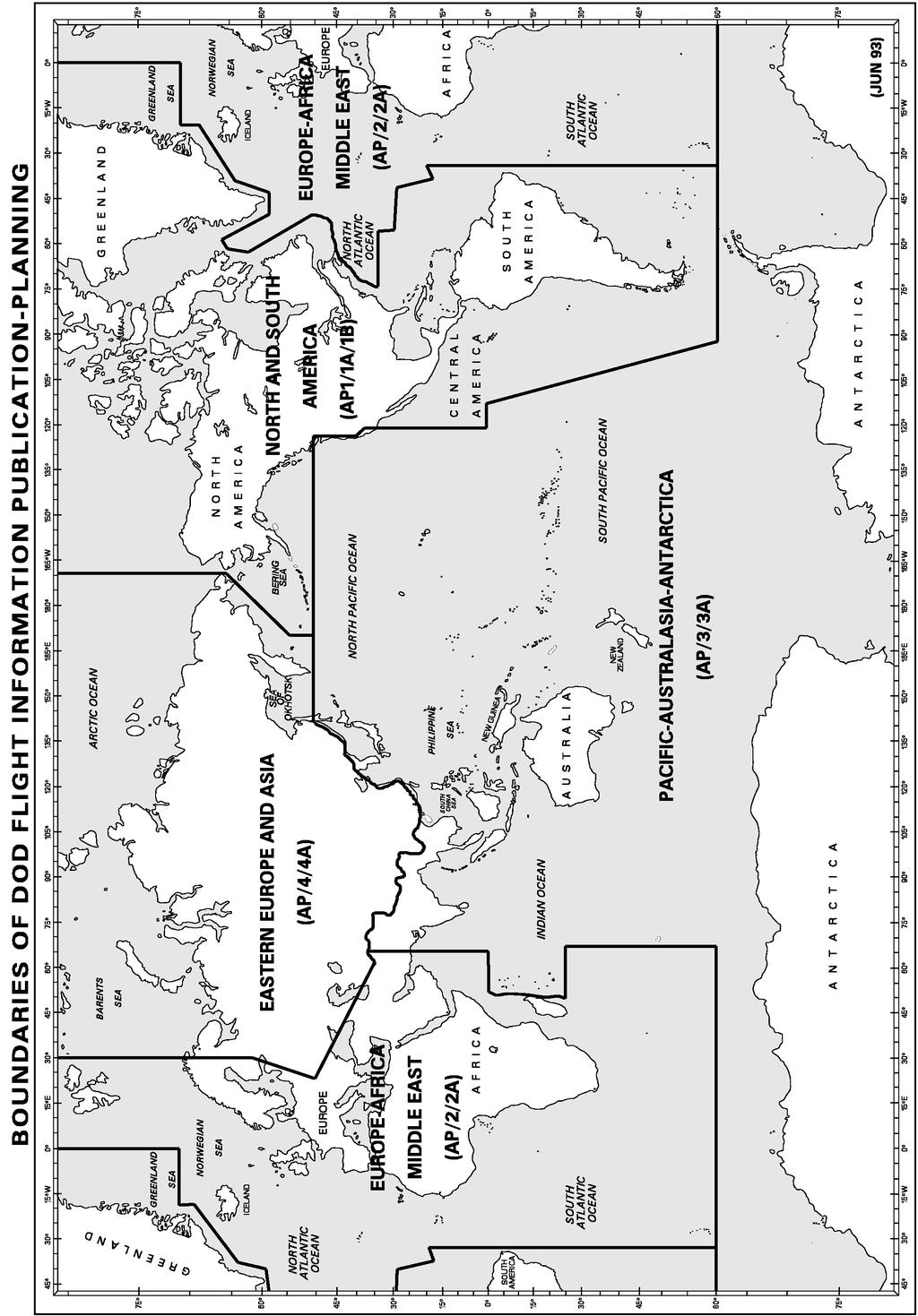
231
EUROPE-AFRICA- MIDDLE EAST
 DoD FLIGHT INFORMATION PUBLICATION AP/2 AREA PLANNING EUROPE-AFRICA- MIDDLE EAST EFFECTIVE 0001L 26 APR 2018 TO 0001L 11 OCT 2018 PCN NR 1 EFFECTIVE 0001L 21 JUN 2018 PCN NR 2 EFFECTIVE 0001L 16 AUG 2018
NORTH AND SOUTH AMERICA
 DoD FLIGHT INFORMATION PUBLICATION AP/1 AREA PLANNING NORTH AND SOUTH AMERICA EFFECTIVE 0001L 29 MAR 2018 TO 0001L 13 SEP 2018 PCN NR 1 EFFECTIVE 0001L 24 MAY 2018 INCLUDED PCN NR 2 EFFECTIVE 0001L 19
International Civil Aviation Organization. Sixth Meeting of CNS/MET Sub-Group of APANPIRG. Bangkok, Thailand, July 2002
 CNS/MET/SG/6-WP/21 International Civil Aviation Organization Sixth Meeting of CNS/MET Sub-Group of APANPIRG Bangkok, Thailand, 15 19 July 2002 Agenda Item 3: ATN transition planning CNS/ATM IMPLEMENTATION
International Civil Aviation Organization. Seventh Meeting of CNS/MET Sub-Group of APANPIRG and Tenth Meeting of CNS/ATM IC Sub-Group of APANPIRG
 CNS/MET-ATM WP/9 International Civil Aviation Seventh Meeting of CNS/MET Sub-Group of APANPIRG and Tenth Meeting of CNS/ATM IC Sub-Group of APANPIRG Bangkok, Thailand, 15 21 July 2003 Agenda Item 13: Review
AD 2. AERODROMES. For the ICAO location indicators used for Canadian aerodromes, refer to the following publications:
 AIP CANADA (ICAO) PART 3 AERODROMES (AD) AD 2. AERODROMES AD 2.1 Aerodrome Location Indicator and Name For the ICAO location indicators used for Canadian aerodromes, refer to the following publications:
Accounting Basis by Country
 Accounting Basis by Country Egypt Africa Northern Africa Morocco Africa Northern Africa Sudan Africa Northern Africa Western Sahara Africa Northern Africa Angola Africa Sub-Saharan Africa Benin Africa
APPENDIX F AIRSPACE INFORMATION
 APPENDIX F AIRSPACE INFORMATION Airspace Use DEFINITION OF AIRSPACE Airspace, or that space which lies above a nation and comes under its jurisdiction, is generally viewed as being unlimited. However,
EFFECTIVE 0901Z 29 MARCH 2018 TO 0901Z 24 MAY 2018 AIP CANADA (ICAO) Part 3 Aerodromes (AD)
 Part 3 Aerodromes (AD)") EFFECTIVE 0901Z 29 MARCH 2018 TO 0901Z 24 MAY 2018 AIP CANADA (ICAO) Part 3 Aerodromes (AD) Published by in accordance with ICAO Annexes 4 and 15 of the Convention on International Civil Aviation 2018
EFFECTIVE 0901Z 29 MARCH 2018 TO 0901Z 24 MAY 2018 AIP CANADA (ICAO) Part 3 Aerodromes (AD) Published by in accordance with ICAO Annexes 4 and 15 of the Convention on International Civil Aviation 2018
Aeronautical Safety of Navigation - The Present and the Future
 Aeronautical Safety of Navigation - The Present and the Future Fran Early 15 June 2011 CNS/ATM Conference 314-676-9114 NGA = Safety of Flight NGA and Geospatial Intelligence NGA Mission To provide timely,
IFR SEPARATION WITHOUT RADAR
 1. Introduction IFR SEPARATION WITHOUT RADAR When flying IFR inside controlled airspace, air traffic controllers either providing a service to an aircraft under their control or to another controller s
ICAO Asia-Pacific Flight Procedure Programme
 ICAO Asia-Pacific Flight Procedure Programme Xiao Jing Deputy Chief of Regional Sub-Office, Asia and Pacific Flight Procedure Programme (FPP) Manager International Civil Aviation Organization (ICAO) 1
Financial Reporting Standards Adoption by Country
 Financial Reporting Standards Adoption by Country Egypt Africa Northern Africa Morocco Africa Northern Africa Sudan Africa Northern Africa Western Sahara Africa Northern Africa Angola Africa Sub-Saharan
USE OF RADAR IN THE APPROACH CONTROL SERVICE
 USE OF RADAR IN THE APPROACH CONTROL SERVICE 1. Introduction The indications presented on the ATS surveillance system named radar may be used to perform the aerodrome, approach and en-route control service:
Civil/Military Coordination Workshop Havana, Cuba April 2015
 Civil/Military Coordination Workshop Havana, Cuba 13-17 April 2015 Civil/Military Coordination in the United States based on Appendix A of ICAO Circular 330 Dave Edwards, U.S. Coast Guard Chairman, ICAO/International
TABLE OF CONTENTS 1.0 INTRODUCTION...
 Advisory Circular Subject: Changes to Air Operator Certificates and Private Operator Registration Documents Issuing Office: Civil Aviation, Standards Document No.: AC 700-043 File Classification No.: Z
Letter of Agreement (LOA)
") Page 1 of 8 Letter of Agreement (LOA) Between Sanya FIR (ZJSA), People s Republic of China Division (VATPRC) and Hong Kong FIR (VHHK), Southeast Asia Division (VATSEA) Revision: New Release Effective Date:
Page 1 of 8 Letter of Agreement (LOA) Between Sanya FIR (ZJSA), People s Republic of China Division (VATPRC) and Hong Kong FIR (VHHK), Southeast Asia Division (VATSEA) Revision: New Release Effective Date:
Audit of Acme Air Training Manual to Advanced Aircrew Academy Online 135 Pilot Recurrent and Initial Curriculums - EXAMPLE
 Audit of Acme Air Training Manual to Advanced Aircrew Academy Online 135 Pilot Recurrent and Initial Curriculums - EXAMPLE Advanced Aircrew Academy will provide an online training center with the following
Regulations & Obligations
 Regulations & Obligations Thursday, March 24, 2015 9:00 a.m. 10:00 a.m.) PRESENTED BY: John Harpool Richard White Adam Hartley International Operators Conference San Diego, CA March 21 24, 2016 Sources:
COMPLIANCE WITH THIS PUBLICATION IS MANDATORY
 BY ORDER OF THE SECRETARY OF THE AIR FORCE AIR FORCE INSTRUCTION 11-201 30 NOVEMBER 2018 Flying Operations FLIGHT INFORMATION PUBLICATIONS COMPLIANCE WITH THIS PUBLICATION IS MANDATORY ACCESSIBILITY: Publications
REPORT ON PROGRESS AND ACCOMPLISHMENTS OF THE ICAO APAC FLIGHT PROCEDURE PROGRAMME (FPP) IN 2012
 IN 2012") REPORT ON PROGRESS AND ACCOMPLISHMENTS OF THE ICAO APAC FLIGHT PROCEDURE PROGRAMME (FPP) IN 2012 ICAO Asia- Pacific FPP Beijing, China ICAO Asia-pacific FPP, Beijing 1 Content History Member States FPP
REPORT ON PROGRESS AND ACCOMPLISHMENTS OF THE ICAO APAC FLIGHT PROCEDURE PROGRAMME (FPP) IN 2012 ICAO Asia- Pacific FPP Beijing, China ICAO Asia-pacific FPP, Beijing 1 Content History Member States FPP
AIR LAW AND ATC PROCEDURES
 1 The International Civil Aviation Organisation (ICAO) establishes: A standards and recommended international practices for contracting member states. B aeronautical standards adopted by all states. C
OPERATIONS MANUAL TABLE OF CONTENTS
 1 of 8 CHAPTER 8: TABLE OF CONTENTS 8.1 8.2 INTRODUCTION ENROUTE NAVIGATION CHARTS 3 4 8.3 JEPPESEN INSTRUMENT APPROACH PROCEDURE (IAC) 5 8. 4 AMENDMENTS 6 8.4.1 General 6 8.4.1.1 NOTAM 6 8.4.2 Distribution
Structuring national health systems to deliver better services
 Structuring national health systems to deliver better services Peter Annear pannear@unimelb.edu.au Asia and the Pacific Policy Society Conference 2014 Confronting the Pacific s health challenges Crawford
COLLISION AVOIDANCE FOR RPAS
 COLLISION AVOIDANCE FOR RPAS Johan Pellebergs, Saab Aeronautics ICAS workshop, September 2017 This document and the information contained herein is the property of Saab AB and must not be used, disclosed
NZQA registered unit standard version 2 Page 1 of 5. Demonstrate knowledge of Asian countries as tourist destinations
 Page 1 of 5 Title Demonstrate knowledge of Asian countries as tourist destinations Level 3 Credits 8 Purpose People credited with this unit standard are able to: locate Asian countries, and key cities,
Pilot RVSM Training Guidance Material
 Pilot RVSM Training Guidance Material Captain Souhaiel DALLEL IFALPA RVP AFI WEST RVSM Pilot Procedures ICAO requires states to establish for flight crews specific: Initial training programs and Recurrent
BOSTON ARTCC (vzbw) TRAINING SYLLABUS LEVEL: Center Controller (C1)
 TRAINING SYLLABUS LEVEL: Center Controller (C1)") BOSTON ARTCC (vzbw) TRAINING SYLLABUS LEVEL: Center Controller (C1) I have lots more to do, a lot more to keep track of, so I ll do it right the first time and won t suck at it. (vzbw Center Controller
BOSTON ARTCC (vzbw) TRAINING SYLLABUS LEVEL: Center Controller (C1) I have lots more to do, a lot more to keep track of, so I ll do it right the first time and won t suck at it. (vzbw Center Controller
Information Paper 2 SUMMARY
 COSCAP North Asia Cooperative Development of Operational Safety & Continuing Airworthiness Programme 14th STEERING COMMITTEE MEETING Performance Based Navigation (PBN) Update on ICAO Asia and Pacific Regional
UNITED STATES OF AMERICA FEDERAL AVIATION ADMINISTRATION WASHINGTON D.C. GRANT OF EXEMPTION
 In the matter of the petition of the DEPARTMENT OF DEFENSE UNITED STATES OF AMERICA FEDERAL AVIATION ADMINISTRATION WASHINGTON D.C. Exemption No. 5100B For an exemption from the provisions 25863 Of sections
ALTIMETER SETTING PROCEDURES
 AIP New Zealand ENR 1.7-1 ENR 1.7 ALTIMETER SETTING PROCEDURES 1 INTRODUCTION 1.1 General 1.1.1 The requirements for altimeter setting are detailed in CAR Part 91. The requirements are summarised in this
WORLD PRESS FREEDOM INDEX 2012
 WORLD PRESS FREEDOM INDEX 2012 1 Finland -10,00 = - Norway -10,00 = 3 Estonia -9,00 - Netherlands -9,00 5 Austria -8,00 6 Iceland -7,00 - Luxembourg -7,00 8 Switzerland -6,20 9 Cape Verde -6,00 10 Canada
Air Traffic Services Standards and Procedures Contents
 Air Traffic Services Standards and Procedures Contents Effective Date Preface 18 May 2007 Contents 31 July 2013 Section 1 Glossary 22 July 2009 Chapter 1 Definitions 8 February 2013 Chapter 2 Abbreviations
R-2515 R-2508 COMPLEX
 R-2515 R-2508 COMPLEX Edwards AFB PPR Briefing Edwards AFB and Edwards Class D Surface Area lie within Restricted Area 2515: R-2515 and Edwards Class D Surface Area contain many flight hazards for aircrews
IVAO Flight Operations Department Indonesia (ID) Division Procedures
 Division Procedures") IVAO Flight Operations Department Indonesia (ID) Division Procedures Revised April 12 rd, 2010 Please consult also the local application of common procedures on http://www.ivao.web.id 1. General 1.1 In
IVAO Flight Operations Department Indonesia (ID) Division Procedures Revised April 12 rd, 2010 Please consult also the local application of common procedures on http://www.ivao.web.id 1. General 1.1 In
Class Alpha. In addition, if you fly above FL240 your aircraft must have DME or a suitable RNAV system.
 Go For It Class Alpha Class A airspace is from 18,000 feet MSL to Flight Level 600 (60,000 feet pressure altitude). Its lateral extent includes the contiguous U.S. and Alaska, and extends 12 nm from the
GOVERNMENT OF INDIA OFFICE OF DIRECTOR GENERAL OF CIVIL AVIATION
 GOVERNMENT OF INDIA OFFICE OF DIRECTOR GENERAL OF CIVIL AVIATION ANSS AC NO. 1 of 2017 31.07. 2017 Air Space and Air Navigation Services Standard ADVISORY CIRCULAR Subject: Procedures to follow in case
Air Traffic Services Standards and Procedures Contents
 Air Traffic Services Standards and Procedures Contents Effective Date Preface 18 May 2007 Contents 22 July 2009 Section 1 Glossary 22 July 2009 Chapter 1 Chapter 3 Chapter 4 Definitions Abbreviations Conversion
EXPLANATION OF TPP TERMS AND SYMBOLS
 U.S. TERMINAL PROCEDURES PUBLICATION 52 EXPLANATION OF TPP TERMS AND SYMBOLS The discussions and examples in this section will be based primarily on the IFR (Instrument Flight Rule) Terminal Procedures
FIT FOR PURPOSE: A Guide to Using NAV CANADA Aeronautical Publications SECTION B PUBLICATION SPECIFIC FIT FOR PURPOSE INFORMATION
 FIT FOR : A Guide to Using NAV CANADA Aeronautical Publications SECTION B PUBLICATION SPECIFIC FIT FOR INFORMATION I TABLE OF CONTENTS SECTION A: GENERAL MATERIAL 2 SECTION B: PUBLICATION SPECIFIC FIT
OCEANIC REQUIRED NAVIGATION PERFORMANCE (Including RNP-10 and RNP-4)
") King Schools Online Internet Learning Programs OCEANIC REQUIRED NAVIGATION PERFORMANCE (Including RNP-10 and RNP-4) Flight Crew Certification Course SYLLABUS King Schools, Inc. 3840 Calle Fortunada San
King Schools Online Internet Learning Programs OCEANIC REQUIRED NAVIGATION PERFORMANCE (Including RNP-10 and RNP-4) Flight Crew Certification Course SYLLABUS King Schools, Inc. 3840 Calle Fortunada San
Asia Pacific Seamless ATM Plan and Implementation of ATFM in Asia Pacific
 Asia Pacific Seamless ATM Plan and Implementation of ATFM in Asia Pacific Yoshiki Imawaka Deputy Director - ICAO Asia and Pacific Office Global Ministerial Conference Riyadh, Saudi Arabia, 29 31 August
AUSTRALIA AERONAUTICAL INFORMATION SERVICE AIRSERVICES AUSTRALIA GPO BOX 367 CANBERRA ACT 2601 CESSATION OF NAVIGATION APPROVALS UNDER CAO 20.
 TELEPHONE: 1300-306-630 (local call - Aust wide, except from mobile phone) FAX: 02 6268 5111 1. INTRODUCTION 1.1 This AIP SUP amends AIP to remove navigation approvals that are no longer able to be used
UNITED STATES OF AMERICA FEDERAL AVIATION ADMINISTRATION WASHINGTON D.C. GRANT OF EXEMPTION
 In the matter of the petition of the DEPARTMENT OF DEFENSE UNITED STATES OF AMERICA FEDERAL AVIATION ADMINISTRATION WASHINGTON D.C. Exemption No. 5100C For an exemption from the provisions 25863 Of sections
PBN Syllabus Helicopter. Learning Objective. phase Theoretical PBN concept. in ICAO Doc 9613)
") PBN Syllabus Helicopter Training Topic phase Theoretical PBN concept training (as described in ICAO Doc 9613) PBN principles PBN components PBN scope Navigation specifications RNAV and RNP Navigation functional
PBN Syllabus Helicopter Training Topic phase Theoretical PBN concept training (as described in ICAO Doc 9613) PBN principles PBN components PBN scope Navigation specifications RNAV and RNP Navigation functional
Electronic Terrain and Obstacle Data
 International Civil Aviation Organization Electronic Terrain and Obstacle Data David Lewtas Chief, Aeronautical Information Unit (MET/AIM) 24 November 2010 ICAO CAR AIM Seminar Kingston, Jamaica 22-24
FLASHCARDS AIRSPACE. Courtesy of the Air Safety Institute, a Division of the AOPA Foundation, and made possible by AOPA Holdings Company.
 AIRSPACE FLASHCARDS Courtesy of the Air Safety Institute, a Division of the AOPA Foundation, and made possible by AOPA Holdings Company. The Air Safety Institute is dedicated to making flying easier and
International Civil Aviation Organization FIT-ASIA CRA ARRANGEMENTS, PROBLEM REPORTS, AND PERFORMANCE DATA ANALYSIS REPORTING
 International Civil Aviation Organization FIT-Asia/5 WP/02 05-06/05/2016 The Fifth Meeting of the Future Air Navigation Systems Interoperability Team- Asia (FIT-Asia/5) Bangkok, Thailand, 05 06 May 2016
DP-3 ICAO Electronic Terrain and. Amendments 33 & 36
 DP-3 ICAO Electronic Terrain and Obstacle Data Amendments 33 & 36 1 Published Amendment 33 to ICAO Annex 15, Chapter 10 July 2004, ICAO Annex 15(Aeronautical Information Services) addeda new Chapter 10
OPERATIONS MANUAL PART A
 PAGE: 1 Table of Content A.GENERAL /CHAPTER 7 -....3 7.... 3 7.1 Minimum Flight Altitudes /Flight Levels VFR Flight... 3 7.2 Minimum Flight Altitudes /Flight Levels IFR Flight... 4 7.2.1 IFR flights non
TRAINING BULLETIN No. 1
 TRAINING BULLETIN No. 1 Introduction: Hickok & Associates has provided a new charting legend Hickok & Associates Helicopter Instrument Approach and Departure Charts - Charting Format & Legend (Revision2),
AIP KUWAIT FIR AMENDMENT 28 IMPLEMENTATION AIRAC DATE 25 NOVEMBER 2004
 Phone: +965 476 25 31 FAX: +965 476 55 12 AFTN: OKNOYNYX Email :ais1@kuwait-airport.com.kw www.kuwait-airport.com.kw STATE OF DIRECTORATE GENERAL OF CIVIL AVIATION AERONAUTICAL INFORMATION SERVICE (AIS)
Appendix A REQUEST FOR AUTHORIZATION FORM
 Appendix A REQUEST FOR AUTHORIZATION FORM Note. For details on completing this form, and for definitions of acronyms and abbreviations, see section on Information Required for the Assessment of Authorization
RNP OPERATIONS. We will now explain the key concepts that should not be mixed up and that are commonly not precisely understood.
 RNP OPERATIONS 1. Introduction Planes were made as a means of transport. To successfully fly from a location A to a location B, pilots were first and foremost navigators. Originally relying on visual landmarks
REPUBLIC OF KOREA. Table 1. FDI flows in the host economy, by geographical origin. (Millions of US dollars)
") Table 1. FDI flows in the host economy, by geographical origin World 4 130 3 395 4 383 8 980 7 050 4 950 2 629 8 409 7 501 8 117 10 247 11 117 Developed economies 3 123 2 385 2 949 7 185 5 743 3 423-275
Table 1. FDI flows in the host economy, by geographical origin World 4 130 3 395 4 383 8 980 7 050 4 950 2 629 8 409 7 501 8 117 10 247 11 117 Developed economies 3 123 2 385 2 949 7 185 5 743 3 423-275
Membership & Voting Strength - 1 October September 2020
 ship & Voting Strength - 1 October 2016-30 September 2020 Assessment Period - 1 October 2012-30 September 2016 Junior Team Championships Junior - Championships Junior - Championships Junior - Africa 1
Navigation Data Chain Certification
 853d Electronic Systems Group Navigation Data Chain Certification Prepared by: 853rd ELSG/NT Electronic Systems Center Hanscom AFB, MA 23 May 2008 Nav Data Chain Certification Overview Background Why certify
AERONAUTICAL INFORMATION CIRCULAR 18/18
 NAV CANADA 19 JUL 18 AERONAUTICAL INFORMATION CIRCULAR 18/18 GUIDANCE FOR STANDARD TERMINAL ARRIVAL (STAR) PROCEDURES The guidance currently published in the Transport Canada Aeronautical Information Manual
PATA Strategic Intelligence Centre. Tsunami Recovery Update. Wednesday June 22, 2005
 PATA Strategic Intelligence Centre Tsunami Recovery Update Wednesday June 22, 2005 Page 1 of 6 Y-T-D Inbound (Source: Relevant NTOs, Airport Authorities) Year Destination Period 2004 2005 Change The Americas
SUPPLEMENT A33 TO THE AIRPLANE FLIGHT MANUAL DA 40 NG. Integrated Avionics System Garmin G1000,
 DA 40 NG AFM Garmin G1000, P-RNAV Operation SUPPLEMENT A33 TO THE AIRPLANE FLIGHT MANUAL DA 40 NG Integrated Avionics System Garmin G1000, Doc. No. : 6.01.15-E Date of Issue : Design Change Advisory :
TANZANIA CIVIL AVIATION AUTHORITY AIR NAVIGATION SERVICES INSPECTORATE. Title: CONSTRUCTION OF VISUAL AND INSTRUMENT FLIGHT PROCEDURES
 Page 1 of 8 1. PURPOSE 1.1. This Advisory Circular provides guidance to personnel involved in construction of instrument and visual flight procedures for publication in the Aeronautical Information Publication.
Gestão de Tráfego Aéreo 2015/2016 Exam Name Student ID Number. I (5.5/20, 0.5 each)
") Gestão de Tráfego Aéreo 2015/2016 Exam 2016.01.04 Name Student ID Number I (5.5/20, 0.5 each) What is each contracting state of ICAO required to provide? [ ] Modern radio navigation facilities for aeroplanes
Gestão de Tráfego Aéreo 2015/2016 Exam 2016.01.04 Name Student ID Number I (5.5/20, 0.5 each) What is each contracting state of ICAO required to provide? [ ] Modern radio navigation facilities for aeroplanes
Asia-Pacific Competition Law Handbook 2014/15
 Asia-Pacific Competition Law Handbook 2014/15 Related publications Our GLOBAL COMPETITION AND REGULATION TEAM (2014) This brochure is a snapshot of our global Competition legal team at Ashurst. It highlights
COUNTRY & TERRITORY PROFILES A Summary of Oil Spill Response Arrangements & Resources Worldwide
 3. COUNTRY & TERRITORY PROFILES (including date of update) A Albania August 2010 Antigua January 2009 Algeria May 2011 Argentina December 2015 Angola May 2009 Aruba April 2008 Anguilla November 2005 Australia
Combined ASIOACG and INSPIRE Working Group Meeting, 2013 Dubai, UAE, 11 th to 14 th December 2013
 IP/2 Combined ASIOACG and INSPIRE Working Group Meeting, 2013 Dubai, UAE, 11 th to 14 th December 2013 Agenda Item 2: Action Item from ASIOACG/7 Indian Ocean RNP4 (Presented by Airservices Australia) SUMMARY
PACIFIC ISLAND COUNTRIES
 QUARTERLY REVIEW OF TOURIST ARRIVALS IN PACIFIC ISLAND COUNTRIES QUARTER 1, 217 I June, 217 Report prepared by : Research & Statistics Division Contacts : Elizabeth Ragimana (eragimana@spto.org) Jennifer
Contents. Subpart A General 91.1 Purpose... 7
 Contents Rule objective... 3 Extent of consultation... 3 Summary of comments... 4 Examination of comments... 6 Insertion of Amendments... 6 Effective date of rule... 6 Availability of rules... 6 Part 91
SITE ELEVATION AMSL...Ground Elevation in feet AMSL STRUCTURE HEIGHT...Height Above Ground Level OVERALL HEIGHT AMSL...Total Overall Height AMSL
 ******************************************** * Federal Airways & Airspace * * Summary Report * ******************************************** File: User Assigned File Name Latitude: NAD83 Coordinate Longitude:
Section 5. Radar Separation
 7/24/14 JO 7110.65V CHG 1 4/3/14 JO 7110.65V Section 5. 5 5 1. APPLICATION a. Radar separation must be applied to all RNAV aircraft operating at and below FL450 on Q routes or random RNAV routes, excluding
REGULATION No. 10/2011 ON APPROVAL OF FLIGHT PROCEDURES INCLUDING SID-s AND STAR-s. Article 1 Scope of Application
 Republika e Kosovës Republika Kosovo Republic of Kosovo Autoriteti i Aviacionit Civil i Kosovës Autoritet Civilnog Vazduhoplovstva Kosova Civil Aviation Authority of Kosovo Director General of Civil Aviation
VATUSA-VATNZ-VATPAC OCEANIC PARTNERSHIP OAKLAND OCEANIC FSS GENERAL SOP 1 OCT 2012
 VATUSA-VATNZ-VATPAC OCEANIC PARTNERSHIP EFFECTIVE OAKLAND OCEANIC FSS GENERAL SOP 1 OCT 2012 I. PURPOSE With the establishment of the VATNZ division of the Oceania Region on 1 January 2007, the Oakland
2005 Annual change ha Ref. year ha ha ha % ha ha % ha ha %
 9 Chapter 3 Global overview A total of 124 countries and areas were identified as containing one or more true mangrove species (Tomlinson, 1986; Saenger, Hegerl and Davie, 1983) (see Annex 3). Table 2
Chapter 6. Brize Radar, Speedbird 213 Heavy, request radar advisory. Speedbird 123 change call sign to BA 123
 INTRODUCTION The procedures for and VFR are mostly identical but some words and procedures are generally only used by large commercial aircraft; hence they appear in this section. In this chapter we will
Class B Airspace. Description
 Class B Airspace Ref. AIM 3-2-3 and FAR 91.131 Surrounds certain large airports Within each Class B airspace area, there are multiple segments with different ceiling/floor altitudes. Example: 70/30 = ceiling
FLIGHT SUPPORT LECTURE GUIDE
 NAVAL AIR TRAINING COMMAND NAS CORPUS CHRISTI, TEXAS CNATRA P-1233 (Rev. 06-09) FLIGHT SUPPORT LECTURE GUIDE AIRWAYS NAVIGATION FLIGHT PROCEDURES T-45 COMBINED FLIGHT TRAINING 2009 FLIGHT TRAINING INSTRUCTION
Chapter 6. Nonradar. Section 1. General DISTANCE
 12/10/15 JO 7110.65W Chapter 6. Nonradar Section 1. General 6 1 1. DISTANCE Use mileage based (DME and/or ATD) procedures and minima only when direct pilot/controller communications are maintained. FIG
Civil Instrument Flight Rules at Military Aerodromes or in Military Controlled Airspace
 Federal Departement of the Environment, Transport, Energy and Communications DETEC Federal Office of Civil Aviation FOCA Safety Division - Flight Operations FOCA GM/INFO Guidance Material / Information
Air Law and ATC Procedures Subject: AIR LAW AND ATC PROCEDURES
 Air Law and ATC Procedures Subject: Classroom Instruction: YES (Workshop) Appr. # of Instruction Hrs: 3 Internal Examination: YES ITSS (online) / Offline International Law: Conventions, Agreements and
Ref. T AP070/09(FS) 24 April 2009
 24 April 2009") International Organiracp~ Mwy~apa~~a~f Civil Aviation de Avlacidn Civil Q ~ ~ P H U ~ ~ M R DFganization lnternacionel rpru~anama anmquu Ref. T 611 1.26 - AP070/09(FS) 24 April 2009 Subject: Foreign Air
International Organiracp~ Mwy~apa~~a~f Civil Aviation de Avlacidn Civil Q ~ ~ P H U ~ ~ M R DFganization lnternacionel rpru~anama anmquu Ref. T 611 1.26 - AP070/09(FS) 24 April 2009 Subject: Foreign Air
(DRAFT) AFI REDUCED VERTICAL SEPARATION MINIMUM (RVSM) RVSM SAFETY POLICY
 AFI REDUCED VERTICAL SEPARATION MINIMUM (RVSM) RVSM SAFETY POLICY") (DRAFT) AFI REDUCED VERTICAL SEPARATION MINIMUM (RVSM) RVSM SAFETY POLICY 26 May 04 TABLE OF CONTENTS CONTENTS... PAGE SECTION 1: INTRODUCTION...3 SECTION 2: RVSM OPERATIONAL CONCEPT...3 SECTION 3: AFI
(DRAFT) AFI REDUCED VERTICAL SEPARATION MINIMUM (RVSM) RVSM SAFETY POLICY 26 May 04 TABLE OF CONTENTS CONTENTS... PAGE SECTION 1: INTRODUCTION...3 SECTION 2: RVSM OPERATIONAL CONCEPT...3 SECTION 3: AFI
Consider problems and make specific recommendations concerning the provision of ATS/AIS/SAR in the Asia Pacific Region LOST COMMUNICATION PROCEDURES
 International Civil Aviation Organization Thirteenth Meeting of the APANPIRG ATS/AIS/SAR Sub-Group (ATS/AIS/SAR/SG/13) Bangkok, Thailand, 23-27 June 2003 ATS/AIS/SAR/SG/13 WP/30 23/6/03 Agenda Item 4:
SAFETYSENSE LEAFLET AIR TRAFFIC SERVICES OUTSIDE CONTROLLED AIRSPACE
 SAFETYSENSE LEAFLET 8e AIR TRAFFIC SERVICES OUTSIDE CONTROLLED AIRSPACE 1 INTRODUCTION 2 NON-RADAR SERVICES 3 RADAR SERVICES 4 HOW TO OBTAIN A SERVICE 5 RADAR SERVICE LIMITATIONS 1 INTRODUCTION a) In this
Gleim Private Pilot Syllabus Fifth Edition, 3rd Printing Updates March 2016
 Page of Gleim Private Pilot Syllabus Fifth Edition, rd Printing Updates March 0 NOTE: Text that should be deleted is displayed with a line through it. New text is shown with a blue background. If you see
SHERAKHAN DESTINATIONS
 SHERAKHAN WORLD TOUR 2015 NETHERLANDS ST MARTIN COSTA RICA COLON PUERTO PLATA SAN JUAN ROAD TOWN COLOMBIA MAHAJANGA BURMA INDIA THAILAND PORT BLAIR SRI LANKA IRIAN MALDIVES KUALA LUMPUR SINGAPORE VICTORIA
PBN IMPLEMENTATION IN INDONESIA
 PBN IMPLEMENTATION IN INDONESIA Program For The PBN Workshop For ATC I Wayan Sudiartha Head of the Standardization and Certification Division Profile of AirNav Indonesia Establishment : o Declared by Government
Part 105. Parachuting - Operating Rules. CAA Consolidation. 15 December Published by the Civil Aviation Authority of New Zealand
 Part 105 CAA Consolidation 15 December 2012 Parachuting - Operating Rules Published by the Civil Aviation Authority of New Zealand DESCRIPTION Part 105 prescribes rules relating to parachute operations,
Windmills & Airspace Can We Work Together?
 May 29, 2008 Windmills & Airspace Can We Work Together? J. Randolph Babbitt C O N F I D E N T I A L www.oliverwyman.com Windmills & Airspace Overview of Airspace Issues For Wind Turbine Sites The FAA s
AERONAUTICAL SERVICES ADVISORY MEMORANDUM (ASAM) Focal Point: Gen
 Focal Point: Gen") Page 1 of 6 1 INTRODUCTION Each route shall be assigned a designator that is unique for that aerodrome. The designator shall be defined in accordance with Annex 11, Appendix 3. In addition, the first 4
Page 1 of 6 1 INTRODUCTION Each route shall be assigned a designator that is unique for that aerodrome. The designator shall be defined in accordance with Annex 11, Appendix 3. In addition, the first 4
Understanding the Jeppesen. Updates: Changes, Errata and What s New
 Understanding the Jeppesen Updates: Changes, Errata and What s New www.understandingaviation.com info@understandingaviation.com Table of Contents Changes... 1 Errata... 5 What s New... 5 Changes Law Amendment
COSCAP CAAM COOPERATION
 14 th STEERING COMMITTEE MEETING 18-20 JUNE, ULAANBAATAR, MONGOLIA CAA OF MONGOLIA COSCAP CAAM COOPERATION ARIUNGEREL Purev AIS Director Civil Aviation Authority of Mongolia Aeronautical Information Management
INTERNATIONAL CIVIL AVIATION ORGANIZATION FIRST MEETING OF DIRECTORS OF CIVIL AVIATION OF THE CARIBBEAN REGION (CAR/DCA/1)
") CAR DCA/1 20/09/02 INTERNATIONAL CIVIL AVIATION ORGANIZATION FIRST MEETING OF DIRECTORS OF CIVIL AVIATION OF THE CARIBBEAN REGION (CAR/DCA/1) (Grand Cayman, Cayman Islands, 8-11 October 2002) Agenda Item
CAR DCA/1 20/09/02 INTERNATIONAL CIVIL AVIATION ORGANIZATION FIRST MEETING OF DIRECTORS OF CIVIL AVIATION OF THE CARIBBEAN REGION (CAR/DCA/1) (Grand Cayman, Cayman Islands, 8-11 October 2002) Agenda Item
ENR 1.1 GEN. RULES (Insert para 13 in ENR 1.1 of AIP India as follows)
") TEL: +91-11-24632950 Extn: 2219/2233 AFS: VIDDYXAX FAX: +91-11-24615508 Email: gmais@aai.aero INDIA AERONAUTICAL INFORMATION SERVICE AIRPORTS AUTHORITY OF INDIA RAJIV GANDHI BHAVAN SAFDARJUNG AIRPORT NEW
TEL: +91-11-24632950 Extn: 2219/2233 AFS: VIDDYXAX FAX: +91-11-24615508 Email: gmais@aai.aero INDIA AERONAUTICAL INFORMATION SERVICE AIRPORTS AUTHORITY OF INDIA RAJIV GANDHI BHAVAN SAFDARJUNG AIRPORT NEW
ENR 1.14 AIR TRAFFIC INCIDENTS
 AIP ENR.- Republic of Mauritius 0 AUG 00 ENR. AIR TRAFFIC INCIDENTS. Definition of air traffic incidents. "Air traffic incident" is used to mean a serious occurrence related to the provision of air traffic
Orientation Booklet The New Airline Chart Series
 Orientation Booklet The New Airline Chart Series Copyright 2007 Jeppesen. All rights reserved. Table of Contents Introduction...1 Approach Chart...2 Heading...2 Plan View...2 Profile View... Minimums...
Performance Based Navigation Operational End-State 2023
 Performance Based Navigation Operational End-State 2023 A Regulatory View Organisation Civil Aviation Authority of New Zealand Date of this Document November 2018 Authored by: Primary Author: Ray Harvey,
ICAO International Aviation and Environment Seminar OPERATIONAL IMPROVEMENTS. Presented by ICAO APAC RSO
 ICAO International Aviation and Environment Seminar OPERATIONAL IMPROVEMENTS Presented by ICAO APAC RSO Operations in the Context of Aviation Planning & Pre-Flight Post Landing Applicable Operational Improvements
DoD FLIGHT INFORMATION PUBLICATION GENERAL PLANNING EFFECTIVE 0001L 1 MAR 2018 TO 0001L 11 OCT 2018 PCN EFFECTIVE 0001L 21 JUN 2018
 DoD FLIGHT INFORMATION PUBLICATION GP GENERAL PLANNING EFFECTIVE 0001L 1 MAR 2018 TO 0001L 11 OCT 2018 PCN EFFECTIVE 0001L 21 JUN 2018 Consult NOTAMS for latest information. Published by NATIONAL GEOSPATIAL-INTELLIGENCE
Performance Based Navigation (PBN) Update on ICAO APAC Regional Sub-Office, APAC Flight Procedure Programme, and COSCAP Supports
 Update on ICAO APAC Regional Sub-Office, APAC Flight Procedure Programme, and COSCAP Supports") Performance Based Navigation (PBN) Update on ICAO APAC Regional Sub-Office, APAC Flight Procedure Programme, and COSCAP Supports COSCAP-NA 14 th Steering Committee Meeting June 2014 ICAO APAC Regional
Performance Based Navigation (PBN) Update on ICAO APAC Regional Sub-Office, APAC Flight Procedure Programme, and COSCAP Supports COSCAP-NA 14 th Steering Committee Meeting June 2014 ICAO APAC Regional
Consideration will be given to other methods of compliance which may be presented to the Authority.
 Advisory Circular AC 139-10 Revision 1 Control of Obstacles 27 April 2007 General Civil Aviation Authority advisory circulars (AC) contain information about standards, practices and procedures that the
REPUBLIC OF SEYCHELLES CIVIL AVIATION AUTHORITY AERONAUTICAL INFORMATION SERVICE P.O.BOX 181, VICTORIA SEYCHELLES
 Phone: 248-384000 AFS: FSIAYNYX FAX: 248-384030 Email: sezais@scaa.sc REPUBLIC OF SEYCHELLES CIVIL AVIATION AUTHORITY AERONAUTICAL INFORMATION SERVICE P.O.BOX 181, VICTORIA SEYCHELLES AIP SUPPLEMENT S02/09
Advanced Rating Study Guide
 Advanced Rating Study Guide FAR Part 103--Ultralight Vehicles FAR Part 91 VFR/IFR Cruise Altitude Windsports Soaring Center 12623 Gridley Street Sylmar, CA 91342-3334 Tel: (818) 367-2430 Fax: (818) 367-5363