Camp Ripley/Veterans State Trail. Master Plan DRAFT September 2012
|
|
|
- Hillary Fleming
- 5 years ago
- Views:
Transcription


1 Camp Ripley/Veterans State Trail Master Plan DRAFT September 2012

2 The Minnesota Department of Natural Resources, Parks and Trails Division would like to thank all who participated in this master planning process. Many individuals and groups in trail communities have been working for many years to help establish this trail. Members of the Camp Ripley/Veterans State Trail Committee and the Project Steering Committee (see below) played a leading role in these efforts and continues to do so. Many DNR staff, city, county, state and federal officials, trail association members and local citizens contributed their time and energy to the planning process as well. Project Team DNR Parks and Trails Division: Laurie Young, Planning Supervisor Suzanne Rhees, AICP, Principal Planner Jenny Wood, Conservation Corps of Minnesota Planner Bolton & Menk, Inc., Project Consultants: Angie Bersaw, Transportation Planner Phil Martin, Project Manager Chris Chromy, Transportation Services Manager Technical Assistance: Randy Thoreson, National Park Service, Rivers, Trails and Conservation Assistance Program 2012, Minnesota Department of Natural Resources Equal opportunity to participate in and benefit from programs of the Minnesota Department of Natural Resources is available to all individuals regardless of race, color, creed, religion, national origin, sex, marital status, status with regard to public assistance, age, sexual orientation, membership or activity in a local commission, or disability. Discrimination inquiries should be sent to MN-DNR, 500 Lafayette Road, St. Paul, MN ; or the Equal Opportunity Office, Department of the Interior, Washington, DC This document is available in alternative formats to individuals with disabilities by calling (Metro Area) or MINNDNR (MN Toll Free) or Telecommunication Device for the Deaf/TTY: (Metro Area) or (Toll Free TTY). For general information regarding DNR s programs, contact: Minnesota Department of Natural Resources 500 Lafayette Road St. Paul, MN (Metro area and outside Minnesota) MINNDNR (MN Toll Free)
3 REPRESENTATIVE AGENCY TITLE Rob Hall Crow Wing County Assistant County Engineer Steve Backowski Morrison County County Engineer Dave Enblom Cass County County Engineer Steve Voss MnDOT District 3 Planning Director Mary Safgren MnDOT District 3 Senior Planner Maj. Keith Ferdon Camp Ripley Training Coordinator Scott Schroeder MnDNR Parks and Trails Natural Resource Supervisor Jake Huebsch Region 5 Development Commission Transportation Planner Randy Thoreson National Park Service Outdoor Recreation Planner Bob Reinitz CRVST Trail Committee Committee Chair Laurie Young MnDNR Parks and Trails Planning Supervisor Jerry Lochner City of Little Falls Public Works Director Angie Bersaw Phil Martin Chris Chromy Bolton & Menk, Inc. Bolton & Menk, Inc. Bolton & Menk, Inc. Transportation Planner Project Manager Transportation Services Manager
4 TABLE OF CONTENTS Executive Summary... 1 Section 1: Planning Process, Purpose, and Scope... 3 Study Process Overview... 3 Why Plan for State Trails?... 4 The State and Regional Context... 4 Agency Coordination and Public Involvement Process... 5 Trail Authorization... 7 Outdoor Recreation Act... 7 Guiding Principles for Sustainable Trails... 9 Vision and Goals Section 2: Recommended Trail Uses Section 3: Trail Alignments and Connections Overview of the Trail Alignment Study Area Segment 1: Crow Wing State Park to the City of Pillager City of Brainerd City of Baxter City of Pillager Segment 2: West Side of Camp Ripley, Pillager to Randall City of Randall Segment 3: South Side of Camp Ripley, Randall to MN Segment 4: MN 371 (from MN 115) to Crow Wing State Park City of Fort Ripley Segment 5: Little Falls Area City of Little Falls Segment 6: Little Falls to the Soo Line Regional Trail Section 4: Trail Management Trail Cross-Section Examples Projected Trail Use Trail Maintenance Information and Education Enforcement Section 5: Natural Resources Ecological Classification System Climate Vegetation Water Resources Wildlife Section 6: Cultural and Socioeconomic Resources Historic and Archaeological Context Representative Historic Sites and Districts Socioeconomic Resources... 86
5 Financial Impacts of Trail Development Section 7: Implementation Overview of the Implementation Process Actions Local Governments Can Take to Support Trail Development Outstanding Issues for Trail Implementation References APPENDICES Appendix A: Rare Species and Communities of Concern Appendix B: Summary of Meeting Results and Public Comments FIGURES FIGURE 1 Public and Agency Involvement... 5 FIGURE 2 Camp Ripley/Veterans State Trail Study Area Corridor FIGURE 3 Minnesota State Trail System FIGURE 4 Overview of Planning Segments FIGURE 5 Segment 1A FIGURE 6 Segment 1B FIGURE 7 Baxter/Brainerd Area..44 FIGURE 8 City of Pillager FIGURE 9 Segment 2A. 46 FIGURE 10 Segment 2B FIGURE 11 Segment 2C FIGURE 12 City of Randall FIGURE 13 Segment 3A FIGURE 14 Segment 3B FIGURE 15 Segment 4A FIGURE 16 Segment 4B FIGURE 17 City of Fort Ripley FIGURE 18 Segment FIGURE 19 City of Little Falls 56 FIGURE 20 Segment FIGURE 21 Trail Cross-Section Examples FIGURE 22 Presettlement Vegetation - North FIGURE 23 Presettlement Vegetation - South FIGURE 24 Native Plant Communities - North FIGURE 25 Native Plant Communities - South FIGURE 26 - Complexity of Implementation TABLE 1: Implementation Factors... 96
6 PAGE LEFT BLANK INTENTIONALLY
7 Executive Summary Trail Alignment and Development The Camp Ripley/Veterans State Trail is a legislatively authorized state trail which will connect the Paul Bunyan State Trail in the Crow Wing State Park and the Soo Line Regional Trail near Little Falls, effectively linking the Central Lakes, Lake Wobegon, Soo Line, Paul Bunyan, Heartland and Mi-Gi-Zi trails into one continuous recreational route. These links also provide an opportunity to connect local trail systems in Central Minnesota as well as the communities of Baxter, Brainerd, Pillager, Randall, Little Falls and Fort Ripley. For purposes of this plan, the trail has been divided into six primary planning segments. The segments are Crow Wing State Park to the City of Pillager, the west side of Camp Ripley from Pillager to Randall, the south side of Camp Ripley from Randall to MN 371 and south to Little Falls, MN 371 to the Crow Wing State Park, the Little Falls Area, and from Little Falls to the Soo Line Regional Trail. Since the alignment has not been determined, criteria for location of the trail are provided, along with alternative trail alignment options being considered for each planning segment. Trail alignment options were developed through an iterative process with the Project Steering Committee and vetted through a public and local agency involvement process. Recommended/Allowable Trail Uses The Camp Ripley/Veterans State Trail is proposed to be a multi-use trail accommodating both motorized and non-motorized trail users. However, the limitations of width, land use restrictions, and sensitive resources dictate that not all uses may be accommodated at all times on the entire length of the trail. In many segments, the alignment options have been identified as multi-use at this stage. Further study will be needed to determine how motorized and non-motorized uses can be accommodated. In other segments, some alignment options have been identified as motorized only. These options were identified in areas where there are known constraints to abutting motorized and non-motorized uses. The trail will accommodate the range of uses found on most state trails, including bicycling, hiking and walking, dog walking, running/jogging, in-line skating/skate skiing, equestrian uses, cross-country skiing, snowmobiling, and environmental education/interpretation. In addition, all-terrain vehicles (ATVs) will be accommodated in most segments, as mentioned above. Certain segments of the trail may also be able to provide public access to waterways, for such uses as fishing and canoe launching, where appropriate. Additional alternative trail alignments will be pursued as necessary to accommodate proposed uses. Trail development will be accessible to people with disabilities wherever possible. Trail Management Trail cross-section examples were developed to illustrate a multi-use paved trail, gravel surfaced ATV trail and a natural surface equestrian track. Buffer areas DRAFT 9/5/2012 1
8 between side-by-side multi-use trail alignments will likely be needed to ensure safety and a pleasant experience for all users. The plan contains recommendations for maintenance, enforcement, and interpretation of natural and cultural resources. Trail maintenance is critical to provide and sustain the quality experience trail users expect and appreciate. The plan recommends that an adequate level of enforcement be provided via a multifaceted approach, to help maintain a safe and secure trail environment. It is also a goal to encourage trail users to understand and obey trail rules, respect other trail users and respect adjoining properties. Natural and Cultural Resources The ecological value of the trail corridor will be enhanced wherever possible through intensive resource management. The vegetation within the trail right-ofway will be managed to provide a healthy diversity of native woodland, wetland, and prairie communities for wildlife habitat and for the enjoyment of trail users and adjoining landowners. Native flowers, grasses, trees and shrubs that are consistent with the natural plant communities of the area will be planted and managed. Areas disturbed during construction will be seeded with native plants. Cultural resources will be preserved and managed for interpretive purposes. Some native plant community management may include cooperative efforts with adjacent land owners. Trail users will have opportunities to experience the history of the region through existing historical and proposed interpretive sites. Public Involvement Public involvement in the planning process has been extensive, with three wellattended public open houses, monthly meetings of the Project Steering Committee, and additional presentations to city and county boards and agencies and to recreation organizations. Public comments are summarized in Appendix B. Implementation The CRVST study area covers a very large area and therefore, it is unlikely that funding for the entire trail will become available all at one time. Funding will likely come from a variety of sources at different times throughout the trail development process. To address this, trail segments have been designed to be implementable in stages, with defined end-point for each segment. Planning-level cost-estimates have also been developed to give local governments and trail supporters a tool for prioritizing trail development. DRAFT 9/5/2012 2
9 1. Planning Process, Vision and Goals Study Process Overview Through the grass roots effort of the Little Falls Visitors and Convention Bureau, the Camp Ripley/Veterans State Trail (CRVST) received its official state trail designation in The CRVST is envisioned to be a true multi-use trail, providing direct motorized and non-motorized recreational use linkage from the Soo Line Trail south of Little Falls to Crow Wing State Park and numerous other recreational use trails, such as the Paul Bunyan State Trail and the Mississippi River Trail. In 2011, local trail advocates joined together with the counties of Cass, Crow Wing, and Morrison, surrounding communities and townships, Region 5 Development Commission (RDC), the Minnesota Department of Transportation (MnDOT), the Minnesota Department of Natural Resources (DNR), and the National Park Service to initiate a trail corridor study. Counties, cities and the RDC contributed to the hiring of Bolton & Menk, Inc., as consultants for the study. The study s primary purpose was to identify trail alignment options, planning cost estimates and a trail implementation plan. Soon after the initiation of the corridor study, DNR involvement was sought in order to coordinate the corridor study process with DNR s master plan process, as required for state trails. DNR representatives became active participants in the CRVST corridor study, leading to a combination corridor study/master plan development process. Consultants and DNR staff collaborated on meeting materials, open houses, and identification of potential trail alignments. This plan, therefore, incorporates most of the material developed for the corridor study, along with additional information on trail management, trail communities, and natural and cultural resources. The corridor study/ master planning process included the following major tasks: Development of an agency and public involvement process that encouraged meaningful participation opportunities for stakeholder involvement, education and discussion. Technical analyses and research to inventory existing trail facilities and user needs and expectations. Development of a trail vision and goals and objectives to lead the identification and evaluation of trail alignment alternatives. Identification and evaluation of general trail alignment locations for both motorized and non-motorized trail uses. Development of study recommendations and next steps to implement the recommended trail plan. The Camp Ripley/Veterans State Trail Corridor Study began in August 2011 and was complete by April The master plan process began concurrent with the corridor study; the draft master plan was released for public review in June All comments received have been carefully considered in revisions to the plan. DRAFT 9/5/2012 3
10 Why Plan for State Trails? Master planning for state trails is conducted in order to satisfy the requirement of Minnesota Statutes, Section 86A.09, which requires that a master plan be prepared for state trails. The planning process is intended to: Provide a unifying vision for trail advocates who are working to secure a trail alignment and funds for development and maintenance of the trail. Guide the development, management, maintenance and operation of the trail so that quality recreational, transportation and healthful exercise opportunities are provided. Provide a forum for open public discussion concerning trail use and trail development options, trail maintenance and management issues, and trail operations and enforcement needs. Support partnerships and processes that will help execute the plan and contribute to providing quality trail opportunities. Assess the projected impacts of trail development on natural, cultural and historic resources in the area as well as the impacts on local communities. The State and Regional Context: The Parks and Trails Legacy Plan The trail master plan is being developed within the context of a major statewide planning effort: the Parks and Trails Legacy Plan; A 25-Year Long-Range Plan for Minnesota, completed in early The plan was mandated by the Minnesota Legislature to help guide how funds from the Clean Water Land and Legacy Act (the Legacy Amendment ) should be spent for parks and trails of regional significance. The Legacy Plan process has helped to identify those parks and trails in Central Minnesota that meet state and regional significance criteria, and has provided a method for identifying and addressing the recreational needs and preferences of each region. The Legacy Plan includes recommendations for DNR to partner with: Transportation interests such as MnDOTand regional and local transportation authorities to support access to parks and trails as well as expand opportunities to develop new trails, enhance trail use, and increase access to transit Tourism, chambers of commerce, and other local tourism providers, who play a key role in providing information about park and trail opportunities Grant-in-aid groups and local communities that are actively promoting outdoor recreation opportunities. Other relevant recommendations include: Development of parks and trails that can accommodate varying forms of transportation, including walking, biking, and ATV riding. Placing a priority on park and trail development in densely settled and rapidly growing parts of the state. DRAFT 9/5/2012 4

 was organized consisting of representatives from Crow Wing, Morrison, and Cass Counties, the City of")
11 Agency Coordination and Public Involvement Process Agency coordination and public involvement were key components to the successful development of the corridor study/master plan. All project partners remained involved throughout the year-long process. Figure 1 illustrates the public and agency involvement process used for the corridor study. The master plan process builds on the same basic framework, but gives the DNR primary responsibility for completing and approving the master plan. Figure 1: Public and Agency Involvement, Trail Corridor Study A Project Steering Committee (PSC) was organized consisting of representatives from Crow Wing, Morrison, and Cass Counties, the City of Little Falls, the DNR, Minnesota Department of Transportation (MnDOT), Camp Ripley, the National Park Service, Region 5 Development Commission, and the CRVST Trail Committee. The responsibilities of the PSC included: Guiding the overall study direction Discussing study progress Reviewing and providing input on technical analysis Reviewing and discussing public input Reviewing and considering study recommendations Public Open Houses. Three public open houses were held at critical study milestones. The purpose of the public open houses was to provide opportunities for public input at key points in the study. The first public open house was held on November 15, 2011 at the Morrison County Courthouse in Little Falls. The purpose of the open house was to introduce the study to the public and to receive input on issues and concerns within the study area. A Citizen Survey was also distributed at this meeting to gather the public s input on the draft trail vision and goals, DRAFT 9/5/2012 5
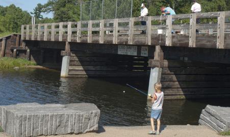
12 identification of trail uses and to provide an opportunity to suggest potential trail alignments. A second public open house was held on March 22, 2012 at City Hall in Baxter. The purpose of this open house was to solicit public input on potential trail alignment options. A presentation was given describing the trail alignment development process and reviewing alignment options for each segment of the study area. Attendees were given a comment form to provide input on each of the alignment options and to allow an opportunity to suggest additional trail alignments if desired. The third public open house was held on June 7, 2012 at the Morrison County Courthouse in Little Falls. The draft plan was available for review and planning staff presented an overview of the master plan process and typical steps in trail development. Field Survey. A survey of the entire legislatively authorized Camp Ripley/Veterans State Trail study area was conducted on September 21, 2011 by PSC members. Seventeen points of interest were noted within the trail study area and 11 of these sites were visited by the PSC. Key features at each of these points of interest were noted and PSC members identified potential issues, constraints and opportunities for trail connections within these areas. The field survey provided an opportunity for the PSC to understand the study area and potential destination/connections important for consideration in the development of CRVST trail alignments. Local Community Meetings. In January and February 2012, consultant staff held individual meetings with representatives from the Cities of Little Falls, Randall, Pillager, Baxter, Brainerd and Cass County. Community representatives attending these meetings included a range of city/county staff, elected officials, business owners, and interested citizens. The purpose of these meetings was to get local input on the desired location of the Camp Ripley/Veterans State Trail connection to or through their community, to discuss potential local trail connections to the state trail, and to discuss local attractions for state trail connection within their communities. These meetings also included a discussion of motorized (ATV and snowmobile) trail use and/or any limitations through each community as well as a discussion of their thoughts on the demand for equestrian trail use. Information from these meetings has been integrated into the community profiles in Section 3. Newspaper Articles. Prior to each public open house, a press release and news article were printed in the St. Cloud Times, Brainerd Dispatch and Morrison County Record. The purpose of the news articles was to provide notice of the upcoming public open house meetings and to provide general study information and status to the general public. The news articles were especially useful given the large study area, which precluded the use of individual mailings. Camp Ripley/Veterans State Trail Website. The CRVST Committee had developed a website prior to the initiation of the Corridor Study. Therefore, a Corridor Study page was added to the CRVST website ( in order to provide study information, progress and next steps, as well as to advertise public involvement opportunities for the corridor study. This provided the opportunity for the public to receive updates on study progress and meeting dates. DRAFT 9/5/2012 6
13 Trail Authorization The Camp Ripley/Veterans State Trail Corridor Study was designated by the Minnesota Legislature in MN Statute , Subd. 28 in 2009 as follows: This trail shall originate at Crow Wing State Park in Crow Wing County at the southern end of the Paul Bunyan Trail and shall extend from Crow Wing State Park westerly to the City of Pillager, then southerly along the west side of Camp Ripley, then easterly along the south side of Camp Ripley across to the east side of the Mississippi River, and then northerly through Fort Ripley to Crow Wing State Park. A second segment of the trail shall be established that shall extend in a southerly direction and in close proximity to the Mississippi River from the southeasterly portion of the first segment of the trail to the City of Little Falls, and then terminate at the Soo Line Trail in Morrison County. The study area for the CRVST corridor study and master plan followed the legislative authorization and is shown in Figure 2. Outdoor Recreation Act The Camp Ripley/Veterans State Trail is one of the legislatively authorized state trails in the Minnesota State Trail System (see Figure 3). State trails are one unit of the state s outdoor recreation system established by the Legislature. In 1975, the Minnesota Legislature enacted the Outdoor Recreation Act (ORA) (Minnesota Statues, Chapter 86A.05, Subdivision 4 and Chapter ). This act established an outdoor recreation system comprised of eleven components or units classifying all state-managed recreation lands. The ORA requires that the managing agency prepare a master plan for the establishment and development of each unit. This plan fulfills this mandate. The Camp Ripley/Veterans State Trail meets the following criteria established for state trails in the ORA: a. A state trail shall be established to provide a recreational travel route which connects units of the outdoor recreational system or the national trail system, provides access to or passage through other areas which have significant scenic, historic, scientific, or recreational qualities or reestablishes or permits travel along an historically prominent travel route or which provides commuter transportation. The Camp Ripley/Veterans State Trail will link state and county parks, historic downtowns, a multitude of state and regional trails, and numerous natural areas. It will pass through areas with significant scenic and historic qualities, and will closely follow the historic travel route of the Mississippi River and subsequent road and rail corridors. b. No unit shall be authorized as a state trail unless its proposed location substantially satisfies the following criteria: 1. permits travel in an appropriate manner along a route which provides at least one of the following recreational opportunities: (i). travel along a route which connects areas or points of natural, scientific, cultural, and historic interest; DRAFT 9/5/2012 7

 travel over a route designed to enhance and utilize the unique qualities of a particular manner of travel in harmony with the natural environment; The trail will afford bikers, hikers, and")

14 There is a rich diversity of natural, scientific, cultural and historical resources along the Camp Ripley/Veterans State Trail corridor, as illustrated by the sampling below: (ii) travel through an area which possesses outstanding scenic beauty; The trail will be situated in and near the Mississippi River Valley, crossing numerous landscapes and ecological regions and offering striking contrasts between the wooded rolling hills west of the Mississippi and the broad plains to the east. (iii) travel over a route designed to enhance and utilize the unique qualities of a particular manner of travel in harmony with the natural environment; The trail will afford bikers, hikers, and wildlife enthusiasts a way to safely enjoy the scenery and cultural and natural amenities by separating slowerpaced trail users from faster-paced highway users. ATV riders and other modes will be buffered from each other with vegetation, grade changes or other techniques. (iv) travel along a route which is historically significant as a route of migration, commerce, or communication; The proposed trail corridor traverses an area shaped by successive eras of settlement and transportation, from riverboat, horse and oxcart to the era of the railroads. The Mississippi River was the major corridor of transport for native peoples, fur traders, early explorers and settlers. The historic Red River oxcart trails between the Selkirk settlements near present-day Winnipeg and Saint Paul crossed the corridor, as well as the military road that connected the original Fort Ripley with Point Douglas at the confluence of the Mississippi and Saint Croix rivers. While the trail search corridor generally does not follow former railroad routes, it crosses many such routes and links small communities created or shaped by the railroads in the late 1800s. (v) travel between units of the state outdoor recreation system or the national trail system; and The Camp Ripley/Veterans State Trail will link Crow Wing and Charles A. Lindbergh state parks. It will connect the Paul Bunyan State Trail in Crow Wing State Park and the Soo Line Regional Trail near Little Falls, effectively linking the Central Lakes, Lake Wobegon, Soo Line, Paul Bunyan, Heartland and Mi-Gi-Zi trails into one continuous recreational route. It will provide a scenic route paralleling and providing access to the Mississippi River, a designated State Water Trail. 2. Utilizes, to the greatest extent possible consistent with the purposes of this subdivision, public lands, rights-of-way, and the like; Public land will be used when trail development is compatible with management objectives of the administering agency. A portion of the trail is expected to follow the edge of the Camp Ripley Military Reservation. State, county, and township road rights-of-way may also be used. DRAFT 9/5/2012 8
15 3. Provides maximum potential for the appreciation, conservation, and enjoyment of significant scenic, historical, natural, or cultural qualities of the areas through which the trail may pass; and Overlooks and interpretive facilities are proposed to increase trail users appreciation and understanding of the natural and cultural resources of the area. Plant community restoration projects, wildlife habitat improvement projects, and development of environmental education information are all projects that could benefit trail users. The trail corridor can be a corridor for both habitat protection and recreation, across landscapes developed for agricultural, military training, commercial, and residential use. The ecological value of the corridor could be enhanced by working to restore healthy native plant communities. 4. Takes into consideration predicted public demand and future uses. The master plan evaluates and uses current research on existing trail use, demand for trail opportunities, demographic data and recreational trends. Current demographic data is taken into account, as well as information gathered at public workshops and through other avenues of public participation. Guiding Principles for Sustainable Trails Guiding principles for ecologically sustainable trails, developed by DNR, provide the underlying rationale for actions related to protecting, restoring, and managing natural environments associated with trail development. There are seven core principles: Avoid sensitive ecological areas and critical habitats. Develop trails in areas already influenced by human activity. Provide buffers to protect sensitive ecological and hydrologic systems. Use natural infiltration and best practices for stormwater management. Provide ongoing stewardship of the trails and adjoining natural systems. Ensure that trails remain sustainable. Formally decommission and restore unsustainable trail corridors. 1 Applications of these principles will minimize the impact of trails on natural resources and sensitive ecological systems. Importantly, the strict application of these guiding principles has to be balanced against the need to locate trails where they will be of high recreational value to the targeted users, who often want to be close to nature, enjoy beautiful scenes, and observe wildlife. This is an important consideration and underscores the need for resource managers, trail designers, and other interested individuals to work together to determine which values are the most important for any given trail alignment. 1 MN DNR, Trail Planning, Design and Development Guidelines, DRAFT 9/5/2012 9
16 Vision and Goals for the Camp Ripley/Veterans State Trail Vision The CRVST will be a multi-use trail that will link the Paul Bunyan State Trail to the Soo Line Regional Trail and will serve as a section of the Mississippi River Trail. Trail users will experience a diversity of landscapes including pine moraines, prairies, hardwood forests and wetlands. The trail will connect users to the region s natural, historic, cultural and scenic resources thereby creating an interest and passion for their conservation and protection. The trail will connect and revitalize central Minnesota communities near and surrounding Camp Ripley, and along the Crow Wing and Mississippi Rivers, by promoting economic development within the area, improving quality of life, and promoting healthy living for residents. Goals The Camp Ripley/Veterans State Trail: 1. Will serve many different types of users throughout all seasons of the year; 2. Will promote economic growth in the area by attracting visitors, attracting and retaining businesses, increasing tourism and linking tourist attractions; 3. Will provide a fun, safe, recreational resource for residents of all ages and interest, thereby benefiting their health and improving their quality of life; 4. Will serve as an alternate means of transportation in the region, connecting rural areas to town centers, commercial districts, parks, and schools, and reducing vehicle trips, thereby improving the environment; 5. Will connect to existing and future trail networks, complete a missing link in the regional/state trail network of this area, provide a new link between cities and townships, and connect local, county and state parks, trails and conservation areas; 6. Will showcase the unique cultural themes of the area, including but not limited to oxcart trails, early Crow Wing town settlements, Fort Ripley ruins, honor/remembrance of veterans, Camp Ripley, Charles A. Lindbergh, etc.; 7. Will increase the awareness of the unique natural, historic and cultural resources along and within proximity of the Crow Wing and Mississippi Rivers; and, 8. Will preserve and protect these natural and environmental resources. DRAFT 9/5/
17 W a d e n a Staples East Gull Lake Motley C a s s Pillager Crow Wing River Mississippi River Baxter Brainerd Crow Wing State Park C r o w W i n g Lake Alexander Camp Ripley Fort Ripley To d d Randall Mississippi River M o r r i s o n Flensburg Charles A. Lindbergh State Park Little Falls Pierz Genola Swanville Sobieski Soo Line Buckman Burtrum Grey Eagle Upsala Elmdale Bowlus Royalton B e n t o n Legend Paul Bunyan State Trail Regional Trail Trail Search Corridor State Park City Boundaries Camp Ripley/Veterans State Trail Figure 2: Study Corridor Overview I Miles
18 Figure 3: Minnesota State Trails Developed and Undeveloped, Authorized in Minnesota Statutes With Major Regional Trails International Falls Arrowhead Tower Ely Grand Marais Moorhead Heartland Detroit Lakes Bemidji Park Rapids Cass Lake Walker Paul Bunyan Cuyuna Lakes Grand Rapids Taconite Mesabi Cloquet CJ Ramstad / North Shore Duluth Two Harbors Superior Vista Silver Bay Gitchi- Gami Fergus Falls Central Lakes Brainerd Camp Ripley Veterans Willard Munger Matthew Lourey Pipestone Ortonville Casey Jones Luverne Alexandria Milan Granite Falls Lake Wilson Currie Willmar MN River Jackson Osakis Lake Wobegon Paynesville Glacial Lakes Redwood Falls Luce Line Hutchinson Des Moines River Valley Little Falls St. Cloud MN Valley Mankato Red Jacket Windom Plymouth Hinckley Gateway St. Paul Eden Prairie Belle Plaine Sakatah Singing Hills Hardwood Creek Blazing Star Albert Lea Sunrise Prairie Mill Towns NorthfieldCannon Valley Faribault Pine Island Stillwater Prairie Stagecoach Wildflower Brown's Creek Country View Red Wing Goodhue Pioneer Douglas Rochester Fountain Shooting Star Le Roy Great River Ridge Blufflands Trail System Root River (Olmsted, Winona, Fillmore and Houston Counties) Eyota Harmony Legend La Crescent Houston Developed State Trails Undeveloped State Trails Major Regional Trails Harmony-Preston Valley µ P:\TAW\State_Trail_SYSTEM\StateTrails_Regional mxd


 Running and Jogging.")

19 2. Recommended Trail Uses The CRVST is proposed to be a multi-use, multi-seasonal trail. However, the limitations of width dictate that not all uses can be accommodated at all times on the entire length of the trail. For example, dual treadways would be necessary to accommodate both biking or in-line skating and equestrian uses or ATV uses. Landowner agreements, land acquisitions, and trail width are examples of factors or limitations that will dictate whether a dual treadway is possible or not, and what uses may be accommodated. The following are the recommended trail uses: bicycling, hiking and walking, dog walking, running/jogging, in-line skating/skate skiing, equestrian uses, cross-country skiing, snowmobiling, ATV and environmental education/interpretation. Hunting will be allowed in accordance with Minnesota Rules, except where discharge of firearms is regulated by community ordinances. Trail development will take accessibility into consideration wherever practical. Certain segments of the trail may provide adequate access to rivers or streams for fishing and/or canoe launching. Bicycling. Bicycling is the number one activity by numbers of summer users on state trails. The length of the trail, the variety of landscapes, and the connections to tourist attractions make this trail appropriate for recreational and touring cyclists of all ages and abilities. The trail will add approximately 70 to 80 miles to the state inventory of about 600 miles of paved state trails. Bicycling is recommended as a use along the entire length of the trail. Hiking and Walking. On state trails, hiking or walking is second only to bicycling as popular low-impact cardiovascular fitness activities on state trails. Grades are likely to be moderate throughout the majority of the trail route, making it suitable for most people to walk and hike. Hiking and walking are recommended as uses on the entire length of the trail. (The use of electric wheelchairs, electric mobility scooters and similar devices is considered equivalent to walking.) Running and Jogging. Many people use the state trails for running and jogging. In addition to individuals who regularly use the trails for exercise, local school track and cross-country teams will be able to use this scenic trail for training purposes. Running and jogging are recommended uses along the entire length of the trail. In-Line Skating / Skate Skiing. In-line skating levels of use have declined, but it remains a popular sport. This activity requires a paved trail with a smooth, wide surface, and is a recommended use on paved segments of the trail. Dog Walking. Dog walking is allowed along the entire length of the trail so long as dogs are leashed and owners properly dispose of pet wastes. State trail rules require all pets to be attended and restrained by a leash of not more than six feet in length. Horseback Riding. Equestrian uses may be accommodated on some sections, where practical and desired, by developing a separate, natural surface treadway, or on a natural surface shoulder of a paved treadway. ATV Riding. This trail will be somewhat unique among Minnesota State Trails in that it will accommodate both non-motorized and motorized summer use. It is anticipated that Class I and II ATV use would be allowed on segments of the trail corridor that can accommodate such use, either adjacent to or separate from non-motorized uses. Snowmobiles may share the use of the ATV alignments in some areas. DRAFT 9/5/


20 Snowmobiling. Snowmobiling will be accommodated wherever feasible and desired, which may include using a separate treadway from the paved treadway. Although, snowmobilers are interested in connecting to the same communities as the summer trail users, the actual alignments for the two treadways will not necessarily be parallel or in the same corridor. Snowmobilers are most interested in securing a permanent alignment, whether seasonal or year-round, that provides a safe, high quality riding experience. Cross-Country Skiing and Snowshoeing. Cross-country skiing may be able to be accommodated in some sections, where practical and desired, however, it is not likely to be a high-use activity. Cross country skiers typically enjoy loop trails, rather than long, linear trails. Trail grooming may also be an issue with the lack of consistent, sufficient snow cover during the winter months. Hunting. State trails allow hunting within the trail right-of-way during the legal hunting season, except where restricted by local ordinance. The current rule states: No firearm or bow and arrow shall be discharged within the trail at any time, except for the purpose of lawful hunting during the period from September 15 to March 30 only. No rifle, shotgun with slug, or bow and arrow shall be discharged upon, over, or across the trail treadway at any time (MN Rules ). Communities may restrict firearms or bow and arrow discharge, or trapping, by ordinance. These ordinances take precedence over state trail rules. Environmental Education/Interpretation. Use of the state trail for environmental education, both for individual trail users and formal groups, is encouraged. Schools or organizations that wish to use a trail can work with DNR staff on specific projects. Interpretive displays on the environment and history of the trail can enhance the trail users experience. Nature photography is another popular activity. Accessibility. The trail will be accessible to people with disabilities wherever possible. Grades in excess of 5% may be unavoidable in some locations where the trail must match a parallel transportation corridor or where one of the exceptions in the Federal accessibility guidelines is met. Fishing Access. Fishing is a popular activity along the Mississippi and Crow Wing Rivers. Depending upon the location and conditions of the trail corridor right-of-way, this activity may be accommodated from the trail where practical. DRAFT 9/5/
Stagecoach State Trail Master Plan
 Stagecoach State Trail Master Plan Minnesota Minnesota Department Department of of Natural Natural Resources Resources Parks and and Trails Trails Division Division Parks March March 2012 2012 The Minnesota
1. Planning Process, Purpose and Scope
 1. Planning Process, Purpose and Scope The Root River State Trail Extension, Houston to La Crescent Master Plan was prepared by the Minnesota Department of Natural Resources, with assistance from the National
Cascade River State Park Management Plan Amendment
 This document is made available electronically by the Minnesota Legislative Reference Library as part of an ongoing digital archiving project. http://www.leg.state.mn.us/lrl/lrl.asp Cascade River State
Glacial Lakes State Trail Master Plan Amendment Trail Extension into Downtown Willmar
 Glacial Lakes State Trail Master Plan Amendment Trail Extension into Downtown Willmar Minnesota Department of Natural Resources Division of Parks and Trails July 2012 Glacial Lakes State Trail Master Plan
2017 Budget & Policy Priorities
 2017 Budget & Policy Priorities Fully Fund Minnesota State Parks and Trails No New Taxes for State Trail Users Keep State Parks Free from the Noise and Undue Artificiality of OHVs Operations Budget: Fully
2. Goals and Policies. The following are the adopted Parks and Trails Goals for Stillwater Township:
 D. PARKS AND TRAILS 1. Introduction Stillwater Township s population is relatively low, with most residents living on rural residences on large lots. The need for active park space has been minimal in
Shooting Star State Trail Master Plan
 Shooting Star State Trail Master Plan Prairie Shooting Star Minnesota Department of Natural Resources Division of Trails and Waterways Historical photos courtesy of the Minnesota Historical Society. Photos
Business Item No
 Metropolitan Parks and Open Space Commission Meeting date: February 6, 2018 For the Community Development Committee meeting of February 20, 2018 For the Metropolitan Council meeting of February 28, 2018
Glacial Lakes State Park Management Plan Amendment Camper Cabin Development
 Glacial Lakes State Park Management Plan Amendment Camper Cabin Development Minnesota Department of Natural Resources Division of Parks and Recreation November 2006 Glacial Lakes State Park Management
MINNESOTA RIVER STATE TRAIL MASTER PLAN DRAFT
 MINNESOTA RIVER STATE TRAIL MASTER PLAN DRAFT Minnesota Department of Natural Resources Division of Parks and Trails November 2013 The Minnesota Department of Natural Resources, Parks and Trails Division
Blueways: Rivers, lakes, or streams with public access for recreation that includes fishing, nature observation, and opportunities for boating.
 Parks, Open Space and Trails PRINCE WILLIAM COUNTY 2008 COMPREHENSIVE PLAN TRAILS PLAN CONTENTS The components of the trails plan are: Intent Definitions Goals, Policies, and Action Strategies Trails Map
Greater Minnesota Regional Parks and Trails Commission Designation Application
 Greater Minnesota Regional Parks and Trails Commission Designation Application General Section Designation Application #: 15-059D Date Submitted: 06/16/2015 Park or Trail Name: Mesabi Trail District #:
Section II. Planning & Public Process Planning for the Baker/Carver Regional Trail began in 2010 as a City of Minnetrista initiative.
 Section II Planning & Public Process Planning for the began in 2010 as a City of initiative. city staff began discussions with the Park District on the possibility of a north/south regional trail connection
Tracy Ridge Shared Use Trails and Plan Amendment Project
 Tracy Ridge Shared Use Trails and Plan Amendment Project Scoping Document Forest Service Allegheny National Forest Bradford Ranger District McKean, County, Pennsylvania In accordance with Federal civil
STATE TRAIL USE. Minnesota Department of Natural Resources Trails and Waterways Division & Office of Management and Budget Services
 STATE TRAIL USE Summary of Summer Trail Use and User Surveys Conducted in 1996, 1997 and 1998 Minnesota Department of Natural Resources Trails and Waterways Division & Office of Management and Budget Services
Segment 2: La Crescent to Miller s Corner
 goal of the USFWS refuges is to conserve, protect and enhance fish, wildlife and plants and their habitats for the continuing benefit of the American people. Refuge lands are used largely for fishing,
MEETING MINUTES District 1 Trail Planning Meeting 1
 MEETING MINUTES District 1 Trail Planning Meeting 1 June 1, 2017 2:00 PM 3:30 PM City of Two Harbors 2:00 Introductions Attendees: Lisa Austin, MnDOT Bryan Anderson, MnDOT Jasna Hadzic-Stanek, MnDOT Justin
ROAD AND TRAIL PROJECT APPROVAL
 ROAD AND TRAIL PROJECT APPROVAL www.marincountyparks.org Marin County Parks, 3501 Civic Center Dr, Suite 260, San Rafael, CA 94903 DATE: July 12, 2017 PRESERVE: Gary Giacomini Open Space Preserve PROJECT:
Continental Divide National Scenic Trail Legislative History and Planning Guidance
 Continental Divide National Scenic Trail Legislative History and Planning Guidance Legislation, Policy, and Direction Regarding National Scenic Trails The National Trails System Act, P.L. 90-543, was passed
BROWN S CREEK STATE TRAIL MASTER PLAN. Minnesota Department of Natural Resources Division of Parks and Trails March 2012
 BROWN S CREEK STATE TRAIL MASTER PLAN Minnesota Department of Natural Resources Division of Parks and Trails March 2012 The Minnesota Department of Natural Resources, Division of Parks and Trails would
3. Trail Alignments and Connections
 3. Trail Alignments and Connections Overview of the Trail Alignment Study Area The CRVST is a legislatively authorized state trail which, when complete, will provide a connection between the Paul Bunyan
STOWER SEVEN LAKES STATE RECREATION TRAIL POLK COUNTY, WISCONSIN. MASTER PLAN June, 2018
 STOWER SEVEN LAKES STATE RECREATION TRAIL POLK COUNTY, WISCONSIN MASTER PLAN June, 2018 Polk County Environmental Services Committee Kim O Connell-Chairman Brad Olson -Vice Chairman Jim Edgell Doug Route
Proposed Action. Payette National Forest Over-Snow Grooming in Valley, Adams and Idaho Counties. United States Department of Agriculture
 United States Department of Agriculture Forest Service January 2012 Proposed Action Payette National Forest Over-Snow Grooming in Valley, Adams and Idaho Counties Payette National Forest Valley, Adams
F. Forest Recreation Management
 F. Forest Recreation Management F.1) Park and Recreation Management F.1.A. Program Overview. The park and recreation program has been in existence since 1980. With ever increasing outdoor recreation demands
Longmont to Boulder Regional Trail Jay Road Connection DRAFT FINAL REPORT
 Longmont to Boulder Regional Trail Jay Road Connection DRAFT FINAL REPORT December 2018 Project Summary Boulder County, Colorado, in partnership with the City of Boulder, is evaluating options for multi-use
FEASIBILITY CRITERIA
 This chapter describes the methodology and criteria used to evaluate the feasibility of developing trails throughout the study areas. Land availability, habitat sensitivity, roadway crossings and on-street
Preferred Recreation Recommendations Stemilt-Squilchuck Recreation Plan March 2018
 Preferred Recreation Recommendations Stemilt-Squilchuck Recreation Plan March 2018 Below are the recommended recreation ideas and strategies that package together the various recreation concepts compiled
2016 Regional Transportation Alternatives Program (TAP) Grant Application
 Grant Application") 2016 Regional Transportation Alternatives Program (TAP) Grant Application PROJECT TITLE: Yelm-Tenino Trail Extension Feasibility Study TRPC use only GENERAL PROJECT INFORMATION Agency or Organization City
2016 Regional Transportation Alternatives Program (TAP) Grant Application PROJECT TITLE: Yelm-Tenino Trail Extension Feasibility Study TRPC use only GENERAL PROJECT INFORMATION Agency or Organization City
DRAFT Cuyuna Lakes State Trail Master Plan Amendment
 DRAFT Cuyuna Lakes State Trail Master Plan Amendment Trail Extension from Crosby to Deerwood Minnesota Department of Natural Resources Division of Parks and Trails June 2013 Cuyuna Lakes State Trail Master
Marchand Provincial Park. Management Plan
 Marchand Provincial Park Management Plan 2 Marchand Provincial Park Table of Contents 1. Introduction... 3 2. Park History... 3 3. Park Attributes... 4 3.1 Natural... 4 3.2 Recreational... 4 3.3 Additional
Baker/Carver Regional Trail master plan public review draft
 Baker/Carver Regional Trail master plan public review draft November 2014 the mission of Three Rivers Park District is to promote environmental stewardship through recreation and education in a natural
4.0 Context for the Crossing Project
 4.0 Context for the Crossing Project This section provides background information about key features of the North Douglas Crossing project area, and opportunities and constraints. This information is important
BACKCOUNTRY TRAIL FLOOD REHABILITATION PROGRAM
 BACKCOUNTRY TRAIL FLOOD REHABILITATION PROGRAM Backcountry Trail Flood Rehabilitation A June 2013 Flood Recovery Program Summary In June 2013, parts of Southern Alberta were devastated from significant
2014 LEGISLATIVE AGENDA
 2014 LEGISLATIVE AGENDA BONDING SESSION Working to acquire, protect and enhance critical land for the public s use and benefit. 2014 LEGISLATIVE AGENDA In preparation for each session of the Minnesota
SMART Southeast Minnesota Association of Regional Trails
 SMART Southeast Minnesota Association of Regional Trails Regional Trails in Southeastern Minnesota MnDOT District 6 J2G Transportation. Wednesday, September 9, 2015 1 Mission Statement The SMART Organization
PROUDLY BRINGING YOU CANADA AT ITS BEST. Management Planning Program NEWSLETTER #1 OCTOBER, 2000
 PROUDLY BRINGING YOU CANADA AT ITS BEST VUNTUT NATIONAL PARK Management Planning Program NEWSLETTER #1 OCTOBER, 2000 INTRODUCTION This newsletter launches the development of the first management plan for
White Mountain National Forest
 White Mountain National Forest United States Department of Agriculture Forest Service Eastern Region Boles Brook Snowmobile Bridge Decision Memo Boles Brook Snowmobile Bridge Project Town of Woodstock
MUNICIPALITY OF ANCHORAGE
 MUNICIPALITY OF ANCHORAGE ANCHORAGE PARKS & RECREATION Memorandum PRC 08-56 DATE: 5 August 2008 TO: FROM: SUBJECT: Parks & Recreation Commission Holly Spoth-Torres, Park Planner PRC 08-56 Far North Bicentennial
Rule Governing the Designation and Establishment of All-Terrain Vehicle Use Trails on State Land
 Rule Governing the Designation and Establishment of All-Terrain Vehicle Use Trails on State Land 1.0 Authority 1.1 This rule is promulgated pursuant to 23 V.S.A. 3506. Section 3506 (b)(4) states that an
METROPOLITAN COUNCIL 390 North Robert Street, St. Paul, MN Phone (651) TDD (651)
 TDD (651)") METROPOLITAN COUNCIL 390 North Robert Street, St. Paul, MN 55101 Phone (651) 602 1000 TDD (651) 291 0904 DATE: June 19, 2007 TO: Metropolitan Parks and Open Space Commission FROM: Jan Youngquist, Senior
METROPOLITAN COUNCIL 390 North Robert Street, St. Paul, MN 55101 Phone (651) 602 1000 TDD (651) 291 0904 DATE: June 19, 2007 TO: Metropolitan Parks and Open Space Commission FROM: Jan Youngquist, Senior
A CASE FOR COMPLETING THE JORDAN RIVER PARKWAY: A
 A CASE FOR COMPLETING THE JORDAN RIVER PARKWAY: A safe crossing at 9000 South and 850 West Proposed 9000 South Underpass Parkway Timeline Parkway, Trail, and Tourism Facts Blueprint Jordan River 1971 1973
Decision Memo for Desolation Trail: Mill D to Desolation Lake Trail Relocation
 for Salt Lake County, Utah Uinta-Wasatch-Cache National Forest Salt Lake Ranger District 1. Background The present location of the Desolation Trail (#1159) between Mill D and Desolation Lake follows old
Casey Jones State Trail Master Plan
 Casey Jones State Trail Master Plan Minnesota Department of Natural Resources Division of Trails and Waterways Casey Jones State Trail Master Plan Master Plan prepared by: Minnesota Department of Natural
Appendix 3. Greenway Design Standards. The Whitemarsh Township Greenway Plan
 Appendix 3 Greenway Design Standards This chapter discusses two design standards for the greenway types discussed above. First, trail design standards are presented together with trailhead facilities and
CHAPTER III: TRAIL DESIGN STANDARDS, SPECIFICATIONS & PERMITS
 CHAPTER III Trail Design Standards, Specifications & Permits This chapter discusses trail standards, preferred surface types for different activities, permits, and other requirements one must consider
April 10, Mark Stiles San Juan Public Lands Center Manager 15 Burnett Court Durango, CO Dear Mark,
 Mark Stiles San Juan Public Lands Center Manager 15 Burnett Court Durango, CO 81301 Dear Mark, We are pleased to offer the following comments on the draft San Juan Public Lands Center management plans
Chambers of Commerce and Lake Groups advertised this NCWRPC created online survey that was : Opened: August 22, 2012; and Closed: October 4, 2012.
 Vilas County Outdoor Recreation Survey Chambers of Commerce and Lake Groups advertised this NCWRPC created online survey that was : Opened: August 22, 202; and Closed: October 4, 202. Q What Vilas County
Rogue River Access and Management Plan Draft Alternatives
 Rogue River Access and Management Plan Draft Alternatives The Rogue River Access and Management Plan was initiated in December, 2011 and is being led by Jackson County Parks (JCP) and Oregon Department
Decision Memo Ice Age Trail Improvement (CRAC 37)
") Decision Memo Ice Age Trail Improvement (CRAC 37) U.S. Forest Service Chequamegon-Nicolet National Forest, Medford-Park Falls Ranger District Taylor County, Wisconsin T32N, R2W, Town of Grover, Section
Decision Memo Ice Age Trail Improvement (CRAC 37) U.S. Forest Service Chequamegon-Nicolet National Forest, Medford-Park Falls Ranger District Taylor County, Wisconsin T32N, R2W, Town of Grover, Section
13.1 REGIONAL TOURISM ISSUES AND SUMMARY OF FINDINGS
 13 REGIONAL TOURISM T he County of Mariposa s recreation needs and facilities fall within two categories: regional tourism and local recreation. This Element focuses on regional tourism issues related
Committee Report. Community Development Committee For the Metropolitan Council meeting of April 13, Business Item No.
 Committee Report Business Item No. 2016-48 Community Development Committee For the Metropolitan Council meeting of April 13, 2016 Subject: Harriet Island-South St. Paul Regional Trail Master Plan, Saint
FINAL TESTIMONY 1 COMMITTEE ON RESOURCES UNITED STATES HOUSE OF REPRESENTATIVES. July 13, 2005 CONCERNING. Motorized Recreational Use of Federal Lands
 FINAL TESTIMONY 1 STATEMENT OF DALE BOSWORTH CHIEF Of the FOREST SERVICE UNITED STATES DEPARTMENT OF AGRICULTURE Before the SUBCOMMITTEE ON FORESTS AND FOREST HEALTH And the SUBCOMMITTEE ON NATIONAL PARKS,
CHAPTER 5. Chapter 5 Recreation Element
 CHAPTER 5 Recreation Element Chapter 5 Recreation Element The Recreation Element of the Meyers Area Plan is a supplement to the Recreation Element of the TRPA Regional Plan and the El Dorado County General
Blue River Trail Master Plan JSA to Town Hall June 2004
 Blue River Trail Master Plan JSA to Town Hall June 2004 Prepared for: Silverthorne Town Council Silverthorne SPORT Committee Department of Recreation and Culture Silverthorne Public Works Silverthorne
SUMMER VILLAGE OF SILVER SANDS. Municipal Development Plan
 SUMMER VILLAGE OF SILVER SANDS Municipal Development Plan Bylaw 253-2014 Adopted August 22, 2014 Summer Village of Silver Sands Municipal Development Plan Bylaw No. 253-2014 Page 2 1 INTRODUCTION 1.1 SETTING
Parkland County Municipal Development Plan Amendment Acheson Industrial Area Structure Plan
 Parkland County Municipal Development Plan Amendment Acheson Industrial Area Structure Plan New Plan Acheson Industrial Area Structure Plan Amendment Parkland County Municipal Development Plan Board Reference
EXECUTIVE SUMMARY PROGRAM DEVELOPMENT REPORT PURPOSE EXISTING SETTING EXPANDING PARKLAND
 EXECUTIVE SUMMARY PROGRAM DEVELOPMENT REPORT PURPOSE As the culmination of the first phase of the master planning process, this Program Development Report creates the framework to develop the Calero County
METROPOLITAN COUNCIL 390 North Robert Street, St. Paul, MN Phone (651) TDD (651)
 TDD (651)") DATE: March 27, 2012 METROPOLITAN COUNCIL 390 North Robert Street, St. Paul, MN 55101 Phone (651) 602-1000 TDD (651) 291-0904 TO: Metropolitan Parks and Open Space Commission FROM: Arne Stefferud, Planning
DATE: March 27, 2012 METROPOLITAN COUNCIL 390 North Robert Street, St. Paul, MN 55101 Phone (651) 602-1000 TDD (651) 291-0904 TO: Metropolitan Parks and Open Space Commission FROM: Arne Stefferud, Planning
PSP 75 Lancefield Road. Northern Jacksons Creek Crossing Supplementary Information
 PSP 75 Lancefield Road Northern Jacksons Creek Crossing Supplementary Information September 2017 The northern crossing of Jacksons Creek proposed within the Lancefield Road PSP is a key part of the ultimate
Those with Interest in the City of Cambridge Trail System
 Community Services Department City Hall 50 Dickson Street, P.O. Box 669 Cambridge ON N1R 5W8 Tel: 519-740-4681 July 20, 2010 To: Re: Those with Interest in the City of Cambridge Trail System City of Cambridge
3.0 LEARNING FROM CHATHAM-KENT S CITIZENS
 3.0 LEARNING FROM CHATHAM-KENT S CITIZENS An important aspect in developing the Chatham-Kent Trails Master Plan was to obtain input from stakeholders and the general public. Throughout the course of the
JOSLIN FIELD, MAGIC VALLEY REGIONAL AIRPORT DECEMBER 2012
 1. Introduction The Federal Aviation Administration (FAA) recommends that airport master plans be updated every 5 years or as necessary to keep them current. The Master Plan for Joslin Field, Magic Valley
Greater Minnesota Regional Parks and Trails Commission Designation Application
 Greater Minnesota Regional Parks and Trails Commission Designation Application General Section Designation Application #: 15-050D Date Submitted: 06/30/2015 Park or Trail Name: Perham to Pelican Rapids
Cuyuna Connection and Cuyuna Hills Backcountry Trail PROPOSED TRAIL DEVELOPMENT December 21, Trail Suitability Analysis
 Cuyuna Connection and Cuyuna Hills Backcountry Trail PROPOSED TRAIL DEVELOPMENT December 21, 2017 Trail Suitability Analysis Trail Suitability Criteria: As set forth in the Crow Wing County Comprehensive
NORTHEAST CARLTON COUNTY BICYCLE ROUTE PLAN
 NORTHEAST CARLTON COUNTY BICYCLE ROUTE PLAN 5/31/2014 and St. Louis River Trail Plan Update Produced by the Arrowhead Regional Development Commission (ARDC) in Partnership with the State Health Improvement
Bradley Brook Relocation Project. Scoping Notice. Saco Ranger District. United States Department of Agriculture Forest Service
 Bradley Brook Relocation Project United States Department of Agriculture Forest Service Scoping Notice White Mountain National Forest February 2011 For Information Contact: Jenny Burnett White Mountain
Park Design and Location Criteria
 Park Design and Location Criteria This section is presented in the interest of assisting park and recreation agencies in the development of a system of parks and recreation areas. A recreation system is
White Mountain National Forest Saco Ranger District
 United States Department of Agriculture Forest Service White Mountain National Forest Saco Ranger District 33 Kancamagus Highway Conway, NH 03818 Comm: (603) 447-5448 TTY: (603) 447-3121 File Code: 1950
MINNESOTA S PARKS & TRAILS LEGACY PROGRAM: ACCOMPLISHMENTS & PROSPECTS
 MINNESOTA S PARKS & TRAILS LEGACY PROGRAM: ACCOMPLISHMENTS & PROSPECTS PAU L P U R M A N M I N N E S OTA D E PA R T M E N T O F N AT U R A L R E S O U R C E S, PA R K S & T R A I L S L EG 5/15/2016 1 A
Mississippi River Parkway Commission of Minnesota
 Mississippi River Parkway Commission of Minnesota Metro Region (Elk River to Hastings) October 27, 2016 2:00 3:30 p.m. Historic Fort Snelling 200 Tower Avenue, St. Paul, MN Metro Region Agenda I. Welcome
1803 West Hwy 160 Monte Vista, CO (719) TTY (719)
 TTY (719)") USDA Forest Service Rio Grande National Forest http://www.fs.fed.us/r2/riogrande 1803 West Hwy 160 Monte Vista, CO 81144 (719)852-5941 TTY (719)852-6271 USDI Bureau of Land Management San Luis Valley Center
USDA Forest Service Rio Grande National Forest http://www.fs.fed.us/r2/riogrande 1803 West Hwy 160 Monte Vista, CO 81144 (719)852-5941 TTY (719)852-6271 USDI Bureau of Land Management San Luis Valley Center
Business Item No XXX. Proposed Action That the Metropolitan Council approve the Coon Creek Regional Trail Master Plan.
 Business Item No. 2015-XXX Metropolitan Parks and Open Space Commission Meeting date: July 7, 2015 For the Community Development Committee meeting of July 20, 2015 For the Metropolitan Council meeting
APPENDIX OFFICIAL MAP ORDINANCE OF HAMILTONBAN TOWNSHIP OFFICIAL MAP NARRATIVE
 APPENDIX A OFFICIAL MAP ORDINANCE OF HAMILTONBAN TOWNSHIP OFFICIAL MAP NARRATIVE INTRODUCTION: The Official Map of Hamiltonban Township has been prepared to identify those lands and features that Hamiltonban
Sawtooth National Forest Fairfield Ranger District
 United States Department of Agriculture Forest Service Sawtooth National Forest Fairfield Ranger District P.O. Box 189 Fairfield, ID. 83327 208-764-3202 Fax: 208-764-3211 File Code: 1950/7700 Date: December
Mississippi Blufflands State Trail. Master Plan
 Mississippi Blufflands State Trail Master Plan Minnesota Department of Natural Resources Division of Parks and Trails September 2016 The Minnesota Department of Natural Resources (DNR), Parks and Trails
Economic Development and Tourism
 SECTION 4 SECTION 4 Economic Development and Tourism 4. Economic Development and Tourism Tourism plays a very important role in Niagara s economy, providing employment and generating business for support
The Baker/Carver Regional Trail is intended to
 Section V Design Guidance The Baker/Carver Regional Trail is intended to safely accommodate 183,000 annual visits, an array of non-motorized uses, a variety of skill levels, and persons with special needs.
Welcome to the future of Terwillegar Park a Unique Natural Park
 Welcome to the future of Terwillegar Park a Unique Natural Park 1 Introduction The Terwillegar Park Concept Plan study will develop an overall concept plan, management objectives and development guidelines
MONTEREY REGIONAL AIRPORT MASTER PLAN TOPICAL QUESTIONS FROM THE PLANNING ADVISORY COMMITTEE AND TOPICAL RESPONSES
 MONTEREY REGIONAL AIRPORT MASTER PLAN TOPICAL QUESTIONS FROM THE PLANNING ADVISORY COMMITTEE AND TOPICAL RESPONSES Recurring topics emerged in some of the comments and questions raised by members of the
Committee Report. Community Development Committee For the Metropolitan Council meeting of August 12, Business Item No.
 Committee Report Business Item No. 2015-168 Community Development Committee For the Metropolitan Council meeting of August 12, 2015 Subject: Coon Creek Regional Trail Master Plan, Anoka County Proposed
Silver Lake Park An Environmental Jewel for the Citizens of Prince William County
 Silver Lake Park An Environmental Jewel for the Citizens of Prince William County The Prince William Park Authority Mission Statement states: The Prince William County Park Authority will create quality
Environment and Natural Resources Trust Fund (ENRTF) M.L ENRTF Work Plan (Main Document)
 M.L ENRTF Work Plan (Main Document)") Environment and Natural Resources Trust Fund (ENRTF) M.L. 2018 ENRTF Work Plan (Main Document) Today s Date: December 8, 2017 Date of Next Status Update Report: January 31, 2019 Date of Work Plan Approval:
Environment and Natural Resources Trust Fund (ENRTF) M.L. 2018 ENRTF Work Plan (Main Document) Today s Date: December 8, 2017 Date of Next Status Update Report: January 31, 2019 Date of Work Plan Approval:
Becker County Trail Routing Feasibility Study
 2016 Becker County Trail Routing Feasibility Study CONNECTING DETROIT MOUNTAIN AND MOUNTAIN VIEW RECREATIONAL AREA TO THE HEARTLAND TRAIL BECKER COUNTY ULTEIG ENGINEERS Contents Acknowledgements...2 INTRODUCTION...3
Procedure for the Use of Power-Driven Mobility Devices on Mass Audubon Sanctuaries 1 September 17, 2012
 Procedure for the Use of Power-Driven Mobility Devices on Mass Audubon Sanctuaries 1 September 17, 2012 Background As part of Mass Audubon s mission to preserve the nature of Massachusetts for people and
MANAGEMENT DIRECTION STATEMENT June, 1999
 Thompson River District MANAGEMENT DIRECTION STATEMENT June, 1999 for Roche Lake Provincial Park Ministry of Environment Lands and Parks BC Parks Division Table of Contents I. Introduction A. Setting
The Chu property is a 6.57 acre parcel located in the Town of Superior on the west side of McCaslin Boulevard. In 2014, the Town of Superior acquired
 1 The Chu property is a 6.57 acre parcel located in the Town of Superior on the west side of McCaslin Boulevard. In 2014, the Town of Superior acquired the Chu property for open space with a contribution
City of Durango 5.8 FUNDING TRAILS DEVELOPMENT
 5.8 FUNDING TRAILS DEVELOPMENT The City has been successful in establishing dedicated local funding sources as well as applying for grants to develop the City s trail system, having received nearly $2.4
Hermosa Area Preservation The Colorado Trail Foundation 4/11/2008
 Hermosa Area Preservation The Colorado Trail Foundation 4/11/2008 Legend d o Tr ail NPA - National Protection Area ra NCA - National Conservation Area o e C Th The Colorado Trail lo FS inventoried Roadless
Greater Minnesota Regional Parks and Trails Commission Designation Application
 Greater Minnesota Regional Parks and Trails Commission Designation Application General Section Designation Application #: 16-043D Date Submitted: 04/28/2016 Park or Trail Name: Tioga Recreation Area District
White Mountain National Forest Saco Ranger District
 United States Department of Agriculture Forest Service White Mountain National Forest 33 Kancamagus Highway Conway, NH 03818 Comm: (603) 447-5448 TTY: (603) 447-3121 File Code: 1950 Date: February 26,
Afton State Park Management Plan Amendment
 This document is made available electronically by the Minnesota Legislative Reference Library as part of an ongoing digital archiving project. http://www.leg.state.mn.us/lrl/lrl.asp Afton State Park Management
RUSHMORE CONNECTOR TRAIL PROPOSAL
 PURPOSE AND NEED Background The U.S. Forest Service, Black Hills National Forest (Forest Service) has received a special use permit application from the State of South Dakota Department of Game, Fish and
FHWA P/N Guidelines. Corridor Relationship. Highway 22 Segment 1 - US 169 to CSAH 2 Relevance / Documentation of Need
 Highway 22 Segment 1 - US 169 to CSAH 2 Vehicle Mobility Congestion Intersection Congestion Existing Conditions - Based on Highway Capacity Manual methodology, corridor level of service is currently LOS
WASHINGTON STATE PARKS LAND CLASSIFICATION SYSTEM
 WASHINGTON STATE PARKS LAND CLASSIFICATION SYSTEM Administrative Code Establishing Land Classification System WAC 352-16-020 Land classification system. State park areas are of statewide natural, cultural,
Metropolitan Parks and Open Space Commission Subject District(s), Member(s): Policy/Legal Reference: Staff Prepared/Presented: Division/Department:
, Member(s): Policy/Legal Reference: Staff Prepared/Presented: Division/Department:") Business Item Metropolitan Parks and Open Space Commission Meeting date: May 20, 2013 Subject: Proposed System Addition Discussion for the 2040 Regional Parks Policy Plan District(s), Member(s): All Policy/Legal
Business Item Metropolitan Parks and Open Space Commission Meeting date: May 20, 2013 Subject: Proposed System Addition Discussion for the 2040 Regional Parks Policy Plan District(s), Member(s): All Policy/Legal
Ouimet Canyon Provincial Nature Reserve. Management Plan
 Ouimet Canyon Provincial Nature Reserve Management Plan NOTE: This document has been scanned and formatted, and therefore is slightly different from the original version. -March 2002 Additional copies
Non-Motorized Transportation
 Non-Motorized Transportation Non-motorized facilities are important components to the transportation system. They provide an environmentally-friendly, low-cost mode of travel. Some of the facilities can
Lake Myra County Park. Wake County, North Carolina Community Forum #2 June 12, 2008
 Lake Myra County Park Wake County, North Carolina Community Forum #2 June 12, 2008 Welcome and Introduction Meeting Agenda Welcome Introductions of Project Team Master Plan Process Community Forum #1 Updates
Yard Creek Provincial Park. Management Plan
 Yard Creek Provincial Park Management Plan Draft January 2010 Yard Creek Provincial Park Management Plan Approved by: telàlsemkin/siyam/chief Scott Benton Bill Williams Squamish Executive Director ation
PROPOSED PARK ALTERNATIVES
 8 Chimne y Rock State Park M a ster Pl an 2011 PROPOSED PARK ALTERNATIVES Introduction Three different park development concepts were prepared and presented to the citizens of North Carolina through a