Garibaldi Provincial Park M ASTER LAN. Prepared by South Coast Region North Vancouver, B.C.
|
|
|
- Jared Welch
- 6 years ago
- Views:
Transcription
1
2 Garibaldi Provincial Park M ASTER P LAN Prepared by South Coast Region North Vancouver, B.C.
3 Canadian Cataloguing in Publication Data Main entry under title: Garibaldi Provincial Park master plan On cover: Master plan for Garibaldi Provincial Park. Includes bibliographical references. ISBN Garibaldi Provincial Park (B.C.) 2. Parks British Columbia Planning. I. British Columbia. Ministry of Parks. South Coast Region. II Title: Master plan for Garibaldi Provincial Park. FC3815.G37G C F1089.G3G
4
5 TABLE OF CONTENTS GARIBALDI PROVINCIAL PARK Page 1.0 PLAN HIGHLIGHTS INTRODUCTION Plan Purpose Background Summary ROLE OF THE PARK Regional and Provincial Context Conservation Role Recreation Role ZONING NATURAL AND CULTURAL RESOURCE MANAGEMENT Introduction Natural Resources Management: Objectives/Policies/Actions Land Management Vegetation Management Water Management Visual Resource Management Wildlife Management Fish Management Cultural Resources VISITOR SERVICES 6.1 Introduction Visitor Opportunities/Facilities Hiking/Backpacking Angling Mountain Biking Winter Recreation Recreational Services Outdoor Education 22
6 TABLE OF CONTENTS VISITOR SERVICES (Continued) Page Other Activities Management Services Headquarters and Service Yards Site and Facility Design Standards Safety and Health Volunteer Services Promotion and Information Program Public Information PLAN IMPLEMENTATION 25 APPENDIX I APPENDIX II APPENDIX III APPENDIX IV APPENDIX V APPENDIX VI BACKGROUND REPORT PROVINCIAL PARK SYSTEM GOALS BLACKCOMB SKI AREA PROPOSAL REVIEW SUMMARY/ANALYSIS OF PUBLIC COMMENTS ON THE GARIBALDI PARK DRAFT MANAGEMENT PLAN BACKCOUNTRY PARK ATTENDANCE PLAN APPROVAL NEWS RELEASE BIBLIOGRAPHY
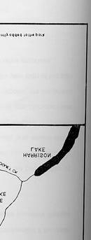
7 LIST OF FIGURES Page FIGURE 1 Regional Context Map 5 FIGURE 2 Zoning Map 10 FIGURE 3 Park Addition Study Areas 13 FIGURE 4 Blackcomb Proposal 14 FIGURE 5 Existing/Proposed Development 27
8 GARIBALDI PROVINCIAL PARK MASTER PLAN 1.0 PLAN HIGHLIGHTS Park Boundary has been legislated About 75% of the park will be nature conservancy Mount Currie and Billy Goat Creek will be studied as park additions Trails will be upgraded and expanded Vegetation Management Plan will be prepared Aircraft access will be managed by restricting landing and by volunteer overflight guidelines Spearhead Route will be studied in detail Heli-skiing will be restricted to the existing permit Mountain hiking facilities and education program are proposed Wildlife Management Plan will be prepared 1
9 2.0 INTRODUCTION 2.1 Plan Purpose The purpose of this master plan is to guide the expansion of backcountry recreational opportunities and the protection of the Lower Mainland's most important wilderness. The key issues that need to be addressed include the following: Role of the Park: Although wilderness has been the traditional role of the park, the increase demands for expanded development and a dwindling supply of unprotected wilderness suggests a re-evaluation. Legislating Boundary: This action is taken to maximize statutory protection of the park but could hinder to some degree boundary deletions. Proposed Additions: Two areas adjacent to the park; Mount Currie and Billy Goat Creek, that are currently included in the Soo Provincial Forest are proposed as potential additions to Garibaldi Park. Level of Development/Services: Increase in recreational opportunities and services are desired but retaining undeveloped wilderness opportunities is also an important objective. 2
10 2.2 Background Summary Garibaldi Provincial Park covers about 194,000 hectares of the Coastal Mountains. It represents and conserves the Rugged Pacific Ranges Regional Landscape. This landscape is characterized by high jagged, ice-blanketed peaks above steep-sided forested mountain slopes which plunge to u-shaped valleys at relatively low elevations. The climate is typical of the West Coast being determined by the eastern movement of moisture laden air resulting in high precipitation and mild temperatures. There are numerous outstanding provincial and nationally significant outdoor recreation features including unique glacial/volcanic peaks such as the Black Tusk and Table mountain and expansive alpine meadow. Garibaldi offers a wide array of hiking/backpacking, rock climbing and ski touring recreational opportunities that range from short duration day trips to multi-day wilderness excursions. The park is the most heavily used backcountry area in the BC Parks System. The park has a long history of association with outdoor recreation clubs who were the impetus behind the designation of the park and who continue to play an active role in assisting park management 3
11 3.0 THE ROLE OF THE PARK 3.1 Regional and Provincial Context (Figure 1) Garibaldi Provincial Park is situated in the Coastal Mountains of Southwestern British Columbia, 75 kilometres north of the City of Vancouver. With the Greater Vancouver area of some 1.5 million people in such close proximity less than an hour's drive away, Garibaldi Provincial Park is one of the most easily accessible wilderness areas in the world. Access to the western half of the park is provided by Highway 99, while the isolated eastern half is accessible by forestry roads. Winter access by air is available but only for heli-skiing. Highway 99 extends to the Canada-US Border and is the main route visitors from Seattle and other Americans use when entering British Columbia. The portion of the highway north of Vancouver is in itself a significant source of recreational opportunities. Popular as a scenic drive, the highway corridor has a number of provincial parks, private resorts and several points of interest. The communities in the immediate vicinity of the park; Squamish, Whistler and Pemberton, provide full services and facilities to visitors including, food, fuel, shopping, entertainment, accommodations and medical services. As Whistler has become a year round international destination area, its influence on Garibaldi Park has substantially increased. The recent expansion of ski lifts to the very height and edge of the park has dramatically made the alpine environment virtually accessible to large numbers of visitors including seniors and the disabled. In addition, the popularity of aircraft access over and in the vicinity of the park has affected the enjoyment of wilderness for many visitors. 4


12
13 Other regional factors that indirectly affect the park include the extensive resource harvesting in the adjacent mountains. While park resources are not impacted, views in the park are adversely affected. 3.2 Conservation Role In keeping with the goals of the Parks system (Appendix II), the main conservation roles of Garibaldi Park are: to represent the Rugged Pacific Ranges Regional Landscape; to preserve the landscapes's special and representative features. From the mountain peaks and valleys to the glaciers, ice caves, cinder cones and subalpine meadows, it is important to retain these provinc ially significant features in a natural state for their recreational enjoyment and their educational and scientific benefits. 3.3 Recreation Role Garibaldi Park serves two of the three Parks system recreation goals. Its recreation role is, twofold, first: to provide the highest quality destination mountain wilderness opportunities in southwestern British Columbia The outstanding mountain features and opportunities of the park, combined with its close association with Whistler Resort and proximity to Vancouver, make Garibaldi one of the most popular backcountry destinations in the Pacific Southwest. destination opportunities include a subalpine/alpine wilderness which provides a variety of day hiking, climbing and backpacking opportunities in the summer while, in winter, outstanding day and overnight backcountry skiing opportunities are available. Access improvements and expansion of support services, created by the development of Whistler as an international, four-season destination resort, have substantially increase awareness of the park and have made its opportunities available to a wider range of visitors. The second recreation role is: to provide a variety of alpine recreation experiences to serve the needs for regional recreation. Its 6
14 Unlike any other provincial park in southwest British Columbia, Garibaldi Park is the last vestige of untouched protected wilderness within a few hours' drive of Vancouver. Its features constitute the singularly most significant protected wilderness in the Lower Mainland. Consequently, its recreation opportunities, highly valued by British Columbians and visitors, substantially contribute to the development of regional tourism while addressing the needs for resident recreation. Given the absence of any equally significant areas and the likelihood of continued resource development and urban growth in the region, the value of this wilderness will continue to grow in future years. 7
15 4.0 ZONING Garibaldi Park is divided into four zones: Wilderness Conservation Zone and Natural Environment Zone; Special Features Zone and Intensive Recreation Zone (Figure 2). Wilderness Conservation Zone * The Wilderness Conservation Zone reflects, in boundary and in park uses, the nature conservancy area. The objective of the zone is to protect a remote, undisturbed natural landscape and to provide backcountry recreation opportunities dependent on a pristine environment. They are characterized by very low use, no facilities or hunting, nonmechanized access and large natural areas free of any evidence of modern man. Management is oriented to protecting a pristine environment. Approximately 145,500 hectares of the park fall into this zone. Natural Environment Zone The objective of this zone is to protect scenic values and provide for backcountry recreation opportunities in a largely undisturbed natural environment. Though characterized by low-to-moderate use, this zone precludes any sense of wilderness isolation. Facilities are moderately developed with trails, walk-in campsites and shelters. The environment of this zone will be less pristine than that available in a Wilderness Conservation Zone. The main management concern will be to keep use impacts below levels that will impair park resources or significantly reduce user satisfaction while encouraging backcountry use for visitors. Approximately 49,000 hectares fall into this zone. * As a result of changes in the provincial park zoning policy, the name of this zone was changed from Nature Conservancy Zone. 8
16 Special Features Zo ne * The objective of this zone is to preserve and present significant natural or cultural resources, features, or processes because of their special character, fragility or heritage value. Management is oriented towards maintaining a high quality recreational and interpretive experience with interpretive facilities provided. This zone includes the Black Tusk, Table and Taylor Meadows, Cheakamus River, Red Heather Ridge and Singing Pass areas. Approximately 3200 hectares fall into this zone. Intensive Recreation Zone * The objective of this zone is to provide concentrations of high use visitor services and facilities. In Garibaldi Park, this zone, some 300 hectares in area, is restricted to both the Diamond Head and Black Tusk road and parking areas. * As a result of a change in the provincial park zoning policy, the name of these zo nes was changed from Special Features Subzone and Development Subzone respectively. 9


17
18 5.0 NATURAL AND CULTURAL RESOURCE MANAGEMENT 5.1 INTRODUCTION The overall management of natural and cultural resources will be based upon the Park Act, Park Regulations, ministry policies and the role of Garibaldi Park in the overall system of provincial parks and recreation areas in British Columbia. The resource management objective in the park is to ensure that the Ministry of Parks' goals are met by: protecting Garibaldi's representative natural environments and recreation resources; allowing only appropriate types and levels of recreation uses; monitoring use impacts and resource conditions so that appropriate actions may be taken; establishing resource guidelines that will protect Garibaldi's recreation and conservation resources. 5.2 NATURAL RESOURCES MANAGEMENT: OBJECTIVES/ACTIONS Land Management OBJECTIVE: To protect the existing land area of the park while expanding park boundaries into adjacent areas that have high park values. Since the establishment of Garibaldi Park, a number of changes to the park's land base have occurred. In view of the general increase in demand for protected areas and wilderness opportunities, it is important to retain the existing land area and review options for expansion. A number of proposals for boundary expansion has been suggested. Actions Detailed studies and discussions will be initiated with various agencies, organizations and individuals to review the expansion of Garibaldi Park in the following areas (Figure 3). Mount Currie: An area containing several alpine meadows, glaciers, ridges, mountain goat habitat, and several waterfalls that potentially offer a variety of recreational opportunities. 11
19 Billy Goat Creek: Mountain goat habitat area omitted from the park but serving an important role in managing and protecting park goats. The entire park with the exception of the Blackcomb Glacier, will be included into Schedule "A" of the Park Act. As decided in the Blackcomb Ski Area Proposal review (Appendix III), the Blackcomb Glacier will be deleted from the park if required for ski development. As with any proposed deletions, a public review will be conducted. Area 3 of the Blackcomb Proposal (Figure 4) will be made available for environmental studies to assess natural features for recreation potential, including alpine skiing. The trailhead access for Cheakamus Lake, Singing Pass and Wedgemount Lake will be upgraded and secured. The Rubble Creek corridor will be managed in keeping with O.I.C. 1185, the Barrier Civil Defence Zone which has restrictions on development and public access. All existing public shelters including The Sphinx and Sentinel Glacier huts will be retained. The Ministry of Forests will be encouraged to reforest the cut blocks adjacent to Glacier Lake for quick green-up and to apply landscape management techniques to existing commitments for future harvesting. The proposed addition at Glacier and Fire lake will be reviewed, upon expiry of resource commitments. 12


20


21
22 5.2.2 Vegetation Management OBJECTIVE: To perpetuate the park vegetation in a natural dynamic ecosystem and preserve critical plant communities. To fulfil the park's conservation and recreation role, it is essential that the major vegetation communities are managed as naturally evolving plant communities. Lightning fires, avalanches or similar hazards are considered natural forces contributing to the evolution of plant communities. Critical plant communities, such as old growth forest, should be preserved as environmental benchmarks and gene pools for the future. Actions A vegetation inventory and management plan will be prepared documenting the impacts on park vegetation with a prescribed program for restoring high impact areas such as the alpine meadows and protecting the old growth forests. Fires, disease or other hazards caused by nature, will be allowed to take their natural course, except in circumstances where human life, facilities, critical plant communities or resources outside the park boundary are threatened Water Management OBJECTIVE: To maintain the park watersheds in their natural condition free from contaminates or pollution to benefit park visitors, plants, animals and down stream users. The maintenance of a high quality water resource is another important component of the conservation and recreation role of Garibaldi Park. While there have been few problems with water quality, increases in park attendance reiterate the need to emphasize actions that conserve this essential resource while still making waterside recreation available. Actions Ensure sanitary facilities are properly designed and located; The Mashiter watershed will be signed; Soil erosion will be minimized through revegetation and careful construction techniques; Public information on water conservation and consumption as well as the safe disposal of grey water will be provided; 15
23 5.2.4 Visual Management OBJECTIVE: To ensure the viewing opportunities within the park and surrounding landscape are maintained and, in some cases, improved. Within the park boundary, a high priority will be given to maintain quality visual experiences while outside park boundaries, adjacent land managers will be encouraged on an ongoing basis to minimize their impact on external park views from within the park. Actions Cooperation with the Ministry of Forests, the Ministry of Crown Lands and the adjacent ski resorts will be encouraged to minimize visual impact. Glacier Lake and the Whistler/Blackcomb ski areas will be emphasized Wildlife Management OBJECTIVE: To maintain the existing natural biotic diversity of species and genetics of the park's wildlife population. The wildlife of Garibaldi Provincial Park is an important contributor to the representation of the Rugged Pacific Ranges Regional Landscape and adds to the appeal of the park as a quality wilderness area. In particular, the opportunity to view pika, marmot and mountain goat add considerably to the park's values. Declining goat populations over the past 15 years have emerged as the major wildlife management concern. Actions A wildlife inventory and long term management plan for wildlife in the park will be formulated in conjunction with agencies and groups managing wildlife resources outside the park, including a comprehensive proposal for maintaining a selfsustaining population. Hunting will be discontinued. Domestic animals including pets will be prohibited in the park. 16
24 5.2.6 Fish Management OBJECTIVE: To manage Cheakamus Lake and Glacier Lake for recreational fishing while maintaining the existing conditions for remaining fish habitat. Actions Angling at Cheakamus and Glacier Lake will be encouraged, with restriction or enhancement measures taken as required. Garibaldi Lake will be maintained as a natural fishery with no enhancement. Fishing will continue provided the resource remains on a self-sustaining basis. Fish will not be introduced into lakes and streams within the nature conservancy area. 5.3 CULTURAL RESOURCES OBJECTIVE: To reduce the rate of deterioration of the Diamond Head Chalet and Taylor cabin. These two structures are historic links to the era of early park visitors and mountaineers and remain as symbolic legacies of the pioneers who worked to preserve Garibaldi Provincial Park. Actions Periodic maintenance will be done to stabilize each structure for as long as possible. Interpretation signs and information will be provided outside both structures to explain their significance in the park's history. lf the structures become a hazard to public safety they will be removed. 17
25 6.0 VISITOR SERVICES 6.1 INTRODUCTION The challenge of providing visitor services in Garibaldi lies in achieving balance between recreational use and the conservation of park features and resources. While Garibaldi's greatest asset is a vast, pristine wilderness rich in outstanding natural features, its greatest constraints in terms of conserving these features are the pressure and demands placed on it by increasing numbers of visitors. In view of the priceless value that accessible wilderness represents, the visitor services concept places a high priority on non-consumptive, low impact recreational opportunities while addressing the needs for expanded facility-oriented uses. Specifically, the visitor services proposed for the park seek to balance the following objectives related to zoning: to provide backcountry opportunities in a highly scenic environment supported by a minimal level of visitor services (Natural Environment Zone, Special Feature Zone); to provide and encourage low impact wilderness opportunities in a pristine natural environment with no developed facilities (Wilderness Conservation Zone); and, to encourage consumptive recreation opportunities outside the park whenever possible. These objectives are reflected in the general access strategy which bring vehicle access close to park boundaries and then provides low-impact trail access to the park's more popular features and to wilderness access points. Beyond the wilderness access points, visitors determine their own travel routes. To achieve these objectives it is important to work in close concert with Squamish, Whistler and Pemberton as well as managers of the adjacent ski resorts, to coordinate planning and development. Informing visitors about all aspects of Garibaldi Park is one of the most important functions of visitor services management. The information strategy will be to emphasize the wilderness nature of the park, encourage dispersed use, and ensure the public is aware 18
26 and prepared for the potential dangers associated with wilderness trave l. 6.2 Visitor Opportunities/Facilities (Figure 5) The following summary outlines each activity, its objective and the facilities or services required Hiking/Backpacking OBJECTIVES: To encourage a range of hiking opportunities from short level interpretive trails through to high elevation routes. In an effort to maximize the wilderness atmosphere many of these routes will not be designated trails. Garibaldi offers a wide variety of hiking opportunities to suit individual physical ability. Most are concentrated in the vicinity of the Black Tusk Meadows, Cheakamus Lake Diamond Head and Singing Pass. While day hiking is most popular, there is considerable opportunity for backpacking during multi-day excursions, particularly three to four day trips north to south along the west half of the park or six or seven day wilderness trips through the heart of the park. In addition to existing trails and designated backcountry huts and camps, the following facilities/services are proposed. Actions Upgrade and secure the existing trail access and staging areas at Cheakamus Lake, Singing Pass, Blackcomb and Wedgemount Lake. A high route trail in the Spearhead Range linking the Blackcomb ski area and the Whistler ski area will be studied in detail. Included in the study will be an assessment of impact on mountain goats. Develop a trail to Mt. Price and Clinker Peak from Garibaldi Lake Campground. Develop a trail along the Musical Bumps. Develop a loop trail linking Russet Lake and Adit Lake. Develop backcountry campsites at Mamquam Lake, Helm Lake and Adit Lakes. Develop a trail from Cheakamus Lake to Singing Pass. Upgrade all existing designated trails. 19
27 6.2.2 Angling OBJ ECTIVE: To provide a high quality experi ence based on a self sustaining fishery. The opportunity to fish for rainbow trout at Garibaldi Lake is one of the main attractions for some visitors. As indicated in the resource management section, this opportunity will be continued, provided the resource remains self-sustaining. circumstances warrant, enhancement measures may be implemented at Cheakamus Lake and Glacier Lake. Actions The facilities/services provided would be information on fishing regulations and conservation Mountain Biking OBJECTIVE: To encourage mountain bike access to park trailhead parking areas but to limit cycling to two areas: the Red Heather Ridge trail up to the Elfin Shelter and the proposed south Cheakamus River trail. Mountain hiking has become an extremely popular outdoor recreation activity over the past few years, providing the opportunity to travel great distances in mountain terrain. But mountain biking in Garibaldi Park has created conflict with pedestrian visitors because most hiking trails in the park are unable to accommodate both users. Many hikers also fear cycling off established trails could cause widespread, irreversible damage to alpine meadows. Actions Develop a mountain bike trail on the southern bank of the Cheakamus River in concert with the Ministry of Forests and outdoor recreation clubs. Encourage mountain bike opportunities at Blackcomb and Whistler ski areas and within the Soo Provincial Forest; Provide information on mountain hiking in the park and vicinity, including information on trail ethics and etiquette. If 20
28 6.2.4 Winter Recreation OBJECTIVE: To encourage ski touring in Diamond Head and other areas of the including the Black Tusk; Singing Pass and, Cheakamus Lake. Winter recreation in Garibaldi Park has traditionally been concentrated in the Diamond Head Area for ski touring and in the Spearhead Range for heli-skiing. Some visitors traverse the Garibaldi Neve from Diamond Head to Garibaldi Lake or to traverse the high route between Whistler and Blackcomb Ski areas. Actions Sign and trail markers will be installed on winter access routes to Cheakamus Lake, Black Tusk and Singing Pass. Study in detail the high route trail in the Spearhead Range linking the Blackcomb ski area and the Whistler ski area as a possible ski tour route supported by a hut system. Included in the study will be an assessment of impact on mountain goats. Encourage snowmobiling outside the park Commercial Recreation Services OBJECTIVE: To encourage commercial recreation services that are in keeping with the role of Garibaldi Park. Wilderness guiding and helicopter skiing have been the traditional commercial recreation services in the park. Sightseeing from aircraft has become a popular recreation services in recent years and continued growth is anticipated. Actions General aviation, landings and sightseeing by aircraft will be managed for minimum impact on park visitors and wildlife through an aviation management plan. The plan will provide guidance on minimum altitude of flights and will restrict landings. The heli-skiing opportunities will continue to be a recrea tion services offered in the park. However, no new areas will be considered within the park for additional heli-skiing. Non-mechanized guiding in the park will be encouraged. 21
29 6.2.6 Outdoor Education OBJECTIVE: To encourage outdoor education in the park and enhance public understanding and appreciation of park values. Garibaldi Park offers numerous opportunities for nature appreciation and wilderness skills development through outdoor education programs. Actions Interpreters will present programs on park themes such as active alpine glaciers, volcanoes, subalpine meadows, meadow restoration, fish protection, wildlife habitats, proper use of wilderness, and early mountaineering in the park. School groups will be encouraged to participate in interpretive programs during their visits in the park Other Activities Park policy throughout British Columbia's park system provides for a variety of socially constructive recreation activities. However, not all of these activities are necessarily in keeping with the wilderness role of Garibaldi Park. Given that and the fact that other opportunities are available in close proximity to the park, heli-hiking, snowmobiling, and hunting are not deemed acceptable activities for Garibaldi Park. 6.3 MANAGEMENT SERVICES Headquarters and Service Yards The park headquarters and service yard will continue to be located at Alice Lake Park with service bases at Garibaldi Lake and Elfin Lakes. The existing service road in the Diamond Head area will be phased out beyond the Red Heather Ridge Shelter Site and Facility Design Standards All sites and facilities developed for public use will meet the design standards of the Ministry of Parks. durability and operational efficiency Safety and Health Factors to be considered include visual aesthetics, safety, Every normal precaution will be taken to ensure the safety and health of visitors and staff in Garibaldi Park. Potable water supplies in high-use areas will be designated and periodically tested. Toilet systems will meet Ministry of Health guidelines. As well, there will be periodic safety inspections of all high-use areas. 22
30 The Ministry of Parks has no internal search and rescue capability, but will offer its resources to RCMP and Provincial Emergency Program (PEP) staff during any searchand-rescue emergency in the park Volunteer Services OBJECTIVE: To encourage volunteer assistance in the overall management of the park. Garibaldi has enjoyed the many and varied services of volunteers over the decades. Guidebooks, trail buildings, clean-up and planning assistance have all resulted from the countless hours of dedicated volunteers and friends. 6.4 PROMOTION AND INFORMATION PROGRAM Given the high levels of park use at present, the spin-off promotional benefits from the marketing of Whistler and the level of visitor impact on some park resources there is little need to promote more park use. There is a need, however, to disperse use. This can be achieved by promoting visitation to the lower use areas, such as Singing Pass and Cheakamus Lake, and away from the higher use areas in the vicinity of the Black Tusk. Various objectives and measures proposed in this plan are directed towards promoting these low use areas. Access improvements, upgraded facilities and expanded information services will assist in shifting use patterns Public Information As mentioned earlier, the information strategy for Garibaldi is to emphasize the park's wilderness nature, encourage environmental ethics and visitation to low use areas and to ensure the public is aware and prepared for the potential dangers associated with wilderness travel. Actions Increase emphasis on environmental ethics in park brochures, signs and information shelters. 23
31 Provide additional programs and seminars on outdoor education and wilderness skills development. Highlight low use areas of the park in regional tourism and provincial park displays, publications and slide shows. Institute a degree of difficulty rating system for park trails to better inform the public on trail conditions. Coordinate with the Resort Municipality of Whistler the possibility of using the proposed village visitor centre for park displays and information. 24
32 7.0 THE ROLE OF THE PARK The complexity and size of Garibaldi Park necessitates a phased program for implementing the number of resource and visitor management proposals over the five year term of the plan. This phasing has been divided into two parts. Phase 1 (Year 1-2) Resource Management Study the proposed park additions for Mount Currie and Billy Goat Creek Designate the Park under Schedule "A" of the Park Act. Done under Park Act Amendment Act, proclaimed ) Prepare a vegetation inventory/management plan and initiate meadow restoration at Diamond Head. Liaise with the Ministry of Forests and the ski resorts with respect to coordinating the planning of ski areas and forestry and park development. Continue goat inventory and studies in conjunction with the establishment of the high route between Whistler and Blackcomb ski areas. Provide interpretive display at Diamond Head Chalet. Discontinue hunting. Install signs on the Mashiter watershed. Visitor Services Upgrade all existing designated trails. Construct a trail from Singing Creek Delta to Singing Pass. Develop Musical Bumps to Singing Pass Trail in conjunction with the Whistler Ski Resort. Install signs and markers on winter access trails to Black Tusk, Singing Pass, and Cheakamus Lake. Develop and implement an aviation management plan. Implement the promotion and information proposals. Develop wilderness campsites at Mamquam Lake and Helm Lake. 25
33 Develop mountain bike trail on South Cheakamus River. Phase 2 (Year 2-5) Resource Management Prepare a wildlife inventory/management plan. Secure trailhead access at Cheakamus Lake, Singing Pass, Blackcomb and Wedgemount Lake. Visitor Services Construct a trail from Garibaldi Lake to Clinker Peak and Mount Price. Develop a loop trial to and a campsite at Adit Lakes. 26


34
35 Garibaldi Provincial Park M ASTER P LAN Appendix I Background Report
36 APPENDIX I GARIBALDI PROVINCIAL PARK BACKGROUND REPORT Page 1.0 INTRODUCTION NATURAL AND CULTURAL RESOURCES Natural Resources Natural Region/Regional Landscape Geology Soils Climate Vegetation Water Resources Fish and Wildlife Visual Resources Outdoor Recreation Features Cultural Resources Resource Analysis TENURES, OCCUPANCY RIGHTS AND JURISDICTIONS RECREATION OPPORTUNITIES/EXISTING FACILITIES MARKET ANALYSIS Existing Use Visitor Profile Demand KEY ISSUES/PUBLIC COMMENTS 31
37 LIST OF FIGURES Page FIGURE 1 Park Location 2 FIGURE 2 Outdoor Recreation Features Map 14 FIGURE 3 Tenures Map 21 FIGURE 4 Existing Development Map 23 FIGURE 5 Major Proposed Additions 34
38 GARIBALDI PROVINCIAL PARK BACKGROUND REPORT 1.0 INTRODUCTION For over eighty years, Garibaldi Park has been providing inspiration and adventure for several generations of hikers fortunate enough to visit its outstanding natural wonders. Through the diligent efforts of the park's first visitors and supporters, including the pioneering mountaineers of the British Columbia Mountaineering Club and the Alpine Club of Canada, the area was established as the province's forth provincial park in The park is named after the most dominant peak in the area, Mount Garibaldi. In 1860, while carrying out a survey of Howe Sound on board the Royal Navy survey ship, H.M.S. Plumper, Captain George Henry Richards beheld a towering mountain to the northeast. Impressed by its majesty and desiring to give the peak a name befitting its splendour, Richards named the mountain after the great 19th Century Italian patriot, Guiseppe Garibaldi. Garibaldi Park is located 97 km north of Vancouver (Figure 1) and is now the sixth largest provincial park in British Columbia, covering over 194,000 hectares of the Pacific Ranges. It is one of several large provincial areas set aside to provide a variety of wilderness recreation while conserving a provincially significant landscape. Within its boundary is a tremendous diversity of natural features from extinct volcanoes and massive glaciers to majestic mountain peaks. For many visitors the real attractions are the colorful alpine meadows. 1


39
40 2.0 NATURAL AND CULTURAL RESOURCES 2.1 NATURAL RESOURCES PHYSIOGRAPHY (Natural Regions and Regional Landscapes) Natural Region and Regional Landscape are basic units that the Ministry of Parks uses to describe areas of common and contiguous landform types, such as mountains, plains, plateaus or lowlands. Garibaldi Park is part of the Rugged Pacific Ranges Regional Landscape which is one of eight Regional Landscapes that collectively represent the Province's Coast Mountain Natural Region. The granitic mountains of the Rugged Pacific Ranges contain the highest peaks in the Coast Mountains from Mount Waddington in the north, at over 4000 metres, to Mount Garibaldi in the south at nearly 2700 metres. Physiographically, Garibaldi Park is typical and representative of this regiona l landscape. Lower mountain peaks have been sculptured by cirque glaciers as evident by rounded and domed peaks, such as Corrie Peak, while many peaks such as James Turner, Mount Garibaldi and Atwell Peak extended above the Pleistocene ice-cap. Mountain slopes are steep sided and densely forested, while the lower elevation u-shaped valleys bear further evidence of the glacial process. Typically, the landscape has a rectangular type drainage pattern with numerous glaciers, ice fields and snow fields. 3

41 4
42 2.1.2 GEOLOGY Geologic History The Pacific Ranges are the result of major geologic events that have occurred since their formation million years ago. They were formed during the Jurassic period by a large mass of intrusive igneous rock called the Coast Batholith. Many other events including volcanic eruptions and the metamorphic granite intrusion and uplifting that occurred during the Cretaceous period, have created this landscape. However, it was several glacial periods that did the most sculpturing to the present park features. The last glacial period, known as the Wisconsin or in British Columbia, the Fraser, began as a massive accumulation of ice and snow. At its maximum, about 15,000 years ago, the glaciers were up to 300 metres in depth and several kilometres long. Through a combination of abrasion and erosion, many of the features in the park, like the cirques and u-shaped valleys, were created. Bedrock Geology The bedrock in Garibaldi Park is composed of sedimentary, metamorphic igneous and volcanic rocks. Igneous rock in the form of Granodiorite, Quartz, Diorite and Migmatite is by far the most prevalent, covering about two thirds of the park area SOILS The soils of Garibaldi Park have essentially been derived from a wide range of glaciated surficial material that has been subject to extensive physical and chemical weathering. Although most of the South Coast Mountain area has not been surveyed for soils, field reports have established a general indication of soil distribution. In Garibaldi Park, two soil orders; organic and podzolic soils are present and represent three great groups including the ferro-humic podzol, humo-ferric podzol, and the folisol soils. Additionally, in the Garibaldi Lake area, there are specialized volcanic soils. 5
43 Ferro-Humic Podzol Shallow deposits of colluvium overlying bedrock is the most common parent material of these soils, although they also form from morainal deposits and gravelly fluvial materials. The main soil forming processes to create this soil type involved the accumulation of organic matter, iron and aluminum oxides producing soils, in combination with the presents of strong podzol B horizons. Soil depth is usually one to two metres, moderately well drained and friable. Humo-Ferric Podzol Like the ferro-humic podzol soil, the humo-ferric podzol are formed from the same types of parent material but in addition are also formed from marine deposits. They are equally moderately well drained, friable and occur in depths one to two metres, particularly the colluvial formed soils. There are greater levels of organic material in the humo-ferris podzol accounting for the emphasis placed in the first prefix of the classification name. Folisols Folisol are organic soils consisting of shallow organic material, consequently they develop in vegetated areas where organic material is abundant. They occur as pockets in conjunction with ferro-humic podzols. Volcanic Soils Very little research has been done on volcanic soils; however, two studies, one by T. Lewis and I. Sneddon reveal that soils derived from lava have no special characteristics other than being a little more nutrient rich CLIMATE The climate of Garibaldi is fairly typical of the West Coast and the Maritime Zone. This zone has a mo isture pattern determined by the eastern movement of moisture laden air from the Pacific Ocean through shallow valleys and steep, mountainous areas to produce a convective weather formation. This system produces warm summers and moderately cold winters. The climate standards indicate average precipitation in August of 5.3 cm, while summer temperatures at the 610 metre elevation average 6
44 18 C. Winter temperatures average -1.5 C at this elevation, with annual snowfall averaging 422 cm. At the northern reaches of Garibaldi, the influence of the interior climate begins, resulting in less precipitation and cooler temperatures VEGETATION (BIOGEOCLIMATIC ZONES) Garibaldi Park has three biogeoclimatic zones: The Coastal Western Hemlock Zone (CWH), the Subalpine Mountain Hemlock (MH) Zone and the Alpine Tundra Zone (AT). The Alpine Tundra Zone is the prevalent zone, occupying approximately 65% of the park area. It begins at about the 1750 metre elevation and is characterized by glaciers, moraines, snow fields and sparse vegetation such as lichen and dwarf Mountain Hemlock. Other dwarfed trees, low shrubs, and herbs are common at the lower elevations of the zone while lichens, principally Coelocaulon aculeatum, Umbillicaria vellea and Rhizocarpon geographicum are the dominant vegetation on exposed peaks. The other two zones are stratified within the valleys with the Subalpine Mountain Hemlock Zone occupying the upper slopes of the valley below the Alpine Tundra Zone, while the Coast Western Hemlock Zone occupies the lower slopes and valley floors. The Coast Western Hemlock Zone occurs along the British Columbian Coast generally between the 0 to 1000 metre elevation. The climatic climax tree species found in the CWH Zone is Western Hemlock (Tsuga heterophylla). This species regenerates in abundance in this zone, however, Western Red Cedar (Thuja plicata) and Douglas Fir (Pseudotsuga menziesii) are also common. Due to the high precipitation, 280 to 665 cm per year, which occurs in the CWH zone, Amabilis fir (Abies amabilis) and Yellow Cedar (Chamaecyparis nootkatensis) frequently occur at the upper elevations. 7
45 In the Subalpine MH Zone the climatic climax tree species is Mountain Hemlock (Tsuga mertensiana). Amabilis Fir (Abies amabillis) and Yellow Cypress (Chamaecyparis nootkatensis) are also common in this zone. At the lowest elevations, Western Hemlock, Douglas-fir and White Pine (Pinus monticola) can be found while at the highest elevations are stunted Alpine Fir (Abies lasiocarpa) and Whitebark Pine (Pinus albicaulis). The development of the Subalpine Mountain Hemlock Zone in Garibaldi Park is affected to a large degree by the moderating influence of the Pacific Ocean. As a result, the weather conditions are milder and have given rise to an atypical subalpine forest. Mountain hemlock, which under normal conditions is uncommon in the subalpine forest, forms the treeline in the Park. Amabilis Fir and Yellow Cypress which, like Mountain Hemlock, have soft needles, are also atypical subalpine forest tree species. Within the Alpine Tundra Zone and the Coastal Western Hemlock Zone lie the main vegetation features of the park including the alpine meadows and old growth cedar forests. There are a variety of alpine meadows in the park, ranging from the alpine flowering type at Black Tusk and Singing Pass to the heather meadows at Diamond Head. Two meadows of significance, a large wet heather meadow above Glacier Lake and the flower meadows below Mt. Price and Table Mountain, have remained virtually undisturbed by man. The old growth cedar forests are located along the Cheakamus River below Cheakamus Lake and in the upper reaches of the Pitt River. They contain a number of giant cedars, roughly two to three metres in diameter, scattered along the trail WATER RESOURCES With a drainage area of nearly 2,000 square kilometres, the water resources of the park are extensive. The main sources of water are meltwater from ice fields and glaciers and significant precipitation. As all park drainage originates within the park, there is very little possibility of contamination or impact from activity outside the park boundaries. 8
46 There are three major lakes in the park: Garibaldi, Cheakamus and Glacier Lake. Garibaldi is the largest lake and is located at the 1470 metre elevation. It has a surface area of over 995 hectares and a mean depth of 121 metres. The deepest point, in the vicinity of Price Bay plunges 259 metres. Water temperature readings taken in the summer of 1983, two metres below the surface indicate 3 C in mid July and at its warmest, at the end of August, 15 C. During the winter, the lake's surface is completely frozen over. The depth of Garibaldi Lake varies considerably throughout the year. During the winter, when water input into the lake is very small, the level drops from water outflow at the outlet and from water escaping through lava beneath the surface. In late winter and early spring, the water level can fall several feet below the level of the outlet, although by June or July it may have risen to the point where it overflows (Mathews, 1975). Heavy snow melt accounts for the rapid rise in lake level in early summer. The lake level gradually falls after most of the snow has melted. Cheakamus Lake is the second largest lake in the park covering 469 hectares at the 831 metre elevation. Its mean depth is 58.1 metres and the deepest point is 119 metres. This point is located near the southeast end of the lake. Glacier Lake is the third largest lake covering 212 hectares at an elevation of 317 metres. The mean depth is 16.4 metres and the deepest point is 29 metres. This point is located near the south end of the lake. Most of the lakes and creeks are turquoise in colour, owing to the extensive run off of glacial flour. They also generally have very little aquatic vegetation. Garibaldi Lake was surveyed in 1977 and found to be absent of aquatic plants while Cheakamus and Glacier Lakes had sparse and sporadic distribution. 9
47 2.1.7 FISH AND WILDLIFE In view of the rugged and generally barren terrain covering most of the park, there is a limited capacity to support a great quantity or diversity of fish and wildlife species in comparison to other provincial wilderness areas. There are, however, twenty-seven species of mammals, nine species of fish, including three salmon species, and nearly one hundred species of birds. The most common mammal species observed by visitors are the Douglas' Squirrel, hoary marmot, pika and mountain goat. Although the list of large mammals believed to be residing in the park on a year round basis includes cougar, coyote, bobcat, Columbian Blacktail Deer, wolverine, black bear and the occasional grizzly bear, these species range over a wide area that usually goes far beyond the park boundaries. With the exception of mountain goats, there is little information on the quantity and condition of these species. The mountain goat population for the park is believed to be approximately animals. This reflects substantial decrease from previous years. The fish resources of the park are primarily associated with the three larges lakes. Garibaldi Lake was stocked with over 17,000 Rainbow Trout (Salmo gairdneri) eggs between 1928 and 1929, and has continued as a self sustaining fishery. Cheakamus Lake has also been stocked with Rainbow Trout. Between 1926 and 1951 nearly 200,000 eggs have been placed in the lake. A 1983 survey however, concluded that fish production in the Cheakamus is quite low given the small size and lack of food in the stomachs of the fish. There are no records of Glacier Lake having been stocked although surveys indicate four species of fish; Largescale Sucker (Catostomus macrocheilus), Dolly Varden (Salvelinus malma), Kokanee (Oncorhychus nerka) and Rainbow Trout are present. 10
48 There is a wide variety of birds that can be seen in the park. The main source of information on the park's birds is from observations by staff and visitors. It appears that many of the birds in the park are associated with its lakes. For example, osprey (Pandion haliaetus), common loon (Gavia immer) and water pipit (Anthus spindetta) have been commonly observed on Garibaldi Lake in addition to Canada Geese (Branta canadensis) on Glacier and Cheakamus Lakes. In the forested areas the common species observed include Blue Grouse (Dendragapus obscurus), Varied Thrush (Ixoreus naevius), Pine Siskin (Cardvelis pinus) and the Clark's Nutcracker (Nucifraga columbiana) to name a few. Barred owl (Strix Varia) and Spotted owl (Strix occidentalis) species have been seen on one occasion in the past. The later is a rare species in British Columbia. While the majority of birds in the park are migratory, there are a few year-round residents including White-tailed Ptarmigan (Lagopus leucurus), Gray Jay (Perisoreus canadensis) and the Raven (corvus corax) VISUAL RESOURCES The visual resources of the Rugged Pacific Ranges Regional Landscape are primarily represented by three types of visual experiences: panorama, enclosures and focals. Panorama - At the high elevation peaks and strategic viewpoints (ie. Wedge, James, Black Tusk, Turner, Sir Richard, Pitt Mountain, Garibaldi), the viewer can experience an uninterrupted view of the mountain ranges and valleys that make up the park and its surroundings. These prominent points are themselves major visual attractions when observed from a distance and represent the most significant visual features. Enclosure - The numerous u-shaped valleys provide a large-scale enclosed visual experience with the valley ridges and creeks acting as the main interest. Forest covered slopes and old avalanche slide sites provide a mid-ground contrast with the latter adding some seasonal variation. Along the edges of the forest cover, emergent deciduous vegetation also contributes to visual diversity through fall colour and winter loss of leaves. 11
49 Focal - There are numerous instances where the landscape focuses the viewer toward a particular feature, as in a cirque lake (ie. Terrarosa Lake) or glacier (ie. Sphinx Glacier) or at the termination of a valley. All visual experiences are often modified by environmental dynamic conditions, particularly atmospheric conditions (ie. low cloud) on the panoramic view. There is generally little visual intrusion by man-made elements except along the periphery of the park boundary. 12

50 2.1.9 OUTDOOR RECREATION FREATURES (FIGURE 2) Garibaldi Provincial Park contains an impressive array of outdoor recreation features that reflect its mountain terrain and volcanic history. The prime concentration of recreation features centre around Garibaldi Lake. Here, four recreation feature units are ranked as nationally significant. These include Garibaldi Lake, the Black Tusk, the Table, and Panorama Ridge. Garibaldi Lake is a spectacular blue-green coloured lake surrounded by glacial and volcanic mountain scenery. The Black Tusk and the Table are volcanic landforms. Panorama Ridge affords superb viewing. 13

51
52 Adjacent to Garibaldi Lake are several features of provincial significance. Black Tusk Meadows is renowned for its alpine flowers. Mount Price is an impressive example of recent volcanism. Lava flows issue from this cone to the north and south. The Castle Towers and Isosceles Peak feature unit contains important glacier and regional topographic patterns. Mount Garibaldi and Diamond Head are well known recreation features in the park, they as well as Opal cone, are contained in recreation feature units of high significance. The south half of Garibaldi Park is dominated by several provincially significant mountain peaks and glaciers. Mamquam Mountain, Mount Sir Richard, Misty Glacier, and Stave Glacier are included in this group. The Fitzimmons and Spearhead Mountain Ranges contain several of the main feature units in the park. The Whistler and Blackcomb ski areas lie within feature units ranked as nationally significant for their regional topographic patterns and downhill skiing opportunities with a provincially significant alpine feature unit that extends from Whistler Mountain south to Russet Lake; Singing Pass. High mountain scenery and glacial landforms dominate the remainder of the Fitzimmons Creek drainage. The north portion of the study area, centred on the Mount Weart and Mount Neal massif, contains a concentration of provincially significant recreation features. Glacial topographic patterns, and rock features are dominant. Wedgemount Lake and alpine units to the north add high quality feature diversity. Alpine and subalpine features are important attractions to the study area. The Black Tusk Meadows, and Paul Ridge are the best known and accessible alpine units. Provincially significant alpine features are found at Wedgemount Lake and the west flank of Mount Currie. An important finding of this assessment is the existence of several alpine - subalpine environments along the east side of the park. Most of these feature units are ranked as moderate in significance. The most noteworthy units are the alpine west of Glacier Lake and south of Fire Lake. 15
53 Old growth forest is found in many areas of the park with the most significant values in the Cheakamus Lake Valley, the upper Snowcap Creek Valley, and the Pitt River Valley. Water features are important throughout the study area. The largest and most important in terms of recreation and uniqueness is Garibaldi Lake. Others such as Cheakamus Lake and Glacier Lake are also noteworthy for the variety of recreation they can provide and the easy access of their low elevation. 16
54 2.2 CULTURAL RESOURCES There are few cultural resources in the park. The most visible cultural objects are two log cabins; Taylor Cain in Taylor Meadows and Diamond Head Chalet at Elfin Lakes. They have been used for recreation for many years and are well known traditional landmarks. These structures are currently in poor condition and are not open for public use. In addition to these cultural objects, there are less visible but significant fossilized sea shells in the Barrier vicinity. They have been identified as a form of extinct clam and are estimated to be from million years old. The Squamish Indians have traditionally visited the park in ancient times to gather obsidian particularly in Ring Creek. This glassy volcanic rock was made into arrows and cutting tools, however, there are no confirmed records of these artifacts being found in the park. 17
55 2.3 RESOURCE ANALYSIS The most significant aspect of a park's resources and features are their potential to serve the goals of the park system and to fulfil the purpose that which it was designated. Garibaldi's resources contribute significantly to achieving the conservation and recreation goals of the British Columbia Parks System (Appendix II). CONSERVATION GOAL SIGNIFICANCE i) Natural Landscape Representation The landform and forest resources are the main resources that typifies the Rugged Pacific Ranges Regional Landscape. The granitic mountains, massive glaciers and u-shaped valleys are just a few of the many landform features while the forest cover of the park represents typical Coast Mountain conditions. ii) Protection of Outstanding Scenic Features and Recreation Settings As aforementioned, the park features are outstanding and provide an exceptional recreation setting. Features such as the Black Tusk are unique scenic features that provide the setting for some of the most outstanding hiking and backpacking opportunities in the province as demonstrated by its popularity with visitors. RECREATION GOAL SIGNIFICANCE i) Major Outdoor Recreation Destinations Garibaldi Park is a major outdoor recreation destination that is an attraction in itself as well as a complementary attraction to the international destination of Whistler. Park attendance figures and surveys confirm the popularity of the park's diverse features and opportunities as a prime destination for wilderness recreation. These opportunities also help diversify the opportunities in Whistler while the extensive infrastructure of support services and recreational opportunities in the town centre attracts and serves international visitors to Garibaldi Park. 18
56 ii) Regional Recreation The close proximity to the Lower Mainland enables Garibaldi Park to offer wilderness opportunities to many communities and representing the majority of the province s population. Although there are other provin cial parks such as Manning or Strathcona that provide wilderness recreation, Garibaldi provides the highest quality opportunities in South West British Columbia by virtue of its size, location and diversity of natural environment that has essentially remained unaltered by man. The other areas have been influenced to varying degrees by trapping, horse packing, or industry. 19
57 3.0 TENURES, OCCUPANCY RIGHTS AND JURISDITION (Figure 3) Leases and Permits: PUP 509 Ministry of Environment, Glaciology Division - Study Purposes PUP 686 PUP 687 PUP 742 PUP 983 PUP 1564 PUP 1635 PUP 1728 PUP 1733 PUP 1825 PUP 1929 PUP 1966 PUP 2195 BC Hydro - Access to Microwave Station BC Tel Access to Microwave Station Whistler Heli Ski Ltd. - Helicopter Skiing Snow Courses #75 - #279 - Snow Measurements Federation of Mountain Clubs - Recreational Guiding Dr. Won S. Hong - Research/Collection BCIT Research Blackcomb Skiing Enterprise - Ski Access Route Ministry of Forests and Lands - Ecosystem Monitoring Pacific Granite Mountaineering - Outdoor Education Royal British Columbia Museum - Collection: Insects Mountain Adventures Ltd. - Commercial Tours Fee Simple Holdings: Forest Tenures: Water Rights: Rights-of-Way: Mineral Claims: Trespasses: Statutory Jurisdiction: Guiding: None None None None None None None None 20


58
59 4.0 RECREATION OPPORTUNITIES/EXISTING FACILITIES (Figure 4) Garibaldi Provincial Park provides a wide range of alp ine backcountry recreational opportunities from day hiking to multi-day backpacking excursions. Access is achieved from five trailhead parking areas; Diamond Head, Black Tusk, Cheakamus Lake, Singing Pass and Wedgemount Lake. Each has different levels of use, facilities and natural features. Diamond Head Area The Diamond Head area, the closest park trailhead to Vancouver, is less than an hour's drive away. Its summer recreational opportunities include day hiking, backpacking, mountain biking and rock climbing. Red Heather Meadows and Elfin lakes are popular day hike destinations while visitors who are backpacking usually can extend their trip to include Opal Cone, Mamquam Lake, Diamond Head or Mount Garibaldi. Mount Garibaldi provides three main climbing approaches ranging from an easy (Class 2) climb to moderate (Class 4). There are over 24 kilometres of developed hiking trails and 11 kilometres of designated backcountry ski trials in the Diamond Head area. The main access trail is multiple use, providing both hiking and mountain biking opportunities. To meet the needs of overnight visitors, about thirty-six designated campsites are provided near Elfin lakes as well as an all-season shelter capable of accommodating thirty to thirty-five people. In addition, there is an all-season day use shelter at Red Heather for hikers and skiers. 22


60

61 24

62 25
63 Besides hiking and rock climbing, there are opportunities for camping, fishing and endless opportunities to view, paint or photograph the spectacular scenery. The Garibaldi Lake area contains 20 kilometres of developed hiking trails. To accommodate overnight visitors there are two campgrounds located at the west side of the lake, that provide tent pads, cooking shelters, and pit toilets. There are 140 campsites in total. Other development includes a nature house and interpretation centre. At the eastern end of the lake there are two primitive huts that are mainly used in winter by skiers crossing the Garibaldi Neve. In winter there are many opportunities for ski touring however as the access is more difficult in winter, only the more adventuresome few visit. Cheakamus Lake Area The Cheakamus Lake area is the most accessible trailhead into the park in terms of trail length and elevation gain. Its relatively flat valley terrain makes the area accessible for virtually all visitors including the elderly. The main attraction of this trail access is the attractive stands of giant trees and picturesque Cheakamus Lake. In addition to the hiking opportunities the area offers fishing and primitive camping. There are about 50 campsites and eight kilometres of trail development. Singing Pass (Fitzimmons Creek) Like the Black Tusk and Diamond Head areas, the Singing Pass area is an alpine destination for day hikers and backpackers. The trail to the pass is approximately 7.5 kilome tres long and climbs 600 metres. It provides opportunities to enjoy an attractive alpine meadow and view at a distant, some of the parks most spectacular peaks. A primitive hut at Russet Lake provides emergency shelter during inclimate weather. Wedgemount Lake Area The Wedgemount Lake area is the most difficult of the five park accesses. The trail is very primitive and rises steeply over 1200 metres. A small overnight shelter is the only development. The rock climbing opportunities are the main attraction with the most challenging Class 5 climbs on the bluffs south of Wedgemount Lake. 26
64 During the winter, the northern boundary of the Fitzimmons Creek drainage, the Spearhead Range, is used by ski mountaineers and extensively for heli-skiing. This range of peaks and glaciers provides excellent powder skiing opportunities. There are no facilities provided in the Spearhead Range. 27
65 5.0 MARKETING ANALYSIS Marketing analysis in planning involves reviewing existing use levels, use patterns and the demand to provide a measure of the effectiveness of existing programs. 5.1 Existing Use Garibaldi Park is the most heavily used backcountry park in the province (Appendix V). During 1989, about 3,600 party nights and about 20,000 party days for day use was recorded, however, as there are a number of undeveloped and unmonitored accesses into the park, actual use figures are believed to be higher. Garibaldi Lake and Diamond Head continue to be the most popular areas of the park representing sixty percent (60%) of camping and seventy percent (70%) of the day use attendance. 5 2 Visitor Profile The typical visitors are young adults from age This group represents over fifty percent (50%) of the people that visit the park. Most visitors to the park, over eighty percent (80%), are British Columbian residents while the states of Washington, Oregon and California surprisingly are the next most significant origin of park visitors. Of those visitors staying overnight, about seventy percent (70%) stay two nights or more. 28
 since 1983 and the decrease in camping use of forty-six percent (46%) since")
66 5.3 Demand Between 1980 and 1989, Garibaldi park averaged about 153,000 visitors each year. Over the last three years, overall attendance has decreased about nineteen percent (19%). An especially significant trend has been the increase in day use of approximately one hundred and fifty-six percent (156%) since 1983 and the decrease in camping use of forty-six percent (46%) since the peak of the decade in
 increase in use since 1984, and the Fitzimmons Creek")
67 Much of the day use increase has occurred at the trailheads closest to the Whistler Resort. The Cheakamus Lake trail has experienced the greatest single increase in the park, having approximately two hundred and thirty-five percent (235%) increase in use since 1984, and the Fitzimmons Creek trail lagging not far behind at an eighty-four percent (84%) increase since the same year. This increase is also reflected, but to a lesser degree, in the popular trailheads such as Rubble Creek/Garibaldi Lake at a fifty-five percent (55%) increase. 30
68 6.0 KEY ISSUES/PUBLIC COMMENTS There are a number of far reaching issues that the master plan must address. All of the key issues have received considerable public review during the course of formulating this plan. The key issues and both the public comments and options to be considered are described as follows: ISSUE: ROLE OF THE PARK Determining the role of the park in the BC Parks System is the fundamental step in determining the park's management direction. Garibaldi has traditionally been a wilderness park; however, the change in recreation use patterns and the increase in demand for more opportunities suggest this role should be reviewed. Public Comments The wilderness emphasis in the park role received wide support when presented to the public. Most people felt there should be wilderness near Vancouver, and Garibaldi was the best candidate. Others, however, have suggested that wilderness close to the Vancouver area was unrealistic given the heavy use of park trails, resource development near park boundaries, and the impact from aircraft noise. They suggested tourism should play an equal role to wilderness. Options Given the above comments, the options to be considered are simply to emphasize wilderness or not to emphasize wilderness. If wilderness is not emphasized, there is no other area in Southwest British Columbia that can meet the role Garibaldi Park currently plays. However, this would open up many opportunities for expanded development and vastly improved access through the use of aircraft. 31
69 ISSUE: LEGISLATING BOUNDARY Legislating the park boundary provides for review and debate in the legislature before boundaries could be reduced and suggest public concerns would be taken into consideration. Public Comment This issues was accepted by most in principle; howe ver, many felt that a review of the entire park boundary should be done first. Those opposed to the boundary review recognize the awkwardness of a straight line boundary but are concerned about the potential to reduce the park size under such a review. There was little support to consider any changes in the boundary that would require a deletion. Options There are two options to address this issue to maintain the status quo or legislate the boundaries. While public review for boundary changes has been the acceptable practice recently, it may be difficult to continue this costly and time consuming process for every proposal that is brought forward. Consequently, there is the potential in the long term to make boundary changes with little or no public involvement if the status quo is maintained. As aforementioned, legislation would ensure boundary changes would be open for review in the legislature. ISSUE: PROPOSED ADDITIONS A number of areas have been proposed to be added to the park (Figure 5). These included six areas proposed in the initial phase of the plan: Lizzie/Ro gers Creek; Mount Currie; Billy Goat Creek; Diamond Head/Rubble Creek; and several others proposed during public meetings including Pinecone Lake; Callaghan Lake, Cheakamus River, Alice Ridge, and Brohm Ridge. Two areas; Rubble Creek and Diamond Head have already been added. The Mount Currie and Billy Goat proposal, are considered the most viable potential additions at this time given the five (5) year term of this plan and considering the logistic and environmental factors of the other proposals. 32
70 Public comments Most people supported the Mount Currie and Billy Goat Creek proposals. Options To retain the current situation would forgo a good opportunity to add to the park land base and potential opportunities. There is no gain in benefits to the park in maintaining the status quo. 33

71
Garibaldi Provincial Park Trail Conditions
 Garibaldi Provincial Park s November 20, 2018 Garibaldi Park is located in the coast mountain wilderness and the weather can be severe and unforgiving. Be well prepared, properly equipped and informed
Garibaldi Provincial Park Trail Conditions
 Garibaldi Provincial Park s August 2, 2018 Garibaldi Park is located in the coast mountain wilderness and the weather can be severe and unforgiving. Be well prepared, properly equipped and informed before
Appendix A BC Provincial Parks System Goals
 Appendix A BC Provincial Parks System Goals The British Columbia Provincial Parks System has two mandates: To conserve significant and representative natural and cultural resources To provide a wide variety
2.0 PARK VISION AND ROLES
 2.0 PARK VISION AND ROLES 2.1 Significance in the Protected Area System Marble Range and Edge Hills provincial parks protect 6.8% of the Pavillion Ranges Ecosection, which is located in the Southern Interior
ANAGEMENT P LAN. July for Chilliwack Lake Park & Chilliwack River Ecological Reserve. Ministry of Environment, Lands and Parks BC Parks Division
 M ANAGEMENT P LAN July 2000 for Chilliwack Lake Park & Chilliwack River Ecological Reserve Ministry of Environment, Lands and Parks BC Parks Division Chilliwack Lake Provincial Park & Chilliwack River
Role of the Protected Area
 Role of the Protected Area Provincial and Regional Context Height of the Rockies and Elk Lakes provincial parks lie in southeastern British Columbia in the Rocky Mountains, about 85 km southwest of Calgary,
MANAGEMENT DIRECTION STATEMENT
 Lower Mainland District MAAGEMET DIRECTIO STATEMET January 2001 for Liumchen Ecological Reserve Ministry of Environment Lands and Parks BC Parks Division Table of Contents Page Introduction... 1 Purpose
ANAGEMENT P LAN. February, for Elk Lakes and Height of the Rockies Provincial Parks. Ministry of Environment, Lands and Parks BC Parks Division
 M ANAGEMENT P LAN February, 1999 for Elk Lakes and Height of the Rockies Provincial Parks Ministry of Environment, Lands and Parks BC Parks Division Elk Lakes & Height of the Rockies Provincial Parks M
ANAGEMENT. LAN November, 1996
 M ANAGEMENT P LAN November, 1996 for Paul Lake Provincial Park Ministry of Environment, Lands and Parks BC Parks Department Paul Lake Provincial Park M ANAGEMENT P LAN Prepared by BC Parks Kamloops Area
SUGARBOWL-GRIZZLY DEN PROVINCIAL PARK AND SUGARBOWL-GRIZZLY DEN PROTECTED AREA Purpose Statement and Zoning Plan
 SUGARBOWL-GRIZZLY DEN PROVINCIAL PARK AND SUGARBOWL-GRIZZLY DEN PROTECTED AREA Purpose Statement and Zoning Plan Located one hour east of Prince George on Highway 16, Sugarbowl-Grizzly Den Provincial Park
MANAGEMENT DIRECTION STATEMENT June, 1999
 Thompson River District MANAGEMENT DIRECTION STATEMENT June, 1999 for Roche Lake Provincial Park Ministry of Environment Lands and Parks BC Parks Division Table of Contents I. Introduction A. Setting
MANAGEMENT DIRECTION STATEMENT June, 1999
 Thompson River District MANAGEMENT DIRECTION STATEMENT June, 1999 for Clearwater River Corridor (Addition to Wells Gray Park) Ministry of Environment Lands and Parks BC Parks Division ii Table of Contents
Yard Creek Provincial Park. Management Plan
 Yard Creek Provincial Park Management Plan Draft January 2010 Yard Creek Provincial Park Management Plan Approved by: telàlsemkin/siyam/chief Scott Benton Bill Williams Squamish Executive Director ation
Marchand Provincial Park. Management Plan
 Marchand Provincial Park Management Plan 2 Marchand Provincial Park Table of Contents 1. Introduction... 3 2. Park History... 3 3. Park Attributes... 4 3.1 Natural... 4 3.2 Recreational... 4 3.3 Additional
Pillar Park. Management Plan
 Pillar Park Management Plan January 2014 Pillar Park Management Plan Approved by: Jeff Leahy Regional Director Thompson Cariboo Region BC Parks January 9, 2014 Date Brian Bawtinheimer Executive Director
ROBERTS CREEK PROVINCIAL PARK MASTER PLAN. November, 1981
 Ministry of Lands, Parks and Housing Parks and Outdoor Recreation Division Park Operations Branch North Vancouver, B. C. ROBERTS CREEK PROVINCIAL PARK MASTER PLAN November, 1981 Mr. G. Trachuk Director
Mackinnon Esker Ecological Reserve Draft - Management Plan
 Mackinnon Esker Ecological Reserve Draft - Management Plan May 2011 Photo Credit: This document replaces the direction provided in the Carp Lake Provincial Park and Protected Area and Mackinnon Esker Ecological
5.0 OUTDOOR RECREATION OPPORTUNITIES AND MANAGEMENT
 5.0 OUTDOOR RECREATION OPPORTUNITIES AND MANAGEMENT 5.1 Introduction This section describes the range of recreational activities that currently take place in Marble Range and Edge Hills Parks, as well
MARBLE RIVER PROVINCIAL PARK
 MARBLE RIVER PROVINCIAL PARK PURPOSE STATEMENT AND ZONING PLAN March 2003 MARBLE RIVER PROVINCIAL PARK Purpose Statement and Zoning Plan Primary Role The primary role of Marble River Park is to protect
Bridge River Delta Park. Management Plan. Final Public Review Draft
 Bridge River Delta Park Management Plan Final Public Review Draft March 2016 Bridge River Delta Park Management Plan Approved by: Jeff Leahy Regional Director Thompson Cariboo Region BC Parks Date Brian
Steps in the Management Planning Process
 Steps in the Management Planning Process Developing a management plan for Kalamalka Lake Park will follow a multi-stage process. The planning process for this park is currently in the Draft Management
MAIN LAKE PROVINCIAL PARK
 MAIN LAKE PROVINCIAL PARK PURPOSE STATEMENT AND ZONING PLAN March 2003 MAIN LAKE PROVINCIAL PARK Purpose Statement and Zoning Plan Primary Role The primary role of Main Lake Park is to protect a biologically
Outdoor Recreation Opportunities Management
 Outdoor Recreation Opportunities Management Introduction The natural features of Height of the Rockies and Elk Lakes provincial parks provide a wide variety of outdoor recreational activities. However,
Kwadacha Wilderness Provincial Park and Kwadacha Addition (Kwadacha Recreation Area) Purpose Statement and Zoning Plan
 Purpose Statement and Zoning Plan") Kwadacha Wilderness Provincial Park and Kwadacha Addition (Kwadacha Recreation Area) Purpose Statement and Zoning Plan Located in a remote area of the northern interior of BC, this large park straddles
Kwadacha Wilderness Provincial Park and Kwadacha Addition (Kwadacha Recreation Area) Purpose Statement and Zoning Plan Located in a remote area of the northern interior of BC, this large park straddles
As outlined in the Tatshenshini-Alsek Park Management Agreement, park management will:
 Management Strategy General Strategy The priority management focus for the park is to ensure that its internationally significant natural, cultural heritage and recreational values are protected and that
Policy. Huts, Cabins and Lodges in BC Provincial Parks
 Policy Huts, Cabins and Lodges in BC Provincial Parks Federation of Mountain Clubs of BC Version 1.3 Published August 2, 2015 INTRODUCTION The Federation of Mountain Clubs of BC (FMCBC) promotes self-propelled
Restore and implement protected status that is equivalent, or better than what was lost during the mid-1990 s
 THE ROSSLAND RANGE, OLD GLORY AREA. Executive summary. The Friends of the Rossland Range Society, on behalf of the local outdoor community, seeks to accomplish the following with respect to the Old Glory
MANAGEMENT DIRECTION STATEMENT March 2003
 Skeena Region MAAGEMET DIRECTIO STATEMET March 2003 for Meziadin Lake Provincial Park Ministry of Water, Land and Air Protection Environmental Stewardsh Division This page left blank on purpose ii Table
Fred Antoine Park. Management Plan. Final Public Review Draft
 Fred Antoine Park Management Plan Final Public Review Draft March 2016 Fred Antoine Park Management Plan Approved by: Jeff Leahy Regional Director Thompson Cariboo Region BC Parks Date Brian Bawtinheimer
WORKSHEET 1 Wilderness Qualities or Attributes Evaluating the Effects of Project Activities on Wilderness Attributes
 WORKSHEET 1 Wilderness Qualities or Attributes Evaluating the Effects of Project Activities on Wilderness Attributes Date: 3/7/2017 Roadless Area: Ruby South Description of Project Activity or Impact to
PLUMPER COVE MARINE PARK MASTER PLAN
 Lower Mainland Region Park Operations Branch Parks and Outdoor Recreation Division Ministry of Lands, Parks and Housing North Vancouver, B.C. PLUMPER COVE MARINE PARK MASTER PLAN DECEMBER, 1980 PLUMPER
KANANASKIS COUNTRY PROVINCIAL RECREATION AREAS MANAGEMENT PLAN DRAFT TERMS OF REFERENCE - November 20, 2007
 KANANASKIS COUNTRY PROVINCIAL RECREATION AREAS MANAGEMENT PLAN DRAFT TERMS OF REFERENCE - November 20, 2007 BACKGROUND There are 42 Provincial Recreation Areas (PRAs) within Kananaskis Country located
Whitemouth Falls Provincial Park. Draft Management Plan
 Whitemouth Falls Provincial Park Draft Management Plan Whitemouth Falls Provincial Park Draft Management Plan Table of Contents 1. Introduction... 3 2. Park History... 3 3. Park Attributes... 4 3.1 Natural...
Pembina Valley Provincial Park. Draft Management Plan
 Pembina Valley Provincial Park Draft Management Plan 2 Pembina Valley Provincial Park Table of Contents 1. Introduction... 3 2. Park History... 3 3. Park Attributes... 3 3.1 Natural... 3 3.2 Recreational...
STONE MOUNTAIN PROVINCIAL PARK Purpose Statement and Zoning Plan
 1 STONE MOUNTAIN PROVINCIAL PARK Purpose Statement and Zoning Plan Stone Mountain Provincial Park is situated 140 km west of Fort Nelson at Kilometre 595 of the Alaska Highway. The 25 690 ha park is located
Kit Carson-Challenger Ridge Trail Project Annual Performance Report-2014 October 22, 2014
 1 Kit Carson-Challenger Ridge Trail Project Annual Performance Report-2014 October 22, 2014 Willow Lake and Kit Carson Peak 2 SUMMARY The Rocky Mountain Field Institute began Phase 1 of a multi-phase,
Clearwater Lake Provincial Park. Draft Management Plan
 Clearwater Lake Provincial Park Draft Management Plan Clearwater Lake Provincial Park Draft Management Plan Table of Contents 1. Introduction... 3 2. Park History... 4 3. Park Attributes... 4 3.1 Location/Access...4
FINGER-TATUK PROVINCIAL PARK
 FINGER-TATUK PROVINCIAL PARK PURPOSE STATEMENT AND ZONING PLAN March 2003 FINGER-TATUK PROVINCIAL PARK Purpose Statement and Zoning Plan Finger-Tatuk Provincial Park is 17,151 ha in size. It includes the
Mackinnon Esker Ecological Reserve. Management Plan
 Mackinnon Esker Ecological Reserve Management Plan March 2017 Cover Page Photo Credit: Rob Bell This document replaces the direction provided in the Carp Lake Provincial Park and Protected Area and Mackinnon
Continental Divide National Scenic Trail Legislative History and Planning Guidance
 Continental Divide National Scenic Trail Legislative History and Planning Guidance Legislation, Policy, and Direction Regarding National Scenic Trails The National Trails System Act, P.L. 90-543, was passed
The following criteria were used to identify Benchmark Areas:
 7.0 BENCHMARK AREAS The Churn Creek Protected Area offers a significant opportunity to learn more about how grassland ecosystems function. One of the key tools that will be used to monitor larger grassland
Sasagiu Rapids Provincial Park. Draft Management Plan
 Sasagiu Rapids Provincial Park Draft Management Plan 2 Sasagiu Rapids Provincial Park Table of Contents 1. Introduction... 3 2. Background and Park Attributes... 3 2.1 Park History.... 3 2.2 Natural Features...
MANAGEMENT DIRECTION STATEMENT
 Skeena District MAAGEMET DIRECTIO STATEMET July, 2000 for Driftwood Canyon Provincial Park Ministry of Environment Lands and Parks BC Parks Division i Table of Contents Driftwood Canyon Park Approvals
OMINEACA PROVINCIAL PARK
 OMINEACA PROVINCIAL PARK AND PROTECTED AREA PURPOSE STATEMENT AND ZONING PLAN March 2003 OMINECA PROVINCIAL PARK AND PROTECTED AREA Purpose Statement and Zoning Plan Omineca Park and Omineca Protected
NICOLUM RIVER PARK MASTER PLAN. July, 1983
 Ministry of Lands, Parks and Housing Parks and Outdoor Recreation Division Lower Mainland Region NICOLUM RIVER PARK MASTER PLAN July, 1983 TABLE OF CONTENTS PART 1: SUMMARY AND BACKGROUND A. Plan Summary...1
Ouimet Canyon Provincial Nature Reserve. Management Plan
 Ouimet Canyon Provincial Nature Reserve Management Plan NOTE: This document has been scanned and formatted, and therefore is slightly different from the original version. -March 2002 Additional copies
Bayview Escarpment. Interim Management Statement
 Bayview Escarpment Interim Management Statement Bayview Escarpment Provincial Nature Reserve Interim Management Statement January 15, 1995 REGIONAL DIRECTOR'S APPROVAL STATEMENT This Interim Management
BLANKET CREEK PROVINCIAL PARK
 BLANKET CREEK PROVINCIAL PARK PURPOSE STATEMENT AND ZONING PLAN February 2003 BLANKET CREEK PROVINCIAL PARK Purpose Statement and Zoning Plan Primary Role The primary role of Blanket Creek Park is to maintain
Stuart River Provincial Park Purpose Statement and Zoning Plan
 Stuart River Provincial Park Purpose Statement and Zoning Plan Stuart River Provincial Park protects three-quarters of the 110 kilometer long Stuart River corridor between Stuart Lake and the Nechako River.
SCHOEN LAKE PROVINCIAL PARK MASTER PLAN
 SCHOEN LAKE PROVINCIAL PARK MASTER PLAN September 1986 Mr. M. V. Collins Assistant Deputy Minister Parks & Outdoor Recreation Division Ministry of Lands, Parks & Housing Victoria, B.C. This Master Plan
THRESHOLD GUIDELINES FOR AVALANCHE SAFETY MEASURES
 BRITISH COLUMBIA MINISTRY OF TRANSPORTATION & INFRASTRUCTURE AVALANCHE & WEATHER PROGRAMS THRESHOLD GUIDELINES FOR AVALANCHE SAFETY MEASURES British Columbia Ministry of Transportation & Infrastructure
Wallace Lake Provincial Park. Management Plan
 Wallace Lake Provincial Park Management Plan 2 Wallace Lake Provincial Park Table of Contents 1. Introduction... 3 2. Park History... 3 3. Park Attributes... 4 3.1 Natural... 4 3.2 Recreational... 4 4.
TAYLOR CANYON RANCH COLORADO - ROUTT COUNTY - STEAMBOAT SPRINGS
 TAYLOR CANYON RANCH COLORADO - ROUTT COUNTY - STEAMBOAT SPRINGS Tucked up against the steep valley shaped by Mt. Pau and rising to the Routt National Forest, Taylor Canyon Ranch is an easily accessible,
ASTER. LAN December for Kokanee Glacier Provincial Park and Recreation Area. Ministry of Parks Hon. John Savage Minister
 M ASTER P LAN December 1990 for Kokanee Glacier Provincial Park and Recreation Area Ministry of Parks Hon. John Savage Minister Kokanee Glacier Provincial Park and Recreation Area M ASTER P LAN Prepared
CARMANAH WALBRAN PROVINCIAL PARK
 CARMANAH WALBRAN PROVINCIAL PARK PURPOSE STATEMENT AND ZONING PLAN September 2003 1 CARMANAH WALBRAN PROVINCIAL PARK Purpose Statement and Zoning Plan Carmanah Walbran Provincial Park is an expansion of
Connie Rudd Superintendent, Black Canyon of the Gunnison National Park
 National Park Service U.S. Department of the Interior Black Canyon of the Gunnison National Park and Curecanti National Recreation Area Information Brochure #1 Wilderness and Backcountry Management Plan
Sand Lakes Provincial Park. Draft Management Plan
 Sand Lakes Provincial Park Draft Management Plan 2 Sand Lakes Provincial Park Table of Contents 1. Introduction... 3 2. Background... 3 3. Park Purpose... 5 4. Park Management Guidelines... 6 Appendix...
MANAGEMENT DIRECTION STATEMENT March 2003
 Skeena Region MAAGEMET DIRECTIO STATEMET March 2003 for Great Glacier Provincial Park Ministry of Water, Land an Air Protection Environmental Stewardship Division ii This management direction statement
Natural and Cultural Values and Their Management...18
 Skagit Valley Provincial Park Management Plan Table of Contents Plan Highlights...4 Introduction...5 The Management Planning Process...5 Background Summary...6 Relationship to Other Land Use Planning...8
Watchorn Provincial Park. Management Plan
 Watchorn Provincial Park Management Plan 2 Watchorn Provincial Park Table of Contents 1. Introduction... 3 2. Park History... 3 3. Park Attributes... 3 3.1 Natural... 4 3.2 Recreational... 4 3.3 Additional
Numaykoos Lake Provincial Park. Management Plan
 Numaykoos Lake Provincial Park Management Plan 2 Numaykoos Lake Provincial Park Table of Contents 1. Introduction... 3 2. Background... 3 3. Park Purpose... 5 4. Park Management Guidelines... 6 Appendix...
Recreational Services Plan. Gatineau Park. Phase 1: Planning Framework
 Recreational Services Plan Gatineau Park Phase 1: Planning Framework 1 Plan Planning in Gatineau Park Gatineau Park : an overview Trends Preliminary assessment Strategic framework 2 Unique natural and
Alternative 3 Prohibit Road Construction, Reconstruction, and Timber Harvest Except for Stewardship Purposes B Within Inventoried Roadless Areas
 Roadless Area Conservation FEIS Summary Table S-1. Comparison of Key Characteristics and Effects by Prohibition Alternative. The effects summarized in this table A would occur in inventoried roadless areas
Finn Creek Park. Management Direction Statement Amendment
 Finn Creek Park Management Direction Statement Amendment November 2013 Management Direction Statement Amendment Approved by: Jeff Leahy Regional Director, Thompson Cariboo BC Parks November 12, 2013 Date
MANAGEMENT DIRECTION STATEMENT March 2003
 Skeena Region MAAGEMET DIRECTIO STATEMET March 2003 for Lava Forks Provincial Park Ministry of Water, Land and Air Protection Environmental Stewardshi Division This management direction statement was
26 Utah s Patchwork Parkway SCENIC BYWAY CORRIDOR MANAGEMENT PLAN (SR 143)
") Natural Natural Quality applies to those features in the visual environment that are in a relatively undisturbed state. These features predate the arrival of human populations and may include geological
Natural Natural Quality applies to those features in the visual environment that are in a relatively undisturbed state. These features predate the arrival of human populations and may include geological
Rio Duthie Sam Guenther
 Rio Duthie Sam Guenther The Issues Environmental Impact Economic Impact Social Impact Environmental Issues The Wildlife The Grizzly Bears Hiking Infrastructure Glaciers Wildlife Elk, bear, mountain goat,
RE: Access Fund Comments on Yosemite National Park Wilderness Stewardship Plan, Preliminary Ideas and Concepts
 September 30, 2016 Superintendent Yosemite National Park Attn: Wilderness Stewardship Plan P.O. Box 577 Yosemite, CA 95389 RE: Access Fund Comments on Yosemite National Park Wilderness Stewardship Plan,
Crystal Lake Area Trails
 Lake Area Trails Welcome to the Lake area of the Big Snowy Mountains! This island mountain range in central Montana features peaks reaching to 8,600 feet and long, high ridges from which vistas of the
APPENDIX. Alberta Land Stewardship Act AMENDMENTS TO THE SOUTH SASKATCHEWAN REGIONAL PLAN
 APPENDIX Alberta Land Stewardship Act AMENDMENTS TO THE SOUTH SASKATCHEWAN REGIONAL PLAN 1 All references to Alberta Environment and Sustainable Resource Development, Environment and Sustainable Resource
Whitefish Range Partnership Tentatively Approved by WRP 11/18/2013!Rec. Wilderness Page 1
 Whitefish Range Partnership Tentatively Approved by WRP 11/18/2013!Rec. Wilderness Page 1 Recommended Wilderness Background The Whitefish Range has a long management and legislative history associated
Theme: Predominately natural/natural appearing; rustic improvements to protect resources. Size*: 2,500 + acres Infrastructure**:
 Recreation Opportunity Spectrum (ROS) Classes The Recreation Opportunity Spectrum (ROS) provides a way to describe the variations in the degree of isolation from the sounds and influences of people, and
Preferred Recreation Recommendations Stemilt-Squilchuck Recreation Plan March 2018
 Preferred Recreation Recommendations Stemilt-Squilchuck Recreation Plan March 2018 Below are the recommended recreation ideas and strategies that package together the various recreation concepts compiled
Proposed Scotchman Peaks Wilderness Act 2016 (S.3531)
") 1 Proposed Scotchman Peaks Wilderness Act 2016 (S.3531) Frequently Asked Questions PLACE Where is the area that would be designated as Wilderness? The lands outlined in S.3531 lie within Idaho along its
1 Proposed Scotchman Peaks Wilderness Act 2016 (S.3531) Frequently Asked Questions PLACE Where is the area that would be designated as Wilderness? The lands outlined in S.3531 lie within Idaho along its
NECHAKO CANYON PROTECTED AREA
 NECHAKO CANYON PROTECTED AREA PURPOSE STATEMENT AND ZONING PLAN March 2003 1 Nechako Canyon Protected Area Purpose Statement and Zoning Plan The Nechako Canyon Protected Area (1,246 hectares) is located
Mountain Goats and Winter Recreation November 17, 2011
 Mountain Goats and Winter Recreation November 17, 2011 Summary Mountain goats need protection from disruption and displacement in their winter feeding areas by motorized and non-motorized recreationists
VARGAS ISLAND PROVINCIAL PARK
 VARGAS ISLAND PROVINCIAL PARK PURPOSE STATEMENT AND ZONING PLAN February 2003 VARGAS ISLAND PROVINCIAL PARK Purpose Statement and Zoning Plan Primary Role The primary role of Vargas Island Park is to protect
Birch Point Provincial Park. Management Plan
 Birch Point Provincial Park Management Plan 2 Birch Point Provincial Park Table of Contents 1. Introduction... 3 2. Park History... 3 3. Park Attributes... 4 3.1 Natural... 4 3.2 Recreational... 4 4. Park
The Geological Pacific Northwest. Wednesday February 6, 2012 Pacific Northwest History Mr. Rice
 The Geological Pacific Northwest Wednesday February 6, 2012 Pacific Northwest History Mr. Rice 1 Free Response #2 Please do not simply list the items for this response. Full sentences!!! Minimum of 3-5
discover Genuine Montana The Last Best Place Great Falls Montana
 discover Genuine Montana The Last Best Place Great Falls Montana the grandest sight I ever beheld... 1805 Meriwether Lewis journal entry Resting on the high plains along Montana s Rocky Mountain Front
Jumbo Glacier Resort Master Plan. Appendix 3-K
 Jumbo Glacier Resort Master Plan Appendix 3-K Letter re: Review of M. Austin s Analysis Report: Potential Impacts of the Proposed JGR on the Central Purcell Grizzly Bear Population Prepared by ENKON Environmental
Map 1.1 Wenatchee Watershed Land Ownership
 Map 1.1 Wenatchee Watershed Land Ownership Map 1.1 Wenatchee Watershed Land Ownership The Wenatchee watershed lies in the heart of Washington state in Chelan County. Just larger than the state of Rhode
Wallace Lake Provincial Park. Draft Management Plan
 Wallace Lake Provincial Park Draft Management Plan Wallace Lake Provincial Park Draft Management Plan Table of Contents 1. Introduction... 3 2. Park History... 3 3. Park Attributes... 4 3.1 Natural...
HIKING IN THE CANADIAN ROCKIES
 HIKING IN THE CANADIAN ROCKIES Distance Time Elevation y MORAINE LAKE TRAILS THE ROCKPILE 0.8 km (0.5 mi) 20 min 30 m (98 ft) Located adjacent to the Lodge, the short interpretive trail up the Rock Pile
BIGHORN BACKCOUNTRY ACCESS MANAGEMENT PLAN
 BIGHORN BACKCOUNTRY ACCESS MANAGEMENT PLAN October, 2002 SPECTACULAR BY NATURE BIGHORN BACKCOUNTRY Alberta s Bighorn Backcountry offers spectacular Rocky Mountain scenery and unforgettable recreational
Norris Lake Provincial Park. Draft Management Plan
 Norris Lake Provincial Park Draft Management Plan 2 Norris Lake Provincial Park Table of Contents 1. Introduction... 3 2. Park History... 3 3. Park Attributes... 4 3.1 Natural... 4 3.2 Recreational...
CATHEDRAL PROVINCIAL PARK MASTER PLAN
 CATHEDRAL PROVINCIAL PARK MASTER PLAN JUNE, 1989 TABLE OF CONTENTS A. Plan Highlights 1 B. Introduction 2 1. Purpose of the Plan 2 2. Planning Issues 3 3. Background Summary 6 C. The Role of the Park 9
TRAILS WHERE TO FIND TRAILS IN NOVA SCOTIA
 TRAILs SIGNAGE Know the Signs............................ 44 WHERE YOU CAN RIDE Roads and Highways........................ 46 Designated Trails........................... 47 Established Trails...........................
Driving Time: 3 hours (allow extra time for stops)
") Scenic Byways loop This journey takes visitors through the eastern edge of Mt. Rainier National Park and along two of Washington s most beloved scenic byways, the Chinook Byway and the White Pass Scenic
Scenic Byways loop This journey takes visitors through the eastern edge of Mt. Rainier National Park and along two of Washington s most beloved scenic byways, the Chinook Byway and the White Pass Scenic
2.1 Physical and Biological Description Matabitchuan River Watershed
 2.1 Physical and Biological Description Watershed 2.1.1 Physical Description The system watershed has a total area of about 933 km 2 and is a tributary system to Lake Temiskaming and the Ottawa River Drainage
Final Environmental Impact Statement for the Merced Wild and Scenic River. Comprehensive Management Plan, Yosemite National Park, Madera and Mariposa
 This document is scheduled to be published in the Federal Register on 02/26/2014 and available online at http://federalregister.gov/a/2014-04061, and on FDsys.gov DEPARTMENT OF THE INTERIOR 4312-FF NATIONAL
SANTA-BOCA PROVINCIAL PARK
 SANTA-BOCA PROVINCIAL PARK PURPOSE STATEMENT AND ZONING PLAN March 2003 SANTA-BOCA PROVINCIAL PARK Purpose Statement and Zoning Plan Primary Role The primary role of Santa-Boca Park is to provide marine-based
Proposal to Redevelop Lower Kananaskis River-Barrier Lake. Bow Valley Provincial Park
 Frequently Asked Questions Proposal to Redevelop Lower Kananaskis River-Barrier Lake Bow Valley Provincial Park Frequently Asked Questions What has been decided? What are the details of the plan? What
Fraser River Provincial Park Purpose Statement and Zoning Plan
 Fraser River Provincial Park Purpose Statement and Zoning Plan Fraser River Provincial Park is located on the west bank of the Fraser River, approximately 35 km south of Prince George. This 4,899 ha Protected
Coronado National Forest Santa Catalina Ranger District
 United States Department of Agriculture Forest Service Coronado National Forest Santa Catalina Ranger District File Code: 1950 Date: October 14, 2015 Dear Interested Party: The Santa Catalina Ranger District
Alpine Glacial Features along the Chimney Pond Trail, Baxter State Park, Maine
 Maine Geologic Facts and Localities September, 2009 Alpine Glacial Features along the Chimney Pond Trail, Baxter State Park, Maine 45 54 57.98 N, 68 54 41.48 W Text by Robert A. Johnston, Department of
PROUDLY BRINGING YOU CANADA AT ITS BEST. Management Planning Program NEWSLETTER #1 OCTOBER, 2000
 PROUDLY BRINGING YOU CANADA AT ITS BEST VUNTUT NATIONAL PARK Management Planning Program NEWSLETTER #1 OCTOBER, 2000 INTRODUCTION This newsletter launches the development of the first management plan for
FINAL TESTIMONY 1 COMMITTEE ON RESOURCES UNITED STATES HOUSE OF REPRESENTATIVES. July 13, 2005 CONCERNING. Motorized Recreational Use of Federal Lands
 FINAL TESTIMONY 1 STATEMENT OF DALE BOSWORTH CHIEF Of the FOREST SERVICE UNITED STATES DEPARTMENT OF AGRICULTURE Before the SUBCOMMITTEE ON FORESTS AND FOREST HEALTH And the SUBCOMMITTEE ON NATIONAL PARKS,
MANAGEMENT DIRECTION STATEMENT
 Skeena District MAAGEMET DIRECTIO STATEMET August 2000 for Driftwood Extension to Babine Mountains Park Ministry of Environment Lands and Parks BC Parks Division This management direction statement was
D IRECTION S TATEMENT
 Vancouver Island Region M ANAGEMENT D IRECTION S TATEMENT September 2003 for Lower Nimpkish Provincial Park Ministry of Water, Land and Air Protection Environmental Stewardship Lower Nimpkish Provincial