Approach to the Designation of Areas of Biodiversity Importance October 2014
|
|
|
- Roger Osborne
- 6 years ago
- Views:
Transcription


1 Approach to the Designation of Areas of Biodiversity Importance October 2014
2 Approach to the Designation of Areas of Biodiversity Importance October 2014 Contents 1 Purpose of this Report 1 2 Background 1 3 What are Areas of Biodiversity Importance? 2 4 Why designate Areas of Biodiversity Importance? 3 5 Identification of Areas of Biodiversity Importance 5 6 Policy requirements for Areas of Biodiversity Importance 5 Appendices 1: Map of Areas of Biodiversity Importance and Sites of Special Significance 7 2: Sites proposed to be designated as Areas of Biodiversity Importance 8 Page
3 Approach to the Designation of Areas of Biodiversity Importance, October Purpose of this Report 1.1 This Report has been prepared to explain the processes the Environment Department has gone through in order to designate Areas of Biodiversity Importance in the Island Development Plan. It has informed the production of the Island Development Plan, under the provisions of The Land Planning and Development (Guernsey) Law 2005, whilst complying with the States Strategic Land Use Plan (SLUP) This report provides the evidence base for the designation of Areas of Biodiversity Importance in the Island Development Plan. It should be read in conjunction with the report Approach to the Designation of Sites of Special Significance, October Background 2.1 A core objective of the Strategic Land Use Plan is that new development is provided for, but is also balanced with the conservation and enhancement of the countryside, landscape character and historic environment. Policy SLP27 of the SLUP states that: The distinctive qualities and features of Guernsey s countryside should be retained and enhanced. The Development Plans will provide an overall analysis of the Island s landscape character and will identify priority areas for the maintenance, enhancement and/or restoration of that character and circumstances where change can be accommodated without significant adverse impact. 2.2 The Strategic Land Use Plan requires the Island Development Plan to contain policies that resist the unnecessary loss of significant areas of biodiversity. Policy SLP30 of the SLUP requires: Through the preparation of the Development Plans the Environment Department will provide measures to maintain biodiversity 1 through the protection and enhancement of key habitats and landscapes. This policy is set in the context of the Phase 1 Habitat Survey, which was commissioned by the Environment Department in This document recognises there has been some loss of biodiversity in Guernsey since the previous survey in The Land Planning and Development (Guernsey) Law, 2005, which was enacted in 2009, made provision for the designation of Sites of Special Significance (SSSs) through Development Plans or Subject Plans. There are currently no SSSs designated in Guernsey. It is proposed to designate SSSs through the Island Development Plan. The most comparable current designations are the Sites of Nature Conservation Importance (SNCIs) identified in the Urban Area Plan ( and the Sites of Nature Conservation Interest (SNCIs) in the Rural Area Plan (RAP). 1 Biodiversity is the diversity of life and can be defined as the totality of genes, species and ecosystems of a region and includes the variety of life forms found at all levels of biological systems. The interdependence between living things, rocks and soils and water and air all interact to create a range of conditions that favour life on earth. Biodiversity underpins the fabric of the natural environment and is a crucial component of what makes Guernsey attractive to Islanders and visitors. 1
4 Approach to the Designation of Areas of Biodiversity Importance, October These SNCIs are areas of different habitat types that are of greatest significance to nature conservation in the Island. SNCI is a non-statutory designation in that there is no specific law either requiring their designation or affording them protection. SNCIs are at present a planning constraint, i.e. a reason for refusing planning consent, within Development Plans. 2.5 Reviews have been carried out in the past of the SNCIs which included recommendations about which sites may be worthy of Site of Special Significance designation. The Reviews have also recommended which other existing SNCI sites should be provided some (lesser) policy protection from development that would adversely affect their biodiversity value. This report sets out which of these sites should be incorporated into the Island Development Plan as Areas of Biodiversity Importance. This is a new designation created for the purposes of the Island Development Plan. 2.6 As part of the evidence base for the designation of Sites of Special Significance (SSS) the Environment Department commissioned Environment Guernsey to carry out a survey, set against guidelines and criteria, of the existing Sites of Nature Conservation Interest / Importance. The findings of the survey provided evidence that informed the Environment Department when considering the designation of SSSs and Areas of Biodiversity Importance. The detailed methodology, findings and recommendations of Environment Guernsey are set out in a separate report Appraisal of Sites of Special Significance Gilmore and Hooper, What are Areas of Biodiversity Importance? 3.1 Areas of Biodiversity Importance are areas of different habitat types that are of significance to nature conservation in the Island. The identification of these areas takes account of the need to ensure the survival of as many species as possible of Guernsey's native wildlife, and to conserve representative examples of the Island's natural and semi-natural habitats whilst balancing this with the need to provide for the social and economic needs of the Island in land use terms. 3.2 It is proposed that the Island Development Plan will include a two-tier system of protection for sites of biodiversity importance in the Island. Guernsey s most important sites for biodiversity would be identified as Sites of Special Significance (SSS) and the policies in the Island Development Plan and the Planning Law would afford a high level of protection in these areas (see the report Approach to the Designation of Sites of Special Significance, October 2014 for further information). 3.3 Designation as a Site of Special Significance (SSS) applies significant constraints to development in those areas. In particular, the potential exists to trigger the requirement for an Environment Impact Assessment and the meaning of development can be extended so that planning permission is required in many more circumstances 2
5 Approach to the Designation of Areas of Biodiversity Importance, October 2014 in SSS than would otherwise be the case. The designation of SSSs therefore has to be proportionate and the criteria for designation set at a high level. 3.4 There are a number of other sites that do not have a sufficiently high level of special interest to be designated as a Site of Special Significance (where there will often be significant constraints on development opportunities) but nevertheless contribute significantly to the biodiversity of the Island. These sites/areas are proposed to be designated as Areas of Biodiversity Importance. The designation of Areas of Biodiversity Importance provides a mechanism to offer some protection and enhancement of such sites when development proposals are being considered through policy in the Island Development Plan. It also provides for the two-tier system of protection recommended by Environment Guernsey in their report and the possibility of enhancement through development advocated by the Biodiversity Strategy Project Group. 3.5 The primary difference between the two levels of protection would be that Sites of Special Significance (SSS) selected for biological, zoological or scientific reasons will normally be designated only where they are important for the conservation of habitats or species of national or international significance, whereas Areas of Biodiversity Importance would be designated because they support habitats or species of regional/channel Islands or local importance or have a particular local biodiversity importance which is not of sufficiently high value to be designated as a SSS but is nonetheless important. 4 Why designate Areas of Biodiversity Importance? 4.1 Sites are proposed to be designated as Areas of Biodiversity Importance for three principal reasons: 1) To provide buffer land for Sites of Special Significance 4.2 Buffer land may be required to protect habitats and wildlife within the Site of Special Significance. Some habitats are vulnerable to edge and overspill effects from neighbouring land such as spray drift of pesticides, wind-blow of fertilisers or atmospheric ammonia from surrounding farmland. In addition, wet ground habitats are often influenced by the hydrology of a much larger area than the site itself, and drainage operations on the surrounding land can have negative impacts such as drying or inflow of fertiliser. Buffer land may also be required to support animals within the Site of Special Significance. For some animals, the Site of Special Significance may be the breeding or roosting area, but surrounding farmland may provide the principal feeding areas. 2) To provide habitat corridors for Sites of Special Significance 4.3 Habitat corridors are a form of buffer, but in this case creating a bridge between two areas of good habitat. The aim of this is to provide a link so that potentially both animals and plants can move between the areas to reduce genetic isolation and 3
6 Approach to the Designation of Areas of Biodiversity Importance, October 2014 improve the chances of maintaining viable populations. Corridors will increase the effectiveness of the best areas, even where the corridors themselves are not good quality habitats but where protection is ensured. Corridors are also likely to increase in their diversity where appropriate management is put in place and maintained, thus further increasing their importance. 4.4 The aim of buffer lands and habitat corridors is to ensure that Sites of Special Significance are less fragmented than the existing Sites of Nature Conservation Importance that they replace, and that they form larger continuous sites (compound sites) with much greater resilience to change and to give wildlife the best chance to survive and thrive. 4.5 In its Report Appraisal of Sites of Special Significance, 2014, Environment Guernsey recommended that sites providing this support for areas of high nature conservation value, also be included within the Site of Special Significance (SSS) designation. However, the Environment Department was aware of the significant constraints that designation as a SSS can legally apply to a site and did not consider that it was proportionate or reasonable to impose such constraints on areas which, in themselves, did not have a sufficiently high level of special interest to be designated as a SSS (see the report Approach to the Designation of Sites of Special Significance, October 2014 for further information). It is considered that designation of these as Areas of Biodiversity Importance provides the second tier of protection recommended by Environment Guernsey whilst offering some flexibility for development. 3) Sites previously recognised for their biodiversity interest 4.6 Some Areas of Biodiversity Importance have also been identified because of their particular local biodiversity importance. These sites do not have a sufficiently high level of special interest to be designated as a Site of Special Significance but nevertheless contribute significantly to the biodiversity of the Island. These sites are identified through being designated as Sites of Nature Conservation Importance/Interest in the current Rural Area Plan and Urban Area Plan. However, it is noted that there are some differences to the extent of the Areas of Biodiversity Importance compared to the Sites of Nature Conservation Importance within the 2002 Urban Area Plan. This is due to a review of Sites of Nature Conservation within the Urban Area Plan, carried out in 2006 (by La Société Guernesiaise and Environment Guernsey), which recommended omitting some existing areas and extending others to reflect changes in the value of the land from a nature conservation perspective. The Areas of Biodiversity Importance reflect the recommendations from the 2006 Review. Descriptions of the areas (in appendix 2) have been drawn from the 2006 Review and also from the April 2003 Review of Sites of Nature Conservation Importance in the Revised Rural Area Plan that was carried out by La Société Guernesiaise. 4
7 Approach to the Designation of Areas of Biodiversity Importance, October Identification of Areas of Biodiversity Importance 5.1 An Appraisal of Sites of Special Significance by Environment Guernsey in 2014, assessed the Island s most important Sites of Nature Conservation Interest / Importance to see which would meet the criteria for designation as a Site of Special Significance (SSS). For the purposes of designation in the Island Development Plan only areas of botanical, scientific or zoological interest have been considered. The biodiversity importance of sites was assessed using the Ratcliffe criteria, including typicalness, fragility, size, diversity, naturalness, rarity, ecological coherence, potential value and recorded history (of management). The Environment Guernsey report sets out in detail the guidelines and criteria used for selection of SSS and Areas of Biodiversity Importance sites. 5.2 Where appropriate, suitable buffer land and corridors have been identified, incorporating other Sites of Nature Conservation Interest / Importance in some cases, and land not previously designated, in order to support the Site of Special Significance (SSS) areas and ensure that the integrity of the habitats and populations of associated wildlife remains viable. Such land adjacent to SSSs should be designated as Areas of Biodiversity Importance in the Island Development Plan 5.3 The Sites of Nature Conservation Interest / Importance of biodiversity importance, remaining following the identification of the Sites of Special Significance, should be designated as Areas of Biodiversity Importance in the Island Development Plan, subject to the recommendations of the 2006 Review for amendments, additions and omissions. This accords with the feedback received at the second stage of public consultation on the review of the Island Development Plan where respondents felt that there should be no reduction in the level of protection afforded by existing Development Plans. 5.4 A map in Appendix 1 shows the proposed Areas of Biodiversity Importance (and for information the Sites of Special Significance). The sites proposed to be designated as Areas of Biodiversity Importance are listed in Appendix 2 with the reason for the proposed designation. In total it is proposed to designate 83 Areas of Biodiversity Importance. 5.5 Unlike Site of Special Significance designations which may have a high level of constraint applied, buildings and their curtilages are proposed to be included within Areas of Biodiversity Importance designations as the planning policy relating to these areas will be less restrictive to development potential. 6 Policy requirements for Areas of Biodiversity Importance 6.1 Areas of Biodiversity Importance, by definition, do not have a sufficient level of special interest to be designated as a Site of Special Significance (SSS) (where it is proposed that there will be significant constraints) but nevertheless contribute significantly to 5
8 Approach to the Designation of Areas of Biodiversity Importance, October 2014 the biodiversity of the Island and in some cases have a valuable role in supporting the areas of higher conservation value identified as SSSs. The designation of Areas of Biodiversity Importance provides a mechanism to offer some protection and enhancement of such sites when development proposals are being considered and allows for enhancement through development. 6.2 Policy should ensure that any development proposed within an Area of Biodiversity Importance is carefully assessed in order to secure protection and, where appropriate, positive enhancement of biodiversity through that development, and to minimise any negative impacts. Where impacts cannot be avoided, appropriate mitigation should be sought. 6.3 If it emerges following the adoption of the Plan that other sites have sufficient interest to be designated as Areas of Biodiversity Importance, these could be designated via a Local Planning Brief or a Subject Plan which will be subject to a Public Inquiry. 6.4 The Environment Department has published a draft Biodiversity Strategy that will help to set a framework within which Guernsey s biodiversity can be protected and enhanced. Once published, the Biodiversity Strategy should be taken into account by the Environment Department when considering proposals for development that may affect an Area of Biodiversity Importance. This needs to be reflected in the policy. 6
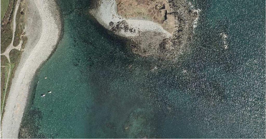
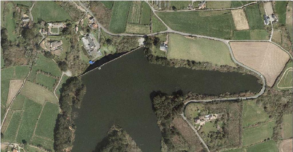
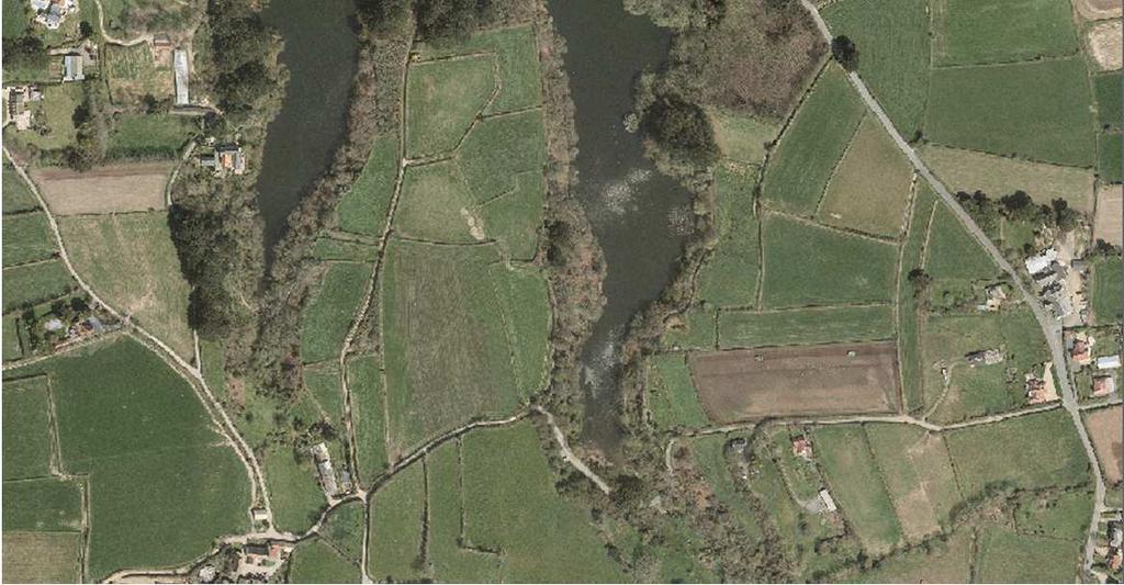
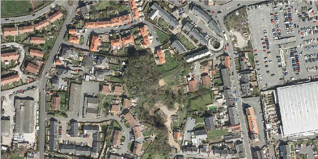
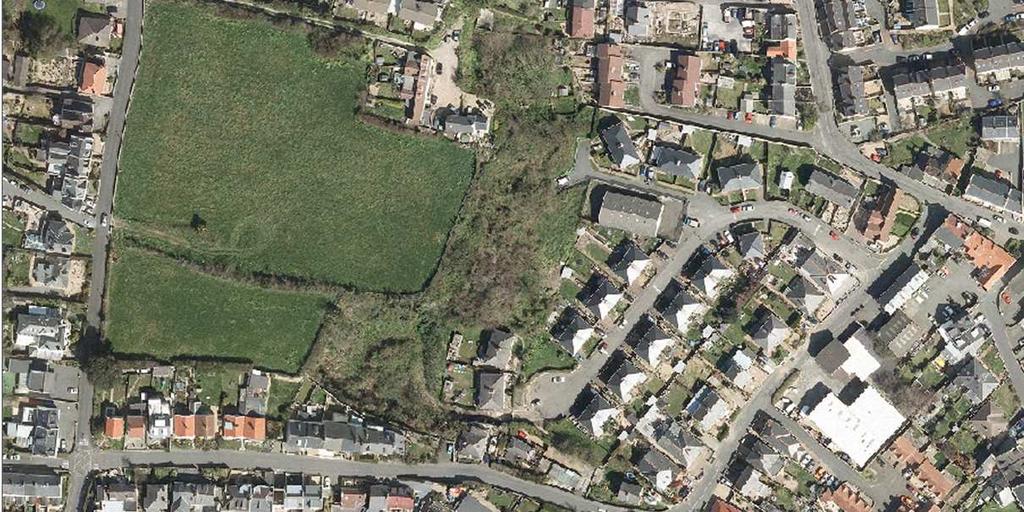
9 7 Appendix 1: Map of Areas of Biodiversity Importance and Sites of Special Significance
10 Appendix 2: Sites proposed to be designated as Areas of Biodiversity Importance Areas of Biodiversity Map Description Importance ref. 1. Areas of Biodiversity Importance to provide buffer land and habitat corridors for the proposed Sites of Special Significance Cliffs Pleinmont 1 Site mainly consists of fields of improved grassland and arable land, some of which are parts of the historic strip field system, with some dense scrub and coastal grassland. The presence of low banks acts as corridors for species where the intervening land is farmed. Pleinmont is important as a stopping off area for migrating birds. Over 150 species of birds have been recorded in the area Fort Hommet Headland & Vazon Coast Vazon coastline 2 Site mainly consists of bare ground and shingle but it operates as a corridor between adjacent SSS along the coast La Claire Mare, La Rousse Mare, the rest of the Colin Best Nature Reserve, Lihou headland & L Erée shingle bank Rue du Braye 3 Amenity grassland field and dense scrub operate as a buffer zone and corridor for the surrounding SSS. Rue de la Vallee Cateline 4 Site consisting of Headland, arable land and improved grassland fields and dense scrub operates as a corridor for the adjacent SSS. La Claire Mare 5 Field of mainly improved grassland with some dense scrub operates as a buffer zone and corridor for the adjacent SSS. Route de la Rocque 6 Improved grassland field operates as a buffer zone for the adjacent SSS. Rue de la Haute Banque 7 Field operates as a buffer zone for the adjacent SSS. Based on the recommendations of the Cliffs SSS appraisal, and on SNCI no. 14 in the RAP. Based on the recommendations of the Fort Hommet headland & Vazon Coast SSS appraisal. Based on the recommendations of the La Claire Mare, Lihou and L Eree SSS appraisal, and on SNCIs no. 8 and 9 in the RAP.
11 9 Areas of Biodiversity Importance Map Description ref L Ancresse Common Quarry at Les Hures 8 Amenity grassland field and dense scrub operates as a corridor between the quarry and the rest of the SSS to the south. La Garenne coastline 9 Coastal strip including coastal grassland and dense scrub operates as a corridor between adjacent SSS. L Abbaye 10 Car park and improved grassland to east of Vale Church operates as a corridor for the adjacent SSS. Les Hures 11 Site consists of dune scrub and dune grassland which operates as a buffer zone for the adjacent SSS Les Vicheries & La Rue Rocheuse (extending to La Saline & Rocquaine Sand Dunes) Rue Rocheuse 12 Site mainly consists of fields of varying quality grasslands and dense scrub which operates as a buffer zone for the adjacent SSS. The site would contribute towards the creation of a larger and more effective safe area for wildlife. Rue des Marais 13 Site mainly consists of amenity grassland and improved grassland fields with some abandoned areas. The site operates as a buffer zone and corridor for the adjacent SSS and contributes towards the creation of a larger and more effective safe area for wildlife. Route du Grand Port 14 Area of amenity grassland which operates as a buffer zone and corridor for the adjacent SSS. The site would contribute towards the creation of a larger and more effective safe area for wildlife. Rue des Salines 15 Area of amenity grassland which operates as a buffer zone and corridor for the adjacent SSS. The site would contribute towards the creation of a larger and more effective safe area for wildlife. Based on the recommendations of the L Ancresse Common SSS appraisal and on SNCI no. 1 in the RAP. Based on the recommendations of the Les Vicheries & La Rue Rocheuse SSS appraisal, and on SNCIs no. 10, 11, 12 and 13 in the RAP.
12 10 Areas of Biodiversity Importance Map Description ref. Rue de la Pomare 16 Area of improved grassland which operates as a buffer zone and corridor for the adjacent SSS. The site would contribute towards the creation of a larger and more effective safe area for wildlife. Rue du Douit du Moulin 17 Site mainly consists of amenity grassland which operates as a buffer zone and corridor for the adjacent SSS. The site would contribute towards the creation of a larger and more effective safe area for wildlife Lihou Island No ABIs within or adjacent to n/a n/a the SSS 1.7. Port Soif to Pont du Valle (including Vale Pond & extending to Cobo) Port Soif sports ground 18 Site mainly consists of amenity grassland and dense scrub which acts as a buffer zone for the adjacent SSS. Les Prins Lane 19 Site mainly consists of amenity grassland which acts as a corridor between the adjacent SSS. Pulias Headland 20 Site mainly consists of improved grassland fields which operate as a buffer zone for the adjacent SSS. Braye du Valle 21 Site mainly consists of fields of semi-improved grassland and semi-improved marshy grassland which operates as a buffer zone for the adjacent SSS South Vazon & La Grande Mare wet meadows Rue du Marais 22 Lowland area behind the sand dunes along Vazon Bay. Site mainly consists of improved grassland field which operates as a buffer zone and corridor for the adjacent SSS. Rue du Gélé 23 Lowland area behind the sand dunes along Vazon Bay. Site mainly consists of fields of improved grassland and semi- n/a Based on the recommendations of the Port Soif to Pont du Valle SSS appraisal, and on SNCIs no. 2, 3 and 16 in the RAP. Based on the recommendations of the South Vazon/La Grande Mare Wet Meadows SSS appraisal, and on SNCIs no. 6 and 7 in the RAP.
13 11 Areas of Biodiversity Importance Map ref. Description improved marshy grassland which operates as a buffer zone and corridor for the adjacent SSS. La Grande Mare 24 The site includes wet meadows, woodland and grassland fields of varying quality St Sampson s Marais & Château des Marais St Sampson s Marais South 25 Forms part of a relatively large area of low-lying grassland. The site consists mainly of improved grassland and dense scrub and operates as a buffer zone and corridor for the adjacent SSS. St Sampson s Marais 26 Forms part of a relatively large area of low-lying grassland. The site consists mainly of grassland fields of varying quality and operates as a buffer zone and corridor for the adjacent SSS. St Sampson s Marais North 27 Forms part of a relatively large area of low-lying grassland. The site consists mainly of improved grassland fields and operates as a buffer zone and corridor for the adjacent SSS. 2. Areas of Biodiversity Importance previously recognised for nature conservation interest in the Urban Area Plan Vale Castle/Rue Des Barrras (SNCI no. 1 in Braye Road (SNCI no. 2 in Grosses Hougues (SNCI no. 3 in 28 The Vale Castle stands on a hill on the north side of the entrance to St Sampson s harbour. The ABI also includes the strip between the coast road and the sea, the field to the north and the recently planted wood to the north west. The site is good for birds generally as a nesting and foraging area for common species and as a migrant stop-off. 29 This is a species-rich wet meadow which, until the draining of the Braye du Valle, was unenclosed land, partly saltmarsh and partly sandy or muddy seashore. 30 This is a typical worked out quarry. The surrounds have been allowed to turn to scrub, and the quarry has filled with water and is used as a reservoir by Guernsey Water. There is no Based on the recommendations of the St Sampson s Marais/Ivy Castle SSS appraisal, and on SNCI no. 16 in the UAP. Extended slightly to west following 2006 UAP SNCI review (see No. 1 in 2006 review for details).
14 12 Areas of Biodiversity Importance Map ref. Description shallow water so the flora and fauna of the water body is limited. The scrubby surrounds are important as breeding, feeding and roosting habitat for birds. Rue Jacques (SNCI no. 4 in 31 A small quarry with shallow water surrounded by narrow strip of deciduous woodland. Franc Fief (SNCI no. 5 in 32 These are marshy fields having a typical wet meadow flora, now very scarce in the island outside nature reserves. At some point drains have been dug from west to East across the fields, and these drains have the majority of the wetland species. Mont Crevelt (SNCI no. 7 in 33 A small hill surmounted by a pre Martello Tower and fort at the South entrance to St Sampson s Harbour. Supports coastal grassland and scrub. Robergerie (SNCI no. 8 in 34 An interesting wood in an old quarry rich in bryophytes (mosses and liverworts). Baubigny Quarry (SNCI no. 9 in 35 A water-filled quarry with sheer, ivy-covered cliff sides, and no shallow water. This is a good area for birds. Les Effards (SNCI no. 10 in 36 Two fields, both of which have streams running across them and on parts of their boundaries. Contain plant species which are Delancey Lane (SNCI no.12 in Delancey (SNCI no. 13 in 38 indicative of a wet meadow flora. 37 Woodland and standing water. The site includes a longabandoned quarry pond and rock face with semi-natural scrub and woodland, and is in a good position for birds following the East Coast on migration. Planted and semi-natural Woodland and areas of Delancey Park which are being mowed less frequently and developing to coastal grassland and scrub. The site is in a good position for birds following the East Coast on migration. Small parcel of land to west omitted following 2006 UAP SNCI review (see No. 8 in 2006 review for details) Extended to north following 2006 UAP SNCI review (see No. 8 in 2006 review for details).
15 13 Areas of Biodiversity Importance Bulwer Avenue & Spur Point (SNCI nos. 14 & 25 in Longue Hougue Quarry (SNCI no. 15 in Ivy Castle Lane (part of SNCI no. 16 The Marais in Mont Arrive (SNCI no. 17 in Rope Walk (SNCI no. 19 in Fosse Andre (SNCI no. 20 in 44 Foss Andre West 45 Foss Andre East Charroterie Valley (SNCI no. 21 in 46 Charroterie Valley West 47 Charroterie Valley North Map Description ref. 39 Coastal grassland and pebble ridge above high tide level, including small areas of coastal rocks, and scrub. The area around Spur Point is important for roosting sea birds. 40 A large water filled quarry surrounded by scrub with some mown areas. There are areas of inaccessible, seasonally flooded grassland vegetation. The quarry is important for gulls as a fresh-water bathing and drinking area. The scrub is important for feeding and nesting birds. 41 Vestigial area of reed bed (Swamp) and medieval drainage ditches. Previously neglected, but now being actively managed to restore and conserve the swamp habitat. 42 Site mainly consisting of planted and regenerated broadleaved woodland or scrub. These areas are good for nesting and foraging birds and allow mixed feeding parties into the heart of Town. 43 Site mainly consisting of planted and regenerated broadleaved woodland or scrub. These areas are good for nesting and foraging birds and allow mixed feeding parties into the heart of Town. 44- Site mainly consisting of planted and regenerated broadleaved 45 woodland or scrub. These areas are good for nesting and foraging birds and allow mixed feeding parties into the heart of Town. Small, but undisturbed areas of woodland and grassland, providing shelter for animals and birds, almost in the middle of Town. Omit area to the west of Mont Arrive Guelles Lane (see below and No. 13 of 2006 UAP SNCI review for details). Field to north of Fosse Andre omitted following 2006 SNCI Review (see No. 13 in 2006 review for details).
16 14 Areas of Biodiversity Importance 48 Charroterie Valley East 49 Charroterie Valley South Les Vardes (part only) (SNCI no. 22 in Candie Cemetery (SNCI no. 23 in Les Banques (SNCI no. 24 in Map ref. Description 50 Small, but undisturbed area of grassland, surrounded by tree belts, providing shelter for animals and birds, almost in the middle of Town. 51 Grassland over 150 years old and may be much older if enclosed from previously existing grazing land. It has an impressive range of grasses and grassland herbs, making the Cemetery a major hotspot of diversity in the urban area. It is also part of a network of feeding and roosting/nesting sites for invertebrates and birds. 52 Coastal grassland and pebble ridge above high tide level, including small areas of coastal rocks, and scrub. A field adjacent to junction between Colborne Road and Les Vardes omitted following 2006 SNCI review (see No. 16 in 2006 review for details). 3. Areas of Biodiversity Importance previously recognised for nature conservation interest in the Rural Area Plan Offshore islets: 53 Hommet 54 Hommet Benest 55 Houmet Paradis 56 Homptolle 57 Le Noir Houmet 58 Port Soif 59 Houmet Jerbe 60 La Capelle The offshore islets variously include Dune and Coastal Grasslands, Hard and Soft Cliffs and Shingle banks. They provide relatively undisturbed areas of these coastal habitats with important bee and bird nesting sites but are vulnerable to unregulated recreational activity. Former RAP SNCIs. Field to west of Grandes Rocques Road (part of SNCI 61 Semi-improved grassland, amenity grassland and dense scrub. Historically, these were carrot-growing fields, divided by
17 15 Areas of Biodiversity Importance no. 4 Portinfer, Port Soif and Grandes Rocques in RAP) La Vallette (part of SNCI no. 14 Cliff and Cliff Valleys in RAP) Map ref. Les Villets (SNCI no. 15 in RAP) 63 Le Grand Pre (SNCI no. 17 in RAP) Le Marais (SNCI no. 18 in RAP) 65 Les Mielles (SNCI no. 19 in RAP) Cuckoo Lane (SNCI no. 20 in RAP) Bordeaux (SNCI no. 21 in RAP) 68 Description Tamarisk hedges. Many of the hedges remain, and the field areas are now largely undisturbed grass land, of importance for birds, invertebrates and many other species. 62 Area consists of deciduous woodland and scrub cliffs, and managed parks and verges. Although biodiversity interest is diminished within roadside and recreational areas, the cliff woodlands and natural sections of coastline within the ABI, which includes some Green Lizard territory, are of similar biodiversity value to the Cliffs SSS. Consists of a small area of reed-bed in one field and two marshy fields; much of which are dominated by Yellow Flag. 64 Contains one of the largest reed-beds in the Island. The area also has a swamp and ponds with a field at the east end that is grazed. It is managed by La Société Guernesiasise as a nature reserve. It is very important for birds and there are a number of scarce reed-bed moths and other insects found here. Several marshy fields with a large pond. Some of the fields contain unimproved / semi-improved marshy grassland with orchids. The area is very important for birds. 66 A marshy field. 67 This area consists of some marshy fields bounded to the North by a flooded quarry surrounded by trees. To the west is a drier area mostly covered with scrub. Consists of three marshy fields with brackish influence lying behind Bordeaux beach. The stream here flows inland at high spring tides and there is a brackish pond, a very rare habitat in
18 16 Areas of Biodiversity Importance Fauxquets Valley (SNCI no. 22 in RAP) 69 Fauxquets Valley North 70 Fauxquets Valley South Talbot Valley (SNCI no. 23 in RAP) 71 Talbot Valley North 72 Talbot Valley 73 Talbot Valley South Quanteraine (SNCI no. 24 in RAP) St Saviour s Reservoir (SNCI no. 25 in RAP) Sous l Eglise (SNCI no. 26 in RAP) Vingtaine de l Epine (SNCI no. 27 in RAP) Map ref Description Guernsey. A stretch of the Fauxquets Valley including two fields at the South still used for grazing, a long stretch of woodland on the steeper slopes of the valley and the valley floor in the centre which has marshy grassland, woodland and ponds. A series of marshy fields in the Talbot Valley and areas of woodland on the sides of the valley. One of the fields is a particularly diverse orchid field. 74 This is a part of a valley with a mill pond, douit, meadows and woods. Orchids and a good diversity of plants are present in the unimproved grassland. It is managed as the Silbe Nature Reserve by La Société Guernesiaise and is open to the public. 75 Contains the largest area of fresh water in the Island, it is important for birds, and is surrounded by woodland. Most of the woodland is planted with coniferous trees but some contains native broad-leaved trees such as oak. To the east is an area of scrub. 76 There are several fields here; most of which have been abandoned long enough for sallow scrub and woodland to have developed. There is a small pond. The north-west end is the area where the German occupying forces dumped the spoil from the tunnels under St Saviour s Church. 77 A series of marshy fields, most of which have been improved. They are often important as feeding and roosting site for wintering and migrating birds.
19 17 Areas of Biodiversity Map Description Importance ref. La Hougue Du Pommier (SNCI no. 28 in RAP) 78 La Hougue Du Pommier West 79 La Hougue Du Pommier East Three marshy fields. A typical orchid meadow. Le Villocq (SNCI no. 29 in RAP) 80 A series of marshy fields next to Le Villocq estate. La Garenne d Anneville (SNCI no. 30 in RAP) 81 This is a medieval rabbit warren enclosed by a ditch. Managed, together with some adjoining land, as a nature reserve. Les Hougues Peres (SNCI no This is a hillock, mostly wooded, containing some old waterfilled in RAP) quarries with interesting flora and fauna. The woodland is diverse for a wood in Guernsey. Heritage Walk (SNCI no. 33 in RAP) 83 An area of parkland once belonging to Lord de Sausmarez. 4. Former Rural Area Plan Sites of Nature Conservation Interest omitted South Entrance to Beaucette Marina Chosen on geological criteria. The diorite here contains several unusual features. 5. Former Urban Area Plan Sites of Nature Conservation Importance omitted Brock Road (SNCI no. 6 in Three small areas of woodland and scrub to the north of Delancey Park. Two of the woodland areas have been gardened and converted to areas of lawn surrounding the trees. The area of scrub is very small and has been recently rotovated. Hougue Nicolle (SNCI no. 11 in Two fields near Les Nicolles. One is dominated by Pampas Grass (Cortaderia selloana), and the other has been overgrazed by horses. Omitted as outside of L Ancresse Common SSS and not consistent with criteria for an ABI. Omitted following 2006 SNCI Review (see No.8 in 2006 review for details). Omitted following 2006 SNCI Review (see No. 12 in 2006 review for details).
20 18 Areas of Biodiversity Importance Delancey Lane (SNCI no.12 in Mont Arrive (part only) (SNCI no. 17 in Neuve Rue (SNCI no. 18 in Fosse Andre (part only) (SNCI no. 20 in Les Vardes (part only) (SNCI no. 22 in Map ref. Description A small area north of the quarry that is a garden. Small area of land that was originally elm woodland but is now almost entirely Japanese Knotweed (Fallopia japonica). Two fields that have been improved agriculturally and most of the interesting wetland flora have been lost. A field that has been developed as a garden. Small field mown as a lawn. Omitted following 2006 UAP SNCI Review (see No. 8 in 2006 review for details). Omitted following 2006 SNCI Review (see No. 13 in 2006 review for details). Omitted following 2006 SNCI Review (see No. 13 in 2006 review for details). Omitted following 2006 SNCI Review (see No. 13 in 2006 review for details). Omitted following 2006 SNCI review (see No. 16 in 2006 review for details).
GUERNSEY STATUTORY INSTRUMENT NO. a? THE PLACES OF RECREATION ORDER, 1996
 GUERNSEY STATUTORY INSTRUMENT 1996 NO. a? THE PLACES OF RECREATION ORDER, 1996 Made... 27th September, 1996 Laid before the States... Coming into Operation... 2nd October, 1996 THE STATES BOARD OF ADMINISTRATION,
ORDINANCE OF THE STATES OF DELIBERATION
 ORDINANCE OF THE STATES OF DELIBERATION ENTITLED The Places of Recreation Ordinance, 1975 * [CONSOLIDATED TEXT] NOTE This consolidated version of the enactment incorporates all amendments listed in the
PRIORITY HABITAT SURVEY 2017 SWALEDALE. Summary. July 2018
 PRIORITY HABITAT SURVEY 2017 SWALEDALE Summary July 2018 Conservation & Monitoring Report No: Lead Author(s): Tony Serjeant & Sue Thurley Incorporating comments from: Gary Smith & Gordon Haycock (16/07/18)
Ordinance of the States IIIV
 Guernsey Ordinance of the States IIIV Made... Came into Operation 30th July, 1975. 30th July, 1975. The Places of Recreation Ordinance, 1975 THE STATES, in pursuance of their Resolution of the nineteenth
Designated Sites. Headlines
 Designated Sites Headlines Over 36% of the Sheffield district is covered by sites with European, national or local designation. These offer valuable habitats to wildlife, with some level of protection,
Draft LAW. ON SOME AMENDAMENTS IN THE LAW No.9587, DATED ON THE PROTECTION OF BIODIVERSITY AS AMENDED. Draft 2. Version 1.
 Technical Assistance for Strengthening the Capacity of the Ministry of Environment, Forests and Water Administration in Albania for Law Drafting and Enforcement of National Environmental Legislation A
Terrestrial Protected Area Nomination: Central Mangrove Wetland South-West, Grand Cayman
 Terrestrial Protected Area Nomination: Central Mangrove Wetland South-West, Grand Cayman The attached nomination, proposing that a parcel of land in the Central Mangrove Wetland be made a Protected Area
Date: 11 th January, From: Plaistow & Ifold Parish Neighbourhood Plan - Steering Group. Plaistow & Ifold Parish Council
 Date: 11 th January, 2017 From: Plaistow & Ifold Parish Neighbourhood Plan - Steering Group To: Plaistow & Ifold Parish Council Re: Neighbourhood Plan Report to Parish Council Meeting 17 Jan 2017 The Steering
1. INTRODUCTION 2. CURRENT STATUS
 LOWLAND HEATHLAND AND LOWLAND DRY ACID GRASSLAND IN OXFORDSHIRE UK Biodiversity Group - Priority Species associated with heathland Nightjar Linnet Dingy mocha moth Grey scalloped bar moth, Other Associated
Protection of Ulcinj Saline
 Strasbourg, 25 March 2015 T-PVS/Files (2015) 21 [files21e_2015.docx] CONVENTION ON THE CONSERVATION OF EUROPEAN WILDLIFE AND NATURAL HABITATS Standing Committee 35 th meeting Strasbourg, 1-4 December 2015
Park-specific management and policies Wainuiomata Recreation Area
 Park-specific management and policies Wainuiomata Recreation Area 6.8 Wainuiomata Recreation Area 6.8.1 Legal status Title held: Legislative status: Wellington Regional Council Administered under Local
TOWPATH MOWING GUIDELINES
 TOWPATH MOWING GUIDELINES 24 September 2007 CONTENTS Introduction Scope and Status of Guidelines Influences on the Guidelines Health and Safety Biodiversity INTRODUCTION Towpath management is a key issue
1 INFORMATION REQUIREMENTS
 1 INFORMATION REQUIREMENTS 1.1 BACKGROUND 2 1.2 WHAT IS THE DISTRICT PLAN 3 1.3 DISTRICT PLAN STRUCTURE 4 1.4 HOW TO USE THE DISTRICT PLAN 5 1.5 STRATEGIC FRAMEWORK 6 Whanganui District Plan (15 January
APPENDIX G ECOLOGICAL REPORTS. G.2 Badger
 APPENDIX G ECOLOGICAL REPORTS G.2 Badger Damhead Creek 2 ES Volume 2 June 2009 Damhead Creek Phase II Proposed Development Badger Survey Results Survey Date: 26 th October 2006. Surveyors: Miranda Cowan
Appendix 8.D Water Vole and Otter Survey Report
 Appendix 8.D Water Vole and Otter Survey Report Entec UK Limited Entec UK Limited Water Vole and Otter Survey Report June 2009 Final Client Job Name Report title File reference E.ON Renewables Ltd Water
3.0 EXISTING PARK & RECREATION SPACE
 3.0 EXISTING PARK & RECREATION SPACE TOWN PARK & RECREATION SPACE An inventory of current parks and recreation area in the Town of Cedarburg is shown in Table 3. These areas total roughly 381.89 acres.
FIELD TRIPS PROPOSAL
 FIELD TRIPS PROPOSAL Make sure you are covered by your insurance. The Foundation for Research on Biodiversity and the Collaboration for Environmental Evidence decline any responsibility during these field
Recreational Carrying Capacity
 9 th Annual Caribbean Sustainable Tourism Conference Recreational Carrying Capacity Graham C Barrow What is Recreational Carrying Capacity? It s not about fixing absolute numbers of visitors/tourists that
ABERDEEN HARBOUR EXPANSION PROJECT November Volume 3: Technical Appendices. Appendix 17-B SLVIA - ABERDEEN GREEN SPACE NETWORK
 ABERDEEN HARBOUR EXPANSION PROJECT November 2015 Volume 3: Technical Appendices Appendix 17B SLVIA ABERDEEN GREEN SPACE NETWORK APPENDIX 17B: SLVIA ABERDEEN GREENSPACE NETWORK 17B SLVIA Aberdeen green
Proposed Official Plan Amendment 41 to the Region of York Official Plan
 COMMITTEE OF THE WHOLE NOVEMBER 18, 2002 REGION OF YORK OFFICIAL PLAN AMENDMENT 41 THE OAK RIDGES MORAINE CONSERVATION PLAN Recommendation The Commissioner of Planning recommends: 1. That the City of Vaughan
Steps in the Management Planning Process
 Steps in the Management Planning Process Developing a management plan for Kalamalka Lake Park will follow a multi-stage process. The planning process for this park is currently in the Draft Management
Forms of Natural Protection in Greece
 Forms of Natural Protection in Greece 105 th Primary School of Thessaloniki NATIONAL PARKS AND PROTECTED AREAS The irregular and constantly increasing human intervention in nature and the relentless exploitation
Perth and Kinross Council Development Management Committee 30 August 2017 Report of Handling by Interim Head of Planning
 Perth and Kinross Council Development Management Committee 30 August 2017 Report of Handling by Interim Head of Planning 5(2)(ii) 17/270 Siting of 12 caravans/chalets, 3 show caravans/chalets and associated
Visual and Sensory Aspect
 Updated All Wales LANDMAP Statistics 2017 Visual and Sensory Aspect Final Report for Natural Resources Wales February 2018 Tel: 029 2043 7841 Email: sw@whiteconsultants.co.uk Web: www.whiteconsultants.co.uk
AMENDMENT NO. 03 TO THE OFFICIAL PLAN FOR THE TOWNSHIP OF ADJALA-TOSORONTIO OAK RIDGES MORAINE CONSERVATION PLAN
 AMENDMENT NO. 03 TO THE OFFICIAL PLAN FOR THE TOWNSHIP OF ADJALA-TOSORONTIO OAK RIDGES MORAINE CONSERVATION PLAN Adopted by Council July 19 th, 2004 Approved with modifications by the Province of Ontario
Schedule of Planning Applications Committee Date: 23 May Reference: 06/18/0064/F Great Yarmouth Officer: Mr J Beck Expiry Date:
 Schedule of Planning Applications Committee Date: 23 May 2018 Reference: 06/18/0064/F Great Yarmouth Officer: Mr J Beck Expiry Date: 24-04-2018 Applicant: Proposal: Site: Mr Mavroudis Clear weather hoardings
PRESPA BIOSPHERE RESERVE MANAGEMENT MACEDONIAN PERSPECTIVE
 PRESPA BIOSPHERE RESERVE MANAGEMENT MACEDONIAN PERSPECTIVE Secretariat by Ohrid, 10.03.2016 Prespa Ohid TBB reserve Biodiversity richness trans-boundary level Total Species richness Registered over 1500
Title/Name of the area: Chwaka Bay, Zanzibar
 Title/Name of the area: Chwaka Bay, Zanzibar Presented by: Dr. Charles Lugomela, Ag. Head, Department of Aquatic Sciences and Fisheries, University of Dar es Salaam, P.O. Box 35064 Dar es Salaam, Tanzania
Kirkcaldy Sea Wall Improvements. Non-technical Summary. For illustration purposes only to give an indicative representation of the scheme.
 ENVIRONMENTAL STATEMENT Non-technical Summary For illustration purposes only to give an indicative representation of the scheme. Kirkcaldy Sea Wall Improvements Introduction A concrete sea wall fronts
Michipicoten Island Regional Plan
 Michipicoten Island Regional Plan This is one of twenty Regional Plans that support implementation of the Lake Superior Biodiversity Conservation Strategy (Strategy). The Strategy, prepared and overseen
Backgrounder Plains Bison Reintroduction to Banff National Park
 Backgrounder Plains Bison Reintroduction to Banff National Park Introduction The five-year reintroduction project is a small- scale initiative that would inform future decisions regarding the feasibility
Rule Governing the Designation and Establishment of All-Terrain Vehicle Use Trails on State Land
 Rule Governing the Designation and Establishment of All-Terrain Vehicle Use Trails on State Land 1.0 Authority 1.1 This rule is promulgated pursuant to 23 V.S.A. 3506. Section 3506 (b)(4) states that an
EUROPEAN COMMISSION DG XI.D.2. COUNCIL DIRECTIVE 79/409/EEC on the conservation of wild birds. and
 EUROPEAN COMMISSION DG XI.D.2 COUNCIL DIRECTIVE 79/409/EEC on the conservation of wild birds and COUNCIL DIRECTIVE 92/43/EEC on the conservation of natural habitats and of wild fauna and flora STANDARD
Terrestrial Protected Area Nomination: Hemmington Forest, Cayman Brac Central
 Terrestrial Protected Area Nomination: Hemmington Forest, Cayman Brac Central Initial discussions with major landowners in the Hemmington Forest area have indicated that a nomination to protect some or
Submission on the Tukituki Catchment Proposal: EPA reference numbers; NSP 13/ , NSP 13/ , NSP 13/ , NSP 13/02.
 Hutt Valley Tramping Club PO Box 30 883 LOWER HUTT 5045 Tukituki Catchment Proposal Environmental Protection Agency Private Bag 63 002 WELLINGTON 6140 29 July 2013 Submission on the Tukituki Catchment
STORNETTA BROTHERS COASTAL RANCH
 STORNETTA BROTHERS COASTAL RANCH Location: Surrounding Point Arena Lighthouse and immediately south of Manchester State Park Mendocino Co., CA Acres: 1,860 Resources: Over two miles of Pacific Ocean coastline
DATE: January 19, WCA Governing Board. Johnathan Perisho, Project Manager. Mark Stanley, Executive Officer
 Item 14 DATE: January 19, 2017 TO: FROM: THROUGH: SUBJECT: WCA Governing Board Johnathan Perisho, Project Manager Mark Stanley, Executive Officer Item 14: Consideration of a resolution to accept an acquisition
Watchorn Provincial Park. Management Plan
 Watchorn Provincial Park Management Plan 2 Watchorn Provincial Park Table of Contents 1. Introduction... 3 2. Park History... 3 3. Park Attributes... 3 3.1 Natural... 4 3.2 Recreational... 4 3.3 Additional
Hawke s Bay Regional Parks Network. Pekapeka Regional Park Individual Park Plan
 Hawke s Bay Regional Parks Network Pekapeka Regional Park Individual Park Plan 2015-2024 Hawke s Bay Regional Council 159 Dalton Street Private Bag 6006 Napier 4110 Hawke s Bay New Zealand Telephone: 0800
Geoscape Toronto The Oak Ridges Moraine Activity 2 - Page 1 of 10 Information Bulletin
 About 13,000 years ago as the Laurentide Ice Sheet melted, glacial meltwater accumulated between the ice sheet and the Niagara Escarpment. This formed a lake basin into which gravel and sand were deposited.
Parkland County Municipal Development Plan Amendment Acheson Industrial Area Structure Plan
 Parkland County Municipal Development Plan Amendment Acheson Industrial Area Structure Plan New Plan Acheson Industrial Area Structure Plan Amendment Parkland County Municipal Development Plan Board Reference
International Union for Conservation of Nature and Natural Resources
 - 156 - APPENDIX XIX International Union for Conservation of Nature and Natural Resources 1110 Morges, Switzerland RESOLUTIONS ADOPTED BY THE TENTH GENERAL ASSEMBLY OF IUCN New Delhi, India, 1 December
Marchand Provincial Park. Management Plan
 Marchand Provincial Park Management Plan 2 Marchand Provincial Park Table of Contents 1. Introduction... 3 2. Park History... 3 3. Park Attributes... 4 3.1 Natural... 4 3.2 Recreational... 4 3.3 Additional
Biosphere Reserves of India : Complete Study Notes
 Biosphere Reserves of India : Complete Study Notes Author : Oliveboard Date : April 7, 2017 Biosphere reserves of India form an important topic for the UPSC CSE preparation. This blog post covers all important
EXPLORING BIOMES IN GORONGOSA NATIONAL PARK
 EXPLORING BIOMES IN GORONGOSA NATIONAL PARK ABOUT THIS WORKSHEET This worksheet complements the Click and Learn Gorongosa National Park Interactive Map (http://www.hhmi.org/biointeractive/gorongosa-national-park-interactive-map),
Twelve Apostles Marine National Park Australia
 EVALUATION REPORT Twelve Apostles Marine National Park Australia Location: Victoria, Australia coastal waters Global Ocean Refuge Status: Nominated (2017), Evaluated (2017) MPAtlas.org ID: 7703885 Manager(s):
^ox, 7. Environment Agency. Hayling Island North Strategy *. M ^, v. * > -.
 ^ox, 7 Environment Agency Hayling Island North Strategy *. M ^, v. * > -. Consultation Document for Preferred Coastal Defence Options - Septem ber 2005 We are the Environment Agency. It s our job to look
SUMMER VILLAGE OF SILVER SANDS. Municipal Development Plan
 SUMMER VILLAGE OF SILVER SANDS Municipal Development Plan Bylaw 253-2014 Adopted August 22, 2014 Summer Village of Silver Sands Municipal Development Plan Bylaw No. 253-2014 Page 2 1 INTRODUCTION 1.1 SETTING
FEASIBILITY CRITERIA
 This chapter describes the methodology and criteria used to evaluate the feasibility of developing trails throughout the study areas. Land availability, habitat sensitivity, roadway crossings and on-street
A21 TONBRIDGE TO PEMBURY DUALLING. Statement of Case
 A21 TONBRIDGE TO PEMBURY DUALLING Statement of Case In Respect of Applications for the Demolition of Listed Buildings Under the Provisions of the Planning (Listed Buildings and Conservation Areas) Act
Draft Resolution on wetlands in polar and subpolar regions
 RAMSAR CONVENTION ON WETLANDS 54th Meeting of the Standing Committee Gland, Switzerland, 23 27 April 2018 Submitted by Sweden Draft Resolution on wetlands in polar and subpolar regions SC54-Com.15 (21.14)
Reaching the 2020 Targets with Blue-Green Infrastructure: Member State Perspectives ESTONIA
 Reaching the 2020 Targets with Blue-Green Infrastructure: Member State Perspectives ESTONIA Mart KÜLVIK Estonian University of Life Sciences With thanks to Hanno Zingel and Herdis Fridolin, MoE Est. Building
Appendix 1: Best Management Practices For Hang Gliding and Paragliding in Jasper National Parks
 Appendix 1: Best Management Practices For Hang Gliding and Paragliding in Jasper National Parks Name of Best Management Practice Best Management Practices for Hang Gliding and Paragliding in Jasper National
IMPACTS OF THE RECENT TSUNAMI ON THE BUNDALA NATIONAL PARK THE FIRST RAMSAR WETLAND IN SRI LANKA
 IMPACTS OF THE RECENT TSUNAMI ON THE BUNDALA NATIONAL PARK THE FIRST RAMSAR WETLAND IN SRI LANKA by C.N.B. Bambaradeniya, IUCN The World Conservation Union, Sri Lanka Country Office (Email: cnb@iucnsl.org)
2.0 Physical Characteristics
 _ 2.0 Physical Characteristics 2.1 Existing Land Use for the Project The site is comprised of approximately 114 acres bounded by Highway 101 to the north, the existing town of Los Alamos to the east, State
Whitemouth Falls Provincial Park. Draft Management Plan
 Whitemouth Falls Provincial Park Draft Management Plan Whitemouth Falls Provincial Park Draft Management Plan Table of Contents 1. Introduction... 3 2. Park History... 3 3. Park Attributes... 4 3.1 Natural...
Queensland s Commitment to the World Heritage Convention
 WORLD HERITAGE LEADERSHIP Queensland s Commitment to the World Heritage Convention The Hon Andrew Powell MP Minister for Environment and Heritage Protection The theme for this symposium Australia s World
Pre-application submission for Committee: Phase 4 development at West Hendon
 Pre-application submission for Committee: Phase 4 development at West Hendon 1. Development Details Phase 4 of the West Hendon Estate Regeneration. 2. Background The redevelopment of the West Hendon Estate
WORKSHEET 1 Wilderness Qualities or Attributes Evaluating the Effects of Project Activities on Wilderness Attributes
 WORKSHEET 1 Wilderness Qualities or Attributes Evaluating the Effects of Project Activities on Wilderness Attributes Date: 3/7/2017 Roadless Area: Ruby South Description of Project Activity or Impact to
PUBLIC CONSULTATION - THE PURPOSE
 PUBLIC CONSULTATION - THE PURPOSE ² To review the sites identified for housing development; ² To introduce new sites that have come forward since the last Public Consultation with potential for housing
Appendix F Public authorities responses
 Planning Proposal under sec 55 of the EP&A Act LEP Refinements Appendix F Public authorities responses Appendix F Public authorities responses Prior to public exhibition, consultation was made with the
North Herts District Council Local Plan Timeline for Response to Council s Request for Strategic Housing Land Land to the North of the Grange,
 North Herts District Council Local Plan Timeline for Response to Council s Request for Strategic Housing Land Land to the North of the Grange, Letchworth Garden City Introduction As part of central government
Information on Ecological and Biological Significant Marine Areas in Albania
 Information on Ecological and Biological Significant Marine Areas in Albania The report is assembled from the draft strategic plan for marine and coastal protected areas in Albania, supported by the GEF-UNDP
Summary of prescribed fires in Prince Albert National Park 2015
 Summary of prescribed fires in Prince Albert National Park 2015 Prince Albert National Park conducted four controlled fires in spring 2015, plus an additional fire in October. Fuel Management for Hazard
KANANASKIS COUNTRY PROVINCIAL RECREATION AREAS MANAGEMENT PLAN DRAFT TERMS OF REFERENCE - November 20, 2007
 KANANASKIS COUNTRY PROVINCIAL RECREATION AREAS MANAGEMENT PLAN DRAFT TERMS OF REFERENCE - November 20, 2007 BACKGROUND There are 42 Provincial Recreation Areas (PRAs) within Kananaskis Country located
Draft Resolution on wetlands in polar and subpolar regions
 RAMSAR CONVENTION ON WETLANDS 54th Meeting of the Standing Committee Gland, Switzerland, 23 27 April 2018 Submitted by Sweden Draft Resolution on wetlands in polar and subpolar regions Doc. SC54-21.14
SHEEPLEAS. Visitor Guide and Self-guided Trails
 SHEEPLEAS Visitor Guide and Self-guided Trails Sheepleas The Sheepleas is an interesting mix of woodland, scrub and open grassland, situated on the chalk of the North Downs. This diversity of habitats
Arrangements for the delivery of minor highway maintenance services by Town and Parish Councils
 Arrangements for the delivery of minor highway maintenance services by Town and Parish Councils Cabinet Date of Meeting 8 March 2017 Officer Cllr Peter Finney, Cabinet Member for Environment, Infrastructure
Bedfordshire and Luton Species Action Plan: Hazel Dormouse
 Bedfordshire and Luton Species Action Plan: Hazel Dormouse Released November 2006 Last updated July 2010 Hazel dormouse, Muscardinus avellanarius Photo by Björn Schulz Bedfordshire Dormouse Group Hazel
Wilderness Areas Designated by the White Pine County bill
 Wilderness Areas Designated by the White Pine County bill SEC. 321. SHORT TITLE. This subtitle may be cited as the `Pam White Wilderness Act of 2006'. SEC. 322. FINDINGS. Congress finds that-- The White
Mackinnon Esker Ecological Reserve Draft - Management Plan
 Mackinnon Esker Ecological Reserve Draft - Management Plan May 2011 Photo Credit: This document replaces the direction provided in the Carp Lake Provincial Park and Protected Area and Mackinnon Esker Ecological
Silver Lake Park An Environmental Jewel for the Citizens of Prince William County
 Silver Lake Park An Environmental Jewel for the Citizens of Prince William County The Prince William Park Authority Mission Statement states: The Prince William County Park Authority will create quality
Order of the Minister of Environment #39, August 22, 2011 Tbilisi
 Registration Code 360050000.22.023.016080 Order of the Minister of Environment #39, August 22, 2011 Tbilisi On preparatory stages and procedure of the methodology for Elaborating structure, content and
Cheshire Ecology Ltd.
 Cheshire Ecology Ltd. What is an NVC Survey? 22 March 2014 1 Introduction A National Vegetation Classification (NVC) survey is a detailed botanical survey of a site. They are normally required for large
TOWARDS SUSTAINABLE MANAGEMENT OF MARINE AND COASTAL HABITATS ASIA- PACIFIC DAY FOR THE OCEAN
 TOWARDS SUSTAINABLE MANAGEMENT OF MARINE AND COASTAL HABITATS WANNAKIAT THUBTHIMSANG PHUKET MARINE BIOLOGICAL CENTER, DMCR, THAILAND ASIA- PACIFIC DAY FOR THE OCEAN 20 NOVEMBER 2018, CONFERENCE ROOM 4,
SUBMISSION FROM BIG SCRUB LANDCARE ON THE DRAFT NSW BIODIVERSITY CONSERVATION BILL AND ACCOMPANYING LEGISLATION AND CODES
 TP Draft 23 June 2016 SUBMISSION FROM BIG SCRUB LANDCARE ON THE DRAFT NSW BIODIVERSITY CONSERVATION BILL AND ACCOMPANYING LEGISLATION AND CODES ABOUT THIS SUBMISSION 1. This submission by Big Scrub Landcare
Priority Species, Communities, Ecosystems, and Threats
 Priority Species, Communities, Ecosystems, and Threats East Gippsland Regional Catchment Strategy 2015/2016 1.0 Objective This document aims to assist in the preparation of project applications for 2015-2016
Reference: 06/13/0594/F Parish: Fritton & St Olaves Officer: Mrs M Pieterman Expiry Date:
 Schedule of Planning Applications Committee Date: 21 st January 2014 Reference: 06/13/0594/F Parish: Fritton & St Olaves Officer: Mrs M Pieterman Expiry Date: 20-01-2014 Applicant: Proposal: Site: Lord
MANAGEMENT DIRECTION STATEMENT
 Lower Mainland District MAAGEMET DIRECTIO STATEMET January 2001 for Liumchen Ecological Reserve Ministry of Environment Lands and Parks BC Parks Division Table of Contents Page Introduction... 1 Purpose
4) Data sources and reporting ) References at the international level... 5
 Data sources and reporting ) References at the international level... 5") D- 1: Protected areas (PA) 1) General description... 2 1.1) Brief definition... 2 1.2) Units of measurement... 2 1.3) Context...2 2) Relevance for environmental policy... 2 2.1) Purpose... 2 2.2) Issue...
D- 1: Protected areas (PA) 1) General description... 2 1.1) Brief definition... 2 1.2) Units of measurement... 2 1.3) Context...2 2) Relevance for environmental policy... 2 2.1) Purpose... 2 2.2) Issue...
David Magney Environmental Consulting
 David Magney Environmental Consulting DELINEATION OF JURISDICTIONAL WATERS AND RIPARIAN HABITATS FOR LYONS CANYON RANCH, NEWHALL, CALIFORNIA Prepared for: UNITED STATES ARMY CORPS OF ENGINEERS and CALIFORNIA
Te Manahuna Consulting
 Assessment of the natural values at the proposed centre pivot irrigation site and surrounds on Ben Ohau Station, Mackenzie Basin, New Zealand August 2016 Abstract The natural values of the area proposed
Boatswain bay biodiversity reserve
 Boatswain bay biodiversity reserve March 2003 1 1. Plan and description 1.1. Geographic location, boundaries and dimensions The plan of the proposed Boatswain bay biodiversity reserve and its location
Tourism 201 CHAPTER 10
 Tourism 201 CHAPTER 10 202 Doncaster Unitary Development Plan Tourism 203 Tourism INTRODUCTION 10.1 The increasing importance of tourism is recognised in the UDP by having its own chapter. The benefits
SnowdoniaNationalParkAuthority SupplementaryPlanningGuidance: VisitorAccommodation October2012
 SnowdoniaNationalParkAuthority SupplementaryPlanningGuidance: VisitorAccommodation October2012 8 SNOWDONIA NATIONAL PARK AUTHORITY SUPPLEMENTARY PLANNING GUIDANCE: 8 VISITOR ACCOMODATION Contents 1 Introduction...
PROTECTED AREAS ZONE - POLICY
 PROTECTED AREAS ZONE - POLICY.1 Introduction The Protected Areas Zone applies to the land depicted on the Ruapehu District Plan Maps as: Amenity Policy Area. Protected Areas - Conservation. (c) Protected
The Conservation Contributions of Ecotourism Cassandra Wardle
 The Conservation Contributions of Ecotourism Cassandra Wardle PhD Candidate, Gold Coast, Australia Supervisors: Ralf Buckley, Aishath Shakeela and Guy Castley State of the Environment State of the Environment
WORKSHEET 24: Sand dunes - Conservation and management
 SAND DUNES - CONSERVATION AND MANAGEMENT MEETING THE CHALLENGE Sand dunes are: Excellent natural protection for the land A great recreational and educational area A specialised wildlife habitat But they
I507 Devonport Naval Base Precinct
 I507. Devonport Naval Base I507.1. Precinct Description The Devonport Naval Base precinct covers most of the land held by the Crown for the HMNZ Naval Base (south yard) in Devonport. It incorporates the
Planning and Building Department
 Page 1 of Report PB-27/11 CITY OF Burlington Planning and Building Department TO: Chair and Members of the Community Development Committee SUBJECT: Niagara Escarpment Plan Amendment 179 (NEPA 179) Addition
Tourism and Wetlands
 CONVENTION ON WETLANDS (Ramsar, Iran, 1971) 43 rd Meeting of the Standing Committee Gland, Switzerland, 31 October 4 November 2011 DOC. SC43-27 Tourism and Wetlands Action requested. The Standing Committee
photos Department of Environment and Conservation Biodiversity Conservation
 photos Department of Environment and Conservation Biodiversity Conservation EcoEducation - making the connections to biodiversity conservation Do you consider experiential learning of biodiversity in the
LATIN AMERICA / CARIBBEAN COIBA NATIONAL PARK PANAMA
 LATIN AMERICA / CARIBBEAN COIBA NATIONAL PARK PANAMA WORLD HERITAGE NOMINATION IUCN TECHNICAL EVALUATION COIBA NATIONAL PARK (PANAMA) ID Nº 1138 Bis Background note: Coiba National Park was nominated for
Case Study: 1. The Clarence River Catchment
 Case Study: 1. The Clarence River Catchment The NSW coastline is a great natural asset, making an enormous contribution to the economy. The resources of coastal catchments such as the Clarence River Catchment,
Tranquil Wood Rhewl, near Ruthin, Denbighshire acres of medal-winning hardwoods for 26,500 (freehold)
") WOODS 4 SALE Phone: 01248 364 362 www.woods4sale.co.uk UK Woodland & Woods For Sale: Specialising in the Sales of Small Woodlands in England, Scotland and Wales for Recreation, Wildlife Conservation and
WOODS 4 SALE Phone: 01248 364 362 www.woods4sale.co.uk UK Woodland & Woods For Sale: Specialising in the Sales of Small Woodlands in England, Scotland and Wales for Recreation, Wildlife Conservation and
City of Durango 5.8 FUNDING TRAILS DEVELOPMENT
 5.8 FUNDING TRAILS DEVELOPMENT The City has been successful in establishing dedicated local funding sources as well as applying for grants to develop the City s trail system, having received nearly $2.4
Connie Rudd Superintendent, Black Canyon of the Gunnison National Park
 National Park Service U.S. Department of the Interior Black Canyon of the Gunnison National Park and Curecanti National Recreation Area Information Brochure #1 Wilderness and Backcountry Management Plan
CORNWALL AND ISLES OF SCILLY LANDSCAPE CHARACTER STUDY
 LCA - Newquay and Perranporth Coast LCA No CA15 JCA Constituent LDUs Total 32: 6, 8, 9, 10, 11, 12, 13, 14, 15, 25, 76, 77, 78, 115, 116, 117, 118, 175, 176, 177U, 178, 296, 343, 344, 346, 347, 348, 349U,
PSP 75 Lancefield Road. Northern Jacksons Creek Crossing Supplementary Information
 PSP 75 Lancefield Road Northern Jacksons Creek Crossing Supplementary Information September 2017 The northern crossing of Jacksons Creek proposed within the Lancefield Road PSP is a key part of the ultimate
AMENDMENT #230 TO THE OFFICIAL PLAN OF THE TOWNSHIP OF KING PLANNING AREA
 AMENDMENT #230 TO THE OFFICIAL PLAN OF THE TOWNSHIP OF KING PLANNING AREA Oak Ridges Moraine Conservation Plan Amendment to Township of King Official Plan Amendment #23 (Hamlet Secondary Plan) October