NATIONAL PARK SERVICE. REMAINING SHORELINE OPPORTUNITIES in Minnesota, Wisconsin, Illinois, Indiana, Ohio, Michigan, Pennsylvania, New York
|
|
|
- Brice Bryant
- 5 years ago
- Views:
Transcription
1 NATIONAL PARK SERVICE Great Lakes Shoreline Recreation Area Survey REMAINING SHORELINE OPPORTUNITIES in Minnesota, Wisconsin, Illinois, Indiana, Ohio, Michigan, Pennsylvania, New York A Report Prepared by the GREAT LAKES SHORELINE RECREATION AREA SURVEY 1959 U.S. Department of the Interior National Park Service
2 NATIONAL PARK SERVICE Great Lakes Shoreline Recreation Area Survey FOREWORD Through a generous donation of private funds, the National Park Service made a survey of the United States portion of the Great Lakes shoreline during 1957 and The objective was to determine what natural lakeshore areas still remained which were worthy of preservation for their scenic, natural or other recreational values. The over-all situation along the Great Lakes shoreline is discussed in the report, Our Fourth Shore. This is a supplement to that report and herein describes the individual shoreline areas suitable for preservation.
3 NATIONAL PARK SERVICE Great Lakes Shoreline Recreation Area Survey UNITED STATES DEPARTMENT OF THE INTERIOR OFFICE OF THE SECRETARY WASHINGTON 25, D. C. January 4, 1960 MEMORANDUM To: Director, National Park Service From: Secretary of the Interior Subject: Great Lakes Shoreline Recreation Area Survey Report The draft of the Great Lakes Shoreline Recreation Area Report has been received and is under review in this office. Because of the numerous inquiries concerning availability of the report, please proceed as rapidly as possible with its publication, using non- Government funds which have been donated for that purpose. Three outstanding areas included in this report--the Sleeping Bear Dunes, Huron Mountains and Pictured Rocks--were recommended for consideration as units of the National Park System by the Advisory Board on National Parks, Historic Sites, Buildings and Monuments at their October 1959 meeting. It should be emphasized, however, that the Department of the Interior is supporting the enactment of legislation to permit the designation by the Secretary of not more than three shore areas as National Shoreline Recreation Areas. The shorelines of the Great Lakes will be considered along with those of the Pacific, Atlantic and Gulf coasts in determining which three areas are worthy of preservation by the Federal Government should Congress enact the legislation. Publication of this Survey Report should not be construed either as approval or disapproval of any recommendations contained herein. In the Great Lakes area, many State and local governmental agencies have evidenced an interest in the preservation of portions of our vanishing shoreline. Because of their concurrent interest in this field, this comprehensive survey should be of great value to such agencies in their consideration of additions to State and local public shoreline areas. Secretary of the Interior
4 NATIONAL PARK SERVICE Great Lakes Shoreline Recreation Area Survey OVERALL SUMMARY Because the "general" shoreline classification (used by the sea coast surveys) would eliminate the Lake ends, the connecting waters and the outlet to the sea a "total" shoreline figure was used on the Great Lakes Survey. The United States portion of this shoreline equals 5,480 miles--1,480 of which encompass the many offshore islands. Of the total 710 miles presently in public ownership 16 miles encompass military reservations, municipal water works, public port facilities etc. and thus are not available for recreation. This leaves only 694 miles of existing public recreational shoreline. Distribution of this public shoreline is shown in the table below. The Survey found that 4,786 miles of the over-all shoreline are in private ownership and hence not usable by the public for recreation. Of this private ownership, 426 miles were identified during the survey as possessing important remaining opportunities for recreation and other public benefits. These were divided among 66 individual areas with 40 in Michigan, 8 in New York, 7 in Wisconsin, 6 in Ohio, 2 in Minnesota, and one each in Illinois, Indiana and Pennsylvania. The 66 individual areas include 5 with 118 miles of shoreline for possible inclusion in the National Park System, 2 major wildlife areas of possible national significance, 39 areas for state parks, 8 state forest areas, 1 state wildlife area, and 11 areas of local significance. Distribution of these potential public areas is shown in the following table. Existing & Potential PUBLIC OWNERSHIP of GREAT LAKES SHORELINE National Park Areas National Forests MINN. WISC. ILL. IND. MICH. OHIO PENN. N.Y. Totals E P E P E small islands small islands small islands
5 Nat'l Wildlife Areas State Park Areas State Forests State Game Areas County Parks Township Parks Municipal Parks Non recreation Totals P E P E P E P E 2.0 * *11.4 P E 0.3 * *4.8 P E * *60.0 P E no record 4.6 no record 16.5 Existing * Potential ALL FIGURES INDICATE SHORELINE MILES *Estimated
6 NATIONAL PARK SERVICE Great Lakes Shoreline Recreation Area Survey REMAINING OPPORTUNITIES IN MINNESOTA SUMMARY Minnesota's North Shore of Lake Superior is outstanding. Nearly the entire shore is characterized by numerous lava flows interspersed with dikes and sills of durable igneous rock. These formations--often spectacular and always picturesque--are part of the Keweenawan rocks, so named for similar exposures on Michigan's Keweenaw Peninsula on the south side of the lake. Older Huronian rocks occur at Pigeon Point just south of the Canadian border and are of great geologic interest. Back from the shore, the land slopes up steeply to a mountainous divide, in places over 2,000 feet above sea level. This landscape has resulted in a scenic, irregular shoreline, deriving its principal attractions from the sweeping views of the lake, imposing shore cliffs, thundering waterfalls and rugged terrain. From Duluth to the Canadian line, U.S. Highway 61--the North Shore Drive--follows, as closely as practicable, the undulations of this shoreline for approximately 150 miles. Expanding private and commercial developments along this highway have pre-empted much of the shore line. The Minnesota Division of State Parks administers 11 areas along this route. Gooseberry Falls State Park has good campground facilities. Less highly developed campgrounds are provided at Temperance and Cascade River State Parks, and potential for future campground developments exists in others. The Highway and Conservation Departments have numerous strategically located picnic areas along the entire route. In many instances, foot trails have been developed for parking areas along the highway to scenic vistas and points of interest. The drive also passes through 40 miles of Superior National Forest, but the Forest Service owns only about two miles of lake frontage along this route. The authorized Grand Portage National Monument will be readily accessible from the relocation of the drive at its northern terminus at the Canadian boundary. Altogether, publicly owned shoreline amounts to about 19 miles, or roughly about 10 percent, of Minnesota's mainland and island Lake Superior shoreline.

7 The few beaches that occur in coves and at river outlets are gravel rather than sand. However, this is no particular deterrent because the cold waters of Lake Superior discourage all but the heartiest swimmers. Sport boating, that rapidly expanding recreational pastime elsewhere, is still a minor activity along this rugged shoreline--limited primarily by the treacherous waters of Lake Superior and an insufficient number of refuge harbors. Scenic enjoyment, along with camping, picnicking and hiking in this refreshing, pollen free atmosphere, are still the principal and growing recreation uses of the North Shore. The existing state parks, plus the North Shore Drive with its recreation access and vistas, have gone a long way toward providing public enjoyment of this important segment of the Great Lakes scene. However, further steps are needed to preserve the scenic integrity that is there. Industrial, commercial and residential development have already consumed over

8 one-third of the shoreline, thus eliminating public enjoyment of the encompassed scenery, waterscapes, and shoreline. Uncontrolled expansion of such development poses a threat to future enjoyment. What is needed is zoning control designed to protect the integrity of the more scenic reaches and provide a harmonious blending of structures and landscape. Another means for protecting the integrity of existing features and increasing the carrying capacity of this recreation wonderland is through expansion of existing state areas. Most of the prime scenic and scientific features in back of this magnificent shoreline are protected by state ownership; but, in many cases, additional shore frontage would enhance the over-all enjoyment of these areas. Expansion of inland holdings around the scenic features would provide adequate buffers against conflicting uses and also furnish space for development of additional camping and picnicking areas to meet the steadily increasing demands for these facilities. An increase in area would also provide a better opportunity to eliminate the hazardous conditions existing at those parks where pedestrians are obliged to cross the highway at grade to reach trails to the waterfalls the parks protect. Specifically, recommendations for treatment of the North Shore Drive and acquisition of the outstanding natural areas at Split Rock and Pigeon Point follow on the succeeding pages. Administrative decisions relative to these areas will be dependent on further studies recommended at both the state and federal levels. GOOSEBERRY FALLS STATE PARK (Lower Falls)

9 NORTH SHORE DRIVE U. S. Highway 61, the North Shore Drive, was built in the early 1920's primarily to provide motor access to the lake shore villages. To a degree, its recreation potential was also recognized in right of way purchase for highway overlooks and wayside areas. However, expanding private and commercial developments along its borders are seriously threatening its continued usefulness as a public recreation road. Such development is a major concern not only to the Department of Conservation but also to the Department of Highways. In this region of outstanding scenic, historic and geologic interest, the North Shore Drive is an important attraction for tourists. It also plays an essential role in tying together, as a unit, the many recreation features of the Lake Superior North Shore. Because of this, some form of parkway treatment is suggested. This concept is further strengthened by Canada's new highway being constructed around the north shore of Lake Superior which will result in much greater tourist traffic. A special study was conducted to evaluate the feasibility of developing a national parkway along this route. To meet national parkway standards, it would be necessary to provide a commercial highway on the landward side of the parkway and a frontage road between the parkway and the privately developed sections of the lakeshore. It was concluded that private and commercial development was already too extensive and topography too restrictive in many places to permit development of such standards. Instead, it is recommended that a parkway-like development be made similar to those for the Great River Road along the Mississippi River. To accomplish this, the following steps are suggested: 1. The Department of Highways and the Department of Conservation should collaborate in preparing a master plan to govern development of the North Shore Drive and the parks as a unit. 2. Each organization could then prepare detailed studies in accordance with the master plan and the Great River Road standards. 3. The Department of Highways would be expected to acquire right of way and the Department of Conservation to acquire additional park lands. 4. Development and improvements could then await the demands of traffic and visitation.


10 North Shore Drive PIGEON POINT LOCATION Pigeon Point lies adjacent to the Canadian Boundary on the north shore of Lake Superior and forms the "point" of Minnesota's "Arrowhead Country." It may be reached by car over U.S. Highway 61 and a side road to Grand Portage. Access to Pigeon Point itself is possible only by boat and foot trail. However, planned relocation of Highway 61 will pass through part of the study area. DESCRIPTION Pigeon Point, with its 30-mile shoreline and over 6,000 acres of wild land, comprises some of Minnesota's most rugged lakeshore landscape. Massive intrusions of diabase, an igneous rock, rise nearly 700 feet above Lake Superior and are covered by trees typical of the northern coniferous forests. White cedar swamps,

11 together with other marshlands, are found throughout the area, and one small lake is present. Deer, bear and, occasionally, moose are found here together with their smaller associates of the northern forests. The picturesque shores of Pigeon Point and its offshore islands are marked by bold rock outcrops, some forming sheer cliffs rising over 100 feet above the water, while elsewhere the rock-clad edge is broken by gravel beaches. One of the principal scenic features is Wauswaugoning Bay and the high cliffs bordering its west and north shores. The 101-foot Pigeon Falls will be a distinctive, climactic feature of the realigned North Shore Drive. The Pigeon River, forming the International Boundary between the United States and Canada in this region is characterized by many high waterfalls and rapids. This made the lower Pigeon River an obstacle to the early fur traders and trappers, and necessitated the location of a portage route. Thus the "Grand Portage" route through a preglacial valley came into use, and today lies within the adjacent Grand Portage Indian Reservation. On the offshore islands, evidence of recent and prehistoric mining operations are still evident. PRESENT USE Today the area is used only as a sporadic hunting ground and intermittent base for declining fishing operations. A major portion of this land is being held in trust for the Grand Portage Band of Chippewa Indians and, as such, is considered private property. Only negligible acreages are in public ownership. ANALYSIS Pigeon Point is one of the largest undeveloped areas on Minnesota's Lake Superior shoreline and, because of its terrain and location, has a relationship with the events surrounding the "Grand Portage." Its possible national significance should be studied further, along with all lands from the tip of Pigeon Point westerly to the east boundary of the Superior National Forest. SPLIT ROCK LOCATION Split Rock's bold, rocky headlands rise above the chill waters of Lake Superior approximately 45 miles northeast of Duluth, Minnesota. Access to this region is provided by U.S. Route 61, the "North Shore Drive," which parallels the Lake Superior shoreline between Duluth, Minnesota and the Canadian border. Southward from the Split Rock Lighthouse, a waterfront of 3.3 miles and an inland area of 1,200 acres are included in this proposal. DESCRIPTION The shore character around Split Rock is dominated by sheer rock cliffs and boulder-lined bays. Atop

12 one of these headlands stands the Split Rock Lighthouse--the unofficial symbol of the North Shore. The picturesque structure holds a fascination for tourists and natives alike, while its flashing light and foghorn warn mariners of the dangers along this shore during violent storms. A small rocky point curves partially around East Bay, forming another of this area's scenic shore features. Except for a narrow connecting link of cobblestones, the bulk of this point would be an island of low, rough outline. Contrasting the dark green of the coniferous cover are the orange lichens that cling to some of the rocks that lie awash during storms. Back of the mainland shore, the land rises moderately to knobs some 200 feet above the lake. From these points, vistas open toward the expanse of Lake Superior and the associated jagged shoreline. A young second growth forest covers most of this region. Birch and aspen are frequently encountered along with a mixture of pine, fir and spruce. PRESENT USE A small, state scenic wayside presently preserves the view from atop Day Hill. A short trail connects this site with the North Shore Drive, whose right of way passes less than a mile from the shoreline. Some private development has taken place along the highway but the shoreline remains undeveloped. ANALYSIS Split Rock, its lighthouse and the associated rough and scenic shores are some of the highlights of Minnesota's Great Lakes environment. By virtue of these features and its association with the North Shore Drive, it is recommended that the present state holdings be enlarged to develop this whole study area as a state park. Split Rock
13 NATIONAL PARK SERVICE Great Lakes Shoreline Recreation Area Survey REMAINING OPPORTUNITIES IN WISCONSIN SUMMARY Wisconsin has shore frontage on both Lake Superior and Lake Michigan. On Lake Superior, counting the 175 miles of shoreline of the Apostle Islands, Wisconsin has a total of 325 miles of shore frontage. As a geographical unit, it is best considered in four segments, each sufficiently distinct to pose problems to the recreation planner. From Superior to Port Wing and from the Michigan state line westward for several miles is a region of shore bluffs. The bluffs vary from 20 to 60 feet in height and are fronted by very narrow beaches, 10 to 40 feet wide, composed of sand, gravel, cobble and rock, and variously littered with driftwood. The soft sand and clays of these old lakebed deposits are easily eroded, and the land back from the lake is cut by ravines and stream beds. Obviously, little recreation value can be attached to beach use, but a number of the streams entering the lake have trout runs of consequence. The Brule River is such an example, and for this and other important reasons it is included as a study area representative of this section. East of Port Wing is the Bayfield Peninsula, the most scenic portion of the mainland shoreline. Steep sloped, rocky headlands are interspersed with sandy bays. The bays, sometimes backed by small marshlands and nestled between the higher prominences, are the focus of recreation possibilities on this shore segment. The Apostle Islands are really a partially inundated extension of the Bayfield Peninsula, but their insular position introduces considerations not like the mainland. Not only are the islands valuable for the overt forms of recreations: boating, beach use, camping, hiking, etc., but they can neatly preserve in a small package a characteristic portion of the natural landscape and its biology. The fourth shore segment includes the Kakagon and Bad River Marshes. Their value for migratory waterfowl is great, and efforts should be made to preserve in public ownership this fine marsh area for the use for which it is best suited. Studies by appropriate state and federal agencies should be undertaken to determine a method of management that would best serve all concerned. At present, the shoreline is either largely forested with second growth timber or given over to farming. Some cottage development occurs, mainly on the Bayfield Peninsula. Large

14 iron-ore docks occur at both Ashland and Superior. The Red Cliff and Bad River Indian Reservations occupy approximately 48 miles of shoreline. The Wisconsin state park system administers 31 areas, none of which occur on Lake Superior. The opportunity to acquire lands for park use would appear fairly good at present. In a few years time the picture could change considerably. BRULE RIVER amounts to 25,000 acres. LOCATION One of Wisconsin's principal tributaries to Lake Superior is the Brule River. Flowing northward toward the largest of the Great Lakes, this stream's mouth is approximately 20 miles east of Superior, Wisconsin. State Highway 13 and connecting county routes provide access to the shoreline of Lake Superior between the Brule and the Amicon Rivers. Further access along this shore line will be provided by a proposed South Shore Drive through the study area. A shoreline of 13.5 miles lies between the Brule and Amicon Rivers; inland, a strip 1 to 2 miles wide along Lake Superior and a 2-mile corridor along the Brule River DESCRIPTION The Lake Superior shoreline between the Amicon and the Brule Rivers is characterized by low bluffs with narrow beaches. Wider shores are confined to the mouths of the two main rivers (the largest belonging to the Brule River). Here, the beaches are composed of fine sands and average approximately 25 feet in width. The Brule River, one of the famous rainbow and brown trout streams of the United States, extends inland along a winding course for nearly 66 miles. Its fame as a trout stream is rivaled only by its scenic beauty and its challenge as a "white-water" canoe route. (The rapids of the Brule are a fitting test for the best canoeist.) Covering the banks of the stream and lakeshore north of the settlement of Brule are forests composed primarily of cutover aspen and birch with a light mixture of conifers. Today, the forests along the stream serve as important factors in the protection of the Brule River and its watershed, since the heavy clay soil and rough topography are susceptible to erosion and watershed damage. Historically, the Brule River was a portion of the route the Indians and voyageurs followed to the portage between Lake Superior and the Mississippi River waterways. Their portage was at the Brule Bog between the Brule and the St. Croix Rivers.

15 PRESENT USE The southern half of the river is now within the Brule River State Forest, but the northern half has been crowded by farming and some cottage development. The appeal of the stream to canoeist and fisherman has a strong attraction to the sportsman. ANALYSIS To achieve the objectives of watershed and forest management as well as to protect recreational opportunities, consideration should be given to extension of the State Forest to and along Lake Superior. Brule River

16 BAYFIELD PENINSULA LOCATION The blunt tip of the Bayfield Peninsula projects conspicuously into Lake Superior as one of Wisconsin's principal shore prominences. With one exception, the bays associated with this shoreline proposal lie on the peninsula's northern tip. The nearest communities are Bayfield and Cornucopia. Both settlements are served by State Route 13 which together with county roads provide access into this region. Three separate Bayfield units involve nearly 12 miles of shoreline and an inland area of almost 4,800 acres. DESCRIPTION Red sandstone and clay bluffs are the typical shore features of the Bayfield Peninsula. Interspersed along these bluffs are a number of bays that account for the uneven shore outline. Nearly all the bays that have been cut back into the shores of the peninsula are characterized by sand beaches. These beaches of fine sand vary in width from a narrow strand up to 40 or 50 feet. Some of the finest beaches are located at Frog, Sand and Bark Bays. Frequently, behind the beaches, marshes are associated with streams draining the inland region and feeding Lake Superior. The three previously named bays are examples of such beach and marsh environment. The trees and shrubs that line these beaches have trapped some of the loose sand, building up the barrier strand between the marsh and bay. Bordering these wetlands will be found stands of pine, spruce and fir; elsewhere, the conifers occur as scattered groups in a predominantly deciduous forest composed primarily of birch and aspen. A rolling countryside of rounded ridges and shallow valleys characterizes the Bayfield Peninsula. Only the shore points demonstrate a boldness of outline. Battered by Lake Superior's wave action, some of the points have been carved to form arches and caves in the sandstone rock. PRESENT USE The northernmost part of the Bayfield Peninsula is included in the Red Cliff Indian Reservation; however, private and county lands form a checkerboard pattern with Indian lands. Three of the four bays in the Bayfield proposal are within the reservation, but involve only a small acreage of restricted Indian allotments. Very few developments exist, leaving the region largely in a natural, unspoiled condition.

17 ANALYSIS The beaches and surrounding terrain of the Bayfield Peninsula offer excellent sites for several small park units. Public acquisition of this portion of Wisconsin's Lake Superior shore would save a scenic region possessing outstanding potential vital to future recreation needs. STOCKTON ISLAND LOCATION The Apostle Islands lie off the Bayfield Peninsula as one of Lake Superior's principal shoreline features. Occupying an area of nearly 600 square miles, this archipelago has a land area of less than 80 square miles. State Route 13 and U.S. Route 2 provide access to mainland points such as Ashland, Bayfield and Washburn, Wisconsin, where boat transportation to the islands is available. Stockton Island, lying near the middle of the group, is the only unit of the Apostles included in this proposal. Its 10,000 acres inscribe a shoreline of nearly 21 miles. DESCRIPTION At present, the Apostle Islands include more than 20 islands ranging in size from 175 to 15,000 acres. Formerly they were part of the Bayfield Peninsula but became separated during the ice age. Today the islands are characterized by low, nearly level outlines of glacial drift lying over their red sandstone foundations. Occasionally, these sandstones are exposed along the shoreline where they form sheer walls, caves or arches; elsewhere, eroding clay banks are typical of the island shoreline. Stockton, the second largest of the islands, has been selected as the unit incorporating most of the Apostle Islands' features. On the island's Presque Isle Point may be found many typical vegetative types. This includes the bog habitats with sundew, pitcher plant and other bog species. In drier locations, red pine copses along with stands of northern hard woods may be found. Second growth stands are typical of nearly the entire island group. Sand beaches occur along portions of Stockton's south shore, particularly the east side of Presque Isle Point. These sand beaches average approximately 50 feet in width, terminating in a low barrier dune. Lake Superior's chilly waters discourage all but the hardiest from swimming; however, the beaches have a scenic appeal worthy of recognition. PRESENT USE Because of its large deer herd, a situation currently true of nearly all the Apostles, hunting is one of the principal autumn activities. The decline of commercial fishing has resulted in the abandonment of several fishing operations on the island, leaving Stockton virtually uninhabited.

18 ANALYSIS By virtue of its island setting, Stockton offers a unique experience in many outdoor activities, such as camping and boating, not found on mainland areas. By the inclusion of representative features typical of the Apostle Islands, Stockton possesses recreation potential that should be recognized by public acquisition. Stockton Island BAD RIVER MARSHES LOCATION Behind the protection of Chequamegon Point lies the delta-like region of the Bad River and Kakagon River marshes. These wetlands are situated approximately 6 miles north. east of Ashland, Wisconsin and are accessible via U.S. Highway 2 and thence by boat into the interior of the marshes. This area, plus Long Island, involves approximately 11,000 acres north of U.S. Highway 12 and a shoreline of 25 miles. DESCRIPTION The Bad River region in corporates two shoreline features rare not only to Wisconsin but Lake Superior as well. Of primary importance are the interior lands whose marshes have some of the greatest wildlife potential, particularly in terms of waterfowl, that remain unprotected on the Great Lakes. The second unusual feature is the sand beach fronting on Lake Superior, including Chequamegon Point's detached extension--long Island.
19 The marsh flats are grown up mainly in wild rice but many other aquatic plants exist, including arrowhead, cattail and water lily. Tamarack bogs and alder thickets also occur, along with scattered sugar maple, basswood, ash and conifers on higher lands. In terms of wildlife, these marshes give evidence of supporting a varied fauna within a favorable northern habitat. Deer occur throughout the area's network of upland hummocks, while muskrat and, possibly, beaver inhabit the marshes. Walleye and great northern pike are popular game fishes of the water courses. Probably the greatest value the area has is to meet waterfowl needs for food, shelter and resting places during migration and breeding seasons. Along the Lake Superior shore, sand beaches form an effective barrier between the marshes and the lake. These beaches, averaging 50 feet in width, are bolstered by a low barrier dune that has been stabilized by beach grasses. PRESENT USE The marshlands lie within the boundaries of the Bad River Indian Reservation; however, the pattern of ownership is a checkerboard of Federal, State County, Indian and private lands. Conflicting property claims have arisen, leaving a clouded picture of land ownership. Hunting and fishing camps, some on floats, have been located in the area while the marshlands are also the scene of annual wild rice harvests in the autumn by Indians from the Bad River Reservation. ANALYSIS Because of the marshes' conservation values, this region should receive further study to determine its national significance in order to formulate a plan for preservation and management of the wildlife and recreation values for future public use.
20 NATIONAL PARK SERVICE Great Lakes Shoreline Recreation Area Survey REMAINING OPPORTUNITIES IN WISCONSIN SUMMARY Though Wisconsin extends only 200 miles north and south along Lake Michigan, the convolutions of the shore around the Door Peninsula, Green Bay and several islands add up to 495 miles. All but 70 of these are mainland miles, either on Green Bay or Lake Michigan. Three state parks, with a total of 6.9 miles of lake frontage and 4,864 acres, already exist along these shores. In addition, Point Beach State Forest, which serves recreation needs on a par with the parks, occupies 5.5 miles of frontage and encompasses 2,258 acres of forest and beach. The shoreline has four segments sufficiently cohesive to merit individual discussion. From the Illinois state line to the base of the Door Peninsula is an area of eroding shore bluffs. Beaches, though primarily sand, are not very wide except at Terry Andrae State Park and Point Beach State Forest. The primary need is for additional frontage for Terry Andrae State Park. The park, with only.7 mile of lake frontage and 167 acres, is hardly adequate for the large crowds it attracts. Cottage development varies from heavy to sparse, depending largely upon the distance from Milwaukee, and farmland comes to the bluff edge along much of this stretch. The Lake Michigan side of the Door Peninsula is the second shore region. In this region the shore bluffs eventually give way to rocky limestone shores and bays with sand beaches often backed by dunes--dunes primarily stabilized by forest cover. This is a scenic region with a pastoral charm that long ago made it a tourist mecca. The cold waters of Lake Michigan bathe this side of the peninsula and it is, consequently, several degrees cooler than the Green Bay shore. Nonetheless, as visitation increases, cottage developments are slowly but surely occupying the best recreation sites. This is an area that is going but not yet gone. Consequently, two study areas are recommended for this shore region. The Green Bay shore of the Door Peninsula is more completely developed, with either farm land or summer homes occupying most of the shore. This is a scenic region with high shore

21 bluffs and cliffs alternating with beaches and coves. Two fine state parks already exist here and, though heavily used, are attractive and natural in appearance. The western shore of Green Bay is very low lying. The shores are sparsely vegetated with rushes and grasses, and sufficient sediment occurs in the sand to make the beaches not overly attractive for recreation. However, these low lying shores are important to--and heavily used by--migrating shore birds, and the marshes fringing the bay have great value for waterfowl. The Wisconsin Conservation Department presently owns considerable land on two of the more important marshes. Thus it appears that the significant conservation needs have been met.

22 TOP O' THE THUMB LOCATION Top-o'-the-Thumb encompasses the northeast tip of the Door Peninsula from Porte des Marts Strait south to the village of Rowleys Bay. This Lake Michigan shoreline is accessible by several county routes and State Route 42 from Sturgeon Bay, 45 miles to the south. A 10-mile shoreline fronts an interior area of 4,800 acres. DESCRIPTION Scenic, resistive limestone fashions an irregular shoreline along Lake Michigan blending from bold points to broad bays. Sandy shores are frequently associated with some of the beaches, particularly at Newport and Europe Bays. Some small limestone pebbles are mixed in the gleaming sand but are not sufficient to detract from the bay's recreation value. Beaches of sand also occur on the eastern shores of Europe Lake. Here, only a narrow, mile-long sand dune well stabilized by pine, oak and maple separates Europe Lake from Lake Michigan. The major portion of the area immediately back of the Lake Michigan shore is in forest growth. Though these forests have been cut over, there still remains a scattering of mature trees in the second growth forest. This cover is dominated by hardwoods such as maple and birch, along with a scattering of red and white pine. Flowing into Rowley Bay is the deep clear water of the Mink River which drains the areas second inland body of water--the marshy Roger Lake. These waters reportedly support such game fish as pike and bass, while the stream edge is a favorite habitat of the great blue heron, other waders and shore birds. PRESENT USE The Door Peninsula is famed as a cherry growing region, and it is this activity together with other agricultural uses that constitute the area's principal activities. Farmland borders the inland side of most of this proposed site. Summer cottage development in this region has become popular in recent years, foretelling a potential future activity. ANALYSIS The Top-o'-the-Thumb possesses not only outstanding scenic and recreation qualities but forests valuable as windbreaks for the protection of interior crop lands. The

23 management of these features could be adequately and desirably discharged by a state forest unit. Top O' The Thumb WHITEFISH BEACH

24 LOCATION Lying on the east side of the Door Peninsula, Whitefish Beach occupies the northern portion of Whitefish Bay between the Clark Lake outlet and Cave Point. State Route 57, together with branching county routes, provides access to this region from Sturgeon Bay 10 miles to the southwest. Statistically, Whitefish Beach and Cave Point comprise a shoreline of nearly 3 miles and an inland area of 700 acres. DESCRIPTION Whitefish Bay is unique among Wisconsin's Lake Michigan shoreline features by virtue of its scenic setting surrounded by a rich recreational region. Cave Point and its low limestone bluffs are among the areas' scenic highlights. Undercut by Lake Michigan's wave action, these bluffs have been shaped as caves and arches. During stormy periods, bellows of thunder emit from the caves while the driving waves cause the surrounding earth to tremble. South of the Point and behind the beach rise a series of sand dunes, some reaching nearly 50 feet above the Lake. Areas of raw sand are not common, though an occasional "blowout" stands above the beach. Covering the dunes are forests of mixed hardwoods and conifers with a carpet of small shrubs and wild flowers completing the dune mantle. The forests appear to reach their largest stature in the vicinity of Cave Point. The presence of wide sand beaches is uncommon along the western shore of Lake Michigan, making their occurrence here an important recreational attraction. Whitefish Bay's fine white sands spread out as broad beaches up to 150 feet in width. Offshore, the bay waters are shallow with a sand bottom that undulates over several sand bars. PRESENT USE Private cottage development has spread over a large segment of Door County's lower Lake Michigan shoreline with some of this development beginning along Whitefish Bay. At present, public ownership is confined to a small 18-acre county park embracing some of the scenic features on Cave Point. ANALYSIS By virtue of the scenic charm and valuable recreation possibilities of Cave Point and Whitefish Beach, this area should be singled out for addition to the state park system. Its unusual features warrant public preservation at an early date before the opportunity is lost.

25 TERRY ANDRAE EXTENSION LOCATION Terry Andrae State Park is situated on the west shore of Lake Michigan about 40 miles north of Milwaukee and 5 miles south of Sheboygan. The proposed extension adjoins the park on the north. It includes 2 miles of shore frontage on Lake Michigan and approximately 1,000 acres of land. The region of park expansion is accessible via U.S. Highway 141 and connecting county routes V and KK. DESCRIPTION The Terry Andrae extension contains one of the last remaining undeveloped sand beach and dune areas along Wisconsin's southern Lake Michigan shoreline. Characterizing this area is a broad beach measuring up to 100 feet in width. This beach, as well as the offshore bottom, is composed primarily of fine sand with a light scattering of small pebbles. Behind the beach rises a low barrier dune partially stabilized by beach grasses and a few low shrubs. Farther inland is a narrow quarter-mile zone of low sand dunes that parallels the shoreline. These dunes seldom reach more than 20 to 30 feet in height, giving an uneven rolling pattern to the terrain. Stabilization of the dunes in the southern portion has been largely by beach grasses, while a denser forest cover clothes the northern half. The scraggly tops of white pine are prominent silhouettes above their forest associates throughout much of the region. The Black River flows through a small marsh west of the existing state park and continues in a northeasterly direction along the west edge of the dunes. Black spruce, ash and alder thickets form a contrasting vegetative pattern to that found on the dunes. PRESENT USE The existing state park, located close to the populus southeastern corner of Wisconsin, frequently experiences overflow crowds in its developed areas. A region containing only a limited cottage development lies north of the state park where suitable conditions exist for expanded bathing, camping and picnicking facilities. ANALYSIS Achievement of optimum public use at a level that would avoid destruction of the park's intrinsic values can be best accomplished by dispersal of use over a larger area. The addition of this Lake Michigan frontage would be an important step toward the realization of better protection of park features and provision for greater public enjoyment.
26 NATIONAL PARK SERVICE Great Lakes Shoreline Recreation Area Survey REMAINING OPPORTUNITIES IN ILLINOIS SUMMARY As summer approaches the southern shores of Lake Michigan and the shallow offshore water begins to store the sun's warmth, the people of Chicago--like people everywhere-- begin to long for a place in the sun, preferably on a sandy beach. Happily, beneath the virulent Chicago skyline, the city maintains nearly 16 miles of highly landscaped lake frontage. Designed for intensive use by the area's millions, they are outstanding in every way. On the 11 city beaches, youngsters, teen-agers and adults may fill spare hours with healthy outdoor recreation. Evanston and other shoreline towns also provide for local beach needs, and private clubs and resorts maintain beaches for their patrons. The Cook County Forest Preserve, preserving a ring of green around Chicago, is known to park and conservation men throughout the country. Its record for providing fine recreation facilities and resisting nonconforming use of Preserve lands is the envy of less fortunate park organizations. The preservation of these natural areas is of inestimable value to all the people of the Chicago area. In like manner, public hunting and fishing grounds, arboretums, reservoirs and city parks are important for the area's recreation needs. Here, however, is a case where a lot is not enough. The burgeoning population of Chicago- -now at an estimated 4 million people--is literally busting its recreation seams. Great numbers of Illinois cars fill the parking lot at Indiana Dunes State Park. The more adventuresome and the solitude seekers have moved out into surrounding states in search of new recreation outlets. The greater Chicago metropolitan area has occupied nearly all of Illinois' 61 miles of Lake Michigan shoreline. Only north of Waukegan is there any semblance of natural shoreline. In acquiring two and three-quarter miles of lake frontage in 1948 for the Illinois Beach State Park, the state of Illinois took an active and affirmative hand in assuring the people of Illinois--and in particular those of the Chicago area--a scenic fragment of Lake Michigan for a state park. Now under way is a fine development program including the construction of a large resort hotel. Natural features, however, are being respected and preserved--the south half of the

27 1,408-acre park is designated as a nature preserve. This prairie-marsh is wonderfully rich botanically and is a favorite haunt of ornithologists. It should certainly be preserved inviolate. There is, however, the ominous factor of increasing pressure on existing facilities and space. The park needs to be big enough not just for the present but for the future, and it needs to be maintained in its current natural condition. To assure such results, the park needs to be extended northward to the Wisconsin line to provide for ever expanding use. ILLINOIS BEACH EXTENSION LOCATION This area lies in Lake County, Illinois along the west shore of Lake Michigan between the Wisconsin state line and Illinois Beach State Park. The study area, involving some 4 miles of shoreline and less than 2,000 acres, lies approximately 45 miles north of Chicago's Loop and about the same distance south of Milwaukee. DESCRIPTION The beaches along this section of Lake Michigan offer outstanding opportunities to help meet the water recreational requirements of northeast Illinois. Though of varying size, many of the beaches exceed 100 feet in width. Mixed with the fine, white sands are small pebbles that offer no objectionable deterrent to beach use. These sands extend off shore into the moderately shallow waters that border the beach. Warmed by the summer sun, the water offers excellent bathing conditions several months each year. Low sand ridges border the lake as an ineffective barrier dune. Along the narrow beaches, the stormy Lake Michigan waves frequently cut into this ridge, eroding and refashioning the shore of glacial till. Inland, marshes occur over the predominately level terrain for a mile back of the shoreline. Breaking the pattern of marshes into fingers are the low sand ridges which were associated with old beach lines. In the marshes a variety of flowering plants abounds, while grasses and other plants serve to stabilize the adjacent sand ridges. Open stands of black oak and other deciduous trees occur sporadically over this old lakebed. PRESENT USE Lying in the middle of this extension is the state-owned Camp Logan, now used as a training site for the National Guard. Between Camp Logan and the

28 Wisconsin state line is a shoreline of nearly one and one-half miles that is marked by blocks of private home development, some having Lake frontage. South of Camp Logan, a shoreline of one and three-quarter miles extends to the state park with private development in scattered groups. Development in the south portion of the extension is not so extensive as that found to the north. ANALYSIS This Illinois beach, together with its immediate environs, possesses potential recreational features capable of meeting the pressing public use requirements of nearby metropolitan areas. The addition of this area to the Illinois Beach State Park allows the expansion of existing recreational facilities to meet these needs without destroying the fine natural area already present in the existing park. Illinois Beach Extension
29 NATIONAL PARK SERVICE Great Lakes Shoreline Recreation Area Survey REMAINING OPPORTUNITIES IN INDIANA SUMMARY The area around Indiana's 45 miles of frontage on Lake Michigan has long been an arena where recreational, residential and industrial interests have jousted for control. Location, terrain and resources are favorable for all three, but space is insufficient to supply the maximum demands of each. In 1916, Stephen Mather, serving as Director of the National Park Service, recommended establishment of a National Park in this area. At that time, the site under consideration contained a 25-mile strip of uninhabited sand beach backed up by 15 square miles of treecovered dunes and wildlife marshes. But World War I intervened, and the same features that appealed to nature enthusiasts also encouraged residential development. Before concrete action on the federal park project could be resumed, two communities (Ogden Dunes and Dune Acres) became solidly established in the heart of the area. In 1923, however, local and state conservation groups succeeded in establishing Indiana Dunes State Park, thus securing three miles of excellent beach plus 2,200 acres of dunes and marshland for public use and enjoyment. The popularity of this outstanding park has increased steadily and the existing facilities are no longer able to handle the crowds. Last July 4th the overcrowded conditions necessitated turning hundreds of people away because of inadequate facilities to accommodate them. The state now plans to provide additional beach access at the east end of the park where a minimum alteration will be made on the natural scene. However, to meet the ever increasing demands of the future, more space will be needed unless the splendid natural values--for which this park was established to preserve--are to be impaired by replacing some of the dunes with parking areas and converting forest area to campsites and picnic grounds. Today, only five and one-half miles of undeveloped shoreline and about 5,000 acres remain which are suitable of consideration for public acquisition and control. Much of this area is owned by industrial corporations that have plans for utilizing this space for steel mill sites. In conjunction with such operations, there are pressures to create a major harbor development in the area. This latter project is designed to give Indiana's production and economy a "place on the sea"--an increased opportunity to benefit from advantages offered by the St. Lawrence Seaway.

30 It is estimated that by 1960 nearly 1 million people--or about one-fifth of Indiana's citizens- -will be living within 50 miles of this shoreline. Across the line in Illinois another 6 million people will be clamoring for outdoor recreational space--especially of the beach type. Rapidly increasing population growth is going to make future recreation needs even greater. The conversion of the following undeveloped shoreline to park use would aid materially in meeting a part of these recreation needs. Also, such action would serve to preserve the natural values there as well as those in the Indiana Dunes State Park.

31 INDIANA DUNES marshes. LOCATION Indiana's undeveloped Lake Michigan shoreline is located in Porter County between its western boundary and Indiana Dunes State Park. It is bounded on the south by the main lines of the New York Central and Chicago South Shore railroads. Access is available over several roads just south of the area which funnel into Chicago, 35 miles to the west. Excluding the communities of Ogden Dunes and Dune Acres, this study area encompasses 5-1/2 miles of shoreline backed up by 5,000 acres of beach, dunes, woodland and DESCRIPTION The shallow waters are warm enough for pleasant swimming for several months each summer. The clean, white sand beaches vary in width with the level of Lake Michigan but are seldom less than 200 feet wide. Rising behind the beaches are the sand dunes, some reaching more than 100 feet above the lake. Behind the barrier dunes lie marshes interspersed with cross ridges of tree-covered dunes. This region along southern Lake Michigan lies in a belt where a number of plants and animals are associated near their northern or southern limits of distribution. Several reptiles and amphibians are near the periphery of their northern range. The flowering dogwood of more southern climes mingles with the white pine, a characteristic tree of the northern Great Lakes. Part of the floral composition is also associated with the prairie peninsula. Bogs and marshes behind the dunes provide a habitat for a variety of marsh plants, while on the dunes and other sandy areas a number of Atlantic Coastal Plain plants appear. PRESENT USE In two separate locations, over 350 acres of duneland have been leveled or altered by sand removal operations with their attendant railroad sidings and grading activities. A half mile east of Ogden Dunes is Burns Ditch. Originally constructed as a drainage channel, it is utilized today primarily as a passage and harbor for private pleasure boats. Between Dune Acres and Ogden Dunes, a large number of frame cottages are scattered along the barrier dune. The natural character of the dunes has been further altered by annual forest fires that have ranged over much of the dunes and marshes during the past two decades. ANALYSIS Few other places on the Great Lakes exhibit a greater need for additional recreation sites than the vast Chicago Metropolitan Area. This remaining portion of Lake Michigan shoreline represents a potential major contribution toward the fulfillment of these recreational needs. Its early acquisition for park uses would be in the best interest of public recreation.

32 Indiana Dunes

33 NATIONAL PARK SERVICE Great Lakes Shoreline Recreation Area Survey REMAINING OPPORTUNITIES IN MICHIGAN OVERALL SUMMARY Though Michigan's 3,200-mile shoreline lost to Alaska its distinction as the longest in the United States, its scenic charm and beauty as a water wonderland cannot be challenged. Encompassing parts of Lakes Erie, Huron, Michigan and Superior, the shores follow the infinite variety of marsh, sand, cobble and rocky headland. The Great Lakes have not only been responsible for fashioning Michigan's scenic heritage, but they have also influenced the discovery and development of a huge inland empire. The search for the Western Sea brought the white man to the lakes' shores, while later the quest for fur rekindled his interest to push farther into the frontier. The passing of the fur trade found the fur-laden canoe supplanted by the ore and grain freighters. Today, a new horizon is opening over the Great Lakes--soon to be the world's eighth sea. Detroit and other cities on the Great Lakes will take their place among the ports of call for ocean-going vessels. The promise of this new era by the St. Lawrence Seaway has eclipsed in many respects a second significant achievement on the Great Lakes--the opening of the Straits of Mackinac Bridge in November 1957.
34 Long separated as two relatively isolated regions, the Upper and Lower Peninsulas are now only ten minutes apart by automobile. The feeling of remoteness associated with Lake Superior and northern Lakes Michigan and Huron will one day disappear as improved access becomes more common. When this atmosphere is gone, something else will probably have disappeared also--undeveloped shoreline. But today an opportunity still remains to set aside outstanding shore features for public benefit. The history of conservation has all too often been written in the tone of "too little, too late." Already the populated regions of southern Michigan have proven this, and it is only as we move north that the opportunities for public shoreline increase. The culmination of undeveloped shoreline resources is found in the vastness of the Upper Peninsula. But, with our society geared to a jet age and the era of "count downs" virtually upon us, the many undeveloped resources of today may be only ephemeral situations. This is the challenge that faces Michigan. The Upper Peninsula presents an opportunity for the study of a recreation land use plan unhampered by many conflicting uses. This same opportunity no longer exists on the Lower Peninsula where many uses have gained control and others seek to eliminate additional shoreline from public use. During the course of this Survey, 13 areas with a combined shoreline of nearly 195 miles were selected on the Upper Peninsula. They represent not only some of the finest shore features of Michigan but of the Great Lakes as well. The scenic cliffs of the Pictured Rocks and the granite domes of the Huron Mountains represent superlative elements of the Great Lakes that should receive national recognition. The beaches and hinterlands of Seul Choix on the northern shores of Lake Michigan show promise as one of the outstanding state park possibilities along the Great Lakes. On the Lower Peninsula, 27 shoreline sites with approximately 100 miles of shoreline were selected along Lakes Michigan, Huron, St. Clair and Erie, as well as the St. Clair and Detroit Rivers. Paramount among these areas was Lake Michigan's Sleeping Bear with its unusual scenic and natural values commanding attention as an equal to the Upper Peninsula's Pictured Rocks and Huron Mountains. However, often confined to limited frontages, many of the areas were found pinched between developments that threaten to completely engulf them. In some instances, recommendations involve existing state parks where additional area is necessary to adequately provide for growing public use and essential to protect significant park values. Also, from time to time some lands now in public ownership, principally held by the U. S. Coast Guard, are declared surplus to the needs of the administering agency. Frequently these sites occupy areas suitable for recreation or other conservation uses. No effort should be spared to retain them in public ownership, for such areas as Sturgeon and Tawas Points on Lake Huron have outstanding potential to meet public recreation needs. With Michigan's command of the largest portion of the Great Lakes shoreline, it is natural that most of the undeveloped shore opportunities also occur here. Consequently, this situation is responsible for the tremendous scope of the problem of preserving an unspoiled shoreline for public use. The challenge of the problem must be met by all citizens, for in

35 the final analysis it is by their action and support that the public's interest in the conservation of its shoreline can serve as a model for preserving a great natural heritage.
36 NATIONAL PARK SERVICE Great Lakes Shoreline Recreation Area Survey REMAINING OPPORTUNITIES ALONG THE MICHIGAN UPPER PENINSULA (Lake Superior Shoreline) SUMMARY Michigan's south shore of Lake Superior possesses an interesting array of diversified scenic shore frontage--probably unmatched on the entire Great Lakes. Contrasting sharply with the long, sand beaches west of Whitefish and Au Sable Points are the precipitous cliffs of the Pictured Rocks near Munising and the rugged conglomerate shores of the Keweenaw Peninsula. The highlands of the Porcupine and Huron Mountains, as well as the Keweenaw Peninsula, provide a mountain backdrop to this northern lake country. Michigan's Upper Peninsula--particularly this varied north shore--is a last frontier in the recreational field. The opening of the Straits of Mackinac Bridge has improved the access to this formerly remote area and is destined to tap the refreshing experiences of the northland. Already vacationists are crowding the facilities of the Porcupine Mountains and Tahquamenon Falls State Parks as well as the four small shoreline parks that lie between. While undeveloped beaches and scenic shore environments remain, they should be acquired to meet today's expanding recreational needs as well as to satisfy future requirements. This portion of the Upper Peninsula is unmarred by extensive commercial and sprawling city developments along its shoreline. It has experienced timber exploitation and repeated fires which, in some instances, have prevented forest regeneration. Copper mining has long been an activity of the Keweenaw Peninsula, but today it is a struggling operation. Commercial fishing, now plagued by the devastations of the sea lamprey, hangs on as one of the picturesque occupations on the Great Lakes. Such are the uses and influences of the Upper Peninsula and its north shore. It is quite conceivable that recreation on this peninsula may well take its place among the principal sources of economic wealth for Upper Michigan. To meet this possibility, the region has great potential. Although some shoreline areas are already preserved, others need protection before the opportunity is gone and their inherent values lost. There are now approximately 85 miles, or 16 percent, of the mainland shoreline in public ownership as state parks, state forests and national forests. Isle Royale National Park is the principal offshore feature now publicly owned.

37 To this total, it is recommended that seven additional areas with 98 miles of shoreline be added. These would include not only the outstanding elements of Lake Superior but of the entire Great Lakes. The Pictured Rocks and the Huron Mountains contain scenery as well as biological and recreational values of exceptional significance. Both of these areas, along with others being recommended, have only limited access and, because of this, many of the intrinsic natural values of the sites have been retained. If acquired and maintained in their unspoiled condition, these areas would make significant contributions to park systems, displaying the best of lakeshore scenery and environment.

38 FOURTEEN MILE POINT LOCATION Lying on Lake Superior's south shore, the Fourteen Mile Point area encompasses most of Sleepy and Misery Bays. Only the eastern portion of Misery Bay may be reached by automobile via county road from State Route 26. Beginning at Fourteen Mile Point, a 10- mile shoreline sweeps eastward, intercepting an inland area of nearly 10,000 acres. DESCRIPTION Today, this site contains some of the least accessible shoreline on the southern shore of Lake Superior. State highways have skirted the area almost entirely while logging roads, many now impassable, have made the only penetrations into the region. The logging which occurred over an extensive area leaves today a relatively young forest composed of mixed hardwoods and conifers. A nearly level terrain lies behind the beaches with only the stream courses causing any variance in the topography. These water courses wind slowly through the region until they unite to run parallel behind the beaches' barrier dune in search of an outlet. The shore conformation includes two broad bays--sleeping and Misery Bays. (The latter is also known as Carvers Bay.) Fine sand beaches, varying from 50 to 75 feet in width, stretch along the bay frontage between rocky sandstone points. Shallow waters cover the bay's sandy offshore bottom, whose contours are marked by several parallel sand bars. Behind the beach is a low barrier sand dune, rising only a few feet above the beach. Here, forest and beach meet. The bays are anchored to the more resistant rocks that periodically emerge along this shore. Fourteen Mile and Willard (or Wolf) Points are such protruding features in this region where bedded sandstone defies Lake Superior's pounding waves. PRESENT USE Due to the relative inaccessibility of the western part of this region, only a small amount of private development has taken place. Along Misery Bay there are a few private cottages. Logging roads lace much of the area; and, periodically, old abandoned logging camps are encountered. Over 3,000 acres of this proposal are state lands administered as a unit of the Baraga State Forest. ANALYSIS The Fourteen Mile Point region has many features capable of making it a fine lakeshore recreation area. Until such time as this site is needed to meet the recreation demand, it could be managed as a state forest with emphasis on improving the forest cover.

39 KEWEENAW POINT LOCATION Projecting more than 60 miles into Lake Superior, the Keweenaw Peninsula is one of the most prominent geographic features of the Great Lakes. The Keweenaw is accessible via U.S. Route 41 and State Route 26 as far as Copper Harbor, while County Route 58 leads to Bete Grise Bay. A study area shoreline here of 31 miles embraces an inland area of nearly 36,000 acres on Keweenaw Point. DESCRIPTION Keweenaw Point features colorful conglomerate shores, several fine sand beaches and ragged, precipitous shore cliffs. Conglomerate is the most characteristic feature of the region, varying from moulded shores to disintegrated red pebble beaches. White sand beaches, particularly at Keystone and Bete Grise Bays, are striking in their contrast to an otherwise rugged shore. At Bete Grise, the Mendota Canal cuts through a fine sand beach to provide small boat access between Lake Superior and Lac La Belle. This inland lake rests along the south line of the northern Keweenaw's rough terrain in an imposing scenic setting. To the south, the Lake Superior shore is a low plain marked by old beach lines. The peninsula's northern terrain is characterized by an uneven topography encompassing several small lakes surrounded by typical lake country forests. The mountainous character is fashioned by gentle slopes that frequently terminate in precipitous cliffs. Historically, the Keweenaw has long been noted for its minerals, particularly copper. Today, ghost towns and abandoned mines mark the passage of the economic life of many of these ventures. The abundant recreational resources of the Peninsula offer excellent possibilities for a revival of the Peninsula's economy on a new basis. PRESENT USE Mining companies own the major portion of Keweenaw Point and are at the present more active in logging operations than mining. Private ownerships are scattered, and some cottage site leasing on mining company land has occurred near Lac La Belle. State properties are confined to Fort Wilkins State Park and a small unit of the Baraga State Forest. ANALYSIS The outstanding recreation features of the Keweenaw Peninsula should be preserved for public use and enjoyment -- possibly as a combined state forest and recreation unit. The problem of local tax revenue losses through public acquisition requires further

40 study to determine how best to achieve a balance in the local economy while meeting accelerated public requirements. Keweenaw Point
41 HURON MOUNTAINS LOCATION The Huron Mountains bulge out along Lake Superior's south shore approximately midway between Duluth, Minnesota and Sault Ste. Marie, Michigan. Through highways bypass this region, but county routes from Marquette and L'Anse do reach the margin of the mountains. Within the mountains, several private roads are closed to public travel. A 22-mile shoreline extends westerly from Big Bay, setting off an inland area of nearly 100,000 acres. DESCRIPTION The Huron Mountains sweep up from a low, level lake plain that borders on Lake Superior. The coastal line along this plain varies from precipitous cliffs to sand beaches with intervening low, broken sandstones completing the lakeshore physiography. Several small lakes rest upon this level plain, collecting the waters that cascade down the escarpment formed by the flanks of the Huron Mountains' northern edge. These mountains are among the highest in Michigan, rising over 1,000 feet above the surrounding region. Nestled among these ancient granite domes are several picturesque lakes, keynoting the northern Great Lakes scene. All of the Huron Mountain drainage system flows eventually into Lake Superior, carried there primarily by the Salmon Trout, Huron and Pine Rivers. Falls and cascades mark the mountain water courses, whereas meandering streams characterize the gentle terrain of the surrounding plains. Remnants of old mature forests exist over portions of the mountain region, although elsewhere logging has altered the forest communities. South of the Hurons, the Yellow Dog River cuts through portions of a vast glacial moraine and outwash plain where large open stands of jack pine spread out in an almost limitless expanse. Deer and bear frequent these northern forests, while evidence of a lynx and, rarely, a wolf may be detected. PRESENT USE A major portion of the outstanding elements of the Huron Mountains is owned by an exclusive private club. Now used as a vacation site, the natural character of the landscape has been adequately preserved. Elsewhere, logging has been a principal use on private and corporation lands. This is particularly true on the west side of the Hurons, though some isolated tracts of virgin forests are reported to remain. State properties are limited to a few scattered tracts administered as part of the Michigamme State Forest. ANALYSIS This area offers resources for public use and enjoyment of unusual variety and scope. It is of possible national significance and should be given further study to determine the best plan for preservation.

42 Huron Mountains

43 PICTURED ROCKS LOCATION The Pictured Rocks and their environs (on the south shore of Lake Superior between Munising and Grand Marais) display some of the most varied and picturesque scenery to be found on the Great Lakes. State road access is limited to the two nearby villages, but county roads pass through the inland region and provide access to the shore at Miners Castle and near Au Sable Point. Including the Thumb of Grand Island, 43 miles of shoreline span an inland area of approximately 100,000 acres. DESCRIPTION This Lake Superior shoreline features 15 miles of 50 to 200-foot high "Pictured Rocks"--multicolored sandstone cliffs into which the waves have carved caves, arches and other suggestive forms. Over these cliffs two streams send small, cascading, ribbon-like waterfalls, adding variety to the lakeshore scene. The setting of the cliffs is further enhanced by the presence of three small sand beaches, hemmed in by basin rims that connect the shore cliffs. To the east of the Pictured Rocks stretch 12 miles of continuous, undeveloped sand beach and five miles of the towering Grand Sable Dunes. Perched atop glacial deposits, the windswept dunes lie nearly 200 feet above Lake Superior. These prime features are concentrated on the shoreline but a five-mile deep littoral band encompasses some 20 small lakes and ponds, three waterfalls, and extensive habitat for deer, bear and other northern wildlife. Beaver Lake and Au Sable Lake are both two miles long, have clean sandy bottoms and offer excellent possibilities for inland swimming, boating and fishing. The woodland cover, although primarily second growth, is recovering in good shape and, with adequate protection, could soon regain its original qualification as a prime forest area. Additional historic, scenic and scientific assets are included on Grand Island, lying one mile offshore at the west end of the area. PRESENT USE Private developments are limited in extent through the area, being confined principally to Miners Beach as well as Grand Sable and Beaver Lakes. The major portion of this study area is owned by a mining company whose principal activity has been timber cutting. Public lands include a small portion of the Hiawatha National Forest together with scattered units of the Grand Sable State Forest. Most of the Grand Sable Dunes are now in state ownership and, along with the Pictured Rocks, have been designated as state park sites. A small county park is presently operated at Miners Castle. ANALYSIS By virtue of its unique and spectacular scenery--unmatched elsewhere on the Great Lakes--this area is of possible national significance and should be given further study to determine the best plan for preservation.

44 Pictured Rocks

45 VERMILION BEACH LOCATION Vermilion Beach reaches 8 miles westward from Whitefish Point to Vermilion on Lake Superior's southeastern shore. One of the principal accesses is a graveled road leading north from the termination of State Route 123 near Tahquamenon Falls State Park to Whitefish Point. Behind the beach environment, an area of 3,200 acres includes old shorelines and sand plains covered by northern forests. DESCRIPTION In contrast to Lake Superior's western limits where sand beaches are uncommon, the eastern shores possess many continuous miles of sandy shoreline. Vermilion's beaches are typical of this southeastern region. Here, mixed with the sand are small pebbles, some of which are agates of varying quality. The storms that bring churning breakers crashing down on the shore frequently mix and add new pebbles and agates to the beaches. A low barrier dune parallels the beach and varies from a low sand ridge to the broken elements of sand dunes. Vegetation has succeeded in stabilizing a large segment of these dunes, but the pounding surf and buffeting winds keep many of the lakeshore slopes bare. Behind the barrier dune lie a number of old, parallel beach lines. Frequently, small bodies of water occupy some of the swales lying between these beach lines, while elsewhere bogs or marshes exist. Being primarily a sand deposit of an old lakebed, the terrain behind the beaches shows very little change in elevation. Near Whitefish Point on the east, only the low rims of old beach lines break an otherwise level topography. To the west, the plain rises only slightly to form a low bluff in back of the beach west of Vermilion Point. The forest cover has been cut over in years past, leaving a young mixed stand of typical northern hardwoods and conifers. Considerable jack pine and white birch are found near the shore, and white pine, spruce and balsam fir along with maple are not uncommon. PRESENT USE Due to the remoteness of this region, caused by its lack of access, the amount of private development has been negligible. A considerable inland area of state owned land is administered as the Lake Superior State Forest. ANALYSIS Completion of public ownership of all the shoreline embraced by Vermilion and Whitefish Points would give vital protection to a shore possessing fine recreational opportunities. These values could be adequately protected and retained by inclusion of this land in the Lake Superior State Forest.

46 WHITEFISH BAY LOCATION Beginning at the Betsy River's mouth near Shelldrake, this shoreline reaches 3 miles northward toward the protecting arm of Whitefish Point. A graveled county road parallels this part of the bay as it connects Whitefish Point with State Route 123 at Tahquamenon Falls State Park. Behind the beach, a narrow ribbon of private land amounting to 600 acres fills out the interior of the study area. DESCRIPTION Characterized by sand beaches and shallow offshore water, Whitefish Bay possesses the potential for a fine water recreation area. While pebbles comprise the major portion of Whitefish Point, their occurrence becomes less common farther south as the transition to sand beach becomes virtually complete within this study area. Here, sand bars covered by shallow water extend out into the bay from the fine sand beaches. Under the warming rays of the sun, the water temperatures rise to make ideal bathing conditions during the summer months. Behind the beaches, a low, stabilized barrier dune parallels the shoreline. Inland, beyond the barrier dune, the sandy soils extend westward as a long, low plain with only old beach lines serving to break the even character of the land. Frequently, marsh areas are associated with the swales found between the old dune ridges. Second growth forests predominate in this region. Scattered conifers exist through these forest lands where the shaggy tops of white pines towering above their associates are not an uncommon sight. PRESENT USE Summer cottage development has begun north of Shelldrake and it appears destined to spread over a major share of this shore to Whitefish Point. Less than one mile west of the shoreline are the state lands of the Lake Superior State Forest. ANALYSIS By virtue of its sand beaches, Whitefish Bay would provide a valuable water recreational area for the nearby Tahquamenon Falls State Park. Its recreation aspects would also make a substantial contribution to a state park or forest including the scenic and wild beaches of Vermilion. Due to its desirable qualities for public use, acquisition cannot be long delayed if it is to be preserved.
47 NATIONAL PARK SERVICE Great Lakes Shoreline Recreation Area Survey REMAINING OPPORTUNITIES ALONG THE MICHIGAN UPPER PENINSULA (Lake Michigan - Lake Huron Shorelines) SUMMARY While the north shore of Michigan's Upper Peninsula is outstanding for its scenic variety, the south shore abounds in active recreation potential. Void of rugged inland topography and precipitous shores, northern Lakes Michigan and Huron boast of wide sand beaches ideal for public use. Shallow bays with sandy bottoms are frequently associated with these beaches and add materially to their appeal for swimming. In contrast, flat limestone bedding planes are exposed along some water lines, adding a new and interesting aspect to the shoreline. Highway access along this shore has been developed to a higher degree than along Lake Superior. In the 260 miles from Menominee to Detour, the highway routes follow or remain in close proximity to the shoreline, never straying more than 10 miles from the lakes. Lying this close to the shoreline, the highway has a profound influence on the shore environment. When given proper treatment--with a right of way of sufficient width to protect its vistas and retain the native roadside character--the highway becomes a pleasant scenic drive. Lacking certain controls, however, the landscape can be marred irreparably. The portion of the Upper Peninsula stretching from Menominee, Michigan on Green Bay to the beginning of the St. Marys River near Sault Ste. Marie has a shoreline of approximately 700 miles. Along this shore the main communities are Escanaba, Manistique, St. Ignace and Sault Ste. Marie. On the west, Escanaba is a shipping point for ore from the Menominee iron range. St. Ignace is the northern anchor point for the Straits of Mackinac Bridge. Several limestone quarries, as well as a large dolomite operation on Drummond Island, are located along the south shore of the peninsula. The ship locks at Sault Ste. Marie are among the busiest in the world during the shipping season. At this time a never ending parade of Great Lakes freighters can be seen on the St. Marys River. Though 15 percent of the southern and eastern shores of the Upper Peninsula is in public ownership, little of this is devoted to recreational land. Less than two percent of this shoreline is devoted to state parks, and they are mostly small areas, except the five miles around Mackinac Island. State forests comprise the principal public land holdings on this portion of the shoreline.

48 Fortunately, there are a number of undeveloped sites remaining that offer considerable potential for recreation areas. Paramount in this group is Seul Choix and its expanse of dunes and beach bound to a scenic limestone point. The iron-making village of Fayette, now a ghost town, has a significant history as well as a charm that would make it one of Michigan's finest lakeshore historic sites. Elsewhere, other beach sites and the historic ruins of a fort are recommended for public acquisition designed to preserve a segment of a region rich in scenic and recreation features. RABER POINT LOCATION Raber Point is located along the west shore of the St. Marys River, approximately 8 miles northwest of Detour, Michigan. Two miles northwest of the Point, the village of Raber is situated near a graveled county road that connects with State Route 48 north of Goetzville. The 5-mile shoreline embraces an inland area of 5,800 acres. DESCRIPTION Raber Point has its primary value in the fossils that occur scattered over the tablelands lying above the St. Marys River. Limestone bluffs rise gently to the higher lands from a narrow flat along the rocks and marsh of the river's bank. From these bluffs, vistas open eastward to St. Joseph and Lime Islands, as well as island-studded Potagannissing Bay. The passage of Great Lakes freighters on the St. Marys River provides an interesting sidelight to these vistas. Lying near these bluffs and farther inland are the limestone rocks that comprise the geologic core of the region. Locked within some rocks, exposed in others, are the fossils of marine life from ancient salt water seas. Through the years, large quantities of these fossils have been removed by collectors, but many still remain. These fossils provide inplace exhibits of considerable scientific interest, and the protection of the remaining fossils in their natural location is essential to the basic importance of the Raber Point region. The terrain west of the bluffs is gently rolling, now and then marked by outcrops of limestone. Open stands of deciduous trees cover a major portion of this region, with birch and aspen particularly abundant. Spruce, white cedar and other conifers are not extensive. Bender Lake, a small body of water bordered by aquatic plants, provides a variety of vegetation of considerable interest as a contrast to the plant growth of the thin soils on the surrounding limestone country.

49 PRESENT USE Private holdings by lumbering interests exist, though extensive logging operations are not known to occur. The properties neighboring this region are primarily in farms where grazing is often a common use. ANALYSIS The educational and scientific values of these fossil deposits impart significant importance to the desirability of preserving this area for public benefit, and indicate that immediate steps should be taken to protect these fossils from destruction. POTAGANNISSING BAY LOCATION Potagannissing Bay forms one of the most distinctive features of the Drummond Island shoreline. Lying offshore from the most easterly part of the Upper Peninsula, Drummond Island rests between Lake Huron, the St. Marys River and the Canadian North Channel. From Detour and the eastern terminus of State Route 134, an auto ferry crosses the St. Marys River to the island. Gravel roads connect the ferry landing with several shore points along Potagannissing Bay. Within the bay, a group of 21 islands constitutes a shoreline of 27 miles and a land area of 2,800 acres. DESCRIPTION Potagannissing Bay's outstanding feature is its island complex, particularly the group east of Harbor Island. This group lies in the relative protection of Drummond Island, whose northern and southern shores reach toward the bay as protecting arms. Nine islands in the group are less than 10 acres in size, while 10 vary from 20 to 80 acres. Harbor Island, the largest, contains nearly 700 acres. The islands are forested with stands of second growth hardwoods and some conifers. The highest elevations occur on Harbor Island where one lobe of the island rises 100 feet above the waters of the Bay. The island appears to be so named because of the natural, though shallow, harbor that is its most prominent feature. Most of the beaches are composed of pebbles and cobbles. Sand beaches are nearly nonexistent. Marshes occur along the bay's east shore as well as a few places along the shores of smaller islands. The entire water area is characterized by shallow depths -- averaging about 18 feet. PRESENT USE Along the south shore of Potagannissing Bay there are scattered private developments, but little has taken place on the islands. Most of the islands are in single ownerships. Considerable boating and fishing activity occurs in the bay region.

50 ANALYSIS This island complex, lying in relatively protected waters, possesses certain desirable qualities for small boat or canoe and wilderness camping uses. Fishing in the bay is now an attraction to many sportsmen. As a boating and wilderness camping park, this area would provide facilities for public use of several rapidly expanding recreational pursuits. FORT DRUMMOND LOCATION The ruins of old Fort Drummond lie adjacent to the protected shores of Whitney Bay near Drummond Island's southwestern tip. The island may be reached by State Route 134 to Detour, Michigan, and thence by auto ferry across the St. Marys River. A gravel road connects the ferry landing with the area adjacent to the historic site. A 7-mile shoreline together with 550 acres involves the western shores of Whitney Bay and four offshore islands. DESCRIPTION The War of 1812 cost the British their flourishing post on Mackinac Island, and in 1815 they established Fort Drummond (Fort Collyer) on Whitney Bay. However, the settlement of the international boundary's location in 1822 showed that the new fort was on American soil, and the British were again obliged to move. So it was that the Union Jack was replaced by the Stars and Stripes in In the passing years the fort was abandoned, and the elements took their toll of stone, mortar and logs. Today, only the weathered masonry chimneys stand as prominent remains, though closer inspection reveals the faint traces of the attendant building foundations. Elsewhere, cedars have overgrown the parade ground as well as the small cemetery where a few weather-worn grave markers remain. These are the faint reminders of the military occupation of this fort over 125 years ago. In terms of Drummond Island's physical characteristics, the presence of limestone is the principal influencing factor. The limestone that underlies this region slants slightly from the shore into the waters of Whitney Bay where occasional boulders lie awash in the shallow water. Beyond, vistas open up to Lake Huron, interrupted occasionally by the outer islands of the bay. PRESENT USE Private properties control this historic site. In one instance, a cabin has been built near Whitney Bay incorporating one of the Fort's standing chimneys. Elsewhere, the northernmost chimneys known to occur in the fort are separated from dolomite mining pits by only the narrow width of a gravel road.

51 ANALYSIS Fort Drummond is recognized as an integral part of the Straits of Mackinac history, more specifically that period immediately following the War of Public acquisition of this site is desirable to provide protection for the fort ruins and to interpret its part in the Straits history. Fort Drummond

52 ST. VITAL POINT LOCATION Located on the north shore of Lake Huron, St. Vital Point protrudes from the southeastern tip of Michigan's Upper Peninsula. Passing near the Point, State Route 134 parallels the shoreline for better than 30 miles west of Detour. Five miles west of Detour, St. Vital Point lies near the mid-point of an 8-mile shoreline, stretching between Huron Point and Carlton Bay. This shore sets off an inland area of nearly 5,600 acres. DESCRIPTION St. Vital Point is a prominent, though narrow, neck of limestone angling into Lake Huron's northern waters. On the Point's eastern shore are some of the finest sand beaches that remain undeveloped on northern Lake Huron. These wide sandy beaches are rimmed by a paralleling low barrier dune partially stabilized by beach grasses. A second low dune is crowded by the edge of the forest. In sharp contrast to the sand beaches are the cobblestone shores on the west side of the Point. Here, limestone cobbles and boulders not only comprise the shore but extend into the shallow offshore waters. These weathered rocks form the tip of St. Vital Point as well, and anchor the arcs of several sand beaches on the east side. North of St. Vital Point stretches a broad, low plain. Covering this region are fine forests containing a considerable quantity of northern conifers, particularly spruce and balsam fir, though representative northern hardwoods are not uncommon. Due to the proximity of State Route 134 to Lake Huron, a scenic lakeshore drive is, in essence, already in existence. The motorist's trip through this region is rewarded by the lake scenes that unfold before him. The boulders as well as the sand beaches offer contrasting foreground to the blue-green waters of Lake Huron that are often framed between birches and white cedars along the shore. PRESENT USE A large portion of this area is already state-owned and is administered as part of Munuscong State Forest, but this state ownership involves only a small fraction of the shoreline. Relatively little development has taken place on the remaining private lands. ANALYSIS Immediate steps should be taken to protect the scenic elements of the existing shore drive as well as the recreation values of the shore and inland environment surrounding St. Vital Point.

53 SCENIC SHORE DRIVES (U.S. HIGHWAY NO. 2) Within the shadow of the Straits of Mackinac Bridge begin some of the Great Lakes' finest shore drives. One of these, U.S. Highway 2, stretches northwesterly for nearly 45 miles, closely paralleling the northern Lake Michigan shore through a region rich in scenery and other recreation values. Following the lake's contour, the shore drive nears the water's edge as it swings between the beach and the sand dunes north of Point aux Chenes. The short alignment that the drive follows here gives the motorist a new and different experience in his association with the Lake. In contrast, the drive mounts the Manitou Paymen Highbanks near the Cut River to produce wide panoramas over the lake and shore environment. These are the extremes the shore route follows, for elsewhere the drive stays in the vicinity of the low bluff that lies behind the beach. Often an open screening of trees faintly reminds the motorists of the Lake's nearness, while elsewhere he may stop at roadside parks to enjoy the unobstructed view and inhale the invigorating lake air. Much has been done of commendable value to provide for the recreational needs of the user on this scenic drive. The U.S. Forest Service has an excellent recreation area along the shoreline near the west boundary of the Marquette National Forest. The State Highway Department has located roadside parks at the Cut River and on Hog Island Point. Within the Mackinac State Forest, the Michigan Department of Conservation controls much of the lake as well as highway frontage. These are the elements of a scenic recreation drive and they have been well developed. Only one threat is posed--unrestricted private and commercial development. By such spoilage of the natural scene, all that has been done to beautify and maintain a pleasing drive could be lost and the route relegated to the status of "just another highway." It is not only the scenic values of U.S. Highway 2, but many other drives along Michigan's water shorelines, that face this situation. The goal for protection of the natural scene along these highways is for public control of sufficient highway right of ways. In many instances, scenic easements may satisfactorily provide the essential safeguards, but, in other cases, the goal can be achieved only through purchased right of way to the shore.

54 POINT PATTERSON LOCATION Lying on the south shores of the Michigan Upper Peninsula, this region is impregnated with the atmosphere of freedom and isolation. The only road access to the shoreline is a county road connecting Cozy Cove with U.S. Route 2 at Gould City. Elsewhere, access into the region or its shore is restricted to foot or boat travel. A 12-1/2- mile shoreline stretches westward from near Point Patterson to the west Mackinac County Line, spanning an area of nearly 12,000 acres. DESCRIPTION Accentuating the uneven shore west from Point Patterson are the resistive limestone slabs and boulders that jut into Lake Michigan. Between these points are wide sand beaches whose fine sands reach into the shallow bays. Bordering the sand beaches are low, partially stabilized barrier dunes; further inland, paralleling sand ridges mark the location of old beach lines. These lines are well defined and comprise one of the region's principal features. Marshlands lie in the narrow swales, and the vegetation of these wet sites contrasts sharply with the plants of the drier ridges. Occasionally, the barrier dunes near the shore are disturbed and the sands begin to shift into the twisted masses of low sand dunes. Extensive forests of sugar maple, beech and birch, along with spruce, balsam fir and white cedar, cover the broad, low inland plain. The forest's remote location on Point Patterson makes this a haven for many forms of northern wildlife. White-tailed deer frequent the area, and, occasionally, bear tracks may be observed on the beaches. PRESENT USE These 12-1/2 miles of shore correspond to the beach frontage of the Mackinac State Forest's west unit. Six miles of this shoreline and approximately 2,000 acres are in private ownership. Relatively no development has occurred in the region near Lake Michigan except for a small, informal picnic ground at Cozy Cove. ANALYSIS Because of the high quality of the beaches here, this location has excellent qualifications for shoreline recreational uses. Consideration should be given to completing state ownership of the lands lying within this unit of the Mackinac State Forest and thereby protecting these shore features for future public benefit.

55 SEUL CHOIX LOCATION The weather-battered limestone point at Seul Choix is the culmination of broad, sweeping beaches on this northern shore of Lake Michigan. At a point 13 miles east of Manistique, state and county routes lead south 8 miles to Seul Choix Point. Near Gulliver Lake, a graveled road terminates at the beaches west of the point. This study site includes a shoreline of 12 miles and an inland area of 5,500 acres. DESCRIPTION The expansive sand beaches of Seul Choix are among the finest to be found on the Great Lakes. Varying from 100 to 150 feet in width, they stretch nearly eight miles along Lake Michigan's turquoise waters. Behind a low barrier dune towers a scenic backdrop of sand dunes. Seul Choix Point is formed by the resistive limestone rocks that are characteristic of the south shore of the Upper Peninsula. Here, massive slabs of bedrock emerge from the bottom of Lake Michigan on a shallow slant, only to be broken in great blocks and channels by the unrelenting elements. Pounding waves in summer and grinding ice blocks in winter work ceaselessly to alter this shore. East of the point, the limestone strata lies nearly level, tilting only slightly into the lake. Inland, on the east side of McDonald Lake, the limestone reappears with fossil beds of considerable geologic interest. Behind the shoreline, the telltale evidences of old beach lines exist as alternating sand ridges and marshes. This is the only break in the otherwise broad, flat plain lying north of Lake Michigan. A deciduous forest composed of second growth white birch and sugar maple covers much of the inland region, while dense stands of northern white cedar, balsam fir and spruce grow in almost impenetrable thickets behind the dunes. PRESENT USE Some shore development has begun on the west side of Seul Choix Point, particularly in a subdivision located almost directly south of Gulliver Lake. Public lands include an active Coast Guard lighthouse on the Point and interior properties of the Manistique River State Forest. ANALYSIS The superlative features of the region, particularly the excellent beaches and their scenic charm, identify Seul Choix as an exceptional public use area. Action should be instigated at an early date to insure protection of the area's primary values for public benefit.

56 Seul Choix

57 FAYETTE LOCATION The ghost town of Fayette is located on the west shore of Lake Michigan's Garden Peninsula in Delta County. County Route 483 winds southward along the east shore of Big Bay de Noc, nearly 18 miles from U.S. Route 2, before reaching the ruins of this old iron-furnace village. The study area's 1,900 acres have a shore frontage of 6 miles stretching south from Middle Bluff. DESCRIPTION Fayette was the result of an attempt, during the early years of Michigan's iron-ore rush, to smelt the high grade ores near their source. Here was a site near the Marquette Range that also provided a ready supply of limestone and hardwood trees, plus a protected harbor for shipment of the finished product. Beginning in 1867 the operation prospered, but depletion of the hardwood supply necessary for charcoal spelled doom, and by 1892 the furnaces cooled and production finally ceased. Today, though abandoned to the elements, striking evidences of furnaces, casting houses, bridge and charcoal houses, lime and charcoal kilns and attendant residences remain. The nearly 40-foot stacks of the furnaces symbolize this smelting site, and the stabilization of these excellent remains is a highly desirable objective. Fayette's picturesque setting adds to the public use potential of the over-all area. The towering limestone cliffs of Middle and Burnt Bluffs rise 100 to 200 feet from the water's edge. White cedars occur atop these bluffs, while the remainder of the Garden Peninsula forest cover consists of second growth birch and maple. Sand Bay describes a broad arc of low dunes and narrow beaches fronting on shallow water that extends nearly 200 yards from shore. Snail Shell Harbor at Fayette offers deep water protection for small boats. PRESENT USE Private holdings constitute the major properties, though steps have been taken by the State to secure the historic site around Fayette. A limited amount of cottage development has taken place on Sand Bay; and, inland, some cleared land is under cultivation. ANALYSIS Because of the historic buildings and structures which remain, Fayette should be publicly acquired to insure the protection of these ruins as an outstanding interpretative center of Michigan's iron industry. In addition to its historical significance, Fayette possesses excellent recreation potential amid a scenic setting that marks it as an exceptional public area.
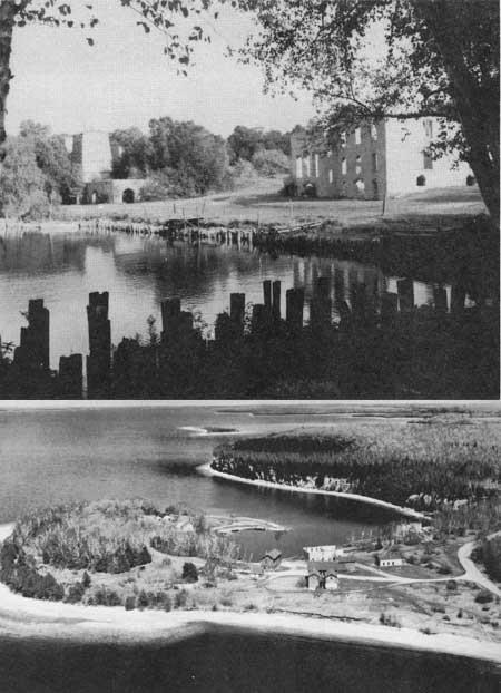
58 Fayette
59 NATIONAL PARK SERVICE Great Lakes Shoreline Recreation Area Survey REMAINING OPPORTUNITIES ALONG THE MICHIGAN LOWER PENINSULA (Lake Michigan Shoreline) SUMMARY As a vacationland, the Lake Michigan shoreline between the Straits of Mackinac and the city of Muskegon is a "natural." Thousands of people flock to this area every summer to enjoy the sand; the scenery and the refreshing climate, along with the cultural advantages that are offered nearby. Here, towering, wind-blown sand dunes are interspersed with sheltered bays; Indian lore and legends are mixed with modern sophistication of art colonies and music festivals; regimented agricultural landscape is contrasted with natural areas rich in geological, botanical and zoological values. Generally speaking, this northeastern Lake Michigan shoreline can be subdivided into three basic sections. The first is from the Mackinac Bridge south to and including Grand Traverse Bay. With a few notable exceptions, this shoreline along this stretch is characterized by shallow waters backed by narrow, cobble beaches and, in some cases, high bluffs. Widely known as a summer resort district, present development is primarily centered around Petoskey, Charlevoix, and Traverse City. Only two study areas were selected in this section. The second section from the tip of Leelanau County south to Muskegon contains some of the most scenic recreation shoreline on the Great Lakes. Here, the almost continuous, clean sand beaches are backed with both low and high dunes--some bare, some covered with magnificent deciduous forests. Behind these dunes are numerous inland lakes that add scenic variety as well as other recreational enjoyment. Here, the numerous recreation possibilities are being recognized by private development which poses a threat to future public benefit of the natural resources. Six areas in this section are recommended for public acquisition. The offshore island groups - Beaver, Fox and Manitou - make up the third shoreline section. Here, the isolation factor is a mixed blessing. Island vacations have a great appeal but access difficulties limit the number of participants. The same limitation favors the retention of natural areas where the adverse effects of man's intrusion can be kept at a minimum. Because it encompasses most of the prime assets represented by Lake Michigan islands, only South Manitou Island has been designated for public acquisition. However, it is

60 recommended that consideration also be given to preserving one or two islands in the Beaver group for their natural values. Northeastern Lake Michigan falls within the Region Two administrative unit of the Michigan Conservation Department. Total state ownership along the 403 miles of mainland shoreline amounts to slightly more than 10 percent. Less than 10 percent is devoted exclusively to recreation and over half of this amount is in Wilderness State Park. The recommended additions to public ownership listed on the following pages would more than double recreation shoreline. However, the resulting 19 percent devoted to such use is not considered excessive in view of the natural values involved, the intensive use of the area and the fact that more parks bring more tourist dollars into the region's economy. STURGEON BAY LOCATION Sturgeon Bay lies beneath the projecting arm of Waugoshance Point in Emmet County near the northern tip of Michigan's lower peninsula. A shore drive, State Route M-131, parallels Lake Michigan from Petoskey to Cross Village, and then continues as a county route along Sturgeon Bay and through the study area. Lying adjacent to the south boundary of Wilderness State Park, this shore is 17 miles southwest of Mackinaw City and approximately 30 miles north of Petoskey. A shoreline of 6.2 miles and an inland area of 2,200 acres is associated principally with Sturgeon Bay's south shore. DESCRIPTION The broad arc of Sturgeon Bay follows an uneven shoreline marked by small indentures. Bordering the water line of this region are beaches with a mixture of sand and pebbles. Some beaches measure up to 100 feet in width, and the six foot water depth may be as much as 300 feet offshore. Pebbles are encountered frequently in these offshore waters. Sturgeon Bay Point is a prominent feature near the south end of the bay. Here, the westerly winds have scoured the point, exposing the underlying glacial drift. Small copses of vegetation have trapped the wind-blown sand, forming an undulating terrain over the bulk of the point.

61 High sand dunes provide a scenic backdrop to this region, paralleling the general shoreline along most of the bay's southern shore. Many reach over 100 feet in height, exposing the raw sand of large "blowouts" amid stands of northern trees that have succeeded in stabilizing much of the dune area. Behind the dunes are thick forests of jack, red and white pine along with many northern hardwoods. PRESENT USE Part of the southern portion of the Sturgeon Bay site lies within a unit of the Hardwood State Forests, while its northern extension reaches into Wilderness State Park. One small private sub-division is located along the shoreline a short distance north of Sturgeon Bay Point, while south of the point small tract development has occurred in several different locations. ANALYSIS The sand dune shoreline that borders most of Sturgeon Bay's south shore would add a new scenic aspect to the Wilderness State Park and would provide further protection to its wilderness values. In addition, the high recreation values of beach and dune make this bay area worthy of consideration for addition to the state park. Sturgeon Bay

62 FISHERMAN ISLAND LOCATION This study area, named after the island lying a few hundred feet offshore, primarily involves a mainland area on the northeastern shore of Lake Michigan. U.S. Highway 31 parallels this segment of shoreline slightly over one mile inland. A 4-mile shoreline, including the island, intercepts an inland area of about 1,500 acres. DESCRIPTION Lying in shallow waters, Fisherman Island itself is a small, four-acre tract covered by deciduous trees and surrounded by a shoreline of cobbles and boulders. During low lake levels it is possible to wade the slightly submerged sand bar between the island and mainland. On the mainland portion of the study area, a sand beach borders the bay at the north end. This beach may vary in width up to nearly 100 feet before being terminated by a low barrier dune. Offshore, the water reaches a six-foot depth 500 to 1,000 feet from the beach. The adjacent bay to the south also has very shallow offshore waters but numerous boulders lie awash on and near the narrow beach. The beaches here are quite narrow with some tree growth occurring within a few feet of the water's edge. Behind the beaches a group of low sand dunes roughly parallels the shoreline. Portions of this dune area have been stabilized by grass and forest cover, leaving active dunes primarily on the point reaching to Fisherman Island. Even here, grasses and shrubs have anchored much of the sand, reducing the amount of actively shifting dunes. PRESENT USE All of this area is in private ownership, though units of the Pigeon River State Forest are contiguous to both extremities of the proposed site along the shoreline. Behind the dune areas, old clearings occur where farming has taken place. ANALYSIS Located in a highly popular summer resort section of Michigan, this study area offers the best possibilities for public recreation between Traverse City and Petoskey. Here, a fine sand beach is combined with an inland area suitable for camping, picnicking and nature study. The easily accessible island adds an unusual attraction. In terms of these values, the area includes characteristics suitable for inclusion in a local or state park system.

63 CAT HEAD BAY LOCATION Located on the northern tip of the Leelanau Peninsula, this bay lies between Cat Head and Lighthouse Points near the entrance to Grand Traverse Bay. Highway access to Cat Head Bay is via Leelanau County routes and State Route 201, the latter running north from Northport where it connects with State Route 22. This 3,000-acre area has a 6.3- mile shoreline on the peninsula tip. DESCRIPTION Cat Head Bay's crescent-shaped shoreline opens to the north, exposed to winds that sweep across its shores heaping up sand in a line of dunes behind the beach. These dunes and their "blowouts" are confined largely to the bay's east side. From atop these dunes, a sweeping panorama spreads across the bay and beyond to the Fox Islands 20 miles away. The beaches bordering Cat Head Bay vary in width up to 100 feet and are paralleled on the inland side by a low barrier dune. The beach is composed of sand and a scattering of pebbles. Offshore, the six-foot water depth lies approximately 100 feet from the beach. Cobbles and boulders occur as more common components of the beach and offshore bottoms in the areas around Cat Head and Lighthouse Points, offering sand in only small amounts. Deciduous trees as well as evergreens are found in the forests surrounding Cat Head Bay. White cedar and balsam fir together with scattered red and white pines are the principal evergreens found along the border of the dunes. Farther inland, the forest is composed of sugar maple, beech and yellow birch along with white birch, ash and a few groves of hemlock. PRESENT USE Public shoreline at Cat Head Bay is confined to Lighthouse Point where a small township park and a Coast Guard Lighthouse are located. Some of the interior private holdings have been cleared for farms as well as a small airport adjacent to Mud Lake. Cherry orchards are a common agricultural use in this region. ANALYSIS The scenic charm of Cat Head Bay, accentuated by its peninsula-tip location, combines with an area possessing outstanding recreation possibilities. Excellent sites for picnicking and camping exist with a region rich in nature study potential. The features of

64 this area are of such character as to warrant immediate steps to be taken to insure their availability for public use. SLEEPING BEAR LOCATION Covering portions of Benzie and Leelanau Counties, this area stretches from Sleeping Bear Bay south to the Platte River besides including South Manitou Island. These segments encompass nearly 30,000 acres and a shoreline of 35 miles. Mainland highway access is provided primarily by State Routes 22 and 109 which parallel the shoreline one to two miles inland. DESCRIPTION The focal point of this region is the wind-swept sands of the Sleeping Bear Dunes--long classed as one of the main scenic features of the Great Lakes. Here, atop a 400-foot high glacial moraine are perched the shifting sands and ghost forests--snags of trees once buried by the moving dunes. Below stretch the endless beaches of sand and small pebbles. A second perched dune complex towers above Empire, Michigan. These dunes resting on a moraine have been stabilized except for several "blowouts" along the lake face. Soaring 530 feet above Lake Michigan, vast panoramas open from these dunes over lake, beach, dune and forest. The southern terminus of this area is the sand plains of the Platte River. Once inundated by ancestral waters of Lake Michigan, today its sandy soils expose old beach lines and low dunes that support fine jack pine forests. Northward, along the eastern and southern flanks of the Empire and Sleeping Bear Dunes, exceptionally fine deciduous forests have become established. Seven miles offshore from Sleeping Bear Point, South Manitou Island is an isolated composite of many features associated with Sleeping Bear and the Platte River Plains. In addition, it supports a large gull rookery while the island's flora achieves significance by virtue of a stand of huge white cedars together with Lake Michigan's only island forest of jack pine. PRESENT USE Little development has taken place along this shore except in Platte and Sleeping Bear Bays along with several of the largest inland lakes. Public properties
65 comprise limited Federal ownerships on South Manitou Island, Sleeping Bear and Platte River. State holdings include the Fife Lake State Forest and three state parks. ANALYSIS By virtue of Sleeping Bear's outstanding natural features, this area is of possible national significance and should be given further study to determine the best plan for preservation.

66 Sleeping Bear

67 BETSIE POINT LOCATION Betsie Point lies 4 miles north of Frankfort, Michigan in Benzie County. Michigan State Route 22 passes the east line of the proposed area, while a county route leads to the Coast Guard Station on Betsie Point. Behind this 1-1/2 mile shoreline are approximately 500 acres of beach, sand dunes and forest. DESCRIPTION The sand dunes of Betsie Point encompass a low lying point in contrast to the high bluffs found on the north and south. The dunes rarely reach more than one-half mile inland from the shore and extend little more than one and one-half miles along the beach. Though irregular in topography, the dunes seldom reach more than 50 feet in height. Dune vegetation has been only partially successful in the stabilization of the sand. Copses of balsam fir, white cedar and a few deciduous trees occupy limited areas within the dune region. Inland behind the dunes are forests composed primarily of deciduous stock, toward which the relentless sands are moving. Sugar maple is a dominant tree found in this zone along with aspen and some hemlock. Several large "blowouts" lie adjacent to this forest edge and threaten to engulf more of the inland cover. As this sand movement continues inland, previously buried forests are uncovered and resemble the snag forests left by forest fires. Beaches up to 50 feet in width lie before the sand dune area. Mixed with the sand are varying amounts of gravel and pebbles, resulting in a rough texture to most of the beaches. Offshore, the six-foot depth is approximately 100 feet from the water's edge. PRESENT USE A Coast Guard lighthouse occupies several acres on Betsie Point while a few of its former buildings, now privately owned, are located nearby. Most of the development in this region is centered about Crystal Lake while other private use has converged on the fine sand beaches of Platte Bay nearby. A few cottage sites have been built along Michigan Route 22, while a private golf course development dominates the area north of Betsie Point. ANALYSIS Betsie Point does not possess outstanding possibilities for swimming; however, its principal values lie in its open dunes suitable for hiking and exploring.

68 Providing for such day use activities, this small area could meet a growing need for lakeshore open space amid a region of growing private developments. HERRING LAKE LOCATION The Herring Lake Site extends from the southern tip of Lower Herring Lake northward to the mouth of the Betsie River near Frankfort. State Route 22 parallels the general shoreline up to a mile inland south of Elberta. This Benzie County shoreline measures nearly 4-1/2 miles in length while intercepting an inland area of 900 acres. DESCRIPTION A high morainal bluff that slopes sharply to the shoreline is the characteristic feature in this region. Atop these bluffs rest stabilized perched dunes, exposing a few "blowouts" to the sweeping lake winds. From these bluffs, some rising over 300 feet above the lake, vast scenic panoramas open along the shoreline and over the waters of Lake Michigan. The continuity of these bluffs is broken in several locations, one midway along their length and again opposite Lower Herring Lake. The Herring Lakes are bodies of water that once were inundated by a higher level of Lake Michigan. Today they lie in a dry embayment bounded by the basin slopes, except on the west where a sand ridge restrains Lake Michigan. Sand beaches, varying in width with the lake levels, stretch along the shoreline beneath the bluffs. Composed primarily of fine to medium-textured sands with only a scattering of pebbles, these beaches offer excellent recreation opportunities. Behind the beach a barrier dune follows the shore for over a mile south of the Betsie River and again opposite Herring Lake. Offshore, the sandy bottom slants away from the beach, passing the six-foot depth nearly 75 to 100 feet from shore. Inland, much of the area is forested, though occasional farm clearings occur. The forests are composed largely of deciduous stock with the pine, hemlock and other conifers scattered throughout. PRESENT USE Private developments have taken up most of the inland shores of Lower Herring Lake, leaving only the western shore undeveloped. To the north there is little

69 development along Lake Michigan before reaching a small public beach and scenic parking overlook near Elberta. ANALYSIS By virtue of its recreation and scenic values, this shoreline possesses the characteristics of an unusually fine public use area. Swimming, boating and camping would find suitable development locations to adequately meet future expanding recreation needs. Herring Lake

70 ARCADIA LOCATION The Arcadia site is associated with a Lake Michigan shoreline of 1.3 miles in the vicinity of Bar Lake in Manistee County. Michigan State Route 22 passes through the village of Arcadia, lying on the east flank of the proposed public use site. Frankfort, Michigan is approximately 12 miles to the north, while Manistee is 22 miles south of Arcadia. Behind the 1.3 miles of Great Lakes shoreline is an inland area of nearly 700 acres. comprise the lake bottom in this zone. The sand beach between Bar Lake and Lake Michigan is one of this region's focal points. The medium textured sand forms a beach that seldom exceeds 50 feet in width. Pebbles are mixed with the sand on the beach as well as offshore. Offshore, the bottom slants rather sharply, reaching a six foot depth in 20 to 40 feet from shore. Coarse sand and pebbles also DESCRIPTION Bar Lake lies in a dry embayment surrounded on three sides by upland bluffs, while on the fourth side a low sand rib separates it from Lake Michigan. At one time, an artificial water channel connected the two lakes, but this has now been choked to a small trickle by the shifting sands. The breakwater that once protected this channel entrance has been responsible for sand accumulation that has widened the beaches, particularly south of the harbor entrance. Narrow sand beaches may be found along portions of Bar Lake's shore. Forests of northern hardwoods clothe the slopes surrounding Bar Lake. Occasionally, conifers are found mixed with oak, ash, birch and maple. Beach grasses are common on the sand ribs along Lake Michigan. PRESENT USE The village of Arcadia, lying near the northeastern tip of Bar Lake, has been influenced over the years by the fortunes of the lumber market. A mill site for a furniture company is located along this lake's shore where its holdings affect an appreciable portion of the lake shoreline. Some clearing has taken place, permitting limited farming elsewhere along the shoreline, but cottage development has not been extensive. ANALYSIS The recreation potential of the Arcadia site is dependent upon the feasibility of keeping the short channel open between Lake Michigan and Bar Lake. The latter lake

71 would be an excellent site for small boating activities in addition to harbor and swimming developments. Arcadia

72 BASS LAKE DUNES LOCATION The Bass Lake Dunes lie 7 miles south of Ludington and 2 miles north of Pentwater. Most of this site lies in Mason County's southwest corner and extends slightly into northern Oceana County. Bass Lake is the principal inland feature, lying near the eastern base of the sand dunes paralleling the Lake Michigan shore. County routes leading from U.S. Highway 31 come within 1/4 mile of the shoreline at the Bass Lake outlet. The dune complex of nearly 600 acres is fronted by a 1.9 mile shoreline. DESCRIPTION The Bass Lake Dunes rise steeply above the waters of Lake Michigan to heights between 100 and 150 feet. A barrier dune is virtually absent along this beach, leaving a steep face exposed to the action of wind and water. These dunes extend less than a mile inland to the small basin holding Bass Lake. The narrow dune strip is a tangled complex of dune ridges, valleys and steep sand slopes. The dunes are well stabilized except on a few of the lakeside slopes. Stabilization has been accomplished by forests of red oak, white pine and white birch together with additional scattered hardwoods. Beach grasses along with a few shrubs have also contributed to holding the sand in place. The beaches are approximately 50 feet wide, composed primarily of sand but containing a mixture of small pebbles. Offshore, the six-foot water depth varies from 100 to 150 feet from the edge of the beach. Sand and small pebbles are also found in this zone of shallow water. PRESENT USE Scattered cottage construction has occurred along much of the county road that parallels the eastern flank of the sand dunes separating Bass Lake from Lake Michigan. This private development has centered primarily along the west shore of Bass Lake. The steep Lake Michigan shore topography has prevented extensive development within the dunes. ANALYSIS Public ownership of the Bass Lake Dunes and their Lake Michigan beaches would permit general access to these shores for swimming as well as hiking and nature study among the dunes. The preservation of the dune forest in its role of stabilizing the sand is an important consideration to the developments along Bass Lake's west shore.


73 These dunes and beaches, set aside as a county or township park, could adequately serve the local public recreation and conservation needs. Bass Lake Dunes FLOWER CREEK DUNES LOCATION The Flower Creek Dunes site overlaps the southern edge of Oceana County from the northwest corner of Muskegon County. Twenty miles to the south is the city of Muskegon, accessible by county routes and U.S. Highway 31. This dune and beach area, with its shoreline of 1.7 miles and inland area of 1,200 acres, encompasses the principal undeveloped features near the mouth of Flower Creek. DESCRIPTION Beaches composed of fine sands vary from 50 to 175 feet in width along this portion of northern Muskegon County shoreline. Frequently, a low barrier dune separates the beaches from the high inland dunes that crest occasionally 100 feet above the lake. Elsewhere, the lakeside of the dune has been truncated and its bluff face rests on the beach not far from the water's edge. Occasional wind erosion has
74 stirred the dune sand, cutting "blowouts" and altering the barrier dunes into broken sand communities. Offshore, several sand bars lie parallel to the shore, a characteristic of a large part of Lake Michigan's eastern shore. Shallow waters are associated with these sand bars, only the sixfoot depth lying up to 150 feet offshore in the Flower Creek region. The sugar maple-beech-yellow birch northern hardwood forest type is found here as well as its common associates--white pine and white birch. Forests, together with beach grasses and shrubs, clothe the dune topography and serve to stabilize these sand hills, preventing a rapid encroachment on the inland areas. PRESENT USE Meinert Park, a small county recreation area south of the mouth of Flower Creek, provides a small beach park for public use as well as being the principal public access to the shoreline in this region. East of the dunes, much of the inland area has been cleared and is used for pasture and cultivation. Cottage development is not extensive but some occurs near Meinert Park in addition to other scattered locations. ANALYSIS The beach qualities of fine sand and shallow offshore water, set against the pleasing backdrop of dunes and forest, provide an excellent site for a lakeshore recreation area. Suitable sites exist for picnicking and would be valuable additions to other public use facilities. The enlargement of Meinert Park to provide these facilities would be worthwhile in meeting projected recreation needs.
75 NATIONAL PARK SERVICE Great Lakes Shoreline Recreation Area Survey REMAINING OPPORTUNITIES ALONG THE MICHIGAN LOWER PENINSULA (Lake Michigan Shoreline) SUMMARY Often referred to as the "Riviera of the Great Lakes," this southeastern Lake Michigan shoreline rivals its European namesake in many ways. The turquoise waters resemble the Mediterranean color, and the whole area is widely known as a summer resort for residents of metropolitan Chicago and Detroit. Missing, however, are the noted casinos generally associated with southern France. This southern Lake Michigan shoreline is almost a continuous sand beach bordered in sections by bluffs and elsewhere by high sand dunes. Along the bluffs, erosion is frequently a serious problem, particularly during high lake levels and stormy periods. Low barrier dunes protect the dune regions from the ravages of storms and serve to reduce the effects of erosion. Dunes in some locations rise over 200 feet above the lake and form a parallel ribbon of sand hills averaging approximately a mile in width. Though numerous dunes have been stabilized, the lake sides of many dunes have large "blowouts" cut by the persistent west winds. Shaped like amphitheaters in the shifting sands, these dunes are hard-pressed to provide a suitable foothold for vegetation. On the leeward side, protected from the dune-cutting winds, forests of deciduous trees have become established. Evergreens occur only sporadically, many lying near the southern limits of their natural range. The scenic appeal of this region can only be rivaled by its recreation values. When the prevailing westerly winds blow surface water toward this shore, the warm water temperatures combine with the sandy beaches to promote ideal swimming conditions. Within reach of large metropolitan areas, the impact on the existing recreational facilities of this region is tremendous. Better than 7,000,000 people reside within a 50-mile radius of this region, including much of the Chicago metropolitan area. Along this 110-mile shoreline are three state parks--warren Dunes, Holland and Grand Haven. The shoreline of these three parks totals less than three percent of the lake front. In 1957 these three parks received an attendance of 3,250,000 or 19 percent of the total Michigan state park visitation.

76 Fortunately, some outstanding undeveloped shoreline remains in this region. Over 14 miles of shoreline have been selected as suitable for preservation and public use. Divided into four areas, these 14 miles of frontage would lift to 15 percent the amount of this shoreline in public ownership. To meet the recreation needs within a highly populated region, this percentage can be considered only a minimum. Unfortunately, a large portion of the remaining beach that would be suitable for recreation is now in various stages of private development and, consequently, unavailable. Acquisition of these proposed areas is considered to be of extreme importance in order to meet pressing recreation demands as well as to protect the basic natural values of existing parks--particularly Warren Dunes.

77 COUNTY LINE LOCATION Straddling the Ottawa- Muskegon county lines, this site lies less than four miles north of Grand Haven. Access to the shore is limited, but county routes parallel the inland edge of the sand dunes and connect with U.S. Highway 31 between Grand Haven and Muskegon. The total undeveloped shoreline amounts to 2.6 miles in addition to a 2,500-acre inland dune region. DESCRIPTION A massive sand dune complex extends as a one-mile wide ribbon along the Lake Michigan shore and strikes a sharp contrast to the gently rolling inland region to the east. Some of the dunes reach heights of nearly 200 feet above the lake level, though the average height is closer to 150 feet. These dunes are primarily stabilized; however, occasionally "blowouts" occur where the eddying wind currents cut into and move the loose sands about the open amphitheaters. It is these areas of bare sand and their dissimilarity to the surrounding woods that impart to the region much of its scenic significance. Forests of second growth sugar maple, beech, cherry, white ash and other hardwood associates are found over large portions of the stabilized dunes. Threatened by the eroding winds along the dune's shore face, the vegetation here struggles to maintain its foothold. Elsewhere, the forest growth finds some protection in the steep dune valleys, threatened only by the landward movement of the sand from the "blowouts." The sand beaches are composed of fine, clean sand and vary in width from 50 to 100 feet. Shallow water extends offshore up to 200 feet before reaching a depth of six feet. Set before the picturesque dunes, these beaches offer exceptional locations for water recreation activities. PRESENT USE Subdivision development is threatening this area from the south. Consider able development has already taken place, eliminating the three and one half miles of connecting shoreline with Grand Haven. Behind the dunes and near Little Black Lake is a country club and associated golf course; otherwise, the area is primarily in wood land or cultivation. The Norton Township Park lies adjacent to the area's northern boundary.

78 ANALYSIS The County Line study site offers some of lower Lake Michigan's finest remaining undeveloped shoreline. The outstanding beaches in conjunction with inland sites for picnicking, camping and nature study give this area the potential for an excellent state park. SAUGATUCK LOCATION This sand dune area lies adjacent to the mouth of the Kalamazoo River near the village of Saugatuck. Access to the region is by connecting state and county routes from U.S. Highway 31. The study area's 2-1/2-mile shoreline and 1,400 acres of sand dunes are split into two sections by the Kalamazoo River. to contain the sand's movement. DESCRIPTION Saugatuck's most extensive dunes lie north of the Kalamazoo River, though several towering dunes occupy a narrow strip south of the river mouth. The northern sand complex is a series of dune "blowouts" extending over a mile inland. The westerly winds ceaselessly tear at these "blowouts", continually reshaping and moving the sand forms. The inland side of the dunes drops abruptly, delineating the east-west advance of the sand. Here, in the lee of the dunes, trees have become established in their attempt In this dune region there is found a variety of tree species; conifers are common, including a few hemlocks and white pine. Red oak, sugar maple and beech occur through out the area along with basswood, sassafras and other deciduous trees. Separating the sand from the beach is a low barrier dune. Tree growth occurs over segments of this dune, while elsewhere beach grasses provide stabilization. Resting before the barrier dune is a beach composed of fine sands. Varying with the lake level, this beach may range in width up to 150 feet or more. Similar fine sands are found offshore, being particularly evident in the sand bars that lie parallel to the shore. PRESENT USE Cottage developments have occurred at the limits of this site, but a lack of access within the area has kept nearly three and one-half miles of shoreline undeveloped. In the south unit below the Kalamazoo River, a radar station is located atop one of the

79 dunes. Dunesmobiles operate over the dunes north of the river, providing visitors an opportunity to see the region more intimately. ANALYSIS By virtue of its fine beaches and scenic hinterlands, Saugatuck has a high public use value. Immediate steps should be taken to safeguard these values in order to meet the recreation demands of this region. Saugatuck

80 THUNDER MOUNTAIN LOCATION Thunder Mountain lies on Lake Michigan's eastern shore nearly 11 miles north of Benton Harbor and 9 miles south of South Haven. These two communities are connected by U.S. Highway 31 which parallels the shore approximately one mile to the east. A study area shoreline of 1.7 miles extends north from Rogers Creek and intercepts an inland region of approximately 500 acres. DESCRIPTION Thunder Mountain, rising above Rogers Creek, is one of the highest dunes along Lake Michigan's southeastern shore. Reaching over 200 feet above the lake, these dunes cover an area more than a mile wide along the shore. Several of the dunes are characterized by large "blowouts" carved and shaped by the prevailing westerly winds. Occasionally, sands are whipped about and carried over the ridge to move slowly inland. These raw sands contrast sharply with the more vigorous forest growth found behind the dunes. The beaches lying before a partially stabilized, low barrier dune are better than 150 feet wide in places. Fine sands with a light mixture of small pebbles are the textural components of this beach. Similar material extends offshore and provides a useable site for swimming and other water recreational pursuits. The forests found at Thunder Mountain include fine examples of second growth trees. White pine along with northern white cedar are the principal conifers, but they comprise only a small segment of the overall forest growth. Being primarily a deciduous forest, a few of the northern species such as sugar maple and birch have become established, while a number of more southern species, including the yellow poplar and sassafras, are present. PRESENT USE Cottage development has occurred in this vicinity where access to the shore is possible. Though much of the building has taken place outside the recommended area, a few intrusions are found inside this site, along with some new construction.

81 ANALYSIS Thunder Mountain combines many recreational attractions within its limits. It possesses high scenic qualities, desirable swimming beaches, suitable areas for picnicking and an interesting scene for nature study. By virtue of these qualities, this site should be given early consideration for public acquisition of the beach and dune areas. Thunder Mountain

82 STEVENSVILLE LOCATION Lying near the southeastern tip of Lake Michigan, the Stevensville site is approximately 12 miles north of the Michigan-Indiana State Line. The principal access route is U.S. Highway 12 which parallels the shore nearly a mile inland between Michigan City, Indiana and Benton Harbor, Michigan. The 2,000 acres and the 4-mile shoreline of this study area are broken into three separate units stretching 7 miles north of Warren Dunes State Park. DESCRIPTION The Stevensville site is characterized by towering sand dunes and broad sand beaches. Within this setting is an excellent environment for recreation. The beaches, composed of clean, fine sands, measure up to 150 feet in width, while offshore the lake's sandy bottom slopes gently to a sand bar, 100 to 125 feet from shore. Behind the beaches, sand dunes tower to a maximum of 200 feet above the lake level. These dunes offer a contrasting topography in a mile-wide band along the shore as compared with the more level terrain farther inland. Accentuating the uneven character of these land forms, some dune "blowouts" are one-half mile wide and extend nearly threefourths mile inland. Old dune "blowouts" may be found that have been stabilized by beach grasses and forest growth. Several species of oak are common associates in these dune forests, along with red maple, beech, sassafras and others. Conifers are not common. In the northern portion of the Stevensville site, three small, shallow lakes lie behind a narrow line of sand dunes. Marsh plants grow profusely in the shallow waters around the lake edges. These water areas provide excellent, though small, waterfowl resting sites. Great blue herons, black terns, in addition to many shore birds, may be seen about the Grand Marais Lakes. PRESENT USE Private developments along this shoreline have resulted in dividing this study area into three separate tracts. The middle area is little more than one-half mile in extent and appears to be in the most danger of encroachment. On the south, better than a mile of undeveloped shoreline lies adjacent to the Warren Dunes State Park north boundary, while to the north, development is closing in on the third open area near the south Grand Marais Lake.

83 ANALYSIS Though this is not a continuous undeveloped shoreline, it, nevertheless, possesses outstanding beaches and scenic hinterlands that make it desirable for public use. Stevensville
84 NATIONAL PARK SERVICE Great Lakes Shoreline Recreation Area Survey REMAINING OPPORTUNITIES ALONG THE MICHIGAN LOWER PENINSULA (Lake Huron Shoreline) SUMMARY Though lying near the geographical center of these great inland seas, Lake Huron has the distinction of being the first to be seen by white man. It was Samuel de Champlain, emerging from the wilds along Georgian Bay in 1615, who first recorded the experience of gazing across one of the Great Lakes. He named it the Freshwater Sea, but today its name bears an association with the Indians who frequented its shores. Once traversed by the frail Indian canoe, today Lake Huron is the trail of Great Lakes freighters as well as ocean-going vessels bound from the far-flung lake and world ports. Occasionally, these vessels put into port along the lake's northern shore to take on one of the region's principal minerals--limestone. Gathered from quarries found along the northern Lake Huron and southern Upper Peninsula shores, the limestone is destined to fulfill its important roll in the production of steel. But, limestone in other forms than that found in the quarries has fashioned this shoreline, providing the setting for a second important resource use--recreation. The lake's recreational wealth is due to an accessible, low shoreline with sandy beaches bordered by shallow, offshore waters. Here, opportunities to find a restful, inviting campsite, a beach to explore, or clear, invigorating water for the hardy swimmer attest to the region's public use values. The serrated northern shoreline stretches nearly 290 miles from the Straits of Mackinac south to the Bay-Tuscola County line and includes 51 miles of offshore island shore. This region possesses a variety of lakefront sites suited to recreation and wildlife conservation, a number of which have already been recognized and set aside. Publicly owned frontage along this portion of the lake includes approximately 24 miles in state forests, wildlife areas and fishing sites and 3.3 miles in state parks. To this public shoreline, it is recommended that 25 miles of additional frontage be placed in public ownership. This seven percent of the lakeshore would bring to 15 percent the amount set aside for public use. To assure the future availability of this segment of the

85 shore, immediate action should be taken since the shoreline within these study areas represents nearly all that remains suitable for public use. Lake Huron, by virtue of the ready access provided by U.S. Highway 23, has been the target for considerable private development. The level nature of the shore provided ideal sites for cottage construction and, being a lee shore, the general eastward movement of Great Lakes storms carried their destructive power away from the western Huron beaches. Finally, the proximity of the populous Detroit area has hastened the spread of development along its shore. Thus today, Lake Huron lies on the threshold between the development that has engulfed the eastern lakes and that now threatens to move northward to overrun the remaining undeveloped shore.

86 BOIS BLANC LOCATION Bois Blanc Island emerges from northwestern Lake Huron at the east end of the Straits of Mackinac. The island, which may be reached by ferry from Cheboygan, has gravel roads providing access to various shore points. The study area's 3.8-mile shoreline and 695 acres comprise most of the Lighthouse Point peninsula. DESCRIPTION Bois Blanc Island, particularly the Lighthouse Point peninsula, contains a representation of some of the Great Lakes' finest forest types. Of primary importance is the occurrence of a stand of mature white pine estimated to be 180 to 250 years old. Though white pine may be found in many parts of the Great Lakes region, nevertheless those of Bois Blanc represent some of the largest individual trees and the most concentrated groupings observed on this survey. Equally important is the value of the stand for educational and research purposes. These pines occur interspersed with red pine, balsam fir, white cedar and spruce, together with such deciduous trees as aspen and white birch. The shallow, marshy Deer Lake near the base of the peninsula provides a suitable habitat for many wet site plants, such as pitcher plant, and various orchids. Elsewhere in drier limestone soils, many other characteristic Great Lakes wildflowers can be found. The island presents several interesting faunal situations that are represented on the peninsula. A sizable deer herd affords an opportunity to study the carrying capacity of various vegetative types. Suitable cover exists for pileated woodpeckers, though strangely enough, skunks and porcupines are not reported on the island. An isolated colony of rattlesnakes occurring here is of interest because this is the northern limit of this species in Michigan. Limestone cobbles form the peninsula's beaches, creating well defined terraces along the eastern shore. Offshore, the lake bottom falls off sharply from the beach line. PRESENT USE All of the land in this study area is in public ownership under the control of the U.S. Forest Service. Currently, consideration is favorably given by the Forest Service to exchange this property for other state forest holdings.

87 ANALYSIS Because of its natural values, particularly the white pine and other forest associates, this site should be preserved as a natural area for the education and enjoyment of the public. LAKE BREEZE LOCATION The Lake Breeze beach lies 2 miles east of Hammond Bay and 1 mile west of Forty Mile Point along the northwestern shores of Lake Huron. From Rogers City, 7 miles to the southeast, U.S. Highway 23 passes less than a mile south of the shoreline. The study area's 3-mile shoreline spans an inland area of nearly 1,000 acres. DESCRIPTION Bordering the bluegreen waters of Lake Huron are the unusually fine shore features of Lake Breeze. Its beaches are composed of fine limestone sands with a scattered occurrence of small pebbles. Varying in widths up to 50 feet, these beaches front on shallow waters whose six-foot depth lies up to 125 feet from shore. These beaches are interspersed with small shore points of cobbles and boulders. A somewhat limited, but scenic area of sand dunes parallels this shoreline. Most of the dunes have been stabilized except in several instances where their slopes have been laid bare by the buffeting shore winds. Low juniper and bearberry occur extensively over the low barrier dune back to the forest line, clutching the loose sand in small mounds. A coniferous forest dominates the area immediately behind the beach and open dune environment. Considerable white and red pine can be found here as well as balsam fir and white cedar. Associated deciduous trees that become more numerous farther inland are aspen, birch, poplar and red oak. On the forest floor in old shoreline swales, large numbers of pitcher plant and sundew occur. Ranging through this region, an observer may catch a glimpse of deer or bobcat as well as representative birds of the northern forests. PRESENT USE Private development has taken place at the east and west extremities of the study area, with some penetration being made from the west. A sizable area covered by unrecorded property ownership plats broken into small lots has prevented additional development due to the difficulties of determining ownership and clearing title. Some state property administered as part of the Black Lake State Forest lies behind the beach.

88 ANALYSIS Because of its exceptional scenic values, combined with an area possessing one of the few remaining fine sand beaches on Lake Huron, Lake Breeze should be acquired to insure its availability for future public use. In addition, its status as one of Lake Huron's outstanding shore areas is bolstered by its desirability for camping, hiking and nature study. THOMPSONS HARBOR LOCATION The Thompsons Harbor shore winds westward from Black Point along one of the irregular sections of Lake Huron shoreline. Located approximately 15 miles southeast of Rogers City via U.S. Highway 23, the harbor is accessible by connecting gravel roads. The 3 miles of shoreline encompassing part of this harbor intercepts an inland area of nearly 1,200 acres. DESCRIPTION This is an area with a scenic appeal based on its limestone points and beaches as viewed from atop the inland dunes. Resistive rock points protrude prominently from this shore, fashioning the series of harbors and bays that are unique along the western Lake Huron shoreline. Occupying many of the protected harbors are beaches composed of sand and cobbles. These are the components of the narrow beaches behind Thompsons Harbor, while offshore an occasional boulder lies awash amid a cobble-covered bottom. Sweeping up southward from the beach, the sandy soils culminate in an uneven outline of dunes. These low sand hills have been virtually stabilized by a mantle of grasses, bearberry, low junipers and other recumbent plants. Persistent winds have, however, cut into the sands and an occasional raw sand slope lies exposed. It is these "blowouts" that add materially to the contrasting scene along this shore. Only scattered white birch, red pine and white cedar occur in the open dune terrain. Behind the dunes and covering most of the shore points are typical northern mixed coniferoushardwood forests. These are nearly all second growth stands. PRESENT USE The majority of this region is owned by an industrial corporation interested in limestone. Several private parties own property within the area, including frontage on part of Thompsons Harbor. State property belonging to the Black Lake State Forest lies near the study site.

89 ANALYSIS Though lacking a suitable bathing beach, Thompsons Harbor possesses areas suitable for camping and picnicking, and further study may indicate the feasibility of developing boating facilities in the harbor. The area's potential for serving these various public use activities, particularly in its scenic setting, indicates the desirability of setting this shoreline aside for the public's benefit and enjoyment. SOUTH POINT LOCATION South Point marks the southerly limit of Thunder Bay, the latter being one of two prominent indentations along Lake Huron's west shore. Though the Detroit and Mackinac Railway parallels the shoreline 1/4 to 2 miles inland, the region is virtually inaccessible by automobile. A county road, passing through the settlement of Black River, comes within a mile of the study area's south limit while U.S. Highway 23 passes up to 5 miles west of the shore between Alpena and Harrisville. The 5-mile shoreline and its 3,400 inland acres spread into both Alpena and Alcona Counties. DESCRIPTION This region is characterized by a low, level topography extending many miles inland. Only the old beach lines left by higher lake levels ages ago alter the face of the level plain. Toward the lake, the low terrain extends beyond the shore for one-quarter to two miles before it is submerged by six feet of water. Occasional boulders lie awash in the shallow waters, particularly in the vicinity of shore points responsible for the irregular shoreline. North of South Point, beaches and the offshore bottom contain a high percentage of cobbles and boulders. In contrast, several of the beaches south of the Point are composed of fine sand. These beaches may measure up to 100 feet in width before terminating in a low grasscovered barrier dune. Offshore, a sandy bottom associated with these beaches offers ideal bathing conditions. A second growth forest composed largely of aspen and birch covers the area behind the beach. Red maple, white cedar and an occasional white pine are common woodland associates. The wet swales between beach lines favor the growth of orchids as well as other interesting flowers of this habitat. PRESENT USE All of the study area is embraced within one unit of the Alpena State Forest. At least one-half mile of northern Alcona County shoreline has been platted for private, small tract development, while elsewhere the property pattern is in large tract single ownerships.

90 ANALYSIS Public acquisition of private lands remaining in this unit of the Alpena State Forest is desirable to assure public access to and use of the shoreline. Such access and use can be adequately met by the continued administration of the area as a state forest. STURGEON POINT LOCATION The 4 miles of shoreline associated with Sturgeon Point reach southward to within 1 mile of Harrisville. Access to the shore is possible via several gravel roads that lead off U.S. Highway 23 as it parallels the lake approximately a mile inland. Behind the shoreline, the study area includes approximately 1,000 acres. DESCRIPTION Sturgeon Point is the most easterly point along the shoreline between Thunder and Saginaw Bays. Protruding lakeward from the point is a long, narrow cobble strand that frequently lies awash during lake storms while in calm weather it is a haven for gulls. The shoreline is a series of shallow arcs separated by small points of cobbles and boulders. Occasionally, boulders also protrude from the beach sands as well as lying in the shallow water offshore. Here, the lake bottom follows a gentle slope for over 200 feet before reaching the six-foot water depth. In the south portion of the study site, several rather extensive beaches of fine sand are backed by a low, grass-stabilized barrier dune. Vegetation, primarily in the form of beach grasses, frequently penetrates the beach area in front of the barrier dune, sometimes to within a few yards of the water line. Behind the shoreline lies a series of old beach lines, separated by low marshy swales. This zone of low terrain terminates less than a mile from the shore when the land rises, sometimes abruptly, to a higher inland plain. A second growth forest clothes this region with conifers, such as tamarack, fir and pine, occurring primarily along the shoreline and in scattered patches inland. Willow, alder, aspen and maple, together with other deciduous trees, comprise the major portion of the inland forest. PRESENT USE Most of the study site is divided among a number of small private ownerships with public property limited to a Coast Guard tract in the vicinity of Sturgeon Point. Some private shoreline development has occurred in at least three separate locations along the lake front.

91 ANALYSIS In order to provide an additional park to serve eastern Michigan and to relieve the overtaxed facilities at Harrisville State Park, the Coast Guard property should be retained in public ownership and the additional private land in the study area should be acquired. Sturgeon Point

92 AU SABLE POINT LOCATION Au Sable Point is the northern limit of Saginaw Bay. Passing within one mile of the Point, U. S. Highway 23 continues 8 miles southwest to the community of East Tawas. Several gravel roads designed to serve cottage developments approach the Point as spurs from the highway. This shoreline, stretching 1.5 miles westward from the Point, spans an inland area of nearly 300 acres. DESCRIPTION The low, level topography around Au Sable Point is the result of its evolution from an earlier lakebed ages ago. The occurrence of paralleling low sand ridges and intervening swales attests to the location of beach lines at various lake levels in the past. An elongated small lake lies in one of the depressions between two of the beach lines. Several other small ponds occur in similar situations. The beaches west of the Point are composed primarily of sand with some scattered fine gravel. Measuring over 50 feet in width, these beaches terminate along a low barrier dune stabilized by beach grasses and a few scattered shrubs. Offshore, the sandy bottom slopes gently for nearly 200 feet before reaching the six-foot water depth. Tree growth is sparse near the beach with only small patches of conifers occupying the area between the first two barrier dunes. Farther inland, more deciduous trees, particularly birch and aspen, are associated with scattered tamarack, white and jack pine. PRESENT USE Au Sable Point lies within the boundary of the Huron National Forest; however, no public lands lie within the study area. The major portion of this site is in a single ownership, but small tract subdivision development is squeezing in from both sides. Already a portion of the western shore of the study area has been staked for subdividing, while an access road and power line have been constructed to serve these building sites. Because of the desirability of this region for cabin development, this shore is in immediate danger of being lost for public use purposes. ANALYSIS Under the present rate of development, public access to the better portions of Lake Huron's lower shoreline will soon be gone. Undeveloped segments of beach, as represented by the quality found at Au Sable Point, should be set aside for public use and enjoyment in recognition of future recreation needs.

93 TAWAS POINT LOCATION Lying along Saginaw Bay's north shore, Tawas Point is less than 5 miles east of the community of East Tawas. Ready access to most of the shore is provided by the Tawas Beach Road which takes off from U.S. Highway 23 near the town's eastern limit. This 1,500- acre study area spans a shoreline of 4 miles. DESCRIPTION Tawas Point is a sand neck that swings southwesterly in a gentle arc to separate Tawas and Saginaw Bays. This sand spit boasts good beaches, some exceeding 100 feet in width, both on the Tawas Bay and Lake Huron (Saginaw Bay) sides. Fine sands with only a light scattering of small pebbles compose the textural quality of the shore as well as the gentle slope of the offshore bottom. Here, the six-foot water depth may lie as much as 400 feet from shore on the bay side. The northeastern bay shores, unlike the Point, are frequently littered with driftwood. Behind the beach, particularly on the Lake Huron side, are several low barrier dunes, typical of the relic beach lines that are prominent north of the Point. Beach grasses along with copses of red and jack pine have succeeded in stabilizing much of the sand near the Point. North of the Point, Lake Solitude rests amid second growth forests with in a half mile of Tawas Bay. The lake occupies a marshy habitat supporting numerous wet site plants, the most notable being the tamaracks along the boggy eastern shore. Elsewhere, in the vicinity of the lake and on drier sites, the shaggy outline of an occasional white pine may be seen rising above a forest canopy of aspen, ash, birch and other hardwoods. PRESENT USE Private subdivision development has eliminated a major portion of the Lake Huron shoreline and threatens to occupy all but Tawas Point. Elsewhere, most of the inland area and a portion of Tawas Bay are owned by a private club. Only Tawas Point is currently owned by the U.S. Coast Guard. ANALYSIS By virtue of the exceptional lake frontage on Tawas Point, this segment of Lake Huron should be retained in public ownership. In addition, the Lake Solitude area has significant natural values that warrant its preservation for public use and enjoyment.

94 Tawas Point

95 TOBICO MARSH LOCATION Tobico Marsh lies adjacent to and north of Bay City State Park, six miles north of Bay City. It may be reached by several roads running west of U.S. Highway 23 and by roads leading north from the state park. DESCRIPTION The study area lies on the lake plain of Saginaw Bay. It is composed of a major lagoon of 326 acres surrounded by a marsh of 191 acres. The marsh is separated from Saginaw Bay by a barrier beach given over to cottage development. West of the lagoon, a series of swales and barrier beaches mark recessional stages in the lowering of Lake Huron to its present level. The sand ridges are vegetated with a variety of deciduous trees and scattered white pine. The area provides a sanctuary for an impressive number of water and marsh birds and other aquatic life. Within the marsh, lagoon and woodland is preserved a highly representative remnant of the indigenous flora of Bay County. PRESENT USE The Division of Game has or is in the process of acquiring the marsh as a State Game Area for the purpose of assisting waterfowl production and use, including public hunting in season. ANALYSIS As a State Game Area, Tobico Marsh is fulfilling its most obvious economic purpose. However, in a larger sense, the area has diverse natural values in a highly populated region largely devoid of these features. Appreciation of the area's scenery, study of aquatic biology and ecology, nature study and field trips originating from the adjoining state park, ornithological and botanical studies, and related uses, not inimical to waterfowl propagation, would guarantee the greatest possible use of the area on a recreational, aesthetic and scientific basis. Acknowledging the jurisdictional authority of the Division of Game of the Department of Conservation, here is an opportunity to work out intensive maximum use of an area through cooperation with the Division of Parks and Recreation, local schools and scouting organizations, sportsmen's groups and the Michigan Natural Areas Council. By maximum use is implied production and perpetuation of waterfowl, protection of non-game species, preservation of botanical elements, and the recreational, educational and interpretive use of the area's aesthetic and natural values.
96 NATIONAL PARK SERVICE Great Lakes Shoreline Recreation Area Survey REMAINING OPPORTUNITIES ALONG THE MICHIGAN LOWER PENINSULA (Lake Huron - Lake Erie Shorelines) SUMMARY The focal point of Michigan's southeastern shoreline is the sprawling metropolis of Detroit. Not only is its great expanse visibly discernible but an even larger area is cast under the shadow of its influence. From the Michigan-Ohio state line, the shoreline winds northward past the developments along western Lake Erie, the waterfront industries of the Detroit River, the private estates of Lake St. Clair and, finally, the private developments of the St. Clair River and Lake Huron. Southeastern Michigan has seen this extensive shoreline swallowed up in development. Some of this was inevitable because industry and commerce have needs and requirements for water frontage. But along with these commercial uses came private developments that spread rapidly along the shorelines, pre-empting beaches that once were unspoiled and available to every one. This situation is not unique to Detroit and its environment alone, but rather this has been the almost universal story wherever development has suddenly exploded to spread and engulf the land. Roads, utilities and home sites were laid out and crammed together to get the most from the land; but, all too often, open space designed for the refreshment of mind, body and spirit were forgotten. Parks and other recreation lands meant curtailed profits from these developments. But today the pendulum may be starting to swing another direction, for open space is important and the profits once thought to be lost from the elimination of a building site are no longer forfeited. Rather, a distinct contribution is being made to man's well-being in a different sense--one difficult to express in dollar values. Along this 427-mile shoreline there are now approximately 55 miles in public ownership, of which 40 miles are devoted to wildlife areas primarily in the marshes along Lakes Erie and St. Clair and Saginaw Bay. The remaining 15 miles are set aside as parks, 10 of which are in the Detroit area. To these public areas it is recommended that nearly eight miles of shoreline be added, half of which would lie along and between Lakes St. Clair and Erie. This would make a valuable contribution toward meeting the recreation needs of Detroit. Elsewhere, several small sites were studied on the St. Clair River and lower Lake Huron. The largest and finest of the

97 areas recommended was found near the tip of the Lower Peninsula's Thumb on Lake Huron; the sandy beaches and hinterland of Port Crescent must take their place among the best on Lake Huron. Today, these unspoiled areas are a partial answer and a means for achieving the goals that will satisfy the public's need for recreation sites. But, deliberate speed and action must be directed toward saving them in their unspoiled state to assure their availability for public use. Failing this, tomorrow we will face the costly problem of reclaiming from development that which we failed to fully appreciate yesterday and today. PORT CRESCENT LOCATION The Port Crescent beach lies 6 miles southwest of the tip of the Thumb of Michigan's Lower Peninsula. State Route 25 parallels this shore generally less than a mile inland as it connects Port Austin with Bay City. The study area has a shoreline slightly in excess of 2 miles and an interior area of nearly 2,000 acres, primarily along the Pinnebog River. waters along southern Lake Huron. DESCRIPTION Some of Lake Huron's finest sand beach is located at Port Crescent near the southern entrance to Saginaw Bay. The quality is further enhanced by its contrast to the surrounding marshy shores of Saginaw Bay and the shallow, boulder-strewn Though small, flat sandstones occur often near the eastern end of the shore, the western portion has an excellent beach composed of fine sand. Measuring nearly 100 feet in width, these beaches slope gently to the water line and beyond. Offshore, the shallow water frequently does not reach a depth of six feet less than 200 feet from the beach. Behind the beaches rise a line of dunes, some over 20 feet high. The lake face of these dunes is nearly bare, while grasses and an occasional cottonwood anchor the sands on the inland slopes. Farther from the shore, a pronounced series of parallel sand ridges left from old beach lines are clearly discernible. A large portion of the area between the lake and the Pinnebog River was at one time cleared, leaving only scattered young jack pines, cottonwood and other dry-site plants on the sand ridges. Today, in the wet swales between the beach lines and along the Pinnebog

98 River, birch, maple, elm, ash and other hardwoods are found. A denser forest growth occurs south of the Pinnebog River and State Route 25. PRESENT USE Numerous private properties exist through the inland area while a major portion of the shore frontage is owned by a sand excavating company. Only a small fraction of the area proposed for state park purposes is now in public ownership. ANALYSIS The exceptional quality of the beaches at Port Crescent, in addition to suitable sites for other recreation pursuits, indicates strongly the need to complete public acquisition of private lands within the proposed Port Crescent State Park boundary. Port Crescent

99 PORT SANILAC LOCATION This small area lies 1-1/2 miles north of the community of Port Sanilac along Lake Huron's southern shore. Paralleling the shoreline between Port Huron and Port Austin, U.S. Highway 25 passes within one-quarter mile of the lake in this study site. Port Sanilac North has a half mile of lake frontage and an inland area of approximately 50 acres. DESCRIPTION The southern shore of Lake Huron has few areas suitable for public recreation. A considerable portion of the shoreline is characterized by low bluffs of clay and sand, but occasionally the bluff outline disappears and a lower shore profile takes its place. This has happened north of Port Sanilac in the vicinity of this study area. A beach less than 50 feet wide lies along this shoreline. Sand and gravel are the principal beach components while the occurrence of small boulders, in some sections, is noticeable. The gradient of the beach is shallow with a similar slope extending offshore. The shallow water that borders this site may extend as much as 1,000 feet offshore before reaching a depth of six feet. Boulders may be found interspersed over the sand and gravel bottom. Behind the beach the land rises in an irregular pattern nearly 50 feet through a zone onequarter mile from shore. All of this area has been cut over, leaving only scattered cottonwoods, white cedar, aspen and willow among a number of shrubs and herbaceous plants. PRESENT USE This site is surrounded by private development. Several private homes have been constructed within the study area, and the possibility of additional development is not remote. Its nearness to Port Huron, and even Detroit, makes it desirable for private lakeshore uses. ANALYSIS Because of its location in a region generally lacking in lakeshore recreation possibilities, Port Sanilac North takes on a more important aspect than it would amid the finer sites of northern Lake Huron. The area is nevertheless suited for such day use activities as picnicking and limited bathing. Developed along these lines, it could contribute to the local park needs of the surrounding region.

100 ST. CLAIR SOUTH LOCATION Lying near the midpoint of the St. Clair River, this site is less than one mile south of the community of St. Clair. Michigan State Route 29 closely parallels the river bank from Algonac to Port Huron, providing easy access to the water. Between the highway and the river, this undeveloped site is approximately.8 mile long and contains 45 acres. DESCRIPTION The narrow shores lining the 39 miles of the St. Clair River are subject to inundation during high water. The sandy strand that lies along the river is seldom more than a few yards wide. Offshore, the river bottom drops off sharply to depths of 26 to 48 feet in the river channel. Behind the low shore, a bluff averaging 15 to 20 feet in height rises rather abruptly and then follows a level plain west to the highway. Nearly all of the area has been cleared with only a few trees lining the river bank and occupying several other scattered lo cations. The passage of Great Lakes shipping so close to shore provides an attraction for this site since few areas lie so close to the shipping lanes. PRESENT USE Private development has taken place at both the north and south limits of this area; while, within a limited portion of this tract, a sand and gravel removal operation has been active. These uses appear to be the extent of activities that might affect a public use area in this locality. Considerable informal fishing use takes place along this section of the St. Clair River by private parties. ANALYSIS The river bank below the community of St. Clair is ideally suited for a state highway roadside park, where a view of passing Great Lakes ships and ocean-going vessels would be the principal attraction. Developed to the same high standards of Michigan's roadside park system, this would provide a restful stop for motorists as well as being a local recreation outlet for fishermen. Sharing this location with the roadside park could be a public fishing site. This use is already well represented, and efforts should be made to insure the public's access to the river in this locality.

101 DETROIT Second only to Chicago in size, the Motor City creates one of the major recreation use impacts in the Great Lakes region. Here, nearly 3-1/2 million people--many of whom spend their working hours in the limiting confines of industrial employment--need and are entitled to outdoor recreation diversion. Inland, much has been done to meet these needs. However, public recreation lands are particularly limited along Lake St. Clair, the Detroit River and western Lake Erie. Along this shoreline (which totals 212 miles of mainland and island frontage), less than 5 percent is devoted to recreation, and the four miles of beach at Sterling Monroe State Park and Metropolitan Beach provide less than one-tenth of an inch of shoreline per person living in the metropolitan area. In or near large centers of population, 20 percent is considered an absolute minimum for public recreation frontage. Available land for conversion to recreation use is a real problem in the Detroit area. Residential and industrial developments are the primary consumers of waterfront. In most cases, these developments are too intensive for practical consideration of public acquisition. In fact, with the advent of the St. Lawrence Seaway, industrial water front expansion may be justified. However, the existing structures in many residential areas have passed their peak of efficient usefulness and, in some instances, have become unattractive liabilities to the over-all area, thereby decreasing general land values. In these latter examples, it is recommended that such sites be rezoned to recreation use and acquired while property values are at a minimum. Since the primary objective of this Survey was to inventory undeveloped shoreline areas, little opportunity was available for close evaluation of obsolete land uses for conversion to recreation. However, it was felt that the Survey would be remiss to completely ignore the problems of shoreline already "vanished." Consequently, after consultation with the Detroit Metropolitan Area Regional Planning Commission, the Survey team examined suggested sites and recommend for public acquisition and conversion to recreation use: (1) the shoreline east of Selfridge Air Force Base; (2) a one-third mile strip of undeveloped shoreline one-half mile west of Metropolitan Beach; and (3) the two miles of undeveloped frontage east of Rockwood, north of Milleville Beach. These recommendations should be considered as minimum objectives, and continuing efforts should be made to search out and convert more shoreline to public recreation benefit.
102 NATIONAL PARK SERVICE Great Lakes Shoreline Recreation Area Survey REMAINING OPPORTUNITIES IN OHIO SUMMARY Lake Erie has some unique distinctions among the Great Lakes--distinctions that fashion its character, and create special problems in relation to recreation. It is the southernmost of the Great Lakes, lying entirely below the 43rd parallel. The waters of Lake Erie are the shallowest of the Great Lakes, their maximum depth being 210 feet. The more southerly position of the lake plus the shallowness of its waters combine to make it the warmest of the Great Lakes. Lake Erie lies in a rich industrial region, and tributary rivers pour into its basin a constant stream of industrial wastes. Lake Erie lies in a rich agricultural region, and tributary rivers pour into its basin a constant load of silt. Lake Erie is shallow, particularly its western end, and wind agitated waves hold the silt in suspension. The shallow, warm waters encourage the growth of Algae, plankton and bottom organisms, so that only along Erie's shores of the Great Lakes are shells of molluscs common. Lake Erie probably has the greatest amount of fish life on the Great Lakes, both in number of species and individuals. Therefore, it is, to a much greater extent than the other lakes, Everyman's fishing hole where, with a minimum of expense and equipment, a fisherman may feel sure of some luck. Where beaches exist along the shoreline, the shallow, temperate waters add to the swimming appeal. Over half of the United States shore of Lake Erie lies in Ohio, which, counting islands and Sandusky Bay, amounts to 312 miles. Generally, this shoreline has three facets. From the Michigan line eastward to Vermilion, the landscape is monotonously flat. Rich farmland occupies this former lakebed. Along the shoreline are marshes, usually separated from the lake by narrow barrier beaches. These marshes are of great importance to migrating waterfowl, but with two exceptions these are private lands of hunting clubs. The only break in the continuity of marshy shoreline is the Marblehead Peninsula and the so-called Catawba Island on the north side of Sandusky Bay. The Silurian limestone of this area is also characteristic of the islands of Lake Erie--the second region. There are four main islands in American waters: Kelleys Island, South Bass, Middle Bass and North Bass Islands. Agriculture, fishing and tourism are their principal economic stays.
103 An island vacation has great appeal, and state parks of sufficient size, stressing camping as a primary feature, could be expected to receive considerable visitation. From the vicinity of Vermilion to the Pennsylvania line is the shore bluff sector. This segment of Lake Erie compares with the most heavily developed shores on the Great Lakes. A vast complex of marinas, private beaches, exclusive developments, and industrial operations crowd to the edge of the eroding bluffs. Since the natural scene has long been altered, since development is essentially complete, little possibility exists of obtaining natural frontage for public recreation along this section. Of the five states with more than 100 miles of Great Lakes shoreline, Ohio probably has the greatest degree of lakeside development. There are no extensively forested lands fronting Erie's shores. There are no long, untouched tracts of beach. Farmland, cottage and resort development, industrial frontage, highways and cities have long since appropriated the vast majority of the shoreline. Ohio has a population of over 9,000,000 people, and the need for public recreation areas on Lake Erie is undeniably great. The State of Ohio maintains 54 areas in its Division of Parks. In addition, the Ohio Department of Highways operates one of the country's outstanding Roadside Park systems. On Lake Erie there are six areas administered by the Division of Parks. One area, Kelleys Island, currently is not developed, leaving five park areas with 2,070 acres of land and 8.9 miles of lake frontage. Perry's Victory and International Peace Memorial National Monument with 20 acres and 3,100 feet of shoreline on South Bass Island is administered by the National Park Service. Of these, only East Harbor State Park and South Bass Island State Reserve permit camping. However, with the addition of Mentor Marsh to Headlands State Park, the acquisition and conversion of Sandusky's Cedar Point, the consolidation of holdings and development at Crane Creek, Ohio would have six first-rate parks on Lake Erie. These would be parks with sufficient diversity to appeal to a great variety of people: campers, bathers, picnickers, fishermen and nature enthusiasts. Specific recommendations are not made here for any areas in Sandusky Bay, but further study may reveal some possibilities for swimming development. With the addition and improvement of beaches at Geneva-on-the-Lake and Plum Brook, the Division of Parks would have coverage on all but the critical Cleveland area. Even so, the distance from Cleveland to these areas--80 miles at most--is not enough to deter today's highway-oriented vacationists. A further consideration that would provide benefits for innumerable Ohio citizens would be the extension of the Division of Wildlife holdings on the Ohio Marshlands of western Lake Erie. Provision for public fishing sites on heavily fished portions of Sandusky Bay and elsewhere, while not studied specifically in this Survey, may merit study by the appropriate state organization. All told, the Ohio study areas recommended in this Survey (exclusive of the Cleveland project) would add 5,772 acres of land and 11 miles of public shoreline frontage. Immediate development of these areas is not necessarily imperative. However, acquisition

104 to provide for future needs of the ever expanding population is important and should not be delayed until existing areas are used to capacity. OHIO MARSHLANDS LOCATION The marshes in this report lie between Toledo and Port Clinton on the boundary of Lucas and Ottawa Counties. Metzger Marsh and Magee Marsh, operated by the Ohio State Division of Wildlife, lie on the west and east, respectively. The area comprises 2,195 acres and spans 1.7 miles of shoreline. DESCRIPTION Western Lake Erie shores are quite unlike the portions lying east of Vermilion. The region is part of an old lakebed plain without noticeable relief. Shore bluffs are nonexistent; and, commonly, narrow barrier beaches front on marshes of varying width. The region was known as the "Black Swamp" to early Ohioans and was originally largely timbered. Today, nearly all of the timber has been cut and the swamps and marshes drained. Most of the remaining marsh is impractical to farm because of its low elevation and the vagaries of the level of Lake Erie. Waterfowl from two major flyways pass through the area during migration. Consequently, the marshes are significant resting and refueling stops for ducks and geese. During the breeding season, several species nest in the area. Besides ducks, black terns, herons, coots and other water birds frequent the marsh. Muskrats exist in large numbers. PRESENT USE Because of their natural importance, plus their proximity to large centers of population--detroit and Cleveland are both less than 100 miles distant--the marshes on the study area were long ago acquired by private and commercial duck clubs. Most of the land is diked and ditched to control water levels for growth of duck foods. About 700 acres of farmland within the study area are important geese feeding grounds and should be procured by the state for that purpose. ANALYSIS Because of their position on the flyways, and because of their extent, the Ohio Marshlands comprise the most important waterfowl habitat on the Great Lakes--and are of national significance. The Ohio State Division of Wildlife has undertaken a program of intensive marsh management consisting of control of water levels, growing of desirable waterfowl foods, encouragement of greater local nesting, research investigations in various phases of marsh management and creation of public hunting and refuge areas. In order to


105 consolidate the two areas under their management, to acquire needed agricultural land for production of forage for geese, and to provide for more public hunting facilities, the state needs to acquire the lands included in the study area. The feasibility of a joint state and federal waterfowl project in these highly productive marshlands is being studied. Ohio Marshlands KELLEYS ISLAND LOCATION Kelleys Island lies 10 miles north of Sandusky in Erie County. Regularly scheduled auto and passenger ferries from Lakeside and Sandusky call on the island during the spring, summer and fall months. Plane flights may be chartered from Peninsular Airport near Port Clinton. The 670-acre study area occupies 1.1 mile of sandy beach on North Bay. DESCRIPTION Kelleys Island, like the several other islands of the Lake Erie group, is composed of highly fossiliferous limestone. A great variety of invertebrate marine fossils, many of large size, characterizes this rock. The island is about three and one-half miles long by one and three-quarters miles wide with a maximum elevation not in

106 excess of 100 feet. Most of the shores are of shelving rock, shingle beach, or fronted by low cliffs. North Bay, however, has a mile of sand beach of medium width--roughly 50 feet. The forest cover has long been removed for farming, and rock quarrying has stripped off large areas of topsoil and underlying strata. In quarried areas, small red cedar are the common trees. Elsewhere, almost pure stands of hackberry occur. On the northeast part of the island are the famous glacier grooves, where overriding glacial ice has worn smooth grooves in the limestone as deeply as three feet. These and a large rock inscribed with Indian petroglyphs are preserved by the Ohio State Archeological and History Society. Another feature of interest is the deserted winery. Built of native stone, this roofless structure is falling in decay as the forest grows up around it. PRESENT USE Kelleys Island at present has considerable allure for tourists who reach the island by private boat, ferry and plane. Farming, vineyards and quarrying are--or have been--important to the island's economy. Cottontails and pheasants are hunted in season, and the island is a sometimes base for both sport and commercial fishermen. The Ohio Division of Parks owns several hundred acres of land on the island but possesses no desirable beach frontage. No park development currently exists. ANALYSIS The small pond at the west end of North Bay could be dredged out and expanded to form an excellent, well protected harbor of refuge and large boat camping area. By acquiring the North Bay beach properties and consolidating lands through the center of the island, a highly desirable park could be developed. CEDAR POINT LOCATION The Cedar Point study area includes the whole outer tip of the peninsula that separates Sandusky Bay from Lake Erie. Lying entirely within the city limits of Sandusky, the area is accessible by road over a causeway across the eastern arm of the bay. Included in this study area are 325 acres en compassed by 3.4 miles of shoreline. DESCRIPTION Cedar Point is the outer extremity of a sand spit and barrier beach built up by wave action in shallow water. In many places the natural connection with the mainland narrows down to about 100 feet in width, but, at the tip it is nearly 2,000 feet across. Here the Lake Erie side is faced with some of the finest and widest natural sand beaches in Ohio.

107 The offshore waters are very shallow some 500 feet out from the water line, and the gently sloping beaches (some up to 250 feet in width) are backed up by a band of ten-foot sand dunes. Behind these dunes the terrain is low, heavily wooded and tends to become swamp mixed with mud flats on the Bay side. Cottonwoods and willows predominate in the tree species and are mixed with ailanthus, ash, red and white oaks and a few sycamores. Cattails, sparterdock, iris, jewelweed and wild grape appear in the marshy areas. Poison ivy is fairly prevalent throughout the area. As along much of the Lake Erie shoreline, snail and two species of clam are abundant. Great blue herons and American egrets occur in the marshes along with the red winged blackbirds, killdeer and gulls that frequent the area. Perch, smelt and sheepshead are plentiful in the surrounding waters. PRESENT USE A large amusement park has been operating on the study area for many years along with a large, sprawling and antiquated resort. Northwest of the resort much of the area has been subdivided and some new construction has been accomplished. A Coast Guard lifeboat station is located on the western rip of the point. Here, also, are two fishing piers, both of which are badly deteriorated. ANALYSIS The high quality of the beaches, rare along Lake Erie's shoreline, justify public acquisition of this area to meet growing recreation needs. PLUM BROOK LOCATION Plum Brook lies about 2-1/2 miles northwest of Huron and 6-1/2 miles southwest of Sandusky. It may be reached from Stare Route No. 2 by two roads: one is a locked government road leading to the pumping station on the study area, and the other is a private road. The study area contains 1,400 acres of land, occupying 2.3 miles of shoreline on Lake Erie. DESCRIPTION The sand spit on which Plum Brook is located terminates at Cedar Point. It is 7.6 miles long and varies from nearly one-half mile to less than 60 feet in width. The Plum Brook segment has approximately 2.3 miles of shoreline divided into three general sections. The north one-fifth is a narrow vegetated strip with small dunes backed by open water. The trees that line this beach are being toppled over by wind and wave and, consequently, litter the beach. The middle two-fifths is free of vegetation, washed over by waves at high water, and is therefore lower and wider. The eastern twofifths abutts on low farmland, ponds and woodland. Low dunes occur along this stretch and the beach varies greatly in width. Downed trees also line this beach in places.

108 An inactive government pumping station on the beach once supplied water to a former Army ordinance depot in the vicinity. The open water behind the beach is shallow with a muddy, sparsely vegetated bottom. Marsh exists around the land fingering in from the south. The water areas, periodically drained by the fluctuations of Lake Erie, are favorite feeding places for great blue herons and common egrets, both of which have breeding colonies near by. PRESENT USE Farming occurs on the lands along the south margin of the study area. A development company has lots for sale along the west end of the barrier beach, but because of the continual erosion and narrowness of the beach, few have been sold. A hunting club owns land on the marshes, and hunting and fishing on other lands doubtlessly occur. ANALYSIS The land adjoining Lake Erie has a high population and few beaches. Plum Brook represents an opportunity to preserve a 2.3-mile stretch of good sand beach in an undeveloped state. In fact, because of its transient nature, the beach is fit for little else. Development of bathhouse facilities and related structures would be limited to the dry land on the east boundary. The marsh is good wildlife habitat, particularly as a feeding ground for herons, egrets and waterfowl. Plum Brook

109 CLEVELAND Ohio's Lake Erie shoreline is dominated by the huge metropolitan area centered around Cleveland--the third largest city on the Great Lakes. Together with its highly populated suburbs, this industrial giant covers 44 miles of lake frontage with industry, shipping and residential provisions. Of these three, residential development consumes the major portion. For mile after mile private homes line the bluffs that rise abruptly 40 to 50 feet from the water's edge. Here, the benefit derived from proximity to the lake is limited primarily to summer breezes and water panoramas. Except during periods of low water, beaches along this section are practically nonexistent, and active water erosion of the bluffs is threatening to undermine some homes near the edge. Public access to Lake Erie's shoreline is also limited by these factors. Within this metropolitan area, slightly more than ten percent of the shoreline is devoted to park-type use, but bathing beach frontage is less than four percent, providing less than one-tenth of an inch per person living within ten miles of the lake. This situation, of course, is already inadequate to answer present demands for access to this recreation resource along the city's doorstep. Here is a case where natural shoreline is not only "vanishing"--it's already gone! High real estate values and development along Cleveland's waterfront preclude possibilities for acquisition of additional public frontage. However, another solution to the problem appears to be more feasible. This alternative is based on the construction of a lakeshore drive in front of the shore bluffs, thus reclaiming much of the lake frontage lost through the years of relentless erosion. From an engineering standpoint, the situation is favorable. The shallow bedrock shelf extending offshore would provide a solid base for construction. With substantial rip-rap along its outer face, backfill could be readily obtained by dredging abundant and suitable clay from the lake bottom. Lying close to the foot of the bluff, the highway traffic would not interfere with vistas from the homes above and the whole project would put an end to the shore erosion problem. Not only would such a project create a splendid scenic drive along the city's waterfront but, in conjunction, additional public recreation space could be created along with ample, protected beaches. To a city already noted for its Civic Center, Mall and "Emerald Necklace," this would add one of the most attractive waterfronts in the world.
110 MENTOR MARSH LOCATION Mentor Marsh adjoins Painesville in Lake County and is nearly encircled by several roads. Approximately 1,350 acres of land and 1.6 miles of shoreline are involved. Cleveland, Akron, Canton and Youngstown are within a 75-mile radius. DESCRIPTION Mentor Marsh, a former Channel of the Grand River which now drains into Lake Erie east of the marsh, is three and one-half miles long and averages 2,000 feet in width. It is flanked by gentle slopes topped by flat land. More swamp than marsh, the channel is generally vegetated with elm, ash, silver maple and black willow. The channel slopes and marsh contain about 50 species of deciduous trees of the central forest region, making the area in terms of species the richest encountered on the survey. The commonest and largest species is the red oak, followed by yellow poplar, cucumber tree, hickory and beech. Wildlife includes raccoon, woodchuck, opossum, cottontail and, probably, fox. Ducks use the marsh during migration and some may nest. Songbirds are common, and the pileolated woodpecker may nest in the swamp. Numerous amphibians and reptiles depend upon the area for their continued existence. Between the yacht basin and Mentor Headlands is a strip of largely cleared land, 2,000 feet deep with one and one-quarter miles of lake frontage. The beach is narrow to nonexistent, backed by actively eroding shore bluffs, 30 to 40 feet high. PRESENT USE Most of the marsh is owned by the Morton Salt Company, presumably for the salt deposits which underlie it. No use is currently made of these wetlands, but the lands above the slopes have been largely cleared of timber. Farmland, in places, comes to the edge of the slopes. A golf course lies along part of the south boundary, and the community of Mentor Headlands crowds to the very edge of the marsh. ANALYSIS Mentor Marsh has great significance as a biological area where many phases of the natural sciences could be studied firsthand. Trails along the slopes and a boardwalk over the marsh would permit access to an environment new to most people. The area's features are enhanced when it is realized that it lies in a region where recreation land is scarce. Camping is feasible along the shore of Lake Erie, and the adjacent Headlands State Park suggests a logical administrative tie-up of the two areas.
111 GENEVA-ON-THE-LAKE LOCATION Geneva-on-the-Lake is a 244-acre area occupying.9 mile of shoreline on Lake Erie. It lies 5 miles north of Geneva, Ohio in northwestern Ashtabula County on State Route 534. The distances from Cleveland and Youngstown, respectively, are about 40 and 60 miles. DESCRIPTION The study area is located around the spot where Cowles Creek and a smaller stream to the westward enter Lake Erie through a common outlet. The two streams form a crescent-shaped lagoon immediately behind the shoreline with the horns of the crescent pointing south. The streams are edged by marsh vegetation at this point; the rest of the area is either in forest or has been cleared. The area is fronted by nearly a mile of beach averaging from 75 to 100 feet wide. It is composed primarily of sand, although some gravel occurs along the water line. Behind the beach, sand banks and low dunes rise about 20 feet. The woodland bordered by the two streams is primarily composed of red and white oaks with a scattering of beech and other species. Young trees are mainly hickory, which seems to indicate that the stand is arriving at a climax stage of oak and hickory. Most of the trees are large, ranging to 75 feet high, and the understory is open and airy. The soil is well drained and it appears a campground might well be established in such a location without greatly altering the forest cover. The lagoon, though not deep, could easily be dredged to create a harbor of refuge and public launching site capable of handling a goodly number of boats. A series of such harbors combined with camping areas would serve to meet a growing demand for facilities for these two popular forms of recreation. PRESENT USE The area is currently used by bathers and fishermen. There appear to be no other important uses, and no structures occur on the study area. ANALYSIS Geneva-on-the-Lake has a fair beach and could help alleviate the recreation problem for heavily industrialized northeastern Ohio. Development of a harbor of refuge is a possible use with the further possibility of a campground and picnic area in the wooded and cleared portions of the area.

112 Geneva on the Lake
113 NATIONAL PARK SERVICE Great Lakes Shoreline Recreation Area Survey REMAINING OPPORTUNITIES IN PENNSYLVANIA SUMMARY When the State of Pennsylvania purchased the 200,000-acre Erie triangle from the Federal Government in 1778, undoubtedly there was little concern over recreation values. Probably no one considered that the great sand spit, enclosing the harbor of the future city of Erie, possessed some of the finest beaches on Lake Erie. Nor could they foresee the historic events that were to take place in that harbor in connection with Commodore Perry and the War of Now, 181 years later, school children study those historic events, and people from as far away as Cleveland, Pittsburgh and Buffalo, know and enjoy the beaches. Today the entire peninsula forms the Presque Isle State Park. And it is a truly outstanding park, rich in history, wildlife and recreation values. The spit sweeps along the lake for 7.8 miles in a continuous beach backed by ponds, vegetated dunes, and the waters of the bay. With all this it would appear that Pennsylvania has ample recreation coverage on its 51 miles of Lake Erie shore. Yet this is not necessarily true when one considers all the factors. The eastern end of the peninsula is closed to public access to give needed protection to a fine colony of nesting common terns and to other wildlife. The city of Erie, with a population of 134,000 people, lies adjacent to the park. This factor exerts a continuous pressure on the area throughout the season. The bay waters afford excellent opportunity for ice fishing in the winter. Finally, with the providential exception of the park, good sand beaches are practically nonexistent along the Pennsylvania shore and those of adjacent New York and Ohio. Thus, people from as far away as Pittsburgh take regular weekend jaunts to enjoy the sand, water and sun of Presque Isle State Park. All of these factors tend to funnel large numbers of people into an excellent, but limited, recreation area. To meet this demand, the Department of Forests and Waters in cooperation with the U.S. Beach Erosion Board and U.S. Army Engineers have recently completed a huge restoration project along the 7-mile beach area. A multi-million dollar park improvement program is now under way to provide much needed facilities for public recreation. Not everyone, however, goes to Lake Erie to swim or sun bathe. Picnicking, nature study, hiking, boating, fishing, painting and simply getting away from the confines of the city are all legitimate recreation uses. Other areas along the lake that could supply these facilities would tend to alleviate the pressure on the State Park. The most likely places for such parks


114 would be where streams cut through the high shore bluffs that line this stretch of Lake Erie. Access to the lake is possible in such instances, and beaches of sorts occur at the mouths of the streams. Boat launching sites, harbors of refuge and camping are other possibilities. These narrow valleys are usually wooded, while the lands above the bluffs are ordinarily in farmland. Such an area is the Elk Creek site described on the following page. Presque Isle State Park ELK CREEK LOCATION The study area lies in Erie County about midway between Conneaut, Ohio and Erie, Pennsylvania. It may be reached by following a road 3 miles north from Girard along Elk Creek. About 1-1/2 miles of shore frontage and 850 acres of land are involved. DESCRIPTION Elk Creek is the largest stream flowing in to Lake Erie in Pennsylvania. Along most of its course it is swift flowing, dropping 677 feet in 25 miles through deep ravines. Near the lake it becomes a series of riffles and pools, forming a continuous pool near its mouth. The stream valley is about 100 feet deep and topped by flat land, mainly agricultural.

115 The stream is of interest for its fish life. In late May, numerous gar and suckers were seen, along with spiny-rayed fish. The stream may be important to spawning fish from Lake Erie, and its significance will be expanded if attempts by the State Fish Commission to establish spawning runs of rainbow trout succeed. Fishing appears to be popular near the mouth of the stream. The area has a large variety of bird life. Small mammals, amphibians and reptiles in considerable numbers also occur. Along the stream, black willows, sycamores and ash trees grow in a park-like stand. Beneath them, a large growth of cinnamon fern adds an almost tropical touch. On the valley slopes, an attractive second growth hemlock-hardwood forest occurs with sugar maple predominating. Stumps to three feet in diameter indicate the size the trees once attained. The beach is backed by bluffs over 50 feet high. East along the shore, the area is extended to include the 80-acre community-owned park near North Girard. PRESENT USE A small marina development occurs at the creek's mouth. Some agricultural land is included and perhaps two or three structures. The 80-acre township park mentioned above lies at the east end of the study area. Some intermittent logging probably takes place, and fishing occurs at the mouth of Elk Creek. ANALYSIS Because of its biological diversity, the stream and surrounding lands would serve ideally as a natural area. Sport fishing would be a compatible use, and the existing community park could be expanded to accommodate camping, picnicking and possibly swimming. Under such conditions, this area would offer recreational diversity along the Lake Erie shoreline and supplement the resources of the state park at Erie. Elk Creek
116 NATIONAL PARK SERVICE Great Lakes Shoreline Recreation Area Survey REMAINING OPPORTUNITIES IN NEW YORK SUMMARY The cold, blue waters of the St. Lawrence River, draining the entire basin of the Great Lakes, are currently the scene of a great seaway development program--a program destined to bring increased material wealth and population growth to New York State's second seacoast. Such cities as Buffalo, Rochester, Oswego, Ogdensburg and Massena cannot help but benefit from such a program. With this new industrial impetus will come an acceleration of related construction activities: new homes, shops, schools and churches. Also needed will be additional highways and park areas to insure that the increasing population will always have access to the benefits and aesthetic values offered along the shoreline. This applies not only to the St. Lawrence River but to the Great Lakes as well. The extensive St. Lawrence State Park will be established on lands created by the Seaway, and New York now has 23 other state parks located along the 775 miles of shoreline covered by this report. However, lest this picture be misleading, it should be stated that 12 of these are closely grouped in the Watertown-Thousand Island Area, and six others are closely clustered along the Niagara River, leaving only five parks scattered over the remaining shoreline. With more and more people flocking to the shores every year, there is no denying the need for expansion. To many people, the Thousand Islands and the St. Lawrence are synonymous. The islandstudded river and surrounding country have long been a tourist mecca; and most of the islands, even the most ludicrously small, are occupied by private homes ranging from modest summer cottages to palatial mansions. This "granite knob" country is of great geologic interest, for here the ancient Pre-Cambrian rocks linking the Adirondacks to the Laurentian Highlands are exposed. A large mainland study area and island have been designated by the Survey on the St. Lawrence--not through any lack of existing parks, but because the preservation of a major natural area is particularly desirable in this region. The mainland portion offers excellent opportunities for preserving natural biological and geological attributes of the St. Lawrence scene. The island has wildlife value as a rookery for great blue herons. Nearly half of New York's mainland frontage on the Great Lakes system is on Lake Ontario. From the St. Lawrence River, this shore extends westerly and southerly for 294 miles to Fort Niagara at the mouth of the Niagara River. For the purpose of convenience,
117 it might be best to think of the shore in terms of three segments: from the St. Lawrence River to Pulaski, from Pulaski to Rochester, and from Rochester to Fort Niagara. The St. Lawrence to Pulaski region can be broken down a second time into a northern section of low lying limestone headlands, bays, peninsulas and islands; and the sandy beaches and marshes south of Stony Point. For retention of natural values, this segment of shore is the best on Lake Ontario. Two study areas occur here: one in the limestone areas at Stony Point and one in the sand beach and marsh portion referred to as Sandy Creek Beaches. The Pulaski-Rochester region lies along the northern edge of the largest drumlin field in the United States. These curious, glacier-moulded hills lie on a north-south axis. Along Lake Ontario, particularly east of Oswego, the waves of the lake have truncated these hills, leaving a series of high shore bluffs alternating with bays, streams, ponds or marshes. The two study areas of this portion of shoreline both contain drumlins. One is a recommended extension of Fair Haven State Park. The second area is a wave-eroded drumlin with high scenic values and geologic interest. Except for a few drumlins around Braddock Bay, the region from Rochester to Fort Niagara is characterized by post-glacier lakebed topography. The land, rising gently back from the lake, is affected by the moderating influence of the lake on the region's climate. Consequently, this is one of the great orchard regions of the eastern United States. It is a pleasant country of prosperous looking farmland, orchards and woodlots. The lake shore, however, is backed by shore bluffs, and beaches are narrow and largely of cobble. The three study areas of this section are all tied in with the projected extension of the Lake Ontario State Parkway; two are extensions of existing state parks, and the third provides for scenic overlooks along the Parkway at strategic intervals. The Niagara River, with its world famous falls, has no study areas designated because of ample coverage in the existing state parks. The 77 miles of Lake Erie shoreline in New York have already been developed to such an extent as to nearly preclude further possibilities. Two state parks already exist along this shore. On Lakes Erie and Ontario, New York has but slightly over 11 miles (less than two percent) of mainland shoreline in state parks. The total water frontage of the various island and mainland parks on the Niagara and St. Lawrence Rivers raises the total to 50 miles. In this report, eight study areas with 28.4 miles of shoreline and 11,400 acres of land are recommended for further study as inclusions within the state park system. This would give the state a total of 78.4 miles of the over-all 775 miles of shoreline. Yet this would amount to only slightly over 10 percent, still far short of the 15 percent considered optimum to satisfy public recreation needs.

118 NIAGARA EXTENSION LOCATION The study area lies on Lake Ontario in the extreme northwest corner of Niagara County, New York. It extends along the shoreline for 2.3 miles from the present Fort Niagara State Park to the mouth of Fourmile Creek. Niagara Falls is just over 12 miles away and Buffalo and Rochester are about 35 and 85 miles distant, respectively. State Routes 18 and 18F traverse the study area and define its southern boundary. DESCRIPTION The 648 acres of proposed extension comprise a linear area, about 1,000 feet deep, along the shore of Lake Ontario. The beaches fronting this 2.3-mile stretch range from narrow to practically nonexistent and are composed of sand, cobble and clay derived from the eroding shore bluffs behind them. In spite of attempts to control it through concrete groin construction, active erosion on these 20 to 30-foot bluffs has proceeded to the point where some structures near the edge are in danger of being under cut. The nearly level land behind these bluffs is broken at two places by the outlets of Fourmile Creek and a smaller creek about one mile to the west. Fourmile Creek widens to about 200 feet near its mouth but is constricted there by a sand bar typical to streams in this vicinity. PRESENT USE Within the bounds of the study area there are approximately 100 summer cottages and permanent homes, a few of which are of fairly substantial quality. These are primarily clustered into four groups separated by orchards and farmland. A fairly extensive amusement park occupies about 20 acres at the west end of the study area just outside the existing boundary of Fort Niagara State Park. ANALYSIS As a result of increased power output from Niagara operations, industry is spreading north along the Niagara River and investigating expansion possibilities along the Lake Ontario shoreline. Fort Niagara State Park, presently squeezed into a small triangular area at the mouth of the river, needs additional space. The area encompassed in this report would serve as a buffer against the impending industrial expansion. Although its natural values are limited, additional lakeshore frontage is also badly needed. Careful landscaping could restore the natural appeal, and a swimming beach could be created by sloping the bluffs and effectively utilizing erosion control measures to create sand fill.

119 PARKWAY OVERLOOKS LOCATION The three study areas are all located in Orleans County in the path of the proposed westward extension of the Lake Ontario State Parkway. They lie along a 16-mile stretch of shoreline between Lakeside and Kendall. Number One is 3 miles north of Kendall; Number Two is adjacent to and west of Transit Road, roughly 4 miles north of State Route 18; and Number Three is paralleled by State Route 18 east of Lakeside. In aggregate they contain 821 acres of land and 4 miles of shoreline. DESCRIPTION The region of Orleans County in which the Parkway Overlooks are located is former lakebed topography. The land has little relief except along stream courses. The three Overlooks have been largely cleared of their original forest cover, as, indeed, has most of the surrounding land. Only Number Three has any forest cover, the remaining timber being mainly beech, maple, elm, hophornbeam and ash. Like much of southern Lake Ontario, the shoreline along the Parkway Overlooks is being gradually eaten away by the relentless action of the waves. Consequently, shore bluffs are a common feature. Overlooks One and Two are fronted by 10-foot bluffs, while Number Three has bluffs to 40 feet high. The beaches below these bluffs are narrow and formed primarily of cobble. The lake bottom along the shore is rocky and during May of 1958 was covered by unsightly growth of green algae. During the spring, thousands of migrating Canada geese and gulls are an attraction along this portion of Lake Ontario. PRESENT USE The three sites are given over almost entirely to farmlands. Number One has two farmhouses with attendant outbuildings. Number Two has four cottages, and Number Three has no structures. Bathing is not a feature along the shore because of the narrow cobble beach. ANALYSIS Routing the Parkway through these Overlooks offers the motorist sweeping scenic vistas of the lakeshore and Lake Ontario with its ships and water birds. Thus variety is added to the inland sections of right of way where views may be restricted by the flat topography and adjacent developments. Only Overlook Number Three would be developed for such active uses as picnicking, swimming and camping.
120 DEVILS NOSE LOCATION Devils Nose lies between Troutburg and Hamlin Beach State Park at the present western terminus of the Lake Ontario State Parkway. This area would add 1.5 miles of shoreline to Hamlin Beach State Park. There are approximately 190 acres in the proposed addition. DESCRIPTION Devils Nose receives its name from a 75-foot high bluff projecting out slightly into Lake Ontario. The bluff is primarily of sand but rests on a resistant projection of conglomerate just above the water line. Most of the gently undulating topography atop the bluff has been cleared and is occupied by about 65 acres of orchard. Two woodlots remain near the shore of the lake, aggregating 20 acres. Though they are small, the woodlots are attractive additions to the study area. Fronting a shallow shoreline indentation east of Devils Nose is a sand beach. It is approximately a half mile long and is from 75 to 100 feet wide. This beach is significant because it occurs along a stretch of shoreline generally devoid of bathing beaches and would be a significant addition to Hamlin Beach State Park. Backing the beach is a steep, sandy bluff averaging 40 feet in height. Along the top of the bluffs, large colonies of bank swallows have excavated their nesting holes. At the time of field investigations in late May, a constant stream of gulls were moving west along the shore, making use of the updrafts along the shore bluffs. In April, large flocks of Canada geese were observed near the shore along this same general region. PRESENT USE Nine cottages are grouped at the east end of the beach. Orchards occupy about a fourth of the area. The remainder of the land, except the woodlots, is cleared but fallow. ANALYSIS This area is needed as an extension of the Hamlin Beach State Park. The Lake Ontario State Parkway will eventually be constructed through the area. Scenic lake views, picnic areas and day use of the beach would be the important features of the area.


121 Devils Nose CHIMNEY BLUFF LOCATION The study area is located 8 miles from Wolcott off U.S. Highway 104 on the road leading to East Bay Park. The total shoreline included in the study area is 1.3 miles. The bluff itself fronts on the lake for 1/2 mile. Approximately 150 acres comprise the study area. DESCRIPTION Like Sitts Bluff in the Fair Haven Extension study area, Chimney Bluff is a wave truncated drumlin. The resultant erosion is the most spectacular on Lake Ontario. The rim of the bluff stands 130 feet above the water and extends inland 500 feet from the shore in a series of knife-edged ridges and chimneys. From the beach and from trails along the rim, scenic views of the bluff, the surrounding terrain and Lake Ontario may be obtained.
122 Because the drumlin is exposed in cross section, it is valuable to geologists in studying the manner in which these interesting glacial deposits were formed. The land contained within the study area is covered with an attractive and vigorously growing hemlock-hardwood forest. Large maple, ash, elm and hemlock shade an open understory containing a large variety of interesting forest floor species. Along the rim, hophornbeam is a common tree, and eastern columbine is a common spring flower. The area is not large and could not be expected to support any but the smaller and commoner species of birds and wildlife. However, along the bluff, a large colony of bank swallows has excavated their nesting holes in the safety of the nearly perpendicular banks. During the summer months, their coming and going animates the natural scene. PRESENT USE The only structure in the main area is a tavern; however, in the shore extension to the east are one or two houses. Some timber cutting is occasionally done, but the area probably receives practically no use except informal sightseeing. ANALYSIS First of all, the area's primary value lies in the scenic qualities of the strangely eroded drumlin. Preservation of these features is important. The small size of the area suggests county or local administration which can supply day-use provisions for picnicking, and trails above and below the bluff for hikers. A low lying area extending along the east boundary might possibly be developed for beach use, thus adding to the area's drawing power.

123 Chimney Bluff

124 FAIR HAVEN EXTENSION LOCATION The area lies adjacent to Fair Haven Beach State Park near the village of Fair Haven in Cayuga County. It can be reached by McIntyre Road via Sterling Center and Old State Roads from Fair Haven. The Extension would add 1-1/2 miles of shoreline and 386 acres to the state park. DESCRIPTION Between Oswego and Rochester lies a portion of the largest drumlin field in the United States. The landscape is distinctive, particularly along Lake Ontario. In the maturing of the shoreline the waves of the lake have eroded away the headlands and stretched barrier beaches across the mouths of shore indentations. The resultant shoreline is one of high bluffs alternating with a series of ponds, swamps, marshes, bays and streams. Fair Haven Extension would include Sitts Bluff, the highest drumlin along the entire shoreline, rising 164 feet above the lake. It would also include an interdrumlin area containing Juniper Pond--an 11-acre body of water adjoined by a fine heath bog--and a section of marsh along Sterling Creek. The beach is narrow and composed mainly of cobble and small boulders. Since the importance of the area is as a natural area extension for the present park, this is not a discouraging factor. On the steep back slopes of Sitts Bluff is a vigorous second growth hemlock-hardwood forest. In the spring this hillside is covered with trillium, columbine, may-apple, violets, foamflower and other flowers. Because of the variety of ecological niches, a variety of wildlife can be expected to occur, particularly birds, but also deer, smaller mammals, amphibians and reptiles of an innocuous sort. PRESENT USE Some logging and grazing occurs, and probably hunting and fishing. There are no structures in the area. ANALYSIS The present state park is already largely developed. This extension is needed to supply a completely natural area and to preserve a unique and interesting landscape. The diversity of the area would lend itself to an interpretive program designed to explain the drumlins and other features. Hiking or nature trails could serve to introduce the park visitor to a varied and highly interesting flora and fauna. The addition of this extension would greatly enhance an already extremely attractive, but heavily used state park. SANDY CREEK BEACHES LOCATION This long linear area of beaches and marshes begins about 10 miles north of Port Ontario in Oswego County and continues north almost to Stony Creek in Jefferson County. The area may be reached from a number of access roads feeding off State Highway 3. However, much of the area is accessible only by boat or on foot. The length of the study area from the south end of North Pond to the north boundary is 12.2 miles. Of this, 3.4 miles are excluded because of intensive development, leaving a total of

125 8.8 miles of shoreline in the study area. Seldom more than a mile deep, the area contains 2,969 acres, mainly marshland. DESCRIPTION The eastern end of Lake Ontario contains not only the finest beaches on the entire lake, but also the finest wildlife habitat. The study area encompasses the best of both. The main marsh area is four and one-half miles long and one-half to one mile wide. Ponds and open meandering channels are interspersed with the marsh vegetation, and are popular fishing areas. Bird life is abundant both on the marshes and along the sandy beaches. The inland edges of the marshes are generally without development, and border on farmland. Around North Pond, however, cottage development is heavy. The sand beaches, ranging from 75 to 200 feet in width, are among the finest found anywhere on the Great Lakes, and are backed by a line of wooded, partly stabilized dunes up to 40 feet high. Along practically their entire extent they are bordered by marsh or water areas, a factor hindering cabin developments. PRESENT USE Aside from the developed areas which have been ringed and excluded from the study area, the principal uses would be hunting, fishing and swimming. Fishing is an important use on all open water areas behind the barrier beach. Only a few, low class structures are found on the barrier beaches. No ownership data was obtained for the Oswego County section, but the rest is all private land with 13 principal owners. ANALYSIS Important to both migrating and nesting waterfowl and to marsh birds, muskrats and other wildlife, the area is of prime importance for wildlife refuge or game management use. The beaches should be maintained for day use with only the barest essential development for providing access and maintenance. Campers could stay at Stony Point and commute to the beach. STONY POINT LOCATION Stony Point lies 7 miles west of the town of Henderson in Jefferson County and is accessible by road via State Route 178. The study area comprises approximately 1,600 acres with 3.9 miles of shoreline on Lake Ontario. DESCRIPTION Stony Point is the southernmost extension of the limestone region of eastern Lake Ontario. It is a region of little marked relief, but forms a series of islands, headlands and bays which add variety to the landscape. The study area lies in a transition zone between the central and northern forest

126 regions and possesses species characteristic of each. Much of the area was formerly occupied by a U.S. military reservation and considerable land had been cleared, resulting in large meadow areas. In places, these are growing back profusely to white and red cedar. Deciduous woods and boggy depressions occur. The entire area rests on glacier-scoured limestone which forms scenic cliffs to 60 feet high near the north boundary. Southward they subside to low bluffs and finally to flat, gently shelving beaches of solid rock. Glacier transported boulders on the south end of these rocky shores add geological interest. No sand beaches occur. The alternating patches of meadow and woodland create an edge effect favorable to birds and other wildlife. Many species of songbirds nest in the area and small mammals, such as cottontail and woodchuck, occur. The rich limestone soil grows an abundance of wildflowers. PRESENT USE Stock grazing is the obvious use at present. The cottage development on Gravely Bay has been excluded from the study area but the lighthouse at the south end has been included. Besides the five acres of lighthouse property, the remainder of the area is divided between three owners. ANALYSIS The area has considerable charm and would serve well as a natural area. The over-all area is also large enough, and topographically suited, to also supply an abundance of campsites so vitally needed to meet the growing demand in this general region. Such a development could also be utilized in connection with the recommended day-use of the beaches and fishing opportunities at Black Pond and Sandy Creek Beach. Stony Point
THE REGION LAKE SUPERIOR THE GITCHI-GAMI TRAIL & THE NORTH SHORE
 LAKE SUPERIOR THE GITCHI-GAMI TRAIL & THE NORTH SHORE 7 LAKE SUPERIOR: Water covers 70% of the earth s surface area, but only 3% of it is freshwater. Saltwater makes up 97% of the earth s water supply.
Segment 2: La Crescent to Miller s Corner
 goal of the USFWS refuges is to conserve, protect and enhance fish, wildlife and plants and their habitats for the continuing benefit of the American people. Refuge lands are used largely for fishing,
There are actually six geographic sub-regions, three in both the uplands and the lowlands.
 6 Regions of AR Although Arkansas is most easily divided into two distinct geographical regions, the northwestern uplands and the southeastern lowlands, this description does not accurately portray the
Whitemouth Falls Provincial Park. Draft Management Plan
 Whitemouth Falls Provincial Park Draft Management Plan Whitemouth Falls Provincial Park Draft Management Plan Table of Contents 1. Introduction... 3 2. Park History... 3 3. Park Attributes... 4 3.1 Natural...
Seager Wheeler Lake. Representative Area. -- Concept Management Plan --
 Seager Wheeler Lake Representative Area -- Concept Management Plan -- Saskatchewan Environment and Resource Management January, 1999 Saskatchewan s Representative Areas Network Program The Government of
Town of Oakfield Agricultural and Farmland Protection Plan
 SECTION III COMMUNITY OVERVIEW A. Regional Setting / Location The Town of Oakfield is located in the northwestern portion of Genesee County. Located west of New York's Finger Lakes, the Town is uniquely
CHAPTER 4 -- THE LAND USE PLAN: DESCRIPTIONS AND POLICIES FOR THIRTEEN PLANNING AREAS
 CHAPTER 4 -- THE LAND USE PLAN: DESCRIPTIONS AND POLICIES FOR THIRTEEN PLANNING AREAS NORTH CENTRAL CAC AREA LITTLE VALLEY ROAD TO JUG HANDLE CREEK PLANNING AREA This planning area includes Cleone, Noyo,
2.1 Physical and Biological Description Matabitchuan River Watershed
 2.1 Physical and Biological Description Watershed 2.1.1 Physical Description The system watershed has a total area of about 933 km 2 and is a tributary system to Lake Temiskaming and the Ottawa River Drainage
Sasagiu Rapids Provincial Park. Draft Management Plan
 Sasagiu Rapids Provincial Park Draft Management Plan 2 Sasagiu Rapids Provincial Park Table of Contents 1. Introduction... 3 2. Background and Park Attributes... 3 2.1 Park History.... 3 2.2 Natural Features...
STORNETTA BROTHERS COASTAL RANCH
 STORNETTA BROTHERS COASTAL RANCH Location: Surrounding Point Arena Lighthouse and immediately south of Manchester State Park Mendocino Co., CA Acres: 1,860 Resources: Over two miles of Pacific Ocean coastline
VOLUME II APPENDIX F DETAILED PHYSICAL DESCRIPTION OF PROJECT RESERVOIRS AND LANDS
 VOLUME II APPENDIX F DETAILED PHYSICAL DESCRIPTION OF PROJECT RESERVOIRS AND LANDS THE CENTRAL NEBRASKA PUBLIC POWER AND IRRIGATION DISTRICT FERC PROJECT NO. 1417 PHYSICAL DESCRIPTION OF PROJECT LANDS
3.0 EXISTING PARK & RECREATION SPACE
 3.0 EXISTING PARK & RECREATION SPACE TOWN PARK & RECREATION SPACE An inventory of current parks and recreation area in the Town of Cedarburg is shown in Table 3. These areas total roughly 381.89 acres.
Clearwater Lake Provincial Park. Draft Management Plan
 Clearwater Lake Provincial Park Draft Management Plan Clearwater Lake Provincial Park Draft Management Plan Table of Contents 1. Introduction... 3 2. Park History... 4 3. Park Attributes... 4 3.1 Location/Access...4
IOWA ORNITHOLOGISTS' UNION - Birding Sites in Dallas County
 IOWA ORNITHOLOGISTS' UNION - Birding Sites in Dallas County Printed on 7/19/2018 Beaver Bottoms Wetland (restricted) (Important Bird Area) GPS Coordinates:, Ownership: Private (see directions for access)
FINGER-TATUK PROVINCIAL PARK
 FINGER-TATUK PROVINCIAL PARK PURPOSE STATEMENT AND ZONING PLAN March 2003 FINGER-TATUK PROVINCIAL PARK Purpose Statement and Zoning Plan Finger-Tatuk Provincial Park is 17,151 ha in size. It includes the
Photography Guide U.P. of Michigan
 Photography Guide U.P. of Michigan Porcupine Mountains Pictured Rocks National Seashore & Tahquamenon Falls By Bill Welch The U.P. of Michigan Michigan s Upper Peninsula (the U.P.) is a forest covered
INFORMATION NOTICE 15-2 Limited & Excluded Lands
 INFORMATION NOTICE 15-2 Limited & Excluded Lands Schedule 1 (Land Description) of onshore petroleum Agreements issued by the Department of Energy details the total hectares calculated. Total hectares are
2.0 Physical Characteristics
 _ 2.0 Physical Characteristics 2.1 Existing Land Use for the Project The site is comprised of approximately 114 acres bounded by Highway 101 to the north, the existing town of Los Alamos to the east, State
ANAGEMENT. LAN November, 1996
 M ANAGEMENT P LAN November, 1996 for Paul Lake Provincial Park Ministry of Environment, Lands and Parks BC Parks Department Paul Lake Provincial Park M ANAGEMENT P LAN Prepared by BC Parks Kamloops Area
(apr l(x)irrnr. brttctx5~~ (H+H J )TVH~HTH. national Seaside. sjludu rora.
irrnr. brttctx5~~ (H+H J )TVH~HTH. national Seaside. sjludu rora.") r sjludu rora. national Seaside IU Inc/uatitq (H+H J )TVH~HTH brttctx5~~ (apr l(x)irrnr BRAnOfOFPLflnninG-nflTIOIlAL. PARK SERVICE D E PflRT m E n T OF TH E I n T E RIOK. NATIONAL SEASHORE PJSCriiATIOIIAL
r sjludu rora. national Seaside IU Inc/uatitq (H+H J )TVH~HTH brttctx5~~ (apr l(x)irrnr BRAnOfOFPLflnninG-nflTIOIlAL. PARK SERVICE D E PflRT m E n T OF TH E I n T E RIOK. NATIONAL SEASHORE PJSCriiATIOIIAL
APPENDIX 19-II. Ontario Trail Network Trailheads EAST-WEST TIE TRANSMISSION PROJECT AMENDED ENVIRONMENTAL ASSESSMENT REPORT
 EAST-WEST TIE TRANSMISSION PROJECT AMENDED ENVIRONMENTAL ASSESSMENT REPORT APPENDIX 19-II Ontario Network heads Report. 1536607/2000/2219 Ontario Network heads in the n-commercial Land and Resource Use
Region 1 Piney Woods
 Region 1 Piney Woods Piney Woods 1. This ecoregion is found in East Texas. 2. Climate: average annual rainfall of 36 to 50 inches is fairly uniformly distributed throughout the year, and humidity and temperatures
CHAPTER 4 -- THE LAND USE PLAN: DESCRIPTIONS AND POLICIES FOR THIRTEEN PLANNING AREAS
 CHAPTER 4 -- THE LAND USE PLAN: DESCRIPTIONS AND POLICIES FOR THIRTEEN PLANNING AREAS NORTH CENTRAL CAC PLANNING AREA 4.4 FORT BRAGG CITY LIMIT TO HARE CREEK PLANNING AREA (Includes Noyo) The Noyo community
Lake Wissota Access Locations within the LaFayette Township. By Chad Martin
 Lake Wissota Access Locations within the LaFayette Township By Chad Martin Anson/ Wissota Access Point # 1 Road: 195 th St. Associated Fire Numbers: 13294 Defining Characteristics: Forested from road
PLUMPER COVE MARINE PARK MASTER PLAN
 Lower Mainland Region Park Operations Branch Parks and Outdoor Recreation Division Ministry of Lands, Parks and Housing North Vancouver, B.C. PLUMPER COVE MARINE PARK MASTER PLAN DECEMBER, 1980 PLUMPER
Map 1.1 Wenatchee Watershed Land Ownership
 Map 1.1 Wenatchee Watershed Land Ownership Map 1.1 Wenatchee Watershed Land Ownership The Wenatchee watershed lies in the heart of Washington state in Chelan County. Just larger than the state of Rhode
Wallace Lake Provincial Park. Management Plan
 Wallace Lake Provincial Park Management Plan 2 Wallace Lake Provincial Park Table of Contents 1. Introduction... 3 2. Park History... 3 3. Park Attributes... 4 3.1 Natural... 4 3.2 Recreational... 4 4.
Pinellas County Environmental Lands
 Pinellas County Environmental Lands In addition to traditional parks and recreation facilities, Pinellas County owns and manages a system of environmental lands that provides specialized resource-based
Ouimet Canyon Provincial Nature Reserve. Management Plan
 Ouimet Canyon Provincial Nature Reserve Management Plan NOTE: This document has been scanned and formatted, and therefore is slightly different from the original version. -March 2002 Additional copies
The gorges of Mohican Park in Ohio create a hiker's paradise Sunday, May 22, 2011 By Bob Downing, Akron Beacon Journal
 Pittsburgh Post-Gazette The gorges of Mohican Park in Ohio create a hiker's paradise Sunday, May 22, 2011 By Bob Downing, Akron Beacon Journal Bob Downing Big Lyons Falls drops 80 feet into a shady U-shaped
Beaver Creek Provincial Park. Management Plan
 Beaver Creek Provincial Park Management Plan 2 Beaver Creek Provincial Park Table of Contents 1. Introduction... 3 2. Park History... 3 3. Park Attributes... 4 3.1 Natural... 4 3.2 Recreational... 4 4.
ROBERTS CREEK PROVINCIAL PARK MASTER PLAN. November, 1981
 Ministry of Lands, Parks and Housing Parks and Outdoor Recreation Division Park Operations Branch North Vancouver, B. C. ROBERTS CREEK PROVINCIAL PARK MASTER PLAN November, 1981 Mr. G. Trachuk Director
CRAZY HORSE TRAIL GUIDE
 CRAZY HORSE TRAIL GUIDE Abridged Version: July 2016 This is a short form of our interpretive trail guide for the Crazy Horse Trail. The full version of the guide has a more detailed description of the
2.0 PARK VISION AND ROLES
 2.0 PARK VISION AND ROLES 2.1 Significance in the Protected Area System Marble Range and Edge Hills provincial parks protect 6.8% of the Pavillion Ranges Ecosection, which is located in the Southern Interior
Birch Point Provincial Park. Management Plan
 Birch Point Provincial Park Management Plan 2 Birch Point Provincial Park Table of Contents 1. Introduction... 3 2. Park History... 3 3. Park Attributes... 4 3.1 Natural... 4 3.2 Recreational... 4 4. Park
Watchorn Provincial Park. Management Plan
 Watchorn Provincial Park Management Plan 2 Watchorn Provincial Park Table of Contents 1. Introduction... 3 2. Park History... 3 3. Park Attributes... 3 3.1 Natural... 4 3.2 Recreational... 4 3.3 Additional
THE ISLANDS PROVINCIAL PARK
 THE ISLANDS PROVINCIAL PARK Situated at the mouth of the Roseway River on Nova Scotia s scenic South Shore, The Islands is located across the harbour from the historic town of Shelburne. The park s picturesque
To Wellness. To Wellness PASSPORT PASSPORT. Partners. Partners. Ashland County Health & Human Services 630 Sanborn Avenue, Ashland, WI
 Partners Ashland County Health & Human Services 630 Sanborn Avenue, Ashland, WI Ashland Bretting Center 320 4th Avenue W., Ashland, WI PASSPORT Bayfield County Health Department 117 E. 6th Street, Washburn,
Massanutten Mountain Cluster
 Massanutten Mountain Cluster Signal Knob Catback Mountain Southern Massanutten Mountain Five areas of almost 49,000 acres on the Lee Ranger District compose the Massanutten Mountain Cluster of Mountain
The Entrance to Phillips Arm Cardero Channel
 The Entrance to Phillips Arm Cardero Channel Jason Zroback jason@landquest.com 1 (604) 414-5577 Jamie Zroback jamie@landquest.com 1 (604) 483-1605 The Source for Oceanfront, Lakefront, Islands, Ranches,
(Short Listing) DUPUYER ACREAGE, ROCKY MOUNTAN FRONT
 DUPUYER ACREAGE, ROCKY MOUNTAN FRONT") (Short Listing) DUPUYER ACREAGE, ROCKY MOUNTAN FRONT This unique property is located 8½ miles northwest of Dupuyer, Montana and approximately thirty 30 miles northwest of Choteau, Montana. Great Falls
(Short Listing) DUPUYER ACREAGE, ROCKY MOUNTAN FRONT This unique property is located 8½ miles northwest of Dupuyer, Montana and approximately thirty 30 miles northwest of Choteau, Montana. Great Falls
What Is An Ecoregion?
 Ecoregions of Texas What Is An Ecoregion? Ecoregion a major ecosystem with distinctive geography, characteristic plants and animals, and ecosystems that receives uniform solar radiation and moisture Sometimes
Proposal: Grand Traverse Islands National Lakeshore
 Proposal: Grand Traverse Islands National Lakeshore August 10, 2015 Contents: Summary Part 1: The Need Part 2: The Answer Part 3: The Why Part 4: The Proposal Part 5: The Process Conclusion Summary The
Northeast Quadrant Distinctive Features
 NORTHEAST QUADRANT Northeast Quadrant Distinctive Features LAND USE The Northeast Quadrant includes all the area within the planning area that is east of Interstate 5 and to the north of State Route 44.
Bayview Escarpment. Interim Management Statement
 Bayview Escarpment Interim Management Statement Bayview Escarpment Provincial Nature Reserve Interim Management Statement January 15, 1995 REGIONAL DIRECTOR'S APPROVAL STATEMENT This Interim Management
4.0 OUTDOOR RECREATION 4.1 PUBLIC LANDS
 4.0 OUTDOOR RECREATION 4.1 PUBLIC LANDS Public lands provide a wide range of recreational opportunities and are considered a valuable community asset. There may be seasonal and/or other use restrictions
FLORIDA DEPARTMENT OF ENVIRONMENTAL PROTECTION DIVISION OF RECREATION AND PARKS RECREATIONAL CARRYING CAPACITY GUIDELINES
 FLORIDA DEPARTMENT OF ENVIRONMENTAL PROTECTION DIVISION OF RECREATION AND PARKS RECREATIONAL CARRYING CAPACITY GUIDELINES THE SELECTION AND CAPACITY DETERMINATION OF USE SITES Introduction The Division
THOMAS A. SWIFT METROPARK Introductions History Present Conditions Future Development Plans Implementation Strategies Statistics
 THOMAS A. SWIFT METROPARK Introductions History Present Conditions Future Development Plans Implementation Strategies Statistics Introduction As an open meadow park positioned along the Mahoning River,
Understanding user expectations And planning for long term sustainability 1
 Understanding user expectations And planning for long term sustainability 1 What is a natural surface trail? It can be as simple has a mineral soil, mulched or graveled pathway, or as developed as elevated
Logo Department Name Agency Organization Organization Address Information 5700 North Sabino Canyon Road
 Logo Department Name Agency Organization Organization Address Information United States Forest Coronado National Forest 5700 North Sabino Canyon Road Department of Service Santa Catalina Ranger District
The Geological Pacific Northwest. Wednesday February 6, 2012 Pacific Northwest History Mr. Rice
 The Geological Pacific Northwest Wednesday February 6, 2012 Pacific Northwest History Mr. Rice 1 Free Response #2 Please do not simply list the items for this response. Full sentences!!! Minimum of 3-5
Photographing Upper Peninsula Waterfalls
 Photographing Upper Peninsula Waterfalls Tod Poirier Freelance Photographer Photography is one of my passions. The following spread showcases several Upper Peninsula waterfalls. At times a single drop
Continental Divide National Scenic Trail Legislative History and Planning Guidance
 Continental Divide National Scenic Trail Legislative History and Planning Guidance Legislation, Policy, and Direction Regarding National Scenic Trails The National Trails System Act, P.L. 90-543, was passed
MASTER PLAN EXECUTIVE SUMMARY
 Biscuit Run State Park Scottsville Road (State Route 20) Charlottesville, VA 22902 Biscuit Run State Park MASTER PLAN EXECUTIVE SUMMARY Department of Conservation and Recreation Division of Planning and
Wallace Lake Provincial Park. Draft Management Plan
 Wallace Lake Provincial Park Draft Management Plan Wallace Lake Provincial Park Draft Management Plan Table of Contents 1. Introduction... 3 2. Park History... 3 3. Park Attributes... 4 3.1 Natural...
Chapter 2: Summary of Existing Open Space System
 Chapter 2: Summary of Existing Open Space System In 1976, the Wake County Board of Commissioners established the Wake County Parks and Recreation Department in order to provide park facilities and programs
Dungeness Recreation Area County Park Master Plan
 Dungeness Recreation Area County Park Public Outreach Meeting October 10, 2007 Project Overview USFWS Site Dungeness Recreation Area County Park Meeting Objectives: Re-Introduce project; provide status
CHAPTER III: TRAIL DESIGN STANDARDS, SPECIFICATIONS & PERMITS
 CHAPTER III Trail Design Standards, Specifications & Permits This chapter discusses trail standards, preferred surface types for different activities, permits, and other requirements one must consider
Nakina Moraine Provincial Park. Interim Management Statement. Ontario. Ministry of Natural Resources
 Nakina Moraine Provincial Park Interim Management Statement Ontario Ministry of Natural Resources 1999, Queen's Printer for Ontario Printed in Ontario, Canada Additional copies of this publication can
4th Grade Third 9 Weeks Test
 4th Grade Third 9 Weeks Test Multiple Choice Identify the choice that best completes the statement or answers the question. 1 A waterway for ships that is dug across land is called a. A port C river B
Bon Portage Island Conservation Campaign
 Bon Portage Island Conservation Campaign Protecting a Coastal Treasure Final Report to Nova Scotia Habitat Conservation Fund September 2012 Protection of Bon Portage Island Over the course of this two-year
Skyland Ranch. At a Glance: Property Features
 Property Features Ideally positioned in an ox box of the mighty Apalachicola River, Skyland Ranch s 2 ½ miles of river frontage form the foundation of this distinctive property. Coveted by recreational
Visual and Sensory Aspect
 Updated All Wales LANDMAP Statistics 2017 Visual and Sensory Aspect Final Report for Natural Resources Wales February 2018 Tel: 029 2043 7841 Email: sw@whiteconsultants.co.uk Web: www.whiteconsultants.co.uk
Geoscape Toronto The Oak Ridges Moraine Activity 2 - Page 1 of 10 Information Bulletin
 About 13,000 years ago as the Laurentide Ice Sheet melted, glacial meltwater accumulated between the ice sheet and the Niagara Escarpment. This formed a lake basin into which gravel and sand were deposited.
Androscoggin River Trail Access Sites. North Woods. 168 miles from its source at Lake Umbagog to Merrymeeting Bay
 Androscoggin River Trail Access Sites North Woods 168 miles from its source at Lake Umbagog to Merrymeeting Bay Trail Under Construction More than 40 Public Access Sites Available Androscoggin River Watershed
CELEBRATE WEST GREENWICH GEOCACHING THROUGHOUT WEST GREENWICH
 CELEBRATE WEST GREENWICH GEOCACHING THROUGHOUT WEST GREENWICH The West Greenwich Land Trust (WGLT) is sponsoring Celebrate West Greenwich, an event designed to celebrate the beauty and history of scenic
Bear Creek Habitat Improvement Project
 06/10/10 Bear Creek Habitat Improvement Project El Paso County, Colorado Pike National Forest and Colorado Springs Utilities Owned Land Report prepared by: Eric Billmeyer Executive Director Rocky Mountain
United States Department of the Interior National Park Service. Boundary Expansion Listed in National Register January 11, 2017
 NPS Form 10900-a (Rev. 8/2002) OMB No. 10240018 United States Department of the Interior National Park Service Boundary Expansion Listed in National Register January 11, 2017 National Register of Historic
Theme: Predominately natural/natural appearing; rustic improvements to protect resources. Size*: 2,500 + acres Infrastructure**:
 Recreation Opportunity Spectrum (ROS) Classes The Recreation Opportunity Spectrum (ROS) provides a way to describe the variations in the degree of isolation from the sounds and influences of people, and
ROAD AND TRAIL PROJECT APPROVAL
 ROAD AND TRAIL PROJECT APPROVAL www.marincountyparks.org Marin County Parks, 3501 Civic Center Dr, Suite 260, San Rafael, CA 94903 DATE: July 12, 2017 PRESERVE: Gary Giacomini Open Space Preserve PROJECT:
2. Goals and Policies. The following are the adopted Parks and Trails Goals for Stillwater Township:
 D. PARKS AND TRAILS 1. Introduction Stillwater Township s population is relatively low, with most residents living on rural residences on large lots. The need for active park space has been minimal in
Acquisition in fee simple of approximately one-half acre of property on the shore of Spring Lake to expand the Lakeside Beach Park.
 Lakeside Beach TF00-136 $122,550.00 in fee simple of approximately one-half acre of property on the shore of Spring Lake to exp the Lakeside Beach. 2000 River Ravines TF00-150 $910,000.00 in fee simple
ELK ISLAND NATIONAL PARK
 ELK ISLAND NATIONAL PARK DEPARTMENT OF THE INTERIOR HON. THOMAS G MURPHY - Minister H. H. ROWATT. C.M.G. - Deputy Minister J. B. HARTTIN Commissioner National Parks of Canada, Ottasna ELK ISLAND NATIONAL
Bureau of Land Management Public Lands Guide Northwest District
 Bureau of Land Management Public Lands Guide Northwest District NORTHWEST Fee Site Restrooms Picnic Sites Developed Campgrounds Farmington Field Office (505) 564-7600 Alien Run Mountain Bike Trail Angel
~,t;b i D34 Vs33 SB 482
 ., SB 482 ~,t;b i D34 Vs33 This document is made available electronically by the Minnesota Legislative Reference Library as part of an ongoing digital archiving project. http://www.leg.state.mn.us/lrl/lrl.asp
Recreation in the Battle River Basin: Overview. John Thompson, Watrecon Consulting
 Recreation in the Battle River Basin: Overview John Thompson, Watrecon Consulting Recreation Rates for Alberta & Battle Basin Households 1996 2004 Battle Basin Alberta Battle Basin Alberta Bird Watching
A Publication of Friends of Sleeping Bear Dunes
 A Publication of Friends of Sleeping Bear Dunes 2014, Friends of Sleeping Bear Dunes, P.O. Box 545, Empire, MI 49630 www.friendsofsleepingbear.org info@friendsofsleepingbear.org Learn more about the Friends
Summary of prescribed fires in Prince Albert National Park 2015
 Summary of prescribed fires in Prince Albert National Park 2015 Prince Albert National Park conducted four controlled fires in spring 2015, plus an additional fire in October. Fuel Management for Hazard
TAYLOR CANYON RANCH COLORADO - ROUTT COUNTY - STEAMBOAT SPRINGS
 TAYLOR CANYON RANCH COLORADO - ROUTT COUNTY - STEAMBOAT SPRINGS Tucked up against the steep valley shaped by Mt. Pau and rising to the Routt National Forest, Taylor Canyon Ranch is an easily accessible,
Rogue Gorge (Mt. Stella) Roadless Area-- T30S R3E (primarily in portions of Sections 23, 26, 33, 34 & 35)
 Roadless Area-- T30S R3E (primarily in portions of Sections 23, 26, 33, 34 & 35)") Rogue Gorge (Mt. Stella) Roadless Area-- T30S R3E (primarily in portions of Sections 23, 26, 33, 34 & 35) Rogue River-Siskiyou National Forest--High Cascades Ranger District Upper, higher elevation trail
Rogue Gorge (Mt. Stella) Roadless Area-- T30S R3E (primarily in portions of Sections 23, 26, 33, 34 & 35) Rogue River-Siskiyou National Forest--High Cascades Ranger District Upper, higher elevation trail
SOL VS.2a, 2b, 2c, 10b
 What are the characteristics of the Coastal Plain? 1. Also known as Tidewater 2. Located near the Atlantic Ocean and the Chesapeake Bay 3. Includes the Eastern Shore, a peninsula between the Atlantic Ocean
MANAGEMENT DIRECTION STATEMENT June, 1999
 Thompson River District MANAGEMENT DIRECTION STATEMENT June, 1999 for Clearwater River Corridor (Addition to Wells Gray Park) Ministry of Environment Lands and Parks BC Parks Division ii Table of Contents
RECREATION. Seven issues were identified that pertain to the effects of travel management on outdoor recreation within portions of the project area.
 RECREATION Seven issues were identified that pertain to the effects of travel management on outdoor recreation within portions of the project area. OPPORTUNITIES FOR SOLITUDE / QUIET TRAILS. One attraction
TABLE OF CONTENTS. B. STATEMENT OF PURPOSE 8 1. Park Objectives 8 2. Manageme nt Philosophy 8
 TABLE OF CONTENTS Page A. INTRODUCTION 1 1. Setting 1 2. Regional Perspective 1 3. Present Development and Use 3 4. Land Status and Access 4 5. Demand 6 6. Purpose of Master Plan 7 B. STATEMENT OF PURPOSE
Neso Lake. Classification: Landscape Description: Park Purpose: Recreation Park
 Neso Lake Classification: Recreation Park Landscape Description: This small recreation park provides access to Neso Lake and the Mistik Creek canoe route. It is located in the Churchill River Upland portion
X. WHATCOM CREEK SMA. X.1 Watershed Analysis. X.1.1 Landscape Setting
 X. WHATCOM CREEK SMA Summary: The entire length of Whatcom Creek is located within the City of Bellingham. SMA jurisdiction associated with this creek is approximately 300 acres. Land use is dominated
Delaware Wildlife Area
 Delaware Wildlife Area 8 miles away from Delaware 4,670 acre Wildlife Area 1) Take Rt. 36/East Williams Street eastward 2) Take left onto Rt. 42/Lake Street 3) Slight left onto Horseshoe Rd./CR. 220 4)
South Atikaki Provincial Park. Draft Management Plan
 South Atikaki Provincial Park Draft Management Plan South Atikaki Provincial Park Draft Management Plan Table of Contents 1. Introduction... 3 2. Park History... 3 3. Park Attributes... 3 3.1 Natural...
Marchand Provincial Park. Management Plan
 Marchand Provincial Park Management Plan 2 Marchand Provincial Park Table of Contents 1. Introduction... 3 2. Park History... 3 3. Park Attributes... 4 3.1 Natural... 4 3.2 Recreational... 4 3.3 Additional
S Central Coast Heritage Protection Act APRIL 21, 2016
 STATEMENT OF GLENN CASAMASSA ASSOCIATE DEPUTY CHIEF, NATIONAL FOREST SYSTEM U.S. FOREST SERVICE U.S. DEPARTMENT OF AGRICULTURE BEFORE THE UNITED STATES SENATE COMMITTEE ON ENERGY AND NATURAL RESOURCES
155 acres on Tyaughton Lake 900 feet of Pristine Waterfront Private & Secluded Property
 155 acres on Tyaughton Lake 900 feet of Pristine Waterfront Private & Secluded Property 946 Tyaughton Lake Road Gold Bridge BC V0K1P0 900 ft of waterfront with 155 acres of south facing easy access. This
CHAPTER 4 -- THE LAND USE PLAN: DESCRIPTIONS AND POLICIES FOR THIRTEEN PLANNING AREAS
 CHAPTER 4 -- THE LAND USE PLAN: DESCRIPTIONS AND POLICIES FOR THIRTEEN PLANNING AREAS SOUTH COAST CAC PLANNING AREA 4.10 NAVARRO RIVER TO MALLO PASS CREEK PLANNING AREA (Includes Greenwood/Elk) This planning
Stephens State Park Trails
 TRAILS OF ALLAMUCHY MOUNTAIN & STEPHENS STATE PARKS Allamuchy Mountain and Stephens State Parks contain 28 marked trails providing access to diverse landscapes for walking, hiking, biking, bird-watching,
Sabourin lake biodiversity reserve
 PLAN OF THE PROPOSED SABOURIN LAKE BIODIVERSITY RESERVE AND CONSERVATION PLAN FOR THE RESERVE (provisional name) Sabourin lake biodiversity reserve February 2003 March 2003 1 1. Plan and description 1.1.
SUMMER VILLAGE OF SILVER SANDS. Municipal Development Plan
 SUMMER VILLAGE OF SILVER SANDS Municipal Development Plan Bylaw 253-2014 Adopted August 22, 2014 Summer Village of Silver Sands Municipal Development Plan Bylaw No. 253-2014 Page 2 1 INTRODUCTION 1.1 SETTING
BRACEVILLE NATURE PRESERVE Introductions History Present Conditions Future Development Plans Implementation Strategies Statistics
 BRACEVILLE NATURE PRESERVE Introductions History Present Conditions Future Development Plans Implementation Strategies Statistics Introduction Braceville Nature Preserve is one of MetroParks largest preserves.
DRAFT GENERAL IMPLEMENTATION PLAN AND SPECIFIC IMPLEMENTATION PLAN MIDDLETON MUNICIPAL AIRPORT MOREY FIELD. Revised 12/12/03
 DRAFT GENERAL IMPLEMENTATION PLAN AND SPECIFIC IMPLEMENTATION PLAN MIDDLETON MUNICIPAL AIRPORT MOREY FIELD Revised 12/12/03 As recommended for approval by the Plan Commission General Project Description
Little Grand Canyon near Pomona, Illinois
 Little Grand Canyon near Pomona, Illinois Below: View of the trail and the terrain created using the Map My Hike app Below: Summary of the hike created using the Map My Hike app Presented by: Jennifer
AMERICAN S PARTICIPATION IN OUTDOOR RECREATION: Results From NSRE 2000 (With weighted data) (Round 1)
 (Round 1)") AMERICAN S PARTICIPATION IN OUTDOOR RECREATION: Results From NSRE 2000 (With weighted data) (Round 1) The emphasis of this report is on participation patterns across activities and segments of our society.
AMERICAN S PARTICIPATION IN OUTDOOR RECREATION: Results From NSRE 2000 (With weighted data) (Round 1) The emphasis of this report is on participation patterns across activities and segments of our society.
Invest in Waterfront Property
 Invest in Waterfront Property Fisherman River $139,000 Total Acreage: 40 acres Private Riverfront within Cape Scott Provincial Park Unique Private Recreational Land www.niho.com (604) 606-7900 Secluded