SUBMISSION TO THE NUNAVUT WILDLIFE MANAGEMENT BOARD FOR
|
|
|
- Kerry Lang
- 5 years ago
- Views:
Transcription
1 SUBMISSION TO THE NUNAVUT WILDLIFE MANAGEMENT BOARD FOR Information: Decision: X Issue: Approval of the Ukkusiksalik Nation Park of Canada Management Plan and associated prohibition of sport fishing by park visitors in water bodies with associated commercial char fishing quotas. Background: Ukkusiksalik National Park (Figure 1) stretches inland from the northwestern shore of Hudson Bay, encompassing the waters of Wager Bay and the lands that surround it. Inuit from the communities of Baker Lake, Chesterfield Inlet, Coral Harbour, Naujaat (formerly known as Repulse Bay), and Rankin Inlet maintain ties to the land with Inuit from Naujaat and Coral Harbour having the closest historic ties to the Park (Map 1). Ukkusiksalik, an Inuktitut term, means place where there is stone to carve pots and oil lamps. The park encompasses an area of km 2 and is among the ten largest national parks in the country. The park was established in 2003 and is jointly managed by Inuit and Parks Canada in accordance with the Nunavut Agreement, the Inuit Impact and Benefit Agreement for Ukkusiksalik National Park of Canada, and the Canada National Parks Act, its associated regulations and policies. Figure 1: Ukkusiksalik National Park of Canada
2 This management plan has been developed to enable implementation of specific articles in the IIBA while protecting, promoting and presenting natural and cultural heritage that is of national significance. The management plan, and the key strategies contained within, will be used as a tool for Inuit and the Government of Canada to manage Ukkusiksalik cooperatively, for the next ten years. Working with Inuit from the park s adjacent communities is central to these strategies. Each key strategy builds on previous accomplishments in ways that enable Parks Canada to better carry out its mandate and enables the park s adjacent communities to benefit from the presence of a national park. KEY STRATEGY 1: INFRASTRUCTURE - Ensuring appropriate facilities are available for protection, presentation, and promotion of Ukkusiksalik National Park Developing infrastructure and transmitting information to park users (Inuit, staff and visitors) are important for management. KEY STRATEGY 2: LIVING LANDSCAPE - Strengthening people s connections to Ukkusiksalik National Park The strong connection of Inuit to the land, the importance of Inuit stories, and presenting and promoting the Park are encapsulated in this strategy. KEY STRATEGY 3: GATHERING KNOWLEDGE - Collecting scientific information and Inuit Qaujimajatuqangit in support of protecting, presenting, and promoting Ukkusiksalik National Park s natural and cultural resources Collecting scientific information and Inuit Qaujimajatuqangit to understand and manage the park are the focus of this strategy. The importance of Inuit Qaujimajatuqangit, research and monitoring is foundational for effective management. Consultation: Please see the attached Ukkusiksalik National Park Management Committee approved Consultation Summary for detailed information on consultations conducted between November 2016 and May Succinctly, during the consultation process, comments and input were sought from the park s adjacent communities of Naujaat, Coral Harbour, Rankin Inlet, Chesterfield Inlet, and Baker Lake and included Hunter and Trapper Organizations, Hamlet councils, Wildlife Officers, youth and community groups, business owners and the public. We also sought input and comments from the Government of Nunavut, Federal departments and agencies with a mandate in Nunavut, Nunavut Tourism, the Inuit Heritage Trust, World Wildlife Fund Canada, and other members of the public at large. Over 40 meetings, open houses, call-in radio shows, and written consultation opportunities were conducted. In addition to consultations included in the attached May 2017 consultation summary, Parks Canada provided an opportunity for public comment on the final draft management plan through an online consultation period, which closed on October 14, All parties previously consulted were also notified of this opportunity to comment. Recommendation: Parks Canada recommends that the NMWB approve the Management Plan for Ukkusiksalik Nation Park of Canada.
3 Parks Canada also recommends the NWMB approve the prohibition of sport fishing by non-inuit park visitors in areas with current commercial char fishing quotas (see Figure 2 for water body names and associated quotas). Recreational angling within Ukkusiksalik National Park will be authorized under a Parks Canada fishing permit; however, these authorizations will not be made until the National Parks of Canada Fishing Regulations (C.R.C., c.1120) are updated to include Ukkusaksalik National Park. Following the updating of the regulations, Parks Canada will seek the NWMB s approval for possible restrictions on catch and possession limits per person per day. Figure 2: Commercial char fishing quotas within the boundary of Ukkusiksalik National Park of Canada (Unnamed River is also referred to as Middle Bay). Prepared by: Peter Kydd Resource Conservation Manager, Parks Canada Nunavut Field Unit (867) Date: October 27, 2017 Attachments: Ukkusiksalik National Park of Canada Management Plan Consultation Summary May 2017

4 Ukkusiksalik National Park of Canada Management Plan Overview Nunavut Wildlife Management Board Regular Meeting December 5,
5 Context First management plan, draft developed by the Park Planning Team, with support from Parks Canada. Draft plan was developed with input from adjacent communities and partners Local and regional consultation in November 2016 and May 2017 UPMC approval of consultation summary May 25, 2017 Draft document reviewed by Parks Canada and posted online for public comment September 2017 UPMC approval of Management Plan October 18, 2017 Next steps (review and approval): Nunavut Wildlife Management Board Kivallik Inuit Association Minister/Chief Executive Officer Tabled in Parliament 2
6 Overview of Plan 1. Introduction 2. Significance of Ukkusiksalik National Park 3. Planning context 4. Vision 5. Strategies Objectives Targets 6. Zoning 7. Summary of strategic environmental assessment 3

7 4
8 Ukkusiksalik National Park is a landscape alive with the stories of generations of Inuit, abundant wildlife, and striking vistas. The park is a beautiful place that feeds our imagination, our souls, and our bodies. Fully immersing oneself into the park will ensure the creation of long lasting memories, connecting you to a land that will never be described as empty and that must always remain a place to escape to. Ukkusiksalik will be a place where the Inuit way of doing things: past, present, and future knowledge, experiences and values, that-is-to-say Inuit Qaujimajatuqangit is protected, promoted, and passed on. Families strengthen their connections to the land. Inuit elders share the skills they learned from their ancestors. Stories are brought to life and passed on as they have been passed on for generations. Ukkusiksalik will continue to be managed jointly by Inuit and the Government of Canada. Management will be based on Inuit Qaujimajatuqangit and science to promote ecological integrity including healthy wildlife populations that are able to follow their natural cycles. Plants that provide food and medicine will be plentiful. Ukkusiksalik will fulfill its destiny as a northern paradise and a true Arctic wilderness for all to experience the mystery now and in perpetuity. 5

9 6
10 Key Strategy 1: Infrastructure Ensuring that appropriate facilities are available for protecting, promoting, and presenting Ukkusiksalik National Park Key Strategy 2: Living Landscape Strengthening people s connections to Ukkusiksalik National Park Key Strategy 3: Gathering Knowledge Collecting scientific information and Inuit Qaujimajatuqangit (Inuit knowledge) to help protect, present, and promote Ukkusiksalik National Park s natural and cultural resources 7
11 Objective 3.2: Scientific information and Inuit Qaujimajatuqangit are being used to inform and support long term management decisions Targets for Objective 3.2: 1. A framework for the Ukkusiksalik Inuit Knowledge Working Group guiding how Inuit Qaujimajatuqangit can provide input into management decisions will be developed within two years of approval of this plan. 2. Collect, record, and share Inuit Qaujimajatuqangit and elders stories about Ukkusiksalik National Park. 3. An outreach program targeting researchers with the goal of encouraging future research is developed and implemented within three years. 4. Research priorities are reviewed with input from the UPMC within two years. 5. Information on caribou, polar bear, and raptor populations is updated before the next State of the Park Assessment in collaboration with other agencies and Inuit knowledge holders to identify ecologically and biologically sensitive areas in the park. 6. Information to implement the fishing prohibition in Article 10.8 of the IIBA is collected to correspond with the enactment of the updated National Parks of Canada Fishing Regulations. 8

12 9
13 ZONE I: SPECIAL PRESERVATION require special protection because they contain or support unique, sensitive, threatened or endangered natural or cultural heritage features, or are among the best examples of the features of the natural region represented by the park. Visitation to Zone I sites may be authorized under carefully controlled and monitored conditions. Motorized access is not permitted, except for strictly controlled motorized access for research and park operation activities authorized by Parks Canada. ZONE II WILDERNESS contains extensive areas that are good representations of a natural region and are conserved in a wilderness state. The perpetuation of ecosystems with minimal human interference is the key consideration. Zone II areas offer opportunities for visitors to experience firsthand the park s ecosystems and require few, if any, rudimentary services and facilities. In much of Zone II, visitors have the opportunity to experience remoteness and solitude. Motorized access is not permitted except strictly controlled motorized access for research, park operations and outreach and education activities relating to the park that are authorized by Parks Canada and are consistent with Parks Canada regulations and policy. ZONE III NATURAL ENVIRONMENT visitors can discover the park s natural and cultural heritage through recreational activities that require a few rustic services and facilities. Motorized access will be permitted to specific, controlled areas only. AREAS OF SPECIAL IMPORTANCE The intent of designating a portion of a national park as an Area of Special Importance to Inuit is to maintain its character for Inuit who may still use those areas as they have done historically prior to the establishment of the park and in recognition of Schedule 6-1 of the Inuit Impact and Benefit Agreement for Ukkusiksalik National Park of Canada which states that Inuit are an integral part of the ecosystem. 10
14 Overview of Zones 11
15 Zone II and Seasonal Closures 12
16 Zone III 13
17 Fishing: Commercial Quotas 14
18 Strategic Environmental Assessment There are no important negative environmental effects anticipated from implementation of the Ukkusiksalik National Park Management Plan. 15

19 Thank you! Ukkusiksalik Park Planning Team Donna Parry, Nunavut Tourism Elizabeth Aglukka, Ukkusiksalik Joint Park Management Committee John Tatty, Ukkusiksalik Joint Park Management Committee Monty Yank, Park Manager, Parks Canada Ukkusiksalik Joint Park Management Committee Donat Milortok, Naujaat Elizabeth Aglukka, Naujaat Jackie Nakoolak, Chair, Coral Harbour Joan Scottie, Baker Lake John Tatty, Rankin Inlet Larry Tautu, Chesterfield Inlet Naujaat Inuit Knowledge Working Group Elizabeth Kidlapik, Hunters and Trappers Organization Honore Aglukka, Elder Jimmy Immingark, Hunters and Trappers Organization Mary Tuktudjuk, Elder/Chair Solomon Malliki, Youth Representative 16


20 Ukkusiksalik National Park of Canada DRAFT Management Plan 2017
21 Ukkusiksalik National Park of Canada Draft Management Plan
22
23 Ukkusiksalik National Park 1 Draft Management Plan Note to Readers This document makes references to articles of the 1993 Agreement Between the Inuit of the Nunavut Settlement Area and Her Majesty The Queen In Right of Canada (Nunavut Agreement) and the 2003 Inuit Impact and Benefit Agreement for Ukkusiksalik National Park of Canada (IIBA). These documents provide a frame of reference and outline obligations for cooperative management of National Parks in Nunavut. It is recommended that readers familiarize themselves with these documents to fully understand the context for managing Ukkusiksalik National Park. Copies of both documents can be obtained by contacting Parks Canada or the Kivalliq Inuit Association.
24 Ukkusiksalik National Park 2 Draft Management Plan Executive Summary Ukkusiksalik National Park stretches inland from the northwestern shore of Hudson Bay, encompassing the waters of Wager Bay and the lands that surround it. Inuit from the communities of Baker Lake, Chesterfield Inlet, Coral Harbour, Naujaat (formerly known as Repulse Bay), and Rankin Inlet maintain ties to the land with Inuit from Naujaat and Coral Harbour having the closest historic ties to the Park (Map 1). Ukkusiksalik, an Inuktitut term, means place where there is stone to carve pots and oil lamps. The park encompasses an area of km 2 and is among the ten largest national parks in the country. The park was established in 2003 and is jointly managed by Inuit and Parks Canada in accordance with the Nunavut Agreement, the Inuit Impact and Benefit Agreement for Ukkusiksalik National Park of Canada, and the Canada National Parks Act, its associated regulations and policies. This management plan has been developed to enable implementation of specific articles in the IIBA while protecting, promoting and presenting natural and cultural heritage that is of national significance. The management plan, and the key strategies contained within, will be used as a tool for Inuit and the Government of Canada to manage Ukkusiksalik cooperatively, for the next ten years. Working with Inuit from the park s adjacent communities is central to these strategies. Each key strategy builds on previous accomplishments in ways that enable Parks Canada to better carry out its mandate and enables the park s adjacent communities to benefit from the presence of a national park. KEY STRATEGY 1: INFRASTRUCTURE - Ensuring appropriate facilities are available for protection, presentation, and promotion of Ukkusiksalik National Park Developing infrastructure and transmitting information to park users (Inuit, staff and visitors) are important for management. KEY STRATEGY 2: LIVING LANDSCAPE - Strengthening people s connections to Ukkusiksalik National Park The strong connection of Inuit to the land, the importance of Inuit stories, and presenting and promoting the Park are encapsulated in this strategy. KEY STRATEGY 3: GATHERING KNOWLEDGE - Collecting scientific information and Inuit Qaujimajatuqangit in support of protecting, presenting, and promoting Ukkusiksalik National Park s natural and cultural resources Collecting scientific information and Inuit Qaujimajatuqangit to understand and manage the park are the focus of this strategy. The importance of Inuit Qaujimajatuqangit, research and monitoring is foundational for effective management.
25 Ukkusiksalik National Park 3 Draft Management Plan 1.0 Introduction Parks Canada manages one of the finest and most extensive systems of protected natural and historic places in the world. The Agency s mandate is to protect and present these places for the benefit and enjoyment of current and future generations. Future-oriented, strategic management of each national park, national marine conservation area, heritage canal and those national historic sites administered by Parks Canada supports the Agency s vision: Canada s treasured natural and historic places will be a living legacy, connecting hearts and minds to a stronger, deeper understanding of the very essence of Canada. This is the first management plan for Ukkusiksalik National Park. The Canada National Parks Act and the Parks Canada Agency Act require Parks Canada to prepare a management plan for each national park. The Ukkusiksalik National Park of Canada Management Plan, 2017 will be endorsed by the Ukkusiksalik Park Management Committee (UPMC) and the Kivalliq Inuit Association and approved by the Nunavut Wildlife Management Board. Furthermore, this management plan will be approved by the Minister responsible for Parks Canada and tabled in Parliament. The process of stakeholder engagement and approvals, ensures Parks Canada s accountability to Canadians while outlining how park management will achieve measurable results in support of the Agency s mandate. Ukkusiksalik National Park is jointly managed in accordance with the Nunavut Agreement and the Inuit Impact and Benefit Agreement for Ukkusiksalik National Park of Canada (IIBA). The Ukkusiksalik Park Management Committee, the Nunavut Wildlife Management Board, Parks Canada staff and Inuit from the park s five adjacent communities were involved in the preparation of the management plan and thus have contributed to shaping the future direction of the national park. This plan sets clear, strategic direction for the management and operation of Ukkusiksalik National Park by articulating a vision, key strategies, objectives and targets. Parks Canada, jointly with Inuit, will report annually on progress toward achieving the plan objectives and will review the plan every ten years or sooner if required. This plan is not an end in and of itself. Parks Canada and Inuit will cooperate to maintain an open dialogue on the implementation of the management plan, and to ensure that it remains relevant and meaningful. The plan will serve as the focus for ongoing engagement on the cooperative management of Ukkusiksalik National Park in years to come.

26 Map 1. Regional Setting Ukkusiksalik National Park 4 Draft Management Plan
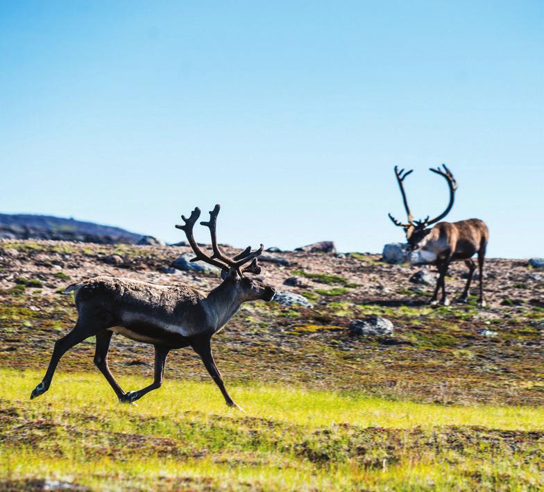
27 Ukkusiksalik National Park 5 Draft Management Plan 2.0 Significance of Ukkusiksalik National Park The park was first proposed as a protected area in 1978, as part of the 6 North of 60 consultation program 1. It was the fourth national park established in Nunavut in accordance with Part 2 of Article 8 of the Nunavut Agreement. The park is representative of the Central Tundra natural region 2. Lands were reserved for a national park in 1996 around Wager Bay, a veritable inland sea which extends more than 150 kilometers inland from Roes Welcome Sound on Hudson Bay to a set of reversing falls at the mouth of Ford Lake, the location of a former Hudson s Bay Company trading post (Map 2). At km 2, Ukkusiksalik is among the ten largest national parks in Canada. Ukkusiksalik, an Inuktitut term, means place where there is stone to carve pots and oil lamps. Soap stone is used by Inuit to construct oil lamps which ensured survival and were used for heat, light, and cooking in the harsh Arctic conditions. The first occupants of the Wager Bay area were nomadic groups affiliated with the Pre- Dorset culture (2000 BC 800 BC) who later evolved into the Dorset culture around 800 BC 3. The first acknowledged inhabitants of the park were members of nomadic groups affiliated with the Thule culture which is known to have arrived in north-western Hudson Bay around 1200 AD 4. The people living in the area until recently are known as Aivilingmiut 5. The park is dotted with at least four hundred and forty-nine known cultural resources which inform our understanding of the historic cultural heritage in this area (Table 1 includes significant cultural sites). Low tundra vegetation superimposed on the Canadian Shield dominates the landscape. Wildlife found in the park includes polar bears, grizzly bears, muskox, caribou, wolves, wolverine, Arctic fox, Arctic hare, Arctic ground squirrel, peregrine falcons, gyrfalcons, golden eagles, rough-legged hawks, snow geese, Canada geese, tundra swans, and snow buntings, among others. Wager Bay is also known for seals, beluga, and arctic char, and for impressive tides. The park is jointly managed by Inuit and Parks Canada in accordance with the Nunavut Agreement and the IIBA. According to Article 2.2.of the IIBA, Ukkusiksalik National Park was established to: Protect a representative natural area of Canadian significance in the Central Tundra natural region so as to leave it unimpaired for future generations; Provide for the maintenance of vital, healthy, wildlife populations capable of sustaining Inuit harvesting needs; Celebrate the special historical and cultural relationship between Kivalliq Inuit and the land in the Ukkusiksalik National Park area; Encourage public understanding, appreciation and enjoyment of the Ukkusiksalik National Park area; and Recognize and honour Inuit knowledge, culture and harvesting rights and incorporate them as part of the living legacy of the park. 1 Parks Canada, Report to the Minister: 6 North of 60 Parks Canada Consultation Program. Ottawa. 10 pp 2 Parks Canada, National Parks System Plan, 3 rd Edition. 106 pp. 3 McGhee, Robert Canadian Arctic Prehistory. Canadian Museum of Civilization, Ottawa. 4 Ibid. 5 Mary-Rousselière, Guy Iglulik in Arctic Ed. by David Damas, pp Handbook of North American Indians, Vol. 5, Smithsonian Institution, Washington.

28 Ukkusiksalik National Park 6 Draft Management Plan Map 2. Ukkusiksalik National Park 3.0 Planning Context The legal and administrative context of the park, broad trends that will affect the park in years to come, and perspectives of Inuit, adjacent community members, stakeholders, and other members of the public must be taken into account in management planning for the future of Ukkusiksalik National Park. Several issues and opportunities were identified in the State of the Park Assessment and pre-planning work including the challenge of current infrastructure deficiencies to support park operations and users, the opportunity for the park to play an important role in protection and promotion of Inuit culture, and the need to collect more scientific and Inuit traditional knowledge for use in park management decisions. 3.1 The Legal and Administrative Context of the Park Following the negotiation and signature of the Nunavut Agreement and the Inuit Impact and Benefit Agreement for Ukkusiksalik National Park of Canada in 2003, Ukkusiksalik National Park was established in 2014 by order in council under the Canada National Parks Act. The Nunavut Agreement defines Inuit rights and benefits and identifies cooperative management structure for national parks in the Nunavut. In particular, Articles in the agreement recognize the right of Inuit to harvest wildlife, quarry carving stone, establish outpost camps, and to enter national parks at no cost. The Nunavut Agreement (Articles ) and the IIBA (Article 6) define the cooperative management approach for the park. The UPMC is the cooperative management body for the park. According to Article 5.5, the role of the UPMC is to advise Parks Canada, the Minister responsible for Parks Canada, the Nunavut Wildlife
29 Ukkusiksalik National Park 7 Draft Management Plan Management Board, and other agencies on all matters relating to the management of the park. 3.2 Early Park Development Since 2003, many actions have been taken to establish a foundation for management. In 2007, an office and garage were constructed and staff housing units were also acquired in the community of Naujaat. Furthermore, considerable success has been made in hiring Inuit to manage the park. Several staff members have close, historic ties to the park, with one staff having been born there. A number of projects have occurred in the park including initiating cleaning up and stabilizing the former Hudson s Bay Company post on Ford Lake and completing the first year of a two year project to conduct research to gather baseline data for Wager Bay. The official opening of the park took place in early July of 2015 at the same time that the Hamlet of Naujaat formally adopted its traditional Inuktitut place name. Finally, in 2017, the first joint review of the IIBA for Ukkusiksalik was completed and the results of this review have been considered in the development of this plan. 3.3 The Relationship with the Park s Adjacent Communities and Tourism Opportunities Inuit maintain a strong relationship with the land and marine environments in which they live. Inuit who live in the communities of Baker Lake, Chesterfield Inlet, Coral Harbour, Naujaat, and Rankin Inlet continue to travel extensively for their way of life, including within the park. Inuit Qaujimatuqangit is vital to understanding the park s ecosystems and enhancing Inuit connections to the park. Rankin Inlet is the Kivalliq region s largest community and is a transportation and logistics hub. In addition to government services, the mining industry has a strong presence in Rankin Inlet and across the Kivalliq region, including areas surrounding the park. Together with the Thelon and Kazan Heritage Rivers, the park has the potential to be a major tourism attraction in the region. Since establishment, the park has seen very few visitors due to a number of factors including the remote nature of the area, the short season for tourism, and the lack of tourism operators and infrastructure in adjacent communities. A naturalist lodge operated, on the shores of Wager Bay for around fifteen years from the late 1980s to the early 2000s on lands leased from Indigenous and Northern Affairs Canada and attracted hundreds of visitors from around the world. The lodge has not operated for approximately 10 years. In order to demonstrate its long term commitment to the development of sustainable tourism, and in order to fulfill the requirements of Article 12.5 of the IIBA, Parks Canada commissioned a tourism strategy as the key to expanding visitation to the park and enhancing the benefits of the presence of the park to Inuit and Inuit businesses in the park s adjacent communities 6. Due to the park s remote location, the cost of accessing it, and the lack of infrastructure, few non-inuit visit the park. Current park visitation has been very low, with a total of seven visitors since the fiscal year. Cruise ship visitation to Nunavut has increased steadily since 2006 and research indicates it will continue to expand, however, Wager Bay and the park have not been identified as desirable destinations for the industry. Concerns have been raised about cruise ships by the UPMC because of the dangers associated with navigating in Wager Bay and the potential to disrupt both Inuit, during traditional harvesting activities, and wildlife, including polar bears and marine 6 Aarluk Consulting Inuit Tourism Strategies for the Five Communities Associated with the Ukkusiksalik National Park Inuit and Impact Benefit Agreement. 104 pp.
30 Ukkusiksalik National Park 8 Draft Management Plan mammals. Increasing high-end private sailboat, yacht, and luxury cruise ship visits indicate new niche market potential, however Wager Bay and the park will likely only remain a curiosity until more nautical information about the area is available to sailors. Visitor access to the park by aircraft has taken place, but it has significant potential to expand visitation, especially during the ice break-up period when overland access will not be possible. The park provides some protection for species and ecosystems, but many Arctic species such as caribou, polar bears, sea birds, and marine mammals range far beyond the boundaries of the park and are not isolated from global pressures. These pressures are changing the entire Arctic and are impacting the lives of Inuit who live there. The ecosystem monitoring program is in place to identify any changes in the integrity of the components of the park s ecosystems. 4.0 Vision The vision for Ukkusiksalik National Park was developed through a workshop involving members of the UPMC, the Park Planning Team, and Parks Canada staff. This vision reflects the desired state of Ukkusiksalik National Park in 15 to 20 years. Ukkusiksalik National Park is a landscape alive with the stories of generations of Inuit, abundant wildlife, and striking vistas. The park is a beautiful place that feeds our imagination, our souls, and our bodies. Fully immersing oneself into the park will ensure the creation of long lasting memories, connecting you to a land that will never be described as empty and that must always remain a place to escape to. Ukkusiksalik will be a place where the Inuit way of doing things: past, present, and future knowledge, experiences and values, that-is-to-say Inuit Qaujimajatuqangit is protected, promoted, and passed on. Families strengthen their connections to the land. Inuit elders share the skills they learned from their ancestors. Stories are brought to life and passed on as they have been passed on for generations. Ukkusiksalik will continue to be managed jointly by Inuit and the Government of Canada. Management will be based on Inuit Qaujimajatuqangit and science to promote ecological integrity including healthy wildlife populations that are able to follow their natural cycles. Plants that provide food and medicine will be plentiful. Ukkusiksalik will fulfill its destiny as a northern paradise and a true Arctic wilderness for all to experience the mystery now and in perpetuity.
31 Ukkusiksalik National Park 9 Draft Management Plan 5.0 Key Strategies The management of Ukkusiksalik National Park takes the form of three key strategies, each with a set of corresponding objectives and targets. Objectives are mutually supportive and address the needs of a new national park to be better known, valued, and enjoyed by Canadians and by visitors from around the world while building a relationship between Parks Canada and Inuit of Baker Lake, Chesterfield Inlet, Coral Harbour, Naujaat, and Rankin Inlet. Key Strategy 1: Infrastructure Ensuring that appropriate facilities are available for protecting, promoting, and presenting Ukkusiksalik National Park Ukkusiksalik is located in a beautiful, but unforgiving landscape. The abundance of polar bears and severe weather conditions dictate that those who visit or work in the park must have hard-sided shelters available to them. Furthermore, the remote nature of the park warrants a base of operations for park staff to fulfill their duties. By implementing this management strategy, facilities will be designed and constructed or secured to fulfil the needs of multiple user groups and ensure safety. Parks Canada will work with stakeholders and partners to design and construct or secure facilities which benefit Inuit, visitors, researchers and other agencies, and park staff while minimizing the impacts to the park s natural and cultural features. Green infrastructures will be considered. The strategy addresses the following priorities and IIBA commitments: Developing hard-sided shelters to ensure the safety of all park users (Article 10.1), and Developing and providing safety information for park visitors and users in several of the park s adjacent communities (Article 9.3.5). Objective 1.1: A base of operations and hard-sided shelters are available in the park Targets 1. A plan to determine the vision and requirements for a base of operations for the park, identifying infrastructure and asset needs, including the need for and availability of hard-sided shelters, is completed within two years. 2. The infrastructure development plan is ready to be implemented within four years, depending on location, size, complexity, and features of the structures. 3. Hard-sided shelters are available for park users and visitors within eight years dependent on size, complexity, integration with existing structures, and features of the structures. Priority locations may include, but are not limited to: near the site of the Hudson s Bay Company post, in Douglas Harbour, in the area of Sila Lodge and east of the reversing falls at Iglujuarnaq.
32 Ukkusiksalik National Park 10 Draft Management Plan Objective 1.2: Access routes and points, safe harbours, sensitive sites, and other features are identified and communicated to park users Targets 1. Access routes, landing sites, safe harbours, emergency shelters, equipment caches, sensitive sites, and other features of interest are identified within two years to support visitor experience development and delivery and for educational and promotional purposes. New, pertinent information will be incorporated into these products as required. 2. Displays are installed in Baker Lake, Naujaat, and Rankin Inlet to promote the park, inform park users and provide interpretation products in accordance with Article of IIBA. Key Strategy 2: Living Landscape Strengthening people s connections to Ukkusiksalik National Park This strategy focuses on recognizing historic and existing connections between Inuit and the park. The historic connections people have to the Wager Bay area is a critical part of the story of Ukkusiksalik National Park to be told. The strategy addresses the following priorities and IIBA commitments: Develop Ukkusiksalik National Park s visitor experience (Article 2.2.4, 2.8, 9, and 10) Respect Inuit harvesting and cultural activities while balancing visitor experience (Article 1.1.2, and Article 3) Promote Ukkusiksalik National Park as a major attraction in the region, across the territory, and nationally (Article 9) Objective 2.1: Inuit connections to Ukkusiksalik National Park are strengthened and shared Targets: 1. Deliver outreach programs in two communities annually. 2. Create opportunities for Inuit to use the park area and to share Inuit Qaujimajatuqangit. 3. Develop and deliver outreach programs or products encouraging land stewardship for the park s adjacent communities. 4. Create at least one student position within one year and staffed annually by students from one of the park s adjacent communities. 5. Strengthen the capacity of UPMC through mentoring and the delivery of training opportunities during each member s mandate. 6. Develop an annual patrol for park monitoring and asset condition assessment with a task schedule within one year, and the first patrol is implemented beginning in the spring following the approval of the plan.
33 Ukkusiksalik National Park 11 Draft Management Plan Objective 2.2: Opportunities for park visitors to experience the landscape and hear the stories of Ukkusiksalik National Park Targets: 1. Interpretive products or experiences are developed to tell the story of Ukkusiksalik National Park s important cultural sites including but not limited to the Hudson s Bay Company post, and Ak&ungitautitalik (rope game site) within five years. 2. Site specific standards and mitigation measures for visitors are developed and communicated to park users for the park s important cultural sites within two years. 3. Wildlife viewing guidelines are developed and communicated to park users within two years. 4. An online digital tool to promote and present the park through virtual visits is launched within the first four years. 5. Three in-park visitor experience opportunities developed, as information is gathered from all sources, including Inuit Qaujimajatuqangit, Inuit Knowledge Working Group and science, and implemented within the ten year scope of this management plan. Key Strategy 3: Gathering Knowledge Collecting scientific information and Inuit Qaujimajatuqangit (Inuit knowledge) to help protect, present, and promote Ukkusiksalik National Park s natural and cultural resources This strategy prioritizes the collection of scientific and Inuit Qaujimajatuqangit in order to understand, protect and promote the cultural and natural heritage values of Ukkusiksalik. This information will be used to establish benchmarks for the long term monitoring of natural and cultural resources in the park, and to better share the park s stories. The strategy addresses the following priorities and Inuit Impact and Benefit Agreement commitments: Protect the park s environment and provide for the maintenance of vital, healthy, wildlife populations capable of sustaining Inuit harvesting needs (Article 2.2) Protect historical and archaeological resources of the park (Article 7) Promote and conduct research in the park (Article 8) Clean up the site of and stabilize the Hudson s Bay Company Post for use in the interpretation of the park s stories (Article ) Objective 3.1: Scientific information and Inuit Qaujimajatuqangit are collected to determine the current health of Ukkusiksalik National Park s ecosystems and to detect changes in the future Targets: 1. Establish and implement a marine ecosystem monitoring program within three years. 2. Establish and implement a terrestrial (tundra) ecosystem monitoring program within three years. 3. Complete baseline data collection, within seven years, to aid in future follow-up program related to the potential effects on the ecosystems of industrial development in areas adjacent to the park. 4. Include at least one Inuit knowledge measure in the monitoring program.
34 Ukkusiksalik National Park 12 Draft Management Plan Objective 3.2: Scientific information and Inuit Qaujimajatuqangit are being used to inform and support long term management decisions Targets: 1. A framework for the Ukkusiksalik Inuit Knowledge Working Group guiding how Inuit Qaujimajatuqangit can provide input into management decisions will be developed within two years of approval of this plan. 2. Continue to collect, record, and share Inuit Qaujimajatuqangit and elders stories about Ukkusiksalik National Park. 3. An outreach program targeting researchers with the goal of encouraging future research is developed and implemented within three years. 4. Research priorities are reviewed with input from the UPMC within two years. 5. Information on caribou, polar bear, and raptor populations is updated before the next State of the Park Assessment in collaboration with other agencies and Inuit knowledge holders to identify ecologically and biologically sensitive areas in the park. 6. Information to implement the fishing prohibition in Article 10.8 of the IIBA is collected to correspond with the enactment of the updated National Parks of Canada Fishing Regulations. Objective 3.3: Progress has been made towards identifying and protecting the cultural resources that tell Ukkusiksalik National Park s story Targets: 1. The Hudson s Bay Company post stabilization and development of an interpretive program in accordance with Article of the IIBA is fully implemented within five years. 2. A monitoring program for any of the park s cultural resources deemed at threat is created and implemented within five years. 3. Progress is made to continue detailed inventories of important cultural sites based on information gathered from traditional knowledge holders. (E.g. five sites during the life of this plan). 4. Increase knowledge of traditional travel routes and Inuktitut place names for the park within 7 years.
35 Ukkusiksalik National Park 13 Draft Management Plan 6.0 Zoning and Areas of Special Importance to Inuit 6.1 Zoning Parks Canada s national park zoning system is an integrated approach to the classification of land and water areas in a national park and designates where particular activities can occur on land or water based on the ability of those areas to support those uses. The zoning system has five categories: Zone I Zone II Zone III Zone IV Zone V Special Preservation; Wilderness; Natural Environnent; Outdoor Recreation; and Park Services. Ukkusiksalik National park has three zoning classifications including zones I, II, and III (Map 3). The Nunavut Agreement requires that national parks in the Nunavut Settlement Area predominantly consist of Zone I and II areas. The zoning system does not apply to resource harvesting activities and subsistence use by Inuit when these activities are being carried in accordance with the Nunavut Agreement. The IIBA does not identify specific needs for areas within the park to be identified as Areas of Special Importance to Inuit, however two such areas were identified during consultations with Inuit (see 6.2 Areas of Special Importance to Inuit). Important cultural sites, which are deemed critical to telling the story of Ukkusiksalik National Park were assigned a Zone I designation. These sites are expected to be used to tell the story of the park and control visitation. Some activities, with conditions and mitigations, will be permitted in those sites. Polar bear denning areas, colony nesting areas for migratory birds, and caribou calving habitat have been designated as Zone II areas with seasonal closures. These important habitat areas will be managed with strict controls to support wildlife conservation. At the time this management plan was written, the results of the Marine Baseline Project had not yet been fully processed. It is expected that some of the information collected during this project could help further refine the zoning in Wager Bay. During the life of this plan, the zoning for Wager Bay may be changed to reflect any sensitive or important feature discovered during the analysis of the information collected during the Marine Baseline Project. In the interim, tools such as Superintendent s Orders, Area Closures, and impact assessment will be used to address issues identified in the results of the project.
36 Ukkusiksalik National Park 14 Draft Management Plan Map 3. Ukkusiksalik National Park Zoning Zone I Significant Cultural Resources ZONE I: SPECIAL PRESERVATION Zone I sites require special protection because they contain or support unique, sensitive, threatened or endangered natural or cultural heritage features, or are among the best examples of the features of the natural region represented by the park. Visitation to Zone I sites may be authorized under carefully controlled and monitored conditions. Motorized access is not permitted, except for strictly controlled motorized access for research and park operation activities authorized by Parks Canada. Several important cultural resources have been identified in the park that, if disturbed, would impede the ability of Parks Canada to tell the story of Ukkusiksalik. Of the approximately 449 known cultural sites in the park, 37 have been recognized as being important in this sense. As more research takes place in the park, it is expected that this selection could change. Respecting the integrity of these and all of the park s cultural resources is important. As such, Special Preservation zoning has been applied using buffers of varying sizes to a selection of these sites. Site specific guidelines are being developed to prevent disturbance for each resource. No camping activities are allowed within the buffers identified for Zone I sites of cultural significance.
37 Ukkusiksalik National Park 15 Draft Management Plan In addition to general archaeological and historical investigations, priority will be placed on the cultural resources which have been deemed to be rare, sensitive, and unique within the parks (Table 1). Table 1 Rare, sensitive, and unique cultural resources of Ukkusiksalik National Park Site Name and/or Location Site IDs Description Ak&ungitautitalik * 70X249 Site of the Rope Game 1.0 Wager Bay Inlet Hudson s Bay Company Post and associated sites** Nuvukliit Island Archipelago Former Hudson s Bay Depot site/iglujuarnaq Lower Piksimanik River Reversing Falls habitation sites Tinittuktuq Point 70X331 70X332 70X461 70X330 70X521 70X518 70X462 70X222 70X237 70X223 70X403 70X404 70X360 70X259 70X467 70X471 70X78 70X1 70X2 70X3 70X4 70X505 70X516 70X506 Former HBC Post Campsite Wager Inlet site Campsite Wolf trap remains Burial site Campsite Catholic Mission Main Savage Island Nuvukliik Island Tundra Vehicle A Iglujuarnaq Falcon Pinnacle Sakamoqtoq Campsite Reversing Falls Campsite Point A Point B Point C Point D Campsite Campsite Burial site Buffer Size (km) 1+ (irregular) 1+ (irregular) (irregular) Sila River Bluffs 70X305 Sila River Bluffs A 0.5 Douglas Harbour, north 70X shore 70X513 70X266 Douglas Harbour Site, across from Tikilak Point Campsite Campsite Tijiarjuaq Peninsula 70X52 Tijiarjuaq Peninsula 1.0 Mattok n/a The remains of the George 2.5 Cleveland Whaling Station Qaurnak Winter House 70X318 Qaurnak Winter House site 0.5 Brown Lake 70X338 Brown Lake 1.0 Cape Dobbs 70X151 Cape Dobbs 1.5 Kuugarjuk Creek Handkerchief Inlet/Kangirsuarjuk 70X280 70X281 n/a Creek A Creek B Shipwreck of the Jeanie and the remains of RCMP Patrol House #3 * Visitation to Ak&ungitautitalik will not be permitted until site specific guidelines are created. ** Visitation to Hudson s Bay Post has been identified as a potential site for visitor experience within the IIBA and will be open for visitors under specific guidelines. Visitors to this area must be accompanied by an approved guide and/or Parks Canada staff member
38 Ukkusiksalik National Park 16 Draft Management Plan Zone II Park Wilderness Areas ZONE II WILDERNESS Zone II contains extensive areas that are good representations of a natural region and are conserved in a wilderness state. The perpetuation of ecosystems with minimal human interference is the key consideration. Zone II areas offer opportunities for visitors to experience firsthand the park s ecosystems and require few, if any, rudimentary services and facilities. In much of Zone II, visitors have the opportunity to experience remoteness and solitude. Motorized access is not permitted except strictly controlled motorized access for research, park operations and outreach and education activities relating to the park that are authorized by Parks Canada and are consistent with Parks Canada regulations and policy. Ukkusiksalik National Park is a vast wilderness known for its abundant animal and plant life that have sustained Inuit for generations. The zoning as wilderness area and associated closures, reflect the requirement for conservation of the natural features of the park while also addressing the temporary nature of the need for protection wildlife and associated habitat (Map 4). As is required by the Nunavut Agreement the majority of the park falls within this designation. The only areas not included into the Wilderness Zoning are those listed above as important cultural sites and those areas listed below as park access routes and landing zones (Map 5). Important natural features in Ukkusiksalik National Park for which a greater degree of protection (for which time bound closures have been prescribed) is warranted include the following: 1. Caribou calving areas (seasonal closure mid-may to July 1). The season may shift over the life of this management plan, based on updated information. Entry into caribou calving areas during the identified calving season is prohibited, including Zone 3 access routes that transit these areas. 2. Polar bear denning areas (seasonal March 1 to July 1). The season may shift over the life of this management plan, based on updated information. Entry into denning areas is prohibited, including Zone 3 access routes that transit these areas. 3. Guillemot, eider duck, and other nesting colonies (seasonal closure while birds are present on the nests). Park visitors may only observe colonies from a distance and must respect setbacks listed in the Migratory Birds Convention Act.
39 Ukkusiksalik National Park 17 Draft Management Plan Map 4. Zone II Wilderness and Seasonal Closures Zone III Park Access ZONE III NATURAL ENVIRONMENT In Zone III areas, visitors can discover the park s natural and cultural heritage through recreational activities that require a few rustic services and facilities. Motorized access will be permitted to specific, controlled areas only. In order to facilitate visitation to the park, several areas of the park have been designated as Zone III Natural Environment. This designation allows the use of motorized means of transportation. Given the remote nature of the park, these areas are important in order to allow outfitters and visitors to enter the park and access key jumping off points for visits. At this time four over snow routes, Wager Bay and two aircraft landing zones have been identified in the park (Map 5). Furthermore the IIBA includes a clause that permits access through the park for potential mining and thus zoning would have to be revisited to potentially support this potential project.

40 Ukkusiksalik National Park 18 Draft Management Plan Map 5. Park Access Routes and Landing Zones Over-snow Routes: Sila River route North Piksimanik route South Piksimanik route Ford Lake route Motorized access over land is only possible during the winter months as there are no roads in the area. Three routes were identified originating from Naujaat and one originating from communities south of the park. As it is the case in other parks in Nunavut, only trips led by outfitters and Park Canada employees will be allowed to use over snow vehicles to access the park. New routes may be permitted in the future. Travel through caribou calving and bear denning areas during the identified season will be prohibited. Wager Bay and Ford Lake: Wager Bay-Ford Lake access Currents at the mouth of Wager Bay have been recorded at up to eight knots. The tides in the bay are said to be comparable in magnitude to Frobisher Bay in Nunavut and are impressively high. Entry into the park from Roes Welcome Sound into Wager Bay is possible although a high degree of knowledge of the tides and currents is needed to navigate into the park safely. Access by smaller watercraft into Ford Lake is allowed via a specific channel that has been designated as a Zone III. Navigating this channel through the reversing tidal rapids at the entrance to Ford Lake is dangerous and is not recommended to unguided visitors (Map A).

41 Ukkusiksalik National Park 19 Draft Management Plan Map A. Ford Lake Access Channel Aircraft Access: Sila Lodge aerodrome 7 Ford Lake aerodrome Aircraft access to designated landing sites within the park will be permitted. In cooperation with the Inuit, and local organizations, Parks Canada will work with the UPMC to identify any new landing sites. Selected sites will minimize potential impacts on natural and cultural resources, Inuit exercising harvesting rights, and other parks users, while optimizing visitor experience. The intent is not to develop or maintain landing strips in the park, but to identify helicopter landing sites or places where fixed-wing aircraft have safely landed in the past. Landing sites outside the park on Inuit Owned Lands and Crown lands should also be considered, in discussion with the appropriate authorities. Two areas in the park were identified as accessible to fixed-wing aircraft. These areas are: the existing landing strip at Sila Lodge, and summer floatplane access at Ford Lake. Onice landings may be possible at these locations. All aircraft landings in the park must be authorized by Parks Canada in accordance with the regulations. () Zone III Sila Lodge Buffer When the park was established two leases managed by Indigenous and Northern Affairs Canada were excluded from the lands transferred to the park. These leases are occupied by a former naturalist lodge. Natural environment zoning has been placed around these leases, giving the operators of the lodge the opportunity to resume operating as they have historically (See Map B). 7 The Sila Lodge aerodrome is not part of Ukkusiksalik National Park, although Parks Canada frequently uses the airstrip for park operations.

42 Ukkusiksalik National Park 20 Draft Management Plan Map B. Sila Lodge Zone III Buffer Zone III Douglas Harbour When the park was established, the Government of Nunavut Department of the Environment had a research cabin located in Douglas Harbour in Wager Bay. The continued existence of a facility at this location is important for monitoring of wildlife populations by the Department of the Environment. Furthermore, the location is used by Inuit taking part in traditional harvesting activities or travelling in the park. Natural environment zoning has been placed around the existing site. Additional space in the zone has been added to allow for limited expansion of the infrastructure at the site to support future park operational activities, if required (Map C).

43 Ukkusiksalik National Park 21 Draft Management Plan Map C. Douglas Harbour Zone III 6.2 Areas of Special Importance to Inuit The intent of designating a portion of a national park as an Area of Special Importance to Inuit is to maintain its character for Inuit who may still use those areas as they have done historically prior to the establishment of the park and in recognition of Schedule 6-1 of the Inuit Impact and Benefit Agreement for Ukkusiksalik National Park of Canada which states that Inuit are an integral part of the ecosystem. Indeed, the absence of Inuit in the ecosystems of Ukkusiksalik National Park would represent a failure of the Agency in maintaining ecological integrity. Restrictions on visitation to Areas of Special Importance to Inuit can be put in place, however no such recommendations were made at this time in the case of the two areas identified for the park. (See Map 6) In Ukkusiksalik National Park, the following have been declared as Areas of Special Importance to Inuit: 1. Lower reaches of the Piksimanik River This area was an important seasonal habitation area and was traditionally inhabited by Inuit until they were forcefully relocated into modern communities only a few decades ago, however the areas were important at different times during the year for generations prior. Numerous cultural sites, including sod houses, tent rings, caches, soap stone quarries, and fish weirs are located in this area. 2. The Savage Islands This grouping of islands located inside Wager Bay was an important habitation area and is also the location of the Nuvudliik Island Catholic mission. Inuit inhabited these islands during the winter months due to their proximity to a polynya and its associated floe edge.

44 Ukkusiksalik National Park 22 Draft Management Plan Map 6. Areas of Special Importance to Inuit 6.3 Visitor Safety Restrictions or Closures A Superintendent s Order is currently in place compelling all visitors to register and deregister from the park. This measure is in place due to the inherently hazardous nature of park use in Nunavut and to ensure park staff are able to respond to an emergency should one occur. 6.4 Recreational Fishing by Visitors Currently, Parks Canada does not have a conservation concern with fish populations in the park. According to Inuit, there are places in the park where arctic char are abundant and have been harvested for many generations. Angling by non-inuit for recreational purposes will be authorized under a Parks Canada fishing permit, once the National Parks of Canada Fishing Regulations (C.R.C., c. 1120) have been updated to include Ukkusiksalik National Park. Restrictions may be set on the number and species of fish that may be caught per person per day. In the park, limits placed on personal catch may mirror the territorial regulations for the areas surrounding the park. Moreover, for potential recreational fishing, it is the desire of the Joint Park Management Committee that any fish caught be kept (for consumption) and not livereleased. Further recreational fishing management proposals include: catch and possession limits of four fish per day per person and sport fishing prohibitions in areas (Map 7) with commercial fishing quotas.

45 Map 7. Commercial Fishing Quotas Ukkusiksalik National Park 23 Draft Management Plan
46 Ukkusiksalik National Park 24 Draft Management Plan 7.0 Summary of Strategic Environmental Assessment Parks Canada is responsible for assessing and mitigating the impacts of management actions on ecosystems and on cultural resources. In accordance with The Cabinet Directive on the Environmental Assessment of Policy, Plan and Program Proposals (2010), a strategic environmental assessment (SEA) was conducted for the Ukkusiksalik National Park Management Plan (2017). The purpose of SEA is to incorporate environmental considerations into the development of public policies, plans, and program proposals to support environmentally-sound decision making. The following is a summary of the environmental assessment. The intent of the park management plan is to continue providing an enhanced level of protection to the exceptional ecological diversity and integrity of an area representative of the Central Tundra Natural Region and to sustain and give recognition to the history of human relationships with the landscape. Environmental and cultural components of note at the park include Wager Bay with its two polynyas that provide an important resource for a variety of marine wildlife and approximately four hundred fifty known cultural sites. Implementation of the plan will result primarily in positive results. The understanding and management of natural and cultural resources will benefit from research and monitoring that is collaborative with local and regional partners and integrated with traditional knowledge. The ecological integrity monitoring program will also be further developed. Elements of the environment important to visitor experience will benefit from the development of interpretive products and visitation/wildlife viewing guidelines. The development of appropriate facilities for protection, presentation, and promotion of the park will be managed and mitigated through the environmental impact assessment process under the Nunavut Planning and Project Assessment Act. Other strategies are proposed in the plan with positive impacts such as the increased research and monitoring of natural and cultural resources and enhancement of visitor experience through the development of interpretive products and visitation/wildlife viewing guidelines. Additionally, existing policies such as park zoning protect the majority of the park as zone I (special preservation), zone II (wilderness) and Areas of Special Importance to Inuit. Public and Indigenous engagement was conducted on the plan. The Ukkusiksalik Park Management Committee, the Nunavut Wildlife Management Board, and Inuit from the park s five adjacent communities were involved in the preparation of the management plan. There are no important negative environmental effects anticipated from implementation of the Ukkusiksalik National Park Management Plan.
47 Ukkusiksalik National Park 25 Draft Management Plan 8.0 Acknowledgements The preparation of this Management Plan involved many people. The input of this diverse group of individuals will result in a plan that will guide the management of the park for many years. The following individuals have made a special contribution and deserve mention: Ukkusiksalik Park Planning Team Donna Parry, Nunavut Tourism Elizabeth Aglukka, Ukkusiksalik Joint Park Management Committee John Tatty, Ukkusiksalik Joint Park Management Committee Monty Yank, Park Manager, Parks Canada Ukkusiksalik Joint Park Management Committee Donat Milortok, Naujaat Elizabeth Aglukka, Naujaat Jackie Nakoolak, Chair, Coral Harbour Joan Scottie, Baker Lake John Tatty, Rankin Inlet Larry Tautu, Chesterfield Inlet Naujaat Inuit Knowledge Working Group Elizabeth Kidlapik, Hunters and Trappers Organization Honore Aglukka, Elder Jimmy Immingark, Hunters and Trappers Organization Mary Tuktudjuk, Elder/Chair Solomon Malliki, Youth Representation


48 Draft Park Management Plan Consultation Summary Methods of Consultation Consultation was undertaken mainly through face-to-face meetings. These meetings occurred in all of the park s adjacent communities. Where face-to-face meetings were not possible, written materials in English and Inuktitut were sent to key stakeholders for comment. In addition to face-to-face meetings, radio broadcasts on community radio were made in Naujaat, Coral Harbour, and Chesterfield Inlet. Written materials were sent to stakeholders for comment if a face-to-face meeting could not be arranged Targeted consultations also took place in communities where key stakeholder groups were not available to meet. In those instances as many members of the key stakeholder groups as possible were met with by the planner and park manager Organizations Consulted and Estimated Number of Individuals Consulted Estimate of Number of Group & Community Type of Consultation Individuals Naujaat Ukkusiksalik Joint Park Management Committee Ukkusiksalik Inuit Knowledge Working Group Face-to-face, planning workshop, conference calls Face-to-face, planning workshop 4 7 Hunters and Trappers Organization Face-to-face 11 Naujaat Hamlet Council Face-to-face 9 Royal Canadian Army Cadet Corps #3055 Face-to-face 20 Naujaat Community Radio* Call-in show? Park office open house* Open house 3 Individuals and business owners Face-to-face 2 Wildlife Officer Face-to-face 1 Total 57
PROUDLY BRINGING YOU CANADA AT ITS BEST. Management Planning Program NEWSLETTER #1 OCTOBER, 2000
 PROUDLY BRINGING YOU CANADA AT ITS BEST VUNTUT NATIONAL PARK Management Planning Program NEWSLETTER #1 OCTOBER, 2000 INTRODUCTION This newsletter launches the development of the first management plan for
Sand Lakes Provincial Park. Draft Management Plan
 Sand Lakes Provincial Park Draft Management Plan 2 Sand Lakes Provincial Park Table of Contents 1. Introduction... 3 2. Background... 3 3. Park Purpose... 5 4. Park Management Guidelines... 6 Appendix...
Management Plan 2017
 2017 2017 Wapusk National Park of Canada ii Her Majesty the Queen in Right of Canada, represented by the Chief Executive Officer of Parks Canada, 2017. Cette publication est aussi disponible en français.
National Park Service Wilderness Action Plan
 National Park Service U.S. Department of the Interior National Park Service Wilderness Action Plan National Wilderness Steering Committee National Park Service "The mountains can be reached in all seasons.
RE: Access Fund Comments on Yosemite National Park Wilderness Stewardship Plan, Preliminary Ideas and Concepts
 September 30, 2016 Superintendent Yosemite National Park Attn: Wilderness Stewardship Plan P.O. Box 577 Yosemite, CA 95389 RE: Access Fund Comments on Yosemite National Park Wilderness Stewardship Plan,
Thaidene Nëné Proposed National Park Reserve. Public Consultation in Yellowknife, NWT June 2016 Protected Areas Establishment Branch Parks Canada 1
 Thaidene Nëné Proposed National Park Reserve Public Consultation in Yellowknife, NWT June 2016 Protected Areas Establishment Branch Parks Canada 1 Consultations for Thaidene Nëné Purpose Parks Canada is
As outlined in the Tatshenshini-Alsek Park Management Agreement, park management will:
 Management Strategy General Strategy The priority management focus for the park is to ensure that its internationally significant natural, cultural heritage and recreational values are protected and that
Hudson Bay Lowlands Proposed Protected Areas
 Hudson Bay Lowlands Proposed Protected Areas Hudson Bay Lowlands Proposed Protected Areas The Protected Areas Initiative has identified portions of the Hudson Bay Lowlands region that have significant
Proposal to Redevelop Lower Kananaskis River-Barrier Lake. Bow Valley Provincial Park. Frequently Asked Questions
 Proposal to Redevelop Lower Kananaskis River-Barrier Lake Bow Valley Provincial Park Frequently Asked Questions What is being proposed? What are the details of the proposal? Where is the project area located?
Land Management Summary
 photo credit: ANGAIR Anglesea Heath Land Management Summary The Anglesea Heath (6,501 ha) was incorporated into the Great Otway National Park in January 2018. This provides an opportunity to consider the
Tourism and Wetlands
 CONVENTION ON WETLANDS (Ramsar, Iran, 1971) 43 rd Meeting of the Standing Committee Gland, Switzerland, 31 October 4 November 2011 DOC. SC43-27 Tourism and Wetlands Action requested. The Standing Committee
Numaykoos Lake Provincial Park. Management Plan
 Numaykoos Lake Provincial Park Management Plan 2 Numaykoos Lake Provincial Park Table of Contents 1. Introduction... 3 2. Background... 3 3. Park Purpose... 5 4. Park Management Guidelines... 6 Appendix...
Chapter 9: National Parks and Protected Areas
 Part 9.1 Torngat Mountains National Park Reserve 9.1.1 The area set out in the Map Atlas (shown for illustrative purposes only in schedule 9-A) and described in appendix D-2 shall become a National Park
MAIN LAKE PROVINCIAL PARK
 MAIN LAKE PROVINCIAL PARK PURPOSE STATEMENT AND ZONING PLAN March 2003 MAIN LAKE PROVINCIAL PARK Purpose Statement and Zoning Plan Primary Role The primary role of Main Lake Park is to protect a biologically
LATIN AMERICA / CARIBBEAN COIBA NATIONAL PARK PANAMA
 LATIN AMERICA / CARIBBEAN COIBA NATIONAL PARK PANAMA WORLD HERITAGE NOMINATION IUCN TECHNICAL EVALUATION COIBA NATIONAL PARK (PANAMA) ID Nº 1138 Bis Background note: Coiba National Park was nominated for
Proposed National Marine Conservation Area Reserve Southern Strait of Georgia PROJECT UPDATE Spring 2012
 Proposed National Marine Conservation Area Reserve Southern Strait of Georgia PROJECT UPDATE Spring 2012 National marine conservation areas (NMCAs) are established to protect, conserve and present examples
A GUIDE TO MANITOBA PROTECTED AREAS & LANDS PROTECTION
 A GUIDE TO MANITOBA PROTECTED AREAS & LANDS PROTECTION Manitoba Wildands December 2008 Discussions about the establishment of protected lands need to be clear about the definition of protection. We will
TURTLE SURVIVAL ALLIANCE EXECUTIVE DIRECTOR
 Transforming passion for turtles into effective conservation action through a global network of living collections and recovery programs. TURTLE SURVIVAL ALLIANCE BACKGROUND TURTLE SURVIVAL ALLIANCE EXECUTIVE
Bill S-5: An Act to amend the Canada National Parks Act (Nááts ihch oh National Park Reserve of Canada)
") Bill S-5: An Act to amend the Canada National Parks Act (Nááts ihch oh National Park Reserve of Canada) Publication No. 41-2-S5-E 16 May 2014 Revised 22 October 2014 Penny Becklumb Tim Williams Economics,
Bill S-5: An Act to amend the Canada National Parks Act (Nááts ihch oh National Park Reserve of Canada) Publication No. 41-2-S5-E 16 May 2014 Revised 22 October 2014 Penny Becklumb Tim Williams Economics,
Ecological Integrity and the Law
 FACULTY OF LAW Ecological Integrity and the Law Shaun Fluker Associate Professor of Law October 6, 2016 Ecological integrity issues are understood more as a matter of politics than ethics or law The judiciary
A Proposed Framework for the Development of Joint Cooperation On Nature Conservation and Sustainable Tourism At World Heritage Natural sites.
 Introduction: A Proposed Framework for the Development of Joint Cooperation On Nature Conservation and Sustainable Tourism At World Heritage Natural sites Between The tourism industry and the UNESCO, World
Little Limestone Lake Provincial Park. Draft Management Plan
 Little Limestone Lake Provincial Park Draft Management Plan Little Limestone Lake Provincial Park Draft Management Plan Table of Contents 1. Introduction... 3 2. Background... 3 3. Planning context...
Continental Divide National Scenic Trail Legislative History and Planning Guidance
 Continental Divide National Scenic Trail Legislative History and Planning Guidance Legislation, Policy, and Direction Regarding National Scenic Trails The National Trails System Act, P.L. 90-543, was passed
Bon Portage Island Conservation Campaign
 Bon Portage Island Conservation Campaign Protecting a Coastal Treasure Final Report to Nova Scotia Habitat Conservation Fund September 2012 Protection of Bon Portage Island Over the course of this two-year
What is Pimachiowin Aki? What is The Land that Gives Life?
 What is Pimachiowin Aki? What is The Land that Gives Life? Pimachiowin Aki is Canada s newest and first mixed (cultural and natural) World Heritage Site. In Anishaabemowin, the Ojibwe language, Pimachiowin
Sawtooth National Forest Fairfield Ranger District
 United States Department of Agriculture Forest Service Sawtooth National Forest Fairfield Ranger District P.O. Box 189 Fairfield, ID. 83327 208-764-3202 Fax: 208-764-3211 File Code: 1950/7700 Date: December
Land Claims as a Mechanism for Wilderness Protection in the Canadian Arctic
 Land Claims as a Mechanism for Wilderness Protection in the Canadian Arctic Vicki Sahanatien Abstract Northern land claims agreements support establishing national parks and wilderness protection but are
Order of the Minister of Environment #39, August 22, 2011 Tbilisi
 Registration Code 360050000.22.023.016080 Order of the Minister of Environment #39, August 22, 2011 Tbilisi On preparatory stages and procedure of the methodology for Elaborating structure, content and
Decision Memo Broken Wheel Ranch Equestrian Outfitter Special-Use Permit Proposed Action
 Decision Memo Broken Wheel Ranch Equestrian Outfitter Special-Use Permit USDA Forest Service Mississippi Bluffs Ranger District, Shawnee National Forest Jackson and Union Counties, Illinois Proposed Action
MANAGEMENT DIRECTION STATEMENT June, 1999
 Thompson River District MANAGEMENT DIRECTION STATEMENT June, 1999 for Roche Lake Provincial Park Ministry of Environment Lands and Parks BC Parks Division Table of Contents I. Introduction A. Setting
Public Submissions in response to the Bill closed on 2 July 2015 and Council lodged a copy of the submission provided as Attachment 1.
 54 PLANNING AND ECONOMIC COMMITTEE 8 JULY 2015 3 SUSTAINABLE PORTS DEVELOPMENT BILL Neil Quinn 1/58/14 #4771706 RECOMMENDATION: That Council endorses the Submission made to the Infrastructure, Planning
Community-based tourism at Gunung Halimun National Park
 Asia-Pacific Environmental Innovation Strategies (APEIS) Research on Innovative and Strategic Policy Options (RISPO) Good Practices Inventory Community-based tourism at Gunung Halimun National Park Summary
Strengthening the Ontario Trails Strategy. Report on Consultations and the Environmental Bill of Rights Registry
 Strengthening the Ontario Trails Strategy Report on Consultations and the Environmental Bill of Rights Registry Purpose To report on the feedback and information received through the regional consultations,
A Master Plan is one of the most important documents that can be prepared by an Airport.
 The Master Plan A Master Plan is one of the most important documents that can be prepared by an Airport. A Master Plan is a visionary and a strategic document detailing planning initiatives for the Airport
Proposal to Redevelop Lower Kananaskis River-Barrier Lake. Bow Valley Provincial Park
 Frequently Asked Questions Proposal to Redevelop Lower Kananaskis River-Barrier Lake Bow Valley Provincial Park Frequently Asked Questions What has been decided? What are the details of the plan? What
Implementation Strategy for the Lethbridge Destination Management Organization (LDMO)
") Implementation Strategy for the Lethbridge Destination Management Organization (LDMO) IMPLEMENTATION AND TRANSITION STRATEGY LDMO MANDATE: To establish a destination management organization that provides
Implementation Strategy for the Lethbridge Destination Management Organization (LDMO) IMPLEMENTATION AND TRANSITION STRATEGY LDMO MANDATE: To establish a destination management organization that provides
MARBLE RIVER PROVINCIAL PARK
 MARBLE RIVER PROVINCIAL PARK PURPOSE STATEMENT AND ZONING PLAN March 2003 MARBLE RIVER PROVINCIAL PARK Purpose Statement and Zoning Plan Primary Role The primary role of Marble River Park is to protect
Wallace Lake Provincial Park. Management Plan
 Wallace Lake Provincial Park Management Plan 2 Wallace Lake Provincial Park Table of Contents 1. Introduction... 3 2. Park History... 3 3. Park Attributes... 4 3.1 Natural... 4 3.2 Recreational... 4 4.
ANAGEMENT P LAN. February, for Elk Lakes and Height of the Rockies Provincial Parks. Ministry of Environment, Lands and Parks BC Parks Division
 M ANAGEMENT P LAN February, 1999 for Elk Lakes and Height of the Rockies Provincial Parks Ministry of Environment, Lands and Parks BC Parks Division Elk Lakes & Height of the Rockies Provincial Parks M
Pembina Valley Provincial Park. Draft Management Plan
 Pembina Valley Provincial Park Draft Management Plan 2 Pembina Valley Provincial Park Table of Contents 1. Introduction... 3 2. Park History... 3 3. Park Attributes... 3 3.1 Natural... 3 3.2 Recreational...
Michipicoten Island Regional Plan
 Michipicoten Island Regional Plan This is one of twenty Regional Plans that support implementation of the Lake Superior Biodiversity Conservation Strategy (Strategy). The Strategy, prepared and overseen
The Vision for the San Juan Islands Scenic Byway
 The Vision for the San Juan Islands Scenic Byway 2 Judd Cove, Orcas Island, Courtesy of Kurt Thorson (kurtthorson.com) and San Juan County Land Bank Vision for the San Juan Islands Scenic Byway The San
Wilderness Research. in Alaska s National Parks. Scientists: Heading to the Alaska Wilderness? Introduction
 Wilderness Research in Alaska s National Parks National Park Service U.S. Department of Interior Scientists: Heading to the Alaska Wilderness? Archeologist conducts fieldwork in Gates of the Arctic National
National Wilderness Steering Committee
 National Wilderness Steering Committee Guidance White Paper Number 1 Issue: Cultural Resources and Wilderness Date: November 30, 2002 Introduction to the Issue Two of the purposes of the National Wilderness
4) Data sources and reporting ) References at the international level... 5
 Data sources and reporting ) References at the international level... 5") D- 1: Protected areas (PA) 1) General description... 2 1.1) Brief definition... 2 1.2) Units of measurement... 2 1.3) Context...2 2) Relevance for environmental policy... 2 2.1) Purpose... 2 2.2) Issue...
D- 1: Protected areas (PA) 1) General description... 2 1.1) Brief definition... 2 1.2) Units of measurement... 2 1.3) Context...2 2) Relevance for environmental policy... 2 2.1) Purpose... 2 2.2) Issue...
Proposed Action. Payette National Forest Over-Snow Grooming in Valley, Adams and Idaho Counties. United States Department of Agriculture
 United States Department of Agriculture Forest Service January 2012 Proposed Action Payette National Forest Over-Snow Grooming in Valley, Adams and Idaho Counties Payette National Forest Valley, Adams
Ministry of Parks, Culture and Sport. Plan for saskatchewan.ca
 Ministry of Parks, Culture and Sport Plan for 2018-19 saskatchewan.ca Table of Contents Statement from the Minister... 1 Response to Government Direction... 2 Operational Plan... 3 Highlights... 7 Financial
Protected Areas & Ecotourism
 Protected Areas & Ecotourism IUCN Best Practice Guidelines, tools & protected area/ecotourism highlights from around the world Kathy Zischka, Director Annual General Meeting Australian 2 November Committee
Criddle/Vane Homestead Provincial Park. Management Plan
 Criddle/Vane Homestead Provincial Park Management Plan 2 Criddle/Vane Homestead Provincial Park Table of Contents 1. Introduction... 3 2. Park History.... 3 3. Park Attributes.... 4 3.1 Natural.... 4 3.2
Establishing a National Urban Park in the Rouge Valley
 STAFF REPORT ACTION REQUIRED Establishing a National Urban Park in the Rouge Valley Date: March 29, 2012 To: From: Wards: Reference Number: Executive Committee Deputy City Manager, Cluster B All p:\2012\cluster
Clam Harbour Provincial Park
 Clam Harbour Provincial Park Public Engagement Session Thursday, September 14 th, 2017 5:30pm 7:30pm Webbers Store 11470 Nova Scotia Trunk 7 Lake Charlotte, NS Agenda Overview of the Provincial Parks System
Marchand Provincial Park. Management Plan
 Marchand Provincial Park Management Plan 2 Marchand Provincial Park Table of Contents 1. Introduction... 3 2. Park History... 3 3. Park Attributes... 4 3.1 Natural... 4 3.2 Recreational... 4 3.3 Additional
SANTA-BOCA PROVINCIAL PARK
 SANTA-BOCA PROVINCIAL PARK PURPOSE STATEMENT AND ZONING PLAN March 2003 SANTA-BOCA PROVINCIAL PARK Purpose Statement and Zoning Plan Primary Role The primary role of Santa-Boca Park is to provide marine-based
BACKCOUNTRY TRAIL FLOOD REHABILITATION PROGRAM
 BACKCOUNTRY TRAIL FLOOD REHABILITATION PROGRAM Backcountry Trail Flood Rehabilitation A June 2013 Flood Recovery Program Summary In June 2013, parts of Southern Alberta were devastated from significant
Watchorn Provincial Park. Management Plan
 Watchorn Provincial Park Management Plan 2 Watchorn Provincial Park Table of Contents 1. Introduction... 3 2. Park History... 3 3. Park Attributes... 3 3.1 Natural... 4 3.2 Recreational... 4 3.3 Additional
NATIONAL AIRSPACE POLICY OF NEW ZEALAND
 NATIONAL AIRSPACE POLICY OF NEW ZEALAND APRIL 2012 FOREWORD TO NATIONAL AIRSPACE POLICY STATEMENT When the government issued Connecting New Zealand, its policy direction for transport in August 2011, one
Whitefish Range Partnership Tentatively Approved by WRP 11/18/2013!Rec. Wilderness Page 1
 Whitefish Range Partnership Tentatively Approved by WRP 11/18/2013!Rec. Wilderness Page 1 Recommended Wilderness Background The Whitefish Range has a long management and legislative history associated
School Group Permits for Kananaskis Country Parks and Protected Areas-Memo
 Parks and Protected Areas School Group Permits for Parks and Protected Areas-Memo From: Date: January 4, 2005 Alberta Parks and Protected Areas Telephone: (403) 678-5508 To: All Alberta School Boards and
communication tower means a tower or structure built to support equipment used to transmit communication signals;
 Ontario Ministry of Natural Resources Subject Communication Tower Sites on Crown Land Compiled by - Branch Lands & Waters Section Land Management Policy PL 4.10.02 Replaces Directive Title Communication
INFORMATION NOTICE 15-2 Limited & Excluded Lands
 INFORMATION NOTICE 15-2 Limited & Excluded Lands Schedule 1 (Land Description) of onshore petroleum Agreements issued by the Department of Energy details the total hectares calculated. Total hectares are
HOW TO OPERATE A PRODUCT DEVELOPMENT FAMILIARIZATION TOUR MANUAL FINAL REPORT FOR DEPARTMENT OF TOURISM & CULTURE
 HOW TO OPERATE A PRODUCT DEVELOPMENT FAMILIARIZATION TOUR MANUAL FINAL REPORT FOR DEPARTMENT OF TOURISM & CULTURE August 2008 1.0 PROJECTAPPLICANT Kluane Inc. Geordan Clark, General Manager Box 20, Burwash
JOINT STATEMENT BY THE BARENTS REGIONAL COUNCIL AT THE BEAC 13TH SESSION 11 October 2011, Kiruna
 JOINT STATEMENT BY THE BARENTS REGIONAL COUNCIL AT THE BEAC 13TH SESSION 11 October 2011, Kiruna 1. The Members of the Barents Regional Council (BRC) met in Kiruna on October 11, 2011, for the 4th meeting
Memorandum of Understanding with ACT Government
 MEDIA RELEASE 8 April 2015 Memorandum of Understanding with ACT Government The ACT Government and Canberra Airport today entered into a new Memorandum of Understanding (MoU) on key areas of common interest
That Council endorses the attached submission on the Reef 2050 Long-term Sustainability Plan.
 4 ORDINARY MEETING 22 OCTOBER 2014 1 REEF 2050 LONG-TERM SUSTAINABILITY PLAN D Walton 8/24/18-01 #4506842v2 RECOMMENDATION: That Council endorses the attached submission on the Reef 2050 Long-term Sustainability
JOSLIN FIELD, MAGIC VALLEY REGIONAL AIRPORT DECEMBER 2012
 1. Introduction The Federal Aviation Administration (FAA) recommends that airport master plans be updated every 5 years or as necessary to keep them current. The Master Plan for Joslin Field, Magic Valley
Yard Creek Provincial Park. Management Plan
 Yard Creek Provincial Park Management Plan Draft January 2010 Yard Creek Provincial Park Management Plan Approved by: telàlsemkin/siyam/chief Scott Benton Bill Williams Squamish Executive Director ation
Caribou Monitoring & Mitigation Agnico Eagle s Experience Jamie Quesnel, Environment Manager Stéphane Robert, Director Regulatory Affairs Nunavut
 Caribou Monitoring & Mitigation Agnico Eagle s Experience Jamie Quesnel, Environment Manager Stéphane Robert, Director Regulatory Affairs Nunavut Mining Symposium April 4, 2017 Building a Long-Term Strategic
VARGAS ISLAND PROVINCIAL PARK
 VARGAS ISLAND PROVINCIAL PARK PURPOSE STATEMENT AND ZONING PLAN February 2003 VARGAS ISLAND PROVINCIAL PARK Purpose Statement and Zoning Plan Primary Role The primary role of Vargas Island Park is to protect
Pillar Park. Management Plan
 Pillar Park Management Plan January 2014 Pillar Park Management Plan Approved by: Jeff Leahy Regional Director Thompson Cariboo Region BC Parks January 9, 2014 Date Brian Bawtinheimer Executive Director
Draft Executive Summary
 Draft Executive Summary The Juneau Tourism Plan development process was undertaken by Egret Communications and ARA Consulting in April 2001, under contract with the City and Borough of Juneau, Alaska.
Wallace Lake Provincial Park. Draft Management Plan
 Wallace Lake Provincial Park Draft Management Plan Wallace Lake Provincial Park Draft Management Plan Table of Contents 1. Introduction... 3 2. Park History... 3 3. Park Attributes... 4 3.1 Natural...
University of Connecticut Division of Student Affairs Unit Review. What is Unit Review? Purpose. Guiding Principles of Unit Review
 University of Connecticut Division of Student Affairs Unit Review What is Unit Review? Unit review is a collaborative process designed to provide an in-depth, comprehensive study of a unit/department.
Daisy Dean Trail 628/619 ATV Trail Construction
 Background and Purpose and Need The Daisy Dean ATV Trail Construction Project is located in the Little Belt Mountains, Musselshell Ranger District, Lewis and Clark National Forest approximately 32 miles
Rogue River Access and Management Plan Draft Alternatives
 Rogue River Access and Management Plan Draft Alternatives The Rogue River Access and Management Plan was initiated in December, 2011 and is being led by Jackson County Parks (JCP) and Oregon Department
APPENDIX. Alberta Land Stewardship Act AMENDMENTS TO THE SOUTH SASKATCHEWAN REGIONAL PLAN
 APPENDIX Alberta Land Stewardship Act AMENDMENTS TO THE SOUTH SASKATCHEWAN REGIONAL PLAN 1 All references to Alberta Environment and Sustainable Resource Development, Environment and Sustainable Resource
Backgrounder Plains Bison Reintroduction to Banff National Park
 Backgrounder Plains Bison Reintroduction to Banff National Park Introduction The five-year reintroduction project is a small- scale initiative that would inform future decisions regarding the feasibility
Preferred Recreation Recommendations Stemilt-Squilchuck Recreation Plan March 2018
 Preferred Recreation Recommendations Stemilt-Squilchuck Recreation Plan March 2018 Below are the recommended recreation ideas and strategies that package together the various recreation concepts compiled
Lake Tahoe Shoreline Plan 03 Policy Topic: Access Issues
 Lake Tahoe Shoreline Plan 03 Policy Topic: Access Issues V9 Last Updated 03.10.2017 1 Brief Description Physical access to the waters of Lake Tahoe is one of the key issues surrounding the Shoreline Plan
Nakina Moraine Provincial Park. Interim Management Statement. Ontario. Ministry of Natural Resources
 Nakina Moraine Provincial Park Interim Management Statement Ontario Ministry of Natural Resources 1999, Queen's Printer for Ontario Printed in Ontario, Canada Additional copies of this publication can
Maligne Valley Action Plan. September 2016
 Maligne Valley Action Plan September 2016 Introduction In 2013, Parks Canada announced its intention at the Jasper National Park Annual Public Forum to develop an implementation strategy or action plan
Bloor Street West Rezoning Application for a Temporary Use By-law Final Report
 STAFF REPORT ACTION REQUIRED 3741 3751 Bloor Street West Rezoning Application for a Temporary Use By-law Final Report Date: June 12, 2007 To: From: Wards: Reference Number: Etobicoke York Community Council
Municipal and Regional District Tax Imposition Bylaw No and Metro Vancouver Letter of Support
 To: From: Re: City of Richmond General Purposes Committee Andrew Nazareth General Manager, Finance and Corporate Services Report to Committee Date: October 11, 2016 File: 08-4150-03-01/2016- Vol01 Municipal
COMMUNICATION AND AWARENESS-RAISING STRATEGY
 MEMORANDUM OF UNDERSTANDING ON THE CONSERVATION OF MIGRATORY SHARKS CMS/Sharks/Outcome 3.5 14 December 2018 3 rd Meeting of the Signatories (Sharks MOS3) Monaco, 10 14 December 2018 COMMUNICATION AND AWARENESS-RAISING
Keith Henry President & CEO, Aboriginal Tourism Association of Canada
 Keith Henry President & CEO, Aboriginal Tourism Association of Canada Aboriginal Tourism Association of Canada - ATAC ATAC focuses on creating partnerships between associations, organizations, government
BROUGHTON ARCHIPELAGO PROVINCIAL PARK
 BROUGHTON ARCHIPELAGO PROVINCIAL PARK PURPOSE STATEMENT AND ZONING PLAN March 2003 BROUGHTON ARCHIPELAGO PROVINCIAL PARK Purpose Statement and Zoning Plan Primary Role The primary role is to contribute
Strategic Objectives, Initiatives and Actions
 Strategic Objectives, Initiatives and Actions The following Strategic Objectives and the associated Initiatives and Actions for each have been developed to meet the challenges associated with trail development
ACTION PLAN FOR THE PERIOD concerning the STRATEGY ON IMPLEMENTATION OF THE FRAMEWORK AGREEMENT ON THE SAVA RIVER BASIN
 Doc. 1S-26-O-11-5/1-2 ACTION PLAN FOR THE PERIOD 2011-2015 concerning the STRATEGY ON IMPLEMENTATION OF THE FRAMEWORK AGREEMENT ON THE SAVA RIVER BASIN April 2011 Table of Contents INTRODUCTION... 5 1.
EPPER PASSAGE PROVINCIAL PARK PURPOSE STATEMENT AND ZONING PLAN
 EPPER PASSAGE PROVINCIAL PARK PURPOSE STATEMENT AND ZONING PLAN August 2003 1 EPPER PASSAGE PROVINCIAL PARK Purpose Statement and Zoning Plan Primary Role The primary role of Epper Passage Park is to protect
Greening Project Status Report: Grand Canyon National Park
 Greening Project Status Report: Grand Canyon National Park Prepared for the Federal Energy Management Program U.S. Department of Energy February 2001 iii Contents Page 1. Introduction... 1 2. Context of
Submission on the Tukituki Catchment Proposal: EPA reference numbers; NSP 13/ , NSP 13/ , NSP 13/ , NSP 13/02.
 Hutt Valley Tramping Club PO Box 30 883 LOWER HUTT 5045 Tukituki Catchment Proposal Environmental Protection Agency Private Bag 63 002 WELLINGTON 6140 29 July 2013 Submission on the Tukituki Catchment
Clearwater Lake Provincial Park. Draft Management Plan
 Clearwater Lake Provincial Park Draft Management Plan Clearwater Lake Provincial Park Draft Management Plan Table of Contents 1. Introduction... 3 2. Park History... 4 3. Park Attributes... 4 3.1 Location/Access...4
Ontario s Approach to Wilderness: A Policy May 1997 (Version 1.0)
") Ontario s Approach to Wilderness: A Policy May 1997 (Version 1.0) 1.0. Introduction Wilderness is important to Ontarians, important to the sustained, healthy functioning of Ontario s ecosystems. The Ministry
Ontario s Approach to Wilderness: A Policy May 1997 (Version 1.0) 1.0. Introduction Wilderness is important to Ontarians, important to the sustained, healthy functioning of Ontario s ecosystems. The Ministry
Outdoor Recreation Opportunities Management
 Outdoor Recreation Opportunities Management Introduction A major role of a management plan is to provide direction regarding the types of recreation that are appropriate, and to outline the steps that
BILL S-210: A REASONABLE STATUTORY FRAMEWORK TO PROTECT GATINEAU PARK
 BILL S-210: A REASONABLE STATUTORY FRAMEWORK TO PROTECT GATINEAU PARK BRIEF SUBMITTED TO THE SENATE STANDING COMMITTEE ON ENERGY, THE ENVIRONMENT AND NATURAL RESOURCES MARCH 27, 2007 Stephen Hazell Executive
Conservation Area Management Statement
 Conservation Area Management Statement Miller Creek Wildlife Area Resolution #: Approval: Issue Date: Date of Last Revision: Table of Contents 1. Purpose....... 1 2. Property Description...... 1 2.1. Legal
Sasagiu Rapids Provincial Park. Draft Management Plan
 Sasagiu Rapids Provincial Park Draft Management Plan 2 Sasagiu Rapids Provincial Park Table of Contents 1. Introduction... 3 2. Background and Park Attributes... 3 2.1 Park History.... 3 2.2 Natural Features...
Draft General Management Plan/Wilderness Study/Environmental Impact Statement
 This document is scheduled to be published in the Federal Register on 05/06/2015 and available online at http://federalregister.gov/a/2015-10528, and on FDsys.gov DEPARTMENT OF THE INTERIOR National Park
Terrestrial Protected Area Nomination: Central Mangrove Wetland South-West, Grand Cayman
 Terrestrial Protected Area Nomination: Central Mangrove Wetland South-West, Grand Cayman The attached nomination, proposing that a parcel of land in the Central Mangrove Wetland be made a Protected Area
Draft. Management Plan. Prepared by the Fishing Branch Local Planning Team
 Draft Shienjik (Fishing Branch) Wilderness Preserve and Habitat Protection Area Management Plan Prepared by the Fishing Branch Local Planning Team Graham Baird, Co-chair - Vuntut Gwitchin First Nation
January 14, Orange County Transportation Authority Attn: M2 NCCP/HCP 550 South Main Street P.O. Box Orange, CA
 Equestrian Trails, Inc. Corral 357 P.O. Box 1026 Trabuco Canyon, CA 92678 http://saddlebackcanyonriders.com/ President: James Iacono... 714-612-1789 January 14, 2016 Orange County Transportation Authority