Review and consider a list of factors to help guide the Board s decision-making process for existing structures, including the radar tower.
|
|
|
- Irene Snow
- 6 years ago
- Views:
Transcription

1 R Meeting July 18, 2012 AGENDA ITEM AGENDA ITEM 1 Informational Report on the Three Radar Tower Options under Consideration for the Mount Umunhum Environmental Restoration and Public Access Project, as well as Additional Relevant Information Regarding Long-Term Costs and Funding AD HOC COMMITTEE S RECOMMENDATION Receive an informational report on the three radar tower options for the Mount Umunhum Environmental Restoration and Public Access Project (Project), as well as additional relevant Project information regarding long-term costs and funding. GENERAL MANAGER S RECOMMENDATION Review and consider a list of factors to help guide the Board s decision-making process for existing structures, including the radar tower. SUMMARY The Environmental Impact Report (EIR) for the Mount Umunhum Environmental Restoration and Public Access Project (Project) was certified by the Board on June 12, 2012 (see Report R-12-59). At the same meeting, the Board approved a portion of the Project, the demolition of all structures except for the radar tower, as the part of the first phase of Project implementation. Other elements of the Project have yet to be approved by the Board of Directors and include: construction of parking areas, installation of minimal site amenities (such as trails and picnic tables), creation of a visitor center, installation of a backpack camp, and one of three options for the radar tower, for which there is no clear, environmentally-superior option. At the July 18 th open house and workshop, the Board and public will be provided the opportunity to review, question, and comment on the three radar tower options under consideration and new information regarding Project costs and funding. The first hour will be an informal open house where members of the public can preview information at various stations. The second hour will be the Board workshop, where District staff and expert consultants will present technical information relating to each radar tower option, including costs, opportunities and constraints, policy implications, and potential partnership considerations. At that time, staff will also present a preliminary list of factors for Board consideration to help guide the radar tower decision-making process. These same factors will also inform future discussions regarding structures that the District has, and will, inherit as part of future land purchases.
2 R Page 2 DISCUSSION The Project was developed to identify public access opportunities for the former Almaden Air Force Station (AFS) located atop Mount Umunhum and Mount Thayer in Sierra Azul Open Space Preserve. The public access improvements proposed for the summit of Mount Umunhum include: a paved access road, drop-off area, Americans with Disabilities Act (ADA) parking, a summit court and view overlook, interpretation, trails, and seating areas. Also, three options are under consideration for the radar tower. Each option shares the goals of: 1) interpreting the site s history and natural history, i.e., the significance of the mountain to the Ohlone people, its place in military and Cold War history, and the unique flora and fauna that are native to the summit; and 2) providing universal access to the summit and to the various site amenities for people of all ability levels. Radar Tower Options The Project EIR analyzed all project elements that may conceivably be included as part of the final site design, including the potential environmental impacts that may result from the three radar tower options: 1) remove entire structure and environmentally restore the footprint; 2) remove majority of structure, but leave a publically accessible open-air structure with lowered walls; and 3) retain and seal the structure onsite. These three radar tower options are illustrated as conceptual renderings in Attachment 1. The three radar tower options were developed over the past two years based on substantial public input, and guidance from the Sierra Azul/Bear Creek Redwoods Ad Hoc Committee at two design workshops held in December 2011 and May All three radar tower options and surrounding public access elements are conceptual in nature and based on site investigations and aerial photographic resources. They reflect an involved and deliberate landscape architectural design process that identified site-appropriate and fiscally-sustainable improvements for the Project Area. Conceptual Cost and Maintenance Estimates Staff and consultants have developed a conceptual cost estimate for the three radar tower options. Initial estimates were provided to the Ad Hoc Committee in May 2012 that have since been updated and are included in this report as Attachment 2. Note that while these are conceptual cost estimates, they are sufficient to provide a good cost comparison, as they are based on standard industry practice, professional experience, and knowledge of the current local construction market costs. At this time, it is not possible to accurately predict all constraints associated with future construction costs, such as material and labor costs, the contractor s method of establishing prices, or the market and bidding conditions at the time of bid. In summary, the costs are as follows: Radar Tower Option Estimated Construction Cost Estimated Cost of Maintenance 20 Years 40 Years Total Estimate over 40 years Remove and restore footprint Open-air with lowered walls $639, $639,319 $816, $816,953 Retain and seal $1,105,876 +$250,000 +$500,000 $1,855,876 The conceptual cost estimate provides a basis for current and future costs associated with the three radar tower options. It excludes costs associated with staffing and general maintenance that would be inherited with any District structure or site that would normally be performed by District staff, such as repairs associated with exterior painting/sealing and minor concrete repair
3 R Page 3 at or near the ground level. It is assumed that the two options (Open Air, Retain and Seal) that leave a portion or all of the structure would require these similar ongoing minor repairs near the ground level over their lifetime. The Restoration option is assumed to also require general maintenance associated with vegetation management and site maintenance. Since these costs would be similar for each option, these were not calculated. However, estimates for the Retain and Seal option do include 20- and 40- year maintenance costs associated with large capital repairs such as roof replacement at 20 and 40 years, and repainting and periodic crack repairs every 15 years for the entire 80-foot tall exterior, at a cost of $250,000 for the first 20 years, and $500,000 for the next 20 years. These necessary repairs would need to be conducted by a specialized contractor as part of a separate, public bidding process. In this context, the 40- year cost of ownership to the District increases the cost of the Retain and Seal option as shown in the table above but does not increase the cost of ownership to the District for the Restoration or Open Air options. The assumptions used to determine the maintenance cost for the Retain and Seal option are included in Attachment 2. Decision Making Factors to Consider for Existing Structures, Including the Radar Tower Typically, consideration of existing structures that are inherited as part of District land purchases involves, at a minimum, an evaluation of existing conditions, a determination of the structure s value to the District and its constituents, short-term and long-term costs, maintenance, and staffing requirements. Because the radar tower has become the single greatest point of focus for the Project as a whole, staff prepared a list of factors to consider as part of the decision-making process. These factors are intended to provide a framework for discussion to assist the Board with determining the outcome for any structure (in this case, the radar tower) and to provide the public with an understanding of the factors that normally must be considered as part of the decision-making process. The unprioritized list of recommended factors is summarized in the table below alphabetically and described further in text that follows; note that Factors B. through I. have been pulled from existing Board policies. Decision Making Factors to Consider for Existing Structures A. Board-Adopted District Policies B. Compatibility with Open Space Character of the Site C. Historic Value D. Partnership Opportunities / Cooperation E. Potential Financial Cost, Including Liability and Management F. Proposed and Potential Uses G. Public Sentiment and Input H. Tradeoffs and Impacts on District Resources I. Visitor Experience
4 R Page 4 A. Board-Adopted District Policies The District Board of Directors has adopted various policies to guide day-to-day administration, operation, and management of District Preserves and to lay out the District s objectives and means by which it accomplishes the mission to acquire and preserve a regional greenbelt of open space land in perpetuity; protect and restore the natural environment; and provide opportunities for ecologically sensitive public enjoyment and education. One factor to consider is whether the structure (or implementation option) under review is consistent with Board-adopted policies. The underlined headings B. through I. below were extracted or inferred from existing Board policies and include a brief summary to help lead a discussion of how they might apply to the radar tower, or any District structure. Basic Policies (Adopted on March 10, 1999) The following are excerpts from the Basic Policies that are relevant to structures and facilities. District Purpose a. As an open space agency, the District s primary purpose is to preserve open space. Development of traditional park and recreation facilities is the responsibility of the cities and counties. Recreational Use and Improvements c. Improvements on District lands are generally limited to facilities (i.e. parking areas, trails and patrol roads, restrooms, mapboards, and signs) for low-intensity recreational uses. Low-intensity recreation avoids concentration of use, significant alteration of the land, and significant impact on the natural resources or on the appreciation of nature. Special Use facilities, (i.e. nature centers, historic structures, picnic tables, or backpack camps), and Special Use activities (i.e. large recreation events, hang gliding, or off-leash dog areas), are considered on a case by case basis. In some cases Special Use activities may require a permit. These types of uses may be allowed when they do not monopolize significant areas of natural land, do not significantly impact natural or aesthetic resources, and provide benefits such as environmental education, heritage resource protection, or public enjoyment and appreciation of nature. The cost of management and exposure to liability of these types of facilities and activities may be a factor in deciding whether to permit them on District lands. Cultural Resources e. Historic structures and sites will be considered for protection by the District where they are associated with lands acquired for overall open space values. Due to the high cost of evaluating, managing, and restoring such facilities, the District depends on grant assistance, public-private partnerships, and outside assistance to support these activities. Sites are evaluated for archaeological resources prior to any new use or improvement which might impact the site. Archaeological resources are evaluated, protected, and made known to the public as appropriate to ensure their preservation. Cooperation a. The District cooperates with and encourages cooperation between governmental agencies, community organizations, and individuals to preserve open space. The District works cooperatively with other governmental agencies and community organizations to facilitate development and management of recreation facilities and of public use. The District ensures that such development is consistent with
5 R Page 5 protection of important natural values of the open space. Policies Regarding Improvements on District Lands (Adopted January 1978, last amended July 2007)) This policy was developed by the Board to assist with the decision making regarding existing structures. Relevant excerpts are provided below. Underline and italics have been added to emphasize text that speaks to criteria, which have been pulled and discussed in further detail under items B through I: Introduction In the process of fulfilling its primary function of acquiring open space, the District also becomes the owner of structures and other improvements of varying condition, usefulness and value. Some of these improvements are appropriate to the open space around them, and others are not. Frequently, structures have some degree of historical value. As use of District lands increases, there will be additional pressure on the District to construct new facilities such as recreational buildings and parking lots. Since there are many costs involved with the maintenance, patrol and liability of structures, it is important that the District establish a policy for the use, construction and/or removal of structures on District lands. Information on specific structures and their use, potential uses and final disposition will be found in the specific site plans. The following policy statements are intended as a guide for the staff in the preparation of such specific site plans to be approved by the Board. B. Policy Statement All structures and other improvements existing on District lands at the time of acquisition are potential resources and as such will be considered for retention and will be addressed in the site plan. In other than emergency situations, public notice will be given to the degree specified in the Open Space Use and Management Planning Process and the Public Notification Policy before any decision is made by the Board to remove a major structure. The District will retain and maintain or build a structure or other improvement only if it is complementary to the objectives of the District outlined in the Basic Policy. Important considerations in the decision to retain an improvement will be its compatibility with the open space character of the site, its potential financial burden to the District in terms of liability and management, historic value, and its proposed use. Existing structures which have identified potential uses may be retained for a specified period as stated in the use and management plan for the site. Other improvements will be removed from the site as soon as it is economically feasible within the constraints of the land management budget. The time scale for the removal will be determined on the basis of both the cost of removal and the degree of negative impact on the site. The site plan will consider the cost and practicality of salvaging materials being removed. Regarding structures having special merit, the same policy states: C. Discussion (3) Improvements which Contribute to the Character of the Site: (e.g., Buildings with Unique Historical or Architectural merit, Barns, Sheds and Fences) In order for the Board to determine the historical, cultural or architectural significance of a structure, the District will notify and consult such agencies as specified in the land Use and Management Planning Process Document.
6 R Page 6 As an aid to this determination, the District will conduct and maintain a survey of significant structures within the planning area. When the District considers acquisition of a site which includes a structure or structures which are listed on the National Register for Historic Places or are clearly eligible for inclusion on that register, the District has a special responsibility to seek some means to protect these structures. An important consideration in the decision to retain such structures will be the availability of special funding programs or resources from other public agencies, private organizations or individuals for the costs of their restoration, maintenance and operation. In extraordinary situations involving structures of exceptional historical or architectural merit, when other resources are not available, the District will either exclude the structures from its acquisition or accept the responsibility to protect and preserve them for an indefinite period while seeking other means for continued preservation and/or restoration as identified in the historical resources inventory. Some structures associated with agriculture or other former uses of the site can contribute significantly to the site without detracting from its open space character. When economically feasible within the constraints of the land management budget, examples of these structures will be retained, maintained, and whenever possible, put to use. B. Compatibility with Open Space Character of the Site As discussed in the Policies Regarding Improvements on District Lands (see above), it is important to consider whether the structure under consideration is believed to be compatible with and/or add to the character of the site and the surrounding landscape. In the case of the radar tower, many members of the public have stated that it provides a sense of place as seen from afar, while others have noted that it detracts from the natural ridgeline. Also, as seen from the summit, the radar tower is physically substantial, and a highly prominent feature that subtracts a portion of the scenic panoramic views; however, a lone tree could also subtract from a panoramic view. Nevertheless, it is important to note that all of the various views from the summit may be obtained by moving around the radar tower structure. C. Historic Value The Policies Regarding Improvements on District Lands calls for the gathering of information pertaining to the historical, cultural, or architectural significance of a structure. Existing historic-era structures inherited through past purchases or under consideration for purchase would require surveys conducted by an expert consultant to evaluate the structure s potential eligibility for listing in the National Register of Historic Places (National Register) and the California Register of Historic Resources (CRHR). As part of this survey, the history and significance of individual buildings and structures should be placed in context of any remaining or demolished larger facility in order to determine eligibility for listing. Taken together, these assessments would be necessary to determine historic significance and integrity. The EIR for the Project was certified by the Board on June 12, 2012 (see Report R-12-59). This analysis concluded that implementation of the Project would not result in any impacts on any documented historical resources presently listed or possibly eligible for listing in the CRHR. This is because no resources are known to be present within the project site and none of the historic-era structures within the project appear to be associated with important historic events or persons at the national, state, or local level.
7 R Page 7 D. Partnership Opportunities/Cooperation The Basic Policy, as stated above, includes a commitment to cooperatively engage with other agencies, community organizations, and individuals to preserve open space and to facilitate development and management of recreation facilities and public use. Beyond this, private organizations and entities could also provide cost-sharing and partnership opportunities to retain and/or manage structures. Existing structures may be more attractive to an entity if accessory amenities are already provided or are anticipated, such as the proposed staging area at Bald Mountain and the trail linking it to the summit, or if a portion of the structural improvements are already completed. The Board may also want to consider the minimum match amount needed for the District to retain a structure. Consideration may be given to a situation where only a portion of the necessary funding to retain a structure is actually obtained by outside sources. In this situation, District costsharing would be necessary. E. Potential Financial Cost, Including Liability and Management The Policies Regarding Improvements on District Lands identifies cost as an important consideration in the decision to retain an improvement. Refer to the section above entitled Conceptual Cost and Maintenance Estimates for a discussion on short term and long term costs. F. Proposed and Potential Uses The Policies Regarding Improvements on District Lands raises the structure s proposed use as an important consideration in the decision to retain or remove it. In the case of the radar tower, staff has worked closely with consultants to evaluate structural conditions and provide recommendations for repairs necessary to repurpose the structure into an occupied structure; that is, to reuse the ground floor, or all floors, for public use. The requirements for an occupied, accessible structure and their associated costs are shown in Attachment 1, in Appendix A, under the section entitled Accessible Tower. A fully accessible building that allows public access to all floors in the building was not supported by the Ad Hoc Committee as one of the tower options to be recommended to the full Board, and the evaluation of environmental impacts for this option was not part of the Project Description approved by the full Board in December However, the Ad Hoc Committee directed staff to evaluate the requirements and cost associated with this fully accessible option to better understand the cost implications and financial feasibility. The conceptual construction cost for a fully accessible structure is estimated to be $6,395,717, with a total cost of ownership over a 40- year period estimated to be $7,395,717 (Attachment 1, Appendix A). Based on the cost associated with improving the structure for human occupancy and use, it was not considered feasible for reuse as a future visitor center, if the Board approves a visitor center as part of the Project. Although it is typically desirable to re-use existing structures, in this case building a new facility that meets current code would be much more cost effective. Also, the remoteness of the location precludes it from being a reasonable storage facility for District needs associated with the Project, which would require similar work to bring the structure up to code for human occupancy (sprinkler system for fire, electricity, etc.). G. Public Sentiment and Input Consideration of the radar tower has elicited the strongest and most varied response from the public and staff (see Summary of Public Comment below). Throughout the project planning and environmental review process, the question regarding the outcome of the radar tower has generated by far the most comments. Many commenters shared their values, personal experiences, memories, and desires for the outcome of this decision-making process. The social importance to many of the commenters is evident from those letters: borne of personal experiences living with the tower as part of the landscape, as children growing up the region, as adults, and as veterans; as a visual reminder of important memories relating to the Cold War in general, and this former Air Force Station in particular; and just as an object of unusual visual interest. While other structures currently owned or being considered for ownership by the District may not elicit the same level of public interest, it is important to consider and evaluate each single comment that is received as part of the decisionmaking process.
8 R Page 8 H. Tradeoffs and Impacts on District Resources Every budget cycle brings tough decisions to the District. In an environment of competing resources, some projects move forward while others must be deferred. This requirement to choose one project over another forces the District to compare the values and priorities of each project: for example, the value of completing one highly worthwhile resource management project ahead of another. Any determination about the radar tower, or any other structure, will also need to be judged against other competing projects, new land purchases, etc., in terms of cost, maintenance requirements, and staffing. I. Visitor Experience The Mission Statement of the District includes opportunities for ecologically-sensitive public enjoyment and education. The goal of the Project is aligned with this mission, and consideration should be given as to whether the radar tower at Mount Umunhum adds value to, or takes away from the visitor experience. Summary of Public Comment It is clear that of all the project elements, the radar tower has produced the strongest and widest range of opinions among the public, staff, and agencies. The number of individual written comments and online petitions that have been received since the last meeting on June 12 (when the Board certified the EIR) are shown below. The number of multiple-choice postcards represents the total received since the beginning of the project (refer to Attachment 3 for more detail). Type of comment Number in Favor of Removing Tower (Restoration or Open Air) Number in Favor of Retaining Tower (Retain and Seal) Individual written comment 8 43 Online petition N/A 802 Multiple choice postcards N/A 80 Late comments will be made available for review at the July 18, 2012 meeting and will be incorporated as Late Attachment 4. FISCAL IMPACT Funds for the Project, including consultant fees, public meeting facility rentals, and public notification costs, were included in the Planning Department s FY budget. There are no direct costs associated with this Board item, including the draft list of factors to consider for considering the retention or removal of structures. BOARD COMMITTEE REVIEW The Sierra Azul/Bear Creek Redwoods Ad Hoc Committee met twice in December 2011 and May 2012 to participate in a radar tower design charrette and provide direction to staff. The options for the radar tower presented to the Board are consistent with the Committee s recommendation. PUBLIC NOTICE Notices about this special meeting of July 18, 2012 were sent to nearly 3,200 interested parties, in addition to approximately 1,500 recipients, including all individuals and organizations requesting notice. Notification about the meeting and its location was included in the summer 2012 District newsletter, which receives wide distribution. Information regarding the radar tower options was also made available on the District s website.
9 R Page 9 CEQA COMPLIANCE Participating in a public Open House and Board workshop does not constitute a project under the California Environmental Quality Act (CEQA), as it will not result in a direct or reasonably foreseeable indirect physical change in the environment [CEQA Guidelines Section 15060(c)(2)]. On June 12, the Board certified the Environmental Impact Report (EIR) for the Project (see Report R-12-59) and also approved demolition of the remaining structures except for the radar tower. The Board has yet to make a decision on the remaining Project elements, including new public access facilities and the disposition of the radar tower. The Board-certified Project EIR, however, did analyze all of the potential environmental impacts and mitigation measures associated with the potential public access improvements and radar tower options that are currently under public and Board review. Prior to making any decision on the remaining Project elements, which are expected at future meetings in the fall,,the Board will first need to consider adoption of the CEQA Findings of Fact, approval of the Mitigation Monitoring Plan, and adoption of a Resolution for the Project. NEXT STEPS A public meeting of the Board of Directors is scheduled for Wednesday, September 19, 2012 at 7:00pm at the Arrillaga Family Community Center in Menlo Park to consider approving remaining elements of the Project, except for the radar tower. Attachment(s) 1. Landscape architect rendering of three radar tower options 2. Conceptual cost estimates 3. Public Comment through July 12, Late Public Comment until noon, July 18, 2012 (if applicable) Responsible Department Head: Ana Ruiz, Planning Manager, AICP Prepared by: Meredith Manning, Senior Planner Contact person: Same Graphics prepared by: Bob Birkeland, Principal Landscape Architect, ASLA, Restoration Design Group


10 Restoration Open Air Retain and Seal Attachment 1.

 2612b Eighth Street / Berkeley, CA 94710 415.981.9434 facsimile tel. 510.644.2798 www.")
11 Mt. Umunhum Environmental Restoration & Public Access Project MIDPENINSULA REGIONAL OPEN SPACE DISTRICT CONCEPTUAL COST ESTIMATE July 18th, 2012 Prepared by: Prepared for: 111 Pine Street, Suite 1315 San Francisco, CA Restoration Design Group, LLC phone (main) 2612b Eighth Street / Berkeley, CA facsimile tel
12 TABLE OF CONTENTS CONTENTS PAGE No. Basis of Estimate 1 Key Criteria 5 Master Summary 6 Restoration 7 Grand Summary 8 Element Cost Summary 9 Estimate Detail 10 Open Air 13 Grand Summary 14 Element Cost Summary 15 Estimate Detail 16 Retain and Seal 19 Grand Summary 20 Appendix A 21 Summit and Tower Area Restoration / Construction Costs (Sitework) 22 Accessible Tower Scheme 23
13 BASIS OF ESTIMATE PROJECT DESCRIPTION This cost estimate evaluates three schemes for the Tower Area on the site: (1) demolishing the Tower and restoring its footprint with native plants, (2) demolishing the Tower to the first floor and leaving an open air ground floor exhibit area, or (3) performing essential repairs to the Tower, and then sealing the facade to prohibit public access. Each of these three schemes is distinctive, however, they all share the same essential site design approach and site costs which are outlined in the Appendix. The three schemes are: Restoration The Restoration scheme demolishes the Tower and recycles the concrete for use in site work and as fill. The ground floor slab remains and is restored with concrete fill, topsoil and native plants. This scheme returns the Tower footprint to a native landscape setting compatible with the surrounding summit area native landscape. Interpretive exhibits are installed around the restored site landscape. Open Air This Open Air scheme demolishes the Tower to the top of the first floor, leaving an open air structure. Tower concrete is recycled for site work and fill. First floor walls and columns are preserved and reconfigured into an open air public space. Maximum remaining wall and column height is approximately feet, with other wall heights at 3-6 feet. Portions of demolished upper Tower walls and floors are saw-cut to create the the structure. Some wall sections are repurposed as site furnishings such as seatwalls, low tables, and seating blocks. Interpretive exhibits are installed on the walls and columns, and repurposed concrete wall sections. Retain and Seal In the Retain and Seal scheme, the Tower remains and the public can walk up to and touch the building, but the interior is not publically accessible. Interior access is limited to MROSD maintenance staff. All openings are sealed for security and a secure maintenance access door is installed. The Tower roof is repaired. Tower surfaces are repaired and painted with anti-graffiti paint. Interpretive exhibits are installed at the base of the Tower or within the immediate site. REFERENCE DOCUMENTATION Documents: R&C Report, dated May 2011 Davis Langdon estimate for Retain and Seal, dated February 2011 R&C Updated Memoradum, dated December 2011 RDG Sketches and Plans, dated 2012 Structural Narrative / Sketches received from R&C Narrative and other scope documents Received By TBD 03-Apr Apr Apr Apr Apr Apr-12 Meetings / Other Communications: Meeting with RDG & R&C Phone conversations - conference calls with RDG, R&C Phone conversations - conference call with MROSD exchanges 03-Apr Apr Apr-12 Apr-Jul-12 Mt. Umunhum Environmental Restoration & Public Access Project CONCEPTUAL COST ESTIMATE July 18, 2012 / Page 1 of 29
14 BASIS OF ESTIMATE BASIS FOR PRICING This estimate reflects the fair construction value for this project and should not be construed as a prediction of low bid. Prices are based on local prevailing wage construction costs at the time the estimate was prepared. Pricing assumes a procurement process with competitive bidding for all sub-trades of the construction work, which is to mean a minimum of 3 bids for all subcontractors and materials/equipment suppliers. If fewer bids are solicited or received, prices can be expected to be higher. Subcontractor markups have been included in each line item unit price. Markups cover the cost of field overhead, home office overhead and subcontractor s profit. Subcontractor markups typically range from 15% to 25% of the unit price depending on market conditions. General Contractor s Site Requirement costs are calculated on a percentage basis. General Contractor s Jobsite Management costs are also calculated on a percentage basis. General Contractor s overhead and fees are based on a percentage of the total direct costs plus general conditions, and covers the contractor s bond, insurance, site office overheads and profit. Unless identified otherwise, the cost of such items as overtime, shift premiums and construction phasing are not included in the line item unit price. This cost estimate is based on standard industry practice, professional experience, and knowledge of the local construction market costs. TBD Consultants have no control over the material and labor costs, contractor's methods of establishing prices, or the market and bidding conditions at the time of bid. Therefore, TBD Consultants do not guarantee that the bids received will not vary from this cost estimate. An Owner's Contingency and Change Order Contingency has not been included in this construction cost estimate, but it is advised that MROSD carry additional contingency to cover scope changes, claims and delays. DESIGN CONTINGENCY The Design Contingency is carried to cover scope that lacks definition and scope that is anticipated to be added to the Design. As the Design becomes more complete, the Design Contingency will be reduced. All schemes used a 15% Design Contingency. Note that the Design Contingency for the Retain and Seal scheme (Davis Langdon estimate) is built into the Davis Langdon costs for this scheme which TBD carried forward. 20 & 40 YEAR MAINTENANCE COSTS (for Retain and Seal scheme only) Order of magnitude costs for the following maintenance items have been included in the summary: Retain and Seal 1) Roof replacement at 20 and 40 years 2) Repainting and minor crack repairs every 15 years NOTE: All other MROSD costs for supervision, insurance, supplies etc. are excluded Mt. Umunhum Environmental Restoration & Public Access Project CONCEPTUAL COST ESTIMATE July 18, 2012 / Page 2 of 29
15 BASIS OF ESTIMATE ESCALATION Escalation has been included in the estimate and reflects the anticipated increases in labor and materials up until the mid point of construction. Escalation is calculated as compounding year on year. An allowance of 12% is included for schemes estimated from April An additional 4% has been applied to any numbers used in the current estimate from the February 2011 (Davis Langdon, Retain and Seal) estimate. This calculation does not account for adverse bidding conditions and a separate contingency should be carried if there are limited qualified bidders or if a market research study indicates a need for this contingency. SOFT COSTS & ADDITIONAL COSTS For the purpose of this estimate, soft costs that will be incurred by MROSD have been based on a percentage of the construction costs. Typically soft costs range from 25% - 40% of construction costs and for the nature of work required for this project TBD estimate that MROSD will incur no less than an additional 30% in soft costs. Other additional costs which are unique to this project have also been identified separate from the direct estimate total, these are carried below the line on summary pages. Soft costs are not limited to but are likely to include the following: - Construction Change Orders - Construction of Temporary Facilities - Hazardous Waste Remediation - FF&E (Fixtures, Furnishings & Equipment) except where noted otherwise - Design Fees - Value Engineering Services - Survey / Utility Mapping - Utility Connection Fees - Constructability Reviews - Security Plan - Testing & Inspections - Program Contingency - Licenses - Moving / Temporary Storage - Santa Clara County Plan Check Fees EXCLUSIONS - Construction Management - Hazardous Materials Inspection - Geotechnical Study (beyond the R&C 2011 report) - Slope Mitigation (noted in the R&C 2011 report) - Third Party MEP Commissioning - Utility Company Back Charges, including work required off-site - Overtime, 2nd Shift and Lost Productivity Premiums - Construction or Occupancy Phasing - Owner's Contingency and Change Order Contingency for scope changes and market conditions at time of bid - Items identified in the design as Not In Contract (NIC) - Permits Mt. Umunhum Environmental Restoration & Public Access Project CONCEPTUAL COST ESTIMATE July 18, 2012 / Page 3 of 29
16 BASIS OF ESTIMATE ITEMS THAT MAY AFFECT THIS ESTIMATE Such items include, but are not limited to the following: - Modifications to the scope of work subsequent to the preparation of this estimate - Unforeseen existing conditions Special Requirements for Site Access, Off-hour Work or Phasing Activities which differ to those stated in the R&C report, - dated May Restrictive Technical Specifications, Excessive Contract or Non-competitive Bid Conditions - Sole Source Specifications for materials, products or equipment - Bid Approvals delayed beyond the anticipated project schedule SLOPE MITIGATION In place of the Slope Mitigation Costs (R&C / Davis Langdon Tower and Slope Mitigation Costs May 2011), per MROSD direction, the project shall hold an allowance of $25,000 for South Slope Mitigation only. NOTE: Per MROSD direction, all of the slope movement mitigation measures in the R&C report (May 2011): Slope Monitoring, Top Tier, Second Tier, and Third Tier recommendations, are excluded. Mt. Umunhum Environmental Restoration & Public Access Project CONCEPTUAL COST ESTIMATE July 18, 2012 / Page 4 of 29
17 KEY CRITERIA PROJECT GSF COMMENTS Restoration 4,000 SF Open Air 4,000 SF Retain and Seal 20,000 SF Sitework Summit & Tower Area Restoration / Construction Costs 115,000 SF See Appendix A ASSUMED CONSTRUCTION SCHEDULE Construction Start Date: To be confirmed Construction End Date: To be confirmed Construction Duration: Assumed 9 Months Mid-date of Construction: Assumed May 2015 Escalation Period: 36 Months Mt. Umunhum Environmental Restoration & Public Access Project CONCEPTUAL COST ESTIMATE July 18, 2012 / Page 5 of 29
18 MASTER SUMMARY Restoration Open Air Retain and Seal ITEM / WORK COMPONENT COMMENTS DIRECT COST (ESTIMATE TOTAL) 416, , ,360 Retain and Seal scheme is escalated from Davis Langdon estimate Feb 2011 to April %. HAZARDOUS MATERIAL ABATEMENT 5,000 5,000 5,000 Allowance for lead paint remediation SUBTOTAL $421,922 $543,924 $742,360 CONSTRUCTION MANAGEMENT N/A N/A N/A ESCALATION UNTIL ,631 65,271 89,083 Assume MROSD construction management Escalation until assume mid point SOFT COSTS (30%) 141, , ,433 See Basis of Estimate for items associated with Soft Costs. NOTE: This does not include MROSD labor. SUBTOTAL DIRECT & INDIRECT COSTS $614,319 $791,953 $1,080,876 ADDITIONAL COSTS SLOPE MITIGATION COST 25,000 25,000 25,000 Allowance for South Slope only per MROSD direction SUBTOTAL WITH ADDITIONAL COSTS $639,319 $816,953 $1,105,876 MAINTENANCE YEARS 1-20 TOTAL NA NA 250,000 YEARS TOTAL NA NA 500,000 Tower maintenance only, items include but are not limited to roof replacement, painting & scaffolding, exterior cosmetic repairs (patching), structural reapirs, anti vandal repairs & insurance. Excludes MROSD staff and surrounding site maintenance costs. TOTAL COST OF OWNERSHIP (MROSD) $639,319 $816,953 $1,855,876 Excludes MROSD Staff Costs Includes 40 years of maintainance outside standard MROSD staff maintenance costs. Excludes earthquake damage repair, which could be necessary at any time, and future building restoration beyond 40 year life cycle. Sitework - Summit and Tower Area Restoration / Construction Costs Completed by RDG for use by TBD / Excludes MROSD staff and site maintenance costs PHASE 1 / Initial Restoration-Access $700,744 $660,744 $660,744 See Appendix A Costs Excludes site demolition; assumes cleared site; includes mark ups. Restoration scheme adds $40,000 for Tower footprint restoration. Essential Features and Site Restoration FUTURE PHASES / Final Restoration Access $3,003,752 $3,003,752 $3,003,752 Final Features and Site Restoration Mt. Umunhum Environmental Restoration & Public Access Project CONCEPTUAL COST ESTIMATE July 18, 2012 / Page 6 of 29
19 Mt. Umunhum Environmental Restoration & Public Access Project RESTORATION Mt. Umunhum Environmental Restoration & Public Access Project CONCEPTUAL COST ESTIMATE July 18, 2012 / Page 7 of 29
20 GRAND SUMMARY - Restoration RESTORATION - GRAND SUMMARY OF COST ITEM / WORK COMPONENT COST ($) COMMENTS DIRECT COST (ESTIMATE TOTAL) $416,922 HAZARDOUS MATERIAL ABATEMENT $5,000 Allowance for lead paint remediation SUBTOTAL $421,922 CONSTRUCTION MANAGEMENT N/A Assume MROSD construction management ESCALATION UNTIL 2015 $50,631 12% SOFT COSTS $141,766 30% Allowance TOTAL DIRECT & INDIRECT COSTS $614,319 ADDITIONAL COSTS SLOPE MITIGATION COST $25,000 Allowance for South Slope only per MROSD direction SUBTOTAL WITH ADDITIONAL COSTS $639,319 YEARS 1-20 TOTAL NA Sitework maintenance provided by MROSD YEARS TOTAL N/A Sitework maintenance provided by MROSD TOTAL COST OF OWNERSHIP (MROSD) $639,319 Mt. Umunhum Environmental Restoration & Public Access Project CONCEPTUAL COST ESTIMATE July 18, 2012 / Page 8 of 29
21 ELEMENT COST SUMMARY - Restoration GSF : 4,000 A B C D E SECTION % TOTAL $ / SF COMMENTS 10 FOUNDATIONS 20 BASEMENT CONSTRUCTION SUBSTRUCTURE 10 SUPERSTRUCTURE 20 EXTERIOR CLOSURE 30 ROOFING SHELL 10 INTERIOR CONSTRUCTION 20 STAIRS 30 INTERIOR FINISHES INTERIORS 10 CONVEYING 20 PLUMBING 30 HVAC 40 FIRE PROTECTION 50 ELECTRICAL SERVICES 10 EQUIPMENT 20 FURNISHINGS EQUIPMENT + FURNISHINGS 10 SPECIAL CONSTRUCTION 20 SELECTIVE BUILDING DEMOLITION 100.0% 324, F SPECIAL CONSTRUCTION + DEMOLITION 100.0% 324, G 10 SITE PREPARATION 20 SITE IMPROVEMENTS 30 SITE MECHANICAL UTILITIES 40 SITE ELECTRICAL UTILITIES 50 OTHER SITE CONSTRUCTION BUILDING SITEWORK DIRECT COSTS 324, SITE REQUIREMENTS 2.0% 6, JOBSITE MANAGEMENT 3.0% 9, ESTIMATE SUB-TOTAL 340, INSURANCE + BONDING 1.5% 5, FEE 5.0% 17, ESTIMATE SUB-TOTAL 362, DESIGN CONTINGENCY 15.0% 54, ESCALATION ESTIMATE SUB-TOTAL 416, ESTIMATE TOTAL 416, Mt. Umunhum Environmental Restoration & Public Access Project CONCEPTUAL COST ESTIMATE July 18, 2012 / Page 9 of 29
22 ESTIMATE DETAIL - Restoration GSF : 4,000 REF DESCRIPTION QUANTITY UoM UNIT RATE TOTAL COMMENTS FOUNDATIONS FOUNDATIONS $0 / SF BASEMENT CONSTRUCTION BASEMENT CONSTRUCTION $0 / SF SUPERSTRUCTURE SUPERSTRUCTURE $0 / SF EXTERIOR CLOSURE EXTERIOR CLOSURE $0 / SF ROOFING ROOFING $0 / SF INTERIOR CONSTRUCTION INTERIOR CONSTRUCTION $0 / SF STAIRS STAIRS $0 / SF INTERIOR FINISHES INTERIOR FINISHES $0 / SF CONVEYING CONVEYING $0 / SF PLUMBING PLUMBING HVAC HVAC $0 / SF Mt. Umunhum Environmental Restoration & Public Access Project CONCEPTUAL COST ESTIMATE July 18, 2012 / Page 10 of 29
23 ESTIMATE DETAIL - Restoration GSF : 4,000 REF DESCRIPTION QUANTITY UoM UNIT RATE TOTAL COMMENTS FIRE PROTECTION FIRE PROTECTION $0 / SF ELECTRICAL ELECTRICAL $0 / SF EQUIPMENT EQUIPMENT $0 / SF FURNISHINGS FURNISHINGS $0 / SF SPECIAL CONSTRUCTION SPECIAL CONSTRUCTION $0 / SF SELECTIVE BUILDING DEMOLITION Demo concrete Tower and recycle concrete on site, recycle rebar at local facilities 1 LS 324, ,204 QUOTE: Amarach Management - Santa Clara SELECTIVE BUILDING DEMOLITION 324,204 $81.05 SITE PREPARATION SITE PREPARATION $0 / SF Mt. Umunhum Environmental Restoration & Public Access Project CONCEPTUAL COST ESTIMATE July 18, 2012 / Page 11 of 29
24 ESTIMATE DETAIL - Restoration GSF : 4,000 REF DESCRIPTION QUANTITY UoM UNIT RATE TOTAL COMMENTS SITE IMPROVEMENTS See RDG Sitework Estimate - Appendix A SITE IMPROVEMENTS $0 / SF SITE MECHANICAL UTILITIES SITE MECHANICAL UTILITIES $0 / SF SITE ELECTRICAL UTILITIES SITE ELECTRICAL UTILITIES $0 / SF OTHER SITE CONSTRUCTION OTHER SITE CONSTRUCTION $0 / SF Mt. Umunhum Environmental Restoration & Public Access Project CONCEPTUAL COST ESTIMATE July 18, 2012 / Page 12 of 29
25 Mt. Umunhum Environmental Restoration & Public Access Project OPEN AIR Mt. Umunhum Environmental Restoration & Public Access Project CONCEPTUAL COST ESTIMATE July 18, 2012 / Page 13 of 29
26 GRAND SUMMARY - Open Air OPEN AIR - GRAND SUMMARY OF COST ITEM / WORK COMPONENT COST ($) COMMENTS DIRECT COST (ESTIMATE TOTAL) $538,924 HAZARDOUS MATERIAL ABATEMENT $5,000 Allowance for lead paint remediation SUBTOTAL $543,924 CONSTRUCTION MANAGEMENT N/A Assume MROSD construction management ESCALATION UNTIL 2015 $65,271 12% SOFT COSTS $182,758 30% Allowance TOTAL DIRECT & INDIRECT COSTS $791,953 ADDITIONAL COSTS SLOPE MITIGATION COST $25,000 Allowance for South Slope only per MROSD direction SUBTOTAL WITH ADDITIONAL COSTS $816,953 YEARS 1-20 TOTAL NA Sitework maintenance only YEARS TOTAL N/A Sitework maintenance only TOTAL COST OF OWNERSHIP (MROSD) $816,953 Mt. Umunhum Environmental Restoration & Public Access Project CONCEPTUAL COST ESTIMATE July 18, 2012 / Page 14 of 29
27 ELEMENT COST SUMMARY - Open Air GSF : 4,000 SECTION % TOTAL $ / SF COMMENTS 10 FOUNDATIONS 0.7% 3, BASEMENT CONSTRUCTION A SUBSTRUCTURE 0.7% 3, SUPERSTRUCTURE 28.8% 120, EXTERIOR CLOSURE 4.8% 20, ROOFING B SHELL 33.5% 140, C D E 10 INTERIOR CONSTRUCTION 20 STAIRS 30 INTERIOR FINISHES INTERIORS 10 CONVEYING 20 PLUMBING 30 HVAC 40 FIRE PROTECTION 50 ELECTRICAL SERVICES 10 EQUIPMENT 20 FURNISHINGS EQUIPMENT + FURNISHINGS 10 SPECIAL CONSTRUCTION 20 SELECTIVE BUILDING DEMOLITION 65.8% 275, F SPECIAL CONSTRUCTION + DEMOLITION 65.8% 275, G 10 SITE PREPARATION 20 SITE IMPROVEMENTS 30 SITE MECHANICAL UTILITIES 40 SITE ELECTRICAL UTILITIES 50 OTHER SITE CONSTRUCTION BUILDING SITEWORK DIRECT COSTS 419, SITE REQUIREMENTS 2.0% 8, JOBSITE MANAGEMENT 3.0% 12, ESTIMATE SUB-TOTAL 440, INSURANCE + BONDING 1.5% 6, FEE 5.0% 22, ESTIMATE SUB-TOTAL 468, DESIGN CONTINGENCY 15.0% 70, ESCALATION ESTIMATE SUB-TOTAL 538, ESTIMATE TOTAL 538, Mt. Umunhum Environmental Restoration & Public Access Project CONCEPTUAL COST ESTIMATE July 18, 2012 / Page 15 of 29
28 ESTIMATE DETAIL - Open Air GSF : 4,000 REF DESCRIPTION QUANTITY UoM UNIT RATE TOTAL COMMENTS FOUNDATIONS Pit Infill Infill pit at ground floor 8'-0" x 5'-5" x 4'-0" 1 LS 3, ,000 Per R&C instruction - not included in DL estimate FOUNDATIONS 3,000 $0.75 / SF BASEMENT CONSTRUCTION BASEMENT CONSTRUCTION $0 / SF SUPERSTRUCTURE Protection of Structural Tower Components Premium for saw cutting and protecting existing structural components of the Tower - save exterior structural walls and columns at ground floor, protect exposed re-bar Repairs to (E) Concrete Floor Slabs Allow for repairs to floor slab that will remain after demo - patch & repair, fill in any holes etc. 1 LS 100, ,000 4,000 SF ,000 Structural Infill Infill elevator pit 1 LS 4, ,500 SUPERSTRUCTURE 120,500 $30.13 EXTERIOR CLOSURE Structural Finishes Allow for finish to remaining structural components and anti - graffiti paint 1 LS 20, ,000 EXTERIOR CLOSURE 20,000 $5 / SF ROOFING ROOFING $0 / SF INTERIOR CONSTRUCTION INTERIOR CONSTRUCTION $0 / SF STAIRS STAIRS $0 / SF INTERIOR FINISHES INTERIOR FINISHES CONVEYING CONVEYING $0 / SF Mt. Umunhum Environmental Restoration & Public Access Project CONCEPTUAL COST ESTIMATE July 18, 2012 / Page 16 of 29
29 ESTIMATE DETAIL - Open Air GSF : 4,000 REF DESCRIPTION QUANTITY UoM UNIT RATE TOTAL COMMENTS PLUMBING PLUMBING HVAC HVAC $0 / SF FIRE PROTECTION FIRE PROTECTION $0 / SF ELECTRICAL ELECTRICAL $0 / SF EQUIPMENT EQUIPMENT $0 / SF FURNISHINGS FURNISHINGS $0 / SF SPECIAL CONSTRUCTION SPECIAL CONSTRUCTION $0 / SF SELECTIVE BUILDING DEMOLITION Demo concrete Tower and recycle concrete on site, recycle rebar at local facilities 1 LS 275, ,574 QUOTE: Amarach Management - Santa Clara partially left on site SELECTIVE BUILDING DEMOLITION 275,574 $68.89 SITE PREPARATION SITE PREPARATION $0 / SF SITE IMPROVEMENTS SITE IMPROVEMENTS $0 / SF Mt. Umunhum Environmental Restoration & Public Access Project CONCEPTUAL COST ESTIMATE July 18, 2012 / Page 17 of 29
30 ESTIMATE DETAIL - Open Air GSF : 4,000 REF DESCRIPTION QUANTITY UoM UNIT RATE TOTAL COMMENTS SITE MECHANICAL UTILITIES SITE MECHANICAL UTILITIES $0 / SF SITE ELECTRICAL UTILITIES SITE ELECTRICAL UTILITIES $0 / SF OTHER SITE CONSTRUCTION OTHER SITE CONSTRUCTION $0 / SF Mt. Umunhum Environmental Restoration & Public Access Project CONCEPTUAL COST ESTIMATE July 18, 2012 / Page 18 of 29
31 Mt. Umunhum Environmental Restoration & Public Access Project RETAIN and SEAL Mt. Umunhum Environmental Restoration & Public Access Project CONCEPTUAL COST ESTIMATE July 18, 2012 / Page 19 of 29
32 GRAND SUMMARY - Retain and Seal RETAIN and SEAL - GRAND SUMMARY OF COST ITEM / WORK COMPONENT COST ($) COMMENTS DIRECT COST (ESTIMATE TOTAL) $737,360 Adapted from Davis Langdon estimate dated February 2011, escalated to April %. HAZARDOUS MATERIAL ABATEMENT $5,000 Allowance for lead paint remediation SUBTOTAL $742,360 CONSTRUCTION MANAGEMENT N/A Assume MROSD construction management ESCALATION UNTIL 2015 $89,083 12% SOFT COSTS $249,433 30% Allowance TOTAL DIRECT & INDIRECT COSTS $1,080,876 ADDITIONAL COSTS SLOPE MITIGATION COST $25,000 Allowance for South Slope only per MROSD direction SUBTOTAL WITH ADDITIONAL COSTS $1,105,876 YEARS 1-20 TOTAL $250,000 YEARS TOTAL $500,000 Tower maintenance only - NOTE: This does not include any site maintenance or MROSD labor. Tower maintenance only - NOTE: This does not include any site maintenance or MROSD labor. TOTAL COST OF OWNERSHIP (MROSD) $1,855,876 Mt. Umunhum Environmental Restoration & Public Access Project CONCEPTUAL COST ESTIMATE July 18, 2012 / Page 20 of 29
33 Mt. Umunhum Environmental Restoration & Public Access Project APPENDIX A Summit and Tower Area Restoration / Construction Costs (Sitework) Accessible Tower Scheme Mt. Umunhum Environmental Restoration & Public Access Project CONCEPTUAL COST ESTIMATE July 18, 2012 / Page 21 of 29
34 Mount Umunhum Environmental Restoration & Public Access Project 7/18/2012 Midpeninsula Regional Open Space District / Restoration Design Group, LLC Preliminary Estimate of Probable Summit and Tower Area Restoration / Construction Costs PHASE ONE PRELIMINARY RESTORATION ITEM / DESCRIPTION QTY. UNIT COST SUBTOTAL Summit and Tower Areas: Elev. Summit, Tower Area, Proposed Parking Areas GENERAL SITE WORK (Summit and Tower Areas) Rough Grade Summit, Tower & Parking Areas 50,000 sf $2 $100,000 Pave Summit Turn-Around & Adjacent Road (Summit Approach Road Excluded) 8,000 sf $6 $48,000 Informal Vehicular Bollards/Barriers at Turn-Around 1 ls $5,000 $5,000 Upper Parking (Basic) 12,000 sf $3 $36,000 Lower Parking (Basic) 20,000 sf $3 $60,000 Phase 1-Interpretive Allowance (Summit and Tower Areas) 1 ls $50,000 $50,000 Site, Trail, and Regulatory Signage 1 ls $10,000 $10,000 Irrigation Allowance (Driwater Gel Packs and Water Truck Allowance) 1 ls $3,000 $3,000 SUMMIT AREA (Elevational Summit Area) Pre-manufactured Double Vault Toilet 1 ea $35,000 $35,000 Picnic Tables 2 ea $5,000 $10,000 Summit Viewpoint Benches or Recycled Concrete Seating Elements 3 ea $2,000 $6,000 Summit Area Trails (4 to 5 ft. width) 2,000 sf $4 $8,000 Secondary Restoration Area (minor level of restoration) 1 ls $35,000 $35,000 TOWER AREA (Area Surrounding Tower) Tower Area ADA and Earthen Trails (4 to 6 ft. width) 4,000 sf $6 $24,000 Crushed Rock Summit Court (informal) 6,000 sf $4 $24,000 Picnic Tables 2 ea $5,000 $10,000 Railing for Landscape Wall Northside of Tower/Court 400 lf $35 $14,000 Secondary Restoration Area (minor level of restoration) 1 ls $35,000 $35,000 SUMMIT & TOWER AREA SUBTOTAL $513,000 Escalation until 2015 (12%) $61,560 SUMMIT & TOWER AREA SUBTOTAL with ESCALATION $574,560 Design Fee Contingency (15%) $86,184 SUMMIT & TOWER AREA TOTAL $660,744 ADDITIONAL / EXCLUDED ITEMS Tower Footprint Restoration Area for Restoration Option #3 Only 4,000 sf $10 $40,000 (Includes fill / soil over remnant Tower footprint and native plant restoration) MROSD Soft Costs in Addition to Design Fee Contingency (15%) Mobilization and General Conditions Summit and Tower Area General Building, Structure, and Site Demolition (beyond Tower Footprint) Summit Approach Road (Estimate is for Summit Court, Turn-around, Parking Areas Only) Site Geotechnical Slope Stability Studies and Implementation Water and Electrical Service for Temporary Irrigation System 40-Year Maintenance Cost (Basic maintenance assumed to be provided by MROSD) Excluded Excluded Excluded Excluded Excluded Excluded Excluded Mt. Umunhum Environmental Restoration & Public Access Project CONCEPTUAL COST ESTIMATE July 18, 2012 / Page 22 of 29
35 Mt. Umunhum Environmental Restoration & Public Access Project ACCESSIBLE TOWER Mt. Umunhum Environmental Restoration & Public Access Project CONCEPTUAL COST ESTIMATE July 18, 2012 / Page 23 of 29
36 GRAND SUMMARY - Accessible Tower ACCESSIBLE TOWER - GRAND SUMMARY OF COST ITEM / WORK COMPONENT COST ($) COMMENTS DIRECT COST (ESTIMATE TOTAL) $4,282,158 HAZARDOUS MATERIAL ABATEMENT $5,000 Allowance for lead paint remediation SUBTOTAL $4,287,158 CONSTRUCTION MANAGEMENT $128,615 3% ESCALATION UNTIL 2015 $514,459 12% SOFT COSTS $1,440,485 30% Allowance TOTAL DIRECT & INDIRECT COSTS $6,370,717 ADDITIONAL COSTS SLOPE MITIGATION COST $25,000 Allowance for South slope only per MROSD direction SUBTOTAL WITH ADDITIONAL COSTS $6,395,717 MAINTENANCE YEARS 1-20 TOTAL $450,000 YEARS TOTAL $550,000 Tower maintenance only - NOTE: This does not include any site maintenance or MROSD labor. Tower maintenance only - NOTE: This does not include any site maintenance or MROSD labor. TOTAL COST OF OWNERSHIP (MROSD) $7,395,717 Excludes MROSD Staff Costs Mt. Umunhum Environmental Restoration & Public Access Project CONCEPTUAL COST ESTIMATE July 18, 2012 / Page 24 of 29
37 ELEMENT COST SUMMARY - Accessible Tower GSF : 20,000 SECTION % TOTAL $ / SF COMMENTS 10 FOUNDATIONS 0.1% 3, BASEMENT CONSTRUCTION A SUBSTRUCTURE 0.1% 3, SUPERSTRUCTURE 22.9% 505, EXTERIOR CLOSURE 1.1% 25, ROOFING B SHELL 24.0% 530, INTERIOR CONSTRUCTION 3.1% 69, STAIRS 9.5% 210, INTERIOR FINISHES 1.7% 38, C INTERIORS 14.3% 317, CONVEYING 11.3% 250, PLUMBING 1.4% 30, HVAC 2.4% 52, FIRE PROTECTION 21.7% 479, ELECTRICAL 20.0% 442, D SERVICES 56.7% 1,254, EQUIPMENT 20 FURNISHINGS 0.5% 10, E EQUIPMENT + FURNISHINGS 0.5% 10, SPECIAL CONSTRUCTION 0.5% 10, SELECTIVE BUILDING DEMOLITION 3.9% 85, F SPECIAL CONSTRUCTION + DEMOLITION 4.3% 95, SITE PREPARATION 20 SITE IMPROVEMENTS 30 SITE MECHANICAL UTILITIES 40 SITE ELECTRICAL UTILITIES 50 OTHER SITE CONSTRUCTION G BUILDING SITEWORK DIRECT COSTS 2,210, SITE REQUIREMENTS 7.0% 154, JOBSITE MANAGEMENT 12.0% 265, ESTIMATE SUB-TOTAL 2,630, INSURANCE + BONDING 2.0% 52, FEE 5.0% 131, ESTIMATE SUB-TOTAL 2,814, DESIGN CONTINGENCY 20.0% 562, ESCALATION ESTIMATE SUB-TOTAL 3,377, ESTIMATE TOTAL 3,377, DAVIS LANGDON ESTIMATE - REPAIR & SEAL 709,000 DAVIS LANGDON ESTIMATE - OCCUPY GROUND FLOOR 196,000 ESCALATION 4% - 1 YEAR GRAND TOTAL 4,282, Mt. Umunhum Environmental Restoration & Public Access Project CONCEPTUAL COST ESTIMATE July 18, 2012 / Page 25 of 29
38 Mt. Umunhum Environmental Restoration & Public Access Project Santa Clara County, California ESTIMATE DETAIL - Option 1: Accessible Tower GSF : 20,000 REF DESCRIPTION QUANTITY UoM UNIT RATE TOTAL COMMENTS FOUNDATIONS Pit Infill Infill pit at ground floor 8'-0" x 5'-5" x 4'-0" 1 LS 3, ,000 Per R&C instruction - not included in DL estimate FOUNDATIONS 3,000 $0.15 / SF BASEMENT CONSTRUCTION BASEMENT CONSTRUCTION $0 / SF SUPERSTRUCTURE Shaft Openings Allow for saw-cut and associated structural work for expansion of existing voids in slab for (N) elevator shaft Allow for saw-cut and associated structural work for expansion of existing voids in slab for (N) stair shaft Create (N) opening in slabs for additional stair shaft. 1 LS 50, ,000 Has to meet code 1 LS 50, ,000 Has to meet code 4 EA 30, ,000 4 openings - 1 per level ITEM DEDUCT: Davis Langdon Infill of stair openings 1 LS -4, (4,200) Shaft Walls Patch & repair (E) elevator shaft walls 1 LS 15, ,000 (N) shaft walls for 2 staircases - assume cmu 1 LS 150, ,000 Allow for doweling (N) shaft walls into (E) exterior walls 1 LS 20, ,000 (E) stair 2 faces - (N) stair 3 faces Repairs to (E) Concrete Floor Slabs Allow for repairs to occupied 5th floor slab - patch & repair, fill in any holes etc. Allow for repairing slabs at unoccupied floor levels 2 thru 4 Opening At 5th Floor For Windows Create openings in exterior walls at 5th floor for windows - 4' x 4' 1 LS 15, , EA 4, ,000 See DL estimate Structure for Elevator (N) elevator rails tied into structure 1 LS 50, ,000 SUPERSTRUCTURE 505,800 $25.29 EXTERIOR CLOSURE Exterior Windows / Lookouts Exterior window / lookouts at 5th floor - 4' x 4' 10 EA 2, ,000 EXTERIOR CLOSURE 25,000 $1.25 / SF ROOFING ROOFING $0 / SF Mt. Umunhum Environmental Restoration & Public Access Project CONCEPTUAL COST ESTIMATE July 18, 2012 / Page 26 of 29
39 Mt. Umunhum Environmental Restoration & Public Access Project Santa Clara County, California ESTIMATE DETAIL - Option 1: Accessible Tower GSF : 20,000 REF DESCRIPTION QUANTITY UoM UNIT RATE TOTAL COMMENTS INTERIOR CONSTRUCTION Interior Doors At Stairs High security anti-vandal interior doors, frame & hardware at stair landings 13 EA 3, ,000 Elevator Fire Doors Allow for elevator fire doors at each stop 2 EA 10, ,000 Allow for signage 1 LS 5, ,000 Allow for miscellaneous specialties 1 LS 5, ,000 INTERIOR CONSTRUCTION 69,000 $3.45 / SF STAIRS Metal pan staircase to 5th floor including all structural work associated with tying into existing building & accessories, handrails & guardrail etc. Metal pan staircase to 5th floor including all structural work associated with tying into existing building & accessories, handrails & guardrail etc. 4 FLT 25, ,000 4 FLT 25, ,000 Maintenance stair & hatch to roof 1 FLT 25, ,000 ITEM DEDUCT: Davis Langdon stair repairs 1 LS -15, (15,000) STAIRS 210,000 $10.5 / SF INTERIOR FINISHES Slab Finish Finish to slab at 5th floor 4,000 SF ,000 Interior Finish at 5th Floor Paint walls at 5th floor 6,048 SF ,144 Paint ceiling at 5th floor 4,000 SF ,000 INTERIOR FINISHES 38,144 $1.91 CONVEYING Elevators 2 stop high security pedestrian elevator 1 LS 250, ,000 CONVEYING 250,000 $12.5 / SF PLUMBING Roof Drainage Replace (E) rain water leader from roof 1 LS 30, ,000 ASSUME NO RESTROOMS PLUMBING 30,000 $1.5 / SF HVAC Ventilation To (E) Shafts Allow for creating openings in exterior shaft walls for natural ventilation 1 LS 20, ,000 Ventilation to 2-5 floors 16,000 SF ,000 HVAC 52,000 $2.6 / SF Mt. Umunhum Environmental Restoration & Public Access Project CONCEPTUAL COST ESTIMATE July 18, 2012 / Page 27 of 29
40 Mt. Umunhum Environmental Restoration & Public Access Project Santa Clara County, California ESTIMATE DETAIL - Option 1: Accessible Tower GSF : 20,000 REF DESCRIPTION QUANTITY UoM UNIT RATE TOTAL COMMENTS FIRE PROTECTION Fire Equipment Fire pump 1 EA 18, ,000 Fire water storage tank & distribution 1 EA 300, ,000 Sprinkler System Fire sprinklers to ground floor 4,000 SF ,000 Fire sprinklers to 5th floor 4,000 SF ,000 Fire sprinklers to stairs 800 SF ,600 Fire sprinklers to 2-4 floors 12,000 SF ,000 FIRE PROTECTION 479,600 $23.98 / SF ELECTRICAL Connection to (E) Main Connection to (E) POC at guardhouse (lower ops area) 1 LS 250, ,000 Back-Up Emergency Power Emergency distribution & connection 1 EA 80, ,000 Allowance for emergency elevator & lighting power Distribution Distribution to elevator 1 LS 15, ,000 Distribution to lighting 1 LS 12, ,000 Lighting Lighting to ground floor 4,000 SF ,000 Lighting to 5th floor 4,000 SF ,000 Lighting to stairs 800 SF ,600 Lighting to floors ,000 SF ,000 Fire Alarm Fire alarm system, distribution & wiring to ground floor and 5th floor 1 LS 20, ,000 ITEM DEDUCT: Davis Langdon photovoltaic's 1 LS -100, (100,000) ELECTRICAL 442,600 $22.13 / SF EQUIPMENT EQUIPMENT $0 / SF FURNISHINGS Allowance for fixed seating 1 LS 10, ,000 FURNISHINGS 10,000 $0.5 / SF SPECIAL CONSTRUCTION Allow for lightning protection 1 LS 10, ,000 SPECIAL CONSTRUCTION 10,000 $0.5 / SF SELECTIVE BUILDING DEMOLITION Structural Demolition Demo (E) elevator shaft walls where applicable & remove elevator Demo (E) stair shaft walls & remove (E) metal staircase 1 LS 30, ,000 1 LS 20, ,000 Mt. Umunhum Environmental Restoration & Public Access Project CONCEPTUAL COST ESTIMATE July 18, 2012 / Page 28 of 29
41 Mt. Umunhum Environmental Restoration & Public Access Project Santa Clara County, California ESTIMATE DETAIL - Option 1: Accessible Tower GSF : 20,000 REF DESCRIPTION QUANTITY UoM UNIT RATE TOTAL COMMENTS Demo & remove (E) mezzanine structure located at 5th floor 1 LS 15, ,000 Interior Demolition Prepare walls at 5th floor for paint 6,048 SF ,096 Prepare ceiling at 5th floor for paint 4,000 SF ,000 Hazmat Allow for interior hazardous material abatement SEE GRAND SUMMARY SELECTIVE BUILDING DEMOLITION 85,096 $4.25 SITE PREPARATION SITE PREPARATION $0 / SF SITE IMPROVEMENTS SITE IMPROVEMENTS $0 / SF SITE MECHANICAL UTILITIES SITE MECHANICAL UTILITIES $0 / SF SITE ELECTRICAL UTILITIES SEE ELECTRICAL SITE ELECTRICAL UTILITIES $0 / SF OTHER SITE CONSTRUCTION OTHER SITE CONSTRUCTION $0 / SF Mt. Umunhum Environmental Restoration & Public Access Project CONCEPTUAL COST ESTIMATE July 18, 2012 / Page 29 of 29
42 Attachment 3 Mt. Umunhum Environmental Restoration and Public Access Project Public comments received after certification of Final Environmental Impact Report June 12 (noon) through July 12 (Close of Business) Original Message----- From: George Clifford, Los Altos Hills Sent: Monday, June 11, :41 PM To: MROSD - Mt. Um; General Information Cc: 'Nancy Couperus'; 'Roger Spreen' Subject: Mt. Umunhum cleanup and restoration I am very excited about the inclusion of the Mount Umunhum in the Sierra Azul Open Space Preserve. The cleanup and removal of the Almaden Air Force Station is an important part of creating a truly unique addition to the Midpeninsula Open Space District. However, I'm extremely disappointed that the district would consider keeping the unsightly concrete block that sits on top of the mountain. I strongly disagree with Mercury News columnist Scott Herhold that this ugly monstrosity should remain. Certainly there are a few former Air Force personnel who have nostalgic memories of this old site. However, the stated purpose of the district is "to purchase, permanently protect, and restore lands forming a regional open space greenbelt, preserve unspoiled wilderness, wildlife habitat, watershed, viewshed, and fragile ecosystems, and provide opportunities for low-intensity recreation and environmental education." It's a real stretch to see how preserving this block of concrete fits these goals. As a former cold warrior, who spent a year staring at a radar screen in a similar structure in Vietnam, I definitely do not want to see any reminders of that era in an open space preserve Original Message----- Sent: Tuesday, June 12, :35 PM To: BOARD; Clerk; Vicky Gou; General Information First Name: Art Last Name: Boudreault Ward / Location: New Almaden Dear Sirs, I believe it is vital to honor the cold war veterans by creating a museum on Mt Umunhum. While some might believe it only housed a battalion of Air Force personnel, what the airmen did kept the U. S. out of war for over thirty years. Without a museum, we will forget that our most successful war since WWII removed the USSR from their attempt at world domination and we DID NOT lose through military battlesour military personnel in that effort. Simple plaques could be placed on the tower as a a start and then with the help of people like Basim Jaber and myself, a constant reminder can be instituted that the world needs protection from tyrants. It could show the interaction between this facility and the other facilities throughout the East and west coasts. Please DO NOT spend funds to remove the tower. Spend it instead on preserving our history. Sincerely, Art Boudreault, Co-Author of Images of America: New Almaden
43 Original Message----- Sent: Tuesday, June 12, :52 PM To: BOARD; Clerk; Vicky Gou; General Information First Name: Stephen Last Name: Weatherly Ward / Location: Wellesley Island, NY Once you tear it down it is GONE forever. I was stationed at the Air Force Radar Station at Mt Hebo, OR. At this location we had the same radar as on Mt Umunhum and a radar tower of the same size that was visible for miles around. The Mt Hebo radar tower and the entire radar station are now GONE forever. There is just one sign less than 2 feet square with a brief narrative to indicate what once resided on top of Mt Hebo and was an integral part of the nation's air defenses that kept us all safe during the Cold War. When I visit Mt Hebo now I am left with the memories of what was. Do I have future regret that the radar tower on Mt Hebo was torn down - absolutely! Visitors often stop at the nearby US Forest Service station for the Siuslaw National Forest to inquire about the location and features of the Mt Hebo radar station. That it was torn down and is GONE forever is a somber reply and very disappointing for most! I travel by the Gettysburg battlefield at least twice a year and you can see the monuments and the place where the 20th Maine fought on Little Round Top. The fence that held up Pickett's charge can be seen. The jog in the Union line on the third day called the "Angle" can be seen. You walk where the soldiers walked and many died. Harrisburgh, PA has the National Museum of the Civil War with actual artifacts. The same is true of the Pamplin National Museum of the Civil War Soldier at Petersburg, VA. The people dimension of this war is there at both locations to be seen, touched, and understood. No book is needed. It is clear to all how far we have come since brother fought brother. It is wonderful to see and touch real uniforms, equipment, weapons, and the soldier's personal kit of 150 years ago. The bloody sunken road at Antietam, MD can be walked on, and the cornfield is where it was 150 year ago. The stone bridge over Antietam Creek that held up Union General Burnside's IX Corps is there and anyone can see why the Confederate forces delayed a much larger Union force. This is not history by book or photographs. This is reality and you can reach out and touch it. THIS IS WHAT IS GONE FOREVER when you tear down a major installation of the Cold War, or any prominent/historical feature of a locality, or the nation itself. When I visit Mt Hebo now I am left with just the memories of what was. For the present you can see what was on Mt Umunhum. Should our children and grandchildren of the future be denied the opportunity to see the real thing and form their own memories of what was and place it in context? I say NO and I don't want them to be the real losers! Save the treasurers you have on Mt Umunhum Original Message----- Sent: Tuesday, June 12, :12 PM To: BOARD; Clerk; Vicky Gou; General Information First Name: Bryce Last Name: Reynolds Ward / Location: San Jose Dear Board, Thanks for working to make Mount Um open to the public. However, it is very important that the tower be saved. Views are great, but can be found in lots of places. The tower is what makes the mountain what it is. No one knows what Mount Um is until you say, "it is the mountain with the cube on top." "Oh, yeah, I know where that is." There are no do-overs on this one. Don't destroy it
44 and the history of that mountain. Thanks so much for your consideration on this very important issue Original Message----- Sent: Tuesday, June 12, :00 PM To: BOARD; Clerk; Vicky Gou; General Information First Name: Sharon Last Name: McCauley Ward / Location: San Jose I moved here in I have used "the box" on Mt. Umunhum ever since as the southern equivalent of the north star, Polaris, to orient my position. I am now retired and a Child Advocate. I am teaching children how to use it to get their bearings. Bearings are important to them. I would be very sad to have it go away. If it isn't feasible to preserve "the box", other approaches - like another structure visible from the vally that is cheaper to maintain - should be investigated Original Message----- Sent: Wednesday, June 13, :48 AM To: BOARD; Clerk; Vicky Gou; General Information First Name: Wayne Last Name: Jueal Ward / Location: San Jose,Ca. Please do not tear down the radar tower, I grew up here in San Jose. Every time you look up to the hill and see the tower you know where you are. The tower is a reminder of days gone by, and helps to remember my childhood here in the valley. I do not know how many of the board grew up here, but if they did they would understand what the tower means to residents. The tower means many things to different people, but it means something to everyone who grew up here. I hope you decide to keep the tower, it would be a big mistake to tear it down. Thanks for your time Original Message----- Sent: Wednesday, June 13, :19 AM To: BOARD; Clerk; Vicky Gou; General Information First Name: Al Last Name: Carlson Phone Number: Read editoral Address: capitolaal@gmail.com Ward / Location: Capitola Original Message----- Sent: Wednesday, June 13, :38 AM To: BOARD; Clerk; Vicky Gou; General Information First Name: Gayle Last Name: Frank Ward / Location: San Jose, CA Please save the radar tower on Mt. Umunhum!! It is an icon and a reminder of our local history during the cold war. It serves as a landmark for those of us in the Santa Clara Valley. Thank you for your consideration.
45 Original Message----- Sent: Wednesday, June 13, :19 PM To: BOARD; Clerk; Vicky Gou; General Information First Name: Dave Last Name: Burnham Ward / Location: San Jose To the Board of Directors, Please save the Mt. Umunhum Tower. It is an important part of our Valley's history and shouldn't be demolished. Separately - Thank you for all you have done to preserve and protect our mountains and other irreplaceable open spaces. Respectfully, Dave Burnham Original Message----- From: Anne Tysanner Sent: Wednesday, June 13, :04 PM To: General Information Subject: Mount Um Tower Feedback Hello, Please forward this letter to the appropriate people. Than you. I am writing regarding the fate of the radar tower on top of Mt. Um. I care deeply about open space and have donated money frequently to your organization over the years in support of your efforts to preserve our heritage. I understand that you may have your own ideas as to what is appropriate in an area of "open space". However, I live in Almaden Valley and the Mt. Um tower is an integral part of our community. When I look down my street, Mt.Um towers over us every day. I guarantee that the vast majority of residents in Almaden and New Almaden want the tower to remain in its current size and shape. Nearby Quicksilver Almaden Park has remnants from its former mining history which enhances the park rather than detracting from its interest. Please don't destroy the history of our places while trying to "preserve" them. I would like to see a museum established in the tower and the ability to walk to the top and take in the view from there. All the time I have lived here, the tower area has been off-limits. I am anxious to go up there and see it for my self. Most likely the Almaden community would use this new open space more than any other group of people. I will be very upset if Mid-Pen chooses to run rough-shod over the wishes of our community in this matter, as there doesn't seem to be any need to remove the tower, just a desire on some people's part to eliminate it Original Message----- Sent: Wednesday, June 13, :15 PM To: BOARD; Clerk; Vicky Gou; General Information First Name: Mary Lou Last Name: Lyon Address: malyon_1999@yahoo.com Ward / Location: Cupertino, CA Save the building and make it a museum for that time period, the Cold War. remember the Orions flying over all the time. The other high peaks have their history on top, Mt.Diablo, original measurements of California; Lick Observatory on Mt. Hamilton; the railroad on Mt.Tamalpais. We need reminders of our history as well as trails.
46 Original Message----- Sent: Wednesday, June 13, :32 PM To: BOARD; Clerk; Vicky Gou; General Information First Name: Joe Last Name: Baronessa Ward / Location: San Jose CA Dear Board of Directors: Please preserve the entire Radar Tower and any other historically significant structures. It would be a shame to lose this piece of history. The other two alternatives don't seem credible. Thank you Original Message----- Sent: Thursday, June 14, :09 PM To: BOARD; Clerk; Vicky Gou; General Information First Name: Chris Last Name: Zervos Ward / Location: San Jose,CA. One should not be to fast on removing history. The tower is and should always be a reminder of our fight for freedom. Many men and women gave there time and lives then and are still doing so now. If it came to a vote of the public the tower would stay. I think that your organization has no intent on ever opening the space to the public at any time. Remember the only way that your group can do what it dose is do to the fact that our men and women in uniform then and now fight for your freedom and now you want to remove one more reminder of that.i think that the tower at Almaden Air Force Base should stay Original Message----- Sent: Friday, June 15, :10 AM To: BOARD; Clerk; Vicky Gou; General Information First Name: Jerry Last Name: Hess Ward / Location: San Jose After attending the Tuesday meeting and listening to all the responses from the staff and the public, three more issues came to mind that were not completely addressed. (best to design it correctly the first time instead of later) 1: Helicopter landing site. Although an area is set aside for it, I should point out it would be well advised to have someone who is an experienced Helicopter pilot review possible landing sites. Wind is a major concern there. I believe the site should be at one of the highest points so if a helicopter is needed is able to land and depart easily into the wind and where an emergency vehicle has clear access. You do not want to have to clear a parking lot in an emergency. 2. The water tank location. The tank would not only provide drinking water but also be used for fire suppression. That being the case, the road leading to it needs to be designed to handle the heavy fire trucks that will be reloading water from it. Plus adequate turn around space. Water weighs 7+ pounds per gallon. So a 5,000 gallon fire tanker is carrying over 35,000 pounds of water not including its own weight. 3: Hang gliders. Just a few unanswered questions. Has anyone discussed where they will be landing? Where do they have permission to land? Is a special area going to be provided just for hang gliders? Access? At what skill level will they be before flying? Who's going to rescue them when they crash? Who is going to pay for the rescue? Permit or not liability is an issue.(thought I'd point that out)
47 In response to the gentleman who said we were idiots during the cold war and God has spoken, we tracked Russian TU-95 Bombers down the West Coast, so the Soviet Union was a real threat. Thank you Original Message----- From: Bev Lipman, Portola Valley, CA Sent: Friday, June 15, :54 PM To: General Information Subject: Mt. Um Radar Tower Dear Board Members, As a Sierra Club hike leader and appreciator of local history, I urge you to keep the radar tower atop the mountain! Original Message----- Sent: Thursday, June 14, :52 PM To: General Information Subject: Plea to remove Radar Box off Umunhum To: Open Space --- who care about the preservation of nature. It is quite the marvel to me how could any entity or individual could possibly think or suggest that the disfiguring, strange embarrassing nipple like building (radar box) right on the pinnacle of beautiful Mount Umunhum is any type of positive contribution to nature? This protruding defacement of a natural wonder is a disgrace to the environment. I cannot imagine how anyone in our community who claims any level of environmental integrity would vote to allow this borderline obscene structure to destroy the view and natural flow of the lovely peak. This mountain may not have all the glory of the Grand Canyon, but it deserves at least some respect for its natural beauty and scenic value. Please remove this obsolete obstructive, man made eyesore from off the top of MT. Umunhum. Please let me know any other action that I can take other than attending the upcoming meeting in July? I think if we want to honor any veterans, it should be in some other manner with an appropriate plaque or smaller momument than a structure 5 stories tall most likely full of asbestos, etc... Thank you for your help. Kay Wheeler-- San Jose, CA Original Message----- From: Jon Meador Sent: Thursday, June 14, :03 PM To: General Information Subject: Mt. Umunhum Hello, I have always been interested in Mt. Umunhum and wonder what you are doing to an area that has a meaning to the community in the San Jose area. I have seen the environmental agencies had their way with a historical site. I know you are all worried about the lead and abistos that are in the buildings that are on the land. I wish there were people in your organization that made an argument to keep at least the tower but I guess the forks have been inserted too deeply from the environmental movement and government bureaucracy to make an historical site to fold. I am not happy with your direction of choice nor the way this organization has treated the old radar base on mt umunhum.
48 The community has too many open areas in Santa Clara County for one aspect of the community. What about those who are interested in historical sites? Do they have a say? According to your doctrine, I guess not! I have lived in Almaden for many years and that radar tower is now a part of that mountain regardless of what others have to say. Your agency could have sent in a proposal to make it a historical site and keep some of the history in which I grew up with. Ansel Adams was one person who played a major part in the environmental movement and helped make Yosemite a national park. I will leave you with the words of Adams as he took a last glance at a relic of World War II- seacoast fortification. "It seems that anything manmade that endures in time acquires some qualities of the natural. Bleak shapes grow into magic that once seen cannot be easily ignored." Thank you for your time Original Message----- From: Hawes, Diane & John Sent: Thursday, June 14, :02 AM To: General Information Subject: Mt. Umunhum Hello, I got your address from the editorial about Mt. Umunhum in the June13, San Jose Mercury/News. We have lived in Almaden Valley for nearly 50 years. I just want to say that we are very much in favor of keeping the 5-story tower on Mt. Umunhum. It has been a point of interest and delight for us and for our children and grandchildren. On our way home from any where to the North, we always look for the building on the mountain to see how much longer we have to go until we are home. Also it has an historical significance from the 'Cold War'. There are not many places that I know of that have that distinction. Almaden Valley would not be the same without it. And we very much look forward to visiting the peak should it become a regional park. Please forward my note above to any organization or to anyone or who might be interested in the opinion of an Almaden Valley resident about the proposed Mt. Unumhum access and keeping our well loved tower/cube. Thank you for your consideration Original Message----- From: Erin Bentley Sent: Wednesday, June 13, :59 PM To: General Information Cc: sherhold@mercurynews.com Subject: Preserve the Mt. Umunhum Tower! To the Midpeninsula Regional Open Space District: Please save the Mt. Um radar tower...as one who's lived in Almaden Valley for nearly 30 years, that's our landmark! Everyone around here orients themselves using that tower. Kids learning to drive find their way homes using that tower (seriously). I ride my horse and hike through Quicksilver several times a week and it is always a lovely and comforting site above us. Driving home in the evening, it rises above the valley serenely like a welcoming beacon. If I imagine the mountaintop without it, it becomes just another hill along the ridgeline. The cost difference between restoring it and removing it is fairly insignificant (sorry, the idea to leave 10 feet of it is ridiculous). True, the tower has historical significance, but this is really about identity. It is Silicon Valley's mountain. Thanks for your consideration and for all that you do to keep green spaces thriving.
49 Original Message----- From: Andrew Lowd Sent: Wednesday, June 13, :32 PM To: General Information Subject: Mt Um: Please Keep the Tower Dear MROSD Staff, I write to ask you to fully preserve the Radar Tower atop Mount Umunhum. Since I was a child 30 years ago, the mountain ranges around the Santa Clara Valley have been defining landmarks for me, and the observatory on Mount Hamilton and the tower on Mt Um are navigation devices for me to this day. When flying home from wherever I've travelled, I look for it on the approach to San Jose. It is a monument and a marker, and I think the mountain will greatly lose its significance without the radar tower. Even partial demolition would reduce the tower's visibility and diminish the specialness and appeal of visiting this mountain. Mount Hamilton would not be a distinguishable landmark for so many of us without the observatory; Mount Um would likewise fade without preservation of the tower. Please keep it in its full height. If possible, it would be wonderful to go inside it and see what it was like to live and work up there -- could it be partially repurposed into a visitor's center? This I don't know, but I do ask you to fully keep the tower. Thank You Original Message----- From: Stu Goodgold, San Jose, CA Sent: Wednesday, June 13, :16 PM To: General Information Subject: Mt Umunhum Put me down as another person strongly in favor of preserving the building atop Mt Umunhum. It is a landmark that has been there for over one generation, and should remian there for current and future generations. Besides, might not tearing it down not pass an Environmental Impact Report? Original Message----- Sent: Wednesday, June 13, :31 AM To: General Information Subject: mt umanhum As a 35 yr resident of Almaden Valley, I strongly recommend the historic five-story radar tower be kept intact. Thank you, Bob and Pat Dando Original Message----- Sent: Wednesday, June 13, :21 AM To: General Information Subject: The Cube at Mt. Um Please keep the Cube. Tearing it down saves little money. Keeping partial walls will cost almost as much as making the entire structure safe. Your alternatives to keeping it intact are not very cost effective. Please help us preserve and value this historical structure. Sylvia Moore, Monte Sereno, CA Original Message----- From: Patrick Pizzo Sent: Wednesday, June 13, :32 AM To: MROSD - Mt. Um
50 Cc: Office of Councilmember Nancy Pyle; Linda Spahr; Subject: Last Night's EIR Report and meeting My name is Patrick Pizzo and I attended last night's meeting at the community center in Saratoga. I spoke to the issue of the EIR for the project and asked whether or not the environmental impact to Hick's Road was considered in the analysis as it is basically the only way up to Mt. Um. (the other being the road through New Almaden, albeit this would be impractical). I want to more fully express my concern. I don't see how one can separate an EIR for the site and not consider an EIR for the way to the site. After all, this is the "Mount Umunhum Environmental Restoration and Public Access Project "... and Hicks Road is a main component to the public access factor. I mentioned the aspect of increased vehicle traffic and the impact of increased nitrogen associated with the outflow from the Catalytic Converter on non-electric vehicles. This nitrogen increase affects the corridor along the access road, increases the growth rate of invasive, non-native plants at the expense of natives. We have a wealth of information about this effect in the area of HWY 101 and the Coyote Hills area of South San Jose and we need to apply this knowledge to assess the degree of environmental impact along Hicks and up to the summit. I mentioned the need to increase the width of Hicks Road to provide two-way access to the summit. I asked about the environmental impact on the water supply for the City of San Jose as the Percolation Ponds of the SCVWD will certainly be affected by debris from the road work. What I didn't think about until the ride home was the presence of Mercury in that soil. As you know, New Almaden featured the second, largest productive Mercury Mine in the World, second only to the Almaden of Spain. The mining was not restricted to the New Almaden and to the los Alimitos Creek; there most recent active Hg mine was on the Guadalupe side of the Quicksilver Park, just below the Dump on the hill, and adjacent Hicks Road. Widening Hicks road necessarily implies a deeper Guadalupe Creek to adjust to maintain the same water flow. When you shake up all those tailings and the Hg species that are inherent to the creek from natural and mining operations, it will travel down-hill and settle in the area of the Masson Dam and the Perc Ponds along Guadalupe. Is the anticipation of this and the projected cost included in the restoration and public access project? It needs to be. Obviously there would have to be an assessment of the impact to fish (Coho Salmon and Steelhead Trout, which the County is trying to call back to the local creeks and streams; I think this is a big budget item and one that should be considered in context of the development of Mr. Um. The project you pursue is not isolated to the summit of Mt. Umunhum. the project is the site and the access to the site. I hope that the Board is looking at the whole picture. Since the project will necessarily impact water quality to the City of San Jose and the County, I encourage a meeting to discuss this specific aspect of the project. The SCVWD, The City of San Jose and the County of Santa Clara should participate. Respectfully, Patrick P. Pizzo, San Jose, CA Original Message----- Sent: Monday, June 18, :10 AM To: BOARD; Clerk; Vicky Gou; General Information First Name: David Last Name: Proulx Ward / Location: San Jose I encourage you to keep the radar tower at Mt. Umunhum, and perhaps make it publicly accessible. It might be a great place for some kind of exhibit(s) as well.
51 Original Message----- Sent: Monday, June 18, :00 AM To: BOARD; Clerk; Vicky Gou; General Information First Name: Beth Last Name: Wyman Ward / Location: Morgan Hill, CA Yes, it is a concrete box. But it is OUR concrete box! PLEASE SAVE THE TOWER! Original Message----- Sent: Monday, June 18, :12 AM To: BOARD; Clerk; Vicky Gou; General Information First Name: Connie Last Name: Rogers Ward / Location: Gilroy I encourage you to save the radar tower on Mt. Umunuhm. It is an historic beacon which defines the mountain and will encourage people to use the recreational space. I realize your focus is open space not historic preservation, but there are times when both can help each other, and this is one of them Original Message----- Sent: Monday, June 18, :40 AM To: BOARD; Clerk; Vicky Gou; General Information First Name: Peter Last Name: Richert Ward / Location: San Jose, Naglee Park area Dear board members, I strongly urge you to pursue a path that preserves the Mt. Umunhum radar tower. In particular, I personally advocate a plan that preserves the full height of the tower, even though I have read that it would be slightly more expensive than a plan that would only keep the lower portion. I feel that the historical significance of the tower, and the opportunity for future generations to consider "why did they build this tower?", make it a worthwhile historic artifact. Thank you Original Message----- From: Gregory Dewing Sent: Wednesday, June 13, :37 PM To: General Information Subject: Mt Umunhum - Pls Preserve Bldg I live just below Mt. Um in Almaden Valley county club area and enjoy looking up at the five story radar tower from both my front and back yards. It's a treasured landmark I've enjoyed from many vantage points since moving to the Bay area in the early 70's. It's always great to see Mt Um "across the valley floor" when returning from a trip utilizing hwy 680 from the east bay. I understand there may be a vote in October of this year to determine the fate of this five story structure. My hope is that this large concrete building will remain "as is" for generations to enjoy as a landmark, a testament to the cold-war era, and a sentinel standing guard over the valley. I hope the remaining buildings will be cleaned-up as soon as possible (overdue) to enable us citizens to be able to hike and enjoy the beautiful views that have been waiting for all of us to enjoy these past twenty/thirty years. Can anything be done to expedite the schedule for clean-up and restoration so we can all enjoy it before I/we begin "pushing up tulips?" Thank you for hearing my voice.
52 Original Message----- From: Jan Carey Date: June 8, :56:20 PM PDT To: "Vicky Gou, MROSD" Subject: Comment--Agenda Posted: FEIR Adoption and Phase I Approval for the Mount Umunhum Environmental Restoration and Public Access Project Reply to Public Session Agenda No. 1, 1--Extremely disappointed that you are going to remove homeowners who will be within park borders, I used to hike in Castle Rock, and enjoyed looking over the fences towards the private lands in and around the park. One particular apple orchard was lovely and every bit as wonderful as viewing Castle Rock park. 2--Also saddened that you are viewing this as a park, rather than what it may well possibly become -a destination. Going to Colorado Springs means going to the most visited mountain in the world. With the view of the valley, it may quite possibly rival San Francisco's attractions or may be one of the more valued place to visit in Silicon Valley; therefore, planning goes beyond the shuttle. The radar tower, which by the report seems a possible foundation left like a hole in the ground at which to stare, could be a viewing tower created of concrete in the same radar tower dimensions. While some on the planning committee may state we don't have the funds for that, we the public would like the opportunity to fund raise the restoration of the existing radar tower into a viewing tower or if that be too expensive, the creation of a new viewing tower, handicapped assessable, to allow the crowds of people to see from the vantage point of a tower. While some reading this may scoff while reading this, I remind you if you look up from the valley you can see the tower, a time when it was the people's rook from which we felt secure and safe, even though during the same time period, Kennedy announced Cuban's nuclear missiles and the station on the hill watched the sky. It had the same emotion purpose as the Medieval tower as a place as defense in war. The numerous attempts to save the Tower is because in creating a park, it is not just a park. It is a place of heroic battles of past fires engulfing homes, of a supreme wilderness area, and a landmark tower, and a possible future of a destination. Please don't dismiss planning for a Yosemite on a hill. Aim high, create a memorable place Original Message----- Sent: Tuesday, June 19, :14 PM To: BOARD; Clerk; Vicky Gou; General Information First Name: Roger Last Name: Tregear Ward / Location: san jose I would like to add my support to keep the tower as a "monument" of our times past. I have lived in San Jose for 49 years. My memory is the radar dish, always turning & sending out a beep every 12 seconds. It was a constant reminder that the United States was in a very vigilant alert state. Those days, we hope, are long past. But, keeping the tower will always remind future generations of the tense past. To be able to visit the tower, go to the top & admire the view will be special for our residents & visitors.
53 Original Message----- Sent: Wednesday, June 20, :46 AM To: BOARD; Clerk; Vicky Gou; General Information First Name: Ethel Last Name: Reinegger Ward / Location: San Jose Please preserve the radar tower on Mt Umunhum. It is a reflection of our local history and also serves as a marker to identify the mountain Original Message----- Sent: Thursday, June 21, :18 PM To: BOARD; Clerk; Vicky Gou; General Information First Name: Sharen Last Name: Schoendorf Ward / Location: Los Altos Hills,CA. I think the concrete block house atop Mt. Umunhum is too large leave there. A smaller memorial would be appropriate Original Message----- Sent: Sunday, June 24, :03 PM To: BOARD; Clerk; Vicky Gou; General Information First Name: Michael Last Name: MacFaden Ward / Location: SJ CA As a long time resident of Almaden/San Jose I ask that that the Mt Um AFB tower be preserved. Its served us during the cold war and now serves as a reminder of the cost of freedom to another generation Original Message----- From: Curtis A. Jones Sent: Wednesday, June 13, :12 PM To: General Information Subject: Radar tower on Mt. Umunhum - please keep Hello. I'm responding to the San Jose Mercury News editorial today. Please, if you can, keep the radar tower on Mt. Umunhum. Two weeks ago if you had asked me if the USA still has nuclear missiles ready to attack I'd have had to think for a few minutes. But then I visited the Air Force Museum in Dayton, Ohio and saw a collection of Minuteman Missiles up close. The active missiles are buried and out of sight, but I won't forget looking up and up and up at those huge engines of destruction in the museum! The cold war still echos, and I would hope the radar tower keeps us terrified of using a threat of war to "solve" problems Original Message----- From: Lance Ginner, Portola Valley, CA Sent: Tuesday, June 19, :57 PM To: General Information Subject: Bias Showing
54 Received the notice for the meeting on the 18th. It is common knowledge that the leadership at Mid Pen is doing everything possible to thwart leaving the tower in place. You certainly cemented that thought with the three option pictures. The one that has the tower standing is totally out of scale to the one with the partial tower. How about a more balanced approach and not try to dictate the outcome before the "common folk" have been heard Original Message----- Sent: Monday, June 11, :33 AM To: BOARD; Clerk; Vicky Gou; General Information First Name: Debra Last Name: Dewey Ward / Location: Medina, Ohio Dear Midpen, My father, Lt.Col. Kenneth Biddle Joyce, ended his long career at the 682nd, in It was a 'young' base then. Its' importance was not on the small end, it helped keep the US safe, the 'cold' war did not become 'hot'! It is a symbol of our continued trust in the Armed Forces, in its' ability to keep us safe. I can understand the removal of the asbestos, (that we all lived with while there), however, what harm is there to leaving the radar tower? A visible and potent reminder of our freedom? Please keep the tower, and make the grounds a teaching place.sincerely 'a proud Air Force brat' Debbie Ann Joyce Dewey. (Part II): Thankyou Michelle for the receipt of my correspondence. I can only hope that it is of help. I grew up on that mountain, and its lost will be felt deeply sincerely debbie dewey Original Message----- From: Alayne and Don Yellum, San Jose, CA Sent: Saturday, June 16, :46 PM To: MROSD - Mt. Um Cc: Don yellum We participated in one of the early public meetings about Mt. Umunhum. Stickers were placed on a large paper indicating preferences, clearly Option 3 was the choice by a landslide! As Bay Area natives, this tower has been part of our whole lives, from the blip on the TV screen as it searched for threats, to its iconic status giving the south bay a sense of space. Our son lives in San Francisco and rode his bike to see us without knowing quite which route to take. He said first he aimed for Mt. Hamilton and as he got closer, he aimed for Mt. Umunhum. Not much else gives us a sense of direction in our busy lives here. Without the building it is just another mountain. After sunset, it's often getting dark here but the sun is still shining on the west face of the building. Beautiful. Would people tear down the Acropolis because it's old and no longer used for its original purpose? Many castles were located on mountaintops for the exact same reason as Mt. Umunhum, keeping an eye out for invaders and giving a sense of security. We support Option 3. It's worth it and will pay for itself in drawing visitors to our area. Preserve what little visible history our area has!! Original Message----- From: Steve Nestle, San Jose, CA Sent: Sunday, June 17, :29 PM To: MROSD - Mt. Um; General Information Subject: Mt Umunhum Mt. Umunhum has been standing over the South Bay for a million years. 60 years ago, we went to the mountain known as Umunhum and completely changed its landscape because of a grave national security emergency. We built a village where none was, or should have been, were it not for
55 this emergency. We flattened it, paved it, and carted tons of concrete up narrow roads to build homes, schools, stores, radar facilities, and more. The mountain and the village served us well. But its time is gone. We owe the mountain great thanks for helping us through a trying time.the best thing we can do for that mountain is return it to the way we found it.that would be a fitting tribute to all who went to the mountain before we did, all who served there during the Cold War days, and all who will come after Original Message----- Sent: Monday, June 18, :20 PM To: General Information Subject: The Cube I want to weigh in on the debate re The Cube on top of Mt. Um. It's so ugly and so out of sync with this beautiful natural spot. Who wants to be reminded of war when enjoying/contemplating nature? Please tear it down. Sincerely, Freda Hofland Original Message----- From: Guy Canha Sent: Tuesday, June 19, :47 AM To: General Information Subject: Mt Umhunum I cannot believe that the Board voted to remove or not restore the Air Force Tower at Mt Umhunum? Is this correct? Because this is what the news said, and I have not read your minutes. As you know, most everyone is concerned and wants that Tower to stay. Even Mike Honda, who grew up on the Valley Floor picking fruit, (As myself and my parents did) wants that thing to stay. Just like Moffett Field s Hangar One, you could EASILY Find people that would donate the one million to leave that tower in place. Easily Original Message----- Sent: Tuesday, June 26, :19 PM To: BOARD; Clerk; Vicky Gou; General Information First Name: Bob Last Name: Guillot Ward / Location: San Jose, Ca. Very few symbols of our nation's cold war sacrifices exist; history compels that Mt. Um be preserved. It was state of the art technology of its day, and fits with our Silicon Valley heritage Original Message----- From: Sue Welch, Los Altos Hills Sent: Thursday, June 21, :43 PM To: MROSD - Mt. Um Subject: Mt Umunhum Board of Directors, MidPenisula Regional Open Space District: The Mercury News appears to be engaged in a public relations campaign to preserve the radar tower at the top of Mt. Umunhum. As a longtime resident of the Bay area and a frequent user of MROSD open space lands, I urge you to ignore their misguided rhetoric and please DEMOLISH the eyesore radar tower on Mt. Umunhum. The presence of this tower is not consistent with the mission of MROSD, which is to preserve and protect OPEN SPACE. This ghastly concrete structure has little or no historic value. Repurposing it as a "public gathering place" is an invitation to increased traffic,
56 vandalism, and fire risk. Demolishing the structure will save money, which is better spent on purchasing and protecting our diminishing open space lands. I urge you to vote to "preserve unspoiled wilderness, wildlife habitat, watershed, viewshed, and fragile ecosystems" and REMOVE the tower Original Message----- Date: July 1, :24:17 AM PDT To: Yoriko Kishimoto I just want to add my voice to the effort to get rid of the radar tower on the mountain. We do not need a memorial to the cold war. We do need a simple visitor center with maps and scopes to view the area. I am looking forward to finally being able to go to the top. I'm sure there are wonderful views and wildflowers. Thanks Jean Struthers Original Message----- Sent: Saturday, June 30, :38 PM To: BOARD; Clerk; Vicky Gou; General Information First Name: Ken Last Name: Thompson Ward / Location: San Jose, CA> The radar tower, just like lighthouses, are obviated with technology and time. We do NOT generally tear down lighthouses, and we should NOT tear down the radar tower. Please do NOT impose nearsighted or politicized agenda on this decision. Heck... why not let the public VOTE on it instead of you guys making the decision. I have spoken to more than 20 friends about the radar tower and NONE want to have it torn down by you guys Original Message----- From: General Information Sent: Monday, July 02, :48 AM To: MROSD - Mt. Um Subject: Fw: save the tower Sent: Saturday, June 30, :41 PM To: info@openspace.org Subject: save the tower Please save the tower on MT Um. It has tremendous historical and community value as a reminder of our past. Thank you. Tim Abney Original Message----- Sent: Monday, July 02, :04 PM To: BOARD; Clerk; Vicky Gou; General Information First Name: jan Last Name: reynolds Ward / Location: San jose I feel the Mt.Umunhum radar tower is a South Bay landmark with historical interest. It is not an eyesore and gives distinction to one of the highest points on these mountains. It is the most visible piece of the Almaden Air Force Station that was there for over 20 years during the Cold War era and part of the nation's defense network called NORAD. As a hiker, I can hardly wait for this area to open up with the radar station in tact as well as a Visitor Center explaining the significance of this gem. Please do not take the tower down!
57 Original Message----- Sent: Wednesday, July 04, :46 PM To: BOARD; Clerk; Vicky Gou; General Information First Name: Jim Last Name: AULT Ward / Location: Mesa, AZ I am a USAF veteran of Almaden AFS. I also lived in San Jose and Saratoga for 21 years. I could see Mount Umunhum and the radar tower from my kitchen window, and it always brought back fond memories of my time spent on the radar station. The tower is a monument to the Cold War and I feel it should remain and be protected as a memorial to all those who protected the USA air space. It is also a landmark in the Santa Clara Valley Original Message----- Sent: Sunday, July 08, :17 PM To: BOARD; Clerk; Vicky Gou; General Information First Name: Henry Last Name: Shaw Ward / Location: Sun City West As a former resident of Almaden Air Force Station for 2 years, I think making the tower into a museum both for the Air Force veterans who were stationed there, and the local Indian tribe who named the mountain is a super idea Original Message----- Sent: Thursday, July 12, :52 AM To: BOARD; Clerk; Vicky Gou; General Information First Name: Michael Last Name: Cook Ward / Location: Milpitas, CA Dear MPROSD Board: Your Mt. Umunhum project is distinct from your other projects in that the mountain top will become a destination for people interested in the view and the history. They won't be hiking or horse riding or hang gliding. They will come for the views and the history alone. Look at Ft Cronkite above the Golden Gate Bridge as an example. Views, photos, then what do people do, they go explore the Nike Missile Pads and bunkers. When there I've often heard folks verbalize the disappointment there is not more information about the ruins available. The tower at Mt Umunhum will be a similar attraction. You will find, particularly when you save the tower, there are insufficient picnic sites and restrooms currently planned for the numbers that will travel to the top of the mountain. People have always been drawn to that peak. You need to provide facilities to handle the numbers of people that will come and preserve the history that is integral to the mountain. If these were Native American structures still atop the peak there would be no discussion of knocking them down. Why then a push to get rid of the landmark icon that is recognized from all parts of the Bay Area and is a living historical marker of the war we won.without firing a shot? Please don't be short sighted. Save the tower on Mt. Umunhum.
58 Original Message----- From: Chris Tann Sent: Thursday, July 12, :21 PM To: MROSD - Mt. Um Subject: Mt Umunhum demolition/recycling Hi, I have been following the Mt. Umunhum development/restoration project with great interest. I recently purchased a hillside block of land in the New Almaden Area that is not far from Mt. Umunhum, and that has a view directly towards the radar tower. We are starting the development process to build a new house on our land. One of our goals in the house development is to achieve a high "green" rating. One good way to achieve this is to use local/recycled materials as much as possible. As I started to think about the upcoming demolition project of the old buildings at Mt. Umunhum, I thought there might be a good opportunity here - what a great way to make the most out of a demolition, by incorporating re-use of the demolished materials in a new home, located within view of the original site. I don't know if the demolition contractor has been selected as yet, but if you can please pass me on any details about how we might get access to recycled materials from the demolition, it would be much appreciated. Thanks and Regards, Chris Original Message----- Sent: Sunday, July 08, :38 PM To: info@openspace.org As a 40 year resident of Almaden Valley, I know how important the tower is to our community. Please keep the entire tower in its entire state!! Save the cube!! Margaret Yost Original Message----- From: HP Baumeister Sent: Monday, July 09, :25 PM To: info@openspace.org Subject: Mt. Umunhum - an alternative approach Dear Openspace officials, unfortunately, I travel a lot and will not be able to make it to the next meeting, thus please accept this as my input. There has been much discussion on the topic of Mt. Umunhum recently, and especially around whether the (some think in-) famous tower up there should be razed or maintained. Since we moved here in 2000, we have been fascinated by this mountain, especially its spectacular almost vertical drop towards Si-Valley - quite unique. We have of course never been up there, but the view must be great! With or without tower, the mountain looks gorgeous, and seems to be an under-appreciated asset in the South-Bay. Since several years, when it became clear that the mountain top would become accessible to the public again - thank you very much for driving this! - I have been daydreaming to build an Aerial Cable Car up to there, in fact to the tower itself. This would bring a major attraction, of which there are sadly not many (well, the Winchester House), to the South-Bay, and would attract a large number of visitors from the Bay Area, California, well, the world, visitors who would otherwise never come to San Jose/the South Bay - I know, as I have met many, many visitors and tourists who have visited California (San Francisco, Yosemite, Lake Tahoe etc.) but did not even know about San Jose's
59 existence! This is the 3rd largest city in CA, and economically one of if not THE most vibrant part of the world! In addition, an aerial tramway would also eliminate the need for rather costly upgrades to Mt. Umunhum Road and provide for no-impact, environmentally friendly transportation to the top, as the primary (I would suggest only regular) access would be via the tramway. In fact, since it's electric, it could and should be solar powered! I have seen such installations in many parts of the world, they seem to be thriving even in much less populated/traveled areas. Except for ski lifts, the only system like this in California is the tramway in Palm Springs ( The only other one on the West Coast I know of is in Portland. So this would not only be very attractive and beneficial in many ways, it would be quite unique. Well, I did a bit more than just dreaming: For example, I did contact the people in Palm Springs, who are very helpful. Their operation is organized as a not-for-profit, and was financed entirely via bonds - no local funds were used. More importantly, the system is a money maker and employs quite a few people. In addition, the CA State Park which is at the top gets $ 1 for every ticket sold; since they had about 450 k visitors, that was about $ 450k for the beleaguered CA State Park system! In this case since the 60's. At this time, it is too early to come up with a cost estimate, but initial discussions I had with a manufacturer point to the $ 5-15 M range. The funds that are currently earmarked to improve the road up there (which many people will be afraid of and accidents are prone to be frequent) could be eliminated and applied to the cable car. Not only would this make for an environmentally sound, zero impact means of transport to the top, the ride would be a safe, enjoyable, unique experience in itself, accessible to everyone. Also, it is quite possible that the much discussed tower could be re-purposed as the "Bergstation", again saving cost and giving it a purpose. Organizationally and financially, my proposal is to follow the path already "beaten" by the Palm Springs Tramway. I hope the above got you as excited about the Mt. Umunhum Aerial Tramway as I am, and your feedback, and any support, help and guidance you may be able to give will be much appreciated. Thanks, and best regards,hp Baumeister Original Message----- From: Bill Desler Sent: Saturday, July 07, :19 AM To: MROSD - Mt. Um Meredith, we will be unable to attend the July 18 Open House. I continue to urge you and the Board to give serious consideration to option 3. The radar tower has been a significant landmark in our valley for many years. The tower is a reminder of the cold war period and a fixture in the Mountain that many feel important. I wish you luck in your project to make Mt Umunhum open to visitors, our hiking group are all anxious to be among the first to hike to the peak Original Message----- From: Kim Worrall Sent: Friday, July 06, :38 PM To: MROSD - Mt. Um Dear Meredith, I am sorry that I can not attend the upcoming meeting for Mt Umunhum. I will be in New York for the entire week. I do wish to let you know that I do vote for keeping the building.
60 Option 3 as you have it on the . It is such an icon in the valley. It gives you a bearing on where you are when you see it. But it is more than that. It is history of the valley and a begone era. What a teaching moment we have with it! Thank you so much for your time and hope that you will convey my choice to the board. Best wishes, Kim Original Message----- From: Dick Rawson Sent: Wednesday, July 11, :53 PM To: MROSD - Mt. Um Hi, Meredith! I received a post card about a July 18 open house and board workshop on the three radar tower options under consideration.i can't see what will take place at the 7/18 events, so I don't know what I can expect to learn or accomplish if I attend. All I see is: Information will be presented... Draft evaluative criteria will be presented to the Board [for future processes]...and, I've seen the content of How can I learn some substantial information about those events on 7/18? All the best, Dick
61
62
63
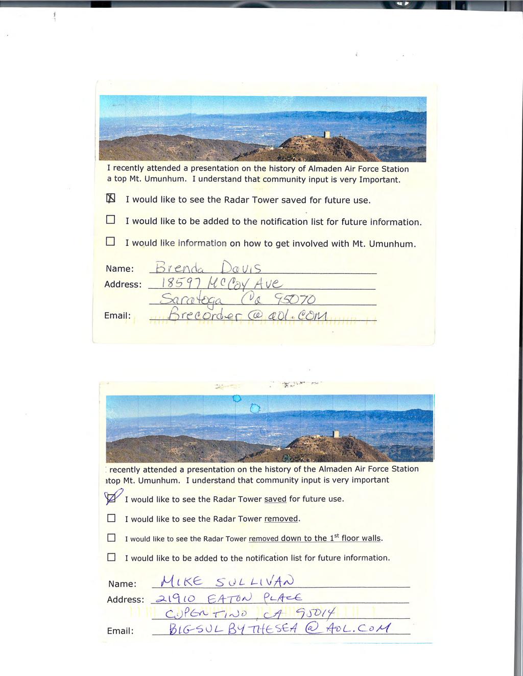
64
Final Design Approval of the Weather Shelters and Summit Stair for the Mount Umunhum Summit Project
 R-16-26 Meeting 16-06 March 9, 2016 AGENDA ITEM AGENDA ITEM 6 Final Design Approval of the Weather Shelters and Summit Stair for the Mount Umunhum Summit Project GENERAL MANAGER S RECOMMENDATIONS 1. Direct
COMMISSION IMPLEMENTING REGULATION (EU)
") 18.10.2011 Official Journal of the European Union L 271/15 COMMISSION IMPLEMENTING REGULATION (EU) No 1034/2011 of 17 October 2011 on safety oversight in air traffic management and air navigation services
18.10.2011 Official Journal of the European Union L 271/15 COMMISSION IMPLEMENTING REGULATION (EU) No 1034/2011 of 17 October 2011 on safety oversight in air traffic management and air navigation services
Program Manual. January 1, EarthCraft House Single Family Program. Viridiant 1431 West Main Street Richmond, VA
 Program Manual EarthCraft House Single Family Program January 1, 2017 Viridiant 1431 West Main Street Richmond, VA 23220 804.225.9843 EarthCraft House Project Process Process Overview All EarthCraft Builders
COMMISSION OF THE EUROPEAN COMMUNITIES. Draft. COMMISSION REGULATION (EU) No /2010
 No /2010") COMMISSION OF THE EUROPEAN COMMUNITIES Brussels, XXX Draft COMMISSION REGULATION (EU) No /2010 of [ ] on safety oversight in air traffic management and air navigation services (Text with EEA relevance)
COMMISSION OF THE EUROPEAN COMMUNITIES Brussels, XXX Draft COMMISSION REGULATION (EU) No /2010 of [ ] on safety oversight in air traffic management and air navigation services (Text with EEA relevance)
RE: Access Fund Comments on Yosemite National Park Wilderness Stewardship Plan, Preliminary Ideas and Concepts
 September 30, 2016 Superintendent Yosemite National Park Attn: Wilderness Stewardship Plan P.O. Box 577 Yosemite, CA 95389 RE: Access Fund Comments on Yosemite National Park Wilderness Stewardship Plan,
Logo Department Name Agency Organization Organization Address Information 5700 North Sabino Canyon Road
 Logo Department Name Agency Organization Organization Address Information United States Forest Coronado National Forest 5700 North Sabino Canyon Road Department of Service Santa Catalina Ranger District
JOSLIN FIELD, MAGIC VALLEY REGIONAL AIRPORT DECEMBER 2012
 1. Introduction The Federal Aviation Administration (FAA) recommends that airport master plans be updated every 5 years or as necessary to keep them current. The Master Plan for Joslin Field, Magic Valley
(i) Adopted or adapted airworthiness and environmental standards;
 Adopted or adapted airworthiness and environmental standards;") TECHNICAL ARRANGEMENT FOR THE ACCEPTANCE OF AIRWORTHINESS AND ENVIRONMENTAL APPROVAL OF CIVIL AERONAUTICAL PRODUCTS BETWEEN THE CIVIL AVIATION BUREAU, MINISTRY OF LAND, INFRASTRUCTURE AND TRANSPORT, JAPAN
TECHNICAL ARRANGEMENT FOR THE ACCEPTANCE OF AIRWORTHINESS AND ENVIRONMENTAL APPROVAL OF CIVIL AERONAUTICAL PRODUCTS BETWEEN THE CIVIL AVIATION BUREAU, MINISTRY OF LAND, INFRASTRUCTURE AND TRANSPORT, JAPAN
12, 14 and 16 York Street - Amendments to Section 16 Agreement and Road Closure Authorization
 REPORT FOR ACTION 12, 14 and 16 York Street - Amendments to Section 16 Agreement and Road Closure Authorization Date: April 27, 2018 To: Toronto and East York Community Council From: Senior Strategic Director,
Decision Memo Broken Wheel Ranch Equestrian Outfitter Special-Use Permit Proposed Action
 Decision Memo Broken Wheel Ranch Equestrian Outfitter Special-Use Permit USDA Forest Service Mississippi Bluffs Ranger District, Shawnee National Forest Jackson and Union Counties, Illinois Proposed Action
Award of Contract for Highway 17 Wildlife Passage Structures and Bay Area Ridge Trail Crossing: Conceptual Design and Feasibility Study
 R-16-18 Meeting 16-04 February 10, 2016 AGENDA ITEM AGENDA ITEM 6 Award of Contract for Highway 17 Wildlife Passage Structures and Bay Area Ridge Trail Crossing: Conceptual Design and Feasibility Study
Great Wolf Lodge Fact Sheet & Frequently Asked Questions Potential Location in Gilroy, California 8/30/17
 WHAT? Great Wolf Resorts has identified Gilroy, California as a potential location for a new Great Wolf Lodge family resort and has entered into a 60-day period of exclusivity with the City and community
STAFF REPORT. Airport Land Use Plan Consistency Review: Santa Barbara Airport Master Plan. MEETING DATE: November 19, 2015 AGENDA ITEM: 7D
 STAFF REPORT SUBJECT: Airport Land Use Plan Consistency Review: Santa Barbara Airport Master Plan MEETING DATE: AGENDA ITEM: 7D STAFF CONTACT: Peter Imhof, Andrew Orfila RECOMMENDATION: Adopt findings
Working Draft: Time-share Revenue Recognition Implementation Issue. Financial Reporting Center Revenue Recognition
 March 1, 2017 Financial Reporting Center Revenue Recognition Working Draft: Time-share Revenue Recognition Implementation Issue Issue #16-6: Recognition of Revenue Management Fees Expected Overall Level
Air Operator Certification
 Civil Aviation Rules Part 119, Amendment 15 Docket 8/CAR/1 Contents Rule objective... 4 Extent of consultation Safety Management project... 4 Summary of submissions... 5 Extent of consultation Maintenance
Perth and Kinross Council Development Control Committee 12 December 2012 Report of Handling by Development Quality Manager
 Perth and Kinross Council Development Control Committee 12 December 2012 Report of Handling by Development Quality Manager 4(3)(i) 12/570 Alterations and replacement windows at Milnathort Town Hall, 1
RESOLUTION NO
 RESOLUTION NO. 2015-15 A RESOLUTION OF THE CITY COUNCIL OF THE CITY OF MARINA AUTHORIZING SUBMISSION OF A GRANT APPLICATION TO THE FEDERAL AVIATION ADMINISTRATION (FAA) FOR PARTICIPATION IN THE 2015 MILITARY
Route Support Cork Airport Route Support Scheme ( RSS ) Short-Haul Operations Valid from 1st January Introduction
 Short-Haul Operations Valid from 1st January Introduction") Route Support Cork Airport Route Support Scheme ( RSS ) Short-Haul Operations Valid from 1st January 2016 1. Introduction Cork Airport is committed to encouraging airlines to operate new routes to/from
Route Support Cork Airport Route Support Scheme ( RSS ) Short-Haul Operations Valid from 1st January 2016 1. Introduction Cork Airport is committed to encouraging airlines to operate new routes to/from
Final Environmental Impact Statement for the Merced Wild and Scenic River. Comprehensive Management Plan, Yosemite National Park, Madera and Mariposa
 This document is scheduled to be published in the Federal Register on 02/26/2014 and available online at http://federalregister.gov/a/2014-04061, and on FDsys.gov DEPARTMENT OF THE INTERIOR 4312-FF NATIONAL
One East First Street Reno, NV
 AECOM City Hall Tower, 16th Floor One East First Street Reno, NV 89501 www.aecom.com 775.337.9565 tel 916.414.5850 fax Mr. David Whalen, P.E. City of Fernley Public Works 595 Silverlace Blvd. Fernley,
CLASS SPECIFICATION 5/12/11 SENIOR AIRPORT ENGINEER, CODE 7257
 Form PDES 8 THE CITY OF LOS ANGELES CIVIL SERVICE COMMISSION CLASS SPECIFICATION 5/12/11 SENIOR AIRPORT ENGINEER, CODE 7257 Summary of Duties: A Senior Airport Engineer performs the more difficult and
City Council Report. Mayor and City Council Susan Cline, Director, Public Works, Civil Engineering
 City Council Report To: From: Mayor and City Council Susan Cline, Director, Public Works, Civil Engineering City Council Meeting: February 28, 2017 Agenda Item: 3.H Subject: Award of Feasibility/Design-Build
MONTEREY REGIONAL AIRPORT MASTER PLAN TOPICAL QUESTIONS FROM THE PLANNING ADVISORY COMMITTEE AND TOPICAL RESPONSES
 MONTEREY REGIONAL AIRPORT MASTER PLAN TOPICAL QUESTIONS FROM THE PLANNING ADVISORY COMMITTEE AND TOPICAL RESPONSES Recurring topics emerged in some of the comments and questions raised by members of the
Architectural Review Commission
 Architectural Review Commission staff report Item 3: Project Planner: Applicant/Owner: VITALITY BOWLS SIGNAGE APPEAL 100 CRESCENT DRIVE PLN 14-0473 Jeff Olsen, (925) 671-5206, jolsen@ci.pleasant-hill.ca.us
APPLICATION FOR SITE DEVELOPMENT PLAN LETTER OF INTENT Amended
 Est. 1982 Est. 1982 Urban Planning Community Design Landscape Architecture 731 North Weber Street, Suite 10, Colorado Springs, CO 80903, 719 633-9700 http://www.gumanltd.com/ Members American society of
COASTAL CONSERVANCY. Staff Recommendation December 2, 2004 COYOTE HELLYER COUNTY PARK BAY AREA RIDGE TRAIL
 COASTAL CONSERVANCY Staff Recommendation December 2, 2004 COYOTE HELLYER COUNTY PARK BAY AREA RIDGE TRAIL File No. 04-057 Project Manager: Amy Hutzel RECOMMENDED ACTION: Authorization to disburse up to
BOARD OF AIRPORT COMMISSIONERS
 1 8/17/2018 8/21/2018 8/16/2018 i ElY MY Y I : JH MT BY...01,, III1*.ji,"1.111Los Angeles World Airports REPORT TO THE BOARD OF AIRPORT COMMISSIONERS Meeting Date: la Approved by: e1. "ampbell, Chief Airports
Sawtooth National Forest Fairfield Ranger District
 United States Department of Agriculture Forest Service Sawtooth National Forest Fairfield Ranger District P.O. Box 189 Fairfield, ID. 83327 208-764-3202 Fax: 208-764-3211 File Code: 1950/7700 Date: December
THE MISSION. A PUBLIC PROCESS FROM BEGINNING TO END.
 THE MISSION. A PUBLIC PROCESS FROM BEGINNING TO END. URBAN DESIGN PRINCIPLES. QUALCOMM STADIUM SITE. I-5 805 15 I-8 DEVELOPMENT PATTERNS. I-5 805 I-I5 I-8 EMBRACE THE RIVER AND PARK SYSTEM. FROM THE MOUNTAINS
BOARD ITO Aide REPORT TO THE AIRPORT COMMISSIONERS
 1 [1 11 BOARD ITO Aide 001:4 Los Angeles World Airports REPORT TO THE Approved by: Justin rbacci - hief Innovation and Commercial St tegy Officer (--(AtSotA_ /1//r/'(10 PV Reviewed by: Samson Mengistu
AIRPORT SPONSORSHIP POLICY
 AIRPORT SPONSORSHIP POLICY The Muskegon County Airport (MKG) Sponsorship policy (Policy) is intended to ensure Airport sponsorships are coordinated and aligned with its business goals, maximize opportunity
CITY OF BELLFLOWER ORDINANCE NO. 1320
 CITY OF BELLFLOWER ORDINANCE NO. 1320 AN ORDINANCE APPROVING ZONING ORDINANCE TEXT AMENDMENT CASE NO. ZOTA 16-04 AMENDING SECTIONS 17.44.235, 17.88.050, AND 17.88.100 OF TITLE 17 OF THE BELLFLOWER MUNICIPAL
Longmont to Boulder Regional Trail Jay Road Connection DRAFT FINAL REPORT
 Longmont to Boulder Regional Trail Jay Road Connection DRAFT FINAL REPORT December 2018 Project Summary Boulder County, Colorado, in partnership with the City of Boulder, is evaluating options for multi-use
Land Management Summary
 photo credit: ANGAIR Anglesea Heath Land Management Summary The Anglesea Heath (6,501 ha) was incorporated into the Great Otway National Park in January 2018. This provides an opportunity to consider the
Executive Summary Downtown Park Fund Allocation HEARING DATE: MAY 5, 2016
 Executive Summary Downtown Park Fund Allocation HEARING DATE: MAY 5, 2016 Date: April 28, 2016 Case No.: 2016 004634CWP Project Name: Allocation of $4,000,000 from the Downtown Park Fund for the Renovation
EVENT CENTRE / ARENA COMPLEX
 EVENT CENTRE / ARENA COMPLEX BUSINESS CASE ANALYSIS PRESENTATION TO COUNCIL JANUARY 14, 2019 PART A: PROJECT RECAP PART B: DETAILED ASSESSMENT OF THE FACILITY OPTIONS PART C: COMPARING THE OPTIONS PART
Submitted electronically via
 Docket Operations, M-30 U.S. Department of Transportation 1200 New Jersey Avenue, SE Washington, DC 20590 RE: DOCKET NUMBER FAA-2010-0997, NOTICE OF PROPOSED RULEMAKING, SAFETY MANAGEMENT SYSTEMS FOR CERTIFICATED
Rangitīkei District Council
 Rangitīkei District Council Assets and Infrastructure Committee Meeting Agenda Thursday 9 August 2018 9:30 AM Contents 1 Welcome...3 2 Council Prayer...3 3 Apologies/leave of Absence...3 4 Members conflict
To obtain Board approval to demolish the former St. Ann School Education Resource Centre building located at 2123 Hixon Street, Oakville.
 Regular Board Meeting Tuesday, November 3, 2015 ACTION REPORT ITEM 8.3 FORMER ST. ANN EDUCATION RESOURCE CENTRE BUILDING DEMOLITION PURPOSE: To obtain Board approval to demolish the former St. Ann School
Cascade River State Park Management Plan Amendment
 This document is made available electronically by the Minnesota Legislative Reference Library as part of an ongoing digital archiving project. http://www.leg.state.mn.us/lrl/lrl.asp Cascade River State
BACKCOUNTRY TRAIL FLOOD REHABILITATION PROGRAM
 BACKCOUNTRY TRAIL FLOOD REHABILITATION PROGRAM Backcountry Trail Flood Rehabilitation A June 2013 Flood Recovery Program Summary In June 2013, parts of Southern Alberta were devastated from significant
Global Sustainable Tourism Destinations Criteria
 Global Sustainable Tourism Destinations Criteria Draft destination level Global Sustainable Tourism Criteria as proposed after Destinations and International Standards joint working group meeting and follow-up
National Wilderness Steering Committee
 National Wilderness Steering Committee Guidance White Paper Number 1 Issue: Cultural Resources and Wilderness Date: November 30, 2002 Introduction to the Issue Two of the purposes of the National Wilderness
SAN MARTIN BUSINESS PLAN COMMUNITY MEETING
 SAN MARTIN BUSINESS PLAN COMMUNITY MEETING Summary of Community Meeting Wednesday May 23, 2018 Santa Clara County Roads and Airports Department hosted a community meeting on Wednesday May 23 nd, 2018 from
STAFF REPORT. Airport Land Use Plan Consistency Review: Old Town Village Mixed Use Project City of Goleta. MEETING DATE: June 18, 2015 AGENDA ITEM: 5M
 STAFF REPORT SUBJECT: Airport Land Use Plan Consistency Review: Old Town Village Mixed Use Project City of Goleta MEETING DATE: AGENDA ITEM: 5M STAFF CONTACT: Peter Imhof, Andrew Orfila RECOMMENDATION:
Notification to Suppliers
 Notification to Suppliers Engagement of Auditors Regarding Certification for the PSO Levy Reference CER/17/021 Date Published 22/02/2017 Closing Date N.A. Executive Summary In the 2016/17 Public Service
SUMMER VILLAGE OF SILVER SANDS. Municipal Development Plan
 SUMMER VILLAGE OF SILVER SANDS Municipal Development Plan Bylaw 253-2014 Adopted August 22, 2014 Summer Village of Silver Sands Municipal Development Plan Bylaw No. 253-2014 Page 2 1 INTRODUCTION 1.1 SETTING
TABLE 4-1 REGIONAL ECONOMIC AIRPORT IMPACT. Jobs Supported
 Financial Analysis 4.0 Overview The 2011 State of Texas Airport System Economic Impact Study calculated that H.H. Coffield Regional Airport has annual local economic impact of $187,293. This value places
Lake Tahoe Airport Master Plan Public Meeting March 16, 2015
 Lake Tahoe Airport Master Plan Public Meeting March 16, 2015 What is an Airport Master Plan? a comprehensive study of an airport [that] usually describes the short, medium, and long term development plans
TRUCKEE TAHOE AIRPORT DISTRICT BOARD OF DIRECTOR STAFF REPORT
 AGENDA ITEM: 11 TRUCKEE TAHOE AIRPORT DISTRICT BOARD OF DIRECTOR STAFF REPORT AGENDA TITLE: MEETING DATE: January 24, 2018 PREPARED BY: NTPUD Agency Partnership Opportunity, Multi-Use Trailhead Access
Administration Policies & Procedures Section Commercial Ground Transportation Regulation
 OBJECTIVE METHOD OF OPERATION Definitions To promote and enhance the quality of Commercial Ground Transportation, the public convenience, the safe and efficient movement of passengers and their luggage
EXHIBIT K TERMINAL PROJECT PROCEDURES PHASE I - DEVELOPMENT OF TERMINAL PROGRAM & ALTERNATIVES
 EXHIBIT K TERMINAL PROJECT PROCEDURES PHASE I - DEVELOPMENT OF TERMINAL PROGRAM & ALTERNATIVES Over the term of the Master Amendment to the Airline Use and Lease Agreement, the Kansas City Aviation Department
CHAPTER 6 NOISE EXPOSURE
 CHAPTER 6 NOISE EXPOSURE FAA requires that the NEM submitted for review represent the aircraft noise exposure for the year of submittal (in this case 2008) and for a future year (2013 for OSUA). However,
S Central Coast Heritage Protection Act APRIL 21, 2016
 STATEMENT OF GLENN CASAMASSA ASSOCIATE DEPUTY CHIEF, NATIONAL FOREST SYSTEM U.S. FOREST SERVICE U.S. DEPARTMENT OF AGRICULTURE BEFORE THE UNITED STATES SENATE COMMITTEE ON ENERGY AND NATURAL RESOURCES
Downtown Dallas Priority Parks DEVELOPMENT AND FUNDING AGREEMENT
 Downtown Dallas Priority Parks DEVELOPMENT AND FUNDING AGREEMENT Park and Recreation Board April 19, 2018 Purpose Provide background information on the four (4) priority Downtown Parks Carpenter Park Harwood
NIAGARA MOHAWK POWER CORPORATION. Procedural Requirements
 NIAGARA MOHAWK POWER CORPORATION Procedural Requirements Initial Effective Date: November 9, 2015 Table of Contents 1. Introduction 2. Program Definitions 3. CDG Host Eligibility Provisions 4. CDG Host
Short-Haul Operations Route Support Scheme (RSS)
") Short-Haul Operations Route Support Scheme (RSS) Valid from January 1 st, 2018 1: Introduction: The Shannon Airport Authority is committed to encouraging airlines to operate new routes to/from Shannon
Short-Haul Operations Route Support Scheme (RSS) Valid from January 1 st, 2018 1: Introduction: The Shannon Airport Authority is committed to encouraging airlines to operate new routes to/from Shannon
AN ORDINANCE OF THE CITY COUNCIL OF THE CITY OF VACAVILLE ADDING CHAPTER 9
 Agenda Item No. January 27, 2009 TO: FROM: SUBJECT: Honorable Mayor and City Council Attention: Laura C. Kuhn, Interim City Manager Rich Word, Chief of Police Scott D. Sexton, Community Development Director
To propose the demolition of the former St. Ann School Education Resource Centre building located at 2123 Hixon Street, Oakville.
 Regular Board Meeting Tuesday, October 20, 2015 STAFF REPORT ITEM 9.1 FORMER ST. ANN EDUCATION RESOURCE CENTRE PROPOSED BUILDING DEMOLITION PURPOSE: To propose the demolition of the former St. Ann School
Project Planning, Compliance, and Funding
 Project Planning, Compliance, and Funding The plans above offer high level guidance to ensure that the A.T. is managed effectively as a whole unit in a decentralized management structure. Cooperative management
::f BOA OF AIRPORT COMMISSIONERS REPORT TO THE. -A. A_ A.4k fig
 3/3/208 2/26/208 Approval NY a NY Y RW JH BOA /...-_ 0...0 00:4.4 Los Angeles World Airports REPORT TO THE OF AIRPORT COMMISSIONERS -A. A_ A.4k._ra. At, Approved y: Dave Jones - Air.n:TPro:-.,. oncession
REPORT 2014/065 INTERNAL AUDIT DIVISION. Audit of air operations in the United. Nations Assistance Mission in Afghanistan
 INTERNAL AUDIT DIVISION REPORT 2014/065 Audit of air operations in the United Nations Assistance Mission in Afghanistan Overall results relating to the effective management of air operations in the United
Minimum Requirements References in National Park Service Policy
 Minimum Requirements References in National Park Service Policy 2006 NPS Management Policies Chapter 6: Wilderness Preservation and Management 6.3 Wilderness Resource Management 6.3.1 General Policy (in
FY Transit Needs Assessment. Ventura County Transportation Commission
 FY 18-19 Transit Needs Assessment Ventura County Transportation Commission Contents List of Figures and Appendices.. 2 Appendices... 1 Chapter 1: Introduction What is the Ventura County Transportation
Administration Policies & Procedures Section Commercial Ground Transportation Regulation
 OBJECTIVE METHOD OF OPERATION Definitions To promote and enhance the quality of Commercial Ground Transportation, the public convenience, the safe and efficient movement of passengers and their luggage
COMMISSION REGULATION (EU) No 255/2010 of 25 March 2010 laying down common rules on air traffic flow management
 No 255/2010 of 25 March 2010 laying down common rules on air traffic flow management") L 80/10 Official Journal of the European Union 26.3.2010 COMMISSION REGULATION (EU) No 255/2010 of 25 March 2010 laying down common rules on air traffic flow management (Text with EEA relevance) THE EUROPEAN
L 80/10 Official Journal of the European Union 26.3.2010 COMMISSION REGULATION (EU) No 255/2010 of 25 March 2010 laying down common rules on air traffic flow management (Text with EEA relevance) THE EUROPEAN
DEPARTMENT OF CIVIL AVIATION Airworthiness Notices EXTENDED DIVERSION TIME OPERATIONS (EDTO)
") EXTENDED DIVERSION TIME OPERATIONS (EDTO) 1. APPLICABILITY 1.1 This notice is applicable to operator engaged in Commercial Air Transport Operations beyond the threshold time established by DCA for EDTO
EXTENDED DIVERSION TIME OPERATIONS (EDTO) 1. APPLICABILITY 1.1 This notice is applicable to operator engaged in Commercial Air Transport Operations beyond the threshold time established by DCA for EDTO
CHAPTER 1: INTRODUCTION
 CHAPTER 1: INTRODUCTION Purpose and Scope The information presented in this report represents the study findings for the 2016 Ronan Airport Master Plan prepared for the City of Ronan and Lake County, the
Criteria for an application for and grant of, or variation to, an ATOL: Financial
 Consumer Protection Group Air Travel Organisers Licensing Criteria for an application for and grant of, or variation to, an ATOL: Financial ATOL Policy and Regulations 2016/01 Contents Contents... 1 1.
Dublin Route Support Scheme ( RSS ) Long-Haul Operations (the Scheme )
 Long-Haul Operations (the Scheme )") Dublin Route Support Scheme ( RSS ) Long-Haul Operations (the Scheme ) 1. Scheme Outline An airline that launches a new route from Dublin Airport (the New Route ), in accordance with the Scheme criteria,
Dublin Route Support Scheme ( RSS ) Long-Haul Operations (the Scheme ) 1. Scheme Outline An airline that launches a new route from Dublin Airport (the New Route ), in accordance with the Scheme criteria,
The Strategic Commercial and Procurement Manager
 Item 3 To: Procurement Sub Committee On: 8 June 2016 Report by: The Strategic Commercial and Procurement Manager Heading: Renfrewshire Council s Community Benefit Strategy 2016 1. Summary 1.1. The purpose
Check-in to China Program 2016 Terms & Conditions
 Check-in to China Program 2016 Terms & Conditions THE TERMS AND CONDITIONS BELOW CONSTITUTE A LEGALLY BINDING AGREEMENT BETWEEN YOU AND DESTINATION MELBOURNE LIMITED WHEN IT FACILITATES THE MAKING OF BOOKINGS
University Architect & VP for Facilities Policy & Procedure #30
 University Architect & VP for Facilities Policy & Procedure #30 TITLE: OBJECTIVE AND PURPOSE RESPONSIBILITY USE OF CHARTER AIRCRAFT FOR RESEARCH PURPOSES To set forth procedures governing the chartering
Pillar Park. Management Plan
 Pillar Park Management Plan January 2014 Pillar Park Management Plan Approved by: Jeff Leahy Regional Director Thompson Cariboo Region BC Parks January 9, 2014 Date Brian Bawtinheimer Executive Director
Recreation Opportunity Spectrum for River Management v
 Recreation Opportunity Spectrum for Management v. 120803 Introduction The following Recreation Opportunity Spectrum (ROS) characterizations and matrices mirror the presentation in the ROS Primer and Field
City of Lafayette. Request for Proposals Municipal Airport Fixed Based Operator
 City of Lafayette Request for Proposals Municipal Airport Fixed Based Operator NOTICE PROPOSERS The City of Lafayette is seeking an experienced, reliable professional to establish and operate a fullservice
Yard Creek Provincial Park. Management Plan
 Yard Creek Provincial Park Management Plan Draft January 2010 Yard Creek Provincial Park Management Plan Approved by: telàlsemkin/siyam/chief Scott Benton Bill Williams Squamish Executive Director ation
[Docket No. FAA ; Directorate Identifier 2016-NM-004-AD; Amendment ; AD ]
![[Docket No. FAA ; Directorate Identifier 2016-NM-004-AD; Amendment ; AD ]](/thumbs/96/127024017.jpg "[Docket No. FAA ; Directorate Identifier 2016-NM-004-AD; Amendment ; AD ]") [Federal Register Volume 82, Number 24 (Tuesday, February 7, 2017)] [Rules and Regulations] [Pages 9489-9492] From the Federal Register Online via the Government Publishing Office [www.gpo.gov] [FR Doc
[Federal Register Volume 82, Number 24 (Tuesday, February 7, 2017)] [Rules and Regulations] [Pages 9489-9492] From the Federal Register Online via the Government Publishing Office [www.gpo.gov] [FR Doc
TERMS OF REFERENCE. Drone Advisory Committee (DAC) Role Name or Title Organization. Director, UAS Integration Office. Director, UAS Integration Office
 Role Name or Title Organization. Director, UAS Integration Office. Director, UAS Integration Office") TERMS OF REFERENCE Drone Advisory Committee (DAC) Committee Leadership Role Name or Title Organization Chairman Lead Designated Federal Officer Subcommittee Oversight Oversight Brian Krzanich Administrator
TERMS OF REFERENCE Drone Advisory Committee (DAC) Committee Leadership Role Name or Title Organization Chairman Lead Designated Federal Officer Subcommittee Oversight Oversight Brian Krzanich Administrator
ROAD AND TRAIL PROJECT APPROVAL
 ROAD AND TRAIL PROJECT APPROVAL www.marincountyparks.org Marin County Parks, 3501 Civic Center Dr, Suite 260, San Rafael, CA 94903 DATE: July 12, 2017 PRESERVE: Gary Giacomini Open Space Preserve PROJECT:
Leases Implementation NOTICE
 NOTICE DISCLAIMER. This document has been compiled by the IATA Industry Accounting Working Group (IAWG), which consists of senior finance representatives from IATA member airlines. This working group s
2.2 For these reasons the provision of tourist signing will only be considered:
 TOURIST SIGNING POLICY 2015 1. DEFINITION 1.1 A tourist destination is defined as a permanently established attraction which attracts or is used by visitors to an area and is open to the public without
STAFF REPORT. Airport Land Use Consistency Determination Betteravia Plaza. MEETING DATE: January 21, 2016 AGENDA ITEM: 8D
 STAFF REPORT SUBJECT: Airport Land Use Consistency Determination Betteravia Plaza MEETING DATE: AGENDA ITEM: 8D STAFF CONTACT: Andrew Orfila RECOMMENDATION: Adopt findings for the Betteravia Plaza project
Section 3.6 Recreation
 3.6 RECREATION This section evaluates the potential impacts of the proposed project on recreation within MTRP. The evaluation is based on field observations, a review of maps of MTRP and the MTRP Master
Guideline: Rules and appropriate practices for disabled aircraft removal
 Guideline for the Airport Community Guideline: Rules and appropriate practices for disabled aircraft removal Date of issue: May 2018 GUIDELINE-OCD001-R0 TABLE OF CONTENTS 1. Purpose and Scope... 3 2. Definitions
Establishes a fare structure for Tacoma Link light rail, to be implemented in September 2014.
 RESOLUTION NO. R2013-24 Establish a Fare Structure and Fare Level for Tacoma Link MEETING: DATE: TYPE OF ACTION: STAFF CONTACT: PHONE: Board 09/26/2013 Final Action Ric Ilgenfritz, Executive Director,
Wilderness Areas Designated by the White Pine County bill
 Wilderness Areas Designated by the White Pine County bill SEC. 321. SHORT TITLE. This subtitle may be cited as the `Pam White Wilderness Act of 2006'. SEC. 322. FINDINGS. Congress finds that-- The White
Appendix 1: Best Management Practices For Hang Gliding and Paragliding in Jasper National Parks
 Appendix 1: Best Management Practices For Hang Gliding and Paragliding in Jasper National Parks Name of Best Management Practice Best Management Practices for Hang Gliding and Paragliding in Jasper National
Submitted Electronically to the Federal erulemaking Portal:
 121 North Henry Street Alexandria, VA 22314-2903 T: 703 739 9543 F: 703 739 9488 arsa@arsa.org www.arsa.org May 9, 2011 Docket Operations, M-30 U.S. Department of Transportation 1200 New Jersey Avenue,
[Docket No. FAA ; Product Identifier 2017-NE-21-AD; Amendment ; AD ]
![[Docket No. FAA ; Product Identifier 2017-NE-21-AD; Amendment ; AD ]](/thumbs/95/125109177.jpg "[Docket No. FAA ; Product Identifier 2017-NE-21-AD; Amendment ; AD ]") [Federal Register Volume 82, Number 242 (Tuesday, December 19, 2017)] [Rules and Regulations] [Pages 60106-60108] From the Federal Register Online via the Government Publishing Office [www.gpo.gov] [FR
[Federal Register Volume 82, Number 242 (Tuesday, December 19, 2017)] [Rules and Regulations] [Pages 60106-60108] From the Federal Register Online via the Government Publishing Office [www.gpo.gov] [FR
DRAFT. Dorabelle Campground Rehabilitation
 DRAFT Dorabelle Campground Rehabilitation September 2012 1.1 REGIONAL SETTING AND PROJECT LOCATION The Dorabelle Campground is located on the western shore of Shaver Lake in Fresno County, California (Section
STUDY OVERVIEW MASTER PLAN GOALS AND OBJECTIVES
 INTRODUCTION An Airport Master Plan provides an evalua on of the airport s avia on demand and an overview of the systema c airport development that will best meet those demands. The Master Plan establishes
Pioneer Events Center
 Planning Workshop for the Concept Design of the Pioneer Events Center Filer, Idaho May 3, 2014 With The Twin Falls County Fair Board and Staff By: Populous Architects / Planners David Forkner ASLA Principal
EXECUTIVE SUMMARY PROGRAM DEVELOPMENT REPORT PURPOSE EXISTING SETTING EXPANDING PARKLAND
 EXECUTIVE SUMMARY PROGRAM DEVELOPMENT REPORT PURPOSE As the culmination of the first phase of the master planning process, this Program Development Report creates the framework to develop the Calero County
Flow Stand Up Paddle Board Parkway Plan Analysis
 Regional Parks Department Jeffrey R. Leatherman, Director County of Sacramento Divisions Administration Golf Leisure Services Maintenance Rangers Therapeutic Recreation Services Flow Stand Up Paddle Board
Executive Summary. MASTER PLAN UPDATE Fort Collins-Loveland Municipal Airport
 Executive Summary MASTER PLAN UPDATE Fort Collins-Loveland Municipal Airport As a general aviation and commercial service airport, Fort Collins- Loveland Municipal Airport serves as an important niche
Date: 11 th January, From: Plaistow & Ifold Parish Neighbourhood Plan - Steering Group. Plaistow & Ifold Parish Council
 Date: 11 th January, 2017 From: Plaistow & Ifold Parish Neighbourhood Plan - Steering Group To: Plaistow & Ifold Parish Council Re: Neighbourhood Plan Report to Parish Council Meeting 17 Jan 2017 The Steering
Passenger Facility Charge (PFC) Program: Eligibility of Ground Access Projects Meeting
 Program: Eligibility of Ground Access Projects Meeting") This document is scheduled to be published in the Federal Register on 05/03/2016 and available online at http://federalregister.gov/a/2016-10334, and on FDsys.gov [ 4910-13] DEPARTMENT OF TRANSPORTATION
This document is scheduled to be published in the Federal Register on 05/03/2016 and available online at http://federalregister.gov/a/2016-10334, and on FDsys.gov [ 4910-13] DEPARTMENT OF TRANSPORTATION
Submission to NSW Koala Strategy Consultation Process. March 2017
 Submission to NSW Koala Strategy Consultation Process March 2017 Table of contents Opening 3 Response 3 Whole-of-government NSW koala strategy 3 State Environment Planning Policy (SEPP) 44 3 The draft
Williamson Rock/Pacific Crest National Scenic Trail (PCT) Project EIS. Notice of intent to prepare an Environmental Impact Statement.
 Project EIS. Notice of intent to prepare an Environmental Impact Statement.") [3411-15-P] DEPARTMENT OF AGRICULTURE Forest Service Angeles National Forest; Los Angeles County, CA Williamson Rock/Pacific Crest National Scenic Trail (PCT) Project EIS AGENCY: ACTION: Forest Service,
[3411-15-P] DEPARTMENT OF AGRICULTURE Forest Service Angeles National Forest; Los Angeles County, CA Williamson Rock/Pacific Crest National Scenic Trail (PCT) Project EIS AGENCY: ACTION: Forest Service,