DRAFT TRAIL IMPROVEMENTS PLAN OCTOBER 2009
|
|
|
- Marian Owens
- 5 years ago
- Views:
Transcription

1 DRAFT TRAIL IMPROVEMENTS PLAN OCTOBER 2009
2 FINAL DRAFT FAR NORTH BICENTENNIAL PARK TRAIL IMPROVEMENTS PLAN Prepared for: Municipality of Anchorage Parks and Recreation 632 West 6th Avenue Prepared by: DOWL HKM 4041 B Street (907) October 2009
3 TABLE OF CONTENTS Page 1.0 INTRODUCTION Purpose and Scope of Project Overview of the Park Regional Setting and Geographic Location Resources Use and Users Major Access Points History of Land Ownership and Management Current Land Use/Management Current Intensity of Recreational Use Land Ownership Municipality of Anchorage Lands State of Alaska Lands Bureau of Land Management Property...22 Heritage Land Bank Lands Anchorage School District Alaska Sled Dog and Racing Association Alaska Botanical Garden Hilltop Ski Area (Youth Exploring Adventure Inc.) Study Area INVENTORY/DATA COLLECTION Goals of the Trail Improvements Plan Previous Plans and Reports Database Development/Data Gathering Public Involvement Participation PUBLIC INVOLVEMENT: ISSUES, CONCERNS, AND CONCEPTS Introduction Steering Committee Technical Advisory Group User Groups Dog Sledding/Alaska Sled Dog and Racing Association Cross-Country Skiing/Nordic Skiing Association of Anchorage Orienteering/Arctic Orienteering Club...37 Off-Leash Dog Walking/Anchorage Unleashed Ski Area Skijoring/Anchorage Skijor Club Mountain Biking/Single-Track Advocates Anchorage Bike Park Equestrians Anchorage Trails and Greenways Coalition Friends of Bicentennial Park Audubon Society Adjacent Agencies Alaska Botanical Garden Bureau of Land Management Chugach State Park Fort Richardson Heritage Land Bank Regulatory Agencies TRAIL IMPROVEMENTS PLAN...47 Page i
4 TABLE OF CONTENTS (cont d) Page 4.1 Trail Classifications Trail Classes 1- through How Trails Were Classified Trail Design Parameters/Guidelines Trail Improvements Plan Introduction Trail Connectivity Resource Protection Proposed Projects Process for Getting Trails Built Types of Funding TRAIL CONSTRUCTION AND MAINTENANCE GUIDELINES Trail Construction Guidelines Natural Surface Trails (Trail Classes 1 through 3) Purpose/Goals Tread Construction Surface Grades Clearing Turns General Notes Drainage Structures Accessible Trails Improved Soft Surface (Trail Class 4) Purpose/Goals Hard Surface (Trail Class 5) Trail Maintenance Guidelines General Guidelines For All Trails Timing Priorities for Work Class-Specific Maintenance Reroutes and Reconstruction Tools Specific Tasks for Different Trail Types Natural Surface Trails Drainage and Tread Issues Clearing Deadfall and Blow Downs Wooden Bridges and Other Structures Cutting Back Vegetation Overgrowth Trash and Mutt Mitt Stations Improved Soft Surface Trails Re-Grading of Trail Surface Brushing and Mowing Sides of Trails Clearing Deadfall and Blow Downs Cutting back Vegetation Overgrowth Tread and Drainage Issues Trash and Mutt Mitt Stations Bridges Maintaining Drainage Trailheads Page ii
5 FIGURES TABLE OF CONTENTS (cont d) Figure 1: Vicinity Map...4 Figure 2: Views...5 Figure 3: Generalized Soils Map...8 Figure 4: Wetlands...13 Figure 5: Major Access Points...15 Figure 6: Land Ownership...18 Figure 7: Generalized Land Use Plan (taken from the 1985 Updated Master Plan)...19 Figure 8: Current Intensity of Recreational Use...21 Figure 9: Diagram of Existing Recreational Use...23 Figure 10: Hilltop Ski Area Lease Boundary...26 Figure 11: Study Area...27 Figure 12: Summary of Stakeholder Ideas/Concepts...32 Figure 13: No New Trail Development...46 Figure 14: Trail Class 1 and 2 - Photo Example...48 Figure 15: Trail Class 3 and 4 - Photo Example...49 Figure 16: Trail Class 5 - Photo Example...50 Figure 17: Trail Classifications...54 Figure 18: Existing and Proposed Trail Classes/Design Parameter Used...55 Figure 19: Hiker-Pedestrian Trail Design Parameters...58 Figure 20: Pack and Saddle Trail Design Parameters...59 Figure 21: Bicycle Trail Design Parameters...60 Figure 22: Nordic Skiing Trail Design Parameters...61 Figure 23: Nordic Skiing Trail Design Parameters - Sections...62 Figure 24: Dog Sledding Trail Design Parameters...63 Figure 25: Skijoring Trail Design Parameters...64 Figure 26: Trail Trunk System...67 Figure 27: Proposed Projects...73 Figure 28: Trailhead Improvements - Rendezvous and Campbell Airstrip...78 Figure 29: Trailhead Improvements - North Bivouac and Hilltop...79 Figure 30: Constructing Climbing Turns...91 TABLES Table 1: Resources Consulted...28 Table 2: Public Involvement Meeting Schedule...31 Table 3: Trail Classes and Mileage...53 Table 4: Trail User Group Proposals...68 Table 5: Proposed Trail Improvements...72 APPENDICES Appendix A...Public Involvement Activities Appendix B... Public Comment Summary Appendix C... Proposed Projects and Cost Estimates Appendix D... Issue Response Summary from Parks & Recreation Commission Meetings Appendix E... Example Trail Management Objectives (TMO) Page iii
6 LIST OF ACRONYMS ABG... Alaska Botanical Gardens ADF&G... State of Alaska Department of Fish and Game ASDRA... Alaska Sled Dog and Racing Association ATGC... Anchorage Trails and Greenways Coalition ATVs... all-terrain vehicles BLM...Bureau of Land Management DOT&PF... State of Alaska Department of Transportation and Public Facilities FNBP... GIS... Geographic Information System GPS... Global Positioning System HLB... Heritage Land Bank km... kilometer MOA... Municipality of Anchorage NPS... National Park Service NSAA... Nordic Skiing Association of Anchorage P&R...Parks and Recreation RTCA... Rivers, Trails, and Conservation Assistance Program STA... Single-Track Advocates TAG... Technical Advisory Group TOA... Tour of Anchorage TRACS... Trail Assessment and Condition Survey USACE... United States Army Corps of Engineers USFS... United State Forest Service UV... ultraviolet Page iv
7 1.0 INTRODUCTION 1.1 Purpose and Scope of Project (FNBP) is the largest park in the Municipality of Anchorage (MOA). This 4,011-acre park, set in the foothills of the Chugach Mountains, gives Anchorage residents and other park visitors an opportunity to recreate in a variety of ways. FNBP is home to the Hilltop Ski Area, the Alaska Botanical Garden (ABG), over 80 miles of multi-use trails, and important connections to Chugach State Park. The park has over one million visitors each year, contributing to the social, economic, and ecological well-being of Anchorage. FNBP accommodates a wide variety of trail users, from dog mushing to skiing to mountain biking to horseback riding. With this wide variety of trail uses, conflicts between the different trail users have arisen. As trail use increases, trail maintenance needs increase. Trail user conflicts, both in winter and in summer, also continue to increase. During the FNBP Trail Improvements Plan project, trails throughout FNBP have been evaluated to determine their condition and current use. Critical missing trail links and trail amenities have been identified. Trail standards, classifications, and trail crew specifications have been developed. This plan has evaluated the need for trailhead and parking upgrades and increased wayfinding and interpretive signage and other public amenities that will enhance the park as a four-season recreation facility. This plan develops a comprehensive and strategic trail project list endorsed by the trail community. The scope of this project is to develop a Trail Improvements Plan, which includes the following: Current data on the existing trails and facilities within FNBP. Trail Classifications, Trail Design Parameters, and Maintenance Guidelines for the managed trails of FNBP. These guidelines will become templates for other trails throughout the MOA park system. A Geographic Information System (GIS) database to facilitate the management of these trails by MOA Parks and Recreation (P&R). This information will be incorporated into the city-wide GIS database, available to the public. Page 1
8 Produce a Trail Improvements Plan with a list of future trail projects that will be a priority for the next 10 to 15 years and to assist MOA P&R in the management of FNBP. Use the Trail Improvements Plan to assist in attaining an Individual Permit (required in order to work in wetland areas) from the United States Army Corps of Engineers (USACE) to allow project development once funding is available. Facilitate the funding process for trail improvements and maintenance. Expedite MOA permitting of trail development and maintenance. With this wide variety of trail uses, conflicts between the different trail users have arisen. In the past, these conflicts between users had reached a threshold where work had to done to bring these varied trail users together to resolve their issues. During this time, many uses such as mountain biking, skijoring, orienteering, and geocaching, were becoming more and more popular with existing trails and areas throughout FNBP meeting the trail characteristics and needs of these trail users. In 1989, MOA P&R created a FNBP Trail Users Group as an open forum for discussion of issues, conflicts, and to identify issues related to the different trail users. Meetings were held monthly at the Campbell Creek Science Center to facilitate the discussion of the needs and desires of each trail user. However, during this same time period, the MOA s approval of maintenance activities on the Tour of Anchorage Trail had improved the trail for one user group and diminished the character of the trail for another user group without an appropriate review. This work initiated the development of the Single-Track Advocates (STA) and the creation of the FNBP Trails Committee. This trails committee was established in 2004 to collaborate on trail improvements in FNBP and to eventually work on the FNBP Trails Committee: Strategic Action Planning document. The trails committee included members from nine different trail user groups and the Friends of FNBP, with two representatives from each group. The FNBP Trails Committee s vision included promoting and encouraging the diversity of park users, and to work towards solutions to issues to enhance park user experiences. In 1995, a plan for trail improvements, called the FNBP: Planning and Development Project, was created to identify and prioritize improvements to the park. This plan identified a list of 27 trail-specific projects within the FNBP boundary and on Bureau of Land Management (BLM) Page 2
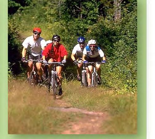
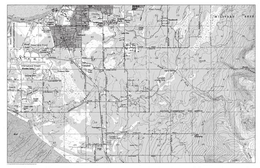
9 Campbell Tract land. With the support of the FNBP Trail Users Group and partnerships with organized trail users, 15 of the 27 projects listed in that plan were completed. With over half of the projects completed and others underway, the FNBP Trail Users Group has accomplished a lot by completing that many projects from a master plan document within a 10-year period (1995 through 2005). A park bond passed in 2007 funded this current project. The future trail improvement projects identified in this plan relate to the needs and desires of the community, while preserving the balance between development and the natural character of the park. This Trail Improvements Plan is intended to be a 10- to 15-year plan with the goal to accomplish the majority of the proposed projects in that time period. This project was not intended to be an update to the currently adopted FNBP Master Plan of 1985; all of the proposed projects outlined in this Trail Improvements Plan are consistent with that plan. Trail users can use this approved Trail Improvements Plan as a basis for new trail development and maintenance of existing trails. This document can be used when meeting with the MOA P&R Commission for approval of new trail projects and trail improvements as those individual projects become funded. 1.2 Overview of the Park Regional Setting and Geographic Location FNBP is situated on the east edge of Anchorage, south of Tudor Road, north of Abbott Road, east of Elmore Road, and west of Chugach State Park (Figure 1). FNBP is a unique park. The majority of the park is undeveloped, except for a variety of trails. It is located within the city of Anchorage, with urban neighborhoods adjacent to three sides. On the east, it is bordered by the one-half-million-acre Chugach State Park and the Stuckagain Heights subdivision. It is a popular place for recreation, with more than 80 trails totaling over 80 miles. Areas of the park are flat, wooded, and include wetland areas, while other areas are steeply sloped and offer superb views. Page 3

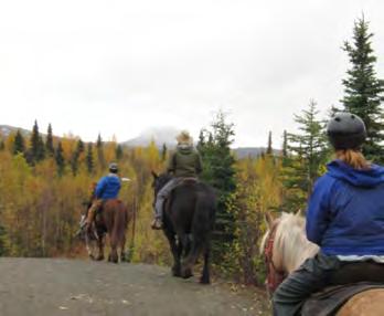
10 Figure 1: Vicinity Map Resources Views. The majority of the FNBP study area is relatively flat, but this changes dramatically toward the southeastern portion of the park that becomes part of the foothills of the Chugach Mountains. FNBP elevations range from 60 to 360 feet above sea level with the steepest slopes found in the canyon or gorge of the South Fork of Campbell Creek, adjacent to the Spencer Loop Trail. Panoramic views of Anchorage and the Cook Inlet are found along the Hillside Park ski trails and the Hilltop Ski Area (Figure 2). Views within FNBP provide glimpses of the surrounding Chugach Mountain range, as well as views to open meadow areas, creeks meandering through the park, and bog areas with distant views of the mountains. Page 4
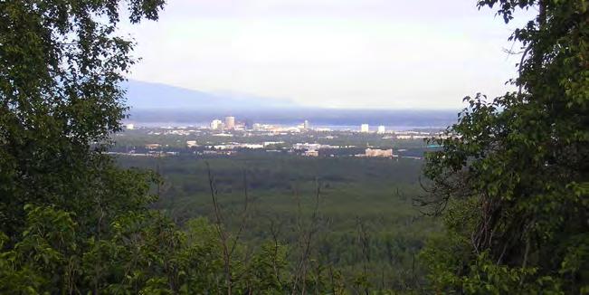
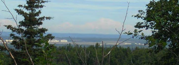
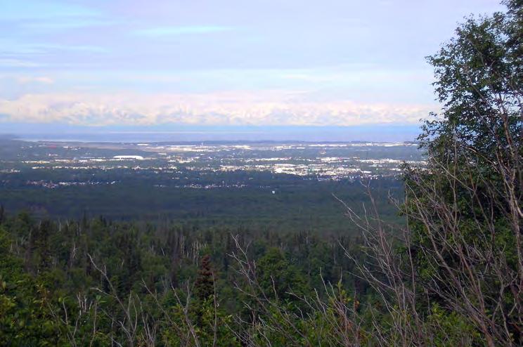
11 Figure 2
12 Wildlife. One of the great qualities of FNBP is the wide variety of wildlife species it supports, including moose, black and grizzly bears, lynx, coyote, hawks, and owls. The creeks of FNBP are teeming with fish, including salmon (king, red, silver), rainbow trout, and Dolly Varden. A variety of bird species are also found in FNBP. The State of Alaska Department of Fish and Game (ADF&G) noted that all of FNBP is a movement corridor for wildlife in the larger context of the Anchorage bowl. A more detailed report is being developed by ADF&G and will be available in 6-12 months. This future report intends to delineate movement corridors of bears by combining location data from Global Positioning System (GPS)-collared bears with computer modeling. However, based on current information from ADF&G, it appears that bears primarily follow the North and South Forks of Campbell Creek that originates in Fort Richardson and Chugach State Park. Vegetation. FNBP contains a variety of plant communities. The different plant communities are determined by the varying site conditions, including soil characteristics, topography and associated elevations, slope, orientation to sun and wind, drainage characteristics, and dynamics of the creeks and riparian areas. The vegetation varies from shrub bogs to diverse woodlands, including bogs and grasslands, deciduous and evergreen forests, mixed forests, dwarf black spruce, and riparian vegetation. The mixed forest is the most dominant vegetation type throughout the study area and includes birch, aspen, spruce, cottonwood, and a variety of other native shrubs. Willows, high and low bush cranberries, currants, and native roses can also be found, providing abundant food for local wildlife. Developed and disturbed areas also exist throughout the FNBP study area. Soils. Soils information for FNBP was extracted from the MOA s GIS database. This database acquired information that is based on the Anchorage Area Soil Survey published by the Soil Conservation Service, Soils can be classified in many different ways depending on use or needs. This study organizes these soils into similar categories based on the drainage types and the development suitability. Soil characteristics vary considerably throughout FNBP. The sub-soil ranges from very gravelly sandy loams that are somewhat excessively drained to soils that have a high content of organic material, are very poorly drained, and are frequently ponding. Page 6
13 The different soil types play a role in determining locations for facilities, trails, and other uses. A structurally sound soil that is well drained with gravels throughout is generally less expensive to build on than soils that require special subgrade preparation, or special structures like bridges or boardwalks. Building on unsuitable soils will not only require additional expenses for construction and maintenance of the facility, but may also create serious environmental consequences such as erosion. The soils have been grouped into four categories: urban and disturbed (somewhat excessively drained), well drained, somewhat poorly drained, and very poorly drained/peat soils. These soil types are highlighted in the soils map (Figure 3) and have been listed below. Urban and Disturbed Land Cryorthents and Urban Land Slopes: 0 to 5 percent Drainage Class: Somewhat excessively drained Representative Profile: Very gravelly sandy loam, moderate permeability Cryorthents and Urban Land Slopes: 5 to 20 percent Drainage Class: Somewhat excessively drained Representative Profile: Very gravelly sandy loam, moderate permeability Deception-Cryorthents complex Slopes: 45 to 90 percent Drainage Class: Well drained to somewhat excessively drained Representative Profile: Very gravelly sandy loam, moderate permeability Well Drained Deception-Estelle-Kichatna complex Slopes: 0 to 7 percent Drainage Class: Well drained Representative Profile: Silt loam to very gravelly sandy loam, moderate permeability Deception-Estelle-Kichatna complex Slopes: 12 to 20 percent Drainage Class: Well drained Representative Profile: Silt loam to very gravelly sandy loam, moderate permeability Page 7


14 Pi oneer Dr Tudor Rd Elmore Rd Lake Otis Pkwy Dowling Rd Figure 3 Generalized Soils Map Campbell Crk Science Ctr Rd Campbell Airstrip Rd Seward Hwy 0 1,000 2,000 4,000 Feet Study Area Established Trails Roads Soil Characteristics Urban and Disturbed Land Well Drained Somewhat Poorly Drained Very Poorly Drained Abbott Rd Hillside Dr Birch Rd P:\Projects\D59813\GIS\Landscape\Final Report\Soils.mxd
15 412 - Deception-Estelle-Kichatna complex Slopes: 20 to 45 percent Drainage Class: Well drained Representative Profile: Silt loam to very gravelly sandy loam, moderate permeability Deception-Estelle-Kichatna complex Slopes: 45 to 85 percent Drainage Class: Well drained Representative Profile: Silt loam to very gravelly sandy loam, moderate permeability Deception-Estelle-Kichatna complex Slopes: Undulating and hilly Drainage Class: Well drained Representative Profile: Silt loam to gravelly sandy loam, moderate permeability Deception-Estelle-Kichatna complex Slopes: Undulating and steep Drainage Class: Well drained Representative Profile: Silt loam to gravelly sandy loam, moderate permeability Kashwitna-Kichatna complex Slopes: 0 to 3 percent Drainage Class: Well drained Representative Profile: Silt loam to gravelly sandy loam, moderate to moderately rapid permeability Kashwitna-Kichatna complex Slopes: 12 to 20 percent Drainage Class: Well drained Representative Profile: Silt loam to gravelly sandy loam, moderate to moderately rapid permeability Kashwitna-Kichatna complex Slopes: 30 to 85 percent Drainage Class: Well drained Representative Profile: Silt loam to gravelly sandy loam, moderate to moderately rapid permeability Page 9
16 431 - Kashwitna-Kichatna complex Slopes: Undulating Drainage Class: Well drained Representative Profile: Silt loam to gravelly sandy loam, moderate to moderately rapid permeability Kashwitna-Kichatna complex Slopes: Undulating and hilly Drainage Class: Well drained Representative Profile: Silt loam to gravelly sandy loam, moderate to moderately rapid permeability Kashwitna-Kichatna complex Slopes: Undulating and steep Drainage Class: Well drained Representative Profile: Silt loam to gravelly sandy loam, moderate to moderately rapid permeability Somewhat Poorly Drained Pioneer Peak silt loam Slopes: 0 to 3 percent Drainage Class: Somewhat poorly drained Representative Profile: Highly decomposed plant material to silt loam, moderately rapid to moderate permeability Soil-related factors: High water table Pioneer Peak silt loam Slopes: 3 to 7 percent Drainage Class: Somewhat poorly drained Representative Profile: Highly decomposed plant material to silt loam, moderately rapid to moderate permeability Soil-related factors: High water table Pioneer Peak-Jacobsen-Doroshin complex Slopes: 12 to 20 percent Drainage Class: Somewhat poorly drained to very poorly drained Depth to high water table: 0 to 24 inches Representative Profile: Highly decomposed plant material to silt loam, moderately rapid to moderate permeability Soil-related factors: High water table, excess organic matter Page 10
17 Very Poorly Drained Doroshin Peat Slopes: 0 to 7 percent Drainage Class: Very poorly drained Depth to high water table: 0 inches Representative Profile: Mucky peat, moderately rapid permeability Soil-related factors: High water table; excess organic matter; ponding Icknuun Peat Slopes: 0 to 3 percent Drainage Class: Very poorly drained Depth to high water table: 0 inches Representative Profile: Mucky peat to silt loam, moderately rapid permeability Soil-related factors: High water table; excess organic matter; ponding Jacobsen-Disappear-Doroshin complex Slopes: 0 to 3 percent Drainage Class: Very poorly drained Depth to high water table: 6 to 12 inches Representative Profile: Mucky peat to gravelly silt loam to very gravelly loamy sand, moderate permeability Soil-related factors: High water table; excess organic matter; ponding Jacobsen-Disappear-Doroshin complex Slopes: 3 to 7 percent Drainage Class: Very poorly drained Depth to high water table: 0 to 12 inches Representative Profile: Mucky peat to very gravelly loamy sand, moderate to moderately rapid permeability Soil-related factors: High water table; excess organic matter; ponding Jacobsen-Disappear-Doroshin complex Slopes: 7 to 12 percent Drainage Class: Very poorly drained Depth to high water table: 0 to 12 inches Representative Profile: Mucky peat to very gravelly loamy sand, moderate to moderately rapid permeability Soil-related factors: High water table; excess organic matter; ponding Page 11
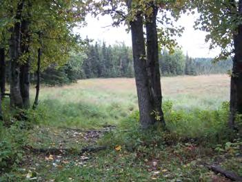
18 437 - Moose River-Niklason complex, frequently flooded Slopes: 0 to 3 percent Drainage Class: Very poorly drained Depth to high water table: 6 to 24 inches Representative Profile: Slightly decomposed plant material to silt loam to stratified find sand to silt loam, moderately rapid to moderate permeability Soil-related factors: Flooding, high water table Moose River-Niklason complex, occasionally flooded Slopes: 0 to 3 percent Drainage Class: Very poorly drained Depth to high water table: 6 to 24 inches Representative Profile: Slightly decomposed plant material to silt loam to stratified find sand to silt loam, moderately rapid to moderate permeability Soil-related factors: Flooding, high water table Salamatof Peat Slopes: 0 to 3 percent Drainage Class: Very poorly drained Depth to high water table: 0 inches Representative Profile: Peat, rapid permeability Soil-related factors: High water table, excess organic matter, ponding Hydrology. Over 1,400 acres of Class A, B, and C wetlands exist in FNBP based on the Anchorage Wetlands Management Plan (1994). These wetland areas are concentrated in the northern portion of the park (Figure 4). They are focused along creek corridors and become more widespread where the creeks merge in the flatter bog areas. Three creeks with headwaters in the Chugach Mountains flow into the western portion of FNBP: the North Fork of Campbell Creek, the South Fork of Campbell Creek, and northernmost branch of Little Campbell Creek. The North Fork of Campbell Creek flows from the northeastern portion of the park west over flat, wet, spruce bogs to join with the South Fork of Campbell Creek. The South Fork of Campbell Creek enters the park in the gorge area in the southeastern portion of the park, to the north of the Hilltop Ski Area, and continues to the northwest paralleling Campbell Airstrip Road. Little Campbell Creek originates near the Hilltop Ski Area trails and winds through the park exiting near the 76th Avenue/Elmore Road intersection. Page 12


19 Pi oneer Dr Tudor Rd Elmore Rd Lake Otis Pkwy N orth For k Campbell Creek South Fork C ampbell Cre ek Dowling Rd Seward Hwy Figure 4 Wetlands 0 1,000 2,000 4,000 Feet Wetlands Study Area Established Trails Streams Roads Cam pb ell Crk Science Ctr Rd North Fo rk Little C a m p bell Creek Campbell Airstrip Rd Abbott Rd Hillside Dr Birch Rd P:\Projects\D59813\GIS\Landscape\Final Report\Wetlands.mxd
20 These streams are remnants of a braided creek system with broad and irregular floodplain boundaries. The creek areas correspond with low elevations and wetland areas that provide valuable habitat for wildlife. The winter glaciating of ice causes overflow of the creeks that become problematic for some of the winter trails in the area, such as the dog mushing trails. Creek overflow onto groomed snow trails can damage the integrity of the packed or groomed trails and cause safety issues with trail racing Use and Users FNBP is a heavily used recreation area for people active in a large variety of sports, at every level, and at all times of the year. Most of the use is considered passive recreation that is defined by such activities as hiking, biking, running, horseback riding, and skiing. This differs from active recreation that includes more organized sports that require fields, such as soccer, football, baseball, and basketball. Trails interwoven throughout the park, range from wide, hardened, and lighted multi-use trails to narrow single-track trails. Active recreation exists to a lesser degree with Hilltop Ski Area, a beginner downhill ski area in the southeast portion of the park, and ball fields in the southwest part of the park. Summer uses include walking, hiking, bicycling, running, orienteering, horseback riding, birding, and nature walks. Winter sports include Nordic skiing, dog mushing, winter biking, skijoring, snowshoeing, downhill skiing, ski jumping, and horseback riding. These uses coexist and may seasonally overlap. Although there are occasionally some conflicts, FNBP has become a popular and enjoyable place for the Anchorage community to recreate Major Access Points FNBP has many different access points for both vehicles and pedestrians that allow for a variety of trail users to access to the park. Seventeen major access points along the perimeter of the park provide access into FNBP (Figure 5). These access points offer a variety of facilities from offstreet parking only to more formalized parking lots with trailhead informational kiosks. Along with these major access points, neighborhood access points exist throughout FNBP. Neighborhood access points are essential for surrounding neighborhoods, providing quick, nonmotorized access into FNBP. There are six major access points on the north side of the park off Tudor Road: Campbell Creek Park along East 48th Avenue just off Lake Otis Parkway, the Page 14

21 Tozier Track, the Chuck Albrecht Ball Fields, the ABG and Benny Benson School, the Rendezvous Trailhead along Campbell Airstrip Road, and the Chugach Foothills Trailhead. Figure 5: Major Access Points Page 15
22 The southwestern portion of the park also has a variety of access points located in the park and on adjacent BLM lands. The Smoke Jumper Trailhead and the Campbell Creek Science Center provide access from the west from BLM lands off Elmore Road. The Campbell Airstrip Trailhead (Buckner Trailhead) on BLM property provides access from Campbell Airstrip Road and east Anchorage. The Abbott Loop Community Park along Elmore Road also provides access into the western portion of the park. On the south side of the park, Service High School, the Hillside Park Trailhead, the Hilltop Ski Area, and the Chugach State Park s Prospect Heights Trailhead provide access into the park. Finally, the North and South Bivouac Trailheads and the Little Hill parking area along Campbell Airstrip Road provide access to the eastern and central portions of the park, across Campbell Creek, and into the Hillside area History of Land Ownership and Management FNBP is a part of the original Campbell Tract, set aside for military use during World War II. This tract of land was later used and managed by the BLM in conjunction with several state agencies, such as the State of Alaska Department of Transportation and Public Facilities (DOT&PF). Approximately 4,260 acres of the Campbell Tract were conveyed from the United States to the MOA through the State of Alaska pursuant to the terms of the Cook Inlet Land Exchange legislation, Section 12(d)(2) of Public Law (January 2, 1976). FNBP also includes Section 33 Campbell Creek Lands in the northwest corner of the park that includes approximately 300 acres of land transferred from Heritage Land Bank (HLB) management to MOA P&R and included in FNBP under Assembly Resolution No (s) on November 11, This legislation allowed the transfer of federal land to State and local governments for recreational and public service uses, through the Recreation and Public Purposes Act (R&PP). After the land transfer language was developed, the 1974 FNBP Master Development Plan set goals for FNBP, which stated specific objectives of the master plan as follows: 1. Maintain the FNBP in perpetuity as a public park for the benefit of the citizens of Alaska. Page 16
23 2. Preserve the streambeds, watershed areas, and wildlife habitat of the area in as pristine a condition as possible allowing for compatible use of the area for nature appreciation by the public. 3. Provide recreational use by the citizens in areas where such use will be consistent with the primary objectives of nature conservation. 4. Provide areas where more intensive public uses can be developed in a manner consistent with nature and harmonious with neighboring uses. This Trail Improvements Plan contains recommendations in concert with the intent of the 1974 FNBP Master Development Plan and the land transfer documents Current Land Use/Management MOA P&R manages a 4,011-acre portion of the Campbell Tract area for non-motorized outdoor recreational use and activities. The MOA P&R staff coordinates with trail users on park management issues through the FNBP Trail Users Group that meets monthly. Paved trails are inconsistent with FNBP being maintained as a natural area. The only locations where proposed trails have been recommended in the study area are in cases where links between two existing paved trails are missing. Also, paved trails are proposed along the future Dr. Martin Luther King, Jr. Avenue (formerly known as 48th Avenue), which is outside the park boundary but within the study area. Figure 6 outlines the existing land ownership throughout the FNBP study area boundary. The generalized land use map from the 1974 FNBP Master Plan and the 1985 Updated FNBP Master Plan as seen in Figure 7 is still being used as the framework for land management within FNBP. The updated master plan noted four land use zones in FNBP, and they are as follows: Greenbelt, Watershed, Active Recreation, and Public and Institutional Lands. Page 17


24 Tudor Rd Fort Richardson Lake Otis Pkwy Campbell Creek Park Alaska Botanical Garden Dowling Rd Figure 6 Land Ownership Campbell Airstrip Road Seward Hwy 0 1,000 2,000 4,000 Feet Campbell Tract Facility Study Area Established Trails Fort Richardson Alaska Botanical Garden Campbell Tract Facility Elmore Road Chugach State Park Hilltop Ski Area/Lease Boundary State of Alaska Private Lands Hillside Park Hilltop Ski Area Chugach State Park Municipality of Anchorage/ Heritage Land Bank/ASD Hillside Park Abbott Rd Hillside Dr Birch Rd P:\Projects\D59813\GIS\Landscape\Final Report\Land Ownership.mxd

25 Figure 7: Generalized Land Use Plan (taken from the 1985 Updated Master Plan) Greenbelts relate specifically to the North and South Forks of Campbell Creek and the northern branch of the Little Campbell Creek. As defined in the 1985 Updated FNBP Master Plan, greenbelts were identified to protect water quality and stream flow within the park. These areas should be protected from extensive facility development and the vegetation should be left as natural as possible. The uses that were recommended for this area were picnicking and trails for hiking, bicycling, cross-country skiing, dog mushing, and nature study. The three areas designated as watershed/recharge areas in the 1985 Updated FNBP Master Plan were defined as extending from the lowlands near the creeks to the mountains. These areas were characterized by their extensive vegetation, which is significant in maintaining the stream quality of the North and South Forks of the Campbell Creek and Little Campbell Creek. The uses Page 19
26 consistent with the watershed designation include hiking, biking, cross-country skiing, dog sledding, and equestrian trails. Active recreation was outlined in three areas throughout FNBP in the updated master plan: the northeastern corner of the park, the land currently being retained by the BLM, and an area in the southwestern corner of the park. The northeastern portion identified was associated with the development of a neighborhood park not to exceed 20 acres. Within this park, limited athletic fields, minimum parking, picnicking facilities, and trail connections into FNBP were to be provided. The central area that was shown as active recreation was related to the BLM land. North of the road into the BLM land, it was recommended that a series of athletic fields, court facilities, and picnic sites be developed. The southwestern portion identified in FNBP was to be developed as a community park with low-key activities such as a play meadow, picnic sites, and trail access. The use of the areas defined as public lands and institutional areas are for public buildings and other facilities that are limited to terms of the federal transfer legislation. This legislation requires that these lands be used for public parks and recreational purposes and other compatible public purposes in accordance with the Generalized Land Use Plan. Any public facilities developed in these areas should be compatible with FNBP and meet the compatibility test outlined in the updated master plan. In the master plan, these areas are subdivided into three categories because some areas are more appropriate for specific types of institutional development than others. Additional master plans are expected for each of these areas if they are to be developed Current Intensity of Recreational Use Figure 8 was developed to illustrate FNBP s current intensity of recreational use throughout the park and study area. This map shows areas of low, medium and high intensity of recreational use both existing in FNBP today and the proposed projects in this plan, as it relates to the natural resources of FNBP. For example, areas where wetlands, creeks, and known wildlife corridors exist are where the low intensity of recreational use is outlined. The intent of this figure is to demonstrate a balanced approach of the different intensities of recreational use within the park. Page 20


27 Pi oneer Dr Tudor Rd Elmore Rd Lake Otis Pkwy Dowling Rd Figure 8 Current Intensity of Recreational Use Campbell Crk Science Ctr Rd Campbell Airstrip Rd Seward Hwy 0 1,000 2,000 4,000 Feet Intensity of Recreational Use Main Trail Trunk River Buffer (526ac) High (1302ac) Medium (1088ac) Low (2308ac) Study Area Established Trails Roads Abbott Rd Hillside Dr Birch Rd P:\Projects\D59813\GIS\Landscape\Final Report\Intensity.mxd
28 This plan maintains the ideas and concepts of the 1985 Updated FNBP Master Plan and the Generalized Land Use Plan map, which balance the development of recreational facilities with the preservation of FNBP as a natural area. Areas designated as having a high intensity of recreational use are defined as areas with approximately 33 miles of trails per square mile. Medium and low areas of recreational use have approximately 18 miles and approximately 7 miles of trail per square mile, respectively. The following graphic, diagram of Existing Recreational Use (Figure 9), illustrates this concept of existing levels of recreational use in FNBP Land Ownership Municipality of Anchorage Lands Two parcels of land were granted to MOA from the original Campbell Tract prior to the 1976 transfer legislation. These parcels include municipal water facilities managed by Anchorage Water and Wastewater Utility in the northeastern and southern portions of the park. Other municipal facilities, such as the Anchorage Police Department, the MOA s Project Management and Engineering facility, the Transit Department, the Animal Control Shelter, and a snow dump facility, are all located outside of the FNBP boundary, but within the study area for this plan State of Alaska Lands The State of Alaska has one in-holding within the FNBP property that is used by the DOT&PF as a storage facility area and communications tower site. It is located south of the existing State Health Labs and Dr. Martin Luther King Jr. Avenue. The State of Alaska Health Laboratories and the State of Alaska Public Safety Complex are located north of FNBP within the study area Bureau of Land Management Property The BLM operates and manages 730 acres of property in the central portion of the FNBP study area. The BLM Headquarters, an airstrip, and the Campbell Creek Science Center are all located on this property. The BLM is committed to providing outdoor non-motorized recreation opportunities on their trail system and has worked with MOA P&R to create seamless boundaries between the BLM property and FNBP. Although the 1974 FNBP Master Plan called for Page 22
29 development of active recreation areas, such as sports fields, those lands have not been relinquished by the BLM to the MOA, and this area currently holds the Campbell Creek Science Center. Figure 9: Diagram of Existing Recreational Use Page 23
30 Heritage Land Bank Lands In the northern part of the FNBP study area, between the park and Tudor Road, HLB lands are managed under the 3500 Tudor Road Master Plan. This plan defines development guidelines for the area from Tozier Track to the west along Tudor Road to the eastern boundary of Boniface Parkway. Other HLB lands, that include existing dog mushing trails, hiking trails, and wetlands, lie directly north of the BLM property Anchorage School District The Benny Benson School, off Tudor Road, borders FNBP to the north, while Service High School and Trailside Elementary, off Abbott Road, border to the south. These facilities use the FNBP trail systems, open space, and recreation areas, and they provide access and parking for other FNBP trail users. Service High School in particular acts as a trailhead for users during both summer and winter. The open space behind the high school, just to the east of the track, is a staging area for junior Nordic skiing and is the start area for the 40- and 50-km portions of the Tour of Anchorage (TOA) ski marathon race. The FNBP trails are an integral part of the high school and middle school athletic programs. From early November to late February, the Nordic ski teams of Service and South use these trails daily for practice. Goldenview and Hanshew Middle Schools use these trails in January and February. On a normal weekday in January, there are up to 300 school athletes on the trails. When the snow conditions at the other schools ski venues are not safe for skiing, the athletes are bused to the Hillside trails. There are days when all the Anchorage High Schools are using the trails. At least one race per year is staged from Service High School. Typical turnout is 400 athletes. Also, the cross country running teams use these trails in August and September. NSAA is contracted by the Anchorage School District to provide grooming service for the high school and middle school ski programs Alaska Sled Dog and Racing Association Alaska Sled Dog and Racing Association (ASDRA) owns and operates their start and finish area for competitive races at the Tozier Track facility, in the northwest corner of the study area, Page 24
31 adjacent to Tudor Road. This location provides ASDRA with easy access and good visibility from this major arterial road corridor. They operate on trails that start from the Tozier Track facility and continue onto HLB lands and into FNBP. A land use agreement between HLB and ASDRA allows for dog mushing. The ASDRA trails extend into the northern and eastern portions of FNBP and into the BLM property Alaska Botanical Garden The ABG leases over 129 acres of HLB land along Campbell Airstrip Road in the north central portion of the study area. ABG has a series of short hiking trails through the different garden areas and has future trail projects outlined in their recently completed master plan. Historically, dog mushing trails ran through the ABG property. However, based on the new master plan for ABG and discussions between the ABG and ASDRA, these trails were recently relocated to the perimeter of the property Hilltop Ski Area (Youth Exploring Adventure Inc.) The Hilltop Ski Area is located in the southeastern portion of the park and is accessed from Abbott Road and Hillside Drive. The Hilltop Ski Area consists of one chair lift, a chalet building housing the ticketing, a restaurant facility, and training and education areas. They currently have a lease agreement with the MOA (see Figure 10 for approximate lease boundary area) Study Area Many of the FNBP trails continue into other adjacent governmental properties, such as the BLM Campbell Tract, and contiguous HLB lands. The legal boundaries of FNBP, BLM, and HLB lands are invisible to trail users, thus the study area for this Trail Improvements Plan exceeds the actual boundaries of FNBP (Figure 11). Essential trail connections are present throughout the various properties and these are considered in this Trail Improvements Plan for consistency and integrity of the overall trail system. The northern boundary of the study area is Tudor Road from Folker Street to the gas line dividing FNBP from Fort Richardson. The eastern boundary is the gas line from Tudor Road and Klutina Street south to the entry drive to the Prospect Heights Trailhead. The southern boundary is Abbott Road from the Prospect Heights Trailhead entry drive to the Elmore Road intersection. The western boundary is along the west side of Elmore Page 25

32 Road from the Abbott Road intersection to the East Dowling Road right-of-way, where it jogs west up to Folker Street. Figure 10: Hilltop Ski Area Lease Boundary Page 26


33 Tudor Rd Elmore Road Lake Otis Pkwy Dowling Rd Campbell Airstrip Road Figure 11 Study Area Seward Hwy 0 1,000 2,000 4,000 Feet Study Area ¹ Abbott Rd Hillside Dr Birch Rd P:\Projects\D59813\GIS\Landscape\Final Report\Study Area Map.mxd
34 2.0 INVENTORY/DATA COLLECTION 2.1 Goals of the Trail Improvements Plan Some of the goals of the FNBP Trail Improvements Plan are to document the extensive network of existing trails, assess the condition of these trails, and develop a list of recommended trail projects in FNBP. The initial step was to gather and review existing information. A GIS database was developed and the existing trails and facilities within FNBP were entered into GIS. Information on existing conditions and trail improvement needs were also gathered through the public process. The trail improvement projects identified are designed to provide for the needs and desires of the community while maintaining a balance between development and the natural character of the park. 2.2 Previous Plans and Reports A variety of plans, studies, and reports were evaluated in development of this plan. Resources consulted are listed in Table 1. Table 1: Resources Consulted Document Author Date Updated FNBP Master Plan MOA 1985 FNBP Master Development Plan MOA 1974 FNBP Planning and Development Project Study and Report Phase Final Report MOA 1995 FNBP Trails Committee Strategic Action Planning FNBP Trails Committee February 2005 Sled Dog Trails in the Anchorage Bowl Trails Plan ASDRA December 2000 Ten-Year Plan for Soft Surface Trails Nordic Skiing Association June 2005 of Anchorage (NSAA) Anchorage Bike Plan Draft MOA In progress 48th Avenue/FNPB Trails Study DOWL HKM February 2007 Incorporating Trail Fundamentals and Trail Management Objectives in Alaska, Alaska Recreation and Park Association United States Forest Service (USFS) Spring Tudor Road Master Plan DOWL HKM December Database Development/Data Gathering Initial data was gathered and collected by the FNBP User Group Trails Subcommittee. Their work on the Strategic Action Planning document for FNBP was the building block for the Page 28
35 development of more trail data. A FNBP trails database was developed using existing MOA GIS data and the USFS model data dictionary. Data collection for the FNBP Trail Improvements Plan was based on the USFS Trail Assessment and Condition Survey (TRACS). The USFS developed TRACS to provide trail-specific information needed for the management and planning of trails and facilities. Other governmental agencies in Alaska, such as the National Park Service (NPS), Alaska State Parks, and the Bureau of Land Management (BLM) are also working to adopt this method. An accepted and established set of standards for trails allows public land agencies to more efficiently manage trails when they cross over multiple boundaries. This system establishes five different trail classifications, and provides trail users and governmental agencies a clear understanding of what type of experience, along with the design parameters and maintenance standards, is expected from each type of trail. Although the MOA database contained information on both formal and informal trails, data was collected on formalized trails and those that made major connections or loops with other trails. MOA P&R staff collected additional data on the managed trails within the study area with a handheld GPS unit. The TRACS system is an organized approach for the collection and maintenance of field data on trail conditions and defines or prescribes the improvements required to bring trails up to a specified standard. In order to determine the relevant data needed for the FNBP Trail Improvements Plan, trail classifications and standards were determined prior to the field survey. MOA P&R staff and an intern from June 24 to August 13, 2008, conducted the survey. After the field survey was completed, the desired or designed use of each trail was identified with design parameters related to the tread width, the grade of the trail, the cross slope, the clearing width and height, and permitted and prohibited uses during different seasons. Trail classifications are discussed more in Chapter Public Involvement Participation Public involvement was a key component in the documentation of existing trails and facilities, as well as in the identification of potential projects for the FNBP Trail Improvements Plan. A variety of measures were implemented in order to obtain as much input, information, and feedback as possible (Appendix A). Page 29
36 A Steering Committee was formed with representatives of park users with strong interests in cross-country skiing, dog mushing, skijoring, biking, hiking, running, and general park and trail use. A Technical Advisory Committee was also formed with representation from municipal, state, and federal land, water, and wildlife resource agencies, as well as other trail experts. Other user groups were also contacted in order to understand their vision for FNBP (Table 2). At these meetings, maps of existing trails were available for the stakeholders to mark up to provide input on new trails, trail improvements, issues or conflicts, and areas that should remain undeveloped in FNBP. These maps were combined into a summary map (see Figure 12) that was reviewed by the Steering Committee, the Technical Advisory Group (TAG), and regulatory agencies, who provided insight related to the wildlife and wetland issues in the park. Stakeholder meetings were also held with the adjacent landowners. Finally, the project team met with the FNBP Trail Users Group and the general public at two public meetings during the regularly scheduled FNBP Trail Users Group meetings. The first meeting was interactive with maps provided to give trail users an opportunity to express their thoughts on the maps. At the second public meeting, the project team presented the information gathered through public involvement combined with the MOA GIS information and the summer trail survey fieldwork. The presentation included a summary of the stakeholders input, the trail classifications for each trail in the park, trail design parameters for each trail user, the proposed trail network, and a list of proposed projects. The meeting notes and the public input/comments are included in Appendix A. This second meeting included information and mapping that took into account the feedback from both the user groups and the land and resource agencies. With this information, a balanced approach to the trail improvement plan was created. Not all of the trails that were on each user group s wish list were incorporated into the plan. Table 2 lists the user group meetings conducted for the study. Page 30
37 Table 2: Public Involvement Meeting Schedule Date Group January 28, 2008 Steering Committee January 29-31, 2008 User Group Meetings ASDRA Nordic Skiing Association of Anchorage (NSAA) Arctic Orienteering Club Anchorage Unleashed Equestrians Anchorage Trails and Greenways Coalition (ATGC) Hilltop Ski Area Anchorage Skijor Club STA Anchorage Bike Park ABG March 3, 2008 Steering Committee Meeting FNBP Trail Users Group/Public Meeting No. 1 March 4, 2008 Landowner Meeting Anchorage School District (Service High School) BLM Fort Richardson Alaska State Parks HLB March 5, 2008 Regulatory Agency Meeting USACE MOA Wetlands Staff/Physical Planning ADF&G March 6, 2008 TAG Meeting #1 NPS Rivers, Trails, and Conservation Assistance Program (RTCA) Alaska Trails MOA Trails Coordinator August 20, 2008 Meeting with Equestrians and Audubon Society September 8, 2008 Steering Committee Meeting FNBP Trail Users Group/Public Meeting No. 2 September 10, 2008 Regulatory Agency Meeting USACE MOA Wetlands Staff ADF&G January 28, 2009 and Steering Committee Meeting: Draft Plan review February 2, 2009 May 5, 2009 TAG Meeting #2 Page 31


38 Lake Otis Pkwy. Trail Rondy Cut Off Trail Baxter Rd. Trail Patterson St. Trail Short Cut Moose Ridge Loop Gasline Trail Tank Trail Powerline/near Point Baxter Bog P E. 48th Trail Head Tudor Road Trail Tudor Road Trail Outgoing Trail P ASDRA Campbell Creek Trail Bragaw St. Trail # P Tour Of Anchorage Old Three Mile Trail Rondy Cut Off Trail # # Boniface Pkwy. Trail Outgoing Trail Rondy Cut Off Trail Tudor Road Trail Tudor Road Trail Rendezvous Trail Head P # P Tudor Road Trail Outgoing Trail Muldoon Rd. Trail Muldoon Rd. Trail Muldoon Swamp Outgoing Trail North Gasline/powerline Trail North Gasline/powerline Trail Fort Richardson Military Land Summary of Stakeholder Ideas/ Concepts Shown at March 3, 2008 Open House Meeting Outgoing Trail Outgoing Trail Outgoing Trail Campbell Creek Park/ Campbell Creek Greenbelt Rondy Cut Off Trail Shield's Trail Old Rondy Trail Rondy Cut Off Trail North Gasline/powerline Trail Tank Trail Dome Trail Homecoming/poleline Homecoming/poleline Woodway Loop Trail Old Rondy Trail Six Mile Trail Old Rondy Trail Buckner Trail Head P Viewpoint Trail # Beaver Dam Trail Moose Ridge Trail Moose Ridge Trail Conflict Areas 4.5km Loop Trail North Gasline/powerline Trail 14 Mile Loop 68th Ave. Trail Smoke Jumper Trail Head P Lynx Trail Lore Road Trail Moose Track Trail Flower Trail Coyote Trail Inner Loop Trail Airstrip Loop Viewpoint Trail Eight Mile Trail Viewpoint Trail Moose Meadow Trail Rover's Run Trail 4.5km Loop Rover's Run Trail 2.5 Km Loop 2.1 Km Loop N. Bivouac Trail Head 2.1 Km Loop P S. Bivouac Trail Head Moose Ridge Loop # 2.1 Km Loop Off Leash Trail North Gasline Trail Stuckagain Heights Subdivision Near Point Lore Road Trail Black Bear Trail Black Bear Trail Homestead Trail Firebreak/Aspen Reveg Trail Ski Trail Abbott Loop Trail Cross Country Ski Trails Mult-use (Except Mushing)!(!(!È P 88th Ave. Trail!* Abbott Road Trail Novice Intermediate Advanced Trail Head Streams Trail Map Legend All trails become mult-use during the snow free season Botanical Gardens Major Trail Corridor/Connector Caution 84th Ave. Trail Meters All dashed trails are proposed Dog Mushing (Winter Only) Tour of Anchorage Trail # Proposed Crossing Proposed Bridge Work Grade Separated Bridge Crossing # Park Boundary Orienterring Prefered Areas Direction of Trail I Abbott Road Trail BLM Land Wetlands!A Lighted Trail Feet ,200 Abbott Loop Trail Head P Neighborhood Trails!A Randys Loop!A!A!A P!A!A!A!A Birch Road Trail #!A Bog Trail Richter Link Trail Hillside Loop!A!A!A Hillside Loop!A Hillside Loop!A!A!A Hillside Loop!A P Hillside Trail Head BLM Ridge Richter Loop Ann's Alley!A Abbott Trail!A!A Besh Lighted Loop P Hilltop Trail Head Gasline Trail Upper Gasline Trail Spencer Loop Llama Trail Chugach State Park Powerline/near Point Powerline South Fork Rim Grass Trail Prospect/middle Fork Powerline/near Point Wolverine Peak Figure 12
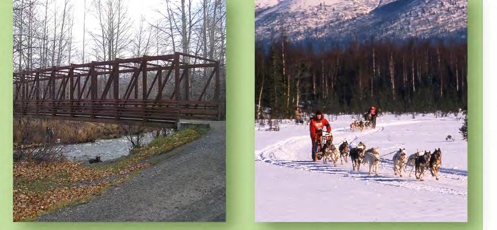
39 3.0 PUBLIC INVOLVEMENT: ISSUES, CONCERNS, AND CONCEPTS 3.1 Introduction This section of the plan summarizes the issues, concerns, and suggestions obtained through meetings with the steering committee, the TAG, various user groups, and other stakeholders. 3.2 Steering Committee A Steering Committee was put together to provide guidance on the Trail Improvements Plan. The Steering Committee consisted of a variety of trail users and leaders within the existing FNBP Trail Users Committee. The project team met with the Steering Committee four times during development of this draft plan. The Steering Committee acted as the liaison for the membership of their respective trail users groups. Many of the Steering Committee comments were related to the planning process and overall park management. Specific concerns addressed included design specifications, access, coordination with neighboring land uses, increasing safety at trailheads, addressing social trails, and addressing the user capacity of the park. Specific projects suggested during Steering Committee meetings are listed below: A separated and hardened trail is needed along Campbell Airstrip Road from the north entry to the Bivouac Trailheads. Additional connector trails are needed from Stuckagain Heights to FNBP. Improvements are needed on the TOA Trail near 48th Avenue: drainage issues and leveling of trail. More lighting and maybe security cameras at trailheads could reduce crime. Consider paving the Hillside Trailhead parking lot. Consider an improved trailhead at the most northeast entry to FNBP (Klutina Street). Block informal trailheads to reduce vandalism. Page 33
40 Repair or replace both TOA bridges south of 48th Avenue to span the wetland/floodplain area. Provide safer street crossings for pedestrians accessing the park. Consider lighting the multi-use trail along Abbott Road. Off-leash trail proposal could result in conflicts with orienteering areas. A one-way ski loop is needed near the Richter Loop. Show large open areas for no new trail development. Trail bridge standards should be developed for FNBP. Trail from Abbott Loop Community Park into FNBP trail network needs reduced slope. Re-vegetate South Bivouac Trailhead entrance with bollards/boulders to close off parking. Focus parking at North Bivouac Trailhead. Improve Little Hill parking pull-out on Campbell Airstrip Road with parallel parking spaces and bollards/boulders to delineate edge. Show a trailhead at Chuck Albrecht Ball Fields. 3.3 Technical Advisory Group A TAG was established with representatives from various groups with Alaska trail-building experience. Representatives from the NPS, RTCA, Alaska Trails, and the MOA s Trails Coordinator were included. This group provided insight into the needs/issues related to FNBP, as well as input on trail construction issues in Alaska. The TAG believes that the use of utility corridors should be reconsidered. An East Anchorage Connector Trail is needed; however, the existing power line corridor is too steep and therefore is not sustainable as a trail. The TAG suggested upgrading the dog mushing trails to allow for more use in the winter, and the possible use of geoblock or geogrids to raise the trails out of wet Page 34
41 areas. The TAG discouraged the development of new trails next to Campbell Creek due to bear activity, and suggested that proper sight distances should be provided on existing trails. They noted that the TOA Trail is a commuter route for cyclists and there is a need for bike lanes along Campbell Airstrip Road. The TAG also expressed a need for more beginner/junior Nordic ski trails north of Service High School and down into Abbott Loop Community Park. 3.4 User Groups Dog Sledding/Alaska Sled Dog and Racing Association The ASDRA currently owns and operates the Tozier Track facility along Tudor Road. It functions as the start and finish area for their racing and training runs. They have expressed their desire to move to a location within FNBP. ASDRA has the following concerns and recommendations for their safe operation on FNBP trails: Trail maintenance is a high priority for ASDRA. The preservation of continuous dog mushing trails separated from other uses is another major concern. Conflicts between existing mushing trails and the TOA Trail occur at two at-grade crossings. The crossings present potential hazards for dog mushers and other trail users as dog teams cannot be stopped quickly and collisions with other trail users can result in injuries to dogs, mushers, and other trail users. These crossings occur at Campbell Creek and south of the proposed 48th Avenue Extension (Dr. Martin Luther King Jr. Avenue). Grade-separated crossings are desired at these locations. ASDRA is concerned over the potential disappearance of dog mushing trails on HLB lands as these lands are developed or sold in the future. The identification of dog mushing trails and trail improvements in an adopted MOA plan could facilitate fundraising for ASDRA trail construction and maintenance. Any improvements to their Tozier Track facility would require upgrades to the building to meet municipal code standards. Page 35
42 3.4.2 Cross-Country Skiing/Nordic Skiing Association of Anchorage The Nordic Skiing Association of Anchorage (NSAA) provided a priority list of improvements to FNBP trails. This list was divided into four categories and prioritized as follows: maintenance; access; development of new trails; and conflict mitigation. While NSAA has specific concerns related to their interests, they also recognize the need for a variety of trail standards and that not all trail users want wide, clear trails. Maintenance - The NSAA grooms the Hillside Park ski trails and the TOA Trail. Slightly crowned trails with a smooth surface facilitate grooming during periods of low snow cover. Access - The NSAA proposed improved access into FNBP for East Anchorage residents. A trailhead or increased parking at Klutina Street where the North Gasline/Powerline Trail terminates in East Anchorage was suggested. Another improvement suggested was a lighted connection from the Bivouac Trailheads to the Hilltop area. New Trails - The NSAA proposed several new trails for development, including four trails they classified as high priority: - A multi-use trail connector from Gasline/Spencer Loop Trail area to Chugach State Park that would be groomed in winter. - New trail loops from Abbott Loop Community Park (beginner level ski trails). - New Classic Ski Loop Trail (extension of existing trails). - A new equestrian loop connecting to the Lore Road Trailhead. Conflict Mitigation - NSAA recommended the development of a separate loop trail for equestrians be established within FNBP to reduce horse traffic on the TOA Trail. - NSAA also recommended the lighting of the multi-use Abbott Road Trail, which would mitigate foot and bicycle traffic on ski-only trails in the winter. Page 36
43 - Develop a trail connection from the South Gasline Trail up to the Prospect Heights Trailhead in Chugach State Park to provide an alternative to hikers and bikers being on ski-only trails in the winter Orienteering/Arctic Orienteering Club The Arctic Orienteering Club expressed concerns with the development of any new trails in FNBP. They consider FNBP an ideal place for orienteering as it is. The wooded areas are easy to roam and are relatively open, with good terrain features. The Arctic Orienteering Club identified the following recommendations for the Trail Improvements Plan: Areas along the north side of Campbell Airstrip Road in the Moose Ridge Trail system and an area to the northwest of the Hillside Park ski trails were outlined as ideal locations for orienteering. They recommended that these areas remain free of any new trail development. The Arctic Orienteering Club expressed the need for a more efficient parking lot at the Campbell Airstrip Trailhead Off-Leash Dog Walking/Anchorage Unleashed Anchorage Unleashed is a non-profit volunteer organization that supports off-leash dog walking in parks in Anchorage including FNBP. An official off-leash dog walking area exists currently along the North Gasline Trail. Anchorage Unleashed noted the following trail improvements and recommendations for the FNBP trails: The North Bivouac Trailhead is the preferred access point into FNBP and it can also be accessed from the Chugach Foothills Trailhead off Klutina Street. Anchorage Unleashed suggested that the cleared area along the North Gasline Trail, near the North Bivouac Trailhead, be used as a dog training area. Develop a loop trail off the North Gasline Trail to provide for a more interesting walk. Page 37
44 Install facilities at trailheads for handling dog waste, information on dog parks in Anchorage, information on bear/moose sightings, and trash cans. Concerns were expressed about potential conflicts with bikers and skijorers along the designated off-leash trail Ski Area Youth Exploring Adventure, Inc., a non-profit organization dedicated to providing recreational programs for Anchorage youth, operates the Hilltop Ski Area. They signed an agreement with the MOA in 2000 to lease the Hilltop Ski Area until Youth Exploring Adventure recently changed its plans to expand into the Spencer Loop trail system due to the high cost of clearing to create new ski runs, the distance from the existing chalet, and the cost of relocating the Spencer Loop. Youth Exploring Adventure identified the following issues, conflicts, and improvements: There are conflicts with cross-country skiers using the Hilltop Ski Area slopes when the Hillside Park trails have inadequate snow cover. Youth Exploring Adventure noted that drainage off the ski slopes and the Spencer Loop Trail are flooding the Hilltop Ski Area parking lot. They indicated that a drainage study for this area needs to be done to mitigate this spring runoff Skijoring/Anchorage Skijor Club The Anchorage Skijor Club, a non-profit volunteer organization, promotes the sports of skijoring and ski pulk by sponsoring skijor and ski pulk races, and by leading skijor tours. Anchorage Skijor Club uses trails throughout the MOA park and trail system, and FNBP provides them with the only loop trail in the system. The Anchorage Skijor Club has the following priorities for trail development or improvements in FNBP: Upgrade or widen Mellen s Way Trail or develop a hardened trail along the northeast side of Campbell Airstrip Road to maintain a loop trail for skijoring within FNBP. These trails should be improved as skijor or multi-use trails. Page 38
45 Move Mellen s Way Trail out of the wetlands and improve the trail by widening and smoothing it. Cut lower limbs of trees adjacent to multi-use trails to provide better sight distances for skijorers. Improvements need to be made to the two TOA Trail bridges. Reorganize the Campbell Airstrip Trailhead with a more efficient parking lot. Develop a non-profit group similar to Sitka Trail Works, Inc., to be formed to help trail users acquire funding and build new trails Mountain Biking/Single-Track Advocates STA was formed to advocate and participate in the preservation, maintenance, and construction of single-track trails. Single-track trails are narrow trails that are primarily constructed for mountain biking and can be used by hikers and runners. STA has identified the following priorities for trail development and concerns that they have related to FNBP trails: STA has recently planned and developed 8-10 miles of new trail in the southeast corner of FNBP above the Hilltop Ski Area. STA would like to continue the construction of single-track trails as approved by the MOA P&R Commission in their Phase II development plan. Those proposed trails are located along the north side of Campbell Airstrip Road, between the Stuckagain Heights subdivision and the North Bivouac Trailhead. STA expressed a desire for the development of trail standards, trail management objectives, and trail classifications to guide new trail construction in FNBP. Develop a multi-use trail connection between the South Gasline Trail and Chugach State Park. Page 39
46 Extend the existing separated trail along Campbell Airstrip Road from the Rendezvous Trailhead to the Campbell Airstrip Trailhead. Develop the Chuck Albrecht Ball Fields as a trailhead in both summer and winter. Maintain the Moose Ridge Trail system on the northeast side of Campbell Airstrip Road as is; they are great for beginner mountain bikers Anchorage Bike Park Anchorage Bike Park is an organization with the goal to provide a fun and safe outlet for offroad bicycling. This group sees an opportunity to use the Hilltop Ski Area in the summer as a lift-served mountain bike park. It would be a free-ride park that includes downhill trails, a dualslalom course, a shuttle into Chugach State Park for a downhill route on the Gasline Trail, a bicycle motocross track by the lower parking lot, wooden features in the wooded areas, a dirt jump park, and a pump track. Free-ride parks combine different aspects of mountain biking such as downhill trail riding and dirt jumping on constructed features or obstacles. A business plan has been developed that includes leasing the ski chalet and working with volunteers to construct the bike park features. This may help eliminate the renegade trail builders from creating features within other areas of FNBP Equestrians Equestrian uses of the trails in FNBP are both by private horse owners and a commercial concessionaire. The equestrian s priorities for trail improvements and use on FNBP trails is as follows: Maintain access for equestrians on multi-use trails in FNBP. They suggested that a longer red light on Elmore Road would provide a safer road crossing for access to the Lore Road Trail. The majority of conflicts occur between equestrians and skiers or skijorers. Page 40
47 They acknowledged that post holes from horses on the winter-groomed trails can be a problem for other trail users. Trailheads should incorporate gravel surfaces, as opposed to asphalt or hard surfaces, for loading and off-loading horses (Abbott Loop Community Park). They also suggested the need for additional tie-up areas at trailheads. Manure can be an issue, as horse riders find it difficult to dismount and clean up. Concessionaire suggested more organized clean-up events in FNBP. Equestrians prefer narrow trails in the woods; yet can run their horses on wider trails with good sight distances Anchorage Trails and Greenways Coalition The Anchorage Trails and Greenways Coalition (ATGC) is a non-profit corporation established to improve trails and greenways in the Anchorage area through service, education, advocacy, and cooperation among diverse interests. ATGC would like to maintain access onto the Fort Richardson trails from the FNBP trail system. They suggested that there is a need for a major trailhead on the north side of FNBP that could be accommodated by using the Chuck Albrecht Ball Fields. ATGC supports the following trail improvement projects: New connector trail from the North Gasline Trail to the Stuckagain Heights entrance. New trail connection from Hillside Park Spencer Loop to Chugach State Park near the Prospect Heights Trailhead. Continue the existing separated, paved trail from the Rendezvous Trailhead, along Campbell Airstrip Road, down to the Campbell Airstrip Trailhead and continuing up to Stuckagain Heights. More signage needed: You are here and directional signage needed along the trails. Clear snow on Elmore Road bike lanes for winter bike commuting. Page 41
48 Develop a junior Nordic ski loop in Abbott Loop Community Park. Need to maintain access onto trails that go into and through military land (Fort Richardson) Friends of Bicentennial Park Friends of FNBP is a group of interested citizens that are committed to maintaining FNBP as a public park, preserving the environmental quality of the park, providing for recreational use consistent with environmental protection, providing for public uses consistent with adjacent uses, and providing for regulations to accomplish these goals. Recommends doing a pilot project of single-track trails so that the public and MOA P&R can evaluate the trails and then propose new ones if applicable. Investigate potential for a trailhead off of Nettleton Drive. There is a concern with Hilltop Ski Area encroaching into FNBP Audubon Society The Anchorage Audubon Society chapter is a volunteer non-profit organization that is dedicated to the conservation of Southcentral Alaska ecosystems, focusing on birds, other wildlife, and their habitats for the benefit and enjoyment of current and future generations. Volunteers provide field trips, natural history presentations, newsletters, the bird hotline, and other educational programs for adults and children. Their concerns and issues of development of trails in FNBP are as follows: They enjoy trails with narrower widths opposed to the wider, more open trails. Bird walks and tours occur in FNBP starting from the Campbell Creek Science Center. 3.5 Adjacent Agencies Alaska Botanical Garden The ABG displays northern horticulture and native plants on a 110-acre spruce and birch woodland in Anchorage. A perimeter fence along the property boundary provides moose Page 42
49 protection for the gardens. ABG has a series of walking trails throughout the different garden areas and has the following desires, issues, and concerns: Worked with ASDRA on re-routing a dog mushing trail along their perimeter fence. Dogs are not allowed in the garden; however, that rule has not been well respected. ABG supports a trail along Campbell Airstrip Road that would connect the Campbell Airstrip Trailhead to the existing paved path on the east side of the road near ABG Bureau of Land Management The BLM maintains and operates the Campbell Tract and airstrip within the FNBP study area. They indicated the following concerns, issues, and recommendations for trail projects: Concern over off-leash dogs gaining access to inappropriate areas. Concerned about the safety of trail users gaining access onto the airstrip. Brown Bear Trail is unfinished and should be completed properly - roots should be armored, log retaining walls should be installed to increase the turning radius, and features or obstacles should be removed for safety. A connector trail from the Hillside Park trails to Chugach State Park and the Prospect Heights Trailhead is needed. Open the dog mushing trails to other users when mushers are not using them. Install more directional signage. Consider zoning within the park and identifying different zones for different levels of trail density to guide future development Chugach State Park Chugach State Park is located directly east of FNBP. Chugach State Park has been working with interested parties on the potential for increased access points into the park. Page 43
50 There should be a seamless connection between Chugach State Park and FNBP. The existing Chugach State Park Trailhead at Stuckagain Heights has some management issues and needs improvements. Chugach State Park has just begun working on a Master Plan/Access Plan. There is a desire for additional access from East Anchorage into Chugach State Park Fort Richardson Fort Richardson is a United States Army installation in north Anchorage. Fort Richardson has property located to the northeast of FNBP, and there are trails that cross from FNBP into these army lands. As security concerns have increased nationwide, access restrictions have increasingly become a concern. In addition, the army may increasingly be looking to use their lands for training. Users do not know how to access the military land available to public use. There is a Personal Identification Number to call when going on and off army property. The army is not interested in increasing access to their lands Heritage Land Bank The HLB is the MOA s property management agency. HLB owns lands that are designated as part of FNBP, as well as adjacent lands that are not designated as parklands. HLB suggested projects be managed by MOA P&R rather than HLB. Graphics should clearly show what lands are owned by HLB. 3.6 Regulatory Agencies There were two meetings with regulatory agencies during the planning process. The agencies included the USACE, the MOA Wetlands Staff, and the ADF&G. The Environmental Protection Agency and the United States Fish and Wildlife Service were also invited but did not attend. The regulatory agencies provided insights related to wildlife and wetland issues in FNBP. Potential FNBP projects were discussed and the agencies provided the project team with Page 44
51 valuable information and recommendations. The USACE provided suggestions on permitting strategies for development of trail projects within wetland areas in FNBP. The ADF&G provided insight on the wildlife corridors in the study area, as well as recent and historic bear activity in the park. Research on grizzly bear activity in FNBP by state biologists indicated the presence of bears along the creek corridors throughout the summer. The bear routes were focused in areas near the South Fork of Campbell Creek adjacent to Mellen s Way Trail. Bear movement also occurs in the northeastern portion of FNBP, from Fort Richardson into FNBP along the North Fork of Campbell Creek. ADF&G suggested that trail development should remain a minimum of 100 feet from each side of the creek, with the exception of the gorge area in the southeastern portion of FNBP. The Habitat Division of ADF&G discussed the need for stream setbacks, barriers or buffers along creeks, and controlled access points for horses and dogs to deter stream bank erosion. MOA Wetlands staff discussed the need for an assessment or recreational carrying capacity study for FNBP. They noted that the USACE would require the Purpose and Need portion of the wetland permit for any new trail development that would impact the wetlands. The USACE suggested doing one Individual Permit for all the projects in order to provide the most flexibility to permit future projects. It was also suggested that a pre-application meeting be set once the Draft Trail Improvements Plan is complete. The USACE suggested wetland delineations be done for the areas where priority projects will most likely occur. Stream bank restoration projects could be proposed to offset some of the impacts of future trail improvements in wetland areas. The agencies were supportive of the concept of creating a zone of no new trail development on the northeast side of Campbell Airstrip Road as shown on Figure 13. Page 45

52 North Fo rk Campbell Creek Stuckaga i n Creek South Fork Campbell Creek N Fork Little Campbell Crk Campbell Airstrip Rd N F ork Lit tle Ca m pbell Crk Study Area Established Trails Major Roads Streams ,000 2,000 Feet No New Trail Development Areas Creek Buffer Figure 13 No New Trail Development July 21, 2009 D59813 P:\Projects\D59813\GIS\Landscape\Final Report\No New Trail Development.mxd
MUNICIPALITY OF ANCHORAGE
 MUNICIPALITY OF ANCHORAGE ANCHORAGE PARKS & RECREATION Memorandum PRC 08-56 DATE: 5 August 2008 TO: FROM: SUBJECT: Parks & Recreation Commission Holly Spoth-Torres, Park Planner PRC 08-56 Far North Bicentennial
2. Goals and Policies. The following are the adopted Parks and Trails Goals for Stillwater Township:
 D. PARKS AND TRAILS 1. Introduction Stillwater Township s population is relatively low, with most residents living on rural residences on large lots. The need for active park space has been minimal in
Understanding user expectations And planning for long term sustainability 1
 Understanding user expectations And planning for long term sustainability 1 What is a natural surface trail? It can be as simple has a mineral soil, mulched or graveled pathway, or as developed as elevated
City of Durango 5.8 FUNDING TRAILS DEVELOPMENT
 5.8 FUNDING TRAILS DEVELOPMENT The City has been successful in establishing dedicated local funding sources as well as applying for grants to develop the City s trail system, having received nearly $2.4
CHAPTER 5. Chapter 5 Recreation Element
 CHAPTER 5 Recreation Element Chapter 5 Recreation Element The Recreation Element of the Meyers Area Plan is a supplement to the Recreation Element of the TRPA Regional Plan and the El Dorado County General
Watchorn Provincial Park. Management Plan
 Watchorn Provincial Park Management Plan 2 Watchorn Provincial Park Table of Contents 1. Introduction... 3 2. Park History... 3 3. Park Attributes... 3 3.1 Natural... 4 3.2 Recreational... 4 3.3 Additional
MASTER PLAN EXECUTIVE SUMMARY
 Biscuit Run State Park Scottsville Road (State Route 20) Charlottesville, VA 22902 Biscuit Run State Park MASTER PLAN EXECUTIVE SUMMARY Department of Conservation and Recreation Division of Planning and
Classifications, Inventory and Level of Service
 Classifications, Inventory and Level of Service Section 3 Kenmore Park, Recreation and Open Space Plan 1 P a g e Classifications and Inventory Park Classifications Kenmore classifies its parks based upon
CHAPTER III: TRAIL DESIGN STANDARDS, SPECIFICATIONS & PERMITS
 CHAPTER III Trail Design Standards, Specifications & Permits This chapter discusses trail standards, preferred surface types for different activities, permits, and other requirements one must consider
48th Avenue/Boniface Parkway Extension Tudor Road to Bragaw Street. 48th Avenue/Far North Bicentennial Park Trails Study
 Tudor Road to Bragaw Street 48th Avenue/Far North Bicentennial Park Trails Study June 2007 48TH AVENUE/FAR NORTH BICENTENNIAL PARK TRAILS STUDY 48TH AVENUE/BONIFACE PARKWAY EXTENSION Prepared for: Municipality
FINAL TESTIMONY 1 COMMITTEE ON RESOURCES UNITED STATES HOUSE OF REPRESENTATIVES. July 13, 2005 CONCERNING. Motorized Recreational Use of Federal Lands
 FINAL TESTIMONY 1 STATEMENT OF DALE BOSWORTH CHIEF Of the FOREST SERVICE UNITED STATES DEPARTMENT OF AGRICULTURE Before the SUBCOMMITTEE ON FORESTS AND FOREST HEALTH And the SUBCOMMITTEE ON NATIONAL PARKS,
Welcome to the future of Terwillegar Park a Unique Natural Park
 Welcome to the future of Terwillegar Park a Unique Natural Park 1 Introduction The Terwillegar Park Concept Plan study will develop an overall concept plan, management objectives and development guidelines
Marchand Provincial Park. Management Plan
 Marchand Provincial Park Management Plan 2 Marchand Provincial Park Table of Contents 1. Introduction... 3 2. Park History... 3 3. Park Attributes... 4 3.1 Natural... 4 3.2 Recreational... 4 3.3 Additional
Clearwater Lake Provincial Park. Draft Management Plan
 Clearwater Lake Provincial Park Draft Management Plan Clearwater Lake Provincial Park Draft Management Plan Table of Contents 1. Introduction... 3 2. Park History... 4 3. Park Attributes... 4 3.1 Location/Access...4
There are conflicts on multi-use trails between fast moving commuters and slower recreational users.
 Appendix A - Page 9 September 26, 2006 Page 9 There is a desire for compatible trail crossings; biking representatives see the combined TOA Trail and the Campbell Creek Trail as a gravel or asphalt trail,
April 10, Mark Stiles San Juan Public Lands Center Manager 15 Burnett Court Durango, CO Dear Mark,
 Mark Stiles San Juan Public Lands Center Manager 15 Burnett Court Durango, CO 81301 Dear Mark, We are pleased to offer the following comments on the draft San Juan Public Lands Center management plans
MORGAN CREEK GREENWAY Final Report APPENDICES
 APPENDICES MORGAN CREEK GREENWAY Appendix A Photos of Existing Conditions in Trail Corridor Photos of existing conditions Main trail corridor - February 2009 Photos of existing conditions south bank Morgan
Blueways: Rivers, lakes, or streams with public access for recreation that includes fishing, nature observation, and opportunities for boating.
 Parks, Open Space and Trails PRINCE WILLIAM COUNTY 2008 COMPREHENSIVE PLAN TRAILS PLAN CONTENTS The components of the trails plan are: Intent Definitions Goals, Policies, and Action Strategies Trails Map
Preferred Recreation Recommendations Stemilt-Squilchuck Recreation Plan March 2018
 Preferred Recreation Recommendations Stemilt-Squilchuck Recreation Plan March 2018 Below are the recommended recreation ideas and strategies that package together the various recreation concepts compiled
Continental Divide National Scenic Trail Legislative History and Planning Guidance
 Continental Divide National Scenic Trail Legislative History and Planning Guidance Legislation, Policy, and Direction Regarding National Scenic Trails The National Trails System Act, P.L. 90-543, was passed
ROAD AND TRAIL PROJECT APPROVAL
 ROAD AND TRAIL PROJECT APPROVAL www.marincountyparks.org Marin County Parks, 3501 Civic Center Dr, Suite 260, San Rafael, CA 94903 DATE: July 12, 2017 PRESERVE: Gary Giacomini Open Space Preserve PROJECT:
2.0 Physical Characteristics
 _ 2.0 Physical Characteristics 2.1 Existing Land Use for the Project The site is comprised of approximately 114 acres bounded by Highway 101 to the north, the existing town of Los Alamos to the east, State
Silver Lake Park An Environmental Jewel for the Citizens of Prince William County
 Silver Lake Park An Environmental Jewel for the Citizens of Prince William County The Prince William Park Authority Mission Statement states: The Prince William County Park Authority will create quality
Blue River Trail Master Plan JSA to Town Hall June 2004
 Blue River Trail Master Plan JSA to Town Hall June 2004 Prepared for: Silverthorne Town Council Silverthorne SPORT Committee Department of Recreation and Culture Silverthorne Public Works Silverthorne
Northeast Quadrant Distinctive Features
 NORTHEAST QUADRANT Northeast Quadrant Distinctive Features LAND USE The Northeast Quadrant includes all the area within the planning area that is east of Interstate 5 and to the north of State Route 44.
Logo Department Name Agency Organization Organization Address Information 5700 North Sabino Canyon Road
 Logo Department Name Agency Organization Organization Address Information United States Forest Coronado National Forest 5700 North Sabino Canyon Road Department of Service Santa Catalina Ranger District
FEASIBILITY CRITERIA
 This chapter describes the methodology and criteria used to evaluate the feasibility of developing trails throughout the study areas. Land availability, habitat sensitivity, roadway crossings and on-street
Business Item No
 Metropolitan Parks and Open Space Commission Meeting date: February 6, 2018 For the Community Development Committee meeting of February 20, 2018 For the Metropolitan Council meeting of February 28, 2018
Whitemouth Falls Provincial Park. Draft Management Plan
 Whitemouth Falls Provincial Park Draft Management Plan Whitemouth Falls Provincial Park Draft Management Plan Table of Contents 1. Introduction... 3 2. Park History... 3 3. Park Attributes... 4 3.1 Natural...
MUNICIPALITY OF ANCHORAGE
 DATE: June 3, 2009 MUNICIPALITY OF ANCHORAGE PARKS & RECREATION DEPARTMENT MEMORANDUM PRC #09-35 TO: FROM: SUBJECT: Parks and Recreation Commission Tom Korosei, Park Planner Proposed Land Exchange for
Dover Park Master Plan. Community Design Event Tuesday, May 22, 5 7 pm
 Dover Park Master Plan Community Design Event Tuesday, May 22, 5 7 pm Agenda I. Introduction / Overview 20 minutes II. Small Group Design Activity 60 minutes III. Small Group Report Out IV. Conclusion
J. Recreation Plan of Conservation and Development. The Town of Hebron. Section 2. Preservation of Unique Assets. 1 P a g e
 The Town of Hebron Section 2 2014 Plan of Conservation and Development Preservation of Unique Assets J. Recreation Open spaces, parks, sports fields, and recreational programs are considered essential
Proposed Action. Payette National Forest Over-Snow Grooming in Valley, Adams and Idaho Counties. United States Department of Agriculture
 United States Department of Agriculture Forest Service January 2012 Proposed Action Payette National Forest Over-Snow Grooming in Valley, Adams and Idaho Counties Payette National Forest Valley, Adams
Section II. Planning & Public Process Planning for the Baker/Carver Regional Trail began in 2010 as a City of Minnetrista initiative.
 Section II Planning & Public Process Planning for the began in 2010 as a City of initiative. city staff began discussions with the Park District on the possibility of a north/south regional trail connection
Trails Technical Committee
 Trails Technical Committee Winter 2017 Draft Report Alignment Proposals for the Inyo National Forest and the Town of Mammoth Lakes Map ID #S18 February 08, 2017 Map ID #S18 Key Agreements As of February
Non-motorized Trail Plan & Proposal. August 8, 2014
 Town of Star Valley Ranch, Wyoming and the Star Valley Ranch Association in partnership with the USDA Forest Service, Bridger-Teton National Forest, Greys River Ranger District Non-motorized Trail Plan
Proposal to Redevelop Lower Kananaskis River-Barrier Lake. Bow Valley Provincial Park. Frequently Asked Questions
 Proposal to Redevelop Lower Kananaskis River-Barrier Lake Bow Valley Provincial Park Frequently Asked Questions What is being proposed? What are the details of the proposal? Where is the project area located?
EXECUTIVE SUMMARY PROGRAM DEVELOPMENT REPORT PURPOSE EXISTING SETTING EXPANDING PARKLAND
 EXECUTIVE SUMMARY PROGRAM DEVELOPMENT REPORT PURPOSE As the culmination of the first phase of the master planning process, this Program Development Report creates the framework to develop the Calero County
NAVAJO COMMUNITY PLAN
 NAVAJO COMMUNITY PLAN Prepared by the NAVAJO COMMUNITY PLANNERS and THE CITY OF SAN DIEGO City of San Diego Planning Department 202 C Street, MS 4A San Diego, CA 92101 Printed on recycled paper. This information,
White Mountain National Forest Saco Ranger District
 United States Department of Agriculture Forest Service White Mountain National Forest Saco Ranger District 33 Kancamagus Highway Conway, NH 03818 Comm: (603) 447-5448 TTY: (603) 447-3121 File Code: 1950
Kelly Motorized Trails Project Proposed Action
 Kelly Motorized Trails Project Proposed Action November 28, 2011 The Flagstaff Ranger District of the Coconino National Forest is seeking public input on the proposed Kelly Motorized Trails Project (formerly
Trail Phasing Plan. Note: Trails in the Clear Creek Canyon area (Segments will be finalized in the future to minimize wildlife impacts
 Note: Trails in the Clear Creek Canyon area (Segments 2 5 and a future JCOS connection) will be finalized in the future to minimize wildlife impacts Trail Phasing Plan P Parking 3 Easy Trail Intermediate
The Recreational Trail along Cushing Park road has been a successful addition to the city
 The Recreational Trail along Cushing Park road has been a successful addition to the city Trails TRAILS, PATHS, ROUTES AND CONNECTORS Citizen input pointed to trails, paths, bike routes, and other non-motorized
National Forests and Grasslands in Texas
 United States Department of Agriculture Forest Service National Forests and Grasslands in Texas Sam Houston NF 394 FM 1375 West New Waverly, Texas 77358 Phone 936-344-6205 Dear Friends, File Code: 1950
Appendix 3. Greenway Design Standards. The Whitemarsh Township Greenway Plan
 Appendix 3 Greenway Design Standards This chapter discusses two design standards for the greenway types discussed above. First, trail design standards are presented together with trailhead facilities and
Criddle/Vane Homestead Provincial Park. Management Plan
 Criddle/Vane Homestead Provincial Park Management Plan 2 Criddle/Vane Homestead Provincial Park Table of Contents 1. Introduction... 3 2. Park History.... 3 3. Park Attributes.... 4 3.1 Natural.... 4 3.2
Southwest Quadrant Distinctive Features
 SOUTHWEST QUADRANT Southwest Quadrant Distinctive Features LAND USE The 31.17 square mile Southwest Quadrant includes all the area within the planning area west of I-5 and south of the Sacramento River.
Trail Management Objectives (TMO s)
") Trail Management Objectives (TMO s) TMO s are the foundation for solid, consistent trail planning, survey & design, construction, maintenance, periodic condition assessment & prescriptions, and on-going
Trail Management Objectives (TMO s) TMO s are the foundation for solid, consistent trail planning, survey & design, construction, maintenance, periodic condition assessment & prescriptions, and on-going
10/25/2013. What is the SCORP?! 2013 Local Government Survey 2013 Statewide Public Survey Advisory Group Priority Areas Your Suggestions!
 COLORADO OUTDOOR RECREATION TRENDS RESULTS FROM THE SCORP AND STATEWIDE Colorado Outdoor Recreation Resource Partnership September 2013 PRESENTATION What is the SCORP?! 2013 Local Government Survey 2013
Dungeness Recreation Area County Park Master Plan
 Dungeness Recreation Area County Park Public Outreach Meeting October 10, 2007 Project Overview USFWS Site Dungeness Recreation Area County Park Meeting Objectives: Re-Introduce project; provide status
Wallace Lake Provincial Park. Management Plan
 Wallace Lake Provincial Park Management Plan 2 Wallace Lake Provincial Park Table of Contents 1. Introduction... 3 2. Park History... 3 3. Park Attributes... 4 3.1 Natural... 4 3.2 Recreational... 4 4.
Pembina Valley Provincial Park. Draft Management Plan
 Pembina Valley Provincial Park Draft Management Plan 2 Pembina Valley Provincial Park Table of Contents 1. Introduction... 3 2. Park History... 3 3. Park Attributes... 3 3.1 Natural... 3 3.2 Recreational...
Chuckanut Ridge Fairhaven Highlands EIS Scoping Concerns
 Chuckanut Ridge Fairhaven Highlands EIS Scoping Concerns Coalition of Southside Neighborhoods CSN Comments for Fairhaven Highlands EIS Scope Hearing, Jan 16, 2008 1 Chuckanut Ridge Hilly Terrain: Potential
4.0 Context for the Crossing Project
 4.0 Context for the Crossing Project This section provides background information about key features of the North Douglas Crossing project area, and opportunities and constraints. This information is important
Longmont to Boulder Regional Trail Jay Road Connection DRAFT FINAL REPORT
 Longmont to Boulder Regional Trail Jay Road Connection DRAFT FINAL REPORT December 2018 Project Summary Boulder County, Colorado, in partnership with the City of Boulder, is evaluating options for multi-use
Beaver Creek Provincial Park. Management Plan
 Beaver Creek Provincial Park Management Plan 2 Beaver Creek Provincial Park Table of Contents 1. Introduction... 3 2. Park History... 3 3. Park Attributes... 4 3.1 Natural... 4 3.2 Recreational... 4 4.
Procedure for the Use of Power-Driven Mobility Devices on Mass Audubon Sanctuaries 1 September 17, 2012
 Procedure for the Use of Power-Driven Mobility Devices on Mass Audubon Sanctuaries 1 September 17, 2012 Background As part of Mass Audubon s mission to preserve the nature of Massachusetts for people and
Table of Contents. page 3 Long term Goals Project Scope Project History. 4 User Groups Defined Trail Representative Committee. 5 Trail Users Breakdown
 Launched April 27th, 2010 1 Table of Contents page 3 Long term Goals Project Scope Project History 4 User Groups Defined Trail Representative Committee 5 Trail Users Breakdown 13 Trail Users Desires 16
PIONEER PARK. City of Des Peres Parks Master Plan. SWT Design 46 INTRODUCTION
 PIONEER PARK INTRODUCTION Pioneer Park is a 7 acre neighborhood park located east of Interstate 270 and south of Manchester Road along Tallie Road. The park is situated in a residential neighborhood with
1.2 Corridor History and Current Characteristics
 SECTION 1 Description and Background of Study Area 1.1 Introduction This preliminary engineering report was prepared for the Alaska Department of Transportation and Public Facilities (ADOT&PF). It is part
National Recreation Trail Update Form
 National Recreation Trail Update Form Introduction Thank you for taking the time to complete this form. Your assistance will help ensure that the National Recreation Trail (NRT) database is complete and
Chapter 2: Summary of Existing Open Space System
 Chapter 2: Summary of Existing Open Space System In 1976, the Wake County Board of Commissioners established the Wake County Parks and Recreation Department in order to provide park facilities and programs
System Group Meeting #1. March 2014
 System Group Meeting #1 March 2014 Meeting #1 Outcomes 1. Understand Your Role 2. List of Revisions to Existing Conditions 3. Information Sources Study Area The Purpose of Mountain Accord is to Preserve
Wilds. Headwaters. Lakes. Oxbows. Falls
 56 5 4 3 Wilds Headwaters Lakes Oxbows Falls 57 Zones It could be said the on-the-ground essence of this master plan appears within the next 6 pages of this report. As we learned in the preceding Cultural
Rogue River Access and Management Plan Draft Alternatives
 Rogue River Access and Management Plan Draft Alternatives The Rogue River Access and Management Plan was initiated in December, 2011 and is being led by Jackson County Parks (JCP) and Oregon Department
Rule Governing the Designation and Establishment of All-Terrain Vehicle Use Trails on State Land
 Rule Governing the Designation and Establishment of All-Terrain Vehicle Use Trails on State Land 1.0 Authority 1.1 This rule is promulgated pursuant to 23 V.S.A. 3506. Section 3506 (b)(4) states that an
Abbott Rd Rehabilitation Phase II - Elmore Rd to Birch Rd
 Abbott Rd Rehabilitation Phase II - Elmore Rd to Birch Rd Project ID SOA07003 Department State of Alaska Project Type Improvement Start Date December 2017 Location Assembly: Section 4, Seats F & G, Assembly:
3.0 EXISTING PARK & RECREATION SPACE
 3.0 EXISTING PARK & RECREATION SPACE TOWN PARK & RECREATION SPACE An inventory of current parks and recreation area in the Town of Cedarburg is shown in Table 3. These areas total roughly 381.89 acres.
KANANASKIS COUNTRY PROVINCIAL RECREATION AREAS MANAGEMENT PLAN DRAFT TERMS OF REFERENCE - November 20, 2007
 KANANASKIS COUNTRY PROVINCIAL RECREATION AREAS MANAGEMENT PLAN DRAFT TERMS OF REFERENCE - November 20, 2007 BACKGROUND There are 42 Provincial Recreation Areas (PRAs) within Kananaskis Country located
Criddle/Vane Homestead Provincial Park. Draft Management Plan
 Criddle/Vane Homestead Provincial Park Draft Management Plan 2 Criddle/Vane Homestead Provincial Park Table of Contents 1. Introduction... 3 2. Park History.... 3 3. Park Attributes.... 3 3.1 Natural....
APPENDIX OFFICIAL MAP ORDINANCE OF HAMILTONBAN TOWNSHIP OFFICIAL MAP NARRATIVE
 APPENDIX A OFFICIAL MAP ORDINANCE OF HAMILTONBAN TOWNSHIP OFFICIAL MAP NARRATIVE INTRODUCTION: The Official Map of Hamiltonban Township has been prepared to identify those lands and features that Hamiltonban
Conservation Area Management Statement
 Conservation Area Management Statement Miller Creek Wildlife Area Resolution #: Approval: Issue Date: Date of Last Revision: Table of Contents 1. Purpose....... 1 2. Property Description...... 1 2.1. Legal
Mt. Hood National Forest
 United States Department of Agriculture Forest Service Mt. Hood National Forest Zigzag Ranger District 70220 E. Highway 26 Zigzag, OR 97049 503-622-3191 Fax: 503-622-5622 File Code: 1950-1 Date: June 29,
A CASE FOR COMPLETING THE JORDAN RIVER PARKWAY: A
 A CASE FOR COMPLETING THE JORDAN RIVER PARKWAY: A safe crossing at 9000 South and 850 West Proposed 9000 South Underpass Parkway Timeline Parkway, Trail, and Tourism Facts Blueprint Jordan River 1971 1973
Proposal to Redevelop Lower Kananaskis River-Barrier Lake. Bow Valley Provincial Park
 Frequently Asked Questions Proposal to Redevelop Lower Kananaskis River-Barrier Lake Bow Valley Provincial Park Frequently Asked Questions What has been decided? What are the details of the plan? What
Chapter eight. Parks and Recreation. Introduction. Crystal Lake Park District
 Chapter eight Parks and Recreation Introduction One of the indicators of quality of life in a city is the parks and recreation system. The City of Crystal Lake is fortunate to have an excellent parks and
Park Design and Location Criteria
 Park Design and Location Criteria This section is presented in the interest of assisting park and recreation agencies in the development of a system of parks and recreation areas. A recreation system is
METROPOLITAN COUNCIL 390 North Robert Street, St. Paul, MN Phone (651) TDD (651)
 TDD (651)") DATE: March 27, 2012 METROPOLITAN COUNCIL 390 North Robert Street, St. Paul, MN 55101 Phone (651) 602-1000 TDD (651) 291-0904 TO: Metropolitan Parks and Open Space Commission FROM: Arne Stefferud, Planning
DATE: March 27, 2012 METROPOLITAN COUNCIL 390 North Robert Street, St. Paul, MN 55101 Phone (651) 602-1000 TDD (651) 291-0904 TO: Metropolitan Parks and Open Space Commission FROM: Arne Stefferud, Planning
Bear Creek Habitat Improvement Project
 06/10/10 Bear Creek Habitat Improvement Project El Paso County, Colorado Pike National Forest and Colorado Springs Utilities Owned Land Report prepared by: Eric Billmeyer Executive Director Rocky Mountain
BACKCOUNTRY TRAIL FLOOD REHABILITATION PROGRAM
 BACKCOUNTRY TRAIL FLOOD REHABILITATION PROGRAM Backcountry Trail Flood Rehabilitation A June 2013 Flood Recovery Program Summary In June 2013, parts of Southern Alberta were devastated from significant
F. Forest Recreation Management
 F. Forest Recreation Management F.1) Park and Recreation Management F.1.A. Program Overview. The park and recreation program has been in existence since 1980. With ever increasing outdoor recreation demands
Project Planning, Compliance, and Funding
 Project Planning, Compliance, and Funding The plans above offer high level guidance to ensure that the A.T. is managed effectively as a whole unit in a decentralized management structure. Cooperative management
Wallace Falls State Park Classification and Management Planning Stage 3 Preliminary Recommendations July 18, 2018 Sultan City Hall
 Wallace Falls State Park Classification and Management Planning Stage 3 Preliminary Recommendations July 18, 2018 Sultan City Hall Thanks for coming! This document contains State Parks preliminary recommendations
Community Development
 Community Development City & Borough of Juneau Community Development 155 S. Seward Street Juneau, AK 99801 (907) 586 0715 Phone (907) 586 4529 Fax DATE: February 11, 2016 TO: FROM: Planning Commission
WELCOME to the Iditarod Dog Sledding Historic District (IDSHD) Workshop. January 11, Houston Middle School Houston, Alaska
 Workshop. January 11, Houston Middle School Houston, Alaska") WELCOME to the Iditarod Dog Sledding Historic District (IDSHD) Workshop January 11, 2012 Houston Middle School Houston, Alaska Workshop Purpose: Present/discuss proposed resolutions to comments received
WELCOME to the Iditarod Dog Sledding Historic District (IDSHD) Workshop January 11, 2012 Houston Middle School Houston, Alaska Workshop Purpose: Present/discuss proposed resolutions to comments received
Whitefish Range Partnership Tentatively Approved by WRP 11/18/2013!Rec. Wilderness Page 1
 Whitefish Range Partnership Tentatively Approved by WRP 11/18/2013!Rec. Wilderness Page 1 Recommended Wilderness Background The Whitefish Range has a long management and legislative history associated
A number of goals were identified during the initial work on this Big Lake Transportation Plan.
 C. Transportation General Background Information Big Lake s transportation system includes all the roads, paths and facilities that allow the movement of private vehicles, trains and planes, as well as
Thank you for this second opportunity to comment on the proposed revisions to the Coconino National Forest Management plan.
 March 8, 2011 Flagstaff Biking Organization PO Box 23851 Flagstaff, AZ 86002 Yewah Lau Coconino National Forest Attn: Plan Revision 1824 South Thompson Street Flagstaff, Arizona 86001 Sent via electronic
National Recreation Trail Application for Designation
 National Recreation Trail Application for Designation Introduction Thank you for your interest in the National Recreation Trail (NRT) program. Completed NRT application packages must be submitted by December
PROPOSED PARK ALTERNATIVES
 8 Chimne y Rock State Park M a ster Pl an 2011 PROPOSED PARK ALTERNATIVES Introduction Three different park development concepts were prepared and presented to the citizens of North Carolina through a
PURPOSE AND NEED. Introduction
 Public Scoping: Allocation of Recreation Capacity for Commercial Outfitter Guide Services on North Kruzof Island Trails (Kruzof Island Outfitter Guide) PURPOSE AND NEED Introduction The U.S. Department
SUMMER VILLAGE OF SILVER SANDS. Municipal Development Plan
 SUMMER VILLAGE OF SILVER SANDS Municipal Development Plan Bylaw 253-2014 Adopted August 22, 2014 Summer Village of Silver Sands Municipal Development Plan Bylaw No. 253-2014 Page 2 1 INTRODUCTION 1.1 SETTING
Ted Stevens Anchorage International Airport
 Ted Stevens Anchorage International Airport 2014 MASTER PLAN UPDATE APPENDIX B - COMMUNICATIONS PLAN JUNE 2014 IN ASSOCIATION WITH: HDR DOWL HKM RIM Architects ATAC CT Argue Aviation Photo credit: Sokol
PEMBERTON VALLEY RECREATIONAL TRAILS MASTER PLAN UPDATE Community Open House. April 2018
 PEMBERTON VALLEY RECREATIONAL TRAILS MASTER PLAN UPDATE Community Open House April 2018 Introductions Introductions Matt Bakker, BHA Project Coordinator Other Team Members: Liz Scroggins, Grey Owl Consulting
APPENDIX D: SUSTAINABLE TRAIL DESIGN. APPENDICES Town of Chili Parks and Recreation Master Plan Update
 APPENDIX D: SUSTAINABLE TRAIL DESIGN APPENDICES Town of Chili Parks and Recreation Master Plan Update Sustainable Trail Construction Sustainable trails are defined by the US Forest Service as trails having
Wallace Lake Provincial Park. Draft Management Plan
 Wallace Lake Provincial Park Draft Management Plan Wallace Lake Provincial Park Draft Management Plan Table of Contents 1. Introduction... 3 2. Park History... 3 3. Park Attributes... 4 3.1 Natural...
DRAFT GENERAL IMPLEMENTATION PLAN AND SPECIFIC IMPLEMENTATION PLAN MIDDLETON MUNICIPAL AIRPORT MOREY FIELD. Revised 12/12/03
 DRAFT GENERAL IMPLEMENTATION PLAN AND SPECIFIC IMPLEMENTATION PLAN MIDDLETON MUNICIPAL AIRPORT MOREY FIELD Revised 12/12/03 As recommended for approval by the Plan Commission General Project Description
GATEWAY PHASE 2. U.S. Forest Service and the Mount Shasta Trails Association
 GATEWAY PHASE 2 U.S. Forest Service and the Mount Shasta Trails Association PROJECT DEVELOPMENT Brief history - Gateway Phase 1 - IMBA conceptual plan - BikeShasta: concert series - USFS & MSTA partnered
COASTAL CONSERVANCY. Staff Recommendation December 2, 2004 COYOTE HELLYER COUNTY PARK BAY AREA RIDGE TRAIL
 COASTAL CONSERVANCY Staff Recommendation December 2, 2004 COYOTE HELLYER COUNTY PARK BAY AREA RIDGE TRAIL File No. 04-057 Project Manager: Amy Hutzel RECOMMENDED ACTION: Authorization to disburse up to
MANAGEMENT DIRECTION STATEMENT June, 1999
 Thompson River District MANAGEMENT DIRECTION STATEMENT June, 1999 for Clearwater River Corridor (Addition to Wells Gray Park) Ministry of Environment Lands and Parks BC Parks Division ii Table of Contents