Finding of No Signific
|
|
|
- Jane Cole
- 5 years ago
- Views:
Transcription


1 Yosemite National Park Finding of No Significant Impact National Park Service U.S.. Dept. of the Interior Half Dome Trail Stewardship Plan Finding of No Signific cant Impact December 20122
2 The Half Dome Trail Stewardship Plan (This page intentionally left blank)


3
4 The Half Dome Trail Stewardship Plan (This page intentionally left blank)
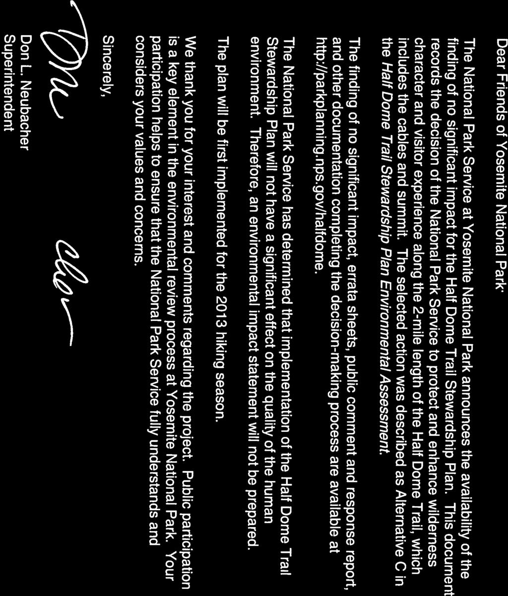
5 The Half Dome Trail Stewardship Plan Finding of No Significant Impact December 2012 Yosemite National Park FINDING OF NO SIGNIFICANT IMPACT This Finding of No Significant Impact (FONSI) documents the decision of the National Park Service (NPS) to adopt a plan for management of the Half Dome Trail in Yosemite Valley and the determination that no significant impacts on the human environment are associated with that decision. PURPOSE AND NEED Half Dome is an iconic, granite peak visible from many spots in Yosemite National Park, rising 5,000 feet above the Yosemite Valley floor in one dramatic sweep of sheer rock. Reaching its summit is a goal for a broad cross section of the public including beginning and experienced hikers, first-time and lifelong park visitors, an array of ethnicities and cultures, children to grandparents, and people from all around the world. For many, this may be their first hike in designated wilderness. The combination of the long hike, an exhilarating, exposed ascent of the cables, and a spectacular view from the summit can combine to be a highlight of a person s summer or even a life-changing event. Popularity of the Half Dome Trail has resulted in crowding along the Trail and the summit; this affects wilderness character of the area by compromising visitors opportunities for solitude. High use levels also affect natural conditions which are essential to wilderness character. Crowding has raised concerns about the safety of both the public and rescue personnel on the cables. Crowding subjects hikers to long travel times and delays in ascending and descending the Half Dome Cables and may prevent them from getting down from the exposed section of the Trail in a timely manner to avoid rain and lightning storms. These conditions led the National Park Service (NPS) to implement an interim permit system in 2010 that limited visitor use of the Half Dome Trail. This system was modified in 2011 and remained in place through the 2012 hiking season. The interim permit system was implemented as an emergency measure in tandem with the development of the Half Dome Trail Stewardship Plan Environmental Assessment (EA). This EA was undertaken with the express purpose to: protect the wilderness character of the project area while providing the public with appropriate opportunities to reach the summit of Half Dome; improve visitor experience on the Half Dome Trail by reducing crowding and limiting encounters among hikers; protect the area s natural and cultural resources; and improve public safety by reducing crowding on the Half Dome Trail. The Half Dome Trail Stewardship Plan
6 Finding of No Significant Impact SELECTED ACTION AND RANGE OF ALTERNATIVES CONSIDERED The EA, dated January 2012, describes and analyzes the following five alternatives: Alternative A: No Action Alternative B: 400 People per Day (Minimum Management Action) Alternative C: 300 People per Day (Preferred) Alternative D: 140 People per Day Alternative E: Remove the Cables These alternatives represent a reasonable range of options that meet the purpose and need for the project, relevant legal requirements, and park policies and guidelines. These alternatives were developed through an interdisciplinary process based on scientific visitor use studies, as well as public, NPS staff, tribal, and agency input. When developing reasonable alternatives for this EA, the NPS sought those alternatives that would: Provide a range of wilderness experiences for people seeking to reach the summit of Half Dome, Protect and enhance the wilderness character of the area, and Provide generally consistent free-flow travel conditions on the Half Dome cable section of the Trail to improve both visitor experience and public safety. SELECTED ACTION 300 PEOPLE PER DAY The goal of the Selected Action is to best protect wilderness character while providing a range of wilderness experiences and enhancements to public safety. The Selected Action is generally the same as Alterative C in the EA (the Preferred Alternative). There are some clarifications and corrections to the EA based on public comment, mainly in the area of commercial use. All corrections and clarifications are described in the Errata. The substantive changes are also included in this FONSI and are reflected in the description of the Selected Action. There are no corrections or clarifications based on agency consultation. Change: The plan will be modified to allow permit allocation for commercial use to respond to changes in use patterns, implementation of new technologies, and to meet the guidelines of the Determination of Extent Necessary (DEN) for commercial use in wilderness. This will ensure equitable and efficient distribution. Public notice will be given for any such modifications to the program. Clarification: Some minor technical corrections and these clarifications were made to the EA based on public comment: Effects of park wide trail use displacement will be monitored and addressed in the upcoming Yosemite Wilderness Stewardship Plan/Environmental Impact Statement Annual Half Dome Trail use data will be posted on the park s website Permits will be transferrable except for the trip leaders 1 1 Trip leader (and alternate) is specified in the application process The Half Dome Trail Stewardship Plan 2
7 Finding of No Significant Impact Under the Selected Action, the NPS will retain the cable system and implement day-use limits through a permit system managing to a target of 300 hikers per day on the Half Dome Trail. Use levels under the Selected Action provide appropriate conditions for wilderness character on the Trail by improving the opportunity for solitude. In the context of this popular, easily accessible wilderness area, solitude was considered to be an outdoor, recreational experience that was free from crowding. Reducing crowding will improve visitor experiences on the Trail and increase the public s ability to more safely use the Trail by maintaining free-flowing travel conditions on the cable section of the Trail. Permits and Fees Half Dome permits will be allocated through a combination of distribution methods. A percentage of Half Dome use will be allocated to Yosemite Wilderness Permit holders 2 who start their overnight trips from specified trailheads in the Half Dome travel area. Pacific Crest Trail permit holders and those with Yosemite Wilderness Permits for trailheads outside of the Half Dome travel area will not be eligible for this privilege but could compete through the normal dayuse permit allocation system. The remaining use will be considered day use and Half Dome permits for this use will be distributed through a combination of an advanced and day-before permit allocation system. Specifics and timing of this advanced allocation system will be refined annually, as needed, to best provide: an equitable distribution system, the ability to cancel unused reservations for a partial refund, technological and/or operational safeguards to protect against illegal resale of permits, and actual use that meets the designated management target. Half Dome permits will be transferrable, except for the trip leaders permit. Trip leaders (and alternate) are designated at the time of permit application. To help ensure compliance, personal identification may be required of trip leaders. Advanced permits will be allocated through a firstcome first-served reservation system, a lottery, or a combination of these options. Additionally, the NPS will reserve and distribute a portion of the day-use permits the day of or days before the hiking permit date to allow for more spontaneous use of the Trail. Finally, if through the ongoing monitoring of visitor use on the Half Dome Trail the NPS determines that this allocation system is not achieving the management target of 300 people per day, the NPS will take action to adapt the permit allocation system to achieve this daily management target. One of these actions could be to sell additional permits, above the use limit number, to make up for an expected number of unused permits. An annual report on Half Dome visitor use statistics will be compiled each year by the NPS and made available to the public. Under the Selected Action, the NPS may periodically adjust the permit allocation system to take advantage of new technologies as they become available. These adjustments would be incorporated to improve equitability and efficiency of the permit allocation system to achieve the prescribed management target. Public notice will be given for any such program adjustments. 2 Yosemite Wilderness Permits allow wilderness users to camp overnight in the wilderness with a set quota available for each trailhead. Wilderness Permits are obtained through a competitive process with advance reservations as well as day-before and day-of allocations. The Half Dome Trail Stewardship Plan 3
8 Finding of No Significant Impact The NPS will charge a fee for Half Dome permits. Permit fees will be designed to recover costs required to maintain the cable system and Trail, monitor use, educate hikers, ensure compliance with use limits, and protect the wilderness resource. This permit program will make the program self-sustaining by recovering those costs needed to directly manage the Half Dome Trail. Total permit fee to a visitor will consist of two costs: 1) the cost of allocating the permit by a contractor (which is approximately $4.50 per group via online application and approximately $6.50 for call in), and 2) the cost per person for the NPS to manage the Trail. This fee will initially range from approximately $6 to $8 per person. If operational costs increase, permit fees would also increase proportionately. Compliance Enforcement and Monitoring Two staff per night will be required for compliance enforcement and monitoring. These staff will stay at the NPS administrative camp at Little Yosemite Valley. These two additional staff will not increase the administrative use footprint. Commercial Use Commercial services providing educational or scenic trips on the Half Dome Trail will be allowed to provide up to a daily limit of 30 persons per day on guided educational trips and 15 people per day on scenic trips. Commercial use numbers were set by a DEN as part of the EA. While commercial use limits are set by the DEN, permit allocation methods will be administered annually by the NPS to ensure equitable and efficient distribution. In response to public comment on the EA, there will not be a prescribed system for allocating commercial use permits in the Selected Action. This stipulation allows the NPS to respond to changes in use patterns, implement new technologies, and meet the DEN guidelines. Public notice will be given for any such program modifications. Trail Maintenance The NPS will maintain the trail bed and stone step sections of the Half Dome Trail. Wilderness trail maintenance will continue to be accomplished primarily with hand tools; however, mechanized or motorized equipment may occasionally be the minimum tool for their work, as described in the 1989 Yosemite Wilderness Management Plan. The cable system will be put up each May and taken down each October as weather permits. This will require use of the NPS administrative camp at Little Yosemite Valley by 6-12 park staff for approximately four days at both the start and end of the season to put up and take down the cable section of the Trail. The steel cables will be left attached to the rock face all year. During the hiking season metal stanchions will be placed to lift the cables off the rock, and wooden steps (attached to the stanchions) will be placed to aid footing. Sections of cables, connecting hardware, and anchor bolts will be inspected twice annually and replaced as necessary. If anchor bolts require replacement, a Minimum Tool Analysis will be completed. When the cables are taken down in the fall, the stanchions and steps will be removed and stored in the immediate area. Visitor Education The NPS will provide and update wilderness stewardship and safety information to help visitors enjoy a safe, successful, low impact wilderness experience. The Yosemite National Park website will provide video and text information about safety and resource stewardship: Information provided to permit The Half Dome Trail Stewardship Plan 4
9 Finding of No Significant Impact applicants will include safety and stewardship recommendations and will also guide visitors to access the park s website for additional education. Ranger Patrols NPS Rangers will patrol the Half Dome Trail regularly to ensure protection of the wilderness resource and check for compliance with regulations. Visitor Use Monitoring The Half Dome Trail will be monitored by NPS visitor use and social science experts to determine actual visitor use levels and associated resource impacts. Wilderness Camping Wilderness camping will be subject to the Yosemite Wilderness Permit System and regulations contained within Title 36 Code of Federal Regulations and the Superintendent s Compendium. The NPS will continue to regulate numbers of wilderness campers in the Half Dome Trail area through trailhead quotas. Camping will continue to be prohibited on the Half Dome summit. OTHER ALTERNATIVES CONSIDERED AND ANALYZED Alternative A (No Action) The No Action Alternative is required by the National Environmental Policy Act and the NPS Director s Order 12: Conservation Planning, Environmental Impact Analysis, and Decisionmaking, to provide the baseline against which to compare the other alternatives. Under this alternative, the park would retain the cable system and continue managing the Half Dome Trail as it was up through There would be no day-use limits. Wilderness camping in the area would continue to be regulated through the Wilderness Permit System. The cables would continue to be put up in May and taken down in October, weather permitting. Maintenance and structural improvements to the Trail and cables would occur as needed. The No Action Alternative would result in unacceptable impacts to both visitor safety and wilderness character per NPS policy. Alternative B: 400 People per Day (Minimum Management Action) The goal of Alternative B was to provide the greatest access while improving visitor safety. Under this alternative the park would retain the cable system and implement day-use limits through a permit system with a management target of 400 hikers per day. This use limit is considered the minimum management action and is the same as the interim permit system that was implemented as a temporary measure to address visitor safety. Under this alternative travel times on the cables, crowding, and wilderness encounters are greatly reduced from the busiest days recorded when no day-use limits were in place (No Action Alternative). Use is not expected to exceed the visitor-informed threshold for crowding. The 400 people per day would be a combination of overnight users with wilderness permits, hikers with permits, and commercial clients and their guides. Day-use permits would be allocated through a combination of advanced reservation and day-before allocation. Five permits per day would be set aside for commercial use for up to two commercial trips per day. Alternative D: 140 People per Day The Half Dome Trail Stewardship Plan 5
10 Finding of No Significant Impact The goal of Alternative D was to protect wilderness character by eliminating crowding. Under Alternative D the park would retain the cable system and implement day-use limits through a permit system allowing 140 hikers per day. At 140 people per day, maximum day-use levels are expected to always remain below the statistical model threshold for crowding, and there would be no delays while traveling on the cables even during maximum use periods. The 140 people per day would be a combination of overnight users with wilderness permits and hikers with day-use permits. Day-use permits would be allocated through a combination of advanced reservation and day before allocation. No commercial use would be allowed. Alternative E: Remove the Cables The goal of Alternative E was to protect wilderness character by removing the cables. Alternative E would result in the park physically removing the cable system from Half Dome. Access to the summit would only be possible via technical climbing routes. One permitted commercial trip per day would be allowed. ACTIONS CONSIDERED BUT DISMISSED The NPS considered a range of actions when developing possible alternatives for the Half Dome Trail Stewardship Plan. The following actions were analyzed, considered, and dismissed because they did not fully satisfy the objectives of this planning effort. Actions were dismissed for one of the following reasons: The action would not satisfy the project s purpose and need. Less environmentally-damaging options were available. The action would cause unacceptable environmental, cultural, or social impacts. The action would present unacceptable risks or constraints with an associated increase in costs. The action would conflict with the guidance and direction provided in the park s 1980 Yosemite General Management Plan. Install a Third Cable to the Cable System With this alternative, the NPS would install a third cable, additional stanchions, steps, anchor bolts, and hardware next to the existing cable system, resulting in a total of three cables and two lanes of travel, one up and one down the cable system. In the absence of use limits, this additional cable could increase the cable system s capacity to handle the same level of use with less congestion. The NPS dismissed this alternative because reducing opportunities for solitude and adding development in wilderness contradict the objectives of this plan to protect wilderness character and improve the visitor experience in the project area. A third cable would allow continued, extremely high use of the Trail resulting in crowding on the Trail and summit, with encounter rates that far exceed any other wilderness area in Yosemite or in the U.S.. Furthermore, the 1989 Yosemite Wilderness Management Plan specifically limits facilities in Yosemite wilderness to those present in 1989 when the plan was written, or those that were specifically proposed in the plan. The plan contends that Further facilities would compromise the National Park Service s responsibilities in wilderness management. This supports why the existing two-cable system could be allowable in wilderness but additional permanent installation of a third cable would not be allowable. The Half Dome Trail Stewardship Plan 6
11 Finding of No Significant Impact Moreover, a three cable system would likely not resolve safety issues associated with unregulated use levels. At 1,200 people per day, people at one time (PAOT) on the cables can reach 130 which could overwhelm even the additional lane of travel, causing delays and congestion. Remove Half Dome Trail from Designated Wilderness Under this alternative, the NPS would recommend to Congress that the Yosemite Wilderness boundaries, as designated in the 1984 California Wilderness Act, be redrawn to remove the Half Dome Trail from designated wilderness. Section 3 (e) of the 1964 Wilderness Act describes the option for boundary adjustment. Doing this would allow the NPS to manage the Half Dome Trail as non-wilderness and would not require the NPS to consider the concept of solitude or the minimum requirement for installation of structures. This alternative is not consistent with the purpose and need of this plan to protect wilderness character. Under this alternative, rather than being a guiding purpose, wilderness character would become irrelevant because Half Dome and the trail leading to Half Dome would be removed from wilderness. This alternative would also not meet the goal of improving safety because existing use levels, which have been shown to impede free-flow on the cable route, would continue. The safety considerations that form part of the purpose and need for this plan exist regardless of the area s status as wilderness. Station Rangers at the Half Dome Cables in Lieu of Use Limits Under this alternative, a ranger would be stationed at the base of the cables to regulate traffic during periods of congestion and/or to close the route during inclement weather. This could eliminate the need for use limits. This alternative was considered and dismissed because it would not decrease crowding and provide for solitude opportunities on the Trail. Encounter rates would continue to be high, and crowding would be transferred to the summit and Sub Dome. Similarly, positioning a ranger to close the cable system when a storm is approaching contradicts established policy for risk management in wilderness. NPS Management Policies states, Park visitors need to accept wilderness on its own unique terms, and the NPS should only provide visitors with general information concerning possible risks. This would establish an unmanageable precedent for other wilderness areas. Control Timing of Use Under this alternative the NPS would spread use out over the day by assigning hikers to specific time slots. Controlling the timing of use would eliminate midday crowding and maintain freeflowing conditions while accommodating a larger number of hikers per day. A ranger would be stationed at the base of the cables and would serve as a gatekeeper allowing hikers to use the cable system only during their assigned time slot. This alternative was dismissed because it does not meet the purpose of increasing safety along the Trail corridor. A late ascent time could pose safety risks for many hikers. Numerous search and rescue incidents are caused by visitors completing the return portion of their trip after dark. In addition, delaying people until later in the day means they are at the summit in the afternoon when thunderstorms are more likely. The Half Dome Trail Stewardship Plan 7
12 Finding of No Significant Impact Permit System with Use Limit of 500 People (or More) per Day Under this alternative the NPS would retain the cable system and implement day-use limits through a permit system managing for a target of 500 or more hikers per day. At 500 people per day, visitor experience on the Half Dome Trail would be similar to conditions previously observed for weekday use without a permit system. The 500 hikers would be a combination of overnight hikers with wilderness permits and hikers with day-use permits. Day-use permits would be allocated through a system that allocates permits months in advance and days in advance. This action was considered and dismissed because it would not sufficiently decrease crowding, provide opportunities for solitude, or provide free-flowing conditions where hikers could manage their own risks. Scientific models concluded that five hundred people per day would result in wilderness encounter which would exceed any other documented wilderness use in the western U.S. Implement a Permit System for Weekends and Holidays Under this alternative a permit system similar to the 2010 interim permit system would be implemented, and use would only be regulated on Friday through Sunday and on federal holidays. Prior to 2010 the busiest days on the Half Dome Trail were Saturdays and holidays with generally much lower use on weekdays. Based on this data, a permit system would only be required to limit use on the identified busiest days, as well as Fridays and Sundays, to account for planned use displacement to adjacent days. This alternative was tested during the 2010 season and found to result in use being significantly displaced to non-permit days, Mondays through Thursdays, with highest use on Thursdays. Monitoring showed daily use was high enough on the busiest days to consistently cause crowding and queuing which adversely impacted both wilderness character and public safety and, therefore, did not meet the purpose and need for this plan. Issue Permits Good for Multiple Days Under this alternative the NPS would retain the cable system and implement a permit system with permits that are good for multiple days. Permit holders would be able to take advantage of favorable weather conditions, weigh other risk management factors, and choose the day of their ascent within a given time period. This action was considered and dismissed because it would not guarantee elimination of crowding, opportunities for solitude, or free-flowing conditions. Under this alternative, there is no way of predicting the number of people who would be using the Half Dome Trail on any given day, and it is likely that encounter rates would exceed acceptable levels on weekends and on the first day of favorable weather after a period of inclement weather. (This space intentionally left blank.) The Half Dome Trail Stewardship Plan 8
13 Finding of No Significant Impact ENVIRONMENTALLY PREFERRED ALTERNATIVE Council on Environmental Quality (CEQ) Regulations, implementing the National Environmental Policy Act (NEPA), and the NPS NEPA guidelines require that the alternative or alternatives which were considered to be environmentally preferable be identified (Section ). Environmentally preferable is defined by CEQ as the alternative that will promote the national environmental policy as expressed in the NEPA Section 101. This means the alternative that causes the least damage to the biological and physical environment; it also means the alternative that best protects, preserves, and enhances historic, cultural, and natural resources. Section 101 of NEPA states that it is the continuing responsibility of the Federal Government to: 1) Fulfill the responsibilities of each generation as trustee of the environment for succeeding generations; 2) Assure for all Americans safe, healthful, productive, and aesthetically and culturally pleasing surroundings; 3) Attain the widest range of beneficial uses of the environment without degradation, risk to health or safety, or other undesirable and unintended consequences; 4) Preserve important historic, cultural, and natural aspects of our national heritage, and maintain, wherever possible, an environment which supports diversity, and variety of individual choice; 5) Achieve a balance between population and resource use which will permit high standards of living and a wide sharing of life s amenities; and 6) Enhance the quality of renewable resources and approach the maximum attainable recycling of depletable resources. (This goal was not considered applicable in this EA.) The Selected Action (Alternative C presented in the EA) would best fulfill responsibilities of the NPS to identify the alternative that will promote national environmental policy as expressed in NEPA Section 101. All action alternatives (B, C, D, and E) address the purpose and need of this plan by improving safety conditions where visitors are able to manage their own risks consistent with criterion 2. The No Action Alternative and Alternatives B, C, and D would retain the cables and allow those hikers without technical rock climbing skills to access the Half Dome summit. Alternative E would remove the cables, thereby improving the undeveloped character of wilderness on the Trail. Alternative D would best meet criterion 4 by managing use levels on the Half Dome Trail to 140 people per day which would likely result in the least impact to the environment while preserving national heritage in the form of historic use of the cables. The difference in physical impacts under the Selected Action and Alternative D is minimal. However, reducing use to the low levels prescribed by Alternative D would not attain the widest range of beneficial uses of the environment (criterion 3). The Selected Action best meets NEPA Section 101 criteria 1, 2, and 3 by maximizing use while maintaining free-flowing conditions. This meets risk management objectives and protects and enhances wilderness character. Compared with other project alternatives, the Selected Action would achieve the best balance between visitor use and resource protection (criterion 3). Thus, the NPS identified this action as the environmentally preferred alternative. The Half Dome Trail Stewardship Plan 9
14 Finding of No Significant Impact DECISION RATIONALE The Selected Action best protects wilderness character while providing a range of wilderness experiences and improving public safety. Decision rationale demonstrating how the Selected Action best meets the purpose and need of this plan is provided below. WHY THE SELECTED ACTION WILL NOT HAVE A SIGNIFICANT IMPACT ON THE HUMAN ENVIRONMENT In considering the 10 criteria for significant impact, as defined by CEQ regulation 40 CFR , it was determined that the Selected Action will not have a significant effect on the human environment. The "human environment", defined in Sec , shall be interpreted comprehensively to include the natural and physical environment and the relationship of people with that environment. This means that economic or social effects are not intended by themselves to require preparation of an environmental impact statement. Specifically, no highly uncertain or controversial impacts, unique or unknown risks, elements of precedence, or cumulatively significant effects have been identified. Implementation of the Selected Action will not result in the loss or destruction of significant scientific, cultural, or historic resources and implementation of the Selected Action will not violate any federal, state, or local laws. All criteria were considered, and it was determined that none of the significance criteria are triggered under the Selected Action, specifically: The Selected Action will benefit both the quality of visitors experience and the public s safety and ability to manage their own risk. Impacts to the natural or physical environment and impacts to the relationship of people with that environment will not be significant. No highly uncertain or controversial impacts or elements of precedence have been identified. The Selected Action prescribes a permit system to regulate use in a wilderness area, a commonly accepted wilderness management practice in the Sierra and in U.S. wilderness areas in general. The interim permit system and its allocation system, though separate from the EA, caused some public concern with management of the Half Dome Trail. However, refinements to the interim permit system have been addressed to satisfy those concerns. Implementation of the Selected Action will not violate any federal, state, or local laws. Special-status species will not likely be adversely affected. There will be no adverse effects to cultural or historic resources. The cable section of the Half Dome Trail does present an uncommon, though not unique, challenge and risk to the public. However, that risk is identified to the public through educational information as part of the permit program on the park s website, through NPS brochures, and on signs along the Trail. By following NPS safety guidance, especially avoiding exposed portions of the Trail during and after inclement weather, the Trail does not present an unacceptable risk. The Selected Action was evaluated in context with other ongoing and proposed management actions, and no adverse cumulative impacts are expected. Some of these other management actions include the Merced Wild and Scenic River Comprehensive Management Plan, the Tuolumne Wild and Scenic River Comprehensive Management Plan, The Half Dome Trail Stewardship Plan 10
15 Finding of No Significant Impact and the Yosemite Wilderness Stewardship Plan. Effects on public health and safety will be improved through regulated use and increased opportunities for safety education. The Selected Action will improve the public s ability to manage its own risk within the park. Based on the following summary of effects, and as discussed in the EA, the Selected Action (Alternative C, as analyzed in the EA) is determined not to have a significant effect on the human environment. Wilderness The Selected Action will result in long-term beneficial impacts to wilderness character by eliminating crowding. The Half Dome Trail, including the cable section, provides the nonclimbing public a rare opportunity to reach an iconic, internationally-known wilderness summit by a uniquely challenging hike. The NPS determined that the Half Dome Trail hiking experience was appropriate for this wilderness area and that the Trail and its structures were not prohibited in wilderness and did not need to be removed. The NPS sought a way to continue Trail usage while addressing adverse impacts resulting from high use and crowding. The Selected Action employs a permit system to regulate and manage use to an acceptable level and eliminate crowding. While permit systems and associated program compliance may adversely impact the unconfined quality of a wilderness experience by intruding into the public s opportunity for unconfined recreation in wilderness, these systems are commonly used as the minimum required management in high-use wilderness areas around the country. Use levels specified in the Selected Action (300 people per day) were deemed to represent the best balance of public access and protection of wilderness character. While the Selected Action (as well as Alternatives B, D, and E) is expected to decrease day use on the trail between the top of Nevada Fall and the start of the Half Dome Trail, it also has the potential to disperse and increase day use and associated impacts to other areas of the park. However, NPS social science staff expects that any dispersed use will result in a nominal redistribution to a number of trails around the park rather than to any one specific trail. Scientific assessment of use on wilderness trails throughout the park and the appropriate management response will be addressed in the upcoming Yosemite Wilderness Stewardship Plan. Overnight use (wilderness camping) should not shift to other wilderness areas in the park because overnight use is regulated by existing trailhead quotas which remain unchanged. Visitor Experience The Selected Action will result in long-term beneficial impacts to visitor experience. This action leaves the cable system in place and allows non-technical climbers to access the Half Dome summit. Use will be managed to a target of 300 people per day through a permit system. During periods of highest use, PAOT on the cables will not reach unacceptable levels and will be only slightly above visitor-informed desirable levels. Public Safety The Selected Acton will result in benefits to public safety and visitors ability to manage their own risk on the Half Dome Trail. With a limit of 300 people per day, use on the Half Dome Trail is expected to provide free-flowing conditions, with an average of 15 PAOT on the cables. Even during brief daily periods of highest use on the cables, 36 PAOT is expected, which is only slightly above the free-flowing level of 30 PAOT. This is expected to greatly reduce descent times from The Half Dome Trail Stewardship Plan 11
16 Finding of No Significant Impact the summit as compared to unregulated use. Hikers should be able to descend exposed sections of the Trail without obstruction from crowding when attempting to avoid approaching storms. Additionally, targeted safety information during the permit process could increase hikers knowledge of potential risks associated with hiking the Trail and strategies to manage those risks. Natural Resources The Selected Action will reduce the number of hikers on the Trail and result in long-term beneficial impacts on natural resources. Targeted education on minimizing impacts to natural resources would be done as part of the permit process. Fewer hikers will reduce current adverse effects on vegetation along the Trail from trampling and soil erosion. Adverse effects to wildlife from increased availability of human food and trash, noise, and visual disturbance from hikers on the Trail will also be reduced. Finally, though the Mount Lyell Salamander, a species of special interest, is generally not disturbed by hikers, any adverse effects on this species should also be reduced. Cultural Resources and Historic Properties The Selected Action will result in no adverse effects to historic properties. Hikers will continue to experience the historic feeling of the Half Dome Cables and Trail Historic District, a historic property that was listed on the National Register of Historic Properties in Park Operations Compliance enforcement, use monitoring, resource and safety education, and trail maintenance will be done by dedicated Half Dome staff and will not adversely affect staffing for other park operations. The permit system will be managed to recover costs thereby eliminating any potential fiscal impact to the park s other operations. With fewer hikers on the Trail, increased targeted education available through the permit process, and a consistent ranger presence, the efficiency of park operations is expected to increase. Under the Selected Action the cable system, the Trail, and the composting toilets at Little Yosemite Valley Campground will all be used less frequently thereby reducing operations and maintenance requirements. The increased opportunity for safety and resource protection education should reduce the frequency of rescue operations and resource restoration efforts. Increased ranger presence on the Trail should improve compliance with regulations. Compliance enforcement and monitoring would add approximately two staff per night at the NPS administrative camp at Little Yosemite Valley. The additional staff would not increase the administrative footprint. The trail crew would continue to stay at Little Yosemite Valley during the cable set up operation at the start of the season and during the cable take down operation at the end of the season. Socioeconomics Permit fees represent a minor adverse economic impact to visitors. The proposed range of total fee (permit cost and application fee) to the visitor is commensurate with other day-use fees at federal areas around the region. To recover operational costs of the permit program, individual hikers will be charged approximately $6 to $8 per permit, in addition to an application fee for permit distribution. This fee is not expected to deter potential Half Dome hikers. Permit demand remained high with comparable fees during the interim permit system. The Half Dome Trail Stewardship Plan 12
17 Finding of No Significant Impact Commercial use limitations under the Selected Action may result in minor, regional adverse impacts to commercial users. During unregulated use on the Half Dome Trail in 2008, commercial trips accounted for approximately 300 guided hikers per year. Under the Selected Action, a maximum of 45 people (clients and guides) per day are allowed over the 136 day season when permits are required. This could amount a maximum of 6,120 visitors per year. It is unlikely these limits will be reached on most days. The allocation system for commercial use will remain flexible to create the least adverse impact to commercial operations as necessary. CUMULATIVE IMPACTS CEQ regulations (section ) describe a cumulative impact as follows:... a Cumulative impact is the impact on the environment which results from the incremental impact of the action when added to other past, present, and reasonably foreseeable future actions regardless of what agency (federal or non-federal) or person undertakes such other actions. Cumulative impacts can result from individually minor but collectively significant actions taking place over a period of time. The analysis of cumulative impacts in The Half Dome Trail Stewardship Plan EA did not identify any significant cumulative impacts. MITIGATION No mitigation measures or best management practices to avoid or reduce adverse impacts on park resources have been identified in association with the Selected Action. PUBLIC INVOLVEMENT AND COORDINATION Public Scoping Public scoping for the EA was initiated on May 26, The 30-day public comment period was to end on June 25, This period was extended until July 9, 2010 to include the Fourth of July holiday weekend, which is typically a high-use period. Three public scoping meetings were held on May 26, June 5, and June 16, 2010, in Yosemite Valley, Fresno, and Berkeley, respectively. Written public scoping comments were received online through the Planning, Environment, and Public Comment (PEPC) website ( fax, U.S. Mail, and on comment forms available at open houses during the scoping period. During the public scoping period, 96 correspondence items (including letters, faxes and s, and meeting notes) were received. Of the 96 items, 88 were from individuals; 3 were from businesses, 2 were from conservation/preservation groups (Wilderness Watch and Friends of Yosemite Valley), 1 was from a non-governmental organization, and 2 were transcripts from public meetings. Each comment letter was carefully reviewed. A total of 361 comments were identified, and 52 concern statements were developed from these comments. Based on internal and public scoping comments and applicable federal law, regulations, and The Half Dome Trail Stewardship Plan 13
18 Finding of No Significant Impact executive orders, the NPS determined that an EA would be the appropriate level of compliance for the Half Dome Trail Stewardship Plan. Public scoping comments and issues raised by NPS staff were used in the alternatives development process and the analysis presented in the EA. Internal scoping and consultation with other government agencies and American Indian tribes and groups informed the planning process. See Consultation, below, for more information. Public Review and Comment Period The Half Dome Trail Stewardship Plan EA was released for public review on January 24, 2012, and the NPS accepted comments through March 15, The document was available through the PEPC website ( and hard copies were available as requested. Approximately 15 hard copies were distributed to individuals, agencies, tribes, groups, and organizations. Comments on the EA could be submitted online through the PEPC website, the address, by U.S. mail, and fax. The public review period was announced in a press release, a Yosemite electronic news release, the Yosemite National Park Daily Report, the Mariposa Gazette, and on the Yosemite National Park website. During the review period, the NPS held a webinar on February 10, 2012 and an open house on February 29, 2012 to disseminate information and collect written comments on the Half Dome Trail Stewardship Plan EA. Following presentations, park staff answered questions clarifying the proposed action; no written comments were submitted at the webinar or open house. During the 52-day public comment period, the park received 1,649 public comment letters from individuals, 5 from businesses, 7 from organizations (Colorado Mountain Club, Wilderness Watch, Save Half Dome, Central Sierra Environmental Resource Center, Sierra Club s Yosemite Chapter, Tehipite Sierra Club Chapter, National Parks Conservation Association), 1 from a county government agency (Tuolumne County Board of Supervisors), and 1 from a federal government representative (California 4 th District Representative Tom McClintock). Public comments included 1,073 form letters supporting the Selected Action. Although most commenters supported the need to address public safety, 41 form letters were received supporting Alternative A (No Action) and a comment letter from Save Half Dome that included an on-line petition with 576 signatures in support of Alternative A and the installation of a third cable. In addition to the letter from Wilderness Watch, 29 form letters supported Alternative E. The majority of individuals who commented were California residents. Many comments focused on the allocation of permits which was not part of the purpose and need statement and, consequently, were not analyzed in the Half Dome Trail Stewardship EA Public Comment and Response Report. Comment analysis identified 1,716 discrete comments, from which 75 general concern statements were generated. The planning team prepared responses to all those comments that were considered substantive. Comments concerning effects of the potential dispersal of Half Dome use to other wilderness trails resulted in a minor change to the cumulative impact analysis on wilderness character. Comments that resulted in (1) changes to the text of the EA for the purpose of clarification and (2) alterations of prescribed actions for implementation of the permit system under the Selected Action are presented in the Errata. All substantive comments and associated responses are documented in the Half Dome Trail Stewardship Plan Public Comment and Response Report available online at The list below summarizes the spectrum of substantive comments received during the comment period: The Half Dome Trail Stewardship Plan 14
19 Finding of No Significant Impact Clarify relationship among safety, crowding, and wilderness character Clarify effects to wilderness character as they relate to the Wilderness Act and case law Reconsider removal of the Half Dome cables Reconsider removal of the Half Dome Trail from designated Wilderness Reconsider addition of a third cable Clarify methodology used in visitor use studies and future monitoring Define NPS role in visitor safety and managing personal risk in wilderness Reconsider allocation of permits for commercial use Stipulate how the permit program will ensure equitable access and protect against misuse and scalping Reconsider period for which permits are required Stipulate considerations in instances of inclement weather Describe educational messaging and training associated with the permit system Quantify displacement impacts on other wilderness areas in Yosemite Clarify relationship of the Half Dome Trail Stewardship Plan to other plans in Yosemite and other national wilderness areas CONSULTATION Culturally Associated American Indian Tribes and Groups Yosemite National Park consulted with traditionally-associated American Indian tribes and groups. These tribes and groups included the American Indian Council of Mariposa County, Inc. (aka Southern Sierra Miwok Nation), Tuolumne Band of Me-Wuk Indians, North Fork Mono Rancheria, Picayune Rancheria of Chukchansi Indians, Bridgeport Paiute Indian Colony, Mono Lake Kutzadika a Tribe, and Bishop Paiute Tribe. Consultation was initiated in a letter of correspondence on June 24, Each tribe or group received a hard copy of the EA mailed in February The NPS did not receive any direct comments or responses from traditionallyassociated American Indian tribes and groups during the planning phases of this EA. Consultation will continue through implementation of the Half Dome Trail Stewardship Plan project to ensure that any potential concerns are addressed accordingly. California State Historic Preservation Officer The 1999 Park Programmatic Agreement Among the National Park Service at Yosemite, the California State Historic Preservation Officer and the Advisory Council on Historic Preservation Regarding Planning, Design, Construction, Operations and Maintenance, Yosemite National Park, California (1999 PA) was developed to coordinate consultation and methods for the park to carry out its responsibilities under Section 106 of the National Historic Preservation Act (NHPA). In accordance with the 1999 PA and consistent with 36 CFR Part 800.3(b) and 36 CFR Part 800.8, consultation with the California State Historic Preservation Office was conducted concurrently for NEPA and the NHPA. The NHPA Section 106 review process is documented in the EA. In accordance with Stipulation VIII B of the 1999 PA, the NPS provided the State Historic Preservation Officer with a consultation letter requesting concurrence on the determination of no adverse effect to historic properties. A response concurring with the no adverse effect was received by November 1, The Half Dome Trail Stewardship Plan 15
20
21 The Half Dome Trail Stewardship Plan Environmental Assessment Determination of Non-Impairment December 2012 Yosemite National Park DETERMINATION OF NON-IMPAIRMENT While Congress has given the National Park Service (NPS) management discretion to allow impacts within parks, that discretion is limited by the statutory requirement (generally enforceable by the federal courts) that the NPS must leave park resources and values unimpaired unless a particular law directly and specifically provides otherwise. This cornerstone of the Organic Act establishes the primary responsibility of the NPS, to ensure that park resources and values will continue to exist in a condition that will allow the American people to have present and future opportunities for enjoyment of them. The impairment of park resources and values may not be allowed by the NPS unless directly and specifically provided for by legislation or by the proclamation establishing the park. The relevant legislation or proclamation must provide explicitly (not by implication or inference) for the activity, in terms that keep the NPS from having the authority to manage the activity so as to avoid the impairment. The impairment that is prohibited by the Organic Act and the General Authorities Act is an impact that, in the professional judgment of the responsible NPS manager, would harm the integrity of park resources or values, including the opportunities that otherwise would be present for the enjoyment of those resources or values. Whether an impact meets this definition depends on the particular resources and values that would be affected; the severity, duration, and timing of the impact; the direct and indirect effects of the impact; and the cumulative effects of the impact in question and other impacts. An impact to any park resource or value may, but does not necessarily, constitute impairment. An impact would be more likely to constitute impairment to the extent that it affects a resource or value whose conservation is: necessary to fulfill specific purposes identified in the establishing legislation or proclamation of the park, or key to the natural or cultural integrity of the park or to opportunities for enjoyment of the park, or identified in the park s general management plan or other relevant NPS planning documents as being of significance. An impact would be less likely to constitute impairment if it is an unavoidable result of an action necessary to preserve or restore the integrity of park resources or values and it cannot be further mitigated. An impact that may, but would not necessarily, lead to impairment may result from visitor activities; NPS administrative activities; or activities undertaken by concessioners, The Half Dome Trail Stewardship Plan EA 1
22 Determination of Non-Impairment contractors, and others operating in the park. Impairment may also result from sources or activities outside the park. NPS Management Policies 2006 requires analysis of potential effects to determine whether or not actions would impair park resources. Park resources and values that are subject to the noimpairment standard include: park scenery, natural and historic objects, and wildlife, and the processes and conditions that sustain them, including, to the extent present in the park: the ecological, biological, and physical processes that created the park and continue to act upon it; scenic features; natural visibility, both in daytime and at night; natural landscapes; natural soundscapes and smells; water and air resources; soils; geological resources; paleontological resources; archeological resources; cultural landscapes; ethnographic resources; historic and prehistoric sites, structures, and objects; museum collections; and native plants and animals; appropriate opportunities to experience enjoyment of the above resources, to the extent that can be done without impairing them; the park s role in contributing to the national dignity, the high public value and integrity, and the superlative environmental quality of the national park system, and the benefit and inspiration provided to the American people by the national park system; and any additional attributes encompassed by the specific values and purposes for which the park was established. Based on enabling and wilderness legislation, legislation of October 1890, the 1984 California Wilderness Act, and the 1980 Yosemite General Management Plan, the purposes of Yosemite National Park are to: provide for the preservation from injury of all timber, mineral deposits, natural curiosities, or wonders within said reservation, and their retention in their natural condition. (H.R ) preservation of the resources that contribute to Yosemite s uniqueness and attractiveness its exquisite beauty; outstanding wilderness values; a nearly full diversity of Sierra Nevada environments, including the very special sequoia groves; the awesome domes, valleys, polished granites, and other evidences of the geologic processes that formed the Sierra Nevada; historic resources, especially those relating to the beginnings of a national conservation ethic; and evidences of the Indians that lived on the land. to make the varied resources of Yosemite available to people for their individual enjoyment, education, now and in the future [wilderness areas] shall be administered for the use and enjoyment of the American people in such manner as will leave them unimpaired for future use and enjoyment as wilderness, and so as to provide for the protection of these areas, the preservation of their wilderness character, and for the gathering and dissemination of information regarding their use and enjoyment as wilderness Based on the 1916 Organic Act and 1980 Yosemite General Management Plan, topics from the EA that were evaluated for potential impairment due to implementing the Selected Action include wilderness, vegetation resources (including non-native species), wildlife, federally listed species and species of special concern, and historic properties. Non-resource topics such as visitor experience, risk management, park operations, and socioeconomics are not subject to impairment determinations. The Half Dome Trail Stewardship Plan 2
23 Determination of Non-Impairment Wilderness Wilderness character consists of four broad qualities: untrammeled, natural, undeveloped, and outstanding opportunities for solitude or a primitive and unconfined type of recreation. The untrammeled quality is unaffected by the Selected Action. No manipulation of natural processes will occur as a result of this action. The natural quality will benefit from the Selected Action because reduced use will result in reduced impact on the natural environment. Additionally, the permit system will afford increased opportunities for stewardship education. The undeveloped quality is unaffected by the Selected Action, as no changes are proposed for the existing trail system. Opportunities for solitude are vastly improved by the Selected Action. Opportunities for a primitive experience are essentially the same as at present. Opportunities for unconfined recreation are diminished by the new permit system. The overall effect of the Selected Action is an improvement to wilderness character. While the benefit to solitude and the natural environment is partially offset by the requiring visitors to obtain a permit, tradeoffs like this are often required in popular wilderness areas, and diminishment of the unconfined quality does not reach the level of impairment. Vegetation and Biotic Communities Most vegetation in the park is classified into five forest vegetation zones and associated meadow zones. Three of the five forest vegetation zones occur along the Half Dome Trail. Upper Montane Forests Most of the Trail occurs within the Upper Montane Forests zone ranging from about 5,900 to 7,870 feet above mean sea level. This zone is characterized by montane chaparral and various coniferous forest communities. There are short, cool summers and cold winters there, and nearly all precipitation is in the form of snow. Subalpine Forests On the upper slopes approaching Half Dome, the Trail crosses through Subalpine Forests characterized by whitebark pine (Pinus albicaulis), mountain hemlock (Tsuga mertensiana), and lodgepole pine (Pinus contorta). This zone overlaps in elevation with the Upper Montane Forests zone, and it has short summers and long, cold, snowy winters with a lot of deep snow. Alpine The last half mile of Trail up to the Half Dome summit goes through the Alpine zone. This area is mostly granite rock with some small pockets of vegetation found in depressions that collect water. Mosses, succulents and other low-growing plants are typically seen in these small pockets. Impacts to vegetation resources in the project area have been from trampling along the Trail s edge and soil erosion on the Trail s bed -- both caused by high numbers of hikers. The Selected Action will reduce both of these impacts by reducing the number of hikers on the Trail and targeted resource protection education as part of the permit system. The Selected Action would not result in impairment to the vegetation and biotic communities. The Half Dome Trail Stewardship Plan 3
24 Determination of Non-Impairment Wildlife The park supports a variety of wildlife that can be seen in a wide range of habitats. Species vary with the types of vegetation that occur, and some vegetation zones are more diverse than others. Wildlife species in the Upper Montane Forest Zone include the great gray owl (Strix nebulosa), red-tailed hawk (Buteo jamaicensis), olive-sided flycatcher (Contopus cooperi), mountain chickadee (Poecile gambeli), Steller s jay (Cyanocitta stelleri), coyote (Canus latrans), black bear (Ursus americanus), mule deer (Odocoileus hemiones), weasel (Mustela spp.), bushy-tailed woodrat (Neotoma cinerea), and golden-mantled ground squirrel (Spermophilus lateralis). Patches of meadow habitats support amphibians and provide nesting habitat for water birds. During summer these areas also provide green vegetation for mule deer. Subalpine Forests near the Trail includes lodgepole pine and whitebark pine/mountain hemlock forests. Wildlife species there include the Yosemite toad (Bufo canorus), Clark s nutcracker (Nucifraga columbiana), dusky flycatcher (Empidonax oberholseri), Williamson s sapsucker (Sphyrapicus thyroideus), pine siskin (Carduelis pinus), yellow-bellied marmot (Marmota flaviventris), and golden-mantled ground-squirrel. Alpine habitat is dominated by talus, rocky outcrops, and rock slabs characteristic of Yosemite s highest elevation peaks. Wildlife there includes the Sierra Nevada yellow-legged frog (Rana sierrae), prairie falcon (Falco mexicanus), golden eagle, gray-crowned rosy-finch (Leucosticte tephrocotis), horned lark (Eremophila alpestris), Belding s ground squirrel (Urocitellus beldingi), American pika (Ochotona princeps), and Sierra Nevada big-horned sheep (Ovis Canadensis sierrae). Impacts to wildlife in the project area have included trampling of vegetation along the Trail corridor, increased availability of human food and trash to wildlife, and noise and visual disturbance from hikers on the Trail. Wildlife in the area, particularly squirrels and chipmunks, have become habituated to hikers and have received food from handouts and from food left in unattended packs. The Selected Action will reduce these impacts by reducing the number of hikers on the Trail and through targeted stewardship education as part of the permit system. The Selected Action would not result in impairment to wildlife. Special Status Species For purposes of this analysis, special status species are defined as plants and wildlife that are listed as follows: U.S. Fish and Wildlife Service (USFWS) endangered, threatened, proposed or candidate species; State of California endangered, threatened, candidate, rare, or fully protected species, species of special concern, or (more specifically) California bird species of special concern; and/or Reported observations, scientific research, and NPS professional judgment. A list of 17 special status species that have the potential to occur in the 6,000 to 9,000 foot range surrounding the Half Dome Trail project area was developed (Table 3-3 in the EA). From this list, NPS staff determined that only the Mount Lyell Salamander is known to occur in the project vicinity. The Half Dome Trail Stewardship Plan 4
25 Determination of Non-Impairment The Mount Lyell salamander (Hydromantes platycephalus) is both a special status species and a California species of special concern. This salamander occurs in a wide range of elevations, mostly above 4,000 feet, in rock fissures, snowmelt seeps, and waterfall habitats. The species has a broad geographic range, but occurs in small local populations. Mount Lyell salamanders have historically been documented on Half Dome. In the 1930s, NPS ranger-naturalists collected more than 100 salamanders. A breeding population of Mount Lyell salamanders currently exists on Half Dome, south of the Trail. No salamanders have been documented in the immediate vicinity of the Trail since Mount Lyell salamanders are nocturnal and live in areas not frequented by day hikers. They spend the day under flat rocks that cover small, water-carved cavities in gravel. They avoid bare, dry areas and, consequently, they are generally not disturbed by hikers. The NPS evaluated effects of the alternatives according to guidance outlined in the 1998 USFWS and National Marine Fisheries Service Endangered Species Act Consultation Handbook: Procedures for Conducting Section 7 consultations and Conference Activities, and as described below: No Effect: The project (or action) is located outside suitable habitat, and there would be no disturbance or other direct, indirect, or cumulative impacts on the species. The action would not affect the listed species or its designated critical habitat. May Affect, Not Likely to Adversely Affect: The project (or action) occurs in suitable habitat or results in indirect impacts on the species, but the effect on the species is likely to be entirely beneficial, discountable, or insignificant. The action might pose effects on listed species or designated critical habitat, but given circumstances or mitigation conditions, the effects might be discounted, insignificant, or completely beneficial. Insignificant effects would not result in take. Discountable effects are those extremely unlikely to occur. Based on best judgment, a person would not (1) be able to meaningfully measure, detect, or evaluate insignificant effects or (2) expect discountable effects to occur. May Adversely Affect: The project (or action) would have an adverse effect on a listed species as a direct, indirect, or cumulative result of the proposed action or its interrelated or interdependent actions, and the effect is not discountable, insignificant, or beneficial. The impact evaluation for special status wildlife species was based on the following: (1) the known or likely occurrence of a species or its preferred habitat in the vicinity of the project area; (2) the direct physical loss or gain, or modification of habitat; and (3) the effective loss of habitat (through avoidance or abandonment) due to visitor activity or noise or other species sensitivity to human disturbance. Direct impacts to the Mount Lyell salamander would be negligible because this species is nocturnal and is not typically affected by day-use activities. Local indirect impacts from improper disposal of human waste or moving boulders could affect this species habitat, especially if hikers enter areas where this species and its habitat occur. The Selected Action will reduce these impacts by reducing the number of hikers on the Trail and through targeted resource protection education as part of the permit system. Therefore, the Selected Action may affect, but is not likely to adversely affect, special status species. Cultural Resources The area of potential effect for this project is a 100 meter buffer on either side of the two miles of the Half Dome Trail. This area was determined to include all resources that might be affected by visitor use of the Trail. The Half Dome Trail Stewardship Plan 5
26 Determination of Non-Impairment The Half Dome Cables and Trail National Register nomination was prepared by the park s Cultural Resources staff to fulfill National Historic Preservation Act (NHPA) Section 110 requirements stating that federal agencies identify, evaluate, and nominate properties to the National Register of Historic Places (NRHP). This draft nomination was submitted for concurrence from the California State Historic Preservation Officer (SHPO) and the Keeper of the National Register in September The property was determined eligible to the National Register and was listed on the NRHP in August of The Half Dome Cables and Trail nomination reached the following conclusions: The Half Dome Cables and Trail is eligible for listing in the National Register as a Historic District with a period of significance extending from George Anderson s ascent of Half Dome and concluding after the cable route and switchbacks were installed by the Sierra Club ( ). The Half Dome Cables and Trail Historic District has three contributing features (Half Dome Trail Alignment, Granite Stone Masonry Steps and Retaining Walls, and the Anderson Memorial Arch Ruins) and one non-contributing feature (Half Dome Cables and Stanchions). Although the Half Dome Cables and Stanchions are listed as noncontributing due to their replacement in 1934 and 1984, they are considered compatible within the historic property. The Half Dome Cables and Trail is considered to have local historic significance under National Register Criterion A as one of the earliest trails to a Yosemite Valley high mountain summit and as one of the most difficult trail building projects in the park. It also has local historic significance under National Register Criterion B for its association with George Anderson, and local historic significance under National Register Criterion C for its technological advances in the design and construction of modern technical rock climbing. Today, the Half Dome Cables and Trail remains much as it did in It maintains a high degree of integrity in location, design, setting, workmanship, feeling, and association but has substantially diminished integrity of materials. The historic location of the stairway switchbacks leading to the cables and the cables themselves has not changed. The design of the route remains true to the 1919 installation by the Sierra Club as a granite switchback stairway leading to a pair of steel cables up Half Dome. The setting of the Half Dome Cables and Trail remains unchanged; it is situated in an otherwise undeveloped part of Yosemite s wilderness, towering above the eastern portion of Yosemite Valley. Historic workmanship is evidenced through dry-laid stone masonry and through the many George Anderson and Sierra Club era drill holes that follow the alignment of the cables. The historic feelings of adventure, exploration, and triumph are still experienced by those who ascend the Half Dome cables. Finally, this route conveys a direct and tangible association to the site s significance in recreation, transportation, and invention and to its association with George Anderson. This popular hike has captured the imagination of Yosemite visitors since George Anderson first ascended the granite monolith in 1875 and it remains a definitive experience for park visitors today. No eligible or potentially eligible archeological resources have been identified along the Half Dome Trail corridor. The Half Dome Trail Stewardship Plan 6
27 Determination of Non-Impairment The Selected Action would allow the public to continue to experience the historic feeling of the Half Dome Cables and Trail Historic District. Minor structural improvements of the cables would be completed in a manner consistent with the historic workmanship and design and would therefore not affect the integrity of the property and would not impair the cultural resource. SUMMARY As described above, adverse effects and environmental impacts anticipated as a result of implementing the Selected Action on a resource or value whose conservation is necessary to fulfill specific purposes identified in the establishing legislation or proclamation of the park, key to the natural or cultural integrity of the park or to opportunities for enjoyment of the park, or identified as significant to the park s general management plan or other relevant NPS planning documents, would not rise to levels that would constitute impairment of park values and resources. (This space intentionally left blank.) The Half Dome Trail Stewardship Plan 7
28 Determination of Non-Impairment (This space intentionally left blank.) The Half Dome Trail Stewardship Plan 8
29 The Half Dome Trail Stewardship Plan Environmental Assessment Errata Sheets December 2012 Yosemite National Park ERRATA SHEETS The Half Dome Trail Stewardship Plan Environmental Assessment (EA) was available for public review and comment from January 24, 2012 through March 15, During the 52-day public comment period, the park received 1,649 public comment letters from individuals, 5 from businesses, 6 from organizations (Colorado Mountain Club, Wilderness Watch, Save Half Dome, Central Sierra Environmental Resource Center, Sierra Club s Yosemite Chapter, Tehipite Sierra Club Chapter), 1 from a county government agency (Tuolumne County Board of Supervisors), and 1 from a federal government representative (California 4 th District Representative Tom McClintock). Public comments included 1,073 form letters supporting the Selected Action. Although most commenters supported the need to address public safety, the park received 41 form letters supporting Alternative A (No Action) and a comment letter from Save Half Dome that included an online petition with 576 signatures in support of Alternative A and the installation of a third cable. In addition to the letter from Wilderness Watch, 29 form letters supported Alternative E. The majority of individuals who commented were California residents. Many comments focused on the allocation of permits which was not part of the purpose and need statement and, consequently, were not analyzed in the Half Dome Trail Stewardship EA Public Comment and Response Report. Discrete comments were screened to determine whether any new issues, reasonable alternatives, potential for significant impacts, or mitigation measures were suggested. Comments in favor of or against the proposed action or alternatives, or comments that only agreed or disagreed with National Park Service (NPS) policy were not considered substantive, if they did not challenge the accuracy of the analysis, dispute information accuracy, suggest different viable alternatives, and/or provide new information that changed the proposal. The comment analysis generated 75 concern statements which were all categorized and addressed by the NPS. All comments and NPS responses are included in the Half Dome Trail Stewardship Plan Public Comment and Response Report, which is available on the Yosemite National Park website at The list below summarizes the spectrum of substantive comments received during the comment period: Clarify relationship among safety, crowding, and wilderness character Clarify effects to wilderness character as they relate to the Wilderness Act and case law Reconsider removal of the Half Dome cables Reconsider removal of the Half Dome Trail from designated Wilderness Reconsider addition of a third cable Clarify methodology used in visitor use studies and future monitoring The Half Dome Trail Stewardship Plan EA 1
30 Errata Sheets Define NPS role in visitor safety and managing personal risk in wilderness Reconsider allocation of permits for commercial use Stipulate how the permit program will ensure equitable access and protect against misuse and scalping Reconsider period for which permits are required Stipulate considerations in instances of inclement weather Describe educational messaging and training associated with the permit system Quantify displacement impacts on other wilderness areas in Yosemite Clarify relationship of the Half Dome Trail Stewardship Plan to other plans in Yosemite and other national wilderness areas Comments received on the EA resulted in either: (1) technical corrections requiring changes to the EA text or (2) responses to substantive comments on the EA that influenced the development of the Selected Action in the Finding of No Significant Impact (FONSI). TECHNICAL CORRECTIONS REQUIRING CHANGES TO THE TEXT The following list includes clarifications or technical corrections to the EA. Where a change was made due to a comment received, an excerpt of the comment is noted. None of the corrections listed below significantly affect the analyses or conclusions regarding the effect of the EA. Page ES-iv, Table ES-1, Add before the table The numbers included in this table are based on modeling from visitor use studies conducted during the 2010 season. Page 1-9, Paragraph 3; Page 2-19, Table 2-3; Page 2-21, Table 2-3; Page 2-22 Page 2-22, Table 2-3; Page 2-24, Table 2-3; Page 3-7, Paragraph 6; Page 3-8, Paragraph 6; Page 3-9, Paragraph 6; Page 3-10, Paragraph 5; Page 3-11, Paragraph 6; Page 13, Paragraph 6; Page 3-14, Paragraph 2; Page 3-17, Paragraph 7; Page 3-23, Paragraph 6 and Paragraph 10; Page 3-24, Paragraph 6; Page 3-29, Paragraph 10; Page 3-31, Paragraph 4; Page 3-34, Paragraph 5 and Paragraph 6; Page 3-35, Paragraph 5 and Paragraph 6; Page 3-36, Paragraph 5 and Paragraph 6; Page 3-37, Paragraph 1, Paragraph 2, and Paragraph 10 ; Page A-2, last section; Change Yosemite Wilderness Stewardship Plan Environmental Impact Statement (EIS) to Yosemite National Park Wilderness Stewardship Plan/Environmental Impact Statement. The plan will not be a re-write, revision, or an update. This will be a new management plan which will replace the existing plan. This change was made based on the following comment received One concern I have [is] the reference to Yosemite National Park's intention of embarking on a new Wilderness Stewardship Plan. In the document it states it will be a "Plan" (page 2-11 Table 2-3), as a "Plan revision" (page 3-37) and also "plan update" (Appendix A-2). Is the 1989 Yosemite Wilderness Plan to be re-written, updated or revised? (Individual, #478) Page 1-9 Paragraph 4, Change entire paragraph to Decisions made in this EA regarding use limits and wilderness facilities may be revisited in the forthcoming Wilderness Stewardship Plan/Environmental Impact Statement (EIS) as part of the park s overall wilderness planning effort. This EA does not constrain the range of alternatives that would be considered in the future wilderness EIS. Decisions made in the EIS may supersede those made in this EA. Wilderness stewardship strategies developed for the EIS may also affect day and overnight use of other trails that lead to Half Dome. Such changes could, in turn, affect use levels at Half Dome. Any such changes would be evaluated comprehensively in the new wilderness plan. based on comment received One concern I have [is] the reference to Yosemite National Park's intention of embarking on a new Wilderness Stewardship Plan. In the document it states it will be a "Plan" (page 2-11 Table 2-
31 Errata Sheets 3), as a "Plan revision" (page 3-37) and also "plan update" (Appendix A-2). Is the 1989 Yosemite Wilderness Plan to be re-written, updated or revised? (Individual, #478) Page 2-4, Paragraph 2, Add Wilderness Permits are required only for overnight wilderness users. Based on comment received Page 2-4 second paragraph; make sure it is clear that YOSE Wilderness Permits are ONLY required for overnight wilderness users. (Individual, #478) Page 2-7, Paragraph 3, Delete 400 and replace with 300 based on the comment received I've already ed you about the cut and paste errors on pages 2-7 (alternative B) and 2-11 (alternative D), the management target number of hikers is under these alternatives is not 300, but rather 400 and 140, respectively. (Individual, #51) Page 2-16, Paragraph 4, Add Public Safety Managing Personal Risk as a factor for evaluation based on comment received Then there is the list on page 2-16, which described the "seven evaluation factors" for the alternatives. Perhaps a bit of a Freudian Slip that there are just six items listed, not one of which is safety oriented. (Individual, #537) Page 2-22, Table 2-3, Natural Resources-Wildlife Cumulative Effects for Alternative A, Change A primary objective of the Wilderness Stewardship Plan Revision is to protect and enhance wilderness character, which includes protecting the fauna in its natural state. to A primary objective of the Yosemite National Park Wilderness Stewardship Plan/Environmental Impact Statement will be to protect and enhance wilderness character, which includes protecting the fauna in its natural state. Page 3-16, Paragraph 2, Change Once off the cables, visitors can travel at their own speed and are unconstrained in finding safer ground. to Once off the cables, visitors can travel at their own speed and are less constrained in finding safer ground. based on comment received Page 3-16 second paragraph; once off the Half Dome Cables the trail is still "constrained" and in places like the Sub-Dome it is constrained with potentially deadly consequences if you stray off of the trail. (Individual, #478) Page 3-30, Add after 4 th paragraph For approximately 4 days at the beginning of the summer season and 4 days at the end of the summer season an additional 6-12 park staff will stay at the NPS Camp at Little Yosemite Valley to put up and take down the cable section of the trail. based on comment received Just the nature of and increased need to manage Half Dome means and increased administrative presence unless clearly stated why not (limited number of people require less management then unlimited numbers). (Individual, #478) Page 3-39, Paragraph 4, Remove However, the amount of soil, vegetation, and wildlife habitats affected by the presence of the Trail is very limited relative to what is available in the park. Page 4-1, Paragraph 1, Change "Internal scoping included analysis from specialists such as historical landscape architects, archeologists, hydrologists, biologists, social scientists, maintenance and facilities staff, park rangers, and other NPS staff ", to "Internal scoping included analysis from specialists such as historical landscape architects, archeologists, hydrologists, biologists, outdoor recreation planners, wilderness specialists, social scientists, maintenance and facilities staff, park rangers, and other NPS staff based on comment received Page 4-1, first paragraph; list of specialists in 2nd sentence should include Outdoor Recreation Specialist; Wilderness Specialist - you can confirm this with the list of prepares on page 5-1. (Individual, #478)
32 Errata Sheets Page 4-2, Paragraph 4, Change The list received from USFWS on was used as a basis for the special status analysis in this EA. to The list received from USFWS on November 14, 2011 was used as a basis for the special status analysis in this EA. Page 7-1, Add California Wilderness Act of Public Law No Page A-3 to A-4, last sentence, Change "The National Park Service is updating the 1989 Yosemite Wilderness Management Plan. The objective associate with updating the plan is to assess current conditions and trends..." to "The National Park Service is replacing the 1989 Yosemite Wilderness Management Plan with a Yosemite National Park Wilderness Stewardship Plan/Environmental Impact Statement. The objective associated with replacing the plan is to assess current conditions and trends..." based on comment received One concern I have [is] the reference to Yosemite National Park's intention of embarking on a new Wilderness Stewardship Plan. In the document it states it will be a "Plan" (page 2-11 Table 2-3), as a "Plan revision" (page 3-37) and also "plan update" (Appendix A-2). Is the 1989 Yosemite Wilderness Plan to be re-written, updated or revised? (Individual, #478) RESPONSE TO SUBSTANTIVE COMMENTS THAT INFLUENCED THE SELECTED ACTION This section is a summary of substantive public comments regarding the Preferred Alternative in the EA that influenced development of the Selected Action in the FONSI. Concern: The NPS should analyze how reducing the number of hikers on Half Dome Trail will affect Wilderness Character on other trails within the park. In each section of the affected environment, the preferred action failed to analyze the effects on other areas of the park. If the NPS proposes to limit access to Half Dome through a permit process there is a possibility that potential users will be forced/decide to use other trails to accommodate for the quota. This could lead to an increase in crowding, user conflict, soil erosion, and SAR within other areas or trails of Yosemite NP. The preferred alternative will be beneficial to Half Dome, but has potential to cause problems in other areas of the park. This EA has the potential to distribute users who would have climbed Half Dome to lesser-used areas of the park, and this document should state that. (Individual, #45) The other trails might get more crowded as use is reduced on this trail. This seems to be happening ever since the quota went into effect. (Individual, #517) If the demand for the Half Dome Trail on weekends is in the neighborhood of 1,000 people per day, with only 300 permits available, it stands to reason that a substantial portion of these other 700 people may choose and are choosing other nearby trails instead, all of which already have substantial use. This impact is wholly unaddressed, and the preferred alternative as well as the interim emergency permit plan may be compounding already overcrowded conditions on these other wilderness trails. Before adopting a final EA, NEPA requires that this impact be addressed. In particular any analysis of this impact should address the compliance of these other trails with the apparent strict requirement for solitude contained in the Wilderness Act, especially with the additional traffic of those turned away from Half Dome. (Individual, #544)
33 Errata Sheets Response: While the Selected Action is expected to decrease day use on the Trail between the top of Nevada Fall and the start of the Half Dome Trail, it also has the potential to disperse and increase day use and its associated impacts to other areas of the park. The plan will be modified to reflect this possibility. Scientific studies of dispersal of day use have not been conducted. However, NPS social science staff expects that any dispersed use will not be concentrated to one trail, but will instead result in a nominal redistribution to a number of trails around the park. Scientific assessment of use on wilderness trails throughout the park, and the appropriate management response will be addressed in the upcoming Yosemite Wilderness Stewardship Plan/Environmental Impact Statement. If demand for overnight use (wilderness camping) shifts to other wilderness areas of Yosemite it will be regulated by existing trailhead quotas which remain unchanged. Topics related to visitor use are addressed in the Visitor Experience Section located in Chapter 3 of the EA. Page 3-8, Paragraph 5; Page 3-9 Paragraph 5; Page 3-10 Paragraph 4; and Page 3-11 paragraph 5 Add While this alternative is expected to decrease day use on the trail between the top of Nevada Fall and the start of the Half Dome Trail, it also has the potential to disperse and increase day use and its associated impacts to other areas of the park. Scientific studies of dispersal of day use have not been conducted. However, NPS social science staff expects that any dispersed use will not be concentrated to one trail but will instead result in a nominal redistribution to a number of trails around the park. Scientific assessment of increased use on other trails in the park and any mitigation needed will be addressed in the upcoming Yosemite Wilderness Stewardship Plan/Environmental Impact Statement. Overnight use (wilderness camping) should not shift to other wilderness areas of Yosemite as overnight use is regulated by existing trailhead quotas which remain unchanged. Concern: The NPS should develop and implement a process to fairly measure and publically report the impacts from this permit system. A process to fairly measure and publically report the decline in outdoor recreation from this arbitrary NPS policy needs to be implemented. (Individual, #521) Response: The Park will make Half Dome Trail use data available annually. This commitment will be added to the Selected Action. During the implementation of the interim permit system the park has not recorded a decline in outdoor recreation; conversely, it recorded the highest park visitation in recent years. Page 2-9; paragraph 6 Add: The NPS would post annual results of Half Dome Trail use data collection on the park website in order to be transparent about the potential adjustments to the allocation system. Concern: The NPS should set aside permits for qualified commercial users. (a) setting aside a number of daily permits (12-15 participants for instance) separate from the public lottery that commercial outfitters such as SYMG can reserve through the wilderness office when we have bookings. All CUA holders allowed to lead day trips up Half Dome would share in this permit pool. This is similar to how the wilderness permitting system operates in Inyo and Sierra National Forests. (Business, #435) Addressing this issue of commercial guiding groups being able to get permits a day, on behalf of Camp Tawonga, I have thought of a possible solution. In order to allow for organizations and
34 Errata Sheets commercial users to plan ahead and be guaranteed a certain number of permits per day, there would need to be a system in which they could prove their purpose of use (either educational or scenic), and be awarded permits on certain dates thru an advanced reservation service competing with other commercial users (instead of competing with the public). This could be a separate lottery system, similar to the one used for the public for the 2012 season. During the lottery system the commercial user could pay an extra fee, show proof of commercial use and reasons for the Half Dome trip (either educational or scenic). They could be awarded up to 10 extra permits (in addition to the 5 permits per day set aside earlier) for the dates that they desired. Similar to the lottery system this year, there could be a maximum of seven days each trip leader is able to request. As proposed already the policy could cap the amount of commercial educational permits at 30 per day and commercial scenic permits at 15 per day. This system would reduce the competition that commercial users would have if they were allocated permits in the general public's lottery system (as proposed in Alternative C). (Business, #498) Response: Half Dome Permit Distribution for Commercial Users as described in the Selected Action on page 2-10 will be modified to allow for greater flexibility in the allocation of permits for commercial services. The original Determination of Extent Necessary (DEN) for commercial use prescribed 30 people a day using educational services and 15 people a day able to use scenic services, limited by an overall restriction of 2 guided parties per day. Further evaluation of the DEN (Appendix C of the EA) showed no advantage to imposing the restriction of 2 guided parties per day to meet the allocation goals for educational and scenic purposes. Daily limits for commercial use, 45 total persons per day -- guides and clients (Appendix C of the EA) will not be changed, but the methods of allocation will remain open. This ensures equitable and efficient distribution, response to changes in use patterns, implementation of new technologies and meets DEN guidelines. Page C-12, Paragraph 4, delete last sentence, In order to maximize opportunities of noncommercial hikers, commercial trips will be limited to two per day. Page 2-10, Replace Paragraph 2 and 3 with: Half Dome Permit Distribution for Commercial Use under the Preferred Alternative. Commercial services providing educational or scenic trips on the Half Dome Trail will be allowed to provide up to a daily limit of 30 persons per day on guided educational trips and 15 persons per day on scenic trips. Commercial use numbers were set by the DEN as part of the EA. Though the amount of commercial use is set by the DEN, the allocation method for permits will be administered annually by the NPS to ensure equitable and efficient distribution, response to changes in use patterns, implementation of new technologies, and to meet DEN guidelines. Public notice will be given for any such modifications to the program. Page 3-35 Under SOCIOECONOMICS ALTERNATIVE C PEOPLE PER DAY (PREFERRED ALTERNATIVE) replace existing second paragraph with: Half Dome Permit Distribution for Commercial Use under the Preferred Alternative. Commercial services providing educational or scenic trips on the Half Dome Trail will be allowed to provide up to a daily limit of 30 persons per day on guided educational trips and 15 persons per day on scenic trips. Commercial use numbers were set by the DEN as part of the EA. Though the amount of commercial use is set by the DEN, the allocation method for permits will be administered annually by the NPS to ensure equitable and efficient distribution, response to
35 Errata Sheets changes in use patterns, implementation of new technologies, and to meet the guidelines of the DEN. Public notice will be given for any such modifications to the program. Concern: The NPS should develop a system to allow permits to be transferred between users. The new system does not allow transference of a permit. I have to apply for a permit four months before my planned hike. At this time, I'm not even sure who will be going with me. Even if I did, if my hiking partner should cancel on me, does this mean I am not allowed to select a new partner, since they won't be able to use one of my permits? That is completely unreasonable. (Individual, 539) Response: The Plan has been modified to reflect that under all permit alternatives permits are transferrable, except for the trip leaders. Trip leaders permits are not transferrable. The public has asked for a degree of integrity that reduces the likelihood of misuse and scalping. The requirement that either a predetermined trip leader or an alternate must be present with the hiking group is one means of meeting this public expectation. References to the transfer of permits are located on the following pages of the EA: Page ES-vii, paragraph 3, Page 2-7, paragraph 7; Page 2-9, paragraph 4; Page 2-11, paragraph 2. Concern: The NPS should cite the source which estimated the user numbers for each alternative in table ES-1. The numbers in Table ES-1 are not explained well and the alternatives are not treated equally. Much of the Table appears to rely heavily on model assumptions. Explain where the numbers are coming from for each alternative. (Individual, #517) Response: The data populating Table ES-1 was derived from the study Pettebone et al The maximum use level of 1,200 persons per day (considered for the No Action Alternative) was derived from data compiled in the 2008 study Lawson el al (2009). This clarification will be added to the plan. Pettebone, D., B. Meldrum, C. Leslie, K. King, and J. Meath Half Dome Trail Visitor Use Monitoring Report. Visitor Use and Social Sciences Branch, Division of Resources Management and Science, Yosemite National Park, El Portal, California. 42 pages. Lawson, S., J. Choi, N. Reigner, P. Newman, and A. Gibson Half Dome Cables Modeling and Visitor Use Estimation Final Report. Yosemite National Park. Updated January Resource Systems Group, Inc., White River Junction, Vermont. 57 pages + appendices. Concern: The NPS should clarify that Yosemite Wilderness Permits are only required for overnight wilderness users. Page 2-4 second paragraph; make sure it is clear that YOSE Wilderness Permits are ONLY required for overnight wilderness users. (Individual, #478) Response: Replace sentence beginning with Yosemite s current Wilderness Permit System requires that wilderness users enter a specific trailhead, with Yosemite s current Wilderness Permit System requires that overnight wilderness users enter a specific trailhead
36 Errata Sheets (This page intentionally left blank)


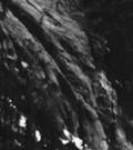


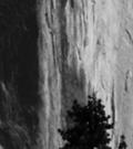


37 Yosemite National Park National Park Service U.S. Dept. of the Interior Half Dome Trail Stewardship Plan Environmental Assessment Public Comment and Response Report December 2012
RE: Access Fund Comments on Yosemite National Park Wilderness Stewardship Plan, Preliminary Ideas and Concepts
 September 30, 2016 Superintendent Yosemite National Park Attn: Wilderness Stewardship Plan P.O. Box 577 Yosemite, CA 95389 RE: Access Fund Comments on Yosemite National Park Wilderness Stewardship Plan,
Minimum Requirements References in National Park Service Policy
 Minimum Requirements References in National Park Service Policy 2006 NPS Management Policies Chapter 6: Wilderness Preservation and Management 6.3 Wilderness Resource Management 6.3.1 General Policy (in
Final Environmental Impact Statement for the Merced Wild and Scenic River. Comprehensive Management Plan, Yosemite National Park, Madera and Mariposa
 This document is scheduled to be published in the Federal Register on 02/26/2014 and available online at http://federalregister.gov/a/2014-04061, and on FDsys.gov DEPARTMENT OF THE INTERIOR 4312-FF NATIONAL
Continental Divide National Scenic Trail Legislative History and Planning Guidance
 Continental Divide National Scenic Trail Legislative History and Planning Guidance Legislation, Policy, and Direction Regarding National Scenic Trails The National Trails System Act, P.L. 90-543, was passed
Decision Memo Broken Wheel Ranch Equestrian Outfitter Special-Use Permit Proposed Action
 Decision Memo Broken Wheel Ranch Equestrian Outfitter Special-Use Permit USDA Forest Service Mississippi Bluffs Ranger District, Shawnee National Forest Jackson and Union Counties, Illinois Proposed Action
National Wilderness Steering Committee
 National Wilderness Steering Committee Guidance White Paper Number 1 Issue: Cultural Resources and Wilderness Date: November 30, 2002 Introduction to the Issue Two of the purposes of the National Wilderness
Connie Rudd Superintendent, Black Canyon of the Gunnison National Park
 National Park Service U.S. Department of the Interior Black Canyon of the Gunnison National Park and Curecanti National Recreation Area Information Brochure #1 Wilderness and Backcountry Management Plan
Rule Governing the Designation and Establishment of All-Terrain Vehicle Use Trails on State Land
 Rule Governing the Designation and Establishment of All-Terrain Vehicle Use Trails on State Land 1.0 Authority 1.1 This rule is promulgated pursuant to 23 V.S.A. 3506. Section 3506 (b)(4) states that an
Wilderness Research. in Alaska s National Parks. Scientists: Heading to the Alaska Wilderness? Introduction
 Wilderness Research in Alaska s National Parks National Park Service U.S. Department of Interior Scientists: Heading to the Alaska Wilderness? Archeologist conducts fieldwork in Gates of the Arctic National
Recreation Opportunity Spectrum for River Management v
 Recreation Opportunity Spectrum for Management v. 120803 Introduction The following Recreation Opportunity Spectrum (ROS) characterizations and matrices mirror the presentation in the ROS Primer and Field
Sawtooth National Forest Fairfield Ranger District
 United States Department of Agriculture Forest Service Sawtooth National Forest Fairfield Ranger District P.O. Box 189 Fairfield, ID. 83327 208-764-3202 Fax: 208-764-3211 File Code: 1950/7700 Date: December
DIRECTOR S ORDER #41: Wilderness Preservation and Management
 These are relevant sections about Wilderness Management Plans from National Park Service 2006 Management Policies, Director s Orders #41 and Reference Manual 41. National Park Service U.S. Department of
Wilderness Stewardship Plan Scoping Newsletter Winter 2013
 Olympic National Park National Park Service U.S. Department of the Interior Wilderness Stewardship Plan Scoping Newsletter Winter 2013 Dear Friends and Neighbors, The Olympic Wilderness was established
Proposed Action. Payette National Forest Over-Snow Grooming in Valley, Adams and Idaho Counties. United States Department of Agriculture
 United States Department of Agriculture Forest Service January 2012 Proposed Action Payette National Forest Over-Snow Grooming in Valley, Adams and Idaho Counties Payette National Forest Valley, Adams
COMMISSION OF THE EUROPEAN COMMUNITIES. Draft. COMMISSION REGULATION (EU) No /2010
 No /2010") COMMISSION OF THE EUROPEAN COMMUNITIES Brussels, XXX Draft COMMISSION REGULATION (EU) No /2010 of [ ] on safety oversight in air traffic management and air navigation services (Text with EEA relevance)
COMMISSION OF THE EUROPEAN COMMUNITIES Brussels, XXX Draft COMMISSION REGULATION (EU) No /2010 of [ ] on safety oversight in air traffic management and air navigation services (Text with EEA relevance)
APPENDIX I STANDARD CONSULTATION PROTOCOL FOR TRAVEL MANAGEMENT ROUTE DESIGNATION
 APPENDIX I STANDARD CONSULTATION PROTOCOL FOR TRAVEL MANAGEMENT ROUTE DESIGNATION Developed Pursuant to Stipulation IV.A. of the Region 3 First Amended Programmatic Agreement Regarding Historic Property
Wilderness Character and Wilderness Characteristics. What s the difference? Why does it matter?
 Introduction Wilderness Character and Wilderness Characteristics What s the difference? Why does it matter? The terms wilderness character and wilderness characteristics are sometimes used interchangeably
WILDERNESS PLANNING. Wilderness. Interagency Regional Wilderness Stewardship Training. Alamosa, Colorado - March 26-29, 2007
 WILDERNESS PLANNING Interagency Regional Wilderness Stewardship Training Alamosa, Colorado - March 26-29, 2007 Suzanne Stutzman Lead Planner/Wilderness Coordinator National Park Service, Intermountain
Theme: Predominately natural/natural appearing; rustic improvements to protect resources. Size*: 2,500 + acres Infrastructure**:
 Recreation Opportunity Spectrum (ROS) Classes The Recreation Opportunity Spectrum (ROS) provides a way to describe the variations in the degree of isolation from the sounds and influences of people, and
Wilderness Stewardship Plan Handbook
 National Park Service U.S. Department of the Interior Wilderness Stewardship Program Wilderness Stewardship Plan Handbook Planning to Preserve Wilderness Character DRAFT April 2012 Wilderness Stewardship
Wallowa Falls Hydroelectric Project FERC Project No. P-308 Proposed Study Plans - Recreation August 2011
 Wallowa Falls Hydroelectric Project FERC Project No. P-308 August 2011 Prepared by: PacifiCorp Energy Hydro Resources 825 NE Multnomah, Suite 1500 Portland, OR 97232 For Public Review Wallowa Falls Hydroelectric
With the first portion of this process complete, we anticipate the general timeline for the remainder of the process to be:
 THE CITY OF FIRE RESCUE E D M O N T O N FIRE RESCUE SERVICES 10351 96 Street Edmonton, Alberta T5H 2H5 April 19, 2013 Dear Rossdale residents: As many of you know, Fire Rescue Services is currently in
South Colony Basin Recreation Fee Proposal
 South Colony Basin Recreation Fee Proposal Purpose and Need for Collecting Fees in South Colony Basin: Forest Service appropriated funds have not been sufficient to maintain current recreational services
S Central Coast Heritage Protection Act APRIL 21, 2016
 STATEMENT OF GLENN CASAMASSA ASSOCIATE DEPUTY CHIEF, NATIONAL FOREST SYSTEM U.S. FOREST SERVICE U.S. DEPARTMENT OF AGRICULTURE BEFORE THE UNITED STATES SENATE COMMITTEE ON ENERGY AND NATURAL RESOURCES
MONTEREY REGIONAL AIRPORT MASTER PLAN TOPICAL QUESTIONS FROM THE PLANNING ADVISORY COMMITTEE AND TOPICAL RESPONSES
 MONTEREY REGIONAL AIRPORT MASTER PLAN TOPICAL QUESTIONS FROM THE PLANNING ADVISORY COMMITTEE AND TOPICAL RESPONSES Recurring topics emerged in some of the comments and questions raised by members of the
Logo Department Name Agency Organization Organization Address Information 5700 North Sabino Canyon Road
 Logo Department Name Agency Organization Organization Address Information United States Forest Coronado National Forest 5700 North Sabino Canyon Road Department of Service Santa Catalina Ranger District
French Fire Recovery and Restoration Project Wilderness Resource Impact Analysis
 French Fire Recovery and Restoration Project Wilderness Resource Impact Analysis This Wilderness Resource Impact Analysis for the French Recovery and Restoration Project (Project) includes a review of
COMMISSION IMPLEMENTING REGULATION (EU)
") 18.10.2011 Official Journal of the European Union L 271/15 COMMISSION IMPLEMENTING REGULATION (EU) No 1034/2011 of 17 October 2011 on safety oversight in air traffic management and air navigation services
18.10.2011 Official Journal of the European Union L 271/15 COMMISSION IMPLEMENTING REGULATION (EU) No 1034/2011 of 17 October 2011 on safety oversight in air traffic management and air navigation services
Final General Management Plan/Wilderness Study/Environmental Impact Statement:
 This document is scheduled to be published in the Federal Register on 03/11/2016 and available online at http://federalregister.gov/a/2016-05542, and on FDsys.gov DEPARTMENT OF THE INTERIOR 4312-FF National
WORKSHEET 1 Wilderness Qualities or Attributes Evaluating the Effects of Project Activities on Wilderness Attributes
 WORKSHEET 1 Wilderness Qualities or Attributes Evaluating the Effects of Project Activities on Wilderness Attributes Date: 3/7/2017 Roadless Area: Ruby South Description of Project Activity or Impact to
SAMTRANS TITLE VI STANDARDS AND POLICIES
 SAMTRANS TITLE VI STANDARDS AND POLICIES Adopted March 13, 2013 Federal Title VI requirements of the Civil Rights Act of 1964 were recently updated by the Federal Transit Administration (FTA) and now require
Williamson Rock/Pacific Crest National Scenic Trail (PCT) Project EIS. Notice of intent to prepare an Environmental Impact Statement.
 Project EIS. Notice of intent to prepare an Environmental Impact Statement.") [3411-15-P] DEPARTMENT OF AGRICULTURE Forest Service Angeles National Forest; Los Angeles County, CA Williamson Rock/Pacific Crest National Scenic Trail (PCT) Project EIS AGENCY: ACTION: Forest Service,
[3411-15-P] DEPARTMENT OF AGRICULTURE Forest Service Angeles National Forest; Los Angeles County, CA Williamson Rock/Pacific Crest National Scenic Trail (PCT) Project EIS AGENCY: ACTION: Forest Service,
Superintendent David Uberuaga June 27, 2011 Grand Canyon National Park P.O. Box 129 Grand Canyon, AZ 86023
 Superintendent David Uberuaga June 27, 2011 Grand Canyon National Park P.O. Box 129 Grand Canyon, AZ 86023 Dear Superintendent Uberuaga, Thank you for the opportunity to provide scoping comments on Grand
White Mountain National Forest Saco Ranger District
 United States Department of Agriculture Forest Service White Mountain National Forest Saco Ranger District 33 Kancamagus Highway Conway, NH 03818 Comm: (603) 447-5448 TTY: (603) 447-3121 File Code: 1950
St. Joe Travel Management EA CULTURAL RESOURCES
 St. Joe Travel Management EA CULTURAL RESOURCES Bruce Gibson May 2015 Regulatory Framework Forest Plan The Idaho Panhandle National Forests (IPNF) Forest Plan requires systematic cultural resource inventory
FINDING OF NO SIGNIFICANT IMPACT BACKCOUNTRY/WILDERNESS MANAGEMENT PLAN AND ENVIRONMENTAL ASSESSMENT ROCKY MOUNTAIN NATIONAL PARK
 FONSI FINDING OF NO SIGNIFICANT IMPACT BACKCOUNTRY/WILDERNESS MANAGEMENT PLAN AND ENVIRONMENTAL ASSESSMENT ROCKY MOUNTAIN NATIONAL PARK The Backcountry/Wilderness Management Plan for Rocky Mountain National
PURPOSE AND NEED. Introduction
 Public Scoping: Allocation of Recreation Capacity for Commercial Outfitter Guide Services on North Kruzof Island Trails (Kruzof Island Outfitter Guide) PURPOSE AND NEED Introduction The U.S. Department
Wilderness Areas Designated by the White Pine County bill
 Wilderness Areas Designated by the White Pine County bill SEC. 321. SHORT TITLE. This subtitle may be cited as the `Pam White Wilderness Act of 2006'. SEC. 322. FINDINGS. Congress finds that-- The White
PROPOSED ACTION South 3000 East Salt Lake City, UT United States Department of Agriculture
 United States Department of Agriculture Forest Service Uinta-Wasatch-Cache National Forest Salt Lake Ranger District 6944 South 3000 East Salt Lake City, UT 84121 801-733-2660 File Code: 1950/2300 Date:
YOSEMITE AREA REGIONAL TRANSPORTATION SYSTEM
 YOSEMITE AREA REGIONAL TRANSPORTATION SYSTEM Short Range Transit Plan Prepared for the Merced County Association of Governments/YARTS Prepared by LSC Transportation Consultants, Inc. YOSEMITE AREA REGIONAL
5.0 OUTDOOR RECREATION OPPORTUNITIES AND MANAGEMENT
 5.0 OUTDOOR RECREATION OPPORTUNITIES AND MANAGEMENT 5.1 Introduction This section describes the range of recreational activities that currently take place in Marble Range and Edge Hills Parks, as well
Thank you for this third opportunity to comment on the proposed revisions to the Coconino National Forest Management plan.
 March 19, 2014 Flagstaff Biking Organization PO Box 23851 Flagstaff, AZ 86002 Vern Keller Coconino National Forest Attn: Plan Revision 1824 South Thompson Street Flagstaff, Arizona 86001 coconino_national_forest_plan_revision_team@fs.fed.us
LESSON 5 Wilderness Management Case Studies
 LESSON 5 Wilderness Management Case Studies Objectives: Students will: review the key points of the Wilderness Act of 1964. brainstorm solutions for Wilderness management issues. Materials: Í Leave no
8 CROSS-BOUNDARY AGREEMENT WITH BRAMPTON TRANSIT
 8 CROSS-BOUNDARY AGREEMENT WITH BRAMPTON TRANSIT The Transportation Services Committee recommends the adoption of the recommendations contained in the following report dated May 27, 2010, from the Commissioner
Cultural Resource Management Report Deer Valley 4wd Restoration and Blue Lakes Road Maintenance Project R
 Cultural Resource Management Report R2015-05-03-10005 Undertaking Description: The proposes to perform road maintenance and meadow restoration on the Deer Valley 4wd trail and road maintenance on the Blue
Air Operator Certification
 Civil Aviation Rules Part 119, Amendment 15 Docket 8/CAR/1 Contents Rule objective... 4 Extent of consultation Safety Management project... 4 Summary of submissions... 5 Extent of consultation Maintenance
Dear Reviewing Officer:
 From: To: Subject: Date: Attachments: Peter Hart FS-r02admin-review Objection Re: Maroon Bells Snowmass Wilderness Overnight Visitor Use Management Plan Monday, August 14, 2017 8:38:01 PM Final Objection
2. CANCELLATION. AC 39-7B, Airworthiness Directives, dated April 8, 1987, is canceled.
 U.S. Department of Transportation Federal Aviation Administration Advisory Circular Subject: AIRWORTHINESS DIRECTIVES Date: 11/16/95 AC No: 39-7C Initiated by: AFS-340 Change: 1. PURPOSE. This advisory
PROUDLY BRINGING YOU CANADA AT ITS BEST. Management Planning Program NEWSLETTER #1 OCTOBER, 2000
 PROUDLY BRINGING YOU CANADA AT ITS BEST VUNTUT NATIONAL PARK Management Planning Program NEWSLETTER #1 OCTOBER, 2000 INTRODUCTION This newsletter launches the development of the first management plan for
Project Planning, Compliance, and Funding
 Project Planning, Compliance, and Funding The plans above offer high level guidance to ensure that the A.T. is managed effectively as a whole unit in a decentralized management structure. Cooperative management
THRESHOLD GUIDELINES FOR AVALANCHE SAFETY MEASURES
 BRITISH COLUMBIA MINISTRY OF TRANSPORTATION & INFRASTRUCTURE AVALANCHE & WEATHER PROGRAMS THRESHOLD GUIDELINES FOR AVALANCHE SAFETY MEASURES British Columbia Ministry of Transportation & Infrastructure
RECREATION. Seven issues were identified that pertain to the effects of travel management on outdoor recreation within portions of the project area.
 RECREATION Seven issues were identified that pertain to the effects of travel management on outdoor recreation within portions of the project area. OPPORTUNITIES FOR SOLITUDE / QUIET TRAILS. One attraction
Alternatives. Introduction. Range of Alternatives
 Alternatives Introduction Federal environmental regulations concerning the environmental review process require that all reasonable alternatives, which might accomplish the objectives of a proposed project,
SUPPLEMENTARY CONDITIONS APPLICABLE TO TOWER CRANES 2012
 SUPPLEMENTARY CONDITIONS APPLICABLE TO TOWER CRANES 2012 TO BE READ IN CONJUNCTION WITH THE CPA MODEL CONDITIONS FOR THE HIRING OF PLANT (2011) EXPLANATORY NOTE: The purpose of these Supplementary Conditions
A GUIDE TO MANITOBA PROTECTED AREAS & LANDS PROTECTION
 A GUIDE TO MANITOBA PROTECTED AREAS & LANDS PROTECTION Manitoba Wildands December 2008 Discussions about the establishment of protected lands need to be clear about the definition of protection. We will
White Mountain National Forest Saco Ranger District
 United States Department of Agriculture Forest Service White Mountain National Forest 33 Kancamagus Highway Conway, NH 03818 Comm: (603) 447-5448 TTY: (603) 447-3121 File Code: 1950 Date: February 26,
Central Cascades Wilderness Strategies Project
 Central Cascades Wilderness Strategies Project Wilderness is Unique What makes designated Wilderness different from other national forest lands? Wilderness Act of 1964 to assure that an increasing population
Wilderness Process #NP-1810: Your letter ID is NP September 5, 2018
 Wilderness Process #NP-1810: Your letter ID is NP-1810-2602-96 September 5, 2018 RE: GMUG Wilderness Evaluation Revised Evaluation Criteria and Draft Report Forest Revision Planning Team: The Continental
Figure 1-Example of terracing from livestock
 To: District Ranger Matt Janowiak April 3, 2016 P.O. Box 439, Bayfield, CO 81122 comments-rocky-mountain-san-juan-columbine@fs.fed.us From: Greg Warren Golden, CO 80401 Please consider the following comments
Flow Stand Up Paddle Board Parkway Plan Analysis
 Regional Parks Department Jeffrey R. Leatherman, Director County of Sacramento Divisions Administration Golf Leisure Services Maintenance Rangers Therapeutic Recreation Services Flow Stand Up Paddle Board
Tahoe National Forest Over-Snow Vehicle Use Designation
 Tahoe National Forest Over-Snow Vehicle Use Designation USDA Forest Service Tahoe National Forest February 20, 2015 Introduction The Forest Service, U.S. Department of Agriculture will prepare an Environmental
Foreign Civil Aviation Authority Certifying Statements. AGENCY: Federal Aviation Administration (FAA), DOT.
, DOT.") This document is scheduled to be published in the Federal Register on 02/22/2019 and available online at https://federalregister.gov/d/2019-02634, and on govinfo.gov [4910-13] DEPARTMENT OF TRANSPORTATION
This document is scheduled to be published in the Federal Register on 02/22/2019 and available online at https://federalregister.gov/d/2019-02634, and on govinfo.gov [4910-13] DEPARTMENT OF TRANSPORTATION
Coronado National Forest Santa Catalina Ranger District
 United States Department of Agriculture Forest Service Coronado National Forest Santa Catalina Ranger District File Code: 1950 Date: October 14, 2015 Dear Interested Party: The Santa Catalina Ranger District
WHEREAS, the City operates and manages Rapid City Regional Airport (RAP); and
; and") MEMORANDUM OF UNDERSTANDING BETWEEN THE RAPID CITY DEPARTMENT OF FIRE & EMERGENCY SERVICES AND RAPID CITY REGIONAL AIRPORT BOARD RELATING TO THE PROVISION OF AIRPORT RESCUE AND FIREFIGHTING SERVICES This
MEMORANDUM OF UNDERSTANDING BETWEEN THE RAPID CITY DEPARTMENT OF FIRE & EMERGENCY SERVICES AND RAPID CITY REGIONAL AIRPORT BOARD RELATING TO THE PROVISION OF AIRPORT RESCUE AND FIREFIGHTING SERVICES This
Federal Aviation Administration. Summary
 Federal Aviation Administration Memorandum Date: February 16, 2006 From: Kim Smith, Manager, Small Airplane Directorate, ACE-100 To: See Distribution Prepared by: Ervin Dvorak, (816) 329-4123 Subject:
Decision Memo for Desolation Trail: Mill D to Desolation Lake Trail Relocation
 for Salt Lake County, Utah Uinta-Wasatch-Cache National Forest Salt Lake Ranger District 1. Background The present location of the Desolation Trail (#1159) between Mill D and Desolation Lake follows old
Creating a User-Driven Long-Distance OHV Trail Through Partnering
 Joseph Raffaele Outdoor Recreation Planner U.S. Bureau of Land Management Yuma, Arizona Creating a User-Driven Long-Distance OHV Trail Through Partnering BLM is a multiple-use land management agency within
The Roots of Carrying Capacity
 1 Applying Carrying Capacity Concepts in Wilderness 1872 1964...shall be preserved for the use & enjoyment of the American people...in such manner as will leave them unimpaired for future generations...
Appendix I Case-Studies in Wilderness Management
 Appendix I Case-Studies in Wilderness Management Management Issue Scenarios Note: These scenarios are meant to be used as guidelines for the program leader rather than to be read verbatim. Introduce a
1. Purpose and scope. a) the necessity to limit flight duty periods with the aim of preventing both kinds of fatigue;
 the necessity to limit flight duty periods with the aim of preventing both kinds of fatigue;") ATTACHMENT A. GUIDANCE MATERIAL FOR DEVELOPMENT OF PRESCRIPTIVE FATIGUE MANAGEMENT REGULATIONS Supplementary to Chapter 4, 4.2.10.2, Chapter 9, 9.6 and Chapter 12, 12.5 1. Purpose and scope 1.1 Flight
ATTACHMENT A. GUIDANCE MATERIAL FOR DEVELOPMENT OF PRESCRIPTIVE FATIGUE MANAGEMENT REGULATIONS Supplementary to Chapter 4, 4.2.10.2, Chapter 9, 9.6 and Chapter 12, 12.5 1. Purpose and scope 1.1 Flight
Securing Permanent Protection for Public Land
 Securing Permanent Protection for Public Land Tools for Wyoming Advocates Paul Spitler* The Wilderness Society * I am a wilderness policy expert, not a powerpoint expert! Platform and Resolutions of the
UNITED STATES DEPARTMENT OF THE INTERIOR BUREAU OF LAND MANAGEMENT MANUAL TRANSMITTAL SHEET
 Form 1221-2 (June 1969) UNITED STATES DEPARTMENT OF THE INTERIOR BUREAU OF LAND MANAGEMENT MANUAL TRANSMITTAL SHEET Release 8-83 Date Subject 8353 Trail Management Areas Secretarially Designated (Public)
MEETING MINUTES Page 1 of 5
 Page 1 of 5 50178.000 May 26, 2009 PROJECT PROJECT NO. MEETING DATE ISSUE DATE Citizens Advisory Committee Meeting MEETING LOCATION MEETING PURPOSE Amy Eckland ISSUED BY SIGNATURE PARTICIPANT See attached
Commission Paper CP2/ April, Commission for Aviation Regulation 3 rd Floor, Alexandra House Earlsfort Terrace Dublin 2 Ireland
 CONSULTATION ON THE INTRODUCTION OF SANCTIONS UNDER ARTICLE 14.5 OF EU REGULATION 95/93, (AS AMENDED) ON COMMON RULES FOR THE ALLOCATION OF SLOTS AT COMMUNITY AIRPORTS Commission Paper CP2/2006 4 April,
Unmanned Aircraft System (Drone) Policy
 Policy") Unmanned Aircraft System (Drone) Policy Responsible Officer: Chief Risk Officer Responsible Office: RK - Risk / EH&S Issuance Date: TBD Effective Date: TBD Last Review Date: New Policy Scope: Includes
Unmanned Aircraft System (Drone) Policy Responsible Officer: Chief Risk Officer Responsible Office: RK - Risk / EH&S Issuance Date: TBD Effective Date: TBD Last Review Date: New Policy Scope: Includes
ENVIRONMENT ACTION PLAN
 ENVIRONMENT ACTION PLAN 2015 16 Airservices Australia 2015 This work is copyright. Apart from any use as permitted under the Copyright Act 1968, no part may be reproduced by any process without prior written
FLIGHT OPERATIONS PANEL (FLTOPSP)
") International Civil Aviation Organization FLTOPSP/1-WP/3 7/10/14 WORKING PAPER FLIGHT OPERATIONS PANEL (FLTOPSP) FIRST MEETING Montréal, 27 to 31 October 2014 Agenda Item 4: Active work programme items
International Civil Aviation Organization FLTOPSP/1-WP/3 7/10/14 WORKING PAPER FLIGHT OPERATIONS PANEL (FLTOPSP) FIRST MEETING Montréal, 27 to 31 October 2014 Agenda Item 4: Active work programme items
DECISION MEMO. Rawhide Trail #7073 Maintenance and Reconstruction
 Page 1 of 6 Background DECISION MEMO USDA Forest Service Jefferson Ranger District Jefferson County, Montana Rawhide Trail #7073 is located in the Elkhorn Mountain Range approximately 10 miles east of
BACKCOUNTRY TRAIL FLOOD REHABILITATION PROGRAM
 BACKCOUNTRY TRAIL FLOOD REHABILITATION PROGRAM Backcountry Trail Flood Rehabilitation A June 2013 Flood Recovery Program Summary In June 2013, parts of Southern Alberta were devastated from significant
(i) Adopted or adapted airworthiness and environmental standards;
 Adopted or adapted airworthiness and environmental standards;") TECHNICAL ARRANGEMENT FOR THE ACCEPTANCE OF AIRWORTHINESS AND ENVIRONMENTAL APPROVAL OF CIVIL AERONAUTICAL PRODUCTS BETWEEN THE CIVIL AVIATION BUREAU, MINISTRY OF LAND, INFRASTRUCTURE AND TRANSPORT, JAPAN
TECHNICAL ARRANGEMENT FOR THE ACCEPTANCE OF AIRWORTHINESS AND ENVIRONMENTAL APPROVAL OF CIVIL AERONAUTICAL PRODUCTS BETWEEN THE CIVIL AVIATION BUREAU, MINISTRY OF LAND, INFRASTRUCTURE AND TRANSPORT, JAPAN
ORDER REQUESTING PROPOSALS
 Order 2017-2-4 Served: February 13, 2017 DEPARTMENT UNITED OF STATES TRANSPORTATION OF AMERICA UNITED STATES OF AMERICA DEPARTMENT OF TRANSPORTATION OFFICE OF THE SECRETARY WASHINGTON, D.C. Issued by the
TONGASS NATIONAL FOREST
 TONGASS NATIONAL FOREST UNITED STATES DEPARTMENT OF AGRICULTURE-FOREST SERVICE Contact: Dennis Neill Phone: 907-228-6201 Release Date: May 17, 2002 SEIS Questions and Answers Q. Why did you prepare this
Decision Memo Sun Valley Super Enduro & Cross-Country Mountain Bike Race. Recreation Event
 Decision Memo 2015 Sun Valley Super Enduro & Cross-Country Mountain Bike Race Recreation Event USDA Forest Service Ketchum Ranger District, Sawtooth National Forest Blaine County, Idaho Background The
STAFF REPORT. Airport Land Use Plan Consistency Review: Old Town Village Mixed Use Project City of Goleta. MEETING DATE: June 18, 2015 AGENDA ITEM: 5M
 STAFF REPORT SUBJECT: Airport Land Use Plan Consistency Review: Old Town Village Mixed Use Project City of Goleta MEETING DATE: AGENDA ITEM: 5M STAFF CONTACT: Peter Imhof, Andrew Orfila RECOMMENDATION:
Environmental Assessment
 United States Department of Agriculture Forest Service October 2011 Environmental Assessment Pacific Crest National Scenic Trail Crossing Bridgeport Ranger District, Humboldt-Toiyabe National Forest Mono
A. CONCLUSIONS OF THE FGEIS
 Chapter 11: Traffic and Parking A. CONCLUSIONS OF THE FGEIS The FGEIS found that the Approved Plan will generate a substantial volume of vehicular and pedestrian activity, including an estimated 1,300
Andres Lainoja Eesti Lennuakadeemia
 Andres Lainoja Eesti Lennuakadeemia In the beginning was the Word... Convention on International Civil Aviation (Doc 7300) was signed on 7 December 1944 International Civil Aviation Organization began
Draft General Management Plan/Wilderness Study/Environmental Impact Statement
 This document is scheduled to be published in the Federal Register on 05/06/2015 and available online at http://federalregister.gov/a/2015-10528, and on FDsys.gov DEPARTMENT OF THE INTERIOR National Park
Daisy Dean Trail 628/619 ATV Trail Construction
 Background and Purpose and Need The Daisy Dean ATV Trail Construction Project is located in the Little Belt Mountains, Musselshell Ranger District, Lewis and Clark National Forest approximately 32 miles
Fossil Creek Wild & Scenic River Comprehensive River Management Plan Forest Service Proposed Action - details March 28, 2011
 Fossil Creek Wild & Scenic River Comprehensive River Management Plan Forest Service Proposed Action - details March 28, 2011 Primary Goals of the Proposed Action 1. Maintain or enhance ORVs primarily by
NEVADA UAS TEST SITE PRIVACY POLICY
 Introduction NEVADA UAS TEST SITE PRIVACY POLICY As required by the Other Transaction Agreement (OTA) between the Federal Aviation Administration (FAA) and the State of Nevada, DTFACT-14-A-00003, Modification
Management Direction for
 USDA United States Department of Agriculture Forest Service Management Direction for the Ansel Adams John Muir and Dinkey Lakes Wildernesses Pacific Southwest Region lnyo and Sierra National Forests April
Procedure for the Use of Power-Driven Mobility Devices on Mass Audubon Sanctuaries 1 September 17, 2012
 Procedure for the Use of Power-Driven Mobility Devices on Mass Audubon Sanctuaries 1 September 17, 2012 Background As part of Mass Audubon s mission to preserve the nature of Massachusetts for people and
Proposed Scotchman Peaks Wilderness Act 2016 (S.3531)
") 1 Proposed Scotchman Peaks Wilderness Act 2016 (S.3531) Frequently Asked Questions PLACE Where is the area that would be designated as Wilderness? The lands outlined in S.3531 lie within Idaho along its
1 Proposed Scotchman Peaks Wilderness Act 2016 (S.3531) Frequently Asked Questions PLACE Where is the area that would be designated as Wilderness? The lands outlined in S.3531 lie within Idaho along its
NOISE ABATEMENT PROCEDURES
 1. Introduction NOISE ABATEMENT PROCEDURES Many airports today impose restrictions on aircraft movements. These include: Curfew time Maximum permitted noise levels Noise surcharges Engine run up restrictions
Part 149. Aviation Recreation Organisations - Certification. CAA Consolidation. 1 February 2016
 Part 149 CAA Consolidation 1 February 2016 Aviation Recreation Organisations - Certification Published by the Civil Aviation Authority of New Zealand DESCRIPTION Part 149 prescribes rules governing the
Operating Limitations At John F. Kennedy International Airport. SUMMARY: This action amends the Order Limiting Operations at John F.
 This document is scheduled to be published in the Federal Register on 06/21/2016 and available online at http://federalregister.gov/a/2016-14631, and on FDsys.gov [4910-13] DEPARTMENT OF TRANSPORTATION
Consideration will be given to other methods of compliance which may be presented to the Authority.
 Advisory Circular AC 139-10 Revision 1 Control of Obstacles 27 April 2007 General Civil Aviation Authority advisory circulars (AC) contain information about standards, practices and procedures that the
Thank you for this second opportunity to comment on the proposed revisions to the Coconino National Forest Management plan.
 March 8, 2011 Flagstaff Biking Organization PO Box 23851 Flagstaff, AZ 86002 Yewah Lau Coconino National Forest Attn: Plan Revision 1824 South Thompson Street Flagstaff, Arizona 86001 Sent via electronic
Natural and Cultural Resources Management, Part 610: Wilderness Stewardship
 Natural and Cultural Resources Management, Part 610: Wilderness Stewardship 2.5 May the Service allow structures and installations in wilderness? Section 4(c) of the Wilderness Act generally prohibits