New Mexico Geological Society
|
|
|
- Hugh Gilmore
- 5 years ago
- Views:
Transcription

1 New Mexico Geological Society Downloaded from: The way of the Fray: a pictorial diary of the Escalante Expedition through north-central New Mexico, 1776 H. L. James, 1974, pp in: Ghost Ranch, Siemers, C. T.; Woodward, L. A.; Callender, J. F.; [eds.], New Mexico Geological Society 25 th Annual Fall Field Conference Guidebook, 404 p. This is one of many related papers that were included in the 1974 NMGS Fall Field Conference Guidebook. Annual NMGS Fall Field Conference Guidebooks Every fall since 1950, the New Mexico Geological Society (NMGS) has held an annual Fall Field Conference that explores some region of New Mexico (or surrounding states). Always well attended, these conferences provide a guidebook to participants. Besides detailed road logs, the guidebooks contain many well written, edited, and peer-reviewed geoscience papers. These books have set the national standard for geologic guidebooks and are an essential geologic reference for anyone working in or around New Mexico. Free Downloads NMGS has decided to make peer-reviewed papers from our Fall Field Conference guidebooks available for free download. Non-members will have access to guidebook papers two years after publication. Members have access to all papers. This is in keeping with our mission of promoting interest, research, and cooperation regarding geology in New Mexico. However, guidebook sales represent a significant proportion of our operating budget. Therefore, only research papers are available for download. Road logs, mini-papers, maps, stratigraphic charts, and other selected content are available only in the printed guidebooks. Copyright Information Publications of the New Mexico Geological Society, printed and electronic, are protected by the copyright laws of the United States. No material from the NMGS website, or printed and electronic publications, may be reprinted or redistributed without NMGS permission. Contact us for permission to reprint portions of any of our publications. One printed copy of any materials from the NMGS website or our print and electronic publications may be made for individual use without our permission. Teachers and students may make unlimited copies for educational use. Any other use of these materials requires explicit permission.
2 This page is intentionally left blank to maintain order of facing pages.
3
4 New Mexico Geol. Soc. Guidebook, 25th Field Conf., Ghost Ranch (Central-Northern N.M.), THE WAY OF THE FRAY: A PICTORIAL DIARY OF THE ESCALANTE EXPEDITION THROUGH NORTH-CENTRAL NEW MEXICO, 1776 by H. L. JAMES New Mexico State Highway Department Santa Fe, New Mexico INTRODUCTION As the Liberty Bell was sounding the joys of independence in the town of Philadelphia, another historical drama of quieter proportions was being enacted on the plaza of a foreign mud village some 2,000 miles across the continent the preparation of the famed Escalante Expedition from Santa Fe to the California capital at Monterey. HISTORY The founding of the province of New Mexico by hate in 1598 was set amidst the remote pueblos of sedentary people. The colonist's only link of communication was to the south via the Camino Real. With the establishment of the missionary frontier in California a century and a half later, the Spanish crown in Mexico City prompted the ties of the mountainous interior to the Pacific Coast. The initiation of this epic effort fell upon the shoulders of New Mexico's governor Mendinueta, who early in 1775 wrote Fray Silvestre Veléz de Escalante, Franciscan missionary at Zuni, and Fray Francisco Garces, Franciscan missionary at San Xavier del Bac, to explore the region to their west and to prepare a report on a possible road to California. Escalante headed north to win the favor of the Hopis, while Garces went west and north into what is now the San Joaquin Valley. On his return to Arizona, Garces discovered Tehachapi Pass; visited the abyss of the Havasupais; and viewed the awesome Grand Canyon. Hoping to connect with Escalante, the travel-weary minister also visited the land of the Hopis, where at Oraibe he was met by sullen occupants who refused him shelter. Garces never closed his exploratory circle with Escalante at nearby Zuni, but instead for some unknown reason returned directly from the high mesas to his desert parish. The two Franciscans' reports, however, of the hostile attitude of the Hopis and Gila River-based Apaches was enough to quell the proposition of a southern route to California. On June 7, 1776, Escalante was summoned from Zuni to Santa Fe by his superior, Fray Francisco Dominguez, who had now accepted the responsibility of opening the coast road via a known trapper's trail through the mountains to the northwest. Unknown to them, the historical date of July 4, 1776, was chosen for departure. Official business of the church and sickness forced a delay, however, and the trek did not actually commence for another three weeks. Finally, with a proclamation from Dominguez: "Now I merely inform you that today, Monday the 29th of July, we shall set out from this villa of Santa Fe on our journey. We are happy and full of hope, trusting only in your fervent prayers, and that as our father you will have our brothers in that very holy province bear us in mind in their offerings and prayers..." Ten persons comprised the exuberant band of explorers that climbed the rounded, pinon-studded hills north of the plaza. It is easy to envision the leaders in their brown, flapping robes and broad sombreros surrounded by gear-laden riders atop unsteady mounts. Perhaps the cathedral bell was clanging; maybe a musket blast or two; certainly barking dogs with trailing processions of screaming children; and the air was filled with choruses of adios, adios. A small herd of cattle, to serve as food, preceded the main body followed by harnessed pairs of pack-mules. Fray Escalante, known as Vel6z to his peers, was selected in the role as keeper of the diary. His superb recordings of the expedition have forever secured his place in history. It should be noted though, for justice sake, that the wayfarer should be bannered as the "Dominguez Expedition," in honor of its originator and leader. But as so often happens in the interpretation of historic events, the pen far outlasts the memory of human deeds. The diarist's first entry was made at the pueblo of Santa Clara: "On the 29th day of July of the year 1776, under the patronage of the Virgin Mary, Our Lady of the Immaculate Conception, and of the most holy patriarch Joseph her most happy spouse, we, Fray Francisco Atanasio Dominguez, present commissary visitor of this Custodia of the Conversion of San Pablo of New Mexico, and Fray Francisco Silvestre Velez de Escalante, minister and teacher of the Christian doctrine at the Mission of Nuestra Senora de Guadalupe de Zuni, accompanied voluntarily by Don Juan Pedro Cisneros, alcalde mayor of the said pueblo of Zuni: Don Bernardo Miera y Pacheco, retired militia captain and citizen of the town of Santa Fe; Don Joaquin Lain, citizen of the same town; Lorenzo Olivares, citizen of the town of El Paso; Lucrecio Muniz; Andres Muniz; Juan de Aguilar; and Simon Lucero; having implored the protection of our most holy patrons and received the Holy Eucharist, we the persons named set out from the town of Santa Fe capital of this Kingdom of New Mexico; and having traveled nine leagues we arrived at the pueblo of Santa Clara, where we spent the night. Today nine leagues." THE ROUTE They were on their way... The overall plan was to follow the established trapper's trail along the watercourses of the intervening highlands; up the Rio Chama and Rio Navajo into present Colorado; across the San Juan and Animas; and then northerly following the Dolores, San Miguel and the yet unnamed Uncompahgre and Gunnison drainages. By August 27 the party had passed present-day Montrose. The trapper's trail was now becoming vague and directions were dependent upon an occasional foraging Yuta Indian. Information received on the 27th indicated that a settlement of


5


6


7 Sabuaganas Indians were nestled in the high mountains to the northeast, and encamped with them some members of the Timpangotizis tribe from the valley of the great lakes to the west. This encouraging news provided the necessary steppingstones of guides to facilitate their westward turn toward the coast. In the mountains that discharge the waters of the Gunnison, the travelers met their first ordeals on the trail. Intersecting, westward-flowing tributaries forced continual up and down marches, sometimes traveling 3 miles to advance only one. The expedition reached the Colorado River downstream from present Grand Valley on September 6, calling it Rio San Rafael. Escalante recorded: "This river carries more water than the Rio del Norte. It rises, according to what they told us, in a great lake which is toward the northeast near the Sierra de la Grulla." Continuing northwest the explorers skirted the white cliffs of the Yampa Plateau and crossed into Utah along the approximate alignment of U.S. 40. At Rio de San Buenaventura, now called the Green River, they made camp in the eastern floodplain four miles north of Jensen, Utah. From the diary entry on September 13: "The river enters this meadow between two high cliffs which, after forming a sort of corral, come so close together that one can scarcely see the opening through which the river comes." From this description the location of their campsite can reasonably be placed a half mile south of the Quarry Visitor Center at Dinosaur National Monument. With the high Uintas now flanking their right, the party marched west toward the land of the great lakes and the homeland of their proud Yuta guides. Following the banks of the Duchesne and Strawberry rivers an uneventful eight days brought them to the impressive body of water now called Utah Lake. Two days were spent along the luxuriant meadows of the lake. Large encampments of friendly Yutas, calling themselves Timpangotizis ("fish eaters"), dwelt near its shores. Escalante was delighted with the fertile valley, naming it "Our Lady of Mercy." In his report to the King of Spain he envisioned the formation of a populous and progressive new province. He urged that one hundred Spanish families be sent to colonize his newly-discovered paradise. One paragraph of his report was devoted to another large lake which lay to the north, but which he never saw. He wrote: "The other lake with which this one communicates, according to what they told us, covers many leagues and its waters are noxious and extremely salty, for the Timpanios (Timpangotizis) assure us that a person who moistens any part of his body with the water of the lake immediately feels much itching." On September 25, with promises to return within one year to baptise them all, the Spaniards bade farewell to their aquatic hosts and continued their trek. Their line of travel now lay along the valleys to the south and west, flanked by imposing mountains that prohibited a more direct course toward the


8 ESCALANTE EXPEDITION coast. South of Nephi, Utah, they crossed into the Sevier River drainage. From this point the Cricket Mountains formed a blockade and forced them still further south. On October 4 they camped near present-day Black Rock, where a series of events altered the expedition. First, dissension flared-up among some members of the troupe; a fight erupted which in turn frightened their Indian guide into desertion. Secondly, on the following day an early season blizzard set in causing considerable suffering from the wetness and cold. Coupled with this was the feeling of confinement in a north-south desert valley. Unable to move west and already forced far below the latitude of Monterey, the members cast lots in favor of returning to Santa Fe. Now with unsettled weather upon them and thoughts of home before them, their pace quickened. Forward into the Dixie section of southwestern Utah, they passed the site of now-existing Cedar City; crossed the Virgin River near Hurricane; and made the first of three roving entries into the state of Arizona. CROSSING OF THE FATHERS On October 26 they reached the Colorado River at the mouth of the Paria, where a century later John D. Lee would establish his historic ferry. From this point commenced one of the great human dramas of Southwest explorations the Crossing of The Fathers. Their courage and endurance consisted of eleven frantic days of ford searching along the west walls of 81
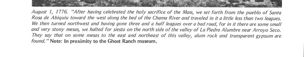
9 82 the now-inundated Glen Canyon. One week was spent in the area of the Paria confluence in attempts at swimming and raft-building all to no avail. In a seemingly hopeless situation, they named the campsite San Benito Salsipuedes ("get out if you can"). On November 2 they climbed the perilous sandstone cliffs behind them and continued northerly along the banks of the canyon, camping on Wahweap Creek near the present marina site on Lake Powell. Three more days of traversing tributary gorges were necessary until, on November 7 at the landmark now called Gunsight Butte, they cut handholds in the precipitous wall and descended to a spot of stilled current where they waded to the east bank. Escalante observed: "... about five o'clock in the afternoon they finished crossing the river, praising God our Lord and firing off a few muskets as a sign of the great joy which we all felt at having overcome so great a difficulty and which cost us so much labor and delay..." The padres had conquered the river in an unparalleled feat that included eating six of their horses supplemented with grass seed and cacti. The Crossing of The Fathers, as Bolton relates, "will resound through centuries" (Bolton, 1972, p. 118). THE LAST LEG Leaving the Colorado, another obstacle blocked their path to the south in the form of steep-sided Navajo Canyon. Confronted with this miniature gorge directly opposite the town of Page, Arizona, they detoured again and followed the canyon to its junction with Kaibito Creek some eight miles upstream crossing at that point on an old Indian trail. Continuing to the southeast, they trodded the sandy wastes of the Kaibito Plateau, passing near later-founded Tuba City. They then crossed Moenkopi Wash and ascended the Moenkopi Plateau. Finally, on November 17, they viewed some semblance of civilization at the mesa-top villages of the Hopis. After needed rest, the persistent frays made attempts at conversion, but were rebuked by the residents. On November 20 the weary travelers, with no new names to register in the fold of the Holy Church, continued their march homeward. An exhausting, four-day, one hundred-mile trek necessitated a JAMES two-day rest at Zuni, followed by a four-day delay at Acoma because of a snowstorm. Christmas Mass was celebrated at the pueblo of Isleta. Their final direction was now north up the Rio del Norte where overnight stops were made at Albuquerque, Sandia and Santo Domingo. On January 2, 1777, exactly four months and some fifteenhundred miles later, the remarkable Way of The Fray was terminated upon reentry into Santa Fe. CONCLUSION The rightfully-termed "Dominguez Expedition" failed in its purpose to connect the provincial outposts of Santa Fe and Monterey. However, its historical significance and geographical contributions of the then unknown interior basins of 18th century New Spain, is monumental. The journal of Escalante and the resultant maps of the expedition are extraordinary in North American exploratory feats. For the opening of new lands and new people, it ranks with the splendid accomplishments of Coronado, Pike, and Lewis and Clark. AUTHOR'S NOTES TO PHOTOGRAPHS The photographs for The Way of The Fray were taken in the summer of 1973 on the corresponding day of the diary entry of Escalante one hundred and ninety-seven years later. Thankfully, few intrusions have marred the physical features of the route during that span. In following the trail of the diary through north-central New Mexico, descriptions and observations at that time can be remarkably applied to the present. Each photograph is captioned by a quote from the diary of Escalante and a note from this author. REFERENCES Bancroft, H. H., 1962, History of Arizona and New Mexico, : Albuquerque, N. Mex., Horn and Wallace (Reprint). Bolton, H. E., 1972, Pageant in the wilderness: Salt Lake City, Utah, Utah State Historical Society (Reprint). Harry P., 1859, The journeyings of father Escalante, 1776: in Simpson, J. H., Explorations across the Great Basin of Utah, 1859, Washington, D.C. Twitchell, R. E., 1963, The leading facts of New Mexico history: Albuquerque, New Mex., Horn and Wallace (Reprint).
THE WAY OF THE FRAY: A PICTORIAL DIARY OF THE ESCALANTE EXPEDITION THROUGH NORTH-CENTRAL NEW MEXICO, 1776
 New Mexico Geol. Soc. Guidebook, 25th Field Conf., Ghost Ranch (Central-Northern N.M.), 1974 77 THE WAY OF THE FRAY: A PICTORIAL DIARY OF THE ESCALANTE EXPEDITION THROUGH NORTH-CENTRAL NEW MEXICO, 1776
Utah Studies DOMINGUEZ AND ESCALANTE
 Utah Studies THE WORLD IN THE 1400 S In the 1400 s merchants in Europe wanted to buy and sell goods with people in faraway places. Some of the reasons for this desire to trade with the world were: the
Unit 13: La Entrada The Spanish Enter New Mexico
 Assessment Activities: Student Activity Sheet Activity 1. Matching Place Names Draw a line to connect the Spanish Place Name with its English definition. 1. Los Alamos a. mayor 2. Española b. the stream
Escalante Way-An Opportunity for the National Park. Service HERBERT E. BOLTON, Cbairman 1
 266 AMERICAN PLANNING AND CIVIC ANNUAL Escalante Way-An Opportunity for the National Park. Service HERBERT E. BOLTON, Cbairman 1 Departmont of Hiatory, Univendty or California and Member Adviaory Board
New Mexico Geological Society
 New Mexico Geological Society Downloaded from: http://nmgs.nmt.edu/publications/guidebooks/29 Scenes from the past--v William L. Hiss, 1978, pp. 353-356 in: Land of Cochise (Southeastern Arizona), Callender,
JUAN DOMINGUEZ DE MENDOZA
 SUB Hamburg B/119429 JUAN DOMINGUEZ DE MENDOZA SOLDIER AND FRONTIERSMAN OF THE SPANISH SOUTHWEST, 1627 1693 Edited by France V. Scholes Marc Simmons Jose Antonio Esquibel Translated by Eleanor B. Adams
Taos Pueblo, New Mexico
 Taos Pueblo, New Mexico The Southwest Border Area Precipitation Climates of the US U.S. and Canada The Southwest Border Area A region of three dominating cultures: Native American, Spanish American, and
Ak-Chin Indian Community. Est. 1912
 Ak-Chin Indian Community Population: 575 (related to Tohono O odham and Akimel O'odham people) Size: 22,000 acres (34 sq miles) Industry: Agriculture, industrial park, ranching Attractions: Harrah s Ak-Chin
The Search for a Southern Overland Route to California Harlan Hague
 The Search for a Southern Overland Route to California Harlan Hague The first region known to Europeans in what is now the United States was not at the mouth of the James River nor was it on the western
Aracely Arrives in the USA
 Aracely Arrives in the USA I met Aracely Jumpa ten years ago. Our group of eight riders were on a bike tour in Peru going over the Andes Mountains and into a remote area of the jungle. Aracely lived with
GIFFORD PINCHOT NATIONAL FOREST
 GIFFORD PINCHOT NATIONAL FOREST 9341 Wright Meadow 93 Spencer Meadow Spencer Butte 4247' 30 30A 19 24 80 31C Lewis River Lower Falls 5 Quartz Creek 90 Taidnapam Falls Upper Falls 31 Spencer Peak 3861'
Hiking New Mexico: A Guide To 95 Of The State's Greatest Hiking Adventures (State Hiking Guides Series) By Laurence Parent READ ONLINE
 By Laurence Parent READ ONLINE") Hiking New Mexico: A Guide To 95 Of The State's Greatest Hiking Adventures (State Hiking Guides Series) By Laurence Parent READ ONLINE Popular park activities include bus tours, fishing, hiking and backcountry
Hiking New Mexico: A Guide To 95 Of The State's Greatest Hiking Adventures (State Hiking Guides Series) By Laurence Parent READ ONLINE Popular park activities include bus tours, fishing, hiking and backcountry
Bernalillo Marketplace
 TURNKEY SALON JOIN Available: NEC Hwy. & NM 313 For Lease ±1,200 SF Turnkey Salon Lease Rate: $18.00 SF + NNN ($4.21/SF) Property Highlights: Fully built-out salon space 7 stations, 3 sinks, 1 bathroom,
Spanish Land Grant History of Santa Teresa and Sunland Park Abridged by Dr. Paul Maxwell Taken from the NM Office of the State Historian
 Spanish Land Grant History of Santa Teresa and Sunland Park Abridged by Dr. Paul Maxwell Taken from the NM Office of the State Historian Introduction: Ownership of what now encompasses the Sunland Park
Guide to Catholic-Related Records in the West about Native Americans See User Guide for help on interpreting entries. UTAH, SALT LAKE CITY new 2006
 Guide to Catholic-Related Records in the West about Native Americans See User Guide for help on interpreting entries UTAH, SALT LAKE CITY new 2006 Family History Library Genealogical Society of Utah W-481
Spanish Missions History and Purpose
 Spanish Missions History and Purpose Columbus's voyage of discovery opened a new world of possibilities for the Spanish. In the Americas, Spain soon began to use its soldiers to increase the size of its
ROCKHOUND MESA. unique places. Offered By: real estate
 ROCKHOUND MESA Offered By: unique places real estate ROCKHOUND MESA Now is your chance to purchase your very own mesa! Rockhound Mesa has it all. Sandstone rock galleries, ponderosa pine, cliffs, views,
White Mountain Wilderness Trails
 The area in which these hikes are located is rugged high mountain country along the Mogollon Rim. This famous eastwest escarpment separates Arizona's high plateau from the basin and range below. These
Tucson History Series
 Tucson History Series This is the third of a six-part series on the history of Tucson. Author Bob Ring challenged himself to capture the what, when, and how of the important events that shaped Tucson s
Curriculum Pacing Guide Grade/Course 5 Th Grade Geography Grading Period 1 st Nine Weeks
 2013-2014 Curriculum Pacing Guide Grade/Course 5 Th Grade Grading Period 1 st Nine Weeks Time Frame Unit/ photographs, pictures, and tables to Locate and identify: Continents and Oceans -North America
Spanish Colonies on the Borderlands
 Spanish Colonies on the Borderlands Pages 90 93 Nov 1 8:14 PM 1 Today's Objectives *Describe Spain s colony in Florida. *Explain how Spain established settlements throughout much of North America. *Describe
National Parks and Beyond
 National Parks and Beyond Canyons, Mesas and Hoodoos Nevada Utah Arizona Red Rock Canyon National Conservation Area Las Vegas, Nevada Begin your adventure under the neon lights of Las Vegas, an oasis in
Sebastian Vizcaiňo
 Sebastian Vizcaiňo 1548-1629 Sebastian Vizcaiňo was a California explorer who was more famous for what he named, or rather renamed, than for what he found. In truth, he didn t discover anything that Cabrillo
Exploring the Great Southwest
 8 Days / 7 Nights DEVELOPED FOR Couples & Families HIGHLIGHTS Private 4x4 Red Rock Jeep Tour Shared Helicopter Flightseeing over Grand Canyon Full Day Private Tour of Grand Canyon National Park with Lunch
California Explorer Series
 California Explorer Series Sebastian Vizcaino 1548-1629 Sebastian Vizcaino was a California explorer who was more famous for what he named, or rather renamed, than for what he found. In truth, he didn
U.S. National Forest Campground Guide
 U.S. National Forest Campground Guide Southwestern Region Arizona, New Mexico, Oklahoma and Texas National Forests and Grasslands in the Southwestern Region NF = National Forest NG = National Grassland
Chapter 6 The Spanish Colonial Period
 Chapter 6 The Spanish Colonial Period The Spanish had lost interest in Texas after the failed expeditions of the 1500 s. They did build colonies in New Mexico along the upper Rio Grande (remember that
How Spain Colonized Texas
 How Spain Colonized Texas Brief History 1492 Columbus came to America Spaniards came to explore American mainland 1500s Spanish explorers Cabeza de Vaca and Coronado reinforced Spanish claim to Texas Friars
Bryce Canyon Country.
 Bryce Canyon Country Backways Itinerary - Grand Staircase, Capitol Reef Region Grand Staircase/Capitol Reef/Henry Mountains Adventure off the beaten path and revel in the beauty of Utah s scenic backways.
Bernalillo Marketplace Shop Space
 JOIN Available: NEC Hwy. & NM 313 For Lease Suite 140-C Suite 180-B Suite 180-F Suite 180-H Lease Rate: $18.00 SF + NNN ($4.21/SF) Property Highlights: Fast-growing retail corridor in underserved market
Level 1 Geography, 2018
 1 91010R Level 1 Geography, 2018 91010 Apply concepts and basic geographic skills to demonstrate understanding of a given environment 2.00 p.m. Friday 9 November 2018 Credits: Four RESOURCE BOOKLET Refer
Marble: 7:09 am Creede: 1:01 pm Today s Airtime: 5.8 hrs Cartographic length 351 miles. Total PIC Time: Total Logged Time 1623.
 Monday, September 11, 2017 Cobra flight #600, PIC #613, 1 landings Misty Meadows, Clear Creek Falls, Lost Lakes, Ute Ridge, Silex, Rio Grande Pyramid, Hossick Lake, Pagosa Peak, Chama Headwaters and Falls,
Sacred Mountains Tour
 Owner: Paul Tohlakai, PO Box 1190, Pinon, Arizona USA 86510, phone: 001-719-588-1884, info@gonavajotrails.com Sacred Mountains Tour Navajo Trails L.L.C. Duration: 9 days Cost: $2,124 - Double Occupancy
Central Overland Trail Utah & Nevada Driving Guide, First Edition, 2016
 Central Overland Trail Utah & Nevada Driving Guide, First Edition, 2016 Page 51 In the third paragraph, second sentence, change 0.4 miles to 0.1 miles. In the fourth paragraph, second sentence, change
DOWNLOAD OR READ : USA CALIFORNIA NEVADA NATIONAL GEOGRAPHIC ADVENTURE TRAVEL MAP PDF EBOOK EPUB MOBI
 DOWNLOAD OR READ : USA CALIFORNIA NEVADA NATIONAL GEOGRAPHIC ADVENTURE TRAVEL MAP PDF EBOOK EPUB MOBI Page 1 Page 2 usa california nevada national geographic adventure travel map usa california nevada
Hole in the Rock Scenic Backway
 Hole in the Rock Scenic Backway The Hole in the Rock Scenic Backway leads one along the pioneer path created by a Mormon Expedition. Approximately 55 miles one-way from Highway 12 to the Hole-inthe-Rock,
The Ultimate Retreat- A Blissful Journey GRAND CANYON, USA. September 20-29, 2017 with Yoga Master Ulrica Norberg
 The Ultimate Retreat- A Blissful Journey GRAND CANYON, USA September 20-29, 2017 with Yoga Master Ulrica Norberg This is a once in a liftetime retreat. What you embark on is a soulful journey into the
BRYCE CANYON COUNTRY. A twisted tree endures rugged life on the rim of the Paunsaugunt Plateau.
 BRYCE CANYON COUNTRY Grand Staircase - Paunsaugunt Plateau Scenic backways itinerary A twisted tree endures rugged life on the rim of the Paunsaugunt Plateau. Travel to Bryce Canyon Country. Lodging check-in,
Kiwanis International
 Page 1 of 7 Southwest 02 Division 2 K0003A Albuquerque NM 79 76 76 76 76 77 84 85 85 7.59 +6 K04781 Aztec NM 5 5 5 5 5 5 5 5 5 0.00 K147 Bloomfield NM 4 4 4 4 4 4 4 4 4 0.00 K08906 Coronado, Albuquerque
THE LOWER L-BAR RANCH
 Wild West Properties, LLC 7400 Gila Road, NE Albuquerque, NM 87109 505-980-8019 http://www.wildwestproperties.com/ Randy J. Wood Qualifying Broker E-mail: rjwood5@comcast.net THE LOWER L-BAR RANCH Widely
5+ BEST DIY BACKPACKING HAMMOCK PLANS FREE PDF VIDEO DOWNLOAD
 PDF 5+ BEST DIY BACKPACKING HAMMOCK PLANS FREE PDF VIDEO DOWNLOAD BACKPACKING CHECKLIST OUTDOORGEARLAB 1 / 5 2 / 5 3 / 5 backpacking nevada pdf Backpacking Hammock Plans. The Best Backpacking Hammock Plans
BRYCE CANYON COUNTRY Boulder Mountain Scenic backways itinerary
 BRYCE CANYON COUNTRY Boulder Mountain Scenic backways itinerary Boulder Mountain Area The high plateaus of the Aquarius Plateau (Boulder Mountain), are heavily forested and covered in countless winding
PROPOSED PROGRAM ITINERARY: (refinements may occur after the field trip pre-run) NORTHEAST ARIZONA
 NORTHEAST ARIZONA") ABF FIELD TRIP LEADER: Paul Remeika ABF TOUR COORDINATOR: Joan Carskaddan MEMBERS ONLY TOUR PRICE $1795/Person, Singles Add $350 PROPOSED PROGRAM ITINERARY: (refinements may occur after the field trip
ABF FIELD TRIP LEADER: Paul Remeika ABF TOUR COORDINATOR: Joan Carskaddan MEMBERS ONLY TOUR PRICE $1795/Person, Singles Add $350 PROPOSED PROGRAM ITINERARY: (refinements may occur after the field trip
Notice of Intent to Repatriate Cultural Items: U.S. Department of Agriculture, Forest
 This document is scheduled to be published in the Federal Register on 06/06/2013 and available online at http://federalregister.gov/a/2013-13461, and on FDsys.gov 4312-50 DEPARTMENT OF THE INTERIOR National
SHELBY RANCH. unique places. Offered By: real estate
 SHELBY RANCH Offered By: SHELBY RANCH The Shelby Ranch is a great opportunity to acquire 702 +/- acres of northern New Mexico property that is less than 1.5 hours from Albuquerque and Durango and offers
Attachment O Verified Statement of Christopher Banet Page 1 of 7
 Attachment O Verified Statement of Christopher Banet Page 1 of 7 Attachment O Verified Statement of Christopher Banet Page 2 of 7 Curriculum Vitae Education Christopher Banet United States Department of
CIRCLE THE AMERICAN WEST
 CIRCLE THE AMERICAN WEST 15 Day Tour from Denver to Denver May 31- June 14, 2019 Mother Nature has loaded the West with stunning scenery, and on this National Parks tour, you ll witness some of natures
NEW MEXICO ATTRACTIONS
 Scenic beauty is the number one reason visitors come to New Mexico, the Land of Enchantment. The geological makeup includes high mountain ranges, desert terrain, great plains, marvelous canyons and of
Around Page, Arizona and Southeastern Utah (U17A Part 1)
") Around Page, Arizona and Southeastern Utah (U17A Part 1) For a two-week hiking and sightseeing trip centered on Utah and the Colorado Plateau area, I began with repeat stays in Page, Arizona and Monticello,
Around Page, Arizona and Southeastern Utah (U17A Part 1) For a two-week hiking and sightseeing trip centered on Utah and the Colorado Plateau area, I began with repeat stays in Page, Arizona and Monticello,
National Parks Called America s Best Idea
 National Parks Called America s Best Idea Welcome to This Is America in VOA Learning English. I'm Jim Tedder. And I'm Kelly Jean Kelly. This week on our program, we talk about national parks in the United
Internet TripTik. From : Zion National Park, Ut Stop At Stop At Stop At Stop At Stop At. : Bryce Canyon National Park, Ut : Arches National Park, Ut
 MAP: Overview Internet TripTik From : Zion National Stop At Stop At Stop At Stop At Stop At To : Bryce Canyon National Park, Ut : Arches National : Canyonlands National : Monument Valley, Utah : Kayenta,
CREDIT LINE: Small Maps Collection, PP-MS 255, Arizona Historical Society-Papago Park
 TITLE: Small Maps Collection DATE RANGE: 1847-2012 CALL NUMBER: PP-MS 255 PHYSICAL DESCRIPTION: 4 linear feet (8 boxes) PROVENANCE: Donated serially from multiple sources COPYRIGHT: Unknown. RESTRICTIONS:
In some ways missions were like small towns. They provided for the spiritual and physical needs of the people that lived within their protective
 In some ways missions were like small towns. They provided for the spiritual and physical needs of the people that lived within their protective walls. Since the chief goal of the mission was to convert
Maggie s Weekly Activity Pack!
 Maggie s Weekly Activity Pack! Name Date Remembering A Great Adventure The Journey of Lewis and Clark It has been two hundred years since Lewis and Clark started their journey across America. In February
Saturday, May 30, 2018 Cobra flight #632, PIC #645, 3 landings Rio San Jose, Salado Creek, Puerco Ruins, La Ventana, Nuestra Senora, Puerco Volcanos
 Saturday, May 30, 2018 Cobra flight #632, PIC #645, 3 landings Rio San Jose, Salado Creek, Puerco Ruins, La Ventana, Nuestra Senora, Puerco Volcanos Belen: 6:43 am Belen: 9:45 am Today s Airtime: 3.0 Total
Peraltas and Native Americans, Dance of the Californians, Mission Dolores, Louis Choris, Courtesy of the Bancroft Library
 Peraltas and Native Americans, 1807 1821 Dance of the Californians, Mission Dolores, Louis Choris, 1816 Scene at San Francisco Presidio, 1816, Louis Choris courtesy of the Bancroft Library I am weary of
USA. Rocky Mountains and Grand Canyon Trekking
 USA Rocky Mountains and Grand Canyon Trekking Itinerary USA Rocky Mountains and Grand Canyon Trekking 15 Days 14 Nights Jackson - Grand Teton Yellowstone Colorado Rocky Mountains Aspen Maroon Bells Durango
Chapter 12 Manifest Destiny ( ) Section 3 War With Mexico
 Section 3 War With Mexico") Assess your agreement with the following statement: The United States government acted morally in its acquisition of the land of the present-day continental United States. A. Strongly agree B. Somewhat
Assess your agreement with the following statement: The United States government acted morally in its acquisition of the land of the present-day continental United States. A. Strongly agree B. Somewhat
Mark Warther $2695 PP Dbl (plus air) Warther Tours can handle all air arrangements
 Warther Tours can handle all air arrangements") Warther Tours Presents: Trains & Parks of Colorado August 3rd - 11th, 2019 With train expert and Colorado enthusiast, Mark Warther as featured in Home & Away Magazine Travel Colorado with train expert
Warther Tours Presents: Trains & Parks of Colorado August 3rd - 11th, 2019 With train expert and Colorado enthusiast, Mark Warther as featured in Home & Away Magazine Travel Colorado with train expert
THE HISTORIC TRAINS OF COLORADO With Five Historic Rail Excursions September 13-20, 2018
 THE HISTORIC TRAINS OF COLORADO With Five Historic Rail Excursions September 13-20, 2018 8 DAYS TOUR HIGHLIGHTS & INCLUSIONS Roundtrip Airfare Deluxe Motorcoach Transportation 7 Nights Quality Accommodations
Unit 5: Selling of the American West
 Unit 5: Selling of the American West Announcements: midterms handed back assignment folder update posted next week turning in assignment folder June 12th Unit 5: Age of Exploration North America Thomas
Base Camp Las Vegas: Hiking The Southwestern States By Deborah Wall READ ONLINE
 Base Camp Las Vegas: Hiking The Southwestern States By Deborah Wall READ ONLINE Base Camp Las Vegas: 101 Hikes in the Southwest [Deborah Wall] on Amazon. com. *FREE* shipping Base Camp Las Vegas: Hiking
ARIZONA HISTORICAL SOCIETY 949 East Second Street Library and Archives Tucson, AZ (520)
") ARIZONA HISTORICAL SOCIETY 949 East Second Street Library and Archives Tucson, AZ 85719 (520) 617-1157 ahsref@azhs.gov PC 078 Mathews, Rena, 1874-1962 Photograph collection, 1900-1962 DESCRIPTION Photograph
ARIZONA HISTORICAL SOCIETY 949 East Second Street Library and Archives Tucson, AZ 85719 (520) 617-1157 ahsref@azhs.gov PC 078 Mathews, Rena, 1874-1962 Photograph collection, 1900-1962 DESCRIPTION Photograph
NPS Form b OMB No United States Department of the Interior National Park Service
 United s Department of the Interior El Camino Real de Tierra Adentro in, AD 1598-1881 El Camino Real de Tierra Adentro in, AD 1598-1881 (Additional Documentation) The purpose of this additional documentation
Guide to the Ezra Zubrow aerial photographs of the Rio Grande Pueblos, circa 1967
 Guide to the Ezra Zubrow aerial photographs of the Rio Grande Pueblos, circa 1967 Photo Lot 2010 13 SMITHSONIAN INSTITUTION National Museum of Natural History National Anthropological Archives 4210 Silver
draft national historic trail study draft environmental impact statement november 1980 NATIONAL HISTORIC TRAIL/NEW MEXICO-COLORADO-UTAH-ARIZONA
 draft national historic trail study draft environmental impact statement november 1980 NATIONAL HISTORIC TRAIL/NEW MEXICO-COLORADO-UTAH-ARIZONA The Dominguez- Escalante logo characterizes the interaction
LAS VARAS RANCH CA COASTAL TRAIL PROPOSED ALIGNMENT
 LAS VARAS RANCH CA COASTAL TRAIL PROPOSED ALIGNMENT Santa Barbara Trails Council * Prepared by Ray Ford February 1,2012 The following notes accompany the Santa Barbara Trails Council map for the Las Varas
International Boundary Study. Tanzania Uganda Boundary
 International Boundary Study No. 55 September 1, 1965 Tanzania Uganda Boundary (Country Codes: TZ-UG) The Geographer Office of the Geographer Bureau of Intelligence and Research INTERNATIONAL BOUNDARY
Subject to Sale, Withdrawal or Error
 We are proud to offer an exclusive listing on a ranch in a very highly desired part of Northeast New Mexico. This ranch truly expresses the long understood real estate requirements of location, location,
Baja California Guided Motorcycle Tour
 Baja California Guided Motorcycle Tour Guided Los Angeles to Los Angeles 16 Days / 15 Nights Available Spring, Autumn, Winter Explore the raw beauty of one of North America s last frontiers, Baja California,
Wah-to-yah And The Taos Trail (Western Series Of English And American Classics) By Lewis Hector Garrard
 By Lewis Hector Garrard") Wah-to-yah And The Taos Trail (Western Series Of English And American Classics) By Lewis Hector Garrard Wah-To-Yah and the Taos Trail: The Classic The classic Joseph Flying Native American Indian Lakota
Wah-to-yah And The Taos Trail (Western Series Of English And American Classics) By Lewis Hector Garrard Wah-To-Yah and the Taos Trail: The Classic The classic Joseph Flying Native American Indian Lakota
Climate. The Grand Canyon State. Established th State
 The Grand Canyon State Established 1912 48th State Arizona achieved statehood on Valentine's Day in 1912. The Grand Canyon is one of the Seven Wonders of the World. Lake Mead and Lake Mohave are two of
Trains & Parks of Colorado June 23 - July 1, 2018
 Warther Tours Presents: Trains & Parks of Colorado June 23 - July 1, 2018 Join Mark Warther on this personally designed adventure through majestic Colorado, the premier destination for rail excursions.
Coyote Gulch, Glen Canyon National Recreation Area, Utah, Spring Break 2009
 Coyote Gulch, Glen Canyon National Recreation Area, Utah, Spring Break 2009 This year, Jen and I decided to revive a tradition begun in our early years together: a yearly Spring Break trip to southern
PLEASE OPPOSE H.R. 399, THE SECURE OUR BORDERS FIRST ACT OF 2015
 Adirondack Council * Allegheny Defense Project * Alliance for Global Justice * Alliance for the Wild Rockies * American Rivers * Arizona Wilderness Coalition * Asian Americans Advancing Justice * Bark
njt Iow Your personalised ebrochure call Not Just Travel Isle of Wight direct on: created: 27 July 2015
 njt Iow Your personalised ebrochure New York to Hollywood Tour created: 27 July 2015 call Not Just Travel Isle of Wight direct on: 01983716727 Duration: 16 days Departure Dates: October 2015 to October
Canyon Country Adventure
 Canyon Country Adventure GRAND CANYON, SEDONA, LAKE POWELL, BRYCE & ZION SEPTEMBER 3-10, 2019 FROM $2,899.00 per person based on double occupancy Experience Nordic Splendor July 7-21, 2018 15 Days 3 Countries
World. Drive Holidays. Guided Seattle to Denver 16 Days / 15 Nights. Available Summer, Autumn. Day 1 - Seattle Arrival
 Canada & Yellowstone Guided Motorcycle Tour Guided Seattle to Denver 16 Days / 15 Nights Available Summer, Autumn This once in a lifetime journey takes you from the emerald waters of Seattle, through the
20-Day Southwest American Adventure
 20-Day Southwest American Adventure The Southwest region of the United States is one that captivates so many adventurers hearts. Can you imagine yourself a homesteader crossing this vast land and coming
RETURN TO THE LOST ADAMS DIGGINGS
 RETURN TO THE LOST ADAMS DIGGINGS My name is Richard U. French, friends call me Dick. I want to tell you a story; it is a story about gold. In the closing months of the American Civil War, in 1864, an
THE OLD SPANISH TRAIL
 THE OLD SPANISH TRAIL By Suzanne Colville Off The Old Spanish Trail was used from 1829 to 1848, as an official trade route between Santa Fe, New Mexico, and Los Angeles, California. Woolen textiles, woven
2010 SOUTHWEST PHOTOGRAPHY WORKSHOP
 2010 SOUTHWEST PHOTOGRAPHY WORKSHOP DATES: April 15-18 2010 (Thursday through Sunday) PRICE: $ 795.00 per person (Limited to 8 participants) The 2010 SOUTHWEST PHOTOGRAPY WORKSHOP will feature some of
Chapter 8: Colorado Plateau State Highway 141, Dove Creek to Naturita
 State Highway 141 Dove Creek to (61 miles) Summary: Highway 141 heads north from US Highway 491 about two miles northwest of the town of Dove Creek. Initially, the highway runs through gently rolling farming
High-Volume Main St. Pad Site
 High-Volume Main St Pad Site SWQ E Main St & Pinon Hills Blvd For Ground Lease, Build-to-Suit or Sale Allen Theaters Animas 10 ANIMAS VALLEY MALL Eng lish Price/Rate Rd See Advisor Available Engl E Ma
Copyright 2018 Ron Gentry & Caryl Bryer Fallert-Gentry. Welcome to Ron & Caryl s 2018 Adventure in the Canyons of the Southwest
 Welcome to Ron & Caryl s 2018 Adventure in the Canyons of the Southwest Ron & Caryl s Adventure in the Canyons of the Southwest On September 8, 2018 we flew to St. George, UT to begin our tour of the canyons
Santa Fe IPDPS 2004 International Parallel & Distributed Processing Symposium
 Santa Fe IPDPS 2004 International Parallel & Distributed Processing Symposium WELCOME TO SANTA FE! Santa Fe Destinations welcomes the participants of IPDPS 2004 to Santa Fe! Santa Fe Destinations is the
Note: Coordinates are provided as Universal Transverse Mercator UTM Zone U21, North American Datum 1983 (NAD 83).
.") Northern Traverse Route Description The Northern Traverse (formerly the North Rim Traverse) is an unmarked and rugged backcountry hiking route. It is known be a demanding hike, because of its terrain and
Northern Traverse Route Description The Northern Traverse (formerly the North Rim Traverse) is an unmarked and rugged backcountry hiking route. It is known be a demanding hike, because of its terrain and
Southwest Utah Explorer
 Southwest Utah Explorer Bryce, Zion, the North Rim, and the Less-Discovered Places October 11 19, 2018 The most remote place in the continental United States? Just south of Highway 12, in southern Utah.
Grand Canyon to Las Vegas Bike Conquer over 560km through unforgettable landmarks
 Grand Canyon to Las Vegas Bike Conquer over 560km through unforgettable landmarks Seeing the iconic majesty of the Grand Canyon National Park first hand allows you to experience why it is one of the World
Hiking California's Trinity Alps Wilderness: A Guide To The Area's Greatest Hiking Adventures (Regional Hiking Series) By Dennis Lewon READ ONLINE
 By Dennis Lewon READ ONLINE") Hiking California's Trinity Alps Wilderness: A Guide To The Area's Greatest Hiking Adventures (Regional Hiking Series) By Dennis Lewon READ ONLINE With over 600 miles of trails and 500000 acres of wilderness
Hiking California's Trinity Alps Wilderness: A Guide To The Area's Greatest Hiking Adventures (Regional Hiking Series) By Dennis Lewon READ ONLINE With over 600 miles of trails and 500000 acres of wilderness
Hiking, 4WD Moab West: Mountain Biking & Recreation : Elevation Profiles, Trail Descriptions, Shaded Relief By Latitude 40 Inc READ ONLINE
 Hiking, 4WD Moab West: Mountain Biking & Recreation : Elevation Profiles, Trail Descriptions, Shaded Relief By Latitude 40 Inc READ ONLINE If searched for a book Hiking, 4WD Moab west: Mountain biking
Council Work Session Summary
 Meeting Date: September 12, 2016 Council Work Session Summary TITLE: THE HISTORY OF THE PIRO IN OUR REGION. PURPOSE(S) OF DISCUSSION: Inform/Update Direction/Guidance Legislative Development/Policy BACKGROUND
Ranchería Grande at Los Brazos de Dios. El Camino Real de los Tejas National Historic Trail during the 18 th -Century
 Ranchería Grande at Los Brazos de Dios El Camino Real de los Tejas National Historic Trail during the 18 th -Century Research Report Secretary of the Interior s Standards for Archaeology & Historic Preservation
4th Grade Third 9 Weeks Test
 4th Grade Third 9 Weeks Test Multiple Choice Identify the choice that best completes the statement or answers the question. 1 A waterway for ships that is dug across land is called a. A port C river B
ITINERARY OUTLINE FOR BESPOKE TRIPS
 TREK GRAND CANYON 1 ITINERARY OUTLINE FOR BESPOKE TRIPS DAY 1 DEPART / ARRIVE LAS VEGAS We arrive into Las Vegas and transfer 30 minutes directly to our Boulder City hotel with our local team. This evening
Vision for national parks highway has Grand County hole
 Vision for national parks highway has Grand County hole BY LEE DAVIDSON THE SALT LAKE TRIBUNE PUBLISHED: DECEMBER 15, 2014 10:37AM UPDATED: DECEMBER 15, 2014 11:20AM For fellow legislators touring the
Arches of the. Sandflats Area. By Virginia Allen
 Arches of the Sandflats Area By Virginia Allen TABLE OF CONTENTS Introduction Dedication Road Log Arches 1. Perforated View Arch 2. Fee Booth Arch 3. Windsong Arch 4. Weird Arch 5. Resting Arch 6. Bike
One Source, Multiple Challenges: The Future Evolution of Water Policy and the Case of the Colorado River
 One Source, Multiple Challenges: The Future Evolution of Water Policy and the Case of the Colorado River David H. Getches Dean and Raphael J. Moses Professor of Natural Resources Law University of Colorado
Bureau of Land Management Public Lands Guide Northwest District
 Bureau of Land Management Public Lands Guide Northwest District NORTHWEST Fee Site Restrooms Picnic Sites Developed Campgrounds Farmington Field Office (505) 564-7600 Alien Run Mountain Bike Trail Angel
ALBUQUERQUE BALLOON FIESTA With Santa Fe and Taos October 10-15, 2018
 ALBUQUERQUE BALLOON FIESTA With Santa Fe and Taos October 10-15, 2018 6 DAYS TOUR HIGHLIGHTS & INCLUSIONS Roundtrip Airfare Deluxe Motorcoach Transportation 5 Nights Quality Accommodations 11 Meals: 5