Courtland Arizona. an Historical Overview
|
|
|
- Madison Harris
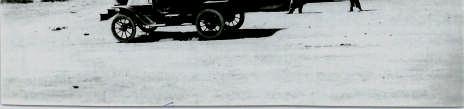
- 6 years ago
- Views:
Transcription


1 Courtland Arizona an Historical Overview Glenn Snow May 2009
2 Copyright 2009 Glenn Snow Cover photograph: Courtland Post Office, courtesy of the Arizona Historical Foundation.
3 Courtland, Arizona stands as an example of a typical southwest mining boom town. From a material standpoint, it owed its existence to copper, railroads, and technology. From a human standpoint, it equally owed its existence to greed, opportunity, optimism, determination, naiveté, stubbornness, publicity, tall tales, resourcefulness, and outright lies. The town of Courtland was named after Courtland Young, one of two brothers who owned the Great Western Copper Mining Company. The Young brothers, lumber magnates from Clinton Iowa, came into possession of a half-sector of land along the southern edge of the Dragoon Mountains in far southeastern Arizona. Courtland Young rarely came to Arizona, largely contenting himself with running the lumber business in Iowa. His brother William was the driving force behind their new mining enterprise out in far-flung Arizona Territory (Arizona became a state on Valentine s Day in 1912). In 1908, a rich vein of copper ore was discovered between the Sulphur Springs Valley and the old turquoise mines once jealously protected by the Chiricahua Apache tribe. Copper mining required great machinery and resources unavailable to the lowly individual prospector or miner, and so the Great Western Copper Mining Company was created to take advantage of this opportunity. Within months, three other large mining companies also staked out claims in the vicinity. At the time, copper was in great demand, as the inventions of Edison and others drove many towns and cities to get electrified. Within months, all the land within walking distance was bought up, in large parcels, and was being divided into residential and mining areas. A Mormon entrepreneur named James McFate (or J.N. McFate, as the common style for men was to identify themselves by their initials instead of their first names) had brokered a deal where he sub-divided a large tract of land adjacent to the big mines, into small lots which were sold for homes to mine workers and businesses to support them. It became known as the McFate townsite, and was the first housing site in the area, apart from tents thrown up on unused land. McFate was an unabashed booster, which served his real-estate business quite well. He had previously been the manager of a bottling company in Morenci, another copper mining town to the north. When word of a rich
4 copper strike reached him, he left the bottling plant and came down to the southern Dragoons to get a jump-start on any competition in what he judged would be a real-estate boom. He was right about the boom. He also got out of the real-estate business before it went bust just a few years later. McFate apparently had excellent business instincts. In the meantime, the Leadville Mining Company, the Calumet and Arizona Mining Company and other concerns had also staked out or negotiated mining rights to just about every square foot of land in the district. Since the Young brothers were the largest landowners, William decided to name the new town after his brother. The town of Courtland, Arizona was born in early In February of 1909, the first issue of the Courtland Arizonan, a weekly newspaper, was published. Its owner and editor, John V. VanEaton, began an enterprise which was almost single-handedly responsible for the widespread reputation of Courtland and the attraction of thousands of residents. Readers of the Arizonan found extensive and unreserved praise for the town and its prospects for the future. Ads on every page extolled the limitless potential of this mining town, and small blurbs filled most every white space with dripping enthusiasm for everything about Courtland. VanEaton soon joined McFate and others in trying his hand at real estate, but he d been so busy starting up the newspaper that he d missed the real early-bird opportunities for wealth.
5 Scores of mine shafts were started, some by big companies and some by individual miners hoping to get lucky and strike it rich. The area is pockmarked with them, attesting to the optimism and sometimes the naiveté of recent arrivals. The miners lived in makeshift homes, often hardly more than tents, and worked long and arduous hours in the mines, following the veins of rich copper ore. Miners were mostly single men, or men living away from their families. The women of Courtland were largely shopkeepers, or the wives of shopkeepers, along with teachers, craftswomen, and operators of boarding houses and restaurants. By the middle of 1910, there were nearly 2000 residents in Courtland, along with miles of water mains, telegraph lines, two rival telephone exchanges, stores, butchers, a lumber yard, an icecream parlor, an automobile dealership, and a movie theater. Most every service was available in Courtland, from barbers to assayers, from saddle repair to machinists. Visitors to the tenderloin district, on the north of Courtland, had other services available to them as well. The law was represented in Courtland almost completely by one man, John Henry Bright. John came from Texas where his family had considerable dealings in oil. He was married to Pearl Allen, and moved with her to join with her family in Arizona in He became a deputy Sheriff of Cochise County and the constable (local jail-keeper) of Courtland that same year. His brother-in-law Wesley Cates held the same position just down the road in Gleeson. Until 1909 there was no real jail in Courtland. Instead, an abandoned mine shaft was fitted with a heavy oak door, which was padlocked closed. In June of 1909, an enterprising though not too sharp prisoner decided to burn his way out through the oak door. Unfortunately there was more smoke than damage, and he nearly suffocated. Sheriff Bright rescued him and the town finished building a proper jail. It was completed in June and was nicknamed The Bright Hotel by the locals. It housed mostly drunks and thieves during its tenure, with the exception of one murderer, a woman who killed her boyfriend in a fit of jealousy in the tenderloin district. John Bright was the one and only constable in the town s brief history, though others were given territorial jurisdiction as the town declined.
6 If copper was the mare who gave birth to Courtland, the railroad was the sire. Two railroad empires competed mightily for the chance to come into Courtland: the Southern Pacific (known as the S.P. or Espee to the locals); and the El Paso and Southwestern (known as the EP&SW). In fact, Courtland became a major battleground for those two railroad companies. The EP&SW was playing David to the S.P. s Goliath. The EP&SW built a line up from Douglas while the Espee built south from their main line in the town of Cochise. Due largely to some labor issues, the EP&SW won the race into town, and in fact almost circled the entire town of Courtland with its tracks. It had two spurs, one coming in on the south side of town and traveling right up through the homes of the Great Western townsite. The other coming up the gully between central and north Courtland and circling around the mountain to a spot just above the end of the southern spur. The effect was like a finger and thumb encompassing the whole town. The Espee had to settle for a terminal on the far south side of Courtland. This spur then continued around the mountains and into Gleeson. The mining ore was all hauled by the EP&SW, while the Southern Pacific focused on freight and passengers, taking advantage of its trans-continental connection in Cochise. Courtland s ore was rich with copper, but it was not deep. By 1911, several of the major mines had played out. At some time in the geologic past, a block of copper-rich rock was shifted into the Courtland area, but that block ended about 300 feet below the surface. The Germania mine (primary mine of the Calumet and Arizona company) was dug down to 500 feet, but no copper was found below the 300 foot level. Flooding groundwater caused them to abandon everything below 300 feet, and when the price of copper dropped in 1913, all work on the Germania ceased. Other mines stopped working as well, and except for a few lone holdouts trying to scratch out a living, all mining ceased by the end of With the closing of the mines, much of the remaining population migrated elsewhere. Courtland s heyday had lasted only four years. It remained as a center for the surrounding farms and ranches, and the railroads made it viable supply town for a while, but eventually, the population of Courtland just bled out.
7 Farms and cattle ranches bordered Courtland on the east, and became Courtland s primary customers, at least for a time. It was the railroad which allowed this to continue. The Southern Pacific eventually bought out the EP&SW system in late 1924, ending that rivalry in a typically American fashion. The trains stopped running to Courtland in the spring of 1933, and the tracks were picked up by New Years Day of The farms and ranches simply switched to trucks for the delivery of their supplies, over increasingly paved roads. Cattle were driven to Willcox and loaded onto trains there until the end of World War II. Small farms, most of which had begun under the Homestead Act of 1863, were gradually abandoned or merged together to create larger farms, which continue to operate in the Sulphur Springs Valley. Ground water could be had in sufficient quantity to supply the agriculture, but it was pumped from several hundred feet below the surface. Until the electrification of the area in the 1950 s and 60 s, that was a difficult and expensive task. The history of Courtland is brief but instructive. It illustrates the rivalry of big railroads and big mining, as well as small hopes and small enterprises. It was the birthplace of several companies as well as the birthplace of William Rumford, the first African- American elected to any public office in northern California. It was a mostly peaceful town, with only one murder in its history, although several shoot-outs occurred on its streets and in nearby arroyos. Its meager ruins encompass the passing of a century and a way of life. Its trails, roads and borders mark the passing of the baton from the railroads of the 19 th century to the roadways of the 20 th century; from small homestead farms to larger and corporate farms; from the Old West to the New West.
8 Courtland, Arizona Portion of a 1927 map of downtown (center) Courtland, showing the jail, a 4-inch water main, and mostly-empty stores on the west side of Ghost Town Trail.
Courtland Arizona. Railroads
 Courtland Arizona Railroads Glenn Snow June 2009 Copyright 2009 Glenn Snow GSnow@GleesonArizona.com Cover photograph: railroad spike, Southern Pacific track bed, Courtland Arizona. Railroads made the settlement
HEADQUARTERS WEST LTD. PHOENIX - TUCSON - SONOITA - COTTONWOOD - ST. JOHNS
 Offered for sale exclusively by: Walter Lane Headquarters West, Ltd. PO BOX 37018 Tucson, AZ 85740 Phone (520) 792-2652 info@headquarterswest.com www.headquarterswest.com General Area Description The Crown
A Half Century of Tucson-Area Stagecoach Service s
 Ring s Reflections by Bob Ring A Half Century of Tucson-Area Stagecoach Service 1870-1920s Last week I wrote about overland stagecoach operations through Tucson. This week I ll tell the story of how Tucson
Pony Express. https://www.youtube.com/watch?v=y1r- GeEd95c
 Pony Express https://www.youtube.com/watch?v=y1r- GeEd95c RIDERS Most riders were around 20 years of age Youngest rider was 11 Oldest rider was mid-40s Many riders were orphans Riders usually weighed around
Weber Point The First Sammamish Lumber and Shingles
 Weber Point The bunkhouse picture is "Courtesy Issaquah History Museums, Neg. 2005.1.18" Weber Point, located on the eastern shores of Lake Sammamish in the northern part of the city of Sammamish, is today
Sheffield Island Camden County, GA
 For Sale $3,150,000 Sheffield Island Camden County, GA 452.5 Total Acres 230 Estimated Upland Acres William Lattimore 912.596.7019 Overview A rare opportunity to own a portion of a pristine island off
Wilkins, Nevada A 20 th Century Ghost Town
 Howard Hickson s Histories Wilkins, Nevada A 20 th Century Ghost Town Wilkins looks like a war zone today. There is nothing there except burned ruins in the sagebrush. It is a far cry from the vital days
Spanish Missions History and Purpose
 Spanish Missions History and Purpose Columbus's voyage of discovery opened a new world of possibilities for the Spanish. In the Americas, Spain soon began to use its soldiers to increase the size of its
Sourisseau. Sourisseau Academy. Les Amis (The Friends) photo collection uuly Smith Layton Archive. presents:
 photo collection uuly Smith Layton Archive. presents:") Sourisseau Academy Smith Layton Archive presents: Charlene Duval, Execu ve Secretary cduval@sourisseauacademy.org Leilani Marshall, Archivist lmarshall@sourisseauacademy.org Phone: 408 808 2064 Sourisseau
Sourisseau Academy Smith Layton Archive presents: Charlene Duval, Execu ve Secretary cduval@sourisseauacademy.org Leilani Marshall, Archivist lmarshall@sourisseauacademy.org Phone: 408 808 2064 Sourisseau
Panning for History Michael Stahl
 Panning for History Michael Stahl The Young Scout troop went on a camping trip one weekend. The 12 boys and their patrol leader went into the woods close to their home city of Sacramento, located in the
next purchase at Antelope Springs Ranch. These centrally located parcels are strategically positioned between Roswell and Artesia, New Mexico.
 Wide open spaces and beautiful sunsets! That s what you get when you make your next purchase at Antelope Springs Ranch. These centrally located parcels are strategically positioned between Roswell and
A Brief History of Williams. by Marlys Hirst
 A Brief History of Williams by Marlys Hirst Williams, Minnesota got its start when the Canadian railway line from Winnipeg to Thunder Bay was built through the area between 1899 and 1900. Two men who worked
Chapter 10 Sampo and Elmo, The Finnish Towns and Mines (1909)
") Chapter 10 Sampo and Elmo, The Finnish Towns and Mines (1909) The Sampo Coal Company constructed the town of Sampo in 1908. It started mine development efforts that same year on an eight-foot vein of coal
Chapter 10 Sampo and Elmo, The Finnish Towns and Mines (1909) The Sampo Coal Company constructed the town of Sampo in 1908. It started mine development efforts that same year on an eight-foot vein of coal
History of the Mexican Revolution
 History of the Mexican Revolution By ThoughtCo.com, adapted by Newsela staff on 10.19.17 Word Count 1,098 Level 840L Revolutionaries Emiliano Zapata and Pancho Villa are among the prominent figures from
Subject to sale, withdrawal, or error.
 CANYON DEVELOPMENT PROPERTY RANDALL COUNTY, TEXAS 381.38± ACRES *Drawing For Illustration Only We are pleased to offer the exclusive listing on the. Located in the Texas Panhandle near Canyon and Amarillo,
LOCATION, CLIMATE, AND NATURAL RESOURCES OF MEXICO
 SS6G3 The student will explain the impact of location, climate, distribution of natural resources, and population distribution on Latin America and the Caribbean. a. Compare how the location, climate,
ARIZONA HISTORICAL SOCIETY 949 East Second Street Library and Archives Tucson, AZ (520)
") ARIZONA HISTORICAL SOCIETY 949 East Second Street Library and Archives Tucson, AZ 85719 (520) 617-1157 ahsref@azhs.gov PC 078 Mathews, Rena, 1874-1962 Photograph collection, 1900-1962 DESCRIPTION Photograph
ARIZONA HISTORICAL SOCIETY 949 East Second Street Library and Archives Tucson, AZ 85719 (520) 617-1157 ahsref@azhs.gov PC 078 Mathews, Rena, 1874-1962 Photograph collection, 1900-1962 DESCRIPTION Photograph
Friday Harbor s Haunted Past and Present
 Published on San Juan Islands Washington Visitors Bureau Orcas Island Lopez Island Friday Harbor San Juan Island (https://www.visitsanjuans.com) Friday Harbor s Haunted Past and Present What small town
Overland Stagecoach Service through Tucson If it weren t for stagecoaches, Tucson wouldn t have developed to be the town we see today!
 Ring s Reflections by Bob Ring Overland Stagecoach Service through Tucson 1857-1880 If it weren t for stagecoaches, Tucson wouldn t have developed to be the town we see today! Let s set the stage (sorry).
CHAPTER 1. INTRODUCTION AND BACKGROUND
 SETTING CHAPTER 1. INTRODUCTION AND BACKGROUND The City and Borough of Juneau (CBJ) is located in the central portion of the Alaskan panhandle, approximately 700 miles from Anchorage and 950 miles from
Town of Oakfield Agricultural and Farmland Protection Plan
 SECTION III COMMUNITY OVERVIEW A. Regional Setting / Location The Town of Oakfield is located in the northwestern portion of Genesee County. Located west of New York's Finger Lakes, the Town is uniquely
Yankee Hill Dispatch
 Yankee Hill Dispatch Vol 2 No 3 Dec 2008 Published by the Yankee Hill Historical Society www.yankeehillhistory.com P.O.Box 4031, Yankee Hill, Ca 95965 Wishing You Happy Holidays And A Prosperous 2009 Our
Feature Article. Fall City: The Hotel Corner since (southeast corner of 337th SE and Redmond-Fall City Rd)
") Feature Article Fall City: The Hotel Corner since 1886 (southeast corner of 337th SE and Redmond-Fall City Rd) Fall City ca.1887 In this very early photo, the river-powered ferry run by the Rutherford
Feature Article Fall City: The Hotel Corner since 1886 (southeast corner of 337th SE and Redmond-Fall City Rd) Fall City ca.1887 In this very early photo, the river-powered ferry run by the Rutherford
At the Moulin Rouge: The Dance
 At the Moulin Rouge: The Dance At the Moulin Rouge: The Dance This text and image are provided courtesy of the Philadelphia Museum of Art. 1890 Oil on canvas 45 1/2 x 59 inches (115.6 x 149.9 cm) HENRI
Economy 3. This region s economy was based on agriculture. 4. This region produced items such as textiles, iron, and ships in great quantities. For th
 Geography 1. This region has a climate of warm summers and snowy cold winters. 2. This region has a climate that is generally warm and sunny, with long, hot, humid summers, and mild winters, and heavy
Mexico. Chapter 10. Chapter 10, Section
 Chapter 10, Section World Geography Chapter 10 Mexico Copyright 2003 by Pearson Education, Inc., publishing as Prentice Hall, Upper Saddle River, NJ. All rights reserved. Chapter 10, Section World Geography
El Rancho Nando Cochise County, Arizona
 El Rancho Nando Cochise County, Arizona Offered by sale exclusively by: Headquarters West, Ltd. Walter Lane 4582 N 1 st Avenue Tucson, AZ 85718 Phone (520) 792-2652, Fax (520) 792-2629 info@headquarterswest.com
The Ghosts of Dawson New Mexico LEGENDS OF AMERICA. A Travel Site for the Nostalgic & Historic Minded. Legends Stuff. Us
 Pagina 1 di 5 LEGENDS OF AMERICA A Travel Site for the Nostalgic & Historic Minded History & Nostaligia Travel To... Rocky Mtn Store Legends Stuff Ghostly Legends More Travel Fun Legends Home Free Newsletter
MP : The Empire Toll Gate and Glen Arbor
 MP 255 256: The Empire Toll Gate and Glen Arbor This section includes the location of the Empire Toll Gate, Glen Arbor and a reservoir. Route Mile Marker X Y Longitude Latitude 1 U. S. Highway 40 255 439593.25
This section of the Plan provides a general overview of the Smoky Mountain Region. It consists of the following four subsections:
 SECTION 3 COMMUNITY PROFILE This section of the Plan provides a general overview of the Smoky Mountain Region. It consists of the following four subsections: 3.1 Geography and the Environment 3.2 Population
THE OLSEN RANCH. Paso Robles, California 600+ UNIT PLANNED COMMUNITY DEVELOPMENT OPPORTUNITY. << Click to View Aerial Tour >>
 THE OLSEN RANCH Paso Robles, California 600+ UNIT PLANNED COMMUNITY DEVELOPMENT OPPORTUNITY > OLSEN RANCH TABLE OF CONTENTS OFFERING OVERVIEW... 3 PROPERTY PHOTOS...10 MAPS
The Glenmary Coke Ovens
 The Glenmary Coke Ovens By MAGGIE BARGER Coke, not for quenching thirst or getting high on, but as a byproduct of coal production. With the coming of the railroad the abundant coal deposits in the area
DETROIT, TOLEDO, AND IRONTON RAILROAD PHOTOGRAPHS SUBSERIES, Accession 548
 Finding Aid for DETROIT, TOLEDO, AND IRONTON RAILROAD PHOTOGRAPHS SUBSERIES, 1922-1923 Finding Aid Published: June 2011 20900 Oakwood Boulevard Dearborn, MI 48124-5029 USA research.center@thehenryford.org
Cherokee And The Concow Dam
 Cherokee And The Concow Dam In 1853 Sol Potter, a school teacher from the Cherokee Nation in Oklahoma along with several students discovered gold in Butte County and named the area Cherokee. Others soon
Introduction to Africa
 Introduction to Africa Did you know? Africa has more countries than any other continent. The Sahara is a desert that is the size of the U.S. It s the world's largest desert. Most of the world s gold and
Section 1: Vocabulary. Be able to determine if the word in bold is used correctly in a sentence.
 Section 1: Vocabulary. Be able to determine if the word in bold is used correctly in a sentence. Hardships: difficult conditions or situations that cause discomfort and/or suffering Pioneers: the people
Catalog #1108. Chilton Trailer Co Inc. 311 E Main Street Chilton WI 53014
 Catalog #1108 Chilton Trailer Co Inc. 311 E Main Street Chilton WI 53014 People By RANDY BISHOP Staff Writer January 25, 2001 Pride runs deep in downtown Chilton In 1955. John Meyer, of Hilbert, welcomed
In 1850, Congress passed a law donating two and one half million acres to the State of Illinois for the use of the Illinois Central Rail Road.
 Merna The town of Merna was founded by primarily Irish and German farmers. Their faith and families were an integral part of who they were. There was and still is today a strong sense of community. Most
TOPIC: Carrillo Family and Carrillo Gardens AYRES NEWSPAPER INDEX
 Arizona (Weekly) Citizen 15 10 1870 3 1 L. Carrillo returns from Magdalena, Sonora Arizona (Weekly) Citizen 19 10 1870 3 3 district court larizona Weekly Staruit, L. Carrillo Arizona (Weekly) Citizen 25
Letter Assessment. (date) Dear, In 1864, Then in 1866, In 1867, As it happened in 1868, Then in 1877, The bust came in.
 Dear, In 1864, Then in 1866, In 1867, As it happened in 1868, Then in 1877, The bust came in.") Letter Assessment (date) Dear, In 1864, Then in 1866, In 1867, As it happened in 1868, Then in 1877, The bust came in. Your friend, The Birth of a City and Railroad in the Rocky Mountains Modified for
Letter Assessment (date) Dear, In 1864, Then in 1866, In 1867, As it happened in 1868, Then in 1877, The bust came in. Your friend, The Birth of a City and Railroad in the Rocky Mountains Modified for
The Wieden Place. Portion of Plat Map Drawn After 1889 and Before Wiedens and Wiedens Roses
 The Wieden Place Anyone sitting on Bench Six today who is looking north to Allman Avenue would see heavy traffic and modern buildings. Students on fifteen or more school busses travel that route on their
RETURN TO THE LOST ADAMS DIGGINGS
 RETURN TO THE LOST ADAMS DIGGINGS My name is Richard U. French, friends call me Dick. I want to tell you a story; it is a story about gold. In the closing months of the American Civil War, in 1864, an
MEEK tart'
 MEEK tart' Post Card Nebraska is one of the nation's leading stock raising areas. It is famous for dairy products. Corn, grain, hay and sugar beets grow in abundance. Industrial activity has rapidly developed.
Gypsum Mine - Buck Mtn. Google earth
 N Gypsum Mine Train Wreck of 1901 (See Page 2 thru 8) Santa Fe Railroad Chevron Havasu Heights Rd. Havasu Heights Arizona Yucca Mine (See Page-9) Revised: 2018-03-16 Start: 34 43.554 N - 114 18.905 W (Chevron
Uncle James Howver The Gold Rush and a Lost Claim
 Uncle James Howver The Gold Rush and a Lost Claim There s Gold in Them Thar Hills! Susan McNelley Some men seek riches. Some men seek adventure. Some men yearn for both. Their stories often stir the imagination.
Opinicon Resort. Summary of Information Available.
 Opinicon Resort Summary of Information Available. Taxes $ 25,917.72 (2014). See tax bills included online with Roll numbers. Brief History Provided and edited by Cindy (Cross) Simpson - original written
Redesigning The Waterfront
 San Francisco Maritime National Park Service U.S. Department of the Interior National Historical Park California Redesigning The Waterfront A Self-Guided Walking Tour Then & Black Point Cove, ca. 1910.
This Is the. W e s t
 This Is the W e s t This Is the W e s t Copyright by Harcourt, Inc. All rights reserved. No part of this publication may be reproduced or transmitted in any form or by any means, electronic or mechanical,
German students built escape route, connected East to West
 German students built escape route, connected East to West By Smithsonian.com, adapted by Newsela staff on 08.31.16 Word Count 985 TOP: A woman along with 57 people escaped through a tunnel at Bernauer
THE OLSEN RANCH. Paso Robles, California 600+ UNIT PLANNED COMMUNITY DEVELOPMENT OPPORTUNITY. << Click to View Aerial Tour >>
 THE OLSEN RANCH Paso Robles, California 600+ UNIT PLANNED COMMUNITY DEVELOPMENT OPPORTUNITY > OLSEN RANCH TABLE OF CONTENTS OFFERING OVERVIEW... 3 PROPERTY PHOTOS...10 MAPS
Warm Up Use complete sentences
 Warm Up Use complete sentences What do you think are 3 differences between the Northern US and the Southern US that caused the Civil War? (asking what you think so there are no wrong answers except silly
A Retrospective 50 Year Memory Tour of Western National Parks & Other Sites 1964 & 2014
 A Retrospective 50 Year Memory Tour of Western National Parks & Other Sites 1964 & 2014 Introduction: In 1964, Paul & Marilyn Koch took a 10 week camping trip through National Parks and other locations
HISTORICAL MARKERS issued by
 HISTORICAL MARKERS issued by INDIANA HISTORICAL BUREAU in MONTGOMERY COUNTY, INDIANA 2016 Compiled by Dian Moore, Montgomery County historian NUMBER NAME 54.1962.1 Lane Place 54.1963.1 Major General Lew
Trail Boss: Rich Bugarin Home # Cell#
 Henness Pass Road Hi-Landers October 2013 Club Run Trail Boss: Rich Bugarin Home # 916-771-3359 Cell# 916-300-3192 E-Mail: rbugarin@hi-landers.com Meet at the Grass Valley Lumber Jack Restraint at 9:00am
HONORING OUR HISTORY. The Story of the City of Grover Beach
 The Place where the Tidelands and the Rails Meet In 1887, the property that would soon be founded as the Town Site of Grover and Huntington Beach was purchased by D.W. Grover, a lumberman, and his associate
Spanish Land Grant History of Santa Teresa and Sunland Park Abridged by Dr. Paul Maxwell Taken from the NM Office of the State Historian
 Spanish Land Grant History of Santa Teresa and Sunland Park Abridged by Dr. Paul Maxwell Taken from the NM Office of the State Historian Introduction: Ownership of what now encompasses the Sunland Park
The Covered Bridges of Preble County. Past, Present and Future By: R. Kyle Cross, P.E., P.S.
 The Covered Bridges of Preble County Past, Present and Future By: R. Kyle Cross, P.E., P.S. The History of the 8 Covered Bridges There are 8 covered bridges in Preble County. Only 2 of them are moved for
Mankato s Transportation Heritage
 Mankato s Transportation Heritage City of Mankato Mankato Heritage Preservation Commission May 11, 2017 1. Union Depot, 112 S. Riverfront Drive, c. 1896. The railroads were Mankato s dominant transportation
447 Route 28 West Yarmouth MA 02673
 CAREY COMMERCIAL, INC. BUSINESS & INVESTMENT PROPERTY 146 MAIN STREET HYANNIS, MA 02601 for sale 2 ACRES OF COMMERCIAL LAND 447 Route 28 West Yarmouth MA 02673 Contact: Chuck Carey 508-790-8900 Ext. 11
Ghost Towns. American West BY RAYMOND BIAL
 Ghost Towns American West BY RAYMOND BIAL An air of mystery swirls around the ghost towns of the American West. What sad and joyous events happened within the tumbledown walls and on the wind-blown streets?
Corporate Environmental Leadership Seminar Yale School of Forestry & Environmental Studies June 4-15, 2000
 KLEE 443 Corporate Environmental Leadership Seminar Yale School of Forestry & Environmental Studies June 4-15, 2000 Robert J. Klee M.E.S., Yale School of Forestry & Environmental Studies, 1999 ECO-INDUSTRIAL
Related Terms:Escondido, Fallbrook, La Jolla, Oceanside, Poway, Rancho Bernardo, San Diego County, San Pasqual, Union-Tribune, Wildfires
 SAVE THIS EMAIL THIS Close Related Terms:Escondido, Fallbrook, La Jolla, Oceanside, Poway, Rancho Bernardo, San Diego County, San Pasqual, Union-Tribune, Wildfires The long road back Two years after wildfires,
Levittown: Birthplace of the American Dream
 Levittown: Birthplace of the American Dream 1 July 2008 Background It was 1947. America, along with its Allies, had just won World War II. The War had snapped the nation out of an depression that had resulted
Physical characteristics and biomes:
 Physical characteristics and biomes: Sahel region, bordering Sahara Characteristics Area suffers from lack of rainfall, over grazing, which causes loss of vegetation and loss of inhabitable areas causing
Guide to the Tonopah-Goldfield Mining Photograph Collection
 Guide to the Tonopah-Goldfield Mining Photograph Collection This finding aid was created by Lindsay Oden and Hannah Robinson on April 27, 2018. Persistent URL for this finding aid: http://n2t.net/ark:/62930/f1w91n
Chapter 25 Section One: Istanbul: A Primate City throughout History urban primate city
 Chapter 25 Section One: Istanbul: A Primate City throughout History Meryem lives in Istanbul, the largest city in Turkey. It is early morning. She is riding a ferryboat to get to work. The ferry carries
Bridge Highest Railway.
 Opinion. The big news to-day is that the bridge over the canyon is complete, and the first train will cross tomorrow. Some may remember a short time ago when the rail line ended at the edge of the gorge,
A short story by Leo Schoof, Kelmscott, Western Australia. The Sexton s Wife
 Page 1 of 8 The Sexton s Wife Andrew Abbott was the sexton of the local church in Dale. He enjoyed this work very much. The task of the sexton was to clean the church. But that was not all. He also had
Get Your Kicks on Route 66
 Get Your Kicks on Route 66 This week, we go for a ride through the colorful history of Route 66, a road that has been called "The Main Street of America. The idea for Route 66 started in Oklahoma. Citizens
Mark Beyer SMOKEJUMPERS. Life Fighting Fires
 Mark Beyer SMOKEJUMPERS Life Fighting Fires Extreme Risk Fighting forest wildfires is a dangerous business. Some wildfires, however, are easier to get to than others. They can begin to burn near roads,
Human Geography of Canada
 Human Geography of Canada History and Government of Canada Like the United States, people migrated across Beringia into Canada, these people were the ancestors of the Inuit (Eskimos) 16 th and 17 th centuries,
Below is the section of the Byway discussed in the Wise County meeting. Primary coal sites are noted on the map.
 APPENDIX H: PUBLIC PARTICIPATION SERIES OF MEETINGS Virginia Coal Heritage Trail Corridor Management Plan Meeting In Big Stone Gap on the Wise County portion of the Norton Loop September 20 th 2010 at
December 2017 Oregon City First Capital City in The West
 December 2017 Oregon City First Capital City in The West A History of Oregon City see page 2. Webfooters Post Card Club PO Box 17240 Portland OR 97217-0240 www.thewebfooters.com Oregon City: The First
About Sutter County. History. Geography
 About Sutter County A lone kayaker with a fishing pole navigates the water in the Sutter Wildlife Refuge in the Sutter Bypass. Outdoor recreation is a big part of the appeal of Sutter County. Sutter County
Aviation, Rail, & Trucking 6-1
 6-1 This chapter describes the services, facilities, and condition of air, rail, and trucking as components of the transportation system. These three intermodal areas have an impact on the factors to be
Presidential Proclamation -- Establishment of the Castle Mountains National Monument
 Presidential Proclamation -- Establishment of the Castle Mountains National Monument ESTABLISHMENT OF THE CASTLE MOUNTAINS NATIONAL MONUMENT - - - - - - - BY THE PRESIDENT OF THE UNITED STATES OF AMERICA
Figure 7. Dragline at Cape Coral, Figure 8. Cape Coral oblique aerial photograph, 1959.
 The dredge-and-fill method, which would later be criticized for its environmental impact, employed in the peak years of the early 1960s as many as four dredges and ten draglines, which at times operated
Phenix, MO. The History of a Ghost Town
 If the statement is true that a town is only a town when it is on the map, then the only town remaining in Phenix, MO, is in the memories of those few who still call it home. A quick review of two state
Heather Rodriguez. Travel, Learn, Teach: Exploring Community Resources for Learning I EDU-X701P.
 Heather Rodriguez 6508 Travel, Learn, Teach: Exploring Community Resources for Learning I EDU-X701P heatherrodriguez@maderausd.org Location Visited: Yosemite Mountain Sugar Pine Railroad Assignment #1:
"Poem in Time of War, 2006"
 Ontario Review Volume 68 Spring/Summer 2008 Article 16 June 2014 "Poem in Time of War, 2006" Anita Barrows Follow this and additional works at: http://repository.usfca.edu/ontarioreview Part of the Poetry
Chapter The All-new, World-class Denver International Airport Identify Describe Know Describe Describe
 Chapter 10 The aerospace subject is very large and diverse. As seen in previous chapters, there are many subject areas. So far you have learned about history, weather, space and aerodynamics. Now you will
Guide to the David Coons Photograph Collection
 This finding aid was created by Lindsay Oden on April 27, 2018. Persistent URL for this finding aid: http://n2t.net/ark:/62930/f13s5v 2018 The Regents of the University of Nevada. All rights reserved.
Portuguese Language - Fostering National Unity
 Geography Brazil Brazil Portuguese Language - Fostering National Unity 11 dialects of Portuguese Influenced by Amerindian and African languages, creating differences between Portuguese spoken in Brazil
The Batterson Barn: Then and Now
 The Batterson Barn: Then and Now The Batterson Barn, along what is now the Red Feather Lakes Road, has been a familiar landmark in the Livermore area for more than 100 years. The following account is based
Human Services ABOUT SUTTER COUNTY. Section E. Photo courtesy Jack Davis
 Human Services ABOUT SUTTER COUNTY Section E Photo courtesy Jack Davis About Sutter County Sutter County is one of California s original 27 counties. Agricultural and commercial operations in Sutter County
Text 1: Empire Building Through Conquest. Topic 6: Ancient Rome and the Origins of Christianity Lesson 2: The Roman Empire: Rise and Decline
 Text 1: Empire Building Through Conquest Topic 6: Ancient Rome and the Origins of Christianity Lesson 2: The Roman Empire: Rise and Decline BELLWORK How did Rome s conquests affect the Empire? OBJECTIVES
student. They should complete the
 Standards SS6H3 The student will analyze important 20th century issues in Latin America and the Caribbean. a. Explain the impact of the Cuban Revolution. Teachers Print off the following page for each
Countries Of The World: France
 Countries Of The World: France By National Geographic Kids, adapted by Newsela staff on 03.26.18 Word Count 681 Level 780L Image 1: A view of the Eiffel Tower in Paris, France. Paris, or, "the city of lights,"
INLAND STEEL COMPANY, INDIANA HARBOR WORKS PHOTOGRAPHS,
 Collection # P 0711 INLAND STEEL COMPANY, INDIANA HARBOR WORKS PHOTOGRAPHS, 1926 Collection Information 1 Historical Sketch 2 Scope and Content Note 3 Contents 4 Processed by Dalton Gackle July 2018 Manuscript
The History of a Floodplain Meadow Bridget Smith
 The History of a Floodplain Meadow Bridget Smith I have lived in the village of Hemingford Grey near the River Great Ouse since 1976 and, like many others, walked the 1½ km into St Ives by the ancient
2012 Colorado Planning & Management Region Report
 INTRODUCTION 2012 Colorado Planning & Management Region Report The San Luis Valley in south central Colorado is the largest alpine valley in North America, bordered on the east by the Sangre de Cristo
Recent EconomicTrends
 Recent EconomicTrends in South Florida by REINHOLD P. WOLFF* OR THE LAST FIFTY YEARS the history of South Florida hlas been closely connected with the history of transportation in the United States. The
Parent Reminders: 1. UNRAAVEL Text 2. Cite Text Evidence for part A questions 3. Write Spelling Words 5x each! Tuesday:
 Name Lifework Mr.Hawkins s Class ELA Homework Week of Dec.4 th - Dec. 8th Weekly Spelling Words 1. Passage 2. Supports 3. Expresses 4. Connection 5. Describes 6. Detail 7. Statement 8. Main idea 9. Author
BROCHURE. APPLE HILL WOODS 118 +/- Acres Camino, California. Presented by Jim Copeland
 BROCHURE APPLE HILL WOODS 118 +/- Acres Camino, California Presented by Jim Copeland 1 The Property This 118 acre is a rare gem in the Sierra Nevada foothills. Covered with lush forestland and scattered
Arrowhead Ranch. Located in the Big Range Country of Central Wyoming.
 Arrowhead Ranch Located in the Big Range Country of Central Wyoming. 58 E. Benteen Street Buffalo, WY 82834 Ph 307-684-9556 Toll Free 888-684-9557 Fax 307-684-8565 Location The ranch is approximately:
Taos Pueblo, New Mexico
 Taos Pueblo, New Mexico The Southwest Border Area Precipitation Climates of the US U.S. and Canada The Southwest Border Area A region of three dominating cultures: Native American, Spanish American, and
CASS SCENIC RAILROAD. Cass, West Virginia. Written by Dan Whetzel Photography by Lance C. Bell
 CASS SCENIC RAILROAD Cass, West Virginia Written by Dan Whetzel Photography by Lance C. Bell m o u n t a i n d i s c o v e r i e s 49 Facing page: Cass Scenic Railroad s Heisler #6 departs from the depot
Japan is basically a mountainous volcanic Island Chain located in the western Pacific Ocean
 I N T R O D U C T I O N T O J A PA N Japan is basically a mountainous volcanic Island Chain located in the western Pacific Ocean The country has four main Islands HOKKAIDO HONSHU SHIKOKU KYUSHU And then
Willemstad: Maritime Heritage. Dimitri Cloose
 Willemstad: Maritime Heritage Dimitri Cloose "In the middle of Willemstad, runs the St. Anna Bay canal, which opens into a whimsical, large harbor area, named Schottegat. There is a pedestrian bridge resting
President Roosevelt and Naturalist John Burroughs at Fort Yellowstone. Ruined Castles of Yellowstone. East Entrance Station
 President Roosevelt and Naturalist John Burroughs at Fort Yellowstone Ruined Castles of Yellowstone East Entrance Station President Roosevelt at Liberty Cap Yellowstone Lake, Mary s Bay Fire Hole River