ELBOW-SHEEP WILDLAND PROVINCIAL PARK MANAGEMENT PLAN. March 1998
|
|
|
- Meryl Clark
- 5 years ago
- Views:
Transcription
1
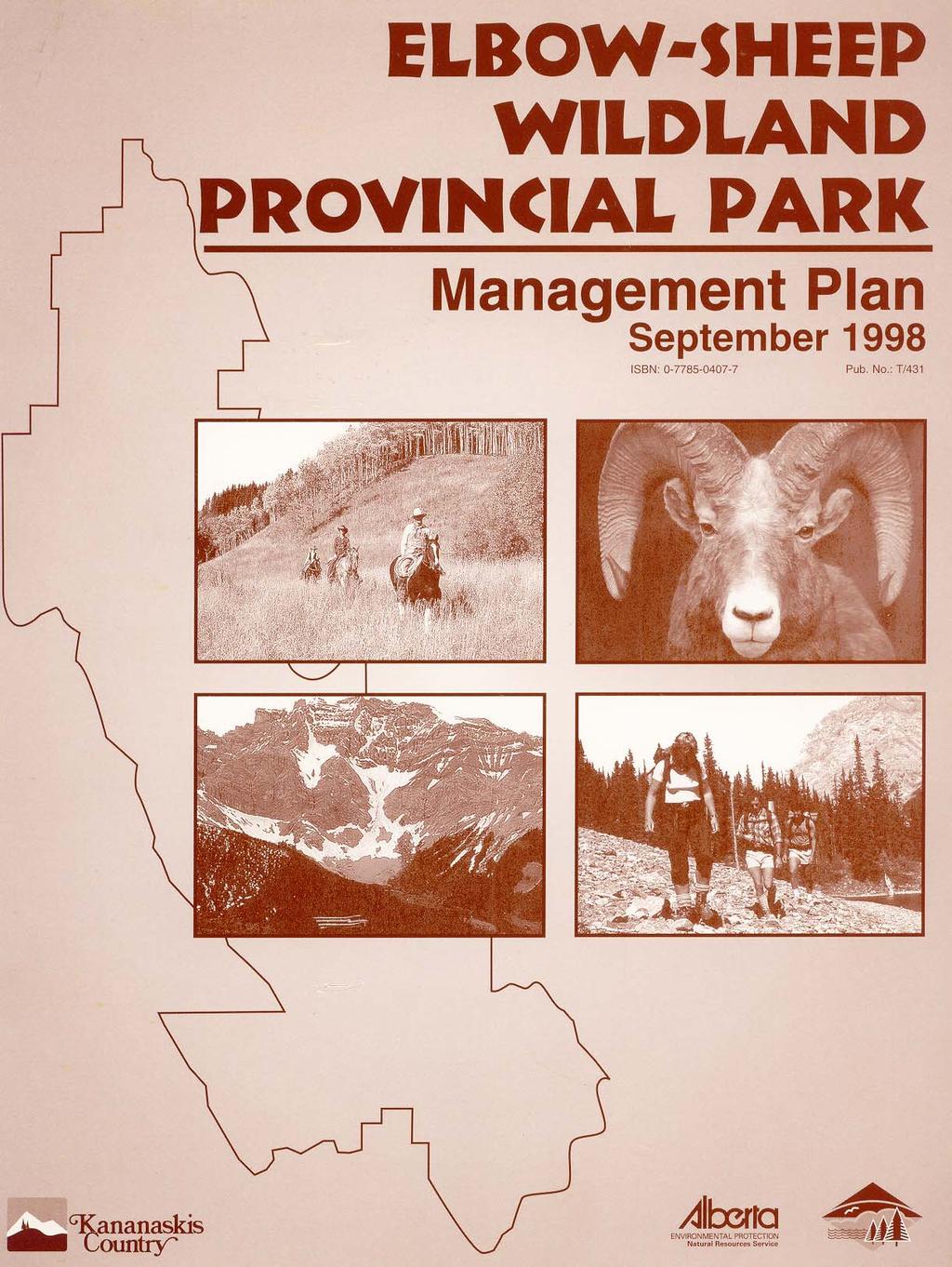
2 ELBOW-SHEEP WILDLAND PROVINCIAL PARK MANAGEMENT PLAN March 1998 Alberta Environmental Protection Canmore, Alberta
3 TABLE OF CONTENTS 1.0 INTRODUCTION Background Purpose of this Management Plan OVERVIEW Regional Setting and Access Natural and Cultural Features Size of Area and Boundary Landforms and Hydrology Climate Soils and Vegetation Fauna History Scenic and Recreational Values SYSTEMS CONTEXT Contribution to Special Places Management Intent for Elbow-sheep Wildland Provincial Park Management Objectives MANAGEMENT ISSUES AND STRATEGIES Landscape Management Vegetation Management Forest Insect and Disease Outbreaks Wildlife Corridors Resource Management Reintroduction of Species Problem Wildlife/Bears Weeds Recreation Management Trails Backcountry Camping Commercial Recreation Helicopters Snowmobile Use Hunting/Use of Firearms Fishing...15 i
4 4.4 Land/Resource Uses and Dispositions Trapping Freehold and Crown Mineral Rights Private Lands Information, Education and Research Public Information Education/Interpretation Research Other Issues Motorized Vehicle Use Access/roads/trails/reclamation Boundary Amendments Domestic Grazing Approval of Activities not Discussed in this Plan PLAN IMPLEMENTATION, REVIEW AND AMENDMENT Regulations and Enforcement Monitoring Roles of Environmental Protection Process for Plan Amendments...19 APPENDICES 20 REFERENCES 20 ii
5 1.0 INTRODUCTION 1.1 Background The Elbow-Sheep Wildland Park was nominated in 1995 under the Special Places 2000 program by the Minister of Environmental Protection, Ty Lund. It was designated by order-in-council as a wildland provincial park in January The intent of a wildland park is to retain large areas of high quality, natural landscape where opportunities for backcountry recreation and tourism activities such as hiking, trail riding, hunting, guiding and outfitting are provided in a way that ensures the retention of the land in a natural state and minimizes interference with natural processes. Facility development will be minimized. All wildlands make significant contributions to the preservation and heritage appreciation goals. Their contribution is especially strong with respect to low-impact, non-facility-based outdoor recreation in wilderness settings and to the tourism goal, especially through guiding and outfitting. All wildland parks will be listed as Natural Heritage Sites. 1.2 Purpose of this Management Plan Management plans are prepared to ensure that the desired management intent and objectives are implemented. The plan will define objectives for preservation, heritage appreciation, and outdoor recreation and tourism activities. It will also define appropriate uses. The quality of this plan will be limited by the completeness and accuracy of information that is available for the area. It will be updated periodically as new information becomes available. Implementation and enforcement of various aspects of the plan are subject to the priorities of regional and district government offices responsible for plan implementation. The plan applies only to public land, not to any private land that exists in the vicinity of the wildland. 1
6 2.0 OVERVIEW 2.1 Regional Setting and Access Elbow-Sheep Wildland Provincial Park is located in Kananaskis Country approximately 70 km west of Calgary (see map). Other population centres nearby include Canmore, Cochrane, Bragg Creek, Turner Valley, Black Diamond and Longview. The southwest boundary of the park adjoins Peter Lougheed Provincial Park and the British Columbia boundary. It is entirely within the Rocky Mountain Natural Region and adjacent to the Foothills Natural Region. Several paved and all-weather gravel roads provide motorized access to within a few kilometres of the wildland, including Highways 40 and 66 and Secondary Road 546. With the exception of Highway 40, which enters the park in its southwest corner and some snowmobile use, access into the wildland is along a number of non-motorized trails. The portion of Highway 40 that traverses a corner of the park is closed annually to all vehicle traffic from December 1 to June 15 primarily for wildlife protection. The three main trailhead access points are Little Elbow Recreation Area on Highway 66, Junction Creek Day Use area on SR 546 and the Elbow Pass Trailhead on Highway 40 in Peter Lougheed Provincial Park. Other access points include Lantern Creek, Mist Creek and Evan Thomas trailheads on Highway 40 as well as Cobble Flats on Highway 66. Informal, occasional access occurs from many points along the Powderface Trail (road) and elsewhere along Highway Natural and Cultural Features Size and Boundary Elbow-Sheep Wildland Provincial Park is 79,200 ha in size. The southern, western and northern boundaries generally follow the height of land marking the Kananaskis and Highwood drainages on one side and the Elbow and Sheep drainages on the other. Exceptions are the Mist Creek watershed of the Highwood drainage and parts of the Wasootch, Evan Thomas and Rocky watersheds of the Kananaskis drainage, which are included in the wildland. The eastern boundary generally coincides with the height of land west of the McConnell Fault (see map) Landforms and Hydrology The wildland is characterized by rugged mountains and valleys, which exhibit alpine and subalpine features. The area is significant as a source of water and contains the headwaters of the Elbow and Sheep, a portion of the Highwood River, as well as a portion of the Jumpingpound Creek headwaters. The Elbow and Sheep drainages supply 19 per cent of the flow in the Bow River and much of this can be assumed to originate as snow melt in the wildland park. The rivers and creeks in the park exhibit fast hydrological response to rainfall. June is the month of maximum flow due to snowmelt and precipitation. 2
7 1
8 2.2.3 Climate The climate is primarily Cordilleran exhibiting no periods of drought, moderate temperature variation and maximum precipitation in winter. The mountainous terrain combined with local climatic variations to create extreme differences in growing conditions within a few metres. In the subalpine, south-facing slopes are much drier than north-facing due to wind and sun exposure. In the alpine however, aspect differences are less apparent because of thin soils Soils and Vegetation Soils are predominately brunisols and regosols. Brunisols occur in areas where steep slopes restrict the penetration of water into the soil, commonly found on calcareous parent material of large mountainous river valleys in the study area. Regosols are indicators of relatively unstable conditions, which interfere with soil development. These soils are generally found on alpine locations and on river terraces, steep south and southwest facing slopes and on sandy river or creek formed terraces and fans. In subalpine areas forest communities are usually found on all aspects. Forest communities are dominated by coniferous species consisting of lodgepole pine, alpine fir, and white spruce/engelmann spruce hybrids. Above treeline, plant communities include species such as mountain avens, grouseberry, snow willow, several mountain heaths and several grasses and sedges Fauna The Elbow-Sheep Wildland Park supports numerous wildlife species characteristic of montane, subalpine and alpine ecoregions of the Central Canadian Rockies Ecosystem. Large populations (>200 animals) of bighorn sheep, elk, mountain goats, and deer exist within the wildland as well as lesser populations of moose, grizzly bear, black bear, cougar, wolf and other mammals (lynx, wolverine, marten, beaver, bobcat, mink etc). The great diversity of habitat types also supports numerous species of songbirds and upland game birds. The wildland contains numerous seasonally important ungulate ranges (e.g. summer elk range) as well as significant carnivore habitat. The number and distribution of several species within the park fluctuates seasonally depending on food supply and snow depth. The headwaters of the Elbow and Sheep Rivers contain bull trout, cutthroat trout, brook trout and mountain whitefish. The Sheep River contains, in its upper reaches, a very important bull trout spawning area. Cutthroat trout and mountain whitefish are the other native fish found in the park. Due to the high prevalence of native fish, this area is extremely important for maintaining native stocks. There are also a number of high mountain lakes, which are stocked on a regular basis with native cutthroat trout. In addition, native cutthroat trout have been stocked in upper Cougar Creek. 1
9 2.2.6 History Archaeological evidence indicates that native peoples have made use of the area now known as the Elbow Sheep Wildland Park for several thousand years. It is estimated that the Stoney peoples who reside next to Kananaskis Country, first occupied these valleys in the 1700s. When Treaty No. 7 was made in 1877, the Stoney Nakoda bands retained these mountain valleys as hunting, camping, fishing, gathering and ceremonial grounds (personal communication, P. Snow, 1998). The Tsuu T ina people who also live nearby, made traditional use of the area too. The first recorded explorations of the Kananaskis valley by Europeans were by James Sinclair in 1841 and the Palliser Expedition in In 1902, much of the Spray and Kananaskis valleys were included as part of Rocky Mountains National Park (now Banff National Park). Prior to the 1920's, land and mineral rights in the Sheep Valley were granted by the federal government to a private coal mining company. This private land remains as an island surrounded by the Wildland Park. In 1930, the federal Department of the Interior transferred Bow River Forest lands to provincial jurisdiction. Since then, the land and resources have been managed by various provincial agencies and departments. In 1977, the provincial government's policy for resource management of the Eastern Slopes was applied to all of the eastern slopes including what is now the Wildland Park. The area which was to become the park was zoned "prime protection" or "critical wildlife" which limited or prohibited further resource extraction activities. This protective zoning was reconfirmed for all of the wildland park area in 1986 when the Kananaskis Country Subregional Integrated Resource Plan was adopted by Cabinet. The existing access roads through the area were closed to public vehicle traffic in 1979 when Kananaskis Country Forest Land Use Zone regulations came into effect. Prior to establishment of the wildland park, the area had low levels of resource use. Climatic and topographic conditions limited forage and timber resources in most areas of the park however; some domestic livestock grazing has been permitted along Highway 40 near Storm Creek, and the Sheep River Valley. Topography and climate also limited commercial timber growth. Timber berths were issued in the Storm, Sheep and Junction Creek drainages as early as the 1920s however these are not now considered part of the permanent timber land base of Kananaskis Country. Prior to 1978, mineral activity was generally absent. This was in spite of the surface and subsurface rights that had been sold or leased for coal exploration. A small amount of Kootenay formation coal was mined in the early 1920's from the Burns coal deposit in the Sheep Valley. The mine area has since been reclaimed and few signs of it remain. Some subsurface mineral rights still exist adjacent to the Burns Mine property but current provincial policy prohibits mining and quarrying in Kananaskis Country. Petroleum and natural gas exploration in the wildland park was limited to the drilling of one well, subsequently abandoned. No commercial interest in quarriable or metallic minerals had been identified prior to the minerals being withdrawn from disposition. 2
10 2.2.7 Scenic and Recreational Values The Elbow-Sheep Wildland Provincial Park consists of natural, rugged alpine and subalpine landscapes. The park is more or less enclosed by high mountain peaks and ridges, and contains stream courses which vary from steep canyons to broad valleys. The Elbow and Sheep River valleys are dominant scenic features. Except for old partially reclaimed forestry roads used as trails, development is minimal. The wildland is popular for people seeking a backcountry or wilderness experience, and who want to travel by foot, horseback or mountain bike. Close proximity to Calgary makes the area an attractive destination for both day and overnight trail users. Commercial outfitting and guiding activities also occur each summer and fall. Other activities include hunting, fishing, mountain climbing and some snowmobiling in winter. Recreation facility development is limited to 75 km of non motorized trails, two designated backcountry campsites (20 tent sites) and a designated snowmobile loop trail (Elbow Loop). 3
11 3.0 SYSTEMS CONTEXT 3.1 Contribution to Special Places Elbow-Sheep Wildland Provincial Park was established as part of Special Places, the Government of Alberta's protected areas program. The vision is to complete a network of Special Places that represent the environmental diversity of the province's six Natural Regions and 20 sub-regions as a natural legacy for future generations. The programs preservation goal is balanced with three other cornerstone goals of outdoor recreation, heritage appreciation and tourism/economic development. 3.2 Management Intent for Elbow-Sheep Wildland Provincial Park Wildland is a new category of park in Alberta. It is classed as one of the Natural Heritage Sites in the provincial network of protected areas. The intent of a wildland park is to: Retain large areas of undeveloped land in a natural state by minimizing facility development and interference with natural processes. This kind of park allows for a variety of backcountry recreation opportunities such as hunting, fishing, trail riding, and backcountry camping and hiking. Snowmobiling and off-highway vehicle use is not allowed in wildland provincial parks except on previously approved/designated OHV trails or routes. Wildland parks provide areas that support backcountry tourism in Alberta, such as the guiding and outfitting industry, and commercial trail riding. Wildland parks are designated under the Provincial Parks Act. Regulations have been amended to support the intent of this designation. Highlights of the revisions are: Industrial development including oil and gas, mining and commercial timber harvesting will not be allowed, however surface access to existing dispositions or to freehold minerals will be considered. Domestic livestock grazing is not permitted. Random camping is allowed in the wildland provincial park. Where there is a designated backcountry campsite, random camping is not allowed within one kilometre of the campground. Hunting, fishing and trapping will continue to be allowed within wildland parks. Firearm discharge permits will not be required for hunters with valid hunting permits. The enabling regulations for wildland provincial parks will not prejudice access to either freehold minerals or private property. Both exist in Elbow-Sheep Wildland Park. 4
12 3.3 Management Objectives The specific objectives for the Elbow-Sheep Wildland Park considering the four goals under the Special Places program are: Preservation: Outdoor Recreation: Heritage Appreciation: To preserve subalpine and alpine habitat and critical ranges for sheep, elk, cougar, grizzly bear and mountain goats from development and use and ensure natural ecological processes are maintained. To maintain recreational uses such as hiking, equestrian use, mountain biking, hunting and backcountry camping so long as preservation objectives are achieved. To establish opportunities for visitors to experience, understand and appreciate the natural features of the park. Tourism/Economic Development: To maintain opportunities for tourists to experience and enjoy the natural features of the park with available approved commercial guide and or outfitting services. 5
13 4.1 Landscape Management Introduction 4.0 MANAGEMENT ISSUES AND STRATEGIES Consistent with the management intent and objectives for this Park and with the current business principles of Alberta Environmental Protection, an ecosystem based approach will be used in managing the Elbow Sheep Wildland Provincial Park. This large new park will be viewed in the even larger context of Kananaskis Country and the Central Rockies Ecosystem. This means for example that working relations with neighboring jurisdictions will be established or enhanced, research into management issues that are common across boundaries (how to address biodiversity or wildlife movement for example) will be enhanced and coordinated, environmental indicators will be identified for more focussed monitoring, and stakeholders and the public will be given more opportunities to participate in ongoing management Vegetation Management A wide variety of vegetation species and communities occur in the Wildland Park. Maintenance of diversity depends on periodic disturbances such as avalanches, flooding, disease and wildfires. Within the Wildland Park, avalanches and flooding will continue to occur naturally. Wildfire, however, poses potentially serious threats to public safety, resources and developments in adjacent areas. For the time being, therefore, all wildfires within the Elbow-Sheep Wildland Park will be actioned as soon as possible. It is anticipated that ongoing research and planning will allow more ecosystem sensitive approaches to wildfire. Recently, a variety of habitat enhancement techniques such as prescribed fires and small scale, selective mechanical clearing have been employed to alter vegetation characteristics so as to mimic natural patterns. A prescribed burn was carried out within the wildland in the Mist Creek valley in An area of 36 ha was burned to remove crown growth and encourage forage for elk and bighorn sheep that winter in the area. Such techniques will continue to be considered within the wildland park provided there would be no significant impacts on any rare, threatened, or endangered species, fragile or unique habitat types, or the natural beauty of the area. Proposals for prescribed burns will be carefully designed so as to not have a negative impact on soil integrity or public safety and involve an evaluation component. Prescriptions will be developed in cooperation with Land and Forest Service and will require the approval of the Director of Forest Protection. Development of a regional fire management plan will address the use of prescribed fire in the wildland park. 6
14 4.1.2 Forest Insect & Disease Outbreaks Endemic levels of forest insects and diseases will be considered a natural part of the wildland ecosystem. On the other hand, if forest insects and diseases within the park threaten adjacent areas or desired values, appropriate control measures will be taken. Methods that cause the least disturbance to the wildland's natural features and use and have the most selective degree of control will be considered first. If these methods are considered inappropriate, less selective measures may be considered on a step-by-step basis until an appropriate method is chosen Wildlife Corridors Many species of wildlife move between seasonal ranges along movement corridors. Preservation of such corridors is essential in maintaining population numbers, maximum habitat utilization, genetic diversity and ecosystem integrity. The Elbow-Sheep Wildland Park contains several known corridors of local and regional significance yet not all corridors for all species are fully understood. Many regionally significant corridors connect important areas within the wildland to important areas outside its boundaries (e.g. the Sheep River drainage connects spring lambing and summer ranges within the wildland park to winter range in the Sheep River Wildlife Sanctuary). Any land use decisions within or adjacent to the wildland will take into consideration the impact such a decision may have on the viability of any wildlife movement corridor in the area. Activities with potential to seriously disrupt animal movements will not be considered within the wildland. Research initiatives designed to better understand the location of movement corridors and/or the impacts of human activities on the viability of any corridors will be encouraged. 4.2 Resource Management Reintroduction of Species Reintroductions or supplementations of native species into areas of former habitat will be considered in instances where, in the past, human activities have impacted populations or disease outbreaks have negatively affected and suppressed populations. No exotic species will be introduced into the wildland park. Use of exotic/domestic species such as llamas and goats for commercial or recreational purposes may be allowed subject to existing health requirements for commercial users. 7
15 4.2.2 Problem Wildlife/Bears Under certain rare circumstances, some species of wildlife or individuals may pose a threat to public safety, to some valuable feature or activity in the wildland park or on adjacent lands. Such occurrences may warrant mitigative activity to reduce the problem. The need for mitigative actions to control individuals or populations will be carefully considered on a case-by-case basis by departmental staff responsible for wildlife management. Black and grizzly bear conflicts will be dealt with according to the Kananaskis Country Bear Conflict Prevention Plan (May 1995). This plan's primary objective is to define appropriate courses of action to minimize the probability of bear-human encounters while protecting and maintaining natural populations of bear species Weeds Weeds will be treated by land managers in accordance with legislation as defined in the Weed Control Act (1980). Within the Wildland Park, infestations are expected to be small scale so the normal methods will consist of hand pulling or cutting with spot spraying as a last resort. Use of weed-free feed for horses will be encouraged. Use of certified native seed mixes in any reclamation projects as outlined in Public Lands Update IND 96-1 and LFS Policy Directives Manual will also help to minimize weed problems. 4.3 Recreation Management This section contains guidelines for managing recreation activities within the wildland park so as to minimize conflicts between users and ensure that impacts on the natural environment are minimized. Examples of impacts from recreational activities include trampling and removal of vegetation, soil compaction, fire damage to soils, tree cutting, erosion and sedimentation, litter, improper disposal of human waste, water contamination, grazing and disturbance to wildlife Trails The Elbow-Sheep Wildland Provincial Park has approximately 75 kilometres of designated shareduse (hiking, biking, equestrian) summer trails (see map). These form part of a larger interconnected trail system, which runs, throughout Kananaskis Country. The Park also has a number of informal non-designated trails. The most heavily used designated trails are the Sheep River Trail, the Little Elbow Trail and the Big Elbow Trail. There is one designated winter use trail, the Elbow Loop Snowmobile Trail, which follows the Little Elbow and Big Elbow Trails. This trail is open from January 1 st to March 31 st annually and provides an opportunity for long range snowmobile touring in backcountry conditions. Access to this trail is from the McLean Creek Off Highway Vehicle Zone 25 kilometers to the east of the park. Use has generally been light but has increased more recently. 8
16 An inventory and assessment of existing opportunities within the wildland will be conducted by departmental staff. Where concerns about overuse or inappropriate use are found, appropriate management action will be taken. This will range from providing good visitor information/education on minimizing impacts to seasonal closures to trail upgrading, reclamation or other measures. For the time being, standards on the Sheep, Little Elbow and parts of the Big Elbow trails will accommodate horse drawn wagons. Designation of additional trails or backcountry campsites will only be considered after determining that impacts will be consistent with the management objectives. The park will be zoned to provide an appropriate range of trail and off-trail opportunities and to maintain wildlife values. Applying the concept of "Limits of Acceptable Change" in the wildland park context will form the basis for determining how these impacts will be managed. This will help to determine, for example, acceptable use levels, types and locations of facilities and information to be provided. The existing Elbow Loop Snowmobile Trail will be maintained but no new snowmobile trails will be added to the system. Impacts of trail use on wildlife will be monitored to determine whether areas of concern exist. Management actions, if necessary, include reclamation, erosion control, trail upgrading or rerouting. Visitor information and education on minimal impact use will be developed in partnership with user groups. A backcountry use permit system is another option for managing recreational use and its impact on the park that will be considered. The Little Elbow Equestrian Trail, which parallels the Little Elbow Trail, is severely impacted and presently receives little use. Appropriate reclamation will occur and equestrian use will be redirected to the nearby shared -use trail. An assessment of all non-designated trails and old roads will be undertaken to determine whether reclamation work is necessary to reduce visual and or environmental impacts. The level of reclamation will be determined by the degree to which impact is taking place and may vary from allowing natural rehabilitation to aggressive revegetation efforts Backcountry Camping There are two backcountry campgrounds in the Elbow-Sheep Wildland. Romulus and Tombstone Creek campgrounds are located along the Little Elbow Trail, which is the most heavily used trail in the wildland. Basic facilities include pit toilets, fire rings, tables, pack racks, and hitching rails for horses. The capacity of the campgrounds is 10 units each. Firewood is available on site and water is from natural sources only. Commencing in the spring of 1998, overnight camping charges will apply at the two designated campsites. The campgrounds are used primarily in the summer and fall and are often at or near capacity during weekends in the summer. No trace camping practices will be encouraged. This will include encouraging the use of stoves rather than fires at campsites. Should use levels rise, upgrading or expansion of these campgrounds would be one of the management actions considered if it could be shown that the intent and objectives of the wildland park will be maintained. 9
17 New legislation for wildland provincial parks permits random camping and allows for open fires as long as the campsites are more than one kilometre away from designated backcountry campsites. Random camping has occurred in the area for many years. The extent to which random camping takes place is not well known however there are a number of well established areas used by both the general public and commercial operators. This activity can result in environmental impacts including erosion, soil compaction, habitat loss, trampling of vegetation, water quality being compromised, litter, and establishment of primitive facilities such as corrals and tie rails, and fire rings. Monitoring will be conducted to determine the extent and nature of impacts from random camping. Appropriate management action will be taken. These will range from providing minimum impact camping information to random campers to site rehabilitation and temporary restrictions. In particular, visitors will be encouraged to keep party size below 10 individuals. Should use levels or impacts related to backcountry camping reach unacceptable levels, restrictions designed to protect the wildland character of the park will be established Commercial Recreation Several commercial operators provide guiding and or outfitting services within the park. Services include guided trail riding, hiking, mountain biking and backcountry camping as well as hunting trips. All commercial operators with a majority of their operation within the wildland, will require a Guiding and Instruction Permit issued by Natural Resources Service. At present, there are no formal limits established as to the maximum number of commercial operations in the park. Rather, each application is assessed on its own merits with a view to minimizing impacts and conflicts among users and maximizing opportunities for visitor enjoyment in a wildland park setting. Monitoring of impacts and conflicts will occur by departmental staff and, when appropriate, result in changes or additional operating conditions. Such monitoring will be part of a comprehensive and effective overall monitoring approach within the park, which may lead eventually to use limits or other management actions. Commercial operators will be consulted about proposed changes before they are implemented. For the time being, only annual permits will be issued and only temporary structures will be permitted. Standard operating conditions that have been applied to commercial permits here in the past are expected to continue to be applied through the Guiding and Instruction Permit or Commercial Trail Riding (CTR) permit process. These will include conditions on campsite locations, limits on maximum group size, duration of stay and other aspects of their operations Helicopters The Provincial Parks Act prohibits unauthorized aircraft landings in the wildland. In order to maintain high quality wilderness recreation opportunities, helicopter landings will only be permitted for emergency or government business where necessary. Overflights by commercial operators will be addressed through negotiations so as to reduce or eliminate undesirable impacts or conflicts. 10
18 4.3.5 Snowmobile Use Snowmobiling is the only motorized off-road activity permitted within the wildland park. This occurs on the Elbow Loop Trail. This loop was in place prior to the wildland being established and has been retained as a designated trail. There are approximately 23 km of this loop within the park with access to it from the McLean Creek Staging Area, approximately 25 km to the east. The number of snowmobilers who use the trail in a season is estimated to be low compared to other snowmobile trails in the area such as McLean Creek and Cataract Creek. Snowmobile club members from the Calgary area report using the trail each winter. The trail is generally open from January 1 st to March 31 st. Off-trail use within the wildland park is prohibited by regulation. Appropriate information and educational techniques will be used to inform trail users that off-trail use is prohibited. Off trail use will be monitored and enforcement measures will be taken when required Hunting/Use of Firearms Hunting by residents and non residents is a popular recreational activity and will continue within the Elbow-Sheep Wildland Park. At present, the wildland includes portions of three Wildlife Management Units (WMU 408, 406, and 404) and most big game species except grizzly bear and mountain goats are hunted. Most hunting (except male bighorn sheep, black bear and gamebirds) will be regulated by a limited permit or quota system based on estimates of population size, hunter success rates and desirable harvest rates which can be adjusted according to population objectives for each species as determined by Natural Resources Service staff. The allocation of Outfitter/Guide permits will continue as outlined under the Alberta Outfitter/Guide policy. Bowhunting will be continued prior to and during general hunting seasons. An amendment to the Parks Act has been made which requires anyone carrying or discharging a firearm in Wildland Parks, other than for licensed hunting purposes, to possess an additional, separate permit. This is called a "Permit to Discharge a Firearm" which will be issued, when appropriate, by Natural Resources Service. 11
19 4.3.7 Fishing The Elbow - Sheep Wildland Park includes a variety of fisheries ranging from high mountain lakes to streams. This area contains some very important native fish bearing waters. The native sport fish species are bull trout, cutthroat trout and mountain whitefish. Several exotic species are also found in the watercourses within the Wildland. They are rainbow trout, brook trout and, in Evan-Thomas Creek, a few brown trout. The majority of the streams contain primarily self sustaining populations of native species which makes this area unique within the southern east slopes and very important for maintaining our native fish stocks. The main management actions will be to continue to regulate fishing activities and protect these stocks from any damaging land use activities. Portions of the Sheep River and Storm Creek within the wildland are extremely important for spawning bull trout, which may travel seasonally from reaches many kilometers downstream. The only stocked creek fishery within the wildland is Cougar Creek above the falls. It will continue to be stocked with native cutthroat trout as necessary. There are also a number of high mountain lakes within the wildland, most of which have been stocked over the last decade or so with native cutthroat trout. Although these lakes are generally small bodies of water with low productivity, they provide high quality recreational opportunities and most will continue to be stocked. Natural Resources Service will continue to maintain creel survey boxes at many of the high mountain lakes in order to monitor the catch rates and fish sizes in these lakes. 4.4 Land/Resource Uses and Dispositions Trapping Trapping will continue within the wildland park as long as it consistent with Natural Resources Service regulations. There are currently eight active Registered Fur Management Areas (RFMA) that are wholly or partially in the Elbow-Sheep Wildland Park. Registered trappers are permitted to use snowmobiles to operate their traplines. There are currently no trappers cabins within the park and no new cabins will be approved Freehold and Crown Mineral Rights Freehold mineral rights exist within the Sheep valley of the Elbow-Sheep Wildland Park. The owners of these rights can apply to the provincial government and the Alberta Energy and Utilities Board (AEUB) for permission to explore or develop. Such an application would trigger existing review processes that would determine whether such development was in the public interest. An application for surface access would be reviewed by the provincial government in light of land use policies and guidelines, which would include the fact that the surrounding area is a wildland park with a high degree of protection. 12
20 There are two existing Crown coal leases within the Wildland park. However, as directed by the Kananaskis Country Integrated Resource Plan, no development of these minerals will be permitted. Furthermore, as directed by recent amendments to legislation for Wildland Parks, there will be no issuance of new Crown mineral rights. The owner of existing rights has the option of applying for compensation from the provincial government Private Land There is a private holding of undeveloped land in the Sheep valley surrounded by the Wildland Park (see map). The owner is authorized to use vehicle access from the Junction Creek Day Use area up the existing trail to his property. There presently is an informal understanding to allow for government and public access across the private property. Opportunities for transferring these lands to the provincial government or for the establishment of a conservation easement will be explored. 4.5 Information, Education and Research Public Information No directional signs indicating the name of the site will be placed along highways leading to the park. "Wildland Park" boundary signs will be placed by the Department where needed on the perimeter. The provision, installation and maintenance of approved trailhead and on-trail signs will be done jointly by department staff and volunteers. Basic park information will be provided through existing Kananaskis Country information outlets. No additional printed brochures or maps are planned at this time. Natural Resources Service will encourage all private producers of maps and guide books to accurately reflect the management intent as well as existing facilities and opportunities in the Wildland Park. Information about the park will also be made available through the internet Education/Interpretation Educational or interpretive use of the Wildland Park will be encouraged subject to "No Trace" backcountry practises. While basic trailhead sign information will be provided, no other interpretive signs or facilities will be developed within the park as to minimize signs within the park. Natural Resources Service staff will work with interested users to develop brochures and other informational/interpretive materials. 13
21 4.5.3 Research Research proposals will be considered, provided such activities have no significant negative impact on the site, the wildlife or other site users. Research related to the management of the site will be given priority. Other research proposals will be considered on a case-by-case basis. A research Permit for approved research activities will be issued by Natural Resources Service and a copy of all research results must be provided to the department. 4.6 Other Issues Motorized Vehicle Use Only non-motorized trail use will be allowed except for snowmobile use on the designated Elbow Loop or by the registered trapper to service his trapline. As well, departmental staff may use vehicles where required for maintenance of campgrounds and trails, emergency use and carrying out approved resource management programs. Vehicle use for research purposes will be considered only when non-motorized access is shown to be unfeasible and where potential conflicts and impacts can be minimized as approved by the Department Access/roads/trails/reclamation In addition to Highway 40, there is an old forestry road right- of- way in the park (Alberta Transportation RDS ); however it has been closed by policy to unauthorized motorized use since It parallels the Little Elbow and Sheep Rivers and is now used primarily for hiking, mountain biking and horseback riding. The provincial government will continue to permit occasional vehicle access by the landowner from the gate at Junction Day Use site up to the private property. No unauthorized use of this trail by vehicles will be permitted. The road right of way that extends north of this private property to Little Elbow Recreation Area will be permanently closed as a road right of way and reclaimed to trail status if an assessment shows this to be necessary Boundary Amendments Consideration was given during plan preparation to boundary amendments however none are proposed at this time. The main concern was that amendments would create conflict with adjacent grazing or other uses. If issues or concerns arise in the future about including nearby lands or a more easily identifiable boundary proves necessary for example, then amendments will be considered. It is also noted that the Sheep Valley candidate special place adjoins part of the east boundary of the wildland park. The future designation and management recommendations for this candidate site may have an effect on the park and these will be monitored by the department. 14
22 4.6.4 Domestic Grazing Grazing of domestic livestock in wildland parks is prohibited by legislation. No grazing occurs within the Elbow-Sheep Wildland Park however a small amount occurs along Highway 40 above Mist Creek. It is not anticipated that this will cause significant impact on park resources or activities. No salting or other encouragement for cattle to graze in the area will be permitted. If monitoring by departmental staff indicates that impacts on wildlife habitat or other aspects of the park are a concern, then further measures will be considered Approval of Activities not Discussed in this Plan Specific activities may be identified which are not discussed in this plan. For these activities to be approved, they must: a) be compatible with the objectives for the Wildland Park; b) not damage significant or special features of the park or impair its aesthetic values; and c) be approved by the department. 15
23 5.0 PLAN IMPLEMENTATION, REVIEW AND AMENDMENT 5.1 Regulations and Enforcement Enforcement of existing regulations for Wildland Parks under the Provincial Parks Act will be provided by government agencies under their existing mandates. Signs will be erected and maintained at trailheads to inform users of existing rules and regulations. The department will ensure that this is implemented as soon as possible following the approval of this plan. 5.2 Monitoring Regular on-site monitoring will be the joint responsibility of volunteers and departmental staff. Natural Resources Service in Canmore will coordinate the volunteers. The intent of monitoring will be to determine the pattern of use, whether or not wildland park values are being maintained and whether appropriate use is occurring. 5.3 Roles of Environmental Protection The co-ordination of plan implementation and day-to-day management of the site is the responsibility of Environmental Protection staff. Roles include public safety, information/education, monitoring and enforcement, administration and planning. They will provide technical advice and support to and work closely with the volunteers in managing and maintaining this wildland park. Overall management authority rests with the Kananaskis Country Interdepartmental Committee (KCIC). 5.4 Process for Plan Amendments The management plan is based on existing knowledge of the site and, consequently will need to be updated from time to time. Such updates will incorporate the results of monitoring, research and evaluation and include public consultation as appropriate. As new issues arise, they will be dealt with to follow, as closely as possible, the intent for the site. When changes to the management plan are required, the involved agencies/groups and the public will be informed and consulted. Major review of the management plan will be considered periodically and done when appropriate. KCIC will be involved in all plan amendments. 16
24 APPENDICES A. Provincial Parks Act amendment to create Wildland Provincial Parks (see next page) REFERENCES Alberta. Resource Evaluation and Planning Division Kananaskis Country sub-regional Integrated Resource Plan. Edmonton. Alberta. Resource Evaluation and Planning Division Ecological Land Classification and Evaluation. Edmonton. Delisle, G.P. and R.J. Hall Forest Fire History Maps of Alberta, 1931 to Government of Canada. Canadian Forestry Service. Edmonton, Alberta. Eastern Slopes Regional Wildlife Workshop, March 30 and 31, Sponsors: Rigel Energy Corporation, Norcen Energy Resources Ltd., Home Oil Company Ltd. Prepared by Komex International Ltd State of the Environment Report covering the: Dyson, Sheep, Threepoint Drainages. Proposed by: Rigel Energy Corporation, Norcen Energy Resources Ltd. and Home Oil Ltd. Prepared by Komex International Ltd. June Wright, H.E., Jr.; Heinselman, M.L The ecological role of fire in natural conifer forests of western and northern North America - introduction. Q. Res. 3:
25 1
KANANASKIS COUNTRY PROVINCIAL RECREATION AREAS MANAGEMENT PLAN DRAFT TERMS OF REFERENCE - November 20, 2007
 KANANASKIS COUNTRY PROVINCIAL RECREATION AREAS MANAGEMENT PLAN DRAFT TERMS OF REFERENCE - November 20, 2007 BACKGROUND There are 42 Provincial Recreation Areas (PRAs) within Kananaskis Country located
APPENDIX. Alberta Land Stewardship Act AMENDMENTS TO THE SOUTH SASKATCHEWAN REGIONAL PLAN
 APPENDIX Alberta Land Stewardship Act AMENDMENTS TO THE SOUTH SASKATCHEWAN REGIONAL PLAN 1 All references to Alberta Environment and Sustainable Resource Development, Environment and Sustainable Resource
MANAGEMENT DIRECTION STATEMENT June, 1999
 Thompson River District MANAGEMENT DIRECTION STATEMENT June, 1999 for Roche Lake Provincial Park Ministry of Environment Lands and Parks BC Parks Division Table of Contents I. Introduction A. Setting
As outlined in the Tatshenshini-Alsek Park Management Agreement, park management will:
 Management Strategy General Strategy The priority management focus for the park is to ensure that its internationally significant natural, cultural heritage and recreational values are protected and that
Outdoor Recreation Opportunities Management
 Outdoor Recreation Opportunities Management Introduction The natural features of Height of the Rockies and Elk Lakes provincial parks provide a wide variety of outdoor recreational activities. However,
2.0 PARK VISION AND ROLES
 2.0 PARK VISION AND ROLES 2.1 Significance in the Protected Area System Marble Range and Edge Hills provincial parks protect 6.8% of the Pavillion Ranges Ecosection, which is located in the Southern Interior
5.0 OUTDOOR RECREATION OPPORTUNITIES AND MANAGEMENT
 5.0 OUTDOOR RECREATION OPPORTUNITIES AND MANAGEMENT 5.1 Introduction This section describes the range of recreational activities that currently take place in Marble Range and Edge Hills Parks, as well
ANAGEMENT P LAN. February, for Elk Lakes and Height of the Rockies Provincial Parks. Ministry of Environment, Lands and Parks BC Parks Division
 M ANAGEMENT P LAN February, 1999 for Elk Lakes and Height of the Rockies Provincial Parks Ministry of Environment, Lands and Parks BC Parks Division Elk Lakes & Height of the Rockies Provincial Parks M
Yard Creek Provincial Park. Management Plan
 Yard Creek Provincial Park Management Plan Draft January 2010 Yard Creek Provincial Park Management Plan Approved by: telàlsemkin/siyam/chief Scott Benton Bill Williams Squamish Executive Director ation
Role of the Protected Area
 Role of the Protected Area Provincial and Regional Context Height of the Rockies and Elk Lakes provincial parks lie in southeastern British Columbia in the Rocky Mountains, about 85 km southwest of Calgary,
MANAGEMENT DIRECTION STATEMENT June, 1999
 Thompson River District MANAGEMENT DIRECTION STATEMENT June, 1999 for Clearwater River Corridor (Addition to Wells Gray Park) Ministry of Environment Lands and Parks BC Parks Division ii Table of Contents
BACKCOUNTRY TRAIL FLOOD REHABILITATION PROGRAM
 BACKCOUNTRY TRAIL FLOOD REHABILITATION PROGRAM Backcountry Trail Flood Rehabilitation A June 2013 Flood Recovery Program Summary In June 2013, parts of Southern Alberta were devastated from significant
BIGHORN BACKCOUNTRY ACCESS MANAGEMENT PLAN
 BIGHORN BACKCOUNTRY ACCESS MANAGEMENT PLAN October, 2002 SPECTACULAR BY NATURE BIGHORN BACKCOUNTRY Alberta s Bighorn Backcountry offers spectacular Rocky Mountain scenery and unforgettable recreational
Proposal to Redevelop Lower Kananaskis River-Barrier Lake. Bow Valley Provincial Park
 Frequently Asked Questions Proposal to Redevelop Lower Kananaskis River-Barrier Lake Bow Valley Provincial Park Frequently Asked Questions What has been decided? What are the details of the plan? What
April 10, Mark Stiles San Juan Public Lands Center Manager 15 Burnett Court Durango, CO Dear Mark,
 Mark Stiles San Juan Public Lands Center Manager 15 Burnett Court Durango, CO 81301 Dear Mark, We are pleased to offer the following comments on the draft San Juan Public Lands Center management plans
Kwadacha Wilderness Provincial Park and Kwadacha Addition (Kwadacha Recreation Area) Purpose Statement and Zoning Plan
 Purpose Statement and Zoning Plan") Kwadacha Wilderness Provincial Park and Kwadacha Addition (Kwadacha Recreation Area) Purpose Statement and Zoning Plan Located in a remote area of the northern interior of BC, this large park straddles
Kwadacha Wilderness Provincial Park and Kwadacha Addition (Kwadacha Recreation Area) Purpose Statement and Zoning Plan Located in a remote area of the northern interior of BC, this large park straddles
Bighorn Country Proposal
 Bighorn Country Proposal Have your say at TalkAEP.ca Improving Bighorn Country for a Growing Alberta Bighorn Country contains some of the greatest unrealized tourism potential in Alberta for its unique
Continental Divide National Scenic Trail Legislative History and Planning Guidance
 Continental Divide National Scenic Trail Legislative History and Planning Guidance Legislation, Policy, and Direction Regarding National Scenic Trails The National Trails System Act, P.L. 90-543, was passed
STONE MOUNTAIN PROVINCIAL PARK Purpose Statement and Zoning Plan
 1 STONE MOUNTAIN PROVINCIAL PARK Purpose Statement and Zoning Plan Stone Mountain Provincial Park is situated 140 km west of Fort Nelson at Kilometre 595 of the Alaska Highway. The 25 690 ha park is located
PROPOSAL FOR RECLASSIFICATION, BOUNDARY AMENDMENT AND DRAFT CONCEPT PLAN FOR SASKATOON MOUNTAIN NATURAL AREA. Frequently Asked Questions
 PROPOSAL FOR RECLASSIFICATION, BOUNDARY AMENDMENT AND DRAFT CONCEPT PLAN FOR SASKATOON MOUNTAIN NATURAL AREA 1. Why is this proposal being put forward? Frequently Asked Questions For many years, Alberta
Bridge River Delta Park. Management Plan. Final Public Review Draft
 Bridge River Delta Park Management Plan Final Public Review Draft March 2016 Bridge River Delta Park Management Plan Approved by: Jeff Leahy Regional Director Thompson Cariboo Region BC Parks Date Brian
Restore and implement protected status that is equivalent, or better than what was lost during the mid-1990 s
 THE ROSSLAND RANGE, OLD GLORY AREA. Executive summary. The Friends of the Rossland Range Society, on behalf of the local outdoor community, seeks to accomplish the following with respect to the Old Glory
Theme: Predominately natural/natural appearing; rustic improvements to protect resources. Size*: 2,500 + acres Infrastructure**:
 Recreation Opportunity Spectrum (ROS) Classes The Recreation Opportunity Spectrum (ROS) provides a way to describe the variations in the degree of isolation from the sounds and influences of people, and
Appendix A BC Provincial Parks System Goals
 Appendix A BC Provincial Parks System Goals The British Columbia Provincial Parks System has two mandates: To conserve significant and representative natural and cultural resources To provide a wide variety
Proposal to Redevelop Lower Kananaskis River-Barrier Lake. Bow Valley Provincial Park. Frequently Asked Questions
 Proposal to Redevelop Lower Kananaskis River-Barrier Lake Bow Valley Provincial Park Frequently Asked Questions What is being proposed? What are the details of the proposal? Where is the project area located?
School Group Permits for Kananaskis Country Parks and Protected Areas-Memo
 Parks and Protected Areas School Group Permits for Parks and Protected Areas-Memo From: Date: January 4, 2005 Alberta Parks and Protected Areas Telephone: (403) 678-5508 To: All Alberta School Boards and
PROUDLY BRINGING YOU CANADA AT ITS BEST. Management Planning Program NEWSLETTER #1 OCTOBER, 2000
 PROUDLY BRINGING YOU CANADA AT ITS BEST VUNTUT NATIONAL PARK Management Planning Program NEWSLETTER #1 OCTOBER, 2000 INTRODUCTION This newsletter launches the development of the first management plan for
Fred Antoine Park. Management Plan. Final Public Review Draft
 Fred Antoine Park Management Plan Final Public Review Draft March 2016 Fred Antoine Park Management Plan Approved by: Jeff Leahy Regional Director Thompson Cariboo Region BC Parks Date Brian Bawtinheimer
A GUIDE TO MANITOBA PROTECTED AREAS & LANDS PROTECTION
 A GUIDE TO MANITOBA PROTECTED AREAS & LANDS PROTECTION Manitoba Wildands December 2008 Discussions about the establishment of protected lands need to be clear about the definition of protection. We will
Draft Concept Plan. for the. Proposed Saskatoon Mountain Provincial Recreation Area
 Draft Concept Plan for the Proposed Saskatoon Mountain Provincial Recreation Area April 2014 Table of Contents INTRODUCTION... PROPOSAL SUMMARY... 1.0 DESCRIPTION OF THE PROPOSED SASKATOON MOUNTAIN PROVINCIAL
Connie Rudd Superintendent, Black Canyon of the Gunnison National Park
 National Park Service U.S. Department of the Interior Black Canyon of the Gunnison National Park and Curecanti National Recreation Area Information Brochure #1 Wilderness and Backcountry Management Plan
Preferred Recreation Recommendations Stemilt-Squilchuck Recreation Plan March 2018
 Preferred Recreation Recommendations Stemilt-Squilchuck Recreation Plan March 2018 Below are the recommended recreation ideas and strategies that package together the various recreation concepts compiled
Sasagiu Rapids Provincial Park. Draft Management Plan
 Sasagiu Rapids Provincial Park Draft Management Plan 2 Sasagiu Rapids Provincial Park Table of Contents 1. Introduction... 3 2. Background and Park Attributes... 3 2.1 Park History.... 3 2.2 Natural Features...
Sawtooth National Forest Fairfield Ranger District
 United States Department of Agriculture Forest Service Sawtooth National Forest Fairfield Ranger District P.O. Box 189 Fairfield, ID. 83327 208-764-3202 Fax: 208-764-3211 File Code: 1950/7700 Date: December
Numaykoos Lake Provincial Park. Management Plan
 Numaykoos Lake Provincial Park Management Plan 2 Numaykoos Lake Provincial Park Table of Contents 1. Introduction... 3 2. Background... 3 3. Park Purpose... 5 4. Park Management Guidelines... 6 Appendix...
Whitefish Range Partnership Tentatively Approved by WRP 11/18/2013!Rec. Wilderness Page 1
 Whitefish Range Partnership Tentatively Approved by WRP 11/18/2013!Rec. Wilderness Page 1 Recommended Wilderness Background The Whitefish Range has a long management and legislative history associated
Rule Governing the Designation and Establishment of All-Terrain Vehicle Use Trails on State Land
 Rule Governing the Designation and Establishment of All-Terrain Vehicle Use Trails on State Land 1.0 Authority 1.1 This rule is promulgated pursuant to 23 V.S.A. 3506. Section 3506 (b)(4) states that an
Recreation Opportunity Spectrum for River Management v
 Recreation Opportunity Spectrum for Management v. 120803 Introduction The following Recreation Opportunity Spectrum (ROS) characterizations and matrices mirror the presentation in the ROS Primer and Field
Wilderness Areas Designated by the White Pine County bill
 Wilderness Areas Designated by the White Pine County bill SEC. 321. SHORT TITLE. This subtitle may be cited as the `Pam White Wilderness Act of 2006'. SEC. 322. FINDINGS. Congress finds that-- The White
Marchand Provincial Park. Management Plan
 Marchand Provincial Park Management Plan 2 Marchand Provincial Park Table of Contents 1. Introduction... 3 2. Park History... 3 3. Park Attributes... 4 3.1 Natural... 4 3.2 Recreational... 4 3.3 Additional
MANAGEMENT DIRECTION STATEMENT March 2003
 Skeena Region MAAGEMET DIRECTIO STATEMET March 2003 for Meziadin Lake Provincial Park Ministry of Water, Land and Air Protection Environmental Stewardsh Division This page left blank on purpose ii Table
Birch Point Provincial Park. Management Plan
 Birch Point Provincial Park Management Plan 2 Birch Point Provincial Park Table of Contents 1. Introduction... 3 2. Park History... 3 3. Park Attributes... 4 3.1 Natural... 4 3.2 Recreational... 4 4. Park
Stuart River Provincial Park Purpose Statement and Zoning Plan
 Stuart River Provincial Park Purpose Statement and Zoning Plan Stuart River Provincial Park protects three-quarters of the 110 kilometer long Stuart River corridor between Stuart Lake and the Nechako River.
Appendix 1: Best Management Practices For Hang Gliding and Paragliding in Jasper National Parks
 Appendix 1: Best Management Practices For Hang Gliding and Paragliding in Jasper National Parks Name of Best Management Practice Best Management Practices for Hang Gliding and Paragliding in Jasper National
OMINEACA PROVINCIAL PARK
 OMINEACA PROVINCIAL PARK AND PROTECTED AREA PURPOSE STATEMENT AND ZONING PLAN March 2003 OMINECA PROVINCIAL PARK AND PROTECTED AREA Purpose Statement and Zoning Plan Omineca Park and Omineca Protected
Watchorn Provincial Park. Management Plan
 Watchorn Provincial Park Management Plan 2 Watchorn Provincial Park Table of Contents 1. Introduction... 3 2. Park History... 3 3. Park Attributes... 3 3.1 Natural... 4 3.2 Recreational... 4 3.3 Additional
The Roots of Carrying Capacity
 1 Applying Carrying Capacity Concepts in Wilderness 1872 1964...shall be preserved for the use & enjoyment of the American people...in such manner as will leave them unimpaired for future generations...
Ouimet Canyon Provincial Nature Reserve. Management Plan
 Ouimet Canyon Provincial Nature Reserve Management Plan NOTE: This document has been scanned and formatted, and therefore is slightly different from the original version. -March 2002 Additional copies
Seager Wheeler Lake. Representative Area. -- Concept Management Plan --
 Seager Wheeler Lake Representative Area -- Concept Management Plan -- Saskatchewan Environment and Resource Management January, 1999 Saskatchewan s Representative Areas Network Program The Government of
TRAIL PLAN for Hubert Lake Wildland Provincial Park, Northeast Region
 TRAIL PLAN for Hubert Lake Wildland Provincial Park, Northeast Region October 2017 PLAN APPROVAL The undersigned hereby approves of the Trail Plan for Hubert Lake Wildland Provincial Park. It is recognized
Final Recreation Report. Sunflower Allotment Grazing Analysis. July 2015
 Final Recreation Report Sunflower Allotment Grazing Analysis July 2015 Table of Contents Introduction... 3 Affected Environment... 3 Four Peaks Wilderness Area... 3 Dispersed Recreation... 3 Environmental
Applying Carrying Capacity Concepts in Wilderness
 Applying Carrying Capacity Concepts in Wilderness...shall be preserved for the use & enjoyment of the American people...in such manner as will leave them unimpaired for future generations... CSS 490 Professor
Little Limestone Lake Provincial Park. Draft Management Plan
 Little Limestone Lake Provincial Park Draft Management Plan Little Limestone Lake Provincial Park Draft Management Plan Table of Contents 1. Introduction... 3 2. Background... 3 3. Planning context...
Clearwater Lake Provincial Park. Draft Management Plan
 Clearwater Lake Provincial Park Draft Management Plan Clearwater Lake Provincial Park Draft Management Plan Table of Contents 1. Introduction... 3 2. Park History... 4 3. Park Attributes... 4 3.1 Location/Access...4
FILE: /PERM EFFECTIVE DATE: May 16, 2014 AMENDMENT:
 APPROVED AMENDMENTS: Effective Date Briefing Note /Approval Summary of Changes: FILE: 11000-00/PERM EFFECTIVE DATE: May 16, 2014 AMENDMENT: Table of Contents 1. POLICY APPLICATION... 1 2. PRINCIPLES AND
SOCIAL CONFLICT BETWEEN MOTORIZED AND NON-MOTORIZED RECREATIONAL ACTIVITIES.
 SOCIAL CONFLICT BETWEEN MOTORIZED AND NON-MOTORIZED RECREATIONAL ACTIVITIES. There is a great disparity in opinions about the effects on a person s recreational experience when they encounter others on
Whitemouth Falls Provincial Park. Draft Management Plan
 Whitemouth Falls Provincial Park Draft Management Plan Whitemouth Falls Provincial Park Draft Management Plan Table of Contents 1. Introduction... 3 2. Park History... 3 3. Park Attributes... 4 3.1 Natural...
112th CONGRESS. 1st Session H. R. 113 IN THE HOUSE OF REPRESENTATIVES
 HR 113 IH 112th CONGRESS 1st Session H. R. 113 To provide for additions to the Cucamonga and Sheep Mountain Wilderness Areas in the Angeles and San Bernardino National Forests and the protection of existing
Approval Statement. Brian Pfrimmer, Central Zone Manager Ontario Parks
 Approval Statement I am pleased to approve this Interim Management Statement for Dividing Lake Provincial Nature Reserve. This Nature Reserve contains biological features of provincial significance and
FINGER-TATUK PROVINCIAL PARK
 FINGER-TATUK PROVINCIAL PARK PURPOSE STATEMENT AND ZONING PLAN March 2003 FINGER-TATUK PROVINCIAL PARK Purpose Statement and Zoning Plan Finger-Tatuk Provincial Park is 17,151 ha in size. It includes the
Wallace Lake Provincial Park. Management Plan
 Wallace Lake Provincial Park Management Plan 2 Wallace Lake Provincial Park Table of Contents 1. Introduction... 3 2. Park History... 3 3. Park Attributes... 4 3.1 Natural... 4 3.2 Recreational... 4 4.
MANAGEMENT DIRECTION STATEMENT
 Lower Mainland District MAAGEMET DIRECTIO STATEMET January 2001 for Liumchen Ecological Reserve Ministry of Environment Lands and Parks BC Parks Division Table of Contents Page Introduction... 1 Purpose
THUNDER HILL PROVINCIAL PARK
 THUNDER HILL PROVINCIAL PARK PURPOSE STATEMENT AND ZONING PLAN February 2003 Approved by: THUNDER HILL PROVINCIAL PARK Purpose Statement and Zoning Plan Primary Role The primary role of Thunder Hill Provincial
Steps in the Management Planning Process
 Steps in the Management Planning Process Developing a management plan for Kalamalka Lake Park will follow a multi-stage process. The planning process for this park is currently in the Draft Management
Mackinnon Esker Ecological Reserve Draft - Management Plan
 Mackinnon Esker Ecological Reserve Draft - Management Plan May 2011 Photo Credit: This document replaces the direction provided in the Carp Lake Provincial Park and Protected Area and Mackinnon Esker Ecological
Dragon Mountain Park. Management Plan. Public Review Draft
 Disclaimer: This draft management plan contains preliminary proposals that are subject to change and therefore may not necessarily reflect the position of the Ministry of Environment. At the conclusion
ANAGEMENT. LAN November, 1996
 M ANAGEMENT P LAN November, 1996 for Paul Lake Provincial Park Ministry of Environment, Lands and Parks BC Parks Department Paul Lake Provincial Park M ANAGEMENT P LAN Prepared by BC Parks Kamloops Area
Pillar Park. Management Plan
 Pillar Park Management Plan January 2014 Pillar Park Management Plan Approved by: Jeff Leahy Regional Director Thompson Cariboo Region BC Parks January 9, 2014 Date Brian Bawtinheimer Executive Director
SUGARBOWL-GRIZZLY DEN PROVINCIAL PARK AND SUGARBOWL-GRIZZLY DEN PROTECTED AREA Purpose Statement and Zoning Plan
 SUGARBOWL-GRIZZLY DEN PROVINCIAL PARK AND SUGARBOWL-GRIZZLY DEN PROTECTED AREA Purpose Statement and Zoning Plan Located one hour east of Prince George on Highway 16, Sugarbowl-Grizzly Den Provincial Park
Land Management Summary
 photo credit: ANGAIR Anglesea Heath Land Management Summary The Anglesea Heath (6,501 ha) was incorporated into the Great Otway National Park in January 2018. This provides an opportunity to consider the
MAIN LAKE PROVINCIAL PARK
 MAIN LAKE PROVINCIAL PARK PURPOSE STATEMENT AND ZONING PLAN March 2003 MAIN LAKE PROVINCIAL PARK Purpose Statement and Zoning Plan Primary Role The primary role of Main Lake Park is to protect a biologically
Outdoor Recreation Opportunities Management
 Outdoor Recreation Opportunities Management Introduction A major role of a management plan is to provide direction regarding the types of recreation that are appropriate, and to outline the steps that
CHESTER-SAWMILL WINTER TRAIL ENHANCEMENT PLAN KANANASKIS COUNTRY. Draft May 9, 2016
 CHESTER-SAWMILL WINTER TRAIL ENHANCEMENT PLAN KANANASKIS COUNTRY Draft May 9, 2016 TABLE OF CONTENTS 1 INTRODUCTION... 1 2 PLAN AREA... 4 2.1 Biophysical... 4 2.2 Park Management Zoning... 6 2.3 Existing
MARBLE RIVER PROVINCIAL PARK
 MARBLE RIVER PROVINCIAL PARK PURPOSE STATEMENT AND ZONING PLAN March 2003 MARBLE RIVER PROVINCIAL PARK Purpose Statement and Zoning Plan Primary Role The primary role of Marble River Park is to protect
Nakina Moraine Provincial Park. Interim Management Statement. Ontario. Ministry of Natural Resources
 Nakina Moraine Provincial Park Interim Management Statement Ontario Ministry of Natural Resources 1999, Queen's Printer for Ontario Printed in Ontario, Canada Additional copies of this publication can
MANAGEMENT DIRECTION STATEMENT
 Skeena District MAAGEMET DIRECTIO STATEMET July, 2000 for Driftwood Canyon Provincial Park Ministry of Environment Lands and Parks BC Parks Division i Table of Contents Driftwood Canyon Park Approvals
Sand Lakes Provincial Park. Draft Management Plan
 Sand Lakes Provincial Park Draft Management Plan 2 Sand Lakes Provincial Park Table of Contents 1. Introduction... 3 2. Background... 3 3. Park Purpose... 5 4. Park Management Guidelines... 6 Appendix...
CATHEDRAL PROVINCIAL PARK MASTER PLAN
 CATHEDRAL PROVINCIAL PARK MASTER PLAN JUNE, 1989 TABLE OF CONTENTS A. Plan Highlights 1 B. Introduction 2 1. Purpose of the Plan 2 2. Planning Issues 3 3. Background Summary 6 C. The Role of the Park 9
Pembina Valley Provincial Park. Draft Management Plan
 Pembina Valley Provincial Park Draft Management Plan 2 Pembina Valley Provincial Park Table of Contents 1. Introduction... 3 2. Park History... 3 3. Park Attributes... 3 3.1 Natural... 3 3.2 Recreational...
ONE ISLAND LAKE PROVINCIAL PARK Purpose Statement and Zoning Plan
 ONE ISLAND LAKE PROVINCIAL PARK Purpose Statement and Zoning Plan Primary Role The primary role of One Island Lake Provincial Park is to provide recreational opportunities to regional and residential area
ANAGEMENT P LAN. July for Chilliwack Lake Park & Chilliwack River Ecological Reserve. Ministry of Environment, Lands and Parks BC Parks Division
 M ANAGEMENT P LAN July 2000 for Chilliwack Lake Park & Chilliwack River Ecological Reserve Ministry of Environment, Lands and Parks BC Parks Division Chilliwack Lake Provincial Park & Chilliwack River
Proposed Scotchman Peaks Wilderness Act 2016 (S.3531)
") 1 Proposed Scotchman Peaks Wilderness Act 2016 (S.3531) Frequently Asked Questions PLACE Where is the area that would be designated as Wilderness? The lands outlined in S.3531 lie within Idaho along its
1 Proposed Scotchman Peaks Wilderness Act 2016 (S.3531) Frequently Asked Questions PLACE Where is the area that would be designated as Wilderness? The lands outlined in S.3531 lie within Idaho along its
Logo Department Name Agency Organization Organization Address Information 5700 North Sabino Canyon Road
 Logo Department Name Agency Organization Organization Address Information United States Forest Coronado National Forest 5700 North Sabino Canyon Road Department of Service Santa Catalina Ranger District
Daisy Dean Trail 628/619 ATV Trail Construction
 Background and Purpose and Need The Daisy Dean ATV Trail Construction Project is located in the Little Belt Mountains, Musselshell Ranger District, Lewis and Clark National Forest approximately 32 miles
Hermosa Area Preservation The Colorado Trail Foundation 4/11/2008
 Hermosa Area Preservation The Colorado Trail Foundation 4/11/2008 Legend d o Tr ail NPA - National Protection Area ra NCA - National Conservation Area o e C Th The Colorado Trail lo FS inventoried Roadless
Rocky Lake Provincial Park. Draft Management Plan
 Rocky Lake Provincial Park Draft Management Plan Rocky Lake Provincial Park Draft Management Plan Table of Contents 1. Introduction... 3 2. Park History... 3 3. Park Attributes... 4 3.1 Location/Access...4
Wallace Lake Provincial Park. Draft Management Plan
 Wallace Lake Provincial Park Draft Management Plan Wallace Lake Provincial Park Draft Management Plan Table of Contents 1. Introduction... 3 2. Park History... 3 3. Park Attributes... 4 3.1 Natural...
TRAILS WHERE TO FIND TRAILS IN NOVA SCOTIA
 TRAILs SIGNAGE Know the Signs............................ 44 WHERE YOU CAN RIDE Roads and Highways........................ 46 Designated Trails........................... 47 Established Trails...........................
MANAGEMENT DIRECTION STATEMENT June, 1999
 Garibaldi/Sunshine Coast District MAAGEMET DIRECTIO STATEMET June, 1999 for Homathko Estuary Provincial Park Ministry of Environment Lands and Parks BC Parks Division TABLE OF COTETS Introduction...1
RE: Access Fund Comments on Yosemite National Park Wilderness Stewardship Plan, Preliminary Ideas and Concepts
 September 30, 2016 Superintendent Yosemite National Park Attn: Wilderness Stewardship Plan P.O. Box 577 Yosemite, CA 95389 RE: Access Fund Comments on Yosemite National Park Wilderness Stewardship Plan,
Planning Wildlife Crossings in Canada's Mountain Parks SESSION: Highway Mitigation: new insights for practitioners
 Planning Wildlife Crossings in Canada's Mountain Parks ID95 SESSION: Highway Mitigation: new insights for practitioners Trevor Kinley, Project Manager Lake Louise Yoho Kootenay Field Unit, Parks Canada
Peace Region. MANAGEMENT Plan. January for Toad River Hot Springs Provincial Park. Ministry of Environment. Environmental Stewardship Division
 Peace Region MANAGEMENT Plan January 2009 for Toad River Hot Springs Provincial Park Ministry of Environment Environmental Stewardship Division Toad River Hot Springs Park Approvals Page Forward This management
Bear Creek Habitat Improvement Project
 06/10/10 Bear Creek Habitat Improvement Project El Paso County, Colorado Pike National Forest and Colorado Springs Utilities Owned Land Report prepared by: Eric Billmeyer Executive Director Rocky Mountain
Ontario. Tide Lake Provincial Nature Reserve. Interim Management Statement. Ministry of Natural Resources
 Ontario Tide Lake Provincial Nature Reserve nterim Management Statement Ministry of Natural Resources Tide Lake Provincial Nature Reserve nterim Management Statement Ontario Ministry of Natural Resources
Wilderness Research. in Alaska s National Parks. Scientists: Heading to the Alaska Wilderness? Introduction
 Wilderness Research in Alaska s National Parks National Park Service U.S. Department of Interior Scientists: Heading to the Alaska Wilderness? Archeologist conducts fieldwork in Gates of the Arctic National
Jan Lake Representative Area -- Concept Management Plan --
 Jan Lake Representative Area -- Concept Management Plan -- Saskatchewan Environment and Resource Management December, 1999 Saskatchewan s Representative Areas Network Program The government of Saskatchewan,
Dragon Mountain Park. Management Plan
 Dragon Mountain Park Management Plan December 2015 Dragon Mountain Park Management Plan Approved by: Peter Weilandt A/Regional Director Thompson Cariboo Region BC Parks December 14. 2015 Date Brian Bawtinheimer
National Park Service Wilderness Action Plan
 National Park Service U.S. Department of the Interior National Park Service Wilderness Action Plan National Wilderness Steering Committee National Park Service "The mountains can be reached in all seasons.
Disclosure Document for Castle Mountain Resort Future Development
 Disclosure Document for Castle Mountain Resort Future Development September 2018 1._ Introduction Castle Mountain Resort Inc. (CMR) has completed a Master Development Plan that proposes to expand the existing
Mackinnon Esker Ecological Reserve. Management Plan
 Mackinnon Esker Ecological Reserve Management Plan March 2017 Cover Page Photo Credit: Rob Bell This document replaces the direction provided in the Carp Lake Provincial Park and Protected Area and Mackinnon