State of the Park Report. Kluane National Park and Reserve of Canada
|
|
|
- Kelley Sims
- 6 years ago
- Views:
Transcription


1 State of the Park Report Kluane National Park and Reserve of Canada
2

3 STATE OF THE PARK REPORT Kluane National Park and Reserve of Canada Principal authors: David Henry, Anne Landry, Tom Elliot, Laura Gorecki, Michael Gates and Channy Chow April 2008
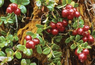
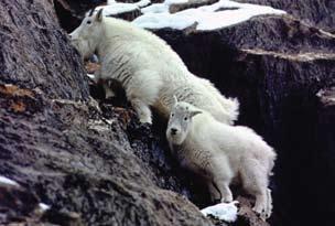
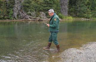
4 Her Majesty the Queen in Right of Canada, represented by the Chief Executive Officer of Parks Canada, State of the Park Report - Kluane National Park and Reserve of Canada. Catalogue No: R63-365/2008E ISBN: Cover photos: Barb Hume and Brittany Au harvesting berries on Cottonwood Pass. Photo: CAFN; Guided walk with a Parks Canada interpreter. Photo: Parks Canada; Lowell Lake. Photo: J. Wills; Donjek Valley. Photo: Parks Canada, D. Delahaye; Cranberries (Vaccinium vitis-idaea). Photo: Parks Canada; Brush hut. Photo: Parks Canada, M. Gates; Park warden monitoring kokanee salmon-spawning stream. Photo: Parks Canada, R. Markel; Mountain goats. Photo: Parks Canada, H. Fuhrer. Inside front cover: Setting a fish net in Mush Lake/Sí Män. Photo: CAFN. Visit the Kluane National Park & Reserve website: Cette publication est aussi disponible en français
5 Recommendation and Approval Recommended by: Michael Riseborough Superintendent Kluane National Park & Reserve Lawrence Joe Director, Heritage, Lands, Resources Champagne and Aishihik First Nations Caroline Hayes Chair Kluane National Park Management Board Anne-Marie Legare Director of Lands, Resources and Heritage Kluane First Nation Approved by: Anne Morin Field Unit Superintendent Yukon Field Unit
6 Acknowledgments Principal Authors: David Henry, Anne Landry, Tom Elliot, Laura Gorecki, Michael Gates and Channy Chow Steering Committee: Sean Sheardown (PC), Caroline Hayes (KPMB), Pauly Sias/Luke Johnson (KFN), Michael Jim (CAFN), Ray Breneman (PC), Anne Landry (PC) Working Groups: Ecological Integrity: David Henry (Lead), Michael Jim, Grace Cohoe/Geraldine Pope/Fred Green, Rhonda Markel. Contributors: Philip Lee, Lloyd Freese, Kevin McLaughlin Cultural Reintegration: Mike Walton (Lead), Paula Banks, Sean Sheardown, Pauly Sias, Craig McKinnon Cultural Resources: Michael Gates (Lead), Diane Strand, Mary-Jane Johnson, Pauly Sias, Fran Oles. Contributors: David Arthurs, Jennifer Hamilton Public Appreciation and Understanding/Visitor Experience: Laura Gorecki (Lead), Tom Elliot. Contributors: Kim Henkel, Andrew Lawrence, Hillarie Zimmermann Cooperative Management: Caroline Hayes (Lead), Michael Jim, Grace Cohoe, Sean Sheardown. Contributor: Channy Chow Special thanks to: Derek Petersen, Jason Boire, Rachel Cooley, Catherine Dumouchel, Judy Unrau, Charlie Krebs, Stan Boutin, Elizabeth Hofer, Alice Kenney Acronyms CAFN COSEWIC CRM EI KEMP KFN KNP&R KPMB SOPR TK VIP VRC WNSC Champagne and Aishihik First Nations Committee on the Status of Endangered Wildlife in Canada Cultural Resource Management Ecological Integrity Kluane Ecological Monitoring Project Kluane First Nation Kluane National Park & Reserve Kluane National Park Management Board State of the Park Report Traditional knowledge Visitor Information Program Visitor Reception Centre Western & Northern Service Centre
7 Table of Contents Executive Summary i State of Ecological Integrity i State of Cultural Resources iii State of Public Appreciation and Understanding v State of Visitor/User Experience vi State of Cooperative Management vii Key Issues and Challenges viii 1. Introduction SOPR Components and Assessment Methods 2 2. Context Introduction Ecological Context Species at Risk Social Context 5 3. First Nation Voices: Traditional Knowledge 7 4. Park Vision 9 5. State of Ecological Integrity Introduction Thresholds Park-wide Measures Climate change Primary productivity Bioregional Indicators Icefields and glaciers Forests Moose Spruce bark beetle Snowshoe hare Arctic ground squirrel Red squirrel Birds Small mammals and ground plants 18 Mice and voles 18 Bearberry 19
8 5.4.3 Tundra Dall s sheep Mountain goats Grizzly bears Recreational use Freshwater Dezadeash water quality Kokanee salmon Wetlands Cultural Reintegration State of Cultural Resources 6.1 Cultural Resources Recent Cultural Resource Management Work Assessment of Condition of Cultural Resources Assessment of Management Practices for Cultural Resources Assessment of Delivery of Cultural Resource Messages State of Public Appreciation and Understanding Introduction In-park Interpretation Interpretive facilities Personal programs Outreach Education/Community Outreach Outreach education Community outreach Public Appreciation and Understanding Assessment Participation Understanding Satisfaction Active support State of Visitor/User Experience Introduction Visitor Experience Assessment Understanding visitors/users 39 Wilderness experience and character 39 Visitor/user segmentation 40 Economic impact of KNP&R Providing opportunities Delivering high-quality service Connecting visitors/users personally with place 49
9 9. State of Cooperative Management Introduction Assessment of Cooperative Management 50 Board processes 50 Board relationships 51 Outcomes 52 Current and emerging issues for board attention 52 Overall assessment Assessment of Management Actions Condition of Information Base Key Issues and Challenges Ecological Integrity 61 Climate change 61 Traditional knowledge (TK) 61 Adjacent land use 61 Recreational use 62 Monitoring of ecological integrity Cultural Resources 62 Intangible cultural resources 62 Tangible cultural resources 62 Cultural resource management Public Appreciation and Understanding 63 Lack of an interpretation and outreach plan 63 On-site interpretive media 63 Visitor/user satisfaction 63 Data and research Visitor Experience 64 Visitor trends 64 Capital assets 64 Sense of welcome 64 Park trails Cooperative Management 64 Common understanding 65 Relationships and communication 65 Credibility 65 References 66 Appendices Appendix 1. EI monitoring: potential measures 69 Appendix 2. Internal assessment of KNP&R s interpretation and outreach program 70 Appendix 3. Indicators of wilderness character 72
10 Figure 1. Parks Canada s integrated mandate 1 Figure 2. Role of SOPR in park planning, monitoring and reporting process 1 Figure 3. Map: Regional setting 4 Figure 4. Elevation of KNP&R: Key ecosystem components 5 Figure 5. KNP&R: Key ecosystem components, drivers and stressors 10 Figure 6a and b. Densities of moose, Auriol/Mush Lake and Duke River areas, Figure 7a d. Area of spruce bark beetle outbreak 15 Figure 8. Snowshoe hare: density per ha, Figure 9. Snowshoe hare: six-year running average for density per hectare, Figure 10. Arctic ground squirrel: density per ha, Figure 11. Arctic ground squirrel: six-year running average for density per hectare, Figure 12. Red squirrel: density per hectare, Sulphur Lake study area, Figure 13. Four-year running average for density per hectare for mice and voles, Figure 14. Four-year running average of berry production, Figure 15 a d. Dall s sheep: density from aerial surveys, Figure 16. Adult mountain goats: densities from aerial surveys, Figure 17. Total number of raft trips on the Alsek River, Figure 18. Number of kokanee salmon, Figure 19. Level of visitor satisfaction with interpretive programs and products offered at KNP&R 36 Figure 20. Level of importance of various interpretive programs and products 37 Figure 21. Level of visitor satisfaction with KNP&R visitor services and facilities 48 Figure 22. Average number of interactions per registered overnight party, Table E1. Indicators: Ecological integrity ii Table E2. Indicators: Cultural resources iv Table E3. Indicators: Public appreciation and understanding v Table E4. Indicators: Visitor/user experience vi Table E5. Key issues and challenges facing the park viii Table 1. Symbols used to evaluate indicators 3 Table 2. Species at Risk in or adjacent to the park 6 Table 3. Annual changes in seven bird populations 18 Table 4. Actions to advance cultural reintegration 26 Table 5. Status of categories of cultural resources in KNP&R 28 Table 6. KNP&R management plan actions 53 Table 7. Quality of data for EI measures relating to KNP&R 59 Table 8. Priorities for monitoring, KNP&R 69 Table 9. Assessment of KNP&R s interpretation and outreach program 70 Table 10. Wilderness management objective: opportunities for solitude and natural quiet 72 Table 11. Wilderness management objective: high-quality wilderness experiences 72 Table 12. Wilderness management objective: pristine campsites 72
11 EXECUTIVE SUMMARY Kluane National Park and Reserve of Canada (KNP&R), located in southwest Yukon, is an immense region (21,980 km 2 ) of high mountains, icefields, glaciers and impressive wildlife. Wilderness to some, homeland to others, the park was established in 1976 and is part of an international World Heritage Site. KNP&R is within the traditional territory of the Champagne and Aishihik First Nations (CAFN) and the Kluane First Nation (KFN); recently these Southern Tutchone people s strong ties to the park s lands have been recognized and encouraged. Parks Canada requires each national park to prepare a five-year state of the park report before launching a management planning process. This is the first such report for KNP&R. The report provides an analysis and assessment of five aspects of the park: ecological integrity; cultural resources; public appreciation and understanding; visitor experience; and cooperative management. The report also assesses major management actions taken in recent years and identifies key issues and challenges facing the park. This will inform future decision-making in the next review of the management plan. Developed with the park s cooperative management partners the Kluane National Park Management Board, CAFN and KFN the report also provides an opportunity to communicate the state of the park to local communities, visitors and other interested parties. State of Ecological Integrity Ecological integrity is the cornerstone underlying the management of national parks and the long-term preservation of biodiversity and harmonious biological dynamics (Parks Canada Agency 2007a, p. 12). Ecological monitoring provides information about the park s ecosystems and is the most advanced of the park s assessment programs. Ecological monitoring reports on five 1 distinct park ecosystems (referred to as bioregional indicators): icefields and glaciers; forests; tundra; freshwater (rivers, streams and lakes); and wetlands. Within each ecosystem, a suite of measures provides the basis for an assessment of its condition: green, or good ; yellow, or fair ; red, or poor ; and grey, or not rated. The same suite of measures is also the basis for assessing trend, which is indicated by arrows (Table E1; see Table 1, page 3 for explanation of symbols). In some cases thresholds have been established, enabling a quantitative assessment; in others, a more qualitative assessment was conducted. Cultural reintegration of the Southern Tutchone people is also recognized as a key component of the park s ecological integrity and has been assessed qualitatively with First Nations partners. Elements of traditional knowledge have been included in this report; however, with the help of projects such as Healing Broken Connections, a more complete and thorough approach to integrating traditional knowledge will be a major objective for the next SOPR. 1. A sixth northern bioregional indicator (marine) is not found in KNP&R. State of the Park Report i
12 Table E1. Indicators: Ecological integrity Indicator (ecosystem) Condition and trend of ecosystem % of park area Number of measures Rationale for ranking Icefields and glaciers The melting rates of icefields and glaciers in the region appear to have tripled recently in response to the changing climate (Arendt et al. 2002). This may be affecting summer water levels and sedimentation levels in glacier-fed rivers and streams. Forests The park s forests have experienced major ecological changes during the past decade and changes continue in the populations of many plants and animals. A massive outbreak of spruce bark beetle over the last 13 years has affected mature spruce trees over more than 350,000 ha in the region. Healthy forest populations include red squirrels, snowshoe hares, mice and voles, bearberry and mushrooms. Populations of concern include moose, arctic ground squirrels and certain bird species; the population of spruce bark beetle is a concern because of its high numbers. Because the park s forest ecosystem is in a period of abrupt change it needs to be carefully monitored. The status of the park s forest is on the border between a green and yellow rating. However, since it is believed that the effects of climate change will worsen In future years, the park s forests have been assigned yellow status and a downward arrow, indicating their declining ecological integrity. Tundra While current monitoring efforts focus on large mammals and recreational use, long-term databases (that increase confidence in the data) and declining backcountry recreational use result in this ecosystem being assigned a green rating. The park has a number of Dall s sheep populations; roughly 75% are stable and 25% show significant population change. The mountain goat populations in the park appear to be stable. Recent data suggest that the grizzly bear population in the park and region is marginally stable, close to carrying capacity and likely declining at 3% per year. The park does not supply enough habitat to support this regional population. Recreational use patterns are changing day use is increasing and overnight backcountry use is decreasing. Progress has been made in the past decade to mitigate recreational use impacts. Freshwater 3 3 Most of the park s streams are out-flowing. Water quality for one of the two in-flowing streams is rated as good. Longterm monitoring of a rare population of kokanee salmon shows significant decline since 2002 for unknown reasons. Park managers conclude that there are insufficient measures to evaluate the ecological integrity of the park s freshwater ecosystems. ii Kluane National Park & Reserve
13 Indicator (ecosystem) Condition and trend of ecosystem % of park area Number of measures Rationale for ranking Wetlands A small but important component of the park, wetlands support plant communities and animal populations that are characteristic of wetland habitats. There are insufficient measures to evaluate the ecological integrity of the park s wetlands. Cultural reintegration n/a Not yet determined The need for cultural reintegration dates back to 1942 when First Nations people were removed from the area that became parklands. This caused considerable hardship and contributed to a significant loss of TK related to the park area. Although significant progress has been made in recent years, especially related to Southern Tutchone people reconnecting with their traditional territory within the park, much work remains to be done. State of Cultural Resources The cultural resources of KNP&R encompass the history of human occupation and activity in the park from as early as 8,000 years ago to the present day, and reflect First Nations life, mining, exploration, mountaineering and recent use. The park has both tangible and intangible resources. Archaeological sites, and the collections of artifacts collected from these sites, constitute tangible evidence of past land use in the park. Intangible cultural resources include oral history, place names, songs and stories, and traditional knowledge of place and the ecosystem (Table E2). Intangible cultural resources have been impaired by the displacement of three generations of local First Nations people from their traditional lands within the park since the end of World War II. The elders who have first-hand knowledge of the park, its places, stories and resources are aging; there is a need to focus attention on the recording and transmission of their knowledge. The 253 documented archaeological sites are threatened by a number of natural processes. Managing these resources is hampered by an incomplete inventory, which can only be expanded by systematic, ongoing archaeological surveys. In addition, 40 of the documented sites have not been formally assessed, and there is no systematic monitoring of known resources. State of the Park Report iii
14 Table E2. Indicators: Cultural resources Indictor Condition and trend No. of evaluation criteria Rationale for ranking Archaeological sites Archaeological collections 4 Archaeological work since the 1997 national State of the Parks Report has resulted in a two-thirds increase in the number of documented sites, although there are significant areas of the park where no survey work has been conducted. The three main threats to resources are erosion (72%), structural decay (39%) and wildfire (36%). 4 The archaeological collection of 15,825 specimens housed in Winnipeg is well maintained. Historic objects 4 The collection of historic objects is small and consists of display items and a small number of items gathered opportunistically from within the park. The size of this collection is not sufficient to warrant proper collections management treatment on site. Cemeteries and burial sites Archival collections Intangible cultural resources Messages related to cultural resources 4 Only one gravesite has been documented in the archaeological record and is in poor condition. 4 The extent of on-site archival material related to the history and operation of the park is not defined, nor is the condition of this material known. Although archival collections represent a small part of the park s cultural resources, efforts are being made to improve their care and management. 3 Until final agreements were signed with CAFN and KFN, three generations of First Nations residents were denied access to their traditional lands within the park. Traditional knowledge of the park area and its resources is vitally important to maintaining the cultural record and ecological integrity of the park. There has been no systematic documentation of First Nations oral history or traditional knowledge related to the park. Immediate action is required to address this gap. Messages related to cultural resources have been delivered by the park, but have not been developed in a systematic way. It is not clear what messages various audiences are receiving and understanding about cultural resources. iv Kluane National Park & Reserve
15 State of Public Appreciation and Understanding Education is a key component of Parks Canada s integrated mandate and plays a fundamental role in maintaining the park s ecological integrity and in providing meaningful experiences to park visitors and users. Promoting public appreciation and understanding involves programs and activities aimed at reaching Canadians at home, at leisure, at school and in their communities. The objective is to inspire their longterm support and shared stewardship of protected areas such as KNP&R. Based on national direction, in-park interpretation is now included under visitor experience (see next section). Since this is a recent change, this SOPR includes in-park interpretation under public appreciation and understanding. Public appreciation and understanding includes four main components: in-park interpretation and heritage presentation (including interpretive facilities and personal programs); outreach education and community programming; visitor participation, understanding and satisfaction; and active support from visitors and stakeholders. Quantitative information sources such as national Visitor Information Program (VIP) surveys and a 2005/06 visitor centre survey were combined with more qualitative analysis from experienced park staff to provide an assessment of visitor and student participation, visitor understanding, visitor satisfaction and active support (Table E3). This analysis helped clarify where data is lacking and where data collection needs to include a greater range of visitors and users. Table E3. Indicators: Public appreciation and understanding Indicator Rank Rationale for ranking Visitor and student participation Visitor understanding Visitor satisfaction Active support Parks Canada s national target is 50% of visitors participating in a learning experience. A 2005/06 survey indicated that 87% of respondents viewed exhibits and/or read park brochures and literature. Approximately 30% of visitor centre visitors view the audiovisual program. Inconsistent collection of visitor statistics makes it difficult to determine the percentage of visitors who attend various park interpretive programs. There is also no clear definition of what learning experience means. A modest outreach school program is delivered annually, primarily to Grade 7 students in local schools and in Whitehorse. While some community members participate in park programs and some successful culture camps have been hosted by CAFN, KFN and Parks Canada, more work is required. Parks Canada s national target is for 75% of visitors to understand the significance of the park. A recent survey indicated that 60% of visitors do so. More measures are required to gain insight into understanding levels of a broader range of visitors and other audiences, including students and local community members. Parks Canada s national target is 85% of visitors satisfied with on-site and outreach programming, including at least 50% very satisfied. Visitor satisfaction at KNP&R ranged between 78% and 100%, depending on the interpretive activity. Other survey results indicate that the park s existing interpretive materials are not those programs and products given a high level of importance by visitors. A 2002 visitor survey found different levels of support for key management plan priorities such as protection of critical wildlife habitat (82%), working with others to maintain the ecosystem (75%), and re-establishing First Nations connection to the land (26%). National targets have not yet been set in the area of active support, and methods of measuring support and data are lacking. State of the Park Report v
16 State of Visitor/User Experience For more than 30 years, KNP&R has been valued as one of Canada s premier wilderness mountain parks, offering a range of high-quality visitor experiences, including mountaineering, rafting, camping and backcountry hiking. People come from around the world to experience the park s wilderness character. A visitor s experience is the cumulative outcome of all aspects of the visit. These include pre-trip and on-site planning, visitor services, programs and infrastructure, reception, campgrounds, hiking trails and other recreational activities and visitor safety. KNP&R identifies three primary user groups for the park: visitors, local users and First Nations citizens (use by First Nations is included in Chapter 4; ecological integrity under cultural re-introduction). Surveys (including the VIP and other more detailed studies) and a Visitor Experience Assessment were used to assess understanding of visitors/users, opportunities provided and delivery of high-quality service. There was insufficient information and means of measuring to assess the indicator connecting visitors/users personally with place (Table E4). Table E4. Indicators: Visitor/user experience Indicator Rank Rationale for ranking Understanding visitors/users Providing opportunities Delivering highquality service Connecting visitors/users personally with place Quite a lot is known about KNP&R s current backcountry users and various tools have been used to understand visitor and user groups, but there is a need to consolidate and simplify types of audiences. In addition, little research has been done on potential audiences and the various audience groups are not well prioritized. Information is conveyed to visitors/users in a variety of ways, including the park s website, brochures, signs and discussions with park staff at visitor centres. The current visitor/user offer ranges from a lack of a sense of arrival at the park to a high level of personalized service (for mountaineers). Objectives for visitors experiences have been established for the park s seven major geographic areas and tourism operators provide a range of recreational opportunities in the park. Way finding and signs and capital assets received red ratings, however, as many capital assets are outdated and poorly maintained. These deficiencies have been recognized for several years and major capital projects are underway to rectify some of them (e.g., KNP&R VRC recapitalization and trailhead signage). Parks Canada s national target is 85% overall visitor satisfaction, including at least 50% very satisfied. In a 2005/06 survey, 97% of respondents reported being satisfied (18%) or very satisfied (79%). Some services, however, such as high quality of service, value for money and availability of pre-trip information, failed to meet the 50% very satisfied rating. Mechanisms are needed to measure satisfaction from users such as school groups, bus groups and local residents. Insufficient information vi Kluane National Park & Reserve
17 State of Cooperative Management The Kluane National Park Management Board (KPMB) was created in the mid-1990s as a result of the CAFN Final Agreement and later expanded as a result of the KFN Final Agreement. An advisory board, it provides advice to elected representatives and officials of KNP&R, CAFN and KFN and is an important vehicle for implementing cooperative management of the park. Although assessment of cooperative management is not a national requirement in state of the park reports, there was local interest in it. This was done through telephone interviews with board members and people who have regular contact with the board. Board processes, board relations, outcomes and current and emerging issues for board attention were examined. Cooperative management is seen as an evolving process. Current strengths include board members respect for each other and commitment to cooperative management; positive board interaction and the fact that consensus is usually reached; perceived influence in setting priorities; and completion of successful projects (such as guided snowmobile trips, hosting a recent national cooperative management conference and the development of the current park management plan). Current weaknesses and areas for improvement include confusion about the board s roles and responsibilities and accountabilities; the board s interaction and relationships with non-board members; perceived lack of credibility with CAFN; and the need for more training around expectations, roles and responsibilities, effective board operations and communication skills. The overall effectiveness of cooperative management was rated in the middle, with most respondents indicating support and commitment to the process. Due to the qualitative nature of the assessment, the individual measures were not rated but cooperative management was rated overall as yellow (fair). State of the Park Report vii
18 Key Issues and Challenges Several key issues and challenges were identified through the assessments completed in the development of this report (Table E5). They will help inform the next review of the management plan. Table E5. Key issues and challenges facing the park Ecological integrity Climate change: Changes in the park s ecosystems due to climate change are apparent (such as increased melting rate of glaciers, unprecedented outbreak of spruce bark beetle and northern expansion of southern mammals). Continued monitoring is important and future adaptation may be necessary. Traditional knowledge (TK): TK related to the park area, a key contributor to the park s ecological integrity, has diminished in recent decades. Efforts are underway to help Southern Tutchone people reconnect with their traditional lands within the park. Mechanisms are needed to help integrate TK into park decision-making. Adjacent land use: Current and anticipated increase in land use adjacent to KNP&R, including forestry, pipeline development, highways and community growth raise ecological concerns. Recreational use: A decline in backcountry use, an increase in day-use, a decrease in human/ bear interactions and maintenance of the park s wilderness character resulted in a green rating for this measure. However, a precautionary approach suggests the need for ongoing monitoring and management of recreational use. Monitoring of ecological integrity: Monitoring has been conducted in the park and region for decades. Recent national direction, data analysis and work on this report have contributed to the recognition of the need to refine the existing monitoring program. Cultural resources Intangible cultural resources: Intangible cultural resources, e.g., oral history, place names, songs and stories, are under threat for a variety of reasons, including previous exclusion of First Nations people from the park area, the aging of elders and changes in lifestyle. Various methods are needed to enhance and strengthen intangible cultural resources in Southern Tutchone traditional lands, including the park. Tangible cultural resources: Erosion, through wind and water, and structural decay and damage from wildfire will have the greatest impact on archaeological sites in the future. The inventory and recording of new and existing sites is important. Cultural resource management: CRM work has been undertaken since park establishment, but the lack of a statement of cultural resource values and lack of an overall CRM strategy make it difficult to move ahead in an effective manner. Public appreciation and understanding Lack of an interpretation and outreach plan: This has left gaps in the program. On-site interpretive media: Much of KNP&R s on-site interpretive media (exhibits, signage, selfguided interpretive trails), as well as the main audio-visual presentation, are old and outdated. Significant steps are being taken to improve this situation. In addition, the type of media provided does not reflect visitors rating of the importance of different interpretive media. Visitor/user satisfaction: The availability of interpretive activities does not meet national targets; visitors see the current offer as insufficient. Also, current programming for local community members, an important park audience, has had limited success. New methods are needed to engage local people. Data and research: A lack of data and research affects the staff s ability to design and deliver programs and products that meet the needs of visitor/user groups and limits their ability to evaluate results. Areas of particular concern are collection of statistics; methods of assessing program effectiveness and understanding; understanding of audience motivations, needs and expectations; and defining and monitoring ways in which audiences actively support management actions for achieving or maintaining the park s ecological integrity. viii Kluane National Park & Reserve
19 Visitor experience Visitor trends: Recently there has been a decline in visitors to the park s VRCs, campground and overnight backcountry use and an increase in day use. A better understanding of the interests and motivations of current and potential visitors is needed to inform decision-making related to visitor opportunities, ecological integrity and education. Capital assets: Visitor services assets, e.g., the KNP&R VRC, are old and in need of recapitalization, or are lacking (for example, there are no day-use facilities in the north end of the park). Capital asset planning requires detailed information about current and potential visitor needs and expectations. Sense of welcome: Visitors do not experience a strong sense of welcome when they arrive, as there are no park gates, identity signs on the main highways or orientation exhibits. Some travelers in the region pass by the park without being aware that it is there. Park trails: Backcountry hiking has been a primary focus since the park was established. In recent years, backcountry use has declined, maintenance of trails has become more challenging and ecological integrity concerns have surfaced. A more in-depth integrated examination of the park s trail offer is needed. Cooperative management Common understanding: There is a lack of a common understanding about what exactly cooperative management is and what it means in practical terms with respect to KNP&R. Lack of clarity leads to confusion and frustration about board roles and responsibilities and ensuing priorities and actions. Relationships and communication: While interactions among board members are positive, there is a need to improve their interactions and relationships with non-board members including park staff. More effective communication with the broader community is also needed. Credibility: Opinions differ concerning the board s credibility with different groups in the community. Most noteworthy is the fact that 60% of the board perceived the board s credibility with CAFN as poor. Frank discussions among the board, CAFN and Parks Canada about CAFN s expectations of the board would be helpful. State of the Park Report ix
20 x Kluane National Park & Reserve
 and cultural resources); education (public appreciation and understanding); and")
21 1. INTRODUCTION This is the first State of the Park Report (SOPR) for Kluane National Park & Reserve of Canada (KNP&R). 1 It provides an analysis and assessment of Parks Canada s integrated mandate: protection (ecological integrity 2 (EI) and cultural resources); education (public appreciation and understanding); and visitor experience (providing opportunities for memorable and meaningful visitor experiences) (Figure 1). expanded to include the other components of Parks Canada s mandate. The SOPR fits within the five-year cycle of national park management planning (Figure 2) and the key issues it identifies inform the Scoping Document that in turn leads to a management plan review. Figure 1. Parks Canada s integrated mandate The SOPR also assesses the state of the park s cooperative management regime and key management actions taken in recent years to address important issues. The assessment concludes by identifying key issues and challenges facing the park. SOPRs are a relatively new national requirement. They grew out of a recommendation from the national Ecological Integrity Panel (2000) and have recently Figure 2. Role of SOPR in park planning, monitoring and reporting process State of the Park Report (5 years) Scoping document (5 years) Management Plan (5 years) Ongoing monitoring National State of Protected Heritage Areas Report (2 years) Implementation report (annual) 1. The terms park and KNP&R are used interchangeably throughout the report and refer to both the park and the park reserve. 2. Ecological integrity means, with respect to a park, a condition that is determined to be characteristic of its natural region and likely to persist, including abiotic components and the composition and abundance of native species and biological communities, rates of change and supporting processes (Parks Canada Agency 2006f). State of the Park Report 1
, Champagne and Aishihik First Nations (CAFN) and Kluane First Nation")
22 The report also provides an opportunity to communicate the state of the park to partners, local communities, visitors and interested individuals. A steering committee was established with representatives from Parks Canada, the Kluane National Park Management Board (KPMB), Champagne and Aishihik First Nations (CAFN) and Kluane First Nation (KFN). The committee oversaw the development of the SOPR; a number of working groups developed the different sections. After review by national office staff, the SOPR was recommended by the park superintendent, KPMB, CAFN and KFN and approved by the Yukon Field Unit Superintendent. 1.1 SOPR Components and Assessment Methods Ecological integrity (EI) monitoring is the most advanced of the assessment programs. Parks Canada has a national commitment to develop fully functioning EI monitoring and reporting systems for all national parks by March 2008 (Parks Canada Agency 2006d). KNP&R s EI was assessed by evaluating five bioregional indicators 3 of ecological health identified for the Northern Bioregion 4 national parks (Figure 5): 1. icefields and glaciers; 2. forests; 3. tundra; 4. freshwater (rivers, streams and lakes); and 5. wetlands. This section of the report also includes an assessment of cultural integration, an important component of EI and one that is determined at the park level. The condition and trend of a suite of relevant field measurements provide information about each of these five ecological indicators. This report assesses monitoring data available as of November 2006; at that time, the condition of the data varied considerably. Mount Logan. Parks Canada/W. Lynch Elements of traditional knowledge have been included in this report, however it was not possible to integrate traditional knowledge to its fullest extent at this time. A more complete and thorough approach to integrating traditional knowledge will be a major objective for the next SOPR. The park s EI monitoring program is under review. The review includes an internal assessment (Parks Canada Agency 2006a), community input, and First Nations input. The objective is to ensure that the integrated EI monitoring program accomplishes the following goals: measures key factors in each of the park s major ecosystems; ensures that these measures are spread across the three monitoring categories (biodiversity, ecological functions/processes and stressors); and incorporates scientific, traditional and local knowledge. Cultural resources were assessed using a template adapted from the evaluation of cultural resources in national historic sites. Cultural resource specialists from the field unit, Western & Northern Canada Service Centre and local First Nations were consulted during the assessment. Archaeological sites, archaeological collections, historic objects, cemeteries 3. A sixth northern bioregional indicator (marine) is not found in KNP&R. 4. A bioregional approach groups national parks with similar ecosystem properties. KNP&R is part of the Northern Bioregion Working Group, along with Nahanni, Tuktut Nogait, Vuntut, Auyittuq, Sirmilik, Ivvavik, Aulavik, Wapusk, Quttinirpaaq, Ukkusiksalik and Torngat Mountains national parks (Parks Canada Agency 2006c). 2 Kluane National Park & Reserve
23 and burials, archival collections and intangible cultural heritage were assessed, examining threats, condition, evaluation, management practices and actions and messages related to cultural resources. National performance indicators for public appreciation and understanding are being developed. Primary data sources for this report include a 2005/06 visitor survey (VIP), a 2002 Kluane Wilderness Study (Haider and McCormick 2004), visitor statistics and park staff. Participation, understanding, satisfaction and active support were assessed. National performance indicators for visitor/user experience are also being developed. Primary data sources for this report include a 2002 Kluane Wilderness Study (Haider and McCormick 2004), an exit survey by the Yukon Department of Tourism & Culture (Government of Yukon 2006), a 2005/06 visitor survey (Visitor Information Program, or VIP; Parks Canada 2006b), a 2005 KNP&R economic impact analysis (Zanasi et al. 2005) and a 2006 visitor experience assessment (Parks Canada Agency 2006e) completed by field unit staff and partners. Understanding visitors/users, providing opportunities and delivering high-quality service were assessed. An interview questionnaire specific to the park was developed and administered to assess cooperative management in the park. Board processes, board relationships, outcomes and current and emerging issues for board attention were assessed. Indicators for protection, education, visitor experience and cooperative management were rated for condition and trend. Symbols and colours represent the condition and trend of the indicators and measures (Table 1). Table 1. Symbols used to evaluate indicators Condition Trend good the condition of the indicator/measure is satisfactory improving the condition of the indicator/measure is improving since the last assessment fair there is concern about the condition of the indicator/ measure stable the condition of the indicator/measure has not changed since the last assessment poor the condition of the indicator/measure is unsatisfactory declining the condition of the indicator/measure has worsened since the last assessment not rated there is insufficient information to determine the condition of the indicator/measure Source: adapted from Parks Canada 2007b. State of the Park Report 3
 and the two First Nations cooperatively manage the park. Collectively, four national and provincial parks form the Kluane/Wrangell-St.")
24 2. CONTEXT 2.1 Introduction Kluane National Park & Reserve lies in the southwestern corner of the Yukon, part of the traditional territories of CAFN (CAFN) and Kluane First Nation (KFN). Parks Canada, the Kluane National Park Management Board (KPMB) and the two First Nations cooperatively manage the park. Collectively, four national and provincial parks form the Kluane/Wrangell-St. Elias/Glacier Bay/ Tatshenshini-Alsek World Heritage Site (97,520 km 2 ), the largest international protected area in the world (Figure 3). Figure 3. Map: Regional setting and nutrients generated by icefields and glaciers influence many of the ecological processes of the greater Kluane ecosystem. The park s other major mountain range is the Kluane Range, which borders the Alaska Highway and Haines Highway (Figure 4). Between the Kluane Range and the Icefield Range lies the Duke Depression, a complex of productive montane, subalpine and alpine areas. At present 18 percent of the park area is vegetated, largely a narrow green belt along the park s eastern boundary. Ecologically these are the most productive lands of KNP&R. They have been inhabited for thousands of years by Aboriginal people, whose close association with the land has created an important body of traditional knowledge. Officially excluded from the park area from the early 1940s until the mid- 1970s, CAFN and KFN citizens are only now starting to spend time back in the park and reconnect with the land. Assisting these Southern Tutchone people reintegrate with the park area, through programs such as Healing Broken Connections 5 is a high priority; their involvement is seen as providing a significant contribution to ecosystem management. Since the mid-1990s, a significant outbreak of spruce beetle has killed mature white spruce trees scattered over 350,000 hectares in the region (Berg et al. 2006). 2.2 Ecological Context The heart of KNP&R is the St. Elias Mountains, the youngest and some of the largest mountains in North America, with some of the largest non-polar ice caps and valley glaciers in the world. These mountains create a barrier between the Pacific Ocean and the plateaus of the Yukon interior, creating a rain shadow in their lee and an arid boreal climate in the eastern and northern parts of the park. Kluane is a vestige of the ice age; the winds, dust storms, weather patterns KNP&R s population of grizzly bears is a significant wildlife resource and is considered an indicator of the health of the Kluane ecosystem. The grizzly bears that inhabit the park s glacial valleys have large home ranges and constitute one of the most viable populations of this species in any Canadian national park (McCann 1998). Equally significant is the park s population of Dall s sheep. This ungulate is more characteristic of the park s northern areas, especially - the alpine and subalpine zones of Tachäl Dhäl (Sheep Mountain) and the headwater areas of the Ä äy Chù (Slims River) and Donjek River watersheds. Within the past century, caribou were found in the park area, but some caribou populations have declined, and migratory caribou herds no longer move through 5. Healing Broken Connections is a multi-year nationally funded Ecological Integrity Theme Project with two primary objectives: to reintegrate First Nation people back on the land within KNP&R; and to determine how traditional knowledge might be used in the park management decision-making process. 4 Kluane National Park & Reserve

25 Figure 4. Elevation of KNP&R: Key ecosystem components Illustration: Brent Liddle the area. A small herd of caribou is periodically found in KNP&R, primarily in the Burwash Uplands near the park s northeastern boundary. Furbearers such as wolves, coyotes, red foxes, lynx, wolverine and other mustelids continue to inhabit the park and the surrounding areas. The diversity of habitats found inside and adjacent to the park contributes to a great variety of bird life. Over 180 species have been reported, including a recent increase of Trumpeter swans and populations of raptors such as Peregrine falcons, gyrfalcons and Bald and Golden eagles. The lakes and streams of KNP&R contain lake trout, northern pike, arctic grayling and several other fish species. The unique land-locked kokanee salmon of Sockeye, Louise and Kathleen lakes are especially significant. The 2004 KNP&R management plan assigned the park a high degree of ecological integrity (Parks Canada Agency 2004b) but listed a number of environmental stressors known or believed to be affecting park ecosystems. Several of the regional stressors (e.g., increased development along highways, forest harvesting, hunting, snowmobile and all-terrain vehicle use) relate to current and anticipated adjacent land uses. The State of Protected Heritage Areas for the Period Ending March 31, 2005 (Parks Canada Agency 2005) assessed eight elements of EI in each of Canada s national parks. 6 KNP&R received a green or positive rating for the seven elements assessed. This first SOPR for the park assesses similar but not identical measures of ecological integrity and provides updates to the 2005 national report. 2.3 Species at Risk The park and adjacent areas provide a seasonal or year-round home to nine wildlife populations that have been designated as Endangered, Threatened or Special Concern by the Committee on the Status of Endangered Wildlife in Canada (COSEWIC). Some of these populations are listed in Schedule 1 of the federal Species at Risk Act (SARA) and some are listed with COSEWIC (Table 2). Certain monitoring protocols (see : Birds and : Grizzly Bears) survey several of these species in and adjacent to the park. A KNP&R warden is involved in developing a recovery strategy for Baikal sedge. 2.4 Social Context The village of Haines Junction (with a population of approximately 800) is located at the intersection of the Alaska Highway and the Haines Highway just outside the park boundary. Haines Junction houses the park administrative headquarters and the main visitor centre (VRC). Other communities adjacent to the park include Klukshu, Destruction Bay and Burwash 6. The eight elements assessed were diversity; predator and prey; species loss; plant growth; development area; population density; internal roads. Forest fire as a land process was not evaluated for KNP&R due to lack of data. State of the Park Report 5
26 Table 2. Species at Risk in or adjacent to the park Species at Risk listed in Schedule 1 of the Species At Risk Act (SARA) Species at Risk listed by COSEWIC but not yet listed in Schedule 1 of SARA Species Baikal sedge, Carex sabulosa Wood bison, Bison bison athabascae Woodland caribou, Rangifer tarandus caribou Peregrine falcon (Anatum) Falco peregrinus anatum Grizzly bear, Ursus arctos (northwestern population) Wolverine, Gulo gulo (western population) Short-eared owl, Asio flammeus Rusty blackbird, Euphagus carolinus Common nighthawk, Chordeiles minor Status Threatened Threatened Special Concern COSEWIC has recently changed its status from Threatened to Special Concern Special Concern Special Concern Special Concern Special Concern COSEWIC has recently classified this species as Threatened Landing. The Haines Highway runs 256 km south over the scenic Chilkat Pass to Haines, Alaska, a port of the Alaska Marine Highway that connects Alaska with the southern 48 states. For nearly 30 years, KNP&R has been valued as one of Canada s premier wilderness mountain parks. Images of the park are featured prominently in the promotional campaigns for the Yukon tourism industry. These images are responsible in part for the park s appeal as a unique wilderness area that attracts recreational visitors from all over the world. The park is also important to residents in local communities and other Yukoners as a place to make a living, visit with family, hike and fish and appreciate as a protected heritage area. Recent surveys have revealed that the most popular recreational activities in the park are hiking, viewing wildlife, visiting the VRCs at Haines Junction and - Tachäl Dhäl, fishing and photography. Flightseeing, mountaineering, rafting, skiing and vehicle-based sightseeing are also popular. Social science research has revealed that encountering untouched nature, experiencing solitude and viewing wildlife in a natural setting are important underlying motivations for people who visit the park. Spending time with family and friends is important for local residents who use the park for recreation. KNP&R day-use visitation is estimated to be 6,500 to 7,500 per year; overnight backcountry use averages 1,025 per year over five years. An estimated 1,500 visitors a year enjoy a wilderness experience through aircraft flightseeing, and this number is increasing. The CAFN land claim agreement came into effect in 1995, the KFN land claim agreement in This, along with the creation of the KPMB, has brought a new era of cooperative management to the park. After many years of hardship caused in part by First Nation citizens being excluded from the park, efforts are underway to encourage the cultural reintegration of First Nations into the park through projects such as Healing Broken Connections. Cooperative management is increasing the involvement of local First Nations and local communities in park management, and social science is helping park managers learn more about visitor/ user trends, motivations and satisfaction. This in turn contributes to improved facilities and services. Outreach and education efforts are also slowly increasing. 6 Kluane National Park & Reserve
27 3. FIRST NATION VOICES: TRADITIONAL KNOWLEDGE It is with pleasure and an eye to the future that we include this introduction to Traditional Knowledge (TK). KFN, CAFN and Parks Canada have been working together over the past five years to improve their working relationship and begin to explore ways of integrating TK into the management of KNP&R. The goal of this section is to provide a brief understanding of TK from the First Nations perspective, and give a sense of how it might be respectfully used in understanding the ecological integrity of the park. TK is unique to each First Nation and there is no one clear definition of what it is. Certain components are common to each First Nation: TK is fundamental to the identity of the First Nation and its citizens and is integral to the First Nation s culture, values, and beliefs; TK is integral to the cultural, political and economic distinctiveness and social well-being of the First Nation and its citizens; TK includes knowledge that is held by individuals, groups of individuals, families or the collective as a whole; TK is steeped in the traditions, culture and history of the community and is closely linked to the environment. It is holistic in nature, linked to the community s spiritual beliefs, way of life, connections to the land and practices; and TK originated in the First Nation s traditions, constantly evolved over time and has contemporary applications. TK is holistic in nature. It does not lend itself well to inclusion in the format of the measure-by-measure assessment adopted for the current State of the Park Report. TK in its fullest sense is a different way of knowing the world, a different way of organizing thought and observations, outcomes and connectedness. It is this inherent understanding and relationship to the land that has allowed First Nations people to survive and even thrive in the region despite a harsh and changing environment. It is no easier for Elders to write down all their traditional knowledge than it is for a person to share all their common sense. They can describe some examples of it, or perhaps tell you when they have used it, but you cannot write it down in a finite and systematic list. TK expertise is gained by a life lived well on the land; it is an expertise that may be less obvious to those outside the community. One of the challenges of integrating the two ways of looking at the world is a fundamental difference in worldviews. In the Southern Tutchone way, people and animals live together as part of the land and people view themselves as part of nature, not apart from nature. Although the ways of looking at the world may differ, there are also similarities between scientific knowledge and traditional knowledge, but these similarities may not be obvious to someone from outside that worldview. For example, peer review is important in both cultures. Scientists review each other s work, or are made to prove it. In the Southern Tutchone way, there are experts in each area that may be based on geography, skill, family or gender. First Nations experts will defer to one another, but an outside researcher may not be aware of those subtleties. Both knowledge systems rely heavily on observation. The First Nations lifestyle and knowledge is based on thousands of years of experiments and the trial and error of living and thriving in a harsh climate. Within the field of resource management, there is pressure to quantify everything and fit it within ecological models. TK tends to be more qualitative: What is the quality? Is it good, bad, fat, skinny, falls apart when you cook it? How does it taste? A particular challenge for resource managers is an implicit value system that suggests that quantitative science is superior to qualitative science. It is a bias that park managers must work to recognize and overcome with the help of their First Nations partners. Values are important in both systems but what is valued may differ. Internationally, KNP&R may be valued as UNESCO World Heritage Site, but this may not be relevant or important in the daily lives of people who are noticing changes at State of the Park Report 7
28 the very local level. Different boundaries can also cause confusion. Park managers may focus attention on the park or the greater ecosystem while local First Nations knowledge is based on their traditional territories. Both CAFN and KFN are interested in actively promoting the respectful use of TK in park management. Some recent attempts to include TK alongside science in the park and elsewhere have fallen short of that goal. In general terms, TK is too often used in piecemeal fashion to support a science-based study or management regime where the outcome is already known. Ecological indicators and the field measurements that support them are often based on criteria that include relevance, measurability, data availability, attribution, set targets and thresholds. Elements of traditional knowledge can complement this well-established science-based regime. A more effective approach would be to develop a parallel assessment tool based on TK. It might look quite different than science-based measures. Relevance might be defined as what is important to the Elders and active subsistence harvesters. Measurability could include non-statistical alternatives to abundance: lots of, not so many long ago, long ago there used to be Assessments of quality are extremely important in traditional knowledge and could prove valuable. Data availability means that there is a way that First Nations people can share and teach their knowledge with others in a tangible way, and have confidence that it will be used appropriately and effectively. It is also fascinating to consider how science can complement traditional knowledge to achieve a greater shared understanding of the processes at work in a particular area. One fundamental difference between a science-based approach and one rooted in traditional knowledge is the idea of attribution. The idea that you can prove that one thing is caused by another may not be important to First Nations; at times it is more important that something simply is. Elders tell us we lose much of the integrity of traditional knowledge when we use English instead of Southern Tutchone, or when we write things down instead of experiencing them firsthand or sharing them through oral traditions. It is not just the knowledge itself that is important, but also the act of teaching and learning. Many spiritual dimensions of traditional knowledge cannot be translated or transcribed and it is important to clearly acknowledge those limitations. TK has been incorporated into this SOPR in small ways. The current format does not lend itself to incorporating the richness TK has to offer, but this compromise is a start. We hope that future reports will allow both knowledge systems to be presented more fully. Involving the knowledge holders in how the information is used will help ensure respectful use and help develop better ways of incorporating TK in the future. One innovation might include using traditional knowledge holders to help in modeling. For example, it is likely that bison, elk, white-tailed deer and cougar will move into KNP&R. Bison are recently reintroduced to the Yukon; most Elders do not trust them and don t hunt them. Despite this, Elders have given detailed information on bison behaviour to young hunters planning to hunt bison. Even though the Elders do not know the animals well, they use their own intimate knowledge of the land, water, other species and weather to predict how a new species would likely use it. This type of knowledge could prove useful in park management. Despite different points of view, there is a lot of common ground in the two ways of viewing the world and a better understanding to be gained by looking at both sides. KFN, CAFN and Parks Canada are working on ways of using qualitative tools that will be better suited for TK. First Nations will continue to challenge park managers to consider TK on its own merits, not just when it reaffirms a larger science-based study. By working together, we learn together, can ask better questions of each other and arrive at better answers and solutions. Champagne and Aishihik First Nations Kluane First Nation 8 Kluane National Park & Reserve

29 4. PARK VISION The vision statement for KNP&R is found in the 2004 management plan. It describes the desired state of the park in 15 years. The park has at least the same high level of ecological integrity today as it had in 2002, based on the top priority of ecological integrity. Principles of precaution and adaptive management are exercised when there is potential for significant adverse effects on the ecosystem. Protection and maintenance of critical habitat and wildlife corridors serve to ensure healthy wildlife populations (e.g., grizzly bears, Dall s sheep, wolves, wolverines, mountain goats and Golden eagles). Natural processes such as fire, insect outbreaks and floods govern change. The enduring cultural relationship between the Southern Tutchone people and the park contributes to the ecological integrity of the regional ecosystem. The park is managed on a regional ecosystem basis with the cooperation of Parks Canada, First Nations, the Government of Yukon, local communities and other agencies and groups. Cultural resources are documented and interpreted through community-based and scientific research methods. These resources are appropriately managed and their meanings are shared and understood. Parks Canada, CAFN and KFN share in the management of the park. Ongoing opportunities are provided to the public to contribute knowledge and ideas to park management and operations. The Kluane National Park Management Board acts as a conduit for local people to participate in park management. The local First Nation final agreements related to the park are being implemented, bringing economic and employment benefits to CAFN and KFN. Dall s sheep. Parks Canada/P. Bastien Traditional knowledge and scientific knowledge are given full and fair consideration in the protection, management and operation of the park. Through interpretation and outreach programs, the public clearly understands the national significance of the park and supports actions that maintain and enhance ecological integrity. Local residents, park visitors and the people of Canada take an active role in protecting and sharing the park s natural and cultural heritage. Visitors enjoy a range of appropriate recreational activities that are based on experiencing and respecting the park s wilderness character and its natural and cultural heritage. The park plays an important role in the region s heritage tourism that is based on the park s wilderness and cultural values. The park is a positive contributor to the local economy, within the context of national park values. Part of a World Heritage Site, the park is an important symbol of Canada and of Canadian identity recognized by people from around the world. Parks Canada Agency 2004b, p.16 State of the Park Report 9


30 Figure 5. KNP&R: Key ecosystem components, drivers and stressors KNP&R: Stressors, drivers and key ecosystem components External stressors Climate change, loss of traditional knowledge, habitat fragmentation, incremental development outside the park Icefields and glaciers Forests Tundra Freshwater Wetlands 79.5% of park area 9.0% of park area 8.3% of park area 3.0% of park area 0.2% of park area Typical plant species nunatak vegetation Typical herbivores pika, arctic ground squirrel Typical carnivores ravens, raptors Humans recreational use Major physical drivers weather, snowfall, wind, solar radiation Specific stressors climate change Typical plant species white spruce, poplar, shrubs, herbs Typical herbivores moose, snowshoe hare, small mammals, insects Typical carnivores black bear, lynx, coyote, mustelids, owls, songbirds, spiders Humans subsistence use, recreational use Major physical drivers weather, precipitation, soils, forest fires Specific stressors spruce bark beetle, climate change, land use outside park, recreational use Typical plant species willow, grasses, sedges, wildflowers, lichen Typical herbivores Dall s sheep, mountain goat, arctic ground squirrel, voles Typical carnivores grizzly bear, wolf, wolverine, raptors Humans subsistence use, recreational use Major physical drivers weather, elevation, annual growing conditions Specific stressors recreational use, flightseeing Typical plant species phytoplankton, algae, emergent vegetation, submergent vegetation Typical herbivores beaver, muskrat, minnows, aquatic invertebrates Typical carnivores merganser, scoter, fish, otter, eagle, osprey Humans subsistence use, recreational use Major physical drivers precipitation, nutrients, wind, glacial melt Specific stressors pollutants (local and longdistance), climate change Typical plant species shrubs, sedges, sphagnum moss, mosses, emergent vegetation Typical herbivores moose, small mammals, aquatic invertebrates, airborne insects Typical carnivores mink, shore birds, songbirds, wood frog Humans subsistence use, recreational use Major physical drivers soil temperature, precipitation, acidity, drainage, organic soils Specific stressors drought conditions, climate change Icefields and glaciers Forests Tundra Freshwater and wetlands Illustration: Brent Liddle 10 Kluane National Park & Reserve
31 5. STATE OF ECOLOGICAL INTEGRITY 5.1 Introduction This section of the report assesses the park s ecological integrity (EI). The park management plan s strategic goal for ecological monitoring is: Integrated ecological monitoring programs for the collection, storage, analysis and interpretation of data leads to enhanced ecological integrity in the greater Kluane ecosystem (Parks Canada Agency 2004b, p. 25). Ongoing regional partnerships have helped fulfill this goal. This SOPR includes data available as of November 2006; the park s monitoring program is currently under review and will be further developed. The park s five ecosystems, or bioregional indicators (Figure 5; Section 5.4) are discussed here according to their extent of coverage in the park, ranging from wetlands at 0.2% to icefields and glaciers at 79.5%. The park s EI monitoring program is made up of several components: monitoring for which KNP&R is primarily responsible (e.g., kokanee spawning counts, ungulate surveys in the park); monitoring for which the Kluane Ecological Monitoring Project (KEMP) 7 partners (including KNP&R) are responsible (e.g., snowshoe hare abundance, white spruce cone crops); and monitoring that KNP&R carries out with other partners (e.g., Dezadeash River water quality, breeding bird surveys). 8 Section 5.5 reports on the cultural reintegration of Southern Tutchone people in the park. This is an important component of the park s ecological integrity, manifested through traditional knowledge (TK). At this time, only some elements of traditional knowledge have been incorporated into this report. Efforts such as Healing Broken Connections are making significant progress on building relationships and finding meaningful ways of using traditional knowledge in park management. It is anticipated that TK will become an increasingly important part of the next SOPR. 5.2 Thresholds Broad EI measures that apply to the entire park are discussed in Section 5.3, followed in Section 5.4 by EI measures that apply to one of the park s five ecosystems. Each EI indicator (ecosystem) is assessed by one or more field measures. In most cases thresholds have been established for each field measurement. In this report, a threshold is a change in a population that park managers view as an early warning of significant change in the ecosystem. Throughout this chapter a yellow threshold indicates a moderate level of change in that ecosystem while a red threshold indicates a more serious level of change. Inside the yellow thresholds is the green zone where the population shows natural variation and is judged to be healthy. 9 For the KEMP databases, a running average of two to six years was often used in order to reduce the amount of variation in the annual monitoring data (see Krebs and Henry 2006 for details of this statistical analysis). Thresholds were calculated based on these running averages. Each measure is assigned a colour associated with its current state (Parks Canada Agency 2007c) and a trend arrow that indicates whether ecological integrity is improving or declining. In a very few cases (such as spruce bark beetle), thresholds have not yet been 7. KEMP is an active monitoring partnership among KNP&R; the Arctic Institute of North America s Kluane Lake Research Station; Yukon College; Yukon Environment; Canadian Wildlife Service; Strategic Forest Management Network and others. It attempts to be an integrated ecological monitoring program for the whole Kluane region, with protocols built on research programs and databases extending back to the mid-1970s (Krebs, Boutin and Boonstra 2001). 8. The full structure of the park s EI monitoring program is described in detail in the 2005/06 annual report of the Kluane Ecological Monitoring Project (Henry et al. 2006). 9. The yellow thresholds include approximately 90% of natural variation shown by this population (1.6 standard deviations from the longterm mean), and the red thresholds include approximately 95% of natural variation shown by this population (2.0 standard deviations from the long-term mean). If the running average crosses a red threshold, there is only a 5% chance that this amount of change would occur based on the population s natural variation, that is, it can be stated with some confidence that regarding this measure, a significant change has taken place in that ecosystem. State of the Park Report 11
32 established, but the measure was assigned a colour and arrow as a result of a consensus decision on the part of park managers. The colour and trend assigned to each field measure are then synthesized using a standardized formula that provides a colour and trend for a given bioregional indicator (Parks Canada Agency 2007c). 5.3 Park-wide Measures Climate change (Stressor) 10 The climate of the Kluane region appears to be changing in important ways. This is directly or indirectly causing significant changes in the ecosystems of the park (see 5.4.1: icefields and glaciers; and 5.4.2: spruce bark beetle, arctic ground squirrel and bearberry). Changing climate patterns are assessed in this section, although climate is used as a measure for each of the park s five ecosystems. Thresholds: Not yet established Assessment: Climate records from Burwash and Haines Junction starting in 1945 show that the average annual temperature and amount of precipitation have increased in the park and throughout the southwest Yukon (Carriere 2003; Berg and Henry 2003). Prolonged periods of severe cold during the winter have decreased in frequency, and temperatures in early to mid-december have increased (Garbutt 2006). Summers are drier. Seven of the ten years from 1989 to 1998 show a decrease in the average amount of precipitation during the summer months. The Kluane region experienced an unbroken run of warm summers from (Berg and Henry 2003). This appears to be one of the driving forces behind the outbreak of spruce bark beetle in southwest Yukon and southern Alaska that was first documented in the Kluane region during 1994 (see ). While thresholds have not yet been established, documented changes in Kluane s climate lead to the conclusion that changes in the climate of the Kluane region are contributing to a deterioration of the park s EI. Traditional Knowledge: Climate change Elders have expressed concern that winters are becoming milder, and they no longer see the extreme cold that they experienced in their youth. They wonder how it affects the furbearers and the kokanee salmon at Kathleen Lake Primary productivity (Ecosystem function) Primary productivity is particularly relevant to the forest and tundra ecosystems. It is currently included as a park-wide measure since the data cannot yet be analyzed at the ecosystem level. Thresholds: Not yet established Assessment: Normalized Difference Vegetation Index (NDVI) measurements from AVHRR 11 satellite images are a coarse measurement of plant productivity (total amount of green plant material) at the landscape scale. 12 These are some of the findings for NDVI data analysis from 1993 to 2004 for the northern national parks and specifically for the Kluane region: 9 of the 11 national parks across northern Canada exhibited a significant increase in plant productivity, largely from mid-june to mid- August; spring green-up in KNP&R varies significantly less than in other northern national parks, and usually occurs between June 10 and 30; and these measurements suggest that plants are responding to the changing climate of the North. It is not yet known how these changing patterns will affect the distribution or abundance of wildlife species across the north or in the Kluane region. 10. In the title of each EI measure, the words in parentheses relate to Parks Canada s EI Assessment Framework, i.e., stressor means that this measure is relevant to the stressor column of the EI Assessment Framework (Parks Canada Agency 2003). 11. AVHRR Advanced Very High Resolution Radiometer. 12. Each pixel in the image covers one km 2 on the ground. 12 Kluane National Park & Reserve
33 5.4 Bioregional Indicators Icefields and glaciers Icefields and glaciers and their associated scree and talus slopes cover nearly 80% of the park (Sundbo 2002). 13 While they do not contribute significantly to the park s biological productivity (with the exception of nunataks), icefields and glaciers are important in determining the weather and hydrology of the park and the region. Arendt et al. (2002) found that glaciers straddling the Alaska-Yukon border and in southern Alaska have melted at an average annual rate of 0.5 metres of thickness since the mid-1950s. These rates have recently more than tripled to 1.8 m per year. This increase in melting rates is keeping the park s glacierfed streams and rivers at a high water level with heavier sediment loads for much of the summer. The impacts of these recent hydrological changes have not yet been documented. At present, there are no EI measures for the park s icefields and glaciers. Discussions are underway with glaciologists from the Kluane Research Station and the Geological Survey of Canada to investigate potential cost-effective measures for carrying out this monitoring. Traditional Knowledge: Icefields and glaciers Water and how it moves through the landscape is a critical element of traditional knowledge; changes in freeze up and thaw, changes in volume and water quality influence everything on the land. Elders are concerned that too much water is melting from the glaciers. They are concerned about what will happen to water when the snow and ice are gone Forests The forests of the park comprise three tree species: white spruce, aspen and balsam poplar. They form a significant portion of the park s green zone (Sundbo 2002). 14 Since the forests have high vertebrate biodiversity, monitoring their species diversity and primary ecological processes has been emphasized. Recently, Baikal sedge (Carex sabulosa), a sand-dune plant found in the park s montane, has been listed as a threatened species under the Species at Risk Act. Parks Canada has taken on the role of responsible federal agency for developing the recovery strategy and action plan for the species, since the Kluane population of Carex sabulosa is the largest of the six populations in the Yukon. Parks Canada will work in partnership with all other jurisdictions responsible for Baikal sedge (Yukon government, First Nations, Environment Canada and others as appropriate). KEMP is a partnership of researchers (see footnote 7). KEMP monitoring is done both inside and adjacent to the park. The resulting databases were analyzed to determine if there were similarities in the patterns in the data collected inside and outside the park. When the data showed a spatial variation of 20% or less (see, for example, Krebs and Henry 2006), it was concluded that patterns were similar. If spatial variation was greater than 20%, then the data was examined more closely. An Analysis of Variance (ANOVA) was carried out on the long-term KEMP databases, and the variance in each was partitioned into: 1) variation within sampling sites, 2) temporal variation and 3) spatial variation. Spatial variation was higher than 20% for only two of the datasets, red squirrels (33%) and bearberry (23%). However, for both of these populations, their temporal variation was nearly twice their spatial variation. 13. Icefields and glaciers cover 57.2% of the park (Sundbo 2002). Scree and talus slopes cover an additional 22.3%. Combined, they form 79.5% of the park, constituting the dominant park ecosystem. 14. Forests cover 6.4% of the park area (Sundbo 2002). Forests grade into shrublands which change into alpine tundra at higher elevation or wetlands in low-lying depressions. Shrublands cover 6.2% of the park (Sundbo 2002); 40 percent of the shrublands has been assigned to the forest ecosystem (expert staff opinion), resulting in forest covering 9.0% of the park. State of the Park Report 13
34 Nevertheless, spatial patterns may vary more for red squirrels and bearberry than for the other KEMP measures and are reflected in the statements given below. Traditional Knowledge: Forests Elders are concerned about the forest dying from spruce beetles and how quickly water moves through the land, and how this will affect the animals. They do not hear as many birds. Colder winters and fires used to help keep the forest healthy Moose (Biodiversity) Relevance: Moose is the primary large ungulate in KNP&R s forests. Moose are important prey for large carnivores, including wolves and grizzly bears. The population of moose within the park is linked to that in the greater park ecosystem. It is also a species of special cultural interest to First Nations. Moose are found throughout the park s green belt, and are assessed through aerial surveys in the Auriol/Mush Lake and Duke River survey areas. Assessment: The overall status for moose is yellow with a declining trend. It is based on amalgamating the different status and trends of the two herds. The total density of moose (males, females and young of the year) in the Auriol/Mush Lake area has been increasing since 1983 (Figure 6); however, its density is still within the thresholds. In contrast, densities of moose around the Duke River are declining (Figure 6a and b). Since 1990, total densities have dropped to 66.7% from those seen in the mid-1980s. The consistent declining trend and its current status is below the red threshold. Figure 6a and b. Densities of moose, Auriol/Mush Lake and Duke River areas, Black data points indicate periods of no significant change; white data points indicate periods of significant change; black lines represent the average trend over the time period Thresholds: Management thresholds are based on the extent of change from densities at the start of sampling in the early 1980s. For Auriol/Mush Lake, the entire range of data was used to set management thresholds. The lower and upper green-to-yellow thresholds were set at 0.50 and 0.86 moose per km 2 while the lower and upper, yellow-to-red thresholds were set at 0.45 and 0.90 moose per km 2 (Lee and Sykes 2008). Duke River did not exhibit any significant changes from 1981 to Based on this time period, the lower and upper green-to-yellow thresholds were set at 1.32 and 1.69 moose per km 2 while the lower and upper threshold for the yellow and red thresholds were set at 1.27 and 1.74 moose per km 2 (Lee and Sykes 2008). Both sets of thresholds represent 90% confidence interval (1.6x standard deviation) for the green-to-yellow threshold and 95% confidence interval (2.0x standard deviation) for the yellow-to-red threshold (Krebs and Henry 2006). The minimum detectable trend over five years for total densities of moose was ±5.1 % at Auriol/ Mush Lake and ±4.8 % at Duke River. 14 Kluane National Park & Reserve
. Changes began to occur in the twentieth century.")
35 Spruce bark beetle (Stressor) Relevance: The spruce bark beetle is believed to be native to the southwest Yukon and to central and southern Alaska. In the Kluane region, evidence suggests that beetle outbreaks were infrequent and limited during past centuries (Berg and Henry 2003). Changes began to occur in the twentieth century. The first large beetle outbreak occurred between 1934 and 1942 on the east side of Dezadeash Lake and extended from Klukshu to Champagne. An even larger outbreak, which started in the early 1990s, is still occurring (Berg et al. 2006). It is estimated that the beetles have affected mature white spruce trees throughout 350,000 ha in the greater Kluane ecosystem (Garbutt, Hawkes and Allen 2006). It is important to monitor the spread and impact of the current outbreak due to its scale and unprecedented nature. stands could cover the landscape. The percentage of aspen growing in these forest stands may increase. Figure 7a d. Area of outbreak, spruce bark beetle Thresholds: Not yet established. Assessment: Beginning in the early 1990s spruce bark beetle populations reached epidemic levels within the Alsek River drainage (Figure 7). By 2005 between 80 and 90% of the trees in the Alsek drainage had been killed by the spruce bark beetle and other associated forest insects (such as the Ips beetle). Spruce bark beetle broods were unusually successful for two main reasons: 1) high brood survival as a result of unusually mild winters, and 2) a relatively high incidence of one-year cycling (spruce beetles normally require two years to complete their life cycle). As a result, beetle populations increased up to tenfold in a single generation (Garbutt 2006). Between 2000 and 2002, forest assessment plots were established in the park within infested stands in the Kaskawulsh and Alsek valleys and at Mush Lake (Garbutt, Hawkes and Allen 2006). Early data suggest that, on average, there are enough young spruce and aspen for natural forest regeneration. With the loss of overstorey trees, the understorey will be able to grow and form the succeeding stand. In the next 30 to 40 years, as the dead overstorey falls, uniform young Source: Garbutt, Hawkes and Allen 2006 The forest floor will be littered with dead stems for the better part of a century, however; at least initially, this will increase the risk of ground forest fires and may impede the movement of wildlife (Garbutt, Hawkes and Allen 2006) Snowshoe hare (Biodiversity) Relevance: This species is the keystone herbivore 15 in the park s boreal forest ecosystem (Krebs, Boutin and Boonstra 2001). Across the boreal forest of North America, snowshoe hare exhibit a strong ten-year population cycle (Henry 2002). In the Kluane region, population changes in 15. Keystone species are species that enrich ecosystem function in a unique and significant manner through their activities, and the effect is disproportionate to their numerical abundance. Their removal initiates changes in ecosystem structure and often loss of diversity (National Wildlife Federation 2006, p.1). State of the Park Report 15
36 hares are the main driver of population changes in predators (e.g., lynx, coyote, red fox), other herbivores (e.g., grouse, arctic ground squirrel, Dall s sheep lambs) and herbs, shrubs and young trees (Krebs et al. 1995; Krebs, Boutin and Boonstra 2001; Wilmshurst, Greer and Henry 2006). By weight, snowshoe hares provide 45% of the mammals that many predators hunt and depend upon. Snowshoe hares have been monitored in the Kluane region since 1976 (Krebs, Boutin and Boonstra 2001). Thresholds: Because of its cyclical population, a sixyear running average for snowshoe hare is used to calculate thresholds (see Krebs and Henry 2006). As shown in Figure 9, the green-to-yellow thresholds are 0.20 and 0.90 hares per ha. The yellow-to-red thresholds are 0.12 and 0.98 hares per ha. Assessment: The last two hare cycles have lasted nine and eight years between peaks (Figure 8), which is short compared to other documented hare cycles (Krebs, Boutin and Boonstra 2001). Hare abundance at the peak of the cycle has declined during the last two cycles (Figure 8). Although these changes are not statistically significant, they are worth noting. Figure 8. Snowshoe hare: density per ha, Spring Summer Figure 9 shows 1) the long-term average density of the population, 2) thresholds, and 3) the six-year running average density of the population from 1976 to Figure 9 also shows that the six-year running average for snowshoe hares was significantly higher from 1982 to In spite of the decline in the average after , the six-year running average has largely stayed within the green zone since This snowshoe hare population is judged to be healthy because it has shown a consistent amount of population variation from 1986 to Its status is green and it shows a stable trend. Figure 9. Snowshoe hare: six-year running average for density per hectare, last year of running average long-term average density for all years Arctic ground squirrel (Biodiversity) Relevance: This small herbivore has numerous inter-relationships with other species and is of particular importance to the local First Nations. By weight, arctic ground squirrels provide 16% of the mammals that many predators hunt and depend upon. Thresholds: Because of its highly cyclical population, a six-year running average density for arctic ground squirrels (Figure 11) is used to calculate thresholds (Krebs and Henry 2006). Assessment: Although arctic ground squirrel populations typically fluctuate in a pattern that parallels snowshoe hare populations (Krebs, Boutin and Boonstra 2001), similarities between these two populations have decreased in recent years. A significant decrease in the arctic ground squirrel population began during 2000 and the population has remained low through Its six-year running average (Figure 11) was 1.36 squirrels per ha for a period ending in 2001 and dropped below 0.3 squirrels per ha for a five-year period ending in Kluane National Park & Reserve
37 Figure 10. Arctic ground squirrel: density per ha, Spring Summer The running average density passed into the yellow zone in At the present time the status of the arctic ground squirrel population in the region is yellow and shows a declining trend. Although the causes for this decline are not yet known, the lack of insulating snow cover during parts of recent winters, and heavy rains which can flood burrows and then freeze in late November or early December are possible factors. Figure 11. Arctic ground squirrel: six-year running average for density per hectare, long-term average density Red squirrel (Biodiversity) Relevance: The red squirrel is an important omnivore in the park s forests, interacting with many plants and occasionally preying on bird eggs, young birds or young hares. By weight, red squirrels provide 17% of the mammals that many predators hunt. Thresholds: Because the red squirrel population shows only moderate variation over time, a one-year average for squirrel density can be used to monitor it (Krebs and Henry 2006). As shown in Figure 12, the greento-yellow thresholds are calculated to be 1.05 and 3.37 squirrels per ha. The yellow-to-red thresholds are 0.75 and 3.69 squirrels per ha. Assessment: Data collected from 1987 to 2006 in the Sulphur Lake study area adjacent to the park show that the long-term average density for red squirrels in this area is 2.2 squirrels per ha (Boutin unpublished data). From 2000 to 2004, the spruce bark beetle outbreak caused a gradual decline in the squirrel population, but it recovered (Figure 12), responding to a large crop of white spruce cones in The monitored red squirrel population at Sulphur Lake has remained largely within the green zone since 1987 (Figure 12). This indicates that this red squirrel population is healthy and productive. The status of the red squirrel population in the Sulphur Lake area is green and shows a stable trend. Figure 12. Red squirrel: density per hectare, Sulphur Lake study area, last year of running average Traditional Knowledge: Säl (Arctic ground squirrel) Säl, known locally as gophers, are a very important species to local First Nations people. Säl are seen as an important healthful food source, and the skins are used in sewing traditional clothing. Much attention is paid to weather conditions, behaviours, food sources and condition of the animals to assess the health of säl in a given area or within a given season long-term average density last year of running average State of the Park Report 17
38 Birds (Biodiversity) Relevance: Birds comprise the greatest vertebrate diversity in the park. Nearly 200 bird species have been documented in KNP&R, approximately two thirds of which nest within the park. Because birds migrate long distances and are highly mobile, bird populations must be analyzed on a regional scale for trends to become apparent. Thresholds: Not yet established. Assessment: Each spring, park staff carry out a Breeding Bird Survey (BBS) 16 on two routes immediately adjacent to the park to help monitor bird populations. 17 The Canadian Wildlife Service has analyzed population trends for Yukon birds from 1994 to 2004 and has observed significant population declines in six bird species. During the same period, one species (Lincoln s sparrow) has shown a significant increase in population (P< 0.01) (Table 3). All the birds species listed in Table 3 are frequently observed in the park and form part of the more than 100 bird species that raise their young in the park. Annual population changes are shown in Table 3. Table 3. Annual changes in seven bird populations Species decrease per year (%) Mew gull Western wood pewee Yellow warbler 9.8 Northern flicker 6.8 White-crowned sparrow 4.2 Dark-eyed junco 3.4 increase per year (%) Lincoln s sparrow 43.6 Although the two BBS routes are a small sample size, survey data from the park area show some of the characteristics as the regional trends given above. Four bird species that occur or breed in the park are listed as Species at Risk: 1) The Peregrine falcon (Anatum) has recently been changed from Threatened to Special Concern in the federal Species at Risk Act (SARA); 2) The Short-eared owl is listed as a Species of Special Concern. It is scheduled to be reviewed by COSEWIC in the near future; 3) The Common nighthawk has recently been classified as Threatened by COSEWIC. The process to list it in SARA has been initiated; 4) The Rusty blackbird has recently been classified as a Species of Special Concern by COSEWIC, and is in the process of being listed in SARA. According to a recent inventory of Rusty blackbirds in KNP&R (Heakes and Henry 2008), several wetlands in the park support 10 to 15 nesting pairs of this species. These wetlands will be monitored in future years Small mammals and ground plants Due to space limitations, the following two forest measures are presented in summary format. See Krebs and Henry 2006 for further details. (These two EI measures are given equal importance to the measures described above for calculating forest indicator state and trend.) Mice and voles (Biodiversity) These small burrowing mammals carry out important functions in the region s forests, dispersing seeds, aerating the soil, and serving as important prey for raptors (e.g., owls and hawks) and mammalian predators (e.g., weasels, martens, coyotes and foxes). For these reasons, the populations should continue to be monitored. Mouse and vole populations have been monitored in areas 16. These BBS routes are part of a North American-wide monitoring program. The bird trends described in this section are based on BBS data from The significant level for the Yukon trends is P<0.05 and for the Northwest Interior Forest P<0.01. Sample size is more than 20 in each case. 17. The BBS route from Jarvis River to Quill Creek has been carried out since 1998 and the route from the Mush Lake road to Million Dollar Falls campground since The decline for Mew gull and Western wood pewee is for an area termed the Northwest Interior Forest (a region that takes in northwestern B.C., Yukon, western NWT and interior Alaska). 18 Kluane National Park & Reserve
39 adjacent to the park since 1973 (Krebs, Boutin and Boonstra 2001) and they show low site-to-site variation (8% spatial variation). Figure 13 shows the yellow and red thresholds. Using a four-year running average (Krebs and Henry 2006), mouse and vole populations have stayed largely within the green zone since However, Figure 13 shows that the four-year average density of these small mammals abruptly increased between 2002 and 2005, only returning to more normal densities in This increase might be caused by greater forest primary productivity due to climate change, or greater ground berry production due to the forest canopy being opened as a result of the outbreak of spruce bark beetle. since However, its overall trend is increasing. The running average of the mean number of berries per quadrat has steadily increased since 1995 and may soon cross into the upper yellow zone. This increased berry production might be a response to the forest canopy being opened as a result of mature spruce trees dying from the spruce bark beetle outbreak, or might be related to Kluane s changing climate. Figure 14. Four-year running average of berry production for bearberry on permanent quadrats, Figure 13. Four-year running average for density per hectare for mice and voles, long-term average density long-term average density last year of running average last year of running average Bearberry (Ecosystem function) Bearberry (also called kinnickinnick) provides important seasonal food for a number of species, including grouse, mice, voles and bears. Its berry crops are a measure of the health and productivity of the forest s herb layer. Berry production varies from site to site (23% spatial variance), but year-to-year patterns (55% temporal variance) are twice as pronounced (Krebs and Henry 2006). Figure 14 shows the yellow and red thresholds. Using a four-year running average, an index of the bearberry crops has stayed within the green zone Tundra Alpine tundra 19 and its associated shrublands have moderate vertebrate biodiversity and high plant biodiversity. In the park, tundra generally starts at elevations between 900 and 1100 metres Dall s sheep (Biodiversity) Relevance: KNP&R has one of the largest concentrations of Dall s sheep in the world. They are the most abundant large mammal in the park, which provides key habitat for their regional survival and reproduction. Dall s sheep are found throughout the alpine areas of the park and are - monitored in four areas: Auriol, Donjek, Tachäl Dhäl and Vulcan Ranges. Their numbers have been tracked through aerial surveys since the mid-seventies (Figure 19. In this report, tundra refers to the areas above treeline that are mostly vegetated. 20. Alpine tundra and grassy areas cover 4.4% of the park. Shrublands, the transition from tundra to forests, cover 6.2% of the park (Sundbo 2002). Sixty percent of the shrublands has been assigned to the tundra ecosystem (based on expert staff opinion), resulting in tundra covering 8.3% of the park. State of the Park Report 19
40 15). Human activity may have a negative impact on the Dall s sheep population. Thresholds: Thresholds are based on a significant change from densities at the start of sampling in - the mid-1970s. Neither the Tachäl Dhäl nor Vulcan Range herds exhibited any significant changes from 1976 to For these herds, thresholds were based on the whole sampling period (Lee and Sykes 2008). The Auriol and Donjek herds have shown changes in densities in recent years. The thresholds for these herds were based on data from 1975 to 1984 and 1976 to 1990, respectively (Figure 15, Lee and Sykes 2008). The minimum detectable trend for the total density of - sheep varied from ±5.6 (Tachäl Dhäl) to ±9.1% (Vulcan Range) over five years. Assessment: The overall ranking of yellow is based on the red status of the Auriol herd and the green status of all other herds. The last survey in 2004 indicated that the Auriol Range had less than 0.35 animals per km 2, a 64% decline from a mean baseline of 0.94 animals per km 2 20 years earlier. The Auriol Range also has the lowest density and absolute numbers (109 animals in 2004) of all the areas. Furthermore, based on the results of the last three surveys the trend is likely to continue (Figure 15). The densities of rams and animals within the nursery (juvenile males and females, and adult females) have also declined while the density for the young of the year has not. From 1976 to 1990 the Donjek Range herd increased from its baseline levels by more than 20%, from 3.3 animals per ha to 4.0 animals per ha in 2006 (Figure 15). However, it is still within the green zone of the thresholds. The Donjek Range herd has also seen an increase in the density of rams and young of the year, although the density of animals within the nursery has not - increased. Both the Tachäl Dhäl and Vulcan herds are within the green zone of the thresholds (Figure 15) Mountain goats (Biodiversity) Relevance: Mountain goats live in the park s alpine areas. Goatherd Mountain and the east side of the Alsek River are productive alpine habitats with ample forage and protection. Although mountain goats do not easily fall prey to natural predators, they may be affected by human influence. Figure 15 a d. Dall s sheep: density from aerial surveys of the Auriol, Donjek, - Tachäl Dhäl (Sheep Mountain) and Vulcan ranges, Auriol Range Year Tachàl Dhäl period of no significant change Year period of significant change Donjek Range Year Vulcan Range Year 20 Kluane National Park & Reserve
41 The Goatherd Mountain population is an indicator of other mountain goat populations in the park; it has been surveyed since 1977 using aerial counts (Dehn 2003). Thresholds: No overall trends were detected in the dataset ( ). Thresholds were based on the entire range of data. Upper boundaries were set at 0.41 (green-to-yellow, average + 1.6x standard deviation) and 0.44 (yellow-to-red, average + 2.0x standard deviation) adult goats/km 2 (Lee and Sykes 2008). The lower boundaries are set at 0.20 (green-to-yellow, average 1.6x standard deviation) and 0.17 (yellowto-red, average 2.0x standard deviation) adult goats/ km 2 (Lee and Sykes 2008). The minimum detectable trend for adult density is ±8.7% over five years. Assessment: Overall status is green with a stable trend. The average density of adult mountain goats from 1977 to 2002 was 0.31 ± 0.7 goats per km 2 (Figure 16). Figure 16. Adult mountain goats: densities from aerial surveys of the Goatherd Mountain herd, Grizzly bears (Biodiversity) Goatherd Mountain Year Relevance: Kluane s grizzly population has been described as possibly one of the most genetically diverse populations in North America (McCann 2001). Considered an umbrella species and indicator species, 21 grizzly bears are an important gauge of EI. Large home ranges, low reproduction rates and sensitivity to human disturbance are all factors that emphasize the necessity for monitoring. The grizzly bear (northwestern population) is listed by COSEWIC as a species of Special Concern. Thresholds: Not yet established. The 2004 park management plan (Parks Canada Agency 2004b) sets a target of human-caused grizzly bear mortality as destruction or removal from the population not exceeding one bear in any seven-year period. Assessment: There is no formal monitoring process either within the park or in the greater ecosystem to allow for a current assessment of population trends or habitat quality. Grizzly bears usually only occupy the green belt of KNP&R, which is relatively small (approximately 4000 km 2 ). Estimated densities within the greenbelt range from 11 bears per 1,000 km 2 in the north end of the park to 40 bears per 1,000 km 2 in the southern regions of the park. There has been no rigorous, scientifically-based population estimate for KNP&R. Most estimates are based on expert opinion or rough counts of bears. Estimates from these exercises range from 64 to 302 bears in the park, indicating substantial uncertainty about the population size. Research conducted by McCann (2001) suggested a negative population growth rate of 3%, which may indicate a declining population. Mortality data from neighbouring jurisdictions suggest that high rates of human-caused mortality may be influencing the region s population dynamics. Human-caused mortality in the Kluane region from 1983 to 2003 met or exceeded the rate recommended by the Yukon government (Pearson 1975; McCann 2001; and Maraj 2007). KNP&R s grizzly population exhibits a late age of first reproduction (eight years), and has small litters (an average of slightly less that two cubs per litter) and a very high natural mortality of newborn cubs (>50%) (McCann 1998). A significant proportion of the park s population requires access to neighbouring lands to meet their habitat requirements. Highways, human umbrella species are typically large and require a lot of habitat. By protecting this larger area, other species are protected as well. An indicator species is one that is particularly sensitive to environmental conditions and therefore can give early warning signals about ecosystem health (National Wildlife Federation 2006, p.1). State of the Park Report 21
42 habitation and various other infrastructure border the park. Harvest of bears is legal outside the park and currently there is no harvest quota for bears. Human/bear interactions within the park have been monitored since the early 1980s. Recent analysis of these interactions suggests that management actions (e.g., bear-resistant food storage requirements, designated campsites and restrictions on human use, travel and camping) in some parts of the park have reduced negative interactions (see Chapter 10, Table 6). While thresholds have not been set, the potential population decline (McCann 2001), high humancaused mortality outside the park (Maraj 2007; McCann 2001; Pearson 1975) and lack of a monitoring protocol have led to uncertainty about the population status of grizzly bears. Park managers by consensus have assigned a yellow rating to this population. Traditional Knowledge: Grizzly (Shär sho) Grizzly bears are very important in a cultural/spiritual context as well as for the role they play in the region s ecology. Many traditional rules governed how an individual was to behave respectfully when living in bear country. Traditional management practices included avoiding salmon streams at the times of day when bears were known to feed. Elders also recognize the importance of stable bear populations, knowing that it was the older dominant bears who minimized human-bear interactions by keeping the young adolescent bears in line. Some Elders have expressed concern that bears in the park have lost their fear of humans, and that this has affected their behaviour Recreational use (Stressor) Note: Although listed here under the Tundra ecosystem (5.4.3), recreational users are found in all the park s ecosystems and often traverse several ecosystems on a single trip. Relevance: The 2004 KNP&R management plan (Parks Canada Agency 2004b) identified impacts of recreational use at the park level (backcountry use, such as wildlife interactions and disturbance and trail and campsite impacts, as well as aircraft landings and flightseeing, fishing) and at the regional level (hunting). An assessment of cumulative effects (Slocombe, Danby and Lenton 2002) evaluated the impact of recreational use on the park. It indicated that many of the management tools recommended by the 2004 park management plan (e.g., use limits, education, closures, designated campsites) had reduced or eliminated some of the previous concerns, but indicated that monitoring of recreational use should continue. Recreational use was reviewed with respect to potential impacts on mountain goats, Dall s sheep, moose and golden eagles. The report s conclusion was that, while there may not be many major individual activity effects the conjunction of several activities such as day-use and backcountry hiking and camping and flightseeing, together with the effects of hunting and road kills outside the park, probably are near critical thresholds for grizzly bear (Slocombe, Danby and Lenton 2002, p. 110). Thresholds: Not yet established. The USDA Forest Service (1990), Gibeau et al. (1996) and Gibeau (1998) have identified cumulative effects thresholds for highintensity human use, ranging from 80 to 100 people per month. Current use levels within KNP&R are below this threshold, although use levels in the Ä äy Chù (Slims River) Valley sometimes approach these values. 22 Assessment: Overnight recreational use of KNP&R has decreased significantly (20 to 40+%) over the last ten years. It currently averages 985 visitors per year. Many factors have contributed to the drop in backcountry use (including the attacks of September 11, 2001, large forest fires, construction on the Alaska Highway and trail closures for fire and/or bear safety). The drop reflects a national trend. The use of trail counters on the park s most popular trails, and of commercial day-use trip reports, have made estimates of the number of day-use visitors more 22. A 2003 KN&PR workshop on grizzly bears provided the information that it was not the number of visitors on the landscape as much as where, when and how recreational users used the landscape (for example, using critical habitats at sensitive times of the day or year), and the specific ecological objectives for the landscape that was important (i.e., critical Dall s Sheep lambing area; critical security habitat for female grizzly bears with cubs; critical winter habitat for moose). 22 Kluane National Park & Reserve
43 accurate. The number of recreational day-use visitors in KNP&R is estimated at 6,500 to 7,500 per year, more than double the estimate in the 2004 park management plan. 23 Commercial use (day and overnight) accounts for 20 to 30% of the recreational users in Kluane. The number of visitors using the Alsek River is lower than in the mid-1990s (Figure 17). The current ecological and wilderness-character threshold allows one departure every other day; use levels during the peak season are well below the maximum 45-trip capacity. Figure 17. Total number of raft trips (to Dry Bay, Turnback, Lowell Lake) on the Alsek River, Lowell Lake 1994 Alsek total Dry Bay Turnback Alsek use limit 2004 A range of research and monitoring work on recreational use has been undertaken in KNP&R since the 1990s. It includes ongoing monitoring and assessment of recreational use levels, surveys on visitor satisfaction and wilderness use, studies of backcountry recreational use impacts, assessments of bear-hiker/rafter risks, and statistical investigation and analysis of bear-hiker/rafter interactions. The research findings and recommendations from these studies have led to the implementation of several management actions, including enhanced pre-trip and on-site trip planning information programs, closures of high-risk backcountry campsites, mandatory use of lower-risk designated campsites, mandatory use of bear-proof food canisters, and limits on and closures of hiking routes. These actions have proved effective in reducing recreational use impacts on the park s EI (see Chapter 10, Table 6 for examples). 20 While thresholds have not yet been established, a green rating is based on demonstrated success of the management actions listed in the previous paragraph in conjunction with decreasing backcountry use Freshwater Dezadeash water quality (Ecosystem function) Relevance: The Dezadeash River, one of the few rivers in KNP&R with its headwaters outside the park, is one of the park s major water sources (Mackenzie-Grieve 2004). It provides habitat for fish, invertebrates and aquatic plants. It is also popular for recreational use; visitors come from all over the world to raft the Dezadeash/Alsek rivers. Thresholds: The Freshwater Quality Index (Water Quality Index) is a compilation of data over a threeyear period. The index is based on variables that characterize a particular site or that may be of concern. It allows experts to synthesize large amounts of complex water-quality data into a simple overall rating for a given site and time period. The index monitors the number of water quality variables that do not meet guidelines, and reports how frequently this occurs, and how much each guideline is exceeded. It then ranks water bodies as excellent, good, fair, marginal or poor, according to their overall suitability to support aquatic life. Assessment: Dezadeash River water-quality monitoring is part of the Pacific and Yukon Region Water-Quality Monitoring Program, which is administered in partnership with Environment Canada. Water from the Dezadeash River has been sampled twice monthly for the past 13 years; the sampling assesses the suitability of water for aquatic life, such as fish, invertebrates and aquatic plants. These organisms require a high quality of water, which must be protected from human causes of water pollution, including waste discharges and land use. 23. An individual may be counted more than once if he or she hikes more than one trail % of the park is covered by open water and includes creeks, rivers and lakes. Gravel and alluvium habitat are closely associated with these water bodies, covering an additional 2.3% of the park, for a total of 3% (Sundbo 2002). State of the Park Report 23
44 The water quality index from rated Dezadeash as 83.8 or good. A good ranking (80 94) indicates that measurements rarely exceed water quality guidelines and, that when they do, it is usually only by a narrow margin. These results suggest that, in this section of the Dezadeash River, aquatic life is protected with only a minor degree of threat or impairment. Based on this information, the status of the Dezadeash is green with a stable trend Kokanee salmon (Biodiversity) Relevance: Since the park s inception, the kokanee salmon population has been recognized as an important component of the Kathleen watershed aquatic ecosystem (Wickstrom 1977). It is the only known population of naturally occurring kokanee salmon in Canada s national park system (Wickstrom 1978). It is believed to have derived from a population of sockeye salmon that once came up the Alsek River to spawning beds in the Kathleen Lake watershed. The status and trends of this population are based on surveys of spawning salmon at Gauging Flat and Chute, Spawning Flats (upper and lower reaches), Basin I, II, III, IV and lakeshore sites (Figure 18). Figure 18. Number of kokanee salmon, Based on walking surveys of Gauging Flat and Chute, Spawning Flats (upper and lower reaches), Basin I, II, III, IV, and lakeshore surveys baseline data with no significant changes in count numbers significant decline in number of salmon Year Thresholds: Based on consultations with First Nations and community stakeholders, the threshold for greento-yellow is 1,500 spawning fish while the yellow-tored is 1,000 spawning fish. The minimum detectable trend after the crash is ±961.5% per five years. This is largely due to the extremely low numbers of fish, the high year-to-year variability of the population relative to current counts, and inadequacy of this sampling method for the current small numbers of fish. Previous to the crash, the minimum detectable trend was ±19.2% per five years. Assessment: The overall ranking of kokanee salmon is red. This follows a crash in the spawning fish counts in From 1976 to 2001, the long-term average for counts was 3,337 (± 1,631 SD). Since 2002, the counts have remained at much lower densities with a mean count of 249 (± 322 SD). Only 61 fish were counted in The declines in the number of fish returning to the spawning beds have raised concern. Sport fishing for kokanee salmon is now prohibited within KNP&R. A number of hypotheses have been investigated in a preliminary manner to understand the causes of and possible mitigation measures for this population decline (see De Graf 2005). Tests found the fish to be relatively free of diseases and parasites. Recent analysis of past and present August water temperature of the Sockeye Creek spawning beds suggests that Kluane s changing climate may be warming water temperatures beyond the optimal range for kokanee reproduction (Morbey 2005). Further research is needed into this preliminary hypothesis Wetlands Due to KNP&R s mountainous terrain and low levels of precipitation, wetlands (bogs, fens and swamps) are scarce in the park, covering only 0.2% of the park area (Sundbo 2002). They do, however, support plant communities and animal populations that are characteristic of wetland habitats. The NDVI productivity protocol and measurements of several forest monitoring measures (e.g., breeding birds, moose) are partially carried out within wetlands and are discussed above. Presently, no EI measures are monitored exclusively in park wetlands. 24 Kluane National Park & Reserve
45 5.5 Cultural Reintegration Although cultural reintroduction is not part of the northern bioregional EI indicators, it is recognized as a key component of the park s EI and has been assessed in a qualitative manner with First Nations partners. For thousands of years the Southern Tutchone people have been an integral part of the greater Kluane ecosystem. The traditional knowledge arising from this long-established relationship to the land contributes to the park s ecological integrity. Recognizing this, a goal within the EI section of the 2004 park management plan states: The aboriginal cultural landscape is recognized as an integral part of the Kluane regional ecosystem, and through the expression of Southern Tutchone traditional knowledge, is a significant contributor to ecosystem management (Parks Canada Agency 2004b, p. 24). Significant progress has been made in recent years towards the strategic goal of cultural reintegration. The need for cultural reintegration dates back to 1942, when First Nations people were removed from the area that became parklands. Since then, Parks Canada s understanding of First Nations longstanding relationship to the land has led it to adopt an approach of inclusion rather than exclusion. Through Healing Broken Connections (an ecological integrity pilot project funded by Parks Canada, CAFN and KFN), Southern Tutchone people are reconnecting with their traditional territory within the park. Together, Parks Canada and the First Nations are protecting traditional knowledge and creating relationships built on healing, trust and a shared commitment to cultural reintegration. Table 4 (page 26) lists actions that have been initiated to advance cultural reintegration. Over time, reintegration will help maintain EI and enable the local First Nations to further contribute to park management. State of the Park Report 25
46 Table 4. Actions to advance cultural reintegration Actions initiated Implementation of National Ecological Integrity Pilot Program Healing Broken Connections: Traditional Knowledge and Regional Integration First Nations Elders, youth, citizens, park staff learning together about First Nations way of life, e.g., culture camps Effect on cultural reintegration Reacquaints First Nations with their cultural heritage in the park Helps park staff and others understand how First Nations traditional knowledge and ties to the land contribute to the maintenance of ecological integrity Returning First Nations people to park lands for purposes of cultural and ecological integrity Facilitating access to and use of park facilities by Elders and youth Increases First Nations access to the park to carry out traditional activities Acknowledges and respects First Nations cultural heritage in park management decisions Construction of traditional structures Achieves recognition that KNP&R is part of the Southern Tutchone cultural landscape and encourages ongoing activities in the park Transmittal of TK from Elders to others KFN Economic Impacts and Benefits Study Development of harvesting protocols to replace existing no-harvest zones First Nations Place Names Project Establishment of trainee positions in resource conservation and heritage presentation Identifies culturally appropriate business opportunities for First Nations Encourages access to and harvesting of culturally significant species by First Nations Teaches First Nations and non-first Nations people about the history and significance of the land and places on the land Permits the sharing of different worldviews and provides a way for park managers to gain insight to issues that affect decision-making Opportunities for First Nations employees to influence Parks Canada s corporate culture Investigation of opportunities to work with First Nations to advance National Historic Site designations Interpretive programming that reflects First Nations stories Provides the opportunity for Elders and youth to share information about important places within the cultural landscapes of the park Involves First Nations in telling their stories about their lands that are now KNP&R Increases the variety of programs offered to visitors 26 Kluane National Park & Reserve

47 6. STATE OF CULTURAL RESOURCES 6.1 Cultural Resources The cultural resources of KNP&R encompass the history of human occupation and activity in the park from as early as 8,000 years ago to the present day, and reflect aboriginal life, mining, exploration, mountaineering and recent use. A number of cultural resource specialists, from both Parks Canada and the neighbouring First Nations, were consulted in the preparation of this report. Data sources included site-specific evaluations derived from the recording and assessment of the archaeological sites in the park, baseline information from the 1997 State of the Parks Report (Canadian Heritage 1998), and a template adapted from the one used to evaluate cultural resources in national historic sites. Both tangible and intangible resources were considered. Archaeological sites, and the collections of artifacts made from these sites, constitute tangible evidence of past land use in the park. Intangible cultural resources include oral history, place names, songs and stories, knowledge of place and the ecosystem. These resources comprise an integral part of the history of Southern Tutchone people whose traditional territories fall within the park. They are also valued because of the contribution they can make to park management. While it is the First Nations who provide an understanding of the value of intangible cultural heritage and who identify the appropriate actions to preserve and enrich these resources, Parks Canada has a responsibility within the park to understand these values and respond appropriately and respectfully in all the actions it takes. High cache. Parks Canada/R. Chambers There are 253 formally recorded archaeological sites within KNP&R, reported through archaeological survey work undertaken since the establishment of the park. Only four sites have undergone extensive excavation. Resources captured as part of the archaeological cultural resource inventory include pre-contact habitation and resource processing sites, historic period brush hut camps, and historic mining cabins. Of particular importance are the precontact quarry and processing sites associated with the HooDoo Mountain obsidian deposits, used for thousands of years as a source of raw material for manufacture of stone tools, and the historic miningrelated sites of Bullion City, scene of the Kluane Gold Rush. Most assessment and monitoring have been conducted in conjunction with inventory surveys ( ; see details in Chapter 11). Archaeological collections from the park represent artifacts that have been recovered during survey and excavation, as well as incidental finds. To date, 15,800 specimens have been collected. It should be noted that Parks Canada has an in-situ management policy for archaeological resources in the park, and these collections of curated artifacts represent only a fraction of the resources managed in the park. Approximately 120 historical objects, representing a small percentage of the park s cultural resources, have been collected from KNP&R and a selection of archaeological specimens and historic objects are on display in the two visitor centres and the warden service office. State of the Park Report 27
48 A small amount of archival material has been collected that relates to the park s mountaineering history, but the content and storage requirements of this material, as well as the extent of personal diaries, log books and files which contain references to cultural resources in the park, have not been assessed. Table 5 provides a summary of the status of the various categories of cultural resources found in and associated with KNP&R. A more complete analysis and assessment was completed by the field unit and park cultural resource management staff, CAFN, KFN and the Kluane National Park Management Board. Table 5. Status of categories of cultural resources in KNP&R Evaluation Criteria Archaeological sites Archaeological collections Built heritage Historic objects Cemeteries and burials Archival collections Intangible cultural heritage * Threats not rated Condition not rated Evaluation not rated not rated Management practices and actions Overall rating not rated not rated not rated Messages related to cultural resources Messages related to cultural resources have been delivered by the park, but have been developed in an ad hoc manner. A cultural resource value statement should be developed to help frame cultural resource messages. Audience evaluation: it is not clear what messages various audiences are receiving and understanding about cultural resources. Comments The main threats to the resources are natural erosion, structural decay and wildfires The archaeological collection housed in Winnipeg is well maintained No buildings recognized or classified by Federal Heritage Building Review Office Approximately 100 items One burial site is reported by archaeological inventory The collection of archival material requires organization and management The advanced age of Elders with personal knowledge of the park and reserve threatens the resource * This category was listed as Oral History in Categories for this table derive from the State of the Parks 1997 Report. -Arrows indicate a trend of improvement or decline in the state of the resource since 1997, the last time that a State of the Parks Report assessed the state of cultural resources in KNP&R (Canadian Heritage 1998). 28 Kluane National Park & Reserve
49 6.2 Recent Cultural Resource Management Work Since 1997 (when the last national State of the Parks Report 25 assessed the state of cultural resources in each park), several archaeological surveys have taken place, adding 100 archaeological sites to the cultural resource inventory. These surveys were carried out in the greenbelt region of the park and included assessments of cultural resources on the Alsek and Kaskawulsh rivers, Mush, Bates and Kathleen lakes areas, and HooDoo Mountain, augmenting work previously done in the Donjek Valley and elsewhere in the park. A number of isolated finds from the icefields may reveal interesting information about the region s human history. Reports have been completed on all inventory surveys, with a report still pending on two archaeological salvage excavation projects in the Donjek Valley. In 1998, the storage of the collection of archaeological specimens housed in the Parks Canada Service Centre in Winnipeg (W&NSC), including the collection from KNP&R, was upgraded to meet the standard for longterm care storage and handling. In 2003, 824 specimens were selected for the Kluane Archaeological Reference Collection Information catalogue. The catalogue includes images of 271 of the artifacts and information generated from the archaeology database about each one. The selected items receive enhanced care for longterm preservation. Since 2004, Healing Broken Connections has undertaken a number of activities including a traditional knowledge database development, ethno-historical research in the park, and renewal of local First Nations ties to the land (5.5: Cultural Reintegration). 6.3 Assessment of Condition of Cultural Resources The integrity of the park s in-situ cultural resources (i.e., archaeological sites and their associated artifacts and features), evaluated at the time the sites were recorded, gives an indication of the condition of the resources, and the threats affecting them. Sites were formally evaluated in terms of the integrity of the resources, impacts at the time of recording, and potential threats to the integrity of the resources. Of a sample of 171 sites recorded or revisited between 1993 and 1999, 22.8% were undisturbed, 30.5% were slightly disturbed sites, 28.7% were moderately disturbed sites and 18% were heavily disturbed or destroyed. Existing impacts at the time of evaluation included erosion (through wind, water, and mechanical processes such as slumpage), fire, decay of structural elements and visitor use. Wind and water affected 35.0% of the sites at the time of evaluation, while mechanical erosion affected 20.5%. The combined effects of erosion were 55.5%. Structural decay, primarily deterioration of wooden elements of cabins and brush-hut sites, was observed at 16.4% of the sites. Visitor use had affected only 8.2% of the sites in the sample, while fire had affected only 3.5% of the resources. Projecting potential impacts suggests a somewhat different pattern. Erosion through wind and water was estimated to potentially affect (or continue to affect) 48.5% of the sites in the future, while slumpage was estimated to affect 23.4% of the resources; thus the combined effects of erosion were projected to affect 71.9% of the cultural resources in the future. Structural decay is projected to affect 39.2%, while fire was estimated to be a hazard for 36.3% of the sites. This reflects the risk of fire in the old growth forests in which many sites are located, and the higher risk of fire due to insect kill. Fire can affect not only exposed wooden elements such as standing brush huts or log buildings, but buried resources by burning through artifact-bearing layers down to mineral soil. Heat from fires can also affect artifacts. Secondary effects include increased erosion in burned areas, and disturbance of sites through blow-downs of standing dead trees. 25. This biennial national report is now called the State of Protected Heritage Areas Report. State of the Park Report 29
.")
50 a threat as the numbers suggest, given that the number of visitors to the park in recent years has been lower than projected. The archaeological collections in Winnipeg are in stable condition in good storage facilities (see 6.2: Recent cultural resource management work and Chapter 11: Condition of information base). CAFN Elder Kathy Birckel (in hat) shares her knowledge of the Mush Bates area with (l-r) researcher Sheila Quock, anthropologist Sheila Greer and Chief Diane Strand on a break from hunting Säl (arctic ground squirrels). CAFN photo. The potential threat of impact through visitor use in the future was estimated at 38.0%, assuming an increasing trend of visitation to the park, and increasing pressure of visitor use on the locations of archaeological sites (campsites, trails, etc.). The evaluations assessed the life expectancy of the sites, using criteria established for the national Threatened Sites Program. These criteria take into account multiple factors, including the integrity of site fabric, existing and potential pressures on the resources from natural agents such as erosion or forest fire, and cultural agents such as visitor use. A projection of the estimated lifespan of the sites examined indicated that by % would suffer disturbance sufficient to seriously impair their integrity or be completely destroyed. Although this percentage is probably somewhat elevated, since it is based on observational judgement rather than empirical data, and the sites have not undergone a subsequent reassessment, it does suggest that the in-situ cultural resources of KNP&R are under threat. Erosion through wind, water, and mechanical processes like slumpage and continuing decay of organic structural elements represents the greatest threat to the archaeological sites. Destruction by natural wildfires within KNP&R constitutes another significant threat. Visitor impact may not be as serious Intangible cultural resources are under severe stress in KNP&R. Loss of First Nation peoples use of the park has resulted in a loss of traditional knowledge related to the park. While people practised active traditional lifestyles outside the park boundary, until recently first-hand knowledge of the park was limited to the few Elders old enough to remember the time before the game sanctuary/park, or information shared second-hand through stories. 6.4 Assessment of Management Practices for Cultural Resources Provisions from Final Agreements signed with CAFN and KFN provide for a cooperative relationship between the First Nations and Parks Canada in the management of cultural resources. The 2004 KNP&R management plan identifies a number of key actions related to cultural resources to be implemented by management. The park has focused on those that relate to the development of capacity and working relationships with First Nation partners, and enhancing understanding of Southern Tutchone relationships with the park. There is no cultural resource management plan for the park, nor is there a scope of collections statement regarding the collection, handling, care, storage, study and use of moveable cultural resources and documentary heritage resources from the park. A statement of cultural resource values has not been drafted for the park; it is expected that this will be developed with the participation of First Nations, Elders and other constituents from the community. A Cultural Resource Inventory Binder and GIS location data, on file at the park, provide basic data for management of the park s archaeological resources, 30 Kluane National Park & Reserve
51 but no cultural resource management plan is in place. Monitoring schedules have been proposed for all recorded sites but no monitoring plan is in place. The site records and the collection of archaeological artifacts curated at the W&NSC are well maintained and monitored. The assemblage of historical objects and archival material housed at the park is relatively small and does not receive the specialized care and attention it needs. 6.5 Assessment of Delivery of Cultural Resource Messages Messages related to cultural resources have been delivered by park staff, but have been developed in an ad hoc fashion. It is not clear what messages various audiences are receiving and understanding about cultural resources. A cultural resource value statement would help frame the park s messages related to cultural resources. State of the Park Report 31
52 7. STATE OF PUBLIC APPRECIATION AND UNDERSTANDING 7.1 Introduction Education is a key component of Parks Canada s integrated mandate and plays a fundamental role in maintaining the park s ecological integrity and in providing meaningful experiences to park visitors and users. Interpretation and outreach programs create an awareness and understanding of the natural and cultural values of KNP&R. Interpretation programs create a personal connection with those visiting the park while outreach education programs reach out to those in local and regional communities and can share the story of KNP&R throughout Canada. Following reductions to interpretation and outreach programs in the 1990s (part of a nationwide federal government review), the park is now rebuilding its commitment to education. This chapter provides an overview of the park s current interpretation and outreach programming and an assessment of the programs, examining participation, understanding, satisfaction and active support. An internal assessment of the park s public education program was also conducted in 2006 to help inform this report (Appendix 2, Table 9). 7.2 In-park Interpretation Interpretive facilities The Kluane National Park and Tachäl Dhäl visitor - centres are the two focal points for park interpretation and visitor contact. Visitors can learn about the park through exhibits, the audio-visual program, park brochures or interaction with staff through talks and presentations.the exhibits and audio-visual program in the Kluane National Park Visitor Centre in Haines Junction are outdated and do not reflect current park stories and messages (Aldrich Pears and Associates 2003). The park is currently in the design phase for the recapitalization of the Kluane Visitor Centre. Minor improvements are being made to the Tachäl Dhäl - exhibits in the next few years to better reflect First Nations stories and messages for the area. Visitor orientation and interpretation signage were identified as outdated or non-existent at all of the park trailheads, highway pullouts and day-use areas. A project was initiated in 2003 to develop and install new or replacement signs at numerous locations inside and adjacent to the park. This project, which includes approximately 89 new interpretive and trailhead orientation signs, is due for completion in At the end of 2006, 19 new signs were completed and installed. CAFN and KFN are working in collaboration with Parks Canada on the design and content for all the signs. There are also three self-guided interpretive trails in the park (Dezadeash, Rock Glacier and Soldier s Summit). The interpretive signs along these trails have deteriorated and are no longer current. There are no plans to replace these signs Personal programs Summer park interpretation is limited and efforts are being made to stabilize it after significant fluctuations over the past decade. Approximately four to seven interpretive programs are delivered each week over a nine-week season. Programs include guided walks, hikes and campfire programs. Short interpretive talks are also given to an average of 200 Yukon students who visit the park each year. The challenge remains to develop and resource a formal onsite school program targeted to a variety of grade levels. 7.3 Outreach Education/Community Outreach Outreach education After virtually no outreach education programming during the 1990s, a commitment was made in 2004 to support a small outreach program. This required a reduction in summer programs. A classroom program was developed that links to the Grade 7 curriculum and recently a Grade 8 program has been introduced. Curriculum-linked educational resources that teachers can use in their classrooms are needed. A variety of educational resources are available to students and others via the Parks Canada website and links. These include a 3-D tour of KNP&R, a lesson plan on kokanee salmon, articles on park management in a Time for Nature series and a Tour Canada from Space segment on KNP&R from Natural Resources Canada. 32 Kluane National Park & Reserve

53 7.3.2 Community outreach Local residents who live in the communities bordering the park (Haines Junction, Destruction Bay and Burwash) are a key park audience. They do not view themselves as park visitors, but park users, and they have different motivations and sensibilities related to the park. They do not consider the park a destination but a place right in their backyard. For some people it is a place to recreate for a few hours, a day or a week. For local First Nations people it may be a place they have only recently become comfortable with for practising traditional activities. Some local people choose to visit areas elsewhere in the region. In the long term, the actions of local people have the potential for much greater impact on the park both positive and negative than those of park visitors. The park would benefit from further learning and collaboration between locals and park staff. Education programs targeted at a local audience can improve awareness and communications in both directions. They can be opportunities for local people to engage and enjoy the park. Parks Canada staff host or participate in a few local special events each summer National Aboriginal Day, Canada Day and Parks Day and in the last few years have had a presence at the local music festivals. Throughout the year a guest-speaker series, targeted primarily at local residents, is held largely in partnership with the Yukon Science Institute and the Arctic Institute. Annual park snowmobile trips and community open houses are hosted in partnership with the Kluane National Park Management Board, also targeted to the region s residents. Although these events are meaningful for a small group of locals, they have not drawn a large audience or a wide range of community members. The challenge remains to develop and fund new methods for engaging more local residents in park programs. CAFN and KFN, together with KNP&R, have hosted culture camps in the park since These events bring together local First Nations youth, Elders, community members and Parks Canada staff for a week of learning and sharing on the land. These camps provide an opportunity for First Nations people to visit their traditional lands and for all participants to share the traditional and scientific knowledge of the area. The cultural stories and traditions of the local First Nations people are an important element of KNP&R interpretation. In the last few years Parks Canada staff have collaborated with CAFN and KFN on the development of cultural themes and messages for a number of interpretive projects. This work has been reflected in the more inclusive content of park brochures, signs and the website. Cultural messages for the park still need to be established to guide interpretive programs and products. 7.4 Public Appreciation and Understanding Assessment An internal assessment of public appreciation and understanding was undertaken using national targets (where they exist). The first such assessment for the park, it provides some useful information, but concerns about a lack of comprehensive data or data that does not encompass a broad range of visitors/users were raised, particularly data related to participation, understanding and active support. Future SOPRs should have more and broader data with which to work. Campfire program. Parks Canada State of the Park Report 33
54 7.4.1 Participation Initial measures have been established for visitor and student outreach participation but measures are still needed to assess the participation of local community members in outreach programming and level of outreach participation via the Parks Canada website (for example, the kokanee salmon lesson plan) Measure: percentage of national park visitors who participate in a learning experience related to natural or cultural heritage Target: 50% (national target) Basic messaging about park significance is provided through exhibits at the Haines Junction and Tachäl - Dhäl visitor centres and through park brochures and literature. Enhanced messaging is provided through the audio-visual program, interpretive talks, special events, campfire talks and guided walks. An average of 54,480 people 26 visit Kluane s two visitor centres each year. According to the 2005/06 survey of visitors, 87% of respondents 27 viewed exhibits and/or read park brochures and literature; this shows that a large proportion of visitors gets some level of basic messaging and orientation to park services. Between 1996 and 2006 an average of 10,255 people per year viewed the Kluane audio-visual program. Approximately 30% of the visitors who come to the KNP&R Visitor Centre receive some form of enhanced messaging. In addition, approximately 785 visitors a year participate in personal programs through campfire talks, guided walks or hikes. Accurate statistics have not been kept for the number of visitors who participated in interpretive talks or special events. More effective and consistent methods for tracking participation in interpretive events are required. However, the same 2005/06 visitor survey revealed that 23% of respondents participated in interpretive talks at the KNP&R Visitor Centre; 17% - in interpretive talks at the Tachäl Dhäl Visitor Centre; 17% in special events; 9.5% in campfire talks; and 5% in guided walks. Participation in interpretive media and programs is one measure of success. More in-depth evaluation is required to understand what visitors are learning from the park s interpretive programs and products to see if key park messages are being successfully communicated. A target of 50% has been established nationally for visitor participation in a learning experience. To more precisely assess this measure, it will be necessary to define what constitutes a learning experience Measure: percentage of Yukon students contacted through an educational learning experience Target: 100% of all Grade 7 and/or Grade 8 students from Haines Junction, Destruction Bay and Burwash; 85% of all Grade 7 students in Whitehorse. Park staff deliver a classroom program developed for Grade 7 students to approximately 245 students every winter in Haines Junction, Whitehorse, and Destruction Bay schools; 77% of the total Grade 7 students (who number approximately 319) in these target communities are contacted This is a ten-year average ( ) of the total number of people who visited the KNP&R Visitor Centre and the Tachäl Dhäl Visitor Centre. A significant number of these visitors go to both centres. Since the park does not have a gate or main point of entry the accurate number of total park visitors is unknown. 27. The survey participants were independent visitors who arrived for a visit in private vehicles (not on a bus). Visitors eligible to participate - in the survey were those entering the park for the first time. Entering the park is defined as visiting KNP&R Visitor Centre, Tachäl Dhäl Visitor Centre and/or Kathleen Lake Day-Use Area. Excluded from the sample were visitors under 18 years of age, people arriving to conduct business (contractors) and Parks Canada staff. On average, 68% of visitors to the park s VRCs are independent travellers while 32% arrive in bus groups. 28. This (245) is the average number of students reached by a classroom program in the 2004/05 and 2005/06 school years. It represents 6% of the approximately 4,100 K 12 students in these communities. 34 Kluane National Park & Reserve

55 7.4.2 Understanding Only one measure ( ) exists to assess understanding. More measures are required to gain insight into a broader range of visitors, and other audiences including students and local community members Measure: percentage of visitors who understand the significance of KNP&R Target: 75% (national target) The 2005/06 visitor survey (Parks Canada Agency 2006b) 29 indicates that 60% of visitors understand the significance of KNP&R as measured by their ability to correctly answer four or more of six knowledge statements. This is below the national target of 75%, although it is higher than the 27% indicated by the 2000 survey (Parks Canada Agency 2004a). Responses to the questions related to knowledge of the significance of the park, in the 2005/06 visitor survey, revealed that in all but one instance (where results were essentially the same), participants taking part in Kluane s interpretive programs scored higher on the knowledge questions about the park than participants who did not participate. The highest scores were from visitors who took part in personal programs such as guided walks and campfire talks. Unfortunately, the small sample size and lack of statistical significance limits the confidence of this finding. However, survey respondents who watched Kluane s audio-visual program did have knowledge scores that were statistically significantly higher than those of non-participants (audio-visual program participants answered an average of four out of six questions correctly versus three out of six correct for non-participants). The effectiveness of Kluane s interpretive programs and products warrants further investigation. Park Superintendant Don Marrin works with his team of First Nations youth to win at traditional hand games at a Tachäl Dhäl camp in CAFN photo Satisfaction Most of the work in this area has been surveys of park visitors. Teachers involved in educational outreach programming also provide some informal feedback on satisfaction Measure: percentage of visitors satisfied with onsite and outreach programming Target: 85% overall satisfied; 50% very satisfied (national target) In the 2005/06 visitor survey, 86% of visitors who participated in an interpretive activity reported being satisfied (34%) or very satisfied (52%) with their interpretive experience; this exceeds the national target (Figure 19). As a learning experience, 86% reported being satisfied (34%) or very satisfied (52%) with the services and activities offered by KNP&R. Personal interpretive events received the highest satisfaction ratings: 89% of visitors were very satisfied with - Tachäl Dhäl interpretive deck talks and 81% were very satisfied with campfire talks. The availability of interpretive programs scored below the national target, with 43% reporting themselves very satisfied. KNP&R s audio-visual program received the lowest overall ratings, with 26% of respondents satisfied and 52% very satisfied This survey looks at independent visitors to the visitor centres and Kathleen Lake campground. Further work is required to learn the level of understanding of park significance of other park visitors, locals, and visitors traveling by bus. 30. Satisfaction with the audio-visual program was down 5% from a 2000 survey but exhibits and brochures/literature received higher ratings in 2005/06. All brochures had been updated in the period between the two surveys. State of the Park Report 35
56 Figure 19. Level of visitor satisfaction with interpretive programs and products offered at KNP&R Source: Parks Canada Agency 2006b satisfied very satisfied national target Guided walk/hike Interpretive talk on the deck of Tachäl Dhäl Bear safety video at KNP&R VRC Interpretive talk at KNP&R VRC Parks Canada brochure/literature VRC exhibits Campfire talk Interpretation activities overall Availability of interpretation activities Audio-visual program at KNP&R VRC Visitors were also asked to rank the importance of various interpretive media, based not on their experience in the park but hypothetically (Figure 20). Visitors rated self-guided brochure-based trails (80%), self-guided sign-based tours (79%), and exhibits (79%) as the most important. As discussed earlier, exhibits and self-guided interpretive trails in Kluane require renewal and updating, particularly given the level of importance assigned to them by respondents. There are currently no self-guided brochure-based tours in KNP&R. Respondents rated guided hikes (longer than two hours) and children/family-oriented interpretive programs as the least important interpretive activities. The audio-visual program was deemed important or very important by 65% of survey respondents, and not at all important by 5% Active support Current means of assessing active support gather information from visitors and stakeholders. Additional tools will be required to assess support of Canadians more generally Measure: Canadians, visitors and stakeholders actively support management actions to achieve or maintain the ecological health of KNP&R Target: Not yet established A 2002 survey of park visitors (Haider and McCormick 2004) 31 asked them to rate the priority of five key initiatives identified in Kluane s park management plan that relate to achieving or maintaining the ecological heath of the park. Respondents identified protection of critical wildlife habitat (82%), working with others to maintain the ecosystem (75%), wilderness declaration, which involves protecting 95% of the park from development (80%), and increasing ecological monitoring (59%) as very high management plan priorities. Re-establishing First Nations lost connection to the land was rated a much lower priority (26%). That indicates that park staff must improve awareness of the importance of this management action to the maintenance of KNP&R s ecological integrity. 31. Park visitors in this survey included backcountry rafters, hikers, and mountaineers, and short-stay day-use hikers encountered at trailheads and/or Kluane VRCs, as well as a small number of local residents (Haider and McCormick 2004). 36 Kluane National Park & Reserve
57 The same survey found that local residents support was 5 to 30% lower for the same initiatives. This suggests that more outreach and education is necessary. Interestingly, local respondents gave expanding education, interpretation and outreach programs a higher rating (54%) than did visitors (39%). Recent funding by the national office of a field unit ecological integrity education/outreach specialist position should assist in this effort. Figure 20. Level of importance of various interpretive programs and products (hypothetical; not based on actual park services) important very important Self-guided, sign-based interpretive tours Self-guided, brochure-based interpretive tours Exhibits Audio-visual programs Short guided walks (less than three hours) Campfire talks Children-/family-based programs Guided hikes (three hours or longer) Source: Parks Canada Agency 2006b State of the Park Report 37

58 8. STATE OF VISITOR/USER EXPERIENCE 8.1 Introduction For more than 30 years, KNP&R has been valued as one of Canada s premier wilderness mountain parks, offering a range of high-quality visitor experiences including mountaineering, rafting, camping and backcountry hiking. People come from around the world to experience the park s wilderness character. More recently, visitor interests in the park have expanded to include more front-country day trips, First Nations cultural heritage and winter experiences. The park has three primary user groups: visitors (which includes a range of groups with specific interests), local users (local community members who do not consider themselves visitors) and First Nations people. Visitors and local users are discussed in this chapter. Use of the park by First Nations is discussed in 5.5 (cultural reintegration). A variety of methods are used to better understand visitors, visitation, and satisfaction of their experience with the park. Surveys have revealed that encountering untouched nature, viewing wildlife in a natural setting, and experiencing solitude and natural quiet are important underlying motivations for people who visit the park. Wilderness surveys undertaken by SFU in 1996 (Dill, Jackson and Wright 1997) and 2002 (Haider and McCormick 2004) indicate that, to meet visitor expectations, Kluane s wilderness should be characterized by pristine views and backcountry campsites, opportunities to experience natural quiet, solitude, wildlife viewing and undisturbed ecosystems. As local First Nations reconnect with the Guided interpretive hike on King s Throne trail. Parks Canada/J. Butterill park, efforts are underway to ensure that subsistence use and recreational use are compatible. Recreational use in the park is managed to protect and preserve the park s natural and cultural features, and the associated wilderness character that is the basis of memorable visitor experiences. Kluane National Park and Reserve continues to receive high scores on the services it provides; overall visitor satisfaction levels (96%) exceed Parks Canada s national satisfaction targets. Park visitation has been decreasing, however, and much of the park s visitor services and facilities require replacement or recapitalization. 8.2 Visitor Experience Assessment Parks Canada conducts Visitor Information Program (VIP) surveys every five to six years to obtain information about visitors and to measure satisfaction and understanding. In KNP&R, these short surveys are complemented by more detailed surveys undertaken by Simon Fraser University s (SFU s) School of Resource and Environmental Management, which provide in-depth information on visitor motivations, willingness to pay, trip expenditure information, perceptions of environmental impacts, preferences for recreational management tools, and park management priorities. Visitor statistics are collected at the park s two VRCs, campground, on the trails through a network of trail counters, and through commercial operator trip reports. Formal and informal consultations with commercial operators, park visitors, local stakeholders, non-governmental organizations and inter-agency partners also provide information on visitor needs and interests. All this information is analyzed and used to guide park management decisions. The information gathered from these extensive and varied sources could be better utilized if it were consolidated, summarized and analyzed into specific areas so that park managers could retrieve it more effectively and efficiently. New tools are being developed nationally within Parks Canada to allow for a systematic, objective measurement of performance in terms of visitor 38 Kluane National Park & Reserve
59 experience. Visitor Experience (VE) assessments help parks and sites evaluate visitors experiences. A VE assessment was completed for KNP&R with staff and partners in November The results of this assessment, as well as recent visitor studies (by Parks Canada, Yukon government and SFU) and staff expertise, contributed to the visitor experience assessment that follows. The charts at the end of each section are summaries of the 2006 VE assessment Understanding visitors/users Through a better understanding of visitors and users both actual and potential Parks Canada will gain an understanding of their needs and expectations, such as why, how and when they visit and where they obtain information about the park. By better understanding its visitors and users, Parks Canada can remain relevant to Canadians by ensuring that its programs are responsive to changes in the tourism industry and in society. Continual improvement can be achieved by evaluating the effectiveness of management actions, learning from this process, and adapting programs accordingly. The three current measures are drawn from the VE assessment but may be modified in the future as a national VE performance measurement framework develops Measure: visitor/user markets (their motivations, needs and expectations) are clearly defined, prioritized and understood Target: Not yet established A 2002 park visitor survey by Simon Fraser University (Haider and McCormick 2004) revealed that for 44% of respondents KNP&R was their main destination; for 43% it was a planned stop on a longer trip; and for 13% it was a side trip taken while in the area. A 2005/06 survey of visitors (Parks Canada Agency 2006b) indicated that 39% of respondents were from Canada, 40% were from the U.S., and 20% were from overseas. This denoted a slight increase in overseas visitors and a slight decrease in U.S. visitors since It also revealed that most visitors to the park were on long haul trips; the average time away from home was 44 nights. On average, survey respondents indicated that they planned to spend 2.4 nights in and around the park; 25% planned to spend two nights and 33% one night. Park visitors are largely older (56% are older than 55), are visiting the park for the first time (70%), and are traveling in an average group size of 2.5 people. Their main park activities are vehiclebased sightseeing (68%), wildlife viewing and bird watching (60%), day hiking (53%) and camping (36%) (Parks Canada Agency 2006b). These participation levels were almost identical to those in a 2000 survey (Parks Canada Agency 2004a). Wilderness experience and character The wilderness character of KNP&R has been, and remains, an important attribute. The management plan lists the wilderness character of the park as one of the seven characteristics of its national significance. The park management plan contains a variety of wilderness character objectives, indicators and targets for each of the major geographic areas within the park. These are monitored to determine if use has been kept within acceptable levels so as not to impair the wilderness experience that people are seeking (Parks Canada Agency 2004b). Research from recreational use monitoring reveals that wilderness character targets under the management objective of providing opportunities for solitude and natural quiet were achieved in all but one instance. Actual encounter levels for the various park locations were all below targets, with the exception of the Alsek River, where the standard was exceeded only slightly (Morris 2007; see Appendix 3, Table 10). The target for the wilderness management objective of providing high-quality wilderness experiences was reached in all areas, with the vast majority of all park users reporting a near or total wilderness experience (Morris 2007; see Appendix 3, Table 11). For the wilderness management objective of providing pristine campsites with little if any sign of other recreational use, the lower the rating the more pristine and undisturbed the campsite. The target for this State of the Park Report 39
60 indicator was reached in all areas except Ä äy Chù (Slims River) East, where it was exceeded only slightly (Morris 2007; see Appendix 3, Table 12). Visitor/user segmentation A range of survey research and staff input has been utilized to identify the major recreational user groups in KNP&R. The 2004 management plan identified eight park visitor/user groups based on their motivations, length of stay and activities: Locals; Day-Use/Overnight Backcountry; Extended Backcountry Trips and Mountaineering; Guided Trips; Yukon-Alaska Circle Tour; Alaska Bound; and General Public. Research carried out by Simon Fraser University (Haider and McCormick 2004) was based on a similar approach. The park offers a variety of recreational use opportunities to meet the needs of a range of users, including backcountry rafters, hikers, and mountaineers, as well as local users and vehicle-, canoe-, kayak- or hiking-based individuals. Parks Canada s 2005/06 survey identified three types of visitors based on an analysis of what was important to them in their decision to visit KNP&R: The Learning Traveller is interested in learning about the various aspects of the park such as Aboriginal culture and history, and the plants and animals in the area; The Outdoor Recreationist is interested in participating in outdoor activities, but also wants to learn about the park; and The Value-Driven Visitor looks for value in their trips while they participate in park activities. The social science research results to date indicate that there are many ways to segment or characterize KNP&R visitors/users. Continued research in this field will help managers make decisions that support high-quality recreational experiences. Understanding visitors/ users Visitor/user markets (their motivations, needs and expectations) are clearly defined, prioritized and understood Strengths User/visitor audiences are defined for the park VIP satisfaction surveys in 2000 and 2005/06 measure performance standards In-depth wilderness surveys completed in 1996 and 2002 provide detailed insights about the motivations, perceptions, attitudes, and preferences of Kluane s frontcountry and backcountry users and local area residents Yukon government exit surveys in 1999 and 2004 reveal some regional information about visitors to the Yukon and the Kluane region Some information on the motivations, needs and expectations of locals was captured in a local questionnaire conducted in 1999 by the KPMB Challenges Data about audience groups needs to be updated, consolidated and simplified with new research findings Parks Canada does not understand or research its potential audiences User/visitor audiences are not clearly prioritized The survey databases need to be consolidated, analyzed and summarized in a manner that enables them to be more effectively and efficiently used to guide park management decisions Parks Canada needs to work more closely with Yukon Tourism & Culture to collect information specific to Kluane through their visitor exit surveys The interests and needs of some target audiences, such as schools, locals and bus tour groups, might be better collected in a different way 40 Kluane National Park & Reserve
61 Measure: changing demographics, emerging trends and trends in regional leisure and tourism understood Target: Not yet established The Yukon government s 2004 exit survey (Government of Yukon 2006) found the number of non-resident visitors to the Kluane region was 9% lower than in its 1999 exit survey (116,635 in 2004 versus 128,795 visitors in 1999). The 2004 survey also found that 109,321 visitors actually stopped in the Kluane region, up 18% from the 1999 survey (Government of Yukon 2006). Changing demographics (i.e., aging population, baby boomers), visitor expectations, factors affecting tourism (price of fuel, services and facilities, etc.) and travel patterns all influence visitors to KNP&R. Ongoing research and monitoring, as well as accurate analysis, is required to stay abreast of these changes and assist decision-making about park services. Both in-house and external research should be planned, undertaken, and consolidated. The results can help define how to meet the needs of both current and future visitors/users. Adapting park services and experiences based on changing demographics, tourism expectations, and local needs and interests is one of the major challenges facing KNP&R managers. Efforts are underway to gain a better understanding of the changing visitor market through coordination of visitor surveys and joint marketing studies. Economic impact of KNP&R A 2005 Kluane National Park and Reserve Economic Impact Analysis report (Zanasi et al. 2005) indicated that the park s average annual expenditures were $2.11 million ( ). Over the same period the park directly created about 28.5 person-years of employment (15 full time and 20 part time), with an average annual payroll of $1.23 million. The park also supports employment and income opportunities for more than 40 tourism and aircraft operators, who provide guided trips and/or aircraft access into and over the park. For three years, Parks Canada had a contract to provide guided interpretive programs for Holland America clients. In 2006, these programs were taken over by private Haines Junction operators, providing employment and income directly to the local operators. The report estimated total annual visitor spending associated with Kluane National Park and Reserve at $3.21 million, based on 75,478 non-resident visitors spending an average of $42.50 each. The report indicated that all spending associated with KNP&R adds $2.5 million to the Yukon s GDP and enhances labour income by $2.2 million. It also estimates that this spending generates an additional $57,000 in property and excise taxes for the Yukon government, and more than 57 person-years of employment per year. When comparing spending specific to the park to that within the Kluane region (the Alaska Highway north to Beaver Creek, east to Champagne and the Haines Highway south to the B.C. border), the 2004 Yukon government exit survey (Government of Yukon 2006) reported that total spending in the Kluane region was $6,560,607, down 4.5% from the 1999 survey. The survey reported that each tourist party in the Kluane region spent $103, up about 7% from the 1999 survey when such spending was $93. These expenditures include both park and non-park visitors. Parks Canada s 2005/06 visitor survey (Parks Canada Agency 2006b) found that visitors who stopped at KNP&R sites spent $283 per group within 80 km of the park. The Yukon government survey found that just 6.6% of the visitors questioned stopped or spent a night in KNP&R. A 2002 park survey of visitor spending within 80 km of the park by SFU (Haider and McCormick 2004) found that expenditures varied by type of group. More money was spent by backcountry visitors, who often have aircraft support or are guided by commercial operators: $1,375 by mountaineers, $1,300 by rafters and $390 by hikers. Frontcountry highway visitors reported group expenditures between $190 and $200. State of the Park Report 41
62 Understanding visitors/ users Changing demographics and emerging trends are understood, regional leisure and tourism trends are understood Strengths Yukon government exit surveys of nonresident travellers provide a source of regional tourism and trends Information is shared by Parks Canada and Yukon Tourism & Culture more often than in the past Challenges Parks Canada needs to better understand emerging trends in tourism, recreation and education Parks Canada does not take advantage of research that is available from other regions, such as Alaska Measure: trends in visitation, activity and visitor use are monitored and understood Target: Not yet established KNP&R has experienced a decline in number of visitors over the last several years. Annual visitation - to the park s VRCs at Haines Junction and Tachäl Dhäl has dropped 16% from a five-year average of 57,825 visitors a year in to the current ( ) five-year average of 48,573. Highway construction, shorter opening hours, forest fires and insect outbreaks in the area may have contributed to this decline, along with broader factors such as the attacks of September 11 and the rising price of fuel. There has been a change in the mode of travel by park visitors with fewer rubber tire or independent visitors (those traveling on their own in personal vehicles or RVs) and more bus tour travellers. Over the last five years the average annual number of independent travellers visiting the park s visitor centres has dropped 26% (from 41,580 to 30,769) while the number of bus-tour travellers has increased 9% (from 16,230 to 17,770). Visitation to KNPR s road-accessible campground at Kathleen Lake has also been dropping, with a 15% decrease over the last five years. The campground currently averages 1,330 campers per summer. Based on trail-counter data, day-use visitation to the park is estimated to range between 6,500 and 7,500 people per year. Day use in Kluane is the one sector that appears to be growing. This is based largely on staff observation but is supported by day-use activity reports from Kluane s licensed operators that demonstrate a five-year growth of approximately 7%. An average of 18 tourism operators provide soft adventure day hikes and van tour activities for about 1,260 visitor days during 210 trips per year in the park; this is 16 to 19% of the total estimated park day use. Since 2001, overnight backcountry use has dropped about 32% to its current five-year average of 1,025 visitors per year ( ). The number of tourism operators providing overnight trips services has also declined, from 22 operators in 2002 to 11 operators in Icefield mountaineering, Alsek River rafting, and Ä äy Chù (Slims River) Valley hiking trips continue to be the most popular backcountry activities. These activities account for 10 30% of backcountry users and 20 35% of backcountry person nights. Use of global positioning systems, satellite phones and lightweight, higher quality backcountry equipment has likely contributed to the lower number of emergency public safety responses in the park over the last several years. That said, when rescues do occur in Kluane s backcountry they are costly, high-profile events in isolated settings with significant risks. 42 Kluane National Park & Reserve
63 Understanding visitors/ users Trends in visitation, activity and visitor use are monitored and understood Strengths Visitor Centre statistics are recorded over the years on a consistent basis Overnight use in the park is monitored and well understood Mountaineering and rafting activities are closely monitored and managed Some day-use information is captured through a network of trail counters and commercial operator trip reports Challenges Without a park gate entrance, exact park visitation statistics cannot be collected Day-use is not well understood for trails and day use areas and has only recently (2004) begun to be monitored with trail counters Methods of collecting park use statistics are not consistent or efficient Parks Canada needs to better understand and respond to declining visitor numbers and changing visitor trends Providing opportunities The four measures listed below related to providing opportunities are drawn from the VE assessment but may be modified in future as a national VE performance measurement framework develops Measure: visitor/user experience opportunities are effectively communicated and useful pre-trip planning information is readily available Target: Not yet established Opportunities are conveyed to visitors/users in a variety of ways, ranging from the park s website to brochures to discussions with park staff at reception centres. Finding ways to determine the best tools to use and to assess their effectiveness would help streamline and strengthen communication in this area. Providing opportunities Visitor/user experience opportunities are effectively communicated and useful pre-trip planning information is readily available Strengths Park website and brochures communicate the range of recreation opportunities available. Staff provide a high level of personalized service (by phone, and in person) to assist users in planning their visit. Mountaineers receive a high level of personal service for their expedition planning. The Yukon government includes park information in their tourism publications. Challenges Trip planning information for all backcountry users (i.e., mountaineering video on-line, a set of frequently asked questions posted on-line) could be streamlined so users are less reliant on personal service. Trip planning information for day users and day hikers is not as accessible or organized as backcountry information. State of the Park Report 43
64 Measure: way finding and signs are clear and complete. Visitors are welcomed and oriented to park services available by staff, signs and other media Target: Not yet established Visitors to the Kluane region are often not aware they are close to a national park or a World Heritage Site. The 2005/06 VIP survey (Parks Canada Agency 2006) found that when respondents were asked to list where they had camped in KNP&R, fewer than half of them (43%) listed areas that were actually in the park. The management plan identifies the need to improve the sense of arrival to the park, including improved highway signage, park identifier signs and interpretive signage at highway pull-outs. The red ranking is due to a lack of highway signs and identifiers; a lack of welcome or sense of arrival; a lack of external orientation exhibits; and reduced services. Providing opportunities Way finding and signs are clear and complete. Visitors are welcomed and oriented to park services available by staff, signs and other media. Strengths Interpretive and trailhead sign project is improving visitor orientation and public safety information. Parks Canada staff provide accurate information in a friendly and professional manner. Yukon Tourism staff work in the Kluane Visitor Centre and provide information about opportunities and services available in the region. Challenges Current highway directional signs are unclear, outdated, unilingual or, in some areas, nonexistent. There is a lack of points of entry or park identity signs on arrival to the park to welcome visitors and orient them to the services available. Visitors may not know they have arrived at a national park. Visitors drive past a large portion of the park before they reach a visitor centre. There are no signs to greet and inform visitors when they arrive at the park. Hours of operation at the visitor centres have been reduced in the last few years. There are no exhibits outside the visitor centres to provide information when the centres are closed. There are no exhibits providing information about recreation opportunities or public safety concerns. 44 Kluane National Park & Reserve
65 Measure: capital assets are appropriate for current and potential visitor needs and expectations Target: Not yet established Given its origins as a wilderness park, KNP&R has a limited number of visitor services and facilities. Most of the current facilities were developed in the late 1980s and have not been adequately maintained in recent years. Many of them require major recapitalization. Visitor facilities include two VRCs, a 39-site campground accessible to vehicles and day-use area, about 200 km of maintained trails and roads (and associated backcountry campsites) and 400 km of hiking routes known to staff. Visitors can learn about recreation opportunities before their visit through park literature, by contacting park staff and through the park website. Visitor service staff provide important park orientation and safety information at the two visitor centres, while park wardens assist mountaineers in planning their expeditions into the icefields. The KNP&R VRC in Haines Junction was built in 1980 to accommodate visitor reception and park administration. It is a focal point for visitor contact and delivery of key park messages. Through an agreement with the Yukon government, territorial tourism services are also available at the VRC. Since 2003, due to resource reallocation, the centre has stopped being open year round and is now open only by appointment from October to May. A major recapitalization of the building and its interpretive products and services is in the planning stages and will be implemented over the next four years. - The Tachäl Dhäl VRC, located on the Alaska Highway at the mouth of the Ä äy Chù (Slims River), is open seasonally from mid-may to early September. Like the KNP&R VRC in Haines Junction, it has experienced the effects of budget restraints and now has a shorter season and fewer operating hours. It is important for interpretation, visitor services and overnight hiker registration for the north end of the park. Approximately 16,000 visitors per year visit the centre. - It is hoped that the Tachäl Dhäl VRC will be the future focus of KFN s economic development opportunities associated with the park. The 200 km of trails and roads in KNP&R are generally well defined with signs, posts, trailheads and obvious walking surfaces. Most of the existing trail system in KNP&R is based on old mining roads and trails built before the park was established. The trails range from easy 20-minute walks to more difficult five- to six-day hikes. Some trails, such as the Cottonwood, have become more difficult in recent years because of bridge washouts, campsite closures and a change to designated campsites. In contrast to trails, routes typically follow no formal path and are not maintained by the park. Recent reductions in the park trail crew has led to a longer trail maintenance cycle that may not meet visitor expectations, public safety requirements or ecological integrity standards. More work has been needed to keep the trails maintained with the increased number of standing dead trees from the outbreak of spruce bark beetle and more downed trees across the trails. The park is faced with reducing the number of maintained trails in the park. These decisions require careful consideration of visitor needs, budgets, ecological integrity and public safety standards. State of the Park Report 45
66 Providing opportunities Capital assets are appropriate for current and potential visitor needs and expectations. Strengths New interpretive and trailhead signs have improved visitor information. New exterior washroom building addresses demands from bus groups. Challenges Planning on capital assets is not based on well-researched information about current and potential visitor needs and expectations. Parks Canada is not able to maintain its existing facilities due to lack of resources. There are no day-use facilities in the north end of the park. Providing drinking water at the campground and Tachäl Dhäl Visitor Centre is - challenging. The trail system is not designed for visitor needs and expectations (largely utilizes old roads and access trails). The KNP&R VRC requires recapitalization to improve visitor experiences and reflect current park messages Measure: a range of opportunities are available that respond to visitor/user needs and expectations, provide for learning and inform visitors of the challenges and issues facing KNP&R Target: Not yet established In order to provide a range of recreational and visitor services for visitors with varying interests, needs and abilities, KNP&R is divided into seven geographic areas. Each area has specific objectives for ecological and visitor experience that determine the type of experience that will be provided, the level of services and facilities offered, the degree of management controls imposed, the targeted levels of use and the ease of visitor/user access. Recreational opportunities include a vehicle-based camping and day-use area at Kathleen Lake, and interpretive highway pull-outs, short frontcountry day hikes, and remote backcountry experiences such as rafting the Alsek River or hiking the Dän Zhür Chù/Donjek routes. These backcountry options offer few, if any, services or facilities. The icefields offer world-class mountaineering and ski touring opportunities for experienced trekkers while flightseeing tours appeal to a broader visitor group. A working group was established during the 1999 management plan review to provide local input into the revision of recreational opportunities in the park. The 2004 park management plan builds upon and broadens the visitor opportunity focus beyond the traditional wilderness experience offered by the park. New activities include a boat-based tour of Kathleen Lake and a fly-in tent camp in the icefields. Interpretive experiences along the highway at trailheads, pullouts and day-use areas have been enhanced with the development of new trail signs and interpretive signs. This will continue as the park sign project proceeds. Since the 2004 management plan, however, winter ski-trail-setting has decreased due to budget reductions and a review of avalanche risks. Improving opportunities for visitors to experience local First Nations culture also remains a challenge. About 42 tourism operators provide a safe and enjoyable recreational experience to a broad range of KNP&R visitors who would likely not otherwise visit the park. Services and activities include guided mountaineering, aircraft flightseeing, fishing, dog sledding, horse trips, day and overnight hiking and rafting. Tourism operators are valued for the work they do in providing facilitated visitor experiences 46 Kluane National Park & Reserve
67 to park visitors. They are also important park stakeholders who provide useful feedback on natural resources and visitor experiences. Tourism operators could be more involved in communication of key park messages if information was better packaged for their use. Providing opportunities A range of opportunities are available that respond to visitor/user needs and expectations. These opportunities provide for learning and inform visitors of the challenges and issues facing KNP&R. Strengths A range of recreational use experiences is available; these have been categorized into seven geographic areas in the park. The park maintains 200 km of hiking trails and approximately 400 km of hiking routes. Two park-sanctioned trips each year allow the local community to experience the park by snowmobile. An average of 42 tourism operators provide for a broad range of hiking, mountaineering, sightseeing, rafting, boating, dog sledding and fishing services. Challenges Not all visitor experience opportunities in the park provide for learning. Recent budget cuts to trail maintenance crew have reduced the ability to maintain all the park trails. A reduction in the number of maintained trails is likely. Highway corridor opportunities are limited. Key park messages need to be packaged for use by tourism operators Delivering high-quality service Some quantitative data is available to assess the delivery of service to visitors. The two measures related to providing opportunities ( and ) are drawn from the VE assessment but may be modified in future as a national VE performance measurement framework develops Measure: the state of perceived service quality received by visitors Target: 85% overall visitor satisfaction, including at least 50% very satisfied (national target). Parks Canada has national performance standards for visitor satisfaction: a minimum of 85% of visitors should be satisfied with their experience with at least 50% being very satisfied. The national Visitor Information Program (VIP) is the primary means for evaluating whether national performance standards are being met. Visitor feedback is also solicited through comment cards. Respondents to the 2005/06 VIP survey reported high levels of satisfaction with various aspects of the KNP&R experience (Figure 21); 97% of visitors reported being satisfied (18%) or very satisfied (79%) with their overall visit to the park. The visit as a memorable experience overall was rated as 14% satisfied and 82% very satisfied, for an overall satisfaction rating of 96%. Evidence of overall satisfaction is also inferred from whether a visitor would recommend KNP&R to others: 77% of respondents indicated they would very likely recommend KNP&R as a place to visit to their family and friends, while only 1 of 238 respondents was not likely to recommend it. It is also clear from the results that interactions with park staff receive a very high satisfaction rating. State of the Park Report 47
68 Figure 21. Level of visitor satisfaction with KNP&R visitor services and facilities Source: Parks Canada Agency 2006b satisfied very satisfied national target Staff helpfulness Staff courteousness Staff knowledge Visit meeting expectations Visit overall Visit as memorable experience Service in language of choice Hiking trails Recreational experience Hours of visitor centre High quality of service Value for money Availability of park information before trip The overall satisfaction level in 2005/06 was 15% higher than in the previous VIP survey in 2000 (Parks Canada Agency 2004a). Satisfaction levels were 2 to 15% higher for service in language of choice (82% very satisfied), hiking trails (52% very satisfied), helpfulness of staff (82% very satisfied) and courtesy of staff (88% very satisfied). Two areas where satisfaction was lower in 2005/06 were the park as a recreational experience and value for money, which had 4% and 20% lower very satisfied ratings. Three areas failed to meet the national target (50% very satisfied): availability of park information prior to trip; receiving high-quality service; and value for money. Satisfaction with hiking trails and satisfaction with visitor centre hours barely met the national target. Attention to these five areas is needed. When responding to questions about what KNP&R could do to make their next visit better, 39% of respondents identified improving various aspects of park infrastructure with roads, campgrounds and washrooms the most commonly named. Delivering high-quality service The state of perceived service quality received by visitors: 85% overall visitor satisfaction, including at least 50% very satisfied (national target). Strengths Park visitors report 97% overall satisfaction with their visit to the park. Overall satisfaction was 15% higher than in the 2000 survey. Staff courteousness and helpfulness, and service in language of choice also ranked high. Challenges Availability of park information prior to trip, receiving high quality service, value for money, hiking trails and visitor service centre hours need to be addressed. More precise and systematic visitor satisfaction reporting and monitoring, which could be used on an annual basis, is needed. Parks Canada does not have a mechanism to measure satisfaction from other users such as school groups, bus groups and local users. 48 Kluane National Park & Reserve
69 Measure: public safety services are provided to visitors/users Target: Not yet established. In a mountainous mountain park like KNP&R, public safety is a major concern. Safety is a shared responsibility; visitors must take precautions that reflect the risk involved in their chosen activity and park staff must concentrate on awareness and education aimed at prevention, supported by search and rescue capabilities. KNP&R s ecological integrity, isolated setting and associated public safety risks has staff spending considerable time on pre-trip planning efforts so recreational users are well prepared prior to entering the park. Recreational use research such as that carried out by MacDougal and Wellwood (2007) provides direction and guidance both park-wide and corridor-specific on the ongoing need to fine-tune and/or improve KNP&R s bear safety education and awareness information programs. This is necessary to ensure that recreational users have safe and memorable visitor experiences with limited impacts on the park s ecological integrity. KNP&R s public safety program focuses on staff training, pre-trip information for park users and search and rescue services. The park s resource conservation staff receive regular training and certification in advanced first aid; avalanche safety; water rescue; mountaineering skills; helicopter sling rescue and ground search and rescue. Resource conservation staff participate in search and rescue operations, both within the park and, occasionally, outside of the park if requested by other agencies such as the RCMP. Although there are few incidents, they are usually expensive, and tend to require a high level of expertise and technical skills and specialized equipment. Delivering high-quality service Public safety services are provided to visitors/users. Strengths Safety messages have been improved with new trailhead signage. Public safety messages and information are conveyed during trip preparation with staff. Park staff are trained and provide highquality search and rescue services in cooperation with other nearby agencies. Challenges Public safety training and search and rescue operations are costly. Based on research, there is a need to finetune and/or improve Kluane s bear safety education and awareness information programs Connecting visitors/users personally with place A meaningful and engaging experience can have physical, emotional, intellectual, and spiritual dimensions. Parks Canada can facilitate visitors and users personal connection to place by understanding their needs, and by providing appealing opportunities through highquality service. Connection to place is the ultimate outcome of a meaningful experience, and the level of this connection determines the strength of support for Parks Canada. While visitors personal connections with KNP&R can be profound, this is a new performance area to measure. Park staff do not yet have ways to measure connection to place; as a result it is not assessed in this report. State of the Park Report 49
70 9. STATE OF COOPERATIVE MANAGEMENT 9.1 Introduction In 1995, the Kluane National Park Management Board was created out of the CAFN Final Agreement to cooperatively manage KNP&R. KFN joined the board in 2004, following the signing of their final agreement. Membership on this board, and the manner in which KNP&R is managed, has changed over time. The board is an advisory body that provides advice to elected representatives and officials of KNP&R, CAFN, and KFN. A cooperation agreement between KPMB, CAFN, KFN and KNP&R was signed in November 2004 to assist in the management of KNP&R. The agreement facilitates cooperative management of KNP&R. As the board s understanding and relationships change over time, it is important to periodically assess these changes to ensure that all parties continue to share a common understanding of cooperative management. To provide input to this SOPR, the cooperative agreement signatories (KPMB, KNP&R, CAFN and KFN) undertook an assessment of current cooperative management of the park and identified ways to improve future management. The issues can be grouped into four broad categories: Board Processes These include board training; board membership; understanding of cooperative management; understanding board goals and objectives; achievement of goals and objectives; effectiveness of meetings; decision-making; and reporting. Board Relationships These include board interactions; roles and responsibilities of board members; fulfilling roles and responsibilities; board influence; board credibility; and communication. Outcomes These include board priorities; board achievements, successes and opportunities; experience on the board; and board effectiveness. Current and emerging issues for board attention, which include potential emerging issues and future challenges. The assessment consisted of conducting telephone interviews with both board members and people who have regular contact with the board. Interview guides were tailored to each of the two groups. Ten people completed the board interview questions, and eight people participated in the non-board interviews. 9.2 Assessment of Cooperative Management Board processes Interviews with board and non-board members indicated that board membership and training is an area that could be improved. Neither board or nonboard respondents thought that board members needed to bring any specific skills or abilities to the board. They acknowledged, however, that board members could be trained after they joined the board to help improve their participation. Useful board training fell into two broad areas: board expectations, including a clear understanding of board expectations, roles and responsibilities; and effective board operations and interactions, such as running and chairing meetings, as well as skills in listening, communication, interpersonal relationships, and facilitation. The term cooperative management had numerous meanings for the interviewees. Most of them stated that cooperative management meant coming together from different perspectives to work as a team and to share management and decision-making for the park. Within these words, people had different interpretations of what the words mean. There was some confusion about the difference between cooperative management and co-management, 32 with some respondents using the two terms interchangeably. Some people perceived a difference 32. Co-management is defined as a situation in which two or more groups negotiate, define and pursue amongst themselves a sharing of the management functions, entitlements and responsibilities for a given territory, area or set of resources (adapted from Borrini- Feyerabend et al in Parks Canada 2007d, p. 19). According to Parks Canada, cooperative management describes a specific type of relationship between Parks Canada and advisory bodies that are established by formal agreement to advise the Minister or Minister s designate (Parks Canada Agency 2007d, p. 19). 50 Kluane National Park & Reserve

71 and said that co-management is an equal weighting, which is not the case in KNP&R. One person referred to the current arrangement at KNP&R as cooperative consultation. To help reduce this confusion, it would be extremely useful to develop a common understanding of what cooperative management is and is not and how it is applied at KNP&R. Half of the board respondents thought that board meetings were run effectively, while a couple of people stated that meetings were difficult to follow, lacked focus, and were repetitive. Two people mentioned that board attendance was sometimes poor or people go on holidays, which reduced the effectiveness of meetings. Mention was made that board meetings need to be more effective. Several members mentioned that the board is effective in making decisions, and that consensus is usually or always reached, with very little conflict. Board relationships Another source of confusion results from board members differing perceptions of their roles and responsibilities. Some board members believe that their role is to manage and direct the park, while others perceive their role as setting policy, leaving day-to-day operations to park employees. It was also unclear as to whom the board is accountable to and where the board gets its direction. There was confusion with regard to the park s role, as to whether it is to support the board in achieving board endeavours or whether the park operates independently without board direction. Most respondents thought board interaction was positive and felt that all board members got along. When board members were asked to rate the board s performance in a number of areas, respect towards each other and commitment to cooperative management were rated the highest, and communication with each other was rated lowest. Some respondents believed all board members freely expressed their points of views, while others thought the board might be too amicable, with some members hesitating to speak up due to the fear of creating conflict. Overall, most board members enjoyed their CAFN member Shauna Strand scrapes a moosehide to soften it, under the careful instruction of KFN Elder Lena Johnson, August 2006, Ätthän Gän (Dry Meat) Camp. CAFN photo experience on the board, using words such as learning or personal growth, enjoyment, challenging, eyeopener, and enlightening to express their feelings. Participants were generally positive about their board involvement; however, frustration was also expressed by eight of the ten board interviewees. Interaction among board members is positive. An area where the board could improve its interaction and relationships is with non-board members. Five of the eight non-board interviewees indicated that the board had improved its relationship with others; however, five non-board respondents also thought this was an area that the board needed to improve the most. Both board and non-board members felt that making recommendations was a board responsibility. When asked how seriously they thought the park considered board recommendations, respondents indicated that greater consideration was given when recommendations were appropriate and policy related; however inappropriate recommendations related to park operations may be given less consideration. Differences in opinion were expressed as to who received board recommendations, whether it was the Minister and/or the park. The board and the park may have different expectations regarding appropriate recipients of these recommendations, which could partially be due to the lack of clarity with respect to respective roles. State of the Park Report 51
72 The perception of the board s influence was mixed, and often depended on the issue under consideration. The board s influence was thought to be greatest in setting priorities, and less for park management and planning. Several people commented that public communication was one of the board s major roles and that it needed to improve. It was acknowledged that the current methods of communication, such as open houses and newsletters, were not very effective. There was also a general perception that the local community had little awareness about the board and what it did. Mention was made that the introduction of the two guided snowmobile trips per year for the community to experience the park were positively received and have helped improve community relationships. When asked how different groups of people perceived the board s credibility, board members tended to be more critical than non-board members. Mention was made that the board s credibility was improving; however, there is room for improvement, and it takes time to build. Outcomes When asked about board priorities, more than one person said no-harvest zones, recapitalization of the KNP&R VRC, and guided snowmobile trips into the park. Both the board and non-board comments related to board achievements were considered together. The achievement that was identified most frequently was the board s improved relationships and communication with the community, First Nations, and park staff. Board achievements that were mentioned by more than one person included guided snowmobile trips into the park for the local community who are not First Nations; Healing Broken Connections for using traditional knowledge in park management; no-harvest zones discussions with CAFN; the cooperative management conference; production of signs in three languages (English, French and Southern Tutchone); and development of the management plan. When asked about areas that the board could improve, respondents generally indicated that everything was fine, and had to pause and think before coming up with comments. Both board and non-board members identified board interaction and relationships with others most often as an area for improvement, given by eight people. Three people thought that participation and attendance at the open houses could be improved. It should be noted that relationships, which were identified as an area for improvement, are a key component of the cooperative management agreement, since its effective implementation is dependent on the relationships among the four signatories. The effectiveness of cooperative management was rated in the middle, with most respondents indicating support and commitment to the process. There is, however, still significant room for improvement. Interviewees commented that cooperative management is an evolving process, and that it takes time to fully understand and appreciate its power and potential. Current and emerging issues for board attention Several future challenges were identified for the board. Challenges related to cooperative management or the board included retaining good board members, and fostering a better understanding/appreciation for cooperative management. Items related to First Nations were harvesting, Healing Broken Connections, and the integration of traditional knowledge into park management. Environmental issues include the spruce beetle outbreak, climate change and the changing ecosystem, along with transplanted species and wildlife. Relationships with the community and with the Minister were also mentioned. Overall assessment Based on the qualitative assessment of cooperative management derived from recent interviews, cooperative management is given a yellow (fair) rating. The primary issues currently facing cooperative management are outlined in Chapter Kluane National Park & Reserve
73 10. ASSESSMENT OF MANAGEMENT ACTIONS The 2004 KNP&R management plan contains a variety of actions to further the work of KNP&R. This section is not a comprehensive review of the management plan actions, but rather an assessment of large-scale, intervention-oriented or proactive management actions that have had a positive effect on the park (Table 6). Over time efforts will be made to make these assessments less qualitative and more quantitative. Table 6. KNP&R management plan actions Management objective Management action Effect To maintain and enhance the park s ecological integrity. Integrated Planning and Management Significant involvement of Parks staff with CAFN and others in the development of CAFN Traditional Territory Forest Management Plan, the Integrated Landscape Plan for the CAFN Traditional Territory and ongoing work with plan implementation. Creation of an Integrated Landscape Management Specialist position within the field unit. Cumulative Effects Cumulative effects assessment in 2002 updated 1995 research and provided recommendations related to EI and visitor experiences which influenced the 2004 management plan. EI Monitoring EI monitoring of kokanee salmon since the 1970s led to detection of a dramatic decrease since 2002 (see section ). Working groups consisting of scientists, park staff, First Nations members and local community members have undertaken various studies and public communications to seek causes, engage locals and educate students and the public. Sport-fishing of kokanee salmon is closed in the park. Involvement with forest planning outside KNP&R helped ensure the protection of important wildlife habitats and corridors and involved the park in fuel abatement programs within the park. These activities provide Parks Canada with a greater understanding of the community s socioeconomic needs and provide partners with a greater understanding of the role of protected areas within the landscape. The Integrated Landscape Management Specialist position increases the park s influence in the greater park ecosystem, improves planning coordination, and allows for more sharing of information and data. Cumulative effects assessment has allowed proactive actions to avoid potential adverse effects of activities, e.g., implementation of the Alsek Moose Management Plan. Kokanee numbers are still very low, but more knowledge has been gained, TK has been gathered, and park staff have engaged in community involvement and public education. State of the Park Report 53
74 Management objective Management action Effect To recognize aboriginal cultural landscape as an integral part of the KNP&R ecosystem, and, through the expression of traditional knowledge, a significant contributor to ecosystem management To maintain a viable population of grizzly bears and minimize human/bear conflicts The enduring human presence in the ecosystem is acknowledged, fostered and respected by protecting and presenting the cultural resources and values of KNP&R Healing Broken Connections, a four-year national EI Theme Project (see section 5.5 and Table 4 for details) Culture camps in the park in 2004, 2005, 2006 and 2007 Use of Southern Tutchone place names in the management plan, park brochures, new signs, interpretive programs, trail descriptions, website and marketing materials Mandatory use of bear-proof canisters by hikers in areas used extensively by bears Enhanced visitor/user awareness through improved information/orientation Participation in the development and sale of the video Staying Safe in Bear Country Permanent closures of high-risk backcountry campsites, and mandatory use of lower-risk designated campsites (see sidebar, page 57) Averse conditioning of potential problem bears Alsek River guidelines, campground assessment Zone I Alsek/Kaskawulsh Grizzly Bear Protection Area Electric fence at Haines Junction landfill Archaeological inventories conducted in the southern portion of the park, concentrating on areas under greatest pressure from visitors Brush Huts project at Ä äy Chù (Slims River) Valley See section 5.5 and Table 4 for details Improved awareness of the Southern Tutchone language; recognition of the importance of land use to First Nations culture; and community pride in the use of FN language Many of these actions have reduced the impacts of recreational use on the park s EI, increased visitor awareness and enhanced visitor experiences Expanded knowledge of the location, type, age and cultural affiliation of archaeological resources in the park Enhanced evaluation of the condition and threats to the integrity of cultural resources in KNP&R More informed management decisions Enhanced knowledge and community awareness of ethnohistory of KNP&R Improved cooperative relationship between Parks Canada, CAFN and KFN Enhanced knowledge through the inclusion of Elders in the fieldwork has brought First Nations people back to places their families once frequented 54 Kluane National Park & Reserve
75 Management objective Management action Effect To enhance and engage visitors, users and students in the understanding of the park s values, heritage and issues To provide a range of high-quality visitor/ user experiences, allowing visitors and users with varying interests and abilities to enjoy the park while protecting its EI A major project to replace and install new trailhead and interpretive signage at trailheads, highway pull-outs and day-use areas from ; signs have key user orientation, safety and interpretive messages; content developed collaboratively with CAFN and KFN Development of Grade 7 classroom program and annual delivery to 245 students in local communities since 2004/05 (77% of target audience) Development and delivery of kokanee salmon communication programs and products to visitors, students, both on-line and in Yukon communities Visitor experience and ecological objectives were established in the 2004 park management plan for the seven major visitor use areas, offering a range of visitor experiences from family roadside camping to world-class wilderness rafting and mountaineering Since 1996, periodic research has examined campsite impacts and visitor experiences related to opportunities for solitude, natural quiet and wilderness experience; indicators and targets have been established for major visitor-use corridors and are monitored on a cyclical five-year basis Proactively established quotas and reservations for backcountry use in the 2004 management plan Surveyed visitor use patterns and satisfaction through Wilderness Use Survey in 2002; client satisfaction surveys in 2000 and 2005/06; and a community questionnaire conducted by KPMB in 1999; trail monitors put in place to monitor use starting in 2004 Construction of new seasonal washroom facility at the KNP&R VRC as part of the recapitalization project, open for use in 2006 Improved awareness of park and better orientation to recreation opportunities; communication of key messages about park safety, ecology and culture and appropriate behaviour; improved awareness of Southern Tutchone place names Improved working relationship with FN partners, fostering shared pride in final product Heightened awareness on the part of local and Whitehorse students about the park, land-use issues, bear biology and appropriate behaviour while visiting/using the park Increased information about the decline of the kokanee salmon population and the role of ecological monitoring in maintaining the park s EI; cooperation between the park and local users in developing the materials on kokanee salmon Maintained EI in major visitor use areas while maintaining visitors satisfaction with their wilderness experience Improved understanding of the use patterns, motivations and satisfaction levels of park visitors Improved visitor experience at the KNP&R VRC State of the Park Report 55
76 Management objective Management action Effect To demonstrate sound environmental practices - Tachäl Dhäl Visitor Centre operates off the grid with reused solar panels and wind power; park mountaintop radio repeaters, with one exception, are powered by solar energy Park staff use four-stroke snow-machines and outboard motors with similar technology Requirement for four-stroke outboard motors on Mush Lake by 2012 In 2006/07 three underground heating fuel tanks were removed at the farm and replaced with double-walled above-ground tanks Working with the Village of Haines Junction, Parks Canada implemented a strategy to utilize natural park wetlands in order to increase the treatment of effluent released from the Haines Junction sewage lagoon facility prior to its being discharged into the Dezadeash River Reduced environmental impact of park operations and recreational park use Use of solar energy at mountaintop repeaters has reduced Parks Canada s use of hazardous chemicals (disposable potash batteries) and the number of maintenance trips to these sites Improved EI through the rehabilitation of three contaminated sites Improved water quality 56 Kluane National Park & Reserve
77 Ä äy Chù (Slims River) Valley: Combining Research with Education to Improve EI and Visitor Experience A 1997 research project studied bear-human interactions in the Sheep Bullion Plateau area of the valley: the area accounted for 27.5% of the reported bear-human interactions for Ä äy Chù (Slims River) Valley study area despite having just 8.3% of overall visitor use; large numbers of bears, especially family groups, were observed throughout the summer; the area provided high-quality feeding habitat throughout the summer; and bears demonstrated habituation and potentially aggressive behavior in campsites on the plateau. These findings led to the closure of the Sheep Bullion Plateau to overnight camping in An updated analysis of hiker-bear interactions in the area evaluated the effectiveness of the overnight camping closure (Figure 22). The investigation found the overnight camping closure had several benefits: a dramatic drop in hiker-bear interactions from 233 or 23.3 per year between 1989 and 1997 to 16 or 2.7 per year between 1998 and 2007; fewer interactions involving bear family groups; and no significant impact on user rates in the park. Closing the area to overnight camping was an effective management action, which contributed to the maintenance of Kluane s ecological integrity and safer, high-quality visitor experiences. The research project was also a successful education outreach experience. It was led by Sandra MacDougal, an ecology instructor at Red Deer College, Alberta, who used the project to provide her second-year students with real-life hands-on research as part of their lab. The required reading list for the ecology lab included several background documents pertaining to KNP&R. Students prepared PowerPoint presentations of their literature review findings and carried out statistical analyzes and interpretation of results from actual KNP&R hiker-bear interaction data. Students visited the KNP&R website and those of other national parks and protected areas and prepared public information brochures. They presented summaries of their data analysis in public presentations, which received positive coverage by the local Red Deer Advocate newspaper. The project included an interactive website where students could post and discuss research results and findings with each other and KNP&R park staff. Both students and staff appreciated the interactive discussion page. One student commented, This is just a quick note to thank you for taking such an interest in our work. It means a lot to many of us to actually be working on a worthwhile real life project and the fact that you are actually paying attention to what we have to say makes the whole experience so much more valuable. Figure 22. Average number of interactions per registered overnight party visiting the Ä äy Chù (Slims River) Valley, closure of Sheep-Bullion Plateau State of the Park Report 57

78 11. CONDITION OF INFORMATION BASE A range of research and monitoring databases were used to assess the condition and trend of the ecosystem indicators in this report. Parks Canada and the local First Nations recognize the importance of traditional knowledge and are finding ways of incorporating TK in park decision-making and the management planning processes. This SOPR includes some elements of traditional knowledge, but the parties are working together to find better ways of including TK in a more meaningful way for future management and reporting processes. Projects such as Healing Broken Connections are assisting with this important work, which will influence the next SOPR. The majority of data sets used in assessing the ecosystem indicators come from one of two sources: 1) surveys carried out by the park s Warden Service; and 2) monitoring projects carried out by the Kluane Ecological Monitoring Project (KEMP), which often utilize existing research projects. Wildlife censuses conducted on an ongoing basis in KNP&R by the Warden Service include moose, Dall s sheep, mountain goats and kokanee salmon. These long-term data sets have recently been fully digitized and analyzed for significant changes (Lee and Sykes 2008; Lee, pers. comm.). Small gaps in each of the data sets exist but do not prevent statistical analysis. Five of the KEMP databases were analyzed to assess the EI of forest ecosystems in KNP&R and surrounding areas. These data sets are fully digitized and are stored by the KEMP. An Analysis of Variance (ANOVA) of eight Observing berry production is an important part of ecological monitoring. Parks Canada/D. Henry long-term databases examined whether patterns were similar for areas within and adjacent to the park (see section 5.4.2). Other than red squirrel and bearberry production, spatial variation for the KEMP measures was low, suggesting that trends are similar inside and adjacent to the park. This could change if and when development outside the park increases. The KEMP data sets have been statistically analyzed for measures of natural variance, significant population trends and management thresholds (see Krebs and Henry 2006, and section of this report). EI measures for the park s forests are also based on aerial surveys of spruce bark beetle outbreaks carried out by the Canadian Forest Service (CFS) for the park and the region. Since 1994 the CFS has produced annual maps that document the spread and intensity of the outbreak. In addition, 27 plots have been established in or adjacent to the park to assess the changing structure of these forests; these will be resampled in approximately 2015 (Garbutt, Hawkes and Allen 2006). Grizzly bear research has been carried out in the park since the mid-1990s. R. Maraj recently completed a Ph.D. dissertation that assesses the health and stability of this population (Maraj 2007). Bear populations are notoriously difficult to count systematically, but data on the bear populations of KNP&R, collected since the early 1990s, have been catalogued and analyzed (see McCann 1998, Maraj 2007). Table 7 summarizes the quality of the data sets presented in Chapter 5. Data on recreational use has been systematically collected since 1992 and is effectively managed. Data document day and backcountry recreational use levels, backcountry campsite locations, bear-hiker/rafter risk assessments and encounter information and analysis, and campsite impact assessments. Monitoring of this data allows changes in recreational use patterns and their associated impacts to be identified. Data also document the effectiveness of several management actions in reducing encounters and problems with bears and in increasing the quality of the wilderness character of the park for visitors. The data needs to be captured, updated, and maintained in a central GISbased meta database. This would allow for better 58 Kluane National Park & Reserve
79 Table 7. Quality of data for EI measures relating to KNP&R Data range Completeness % digitized Analyzed statistically Power analysis Precipitation and temperature Some values estimated Moose One year missing 100 Yes No 100 Yes Yes Spruce bark beetle aerial survey No gaps Annual map produced No No Red squirrel * No gaps 100 Yes No Snowshoe hare * No gaps 100 Yes No Arctic ground squirrel * No gaps 100 Yes No Breeding birds survey #1: #2: No gaps 100 Yukon analysis No Mice and voles * No gaps 100 Yes No Bearberry production * No gaps 100 Yes No Dall s sheep Some small gaps Mountain goats Some small gaps 100 Yes Yes 100 Yes Yes Grizzly bears Some gaps Most Some No Recreational use No gaps 100 Some No Kokanee salmon Some gaps 100 Yes Yes Water quality, Dezadeash River ** Some gaps 100 Being analyzed statistically for trends No *KEMP databases; **Environment Canada Water Quality monitoring databases ( presentation and analysis of recreational use information, particularly as it overlaps with data related to Kluane s natural and cultural resources. Cultural resources in KNP&R have been documented through formal inventory surveys, assessments and limited excavations as well as incidental finds reported by park staff or visitors. Two major cycles of inventory survey have been carried out in Kluane. The first ( ) was primarily focused on documentation of historic mining-related sites; the second ( ) attempted to document pre-contact and First Nations traditional-use sites. The majority of inventory survey has occurred in the greenbelt area of the park including major river corridors (Donjek, Kaskawulsh, Ä äy Chù (Slims River), Bullion Creek, Alsek River, etc.), lakes (Kathleen, Mush, Bates), high visitation areas (Donjek, Ä äy Chù (Slims River), Alsek), trails (Donjek, State of the Park Report 59
80 Cottonwood), and special interest areas (HooDoo Mountain). Gaps in coverage include mountain passes, high plateaus and the icefields. Most assessment and monitoring have been conducted in conjunction with the inventory surveys ( ); the last formal assessment of site condition was in About 59% of the approximately 253 documented park sites have been assessed at least once. The main gap in assessment data relates to historic miningrelated sites that were recorded in , prior to the establishment of formal evaluation criteria, and have not been revisited since their initial recording. As with condition assessment, monitoring has been done primarily in conjunction with inventory surveys. Monitoring criteria and schedules have been proposed for all sites assessed since 1993; however, no formal monitoring programme has ever been implemented. All documented sites in the park have been listed in a series of final reports on file at the park, the Western & Northern Service Centre (WNSC), and the National Documentation Centre. All original field notes, maps, images and the majority of artifacts recovered from park sites have been catalogued, and are curated at the WNSC in Winnipeg. Basic analysis has been performed on all artifacts collected from sites in the park in conjunction with the cataloguing process and some have been analyzed in more detail as required for program purposes. Artifacts are organized by archaeological site number and material type for ease of accessibility. A number of artifacts are on display at KNP&R and a small amount of material at the park still has to be recorded in the database. All artifacts have been assessed as to their physical condition. In 2007 analytical data captured in the archaeology database was upgraded for consistency and accuracy as part of the WNSC s Collections Protection Program. Of the 15,825 artifacts and samples recovered, 824 were selected for a site-specific reference collection. This provides an overview of the character and diversity of the artifacts and their suitability for display or reproduction. These artifacts will receive enhanced care for long-term preservation. They are complemented by an incomplete catalogue, which includes artifact descriptions, interpretive statements and photographs. All information on the documented sites is managed and archived at the WNSC in Winnipeg. GIS datasets in electronic format, generated from the archaeology database, are periodically updated and sent to the park. To help make the site data readily accessible to the park, a Kluane Cultural Resource Inventory (CRI) Binder brings together information from a variety of sources. It contains tombstone data on each site, description of in-situ resources, site condition, assessment of significance, history of investigations and 1:50,000 NTS maps with locations. Its three-ring binder format allows it to be easily updated. Data from the Parks Canada Visitor Information Program (VIP) was used to assess public appreciation and understanding and visitor satisfaction with onsite programming. A Parks Canada Visitor Experience Assessment was used to evaluate visitor/user experience. The Yukon government s 2004 Exit Survey (Government of Yukon 2006) was also used, as were more detailed visitor surveys conducted by SFU. Park staff also conducted an internal assessment of the park s interpretation and outreach program. Ensuring adequate levels of statistically based confidence and representativeness through appropriate sampling methodology and sample sizes is a challenge in wilderness parks such as KNP&R with lower visitor use levels. It is particularly challenging to collect visitor group specific perspectives in issue specific categories such as satisfaction, motivation, management preferences and priorities. Social science researchers put considerable effort into sampling procedures to ensure statistical reliability and representativeness. Using the current data to analyze public appreciation and understanding and visitor experience highlighted areas where information is lacking. This is discussed in sections 12.3 and To assess cooperative management an interview survey was developed specifically for the SOPR and administered by WCSC staff. It is hoped that this survey might be useful to other cooperatively managed sites. 60 Kluane National Park & Reserve
 rates the state of EI in national parks as green, yellow or red,")
81 12. KEY ISSUES AND CHALLENGES 12.1 Ecological Integrity The national State of Protected Heritage Areas for the period ending March 31, 2005 (Parks Canada Agency 2005) rates the state of EI in national parks as green, yellow or red, based on eight ecological factors (e.g., biodiversity, species loss, plant growth, developed areas) within the broader categories of land biodiversity, land processes and land stressors. KNP&R received a green rating for seven of these factors (there was insufficient data for the eighth). Although this indication of the park s high degree of EI is encouraging, the park is subject to stressors. Four issues climate change, loss of traditional knowledge, adjacent land use and recreational use are the principal stressors and threats to the park s ecosystems; the monitoring of EI is another concern. Climate change There is still much to learn about the current and future impacts of climate change on the park and surrounding environments, but the increased melting rates of glaciers and the unprecedented spruce bark beetle outbreak in the region over the past decade are indications that change is happening at a rapid rate. A pattern of slow and steady expansion of southern mammals, such as white-tailed deer, cougar (moving in on their own), wood bison (reintroduced) and elk (introduced) is also taking place (Henry et al. 2007) and a climate change conference in Haines Junction in 2006 reported many changes observed through TK, local and scientific knowledge (Alsek Renewable Resource Council and Champagne and Aishihik First Nations 2006). Continued monitoring is important and future adaptation may be necessary. between First Nations and Parks Canada, led to a limited amount of TK related to the park area that could be incorporated in park decision-making. Projects such as Healing Broken Connections are important in helping Southern Tutchone people reconnect with their traditional lands within the park. Mechanisms are needed to help integrate TK into park decision-making in meaningful and respectful ways. Adjacent land use The current and anticipated increase in land use adjacent to KNP&R raises concerns, especially since only 18% of the park is vegetated and several largemammal populations travel inside and outside the park. Anticipated increased regional forestry activities, including a potential harvest of a million cubic metres over the next ten years, could contribute to habitat loss, habitat fragmentation and loss of ecological connectivity. Continuing work with CAFN and the Yukon government on the CAFN Traditional Territory Forest Management Plan and its implementation will be important. The regional projects and activities outside the park with the greatest potential to affect the park are, in order of significance (scale and probability): hunting; forestry; pipeline; highways; and community growth (Slocombe, Danby and Lenton 2002). Parks Canada will need to monitor changes over time and work with others to ensure that park interests are considered. Traditional knowledge (TK) Traditional knowledge, arising from First Nations long-established relationship with the land, is a key contributor to the park s ecological integrity. The removal of First Nations people from the area for several decades, compounded by other social upheaval and an initial poor working relationship Mountaineering in the icefields. Parks Canada State of the Park Report 61
Kluane. National Park of Canada. Management Plan
 Kluane National Park of Canada Management Plan J u n e 2 0 1 0 ii Her Majesty the Queen in right of Canada, represented by the Chief Executive Officer of Parks Canada, 2010. Cette publication est aussi
PROUDLY BRINGING YOU CANADA AT ITS BEST. Management Planning Program NEWSLETTER #1 OCTOBER, 2000
 PROUDLY BRINGING YOU CANADA AT ITS BEST VUNTUT NATIONAL PARK Management Planning Program NEWSLETTER #1 OCTOBER, 2000 INTRODUCTION This newsletter launches the development of the first management plan for
As outlined in the Tatshenshini-Alsek Park Management Agreement, park management will:
 Management Strategy General Strategy The priority management focus for the park is to ensure that its internationally significant natural, cultural heritage and recreational values are protected and that
HOW TO OPERATE A PRODUCT DEVELOPMENT FAMILIARIZATION TOUR MANUAL FINAL REPORT FOR DEPARTMENT OF TOURISM & CULTURE
 HOW TO OPERATE A PRODUCT DEVELOPMENT FAMILIARIZATION TOUR MANUAL FINAL REPORT FOR DEPARTMENT OF TOURISM & CULTURE August 2008 1.0 PROJECTAPPLICANT Kluane Inc. Geordan Clark, General Manager Box 20, Burwash
MAIN LAKE PROVINCIAL PARK
 MAIN LAKE PROVINCIAL PARK PURPOSE STATEMENT AND ZONING PLAN March 2003 MAIN LAKE PROVINCIAL PARK Purpose Statement and Zoning Plan Primary Role The primary role of Main Lake Park is to protect a biologically
Kwadacha Wilderness Provincial Park and Kwadacha Addition (Kwadacha Recreation Area) Purpose Statement and Zoning Plan
 Purpose Statement and Zoning Plan") Kwadacha Wilderness Provincial Park and Kwadacha Addition (Kwadacha Recreation Area) Purpose Statement and Zoning Plan Located in a remote area of the northern interior of BC, this large park straddles
Kwadacha Wilderness Provincial Park and Kwadacha Addition (Kwadacha Recreation Area) Purpose Statement and Zoning Plan Located in a remote area of the northern interior of BC, this large park straddles
Wallace Lake Provincial Park. Management Plan
 Wallace Lake Provincial Park Management Plan 2 Wallace Lake Provincial Park Table of Contents 1. Introduction... 3 2. Park History... 3 3. Park Attributes... 4 3.1 Natural... 4 3.2 Recreational... 4 4.
Canadian Environmental Sustainability Indicators. Ecological integrity of national parks
 Canadian Environmental Sustainability Indicators integrity of national parks Suggested citation for this document: Environment and Climate Change Canada (2018) Canadian Environmental Sustainability Indicators:
OMINEACA PROVINCIAL PARK
 OMINEACA PROVINCIAL PARK AND PROTECTED AREA PURPOSE STATEMENT AND ZONING PLAN March 2003 OMINECA PROVINCIAL PARK AND PROTECTED AREA Purpose Statement and Zoning Plan Omineca Park and Omineca Protected
FINGER-TATUK PROVINCIAL PARK
 FINGER-TATUK PROVINCIAL PARK PURPOSE STATEMENT AND ZONING PLAN March 2003 FINGER-TATUK PROVINCIAL PARK Purpose Statement and Zoning Plan Finger-Tatuk Provincial Park is 17,151 ha in size. It includes the
Role of the Protected Area
 Role of the Protected Area Provincial and Regional Context Height of the Rockies and Elk Lakes provincial parks lie in southeastern British Columbia in the Rocky Mountains, about 85 km southwest of Calgary,
MARBLE RIVER PROVINCIAL PARK
 MARBLE RIVER PROVINCIAL PARK PURPOSE STATEMENT AND ZONING PLAN March 2003 MARBLE RIVER PROVINCIAL PARK Purpose Statement and Zoning Plan Primary Role The primary role of Marble River Park is to protect
Sand Lakes Provincial Park. Draft Management Plan
 Sand Lakes Provincial Park Draft Management Plan 2 Sand Lakes Provincial Park Table of Contents 1. Introduction... 3 2. Background... 3 3. Park Purpose... 5 4. Park Management Guidelines... 6 Appendix...
Wallace Lake Provincial Park. Draft Management Plan
 Wallace Lake Provincial Park Draft Management Plan Wallace Lake Provincial Park Draft Management Plan Table of Contents 1. Introduction... 3 2. Park History... 3 3. Park Attributes... 4 3.1 Natural...
National Park Service Wilderness Action Plan
 National Park Service U.S. Department of the Interior National Park Service Wilderness Action Plan National Wilderness Steering Committee National Park Service "The mountains can be reached in all seasons.
Yard Creek Provincial Park. Management Plan
 Yard Creek Provincial Park Management Plan Draft January 2010 Yard Creek Provincial Park Management Plan Approved by: telàlsemkin/siyam/chief Scott Benton Bill Williams Squamish Executive Director ation
STONE MOUNTAIN PROVINCIAL PARK Purpose Statement and Zoning Plan
 1 STONE MOUNTAIN PROVINCIAL PARK Purpose Statement and Zoning Plan Stone Mountain Provincial Park is situated 140 km west of Fort Nelson at Kilometre 595 of the Alaska Highway. The 25 690 ha park is located
RE: Access Fund Comments on Yosemite National Park Wilderness Stewardship Plan, Preliminary Ideas and Concepts
 September 30, 2016 Superintendent Yosemite National Park Attn: Wilderness Stewardship Plan P.O. Box 577 Yosemite, CA 95389 RE: Access Fund Comments on Yosemite National Park Wilderness Stewardship Plan,
MANAGEMENT DIRECTION STATEMENT June, 1999
 Thompson River District MANAGEMENT DIRECTION STATEMENT June, 1999 for Roche Lake Provincial Park Ministry of Environment Lands and Parks BC Parks Division Table of Contents I. Introduction A. Setting
Whitemouth Falls Provincial Park. Draft Management Plan
 Whitemouth Falls Provincial Park Draft Management Plan Whitemouth Falls Provincial Park Draft Management Plan Table of Contents 1. Introduction... 3 2. Park History... 3 3. Park Attributes... 4 3.1 Natural...
Mackinnon Esker Ecological Reserve Draft - Management Plan
 Mackinnon Esker Ecological Reserve Draft - Management Plan May 2011 Photo Credit: This document replaces the direction provided in the Carp Lake Provincial Park and Protected Area and Mackinnon Esker Ecological
Proposal to Redevelop Lower Kananaskis River-Barrier Lake. Bow Valley Provincial Park. Frequently Asked Questions
 Proposal to Redevelop Lower Kananaskis River-Barrier Lake Bow Valley Provincial Park Frequently Asked Questions What is being proposed? What are the details of the proposal? Where is the project area located?
Marchand Provincial Park. Management Plan
 Marchand Provincial Park Management Plan 2 Marchand Provincial Park Table of Contents 1. Introduction... 3 2. Park History... 3 3. Park Attributes... 4 3.1 Natural... 4 3.2 Recreational... 4 3.3 Additional
Numaykoos Lake Provincial Park. Management Plan
 Numaykoos Lake Provincial Park Management Plan 2 Numaykoos Lake Provincial Park Table of Contents 1. Introduction... 3 2. Background... 3 3. Park Purpose... 5 4. Park Management Guidelines... 6 Appendix...
MANAGEMENT DIRECTION STATEMENT March 2003
 Skeena Region MAAGEMET DIRECTIO STATEMET March 2003 for Meziadin Lake Provincial Park Ministry of Water, Land and Air Protection Environmental Stewardsh Division This page left blank on purpose ii Table
Decision Memo Broken Wheel Ranch Equestrian Outfitter Special-Use Permit Proposed Action
 Decision Memo Broken Wheel Ranch Equestrian Outfitter Special-Use Permit USDA Forest Service Mississippi Bluffs Ranger District, Shawnee National Forest Jackson and Union Counties, Illinois Proposed Action
South Atikaki Provincial Park. Draft Management Plan
 South Atikaki Provincial Park Draft Management Plan South Atikaki Provincial Park Draft Management Plan Table of Contents 1. Introduction... 3 2. Park History... 3 3. Park Attributes... 3 3.1 Natural...
Appendix A BC Provincial Parks System Goals
 Appendix A BC Provincial Parks System Goals The British Columbia Provincial Parks System has two mandates: To conserve significant and representative natural and cultural resources To provide a wide variety
Watchorn Provincial Park. Management Plan
 Watchorn Provincial Park Management Plan 2 Watchorn Provincial Park Table of Contents 1. Introduction... 3 2. Park History... 3 3. Park Attributes... 3 3.1 Natural... 4 3.2 Recreational... 4 3.3 Additional
Clearwater Lake Provincial Park. Draft Management Plan
 Clearwater Lake Provincial Park Draft Management Plan Clearwater Lake Provincial Park Draft Management Plan Table of Contents 1. Introduction... 3 2. Park History... 4 3. Park Attributes... 4 3.1 Location/Access...4
Tourism and Wetlands
 CONVENTION ON WETLANDS (Ramsar, Iran, 1971) 43 rd Meeting of the Standing Committee Gland, Switzerland, 31 October 4 November 2011 DOC. SC43-27 Tourism and Wetlands Action requested. The Standing Committee
Sasagiu Rapids Provincial Park. Draft Management Plan
 Sasagiu Rapids Provincial Park Draft Management Plan 2 Sasagiu Rapids Provincial Park Table of Contents 1. Introduction... 3 2. Background and Park Attributes... 3 2.1 Park History.... 3 2.2 Natural Features...
SUGARBOWL-GRIZZLY DEN PROVINCIAL PARK AND SUGARBOWL-GRIZZLY DEN PROTECTED AREA Purpose Statement and Zoning Plan
 SUGARBOWL-GRIZZLY DEN PROVINCIAL PARK AND SUGARBOWL-GRIZZLY DEN PROTECTED AREA Purpose Statement and Zoning Plan Located one hour east of Prince George on Highway 16, Sugarbowl-Grizzly Den Provincial Park
 AGREEMENT Between Director of the Białowieża National Park, based in Białowieża (Poland) and Director of the National Park Bialowieża Forest, based in Kamieniuki (Belarus) and Head Forester of the Białowieża
Finn Creek Park. Management Direction Statement Amendment
 Finn Creek Park Management Direction Statement Amendment November 2013 Management Direction Statement Amendment Approved by: Jeff Leahy Regional Director, Thompson Cariboo BC Parks November 12, 2013 Date
Chapter 9: National Parks and Protected Areas
 Part 9.1 Torngat Mountains National Park Reserve 9.1.1 The area set out in the Map Atlas (shown for illustrative purposes only in schedule 9-A) and described in appendix D-2 shall become a National Park
PROPOSED EXPANSION OF NAHANNI NATIONAL PARK RESERVE
 PROPOSED EXPANSION OF NAHANNI NATIONAL PARK RESERVE Boundary Options October 2007 Since 2004, the Nahanni Expansion Working Group (NEWG) has been overseeing feasibility studies for the proposed expansion
DECISION MEMO. Rawhide Trail #7073 Maintenance and Reconstruction
 Page 1 of 6 Background DECISION MEMO USDA Forest Service Jefferson Ranger District Jefferson County, Montana Rawhide Trail #7073 is located in the Elkhorn Mountain Range approximately 10 miles east of
Pembina Valley Provincial Park. Draft Management Plan
 Pembina Valley Provincial Park Draft Management Plan 2 Pembina Valley Provincial Park Table of Contents 1. Introduction... 3 2. Park History... 3 3. Park Attributes... 3 3.1 Natural... 3 3.2 Recreational...
MANAGEMENT DIRECTION STATEMENT
 Lower Mainland District MAAGEMET DIRECTIO STATEMET January 2001 for Liumchen Ecological Reserve Ministry of Environment Lands and Parks BC Parks Division Table of Contents Page Introduction... 1 Purpose
Ministry of Parks, Culture and Sport. Plan for saskatchewan.ca
 Ministry of Parks, Culture and Sport Plan for 2018-19 saskatchewan.ca Table of Contents Statement from the Minister... 1 Response to Government Direction... 2 Operational Plan... 3 Highlights... 7 Financial
ANAGEMENT P LAN. February, for Elk Lakes and Height of the Rockies Provincial Parks. Ministry of Environment, Lands and Parks BC Parks Division
 M ANAGEMENT P LAN February, 1999 for Elk Lakes and Height of the Rockies Provincial Parks Ministry of Environment, Lands and Parks BC Parks Division Elk Lakes & Height of the Rockies Provincial Parks M
Management Plan 2017
 2017 2017 Wapusk National Park of Canada ii Her Majesty the Queen in Right of Canada, represented by the Chief Executive Officer of Parks Canada, 2017. Cette publication est aussi disponible en français.
Wilderness Research. in Alaska s National Parks. Scientists: Heading to the Alaska Wilderness? Introduction
 Wilderness Research in Alaska s National Parks National Park Service U.S. Department of Interior Scientists: Heading to the Alaska Wilderness? Archeologist conducts fieldwork in Gates of the Arctic National
Birch Point Provincial Park. Management Plan
 Birch Point Provincial Park Management Plan 2 Birch Point Provincial Park Table of Contents 1. Introduction... 3 2. Park History... 3 3. Park Attributes... 4 3.1 Natural... 4 3.2 Recreational... 4 4. Park
MANAGEMENT DIRECTION STATEMENT June, 1999
 Thompson River District MANAGEMENT DIRECTION STATEMENT June, 1999 for Clearwater River Corridor (Addition to Wells Gray Park) Ministry of Environment Lands and Parks BC Parks Division ii Table of Contents
Conservation Area Management Statement
 Conservation Area Management Statement Miller Creek Wildlife Area Resolution #: Approval: Issue Date: Date of Last Revision: Table of Contents 1. Purpose....... 1 2. Property Description...... 1 2.1. Legal
APPENDIX. Alberta Land Stewardship Act AMENDMENTS TO THE SOUTH SASKATCHEWAN REGIONAL PLAN
 APPENDIX Alberta Land Stewardship Act AMENDMENTS TO THE SOUTH SASKATCHEWAN REGIONAL PLAN 1 All references to Alberta Environment and Sustainable Resource Development, Environment and Sustainable Resource
Planning Future Directions. For BC Parks: BC Residents' Views
 Planning Future Directions For BC Parks: BC Residents' Views Summary Report Ministry of Water, Land and Air Protection Province of British Columbia April, 2002 National Library of Canada Cataloguing in
Fred Antoine Park. Management Plan. Final Public Review Draft
 Fred Antoine Park Management Plan Final Public Review Draft March 2016 Fred Antoine Park Management Plan Approved by: Jeff Leahy Regional Director Thompson Cariboo Region BC Parks Date Brian Bawtinheimer
2.0 PARK VISION AND ROLES
 2.0 PARK VISION AND ROLES 2.1 Significance in the Protected Area System Marble Range and Edge Hills provincial parks protect 6.8% of the Pavillion Ranges Ecosection, which is located in the Southern Interior
Proposal to Redevelop Lower Kananaskis River-Barrier Lake. Bow Valley Provincial Park
 Frequently Asked Questions Proposal to Redevelop Lower Kananaskis River-Barrier Lake Bow Valley Provincial Park Frequently Asked Questions What has been decided? What are the details of the plan? What
Ecological Integrity and the Law
 FACULTY OF LAW Ecological Integrity and the Law Shaun Fluker Associate Professor of Law October 6, 2016 Ecological integrity issues are understood more as a matter of politics than ethics or law The judiciary
A GUIDE TO MANITOBA PROTECTED AREAS & LANDS PROTECTION
 A GUIDE TO MANITOBA PROTECTED AREAS & LANDS PROTECTION Manitoba Wildands December 2008 Discussions about the establishment of protected lands need to be clear about the definition of protection. We will
Criddle/Vane Homestead Provincial Park. Management Plan
 Criddle/Vane Homestead Provincial Park Management Plan 2 Criddle/Vane Homestead Provincial Park Table of Contents 1. Introduction... 3 2. Park History.... 3 3. Park Attributes.... 4 3.1 Natural.... 4 3.2
Stuart River Provincial Park Purpose Statement and Zoning Plan
 Stuart River Provincial Park Purpose Statement and Zoning Plan Stuart River Provincial Park protects three-quarters of the 110 kilometer long Stuart River corridor between Stuart Lake and the Nechako River.
Michipicoten Island Regional Plan
 Michipicoten Island Regional Plan This is one of twenty Regional Plans that support implementation of the Lake Superior Biodiversity Conservation Strategy (Strategy). The Strategy, prepared and overseen
Bill S-5: An Act to amend the Canada National Parks Act (Nááts ihch oh National Park Reserve of Canada)
") Bill S-5: An Act to amend the Canada National Parks Act (Nááts ihch oh National Park Reserve of Canada) Publication No. 41-2-S5-E 16 May 2014 Revised 22 October 2014 Penny Becklumb Tim Williams Economics,
Bill S-5: An Act to amend the Canada National Parks Act (Nááts ihch oh National Park Reserve of Canada) Publication No. 41-2-S5-E 16 May 2014 Revised 22 October 2014 Penny Becklumb Tim Williams Economics,
The Vision for the San Juan Islands Scenic Byway
 The Vision for the San Juan Islands Scenic Byway 2 Judd Cove, Orcas Island, Courtesy of Kurt Thorson (kurtthorson.com) and San Juan County Land Bank Vision for the San Juan Islands Scenic Byway The San
Decision Memo for Desolation Trail: Mill D to Desolation Lake Trail Relocation
 for Salt Lake County, Utah Uinta-Wasatch-Cache National Forest Salt Lake Ranger District 1. Background The present location of the Desolation Trail (#1159) between Mill D and Desolation Lake follows old
Hudson Bay Lowlands Proposed Protected Areas
 Hudson Bay Lowlands Proposed Protected Areas Hudson Bay Lowlands Proposed Protected Areas The Protected Areas Initiative has identified portions of the Hudson Bay Lowlands region that have significant
Dungeness Recreation Area County Park Master Plan
 Dungeness Recreation Area County Park Public Outreach Meeting October 10, 2007 Project Overview USFWS Site Dungeness Recreation Area County Park Meeting Objectives: Re-Introduce project; provide status
Northern Rockies District Value of Tourism Research Project December 2007
 Northern Rockies District Value of Tourism Research Project December 2007 Project Partners: Northern Rockies Regional District, Tourism British Columbia, Northern Rockies Alaska Highway Tourism Association,
Fraser River Provincial Park Purpose Statement and Zoning Plan
 Fraser River Provincial Park Purpose Statement and Zoning Plan Fraser River Provincial Park is located on the west bank of the Fraser River, approximately 35 km south of Prince George. This 4,899 ha Protected
BACKCOUNTRY TRAIL FLOOD REHABILITATION PROGRAM
 BACKCOUNTRY TRAIL FLOOD REHABILITATION PROGRAM Backcountry Trail Flood Rehabilitation A June 2013 Flood Recovery Program Summary In June 2013, parts of Southern Alberta were devastated from significant
White Mountain National Forest
 White Mountain National Forest United States Department of Agriculture Forest Service Eastern Region Boles Brook Snowmobile Bridge Decision Memo Boles Brook Snowmobile Bridge Project Town of Woodstock
Nakina Moraine Provincial Park. Interim Management Statement. Ontario. Ministry of Natural Resources
 Nakina Moraine Provincial Park Interim Management Statement Ontario Ministry of Natural Resources 1999, Queen's Printer for Ontario Printed in Ontario, Canada Additional copies of this publication can
Dä Ku. The Champagne and Aishihik First Nations
 Dä Ku Summer 2011 Cultural Centre The Dä Kų Cultural Centre construction site this summer. The Champagne and Aishihik First Nations (CAFN) Dä Kų Cultural Centre construction is speeding toward completion.
Ouimet Canyon Provincial Nature Reserve. Management Plan
 Ouimet Canyon Provincial Nature Reserve Management Plan NOTE: This document has been scanned and formatted, and therefore is slightly different from the original version. -March 2002 Additional copies
DIRECTOR S ORDER #41: Wilderness Preservation and Management
 These are relevant sections about Wilderness Management Plans from National Park Service 2006 Management Policies, Director s Orders #41 and Reference Manual 41. National Park Service U.S. Department of
MANAGEMENT DIRECTION STATEMENT March 2003
 Skeena Region MAAGEMET DIRECTIO STATEMET March 2003 for Lava Forks Provincial Park Ministry of Water, Land and Air Protection Environmental Stewardshi Division This management direction statement was
Bradley Brook Relocation Project. Scoping Notice. Saco Ranger District. United States Department of Agriculture Forest Service
 Bradley Brook Relocation Project United States Department of Agriculture Forest Service Scoping Notice White Mountain National Forest February 2011 For Information Contact: Jenny Burnett White Mountain
MANAGEMENT DIRECTION STATEMENT
 Skeena District MAAGEMET DIRECTIO STATEMET July, 2000 for Driftwood Canyon Provincial Park Ministry of Environment Lands and Parks BC Parks Division i Table of Contents Driftwood Canyon Park Approvals
Wilderness Stewardship Plan Scoping Newsletter Winter 2013
 Olympic National Park National Park Service U.S. Department of the Interior Wilderness Stewardship Plan Scoping Newsletter Winter 2013 Dear Friends and Neighbors, The Olympic Wilderness was established
Bayview Escarpment. Interim Management Statement
 Bayview Escarpment Interim Management Statement Bayview Escarpment Provincial Nature Reserve Interim Management Statement January 15, 1995 REGIONAL DIRECTOR'S APPROVAL STATEMENT This Interim Management
GOLDEN BACKCOUNTRY RECREATION ADVISORY COMMITTEE (GBRAC)
") GOLDEN BACKCOUNTRY RECREATION ADVISORY COMMITTEE (GBRAC) MINUTES from November 1, 2006 Meeting Attending: Sector / Stakeholder GBRAC Commercial Aerial Motorized Sector GBRAC Habitat Protection; Sport Fishing
GOLDEN BACKCOUNTRY RECREATION ADVISORY COMMITTEE (GBRAC) MINUTES from November 1, 2006 Meeting Attending: Sector / Stakeholder GBRAC Commercial Aerial Motorized Sector GBRAC Habitat Protection; Sport Fishing
Daisy Dean Trail 628/619 ATV Trail Construction
 Background and Purpose and Need The Daisy Dean ATV Trail Construction Project is located in the Little Belt Mountains, Musselshell Ranger District, Lewis and Clark National Forest approximately 32 miles
What is Pimachiowin Aki? What is The Land that Gives Life?
 What is Pimachiowin Aki? What is The Land that Gives Life? Pimachiowin Aki is Canada s newest and first mixed (cultural and natural) World Heritage Site. In Anishaabemowin, the Ojibwe language, Pimachiowin
Final Environmental Impact Statement for the Merced Wild and Scenic River. Comprehensive Management Plan, Yosemite National Park, Madera and Mariposa
 This document is scheduled to be published in the Federal Register on 02/26/2014 and available online at http://federalregister.gov/a/2014-04061, and on FDsys.gov DEPARTMENT OF THE INTERIOR 4312-FF NATIONAL
Overview. Wilderness Act of Statement of Need. What is Wilderness Character. Monitoring Wilderness Character
 Overview Monitoring Wilderness Character What What & Why? How? How? Conceptual Development How? How? Implementation Future? Future? Troy Hall Steve Boutcher USFS Wilderness & Wild and Scenic River Program
WORKSHEET 1 Wilderness Qualities or Attributes Evaluating the Effects of Project Activities on Wilderness Attributes
 WORKSHEET 1 Wilderness Qualities or Attributes Evaluating the Effects of Project Activities on Wilderness Attributes Date: 3/7/2017 Roadless Area: Ruby South Description of Project Activity or Impact to
TRAIL PLAN for Hubert Lake Wildland Provincial Park, Northeast Region
 TRAIL PLAN for Hubert Lake Wildland Provincial Park, Northeast Region October 2017 PLAN APPROVAL The undersigned hereby approves of the Trail Plan for Hubert Lake Wildland Provincial Park. It is recognized
BROUGHTON ARCHIPELAGO PROVINCIAL PARK
 BROUGHTON ARCHIPELAGO PROVINCIAL PARK PURPOSE STATEMENT AND ZONING PLAN March 2003 BROUGHTON ARCHIPELAGO PROVINCIAL PARK Purpose Statement and Zoning Plan Primary Role The primary role is to contribute
UNITED STATES DEPARTMENT OF THE INTERIOR BUREAU OF LAND MANAGEMENT MANUAL TRANSMITTAL SHEET
 Form 1221-2 (June 1969) UNITED STATES DEPARTMENT OF THE INTERIOR BUREAU OF LAND MANAGEMENT MANUAL TRANSMITTAL SHEET Release 8-83 Date Subject 8353 Trail Management Areas Secretarially Designated (Public)
Criddle/Vane Homestead Provincial Park. Draft Management Plan
 Criddle/Vane Homestead Provincial Park Draft Management Plan 2 Criddle/Vane Homestead Provincial Park Table of Contents 1. Introduction... 3 2. Park History.... 3 3. Park Attributes.... 3 3.1 Natural....
Jasper National Park Management Plan Review
 November 6, 2009 Parks Canada Management Plan Review Update 1 Jasper National Park Management Plan Review Minister s Message Jasper National Park was established in 1907, expanding on Canada s early commitment
Thaidene Nëné Proposed National Park Reserve. Public Consultation in Yellowknife, NWT June 2016 Protected Areas Establishment Branch Parks Canada 1
 Thaidene Nëné Proposed National Park Reserve Public Consultation in Yellowknife, NWT June 2016 Protected Areas Establishment Branch Parks Canada 1 Consultations for Thaidene Nëné Purpose Parks Canada is
A Proposed Framework for the Development of Joint Cooperation On Nature Conservation and Sustainable Tourism At World Heritage Natural sites.
 Introduction: A Proposed Framework for the Development of Joint Cooperation On Nature Conservation and Sustainable Tourism At World Heritage Natural sites Between The tourism industry and the UNESCO, World
3.0 LEARNING FROM CHATHAM-KENT S CITIZENS
 3.0 LEARNING FROM CHATHAM-KENT S CITIZENS An important aspect in developing the Chatham-Kent Trails Master Plan was to obtain input from stakeholders and the general public. Throughout the course of the
MEETING CONCLUSIONS. Andean South America Regional Meeting Lima, Peru 5-7 March ECOTOURISM PLANNING
 MEETING CONCLUSIONS Andean South America Regional Meeting Lima, Peru 5-7 March 2002 1.0 ECOTOURISM PLANNING 1.1 Protected Areas Ecotourism in Protected Areas is part of an integrated vision of tourism
Labrador - Island Transmission Link Target Rare Plant Survey Locations
 27-28- Figure: 36 of 55 29-28- Figure: 37 of 55 29- Figure: 38 of 55 #* Figure: 39 of 55 30- - east side Figure: 40 of 55 31- Figure: 41 of 55 31- Figure: 42 of 55 32- - secondary Figure: 43 of 55 32-
Restore and implement protected status that is equivalent, or better than what was lost during the mid-1990 s
 THE ROSSLAND RANGE, OLD GLORY AREA. Executive summary. The Friends of the Rossland Range Society, on behalf of the local outdoor community, seeks to accomplish the following with respect to the Old Glory
April 10, Mark Stiles San Juan Public Lands Center Manager 15 Burnett Court Durango, CO Dear Mark,
 Mark Stiles San Juan Public Lands Center Manager 15 Burnett Court Durango, CO 81301 Dear Mark, We are pleased to offer the following comments on the draft San Juan Public Lands Center management plans
Bon Portage Island Conservation Campaign
 Bon Portage Island Conservation Campaign Protecting a Coastal Treasure Final Report to Nova Scotia Habitat Conservation Fund September 2012 Protection of Bon Portage Island Over the course of this two-year
Ontario s Approach to Wilderness: A Policy May 1997 (Version 1.0)
") Ontario s Approach to Wilderness: A Policy May 1997 (Version 1.0) 1.0. Introduction Wilderness is important to Ontarians, important to the sustained, healthy functioning of Ontario s ecosystems. The Ministry
Ontario s Approach to Wilderness: A Policy May 1997 (Version 1.0) 1.0. Introduction Wilderness is important to Ontarians, important to the sustained, healthy functioning of Ontario s ecosystems. The Ministry
Mount Revelstoke and Glacier National Parks of Canada State of the Park Assessment (2018)
") Mount Revelstoke and Glacier National Parks of Canada State of the Park Assessment (2018) Prepared by: Nicholas Irving, Field Unit Superintendent, Mount Revelstoke and Glacier Field Unit Approved: Dave
Mount Revelstoke and Glacier National Parks of Canada State of the Park Assessment (2018) Prepared by: Nicholas Irving, Field Unit Superintendent, Mount Revelstoke and Glacier Field Unit Approved: Dave
Land Claims as a Mechanism for Wilderness Protection in the Canadian Arctic
 Land Claims as a Mechanism for Wilderness Protection in the Canadian Arctic Vicki Sahanatien Abstract Northern land claims agreements support establishing national parks and wilderness protection but are
Definitions Committee on Tourism and Competitiveness (CTC)
") Definitions Committee on Tourism and Competitiveness (CTC) Since its establishment in 2013 as a subsidiary organ of the Executive Council, the Committee on Tourism and Competitiveness (CTC) has focused
Definitions Committee on Tourism and Competitiveness (CTC) Since its establishment in 2013 as a subsidiary organ of the Executive Council, the Committee on Tourism and Competitiveness (CTC) has focused
Rogue River Access and Management Plan Draft Alternatives
 Rogue River Access and Management Plan Draft Alternatives The Rogue River Access and Management Plan was initiated in December, 2011 and is being led by Jackson County Parks (JCP) and Oregon Department
YUKON TOURISM DEVELOPMENT STRATEGY GROWING TOURISM. OUR FUTURE. OUR PATH.
 YUKON TOURISM DEVELOPMENT STRATEGY GROWING TOURISM. OUR FUTURE. OUR PATH. Tourism in Yukon WHAT DOES TOURISM CONTRIBUTE TO THE YUKON ECONOMY? Tourism is a major contributor to the local economy, responsible