Kluane. National Park of Canada. Management Plan
|
|
|
- Cory Atkins
- 6 years ago
- Views:
Transcription

1
2
3 Kluane National Park of Canada Management Plan J u n e
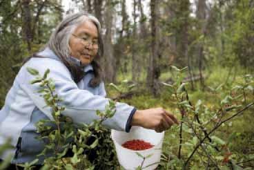
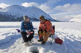
4 ii Her Majesty the Queen in right of Canada, represented by the Chief Executive Officer of Parks Canada, Cette publication est aussi disponible en français. Visit the Kluane National Park and Reserve of Canada website at: Library and Archives Canada Cataloguing in Publication Kluane National Park and Reserve of Canada Management Plan Catalogue No: R64-105/ E ISBN: Front Cover Image Credits Centre: HIKING NEAR CANADA CREEK IN THE Ä Y CHỪ VALLEY. Parks Canada/F. Mueller Top left: Champagne and Aishihik First Nation citizen Barb Hume harvesting soapberries. Parks Canada/F. Mueller Top centre: Dall s sheep. Parks Canada/S. Davidson Top right: Ice-fishing at Kathleen Lake. Parks Canada/F. Mueller


5 Kluane National Park and Reserve of Canada Management Plan iii Foreword Canada s national historic sites, national parks and national marine conservation areas offer Canadians from coast-to-coast-to-coast unique opportunities to experience and understand our wonderful country. They are places of learning, recreation and inspiration where Canadians can connect with our past and appreciate the natural, cultural and social forces that shaped Canada. From our smallest national park to our most visited national historic site to our largest national marine conservation area, each of these places offers Canadians and visitors several experiential opportunities to enjoy Canada s historic and natural heritage. These places of beauty, wonder and learning are valued by Canadians - they are part of our past, our present and our future. Our Government s goal is to ensure that Canadians form a lasting connection to this heritage and that our protected places are enjoyed in ways that leave them unimpaired for present and future generations. We see a future in which these special places will further Canadians appreciation, understanding and enjoyment of Canada, the economic wellbeing of communities, and the vitality of our society. Our Government s vision is to build a culture of heritage conservation in Canada by offering Canadians exceptional opportunities to experience our natural and cultural heritage. These values form the foundation of the new management plan for Kluane National Park and Reserve. I offer my appreciation to the many thoughtful Canadians who helped to develop this plan, particularly to our dedicated team from Parks Canada, our cooperative management partners the Kluane National Park Management Board, Champagne and Aishihik First Nations and Kluane First Nation, and to all those local organizations and individuals who have demonstrated their good will, hard work, spirit of co-operation and extraordinary sense of stewardship.
6 iv
7 Kluane National Park and Reserve of Canada Management Plan v Recommendations Recommended by: Alan Latourelle Chief Executive Officer Parks Canada Diane Strand Chief Champagne and Aishihik First Nations Anne Morin Field Unit Superintendent Yukon Field Unit, Parks Canada Wilfred Sheldon Chief Kluane First Nation Sean Sheardown Superintendent Kluane National Park and Reserve of Canada, Parks Canada Luke Johnson Chair Kluane National Park Management Board
8 vi
9 Kluane National Park and Reserve of Canada Management Plan vii Executive Summary Kluane National Park & Reserve protects and celebrates a spectacular Canadian landscape of high mountain peaks, massive valley glaciers, boreal forests, northern wildlife, and rich cultural heritage, inviting all Canadians to explore an iconic wilderness environment of outstanding ecological integrity and cultural value. An important part of the traditional territory of the Southern Tutchone people, Kluane National Park & Reserve is managed in partnership with the Kluane First Nation and the Champagne and Aishihik First Nations, who continue to maintain their deep cultural and spiritual relationship to the land. It offers local residents and international audiences the opportunity to experience and learn about the land that has been home to Southern Tutchone people for thousands of years, and to discover the land, animals and seasons that are at the heart of their traditional culture and way of life. Kluane National Park & Reserve is known worldwide for its outstanding wilderness recreation opportunities, attracting mountaineers, white-water rafters and experienced hikers to its mountainous terrain and icy blue rivers. The park includes a portion of the Alsêxh/Alsek River, a designated Canadian Heritage River. Together with Alaska s Wrangell-St. Elias National Park and Preserve, Glacier Bay National Park and Preserve, and British Columbia s Tatshenshini-Alsek Park, Kluane National Park & Reserve is part of the largest international UNESCO World Heritage Site. This new management plan builds on the park s classic wilderness experience to create more diverse opportunities for Canadians to explore and appreciate this national treasure. Using social science research and strategic planning, Parks Canada will develop, promote and deliver a wider range of visitor experience opportunities that will engage and connect with an expanded audience. Visitor experiences at Kluane National Park & Reserve generally fit within three main types of experiences, identified in this plan as Drive Through Awareness, A Step Into the Wild, and Into the Heart of Kluane s Wilderness. Within these categories, park visitors will find a range of activities, facilities and programs to enrich each type of experience. Drive Through Awareness and A Step Into the Wild will be a primary focus for actions during the life of this plan, where new opportunities will be designed to meet the needs of highway travellers and audiences interested in discovering the park through day-use and short overnight activities. It is recognized that visitors who enjoy backcountry experiences as described in Into the Heart of Kluane s Wilderness are currently wellserved by existing programs and services. Working with First Nation and Government of Yukon partners, Parks Canada will develop and present modern, relevant, and engaging programs and facilities to welcome visitors to the new Champagne and Aishihik First Nations Cultural Centre and to the Tach l Dhǟl Visitor Centre, inviting them to explore the fascinating natural and cultural environment of the park. Existing facilities and services in the park, e.g., Kathleen Lake campground, will be used to promote increased use of the park by regional audiences and the local community, encouraging a wider range of activities and stronger personal ties to the park. A review of the park s trail system will address increasing visitor interest in front country hiking and mountain biking opportunities, and establish a sustainable trail system suitable for the park s maintenance capacity. New guidelines will permit two-way air access to designated landing sites in the park s greenbelt, providing new opportunities for visitors to experience the backcountry. Parks Canada will explore the feasibility of providing alternative roofed accommodation in the park, e.g., backcountry huts, yurts, commercial trailers, or wall tents, to expand camping
10 viii opportunities for new audiences. Working with the Champagne and Aishihik First Nations and Kluane First Nation, additional commercial motorboat access will also be considered, with the possibility of tours to be offered on some of the park s major rivers. Through strategic outreach programming and ongoing engagement with local audiences, the park s reach will be extended locally, regionally and nationally. This management plan will continue to build stronger relationships with Kluane National Park & Reserve s First Nation partners, Champagne and Aishihik First Nations and Kluane First Nation, ensuring that cultural reintegration is actively supported, traditional knowledge and cultural resources are protected, and that training, employment and economic opportunities for both First Nations are pursued. The process that began through the Healing Broken Connections project will continue, and a strong First Nation presence in the park will enhance the visitor experience, ecological integrity, and cultural heritage of the park. Parks Canada will continue to work with the Kluane First Nation, Champagne and Aishihik First Nations and the Kluane National Park Management Board, to share in the effective and enduring cooperative management of the park, based on strong mutual respect and a shared understanding of respective responsibilities. will be managed for higher levels of multiple use activities and others will be managed for lower levels of use that facilitate experiences with high wilderness character. As a whole, this management plan intends to build stronger and more relevant connections between Kluane National Park & Reserve and a wider Canadian audience. It will result in a greater variety of visitor experience opportunities, more meaningful visitor experiences, greater engagement with the local communities, further reintegration of First Nations into the park, strengthened relationships with First Nation partners and enhanced cooperative management. This new management plan will also maintain and improve the park s ecological integrity through the completion of a more comprehensive ecological monitoring program, a focus on the park s forest ecosystems, active management of species at risk and non-native species, and increased public communications about ecological integrity issues and activities in the park. An area management approach included in this plan continues to define seven geographic areas in the park that offer distinct visitor experience opportunities, and identifies ways to provide a range of diverse and compatible visitor experiences best suited to each area. The unique ecosystems and landscape features of each area will be respected and incorporated into recreational and learning opportunities that meet the needs of a variety of audiences. Some areas
11 Kluane National Park and Reserve of Canada Management Plan ix Table of Contents Foreword... iii Recommendations...v Executive Summary...vii 1.0 Introduction An Updated Management Plan for Kluane National Park & Reserve Management Plan Review Process Importance of the Park A Place of National and International Significance UNESCO World Heritage Site Canadian Heritage River National Significance Planning Context/Current Situation Renewal within Parks Canada Regional Context First Nation Presence Cooperative Management Current Situation State of the Park and Key Issues and Challenges Vision Statement Key Strategies Experiencing Kluane A Personal Journey Rediscovering Dän Keyi (Our People s Land) Nature Prevails Keeping Kluane Healthy Building and Walking the Trail Together Significance Beyond Boundaries Area Management Approach Mush and Bates Lakes/Alder Creek Valley and Cottonwood Trail Kathleen Lake Alsêxh/Alsek -Titl àt Mǟn Tágà/Dezadeash River Valleys Ä y Chừ Valley Sh r Ndü Chù/Duke - Dän Zhǜr Chù/Donjek River Valleys The Icefields Highway Corridor Partnership and Public Engagement Zoning and Wilderness Declaration... 49
12 x 8.1 Park Zoning System Wilderness Area Declaration Administration and Operations Environmental Stewardship Monitoring Strategic Environmental Assessment Introduction Assessment Approach and Findings Five Key Strategies Area Management Public Engagement Administration and Operations Monitoring Conclusions...62 Acknowledgements References Glossary...66 Summary of Planned Actions...68 Appendix A Statement of Significance for Kluane/Wrangell-St. Elias/Glacier Bay/ Tatshenshini-Alsek...75 Appendix B Zone I Special Management Areas...76 Appendix C Framework for Monitoring of Ecological Integrity in Kluane National Park and Reserve March Appendix D Indicators of Wilderness Character...79 Maps Map 1 Regional setting...xi Map 2 Kluane/Wrangell-St. Elias/Glacier Bay/Tatshenshini-Alsek World Heritage Site.. 4 Map 3 Visitor experience opportunities Map 4 Park zoning...51 Tables Table 1 Species at Risk in Kluane National Park and Reserve...10 Table 2 Summary of Actions for the 2010 Kluane National Park and Reserve Management Plan Table 3 Framework for monitoring of ecological integrity in Kluane National Park and Reserve... 78

13 Yukon Kluane National Park and Reserve of Canada Management Plan xi parks Canada Heritage Areas in Yukon and Northern British Columbia 1 Alaska U.S. Canada 2 Old Crow Inuvik Ivvavik National Park Vuntut National Park Kluane National Park and Reserve Klondike National Historic Sites - Dawson Historical Complex - Dredge No.4 - S.S. Keno S.S. Klondike National Historic Site Chilkoot Trail National Historic Site 5 Yukon 4 Dawson City 2 Yukon Northwest Territories Beaver Creek 1 Carmacks 4 3 Haines Junction N Kilometres 5 Whitehorse Alaska Carcross Skagway 6 Haines Teslin Yukon British Columbia Map 1 Regional setting
14 xii

15 Kluane National Park and Reserve of Canada Management Plan Introduction Dezadeash River and Alsek Pass. Parks Canada 1.1 An Updated Management Plan for Kluane National Park & Reserve Parks Canada is responsible for administering a national system of protected heritage places, including national parks, national historic sites and national marine conservation areas; special places that help define Canada and Canadians. The Park Canada mandate has remained essentially unchanged for three quarters of a century: On behalf of the people of Canada, we protect and present nationally significant examples of Canada s natural and cultural heritage, and foster public understanding, appreciation and enjoyment in ways that ensure the ecological and commemorative integrity of these places for present and future generations. The Canada National Parks Act requires each national park to have a management plan. These plans reflect the policies and legislation of Parks Canada and comprehensive land claim agreements and are prepared in consultation with Canadians. They are tabled in Parliament and reviewed every five years. The Canada National Parks Act, Parks Canada Agency Act, and the Parks Canada Guiding Principles and Operational Policies set the context for this responsibility. This management plan updates and replaces the 2004 management plan and provides long-term strategic direction for the management of Kluane National Park & Reserve of Canada (KNP&R) for the next five years. 1.2 Management Plan Review Process The management plan review was led by a planning team with representatives from Parks Canada, Champagne and Aishihik First Nations (CAFN), Kluane First Nation (KFN) and the Kluane National Park Management Board.
16 2 The White River First Nation was invited to participate in the plan review. Key documents used when reviewing and revising the park s management plan included the CAFN and KFN final agreements, the 2008 KNP&R State of the Park Report, the 2004 KNP&R management plan, the Parks Canada Agency Corporate Plan 2009/ /14, and new national management planning guidelines outlined in the 2008 Parks Canada Guide to Management Planning. Public consultation is an essential element in all management plan reviews and partners, stakeholders and the public were engaged in a variety of ways through the plan review process. Visitor experience opportunities have generated a lot of public interest since the establishment of the park, and continue to do so. A two-day Visitor Experience Opportunities Workshop was held in the fall of 2009, to discuss current and potential new visitor experience opportunities. Forty participants provided representation from local First Nations, the Kluane National Park Management Board, local businesses, tourism industry, environmental organizations, park users, Yukon government, the education community and Parks Canada. A broad range of ideas were discussed and the results of the workshop were summarized and circulated for broader public input through a newsletter. Other key elements of consultation during the plan review included an on-line survey with local park operators and businesses, sessions with First Nation Elders and the Haines Junction Village Council, newsletters distributed to local residents, stakeholders and interested individuals by mail, and the national Parks Canada website, and open houses in Burwash, Haines Junction and Whitehorse. Over 50 comment forms submitted following the open houses provided the planning team with thoughtful input on future directions for the park. A final newsletter summarized what was heard and what was included in the final plan for the Minister s approval.
 within the traditional territory of the Champagne and Aishihik First Nations,")
17 Kluane National Park and Reserve of Canada Management Plan Importance of the Park A Place of National and International Significance Mount Logan. Parks Canada/W. Lynch Kluane National Park & Reserve lies in the southwest corner of Yukon Territory, a vast mountain area (21,980 km 2 ) within the traditional territory of the Champagne and Aishihik First Nations, the Kluane First Nation and the White River First Nation. First set aside as the Kluane Game Sanctuary in the early 1940s, it was declared a national park reserve in The 1993 Champagne and Aishihik First Nations Final Agreement established the southeastern portion of the park reserve as Kluane National Park. The Kluane First Nation Final Agreement was signed in 2003; the Tach l Region (northern portion of the park reserve) will retain park reserve status until the White River First Nation concludes a final agreement. 2.1 UNESCO World Heritage Site The World Heritage Convention is a United Nations agreement, endorsed by more than 100 countries, that recognizes the importance of protecting examples of the world s cultural and natural heritage. The convention states that the significance of these heritage resources transcends national boundaries and should be preserved for future generations. The Kluane/ Wrangell-St. Elias/Glacier Bay/Tatshenshini- Alsek World Heritage Site, almost 100,000 km 2 in size, is the largest international World Heritage Site (see Map 2; Appendix A for Statement of Significance). World Heritage status was first proclaimed in 1979 for Kluane National Park and Reserve and Wrangell-St. Elias National Park and Preserve, with the addition of Glacier Bay National Park and Preserve in 1992 and Tatshenshini-Alsek Park in The qualities that led to the initial nomination were an unbroken, pristine natural
18 4 A L A S K A Y U K O N UNITED STATES CANADA A L A S K A (USA) YUKON NORTHWEST TERRITORIES Wrangell-St. Elias National Park and Preserve Asi Keyi Territorial Park Kluane Wildlife Sanctuary KLUANE NATIONAL PARK & RESERVE BRITISH COLUMBIA Donjek Duke Burwash Landing Destruction Bay 2 River River Kluane Lake KLUANE NATIONAL PARK RESERVE OF CANADA Mount Logan Aäy (Slims Chù River) 1 Kaskawulsh Kloo Lake Haines Junction River Alsek River KLUANE Dezadeash NATIONAL Lake Mush Lake PARK Klukshu Bates Lake Kathleen Lake 3 1 Dezadeash R. Whitehorse 1 River 2 P A C I F I C O C E A N Tatshenshini Tatshenshini- Alsek Park Skagway B R I T I S H C O L U M B I A Haines Protected Areas around KNP & R World Heritage Site N km 30 Glacier Bay National Park and Preserve CANADA UNITED STATES Juneau Map 2 Kluane/Wrangell-St. Elias/Glacier Bay/Tatshenshini-Alsek World Heritage Site system with a rich variety of vegetation patterns and ecosystems, a wealth of wildlife populations including grizzly bears, Dall s sheep... and a number of rare plant communities. They also contain the largest non-polar icefield in the world and some of the world s most spectacular glaciers (from the World Heritage Site plaque). Through this management plan, Parks Canada will continue to work with partners in Alaska and British Columbia to ensure the World Heritage Site s outstanding universal value and integrity are conserved into the future. 2.2 Canadian Heritage River The Canadian Heritage Rivers System is Canada s national program for freshwater heritage conservation. It is a cooperative program between the governments of Canada and all ten provinces and three territories. The objectives of the program are to give national recognition to Canada s outstanding rivers and to ensure long-term management that will conserve their natural, historical and recreational values for the benefit and enjoyment of Canadians, now and in the future. The Alsêxh/Alsek River (Yukon portion) was one of the first rivers to be designated (1986). Initially designated for its natural values, the river has since become a world-class wilderness
19 Kluane National Park and Reserve of Canada Management Plan 5 rafting river and its cultural values have become more widely recognized. A ten-year monitoring report ( ) determined, that the majority of the Alsêxh/Alsek River s natural heritage values remain intact, and, with the exception of changes due to natural processes, remain essentially unchanged over the last ten year period and since its original designation in A plaque commemorating the designation of the river to the Canadian Heritage Rivers System is located at the Titl àt Mǟn Tágà/Dezadeash River day-use area in Haines Junction. Through this management plan and the Alsêxh/ Alsek River Management Guidelines, the natural values that led to the nomination of the Alsêxh/ Alsek River as a Canadian Heritage River and the river s cultural and recreational values will be safeguarded and presented. 2.3 National Significance The characteristics that help define this part of the Northern Coast Mountains Natural Region and provide values for protection and celebration include: PARK PURPOSE: To protect for all time, and to present to the public, a natural area of Canadian significance representative of the Northern Coast Mountains Natural Region. The St. Elias Mountains, with many of Canada s highest mountains, including Mount Logan, Canada s highest peak at 5,959 m; The largest non-polar icefield in the world, with immense valley glaciers and wild rivers a vestige of the last Ice Age; The most genetically diverse population of grizzly bears in North America, a significant population of Dall s sheep, and the only land-locked kokanee salmon population in a Canadian national park; An ecological crossroads of Pacific Ocean influences, the Arctic and the boreal forest resulting in diverse vegetation communities; Local First Nations with strong ties to the land and commitment to maintaining this aspect of their culture; The Kluane First Nation Final Agreement (Chapter 10, Schedule C, 1.0) states the following objectives for the park: To recognize Kluane First Nation history and culture, and the rights provided for in this schedule, in the planning, management, administration and operation of the Tach l Region; To recognize and protect the traditional and current use of the Tach l Region by Kluane People in the development and management of the Tach l Region; To protect for all time a representative natural area of Canadian significance in the North Coastal Mountains Natural Region; To encourage public understanding, appreciation and enjoyment of the Tach l Region in a manner which leaves it unimpaired for future generations; To provide economic and employment opportunities to Kluane People in the development, operation and management of the Tach l Region; To recognize that oral history is a valid and relevant form of research for establishing the historical significance of Heritage Sites and Moveable Heritage Resources in the Tach l Region directly related to the history of Kluane People; To recognize the interest of Kluane People in the interpretation of Aboriginal place names and Heritage Resources in the Tach l Region directly related to the culture of Kluane People; and To integrate traditional and scientific knowledge in the management of the natural and cultural resources of the Tach l Region.
20 6 The Champagne and Aishihik First Nations Final Agreement (Chapter 10, Schedule A, 1.0) states the following objectives for the park: To recognize Champagne and Aishihik First Nations history and culture, and the rights provided for in this schedule, in the establishment and operation of the park; To recognize and protect the traditional and current use of the park by Champagne and Aishihik people in the development and management of the park; To protect for all time a representative natural area of Canadian significance in the Northern Coast Mountains Natural Region; To encourage public understanding, appreciation and enjoyment of the park in a manner that leaves it unimpaired for future generations; To provide economic opportunities to Champagne and Aishihik people in the development, operation and management of the park; To recognize that oral history is a valid and relevant form of research for establishing the historical significance of heritage sites and moveable heritage resources in the park directly related to the history of Champagne and Aishihik people; and To recognize the interest of Champagne and Aishihik people in the interpretation of Aboriginal place names and heritage resources in the park directly related to the culture of Champagne and Aishihik people. Significant cultural resources, including an ancient obsidian quarry site, heritage trails and Aboriginal place names; and Wilderness character that provides opportunities for visitors to experience beauty, quiet, solitude, and wildlife in their natural setting. Ecological Significance The heart of KNP&R is the St. Elias Mountains, the youngest and some of the largest mountains in North America. Containing some of the largest valley glaciers in the world, the park is a vestige of the Ice Age. The other major mountain range of the park is the Kluane Ranges, bordering the Alaska Highway and Haines Road. Between this mountain range and the Icefield Ranges lies the Duke Depression, a complex of productive montane, subalpine and alpine areas. At present 18% of the park area is vegetated, largely a narrow green belt along the park s eastern boundary. Ecologically these are the most productive lands of KNP&R. They have been inhabited for thousands of years by Aboriginal people, whose close association with the land has created an important body of traditional knowledge. Officially excluded from the park area from the early 1940s until the mid-1970s, CAFN and KFN citizens are only now starting to spend time back in the park and reconnect with the land. Assisting these Southern Tutchone people to reintegrate with the park area is a high priority; their involvement provides a significant contribution to ecosystem management. KNP&R s population of grizzly bears is a significant wildlife resource and is considered an indicator of the health of the Kluane ecosystem. The grizzly bears that inhabit the park s glacial valleys have large home ranges and constitute one of the most viable populations of this species in any Canadian national park. Equally significant is the park s population of Dall s sheep. This ungulate is more characteristic of the park s northern areas, especially the alpine and subalpine zones of Tach l Dhǟl and the headwater areas of the Ä y Chừ and Dän Zhǜr Chù/Donjek River watersheds. The diversity of habitats, both inside and adjacent to KNP&R, contributes to a great variety of birdlife. Over 180 species have been reported, including recent increases in trumpeter swans and populations of raptors such as peregrine falcons, gyrfalcons, and bald and golden eagles. The park s lakes and streams contain lake trout, arctic grayling and several other fish species. Especially significant are the unique landlocked kokanee salmon of Sockeye, Louise and Kathleen lakes.

21 Kluane National Park and Reserve of Canada Management Plan Planning Context/Current Situation 3.1 Renewal within Parks Canada Parks Canada is beginning to renew its work to better serve the needs of Canadians today and into the future. There are many factors currently influencing Parks Canada - shifts in the cultural makeup of our cities, an aging population, Canadian s changing connection to their environment, increasing threats to natural and cultural heritage, and changes in how Canadians spend their leisure time. In order for Parks Canada programs to continue to be relevant, it is necessary to take a fresh look at the needs and desires of Canadians. Parks Canada is seeking ways to better connect Canadians with KNP&R, increase visitation and strengthen outreach education. 3.2 Regional Context Local Communities The village of Haines Junction, with a population of approximately 800, is located at the intersection of the Alaska Highway and the Haines Highway just outside the park boundary. Haines Junction houses the park administrative headquarters. Other communities adjacent to the park include Klukshu, Destruction Bay and Burwash Landing. The Haines Highway runs 256 km south over the scenic Chilkat Pass to Haines, Alaska, a port of the Alaska Marine Highway that connects Alaska with the southern 48 states. Developments in the Region A right-of-way for a natural gas pipeline runs parallel to the Alaska Highway adjacent to KNP&R and crosses park lands for approximately three kilometres in the Congdon Creek area. In anticipation of development Pond Hockey on Kathleen Lake. Parks Canada/K. Moylan an extensive environmental review was done in the 1970s, but the project did not proceed at that time. Interest in pipeline development has recently been renewed, with two major partnerships carrying out planning and design work. Applications for project review and certifications are forecasted to be submitted in The National Energy Board, Major Projects Management Office, Canadian Environmental Assessment Agency, and the Yukon Environmental and Socio-economic Assessment Board will participate in the review of the Canadian portion of the projects. Local resource extraction interests and activities have occurred near KNP&R and will continue into the future. Timber harvesting occurs near the eastern park boundary under the guidance

22 8 of an Integrated Landscape Management Plan. Small-scale placer gold mining continues to occur adjacent to the park, and recently many hundreds of quartz mining claims were staked in the Kluane Wildlife Sanctuary and on First Nation settlement land, including along approximately 80 kilometres of the park s northern boundary. Another regional development with future impacts on the park is the upgrading of the Alaska Highway along the park boundary. Once this project is completed the park boundary will be adjusted to follow the edge of the final road routing, with a small allowance for right-of-way. With this finalized, and with a possible future agreement between White River First Nation and the Government of Canada, there is potential for the Tach l Region to change from park reserve to park status. Major transportation, resource extraction and energy corridor developments in the Shakwak Valley and the subsequent implications for the ecological integrity of KNP&R highlight the need to consider the impacts of regional land use decisions on park values. Kluane First Nation member showing youth how to identify animal tracks. Parks Canada/F. Mueller 3.3 First Nation Presence Since time immemorial, the Southern Tutchone people, which includes CAFN and KFN, have lived throughout the area that is now the national park. They have adapted to this environment and acquired and refined the skills necessary to survive in this area. In 1943, the area was set aside as a game sanctuary, banning First Nation traditional harvesting activities such as hunting, trapping, and gathering plants and medicines. With this ban in place, the First Nations were effectively removed from the area, causing hardship and alienation from the land. Their traplines were taken away and their cabins were dismantled or burned. Despite lifting the ban on hunting and trapping for First Nations in 1976, many First Nations citizens continued to avoid the area for fear of reprisal. Not until 1993 did the CAFN finally receive legislated assurance, through a comprehensive agreement, that they could return to their traditional lands in the Kluane area and resume harvesting in the park. In 2003, the KFN also negotiated a comprehensive agreement confirming similar rights. Subsistence use in the park includes the right to hunt, fish, gather edible plants and trap furbearing animals using traditional and current methods and equipment. Currently, subsistence activities in the park are low, but are anticipated to rise as local First Nation citizens become re-acquainted with the park. Healing Broken Connections Healing Broken Connections, a nationally funded project from , began the process to help reintegrate local First Nation citizens into the part of their traditional territories that is now the national park. Working collaboratively with CAFN and KFN, the project included several culture and science camps in the park, workshops, the collection of traditional knowledge, trips into the park, e.g., gopher harvest camps and the construction of several Njals (pole houses). The project s final report states, Arguably the most significant product outcome from this project was the strengthened relationship between Parks Canada and First Nations. This project has helped pave the way for KNP&R and the First Nations to work together now and into the future. Both the KFN and CAFN final agreements identify zones within the park where there will be no Aboriginal harvest except for the
23 Kluane National Park and Reserve of Canada Management Plan 9 allowance within the KFN final agreement for a pre-defined harvest in one of the KFN No Harvest Zones. Three No Harvest Zones are identified in the CAFN final agreement, and two No Harvest Zones are identified in the KFN final agreement. Two of the No Harvest Zones in CAFN traditional territory are currently under review by the Kluane National Park Management Board. They will make a recommendation concerning proposed changes to the Minister of the Environment during the life of this management plan. 3.4 Cooperative Management The Champagne and Aishihik First Nations Final Agreement and the Kluane First Nation Final Agreement ushered in a new era in the management of KNP&R. The Champagne and Aishihik First Nations Final Agreement established the creation of the Kluane National Park Management Board (the Board) and the two final agreements identify specific rights and responsibilities of the two First Nations, the Board and Parks Canada in the management of the park a cooperative management regime based on shared responsibility. The Board can make recommendations to the Minister of the Environment. The Kluane National Park Management Board consists of six voting members; two are nominees of CAFN, two are nominees of KFN and two are nominees of the Government of Canada. All are appointed by the Minister responsible for Parks Canada. The park superintendent sits on the Board as a nonvoting member. An advisory board, it provides advice to elected representatives and officials of KNP&R, CAFN and KFN. 3.5 Current Situation Several significant events have happened since the last management plan in The two most significant events locally are the coming into effect of the Kluane First Nation Final Agreement (February 2004) and the nationally funded Healing Broken Connections project (2004 to 2009). The decision in 2009 to relocate the Kluane National Park Visitor Centre operations (Haines Junction) to the new CAFN Cultural Centre in the fall of 2011 will also have a major impact on park operations during the life of this management plan. Kluane Ecosystems Since the mid-1990s, a large-scale outbreak of spruce bark beetle has affected white spruce trees throughout 350,000 ha in the greater Kluane ecosystem, increasing local community concerns about the risk of forest fires and likely having an impact on visitor perceptions about the landscape. Research also shows glaciers on the Alaska-Yukon border melting at a rate three times of that in the 1950s. The greater Kluane ecosystem is also affected by increasingly diverse land use demands outside the park. Significant landscape and forestry planning has recently taken place throughout the CAFN traditional territory. Since 2003, all of the Yukon, including the national park, uses a new project assessment tool, the Yukon Environmental and Socio-economic Assessment Act. This tool examines both the environmental and socio-economic implications of proposed projects. Species at Risk Under the federal Species at Risk Act Parks Canada is responsible for the protection and recovery of listed species found in national parks. KNP&R and adjacent areas provide a seasonal or year-round home to several wildlife populations and one plant species that have been designated as Threatened or Special Concern by the Committee on the Status of Endangered Wildlife in Canada (COSEWIC). Some of these populations are listed in Schedule 1 of the Species at Risk Act and some are listed with COSEWIC (Table 1). Over the life of this plan, KNP&R may see the arrival of wood bison, a Threatened species reintroduced to the Yukon in the 1980s and 1990s through the National Bison Recovery Program. Local First Nations are concerned about potential spread of disease or displacement of other species by bison, as well as damage they might do to cultural resources and vegetation.
24 10 Table 1 Species at Risk in Kluane National Park and Reserve Status Species COSEWIC SARA (Schedule 1) Baikal sedge, Carex sabulosa Threatened listed Wood bison, Bison bison athabascae Threatened listed Common nighthawk, Chordeiles minor Threatened listed Olive-sided flycatcher, Contopus cooperi Woodland caribou, Rangifer tarandus caribou Threatened Special Concern listed listed Peregrine falcon (Anatum), Falco peregrines anatum Special Concern (recently assessed as no longer Threatened) Rusty blackbird, Euphagus carolinus Special Concern listed listed as Threatened (this species is currently undergoing consultation for down-listing to Special Concern under SARA. Until a decision is made, it is still listed in Schedule 1 as Threatened) Grizzly bear, Ursus arctos (northwestern population) Wolverine, Gulo gulo (western population) Special Concern Special Concern not currently listed not currently listed Horned grebe, Podiceps auritus Special Concern not currently listed Short-eared owl, Asio flammeus Special Concern on SARA Schedule 3 - not yet listed under Schedule 1 Research to understand the magnitude of impacts bison might have on natural and cultural resources is underway and will contribute to KNP&R s ability to make informed management decisions related to the management of the species should it expand its range to include the park. While not a Species at Risk, there is also concern and on-going work related to the kokanee salmon, which received a poor rating and declining trend in the 2008 State of the Park Report. Parks Canada is the lead agency for the on-going development of the recovery strategy for the Baikal sedge, and will soon be working to identify its Critical Habitat. Invasive Species There are currently eight invasive, exotic plant species known to be in KNP&R or very near the boundary. In some instances, e.g., sweet clover, significant risks exist that the species could quickly move deep into the interior of the park with significant ecological consequences, such as impacts on wildlife distributions and visitor experience. Elk were introduced into the Yukon through the efforts of the Yukon Fish and Game Association in the 1950s. Similar to concerns about bison, local First Nations are concerned about potential spread of disease or displacement
25 Kluane National Park and Reserve of Canada Management Plan 11 of other species by elk. The arrival of new species in the park will require management decisions. Parks Canada will need to conduct risk assessments related to the presence of non-native species, and continue to work with partners in the monitoring and appropriate management of these species. Cultural Resources Over the years, Parks Canada and local First Nations have conducted a variety of archaeological, oral history, and historical studies in the park and surrounding area. Over 250 archaeological sites have been identified in the park, including sites associated with early 20th century mining activities and a variety of pre-contact Aboriginal sites that indicate use of the park area for at least 7,000 years. Resources related to historic use are also abundant, including cabins from the Kluane Gold Rush and traditional First Nation sites for hunting, trapping and fishing. Mining cabins have been documented and mountaineering history and highway construction have also been researched. A number of isolated finds from the Icefields may reveal interesting information about the region s human history. Tangible cultural resources include archaeological sites, artifacts, and records. Intangible cultural resources include oral history, placenames, songs, stories, and traditional knowledge of place and the ecosystem. Visitor Experience People come from all over the world to experience KNP&R. Recent surveys have revealed that the most popular recreational activities in the park are hiking, viewing wildlife, visiting the visitor reception centres, fishing and photography. Flight-seeing, mountaineering, rafting, skiing and vehicle-based sightseeing are other popular visitor activities. Social science research has revealed that encountering untouched nature, experiencing solitude and viewing wildlife in a natural setting are important underlying motivations for people visiting the park part of the reason KNP&R has been valued by many as one of Canada s premier wilderness mountain parks for over 30 years. Spending time with family and friends is important for local residents using the park for recreation. On-site interpretive programming includes an average offer of four to six guided interpretive hikes and campfire talks per week during the summer visitor season. Interpretive talks are also available at each of the park visitor centres on a daily basis, either on-demand or through group requests booked in advance, including school groups. Program themes and subjects are continually renewed to communicate current key park messages. One specific park program focussed on communicating messages about bear ecology and safety is a fixed component of the park interpretive offer. In the fall, winter, and spring most park services are reduced significantly. The Tach l Dhǟl Visitor Centre is closed during this time, and the KNP&R Visitor Centre in Haines Junction is open by appointment only. During this time, groups are welcome to book interpretive talks at the Visitor Centre, which offer an introduction to the natural and cultural history of the park. Recently there has been a decline in visitors to the park s visitor centres and campgrounds, and a decline in overnight backcountry use. Visitation to the KNP&R Visitor Centre in Haines Junction has declined 18% over the last decade, and on average, overnight backcountry use in Kluane is down 38% over the last 10 years. Similarly, KNP&R s road-accessible campground at Kathleen Lake is down approximately 30% over the same period. The Government of Yukon s 2004 Yukon Visitor Exit Survey, Kluane Region also found that approximately 85% of visitors to the Kluane region actually stopped on their way through, but that only 6.6% of the visitors stopped or spent a night in KNP&R. These numbers indicate that, not only is visitation to the Kluane region in decline, but also that the majority of travellers passing through the Kluane region are not being attracted to stop at a visitor centre or spend time in the park.
26 12 In contrast to dropping overnight numbers, day use is estimated at more than 10,500 visitors per year, up substantially from the 2,000 to 3,000 estimated in the 2004 management plan. Holland America clients account for some of this rise. Trail and road counters installed over the last few years have improved the accuracy of user statistics. The Kluane National Park and Reserve of Canada 2006 Visitor Survey and the more detailed Kluane Wilderness Study 2002 have provided visitor information related to satisfaction, understanding, motivations, perceptions of environmental impacts and park management priorities. Ninety-seven percent of visitors reported being satisfied (18%) or very satisfied (79%) with their visit to the park. Eighty-six percent of visitors were satisfied (34%) or very satisfied (52%) with their interpretive experience, but the availability of interpretive programs scored below the national target, and the KNP&R Visitor Centre audiovisual program received the lowest overall interpretation rating (25% satisfied; 52% very satisfied). Major capital investments in recent years have been made in upgrading the interpretation and trailhead signage in the park. In addition, early in 2009, a decision was made to relocate the KNP&R Visitor Centre to the new CAFN Cultural Centre in Haines Junction, which will open in the fall of The new centre, while principally a cultural centre for CAFN, will also be the key contact with park visitors in Haines Junction, housing both the Parks Canada visitor centre and the Government of Yukon regional tourism centre. Public Education and Awareness After virtually no outreach education programming during the 1990s, a modest classroom program has been developed and presented locally and regionally since Two classroom programs about park ecosystems target grade 7 and 8 curriculum and are offered annually in Haines Junction, Whitehorse, and recently in other southern Yukon communities. Since 2007, Parks Canada has worked with St. Elias School in Haines Junction to provide support to their Experiential Science program, including the production of three resource binders. Parks Canada staff also make yearly visits to the schools in Beaver Creek and Destruction Bay and web-based educational resources about the park are also available. For local residents who live in the communities bordering KNP&R, the park is not a destination that they visit, but an integral part of their own neighbourhood. Parks Canada staff have undertaken a variety of activities over the last number of years to engage and communicate with local audiences, including hosting special events to celebrate National Aboriginal Day, Canada Day, and Parks Day, and in the last few years have had a presence at the local music festivals. A guest speaker series throughout the year is targeted primarily at Haines Junction residents, and held in partnership with the Yukon Science Institute and the Arctic Institute. There is a need to work more with the other communities that border the park. Annual park snowmobile trips are also targeted to regional residents. Although these events are meaningful for a small group of locals, they have not drawn a large audience or wide range of community members. Parks Canada co-hosted a very successful winter family day at Kathleen Lake in March 2010 with several community groups. Future events like this will hopefully build stronger relationships with the local communities. For the Canadian public as a whole, the Parks Canada website enables virtual visitors to learn key natural and cultural messages about KNP&R, and includes on-line curriculumlinked resources that allow teachers across Canada to present KNP&R programs to their classes. Continued work is required to maintain a current and interesting website, and there are opportunities to further enhance the website through new media products.

27 Kluane National Park and Reserve of Canada Management Plan State of the Park and Key Issues and Challenges The KNP&R 2008 State of the Park Report identified and described some of the key issues and challenges facing the park. important progress in this area, but there is still work to be done to advance cultural reintegration in the park. Ecological Integrity The State of the Park Report rated several bioregional indicators of ecological integrity in the park. The Icefields and Glaciers indicator received a Fair rating, due to the recent rapid change in melting rates, which may be a result of the changing climate. This may be affecting summer water levels and sedimentation levels in glacier-fed rivers and streams. The Tundra indicator received a Good rating, with a declining trend. Successful management actions related to recreational use have proved effective in ensuring the ecological integrity of the park. The mountain goat population remains stable and healthy, but the declining trend in the population of the Auriol herd of Dall s sheep, and a lack of data and understanding about the park s grizzly bear population, led to this indicator being assigned a declining trend. The Forests indicator received a Fair rating and declining trend. Major changes in the forest ecosystems are causing concern to First Nations, the local community and park scientists, largely due to the massive outbreak of spruce bark beetle over the last 13 years. There were insufficient measures available to evaluate the ecological integrity of two indicators - Freshwater and Wetlands. Cultural Reintegration of the Southern Tutchone people was recognized as a sixth important indicator of ecological integrity in the park. The traditional knowledge arising from the long-established relationship of Southern Tutchone people to the land contributes to the park s ecological integrity. Due to the damaging history of excluding First Nations people from the park this indicator received a Poor rating with an improving trend. The Healing Broken Connections project has helped make Njal. D. van Lieshout Cultural Resources Most of the indicators used to assess the state of cultural resources in the park received Fair ratings, including Archaeological Sites, Historic Objects, Cemeteries and Burial Sites, Archival Collections, and Messages Related to Cultural Resources. A collection of archaeological specimens housed in collections storage is well maintained and received a Good rating. Cultural resource management work has been undertaken since park establishment, but there is a need to develop a cultural resource management plan for the park, that will help identify priority actions to address the impacts of natural processes on archaeological sites and continue the inventory and recording of new and existing sites. The Intangible Cultural Resources indicator received a Poor rating, reflecting the loss of First Nations oral history and traditional knowledge resulting from the historic long-term exclusion of First Nations from the park and changes in lifestyle. The aging of Elders places additional stress on this indicator, as Elders traditional knowledge not passed on to future generations may be lost over time. A variety of methods and actions are needed to strengthen the preservation and continuation of intangible cultural resources in First Nation traditional lands within the park. This is a joint responsibility with the First Nations and requires actions within the life of this management plan.
28 14 Public Appreciation and Understanding All of the indicators for public appreciation and understanding received a Fair rating. The 2008 State of the Park Report concluded that the indicators Visitor and Student Participation, Visitor Understanding, Visitor Satisfaction, and Active Support all demonstrate some level of success, but more work is required in each of these areas. While an interpretive program has been offered for many years, the lack of an interpretive plan has left gaps in the program. In addition a better understanding of audience needs should be used to inform new product and program development. Local residents living in the communities bordering the park are a key park audience as, in the long-term, their actions have the potential for much greater impact on the park both positive and negative than those of park visitors. Some community outreach programs exist, but new methods for engagement are needed. In recent years, local and regional classroom programs have been developed and delivered, and this should continue to be a focus. More broadly, on a Yukon-wide level and a national level, outreach objectives and actions need to be defined. A variety of educational resources are available to students and others on the Parks Canada website and links through other websites, but outreach at this level has not been considered strategically. The lack of an outreach plan was identified in the State of the Park Report as a key issue. Visitor Experience All indicators for Visitor Experience also received a Fair rating. The Understanding Visitors indicator showed a good understanding of the park s backcountry users, but a need to simplify the general use of audience types and prioritize them. More research is also required to understand potential audiences. The Providing Opportunities indicator showed some high levels of opportunity for park visitors, but outdated signage and capital assets, including the main park visitor centre, were recognized as deficiencies. The Delivering High-quality Service indicator showed 97% of respondents in a 2005/06 survey reported being satisfied (18%) or very satisfied (79%). Some services, however, such as high quality of service, value for money and availability of pre-trip information, failed to meet the 50% very satisfied rating. Mechanisms are needed to measure satisfaction of users such as school groups, bus groups and local residents. There was insufficient information to assess the Connecting Visitors Personally with Place indicator. Several factors are driving the need to review and revise the visitor experience offer in the park: Changing visitor patterns decreasing backcountry use; increasing frontcountry use; Changing tourism trends an aging and more affluent population looking for greater comforts while travelling; Renewal work within Parks Canada, striving to better serve the needs of Canadians in order to continue being relevant into the future; Local First Nation economic interests in tourism-based businesses providing employment and a greater range of visitor opportunities; Funding pressures on the maintenance of visitor facilities and assets, e.g., park trails, campground; and Needing to review the park s visitor opportunities within a regional tourism context. Cooperative Management Cooperative management was rated as Fair overall, through a qualitative assessment process that did not rate individual measures. Cooperative management has been in place since The Kluane National Park Management Board has experienced successes and frustrations over the years and it continues to evolve. Improving relationships between Parks Canada, CAFN and KFN has led to government-to-
29 Kluane National Park and Reserve of Canada Management Plan 15 government relations playing a significant and growing role in the cooperative management of the park. The management plan needs to define ways in which cooperative management can continue to be strengthened over the life of the plan. While working with the best of intentions, there is a lack of common understanding of what cooperative management means in practical terms for the park. There is also a need for further relationship building and communication with park staff and the broader community.
30 16

31 Kluane National Park and Reserve of Canada Management Plan Vision Statement Grizzly bears. H. Fitzgerald A park vision is meant to convey the special character of KNP&R and paint an inspiring picture of the future desired state of the park over the next 15 to 20 years. This is a living land; this is Dän Keyi. The ecological integrity of the park is maintained, while showcasing the essence of this land to Canadians and visitors. Cooperative management is shared by Parks Canada, Champagne and Aishihik First Nations, Kluane First Nation and the Kluane National Park Management Board. Together with our First Nation partners, we engage the people and communities that share Kluane s landscapes. Kluane National Park is a vibrant and diverse landscape. The product of a relationship that has existed between land, plants, animals and human beings for thousands of years, it continues to evolve. To stand in the timeless majesty of its mountains, glaciers and valleys is humbling; to witness the beauty and power of grizzly bears, Dall s sheep, and other wildlife, which fills its vast expanse, instils in us a sense of wonder and renewal; to share this land with our First Nation partners, helps in understanding how people can live in harmony with their natural and physical surroundings. An easily attainable wilderness experience, with family and friends, or entirely alone, creates a wealth of memories. Kluane provides us with personal challenges that can be found on the summits of its mountains, in the depths of its valleys, and on its powerful rivers. It is
32 18 truly a breathtaking, world-class wilderness; part of a UNESCO World Heritage Site. Kluane is more than its physical geography of high mountains and rushing rivers, it is a land that embraces the human and cultural significance that helps shape this landscape. The prosperity of its ecosystems depends on the good health of its water, land, plants, animals and people. We invite you to experience and learn from a living park, walk on the path of modern cooperation and conservation, and discover Kluane. Welcome. Dannch e.

33 Kluane National Park and Reserve of Canada Management Plan Key Strategies Southern Tutchone youth drumming as part of Hand Games at Healing Broken Connections Ka Kon Camp, August D. van Lieshout Key strategies describe an integrated, focused approach of how the park will be managed in the mid- to long-term. The strategies set the path to achieve the park vision in an integrated fashion, while addressing park challenges. Within a key strategy, objectives are a more specific description of outcomes (short- to long-term). Key actions state what will be done within the five year term of the management plan s implementation. Park Vision Key Strategies Objectives Key Actions Five key strategies will help focus work over the coming years. 5.1 Experiencing Kluane A Personal Journey The main objectives of this strategy are to offer a diverse range of memorable visitor experience opportunities, promote learning and appreciation of the park s natural and cultural resources, and attract new visitors by offering desirable and relevant opportunities. For over 30 years, KNP&R, a part of a world heritage site, with iconic images of glaciers, grizzly bears and Dall s sheep, has attracted international attention as a premier wilderness recreation destination. Whether scaling Canada s highest peak, or viewing it on an over-flight of the park, visitors have memorable experiences. Changing visitor patterns and tourism trends in recent years has led to decreasing use in the backcountry and increasing use in the park s front country. There is also a growing interest in
34 20 First Nation culture and an interest on the part of the local First Nations to share their rich cultures with visitors. This strategy recognizes the history of the park as a wilderness park, and will build on these strengths by expanding the range of visitor opportunities in the park, to attract new and potentially larger audiences to enjoy and learn about the park, facilitating a greater appreciation and understanding of the unique natural and cultural landscapes of KNP&R. It emphasizes the importance of the personal connections visitors make with the park. Education about the park, its unique features, continuing importance to local First Nations, and ecological issues facing it, will help build memorable personal experiences for visitors. Most visitor experiences fit within one of three main types; Drive Through Awareness; A Step into the Wild; and Into the Heart of Kluane s Wilderness. During the life of this management plan, work will focus on improving the opportunities for visitors seeking Drive Through Awareness and A Step into the Wild experiences. The CAFN Cultural Centre and Tach l Dhǟl Visitor Centre Gateways to Kluane The visitor centre operations in Haines Junction will be relocating to the new CAFN Cultural Centre in the fall of The building will be owned and operated by CAFN, but Parks Canada will have its own distinct exhibits, programs and staff presence. This exciting new centre will be primarily a cultural and community centre for Champagne and Aishihik First Nations citizens, and will also provide innovative and engaging experiences where visitors can learn about the culture and heritage of CAFN, KFN, KNP&R and the region. It will offer a one stop shop destination for park and tourism information, creating a strong draw for independent highway travellers, bus tours, local and Yukon residents, First Nation members, and school and youth groups. Modern facilities, renewed exhibits, and coordinated services and programs will ensure that this broad range of audiences enjoys meaningful and relevant experiences. The shared planning and presentation of the new centre will allow Parks Canada to work with CAFN and KFN on developing and delivering culturally-based interpretive themes and programs related to the park. State-of-the-art exhibits, a new highdefinition video, improved visitor service facilities, personal programs, and special events will help visitors to feel a personal connection to the park, and promote greater enjoyment and participation in learning experiences. The new KNP&R visitor centre will become the hub of programming for the park, inviting visitors to explore the park through a range of recreational activities, interpretive programs, and community events. For some, a visit to the centre will be their main experience of the park. For others, it will be a jumping off point for their park visit. Tach l Dhǟl Visitor Centre will continue to serve visitors at the north end of the park, where there are excellent opportunities to view Dall s sheep and enjoy day and overnight hikes in the Ä y Chừ Valley and beyond. Exhibits have been upgraded in recent years, incorporating the cultural heritage of KFN. Discussions between KNP&R and KFN about the First Nation having a greater role in operations at Tach l Dhǟl are on-going. Ideas developed in the Kluane First Nation s Impacts and Benefits Plan include the possibility of expanding the Tach l Dhǟl Visitor Centre to include a food concession, tour booking centre, and a retail area for KFN artwork, crafts and products. Future plans are still under consideration, but visible outcomes are likely during the life of this management plan.
35 Kluane National Park and Reserve of Canada Management Plan 21 Drive Through Awareness: Casual visitors and highway travellers are an important park audience, making up the largest percentage of park visitors. Many of these visitors are en route to and from Alaska and are literally driving by the park. The impressive scenic drive along the Alaska and Haines highways and stops at the visitor centres are their only experiences of the park. Highly visible signage providing a sense of welcome (currently lacking), and engaging exhibits and staff at the visitor centres are key to their enjoyment and appreciation of the park s natural and cultural heritage. This brief visit is also their opportunity to learn about the thriving First Nation culture in the region. For some, a brief but memorable experience may lead to a longer future visit to the park. Drive Through Awareness focuses on serving the needs of these visitors at the park s two visitor centres (see sidebar). A Step into the Wild (primarily day-use and short overnight trips): Other visitors are seeking a personal experience that engages their senses and makes contact with the park environment. They enjoy opportunities that allow them to enter the world of KNP&R in comfort and security. Excellent interpretive exhibits and visitor information at the visitor centres support their exploration of the park. A wide variety of day and short overnight opportunities invite them into Kluane country. They may stay at a park or territorial campground or enjoy a night or two at one of the local B&Bs, motels or lodges. For those seeking more in-depth knowledge, interpretive walks and First Nation cultural programming will be available. For those seeking a brief taste of the park s inner landscapes, commercial flights over the park allow access to the majesty of its interior glaciers and mountains. Easier air access and guided trips like boat tours will help visitors with less time or backcountry experience explore farther into the park. All of these opportunities will enrich visitors understanding, appreciation and enjoyment of the park. A Step into the Wild focuses on offering authentic connections with nature and First Nation culture to a more diverse audience and greater number of visitors. Into the Heart of Kluane s Wilderness (backcountry hiking, rafting, mountaineering): KNP&R offers adventurous visitors the opportunity to experience a range of backcountry explorations in the iconic wilderness of the park. Visitors looking for moderate and challenging multi-day trips enjoy opportunities like hiking in the Ä y Chừ Valley, watching grizzly bears and climbing Observation Mountain to view the Kaskawulsh glacier. For experienced wilderness travellers, extended hiking, rafting, skiing and mountaineering trips offer unforgettable opportunities to delve more deeply into the rich natural and cultural environment of the park. The park visitor centres and staff provide information and services to support each of these activities, allowing visitors to experience their own challenging and rewarding journeys in KNP&R. Into the Heart of Kluane s Wilderness focuses on providing the more traditional multi-day backcountry wilderness experience for which the park is famous. Use of the Visitor Experience Cycle tool will ensure that Parks Canada addresses each important stage of the visitor experience at KNP&R, including wishing, planning, travelling, arriving, visiting, departing, and remembering. As part of the trip cycle, this strategy will address arriving, as there is a lack of a sense of welcome when visitors arrive at the park, as there are no park gates, identity signs on the main highways, or orientation exhibits. Direction for Expanding Visitor Experience Opportunities The range of opportunities offered to park visitors continues to elicit significant public interest from the many people who care passionately about the park and its future. As part of the plan review process, a Visitor Experience Opportunities Workshop was held with 40 participants to discuss current and potential new visitor experience opportunities for the park. The main themes that emerged as part of a visitor experience visioning exercise were: increase front country opportunities; engage local people/youth/energy; education; quality wilderness experiences; increase backcountry opportunities; increase infrastructure; communication with partners; and promotion. Many good ideas were generated and the public was then given an opportunity to comment on
36 22 the ideas as part of the plan review process. The following are ideas that will be explored further for implementation in the coming years: Develop activities that engage artists with visitors, locals and Canadians. Partner with local First Nations to expand the visitor offer. Expand activities at Kathleen Lake, e.g., playground at the campground, more community events. Increase activities for highway travellers, e.g., use new media to provide interpretation. Partner with local businesses and park operators to market the Kluane Region. The sections below (Park Trails to Winter) provide more specific direction on next steps towards implementing some of the ideas from the workshop that would be new to KNP&R. Actions related to these ideas are found in this key strategy or within the individual area concepts (Chapter 6). Major new recreational activities and events will undergo an assessment as described in Parks Canada s Recreational Activity and Special Event Assessments bulletin. New commercial operations will be subject to public review and environment assessment under the Yukon Environmental and Socio-economic Assessment Act. In addition, any proposed changes to park zoning will include public consultation. The following activities will be prohibited in the park, due to national policy or local decisions: ATV use is prohibited nationally; personal watercraft (sea-doo) use is prohibited locally; and heli-skiing does not fit national policy. All Visitor Experience opportunities in KNP&R must meet the following criteria, as presented at the 2009 Visitor Experience workshop. 1. Respect provisions of the Canada National Parks Act, Champagne and Aishihik First Nations Final Agreement, Kluane First Nation Final Agreement, Species at Risk Act, and other relevant legislation and policy; 2. Respect opportunities for future generations; 3. Respect the long association and traditional and current use that First Nations have with and in the park; 4. Maintain the ecological integrity of the park; 5. Maintain the wilderness character of the park; 6. Maintain cultural resources within the park - must not result in damage or loss of cultural resources; 7. Complement current visitor activities/ opportunities; do not unreasonably compromise existing uses; 8. Accommodate a diversity of activities and consider them in a regional context (i.e., what is offered in the region outside the park); 9. Be interesting/doable activities; likely to succeed; and 10. Consider the potential for economic opportunities, especially for First Nations people.

37 Kluane National Park and Reserve of Canada Management Plan 23 Map 3 Visitor experience opportunities

38 24 Park Trails Hiking is one of the most popular activities in the park. There are approximately 200 km of trails and many recognized hiking routes found in KNP&R (Map 3). The majority of the existing trail system is based on old mining roads and trails built prior to park establishment in the early 1970s. The trails range from 20 minute walks to more difficult five to six day hikes. In contrast to trails, routes typically follow no set path and are not maintained by the park. They follow streambeds and river channels, alpine meadows and ridgelines, game trails, and occasionally old mining roads. Routes are generally long and challenging. There is a need to conduct a comprehensive review of the park s trail system. Visitor needs are changing, maintenance standards have changed over the years and the current trail system is not sustainable. During the plan review, people indicated a desire for more front country hiking opportunities, loop trails and a desire for mountain biking opportunities beyond the ones now offered on old mining roads. The Cottonwood Trail and Auriol Trail are of particular interest to mountain bikers. Maintenance standards on the Mush Lake Road will also be included in this review. Early in the plan implementation, a trail review will be undertaken and interested individuals will have an opportunity to provide input into the process. The objective is a sustainable trail system, offering a greater diversity of opportunities to visitors. Air Access There are currently eight designated landing sites located within KNP&R that support extended back-country hiking, rafting and mountaineering trips. Five are located within the Icefields (where visitors can fly in and out and day-trips are permitted) and three within the greenbelt area (Onion Lake, Lowell Lake, Bighorn Lake, Map 3). At the greenbelt landing sites, visitors have been permitted to fly one way, either in or out, to support backcountry travel in more remote areas of the park. To expand backcountry opportunities to more visitors, drop-off and pick-up will be now be permitted at the Onion Lake and Bighorn Parks Canada/F. Mueller Lake sites. Permitting visitors to fly both ways will help facilitate day trips to some of these areas and make it easier for people to spend time in the backcountry. Two way access at Lowell Lake will not be permitted because of previously identified cumulative effect concerns in Hegmann (1995), and compatibility concerns. An alternative to Lowell Lake site is the Dusty Glacier, where day use landings will continue to be permitted to facilitate a touch a glacier wilderness experience. In addition, one or two two-way helicopter landing sites in the green belt will be sought to provide a more readily accessible alpine-based hiking experience. All aircraft landings in the park continue to require a landing permit. Guidelines will be developed to ensure high quality visitor experience and the maintenance of wilderness character and ecological integrity. Education will be important to make sure visitors are fully prepared for travel in these more remote areas. Work from the 2004 management plan to designate a fixed-wing landing area at Bighorn Lake will continue. Alternate Roofed Accommodation Several national parks have huts in the backcountry for visitor use (e.g., Alpine Club huts in the Rockies) and some are piloting new forms of accommodation in the front country (e.g., yurts and commercial camper trailers in campgrounds). KNP&R may pursue this type of facility at the Kathleen Lake campground, to be offered by a third party. The park will also be open to proposals for rustic commercial accommodation elsewhere in the park for visitor use, e.g., cabin, wall tent. The local First Nations will be consulted if proposals come forward.
39 Kluane National Park and Reserve of Canada Management Plan 25 Commercial Motorboat Access Currently there is a commercial motorboat tour offered at Kathleen Lake by a local First Nation operator. The 2004 plan also provided for a CAFN business to offer a motor-assisted float trip on the Titl àt Mǟn Tágà/Dezadeash River between Haines Junction and Serpentine Creek (not yet offered). To help encourage the development of the Titl àt Mǟn Tágà/Dezadeash River float, a proposal for motor-assisted float trips in both directions (rather than return by road) will be accepted. During plan consultations, the majority of respondents did not support an expansion of commercial motorboat access in the park, citing concerns about disturbance to others and wildlife, and maintaining wilderness character. The CAFN and KFN final agreements give the First Nations rights of first refusal on any new licenses issued for the commercial operation of motor-assisted boat tours permitted in the park. Both First Nations final agreements include as one of the objectives for the national park, to provide economic opportunities to CAFN and KFN in the development and operation of the park. To assist in providing economic opportunities for CAFN and KFN, expanded commercial motor-assisted boat tours (which could include motorboats and jet boats) will only be considered from a CAFN or KFN business for Ä y Chừ (Slims River) and from a KFN business for the Dän Zhǜr Chù/Donjek River. Either of these new offers would require a park zoning change and an environmental and socioeconomic assessment. Public consultation is part of both of these processes. If the motorboat tours go ahead, the economic, environmental and compatibility feasibility and success of these new tours, in conjunction with new technology advancements and changing visitation patterns, will determine if motorboat access could be expanded into other areas of the park during future management plan reviews. Winter Use During the winter, KNP&R offers recreational experiences characterized by outstanding opportunities for solitude and quiet in a natural setting where wildlife is largely undisturbed by human influences. Winter experiences are primarily day use cross-country skiing on a variety of park trails, ice-fishing at Kathleen Lake, and a limited number of overnight skiing and dogsled trips. Snowmobile use in the park will remain limited to the surface of Kathleen Lake to facilitate a winter experience; along the abandoned pipeline right-of-way between Haines Junction and Titl àt Mǟn/Dezadeash Lake; and during one to two annual parksanctioned snowmobile trips targeted to local residents. Currently, most winter park users are local residents. Increased winter tourism will be encouraged through offering special events and partnering with others. Park Interpretation New park capacity and staff positions related to visitor experience will facilitate the development of a more strategic and expanded interpretive offer in the park. Interpretive planning will determine key park messages to be communicated, identify gaps in the current offer and identify future opportunities. The majority of visitors go to at least one of the park s visitor centres, and for many the visitor centre is their main contact with the park. The two visitor centres will therefore continue to provide the best opportunities to share the park s stories with this audience. Interpretive products and services will be strengthened through the use of new technologies and media in order to be more relevant and engaging. Strategic interpretive planning will ensure that KNP&R offers a variety of programs and experiences designed to meet the needs and interests of a variety of park visitors. Area Concepts The key strategy Experiencing Kluane A Personal Journey looks at aspects of the visitor experience that apply across the park. The seven geographic areas of the park that have been used since the 1990 management plan will continue to frame the visitor experience opportunities and ecological integrity objectives in different areas of the park as area concepts. The seven geographic areas are described in Chapter 6 (Map 3).
40 26 Experiencing Kluane A Personal Journey: A 5-year plan Objective 1: Diverse opportunities for visitors appeal to a broader range of visitors and increases visitation. Targets: Visitation increases 16% over the next three years, to a total of 43,000 annual visitors by 2012 (up from 37,144 in 2009). On average, 90% of visitors surveyed are satisfied with their visit and on average, 75% of visitors are very satisfied. Complete trail review by 2012; then initiate implementation. Actions (also refer to area concepts, Chapter 6): 1. Conduct and initiate implementation of a comprehensive review of the park s trail system. 2. Develop activities that will engage artists with visitors, locals and Canadians, e.g., Artists in the Park. 3. Partner with local First Nations to expand the visitor offer. 4. Consider proposals for rustic commercial accommodation in the park. 5. Working with others, promote increased winter visitation through awareness and special events, e.g., host at least one winter special event annually. 6. Conduct on-going cyclical social science research including Visitor Information Program surveys to gauge visitor needs and interests, satisfaction, and understanding. 7. Investigate, and if feasible establish, one or two two-way helicopter landing sites in the greenbelt. Objective 2: Visitors, local residents and other Canadians appreciate and understand the park s natural and cultural resources. Targets: On average, 85% of visitors at surveyed locations consider the park meaningful to them. On average, 60% of visitors consider that they learned about the natural and cultural heritage of the place. Actions: 1. Develop an interpretive plan for the park by 2013; then initiate implementation. The plan will provide direction on key audiences, types of programs, messages, methods for delivery and interpretive products. 2. Complete the highway and trailhead sign project.
41 Kluane National Park and Reserve of Canada Management Plan 27 Experiencing Kluane A Personal Journey: A 5-year plan Objective 3: Current markets continue to enjoy the park and new markets are attracted to visit the park. Targets: Identify potential new market segments using social science tools. On average, 90% of visitors surveyed report that they enjoyed their visit. Actions: 1. Conduct social science research to guide park investment, operational and marketing decisions e.g., to determine level of awareness of KNP&R with Yukoners and Alaskans to help inform promotion activities. 2. Identify targeted audiences and strategies for promoting visitor experiences in the park e.g., regional audiences, Yukon families, youth groups, school groups. 3. Update and expand information and marketing tools associated with the park e.g., photos, website, Explorer Quotient, social networking. 4. Locally implement the national Parks Canada branding program. 5. Work with others to promote the park and cross-market other regional attractions. Objective 4: The park visitor centre in the CAFN Cultural Centre is open and operational and both visitor centres welcome and orient visitors to the park and provide engaging interpretation. Targets: Relocate the visitor centre operations in Haines Junction to the new CAFN Cultural Centre by the fall of Actions: 1. Complete the design, fabrication and installation of exhibits, A/V production and other necessary components of the park visitor centre at the new CAFN Cultural Centre in Haines Junction. 2. Work with CAFN and Yukon government to set up operations and deliver programming in the new CAFN Cultural Centre. 3. Work with KFN to further develop Tach l Dhǟl to provide more services to visitors and economic opportunities for the First Nation.
42 28 Guiding Principles The following principles will be used to guide recreational use management within the park: Subsistence activities will take priority over recreational activities, and may influence recreational activities in KNP&R. KNP&R s wilderness backcountry areas will be managed so visitors can experience a sense of freedom, solitude, natural quiet, challenge and self-reliance. The park will use a variety of techniques for managing recreational use to ensure ecological integrity, the protection of cultural resources and high quality wilderness experiences. These include limits on group size, length of stay, number of commercial operators and aircraft landings, quotas, reservation systems and trip scheduling, use of designated campsites, routes and trails, permanent or temporary closures, Leave No Trace education and mandatory use of bear canisters. Scientific research and traditional knowledge will be used to guide recreational use management decisions. Recreational use activities must be consistent with fostering a greater understanding and appreciation of park values and interpretation themes. 5.2 Rediscovering Dän Keyi (Our People s Land) The main objectives of this strategy are to acknowledge, foster and respect the enduring First Nation presence in the ecosystem and promote the understanding, appreciation and stewardship of the cultural landscapes, resources and values of the park. This key strategy will concentrate on honouring, supporting, and promoting an understanding of the important ongoing relationships between the area that is now the national park and KFN and CAFN citizens. It will further work started by the Healing Broken Connections project and ensure that the First Nations heritage, knowledge, culture, and connection to the park area continue and are more fully integrated into the park s management and activities. The traditional and continuing presence of First Nations in the park is recognized for its importance to the ecological integrity of the park, and First Nations use and practices in the park will be actively supported. The integral role of First Nations within the park ecosystem will be communicated through interpretive and educational programs and materials. This strategy also involves important cultural resource management work to ensure the protection and presentation of the park s considerable cultural resources. Cultural resources and landscapes in the park will be honoured and included in park management decisions and communications activities. Cultural resources will be managed according to a cultural resource management plan, to be developed in cooperation with KFN and CAFN partners. Economic opportunities related to the park are a priority for both First Nations. The CAFN and KFN final agreements both specify certain economic opportunities associated with the park, including direct employment, potential commercial operations (e.g., horse riding, dog sledding, motor-assisted boat tours) and trail construction and maintenance work. It is recognized that some of the opportunities outlined in the final agreements may no longer warrant economic investment, therefore, future economic opportunities should be based on the spirit of the agreements, rather than what is explicitly stated in the agreements. Some of the actions related to First Nations economic opportunities are found in the Experiencing Kluane A Personal Journey key strategy and the area concepts (Chapter 6). This strategy will continue to strengthen the relationship between Parks Canada and its First Nations partners, and foster deeper understanding and support by visitors. In future it is hoped that this strategy will require less focus as it will simply become how work is done.
43 Kluane National Park and Reserve of Canada Management Plan 29 Rediscovering Dän Keyi: A 5-year plan implementation Objective 1: Working with CAFN and KFN, fulfil the objectives outlined in their respective final agreements, with respect to KNP&R. Targets: Have a joint identity program in place by 2015, in which the involvement of First Nations in the creation and management of KNP&R is reflected in signage, uniforms and communication products related to KNP&R. Finalize the transfer of a patrol cabin to KFN by the end of Establish a baseline of First Nation use of the park (or presence in the park) by Actions working with CAFN and KFN: 1. Continue to provide economic, training and employment opportunities to CAFN and KFN in the operation and management of the park. 2. Work with KFN and CAFN to identify and develop Aboriginal cultural tourism opportunities associated with the park. 3. With KFN and CAFN, develop and deliver communications for First Nation citizens, visitors and the general public, outlining First Nation rights within the park. 4. Continue to facilitate reintegration of CAFN and KFN citizens into their traditional territory in the park, e.g., finalize the transfer of a patrol cabin to KFN and work with CAFN and KFN to develop new structures for their use. 5. Achieve joint identity of the cooperative managers of KNP&R, e.g., signs, uniforms. 6. With CAFN and KFN, finalize the KNP&R sign plan, including where Southern Tutchone should be included. 7. Continue work to locate and map First Nation camps and heritage trails. 8. Recognize and communicate the history of First Nation cabins and camps lost to First Nations when the park was established and work cooperatively towards resolution of this issue. Actions working with Kluane First Nation: 1. Establish a significant relationship in the Tach l Region e.g., park staff present in Burwash Landing. 2. Participate in KFN community development planning processes as requested. 3. Work with KFN to develop economic opportunities at the Tach l Dhǟl Visitor Centre. 4. Continue to jointly develop interpretive signs around key park sites in the Tach l Region. 5. Support the implementation of the Kluane First Nation Impacts and Benefits Plan.
44 30 Rediscovering Dän Keyi: A 5-year plan implementation Objective 2: Cultural reintegration, an indicator of the park s ecological integrity, is improved. Targets: The cultural reintegration indicator condition and trend will change from poor/improving to fair/stable by Increase the percentage of visitors who understand the role of First Nation activities and history in the ecological integrity of the park. By the next State of the Park Report in 2013, at least three measures are in place to assess and track the status of cultural reintegration. Actions: 1. Continue the legacy of the Healing Broken Connections that will facilitate the reintegration of CAFN and KFN citizens into their traditional territory within the park e.g., participate in culture camps for First Nation youth and citizens, promote First Nation participation in field work and research in the park. 2. Develop measures for the cultural reintegration indicator to enable quantitative reporting in future State of the Park reports. 3. Help facilitate the First Nations process of updating past traditional knowledge projects and identify where traditional knowledge is important for making management decisions. 4. Explore various approaches for incorporating traditional knowledge into park management, e.g., reviewing current catch and release fishing policy. Objective 3: Cultural resources within KNP&R are maintained, protected, presented and celebrated. Targets: Complete cultural resource management plan by 2013; then initiate implementation. A system is in place for documenting intangible cultural resources by Actions: 1. Working with KFN and CAFN, complete and start implementing a cultural resource management plan for the park. 2. Strategically carry out cultural resource management activities based on an assessment of risks to known resources and opportunities presented by new discoveries and information. 3. Develop a system for documenting intangible cultural resources, e.g., oral history, place names, traditional knowledge of place and the ecosystem.

45 Kluane National Park and Reserve of Canada Management Plan 31 This work will allow future completion of a fire management plan to direct fire management activities, planning and partnerships. Dall s sheep. Parks Canada/S. Davidson 5.3 Nature Prevails Keeping Kluane Healthy The overall objective of this strategy is to maintain and improve the park s ecological integrity, focusing on the park s forests, and provide opportunities for visitors and others to learn about the park s ecological integrity. The forested area of the park received the lowest ecosystem rating in the 2008 State of the Park Report, rated as fair and declining. First Nation Elders have also expressed concern: Elders are concerned about the forest dying from spruce beetles and how quickly water moves through the land, and how this will affect the animals. They do not hear as many birds. Colder winters and fires used to help keep the forest healthy (State of the Park Report 2008). Several significant threats to the health of the park s forests have been identified and more information is required to fully understand the processes currently affecting the forest ecosystem. Absence of fire, the extensive spruce bark beetle outbreak, and the absence of First Nation people on the land are all clear factors in the deteriorating ecological integrity of this part of the park. Other issues affecting the park s ecological integrity include species at risk and the arrival of non-native species. The spruce beetle outbreak has led to a changed forest structure with abundant dead trees, both standing and fallen. The large number of dead trees is causing considerable concern about higher potential risks of wildfire. There is a need for a comprehensive fire history study, as well as a need to understand the long-term First Nation use of fire in the Kluane region, in order to more fully understand the role that fire has played in the health of KNP&R s forest ecosystems. KNP&R has made significant advances in understanding its bear populations and in minimizing conflicts between park users and bears. This is the result of past multi-partner research, on-going monitoring, on-going implementation of the bear management plan and related strategies, and continuing efforts to work with biologists to refine our knowledge and further reduce risks to bears and humans. This proactive approach will be continued. The KNP&R ecological integrity monitoring program is strong in some areas, but further work is needed to provide a comprehensive ecological integrity monitoring program that will alert managers to changes in ecological integrity that will lead to management action. Increasing land use pressures adjacent to KNP&R will require the park to become more involved in planning and assessment processes, including the provision of strategic input to the Yukon Environmental and Socio-economic Assessment Board. This strategy will seek to gain a better understanding of the changed forest ecosystem and implement a more representative set of monitoring measures for the park s forests. It will aim to increase understanding and support for the role of First Nation activities in the ecological integrity of the park; improve public understanding of the threats facing the park s forests; deal with species at risk and invasive species; enhance visitor experience opportunities in the park; and offer ways for visitors to engage with park management. Note: Work related to the Cultural Reintegration ecological integrity indicator is found under Rediscovering Dän Keyi.
46 32 Nature Prevails Keeping Kluane Healthy: A 5-year plan Objective 1: The ecological integrity of the park s forests is no longer declining and information on forest health is improving. Targets: Finalize the fire management plan by Improve the estimate of the ecological integrity measure Area Burned Condition Class (a measure used to quantify the departure from historic fire cycles) by the next State of the Park Report in Complete a strategy for addressing the decline of the Sh r Ndü Chù/Duke River moose by the next State of the Park Report in Establish the appropriate number of permanent sample plots to monitor the response of forests to the spruce bark beetle outbreak by Actions Fire Management: 1. Carry out a large-scale disturbance regime study to characterize the role of fire (and other disturbance mechanisms) in forest succession within the park. 2. Maintain capacity and relationships to action wildfires in the park in a timely, efficient and safe manner. 3. Work with First Nation partners to determine their interests in protecting culturally important artifacts and sites from fire. 4. Perform small-scale fuel modifications to address localized, high risk wildfire concerns. Actions Forest Health: 1. Develop a strategy with KFN and Government of Yukon to investigate and address the decline in the Sh r Ndü Chù/Duke River moose population. 2. Implement a set of stand-level measures to monitor how the forest changes as it responds to the spruce bark beetle outbreak. 3. Continue to engage in planning and assessment processes of activities outside the park, which could have an impact on KNP&R.
47 Kluane National Park and Reserve of Canada Management Plan 33 Nature Prevails Keeping Kluane Healthy: A 5-year plan Objective 2: Threats from non-native species are reduced and Species at Risk are actively managed. Targets: Pilot at least one additional measure (since 2008 State of the Park Report) for monitoring the condition of the Kathleen Lake system by Identify critical habitat for the two park populations of Baikal sedge by The park continues to be elk-free in By 2015, complete species-specific action plans for priority invasive species identified in KNP&R and surrounding areas. By 2011, ensure that all research permits issued for research in KNP&R water bodies, and by 2013, other regulated activities related to KNP&R waters, carry conditions to prevent the spread of disease and invasive species between water bodies. By 2013 there is a plan in place to address the Kathleen Lake kokanee population decline. Actions Species at Risk: 1. Implement management actions identified in the proposed Baikal Sedge Recovery Strategy. 2. Investigate opportunities to provide for a COSEWIC assessment of the Kathleen Lake kokanee salmon population. 3. Continue to research the cause of the decline of the kokanee salmon and pursue a broader examination of the ecological integrity of the Kathleen Lake system using other measures, e.g., lake trout. 4. Develop a management strategy to address potential environmental and cultural impacts of wood bison should they expand their range into the park, taking into account the interests of local First Nations, the National Wood Bison Recovery Team and the Yukon Bison Technical Committee. 5. Contribute to the assessments of other species being considered for COSEWIC listing. 6. Work with partnering governments to increase our knowledge of the Kluane caribou herd. Actions Non-native Species: 1. Inventory non-native vegetation species in and near the park, and develop species-specific action plans based on the relative risk associated with the presence of each species. 2. Work with the Government of Yukon to determine a strategy to prevent elk from entering the park and/or removing them should their range expand into the park. 3. Continue to work with others in the monitoring, and where appropriate, the management of non-native species. Actions Aquatics: 1. Work pro-actively, including through education, to prevent the spread of freshwater fungus and viruses that cause mortality to fish and amphibians.
48 34 Nature Prevails Keeping Kluane Healthy: A 5-year plan Objective 3: A more complete ecological integrity monitoring program leads to improved reporting in the short- term and improved ecological integrity in the long-term. Targets: Report on the condition of all indicators by the next State of the Park Report in Develop at least one landscape-level measure of ecological change by the next State of the Park Report in Actions: 1. Design monitoring programs for the four indicators where monitoring did not exist in the 2008 State of the Park Report: glaciers; wetlands; freshwater; and cultural reintegration. 2. Work with KFN and CAFN to identify traditional knowledge indicators and measures for ecological integrity monitoring. 3. Develop a work plan with CAFN and KFN to guide how to incorporate traditional knowledge into the monitoring program. 4. Support First Nations wildlife monitoring programs by increasing integration into KNP&R ecological monitoring program. 5. Develop measures that are able to report on landscape-level change (e.g., percentage of historic cycle achieved, change in area in all glaciers in the park, change in habitat connectivity). 6. Design and implement a more representative set of measures for the forest indicator. Objective 4: A variety of audiences (e.g., staff, First Nation partners, local community, visitors) gain a better understanding of the ecological integrity monitoring program and its purpose, key ecological integrity issues facing the park and the role of First Nations related to the ecological integrity of the park. Targets: An opportunity to volunteer on an ecological integrity monitoring program is offered annually to staff, First Nation partners, local communities, and visitors. There is an increase in the number of people who volunteer at the park. Actions: 1. Undertake activities to increase visitor understanding and support for the role of traditional First Nation activities in the ecological integrity of the park. 2. Communicate the purpose and results of ecological integrity monitoring efforts to park audiences in a timely and relevant manner. 3. Through the field unit volunteer coordinator, provide opportunities for individuals to be involved in park-based monitoring programs. 4. Explore opportunities for schools to learn about ecological monitoring in the park through curriculum-linked school programs and on-site visits.
49 Kluane National Park and Reserve of Canada Management Plan 35 Guiding Principles The following ecological integrity principles, adapted from the 1990 and 2004 management plans, will continue to be used to ensure that ecological integrity is maintained in KNP&R. These guidelines are based on conservation biology principles, adaptive management, and the principle of ecological precaution: means for the park. As with the Rediscovering Dän Keyi key strategy, in the future it is hoped that this strategy will require less focus as it will have become the natural way the park is managed. Compatible means park use and management actions will be compatible (sympathetic and complementary) with the wilderness nature of the park, the sensitivity of park resources, and First Nation values and uses; Controllable means Parks Canada will ensure that control is maintained with respect to the means, timing, and frequency of a particular park use or management action; and Reversible means that Parks Canada will monitor the effects of park use and management, and adjust actions, if required, in order to minimize impacts, or completely remove a use, a facility, or an activity, if necessary. 5.4 Building and Walking the Trail Together The main objective of this strategy is to strengthen cooperative management of the park. This strategy focuses on continuing to strengthen cooperative management of the park, between Parks Canada, the Kluane National Park Management Board, KFN and CAFN. A greater awareness of the cooperative management of the park is also a priority. This includes more clearly defining the roles and responsibilities of the cooperative management partners, leading to more effective cooperative management. It also includes further relationship building for a common understanding of shared visions and goals, as well as the practical implications of their decisions in park use and management. A greater general awareness of the cooperative management of the park will also be a priority. Opportunities will be created for park staff, visitors, and the broader community to learn about cooperative management and what it

50 36 Building and Walking the Trail Together: A 5-year plan Objective 1: The park is cooperatively managed with KFN, CAFN and the Kluane National Park Management Board in an efficient and effective manner to the satisfaction of all parties. Target: The park is cooperatively managed with KFN, CAFN and the Kluane National Park Management Board in an efficient and effective manner to the satisfaction of all parties. Actions: 1. Clearly define the roles and responsibilities of the park s cooperative managers. 2. Review the Cooperative Agreement as a tool to aid cooperative management, and modify or augment if needed. 3. Increase awareness of the Kluane National Park Management Board and its work within the broader community. Outreach school program. Parks Canada/K. Alexander 5.5 Significance Beyond Boundaries The main objectives of this strategy are to define an outreach program that recognizes the importance of local communities to the park, to strengthen learning experiences through curriculum linked school programming, and to communicate effectively about park values to non-visiting audiences to inspire and invoke support. in order to build a sense of personal connection to KNP&R and for Parks Canada to reach and be relevant to Canadians whether or not they have an opportunity to visit the park. Through public outreach education, Parks Canada can build a greater understanding and appreciation of KNP&R and also encourage individuals and communities to support and become engaged in its protection and presentation. This strategy is designed to extend the reach of KNP&R, through popular media, modern technology and outreach programming, to bring current, lively and engaging content into homes, schools and communities so that Canadians can choose to make the park part of their daily lives. This strategy will extend the park s reach, locally, regionally and nationally through effective and relevant learning opportunities designed to increase understanding and appreciation of KNP&R. Public outreach education is about communicating important Parks Canada stories and messages to Canadians at home, at leisure, at school and in their communities. It is important
51 Kluane National Park and Reserve of Canada Management Plan 37 Significance Beyond Boundaries: A 5-year PLAN Objective 1: Outreach audiences are defined and an outreach program is developed and implemented for the park in order to extend the park s reach locally, regionally and nationally. Targets: Increase the number of students in the Yukon (focussed on students in Haines Junction, Burwash, Destruction Bay, and Whitehorse) who have contact with Kluane school programming either in the classroom, on-site, or through the internet. One school program is developed by 2015 that will be delivered at Kathleen Lake. One youth program is developed by 2015 that will be delivered at the CAFN Cultural Centre. The number of school visits to the park increases by The number of visits to the website increases. Actions: 1. Develop an outreach education plan that will provide a solid framework for identifying, understanding and engaging current and potential audiences. 2. Continue working closely with St. Elias School to support and promote learning about the park that meets their needs. 3. Take park messages to broader school audiences within the Yukon and to Canadians via the Parks Canada Teachers Resource Centre. 4. The Grade 4 Environmental Stewardship Certificate Program, which includes information about KNP&R ecosystems, will be offered at St. Elias School, Kluane Lake School and other Yukon schools. 5. Develop youth programming for Yukon students to be delivered at the park visitor centres. 6. Promote the park visitor centres as a useful resource for teachers. 7. Develop a school offer for Yukon students to be delivered at Kathleen Lake. 8. Promote Kathleen Lake as a useful resource for teachers and youth groups (e.g., Scouts). 9. Continually refresh and renew content for an enhanced web presence that provides learning, sharing and experiential opportunities for Canadians and others so that they can experience the excitement of virtually being in KNP&R.
52 38 Significance Beyond Boundaries: A 5-year PLAN Objective 2: Ongoing engagement with local audiences is promoted, creating a lifelong connection to the park. Targets: One outreach program is developed by 2015 that targets new Canadians residing in the Yukon. There is increased participation in park programs by local residents. Increase visitation by Yukon residents to the park over the next five years. Increase the number of local residents who visit the CAFN Cultural Centre (compared to the KNP&R Visitor Centre) over the next five years. Increase the number of special events targeting local residents over the next five years. 10% increase in the number of Yukon residents who are familiar with Kluane (using the 2009 Telephone Survey of Yukon Residents as a baseline), and develop a baseline estimate for the percentage of Yukon residents who learned something about the park from their use of the interpretive facilities and services for the area. Actions: 1. Develop new methods for engaging more local residents in park programs based on their interests and motivations. 2. Help ensure that the CAFN Cultural Centre becomes a centrepiece for the Haines Junction community, not only for visitors but also First Nation citizens and local residents. 3. Deliver a variety of special events out of the CAFN Cultural Centre that engage local residents through learning and sharing in an integrated experience with CAFN and the Government of Yukon. 4. Work to ensure that Kathleen Lake campground is an important recreational area for local residents. 5. Deliver a variety of special events at various locations in the park such as Kathleen Lake and Tach l Dhǟl that engage local residents, e.g., family fun day at Kathleen Lake, community barbeque, annual scavenger hunt, etc. 6. Link KNP&R messages and stories to national urban outreach strategies and explore opportunities to reach new Canadians residing in the Yukon.
.")
53 Kluane National Park and Reserve of Canada Management Plan Area Management Approach Moose and calf. Parks Canada/B. Bakker While key strategies focus on management approaches that affect the park as a whole, area management approaches focus on approaches for specific geographic areas of the park (Map 3). The seven geographic areas described in the 1990 and 2004 park management plans will continue to be used to define the recreational experiences provided in each area of the park and provide visitor experience and ecological objectives for each area. Some areas are managed for higher levels of multiple-use activities e.g., Kathleen Lake, while others are managed for high-end wilderness experiences e.g., the Alsêxh/Alsek River corridor, and others offer something in-between, e.g., the front country highway corridor and the Ä y Chừ Valley. 6.1 Mush and Bates Lakes/Alder Creek Valley and Cottonwood Trail The Mush/Bates lakes corridor provides opportunities for a variety of experiences, including multi-day hiking and horseback trips along the Cottonwood Trail, short day and overnight trips to Shorty Creek, or multi-day trips to Nàłùdäy Dhǟl/Goatherd Mountain. An old mining road provides limited access for boating, fishing and hiking trips into the area. This area is important to local residents, and it is anticipated that as First Nations reconnect with their traditional harvest areas subsistence activity may increase. Once visitors go beyond the motorized access points, the Mush/Bates lakes corridor wilderness experience is one of self-reliance and self-discovery. Relative to overall overnight use in the park, the Mush/Bates lakes area receives a fairly low

54 40 amount of use. In contrast, the Cottonwood Trail is the fourth most popular trail in the park, receiving an average of 96 hikers per year. One or two commercial operators continue to lead guided hiking, fishing and boating trips into the Mush/Bates lakes area. There is no longer a horseback operator running trips on the Cottonwood, but one to four operators are running hiking trips over the Cottonwood in any given year. The odd commercial dog sled trip has been made along the Mush/Bates road and Cottonwood Trail. Guiding Principles: Continue to permit up to 30 hp motors on Mush Lake, and limit boat motors to fourstroke engines only (or equivalent) by Continue to permit only non-motorized use by visitors on Bates Lake. Objectives: Visitor Experience Provide a gradient of experiences within the Mush/Bates corridor characterized by motorized and non-motorized access to Mush Lake, motorized and non-motorized recreational activities on Mush Lake, and non-motorized activities on Bates Lake. Minimize the potential for conflict between subsistence and recreational activities in the Mush and Bates Lakes/Alder Creek Valley area. Provide a wilderness experience on the Cottonwood Trail characterized by: non-motorized activities; relatively few encounters with other parties; low campsite impacts; few facilities; and opportunities for wildlife viewing. Ecological Protect and maintain the Alder Creek and Fraser Fen moose habitat and Alder Creek moose calving areas. Protect and maintain the critical mountain goat habitat and resident mountain goat population on Nàłùdäy Dhǟl/Goatherd Mountain. Action: Define and establish the appropriate level of maintenance of the Mush/Bates Lake Road as part of the park trail review. Yukon Government/R. Armour 6.2 Kathleen Lake Kathleen Lake is one of Kluane NP&R s central attractions, offering visitors a diverse range of recreational and educational opportunities to explore and engage in the park. Located in a beautiful and dramatic setting, it is the park s focal point for highway-accessible camping and water-based recreation, with a scenic and well-maintained campground, day use facilities, and access to overnight hiking trails providing an area of compatible multi-use and family oriented recreation. The King s Throne is one of the park s most popular day-hikes, and the Kokanee shoreline trail is a popular lakeshore stroll. A local First Nation business, Kruda Ché, offers cultural boat tours on Kathleen Lake, and several commercial operators also provide guided day use hiking, fishing, kayaking and boating services at Kathleen Lake. The area has excellent potential for connecting with a variety of audiences, including park visitors, local community residents, and local and regional school and youth groups, and will be used as a site to promote increased visitation. The visitor experience at Kathleen Lake is characterized by relatively high use levels, including picnicking, boating, fishing, beach activities, vehicle based camping, and day and overnight hiking. This is an area where a variety of motorized and non-motorized experiences can be offered with supporting facilities, including signage, a day use shelter, dock, hardened trails, and semi-serviced
55 Kluane National Park and Reserve of Canada Management Plan 41 campsites, in ways that have minimum impact on the park environment. Parks Canada will manage for these multi-recreational experiences while ensuring protection of the land-based and aquatic ecosystems, with particular attention paid to the declining population of spawning kokanee salmon. Kathleen Lake also provides an ideal opportunity to engage stakeholders, e.g., local community members and tourism operators, in the protection and presentation of KNP&R. It offers a community gathering place to engage local residents through participation in special events such as annual pond hockey tournaments, community barbecues, and family activities e.g., weddings and reunions; and it is an inviting focal point for more active promotion of the outstanding visitor experience opportunities that exist beyond Kathleen Lake. Because of its accessible location and facilities such as the day use shelter, picnic tables, campsites, and outhouses, this area also offers an excellent site for educational activities for school and youth groups. During the life of this management plan, Kathleen Lake will be promoted as an area for greater use by local residents, community and special events, and school programs. As included in Experiencing Kluane A Personal Journey (p.24), the park will explore options for having alternate roofed accommodation, e.g., commercially-provided hard-sided trailers, available for rent at Kathleen Lake campground. Objectives Visitor Experience Provide a variety of motorized and nonmotorized experiences with support facilities for people of all ages and abilities. Kathleen Lake campground and day use facilities are actively used and important to the Haines Junction community. Local residents and visitors use the site as a gathering place for community and special events. Regional school groups use the area for recreational and educational activities. Increased visitation to Kathleen Lake by Yukon residents. Ecological Protect and maintain the critical grizzly habitat around Sockeye Lake. Continue working collaboratively with the Government of Yukon to maintain and protect the Kathleen Lake aquatic ecosystem. Protect and maintain the Sockeye Lake and River Zone I Area. Protect and maintain the critical winter habitat for moose around Sockeye Lake and Cottonwood Creek. Actions: Expand activities at Kathleen Lake, making it more of a focus for community and special events and school group activities. Explore options, and if feasible and with sufficient demand, implement alternate roofed accommodation at Kathleen Lake campground (see Experiencing Kluane A Personal Journey for more details). 6.3 Alsêxh/Alsek -Titl àt Mǟn Tágà/ Dezadeash River Valleys The Alsêxh/Alsek -Titl àt Mǟn Tágà/Dezadeash river valleys offer three distinct wilderness experiences and features not accessible elsewhere in the park. Recognizing the exceptional values of this area, the Alsêxh/Alsek River was designated a Canadian Heritage River in The international rafting community also considers the Alsêxh/Alsek River one of the world s best rivers to raft, and a recent National Geographic book Journeys of a Lifetime listed the Alsêxh/Alsek and Tatshenshini rivers as Number One of the top ten raft trips in the world. The white water of the rivers, the surrounding glaciers, icebergs, wildlife, and the spectacular wilderness experience of northern mountains and tundra all combine to create an outstanding experience even for the most experienced wilderness rafters. For the last 30 years, the Alsêxh/Alsek and Tatshenshini rivers have also been elected as the Guides Choice for North America s Wildest River. The Alsêxh/Alsek River provides water-based trips of different lengths to Lowell Lake, Turnback Canyon or Dry Bay. These trips offer an exceptionally high quality wilderness
56 42 experience characterized by flat to class IV+ waters, opportunities for solitude, natural quiet and self reliance, pristine campsites and opportunities to see moose, grizzly bear, sheep, mountain goats, glaciers and icebergs. The Alsêxh/Alsek River experience is one of self-discovery since no trails or facilities exist along these routes. Visitors can enjoy these recreational experiences on their own or through one of several commercial rafting companies. The Titl àt Mǟn Tágà/Dezadeash River between the Haines Junction bridge and Serpentine Creek offers a flatwater river experience through wetland habitats, important for shorebirds, waterfowl, moose and grizzly bear. The Alsek Road offers four wheel drive vehicle, mountain bike and hiking opportunities along the old mining road from the Alaska Highway through the Kluane Game Sanctuary, into the park. A variety of day use and overnight trips take place along the upper Alsek Valley above the Kaskawulsh River. Visitor use in the Alsêxh/ Alsek -Titl àt Mǟn Tágà/Dezadeash river valleys consists primarily of rafters and hikers, and currently averages 267 visitors per year. Over the last ten years, visitor numbers have dropped in this area of the park, in similar proportion to other areas of visitor use. The Alsek and Kaskawulsh valleys continue to be frequently used as aircraft access corridors to the park s Icefields. Objectives Visitor Experience Manage the Alsêxh/Alsek River to maintain its existing high-quality wilderness experience characterized by opportunities for solitude, natural quiet, self-reliance, pristine campsites, no support facilities and opportunities to see moose, grizzly bears, sheep, mountain goats, glaciers and icebergs. Maximizing recreational use is not a management objective for the Alsêxh/Alsek -Titl àt Mǟn Tágà/Dezadeash river corridor. Manage and provide for a variety of day and overnight recreational opportunities accessed by the Alsek Road. Manage the Alsêxh/Alsek River watershed in conjunction with the Tatshenshini-Alsek Management Board, U.S. National Parks Service and the Government of Yukon. Provide opportunities for a high quality day use wilderness experience along the Titl àt Mǟn Tágà/Dezadeash River between the Haines Junction bridge and Serpentine Creek characterized by few encounters with other parties, pristine wetland habitats, and healthy shorebird, waterfowl, moose and grizzly bear populations. Ecological Protect and maintain the Alsek/Kaskawulsh Grizzly Bear Zone I Area and its associated denning areas, critical habitats, security areas and movement corridors. Protect and maintain critical mountain goat habitats and resident goat populations on Nàłùdäy Dhǟl/Goatherd Mountain and the Alsek Ranges. Protect and maintain the Titl àt Mǟn Tágà/ Dezadeash River wetland and shrub dominated habitats as nesting and rearing areas for shorebirds and waterfowl, particularly ducks and trumpeter swans, and as feeding areas for moose and grizzly bears. Protect and maintain the wildlife and avian movement corridors between the Alsêxh/ Alsek River Valley and Shakwak Trench through Alsek Pass. Action: From direction in the CAFN Final Agreement, subject to submission of a business proposal, a Champagne and Aishihik First Nations business will be permitted to offer a guided two-way motor supported float trip service on the Titl àt Mǟn Tágà/Dezadeash River between Haines Junction and Serpentine Creek. Guiding Principles: Continue to manage the Alsêxh/Alsek River as a premier wilderness rafting experience by allocating no more than 15 departures a month (departures scheduled about every second day) to private or commercial river runners. Continue to revise and implement management strategies, including the Alsêxh/

57 Kluane National Park and Reserve of Canada Management Plan 43 Alsek River Management Guidelines, which protect the natural, cultural and recreational values of the Alsêxh/Alsek River. Parks Canada/F. Mueller 6.4 Ä y Chừ Valley The Ä y Chừ Valley is KNP&R s primary backpacking and day use area in the northern end of the park. It offers a variety of stunning one to four day wilderness recreational hiking opportunities, allowing visitors to see and experience the park s alpine tundra, wildlife, and a major valley glacier. During the June through August visitor season, the Ä y Chừ Valley is used by numerous hikers and campers, and aircraft over-flights are common. Because of this, the opportunity to experience solitude and natural quiet is lower than other areas of the park, but campsite impacts and the presence of park staff, signs and facilities in the Ä y Chừ Valley backcountry remain relatively low. The Ä y Chừ Valley receives an average of 315 overnight hikers a year. The most popular overnight hikes in the area are Ä y Chừ West and Ä y Chừ East. Trail counters have revealed the Ä y Chừ Valley area (excluding Tach l Dhǟl trail) receives an estimated average of more than 1,340 day users a year. The most popular day hikes in the valley are the Tachäl Creek mining road, Soldier s Summit, and Bullion Creek. In terms of hiker numbers and parties, the overall use of all trails and routes in Ä y Chừ Valley continues to receive the highest level of recreation use in the park. One or two operators guide overnight hiking trips, and seven or eight companies continue to lead day trips in the Ä y Chừ Valley/ Tach l Dhǟl area. Portions of the Ä y Chừ Valley may be closed during the summer. These proactive closures are usually due to the presence of grizzly bear family groups, not problem bear situations. Bear/hiker interaction and risk assessment research indicate that Ä y Chừ remains an area requiring ongoing management attention because the area contains high quality habitat for bears and has a variety of travel and visibility concerns. One of the major findings of the 2005 study Grizzly Bear/Human Interactions in the Ä y Chừ Valley and Sheep Bullion Plateau was that the number of reported bear-human interactions in the Ä y Chừ Valley study area has dropped dramatically. The major reason for the decline is attributed to the 1998 closure of the Tach l-bullion Plateau to camping. However, many other factors likely contribute to this decline, including decreased visitor use in recent years, and changes in the bear population due to natural factors and human activity in the greater ecosystem, which extends far beyond the park borders (MacDougall 2005). Objectives Visitor Experience The Ä y Chừ Valley recreational wilderness experience is characterized by modest encounter levels with other parties and campsite and trail conditions with relatively low impact levels. Support facilities such as trails and signage will be provided to concentrate impacts and/ or to reduce the probability of bear/human interactions, and provide opportunities to see and experience alpine vegetation, a valley glacier, and wildlife. Compatible with the preceding visitor experience objectives, provide easier access by motorboat for wildlife and glacier viewing experiences and an opportunity to learn more about First Nation culture and history. Ecological Protect and maintain the Bullion Creek Dunes, Ä y Chừ Delta, and Tach l Dhǟl Loess Zone I areas. Protect and maintain the Tach l-bullion Plateau critical grizzly bear habitat, family group security areas, and associated movement corridors to and from this area. Protect and maintain the critical wildlife habitat, breeding areas and associated
58 44 movement corridors for Dall s sheep, mountain goat, golden eagles and grizzly bears in the Ä y Chừ Valley. Action: Consider a commercial motorboat tour up Ä y Chừ from a CAFN or KFN business (see Experiencing Kluane A Personal Journey for more details). Guiding Principles: Use a variety of management tools as needed to ensure bear management and high quality visitor experience opportunities e.g., use of bear proof canisters, periodic trail closures. 6.5 Sh r Ndü Chù/Duke - Dän Zhǜr Chù/Donjek River Valleys The Sh r Ndü Chù/Duke - Dän Zhǜr Chù/ Donjek river valleys area provides a high quality wilderness hiking experience in the north end of the park. This recreational experience is characterized by pristine undeveloped campsites, outstanding opportunities for solitude, natural quiet and self-reliance, wildlife and glacier viewing, and few if any park facilities. Because it is remote, recreational access is sometimes provided by aircraft. Work from the 2004 management plan is continuing in order to designate an aircraft landing site suitable for wheeled aircraft in the vicinity of Bighorn Lake. The Sh r Ndü/Duke, Dän Zhǜr/Donjek, Burwash Uplands and other northern areas of KNP&R receive an average of 133 hikers per year. Averaging 20 parties a year, the Dän Zhǜr/ Donjek route accounts for more than half of the use in the north end of the park. Three to four commercial operators continue to run guided backcountry trips into the Sh r Ndü/Duke, Dän Zhǜr/Donjek and Burwash Uplands areas of the park. Objectives Visitor Experience Manage and protect the outstanding recreational wilderness experience inherent in the Sh r Ndü Chù/Duke - Dän Zhǜr Chù/ Donjek rivers area as characterized by pristine undeveloped campsites, outstanding opportunities for solitude and natural quiet, wildlife and glacier viewing and few if any park facilities. Compatible with the preceding visitor experience objective, provide easier access by motorboat for wildlife and glacier viewing experiences and an opportunity to learn more about First Nation culture and history. Ecological Protect and maintain the critical grizzly bear habitat and associated movement corridors in the Dän Zhǜr Chù/Donjek River Valley to Alaska Highway area. Protect and maintain the critical Dall s sheep habitat and associated movement corridors in the Mt. Hoge, Dän Zhǜr/Donjek, Steele Creek and Burwash Uplands areas. Protect and maintain the critical moose and golden eagle habitats and associated movement corridors in the Upper Sh r Ndü/ Duke, Dän Zhǜr/Donjek, and Burwash Uplands areas. Protect and maintain the assemblage of rare plant and animal communities associated with the Steele Creek Alpine, Mt. Hoge/Dän Zhǜr/Donjek Valley and Sh r Ndü Chù/Duke River Headwaters Zone I areas. Key Actions Continue to investigate, and if possible, designate an alternative wheeled landing site in the immediate vicinity of Bighorn Lake. Consider options for a commercial motorboat tour up the Dän Zhǜr Chù/Donjek River by a KFN business (see key strategy Experiencing Kluane A Personal Journey for more details). 6.6 The Icefields The Icefields in the heart of the park offers world-class mountaineering and ski-touring opportunities in a pristine wilderness setting that provides opportunities for solitude, natural quiet, personal challenge and self-discovery. Wilderness character remains an important part of the current mountaineering experience. The

59 Kluane National Park and Reserve of Canada Management Plan 45 Objectives Visitor Experience Mountainerring in the Icefields. Parks Canada 2002 Kluane Wilderness Study found that almost 30% of the mountaineering respondents had considered climbing Denali in Alaska but had ultimately chosen KNP&R because Denali was too crowded. Icefields aircraft over-flights enable many day users to experience the Icefields and to see Canada s highest mountains and the network of massive valley-bound glaciers. Icefield Discovery, a commercial temporary tent camp has been providing visitors an Icefields-based day and/or overnight wilderness experience since June Access to the tent camp continues to be challenged by weather, and visitation numbers remain relatively low. In recent years the owners of the tent camp have focused their marketing efforts towards supporting university level glaciology field camps and/or studies and less weather-dependent overnight groups. The Icefields area continues to receive some of the highest levels of overnight use in the park. Over the last ten years, mountaineering use has averaged 101 people and 2611 person days a year. Mountaineering still ranks number one as the activity accounting for the highest number of person days spent in the park each year, since these trips last longer than most others i.e., an average of 19 days per person per trip for icefield mountaineers as compared to an average of 5 days per person per trip for backcountry hikers and rafters. One to three mountaineering trips a year continue to be led by Association of Canadian Mountain Guides operators. A local aircraft operator estimates that over 1,000 people a year receive an Icefields experience through aircraft over-flights. During the main visitor season they can average as many as ten flights a day into the Icefields. Enhance opportunities for a first-hand day use glacier viewing wilderness experience i.e., on the Dusty Glacier or at the Icefield Discovery Camp, characterized by solitude, natural quiet and little or no sign of human use. Provide a variety of Icefields-based mountaineering and ski touring wilderness experiences characterized by opportunities for solitude, natural quiet, intense physical challenge, self-reliance/self-rescue and limited signs of human use. Ecological To protect and maintain the unique plant and animal communities associated with the nunataks in the Icefields, and in particular the Logan Nunatak Zone I Area. To protect and maintain the critical habitats, security areas, wildlife and wildlife movement corridors in the greenbelt valleys used for aircraft access to the Icefields. Key Actions KNP&R will continue to work with aircraft operators to identify and designate one or two multiple-operator day-use landing sites in the Icefields, on ice. One additional seasonal tent camp will be permitted in the Icefields subject to submission and approval of a business plan proposal and environmental assessment. 6.7 Highway Corridor The highway corridor through the Kluane Region bordering KNP&R is one of the most scenic vehicle-based experiences in the Yukon. The highway corridor is serviced by a variety of highway and community-based visitor services and facilities and commercial, Government of Yukon and Parks Canada campgrounds. The experience is characterized by scenery and wildlife viewing, highway pull-offs and interpretive panels, visitor reception centres and natural, historical and cultural attractions. Highway travellers can learn more about
60 46 KNP&R and the surrounding region at the park s two visitor centres, roadside exhibits or on one of several short self-guided trails along the highway. Highway travellers make up a large majority of the park s potential audiences. These include independent visitors travelling by RV or other private vehicle, and visitors travelling with organized bus tours. Many of these visitors experience only vehicle-based sightseeing at KNP&R, and possibly a stop at a park visitor centre. Unlike backcountry visitors who usually plan their outdoor park experience, frontcountry visitors are more likely to be passing through to other destinations and only have a short time to learn about the park. It is important to find innovative ways to appeal to this large audience. Other opportunities to engage visitors in the highway corridor include the Kathleen Lake campground and day use facility, and short hiking trails along the highway corridor. Vehicle and trail counters installed along most of the park s more popular day use trails and access roads along the highway corridor indicate that annual day use is 10,500+ people a year. The more popular trails or road access points along the highway corridor include Rock Glacier with a day use estimate of over 2,650 people per year; Ä y Chừ West Road with an average of more than 1,292 vehicles per season; the Titl àt Mǟn Tágà/Dezadeash River Trail with more than 1,000 hikers per season; the Auriol Trail at over 780 hikers a season; and the St. Elias Trail with over 300 people per year during the peak season. The St. Elias and Auriol trails also provide access to two short overnight trip opportunities. The national trend towards shorter trips in recent years is demonstrated on both the Auriol and St. Elias trails. Their average use over the last five years is higher than the last ten year average. Currently there is a lack of directional and promotional signage for KNP&R, leaving gaps in the visitors sense of welcome, awareness of park boundaries, and understanding of park opportunities. A major project to replace all highway trailhead orientation and interpretive signs is almost complete. The newly developed panels contain updated natural and cultural history information, and increased information about First Nations place names and traditional use of the area. Along with physical infrastructure to support the visitor experience, new media and technologies e.g., podcasts and CD recordings, will be investigated for opportunities to enhance the visitor experience. Using technology that visitors can access while inside their vehicles would allow the communication of important park messages while encouraging travellers to stop at key locations along the highway. Increasing service to the front-country highway travel market will also be accomplished by offering a broader mix of products and services, packaging these products and services, and then delivering consistent marketing campaigns. KNP&R will continue to work with CAFN, KFN, and Government of Yukon to assess the needs of highway travellers in the region and determine ways to enrich and enhance their visitor experience opportunities. Objectives Visitor Experience To provide highway corridor travellers with information that makes them aware of the visitor opportunities in the park. To ensure that highway drivers are aware they are passing beside KNP&R and have a pleasurable and educational experience. Action: Assess the possibility of increasing frontcountry hiking opportunities as part of the comprehensive park trail review (see Experiencing Kluane A Personal Journey for more details). Continue to implement the KNP&R portion of the Yukon Field Unit Sign Plan for highway and directional signage. Investigate the use of new technologies to engage highway travellers.

61 Kluane National Park and Reserve of Canada Management Plan Partnership and Public Engagement Visitor experience opportunities workshop. Parks Canada/N. Pritchett The KFN, CAFN, and Kluane National Park Management Board are partners in the cooperative management of KNP&R. The central importance of Parks Canada s relationships with these partners is described in key strategy four, Building and Walking the Trail Together. Work will also continue to engage the White River First Nation. KNP&R also works with a wide variety of international, national and regional partners to engage others in the protection and presentation of KNP&R. Important working relationships include the Government of Yukon, Tourism Industry Association, Wilderness Tourism Association of the Yukon, the Village of Haines Junction, St. Elias School, Environment Canada, Fisheries and Oceans Canada, the U.S. National Park Service, British Columbia Parks, Yukon Environmental and Socio-economic Assessment Board, Yukon College, and researchers from several universities. Public engagement is also essential to Parks Canada s program delivery and continued relevance. It includes the support and involvement of stakeholders and partners. Stakeholder engagement activities ensure that Canadians needs and priorities are clearly expressed to Parks Canada and that these interests inform and influence Parks Canada s actions and direction. A range of public consultation activities undertaken through this management plan review process also drew organizations and individuals to express interest in continued public involvement during
62 48 plan implementation. Opportunities for public involvement during plan implementation are outlined elsewhere in the management plan, e.g., during trail review and prior to any zoning changes. Parks Canada will also report annually on the implementation of the management plan. This may take the form of a newsletter, meeting or other format.
63 Kluane National Park and Reserve of Canada Management Plan Zoning and Wilderness Declaration 8.1 Park Zoning System The national park zoning system classifies areas within a park according to their need for protection, with consideration given to areas suitable for visitor activities. The system s five categories are described in Parks Canada s Guiding Principles and Operational Policies. KNP&R contains Zone 1 to Zone IV areas. The zoning system does not preclude resource harvesting activities and subsistence use by the CAFN and the KFN. The No Harvest Zones related to resource harvest are discussed in section 3.3, First Nation Presence. Certain new visitor experience opportunities included in this plan review may require a zoning review and amendment to go forward e.g., increased commercial motorboat access. Any proposed zoning change would include public consultation. Zone I Special Preservation (14% of the park) Zone I lands deserve special preservation because they contain or support unique, threatened or endangered natural or cultural features, or are among the best examples of the features that represent a natural region. Preservation is the key consideration. Motorized access is not permitted. This plan identifies 13 Zone I areas that were also in the 2004 park management plan (Map 4). Zone I areas: Logan Nunatak Steele Creek Alpine Mt. Hoge/ Dän Zhǜr Chù/Donjek River Valleys Sh r Ndü Chù/Duke River Headwaters Bullion Creek Dunes Tach l Dhǟl Ä y Chừ Delta Alsek/Kaskawulsh Grizzly Bear Protection Area Nàłùdäy Dhǟl/Goatherd Mountain Lower Alsêxh/Alsek River Sockeye Lake and River Fraser Creek Fen Airdrop Lake/Hoodoo Mountain Archaeological Sites (not shown on Map 4) Descriptions of the Zone I areas are found in Appendix B. Zone II Wilderness (85% of the park) Zone II contains extensive areas that are good representations of a natural region and are conserved in a wilderness state. The perpetuation of ecosystems with minimal human interference is the key consideration. Zone II areas offer opportunities for visitors to experience firsthand the park s ecosystems and require few, if any, rudimentary services and facilities. In much of Zone II, visitors have the opportunity to experience remoteness and solitude. Motorized access is not permitted except for strictly controlled air access in remote areas. During the winter months, the Cottonwood Trail and the Ä y Chừ Valley are temporal Zone III. The one to two annual park-sanctioned snowmobile trips targeted to the region s residents may occur in these areas. This is the only motorized activity permitted in these areas. These areas will not be declared wilderness (see below). Zone III Natural Environment (<1% of the park) In Zone III areas, visitors can discover the park s natural and cultural heritage through recreational activities that require a few rustic services and facilities. Only controlled access by private vehicle will be permitted (road
64 50 closures as required and motor restrictions on motorboats). All park access roads are Zone III. These are Mush Lake Access Road, Alsek Access Road, Vulcan Creek Access Road and Sheep Creek Access Road. Controlled road access into KNP&R is facilitated by: seasonal gate closures; short-term or long-term closures related to bears; the requirement for a four-wheel drive vehicle; and the traditional low level of use prior to and since park establishment. Other Zone III areas are Mush Lake, Mush Lake Day Use Area, Titl àt Mǟn Tágà/Dezadeash River from park boundary to Serpentine Creek, Sheep Creek Day Use Area and the abandoned pipeline right-of-way. Zone IV Outdoor Recreation (< 1% of the park) Zone IV offers a broad range of opportunities for understanding and enjoying the park s heritage and related essential services and facilities. The park s three Zone IV areas are: Kathleen Lake; Kathleen Lake Day Use Area; and Tach l Dhǟl Visitor Centre Area. 8.2 Wilderness Area Declaration The Canada National Parks Act provides for the designation, by regulation, of wilderness areas of the park. The intent of wilderness declaration is to assist in ensuring a high level of ecological integrity by preventing activities likely to impair wilderness character. Only those developments and activities required for essential services and the protection of park resources will be permitted in declared wilderness areas. Human use in declared wilderness areas will be managed based on ecological and visitor experience objectives and recreational use strategies, in accordance with the Canada National Parks Act. years through the management planning review process; Wilderness declaration regulations are a legislative tool that guarantees the public will have the highest degree of assurance that development and uses inconsistent with wilderness character will not occur; it represents a long-term permanent degree of natural state protection of the park. Boundaries of a declared wilderness area can only be changed through the formal process of a regulation amendment, which requires an Order in Council. Wilderness declaration was proposed for 95% of the park in the 2004 management plan but has not been implemented. Through consultations, the local First Nations stated they have concerns related to economic opportunities if wilderness declaration was implemented as originally envisioned in the 2004 management plan. During the life of this plan, further consultations will be undertaken with CAFN, KFN and White River First Nation, to see if there is an area of the park that can move forward with wilderness declaration. Action: Conduct work to determine if an area of the park can move forward with wilderness declaration. The major difference between park zoning and wilderness declaration is: Park zoning is a planning tool that, while ecological integrity is the primary consideration, determines areas and sets limits on what and where uses can occur in a park, and that can be amended every five

65 Kluane National Park and Reserve of Canada Management Plan 51 Map 4 Park zoning
66 52

.")
67 Kluane National Park and Reserve of Canada Management Plan Administration and Operations Currently, KNP&R operations are located in two separate locations: the existing Visitor Centre/ Administration Building in the centre of Haines Junction; and the Resource Conservation, Law Enforcement, and Asset Management Operation Centre, two kilometres west of Haines Junction. The move of the Visitor Centre to the new CAFN Cultural Centre in 2011 will provide an opportunity to review the park administration and operations infrastructure (offices, etc.). The intent, at minimum, is to significantly reduce the number of buildings at the current Operation Centre ( the Farm ) or relocate all park operations from the Farm to the existing Visitor Centre/Administration Building in Haines Junction. Sewing canvas and hide moccasins at the Healing Broken Connections Winter Camp 2010 at Tach l Dhǟl. Parks Canada /K. Alexander 9.1 Environmental Stewardship Environmental stewardship reduces the impact of our daily activities on the environment. The idea of stewardship includes a range of issues from water quality and energy consumption to chemical use and contaminated sites. It also includes a wide variety of activities from recycling and reducing consumption to restoring disturbed landscapes. Park operations demonstrate sound environmental practices in a number of ways. Tach l Dhǟl Visitor Centre operates off the grid with reused solar panels and wind power; park mountain top radio repeaters, with one exception, are powered by solar energy. Park staff use four-stroke snow machines and outboard motors with similar technology. Kathleen Lake Family Fest Day. Parks Canada/K. Moylan remaining underground petroleum tank will be dealt with during the life of this plan. One of the reasons for moving to consolidate park operations in the Haines Junction Administration Building is that it will reduce the physical size of park operations and lead to a significant reduction in the park s carbon footprint as the buildings at the Farm are not energy efficient. Since the last management plan, three underground petroleum tanks at the Farm have been removed and replaced by above-ground double-walled storage tanks in The one
68 54

69 Kluane National Park and Reserve of Canada Management Plan monitoring Ecological monitoring has been carried out in various forms inside the park and in the region for decades. National direction from Parks Canada, data analysis and the 2008 State of the Park Report have all recognized the need to refine the existing monitoring program to ensure that it provides appropriate measures for the full range of ecological integrity indicators, including glaciers, wetlands, freshwater, and cultural reintegration. Future work will also include expanding the role of traditional knowledge, developing measures that allow reporting on landscape-level changes, completing the documentation of monitoring protocols, and ensuring data management for each measure (see Appendix C for current and future ecological integrity measures). A review of existing thresholds and the establishment of new thresholds will include planning responses to critical ecological integrity issues when monitoring measures cross thresholds. The recent hiring of monitoring ecologists and a GIS specialist for the field unit will help with this work, as will ongoing discussions with First Nations, partners, and local community members. These efforts should assist with maintaining and improving the park s ecological integrity. The next State of the Park Report will be produced in The wilderness character of KNP&R remains an integral part of the full range of visitor experiences in the park. From the visitor s perspective, wilderness character is the sense of being immersed in the natural environment in a way that allows for an authentic personal experience. It includes the opportunity to enjoy peaceful campsites with little sign of other recreational use, opportunities for solitude and natural quiet, and quality experiences on the land. As visitors explore new opportunities and activities in the park, impacts of increasing use will be monitored though recreational Measuring the water temperature during frog surveys of the Dezadeash wetlands. C. Cowie use studies, visitor surveys and bear-hiker interaction studies every five to seven years to ensure this aspect of the visitor experience is not diminished. Recreational use studies will be used to determine: what areas of the park are being utilized; the impacts of recreational use; if recreational use patterns are changing; and if wilderness character targets related to pristine campsites, encounters with other groups, campsite density etc., are being met. Surveys will be continued to determine if wilderness character targets related to opportunities for solitude and natural quiet and provision of quality wilderness experiences are being met. Appendix D lists a series of indicators that will be used to regularly monitor the state of the park s wilderness character at a range of locations. Bear/hiker interaction studies will be used to evaluate whether recreational use is contributing to changing patterns in interaction
70 56 rates, habituation and/or displacement of bears from their natural habitats etc., and what management actions will be implemented (e.g., campsite closures, designated campsite use), as required. To complement the monitoring of wilderness character, which focuses on human values and perceptions, the monitoring of ecological integrity indicators integral to that wilderness character will recognize that expanding visitor experience opportunities may be placing previously unseen impacts on the ecosystem. The existence of long-term data sets and KNP&R s on-going ecological integrity monitoring program will provide opportunities to determine the effectiveness of mitigations put in place to ensure the wilderness character and ecological integrity of the park are maintained. Previous work on cumulative impacts of park activities will be re-assessed. The park s visitor experience and external relations monitoring program will be used to determine the effectiveness of the marketing and promotions, interpretation and visitor services, outreach education and stakeholder engagement offer. Regularly scheduled visitor surveys such as the Visitor Information Program survey will continue to be used to monitor a suite of indicators to determine if national standards are being met. Visitor satisfaction with the park s services and facilities; level of enjoyment; learning opportunities, and meaningful and memorable experiences will all be monitored and evaluated to determine if and/or how visitor experiences are changing over time. The staffing of new external relations and visitor experience positions will enable the park to enhance and expand its existing social science program. The social science monitoring program will provide a better understanding of new and existing visitors and their desired activities and expectations. The visitor experience monitoring and research findings will be used to support decision making.

71 Kluane National Park and Reserve of Canada Management Plan strategic Environmental Assessment Campfire talk. Parks Canada 11.1 Introduction This strategic environmental assessment briefly documents the approach used to identify and assess key issues and critical decision-making factors associated with the 2010 Kluane National Park & Reserve of Canada management plan. Consistent with guidance in The Cabinet Directive on the Environmental Assessment of Policy, Plans and Program Proposals (2004), the focus was to identify strategic considerations at a broad, conceptual level, rather than by assessing individual actions in detail. Parks Canada recognizes strategic environmental assessment is part of a tiered approach to assessing impacts. Detailed impact assessment analysis of individual projects and activities will take place after the management plan has been approved and initiatives are considered for implementation Assessment Approach and Findings Management planning is a strategic planning exercise which fulfills many key principles of good strategic environmental assessment practice. Both processes use strategic analysis in support of informed decision-making. Both typically define a vision, objectives, targets, and means to follow-up or measure success and then apply these findings to make necessary refinements. This degree of fulfilment of strategic environmental assessment requirements during the planning process is acknowledged and was taken into consideration when deciding on the degree of effort required for the management plan strategic environmental assessment. The 2010 Kluane National Park & Reserve management plan builds upon direction established in the 2004 management plan. A comparison of the 2004 and 2010 management plans was made to identify key differences. A
PROUDLY BRINGING YOU CANADA AT ITS BEST. Management Planning Program NEWSLETTER #1 OCTOBER, 2000
 PROUDLY BRINGING YOU CANADA AT ITS BEST VUNTUT NATIONAL PARK Management Planning Program NEWSLETTER #1 OCTOBER, 2000 INTRODUCTION This newsletter launches the development of the first management plan for
As outlined in the Tatshenshini-Alsek Park Management Agreement, park management will:
 Management Strategy General Strategy The priority management focus for the park is to ensure that its internationally significant natural, cultural heritage and recreational values are protected and that
State of the Park Report. Kluane National Park and Reserve of Canada
 State of the Park Report Kluane National Park and Reserve of Canada STATE OF THE PARK REPORT Kluane National Park and Reserve of Canada Principal authors: David Henry, Anne Landry, Tom Elliot, Laura Gorecki,
HOW TO OPERATE A PRODUCT DEVELOPMENT FAMILIARIZATION TOUR MANUAL FINAL REPORT FOR DEPARTMENT OF TOURISM & CULTURE
 HOW TO OPERATE A PRODUCT DEVELOPMENT FAMILIARIZATION TOUR MANUAL FINAL REPORT FOR DEPARTMENT OF TOURISM & CULTURE August 2008 1.0 PROJECTAPPLICANT Kluane Inc. Geordan Clark, General Manager Box 20, Burwash
National Park Service Wilderness Action Plan
 National Park Service U.S. Department of the Interior National Park Service Wilderness Action Plan National Wilderness Steering Committee National Park Service "The mountains can be reached in all seasons.
OMINEACA PROVINCIAL PARK
 OMINEACA PROVINCIAL PARK AND PROTECTED AREA PURPOSE STATEMENT AND ZONING PLAN March 2003 OMINECA PROVINCIAL PARK AND PROTECTED AREA Purpose Statement and Zoning Plan Omineca Park and Omineca Protected
Role of the Protected Area
 Role of the Protected Area Provincial and Regional Context Height of the Rockies and Elk Lakes provincial parks lie in southeastern British Columbia in the Rocky Mountains, about 85 km southwest of Calgary,
Yard Creek Provincial Park. Management Plan
 Yard Creek Provincial Park Management Plan Draft January 2010 Yard Creek Provincial Park Management Plan Approved by: telàlsemkin/siyam/chief Scott Benton Bill Williams Squamish Executive Director ation
Bill S-5: An Act to amend the Canada National Parks Act (Nááts ihch oh National Park Reserve of Canada)
") Bill S-5: An Act to amend the Canada National Parks Act (Nááts ihch oh National Park Reserve of Canada) Publication No. 41-2-S5-E 16 May 2014 Revised 22 October 2014 Penny Becklumb Tim Williams Economics,
Bill S-5: An Act to amend the Canada National Parks Act (Nááts ihch oh National Park Reserve of Canada) Publication No. 41-2-S5-E 16 May 2014 Revised 22 October 2014 Penny Becklumb Tim Williams Economics,
 AGREEMENT Between Director of the Białowieża National Park, based in Białowieża (Poland) and Director of the National Park Bialowieża Forest, based in Kamieniuki (Belarus) and Head Forester of the Białowieża
What is Pimachiowin Aki? What is The Land that Gives Life?
 What is Pimachiowin Aki? What is The Land that Gives Life? Pimachiowin Aki is Canada s newest and first mixed (cultural and natural) World Heritage Site. In Anishaabemowin, the Ojibwe language, Pimachiowin
Northern Rockies District Value of Tourism Research Project December 2007
 Northern Rockies District Value of Tourism Research Project December 2007 Project Partners: Northern Rockies Regional District, Tourism British Columbia, Northern Rockies Alaska Highway Tourism Association,
Chapter 9: National Parks and Protected Areas
 Part 9.1 Torngat Mountains National Park Reserve 9.1.1 The area set out in the Map Atlas (shown for illustrative purposes only in schedule 9-A) and described in appendix D-2 shall become a National Park
A GUIDE TO MANITOBA PROTECTED AREAS & LANDS PROTECTION
 A GUIDE TO MANITOBA PROTECTED AREAS & LANDS PROTECTION Manitoba Wildands December 2008 Discussions about the establishment of protected lands need to be clear about the definition of protection. We will
2.0 PARK VISION AND ROLES
 2.0 PARK VISION AND ROLES 2.1 Significance in the Protected Area System Marble Range and Edge Hills provincial parks protect 6.8% of the Pavillion Ranges Ecosection, which is located in the Southern Interior
Nakina Moraine Provincial Park. Interim Management Statement. Ontario. Ministry of Natural Resources
 Nakina Moraine Provincial Park Interim Management Statement Ontario Ministry of Natural Resources 1999, Queen's Printer for Ontario Printed in Ontario, Canada Additional copies of this publication can
Kwadacha Wilderness Provincial Park and Kwadacha Addition (Kwadacha Recreation Area) Purpose Statement and Zoning Plan
 Purpose Statement and Zoning Plan") Kwadacha Wilderness Provincial Park and Kwadacha Addition (Kwadacha Recreation Area) Purpose Statement and Zoning Plan Located in a remote area of the northern interior of BC, this large park straddles
Kwadacha Wilderness Provincial Park and Kwadacha Addition (Kwadacha Recreation Area) Purpose Statement and Zoning Plan Located in a remote area of the northern interior of BC, this large park straddles
The Vision for the San Juan Islands Scenic Byway
 The Vision for the San Juan Islands Scenic Byway 2 Judd Cove, Orcas Island, Courtesy of Kurt Thorson (kurtthorson.com) and San Juan County Land Bank Vision for the San Juan Islands Scenic Byway The San
Draft Executive Summary
 Draft Executive Summary The Juneau Tourism Plan development process was undertaken by Egret Communications and ARA Consulting in April 2001, under contract with the City and Borough of Juneau, Alaska.
MANAGEMENT DIRECTION STATEMENT June, 1999
 Thompson River District MANAGEMENT DIRECTION STATEMENT June, 1999 for Clearwater River Corridor (Addition to Wells Gray Park) Ministry of Environment Lands and Parks BC Parks Division ii Table of Contents
Backgrounder Plains Bison Reintroduction to Banff National Park
 Backgrounder Plains Bison Reintroduction to Banff National Park Introduction The five-year reintroduction project is a small- scale initiative that would inform future decisions regarding the feasibility
ANAGEMENT P LAN. February, for Elk Lakes and Height of the Rockies Provincial Parks. Ministry of Environment, Lands and Parks BC Parks Division
 M ANAGEMENT P LAN February, 1999 for Elk Lakes and Height of the Rockies Provincial Parks Ministry of Environment, Lands and Parks BC Parks Division Elk Lakes & Height of the Rockies Provincial Parks M
Land Claims as a Mechanism for Wilderness Protection in the Canadian Arctic
 Land Claims as a Mechanism for Wilderness Protection in the Canadian Arctic Vicki Sahanatien Abstract Northern land claims agreements support establishing national parks and wilderness protection but are
Management Plan 2012 Amendment
 Riding Mountain National Park of Canada and Riding Mountain Park East Gate Registration Complex National Historic Site of Canada Management Plan 2012 Amendment Visit the Riding Mountain National Park of
RE: Access Fund Comments on Yosemite National Park Wilderness Stewardship Plan, Preliminary Ideas and Concepts
 September 30, 2016 Superintendent Yosemite National Park Attn: Wilderness Stewardship Plan P.O. Box 577 Yosemite, CA 95389 RE: Access Fund Comments on Yosemite National Park Wilderness Stewardship Plan,
MAIN LAKE PROVINCIAL PARK
 MAIN LAKE PROVINCIAL PARK PURPOSE STATEMENT AND ZONING PLAN March 2003 MAIN LAKE PROVINCIAL PARK Purpose Statement and Zoning Plan Primary Role The primary role of Main Lake Park is to protect a biologically
BRIEF TO THE ROYAL COMMISSION ON ABORIGINAL PEOPLES THE NUNAVIK CONSTITUTIONAL COMMITTEE
 BRIEF TO THE ROYAL COMMISSION ON ABORIGINAL PEOPLES THE NUNAVIK CONSTITUTIONAL COMMITTEE MAY, 1993 EXECUTIVE SUMMARY - This brief is submitted by the Nunavik Constitutional Committee. The Committee was
Jasper National Park Management Plan Review
 November 6, 2009 Parks Canada Management Plan Review Update 1 Jasper National Park Management Plan Review Minister s Message Jasper National Park was established in 1907, expanding on Canada s early commitment
Proposal to Redevelop Lower Kananaskis River-Barrier Lake. Bow Valley Provincial Park. Frequently Asked Questions
 Proposal to Redevelop Lower Kananaskis River-Barrier Lake Bow Valley Provincial Park Frequently Asked Questions What is being proposed? What are the details of the proposal? Where is the project area located?
Establishing a National Urban Park in the Rouge Valley
 STAFF REPORT ACTION REQUIRED Establishing a National Urban Park in the Rouge Valley Date: March 29, 2012 To: From: Wards: Reference Number: Executive Committee Deputy City Manager, Cluster B All p:\2012\cluster
MANAGEMENT DIRECTION STATEMENT March 2003
 Skeena Region MAAGEMET DIRECTIO STATEMET March 2003 for Meziadin Lake Provincial Park Ministry of Water, Land and Air Protection Environmental Stewardsh Division This page left blank on purpose ii Table
Land Management Summary
 photo credit: ANGAIR Anglesea Heath Land Management Summary The Anglesea Heath (6,501 ha) was incorporated into the Great Otway National Park in January 2018. This provides an opportunity to consider the
FINGER-TATUK PROVINCIAL PARK
 FINGER-TATUK PROVINCIAL PARK PURPOSE STATEMENT AND ZONING PLAN March 2003 FINGER-TATUK PROVINCIAL PARK Purpose Statement and Zoning Plan Finger-Tatuk Provincial Park is 17,151 ha in size. It includes the
MANAGEMENT DIRECTION STATEMENT
 Lower Mainland District MAAGEMET DIRECTIO STATEMET January 2001 for Liumchen Ecological Reserve Ministry of Environment Lands and Parks BC Parks Division Table of Contents Page Introduction... 1 Purpose
MANAGEMENT DIRECTION STATEMENT June, 1999
 Thompson River District MANAGEMENT DIRECTION STATEMENT June, 1999 for Roche Lake Provincial Park Ministry of Environment Lands and Parks BC Parks Division Table of Contents I. Introduction A. Setting
Ministry of Parks, Culture and Sport. Plan for saskatchewan.ca
 Ministry of Parks, Culture and Sport Plan for 2018-19 saskatchewan.ca Table of Contents Statement from the Minister... 1 Response to Government Direction... 2 Operational Plan... 3 Highlights... 7 Financial
April 10, Mark Stiles San Juan Public Lands Center Manager 15 Burnett Court Durango, CO Dear Mark,
 Mark Stiles San Juan Public Lands Center Manager 15 Burnett Court Durango, CO 81301 Dear Mark, We are pleased to offer the following comments on the draft San Juan Public Lands Center management plans
Pembina Valley Provincial Park. Draft Management Plan
 Pembina Valley Provincial Park Draft Management Plan 2 Pembina Valley Provincial Park Table of Contents 1. Introduction... 3 2. Park History... 3 3. Park Attributes... 3 3.1 Natural... 3 3.2 Recreational...
Michipicoten Island Regional Plan
 Michipicoten Island Regional Plan This is one of twenty Regional Plans that support implementation of the Lake Superior Biodiversity Conservation Strategy (Strategy). The Strategy, prepared and overseen
Fred Antoine Park. Management Plan. Final Public Review Draft
 Fred Antoine Park Management Plan Final Public Review Draft March 2016 Fred Antoine Park Management Plan Approved by: Jeff Leahy Regional Director Thompson Cariboo Region BC Parks Date Brian Bawtinheimer
Continental Divide National Scenic Trail Legislative History and Planning Guidance
 Continental Divide National Scenic Trail Legislative History and Planning Guidance Legislation, Policy, and Direction Regarding National Scenic Trails The National Trails System Act, P.L. 90-543, was passed
RESEARCH AND PLANNING FORT STEELE HERITAGE TOWN VISITOR STUDY 2007 RESULTS. May 2008
 RESEARCH AND PLANNING FORT STEELE HERITAGE TOWN VISITOR STUDY 2007 RESULTS May 2008 Research and Planning Tourism British Columbia 300-1803 Douglas St. Box 9830 Stn. Prov. Gov t. Victoria, BC V8W 9W5 Web:
Policy PL Date Issued February 10, 2014
 Subject RENEWABLE ENERGY ON CROWN LAND Compiled by Renewable Energy Program, Biodiversity Branch Replaces Policy Directives Waterpower Site Release Crown Land Onshore Windpower Development - Crown Land
Proposal to Redevelop Lower Kananaskis River-Barrier Lake. Bow Valley Provincial Park
 Frequently Asked Questions Proposal to Redevelop Lower Kananaskis River-Barrier Lake Bow Valley Provincial Park Frequently Asked Questions What has been decided? What are the details of the plan? What
Rogue River Access and Management Plan Draft Alternatives
 Rogue River Access and Management Plan Draft Alternatives The Rogue River Access and Management Plan was initiated in December, 2011 and is being led by Jackson County Parks (JCP) and Oregon Department
Sand Lakes Provincial Park. Draft Management Plan
 Sand Lakes Provincial Park Draft Management Plan 2 Sand Lakes Provincial Park Table of Contents 1. Introduction... 3 2. Background... 3 3. Park Purpose... 5 4. Park Management Guidelines... 6 Appendix...
APPENDIX. Alberta Land Stewardship Act AMENDMENTS TO THE SOUTH SASKATCHEWAN REGIONAL PLAN
 APPENDIX Alberta Land Stewardship Act AMENDMENTS TO THE SOUTH SASKATCHEWAN REGIONAL PLAN 1 All references to Alberta Environment and Sustainable Resource Development, Environment and Sustainable Resource
MANAGEMENT DIRECTION STATEMENT
 Skeena District MAAGEMET DIRECTIO STATEMET July, 2000 for Driftwood Canyon Provincial Park Ministry of Environment Lands and Parks BC Parks Division i Table of Contents Driftwood Canyon Park Approvals
Numaykoos Lake Provincial Park. Management Plan
 Numaykoos Lake Provincial Park Management Plan 2 Numaykoos Lake Provincial Park Table of Contents 1. Introduction... 3 2. Background... 3 3. Park Purpose... 5 4. Park Management Guidelines... 6 Appendix...
SUGARBOWL-GRIZZLY DEN PROVINCIAL PARK AND SUGARBOWL-GRIZZLY DEN PROTECTED AREA Purpose Statement and Zoning Plan
 SUGARBOWL-GRIZZLY DEN PROVINCIAL PARK AND SUGARBOWL-GRIZZLY DEN PROTECTED AREA Purpose Statement and Zoning Plan Located one hour east of Prince George on Highway 16, Sugarbowl-Grizzly Den Provincial Park
Pillar Park. Management Plan
 Pillar Park Management Plan January 2014 Pillar Park Management Plan Approved by: Jeff Leahy Regional Director Thompson Cariboo Region BC Parks January 9, 2014 Date Brian Bawtinheimer Executive Director
Wallace Lake Provincial Park. Management Plan
 Wallace Lake Provincial Park Management Plan 2 Wallace Lake Provincial Park Table of Contents 1. Introduction... 3 2. Park History... 3 3. Park Attributes... 4 3.1 Natural... 4 3.2 Recreational... 4 4.
Ontario. Tide Lake Provincial Nature Reserve. Interim Management Statement. Ministry of Natural Resources
 Ontario Tide Lake Provincial Nature Reserve nterim Management Statement Ministry of Natural Resources Tide Lake Provincial Nature Reserve nterim Management Statement Ontario Ministry of Natural Resources
Final Environmental Impact Statement for the Merced Wild and Scenic River. Comprehensive Management Plan, Yosemite National Park, Madera and Mariposa
 This document is scheduled to be published in the Federal Register on 02/26/2014 and available online at http://federalregister.gov/a/2014-04061, and on FDsys.gov DEPARTMENT OF THE INTERIOR 4312-FF NATIONAL
Waterton Lakes National Park Management Plan Review Concept
 November 6, 2009 Parks Canada Park Management Plan Concept Waterton Lakes National Park Management Plan Review Concept Minister s Message Waterton Lakes National Park was established in 1895, building
South Atikaki Provincial Park. Draft Management Plan
 South Atikaki Provincial Park Draft Management Plan South Atikaki Provincial Park Draft Management Plan Table of Contents 1. Introduction... 3 2. Park History... 3 3. Park Attributes... 3 3.1 Natural...
Marchand Provincial Park. Management Plan
 Marchand Provincial Park Management Plan 2 Marchand Provincial Park Table of Contents 1. Introduction... 3 2. Park History... 3 3. Park Attributes... 4 3.1 Natural... 4 3.2 Recreational... 4 3.3 Additional
Steps in the Management Planning Process
 Steps in the Management Planning Process Developing a management plan for Kalamalka Lake Park will follow a multi-stage process. The planning process for this park is currently in the Draft Management
A Proposed Framework for the Development of Joint Cooperation On Nature Conservation and Sustainable Tourism At World Heritage Natural sites.
 Introduction: A Proposed Framework for the Development of Joint Cooperation On Nature Conservation and Sustainable Tourism At World Heritage Natural sites Between The tourism industry and the UNESCO, World
Protected Areas & Ecotourism
 Protected Areas & Ecotourism IUCN Best Practice Guidelines, tools & protected area/ecotourism highlights from around the world Kathy Zischka, Director Annual General Meeting Australian 2 November Committee
Decision Memo Broken Wheel Ranch Equestrian Outfitter Special-Use Permit Proposed Action
 Decision Memo Broken Wheel Ranch Equestrian Outfitter Special-Use Permit USDA Forest Service Mississippi Bluffs Ranger District, Shawnee National Forest Jackson and Union Counties, Illinois Proposed Action
Tourism and Wetlands
 CONVENTION ON WETLANDS (Ramsar, Iran, 1971) 43 rd Meeting of the Standing Committee Gland, Switzerland, 31 October 4 November 2011 DOC. SC43-27 Tourism and Wetlands Action requested. The Standing Committee
BACKCOUNTRY TRAIL FLOOD REHABILITATION PROGRAM
 BACKCOUNTRY TRAIL FLOOD REHABILITATION PROGRAM Backcountry Trail Flood Rehabilitation A June 2013 Flood Recovery Program Summary In June 2013, parts of Southern Alberta were devastated from significant
Bridge River Delta Park. Management Plan. Final Public Review Draft
 Bridge River Delta Park Management Plan Final Public Review Draft March 2016 Bridge River Delta Park Management Plan Approved by: Jeff Leahy Regional Director Thompson Cariboo Region BC Parks Date Brian
Wilderness Stewardship Plan Scoping Newsletter Winter 2013
 Olympic National Park National Park Service U.S. Department of the Interior Wilderness Stewardship Plan Scoping Newsletter Winter 2013 Dear Friends and Neighbors, The Olympic Wilderness was established
Public Submissions in response to the Bill closed on 2 July 2015 and Council lodged a copy of the submission provided as Attachment 1.
 54 PLANNING AND ECONOMIC COMMITTEE 8 JULY 2015 3 SUSTAINABLE PORTS DEVELOPMENT BILL Neil Quinn 1/58/14 #4771706 RECOMMENDATION: That Council endorses the Submission made to the Infrastructure, Planning
Managing the Tatshenshini River as a Canadian Heritage River
 Managing the Tatshenshini River as a Canadian Heritage River Yukon Portion Environment Managing the Tatshenshini River as a Canadian Heritage River Yukon Portion Prepared by Parks Branch, Department of
Arthur Carhart National Wilderness Training Center s Wilderness Investigations High School
 Arthur Carhart National Training Center s Investigations High School 101/Lesson 2 (OPTION 2B) Introducing the Act Goal: Students will understand the difference between wild spaces and federally designated
Watchorn Provincial Park. Management Plan
 Watchorn Provincial Park Management Plan 2 Watchorn Provincial Park Table of Contents 1. Introduction... 3 2. Park History... 3 3. Park Attributes... 3 3.1 Natural... 4 3.2 Recreational... 4 3.3 Additional
Proposed Scotchman Peaks Wilderness Act 2016 (S.3531)
") 1 Proposed Scotchman Peaks Wilderness Act 2016 (S.3531) Frequently Asked Questions PLACE Where is the area that would be designated as Wilderness? The lands outlined in S.3531 lie within Idaho along its
1 Proposed Scotchman Peaks Wilderness Act 2016 (S.3531) Frequently Asked Questions PLACE Where is the area that would be designated as Wilderness? The lands outlined in S.3531 lie within Idaho along its
Clearwater Lake Provincial Park. Draft Management Plan
 Clearwater Lake Provincial Park Draft Management Plan Clearwater Lake Provincial Park Draft Management Plan Table of Contents 1. Introduction... 3 2. Park History... 4 3. Park Attributes... 4 3.1 Location/Access...4
Restore and implement protected status that is equivalent, or better than what was lost during the mid-1990 s
 THE ROSSLAND RANGE, OLD GLORY AREA. Executive summary. The Friends of the Rossland Range Society, on behalf of the local outdoor community, seeks to accomplish the following with respect to the Old Glory
MARBLE RIVER PROVINCIAL PARK
 MARBLE RIVER PROVINCIAL PARK PURPOSE STATEMENT AND ZONING PLAN March 2003 MARBLE RIVER PROVINCIAL PARK Purpose Statement and Zoning Plan Primary Role The primary role of Marble River Park is to protect
STONE MOUNTAIN PROVINCIAL PARK Purpose Statement and Zoning Plan
 1 STONE MOUNTAIN PROVINCIAL PARK Purpose Statement and Zoning Plan Stone Mountain Provincial Park is situated 140 km west of Fort Nelson at Kilometre 595 of the Alaska Highway. The 25 690 ha park is located
Management Plan 2017
 2017 2017 Wapusk National Park of Canada ii Her Majesty the Queen in Right of Canada, represented by the Chief Executive Officer of Parks Canada, 2017. Cette publication est aussi disponible en français.
Stuart River Provincial Park Purpose Statement and Zoning Plan
 Stuart River Provincial Park Purpose Statement and Zoning Plan Stuart River Provincial Park protects three-quarters of the 110 kilometer long Stuart River corridor between Stuart Lake and the Nechako River.
MANAGEMENT DIRECTION STATEMENT March 2003
 Skeena Region MAAGEMET DIRECTIO STATEMET March 2003 for Lava Forks Provincial Park Ministry of Water, Land and Air Protection Environmental Stewardshi Division This management direction statement was
Hudson Bay Lowlands Proposed Protected Areas
 Hudson Bay Lowlands Proposed Protected Areas Hudson Bay Lowlands Proposed Protected Areas The Protected Areas Initiative has identified portions of the Hudson Bay Lowlands region that have significant
Appendix A BC Provincial Parks System Goals
 Appendix A BC Provincial Parks System Goals The British Columbia Provincial Parks System has two mandates: To conserve significant and representative natural and cultural resources To provide a wide variety
Mackinnon Esker Ecological Reserve Draft - Management Plan
 Mackinnon Esker Ecological Reserve Draft - Management Plan May 2011 Photo Credit: This document replaces the direction provided in the Carp Lake Provincial Park and Protected Area and Mackinnon Esker Ecological
FINAL TESTIMONY 1 COMMITTEE ON RESOURCES UNITED STATES HOUSE OF REPRESENTATIVES. July 13, 2005 CONCERNING. Motorized Recreational Use of Federal Lands
 FINAL TESTIMONY 1 STATEMENT OF DALE BOSWORTH CHIEF Of the FOREST SERVICE UNITED STATES DEPARTMENT OF AGRICULTURE Before the SUBCOMMITTEE ON FORESTS AND FOREST HEALTH And the SUBCOMMITTEE ON NATIONAL PARKS,
Preferred Recreation Recommendations Stemilt-Squilchuck Recreation Plan March 2018
 Preferred Recreation Recommendations Stemilt-Squilchuck Recreation Plan March 2018 Below are the recommended recreation ideas and strategies that package together the various recreation concepts compiled
MANAGEMENT DIRECTION STATEMENT March 2003
 Skeena Region MAAGEMET DIRECTIO STATEMET March 2003 for Great Glacier Provincial Park Ministry of Water, Land an Air Protection Environmental Stewardship Division ii This management direction statement
MINNESOTA S PARKS & TRAILS LEGACY PROGRAM: ACCOMPLISHMENTS & PROSPECTS
 MINNESOTA S PARKS & TRAILS LEGACY PROGRAM: ACCOMPLISHMENTS & PROSPECTS PAU L P U R M A N M I N N E S OTA D E PA R T M E N T O F N AT U R A L R E S O U R C E S, PA R K S & T R A I L S L EG 5/15/2016 1 A
Working Towards Sustainable Tourism in England s AONBs
 Working Towards Sustainable Tourism in England s AONBs Purpose: this Accord sets out a shared vision for tourism in England s Areas of Outstanding Natural Beauty (AONBs) and outlines the contribution that
Thaidene Nëné Proposed National Park Reserve. Public Consultation in Yellowknife, NWT June 2016 Protected Areas Establishment Branch Parks Canada 1
 Thaidene Nëné Proposed National Park Reserve Public Consultation in Yellowknife, NWT June 2016 Protected Areas Establishment Branch Parks Canada 1 Consultations for Thaidene Nëné Purpose Parks Canada is
INFORMATION NOTICE 15-2 Limited & Excluded Lands
 INFORMATION NOTICE 15-2 Limited & Excluded Lands Schedule 1 (Land Description) of onshore petroleum Agreements issued by the Department of Energy details the total hectares calculated. Total hectares are
Ouimet Canyon Provincial Nature Reserve. Management Plan
 Ouimet Canyon Provincial Nature Reserve Management Plan NOTE: This document has been scanned and formatted, and therefore is slightly different from the original version. -March 2002 Additional copies
D IRECTION S TATEMENT
 Vancouver Island Region M ANAGEMENT D IRECTION S TATEMENT September 2003 for Lower Nimpkish Provincial Park Ministry of Water, Land and Air Protection Environmental Stewardship Lower Nimpkish Provincial
TURTLE SURVIVAL ALLIANCE EXECUTIVE DIRECTOR
 Transforming passion for turtles into effective conservation action through a global network of living collections and recovery programs. TURTLE SURVIVAL ALLIANCE BACKGROUND TURTLE SURVIVAL ALLIANCE EXECUTIVE
Draft. Management Plan. Prepared by the Fishing Branch Local Planning Team
 Draft Shienjik (Fishing Branch) Wilderness Preserve and Habitat Protection Area Management Plan Prepared by the Fishing Branch Local Planning Team Graham Baird, Co-chair - Vuntut Gwitchin First Nation
Submission to NSW Koala Strategy Consultation Process. March 2017
 Submission to NSW Koala Strategy Consultation Process March 2017 Table of contents Opening 3 Response 3 Whole-of-government NSW koala strategy 3 State Environment Planning Policy (SEPP) 44 3 The draft
Maligne Valley Action Plan. September 2016
 Maligne Valley Action Plan September 2016 Introduction In 2013, Parks Canada announced its intention at the Jasper National Park Annual Public Forum to develop an implementation strategy or action plan
Official Journal of the European Union L 337/43
 22.12.2005 Official Journal of the European Union L 337/43 PROTOCOL on the implementation of the Alpine Convention of 1991 in the field of tourism Tourism Protocol Preamble THE FEDERAL REPUBLIC OF GERMANY,
Proposed National Marine Conservation Area Reserve Southern Strait of Georgia PROJECT UPDATE Spring 2012
 Proposed National Marine Conservation Area Reserve Southern Strait of Georgia PROJECT UPDATE Spring 2012 National marine conservation areas (NMCAs) are established to protect, conserve and present examples
Criddle/Vane Homestead Provincial Park. Management Plan
 Criddle/Vane Homestead Provincial Park Management Plan 2 Criddle/Vane Homestead Provincial Park Table of Contents 1. Introduction... 3 2. Park History.... 3 3. Park Attributes.... 4 3.1 Natural.... 4 3.2
Banff National Park. Management Plan
 Banff National Park Management Plan June 2010 Banff National Park of Canada Management Plan Her Majesty the Queen in right of Canada, represented by the Chief Executive Officer of Parks Canada, 2010 Également
We, Ministers, assembled in Berlin for the International Conference on Biodiversity and Tourism from 6 to 8 March 1997
 March 8th, 1997 Berlin Declaration BIOLOGICAL DIVERSITY AND SUSTAINABLE TOURISM We, Ministers, assembled in Berlin for the International Conference on Biodiversity and Tourism from 6 to 8 March 1997 -
PROPOSED EXPANSION OF NAHANNI NATIONAL PARK RESERVE
 PROPOSED EXPANSION OF NAHANNI NATIONAL PARK RESERVE Boundary Options October 2007 Since 2004, the Nahanni Expansion Working Group (NEWG) has been overseeing feasibility studies for the proposed expansion
Global Sustainable Tourism Destinations Criteria
 Global Sustainable Tourism Destinations Criteria Draft destination level Global Sustainable Tourism Criteria as proposed after Destinations and International Standards joint working group meeting and follow-up