BOW CORRIDOR ECOSYSTEM ADVISORY GROUP
|
|
|
- Clarissa Reynolds
- 5 years ago
- Views:
Transcription
1 BOW CORRIDOR ECOSYSTEM ADVISORY GROUP Bow Corridor Ecosystem Advisory Group (BCEAG) GUIDELINES FOR HUMAN USE WITHIN WILDLIFE CORRIDORS AND HABITAT PATCHES IN THE BOW VALLEY (BANFF NATIONAL PARK TO SEEBE) August 1999 Municipal District of Bighorn Town of Canmore Banff National Park Government of Alberta
2 Pub No. T/464 ISBN No Date: August 1999 Copies of this report may be obtained from: Town of Canmore Municipal District of Bighorn 600 9th Street Box 310 Canmore, AB No. 2 Heart Mountain Drive T1W 2T2 Exshaw, AB Telephone: (403) T1W 2M4 Telephone: (403) Information Centre Alberta Environment Alberta Environment th Street NE Second Floor, Canmore Provincial Building Calgary, AB 800 Railway Avenue T2E 7J2 Canmore, AB Telephone: (403) T1W 1P1 Telephone: (403) Public Lands Division Agriculture, Food and Rural Development Superintendent John J. Bowlen Building Banff National Park th Avenue SW Box 900 Calgary, AB Banff, AB T2P 0Y8 T0L 0C0 Telephone: (403) Telephone: (403) A copy of this report may be viewed at: Library Alberta Environment 6th Floor, Great West Life Building Street Edmonton, AB T5K 2M4 Telephone: (403)
3 Table of Contents 1.0 Background Purpose of the Guidelines Applicability Implementation Wildlife and Human Activity Recommendations Other Recommendations Education, Monitoring and Implementation Trails and Mapping Literature Cited... 7 List of Maps Map 1 Trails Inventory Map Western Half and Eastern Half... 8 Map 2 Detailed Map Key Western Half and Eastern Half Map 3 BCEAG Guidelines for Human Use: Nordic Centre Trails Map 4 BCEAG Guidelines for Human Use: Benchlands Trails Map 5 BCEAG Guidelines for Human Use: Indian Flats Trails Map 6 BCEAG Guidelines for Human Use: TSR Northwest Trails Map 7 BCEAG Guidelines for Human Use: TSR East Central Trails Map 8 BCEAG Guidelines for Human Use: TSR Southwest Trails Map 9 BCEAG Guidelines for Human Use: TSR Southeast Trails Map 10 BCEAG Guidelines for Human Use: Wind Creek Trails i
4 Appendices Appendix 1 Definitions Appendix 2 Mapping Legend Information Appendix 3 Acknowledgements ii
5 1.0 Background The Bow Corridor Ecosystem Advisory Group (BCEAG) is a partnership involving the Municipal District of Bighorn, Town of Canmore, Banff National Park and the Provincial Government. The goal is to facilitate the coordination of responses to environmental and resource issues in the Bow Valley. The objectives of BCEAG are: To facilitate inter-agency partnerships in managing environmental and resource issues in the corridor; To ensure environmental and resource management initiatives in the corridor are coordinated and integrated; To facilitate a coordinated one-window approach on cross-agency issues; To provide information and advice to member agencies on resolving environmental and resource management issues. Commercial, recreational, and residential development within the Bow Valley has increased to the extent that it is important to take steps to ensure that wildlife habitat does not become increasingly fragmented and that functional wildlife linkage corridors between habitat patches are addressed. Due to the finite land base remaining for habitat and corridor functions, there is concern over the impact that recreational human use within these critical areas may have on their future ability to provide the necessary components for use by wildlife. Suitable remaining habitat exists on limited patches of private, municipal and provincial lands in the valley with various jurisdictions having planning and regulatory authority over the lands. In view of this, the BCEAG agencies felt it is necessary to take cooperative steps to manage human use impacts in the wildlife corridors and habitat patches. In March 1998, BCEAG endorsed an approach to managing human use in its report titled Wildlife Corridor and Habitat Patch Guidelines For The Bow Valley. The report recommends restrictions on the types of land uses that should be permitted within wildlife corridors and local habitat patches. Please refer to Appendix 1 for definitions of these terms. The BCEAG report also provides a reference map delineating wildlife use areas as movement corridors and local and regional habitat patches. In addition, the report identifies approaches that should be incorporated into the management of human activities in these areas. The development and subsequent acceptance of these guidelines by the participating jurisdictions was the first step in creating a functional network of wildlife corridors and habitat patches within the Bow Valley. In May 1998, a BCEAG subcommittee was assigned the task of preparing guidelines directed specifically at human use within wildlife corridors and habitat patches. This subcommittee was called the Human Use Group. Of particular concern was the need to consolidate human use trails scattered throughout critical wildlife areas. Seasonal closures and partial day closures were also identified as proposed methods to ensuring that the network of wildlife corridors would remain functional. To address these issues, key stakeholders and representatives of user groups were identified and information gathering workshops were conducted on June 17 & 18, The workshops were followed by field inspections for areas of particular concern on July 15, 16 & 29, Using information from the initial workshops, field inspections and previously surveyed trails, a series of maps and trail use recommendations were created. These maps and recommendations were presented to stakeholders for review on October 14, Changes 1
6 resulting from the workshops were presented to BCEAG for comment on November 5, On February 8, 1999, an open house was held to present these draft recommendations to the general public. Changes resulting from the open house were incorporated and the revised draft recommendations were presented to BCEAG for approval on June 17, Purpose of the Guidelines The purpose of these guidelines is to provide BCEAG member jurisdictions with a coordinated approach to recommendations regarding the management of human use activities within wildlife corridors and habitat patches in the Bow Valley. 3.0 Applicability These guidelines provide an advisory framework for decision making for all BCEAG agencies. However, the guidelines have no statutory authority in any jurisdiction unless adopted under specific legislation. With regard to the designation of the Bow Valley Wildland Provincial Park and adjacent protected areas within the Bow Valley, it is the recommendation of BCEAG that these guidelines be incorporated into the management plans that will be developed in the future for these newly designated areas. For trails within Kananaskis Country, implementation of the guidelines will be coordinated with the outcome of the Kananaskis Country Recreation Development Policy Review. For trails within Three Sister s Resorts, trail development has been approved under the Wildlife Human Interaction Prevention Plan (WHIPP) which is consistent with recommendations of the BCEAG Human Use Group. The WHIPP has been approved by Alberta Environment. This report is considered a living document and as such, the report may be updated by BCEAG as new information becomes available. 4.0 Implementation Implementation of the guidelines will be the responsibility of each of the partnering jurisdictions. Voluntary compliance and public education will be the main tools used in the implementation of the guidelines. It is expected that trail users (i.e. users groups) and developers will play an integral role in the successful implementation of these guidelines. 5.0 Wildlife and Human Activity Wildlife species vary in their tolerance to humans and will abandon areas if tolerance thresholds are exceeded. Habitat abandonment by wildlife due to high levels of human activity is a common occurrence. What is less clear is an understanding of the various factors that influence tolerance levels of different species and even individuals of the same species. There is general consensus among researchers that the response of a species to a particular disturbance depends largely on disturbance history (Paquet et al. 1994). New disturbances, in conjunction with established background disturbance, may surpass the level of habituation or innate behavioral plasticity that allows the animal to cope with disruption (Paquet et al. 1994:4). This same study indicated that increased stress resulting from activities, such as human harassment, may force wildlife to select or be displaced from suitable habitats to sub-optimal habitats and 2
7 travel routes in more difficult terrain. Depleted energy budgets and reduced fitness are possible outcomes of navigating through these sub-optimal areas. It should also be noted that not all species react equally. Species adapted to mature forests or large tracts of undisturbed land, such as grizzly bears (Ursus arctos) or wolves (Canis lupus), are especially vulnerable to loss of habitat and human disturbance (Paquet et al. 1994:4). These species are often considered keystone species and their loss can disrupt mutualistic relationships or food webs. This may result in secondary extinction or unanticipated ripple effects in populations of other species (Wilcox and Murphy 1985, Wilcove et al in Paquet et al. 1994). Increased contact with humans is directly linked to increased human/wildlife interactions and in the case of bears is directly linked to increased mortality (Weaver et al. 1986, Mattson 1993). The Eastern Slopes Grizzly Bear Project (1998) found that 95% of all human-caused grizzly bear mortality occurred nearby roads or trails. In a recent study of habitat use by cougars, Jalkotzy et al. (1999) found that both male and female cougars avoided areas of high human use and where human use levels exceeded users/month, useful habit for cougars could be alienated. In some instances, this conflict with recreational users and large carnivores with the subsequent removal of problem animals has resulted in mortality sinks which may be having significant effects of regional populations of these species (Paquet et al. 1994). Based on these links between human use and wildlife use, the focus of the committee s recommendations have been to examine the level of human use that is currently occurring on the land base with primary emphasis on those lands that have been identified as wildlife corridor or habitat patches. The guiding principle is that trail use within wildlife corridors, except for limited perpendicular crossings, is incompatible with their primary wildlife function (Wildlife Corridor and Habitat Patch Guidelines For The Bow Valley, 1998) given the size of the remaining areas of undisturbed habitat available as movement corridors. Recommendation criteria used in the development of the human use guidelines were primarily related to the size (width) of the corridor or habitat patch (area) as well as the seasonal sensitivity of the area from a wildlife perspective (i.e. calving for elk, lambing for sheep, winter range). In corridors deemed too narrow to accommodate both wildlife and human usage, permanent trail closures were recommended. Where multiple trails existed through corridors, redundant trails were recommended for closure with those left open being in locations least likely to have an impact on wildlife and leave the largest undisturbed land area for security. Many areas of the valley receive only seasonal use by wildlife and could be used by recreational users once they have been vacated by wildlife. Based on these criteria, certain trails have been recommended for closure only during the winter months while others would be closed only during sensitive times such as bighorn sheep lambing. 6.0 Recommendations Please refer to the accompanying maps for trail location. Please note that the numbers are not sequential. Trails without numbers do not have recommendations. 3
8 Trail # Recommendation Rationale 1-4 No expansion. Seasonal winter/spring closure. Elk winter range use. December 1 June No winter trail maintenance prescribed. Elk winter range use. Discourage expansion of human use within Georgetown Regional Habitat Patch No expansion. Seasonal winter/spring closure. December 1 June 15. Important habitat area for elk in spring and winter. 29 Permanent closure. Consolidation of trails, important habitat Seasonal cross-country ski trail only. Open Dec. 1 Mar. 31. Impacts corridor. Effort to reduce summer human use Permanent Closure. Impacts wildlife corridor. Portions of trails #36 - #37 fall within private land. 38 Seasonal spring closure May 1 June 15. Lambing area for bighorn sheep in upper basin. Portions of trail #38 falls within private land Seasonal cross-country ski trail only. Open Dec. 1 Mar. 31. Effort to reduce summer usage of trails going through corridors. 43 Permanent closure. Consolidation of trails. Protect access for sheep to lick site. 44 Permanent closure. Re-routing of trail. Need to direct public away from wildlife underpass Seasonal spring closure. May 1 June 15. Sheep lambing at upper elevations. Trail #47 allows utility vehicles access to Stewart Creek irrigation controls. Seasonal closure for recreational use Seasonal winter/spring closure. December 1 June 15. Important winter, spring (calving, lambing) range for elk and sheep. 53 Seasonal winter/spring closure. December 1 June 15. Important winter, spring range for elk and sheep Seasonal spring closure. May 1 June 15. Sheep lambing at upper elevations. 57 Seasonal winter/spring closure. December 1 June 15. Important winter, spring area for elk, sheep Seasonal winter/spring closure. December 1 June 15. Important winter range for elk, sheep. Wildlife corridor. 4
9 Trail # Recommendation Rationale Permanent closure. Important winter, spring range for elk and sheep. 66 Re-routing to accommodate for permanent closure Continuity of trail. of trails #64 and # Seasonal winter/spring closure. December 1 June 15. In wildlife corridor. Important winter area for elk, sheep Permanent closure. Consolidation of trails in corridor. 86 Open 8:00 AM until Midnight Only. High use public trail crossing corridor at pinch point. Trail closed at times of likely wildlife use Permanent closure. Consolidation of trails, elk winter range Seasonal winter closure. December 1 May 15. Important winter spring area for elk, sheep. 94 Permanent closure. Consolidation of trails, important winter spring area for elk, sheep Seasonal winter closure. December 1 May 15. Important winter spring area for elk, sheep. 114 Seasonal winter/spring closure Dec. 1 June 15. Elk winter/spring range. Closure to be re-evaluated pending future development adjacent to the corridor. 115 Permanent closure. Consolidation of trails, important winter spring area for elk, sheep. Please note that the Stewart Creek wildlife underpass is permanently closed to all human use. 7.0 Other Recommendations Off leash dogs have been identified as having the single greatest potential impact on wildlife usage of corridors and habitat areas (J. Jorgenson, pers. comm.). Studies on heart rate responses of free ranging elk and bighorn sheep to various stimuli found that free ranging dogs and people with leashed dogs resulted in significantly elevated heart rates and long withdrawal responses (Ward et al. 1976, MacArthur et al. 1979). In another study with white-tailed deer, Nelson and Woolf (1978) found free ranging dogs and coyotes to be responsible for 69% of fawn mortalities. With this in mind, and recognizing that a variety of different animal control regulations and policies exist throughout each of the partnering jurisdictions, it is the recommendation of this committee that dogs should be kept on a leash at all times on any trails that lie within identified wildlife corridors and habitat patches (as recommended in Wildlife Corridor and Habitat Patch 5
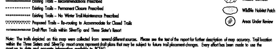
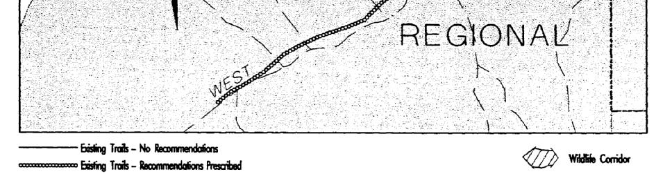
10 Guidelines for the Bow Valley, 1998). It should also be noted that dogs must be on a leash at all times within Wildland and Provincial Parks. Cartpaths located within wildlife corridors and habitat patches on SilverTip and Three Sister s Resort properties are intended for golf course use only and are not intended for public recreational trail use. Exceptions are those that have been identified for cross-country ski use in Three Sisters Resort s Wildlife Human Interaction Prevention Plan. 8.0 Education, Monitoring and Implementation To help ensure compliance, a significant public education effort will have to be undertaken to advise the public of the reasons behind these guidelines and to encourage community support for this initiative. To achieve this end, BCEAG has recommended the creation of a working subcommittee to deal specifically with education and implementation issues. This sub-committee has also been assigned the task of making recommendations on the potential establishment of a corridor wide monitoring program. The sub-committee is expected to begin their task during the summer of Furthermore, BCEAG has taken steps to encourage the development of a community education strategy by a Master s student currently working on her Degree in Education at the University of Calgary. This project is seen as complementary to the work of the aforementioned BCEAG Education, Monitoring and Implementation (EMI) Sub-Committee. 9.0 Trails and Mapping The trails depicted on this map were collected from several different sources between January 1998 and April These include the use of global positioning system surveys, drafted planning documents, ground surveys, and expert opinion. Therefore, the accuracy of the trail information reflects the degree of accuracy of these various methods. Every effort has been made to use the most up to date and accurate information available to BCEAG. An informal, co-operative agreement between the BCEAG HUG working group and the three major developers in the Town of Canmore (Eagle Terrace, SilverTip, and Three Sisters Resorts (TSR) has resulted in the inclusion of those developers most up to date trail information in the HUG trail mapping process. To maintain this agreement both SilverTip and TSR have asked that the trail information they supplied to BCEAG be represented on any maps produced as Draft Plan Trails. The map-reader should be aware these trail placements are general plans and as such, trails may be added or removed, and the location and intended use of trails may change. Furthermore, BCEAG s trail recommendations may be subject to change depending on the developer s needs or agencies concerns. The continuing process of informal trail development within the Bow Valley makes it difficult to cost-effectively map all the trails presently being used. However we believe this series of maps represents the most comprehensive collection of trails data for the Bow Valley to date. It should be noted that this report makes no distinction between primary and secondary corridors. 6
11 10.0 Literature Cited Eastern Slopes Grizzly Bear Project Grizzly Bear Population and Habitat Status in Kananaskis Country, Alberta: A Report to the Department of Environment Protection, Natural Resources Service, Alberta. Prepared by the Eastern Slopes Grizzly Bear Project, University of Calgary, Calgary, Alberta. Jalkotzy, M.G., P.I. Ross, and J. Wierzchowski Cougar habitat use in southwestern Alberta. Prepared for Alberta Conservation Association. Arc Wildlife Services Ltd., Calgary. 32pp. MacArthur, R.A., R.H. Johnson, and V. Geist Factors influencing heart rate in freeranging bighorn sheep: a physiological approach to the study of wildlife harassment. Can. J. Zool. 57(2): Mattson, D Background and Proposed Standards for Managing Grizzly Bear Habitat security in the Yellowstone Ecosystem. Technical Report. Prep for the US Forest Service and the US Fish and Wildlife Service. 18pp Nelson, T.A., and A. Woolf Mortality of white-tailed deer fawns in southern Illinois. J. Wildlife Management. 51(2): Paquet, P., Gibeau, M.L., Herrero, S., Jorgenson, J. and J. Green Wildlife corridors in the Bow River Valley, Alberta. A strategy for maintaining well-distributed, viable populations of wildlife. A report to the Wildlife Corridor Task Force. 37pp. Ward, A.L., J.J. Cupal, G.A. Goodwin, and H.D. Morris Effects of highway construction and use on big game populations. Federal Highway Administration Offices of Research and development. Washington, D.C. Report No. FHWA-RD Weaver, J.L., R.E. Escano and W.S. Winn A framework for assessing cumulative effects on grizzly bears. North American Wildlife and Natural resources Conference. 52: Wilcove D.S., McLellan C.H., and A.P. Dobson Habitat fragmentation in the temperate zone. In M.E. Soule, ed. Conservation Biology: The science of scarcity and diversity. Sinaeur Assoc. Inc. Sunderland, MA. 584pp. Wilcox, B., and Murphy, D Conservation strategy: the effects of fragmentation on extinction. Am. Naturalist Wildlife Corridor and Habitat Patch Guidelines for the Bow Valley Prepared by Alberta Agriculture, Food and Rural Development, Alberta Environmental Protection, Banff National Park, Town of Canmore and Municipal District of Bighorn. 33pp. 7

12 8

13 9

14 10
15 11

16 12

17 13

18 14

19 15

20 16

21 17


22 18


23 19
24 Appendices Appendix 1: Definitions Habitat Patch Habitat patches are areas of land linked together by wildlife corridors. Habitat patches are generally large in area and meet a wider spectrum of habitat requirements (e.g. feeding, breeding, thermal regulation, security, resting) for species expected to live in the valley. Wildlife Corridor Wildlife corridors area areas of land designed to provide connectivity among habitat patches. Wildlife corridors are generally not designed to fulfil any of the requirements of habitat patches other than some elements of security without which animals would not use them. Appendix 2: Mapping Legend Information Circled Area 3 Area that represent constraints on wildlife utilization and movement but on which detailed information to better delineate exact boundaries is lacking. Final delineation of wildlife corridor/habitat patch boundaries will occur after completion of site-specific research, EIA studies and associated development review processes. Circled Area 4 Area which provides a critical link for wildlife moving between the Kananaskis Valley and Banff National Park. More detailed information is currently being gathered to delineate specific wildlife corridor and highway crossing locations. Appendix 3: Acknowledgements These guidelines were prepared with the help and assistance of many individuals from the Municipal District of Bighorn, Town of Canmore, Alberta Environment, Alberta Agriculture, Food and Rural Development and Banff National Park. Steven Hills of Terrapro Incorporated in Prince George, British Columbia kindly donated a digital autocad copy of several GPS, differentially corrected trails in the Bow Valley. This contribution of data greatly improved both the comprehensiveness and accuracy of the trails inventory. Frank Kernick, of Eagle Terrace Developments, Canmore, Alberta provided an AutoCAD file of existing trails on their property. John Third of SilverTip (Stone Creek Properties Inc.) furnished spatial information for their development area. Kara Holt of Three Sisters Resorts supplied a digital draft plan of proposed trails on Three Sister s property. An initial provincial update of the multiple use trails in and around Canmore was completed for this report. We would also like to thank all those individuals who assisted with the trails update by providing their time and expertise to the inventory. Many thanks to: Kristine Bulek, Greg Birch, Don Cockerton, Jim Dennis, Steven Donelon, Steve Gaylor, Sam Hall, Carolyn Harris, Scott Jevons, Jamie Johnson, Jon Jorgenson, Dales Judd, Doug Kielau, Brad Kopp, Niki 20
25 LePage, Mark Lindberg, Greg McAndrews, Glen Naylor, Terry Riva, Pete Smillie, Emily Smith, Rob Wolfe and Fine Zweier. Thanks to all individuals who participated into the information gathering workshops held in June and October of Many of these individuals contributed a great deal towards the inventory and through their overall general knowledge of trails in the area. 21
REGIONAL WILDLIFE CORRIDOR STUDY. Wind Valley/Dead Mans Flats
 REGIONAL WILDLIFE CORRIDOR STUDY Wind Valley/Dead Mans Flats Part II Wildlife Corridor Delineation Prepared for The Wind Valley Wildlife Corridor Committee that includes: Regulatory Agencies Alberta Sustainable
BACKCOUNTRY TRAIL FLOOD REHABILITATION PROGRAM
 BACKCOUNTRY TRAIL FLOOD REHABILITATION PROGRAM Backcountry Trail Flood Rehabilitation A June 2013 Flood Recovery Program Summary In June 2013, parts of Southern Alberta were devastated from significant
Road Ecology Center escholarship Repository John Muir Institute of the Environment University of California, Davis
 Road Ecology Center escholarship Repository John Muir Institute of the Environment University of California, Davis Year Paper Tremblaya Modeling and management of potential movement for elk (Cervus elaphus),
Role of the Protected Area
 Role of the Protected Area Provincial and Regional Context Height of the Rockies and Elk Lakes provincial parks lie in southeastern British Columbia in the Rocky Mountains, about 85 km southwest of Calgary,
Proposal to Redevelop Lower Kananaskis River-Barrier Lake. Bow Valley Provincial Park. Frequently Asked Questions
 Proposal to Redevelop Lower Kananaskis River-Barrier Lake Bow Valley Provincial Park Frequently Asked Questions What is being proposed? What are the details of the proposal? Where is the project area located?
GOLDEN BACKCOUNTRY RECREATION ADVISORY COMMITTEE (GBRAC)
") GOLDEN BACKCOUNTRY RECREATION ADVISORY COMMITTEE (GBRAC) MINUTES from November 1, 2006 Meeting Attending: Sector / Stakeholder GBRAC Commercial Aerial Motorized Sector GBRAC Habitat Protection; Sport Fishing
GOLDEN BACKCOUNTRY RECREATION ADVISORY COMMITTEE (GBRAC) MINUTES from November 1, 2006 Meeting Attending: Sector / Stakeholder GBRAC Commercial Aerial Motorized Sector GBRAC Habitat Protection; Sport Fishing
ANAGEMENT P LAN. February, for Elk Lakes and Height of the Rockies Provincial Parks. Ministry of Environment, Lands and Parks BC Parks Division
 M ANAGEMENT P LAN February, 1999 for Elk Lakes and Height of the Rockies Provincial Parks Ministry of Environment, Lands and Parks BC Parks Division Elk Lakes & Height of the Rockies Provincial Parks M
Planning and Building Department
 Page 1 of Report PB-27/11 CITY OF Burlington Planning and Building Department TO: Chair and Members of the Community Development Committee SUBJECT: Niagara Escarpment Plan Amendment 179 (NEPA 179) Addition
Marchand Provincial Park. Management Plan
 Marchand Provincial Park Management Plan 2 Marchand Provincial Park Table of Contents 1. Introduction... 3 2. Park History... 3 3. Park Attributes... 4 3.1 Natural... 4 3.2 Recreational... 4 3.3 Additional
White Mountain National Forest Saco Ranger District
 United States Department of Agriculture Forest Service White Mountain National Forest Saco Ranger District 33 Kancamagus Highway Conway, NH 03818 Comm: (603) 447-5448 TTY: (603) 447-3121 File Code: 1950
Proposed Action. Payette National Forest Over-Snow Grooming in Valley, Adams and Idaho Counties. United States Department of Agriculture
 United States Department of Agriculture Forest Service January 2012 Proposed Action Payette National Forest Over-Snow Grooming in Valley, Adams and Idaho Counties Payette National Forest Valley, Adams
APPENDIX. Alberta Land Stewardship Act AMENDMENTS TO THE SOUTH SASKATCHEWAN REGIONAL PLAN
 APPENDIX Alberta Land Stewardship Act AMENDMENTS TO THE SOUTH SASKATCHEWAN REGIONAL PLAN 1 All references to Alberta Environment and Sustainable Resource Development, Environment and Sustainable Resource
Proposal to Redevelop Lower Kananaskis River-Barrier Lake. Bow Valley Provincial Park
 Frequently Asked Questions Proposal to Redevelop Lower Kananaskis River-Barrier Lake Bow Valley Provincial Park Frequently Asked Questions What has been decided? What are the details of the plan? What
Planning Wildlife Crossings in Canada's Mountain Parks SESSION: Highway Mitigation: new insights for practitioners
 Planning Wildlife Crossings in Canada's Mountain Parks ID95 SESSION: Highway Mitigation: new insights for practitioners Trevor Kinley, Project Manager Lake Louise Yoho Kootenay Field Unit, Parks Canada
Yard Creek Provincial Park. Management Plan
 Yard Creek Provincial Park Management Plan Draft January 2010 Yard Creek Provincial Park Management Plan Approved by: telàlsemkin/siyam/chief Scott Benton Bill Williams Squamish Executive Director ation
Blueways: Rivers, lakes, or streams with public access for recreation that includes fishing, nature observation, and opportunities for boating.
 Parks, Open Space and Trails PRINCE WILLIAM COUNTY 2008 COMPREHENSIVE PLAN TRAILS PLAN CONTENTS The components of the trails plan are: Intent Definitions Goals, Policies, and Action Strategies Trails Map
A GUIDE TO MANITOBA PROTECTED AREAS & LANDS PROTECTION
 A GUIDE TO MANITOBA PROTECTED AREAS & LANDS PROTECTION Manitoba Wildands December 2008 Discussions about the establishment of protected lands need to be clear about the definition of protection. We will
Preferred Recreation Recommendations Stemilt-Squilchuck Recreation Plan March 2018
 Preferred Recreation Recommendations Stemilt-Squilchuck Recreation Plan March 2018 Below are the recommended recreation ideas and strategies that package together the various recreation concepts compiled
Sawtooth National Forest Fairfield Ranger District
 United States Department of Agriculture Forest Service Sawtooth National Forest Fairfield Ranger District P.O. Box 189 Fairfield, ID. 83327 208-764-3202 Fax: 208-764-3211 File Code: 1950/7700 Date: December
Labrador - Island Transmission Link Target Rare Plant Survey Locations
 27-28- Figure: 36 of 55 29-28- Figure: 37 of 55 29- Figure: 38 of 55 #* Figure: 39 of 55 30- - east side Figure: 40 of 55 31- Figure: 41 of 55 31- Figure: 42 of 55 32- - secondary Figure: 43 of 55 32-
As outlined in the Tatshenshini-Alsek Park Management Agreement, park management will:
 Management Strategy General Strategy The priority management focus for the park is to ensure that its internationally significant natural, cultural heritage and recreational values are protected and that
Three Sisters Campground Redevelopment
 Three Sisters Campground Redevelopment In 2013 heavy rains in southern Alberta caused flooding along the Bow River that resulted in damage to facilities in the Kananaskis Region including the Three Sisters
Jumbo Glacier Resort Master Plan. Appendix 3-K
 Jumbo Glacier Resort Master Plan Appendix 3-K Letter re: Review of M. Austin s Analysis Report: Potential Impacts of the Proposed JGR on the Central Purcell Grizzly Bear Population Prepared by ENKON Environmental
Committee. Presentation Outline
 CW-33-15 11/9/2015 Community and Corporate Services Committee November 10, 2015 1 Presentation Outline Background Vision and Objectives Study Process and Timeline Public and Stakeholder Engagement Organization
SUMMER VILLAGE OF SILVER SANDS. Municipal Development Plan
 SUMMER VILLAGE OF SILVER SANDS Municipal Development Plan Bylaw 253-2014 Adopted August 22, 2014 Summer Village of Silver Sands Municipal Development Plan Bylaw No. 253-2014 Page 2 1 INTRODUCTION 1.1 SETTING
Wilderness Areas Designated by the White Pine County bill
 Wilderness Areas Designated by the White Pine County bill SEC. 321. SHORT TITLE. This subtitle may be cited as the `Pam White Wilderness Act of 2006'. SEC. 322. FINDINGS. Congress finds that-- The White
Private Land Conservation Opportunities in Alberta s Bow Valley
 Private Land Conservation Opportunities in Alberta s Bow Valley Technical Report #9 July 2010 By: Karsten Heuer and Tracy Lee Yellowstone to Yukon Conservation Initiative Technical Report #9 July 2010
Land Management Summary
 photo credit: ANGAIR Anglesea Heath Land Management Summary The Anglesea Heath (6,501 ha) was incorporated into the Great Otway National Park in January 2018. This provides an opportunity to consider the
Rule Governing the Designation and Establishment of All-Terrain Vehicle Use Trails on State Land
 Rule Governing the Designation and Establishment of All-Terrain Vehicle Use Trails on State Land 1.0 Authority 1.1 This rule is promulgated pursuant to 23 V.S.A. 3506. Section 3506 (b)(4) states that an
STAFF REPORT ACTION REQUIRED
 STAFF REPORT ACTION REQUIRED PLANNING AND CONSULTATION PROCESS FOR SECOND EXITS CHESTER STATION UPDATE Date: September 28, 2015 To: From: TTC Board Chief Executive Officer Summary Staff reported to the
Proposed Official Plan Amendment 41 to the Region of York Official Plan
 COMMITTEE OF THE WHOLE NOVEMBER 18, 2002 REGION OF YORK OFFICIAL PLAN AMENDMENT 41 THE OAK RIDGES MORAINE CONSERVATION PLAN Recommendation The Commissioner of Planning recommends: 1. That the City of Vaughan
Appendix 1: Best Management Practices For Hang Gliding and Paragliding in Jasper National Parks
 Appendix 1: Best Management Practices For Hang Gliding and Paragliding in Jasper National Parks Name of Best Management Practice Best Management Practices for Hang Gliding and Paragliding in Jasper National
Establishing a National Urban Park in the Rouge Valley
 STAFF REPORT ACTION REQUIRED Establishing a National Urban Park in the Rouge Valley Date: March 29, 2012 To: From: Wards: Reference Number: Executive Committee Deputy City Manager, Cluster B All p:\2012\cluster
Watchorn Provincial Park. Management Plan
 Watchorn Provincial Park Management Plan 2 Watchorn Provincial Park Table of Contents 1. Introduction... 3 2. Park History... 3 3. Park Attributes... 3 3.1 Natural... 4 3.2 Recreational... 4 3.3 Additional
Fred Antoine Park. Management Plan. Final Public Review Draft
 Fred Antoine Park Management Plan Final Public Review Draft March 2016 Fred Antoine Park Management Plan Approved by: Jeff Leahy Regional Director Thompson Cariboo Region BC Parks Date Brian Bawtinheimer
MUNICIPALITY OF ANCHORAGE
 MUNICIPALITY OF ANCHORAGE ANCHORAGE PARKS & RECREATION Memorandum PRC 08-56 DATE: 5 August 2008 TO: FROM: SUBJECT: Parks & Recreation Commission Holly Spoth-Torres, Park Planner PRC 08-56 Far North Bicentennial
Longmont to Boulder Regional Trail Jay Road Connection DRAFT FINAL REPORT
 Longmont to Boulder Regional Trail Jay Road Connection DRAFT FINAL REPORT December 2018 Project Summary Boulder County, Colorado, in partnership with the City of Boulder, is evaluating options for multi-use
Daisy Dean Trail 628/619 ATV Trail Construction
 Background and Purpose and Need The Daisy Dean ATV Trail Construction Project is located in the Little Belt Mountains, Musselshell Ranger District, Lewis and Clark National Forest approximately 32 miles
April 10, Mark Stiles San Juan Public Lands Center Manager 15 Burnett Court Durango, CO Dear Mark,
 Mark Stiles San Juan Public Lands Center Manager 15 Burnett Court Durango, CO 81301 Dear Mark, We are pleased to offer the following comments on the draft San Juan Public Lands Center management plans
EAST DON TRAIL ENVIRONMENTAL ASSESSMENT. Community Liaison Committee Meeting #3 July 15, :30 to 8:30 pm Flemingdon Park Library
 EAST DON TRAIL ENVIRONMENTAL ASSESSMENT Community Liaison Committee Meeting #3 July 15, 2013 6:30 to 8:30 pm Flemingdon Park Library Agenda 1. Welcome 2. Housekeeping and Updates a) Housekeeping b) CLC
The Corporation of the City of Kawartha Lakes Council Report
 The Corporation of the City of Kawartha Lakes Council Report Report Number ENG2017-008 Date: September 12, 2017 Time: 2:00 p.m. Place: Council Chambers Ward Community Identifier: All Subject: Author Name
Proposal to Redevelop Lower Kananaskis Lake Campgrounds in Peter Lougheed Provincial Park. What We Heard
 Proposal to Redevelop Lower Kananaskis Lake Campgrounds in Peter Lougheed Provincial Park What We Heard In December 2016, Alberta Parks proposed to make several changes to campgrounds in the Lower Kananaskis
Restore and implement protected status that is equivalent, or better than what was lost during the mid-1990 s
 THE ROSSLAND RANGE, OLD GLORY AREA. Executive summary. The Friends of the Rossland Range Society, on behalf of the local outdoor community, seeks to accomplish the following with respect to the Old Glory
Robson Valley Avalanche Tract Mapping Project
 Robson Valley Avalanche Tract Mapping Project Prepared for: Chris Ritchie Ministry of Water Land and Air Protection 325 1011 4th Avenue Prince George, BC. V2L3H9 and Dale Seip Ministry of Forests 1011
Backgrounder Plains Bison Reintroduction to Banff National Park
 Backgrounder Plains Bison Reintroduction to Banff National Park Introduction The five-year reintroduction project is a small- scale initiative that would inform future decisions regarding the feasibility
Parkland County Municipal Development Plan Amendment Acheson Industrial Area Structure Plan
 Parkland County Municipal Development Plan Amendment Acheson Industrial Area Structure Plan New Plan Acheson Industrial Area Structure Plan Amendment Parkland County Municipal Development Plan Board Reference
Bloor Street West Rezoning Application for a Temporary Use By-law Final Report
 STAFF REPORT ACTION REQUIRED 3741 3751 Bloor Street West Rezoning Application for a Temporary Use By-law Final Report Date: June 12, 2007 To: From: Wards: Reference Number: Etobicoke York Community Council
Planning & Building Department
 Page 1 of Report Planning & Building Department To: Subject: Community Development Committee Protecting Escarpment Rural Land (PERL) Proposed Niagara Escarpment Plan Amendment Niagara Escarpment Commission
JOSLIN FIELD, MAGIC VALLEY REGIONAL AIRPORT DECEMBER 2012
 1. Introduction The Federal Aviation Administration (FAA) recommends that airport master plans be updated every 5 years or as necessary to keep them current. The Master Plan for Joslin Field, Magic Valley
Part Three : COMMUNITY PLAN AREAS AND SPECIAL STUDY AREAS SACRAMENTO 2030 GENERAL PLAN. Introduction
 Special study Areas Part Three : COMMUNITY PLAN AREAS AND SPECIAL STUDY AREAS SACRAMENTO 2030 GENERAL PLAN Introduction Beyond the boundaries of the 2030 General Plan, the City has defined Special Study
National Park Service Wilderness Action Plan
 National Park Service U.S. Department of the Interior National Park Service Wilderness Action Plan National Wilderness Steering Committee National Park Service "The mountains can be reached in all seasons.
MANAGEMENT DIRECTION STATEMENT June, 1999
 Thompson River District MANAGEMENT DIRECTION STATEMENT June, 1999 for Roche Lake Provincial Park Ministry of Environment Lands and Parks BC Parks Division Table of Contents I. Introduction A. Setting
Response to the London Heathrow Airport Expansion Public Consultation
 Response to the London Heathrow Airport Expansion Public Consultation Summary This report sets out the response to the Heathrow Airport s consultation on airport expansion and airspace change. The consultation
 March 25, 1994 To: Re: MEMO TO FILE MINOR AMENDMENT - PINERY PROVINCIAL PARK MANAGEMENT PLAN The following paragraph from page 5 of the Pinery Provincial Park Management Plan (ISBN 0-7729-0290-9) lnsects
EXECUTIVE SUMMARY PROGRAM DEVELOPMENT REPORT PURPOSE EXISTING SETTING EXPANDING PARKLAND
 EXECUTIVE SUMMARY PROGRAM DEVELOPMENT REPORT PURPOSE As the culmination of the first phase of the master planning process, this Program Development Report creates the framework to develop the Calero County
2.0 PARK VISION AND ROLES
 2.0 PARK VISION AND ROLES 2.1 Significance in the Protected Area System Marble Range and Edge Hills provincial parks protect 6.8% of the Pavillion Ranges Ecosection, which is located in the Southern Interior
RUSHMORE CONNECTOR TRAIL PROPOSAL
 PURPOSE AND NEED Background The U.S. Forest Service, Black Hills National Forest (Forest Service) has received a special use permit application from the State of South Dakota Department of Game, Fish and
Decision Memo Broken Wheel Ranch Equestrian Outfitter Special-Use Permit Proposed Action
 Decision Memo Broken Wheel Ranch Equestrian Outfitter Special-Use Permit USDA Forest Service Mississippi Bluffs Ranger District, Shawnee National Forest Jackson and Union Counties, Illinois Proposed Action
Final Environmental Impact Statement for the Merced Wild and Scenic River. Comprehensive Management Plan, Yosemite National Park, Madera and Mariposa
 This document is scheduled to be published in the Federal Register on 02/26/2014 and available online at http://federalregister.gov/a/2014-04061, and on FDsys.gov DEPARTMENT OF THE INTERIOR 4312-FF NATIONAL
Keeping Wilderness Wild: Increasing Effectiveness With Limited Resources
 Keeping Wilderness Wild: Increasing Effectiveness With Limited Resources Linda Merigliano Bryan Smith Abstract Wilderness managers are forced to make increasingly difficult decisions about where to focus
CHAPTER 6 NOISE EXPOSURE
 CHAPTER 6 NOISE EXPOSURE FAA requires that the NEM submitted for review represent the aircraft noise exposure for the year of submittal (in this case 2008) and for a future year (2013 for OSUA). However,
National Forests and Grasslands in Texas
 United States Department of Agriculture Forest Service National Forests and Grasslands in Texas Sam Houston NF 394 FM 1375 West New Waverly, Texas 77358 Phone 936-344-6205 Dear Friends, File Code: 1950
Creating a User-Driven Long-Distance OHV Trail Through Partnering
 Joseph Raffaele Outdoor Recreation Planner U.S. Bureau of Land Management Yuma, Arizona Creating a User-Driven Long-Distance OHV Trail Through Partnering BLM is a multiple-use land management agency within
Wilderness Process #NP-1810: Your letter ID is NP September 5, 2018
 Wilderness Process #NP-1810: Your letter ID is NP-1810-2602-96 September 5, 2018 RE: GMUG Wilderness Evaluation Revised Evaluation Criteria and Draft Report Forest Revision Planning Team: The Continental
Course Outline. Part I
 Course Outline Part I Programme Title : All Full-time Undergraduate Programmes Course Title : Conservation and Ecotourism Course code : COC1040 / CSL1013 Department : Science and Environmental Studies
Cascade River State Park Management Plan Amendment
 This document is made available electronically by the Minnesota Legislative Reference Library as part of an ongoing digital archiving project. http://www.leg.state.mn.us/lrl/lrl.asp Cascade River State
KANANASKIS COUNTRY PROVINCIAL RECREATION AREAS MANAGEMENT PLAN DRAFT TERMS OF REFERENCE - November 20, 2007
 KANANASKIS COUNTRY PROVINCIAL RECREATION AREAS MANAGEMENT PLAN DRAFT TERMS OF REFERENCE - November 20, 2007 BACKGROUND There are 42 Provincial Recreation Areas (PRAs) within Kananaskis Country located
Kwadacha Wilderness Provincial Park and Kwadacha Addition (Kwadacha Recreation Area) Purpose Statement and Zoning Plan
 Purpose Statement and Zoning Plan") Kwadacha Wilderness Provincial Park and Kwadacha Addition (Kwadacha Recreation Area) Purpose Statement and Zoning Plan Located in a remote area of the northern interior of BC, this large park straddles
Kwadacha Wilderness Provincial Park and Kwadacha Addition (Kwadacha Recreation Area) Purpose Statement and Zoning Plan Located in a remote area of the northern interior of BC, this large park straddles
Pembina Valley Provincial Park. Draft Management Plan
 Pembina Valley Provincial Park Draft Management Plan 2 Pembina Valley Provincial Park Table of Contents 1. Introduction... 3 2. Park History... 3 3. Park Attributes... 3 3.1 Natural... 3 3.2 Recreational...
YMCA Calgary Camp Chief Hector YMCA Summer Camp. PIONEER 14Y-15Y Midcamp or Gray Jay. PIONEER 14Y HIKE PROGRAM - Midcamp
 PIONEER 14Y-15Y Midcamp or Gray Jay Pioneer campers have many program options to choose from, but all include a chance to make new friends, work as a team, and learn about wilderness camping. All groups
National Wilderness Steering Committee
 National Wilderness Steering Committee Guidance White Paper Number 1 Issue: Cultural Resources and Wilderness Date: November 30, 2002 Introduction to the Issue Two of the purposes of the National Wilderness
RE: Access Fund Comments on Yosemite National Park Wilderness Stewardship Plan, Preliminary Ideas and Concepts
 September 30, 2016 Superintendent Yosemite National Park Attn: Wilderness Stewardship Plan P.O. Box 577 Yosemite, CA 95389 RE: Access Fund Comments on Yosemite National Park Wilderness Stewardship Plan,
QUÉBEC DECLARATION ON ECOTOURISM World Ecotourism Summit Québec City, Canada, 2002
 QUÉBEC DECLARATION ON ECOTOURISM World Ecotourism Summit Québec City, Canada, 2002 The participants at the Summit acknowledge the World Summit on Sustainable Development (WSSD) in Johannesburg, August/September
FILE NO. ANMICALGIC-1
 MUNICIPAL GOVERNMENT BOARD FILE NO. ANMICALGIC-1 IN TEE MATTER OF THE "Municipal Government Act" AND IN THE MATTER OF an application by the City of Calgary, in the Province of Alberta, to annex certain
Port Bruce. Interim Management Statement
 Port Bruce Interim Management Statement Port Bruce Interim Management Statement August 3, 1999 This Port Bruce Provincial Park Interim Management Statement provides direction for the custodial management
Continental Divide National Scenic Trail Legislative History and Planning Guidance
 Continental Divide National Scenic Trail Legislative History and Planning Guidance Legislation, Policy, and Direction Regarding National Scenic Trails The National Trails System Act, P.L. 90-543, was passed
Criddle/Vane Homestead Provincial Park. Management Plan
 Criddle/Vane Homestead Provincial Park Management Plan 2 Criddle/Vane Homestead Provincial Park Table of Contents 1. Introduction... 3 2. Park History.... 3 3. Park Attributes.... 4 3.1 Natural.... 4 3.2
Lake Manyara Elephant Research
 Elephant Volume 1 Issue 4 Article 16 12-15-1980 Lake Manyara Elephant Research Rick Weyerhaeuser World Wildlife Fund - U.S. Follow this and additional works at: https://digitalcommons.wayne.edu/elephant
The Calgary Airport Authority. Parallel Runway Project. Public Consultation Meetings April 30 th, May 2 nd & May 4 th
 The Calgary Airport Authority Parallel Runway Project Public Consultation Meetings April 30 th, May 2 nd & May 4 th 1 Welcome AGENDA The Airport Authority The Project The Environmental Assessment Process
MONTEREY REGIONAL AIRPORT MASTER PLAN TOPICAL QUESTIONS FROM THE PLANNING ADVISORY COMMITTEE AND TOPICAL RESPONSES
 MONTEREY REGIONAL AIRPORT MASTER PLAN TOPICAL QUESTIONS FROM THE PLANNING ADVISORY COMMITTEE AND TOPICAL RESPONSES Recurring topics emerged in some of the comments and questions raised by members of the
MARBLE RIVER PROVINCIAL PARK
 MARBLE RIVER PROVINCIAL PARK PURPOSE STATEMENT AND ZONING PLAN March 2003 MARBLE RIVER PROVINCIAL PARK Purpose Statement and Zoning Plan Primary Role The primary role of Marble River Park is to protect
PURPOSE AND NEED. Introduction
 Public Scoping: Allocation of Recreation Capacity for Commercial Outfitter Guide Services on North Kruzof Island Trails (Kruzof Island Outfitter Guide) PURPOSE AND NEED Introduction The U.S. Department
Asia Pacific Regional Aviation Safety Team
 International Civil Aviation Organization (ICAO) Regional Aviation Safety Group (Asia & Pacific Regions) Asia Pacific Regional Aviation Safety Team GUIDANCE FOR AIR OPERATORS IN ESTABLISHING A FLIGHT SAFETY
Response to Public Comments
 Appendix D Response to Public Comments Comment Letter # Response 1, 2, 3, 4, 5, 7, 8, 9, 10, 11, 12, 13, 14, 15, 16, 17, 18, 19, 20, 22, 23, 24, 25, 26, 27, 29, 30, 31, 32, 33, 34, 35, 36, 37, 38, 39,
Comparison Between Old and New ALUC Plans
 A P P E N I X H Comparison Between Old and New ALUC Plans OVERVIEW This Placer County Airport Land Use Compatibility Plan (ALUCP) sets forth land use compatibility criteria for the environs of Auburn Municipal,
Lake Tahoe Shoreline Plan 03 Policy Topic: Access Issues
 Lake Tahoe Shoreline Plan 03 Policy Topic: Access Issues V9 Last Updated 03.10.2017 1 Brief Description Physical access to the waters of Lake Tahoe is one of the key issues surrounding the Shoreline Plan
Steps in the Management Planning Process
 Steps in the Management Planning Process Developing a management plan for Kalamalka Lake Park will follow a multi-stage process. The planning process for this park is currently in the Draft Management
RECREATION. Seven issues were identified that pertain to the effects of travel management on outdoor recreation within portions of the project area.
 RECREATION Seven issues were identified that pertain to the effects of travel management on outdoor recreation within portions of the project area. OPPORTUNITIES FOR SOLITUDE / QUIET TRAILS. One attraction
AURORA WILDLIFE RESEARCH
 AURORA WILDLIFE RESEARCH Kim Poole 2305 Annable Rd. Nelson, BC, V1L 6K4 Canada Tel: (250) 825-4063; Fax: (250) 825-4073 e-mail: klpoole@shaw.ca 27 April 2005 Mike Gall Conservation Specialist and Glenn
The following criteria were used to identify Benchmark Areas:
 7.0 BENCHMARK AREAS The Churn Creek Protected Area offers a significant opportunity to learn more about how grassland ecosystems function. One of the key tools that will be used to monitor larger grassland
Aviation Rulemaking Advisory Committee; Transport Airplane and Engine Issues; New Task
 This document is scheduled to be published in the Federal Register on 06/04/2015 and available online at http://federalregister.gov/a/2015-13542, and on FDsys.gov 4910-13P DEPARTMENT OF TRANSPORTATION
Trail # NW Tuesday, June DESIGN. Provide an Review the Provide an. Project Goals: System system. wayfinding
 I. Welcome / Introductions Bethany Creek Trail #2 Segment 3 Neighborhood Meeting #1 Bethany Presbyterian Church 15505 NW Springville Road, Portland, OR 97229 Tuesday, June 26, 2018 @ 6:00PM Meeting Minutes
1 INFORMATION REQUIREMENTS
 1 INFORMATION REQUIREMENTS 1.1 BACKGROUND 2 1.2 WHAT IS THE DISTRICT PLAN 3 1.3 DISTRICT PLAN STRUCTURE 4 1.4 HOW TO USE THE DISTRICT PLAN 5 1.5 STRATEGIC FRAMEWORK 6 Whanganui District Plan (15 January
Recommendations on Consultation and Transparency
 Recommendations on Consultation and Transparency Background The goal of the Aviation Strategy is to strengthen the competitiveness and sustainability of the entire EU air transport value network. Tackling
Classifications, Inventory and Level of Service
 Classifications, Inventory and Level of Service Section 3 Kenmore Park, Recreation and Open Space Plan 1 P a g e Classifications and Inventory Park Classifications Kenmore classifies its parks based upon
A Master Plan is one of the most important documents that can be prepared by an Airport.
 The Master Plan A Master Plan is one of the most important documents that can be prepared by an Airport. A Master Plan is a visionary and a strategic document detailing planning initiatives for the Airport
2016 Regional Transportation Alternatives Program (TAP) Grant Application
 Grant Application") 2016 Regional Transportation Alternatives Program (TAP) Grant Application PROJECT TITLE: Yelm-Tenino Trail Extension Feasibility Study TRPC use only GENERAL PROJECT INFORMATION Agency or Organization City
2016 Regional Transportation Alternatives Program (TAP) Grant Application PROJECT TITLE: Yelm-Tenino Trail Extension Feasibility Study TRPC use only GENERAL PROJECT INFORMATION Agency or Organization City
REPORT 2014/065 INTERNAL AUDIT DIVISION. Audit of air operations in the United. Nations Assistance Mission in Afghanistan
 INTERNAL AUDIT DIVISION REPORT 2014/065 Audit of air operations in the United Nations Assistance Mission in Afghanistan Overall results relating to the effective management of air operations in the United
THE NATIONAL ACADEMIES PRESS
 THE NATIONAL ACADEMIES PRESS This PDF is available at http://nap.edu/24791 SHARE NextGen for Airports, Volume 5: Airport Planning and Development DETAILS 84 pages 8.5 x 11 PAPERBACK ISBN 978-0-309-44631-0
Prior to contacting the Whitecourt Trailblazers Snowmobile Club, applicants must:
 WHITECOURT TRAILBLAZERS Box 607 Whitecourt, AB T7S 1N7 www.whitecourttrailblazers.ca CNT AMENDMENT Restriction Code 710: See Comments Comments All applicants are required to contact: Whitecourt Trailblazers