Rural Settlement Change in East Suffolk,
|
|
|
- Gervase Perkins
- 5 years ago
- Views:
Transcription
1 Rural Settlement Change in East Suffolk, Peppy Macdonald Degree of Doctor of Philosophy August 2017 University of East Anglia School of History This copy of the thesis has been supplied on condition that anyone who consults it is understood to recognise that its copyright rests with the author and that use of any information derived there from must be in accordance with current UK Copyright Law. In addition, any quotation or extract must include full attribution. I confirm that the submitted work is entirely original, and that quotes and references are attributed as applicable.
2 Abstract Rural Settlement Change in East Suffolk, The purpose of this thesis is to examine changes in rural settlement in eastern Suffolk over the period of study. England became a largely urban nation in the second half of the nineteenth century, and although east Suffolk remained essentially rural, there was even here a trend towards the urban. In 1851 forty-three percent of the population lived in rural parishes; by 1931 it was nineteen per cent. The population, over the same period, rose from 121,652 to 231,295. Despite the slow decline in the importance of agriculture as an employer, exacerbated by severe agricultural depression from the late nineteenth century, this was population redistribution rather than depopulation. A range of influences and their impact on rural settlement are discussed, including the effects of soil type, land ownership patterns (particularly regarding open and close parishes) and developments in transport infrastructure - the railway in the second half of the nineteenth century, the motor car in the twentieth. Improved transport, together with other social and economic changes led to a significant expansion of coastal resorts, and, even in this essentially rural area, a degree of suburbanisation on the fringes of towns. Land ownership remained surprisingly important throughout the period, despite the gradual erosion of landowners power by increasing state intervention in the management of the rural landscape. The period following the First World War saw major changes in the character of housing provision, and thus in the population and appearance of many villages and hamlets. While the landscape of rural Suffolk has ancient roots, many of its key features were forged in the period between the mid nineteenth century, and the middle decades of the twentieth. Only by appreciating the complexity of relatively recent developments can the character of rural settlements, here and in other areas, be fully understood. 2
3 Contents Abstract - 2 Contents 3 List of Illustrations 5 List of Tables 9 Acknowledgements 10 Abbreviations 10 Chapter 1: Society, Economy and Demographic Development in East Suffolk, Introduction 11 Nineteenth century context 18 Late nineteenth century 30 Change in the twentieth century 33 East Suffolk: landscape and demography 38 Chapter 2: Sources and approaches 49 Primary source material 71 Chapter 3: Estate Landscapes: the old order Introduction 76 Open and Close villages 77 Henham and Sudbourne 82 Other estates: Rendlesham, Benacre and Orwell Park 104 Somerleyton and Bawdsey 106 Population comparisons 115 Conclusion 122 Chapter 4: The New Order: planning and bureaucracy Introduction 124 Motor transport 124 Private house building 130 Council housing 136 Council housing in East Suffolk 140 Conclusion 166 Chapter 5: The Development of Seaside Resorts Introduction 168 Context 168 Aldeburgh 169 Southwold 180 Walberswick 200 Felixstowe 202 Thorpeness 220 Representation 230 Conclusion 239 3
4 Chapter 6: Suburbanisation in East Suffolk Introduction 242 Suburbanisation in context 244 Transport 248 Council Housing 250 Interwar suburbs 252 Residential development in East Suffolk 255 Ipswich 256 Kesgrave and Martlesham 274 Woodbridge 282 Melton 291 Lowestoft 293 Conclusion 293 Chapter 7: Conclusion 296 Bibliography 302 Appendix Appendix Appendix Appendix
5 List of illustrations Page Figure 1 Parish map, showing area of study 13 Figure 2 Map showing railway network 22 Figure 3 Map showing distribution of estates 28 Figure 4 Graph showing percentage population change according to soil type from Figure 5 Graph showing average population densities for each soil type from Figure 6 Graph showing population change in open and close villages 43 Figure 7 Chart showing population distribution in Figure 8 Chart showing population distribution in Figure 9 Lord Ullswater s cottages at Tunstall, taken from the sales particulars for the Ullswater Estate, 9 th November, Figure 10 Part of map of Henham Hall estate originally drawn up In Figure 11 Detail of Rustic Lodge, Sudbourne 88 Figure 12 Smoky House, Sudbourne 88 Figure 13 Estate cottages in Orford 95 Figure 14 White Lodge, Sudbourne 97 Figure 15 picturesque cottage, Sudbourne 98 Figure 16 Traced detail from Tithe map for Somerleyton, Figure 17 Detail of OS map Somerleyton. County Series,1 st edition, 1884, 1: Figure 18 Lithograph of cottages at Blaise Hamlet, 1826, James Duffield Harding, Library, University of Bristol 111 Figure 19 Architect s drawing, (1965) of cottage at Somerleyton, Alfred Savill & Sons, Norwich 111 Figure 20 Row of estate cottages, Bawdsey 114 Figure 21 Semi-detached cottages, Bawdsey 115 Figure 22 Graph showing population change in parishes associated with Henham estate 116 Figure 23 Graph showing aggregate population change in parishes associated with Henham estate 116 Figure 24 Graph showing population change in parishes associated with Sudbourne estate 117 Figure 25 Graph showing aggregate population change in parishes associated with Sudbourne estate 117 Figure 26 Graph showing population change in parishes associated with Rendlesham estate 118 Figure 27 Graph showing aggregate population change in parishes associated with Rendlesham estate 118 Figure 28 Graph showing population change in parishes associated with Benacre estate 119 5
6 Figure 29 Graph showing aggregate population change in parishes associated with Benacre estate 119 Figure 30 Graph showing population change in parishes associated with Orwell Park estate 120 Figure 31 Graph showing aggregate population change in parishes associated with Orwell Park estate 120 Figure 32 Graph showing population change in parishes associated with Somerleyton estate 121 Figure 33 Graph showing aggregate population change in parishes associated with Somerleyton estate 121 Figure 34 Graph showing population fluctuation at Bawdsey, Figure 35 Eastern Counties Road Car Company, route map, July Figure 36 Forbes Glennie s drawing of proposed council houses at Thorpeness 158 Figure 37 Council houses at Thorpeness 159 Figure 38 A. Hipperson, drawing of non-parlour Type A council houses for Blyth RDC 160 Figure 39 Council houses at Wrentham, Blyth RDC 161 Figure 40 Council houses at Top Road, Hasketon 162 Figure 41 Council houses at Holly Lane, Little Bealings 162 Figure 42 Garrett House, Aldeburgh 173 Figure 43 Dunan House, Aldeburgh 173 Figure 44 Plan of proposed building plots accompanying the sales particulars for Crespigny Estate, Aldeburgh, Figure 45 Detail of OS map Aldeburgh, County Series, 1 st revision 1904, 1:2500, showing new building on what was Crespigny estate land 176 Figure 46 Detail of OS map, Aldeburgh, County Series, 2 nd revision, 1928, 1:10560, showing further building development 179 Figure 47 Detail of OS map Southwold, County Series, 1 st edition, 1884, 1: Figure 48 Detail of OS map Southwold, County Series, 1 st revision, 1905, 1: Figure 49 Sea facing houses on North Parade 185 Figure 50 Plan accompanying sales particulars for Town Farm Figure 51 Estate, Southwold, Detail of OS map Southwold, County Series, 2nd revision, 1927, 1: Figure s semi-detached houses, Pier Avenue 195 Figure 53 Arts & Crafts inspired house, Pier Avenue 196 Figure 54 workmen s dwellings, St Edmund s Road 197 Figure 55 Figure 56 Figure 57 Detail of Conservative Land Association plan for building development, c Detail of OS map Felixstowe, County Series, 1 st revision, 1903, 1: Eastward Ho Estate taken from In and Around Victorian Felixstowe, photograph No 7 (1883) 210 6
7 Figure 58 Eastward Ho Estate taken from In and Around Victorian Felixstowe:, photograph No 8 (1887) 211 Figure 59 Eastward Ho Estate taken from In and Around Victorian Felixstowe, photograph No 9 (1897) 212 Figure 60 Kilgarth Court, Wolsey Gardens, Felixstowe 217 Figure 61 Beach Road East, Felixstowe 218 Figure 62 Tomline Road, Felixstowe 219 Figure 63 Detail of OS map Thorpeness, County Series, 1 st revision, 1905, 1: Figure 64 Benthills 224 Figure 65 Tulip Cot 224 Figure 66 Lakeside bungalows 225 Figure 67 Westgate 225 Figure 68 Figure 69 Figure 70 Figure 71 Plan of Thorpeness and the Meare taken from Kemp, Concerning Thorpeness, facing p Edwin Hayes, Southwold, oil on board, 17.8 x 28cm, private collection 231 Philip Wilson Steer, Southwold, c1889, Oil on canvas, 50 x 61cm, Tate Gallery 232 Thomas Smythe, Felixstowe, oil on canvas, 22.8x29.8cm, private collection 233 Figure 72 Felixstowe postcard, view of Felix Hotel, Figure 73 Felixstowe postcard, Grand Hotel, Figure 74 postcard, Crag Path and beach, Aldeburgh, Figure 75 Eric Ravilious, Bathing machines, Aldeburgh, 1938, watercolour and pencil on paper, 41x52cm, Daniel Katz Gallery 235 Figure 76 postcard, beach and North Parade, Southwold, Figure 77 postcard, North beach and pier, Southwold, c1920s 236 Figure 78 Detail of OS map Ipswich, County Series, 1 st edition, 1887, 1: Figure 79 Detail of OS map Ipswich, County Series, 1 st revision, 1905, 1: Figure 80 Detail of OS map Ipswich, County Series, 2 nd Revision, 1928, 1: Figure 81 Detail of OS map Ipswich, County Series, 1 st edition, 1884, 1: Figure 82 Detail of OS map Ipswich, County Series, 1 st revision, 1904, 1: Figure 83 Detail of OS map Ipswich, County Series, 2 nd revision, 1927, 1: Figure 84 Detail of OS map Ipswich, County Series, 2 nd revision, 1928, 1: Figure 85 Detail of OS map Ipswich, County Series, 3rd revision, 1938, 1: Figure 86 Leopold Road showing suburban streetscape 272 Figure 87 Figure 88 Detail of OS map Kesgrave, County Series, 2 nd revision, 1928, 1: Detail of OS map Kesgrave, County Series, 3 rd revision, 1938, 1:
8 Figure 89 Plan accompanying sales particulars for building land in Kesgrave 278 Figure 90 Deben Avenue, Kesgrave 280 Figure 91 Detail of OS map Woodbridge, County Series, 1 st revision, 1904, 1: Figure 92 Detail of OS map Woodbridge, County Series, 2 nd revision, 1927, 1:
9 List of tables Where relevant, minus figures are shown in italics Page Table 1 Key to parish map 14 Table 2 Showing relative population figures for the whole of Suffolk and for the eastern part of Suffolk 39 Table 3 Showing relative population figures for East Suffolk excluding Ipswich 39 Table 4 Showing relative population figures for Ipswich 40 Table 5 Showing comparison of population change in seaside resorts 46 Table 6 Showing relative population figures for Suffolk and West Suffolk 48 Table 7 Transcription of list of tenants with comparative rents, 1877, 1892, Table 8 Showing population change in parishes associated with the Henham estate 94 Table 9 Showing number of inhabited houses in parishes associated with the Henham and Sudbourne estates between 1901 and Table 10 Showing the results of the Housing Survey 1919 for Woodbridge RDC 141/142 Table 11 Showing number of completed council houses for Woodbridge RDC, confirmed February Table 12 Showing slum clearance and new housing under the 1936 Housing Act 148 Table 13 Register of new dwellings provided with Exchequer Assistance 150 Table 14 Showing overall status of demolition of cottages and Council house building between 1919 and Table 15 Showing Certificates of Completion for council housing built by Blyth RDC under Housing Acts of 1923 and Table 16 Showing Register of New Houses provided for the Agricultural population by Blyth RDC under the Housing (Financial Provisions) Act 1938, Section (2) (3). 156 Table 17 Showing change in population in parishes associated with suburban growth 244 9
10 Acknowledgements Firstly, I would like to thank my supervisor, Professor Tom Williamson, for his interest in my subject and his unfailing advice and support throughout the period of my research. I am indebted to the staff of the libraries and archives I have used for their patience and help in locating material, especially the Suffolk Record Office where I almost took up residence, and the Warwickshire County Record Office who hold the archives of the family of the Marquess of Hertford, sometime owners of Sudbourne Hall. My thanks also go to the National Archives and especially to Glen Ogilvie for his generosity in giving me free access to his family archives concerning Thorpeness. My thanks also go to my good friend Caroline Palmer for her continuing support, and for her help in reading draft chapters and offering comments, criticisms and pointing out errors. Lastly, I could not have completed my thesis without the love, patience and forbearance of my husband, Nick Fowler. Abbreviations BPP CDC CPRE EADT ECRCC ESCC ISFLS ITM LGB NA NRO OS RDC SFWI SROI SROL UDC WI WRO British Parliamentary Papers Coast Development Company Council for the Preservation of Rural England East Anglian Daily Times Eastern Counties Road Car Company East Suffolk County Council Ipswich & Suffolk Freehold Land Society Ipswich Transport Museum Local Government Board National Archives Norfolk Record Office Ordnance Survey Rural District Council Suffolk Federation of Women s Institutes Suffolk Record Office, Ipswich Suffolk Record Office, Lowestoft Urban District Council Women s Institute Warwick Record Office 10
11 CHAPTER 1 Society, Economy and Demographic Development in East Suffolk, Introduction The purpose of this thesis is to explore the evolution of settlement in the rural parts of east Suffolk between 1850 and 1939: the term east Suffolk being used to describe an area defined by the ancient units of hundreds, rather than the administrative county of East Suffolk, formally recognised under the Local Government Act of A full list of the parishes examined is given below. While the primary focus is on rural villages, the study also embraces various forms of suburban development on the fringes of towns and along the coast. In both national and regional terms this was a period of population growth, but at a local level the development of rural settlement was complex, influenced by a variety of factors. These included the development of transport networks, patterns of land ownership and variations in the character of the local economy. For much of the period studied, agriculture was in a state of depression, but at the same time changes in the distribution of wealth and the availability of leisure time led to an expansion of the holiday industry, while the growth of major towns like Ipswich influenced the character of surrounding villages. The thesis will examine the interaction and relative importance of all these factors on the built environment of the area in the period from the mid nineteenth century to the outbreak of the Second World War. Although the modern county of Suffolk is a single entity and has been for several centuries, West Suffolk in the middle ages enjoyed a degree of autonomy under the Liberty of Bury St Edmunds. 1 In the nineteenth century the division of Suffolk into two separate counties, East and West, was regularised under the Local Government Bill of In 1 Thomas, G., 'Local Government since 1872', in Dymond, D. and Martin, E., (1999), An Historical Atlas of Suffolk, Ipswich, Suffolk County Council, pp28-29, (p28). 11
12 terms of nineteenth century development East Suffolk, of which the study area is a part, presents a greater contrast in terms of economy and social structure than West Suffolk. Ipswich was not only the largest town in the county but also an important trading port, and the coastline of East Suffolk offered trade as well as development opportunities for the new fashion of sea bathing. West Suffolk on the other hand suffered more depopulation in the one hundred years between 1851 and 1951, caused in part by the lack of urban growth when compared with East Suffolk, and it remained more dependent on agriculture as the basis for its economy. The study area comprises the hundreds of Mutford and Lothingland, Blything, Plomesgate, Wilford, and Colneis, all of which include coastal parishes, together with the inland hundreds of Carlford and Loes, see the parish map at Figure 1. The parish of Kenton is omitted, being historically detached from the bulk of Loes Hundred; conversely, the parishes of Kelsale and Carlton, later to be combined to form the larger parish of Kelsale cum Carlton, are included although historically they were detached parishes of Hoxne Hundred. In modern terms this does, in fact, equate to the greater part of the current Suffolk Coastal District Council together with the largely coastal parishes of Waveney District Council. Lowestoft will not be examined in detail. It is included in the study because it played an important part in the development of east Suffolk, but since it was both fishing port and seaside resort there is not sufficient space here to do it justice. Under the Local Government Bill of 1888 Ipswich gained independence as a county borough with a population just above the 50,000 qualifying mark. The Public Health Act of 1872 abolished Poor Law Unions and replaced them with Rural Sanitary Authorities; following further reorganisation in 1894, all urban Sanitary Authorities became Urban Districts, and rural Sanitary Authorities became Rural Districts. Minor boundary changes made under the Local Government Act of 1929 are dealt with in the following analysis of population changes. 2 2 Ibid, p28. 12

, An Historical Atlas of Suffolk, Ipswich, Suffolk County")
13 Figure 1: map showing the area studied, adapted from map of County of Suffolk 19 th Century taken from An Historical Atlas of Suffolk. 3 See key for parish names 3 Dymond, D. and Martin, E., (1999), An Historical Atlas of Suffolk, Ipswich, Suffolk County Council, inserted map. 13
14 No Parish No Parish No Parish No Parish 1 Aldeburgh 46 Culpho 91 Kettleburgh 136 Stoven 2 Alderton 47 Dallinghoo 92 Kirkley 137 Stratford St A 3 Ald m/thorpe 48 Darsham 93 Kirton 138 Stratton Hall 4 Alnesbourn Pr 49 Debach 94 Knodishall 139 Sudbourne 5 Ashby 50 Dunwich 95 Leiston 140 Sutton 6 Barnby 51 Earl Soham 96 Letheringham 141 Sweffling 7 Bawdsey 52 Easton 97 Levington 142 Theberton 8 Bealings (Gt) 53 Easton Bavents 98 Linstead M 143 Thorington 9 Bealings (Lt) 54 Eyke 99 Linstead P 144 Trimley St Martin 10 Belton 55 Falkenham 100 Lound 145 Trimley St Mary 11 Benacre 56 Farnham 101 Lowestoft 146 Tuddenham St M 12 Benhall 57 Felixstowe 102 Marlesford 147 Tunstall 13 Blaxhall 58 Flixton 103 Martlesham 148 Ubbeston 14 Blundeston 59 Foxhall 104 Melton 149 Ufford 15 Blythburgh 60 Framlingham 105 Middleton 150 Uggeshall 16 Blyford 61 Friston 106 Monewden 151 Walberswick 17 Boulge 62 Fritton 107 Mutford 152 Waldringfield 18 Boyton 63 Frostenden 108 Nacton 153 Walpole 19 Bradwell 64 Gedgrave 109 Newbourn 154 Walton 20 Bramfield 65 Gisleham 110 Orford 155 Wangford 21 Brampton 66 Lt Glemham 111 Otley 156 Wantisden 22 Brandeston 67 Gt Glemham 112 Oulton 157 Wenhaston/Mells 23 Bredfield 68 Gorleston 113 Oulton Broad 158 Westerfield 24 Brightwell 69 Grundisburgh 114 Pakefield 159 Westhall 25 Bromeswell 70 Gunton 115 Parham 160 Westleton 26 Bruisyard 71 Hacheston 116 Peasenhall 161 Wickham Market 27 Bucklesham 72 Halesworth 117 Pettistree 162 Wissett 28 Burgh 73 Haselwood 118 Playford 163 Witnesham 29 Burgh Castle 74 Hasketon 119 Purdis Farm 164 Woodbridge 30 Butley 75 Havergate 120 Ramsholt 165 Wrentham 31 Campsea Ash 76 Hemley 121 Rendham 166 Yoxford 32 Capel St A 77 Henham 122 Rendlesham 33 Carlton 78 Henstead 123 Reydon 34 Carlton Col 79 Herringfleet 124 Rumburgh 35 Charsfield 80 Heveningham 125 Rushmere 36 Chediston 81 Hollesley 126 Rushmere St A 37 Chillesford 82 Holton 127 Saxmundham 38 Clopton 83 Hoo 128 Shottisham 39 Cookley 84 Hopton 129 Sibton 40 Corton 85 Huntingfield 130 Snape 41 Cove (South) 86 Iken 131 Somerleyton 42 Covehithe 87 Ipswich 132 Sotherton 43 Cransford 88 Kelsale 133 Southwold 44 Cratfield 89 Kesgrave 134 Spexhall 45 Cretingham 90 Kessingland 135 Sternfield Table 1: Key to parish map 14
15 Ipswich expanded rapidly in the later nineteenth century; Lowestoft also grew, both as an important fishing port and as a seaside resort. The largest among several market towns was Woodbridge, with a population in 1851 of 5,161 falling to 4,734 in Of the other four market towns, Framlingham, Halesworth, Saxmundham and Wickham Market, only Halesworth had a population greater than 2,500 in 1851 (2,662), and only Saxmundham showed an overall increase in population over the whole period, of nearly twenty-two per cent. In contrast, the coastal towns of Southwold, Aldeburgh and Felixstowe expanded, reflecting their growing popularity as holiday and seaside resorts. As noted above, this thesis interprets the term rural settlement widely. The area under discussion encompasses not only the rural landscape of villages, hamlets and farmsteads, but also that land surrounding towns which in 1850 was rural but which by 1939 was developed; thus, the enquiry which follows includes an element of urban growth, particularly concerning Ipswich and coastal settlements. Although Ipswich and the coastal resorts of Aldeburgh and Southwold were already well established urban centres by 1850, they were all subject to extensive development in the following one hundred years. Much of this development took place on rural land, some of it farm land, and furthermore, development in these towns, and the development of Felixstowe, had implications for changes in rural settlement outside their boundaries; for this reason elements of the development of these towns are included here. The term rural clearly implies not urban, but definitions of rural have tended to be imprecise. For some the definition of an urban settlement is one with a maximum of 2,500 people. 4 The General Report accompanying Vol. IV of the 1881 census states that The urban population [ ] consists of the inhabitants of the chief towns and their immediate neighbourhood, while the rural population includes the inhabitants of the smaller towns as well as of the strictly country parishes. 5 4 Higgs, E., ( ), Rural/urban definitions, November 18, 2014, yes&mno= ( ), Census of 1881 England and Wales, Vol IV, General Report, January 16, 2013, 15
16 Whatever criteria are used, settlement patterns in east Suffolk, with the caveat outlined above, remained essentially rural throughout the period. Soils are an important factor in a primarily agricultural area, and East Suffolk is divided into two main soil types. To the east of the Ipswich to Lowestoft railway line lie sandy soils of the Newport Association, varying from the very acidic Newport 4 to the less acidic Newport 2, with a variety of wet alluvial soils in the coastal and river marshes. Traditionally this area included extensive tracts of heathland, although much of this was reclaimed during the late eighteenth and nineteenth centuries, using the underlying crag to neutralise acidity; carrots as well as wheat and barley were grown here. 6 The coastal marshes provided valuable grazing for fattening bullocks and for sheep. In the inland parishes to the west the soils are mainly derived from boulder clay: the heavy, poorly-draining soils of the Beccles and Ragdale Association, which Arthur Young referred to as strong loam. At the two extremes of the area, on the Felixstowe peninsula in the south and to the north of Lowestoft, there are areas of sandy loam, Young s rich loam. 7 On the heavy claylands farming changed in the decades either side of 1800, as already noted, from dairying to predominately arable cultivation, wheat being the main crop. Primary communication routes in east Suffolk run north to south, parallel to the coast, with almost no major roads running east-west. The road route, turnpiked in 1785, and the railway, opened in the 1850s, between Ipswich and Lowestoft follow essentially the same line, neatly demarcating the major soil divisions of the area. The Ordnance Survey Revised New Series of maps, printed at the end of the nineteenth century, show clearly how main roads radiated from Ipswich, and Patrick Abercrombie, writing in 1935, noted the proliferation of very minor roads, connecting villages, very often by indirect routes. 8 6 Thirsk, J. and Imray, J., (1958), Suffolk Farming in the Nineteenth Century, Ipswich, Suffolk Records Society, pp Martin, E., 'Soil Regions', in Dymond, D. and Martin, E., (1999), An Historical Atlas of Suffolk, Ipswich, Suffolk County Council, pp20-21, (p20); Butcher, R. W., (1941), The Land of Britain, the Report of the Land Utilisation Survey of Britain: Parts Suffolk (East and West), London, Geographical Publications, p316; see also Watson, P., (2008), Landscape Typology, July 9, 2010, for detailed description of the various landscape types in Suffolk. 8 Abercrombie, P. and Kelly, S., (1935), East Suffolk Regional Planning Scheme, Liverpool, University Press of Liverpool, p33. 16
17 The changes which took place in the Suffolk landscape after the mid-nineteenth century cannot be understood without some idea of the processes which led to the very form of that landscape as it was in While the development of rural settlement in England during the relatively recent past has been somewhat neglected by landscape historians, much research has been carried out on the genesis of rural settlement in the middle ages, especially on the origins, expansion and contraction of medieval villages and hamlets, 9 and although historians have posited a number of different models for the early development of settlement, there is general agreement that in the medieval period Suffolk was among the most densely populated areas in England. 10 By the thirteenth century early settlements along river valleys had become loosely integrated polyfocal villages rather than closely nucleated sites, and beyond the valleys there were numerous hamlets and isolated farmsteads. On the claylands of High Suffolk Warner has discussed the presence of greens, commons and greenside settlement, and examined the evolution of such settlements in the medieval period. 11 The presence of isolated churches associated with a manor house in a number of clayland parishes has been attributed to the Late Saxon pattern of private churches attached to a hall. 12 However, villages on Suffolk s heavy claylands did not dwindle away as happened in other parts of lowland England in the fifteenth and sixteenth centuries. 13 Bailey states that By c.1300 the settlement pattern of Suffolk had acquired many of its distinguishing modern characteristics: looseknit centres of primary settlement along river valleys, with scatterings of isolated farmsteads and greenside hamlets on the interfluves and around upland parish boundaries See Jones, R. and Page, M., (2006), Medieval Villages in an English Landscape, Beginnings and Ends, Macclesfield, Windgather Press; Roberts, B. K. and Wrathmell, S., (2002), Region and place : a study of English rural settlement, London, English Heritage. 10 Jones, R. and Page, M., (2006), Medieval Villages in an English Landscape, pp81-82; Bailey, M., (2007), Medieval Suffolk, an economic and social history, , Woodbridge, Boydell Press, p67. See also Roberts, B. K. and Wrathmell, S., (2002), Region and place : a study of English rural settlement, p Warner, P., (1987), Greens, Commons and Clayland Colonization: The Origins and Development of Green-side Settlement in East Suffolk, Leicester, Leicester University Press, pp1-2 and pp Martin, E. (2000), 'Rural Settlement Patterns in Medieval Suffolk', Medieval Settlement Research Group, 15, Williamson, T., (2006), East Anglia, London, Harper Collins, pp Bailey, M., (2007), Medieval Suffolk, p71. 17
18 In his archaeological survey of a 130 square kilometre block of land surrounding the Sutton Hoo site on the river Deben, in the coastal sands area, Newman has uncovered evidence of early settlement close to parish churches, and ample evidence of high population density; 15 and Williamson has demonstrated that in the coastal area of poor sandy soils, to the east of the modern A12 road, the earlier pattern of dispersed settlement gave way to an increase in nucleated settlements during the course of the seventeenth, eighteenth and nineteenth centuries. 16 However, in this area there were still scattered farmsteads and hamlets. Nineteenth century context It is impossible to examine the development of settlement without some understanding of the economic situation at the start of the period. Agriculture had for centuries been the driving force of the economy of Suffolk, and its pre-eminence in the seventeenth and eighteenth centuries when Suffolk farmers had been at the forefront of agricultural improvements has been described by Thirsk and Imray: the use of roots as feed for dairy cattle was pioneered in Suffolk as early as the 1660s and hollow draining, practised here in the 1740s, became more widespread in the early nineteenth century. 17 By 1800 agricultural techniques in the county were ahead of other counties in the Midlands and methods new elsewhere were commonplace in Suffolk. 18 Against this background of agricultural expertise, farming was undergoing radical changes. Since the fifteenth century Suffolk had been a dairying county, especially in the heavy claylands of the central area where the land was broken up into comparatively small farms. 19 Towards the end of the eighteenth century, however, as part of the drive for improvement, large tracts of land were 15 Newman, J. (2000), 'A landscape of dispersed settlement - change and growth in south east Suffolk', Medieval Settlement Research Group, 15, 7-8, pp Williamson, T., (2005), Sandlands: The Suffolk Coasts and Heaths, Macclesfield, Cheshire, Windgather Press, p Thirsk, J. and Imray, J., (1958), Suffolk Farming in the Nineteenth Century, pp Ibid, p Wade Martins, S. and Williamson, T., (2008), The Countryside of East Anglia, Woodbridge, Boydell Press, p7. 18
19 ploughed up and converted to arable, and between 1804 and 1819 the high price of corn led to an acceleration of this process. 20 At the same time more common and waste land was enclosed for cultivation, and as the need for labour increased there was a corresponding rise in the population. By the mid nineteenth century the conversion of pasture to arable had taken such a hold in Suffolk that it was now the breadbasket of England. 21 According to the 1851 census, a total of 66,654 people were employed in agriculture, 22,000 more than at the previous census in 1841, representing almost twenty per cent of the total population. 22 After the somewhat turbulent years of the Napoleonic War earlier in the century, prospects were now encouraging: the Crimean War in the mid-1850s stimulated the need for grain and prices rose again. The recent formation of agricultural societies which, among other benefits, offered prizes for good husbandry, acted as a stimulus to industry and good practice; in Suffolk there was excellent stock breeding including the then recently developed black-faced Suffolk sheep and the heavy Suffolk Punch horse which was gaining a world-wide reputation. 23 Yet while Suffolk had long been a primarily agricultural county, changes in rural settlement in the period studied here cannot be understood against the background of farming alone. To begin with, its agricultural economy was fundamentally affected, if sometimes indirectly, by the large-scale urbanisation of large areas of England: from the 1780s, the national economy shifted from being overwhelmingly based on agriculture to an increasing emphasis on heavy industry and manufacturing, and the population of England and Wales grew exponentially, rising from 8.5 million in 1801 to 32.5 million in Increasing industrialisation brought with it the rapid expansion of towns and cities, particularly in the northern half of the country. For example, 20 Raynbird, W. and Raynbird, H., (1849), The Agriculture of Suffolk, London, Longman, p Wade Martins, S. and Williamson, T., (2008), The Countryside of East Anglia, p5. 22 Glyde, J., (1856), Suffolk in the Nineteenth Centry: Physical, Social, Moral, Religious and Industrial, London, Simpkin, Marshall, p Thirsk, J. and Imray, J., (1958), Suffolk Farming in the Nineteenth Century, pp24-29; see also pp for details of prizes awarded in 1849 by the East Suffolk Agricultural Association. 24 D'Cruze, S., 'The Family', in Williams, C., (2004), A Companion to 19th-Century Britain, Oxford, Blackwell Publishing, pp , (p255). 19
20 Liverpool s population in 1831 was 205,572, but by 1891 it had more than doubled to 517, Thus, during the two decades from 1850 to 1870 demand for food was stimulated and agricultural prosperity encouraged. In addition, industrialisation required efficient systems of communication, culminating in the development of a national rail network. A description in Kelly s Directory for Liverpool and Suburbs in 1894 for instance gives a vivid indication of the enormous changes taking place in the north of England. There were five approaches to Liverpool by rail at this date, the Liverpool and Manchester line being the second railway line to be constructed in the country, in The station for the Lancashire and Yorkshire Railway, The Exchange, had twelve lines running into it with six platforms and a large station hotel. 26 That the railway was a vital link in Britain s importance in an increasingly industrialised world is highlighted by Stephen Daniels. In his discussion of a painting by J.M.W. Turner, Rain, Steam and Speed The Great Western Railway, (1844), he emphasises the interconnectedness of the new railway with the ancient river Thames and its impact on the country s growth: Neither was merely a line of linkage, but a system with regional, national and international dimensions. 27 By the mid nineteenth century the age of the railway was well established, and this was the catalyst bringing the far reaching changes of the industrial revolution to rural Suffolk. Over the past two hundred years improvements in the various modes of transport for people, goods and animals had proceeded side by side, complementing each other according to the needs of a particular region, but during the course of the second half of the nineteenth century the growing railway network swept all of this aside. 28 The railway was faster; it could carry more goods at any one time, certainly than previous forms of road transport; it was not, on the whole, subject to the vagaries of the weather; and lastly but perhaps most 25 (1894), Kelly's Directory for Liverpool and Suburbs, London, Kelly & Co., p Ibid, p2. 27 Daniels, S., (1993), Fields of Vision: Landscape Imagery and National Identity in England and the United States, Cambridge, Polity Press, p Albert, W., (1972), Turnpike Road System in England , Cambridge, Cambridge University Press, p
21 importantly, its timetable could be relied upon to a greater extent than existing forms of transport. In Suffolk, largely because of its rural nature, the railway arrived later than in some other areas of England. Figure 2 indicates that the link between Ipswich and London was completed in 1846, but it was not until 1859 that the railway finally reached Lowestoft. Branch lines to Aldeburgh and Southwold were completed in 1860 and 1879 respectively, but Felixstowe town was not served by the railway until Prior to the expansion of the railway system, the bulk of migration was within regions over relatively short distances; migration over longer distances did not gather pace until the advent of cheap rail fares at the end of the nineteenth century. 29 The beginning of the process of the breakdown of social isolation has been noted elsewhere, and in many ways the importance of the coming of the railway to a rural area such as this cannot be overstated. 30 Although a rural county, Suffolk s economic and social development was profoundly affected by industrialisation. 29 Whyte, I., 'Migration and Settlement', in Williams, C., (2004), A Companion to 19th- Century Britain, Oxford, Blackwell Publishing, pp , (p276). 30 Horn, P., (1984), The Changing Countryside in Victorian and Edwardian England and Wales, London, Athlone Press, p8; see also Howkins, A., (1991), Reshaping Rural England: A Social History , London, Routledge, p
22 Figure 2: map illustrating development of the railway network in East Suffolk, adapted from An Historical Atlas of Suffolk. 31 It should also be noted that while Suffolk remained a predominantly rural economy, it was not exclusively so. The county had none of the natural resources necessary for industrialisation such as coal or iron ore, and, given the gentle nature of its topography, the relatively small number 31 Dymond, D. and Martin, E., (1999), An Historical Atlas of Suffolk. 22
23 of watermills were limited to very localised use. 32 But it was not completely lacking in industry. Since Suffolk has no local stone for building, many small brickworks were established serving purely local needs, but by the mid nineteenth century the larger ones, where they were close to a means of transport, were exporting bricks out of the county. However, as bricks began to be mass produced in other parts of the country, notably in the Bedford area, in the late nineteenth century many of the small local brickyards were unable to compete and were forced to close. 33 Malting and brewing, in contrast, thrived throughout the nineteenth century, particularly in Ipswich. By 1855 there were also maltings centred on Southwold, Halesworth, Snape, Aldeburgh and Woodbridge. 34 As with all other industries, the advent of the railways was important here. Rail travel was faster, and on the whole rates were cheaper, than shipping by sea; indeed the Great Eastern Railway offered very low rates in order to compete with coastal shipping routes. 35 The advantages were sufficiently attractive to cause Newson Garrett, who was to play a significant role in the later development of Aldeburgh, to guarantee regular freight on the railway in return for the construction of a goods only line between his maltings at Snape and the main line between London and Lowestoft, although there were already good links by water. 36 Brewing, the obvious corollary to malting, was traditionally carried out either at home for private consumption, or in a brewhouse attached to an inn or tavern, but as the consumption of beer rose steadily until the late 1870s, small breweries countrywide were taken over and an increasing proportion of beer was brewed by common brewers, that is wholesalers to the retail market. 37 In Suffolk, however, small scale brewing and malting survived until the end of the nineteenth century, the harvest brew 32 Dolman, P., 'Windmills and Watermills', in Dymond, D. and Martin, E., (1999), An Historical Atlas of Suffolk, Ipswich, Suffolk County Council, pp ; Suffolk Mills Group, January 6, 2010, 33 Pankhurst, C., 'The Brickmaking Industry', in Dymond, D. and Martin, E., (1999), An Historical Atlas of Suffolk, Ipswich, Suffolk County Council, pp , (p146). 34 Malster, R., 'Malting and Brewing', in Dymond, D. and Martin, E., (1999), An Historical Atlas of Britain, Ipswich, Suffolk County Council, pp , (p152). 35 Brown, J., (1983), Steeped in Tradition The Malting Industry in England since the Railway Age, Reading, Institute of Agricultural History, p Clark, C., (1998), The British Malting Industry since 1830, London, Hambledon Press, p Brown, J., (1983), Steeped in Tradition, p17. 23
24 still being an annual event in many Suffolk farmhouses and cottages, finally yielding to the commercial strength of the leading malting firms. 38 Other industries were directly related to, and dependent upon, Suffolk s agricultural base. Interest in the mechanisation of agricultural processes was growing in the nineteenth century, and Suffolk manufacturers were gaining a reputation for ground-breaking farm machinery and fertilisers. Pre-eminent among the several companies of agricultural mechanists in Suffolk early in the century were Ransome s of Ipswich and Garrett s of Leiston, both companies founded at the end of the eighteenth century and built into thriving and important businesses. 39 At Ransome s, where the workforce increased from one in 1789 to over 1,000 in 1849, innovative ploughs were produced, including a kind of self sharpening ploughshare which earned the company a national reputation, also exporting to Eastern Europe. 40 Garrett s invented and improved various types of drills, threshing machines and horse-hoes, building a reputation for introducing steam-driven machinery. 41 The sea provided the raw materials for what was probably east Suffolk s most important industry, other than farming. Fishing was an activity with a long history in the area: in the middle ages Dunwich, Southwold and Aldeburgh were the major ports for this important industry, but Walberswick and Thorpe also had sizeable fishing fleets. 42 Much of the fishing was coastal, the main catch being herring, but sprats were also caught, and there was some deep sea fishing for cod and haddock in Icelandic waters. 43 However, coastal erosion and the silting up of harbours was a continual problem, and there was competition from the Netherlands; by the early eighteenth century fishing in all of these places was much reduced. 44 Many small fishing communities supplied their local markets in Suffolk as elsewhere, but of the major fishing ports only 38 Clark, C., (1998), The British Malting Industry since 1830, pp Raynbird, W. and Raynbird, H., (1849), The Agriculture of Suffolk, p Grace, D. R. and Phillips, D. C., (1975), Ransome of Ipswich, Reading, Institute of Agricultural History, p1. 41 Raynbird, W. and Raynbird, H., (1849), The Agriculture of Suffolk, pp189 and Bailey, M. (1990), 'Coastal Fishing off south east Suffolk in the century after the Black Death', Proceedings of the Suffolk Institute of Archaeology and Natural History, XXXVII(2), pp Ibid, p Williamson, T., (2005), Sandlands, p
25 Lowestoft weathered change over the centuries and could claim that it had a longstanding fishing community of significance. 45 Lowestoft s fishing fleet expanded rapidly in the 1840s and 1850s, due in part at least to the arrival of the railway in 1847, but also because of the development of the harbour undertaken by Sir Samuel Morton Peto, the then new owner of Somerleyton Hall. 46 Lowestoft continued to expand, reaching its peak just before the outbreak of the First World War when it was second only to Grimsby in terms of the number of men employed regularly in the fishing industry. In 1913 there were 320 local drifters and 420 boats from Scotland working out of Lowestoft, bringing in nearly 535,000 crans of herring. 47 The fishing industry also brought in ancillary trades, providing more employment for men and women in net, sail and rope making, boat building and the handling and selling of fish. 48 After the First World War catches were considerably lower and the fishing industry in Lowestoft began a slow decline, never to repeat its former glory. Local fishing and ancillary trades remained important in the development of small towns and villages such as Southwold, Thorpeness and Aldeburgh, but these were quickly overtaken by the holiday industry in the second half of the nineteenth century, and fishing declined here too. The sea had long moulded the county s economy in other ways. Ipswich and the other smaller ports on the Suffolk coast, Aldeburgh, Orford, Southwold and Woodbridge, all had the advantage of sheltered upriver quays for receiving sea going vessels but, as noted above, the long term development of the smaller ports was hampered by the silting up of harbours, compromising their long term future. Nevertheless, as well as transporting coal from the north east coal mining districts, the east coast trade also dealt in grain and malt to London. We have seen that bricks were exported in the nineteenth century as well as agricultural implements, but the chief export from Suffolk ports in the mid nineteenth century was cereals. Newson Garrett at Snape was shipping 17, Thompson, P., et al., (1983), Living the Fishing, London, Routledge & Kegan Paul, p Brooks, D. E. C., (1996), Sir Samuel Morton Peto, Bt., : Victorian Entrepreneur of East Anglia, Bury St Edmunds, Bury Clerical Society. 47 Ibid, p183; Malster, R., 'The Herring Fishery', in Dymond, D. and Martin, E., (1999), An Historical Atlas of Suffolk, Ipswich, Suffolk County Council, pp , (p138). 48 Butcher, D., (1980), The Trawlermen, Reading, Tops'l Books, p19. 25
26 quarters of barley a year. 49 Incoming cargoes included timber, raw materials for local industries such as pig iron for the engineering works, and salt. 50 The holiday industry, mentioned above, became an increasingly important factor in the development of this coast from the mid-nineteenth century. The new fashion for sea bathing slowly superseded the popularity of taking the waters at spa towns in the first half of the nineteenth century. 51 Aldeburgh and Southwold in particular began to take advantage of this change before 1850, building a new economic base to replace their dwindling fishing industries. The agricultural economy of rural counties in the nineteenth century cannot be separated from their social landscape. 52 In the decades leading up to 1850 the old paternalistic order predicated on the idea of master/servant gave way to a more straightforward system based on employer/wage earner. 53 The great landowners remained at the top of the hierarchy but the Anglican Church, disturbed by increased interest in rural areas in nonconformism, began to take a more active interest in the welfare of the population, adopting a return to a paternalistic attitude within the church, and distancing itself somewhat from identification with the landlord class. 54 Anglican Church ( National ) schools and Nonconformists ( British ) schools increased in number. 55 Amongst other changes harvest festival celebrations, previously a secular and possibly 49 Pipe, J., (1976), Port on the Alde: Snape and the Maltings, Snape, Suffolk, Snape Craft Centre, p8. 50 Malster, R., 'Navigation, Ports and Trade', (1999), An Historical Atlas of Suffolk, p Walton, J., (1983), The English Seaside Resort: A Social History , Leicester, Leicester University Press, p9. 52 Rawding, C. (1992), 'Society and Place in Rural Lincolnshire', Rural History, 3(1), pp59-86, (p64). 53 Ibid; Howkins, A., (1991), Reshaping Rural England, p Paine, C., 'Protestant Nonconformity', in Dymond, D. and Martin, E., (1999), An Historical Atlas of Suffolk, Ipswich, Suffolk County Council, pp The map, p115, indicates that the 1851 Census of Religious Worship recorded a considerable number of nonconformist chapels in the villages of East Suffolk; see also Howkins, A., (1991), Reshaping Rural England, pp70-74; Moses, G., 'Popular Culture and the 'Golden Age': the Church of England and hiring fairs in the East Riding of Yorkshire c ', in Inkster, I., et al., (2000), The Golden Age, Essays in British Social and Economic History, , Aldershot, Ashgate, pp , (p198). 55 Northeast, P., 'Elementary Education in the 19th Century', in Dymond, D. and Martin, E., (1999), An Historical Atlas of Suffolk, Ipswich, Suffolk County Council, pp , (p118). 26
27 drunken affair, now became part of the church calendar, underlining the idea of correct social behaviour at village level. 56 This was the generalised picture throughout rural England, but in east Suffolk, where there were few large estates, the situation was somewhat different. In the second half of the nineteenth century there were five large estates with acreages of over 10,000 and only three of over 5,000 acres in this area, see Figure Glyde, writing in 1856, observed that there were few country seats of Merchant Princes, but numerous mansions of the landed gentry and the homesteads of the wealthy yeomen, with beautiful lawns, fine avenues of trees, and occasionally a colony of rooks 58 Suffolk had always been an area with a large number of freeholders, particularly on the central belt of heavy clay which had been cattle farming country since the fifteenth century. 59 The eastern coastal belt on the other hand, an area of light sandy soils, was not suited to intensive cultivation before the introduction of agricultural improvement, and was comparatively sparsely settled. 56 BPP (1868), First Report from the Commissioners on the Employment of Children, Young Persons and Women in Agriculture, report by Rev. James Fraser, on Norfolk, Essex, Sussex, Gloucester and parts of Suffolk, , XVII. 57 Bateman, J., (1883), The Great Landowners of Great Britain and Ireland, London, Harrison and Sons, p Glyde, J., Suffolk in the Nineteenth Centry, p Thirsk, J. and Imray, J., (1958), Suffolk Farming in the Nineteenth Century, p31; see also Wade Martins, S. and Williamson, T., (2008), The Countryside of East Anglia, p7. 27
28 Figure 3: map showing distribution and size of larger estates in the area of study, in the second half of the nineteenth century Adapted from the 19 th century parish map included in Dymond, D. and Martin, E., (1999), An Historical Atlas of Suffolk. In most cases the name of the estate is the same as the parish; where this is not the case, the parish name is shown. 28
29 The rural hierarchy of the agricultural interest, landlord, farmer, labourer, which Howkins quotes from the 1861 Census Report still made up the great central productive class of the country. 61 It seems, then, on the surface at least, that life was stable and relatively prosperous, and indeed the two decades after 1850 have been called the Golden Age of English agriculture. 62 The caveat here is that the term golden age is relative. It may have been so for landowners and farmers, but conditions for the farm labourer and for those on the margins of society in the new climate of a wage economy were often precarious. 63 According to the census of 1851, there were an average of sixty-five paupers for every 10,000 persons in Great Britain, but in Suffolk there were 153 paupers for every 10,000 persons. 64 Other contemporary accounts tell of the poverty of the rural poor in Suffolk in the nineteenth century: Thirsk and Imray refer to the lower standard of living of labourers in Suffolk compared to other eastern counties, citing accounts in The Times newspaper in 1874, and a Royal Commission report. 65 The relatively small number of large estates is relevant here, particularly concerning the issue of open and close villages. A close village was one where, broadly speaking, the land was owned by one or two landlords who therefore had the power to restrict cottage building, forcing the poor and destitute to move to another parish where land was owned by many landlords and no such restrictions existed; the poor thus became a charge on the open parish. However, the existence of a large estate could exercise a benevolent effect on the local population; where the landowner was conscientious in the care of his tenants, the benefits were obvious and several accounts describe these. 66 Moreover, such 61 Howkins, A., (1991), Reshaping Rural England, p Thirsk, J. and Imray, J., (1958), Suffolk Farming in the Nineteenth Century, p27; see also Caunce, S., 'A Golden Age of Agriculture?', in Inkster, I., et al., (2000), The Golden Age: Essays in British Social and Economic History, , Aldershot, Ashgate, pp Caunce, S., 'A Golden Age of Agriculture?', (2000), The Golden Age, p Glyde, J., (1856), Suffolk in the Nineteenth Centry, p Thirsk, J. and Imray, J., (1958), Suffolk Farming in the Nineteenth Century, pp Ibid, pp ; BPP (1893), Royal Commission on Labour ( ). The agricultural labourer. Vol. I. England. Part III. Reports by Mr. Arthur Wilson Fox, upon certain selected districts in the counties of Cumberland, Lancashire, Norfolk, Northumberland, and Suffolk, XXXV, pp35-36; Clifford, F., (1875), The Agricultural Lock-Out of 1874, Edinburgh and London, William Blackwood, pp
30 landowners did not necessarily expect a return from their rented cottages since they were viewed as part of the long term improvement of their farms, and less tangibly, of the behaviour of their tenants. 67 There are also accounts of small landlords in larger open parishes who acquired cottages for rental to labourers, but who did not have the means to maintain them, and certainly not land to provide tenants with the allotments often available with estate cottages. 68 The question of land ownership and the classification of villages into open and close is of prime importance then in determining future development in individual parishes. Particularly until the break up of estates, (if indeed they were broken up), close parishes were more likely than open parishes to remain undeveloped, and this issue will be discussed in subsequent chapters. The Late Nineteenth Century The golden age of agriculture was, however, short lived, and the major agent for change from the 1870s was severe agricultural depression. Its immediate causes were increasing imports of cheap wheat. After the repeal of the Corn Laws in 1846 the expected flood of cheap imports did not materialise. However, by 1871 imported wheat accounted for about forty per cent of British consumption, and by the 1880s grain was being imported not only from the USA but also from Russia and elsewhere and prices for home produced grain fell disastrously. To compound rural distress, from about 1875 until the end of the century there was an almost continuous series of bad harvests and Suffolk became, as in the past, one of the most depressed counties in England; landlords could not let their farms and had to allow the land to deteriorate. 69 The heavy claylands of central Suffolk, which had earlier been turned over to arable, could not easily adapt to the new circumstances; while recent work has 67 Bujak, E. J., (1997), Suffolk Landowners: An Economic & Social History of the County's Landed Families in the Late Nineteenth and Early Twentieth Centuries, PhD, University of East Anglia, p Thirsk, J. and Imray, J., (1958), Suffolk Farming in the Nineteenth Century, p31; see also Clifford, F., (1875), The Agricultural Lock-Out of 1874, pp Thirsk, J. and Imray, J., (1958), Suffolk Farming in the Nineteenth Century, p29. 30
31 demonstrated that the picture was not one of unmitigated gloom, neither was there much room for optimism. 70 One result of agricultural depression was depopulation. Prior to 1871 there was no absolute decline in population in any county in England, the natural increase of the population adequately compensating for those who moved away. 71 Migration began early in Suffolk, with people moving both to the north of England and America, as a result of rural poverty and the harsh conditions of the Poor Law Amendment Act of But it did not reduce overall levels of population in the countryside. 73 Only as agricultural depression set in and work grew scarce did rural populations begin to decline. Better housing and employment conditions and higher wages were major incentives, but for young people especially, lights, bustle, and entertainment - sorely lacking in small rural villages - were also important: indeed for Burchardt this ran a close second to the lure of higher wages as a reason for the migration of young people from country to town. 74 There was also a corresponding rise in incidents of unrest among agricultural workers, especially after 1872, the year which saw the beginning of national trade union organisation among agricultural labourers, brought about as a result of the increasing lack of work during the years of depression. 75 The agricultural depression caused land values and rents to fall to an alarming degree in some areas and there are many accounts of both tenants and landlords in difficulties; sometimes tenants could not be found for even drastically reduced rents. 76 In time, many large landed estates were broken up, but this was a gradual development. Initially, financially 70 Wade Martins, S. and Williamson, T., (2008), The Countryside of East Anglia, p Howkins, A., (1991), Reshaping Rural England, p Thirsk, J. and Imray, J., (1958), Suffolk Farming in the Nineteenth Century, p Ibid, pp22-23 and p Burchardt, J. (1999), 'Reconstructing the Rural Community: Village Halls and the National Council of Social Service, ', Rural History, 10(2), ,(p194). 75 Thirsk, J. and Imray, J., (1958), Suffolk Farming in the Nineteenth Century, p34; Howkins, A., (1991), Reshaping Rural England, pp describes the rise and fall of the first national union of labourers under the leadership of Joseph Arch. See p188 with particular reference to conditions in East Anglia. 76 Wade Martins, S. and Williamson, T., (2008), The Countryside of East Anglia, p13. The authors give an account of falling rents on the Hare estate in Norfolk and indicate that what was true there was true more or less everywhere else in East Anglia. Thirsk, J. and Imray, J., (1958), Suffolk Farming in the Nineteenth Century, pp The authors quote letters between the landlord, agent and solicitor in 1879 concerning the Chediston Hall estate in Suffolk, allowing tenants in difficulty a longer time to pay the rent. 31
32 challenged landowners tended to sell their properties to men who had made their money elsewhere. Such individuals were also accruing power at a national level; the Parliament of 1880 was the last in which traditional landowners had a clear majority, and in the election of 1885 they were outnumbered. 77 Changes in the fortunes of the landowners, large and small, coupled with the economic distress of labouring people, put significant pressure on the paternalistic status quo. The traditional dominance of large landowners of the countryside was also challenged by the establishment of elected county councils in 1888, and of parish and district councils under the Local Government Act of The balance of power between landlord, tenant and labourer was shifting and this, together with easier access to consumer products provided by improving communication systems, and knowledge of the wider world provided by the growth of local newspapers, gave rural people in the closing decades of the nineteenth century a very different outlook on the world to that of their parents and grandparents. 78 At a national level attitudes were also changing in response to expanding industrialisation, and the increased political and economic power of a largely urban and suburban middle class. The countryside was increasingly seen as a problem, and debate continued in Parliament over land reform. 79 This involved not only a desire to revive small farms and provide smallholdings, but also allotments for labourers: the allotment Acts of 1887 and 1890 and the subsequent Local Government Act of 1894 gave local authorities the right for the first time to compulsorily acquire land from farmers and landowners for this purpose. 80 More significant, perhaps, was the growing concern about the need to preserve the rural landscape from the damage done by mining and railway interests for 77 Perkin, H., (1989), The Rise of Professional Society England since 1880, London, Routledge, p Howkins, A., (1991), Reshaping Rural England, p Readman, P., (2008), Land and Nation in England, Patriotism, National Identity, and the Politics of Land, , Woodbridge, Royal Historical Society/ Boydell Press. See his chapter on Agriculture: Our Greatest Industry, pp for an account of the argument and counter argument for land reform and the rise and fall of the National Agricultural Union. 80 Burchardt, J., (2002), The Allotment Movement in England, , Woodbridge, Royal Historical Society, Boydell Press, pp
33 purely commercial gain, and to preserve open areas on the fringes of the growing cities to provide for the health and welfare of their inhabitants. The countryside in itself was a relatively new concept, not common currency until the nineteenth century, and it has been argued that, as industrialisation progressed, the now predominately urban population viewed the countryside as an object of consumption rather than a means of production. 81 Several new organisations relating to the conservation of the countryside emerged from these preoccupations. The Commons Preservation Society was formed in 1865, a measure taken with the intention of curtailing the freedom of private enterprise to devour every piece of available land in their rush to develop new industries, and in 1884 the National Footpaths Preservation Society was formed. Indirectly these and other measures led to the formation in 1894 of the National Trust in a bid to preserve larger tracts of land for the enjoyment of all. 82 There was also a resurgence of interest in folk music and country dancing, leading ultimately to the subject being taught in elementary schools. 83 Change in the twentieth century Despite these upheavals, in the first decade of the twentieth century, on the surface at least, there was initially little change in the pattern of rural life. Rents were still paid to the landowner (although in some cases to a new landowner) and villages were still served by carriers carts. The old alignment of landowner/farmer/labourer was still the dominant model, although loyalties and allegiances were somewhat weaker than fifty years previously. But the First World War marked a watershed in the development of rural society. Although the war led to some recovery in agricultural fortunes, losses of heirs on the battlefield coupled with uncertainty about the future, and a return to agricultural depression in the early 1920s, led many large landowners to place their estates on the market, often now leading to the 81 Burchardt, J., (2002), Paradise Lost: Rural Idyll and Social Change since 1800, London, I. B. Tauris, pp Ibid, p93; Readman, P., (2008), Land and Nation in England, pp Howkins, A., (2003), The Death of Rural England: A social history of the countryside since 1900, London and New York, Routledge, p26. 33
34 division of the property rather than its acquisition by a new owner. 84 In the more general post-war economic depression after 1921, moreover, agriculture was increasingly marginalised by the political elite, particularly the Labour Party who viewed rural areas as backward and reactionary. Even the Conservatives, traditional country landlords and champions of the agricultural interest, were unwilling to support farmers against the flood of cheap imported food. Stanley Baldwin, far from offering practical help to farmers, instead emphasised what might be termed the spiritual benefits to be derived from contact with the soil and the seasons. 85 Not surprisingly, there was an avalanche of land appearing on the market before and after the war, characterised by Bujak as the greatest redistribution of land in England since the Dissolution of the Monasteries. Indeed, it has been stated that by December of 1922 about one quarter of the land in England had changed hands. 86 Other profound changes resulted from further increases in state power, and state involvement in the nation s economic life. In particular, in an east Suffolk context, pre-war concerns over the country s declining reserves of timber were exacerbated by wartime requirements, not least for trenches and coal mines. Forestry plantations to alleviate unemployment in agriculturally unproductive rural areas were suggested in the Acland Report of These were developed mainly in the upland areas in the north and west of Britain, but the poor light soils of east Suffolk and the Brecklands of Norfolk were included in the remit of the Forestry Commission, set up in The Forestry Commission continued to acquire parcels of land for afforestation, a policy which dramatically changed the appearance of parts of the east Suffolk landscape in the first half of the twentieth century. 88 The First World War was a catalyst for change in many ways. The waning influence of the church and landlord, together with the 84 Wade Martins, S. and Williamson, T., (2008), The Countryside of East Anglia, p Howkins, A., (2003), The Death of Rural England, pp50-51; Moore-Colyer, R. J. (2002), 'A Voice Clamouring in the Wilderness: H. J. Massingham ( ) and Rural England', Rural History, 13(2), pp , (p201). See also Miller, S., (1995), Urban Dreams and Rural Reality: Land and Landscape in English Culture, , Rural History, 6(1), pp89-102, (p94). 86 Bujak, E. J., (1997), Suffolk Landowners, pp ; Howkins, A., (2003), The Death of Rural England, p Sheail, J., (2002), An Environmental History of Twentieth Century Britain, Basingstoke, Palgrave, pp Ibid, p91. 34
35 Representation of the People Act in 1918, offered working people greater control over their own lives. 89 For rural women the development of Women s Institutes from 1915 into a National Federation by 1919 provided a social outlet away from home. 90 It co-operated with the Village Halls Association, the Workers Educational Association, the Young Men s Christian Association and the National Council for Social Service in establishing village halls. The quality of the architecture of new halls was overseen, but the significant development was that halls were to be democratically controlled by local people so that they would be available for use by all local groups and organisations; the very nature of democratic organisation was intended to bring the community together, fostering a sense of cohesion and ownership unlike the old reliance on the charity of the ruling class. 91 The census for 1901 indicated that England and Wales together made up the world s first truly urban and industrial nation; only twentythree per cent of the total population lived in rural areas. 92 Over the following decades urbanisation spread ever further into the countryside, a consequence of new developments in transport with profound implications for the development of settlement. By March 1914 there were 388,860 motor vehicles on the road in Britain, including 132,015 private cars; 93 by 1939 this number had risen to slightly more than two million. 94 After the First World War public bus and coach services became more common; it has been stated that the development of bus and coach services caused a greater change in society than the building of the railways themselves, and the bus was chiefly responsible for the social revolution that caused 89 King, C. (2009), 'The Rise and Decline of Village Reading Rooms', Rural History, 20(2), , (p183). 90 Morgan, M. (1996), 'Jam Making, Cuthbert Rabbit and Cakes: Redefining Domestic Labour in the Women's Institute, ', Rural History, 7(2), , (p208). See also Burchardt, J., (1999), Reconstructing the Rural Community: Village Halls and the National Council of Social Service, , Rural History, 10(2), pp , (p195). 91 Burchardt, J., (1999), 'Reconstructing the Rural Community: Village Halls and the National Council of Social Service, ', Rural History. I have drawn extensively on this paper which includes a detailed history of the genesis of the village hall movement. 92 Howkins, A., (2003), The Death of Rural England, p8. 93 Buchanan, C. D., (1958), Mixed Blessing: The Motor in Britain, London, Leonard Hill, p9. 94 O'Connell, S., (1998), The Car in British Society: Class, gender and motoring , Manchester, Manchester University Press, p19. 35
36 the end of isolation for remote country villages, and broke the sharp division between town and country. 95 In Rowley s words, it is the internal combustion engine more than anything else that has created the contemporary landscape and fashioned our perception of the landscape. 96 Many embraced the motor car as a symbol of individual freedom, allowing urban dwellers to rediscover the countryside. 97 Although city dwellers had been able to make trips out of town using the railways for many years, increasing car ownership in the interwar years made larger swathes of the countryside, as well as coastal resorts, available to holiday makers and trippers no longer reliant on places within easy reach of a railway station. Others, however, were appalled by what they saw as the destruction of the countryside by the increase in motor traffic. 98 The increase in car ownership created opportunities for the affluent urban middle classes looking for ways to spend their leisure time. Golf was increasingly popular, and the sandy heathlands of east Suffolk were ideal for golf courses. These were often a short distance from towns such as Ipswich and Woodbridge where there was also a degree of suburbanisation taking place. Away from the towns counterurbanisation began to take place in a small way; redundant farmhouses and cottages were ripe for conversion into holiday homes, especially as estate lands were sold off, and east Suffolk with its coastline and newly popular seaside resorts was well placed to take advantage of this type of change of use and ownership. Part of the modern approach to rural landscapes was the organised control of development advocated by men such as Clough Williams-Ellis and Patrick Abercrombie, both of whom, particularly the latter, were instrumental in the setting up of the Council for the Preservation of Rural England (CPRE). 99 Necessary changes to the landscape included marching lines of electricity pylons, begun in 1919 with the setting up of 95 Hibbs, J., (1989 2nd edn), The History of British Bus Services, Newton Abbot, David & Charles, p Rowley, T., (2006), The English Landscape in the Twentieth Century, London, Hambledon Continuum, p3. 97 Jeremiah, D. (2010), 'Motoring and the British Countryside', Rural History, 21(2), , (p234). 98 Jeans, D. N., (1990), Planning and the Myth of the English Countryside in the Interwar Period, Rural History, 1(2), pp , (p250). 99 Matless, D., (1998), Landscape and Englishness, London, Reaktion Books, p25. 36
37 the national transmission grid. 100 Also planned were arterial roads, uncluttered with unsightly signs or ribbon development. 101 Writing shortly after the Second World War Buchanan, a professional planner, made a somewhat surprising case for successful ribbon development if the planning and architecture were given sufficient consideration. The reality, however, was different; in his words perhaps the greatest disaster the long-suffering face of our country has had to endure. 102 He did not give the same weight to the effects of motoring on rural areas as he did for urban areas, but made two important points; the first was the influence of middle class car ownership on village regeneration in some places counterurbanisation; and the second was the significance of the development of rural bus services which went some way to breaking down the isolation of many villages. 103 The vision of the planners then, notwithstanding the somewhat idealised picture in some advertising material, is the form follows function aesthetic of twentieth-century modernism. Against this was the desire for a more wholesale return to the values of an earlier age, eschewing the intensive practices advocated by scientists and factory-led mass production. Much of this thinking, propounded by Viscount Lymington, Rolf Gardiner and H.J. Massingham among others, emerges from a sometimes quite extreme right-wing perspective, but as Moore-Colyer points out, it made sense in the 1930s, given the objective of returning England to its national vigour, both in terms of the land itself and its people after the ravages of the First World War. 104 These people were ruralists, interested only in the country, and indeed for them a return to organic husbandry was the only way to save the soil itself from degradation and to protect the increasingly urban population from the allegedly corrupting influence of city living Rowley, T., (2006), The English Landscape in the Twentieth Century, p Matless, D., (1998), Landscape and Englishness I have found Matless Chapter 1, Ordering England, pp25-61, invaluable in understanding the philosophies underpinning the development of landscape between the wars. 102 Buchanan, C. D., (1958), Mixed Blessing, p Ibid, p Moore-Colyer, R. J., (2002), 'A Voice Clamouring in the Wilderness', Rural History (pp ). 105 Ibid. 37
38 Thus the years leading up to the outbreak of the Second World War revealed diverging if not conflicting interests. Armstrong describes the change from economically and ecologically interconnected uses to a pattern of unconnected separate uses. 106 Land use and therefore people s livelihoods were changing dramatically, the sandy heaths along the coast being particularly vulnerable to change. The number of sheep in the area began to drop in the 1920s, and still more so over the 1930s. east Suffolk was now an area which supported not only agriculture, but also forestry plantations, golf courses, airfields and gravel workings; golf courses alone accounted for about 1,500 acres of heathland. The landscape of 1939 was a very different one to that of 1850, not only physically but also socially, culturally and economically, and the shape and size of towns and villages had changed accordingly. East Suffolk: landscape and demography It is impossible to understand changes in the character or patterns of rural settlement in isolation from developments in local demography, and these pose a number of intriguing questions which the rest of this thesis will seek to address. An analysis of changes in the population of east Suffolk compared with the county as a whole between 1850 and 1939 is shown in Tables 2, 3 and 4. Although the population of the county as a whole increased at each census date, the rise in the east was proportionately much greater, the large percentage difference over the whole period accounted for by the inclusion of the county borough of Ipswich, which grew from a population of 32,914 in 1851 to 87,569 in 1931, an overall increase of nearly 167 per cent. If Ipswich is excluded from the count for east Suffolk, the increase is still proportionately greater than the whole except for 1931; in fact Ipswich accounts for a sizeable proportion of the population for the whole county, between one quarter and one third over the whole period. In the opening paragraphs of this chapter the population of Liverpool in the north west of England was shown to have more than doubled between 1831 and In 1841 the population of Ipswich was 25,264, rising to 57,360, also more than doubling in size, 106 Armstrong, P., (1975), The Changing Landscape: The History and Ecology of Man's Impact on the Face of East Anglia, Lavenham, Terence Dalton, pp
39 demonstrating that despite the lack of a developing heavy industry, Ipswich, although a much smaller town, was growing at least at the same rate as some of the major cities in the industrial north. Suffolk Year Pop % diff % diff a-i Pop east Suffolk % diff % diff a-i % of whole a , , b , , c , , d , , e , , f , , g , , h , , i , , Table 2: relative population figures for the whole of Suffolk and for the eastern part of Suffolk. Year east Suffolk Pop ex Ipswich % diff % diff a-i % of east Suffolk a ,652 88, b ,804 89, c ,294 94, d ,022 99, e , , f , , g , , h , , i , , Table 3: relative population figures for east Suffolk excluding Ipswich. 39
40 Year Ipswich % diff % of east Suffolk % diff a-i a , b , c , d , e , f , g , h , i , Table 4: relative population figures for Ipswich Nevertheless, despite the agricultural depression of the late nineteenth century, migration of people from rural to urban areas and the upheavals caused by the First World War, the only time the population of the whole county fell was in 1861, and then only by 145 people or 0.04 per cent. Against the general trend, however, in the eastern part of the county the 1861 census shows a population increase of over five per cent. The census figures for the same year show that the population of Norfolk was 434,798, a fall of 1.79 per cent from the previous census. This evidence suggests that the extent of rural depopulation, at least in east Suffolk, has sometimes been exaggerated. Variation in soil type needs to be considered as a factor in the demographic behaviour of particular rural settlements (excluding the large urban centres of Ipswich and Lowestoft), since different soils were associated with variations in farming patterns, as already noted, each with differing labour demands. Soil type, therefore, had an impact on whether a village could maintain its population at a time of overall demographic decline. To make this analysis the villages selected are those where there is no other obvious influence on population growth or decline such as proximity to a growing town or holiday area. These are the 126 villages whose economy was and remained agricultural, seventy-six per cent of the total number of parishes in the area (see Appendix 1). The raw census data indicates that parishes on lighter soils tended to have smaller populations, while those on heavy soil had the highest 40
41 concentration of people, and there is also some indication that there is a correlation between soil type, population size and the physical size of the parish, but this is not definitive. The effect soil type exerted on populations is shown in the graph below; these are aggregate figures for the total number of parishes with each predominate soil type, light (thirtythree parishes), mixed (sixty parishes) and heavy (thirty-three parishes), as shown in the directories for Suffolk in each decade. The graph indicates population decline in parishes for each soil type as a percentage of an arbitrary starting point of zero at 1851 (Figure 4). Population in villages with differing soil types shown as percentage of population at 1851 P ercentage change 0.00% -5.00% % % % % % % Census dates Heavy soils Light soils Mixed soils Figure 4: percentage population change according to soil type from Figure 5 shows average population densities for parishes in each soil type, calculated at numbers of people per ten acres, and there is an expected overall decline. Parishes on heavy soil show the highest density of population in 1851, but by 1931 they show the lowest, dropping from 2.5 people per ten acres in 1851 to 1.8 in 1931, an overall drop of over 28 per cent. Parishes on light soil however, while starting from a low density, only fall by 16 per cent, and indeed the census figures for 1911 and 1931 show that density increased slightly in these parishes. Parishes on mixed soil show a steady pattern of decline, an overall drop of nearly 22 per cent, although in contrast to the rise in parishes on light soil, in 1931 density in mixed soil parishes fell by 6 per cent. 41
42 Population density per 10 acres for differing soil types Population density Census dates mixed soil light soil heavy soil Figure 5: average population densities for each soil type from In summary, the parishes on heavy clay soil in the west of the area tend to be smaller than the coastal parishes, an area of sandy heathland. The smaller western parishes also tended to have a higher density of population in 1851 but suffered the greatest population loss between 1851 and As agricultural depression took hold in the later nineteenth century, on these heavy soils it was harder for farmers to adapt to the new circumstances. 107 However, there may well have been a further and more significant factor, discussed in more detail below. The light soils lay beside the coast: villages located here could benefit from the development of the holiday industry, and possibly retirement to a lesser extent than the major holiday resorts, but enough to retard their decline. Reference was made earlier to open and close villages, and the practice of restricting cottage building in those settlements almost wholly owned by one landlord. Definitions for the terms open and close in this context are contested, 108 but for the purposes of this analysis the simple criterion of land ownership has been used; a close village is one where, according to the relevant historical directories, there were no more than two principal landowners, except, as will be shown below, in the 1920s and 1930s when estates were being broken up. 109 An open village is 107 Thirsk, J. and Imray, J., (1958), Suffolk Farming in the Nineteenth Century, p See Banks, S. (1988), 'Nineteenth Century Scandal or Twentieth Century Model?', Economic History Review, 41(1), 51-73, for a detailed examination of definitions of open and close villages. 109 White s and Kelly s directories have been consulted, one for each decade, but caution must be exercised: the method of collecting data for the directories was not necessarily the same over time, and different editors may well have exercised different judgements. 42
43 therefore one where there were a variable number of landowners. Appendix 2 lists the villages in each category and those villages essentially in sole ownership at least until the 1930s. Figure 6 indicates that while open villages had a far higher aggregate population than close villages, the pattern of demographic change in both categories was very similar. Both sets of villages remain largely stable until 1881 when there is a slight fall continuing to 1901 when they rise again to a small degree and thereafter remain relatively stable, although the line for open villages indicates a small fall between 1911 and 1921 and thereafter remains stable. In contrast, close villages remain stable between 1911 and 1921 and show a small rise between 1921 and Population change in Open and Close villages Population Census dates Open villages Close villages Figure 6: population change in open and close villages. Suburbanisation was not a major factor in late nineteenth and early twentieth century Suffolk, and cannot be compared with the growth of suburbs in London or other major towns. However, some of the growth in Ipswich can be characterised as of suburban type, and as communication networks grew and improved, there was inevitable growth in villages close to both Ipswich and Lowestoft. The charts below provide a graphic illustration of the changing relative importance of selected types of parishes in the area (see Appendix 3). They are labelled parishes liable to suburbanisation in 1851, and suburbanised parishes in Leiston has been treated separately since it does not fall easily into any of the categories: it expanded rapidly owing to the presence of Garrett s engineering works, but towards the end of the period, as horse-drawn agricultural machinery 43
44 was overtaken by petrol driven machinery, the works declined, and with it the population. 110 The parishes of Alnesbourn Priory and Purdis Farm have been excluded from the suburban category because for much of the period they were included within the parish of Nacton. However, as will be explained below, both areas eventually contributed to the enlargement of Ipswich. Walton, however, is included in the calculation for suburbanised parishes for 1851, but by 1921 this parish was incorporated into the town of Felixstowe, and so it is not included in the chart for 1931, its population being counted as part of Felixstowe. Population distribution % 11% 43% 8% 1% 27% 6% Seaside towns Parishes liable to suburbanisation Lowestoft Rural parishes Market towns Ipswich Leiston Figure 7: population distribution in A comparison of the two charts (Figures 7 and 8) shows that the greatest change was to the overall size of Ipswich and Lowestoft, with a dramatic corresponding shrinkage in the population of rural villages. Suburbanisation represents only a small percentage of the overall population, reaching eleven per cent in 1931, whereas rural parishes, despite the decrease, still represent nineteen per cent overall, nearly twice the size of suburbanised parishes. 110 Butcher, R. W., (1941), The Land of Britain, p
45 The situation in Lowestoft and its surrounding parishes is somewhat confused because of the many boundary changes which took place between 1894 and Some parishes were reduced in area at the expense of neighbouring parishes, as well as to enlarge Lowestoft, and some parishes were subsumed in their entirety into Lowestoft. Kirkley for instance seems to have been abolished as a separate entity in 1907 and became part of Lowestoft. Major boundary changes took place in 1935 under the East Suffolk Review. Gunton was abolished altogether to become part of Lowestoft. Pakefield was also abolished, but the land was shared out between Lowestoft, Carlton Colville and Gisleham, and Corton was also reduced to enlarge Lowestoft. Clearly then this was essentially suburbanisation in and around Lowestoft which grew over the whole period, including the surrounding parishes, by 445%. Population distribution % 19% 8% 5% 11% 19% 36% Seaside towns Market towns Suburbanised parishes Ipswich Lowestoft Leiston Rural parishes Figure 8: Showing population distribution in Ipswich presents a rather different picture again, and will be discussed in a later chapter. However, the initial growth in the size of Ipswich was stimulated by the building of the wet dock in 1842 and the development of the railway system. We have seen how such new opportunities for employment attracted workers from the agricultural hinterland, especially given the poor prospects for employment in agriculture during the last decades of the nineteenth century; opportunities were similarly available in Lowestoft in the fishing industry and in its 45
46 developing holiday industry. Although suburbanisation is difficult to define indeed, the categorisation of any area as suburban is always likely to be subjective - it was a relatively minor factor in the development of the physical landscape of the area, while at the same time involving over fifty per cent of its population. In the mid to late nineteenth century the development of a leisure industry in this area was centred almost exclusively on the coast. The growth of seaside resorts and Table 5 compares the demographic development of Lowestoft, Southwold, Aldeburgh and Felixstowe. Year L % change S % change A % change F % change % change Table 5: comparison of population change in seaside resorts. L Lowestoft: S - Southwold: A Aldeburgh: F - Felixstowe In none of these resorts was growth unbroken over the whole period. However, at Felixstowe - which was wholly undeveloped in growth did not start in earnest until 1871 and then occurred rapidly, the population rising by over 1500% by Aldeburgh and Southwold, both of which were already established as small scale resorts, grew by only fifty-six per cent and thirty per cent respectively, but the population at Southwold fluctuated throughout the period, for reasons to be explored later in this thesis. Lowestoft reached its heyday in the 1920s. By that date the fishing industry was already in decline and the population with it. In contrast, the population of Felixstowe continued to increase up to the Second World War. Like Lowestoft, Felixstowe was not only a seaside resort; in 1875 it began to be developed as a commercial port and this 46
47 development continued, interrupted only by the two World Wars when the port was requisitioned for military use. 111 Although these four places were the main holiday resorts in the area, remarkable growth occurred elsewhere. 112 Thorpeness, counted for population purposes with Aldringham, lies just to the north of Aldeburgh and developed as a family friendly holiday village. Development began in 1910, halted during the First World War and continued after Like Lowestoft, this village reached its peak of popularity in the 1920s, rising from a population of 467 in 1851 to 901 in 1921, and then falling slightly to 855 in 1932, an overall percentage change of 83.08% between 1851 and Other seaside developments were largely associated with Lowestoft, particularly Kessingland to the south and Corton to the north. Kessingland increased its population steadily throughout the period, reaching its peak, as at other resorts in the 1920s. Between 1851 and 1931 the population here increased by 131%. Corton was smaller with a more fluctuating population, and it too seems to have been at its height in the 1920s; but here the overall increase was only 2.68%. Kelly s Directory for 1929 lists recently developed holiday camps in both villages. 114 Pakefield, situated between Lowestoft and Kessingland, increased by 147% overall. Here however, the sea was constantly encroaching and whole streets were lost in winter storms. It seems likely then that the increase in population here had more to do with suburban building associated with Lowestoft than with the development of seaside resort facilities. In summary, it is evident that the population of east Suffolk rose steadily between 1851 and 1931, in marked contrast to the situation in the west of the county, where the population declined steadily throughout the period (Table 6). Although to some extent this increase is explained by the expansion of Ipswich, even excluding this, the population increased at every census year except 1931 when it fell by a mere 1.55%. The main 111 Port of Felixstowe: a track record of always leading the way, September 2, 2010, Williamson, T., (2005), Sandlands, p141; Parkes, W. H., (2001 (first published 1912)), Thorpeness, Aldeburgh, Suffolk, Meare Publications, p de Mille, A. O., (1996), One Man's Dream: The Story Behind G. Stuart Ogilvie and the Creation of Thorpeness, Dereham, Nostalgia Publications. 114 (1929), Kelly's Directory for Suffolk, London, Kelly & Co. 47
48 reason for this, as already intimated, lies in the area s long and relatively gentle coastline allowing fishing towns and villages to develop into thriving if relatively small scale holiday resorts and, to a lesser extent, retirement centres. West Suffolk, in contrast, had neither the immediate means of developing an alternative economy to agriculture, nor the benefit of the county town of Ipswich. Year Pop Suffolk % diff % diff a-i Pop West Suffolk % diff % diff a-i % of whole a , , b , , c , , d , , e , , f , , g , , h , , i , , Table 6: relative population figures for Suffolk and West Suffolk. The foregoing analysis provides the basis for a closer examination of how east Suffolk developed towards the end of the nineteenth century and the beginning of the twentieth century. It must be emphasised, however, that it has largely concentrated on demography. Some of the factors which seem to have had a limited impact on the size of settlement, such as ownership patterns, arguably had a greater influence on their appearance; in this and other cases, moreover, raw demographic statistics can provide a misleading impression of the real vitality (or otherwise) of rural settlements. Some of these complexities will be explored in more detail in the chapters that follow. 48
49 CHAPTER 2 Sources and approaches Chapter 1 set out the intention and scope of this investigation and the context within which it will be made. Historians and other writers have explored factors affecting rural development and the period under discussion from a variety of perspectives, and a review of the material available provides a useful starting point for this analysis, together with notes on the primary sources drawn upon. Landscape historians have tended to concentrate their research on the medieval and post medieval period, and as a result the body of work available for later periods, and particularly the later nineteenth century and the twentieth century, is not extensive. The post-medieval research has focused on issues surrounding the development of contrasting communities in the course of the seventeenth, eighteenth and early nineteenth centuries, although much of this work has been carried out by historical geographers, emphasising the interdisciplinary nature of landscape history. 1 The open and close model of parishes has been explored from a number of different standpoints; 2 and the influence of estates on the wider landscape has been examined in a variety of contexts. 3 In contrast, the way in which settlements, and especially rural settlements, developed physically in the period since the mid nineteenth century has been little studied. It is interesting to speculate on why the late nineteenth century and early twentieth century landscape has received relatively little critical attention to date from landscape historians. Landscape history is a relatively young discipline, and it may be that the pre-industrial age presented a more attractive proposition, although, as suggested by Trevor 1 See Mills, D. R., (1973), English Rural Communities: The Impact of a Specialised Economy, London, Macmillan. 2 See for instance Snell, K. D. M., (2006), Parish and Belonging, Community, Identity and Welfare in England and Wales , Cambridge, Cambridge University Press. 3 Finch, J. and Giles, K., (2007), Estate Landscapes, Design, Improvement and Power in the Post-Medieval Landscape, Woodbridge, Boydell Press. 49
50 Rowley, there has been some interest in the cataclysmic effects of the two world wars. 4 Christopher Taylor s penultimate chapter in Village and Farmstead, The Development of the Modern Countryside, gives a brief overview of rural change in the seventeenth, eighteenth and nineteenth centuries; he devotes his last chapter to The Modern Landscape, covering the first half of the twentieth century. 5 Here he acknowledges that change in the twentieth century was both more violent and faster than in previous centuries, but gives very little detail, for example making only a passing reference to rural council housing. 6 Rowley s The English Landscape in the Twentieth Century covers England over the whole of the twentieth century, and is also, therefore, necessarily an overview, but nevertheless a valuable one. 7 As already stated, Suffolk s economy had long centred on agriculture, and Volume VII of The Agrarian History of England and Wales covers the period from , chapter five dealing with East Anglia and the Fenlands; however, although this provides a useful overview, the coastal area of light soil is not dealt with in any great detail. 8 A broader perspective is evident in Thirsk and Imray s Suffolk Farming in the Nineteenth Century. 9 This book was compiled from surviving documents concerning husbandry in the nineteenth century at a time when the country was devoting increasing resources of capital and labour to industry. The social background to the period has been extensively examined, not least by Alun Howkins in Reshaping Rural England and The Death of Rural England. In the first volume he analyses shifting social patterns from 1850 until 1925, with particular emphasis on the rural poor, against a background of great change in rural communities in a period of agricultural 4 Rowley, T., (2006), The English Landscape in the Twentieth Century, London, Hambledon Continuum, pxiii. 5 Taylor, C., (1984), Village and Farmstead, A History of Rural Settlement in England, London, George Philip, pp Ibid, p Rowley, T., (2006), The English Landscape in the Twentieth Century. 8 Holderness, B. A., 'East Anglia and the Fenlands', in Collins, E. J. T., (2000), The agrarian history of England and Wales, Volume VII: , Cambridge, Cambridge University Press, Thirsk, J. and Imray, J., (1958), Suffolk Farming in the Nineteenth Century, Ipswich, Suffolk Records Society. 50
51 depression and international conflict. 10 The second volume covers the whole of the twentieth century, and although there is some overlap for the first quarter century with his earlier book, here he analyses the effects on rural society of the increasing mechanisation of agriculture, as well as changes brought about by the spread of suburbia. 11 However, by Howkins own admission, this book is regionally uneven and, particularly in terms of counterurbanisation and the spread of suburbia, tends to concentrate on the south eastern part of the country. 12 Perhaps because of his emphasis on the centrality of agriculture to the rural landscape, the important issue of the proliferation of motor traffic and its effects on rural society is not dealt with in any detail. Neither does he place much emphasis on the provision of council housing, particularly in the interwar period, and the improvement this delivered to the living conditions of some rural workers. In his contribution to The English Countryside between the Wars Howkins concentrates on the period between 1920 and 1940, and the continuing decline in the importance of agriculture in rural communities. He emphasises the decline in the numbers of people employed in agriculture as the numbers of white collar workers increased and the suburbs spread outwards, or as he describes the change, as cows and ploughs, as landlord, farmer and labourer, or as cottage and castle comes to an end. 13 But again, this is a view biased towards the south east and ignores the fact that East Anglia remained rural for longer than other areas. Rural social history is also explored extensively by Jeremy Burchardt. In Paradise Lost he makes the point that the influence of ideas about the countryside was as important to its development as the development was to the ideas, that is, these two strands were more interdependent than perhaps had previously been articulated. 14 In his paper Agricultural history, rural 10 Howkins, A., (1991), Reshaping Rural England: A Social History , London, Routledge. 11 Howkins, A., (2003), The Death of Rural England: A social history of the countryside since 1900, London and New York, Routledge. 12 Ibid, p3. 13 Howkins, A., 'Death and Rebirth? English rural society, ', in Brassley, P., et al., (2006), The English Countryside between the Wars, Regeneration or Decline?, Woodbridge, Boydell, 10-25, (p24). 14 Burchardt, J., (2002), Paradise Lost: Rural Idyll and Social Change since 1800, London, I. B. Tauris. 51
52 history or countryside history? he questions the concentration in previous rural histories on agriculture as a starting point, and argues for a more nuanced approach encompassing ideas of identity, culture and consumption. 15 The histories referred to above are not directly concerned with settlement; they are nevertheless very relevant to the way in which rural settlement changed over the period studied. A central issue, however, in the development of rural settlement is the question of land ownership and estate landscapes. Estate Landscapes, edited by Jonathan Finch and Kate Giles, examines various aspect of designed landscapes in the post-medieval period, but with one or two exceptions, at least as far as England is concerned, the papers do not deal extensively with the nineteenth and twentieth centuries. 16 But large and middling sized estates were still an important feature of the rural landscape, at least up until the Second World War, as shown by Bateman s The Great Landowners of Great Britain and Ireland and Clemenson s English Country Houses and Landed Estates. 17 And bound up with land ownership is the question of open and close villages. Although this is often discussed in the context of the eighteenth and nineteenth centuries, as we shall see it was also relevant in the first half of the twentieth century. 18 For most writers, both contemporary commentators and modern historians, the difference between open and close parishes was predicated on the provisions of the Poor Law. 19 The Poor Law Amendment Act of 1834 resulted in the New Poor Law, the responsibility for the relief of the poor remaining with individual parishes, and therefore it was in the interests of landowners to manage their liability by limiting the number of cottages 15 Burchardt, J. (2007), 'Agricultural history, rural history or countryside history? ', The Historical Journal, 50(2), Finch, J. and Giles, K., (2007), Estate Landscapes. 17 Bateman, J., (1883), The Great Landowners of Great Britain and Ireland, London, Harrison and Sons and Clemenson, H. A., (1982), English Country Houses and Landed Estates, London, Croom Helm. 18 See, for instance, Mills, D. R. and Short, B. M. (1983), 'Social change and social conflict in nineteenth-century England: The use of the open-closed village model', Journal of Peasant Studies, 10(4), , and Short, B., 'The Evolution of contrasting communities within rural England', in Short, B., (1992), The English Rural Community Image and Analysis, Cambridge, Cambridge University Press, See reference to the views of Arthur Young writing in 1774 in Holderness, B. A. (1972), ''Open' and 'Close' Parishes in England in the Eighteenth and Nineteenth Centuries', Agricultural History Review, 20(2), , (p128). 52
53 available. Those who were unable to claim settlement were forced to seek accommodation and work in neighbouring open parishes. A Government report of 1850 set out the working of the system, illustrating the disadvantage to which many able-bodied labourers were put: The free use and circulation of labour must, of course, be greatly fettered by a system which renders a labourer liable to removal if he does not happen to find work at once where he seeks it, and subjects him to punishment as a vagrant if he should fail in a second attempt. Many, therefore, prefer accepting the certain provision made for pauperism at home in their own parish to the chance of finding suitable and profitable employment in some other place, whence they are liable to be driven immediately upon their becoming chargeable, through want of work or other cause, and to which they cannot return without incurring the risk of punishment. 20 By restricting the number of cottages available, close parishes could limit the number of residents to match the available work. In areas where there was a high proportion of seasonal work, for instance in arable areas, when extra labour was needed in a close parish it could be imported from neighbouring open parishes, often necessitating long journeys to work on foot. 21 Holderness, in his paper 'Open' and 'Close' Parishes in England in the Eighteenth and Nineteenth Centuries, states that the question of open and close villages had been under consideration as early as the seventeenth century; 22 and Caird cited it in the 1850s, as a cause of distress for the rural poor. 23 Holderness draws attention to the problem of definition of the terms open and close, both for nineteenth century commentators and modern historians, leading to different interpretations of the operation of the model. He provides a survey of nineteenth century opinions, including those of the authors of various government reports on housing and employment, and 20 BPP (1850), Report to the Poor Law Board, on Laws of settlement, and removal of the poor: Report of G. A. à Beckett for Suffolk, Norfolk, Essex and Reading Union in Berkshire, XXVII, p1. 21 Holderness, B. A., (1972), ''Open' and 'Close' Parishes in England in the Eighteenth and Nineteenth Centuries', p Ibid, pp Caird, J., (1968 (1st edn. pub. 1852)), English Agriculture in , London, Frank Cass, p
54 himself favours an approach centred on the supply of labour and the availability of housing. 24 After Holderness had raised the question, other historians revisited the issue, not least Dennis Mills in his study of rural social structure in Britain, Lord and Peasant in Nineteenth Century Britain. 25 He discusses the role of social control to illustrate differences between open and close communities, and bases his arguments largely in terms of landownership which necessarily includes discussion of restrictive practices concerning the availability of cottages. For him the open and close model can be used predictively: The prediction is that marked differences in the social distribution of landownership will give rise to marked differences in population density, occupations and other features of rural economy and society. 26 Sarah Banks, however, takes issue with both Holderness and Mills. 27 In the first place she considers that modern historians have mistakenly used the nineteenth century discussion of open and close villages as a model for understanding nineteenth century rural society. 28 More particularly in her view both Holderness and Mills confuse their arguments by conflating the various issues involved: land ownership, restriction of cottage building and the availability of labour supply. 29 However, notwithstanding the coverage this issue received from nineteenth-century government sources, particularly the report of the Royal Commission on Labour published in 1893, Sarah Banks has pointed out that concrete evidence of restrictive practices on the part of landowners is hard to come by. 30 In her detailed analysis of the various definitions used by others, she has refuted the simple explanation of a predictive model, although she concedes that there may be interactions 24 Holderness, B. A., (1972), ''Open' and 'Close' Parishes in England in the Eighteenth and Nineteenth Centuries'. 25 Mills, D. R., (1980), Lord and Peasant in Nineteench Century Britain, London, Croom Helm. 26 Ibid, p Banks, S. (1988), 'Nineteenth Century Scandal or Twentieth Century Model?', Economic History Review, 41(1), Ibid, p Ibid, pp Ibid, p64; see also BPP (1893), Royal Commission on Labour ( ). The agricultural labourer. Vol. I. England. Part III. Reports by Mr. Arthur Wilson Fox, upon certain selected districts in the counties of Cumberland, Lancashire, Norfolk, Northumberland, and Suffolk, XXXV, pp
55 between neighbouring parishes in terms of movements of population and labourers. 31 In terms of the discussion of rural settlement change which follows, it is important to note that it has been shown by Short and Mills that the nineteenth century model of open and close villages was not a simple one. More realistically it should be viewed as a continuum, ranging from a village with a number of owners and varying employment opportunities to a village totally under the control of the landowner. 32 In between these two poles there were parishes where the means of production were owned by many, but the surrounding agricultural land was in single ownership, and also villages where there were one, two or even three large landowners, so that social control was perhaps more divided. Howkins, in his discussion of the open and close model, is in agreement with Banks that to use only the criterion of land ownership is perhaps too simplistic; but even so, it cannot be ignored completely because for many nineteenth century commentators, this was the category they tended to use, even if their definition was imprecise. 33 Howkins, like Mills, is interested in the extent to which the open/close model exerted social control on particular communities, but here the issue is a moral one. In this reading, in the Victorian mind close villages were good and open ones bad, but Howkins stresses the interdependency between open and close villages. 34 Trevor Wild in his book Village England does not examine the causes of open and close villages, but describes their effect on rural communities, characterising open villages as entirely disreputable. 35 He presents an unmediated view of mid nineteenth century village England, substantially in line with nineteenth century commentators. He does, however, comment that in some areas landowners continued to exert the control formerly attributed to the provisions of the Poor Law after the passing of the 1865 Union 31 Banks, S., (1988), 'Nineteenth Century Scandal or Twentieth Century Model?', p Mills, D. R. and Short, B. M., (1983), 'Social change and social conflict in nineteenth-century England'. 33 Howkins, A., (1991), Reshaping Rural England, p Ibid, pp Wild, T., (2004), Village England, A Social History of the Countryside, London, I. B. Tauris, pp
56 Chargeability Act. 36 The discussion above illustrates the complexity of the issue of open and close villages, and while there is some agreement among historians as to the causes of the model, a variety of approaches are taken in order to examine different aspects of their effect on rural society in the nineteenth century. Although historians have discussed rural land sales in the first half of the twentieth century, 37 very little comment has been made on the effects of changes in land ownership on the size and shape of villages, and whether there was an increase in house building in specific places. Wild is something of an exception, devoting a section entitled Modernity and the Inter-War Village to the issue, but it is a general account, and there is considerable scope for further investigation. 38 Gillian Darley in her excellent book Villages of Vision catalogues and discusses the various manifestations of planned village building since the eighteenth century. 39 These are villages planned and built either by a single landowner, by philanthropic industrialists, or in a small number of cases, by religious or single interest groups to house their adherents. By the very nature of their ownership these villages, according to the arguments put forward above, could all be termed close, but Darley s interest lies primarily in their architectural merit or otherwise; she is not concerned with the open close model but nevertheless, her treatment of such village typologies is very relevant in this discussion of rural settlement change. But even here her treatment of twentieth century villages is not extensive: in east Suffolk Thorpeness is discussed, but although it is outside the remit of this thesis it is surprising that in looking at the future for planned settlement in the second half of the twentieth century and beyond, she makes no mention of Martlesham Heath, planned and built in the 1970s and still retaining its village identity despite recent pressure for increased house building. 36 Ibid, p For instance see Howkins, A., (2003), The Death of Rural England. His chapter 4, Landowners and farmers, pp55-76, discusses social changes occasioned by land sales, but does not address the effect on the size and shape of villages. 38 Wild, T., (2004), Village England, pp Darley, G., (2007), Villages of Vision: A Study of Strange Utopias, Nottingham, Five Leaves. 56
57 Wild, however, sounds a note of caution for the tenants of estate cottages. Again it is a somewhat unmediated view, but he posits the idea that traditional landed gentry tended to look after their tenants and cottages, whereas the new gentry, newly rich industrialists wanting to buy a country estate, were more interested in personal status and a show of wealth and less concerned with the welfare of their tenants and state of their cottages. 40 The whole question of rural landownership was fundamental to the shaping of the rural landscape throughout the post-medieval period, but became a contested political issue towards the end of the nineteenth century and there were calls for land reform from several quarters, but particularly from the Liberal party. In his paper Land and Politics in England in the Nineteenth Century F.M.L. Thompson sets out the various strands of argument; in his view the reason for the lack of prominence of the English land question in histories of the nineteenth century to date (1965) was the lack of any real leap forward despite various pieces of legislation. The great landowners continued to hold sway in the countryside well into the twentieth century. In his opinion, however, it was the importance of the ongoing struggle for political and social power which eventually led to a change in the status quo rather than any great victory by the reformers. 41 Readman, in part of the introduction to his book Land and Nation, acknowledges Thompson s work in bringing the English Land Question to the attention of historians, but is not entirely convinced by his argument. 42 Readman s contention is that the politics concerning the land question interacted with issues about English identity. Furthermore, he is of the opinion that this was not necessarily a nostalgic backward view, but that Conservatives, while indeed embracing aspects of the past, were also prepared to accept elements of modernity. 43 The Liberal Party also looked to the past for models for the future, particularly concerning small farms, now 40 Wild, T., (2004), Village England, pp Thompson, F. M. L. (1965), 'Land and Politics in England in the Nineteenth Century', Transactions of the Royal Historical Society, 15, Readman, P., (2008), Land and Nation in England, Patriotism, National Identity, and the Politics of Land, , Woodbridge, Royal Historical Society/ Boydell Press, p Ibid. See his chapter 7, Conservative Agrarianism, pp , for an examination of Conservative views. 57
58 formulated in plans for smallholdings and a return to free village communities, but they were also interested in modern methods of farming including the use of modern fertilisers and automated machinery. 44 Ian Packer in his book Lloyd George, Liberalism and the Land examines the Liberal party engagement with land issues but specifically in the Edwardian era. 45 He argues that the Liberal stance on land reform was not confined to the rural, but included an urban dimension; Radicals came to see the land as the solution for subjects as disparate as the crisis in local government finance, unemployment and housing shortages. What these topics had in common was a conviction in the Liberal Party that landlords must be responsible for many of the ills of urban society, just as they were for the difficulties of rural England. 46 But the significant point here is that he considers that those in the party committed to land reform were, in fact, only a small minority, and that their primary aim was short term political gain rather than ideological principle. It has been noted above that although land reform was a very live issue at the end of the nineteenth century and into the twentieth century, no far-reaching legislation was enacted. However, after the Liberals were swept to power in 1906, and Lloyd George became Chancellor of the Exchequer in 1908, there was one piece of legislation which has proved important for historians. The 1910 Finance Act provided for all land in the United Kingdom to be valued; the act was short lived and in 1920 the land clauses of the act were repealed, but not before land valuations had been undertaken, resulting in a comprehensive land survey comparable to that of the Domesday Book. Brian Short in Land and Society in Edwardian Britain gives a description of the workings of the 1910 Finance Act, including comprehensive details of the information required and the form in which it had to be gathered, as well as the probable location of extant archives. For the purposes of this thesis this has clearly been an invaluable resource, and further details of the information 44 Ibid, pp Packer, I., (2001), Lloyd George, Liberalism and the Land: The Land Issue and Party Politics in England, , Woodbridge, Royal Historical Society, Boydell Press. 46 Ibid, p
59 required by the Act are given below in the Primary sources section. 47 From a theoretical perspective, it has been argued that the land taxes proposed were a strategic device, but Readman asserts their ideological significance, drawing on the idea that private property rights in land were not absolute, but also concerned the national interest. 48 Brian Short and John Godfrey, in their micro-history of the Edwardian land campaign, caution against drawing local conclusions from the national events, or indeed drawing national conclusions from events in a particular local area, but they emphasise the importance to historians of both approaches in order that we may fully understand the whole picture; in this paper they use the events played out on the Duke of Norfolk s estates in Sussex over land reform to inform our understanding of Lloyd George s attempt to impose his land taxes. 49 The social structures of rural England changed relatively little in the nineteenth century according to the writers noted above, but in the early twentieth century modernising influences gathered pace, developments which have been widely discussed by historians. The appearance of reading rooms in the nineteenth century has been examined by Carole King with particular reference to Norfolk. She describes their establishment in rural communities as being a combination of philanthropy on the part of the ruling classes and the church, and as an effort to control drunkenness and bad behaviour by providing an alternative to the public house. Since she states that their use was usually confined to working men (members were almost exclusively male), this is another form of social control by the ruling classes. 50 Martins and Williamson point out that reading rooms were also occasionally funded by public subscription. 51 Jeremy Burchardt in his discussion of village halls after the First World War mentions reading rooms only briefly as a strand of village recreation at 47 Short, B., (1997), Land and Society in Edwardian Britain, Cambridge, Cambridge University Press. 48 Readman, P., (2008), Land and Nation in England. 49 Short, B. and Godfrey, J. (2007), ''The Outhwaite controlversy': a micro-history of the Edwardian land campaign ', Journal of Historical Geography, 33, King, C. (2009), 'The Rise and Decline of Village Reading Rooms', Rural History, 20(2), Wade Martins, S. and Williamson, T., (2008), The Countryside of East Anglia, Woodbridge, Boydell Press, p
60 the end of the nineteenth century, but concentrates chiefly on public houses and school rooms. 52 He examines the post war interest in improving social provision for rural communities, driven by several organisations, but especially the National Council for Social Service who were also concerned with putting rural leisure activities on a more democratic footing. Burchardt implies that village halls did not really begin to appear until after the First World War but Martins and Williamson cite examples, in Suffolk and Norfolk at least, preceding the war, and they also refer to their post war erection in many cases as a means of memorialising the dead. 53 The new organisation of the Women s Institute was also sometimes responsible for building village halls, as described in Maggie Morgan s paper, Jam Making, Cuthbert Rabbit and Cakes: Redefining Domestic Labour in the Women's Institute, In this paper Morgan seeks to redefine the jam and Jerusalem image of the WI in relation to late twentieth century feminism, but she also adds to this history of interwar rural social relations. Where Burchardt concentrates on the political aspects of interwar social change, in both his paper on village halls referred to above, and in State and Society in the English Countryside: The Rural Community Movement in which he examines the role of Rural Community Councils in early twentieth century rural development, 55 Morgan, in the paper mentioned above and in Jam, Jerusalem and Feminism, concentrates to a greater extent on the personal with particular emphasis on the increasing importance of the role of women outside the domestic sphere. 56 At first sight these matters may not seem to be directly concerned with rural settlement, but the many social changes which took place in the interwar years and which, among other things, instigated the building of village halls, obviously had a material effect on the physical appearance of rural villages. However, the subject of rural housing has received little attention, and the 52 Burchardt, J. (1999), 'Reconstructing the Rural Community: Village Halls and the National Council of Social Service, ', Rural History, 10(2), , (pp ). 53 Wade Martins, S. and Williamson, T., (2008), The Countryside of East Anglia, p Morgan, M. (1996), 'Jam Making, Cuthbert Rabbit and Cakes: Redefining Domestic Labour in the Women's Institute, ', Rural History, 7(2), , (p208). 55 Burchardt, J. (2012), 'State and Society in the English Countryside: The Rural Community Movement ', Rural History, 23(1), Morgan, M. (1995), 'Jam, Jerusalem and Feminism', Oral History, 23(1),
61 advent of council housing has been particularly neglected, an issue with which the WI were very much concerned, as evidenced in a paper given by the archivist of the National Federation of Women s Institutes at a conference on voluntary action at Liverpool University in Council housing research has focused largely on the urban and very little has been written on the subject for rural areas. Burnett in his book on the social history of housing gives an informative account of the social pressures and subsequent Acts of Parliament which provided for money to be made available to local authorities for housing purposes. 58 But even here there is no specific analysis of the quantity or quality of provision in rural areas as opposed to urban. In Homes Fit for Heroes Swenarton takes a more overtly political view of the situation immediately after the First World War. For him it was not just a matter of social pressures as Burnett suggests, but to avoid a much more serious threat of social unrest that forced the post war Government to take steps to intervene in the housing market. He also emphasises the political nature of the steps taken; the Government viewed their intervention as a short term measure for political gain. 59 Rowley mentions council housing in his The English Landscape in the Twentieth Century, but again concentrates on their place in the urban landscape, with particular emphasis on their contribution to suburban sprawl. 60 Trevor Wild, however, does address the advent of rural council housing in his Village England, and makes the point that initially such developments were small, usually within the core of the village, and usually in open villages. 61 With the exception of Wild, none of the writers mentioned above engage specifically with the need and provision of state aided housing in rural communities. It is perhaps surprising that this issue is not more widely discussed, even in such a wide ranging collection of work as is contained in 57 Stamper, A., Countrywomen in Action - Voluntary Action in the National Federation of Women's Institutes , (2001), 400 years of charity - a conference on the history of voluntary action, University of Liverpool. 58 Burnett, J., (1986), A Social History of Housing, , London, Methuen. See particularly pp Swenarton, M., (1981), Homes Fit For Heroes: The Politics and Architecture of Early State Housing in Britain, London, Heinemann Educational Books. See particularly pp Rowley, T., (2006), The English Landscape in the Twentieth Century. 61 Wild, T., (2004), Village England, p
62 The English Countryside Between the Wars. 62 The genesis of council housing, although small in numbers in rural communities at the beginning, is an important issue when considering the morphology of villages, not least as regards their design and their effect, if any, on ideas of regional identity. State aided housing was only part of the solution to the housing shortage, and with a rising population through the nineteenth century and into the twentieth, other remedies were needed. Much has been written about the spread of urban centres and the development of suburbs, including the garden city movement. 63 David Gilbert and Rebecca Preston have contributed an admirable analysis of responses to the growth of suburbia in the interwar period, covering political attitudes, views on the architectural merits or otherwise of suburban houses, and the cultural significance of suburbs. They document the general antipathy of the establishment to the spread of suburbia, taking the view that suburbs were then, and continue to be, a signifier for social change more widely. 64 However, very little has been said about rural suburbanisation, a term used by Wild in his chapter on Village England in the inter-war years, but for which he does not provide a definition. 65 It has already been established that population patterns shifted between 1850 and 1950 and many rural areas lost population; but in some places, including some villages in Suffolk, there was not so much population loss as change in the type of population. In his survey of a number of rural parishes in Devon between the wars, Paul Brassley establishes that although the number of people practising rural crafts reduced considerably, the number of builders, garages and those providing 62 Brassley, P., et al., (2006), The English Countryside Between the Wars, Regeneration or Decline?, Woodbridge, Boydell. 63 See for instance Creese, W. L., (1992), The Search for Environment: The Garden City Before and After Baltimore and London, John Hopkins University Press; Oliver, P., et al., (1981), Dunroamin: The Suburban Semi and its Enemies, London, Barrie & Jenkins; Whitehand, J. W. R. and Carr, C. M. H., (2001), Twentieth-Century Suburbs: A Morphological Approach, London, Routledge, among many others. 64 Gilbert, D. and Preston, R., ' Stop being so English : Suburban Modernity and National Identity in the Twentieth Century', in Gilbert, D., et al., (2003), Geographies of British Modernity: Space and Society in the Twentieth Century, Malden, MA, Blackwell Publishing, Wild, T., (2004), Village England, p
63 various forms of hospitality increased, although not by substantial numbers. 66 Despite overall rural population loss there would have been a small increase in the number of houses in some of the chosen parishes, built singly or at most in twos and threes on the edges of villages. For Wild changes such as new enterprises, modern infrastructure, village halls and council housing brought with them a revitalisation in many areas of the country by the outbreak of war in This may well have been true of some areas, but as Wade Martins and Williamson point out, in East Anglia at least, villages were not thriving in comparison with urban areas, and many were stagnating demographically. 68 An important factor which Brassley does not discuss relating to changing village demographics, is the issue of people no longer living and working in the same area. In rural villages close to towns in this period there was substantial speculative building, and the only possible term to be used here is rural suburbanisation. These villages saw a major increase in population while maintaining their rural identity, at the same time as more remote villages saw sometimes quite substantial losses of population. Development such as this has been very little discussed, the majority of existing research being mainly concerned with large scale urban suburbanisation, especially in the south east. The social changes throughout the country which brought about the spread of housing beyond existing boundaries also gave rise to new avenues for leisure. The beginning of the fashion for sea bathing was an important development and in the nineteenth century in many coastal areas where there had been small fishing settlements there were now the beginnings of seaside resorts. However, as with the issue of rural suburbanisation, the growth of coastal resorts in an otherwise rural environment is also currently underresearched. 66 Brassley, P., 'The wheelwright, the carpenter, two ladies from Oxford, and the construction of socio-economic change in the countryside between the wars', in Brassley, P., et al., (2006), The English Countryside between the Wars, Regeneration or Decline?, Woodbridge, Boydell Press, (p228). 67 Wild, T., (2004), Village England, p Wade Martins, S. and Williamson, T., (2008), The Countryside of East Anglia, p
64 Walton s The English Seaside Resort is, as the title suggests, a wide ranging social history of the rise in the popularity of sea bathing up to the outbreak of the First World War. 69 He charts this history from taking the waters in spa towns to immersion in the sea for therapeutic reasons, and eventually to bathing purely for pleasure. This is an area also explored by Corbin, who is interested in the existential experience of the sea at the beginning of its rise to acceptance as a site for leisure activities. 70 Walton takes a more pragmatic stance, and examines the social class element in particular resorts and different parts of the country. But perhaps inevitably, he has more to say about the larger resorts and their ability to develop their facilities in a number of different ways, particularly as rail travel became an option for greater numbers of people. However, while he addresses the various drivers for the growth of resorts in the nineteenth century, not least the spread of the railway network, his primary aim is to chart the emergence of the seaside holiday as a mass movement, available to all strata of society. Both of these books are important in discussing the rise of a relatively new popular social phenomenon, and therefore providing background to the current discussion, but while Walton mentions smaller resorts wanting to capitalise on their degree of exclusivity, he does not analyse them in any great detail. 71 Moreover, in both this book and in the later The British Seaside, what is not examined is the impact of the holiday resort on the character and development of the area surrounding a resort, a factor which is particularly relevant in rural areas where hitherto agriculture was the dominant source of employment. In the later book he looks more closely at social interactions engendered by the seaside holiday, and the rich cultural seam it offered for writers and film makers in the twentieth century. 72 But again, it is the mass 69 Walton, J., (1983), The English Seaside Resort: A Social History , Leicester, Leicester University Press. 70 Corbin, A., (1995), The Lure of the Sea, The Discovery of the Seaside , London, Penguin Books. 71 Walton, J., (1983), The English Seaside Resort, p Walton, J. K., (2000), The British Seaside: Holidays and resorts in the twentieth century, Manchester, Manchester University Press. 64
65 market holiday which interests him, so that he is able to refer to the little Suffolk resorts without any further mention. 73 Lara Feigel and Alexandra Harris have brought together in Modernism on Sea a collection of essays which also look at the cultural legacy of life at the seaside resort, focussing specifically on the avant garde, and their approach underlines the importance of a particular aesthetic at the seaside, not found elsewhere. 74 This is a point explored at greater length by Fred Gray in Designing the Seaside, his central argument being that a distinctive architecture helps define the seaside resort as an arena of leisure. 75 His book covers a similar period to Walton s The English Seaside Resort, that is from the eighteenth century to the present day, and deals extensively with the exuberant styles of building at the seaside not often found elsewhere, as well as the freight of meaning they carry with them. He concentrates on public buildings, piers, pavilions, hotels and shelters, an area also charted by Lynn Pearson, but unfortunately, although they are mentioned, Gray gives little attention to the more domestic sphere of housing. This too, especially close to the sea, often displays forms of decoration which can instantly be recognised as seaside architecture, and more examples of these would have been welcome. 76 The impact of seaside resorts on their hinterland has not been widely explored, as noted above, and Wild s view of rural suburbanisation, also cited above, calls into question counterurbanisation, an issue which was beginning to impact rural Suffolk in the early twentieth century; but defining the term remains a contested issue. In a paper from 1989 Champion sets out a definition of counterurbanisation as representing a redistribution of population from major cities and metropolitan concentrations towards smaller metropolitan areas and beyond into non-metropolitan territory, but he makes it 73 Ibid, p Feigel, L. and Harris, A., (2009), Modernism on Sea: Art and Culture at the British Seaside, Oxford, Peter Lang. 75 Gray, F., (2006), Designing the Seaside: Architecture, Society and Nature, London, Reaktion Books, p7. 76 Pearson, L. F., (1991), The People's Palaces: The Story of the Seaside Pleasure Buildings of , Buckingham, Barracuda Books. 65
66 clear that this is a working definition. 77 Jeremy Burchardt s paper Historicizing counterurbanization: in-migration and the reconstruction of rural space in Berkshire (UK), clearly lays out recent argument and counter argument on the subject, and he demonstrates that in Berkshire at least counterurbanisation began before the Second World War. 78 However, the definition of the term counterurbanisation is still subject to question and Burchardt does not commit himself here, emphasising the difficulties and leaving the boundaries between suburbanisation and counterurbanisation somewhat blurred. This is also clearly evident in Howkins discussion of New countrymen and women in Surrey; he refers to high quality residential scatter, a phrase taken from Jackson s The Railway in Surrey. 79 Is this suburbanisation or counterurbanisation? What is not in dispute is the increase in motor traffic and much has been written on the use of cars and the associated planning issues. Geoffrey Boumphrey, writing from the near perspective of 1940, had much to say on what he saw as failures in the design of new roads, advertisement hoardings and necessary petrol stations. However, he was a modernist and was very far from the position, taken up by other commentators, of opposition to change of any kind; his idea of the spoliation of the countryside was predicated on what he saw as constructive solutions encapsulated thus: The only satisfactory attitude to adopt in regard to rural development is that the country must develop, (so that the word preservation is a dangerous one to use without strict limitations); and that outside the realms of pure art, beauty is always founded on efficiency, which in its turn proceeds largely from order. 80 The title of Mixed Blessing is apt in that the author, Colin Buchanan, writing in 1958, was concerned with presenting a dispassionate account of the rapid expansion of the motor industry, with particular emphasis on the 77 Champion, A. G. (1989), 'Counterurbanization in Britain', Geograhical Journal, 155(1), 52-59, (p52). 78 Burchardt, J. (2012), 'Historicizing counterurbanization: in-migration and the reconstruction of rural space in Berkshire (UK), ', Journal of Historical Geography, 38(2), Alan Jackson, (1999), The Railway in Surrey, Penryn, Atlantic Transport Publishers, p148, quoted in Howkins, A., (2003), The Death of Rural England, p Boumphrey, G., (1940), Town and Country Tomorrow, London, Thomas Nelson, p31. 66
67 economic and social effects. 81 Where Buchanan gives an account of road development from his professional perspective as a planner, William Plowden in The Motor Car and Politics, had a rather more detached view of how politicians dealt with the unplanned proliferation of motor traffic. The major point he made is that successive governments were perplexed by the problems with which they were faced and did not fully understand the implications of the rapidly growing use of the motor car. 82 David Jeremiah in his paper Motoring and the British Countryside emphasises the role of the early motoring press in contributing to calls for the preservation of the countryside while promoting the advantages of owning a motor car. Since the major reason for car ownership in the interwar period was for individual freedom and enjoyment of the countryside, it was obviously in its interest to do so. 83 He sets out the contemporary arguments for and against motoring but in his opinion it made a large contribution to the rural economy as well as strengthening the idea of British identity being bound up with the countryside. 84 Jeans has written about the perceived threats to the English countryside, voiced loudly by the establishment elite chiefly against the urban middle classes, but in his opinion change in the countryside came from within, not from without; the contemporary urban view of the idyll of the English countryside was a myth, a complicated mix of class based preservation battles and the interests of the motoring lobby set against rural change already taking place, the break-up of estates, out migration and the disappearance of many rural crafts and trades. 85 An interesting corollary to this discussion of the proliferation of the motor car and its effects on rural areas, and more particularly rural settlement, is Pooley s Landscapes without the car: a counterfactual historical geography of twentieth-century Britain. In this paper he posits the question of how roads, towns and villages would look today if private car ownership had been 81 Buchanan, C. D., (1958), Mixed Blessing: The Motor in Britain, London, Leonard Hill. 82 Plowden, W., (1971), The Motor Car and Politics, , London, Bodley Head. 83 Jeremiah, D. (2010), 'Motoring and the British Countryside', Rural History, 21(2), Ibid, pp Jeans, D. N. (1990), 'Planning and the Myth of the English Countryside in the Interwar Period', Rural History, 1(2),
68 severely restricted at the beginning of the twentieth century. 86 In the light of Jeremiah s emphasis on the promotion by the motoring press of the delights of private car ownership, Pooley argues that if the pro-car lobby had been less successful, much stricter conditions could have been imposed on road traffic in Britain. 87 This question is not strictly relevant here, but if Pooley s argument is correct, it is interesting to speculate how it would have affected rural settlement. A number of writers, historians and geographers, have written on the subject of identity and meaning in the landscape, and while these ideas, as well as written and pictorial representations, are not at first sight directly relevant to a discussion of rural settlement, nevertheless they contribute to perceptions of the rural landscape in both public and private spheres. They can also exert influence, albeit in a minor way, over the development of the rural landscape. Lowenthal and Price, writing in 1964 for the Geographical Review, give a straightforward account of the English landscape, describing it for an American audience. 88 While characterising the English village as being built from local building materials which make coherent the remnants of centuries and give visual expression to parochialism, they were critical of more recent manifestations of village building, but not from a nostalgic perspective: In many winding streets pride of place is occupied by furniture borrowed from an urban scene - concrete lamp standards, monumental bus stations, fortresslike public conveniences, pompous war memorials, and beds of geraniums in municipal traffic circles. 89 The idea of nostalgia and the myth of the ideal English landscape is a common theme for writers as Simon Miller demonstrates in Urban Dreams and Rural Reality. But he argues that Stanley Baldwin s 1920s enthusiasm for the rural, encapsulated in his phrase England is the country and the country is England, and underlined by his promotion of the Shropshire-based 86 Pooley, C. G. (2010), 'Landscapes without the car: a counterfactual historical geography of twentieth-century Britain', Journal of Historical Geography, 36, Ibid, p Lowenthal, D. and Prince, H. C. (1964), 'The English Landscape', Geographical Review, 54(3), Ibid, p
69 novels of Mary Webb, was instrumental in fostering a vision of an ideal rural England, but that this was intended for an urban audience, and largely ignored the reality of life in rural areas. This vision was not a new one, but Miller maintains that Baldwin and others ensured its longevity. 90 However, David Matless in Landscape and Englishness rejects the commonly held belief that a wish to recreate an imagined idealised past was what drove those concerned with planning for new houses and roads in the interwar period. 91 Many contemporary writers were vociferous in their objections to what they perceived to be the despoliation of the English countryside; 92 but for some, such as Patrick Abercrombie, this meant an ordered, modernist approach to distinguish the rural from the urban and to prevent what was perceived to be tasteless sprawl as Matless points out. 93 D.N. Jeans in his paper Planning and the myth of the English countryside in the interwar period argues that the business interests of the tourist industry in England were also active in protecting the countryside, anxious to prevent inappropriate development. 94 In this he is in agreement with Jeremiah s contention that the motoring industry contributed to the protection of the countryside as noted above, but Jeans also emphasises the change that was taking place from within. Jeremy Burchardt, in his examination of the role of rural community councils in shaping post First World War rural identity, already referred to above, adds a further different slant on this issue which places the village at the centre of community as opposed to the now declining social elite of the landowners. 95 In the interwar years the strong sense of nostalgia was intensified by the legacy of the First World War as pointed out by Marion Shaw, bringing 90 Miller, S. (1995), 'Urban Dreams and Rural Reality: Land and Landscape in English Culture, ', Rural History, 6(1), Matless, D., (1998), Landscape and Englishness, London, Reaktion Books. 92 See for example Abelson, E., (1988), A Mirror of England: an anthology of the Writings of H.J. Massingham ( ), Bideford, Devon, Green Books, Williams Ellis, C., (1928), England and the Octopus, London, Geoffrey Bles, and C. E. M. Joad, The People s Claim in Williams Ellis, C., (1937), Britain and the Beast, London, J. M. Dent. 93 Matless, D., (1998), Landscape and Englishness, pp Jeans, D. N., (1990), 'Planning and the Myth of the English Countryside in the Interwar Period', p Burchardt, J. (2011), 'Rethinking the Rural Idyll, The English Rural Community Movement, ', Cultural and Social History, 8(1),
70 about a sense of identification of Englishness with rurality and healing in nature. 96 However, ideas of meaning are not fixed and landscapes can have different resonances for different people. As Matless has it: Indeed, the question of what landscape is or means can always be subsumed in the question of how it works; as a vehicle of social and self-identity, as a site for the claiming of a cultural authority, as a generator of profit, as a space for different kinds of living. 97 Travelogues for the county of Suffolk, written for the most part before the outbreak of the First World War, were an important source of information for visitors, and tended to use florid language in an attempt to evoke a romantic countryside which essentially no longer existed, if it ever had. But even in the interwar years, given the limited scale of new building, whether by councils or private individuals, in villages lying at any distance from the major towns such as Ipswich or Felixstowe, visiting writers found it easy to praise their unspoilt appearance. Arthur Mee described, in a book published in 1941, but begun in the 1930s, how The traveller who wanders almost anywhere in Suffolk will not go wrong, for it is delightful or historic or romantic wherever we turn. 98 The great Motor Age that has shattered so much loveliness in England s countryside has not destroyed the simple beauty of these eastern villages. They remain as they have been for generation after generation, with the glory of their open fields, their wide landscapes enriched by trees, lovely commons golden with gorse, hedgerows filled with loosestrife, and wild flowers in profusion everywhere. 99 Such writing and the ideas of identity referred to above, while not directly describing rural settlement, nevertheless demonstrate the interconnectedness and interdependence of ideas and reality, and underlines the interdisciplinary nature of much of the writing above. But it is significant that certainly as far as the first half of the twentieth century is concerned, there 96 Shaw, M., 'Cold Comfort times: women rural writers in the interwar period', in Brassley, P., et al., (2006), The English Countryside between the Wars: Regeneration or Decline?, Woodbridge, Boydell Press, 73-86, (pp75-76). 97 Matless, D., (2016), Landscape and Englishness London, Reaktion Books, p Mee, A., (1941), Suffolk Our Farthest East, London, Hodder and Stoughton, p7. 99 Ibid, p2. 70
71 is still scope for more investigation of rural housing provision and its effect on the rural landscape generally. Primary sources Primary source material is clearly an invaluable and necessary resource when undertaking research of this nature. As already noted in the previous chapter, census data is important here in providing information about population numbers, and the changes taking place over each decade. The number of inhabited houses in each parish is also given and, sometimes, the number of new houses built; this is clearly of great significance when considering changes to rural settlement. However, the way in which the census is taken tends to be altered, even if only in small ways, from one census to the next, and care must be taken in interpreting the figures. The point needs to be made here that only the raw data has been used. More detailed census information such as the numbers of people inhabiting each house, marital status and occupations have not been drawn upon, partly because of the constraints of space, and partly because the case studies of particular parishes undertaken here do not require such information, although there is clearly scope for a more detailed investigation. In the late nineteenth century, the Government published a number of reports on the current state of agriculture, rural housing and rural labour such as the First Report from the Commissioners on the Employment of Children, Young Persons and Women in Agriculture (1868), the Royal Commission for inquiring into Housing of Working Classes (1884), and the Royal Commission on Labour (1893). 100 These are useful in gaining first hand understanding of how the government responded to various situations and any action they may have taken. But such reports need to be treated with caution since their 100 BPP (1868), First Report from the Commissioners on the Employment of Children, Young Persons and Women in Agriculture, report by Rev. James Fraser, on Norfolk, Essex, Sussex, Gloucester and parts of Suffolk, , XVII; BPP (1884-5), Royal Commission for inquiring into Housing of Working Classes. First Report, Minutes of Evidence, Appendix (England and Wales); Indexes; BPP (1893), Royal Commission on Labour ( ). The agricultural labourer. Vol. I. England. Part III. Reports by Mr. Arthur Wilson Fox, upon certain selected districts in the counties of Cumberland, Lancashire, Norfolk, Northumberland, and Suffolk, XXXV. 71
72 attitudes were those of a paternalistic establishment and did not necessarily accurately reflect the working and housing conditions on the ground of labouring men and women. Much information can be gathered from estate papers, where they are available and accessible. Estate maps are a valuable resource and have been useful here, providing evidence of the extent of the estate, and possibly evidence of later acquisition or disposal of land; similarly, details of individual farms or parcels of land are important, although again, care must be taken in ascertaining that the information on maps and plans represents what was actually in place, or was in fact a plan for future development which may never have materialised. A greater understanding of the intentions of a landowner can also be found in personal correspondence concerning the management of an estate; this is especially important where details of building or renovations of building are discussed, giving an indication of the economic viability of the estate, as well as the care taken of tenants. Sales catalogues are a much underused but valuable resource. Not only do they give quite detailed descriptions of what is to be sold, but often include plans and photographs, especially useful for the first half of the twentieth century when some of the larger estates in east Suffolk were in the process of being broken up. Again, caution must be exercised since the number of lots actually sold at auction is not always clear; unsold lots may have been sold at a later date by private treaty, but this is not always obvious. In some cases, prices are noted in pencil on the particulars, but it remains unclear whether the sale was completed, so that other sources need to be consulted in order to gain an accurate picture of the sale. It is worth remembering too that these documents are essentially a form of advertising, and not all the information given can be taken at face value; nevertheless, the advertising element provides an insight into the expected market for a particular sale and more generally the social attitudes of the time. This is particularly relevant after the First World War when it becomes clear that what were tenant farms and accompanying agricultural land were being offered to a very different market not necessarily for agricultural use. The 1910 Finance Act has already been mentioned above in connection with Short s work, but the importance of the information provided 72
73 about land ownership under the provisions of this Act cannot be overstated. The first part of Short s book gives very detailed information. 101 The Act provided for: a valuation to be made of all land in the United Kingdom, showing separately the total value and the site value respectively of the land, and in the case of agricultural land the value of the land for agricultural purposes where that value is different from the site value. 102 In organisational terms, England and Wales was divided into fifteen Divisions (increased from the original twelve), Suffolk being included in Home Counties North. The regional Divisions were subdivided into Valuation Districts which at local level were the key unit for valuation purposes; in Suffolk, Ipswich was the town identified to hold the records, from which valuations were issued. Valuation Districts were further broken down into convenient groups of Income Tax Divisions, twenty of which comprised the Ipswich District. For the purposes of this study, the most important elements are the Valuation Book, the Field Books and the maps. The Valuation Book contained three forms, the most important of which was Form 21, which listed, among other details, a unique assessment number, the names and addresses of the owner and occupier, the estimated extent of the property, the extent determined by the valuer, and a map reference. There was also a column in which comments could be made, and this sometimes provides information which helps to clarify the picture. In some areas, and East Suffolk is one of these, where later sales took place, these are also noted together with relevant acreages and the names of new owners, and sometimes whether or not the land in question is to be used for new building; this cannot be taken as comprehensive but nevertheless gives an important overall picture of the pattern of land sales in the interwar period. For the rural parts of Suffolk, the maps used were the 1:2500 (25 to 1mile) Ordnance Survey maps, marked up clearly with the assessment number corresponding to the number in the Valuation Book. For the areas of villages and towns the maps were usually coloured as well, making it easier to 101 Short, B., (1997), Land and Society in Edwardian Britain, see Part I: Processes and representations, pp (1910), The Finance ( ) Act, 1910, 10 Edward 7, Section 26 (1). 73
74 distinguish small parcels of land and buildings one from another. The Field Books contain detailed descriptions of each property, for instance the number and uses of rooms, suitability for purpose and condition of ancillary buildings and details of water and sanitary facilities. The Field Books were compiled from landowners returns (Form 4), and valuations were made using the Field Books and the maps. All Field Books relating to the 1910 Finance Act are held in the National Archives, as are the finished maps completed from the survey information. Some working maps survive, but unfortunately not for Suffolk; however, the Valuation Books for Ipswich Valuation District are held by Suffolk Record Office. It is clear then that this new Domesday survey of English land ownership is a vital tool in researching changes in land settlement. In the latter part of the nineteenth century and into the twentieth, as local government was reformed in various ways and greater regulation was imposed on the rural landscape, especially as to housing provision and road building, local authority council minutes and reports provide a wealth of information. The two Acts of Parliament which had a significant effect on local government reform were the Local Government Act of 1888 which initiated county councils and the Local Government Act of 1894 which provided for elected urban and rural district councils. Other examples of government measures which were significant for settlement change were the Public Health Act of 1875 which gave local authorities powers to control sanitary and housing conditions, followed by the Public Health Amendment Act of 1890, allowing for greater controls. Thus the regulation of private house building became more stringent, and in some cases, in Woodbridge for example where a detailed housing register was kept, there is very full evidence from which to construct a picture of the enlargement of the town at the end of the nineteenth century. Sadly however, this is not necessarily the case for all local authorities. Various Housing Acts were passed in the interwar period as a response to the urgent need for state aided housing and according to the changes of leadership of central government. The Housing and Town Planning Act (the Addison Act) of 1919 was followed by Housing Acts of 1923, 1924 and 1930, and local authority records include extensive information on the developing 74
75 provision of rural council housing as a result of these various acts. Clearly, this is particularly important resource in undertaking research for this study. Local government documents also provide interesting and useful information on such considerations as drainage provision, street lighting, road and verge widths, house numbering and the provision of fire appliances. This all adds to our understanding of the changes taking place in rural communities, and the increasing bureaucratisation and improving amenities generally in rural society. Such records, however, are sometimes incomplete or contradictory, and again caution must be exercised in drawing conclusions from the available evidence. The above analysis of recent scholarship on the subject of this thesis, together with primary sources noted above, serve to inform the body of work set out in the following chapters. 75
76 CHAPTER 3 Estate landscapes: the old order Introduction Landownership prior to the later nineteenth century has been seen by both landscape historians and historical geographers as a key factor in the development of settlement. Some have interpreted the regular forms exhibited by some villages as the result of deliberate planning in the early middle ages, while the distinct elements of polyfocal villages have been identified with particular manors or estates. Some researchers have, moreover, seen variations in status and tenure underlying more basic distinctions between areas of nucleated and of dispersed settlement. In the post-medieval period, similarly, many have argued for the importance of ownership in the demographic development of villages, and thus in their shape and size, especially in the dichotomy of the open and closed model. 1 Less attention, however, has been given to the effect that variations in land ownership had on the development of rural settlement in the period after the mid-nineteenth century. This issue must be examined in the context of the social and political conditions outlined briefly in Chapter 1, and particularly in that of the decline of large landed estates. This, as noted, followed a period in which estates had expanded, partly though enclosure but mainly in Suffolk through the buying up of neighbouring properties, whether small estates or individual freehold farms. 2 The progress of the Industrial Revolution brought newly rich businessmen and industrialists into the land market, anxious to lay claim to the way of life of the landowning classes, either by 1 Jones, R. and Page, M., (2006), Medieval Villages in an English Landscape, Beginnings and Ends, Macclesfield, Windgather Press, pp81-82; Roberts, B. K. and Wrathmell, S., (2002), Region and place : a study of English rural settlement, London, English Heritage, p49. 2 Roberts, B., 'Rural Settlement in the Mid-19th Century', in Dymond, D. and Martin, E., (1999), An Historical Atlas of Suffolk, Ipswich, Suffolk County Council, p104; Suffolk Record Office, Ipswich, (SROI) (mid nineteenth century), HB26/412 Sales particulars of various parcels of land in East Suffolk, Rous papers, archive of the family of the Earl of Stradbroke of Henham Hall. 76
77 buying an estate or by building new country houses; 3 indeed, it has been suggested that more country houses were built in the nineteenth century than had been built in the previous three hundred years. 4 In midnineteenth century Suffolk, because this was an area with a large number of small freeholders, as already noted, there was a shortage of estate land for sale so that initially at least estates purchased were small, land being added as it became available. 5 The period of severe agricultural depression after 1880 has been seen as a major factor in the breakup of landed estates, the consequence in particular of falling farm rents. 6 However, the situation in Suffolk was not clear cut and estates were not immediately broken up or sold. 7 But the threat of land taxation in 1909 was a further incentive for landowners to at least consolidate their holdings by selling off outlying parts of their estates. 8 Many large estates were eventually broken up after the watershed of the First World War, and their constituent farms often sold to tenants. Open and Close villages As already noted, since the 1840s discussions of rural settlement have often been based on the dichotomy between open and close parishes. 9 A close parish was one in which the land was in the hands of one, or at most two or three, large landowners who were able to exercise close control over the village. 10 An open village was one where the land was owned by a number of individuals with smaller landholdings and who were 3 Girouard, M., (1978), Life in the English Country House, New Haven and London, Yale University Press, p Clemenson, H. A., (1982), English Country Houses and Landed Estates, London, Croom Helm, p47. 5 Bujak, E. J., (1997), Suffolk Landowners: An Economic and Social History of the County's Landed Families in the Late Nineteenth and Early Twentieth Centuries, PhD, University of East Anglia, p45. 6 Ibid, p Wade Martins, S. and Williamson, T., (2008), The Countryside of East Anglia, Woodbridge, Boydell Press, p75. 8 Bujak, E. J., Suffolk Landowners, p Holderness, B. A. (1972), ''Open' and 'Close' Parishes in England in the Eighteenth and Nineteenth Centuries', Agricultural History Review, 20(2), , (p127); see also Howkins, A., (1991), Reshaping Rural England: A Social History , London, Routledge, p Snell, K. D. M. and Ell, P. S., (2000), Rival Jerusalems: The Geography of Victorian Religion, Cambridge, Cambridge University Press, p
78 less able to control the affairs of the parish. 11 An important aspect of this contrast was population size; in a close community the population tended to be smaller than in a neighbouring open parish. Similarly the absence of control also affected the physical appearance of open villages, which displayed no overall architectural style. In a close village, in contrast, the landowner might choose to impose his own style on cottage building, giving the settlement a distinctive and identifiable character. Inevitably this division of parishes into open and close is not a simple matter, and not all villages necessarily fit neatly into either category. It has been pointed out that the social structure of a close village with a non-resident landlord might be very different from one where the landlord was resident and in close control. The centre of a village might be owned by several different owners, classifying it as open, while the surrounding land might be owned by one or maybe two landowners. 12 For landowners, however, their domination of a parish, built up over time and referred to by Short as the core, was desirable for the exercise of social and political power. 13 A pejorative tone was routinely adopted by nineteenth-century commentators when referring to open villages, their constituent dwellings being characterised as wretched, damp, unwholesome and inconvenient. 14 Holderness refers to the problem of open and close villages as a mid- Victorian scandal. 15 However, the government report of 1850 was a preliminary to the Union Chargeability Act of 1865 whereby maintenance of the poor became the responsibility of poor law unions rather than the 11 See Caird, J., (1968 (1st edn. pub. 1852)), English Agriculture in , London, Frank Cass; Holderness, B. A., ''Open' and 'Close' Parishes in England in the Eighteenth and Nineteenth Centuries'. 12 Short, B., 'The Evolution of contrasting communities within rural England', in Short, B., (1992), The English Rural Community Image and Analysis, Cambridge, Cambridge University Press, 19-43, (p20); see also Mills, D. R. and Short, B. M. (1983), 'Social change and social conflict in nineteenth-century England: The use of the open-closed village model', Journal of Peasant Studies, 10(4), , (pp ). 13 Short, B., 'The Evolution of contrasting communities within rural England', The English Rural Community, (p20). 14 BPP (1850), Report to the Poor Law Commissioners on Norfolk, Suffolk, Essex and Reading Union, Berks, Report on Laws of Settlement and Removal, XXVII, p2. 15 Holderness, B. A., ''Open' and 'Close' Parishes in England in the Eighteenth and Nineteenth Centuries', (p127). 78
79 parish, lessening the pressures on individual landowners to limit settlement size. 16 In theory, in a close parish where an active landowner built good quality estate cottages he would be assured of a loyal (or pragmatic) workforce, but the worker was also assured of a decent cottage and allotment, sometimes rented at below market rents and direct from the landowner rather than a tenant farmer. 17 Such a parish might in some areas have contributed to difficulties of labour supply, but also in the view of Victorian mores, went some way to improving the manners and morals of the tenants, 18 although George Ewart Evans sounds a note of caution regarding the loss of freedom for the tenant in an estate cottage: eventually they find their lot as oppressive as they would have done under overt poverty. 19 Open parishes did not necessarily fulfil the picture of the den of iniquity painted by the Report to the Poor Law Commissioners. In many open parishes, moreover, particularly larger ones, there were many more opportunities for employment. The annually published directories provide a wealth of evidence of trades-people and shopkeepers in open villages; for instance in Eyke the directory for 1855 lists eleven trades people of various kinds as well as nine farmers. This contrasts with the neighbouring close village of Rendlesham where only nine people in total are listed, including Lord Rendlesham, the rector, a curate and a schoolroom assistant. 20 However, there is also ample evidence to suggest living conditions in many were less than ideal. Glyde, writing in the 1850s, gives an account which appears to be reasonably dispassionate; his aim was to give an account of the economic, political and social position of Suffolk and many statistics as to crops, births, marriages and deaths, population and other such matters are listed, but cottages are described: The old cottages are mostly clay-walled and thatched; they are warmest in winter and coolest in summer; but are 16 Ibid 17 Bujak, E. J., Suffolk Landowners, p Ibid. 19 Evans, G. E., (1977), Where Beards Wag All, London, Faber, p117. In the introduction to his book, Evans states that much of his evidence was gathered in East Anglia, and indeed the text makes clear that many examples came from East Suffolk. 20 (1855), White's Directory for Suffolk, Sheffield, Robert Leader, pp356 and
80 frequently built in lone and inconvenient situations. The new cottages are small, one brick thick generally, and pantiled. 21 However, they were frequently damp with insufficient rooms and sanitary arrangements. In his 1895 report for the Royal Commission on Agriculture Wilson Fox stated that the best cottages in Suffolk tended to be those owned by large landowners while the worst were in open villages and owned by speculative landlords, often without the means to maintain their property. 22 In such official or semi-official documents of the period the facts were stated as they were seen, although even here there was likely to have been a political agenda at work. Nevertheless, the state of housing for the rural poor in East Suffolk was generally thought to be in a deplorable state. Millin describes a cottage thus: it stood in an open and sunny position; the luxuriant garden plot at the back showed prettily through the open passage leading from the front door, and the children playing about it gave a homely cheerful aspect to it. But this was the outward appearance. He goes on: I really felt it unsafe to stand upon the floor. The walls were cracked and broken. Throughout the house they were patched with tarred sacking or bits of sheet-iron, the roof was leaky, and rain was free to come in from above, and all the winds of heaven had free course through broken floors and ramshackle windows. 23 This was, in fact, in Essex, but there is ample evidence to suggest that the situation in the adjacent county of Suffolk was no different. 24 Where Millin identified better housing, it was often in estate villages where the appearance was altogether different. 25 The more prosperous village in question was a close one, owned by the Duke of Grafton. The book from which these quotations have been taken is a collection of articles written by the author for the Daily News, a national newspaper, first issued in 1846 and initially edited by 21 Glyde, J., (1856), Suffolk in the Nineteenth Century: Physical, Social, Moral, Religious and Industrial, London, Simpkin, Marshall, p BPP (1895), Royal Commission on Agriculture, report by Assistant Commissioner Mr Wilson Fox on the County of Suffolk paragraph Millin, G. F., (1891), Life in our Villages, London, Cassell & Co., p Thirsk, J. and Imray, J., (1958), Suffolk Farming in the Nineteenth Century, Ipswich, Suffolk Records Society, p Millin, G. F., Life in our Villages, p50. 80
81 Charles Dickens. 26 It was a paper with liberal tendencies, and therefore the political agenda of the book is clear, and Millin makes the point that where there were good cottages, good water and reasonable wages, the population was declining. The reason given by a local resident was that as soon as they got hold of a young man and set him thinking a bit, he began to think of going. 27 It was education, a desirable development, which prompted the exodus from the countryside. Once exposed to the possibilities of a wider world people would want to leave in search of a better life, no matter what their living circumstances in their village. However, written only four years earlier, a different account is given, describing the drift to the towns: But where do they come from? Not from the pretty cottages with the pleasant gardens; not from the model houses on the rich man s estate, who will not permit overcrowding, and whose pride and delight is to see the woodbine clambering over the porch, and the chubby children patting the pig in the sty. They come from the tumble-down hovels run up on no man s land Heaven knows when or by whom the hamlets as we call them for want of any better name which belong to the firm of Grasper, Grind, and Sponge, and which the young fellows whom we are beginning to educate find simply uninhabitable. 28 There is an agenda here too, but nevertheless it is clear that the situation on the ground, as far as the habitable state of cottages was concerned, was mixed. Thirty years later, and again built by a landowner, Lord Ullswater, for workers on his estate at Campsea Ashe, new cottages were awarded first prize in a Country Life competition in These were semi-detached cottages, one room deep, with whitewashed walls and tiled roofs without dormers which are described as being thoroughly typical of Suffolk. 29 They were described in the sales particulars prepared for the sale of the Campsea Ashe estate in 1949 as The Attractive, Well Placed pair of semi-detached cottages situated in the Village of Tunstall and built in 1914 from plans produced by Country Life 26 Concise History of the British Newspaper in the Nineteenth Century, July 31, 2015, 27 Millin, G. F., Life in our Villages, p Jessopp, A., (1887), Arcady for better for worse, London, T. Fisher Unwin, p Weaver, L., (1926), Cottages: their planning, design and materials, London, Country Life, pp


82 and were built of cement rendered brick with pantiled roofs (Figure 9). 30 Compared to cottages built by other landowners, perhaps on larger estates, this pair of cottages are utilitarian in appearance, and are clearly not intended to be interpreted as a display of the owner s standing. Figure 9: Lord Ullswater s cottages at Tunstall, taken from the sales particulars for the Ullswater Estate, 9 th November, Henham and Sudbourne The continuing scale and character of the impact of landed estates on rural settlement in the second half of the nineteenth century is best demonstrated by examining in some detail two examples, Henham and Sudbourne. These two properties were of similar size, Henham being 11,147 acres in 1863 and Sudbourne 11,774 acres in 1870, both figures taken from estate papers. 31 The two estates were similar in some other 30 (1949), Sales Particulars, Campsea Ashe Estate, January 29, 2016, 31 SROI (1863). HA11/A3/20 Total quantity of land upon the Estate of the Right Honourable The Earl of Stradbroke, May 1 st 1863; WRO ( ), CR114A/248 Miscellaneous papers and accounts, including valuation of estate, 1849 and accounts relating to sale of estate in 1873, Mr Davey s Report on the state of the farms,
83 respects, but overwhelmingly different in terms of continuity of ownership. Henham was purchased by the Rous family in 1545, Earls of Stradbroke from 1821, and remains in their hands today. 32 In contrast, the Sudbourne estate changed hands several times. It was bought in the mid eighteenth century by the first Marquess of Hertford, and remained in the family until the 1870s. On the death of the fourth Marquess in 1870, a long and complicated inheritance dispute was resolved and the estate was purchased in 1872 by Richard Wallace, believed to be the illegitimate son of the fourth Marquess. 33 In the two intervening years it appears that the fifth Marquess, while his ownership was in dispute, took a close interest in the running of the estate. 34 Wallace was an active landlord, and it was under his tenure that the pleasure grounds were laid out. 35 After Wallace sold the estate in 1884, it changed hands six times before the Second World War, and between 1918 and 1939 its extent gradually diminished. 36 Both Henham Hall and Sudbourne Hall were designed by James Wyatt in the late eighteenth century: at Henham rebuilding was necessitated by a disastrous fire in 1773, at Sudbourne because the existing house had fallen into a state of disrepair. 37 Both houses were further remodelled in the nineteenth century; at Henham Edward Middleton Barry was employed in 1858 to give the house an Italianate air with a roof balustrade and an imposing colonnade across the front of the building. 38 While the same desire to present a fashionable front to the world was no doubt also present at Sudbourne, changing ownership was also important. Wallace had the house refaced in brick in , and further extensive alterations were made, including the construction of a 32 Roberts, W. M., (2010), Lost Country Houses of Suffolk, Woodbridge, Boydell Press, p Ibid, p WRO ( ) CR114A/731/1 Sudbourne Estate, Miscellaneous estate correspondence; WRO ( ) CR114A/731/2 Sudbourne Estate, Miscellaneous estate correspondence. 35 (1892), White's Directory for Suffolk, Sheffield, William White Ltd., p Roberts, W. M., Lost Country Houses of Suffolk, pp Ibid, pp86 and Girouard, M., Life in the English Country House. See his chapter The Moral House: , pp , on the changes taking place in the social habits of the landowning classes at this period, but particularly p268, concerning the increasingly competitive nature of the country house world. 83
84 tower over the front entrance, in the first decade of the twentieth century by the then owner, Kenneth M. Clark. 39 Although an estate survey gave the acreage of Henham in 1863 as 11,147 acres, as stated above, it is noted that twenty years earlier it had been only 10,524 acres; a further note, undated but written in the same hand, indicates that 623 acres had been purchased since the previous survey. 40 A map of the estate, drawn up in 1872, indicates in different colours the land purchased by successive earls of Stradbroke, part of which is shown in Figure 10. The areas coloured green represent lands inherited by the second earl in 1827; the parts coloured pink indicate land purchased by him since 1827, mainly in parishes surrounding the home estate; 41 those coloured blue were added after the map was originally drawn, since a note in pencil on the map describes this land as having been purchased by George, 3 rd Earl of Stradbroke who succeeded to the estates in This is significant since this period of agricultural depression is usually assumed to have been one in which estates were financially challenged, and thus unable to increase in size. These last acquisitions amounted to 180 acres in the parish of Stoven, and consisted of two complete farms, while land purchased in Uggeshall (eighty two acres) and Wangford (five acres) appears to have been by way of consolidation, small parcels adjacent to property already owned by the Earl. 39 Kenworthy-Browne, J., et al., (1981), Burke's and Savills Guide to Country Houses, Volume III East Anglia, London, Burke's Peerage, p SROI (1863). HA11/A3/20 Total quantity of land upon the Estate of the Right Honourable The Earl of Stradbroke, May 1 st SROI (1842), HB26/412/ papers relating to the purchase of land in Uggeshall by the Earl of Stradbroke; SROI (1844), HB26/412/ papers relating to the purchase of land in Wangford by the Earl of Stradbroke for the Countess of Stradbroke; SROI (1849), HB26/412/ papers relating to the purchase of land in Stoven and Uggeshall by the Earl of Stradbroke; SROI (1867), HB26/412/ papers relating to the purchase of land in Sotherton by the Earl of Stradbroke. 42 SROI (1872), HA11/C9/71 map of Henham Hall estate lying in Henham and surrounding parishes. 84

85 Figure 10: part of map of Henham Hall estate originally drawn up in1872. At Sudbourne, there are no records to show that the Marquess of Hertford was buying land in the mid nineteenth century, but a portfolio of maps drawn up in 1841 demonstrates that he already owned almost the whole parish of Sudbourne, together with the greater part of the parishes of Iken, Chillesford and Gedgrave, as well as a considerable amount of property in the much more populous parish of Orford. 43 White s Directory 43 SROI (1841), HD628 Maps of the Sudbourne Estate in the County of Suffolk, surveyed by Bland H Galland, Civil Engineer, 1839, 1840,
86 for 1855 states that a Mr James Chaplin and some other proprietors had small estates in the parish of Sudbourne. 44 The Marquis of Hertford was a non-resident landlord, and the same directory states that he very seldom visits it, being generally at Ragley in Warwickshire, and that the extensive park is used as a sporting residence, the park and neighbourhood abounding in game. 45 From the middle of the nineteenth century until the death of the fourth Marquess in 1870 there was very little change in the estate, to judge from the available evidence; but the disputed will of 1870 marked the beginning of a period of alterations, in ownership and to some extent in its character. The fifth Marquess was considerably involved in the estate in the two years before its eventual disposal, presumably to ensure a good price in the event of any sale. Various reports and valuations were prepared by his agent Mr Davy of Garboldisham, the first of them being on all the tenanted farms on the estate. The individual reports are brief, stating the soil type and state of cultivation, with an occasional comment on the state of the buildings. From their tenor it appears that such an exercise had not been carried out for some time, and Mr Davy s general remarks made clear that there was work to be done to improve the profitability of the property: The tenants on the estate appear to be of a very respectable class but do not cultivate the lands so well as they might do The sale of the estate to Richard Wallace was not a foregone conclusion, although he had been named in the will of the fourth Marquess. A letter to Lord Hertford dated 27 th November 1871 from a Mr Draper at Sudbourne Hall, expresses the writer s personal feelings on the matter of a new owner: We are all Conservatives about here so that the feeling is certainly in favour of a nobleman for a landlord in preference to one of these very rich gentlemen who have made their money and become possessors of the landed property by no other right than that of purchase. I hope I 44 Suffolk, p Ibid. 46 WRO ( ), CR114A/248 Miscellaneous papers and accounts, including valuation of estate, 1849 and accounts relating to sale of estate in
87 am not taking too great a liberty in expressing my own and a general opinion thus freely. 47 This is an interesting comment when set against Bujak s assertion of the openness of the landed elite in allowing the newly rich to build up estates in rural areas, thus diffusing potential sources of social tension and political instability. 48 As soon as the 1872 agreement was signed Richard Wallace began buying small amounts of property, presumably to consolidate his land holdings, giving him not only greater control over the activities of the parish, but also perhaps a greater degree of social standing in the wider rural area. 49 But the major work he undertook once in possession of the property was to make alterations to the house, particularly its outward appearance as already noted. 50 Conservatories were built to the left of the garden front, and he hired the architect Frederick Barnes to lay out new terraced areas around the house with broad straight walks, and new gardens. New outbuildings were also built, including stables, a coach house, lodges and the bailiff s house, as well as Home Farm (now Chillesford Lodge) built as a model farm. 51 In the late eighteenth and early nineteenth centuries Uvedale Price and William Gilpin were expounding their theories of the Picturesque with particular emphasis on cottage building. 52 Their influence was far reaching and long lasting; elements of the fashion were seen throughout the nineteenth century and here they are evident in the steeply pitched thatched roofs, tall chimneys and decorative brickwork (Figures 11, 12). 47 Ibid. 48 Bujak, E. J., Suffolk Landowners, pp SROI (1873), HB83:1379/3(c) conveyance of plot of land 1 acre 33 perches in area, Tithe No 655, by Henry Brinkley of Sudbourne, farmer to Sir Richard Wallace of Sudbourne Hall for 85, 17th December 1873; SROI (1876), HB83:1379/4(l) Bargain and Sale of cottage and yard in Sudbourne by Mr Robert Mills of Orford to Sir Richard Wallace, 20th June Kenworthy-Browne, J., et al., Burke's and Savills East Anglia, p SCDC, (2010), Historic Landscape Appraisal for Sudbourne Park prepared by The Landscape Partnership, May 1, 2013, p4. 52 Darley, G., (2007), Villages of Vision: A Study of Strange Utopias, Nottingham, Five Leaves, p46. 87


88 Figure 11: Rustic Lodge, Sudbourne Figure 12: Smoky House, Sudbourne 88
89 Wallace sold the estate to Arthur Heywood in The interesting and counterintuitive fact here is that, as at Henham but on a greater scale, Heywood, like his predecessor, immediately began to purchase land and increase the size of the estate, despite the long years of falling prices, bad harvests and increasing volumes of imports from abroad. 54 He bought Furze Farm and Cowton Farm in Sudbourne parish, a total of about 400 acres; this was the land mentioned in White s Directory of 1855 as the small estate owned by James Chaplin. 55 Again, these purchases were an exercise in consolidation, now giving him control over nearly the whole parish. What is striking in the context of the present discussion is that the drive to expand the estate was not confined to productive agricultural land only. Village properties, cottages and other premises were also acquired, sometimes in very small plots. Heywood bought small parcels of land, this time in surrounding parishes of Chillesford and Iken as well as Sudbourne, including the old workhouse in Iken. 56 Again, Heywood was consolidating his land holdings, but also presumably increasing his sphere of influence. Certainly, Kelly s Directory for 1892 lists him as a magistrate, and a deputy Lieutenant for the county of East Suffolk. 57 Events at Sudbourne, and to some extent at Henham, were in direct contradiction of the more usual view of the fate of large estates in the late nineteenth and early twentieth centuries. 58 Far from declining, the estate at Henham was maintaining its size, and the acreage at Sudbourne was actually increasing SROI (1884), HB83:1379/8 as to purchase from Sir Richard Wallace by Arthur Heywood Esq. dated 7 th April Thirsk, J. and Imray, J., Suffolk Farming in the Nineteenth Century, p SROI (1885), HB83:1379/17k Conveyance of Firs or Furze Farm in the parish of Sudbourne in the County of Suffolk from Mr George Chaplin and his mortgagees to Arthur Heywood Esq.; SROI (1885), HB83:1379/20c Conveyance of The Cowton Farm at Sudbourne and Iken in the county of Suffolk from Mr George Chaplin to Arthur Heywood Esq. 56 SROI (1896), HB83:1379/25i conveyance of freehold property in Iken (formerly the workhouse) from Mr George Hunt to Arthur Heywood; SROI (1896), HB83:1379/25g sales particulars for dwelling house and cottage at Orford and brick and tiled cottages at Iken, 20 th November 1896, Lot 2 sold to Arthur Heywood for (1892), Kelly's Directory for Cambridgeshire, Norfolk and Suffolk, London, Kelly & Co., p Bujak, E. J., Suffolk Landowners, p Wade Martins, S. and Williamson, T., The Countryside of East Anglia, p78. 89
90 This further amassing of land by single landowners leads again to consideration of open and close villages. If the reasons frequently put forward for the distinction between open and close villages were correct, then the differences between them would be expected to decline after the passing of the Union Chargeability Act of However, for some estates exactly the opposite took place. Far from close villages declining, some were subject to more control from the estate rather than less. At a local level the landowner could exercise a large degree of patronage in the name of social control; at Henham the perpetual curacy of the church was in the gift of the Earls of Stradbroke, and at Sudbourne the school at Orford, which also served Sudbourne, was built by the fifth Marquess of Hertford in the 1870s, further enlarged by Richard Wallace in Control of land and settlements still brought power and prestige, even after the reforms of local government in the late 1880s and early 90s. 61 But control also allowed the owner to mould the environment around his home along lines more agreeable to him, removing derelict buildings and preventing unwanted development. At Henham details of cottage rents on the estate for 1879 indicate that there were only seven cottages in the parish itself, whereas in Sotherton the holding was twenty-one, in Wangford twenty including one shop, and in Uggeshall ten. 62 But a list of properties to be repaired drawn up in 1874 details nine cottages, as well as the number of tenements in each cottage (a total of eighteen), indicating that more families could be accommodated than the number of cottages suggests. 63 This implies a measure of overcrowding, and certainly a disinclination to build further cottages. Housing in general was limited in the parish. Henham Park itself comprised about 1,000 acres of the total 1,500 acres of the parish of Henham in 1869, as listed in the Post Office Directory, the rest of the land being occupied by only two or three farms. The Directory lists only two residents for the parish, one farmer and the Earl of 60 WRO ( ), CR114A/733 Sudbourne Estate: correspondence relating to Orford and Sudbourne National School and local politics; Suffolk, p Clemenson, H. A., English Country Houses and Landed Estates, p18; see also Short, B., 'The Evolution of contrasting communities within rural England', The English Rural Community, (p29). 62 SROI (1879), HB26/412/1646 Henham Estate Cottage Rents. 63 SROI (1874), HA11/C3/25 List of cottages belonging to the Earl of Stradbroke. 90
91 Stradbroke s land agent, apart from the Earl himself: there were no shops or even a church. 64 In many ways Henham resembles a close parish, long after the ending of the poor law provisions which had, in the eyes of many, given rise to this kind of village. Wangford, the parish bordering Henham to the east, which although according to land ownership criteria would in an earlier age perhaps have been described as close, was in appearance open, having several pubs and inns, a Primitive Methodist chapel and an Independent chapel. White s Directory for 1892 listed the village as having 565 inhabitants in 1891 and 851 acres of land, 806 of which were part of Henham Hall park. 65 The village itself, concentrated for the most part on two streets enclosing the parish church (which also served Henham) was entirely surrounded by land owned by the Earl of Stradbroke, and indeed Stradbroke owned some of the means of production including a woodyard, the mill and maltings as well as the Post Office, according to the valuations made for the Finanace Act of But the 1892 directory lists thirty seven tradespeople and four private citizens. According to the Wangford Tithe Apportionment, drawn up in 1841, Stradbroke owned five cottages out of a total of thirty-seven and twenty-one houses. 67 By 1910 this had increased to forty-nine cottages and seven houses, but other people still owned sixty-three cottages and twenty-one houses. 68 Wangford then clearly operated, in effect, as an open village, essentially servicing Henham and the other villages under the control of the Earl of Stradbroke. This said, on that portion of the parish owned by the estate, the number of dwellings appears to have been deliberately reduced. Thirty-six tenements were listed in an estate survey of 1874, and pencil notes indicate that eight had either been pulled down or were shut up by 64 (1869), Post Office Directory for Cambridge, Norfolk and Suffolk, London, Kelly & Co. It is difficult to establish the exact division of land in Henham as there was no Tithe Assessment for the parish, and estate documents treat the farms in Henham and its surrounding parishes as Henham. 65 Suffolk, p SROI (1910), IL 401/1/2/14 Finance Act 1910 Valuation Book for the parishes of Bavents Easton, Blythburgh, Bulcamp, Henham, Reydon, Sotherton, Walberswick and Wangford. 67 SROI (1841), FDA 271/A1/1 Wangford Tithe Apportionment. 68 SROI (1910), IL 401/1/2/14 Finance Act 1910 Valuation Book for the parishes of Bavents Easton, Blythburgh, Bulcamp, Henham, Reydon, Sotherton, Walberswick and Wangford. 91
92 1879. In 1879 twenty cottages and one shop were listed. Evidently, the earl wished to limit the number of cottages, even as more property was acquired, presumably to limit expenditure on repairs as estate fortunes waned, and perhaps to remove signs of dereliction, the village as noted lying close to the mansion. The 1894 survey also gives comparative rents for 1877, 1892 and 1894 (Table 7): in most cases both the value of the land and the rent demanded from it was significantly lower in 1894 than it had been in the 1870s. The structure of the parish of Uggeshall was broadly similar to Wangford. In the mid nineteenth century the land was in the hands of a number of small owners, the Earl of Stradbroke owning only 700 acres from a total of 1,474 acres according to the Tithe Apportionment of 1841, 69 and the directory for 1855 listed five tradespeople including an innkeeper. A great part of the land purchased by the second earl, was in the parish of Uggeshall, and in subsequent directories the Earl of Stradbroke was listed as the principal landowner. Uggeshall then, like Wangford, remained an open village in terms of its commercial life, while the agricultural land was owned by the Earl of Stradbroke; at least as far as land ownership was concerned, the parish was a close one. Here too, however, some estate cottages had been demolished, or were at least unoccupied, by the time of the 1894 survey SROI (1841), FDA/266/A1/1a Tithe Apportionment for the parish of Uggeshall. 70 SROI (1874), HA11/C3/25 List of cottages belonging to the Earl of Stradbroke.; SROI (1879). HB26/412/1646 Henham Estate Cottage Rents. 92
93 Aldrich Bolton J. Capon G. Cook G.A. Cook Daniels G. Etheridge Eade C. Etheridge N. Etheridge A.N. Etheridge Fuller & Etheridge 30?? Farringdon 161?? D. Girling??? Green Goddard R.S. Girling Gilbert Goossen Hunt??? Holness? Hayward Harsant Howlett Johnson Keith? Lulbrook Lovett Norman Norman Smith?? Lady Stradbroke Saunders Searce Whatton Wolseley Waybrook Table 7: Transcription of list of Henham estate tenants with comparative rents, 1877, 1892, Table 8 sets out population changes in Henham and surrounding parishes for the second half of the nineteenth. Overall the populations of each parish fell, except at Henham where there was an overall increase. Although a close village, its landlord had a social position to maintain, and the diaries of Augusta, Countess of Stradbroke, wife of the second 71 SROI (1894), HA11/C3/23 List of Tenants with comparative rents , 1892,
94 earl, show that there was a constant round of social engagements at Henham Hall, no doubt requiring a small army of servants to provide the necessary levels of service and comfort. 72 A visitor s book for Henham Hall listing visitors between the years of 1876 and 1896 indicates that until about 1886 the family was in residence in the winter months only, but after 1886 the house appears to have been occupied for the whole year. 73 Shooting in the winter months was an attraction, and there are a number of references to game taken, particularly between 1894 and The numbers of cottages on the estate may have been limited or reduced, but in the home parish the numbers of living-in servants ensured that the population actually remained buoyant, something which perhaps needs to be borne in mind when the demographic impact of ownership is examined in earlier contexts. Parish Henham Sotherton Stoven Uggeshall Wangford Table 8: population change in parishes associated with the Henham estate. Unfortunately, the available estate records for Sudbourne are not as comprehensive as those for Henham, but in a letter dated 21 st January 1872 to an unknown recipient, presumably his agent, the fifth Marquess explained his position and set out his achievements on the estate: We trust that during the short time we have been in possession we have not been unmindful of our duties. The school at Orford so long talked of has been actually erected Some model cottages have been built which were to have been quickly followed by others, and fifty six cottages have been substantially repaired during the last year while a system of numbering the whole of them on the estate has been adopted Allotment gardens have been laid out, a sub post office has been established at Sudbourne and a Telegraph office at Orford. I allude to these not for the purpose of my glorifying the little I have been able to do but in the hope that those who come after 72 SROI ( ), HA11/A14/1/1-32 Diaries of Augusta, Countess of Stradbroke, wife of 2 nd Earl. 73 SROI ( ), HA11/C47/21 Henham Hall Visitors Book. 74 SROI ( ), HA11/1017/32 notes of game taken (hares, pheasant, partridges, rabbits, woodcock, snipe, teal and duck). 94

95 me may be induced to continue on a larger and more complete scale the attempt we have made to help those living in the neighbourhood. 75 These are the sentiments of a paternalistic landlord, and are interesting in the light of the impending sale of the estate to a detached member of the family with no particular connection to Suffolk. The new houses erected in Orford are unmistakably estate cottages (Figure 13), but adjacent rows are not identical so the Marquess was clearly not overly concerned with creating a rigidly cohesive estate village. Figure 13: Estate cottage in Orford In a parish such as Sudbourne where the greater part of the land was owned by a single landowner, the parishioners were necessarily dependant on the landowner not only for their livelihood, but also for their accommodation, and to some extent for leisure activities as well. Wilson Fox in his summary report accompanying the Royal Commission on 75 WRO ( ), CR114A/248 Miscellaneous papers and accounts, including valuation of estate, 1849 and accounts relating to sale of estate in
96 Labour of 1893 states that in open villages there is a tendency for relations between employers and employed to become confined solely to business matters. In a close village this was not the case, but it should be noted that in Sudbourne, in contrast to many close villages such as Henham with a resident landlord, there was a public house, and a Baptist chapel, built in An account of cottage repairs carried out at Sudbourne sets out details of work undertaken in 1871 on fifty five cottages including the conversion of two old farmhouses into a very good double cottage in each case, and the conversion of a small double cottage into a large single one. 76 However, in a letter of the previous year, the Marquess s land agent, Mr Davy clearly sets out his position on the matter of cottage building, suggesting that in his later letter the Marquess was indeed glorifying the little I have been able to do : I cannot see how we can (?lessen) the number of cottages at Chillesford as there does not appear to be any more accommodation for labourers than is wanted. It is important to have them live on the spot both for master and man. 77 This, however, is the only evidence of a desire to demolish cottage accommodation. This was primarily a sporting estate with a mostly non-resident landlord and in a letter dated 14 th October, 1871 Mr Davy refers to the difficulty of letting a farm because of the association with sporting rights. The solution he suggested was to take the farm in hand and install someone to farm it under his direction. 78 At the height of the agricultural depression in the 1880s agricultural rents had to be reduced, as at Henham, but another way of weathering the storm for larger landowners was the letting of sporting rights together with the mansion while the landowner took up residence elsewhere. 79 Thirsk and Imray refer to antagonism towards lessees of sporting rights on lighter land, although 76 WRO ( ), CR114A/249 Valuations and expenses at Sudbourne Hall. 77 WRO ( ), CR114A/731/2 Sudbourne Estate, Miscellaneous estate correspondence, Letter dated 19 th November WRO (1871), CR114A/734 Sudbourne Estate: correspondence relating to the sale of the estate, Letter dated 14 th October Wade Martins, S. and Williamson, T., The Countryside of East Anglia, p76. 96

97 there is no direct evidence that this was the case at Sudbourne, apart from this reluctance to take on such farms in the first place. 80 This examination of the two estates of Henham and Sudbourne suggests that land ownership still had a major if complex impact on the development of settlements in the second half of the nineteenth century. Even towards the end of the century major landowners continued to expand their property, but often attempted to limit or reduce the numbers of cottages they owned, particularly in their home parishes, partly to limit their financial liabilities perhaps, but also for aesthetic reasons. Yet at the same time, it is interesting that despite being mostly resident at Henham, the Earls of Stradbroke apparently made no attempt to impose a recognisable architectural style on their estate. Only at Sudbourne, with a non-resident landlord, were several estate cottages built as well as lodges, which although of different styles, nevertheless gave the estate a measure of identity (Figures 14, 15). Figure 14: White Lodge, Sudbourne. 80 Thirsk, J. and Imray, J., Suffolk Farming in the Nineteenth Century, p30. 97

98 Figure 15: picturesque cottage, Sudbourne. In the early years of the twentieth century the development of these two estates followed broadly similar paths, with the one crucial difference of continuity of ownership or lack of it. At Henham, the status quo was maintained, and there is little evidence of any major changes. This was an estate maintained in the tradition of the paternalistic landlord embodying a particular sense of rural English identity. 81 The valuation list prepared under the terms of the 1910 Finance Act lists the Earl of Stradbroke as the sole owner of all property in the home parish of Henham, while at Wangford he owned 694 acres out of a total of 854, as well as the post office, mill, maltings and woodyard. 82 The Sudbourne estate in contrast was sold to Arthur Wood in 1897 who sold it again after only seven years to Kenneth Mackenzie Clark, a classic late nineteenthcentury example of an industrialist buying prestige, social status and 81 Readman, P., (2008), Land and Nation in England, Patriotism, National Identity, and the Politics of Land, , Woodbridge, Royal Historical Society/ Boydell Press, p SROI (1910), IL 401/1/2/14 Finance Act 1910 Valuation Book for the parishes of Bavents Easton, Blythburgh, Bulcamp, Henham, Reydon, Sotherton, Walberswick and Wangford. 98
99 influence. 83 The 1910 Finance Act Valuation List for Sudbourne lists Clark as owning 4,700 acres out of a total of 5,039, fifty acres of which was taken up by roads and foreshore. Clark also owned the Chequers Inn, a number of houses as well as two shops and seventy-nine cottages out of a total of ninety-four. 84 Although there was a change of ownership the Sudbourne estate remained relatively intact. Henham Hall was requisitioned by the army during the First World War and used as a military hospital, apparently overseen by Lady Stradbroke since it is referred to in the records as Lady Stradbroke s Military Hospital. 85 The first evidence of financial difficulties appear in a letter from Lady Stradbroke to Mr Mitchell, the estate land agent, in which she said His Lordship is selling the Bruisyard property, I am sorry but it is the only thing to do, with expenses increasing for landlords as they are doing. 86 But it was after the war that the shape and management of the two properties diverged sharply. At Henham the house reverted to being a private residence, although since Lord Stradbroke was appointed Governor of Victoria, Australia in 1920, and was joined there by Lady Stradbroke, the estate now had an absentee landlord. Nevertheless, Lord Stradbroke continued to take a keen interest and exert influence over the management of the estate. Some repairs were undertaken during the war as indicated in a repair book for The list of properties is extensive, but the type and extent of repairs are not given. 87 In a letter of 25 th February 1920 Stradbroke was clearly despondent after receiving the accounts for It appears that losses on the farms in hand were very heavy, but he nevertheless mentions the possibility of building a pair of new cottages, and he reassured his agent that he was not thinking of selling Henham, this apparently in response to an enquiry from Rutley & Co. 88 Despite a brief period of optimism in some parts of East Anglia 83 Girouard, M., Life in the English Country House, p SROI (1910), IL401/1/1/41 Finance Act 1910 Valuation Book for the parishes of Gedgrave, Havergate Island, Iken, Orford and Sudbourne. 85 Roberts, W. M., Lost Country Houses of Suffolk, p88; see also record books of the hospital at SROI ( ), HA11/A16/10/1-10 Record books of soldiers in Lady Stradbroke's Military Hospital at Henham. 86 SROI ( ), HA11/C4/17 Letters between Lord and Lady Stradbroke and W. Mitchell, agent. 87 SROI ( ), HA11/C46/53/1 Henham Estate Repairs Book. 88 SROI ( ), HA11/C4/17 Letters between Lord and Lady Stradbroke and W. Mitchell, agent. 99
100 immediately after the war, at Henham this was not apparent; 89 a letter from Lord Stradbroke in March 1920 refers to the burden on landlords of increased agricultural wages. 90 Nevertheless, the period after the First World War was largely stable. There was little evidence of any new building, but extensive repairs were again undertaken, presumably after the Earl s return from Australia, and the repairs book notes the building, work undertaken and the cost. 91 There is only one specific reference to new building in this document, a bungalow at Bulcamp on the south west boundary of the home estate, built at a cost of 254 9s. 3d. Reference is made to new cottages at Uggeshall but no details, and a Dutch barn on Park Farm was converted to a garage, evidence of the use of the motor car by people other than the earl himself. In the 1930s there were a series of reports on the state of farms on the estate which were not favourable. 92 The final memorandum entitled Henham Farms and Estate: Year 1937/38: With Suggestions for Programme for 1938/39 by J F Fleming appeared in 1938 and detailed work already begun in response to earlier memoranda, but it also laid out the current position of buildings on the estate. A good start had been made on the work of overhauling cottages, twelve having been completed, but thirteen cottages had been issued with demolition orders with possibly more to follow. In order to replace these it was planned that eight new cottages would be built for farm tenants at more convenient sites on the estate. 93 The housing registers for new housing, both council and privately built, are incomplete for these parishes, and it is not known where, when or even if these cottages were built; no new OS maps were issued after the 1920s until after the Second World War. On this estate the status quo was maintained, if on a financially precarious base; the earl managed to hold on to the estate which had been so carefully increased by his father and grandfather in the second half of the nineteenth century. 89 Wade Martins, S. and Williamson, T., The Countryside of East Anglia, p SROI ( ), HA11/C4/17 Letters between Lord and Lady Stradbroke and W. Mitchell, agent. 91 SROI ( ), HA11/C46/53/2 Henham Repairs Book. 92 SROI ( ), HA11/C3/38 Reports and memoranda on Henham estate farms. 93 Ibid. 100
101 At Sudbourne the story was very different. The entire estate was put up for auction by Kenneth Clark in 1918, but the sale was not straightforward. The greater part of the property was bought by Walter Boynton who, according to a recent historic landscape appraisal of Sudbourne Park, was interested in the value of the timber and felled many trees. 94 The sale was not fully completed, allowing Clark to remain in residence for almost two more years, but essentially this was the beginning of the breakup of the estate. 95 In 1920 the property was sold again to Joseph Watson, and a local authority rating valuation for 1920 lists him as owning the hall and 1,298 acres of land, a considerable decrease from the 4,700 owned by Clark in Walter Boynton still retained 525 acres of woods on the home estate and a further 1,826 acres which included at least six farms and a number of houses and cottages. Significantly, 657 acres of Lantern Marshes were now listed as being owned by the War Office for aviation purposes (a move which led to the parish being evacuated in its entirety during the Second World War). 96 By 1922 the estate was on the market yet again following the death of Watson, now ennobled to Lord Manton. 97 This sale signalled the complete breakup of the estate; the hall was sold to Malcolm Lyon with only 196 acres of land and seventy-six acres of woodland in the park, according to an entry dated 22 nd October 1923 in the 1920 valuation list. 98 The Watson family retained Chillesford Lodge, actually located in the parish of Chillesford, with its model dairy and extensive farm buildings; the family still farm this land today. 99 Lyon acquired more land between his initial purchase in 1923 and a valuation in1929; he is listed as owning 314 acres including the mansion, offices and appurtenances, 196 acres of 94 SROI (1918), EE5/10/144 Sales Particulars for the Sudbourne Hall Estate, for sale by auction on Friday and Saturday 31st May and 1 st June 1918; SCDC, (2010), Historic Landscape Appraisal for Sudbourne Park prepared by The Landscape Partnership, May 1, 2013, p4. 95 Roberts, W. M., Lost Country Houses of Suffolk, p SROI (1920), EF11/5/8/2 Valuation Lists for the parish of Sudbourne, Plomesgate Union; Roberts, W. M., Lost Country Houses of Suffolk, p NRO (1922), Sales Particulars for the Sudbourne Hall Estate. 98 SROI (1920), EF11/5/8/2 Valuation Lists for the parish of Sudbourne, Plomesgate Union. 99 SCDC, (2010), Historic Landscape Appraisal for Sudbourne Park prepared by The Landscape Partnership, May 1, 2013, p4. 101
102 the park and four cottages, two of which were the lodges Rustic Lodge and White Lodge. 100 The Sudbourne estate land retained by the Watson family after the sale of 1922 was further fragmented by two subsequent sales, in 1927 and Property in the other parishes associated with the Sudbourne Estate also changed hands, with varied results. In Orford, for example, most of the property was, by 1920, divided between Walter Boynton and Joseph Watson; 102 but by 1929 it was divided between many owners. 103 In Chillesford various relatively small parcels of farmland changed hands during the 1920s, but at the 1929 valuation the Honourable Alistair Watson still owned over 1,000 acres of land out of a total of about 1,800 acres. 104 At Iken at the end of the 1920s a large part of the land was still owned by Walter Boynton. Both parishes remained essentially close but with different owners, neither of whom held extensive holdings. The status quo was essentially maintained, at least up to the outbreak of the Second World War, with the exception of one or two new houses being built for owner occupation in Iken and Chillesford, and a new bungalow in Sudbourne. 105 Dennis Mills, in his extensive work on the question of open and close villages, has associated this type of building with the later development, in the twentieth and twenty-first centuries, of former close villages associated with a landed estate. 106 Further change of ownership had taken place by the close of the 1930s in these parishes, and Sir Bernard Greenwell was now owned substantial areas of agricultural 100 SROI (1929), EF11/5/8/4 Valuation List for the parish of Sudbourne, Plomesgate Union. 101 SROI (1927), SC400/5 Sales Particulars for Sudbourne Estate, for sale by auction on 29th July 1927; SROI (1930), SC101/2 Sales Particulars for the Sudbourne Estate, for sale by auction on 26th June SROI ( ), EF11/5/8/2 Valuation List for the parish of Orford in Plomesgate Union, Valuation List for SROI ( ), EF11/5/8/4 Valuation List for the Parish of Orford, Plomesgate Union. 104 SROI ( ), EF11/5/8/3 Valuation List for the parish of Chillesford, Plomesgate Union. 105 SROI (1929), EF11/5/8/3 Valuation List for the parish of Iken, Plomesgate Union; SROI ( ), EF11/5/8/3 Valuation List for the parish of Chillesford, Plomesgate Union.; SROI (1929), EF11/5/8/4 Valuation List for the parish of Sudbourne, Plomesgate Union. 106 Dennis Mills, (1980) Lord and Peasant in Nineteenth Century Britain, quoted in Jackson, A. (2012), 'The 'Open-Closed' Settlement Model and the Interdisciplinary Formulations of Dennis Mills: Conceptualising Local Rural Change', Rural History, 23(02), , (p127). 102
103 land. 107 The land was no longer in the control of one large landowner, but despite this, little else had changed in the physical appearance of the landscape except that commercial forestry was now carried on in limited areas. Interestingly, the stock of inhabited houses in both groups of parishes remained remarkably stable between the censuses of 1901 and 1931, with the exceptions of Orford and Sudbourne, where there was a decline. Even here, however, the reduction in dwellings was on a very small scale (Table 9). Parish Inhabited Uninhabited Structurally separate houses dwellings occupied* 1901 census 1931 census Henham Sotherton Stoven Uggeshall Wangford Chillesford Iken Orford Sudbourne Table 9: numbers of inhabited houses in parishes associated with the Henham and Sudbourne estates between 1901 and * A direct comparison between the two sets of data is problematic; the way in which housing provision was counted changed between 1901 and In 1931 only structurally separate dwellings were counted, allowing for separate units in one building. No listing was given for uninhabited houses. Although there is a reference in the valuation lists of two properties becoming one, there is no mention at all of cottages being demolished, although we should note that no allowance was made in the 1931 census for uninhabited houses. A decline in the population of Henham and Wangford in the years between 1900 and 1931 is not reflected in any change in the numbers of houses, and may in part be explained by the 107 SROI (1933), EF11/2/10/3 Plomesgate Rural District Rating Area, Draft Valuation List 4 th November 1933, Vol 2 for parishes in the Woodbridge Rating Area, Sudbourne; SROI (1933), EF11/2/10/2 Plomesgate Rural District Rating Area, Draft Valuation List 4 th November 1933, Vol 1 for parishes in the Woodbridge Rating Area, Iken. 103
104 absence of the earl abroad, leading to a reduction in the staff at Henham and, perhaps, some economic impact on the neighbouring village. At Sudbourne the population dropped by nearly twenty-two per cent between 1921 and 1931, almost certainly as a consequence of the 1922 sale of the estate and its consequent breakup. Other estates: Rendlesham, Benacre and Orwell Park Most other estates in the area display variations on these themes, although lack of space precludes a detailed discussion. The development of the Rendlesham estate was made problematic by the after-effects of a complicated will left by the first Lord Rendlesham in This ensured that his descendants had little room to manoeuvre, and there does not appear to have been any significant attempt to increase the size of the property which was, in any case, considerable. Lord Rendlesham was the chief landowner in the parishes of Rendlesham, Butley, Capel St Andrew, Eyke and Wantisden, and also owned individual parcels of land in a number of other parishes. When these were put up for sale in 1914 they were described as Important Freehold Agricultural Properties, totalling 5,857 acres and all within about 10 miles of Wickham Market. 109 As regards open and close parishes, the situation was similar to that pertaining at Henham and Sudbourne; Eyke operated in effect as an open village with a number of people owning cottages, shops and other premises, although the major part of the surrounding land was owned by Lord Rendlesham, so that the village economy still relied to a great extent on the patronage of Lord Rendlesham and his farm tenants. At Benacre, owned by the Gooch family, there is little evidence of either the purchase of land or of any significant building in the second half of the nineteenth century. At the time of the tithe apportionment in 1844 Sir Thomas Gooch owned all but thirty seven acres of the parish of Benacre as well as the whole of the parish of Easton Bavents and the majority of the land in Covehithe and South Cove. 110 This situation had 108 Roberts, W. M., Lost Country Houses of Suffolk, p SROI (1914), fsc 335/1 Sales Particulars for the outlying portions of the Rendlesham Estates, by direction of the Right Hon. Lord Rendlesham. 110 SROI (1844), FDA24/A1/1a Tithe Apportionment for the parish of Benacre; SROI (1849), FDA89/A1/1a Tithe apportionment for parish of Easton Bavents; SROI (1842), 104
105 changed little by 1910 when land ownership was reassessed under the Finance Act. 111 Benacre, like Henham, remains in the hands of the same family today, but the Rendlesham estate was broken up over a number of years between 1914 when the first sale was attempted, and The sale of the house was eventually completed in A small amount of land was bought by the Forestry Commission from Lord Rendlesham in the parish of Eyke, so that here, as at Sudbourne, the landscape was altered, but not extensively. 114 So far the impact of large landowners on settlement has emphasised the survival of traditional approaches to land and its management, including the survival of aspects of the close village into the twentieth century. Even where estates were acquired by newcomers who had made their money elsewhere, established trappings were often maintained. But some new arrivals had a keener interest in developing their land along commercial lines. Colonel George Tomline acquired the Orwell Park estate in the parish of Nacton in His approach to landowning was that of an entrepreneur, although it is unclear if this was his intention when he first acquired the estate. Whatever the case, he was unable to buy more land in Nacton or the neighbouring parish of Levington, but in the 1860s he set about buying up property in all the surrounding parishes. In a letter of 8 th January 1862 a Mr Cordy wrote to his brother in New Zealand: Our great Squire G. Tomline of Orwell Park, Nacton, is very anxious to buy up all the land in this neighbourhood having added to what was Sir R. Harland s estate Stratton Hall, Martlesham Hall, Mr Shaw s estate, Kesgrave, Seckford Hall, and this year Mr. Bobys & Mr Fulcher s farms at Walton. He would like to have the FDA71/A1/1a Tithe apportionment for the parish of Covehithe (otherwise Northales); SROI (1840), FDA223/A1/1a Tithe Apportionment for the parish of South Cove. 111 SROI (1910), IL 401/1/2/46 Finance Act 1910 Valuation Book for the parishes of Frostenden, South Cove and Uggeshall, Division of Blything. 112 SROI (1914), fsc 335/1 Sales Particulars for the outlying portions of the Rendlesham Estates, by direction of the Right Hon. Lord Rendlesham.; SROI (1919), HB416/B1/91/3 Sales particulars for the Butley portion of the Rendlesham Estate for sale by auction on Tuesday 16 December 1919 by direction of the Right Honourable Lord Rendlesham; SROI (1920), fsc335/2 Sales Particulars for the Home Portion of the Rendlesham Estates; SROI (1922), fsc242/33 Sales Particulars for The Rendlesham Estate of 3,400 acres. 113 Roberts, W. M., Lost Country Houses of Suffolk, p SROI (1912), EF11/5/8/1/13 Valuation List for the parish of Eyke 1912, Supplementary List for
106 Duke of Hamilton s estate (Trimley) to make him complete but I suppose that is not to be had. 115 Tomline foresaw the development potential at Felixstowe, and his plans for a railway there were essential to bring him a return on his substantial investments in landed property. 116 According to an obituary in the Ipswich Journal for 30 th August 1889, at the time of his death the Orwell Park estate comprised 18,479 acres, not one single part of which was inherited by the late owner. 117 As the need for housing grew in the first half of the twentieth century Tomline s heir, Ernest Pretyman sold off land, notably in Felixstowe and Kesgrave, for building, but this was a pragmatic decision rather than one driven by financial necessity, and will be discussed in later chapters. 118 Somerleyton and Bawdsey All the estates discussed above were inherited by their owners, although sometimes through rather tenuous connections. The Somerleyton estate presents an entirely different picture. It was bought in 1843 by Sir Morton Peto, an industrialist who was ultimately responsible for the construction of one third of all the railways in England. 119 Having bought his stake in country house property, Peto immediately began to make his mark on the estate. Rather than demolish the existing Jacobean house, he employed as architect the sculptor John Thomas to remodel the façade. Thomas, who had worked on the Houses of Parliament with Barry, created an elaborate Italianate mansion with the addition of a lavish iron and glass Winter Garden, which Brooks notes was an accurate reflection of the 115 Letters from Mr Charles Cordy of Searson Farm, Trimley St Mary to his brother, John Cordy who had emigrated from Hacheston to New Zealand in Thirsk, J. and Imray, J., Suffolk Farming in the Nineteenth Century, p Riches, C. N., (1976), The Development of Felixstowe , M.Phil, University of East Anglia,, p Ipswich Journal 30th August 1889, February 5, 2016, %20august% This is the same Pretyman who was a vociferous opponent of Lloyd George s land tax reforms of 1910, see Short, B., (1997), Land and Society in Edwardian Britain, Cambridge, Cambridge University Press, p Brooks, D. E. C., (1996), Sir Samuel Morton Peto, Bt., : Victorian Entrepreneur of East Anglia, Bury St Edmunds, Bury Clerical Society, pp46 and 6. See also Peto s entry in (2011), Oxford Dictionary of National Biography, July 24, 2017, 106
107 railway architecture of the Great Western Railway with which Peto was closely connected. 120 Peto also developed the garden, engaging the garden designer William Andrews Nesfield, who made an elaborate parterre to the west of the house, and a great yew maze which still exists today. 121 Newly introduced specimen conifers were planted also. The extensive range of glasshouses was designed by Joseph Paxton. 122 almost continuous brick wall was built to surround the park, which no doubt provided privacy and security, but also signalled the presence of a grand establishment. To underline the point new lodges were built, one of which, the park keeper s house at the end of the west drive, was described in Sales Particulars of 1861 as rustic, brick, roughcast with reeded roof, very ornamental. 123 This activity is a prime example of a newly rich industrialist eager and able to set himself up as a member of the landed gentry with influence over his local landscape and society. 124 The main way in which Peto displayed his influence over his new landholding was by creating a new model village on the green around which the existing settlement already clustered. Several cottages were demolished and John Thomas was employed to design twenty-eight new ones grouped round a green with a pump and a few carefully planted trees. 125 What had been an untidy grouping of cottages and outbuildings, as shown on the 1843 Tithe map (Figure 16) became an orderly, neatly planned model village, each cottage being provided with a substantial garden (Figure 17). The cottages are described in the Sales Particulars as: Twenty-Eight Cottage Residences of a most substantial and a highly ornamental character, showing in the Domestic Arrangement and in the Sleeping Apartments, a An 120 Brooks, D. E. C., Sir Samuel Morton Peto, Bt., p Williamson, T., (2000), Suffolk's Gardens and Parks, Designed Landscapes from the Tudors to the Victorians, Macclesfield, Windgather Press, pp Anonymous, (2003), Somerleyton Hall and Gardens, Norwich, Jarrold Publishing, pp SROL (1861), 749/2/165 Sales Particulars for Somerleyton Hall estate, 4450 acres for sale by auction in one lot on 16 th July 1861; Williamson, T., Suffolk's Gardens and Parks, p Girouard, M., Life in the English Country House, p Brooks, D. E. C., Sir Samuel Morton Peto, Bt., pp98-102; Darley, G., Villages of Vision, p
108 singular and rare attention to the comfort and morality of Peasant families. 126 Figure 16: Traced detail from Tithe map for Somerleyton, SROL (1861), 749/2/165 Sales Particulars for Somerleyton Hall estate, 4450 acres for sale by auction in one lot on 16 th July SROL (1843), 544/36 Tithe Map for Somerleyton. 108
109 Figure 17: Detail of OS map County Series, 1 st edition, Somerleyton, 1884, 1:2500. The cottages at Somerleyton have been described as almost identical to those at Blaise, but more practical, being larger with bigger gardens. 128 Williamson also refers to the influence at Somerleyton of Blaise Hamlet near Bristol, designed by John Nash in Blaise has been cited as the model for every subsequent Picturesque village, and its cottages, some of them with deep thatched roofs and all of them with ornamental chimneys, are a testament to everything Price advocated in the matter of Picturesque villages (see Figure 18). 130 The similarity of the cottages at Somerleyton is illustrated in an architects drawing of one of the cottages 128 Brooks, D. E. C., Sir Samuel Morton Peto, Bt., p Williamson, T., Suffolk's Gardens and Parks, p139; Brooks, D. E. C., Sir Samuel Morton Peto, Bt., p Darley, G., Villages of Vision, p
110 here dating from the 1960s. The same high chimneys and overhanging thatch (Figure 19) are in evidence, and there is similarity too in the layout of the two villages. At Blaise there is a notable absence of symmetry, the cottages all facing in different directions. At Somerleyton, although the cottages are grouped round the village green, some are set back from the road with larger front gardens so that the overall impression is of a pleasing irregularity. The houses themselves are all different in their detailing, and in this too they bear a remarkable resemblance to Blaise, accentuating the feeling that Nash had achieved of vernacular building over a long period. 131 In the same vein was the school which Darley describes as having all the Picturesque features. 132 More cottages, a police house, a non-conformist chapel and a reading room were built in The Street, leading away from the green to the south west. Some of these additional cottages were specifically designated for widows, an example of Peto s relatively enlightened attitude Brooks, D. E. C., Sir Samuel Morton Peto, Bt., p Darley, G., Villages of Vision, p Brooks, D. E. C., Sir Samuel Morton Peto, Bt., p
 of cottage at Somerleyton.")

111 Figure18: Lithograph of cottages at Blaise Hamlet, Figure 19: Architect s drawing, (1965) of cottage at Somerleyton. In terms of the wider landscape, it is significant that the population of Somerleyton rose from 504 in 1841 to 627 in 1851 and gradually declined thereafter. During this period the mansion and model village 111
112 were being built, the new garden works undertaken and the household established; when the estate was sold again in 1863 the park had more than doubled in size since Peto s purchase in Of all the estates considered, it is at Somerleyton that the most obvious changes were made to settlement in the second half of the nineteenth century, changes carried out by an incomer keen to establish himself as a member of the landed gentry. His motives appear to have been complex; he was announcing himself as a member of the upper echelons of Suffolk society, but at the same time his attitude was that of a benevolent landlord in providing good cottages for his estate workers. It is also interesting that Peto chose an elaborate Italianate style for his mansion, but for the model village his choice was the Picturesque. Both styles are highly ornamental, but there is no other discernible point of contact between the two. It is commonly stated that Peto was eventually obliged to sell Somerleyton Hall because of insolvency, but the estate was first put on the market in 1861, whereas the crisis which instigated his financial collapse did not take place until The estate was first offered for sale in one lot with a total of 4,450 acres, the home portion of the estate amounting to 3,224 acres. 135 This sale was unsuccessful and was offered again in 1862, this time with a total of 2,840 acres, limited to the home estate only with a smaller acreage. 136 The whole estate was finally bought in 1863, two years after it originally came up for sale. 137 The purchaser was Frank Crossley, another industrialist, and although the evidence is somewhat scattered, it seems certain that he, as at Henham and Sudbourne, continued to buy property throughout the years of agricultural depression, particularly in the 1880s and 1890s. The Flixton Decoy estate, to the south east of Somerleyton, was offered for sale in Most of the surrounding land was already owned by Sir Savile Brinton Crossley, and a draft list of Somerleyton estate holdings dated 1890 shows that this small estate and other pieces of land in Flixton, 134 Williamson, T., Suffolk's Gardens and Parks, p SROL (1861), 749/2/165 Sales Particulars for Somerleyton Hall estate, 4450 acres for sale by auction in one lot on 16 th July SROL (1862), 749/2/166 Sales Particulars for Somerleyton Hall Estate, 2480 acres for sale in 1 lot, 5 th August Brooks, D. E. C., (1979), A Thousand Years of Village History Trustees for the Parish Churches of Ashby, Herringfleet and Somerleyton, p
113 including Flixton House and Flixton Woods, were purchased by Crossley. 138 A further small estate, the Blundeston Lodge estate, was bought in 1897 but sold again early in the twentieth century. 139 A comparison between the tithe apportionments of the 1840s and the land valuations undertaken under the 1910 Finance Act for the parish of Somerleyton and surrounding parishes shows the extent of change in land ownership. In the parishes of Somerleyton and Ashby patterns of land holding did not significantly change although the identity of the major landowner did, whereas in the parishes of Blundeston, Flixton and Lound there was major change. In these three parishes there was no major landowner in the 1840s, but by 1910 Crossley held the largest single landholding in Blundeston, but still owned less than fifty per cent of the land. In Flixton by 1910 Crossley was virtually the single landowner, and in Lound it was the familiar pattern; Crossley was the major landowner of farms and farm cottages, but others owned the public house, the mill and other cottages. 140 The Bawdsey estate, located towards the southern end of the study area, is an even more striking example of how an incomer with the means and incentive was able to make a substantial impact on rural settlement. In this case the estate itself was a completely new creation. Sir Cuthbert Quilter, originally resident at Hintlesham Hall to the west of Ipswich, first built a holiday house at Bawdsey in the 1880s, but this was expanded into a major mansion in the 1890s when the family took up residence there full time. 141 It was built in a very exposed position on a cliff by the sea, and is 138 SROL (1884), 749/2/145 Plan accompanying Sales Particulars for Flixton Decoy estate, Valuable Freehold property situated in the parishes of Flixton and Blundeston, for sale by Mr George Ayscough Wilkinson; SROL (1890), 749/2/165 Notes for New Estate Details Sir S B C, Somerleyton Estate. 139 SROL (1897), 749/2/164 Sales Particulars for Blundeston Lodge, vendor Mr M Johnson, for sale on 24 th November 1897; SROL (1919), 749/2/132 Sales particulars for outlying portions of the Somerleyton Estate (Blundeston, Flixton and Oulton), for sale by auction on Wednesday, 1 st October 1919 by direction of Rt Hon Lord Somerleyton. 140 SROL (1842), 544/4 Tithe apportionment for the parishes of Blundeston and Flixton; SROL (1842), 544/27 Tithe apportionment for the parish of Lound; SROL (1843), 544/2 Tithe Apportionment for the parish of Ashby; SROL (1844), 544/37 Tithe apportionment for the parish of Somerleyton; SROI (1910), IL 401/1/2/20 Finance Act 1910 Valuation Book for the parishes of Belton, Fritton, Herringfleet and Somerleyton; SROI (1910), IL 401/1/2/4 Finance Act 1910 Valuation Book for the parishes of Ashby and Lound; SROI (1910), IL401 1/2/22 Finance Act 1910, Valuation Book for the parishes of Blundeston, Corton, Flixton, Gunton and Oulton. 141 Sandon, E., (1977), Suffolk Houses A Study of Domestic Architecture, Woodbridge, Antique Collectors' Club, p

114 a striking building in a variety of styles. 142 At the same time Quilter acquired more property in order to create a country estate so that by the time of the 1910 Finance Act valuations he had amassed 1,370 acres of land including several farms, houses and cottages, a school house, reading room and two shops; 143 the only property owned by other people in the parish was the vicarage, an inn and some cottages and further cottages at Shingle Street, an isolated fishing settlement. 144 Quilter was responsible for building many new cottages in the village in order to house estate workers, as well as the reading room. While not designed in a distinctive estate style, and less ornamental in character than those erected at Sudbourne, they nevertheless clearly belong to an estate (Figures 20 and 21). 145 Figure 20: Row of estate cottages, Bawdsey. 142 Williamson, T., Suffolk's Gardens and Parks, p Ibid, p165; SROI (1910), IL401/1/1/3 Finance Act 1910 Valuation Book for the parishes of Alderton, Bawdsey, Hollesley, Ramsholt and Shottisham. 144 See SROI (1843), FDA16/A1/1a Tithe apportionment for the parish of Bawdsey. 145 Webb, J., (n.d.), Bawdsey Parish, Our Village, February 8, 2016, 114

115 Figure 21: Semi-detached cottages, Bawdsey. Population comparisons Although landed estates thus continued to have a significant influence on rural settlement within the study area into the twentieth century, there does not appear to have been a marked difference in the demographic behaviour of villages entirely, and partially, owned by them. Two graphs are presented for each estate except for Bawdsey (Figures 22-34): the first in each case illustrates population change for the individual parishes associated with the estate, while the second shows the population change for the open parish and the aggregate changes for the close parishes. 146 In almost every case, the closed settlement behaves much as the others: the exception is the Tomline estate centred on Nacton and other parishes close to Felixstowe where, as we have seen, Tomline embarked on a plan of systematic commercial development. The strongest correlation between the two types of villages is shown at Somerleyton and Benacre. Neither of these estates were broken up, and indeed are still in the same ownership today. The situation was similar at Henham, but 146 There were two open parishes associated with the Somerleyton estate, Blundeston and Lound. 115
116 here the population of the open parish, Wangford, fell to a greater degree than the close parishes; the reasons for this have been discussed above. The spike in population numbers in 1881 shown in the Sudbourne graphs is accounted for by land acquisition and works undertaken at the estate by the new owner, Richard Wallace; the relatively steep decline after 1921 coincides with the break-up of the estate. The greatest degree of fluctuation took place at Rendlesham, but here too the pattern is broadly similar. Only one graph is shown for Bawdsey, a very recently established estate. Quilter s acquisition of land did not extend to any great extent beyond the parish of Bawdsey and so the foregoing analysis does not apply Henham Wangford (open) Uggeshall Sotherton Figure 22: population change in parishes associated with Henham estate Henham close parishes Wangford (open) Figure 23: aggregate population change in parishes associated with Henham estate. 116
117 Sudbourne Orford (open) Chillesford Iken Gedgrave Figure 24: population change in parishes associated with Sudbourne estate Orford (open) Sudbourne close parishes Figure 25: aggregate population change in parishes associated with Sudbourne estate. 117
118 Capel St Andrew Rendlesham Eyke (open) Butley Wantisden Figure 26: population change in parishes associated with Rendlesham estate close parishes Eyke (open) Figure 27: aggregate population change in parishes associated with Rendlesham estate. 118
119 Easton Bavents Benacre South Cove Covehithe Wrentham (open) Figure 28: population change in parishes associated with Benacre estate close parishes Wrentham (open) Figure 29: aggregate population change in parishes associated with Benacre estate. 119
120 Nacton Levington Foxhall Trimley St Martin Trimley St Mary Kirton (open) Bucklesham Figure 30: population change in parishes associated with Orwell Park estate close parishes Kirton (open) Figure 31: aggregate population change in parishes associated with Orwell Park estate. 120
121 Somerleyton Flixton Lound (open) Ashby Blundeston (open) Figure 32: population change in parishes associated with Somerleyton estate Somerleyton close parishes Somerleyton open parishes Figure 33: aggregate population change in parishes associated with Somerleyton estate. 121
122 Bawdsey population Bawdsey population Figure 34: population fluctuation in the parish of Bawdsey. Conclusion In the late nineteenth century, and into the early twentieth, large landed estates continued to be a significant element in the development of rural settlement in east Suffolk. Far from estates breaking up in this area, if a landowner chose to sell up, at least until after the First World War, an estate tended to be bought in its entirety, and in many cases by industrialists who had made their money elsewhere. In some cases, as the examples of Henham, Sudbourne and Somerleyton clearly demonstrate, landowners increased their holdings, even as the agricultural depression deepened. The financial problems of smaller landowners presumably provided opportunities for richer neighbours, keen to perpetuate or in the case of Cuthbert Quilter especially to create an image of rural continuity in what was a rapidly changing world. The virtually unquestioned power of the great landowner in rural society was slowly being eroded by the state. County and parish councils had been established, creating at least the possibility of giving a voice to people rather lower down the social scale. In addition, and perhaps more importantly, the various strands of agitation for land reform also threatened the status quo of the large landowner. Bawdsey is especially interesting in this context: a completely new estate created at the end of the nineteenth century with a grand mansion and estate cottages. If this was not a complete estate village, it is noteworthy that the one real estate village in the area with its own 122
123 architectural identity was also created by new money at Somerleyton, albeit before the onset of depression. At other estates, cottage building may not have occurred on the same scale, but where new houses were erected, landowners tended to leave their mark by employing a particular style of architecture, often incorporating elements of the Picturesque, such as thatched roofs, decorative brickwork and ornate chimneys as at Sudbourne. Although the principal reason for the distinction between open and close villages had disappeared with successive changes to the organisation of poor relief, especially the passing of the Poor Law Amendment Act of 1834 and the Union Chargeability Act of 1865, some elements of the contrast survived well into the twentieth century, wherever large estates, embracing entire parishes remained intact. Although in terms of their demographic development there was little obvious difference between estate and non-estate villages, close inspection reveals that owners often continued to remove, and certainly to limit the numbers of, cottages: population levels were often maintained by the numbers of servants accommodated within the great house itself. But as in earlier periods, the simple model, as many historians have noted, is too simple: thus parishes which might appear close in land ownership terms often operated as open in terms of cottage ownership and in their economic life, and functioned as the commercial centres for large estates. Despite the mass of threats from the changing political and economic circumstances, the ownership of all of the estates discussed remained relatively stable until after the First World War, and for Henham, Benhall and Somerleyton up to and beyond the Second World War. However, these enclaves of an old order unquestionably existed within a changing world, characterised by improvements in communication, new administrative and political structures, changing residence patterns and increasing bureaucracy. How these forces shaped the wider countryside will be considered in the following chapters. 123
124 CHAPTER 4 The new order: planning and bureaucracy Introduction The previous chapter examined the role played by landed estates in the development of rural settlement. Although, as we have seen, aspects of the old order survived, despite the increasingly challenged state of estate finances, well into the twentieth century, of more significance was the growing power of the state, both in the provision of rural housing and in the direction and control of development. The 1884 Third Reform Act had effectively doubled the size of the electorate by enfranchising agricultural workers. 1 County councils were introduced in 1888 and district and parish councils in The powers of landowners to act unilaterally were subtly restricted since it would now be possible for persons other than the local landed elite to stand for election to these bodies and exert their own influence on their local community. In practice this did not happen immediately and it was often that same landed elite who were elected, but symbolically the end of the old system was marked. 2 Other central government legislation and the pressing need for better housing for working people further diminished the power of landowners. These changes in turn reflected major shifts in the character of economic and political power, and accelerating social change, as well as important technological developments. Motor transport A major change which the new forms of local government had to deal with, and one with an important impact on rural settlement, was the unprecedented increase in motor traffic noted above. Roads before the First World War were often unpaved and unsuitable for motor traffic 1 Howkins, A., (2003), The Death of Rural England: A social history of the countryside since 1900, London, Routledge, p22. 2 Howkins, A., (1991), Reshaping Rural England: A Social History , London, Routledge, p
125 except for the old turnpike roads. 3 Clearly work was needed to make the roads usable. There are contracts dated between 1910 and 1916 for the supply of road making materials between various companies and Blything Rural District Council (RDC), although there is no indication as to where they were needed. 4 In the same period Woodbridge RDC received a letter from the Road Board dated 30 th April 1914 proposing the classification of roads, and seeking information as to how the local authority would go about this. The intention seems to have been to aid decision making at government level as to the provision of grants and maintenance. The changes brought about by the increase of motor travel operated both ways, from country to town and town to country. The ongoing growth of suburban development created large numbers of middle class urban or semi urban dwellers with time for leisure activities; golf was increasingly popular and several courses were created, often on unproductive heathland, such as at Aldeburgh and Southwold in 1884, and Rushmere Heath near Ipswich in After the First World War cottages in the countryside were offered for sale as weekend cottages or golfing retreats the beginnings of what some geographers refer to as counter-urbanisation. 6 The motor car, the omnibus and improved roads had a significant effect on this counter-urbanisation aspect of development of the rural landscape, and on the character of settlement. The development of bus services in East Suffolk as part of this process was slow. There was perceived to be little need to provide new bus routes to numerous, relatively isolated, rural villages and such routes would be uneconomic to run. 7 Essentially in East Suffolk there was no 3 Rowley, T., (2006), The English Landscape in the Twentieth Century, London, Hambledon Continuum, p11; Robertson, A., 'Turnpikes and Stagecoaches', in Dymond, D. and Martin, E., (1999), An Historical Atlas of Suffolk, Ipswich, Suffolk County Council, , (p126). 4 SROI ( ), EF6/1/4/1 Blything RDC, Contracts for materials for road construction. 5 Armstrong, P., (1975), The Changing Landscape: The History and Ecology of Man's Impact on the Face of East Anglia, Lavenham, Terence Dalton, p87. 6 SROI (1922), fsc242/33 Sales Particulars for The Rendlesham Estate of 3,400 acres, see particularly Lots 9 and Brewster, D. E., (1974), Motor Buses in East Anglia , Surrey, Oakwood Press, p3; Doggett, M., (1979), Eastern Counties: The First 50 Years, Norwich, Eastern Counties Omnibus Co. Ltd., p1. 125
126 regular bus service until after the First World War. 8 After 1919 services run by the Eastern Counties Road Car Company (ECRCC) developed relatively quickly, all routes radiating out of Ipswich as illustrated in Figure 35, and most were in place by A route from Ipswich to Felixstowe was established in June 1919 and from Ipswich to Woodbridge and Melton in July The map clearly illustrates that many villages were now within reasonable distance of a bus route, with the exception of the coastal area north of a line between Ipswich and Felixstowe extending as far as Orford, and to the east of Woodbridge. However, by at least 1931 Hollesley, Sutton and Waldringfield were included on regular bus routes and the southern part of East Suffolk was now relatively well served. 11 Services provided by the ECRCC only extended as far north as Halesworth and Southwold, and in the northern part of the region services run by United Automobile Services Ltd out of Lowestoft did not generally come further south into Suffolk than Kessingland and Oulton, although they did run a coastal service as far as Southwold. 12 Consequently, many villages in this area continued to rely on the carrier s cart, and links were less than comprehensive here, although Patrick Abercrombie, in the introduction to his report on the regional planning scheme for East Suffolk in 1935, makes the point that stagnation is not implied by remoteness Anonymous, (2000), Eastern Counties Roadcar Company, Ipswich, Ipswich Transport Museum, p1. 9 ITM (1929), HD2272/321/26 Eastern Counties Road Car Ltd Route Map and Guide February Anonymous, Eastern Counties Roadcar Company, p3. 11 Doggett, M., Eastern Counties: The First 50 Years, p Ibid, p2. 13 Abercrombie, P. and Kelly, S., (1935), East Suffolk Regional Planning Scheme, Liverpool, University Press of Liverpool, pxi. 126


127 Figure 35: Eastern Counties Road Car Company, route map, July There was a negative side to the expansion of motor traffic. These were the early days of town planning, not yet extended to the regulation of out-of-town streets. Some contemporary commentators were appalled by what they saw as the desecration of the English countryside: 127
128 The motor road, inhuman, unnatural and altogether relentless, drives like a ram through the countryside with as much regard for its forms and design as a hot poker drawn over a carpet. [ ] The old roads, often byways with primrosed banks, and so truly modelled to the country qualities on either side of them, give way to these great tar tracks with their concrete borders, rows of equidistant trees, metal vomit of petrol stations and bellowing advertisements. 14 This graphic account describes the unregulated ribbon development springing up at the side of rural roads. 15 For the developer this was certainly the easiest and cheapest way to provide new housing on the edges of towns and villages, allowing for convenient connection to existing power and water supplies, and giving direct access to the road for cars and bus services. 16 Abercrombie, a major figure in interwar town planning, and an advocate of the principle of the by-pass road, avoiding the necessity of widening narrow roads in towns and villages, applauded the initiative of various county councils in the planting of trees and laying out grass margins along new and existing roads. 17 Clough Williams-Ellis, also in favour of new major routes out of towns, considered ribbon development uneconomic, and bemoaned the fact that we are doing little or nothing to combat it. 18 In order to regulate the situation, the Restriction of Ribbon Development Act was passed in 1935 limiting new access on to classified roads and regulating the distance from the road of any new building. 19 Prior to the passing of the 1935 Act, and as a response to the torrent of objections to the perceived desecration of the countryside by invading motor traffic, and other rural development, the Council for the Preservation of Rural England (CPRE) was founded in This 14 Massingham, H. J., 'England Laid Waste', in Abelson, E., (1988), A Mirror of England: an anthology of the writings of H.J. Massingham ( ), Bideford, Green Books, 35-39, (p38), first pub. in The Heritage of Man, (1929), pp Burchardt, J., (2002), Paradise Lost: Rural Idyll and Social Change since 1800, London, I. B. Tauris, p Rowley, T., The English Landscape in the Twentieth Century, p Abercrombie, P., (1926), The Preservation of Rural England: the control of development by means of rural planning, London, University of Liverpool Press, pp Williams Ellis, C., (1928), England and the Octopus, London, Geoffrey Bles, pp Rowley, T., The English Landscape in the Twentieth Century, p Jeans, D. N. (1990), 'Planning and the Myth of the English Countryside in the Interwar Period', Rural History, 1(2), , (p250). 128
129 organisation and the various Acts of Parliament took steps to control the proliferation of ugly petrol stations and roadside advertising. Somewhat counter-intuitively, the motoring lobby themselves were interested in protecting the countryside, in order for it to be enjoyed by motorists: the motoring trade was at pains to portray car ownership as an opportunity for rest, recreation and enjoyment for urban dwellers. 21 In east Suffolk, a circular letter was sent out in 1930 from the East Suffolk County Council (ESCC) to parish councils and others seeking opinions on where petrol filling stations should be prohibited in order to enable the creation of new bye-laws under the Petroleum (Consolidation) Act The aim was to prevent the siting of petrol stations in areas or places which possess amenities of rural scenery, or are places of beauty or historic interest, or are public parks, pleasure promenades, or streets or places which are of interest by reason of their picturesque character. 23 It is interesting to note that among those organisations whose opinions were being sought on this matter were the Women s Institute (WI) and the Suffolk Preservation Society, which had only recently been formed, in The same concern was shown in 1938 in the Minutes of the Joint Planning Scheme set up between Ipswich Borough Council and Deben UDC and RDC to regulate matters concerning buildings and roads. An application had been made for the erection of an advertisement hoarding for a petrol company at the junction of the new Woodbridge by-pass and the Martlesham to Ufford road. It was decided to recommend rejecting the application because the structure would be unsightly and conspicuous in the position desired and the sign itself carried out in red and yellow lettering, would be detrimental to existing amenities. The grounds for rejection were suggested as serious injury to the amenities. 24 Abercrombie s East Suffolk Regional Planning Scheme was prepared in 1935 under the auspices of the county wide Joint Regional 21 Jeremiah, D., (2010), Motoring and the British Countryside, Rural History, 21(2), pp , (p236). 22 SROI (1930), FC85/B8/1 Circular Letter to Clerks to Parish Councils re Bye-laws as to Petroleum Filling Stations. 23 Ibid. 24 SROI (1937/1938), 44/1 Minutes of East Suffolk (South East Area No 1) Joint Planning Board. 129
130 Planning Committee. Abercrombie acknowledged that East Suffolk had escaped some of the less desirable forms of modernisation but emphasised that If Suffolk is to retain its present attractiveness, it must see that disfigurement is not allowed to rear its gorgon head and frighten people away. 25 He was impressed with the largely unspoilt character of Orford except for a rather untidy petrol station situated near to the end of Doctor s Lane. 26 The increase in motor traffic, facilitating travel for local people and bringing more visitors to the area, had a considerable effect on towns and villages in this rural area. Development took place in several forms, but the distinctions are inevitably not clear cut. Seaside towns benefited from the arrival of greater numbers of visitors, and at the edges of towns and surrounding villages there was a suburbanising effect. These issues will be addressed in later chapters, but there remains the question of the relatively new idea of state intervention in town planning, and especially the provision of council housing. These are aspects of a new modernity, but in this are also included new ideas of rurality and what the countryside represented to residents, incomers and visitors. Private house building Except in parishes close to Ipswich and Lowestoft, and to a lesser extent, Woodbridge, there was no large scale private housing development in rural parishes. Any building was very piecemeal, and mostly took place in the mid to late 1930s. Blyth RDC kept a Register of Plans which lists one new house in Earl Soham (1937), two bungalows in Kelsale (1937), the conversion of three cottages to a bungalow in Chediston (1936) and bungalows in Kettleburgh (1936), Snape (two in 1936), Theberton (1937) and Thorington (1936). 27 This list demonstrates how little private building was taking place in parishes where there was no obvious attraction for leisure activity. Interestingly, as a caveat to this statement, there were plans drawn up in the parish of Benhall for a housing development of up to eighty-three 25 Abercrombie, P. and Kelly, S., East Suffolk Regional Planning Scheme, pxi. 26 Ibid, p SROI (1930s), EF13/3/1/1 Blyth Rural District Council Register of Plans. 130
131 houses, divided into categories on plots of differing sizes and sited close to the railway line and an existing road. The plan is undated but mentions county council cottages nearby which would suggest that it was drawn up after the First World War, but in fact the development was never built. The plan is among papers for the Benhall Lodge Estate and it is likely therefore that the land was owned by the Hollond family who held the estate until after the Second World War. 28 However, despite the failure of this plan, in the late 1930s there were a number of new houses and bungalows built in the parish as well as a new garage and workshop, evidence of the growing number of motor vehicles on the road. 29 There is no distinct pattern, then, in the building of private houses in rural parishes. In estate villages where the estate had been broken up, such as Rendlesham and Sudbourne, there was some change, although very minor. At Rendlesham small parcels of land continued to change hands after the sale of the major part of the estate in 1923, and other minor changes took place: two cottages were demolished in 1922 and one new cottage built in A later rating valuation in 1929 and its amendments indicate that Sir Charles Bunbury, the new owner of Naunton Hall in the parish, had built four new properties near Naunton Hall. 31 In the other parishes where Lord Rendlesham had been the major landowner, Boyton, Butley, Capel St Andrew and Wantisden, there was no new building, and in Eyke there was surprisingly little until the 1930s, and even then it was not substantial. The Forestry Commission built two new cottages, and there was one new private house and a telephone exchange. 32 On the Sudbourne estate there was little new building in the estate s satellite parishes of Chillesford, Iken and Gedgrave, and only one or two new houses in Sudbourne after the estate had been broken up SROI (n.d.), HA 408/D/8 Benhall Lodge Estate Papers, Plans for proposed new housing development in Benhall. 29 SROI (1930s), EF13/2/6/1 Valuation Lists for Parish of Benhall, amendments. 30 SROI (1912), EF11/5/8/2 Valuation List for the parish of Rendlesham, Plomesgate Union, amendments 1921, 1922, 1923, SROI (1929), EF11/5/8/4 Valuation List for the parish of Rendlesham, Plomesgate Union. 32 SROI (1929), EF11/5/8/3 Valuation List for the parish of Eyke, Plomesgate Union Amendments 1931, SROI (1933), EF11/2/10/3 Plomesgate Rural District Rating Area, Draft Valuation List 4 th November 1933, Vol 2 for parishes in the Woodbridge Rating Area, Sudbourne. 131
132 In Orford, however, which now had little connection with the estate, there was considerable new private building, no doubt due to its riverside location from both a residential and a commercial point of view. 34 In fact, at Orford houses suitable for use as a weekend retreat had been built much earlier. In a book published in 1906 reference is made to a house apparently designed by architects Harry Sirr and E.J. Rope of London and Little Glemham. The house is described as being planned to give the principal rooms a south east aspect of the sake of the sea and river view and the yacht racing. 35 More significant is the potential sale of estate properties and the way in which they were described in sales particulars. Rendlesham Hall and its estate had been unsuccessfully offered for sale in 1914 on the eve of the First World War. It was on the market again in 1920 and although some lots were sold, the hall itself was not. 36 A third attempt was made in 1922 with mixed results, but the difference here was the language used to describe the lots. The sales particulars in 1920 were couched in straightforward terms, but in 1922 there was a conscious attempt at marketing various properties to appeal not to traditional rural landowners, or to former tenants, but to middle-class buyers anxious to find a modest property in the country. Lot 9, formerly listed plainly as a cottage, now appears as An attractive and picturesque cottage with buildings and large garden suitable for a week end residence, facing Ash Green and approx 1 mile from Wickham Market station. 37 Similarly, Lot 26, formerly listed simply as a row of three cottages, was now described as a row of three cottages in Eyke with thatched roofs and quaint dormer windows which without much outlay could be converted into an excellent week-end or golf 34 SROI (1933), EF11/2/10/3 Plomesgate Rural District Rating Area, Draft Valuation List 4 th November 1933 Vol 2 for parishes in the Woodbridge Rating Area, Orford. 35 Elder-Duncan, J. H., (1906), Country Cottages and Week-end Homes London, Cassell, p Roberts, W. M., (2010), Lost Country Houses of Suffolk, Woodbridge, Boydell Press, p SROI (1920), fsc335/2 Sales Particulars for the Home Portion of the Rendlesham Estates; SROI (1922), fsc242/33 Sales Particulars for The Rendlesham Estate of 3,400 acres., lot
133 cottage. 38 Several other cottages are also listed as being suitable for weekend retreats or golf cottages, close to Woodbridge golf course. 39 The situation was similar in the case of Sudbourne Hall, also offered for sale twice after the First World War. In the nineteenth century this had been primarily a sporting estate, an aspect heavily emphasised in the sales particulars, which are more prosaically worded than those for Rendlesham in 1922, but the preamble stated that Several of the smaller private houses and cottages are admirably suitable for week-end purposes. 40 The purpose of these particulars was to sell property, and although the sporting possibilities attached to both estates were emphasised, the examples cited above illustrate that the social landscape had changed and the grand estates in East Suffolk no longer held the same place in the public imagination. Adrian Bell, writing in the 1930s, said of Suffolk people that they are just beginning to be aware that a stranger sees something in an old cottage. They do not know what. 41 Lawrence Weaver, writing in 1926, was concerned with the design and building of new cottages, but nevertheless he highlights the new appetite for urban dwellers with means to buy a country retreat: The war, however, has not destroyed, but rather increased, interest in the cottage which, while small and comparatively inexpensive, is built [ ] in the midst of a comparatively large garden for people who want a country retreat 42 It was only in a few coastal parishes that there was a significant amount of new building. A supplemental valuation list for 1922 for the parish of Walberswick lists a number of new houses built between 1922 and Walberswick, an artists colony in the late nineteenth century, 38 SROI (1920), fsc335/2 Sales Particulars for the Home Portion of the Rendlesham Estates., lot 67; SROI (1922), fsc242/33 Sales Particulars for The Rendlesham Estate of 3,400 acres. 39 SROI (1922), fsc242/33 Sales Particulars for The Rendlesham Estate of 3,400 acres., lots 13 and SROI (1922), MC14/169 Sales Particulars for the Sudbourne Hall Estate, to be offered for sale by Auction on 11 th July Corduroy in Bell, A., (1937), Corduroy, Silver Ley, The Cherry Tree, London, Readers' Union, pp Weaver, L., (1926), Cottages: their planning, design and materials, London, Country Life, p SROI (1922), EF6/2/7/25 Valuation list for the parish of Walberswick 1880, Supplement
134 continued to exercise an appeal as a holiday destination. The parish of Waldringfield, on the river Deben and increasingly popular for sailing, showed a similar increase in building, mostly of bungalows and chalets; 44 and in 1934 an agreement was drawn up to erect a club house near Waldringfield cliff for the sailing club. 45 All of the above evidence points strongly to the fact that the greater part of private new building in the interwar years was for holiday and leisure purposes, and very little of it was speculative but was for named clients. Some of this new building, frequently bungalows, was for owneroccupation, a relatively new phenomenon in interwar Britain which had its roots in the availability of speculative builders, mortgages, and the relatively high cost of rented houses. 46 The first bungalow to appear in Britain was constructed as early as This was on the Kent coast and was built as a holiday house, speculatively for the new middle classes with surplus money to spend. 47 The idea of the bungalow was a colonial import from India. Anthony King gives an extensive explanation of its origins: by the time bungalows arrived in England they represented an idea of leisure, getting away from it all and healthy living with access to the open air and were almost exclusively built at seaside resorts. 48 These early bungalows were spacious affairs, and quickly became fashionable. They could be quite elaborate, and were not necessarily restricted to a single storey. King notes that After 1918, the idea gained immensely in popularity., although they were still seen as essentially a rural phenomenon. 49 The bungalow represented the ideal for those looking for a comparatively low cost entry into property ownership with the added advantage of detached privacy, the perfect opportunity to emulate the style of a country-house-owning 44 SROI (1933), EF11/2/10/3 Plomesgate Rural District Rating Area, Draft Valuation List 4 th November 1933, Valuation List Vol 2 for parishes in the Woodbridge Rating Area, Waldringfield. 45 SROI (1934), FC 54/C6/3 Agreement for placing a Club house on land near Waldringfield Cliff. 46 Crisp, A., (1998), The working class owner-occupied house of the 1930s, October 7, 2015, introduction of unpaginated M.Litt thesis, Oxford University. 47 King, A. D., (1984), The Bungalow: The Production of a Global Culture, London, Routledge & Kegan Paul, p Ibid, pp74 and Ibid, p
135 elite. 50 A book published in 1920 under the auspices of Country Life provided descriptions and illustrations of bungalow types for particular locations, methods of building and ideal layouts, and even at this relatively early date of the development of bungalows for a wider public, the book sounded a word of warning: The author hopes by this series that he may do a service to many people who contemplate erecting a bungalow for themselves, and who wish their little house to embody the most convenient and economical arrangements, while at the same time attaining definite architectural character, so being redeemed from the vulgar appearance which, unfortunately, so many bungalows display. 51 Randall Phillips makes the point that a comparison of costs for a five roomed bungalow with a similar sized cottage came out in favour of the cottage by a margin of nine percent. However, he considered that the advantages of labour saving convenience and the slightly cheaper cost of furnishing and equipping a bungalow outweighed the higher building costs. 52 When bungalows were first popularised in Britain towards the end of the nineteenth century they were seen as very desirable: A cottage is a little house in the country, but a Bungalow is a little country house a homely, cosy little place, with verandahs and balconies, and the plan so arranged as to ensure complete comfort, with a feeling of rusticity and ease. 53 In the interwar years the bungalow was popular for different reasons. It was seen as a non-urban, suburban or country dwelling which could be used either as a permanent residence or limited to weekend and holiday use. 54 It also carried with it an ideological appeal; usually detached, it was a symbol of private property, and for those who could afford it, it was increasingly popular as a retirement home. 55 Given that, for most of the period studied, the rural population was declining, it may seem surprising that so much piecemeal private 50 Ibid, p Phillips, R. R., (1920), The Book of Bungalows, London, Country Life, p5. 52 Ibid, p Briggs, R. A., (1897), Bungalows and Country Residences. A Series of Designs and Examples of Recently Executed Works, London, B.T. Batsford, unpaginated preface. 54 King, A. D., The Bungalow, p Burnett, J., (1986), A Social History of Housing, , London, Methuen, p
136 development occurred within this rural area. The explanation raises problems of definition. In chapter 5 the impact of large-scale suburbanisation in east Suffolk is described. In one sense, some of this development especially along arterial roads, in ribbon form was a variant of this, but in most contexts the addition of a bungalow here, a modern house there, cannot usefully be described in this way. Some geographers have used the term counter-urbanisation for the redistribution of population from major cities and metropolitan concentrations towards smaller metropolitan areas and beyond into nonmetropolitan territory. 56 It is a phenomenon usually associated with population shifts after the Second World War, but there is clear evidence that it was happening, on a limited scale, in the period between the wars, as affluent members of the middle class began to build themselves country properties on the edges of villages, particularly those close to Ipswich and the coast, as well as on the fringes of market towns. Howkins has noted in England more widely the dramatic change in the character of rural populations in the interwar years, with a decline in the numbers of those employed in agriculture, and a large increase in individuals employed in white collar and service jobs. 57 But the term counter urbanisation is perhaps more correctly employed to describe movement of urban populations into rural areas through the displacement of the existing population, rather than primarily through the addition of more dwellings. Arguably east Suffolk exhibits, in many places, an intermediate phenomenon, in which small-scale development occurred for new populations within existing villages; this was development of a suburban type without creating a full-scale suburb. Council Housing The clearest manifestation of the new balance of power in the countryside was the provision of council housing. After the First World War the need for rural housing was an urgent matter. Since the turn of the century it 56 Champion, A. G. (1989), 'Counterurbanization in Britain', Geograhical Journal, 155(1), 52-59, (p52). 57 Howkins, A., 'Death and Rebirth? English rural society, ', in Brassley, P., et al., (2006), The English Countryside between the Wars, Regeneration or Decline?, Woodbridge, Boydell, 10-25, (p17). 136
137 had been widely recognised that improved housing was necessary to keep labourers on the land, resulting in various pieces of legislation, but now there was the added pressure of the needs of returning soldiers. 58 The Housing of the Working Classes Act 1890 provided for Treasury loans to local authorities for the purpose of building houses, and under the Small Dwelling Acquisition Act of 1899, local authorities were given the power to lend money for house purchase. None of the provisions of these acts were mandatory and were seldom acted upon; other pieces of legislation were similarly unsuccessful, although the Housing and Town Planning Act of 1909 did allow local authorities to keep land and buildings acquired or built by them for housing provision. 59 In the event only 470 houses were built nationally between 1909 and To compound the problem, the Rent and Mortgage Restriction Act of 1915, passed to control rising rents, was not repealed immediately after the war so that few speculative builders were interested in building low cost housing for low rents. 61 It was not until after the First World War, therefore, that the nettle of the provision of housing was firmly grasped. 62 The government was further motivated by a perceived threat of agitation throughout the country It was feared that a threatened strike in Glasgow in January 1919, if not dealt with, would be the catalyst for widespread civil unrest. 63 For Swenarton and Linsley it was these political considerations rather than the urgent need for new housing which propelled the government into what became the Housing and Town Planning Act 1919, commonly referred to as the Addison Act. 64 The use of the phrase town planning is significant in the title of this act. Model villages had been planned and built in the past, but these were usually the creation of a single estate owner such as at the Picturesque Blaise Hamlet, or of an industrialist, such as at Bourneville and Port 58 Linsley, B., (2005), Homes for Heroes, Housing Legislation and its Effect on Housing in Rural Norfolk , PhD, University of East Anglia, pp12 and 25-27; see also Burnett, J., A Social History of Housing , pp Linsley, B., Homes for Heroes, pp19 and Ibid, p Burnett, J., A Social History of Housing , p Linsley, B., Homes for Heroes, p Swenarton, M., (1981), Homes Fit For Heroes: The Politics and Architecture of Early State Housing in Britain, London, Heinemann Educational Books, p Linsley, B., Homes for Heroes, p52; she also cites Cole, I. and Furbey, R., (1994), The Eclipse of Council Housing, London, Routledge, pp
138 Sunlight, designed to provide housing for workers in a specific place: the local example of Somerleyton has been described earlier. 65 At the end of the nineteenth century Ebenezer Howard published To-morrow: A Peaceful Path to Real Reform, reprinted four years later in 1902 as Garden Cities of Tomorrow, in which were outlined his ideas for planned garden cities. Various public health acts had been passed in the nineteenth century enabling the government of the day to improve drainage and sanitation as well as improve the housing of the working classes, but although the phrase Town Planning was used in the largely unproductive act of 1909, this act of 1919 was the first acknowledgement in the public realm of the idea of comprehensive planning. A mandatory duty was placed on all local authorities to produce housing schemes for their area within three months of the passing of the Act or within three months of notice being served on them by the Local Government Board (LGB). Each scheme was to specify the number and nature of the houses to be provided by the local authority, the amount of land required and its locality, the average number of houses per acre and the timescale of the scheme. 66 To accompany the Act the LGB produced a manual to aid local authorities in which they stated that competent architects were required, or at least a qualified engineer or surveyor working within the local authority, to oversee the design of houses; they were anxious to avoid monotony of treatment and stereotyping of designs. 67 Although houses for working people had been built under the auspices of the LGB in the last quarter of the nineteenth century, the practice was not widespread, and it was generally believed that the need for housing would be met by private enterprise except for the rehousing of relatively small numbers of people displaced by various sanitary schemes. 68 The Addison Act was not entirely successful, but importantly, the principal of a mandatory duty on local authorities to provide housing for the working classes had now been established. 65 Darley, G., (2007), Villages of Vision: A Study of Strange Utopias, Nottingham, Five Leaves, pp63-68 and (1919), Housing, Town Planning, &c., Act, 1919, [9 & 10 Geo.5. Ch.35] 67 LGB (1919), Manual on the Preparation of State aided Housing Schemes, p4. 68 Burnett, J., A Social History of Housing , p
139 Equally important was the Tudor Walters Report, published in This was an innovative and far reaching document covering all aspects of the design of small houses including layout of the site, the number of rooms recommended and densities per acre. 69 The hand of Raymond Unwin, a member of the Tudor Walters Committee, was evident in the recommendations of the report. 70 Unwin, an architect, had been closely connected with the Garden City Movement; he disliked the linearity of suburban streets and, writing in 1901, he suggested that houses could be grouped together and so arranged that each would obtain a sunny aspect and an open outlook;. 71 Such ideas were adopted by the report; building density in rural areas was to be limited to eight houses per acre in order to allow for larger gardens than in urban areas, and there were to be cul-de-sacs and open spaces. Houses were to be sited to take advantage of the sun, and each house was to have a larder and a bathroom. 72 Other elements of the report included economies to be gained in the layout of chosen site, including roads and drainage systems, but consideration was also to be given to an overall sense of harmony in the building, a concept with which Unwin had been most concerned. 73 The Tudor Walters report undoubtedly influenced the writing of the LGB manual, published a year later, since it recommends Unwin s building densities and states By so planning the lines of the roads and disposing the spaces and the buildings as to develop the beauty of vista, arrangement and proportion, attractiveness may be added to the dwellings at little or no extra cost. 74 In the years immediately after the war then there was hope of better housing for rural labourers, although it quickly became clear that an economic rental structure to suit local authorities would be too steep for the lowest paid agricultural workers and would only provide housing for skilled artisans. 75 However, some stimulus was given to the private 69 Ibid, p Swenarton, M., Homes Fit For Heroes, p Unwin, R., (1901), The Art of Building a Home, London, Longmans, Green, p Burnett, J., A Social History of Housing , p Swenarton, M., Homes Fit For Heroes, p96; see also Building and Natural Beauty in Unwin, R., The Art of Building a Home, pp LGB (1919), Manual on the Preparation of State aided Housing Schemes., p6. 75 Swenarton, M., Homes Fit For Heroes, p
140 sector in the shape of loans or grants to provide housing in rural areas. 76 In 1926 the Rural Workers Housing Act was passed, followed by the 1933 Housing (Financial Provisions) Act which empowered county councils to give grants to landlords who were unable or unwilling to improve their workers housing. 77 Houses so converted or improved had to be rented to agricultural workers, which included those employed by the Forestry Commission. Council Housing in East Suffolk Despite the migration of rural populations to towns and cities, the provision of housing in rural parishes was a pressing matter in the years immediately after the First World War, not necessarily because of a lack of numbers of houses, but because of the poor and outdated condition of the housing stock. 78 Authorities in East Suffolk responded relatively promptly to the requirements of the Addison Act; the survey completed by Woodbridge RDC demonstrates the seriousness of the situation in this one district. The figures are set out in Table 10 below. At the bottom of the survey is printed a note: With regard to those scheduled for condemnation, intimation is being given to the owners of that fact, and notice is being given to the owners of those requiring repair to put them into a proper state of repair. As to the New Houses required, it will be understood that the number stated is approximate only and is subject to variation as circumstances may require. It is evident, however, that a large number of new houses must be built.[ ] Your committee have invited suggestions as to suitable sites from the Parish Councils and Parish Meetings and are now engaged in considering their replies and surveying the sites Wade Martins, S. and Williamson, T., (2008), The Countryside of East Anglia, Woodbridge, Boydell Press, p Howkins, A., The Death of Rural England, p Burnett, J., A Social History of Housing , p SROI (1919), EF9/1/1/11 Woodbridge Rural District Council, Report of the Housing Committee, Survey of working class dwellings 140
141 Woodbridge Rural District Council, Report of the Housing Committee, 3 rd July 1919 Survey of working class dwellings Parish Houses scheduled for Houses requiring repair to fit Number of new houses Population at 1911, 1921, 1931 census* condemnation them for habitation required Alderton /426/380 Alnesbourne /39/36 Priory Bawdsey made 5 457/462/376 into 4 Gt Bealings /281/270 Lt Bealings /280/297 Boulge See Debach 103/76/68 Boyton 1 3 (to be 4 212/172/182 made into 1) Bredfield /325/372 Brightwell /77/83 Bromeswell /238/268** Bucklesham - 22 (2 to be 4 264/272/232 made 1) Burgh made 6 212/191/210 into 3 Capel St /135/128 Andrew Charsfield /369/416 Clopton /292/272 Culpho /114/79 Dallinghoo /261/220 Debach to serve Boulge & Debach 130/123/127 Falkenham /241/216 Foxhall & /277 Purdis Farm +27/ to serve Foxhall & Purdis Farm Grundisburgh /762/756 Hasketon /422/439 Hemley /89/83 Hollesley /575/850 Kesgrave /103/869 Kirton /499/469 Levington /199/154 Martlesham /450/975 Melton /2073/2197 Nacton - 11 (4 to be - 455/387/483 made 2) Newbourne 2 11 (4 to be - 106/94/81 made 1) Otley /537/518 Pettistree /218/276 Playford /216/
142 Purdis Farm See Foxhall Ramsholt /132/118 Rushmere 2 15 (8 to be - 463/437/1133 made 4) Shottisham /243/206 Stratton Hall /39/39 Sutton 3 10 (4 to be /471/503 enlarged) Trimley St /1562/1726 Martin & St Mary Tuddenham - 3 (2 to be 4 362/337/310 enlarged) Ufford /432/536 Waldringfield /247/205 Westerfield /107/127 Witnesham /511/476 Totals Table 10: the results of the Housing Survey 1919 for Woodbridge Rural District Council. 80 *This column was not included in the survey **The figures in bold denote parishes where there was a consistent rise in population numbers In a separate document, but apparently part of the same 1919 housing survey, there are some interesting responses to queries from central government which give a clear picture of the state of housing in the area: Staple industry of the district agriculture Pre-war population 16,726 Average annual increase for five years pre-war 128 Estimated present population 16,722 Anticipated increase or decrease of working class population due to industrial changes nil Number of dwelling houses in the district 3,886 Number of working class houses as specified below 3,493 Average number of working class houses built annually for five years pre-war 14 Number of working class houses built between 1 st January 1915 and 31 st December 1918 none Number of empty buildings which might be made suitable for the working classes none Tenements with more than 2 persons per room 13 Total number of occupants 99 Number of houses intended for one family now occupied by two or more families none 80 Ibid. 142
143 There follows a list of current rents for various types and sizes of accommodation followed by answers to further questions under the heading: Working class houses required in the next three years: To meet unsatisfied demand such as population growth, overcrowding etc. 121 The rehousing of clearance of unhealthy areas none To replace other dwellings identified as unfit 148 Number of houses estimated to be built by persons other than the local authority none How many houses are not and cannot be made fit 148 Number of persons inhabiting these houses 609 How many houses are subject to closing or demolition orders none How many houses are seriously defective but can be made habitable 470 Several notes are made in this section as to the number of houses to be built other than by the local authority. The Suffolk District Asylum (in Melton parish) was expected to build some houses for their workers, but these would not affect the figures in the survey. In addition the council set out their opinion that an appreciable number of houses would be built by private persons if such facilities as are given to Local Authorities for obtaining materials etc. were extended to them. Having completed the survey, the local authority was required to set out details of their proposed housing scheme: Scheme of the Woodbridge rural District Council for the Provision of New Houses under Section 1 of the Housing, Town Planning etc. Act 1919: Approximate number of new houses to be provided 269 (numbers of rooms etc are unspecified) Approximate acreage of land to be acquired 67 acres Average number of houses per acre 4 Houses are required in nearly every parish in the rural district The scheme is to be completed at the earliest possible date Again, notes were added by the Woodbridge RDC: in order to guard against overbuilding and with a view to getting on with the work it is proposed to begin by building half the estimated number of houses required in each parish; the Council will thus be enabled to watch the probable needs of the district and amend their plans as required. A letter dated 21 st November 1919 was subsequently received from the Housing Commissioner granting provisional approval of the scheme SROI (1919), EF9/1/4/3 Woodbridge Rural District Council Form of Survey of Housing Needs under the Housing, Town Planning Act etc
144 Table 10 above, setting out the housing needs of the district, gives some interesting information. It is clear from the number of houses requiring repair to fit them for habitation that the housing stock for working-class people was very poor, particularly so in the parish of Ufford, where the principal landowner was Edward Brooke of Ufford Place. Possibly because of the increase in death duties introduced under the Finance Act of 1919, on his death in acres of land in Ufford and other parishes was put up for auction, followed by more sales in 1930 on the death of his sister. 82 Possibly the estate was not prospering and Brooke had not been a conscientious landlord. There are numerous references in the Parish Council minutes to the deplorable state of the roads in the parish, some of which were impassable in bad weather, the state of stiles and hedges, and the urgent need of new houses for parishioners. 83 Several other parishes were listed where many houses required repair. In Bucklesham it was twenty-two houses, Falkenham twenty-two, Kirton forty-eight and the total number of houses requiring repair in Trimley St Martin and Trimley St Mary was thirty-six. A considerable part of the land in each of these parishes was owned by the Orwell Park estate, now in the hands of Ernest Pretyman. These numbers suggest that he did not spend money on maintaining his cottages, and it is perhaps significant that a few years later Pretyman sold a quantity of land close to Ipswich for development. The housing scheme planned by Woodbridge RDC proceeded, but not strictly according to the plan. A letter to the council from ESCC regarding the housing shortage and dated 3 rd November 1926 includes another questionnaire to which answers were supplied, dated February 1927: Housing of the Working Classes 1. What was the number of houses estimated in 1918 or 1919 by the council as being required in the district? How many houses have been erected by the council since 1 st January Roberts, W. M., Lost Country Houses of Suffolk, p SROI ( ), EG88/B1/2 Ufford Parish Council Minutes19 th June 1919, 13 th March 1922, 24 th April 1922; SROI ( ), EG88/B1/3 Ufford Parish Council Minutes 2 nd July 1936, 23 rd October
145 3. How many houses have been erected in the district since 1 st January 1919 by private enterprise a) with subsidy 46 b) without subsidy What number of houses does the council propose to erect in a) 1927 none b) 1928 none 5. What is the number of houses the council anticipate will be erected by private enterprise in the district in a) 1927 probably a b) 1928 considerable number will be erected in Kesgrave and neighbouring area 6. How many houses in addition to the number included in reply to 4 and 5 above does the council estimate are still required in the district, specifying the localities where most needed the Housing Committee are of the opinion that the pressure for houses is not so great as in There are tender documents and contracts with various local building companies for the 110 completed houses referred to in the questionnaire above; Table 11 indicates the numbers of houses in specific parishes: Parish Need 1919 Number complete by 1927 Parish Need 1919 Bredfield 10 4 Hollesley 6 4 Bromeswell 9 4 Martlesham 16 8 Burgh 6 4 Melton Charsfield None 4 Otley 8 4 Clopton 14 6 Pettistree 2 2 Dallinghoo 6 4 Playford 10 2 Debach 4 2 Sutton 12 6 Grundisburgh Trimley Great 4 2 Ufford Bealings Hasketon 8 4 Witnesham 6 4 Totals Table 11: number of completed council houses for Woodbridge RDC, confirmed February Number complete by SROI ( ), EF9/1/5/1 Woodbridge Rural District Council letters and documents. 85 SROI (1920s), EF9/1/4/3 Woodbridge Rural District Council, forms of tender and building contracts for the erection of council houses. 145
146 Table 10 demonstrates that in the majority of parishes under the jurisdiction of the Woodbridge RDC the population fell between the census of 1911 and that of 1921, and in any case it had been made clear by the RDC in the initial survey that their intention was to build only half of the houses needed in the first instance in order to guard against overbuilding. 86 According to the records available, by 1927 council houses had been built in only twenty of the twenty-nine parishes identified as needing council houses, and in those twenty parishes 207 houses were needed but only 110 built. In Charsfield four council houses were built where the original survey stated that none were needed. This might have been merely because of the availability of land: in the neighbouring parish of Clopton, for example, a need for fourteen houses was identified but by 1927 only six had been built, possibly offset by those built in Charsfield. More surprising, however, is the number of houses built by private enterprise listed in the 1927 survey, a total of 328, of which 282 were built without any government subsidy. The original 1919 survey had stated unambiguously that no houses were expected to be built by persons other than the local authority. 87 However, a new housing act had been passed in 1923 under a new Conservative government, primarily to encourage private enterprise building. Houses had to be built to the required minimum standard and could not exceed a certain size, but could then be let or sold at any price. Under this act it was assumed that after 1925 private enterprise would be able to supply the country s housing need without subsidy. 88 No indication is given as to the location or type and size of this housing, but since only forty-six houses attracted the government subsidy, and since the only parishes where growth was taking place at this time were those close to either Ipswich or Woodbridge, it is likely that the majority of these private enterprise houses were associated with suburban growth, and not the type of housing needed in more rural parishes SROI (1919), EF9/1/4/3 Woodbridge Rural District Council Form of Survey of Housing Needs under the Housing, Town Planning Act etc Ibid. 88 Burnett, J., A Social History of Housing , p See Table 10 detailing housing need in 1919 for the relevant population figures. 146
147 More council houses were built in the 1930s. On 27 th May 1931, the ESCC enquired of the RDC as to the current state of council housing in the district. At that time no houses were needed to meet any expected increase in population or industry, but a number of houses had been approved but not yet completed at Tuddenham (six), Bealings (two) and Otley (four). Another six houses were planned for Grundisburgh for the year ending 31 st March 1932 but had not yet been approved. 90 Rural district councils underwent a degree of reorganisation under the Local Government Act of 1929, so that in 1934 Woodbridge RDC became Deben RDC, Blything RDC became Blyth RDC and Plomesgate RDC was abolished and its parishes transferred principally to Deben RDC but some to Blyth RDC. There appears to have been little new council housing between 1932 and 1936 at Deben RDC, but after 1936 a considerable number of houses were scheduled for demolition and new housing schemes were put in train. The terms of the 1930 Housing Act began the process of slum clearance, but by 1933 this had become mandatory. The emphasis was on the clearance of unfit housing rather than on providing new housing; the guidelines in the act were unclear, and this may explain the lack of activity. 91 Under the 1936 Housing Act, Deben RDC issued clearance orders dated 29 th August 1936 for twelve cottages in Tunstall, five in Ufford and premises in Wickham Market; the numbers here are unclear, but certainly approval had been obtained from the Ministry of Health to build at least thirteen houses in Spring Lane, Wickham Market. 92 It is made clear in correspondence between the clerk to the RDC and the Ministry of Health that local authorities were somewhat hampered in their building programmes under the terms of the 1936 act by the insistence of government that subsidies would only be paid for housing to relieve overcrowding among agricultural workers; occupations such as postmen and roadmen would not qualify. 93 In a further letter from the Ministry of 90 SROI ( ), EF9/1/5/1 Woodbridge Rural District Council letters and documents. 91 Burnett, J., A Social History of Housing , p SROI (1937), EF11/1/3/24 Deben Rural District Council, correspondence concerning slum clearance 93 SROI (1930s), EF11/1/3/25 Deben Rural District Council, correspondence relating to slum clearance, file
148 Health, dated 5 th January 1937, approval was given for the purchase of land in the parishes of Bromeswell, Monewden, Kirton and Hollesley, with the caveat that The Minister assumes that the council are satisfied that the provisions of the Restriction of Ribbon Development Act, 1935 will not affect their proposals for the development of these sites 94 Further slum clearance and new building took place in various parishes under the 1936 Housing Act, and Table 12 shows that although there is some correlation between demolition and building, the situation is not completely straightforward. Parish No of cottages demolished Date Orford 2 August 1937 Wickham 4 Oct 1937 Market 2 Sept Not known New housing 4 x 3bed 3 x 4bed Date Jan 1937 Sept 1937 Tunstall 2 July x 2bed 1 x 4bed Sept 1937 Sep 1937 Bromeswell 2 March x 3bed January 1937 Alderton 2 Jan 1938 Monewden Jan 1937 June 1937 July 1938 Hollesley 2 Jan x 3bed 2 x 4bed Butley 2 July 1938 Witnesham 1 x 3bed 1 x 4bed 2 x 5bed January 1937 January 1937 Sept 1937 Sept 1937 Sept 1937 Table 12: slum clearance and new housing in Woodbridge RDC under the 1936 Housing Act In fact, it is difficult to assess exactly where demolitions took place because after the First World War, for reasons of economy, revisions of the large-scale Ordnance Survey maps were not as regular as previously planned and coverage was not complete; it is therefore difficult to compare with earlier maps, and in some cases where revisions were published in the interwar period, new council houses are not indicated and do not appear, even when their date of building is known, until the 94 SROI (1937), EF11/1/3/24 Deben Rural District Council, correspondence concerning slum clearance 148
149 1950s. 95 However, specific reference is made in some cases in local authority correspondence. Clearance Orders were referred to in a document dated 29 th August 1936 for the parish of Tunstall for seven cottages in Main Road, three cottages in Ash Lane and two cottages at The Common. Also mentioned was Clearance Order No 1 for five cottages in Ufford High Street. 96 On 5 th January 1937 the Ministry of Health agreed to the building of further houses in Bromeswell (four), Hollesley (ten), Monewden (eight), Kirton (two) and Wickham Market (fourteen), although it is not clear if the houses mentioned in the table above were in addition to these or part of the same schemes. A further house was approved for Bromeswell on 23 rd September In 1938 yet another housing bill was passed, still under Conservative leadership of the National Coalition. This was the Housing (Financial Provisions) Act 1938; under the terms of this act, local authorities were required to specify under which section of the act council houses for each parish were provided: Table 13 illustrates the provision for Deben RDC. Several of these houses were completed after 1939, but the approval would have been granted in 1939 or earlier. In the absence of definitive figures it is difficult to establish exactly how many council houses were built in each parish of the Woodbridge, and then Deben, RDC since different information is given in different documents, and there is little uniformity of approach. But it is abundantly clear that before the First World War housing for rural workers had been allowed to significantly deteriorate, and that within the constraints of the various housing acts the local authority was making considerable efforts to alleviate the situation. The principle of the burden of the housing subsidy not exceeding a penny rate meant that the cost of housing was always a major consideration. 95 See Ordnance Survey map series for pre and post Second World War at (2012), National Library of Scotland, 13th May 2015, 96 SROI (1937), EF11/1/3/24 Deben Rural District Council, correspondence concerning slum clearance 97 Ibid. 149
150 Parish No of houses / bedrooms Date completed Location if known Comments Under Section 1 or 2 of Housing (Financial Provisions) Act 1938: displacements from clearance areas, unfit houses in development areas, individual unfit houses and parts of buildings closed Bucklesham 4 x 2 Aug 1938 Levington ane Trimleys 17 x 2 4 x 3 July 1939 July 1938 Mill Lane Cavendish Rd 5 for ag workers 2 for ag workers Debach 2 x 3 1 x 4 Aug 1938 Aug 1938 For ag workers Grundisburgh 2 x 2 Aug 1938 Meeting Lane 1 for ag worker Chillesford 2 x 3 Dec 1939 The Street 1 for ag worker Ufford 3 x 3 Dec 1940 Spring Lane 1 for ag worker Orford 2 x 1 Feb 1939 Nightingale Piece Hasketon 2 x 3 April 1940 Nr Turks Head Little Bealings Holly Lane 2 x 2 2 x 3 2 x 3 May 1940 May 1940 May 1940 bungalows For ag workers Under Section 1 or 2 of the above Act for the abatement of overcrowding or in connection with displacements from houses in redevelopment areas unfit and incapable of being rendered fit Bucklesham 1 x 4 Aug 1938 Levington Lane 1 x 3 Trimleys 4 x 4 2 x 3 1 x 2 Aug 1938 July 1939 July 1939 July 1939 Levington Lane Cavendish Rd Cavendish Rd Cavendish Rd For ag worker For ag workers Debach 1 x 4 March 1939 No 8 Council Houses For ag worker Grundisburgh 2 x 4 Feb 1939 Meeting Lane 1 for ag worker Chillesford 2 x 3 Dec 1939 The Street 1 for ag worker Hasketon 1 x 3 Aug 1940 Nr Turks Head For ag worker Ufford 2 x 3 Dec 1940 Spring Lane 1 for ag worker Under Section 2 of the above Act to meet the general needs of the agricultural population Orford 2 x 1 4 x 3 Feb 1939 Feb 1939 Nightingale Piece Bungalows Hasketon 3 x 3 April 1940 Nr Turks Head Ufford 1 x 3 Dec 1940 Spring Lane Grundisburgh 4 x 3 March 1944 Stoney Road By persons other than the Council attracting Exchequer contributions under Section 3 of the above Act Waldringfield 1 x 3 June 1939 For ag worker Otley 1 x 2 Oct 1939 Ipswich Road For ag worker Trimley St Martin 2 x 3 May 1940 Kirton Road For ag workers Table 13: register of new dwellings in Woodbridge RDC provided with Exchequer assistance SROI (1938), EF11/4/4/1 Deben Rural District Council, Housing (Financial Provisions) Act 1938 Register. 150
151 Table 14 demonstrates that when compared to the population figures for individual parishes, the great majority of council housing in Woodbridge/Deben RDC was built either to provide replacements for houses being demolished, or to relieve overcrowding in existing houses, emphasis being placed on providing adequate housing for agricultural workers, particularly after the 1936 Housing Act and subsequent acts. The population in many parishes fell over the period, so that there was no real need for additional housing, unlike in many other parts of the country. Obvious exceptions to the pattern here were the parishes of Kesgrave, Martlesham, Melton, Rushmere and the two Trimley parishes, in all of which there was significant suburban development. But there were other parishes with a rising population where a contributory factor may have been that displaced families were rehoused in a different parish where land may have been more readily available, although this is difficult to verify. 151
152 Parish Council house need 1919 Built Scheduled demolition/ actually demolished Pop 1911 Pop 1921 Pop 1931 Alderton X X * Bawdsey X X Great X Bealings Little Bealings X X X Boulge See Debach Boyton X X Bredfield X X Bromeswell X X X Bucklesham X X Burgh X X X Butley X Capel St X X Andrew Charsfield None X X Chillesford X Clopton X X X Dallinghoo X X X Debach X X X Foxhall & X Purdis Farm Grundisburgh X X X Hasketon X X X Hemley X Hollesley X X X Kirton X X X Martlesham X X X Melton X X Monewden X Newbourne X Orford X X Otley X X X Pettistree X X X Playford X X X Rushmere X Shottisham X X Sutton X X X Trimleys X X X Tuddenham X Tunstall X X Ufford X X X Waldringfield X Wickham Mkt X X Witnesham X X X Table 14: overall status of demolition of cottages and council house building between 1919 and 1939 for Woodbridge RDC. * population figures shown in bold indicate a fall against the previous census 152
153 To emphasise the difficulty of presenting a clear picture of the number of houses demolished and council houses built between 1919 and 1939, it will be noted that some parishes such as Chillesford and Orford, both associated with the Sudbourne estate, and Tunstall, Waldringfield and Wickham Market, were not identified in 1919 as needing council houses, but some were subsequently built in these parishes, as shown in Table 13 and a letter dated 8 th February 1940 from Deben RDC to the Ministry of Health. 99 Conversely in Bawdsey, Great Bealings and Boyton a need for council housing was identified, but none were built before the Second World War. An added complexity is the issue of houses built by others but attracting the same subsidy as local authority housing. No definitive numbers are available, and only occasional reference to specific cases. On 15 th September 1938 approval was given for three cottages at Clopton for Mr Vesey, but with the stipulation that the cottages be used solely for the occupation of servants employed in connection with the maintenance of the estate. 100 The advantage here was twofold: for the local authority the housing stock was improved, but the estate owner was also able to gain financially while providing housing for his employees. Approval was also given to private developers for one house in Waldringfield and one in Grundisburgh for which the subsidy could be claimed if the houses were let to agricultural workers. There is also a reference to an identified need for eight council houses in Butley. The plans were shelved because it was understood that Sir Bernard Greenwell, who now owned a considerable quantity of land in the area, was himself planning to build eight cottages. In the event, because of the state of war preparation, Greenwell did not go ahead and the council plan was reinstated. 101 As the international situation became more pressing during the late 1930s and war looked inevitable, local authorities were forced to reconsider their plans. Deben RDC continued to seek approval from the Ministry of Housing for the purchase of land and building of houses, and in 99 SROI ( ), EF11/1/3/2/5 Deben Rural Distrtict Council, correspondence concerning the provision of council housing. 100 SROI (1938), EF11/1/1/40 Deben Rural District Council, Housing and Town Planning Committee Minute book, 15 th September Ibid, 16 th March 1939 and 11 th May
154 March 1939 approval was given for the acquisition of land in Chillesford and Ufford, and the layout and plans for houses in Chillesford, Little Bealings, Ufford and Hasketon. 102 However, in September it was decided that plans for more houses in Grundisburgh, and for housing in Blaxhall, Clopton, Charsfield and Bromeswell should be held in abeyance. Houses already in the course of erection in Ufford, Chillesford, Little Bealings and Hasketon were to be completed. 103 Council housing already existed in all of these parishes, and it seems, therefore, that Deben RDC was doing its best to provide decent housing for working people. This growing provision of council houses in Woodbridge and Deben RDC was, of course, replicated in the other rural district councils of East Suffolk. At Blything RDC, later to become Blyth RDC, there are similar registers of housing provided, demonstrating that council houses had been built in most parishes by the outbreak of the Second World War (Tables 15, 16). 102 Ibid, 16 th March Ibid, 14 th September
155 Parish No of houses Location Date of completion Thorpeness 8 houses 25/10/1935 Kelsale 8 cottages Main Road 31/03/1932 Knodishall 8 cottages School Road 31/03/1932 Westleton 8 cottages Blythburgh Road 31/03/1932 Spexhall 2 bungalows 4 cottages Garrett Lane Grubb Lane 31/03/ /03/1932 Aldringham 4 cottages + 2 bungalows Coldfair Green 11/05/1932 Bramfield 2 cottages + 6 bungalows The Street 11/05/1932 Kelsale 6 bungalows Church Road 11/05/1932 Walpole 4 cottages + 2 bungalows Halesworth Road 27/06/1932 Wrentham 12 cottages London Road 20/05/1932 Walberswick 4 cottages + 2 cottages Church Lane 11/07/1932 Wangford 8 cottages + 1 cottage Duck Lane 28/08/1933 Yoxford 6 cottages 02/08/1933 Knodishall 4 cottages 02/08/1933 Darsham 4 cottages Near Fox Inn 08/08/1933 Chediston 4 cottages 08/08/1933 Wissett 4 cottages 08/08/1933 Blyford 8 cottages 08/08/1933 Frostenden 4 cottages 08/08/1933 Wenhaston 4 cottages 08/08/1933 Blythburgh 4 cottages 20/08/1933 Thorpeness 6 non parlour houses 09/05/1934 Framlingham 2 cottages Saxtead Road 21/09/1934 Thorpeness 6 cottages + 8 cottages 14/06/1935 Yoxford 12 cottages 31/03/1936 Blythburgh 4 cottages 31/03/1936 Darsham 2 cottages 31/03/1936 Snape 4 cottages 31/03./1936 Walpole 2 cottages 31/03/1936 Westleton 4 cottages 31/03./1936 Peasenhall 6 cottages 31/03/1936 Friston 2 cottages 04/07/1936 Benhall 8 cottages 04/07/1936 Bruisyard 4 cottages 04/07/1936 Chediston 4 cottages 04/07/1936 Cookley 2 cottages Dennington 8 cottages Friston 4 cottages Farnham 4 cottages Knodishall 4 cottages Snape 4 cottages Wenhaston 4 cottages 12/01/1938 Cratfield 4 cottages 12/01/1938 Linstead 4 cottages 12/01/1938 Total 245 houses, cottages and bungalows Table 15: Certificates of Completion for council housing built by Blyth RDC under Housing Acts of 1923 and SROI (1930s), EF13/4/2/5 Blyth Rural District Council Certificates of Completion under the Housing Acts 1923 and
156 Parish No and size of houses Location Date of completion Landlord Completed under Section 2 of the Act* Aldringham 4 x 3 bed Mill Road 1939 Blyth RDC Cookley 4 x 3 bed 1939 Blyth RDC Darsham 2 x 3 bed Near Fox 1940 Blyth RDC Inn Earl Soham 12 x 3 bed Bedfield 1939 Blyth RDC Road Framlingham 8 x 3 bed Kings 1939 Blyth RDC Avenue Gt Glemham 8 x 3 bed Low Road 1939 Blyth RDC Hacheston 1 x 4 bed 1 x 2 bed 4 x 3 bed 6 x 3 bed Blyth RDC Kettleburgh 6 x 3 bed 1939 Blyth RDC Wenhaston 8 x 3 bed Heath Road 1940 Blyth RDC Bruisyard 2 x 3 bed 1940 Blyth RDC Parham 6 x 3 bed Blyth Row 1940 Blyth RDC Rendham 6 x 3 bed 1940 Blyth RDC Kelsale 8 x 3 bed 1940 Blyth RDC Theberton 8 x 3 bed 1940 Blyth RDC Peasenhall 6 x 3 bed 2 in 1941 Blyth RDC 4 in 1942 Total 100 Completed under Section 3 of the Act** Sternfield 1 x 3 bed Sandy Lane 1939 D Woodard Earl Soham 1 x 3 bed Glebe Cottage 1939 Major Edgar Marlesford 2 x? Hall Farm 1939 Capt. Schreiber Easton 4 x 3 bed Stud Farm 1939 F. Warren Blythburgh 2 x 3 bed Union Farm 1939 W. Petre, Estate Office Sternfield 2 x 3 bed Redhouse 1939 A. Byrne Farm Total 12 Grand total 112 Table 16: Register of New Houses provided for the Agricultural population by Blyth RDC under the Housing (Financial Provisions) Act 1938, Section (2)* (3)**. 105 *houses built by the local authority ** houses built by others but eligible for the same subsidy under the Act As was the case in Deben RDC, some of the houses were not completed until after 1939, but approval for building was granted in 1939 or earlier. The number of houses listed in these two tables demonstrates that the 105 SROI (1930s), EF13/4/2/4 Blyth Rural District Council Register of New Houses Provided (Agricultural). 156
157 provision of council housing gathered pace towards the end of the interwar period. The great majority of council houses built by Blyth RDC at this period appear to have been designed by their surveyor, A. Hipperson, except for those in Thorpeness which were designed by Forbes Glennie, the architect appointed by Stuart Ogilvie to help with the design of the seaside holiday village of Thorpeness. It is interesting to note that Forbes Glennie, in this eclectically styled village (see the following chapter), chose to design very traditional red brick terraces for these council houses, and perhaps significantly too, they were somewhat hidden away behind the massive facade of the Ogilvie almshouses (Figures 36 and 37). Hipperson s designs were for semi-detached cottages, and appear to be of a very generic type, often built of red brick (Figures 38, 39). 157
, EF13/1/9/2 Forbes Glennie s drawing of proposed council houses at")
158 Figure 36: Forbes Glennie s drawing of proposed council houses at Thorpeness SROI (1933), EF13/1/9/2 Forbes Glennie s drawing of proposed council houses at Thorpeness. 158

159 Figure 37: Council houses at Thorpeness. 159
, EF13/1/9/2 A.")
160 Figure 38: A. Hipperson, drawing of non-parlour Type A council houses for Blyth RDC SROI ( ), EF13/1/9/2 A. Hipperson, drawing of non-parlour Type A council houses for Blyth Rural District Council. 160

161 Figure 39: Council houses, Wrentham, Blyth RDC. E. Harding Payne ARIBA was employed by Woodbridge RDC, certainly for a number of their council houses, but it is unclear whether he oversaw the whole project, or whether different architects were employed. As early as 1919 Woodbridge RDC received standard specifications from the Ministry of Health but on the same date they also received designs submitted locally, and there is no further evidence to suggest which designs were used. 108 Whatever decision was taken, it is clear from the examples shown here that the designs, while not all identical, are nevertheless unexceptional (Figures 40, 41). 108 SROI ( ), EF9/1/1/11 Woodbridge RDC, Minutes of Housing, Town Planning etc Committee, minute of meeting on 4 th September


162 Figure 40: Council houses at Top Road, Hasketon, Woodbridge RDC Figure 41: Council houses at Holly Lane, Little Bealings, Woodbridge RDC Whoever designed the houses, the process of the demolition and the building of new, often generic, council houses had a significant effect on the appearance of many rural villages. Some attempts were made to 162
163 ensure that they were visually assimilated into the fabric of the villages, at least in the later stages of the process in the interwar years. On 19 th July 1938 a Rural Housing Conference was held at Bury St Edmunds, addressed by the Minister of Health, Walter Elliot. Mr Elliot urged the provision of houses for young marrying couples to stem the drift of young people to the towns. He also recommended that houses should be built in groups in existing villages rather than in isolation away from services, light, water, church and neighbours, neatly encompassing the issue of cost as well as social cohesion. 109 A proposal for new housing at Blaxhall in Deben RDC may have been the victim of these recommendations. A site was proposed for the scheduled new housing to relieve overcrowding in December of that year, but as the site was in a rural zone, some distance to the west of the area identified for residential purposes, the Plans Sub-Committee decided that it was not in the interests of good planning and therefore approval was not given. 110 Most council houses built in the interwar period in east Suffolk were certainly built in groups, usually of pairs of semi-detached houses, but they were also usually built in a row, rather than grouped more informally as recommended by the Tudor Walters report, although some were set back from the road, avoiding total uniformity. Weaver, in his book on cottages published in 1926, had much to say about the design and construction of rural cottages and examined the use of non traditional materials, commenting that The task of maintaining to-day anything like the traditional character in cottage-building in the face of the over-mastering claims of economy is made all the greater by the shortage of traditional materials. 111 In east Suffolk, however, council houses were apparently exclusively brick built, and often whitewashed, perhaps a reference to the traditional colour washed Suffolk farmhouse and cottage. Abercrombie, in the Introduction to his East Suffolk Regional Scheme, takes a pragmatic view of council house building. In his opinion it was better to build straightforward and honest houses than to insist on a pedantic 109 SROI (1938), EF11/1/1/40 Deben Rural District Council, Housing and Town Planning Committee Minute book. 110 Ibid, 15 th December Weaver, L., Cottages, p
164 affectation of old-worldliness, and he applauded Suffolk County Council for taking this route. 112 There does not appear to be any correlation between a possible rise in population figures in a particular parish, and the erection of council houses. For example in Bredfield and Hasketon, where populations rose between 1921 and 1931, the council houses are in the centre of the village, whereas in Bucklesham and Grundisburgh, where populations fell over the same period, the first council houses were built on the edge of the villages. It is probable that this had more to do with the cost and availability of land rather than any perceived desire on the part of the authorities to separate them from the existing settlement. Something of an exception to this rule was at Ufford where the first council houses were built on the main road a little way from the centre of the village. The parish council minutes for 1922 stress the urgent need for council housing, and again, this site may have been chosen simply because the land was available. 113 It might be assumed, as the influence exerted by large estates waned in the early twentieth century, and the role of the state in the provision of housing (and much else) steadily increased, that any distinction between estate villages, and other types of rural settlement, would be eroded. In fact, it is notable that where a parish remained in sole ownership, relatively few council houses were built. At Henham and Benacre none appear to have been built in the main estate villages, but only in the parishes of Wangford and Wrentham, which were close in terms of land ownership, but open in terms of economic and commercial functions: twelve cottages had been built at Wrentham by the end of 1932, and nine at Wangford by the end of 1933, all designed by Hipperson. 114 The situation on the Somerleyton estate is less clear, as few records detailing the development of council housing in Mutford and Lothingland RDC during this period have survived. But no inter-war council houses appear to exist in Somerleyton parish today. 112 Abercrombie, P. and Kelly, S., East Suffolk Regional Planning Scheme, pxi. 113 SROI ( ), EG88/B1/2 Ufford Parish Council Minutes.19 th June 1919, 13 th March SROI (1930s), EF13/4/2/5 Blyth Rural District Council Certificates of Completion under the Housing Acts 1923 and
165 More surprising is the fact that few council houses were erected in estate villages even after the estates with which they were associated had been broken up. Of the parishes forming part of the Sudbourne estate which, as we have seen, was effectively broken up in no council houses at all were built in Sudbourne, Gedgrave or Iken in this period. The exceptions were Orford, where eight were erected in 1939, largely to relieve overcrowding; and Chillesford, where four were built in 1939 as a result of demolition and overcrowding. At Rendlesham the situation was similar. The estate was finally broken up in 1922, but apart from a stated requirement for two council houses at Capel St Andrew in the Woodbridge RDC 1919 housing survey, there is no evidence of council house building in any of the parishes associated with the Rendlesham estate, even at Eyke which, as has already been noted, and like Wrentham and Wangford, was a close parish in terms of land ownership until the breakup of the estate, but open in terms of its commercial life. 115 Capel St Andrew is not mentioned again and there is no evidence that the two council houses required were in fact built during the interwar years. One possible reason for this general lack of council housing could have been that successive estate owners at Sudbourne had kept their cottages in a better condition than was usual in other villages, where houses were owner-occupied, rented out by small landowners, or associated with farms. This suggestion, however, is very hard to verify in the absence of detailed estate accounts. In addition, many of these places, lying at the heart of large estates and close to the residence of the owner, had developed in such a way as to offer limited employment opportunities, with corresponding limited need for extra housing. It is also perhaps possible that the picturesque quality of estate villages made councils reluctant to build there: they still exercised a hold on the imagination and contributed to the myth of the English countryside. 116 Whatever the explanation, the difference served to maintain the visual distinction between estate villages, and other rural settlements. Only the Orwell Park estate presents a radically different picture. Because of the 115 SROI (1919), EF9/1/1/11 Woodbridge Rural District Council, Report of the Housing Committee, Survey of working class dwellings 116 Burchardt, J., Paradise Lost, p
166 proximity of its constituent parishes to either Ipswich or to Felixstowe, they underwent a different kind of development a significant degree of suburbanisation, as we shall see. As a footnote to the state of housing in Suffolk in the interwar years the following quote is interesting. It is taken from a book of reminiscences published by the WI, although there is no indication of the precise location or type of house: When I first came to live in Suffolk in 1934, I was amazed to find that my new home had no gas or electricity, no water laid on, no main drainage, no indoor sanitation and, of course, no bathroom. In my youth in the north of England I had sometimes lived in houses without electricity or a bathroom, but never in a house without mains water laid on. In many ways, coming to live in Suffolk seemed to have dropped me back into the 19 th century. 117 Conclusion The period from the 1880s until the outbreak of the Second World War was one of major change for the whole country. But in Suffolk, the old order died slowly. Although many large landed estates were eventually broken up, their influence on rural settlement in terms of the location of new development disappeared more gradually. Moreover, although spatial planning assumed a much greater degree of importance in the interwar period than before, its scope was still limited, and mainly reactive, as with the Restriction of Ribbon Development Act of 1935, designed to prevent unsightly development at the edges of towns and villages. More important was the introduction of council housing, which began to transform the appearance of some individual villages. Some attempt to integrate this new housing form into the fabric of villages was made, but they were not designed in a consciously rural idiom; these houses were modern, but not modernist. The materials used in their construction were unexceptional, driven by the necessity for economy, but they were nevertheless cottage buildings, and Patrick Abercrombie in his East Suffolk Regional Scheme report stated that The County Council in its 117 SFWI, (1994), Suffolk Within Living Memory, Newbury, Countryside Books, p
167 building has given a lead to many a village as to the sort of thing which can add to rather than detract from a rural scene. 118 Populations in many parishes continued to fall as people, particularly the young, left to seek better opportunities in the towns, but the standard of housing in the villages was slowly improving. And there were many changes in the details of the village environment, reflecting wider developments in society and technology. Many villages now had a village hall - under their own control rather than that of an estate owner or the clergy. There was more opportunity to travel further afield, with the development of bus services, something which may have led to the decline of village shops, but which continued to open up remote communities to a wider world. There was, however, a tension between the necessity of modernising and improving living conditions and facilities for local inhabitants, and the image of the countryside promulgated by outsiders in written and pictorial form outsiders who were increasingly insiders - as cottages were acquired as holiday or retirement homes. These new types of residents represented a major change in some rural communities. 118 Ibid, pxi. 167
168 CHAPTER 5 The Development of Seaside Resorts Introduction This chapter will examine coastal settlements in east Suffolk and their response to the opportunities arising from improvements in communications and the growth of a middle class with money and leisure time. As noted earlier, the term rural has been interpreted widely and encompasses the transformation of small towns as well as villages over the period of study. How and why particular towns developed into desirable and, in a small way, fashionable resorts will be explored as well as the differences in their development and why these occurred. Aldeburgh, Southwold and Felixstowe in particular will be discussed, together with the smaller villages of Walberswick and Thorpeness. Context The east-facing Suffolk coastline, bordering the North Sea, or German Ocean as it was known in the nineteenth century, presents an apparently unpromising outlook for the development of seaside resorts. The sea, especially in winter storms, was a very real threat. Erosion of the low cliffs along the coast was and is a constant problem. But in all Suffolk coastal towns, with the exception of Lowestoft (where Morton Peto, the owner of Somerleyton Hall, had made improvements to the harbour), the fishing industry was in decline by the late nineteenth century. At the same time, improved transport links, coupled with increasing leisure time and disposable income amongst both the growing middle class and the upper levels of the working class, ensured that a seaside holiday became available to a much larger proportion of the population than hitherto. 1 During the eighteenth century the longstanding prejudice against sea bathing was slowly eroded, partly because of medical opinion 1 Walton, J., (1983), The English Seaside Resort: A Social History , Leicester, Leicester University Press, p1; I have drawn extensively on Walton s body of work relating to the growth of seaside resorts throughout the country. 168
169 advocating the efficacy of cold baths, now available at the more fashionable spa towns such as Bath and Tunbridge Wells. It was a comparatively short step from visiting a spa to visiting a coastal watering place, and for the aristocracy sea bathing became a natural extension of taking the waters at the spa towns; fashionable London followed the Prince Regent to Brighton in the early nineteenth century and the future of the seaside resort was assured. 2 In the second half of the nineteenth century the proliferation of the rail network accelerated the development of coastal resorts, but the emphasis changed from visiting for therapeutic reasons to enjoying nature for its own sake. The visual imagination was important for Victorians and the sea view with its horizon and suggestions of expansiveness took on a new significance, which in turn had a lasting and important effect on the design of resorts. 3 In the twentieth century the principal agent for change was the increasing availability and popularity of travel by car or coach and thus the character of some resorts began to shift. As seaside resorts with their bracing climate increasingly offered year round opportunities for entertainment, they also became an appealing proposition for retirement. 4 Aldeburgh White s Directory for 1855 describes Aldeburgh as a seaport, fishing town and bathing place, pleasantly situated on the side of a picturesque acclivity, rising boldly from the German Ocean. 5 A further description implies gathering prosperity and change, several families of distinction, wishing for a greater degree of privacy and retirement than can be enjoyed in a fashionable watering-place, having made it their summer residence, its appearance has, since that period, been totally changed. 6 However, the difficulty with this sentence is that it first appeared in a book published in 1820 and the period initially referred to was thus the turn of the 2 Walton, J., (2005), The Seaside Resort: A British Cultural Export, 9, 3 Gray, F., (2006), Designing the Seaside: Architecture, Society and Nature, London, Reaktion Books, p24. 4 Walton, J., The English Seaside Resort, p71. 5 (1855), White's Directory for Suffolk, Sheffield, Robert Leader, p Ibid, p
170 nineteenth century. 7 As a contemporary observation from 1855 it is belied by a report dated 1858 presented to the Corporation of the Borough of Aldeburgh by house owners, tradesmen and others of the town of Aldeburgh in which the signatories complained of the present depreciated state of their property and the depressed condition of their trade. 8 Despite the increase in population from 804 in 1801 to 1,627 in 1851, and a sense of optimism demonstrated by the prospect of the sale in 1849 of the Crespigny Estate for building new houses, behind the seafront and the main street, the sentiments expressed above were borne out by the failure of this sale. 9 Clearly there was a downturn in Aldeburgh s fortunes in the middle of the century, and between 1851 and 1861 the population rose by only five per cent; the 1858 report attributed the lack of growth firstly to the fact that properties were occupied by visitors for only three months of the year at most, and secondly, that almost all of the influential and wealthy families who once lived in Aldeburgh had left or were about to leave. 10 The key which eventually stimulated the expected changes and improvements to the town was the arrival of the railway. The links between Ipswich and Lowestoft and Yarmouth were completed in 1859; in the same year a branch line was laid as far as Leiston, primarily to serve Garrett s growing engineering works there, and the following year the line was extended to Aldeburgh. 11 White s 1855 directory indicated that the large and handsome mansions were on the whole owned by local landowners; later directories, however, show an increasingly wide range of trades in the town, and a corresponding increase in the listing of private citizens, naming streets and terraces of recent construction, so that although the earlier proposed sale of the Crespigny estate was unsuccessful, development was now gathering pace Anonymous, (1820), Aldborough Described: being a full delineation of that fashionable and much-frequented Watering-place; and interspersed with Poetic and Picturesque Remarks on its Coast, its Scenery, and its Views, Ipswich, J. Raw. 8 SROI (1858), EE1/1/15/4 Report of house owners, tradesmen and others of the town of Aldeburgh to the Corporation of the Borough of Aldeburgh. 9 SROI (1849), fsc 003/3 Sales Particulars for Crespigny House, Aldeburgh. 10 SROI (1858), EE1/1/15/4 Report of house owners, tradesmen and others of the town of Aldeburgh to the Corporation of the Borough of Aldeburgh. 11 Robertson, A., 'Railways', in Dymond, D. and Martin, E., (1999), An Historical Atlas of Suffolk, Ipswich, Suffolk County Council, , (p128). 12 Suffolk; (1885), White's Directory for Suffolk, Sheffield. 170
171 At about the same time as the railway reached Aldeburgh there was an exchange of letters between the Town Clerk and a Mr Peter Long of Colchester, from whom a legal opinion was sought as to the validity of terms under which a Mr Peter Bruff would lease land on Aldeburgh Common for building purposes. 13 An eventual agreement was reached, stipulating that the land be leased for 150 years; that a new road be built from the Toll Bar to Slaughden at Fort Green; that within two years of taking up the lease, the lessee should drain and plant an area of not less than four acres with not less than 10,000 good transplanted hardy trees and shrubs ; and that within five years the lessee should spend 5,000 in the erection of substantial dwelling houses to a minimum value of per annum, this amount to include planting, draining and roadmaking. 14 The plan of what was to become Aldeburgh Park Estate includes sketches of the proposed houses labelled first class villas and second class villas, with their relative positions noted on the plan. Reality, however, was different. Progress in developing the estate was slow and Newson Garrett, brother of the owner of the Leiston engineering works and a prominent Aldeburgh citizen, appears to have bought the entire property in the 1870s in order to build large unique houses for his sons and daughters. 15 Garrett had built his own house in 1852, a large mansion facing south away from the sea. Alde House was large enough for himself, his wife and ten children, and he clearly lived in some style, 16 but when originally built there would have been a wide, open view across the marshes to the south. He took a similar approach to the new houses on the Aldeburgh Park Estate, which were erected out of sight of the sea and well protected by massed tree planting. The sea at Aldeburgh, while providing the attractions of a summer holiday in fair weather, in winter was capable of demonstrating very different characteristics. There are many accounts of storms, damage to buildings, and the eventual loss of some 13 SROI (1859), EE1/1/15/4 Letter dated 20/09/1859 concerning the Corporation of Aldeburgh and Peter Bruff. 14 SROI (1859), EE1/1/15/4 Reports to the Committee of the Corporation of Aldeburgh and legal papers. 15 Pipe, J., (1976), Port on the Alde: Snape and the Maltings, Snape, Snape Craft Centre, p Ibid, p
172 buildings under the waves. 17 These houses thus provided a safe haven with all the health benefits of a seaside location, fresh air and open space beyond, but sited within an enclosed space, safely bounded by trees, an inward looking, almost unreal place. Their architecture has been described as whimsical ; 18 each was built in a different style, none reflecting the common view of large Victorian town houses seen in towns all over England at this time, but neither do they reflect the exuberant architecture of contemporary seaside building with balconies and bay windows as may be seen on the sea front in relatively modest houses or in more grandiose style at nearby Felixstowe. They make no reference to Aldeburgh as a seaside resort, and show very little connection to the Suffolk landscape. Garrett House (Figure 42) is of tile hung construction, reminiscent of the Kentish Weald, and Dunan House (Figure 43) is a sort of fairy tale gingerbread house with a steeply pitched overhanging roof and decorative gables. Garrett, then, was building himself a small enclave, seemingly unconnected to the seaside element of the town, 17 Smith, C. H. H., (1964), Slaughden Story, Leiston, Leiston Abbey Press, p Whitehead, R. A., (1991), The Beloved Coast and Suffolk Sandlings, Lavenham, Terence Dalton, p


173 Figure 42: Garrett House, Aldeburgh. Figure 43: Dunan House, Aldeburgh 173
174 By the time the houses of the Garrett family were completed, Aldeburgh was developing a new pride in itself. In May 1884 the practice of beating the bounds was renewed for the first time for over 50 years. 19 The surrounding, rather bleak, countryside, flat marsh and heath, was no longer viewed as alien, barren and unproductive, but as a new idea of nature, to be appreciated and explored. 20 Hunting for semi-precious stones such as cornelians, amber and agate along the beach was recommended in a contemporary guide book, as well as fossil hunting in the crag pits at Leiston; The botanist and naturalist can both find great quantities of subjects around Aldeburgh, as there are moorland, marsh, mere, and wood. 21 The influence of Charles Darwin cannot be ignored here; On the Origin of Species by Means of Natural Selection was published in 1859, contributing to a new enthusiasm for exploring the countryside. Indeed, as Burchardt points out, the term countryside only came into general use in the nineteenth century, indicating a new relationship with our natural surroundings. 22 A large proportion of the building being undertaken in Aldeburgh at the end of the nineteenth century was of a kind suitable for the occupation of gentlemen, and Newson Garrett, who became the Mayor of Aldeburgh when the terms of the Town Charter were changed in 1885, epitomised the tone of Aldeburgh, progressive but solid. Besides his interests in the Aldeburgh Park Estate and Alde House, he also built Brudenell Terrace and, to commemorate Queen Victoria s Jubilee in 1887, the Jubilee Hall at his own expense. 23 This was not the largesse of an aristocratic absentee landlord, but the generous, though no doubt somewhat self-interested, gesture of a man who had played a large part in making the town what it had become. The Crespigny Estate, after the unsuccessful attempt in 1849, was again on the market as building land in 1886: on this occasion the house was offered separately as being suitable for a school or other public or 19 Suffolk. 20 Gray, F., Designing the Seaside, pp Talbutt, J. F., (1880), A Guide to Aldeburgh; to which is added the History of Orford & Dunwich, Aldeburgh, G. Smith, Vista Bazaar, p6. 22 Burchardt, J., (2002), Paradise Lost: Rural Idyll and Social Change since 1800, London, I. B. Tauris, p4. 23 Pipe, J., Port on the Alde, p
, and the particulars stipulate the value of various types of houses proposed,")
175 private uses. 24 The plan accompanying the sales particulars shows a rectangular plot of land laid out in building plots (Figure 44), and the particulars stipulate the value of various types of houses proposed, and the inclusion of shops. The whole is billed as The only available freehold building estate facing the sea and offers lucrative investments to builders and others. 25 Figure 44: Plan of proposed building plots accompanying the sales particulars for Crespigny Estate, Aldeburgh, The second edition Ordnance Survey map of 1904 reveals that the Crespigny estate had now been built upon, particularly those plots designed for smaller houses on Lee Road, Fawcett Road and Park Lane (Figure 45). The Terrace, facing the sea above the old part of the town, had also been partially built, and these houses displayed their credentials as seaside houses, some with ornate balconies and some with decorative Dutch gables, but the architecture of the streets behind The Terrace was of a quite ordinary kind, showing none of the exuberance of the larger houses on the Aldeburgh Park Estate. This was a speculative development, the cost of building materials being a major consideration. 24 SROI (1886), HE/401/5/4/258 Sales Particulars, Crespigny Estate, Aldeburgh. 25 Ibid. 26 SROI (1886), HE401/5/4/259 Plan of proposed building plots accompanying the sales particulars for Crespigny Estate, Aldeburgh. 175

176 Figure 45: Detail of OS map, Aldeburgh, County Series, 1 st revision 1904, 1:2500 showing new building on what was Crespigny estate land. The field books and maps associated with the Finance Act 1910 indicate that, apart from a block of twelve cottages in Park Lane owned by the Universal Property and Investment Company Limited in London, the 176
177 great majority of rented property was owned by people who either lived in Aldeburgh or in surrounding towns such as Saxmundham. On the other hand, the greater part of building land not already developed in 1910 was owned by people who lived outside the area. 27 This could either suggest that those who had already built houses then chose to settle in Aldeburgh. A more likely explanation is that this land was bought as an investment and for reasons that are explored in connection with Southwold, where the tendency is more marked, were not built on immediately. At the end of the nineteenth century Aldeburgh seemed to be presenting two different faces to the world. On the one hand there was the quiet seaside resort comprising two principal streets at sea level: the High Street, displaying a mixture of architectural periods and styles; and Crag Path, facing the sea, which was characterised by late eighteenthcentury and early nineteenth-century houses, with some later additions displaying the idiosyncratic architecture, balconies and decorative gables, familiar in seaside resorts of the period. The houses on the Aldeburgh Park Estate, on the other hand, declare their separateness from the town, facing away from the sea and surrounded by trees. Gray, in his discussion of the pre-twentieth century development of resorts, emphasises the desirability of a sea view, whether for visitors or permanent residents. 28 This is therefore a singular development and perhaps emphasises the determination on the part of the ruling classes of the town not to be associated with the more garish element of other seaside resorts of the time. The seaside has often been seen as a levelling arena, or morally neutral ground, where different classes of society could mingle with each other to a greater degree than in other spheres of life, and indulge in a multitude of activities. 29 Aldeburgh in the late nineteenth century and early twentieth century seemed determined to 27 SROI (1910), IL 401 1/2/ Finance Act, Valuation Book for the parishes of Aldeburgh and Hazlewood; NA (1910), IR58/51255 Board of Inland Revenue: Valuation Office: Field Book, Aldeburgh Assessment No Gray, F., Designing the Seaside, pp24-24 and Walton, J., The English Seaside Resort, p20. See also Gray s discussion of the role of architecture in controlling the tone of particular spaces in Gray, F., Designing the Seaside, Chapter 2 Building the Seaside, pp45-64, and Rob Shield s discussion of the liminality of the seaside in Shields, R., (1991), Places on the margin: alternative geographies of modernity, London, Routledge, his section Leisure spaces: liminality and carnival pp
178 resist this aspect of resort life - in contrast to Felixstowe, a short way down the coast to the south. As we have seen, it was quaintness and healthy exercise that the town offered visitors. Aldeburgh, as elsewhere, was enjoying its Edwardian heyday. But the First World War inevitably impinged. In 1915 an air station, which eventually became an RAF training school, was established just outside the town. Eighty-four names are listed on Aldeburgh War Memorial which was unveiled on 2 nd January However the population figures show that there was an increase of nearly twenty-two per cent between the censuses of 1911 and 1921, demonstrating that Aldeburgh continued to prosper after The town s population peaked in the 1920s and the revised edition of the OS 1:10,560 map of 1926 shows a significant density of housing, particularly above the town in the area that had been the Crespigny estate, and also close to the station and along the Leiston Road (Figure 46). In 1923 The Mayor s Field Association was formed with the object of encouraging and promoting games. Once developed, this recreation ground provided tennis courts, a hockey field and an 18 hole putting green as well as facilities for children s games. 31 So Aldeburgh had finally become the thriving town looked for in the middle years of the nineteenth century, but without becoming another Felixstowe, and guide books continued to emphasise the health benefits to be derived from a holiday at the seaside, one from the 1920s making particular mention of the Invigorating sea breezes which rise from the North Sea, making it suitable for delicate residents almost all the year round Green, S., (2006), Roll of Honour - Suffolk, February 4, 2009, 31 (1937), Kelly's Directory for Suffolk, London, Kelly & Co. 32 Anonymous, (c.1921), The Popular Guide to Aldeburgh, Ipswich, Powell & Co., p1. 178


179 Figure 46: Detail of OS map, Aldeburgh, County Series, 2nd revision, 1928, 1:10560 showing further building development. As a footnote to the development being carried on in the interwar years, it is perhaps significant that a council rentbook for the years lists only four council owned cottages in the town. In contrast to the neighbouring resort of Southwold, which was in many other ways similar, and where dwellings for working men were being built as early as 1905, Aldeburgh displayed no desire for wider social provision, but preferred to concentrate on the cultivation of a certain exclusivity. Evidence from the various written and pictorial representations of the town indicates that the aim to build a quiet, genteel resort, was largely successful, and indeed the town maintains some of this character today. 179
180 Southwold Development in Southwold in the nineteenth century was driven by similar imperatives to those at Aldeburgh; fishing was in decline and the borough needed to look elsewhere to maintain and increase its prosperity. The 1855 edition of White s directory of Suffolk describes Southwold as a small market-town, municipal borough, seaport, bathing place, and fishing station, pleasantly situated on an eminence, overlooking the German Ocean, a very similar description to that given for Aldeburgh, and the harbour at Southwold, to the south of the town, was capable of berthing vessels of up to 120 tons burthen, either in the River Blythe or in Buss Creek. 33 The difficulty facing Southwold was that although situated on an eminence it was almost entirely surrounded by water (Figure 47): to the east is the sea, to the south the River Blyth and the harbour, and to the north Buss Creek, which branches off from the river and bends round the town to the north west, petering out almost at the sea again. The land between the town and Buss Creek comprised grazing marsh, too difficult and expensive to develop. 33 Suffolk. 180


181 Figure 47: Detail of OS map Southwold, County Series, 1 st edition, 1884, 1: Fishing had been carried on here for many years; improvements had been made to the harbour in the mid eighteenth century and again in But despite dredging and repairs to the banks it was still subject to constant silting. 35 References to the difficulties of maintaining constant access to the harbour are numerous over the following decades and although it may have been capable of accommodating good sized vessels, maintenance difficulties meant that the town, like Aldeburgh, could not compete with the thriving fishing industry at Lowestoft. 36 At the beginning 34 Ibid. 35 Wake, R., (1842), Southwold and its Vicinity, Ancient and Modern, Yarmouth, F. Skill, p In 1858 James Maggs reported the harbour blocked up, Maggs, J., (2007), The Southwold Diary of James Maggs, , Woodbridge, Boydell Press, p
182 of the twentieth century there were again moves to improve Southwold harbour, but after neglect during the First World War, only small sail or row boats were able to use the harbour; there were about twenty or thirty of these and twenty five motor boats regularly fishing out of the harbour. 37 The sea caused problems not only for the harbour, but also for the cliffs on which Southwold sits. Regularly battered by winter storms, they needed expensive defences, and several schemes were undertaken in the one hundred years under consideration here, bracing the cliffs and constructing groynes out to sea to mitigate the force of the waves. In one of the many guides to Southwold, undated but apparently published in the 1950s, it is suggested that 110,000 had been spent on sea defences since Clearly, the business of developing a thriving economy at Southwold in the changing environment of the late nineteenth century was difficult. Space for development was limited, the long term viability of a fishing industry was doubtful, and there was the ever present difficulty and expense of defending the shore from the relentless sea. The key, as at Aldeburgh, and indeed elsewhere in the country, was the development of a rail link. 39 A branch rail line from Halesworth to Southwold was completed in 1879, although not without difficulty. The East Suffolk Railway, the company responsible for the main line between Ipswich and Lowestoft, refused to build a branch line, but eventually local opinion prevailed, and the Southwold Light Railway Company was formed. The line travelled over the common, crossed the river by means of a 146ft swing bridge, and continued to Walberswick, Blythburgh, Wenhaston and finally Halesworth. 40 This was only ever a single track narrow gauge line, and although it achieved its object in bringing visitors to Southwold, it was not long lived, and closed in SROL (1929), 491/12F/56 Report on the State of Southwold Harbour, Suffolk, dated 27 th July 1929 by Ernest R.Cooper, Manager and Harbour Master. 38 Jenkins, F., (n.d.), Visitors Guide to Southwold and District, Southwold, Sole Bay Bookshop, p6. 39 Walton, J., The English Seaside Resort, pp The Southwold Railway , April 7, 2011, 41 Ibid. 182
183 It is evident then, that despite the arrival of the railway and the greater potential to reach wider markets, hopes of bringing a large scale fishing industry back to Southwold were at best optimistic. With no major industries to draw on, the Aldermen and Burgesses turned their attention to other opportunities. Southwold had attracted summer visitors for many years, especially those in search of the health benefits of sea bathing, urged on by the publication of pamphlets written by medical men. One such publication, written in 1840 by a surgeon, Mr Bradley, mentioned Southwold particularly, and the benefits of sea bathing here on account of the stimulating quality of the salt which the water contains. 42 Southwold s elevated position gave the town an advantage in capitalising on a changing view of the seaside in late Victorian England. The enjoyment of views and nature were becoming as important as sea bathing, and there were already some attractive marine villas built on the cliff top overlooking the sea with gliding parties of fashionable company as described by Robert Wake in By 1885 land was being made available for building new estates on the cliffs for use by visitors. 44 The sales particulars for the proposed North Cliff Estate describe the land as on the summit of a bold cliff, commanding grand views over the German Ocean, and forming practically the only remaining Building Land facing the sea. They are admirably adapted for the erection of Marine Residences and Shops. 45 The development was for eighty building plots including a hotel facing the sea, and twenty-three shop plots on Stradbroke Road. By 1905 the majority of the plots were built upon, especially those in the favoured sea facing positions (Figure 48). However, even those houses facing the sea were of a fairly typical design for the period and do not display any of the characteristics associated with late nineteenth century, early twentieth century seaside architecture (Figure 49). 42 Bradfield, W., (1840), A Popular Essay on Bathing with Remarks on Scrofula, and on the Salubrity of Southwold, Halesworth and London, T. Tippell and Longman, p Wake, R., Southwold and its Vicinity, p SROL (1894), 491/12E/75-80 ( ) Southwold Borough, Town Clerk, miscellaneous correspondence. 45 SROL (1885), 1117/377/56 Sales Particulars for North Cliff Estate, Southwold, to be sold by auction on 5th April


184 Figure 48: Detail of OS map Southwold, County Series, 1 st revision, 1905, 1: The red cross marks the West End Estate. 184
 Road, were still empty (see Figure")
185 Figure 49: Sea-facing houses on North Parade, Southwold. A further auction in 1893 advertised forty plots of freehold building land on the West End Estate on land abutting the common. 46 The 1905 map indicates that the plots facing the common had been built on by then, while the plots on the internal roads, Wymering Road and Black Shaw (Shore) Road, were still empty (see Figure 61). However, in 1907 a company was formed, the London and Southwold Trading Company, whose principal aim under the Companies Acts was to traffic in Land and House and other property. 47 The map relating to the Finance Act 1910 shows that c.1910 only nine of a total of forty-three plots remained vacant. 48 Significantly, the ownership of seventeen plots, principally on Wymering Road and Black Shore Road, was divided between the London and Southwold Trading Company (five), Talfourd Hughes (ten) and Arthur Sales (two), both individuals being directors of the company. Clearly, it was the original sale of this estate which prompted the formation of the London and Southwold Trading Company; it was wound up in 1911 and officially dissolved in 46 SROL (1893), 880/D5/19 Sales particulars for the auction of building plots on the West End Estate, Southwold. 47 NA ( ), BT31/18217/94961 Companies Registration Office, Files of Dissolved Companies, London and Southwold Trading Company. 48 (c.1910), NA, IR 127/5/174, OS Sheet Reference: Suffolk XXIX 14. The estate at auction in 1893 numbered 40 lots; since that date adjustment had been made as to size and distribution of the land. 185
186 As a corollary to the development of this part of Southwold, it is interesting to note that all the plots facing the common were owneroccupied in 1910, although it is likely that some were holiday homes. The only other sizeable piece of land suitable for development was Town Farm Estate, on the northern edge of the town, which was owned by the Corporation. The estate comprised Town Farm and Brick Kiln Farm, let by the Corporation as farming land and for the extraction of materials for brickmaking. The latest lease ran from 11 th October 1888 for a term of seven years, but included a clause stating that the lessors had the right to take back any part of the land they required for building upon serving three months notice. 50 A plan accompanying this document shows the route of a proposed new road, indicating that the Corporation had already decided the future designation of the land in principle. However, the process of making the land available for building was not straightforward, despite a report dated September 1895 in which the writers compare the Southwold scheme with estates in other resorts. Great emphasis is laid in the report on the necessity for adequate housing and wide roads: Experiences teaches us that Visitors are no longer satisfied, to go to a seaside resort where the houses are cramped and mean and the roads narrow, especially in localities recently developed. The most successful building estates have been those where the roads have been laid out on liberal lines, and as a case in point Eastbourne may be mentioned. 51 On 21 st January 1896 in a Memorial to the Local Government Board (LGB) the Corporation sought permission to sell the Town Farm estate by public auction for building, and the accompanying plan shows the land laid out as 122 plots with necessary new roads. 52 In a report required by the LGB the Corporation was optimistic. They took the view that freehold leases would find a ready market, would quickly be built upon and would 49 NA ( ), BT31/18217/94961 Companies Registration Office, Files of Dissolved Companies, London and Southwold Trading Company. 50 SROL ( ), 491/13A/25-27 papers relating to the development of Town Farm Estate, Sept June SROL (1895), 491/13A/26 Report from Messrs Walker and Key to Mayor and Corporation of Southwold regarding development of Town Farm. 52 The Local Government Board was established in 1871 under the Local Government Board Act; it brought together the functions previously carried out by the Board of Trade and the Home Office. 186
187 add to the prosperity of the Borough. The report notes that the North Cliff estate, laid out nearly ten years previously, was now almost entirely covered and prices were high. 53 On 31 st May 1897 permission was granted by the LGB for the sale of Town Farm estate for building purposes, and finally approval was given on 26 th July 1898 for the whole of the land to be sold to the Coast Development Company (CDC). 54 A clause in the contract required the company to erect a pier at a minimum cost of 5,000 within three years. 55 For the company the pier was the main attraction since the Memorandum of Association was signed on 17 th January 1898, only a few months before the acquisition of the Town Farm Estate. 56 The aims of the CDC allowed for the company To acquire and take over as going concerns and amalgamate the undertakings of five companies variously concerned with the development of Clacton-on-Sea and Walton-on-the-Naze, including the Belle Steamer Company. 57 Belle Steamers had been plying between London and Great Yarmouth since 1896 but landing at Southwold without a pier was awkward and tide dependant. 58 The CDC, having acquired Belle Steamers, were able to offer Southwold the opportunity to increase the steamer trade, bring people to Southwold, and provide an added attraction to visitors already in the town. Anecdotally, Southwold residents were not entirely happy with the new influx of visitors, and relations between the company and the town were somewhat strained. 59 This was demonstrated by a letter to the council from the company dated 25 th May 1900 referred to at a meeting of the council on 1 st June The letter stated that road making was the council s responsibility, and had still not been carried out although the pier was due to open for traffic on 2 nd June: 53 SROL ( ), 491/13A/25-27 papers relating to the development of Town Farm Estate, Sept June Ibid. 55 SROL ( ), 491/13A/25-27 papers relating to the development of Town Farm Estate, Sept June NA ( ), BT31/7771/55554 Companies Registration Office, Files of Dissolved Companies, Coast Development Co. Ltd. 57 Ibid. 58 Boyle, I., ( ), Belle Steamers, August 4, 2011, 59 Ibid. 187
188 when the Company s Steamers will commence to call bringing, we hope, large numbers of visitors who cannot fail to remark upon the disgraceful state of the Council s property, for which this company must disclaim any responsibility. 60 For the Company, and for the town, the pier was an important part of the whole development scheme, and indeed the idea of a pier at Southwold had been under consideration for several years. The first piers in the country were largely functional structures, designed to facilitate the landing of goods and people, but in the 1840s it was realised that they could also offer pleasurable promenading for visitors, and at the same time generate income. 61 As piers became popular the General Pier and Harbour Act of 1861 was passed, making the planning and financing of such things more straightforward. 62 Hastings pier in Sussex, built between 1869 and 1872, was the first truly ornate pier, with pavilions and kiosks in the oriental style, which set the tone and confirmed the popularity of piers as a site of recreation at many seaside resorts all over the country in the Victorian and Edwardian periods. 63 The idea for a pier at Southwold was mooted before the established popularity of piers in general, at a time when its use would still have been primarily functional. Records exist for at least three schemes, two of which came to nothing, and at least one of them connected to the harbour. In 1898 a Provisional Order was granted for the third scheme, although it is not clear whether this scheme was put forward independently of the sale of land to the CDC, or whether it was proposed as part of the overall scheme. 64 The pier was to begin at a point about 500 yards north-northeast of the coastguard station, and extend into the sea for about 2,170 yards SROL ( ), 491/6A/7 Southwold Borough Council Minutes, Minute Book 1 November December 1912, pp Pearson, L. F., (2008), Piers and Other Seaside Architecture, Oxford, Shire Publications, p5. 62 Wade Martins, S. and Williamson, T., (2008), The Countryside of East Anglia, Woodbridge, Boydell Press, p Pearson, L. F., Piers and Other Seaside Architecture, pp SROI (1898), AE150/8/2/21 Board of Trade Session Tidal Waters, Provisional Order Southwold Pier. 65 Ibid. 188
189 It is perhaps significant, and may have had a bearing on the disappointing sales of the building plots on their estate, that none of the shareholders of the company were local to Southwold or had a personal interest in the town; only one, a Mr George Riley of Walton on Thames, seems also to have bought property, lot 132 in Corporation Road, which by the time of the 1910 Finance Act had still not been built on. 66 This seems to have been an enterprise purely about investment, rather than one with personal and local interest, as with the Southwold Trading Company. The CDC divided the land for sale into two parts, and issued sales particulars for the first part, to be sold by auction on 19 th August In the opening remarks emphasis is laid on the amount of hotel accommodation in the town. According to this the existing hotel accommodation, although recently increased, was still not sufficient to meet demand, and a large sea facing plot was set aside for the erection of a Grand Hotel. The housing plots were variously described as fine sites for the erection of Shops or superior Villas (Station Road), suitable for the erection of small villas which are in great demand (Hotson Road) and some of the choicest sites on the Estate, these on the noble thoroughfare of Pier Avenue. Pier Avenue, as can be seen from the plan accompanying the sales particulars (Figure 50), was a straight road running from the railway station to the sea front, which would culminate, eventually, in the pier to be erected by the company. 66 SROI (1910), IL 401/1/2/68 Finance Act 1910 Valuation Book for Southwold. 67 SROL (1899), 1117/377/57 Sales Particulars August 19 th 1899 Town Farm and Reydon Estates, Southwold, First Portion, Sale of Building Land. 189

190 Figure 50: Plan accompanying sales particulars for Town Farm Estate, Southwold, The CDC actively promoted its scheme, and an extract from the Estates Gazette of 5 th August 1899, reprinted in the sales particulars, confirms that it was an important one. The article refers to the year s Royal Academy exhibition at which the designs for the Grand Hotel by Mr C. H. M. Mileham were exhibited. 68 However, the sale did not meet expectations, and in an article in the East Anglian Daily Times of 21 st August 1899, details were given; from a total of 123 plots offered for sale only twenty-four were sold and sixty-six withdrawn. 69 The optimism conveyed in the prospectus for the auction of the second part of the Town Farm estate, to take place on 10 th August 1900, was equal to the first, emphasising the benefits that the estate would bring to the town. 70 The pier had been completed and opened for business in June of that year and the Grand Hotel, complete with tennis courts and pleasure grounds, was expected to open in the autumn. A row of plots 68 Ibid. 69 Ibid. 70 SROL (1900), 491/13A/27A August 10 th 1900, Town Farm and Reydon Estates, Southwold, second edition, second portion, Sale of building land. 190
191 intended for use as shops in Corporation Road is mentioned and these, when built, were expected to help in creating a busy thoroughfare. It is unclear exactly how many plots were sold on this occasion, but the map (Figure 51) indicates that comparatively little building had taken place as late as This does not necessarily mean that the sale was unsuccessful. It may have been that buyers held on to their plots, either because of lack of funds for building, or because of the political and fiscal situation at the time. Land taxation was a major issue for the Liberal party in the early 1900s, being seen as a simple remedy for housing shortages. The situation as it existed was seen by some as discouraging house building since tax on the land alone was lower than if it was built on. 71 There was some building on the estate, as can be seen in the Corporation s Register of Plans which lists the names of the owner or architect, the builder and the date of approval of the plans. 72 Plans were approved for houses in Cautley Road in 1901 and 1902, in Pier Avenue in 1903 and 1904 and in Hotson Road in Individual houses were built in Cautley Road and Hotson Road in 1913, but nothing is listed after that date. It could be that the practice was discontinued during the First World War and not taken up again after 1918, but whatever the case, the list is not comprehensive. 71 Packer, I., (2001), Lloyd George, Liberalism and the Land: The Land Issue and Party Politics in England, , Woodbridge, Royal Historical Society, Boydell Press, p SROL ( ), 491/12/2/9/10 Corporation of Southwold, Register of Plans. 191

192 Figure 51: Detail of OS map Southwold, County Series, 2nd revision, 1927, 1:
193 The maps and field books produced for the 1910 Finance Act provide much more reliable information as to ownership of individual plots, bearing in mind that some may have changed hands in the interval between the original sale and the passing of the Finance Act. 73 For ease of reference the plots as detailed on the maps accompanying the 1910 valuation have been divided into the following six categories: a) plots sold and built on 16 b) plots sold but left undeveloped 29 c) plots sold and subsequently sold back to CDC 34 d) plots unsold but apparently developed by CDC 11 e) plots apparently bought privately after the auctions 27 f) plots still owned by CDC and undeveloped 62 The CDC remained the largest single owner, either of land which did not sell or was not included in either auction, or plots subsequently bought back from the original purchasers. For the rest, the plots were owned by numerous individuals. Of the twenty-seven developed plots, eleven were still owned by the Company (including the Grand Hotel), five were owner occupied and the remaining twelve rented out or mortgaged. The majority of private owners of undeveloped land owned one or two plots only, but one freeholder, a Mr Elliott of London, owned a parcel of nine plots, and another, a Mr Baxter, also of London, owned five plots. It is significant that the majority of private owners were not local, and were presumably therefore interested in the investment potential of the property. A caveat here is that it is not known whether any of these owners were regular visitors to Southwold, and therefore had a more personal interest. However, the question remains, why was this land not built upon? S.B. Saul identifies a cycle of house building during the period which peaked in 1902 and declined more or less steadily thereafter. His figures include a category for holiday resorts, and while this is very broad, it is reasonable to suppose that Southwold followed the pattern shown at other resorts where the peak in building was 1903 with a steady decline 73 NA (1910), IR58/51840 Board of Inland Revenue: Valuation Office: Field Book, Southwold Assessment No ; NA (1910), IR58/51841 Board of Inland Revenue: Valuation Office: Field Book, Southwold Assessment No ; NA (1910), IR 58/51844 Board of Inland Revenue: Valuation Office: Field Book, Southwold Assessment No ; SROI (1910), IL 401/1/2/68 Finance Act 1910 Valuation Book for Southwold. See also Short, B., (1997), Land and Society in Edwardian Britain, Cambridge, Cambridge University Press, p
194 thereafter up to the outbreak of the First World War. 74 Continuing uncertainty over land taxation was possibly an issue here, discouraging speculative builders from erecting buildings on sites which, if unsold, would potentially attract more tax than an undeveloped site, a considerable disincentive to build for a small scale builder or investor unless certain of selling the property. 75 A further problem arose over money supply. Mortgages were difficult to obtain, the investment market was volatile, and it appears that due to a variety of pressures investors were moving their money from bricks and mortar to more profitable opportunities overseas, and in the years leading up to 1914 mortgages were in very short supply. 76 Saul also quotes from the Building Societies Gazette of 1 st January 1909 which suggests that at least in the London area, speculators rushed to build estates where previously there had been orchards and market gardens in order to create ground rents. 77 The problem at Southwold was not large numbers of unsold houses, but undeveloped building land, and this serves to underline the many factors involved in developing towns and suburbs at this time. Building on the Town Farm Estate was certainly patchy. The country-wide slump in house building and difficulty in obtaining mortgages money would have had a material effect, more especially since there were many small owners rather than one developer, and if they wished to rent out the houses eventually built, the return would be relatively small, a further disincentive in difficult times. Although unverifiable, it is possible also that on a largely undeveloped estate with a high proportion of individual land owners, a degree of courage was needed to develop a single plot, surrounded by other empty plots. In other words, it needed someone to take the plunge in order for others to follow suit. However, by the 1930s at least some of the plots had been built on, but again, the architecture is of a very generic character for the period, and does nothing 74 Saul, S. B. (1962), 'House Building in England, ', Economic History Review, 15(1), , (p121). 75 Packer, I., Lloyd George, Liberalism and the Land; chapter 3, (pp 54-75), The Transformation of the Urban Land Issue, gives a detailed discussion of the issues involved here. 76 Saul, S. B., 'House Building in England, '; Offer, A., (1981), Property and Politics Landownership, Law, Ideology and Urban Development in England, Cambridge, Cambridge University Press, pp Saul, S. B., 'House Building in England, ', (p135). 194
.")
195 to indicate that this is a seaside resort, especially in a street originally designated as an important one leading directly to the pier and the sea (Figure 52). Houses designed somewhat earlier have a more original appearance, but still not denoting the seaside (Figure 53). Figure 52: 1930s semi-detached houses, Pier Avenue, Southwold. 195

196 Figure 53: Arts & Crafts inspired house, Pier Avenue, Southwold. Importantly, however, the Corporation itself did not stand still. Somewhat surprisingly for a small and essentially unimportant town, Southwold appears to have been at the forefront in building housing for the working classes. In 1904 permission was granted by the LGB for the Corporation to appropriate land in St Edmund s Road for the erection of sixteen workmen s dwellings with three bedrooms each, a sitting room, kitchen and scullery (Figure 54) SROL (1904), 491/25B/15 Instrument under the Housing of the working Classes Act 1890, 16 Workmens Dwellings. 196

197 Figure 54: workmen s dwellings, St Edmund s Road, Southwold. The building of these houses was noteworthy at the time, as is evident from the number of letters received by the Corporation from other local authorities expressing interest not only in the cost of building, but also in the design of the houses. Letters came from authorities close by such as Aldeburgh, but also from as far afield as Minehead and Rawtenstall. An undated letter from The County Gentleman and Land & Water from their offices in Dean Street, WC asks for a photograph of the cottages. The letter states that they are greatly interested in the housing problem and are currently holding an exhibition of cheap cottages at the Garden City at Letchworth. 79 In another piece, from the Evening Telegraph of 21 st July 1905, the houses are described as the cheapest municipal cottages in England. 80 In an undated handwritten list of statistics connected to these workmen s dwellings, presumed to be written in response to queries from other local authorities, the writer states that 79 Ibid. 80 Ibid. 197
198 Last year the Council erected twelve additional dwellings which are let at 4/6 per week. 81 Further council houses were built in the borough in 1930 when a contract was made between the Corporation and a firm of builders for the erection of ten houses in Hotson Road, and again in 1935 for two houses in Cumberland Road and two in St Edmund s Road. 82 It is notable that new building was going on as late as this in Hotson Road and St Edmund s Road, both of which were part of the Town Farm Estate. In 1937 further contracts were signed for the erection of twenty-four council houses in the neighbouring parish of Reydon on land owned by the Southwold Corporation. In spite of the active and engaged character of its council, Southwold did not fulfil the potential expected of it at the turn of the nineteenth century. The attempts at reviving the fishing trade failed despite the money and effort expended on it. The railway, never commercially successful, finally closed in 1929, and the Town Farm Estate somehow never matched the expectations of its planners. The patchiness of this development was mirrored, to some extent, in the development of housing close to Ipswich, which will be explored in the following chapter. Nevertheless, despite all these setbacks, Southwold was taking steps to keep abreast of modern innovations. In a guide book published in 1932 an interesting new development was listed: During recent years the front has been much improved, notably by the addition of a well-planned type of beach bungalow, with covered verandah, which have frontages of either 10-ft or 8-ft and a floor area of 80 sq.ft. with large doors opening the full width. These bungalows not only add to holiday pleasures but are a distinctly artistic addition, and now that the larger part of the front has a concrete promenade the demand exceeds the supply. They are most comfortably furnished and some are fitted with gas and handy water supply, so that the whole day can be spent practically at the water s edge no matter what the weather may be. The opportunity of bathing at will is a further asset of these bungalows Ibid. 82 SROL ( ), 491/12C/12 Contracts for council housing and associated works 83 Anonymous, (1932), Southwold: A Guide to assist the visitor in the enjoyment of a holiday, Southwold, Southwold Press, pp
199 These bungalows, or beach huts, were a relatively new addition to the seaside resort. They had superseded the bathing machine and were synonymous with the relaxation of bathing regulations and the new approach to shared family enjoyment. 84 Overnight stays were generally prohibited in them, but for the time they were occupied they created a private space in an essentially public arena. 85 The same guide book also celebrated the fact that Southwold remained a resort held in high esteem by those who come for rest and re-creation and that, despite some building on the borders of the common, strong opposition has so far saved this unique spot from being converted into desirable building plots. 86 As at Aldeburgh, the catalyst for development at Southwold was the coming of the railway, although here it was very short lived. Southwold, again like Aldeburgh, was at pains to present itself as a quiet resort, but here there was a stronger commercial emphasis, and the provision of a pier with daily visiting steamers and the archetypal seaside Grand Hotel meant that there were many more visitors in the summer months. The local authority archives also contain many requests from different kinds of entertainers such as comedians, a ladies military band, concert parties and actors, seeking licences to perform on the beach and elsewhere for the summer season. 87 Land for development was to some extent in the hands of outside interests, unlike at Aldeburgh, which seems to have contributed to the patchy nature of some of the housing developments, but also perhaps to a lack of a feeling of ownership in the town, so that coupled with the more usual seaside delights mentioned above, Southwold seems to have had to negotiate an uneasy path between quiet gentility and commercialism. It is interesting to note that today Southwold has returned to a quiet if fashionable exclusivity. 84 Gray, F., Designing the Seaside, p Ibid, p Anonymous, Southwold A Guide, pp 3 and SROL (1900), 491/12E/86 Southwold Borough, Town Clerk, miscellaneous correspondence; SROL (1906/1907), 491/12E/92-93 Southwold Borough, Town Clerk miscellaneous correspondence. 199
200 Walberswick The small village of Walberswick, opposite Southwold on the south side of the River Blyth, benefited almost by accident from the short-lived railway between Southwold and Halesworth. It had previously been accessible only by ferry across the river or by road. As with other towns and villages along the Suffolk coast, the arrival of the railway injected a new energy, and to this particular village brought an influx of visitors, but its development was on a much smaller scale and in complete contrast to its neighbour. In the fifteenth century Walberswick was a thriving port and market town, but by the nineteenth century it was considerably reduced in size and relied for employment on agriculture and fishing. 88 However, the village was considered by many to be the most picturesque village on the Suffolk coast 89 and as early as the beginning of the nineteenth century visitors were making the arduous journey there by road or by sea. 90 Some of these early visitors were artists, attracted by the scenery, and by the end of the nineteenth century Walberswick had become an artists colony, influenced by the plein air movement gaining popularity in Europe. Inspired by the French realist painter, Jules Bastien Leplage, artists left the cities to paint scenes of rural life, often portraying the rural poor in a somewhat romantic light. 91 In London the New English Art Club (NEAC) was founded in 1886, offering alternative ideals to those of the Royal Academy. 92 Members of the NEAC were interested in a naturalistic style of painting, often portraying ordinary people going about their daily tasks, as well as landscape. Several members, among them Philip Wilson Steer, Francis Newbery and Arthur Rendall, were regular visitors to Walberswick. Indeed both Francis Newbery and Arthur Rendall later bought houses here. 93 Walberswick was not an isolated example of 88 Dutt, W. A., (1905), Suffolk, London, Methuen, p Ibid, p Scott, R., (2002), Artists at Walberswick: East Anglian Interludes , Bristol, Art Dictionaries, p16. This book has been an invaluable resource in relation to the growth of Walberswick as an artists colony. 91 Worpole, K., (2000), Here Comes the Sun: Architecture and Public Space in Twentieth- Century Culture, London, Reaktion Books, p38. The French school of outdoor landscape painting developed contemporaneously with the English, mostly watercolour, tradition of rustic landscapes. Although both were romantic styles, they remained separate schools. 92 Scott, R., Artists at Walberswick, p Ibid. 200
201 artists gathering in a specific village. At the other end of the country a group of artists, similarly motivated and known as the Glasgow Boys, formed an artists colony in Cockburnspath, a small village in Berwickshire. Visitors need lodgings, giving Walberswick residents a way to compensate for the decline in fishing and the ongoing difficulties of maintaining a harbour liable to silting up. Initially the visiting artists lodged with local families, since the two public houses in the village did not provide sufficient accommodation. 94 Net drying and storage sheds on the beach and along the river bank, formerly used by local fishermen, were also appropriated by artists for use as studios; some had extensive areas of glass let into them to provide adequate light, and were used in this way at least until the start of the Second World War. In the first decade of the twentieth century several large houses were built, some for artists who wanted to settle in the village, but others for members of the London literary and theatrical community who were attracted by the village s growing reputation as a quiet seaside retreat. Many of the new houses were built in the Arts and Crafts style, some of them designed by Frank Jennings, who often included in his houses items rescued from older buildings, such as linenfold panelling. 95 Lawrence Weaver, writing at about this time, evidently approved of this treatment: It is the more pleasant, therefore, to find a place like Walberswick, which has followed a better way. This little Suffolk fishing village has grown much of late years. Had the builder of villas been allowed free course, the charm of the place would have evaporated. But a better spirit was abroad, and there was, fortunately, a local architect who was wise enough to understand, and cared to follow, the Suffolk tradition. 96 Weaver is referring to the house that Jennings designed and built for himself, Marshway. The house was markedly picturesque but not apparently at the expense of convenience. The majority of these houses did not obviously alter the appearance of the village since they were situated in back lanes behind established trees. 94 Ibid. 95 Ibid, pp Weaver, L., (1922), Small Country Houses of To-Day, London, Country Life and George Newnes, unpaginated. 201
202 There was no further development at Walberswick, and it remained a small village with a very particular clientele in contrast to its larger and livelier neighbour. The significant factor here was the short life of the branch railway line and undeveloped road access. Felixstowe What constituted a thriving seaside resort in the mid nineteenth century? According to White s Directory of 1855 the village of Felixstow has been much improved during the last twenty years by the erection of many neat houses for the accommodation of visitors, and is now in high celebrity as a bathing place. 97 However, Harvey Goodwin, in a series of letters written to an imaginary newspaper in 1857, describes a place rather lacking in amenities, although he appears to have expected it to grow. 98 Unlike other watering places on the Suffolk coast, Felixstowe in the 1850s seems to have been merely a collection of neat houses optimistically built on the beach. A map drawn in 1855 for the principal landowner of the area, Col. George Tomline of Orwell Park, and based on the tithe map, shows just this, that Felixstowe at this stage was little more than a collection of scattered cottages and farms. There was the Bath Hotel, built on the cliffs in 1839 by a local landowner, John Cobbold, and hot and cold baths were to be had at the Fludyer s Arms Inn, but otherwise development was not much in evidence except for a cottage built on a prominence at Cottage Point overlooking the German Ocean. 99 Even less developed was the hamlet of Felixstowe at the mouth of the River Deben where no tracks of any kind are shown between the few cottages, borne out by a contemporary account by the Rev. Badham from East Bergholt, An August at Felixstow. He recounts a trip to see Bawdsey Ferry (on the opposite bank of the Deben) by donkey cart. After an hour s journey and still two miles from Bawdsey, they came to a rise and saw before them sparkling water, but inland the ground was scorched by the sun and very 97 Suffolk, p Goodwin, H., (1854), Letters from Felixstow, Cambridge, John Clay at the University Press, p Riches, C. N., (1976), The Development of Felixstowe , M.Phil, University of East Anglia, p8; Suffolk, p
203 barren, without tree, copse, farm-house, or hamlet, for the eye to rest on. 100 As late as the 1870s shopping for necessities was still done in the neighbouring village of Walton. 101 In the mid nineteenth century Walton had a higher population than Felixstowe; this remained the case until the early twentieth century, as shown by the 1901 census. In 1851 Felixstowe s population was a mere 691 against 897 at Walton, rising to 760 and 1,016 respectively in But by 1911 Felixstowe had grown to 4,440, an increase of over 500%, whereas the population at Walton was now lower than Felixstowe at 4,226, and by the time of the next census in 1921, Walton had been officially subsumed into Felixstowe. Anecdotally the growing town was named Felixstowe rather than by the name of the originally larger settlement of Walton in order for it not to be confused in the eyes of potential visitors with Walton-on-the Naze, further down the coast in Essex. 102 While at other seaside resorts the railway was important, at Felixstowe it was crucial. In contrast to the situation at Aldeburgh and Southwold, where fishing had been more important, there was no established industry, only very local fishing and farming. The person eventually responsible for bringing the railway to Felixstowe was George Tomline, who made his first attempt to develop a line from Ipswich to Felixstowe in Tomline, as we have seen, bought Orwell Park in 1847 in the nearby parish of Nacton, followed by manorial rights in Over the next few years he set about acquiring every piece of land available in the area until, by the time of his death in 1887, he was reputedly the second wealthiest landowner in the county and owned approximately ninety per cent of the land in Felixstowe itself. 103 His personal papers are not readily available, and it is not entirely clear, therefore, whether it had always been his intention to establish Felixstowe as something more than a small seaside resort. His1864 scheme for a 100 Badham, C. D., (1857), An August at Felixstow, Ipswich, J. Haddock, p Bumstead, G., (1883(?)), Pearls of Eloquence and Love for Felixstowe and its Neighbourhood strung together by me, G.B., Felixstowe, Louisa Capon, p Rayner, D., (1991), Walton cum Felixstowe, Felixstowe, Felix Press, p Malster, R., (1996), Felixstowe: 100 years a working port, , Felixstowe, Port of Felixstowe, pp1-2; Riches, C. N., The Development of Felixstowe , p
204 railway, although passed by Parliament in 1865, came to nothing, as was the case of another scheme put forward by others. 104 Riches speculates about Tomline s motive here since his first abortive railway scheme was put forward before he became a major landowner, and it seems that he originally planned for the rail line to terminate in what is now the heart of Felixstowe town. He already owned some of the land over which the railway would pass, and therefore there was profit to be had. 105 However, the scheme ultimately passed by Parliament under the Felixstowe Pier and Railway Act of 1875 was to end in a quite different position, at the western edge of the peninsula, some way from the existing settlement. By this time Tomline owned most of Langer Common so that the new railway would pass over his land which he intended to develop. Beach Station was built and Tomline erected a terrace of houses, Manor Terrace, and the Manor House Hotel in The position of the station caused controversy since it was sited some distance from the already inhabited area of the town. The East Anglian Daily Times of 11 th June 1878 noted that as a consequence, day visitors on excursions organised by the Great Eastern Railway Company from such places as Ipswich, Stowmarket and Bury St Edmunds did not mingle very much with wealthier long-stay visitors in the main part of the town, such as His Highness Prince Dhilap, and other titled persons. 107 According to Riches, the position of the station was crucial to Tomline s plan since he intended that a new settlement would develop centred on the station, and that visitors would patronise his new hotels rather than older establishments on the cliff. 108 Manor Terrace was the only construction that Tomline undertook himself. His preferred manner of capitalising on his large land holdings was to lease or sell the land for others to develop, and it is probable that the building of this terrace was undertaken in order to encourage others to 104 Riches, C. N., The Development of Felixstowe , pp I have drawn extensively on Riches work to establish the detail of railway development here. 105 Ibid, p Park, C. and Kindred, B., (1982), The Cotman Walk, Felixstowe, The Felixstowe Society, p Riches, C. N., The Development of Felixstowe , p Ibid, pp
205 take up land to create the thriving centre he envisaged. But the area was slow to develop, and although Tomline may have been far sighted in his programme of land acquisition, his plans did not proceed quite as he wanted. Nevertheless, he continued to pursue his interest in creating a port in the area, and work began in Pier Station was opened in 1877, allowing passengers direct access to ferries, and work started on construction of a dock at Horseshoe Creek. The dock was officially opened in1887, apparently funded by the sale of part of Tomline s interest in the railway to the Great Eastern Railway. 109 While Tomline was establishing the dock and railway, his building plans continued. A plan dated 1863 labelled Building Land in Felixstowe The Property of Colonel Tomline, To Be Sold or Let On Lease shows building plots on low lying ground facing the sea, and at this stage the roads, although indicated, were not yet named. 110 The northern boundary of the plan is labelled War Department Boundary indicating that the garrison at Landguard Fort still had use of at least some of the common land. This land is also labelled Landguard Dry Common (my italics), presumably to reassure prospective buyers and tenants that the land was not liable to cause problems of damp or instability. At the other end of the town there was housing development on the cliff top, so that Tomline s plans already had competition. As early as 1862 the estate of the late Capt. Montague was put up for auction. This was largely agricultural land in the vicinity of what was soon to become designated on maps as Old Felixstowe, in the area surrounding the original parish church of St Peter and St Paul. Several of the lots were specifically earmarked for development: Lots 3,4,6,7 and 8 command grand and extensive sea views and offer magnificent sites for the erection of first class marine residences in this highly favoured locality. 111 The plan gives no details of location, and the lots are nothing more than fields awaiting development; it is difficult, therefore, to accurately define exactly 109 Anonymous, (1975), The Felixstowe Dock and Railway Company , written to celebrate the centenary year of the company Felixstowe, FDRC, unpaginated; Riches, C. N., The Development of Felixstowe , p SROI (1863), HA119 50/3/155: Plan of Building Land in Felixstowe, property of Colonel Tomline. 111 SROI (1862), HD11:52/1/4 Sales particulars and plan of estate, late the property of Capt Montagu, deceased, for auction on 29 th July
206 where they were, although the first edition OS map of 1881 indicates building adjacent to Martello Place, and this would seem to correspond to Lot 7. With this caveat in mind, the other building lots do not appear to have been developed by The plan referred to above indicates the position of land in the control of the Conservative Land Society, but a more detailed layout plan showing plot numbers and building lines is assumed to be much later, c1875 (Figure 55). 112 The plots were in the area of Cambridge Road, Hamilton Terrace, facing the sea, and Ranelagh Gardens, but here again initial take up was not extensive as illustrated by the 1903 OS map (Figure 56), and some of the building plots on the plan later became Ranelagh Gardens. A booklet published in 1905 to advertise the delights of the newly built Felix Hotel refers to Ranelagh Gardens as a focus for entertainments in summer. It lists concerts, dress balls, children s dances and croquet on the lawns among many other attractions SROI (c.1875), HA119:50/3/203 Plan of the Felixstowe Estate of the Conservative Land Society. Societies of this type were formed to promote home ownership for the working classes in the second half of the nineteenth century; a fuller explanation is given in the following chapter in connection with the Ipswich & Suffolk Freehold Land Society 113 SROI, (1905), FEL Concerning the Felix Hotel and Sunny Felixstowe, Felixstowe, p


207 Figure 55: Detail of Conservative Land Association plan for building development, c


, formed in")

208 Figure 56: Detail of OS map Felixstowe, County Series, 1st revision, 1903, 1:2500. The Ipswich and Suffolk Freehold Land Society (ISFLS), formed in 1849, had amassed a quantity of land in the area. Their archive is 208
209 extensive, but space does not allow for a detailed examination of their undertakings; the example below demonstrates the pace at which Felixstowe was developing at the end of the nineteenth century. Ownership in a piece of land known as Reynold s Field was transferred from the Cobbold family to a builder, John Pells, in a Conveyance dated This land, laid out in building plots on new roads, Berners Road and Beach Road, was offered by the ISFLS to its members to be sold or let by ballot in 1885; the plan indicates that thirty-two plots on the same piece of land had been balloted in In 1881 Tomline made an agreement with John Bugg and William Jolly for the lease on a term of ninety nine years from 25 th March 1881 for building on land subsequently to be known as the Eastward Ho estate; the initial agreement provided for the laying out of necessary new roads and the provision of cesspools and drains, all of which needed to have Tomline s approval before construction. 116 The value of houses in particular roads was detailed and the agreement also laid down that After completion of the roads the tenant shall in the first year build at least six messuages and in each succeeding year until all is built. 117 The land, with laid out roads and numbered building plots as well as six built houses, was put up for auction in 1883, described as two superior marine residences, a terrace of six residences, and sixty three plots of building land situate in the best part of this fast increasing watering place. 118 The virtues of Felixstowe as a health resort were emphasised as well as the safety of the beach for bathing at all states of the tide. 119 A contemporary photograph shows the two superior marine residences in an otherwise desolate site, but with posts showing the road names (Figure 57) SROI (1880s), GF419/Bundle 199, papers relating to Ipswich and Suffolk Freehold Land Society. 115 Ibid. 116 SROI (1881), GF419/Bundle 72: papers relating to ISFLS : Agreement (copy) for building on and leases of land in Felixstowe Suffolk between George Tomline, landlord of Orwell Park, and Frederick John Bugg and William Jolly, Tenants. 117 Ibid. 118 Ibid, Sales particulars of Eastward Ho Estate at Felixstowe for auction, Ibid. 120 Corker, C., (1972), In and Around Victorian Felixstowe: A Collection of over 160 Victorian Photographs, Felixstowe, A. Charles Phillips, unpaginated; photograph 7 is labelled Again in 1883, then called Eastward Ho Estate, name changed to Wolsey Gardens in The notice boards carry the names Stanley, Leopold, Tomline and Queens Roads.. 209

210 Figure 57: Eastward Ho Estate taken from In and Around Victorian Felixstowe, photograph No 7 (1883). Again the sales particulars made much of the advantages of Felixstowe and the splendid panoramic sea views. Nearby amenities included the proximity of the recently established Parkeston Quay, opened by the Great Eastern Railway Company, the embarkation point for travel to the continent. Also listed was the recently established golf club, membership numbers of which made it at that time the third most important in the country. 121 Despite these advantages, progress on this estate was slow; only eleven plots were sold at this first auction. According to a letter in the EADT of 30 th January 1883, those nearer the sea commanded a considerably higher price at an average of 950 per acre compared to 400 per acre away from the sea. 122 The EADT of 25 th August 1891 gave details of a further auction of land on the estate which had taken place on the previous Saturday. This auction was successful; of a total of forty-three lots of building land only two were withdrawn, and the article states: There was a good attendance, mainly composed of Ipswich and Felixstowe residents. 123 Contemporary photographs illustrate how quickly Felixstowe was growing. A view from 121 SROI (1881), GF419/Bundle 72: papers relating to ISFLS : Sales particulars of Eastward Ho Estate at Felixstowe for auction, Riches, C. N., The Development of Felixstowe , p EADT (25th August 1891), Sale of Building Land at Felixstowe. 210


211 the cliffs of 1887 shows very sparse development; Tomline s Eastward Ho estate is visible to the right of the picture and Manor Terrace is discernible at far left, but there is little else. However, ten years later a picture taken from the same vantage point shows a mass of building and considerable activity on the beach (Figures 58, 59); other contemporary photographs show that Hamilton Road was developing as the principal shopping street. 124 Figure 58: Eastward Ho Estate taken from In and Around Victorian Felixstow:, photograph No 8 (1887). 124 Corker, C., In and Around Victorian Felixstowe, photographs 8 and

212 Figure 59: Eastward Ho Estate taken from In and Around Victorian Felixstowe, photograph No 9 (1897). In the summer of 1891 the Empress of Germany and her family visited Felixstowe in order for her ailing children to benefit from the healthy air, giving the town a certain cachet. In 1898 a railway station was opened serving this cliff-top end of the town; evidence suggests that it was after this date that the growing settlement took on the appearance of a thriving town. The Orwell Hotel, owned and built by Douglas Tollemache and situated almost opposite the new Town Station, was opened on the same day as the station. At the opening ceremonies for the station Lord Hamilton is quoted as saying in his address that the people of Felixstowe would be advised to keep the town as a first-class resort for first-class visitors. 125 Over these last two decades of the nineteenth century development on the Ocean View estate, Tomline s land at the southern end of the town close to Beach Station, was still slow, in a similar way to the development of the Town Farm Estate in Southwold. The nd edition OS map shows that in Felixstowe roads were in place, but large blocks of land still completely vacant. Other estates in the town were still not fully developed, but none were as undeveloped as this area. Tomline s vision 125 Ramsey, L. J., (1995), Edwardian Grand Hotel; the history of Harvest House, Felixstowe - the first ninety years, Brentwood, L.J. Ramsey, p
213 of a bustling town here, with communication links by land and sea, had not materialised as he had hoped. It is impossible to tell whether he was attempting to recoup some of his expenditure, or whether he was merely following a pattern of providing land but not houses; whatever the reason, in 1896, 1897 and 1890 a series of conveyances both by him and his heir, Captain Pretyman, indicate that much of this estate was transferred to Messrs Bugg and Jolly, but this time the land was sold rather than leased. 126 The years of the turn of the century were essentially Felixstowe s heyday. In 1901 the Felix Hotel was opened to much acclaim, also owned by Douglas Tollemache; he already had brewing interests in Ipswich, but this was his big project. Rail links had increased hotel trade at resorts all over the country, and some grand hotels were ventures of railway companies themselves. 127 Increasingly resorts were also providing facilities to encourage winter visitors, and Felixstowe was no exception. This hotel was designed for Tollemache by Thomas Cotman, a local architect and son of John Sell Cotman, one of the leading members of the Norwich School of painters. Thomas Cotman s design for the Felix Hotel (originally to be called the Balmoral Hotel, the name which appears on some maps) included a palm court or winter garden, an elegant dining room to seat 450 guests, 169 rooms and fifty two bathrooms. It was the largest and most luxuriously appointed hotel in Eastern England: Its completeness and perfection of appointment will commend themselves to all who are seeking an ideal retreat from the bustle and whirl of our towns and cities. 128 Mention is also made of the benefits of a winter stay here: the air is bracing and dry, and its cliffs being sixty feet above the sea level, there are some well sheltered spots which are suitable for the treatment of chest cases, even in winter. 129 As Felixstowe developed there was a need for more organised local government; in 1888 a Medical Officer of Health was appointed and a 126 SROI (1886), HA119 50/3/158 Conveyance of land from Capt. George Tomline to Messrs. Bugg & Jolly, dated 4 th June 1886; SROI (1890), HA119 50/3/158 plan and conveyance of land on the south side of Undercliff Road and land at Sea Road. 127 Walton, J., The English Seaside Resort, p SROI, FEL Concerning the Felix Hotel and Sunny Felixstowe, p3; Park, C. and Kindred, B., The Cotman Walk, p SROI, FEL Concerning the Felix Hotel and Sunny Felixstowe, p
214 surveyor. 130 Captain Pretyman offered the town a piece of land on which to erect a purpose built Town Hall in Undercliff Road which was officially opened in January In 1894 a District Council was formed which was able to promote the Felixstowe and Walton Improvement Act As a result they were able to acquire land on Langer Common for the recreational use of the town, and to construct a sea wall and promenade. 133 The growth of seaside resorts in mid-nineteenth century Britain led to speculative new seaside entertainment buildings. 134 This was certainly true in Felixstowe, in contrast to the situation at either Southwold or Aldeburgh. In 1875 John Cobbold agreed to lease land on the cliff and sea front to promoters of Felixstowe Spa. A competition was held in 1897 to design a pavilion and gardens which was won by Brightwen Binyon of Ipswich who designed an elaborate domed pavilion, but sadly this was never realised. 135 A pavilion was eventually built in 1909 to provide a venue for entertainments and refreshments. 136 A guide book published in 1913 lists the new West End Bandstand and a new Theatre and Picture House erected in a commanding position in Hamilton Terrace which included an oak tea-room, promenade and smoke-lounge, and which was designed by Ipswich architect, Harold Hooper. 137 In 1902 the District Council purchased land from Capt. Pretyman including a part of the foreshore for building a pier and promenade. 138 The pier was constructed by the CDC who had recently built and opened the pier at Southwold in 1900, and here again the purpose was to provide easy access for boarding and disembarkation for the fleet of Belle 130 Riches, C. N., The Development of Felixstowe , p SROI ( ), EF12/1/1/91 Felixstowe & Walton Local Board, Plans Sub- Committee Minute Book , Minutes between 6 th May 1891 and 6 th January Between 1887 and 1895 local government was carried out by Felixstowe and Walton Local Board, which in 1895 became Felixstowe and Walton Urban District Council. In August 1914, the name changed again to Felixstowe Urban District Council. 133 Riches, C. N., The Development of Felixstowe , p Gray, F., Designing the Seaside, p Pearson, L. F., (1991), The People's Palaces: The Story of the Seaside Pleasure Buildings of , Buckingham, Barracuda Books, pp (2011), Spa Pavilion: History, September 13, 2011, Anonymous, (c.1913), Sunny Felixstowe: Queen of the East Coast, Felixstowe, Advancement and Winter Season Association, pp Riches, C. N., The Development of Felixstowe , p
215 Steamers owned by the company which plied between Great Yarmouth and London. The pier was opened in 1905; it was more than half a mile long and was traversed for its whole length by an electric tramway the fare for which was 1d. There was no pavilion on the pier itself, but one was built in the tastefully laid out pier gardens and here there were entertainments in the summer season. 139 Felixstowe was now a fully fledged seaside resort, having grown from a population of 691 in 1851 to 4,440 in 1911, considerably bigger than both Aldeburgh (2,374 in 1911) and Southwold (2,655 in 1911), and according to Walton s calculations for 1911, Felixstowe was ranked seventy two by population size out of a total of 145 resorts. 140 After the First World War modern amenities were added to the town. In 1919, possibly in an effort to regenerate visitor interest, an official guidebook was published by the Health Resorts Association under the auspices of Felixstowe UDC. In this book some very optimistic claims are made for Felixstowe: The air is exceedingly dry, invigorating and salubrious, and is of a somewhat similar nature to that of the High Alps; so much so in fact, that medical men are constantly recommending Felixstowe to patients suffering from lung trouble and nervous disorder. 141 There are extensive descriptions of the delights to be experienced at Felixstowe, including the trees and flowers on the cliff, nightly entertainments put on at the Playhouse in Hamilton Road, even sometimes pantomimes and operas, and the Victoria Cinema. Interestingly, the town was not only interested in promoting itself as a health resort, but even at this late date was actively seeking to position itself as an exclusive resort: In order to render it select, the Council have also arranged that it shall be one of the very few Seaside Health Resorts from which the London day-tripper is excluded. 142 However, social changes throughout the country meant that this was a somewhat forlorn hope, not least because, as holidays became a 139 Anonymous, Sunny Felixstowe: Queen of the East Coast, p Walton, J., The English Seaside Resort, p65. Interestingly this is the only table in Walton s book in which Felixstowe appears, presumably because of its late development. 141 Fawkes, J. A., (1919), Felixstowe, The Official Publication of the Urban District Council, London, Health Resorts Association, London, p Ibid. 215
216 more realistic proposition for people lower down the social scale, the really wealthy began to look across the Channel for their exclusive resorts. 143 Advertisements for guest houses and boarding houses in official guides make it clear that Felixstowe was in reality catering for a wide range of holidaymakers. A 1919 edition does not mention boarding houses at all, and carries advertisement for only seven hotels, whereas the 1925 edition lists twenty one boarding houses; the 1932 edition lists thirty three boarding houses as well as hotels and apartments. 144 Increasing car ownership made Felixstowe a viable day out for people from a wider area than before and the numbers of day trippers increased to such an extent that car parking became a problem. In the 1930s Eastern Counties Omnibus Company were running a bus into Felixstowe every ten minutes. 145 In 1933 Billy Butlin opened an amusement park at the south end of town, so providing a different kind of entertainment for these new visitors. The character of Felixstowe had changed, and perhaps it is possible to say that the tension between Tomline s vision of a bustling resort close to the docks, and the more rarified facilities on offer on the cliffs, was beginning to be resolved. In 1929 a local estate agent published a booklet extolling the virtues of Felixstowe as a permanent place of residence rather than just a holiday resort: The requirements of the all-the-year-round inhabitant are infinitely more exacting than those of the once-a-year visitor. To what extent the former are satisfied at Felixstowe it is the purpose of this brochure to indicate. 146 The usual attractions are rehearsed in this booklet, and it is at pains to demonstrate that in its south facing position, the climate at Felixstowe is not as bleak and cold as commonly believed. The variety of houses are described, many of them picturesque, and there is ample scope for those who are seeking a growing town in which to open up a new business, and 143 Walton, J. K., (2000), The British Seaside: Holidays and resorts in the twentieth century, Manchester, Manchester University Press, p Fawkes, J. A., Felixstowe; Anonymous, (1925), Official Guide to Felixstowe and District, Felixstowe, W. S. Cowell; Anonymous, (1932), Felixstowe Offcial Guide and Street Plan London, Henderson & Spalding. 145 Riches, C. N., The Development of Felixstowe , p Archer, W. G., (c. 1929), The Residential Attractions of Felixstowe, Felixstowe, The Residential Centres Bureau Handbooks, p4. 216


217 there are still some exceptionally charming building sites for those who wish to build to their own design. 147 Felixstowe, at this stage in its development, towards the middle of the twentieth century, was seeking to expand. The picturesque houses referred to, built predominately in the fifty years between 1870 and 1920, display many of the exuberant characteristics commonly found in seaside resorts. In an article in Country Life written in 1981, the author Michael Talbot identifies the influence of a wide variety of architectural styles in Felixstowe s residential streets from Italianate and Renaissance to Dutch vernacular and Arts and Crafts (Figures 60, 61, 62). He cites four firms of architects, all based in Ipswich: T.W. Cotman, J.S. Corder, Brightwen Binyon and Eade & Johns. 148 Figure 60: Kilgarth court, Wolsey Gardens, Felixstowe. 147 Ibid, p SROI (1981), 'Suffolk's Victorian New Town' by Michael Talbot (page numbers obliterated) 217


218 Figure 61: Beach Road East, Felixstowe. 218

219 Figure 62: Tomline Road, Felixstowe. Balconies and ironwork are much in evidence in Felixstowe, with the result that of all three of the towns under consideration here, Felixstowe s appearance is the most typical of our cultural idea of a late nineteenth century seaside resort, with two large hotels, one of which overlooked the sea from the clifftop. As at Southwold there was from the start a tension in the development of Felixstowe. On the one hand there was the clifftop development where the main part of the town developed in the late nineteenth century with shops and smart hotels, and which the town officials were determined would remain exclusive, specifically discouraging London day trippers. On the other hand was Col. Tomline s much more commercially minded development at the southern end of the town. Again as at Southwold, progress here was slow; this may have been because Tomline did not retain control of building, but either sold or leased land for others to build. His interest was also concentrated elsewhere in 219
220 the development of a port, so that while this may have benefited the future of Felixstowe, it may not have presented an attractive proposition to potential house buyers in contrast to the clifftop part of Felixstowe where there were already the kind of facilities more usually associated with a seaside resort, The health benefits to be had at Felixstowe were always stressed as an important part of its attraction, but in the interwar period various advertising materials added to this by promoting its winter climate, and its suitability as a place to settle permanently rather than just visiting for a summer holiday; indirectly this led to its popularity as a place to live in retirement, and the town s population increased. Ultimately then, Felixstowe fulfilled Tomline s vision of a thriving town, but not quite in the way or in the timescale that he had imagined. Neither did it develop in the way envisioned by others as an exclusive resort, and of the three larger towns discussed here, Felixstowe became and remains the most outwardly commercial resort. Thorpeness The last of the resorts on this stretch of coast to be developed was Thorpeness. In 1910, when Aldeburgh had firmly established itself as a quiet but pleasant and interesting seaside destination for the discerning middle-class family, another enterprise began to take shape just to the north of the town at Thorpe Haven. This hamlet had been an important safe harbour for coastal trading and fishing in the sixteenth century but gradually silted up and fell into disuse. Administratively the settlement was now linked with the village of Aldringham; at the 1901 census the population of Aldringham cum Thorpe was 573. Aldringham, about a mile to the west of Thorpe, is clustered round a crossroads on the route between Aldeburgh and Leiston, whereas Thorpe was relatively inaccessible and the second edition Ordnance Survey map of 1905 shows only a coastguard station and one or two scattered cottages (Figure 63). 220
221 Figure 63: Detail of OS map Thorpeness, County Series, 1 st revision, 1905, 1: However, in the mid-1850s Alexander Ogilvie, employed by the Eastern Counties Railway, bought Sizewell Hall as a holiday house with just over two acres of land; when his son, Glencairn Stuart Ogilvie, inherited it in 1908 the estate had increased to 600 acres, including farms and pastures, marsh and heathland and seven miles of coast stretching from Dunwich in the north to Thorpe. Stuart Ogilvie, a successful London playwright, had become a man of means, and it was his dream to bring life and employment back to this small area to the north of Aldeburgh. Influenced no doubt by the success of Aldeburgh as a holiday destination, he conceived the idea of a holiday village. 149 Towards the end of the nineteenth century, as already indicated, there was a growing awareness of the benefits of the open air and sunshine, fuelled partly by improvements in town planning, culminating in the 1908 Housing Bill which provided for proper sanitary conditions, improved amenities and consideration of the layout of the land itself. 150 As well as these practical considerations, there was also the plein-air movement, fuelling the growing mood of nostalgia for a rural past. The accident of location of Ogilvie s estate and his involvement in London theatrical and literary life meant that he was ideally placed to take 149 de Mille, A. O., (1996), One Man's Dream: The Story Behind G. Stuart Ogilvie and the Creation of Thorpeness, Dereham, Nostalgia Publications, pp7 and Cherry, G. E., (1988), The Shaping of Urban Britain in the Nineteenth and Twentieth Centuries, London, Edward Arnold, p
222 advantage of these currents of thought; the village he envisaged would be an expression of Art as well as an effort of Science. 151 A company was formed, Seaside Bungalows Ltd., to manage the day-to-day running of the project, but Ogilvie retained overall control in order to ensure that it developed in the way he envisaged. In a booklet first published in 1912, apparently as a kind of high class advertisement, great play is made of the rights acquired over the foreshore. The stretch of beach in front of the village was for the use of residents only, and would provide an important and powerful weapon of defence against the invasion of trippers and other undesirables. 152 Clearly this was not a purely money spinning exercise, but rather an attempt to create a very particular kind of village, a haven for the well-to-do. This was a time when, despite the Edwardian Golden Afternoon, there were impending social changes brought about by the agricultural depression of the late nineteenth century and the decline of Empire; memory and nostalgia were at work here to recreate that lost Golden Age. 153 From its inception in 1910 the intention was to reclaim an England lost to the ravages of nineteenth-century industrialisation: Rivers were polluted, landscapes disfigured, the Tranquillity of the Country sacrificed to serve Commercial Needs, and the smoke of Factory chimneys settled like a fog upon English Life, obscuring the Message and the Meaning of Nature and her Ways. 154 The book from which this quotation is taken lists no author but only an editor, Graeme Kemp, who appears to have been in Ogilvie s employ, but the tone of the book, which sets out to extol the virtues of Thorpeness and the manner in which it was planned and built, suggests that it was in fact written by Ogilvie himself, a sort of manifesto of his creation. There is no pretence here about the importance of memory and nostalgia, it is clear 151 Kemp, G., (1924 (6th edn.)), Concerning Thorpeness: Being a few principles with practical examples of the Art and Science of Town Planning, Bungay, Clay & Sons, p Parkes, W. H., (2001 (first published 1912)), Thorpeness, Aldeburgh, Suffolk, Meare Publications, p Helmreich, A., (2002), The English Garden and National Identity: The Competing Styles of Garden Design, , Cambridge, Cambridge University Press, p Kemp, G., Concerning Thorpeness, p
223 in everything Ogilvie writes about his dream; this was a village planned to look unashamedly backwards to an England of a happier day. 155 The architectural inspiration for Ogilvie s village was eclectic, ranging from some of the first bungalows to be built, The Benthills (Figure 64), and the rather bizarre Dutch style Tulip Cot (Figure 65), to the larger Lakeside bungalows (Figure 66) and the later Tudor inspired cottages in Westgate (Figure 67). Clearly then, while Ogilvie was determined that Thorpeness should not be allowed to grow as a thing of bits, but that it should be a complete unity if possible a perfect whole, there was no rigidly imposed architectural plan; it seems to have been conceived as a kind of fantasy. 156 He employed two architects, William Gilmore Wilson and Frederick Forbes-Glennie, over a period of years, although throughout the project he kept very tight control in a manner reminiscent of great eighteenth-century amateur garden makers. 157 Apparently Ogilvie designed many of the buildings himself, only passing his drawings to his architects for a professional guiding hand. 158 The original Country Club building, then called the Kursaal, was one of the first buildings to be built in order that entertainment facilities should be available for visitors from the very start. It was designed by Forbes-Glennie in 1912, providing for theatre, dancing and concerts, and after the First World War, there were also extensive ornamental gardens, tennis courts and croquet lawns. 155 Ogilvie, G. S. (1920s-1930s), News Cuttings Vol IV, Ogilvie quoted in Sunday Express, 23 February Ogilvie, G. S. The Book, Vol I, 15 October April 1926, entry for 1 January After the First World War Ogilvie instituted a system of day books in which he recorded instructions and comments to his manager who confirmed and commented on the facing page. Unfortunately, no such records appear to have survived prior to See Mowl, T., (2000), Gentlemen & Players: Gardeners of the English Landscape, Stroud, Sutton Publishing, particularly Gentlemen in Control the Rococo Garden, (pp ) for a discussion of the gardens at Stourhead created in the mid-18 th century by its owner, Henry Hoare. 158 Ogilvie, G. S. The Book, Vol I, 15 October April 1926., 1 January 1926; Ogilvie, G. S. The Book, Vol IV, 19 October July 1927, letter to W.G. Wilson, FRIBA, 22 April


224 Figure 64: Benthills, Thorpeness. Figure 65: Tulip Cot, Thorpeness. 224

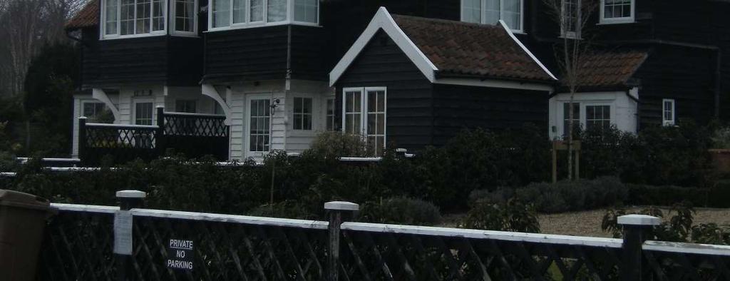

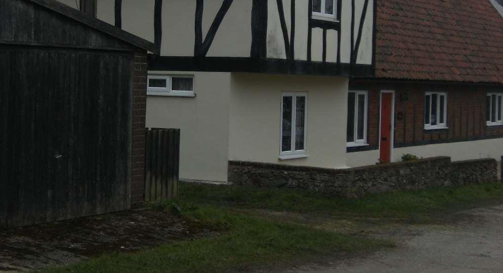
225 Figure 66: Lakeside bungalows, Thorpeness. Figure 67: Westgate, Thorpeness. 225
226 This then was the original idea, an English seaside village built to represent to the holidaying families of the affluent middle classes a particular vision of England, a country still in control and at peace with itself. A seaside holiday means sand and sea, and indeed the Country Club and some of the bungalows, were built facing the sea to give an unbroken view of the Thorpeness sands and North sea 159 However, the real centre and focus of the village is the Meare, a large, shallow expanse of water created from the silted up streams, marshes and mud flats of the area. Here Ogilvie gave full rein to his imagination. He created a fantasy world for children which, in a report in the London Morning Post on the day of its opening in 1913, was dubbed the home of Peter Pan (Figure 68). 160 This turning inwards, away from the wider world beyond symbolised by the sea, would seem to be a contradiction for a society apparently at ease with itself and used to the consequences of imperialism, but the idea of an idealised rural England was a powerful one in the Edwardian period. Ogilvie appears not to have been attracted by the beyond, and Thorpeness essentially turned its back on the sea. The sea was important as a draw to the holiday makers, but the Meare, surrounded partly by pretty bungalows and partly by trees and heathland, presented the idyllic image of children playing, at once enjoying the outdoors and the water, and protected from the alien world beyond: The very global reach of English imperialism into alien lands was accompanied by a countervailing sentiment for cosy home scenery, for thatched cottages and gardens in pastoral countryside Parkes, W. H., Thorpeness, p Kemp, G., Concerning Thorpeness, p Daniels, S., (1993), Fields of Vision: Landscape Imagery and National Identity in England and the United States, Cambridge, Polity Press, p6. 226


 refers to a movement set afoot about half a century ago")


227 Figure 68: Plan of Thorpeness and the Meare taken from Kemp, Concerning Thorpeness, facing p21. It seems that Ogilvie was acquainted with the ideas of Ebenezer Howard, although clearly he thought that they did not go far enough. Kemp (or is it Ogilvie?) refers to a movement set afoot about half a century ago to address the problems of industrialisation by building towns which should as far as possible preserve the Natural Beauties and Healthy Conditions of Country Life, and in his opinion Letchworth, Port Sunlight, Golden Green, Whiteleys Village and other Garden Suburbs are 227
228 tentative endeavours to effect this purpose. 162 Charlotte de Mille refers to the similarities in the aims of Howard and Ogilvie to provide fresh air and sunlight, as well as the necessity for pure water and proper sanitation. 163 These principles were certainly important to Ogilvie, not least because of the very nature of the village as a place to spend a summer holiday, and despite Ogilvie s desire to create a representation of the past, paradoxically he was also very concerned to provide modern facilities. 164 It was partly because of the innovative use of concrete in the building of most of the houses that the project was economically viable; Ogilvie set up a factory, out of sight and sound of the village, for its manufacture using the freely available shingle as raw material. 165 Charlotte de Mille links Ogilvie s borrowing of Howard s ideas with the Arts & Crafts movement and William Morris. 166 While the influence of this moment of English vernacular architecture and garden making cannot be dismissed altogether, the building style at Thorpeness is far more eclectic, eventually borrowing not only from medieval styles, but also from the Jacobean; and there is the Cubist inspired Drake House, built in 1927, and the unclassifiable golf club with its turrets surmounted with golf tees. Indeed, as discussed, many of the buildings are constructed of concrete slabs, a far cry from the craft inspired building advocated by Morris, and if this development is utopian, it is a utopia for a small and very particular section of society. The nostalgia embodied in the construction of Thorpeness is not Morris back to the future nostalgia for an equal society located in a sort of future middle ages as he described in News from Nowhere, but rather a more generalised nostalgia for an imagined idea of the past. 167 The focus for this vision is not the sea but the Meare, carefully landscaped with inlets, mounds and wooded islands, so that the whole seventy strong fleet of small rowing boats and sailing dinghies could be on the water at the 162 Kemp, G., Concerning Thorpeness, p de Mille, C., (2004), Thorpeness, Suffolk: An Exploration of its Genesis, MA, University of St Andrews, p Parkes, W. H., Thorpeness, pp de Mille, C., Thorpeness, Suffolk, pp Ibid, p Morris, W., (2003), News from Nowhere, Oxford, Oxford University Press. 228
229 same time but only a dozen or so in view. 168 There was something of interest on every island; in one of the last attractions to be installed on the Meare, Peggotty s Hut, is another literary allusion, this time to Dickens, and here too there is a reference to the romanticised paintings of broken down cottages by Allingham and Birket Foster referred to by Anne Helmreich. 169 It is the Meare, set off by the picturesque boathouse, pantiled and timber framed with a raised loggia and an ornamental Clock Tower, that gives this village its life, and it is this that prevents it from becoming merely a collection of picturesque holiday cottages. 170 Thorpeness was clearly something of an oddity, but it had, so to speak, a companion piece in North Wales. The village of Portmeirion was begun in 1925 and conceived by its architect, Clough Williams-Ellis, also as a kind of fantasy picturesque village with eccentric architecture and brightly painted houses. 171 Unlike Thorpeness it had the advantage of a steep hilly site overlooking the sea and was therefore more closely identified with the Picturesque, but like Thorpeness it was the inspiration of one man who had the finance and opportunity to build a kind of estate village in the manner of a great landowner of the eighteenth century. Although Thorpeness was begun in the years immediately before the First World War, building came to a halt during the war and was not completed until the 1930s, and it is clear from the literature about the village published after 1918 that Ogilvie s vision was intensified by the catastrophe of the war. In the book edited by Kemp, in a section headed Private Enterprise, there is what can only be called a diatribe against the evils of socialism and a corresponding paean to the benefits of private enterprise to society. Ogilvie recommends his ideas to every passionate Patriot who craves to rebuild Old England as a living Monument of Freedom that shall be worthy of Our Immortal and Glorious Dead. 172 In an uncertain future it became even more important to create something that was symbolic of value, and Ogilvie s nostalgia was unashamed; he 168 Kemp, G., Concerning Thorpeness, p Helmreich, A., The English Garden and National Identity, p Kemp, G., Concerning Thorpeness, p Darley, G., (2007), Villages of Vision: A Study of Strange Utopias, Nottingham, Five Leaves, p Kemp, G., Concerning Thorpeness, p
230 craved a time when physical and social boundaries were firmly marked. Everything was in its place, and people too knew their place. 173 Thorpeness then, proclaims its boundedness, its identity pinned on notions of memory and nostalgia. 174 The contrast between Thorpeness and Aldeburgh is striking, and it is interesting that they developed so differently in such close proximity to each other. Representation Representations of a given landscape, whether pictorial or textual, are useful in helping to define how the landscape is viewed by residents and visitors alike, and they may also to some extent affect development. In other words, pictures and accounts are, by their very nature, influenced by the place itself, but the place may also be influenced by the representations. This is particularly true of places focused on leisure, and for this reason a brief account is given here of representations of the holiday resorts examined above. Resorts such as Southwold and Aldeburgh were seen as essentially unspoilt places unaffected by tourism, and this idea was reinforced by visual representations. In Howard s view, after rural cottages, paintings of fishing villages became the second great stereotype of the period, and the fisherman became almost a folk hero of the age. 175 Edwin Hayes painting (Figure 69) portrays boats and a fisherman and the town on the cliff, but no hint that Southwold was also a resort. This was part of a wider phenomenon illustrated by Christian Payne: in the art produced for exhibitions and even in many illustrated books, evidence of tourism was pushed into the background, or ignored altogether, and the more picturesque elements of fishing boats and traditional occupations given prominence Lowenthal, D. (1991), 'British National Identity and the English Landscape', Rural History, 2(2), , (p221). 174 Massey, D., (1998), Space, Place and Gender, Cambridge, Polity Press, p Howard, P., (1991), Landscapes The Artists' Vision, London, Routledge, pp Payne, C., (2007), Where the sea meets the land: artists on the coast in nineteenth century Britain, Bristol, Sansom & Co., p

231 Figure 69: Edwin Hayes, Southwold, oil on board, 17.8x28cm, private collection. Hayes painting is undated, but as he lived between , it was likely to have been painted in the mid-nineteenth century. A contrasting painting is Southwold, painted in 1889 by Philip Wilson Steer, one of the leaders of the artists community at Walberswick (Figure 70). 177 This painting portrays Victorian ladies promenading on the cliff and looking out to sea, to the horizon, which it has been suggested, denotes a Victorian idea of expansiveness and a looking towards the future Scott, R., Artists at Walberswick, p Flint, K., (2000), The Victorians and the Visual Imagination, Cambridge, Cambridge University Press, p
, with fishermen s sheds on the beach, but a terrace of houses behind.")
232 Figure 70: Philip Wilson Steer, Southwold, c1889, oil on canvas, 50x61cm, Tate Gallery. Felixstowe was represented very differently. An early canvas by Thomas Smythe shows the town in the early stages of development (Figure 71), with fishermen s sheds on the beach, but a terrace of houses behind. In the distance, close to the shore and along the cliff, there are suggestions, somewhat indistinct, of more houses. Because development was rapid, few other artists thought the fashionable and distinctly un-picturesque resort worth painting. 232

233 Figure 71: Thomas Smythe, Felixstowe, oil on canvas, 22.8x29.8cm, private collection. Numerous postcards, however - a form of communication which also acted as a type of advertisement, first produced in Britain in 1894 with an image of Scarborough s North Bay show the pier, the promenade along the sea front, the grand hotels and the gardens on the cliff. 180 The two images shown here illustrate very contrasting ideas of the town. The view of the Felix Hotel at the top of the cliff gives an impression of grandeur and exclusivity (Figure 72), even perhaps suggesting sophisticated resorts on the continent, whereas the slightly earlier image of the Grand Hotel shows a more populist image, a bustling and quite crowded environment (Figure 73). 179 Gray, F., Designing the Seaside, p Postcards need to be treated with caution since the dating and source of the image can be problematic. 233

.")
234 Figure 72: Felixstowe, view of the Felix Hotel, Figure 73: Felixstowe postcard, Grand Hotel, The rather less sophisticated nature of Aldeburgh is suggested by a postcard showing the beach and Crag Path dated 1938 (Figure 74), and a painting of Aldeburgh by Eric Ravilious of the same date. It is noteworthy that the by then old fashioned bathing machines were still in use here as late as 1938 (Figure 75) There are still no beach huts at Aldeburgh. 234


235 Figure 74: postcard, Crag Path and beach, Aldeburgh, Figure 75: Eric Ravilious, Bathing machines, Aldeburgh, 1938, watercolour and pencil on paper, 41x52cm, Daniel Katz Gallery. 235


236 Postcard images of Southwold are more conventional, showing the beach (Figure 76) and the pier: but the town s distinctive character was already apparent in its famous beach huts, which appear prominently on a postcard from the early 1920s (Figure 77). Figure 76: postcard, beach and North Parade, Southwold, Figure 77: postcard, North beach and pier, Southwold, c1920s. 236
237 Guide books similarly presented a particular slant on each resort. Until the last quarter of the nineteenth century guide books were usually produced commercially. so that there was no guarantee of a favourable account. 182 But by the turn of the century Southwold, for example, was producing its own guides and was therefore able to control the content, although often, surprisingly, these accounts were merely factual without any attempt to gloss the facilities the town had to offer. 183 One Jarrold guide to Southwold, published between 1900 and the First World War, described the town as A bright and quaint, and very interesting little town 184 The cliff front was described as being different to other watering places, and was not laid out in precise rows of bow windowed terraces or a straight-laced parade backed by a series of gigantic hotels, which made it the chief attraction for most visitors. 185 The Jarrold guide to Aldeburgh of 1911, written discursively in the form of a tour round the town, emphasised the health-giving character of the place in its description of Crag Path on the sea front: It stretches away so invitingly to Thorp, so straight and even, and the air is so invigorating, that we do not wonder that this promenade, two miles long, is quite celebrated, and is thronged in summer evenings by happy visitors. 186 The same guide urged visitors to use the new golf links, Gentle exercise in the finest air, amid lovely views, soon give the nervous strength, and this popular game has added to the attractions of the place. 187 Not for Aldeburgh the noise and bustle of other seaside resorts, but something else entirely: Of the many holiday resorts on the East coast none has made itself firm or more faithful friends than Aldeburgh quaint, old-fashioned Aldeburgh. No such crowds of holiday-makers, it is true, rush to Aldeburgh as are drawn by the noisier gaieties of Yarmouth and Clacton, or the more fashionable attractions of Lowestoft and Felixstowe, but those who have once felt the spell of the quiet little 182 Gray, F., Designing the Seaside, p Cooper, E. R., (undated), Southwold London, Health Resorts Association, pp20 and 27; no publication date is given, but the description of the state of the harbour indicates that the publication date was prior to Anonymous, (c.1901), The Illustrated Handbook to Southwold and Neighbourhood, Norwich, Jarrolds, p Ibid, p Anonymous, (c.1893), The Illustrated Guide to Aldeburgh including Southwold, Dunwich, Halesworth, Leiston, Walberswick, Burgh Castle etc., Norwich, Jarrold & Sons, p Hooper, J., (1911), The Illustrated handbook to Aldeburgh and neighbourhood, Norwich, Jarrold & Sons, p
238 town come again year after year under the influence of an attachment that every visit but serves to increase. 188 Felixstowe was presented very differently again. Sunny Felixstowe, published in about 1913 by the Advancement of Winter Season Association, lists every possible form of entertainment. It opens with a description of Felixstowe as a famous seaside health resort, and states that being south facing, it has a mild winter climate. Given the name of the publisher, this book was evidently an effort to market Felixstowe as a town to be visited all year round rather than just in the summer months. 189 This was a major preoccupation for resorts in many parts of the country throughout the nineteenth century, and attracting wealthy visitors in the winter was the great prize for many resorts, having to compete with the growing popularity of the French Riviera and Switzerland. 190 In the interwar period Felixstowe capitalised on the growing cult of the sun, a broadly based social movement involving holidaymakers and the medical profession among other bodies which revolved around the pleasures of the sun and sun bathing. A suntan was now socially acceptable in the new dream of health, sunlight and the body reformed. 191 Inevitably there were changes over time in the way in which these resorts presented themselves, but it is striking how far the differences between them remained much the same. Felixstowe in particular was at pains to enumerate the wealth of entertainment available throughout the year: Southwold was more guarded, and council meeting minutes indicate that entertainments were allowed on the beach, but only until they became boisterous or otherwise objectionable. 192 Aldeburgh was perhaps the least developed of the three, and commentators frequently contrasted it with Felixstowe: 188 Anonymous, (1906), Notes on Aldeburgh by a Visitor, Watford, C.H. Peacock, p3, quoted from The Daily Chronicle, 17 th August Anonymous, Sunny Felixstowe: Queen of the East Coast, pp3 and Walton, J., The English Seaside Resort, p Gray, F., '1930s Architecture and the Cult of the Sun', in Feigel, L. and Harris, A., (2009), Modernism on Sea, Art and Culture at the British Seaside, Oxford, Peter Lang, , (pp 159 and 161); Worpole, K., Here Comes the Sun, p SROL ( ), 491/6A/7 Southwold Borough Council Minutes, Minute Book 1 November December 1912., minute of meeting 16 th November
239 To spend a day at Aldeburgh is a very pleasant change for the resident in Ipswich. Of course our own Felixstowe is more up-to-date and prim; but this is the reason why it is good to get away to Aldeburgh. The charm of this oldworld place would vanish as soon as an esplanade and pier with trim gardens were brought into existence by the Town Council.The row of houses, hotels and cottages along the front is perhaps the most picturesque to be seen on the East Coast. There are no two structures alike. 193 Conclusion It is perhaps surprising that in the relatively remote, east facing county of Suffolk, away from the newly industrialised areas of the country, four identifiably different resorts developed and were able to sustain themselves in the second half of the nineteenth century and into the twentieth. In his discussion of the significance of railway expansion to the development of the more remote seaside resorts, Walton highlights the motivation for many people who visited such resorts: they were seeking seclusion and natural beauty. 194 The railway was central to the development of Aldeburgh, Southwold and Felixstowe, and all three of these embryo resorts sought to achieve exclusivity. They were all determined to exclude day trippers, and in the case of the smaller settlement of Thorpeness, very specific about their intentions. In the inter-war years this was a common theme in the marketing of resorts here and elsewhere. 195 However, what distinguishes Aldeburgh and Southwold from other resorts is their topography. Both towns are built on low cliffs, and especially at Southwold, are virtually surrounded by water and marshland, limiting the opportunities for wider development. Southwold managed this problem by building a pier to encourage steamers to visit the town and providing grand hotel accommodation with tennis courts and gardens. Aldeburgh on the other hand maintained its air of exclusivity. There was no pier and while there was hotel accommodation, it was not in the style of the grand seaside hotels available at other resorts. Aldeburgh, viewed 193 SROI (1907), EE1/5/2/9 Cuttings book Suffolk Vol I ; this extract is taken from a report entitled Excursion to Aldeburgh dated April 13 th 1907 by Lucking Tavener. 194 Walton, J., The English Seaside Resort, p Gray, F., Designing the Seaside, p
240 from the north and the south, has an air of self-containment, and indeed in winter, when the sea is rough, can look almost forbidding. The east coast is not known for its balmy weather, and indeed has a reputation for being cold and bleak. Felixstowe countered this by stressing the amount of sun available in summer and winter and its south facing aspect. 196 Its proximity to Ipswich and its early royal connections as well as the drier nature of the soil all contributed to its rapid development. By 1911 its population had overtaken both Aldeburgh and Southwold and between 1851 and 1931 it grew by nearly fifty-seven per cent. In the development of all the Suffolk resorts land ownership and earlier history were important contributory factors. In Southwold, where much of the development was speculative and in the hands of outsiders, development was slow, whereas in Aldeburgh the opposite was the case. Apart from the slow early start of the Crespigny estate, development took place at a more or less steady pace and was largely in the hands of local people. Felixstowe, almost totally undeveloped until the later nineteenth century, demonstrated both models; Tomline s prospective new centre to the south of the old town was speculative and slow, whereas a large part of the development in old Felixstowe, where the main shopping streets developed, was in the hands of the ISFLS. In a document celebrating their fifty year jubilee in 1899 they describe their involvement in the growth of Felixstowe: but it was reserved for the Freehold Land Society to give the working-classes and the middle-classes an opportunity of obtaining a settlement at Felixstowe, and the town would never have been what it is to-day but for their influence and enterprise. 197 The visitor to Suffolk before the Second World War was thus presented with a choice of holiday resorts, from the exclusive and inward looking at Aldeburgh, to the slightly more open Southwold, or Felixstowe, altogether larger and more lively with its pier and Spa Pavilion. Walberswick and Thorpeness offered contrasting experiences, both being 196 Anonymous, Sunny Felixstowe: Queen of the East Coast, pp Anonymous, (1899), Jubilee of the Ipswich & Suffolk Freehold Land Society, , Ipswich, East Anglian Daily Times, p
241 altogether smaller. Thorpeness in particular is interesting in that, as at the model village at Somerleyton previously discussed, this was a selfcontained development instigated by a relative incomer, and presenting most clearly an idea of nostalgic, idealised Englishness. With the exception of Felixstowe, all the resorts were to a greater or lesser degree, relatively remote, quaint and quiet, but nevertheless represented a significant change in the development of rural east Suffolk. 241
242 CHAPTER 6 Suburbanisation in East Suffolk Introduction This chapter sets out to explore the development of suburbs in East Suffolk, a statement which is somewhat counterintuitive since we are dealing here with what remains to this day a predominately rural county. It follows that a number of questions need to be addressed in the context of urban development in East Suffolk. The term suburb is very difficult to define; how, for example, does a suburb differ from an urban area, and how many dwellings need to be added to a rural area before it can be considered suburbanised? The kind of employment available and its location may also have a bearing on the definition of an expanding settlement, and there is also the question of infrastructure. Is a suburb merely a collection of dwellings or is it served by its own shops and services? Suburbs have been defined in a number of subtly different ways: for Ian Bentley they are low-density, middle-class housing areas at the city s periphery 1, and in Barrett and Phillips Suburban Style: In general they can be defined as largely residential areas that owe their existence, initially at least, to nearby centres of industry or commerce. 2 The problem with both of these definitions for our purposes is that they are not entirely relevant to the situation in East Suffolk. Here, with the exception of the county town of Ipswich, there were no significant centres of industry or commerce, or indeed any cities. Suffolk then, and East Anglia generally, did not conform to the classic model of suburbanisation as demonstrated in the rapid spread outwards of the industrial towns and cities of the northern half of the country and London, where, as early as 1881, W. S. Clarke was able to list eighty-nine suburbs encircling the city, 1 Bentley, I., 'Arcadia becomes Dunroamin, Suburban Growth and the Roots of Oppression', in Oliver, P., et al., (1981), Dunroamin: the Suburban Semi and its Enemies, London, Barrie & Jenkins, 54-76, (p55). 2 Barrett, H. and Phillips, J., (1987), Suburban Style: The British Home, , London, Macdonald & Co, p9. 242
243 each with their own identity, some being more or less exclusive than its neighbour, a pattern which was repeated elsewhere in the country. 3 Alun Howkins has suggested that rural history as defined by cows and ploughs, as landlord, farmer and labourer, or as cottage and castle had perhaps come to an end. 4 In Suffolk, this was rather less true than in the southeastern parts of the country, in the hinterland of London. But as we have seen, piecemeal development occurred in many rural settlements, and true suburbanisation also occurred, especially in the interwar years, and locally at least added significantly to the character of settlements, some of which were previously entirely rural. The towns and villages where such development took place will be examined, with particular attention paid to Ipswich, within whose boundaries there was still agricultural land in Because of the comparatively small size of the town and the lack of heavy industry, such building remained largely within the existing borough boundary and did not encompass existing settlements as had happened in London over the previous one hundred years, or indeed develop into identifiable separate districts as was happening in cities such as Manchester and Nottingham. 5 Nevertheless, Ipswich s economic expansion led to sustained growth in a number of neighbouring villages, including Rushmere St Andrew, Foxhall and Kesgrave, although the impact was not universal and nearby Westerfield experienced a sharp demographic decline. The expansion of Lowestoft had a similar knock-on effect on villages such as Kessingland, while Melton, adjacent to Woodbridge, increased its population, as did Woodbridge itself, although here the increase was not enough to regain population loss during the years of agricultural depression (Table 17). 3 Clarke, W. S., (1881), The Suburban Homes of London: A Residential Guide, London, Chatto & Windus, pv. 4 Howkins, A., 'Death and Rebirth? English rural society, ', in Brassley, P., et al., (2006), The English Countryside between the Wars, Regeneration or Decline?, Woodbridge, Boydell, 10-25, (p24). 5 Burnett, J., (1986), A Social History of Housing, , London, Methuen, pp108 and
244 Percentage Suburban growth change Ipswich Foxhall Kesgrave Martlesham Rushmere St Andrew Westerfield Lowestoft Carlton Colville Gunton 77 Kessingland Kirkley Oulton Oulton Broad Pakefield Woodbridge Melton Table 17: change in population in parishes associated with suburban growth. Patterns of development were complex. They took a number of different forms the growth of middle-class housing, counterurbanisation and the growth of council housing (already discussed) and were influenced by a number of different factors. The most important of these were perhaps local land ownership and the character and development of transport networks. Suburbanisation in context Earlier discussion has demonstrated that urban populations throughout the country had been growing exponentially since at least the middle of the nineteenth century, and that by the turn of the twentieth century England was essentially an urban country. However, the numbers of working people migrating to urban areas created unsustainable pressure on inadequate infrastructures so that living conditions in many of the new urban areas were woefully inadequate and unsanitary. 6 6 Ibid; see Part 1 ( ) Chapter 3, The Housing of the Urban Working Classes, (pp54-96), for a discussion on the types and state of housing in the industrial cities. 244
245 Authorities were slow to respond to the problem, but over the second half of the nineteenth century a gradual awareness grew of the influence of improved sanitary conditions on the health of the population, and this became the driving force for change. 7 In the first half of the nineteenth century, for those fortunate enough to be able to afford the increased rent there was a move away from cellar accommodation, tenements and rookeries to terraced housing. 8 Burnett observes that this can be seen as the beginning of the emphasis on private space; these houses had narrow frontages straight on to the street rather than an internal court, and two ground floor rooms, the back room for cooking and everyday living, and the front parlour for show, containing the best furniture and used primarily for entertaining visitors. 9 Of course, there were local variations in house types, but this two up, two down pattern became increasingly widespread until, by the second half of the nineteenth century, the terraced house was the norm for urban working-class families. 10 Nevertheless, these houses were still built comparatively close to the centre of towns and the workplace because of the limitations of local transport systems. The middle classes, however, were able to move further out. Driven by a desire to escape the dirt and noise of the city centre, where in any case by the middle of the nineteenth century any remaining available land was likely to be used for commercial premises, they were able to take advantage of lower land prices and the variety in size and style of house types offered by speculative builders. 11 These houses were aspirational: social standing was important, indicated by the size and number of rooms and the affordability of live in servants. Towards the end of the nineteenth century terraced houses, even larger ornate ones, became less fashionable among the middle classes, and the villa became the desirable norm. 12 Bound up with these social aspirations were less tangible threads concerning physical security and domesticity. Arnold Bennett, although 7 Gauldie, E., (1974), Cruel Habitations A History of Working-Class Housing , London, George Allen & Unwin, pp Ibid. 9 Burnett, J., (1986), A Social History of Housing , pp Ibid, p Ibid, p Ibid, p198 and p
246 writing about a different part of the country, displayed a keen eye for such changes in middle-class society. In Book III of the Clayhanger trilogy he has Edwin Clayhanger, in 1892, recently married, musing on the pleasure represented by his detached house, built by his father some twelve years earlier: More and more he was growing to look upon his house as an island, cut off by a difference in manners from varnished barbarism of multitudinous new cottages 13 Away from the pressures of city life, the home increasingly displaced the workplace as the focus for life s fulfilment. 14 In the second half of the nineteenth century working-class housing remained close to the centre of towns and cities because of the lack of a cheap and flexible transport system, and while the railways were developing, travel by road was still dependent on horsepower. However, efforts were being made to develop other forms of road transport. Tramways, begun in America, originally to carry goods in mines and quarries, migrated to city streets and then to Europe and Britain, and for a time were a useful means of local transport, enabling road travel to the outer reaches of cities. 15 Various mechanical means of powering trams were tried, including steam, and indeed a tramway was proposed in the 1870s between Ipswich and Felixstowe, but was not pursued. 16 Within the borough boundaries of Ipswich a limited service of horse drawn trams first appeared on the streets in More routes were added which operated in competition with the red horse buses of the Ipswich Omnibus Service; but in 1900 the Ipswich Corporation Tramway Act authorised the running of electric trams, and the borough took over operation of the horse tramway company in Horse trams were taken out of service in 1903 to allow track to be laid for electric trams which began operating at the end of the year; one of the first lines to operate was routed to cater for 13 Bennett, A., (1926), The Clayhanger Family, London, Methuen, p Bentley, I., 'Arcadia becomes Dunroamin, Suburban Growth and the Roots of Oppression', (1981), Arcadia becomes Dunroamin, (p60). 15 Taplin, M., (1998), The History of Tramways and Evolution of Light Rail, January 6, 2012, 16 Ibid; Malster, R., (1996), Felixstowe: 100 years a working port, Felixstowe, Port of Felixstowe, p2. 17 Barker, C., (2005), Trolleybus Classics no 15: Ipswich Trolleybuses, Midhurst, Sussex, Middleton Press. 246
247 Great Eastern Railway river steamers. 18 Tramlines were constructed in Ipswich itself, but did not extend beyond the borough boundary, and motorised public transport outside the borough boundary was extremely limited at least until after the First World War. 19 Contemporary responses to the largely unplanned spread of the urban environment were mixed. Some were enthusiastic; in 1881 W.S. Clarke wrote of the fair dwellings and picturesque retreats which form that lovely fringe the Suburban Homes of London. 20 Others responded less positively, particularly regarding the spread of houses at the lower end of the market: thousands of houses, built within the last ten years, of rotten brick, with various iron devices to hold it together 21 The suburbs were steadily expanding then, up to the First World War. Inadequate housing in the cities themselves still remained a problem, and this elicited a number of responses, notably the building of model villages by industrialists, such as at Bournville and Port Sunlight, already mentioned. These were built to house their own workforces, and were examples of enlightened housing provision. 22 Ebenezer Howard, author of Garden Cities of Tomorrow and the primary advocate for garden cities, took a different approach. What he envisaged was a harmonious melding of town and country, with the urban element surrounded by a planned green belt containing farms to supply fresh produce to the town. 23 And on a theoretical rather than a practical level, William Morris was expounding his views on the ills of society as he saw it, in the Commonweal, official organ of the Socialist League, and also in his Utopian novel, News from Nowhere. In his view, the need for better housing was not only a matter of necessity, but also concerned identity and sense of place Ibid. 19 Doggett, M., (1979), Eastern Counties: The First 50 Years, Norwich, Eastern Counties Omnibus Co. Ltd., p1. 20 Clarke, W. S., (1881), The Suburban Homes of London, pv. 21 John Ruskin, (1873) Fors Clavigera, Letter 29, La Douce Amie. Quoted in Burnett, J., (1986), A Social History of Housing , p Darley, G., (2007), Villages of Vision: A Study of Strange Utopias, Nottingham, Five Leaves rev.edn., pp Howard, E., (1946), Garden Cities of Tomorrow, London, Faber and Faber, pp Morris, W., (2003), News from Nowhere, Oxford, Oxford University Press, p62. Originally published in serial form in 1890 in The Commonweal. 247
248 The emphasis on green space in the minds of politicians and commentators, and the need to provide space for recreation, was a key factor in the spread of the idea of garden cities, and the hold it took on the public imagination. Ebenezer Howard s concept was for a city totalling 6,000 acres, the central urbanised part of which would cover 1,000 acres; the population of the central city was proposed to be 30,000, with a further 2,000 in the outlying agricultural areas. 25 Howard s idea was first translated into reality by Raymond Unwin and his partner, Barry Parker, at Letchworth in the early 1900s. 26 Unwin and Parker s designs were initially for the layout of the site, but the houses that Unwin designed, in the town centre and a house for his own use, displayed a marked affinity with the principles of the Arts and Crafts movement. 27 Houses, with dormer windows and tall chimneys, were built in small groups, with roads designed to allow for interesting vistas rather than straight lines. It was this legacy, a commitment to aesthetically pleasing design of houses, matched with an equal commitment to the design of the whole, which influenced the appearance of much planned rather than speculative building up to the Second World War. Transport Despite these uncommon exercises in planned design, by 1914 and the outbreak of the First World War, urban England had developed into a land of overcrowded cities, particularly London and the industrial north, ringed by inner suburbs of smaller terraced housing and the beginnings of outer, largely unplanned, suburbs of detached and semi-detached villas. But the scale of this development would not have been possible without further improvement in transport. Tramways were a useful beginning, but were expensive to build and were not, on the whole, long lasting. It was the invention of the electric motor and the internal combustion engine which precipitated a revolution in road transport. At the turn of the century motor buses began to appear on the roads, most frequently owned either 25 Howard, E., (1946), Garden Cities of Tomorrow, pp51 and See the chapter on The First Garden City Vision and Reality in Miller, M., (1992), Raymond Unwin: Garden Cities and Town Planning, Leicester, Leicester University Press, pp49-77 for a description of the genesis of Letchworth Garden City. 27 Ibid, pp67and
249 by the local authority or by railway companies in conjunction with the trains as an alternative to extending the railway line. 28 In London it was the extension of railways and the underground system which allowed speculative building further from the centre, but in other towns and cities the flexibility of the motor bus, not dependent on rails or wires, provided the catalyst for the development of suburbs in outlying areas, offering a commercially viable and reliable service for the majority of the burgeoning numbers of white collar workers anxious to house their families away from the noise and dirt of city centres. 29 In East Suffolk the development of transport infrastructure was slower than in other parts of the country, as we have seen. The first routes were unreliable and short lived. 30 However, in Ipswich itself electric trams were replaced with trolley buses in 1923, but like the trams, these did not extend beyond the corporation boundary. 31 A local bus service, agreed with the corporation, went into service in the north of the town in Interestingly, in 1924 the Eastern Counties Road Car Co. made an offer to Ipswich Council to take over the operation of public transport in the borough, but the offer was declined and the Council opted to concentrate on expanding their trolleybus system which remained in operation until Ipswich Corporation was the last major urban operator in Britain to put motorbuses into service; they did not appear on the town streets until In contrast, outside the confines of Ipswich Borough, bus services expanded until by 1931 there were thirty-three different buses covering the whole county, all of which served at least part of East Suffolk. These services were all operated by the Eastern Counties Omnibus Co. 28 Hibbs, J., (1989 2nd edn), The History of British Bus Services, Newton Abbot, David & Charles, p Burnett, J., (1986), A Social History of Housing , p258. See also Hibbs, J., (1989 2nd edn), The History of British Bus Services, p Doggett, M., (1979), Eastern Counties: The First 50 Years, p1. 31 Anonymous, (1958), History of the Eastern Counties Omnibus Company Ltd and of the Corporations of Great Yarmouth, Ipswich and Lowestoft From the early days to the present time, London, P.S.V.Circle and Omnibus Society, p69. See also a drawing showing the extent of the trolleybus services in Ipswich, undated but known to be of the 1930s, SROI (1930s), DC16/4/1 Documents and drawings relating to Ipswich trolleybus service. 32 Doggett, M., (1979), Eastern Counties: The First 50 Years, p3. 33 Ibid, p3; see also Ipswich Transport Museum: History, April 24, 2012, 249
250 Ltd. which, by buying up smaller companies, was also gradually able to offer express services to London from Ipswich and the coastal towns. 34 Car ownership at the turn of the century was limited to the wealthy, but even so, by 1905 there were 16,000 private cars on British roads. 35 However, there is little evidence to suggest that at this early date cars were used for travel to work. 36 Railways, trams, motor coaches and buses provided the usual means for the daily journey from suburban homes to city centres for work, but nevertheless, for those able to afford a private car there were opportunities to live further afield in outlying villages in the interwar period. It is worth noting that even though commercial motor vehicles were instrumental in the development of the suburbs, they were quickly outnumbered by private cars; by 1907 when 32,500 vehicles were registered, there were four times as many private cars as commercial vehicles. 37 Council Housing The evolution of state provision of housing in the country generally and for east Suffolk in particular has been explored earlier; examination of council housing will, therefore, be limited to the more suburban areas of the region. The Housing of the Working Classes Act of 1890 for the first time enabled local authorities to directly provide housing, but outside London there was little uptake of the overly complicated system and building by local authorities rarely took place. 38 The building of council houses in East Suffolk did not really begin until after the First World War. 39 In 1916 the Housing Panel of the Reconstruction Committee was set up under the chairmanship of the Fourth Marquis of Salisbury, in order 34 Doggett, M., (1979), Eastern Counties: The First 50 Years, pp7 and O'Connell, S., (1998), The Car in British Society: Class, gender and motoring , Manchester, Manchester University Press, p Oliver, P., 'Great Expectations, Suburban Values and the Role of the Media', in Oliver, P., et al., (1981), Dunroamin: the Suburban Semi ad its Enemies, London, Barrie & Jenkins, , (p123). 37 Plowden, W., (1971), The Motor Car and Politics, , London, Bodley Head, p Swenarton, M., (1981), Homes Fit For Heroes: The Politics and Architecture of Early State Housing in Britain, London, Heinemann Educational Books, pp Linsley, B., (2005), Homes for Heroes, Housing Legislation and its Effect on Housing in Rural Norfolk , PhD, University of East Anglia, pp26 and
251 to formulate the new housing policy. 40 Among the members of this committee were Seebohm Rowntree and Beatrice Webb, both forward thinkers, and although Raymond Unwin, closely associated with the Garden City Movement, as we have seen, was not officially a member, he too was involved. 41 In his early writing Unwin disliked the idea of suburbs altogether, preferring a model based on the ideas of William Morris where people were not segregated according to their income and social standing. 42 Despite these views, a suburban focus was chosen rather than a garden city model for the majority of schemes. 43 The 1918 Tudor Walters Report recommended a maximum of twelve houses to the acre in urban areas. This idea of low density housing originated in Unwin s designs for New Earswick in York and Letchworth, the first garden city, and was predicated on the relationship between the cost of land and the cost of road construction: more land was taken up for roads in high density layouts than for low density. 44 As to how and why these particular densities were arrived at there seems to be very little comment. Clearly an avoidance of nineteenth-century overcrowding was a primary consideration, and equally clearly, the basic principles of the Garden City had been broadly accepted. 45 Geoffrey Boumphrey, writing in 1940, characterised Ebenezer Howard s idea of fourteen houses to the acre, later changed to twelve, as a purely arbitrary figure which has taken a most extraordinary and unjustifiable hold on the minds of our town-planners, architects, local authorities, and legislators. He commented on the fixed idea which had arisen that housing at this density gives optimum health conditions, and that anything denser is automatically less healthy and should be permitted only in exceptional circumstances. In his opinion No such contention can possibly be proved or even reasonably suggested; and gardening facilities (especially with an eye to that surplus), not considerations of health primarily, were the basis 40 Miller, M., (1992), Raymond Unwin, p Ibid. 42 Creese, W. L., (1992), The Search for Environment The Garden City: Before and After Baltimore and London, John Hopkins University Press, p Miller, M., (1992), Raymond Unwin, pp Swenarton, M., (1981), Homes Fit For Heroes, pp Ibid, p
252 on which it was first worked out. 46 Boumphrey s comments must be seen in the light of his antipathy to the garden city movement; he was, after all a modernist. Interwar suburbs At the same time as this exercise in state intervention, there was a speculative building boom in housing for the new middle classes, rather poorer than their Edwardian counterparts. These were white collar workers in teaching, retail, clerical and administrative jobs, who wanted to escape the towns and demonstrate their arrival in the ranks of the middle class. According to Burnett, the middle class increased from 20.3 per cent of the total population in 1911 to 30.4 percent in 1951, based on the number of non-manual occupations. It was also estimated that in the interwar period about half the population of Britain lived in the suburbs, the greatest proportion living in three bedroomed semi-detached houses. 47 In general terms across the country, certainly after the First World War, there was a trend towards smaller households; fewer middle class households had live-in servants, improvements in healthcare and birth control resulted in fewer children per family, but healthcare improvements also meant that people were living longer. 48 The interwar suburban landscape has been a site of contention since the semi-detached villas began to be built. Preservationists found much to criticise in the formless spread of suburbs, and Clough Williams Ellis was not sparing in his criticism of the spate of mean building all over the country that is shrivelling Old England. 49 Here the criticism is not about the lack of modern architecture, but a return to the familiar complaint about the desecration of an imagined ideal England. A somewhat different approach was taken by modernists such as Boumphrey who attended the fourth meeting of the International Congress of Modern Architecture in At this event criticism was heaped on the spread of suburbs in England, Europe and America on the grounds of their ugliness 46 Boumphrey, G., (1940), Town and Country Tomorrow, London, Thomas Nelson, p Burnett, J., (1986), A Social History of Housing , pp Ibid, p Williams Ellis, C., (1928), England and the Octopus, London, Geoffrey Bles, p
253 and incoherent and disordered planning. 50 Ian Davis, in his analysis of such criticism, concludes that the attitude of the adherents of the Modern Movement had more to do with prejudice against the tendency to individualism in the design of suburbs, and a misunderstanding of the needs and aspirations of its inhabitants. 51 Boumphrey himself objects not to suburban architecture in itself, but that it was in the wrong place: The lessons of eighteenth century town design were ignored and, instead, we were treated to a romantic back to the country village revival in the rise of garden city ideology. Confined to genuine garden cities this would have been well enough, but applied as it has been to town, country, and suburb alike, it has been the cause of most of the ugliness and despoliation described in this book. 52 David Matless considers the criticism on the basis of a gendered analysis. In this reading the suburbs become the site of feminised, privatised domesticity, without function. 53 A feminist reading might, of course, wish to take issue with the idea of the functionlessness of a feminised space. For the people who actually lived in them, the suburbs represented safety, security, and the focus of daily life, rooted in an idea of permanence and Englishness, characterised by the architecture itself which almost invariably drew on elements of past styles. In the interwar period red roofs and chimney stacks were common, but the white paint had given place to natural coloured oak; oak beams criss-crossed the large gable that, with one slope extending almost to the ground, formed the front of the house; the porch, shaped like half a lych-gate, was of oak, and so were the frames and sills of the windows. The windows themselves were of metal, leaded into square or diamond panes. Crazy paving in the front garden had replaced the gravel path, and indoors, rustic brick fireplaces had replaced the blackleaded grates and painted mantel-pieces. 54 This is the description of interwar suburban style given in J.M. Richards defence of English suburbs, Castles on the Ground, written in 1946, from 50 Ibid, pp Ibid, p Boumphrey, G., (1940), Town and Country Tomorrow, p Matless, D., (1998), Landscape and Englishness, London, Reaktion Books, pp See also Simon Miller s analysis of the conflicting ideas of town and country polarised by the threat of suburbia in Miller, S. (1995), 'Urban Dreams and Rural Reality: Land and Landscape in English Culture, ', Rural History, 6(1), Richards, J. M., (1973), The Castles on the Ground, London, John Murray, p
254 a somewhat nostalgic point of view after an absence from Britain. 55 Indeed the lithographs by John Nash which illustrate the book give an idealised picture of suburbs. There is an abundance of trees, greenery and winding paths and roads, but no evidence of the ribbon development which was pushing out from every town in England along the roads now served by motor coaches and buses. 56 This point is important because, as with the appearance of motor buses on the roads in the years preceding the First World War, development of the road system after the war was a crucial factor in the continuing development of suburbia. It was not the primary reason for the growth of suburbs, but the flexibility afforded by bus and coach travel meant that builders were no longer dependent on land close to a rail link for sites for new estates, and indeed one writer has the more well-to-do leapfrogging further out with their motor cars to the one-per-acre zone. 57 Such improved communication systems brought with them the unforeseen consequence of ribbon development which was viewed with displeasure by many. E.M. Forster, in his contribution to Britain and the Beast, published in 1937, wrote of the destruction of the countryside: In the last fifteen years we have gashed it to pieces with arterial roads, trimmed the roads with trash, and ruined several selected areas systematically. 58 More specifically in East Suffolk, Patrick Abercrombie in his East Suffolk Regional Scheme mentions the main artery of the county road system, the London to Great Yarmouth road. He writes that there was a considerable amount of recent development on this road, particularly at Kesgrave, where the heathlands have been ruined by bungalows and shacks of the worst type. 59 Despite its negative aspects, ribbon development, because it was the cheapest means of providing new houses with easy access to bus routes along the main roads, continued to 55 Daniels, S., 'Suburban Prospects', in Alfray, N., et al., (2004), Art of the Garden, London, Tate Publishing, pp22-30, (p29). 56 Oliver, P., 'Introduction', in Oliver, P., et al., (1981), Dunroamin: the Suburban Semi and its Enemies, London, Barrie & Jenkins, 9-26, (p25). 57 Buchanan, C. D., (1958), Mixed Blessing: The Motor in Britain, London, Leonard Hill, p Forster, E. M., 'Havoc', in Williams Ellis, C., (1937), Britain and the Beast, London, J. M. Dent, 44-47, (p44). 59 Abercrombie, P. and Kelly, S., (1935), East Suffolk Regional Planning Scheme, Liverpool, University Press of Liverpool, p
255 spread. 60 For the householder houses built along a main road were convenient for travel and also provided a pleasant view over fields at the back. 61 In 1935 the Restriction of Ribbon Development Act was passed in an attempt to impose a measure of control on the growth of urban sprawl. Private car ownership was still rising as the purchase price of cars fell, partly because of increased efficiency and rationalisation of production methods, and partly due to the production of smaller cars such as the Austin In the years leading up to the First World War a car was seen as an expensive luxury, on the whole only available to the upper echelons of society, but in the interwar years, for the professional and commercial middle classes a car began to be seen as a necessity. 63 As prices fell and hire purchase became more widely available, by the end of the 1930s car ownership was within the means of some working-class people, and car sharing was not uncommon. 64 The car s primary use throughout this period was for leisure, and there is a wealth of evidence to point to the importance of family outings at weekends, the possibility of day trips to the seaside, and the increasing popularity of picnicking. 65 Clearly, the development of motor transport was fundamental to the development of suburbs. Residential development in East Suffolk Declining opportunities for rural employment and, in particular, the rapid expansion of light industry and services ensured the expansion of larger towns at the expense both of smaller market centres and purely rural settlements. Apart from the still relatively small seaside resorts of Southwold, Aldeburgh and Felixstowe, and the market towns, the only urban centres of any notable size in East Suffolk were Lowestoft and Ipswich, and these were more likely to offer opportunities for work. It was these towns which experienced a measure of true urbanisation. 60 Rowley, T., (2006), The English Landscape in the Twentieth Century, London, Hambledon Continuum, p A.M. Edwards, quoted from The Design of Suburbia: A Critical Study in Environmental History, in ibid, p O'Connell, S., (1998), The Car in British Society, pp Ibid. 64 Ibid, pp Ibid, pp
256 Ipswich Ipswich was (and still is) the largest town in East Suffolk, having a population of 32,914 in 1851, rising to 87,569 in This compares to the considerably larger population of Norwich which was 68,195 in 1851 and 126,236 in 1931, and the much smaller population of Colchester in Essex of 19,443 and 49,131 respectively. White s Directory for 1855 states that while Ipswich s borough boundary was quite extensive, covering an area of five miles by four miles, the populated part of the town was concentrated largely in the centre, leaving extensive areas of land available for development on the outskirts of Ipswich, but within the historic town boundary. 66 A high proportion of the as yet undeveloped land in Ipswich was bought by the Ipswich and Suffolk Freehold Land Society (ISFLS). This organisation, formed in 1849, had as one of its aims, to improve the social position and promote the moral elevation of the unenfranchised population of this country. 67 In 1899 the organisation was involved, either directly or indirectly, with estates in Ipswich, Lowestoft, Woodbridge, Framlingham, Wickham Market, Otley and Melton. 68 Its extensive archive shows that it was active in providing housing in the area at least until the late 1930s and therefore played an important part in the suburban development of the whole area. 69 The archive is a rich source of information concerning housing development in East Suffolk and some parts of Essex and Norfolk in the second half of the nineteenth century and first half of the twentieth century. 70 Freehold land societies such as this were being formed in many parts of the country in the second half of the nineteenth century, with the explicit aim of improving the lives of the working classes. 71 The way in which this was to be achieved was complex, but essentially rested on the notion, arising out of the Reform Acts of 1832 and 1867, that a working 66 (1855), White's Directory for Suffolk, Sheffield, Robert Leader, p Anonymous, (1899), Jubilee of the Ipswich & Suffolk Freehold Land Society, , Ipswich, East Anglian Daily Times, p9. 68 Ibid, p SROI (1904-), GF419/FLS1849/3/1/1 Freehold Land Society Plan Book. 70 Transactions investigated here cover only a small part of the archive, but a more comprehensive study could be undertaken at some time in the future, giving a fuller picture of this kind of housing development in East Suffolk. 71 Gauldie, E., (1974), Cruel Habitations, p
257 man could earn a vote by becoming the owner of a 10 house. 72 That this enfranchisement was their primary aim, rather than a desire to improve living conditions, is made explicit by evidence of shoddy building in some parts of the country. This was apparently seen as acceptable in the face of a property owning electorate intent on protecting their own interests rather than widening enfranchisement. 73 In the scheme followed by the ISFLS, in order to become a member, a person had to buy a share of not more than 25, to be paid for with an entrance fee of 1s., together with a fortnightly subscription of 3s., with an additional payment of 6d. per quarter towards expenses. The Society bought land, divided it into plots, and allocated it to members by ballot. 74 The first piece of land bought by the society in Ipswich was just over ninety-eight acres of the Cauldwell Hall Estate, laid out with intersecting roads and divided into 282 lots. In the account of the ISFLS, published to celebrate the organisation s silver jubilee, the land was described as quite beyond the inhabited area of the borough. The location of a few houses was itemised, but All the rest was arable and pasture land, bordering upon arid heath. 75 The exact date of purchase of this land is uncertain, but by 1860 a plan was available showing thirty seven plots bordering Woodbridge Road, Caldwell Avenue, Holland Road, Tovells Road and Cauldwell Hall Road, just to the east of what is shown on contemporary maps as Caldwell House. 76 Undeveloped land within the borough boundary was beginning to be utilised, and the success of this development was perhaps indicated by the resale of three freehold houses in Freehold Terrace, sold by auction on 27 th August These were three bedroomed houses with small back gardens, originally built by ISFLS, and then commanding rents of 10/8s per annum. 77 By 1899 the Society was able to congratulate itself 72 Ibid. See the whole of Gauldie s chapter on Freehold Land Societies, pp , for an account of the genesis of freehold land societies. 73 Ibid, p Anonymous, (1899), Jubilee of the Ipswich & Suffolk Freehold Land Society, p9. 75 Ibid, p SROI (1860), GF419/FLS1849/3/1/1/115 Ipswich and Suffolk Freehold Land Society Plan Book, , page SROI (1889), HB54/G/31 Particulars and conditions of sale of three freehold dwelling houses, nos 24, 25, 26 Freehold Terrace, Cauldwell Hall Road, to be sold by auction on Tuesday 27 th August
258 on the success of the plan which is referred to as the Great Eastern Suburb of Ipswich : Upon the open farm-land of fifty years ago a new township has sprung into existence with churches, schools, and other public institutions, with streets well lighted and at last effectually sewered, with a tramway service which renders it easily accessible from the borough at large. It is essentially a working class neighbourhood, but free from all or most of the characteristics usually associated with such a term. 78 Another development took place, also under the auspices of the ISFLS, on land close to the Caldwell Hall Estate. This was a substantial parcel of land amounting to almost seventy four acres backing onto the Ipswich to Felixstowe railway line with frontages to Derby Road and Felixstowe Road. In 1880 a ten acre portion was allotted to shareholders and quickly built upon, and it would appear from contemporary maps that this was the frontage to Derby Road. A further seventeen acres was sold to the corporation to add to the grounds of the mental asylum, now St Clements Hospital. The remaining forty seven acres, with frontages to the Felixstowe Road, were divided into plots, termed garden farms. The land was divided into eight two acre plots, six plots of 1½ acres, six of one acre and two of 130 rods. In addition, in 1884 a piece of land of one hundred rods, fronting Derby Road, was sold to the Ipswich School Board. 79 The published account of the activities of the ISFLS describes substantial semi-detached cottages, set in the middle of the plots rather than at the road frontage, each with a shed as well as a newly dug well for each pair of cottages. The largest two acre plots, with house, shed, water supply, and all accessories, were sold at the ballot for 286. The price of the smaller plots is not given, but when all was completed we are told that under careful and patient cultivation, the reclaimed area of a somewhat arid heath has been converted into most fertile gardens; 80 An examination of successive OS maps illustrates the various stages of development of this land. The first edition of 1887 indicates no 78 Anonymous, (1899), Jubilee of the Ipswich & Suffolk Freehold Land Society, pp Ibid, pp Ibid, p
259 development at all, but by 1905 when the second edition was published, the cottages detailed above are evident as well as a row of houses on the Derby Road frontage. Also shown are several scattered houses on the Felixstowe Road frontage at the Derby Road end. By 1928 further development is indicated in the area. One of the larger garden plots shows extensive greenhouses, but on the southern side of Felixstowe Road new side roads had been laid out and a considerable number of semi-detached houses had been built. The last available map before the Second World War dated 1938 shows considerable infilling in the surrounding streets (Figures 78, 79, 80). 259

260 Figure 78: Detail of OS map Ipswich, County Series, 1 st edition, 1887, 1:

261 Figure 79: Detail of OS map Ipswich, County Series, 1 st revision, 1905, 1:

262 Figure 80: Detail of OS map Ipswich, County Series, 2 nd revision, 1928, 1: At approximately the same time as this development was taking place, contemporary maps show that even towards the centre of the town there were still sizeable areas of undeveloped land. In a small area of land bounded by Back Hamlet, Foxhall Road and Fore Hamlet leading into Bishops Hill, there were a cluster of three small estates, Trinity Lodge (formerly Lower Hill House), Hill House and Rose Hill, all of which were working farms in the early nineteenth century. 81 By 1927, however, Hill House had been demolished, part of the land developed into new streets and housing, and part retained for the creation of what is now Alexandra Park. While the house remained standing, Trinity Lodge had lost the majority of its land to building, and because of road widening now fronted directly onto the street. Rose Hill was the largest of the estates, but by 1884 some of the surrounding land was already laid out for building, and 81 Milverton, J., (2001), From Farm to Suburb: the evolution of three farms in the parish of St Clement, Ipswich, during the eighteenth and nineteenth centuries, Diploma in English Local History (Ipswich), UEA Centre for Continuing Education, p
263 some plots already built upon. By 1904 the surrounding streets were more closely built, but the house remained and it was not until after 1933, when the Rosehill House estate came up for sale, that the immediate grounds to the house were developed. 82 The land belonging to Trinity Lodge appears to have been bought by a private builder who built the terraces of small houses to either side of the Lodge and which remained in his ownership until However, some of the land surrounding the Rosehill Estate was bought by the ISFLS as early as the 1870s and they also acquired part of the Hill House estate in The society continued to acquire land in all areas of the borough and was responsible for a large part of suburban development in Ipswich. Following the success of the Caldwell Hall estate, the ISFLS took the decision to drop their political aims and continue as a profit-promoting and purely business-like organization. 85 This development was common to similar societies in other parts of the country, including London and Birmingham, and by 1871 freehold land societies were completely merged with building societies, their political character eclipsed, and their membership more likely to be middle class. 86 Towards the end of the nineteenth century the ISFLS began to operate a dual system whereby they either offered their members the opportunity of buying a plot on which to build a house, or the society themselves built houses and offered them for sale. For example, houses were offered for sale to members in 1902 for 310 each, paid for by fortnightly instalments of 1 4s 6d in Henslow Terrace, Henslow Road in the Foxhall Road area, and were described as: Entrance hall, front parlour with bay, back sitting room with French Casement, both rooms fitted with tiled hearths, registers and enamelled slate and marble mantels, kitchen, scullery, larder and outhouses, 3 bedrooms and bathroom fitted with bath, Venetian blinds fitted to front windows, Derby Road line of tramway conveniently close SROI (1933), HE402/2/1933/7 Sales Particulars, Rosehill House Estate, abutting upon Felixstowe Road and RoseHill Road, Ipswich. 83 Milverton, J., (2001), From Farm to Suburb, p Ibid, pp38-40 and 23. See also SROI (1870s), GF419/Bundle 5: Papers relating to the ISFLS. 85 Anonymous, (1899), Jubilee of the Ipswich & Suffolk Freehold Land Society, p Gauldie, E., (1974), Cruel Habitations, p SROI ( ), Plan Book No 1 of the Ipswich and Suffolk Freehold Land Society, plan No GF419/FLS1849/3/1/1/
264 On the north eastern edge of the borough an offer was made for both types of property: a notice was posted of a ballot for various houses in Ipswich and Felixstowe in May 1902, including in Ipswich ten eligible building plots in Schreiber Road and ten houses called Schreiber Terrace, Schreiber Road. The listing suggests that they each contained a hall, front parlour, keeping room and kitchen, a front room fitted with marble chimney piece and tiled hearth and three good separate bedrooms with cupboard accommodation. 88 The land, which included Schreiber Road, was put up for auction in May 1901 by Mrs Rosa Schreiber of Marlesford Hall, and was bought by ISFLS for 1,450. It was described as being in the parishes of St Margaret s Ipswich and Rushmere St Andrew and the plan accompanying the sales particulars marked the parish boundary across the site and showed the land laid out in lots with the road already named. The sales particulars also indicated that gas and water mains were already laid in nearby Woodbridge Road, and sewers were to be built shortly; there is a note to say that No building restrictions are imposed whatever. 89 Further extracts from the OS maps illustrate the spread of this type of suburbanising development in Ipswich (Figures 81, 82, 83). 88 Ibid, plan No GF419/FLS1849/3/1/1/ SROI (1901), GF419/FLS1849/3/2/236/2 (GF419/Bundle 338(2)) Particulars and conditions of sale of building land, Woodbridge and Rushmere Roads, Ipswich; to be sold by auction 16 th May


265 Figure 81: Detail of OS map Ipswich, County Series, 1 st edition, 1884, 1:


266 Figure 82: Detail of OS map Ipswich, County Series, 1 st revision, 1904, 1:


267 Figure 83: Detail of OS map Ipswich, County Series, 2nd revision, 1927, 1:
268 In the year following this sale the parish boundaries were changed under Local Government Board Order 44972; Rushmere St Andrew was reduced in area, and that part of the parish in which housing was beginning to appear was taken into Ipswich. This and later boundary changes in 1934 demonstrate how the suburbanising element in the region remained largely confined to Ipswich itself, while the surrounding villages maintained their relatively small populations. Other parcels of land in this area belonging to the Schreiber family were sold at about the same time, including Roundwood House, but these were not developed until after the First World War. The house itself was not demolished until 1967, was never built over and today is used as school playing fields. As to the remaining parts of the estate, those lands within the Ipswich boundary passed to the ISFLS in 1927, and are detailed in one of the Society s Minute Books as the Sidegate Lane Estate and the Roundwood Estate. 90 In July 1925 it is minuted that Mr Durrant, builder, was interested in the Roundwood estate, and was negotiating to buy the remainder of estate, including the old mansion. A price of 1,150 was agreed, but as there are no further entries on this subject, the specific outcome is unknown. 91 Between 1927 and 1932 land was being offered on the Sidegate Lane estate as building plots to members, but it can be assumed that this was not entirely successful since in 1933 certain builders were asked to tender for building on the plots, and in 1934, completed houses were being offered for sale in Sidegate Avenue. 92 The Marquis of Bristol, whose family seat was at Ickworth House in West Suffolk, was, together with the Pretyman family of Orwell Park, Nacton, the chief landowner in the village of Rushmere St Andrew. In March 1929 he sold a strip of land south of Rushmere Road to the Ipswich Corporation which they agreed to make into part of the Ipswich By Pass Road and sewer along it. 93 The first mention of this road appears in 1928; it was to be known as Colchester Road. It is striking to note the rise in the 90 SROI ( ), GF419/FLS1849/1/1/4/2 Ipswich & Suffolk Freehold Land Society Minute Book Foxhall Heath Estate (and others). 91 Ibid. 92 Ibid. 93 SROI ( ), HB54/E53/4 Miscellaneous papers relating to Winkworth property in Rushmere,
 per frontage foot, but by 1931 the price had risen to 3 per frontage foot (Figures 84, 85).")
269 price of building plots once this new major road was in place. In 1928 plots in Leopold Road were being offered for 50/- (fifty shillings) per frontage foot, but by 1931 the price had risen to 3 per frontage foot (Figures 84, 85). Since the price of land remained relatively low throughout the 1930s, and loans for building were also relatively cheap and easy to obtain, it can be assumed that it was the new road rather than increased costs which governed this increase in the price of plots. 94 Figure 84: Detail of OS map Ipswich, County Series, 2 nd revision, 1928, 1: Burnett, J., (1986), A Social History of Housing , pp Burnett observes that 5 per foot was the average price in London suburbs. 269

270 Figure 85: Detail of OS map Ipswich, County Series, 3rd revision, 1938, 1:
271 The houses built in this area of Ipswich at this period were generally detached, semi-detached with some bungalows. Immediately preceding the First World War the ISFLS specifically stated that there were no building restrictions, but by the 1920s building restrictions were firmly in place. In an Abstract of Title to part of this land dated 1928, a series of restrictions were applied: no building was to be closer to the road than the indicated building line; all houses were to be detached or semi-detached; each pair of houses had to be at least eight feet from its neighbour; no detached house was to be built for less than 250, or pair of semidetached for less than 500; all houses were to be private dwelling houses with necessary garages and outhouses, and there was to be no nuisance caused to neighbours. 95 These and similar restrictions, such as road widths, were codified by the passing of the Town Planning Act 1932, which introduced the new concept of zoning whereby districts were identified for different uses, and housing densities differed accordingly. 96 Even before this, Ipswich Borough had developed a Town Planning Scheme which seems to have anticipated the 1932 Act. In June 1928 the Town Council sent a letter to ISFLS concerning the Sidegate Lane Estate, informing them of the maximum density of twelve houses to the acre, and that the building line on the new by-pass road was to be thirty feet from the road line. 97 It had been twenty years since the ISFLS was motivated by political ideals. Now they were a commercial business, selling building plots to members and building houses to satisfy the needs of the new middle classes. The houses in this part of Ipswich were not grand, but built to satisfy the aspirations of the intended occupants for security in their own home, and for individuality. Many different builders were at work on these schemes, so that while there was clearly an economic imperative to keep building costs down, these were not the endless identical terraces of the late nineteenth-century town expansion but a mix of detached, semidetached and bungalows (Figure 86). As Richards puts it of the new 95 SROI ( ), GF419/FLS1849/3/2/57 (GF419/Bundle 65) Documents relating to Sidegate Lane Estate, Burnett, J., (1986), A Social History of Housing , p SROI (1850), GF419/FLS1849/3/1/2/53, Plan Book No 2 of the ISFLS, June

272 inter-war homeowner, He is not only master in his own house, but creator of his world. 98 Figure 86: Leopold Road, Ipswich, showing suburban streetscape. In the 1930s the Marquis of Bristol sold off more of his Rushmere land for building. The land in question, now within the Ipswich boundary, was described as being partly to the north of the Colchester Road, and partly to the south, to the east of Rushmere Road, and this appears to be the first evidence of development north of the new by-pass. Not more than eighty-one houses were to be built fronting the Colchester Road, a mix of detached and semi-detached built of brick with tile or slate roofs. There is a note to say that bungalows may be built below the dotted line, but in the absence of the accompanying plan it is difficult to establish exactly where these were to be. 99 These instances of building in the east of the borough indicate that the pattern of population growth in Ipswich was relatively straightforward. From the mid nineteenth century development took place within the borough boundary. Potential growth beyond the boundary was dealt with by instigating boundary changes, which clearly had an effect on neighbouring parishes. The area of land taken into Ipswich from the parish of Rushmere St Andrew was undeveloped and therefore the loss of 98 Richards, J. M., (1973), The Castles on the Ground, p SROI ( ), HB54/E53/4 Miscellaneous papers relating to Winkworth property in Rushmere,
273 land made no difference to the population of the village; there was very little change here at least until the First World War. After 1918, piecemeal development began to take place of the type of houses detailed above, demanded by the new middle classes whose ranks had been swelled by an increasing need for non-manual workers. In 1924, Heath Farm, Rushmere St Andrew came up for auction and was described as suitable for immediate development as a building estate. 100 The majority of the land on offer was on either side of Humber Doucy Lane which formed the new boundary with Ipswich. By 1927 there had been little or no development here, but by 1938 development had begun in both parishes. On the Ipswich side of Humber Doucy Lane there were large semidetached houses, but on the Bealings Road frontage, in the parish of Rushmere, the new houses were, for the most part, detached. There were already a few detached houses on quite considerable plots between Bealings Road (now known as Playford Road) and Woodbridge Road, but it is surprising that the Heath Farm land was not more widely developed earlier, particularly since the southern part of Rushmere parish is heathland, much of which had been used as a golf course since 1895, presumably rendering the land facing the golf links desirable for building purposes. A probable explanation here is that speculative building in the inter-war years tended to follow the line of roads, particularly those with good transport links: we have already seen that by the beginning of the 1930s the bus network in this part of the county was well developed; it was also easier and cheaper for builders to build along roads where services were established, 101 In the mid-1930s a building estate was offered for sale, by direction of the Vicar and churchwardens of the Parish of Rushmere St Andrew, and was sold to Turner, Martin Symes, a firm of local solicitors for This land had frontages of about 418 feet to Beech Road which ran southwards from the Woodbridge Road and was adjacent to Rushmere Heath, but for the most part development in Rushmere St Andrew took 100 SROI (1924), SC346/2 Sales Particulars of Heath Farm, Ipswich and Rushmere, for auction on Tuesday May 27 th Rowley, T., (2006), The English Landscape in the Twentieth Century, p SROI (1934), FB97/A12/2 Sales particulars of building estate, Rushmere, near Ipswich, 11 th July
274 place along the main road, leaving the village itself more or less intact. In the parish of Purdis Farm to the east of Ipswich, 2,285 acres of the Broke Hall estate in Nacton were put up for auction in This was described as the greater part of the Broke Hall Estate, including over 40,000 ft of road frontages to main roads, and was termed ripe for immediate development for housing sites, factory sites, small holdings etc. etc. 103 However, very little development took place on this land until after the Second World War. Some of the land bought for building purposes closer to the existing built up area of Ipswich had been working farms owned by a number of different owners, but it is interesting that land closer to the borough boundary, and land in the parish of Rushmere St Andrew, later taken into Ipswich by means of a boundary change, had been owned by some of the larger local landowners. Much of it was unproductive heathland, so that the landowners were able to make a considerable return on land which previously had had no great monetary value. Kesgrave and Martlesham Development in the adjacent village of Kesgrave was very different, and despite the fact that it did not share a boundary with Ipswich, Kesgrave might be seen as a true suburb. In the valuation books compiled under the Finance Act 1910, only one owner was listed, E. G. Pretyman of Orwell Park. The population at the previous census in 1901 had been a mere seventy-four. 104 In 1921 the population had risen to 103, rising again to 869 in 1931, an increase of over seven hundred per cent since In 1922 Pretyman offered the valuable freehold estate of The Hall Farm Kesgrave, for auction. It was described as having long frontages to the main Ipswich to Woodbridge Road, near to Ipswich Golf Links, supplied by good service of motor buses and being eminently suitable for 103 SROI (1926), fsc295/1 Sales Particulars for the sale of the greater part of the Broke Hall Estate. 104 SROI (1910), IL401/1/1/69 Finance Act 1910, Valuation Book for the parishes of Kesgrave, Martlesham and Waldringfield. 274
275 building sites. 105 The land concerned extended from Bell Lane to Dobbs Lane, west to east, but by 1928 only the western portion had been built upon. A decade later new roads had been laid out in the eastern portion and houses built (Figures 87, 88). 105 SROI (1922), HE402/2/1922/10 Sales particulars, Valuable freehold estate The Hall Farm, Kesgrave to be sold by auction on Tuesday 10 th October
276 Figure 87: Detail of OS map Kesgrave, County Series, 2nd revision, 1928, 1: Bell Lane is in the centre of the village; Dobbs Lane is at the right of the map. 276
277 Figure 88: Detail of OS map Kesgrave, County Series, 3 rd revision, 1938, 1:
.")
278 A large parcel of land to the west of Bell Lane extending from Edmonton Road to the parish boundary was sold in the early 1920s, and in 1926 was again offered for sale, but now laid out in building plots, by Percy Huckle of Lowestoft; the plan of the land accompanying the sales particulars shows names of prospective purchasers on specific plots (Figure 89). 106 A published history of the parish of Kesgrave gives a succinct account of the effect of this on the future of the village, describing it as probably the most significant land sale in the history of Kesgrave. Huckle was a property developer and commenced the ribbon development which determined Kesgrave s present character as a dormitory suburb rather than agricultural village. 107 Figure 89: Plan accompanying sales particulars for building land in Kesgrave. The piece of land remaining between Bell Lane and Edmonton Road was bought by the ISFLS in 1933 for 2, According to the Minutes of the Kesgrave and Martlesham Estate Sub-Committee of the 106 SROI (1926), HE402/1/1926/28 Sales Particulars of building plots in Kesgrave, to be sold by auction on Thursday 9 th December Ponting, G. and Ponting, M., (1981), The Story of Kesgrave: Stability and Growth in a Suffolk Parish, Isle of Lewis, G. & M. Ponting, p Ibid, p
279 ISFLS, the Bell Lane frontage of this land was 3,200 feet with a depth of 500 feet, which suggests that it extended some way back from the Woodbridge Road. 109 However, Ponting suggests that the ISFLS extended to the western boundary of the parish; this would mean that it included the land offered for sale in plots by Percy Huckle, which seems unlikely. 110 Whatever the case, an entry in the Kesgrave Parish Magazine for April 1925 said: Few parishes have grown as rapidly as Kesgrave during the past twelve months. At the beginning of the year, there were only 17 homes in the parish, while at the moment of writing there are 109 either built or building [ ]. What it will be like in another year or two one can only imagine, when the great widening of the high road will have been completed, with a line of shops probably extending along it. 111 The first streets to be developed in the Hall Farm estate area were Windrush Road and St Olave s Road. These houses were very small, only two roomed, and were occupied by retired farm workers and labourers, or families who could scrape together just enough money to escape the Ipswich housing shortage. 112 The houses on Mr Huckle s development on the western parish boundary were also small and would not have appealed to the new upwardly mobile middle classes. To the east of this, on the parish border between Kesgrave and Martlesham, rather better quality houses were built by a Mr Gayfer who produced a brochure in which he made great play of the advantages of his houses, and urged customers to take the plunge now before it is too late. 113 Strictly speaking Mr Gayfer s development was in Martlesham, but a small side road, Gayfer Avenue, crossed the parish boundary into Kesgrave. This only serves to highlight the contrast between the west end of the parish, closest to Ipswich, where the houses were small, many of them single storey, and the more prosperous appearance of the houses 109 SROI ( ), GF419/FLS1849/1/1/4/4 ISFLS Minutes of Kesgrave and Martlesham Estates Minute of 19 th September Ponting, G. and Ponting, M., (1981), The Story of Kesgrave, p Ibid, p Ibid, p Ibid. The text of this brochure is reproduced in Appendix 4 as an example of the marketing tactics used in such a case to illustrate the joys of suburban life. 279

280 in the east of the parish. Parts of Deben Avenue in fact had all the appearance of a suburban street in an urban setting: rows of semidetached villas typical of the interwar period (Figure 90). Figure 90: Deben Avenue, Kesgrave. The rapid growth of Kesgrave is remarkable in this rural setting. On the eve of its development in 1922, Kelly s directory lists only two private residents, the publican of the Bell Inn and two farmers. The children of the parish attended school in Little Bealings, also the location of the nearest money order and telegraph office. By 1925 buses passed through Kesgrave between Ipswich and Woodbridge every fifteen minutes, and residents had increased slightly to six private and seven commercial. By 1937, however, there were fourteen private residents listed; the addresses for ten of these are given as Main Road. Of course, the frontages to the main road were among the first to be developed, but the plots here were significantly larger than those on Windrush and St Olave s Roads and the houses detached. It would seem, therefore, that the main road was the most desirable location between the wars. This was not merely a residential development; the commercial life of the village had also increased so that by 1937 forty-nine commercial enterprises are listed, among them a physician, a solicitor, a district nurse, two motor engineers and two cafes, as well as the usual shopkeepers, butchers and bakers. The village had been transformed 280
Warding Submission Volume 1. April East Suffolk
 East Suffolk Warding Submission Volume 1 April 2018 East Suffolk 0 1 Warding Pattern Submission by Suffolk Coastal District Council and Waveney District Council for the proposed East Suffolk Council Electoral
New electoral arrangements for East Suffolk Council. Draft recommendations
 New electoral arrangements for East Suffolk Council Draft recommendations July 2018 Translations and other formats For information on obtaining this publication in another language or in a large-print
Reference: 06/13/0594/F Parish: Fritton & St Olaves Officer: Mrs M Pieterman Expiry Date:
 Schedule of Planning Applications Committee Date: 21 st January 2014 Reference: 06/13/0594/F Parish: Fritton & St Olaves Officer: Mrs M Pieterman Expiry Date: 20-01-2014 Applicant: Proposal: Site: Lord
The promotion of tourism in Wales
 The promotion of tourism in Wales AN OUTLINE OF THE POTENTIAL ADVANTAGES AND DISADVANTAGES OF ADVANCING CLOCKS BY AN ADDITIONAL HOUR IN SUMMER AND WINTER Dr. Mayer Hillman Senior Fellow Emeritus, Policy
a manifesto for business
 a manifesto for business to 2020 Introduction and role of this manifesto What is Suffolk Chamber of Commerce s role? Suffolk is a county undergoing profound economic change. Suffolk Chamber of Commerce,
Produced by: Destination Research Sergi Jarques, Director
 Produced by: Destination Research Sergi Jarques, Director Economic Impact of Tourism Oxfordshire - 2015 Economic Impact of Tourism Headline Figures Oxfordshire - 2015 Total number of trips (day & staying)
Produced by: Destination Research Sergi Jarques, Director
 Produced by: Destination Research Sergi Jarques, Director Economic Impact of Tourism North Norfolk District - 2016 Contents Page Summary Results 2 Contextual analysis 4 Volume of Tourism 7 Staying Visitors
Produced by: Destination Research Sergi Jarques, Director
 Produced by: Destination Research Sergi Jarques, Director Economic Impact of Tourism Norfolk - 2016 Contents Page Summary Results 2 Contextual analysis 4 Volume of Tourism 7 Staying Visitors - Accommodation
EAST SUFFOLK LINES. Stations Investment Plan. Produced by the East Suffolk Lines Community Rail Partnership
 EAST SUFFOLK LINES Stations Investment Plan Produced by the East Suffolk Lines Community Rail Partnership Updated February 2016 1. Introduction 1.1 This document (originally produced in 2010, updated in
Economic Impact of Tourism. Norfolk
 Economic Impact of Tourism Norfolk - 2009 Produced by: East of England Tourism Dettingen House Dettingen Way, Bury St Edmunds Suffolk IP33 3TU Tel. 01284 727480 Contextual analysis Regional Economic Trends
Produced by: Destination Research Sergi Jarques, Director
 Produced by: Destination Research Sergi Jarques, Director Economic Impact of Tourism Norfolk - 2017 Contents Page Summary Results 2 Contextual analysis 4 Volume of Tourism 7 Staying Visitors - Accommodation
East Lancashire Highways and Transport Masterplan East Lancashire Rail Connectivity Study Conditional Output Statement (Appendix 'A' refers)
") Report to the Cabinet Member for Highways and Transport Report submitted by: Director of Corporate Commissioning Date: 1 June 2015 Part I Electoral Divisions affected: All East Lancashire Highways and
Report to the Cabinet Member for Highways and Transport Report submitted by: Director of Corporate Commissioning Date: 1 June 2015 Part I Electoral Divisions affected: All East Lancashire Highways and
Produced by: Destination Research Sergi Jarques, Director
 Produced by: Destination Research Sergi Jarques, Director Economic Impact of Tourism Epping Forest - 2014 Economic Impact of Tourism Headline Figures Epping Forest - 2014 Total number of trips (day & staying)
The performance of Scotland s high growth companies
 The performance of Scotland s high growth companies Viktoria Bachtler Fraser of Allander Institute Abstract The process of establishing and growing a strong business base is an important hallmark of any
EAST WEST RAIL EASTERN SECTION. prospectus for growth
 EAST WEST RAIL EASTERN SECTION prospectus for growth September 2018 executive summary The East West Rail Consortium, a partnership of local authorities, rail operators and Network Rail, continues to promote
UK household giving new results on regional trends
 CGAP Briefing Note 6 UK household giving new results on regional trends 01 08 July 10 Tom McKenzie and Cathy Pharoah In a climate of growing political emphasis on charitable activity at local levels, this
Economic Impact of Tourism. Cambridgeshire 2010 Results
 Economic Impact of Tourism Cambridgeshire 2010 Results Produced by: Tourism South East Research Department 40 Chamberlayne Road, Eastleigh, Hampshire, SO50 5JH sjarques@tourismse.com http://www.tourismsoutheast.com
Economy 3. This region s economy was based on agriculture. 4. This region produced items such as textiles, iron, and ships in great quantities. For th
 Geography 1. This region has a climate of warm summers and snowy cold winters. 2. This region has a climate that is generally warm and sunny, with long, hot, humid summers, and mild winters, and heavy
Baslow & Bubnell Page 1 of 5 A Comparison
 Baslow & Bubnell Page 1 of 5 Introduction This paper describes the number of houses in Baslow and Bubnell from 1670 up to the present day. Most of the data was obtained by counting the buildings on a series
Appendix A: Summary of findings drawn from an analysis of responses to the questionnaire issued to all households in Trimley St Martin
 Transport and Works Act 1992 The Network Rail (Felixstowe Branch Line Improvements Level Crossing Closure) Order Trimley St Martin Parish Council Statement of Case The statement of Case of the Parish Council
Produced by: Destination Research Sergi Jarques, Director
 Produced by: Destination Research Sergi Jarques, Director Economic Impact of Tourism Oxfordshire - 2016 Economic Impact of Tourism Headline Figures Oxfordshire - 2016 number of trips (day & staying) 27,592,106
WORK COMPLETED SINCE APRIL 2015 BABERGH DISTRICT COUNCIL
 WORK COMPLETED SINCE APRIL 2015 BABERGH DISTRICT COUNCIL Exchange Area Locality Total Fibre Origin Suffolk Electoral SCC Councillor MP Bildeston Chelsworth Rd Area, Bildeston 336 IP7 7 Ipswich Cosford
Regional Universities Network. Introduction. Regional Universities Network. Economic Impact of the Universities in the Regional Universities Network
 Regional Universities Network Economic Impact of the Universities in the Regional Universities Network Introduction The Regional Universities Network (RUN) is a network of six universities with headquarters
Following the initial soil strip archaeology is sprayed up prior to planning and excavation
 Barton Quarry & Archaeology Over the past half century quarries have been increasingly highlighted as important sources of information for geologists, palaeontologists and archaeologists, both through
a guide North of England Institute of Mining and Mechanical Engineers Nicholas Wood Memorial Library Mines Inspectors reports Introduction
 North of England Institute of Mining and Mechanical Engineers Nicholas Wood Memorial Library Mines Inspectors reports a guide Introduction The Mines Inspectors reports comprise some tens of thousands of
Do Scenic Amenities Foster Economic Growth in Rural Areas?
 Do Scenic Amenities Foster Economic Growth in Rural Areas? By Jason Henderson and Kendall McDaniel Rural areas in the Tenth District are experiencing a period of renewed economic growth in the 199s. After
An Assessment of Lower Boddington
 W An Assessment of Lower Boddington Design and Conservation Team Reviewed Winter 2017 Contents Introduction... 2 Origins and Archaeology... 3 Historic Development... 3 Plan Form... 3 Space and relationship
TOWN PLANNING SUBMISSION TO THE GREATER SYDNEY COMMISSION LANDS AT ARTARMON
 TOWN PLANNING SUBMISSION TO THE GREATER SYDNEY COMMISSION LANDS AT ARTARMON March 2017 TABLE OF CONTENTS 1.0 INTRODUCTION 3 2.0 THE SUBJECT SITE 4 3.0 STRATEGIC PLANNING CONTEXT 6 4.0 SUMMARY AND CONCLUSIONS
The Economic Contributions of Agritourism in New Jersey
 The Economic Contributions of Agritourism in New Jersey Bulletin E333 Cooperative Extension Brian J. Schilling, Extension Specialist in Agricultural Policy Kevin P. Sullivan, Institutional Research Analyst
Tourism 201 CHAPTER 10
 Tourism 201 CHAPTER 10 202 Doncaster Unitary Development Plan Tourism 203 Tourism INTRODUCTION 10.1 The increasing importance of tourism is recognised in the UDP by having its own chapter. The benefits
Agritourism in Missouri: A Profile of Farms by Visitor Numbers
 Agritourism in Missouri: A Profile of Farms by Visitor Numbers Presented to: Sarah Gehring Missouri Department of Agriculture Prepared by: Carla Barbieri, Ph.D. Christine Tew, MS candidate April 2010 University
JOINT CORE STRATEGY FOR BROADLAND, NORWICH AND SOUTH NORFOLK EXAMINATION MATTER 3C EASTON/COSTESSEY
 Matter 3C Easton/Costessey Representor No. 8826 JOINT CORE STRATEGY FOR BROADLAND, NORWICH AND SOUTH NORFOLK EXAMINATION MATTER 3C EASTON/COSTESSEY SUBMISSION ON BEHALF OF TAYLOR WIMPEY DEVELOPMENTS AND
Commissioned by: Economic Impact of Tourism. Stevenage Results. Produced by: Destination Research
 Commissioned by: Produced by: Destination Research www.destinationresearch.co.uk December 2016 Contents Page Introduction and Contextual Analysis 3 Headline Figures 5 Volume of Tourism 7 Staying Visitors
Figure 1.1 St. John s Location. 2.0 Overview/Structure
 St. John s Region 1.0 Introduction Newfoundland and Labrador s most dominant service centre, St. John s (population = 100,645) is also the province s capital and largest community (Government of Newfoundland
Retail The UK retail hierarchy: Beyond the shopping centre pipeline
 Retail The UK retail hierarchy: Beyond the shopping centre pipeline Received (in revised form): 2 October 2006 Andrew Go odwin is a partner at Donaldsons; independent property consultants in the UK and
Neptune House, 43 King Street, Aldeburgh. IP15 5AH. A handsome four bedroom seaside town house in a central location and with a sea glimpse.
 Neptune House, 43 King Street, Aldeburgh. IP15 5AH A handsome four bedroom seaside town house in a central location and with a sea glimpse. Neptune House, 43 King Street, Aldeburgh, Suffolk. IP15 5AH
Economic Impact of Tourism. Hertfordshire Results. Commissioned by: Visit Herts. Produced by:
 Commissioned by: Visit Herts Produced by: Destination Research www.destinationresearch.co.uk December 2016 Contents Page Introduction and Contextual Analysis 3 Headline Figures 5 Volume of Tourism 7 Staying
The Economic Impact of Tourism on Oxfordshire Estimates for 2013
 The Economic Impact of Tourism on Oxfordshire Estimates for 2013 County and District Results September 2014 Prepared by: Tourism South East Research Unit 40 Chamberlayne Road Eastleigh Hampshire SO50 5JH
Living & Working Tourism
 Living & Working Tourism 5.10Tourism Background 5.10.1 Tourism is a major rural industry in Dorset, contributing over 600 million in visitor expenditure and supporting over 21,000 jobs directly and indirectly
Woodbridge School Bus Routes
 Bus Routes 2018/19 Woodbridge School Bus Routes Information About Travel School coach services operate daily throughout the local region and all routes are detailed on the School s website www.woodbridgeschool.org.uk.
East West Rail Consortium
 East West Rail Consortium EWR Wider Economic Case: Refresh 18 th November 2015 Rupert Dyer Rail Expertise Ltd Rail Expertise Ltd. Tel: 01543 493533 Email: info@railexpertise.co.uk 1 Introduction 1.1 The
For Sale. gva.co.uk/7247. Little Haven Holiday Park. Landseer Avenue Chapel St Leonards Lincolnshire PE24 5QZ. Guide Price 900,000
 For Sale Landseer Avenue Chapel St Leonards Lincolnshire PE24 5QZ Guide Price 900,000 An attractive holiday park developed for 41 pitches (37 occupied) in a popular tourist location on the Lincolnshire
SHIP MANAGEMENT SURVEY* July December 2015
 SHIP MANAGEMENT SURVEY* July December 2015 1. SHIP MANAGEMENT REVENUES FROM NON- RESIDENTS Ship management revenues dropped marginally to 462 million, following a decline in global shipping markets. Germany
Supporting information to an application for preapplication 3 rd February 2017
 Development Services, West Lindsey District Council, Guildhall, Marshall s Yard, Gainsborough DN21 2NA Supporting information to an application for preapplication advice. 3 rd February 2017 Proposal for
National Passenger Survey Spring putting rail passengers first
 National Passenger Survey putting rail passengers first What is Passenger Focus? Passenger Focus is the independent national rail consumer watchdog. Our mission is to get the best deal for Britain s rail
Estimates of the Economic Importance of Tourism
 Estimates of the Economic Importance of Tourism 2008-2013 Coverage: UK Date: 03 December 2014 Geographical Area: UK Theme: People and Places Theme: Economy Theme: Travel and Transport Key Points This article
City employment: An overview from the Business Register & Employment Survey (BRES)
") employment September 2012 employment: An overview from the Business Register & Employment Survey (BRES) Rachel Smith, September 2012 On 28 September, the latest employment estimates for 2011, taken from
employment September 2012 employment: An overview from the Business Register & Employment Survey (BRES) Rachel Smith, September 2012 On 28 September, the latest employment estimates for 2011, taken from
URBAN DESIGN REPORT. Proposed Residential Development, Old Church Road, Caledon East
 Proposed Residential Development, Old Church Road, Caledon East TABLE CONTENTS: 1.0 DEVELOPMENT 1.1 Introduction-Analysis of Guiding Principles and Documents 1.2 Community Design and Architectural Design
The case for a local rail station. At Great Blakenham, Suffolk.
 The case for a local rail station At Great Blakenham, Suffolk. The London to Norwich (Great Eastern) main rail line passes through Great Blakenham in Suffolk, a village which adjoins Claydon and Barham.
5 Rail demand in Western Sydney
 5 Rail demand in Western Sydney About this chapter To better understand where new or enhanced rail services are needed, this chapter presents an overview of the existing and future demand on the rail network
Sunshine Coast Council Locked Bag 72 Sunshine Coast Mail Centre QLD Submitted via online portal. 2 June 2017.
 Sunshine Coast Council Locked Bag 72 Sunshine Coast Mail Centre QLD 4560 Submitted via online portal 2 June 2017 Dear Sir /Madam, RE: DRAFT ENVIRONMENTAL AND LIVEABILITY STRATEGY The Green Building Council
Increasing numbers of superfast broadband delivered to the county
 AUGUST 2017 EDITION Message from Cllr Jane Storey Better Broadband August 2017 Update As I reported in the last newsletter, we are delighted to have recently moved above 90% coverage of superfast broadband
An exciting collection of 2, 3 & 4 bedroom homes
 An exciting collection of 2, 3 & 4 bedroom homes Introducing Mayflower Green Mayflower Green is an attractive collection of 60 thoughtfully designed and beautifully specified two, three and four bedroom
The Economic Impact of Tourism on Calderdale Prepared by: Tourism South East Research Unit 40 Chamberlayne Road Eastleigh Hampshire SO50 5JH
 The Economic Impact of Tourism on Calderdale 2015 Prepared by: Tourism South East Research Unit 40 Chamberlayne Road Eastleigh Hampshire SO50 5JH CONTENTS 1. Summary of Results 1 2. Table of Results Table
Date: 11 th January, From: Plaistow & Ifold Parish Neighbourhood Plan - Steering Group. Plaistow & Ifold Parish Council
 Date: 11 th January, 2017 From: Plaistow & Ifold Parish Neighbourhood Plan - Steering Group To: Plaistow & Ifold Parish Council Re: Neighbourhood Plan Report to Parish Council Meeting 17 Jan 2017 The Steering
The Suffolk Coast Tourism Strategy
 The Suffolk Coast Tourism Strategy 2013-2023 Executive Summary Prepared on behalf of the Suffolk Coast & Heaths AONB Partnership and the Suffolk Coast Destination Management Organisation 1 of 21 Contents
Baku, Azerbaijan November th, 2011
 Baku, Azerbaijan November 22-25 th, 2011 Overview of the presentation: Structure of the IRTS 2008 Main concepts IRTS 2008: brief presentation of contents of chapters 1-9 Summarizing 2 1 Chapter 1 and Chapter
World Regional Geography
 Margate, Kent: The first seaside resort World Regional Geography by Lew, Hall & Timothy Virtual Field Trip Photos and text by: C. Michael Hall Photos Taken: 2004-05 Creative Commons 3.0 Copyright by Alan
Cheers to Nottinghamshire s Pubs!
 Cheers to Nottinghamshire s Pubs! Public Houses, taverns and inns have been at the centre of English community life for hundreds of years. Their origin can be traced back to Roman Britain, when places
Cabinet Member, Councillor Kerry had submitted a written report by which had been circulated to Parish Councillors.
 Minutes of the Meeting of Trimley St Martin Parish Council held at the Trimley St Martin Memorial Hall on Tuesday 5 September 2017 at 7.30 p.m. Present: Parish Councillors: Barker, Garrett, Parker, Pither,
HOLIDAY LODGE DEVELOPMENT Wiggs Road, Haddiscoe, Norfolk, NR14 6PQ
 HOLIDAY LODGE DEVELOPMENT Wiggs Road, Haddiscoe, Norfolk, NR14 6PQ HOLIDAY LODGE DEVELOPMENT Wiggs Road, Haddiscoe, Norfolk, NR14 6PQ Guide Price 350,000 Gt Yarmouth 10 miles, Norwich 17 miles, Southwold
The Economic Impact of Tourism on Scarborough District 2014
 The Economic Impact of Tourism on Scarborough District 2014 Prepared by: Tourism South East Research Unit 40 Chamberlayne Road Eastleigh Hampshire SO50 5JH CONTENTS 1. Summary of Results 1 2. Table of
Submission to. Queenstown Lakes District Council. on the
 Submission to Queenstown Lakes District Council on the Queenstown Lakes District Proposed District Plan, Section 32 Evaluation, Stage 2 Components October 2017, for Visitor Accommodation Date: 23 Feb 2018
SHREWSBURY TOURISM ECONOMIC IMPACT ASSESSMENT
 SHREWSBURY TOURISM ECONOMIC IMPACT ASSESSMENT 2005 SHREWSBURY TOURISM ECONOMIC IMPACT ASSESSMENT 2005 FINAL REPORT September 2007 Prepared by Research Department Larkhill Road Worcester WR5 2EZ Telephone:
Future Economy. Future Econo. Conditions for Growth. Conditions for Growth. Growth for Business. Growth for Business. Isles of Scilly.
 Isles of Scilly Evidence Base Future Economy Future Economy Conditions for Growth Conditions for Growth Growth for Business Growth for Business Future Econo CONTENTS Introduction... 3 Economic Overview...
IPSWICH MEANS BUSINESS
 IPSWICH MEANS BUSINESS Ipswich is the oldest English town that boasts a new waterfront, a university and a cultural centre that attracts visitors from all over the world. Its location makes connection
On the right track. Stansted s vision for improved rail connectivity
 On the right track Stansted s vision for improved rail connectivity Stansted Airport - a catalyst for economic growth and productivity Stansted in 30 fast and reliable rail services Stansted wants to play
Introduction 3. Accommodation 4. Ireland Market 5. Activity Providers, Attractions, Retail and Transport 6. Overseas Market Performance 7.
 Contents Page No: Introduction 3 Accommodation 4 Ireland Market 5 Activity Providers, Attractions, Retail and Transport 6 Overseas Market Performance 7 Prospects 8 Factors Impacting on Performance 9 Operational
The regional value of tourism in the UK: 2013
 Article: The regional value of tourism in the UK: 2013 Estimates of the economic value of tourism within UK regions and sub-regions. It includes supply and demand data relating to tourism and tourism industries.
Review of the Scottish National Tourism Strategy
 Review of the Scottish National Tourism Strategy This paper supplements the Scottish Natural Heritage (SNH) response to the review of the Tourism Strategy, in order to explain in a more logical way the
CRITICAL FACTORS FOR THE DEVELOPMENT OF AIRPORT CITIES. Mauro Peneda, Prof. Rosário Macário AIRDEV Seminar IST, 20 October 2011
 CRITICAL FACTORS FOR THE DEVELOPMENT OF AIRPORT CITIES Mauro Peneda, Prof. Rosário Macário AIRDEV Seminar IST, 20 October 2011 Introduction Airports are becoming new dynamic centres of economic activity.
Discussion on the Influencing Factors of Hainan Rural Tourism Development
 2018 4th International Conference on Economics, Management and Humanities Science(ECOMHS 2018) Discussion on the Influencing Factors of Hainan Rural Tourism Development Lv Jieru Hainan College of Foreign
Tourism Satellite Account Calendar Year 2010
 The Economic Impact of Tourism in Georgia Tourism Satellite Account Calendar Year 2010 Highlights The Georgia visitor economy rebounded in 2010, recovering 98% of the losses experienced during the recession
North & West Melbourne Precinct HO3. March 2015
 North & West Melbourne Precinct HO3 March 2015 Local Heritage Planning Policy Review Statements of Significance Melbourne s Local Heritage Planning Policy Review project includes the preparation of statements
GEOGRAPHY OF UK. (O Driscoll, James. 2003)
") GEOGRAPHY OF UK (O Driscoll, James. 2003) A group of about 5,000 islands off the northcoast of mainland Europe Between the latitude 50 N and 61 N UK consists of four countries; * England, * Wales, * Scotland,
GEOGRAPHY OF UK (O Driscoll, James. 2003) A group of about 5,000 islands off the northcoast of mainland Europe Between the latitude 50 N and 61 N UK consists of four countries; * England, * Wales, * Scotland,
Appendices A (Our ambition for nature (A3 plan) and further information)
 and further information)") Appendices A (Our ambition for nature (A3 plan) and further information) Penny Hill Farm Nature Conservation vision Key: Tenancy boundary Meadow restoration & Mowing/meadow F33 Mowing/meadow Progress towards
Appendices A (Our ambition for nature (A3 plan) and further information) Penny Hill Farm Nature Conservation vision Key: Tenancy boundary Meadow restoration & Mowing/meadow F33 Mowing/meadow Progress towards
HEALTH SECTOR ECONOMIC INDICATORS REPORT
 HEALTH SECTOR ECONOMIC INDICATORS REPORT For: Mid North Coast Local Health District Report prepared by: April 2013 Table of Contents Introduction 3 Executive Summary 4 Output 5 Value-Added 7 Workforce
Freshwater Neighbourhood Plan Examination Reply to request for further information and questions from the Examiner to the Parish Council and IWC
 Freshwater Neighbourhood Plan Examination Reply to request for further information and questions from the Examiner to the Parish Council and IWC 1. Please would IWC confirm the date the Plan area was designated.
the research solution
 the research solution FOREST OF DEAN DMO TOURISM ECONOMIC IMPACT ASSESSMENT 2006 FOREST OF DEAN DMO AREA TOURISM ECONOMIC IMPACT ASSESSMENT 2006 FINAL REPORT October 2007 Prepared by The Research Solution
TELFORD & WREKIN TOURISM ECONOMIC IMPACT ASSESSMENT
 TELFORD & WREKIN TOURISM ECONOMIC IMPACT ASSESSMENT 2005 TELFORD & WREKIN TOURISM ECONOMIC IMPACT ASSESSMENT 2005 FINAL REPORT September 2007 Prepared by Research Department Larkhill Road Worcester WR5
LEEDS PROPERTY GUIDE 2018/2019
 LEEDS PROPERTY GUIDE 2018/2019 LEEDS PROPERTY GUIDE - 2018/2019 WHY INVEST IN BUY-TO-LET? There has never been a better time to invest in buy-to-let in the UK. The number of people renting in the UK is
Youth Retention: July Value of post secondary education in regional settings. Prepared for Luminosity Youth Summit.
 Youth Retention: Value of post secondary education in regional settings Prepared for Luminosity Youth Summit July 2013 Prepared by MID NORTH COAST NSW Table of contents Table of contents... 2 Introduction...
The Economic Benefits of Agritourism in Missouri Farms
 The Economic Benefits of Agritourism in Missouri Farms Presented to: Missouri Department of Agriculture Prepared by: Carla Barbieri, Ph.D. Christine Tew, M.S. September 2010 University of Missouri Department
Self Catering Holidays in England Economic Impact 2015
 Self Catering Holidays in England Economic Impact 2015 An overview of the economic impact of self catering holidays in England Published by The South West Research Company Ltd March 2017 Contents Page
National Rail Passenger Survey Autumn 2013 Main Report
 National Rail Passenger Survey Autumn 2013 Main Report What is Passenger Focus? Passenger Focus is the independent consumer watchdog for Britain s rail passengers and England s bus, coach and tram passengers
Employment characteristics of UK tourism industries in 2008
 Employment characteristics of UK tourism industries in 2008 Eddie Smith, Dominic Webber and Sean White Tourism Intelligence Unit, Office for National Statistics Summary This article uses an analysis of
1. Parish: Walberswick
 1. Parish: Walberswick Meaning: Waldberht s/walhberht s dwelling place/village/hamlet/farm 2. Hundred: Blything Deanery: Dunwich ( 1868), Dunwich (South)(1868 1914), N. Dunwich (1914 1972), Halesworth
ARRIVAL CHARACTERISTICS OF PASSENGERS INTENDING TO USE PUBLIC TRANSPORT
 ARRIVAL CHARACTERISTICS OF PASSENGERS INTENDING TO USE PUBLIC TRANSPORT Tiffany Lester, Darren Walton Opus International Consultants, Central Laboratories, Lower Hutt, New Zealand ABSTRACT A public transport
Visual and Sensory Aspect
 Updated All Wales LANDMAP Statistics 2017 Visual and Sensory Aspect Final Report for Natural Resources Wales February 2018 Tel: 029 2043 7841 Email: sw@whiteconsultants.co.uk Web: www.whiteconsultants.co.uk
Spadina Avenue Built Form Study Preliminary Report
 STAFF REPORT ACTION REQUIRED Spadina Avenue Built Form Study Preliminary Report Date: July 9, 2014 To: From: Wards: Reference Number: Toronto and East York Community Council Director, Community Planning,
Aboriginal and Torres Strait Islander Life Expectancy and Mortality Trend Reporting
 Aboriginal and Torres Strait Islander Life Expectancy and Mortality Trend Reporting Technical Report December 2015 Amended May 2016 Authors: Clare Coleman, Nicola Fortune, Vanessa Lee, Kalinda Griffiths,
THE SALE OF WADE'S FARM, BARTON STACEY, IN 1894
 THE SALE OF WADE'S FARM, BARTON STACEY, IN 1894 by Linda Moffatt April 2013 for the bartonstaceyhistory@gmail.com www.bartonstaceyhistory.co.uk In 1894 John Wade sold Wade's Farm to George Judd. The sale
LIVERPOOL CITY CENTRE. Commercial Office Market Review 2005
 LIVERPOOL CITY CENTRE Commercial Office Market Review 2005 SUMMARY Liverpool s office market is changing beyond recognition, with newly-built offices, increasing demand from professional and financial
USEFUL. SOURCES 1 The Inland Revenue Survey of Land Value and Land Ownership, LOCAL HISTORY. Introduction. Douglas G Lockhart
 USEFUL LOCAL HISTORY SOURCES 1 The Inland Revenue Survey of Land Value and Land Ownership, 1910-1915 Introduction Douglas G Lockhart A survey of all land in Scotland took place between 1910 and 1915 the
Sizewell C Community Forum Secretariat
 Attendees: Brian Stewart OBE, Community Forum Chair Jim Crawford, (from Item IV) Richard Bull, Tom McGarry, Secretariat Suzie Osben, Aldeburgh Town Council Eric Atkinson, Aldringham-cum-Thorpe Parish Council
CAMPER CHARACTERISTICS DIFFER AT PUBLIC AND COMMERCIAL CAMPGROUNDS IN NEW ENGLAND
 CAMPER CHARACTERISTICS DIFFER AT PUBLIC AND COMMERCIAL CAMPGROUNDS IN NEW ENGLAND Ahact. Early findings from a 5-year panel survey of New England campers' changing leisure habits are reported. A significant
AUSTRALIAN TRAVEL TIME METRIC 2017 EDITION
 AUSTRALIAN TRAVEL TIME METRIC 217 EDITION For more information please contact: Brendan Lyon Chief Executive Officer Infrastructure Partnerships Australia Suite 3.3, Level 3, 9 Pitt Street Sydney NSW 2
Business Register and Employment Survey 2016 Update Final March 2016
 Business Register and Employment Survey 2016 Update Final March 2016 Jamie.watson@coast2capital.org.uk EXECUTIVE SUMMARY The Business Register and Employment Survey (BRES) update has shown that the Coast
Lower Thames Crossing consultation response
 Lower Thames Crossing consultation response Context: This is the response from Campaign for Better Transport to the Department for Transport s consultation Options for a new Lower Thames Crossing. Consultation
The Economic Impact of West Oxfordshire s Visitor Economy 2015
 The Economic Impact of West Oxfordshire s Visitor Economy 2015 Produced on behalf of the West Oxfordshire District Council By The South West Research Company Ltd October 201 1 Contents Page Introduction