HISTORIC SITE FORM HISTORIC SITES INVENTORY
|
|
|
- Ernest Tate
- 5 years ago
- Views:
Transcription
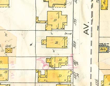
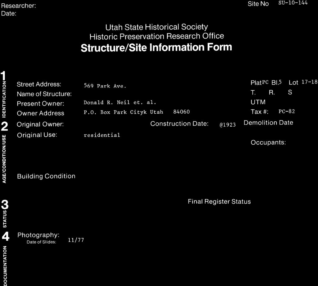
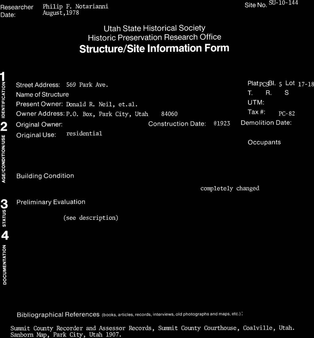
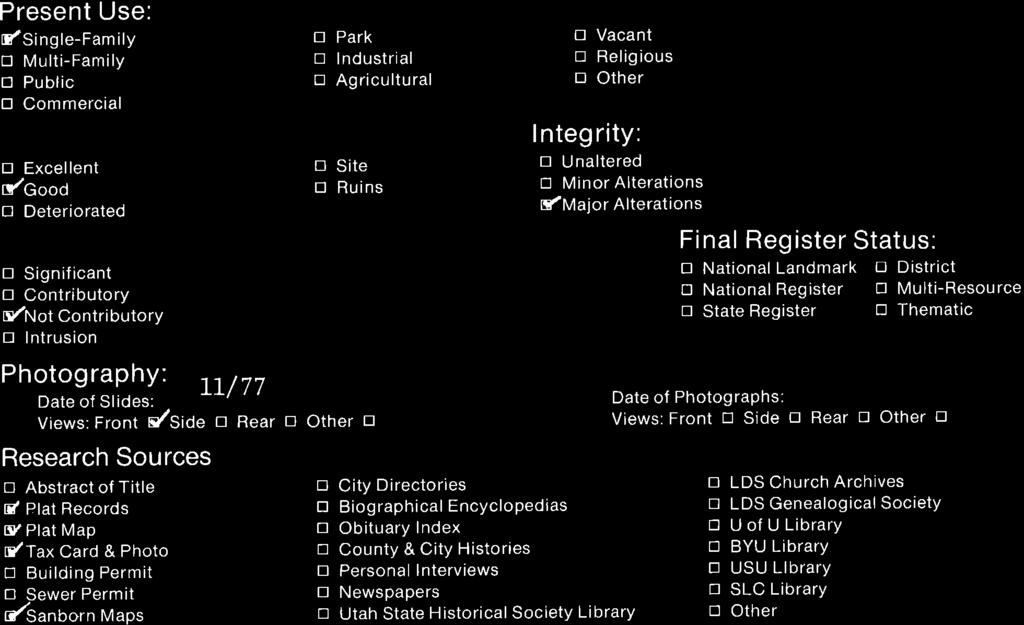
1 HISTORIC SITE FORM HISTORIC SITES INVENTORY 1 IDENTIFICATION Name of Property: House at 569 Park Avenue PARK CITY MUNICIPAL CORPORATION (10-08) Address: 569 Park Avenue City, County: Park City, Summit County, Utah Current Owner Name: William A. and Janet Kershaw, et. al. A.K.A.: Tax Number: PC-82 Parent Parcel(s): N/A Current Owner Address: 620 Mystic Lane, Sacramento, CA Legal Description (include acreage): LOTS 17 & 18 BLK 5 PARK CITY SURVEY [ ] (see record for complete legal description) 2 STATUS/USE Property Category Evaluation* Reconstruction Use building(s), main Landmark Site Date: Original Use: single dwelling building(s), attached Significant Site Permit #: Current Use: single dwelling building(s), detached Not Historic Full Partial building(s), public building(s), accessory *National Register of Historic Places: eligible ineligible structure(s) listed (date: ) 3 DOCUMENTATION Photos: Dates Research Sources (check all sources consulted, whether useful or not) tax photo: c abstract of title city/county histories prints: Nov (3) tax card personal interviews historic: original building permit Utah Hist. Research Center sewer permit USHS preservation files Drawings and Plans Sanborn maps USHS architects file measured floor plans obituary index LDS Family History Library site sketch map city directory/gazetteers Park City Hist. Soc./Museum Historic American Bldg. Survey census records university library(ies): original plans: biographical encyclopedias other: other: newspapers Bibliographical References (books, articles, interviews, etc.). Attach copies of all research notes and materials Carter, Thomas and Peter Goss. Utah s Historic Architecture, Salt Lake City: Center for Architectural Studies, Graduate School of Architecture, University of Utah and Utah State Historical Society, Hampshire, David, Martha Sonntag Bradley and Allen Roberts. A History of Summit County. Coalville, UT: Summit County Commission,1998. National Register of Historic Places. Park City Main Street Historic District. Park City, Utah, National Register # Peterson, Marie Ross and Mary M. Pearson. Echoes of Yesterday: Summit County Centennial History. Salt Lake City: Daughters of Utah Pioneers, Randall, Deborah Lyn. Park City, Utah: An Architectural History of Mining Town Housing, 1869 to Master of Arts thesis, University of Utah, Thompson, George A., and Fraser Buck. Treasure Mountain Home: Park City Revisited. Salt Lake City: Dream Garden Press, Researcher/Organization: John Ewanowski, CRSA Architecture Date: Nov. 2014
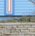
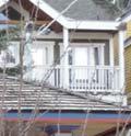
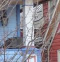
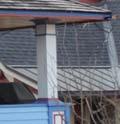
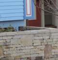
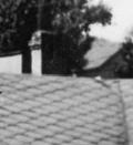
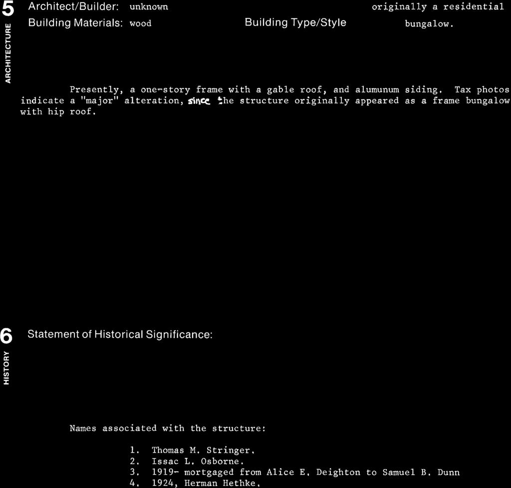
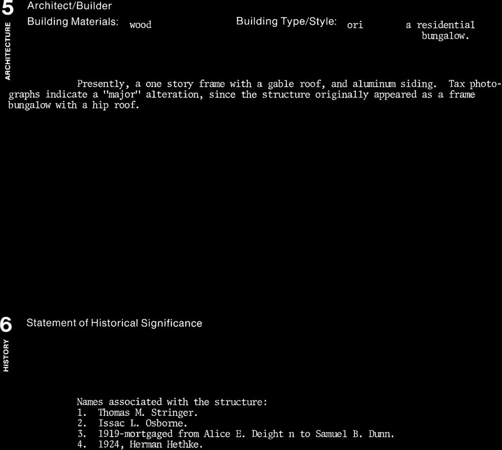
2 4 ARCHITECTURAL DESCRIPTION AND INTEGRITY 569 Park Avenue, Park City, Utah (2/5) Building Type and/or Style: bungalow type, Victorian Eclectic style No. Stories: 1 Additions: none minor major (describe below) Alterations: none minor major (describe below) Number of associated outbuilding and/or structures: accessory building(s), # 0 ; structure(s), # 0. General Condition of Exterior Materials: Materials: Good: Well-maintained with no serious problems apparent Fair: Some problems are apparent. Describe the problems: Poor: Major problems are apparent and constitute and imminent threat. Describe the problems: Uninhabitable/Ruin Foundation: concrete Walls: clapboard siding Roof: wood shingles Windows/Doors: slider windows (typical) and glazed wood front door with wooden trim. Essential Historical Form: retains does not retain Location: original location moved (date:, original location: ) Design: This bungalow is rectangular in plan, with a full width front porch and central entrance. The roof structure has been modified from a hipped type to include a gable on the front (east) elevation, a renovation that occurred after a tax photograph taken in the early 1940s. The front porch is made of wood and contains some Victorianinspired details. Slider windows have been installed to replace the original windows, which were presumably double-hung type. Setting: Set in Old Town Park City, one block west of historic Main Street. With narrow lots and streets, the neighborhood is relatively dense for single-family zoning. The house is set on a double-wide lot, which is approximately 50 x75. Many of the surrounding houses are historic. Workmanship: Was constructed of less common materials than surrounding Victorian residences, including clapboard siding, wood roof shingles, and slider windows, although these materials were also used to a small degree in Park City. Drop wood siding, asphalt shingles, and double-hung windows were more common. Some of the wood trim accents on the front façade suggest the Victorian style, but these were added after the 1940s tax photo and are not original. Feeling: Retains historic feel through material usage and details, although the original appearance has been altered somewhat. Bungalows were not as common in Park City as rectangular cabins, T-cabins, and pyramid houses, but that has the feel of a historic sample of that type. Association: The Mature Mining Era in Park City, during which the local mines were still producing a large share of the country s silver supply. A decline in silver prices through the 1920s was caused by increased production amidst decreased demand. This drop in prices caught up to Park City mines in the 1930s, which caused a local decline in the industry and an economic downturn, along with the Great Depression. Samuel B. and Alice
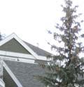
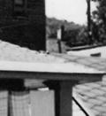
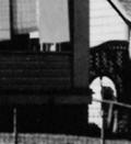
3 569 Park Avenue, Park City, Utah (3/5) Deighton Dunn purchased the property in 1917, immediately taking out an $ mortgage, suggesting a possible date of construction. 1 5 SIGNIFICANCE Architect: not known known: (source: ) Date of Construction: c Builder: not known known: (source: ) The site must represent an important part of the history or architecture of the community. A site need only be significant under one of the three areas listed below: 1. Historic Era: Settlement and Mining Boom Era ( ) Mature Mining Era ( ) Mining Decline and Emergence of Recreation Industry ( ) Description of historic era: By the 1890s, Park City was a bona fide mining town, with a railroad station, post office, fire department, and growing school system. While individuals lost and gained jobs based on fluctuating silver prices, the mining industry was relatively stable in Park City through the 1920s. The Great Fire of 1898 proved the strength of the town: while Main Street was almost completely levelled and sustained over $1,000,000 in damages, most of the buildings were rebuilt by Unlike other fire ravaged western mining towns, which often went permanently bust over similar blazes, the demand for Park City silver caused a rapid rebuilding of the business district. Park City survived the Spanish Flu Epidemic, World War I, and Prohibition mostly unscathed, boasting over 4,000 residents in the 1930 United States Census. 2. Persons: Thomas and Matilda Stringer (purchased 1899) and Samuel B. and Alice Deighton Dunn (purchased 1917) 3. Architecture: N/A 6 PHOTOS Photographs on the following pages (taken by the researcher, unless noted otherwise): Photo No. 1: Northeast oblique. Camera facing southwest. November Photo No. 2: East elevation. Camera facing west. November Photo No. 3: Southeast oblique. Camera facing northwest. November Photo No. 4: Southeast oblique. Camera facing northwest. Tax photo, c (Summit County) 1 From title abstracts in the Summit County Recorder s Office, Coalville, UT.


")


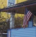


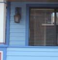


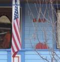


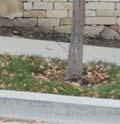

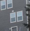


4 569 Park Avenue, Park City, Utah (4/5) Photo No. 1: Northeast oblique. Camera facing southwest. November Photo No. 2: East elevation. Camera facing west. November 2014.


")


")


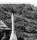
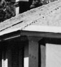


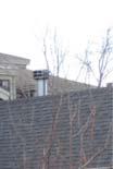


5 569 Park Avenue, Park City, Utah (5/5) Photo No. 3: Southeast oblique. Camera facing northwest. November Photo No. 4: Southeast oblique. Camera facing northwest. Tax photo, c (Summit County)


6 569 Park Avenue Sanborn Map History
7
8

9
10
11
NE¼ of NE¼ of NE¼ of NE¼ of section Roof configuration (enter one): Gabled Roof / Front Gabled Roof
: Gabled Roof / Front Gabled Roof") OAHP1403 Rev. 9/98 COLORADO CULTURAL RESOURCE SURVEY Official Eligibility Determination (OAHP use only) Date Initials Determined Eligible - National Register Architectural Inventory Form Determined Not
OAHP1403 Rev. 9/98 COLORADO CULTURAL RESOURCE SURVEY Official Eligibility Determination (OAHP use only) Date Initials Determined Eligible - National Register Architectural Inventory Form Determined Not
Architectural Inventory Form
 OAHP1403 Rev. 9/98 COLORADO CULTURAL RESOURCE SURVEY Architectural Inventory Form Official eligibility determination (OAHP use only) Date Initials Determined Eligible- NR Determined Not Eligible- NR Determined
Town: Sharon Place (neighborhood or village): Sharon. ame of Area: Present Use: Date (month / year): July 2008
: Sharon. ame of Area: Present Use: Date (month / year): July 2008") FORM A - AREA MASSACHUSETTS HISTORICAL COMMISSION MASSACHUSETTS ARCHIVES BUILDING 220 MORRISSEY BOULEVARD BOSTON, MASSACHUSETTS 02125 Photograph Assessor s Sheets USGS Quad Area Letter Form Numbers in
FORM A - AREA MASSACHUSETTS HISTORICAL COMMISSION MASSACHUSETTS ARCHIVES BUILDING 220 MORRISSEY BOULEVARD BOSTON, MASSACHUSETTS 02125 Photograph Assessor s Sheets USGS Quad Area Letter Form Numbers in
ADDENDUM. Chain of Title. Block C, Lot 8-9. Adrian I. Velthuis and Floyd T. Grant to Lottie Thompson
 Chain of Title Block C, Lot 8-9 NLP 5175:842 October 18, 1979 NLP 4979:58 October 5, 1977 NLP 4763:448 May 11, 1977 Adrian I. Velthuis and Floyd T. Grant to Lottie Thompson Gentlemens II Properties, Inc.,
THE BARNACLE 3485 MAIN HIGHWAY
 THE BARNACLE 3485 MAIN HIGHWAY Designation Report City of Miami REPORT OF THE CITY OF MIAMI PLANNING AND ZONING DEPARTMENT TO THE HISTORIC AND ENVIRONMENTAL PRESERVATION BOARD ON THE POTENTIAL DESIGNATION
808 Cherry Avenue
 808 Cherry Avenue 104-0213-0059 Primary Resource Information: Single Dwelling, Stories 2.00, Style: Other, ca 1900 July 2006: This 2-story, 3-bay frame I-house features a central-front gable, a brick pier
Architectural Inventory Form
 COLORADO CULTURAL RESOURCE SURVEY Page 1 of 3 Official Eligibility Determination (OAHP use only) Rev. 9/98 OAHP1403 Date Initials Determined Eligible National Register Determined Not Eligible National
Address 347 Whitney Street. East elevation, camera facing southwest.
 FORM B BUILDING Assessor s Number USGS Quad Area(s) Form Number MASSACHUSETTS HISTORICAL COMMISSION MASSACHUSETTS ARCHIVES BUILDING 220 MORRISSEY BOULEVARD BOSTON, MASSACHUSETTS 02125 Town Northborough
STATE OF IOWA. Historical and Architectural Survey for 2008 Flood Projects in Vinton, Benton County
 STATE OF IOWA CHESTER J. CULVER GOVERNOR PATTY JUDGE LT. GOVERNOR DEPARTMENT OF PUBLIC DEFENSE IOWA HOMELAND SECURITY AND EMERGENCY MANAGEMENT DIVISION DAVID L. MILLER, ADMINISTRATOR Historical and Architectural
NPS Form OMB No Exp Status occupied X unoccupied work in progress Accessible yes: restricted yes: unrestricted _5Lno
 NPS Form 10-900 OMB No. 1024-0018 Exp. 10-31-84 United States Department of the Interior National Park Service National Register of Historic Places Inventory Nomination Form See instructions in How to
Commonwealth of Massachusetts Massachusetts Historical Commission 220 Morrissey Boulevard, Boston, Massachusetts
 Inventory No: Historic Name: Common Name: Address: HRV.165 Blood, Joseph House Farnsworth, Jonathan - Beaman, Jonathan House 74 Poor Farm Rd City/Town: Village/Neighborhood: Local No: 9-17 Year Constructed:
1 Gildersleeve Wood (DHR # )
") GILDERSLEEVE WOOD 1 Gildersleeve Wood (DHR # 104-5092-0012) STREET ADDRESS: 1 Gildersleeve Wood MAP & PARCEL: 11-20 PRESENT ZONING: R-1U ORIGINAL OWNER: Lindsay Family ORIGINAL USE: PRESENT USE: PRESENT
GILDERSLEEVE WOOD 1 Gildersleeve Wood (DHR # 104-5092-0012) STREET ADDRESS: 1 Gildersleeve Wood MAP & PARCEL: 11-20 PRESENT ZONING: R-1U ORIGINAL OWNER: Lindsay Family ORIGINAL USE: PRESENT USE: PRESENT
 Page 1 Original Update HISTORICAL STRUCTURE FORM FLORIDA MASTER SITE FILE Consult Guide To Historical Structure Forms for detailed instructions Site # 8OR9844 Recorder # 26 Recorder Date 2/20/08 Site Name
Type of Building. By-law
 1 2-2-storey frame house on stone rubble foundation. - Built by Mead - "Ontario " plan. - Centred gable with arched window in gable. Meads 202 John Plan 20, Part Lot 20 1895 Residence - Shutters on the
Maryland Historical Trust Inventory No. PG: Maryland Inventory of Historic Properties Form
 Inventory No. PG: 62-012 Maryland Inventory of 1. Name of Property (indicate preferred name) historic other 2. Location street and number 11205 Old Baltimore Pike not for publication city, town Beltsville
 Page 1 of 6 Property: 1910 WILMINGTON AVE Parcel ID: N0170522017 Parcel Street Address: 1910 WILMINGTON AVE Richmond, VA 23227-4344 Owner: Mailing Address: Association Name : Parent Parcel ID: Assessment
Fletchertown (71A-022)
") Fletchertown (71A-022) Fletchertown is a late-nineteenth-century rural African-American community in northeastern Prince George s County. The community is located south of Huntington and northwest of Bowie.
Fletchertown (71A-022) Fletchertown is a late-nineteenth-century rural African-American community in northeastern Prince George s County. The community is located south of Huntington and northwest of Bowie.
Maryland Historical Trust Inventory No. PG: 81B-008 Maryland Inventory of Historic Properties Form
 Maryland Historical Trust Inventory No. PG: 81B-008 Maryland Inventory of 1. Name of Property (indicate preferred name) historic other 2. Location Dyson Farmhouse (preferred) street and number 13010 Piscataway
301 7½ Street SW
 301 7½ Street SW 104-0213-0072 Primary Resource Information: Single Dwelling, Stories 2.00, Style: Other, ca 1890 July 2006: This late-19th-century, 3-bay, 2-story, hip-roofed frame I-house features projecting
Maryland Historical Trust Inventory No. PG: 86A-026 Maryland Inventory of Historic Properties Form
 Inventory No. PG: 86A-026 Maryland Inventory of 1. Name of Property (indicate preferred name) historic other 2. Location street and number 12811 Croom Road not for publication city, town Naylor vicinity
Commonwealth of Massachusetts Massachusetts Historical Commission 220 Morrissey Boulevard, Boston, Massachusetts
 Inventory No: Historic Name: Common Name: Address: NWB.3010 Colonial Beacon Oil Company Shed Blue Frontier Yacht Services Office 115 Water St City/Town: Newburyport Village/Neighborhood: Local No: 20-10
Agriculture; Architecture; Community Planning
 Inventory No: Historic Name: SBR.Q Bemis - LaurEdo Farm Common Name: Address: City/Town: Village/Neighborhood: Local No: Year Constructed: Architect(s): Architectural Style(s): Use(s): Significance: Agricultural;
Houses on the east side of River Street, camera facing northeast. Date (month/year) March 2009
 March 2009") FORM A - AREA MASSACHUSETTS HISTORICAL COMMISSION MASSACHUSETTS ARCHIVES BUILDING 220 MORRISSEY BOULEVARD BOSTON, MASSACHUSETTS 02125 Assessor s Sheets USGS Quad Area Letter Form Numbers in Area Shrewsbury
FORM A - AREA MASSACHUSETTS HISTORICAL COMMISSION MASSACHUSETTS ARCHIVES BUILDING 220 MORRISSEY BOULEVARD BOSTON, MASSACHUSETTS 02125 Assessor s Sheets USGS Quad Area Letter Form Numbers in Area Shrewsbury
Architectural Inventory Form
 COLORADO CULTURAL RESOURCE SURVEY Page 1 of 3 Official Eligibility Determination (OAHP use only) Rev. 9/98 OAHP1403 Date Initials Determined Eligible National Register Determined Not Eligible National
HISTORIC LANDMARK COMMISSION APRIL 24, 2017 DEMOLITION AND RELOCATION PERMITS HDP E. 3 RD STREET
 HISTORIC LANDMARK COMMISSION APRIL 24, 2017 DEMOLITION AND RELOCATION PERMITS HDP-2017-0100 1401 E. 3 RD STREET D.3-1 PROPOSAL Demolish a ca. 1923 house. ARCHITECTURE One-story, rectangular-plan, stone-veneered
FLAGLER WORKER S HOUSE FORT DALLAS PARK S.E. 4 STREET
 FLAGLER WORKER S HOUSE FORT DALLAS PARK 60-64 S.E. 4 STREET Designation Report City of Miami REPORT OF THE CITY OF MIAMI PLANNING DEPARTMENT TO THE HERITAGE CONSERVATION BOARD ON THE POTENTIAL DESIGNATION
MAGIC CITY PARK NE 2 ND AVENUE
 MAGIC CITY PARK 6001 6005 NE 2 ND AVENUE Designation Report City of Miami REPORT OF THE CITY OF MIAMI PRESERVATION OFFICER TO THE HISTORIC AND ENVIRONMENTAL PRESERVATION BOARD ON THE POTENTIAL DESIGNATION
State Level Historic Documentation Report. John Blue Bridge Hampshire County
 State Level Historic Documentation Report State Project No. S314-28-22.27 Federal Project No. BR-0028(058)D John Blue Bridge Hampshire County Prepared by: Randy Epperly, Historian Department of Transportation
East and north elevations, camera facing west. Condition Good
 FORM B BUILDING MASSACHUSETTS HISTORICAL COMMISSION MASSACHUSETTS ARCHIVES BUILDING 220 MORRISSEY BOULEVARD BOSTON, MASSACHUSETTS 02125 Assessor s Number USGS Quad Area(s) Form Number Town Northborough
Change dormers and main entry on the river side of the house. Site: 43 Riverbank Road, Block 10 Lot 3
 City of Burlington Historic Preservation Commission Meeting Minutes: December 2, 2015 The City of Burlington Historic Preservation Commission held its regular monthly meeting on Wednesday, December 2,
Charles Pillsbury Allen House
 Charles Pillsbury Allen House 1380 Rocky Lake Drive circa 1847 In 1831, Charles Pillsbury Allen (1805-1862) started his Chair and Bucket Manufactory in Fall River. In 1847, Mr. Allen (1805-1862) bought
Maryland Historical Trust Inventory No Maryland Inventory of Historic Properties Form
 Inventory No. 32-31 Maryland Inventory of 1. Name of Property (indicate preferred name) historic Pinecrest Recreation Center 1 other Pinecrest Recreation Building (preferred) 2. Location street and number
The meeting house is a converted Plymouth Brethren Chapel which originally was two cottages. It has medium significance.
 Quaker Meeting House, Ashburton Foales Court, off North Street, Ashburton, Devon, TQ13 7QE National Grid Reference: SX 75574 69951 Statement of Significance The meeting house is a converted Plymouth Brethren
Commonwealth of Massachusetts Massachusetts Historical Commission 220 Morrissey Boulevard, Boston, Massachusetts
 Inventory No: Historic Name: Common Name: Address: HRV.173 Rand, Jonathan House and Farm Taylor, William Jr. - Barnard, Ephraim House 44 Littleton County Rd City/Town: Village/Neighborhood: Local No: 23-20,21
Eagle Harbor (PG 87B-038)
") Eagle Harbor (PG 87B-038) The resort community of Eagle Harbor began to develop in the 1920s at the site of an ancient river port, Trueman Point (87B-028), on the Patuxent River. 1 Eagle Harbor is located
Eagle Harbor (PG 87B-038) The resort community of Eagle Harbor began to develop in the 1920s at the site of an ancient river port, Trueman Point (87B-028), on the Patuxent River. 1 Eagle Harbor is located
HISTORIC DISTRICT STUDY COMMITTEE REPORT GEORGE FARMSTEAD HISTORIC DISTRICT OAKLAND TOWNSHIP, MICHIGAN
 HISTORIC DISTRICT STUDY COMMITTEE REPORT GEORGE FARMSTEAD HISTORIC DISTRICT OAKLAND TOWNSHIP, MICHIGAN HISTORIC DISTRICT STUDY COMMITTEE REPORT GEORGE FARMSTEAD HISTORIC DISTRICT OAKLAND TOWNSHIP, MICHIGAN
Maryland Historical Trust Inventory No. PG: Maryland Inventory of Historic Properties Form
 Inventory No. PG: 67-022-22 Maryland Inventory of 1. Name of Property (indicate preferred name) historic other 2. Location street and number 5707 Seminole Street not for publication city, town Berwyn Heights
Front Carport Design Standards, Requirements & Application
 Front Carport Design Standards, Requirements & Application THIS PAGE INTENTIONALLY LEFT BLANK. Carport: A structure designed or used to shelter vehicles that is open on at least two sides. Carport shall
city or town Muscatine vicinity, county Muscatine Legal Description: (If Rural) Township Name Township No. Range No. Section Quarter of Quarter
 Township Name Township No. Range No. Section Quarter of Quarter") Site Inventory Form State Inventory No. 70-00233 New Supplemental State Historical Society of Iowa Part of a district with known boundaries (enter inventory no.) (December 1, 1999) Relationship: Contributing
Site Inventory Form State Inventory No. 70-00233 New Supplemental State Historical Society of Iowa Part of a district with known boundaries (enter inventory no.) (December 1, 1999) Relationship: Contributing
Maryland Historical Trust Inventory No. PG: 86A-003 Maryland Inventory of Historic Properties Form
 Inventory No. PG: 86A-003 Maryland Inventory of 1. Name of Property (indicate preferred name) historic other 2. Location street and number 12005 Duley Station Road not for publication city, town Upper
National Register of Historic Places Inventory Nomination Form
 NPS Form 10-900-a Exp. 10-31-84 Continuation sheet 4 5 item number 7 Page 45 NAME: Knight Estate LOCATION: 486 East Avenue,,--v..u^-^ OWNER: State of Rhode Island Department of Education Board of Regents
Number of Resources within Property: Contributing Noncontributing buildings sites stmctures objects. 2 0 Total
 NPS Form 10-900 (Rev. 8-86) United States Department of the Interior National Park Service NATIONAL REGISTER OF HISTORIC PLACES REGISTRATION FORM OMB No. 1024-0018 FE3 19 1S9Z NATIONAL ^ 1. NAME OF PROPERTY
Maryland Historical Trust Inventory No. 15/6 Maryland Inventory of Historic Properties Form
 Inventory No. 15/6 Maryland Inventory of 1. Name of Property (indicate preferred name) historic Becraft Farm other 2. Location street and number 28500 Ridge Road not for publication city, town Mount Airy
nr" I... Town ses: Present Greek Orthodox Church Original Greek Orthodox Church 1>w~urce Centen~ial '90. i Moineau Photo Coll.
 w u" :~ :;, - FORM B - BULDNG Assess6r'~ number USGS Quad Massachusetts Historical Commission : «69 367 Town nr" Marlborough (neighborhood or village) rdress Central Street storic Name Saints Anargyroi
NATIONAL REGISTER OF HISTORIC PLACES REGISTRATION FORM
 NPS Form 10-900 OMB No. 1024-0018 (Rev. 10-90) United States Department of the Interior National Park Service NATIONAL REGISTER OF HISTORIC PLACES REGISTRATION FORM 1. Name of Property historic name Compton-Johnson
Total 1 Total. Current Functions (Enter categories from instructions) Materials (Enter categories from instructions)
 Materials (Enter categories from instructions)") Site Inventory Form State Inventory No. 29-00962 New Supplemental State Historical Society of Iowa Part of a district with known boundaries (enter inventory no.) 29-03685 (November 2005) Relationship:
Site Inventory Form State Inventory No. 29-00962 New Supplemental State Historical Society of Iowa Part of a district with known boundaries (enter inventory no.) 29-03685 (November 2005) Relationship:
MEDIA ADVISORY. FOR IMMEDIATE RELEASE November 12, 2012
 MEDIA ADVISORY FOR IMMEDIATE RELEASE November 12, 2012 Niagara-on-the-Lake On Monday, November 19, 2012, the Lord Mayor and members of the Town s Municipal Heritage Committee and War of 1812 Bicentennial
National Register off Historic Places Inventory Nomination Form
 NPS Fomi ia-900-a OMB Ho. 1024-0018 Exp. 10-31-S4 United States Department of the Interior National Park Service National Register off Historic Places Inventory Nomination Form For HPS UM only received
History/Descriptive Notes: 3.5 acres with orchard that was actively used until current owner purchased in 1982.
 Address: 4395 McCandlish Road Tax Parcel Number: 12-22-200-031 Year Built: 1926 (per owner) Architectural Style: Craftsman Other Buildings/Features: garage (date unknown) 61 History/Descriptive Notes:
Abandoned or Vacant; Agricultural; Camp; Other Residential Agriculture; Archaeology, Historic; Architecture; Politics Government; Social History
 Inventory No: Historic Name: HRV.G Civilian Conservation Camp Common Name: Address: City/Town: Village/Neighborhood: Local No: 13-7.01 Year Constructed: Architect(s): Architectural Style(s): Use(s): Significance:
URBAN DESIGN REPORT. Proposed Residential Development, Old Church Road, Caledon East
 Proposed Residential Development, Old Church Road, Caledon East TABLE CONTENTS: 1.0 DEVELOPMENT 1.1 Introduction-Analysis of Guiding Principles and Documents 1.2 Community Design and Architectural Design
3. Classification -- Category Ownership Status Present Use
 United States Department of the Interior National Park Service?htbn~! Register of klkt~rk Places For HPS UM only received Inventory-Nomination Form date entered See instructions in How to Complete National
WHANGANUI DISTRICT HERITAGE INVENTORY
 WHANGANUI DISTRICT HERITAGE INVENTORY Register Item No: 314 Type: Building Site: Pre-1900 Archaeological Interest Name: GRAND HOTEL Location: 99 St Hill Street (cnr Guyton Street), Whanganui Legal Description:
United States Department of the Interior National Park Service. Boundary Expansion Listed in National Register January 11, 2017
 NPS Form 10900-a (Rev. 8/2002) OMB No. 10240018 United States Department of the Interior National Park Service Boundary Expansion Listed in National Register January 11, 2017 National Register of Historic
ate: AR County: Pulaski Code: AR Zip Code: Noncontributing buildings sites structures objects Total
 Mims-Ereedlove-Priest-Weatherton House Name of Property Little Rock, AR County and State ~- -,s Form 10-900 'V. 8-86) OMB No. 1024-0018 United States Department of the Interior National Park Service NATIONAL
Riverside County Landmark Application Lawler Lodge
 November 20, 2014 Agenda Item: 9.3 Job Code: 2014-11 Riverside County Landmark Application Lawler Lodge 1. SITE NAME: a. Historic: Lawler Park, Lawler Lodge b. Common: Lawler Lodge 2. LOCATION: a. Address:
Finding Aid for the Kent County bridges collection Collection 132
 Finding Aid for the Kent County bridges collection Collection 132 Finding aid prepared by Mary S. Alfson This finding aid was produced using the Archivists' Toolkit January 31, 2014 Describing Archives:
THE CORPORATION OF THE TOWN OF NIAGARA-ON-THE-LAKE. BY-LAW NO (214 Four Mile Creek Road)
") THE CORPORATION OF THE TOWN OF NIAGARA-ON-THE-LAKE BY-LAW NO. 4807-15 (214 Four Mile Creek Road) A BY-LAW TO DESIGNATE THE PROPERTY KNOWN MUNICIPALLY AS WOODBOURNE, 214 FOUR MILE CREEK ROAD, IN THE TOWN
THE CORPORATION OF THE TOWN OF NIAGARA-ON-THE-LAKE BY-LAW NO. 4807-15 (214 Four Mile Creek Road) A BY-LAW TO DESIGNATE THE PROPERTY KNOWN MUNICIPALLY AS WOODBOURNE, 214 FOUR MILE CREEK ROAD, IN THE TOWN
HENNIGAN PLACE. This photograph is circa November Name, address, and telephone number of the present owner and occupant of the property:
 HENNIGAN PLACE This report was written on November 7, 1979 This photograph is circa November 2006. 1. Name and location of the property: The property known as the Hennigan Place is located at 3503 Tilley
RESEARCH AND EVALUATION SUMMARY: 297 AND 299 SHERBOURNE STREET
 ATTACHMENT NO. 6 RESEARCH AND EVALUATION SUMMARY: 297 AND 299 SHERBOURNE STREET William Elliott Houses: principal (west) elevations (Heritage Preservation Services, 2016) HISTORICAL CHRONOLOGY Key Date
City Of Kingston Municipal Heritage Committee Meeting Number Agenda Monday August 25, 2014 at 1:00 p.m. Council Chamber, City Hall
 City Of Kingston Meeting Number 10-2014 Agenda Monday August 25, 2014 at 1:00 p.m. Council Chamber, City Hall Please provide regrets to Mr. James Thompson, Committee Clerk at 613-546- 4291, extension 1268
National Register of Historic Places Registration Form
 NPS Form 10-900 OMB No. 10024-0018 (Oct. 1990) United States Department of the Interior National Park Service National Register of Historic Places Registration Form 1. Name of Property historic name Hickory
National Register of Historic Places Registration Form
 NPS Form 10-900 OMB No. 10024-0018 (Oct. 1990) United States Department of the Interior National Register of Historic Places Registration Form 1. historic name South Charles Town Historic District other
Inclusion on the City of Toronto Inventory of Heritage Properties 27 Front Street East (St. Lawrence Centre)
") STAFF REPORT ACTION REQUIRED Inclusion on the City of Toronto Inventory of Heritage Properties 27 Front Street East (St. Lawrence Centre) Date: December 20, 2012 To: From: Toronto Preservation Board Toronto
STAFF REPORT ACTION REQUIRED Inclusion on the City of Toronto Inventory of Heritage Properties 27 Front Street East (St. Lawrence Centre) Date: December 20, 2012 To: From: Toronto Preservation Board Toronto
Notice of Intent of Waiver with Respect to Land; Fort Wayne International Airport, Fort Wayne, IN. AGENCY: Federal Aviation Administration (FAA), DOT.
, DOT.") This document is scheduled to be published in the Federal Register on 03/23/2018 and available online at https://federalregister.gov/d/2018-05888, and on FDsys.gov [4910-13] DEPARTMENT OF TRANSPORTATION
This document is scheduled to be published in the Federal Register on 03/23/2018 and available online at https://federalregister.gov/d/2018-05888, and on FDsys.gov [4910-13] DEPARTMENT OF TRANSPORTATION
THE FORMER BRADBURY HALL, CHATSWORTH ROAD, CHESTERFIELD. GROUP LEADER, DEVELOPMENT MANAGEMENT
 AGENDA ITEM NO. 7 THE FORMER BRADBURY HALL, CHATSWORTH ROAD, CHESTERFIELD. MEETING: PLANNING COMMITTEE DATE: 17 TH MAY 2004 REPORT BY: WARD: COMMUNITY FORUM: GROUP LEADER, DEVELOPMENT MANAGEMENT HOLMEBROOK
NPS Form OMB No (Rev ) U. S. Department of the Interior Name of Property: Hungry Mother State Park Historic District
 U. S. Department of the Interior Name of Property: Hungry Mother State Park Historic District") NPS Form 10-900 OMB No. 1024-4018 (Rev. 10-90) U. S. Department of the Interior Name of Property: Location: 5. Classification Ownership of Property (Check as many boxes as apply) Category of Property (Check
NPS Form 10-900 OMB No. 1024-4018 (Rev. 10-90) U. S. Department of the Interior Name of Property: Location: 5. Classification Ownership of Property (Check as many boxes as apply) Category of Property (Check
SEE ATTACHED SHEET. Massachusetts Historical Commission 80 Boylston Street Boston, Massachusetts 02116
 FORMA - AREA Assessor's Sheets USGS Quad Area Letter Form Numbers in Area 153, 64-67, 1 I I I 124,57, 67, 91, I 76-79, 88-9d 650, 651, 9] 6-918, 1230-1241 West residential. commercial. industrial..."onstructiondates
STATE OF WASHINGTON ARCHAEOLOGICAL SITE INVENTORY FORM
 STATE OF WASHINGTON ARCHAEOLOGICAL SITE INVENTORY FORM Smithsonian Number: 45 County: Chelan Date: 6/12/2018 Human Remains? DAHP Case No.: Archaeological Sites are exempt from public disclosure per RCW
AHPP. LISTED ========================================================================
 NPS Form 10-900 (Rev. 8-86) Jnited States Department of the Interior ational Park Service OMB No. 1024-0018 LISTED NATIONAL REGISTER OF HISTORIC PLACES REGISTRATION FORM AHPP. 1. Historic Name: Bush-Dubisson
Hwy Retaining Wall/ Sea Wall. Not Eligible, see Statement of Significance Also member of listed NR district: Mantorville Historic District
 Historic Name CS # 2007 Other Name SHPO Inv # Location E and W sides of TH 57 between 6th St and 7th St Hwy District Reference City/Township County Mantorville, City of Dodge Acres Twp Rng Sec 107N 16W
Seaforth Walking Tour
 Seaforth Walking Tour 1: Victoria Park The land for Victoria Park was donated to the Town by Dr. William Gouinlock in 1875, (one year after Seaforth was officially incorporated). The bandshell was constructed
Figure San Dimas Bonita at San Dimas Avenue (view looking west)
") The adjoining neighborhood has an eclectic assortment of building types and uses, including: the historically significant but not architecturally or visually noteworthy San Dimas Lemon Association Packing
The adjoining neighborhood has an eclectic assortment of building types and uses, including: the historically significant but not architecturally or visually noteworthy San Dimas Lemon Association Packing
L 2-1. Heritage Report: Reasons for Heritage Designation. Wilkinson / Lundy Farmhouse 715 Queen Street West
 L 2-1 Heritage Report: Reasons for Heritage Designation Brampton Heritage Board Date: January 15, 2013 Wilkinson / Lundy Farmhouse 715 Queen Street West January 2013 1 L 2-2 Profile of Subject Property
City of Rolling Hills INCORPORATED JANUARY 24, 1957
 City of Rolling Hills INCORPORATED JANUARY 24, 1957 NO. 2 PORTUGUESE BEND ROAD ROLLING HILLS, CA 90274 (310) 377-1521 FAX (310) 377-7288 INSTRUCTIONS FOR COMPLETION OF THE LOT COVERAGE FORMS TOTAL STRUCTURES
17 Mathilda Welmering Park Planning Zone 3
 17 Mathilda Welmering Park Planning Zone 3 8301 Mathilda Visit Date: September 2016 St. Louis County Parks Master Plan Page 1 Description: The six acre Mathilda Welmering Park is named for two streets
OCALA HISTORIC PRESERVATION ADVISORY BOARD MEETING
 1). Call to Order and Roll Call OCALA HISTORIC PRESERVATION ADVISORY BOARD MEETING 2). Public Meeting Notice Acknowledgement Citizen Service Center (2 nd Floor) Growth Management Training Room 201 SE 3
MINNESOTA HISTORIC.PROPERTIES INVENTORY FORM. Yes_ No X Restricted
 HISTORIC NAME: CURRENT NAME: LEGAL DESC.: MINNESOTA HISTORIC.PROPERTIES INVENTORY FORM Hartley Sugar Camp W % of Gov't. Lot 3 and T55, R24, Sec. 9 COUNTY: Itasca CITY/TWP.: Trout Lake Twp. ADDRESS: of
San Francisco Planning Department South Mission Historic Resources Survey Historic District Description
 and Lofts West side of Orange Alley between 25 th and 26 th Streets. Boundaries: West side of Orange Alley between 25 th and 26 th Streets (back lots with frontage on Valencia Street) Period of Significance:
Mountain Valley Pipeline, LLC Mountain Valley Pipeline Project Docket No. CP
 16. Prior to construction, Mountain Valley shall file with the Secretary, for review and approval by the Director of OEP, a segment-specific construction and operation access plan for the area between
TOWNSHIP OF COLTS NECK ARCHITECTURAL REVIEW COMMITTEE February 28, 2006
 TOWNSHIP OF COLTS NECK ARCHITECTURAL REVIEW COMMITTEE February 28, 2006 Chairperson, Lillian Burry, called the Colts Neck Architectural Review Committee to order at 5:30 p.m. She read the following statement:
New Orleans Historic District Landmarks Commission Nomination Report 210 State Street, former NOAH Campus July 17, 2014
 New Orleans Historic District Landmarks Commission Nomination Report 210 State Street, former NOAH Campus July 17, 2014 Meeting Date: July 17, 2014 Property Address: Owner: 210 State Street Children s
COLORADO HISTORICAL SOCIETY
 SECTION I COLORADO HISTORICAL SOCIETY OAHP1414 (Rev. 11/2001) COLORADO STATE REGISTER OF HISTORIC PROPERTIES NOMINATION FORM Name of Property Historic Name Boor Ranch/Boor Homestead Other Names Redmond
Intensive Level Historic Resources Survey 5.0 ANNOTATED LIST OF PROPERTIES
 Intensive Level Historic Resources Survey 5.0 ANNOTATED LIST OF PROPERTIES CBCA PN 05-012A May 2009 Photo Location Description 10760 Bodine Road Date: 1811 Historic addition of side block to the rear;
Sylvan Park Neighborhood Survey, ca. 1983
 Sylvan Park Neighborhood Survey, ca. 1983 Collection Summary Creator: Sarah Foster Kelley Title: Sylvan Park Neighborhood Survey Inclusive Dates: ca.1983 Summary/Abstract: Deed research sheets and color
National Register of Historic Places Registration Form
 NPS Form 10-900 OMB No. 10024-0018 (Oct. 1990) Registration Form This form is for use in nominating or requesting determinations for individual properties and districts. See instructions in How to Complete
STREET STATEMENT OF SIGNIFICANCE MARCH 2017
 1195 12 TH STREET STATEMENT OF SIGNIFICANCE MARCH 2017 HISTORIC CONTEXT The Rush House is located in the historic Ambleside neighbourhood of West Vancouver. Due to its position along the Burrard Inlet,
National Register of Historic Places Registration Form
 NPS Form 10-900 OMB No. 1024-0018 (Expires 5/31/2012) National Register of Historic Places Registration Form This form is for use in nominating or requesting determinations for individual properties and
AH pp. I Ti. Nov 7 I) I I y
 I I y") ..------------------------------------------ ------------ - - -- - NPS Form 10-900 (Rev. 8-86) United States Department of the Interior ~a tional Park Service NATIONAL REGISTER OF HISTORIC PLACES REGISTRATION
..------------------------------------------ ------------ - - -- - NPS Form 10-900 (Rev. 8-86) United States Department of the Interior ~a tional Park Service NATIONAL REGISTER OF HISTORIC PLACES REGISTRATION
Friends Meeting House, Hitchin. 1 Paynes Park, Hitchin, Hertfordshire, SG5 1EH. National Grid Reference: TL Statement of Significance
 Friends Meeting House, Hitchin 1 Paynes Park, Hitchin, Hertfordshire, SG5 1EH National Grid Reference: TL 18282 29279 Statement of Significance A meeting house of 1957 designed by Paul V. Mauger and erected
Address: Fenton Road Tax Parcel Number: Year Built: 1929
 Site Name: Camp Copneconic 39 Address: 10407 Fenton Road Tax Parcel Number: 12-31-300-001 Year Built: 1929 (date source: Tax records) Architectural Style: American Lodge/Timber Framed Other Buildings/Features:
Gilpin County Historic Preservation Advisory Commission. 114 Redtail Road Historic Eligibility Review
 Gilpin County Historic Preservation Advisory Commission 114 Redtail Road Historic Eligibility Review Deon Wolfenbarger Three Gables Preservation February 18, 2017 BACKGROUND The purpose of the review is
Berwyn Heights (67-022)
") Berwyn Heights (67-022) Berwyn Heights was established as a late-nineteenth-century railroad and streetcar suburb, located in northwestern Prince George s County, approximately eight miles northeast of
Berwyn Heights (67-022) Berwyn Heights was established as a late-nineteenth-century railroad and streetcar suburb, located in northwestern Prince George s County, approximately eight miles northeast of
HEARST GARDENS BERKELEY, CA 94702
 APPLICANT: RHOADES PLANNING GROUP 1611 TELEGRAPH AVE. SUITE 200 OAKLAND, CA 94612 [510] 545-4341 PROJECT: BERKELEY, CA 94702 ARCHITECT: DEVI DUTTA-CHOUDHURY, AIA DEVI DUTTA ARCHITECTURE INC. 1958A UNIVERSITY
February 2006 COA Report
 February 2006 COA Report Date 2/21/2006 957 East 4th Street, Long Beach, California 90802 Coffee Pot Café 2/28/2006 225 West Anaheim Street, Long Beach, California 90813 Windows, install new single light
MASSACHUSETTSHISTORICAL COMMISSION Office of the Secretary, State House, Boston. 1. Town Marlborough. Name Josiah Stow Homestead.
 FORM B - BUILDING In Area no. Form no. MASSACHUSETTSHISTORICAL COMMISSION Office of the Secretary, State House, Boston / ;;L. 1. Town Address Spoonhill Ave. Name Josiah Stow Homestead 2. Present use Residence
National Register of Historic Places Registration Form
 NPS Form 10-900 OMB No. 10024-0018 (Oct. 1990) Registration Form This form is for use in nominating or requesting determinations for individual properties and districts. See instructions in How to Complete
Appendix E Historic Property Inventory Forms
 Appendix E Historic Property Inventory Forms TECHNICAL MEMORANDUM Sound Transit Federal Way Link Extension WISAARD Survey Entries PREPARED FOR: COPY TO: PREPARED BY: Sound Transit Alisa Swank/ CH2M MaryNell
927 JEFFERSON SUITES. A Unique Luxury Property in the Heart of South Beach
 927 JEFFERSON SUITES A Unique Luxury Property in the Heart of South Beach Named the 8th Hottest Hotel in 2016 in Miami Beach by Curbed Miami TOP RATED INDEX Introduction History Location and Surroundings
PROJECT: Rehabilitate Historic Bathhouses for Adaptive Use
 LOCATION: Hot Springs National Park, Hot Springs Arkansas SIZE: Approximately 105,000 sf among six buildings DATE: 2003-present ROLE: Project Manager for Historic Structure Reports, pre-design through