Existing Zoning Kingwood Township, Hunterdon County, NJ. October 2012 AR-2 AR-2 AR-2. Figure 1a
|
|
|
- Emma Brooks
- 5 years ago
- Views:
Transcription
1 Existing Zoning Figure 1a HC VR-1 VC-1 VR-1: Village Residential -1 VC-2 BP VR-2: Village Residential - 2 Agricultural/Residential VC-1: Village Commercial - 1 PO/R VC-2: Village Commercial - 2 PO/R: Professional Office/Research HC: Highway Commercial BP: Business Park BC: Byram Colony VR-2 BROOK BC LOCKATONG
2 Land Use Plan Figure 1b Overlay istricts Commercial/Artisan Subdistrict Mixed Use Core Subdistrict Professional Office/Residential Subdistrict Scenic Corridor Overlay Land Use Plan VR-1: Village Residential - 1 VR-2: Village Residential - 2 : Agricultural/Residential VC-1: Village Commercial - 1 VC-2: Village Commercial - 2 PO/R: Professional Office/Residential HC: Highway Commercial BP: Business Park BC: Byram Colony HC VC-2 VR-2 VR-1 VC-1 PO/R BP BROOK BC LOCKATONG NJEP LU/LC

3 Figure 2: Recommended Amendment to Zoning Map Route 12 Scenic Corridor Overlay (SCO) Zone October 2011 Reexamination Report istrict Route 12 Scenic Corridor Overlay VR-1 Village Residential-1 VR-2 Village Residential-2 Agricultural/Residential VC-1 Village Commercial-1 VC-2 Village Commercial-2 HC Highway Commercial BP Business Park PO/R Professional Office/Residential HC VC-2 VR-1 VR-1 VC-1 VC-2 LOWER HC PO/R HC ALFO LA WAGON WHEEL R PO/R BP PO/R NJEP, Hunterdon County, Maser Consulting
4 PO/R PO/R BP Figure 3: Recommended Amendment to Zoning Map Eastern Gateway Village Center Overlay (EGVCO) Zone October 2011 Reexamination Report Zoning Eastern Gateway Village Center Overlay Zone Commercial/Artisan Subdistrict Mixed Use Core Subdistrict Professional Office/Residential Subdistrict Agricultural/Residential BP Business Park PO/R Professional Office/Residential PITTSTOWN PO/R ,000 Feet NJEP, Hunterdon County, Maser Consulting
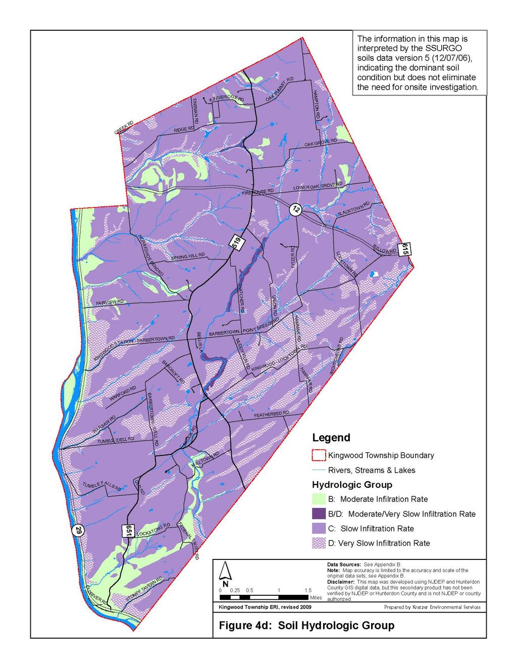
5 Soils by Acres per Septic Figure 4 Zone Boundaries Acres per Septic System Greater than 6 acres but less than 7 acres 7 acres and greater but less than 8 acres 8 acres or greater but less than 9 acres Not Applicable VR-2 HC VR-1 VC-2 VC-1 VR-1 VC-2 HC PO/R HC STANBURY LA KINGWOO - LOWER ALFO LA PO/R BP PO/R WICHECHEOKE NRCS - SSURGO version 2.2 TUMBLE FALLS BC BYRAM - LOCKATONG Soil(s) Name Acres/Septic Hazelton and Neshaminy 6.7 Riverhead and Klinesville 6.8 Birdsboro and Pope 6.9 Bucks, Legore, and Lansdale 7 Chalfont 7.7 Abbottstown 7.8 Penn and Reaville 7.9 Readington 8.1 Mount Lucas 8.2 Rowlands 8.3 Lehigh 8.4 Quakertown 8.5 Bowmansville, Croton, Pits, Sand, gravel, Reaville Variant, Rubble, N/A Water


6 epth to Bedrock Figure 5 epth to Fragipan 15 to 30 Inches epth to Fragipan 24 to 36 Inches epth to Bedrock 0 Inches 10 to 20 Inches 18 to 33 Inches 20 to 33 Inches 20 to 40 Inches 40 to 53 Inches 40 to 60 Inches 42 to 72 Inches LOWER ALFO LA 44 to 56 Inches 48 to 60 Inches 48 to 99 Inches 54 to 66 Inches BARBERTOWN - POINT BREEZE No Restrictive Layer Pits, sand and gravel Water BROOK BYRAM - NRCS - SSURGO version 2.2
7 Groundwater Recharge Figure 6 Recharge Rates B: 10 to 17 inches per year C: 8 to 9 inches per year LOWER WAGON WHEEL R : 1 to 7 inches per year L: hydric Soils OL ROUTE 12 W: wetlands BARBERTOWN - POINT BREEZE KINGWOO - TUMBLE FALLS BYRAM LA BYRAM - LOCKATONG NJGS 2005GS02-3 Ground-Water Recharge for New Jersey
8 Geology Figure 7 Jurassic iabase Lockatong Formation Passaic Formation Passaic Formation Gray bed Red bed Stockton Formation LOWER ALFO LA BARBERTOWN - POINT BREEZE TUMBLE FALLS BROOK NJEP
9 epth to Seasonal High Water Table Figure 8 depth to Water 6 Inches 12 Inches 15 Inches LOWER OL ROUTE 12 WAGON WHEEL R 18 Inches 24 Inches 27 Inches Greater than 60 Inches Water BARBERTOWN - POINT BREEZE KINGWOO - TUMBLE FALLS BYRAM LA BYRAM - LOCKATONG NRCS - SSURGO version 2.2
10
11 Septic Suitability Figure 10 Not Rated Somewhat Limited Very Limited LOWER ALFO LA BARBERTOWN - POINT BREEZE TUMBLE FALLS BROOK NRCS - SSURGO version 2.2
12 Zoning and Tax Class Figure 11 Zone Boundaries Overlay istricts Commercial/Artisan Subdistrict Mixed Use Core Subdistrict Professional Office/Residential Subdistrict Scenic Corridor Overlay Property Class Vacant Residential Apartment Farm Assessed Farm Qualified Commercial Industrial Public School Public Property Church and Charitable Cemetery Other Exempt No ata TUMBLE FALLS HC BROOK VC-2 VR-2 VR-1 VC-1 PO/R BP BC
13 1995 Land Use/Land Cover Figure 12 IT OAK SUMM ON K HAMPT EE CR OA K GR O VE R Agriculture LOWER OAK GROVE Barren Land SL HO E H WY RTOWN MU N RU BA BR OO KR BE FEATHER E L L L TUMBLE IEL MI FEE R M - KIN G W OO AL T W R BYR A T LL N OW IST R OL P OM ST AW RS FT RO RC A W TOWN - I BARBER WA O RF LO W Y RBE STATION - BA KINGWOO N WIL BE LA ES THATCHER AY ANIEL BR Wetlands RS GW OO HO ALFOR KIN Urban Water NR Forest TOW ACK NJEP LU/LC This map epartment was of developed using Environmental Hunterdon Protection County Geographic N ER AV T F
14 2007 Land Use/Land Cover TR I NGSRI GE R OA K S OA RIGE K K EE CR HAMPTON UM MI Figure 13 RO V E R KG G LOWER OAK E FIREHOUS RO V E R OL RO U TO ACK SL TE WN 12 Agriculture N EY ISK WH BE Forest WIL LOW CK LO H OE KIN GW ES OO RS HO Barren Land R LA TO W N O B L E F ALLS E IN NW AR BR OO O R LA ILL GR ON L RA E T WIST BYR AM LA P OM ST WN TO FE T LOC KA E KR FEATHERB M W TU M BYR A M -K IN G O AR OO NR MM R LL TUMBLE IE W NG KI TO W O CK -L HA FT E LL R S R TOWN - I AR W AW R B AR B E R O RF WA BERTOWN WIC HEC HEO KE O ATION - BAR ER W ST EEZ HAMMAR G IN R N - POINT B BARBERTOW RO RC BA K AY HWY Wetlands THATCHER Water ANIEL BR Urban N ER AV FT NJEP LU/LC This map epartment was of developed using Environmental Hunterdon Protection County Geographic


15 Steep Slopes Figure 14 Slopes 0-12% Slopes 12%-15% Slopes 15%-20% Slopes 20%-25% Slopes greater than 25% LOWER ALFO LA BARBERTOWN - POINT BREEZE TUMBLE FALLS BROOK NJEP LU/LC
16 2007 Land Use/Land Cover - Wetlands Figure 15 LOWER ALFO LA Wetlands BARBERTOWN - POINT BREEZE TUMBLE FALLS BROOK NJEP LU/LC
17 Hydrology and Surface Water Quality Ni s h isakawick Creek Figure 16 FW2-Non-Trout FW2-Non-Trout (C1) FW2-Trout Maintanence (C1) FW2-Trout Production (C1) 100 yr Floodplain Water Wetlands Copper Creek UNT Little Nishisakawick Creek Copper Creek UNT Copper Creek UNT Copper Creek Lockatong Creek UNT Copper Creek UNT elaware River UNT elaware River UNT elaware River UNT elaware River UNT Warford Creek Lockatong Creek UNT Lockatong Creek UNT Lockatong Creek Lockatong Creek UNT Uncoded Tributary Muddy Run Muddy Run UNT Muddy Run UNT Wickecheoke Creek UNT Wickecheoke Creek UNT NJEP LU/LC elaware River UNT elaware River UNT


18 Farmland Capable Soils Figure 17 Preserved Farms Target Farms Statewide Important Soils Prime Farmland Soils LOWER ALFO LA BARBERTOWN - POINT BREEZE TUMBLE FALLS BROOK NRCS - SSURGO version 2.2
19 Wellhead Protection Areas, Non-Public Wells and Known Contaminated Sites %, Figure 18 %, %, %, %, %, %, %, Known Contaminated Sites Public Well Head Protection Areas Tier 1 (2 years) Tier 2 (5 years) Tier 3 (12 years) Non-Public Well Head Protection Areas Tier 1 (2 years) Tier 2 (5 Years) Tier 3 (12 Years) NJEP LU/LC
20 Sewer Service Areas Figure 19 Eastern Gateway Village Overlay Zone Area to be removed from Adopted SSA Proposed Sewer Service Areas LOWER ALFO LA BARBERTOWN - POINT BREEZE BROOK NJEP
" Voting Place " " Prince William County, Virginia Gainesville Election District Voting Precincts and Voting Places EVERGREEN BATTLEFIELD ALVEY
 GROVETON PAGELAN LN MOUNTAIN Prince William County, Virginia Gainesville Election istrict Voting Precincts and Voting Places EVERGREEN LOGMILL JAMES MAISON HY 15 Voting Place 401 Evergreen Precinct Evergreen
CITY OF WEST BEND NOTICE OF PUBLIC HEARING 2020 COMPREHENSIVE PLAN AMENDMENT
 CITY OF WE BEND NOTICE OF PUBLIC EARING 2020 COMPRNSIVE PLAN AMENDMENT NOTICE IS EBY GIVEN that a Public earing will be held in the City Council Chambers, 1115 S. Main Street, West Bend, Wisconsin, on
Crystal Spring SNA. Washington County N W N W N W N W N W92 45.
 W92 45.899 W92 45.835 W92 45.826 W92 45.814 Z o av ral eek s C r N45 15.465 W92 45.972 N45 15.439 W92 46.102 W92 45.913 hidden cove N45 15.413 W92 45.857 W92 45.791 W92 45.899 W92 45.835 W92 45.826 W92
Sewage Lagoon. Pine. Pine. Pine. Pine. Rd. Long. Pine/Spruce WHITEHORSE. Ic e. Pine. Rd. La ke. Spruce. L ak e. Miles. Lak. Pine/Spruce.
 r Fa lc /Spruc ighway Driv Falcon Kl on Alasa H di MAPHERSO Y. O HIDDE VALLEY L L E lvd OPPER RIDGE nb Snow Dump R to mil Ha RIVE on Hw Dr. y. Y YUK Spruc/ h v Dri La rt o r Sta it Ad Swag Lagoon n L ab
The Problem.. SuDS: Controlling the Flow. LANDF RM Technical delivery of SuDS 15/10/2013. Bridget Woods Ballard HR Wallingford 1.
 SuDS: Controlling the Flow 15th October 2013 Bridget Woods Ballard The Problem.. Page 2 Bridget Woods Ballard HR Wallingford 1 15th October 2013 Landform Event Page 3 HR Wallingford 2013 The Aim of SuDS.
TOURS. Day Tours from York Whitby. North York Moors. The Yorkshire Dales.
 TOURS 2018-2019 Day Tours from York Whitby North York Moors The Yorkshire Dales Castle Howard The Lake District 01904 405341 www.mountain-goat.com1 Welcome to Yorkshire 1972 Established in 1972 Small group
BON SECOUR VILLAGE 283 ACRE COASTAL MIXED USE DEVELOPMENT OPPORTUNITY GULF SHORES, AL HEATH MILLIGAN. PRINCIPAL
 283 ACRE COASTAL MIXED USE DEVELOPMENT OPPORTUNITY 1642 Powers Ferry Road SE Suite 250 Marietta, GA 30067 www.macallanre.com 283 ACRE COASTAL MIXED USE DEVELOPMENT OPPORTUNITY INTRODUCTION MACALLAN REAL
North Beach Redevelopment Initiative Alternative 1 Corpus Christi, Texas
 A C B 8 BACH TIMON BV SURFSI BV FSPRAY BURSON 5 5 5 4 5 5 BRIGPORT BRAKWATR 5 egend 4 9 0 Single Family etached Multi-Family Single Family Attached 4 5 Hotel/Hospitality Mixed-Use Restaurant/estination
TO LET offices. 20,735 to 64,639 sq ft. available now WATERFRONT HOUSE, TECHNOLOGY DRIVE, BEESTON BUSINESS PARK, NG9 1LA.
 TO LET offices WATERFNT HOUSE, TECHNOLOGY RIVE, BEESTON BUSINESS PARK, NG9 1LA available now 20,735 to 64,639 sq ft High Quality Refurbished Grade A offices Secure site with manned gatehouse Up to 323
BUCKS COUNTY TRAILS. September 10, 2015 Presentation to:
 BUCKS COUNTY TRAILS September 10, 2015 Presentation to: BUCKS COUNTY TRAILS Benefits of Trails Bucks County Trails The Circuit Active Trail Projects Planning Studies Municipal Trails Planning Other Trail
NEW PROPOSED WESTPORT DEVELOPMENT
 NEW PROPOSED WESTPORT DEVELOPMENT Build-To-Suit 2,400 Sq Ft Building plus Patio & Deck 4114 Broadway Boulevard, Kansas City, Missouri Premier restaurant location Estimated Population 273,992 Average Household
CA CA CA CA CA CA CA CA CA CA Educational facilities - public elementary and high schools and private schools with a curriculum similar to public
 (Y = Permitted) TABLE A (CA = Contract Agreement) PERMITTED USES BY DISTRICT Agricultural Uses (Light) Farming & Livestock related activities Y Y Y Y Y Y Agricultural Uses (Heavy) Commercial Type Animal
Ridgefield Crossing. Mixed-Use Development. Pricing: Site. Possible build-to-suit FOR SALE, GROUND LEASE, OR BUILT-TO-SUIT
 N 65th Ave N 10th St Pioneer St Site S 5th St S 6th Way Mixed-Use Development New mixed-use development with great freeway access. 128 housing units and 11 commercial lots planned. Drive-thru & build-to-suit
Stormwater Management Plan
 Stormwater Management Plan March 2010 Revision 1 (February 2011) A copy of this Stormwater Management Plan is to be kept on site at all times. Volume 1 of 1 120TH AVE. 120th AVE HUDSON RD. 120TH
City of North Liberty
 City of North Liberty City Council Agenda Special Session August 3, 11 AGENDA North Liberty City Council August 3, 11 Special Session :3 p.m. Council Chambers 1. Call to order.. Roll call. 3. Approval
HUTTO PFLUGERVILLE Y 183. Leander Rehabilitation PUD Northwest. Park at Lakeline. Lakeline Mall. Texas Guaranteed. Student Loan Corp.
 BRIARCLIFF JONESTOWN POINT VENTURE LAKEWAY SUBJECT VOLENTE CEDAR PARK PFLUGERVILLE HUTTO TAYLOR ELGIN 9.3 Acres 3.8 Acres M E TRL B ULLI CK C REEK RD HOLL O W RD Comanche Canyon ETJ PUD Twin Creeks Country
Yellowstone Benchmarks North Entrance Road
 Yellowstone Benchmarks From the North: Reset your odometer/gps at the Roosevelt Arch From Mammoth Hot Springs: Reset your odometer/gps as you pass the Mammoth Post Office heading north Most of the benchmarks
San Francisco, California Hunters Point Shipyard. Design for Development
 San Francisco, California Hunters Point Shipyard Design for Development San Francisco, California Hunters Point Shipyard Design for Development Adopted June 3, 2010 by: San Francisco Planning Commission
LAND AVAILABLE SITES WATERFORD COMMERCIAL LELAND, NC Don Harley u SUNCOAST
 LAND AVAILABLE SITES WATERFORD COMMERCIAL LELAND, NC 28451 Don Harley u 910-262-3148 don.harley@cbcsuncoast.com Coldwell Banker Commercial SunCoast u 1430 Commonwealth Drive u Suite 102 u Wilmington, NC
1430 Commonwealth Drive u Suite 102 T: u F:
 LAND AVAILABLE SITES WATERFORD COMMERCIAL LELAND, NC 28451 Don Harley u 910-262-3148 don.harley@cbcsuncoast.com Coldwell Banker Commercial Sun Coast Partners www.cbcsuncoast.com u u 1430 Commonwealth Drive
CHAPTER FIVE ENVIRONMENTAL CONSEQUENCES
 CHAPTER FIVE ENVIRONMENTAL CONSEQUENCES Pursuant to the environmental documentation requirements of FAA Order 1050.1E, Environmental Impacts, Policies and Procedures, this chapter describes the reasonably
Site Location. Site Location. Renville. Renville County. County. Sacred Heart Township. Chippewa. Kandiyohi. Yellow Medicine.
 M I N N E S O T A T117N Chippewa T117N R37 Sec 15 T117N Kandiyohi Sec 16 Site Location Sec 14 T114N R37 W ) 61 Sec 13 T116N R37W 565 12 Sec 22 Sec 23 Sec 24 565 10 565 11 Sec 21 )58 Sec 28 565 19 T114N
STRATHCONA COUNTY YELLOWHEAD NORTH ARTERIAL ROAD FUNCTIONAL DESIGN STUDY
 STRATHCONA COUNTY Appendix G - Right-of-Way Plans ( TR) TC +65.7 POB +. YELLOW HEAD NORTH 376 MC PIPELINE CORRIDOR.56 HECTARES.7 HECTARES. HECTARES.3 HECTARES LOT B A. TOWNSHIP ROAD 53 JOB RANGE ROAD 3
Commissioned by Paul and Joyce Riedesel in honor of their 45th wedding anniversary. Lux. œ œ œ - œ - œ œ œ œ œ œ œ œ œ œ. œ œ œ œ œ œ œ œ œ.
 LK0-0 Lux/ a caella $2.00 Commissioned by aul and Joyce Riedesel in honor of their 5th edding anniversary. Offertorium and Communio from the Requiem Mass f declamatory - solo - - - - U Ex - au - di o -
Town of Scarborough, Maine Parcel Report
 Town of Scarborough, Maine Parcel Report Map/Lot Number R017005 Parcel Information Report generated: 10/4/2012 8:19:58 AM Account Number: 298 Parcel Type: Parcel Map/Lot Number: R017005 Parent Lot: R017005
St. Croix Savanna SNA
 N44 59.954 W92 46.946 N44 59.906 Na ve Plant Communi es* Dry Sand - Gravel Oak Savanna (Southern) * Source: Minnesota Biological Survey N44 59.673 W92 46.734 N44 59.754 W92 46.748 National Wetlands Inventory
DESCRIPTION. 2,326± acres ROAD FRONTAGE. 10,940 ± on N side of Florida s Turnpike 2,620 ± on E side of CR 468
 FLORIDA'S TURNPIKE DESCRIPTION Located in close proximity to The Villages, the country s fastest-growing (3,419 sales in 2013) and largest single-site real estate development, which boasts 33 golf courses,
Promotional opportunities
 Promotional opportunities in Chester Promote your brand in Chester City Centre CH1ChesterBID is the Business Improvement District for Chester and has been appointed by Cheshire West and Chester Borough
 www.thehubnewbrunswick.com BUILD YOUR IDEAL ENVIRONMENT The Hub @ New Brunswick Station offers an opportunity for clients to customize their workspace while considering options around efficiency, flexibility
Specification Details: Coded Dash Number M28803/1 -MC PART LISTINGS MANUFACTURER'S DESIGNATION OR TYPE NUMBER TEST OR QUALIFICATION REFERENCE
 Specification Details: DLA Land and Maritime - VQ Date: 2/4/2015 Specification: MIL-DTL-28803 Title: Display, Optoelectronic, Readouts, Backlighted Segmented Federal Supply Class (FSC): 5980 Conventional:
Out-of-District Placement December Extraordinary Services ESY
 Initials Classification Placement Cost ESY Cost School Year DD Bridgewater Raritan (350555005) $ 14,427.00 Extraordinary Services ESY Extraordinary Services School Year Related Services Cost COMMENTS AJ
Analysis of Zoning for Prototype Development Projects in Yamhill County
 March 3, 2009 To: cc: From: Re: Clark Worth Eric Hovee Bruce Prenguber John Spencer Analysis of Zoning for Prototype Development Projects in Yamhill County INTRODUCTION The purpose of this memo is to determine
SUPER VACANT LAND REAL ESTATE OPPORTUNITIES
 SUPER VACANT LAND REAL ESTATE OPPORTUNITIES ESTATE SALE Panama City - Bay County, Florida - Northwest Florida 12 VACANT LAND PARCELS AVAILABLE From.72± Acres up to 130± Acres Available Waterfront and Interior
RV Park. at NAS JACKSONVILLE THE
 RV Park at S JACKSOVILLE THE Welcome! Birmingham Ave On behalf of the staff, we welcome you to our RV family. Our goal is to ensure that you have a care-free time with us. 0 1 While you are here please
Land Use. Scenic views of agricultural lands along Route 13 in Pulaski, NY. Agricultural Use
 Land Use Information on the primary and secondary uses of parcels of land within a community is needed for many aspects of land use planning and policy development. It is also essential for monitoring
Life has never been more convenient.
 Life has never been more convenient. Charlotte s newest living, office and shopping destination. Optical Communications HEadquarters 78,000 SF Wells Herndon wells@simpsoncre.com 336.407.2181 Joey organthall
41 Maryland Ave MARYLAND AVE & E MIDDLE LN ROCKVILLE, MD
 41 Maryland Ave MARYLAND AVE & E MIDDLE LN ROCKVILLE, MD Market Overview 15 70 340 15 70 83 BALT 7 270 370 270 MD 2 41 MARYLAND AVE 2 $92K MEDIAN HOUSEHOLD INCOME OF RESIDENTS WITHIN 1 MILE 107,647 POPULATION
T H E B U C K I N G H A M S U I T E
 THE BUCKINGHAM SUITE THE BUCKINGHAM SUITE Situated on the 44th floor of The Tower, One St George Wharf, The Buckingham Suite is one of London s superior residences and one of the world s most magnificent
F-2. Gentian Plant Survey. J:\scopes\04w018\10000\FVD reports\final EIA\r-EIA app.doc
 F-2 Gentian Plant Survey J:\scopes\04w0\10000\FVD reports\final EIA\r-EIA app.doc Narrow-leaved Gentian 1. Introduction Several Narrow-leaved Gentian NLG) plants were found along the Salmon Trout River
AvalonVillage WALNUT CREEK EXCLUSIVE RETAIL AGENTS: EXCLUSIVE OFFICE AGENT:
 AvalonVillage in WALNUT CREEK Keith Marr 925.974.0112 kmarr@newmarccarey.com CA RE License #00857732 Meghan Basso 925.974.0117 mbasso@newmarccarey.com CA RE License #01880016 Danny Bartz 925.974.0231 bartz@newmarccarey.com
The Crossing at Doby s Bridge Doby s Bridge Rd and Fort Mill Southern Bypass
 Dobys Brige R Retail Space for Lease Park Propose Fort Mill Southern Bypass Nims Village ± 65 units SITE Holbrook R Dobys Brige R N Elementary School Retail Space & Outparcels For Lease Locate in fast
MAPLEWOOD VILLAGE CENTRE AND INNOVATION DISTRICT IMPLEMENTATION PLAN & DESIGN GUIDELINES. November 6, 2017 Regular Meeting of Council
 MAPLEWOOD VILLAGE CENTRE AND INNOVATION DISTRICT IMPLEMENTATION PLAN & DESIGN GUIDELINES November 6, 2017 Regular Meeting of Council Recommendation THAT Council: Approve the Maplewood Village Centre and
Mountain Valley Pipeline Project. Docket No. CP
 Supplemental Responses to FERC Staff s Recommended Mitigation in Draft Environmental Impact Statement December 2016 14. Prior to the end of the draft EIS comment period, Mountain Valley shall file with
Archaeological Watching Brief
 The Bull Bracknell Archaeological Watching Brief Report September 206 Client: Bracknell Regeneration Limited Partnership Issue No: OA Job No: 6408 NGR: SU 8696 6930 Archaeological Watching Brief MANCHESTER
PROPERTY DETAILS SACRAMENTO INTERNATIONAL LOGISTICS CENTER LOCATED WITHIN METRO AIR PARK PLANNED BUILDINGS BUILDING SF: 519,680, 617,000 & 1,004,160
 PLANNED BUILDINGS INERNAIONAL LOGISICS CENER LOCAED WIHIN MERO AIR PARK PROPERY DEAILS BUILDING SF: 519,6, 617,000 & 1,004,160 AVAILABLE SF: 519,6, 617,000 & 1,004,160 GRADE DOORS: 12 X 14 DOCK DOORS:
Town of Oakfield Agricultural and Farmland Protection Plan
 SECTION III COMMUNITY OVERVIEW A. Regional Setting / Location The Town of Oakfield is located in the northwestern portion of Genesee County. Located west of New York's Finger Lakes, the Town is uniquely
Official Minutes of MARION COUNTY BOARD OF COUNTY COMMISSIONERS. May 8, 2018
 Official Minutes of MARION COUNTY BOARD OF COUNTY COMMISSIONERS May 8, 2018 CALL TO ORDER: The Marion County Board of County Commissioners met in a special session in Commission Chambers at 5:33 p.m. on
Amendment 41 to the Official Plan for the Regional Municipality of York
 Attachment 3 Council Report Attachment Amendment 41 to the Official Plan for the Regional Municipality of York As approved by the Minister of Municipal Affairs and Housing October 21, 2004 Deferred policies
Geoscape Toronto The Oak Ridges Moraine Activity 2 - Page 1 of 10 Information Bulletin
 About 13,000 years ago as the Laurentide Ice Sheet melted, glacial meltwater accumulated between the ice sheet and the Niagara Escarpment. This formed a lake basin into which gravel and sand were deposited.
BASE MAP Town of South Hero
 BAS MAP Map 1 KLR Allenholm Air Strip South Hero Cemetery HRO [!ï [ Folsom lementary School Rd Apple Campground & Marina Rd Camp Skyland Z/GIS/Projects/County/GrandIsle/SouthHero/TownPlan2015/Map1.mxd
ACTIVE DEVELOPMENT APPLICATIONS - FEBRURAY 2015
 ACTIVE DEVELOPMENT APPLICATIONS - FEBRURAY 2015 AGRICULTURAL LAND RESERVE - SUBDIVISION ALR-01-13 That Part of Section 34, Otter District, Shown Outlined in Red on Plan Deposited Under Otter Point Two
1133 W. MORSE BLVD, WINTER PARK, FL OFFICE / MEDICAL SPACE FOR LEASE
 1133 W. MORSE BLVD, WINTER PARK, FL 32789 OFFICE / MEDICAL SPACE FOR LEASE PROPERTY OVERVIEW OFFICE / MEDICAL BUILDING IN GREAT WINTER PARK LOCATION UP TO 11,361± SF (ENTIRE BUILDING) AVAILABLE FIRST &
A TI,DIOS (You Are God) œ œ. œ œ œ œ. œ. œ. œ. Dios, Dios, God, we ac -
 œ œ. œ œ œ œ. œ. œ. œ. Dios, Dios, God, we ac -") Keyboard ITRO South erican Dance (q = ca. 80) TI,DIOS ( re God)....... the Se - the.. m Bilingual Spanish nglish.. % % Text: Spanish: Rosa María Icaza, VI, 1999, Mexican erican ultural enter. rights reserved.
Keyboard ITRO South erican Dance (q = ca. 80) TI,DIOS ( re God)....... the Se - the.. m Bilingual Spanish nglish.. % % Text: Spanish: Rosa María Icaza, VI, 1999, Mexican erican ultural enter. rights reserved.
Assessment of Pathogen Strategies
 Assessment of Pathogen Strategies Bacteria levels in receiving waters are a primary concern for federal, state, and local agencies. The primary sources of bacteria are generally attributed to combined
A TI,DIOS (You Are God) INTRO South American Dance (q = ca. 80) Dm. œ œ. œ # œ œ œ œ. œ. œ. œ œ. j J œ. œ œ œ œ œ œ œ. ba - mos; you; All
 INTRO South American Dance (q = ca. 80) Dm. œ œ. œ # œ œ œ œ. œ. œ. œ œ. j J œ. œ œ œ œ œ œ œ. ba - mos; you; All") TI,DIOS ( re God) INTRO South erican Dance (q = ca 80) # %? Bilingual Spanish nglish? RFRIN: 1st time: ; reafter: Soprano/Melody F lto Tenor m claim ce - claim you; mos; you; Dios, Dios, God, J J Text:
TI,DIOS ( re God) INTRO South erican Dance (q = ca 80) # %? Bilingual Spanish nglish? RFRIN: 1st time: ; reafter: Soprano/Melody F lto Tenor m claim ce - claim you; mos; you; Dios, Dios, God, J J Text:
St. Joe Travel Management EA CULTURAL RESOURCES
 St. Joe Travel Management EA CULTURAL RESOURCES Bruce Gibson May 2015 Regulatory Framework Forest Plan The Idaho Panhandle National Forests (IPNF) Forest Plan requires systematic cultural resource inventory
Report sales to a QEZE of nonresidential gas (including propane in containers of 100 pounds or more), electric, refrigeration, and steam services.
, electric, refrigeration, and steam services.") New Yk State Department of Taxation and Finance Consumer s Utility and Fuel Taxes f Nonresidential Gas, Electric, Refrigeration, and Steam Services Sold to a Qualified Empire Zone Enterprise (QEZE) File
New Yk State Department of Taxation and Finance Consumer s Utility and Fuel Taxes f Nonresidential Gas, Electric, Refrigeration, and Steam Services Sold to a Qualified Empire Zone Enterprise (QEZE) File
THE RETAIL AT THE MERCER
 THE RAIL AT THE MERCER 8,748 SQ. FT. OF RAIL FOR SALE CORNER OF MERCER & JOHN 100% RAIL 100% LEASED CB Limited, Real Estate Brokerage 145 King Street West Suite 1100 Toronto, ON M5H 1J8 THE MERCER THE
2.0 Physical Characteristics
 _ 2.0 Physical Characteristics 2.1 Existing Land Use for the Project The site is comprised of approximately 114 acres bounded by Highway 101 to the north, the existing town of Los Alamos to the east, State
124 Blarney Drive Columbia, South Carolina
 For Sale ±2.99 AC Commercial Land Two N otch Rd. Exit 7 Site 24 Blarney Drive Columbia, South Carolina Exclusively Offered By: Tom Milliken O: + 803 744 9837 C: + 803 33 6999 E: tmilliken@naiavant.com
LAND FOR SALE SUBDIVISION LAND: SFR DEVELOPMENT LAND OF ±100 HOMES Ave 13 1/2, Madera, CA PROPERTY FEATURES
 SALE PRICE: $1,795,000 PRICE PER LOT: $18,505 PRICE PER SF: $2.35 LOT SIZE: 17.48 Acres APN #: 034-151-018 & -019 ZONING: PUD 6,000 R-1 Residential MARKET: City Of Madera PROPERTY FEATURES Shovel-ready
A G E N D A MEETING CITY COUNCIL THIRD FLOOR ANNEX CHAMBERS. TUESDAY, September 27, :45 PM
 A G E N D A MEETING CITY COUNCIL THIRD FLOOR ANNEX CHAMBERS TUESDAY, Septeber 27, 2016 5:45 PM Pledge of Allegiance Moent of Silence Roll Call Minutes Mayor s Report/City Council Sub-Coittee Reports City
City of College Park s Update to the Zoning Ordinance
 Comparison table for the City s Zoning Ordinance Residential s R-1 Single Family R-2 Single Family Single family uses 24,000 sq ft lot size 90 ft lot width Front 60 ft Side 15 ft Rear 40 ft Minimum floor
RANDALL SALEM SALEM BRISTOL BRISTOL BRIGHTON PARIS PARIS SOMERS BRIGHTON MAP V-4 EXISTING AND FUTURE SEWER SERVICE AREAS IN KENOSHA COUNTY R 19 E R 20
 RANDALL SALEM SALEM BRISTOL BRISTOL BRIGHTON PARIS PARIS SOMERS BRIGHTON MAP V-4 EXISTING AND FUTURE SEWER SERVICE AREAS IN KENOSHA COUNTY R 19 E R 20 E BRIGHTON R 20 E KE NOSHA CO. PARIS SOMERS R 23 E
ACCESSIBILITY CAMPING DETOUR
 ACCESSIBILI CAMPIG EUR 330 332 LEIS R 88 LEI IC R PS IRECIS 1. 2. 3. 4. 5. ake upont ighway (US-) to head ortheast on yke Branch Rd (CR 331) ake the 3rd right onto. enneys Rd. (CR 330) ake the 2nd right
This work was created for a charity, and you may freely make printed copies from this PDF data for your performance until Dec 31, 2022.
 This ork as created or a charity, and you may reely make rinted coies rom this D data or your erormance until Dec 31, 2022 lease inorm isemanroectcom or erormances and recordins This ork as created or
Watershed Report Lower Eleven Point River
 Watershed Report Lower Eleven Point River 1101001104 The Center for Advanced Spatial Technologies at the University of Arkansas has developed the Arkansas Automated Reporting and Mapping System with funding
14 LOT SUBDIVISION FINAL MAP READY TO PULL
 New Home Comparables of $550,000-$600,000 Lot Size Range Approx. 10,000-15,000 SF 4.33 Acres Grading & Improvement Plans Complete SALE PRICE: $1,595,000 $1,350,000 Lindo Lake Park Lakeside Middle School
Houston. Description: Hwy 59 Eastex Frwy WS 0.3mi S/O FM 1960 F/N - 2. TAB Panel ID: City: HUMBLE Latitude:
 001023 - Houston Description: Hwy 59 Eastex Frwy WS 0.3mi S/O FM 1960 F/N - 2 TAB Panel ID: 74698 City: HUMBLE Latitude: 29.999 Media Type: Digital State: TX Longitude: -95.271 Display Dimensions: 14'
AMENDMENT NO. 03 TO THE OFFICIAL PLAN FOR THE TOWNSHIP OF ADJALA-TOSORONTIO OAK RIDGES MORAINE CONSERVATION PLAN
 AMENDMENT NO. 03 TO THE OFFICIAL PLAN FOR THE TOWNSHIP OF ADJALA-TOSORONTIO OAK RIDGES MORAINE CONSERVATION PLAN Adopted by Council July 19 th, 2004 Approved with modifications by the Province of Ontario
HARD CORNER PAD AVAILABLE AT BRAND NEW HIGHWAY INTERCHANGE LOCATED IN THE CITY OF PRESCOTT S GROWTH AREA
 HA COE PA AVAILABLE AT BA EW HIGHWAY ITECHAGE LOCATE I THE CITY OF PESCOTT S GOWTH AEA POPOSE 1501 EEP WELL AEX 1,304 ACES ±6,348 VP ±14,322 VP EEST A LOVE FIEL AIPOT STATE LA Antelope Crossing ±255 Units
TYSONS DEVELOPMENT, LLC
 TYSONS DEVELOPMENT, LLC BE AT THE CENTER OF IT ALL Prominently located as the gateway to Tysons, Virginia, The View is being zoned as an entire urban block, combining three million square feet of office,
Field Guide. Nature Nearby. Traverse City
 Field Guide Nature Nearby Traverse City FEATURED PROPERTIES 1 DEEPWATER POINT NATURAL AREA 2 HICKORY MEADOWS NATURAL AREA KALKASKA 3 MAPLE BAY NATURAL AREA E as t A rm G r a n d Tr a v er s e B ay 4 PELIZZARI
RETAIL FACTS & FIGURES
 RETAIL FACTS & FIGURES KING S CROSS WAS A NATURAL FIT TO LAUNCH OUR UNIQUE FASHION CONCEPT. KING S CROSS OFFERS A UNIQUE RETAIL ENVIRONMENT IT S AN EXCITING AREA WITH A BRIGHT RETAIL FUTURE. Gino Da Prato,
3.0 EXISTING PARK & RECREATION SPACE
 3.0 EXISTING PARK & RECREATION SPACE TOWN PARK & RECREATION SPACE An inventory of current parks and recreation area in the Town of Cedarburg is shown in Table 3. These areas total roughly 381.89 acres.
Applying Geospatial Tools to Produce Data for SDG Indicators in Mexico
 Applying Geospatial Tools to Produce Data for SDG Indicators in Mexico Inter-Agency and Expert Group On SDGs Indicators Enrique Ordaz Francisco J. Jimenez Stockholm November 2018 Background INEGI has produced
22.22 ACRES OF MIXED-USE LAND FOR SALE
 FOR SALE - PRICING VARIES PROPERTY HIGHLIGHTS + + 4 parcels totaling ±22.22 acres + + Located in growing area + + Quick access to Forest Blvd N, Fenway Ave N and I-35 freeway + + Adjacent to Regional Airport
ACOE 404 Application Figure 1 Typical Ditch and Berm Sytem Cross Section. Mosaic Fertilizer, LLC
 Ditch and Berm Design Elements Range in Width - Feet 1. Silt fence 5-10 2. Berm outside slope (2H:1V max, 4H:1V slope, 4-10 ft. high) 8-40 3. Berm top road (drivable) 20-30 4. Berm inside slope (2H:1V
Welcome to Dayton Parkway Interchange Open House. November 26, 2018
 Welcome to Dayton Parkway Interchange Open House November 26, 2018 Project Partners Minnesota DOT Hennepin County City of Rogers Dayton Project History NW Hennepin County I94 Study 2007/08 Interchange
TENNESSEE GAS PIPELINE COMPANY, L.L.C. NORTHEAST ENERGY DIRECT PROJECT (WRIGHT TO DRACUT PIPELINE SEGMENT)
") e ll ect H Pr p 88 89 9 9 92 9 94 95 96 97 t 98 e NOTHFEL, MA - QUA 99 2 4 5 ge O ra METE LOCATON POPOSE NOTHEAST ENEGY ECT GHT TO ACUT CENTELNE POPOSE NOTHEAST ENEGY ECT LATEAL CENTELNE POPOSE NOTHEAST
e ll ect H Pr p 88 89 9 9 92 9 94 95 96 97 t 98 e NOTHFEL, MA - QUA 99 2 4 5 ge O ra METE LOCATON POPOSE NOTHEAST ENEGY ECT GHT TO ACUT CENTELNE POPOSE NOTHEAST ENEGY ECT LATEAL CENTELNE POPOSE NOTHEAST
The Island. Johnson Ave. Grand St. Fair St. Knower Ave. Main St. Brookside Pl. Furman Dr ,000 2,000 Feet
 front Recreational Assets Planning Fox reek bury Rd Schoharie reek 0 50 Feet front Revitalization Area (WRA) Boundary State Route ounty/town/village Road Village of Schoharie front Recreational Assets
BBL07/WBBL03 HOBART HURRICANES CORPORATE HOSPITALITY
 BBL07/WBBL03 HOBART HURRICANES CORPORATE HOSPITALITY HOTTEST NIGHT OUT THIS SUMMER Make the most of this summer and enjoy Big Bash entertainment from start to finish, with massive hits, classic catches,
TO LET TITHEBARNPROJECT.COM
 TITHEBARPROJECT.COM UIQUE OPPORTUITY FOR A COFFEE + BAR OPERATOR I LIVERPOOL CITY CRE, GROUD FLOOR + BASEM SPACE FROM 1,754 TO 4,200 SQ FT TO L We want someone with vision to create a buzzing bar for the
Proposed Arthurs Point Special Housing Area. Housing Accords and Special Housing Areas Act Expression of Interest
 Proposed Arthurs Point Special Housing Area Housing Accords and Special Housing Areas Act 2013 Expression of Interest 1.0 APPLICANT The applicant for the proposed Arthurs Point Special Housing Area is
Commission SUMMARY: 12, Action. review. hearing is. being. 601 E Kennedy Blvd., 18
 Hillsborough County City-Countyy Planning Commission 601 E Kennedy Blvd., 18 th floor, Tampa, Florida, 33601 813-272-5940 theplanningcommission.org EXECUTIVE SUMMARY Meeting Date: August 12, 2013 Agenda
Atlas of a regional transportation network: Oregon Metro's Mobility Corridor Atlas
 Atlas of a regional transportation network: Oregon Metro's Mobility Corridor Atlas Matthew Hampton Oregon Metro February 25 th, 2013 Early experience with transportation Our region Charting a Different
Northeast Quadrant Distinctive Features
 NORTHEAST QUADRANT Northeast Quadrant Distinctive Features LAND USE The Northeast Quadrant includes all the area within the planning area that is east of Interstate 5 and to the north of State Route 44.
Welcome Land Use Element... LU-1
 Welcome Land Use Element... LU-1 Land Use Plan... LU-3 Residential Land Uses... LU-12 Commercial Land Uses... LU-14 Mixed Use... LU-16 Industrial Land Uses... LU-18 Automobile-Related Land Uses... LU-19
THE OLSEN RANCH. Paso Robles, California 600+ UNIT PLANNED COMMUNITY DEVELOPMENT OPPORTUNITY. << Click to View Aerial Tour >>
 THE OLSEN RANCH Paso Robles, California 600+ UNIT PLANNED COMMUNITY DEVELOPMENT OPPORTUNITY > OLSEN RANCH TABLE OF CONTENTS OFFERING OVERVIEW... 3 PROPERTY PHOTOS...10 MAPS
SOUTH INTERCHANGE AREA
 Santaquin City General Plan 1 Location and Characteristics The South Interchange Area of Santaquin is located west of Interstate 15 and south of 500 South (Figure 1). It includes properties already annexed
Stage 2 - November 2017 Survey and Map Comments (verbatim)
") Stage 2 - November 2017 Survey and Map Comments (verbatim) Identifying information removed to meet Freedom of Information and Protection of Privacy Act (FOIP Act). Comments are recorded exactly as they
Stage 2 - November 2017 Survey and Map Comments (verbatim) Identifying information removed to meet Freedom of Information and Protection of Privacy Act (FOIP Act). Comments are recorded exactly as they
Mark West Creek Flow Study Report
 Mark West Creek Flow Study Report Biology and Geology of Mark West Creek The headwaters of Mark West Creek are located in the Mayacamas Mountain range, which border Napa and Sonoma County, where it then
Appendix I: Wetlands and Vernal Pools Functions and Values
 Appendix I: Wetlands and Vernal Pools Functions and Values Wetlands proposed to be impacted by each alternative were reviewed to determine what functions and values the wetland currently provides that
DRAFT GENERAL IMPLEMENTATION PLAN AND SPECIFIC IMPLEMENTATION PLAN MIDDLETON MUNICIPAL AIRPORT MOREY FIELD. Revised 12/12/03
 DRAFT GENERAL IMPLEMENTATION PLAN AND SPECIFIC IMPLEMENTATION PLAN MIDDLETON MUNICIPAL AIRPORT MOREY FIELD Revised 12/12/03 As recommended for approval by the Plan Commission General Project Description
UAV Flight Services Company. What We Do. What Sets us Apart
 UAV Flight Services Company A dedicated team of aviators, technologists, and engineers. What We Do UAV flight services for data collection, mapping, and inspection What Sets us Apart Extensive field experience,
RACER Properties in Saginaw Area
 RACER Properties in Saginaw Area Bruce Rasher, Redevelopment Manager brasher@racertrust.org Saginaw Area, MI Overview See Buena Vista Township View map for details See Saginaw View map for details 2017
Proposed Official Plan Amendment 41 to the Region of York Official Plan
 COMMITTEE OF THE WHOLE NOVEMBER 18, 2002 REGION OF YORK OFFICIAL PLAN AMENDMENT 41 THE OAK RIDGES MORAINE CONSERVATION PLAN Recommendation The Commissioner of Planning recommends: 1. That the City of Vaughan
NJ 7 (South to North) Newark Turnpike
 Newark Turnpike") Mile Posts: 0.000 -.000 Newark Turnpike Sip A venue 508 Fish H o u se 659 General Pula sk i Skyway Wallis Avenue Corbin Avenue Tonnele Avenue Summit Avenue East Str eet Whitpenn Bridge Pavonia Avenue 501
Mile Posts: 0.000 -.000 Newark Turnpike Sip A venue 508 Fish H o u se 659 General Pula sk i Skyway Wallis Avenue Corbin Avenue Tonnele Avenue Summit Avenue East Str eet Whitpenn Bridge Pavonia Avenue 501
Acres Monterey County, California OPEN GROUND IN SALINAS VALLEY VEGETABLE AND STRAWBERRY PROPERTY
 324 +- Acres Monterey County, California OPEN GROUND IN SALINAS VALLEY VEGETABLE AND STRAWBERRY PROPERTY EXCLUSIVELY PRESENTED BY: Morris Garcia License 00834407 (559) 994-7453 Cell Sarah Donaldson License
Chiang Mai Orchid Restaurant Authentic Thai Cuisine
 www.jimgrievesalesteam.com Chiang Mai Orchid Restaurant Authentic Thai Cuisine 131 Hudson Avenue NE Salmon Arm BC Business for Sale $349,000 MLS10167259 SUCCESS RESTAURANT BUSINESS FOR SALE - Great opportunity