A Brief Overview of the Rio Grande Compact 04/26/06
|
|
|
- Logan Peters
- 5 years ago
- Views:
Transcription

1 A Brief Overview of the Rio Grande Compact 04/26/06
2 The New Mexico Interstate Stream Commission Investigate, Protect, Conserve, and Develop the State s Waters and Stream Systems Negotiate and Administer Interstate Compacts Oversee Development of Regional Water Plans & State-Wide Water Plan Federal Issues Management (Endangered Species Act water issues)
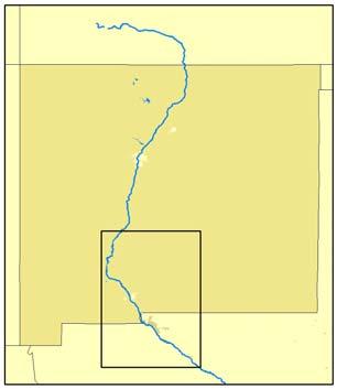
3 The Upper Rio Grande Basin
4 Background Late 1800 s Drought and Increased Irrigation Diversion in Colorado 1896 Federal Embargo on Water Development 1906 Treaty of Elephant Butte Reservoir Operational Early 1920 s Federal Water Development Embargo Lifted Late 1920 s Middle Rio Grande Conservancy District Construct the MRGCD diversion dams, canals, drains, and El Vado Reservoir
5 Background (Continued) 1929 Interim Rio Grande Compact Sets limits on depletions of water 1935 El Vado Reservoir Completed Supreme Court Lawsuit by Texas Rio Grande Joint Investigation 1938 Rio Grande Compact Signed, Supreme Court Lawsuit dismissed
6 The Rio Grande Compact Signed in 1938 in Santa Fe following those four decades of controversy to: Effect an equitable apportionment of the waters of the Rio Grande above Ft. Quitman, Texas Remove all causes of present and future controversy Promote interstate comity
7 The Rio Grande Compact The Compact apportions the waters of the Upper Rio Grande Basin amongst the three States The Compact does not affect the obligations of the United States to Indian Tribes or impair their Rights San Juan-Chama Project Water is not subject to Compact apportionment
8 The Rio Grande Compact - Colorado Colorado is Required to Deliver Water to New Mexico at the Stateline
9 The Rio Grande Compact - Colorado
10 The Rio Grande Compact - Colorado COLORADO ANNUAL COMPACT ALLOCATION - RIO GRANDE ANNUAL COMPACT ALLOCATION (1000 a In above average year, flow in excess of 560,000 acre feet must be delivered to New Mexico. Available for Depletion in Colorado Colorado Delivery Obligation to New Mexico ANNUAL FLOW AT DEL NORTE (1000 af)
11 The Rio Grande Compact - Colorado COLORADO ANNUAL COMPACT ALLOCATION - CONEJOS RIVER ANNUAL COMPACT ALLOCATION (1000 a In above average year, flow in excess of 224,000 acre feet must be delivered to Rio Grande. Available for Depletion Delivery Obligation to Rio Grande ANNUAL CONEJOS RIVER INDEX SUPPLY (1000 af)
12 The Rio Grande Compact New Mexico New Mexico is Required to Deliver Water to Texas at Elephant Butte Reservoir based upon flow at Otowi Bridge

13 The Rio Grande Compact New Mexico
14 Middle Rio Grande Compact Allocation and Obligation 3000 ANNUAL COMPACT ALLOCATION CHART ANNUAL COM PACT ALLOCATION (1000 acre-feet) In above average year flow in excess of 405,000 acre-feet must be passed below Elephant Butte Reservoir New Mexico Delivery Obligation to below Elephant Butte Dam 200 Available for Depletion above Elephant Butte Dam in New Mexico ANNUAL INFLOW AT OTOWI (Otowi Index Supply, 1000 acre-feet)
15 New Mexico s Compact Compliance 300 Rio Grande Compact Cumulative Delivery Departure Departure in Thousands of AF Credit = 37,100 AF Time (Calendar Years)
16 New Mexico s Compact Compliance NMISC Goal Maintain compliance while allowing for efficient and effective use of the available supply Status in Compliance since the late 1960 s Activities Middle Rio Grande Project Operations of the Low Flow Conveyance Channel ISC/Reclamation Coop Agreements River System Maintenance Metering and Modeling Pilot Channel Work Other SJC Water Depletion Offset and Municipal Pumping

17 Rio Grande Floodway in 1952 Looking downstream from south boundary of Bosque del Apache (courtesy of Reclamation)
18 Compact Storage Restrictions If We Accrue Deliveries to Texas: Water Must be Retained in Storage in Post reservoirs to the extent of the debits and cannot be used If Usable Storage in Rio Grande Project Reservoirs is low: cannot increase the amount of native water stored in post-1929 reservoirs An accepted Relinquishment allows for some upstream storage
19 The Compact and Elephant Butte Reservoir Colorado and New Mexico Credit Water is held in Elephant Butte Reservoir Spills from Elephant Butte Reservoir eliminate credits and debits
20 The Rio Grande Compact - Texas From Elephant Butte Reservoir to Fort Quitman, Texas 57% of the Rio Grande Project Supply delivered to New Mexican s

21 The Rio Grande Project
22 The Rio Grande Project Delivers water to the Republic of Mexico and irrigable lands in New Mexico and Texas During full allocation years, Reclamation delivers about 931,800 AF at diversion dam canal headings with a reservoir release of 790,000 AF Hudspeth County Irrigation District is not part of the Rio Grande Project
23 RIO GRANDE PROJECT STORAGE 2,500,000 Maximum Available Storage Capacity 2,000,000 ACRE-FEET 1,500,000 1,000, , Note: Storage values as of Jan 1 each year. Elephant Butte and Caballo Reservoirs included in analysis. Value for Jan 1, 2005 is estimated
Colorado s Compacts. Craig Cotten Division Engineer
 Colorado s Compacts Craig Cotten Division Engineer 19 States & Mexico Rely on Colorado Water Methods of Allocating Water Between States Litigation Court Decides Federal Federal Government Decides Agreement
Dr. Christopher Brown New Mexico State University GEF Project Rio Meeting Ciudad Juárez, México 3-5 October 2006
 Political and Institutional Aspects of Rio Grande/ Río Bravo Basin Management Dr. Christopher Brown New Mexico State University GEF Project Rio Meeting Ciudad Juárez, México 3-5 October 2006 Institutional
One Source, Multiple Challenges: The Future Evolution of Water Policy and the Case of the Colorado River
 One Source, Multiple Challenges: The Future Evolution of Water Policy and the Case of the Colorado River David H. Getches Dean and Raphael J. Moses Professor of Natural Resources Law University of Colorado
INTERNATIONAL BOUNDARY AND WATER COMMISSION, UNITED STATES AND MEXICO
 INTERNATIONAL BOUNDARY AND WATER COMMISSION, UNITED STATES AND MEXICO CHARACTERISTICS OF THE U.S.-MEXICO BORDER Land Boundary 674 miles Colorado River 24 miles Rio Grande 1,254 miles Over 12 million residents
Successful Experiences in Rio Grande/Rio Bravo Watershed Management
 Successful Experiences in Rio Grande/Rio Bravo Watershed Management 5 th th World Water Forum Istanbul, Turkey March 22-23, 23, 2009 Introduction A watershed with many voices a medley of cultures, customs,
Wilderness Areas Designated by the White Pine County bill
 Wilderness Areas Designated by the White Pine County bill SEC. 321. SHORT TITLE. This subtitle may be cited as the `Pam White Wilderness Act of 2006'. SEC. 322. FINDINGS. Congress finds that-- The White
STATE OF NEW MEXICO S INITIAL DISCLOSURES. The Plaintiff, State of New Mexico ex rel. State Engineer ( State ), hereby makes its
, hereby makes its") STATE OF NEW MEXICO COUNTY OF SAN JUAN ELEVENTH JUDICIAL DISTRICT STATE OF NEW MEXICO, ex rel. STATE ENGINEER, v. Plaintiff, THE UNITED STATES OF AMERICA, et al., Defendants, CV-75-184 HON. JAMES J. WECHSLER
STATE OF NEW MEXICO COUNTY OF SAN JUAN ELEVENTH JUDICIAL DISTRICT STATE OF NEW MEXICO, ex rel. STATE ENGINEER, v. Plaintiff, THE UNITED STATES OF AMERICA, et al., Defendants, CV-75-184 HON. JAMES J. WECHSLER
MEMO TO STATE PUBLICATION PROGRAM LIBRARIES June 2, 2005
 MEMO TO STATE PUBLICATION PROGRAM LIBRARIES June 2, 2005 All expenses paid! Digital Archive Training! - We are planning a late July meeting and training session here in Santa Fe for any libraries interested
January 14,2010. Ms. Linda Bassi Colorado Water Conservation Board 1313 Sherman Street, Room 723 Denver, CO Dear Linda,
 STATE OF COLORADO Bill Ritter, Jr., Governor DEPARTMENT OF NATURAL RESOURCES DIVISION OF WILDLIFE AN EQUAL OPPORTUNITY EMPLOYER Thomas E. Remington, Director 6060 Broadway Denver, Colorado 80216 Telephone:
Natural Factors Affecting the Level of Osoyoos Lake
 Natural Factors Affecting the Level of Osoyoos Lake Background Osoyoos Lake is operated under conditions prescribed by the International Joint Commission (IJC) and Figure 1 shows the ranges within which
3.0 OVERVIEW OF HUECO BOLSON
 3.0 OVERVIEW OF HUECO BOLSON The Hueco Bolson covers about 2,500 square miles, or 1.6 million acres in New Mexico, Texas, and Chihuahua (Figure 3-1). In Texas, the Hueco overlies portions of El Paso and
Attachment O Verified Statement of Christopher Banet Page 1 of 7
 Attachment O Verified Statement of Christopher Banet Page 1 of 7 Attachment O Verified Statement of Christopher Banet Page 2 of 7 Curriculum Vitae Education Christopher Banet United States Department of
4180 acre-feet minimum conservation pool
 MEMORANDUM Subject: Bear River Basin Plan SULPHUR CREEK RESERVOIR Date: July 20, 2000 Location: Section 34, Township 14N, Range 119W. Located on Sulphur Creek, tributary to the Bear River. Located approximately
EL PASO S DESALINATION EFFORTS
 El Paso s Desalination Efforts WATER DESALINATION AND REUSE STRATEGIES FOR NEW MEXICO SEPTEMBER NEW MEXICO WATER RESOURCES RESEARCH INSTITUTE 2004 Bill Hutchison has more than 20 years of experience as
BIG HORN RIVER. Big Horn Canal Bluff Fritz Highland Hanover Kirby Lower Hanover Lucerne Tillard Upper Hanover
 BIG HORN RIVER Big Horn Canal Bluff Fritz Highland Hanover Kirby Lower Hanover Lucerne Tillard Upper Hanover DESCRIPTION AND OPERATION MEMORANDUM BIG HORN CANAL USGS ID 4418 D1, 4418 C1, 4417 C8, 4418
International Osoyoos Lake Board of Control Annual Report to the International Joint Commission
 International Osoyoos Lake Board of Control 2013 Annual Report to the International Joint Commission TABLE OF CONTENTS ACTIVITIES OF THE BOARD... 1 HYDROLOGIC CONDITIONS IN 2013... 2 Drought Criteria...
SECTION 3 GENERAL DESCRIPTION OF THE RIVER BASIN
 SECTION 3 GENERAL DESCRIPTION OF THE RIVER BASIN SECTION 3 GENERAL DESCRIPTION OF THE RIVER BASIN River basin description. A general description of the river basin or subbasin, as appropriate, in which
Colorado River Interim Guidelines for Lower Basin Shortages and Coordinated Operations for Lake Powell and Lake Mead Draft EIS
 Colorado River Interim Guidelines for Lower Basin Shortages and Coordinated Operations for Lake Powell and Lake Mead Draft EIS Modeling Workshop Henderson, Nevada March 6, 2007 Sessions SESSION I (9:00
International Osoyoos Lake Board of Control Annual Report to the International Joint Commission
 International Osoyoos Lake Board of Control 2015 Annual Report to the International Joint Commission Cover: Northern extent of Osoyoos Lake, where the Okanagan River enters the lake, 2015. View is to the
INTRODUCTION 250,000
 INTRODUCTION The United States of America has over 250,000 rivers, with a total of about 3,500,000 miles of rivers. The main stems of 38 rivers in the United States are at least 500 miles (800 km) long.
Guide to MS416 Albert Bettle Papers
 University of Texas at El Paso DigitalCommons@UTEP Finding Aids Special Collections Department 6-26-2017 Guide to MS416 Albert Bettle Papers Armand J. Avila The University of Texas at El Paso Follow this
2014 Colorado River Annual Operating Plan Colorado River Management Work Group (CRMWG) Final Consultation September 5, 2013
 Final Consultation September 5, 2013") 2014 Colorado River Annual Operating Plan Colorado River Management Work Group (CRMWG) Final Consultation September 5, 2013 2014 Colorado River AOP Final Consultation Meeting Welcome and Introductions
2014 Colorado River Annual Operating Plan Colorado River Management Work Group (CRMWG) Final Consultation September 5, 2013 2014 Colorado River AOP Final Consultation Meeting Welcome and Introductions
International Osoyoos Lake Board of Control Annual Report to the International Joint Commission
 International Osoyoos Lake Board of Control 2010 Annual Report to the International Joint Commission TABLE OF CONTENTS ACTIVITIES OF THE BOARD... 1 HYDROLOGIC CONDITIONS IN 2010... 2 Drought Criteria...
DROUGHT AND SCARCITY PLANS IN THE BRAVO RIVER BASIN
 DROUGHT AND SCARCITY PLANS IN THE BRAVO RIVER BASIN Sergio Soto-Priante Deputy Director General Sub Direction of Hydraulic Infrastructure for Agriculture National Water Commission (Mexico) February 2009.
Spanish Land Grant History of Santa Teresa and Sunland Park Abridged by Dr. Paul Maxwell Taken from the NM Office of the State Historian
 Spanish Land Grant History of Santa Teresa and Sunland Park Abridged by Dr. Paul Maxwell Taken from the NM Office of the State Historian Introduction: Ownership of what now encompasses the Sunland Park
CASE NO. 2019CW10 (REF NO. 12CW118).
.") IN THE DISTRICT COURT IN AND FOR WATER DIVISION NO. 4 STATE OF COLORADO TO: ALL PERSONS INTERESTED IN WATER APPLICATIONS IN SAID WATER DIVISION NO. 4 Pursuant to C.R.S. 37-92-302, as amended, you are notified
IN THE DISTRICT COURT IN AND FOR WATER DIVISION NO. 4 STATE OF COLORADO TO: ALL PERSONS INTERESTED IN WATER APPLICATIONS IN SAID WATER DIVISION NO. 4 Pursuant to C.R.S. 37-92-302, as amended, you are notified
WASHINGTON COUNTY WATER CONSERVANCY DISTRICT
 WASHINGTON COUNTY WATER CONSERVANCY DISTRICT Minutes of Meeting of Board of Trustees April 4, 2018 Minutes of a public meeting of the board of trustees of the Washington County Water Conservancy District,
David Johnson. Tom, Attached please find the final scoping letter and figures for your review. David
 David Johnson From: Sent: To: Cc: Subject: Attachments: David Johnson Tuesday, April 12, 2011 4:33 PM Thomas Malecek Dave Dyer; Jason Marks (jmarks@segroup.com) VWC Scoping Letter
Annual Report to the. International Joint Commission. from the. International Osoyoos Lake Board of Control for
 Annual Report to the International Joint Commission from the International Osoyoos Lake Board of Control for Calendar Year 2005 INTERNATIONAL JOINT COMMISSION International Osoyoos Lake Board of Control
SUSTAINABLE ECOTOURISM DEVELOPMENT IN THE EMBERÁ INDIGENOUS COMMUNITIES, CHAGRES NATIONAL PARK, PANAMA
 SUSTAINABLE ECOTOURISM DEVELOPMENT IN THE EMBERÁ INDIGENOUS COMMUNITIES, CHAGRES NATIONAL PARK, PANAMA Authors: Gerald P. Bauer Natural Resource & Environmental Advisor US Forest Service, International
Piedra River Protection Workgroup Meeting #5 Feb. 21, 2012 Ross Aragon Community Center, Pagosa Springs
 Piedra River Protection Workgroup Meeting #5 Feb. 21, 2012 Ross Aragon Community Center, Pagosa Springs What happened at this meeting? - Identified conservation easements - Discussed In-stream Flows -
COMPLAINT FOR DECLARATORY RELIEF AND DECREE QUIETING TITLE
 DISTRICT COURT, PARK COUNTY, STATE OF COLORADO 300 Fourth St. (P.O. Box 190) Fairplay, Colorado 80440 719-836-2940 Plaintiff: ELKHORN RANCH HOMEOWNERS ASSOCIATION, INC. v. Defendants: INDIAN MOUNTAIN CORP.,
MANAGING FRESHWATER INFLOWS TO ESTUARIES
 MANAGING FRESHWATER INFLOWS TO ESTUARIES Yuna River Hydrologic Characterization A. Warner Warner, A. (2005). Yuna River Hydrologic Characterization. University Park, Pennsylvania: The Nature Conservancy.
Catchment and Lake Research
 LARS 2007 Catchment and Lake Research Multilateral versus bilateral agreements for the establishment of river based organizations: comparison of legal, economic and social benefits in the Zambian experience.
1803 West Hwy 160 Monte Vista, CO (719) TTY (719)
 TTY (719)") USDA Forest Service Rio Grande National Forest http://www.fs.fed.us/r2/riogrande 1803 West Hwy 160 Monte Vista, CO 81144 (719)852-5941 TTY (719)852-6271 USDI Bureau of Land Management San Luis Valley Center
USDA Forest Service Rio Grande National Forest http://www.fs.fed.us/r2/riogrande 1803 West Hwy 160 Monte Vista, CO 81144 (719)852-5941 TTY (719)852-6271 USDI Bureau of Land Management San Luis Valley Center
SHELBY RANCH. unique places. Offered By: real estate
 SHELBY RANCH Offered By: SHELBY RANCH The Shelby Ranch is a great opportunity to acquire 702 +/- acres of northern New Mexico property that is less than 1.5 hours from Albuquerque and Durango and offers
Water Use for Agriculture in Priority Rivers Basins
 Water Use for Agriculture in Priority Rivers Basins Section 1 Section 2 Section 3 Section 4 Section 5 Section 6 Section 7 Section 8 Executive Summary Introduction Water Resources A Global Perspective Africa:
Colorado Springs Utilities Spring 2016 Update. CEO Jerry Forte Leon Young Service Center, April 13, 2016
 Colorado Springs Utilities Spring 2016 Update CEO Jerry Forte Leon Young Service Center, April 13, 2016 1 Spring 2016 Update Today s Discussion 2015 highlights Bright energy future Cleaner air Southern
MARCHING AHEAD. Water Conservation through Public Participation FOR HINDI EDITION SEE PAGE NO.53. For Official Circulation only
 BILINGUAL MONTHLY MAGAZINE VOL-4 ISSUE-5 MAY 2018 GUJARAT For Official Circulation only MARCHING AHEAD FOR HINDI EDITION SEE PAGE NO.53 WATER IS LIFE Water Conservation through Public Participation facebook.com/cmoguj
Bat Cave Canyon Ranch 2,920 acres Jeff Davis County, Texas
 Bat Cave Canyon Ranch 2,920 acres Jeff Davis County, Texas James King, Agent Office 432.426.2024 Cell 432.386.2821 James@KingLandWater.com Bat Cave Canyon Ranch 2,920 acres Jeff Davis County, Texas James
RiverWare User Group Meeting, february Migration Lerma-2004 model, from Stella to RiverWare
 RiverWare User Group Meeting, february 2015 Migration Lerma-2004 model, from Stella to RiverWare RiverWare User Group Meeting, february 2015 Working Group Universidad Autónoma de Zacatecas: Dr. Ángel Alfonso
Index to Major Southern Pacific Company Files of importance
 Abbreviations used Meaning of Series Codes used: AUD Audit; DE Division of Engineer; GCA General Claim Agent; GFA General Freight Agent; GPA General Passenger Agent; GSO General Superintendent s Office;
Poudre River District 3. Irrigation Ditch Construction in Fort Collins - Late 19 th Century
 Poudre River District 3 Irrigation Ditch Construction in Fort Collins - Late 19 th Century Where Does the Water in the Poudre Come From? Three main sources Native River Water C-BT System Water Other Transbasin
Phoenix Habitat Restoration Projects
 Phoenix Habitat Restoration Projects Spur Cross Ranch Cave Creek (Estergard) Regional Tree and Shade Summit March 9, 2010 Desert Riparian Ecosystems Healthy riparian areas like this once existed along
NATIONWIDE PERMIT ACTIONS APRIL - JUNE 2014
 DA Number 00385-LCO 00123 00124 00073 00075 00430 00043-SCO 00062-SCO 00062-SCO 00183-SCO 00195-SCO 00264-SCO 00272-SCO 00278-SCO 00282-SCO Action Type Name Closure Method County State Kingston Road and
LESOTHO HIGHLANDS DEVELOPMENT AUTHORITY
 LESOTHO HIGHLANDS DEVELOPMENT AUTHORITY ANNUAL FLOW RELEASES INSTREAM FLOW REQUIREMENT (IFR) IMPLEMENTATION AND MONITORING (October 2004 to September 2005) TOWER ON MALIBAMATŠO RIVER @ KAO REPORT N0.6
Department of Environment and Natural Resources
 Department of Environment and Natural Resources Brad Ives Assistant Secretary for Natural Resources brad.ives@ncdenr.gov 919-707-8620 Mitch Gillespie Assistant Secretary for Environment mitch.gillespie@ncdenr.gov
Natural Resources Journal
 Natural Resources Journal 40 Nat Resources J. 2 (Spring 2000) Spring 2000 Mining of Internationally Shared Aquifers: The El Paso-Juarez Case Octavio E. Chavez Recommended Citation Octavio E. Chavez, Mining
Water Management in the United States and the Fate of the Colorado River Delta in Mexico
 University of Colorado Law School Colorado Law Scholarly Commons Articles Colorado Law Faculty Scholarship 2003 Water Management in the United States and the Fate of the Colorado River Delta in Mexico
No UNITED ARAB REPUBLIC and SUDAN Agreement (with annexes) for the full utilization of the Nile waters. Signed at Cairo, on 8 November 1959
 for the full utilization of the Nile waters. Signed at Cairo, on 8 November 1959") UNITED ARAB REPUBLIC and SUDAN Agreement (with annexes) for the full utilization of the Nile waters. Signed at Cairo, on 8 November 1959 Official text: Arabic. Registered by the United Arab Republic on
UNITED ARAB REPUBLIC and SUDAN Agreement (with annexes) for the full utilization of the Nile waters. Signed at Cairo, on 8 November 1959 Official text: Arabic. Registered by the United Arab Republic on
Policy PL Date Issued February 10, 2014
 Subject RENEWABLE ENERGY ON CROWN LAND Compiled by Renewable Energy Program, Biodiversity Branch Replaces Policy Directives Waterpower Site Release Crown Land Onshore Windpower Development - Crown Land
Issue Brief A Political Storm Over the Nile
 Issue Brief A Political Storm Over the Nile DECEMBER 2010 This issue brief was prepared by Adonia Ayebare, Director of IPI s Africa Program. Established in 1992, the Africa Program examines the capacity
BORDER WEST EXPRESSWAY (LOOP 375)
") BORDER WEST EXPRESSWAY (LOOP 375) 2015 Project Update Agenda 1 2 3 4 Team Overview Project Details Questions 2 Teams Owner Texas Department of Transportation Independent Engineer HDR Engineering Atkins
BORDER WEST EXPRESSWAY (LOOP 375) 2015 Project Update Agenda 1 2 3 4 Team Overview Project Details Questions 2 Teams Owner Texas Department of Transportation Independent Engineer HDR Engineering Atkins
Equitable Water Apportionment on the Canadian Prairies
 Equitable Water Apportionment on the Canadian Prairies The Master Agreement on Apportionment 1969 & The Prairie Provinces Water Board October, 2017 Alberta - Saskatchewan - Manitoba - Canada 1 Early agreements
MIÑO O AND LIMIA BASINS
 Miño-Sil MIÑO O AND LIMIA BASINS José Álvarez Díaz Sil River Basin District s s Planning Office, Spain WORKSHOP ON TRANSBOUNDARY WATER RESOURCES BUDAPEST, HUNGARY, 8-10 FEBRUARY 2011 INDEX 1. OVERVIEW
Unit 13: La Entrada The Spanish Enter New Mexico
 Assessment Activities: Student Activity Sheet Activity 1. Matching Place Names Draw a line to connect the Spanish Place Name with its English definition. 1. Los Alamos a. mayor 2. Española b. the stream
PROJECT INFORMATION DOCUMENT (PID) CONCEPT STAGE March 2009 Report No.: AB4607 Project Name
 CONCEPT STAGE March 2009 Report No.: AB4607 Project Name") PROJECT INFORMATION DOCUMENT (PID) CONCEPT STAGE March 2009 Report No.: AB4607 Project Name Rio Bogota Environmental Infrastructure Region LATIN AMERICA AND CARIBBEAN Sector Sewerage (70%); Flood protection
PROJECT INFORMATION DOCUMENT (PID) CONCEPT STAGE March 2009 Report No.: AB4607 Project Name Rio Bogota Environmental Infrastructure Region LATIN AMERICA AND CARIBBEAN Sector Sewerage (70%); Flood protection
Chapter 16 WESTERN EXPANSION AND CONFLICT ( )
") Chapter 16 WESTERN EXPANSION AND CONFLICT (1845-1860) Section 1: The Mexican War Section 2: Results of the Mexican War Section 3: The Texas Rangers and American Indians 1 SECTION 1: The Mexican War OBJECTIVES
Chapter 16 WESTERN EXPANSION AND CONFLICT (1845-1860) Section 1: The Mexican War Section 2: Results of the Mexican War Section 3: The Texas Rangers and American Indians 1 SECTION 1: The Mexican War OBJECTIVES
Guánica Bay Watershed Initiative
 Guánica Bay Watershed Initiative Prepared by Center for Watershed Protection For NOAA and PRDNER NOAA circulated plan to all agencies USDA/ NRCS entered As commitment to Coral Reef Task Force How did
Tonopah Irrigation District
 Tonopah Irrigation District Presentation to Arizona Power Authority Concerning 2017 Hoover Process and District s Needs October 24, 2012 Elizabeth Story, Administrator Location Tonopah Irrigation District
City Council Report. Mayor and City Council Susan Cline, Director, Public Works, Civil Engineering
 City Council Report To: From: Mayor and City Council Susan Cline, Director, Public Works, Civil Engineering City Council Meeting: February 28, 2017 Agenda Item: 3.H Subject: Award of Feasibility/Design-Build
Flying Cloud Airport (FCM) Zoning Process: Informing a Mn/DOT Path Forward
 Zoning Process: Informing a Mn/DOT Path Forward") : Informing a Mn/DOT Path Forward A Review of the Flying Cloud Airport (FCM) Joint Airport Zoning Board (JAZB) Process and the Draft Airport Zoning Ordinance B A RPZ RPZ A B C Zone Chad E. Leqve Director
: Informing a Mn/DOT Path Forward A Review of the Flying Cloud Airport (FCM) Joint Airport Zoning Board (JAZB) Process and the Draft Airport Zoning Ordinance B A RPZ RPZ A B C Zone Chad E. Leqve Director
FLOW REDUCTION IMPACTS ALONG RIVER NILE IN EGYPT
 FLOW REDUCTION IMPACTS ALONG RIVER NILE IN EGYPT Sherine S. Ismail Prof., Head of Lake Nasser studies department, Nile Research Institute, E-mail:sherine_shawky@yahoo.com ABSTRACT Nile water discharges
The Effects of Glen Canyon Dam on the Sacred Navajo Land. Jennifer Jenkin Barry Goldwater High School 2009
 The Effects of Glen Canyon Dam on the Sacred Navajo Land Jennifer Jenkin Barry Goldwater High School 2009 Why was Glen Canyon Dam built? The dam was built in 1956 to build a hydro-electric plant to increase
OFFICIAL MEDIA & PRESS KIT Updated November 2014
 OFFICIAL MEDIA & PRESS KIT Updated November 2014 This information packet will be useful in learning more about the Palmdale Water District. For further information, please visit our website at http://www.palmdalewater.org/
Meeting Agenda. Why are we here? Getting Started. Designated Uses. Water Quality Standards
 Upper Basin Total Maximum Daily Load Study and Rapidan Technical Advisory Committee Meetings July 27, Meeting Agenda Water Quality Assessments and TMDL Process Bryant Thomas, VA DEQ Overview of 16 TMDL
Module 1 Educator s Guide: Representative Discussion Points Investigation 3
 Module 1 Educator s Guide: Representative Discussion Points Investigation 3 Ethiopia and Eritrea Our combined population is 59,578,171 people. We have just emerged from a long period of civil war and famine.
Hydrological study for the operation of Aposelemis reservoir Extended abstract
 Hydrological study for the operation of Aposelemis Extended abstract Scope and contents of the study The scope of the study was the analytic and systematic approach of the Aposelemis operation, based on
Colorado s Instream Flow Program at 40. ICWP Annual Conference October 16, 2013 Denver, Colorado
 Colorado s Instream Flow Program at 40 ICWP Annual Conference October 16, 2013 Denver, Colorado ISF Program established in 1973 by Senate Bill 97 Recognized the need to correlate the activities of mankind
DIDYMO SURVEY, LOWER FRYINGPAN RIVER, BASALT, COLORADO 2015
 DIDYMO SURVEY, LOWER FRYINGPAN RIVER, BASALT, COLORADO 2015 Second Annual Report PREPARED FOR: ROARING FORK CONSERVANCY PREPARED BY: COLORADO MOUNTAIN COLLEGE NATURAL RESOURCE MANAGEMENT PROGRAM TIMBERLINE
TRINITY RIVER CORRIDOR
 TRINITY RIVER CORRIDOR MODIFIED DALLAS FLOODWAY PROJECT UPDATE May 12, 2015 Jon Loxley Project Manager Dallas Floodway Project Fort Worth District U.S. Army Corps of Engineers US Army Corps of Engineers
No, Agreement relating to emergency deliveries of Colorado. maps and scheduie). Adopted at Ciudad Juiirez on.
. Adopted at Ciudad Juiirez on.") No, 16559 UNITED STATES OF AMERICA and MEXICO Agreement relating to emergency deliveries of Colorado River waters for use in Tijuana. Effected by Minute No. 240 of the International Boundary and Water
No, 16559 UNITED STATES OF AMERICA and MEXICO Agreement relating to emergency deliveries of Colorado River waters for use in Tijuana. Effected by Minute No. 240 of the International Boundary and Water
Mark West Creek Flow Study Report
 Mark West Creek Flow Study Report Biology and Geology of Mark West Creek The headwaters of Mark West Creek are located in the Mayacamas Mountain range, which border Napa and Sonoma County, where it then
7KH'LVSXWH2YHU6KDUHG:DWHUVRIWKH 5tR*UDQGH5tR%UDYR
 7KH'LVSXWH2YHU6KDUHG:DWHUVRIWKH 5tR*UDQGH5tR%UDYR $3ULPHU Photo: The Confluence of the Río Grande and Río Conchos near Presidio/Ojinaga www.texascenter.org/borderwater -XO\ Overview This short primer is
Daisy Dean Trail 628/619 ATV Trail Construction
 Background and Purpose and Need The Daisy Dean ATV Trail Construction Project is located in the Little Belt Mountains, Musselshell Ranger District, Lewis and Clark National Forest approximately 32 miles
White Oak Creek. Recreational Use Attainability Analysis Summary of Findings. Texas Institute for Applied Environmental Research Stephenville, Texas
 White Oak Creek Recreational Use Attainability Analysis Summary of Findings Texas Institute for Applied Environmental Research Stephenville, Texas August 8, 2016 Sulphur Springs, Texas August 9, 2016 Mount
Closure Method County State Laguna Pueblo 404(F) Activity not. Activity not. Activity involve discharge into NONwaters.
 Activity not. Activity not. Activity involve discharge into NONwaters.") DA Number 00273-00291- 00295-00298- 00304- Action Type Project Name End Date Closure Method County State Laguna Pueblo Irrigation/Diversion Structure Maintenance, Seboyeta Creek, Cibola County 9-Jul-12
DA Number 00273-00291- 00295-00298- 00304- Action Type Project Name End Date Closure Method County State Laguna Pueblo Irrigation/Diversion Structure Maintenance, Seboyeta Creek, Cibola County 9-Jul-12
CREDIT LINE: Small Maps Collection, PP-MS 255, Arizona Historical Society-Papago Park
 TITLE: Small Maps Collection DATE RANGE: 1847-2012 CALL NUMBER: PP-MS 255 PHYSICAL DESCRIPTION: 4 linear feet (8 boxes) PROVENANCE: Donated serially from multiple sources COPYRIGHT: Unknown. RESTRICTIONS:
Water Quality Report for Auburn Ravine Water Year
 Water Quality Report for Auburn Ravine Water Year 216-217 Compiled by the SARSAS Citizen Science Program INDEX 1. Overview of Auburn Ravine 2. Comments on Study 3. Sites of study on Auburn Ravine a. Auburn
WP4.4 Cordevole MCA alternatives description
 WP4.4 24/11/2010 version 2.0 Authors Member number and name Sara PAVAN, Matteo Cesca, Alessandro Vianello, Italo Saccardo PP2-ARPAV SHARE - Sustainable Hydropower in Alpine Rivers Ecosystems http://www.sharealpinerivers.eu
2012 Colorado Planning & Management Region Report
 INTRODUCTION 2012 Colorado Planning & Management Region Report The San Luis Valley in south central Colorado is the largest alpine valley in North America, bordered on the east by the Sangre de Cristo
Withdrawn Due To No Permit Required (NPR) Baca CO. Verified Without Special Conditions Chaffee CO. Verified Without Special Conditions Chaffee CO
 Baca CO. Verified Without Special Conditions Chaffee CO. Verified Without Special Conditions Chaffee CO") DA Number 00045-00057 NWP 00118 NWP 00477- NATIONWIDE PERMIT ACTIONS JAN - MAR 2013 Action Type Project Name End Date Railroad Bridge 190.22 Replacement, BNSF Railway Company, Two Butte Creek Tributary,
DA Number 00045-00057 NWP 00118 NWP 00477- NATIONWIDE PERMIT ACTIONS JAN - MAR 2013 Action Type Project Name End Date Railroad Bridge 190.22 Replacement, BNSF Railway Company, Two Butte Creek Tributary,
1. International Conventions 2. South African Legislation 3. Swaziland Legislation
 A. Legal context WATER FOR EVER 1. International Conventions 2. South African Legislation 3. Swaziland Legislation B. Evolution of KOBWA 1. Treaties 2. Evolution Stages 3. Main Objectives 4. Need for Bi-national
Mud Creek and West Mud Creek
 Mud Creek and West Mud Creek Recreational Use Attainability Analysis Summary of Findings Texas Institute for Applied Environmental Research Stephenville, Texas September 15, 2014 1 Project Partners Texas
Lake Chelan Operations
 Lake Chelan Operations IPMA Executive Seminar September 17, 2013 Presented by: Janet Jaspers Chelan County PUD Lake Chelan Hydroelectric Project Today s Discussion Chelan PUD Overview Interesting Facts
APPENDIX G. The WAP Conservation Landscape and Focal Areas
 APPENDIX G The WAP Conservation Landscape and Focal Areas Focal areas were identified as discrete landscape units using the natural basin and range geography of the Nevada landscape. These units were prioritized
Weymouth & Hingham (ARAWH) Draft Report: Weymouth Water Supply & Regulatory Review
 Draft Report: Weymouth Water Supply & Regulatory Review") Advocates of Rockland, Abington, Weymouth & Hingham (ARAWH) Draft Report: Weymouth Water Supply & Regulatory Review Technical Assistance Services for Communities 2010 Thursday, November 4, 7:00 8:45 p.m.
Advocates of Rockland, Abington, Weymouth & Hingham (ARAWH) Draft Report: Weymouth Water Supply & Regulatory Review Technical Assistance Services for Communities 2010 Thursday, November 4, 7:00 8:45 p.m.
San Diego County. The San Diego County Courthouse. Part 1 of 6: San Diego.
 San Diego County The San Diego County Courthouse. Part 1 of 6: San Diego. San Diego County San Diego County Data Population: 2,813,833 ( Rank: 3) Land Area (square miles): 4,200 (Rank: 9) The hills that
AGENCY SCOPING MEETING
 AGENCY SCOPING MEETING Environmental Impact Statement (EIS) Conducted for the Friedman Memorial Replacement Airport in the Wood River Region of South Central Idaho December 4, 2007 1:00 p.m. 4:00 p.m.
Hydraulic Report. Trail 5 Snowmobile Trail Over Mulligan Creek. Prepared By: COLEMAN ENGINEERING COMPANY Karisa V. Falls, P.E.
 Prepared for: Prepared by: Marquette County Road Commission Coleman Engineering Company Marquette, Michigan Iron Mountain, MI December 2011 Hydraulic Report Trail 5 Snowmobile Trail Over Mulligan Creek
Utah Nevada California Arizona New Mexico Baja California Texas Sonora Chihuahua Coahuila de Zaragoza Sinaloa Durango Nuevo León Zacatecas San Luis
 Nevada Utah California Arizona New Mexico Baja California Sonora Texas Chihuahua Coahuila de Zaragoza Sinaloa US States Mexico States International Boundary Durango Nayarit Zacatecas Jalisco Nuevo León
Recommendations for Renewal of the International Joint Commission s Osoyoos Lake Order
 Recommendations for Renewal of the International Joint Commission s Osoyoos Lake Order Prepared by the International Osoyoos Lake Board of Control June 21, 2012 1 Contents Executive Summary... 1 Introduction...
REDD+ IN YUCATAN PENINSULA
 REDD+ IN YUCATAN PENINSULA JOINING FORCES TO PRODUCE AND PRESERVE 2 3 Campeche, Yucatan, and Quintana Roo combat deforestation together in the Yucatan Peninsula and build a new path for growth A peninsular
I called Joe and Mark, two trike pilots in El Paso to let them know we were coming. They arranged hanger space for us at Cielo Dorado Airport.
 Friday August 27, 2010 328th Cobra flight, 338th PIC, 3 landings Rio Salado Box, VLA, Monticello Canyon, TorC, Elephant Butte, Caballo, Hatch Valley Cielo Dorado Lonny Coots is having a fly-in at his farm
Why are the underground fuel tanks being removed and replaced with above ground tanks?
 AIRPORT/CITIZEN FAQ This list of Frequently Asked Questions (FAQs) with responses are provided to share information related to airport topics with the Citizens of Georgetown. The questions / responses
Trails and Towers El Camino Real and the Verde Power Line in Santa Fe County
 Devin Bent, p 1 of 6, December 16, 2016. Introduction Trails and Towers El Camino Real and the Verde Power Line in Santa Fe County El Camino Real begins in Mexico City and travels 1600 miles north entering
John Groesbeck Ryan Umina Neil Mudjer Dan Armgardt
 John Groesbeck Ryan Umina Neil Mudjer Dan Armgardt Themes Politics Social-Economic Impact Future Damming and Implications Uses of Dams Water Supply Navigation Hydropower Stabilize Water Flow Irrigation
HYDRAULIC DESIGN OF THE TOURISTIC BERTHING IN ASWAN CITY
 HYDRAULIC DESIGN OF THE TOURISTIC BERTHING IN ASWAN CITY Dr. Hossam El-Sersawy Researcher, Nile Research Institute (NRI), National Water Research Center (NWRC), Egypt E-mail: h_sersawy@hotmail.com Dr.
DATE: January 19, WCA Governing Board. Johnathan Perisho, Project Manager. Mark Stanley, Executive Officer
 Item 14 DATE: January 19, 2017 TO: FROM: THROUGH: SUBJECT: WCA Governing Board Johnathan Perisho, Project Manager Mark Stanley, Executive Officer Item 14: Consideration of a resolution to accept an acquisition
Are there successful fish passes? Lessons from South America. Paulo Santos Pompeu Federal University of Lavras
 Are there successful fish passes? Lessons from South America Paulo Santos Pompeu Federal University of Lavras Is it possible to build a successful fish pass? When it is not possible? Could we know when