Santa Cruz Wharf Improvement Project. Briefing Paper. Prepared by City of Santa Cruz. for
|
|
|
- Augustine Wilkinson
- 5 years ago
- Views:
Transcription

1 Santa Cruz Wharf Improvement Project Briefing Paper Prepared by City of Santa Cruz for U.S. Army Corps of Engineers Interagency Meeting 12 November 2014

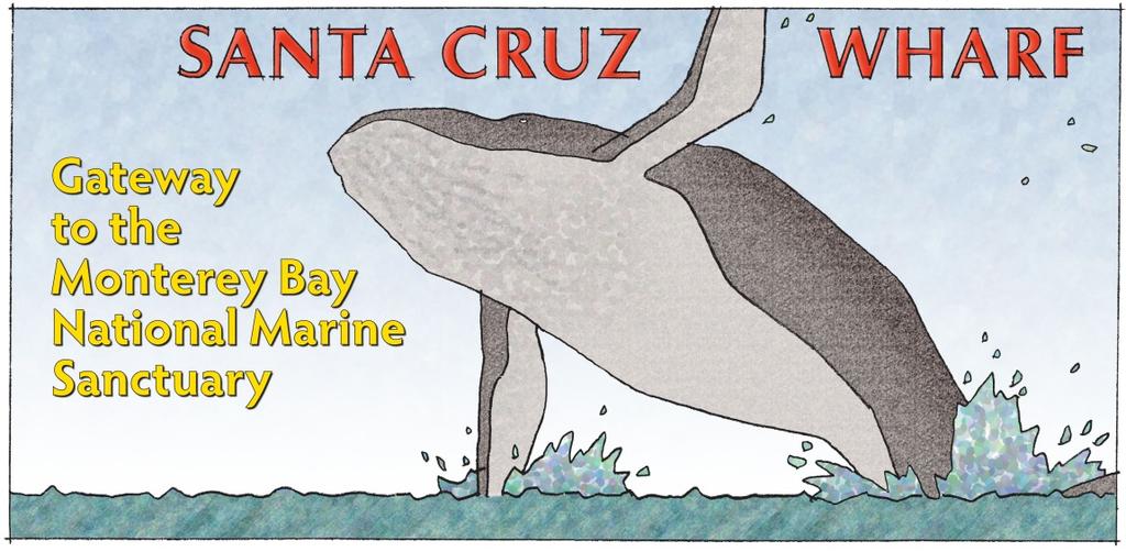
2 Santa Cruz Wharf Improvement Project Constructed on a base of over 4,400 Douglas-fir piles, the Santa Cruz Wharf is the longest timber-supported structure in the United States. The Santa Cruz Wharf Improvement Project encompasses a 2.5 acre expansion for public access, recreation, and interaction with the Monterey Bay National Marine Sanctuary.

3 Santa Cruz Wharf Master Plan and Engineering Report Funded by a grant from the U.S. Department of Commerce Economic Development Administration and administered by the Seattle Regional Office

4 Santa Cruz Wharf Improvement Project Location Map
5 Wharf Master Plan Economic Development Design and Development Standards Public Access and Recreational Uses Educational and Scientific Nexus Engineering Report Pilings, Supports, and Deck Roadways, Pedestrian Walkways, Parking Areas Reduction of Environmental Impacts Sewer, Lighting, and Fire Suppression Systems
6 Santa Cruz Wharf Improvement Project Project Summary Existing Wharf (300,100 sq.ft. and 4,440 piles) Parking and vehicular circulation 178,400 sq.ft. Commercial and retail uses 54,600 sq.ft. Wharf Operations 11,100 sq.ft. Public Access 56,000 sq.ft. Proposed (108,000 sq.ft. and 900 piles) Parking and vehicular circulation 0 sq.ft. Commercial and retail uses 0 sq.ft. Wharf Operations 0 sq.ft. Public Access 108,000 sq.ft
7 Santa Cruz Wharf Improvement Project Interagency Meeting Focus and Feedback Confirmation of lead agency General permitting requirements Issues/concerns of specific agencies Critical path steps/process
8 Santa Cruz Wharf Master Plan Concepts, Proposals, and Recommendations The Gateway Entrance

9 The Gateway Entrance Create a new and more attractive gateway to the Wharf to be more visible, create a more positive transition from the land to the Monterey Bay, and provide a better sense of arrival.
10 Santa Cruz Wharf Master Plan Concepts, Proposals, and Recommendations The Welcome Center

11 The Welcome Center Construct a Welcome Center at the beginning of the line of buildings on the west side of the Wharf, facing the shore and greeting visitors to the commercial and recreational experiences that follow. Include an open water swim facility.
12 Santa Cruz Wharf Master Plan Concepts, Proposals, and Recommendations The East Promenade

13 The East Promenade Construct a 24' wide promenade along the Wharf's eastern edge to create uninterrupted opportunities for recreation, to reduce pedestrian/vehicular conflicts, and to provide for an alternate emergency access route.
14 Santa Cruz Wharf Master Plan Concepts, Proposals, and Recommendations The Small Boat Landing

15 The Small Boat Landing Construct a small boat landing facility on the east side of the Wharf adjacent to the new East Promenade for kayak, paddleboard, and fishing boat rentals as well as for Wharf Operations.
16 Santa Cruz Wharf Master Plan Concepts, Proposals, and Recommendations The Western Walkway

17 The Western Walkway Construct a 12' wide walkway on the western side of the Wharf that provides for continuity of access in a manner that does not conflict with visual access from adjacent commercial uses.
18 Santa Cruz Wharf Master Plan Concepts, Proposals, and Recommendations The Events Pavilion

19 The Events Pavilion Construct a multi-sided Events Pavilion that creates a continuity of the commercial uses where the Wharf bends to the southwest and provides a large, weather-protected space.
20 Santa Cruz Wharf Master Plan Concepts, Proposals, and Recommendations The South Landing

21 The South Landing Construct a landing facility for the docking of larger vessels at the end of the Wharf for science, education, research, sports fishing and whale watching.
22 Santa Cruz Wharf Master Plan Concepts, Proposals, and Recommendations The Landmark Building

23 The Landmark Building Construct a new Landmark Building reminiscent in scale and form of the structure once located at the end of the Wharf. Provide a visual focus and destination attraction which entices visitors to venture out to the end of the Wharf.
24 Santa Cruz Wharf Master Plan Concepts, Proposals, and Recommendations The Stepped Overlook

25 The Stepped Overlook Heighten the experience of the dynamic qualities of water, the variability of waves and tides, and the exhilaration of being out over water by creating a Stepped Overlook that extends out into the Monterey Bay.


26 Santa Cruz Wharf Master Plan Concepts, Proposals, and Recommendations On-Demand Vacuum Assisted Refuse and Recycling Collection System
27 Santa Cruz Wharf Engineering Report Findings and Recommendations 1. Piling Survey 4,400 piles inspected; 5% need replacement. Add additional piles for lateral stability. 2. Structural Evaluation Wharf in serviceable shape for a 100 yr. old structure. Add additional connectors at unsupported splices. Increase load capacity at roadway turnarounds. 3. Roadways/Parking Install rubberized AC throughout. Install plywood/waterproofing layer between AC and deck boards to minimize cracking. Install drain inlets in vehicle area to treat runoff with media filtration to address water quality.
28 Santa Cruz Wharf Engineering Report Findings and Recommendations 4. Walkways/Commons Fair to good condition. Address reflective cracking with plywood/waterproofing underlayment. Relocate/remediate impediments to pedestrian movement. 5. Sanitary Sewer Existing gravity mains are well within their capacity carrying about 50% of total possible flow rate. Given the present age and condition of the existing gravity mains, it is estimated they have at least 25 years of serviceable life remaining. 6. Fire Systems Extend coverage of the under deck fire suppression system at the public access dock and boat rental dock. Limit boat anchorage to outside 200 feet of the west side.
29 Santa Cruz Wharf Engineering Report Findings and Recommendations 7. Building Supports Adequate structural capacity to support one- and two-story buildings, including those identified in the Wharf Master Plan. Provides structural requirements for new construction. 8. New Landing Preliminary berthing analysis was performed in order to determine the berthing energy demand for the design of the landing structure. The design vessel was a 200 LT Coast Guard Marine Protector Class vessel, with a 110 ft. length overall. Fixed landing system is the most feasible for all year access at the Wharf. 9. Weather Impacts Widen the Wharf with vertical timber piles to increase its resistance to lateral wave and tsunami forces.
30 Santa Cruz Wharf Master Plan Capital Improvements Budget Estimate Gateway Entrance $1,200,000 to $1,400,000 and Pay Stations Welcome Center $810,000 to $972,000 Open Water $245,000 to $294,000 Swim Facility East Promenade: $11,900,000 to $14,300,000 West Walkway/Access: $2,500,000 to $3,000,000 Small Boat Landing: $2,900,000 to $3,500,000 Events Pavilion: $1,240,000 to $1,488,000 South Landing: $1,000,000 to $1,200,000 Landmark Building: $2,100,000 to $2,520,000 Total: $24,000,000 to $29,000,000
31 Santa Cruz Wharf Master Plan Repairs/Maintenance Budget Estimate Piles $1,000,000 to $1,500,000 Deck Substructures $750,000 to $1,100,000 Miscellaneous $200,000 to $300,000 (sewer, fire protection, landings) Paving $7,200,000 to $8,600,000 Total: $9,150,000 to $11,500,000
32


33 Santa Cruz Wharf Improvement Project Interagency Meeting Focus and Feedback Confirmation of lead agency General permitting requirements Issues/concerns of specific agencies Critical path steps/process
THE AIRTRAIN AIRPORT ACCESS SYSTEM JOHN F. KENNEDY INTERNATIONAL AIRPORT AIRPORT ACCESS SERVICE
 THE AIRTRAIN AIRPORT ACCESS SYSTEM JOHN F. KENNEDY INTERNATIONAL AIRPORT AIRPORT ACCESS SERVICE The JFK AirTrain airport access system interfaces with two existing regional transit systems; the Long Island
CONTENTS. 1 Introduction Always Moving Forward while Building on the Past A Dynamic Destination... 5
 2010 STRUCTURE PLAN - 2 - CONTENTS 1 Introduction... 5 1.1 Always Moving Forward while Building on the Past... 5 1.2 A Dynamic Destination... 5 2 Map A... 6 Exhibition Place and its Neighbours... 7 3 Demonstration
Serving the Tampa Bay Maritime Community Since Celebrating over 125 Years of Service
 Serving the Tampa Bay Maritime Community Since 1886 Celebrating over 125 Years of Service Tampa Bay Pilots Association Piloting is an essential service of such paramount importance that its continued existence
During Construction. Full Resident and Non-Resident Services. Contract Administration and Construction Supervision of Groundside and Airside Projects
 Page 1 of 5 May 21, 2007 HOME PROFILE SECTORS & SERVICES CAREERS SEMINARS & PAPERS LINK airport development Description of Service transportatio services link Airport Developm Pre-Construction Area Development
Longmont to Boulder Regional Trail Jay Road Connection DRAFT FINAL REPORT
 Longmont to Boulder Regional Trail Jay Road Connection DRAFT FINAL REPORT December 2018 Project Summary Boulder County, Colorado, in partnership with the City of Boulder, is evaluating options for multi-use
Home of Southbank Partners. Riverfront Commons. Southbank Partners. Covington Newport Bellevue Ft. Thomas Dayton Ludlow
 Home of Southbank Partners Riverfront Commons Southbank Partners Covington Newport Bellevue Ft. Thomas Dayton Ludlow Riverfront Commons Fostering a vision of Northern Kentucky s Future Riverfront Commons
Port Everglades Master/Vision Plan Update
 Port Everglades Master/Vision Plan Update Environmental Stakeholder Meeting June 15, 2009 Discussion to Focus On: Updating the 2006 Port Everglades Master Plan Issues dealing with the Turning Notch Potential
( vs )
") Cruise Down Under Conference 2009: Riding the Cruise Boom Port and Terminal Developments August 27, 2009 Growth of Cruising in Australia (2006 2007 vs. 2007 2008) Australian ports increased by 13% Passenger
Cruise Down Under Conference 2009: Riding the Cruise Boom Port and Terminal Developments August 27, 2009 Growth of Cruising in Australia (2006 2007 vs. 2007 2008) Australian ports increased by 13% Passenger
Master Plan Update Community Advisory Committee Kick-off Meeting
 Nashville International Airport Master Plan Update Community Advisory Committee Kick-off Meeting September 13, 2018 Agenda Welcome and Introductions Master Plan Objectives Master Plan Process BNA Vision
CORPS OF ENGINEERS ALASKA DISTRICT Dredging Projects. Michael Tencza, PE Operations Project Manager November 4, 2015
 CORPS OF ENGINEERS ALASKA DISTRICT 2016 Dredging Projects Michael Tencza, PE Operations Project Manager November 4, 2015 US Army Corps of Engineers Building and Preserving Alaska s Future AWARDED CONTRACTS
WORKING DRAFT (DECEMBER 2016) - FOR COMMUNITY REVIEW BY
 - FOR COMMUNITY REVIEW BY") PURPOSE The purpose of this Working Draft Spatial Framework summary is to facilitate additional public and stakeholder feedback following the public meetings and reference group workshops held in November
PURPOSE The purpose of this Working Draft Spatial Framework summary is to facilitate additional public and stakeholder feedback following the public meetings and reference group workshops held in November
COMMONWEALTH OF THE BAHAMAS MINISTRY OF PUBLIC WORKS & TRANSPORT NASSAU HARBOUR PORT IMPROVEMENT PROJECT. Nassau Harbour Port Improvement Project
 COMMONWEALTH OF THE BAHAMAS MINISTRY OF PUBLIC WORKS & TRANSPORT NASSAU HARBOUR PORT IMPROVEMENT PROJECT AUGUST 2009 OVERALL VIEW OF NASSAU HARBOUR AERIAL VIEW OF NASSAU HARBOUR PROJECT HISTORY 1960 s
Airport Planning Area
 PLANNING AREA POLICIES l AIRPORT Airport Planning Area LOCATION AND CONTEXT The Airport Planning Area ( Airport area ) is a key part of Boise s economy and transportation network; it features a multi-purpose
2 SITE ANALYSIS AND DESIGN CRITERIA
 2 SITE ANALYSIS AND DESIGN CRITERIA PRELIMINARY DEVELOPMENT CRITERIA 12 URBAN CONTEXT 13 VIEW 14 SITE GRADING 16 EXISTING STRUCTURES 16 STRUCTURAL AND SEISMIC CONSTRAINTS 18 CRUISE INDUSTRY AND ACTIVITY
F6. Coastal Ferry Terminal Zone
 F6. Coastal Ferry Terminal Zone F6.1. Zone description The purpose of the Coastal Ferry Terminal Zone is to provide for the integrated and efficient operation and development of ferry terminal facilities.
places Mooloolaba s heart five
 five places the mooloolaba heart 1 Flexible community event use of school oval 2 Enhanced streetscape District cycle route Future cross-block pedestrian link 5 Existing school buildings New signalised
BNA Master Plan Update Community Advisory Committee Meeting No. 5
 A Six Sigma Organization BNA Master Plan Update Community Advisory Committee Meeting No. 5 September 19, 2012 Introductions MNAA Staff RW Armstrong Team Albersman & Armstrong, Ltd. Atkins North America,
A BOAT RAMP TO NOWHERE
 A BOAT RAMP TO NOWHERE A PROPOSAL FOR ACCESS TO HARVIE PASSAGE A Presentation to the City of Calgary December 2017 Presented by: Peter Crowe-Swords Bow River Trout Foundation Background: The Bow River
THAT the Board approve the final proposed concept plan for the Jericho Marginal Wharf site as shown in Figure C-4 of Appendix C.
 Date: January 17, 2012 TO: Board Members Vancouver Park Board FROM: General Manager Parks and Recreation SUBJECT: Jericho Marginal Wharf Phase 2 Concept Plan RECOMMENDATION THAT the Board approve the final
Port MacKenzie Rail Extension
 Port MacKenzie Rail Extension Project The Matanuska-Susitna Borough (MSB) and the Alaska Railroad Corporation (ARRC) jointly propose construction and operation of a new rail line to connect the Borough
COCONUT GROVE WATERFRONT MASTER PLAN. ERA / Curtis Rogers / ConsulTech / Paul George Ph.D.
 COCONUT GROVE WATERFRONT MASTER PLAN ERA / Curtis Rogers / ConsulTech / Paul George Ph.D. Agenda City's Vision & Community Input Framework Concepts December 2006 Schemes Draft Final Plan Waterfront Open
how it started where we are now what is coming up NEW WESTMINSTER WATERFRONT PARK THE RIVER THE PAST THE PEOPLE
 how it started Downtown Waterfront Park How It Started March 2009 City of New Westminster Purchases 3.2 Hectare Westminster Pier Site March 2009 City of New Westminster and Design Team develop plan for
FINAL. Bicycle/Pedestrian Feasibility Study City of DeBary Dirksen Drive Trail. Prepared For: Volusia County MPO
 City of DeBary Dirksen Drive Trail FINAL Prepared By: Reynolds, Smith and Hills, Inc. Prepared For: Volusia County MPO September 2007 Table of Contents INTRODUCTION...1 PROJECT PURPOSE AND SCOPE...2 PHYSICAL
OPEN CELL SHEET PILE TECHNOLOGY. Presentation to Alaska State Legislature, House Finance Committee
 OPEN CELL SHEET PILE TECHNOLOGY Presentation to Alaska State Legislature, House Finance Committee OPEN CELL SHEET PILE Technology Retaining Wall System Patents Obtained by PND Engineers ARRC Dock, Seward,
NEWBORO AND PORTLAND HARBOUR REDVELOPMENT PLANS
 INTRODUCTION The Municipal docks in both Newboro and Portland were transferred to the Township of Rideau Lakes by Parks Canada in 2002. Little has been done to improve the docks physical condition or role
Hospital Link Project Project Update September 2015
 Hospital Link Project Project Update September 2015 General The project provides a link between Riverside Drive and the Transitway to the Hospital Ring Road. This link is needed to improve transit service
4.0 Context for the Crossing Project
 4.0 Context for the Crossing Project This section provides background information about key features of the North Douglas Crossing project area, and opportunities and constraints. This information is important
Port MacKenzie Rail Extension
 Port MacKenzie Rail Extension Project The Matanuska-Susitna Borough (MSB) and the Alaska Railroad Corporation (ARRC) jointly propose construction and operation of a new rail line to connect the Borough
crrv OF DALLAS Memorandum Trinity River Corridor Project Update On Recreation
 Memorandum OATE December 8, 2011 crrv OF DALLAS TO Trinity River Corridor Project Committee Members: Vonciel Jones Hill (Chair) Linda Koop (Vice Chair), Monica Alonzo, Scott Griggs, Angela Hunt, Delia
Multimodal Planning Studies
 Multimodal Planning Studies Commuter Park and Ride Study Steering Committee Meeting June 6, 2013 Agenda 1. Update on Project Schedule 2. Update on Online Interactive Mapping 3. Key Themes from the Open
Auburn Trail / Ontario Pathways Trail Connector Feasibility Study Public Information Meeting Wednesday, August 22, 2012
 Auburn Trail / Ontario Pathways Trail Connector Feasibility Study Public Information Meeting Wednesday, August 22, 2012 Purpose of Feasibility Study Purpose Evaluate the feasibility of constructing a multiuse
TRANSMITTAL. Please contact me with any questions. 7 Spruce Road, Freeport, ME T: (207)
") BAKER DESIGN CONSULTANTS Civil, Marine and Structural Engineering To: Alex Jaegerman FAICP Director of Planning & Development Town of Yarmouth 200 Main Street PO Box 907 Yarmouth, ME 04096 From: Barney
BAKER DESIGN CONSULTANTS Civil, Marine and Structural Engineering To: Alex Jaegerman FAICP Director of Planning & Development Town of Yarmouth 200 Main Street PO Box 907 Yarmouth, ME 04096 From: Barney
Great Wolf Lodge Fact Sheet & Frequently Asked Questions Potential Location in Gilroy, California 8/30/17
 WHAT? Great Wolf Resorts has identified Gilroy, California as a potential location for a new Great Wolf Lodge family resort and has entered into a 60-day period of exclusivity with the City and community
Water Space. A development opportunity at the Canting Basin, Pacific Quay, Glasgow
 Water Space A development opportunity at the Canting Basin, Pacific Quay, Glasgow Summary Canting Basin Lower Harbour The Pacific Quay development, which Graving Docks Quay includes the new BBC Scotland
Everett Riverwalk Life style explore
 Life style explore Project Overview The 217-acre Everett Riverfront redevelopment is visible from I-5 with traffic counts charted at 170,000+ vehicles per day with direct freeway access from 4-way interchange.
Aloha Stadium Conceptual Redevelopment Report. April 5, 2017
 Aloha Stadium Conceptual Redevelopment Report April 5, 2017 THE HISTORY OF ALOHA STADIUM A Hawaii landmark since 1975 Aloha Stadium has stood for over 40 years and effectively achieved its mission as a
Spadina Avenue Built Form Study Preliminary Report
 STAFF REPORT ACTION REQUIRED Spadina Avenue Built Form Study Preliminary Report Date: July 9, 2014 To: From: Wards: Reference Number: Toronto and East York Community Council Director, Community Planning,
Salmon Centre of Excellence
 Salmon Centre of Excellence Concept Proposal Refresh & Inspire 3.5 Acre Waterfront Task Force July 25 th, 2017 Dr. Jim Powell BC Centre for Aquatic Health Sciences Society Who are BC CAHS? Non-profit society
Community Input Meeting. Fairgrounds Master Planning Update. January 7, 2016, 7 pm
 Community Input Meeting Fairgrounds Master Planning Update January 7, 2016, 7 pm Fiesta Hall Santa Clara County Fairgrounds 355 Tully Road, San Jose, CA Tonight s Agenda 1) Board of Supervisors Direction
BNA Master Plan Update Public Meeting No. 2
 A Six Sigma Organization BNA Master Plan Update Public Meeting No. 2 September 18, 2012 Agenda BNA Master Plan Update Consultants Status of the BNA Master Plan Update Workstation Boards Forecasts of Aviation
ONONDAGA CREEKWALK PHASE II. Public Information Meeting Series 1
 ONONDAGA CREEKWALK PHASE II Public Information Meeting Series 1 Andrew Maxwell Director, Syracuse-Onondaga County Planning Agency Owen Kerney Assistant Director for City Planning Russell Houck, PE City
AIRPORT DEVELOPMENT PLAN. Design-Build Institute of America September 8, 2015
 AIRPORT DEVELOPMENT PLAN Design-Build Institute of America September 8, 2015 Lindbergh Field - 1935 3 Page 2 Lindbergh Field - 1944 3 Page 3 Lindbergh Field - 1955 3 Page 4 San Diego International Airport
Port of San Diego Overview and Updates. September 2017
 Port of San Diego Overview and Updates September 2017 Port of San Diego Jurisdiction 34 miles of waterfront 2,403 acres of land 3,535 acres of water Port Tidelands Coronado San Diego National City Chula
Gerald R. Ford International Airport Authority Master Plan Update A World Class Gateway
 Gerald R. Ford International Airport Authority Master Plan Update A World Class Gateway Master Plan Advisory Committee (MPAC) Alternatives September 28, 2017 AGENDA Review of Previous Work Ultimate Land
West Santa Ana Branch Transit Corridor. Community Meetings March 12, 13, 17 & 19, 2018
 West Santa Ana Branch Transit Corridor Community Meetings March 12, 13, 17 & 19, 2018 Purpose of this Meeting > Update on Public Scoping comments received > Why Metro is revisiting the Northern Alignments
Port Everglades Master Plan Update Tenant Workshop. July 12, Port Everglades Master Plan Update 2006
 Tenant Workshop July 12, 2007 1 Original 2026 Year Vision Plan DYNEGY PROPERTY SHARED AIRPORT/SUPPORT FACILITY 12 12 2 Input from Tenants Northport Convention Center carve out Expanded cruise berth at
NOTICE OF PREPARATION/NOTICE OF PUBLIC SCOPING MEETING
 Notice Of Preparation/Notice of Public Scoping Meeting for a Draft Environmental Impact Report for the Airport Park Expansion Project CITY OF SANTA MONICA CITY PLANNING DIVISION 685 MAIN STREET, ROOM 22
FISCHLER PROPERTY COMPANY LLC 1605 HENDRY STREET FORT MYERS, FL
 FISCHLER PROPERTY COMPANY LLC 1605 HENDRY STREET FORT MYERS, FL 33901 WWW.FISCHLERCO.COM FOR SALE 1013 EMBERS PKWY., CAPE CORAL, FL 33993 ENTITLED LAND FOR DEVELOPMENT EMBERS LAKE ESTATES for information
AUGUST 5, 2010 UPDATE # 3 AMTRAK/FEC PROJECT: STATION LOCATIONS AND CONCEPTUAL DRAWINGS
 AUGUST 5, 2010 UPDATE # 3 AMTRAK/FEC PROJECT: STATION LOCATIONS AND CONCEPTUAL DRAWINGS The Summer of 2010 has been a time of tremendous progress for the Amtrak/FEC Corridor project and its goal of restoring
395 Express Lanes Project Update
 395 Express Lanes Project Update Key Dates Milestone Date Limited Notice to Proceed February 2017 Early Works March-June 2017 Full Notice to Proceed July 2017 Preparatory Work Summer 2017 Draft Noise Abatement
SOMETHING AMAZING IS HAPPENING IN THE BAHAMAS
 SOMETHING AMAZING IS HAPPENING IN THE BAHAMAS THE BEAUTY & ADVENTURE OF THE BAHAMAS ON YOUR DOORSTEP NASSAU THE BAHAMAS ONE MARINA, YAMACRAW HILL ROAD, NASSAU, BAHAMAS ESTATE OFFICE: 1 (242) 676 8552 TOLL
2015 PURDUE ROAD SCHOOL March 11, 2015
 2015 PURDUE ROAD SCHOOL March 11, 2015 Runway Protection Zone (RPZ) Definition It is a trapezoidal shape formed off the end of a runway and its geometry it a function of the airport s aircraft approach
PASSENGER SHIP SAFETY. Damage stability of cruise passenger ships: Monitoring and assessing risk from operation of watertight doors
 E MARITIME SAFETY COMMITTEE 93rd session Agenda item 6 MSC 93/6/9 11 March 2014 Original: ENGLISH PASSENGER SHIP SAFETY Damage stability of cruise passenger ships: Monitoring and assessing risk from operation
Chapter 1: Introduction Draft
 Chapter 1: Draft TABLE OF CONTENTS 1... 4 1.6.1 Stakeholder Engagement Plan... 10 Chapter 1 Page 2 TABLE OF EXHIBITS Exhibit 1.1-1 ABIA Annual Growth Since 1993... 5 Exhibit 1.4-1: ABIA Location Map...
PALO CORONA REGIONAL PARK MPRPD BOARD MEETING AUGUST 8, 2018
 PALO CORONA REGIONAL PARK MPRPD BOARD MEETING AUGUST 8, 2018 ACKNOWLEDGEMENTS AGENCIES AND ORGANIZATIONS The Trust for Public Land Big Sur Land Trust Santa Lucia Conservancy California State Parks Point
STITCH TRANSFORMATIVE IDEA 3. SHORELINE STITCH. Re-connect the city to the waterfront and link the east and west Core Circle landscapes
 SHORE STITCH TRANSFORMATIVE IDEA 3. SHORELINE STITCH Re-connect the city to the waterfront and link the east and west Core Circle landscapes 126 LINE PUBLIC WORK 127 TRANSFORMATIVE IDEA 3. SHORELINE STITCH
Introduction DRAFT March 9, 2017
 Chapter Overview The City of Redmond (City) initiated an update to the Airport Master Plan ( Plan ) to assess the facility and service needs of the Redmond Municipal Airport ( the Airport ) throughout
Chapter 1: Introduction
 Chapter 1: TABLE OF CONTENTS 1... 4 1.1 Master Plan Study Content... 4 1.2 Purpose and Scope of Master Plan Study... 4 1.3 Airport History and Role... 6 1.4 Airport Location and Service Area... 6 1.5 ABIA
Crossing the Keweenaw Waterway in an Emergency with a U.S Army Floating Bridge
 Crossing the Keweenaw Waterway in an Emergency with a U.S Army Floating Bridge Photo: John Kiefer William Leder, Adjunct Professor (Ret.) Department of Civil and Environmental Engineering Contributions
ROYAL VIEW DEVELOPMENT
 GRETNA BUILDING FOR LEASE ROYAL VIEW DEVELOPMENT PROPOSED RENDERINGS AVAILABLE FOR PRE-LEASE + + LEASE RATE AND AVAILABILITY MINIMUM SPACE: MAXIMUM SPACE: LEASE RATE: 1,278 SF 16,500 SF $16.50 - $22.00
LYNDHURST NEW URBAN DEVELOPMENT AREA STRUCTURE PLAN. Lyndhurst New Urban Development Area Structure Plan OUTCOMES AND PERFORMANCE STANDARDS
 APPENDIX 15.1-3 LYNDHURST NEW URBAN DEVELOPMENT AREA STRUCTURE PLAN Purpose of the Structure Plan Lyndhurst New Urban Development Area Structure Plan OUTCOMES AND PERFORMANCE STANDARDS LSP-P1 The District
Transportation TRANSPORTATION PROJECTS
 Transportation TRANSPORTATION PROJECTS Balls Ford Road Interchange Total Project Cost $142.9M This project includes the construction of a new diverging diamond interchange at Route 234 Bypass (Prince William
CRANE LAKE TRAILS NETWORK AND SPACES
 CRANE LAKE TRAILS NETWORK AND SPACES AREA TRAILS COMMUNITY TRAILS GOLD COAST TRAIL LAKE PARK OPTION ONE LAKE PARK OPTION TWO OVERFLOW TRAILHEAD PARKING THE GATE AREA TRAILS Trails are a major resource
Washington Township MASTER PLAN. Addendum: Washington Township Master Plan
 Washington Township MASTER PLAN Addendum: Washington Township Master Plan CHAPTER XI RECREATION CORE DISTRICT Introduction The Recreation Core District generally encompasses the areas north of 30 Mile
RIVER ACCESS STRATEGY
 RIVER ACCESS STRATEGY The River Access Strategy is a 10-year plan the City of Edmonton is developing to inform future programming, operations and infrastructure improvements that support access to the
Island Eastern Corridor Boardwalk-Cycleway Feasibility Study
 For discussion on 12 January 2012 Island Eastern Corridor Boardwalk-Cycleway Feasibility Study PURPOSE The purpose of this paper is to understand and promote the feasibility of incorporating the Harbourfront
Second Avenue: Union Street to Lenora Street, Condominium Owners c/o Michael McQuaid 1521 Second Avenue Seattle, WA 98101
 Second Avenue: Union Street to Lenora Street, Condominium Owners c/o Michael McQuaid 1521 Second Avenue Seattle, WA 98101 Subject: New Development - Cumulative Downtown Alley Traffic Congestion and Safety
D1 January 8, 2014 Public Hearing APPLICANT: HUNT CLUB FARM
 D1 January 8, 2014 Public Hearing APPLICANT: HUNT CLUB FARM PROPERTY OWNER: HUNT CLUB A-1- A, LLC. STAFF PLANNER: Kevin Kemp REQUEST: Modification of a Conditional Use Permit approved by the City Council
Dear Councilmembers of the Arts, Entertainment, Parks and River Committee:
 June 18, 2018 RE: CF 18-0057 Griffith Park Mobility and Access Dear Councilmembers of the Arts, Entertainment, Parks and River Committee: As Friends of Griffith Park evaluated the proposed Dixon strategies,
Section XIII. Cost Estimates
 Section XIII Cost Estimates 13-01. INTRODUCTION SECTION XIII COST ESTIMATES a. General. Preliminary cost estimates for development of proposed new and renovation or replacement actions at Lake Shelbyville
LRTP Ref. Type of Work. Detailed Project Description. Cruise Terminal H Improvements C-6 $13,050 $13,050
 (All s are located at the Seaport, unless otherwise noted) Facility/ Name Detailed Description SP20000000 01 Cruise Terminal H Improv. Cruise Terminal H Improvements $13,050 $13,050 2016 Upgrade Terminal
Georgetown-Lewes Rail/Trail Study. Rail/Trail Study: Cool Spring to Cape Henlopen State Park New Road Extension (House Resolution No.
 Georgetown-Lewes Rail/Trail Study Rail/Trail Study: Cool Spring to Cape Henlopen State Park New Road Extension (House Resolution No. 47) August 22, 2011 Presentation Outline Background Benefits Statewide
Draft Concept Alternatives Analysis for the Inaugural Airport Program September 2005
 Draft Concept Alternatives Analysis for the Inaugural Airport Program September 2005 Section 3 - Refinement of the Ultimate Airfield Concept Using the Base Concept identified in Section 2, IDOT re-examined
Fuller/Fuller Heights Road Improvements
 Fuller/Fuller Heights Road Improvements Total Project Cost - $4.4M Project Description This project will construct a mini-roundabout at the intersection of Fuller Heights Road and Old Triangle Road to
Southeast Alaska by the Numbers 2016
 Rain Coast Data SOUTHEAST CONFERENCE S Annual Economic Report to the Region Southeast Alaska by the Numbers 2016 Yakutat MAP OF SOUTHEAST ALASKA Southeast Alaska & AMHS FERRY ROUTE Klukwan 1,000+ Islands
BACK COUNTRY UNIT PREFERRED ALTERNATIVE
 BACK COUNTRY UNIT PREFERRED ALTERNATIVE San Francisco (118 mi) Carmel-By-The-Sea Carmel River Carmel Valley Road State Beach Private Property Point Lobos State Reserve Point Lobos Ranch RUSTIC CAMPING
35 Bee Tree Park Planning Zone 3
 35 Bee Tree Park Planning Zone 3 2701 Finestown Road Visit Date: August 2016 St. Louis County Parks Master Plan Page 1 35 Bee Tree Park 2701 Finestown Road St. Louis County Parks Master Plan Planning Zone
Transportation Supporting Dulles Airport
 Transportation Supporting Dulles Airport Committee for Dulles Economic Development and Transportation Committee July 12, 2018 Tom Biesiadny, Director Fairfax County Multiple Transportation Improvements
MONTGOMERY COUNTY PLANNING DEPARTMENT THE MARYLAND-NATIONAL CAPITAL PARK AND PLANNING COMMISSION
 MONTGOMERY COUNTY PLANNING DEPARTMENT THE MARYLAND-NATIONAL CAPITAL PARK AND PLANNING COMMISSION MCPB Item No. Date: 6/23/2016 Lucy V. Barnsley Elementary School Addition, Mandatory Referral MR2016027
2016 Regional Transportation Alternatives Program (TAP) Grant Application
 Grant Application") 2016 Regional Transportation Alternatives Program (TAP) Grant Application PROJECT TITLE: Yelm-Tenino Trail Extension Feasibility Study TRPC use only GENERAL PROJECT INFORMATION Agency or Organization City
2016 Regional Transportation Alternatives Program (TAP) Grant Application PROJECT TITLE: Yelm-Tenino Trail Extension Feasibility Study TRPC use only GENERAL PROJECT INFORMATION Agency or Organization City
Wilds. Headwaters. Lakes. Oxbows. Falls
 56 5 4 3 Wilds Headwaters Lakes Oxbows Falls 57 Zones It could be said the on-the-ground essence of this master plan appears within the next 6 pages of this report. As we learned in the preceding Cultural
Marine Exchange of Alaska Port of Juneau Navigation Study
 Safe, Secure, Efficient and Environmentally Responsible Maritime Operations 1000 Harbor Way, Juneau, Alaska 99801 Ph: (907) 463-2607 December 10, 2008 Mr. John Stone Port Director City of Juneau 155 S.
3. COLTA / HUGA CONNECTIONS - PRELIMINARY
 9 3. COLTA / HUGA CONNECTIONS - PRELIMINARY 3.1 COLTA The Chain of Lakes Trail Association (COLTA) trail, formerly identified as the Chester Spur Line, was completed and opened for use in June 2011. The
FIRST PUBLIC WORKSHOP
 Lambert-St. Louis International Airport Master Plan & 14 CFR Part 150 Noise Compatibility Plan Update FIRST PUBLIC WORKSHOP February 12 th 2009 Why prepare a Master Plan Update Now? Last full Master Plan
Calgary River Access Strategy Priority Sites and Proposed Funding
 Calgary River Access Strategy Priority Sites and Proposed Funding CPS2017-0103 ATTACHMENT 2 A total of $7,660,000 (Class 5 estimate) is required to implement all sites within the Calgary River Access Strategy;
LANGAN INTERNATIONAL HOTEL & RESORT QUALIFICATIONS
 LANGAN INTERNATIONAL HOTEL & RESORT QUALIFICATIONS FOUR SEASONS BAHRAIN Bahrain Bay Manama Kingdom of Bahrain Signature Hotels Management Company S.P.C. Skidmore Owings & Merrill LLP Site/Civil Geotechnical
SOUTH LAKE TAHOE, CALIFORNIA REGAN BEACH PRELIMINARY DESIGN NOVEMBER 2015
 SOUTH LAKE TAHOE, CALIFORNIA REGAN BEACH PRELIMINARY DESIGN NOVEMBER 2015 Contents BACKGROUND...1 CONTEXT MAP....2 PROJECT BACKGROUND....3 AERIAL TIMELINE....4 HISTORIC PHOTOS...5 EXISTING CONDITIONS
PROGRESS REPORT WATERFRONT PROGRAM. Q (July - September) Highlights from Q3 2017
 Highlights from Q3 2017") WATERFRONT PROGRAM PROGRESS REPORT Q3 2017 (July - September) Highlights from Q3 2017 Completed major construction on the Elliott Bay Seawall Project. Finalized the Main Corridor 90% design plans and specifications
WATERFRONT PROGRAM PROGRESS REPORT Q3 2017 (July - September) Highlights from Q3 2017 Completed major construction on the Elliott Bay Seawall Project. Finalized the Main Corridor 90% design plans and specifications
TERMINAL DEVELOPMENT PLAN
 5.0 TERMINAL DEVELOPMENT PLAN 5.0 TERMINAL DEVELOPMENT PLAN Key points The development plan in the Master Plan includes the expansion of terminal infrastructure, creating integrated terminals for international,
Let'sPlaySF! SERGEANT JOHN MACAULAY PARK. Recreation and Park Commission Approval of Concept Design November 1, 2017
 Let'sPlaySF! SERGEANT JOHN MACAULAY PARK Recreation and Park Commission Approval of Concept Design November 1, 20 PROJECT LOCATION AND NEIGHBORHOOD CONTEXT CORNER OF LARKIN & MYRTLE O FARRELL STREET MYRTLE
12, 14 and 16 York Street - Amendments to Section 16 Agreement and Road Closure Authorization
 REPORT FOR ACTION 12, 14 and 16 York Street - Amendments to Section 16 Agreement and Road Closure Authorization Date: April 27, 2018 To: Toronto and East York Community Council From: Senior Strategic Director,
Laxon Terrace - Sarawia. Click to add title. Street Rail Level Crossing. Public Forum. December
 Laxon Terrace - Sarawia Click to add title Street Rail Level Crossing Public Forum December 2012 www.aucklandtransport.govt.nz Overview of Presentation Objectives and Reasons for Separation Project Background
Hospital Link Project Project Update Winter 2018
 Hospital Link Project Project Update Winter 2018 General The project provides a link from Riverside Drive and the Transitway to the Hospital Link Road. Construction of the Hospital Link facility is open
SR 934 Project Development And Environment (PD&E) Study
 Study") SR 934 Project Development And Environment (PD&E) Study Project Advisory Group Meeting March 1, 2018 State Road 934/NE/NW 79th Street from west of I-95 (NW 13th CT) to N. Bayshore Drive PD&E STUDY SR 934/NE/NW
SR 934 Project Development And Environment (PD&E) Study Project Advisory Group Meeting March 1, 2018 State Road 934/NE/NW 79th Street from west of I-95 (NW 13th CT) to N. Bayshore Drive PD&E STUDY SR 934/NE/NW
METROPOLITAN COUNCIL 390 North Robert Street, St. Paul, MN Phone (651) TDD (651)
 TDD (651)") DATE: March 27, 2012 METROPOLITAN COUNCIL 390 North Robert Street, St. Paul, MN 55101 Phone (651) 602-1000 TDD (651) 291-0904 TO: Metropolitan Parks and Open Space Commission FROM: Arne Stefferud, Planning
DATE: March 27, 2012 METROPOLITAN COUNCIL 390 North Robert Street, St. Paul, MN 55101 Phone (651) 602-1000 TDD (651) 291-0904 TO: Metropolitan Parks and Open Space Commission FROM: Arne Stefferud, Planning
MORGAN CREEK GREENWAY Final Report APPENDICES
 APPENDICES MORGAN CREEK GREENWAY Appendix A Photos of Existing Conditions in Trail Corridor Photos of existing conditions Main trail corridor - February 2009 Photos of existing conditions south bank Morgan
Greater Orlando Aviation Authority
 Greater Orlando Aviation Authority Orlando International Airport & Orlando Executive Airport Budgets Fiscal Year 2017-2018 Greater Orlando Aviation Authority Orlando, Florida Greater Orlando Aviation Authority
Creating a User-Driven Long-Distance OHV Trail Through Partnering
 Joseph Raffaele Outdoor Recreation Planner U.S. Bureau of Land Management Yuma, Arizona Creating a User-Driven Long-Distance OHV Trail Through Partnering BLM is a multiple-use land management agency within
SCOPING INFORMATION PACKET
 SCOPING INFORMATION PACKET Project Description The proposed project would provide a direct link connecting several light rail lines in operation or in construction, including the Metro Gold Line to Pasadena,
Virgin Islands Port Authority Hurricane. Recovery Update. March 2018
 Virgin Islands Port Authority Hurricane Recovery Update March 2018 VIRGIN I SLANDS PORT AUTHORITY UNITED STAT ES VIRGIN I SLAND S Hurricanes Irma & Maria s Impact on the USVI s Ports On September 6 and