Submission of REPUBLICA ORIENTAL DEL URUGUAY. to the COMMISSION ON THE LIMITS OF THE CONTINENTAL SHELF
|
|
|
- Sybil Franklin
- 5 years ago
- Views:
Transcription


1 Submission of REPUBLICA ORIENTAL DEL URUGUAY to the COMMISSION ON THE LIMITS OF THE CONTINENTAL SHELF pursuant to provisions of article 76, paragraph 8, of the United Nations Convention on the Law of the Sea EXECUTIVE SUMMARY
2 Advisory Commission of the Uruguayan Executive Power on the Delineation of the Outer Limit of the Continental Shelf (COALEP) Dr. Carlos Mata Prates; Chairman Ministry of Foreign Affairs RAdm. Manuel Burgos Uruguayan Navy; Ministry of Defence Capt. Julio Lamartheé Tajes Ministry of Foreign Affairs Mr. Daniel Montiel Directorate of Aquatic Resources; Ministry of Livestock, Agriculture and Fisheries Dr. Fernando Preciozzi Directorate of Mining and Geology; Ministry of Industry, Energy and Mining Dr. Héctor de Santa Ana Directorate of Fuels, Alcohol and Portland Cement Capt. Francisco Caamaño Uruguayan Navy; Ministry of Defence 1
3 2

4 CONTENTS 1. INTRODUCTION PROVISIONS OF ARTICLE 76 INVOKED IN URUGUAY S SUBMISSION ABSENCE OF TERRITORIAL DISPUTES ASSISTANCE IN THE ELABORATION OF URUGUAY'S SUBMISSION STATE BODIES CONCERNED IN THE ELABORATION OF URUGUAY S SUBMISSION THE URUGUAYAN CONTINENTAL MARGIN - GENERAL FEATURES OUTER LIMIT OF URUGUAY'S CONTINENTAL SHELF... 9 LIST OF FIGURES Figure 1: Uruguay s continental shelf... 4 Figure 2: Location, limits and morphological features of the Uruguayan continental margin... 7 Figure 3: Major geological features of Uruguay: areas of crystalline basement and of phanerozoic sedimentary basins... 8 Figure 4: Major structural features of the Uruguayan continental margin and adjacent areas... 8 Figure 5: Chart showing the two constraint lines (2,500 meter isobath M and the line at 350 M from the baselines), the outer edge of the continental margin, and the resulting line delineating the Outer Limit of Uruguay s Continental Shelf (350 M)
 hereby submits to the Commission on the Limits of the Continental Shelf (the Commission) particulars on the outer limit of its continental shelf, extending beyond 200")

5 1. INTRODUCTION Pursuant to provisions of article 76 of the United Nations Convention on the Law of the Sea (hereinafter the Convention), and to article 4 of Annex II of same, República Oriental del Uruguay (Uruguay) hereby submits to the Commission on the Limits of the Continental Shelf (the Commission) particulars on the outer limit of its continental shelf, extending beyond 200 nautical miles (M) from the baselines from which the breadth of territorial sea is measured. On December 10, 1982 Uruguay signed the Convention, which was subsequently approved by Uruguayan Law Nº 16,287, and ratified on December 10, Figure 1 shows the extent of Uruguay s Continental Shelf, particulars of which are herewith submitted to the Commission. Figure 1: Uruguay's continental shelf 4
 points in conformity with paragraph 4 (b) of article 76 of the Convention -i.e. those points at the base of the continental slope where the gradient change was found to be maximum.")
6 2. PROVISIONS OF ARTICLE 76 INVOKED IN URUGUAY S SUBMISSION The fixed points delimiting Uruguay s Continental Shelf are defined in this Submission. Such determinations were based on the following analysis: Determination of foot of slope (FOS) points in conformity with paragraph 4 (b) of article 76 of the Convention -i.e. those points at the base of the continental slope where the gradient change was found to be maximum. Delineation of the outer edge of the continental margin in conformity with the methodology set out in paragraph 4 (a) (ii) of article 76 of the Convention -i.e. FOS points + 60 M. Application of the constraint criterion provided for in paragraph 5 of article 76 - i.e. 350 M constraint line 3. ABSENCE OF TERRITORIAL DISPUTES There exist, at present, no unresolved disputes over the maritime border with either of Uruguay s neighbouring countries, Argentina or Brazil. 4. ASSISTANCE IN THE ELABORATION OF URUGUAY'S SUBMISSION Assistance in the elaboration of this Submission was received, in April 2008, from Dr. Galo Carrera, member of the Commission. Further assistance was also received from other, non-member consultants and institutions from Germany, Brazil, Portugal and Norway. 5
.")
7 5. STATE BODIES CONCERNED IN THE ELABORATION OF URUGUAY S SUBMISSION Uruguay's Executive Power Resolution of August 20, 1996 created an Advisory Commission of the Uruguayan Executive Power on the Delineation of the Outer Limit of the Continental Shelf (COALEP). Thus deputed the task of delineating the outer limit of Uruguay s continental shelf beyond 200 M, the said Advisory Commission is integrated by the following state bodies: Ministry of Foreign Affairs Ministry of Defence (General Command of the Uruguayan Navy) Ministry of Livestock, Agriculture and Fisheries (Directorate of Aquatic Resources) Ministry of Industry, Energy and Mining (Directorate of Mining and Geology - Directorate of Fuels, Alcohol and Portland Cement) Uruguayan Law Nº 17,033 (Law of Maritime Territory), approved in 1998, adapted the Uruguayan legislation to the Convention s regulations, which entered into force in Uruguay in Under article 18 of the above-referred Law, the Uruguayan Navy was charged with conducting studies and works as required for determining the outer limit of Uruguay s continental shelf. To fulfil the provisions of said Law, the Uruguayan Navy created the Office for Coordination of the Continental Shelf Surveying Project (OCPLA). OCPLA has received technical assistance from various divisions of the Uruguayan Navy, as well as from other state bodies, including, among others, the following: Oceanography, Hydrography and Meteorology Service of the Uruguayan Navy Research Vessel ROU 22 Oyarvide Directorate of Mining and Geology of the Ministry of Industry, Energy and Mining Faculty of Science of Uruguay's State University (Universidad de la República) Directorate of Fuels, Alcohol and Portland Cement (ANCAP) 6
.")

8 6. THE URUGUAYAN CONTINENTAL MARGIN - GENERAL FEATURES The Uruguayan continental margin comprises the area delimited approximately between latitude 33º S and 40º S and longitude 46º W and 56º W (Figure 2). The evolution and configuration of this margin was determined by tectonic, magmatic and sedimentary processes that have, ever since the Jurassic, governed the fragmentation of West Gondwanaland, and the subsequent appearance, opening and evolution of the Atlantic Ocean. Figure 2: Location, limits and morphological features of the Uruguayan continental margin Morphologically, the Uruguayan continental margin comprises a broad, well-defined continental shelf with particular features of the continental slope; namely, the transition from the continental slope to the abyssal plain is marked by the absence of a continental rise along the entire width of the Uruguayan continental margin. Geologically, the continental rupture, aperture and separation dynamics led to the development of a broad, divergent and segmented volcanic continental margin, where various sedimentary depocentres developed in the Meso-Cenozoic. These depocentres vary in thickness up to 12,000 meters and are displaced and separated by structural elements e.g. internal highs, fault systems. Among such depocentres, an aulacogenic structure oriented in the WNW-ESE direction comprises the Punta del Este Basin; to the North of which is the Pelotas Basin, and to the South-East of which - towards deeper regions- is the Eastern River Plate Basin (Figure 3). 7


9 Data concerning the stratigraphic and structural features of the sedimentary basins off the Uruguayan coast are the result of drilling and geophysical surveying for hydrocarbon reservoirs. In the light of data collected by COALEP, the continuity of sediments was confirmed beyond 350 M from the Uruguayan coastline, with thickness greater than 2,000 meters. Figure 3: Major geological features of Uruguay: areas of crystalline basement and of phanerozoic sedimentary basins The Punta del Este Basin is developed South of the Polonio High, to the North-East of which the Pelotas Basin stretches along the Brazilian shelf up to the Florianópolis High. As also found in vast areas of the South-Atlantic margin, the Uruguayan continental margin shows tectonic segmentation defined by the River Plate Transfer System, which is reflected in the seabed morphology both North and South of the above-described structural pattern (Figure 4). Figure 4: Major structural features of the Uruguayan continental margin and adjacent areas 8


10 7. OUTER LIMIT OF URUGUAY'S CONTINENTAL SHELF The outer edge of the continental margin is part of the basis for determining the Outer Limit of the Continental Shelf, pursuant to provisions of Art. 76. Therefore, four FOS points were selected between the Northern border, with Brazil, and the Southern border, with Argentina. The outer edge of the continental margin is generated by the above points, based on the Hedberg formula (FOS + 60 M). The outer edge of the Uruguayan continental margin is defined by a set of fixed points located on the envelope curve determined by arcs drawn at a 60 M distance from the selected FOS points. On drawing the constraint lines described in paragraph 5 of article 76, all abovereferred fixed points are found to lie beyond both such constraints (Figure 5). Thus, in conformity with provisions of paragraph 7 of article 76, the Outer Limit of Uruguay s Continental Shelf is delineated by straight lines of length not greater than 60 M joining 45 fixed points located at a 350 M distance from the respective baselines. Figure 5: Chart showing the two constraint lines (2,500 meter isobath M and the line at 350 M from the baselines), the outer edge of the continental margin, and the resulting line delineating the Outer Limit of Uruguay s Continental Shelf (350 M) 9
11 Geographic coordinates (Datum WGS 84) of fixed points delineating the Outer Limit of Uruguay's Continental Shelf FP Latitude º Longitude º Distance to previous Origin (South) (West) point (M) M, see NOTE M M M M M M M M M M M M M M M M M M M M M M M M M M M M M M M M M M M M M M M M M M M M, on LMB with Brazil 10
12 NOTE: The fixed point FP 01 is equidistant from Punta Médanos in Argentina (Punta Médanos A01b), located at latitude 36º 53' 18.2'' S and longitude 056º 40' 09.8'' W, and Cabo Santa María in Uruguay, located at latitude 34º 40' '' S and longitude 054º 09' '' W, compliant with article 70 of Tratado del Río de la Plata y su Frente Marítimo (Treaty of the River Plate and its Maritime Front). 11
PART 1. EXECUTIVE SUMMARY. English Translation of the Russian Original
 REVISION OF THE PARTIAL SUBMISSION OF THE RUSSIAN FEDERATION TO THE COMMISSION ON THE LIMITS OF THE CONTINENTAL SHELF RELATED TO THE CONTINENTAL SHELF IN THE SEA OF OKHOTSK PART 1. EXECUTIVE SUMMARY English
The Senate and the Chamber of Representatives of the Eastern Republic of Uruguay, meeting in general assembly, decree:
 Page 1 Act 17.033 of 20 November 1998 establishing the boundaries of the territorial sea, the adjacent zone, the exclusive economic zone, and the continental shelf The Senate and the Chamber of Representatives
The following ministries, departments and agencies of the Government of the Solomon Islands involved in the preparation of the Submission:
 Joint Submission to the Commission on the Limits of the Continental Shelf concerning the Ontong Java Plateau by the Federated States of Micronesia, Papua New Guinea and the Solomon Islands The Joint Submission
EXECUTIVE SUMMARY. Partial Amended Submission to the Commission on the Limits of the Continental Shelf in Respect of the North Area
 EXECUTIVE SUMMARY Partial Amended Submission to the Commission on the Limits of the Continental Shelf in Respect of the North Area Pursuant to Article 76 of the United Nations Convention on the Law of
UNITED REPUBLIC OF TANZANIA
 UNITED REPUBLIC OF TANZANIA Partial Submission on the Continental Shelf beyond 200 Nautical Miles to the Commission on the Limits of the Continental Shelf Pursuant to Part VI of and Annex II to the United
INTERNATIONAL BOUNDARY STUDY. SERIES A. LIMITS IN THE SEAS. NUM--ETC(UI UNCLASSIFI1ED EN~D
 INTERNATIONAL BOUNDARY STUDY. SERIES A. LIMITS IN THE SEAS. NUM--ETC(UI UNCLASSIFI1ED NL EN~D DITRETk1'.' I This paper is one of a series issued by The Geographer, Bureau of Intelligence and Research of
Washington College of Law Library. This Book Belonged to The Private Collection
 THE AMERICAN UNIVERSITY Washington College of Law Library This Book Belonged to The Private Collection of Judge Richard R, Baxter THEAMERICANUNWERm Washington College of Law Law Library Washington, D.C.
Decrees, orders, circulars
 1 OFFICIAL GAZETTE OF THE FRENCH REPUBLIC Decrees, orders, circulars Ministry of Overseas Territories Decree No. 2015-551 of 18 May 2015 defining the baselines from which the breadth of the French territorial
Taken from UNITED STATES OF AMERICA
 UNITED STATES OF AMERICA SUMMARY OF CLAIMS TYPE DATE SOURCE LIMITS NOTES TERRITORIAL SEA Dec 88 Presidential Proclamation No. 5928 12nm Territorial Sea extension from 3 to 12 nm. Also applies to territories
Law on the boundaries of the maritime tract, 10 March 1993
 Page 1 Law on the boundaries of the maritime tract, 10 March 1993 Article 1 In the present law, the maritime tract shall be determined to be the part of the sea which is bordered by the mainland and falls
Maritime Areas Act, 1983 (1)(Act No. 15 of 19 May 1983)
(Act No. 15 of 19 May 1983)") Page 1 Maritime Areas Act, 1983 (1)(Act No. 15 of 19 May 1983) An act to declare the Maritime Areas and for matters incidental thereto and connected therewith. 1. This Act may be cited as the Maritime
Page 1 Maritime Areas Act, 1983 (1)(Act No. 15 of 19 May 1983) An act to declare the Maritime Areas and for matters incidental thereto and connected therewith. 1. This Act may be cited as the Maritime
Marine Protection Rules Part 141 Ship Design, Construction, Equipment and Operation Noxious Liquid Substances in Bulk
 Marine Protection Rules Part 141 Ship Design, Construction, Equipment and Operation Noxious Liquid Substances in Bulk ISBN 978-0-947527-48-8 Published by Maritime New Zealand, PO Box 25620, Wellington
2. Dominican Republic
 18 2. Dominican Republic Act 66-07, 22 May 2007 1 National Congress on behalf of the Republic CONSIDERING that the maritime delimitation of the Dominican Republic should be carried out in accordance with
Official Gazette of the French Republic No of 1 November Text No. 6
 1 Translated from French 20 December 2017 Official Gazette of the French Republic No. 0256 of 1 November 2017 Text No. 6 Decree No. 2017-1511 of 30 October 2017 defining the baselines from which the breadth
Danube River Basin District
 Danube River District Part B - Report 2003 ROMANIA Information required according to Art. 3 (8) and Annex I of the EU Water Framework Directive Reporting deadline: June 22, 2004 Prepared by National Administration
Application for a Research Cruise within Waters under Ireland s Jurisdiction
 Ref.id.: KS&SMS-5-4-10 Skjema Side 1 av 12 Department of Foreign Affairs Application for a Research Cruise within Waters under Ireland s Jurisdiction Note: This form must be delivered, through official
2012. Proceedings of the 11 European Geoparks Conference. AGA Associação Geoparque Arouca, Arouca, 5-6.
 References to this volume It is suggested that either the following alternatives should be used for future bibliographic references to the whole or part this volume: th Sá, A.A., Rocha, D., Paz, A. & Correia,
Report on Geographic Scope of Market-based Measures (MBMS)
") Report on Geographic Scope of Market-based Measures (MBMS) Analysis of proposed approaches for the coverage of international aviation emissions under a market-based measure This report is intended to address
Report on Geographic Scope of Market-based Measures (MBMS) Analysis of proposed approaches for the coverage of international aviation emissions under a market-based measure This report is intended to address
Danube River Basin District
 Danube River Basin District Part B National Report BULGARIA Information required according to Art. 3 (8) and Annex I of the EU Water Framework Directive prepared by Ministry of Environment and Water 2
Cooperation Agreements for SAR Service and COSPAS-SARSAT SEARCH AND RESCUE AGREEMENTS: OVERVIEW. (Presented by United States)
") SAR/NAM/CAR/SAM IP/16 International Civil Aviation Organization 12/05/09 Search and Rescue (SAR) Meeting for the North American, Caribbean and South American Regions (SAR/NAM/CAR/SAM) (Puntarenas, Costa
SAR/NAM/CAR/SAM IP/16 International Civil Aviation Organization 12/05/09 Search and Rescue (SAR) Meeting for the North American, Caribbean and South American Regions (SAR/NAM/CAR/SAM) (Puntarenas, Costa
Estuaries of South America
 Gerardo M.E. Perillo Maria Cintia Piccolo Mario Pino-Quivira (Eds.) Estuaries of South America Their Geomorphology and Dynamics With 102 Figures and 20 Tables Springer 1 What Do We Know About the Geomorphology
REGULATION No. 10/2011 ON APPROVAL OF FLIGHT PROCEDURES INCLUDING SID-s AND STAR-s. Article 1 Scope of Application
 Republika e Kosovës Republika Kosovo Republic of Kosovo Autoriteti i Aviacionit Civil i Kosovës Autoritet Civilnog Vazduhoplovstva Kosova Civil Aviation Authority of Kosovo Director General of Civil Aviation
Annex 1 Baseline of the Territorial Sea of the Republic of Estonia. Continues along the low-water line of the sea coast to point 3.
 Annex 1 Baseline of the Territorial Sea of the Republic of Estonia Point Geographical coordinates no. latitude (N) longitude (E) 1 59 34,17 28 05,87 25013 23002 Chart no. Comments Border between the Republic
WWNWS3/3/2-VI Meeting 3 17 August MSI Self Assessment NAVAREA VI SUMMARY
 WWNWS WWNWS3/3/2-VI Meeting 3 17 August 2011 MSI Self Assessment NAVAREA VI Submitted by ARGENTINA SUMMARY Executive Summary: Overview of activities undertaken within NAVAREA VI since WWNWS2 Action to
International Boundary Study. Tanzania Uganda Boundary
 International Boundary Study No. 55 September 1, 1965 Tanzania Uganda Boundary (Country Codes: TZ-UG) The Geographer Office of the Geographer Bureau of Intelligence and Research INTERNATIONAL BOUNDARY
Overview ICAO Standards and Recommended Practices for Aerodrome Mapping Data reported to AIM
 Overview ICAO Standards and Recommended Practices for Aerodrome Mapping Data reported to AIM References ICAO SARPS Annex 14 Vol. I, 7 th Edition, July 2016 ICAO SARPS Annex 15, 15 th Edition, July 2016
AERODROME LICENCE APPLICATION PROCESS
 0000180111 Page 2 Why is a Licence Required? An aerodrome licence is required for a site if it is intended to facilitate operations by commercial transport aircraft, other aerial work other than rotorcraft,
HELLENIC NAVY HYDROGRAPHIC SERVICE. XVI th MEDITERRANEAN AND BLACK SEAS HYDROGRAPHIC COMMISSION NATIONAL REPORT OF GREECE
 HELLENIC NAVY HYDROGRAPHIC SERVICE XVI th MEDITERRANEAN AND BLACK SEAS HYDROGRAPHIC COMMISSION NATIONAL REPORT OF GREECE Odessa - Ukraine, 22-24 September 2009 1. Hydrographic Service: General Hellenic
STUDY GUIDE. The Land. Physical Features of Latin America. Chapter 8, Section 1. Terms to Know DRAWING FROM EXPERIENCE ORGANIZING YOUR THOUGHTS
 For use with textbook pages 193 198. The Land Terms to Know cordillera A mountain range that runs parallel to another mountain range (page 194) altiplano A high plain (page 194) escarpment A steep cliff
ARTWEI ARTWEI ARTWEI
 Protection / Management Plans for Natura 2000 areas and Maritime Spatial Plan for internal sea waters - including the Szczecin Lagoon Szczecin, 7th May 2011 Andrzej Zych Inspectorate of Coast Protection
International Boundary Study
 International Boundary Study Series A Limits in the Seas No. 3 January 23, 1970 Ireland Straight Baselines: Ireland (Country Codes: EI) The Geographer Office of the Geographer Bureau of Intelligence and
Land Figures & Spatial Data Infrastructure in KOSOVO
 Land Figures & Spatial Data Infrastructure in KOSOVO Idriz SHALA idriz.shala@gmail.com GIS -expert Afrim SHARKU afrim.sharku@gmail.com Land Management - Expert Kick-off meeting of the Regional Expert Advisory
CHAPTER FISHERY LIMITS ORDINANCE and Subsidiary Legislation
 TURKS AND CAICOS ISLANDS CHAPTER 10.09 FISHERY LIMITS ORDINANCE and Subsidiary Legislation Revised Edition showing the law as at 31 August 2009 This is a revised edition of the law, prepared by the Law
COUNCIL OF THE EUROPEAN UNION. Brussels, 3 October 2013 (OR. en) 13408/13 Interinstitutional File: 2013/0020 (NLE) TRANS 466 MAR 126
 13408/13 Interinstitutional File: 2013/0020 (NLE) TRANS 466 MAR 126") COUNCIL OF THE EUROPEAN UNION Brussels, 3 October 2013 (OR. en) 13408/13 Interinstitutional File: 2013/0020 (NLE) TRANS 466 MAR 126 LEGISLATIVE ACTS AND OTHER INSTRUMTS Subject: COUNCIL DECISION authorising
COUNCIL OF THE EUROPEAN UNION Brussels, 3 October 2013 (OR. en) 13408/13 Interinstitutional File: 2013/0020 (NLE) TRANS 466 MAR 126 LEGISLATIVE ACTS AND OTHER INSTRUMTS Subject: COUNCIL DECISION authorising
GEOPOLITICAL INDICATORS OF THE OCEANS. World Percentage Earth 29,6 Percentage oceans 36,2. 0,009 million km²
 EXCLUSIVE ECONOMIC ZONE (EEZ) World Percentage Earth 29,6 Percentage oceans 36,2 Highest and lowest value United States Jordan 12,2 million km² 0,009 million km² EEZ by developement level Number of countries
CROSS-BORDER TRADE IN SERVICES
 Disclaimer: In view of the Commission's transparency policy, the Commission is publishing the texts of the Trade Part of the Agreement following the agreement in principle announced on 21 April 2018. The
This Book Belonged to. of Judge Richard R. Baxter. The Private Collection. THE AMERICAN UNIVERSITY Washington College of Law Library.
 THE AMERICAN UNIVERSITY Washington College of Law Library This Book Belonged to The Private Collection of Judge Richard R. Baxter THE AMERICAN UNIVERSITY Washington college of ~ a w Law Library Waship%on,
NOTIFICATION OF PROPOSED RESEARCH CRUISE
 NOTIFICATION OF PROPOSED RESEARCH CRUISE PART A: GENERAL 1. NAME OF RESEARCH SHIP FS POSEIDON CRUISE NO. P303 2. DATES OF CRUISE From: 11/09/2003 To: 06/10/2003 3. OPERATING AUTHORITY Institut fuer Meereskunde
EN Official Journal of the European Union. (Acts whose publication is obligatory)
") 31.3.2004 EN Official Journal of the European Union L 96/1 I (Acts whose publication is obligatory) REGULATION (EC) No 549/2004 OF THE EUROPEAN PARLIAMENT AND OF THE COUNCIL of 10 March 2004 laying down
31.3.2004 EN Official Journal of the European Union L 96/1 I (Acts whose publication is obligatory) REGULATION (EC) No 549/2004 OF THE EUROPEAN PARLIAMENT AND OF THE COUNCIL of 10 March 2004 laying down
Environmental Impact Assessment of the dredging operations and aids to navigation works in the Argentina s Santa Fe Confluencia waterway.
 of the dredging operations and aids to navigation works in the Argentina s Santa Fe Confluencia waterway. LIC. CLAUDIO DANIELE cdaniele@estudioayd.com.ar Presented by Ing. Martín Civeira Study area Argentina
The Geological Pacific Northwest. Wednesday February 6, 2012 Pacific Northwest History Mr. Rice
 The Geological Pacific Northwest Wednesday February 6, 2012 Pacific Northwest History Mr. Rice 1 Free Response #2 Please do not simply list the items for this response. Full sentences!!! Minimum of 3-5
Month June 2011 South America (except Colombia for HA) Date of submission 01/07/11 MONTHLY REPORT
 Date of submission 01/07/11 MONTHLY REPORT") ANNEX IV-3 EUROPEAN COMMISSION HUMANITARIAN AID OFFICE (ECHO) Monthly report number 2011/6 Month June 2011 Country South America (except Colombia for HA) Date of submission 01/07/11 Author ECHO Quito MONTHLY
ANNEX IV-3 EUROPEAN COMMISSION HUMANITARIAN AID OFFICE (ECHO) Monthly report number 2011/6 Month June 2011 Country South America (except Colombia for HA) Date of submission 01/07/11 Author ECHO Quito MONTHLY
Ecosystem context in the Environmental Impact Assessment of the Dredging Operations in the Argentina s Santa Fe
 Ecosystem context in the Environmental Impact Assessment of the Dredging g Operations in the Argentina s Santa Fe Confluencia Waterway (Paraná River) Authors: Claudio Daniele (Estudio de Ambiente y Desarrollo
TREATY SERIES 2007 Nº 73
 TREATY SERIES 2007 Nº 73 Agreement between the Government of the Republic of Singapore and the Government of Ireland for Air Services between and beyond their Respective Territories Done at Singapore on
Introduction to the Data Catalogue
 AIS-AIMSG/11-SN /11 22/04/15 AERONAUTICAL INFORMATION SERVICES-AERONAUTICAL INFORMATION MANAGEMENT STUDY GROUP (AIS-AIMSG) ELEVENTH MEETING Montreal, 27 April to 1 May 2015 Agenda Item 2: AIM Domain Scope
BARBADOS NATIONAL REPORT
 BARBADOS NATIONAL REPORT TO THE 10 TH MEETING OF THE MESO-AMERICA AND CARIBBEAN HYDROGRAPHIC COMMISSION BRIDGETOWN, BARBADOS 3 RD 6 TH NOVEMBER 2009 HYDROGRAPHIC OFFICE: Establishment Barbados is an associate
The Antarctic Treaty System
 Secretariat of the Antarctic Treaty Secrétariat du Traité sur L Antarctique Secretaría del Tratado Antártico Ceкpeтapиaт Дoгoвopa об Aнтapктикe The Antarctic Treaty System There are few places in the world
2009 No ANTARCTICA. The Antarctic (Amendment) Regulations 2009
 Regulations 2009") STATUTORY INSTRUMENTS 2009 No. 2354 ANTARCTICA The Antarctic (Amendment) Regulations 2009 Made - - - - 23rd August 2009 Laid before Parliament 1st September 2009 Coming into force - - 22nd September 2009
STATUTORY INSTRUMENTS 2009 No. 2354 ANTARCTICA The Antarctic (Amendment) Regulations 2009 Made - - - - 23rd August 2009 Laid before Parliament 1st September 2009 Coming into force - - 22nd September 2009
Objective. Students will familiarize themselves with the physical features and climates of Latin America.
 Journal Write KWL What do you KNOW about Latin America? What do you WANT TO KNOW about Latin America? What did you LEARN today that you didn t know before? Latin America Objective Students will familiarize
ANNEX V. List of Abbreviations
 ANNEX V List of Abbreviations SEE R&D EU TEN-T GROSEE FP NUTS LAU ESPON Cohesion SMART SWOT MEGA FUA GDP PUSH PIA TRACC RO BG GR EUROSTAT BBU OTP FYROM EC FMA FOCI ECR2 South East Europe Research and Development
PART 71. Designation Of Class A And C Airspace; Air Traffic Service Routes; Designation Of Airways; And Reporting Points
 PART 71 Designation Of Class A And C Airspace; Air Traffic Service Routes; Designation Of Airways; And Reporting Points This new part of Jordanian Civil Aviation Regulations is hereby adopted under the
35. SUPPLEMENTARY BOUNDARY TREATY 1 BETWEEN ARGENTINA AND PARAGUAY, SIGNED AT BUENOS AIRES, JULY
 Title: Supplementary boundary treaty between Argentina and Paraguay on the river Pilcomayo Parties: Argentina, Paraguay Basin: Pilcomayo Date: 6/1/1945 Argentina-Paraguay 35. SUPPLEMENTARY BOUNDARY TREATY
Copyright is owned by the Author of the thesis. Permission is given for a copy to be downloaded by an individual for the purpose of research and
 Copyright is owned by the Author of the thesis. Permission is given for a copy to be downloaded by an individual for the purpose of research and private study only. The thesis may not be reproduced elsewhere
Participant Presentations (Topics of Interest to the Meeting)
") 27/10/16 Twenty Sixth Pan America Regional Aviation Safety Team Meeting (PA RAST/26) of the Regional Aviation Safety Group Pan America (RASG PA) San Jose, Costa Rica, 30 November to 2 December 2016 Agenda
27/10/16 Twenty Sixth Pan America Regional Aviation Safety Team Meeting (PA RAST/26) of the Regional Aviation Safety Group Pan America (RASG PA) San Jose, Costa Rica, 30 November to 2 December 2016 Agenda
Rural Rustic Road Program
 Virginia Department of Transportation s Rural Rustic Road Program Prepared by the Local Assistance Division Virginia Department of Transportation 1401 East Broad Street Richmond, Virginia 23219 Michael
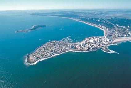
Infrastructure Report Uruguay 2014
 Page 1 Market Research Infrastructure Report Uruguay 2014 Prepared by Your guide to doing business in Latin America Miryam Lazarte, Founder & CEO Page 2 EXECUTIVE SUMMARY Despite Uruguay's small size and
Learning Objectives. By the end of this presentation you should understand:
 Designing Routes 1 Learning Objectives By the end of this presentation you should understand: Benefits of RNAV Considerations when designing airspace routes The basic principles behind route spacing The
Kermadec. Ocean Sanctuary
 Kermadec Ocean Sanctuary Kermadec Ocean Sanctuary, New Zealand Pacific Remote Islands National Marine Monument, United States Coral Sea Marine Reserve, Australia Proposed Pitcairn Marine Reserve, United
Baltic Marine Environment Protection Commission
 Baltic Marine Environment Protection Commission Group of Experts on Safety of Navigation Copenhagen, Denmark, 3 December 2014 SAFE NAV 5-2014 Document title Revision of HELCOM Recommendation 25/7 Safety
The Maltese Islands: Geography
 The Maltese Islands: Geography The Maltese Archipelago comprises a group of small low islands aligned in a NW-SE direction. At their extreme points the Maltese Islands fall within the following points:
ICES form - Notification of proposed research cruise
 Ref.id.: KS&SMS-5-4-02 Standard Side 1 av 5 1. NAME OF RESEARCH SHIP: CRUISE NO.: 2. DATES OF CRUISE From: To: 3. OPERATING AUTHORITY: TELEPHONE: TELEFAX: TELEX: 4. OWNER (if different from no. 3) 5. PARTICULARS
SITE ELEVATION AMSL...Ground Elevation in feet AMSL STRUCTURE HEIGHT...Height Above Ground Level OVERALL HEIGHT AMSL...Total Overall Height AMSL
 ******************************************** * Federal Airways & Airspace * * Summary Report * ******************************************** File: User Assigned File Name Latitude: NAD83 Coordinate Longitude:
21 WORLD CONGRESS OF SOIL SCIENCE Sunday 20 Friday 25 November 2016 Rio de Janeiro, Brazil
 21 WORLD CONGRESS OF SOIL SCIENCE Sunday 20 Friday 25 November 2016 Rio de Janeiro, Brazil FIELD TRIP TO PADDY SOIL OF RIO GRANDE DO SUL Summary: Field trip to the paddy soils of the State of Rio Grande
Questions and Answers Cape Town Agreement of 2012
 Questions and Answers Cape Town Agreement of 2012 1. What is the Cape Town Agreement of 2012? The Cape Town Agreement of 2012 (the Agreement) sets internationally agreed minimum standards for the design,
Presentation. Feasibility of the Establishment of a Single Airspace within the Caribbean
 Presentation Feasibility of the Establishment of a Single Airspace within the Caribbean BY E. Anthony Archer Chairman, Caribbean Aviation Safety and Security Oversight System (CASSOS) JUNE 09 2011 REQUEST
MESO AMERICAN AND CARIBBEAN SEA HYDROGRAPHIC COMMISSION 18 th Meeting Varadero, Cuba (27 November - 02 December 2017) NATIONAL REPORT BRAZIL
 NATIONAL REPORT BRAZIL") Pag. 1 de 5 MESO AMERICAN AND CARIBBEAN SEA HYDROGRAPHIC COMMISSION 18 th Meeting Varadero, Cuba (27 November - 02 December 2017) NATIONAL REPORT BRAZIL 1. Hydrographic Office / Service: Directorate of
Pag. 1 de 5 MESO AMERICAN AND CARIBBEAN SEA HYDROGRAPHIC COMMISSION 18 th Meeting Varadero, Cuba (27 November - 02 December 2017) NATIONAL REPORT BRAZIL 1. Hydrographic Office / Service: Directorate of
MESO AMERICAN AND CARIBBEAN SEA HYDROGRAPHIC COMMISSION 15 th Meeting - Manzanillo, Mexico (10-13 December 2014) NATIONAL REPORT BRAZIL
 NATIONAL REPORT BRAZIL") Pag. 1 de 6 MESO AMERICAN AND CARIBBEAN SEA HYDROGRAPHIC COMMISSION 15 th Meeting - Manzanillo, Mexico (10-13 December 2014) NATIONAL REPORT BRAZIL 1.Hydrographic Office / Service: Directorate of Hydrography
Pag. 1 de 6 MESO AMERICAN AND CARIBBEAN SEA HYDROGRAPHIC COMMISSION 15 th Meeting - Manzanillo, Mexico (10-13 December 2014) NATIONAL REPORT BRAZIL 1.Hydrographic Office / Service: Directorate of Hydrography
DRAFT AGREEMENT BETWEEN THE EUROPEAN ORGANISATION FOR THE SAFETY OF AIR NAVIGATION (EUROCONTROL) AND THE KINGDOM OF MOROCCO
 AND THE KINGDOM OF MOROCCO") DRAFT AGREEMENT The European Organisation for the Safety of Air Navigation, hereinafter referred to as EUROCONTROL, acting through its Permanent Commission and represented by its Director General, Mr.
DRAFT AGREEMENT The European Organisation for the Safety of Air Navigation, hereinafter referred to as EUROCONTROL, acting through its Permanent Commission and represented by its Director General, Mr.
OFFICE OF THE SECRETARY OF ECONOMIC DEVELOPMENT
 OFFICE OF THE SECRETARY OF ECONOMIC DEVELOPMENT Colima, Mexico Tel: +52 (312) 316-2028 Fax: +52 (312) 316-2034 E-mail: sefome@col.gob.mx Infrastructure Colima's modern and well-developed infrastructure
Presented by Matti Amukwa Chairman Confederation of Namibian Fishing Associations November 2012
 Presented by Matti Amukwa Chairman Confederation of Namibian Fishing Associations November 2012 European Commission Regional Seminar on the EU- SADC Economic Partnership Agreement in Botswana, 14-15 November
Order on the discharge of oil from ships in the exclusive economic zone around Greenland
 Translation: Only the Danish document has legal validity. Order no. 589 of 22 May 2017 issued by the Ministry of Environment and Food of Denmark Order on the discharge of oil from ships in the exclusive
47I THE LAS ANIMAS GLACIER.
 THE LAS ANIMAS GLACIER. ONE of the largest of the extinct glaciers of the Rocky Mountains was that which occupied the valley of the Las Animas river. This stream originates in the San Juan mountains in
GREATER GEELONG PLANNING SCHEME PROPOSED AMENDMENT FOR THE PROTECTION OF EMERGENCY MEDICAL SERVICE HELICOPTER FLIGHTPATHS SERVING GEELONG HOSPITAL
 GREATER GEELONG PLANNING SCHEME PROPOSED AMENDMENT FOR THE PROTECTION OF EMERGENCY MEDICAL SERVICE HELICOPTER FLIGHTPATHS SERVING GEELONG HOSPITAL APRIL 2014 Report Prepared for The Minister for Health
Friday, November 10, 2017
 Friday, November 10, 2017 Andes and Midlatitude Countries Objective: Summarize the main physical features and regions of the Southern Cone. Identify and locate the urban centers and understand the pattern
 16 March 2004 HELCOM RECOMMENDATION 25/7 on the SAFETY OF WINTER NAVIGATION IN THE BALTIC SEA AREA having regard to Article 13, Paragraph b) of the Helsinki Convention was adopted on 2 March 2004 in Helsinki
AERONAUTICAL SERVICES ADVISORY MEMORANDUM (ASAM) Focal Point: Gen
 Focal Point: Gen") Page 1 of 14 1 INTRODUCTION This guidance material has been prepared for use for the definition of protected surfaces in the vicinity of aerodromes. Survey information for an aerodrome is essential for
Page 1 of 14 1 INTRODUCTION This guidance material has been prepared for use for the definition of protected surfaces in the vicinity of aerodromes. Survey information for an aerodrome is essential for
4 Rights and duties in connection with the conduct of petroleum activities
 Guidelines for application for Acknowledgment of Compliance (AoC) for mobile facilities intended for use in the petroleum activities on the Norwegian Continental Shelf (Unofficial translation), issued
Geographic Qualities of South America
 Geographic Qualities of South America 1. South America is the fourth largest continent in area. It is located in the Western Hemisphere, lying southwest of North America. Most of South America lies in
PROSPECTING, EXPLORATION AND EXPLOITATION OF DEEP SENSITIZATION SEMINAR ON THE WORK OF THE PROVISIONAL AGENDA
 PROSPECTING, EXPLORATION AND EXPLOITATION OF DEEP SEABED MINERAL RESOURCES IN THE AREA: CHALLENGES FOR THE CARIBBEAN AND OPPORTUNITIES FOR COLLABORATION SENSITIZATION SEMINAR ON THE WORK OF THE INTERNATIONAL
IPA cross-border project BALMAS (Ballast water management system for Adriatic sea protection)
") IPA cross-border project BALMAS (Ballast water management system for Adriatic sea protection) Gašper Zupančič, Institute for Water of the Republic of Slovenia BlueMed meeting, Piran, 22.3.2017 What s wrong
IPA cross-border project BALMAS (Ballast water management system for Adriatic sea protection) Gašper Zupančič, Institute for Water of the Republic of Slovenia BlueMed meeting, Piran, 22.3.2017 What s wrong
Brador hills biodiversity reserve
 Brador hills biodiversity reserve September 2003 1. Plan and description 1.1. Geographic location, boundaries and dimensions The plan of the proposed Brador hills biodiversity reserve and its location
New Zealand Hydrographic Authority HYPLAN. Version April 2017
 New Zealand Hydrographic Authority Version 1.0 18 April 2017 This page is intentionally blank Land Information New Zealand Crown Copyright 18 April 2017 2 Preface The following document is certified by
FRAMEWORK LAW ON THE PROTECTION AND RESCUE OF PEOPLE AND PROPERTY IN THE EVENT OF NATURAL OR OTHER DISASTERS IN BOSNIA AND HERZEGOVINA
 Pursuant to Article IV4.a) of the Constitution of Bosnia and Herzegovina, at the 28 th session of the House of Representatives held on 29 April 2008, and at the 17 th session of the House of Peoples held
SHIP ACCIDENTS IN THE BALTIC SEA AREA
 COMPILATION ON SHIP ACCIDENTS IN THE BALTIC SEA AREA 1989-1999 FINAL REPORT PREPARED BY THE MINISTRY OF ENVIRONMENT PROTECTION AND REGIONAL DEVELOPMENT OF THE REPUBLIC OF LATVIA MARINE ENVIRONMENT BOARD
THE INTERNATIONAL GROWTH OF SPANISH HOLIDAY HOTEL CHAINS FROM A GLOBAL PERSPECTIVE: A CASE STUDY
 Cuadernos de Turismo, nº 25, (2010); pp. 263-267 ISSN: 1139-7861 Universidad de Murcia THE INTERNATIONAL GROWTH OF SPANISH HOLIDAY HOTEL CHAINS FROM A GLOBAL PERSPECTIVE: A CASE STUDY Begoña Fuster García,
INTERNATIONAL COURT OF JUSTICE DISPUTE CONCERNING MARITIME DELIMITATION IN THE CARIBBEAN SEA AND THE PACIFIC OCEAN. COSTA RICA v.
 INTERNATIONAL COURT OF JUSTICE DISPUTE CONCERNING MARITIME DELIMITATION IN THE CARIBBEAN SEA AND THE PACIFIC OCEAN COSTA RICA v. NICARAGUA MEMORIAL OF COSTA RICA VOLUME I 3 FEBRUARY 2015 TABLE OF CONTENTS
COMMISSION IMPLEMENTING REGULATION (EU)
") 18.10.2011 Official Journal of the European Union L 271/15 COMMISSION IMPLEMENTING REGULATION (EU) No 1034/2011 of 17 October 2011 on safety oversight in air traffic management and air navigation services
18.10.2011 Official Journal of the European Union L 271/15 COMMISSION IMPLEMENTING REGULATION (EU) No 1034/2011 of 17 October 2011 on safety oversight in air traffic management and air navigation services
Cooperative Development of Operational Safety Continuing Airworthiness Programme. COSCAP-Gulf States. Training of Airworthiness Inspectors
 COSCAP- Training of Airworthiness Inspectors Part V _ STATE SAFETY OVERSIGHT SYSTEM (ICAO Doc 9734, Part I) By Nadia Konzali COSCAP-GS Project Coordinator FLIGHT PLAN 1. Civil aviation regulations; 2.
Baltic Marine Environment Protection Commission
 Baltic Marine Environment Protection Commission Revised HELCOM RECOMMENDATION 25/7 Adopted 2 March 2004 having regard to Article 13, Paragraph b) of the Helsinki Convention Revised 4 March 2015 and 10
Summary of Public Submissions Received on
 Summary of Public Submissions Received on NPRM 15-01 Omnibus 2014 Prepared by DENISE RATIETA and PAUL ELTON 17 August 2015 Table of Contents General... 1 Summary of Submissions... 1 Definition of controlled
ARGENTINA. Marine Rescue Co-ordination Centre: Bahía Blanca (PREFECTURA NAVAL) Region: III Position: 38 43'S 62 6'W
 Region: III Position: 38 43'S 62 6'W") Marine Rescue Co-ordination Centre: Bahía Blanca (PREFECTURA NAVAL) Position: 38 43'S 62 6'W Call Sign: L2N Area Covered: South Atlantic - Atlantic area of Argentina from Claromecó to the mouth of the
Marine Rescue Co-ordination Centre: Bahía Blanca (PREFECTURA NAVAL) Position: 38 43'S 62 6'W Call Sign: L2N Area Covered: South Atlantic - Atlantic area of Argentina from Claromecó to the mouth of the
AIM WG: Contributing to ATM Success. Roland Baumann Head Planning & Development AIM skyguide
 AIM WG: Contributing to ATM Success Roland Baumann Head Planning & Development AIM skyguide AIM Contributing to ATM Success change of the value proposition towards ATM Information Management Services the
Consideration will be given to other methods of compliance which may be presented to the Authority.
 Advisory Circular AC 139-10 Revision 1 Control of Obstacles 27 April 2007 General Civil Aviation Authority advisory circulars (AC) contain information about standards, practices and procedures that the
United Nations Convention on the Law of the Sea, Dec. 10, Map of Convention Area Protocol to the London Convention
 Handout #2 Professor Jon M. Van Dyke International Ocean Law Spring 1998 Treaty Texts United Nations Convention on the Law of the Sea, Dec. 10, 1982... 1 Status of Law of the Sea Convention (and Part XI
Gas y Petróleo del Neuquén S.A.
 Gas y Petróleo del Neuquén S.A. THE DECISION TO GROW WITH ENERGY INVESTMENT OPPORTUNITIES IN THE OIL & GAS SECTOR IN NEUQUEN PROVINCE V Bidding Round Plan Nuevos Horizontes & Quarterly open Biddings under
Order of the Minister of Environment #39, August 22, 2011 Tbilisi
 Registration Code 360050000.22.023.016080 Order of the Minister of Environment #39, August 22, 2011 Tbilisi On preparatory stages and procedure of the methodology for Elaborating structure, content and
REPORT BY THE NAVAL HYDROGRAPHIC SERVICE
 IHO Hydrographic Committee on Antarctica (HCA) 15th Meeting, Niteroi, Brazil 26-28 June 2018 REPORT BY THE NAVAL HYDROGRAPHIC SERVICE MINISTERIO DE DEFENSA SERVICIO DE HIDROGRAFIA NAVAL Tel.: (54-11) 4301-0061/67
Glacial Origins and Features of Long Island
 Glacial Origins and Features of Long Island Interior Coastal Plain Continental Shelf Long Island s Geology 0 Ma Phanerozoic 540 Ma Proterozoic 2500 Ma Archean 3800 Ma Hadean 4600 Ma C M P Geologic Time
Summary 2018/2 2 February Maritime Delimitation in the Caribbean Sea and the Pacific Ocean (Costa Rica v. Nicaragua) and
 and") INTERNATIONAL COURT OF JUSTICE Peace Palace, Carnegieplein 2, 2517 KJ The Hague, Netherlands Tel.: +31 (0)70 302 2323 Fax: +31 (0)70 364 9928 Website: www.icj-cij.org Twitter Account: @CIJ_ICJ YouTube
INTERNATIONAL COURT OF JUSTICE Peace Palace, Carnegieplein 2, 2517 KJ The Hague, Netherlands Tel.: +31 (0)70 302 2323 Fax: +31 (0)70 364 9928 Website: www.icj-cij.org Twitter Account: @CIJ_ICJ YouTube
The Aegean Maritime Disputes and International Law
 The Aegean Maritime Disputes and International Law YÜCELACER BA, LIM, PhD. ASHGATE Contents Preface Acknowledgements Table of Abbreviations ix x xi INTRODUCTION 1 PART I: THE AEGEAN SEA IN ITS CONTEMPORARY