Public Informational Meeting
|
|
|
- Erin Simmons
- 5 years ago
- Views:
Transcription
1 Public Informational Meeting April 17, 2007


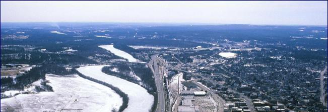
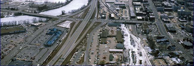
2 Bow-Concord I-93 I Transportation Planning Study Bow-Concord Interstate 93 Transportation Planning Study
3 Context Sensitive Solutions Planning Steps Screen Alternatives Determine Range of Reasonable Alternatives Brainstorm Alternatives Goal Statement Screening Criteria Community Transportation Workshop May 18 & 20, 2006 Problem Statement
4 Bow-Concord Planning Group Environment Environmental Protection Agency Army Corp. of Engineers US Fish & Wildlife NH Dept. of Environmental Services NH State Historic Preservation Office NH Fish & Game Conservation Law Foundation Society for the Protection of NH Forests Jordan Institute NH Celebrates Wellness Bow - Concord Transportation Community Town of Bow City of Concord Town of Pembroke Concord 2020 River Connection FHWA NHDOT Central NH Regional Planning NHDRED Travel & Tourism NH Office of Energy & Planning Concord Area Transit Concord Trailways Pan Am Railway NE Southern Railroad
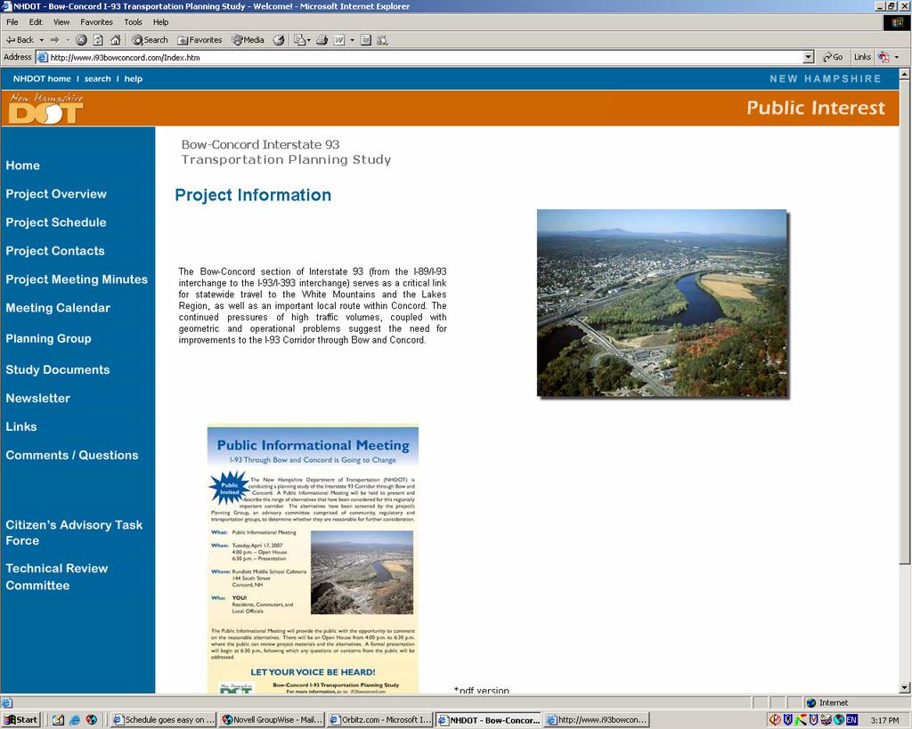
5 Project Problem Statement "Marked by aging infrastructure and limited transportation options, the Bow-Concord I-93 I Corridor neither meets the varied transportation and safety demands of interstate highway users, nor appropriately balances those demands against the interests of the Capitol Region communities in their unique identities and visions, their economic vitality, preservation of and access to their natural and historic resources, and their quality of life. Future population and economic growth, in the region and beyond, will increase transportation demand and further exacerbate this problem."
6 Project Goal Statement The Bow-Concord I-93 I Corridor should balance the needs of all users and the surrounding communities by providing a safe, affordable, reliable, environmentally acceptable and community compatible transportation system. The system will offer mobility choices and complement the unique character of the Capitol Region communities. It will support their economic initiatives, preserve and/or enhance their natural and historic resources, facilitate non-vehicular access, and sustain the communities quality of life, now and into the future.
7 Screening Criteria Bow-Concord Interstate 93 Transportation Planning Study

8 Screening Criteria Bow-Concord Interstate 93 Transportation Planning Study
9 Alternatives or Components Stand Alone Alternatives No Build Travel Demand Management (TDM)/Transit Transportation System Management (TSM) Opportunity Corridor Concept Option 1 Opportunity Corridor Concept Option 2 (Reversible Lane) Opportunity Corridor Concept Option 4 (106 Connector & Exit 2 ½) Opportunity Corridor Concept Option 5 ( Lite( Lite ) Route 106 Connector Option 1 (I-89 to Route 106) Route 106 Connector Option 2 (I-93 to Route 106 & Exit 11 ½) Local Road Improvements Safety Improvements 1992 Feasibility Study Passenger Rail Service Shift I-93 I to East Side of Merrimack River Western Beltway Components Transportation System Management (TSM) Alternate Land Use I-93 Tunnel Rail in I-93 I Median Move Merrimack River away from I-93I
")
10 Assumed Components Preservation of existing Rail Corridor Safety Improvements Enhanced Pedestrian and Bicycle Facilities Transportation Demand Management (TDM) initiatives
11 No Build Alternative Bow-Concord Interstate 93 Transportation Planning Study
12


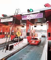
13 Travel Demand Management Expanded Bus Service Toll Pricing Enforcement Park and Ride Lots Tele-commuting Bow-Concord Interstate 93 Transportation Planning Study
14
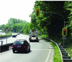


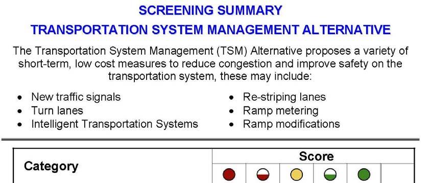
15 Transportation System Management Intelligent Information Systems Ramp Metering Turn Lanes Re-Striping Lanes Ramp Modifications Loudon Exit 14 New Traffic Signals
16

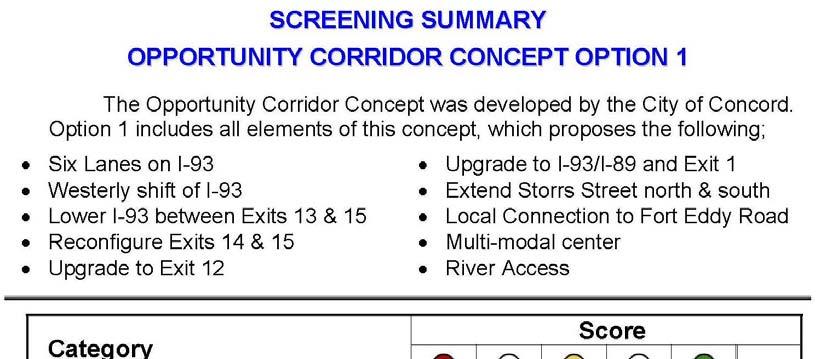
17 Opportunity Corridor Concept Option 1 Six Lanes on I-93I Westerly Shift of I-93 I Lower I-93 I b/w Exits 13 & 15 Reconfigure Exits 14 & 15 Upgrade Exit 12 Upgrade I-93/II 93/I-89 Interchange and Exit 1 on I-89I Maintain Rail Corridor Extend Storrs Street Local connection over I-93I Multi-modal center Enhanced pedestrian & bicycle connections Enhanced river access Source: Opportunity Corridor Master Plan Bow-Concord Interstate 93 Transportation Planning Study

18 Opportunity Corridor Concept Option 1 Bow-Concord Interstate 93 Transportation Planning Study
19

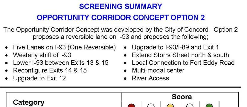
20 Source: ASSHTO Green Book Bow-Concord Interstate 93 Transportation Planning Study Opportunity Corridor Concept Option 2 Five Lanes on I-93 I (One Reversible) Westerly Shift of I-93 I Lower I-93 I b/w Exits 13 & 15 Reconfigure Exits 14 & 15 Upgrade Exit 12 Upgrade I-93/II 93/I-89 Interchange and Exit 1 on I-89I Maintain Rail Corridor Extend Storrs Street Local connection over I-93I Multi-modal center Enhanced pedestrian & bicycle connections Enhanced river access
21


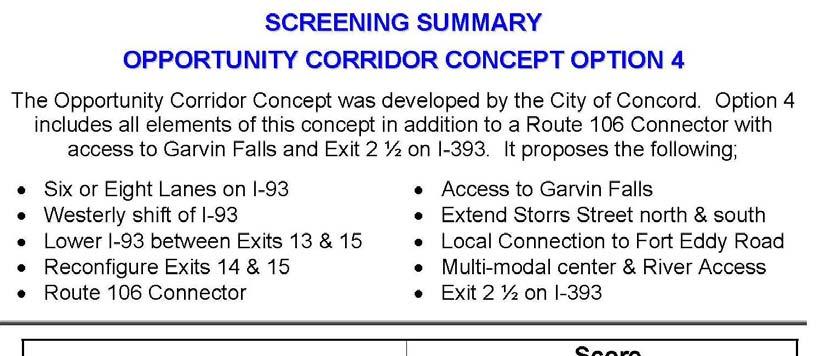
22 Opportunity Corridor Concept Option 4 All Option 1 Elements Assumes an Exit 2 ½ on I-393I Assumes a Route 106 Connector Assumes Access to Garvin Falls for Development Requires Revised Land Use
23


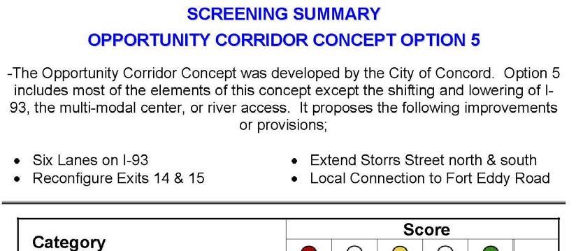
24 Opportunity Corridor Concept Option 5 Lite Version Six Lanes on I-93I Reconfigure Exits 14 & 15 Upgrade Exit 12 Upgrade I-93/II 93/I-89 Interchange and Exit 1 on I-89I Maintain Rail Corridor Extend Storrs Street Local connection over I-93I No Westerly Shift of I-93, I No Lower I-93, I No Multi-modal center, No enhanced river access
25
26 Route 106 Connector Option 1 Limited access roadway from I-89 to the Route 3/106 Intersection Four lanes on I-93 I Full interchange at I-89/II 89/I-9393 Option 2 Option 1 Option 2 Limited access roadway from I-93 I to the Route 3/106 Intersection New Exit 11-1/2 1/2 Four lanes on I-93 I Full interchange at I-89/II 89/I-9393


27 Route 106 Connector Option 1 Bow-Concord Interstate 93 Transportation Planning Study Limited access roadway from I-89 I to the Route 3/106 Intersection Four lanes on I-93 I Full interchange at I-89/II 89/I-9393
28


29 Route 106 Connector Option 2 Limited access roadway from I-93 I to the Route 3/106 Intersection New Exit 11-1/2 1/2 Four lanes on I-93 I Full interchange at I-89/II 89/I-9393
30


31 Local Road Connector Improvements Storrs Street Four lanes on I-93 I Langley Parkway Exit 16 to US 3 Connector Exit 16 ½ Storrs Street
32
33 Safety Improvements Exit 15 Weaves Exit 14 to 15 Weaves Exit 12 Deceleration Exit 1 weaves with I-89/I Interchange
34
35 1992 Feasibility Study Eight lanes on I-93 I Upgrades to Exits 12 through 15 on I-93I Upgrades to I-89/II 89/I-9393 Interchange Upgrades to Exit 1 on I-89I
36


37 Alternate Land Use Where will people live? Concord Where are the future jobs? How will people commute? Source: Central NH Regional Planning Commission
38 Passenger Rail Service
39


40 I-93 Tunnel Merrimack River Exit 13 Exit 15 Exit 14 Main Street
41
42 Shift I-93 I to East of Merrimack River From Exit 12 to Exit 15 Two new Bridges over river Assumes Six Lane I-93I Upgrades to all Exits
43
44 Move Merrimack River Away from I-93I Existing Bow-Concord Interstate 93 Transportation Planning Study
45
46 Rail Transit in I-93 I Median
47
48 Western Beltway New Limited Access Corridor Begin at Exit 2 on I-89I End at Exit 16 on I-93I
49
50 Alternatives and Components Alternatives Required by NEPA No Build Travel Demand Management (TDM)/Transit Transportation System Management (TSM) Reasonable Alternatives Opportunity Corridor Concept Option 1 Reasonable Components Transportation System Management (TSM) Alternate Land Use I-93 Tunnel Rail in I-93 I Median Unresolved Alternatives Unreasonable Alternatives Opportunity Corridor Concept Option 2 (Reversible Lane) Opportunity Corridor Concept Option 5 ( Lite( Lite ) Route 106 Connector Option 1 (I-89 to Route 106) Route 106 Connector Option 2 (I-93 to Route 106 & Exit 11 ½) Local Road Improvements Safety Improvements 1992 Feasibility Study Passenger Rail Service Shift I-93 I to East Side of Merrimack River Move Merrimack River Western Beltway Opportunity Corridor Concept Option 4 (Route 106 Connector & Exit 2 ½)
51 NHDOT Project Development Process for Bow-Concord Part A Planning ( ) Purpose and Need for Project Range of Reasonable Alternatives Public Involvement Part B Scoping ( ) 2008) Select Preferred Alternative Environmental Documentation Public Hearing Part C Design ( ) 2012) Detailed Design Purchase Right of Way Secure Permits Begin Construction (2013) Bow-Concord Interstate 93 Transportation Planning Study Problem Solution Solution Implementation
52
53
54 Comments? Questions?
Score. Category. Access Aesthetics Community Resources
 NO BUILD ALTERNATIVE The No Build Alternative is the do nothing option that is used for comparison to the build alternatives. The screening assumes no new facilities are constructed as part of the I-93
I-66 Inside the Beltway Feasibility Study
 I-66 Inside the Beltway Feasibility Study Feasibility Study Study Process Context Sensitive Dialogues Corridor Assessments / Data Collection Problem Statement Refinement Concept Development Concept Evaluation
A CASE FOR COMPLETING THE JORDAN RIVER PARKWAY: A
 A CASE FOR COMPLETING THE JORDAN RIVER PARKWAY: A safe crossing at 9000 South and 850 West Proposed 9000 South Underpass Parkway Timeline Parkway, Trail, and Tourism Facts Blueprint Jordan River 1971 1973
Update on the I-680 Transit Corridor Improvement Project HOV on/off Ramps Environmental Impact Report Community Engagement Plan
 Update on the I-680 Transit Corridor Improvement Project HOV on/off Ramps Environmental Impact Report Community Engagement Plan Presentation Overview Introductions Susan Miller, Director of Projects, Contra
Arlington County Board Meeting Project Briefing. October 20, 2015
 Arlington County Board Meeting Project Briefing October 20, 2015 Project Map 2 Project Context Only Interstate in the Country limited to HOV only traffic during rush hours Stoplight at the end of I-66
McLean Citizens Association Transportation Committee Project Briefing
 McLean Citizens Association Transportation Committee Project Briefing November 10, 2015 Project Map 2 Project Context Only Interstate in the Country limited to HOV only traffic during rush hours Stoplight
Public Information Meetings. October 5, 6, 7, and 15, 2015
 Public Information Meetings October 5, 6, 7, and 15, 2015 Project Map 2 Project Context Only Interstate in the Country limited to HOV only traffic during rush hours Stoplight at the end of I-66 eastbound
DULLES AREA HIGHLIGHTS. Gary Garczynski Commonwealth Transportation Board Northern Virginia District. Committee for Dulles August 4, 2016
 DULLES AREA HIGHLIGHTS Gary Garczynski Commonwealth Transportation Board Northern Virginia District Committee for Dulles August 4, 2016 Smart Scale (formerly HB2) Overview Round 1 completed with the adoption
I-95/395 HOV/Bus/HOT Lanes Project Overview
 I-95/395 HOV/Bus/HOT Lanes Project Overview 2 I-95/395 HOV/Bus/HOT Lanes Meetings Agenda 7 p.m. to 9 p.m. Open House Information Stations and Q&A With Project Staff 7:30 p.m. and 8:30 p.m. Project Overview
Construction underway. STATUS: 229 5,190 5,419 5,305 STIP REFERENCE #FR /01/2013
 FREDERICK COUNTY STATE HIGHWAY ADMINISTRATION -- Frederick County -- Line 1 PROJECT: I-7, Baltimore National Pike INTERSTATE CONSTRUCTION PROGRAM DESCRIPTION: Widen I-7 east of MD 355 to east of MD 144
FREDERICKSBURG DISTRICT. District Engineer Marcie Parker, P.E. May 8, 2018
 FREDERICKSBURG DISTRICT District Engineer Marcie Parker, P.E. May 8, 2018 3 Interstate 95 Projects Fredericksburg Area Fredericksburg region will see greatest degree of I-95 construction since widening
Elected Officials and Media Briefing I-395 Express Lanes Northern Extension
 Elected Officials and Media Briefing I-395 Express Lanes Northern Extension Updates on: I-95 Express Lanes Southern Extension Transform 66: Inside and Outside the Beltway March 31, 2016 Today s Agenda
HAMPTON ROADS CROSSINGS PATRIOTS CROSSING AND HRBT
 HRTPO Board Meeting March 21, 2013 Agenda ITEM #9: HAMPTON ROADS CROSSINGS PATRIOTS CROSSING AND HRBT Congestion at the Hampton Roads Bridge-Tunnel (HRBT) on I-64 has long been identified as a problem
Transportation Supporting Dulles Airport
 Transportation Supporting Dulles Airport Committee for Dulles Economic Development and Transportation Committee July 12, 2018 Tom Biesiadny, Director Fairfax County Multiple Transportation Improvements
RW Bruhn Bridge and Approaches Project
 RW Bruhn Bridge and Approaches Project The Trans-Canada Highway 1 RW Bruhn Bridge and Approaches Project involves four-laning approximately 1.9 km of Highway 1 in Sicamous, including replacement of the
Macleod Trail Corridor Study. Welcome. Macleod Trail Corridor Study Open House. Presentation of Proposed Design Concepts
 Macleod Trail Corridor Study Welcome Macleod Trail Corridor Study Open House Presentation of Proposed Design Concepts Study Purpose Develop a corridor plan for Macleod Trail that aligns with The City s:
2017 TBARTA Future Regional Priority Projects Adopted by TBARTA Board, December 9, 2016
 2017 TBARTA Future Regional Priority Projects Adopted by TBARTA Board, December 9, 2016 Project numbers do not signify ranking they are for mapping identification purposes only. 1. 15th Street East The
Longmont to Boulder Regional Trail Jay Road Connection DRAFT FINAL REPORT
 Longmont to Boulder Regional Trail Jay Road Connection DRAFT FINAL REPORT December 2018 Project Summary Boulder County, Colorado, in partnership with the City of Boulder, is evaluating options for multi-use
Appendix 4.8 A. Agency Correspondence and Final APE Statement
 Appendix 4.8 A Agency Correspondence and Final APE Statement Area of Potential Effect for Cultural Resources Introduction The South Coast Rail project requires review by the Army Corps of Engineers (Corps),
4. Safety Concerns Potential Short and Medium-Term Improvements
 NH Route 104 Access Management Study Page 19 4. Safety Concerns Potential Short and Medium-Term Improvements Potential safety improvement strategies are listed by priority based on field observations by
Non-Motorized Transportation
 Non-Motorized Transportation Non-motorized facilities are important components to the transportation system. They provide an environmentally-friendly, low-cost mode of travel. Some of the facilities can
Transform66 Transportation Management Plan: Transit & TDM Strategies
 Transform66 Transportation Management Plan: Transit & TDM Strategies Commuter Connections Committee November 15, 2016 1 Transforming I-66 A short introduction. http://outside.transform66.org/meetings/video_recordings.asp
Memorandum. To: From: cc: Date: November 7, Re: 1.0 Purpose and Organization of this Addendum. 2.0 Project Description
 Memorandum To: From: cc: Laura Prickett, Horizon Water and Environment Analette Ochoa and Wana Chiu, WRECO Parag Mehta, Kimley Horn Date: November 7, 2017 Re: Santa Cruz Route 1 Tier I and Tier II HOV
ROUTE 630 DIVERGING DIAMOND INTERCHANGE
 ROUTE 630 DIVERGING DIAMOND INTERCHANGE Virginia Department of Transportation Contract Value and Dates Contract Value: $99,949,969.50 Start of Construction: Summer 2017 Final Completion Date: July 31,
APPENDIX A DATA COLLECTION BIBLIOGRAPHY SANTA CLARA COUNTY I-680 CORRIDOR STUDY
 APPENDIX A DATA COLLECTION BIBLIOGRAPHY APPENDIX A DATA COLLECTION BIBLIOGRAPHY This section of the I-680 Corridor Study presents a summary (or bibliography) of the data that was collected and reviewed
Memorandum. Roger Millar, Secretary of Transportation. Date: April 5, Interstate 90 Operations and Mercer Island Mobility
 Memorandum To: From: The Honorable Dow Constantine, King County Executive; The Honorable Ed Murray, City of Seattle Mayor; The Honorable Bruce Bassett, City of Mercer Island Mayor; The Honorable John Stokes,
Treasure Island Supplemental Information Report Addendum
 1 1 1 1 0 1 0 1 0 1 Treasure Island Supplemental Information Report Addendum Introduction Purpose The purpose of this Supplemental Information Report (SIR) Addendum is to determine if the current land
ONONDAGA CREEKWALK PHASE II. Public Information Meeting Series 1
 ONONDAGA CREEKWALK PHASE II Public Information Meeting Series 1 Andrew Maxwell Director, Syracuse-Onondaga County Planning Agency Owen Kerney Assistant Director for City Planning Russell Houck, PE City
REPORT TO THE STRATEGIC PLANNING AND DEVELOPMENT COMMITTEE
 REPORT TO THE STRATEGIC PLANNING AND DEVELOPMENT COMMITTEE INFORMATION REPORT ON METROPOLITAN WASHINGTON AIRPORTS AUTHORITY SUPPORT TO REGIONAL TRANSPORTATION PLANNING EFFORTS JUNE 2013 Purpose To inform
Stage 2 ION: Light Rail Transit (LRT) from Kitchener to Cambridge
 from Kitchener to Cambridge") Stage 2 ION: Light Rail Transit (LRT) from Kitchener to Cambridge Public Consultation Centre (PCC) No. 3 Please Sign-in Cambridge City Hall November 21, 2017 2:00 to 8:00pm Preston Memorial Auditorium
Stage 2 ION: Light Rail Transit (LRT) from Kitchener to Cambridge Public Consultation Centre (PCC) No. 3 Please Sign-in Cambridge City Hall November 21, 2017 2:00 to 8:00pm Preston Memorial Auditorium
WELLINGTON $422 MILLION $614 MILLION $83 MILLION 22% SPEND $1.9 BILLION
 WELLINGTON WELLINGTON $1.9 BILLION FORECAST TOTAL WELLINGTON INVESTMENT The Wellington region s transport challenges are dominated by the region s concentration of population in the metropolitan cities,
Airport Planning Area
 PLANNING AREA POLICIES l AIRPORT Airport Planning Area LOCATION AND CONTEXT The Airport Planning Area ( Airport area ) is a key part of Boise s economy and transportation network; it features a multi-purpose
TransAction Overview. Introduction. Vision. NVTA Jurisdictions
 Introduction Vision NVTA Jurisdictions In the 21 st century, Northern Virginia will develop and sustain a multimodal transportation system that enhances quality of life and supports economic growth. Investments
SCOPING INFORMATION PACKET
 SCOPING INFORMATION PACKET Project Description The proposed project would provide a direct link connecting several light rail lines in operation or in construction, including the Metro Gold Line to Pasadena,
CITY MANAGER S OFFICE CITY OF MERCER ISLAND, WASHINGTON 9611 SE 36 th Street Mercer Island, WA (206)
") CITY MANAGER S OFFICE CITY OF MERCER ISLAND, WASHINGTON 9611 SE 36 th Street Mercer Island, WA 98040-3732 (206) 275-7600 www.mercergov.org August 18, 2016 Mr. Daniel M. Mathis Division Administrator Federal
CITY MANAGER S OFFICE CITY OF MERCER ISLAND, WASHINGTON 9611 SE 36 th Street Mercer Island, WA 98040-3732 (206) 275-7600 www.mercergov.org August 18, 2016 Mr. Daniel M. Mathis Division Administrator Federal
University Region Non-Motorized Plan 2015
 Non-Motorized Transportation Non-motorized facilities are important components to the transportation system. They provide an environmentally-friendly, low-cost mode of travel. Some of the facilities can
Arlington County Board Work Session Eastbound Widening January 17, Amanda Baxter, VDOT Special Projects Development Manager
 Arlington County Board Work Session Eastbound Widening January 17, 2017 Amanda Baxter, VDOT Special Projects Development Manager Program Area Map 2 Program Scope Tolling during weekdays, peak hours, peak
Engagement Summary Report. Trans-Canada Highway 1 RW Bruhn Bridge Replacement Project. Community Engagement November 15, 2016 to January 15, 2017
 Trans-Canada Highway 1 RW Bruhn Bridge Replacement Project Community Engagement November 15, 2016 to January 15, 2017 Engagement Summary Report February 2017 Prepared by Kirk & Co. Consulting Ltd. Trans-Canada
Mohawk Hudson Bike Hike Trail Crossroad Connection Study
 Summary Report - April 21, 2003 Mohawk Hudson Bike Hike Trail Crossroad Connection Study Summary Report Introduction The Capital District Transportation Committee (CDTC), in partnership with Albany County,
Route 29 Solutions Projects
 Your guide to the Route 29 Solutions Projects For full details & continued engagement please visit www.route29solutions.org The Route 29 Solutions Package is a $230 million investment into the improvement
Interstate 90 and Mercer Island Mobility Study APRIL Commissioned by. Prepared by
 Interstate 90 and Mercer Island Mobility Study APRIL 2017 Commissioned by Prepared by Interstate 90 and Mercer Island Mobility Study Commissioned by: Sound Transit Prepared by: April 2017 Contents Section
SR 934 Project Development And Environment (PD&E) Study
 Study") SR 934 Project Development And Environment (PD&E) Study Project Advisory Group Meeting March 1, 2018 State Road 934/NE/NW 79th Street from west of I-95 (NW 13th CT) to N. Bayshore Drive PD&E STUDY SR 934/NE/NW
SR 934 Project Development And Environment (PD&E) Study Project Advisory Group Meeting March 1, 2018 State Road 934/NE/NW 79th Street from west of I-95 (NW 13th CT) to N. Bayshore Drive PD&E STUDY SR 934/NE/NW
1.0 Purpose and Organization of the Community Impact Assessment Addendum
 Memorandum To: From: cc: Laura Prickett, Horizon Water and Environment Carie Montero, Senior Project Manager/Environmental Lead, Parsons Transportation Group Parag Mehta, Kimley Horn Date: September 24,
PSP 75 Lancefield Road. Northern Jacksons Creek Crossing Supplementary Information
 PSP 75 Lancefield Road Northern Jacksons Creek Crossing Supplementary Information September 2017 The northern crossing of Jacksons Creek proposed within the Lancefield Road PSP is a key part of the ultimate
1.2 Corridor History and Current Characteristics
 SECTION 1 Description and Background of Study Area 1.1 Introduction This preliminary engineering report was prepared for the Alaska Department of Transportation and Public Facilities (ADOT&PF). It is part
Charlotte Regional Express Lane Facilities: I-485 and US 74. North Carolina Turnpike Authority March 21, 2018
 Charlotte Regional Express Lane Facilities: I-485 and US 74 North Carolina Turnpike Authority March 21, 2018 NC Turnpike Authority Overview Created in 2002 by the General Assembly Authorized to design,
A. CONCLUSIONS OF THE FGEIS
 Chapter 11: Traffic and Parking A. CONCLUSIONS OF THE FGEIS The FGEIS found that the Approved Plan will generate a substantial volume of vehicular and pedestrian activity, including an estimated 1,300
November 21, 2012 Barbara Kelleher, (954)
") November 21, 2012 Barbara Kelleher, (954) 777-4090 barbara.kelleher@dot.state.fl.us BROWARD COUNTY TRAFFIC IMPACT REPORT November 26 to November 30, 2012 FORT LAUDERDALE -- Construction and maintenance-related
November 21, 2012 Barbara Kelleher, (954) 777-4090 barbara.kelleher@dot.state.fl.us BROWARD COUNTY TRAFFIC IMPACT REPORT November 26 to November 30, 2012 FORT LAUDERDALE -- Construction and maintenance-related
Transportation TRANSPORTATION PROJECTS
 Transportation TRANSPORTATION PROJECTS Balls Ford Road Interchange Total Project Cost $142.9M This project includes the construction of a new diverging diamond interchange at Route 234 Bypass (Prince William
The Future of the Road to Revolutions. A Battle Road Scenic Byway Public Forum November 9, 2010
 The Future of the Road to Revolutions A Battle Road Scenic Byway Public Forum November 9, 2010 Who is the Battle Road Scenic Byway? Four Towns: Arlington, Lexington, Lincoln, Concord Minute Man National
Design Public Hearing
 Design Public Hearing Monday, March 7, 2016 Washington-Lee High School Cafeteria 1301 N. Stafford Street, Arlington, VA 22201 Tuesday, March 8, 2016 Eagle Ridge Middle School Cafeteria 42901 Waxpool Road,
TERMINAL DEVELOPMENT PLAN
 5.0 TERMINAL DEVELOPMENT PLAN 5.0 TERMINAL DEVELOPMENT PLAN Key points The development plan in the Master Plan includes the expansion of terminal infrastructure, creating integrated terminals for international,
Western Placer County Transit Operators Short Range Transit Plan Updates FY to FY Project Update and Alternatives Discussion
 Western Placer County Transit Operators Short Range Transit Plan Updates FY 2018-19 to FY 2024-25 Project Update and Alternatives Discussion Public Workshop Purpose Present various transit service, capital
INTERSTATE 395 EXPRESS LANES NORTHERN EXTENSION TRAFFIC & TRANSPORTATION TECHNICAL REPORT SEPTEMBER 2016
 INTERSTATE 395 EXPRESS LANES NORTHERN EXTENSION TRAFFIC & TRANSPORTATION TECHNICAL REPORT SEPTEMBER 2016 INTERSTATE 395 EXPRESS LANES NORTHERN EXTENSION Traffic and Transportation Technical Report City
Presented By: Deputy Executive Director February 17, 2011
 TRANSPORTATION PROJECT PRIORITIZATION Presented By: Camelia Ravanbakht, Ph.D. Ca e a aaba t,.. Deputy Executive Director February 17, 2011 OVERVIEW 2034 Long-Range g Transportation Plan (LRTP) Process
Southern Beltway Projects Summary
 Southern Beltway Projects Summary The Pennsylvania Turnpike Commission is proposing the construction of a 30-mile, tolled fourlane limited-access highway, known as the Southern Beltway that will be located
December 2012 Update. I-95 New Haven Harbor Crossing. Corridor Improvement Program
 December 2012 Update I-95 New Haven Harbor Crossing Corridor Improvement Program Prepared by: Connecticut Department of Transportation District 3A 424 Chapel Street New Haven, CT 06511 Prepared for: South
PURPOSE AND NEED (CONCURRENCE POINT 1) NEW CANADA ROAD PROJECT FROM STATE ROUTE 1 (U.S. HIGHWAY 70) TO U.S. INTERSTATE 40
 NEW CANADA ROAD PROJECT FROM STATE ROUTE 1 (U.S. HIGHWAY 70) TO U.S. INTERSTATE 40") PURPOSE AND NEED (CONCURRENCE POINT 1) NEW CANADA ROAD PROJECT FROM STATE ROUTE 1 (U.S. HIGHWAY 70) TO U.S. INTERSTATE 40 Project Description The primary purpose of this project is to improve the major
PURPOSE AND NEED (CONCURRENCE POINT 1) NEW CANADA ROAD PROJECT FROM STATE ROUTE 1 (U.S. HIGHWAY 70) TO U.S. INTERSTATE 40 Project Description The primary purpose of this project is to improve the major
Lake Erie Commerce Center Traffic Analysis
 LOCATION: East of NYS Route 5 at Bayview Road Town of Hamburg Erie County, New York PREPARED BY: Wendel Companies 140 John James Audubon Parkway Suite 200 Amherst, New York 14228 January 2012 i ii Table
FNORTHWEST ARKANSAS WESTERN BELTWAY FEASIBILITY STUDY
 FNORTHWEST ARKANSAS WESTERN BELTWAY FEASIBILITY STUDY EXECUTIVE SUMMARY The 2030 Northwest Arkansas Regional Transportation Plan developed by the Northwest Arkansas Regional Planning Commission (NWARPC)
SOUTH INTERCHANGE AREA
 Santaquin City General Plan 1 Location and Characteristics The South Interchange Area of Santaquin is located west of Interstate 15 and south of 500 South (Figure 1). It includes properties already annexed
Northern Virginia District State of the District. Helen L. Cuervo, P.E. District Engineer October 18, 2017
 Northern Virginia District State of the District Helen L. Cuervo, P.E. District Engineer October 18, 2017 Susan Shaw, P.E., Megaprojects Director Virginia Department of Transportation American Society
Colorado Department of Transportation The Role of State Departments of Tr of T ansportation
 1 Colorado Department of Transportation The Role of State Departments of Transportation in High Speed Rail October 14, 2010 Las Vegas, Nevada Mark Imhoff Colorado Department Of Transportation Director,
Project Location MP A44.5 MP A38 PRELIMINARY. A A57 (Future Project) A42 - A44.5 (Fall Fall 2019) A38 - A42. A31 - A38 - In Design
 A42 - A44.5 (Fall Fall 2019) A38 - A42. A31 - A38 - In Design") RECONSTRUCTION AND WIDENING PROJECT Project Location A44.5 - A57 (Future Project) MP A44.5 Steinsburg Road (Fall 2015 - Fall 2016) John Fries Highway (Fall 2017 - Fall 2019) A42 - A44.5 (Fall 2017 - Fall
RECONSTRUCTION AND WIDENING PROJECT Project Location A44.5 - A57 (Future Project) MP A44.5 Steinsburg Road (Fall 2015 - Fall 2016) John Fries Highway (Fall 2017 - Fall 2019) A42 - A44.5 (Fall 2017 - Fall
Fairfax County Transportation Advisory Commission (TAC)
") Fairfax County Transportation Advisory Commission (TAC) January 17, 2017 Susan Shaw, P.E., Megaprojects Director Virginia Department of Transportation Amanda Baxter, Special Projects Development Manager
Fairfax County Transportation Advisory Commission (TAC) January 17, 2017 Susan Shaw, P.E., Megaprojects Director Virginia Department of Transportation Amanda Baxter, Special Projects Development Manager
Whittier Bridge Project
 Amesbury / Newburyport / Salisbury Whittier Bridge / I-95 Improvement Project Original Whittier Bridge Proposed Whittier Bridges 10/21/2016 Whittier Bridge Project 1 Project Description The project limits
Chairman and Members of the Planning and Development Committee. Edward R. Sajecki, Commissioner of Planning and Building
 LA.09.TOR TORONTO DATE: TO: FROM: SUBJECT: Chairman and Members of the Planning and Development Committee Edward R. Sajecki, Commissioner of Planning and Building Proposed Rezoning and Master Plan Union
Northern Beaches Transport Action Plan
 Northern Beaches Transport Action Plan The NSW Government is taking action now to deliver transport improvements for the Northern Beaches, as well as planning for the future growth of the area. $633 million
CONTACT: Michelle T. Holland
 FOR IMMEDIATE RELEASE Thursday, December 7, 2017 CONTACT: Michelle T. Holland 703-586-0487 (C) Michelle.Holland@vdot.virginia.gov Jennifer McCord 571-230-2926 Jennifer.McCord@vdot.virginia.gov 66 EXPRESS
Major Projects Overview
 Major Projects Overview Miami-Dade Expressway Authority February 2018 About MDX MDX operates 5 roads in Miami Dade County SR 924, SR 112, SR 836, SR 874 and SR 878 MDX Primary Source of Revenue: User Fees-Tolls
5.1 Traffic and Transportation
 5.1 When it opens in 2009, the Bellevue Nickel Improvement Project will increase the number of vehicles able to travel through the study area, improve travel speeds, and improve safety by reducing the
Bike/Pedestrian/Golf Cart Trail Recommendations for the City of Dasher
 Valdosta-Lowndes MPO Memo To: From: City of Dasher Mayor and City Council VLMPO Staff CC: Date: 7/12/2018 Re: Bike/Pedestrian/Golf Cart Trail Recommendations for the City of Dasher The City of Dasher is
FEASIBILITY STUDY. holdings SEPTEMBER 13, prepared for: prepared by:
 FEASIBILITY STUDY SEPTEMBER 13, 2013 prepared for: holdings prepared by: Table of Contents Project Feasibility... 3 Project Background... 4 Project and Community Context... 5 Site constraints... 6 Statement
Chapter 2: Entire US287 Corridor
 Chapter 2: Entire US287 Corridor The US287 Study Area spans four incorporated jurisdictions and two counties. Due to the length and density of infrastructure along the US287 Study Area, corridor-wide maps
WEST OFFICE CENTER DRIVE FORT WASHINGTON OFFICE PARK FORT WASHINGTON, PA
 WEST OFFICE CENTER DRIVE FORT WASHINGTON OFFICE PARK FORT WASHINGTON, PA The Park The Location The Amenities The Future The Fort Washington Office Park has undergone signification and extensive revitalization
MONTEREY REGIONAL AIRPORT MASTER PLAN TOPICAL QUESTIONS FROM THE PLANNING ADVISORY COMMITTEE AND TOPICAL RESPONSES
 MONTEREY REGIONAL AIRPORT MASTER PLAN TOPICAL QUESTIONS FROM THE PLANNING ADVISORY COMMITTEE AND TOPICAL RESPONSES Recurring topics emerged in some of the comments and questions raised by members of the
Union Station Queens Quay Transit Link Study
 Welcome Union Station in 1899. Image: City of Toronto Archives Union Station today. Image: Camil Rosiak Activity along Queens Quay. Image: Waterfront Toronto For more information or to comment, visit toronto.ca/waterfronttransit
A Master Plan is one of the most important documents that can be prepared by an Airport.
 The Master Plan A Master Plan is one of the most important documents that can be prepared by an Airport. A Master Plan is a visionary and a strategic document detailing planning initiatives for the Airport
Aviation, Rail, & Trucking 6-1
 6-1 This chapter describes the services, facilities, and condition of air, rail, and trucking as components of the transportation system. These three intermodal areas have an impact on the factors to be
A BOAT RAMP TO NOWHERE
 A BOAT RAMP TO NOWHERE A PROPOSAL FOR ACCESS TO HARVIE PASSAGE A Presentation to the City of Calgary December 2017 Presented by: Peter Crowe-Swords Bow River Trout Foundation Background: The Bow River
395 Express Lanes Project Update
 395 Express Lanes Project Update Key Dates Milestone Date Limited Notice to Proceed February 2017 Early Works March-June 2017 Full Notice to Proceed July 2017 Preparatory Work Summer 2017 Draft Noise Abatement
PART VIII APPLICATION FOR REVISED SOUTH SIDE TRAFFIC MANAGEMENT WORKS TO FACILITATE LUAS BXD PLANNING REPORT ROADS & TRAFFIC DEPARTMENT
 PART VIII APPLICATION FOR REVISED SOUTH SIDE TRAFFIC MANAGEMENT WORKS TO FACILITATE LUAS BXD PLANNING REPORT ROADS & TRAFFIC DEPARTMENT NOVEMBER 2012 1.0 INTRODUCTION This report has been prepared in support
October 31, 2014 Chuck McGinness, (954)
") From: McGinness, Charles To: McGinness, Charles Subject: FDOT Broward County Traffic Impact Report 10 31 14 through 11 07 14 Date: Friday, October 31, 2014 2:59:04 PM Attachments: image002.png October
From: McGinness, Charles To: McGinness, Charles Subject: FDOT Broward County Traffic Impact Report 10 31 14 through 11 07 14 Date: Friday, October 31, 2014 2:59:04 PM Attachments: image002.png October
Proposed Dulles Toll Road Rate Adjustments
 Proposed Dulles Toll Road Rate Adjustments Dulles Corridor Advisory Committee Meeting October 5, 2012 Discussion Outline Regulatory Process for Changing Toll Rates Information Provided at Public Hearings
Fairfax County Parkway Widening Fairfax County
 Get Involved VDOT representatives will review and evaluate information received as a result of this meeting. Please fill out the comment sheet provided in this brochure if you have any comments or questions.
WELCOME TO THE OPEN HOUSE
 WELCOME TO THE OPEN HOUSE US 281 North Loop 1604 to Borgfeld Drive CSJ: 0253-04-146 & 0253-04-138 May 12, 2016 Please sign in Explore the exhibits Submit a comment form Ask questions We want to know your
Main Line System Recommendations
 (Existing) Main Line System Recommendations This system recommendation focuses mobility investment in a central main line corridor proximate to I-290. A bus rapid transit (BRT) line at each end of the
Important Lane Closures, April 3 9, 2011
 March 31, 2011 CONTACT: Marcia McAllister T: 703 572 0506 C: 571 730 9117 marcia.mcallister@dullesmetro.com Important Lane Closures, April 3 9, 2011 RESCHEDULED: Lane Shifts of Westbound Route 7 at Route
State Route 189 Project and Draft Resolution of Support. November 2014
 State Route 189 Project and Draft Resolution of Support November 2014 Corridor Location Image sources: ADOT Statewide and National Importance: CANAMEX Corridor Image source: FHWA Statewide and National
Fort Lauderdale City Commission Transit Presentation. July 21, 2009 CAR
 Fort Lauderdale City Commission Transit Presentation July 21, 2009 CAR 109 0932 Agenda Overview City Transit Vision Commission Direction 2035 LRTP Long Range Transportation Plan THOR Transit/Housing Oriented
Bloor Street West Rezoning Application for a Temporary Use By-law Final Report
 STAFF REPORT ACTION REQUIRED 3741 3751 Bloor Street West Rezoning Application for a Temporary Use By-law Final Report Date: June 12, 2007 To: From: Wards: Reference Number: Etobicoke York Community Council
Welcome to the Cross County Trail Public Input Session!
 Welcome to the Cross County Trail Public Input Session! Please sign in on the table below! What are we doing here? Camden County has proposed a bicycle and pedestrian trail spanning across the entire county.
INTERSTATE 10 AND INTERSTATE 17 SPINE WORKSHOP
 October 31, 2012 INTERSTATE 10 AND INTERSTATE 17 SPINE WORKSHOP ADOT FHWA MAG City of Phoenix City of Tempe City of Chandler Valley Metro/RPTA October 31, 2012 1 Agenda Introductions Background Purpose
Mission Statement. Spur 601 Project Highlights
 Mission Statement SPUR 601 is a TxDOT project dedicated to provide a safe, efficient, reliable new corridor to improve the mobility in east-central El Paso. The SPUR 601 team is working in partnership
The Vision for the San Juan Islands Scenic Byway
 The Vision for the San Juan Islands Scenic Byway 2 Judd Cove, Orcas Island, Courtesy of Kurt Thorson (kurtthorson.com) and San Juan County Land Bank Vision for the San Juan Islands Scenic Byway The San
Blueways: Rivers, lakes, or streams with public access for recreation that includes fishing, nature observation, and opportunities for boating.
 Parks, Open Space and Trails PRINCE WILLIAM COUNTY 2008 COMPREHENSIVE PLAN TRAILS PLAN CONTENTS The components of the trails plan are: Intent Definitions Goals, Policies, and Action Strategies Trails Map
DHS Consolidation at St. Elizabeths Master Plan Amendment. Transportation Interstate 295 / Malcolm X Avenue Interchange
 Transportation Interstate 295 / Malcolm X Avenue Interchange Consulting Parties Meeting November 08, 2011 (Revised December 20, 2011) Transportation I-295 / Malcolm X Avenue Interchange AGENDA Follow-up
WELCOME US 83 Public Meeting
 WELCOME US 83 Public Meeting From north of the Starr/Zapata County Line to Loma Blanca Road Thursday, June 8, 2017 Roma Middle School Lecture Hall Open House: 5 6 p.m. Presentation and Public Comment:
A VISION FOR I-95. January 12, Delaware Department of Transportation
 A VISION FOR I-95 January 12, 2011 Delaware Department of Transportation The East Coast s Main Street Along with SR 1, the most significant highway in Delaware 29 miles to I ".', 2 Sponsoring / Cooperating
Citrus Heights Creek Corridor Trail Project Trail Advisory Group Field Trip #2 September 11, :00 11:00 am Trellis Hall, Citrus Heights
 September 11, 2013 9:00 11:00 am Trellis Hall, Citrus Heights Project Overview The City of Citrus Heights is studying the feasibility of establishing a multi use trail system within the City s 26 miles