Introduction. We hope you find these materials useful and would welcome any feedback.
|
|
|
- Avice Thornton
- 6 years ago
- Views:
Transcription
1
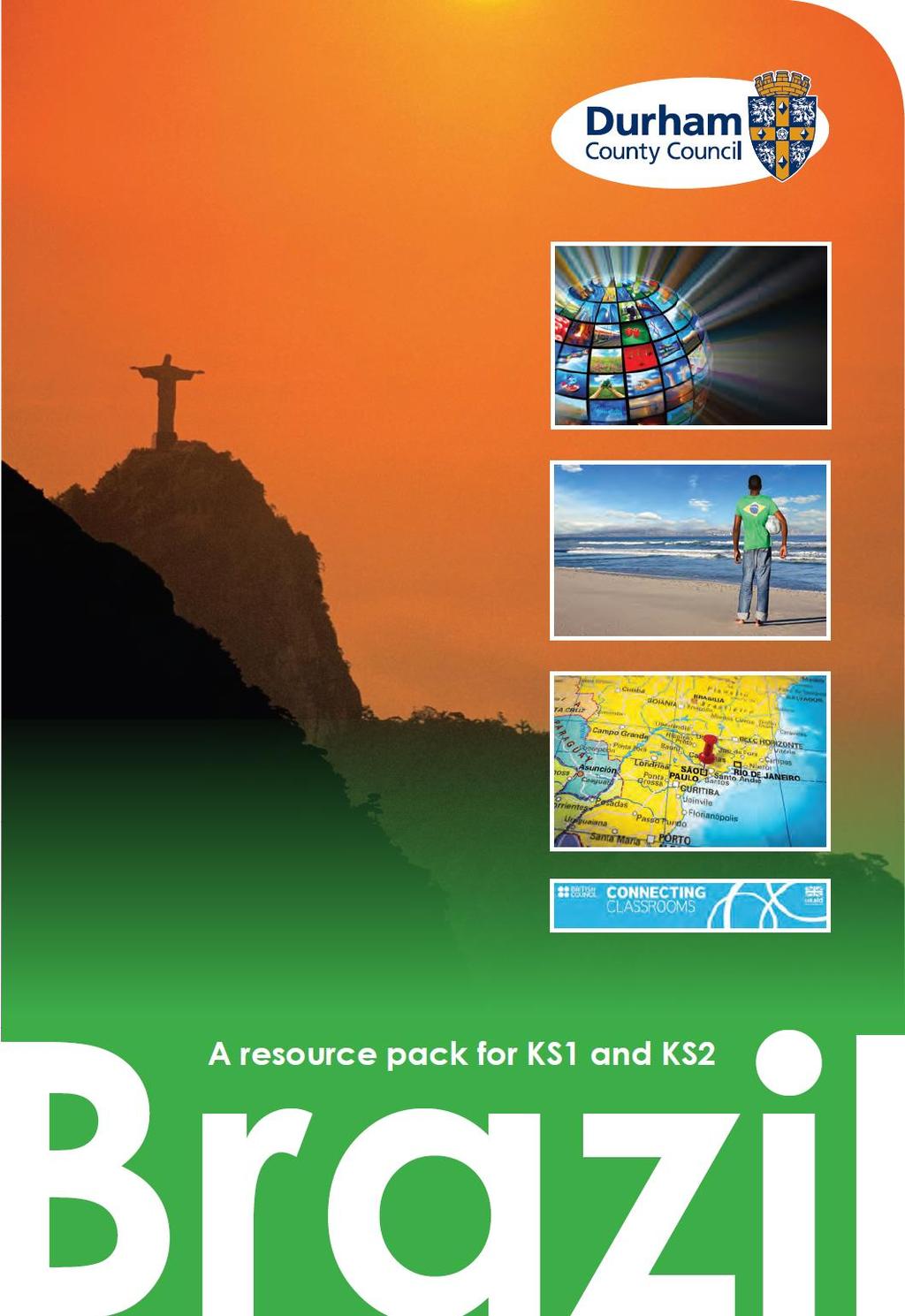
2 Introduction This planning pack was produced with teachers from County Durham following a visit to São Paulo. The materials support the teaching of geography at key stage one and two within the context of the 2014 National Curriculum. In KS1, pupils are required to develop an understanding of geographical similarities and differences through studying the human and physical geography of a small area of the United Kingdom, and of a small area in a contrasting non-european country. The São Paulo city / home enquiry in this planning can support this area of study. In KS2, pupils should have the opportunity to understand geographical similarities and differences through the study of the human and physical geography of a region of the United Kingdom, a region in a European country, and a region within North or South America. The learning activities based around the São Paulo region support the study of this aspect of the curriculum. The outline planning suggests how teachers can use the resources to develop pupils locational and place knowledge as well as building geographical skills in both key stages. Types of geographical communication are suggested throughout the planning. Some background information on Brazil is included at the start of this pack for teachers and this country profile may also be useful for KS2 pupils. The two pictorial sources in this opening section could be used for a brief history activity based on the use of sources and some possible questions are suggested. The main geography learning activities are based around three photograph packs; Where in the world? What can I find in this place? and Destination São Paulo! Teachers will want to select the number and most appropriate materials for their particular pupils. We hope you find these materials useful and would welcome any feedback. You can download these resources at
3 Country profile - Brazil Location Brazil is located on the east-central coast of South America. It is the fifth largest country in the world, and takes up half of the continent. It shares its border with 10 different countries; to the North are Venezuela, Guyana, Suriname and French Guiana, along West edge of the country are Colombia, Peru, Bolivia, Paraguay, Argentina and Uruguay. In fact Chile and Ecuador are the only countries within South America not to share a border with Brazil. Brazil is mainly located between the Equator and the Tropic of Capricorn. Landscape Brazil s landscape is mainly tropical rainforest where over 2,000 different types of trees grow in the wet, hot conditions. The Amazon rainforest is made up of thousands of species of plants, animals and insects and is thought to be the most diverse ecosystem in the world. The centre of the country is made up of tropical grassland with some trees and shrubs. Northern Brazil is dominated by the Amazon River basin and the forests which surround it. The Amazon is not one river but a network of water ways, the total length is 6,993km making it of one of the longest rivers in the world. Climate The climate in Brazil is mostly tropical and subtropical, but temperatures vary because it has lots of different kinds of terrain. In a rainforest area it is hot and humid throughout the year with an average temperature of 27 C. There is no dry season with rainfall all year round ranging from inches. In Rio de Janerio in summer it can be over 40 C. Rainfall is still high in this area with an average of 44 inches per year. São Paulo has a similar climate to Rio with a rainy summer and drier winter, although, on average, it has more rainfall.
 Languages:. Portuguese is official language.")
4 FACTFILE Population: million (UN) Land Size: sq. km Brazil is the largest country in South America and is the 5th largest country in the world by size and by population. 13 of its cities have more than 1 million residents. Around 60% of the Amazon rainforest is located in Brazil Capital: Brasilia Currency:. Real (BRL) Languages:. Portuguese is official language. 242 languages spoken across the country. Main exports:.. Iron ore, soya beans, footwear, coffee, timber, transport equipment. The country s biggest export commodity is coffee beans The Brazilian flag : Green for the forests Yellow for gold Blue for the skies White for peace Stars one for each of the Brazilian states Its motto Order and Progress Main foods eaten: Barbecued meat, Pao de queijo (cheese and bread), Feijoada (stew with black beans) Life Expectancy: Females 77 years/males 70 years
5 History Archaeologists think that people have lived in the area we call Brazil for 32,000 years. The first peoples of this area were nomads and farmers with around 1000 tribes of indigenous Indians. We know very little about them as they left us few artefacts or buildings. European invasion Brazil was discovered in 1500 by Portuguese explorer Pedro Cabral, who landed in South America on the way to India. When Europeans first reached the coast of Brazil, the country was home to about 30 million indigenous people. Whole tribes of indigenous Indians were wiped out by the diseases the Europeans brought with them. (Today there are less than 300,000 indigenous peoples remaining). The Europeans wanted the wood, gold and precious stones of Brazil. Sugar and coffee were planted and African slaves were imported to work on the huge farms Nineteenth century Brazil Brazil gained independence in 1822 from Portugal and Dom Pedro I became the first Emperor. By 1889, the rich coffee farmers had grown tired of the monarchy and the Emperor was removed; Brazil became a Republic. There were many wars between Brazil and the surrounding countries. Twentieth Century Brazil During the 1970s, Brazil was ruled by army generals and people had very little choice or freedom. In 1990, free elections were held and the country has held several elections since the return of democracy..


6 The Discovery of Brazil Cabral (centre-left, pointing) sights the Brazilian mainland for the first time on 22 April A painting by Aurélio de Figueiredo completed in Source: Museu National How did European explorers travel to Brazil? Can you find any clues about why they went to Brazil or what they were planning to do when they arrived? How does the painting make you feel about this event? The artist painted this picture 400 years after the event. Why do you think he painted it?

7 Coffee workers in Brazil in the 1930s. Source: The Brazil Museum of Coffee 1. Who can you see in the photograph? 2. These people are all workers on coffee farms. Does anything surprise you? 3. What do you think it would be like to be one of these workers?
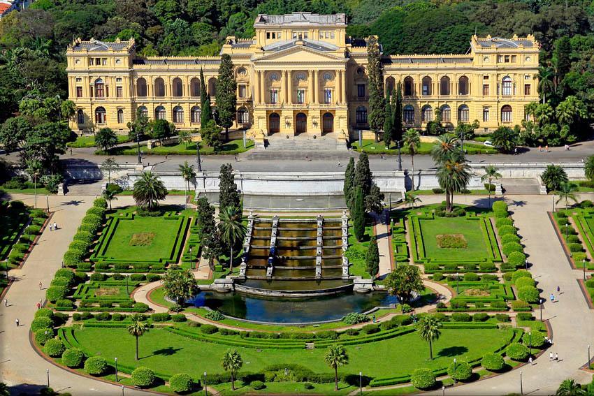
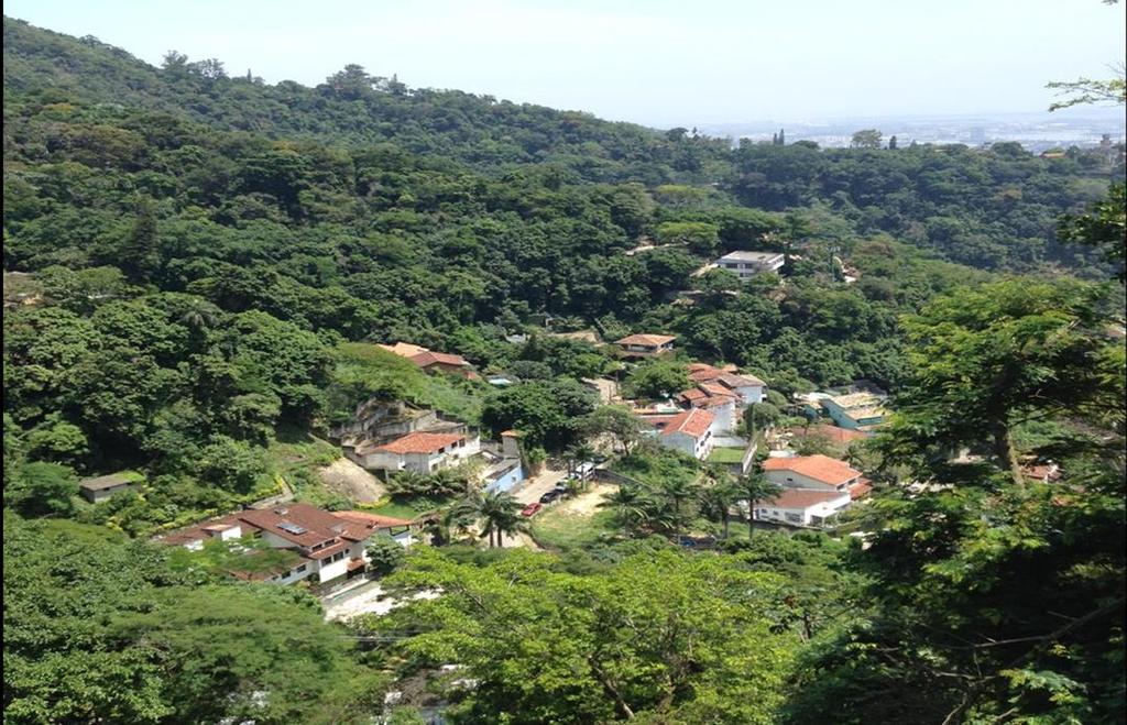
8 Key Stage 1 Geography Geographical skills and communication are developed throughout the activities. Locational knowledge 1. Pupils are given a series of clues from the Where in the world? pack and asked to investigate where in the world the country they are going to study is located. Pupils can use a world map to plot their ideas and then highlight the actual destination country. 2. Using a world map and atlas pupils are asked to describe where Brazil is located, including the continent and surrounding countries. Place knowledge/ Human and physical features 1. Pupils will begin the think about what makes a place unique by using their geographical skill of using photographs from the What can I find in this place? pack. Pupils are given a series of images and are asked to investigate what they can see. Begin with very general observations to build confidence. 2. Extend geographical understanding by asking pupils to label, apply labels or circle physical and human features. 3. Develop enquiry skills by asking pupils to pose geographical questions about some of the places in the photographs 4A-4H which show a series of human and physical images taken from Brazil. For each image pupils have to think about what type of questions they might ask to find out more information. To support this activity further, teachers may want to provide additional information about each image which can be found in the teacher pack
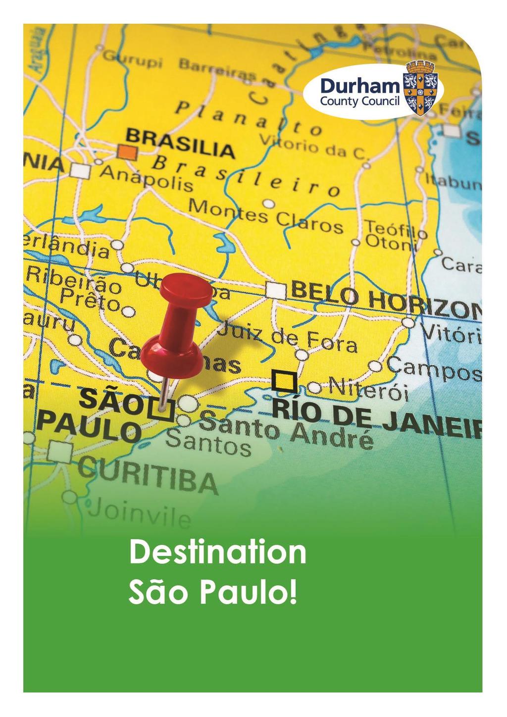
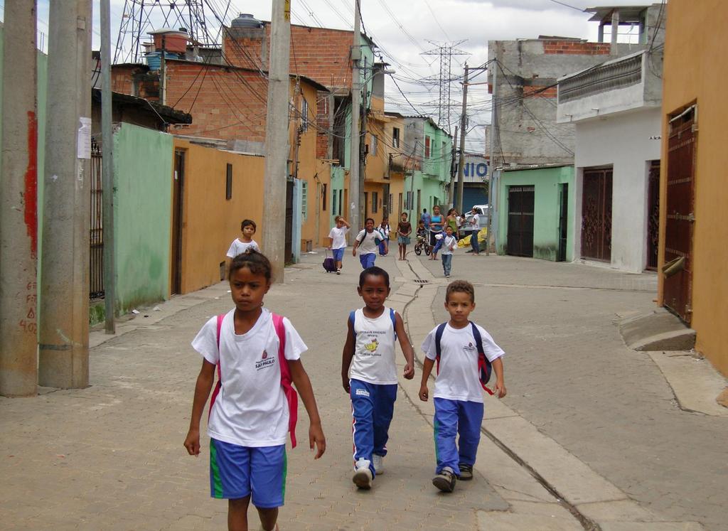
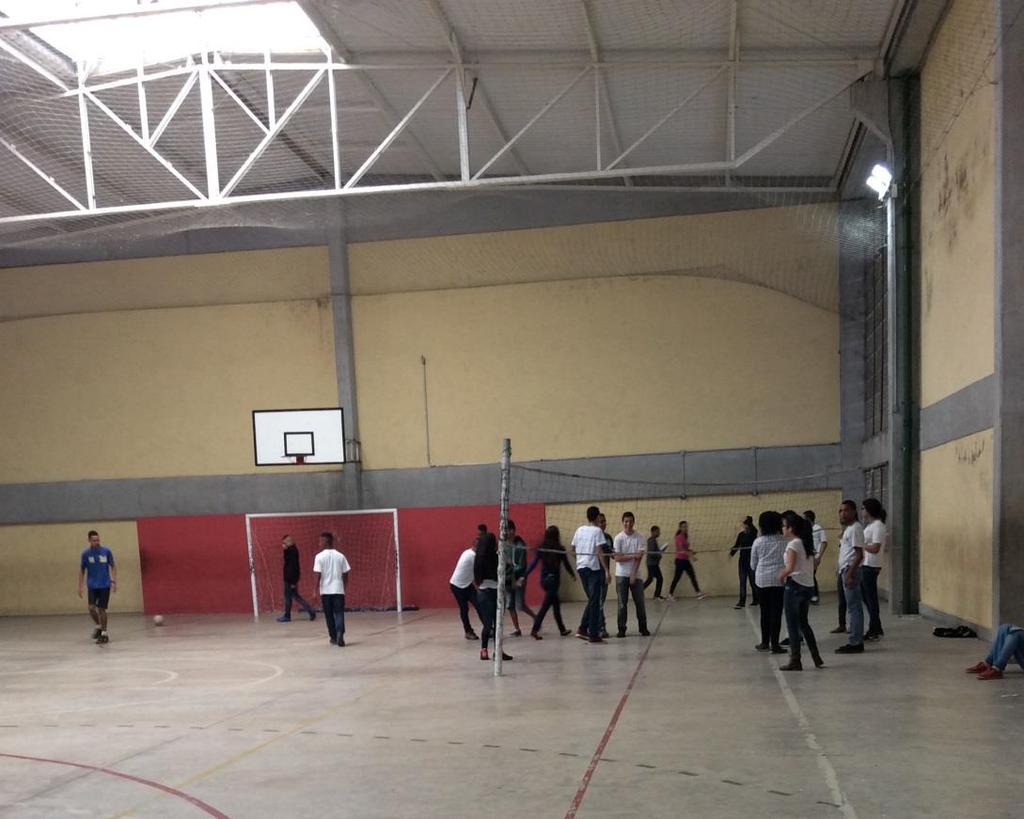
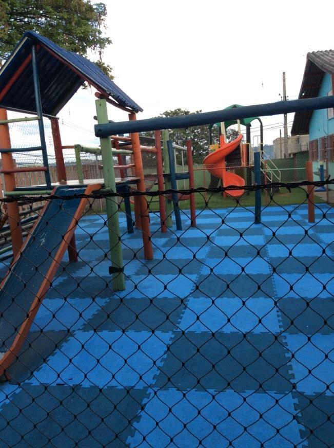
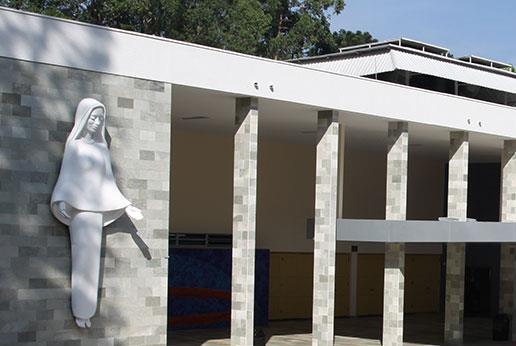
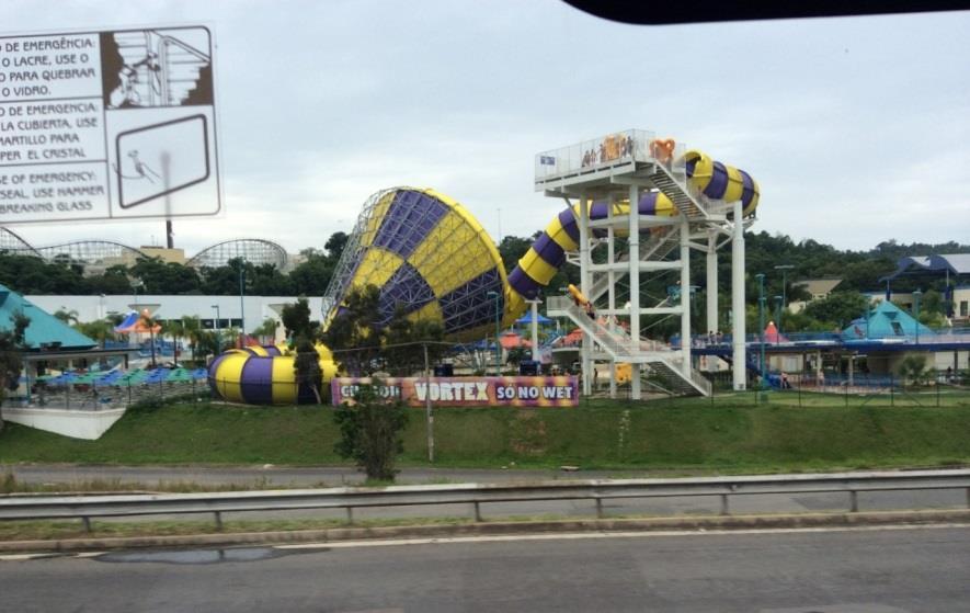
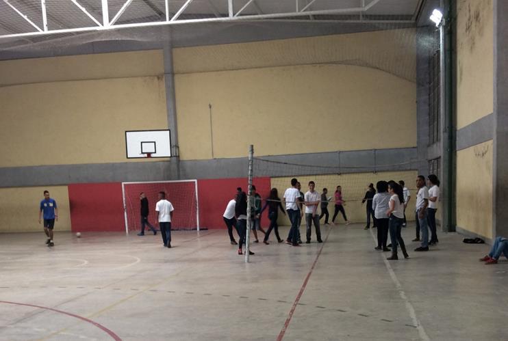
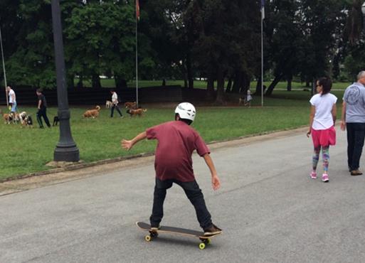
9 4. My place/ your place what is the same? Comparing a small area of the UK and a small area of non- European country. In small groups, pupils are given a series of images which depict life in São Paulo 5. (Destination São Paulo pack). These are based around school, environment, transport and play. Teachers may want to focus on one category for comparison work. Pupils need to identify similarities/ differences between Sao Paulo and their own local area. Teachers might find it useful to provide some photographs of the local UK area for pupils to use. A basic table is included at the back of these materials. 6. Using these images and any additional research pupils can produce an extended piece of writing appropriate to their year group e.g. a poster or a leaflet to illustrate how life in São Paulo is similar or different to life in their home area.
10 Key Stage 2 Geography Geographical skills and communication are developed throughout the activities. Locational knowledge 1. Pupils will use a series of clues to work out hemisphere, continent, country, and city in the Where in the World? pack. An extension resource, Location Challenge, can be found at the end of this planning for use in consolidation of locational knowledge. 2. Pupils should then write an accurate geographical description of the locations of São Paulo and Rio de Janeiro. Teachers may wish to use the opportunity to revise the location of the home town of the pupils. There are many extensions possible here for example: calculation of distance, use of scale in an atlas and looking at time zones. 3.The class should discuss what this location might mean for the physical geography of Brazil. i.e. tropics, climate, vegetation, hazards. 4. Pupils should use an up to date atlas to annotate a map of Brazil to show the key human and physical landmarks. By Y6 this should include some topographical detail. Pupils should add a key and discuss the scale of the maps used and produced. Place knowledge/ Human and physical features Focus: comparing the physical and human geography of a region of the UK and a region of a non-european country. This stepped enquiry focuses on working like a geographer and using different pieces of information to investigate a region of Brazil and compare it to the pupils home region. Awareness of new geographical terms and the comparison of similarity and difference are the main objectives.
11 1. Using the resources in the Destination São Paulo pack, set the big picture by looking at the Brazil fact file information. Set up a comparison challenge. What can the pupils find out about the UK to complete a big picture UK chart? Support this with atlas and guided internet searches. 2. A tale of two cities. What are the similarities between Durham (and your nearest city) and São Paulo? Discuss with pupils the questions they would need to ask to try and answer this question. Discuss the types of things they would need to know and how they might find out. Ensure coverage of physical and human geography. The areas of research might include weather, population, main jobs, life at school, and types of houses, places to play, transport, decision makers, foods, languages spoken, money used, vegetation, rivers, important buildings, a university, healthcare, and life expectancy. The photographs included in the pack can support many of these enquiries. Other sources should be used; some examples are in the São Paulo pack. A research table could be drawn up for pupils to use to record their initial findings. 3. Draw the enquiry together by comparing 3 aspects of life in São Paulo with 3 aspects of life in Durham. This can start as a Venn diagram and then be developed into a longer report style piece of writing or a news cast using the images from the pack and voice overs written by the pupils.
12 KS1: My place, your place Spotting differences and things that are similar Use the photographs to see what you can find. Places to play São Paulo My home area Transport School Environment
13 KS2 Extension resource location challenge! Using an atlas to help you: 1. Label all the countries of South America. Can you add the missing islands? 2. Mark and label the Equator and the Tropic of Capricorn 3. Mark and label the Amazon River, and the cities of Brasília, São Paulo and Rio de Janeiro 4. Locate and label the Atlantic Ocean, Pacific Ocean, South Atlantic Ocean 5. Locate and label the Andes mountain range, Tierra del Fuego and Cape Horn.
14
15

16 Aerial view KS1 Where is the plane going to land? KS2 -Where do you think the destination might be?


17 KS2 - Hemisphere clue The plane will land to the West of the Prime Meridian and south of the Equator. KS1&2 Can you name the continent?


18 This is a place with Highlands A place with one of the world s great rivers


19 Did you guess the country? Our exact location São Paulo S, W

20 How is the location of São Paulo different to the location of your home town or city?
21

22 4A - This image shows a rural area which has some development around the main transport use. Pupils may consider how the land is being used; type of building, vegetation cover or what else can be seen in the background


23 4B - An image of a beach which shows a large number of buildings developed along the coastline. The impact of these hotels and tourists maybe something pupils want to think about, alongside who may be visiting the area. 4C - This image shows the river channel and illustrates to pupils that not all rivers in Brazil look like the Amazon. How will the river be used, what about the surrounding vegetation and how does it support the country.


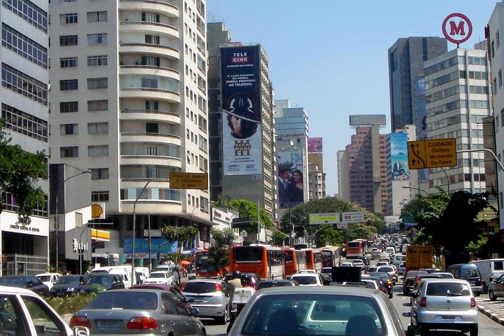
24 4D - The image of the port shows how areas of the country are by used by major industries. Pupils may want to consider how the industry works, where do the ships which dock here come from, what impact does it have on the area, do many people work there, why is the port in this place? 4E - This is an image of a city in Brazil, and is designed to help pupils to realise that there are built up areas in the country with high rise buildings and skyscrapers.


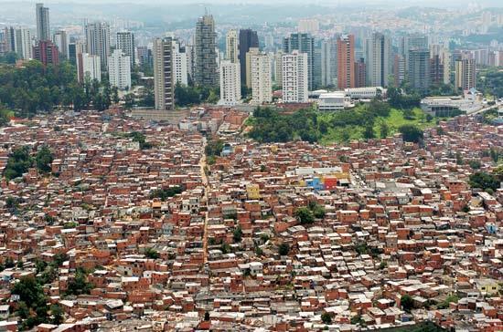
25 4F - An image of a town in Brazil, this shows in more detail many of the features of an urban area. Pupils can think about how it is being used, the transport, types of shops and places people are using. 4G - This is an image of a favela on a hill. It shows the housing which is crammed in to any available area with limited facilities. Pupils may want to think about who lives here, what is it like, why is it on a hill?

26 4H - An image of vegetation, which can be used to think about what the environment is like and how it is being used by people on a daily basis, is it like the countryside of the North East?
27
28 A
29 B
30 C
31 D
32 E

33 What is life in São Paulo like?
34 São Paulo school fact file Schooling in São Paulo is free and it is the law that children between the ages of six and 14 to go to school. Most children attend the school which is closest to their home. There are so many pupils in the city that schools in São Paulo often run three separate school sessions per day: in the morning, afternoon and evening. Children attend one session per day. Classes at schools in São Paulo are taught in Portuguese. São Paulo has a very famous University where people go from all over the world to study medicine. Thanks to the Academic Section of the Embassy of Brazil, London for their help in the production of this pack. This pack has been produced following a visit by teachers from County Durham schools to São Paolo as part of the British Council s Connecting Classrooms programme. For more information about this professional development scheme see: Durham County Council s International Relations team can help support schools with curriculum based international school partnerships. For more information see: or international@durham.gov.uk tel
Geographic Qualities of South America
 Geographic Qualities of South America 1. South America is the fourth largest continent in area. It is located in the Western Hemisphere, lying southwest of North America. Most of South America lies in
Portuguese Language - Fostering National Unity
 Geography Brazil Brazil Portuguese Language - Fostering National Unity 11 dialects of Portuguese Influenced by Amerindian and African languages, creating differences between Portuguese spoken in Brazil
*Latin America spans 7,000 miles, from Mexico to Tierra Del Fuego. *3 Regions: Central America, South America, and the Caribbean.
 Physical Geography Latin America spans 7,000 miles, from Mexico to Tierra Del Fuego *3 Regions: Central America, South America, and the Caribbean. *Intro clip: http://www.youtube.com/watch?v=cffp6rza3
Brazil. Population & Culture
 Brazil Population & Culture Population of Brazil Largest country in South America 200 million people (2012 est) Growing population - approximately 1% per year Life expectancy - approx 72 years Population
Comprehension Questions:
 Unit 3: Central & South america Comprehension Questions: 1. What is the driest desert on earth? Atacama Desert 2. What two water routes were discovered in the 1500s to get around the tip of South America?
Chapter 19 Test on South America
 Name Part 1 - Labeling (27 pts.) Chapter 19 Test on South America Score A. Locate the countries and territory contained in the word box below on the map of South America on the next page. Write the name
Created by Bobbie Kalman
 Created by Bobbie Kalman For my longtime friend Tony Zinnanti and his Brazilian family, Alba and Bianca, with much love to you all Author and Editor-in-Chief Bobbie Kalman Editors Kathy Middleton Crystal
Latin America. Physical Geography
 Latin America Physical Geography Regions Latin America can be divided into separate regions based on physical geography or cultural geography. Regions If we look at physical geography Latin America has
South American Countries. Capital Location Population Terrain Climate
 South American Countries Capital Location Population Terrain Climate Andes Mountains Four large areas that make up the Central Plains: Llanos, the Selva, the Gran Chaco, and the Pampas Brazilian Highlands
A funny sounding lake. South American Landforms, Climate, and Vegetation
 A funny sounding lake South American Landforms, Climate, and Vegetation 3 4 Essential Question: How have physical features and climate affected the population distribution of Latin America? 5 I. Landforms
CHAPTER 12. South America. Section 1: Natural Environments Section 2: History and Culture Section 3: South America Today. HOLT World Geography
 CHAPTER 12 South America Section 1: Natural Environments Section 2: History and Culture Section 3: South America 1 Section 1 Natural Environments Objectives: What are the major landforms and rivers of
Chapter 10 Study Guide SOUTH AMERICA
 Chapter 10 Study Guide SOUTH AMERICA When Spain and Portugal competed for trading lands in the New World, who came up with the line of demarcation to settle the dispute? The Caribbean Countries: Who was
Latin America s Physical Geography. EQ: What are characteristics of Latin America s physical features?
 Latin America s Physical Geography EQ: What are characteristics of Latin America s physical features? Your Task: We are going to participate in a Museum Walk! You will travel around the room with a partner
1 What do you know about Brazil? What. 2 What would you like to know about Brazil? 3 Look at the short movie clips below to see
 This fact sheet introduces you to the beautiful country of Brazil with its varied scenery. 1 What do you know about Brazil? What is Brazil famous for? Make a list of the facts that you know about the country
Latin America. Introduction
 Latin America Introduction What are the 5 Themes of Geography? Draw lines to connect the theme to the definition: Location How humans and the environment impact each other Physical and human characteristics
Latin America and The Caribbean. A Closer Look.
 Latin America and The Caribbean A Closer Look. Mexico Capital: Mexico City The Location of Mexico Mexico is the second-largest country by size and population in Latin America.but the Largest Spanish -
Essential Questions. 1. How have historical figures and events affected South America today?
 South America Essential Questions 1. How have historical figures and events affected South America today? 2. How has location affected the development of countries in South America? 3. How has the role
2. The most important crop in Mexico. 3. The Priest who spoke against Spain. 5. Ancient Aztec city, now Mexico City
 Name: Date: Did you hear about what happened at the laundromat last night? Three clothespins held up two shirts! Clues are listed below. Print the word that matches the clue on the blank line by the clue.
Mrs. Reifsnyder World Geography. Unit 8: Latin America Study Guide SOLs Addressed: WG. 1c, 2b, 3c, 4, 10b/c
 Mrs. Reifsnyder World Geography Unit 8: Latin America Study Guide SOLs Addressed: WG. 1c, 2b, 3c, 4, 10b/c Essential Questions: - In what ways do physical, economic, and cultural characteristics influence
Activity 1 - Where is Brazil? Using a map or atlas to help you:
 Activity - Where is Brazil? Using a map or atlas to help you: Label all the countries of South America 2 Mark and name the Equator and the Tropic of Capricorn 3 Mark and name the Amazon River, and the
South America Projects
 South America Projects Study the geography of South America by choosing one of the activities below. South American Travel Brochure Explorer s Journal World Cup Geography Create a Playable Board Game Create
Brazil. Brazil A Reading A Z Level J Leveled Book Word Count: 279 LEVELED BOOK J
 Brazil A Reading A Z Level J Leveled Book Word Count: 279 Discussion Questions Evaluate: What is interesting about the Amazon rainforest? Analyze: Why do you think the author calls Brazil an exciting country?
Name: Hour: Day: The Land and Its Regions (pg ) Define, in your own words, escarpment. Define, in your own words, sertão
 Define, in your own words, escarpment. Define, in your own words, sertão") Name: Hour: Day: World Geography Guided Reading Notes Chap 12 & 13 --- ANSWER IN COMPLETE SENTENCES!!!! READ EACH QUESTION CAREFULLY & ANSWER COMPLETELY!!!! Objectives: Upon completion of reading you should
Name: Hour: Day: World Geography Guided Reading Notes Chap 12 & 13 --- ANSWER IN COMPLETE SENTENCES!!!! READ EACH QUESTION CAREFULLY & ANSWER COMPLETELY!!!! Objectives: Upon completion of reading you should
CHAPTER Latin America. Regional Atlas Study Guide. 2 Chapter A. As You Read. B. Reviewing Vocabulary
 CHAPTER 28 9 Many Th ew inventions new Regional Atlas Study Guide Latin America Directions: As you work through the Regional Atlas, complete the chart below by writing two details about each Latin American
South America. pg. 520 (5 th) pg. 523 (6 th )
 pg. 523 (6 th )") South America pg. 520 (5 th) pg. 523 (6 th ) Venezuela Rich in Oil Lake Maracaibo Called Little Venice pg. 572 (5 th) pg. 574 (6 th ) Caracas 8 miles Inland 3000 pg. 572 (5 th) pg. 574 (6 th ) Caracas
South America pg. 520 (5 th) pg. 523 (6 th ) Venezuela Rich in Oil Lake Maracaibo Called Little Venice pg. 572 (5 th) pg. 574 (6 th ) Caracas 8 miles Inland 3000 pg. 572 (5 th) pg. 574 (6 th ) Caracas
STUDY GUIDE. The Land. Physical Features of Latin America. Chapter 8, Section 1. Terms to Know DRAWING FROM EXPERIENCE ORGANIZING YOUR THOUGHTS
 For use with textbook pages 193 198. The Land Terms to Know cordillera A mountain range that runs parallel to another mountain range (page 194) altiplano A high plain (page 194) escarpment A steep cliff
The Northern Tropics
 The Northern Tropics The Guianas Countries Guyana, Suriname, French Guyana Culture reflects colonial history Official Languages Guyana English Suriname Dutch French Guyana - French Religions Suriname and
Regional Atlas: Introduction to Latin America
 Chapter 9, Section World Geography Chapter 9 Regional Atlas: Introduction to Latin America Copyright 2003 by Pearson Education, Inc., publishing as Prentice Hall, Upper Saddle River, NJ. All rights reserved.
Latin America 11/4/2013. Latin America Today. 580 million people 9% of the world s population Diverse backgrounds:
 Latin America Chapter 10 Human Geography Latin America Today 580 million people 9% of the world s population Diverse backgrounds: Native Americans Europeans Africans Asians 1 Population 393 million live
Brazil. Brazil A Reading A Z Level T Leveled Book Word Count: 1,090 LEVELED BOOK T
 Brazil A Reading A Z Level T Leveled Book Word Count: 1,090 Discussion Questions Compare and Contrast: How are the Pantanal and the Amazon Rainforest alike? How are they different? Cause and Effect: In
Mrs. Davis s Adventures
 Mrs. Davis s Adventures Latin America Countries & Political Map NAME: DATE: PERIOD: DIRECTIONS: Use your mapping skills and textbook pages: 127, 97, and 3 to complete Mrs. Davis s Story. Transfer the countries
South America. Land of Color and Contrast
 South America Land of Color and Contrast Home to: *The world s largest river system *The longest mountain chain, and second tallest mountains *Earth s driest desert *One of the world s great grassland
The geographic landscape of Brazil varies greatly within the nation. The total area of Brazil is
 Brazil Location, geography, and climate The geographic landscape of Brazil varies greatly within the nation. The total area of Brazil is approximately 8,547,403.5 square kilometers and borders every South
Latin America. Chapter 9 Physical Geography
 Latin America Chapter 9 Physical Geography Latin American Regions Middle America includes Mexico and the Central American countries The Caribbean Islands South America Mexico Landforms Sierra Madre Oriental
Exploring South America Learning Lapbook with Study Guide
 A J T L Grades 1-4 Exploring South America Learning Lapbook with Study Guide A Journey Through Learning www.ajourneythroughlearning.com Copyright 2013 A Journey Through Learning 1 Authors-Paula Winget
The Lesser Antilles. Dominican Republic), and Puerto Rico
, and Puerto Rico") The Caribbean Islands are archipelagoes or groups of islands. The major archipelagoes are: The Greater Antilles - Cuba, Jamaica, Hispaniola (Composed of Haiti and the Dominican Republic), and Puerto Rico
The Caribbean Islands are archipelagoes or groups of islands. The major archipelagoes are: The Greater Antilles - Cuba, Jamaica, Hispaniola (Composed of Haiti and the Dominican Republic), and Puerto Rico
THE PHYSICAL AND CULTURAL GEOGRAPHY OF SOUTH AMERICA
 THE PHYSICAL AND CULTURAL GEOGRAPHY OF SOUTH AMERICA 1 Global location Relative to European capitals Relative to US cities Time zones Two oceans Pacific rim countries - farther to Asia than USA Not on
Latin America. Physical Geography
 + Latin America Physical Geography + I. Landforms A. Caribbean & Central America 1. Mexico is dominated by two mountain chains, collectively called the Sierra Madre. A high plateau is situated in between.
World Geography Ch. 7.2 Climate Regions of Latin America
 World Geography Ch. 7.2 Climate Regions of Latin America BR: D10 When you think of Latin America, what types of climates do you think are down there? Write down which of the following you believe are there:
2.1 What is the climate like?
 José Medeiros This fact sheet allows you to see how varied the countryside is across Brazil. 2.1 What is the climate like? Most of Brazil is in the Southern Hemisphere, where the seasons are the opposite
Geography. Continents. Preview. For Middle Primary
 Geography Continents For Middle Primary 1 Contents The Continent Of Africa... Page 3 Africa... Page 4 The Continent Of South America... Page 5 South America... Page 6 Answers... Page 7 Title: Continents
UNIT 3 Extra Review for Chapters 9-11
 UNIT 3 Extra Review for Chapters 9-11 Mexico Central America Caribbean Islands Middle America is Central America, Mexico, and the Islands of the Caribbean Central America is a region within Middle America.
6th Grade Western Hemisphere Geography
 6th Grade Western Hemisphere Geography Multiple Choice Identify the choice that best completes the statement or answers the question. 1 Latin America is located in the A Northern Hemisphere. C Western
LOCATION, CLIMATE, AND NATURAL RESOURCES OF MEXICO
 SS6G3 The student will explain the impact of location, climate, distribution of natural resources, and population distribution on Latin America and the Caribbean. a. Compare how the location, climate,
Here you will find out how Brazil developed over the centuries and why people travelled to live in the country.
 Here you will find out how Brazil developed over the centuries and why people travelled to live in the country. The people of Brazil are descended from people who came from many other parts of the world.
DATE: A Short Introduction
 Question: What do you already know about Brazil? Read the article below and then answer the questions. A Short Introduction Brazil is big. It is the largest country in South America, and the fifth largest
Macmillan Cultural Readers ELEMENTARY LEVEL. Brazil MACMILLAN
 Macmillan Cultural Readers ELEMENTARY LEVEL SUSAN HOLDEN AND Alberta White Brazil MACMILLAN Macmillan Cultural Readers ELEMENTARY LEVEL Founding Editor of the Macmillan Readers: John Milne The Macmillan
COUNTRY DATA: BRAZIL: Information from the CIA World Factbook INTRODUCTION
 COUNTRY DATA: BRAZIL: Information from the CIA World Factbook INTRODUCTION Following more than three centuries under Portuguese rule, Brazil gained its independence in 1822, maintaining a monarchical system
Location, Climate, & Natural Resources. Where People Live & How They Trade
 Location, Climate, & Natural Resources Where People Live & How They Trade Standards SS6G13 The student will explain the impact of location, climate, distribution of natural resources, and population distribution
STANDARDS: Brain Wrinkles
 STANDARDS: SS6G3 The student will explain the impact of location, climate, distribution of natural resources, and population distribution on Latin America and the Caribbean. a. Compare how the location,
3 rd Term Worksheet [ ] Subject Geography Class VI Name : Sec. :
![3 rd Term Worksheet [ ] Subject Geography Class VI Name : Sec. :](/thumbs/84/89736232.jpg "3 rd Term Worksheet [ ] Subject Geography Class VI Name : Sec. :") 1 geo (vi) 3 rd Term Worksheet [2018 19] Subject Geography Class VI Name : Sec. : Case Study 1 : The Lumberjacks of Canada Exercise: [80-81] [A] Choose the correct answers: [80] 1. What are the men who
1 geo (vi) 3 rd Term Worksheet [2018 19] Subject Geography Class VI Name : Sec. : Case Study 1 : The Lumberjacks of Canada Exercise: [80-81] [A] Choose the correct answers: [80] 1. What are the men who
Objective. Students will familiarize themselves with the physical features and climates of Latin America.
 Journal Write KWL What do you KNOW about Latin America? What do you WANT TO KNOW about Latin America? What did you LEARN today that you didn t know before? Latin America Objective Students will familiarize
Brain Wrinkles. Location, Climate, & Natural Resources of. Where People Live & How They Trade
 Location, Climate, & Natural Resources of Where People Live & How They Trade It s south of the US, east of the Pacific Ocean, and west of the Gulf of Mexico & Caribbean Sea. It s great that it s located
Do Not Write On This Sheet. World Rally. City, country, continient: to city, country, continent:
 World Rally At each checkpoint you must list the city, country, and continent. The teacher must check all answers before you can go on to the next checkpoint. Checkpoint 1: Start at: 29 N 98 W and go to:
6th Grade Western Hemisphere Geography
 6th Grade Western Hemisphere Geography Multiple Choice Identify the choice that best completes the statement or answers the question. 1 Latin America is located in the A Northern Hemisphere. C Western
Let s Go to Brazil! Click on the Amazon Forest and answer following questions. 2.Where do tribes of Native people live?
 Name Let s Go to Brazil! Directions : Go to the Edwardscape.com Link Center. Click on Current Events. Click on Time for Kids. Type Go Places: Brazil in the search box on the homepage. Click on Sightseeing
Brain Wrinkles. Africa: The impact of location, climate, & physical characteristics on where people live, the type of work they do, & how they travel
 Africa: The impact of location, climate, & physical characteristics on where people live, the type of work they do, & how they travel STANDARDS: SS7G3 The student will explain the impact of location, climate,
The Adventures of Bella & Harry: Let s Visit Rio de Janeiro!
 The Adventures of Bella & Harry: Let s Visit Rio de Janeiro! Written by: Lisa Manzione Illustrations by: Kristine Lucco Dear Teacher, We hope you and your class enjoy reading about Bella & Harry and their
South & Central America, including Mexico Information
 South & Central America, including Mexico Information From the Amazon to the Andes and all of the mystical wonders in between, Mexico and South and Central America are full of stories to tell. Whether
Many ecotourists visit the various natural habitats in Central America. Why do you think ecotourism has become so popular?
 Chapter 9 Middle America and Spanish Speaking South America pg. 252 287 9 1 Central America pg. 255 259 Connecting to Your World What is one country in Central America that promotes ecotourism? Many ecotourists
Physical characteristics and biomes:
 Physical characteristics and biomes: Sahel region, bordering Sahara Characteristics Area suffers from lack of rainfall, over grazing, which causes loss of vegetation and loss of inhabitable areas causing
countries include the Republic of Benin, Chad. Cameroon, and Niger. These countries surround
 Nigeria Location Nigeria is located in West Africa and it shares land borders with a few countries. These countries include the Republic of Benin, Chad. Cameroon, and Niger. These countries surround Nigeria
LOCATION, LOCATION, LOCATION! Mexico, Venezuela, Cuba, and Brazil
 LOCATION, LOCATION, LOCATION! Mexico, Venezuela, Cuba, and Brazil GPS and E.Q. GPS: SS6G3 The student will explain the impact of location, climate, distribution of natural resources, and population distribution
If searching for a ebook Nature Destinations Venezuela and Brazil 2016: Gran Sabana, Llanos, Amazon, Iguacu Falls and the Coastline - Natural Tourist
 Nature Destinations Venezuela And Brazil 2016: Gran Sabana, Llanos, Amazon, Iguacu Falls And The Coastline - Natural Tourist Attractions Of Venezuela And Brazil (Calvendo Nature) By Rudolf Blank READ ONLINE
Warm-up. A. Exports only manufactured goods B. Should import fewer products C. Needs to import more products D. Does not import or export
 Warm-up As with any small country, Cuba has fewer natural resources than countries such as Brazil. This affects their trade in that Cuba A. Exports only manufactured goods B. Should import fewer products
Africa 1. About how many miles is it from the capital of Burkina Faso to the capital of Gambia? 3. What country has the second highest birthrate?
 Pts Answers - (Write answers in Answers column. Do Not mark in Pts. Column.) Africa 1. About how many miles is it from the capital of Burkina Faso to the capital of Gambia? 2. The continent's two largest
Inter-American Defense College
 http://www.jid.org/iadc.php Inter-American Defense College Inter-American Defense College Building Confidence & Security Since 1962 A Confidence & Security Building Measure Inter-American Defense College
DOWNLOAD OR READ : MAPPING SOUTH AMERICA PDF EBOOK EPUB MOBI
 DOWNLOAD OR READ : MAPPING SOUTH AMERICA PDF EBOOK EPUB MOBI Page 1 Page 2 mapping south america mapping south america pdf mapping south america South America PDF maps Free South America maps for students,
1st Period Mr. Chavira WORLD GEOGRAPHY. Hector Rodriguez
 1st Period Mr. Chavira WORLD GEOGRAPHY Hector Rodriguez P a g e 1 Table of Contents Latin America Page 2 o Maps Economic Map Page 3 Political Map Page 4 Population Map Page 5 Physical Page 6 o Notes Physical
Call Center Industry in Colombia
 Call Center Industry in Colombia 2008 1 Colombia was chosen by DIRECTV as one of the options to centralize its Call Center operations, mainly because of the high level of commitment and service attitude
Option 2. Iguazu Falls. 2 night extension
 Option 2. Iguazu Falls 2 night extension GENERAL INFORMATION CLIMATE: Brazil is marked by highly varied climates. It goes from the humidity of the Amazon Region, the dry heat of the Northeastern region
Why is the US industry and agriculture prosperous? The US industry and agriculture is so prosperous because it has many different natural resources.
 Ch. 1-7 Study Guide Why is the US industry and agriculture prosperous? The US industry and agriculture is so prosperous because it has many different natural resources. What likely drew immigrants to the
Friday, November 10, 2017
 Friday, November 10, 2017 Andes and Midlatitude Countries Objective: Summarize the main physical features and regions of the Southern Cone. Identify and locate the urban centers and understand the pattern
LATIN AMERICA. Mexico Central America Caribbean Islands South America
 LATIN AMERICA Mexico Central America Caribbean Islands South America HISTORY First Settlers Hunters/gatherers from Asia crossed land bridge connecting Asia and Alaska Learned to farm over time Maize (corn)
Just more than 30 years...
 Just more than 30 years... BRAZIL A COUNTRY OF NATURAL BEAUTY The First Destination Management Company with Controlled & Guaranteed Quality. Efficient Brazilian Destination Management Company with more
NZQA registered unit standard version 2 Page 1 of 5
 Page 1 of 5 Title Demonstrate knowledge of Central American or South American countries as tourist destinations Level 3 Credits 8 Purpose People credited with this unit standard are able to: locate Central
Brazil Today The Amazon River and Basin
 Non-fiction: Brazil Today The Amazon River and Basin Brazil Today The Amazon River and Basin Deep within the Andes Mountains of northern Peru, two rivers flow together. Their junction forms one of the
WORLD GEOGRAPHY. Hector Rodriguez
 Mr. Chavira 9th Period WORLD GEOGRAPHY Hector Rodriguez P a g e 1 Table of Contents Latin America Page 2 o Maps Economic Map Page 3 Political Map Page 4 Population Map Page 5 Physical Page 6 o Notes Physical
Introduction to Africa
 Introduction to Africa Did you know? Africa has more countries than any other continent. The Sahara is a desert that is the size of the U.S. It s the world's largest desert. Most of the world s gold and
Unit 5: Latin America Today
 Unit 5: Latin America Today In this unit, you will turn your attention to Latin America. You will study the geography of some Latin American countries. You will learn about their history, politics, revolutions,
Fieldwork Dates AmericasBarometer
 Fieldwork Dates AmericasBarometer 2004-2014 This document contains information regarding fieldwork s for the AmericasBarometer project, 2004-2014. Some information may be incomplete and we will up the
ECONOMY AND PLANNING SECRETARIAT. State of São Paulo: Overview. State of São Paulo: The best investment opportunities ECONOMY AND PLANNING SECRETARIAT
 State of São Paulo: Overview State of São Paulo: The best investment opportunities ECONOMY AND PLANNING SECRETARIAT April 2009 Territory, Population and Economy Area > 4 million km 2 Population > 100 million
Chapter 20. The Physical Geography of Africa South of the Sahara
 Chapter 20 The Physical Geography of Africa South of the Sahara Chapter Objectives Identify the major landforms, water systems, and natural resources of Africa south of the Sahara. Describe the relationship
Latin American Revolutions of the early 1800s
 Latin American Revolutions of the early 1800s I. Background The Spanish/Portuguese Colonial System A. The Roles of Colonies fulfillment of mercantilism for Spain and Portugal 1. Plantation Agriculture
for HUB MSMEs IX Meeting of the Executive Steering Committee of IX Meeting of the Executive Steering Committee of IIRSA
 INITIATIVE FOR THE INTEGRATION OF REGIONAL INITIATIVE FOR THE INTEGRATION OF REGIONAL INFRASTRUCTURE IN SOUTH AMERICA INFRASTRUCTURE IN SOUTH AMERICA IIRSA IIRSA ANNEX ANNEX 13 11 Project: PARAGUAY-PARANA
Chapter 6 South America
 Chapter 6 South America Identifying the Boundaries Europeans called the Western Hemisphere the New World. South America is the realm consisting of the southern portion of the New World. This realm includes
GUIDE ECUADOR & GALAPAGOS 28 DAYS SUMMER 2019
 GUIDE ECUADOR & GALAPAGOS SUMMER 2019 28 DAYS WHERE ARE YOU GOING? ECUADOR & GALAPAGOS Ecuador is a spectacular sensory overload! Trek through volcanic landscapes, under the watch of the sky-scraping peaks
ASCENDING RIBEX SOUTH AMERICA. 6500km from South to North in inflatable boats Argentina. Paraguay. Bolivia. Brazil WORLD WIDE EXPEDITIONS
 2018 ASCENDING SOUTH AMERICA 6500km from South to North in inflatable boats Argentina. Paraguay. Bolivia. Brazil RIBEX WORLD WIDE EXPEDITIONS Ascending South America Expedition is an unprecedented and
GEOGRAPHY AND HISTORY
 GEOGRAPHY AND HISTORY YEAR 1, PART 1 www.vicensvives.es Contents 01 Our planet Earth 02 The representation of the Earth: maps 03 The Earth s relief 04 Rivers and seas 05 Weather and climate 06 Climates
BRAZIL'S HISTORIC GOLD ROUTE RAIL TOUR Route of Gold Special Train Tour
 BRAZIL'S HISTORIC GOLD ROUTE RAIL TOUR Route of Gold Special Train Tour 13 DAYS / 12 NIGHTS The trip is a mixture of natural and cultural beauties of the fifth largest country in the world, combined with
GUIDE ECUADOR & GALAPAGOS 28 DAYS SUMMER 2019
 GUIDE ECUADOR & GALAPAGOS SUMMER 2019 28 DAYS Ecuador is a spectacular sensory overload! Trek through volcanic landscapes, under the watch of the sky-scraping peaks of the Andes, to see the crystal blue
11/16/2015 PRESENTS COUNTRY SPOTLIGHT: Peru WHERE IN THE WORLD. Capital: Lima
 PRESENTS COUNTRY SPOTLIGHT: Peru WHERE IN THE WORLD Capital: Lima 1 GEOGRAPHY Located in South America Shares borders with Ecuador, Colombia, Brazil, Bolivia and Chile It s the third largest country in
Just how big is Africa?
 The United States China India The United Kingdom Portugal Spain France Belgium Germany The Netherlands Switzerland Italy Eastern Europe Japan 11.7 million sq. miles Just how big is Africa? Chapter 18 Section
U N I T 3 Latin America
 UN I T 3 Latin America Introducing the Region: Physical and Human Geography Chapter 9 Spatial Inequality in Mexico City: From Cardboard to Castles TCI5 428 GA_SE_ML_03-1.eps Cyan Magenta Yellow Black Second
CHRONOLOGY. of Colonialism in South America
 CHRONOLOGY of Colonialism in South America 1492 Columbus Sails for Spain Detail from: America Sive Novus Orbis, by Theodore de Bry, 1596 Image from: De Insulis nuper in mari Indico repertis, by Christopher
Land use in Rio de Janeiro
 Land use in Rio de Janeiro The objective of this exercise is to use Google Earth to examine the nature of the site and situation of Rio de Janeiro and to try to understand the nature of one of the world
Oceania. Australia, New Zealand, and the Pacific Islands. Physical Geography. Where is Australia located?
 Oceania Australia, New Zealand, and the Pacific Islands Physical Geography Australia New Zealand Oceania Where is Australia located? Australia & Oceania are a group of islands located between Asia, Antarctica,
Africa s. Presentation, Graphic Organizers, & Activities
 Africa s Presentation, Graphic Organizers, & Activities STANDARDS: SS7G1 Locate selected features of Africa. a. Locate on a world and regional political-physical map: Sahara, Sahel, savanna, tropical rain
Southern Africa. Countries, Geography, & Climate
 Countries, Geography, & Climate The Southern African region consists of the following countries: Angola Zambia Malawi Mozambique Zimbabwe Botswana Namibia Swaziland Lesotho South Africa Comoros Madagascar
Parent Reminders: 1. UNRAAVEL Text 2. Cite Text Evidence for part A questions 3. Write Spelling Words 5x each! Tuesday:
 Name Lifework Mr.Hawkins s Class ELA Homework Week of Dec.4 th - Dec. 8th Weekly Spelling Words 1. Passage 2. Supports 3. Expresses 4. Connection 5. Describes 6. Detail 7. Statement 8. Main idea 9. Author