Chapter Objectives. Describe the dominant landforms and natural resources of Southeast Asia. Discuss Southeast Asia s climate and vegetation.
|
|
|
- Sophia Fletcher
- 5 years ago
- Views:
Transcription
1
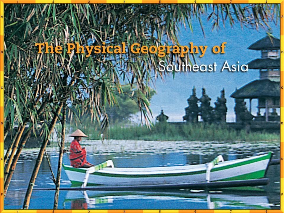
2 Chapter Objectives Describe the dominant landforms and natural resources of Southeast Asia. Discuss Southeast Asia s climate and vegetation.
3 The Land Section 1
4 Objectives Describe how tectonic plates and activity from volcanoes and earthquakes formed Southeast Asia. Explain why the region s waterways are important to its peoples. Summarize how rich natural resources affect Southeast Asia s economy.
5 Terms to Know Cordillera archipelago insular flora fauna
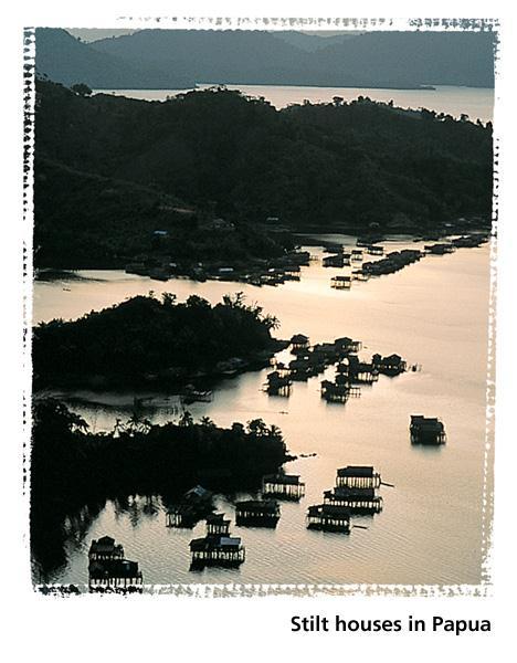
6 A Geographic View
7 Geographic Literacy Although the Philippines includes over 7,000 islands, the archipelago s total area is only 115,831 square miles (300,001 sq. km), about the size of Arizona. The islands that make up the Philippines together have a coastline that measures 22,554 miles (36,289 km). The two large islands of Luzon and Mindanao account for about 66 percent of the country s land area.
8 Peninsula and Islands The collision of three tectonic plates millions of years ago produced the peninsulas and islands of Southeast Asia. Straddling the Equator, Southeast Asia has mountainous terrain with a predominately tropical climate. Mainland Southeast Asia About half of Southeast Asia s 11 countries are located on the mainland. Malaysia is both a mainland and an island country. Laos is the only landlocked country in the region.

9 Peninsulas and Islands
10 Peninsulas and Islands Island Southeast Asia Southeast Asia s island nations include Brunei, East Timor, Indonesia, Singapore, and the Philippines. Indonesia the largest island country in the region is made up of more than 13,500 islands that span 3,000 miles (4,827 km) and two oceans, the Indian and the Pacific. Singapore consists of one large island and 50 smaller ones. The Philippines is made up of more than 7,000 islands, 11 of which are home to 95 percent of the population.
11 Physical Features Mountains Southeast Asia s many mountains create geographical and political boundaries. Some of them are active volcanoes, forming part of the Ring of Fire. Over time, mineral-rich volcanic material has broken down to provide farmers with rich, fertile soil. Volcanoes of Indonesia and the Philippines Java, an Indonesian island, is one of the Ring of Fire s most active areas. It is home to 17 of Indonesia s 100 active volcanoes. In 1883, the eruption of Krakatau (Krakatoa) in Indonesia caused massive destruction and great loss of life. In 1991, the Philippines s Mount Pinatubo erupted, burying the surrounding area under a foot of mineral-rich volcanic ash.


12 Physical Features
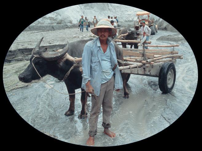
13 Physical Features Rivers Southeast Asians rely on waterways for transportation, communication, and food. Mainland rivers originate in the northern highlands and flow south toward the Gulf of Thailand. Major rivers include the Irrawaddy in Myanmar, the Chao Phraya in Thailand, the Red River in Vietnam, and the Mekong River, which flows through the Indochina Peninsula before emptying into the South China Sea. The rivers on islands are generally shorter and flow in various directions.

14 Physical Features
15 Natural Resources Energy Sources Southeast Asia has a plentiful supply of coal, oil, and natural gas. Indonesia, one of the leading producers of oil, is a member of OPEC. Malaysia, Vietnam, the Philippines, and Brunei also have fossil fuel resources. Minerals and Gems Southeast Asia has abundant mineral resources. Indonesia mines nickel and iron, and copper is mined in the Philippines. Other countries in the region, especially Malaysia, mine tin. Sapphires, rubies, and pearls are also found in large quantities in Southeast Asia.
16 Natural Resources Myanmar has substantial deposits of minerals and gems, but mining employs less than 1 percent of Myanmar s workers. Flora and Fauna A vast array of flowers and plants contributes to the region s economy. Thailand is one of the world s leading exporters of orchids. Malaysia is a source of much of the world s rubber, and Indonesia is the world s largest supplier of plywood. Southeast Asia has a wide variety of animals including elephants, rhinoceroses, tigers, and orangutans. Animals exclusive to the region include the Komodo dragon, an Indonesian lizard, and the bearded pig.
17 Natural Resources Fishing More than 2,500 species of fish swim the tropical waters of Southeast Asia. Southeast Asians consume seafood at almost twice the world s average rate. Fish farming is important to local economies. Concern about overfishing has risen because local fishers must now compete with large fleets of trawlers.
18 Climate and Vegetation Section 2
19 Objectives Identify the weather pattern that influences Southeast Asia s climate. List the region s main climate types. State the main type of natural vegetation found in Southeast Asia.
20 Terms to Know Endemic deciduous
21 A Geographic View
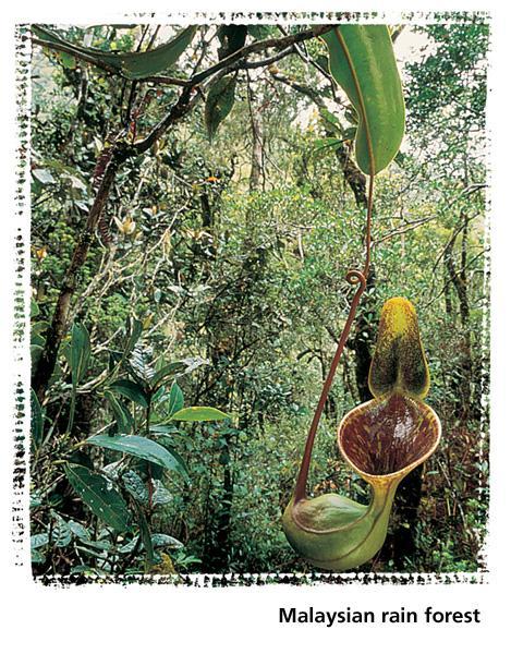
22 Geographic Literacy Malaysia includes mainland and island areas: West Malaysia, primarily on the southern part of the Malay Peninsula, and East Malaysia, on the northern part of the island of Borneo. Both areas, however, have similar natural features: coastal swamps or mangrove forests, lowland rain forests, and interior mountains.
23 Tropical Climate Regions Southeast Asia s rain forests depend on the moisture brought by the summer monsoons blowing in from the south and west. Tropical Rain Forest Climate Most of Southeast Asia has a tropical rain forest climate. Temperatures are fairly constant, averaging 79 F (26 C). Humidity is always high, and annual rainfall is between 79 and 188 inches (201 and 478 cm). The rain forests feature more than 145,000 species of flowering plants. Other types of vegetation include peat swamp forests, mangrove swamp forests, and evergreen trees.
24 Tropical Climate Regions Singapore Singapore, once covered by dense rain forest, is now almost entirely urbanized. Nearly 80 percent of the trees now growing there are imported, some originating from such distant places as Central and South America. Tropical Savanna Climate Parts of the Indochina Peninsula and the islands of Indonesia have a tropical savanna climate, with alternating wet and dry seasons and tree-covered grasslands. The dry season may last from four to eight months per year.

25 Tropical Climate Regions
26 Tropical Climate Regions Humid Subtropical Climate Northern Myanmar and Vietnam, most of Laos, and part of Thailand have a humid subtropical climate, with a cool dry season lasting from November to April.
27 Highland Climate Region Highlands climates predominate in mountainous areas of Myanmar, New Guinea, and Borneo. Temperatures are cooler here.

28 Highlands Climate Region
29 Section 1 Summary Mountains and rivers dominate the region s landscape. The island mountains are part of the Pacific Ring of Fire. Rivers on the mainland of Southeast Asia are important for agriculture, communication, and transportation. Southeast Asia contains abundant natural resources, including fossil fuels, natural steam, minerals, and gems.
30 Section 2 Summary Monsoons cause two main seasons in Southeast Asia, one wet and one dry. Southeast Asia s major climate is tropical rain forest, although parts of the mainland and some of the islands have other types of climate. Humid subtropical climates predominate in Laos and in northern areas of Myanmar, Thailand, and Vietnam. Highlands climates are found in the mountains of Myanmar, Borneo, and New Guinea.
STUDY GUIDE. The Land. Chapter 29, Section 1. Both. Terms to Know DRAWING FROM EXPERIENCE ORGANIZING YOUR THOUGHTS
 Chapter 29, Section 1 For use with textbook pages 719 724. The Land Terms to Know cordilleras Parallel mountain ranges and plateaus (page 719) archipelago A group of islands (page 720) insular Relating
Chapter 14. The Physical Geography of Russia
 Chapter 14 The Physical Geography of Russia Chapter Objectives Identify the physical features and natural resources of Russia. Discuss the effects of Russia s climate and vegetation on life in the region.
Chapter 20. The Physical Geography of Africa South of the Sahara
 Chapter 20 The Physical Geography of Africa South of the Sahara Chapter Objectives Identify the major landforms, water systems, and natural resources of Africa south of the Sahara. Describe the relationship
Location, Climate, & Natural Resources
 Location, Climate, & Natural Resources UK is a country of islands off the coast of mainland Europe. It consists of England, Northern Ireland, Scotland, & Wales. UK s location makes it a HUB for trade.
Chapter 17. North Africa, Southwest Asia and Central Asia
 Chapter 17 North Africa, Southwest Asia and Central Asia Chapter Objectives Describe the major landforms and natural resources of North Africa, Southwest Asia, and Central Asia. Discuss the climate and
LOCATION, CLIMATE, AND NATURAL RESOURCES OF MEXICO
 SS6G3 The student will explain the impact of location, climate, distribution of natural resources, and population distribution on Latin America and the Caribbean. a. Compare how the location, climate,
Terms to Know. artesian well coral atoll krill lagoon
 Chapter Objectives Describe the diverse landforms and natural resources of Australia, Oceania, and Antarctica. Discuss the wide range of climates and vegetation throughout the region. The Land Section
Latin America and The Caribbean. A Closer Look.
 Latin America and The Caribbean A Closer Look. Mexico Capital: Mexico City The Location of Mexico Mexico is the second-largest country by size and population in Latin America.but the Largest Spanish -
Location, Climate, & Natural Resources Brain Wrinkles
 Location, Climate, & Natural Resources Standards SS6G10 The student will explain the impact of location, climate, natural resources, and population distribution on Europe. a. Compare how the location,
STUDY GUIDE. The Land. Physical Features of Latin America. Chapter 8, Section 1. Terms to Know DRAWING FROM EXPERIENCE ORGANIZING YOUR THOUGHTS
 For use with textbook pages 193 198. The Land Terms to Know cordillera A mountain range that runs parallel to another mountain range (page 194) altiplano A high plain (page 194) escarpment A steep cliff
Latin America. Chapter 9 Physical Geography
 Latin America Chapter 9 Physical Geography Latin American Regions Middle America includes Mexico and the Central American countries The Caribbean Islands South America Mexico Landforms Sierra Madre Oriental
CH. 1 Europe and Russia: Physical Geography. Section 1 Land and Water p Europe and Russia are part of the world s largest landmass called.
 CH. 1 Europe and Russia: Physical Geography Section 1 Land and Water p.10-16 Europe and Russia are part of the world s largest landmass called. The country of Russia stretches over both continents. About
Friday, November 10, 2017
 Friday, November 10, 2017 Andes and Midlatitude Countries Objective: Summarize the main physical features and regions of the Southern Cone. Identify and locate the urban centers and understand the pattern
UNIT 5 AFRICA PHYSICAL GEOGRAPHY SG 1 - PART II
 UNIT 5 AFRICA PHYSICAL GEOGRAPHY SG 1 - PART II III. CLIMATE & VEGETATION A. The four main climate zones are tropical wet, tropical wet/dry (split into monsoon & savanna), semiarid, and arid. Other climate
Latin America. Physical Geography
 + Latin America Physical Geography + I. Landforms A. Caribbean & Central America 1. Mexico is dominated by two mountain chains, collectively called the Sierra Madre. A high plateau is situated in between.
Oceania. Australia, New Zealand, and the Pacific Islands. Physical Geography. Where is Australia located?
 Oceania Australia, New Zealand, and the Pacific Islands Physical Geography Australia New Zealand Oceania Where is Australia located? Australia & Oceania are a group of islands located between Asia, Antarctica,
Essential Questions. 1. How have historical figures and events affected South America today?
 South America Essential Questions 1. How have historical figures and events affected South America today? 2. How has location affected the development of countries in South America? 3. How has the role
CHAPTER 12. South America. Section 1: Natural Environments Section 2: History and Culture Section 3: South America Today. HOLT World Geography
 CHAPTER 12 South America Section 1: Natural Environments Section 2: History and Culture Section 3: South America 1 Section 1 Natural Environments Objectives: What are the major landforms and rivers of
GEOGRAPHY AND HISTORY
 GEOGRAPHY AND HISTORY YEAR 1, PART 1 www.vicensvives.es Contents 01 Our planet Earth 02 The representation of the Earth: maps 03 The Earth s relief 04 Rivers and seas 05 Weather and climate 06 Climates
BAM TOURS AN AUTHENTIC DMC
 INDONESIA, BALI & BEYOND BAM TOURS AN AUTHENTIC DMC PT BATUR AGUNG MULTITAMA INDONESIA - BALI BRIDGING 1THE DREAM 2017 PT. Batur Agung Multitama. All rights reserved www.balibamtours.com Indonesia Indonesia
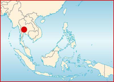
UNIT. Southeast Asia. 704 Unit 10
 UIT 10 Southeast Asia 704 Unit 10 GS OLIE www.nationalgeographic.com/education WHY IT S IMPORTAT Southeast Asia is a vital crossroads of trade and commerce.the region is rich in natural resources such
MCGRAW-HILL EUROPE. Chapter 11 Physical Geography Pages 332 to 341
 MCGRAW-HILL EUROPE Chapter 11 Physical Geography Pages 332 to 341 Countries of Western Europe Benelux Countries UK, France, Luxembourg, Germany, Netherlands, Belgium, Austria, Switzerland, Belgium, Monaco,
Portuguese Language - Fostering National Unity
 Geography Brazil Brazil Portuguese Language - Fostering National Unity 11 dialects of Portuguese Influenced by Amerindian and African languages, creating differences between Portuguese spoken in Brazil
Location, Climate, & Natural Resources. Where People Live & How They Trade
 Location, Climate, & Natural Resources Where People Live & How They Trade Standards SS6G13 The student will explain the impact of location, climate, distribution of natural resources, and population distribution
The Geological Pacific Northwest. Wednesday February 6, 2012 Pacific Northwest History Mr. Rice
 The Geological Pacific Northwest Wednesday February 6, 2012 Pacific Northwest History Mr. Rice 1 Free Response #2 Please do not simply list the items for this response. Full sentences!!! Minimum of 3-5
South, Southeast, and East Asia Physical Geography
 South, Southeast, and East Asia Physical Geography Mountains A. B. C. Mountains are important in Asia because they influence: Population patterns Movement of people and goods Climate Himalaya Mountains
Wednesday, April 4, 2018
 Wednesday, April 4, 2018 Physical Geography of Japan Objective: Outline the countries and territories that are included in East Asia. Describe the main physical features and climate types of each country.
EXPLORING BIOMES IN GORONGOSA NATIONAL PARK
 EXPLORING BIOMES IN GORONGOSA NATIONAL PARK ABOUT THIS WORKSHEET This worksheet complements the Click and Learn Gorongosa National Park Interactive Map (http://www.hhmi.org/biointeractive/gorongosa-national-park-interactive-map),
Chapter 16 ~ Eastern Mediterranean
 Chapter 16 ~ Eastern Mediterranean Physical Geography of the Eastern Mediterranean Landforms This area is known as the Levant and includes Syria, Jordan, Lebanon, Israel, and the Palestinian territories.
Label your Map with Russia. Map Activity
 Bell Activity How many time zones does the U.S. have? How do these time zones affect life in the U.S.? Russia is so large it has 11 time zones. What difficulties might this create? Objectives Know landforms,
STUDY GUIDE. The Land. Chapter 20, Section 1. The Land of Africa South of the Sahara. Landforms Water Systems Natural Resources.
 For use with textbook pages 499 504. The Land Terms to Know escarpment A steep, often jagged slope or cliff (page 500) cataract A towering waterfall (page 500) rift valley A large crack in the earth s
AFRICAN PHYSICAL GEOGRAPHY
 AFRICAN PHYSICAL GEOGRAPHY Here are some factoids about Africa: world s second largest continent (11,700,000 miles). Home to 52 countries, 1,000 languages, 800 million people. 10% of the world s population
Monday, December 11, 2017
 Monday, December 11, 2017 Physical Geography of Russia Objective: complete Warm-Up, write outline notes and discuss the geography of Eastern Europe/mother Russia and view Geography Now: Belarus. География
Chapter 21: EAST AFRICA
 Chapter 21: EAST AFRICA Physical Geography of East Africa Landforms East Africa is a diverse landscape of different plains, volcanic mountains, and plateaus cut by a large valley and marked by many rivers
7/27/2010. Regions of Subsaharan Africa. SUBSAHARAN AFRICA II (Chapter 6, pages ) Southern Africa. South Africa: Peaceful Change from Apartheid
 Southern Africa. South Africa: Peaceful Change from Apartheid") SUBSAHARAN AFRICA II (Chapter 6, pages 209-227) Regions of Subsaharan Africa Southern Africa 10 countries, 6 of them landlocked Congo Basin marks northern limit Plateau country Rich in natural resources
SUBSAHARAN AFRICA II (Chapter 6, pages 209-227) Regions of Subsaharan Africa Southern Africa 10 countries, 6 of them landlocked Congo Basin marks northern limit Plateau country Rich in natural resources
COUNTRY DATA: Costa Rica : Information from the CIA World Factbook! INTRODUCTION GEOGRAPHY
 ! COUNTRY DATA: Costa Rica : Information from the CIA World Factbook! INTRODUCTION GEOGRAPHY Location Area Central America, bordering both the Caribbean Sea and the North Pacific Ocean, between Nicaragua
Chapter 16 ~ Eastern Mediterranean
 Chapter 16 ~ Eastern Mediterranean Physical Geography of the Eastern Mediterranean Landforms This area is known as the Levant and includes Syria, Jordan, Lebanon, Israel, and the Palestinian territories.
STANDARDS: Brain Wrinkles
 STANDARDS: SS6G3 The student will explain the impact of location, climate, distribution of natural resources, and population distribution on Latin America and the Caribbean. a. Compare how the location,
Do Not Write On This Sheet. World Rally. City, country, continient: to city, country, continent:
 World Rally At each checkpoint you must list the city, country, and continent. The teacher must check all answers before you can go on to the next checkpoint. Checkpoint 1: Start at: 29 N 98 W and go to:
Brazil. Chapter 12. Chapter 12, Section
 Chapter 12, Section World Geography Chapter 12 Brazil Copyright 2003 by Pearson Education, Inc., publishing as Prentice Hall, Upper Saddle River, NJ. All rights reserved. Chapter 12, Section World Geography
Mediterranean Europe
 Chapter 17, Section World Geography Chapter 17 Mediterranean Europe Copyright 2003 by Pearson Education, Inc., publishing as Prentice Hall, Upper Saddle River, NJ. All rights reserved. Chapter 17, Section
A funny sounding lake. South American Landforms, Climate, and Vegetation
 A funny sounding lake South American Landforms, Climate, and Vegetation 3 4 Essential Question: How have physical features and climate affected the population distribution of Latin America? 5 I. Landforms
Objective. Students will familiarize themselves with the physical features and climates of Latin America.
 Journal Write KWL What do you KNOW about Latin America? What do you WANT TO KNOW about Latin America? What did you LEARN today that you didn t know before? Latin America Objective Students will familiarize
Brain Wrinkles. Location, Climate, & Natural Resources of. Where People Live & How They Trade
 Location, Climate, & Natural Resources of Where People Live & How They Trade It s south of the US, east of the Pacific Ocean, and west of the Gulf of Mexico & Caribbean Sea. It s great that it s located
Travelling In Southeast Asia: Hong Kong, Indochina, Indonesia, Malaysia, Philippines, Singapore, Thailand By Paul Gaffey READ ONLINE
 Travelling In Southeast Asia: Hong Kong, Indochina, Indonesia, Malaysia, Philippines, Singapore, Thailand By Paul Gaffey READ ONLINE If searched for a ebook Travelling in Southeast Asia: Hong Kong, Indochina,
Regional Atlas: Introduction to Latin America
 Chapter 9, Section World Geography Chapter 9 Regional Atlas: Introduction to Latin America Copyright 2003 by Pearson Education, Inc., publishing as Prentice Hall, Upper Saddle River, NJ. All rights reserved.
STUDY GUIDE. The Land. Chapter 17, Section 1. There are frequent earthquakes in the region. Petroleum is a major export in the region.
 For use with textbook pages 421 426. The Land Terms to Know alluvial soil A rich soil made up of sand and mud deposited by flowing water (page 423) wadi A streambed that remains dry until a heavy rain
Introduction to Africa
 Introduction to Africa Did you know? Africa has more countries than any other continent. The Sahara is a desert that is the size of the U.S. It s the world's largest desert. Most of the world s gold and
South American Countries. Capital Location Population Terrain Climate
 South American Countries Capital Location Population Terrain Climate Andes Mountains Four large areas that make up the Central Plains: Llanos, the Selva, the Gran Chaco, and the Pampas Brazilian Highlands
Southern Africa. Countries, Geography, & Climate
 Countries, Geography, & Climate The Southern African region consists of the following countries: Angola Zambia Malawi Mozambique Zimbabwe Botswana Namibia Swaziland Lesotho South Africa Comoros Madagascar
Mexico. Chapter 10. Chapter 10, Section
 Chapter 10, Section World Geography Chapter 10 Mexico Copyright 2003 by Pearson Education, Inc., publishing as Prentice Hall, Upper Saddle River, NJ. All rights reserved. Chapter 10, Section World Geography
Physical Regions of the U.S.
 Physical Regions of the U.S. Quickly use this map to label the map on your paper Pacific Coast The coast from southern California to Alaska The region of the Pacific Northwest has a long history that was
LAST TIME (Happy 300 th Birthday Ben Franklin!)
") LAST TIME (Happy 300 th Birthday Ben Franklin!) Latin American Diversity: Introduction Physical Geography of Mexico, Caribbean, and Central America: 1. Mexican drylands 2. Mesoamerican Highlands 3. Coastal
LAST TIME (Happy 300 th Birthday Ben Franklin!) Latin American Diversity: Introduction Physical Geography of Mexico, Caribbean, and Central America: 1. Mexican drylands 2. Mesoamerican Highlands 3. Coastal
Mrs. Reifsnyder World Geography. Unit 8: Latin America Study Guide SOLs Addressed: WG. 1c, 2b, 3c, 4, 10b/c
 Mrs. Reifsnyder World Geography Unit 8: Latin America Study Guide SOLs Addressed: WG. 1c, 2b, 3c, 4, 10b/c Essential Questions: - In what ways do physical, economic, and cultural characteristics influence
Japan is basically a mountainous volcanic Island Chain located in the western Pacific Ocean
 I N T R O D U C T I O N T O J A PA N Japan is basically a mountainous volcanic Island Chain located in the western Pacific Ocean The country has four main Islands HOKKAIDO HONSHU SHIKOKU KYUSHU And then
Geographic Qualities of South America
 Geographic Qualities of South America 1. South America is the fourth largest continent in area. It is located in the Western Hemisphere, lying southwest of North America. Most of South America lies in
AT A GLANCE ANDAMAN AND NICOBAR ISLANDS AND TROPICAL ISLAND NATIONS
 Geographical Information CHAPTER 19 AT A GLANCE ANDAMAN AND NICOBAR ISLANDS AND TROPICAL ISLAND NATIONS Name of island Ocean where located Longitude Latitude No. of islands Andaman and Nicobar Bay of Bengal
Just how big is Africa?
 The United States China India The United Kingdom Portugal Spain France Belgium Germany The Netherlands Switzerland Italy Eastern Europe Japan 11.7 million sq. miles Just how big is Africa? Chapter 18 Section
Australian Geography. Standards:
 Australian Geography Standards: SS6G12 The student will be able to locate selected features of Australia. a. Locate on a world and regional political-physical map: the Great Barrier Reef, Coral Sea, Ayers
CANADA: ITS LAND, RESOURCES, & ECONOMY PRE-TEST
 PRE-TEST Name Directions: In the blank space, write a "T" if the statement is true and an "F" if the statement is false. 1. Canada has 11 geographic regions. 2. The cordillera is found in central Canada.
One Commodity Map. 7. What is a commodity? 8. Explain what a one-commodity country is.
 7. What is a commodity? 8. Explain what a one-commodity country is. 9. What must African countries do in order to become more stable economically? One Commodity Map Countries which OIL is the lone commodity
NZQA registered unit standard version 2 Page 1 of 5. Demonstrate knowledge of Asian countries as tourist destinations
 Page 1 of 5 Title Demonstrate knowledge of Asian countries as tourist destinations Level 3 Credits 8 Purpose People credited with this unit standard are able to: locate Asian countries, and key cities,
BROADEN YOUR HORIZONS IN SOUTHEAST ASIA
 BROADEN YOUR HORIZONS IN SOUTHEAST ASIA Study abroad at Monash University Malaysia Monash University now offers the opportunity to study abroad at our Malaysian campus. We are delighted to welcome Exchange
Papua New Guinea. Mt Wilhelm Climb. PNG Trekking Adventures
 Adventure Papua New Guinea Mt Wilhelm Climb 2015 PNG Trekking Adventures Trekking Adventures Papua New Guinea Madang Mt Wilhelm Mt Hagen Goroka Lae Kavieng Rabaul ABOUT PAPUA NEW GUINEA Papua New Guinea
Latin America. Physical Geography
 Latin America Physical Geography Regions Latin America can be divided into separate regions based on physical geography or cultural geography. Regions If we look at physical geography Latin America has
Communicating the Economic and Social Importance of Coral Reefs for South East Asian countries
 Communicating the Economic and Social Importance of Coral Reefs for South East Asian countries This fact sheet will provide you with information extracted from economic studies BASICS Coral reefs are among
Economy 3. This region s economy was based on agriculture. 4. This region produced items such as textiles, iron, and ships in great quantities. For th
 Geography 1. This region has a climate of warm summers and snowy cold winters. 2. This region has a climate that is generally warm and sunny, with long, hot, humid summers, and mild winters, and heavy
Chapter 1 Test A (1 of 5)
") Chapter 1 Test A (1 of 5) Vocabulary Match the descriptions with the correct terms. (8 points) Column I 1. a natural feature of Earth s surface 2. something in the environment that people use 3. the pattern
Chapter 1 Test A (1 of 5) Vocabulary Match the descriptions with the correct terms. (8 points) Column I 1. a natural feature of Earth s surface 2. something in the environment that people use 3. the pattern
Brain Wrinkles. Africa: The impact of location, climate, & physical characteristics on where people live, the type of work they do, & how they travel
 Africa: The impact of location, climate, & physical characteristics on where people live, the type of work they do, & how they travel STANDARDS: SS7G3 The student will explain the impact of location, climate,
Exploring Mexico. Directions: Complete the paragraphs below. Write the correct word from the Word Bank to complete each sentence.
 Exploring Mexico Section 1 10 Directions: Complete the paragraphs below. Write the correct word from the Word Bank to complete each sentence. Word Bank United States Central Plateau irrigation isthmus
*Latin America spans 7,000 miles, from Mexico to Tierra Del Fuego. *3 Regions: Central America, South America, and the Caribbean.
 Physical Geography Latin America spans 7,000 miles, from Mexico to Tierra Del Fuego *3 Regions: Central America, South America, and the Caribbean. *Intro clip: http://www.youtube.com/watch?v=cffp6rza3
Latin America. Introduction
 Latin America Introduction What are the 5 Themes of Geography? Draw lines to connect the theme to the definition: Location How humans and the environment impact each other Physical and human characteristics
INTERNATIONAL VISITOR SURVEY PAPUA NEW GUINEA
 INTERNATIONAL VISITOR SURVEY PAPUA NEW GUINEA PAPUA NEW GUINEA TOURISM PROJECT PROJECT OBJECTIVES Objective 1 Objective 2 Objective 3 Grow tourism arrivals to PNG by working with government and private
Monitoring the Environmental Status of the Heart of Borneo
 Monitoring the Environmental Status of the Heart of Borneo By: Stephan Wulffraat The Heart of Borneo conservation initiative has been going on now for several years and has gained increasing support from
The Economic Contribution of Cruise Tourism to the Southeast Asia Region in Prepared for: CLIA SE Asia. September 2015
 BREA Business Research & Economic Advisors The Economic Contribution of Cruise Tourism to the Southeast Asia Region in 2014 Prepared for: CLIA SE Asia September 2015 Business Research & Economic Advisors
An NPS Wetland of International Significance!
 An NPS Wetland of International Significance! A World Class Tourism Destination Linda Friar Chief of Public Affairs 305-242-7714 Linda_Friar@nps.gov The Everglades - International Recognition as a special
Geography: Unit 2. Map. Rivers. Major Physical Features. Slide 1. Slide 2. Slide 3. Slide 4. North America United States and Canada.
 Mississippi River Slide 1 Slide 2 Slide 3 Slide 4 Geography: Unit 2 North America United States Map Major Physical Features Mountain Ranges Brooks Range Mackenzie Mountains Coast Mountains Cascades Sierra
3.2.5: Japanese American Relations U.S. Entry into WWII. War in the Pacific
 3.2.5: Japanese American Relations 1937-1942 U.S. Entry into WWII War in the Pacific 1920s 1930s Review USA Wilson s 14 Points...League of Nations Isolationism Economic Depression FDR Japan Emerging world
Physical characteristics and biomes:
 Physical characteristics and biomes: Sahel region, bordering Sahara Characteristics Area suffers from lack of rainfall, over grazing, which causes loss of vegetation and loss of inhabitable areas causing
LEAFLET FEBRUARY. WWF-Greater Mekong DAWNA TENASSERIM LANDSCAPE. Wayuphong Jitvijak / WWF-Thailand
 LEAFLET FEBRUARY 2014 WWF-Greater Mekong Wayuphong Jitvijak / WWF-Thailand DAWNA TENASSERIM LANDSCAPE The landscape includes 30,539km2 of protected areas and nearly 50,000km2 of wilderness area, providing
SS7G1 The student will locate selected features of Africa.
 Standards SS7G1 The student will locate selected features of Africa. a. Locate on a world and regional political-physical map: the Sahara, Sahel, savanna, tropical rain forest, Congo River, Niger River,
OUR COUNTRY INDIA L OCATIONAL SETTING
 7 India is a country of vast geographical expanse. In the north, it is bound by the lofty Himalayas. The Arabian Sea in the west, the Bay of Bengal in the east and the Indian Ocean in the south, wash the
This year's conference theme is "Collection and Access Development: Two Sides of the Same Coin".
 CONFERENCE ANNOUNCEMENT: The South East Asia Pacific Audio Visual Archives Association (SEAPAVAA) is pleased to announce that it will hold its 13th Conference and General Assembly on 15 _ 20 May 2009 at
GENERAL INFORMATION NOTE
 GENERAL INFORMATION NOTE 9 th UNWTO ASIA/PACIFIC EXECUTIVE TRAINING PROGRAMME ON TOURISM POLICY AND STRATEGY Community Based Development and Tourism Recovery 28 April 1 May 2015 in Bohol, Philippines 0
VOLCANO DISCOVERY 5 days
 5 days Countries visited Philippines Tour Highlights Trek to Mount Pinatubo Take a boat to Lake Taal's inner volcano Witness smoking Mount Mayon - the perfect conical volcano Places visited Legazpi Tagaytay
:: United States Pacific Island Wildlife Refuges Introduction :: United States Pacific Island Wildlife Refuges Background: Baker Island:
 The World Factbook Australia-Oceania :: United States Pacific Island Wildlife Refuges (territories of the US) Introduction :: United States Pacific Island Wildlife Refuges Background: All of the following
Brief Description of Northern the West Bank, Palestine Prepared by: Dr. Ahmed Ghodieh Department of Geography An-Najah National University Nablus,
 Brief Description of Northern the West Bank, Palestine Prepared by: Dr. Ahmed Ghodieh Department of Geography An-Najah National University Nablus, Palestine Brief Description of Northern the West Bank
Wetlands Biodiversity in Southeast Asia: Areas of Cooperation with ACB
 Asia Regional Preparatory Meeting for COP 11 of the Ramsar Convention Mercure Convention Center, Jakarta, Indonesia, 14-18 November 2011 Wetlands Biodiversity in Southeast Asia: Areas of Cooperation with
The Upcoming Opportunities of Rail Transportation Development in Southeast Asia MANAGING DIRECTOR OF PROFREIGHT GROUP
 The Upcoming Opportunities of Rail Transportation Development in Southeast Asia P R E S E N T E D B Y M R. S U W I T R ATA N A C H I N D A MANAGING DIRECTOR OF PROFREIGHT GROUP Outline - Introduction -
Chapter 2A: The Russian Realm
 Geography: Realms, Regions, and Concepts 16 th Edition Chapter 2A: The Russian Realm The Russian Realm Two transition zones mark the margins. The Russian Realm Two transition zones mark the margins. Physical
Geography: Unit 2. Map. Major Physical Features. Rivers. Mississippi River Missouri River Ohio River Rio Grande. Mackenzie. Colorado River Green River
 1 2 3 4 Geography: Unit 2 North America United States and Canada Map Major Physical Features Mountain Ranges Brooks Range Mackenzie Mountains Coast Mountains Cascades Sierra Nevada Rocky Mountains Appalachian
!!!!!!!!!!Mali s Geographic Makeup
 DANU Strategic Forecasting Group May 27th 2016!!!!!!!!!!Mali s Geographic Makeup By Liliana Pirlea Location: Mali is a landlocked country located in West Africa. Mali is the 8th largest country in Africa
Warm ups *What is unique about the status of Switzerland? *How Austria s history differed from that of Switzerland?
 Warm ups 12.07.2016 *What is unique about the status of Switzerland? *How Austria s history differed from that of Switzerland? Lesson Objective: *describe how Spain differs physically, economically, and
Africa s. Presentation, Graphic Organizers, & Activities
 Africa s Presentation, Graphic Organizers, & Activities STANDARDS: SS7G1 Locate selected features of Africa. a. Locate on a world and regional political-physical map: Sahara, Sahel, savanna, tropical rain
Read and Respond: Australia
 Read and Respond: Australia Directions: Highlight the answers to the following questions and write them out in complete sentences on your own sheet of paper. GEOGRAPHY OF AUSTRALIA The best way to visualize
THE CHALLENGES AND OPPORTUNITIES OF ASIA-PACIFIC TRADE
 THE CHALLENGES AND OPPORTUNITIES OF ASIA-PACIFIC TRADE 1 14 22 PERCENT INCREASE VALUE OF AUSTRALIAN EXPORTS TO KEY MARKETS 2017 WAS A BANNER YEAR FOR TRADE GROWTH IN THE ASIA-PACIFIC (APAC) REGION In fact,
Australia. Geography
 Australia Geography Label the Map!!! New South Wales New South Wales Location: State on the east coast of Australia. Australian Capital Territory - Sydney! (5th largest, 1st most populous) Climate Types:
Journey Around the World with the Universal Atlas of Fernão Vaz Dourado
 OCTOBER 28, 2018 BY MEDIEVALISTS.NET Journey Around the World with the Universal Atlas of Fernão Vaz Dourado By João Carlos Garcia This atlas was made in 1571 by one of the finest Portuguese cartographers,
2.1 What is the climate like?
 José Medeiros This fact sheet allows you to see how varied the countryside is across Brazil. 2.1 What is the climate like? Most of Brazil is in the Southern Hemisphere, where the seasons are the opposite
Ecoregion Map. Indonesian model and experiences in developing ecosystem conditions and ecosystem services through ecoregion zoning
 Ecoregion Map Indonesian model and experiences in developing ecosystem conditions and ecosystem services through ecoregion zoning PLANNING OF ENVIRONMENTAL PROTECTION AND MANAGEMENT (EPM PLAN) PLANNING