Terms to Know. artesian well coral atoll krill lagoon
|
|
|
- Chloe Lloyd
- 6 years ago
- Views:
Transcription
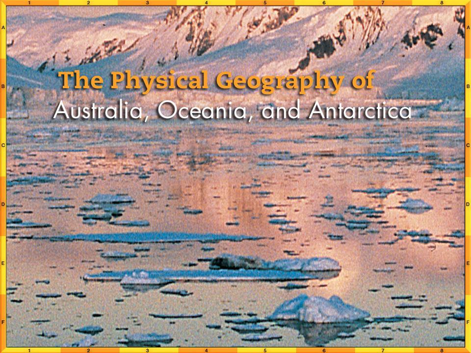
1
2 Chapter Objectives Describe the diverse landforms and natural resources of Australia, Oceania, and Antarctica. Discuss the wide range of climates and vegetation throughout the region.
3 The Land Section 1
4 Objectives Describe how mountains, plateaus, and lowlands differ in Australia and New Zealand. Explain how volcanoes and continental shelves formed the islands of Oceania Discuss why the physical geography of Antarctica attracts scientists
5 Terms to Know artesian well coral atoll krill lagoon
6 A Geographic View
7 Geographic Literacy Rock climbing and mountain climbing are popular sports in Australia, even though most of the landscape is flat. The Great Dividing Range and the craggy island of Tasmania, among other places, provide many climbing opportunities. Even the city of Sydney boasts a rock climbing club and over 140 crags in its immediate area, ranging from breathtaking ocean cliffs to crags tucked into the suburbs. Within a twohour drive of the city are more spectacular world-class climbing locations such as the Blue Mountains, Nowra, and Point Perpendicular.
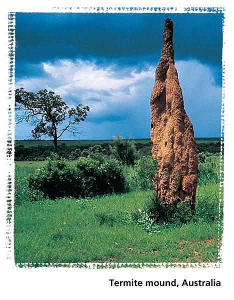
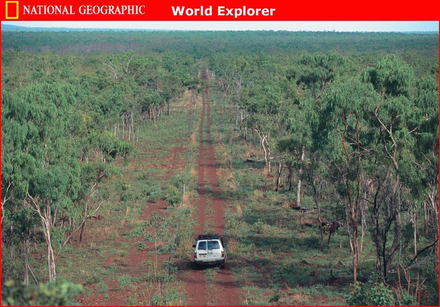
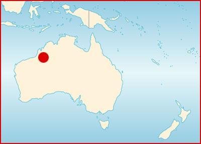
8 Australia: A Continent and a Country Australia is the only country in the world that covers an entire continent. Surrounded by water, Australia is really an island, but it is called a continent because of its tremendous size. Mountains and Plateaus The Great Dividing Range is a chain of hills and mountains along the eastern coast of Australia s otherwise flat landscape. The Western Plateau, or outback, covers almost two-thirds of the continent. This area includes three deserts. South of the deserts lies the barren Nullarbor ( no tree ) Plain, which ends in cliffs overlooking the Indian Ocean.
9 Australia: A Continent and a Country
10 Australia: A Continent and a Country (cont.) Central Lowlands This expanse of grassland and desert separates the Great Dividing Range from the Western Plateau. Infrequent rains are heavy and fill the area s usually dry lakes and rivers. Below the surface lies the Great Artesian Basin, a source of underground water that ranchers use for livestock. Great Barrier Reef Lying off the eastern coast of Australia, this string of about 2,500 coral reefs has been designated a national park and World Heritage Site. The Great Barrier Reef provides a home for many species of tropical fish and sea creatures.
11 Australia: A Continent and a Country (cont.) Natural Resources Only 10 percent of Australian land is arable, but farmers use their resources efficiently. The country s major agricultural crops are wheat, barley, fruit, and sugarcane. Arid areas are home to a livestock-ranching industry. Mineral resources include bauxite, coal, iron ore, lead, zinc, gold, nickel, and petroleum. Australia is also a major producer of opals.
12 Oceania: Island Lands Oceania is a group of thousands of islands, some separated by great distances, that were formed by colliding tectonic plates millions of years ago. Island Clusters The three main island clusters are Melanesia to the north and east of Australia; Micronesia to the north of Melanesia; and Polynesia, extending from Midway Island to New Zealand. Island Types High islands such as Fiji and Tahiti feature volcanic mountains, some still active, and coastal plains.
13 Oceania: Island Lands Low islands such as the Marshall Islands are atolls each a ring of land around a lagoon, the result of the buildup of coral reefs on a submerged volcano. Continental islands include Papua New Guinea and New Caledonia. They feature rugged interior mountains and plains, swamps, and rivers along coastal areas.

14 Oceania: Island Lands
15 New Zealand: A Rugged Landscape New Zealand s two largest islands are called North Island and South Island. Both islands feature mountains, fertile soil, sparkling lakes, and scenic coastlines. North Island includes hot springs and active volcanoes. South Island features the Southern Alps and the fertile Canterbury Plains. About 55 percent of New Zealand s land supports crops and livestock. The country s sheep and wool products dominate exports, and its forests yield valuable timber. Most power is hydroelectric or geothermal (from water heated underground by volcanoes). Several varieties of fish populate the coastal waters.

16 New Zealand: A Rugged Landscape
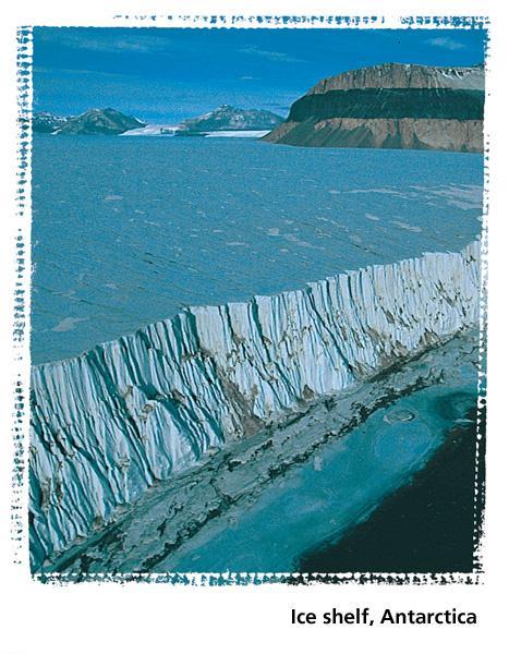
17 Antarctica: A White Plateau Antarctica is twice the size of Australia. About 98 percent of Antarctica is covered by a massive ice cap that holds 70 percent of the world s freshwater. Activity on Antarctica is limited to scientific research. Fishing boats sail coastal waters to harvest krill, a plentiful and protein-rich sea creature that may help alleviate world hunger.
18 Climate and Vegetation Section 2
19 Objectives Examine how variations in rainfall affect Australia s climate and vegetation Consider how elevation affects climate patterns in New Zealand. Identify what vegetation survives in the cold, dry Antarctic climate
20 Terms to Know wattle doldrums typhoon manuka lichen crevasse
21 A Geographic View
22 Geographic Literacy Eucalyptus trees are impressive in size, growing as tall as 300 feet (90 m) in their natural habitat of Australia. Aborigines have used the oil from eucalyptus leaves as an antiseptic to prevent infections and reduce fevers. Europeans began harvesting eucalyptus trees in the 1850s. By the early 1900s, Australia monopolized world trade in eucalyptus oil, used as a medicine (inhalant, antiseptic), in industry (oils, solvents), and in flavorings and perfumes. Today Australia exports only about 5 to 10 percent of the oil on the world market; China dominates production because of its low labor costs.
23 Australia The Western Plateau is scorched by the sun during the day, but temperatures are much colder after dark. The area receives less than 10 inches (25 cm) of rain annually, and its sparse vegetation does not support grazing. The steppe climate in the area around the desert features more rainfall, so there is more vegetation. Annual rainfall during the wet season is between 10 and 20 inches (between 25 and 51 cm). The area is ideal for grazing and can support some agriculture. Coastal areas of Australia have moister climates. These areas include most of the country s farmland.
24 Oceania Most of Oceania features a tropical rain forest climate. Temperatures are always warm except on some high mountain peaks, where the snow never melts. Seasons alternate between wet and dry. High islands get a lot of rain; low islands get very little. Oceania is vulnerable to typhoons.
25 New Zealand: A Rugged Landscape New Zealand has a marine west coast climate, with cool summers and mild winters. and sunny in summer, but mountaintops may be covered with snow year-round. New Zealand averages 25 to 60 inches (64 to 152 cm) of rain yearly, but South Island s Southern Alps receive as much as 315 inches (800 cm) annually.

26 New Zealand: A Rugged Landscape
27 Antarctica Antarctica is the world s highest, driest, coldest, and windiest continent. Temperatures may drop to 129ºF ( 89ºC) in winter. Snowfall varies from 2 to 24 inches (5 to 61 cm) annually. Only the hardiest vegetation survives in Antarctica mosses, algae, and lichens. A small area on the Antarctic Peninsula, which is warmer than the rest of the continent, is home to Antarctica s only two species of flowering plants. Antarctica s ice cap is frozen, but its weight causes it to move toward the coasts. As it moves, the ice breaks into pieces.
28 Section 1 - Summary Australia, both a country and a continent, encompasses mountains, central lowlands, and expansive deserts. Rich mineral deposits and productive farms and ranches contribute to the Australian economy. Oceania s thousands of islands extend across the southern Pacific Ocean. The islands of Oceania were formed either directly or indirectly by volcanic activity. New Zealand s main features are two large islands with mountain ranges, rivers, and lakes. The country boasts rich soil and timberland. Antarctica is an ice-covered continent. While Antarctica may have important mineral resources, its key resource is the information it offers to scientists.
29 Section 2 Summary Australia generally has a hot, dry climate. Along the edges of the vast interior desert, the steppe receives sufficient rainfall for raising livestock. Only the coastal climates provide enough rainfall for growing crops without irrigation. Oceania enjoys a warm, moist tropical climate. Most islands have wet and dry seasons. The amount of rain during the wet season determines whether shrubs and grasses or dense rain forests will grow. New Zealand s marine west coast climate provides year-round rainfall, with temperatures that vary without being extreme. Antarctica s extremely cold and windy climate supports primarily lichens and mosses.
Oceania. Australia, New Zealand, and the Pacific Islands. Physical Geography. Where is Australia located?
 Oceania Australia, New Zealand, and the Pacific Islands Physical Geography Australia New Zealand Oceania Where is Australia located? Australia & Oceania are a group of islands located between Asia, Antarctica,
Chapter 14. The Physical Geography of Russia
 Chapter 14 The Physical Geography of Russia Chapter Objectives Identify the physical features and natural resources of Russia. Discuss the effects of Russia s climate and vegetation on life in the region.
Chapter Objectives. Describe the dominant landforms and natural resources of Southeast Asia. Discuss Southeast Asia s climate and vegetation.
 Chapter Objectives Describe the dominant landforms and natural resources of Southeast Asia. Discuss Southeast Asia s climate and vegetation. The Land Section 1 Objectives Describe how tectonic plates and
Chapter 17. North Africa, Southwest Asia and Central Asia
 Chapter 17 North Africa, Southwest Asia and Central Asia Chapter Objectives Describe the major landforms and natural resources of North Africa, Southwest Asia, and Central Asia. Discuss the climate and
STUDY GUIDE. The Land. Chapter 29, Section 1. Both. Terms to Know DRAWING FROM EXPERIENCE ORGANIZING YOUR THOUGHTS
 Chapter 29, Section 1 For use with textbook pages 719 724. The Land Terms to Know cordilleras Parallel mountain ranges and plateaus (page 719) archipelago A group of islands (page 720) insular Relating
STUDY GUIDE. The Land. Physical Features of Latin America. Chapter 8, Section 1. Terms to Know DRAWING FROM EXPERIENCE ORGANIZING YOUR THOUGHTS
 For use with textbook pages 193 198. The Land Terms to Know cordillera A mountain range that runs parallel to another mountain range (page 194) altiplano A high plain (page 194) escarpment A steep cliff
Chapter 20. The Physical Geography of Africa South of the Sahara
 Chapter 20 The Physical Geography of Africa South of the Sahara Chapter Objectives Identify the major landforms, water systems, and natural resources of Africa south of the Sahara. Describe the relationship
Chapter 10 Test on Australia
 Name Score Chapter 10 Test on Australia Part 1 - True/False Read each statement carefully. If it is true, clearly mark T in the blank space. If it is false, clearly mark F in the blank space. For false
The Geological Pacific Northwest. Wednesday February 6, 2012 Pacific Northwest History Mr. Rice
 The Geological Pacific Northwest Wednesday February 6, 2012 Pacific Northwest History Mr. Rice 1 Free Response #2 Please do not simply list the items for this response. Full sentences!!! Minimum of 3-5
Australia. Geography
 Australia Geography Label the Map!!! New South Wales New South Wales Location: State on the east coast of Australia. Australian Capital Territory - Sydney! (5th largest, 1st most populous) Climate Types:
Latin America and The Caribbean. A Closer Look.
 Latin America and The Caribbean A Closer Look. Mexico Capital: Mexico City The Location of Mexico Mexico is the second-largest country by size and population in Latin America.but the Largest Spanish -
Label your Map with Russia. Map Activity
 Bell Activity How many time zones does the U.S. have? How do these time zones affect life in the U.S.? Russia is so large it has 11 time zones. What difficulties might this create? Objectives Know landforms,
GEOGRAPHY AND HISTORY
 GEOGRAPHY AND HISTORY YEAR 1, PART 1 www.vicensvives.es Contents 01 Our planet Earth 02 The representation of the Earth: maps 03 The Earth s relief 04 Rivers and seas 05 Weather and climate 06 Climates
Friday, November 10, 2017
 Friday, November 10, 2017 Andes and Midlatitude Countries Objective: Summarize the main physical features and regions of the Southern Cone. Identify and locate the urban centers and understand the pattern
LOCATION, CLIMATE, AND NATURAL RESOURCES OF MEXICO
 SS6G3 The student will explain the impact of location, climate, distribution of natural resources, and population distribution on Latin America and the Caribbean. a. Compare how the location, climate,
A funny sounding lake. South American Landforms, Climate, and Vegetation
 A funny sounding lake South American Landforms, Climate, and Vegetation 3 4 Essential Question: How have physical features and climate affected the population distribution of Latin America? 5 I. Landforms
Monday, December 11, 2017
 Monday, December 11, 2017 Physical Geography of Russia Objective: complete Warm-Up, write outline notes and discuss the geography of Eastern Europe/mother Russia and view Geography Now: Belarus. География
CH. 1 Europe and Russia: Physical Geography. Section 1 Land and Water p Europe and Russia are part of the world s largest landmass called.
 CH. 1 Europe and Russia: Physical Geography Section 1 Land and Water p.10-16 Europe and Russia are part of the world s largest landmass called. The country of Russia stretches over both continents. About
Location, Climate, & Natural Resources
 Location, Climate, & Natural Resources UK is a country of islands off the coast of mainland Europe. It consists of England, Northern Ireland, Scotland, & Wales. UK s location makes it a HUB for trade.
STUDY GUIDE. The Land. Chapter 17, Section 1. There are frequent earthquakes in the region. Petroleum is a major export in the region.
 For use with textbook pages 421 426. The Land Terms to Know alluvial soil A rich soil made up of sand and mud deposited by flowing water (page 423) wadi A streambed that remains dry until a heavy rain
Latin America. Chapter 9 Physical Geography
 Latin America Chapter 9 Physical Geography Latin American Regions Middle America includes Mexico and the Central American countries The Caribbean Islands South America Mexico Landforms Sierra Madre Oriental
Location, Climate, & Natural Resources Brain Wrinkles
 Location, Climate, & Natural Resources Standards SS6G10 The student will explain the impact of location, climate, natural resources, and population distribution on Europe. a. Compare how the location,
Latin America. Physical Geography
 + Latin America Physical Geography + I. Landforms A. Caribbean & Central America 1. Mexico is dominated by two mountain chains, collectively called the Sierra Madre. A high plateau is situated in between.
STUDY GUIDE. The Land. Chapter 20, Section 1. The Land of Africa South of the Sahara. Landforms Water Systems Natural Resources.
 For use with textbook pages 499 504. The Land Terms to Know escarpment A steep, often jagged slope or cliff (page 500) cataract A towering waterfall (page 500) rift valley A large crack in the earth s
Mexico. Chapter 10. Chapter 10, Section
 Chapter 10, Section World Geography Chapter 10 Mexico Copyright 2003 by Pearson Education, Inc., publishing as Prentice Hall, Upper Saddle River, NJ. All rights reserved. Chapter 10, Section World Geography
CHAPTER 12. South America. Section 1: Natural Environments Section 2: History and Culture Section 3: South America Today. HOLT World Geography
 CHAPTER 12 South America Section 1: Natural Environments Section 2: History and Culture Section 3: South America 1 Section 1 Natural Environments Objectives: What are the major landforms and rivers of
AFRICAN PHYSICAL GEOGRAPHY
 AFRICAN PHYSICAL GEOGRAPHY Here are some factoids about Africa: world s second largest continent (11,700,000 miles). Home to 52 countries, 1,000 languages, 800 million people. 10% of the world s population
Just how big is Africa?
 The United States China India The United Kingdom Portugal Spain France Belgium Germany The Netherlands Switzerland Italy Eastern Europe Japan 11.7 million sq. miles Just how big is Africa? Chapter 18 Section
Location, Climate, & Natural Resources. Where People Live & How They Trade
 Location, Climate, & Natural Resources Where People Live & How They Trade Standards SS6G13 The student will explain the impact of location, climate, distribution of natural resources, and population distribution
Australian Geography. Standards:
 Australian Geography Standards: SS6G12 The student will be able to locate selected features of Australia. a. Locate on a world and regional political-physical map: the Great Barrier Reef, Coral Sea, Ayers
Brain Wrinkles. Africa: The impact of location, climate, & physical characteristics on where people live, the type of work they do, & how they travel
 Africa: The impact of location, climate, & physical characteristics on where people live, the type of work they do, & how they travel STANDARDS: SS7G3 The student will explain the impact of location, climate,
area sq. km capital - Camberra situated on the southern hemisphere, surrounded by the Indian and Pacific ocean
 Otázka: Australia and New Zealand Jazyk: Angličtina Přidal(a): Petra The commonwealth of Australia area 7 700 000 sq. km capital - Camberra situated on the southern hemisphere, surrounded by the Indian
Chapter 21: EAST AFRICA
 Chapter 21: EAST AFRICA Physical Geography of East Africa Landforms East Africa is a diverse landscape of different plains, volcanic mountains, and plateaus cut by a large valley and marked by many rivers
Discover Australia. It is very far away from Europe and by plane it takes you over 20 hours to get there.
 1 bauxite = a raw material from which aluminium is made discovery =to find something for the first time divide = to separate something into two or more parts equator = the line around the middle of the
Latin America s Physical Geography. EQ: What are characteristics of Latin America s physical features?
 Latin America s Physical Geography EQ: What are characteristics of Latin America s physical features? Your Task: We are going to participate in a Museum Walk! You will travel around the room with a partner
Objective. Students will familiarize themselves with the physical features and climates of Latin America.
 Journal Write KWL What do you KNOW about Latin America? What do you WANT TO KNOW about Latin America? What did you LEARN today that you didn t know before? Latin America Objective Students will familiarize
World Geography Ch. 7.2 Climate Regions of Latin America
 World Geography Ch. 7.2 Climate Regions of Latin America BR: D10 When you think of Latin America, what types of climates do you think are down there? Write down which of the following you believe are there:
Chapter 7 Geography and the Early Settlement of Egypt, Kush, and Canaan
 Chapter 7 Geography and the Early Settlement of Egypt, Kush, and Canaan How did geography affect early settlement in Egypt, Kush, and Canaan? Section 7.1 - Introduction RF/NASA//Corbis This satellite photograph
Read and Respond: Australia
 Read and Respond: Australia Directions: Highlight the answers to the following questions and write them out in complete sentences on your own sheet of paper. GEOGRAPHY OF AUSTRALIA The best way to visualize
Introduction to Africa
 Introduction to Africa Did you know? Africa has more countries than any other continent. The Sahara is a desert that is the size of the U.S. It s the world's largest desert. Most of the world s gold and
2015 Brain Wrinkles. SS8G1b
 SS8G1b Georgia is a geographically diverse state that is divided into five regions. The first three regions (Appalachian Plateau, Valley and Ridge, and Blue Ridge) are in the mountains and foothills of
EXPLORING BIOMES IN GORONGOSA NATIONAL PARK
 EXPLORING BIOMES IN GORONGOSA NATIONAL PARK ABOUT THIS WORKSHEET This worksheet complements the Click and Learn Gorongosa National Park Interactive Map (http://www.hhmi.org/biointeractive/gorongosa-national-park-interactive-map),
Academic Vocabulary Social Studies, 5-8 (adapted from Building Academic Vocabulary by Robert Marzano.)
") Academic Vocabulary Social Studies, 5-8 (adapted from Building Academic Vocabulary by Robert Marzano.) Provide a student-friendly description, explanation, or example of the term. 7 Continents of the World
Academic Vocabulary Social Studies, 5-8 (adapted from Building Academic Vocabulary by Robert Marzano.) Provide a student-friendly description, explanation, or example of the term. 7 Continents of the World
Essential Questions. 1. How have historical figures and events affected South America today?
 South America Essential Questions 1. How have historical figures and events affected South America today? 2. How has location affected the development of countries in South America? 3. How has the role
MEEK tart'
 MEEK tart' Post Card Nebraska is one of the nation's leading stock raising areas. It is famous for dairy products. Corn, grain, hay and sugar beets grow in abundance. Industrial activity has rapidly developed.
Geographic Qualities of South America
 Geographic Qualities of South America 1. South America is the fourth largest continent in area. It is located in the Western Hemisphere, lying southwest of North America. Most of South America lies in
What Is An Ecoregion?
 Ecoregions of Texas What Is An Ecoregion? Ecoregion a major ecosystem with distinctive geography, characteristic plants and animals, and ecosystems that receives uniform solar radiation and moisture Sometimes
Physical Regions of the U.S.
 Physical Regions of the U.S. Quickly use this map to label the map on your paper Pacific Coast The coast from southern California to Alaska The region of the Pacific Northwest has a long history that was
Chapter 7. Geography and the Early Settlement of Egypt, Kush, and Canaan
 Chapter 7 Geography and the Early Settlement of Egypt, Kush, and Canaan Chapter 7 Geography and the Early Settlement of Egypt, Kush, and Canaan How did geography affect early in Egypt Kush, and Canaan?
Animals and Adaptations
 Animals and Adaptations Integration: Science; Health (Personal Health) Grade Levels: 4-6 Time: 2-4 class periods Materials: Sandwich bags that seal Tape Vegetable shortening or lard Ice water Rubber bands
UNIT 5 AFRICA PHYSICAL GEOGRAPHY SG 1 - PART II
 UNIT 5 AFRICA PHYSICAL GEOGRAPHY SG 1 - PART II III. CLIMATE & VEGETATION A. The four main climate zones are tropical wet, tropical wet/dry (split into monsoon & savanna), semiarid, and arid. Other climate
Chapter 7: The Geography and Settlement of Egypt, Kush, and Canaan
 Chapter 7: The Geography and Settlement of Egypt, Kush, and Canaan Learning Target: I can explain how geography affected early settlement in Egypt, Kush, and Canaan. Ancient Egypt and the Middle East Can
Portuguese Language - Fostering National Unity
 Geography Brazil Brazil Portuguese Language - Fostering National Unity 11 dialects of Portuguese Influenced by Amerindian and African languages, creating differences between Portuguese spoken in Brazil
Chapter 16 ~ Eastern Mediterranean
 Chapter 16 ~ Eastern Mediterranean Physical Geography of the Eastern Mediterranean Landforms This area is known as the Levant and includes Syria, Jordan, Lebanon, Israel, and the Palestinian territories.
SS7G1 The student will locate selected features of Africa.
 Standards SS7G1 The student will locate selected features of Africa. a. Locate on a world and regional political-physical map: the Sahara, Sahel, savanna, tropical rain forest, Congo River, Niger River,
CANADA: ITS LAND, RESOURCES, & ECONOMY PRE-TEST
 PRE-TEST Name Directions: In the blank space, write a "T" if the statement is true and an "F" if the statement is false. 1. Canada has 11 geographic regions. 2. The cordillera is found in central Canada.
SS8G1 The student will describe Georgia with regard to physical features and location.
 SS8G1ab Standards SS8G1 The student will describe Georgia with regard to physical features and location. a. Locate Georgia in relation to the region, nation, continent, and hemispheres. b. Describe the
Chapter 2A: The Russian Realm
 Geography: Realms, Regions, and Concepts 16 th Edition Chapter 2A: The Russian Realm The Russian Realm Two transition zones mark the margins. The Russian Realm Two transition zones mark the margins. Physical
Guam I INTRODUCTION II LAND AND ECONOMY Microsoft Corporation. All rights reserved.
 Page 1 I INTRODUCTION, island in the western North Pacific Ocean, unincorporated territory of the United States, largest and southernmost of the Mariana Islands. It is 48 km (30 mi) long and a maximum
Physical characteristics and biomes:
 Physical characteristics and biomes: Sahel region, bordering Sahara Characteristics Area suffers from lack of rainfall, over grazing, which causes loss of vegetation and loss of inhabitable areas causing
Region 1 Piney Woods
 Region 1 Piney Woods Piney Woods 1. This ecoregion is found in East Texas. 2. Climate: average annual rainfall of 36 to 50 inches is fairly uniformly distributed throughout the year, and humidity and temperatures
Geography: Unit 2. Map. Rivers. Major Physical Features. Slide 1. Slide 2. Slide 3. Slide 4. North America United States and Canada.
 Mississippi River Slide 1 Slide 2 Slide 3 Slide 4 Geography: Unit 2 North America United States Map Major Physical Features Mountain Ranges Brooks Range Mackenzie Mountains Coast Mountains Cascades Sierra
Chapter 16 ~ Eastern Mediterranean
 Chapter 16 ~ Eastern Mediterranean Physical Geography of the Eastern Mediterranean Landforms This area is known as the Levant and includes Syria, Jordan, Lebanon, Israel, and the Palestinian territories.
Brazil. Chapter 12. Chapter 12, Section
 Chapter 12, Section World Geography Chapter 12 Brazil Copyright 2003 by Pearson Education, Inc., publishing as Prentice Hall, Upper Saddle River, NJ. All rights reserved. Chapter 12, Section World Geography
2.1 What is the climate like?
 José Medeiros This fact sheet allows you to see how varied the countryside is across Brazil. 2.1 What is the climate like? Most of Brazil is in the Southern Hemisphere, where the seasons are the opposite
*Latin America spans 7,000 miles, from Mexico to Tierra Del Fuego. *3 Regions: Central America, South America, and the Caribbean.
 Physical Geography Latin America spans 7,000 miles, from Mexico to Tierra Del Fuego *3 Regions: Central America, South America, and the Caribbean. *Intro clip: http://www.youtube.com/watch?v=cffp6rza3
12.2 Australia. Physical Geography LEARNING OBJECTIVES. Chapter 12 Australia and New Zealand
 12.2 Australia LEARNING OBJECTIVES 1. Summarize the colonial exploitation and development of Australia. 2. Understand the basic characteristics of Australia s physical geography. 3. Outline how the core-periphery
Lesson 1: Land and Climate of the West Land and Water of the West 1. There are 13 states in the West, divided into 3 regions a. Southwest: Nevada,
 Lesson 1: Land and Climate of the West Land and Water of the West 1. There are 13 states in the West, divided into 3 regions a. Southwest: Nevada, Utah, Arizona, New Mexico b. Mountain States: Wyoming,
UNIT 5 PHYSICAL GEOGRAPHY SG 1 - PART I
 UNIT 5 PHYSICAL GEOGRAPHY SG 1 - PART I Africa is HUGE! I. LANDFORMS A. Plateaus - an area of relatively level high ground. 1. Africa s interior is dominated by series of plateaus and elevated basins such
4th Grade Social Studies 2nd Nine Weeks Test
 4th Grade Social Studies 2nd Nine Weeks Test Multiple Choice Identify the choice that best completes the statement or answers the question. 1 Which is the largest city in the United States? A Philadelphia,
STANDARDS: Brain Wrinkles
 STANDARDS: SS6G3 The student will explain the impact of location, climate, distribution of natural resources, and population distribution on Latin America and the Caribbean. a. Compare how the location,
Economy 3. This region s economy was based on agriculture. 4. This region produced items such as textiles, iron, and ships in great quantities. For th
 Geography 1. This region has a climate of warm summers and snowy cold winters. 2. This region has a climate that is generally warm and sunny, with long, hot, humid summers, and mild winters, and heavy
:: United States Pacific Island Wildlife Refuges Introduction :: United States Pacific Island Wildlife Refuges Background: Baker Island:
 The World Factbook Australia-Oceania :: United States Pacific Island Wildlife Refuges (territories of the US) Introduction :: United States Pacific Island Wildlife Refuges Background: All of the following
Chapter 13: Life in the Central Andes- Adapting to a Mountainous Region
 Chapter 13: Life in the Central Andes- Adapting to a Mountainous Region 1. Introduction La Paz, Bolivia, is the highest big city in the world, sitting at 12,000 feet above sea level in the central Andes
Snow Way by Beth Geiger
 6 th Grade ELA SAMPLES OF STANDARDS STUDENTS ARE LEARNING THIS NINE WEEKS: STANDARDS: RI.6.2, RI.6.3, RI.6.5, RI.6.8, W.6.2 Snow Way by Beth Geiger Where will you find the world s best spot for stargazing?
Ancient Egypt and the Near East
 *O*»f ' i ft Ancient Egypt and the Near East Chapter 7 Chapter 8 Chapter 9 Geography and the Early Settlement of Egypt, Kush, and Canaan The Ancient Egyptian P h a r a o h s Daily Life in Ancient Egypt
Colorado Life Zone Scavenger Hunt
 Colorado Life Zone Scavenger Hunt Below are worksheets created for all the habitats or life zones. They were designed with the intention of breaking the class up into small groups, and having students
Australia Physical Features
 Australia Physical Features Great Barrier Reef The Great Barrier Reef, off the coast of Queensland in northeastern Australia, is the largest living thing on Earth, and even visible from outer space. With
Brain Wrinkles. Location, Climate, & Natural Resources of. Where People Live & How They Trade
 Location, Climate, & Natural Resources of Where People Live & How They Trade It s south of the US, east of the Pacific Ocean, and west of the Gulf of Mexico & Caribbean Sea. It s great that it s located
The Land Photo Source: The Atlas of Canada, The Red River, Manatoba, Canada land/physio_red_ri
 The Land The United States and Canada An Overview of the Region The United States and Canada are the two largest countries in North America. The Rio Grande is part of the southwest border of the United
Latin America. Physical Geography
 Latin America Physical Geography Regions Latin America can be divided into separate regions based on physical geography or cultural geography. Regions If we look at physical geography Latin America has
Latin America. Introduction
 Latin America Introduction What are the 5 Themes of Geography? Draw lines to connect the theme to the definition: Location How humans and the environment impact each other Physical and human characteristics
DENMARK. CHAPTER TWELVE Section Two. DENMARK and ICELAND DENICE. Greenland too!
 CHAPTER TWELVE Section Two and ICELAND DENICE Greenland too! KEY QUESTION The success of Denmark can be traced to its' relationship with Europe. Explain Population: 5,325,000 Size: 16,638 sq. miles
World Heritage Site 1. World Heritage Site 2 OCEANIA
 World Heritage Site 1 This site is managed by both the national government of this country in the southern hemisphere and the native people who have lived here for thousands of years. Tidal plains, lowlands,
Geography: Unit 2. Map. Major Physical Features. Rivers. Mississippi River Missouri River Ohio River Rio Grande. Mackenzie. Colorado River Green River
 1 2 3 4 Geography: Unit 2 North America United States and Canada Map Major Physical Features Mountain Ranges Brooks Range Mackenzie Mountains Coast Mountains Cascades Sierra Nevada Rocky Mountains Appalachian
ì<(sk$m)=beicea< +^-Ä-U-Ä-U
=beicea< +^-Ä-U-Ä-U") Fascinating Facts The Nile River in Egypt is the world s longest river, but the Amazon River in Brazil moves the most water. The world s largest freshwater lake is Lake Baikal in Russia. The highest temperature
Fascinating Facts The Nile River in Egypt is the world s longest river, but the Amazon River in Brazil moves the most water. The world s largest freshwater lake is Lake Baikal in Russia. The highest temperature
Geography (cont) Sorghum, rice, millet, rice, wheat and corn grown on savannahs. Not just one big plain though mountainous and swampy areas too
 Sorghum, rice, millet, rice, wheat and corn grown on savannahs. Not just one big plain though mountainous and swampy areas too") Geography & Society in Africa: 500 BCE-900 CE Geography Around 5000 miles wide and long Various climates, jungles, snow-capped mountains, deserts and rain-soaked areas. 40% desert - largely uninhabitable
Geography & Society in Africa: 500 BCE-900 CE Geography Around 5000 miles wide and long Various climates, jungles, snow-capped mountains, deserts and rain-soaked areas. 40% desert - largely uninhabitable
Teacher s Guide For. Glaciers
 Teacher s Guide For Glaciers For grade 7 - College Program produced by Centre Communications, Inc. for Ambrose Video Publishing, Inc. Executive Producer William V. Ambrose Teacher's Guide by Mark Reeder
Glaciers. Reading Practice
 Reading Practice A Glaciers Besides the earth s oceans, glacier ice is the largest source of water on earth. A glacier is a massive stream or sheet of ice that moves underneath itself under the influence
Exam Review. Part 3- Deserts, Glaciers, and maps
 Exam Review Part 3- Deserts, Glaciers, and maps What causes a desert? Lots of sand Vegetation holds the arms Star Dunes- Star dunes form only in places where wind blows from varied directions over the
Mrs. Reifsnyder World Geography. Unit 8: Latin America Study Guide SOLs Addressed: WG. 1c, 2b, 3c, 4, 10b/c
 Mrs. Reifsnyder World Geography Unit 8: Latin America Study Guide SOLs Addressed: WG. 1c, 2b, 3c, 4, 10b/c Essential Questions: - In what ways do physical, economic, and cultural characteristics influence
3rd GRADE MINIMUM CONTENTS UDI 1: LANDSCAPES (5)
") 3rd GRADE MINIMUM CONTENTS UDI 1: LANDSCAPES (5) DIFFERENT LANDSCAPES A landscape is all the things that we see in a place. There are different types of landscapes. Mountain landscapes have mountains and
3rd GRADE MINIMUM CONTENTS UDI 1: LANDSCAPES (5) DIFFERENT LANDSCAPES A landscape is all the things that we see in a place. There are different types of landscapes. Mountain landscapes have mountains and
GLADSTONE - Australia s Model 21 st Century Sustainable Region
 GLADSTONE - Australia s Model 21 st Century Sustainable Region #1412335 PRESENTED BY: LEO ZUSSINO, CHAIRMAN #1351723 #1351723 Gladstone Region Australia s Sustainable Manufacturing, Tourism & Agriculture
OUR COUNTRY INDIA L OCATIONAL SETTING
 7 India is a country of vast geographical expanse. In the north, it is bound by the lofty Himalayas. The Arabian Sea in the west, the Bay of Bengal in the east and the Indian Ocean in the south, wash the
North Africa. Chapter 25. Chapter 25, Section
 Chapter 25, Section World Geography Chapter 25 North Africa Copyright 2003 by Pearson Education, Inc., publishing as Prentice Hall, Upper Saddle River, NJ. All rights reserved. Chapter 25, Section World
Varied Lands and Varied Resources Chapter 9 Lesson 1
 Varied Lands and Varied Resources Chapter 9 Lesson 1 16 independent countries make up region of Europe From in north to Balkan Peninsula in south Eastern Europe four separate sub regions Western Balkans
Exam Review. Part 3- Deserts, Glaciers, and maps
 Exam Review Part 3- Deserts, Glaciers, and maps What causes a desert? Lots of sand Vegetation holds the arms Star Dunes- Star dunes form only in places where wind blows from varied directions over the
Regional Atlas: Introduction to Latin America
 Chapter 9, Section World Geography Chapter 9 Regional Atlas: Introduction to Latin America Copyright 2003 by Pearson Education, Inc., publishing as Prentice Hall, Upper Saddle River, NJ. All rights reserved.
2015 Brain Wrinkles. SS8G1b
 SS8G1b Standards SS8G1 The student will describe Georgia with regard to physical features and location. b. Describe the five geographic regions of Georgia; include the Blue Ridge Mountains, Valley and
LAST TIME (Happy 300 th Birthday Ben Franklin!)
") LAST TIME (Happy 300 th Birthday Ben Franklin!) Latin American Diversity: Introduction Physical Geography of Mexico, Caribbean, and Central America: 1. Mexican drylands 2. Mesoamerican Highlands 3. Coastal
LAST TIME (Happy 300 th Birthday Ben Franklin!) Latin American Diversity: Introduction Physical Geography of Mexico, Caribbean, and Central America: 1. Mexican drylands 2. Mesoamerican Highlands 3. Coastal