Wolf Lake Area Research Report #3
|
|
|
- Nora Floyd
- 6 years ago
- Views:
Transcription


1 Wolf Lake Area Research Report #3 Yukon Wildlands Study A Preliminary Report on the Findings of Two Biological Surveys in the Wolf Lake Area: Red River Lake and Crescent Lake Area Prepared by Canadian Parks & Wilderness Society in cooperation with World Wildlife Fund Canada, Teslin Tlingit Council and the Teslin Renewable Resources Council For theyukon Wildlands Project
2 WOLF LAKE ECOSYSTEM REPORT #3 A Preliminary Report on the Findings of Two Biological Surveys in the Wolf Lake Area: Red River Lake and Crescent Lake area March, 2001 By: CPAWS-Yukon with World Wildlife Fund Canada for the Yukon Wildlands Project In cooperation with the Teslin Tlingit Council and the Teslin Renewable Resources Council Written by: Larry Gray Randi Mulder Rhonda Rosie Dennis Kuch Juri Peepre Brian Slough Dave Mossop Rem Ricks Report prepared by Randi Mulder Yukon Chapter of Canadian Parks & Wilderness Society: Box Whitehorse, YT Y1A 5P7 Ph: /Fx: cpaws@yknet.yk.ca

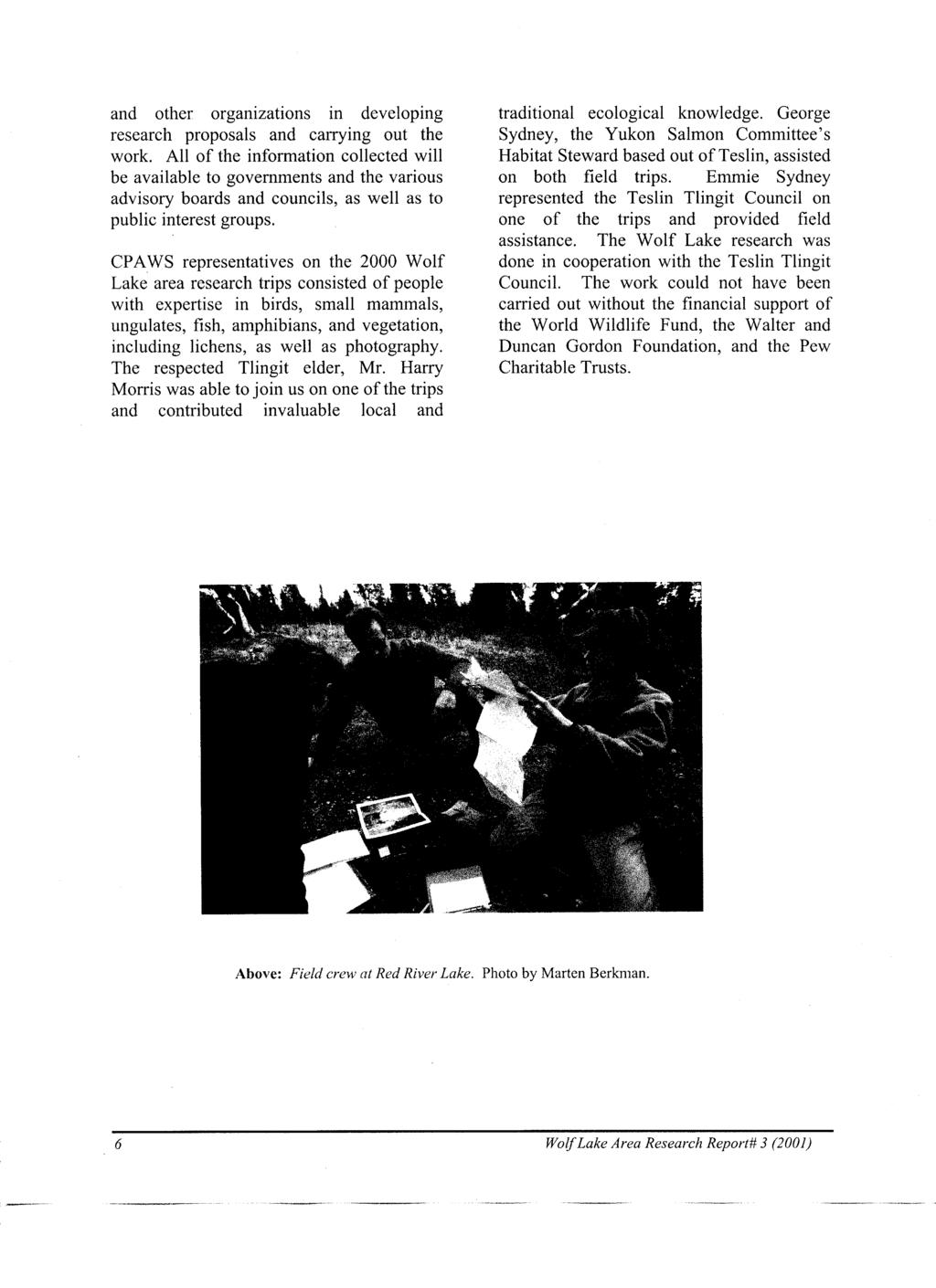
3 ACKNOWLEDGEMENTS The Yukon Chapter of the Canadian Parks and Wilderness Society acknowledges the generous support and co-operation of the people and organizations who contributed to the research and report on the 2000 Wolf Lake Area Study. Co-operators Teslin Tlingit Council Teslin Renewable Resources Council World Wildlife Fund Canada Supporters World Wildlife Fund Local Action Fund Wilburforce Foundation Pew Foundation Walter & Duncan Gordon Foundation Field Work Participants Marten Berkman Dennis Kuch Rem Ricks Joe Campana Jo Lukawitski Rhonda Rosie Larry Gray Harry Morris Emmie Sidney Mac Hislop Dave Mossop George Sidney Marlene Jennings Richard Oziewicz Brian Slough Wolf Lake area research is part of Natural Legacy 2000, a nationwide initiative to conserve wildlife and habitats on private and public lands. We gratefully acknowledge the support of the Government of Canada s Millenium Partnership Program.
4 TABLE OF CONTENTS INTRODUCTION... 1 Regional Setting... 1 Conservation Status... 1 First Nations... 1 Research Project... 4 A Co-operative Effort... 4 NATURAL VALUES... 7 Representative Ecosystem... 7 Wildlife Habitat & Species Populations... 7 Wetlands... 8 Aquatic Species... 8 Vegetation... 8 Wilderness... 8 HIGHLIGHTS OF 2000 FIELD TRIP FINDINGS ECOREGION DESCRIPTIONS Yukon Southern Lakes Pelly Mountains BIRD LIFE Red River Lake Birds of Prey Waterbirds and Grouse Song Birds Special Places Crescent Lake Area Findings Species Decline Concluding Remarks MAMMALS Red River Lake Crescent Lake Area AMPHIBIANS FISH Red River Lake Gillnetting Minnow Trapping Beach Seining Wolf Lake Area Research Report #3 (2001) i
5 Angling Observations Substrate General Lake Information Summary VEGETATION Red River Lake General Description of Area Common Plant Species Rare Plants Vegetation Types Forest Types Shrub Types Graminoid Types Ribbed Fen Complex Crescent Lake Area General Description of Area Common Plant Species Rare Plants Vegetation Types Forest Types Shrub Types Alpine Dwarf Shrub Communities Meadows Rocky Slopes and Boulder Piles Roads and Other Disturbed Sites REFERENCES ii Wolf Lake Area Research Report #3 (2001)
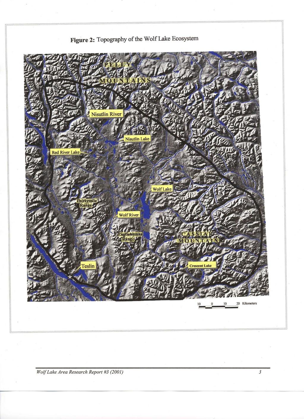
6 LIST OF FIGURES Figure 1. CPAWS Study Sites in the Wolf Lake Area ( )... 2 Figure 2. Topography of the Wolf Lake Ecosystem... 3 Figure 3. Traditional Territories in the Wolf Lake Ecosystem... 5 Figure 4. Ecoregions of the Wolf Lake Area Figure 5. Red River Lake Area, Yukon Territory Figure 6. CPAWS Study Sites in the Crescent Lake Area, July Figure 7. Canada Breeding Bird Survey Trend Data ( ) for the Belted Kingfisher, Olive-sided Flycatcher, Blackpoll Warbler and Boreal Chickadee Figure 8. Breeding Distribution of Golden-crowned Sparrow Figure 9. U.S. Christmas Bird Count Trend Data for Golden-crowned Sparrow Figure 10. Breeding Distribution of American Tree Sparrow Figure 11. U.S. Christmas Bird Count Data for American Tree Sparrow Figure 12. Breeding Distribution of Boreal Chickadee Figure 13. U.S. Christmas Bird Count Data for Boreal Chickadee Figure 14. Comparing U.S. Christmas Bird Count (CBC) Data with Breeding Bird 31 Survey Data for Boreal Chickadee... Figure 15. Fish Sampling Sites at Red River Lake, June Figure 16. Main Vegetation Sampling Sites at Red River Lake, June LIST OF TABLES Table 1. The relative abundance of waterbirds recorded from standardized ground counts in the Red River Lake basin, spring Table 2. Breeding pairs of waterbirds on ponds in the Red River Lake basin, 2000 Table The relative abundance of bird species from point counts and transect counts, Red River Lake basin, Table 4. List of bird species observed in the Red River Lake basin, Table 5. Bird species observed near Crescent Lake, Yukon, July Table 6. Wildlife sightings and signs in the Crescent Lake area, July Table 7. Results of gill net sets, Red River Lake Table 8. Results of minnow trap sets, Red River Lake Table 9. Results of beach seining, Red River Lake Table 10. Results of angling, Red River Lake Table 11. Results of observation, Red River Lake Wolf Lake Area Research Report #3 (2001) iii
7 LIST OF APPENDICES A. Conservation Issues in the Yukon B. Caribou Herds in the Yukon C. Rare Plants Found in the Wolf Lake Ecosystem D. Glossary of Terms E. Birds of the Wolf Lake Area F. Mammals of the Wolf Lake Area G. Vascular Plants of the Wolf Lake Area H. Mosses, Lichens and Liverworts of the Wolf Lake Area I. Vegetation Types of the Red River Lake Area J. Vegetation Types of the Crescent Lake Area iv Wolf Lake Area Research Report #3 (2001)
8 INTRODUCTION Regional Setting Red River Lake and Crescent Lake are two lakes within the Wolf Lake ecosystem in south-central Yukon, within the traditional territory of the Teslin Tlingit First Nation. Wolf Lake is a large body of water northeast of Teslin that is drained by the Wolf River, which flows into Nisutlin River and eventually Teslin Lake (see Figures 1 and 2). Red River Lake lies to the northwest of Wolf Lake, north of the Thirtymile Range. The Pelly Mountains rise further to the north. The Red River flows out of this lake and joins the Wolf River just when the Wolf River starts to flow southward between the Thirtymile Range and the Englishmans Range. Crescent Lake lies to the southeast of Wolf Lake, in the Cassiar Mountains. It is located about 21 km north of the Alaska Highway and 42 km east of Teslin. This small lake is drained by a creek that joins the Swift River. The Liard River has its headwaters to the northeast of Wolf Lake. Conservation Status Wolf Lake, Red River Lake and Crescent Lake are within the Pelly Mountains and Yukon Southern Lakes ecoregions. The Southern Lakes and Pelly Mountains ecoregions are not yet represented by a territorial protected area as outlined in the Yukon Protected Areas Strategy (see Appendix A for description of how ecoregions form a framework for protected area planning). The Wolf Lake area also falls within Natural Region #7 among the 39 natural regions identified by Parks Canada (Parks Canada, 1998). Region #7 includes much of central and western Yukon and is not yet represented by a national park. The Nisutlin National Wildlife Area is located at the mouth of the Nisutlin River Delta. The Wolf lake area also lies within the area of the Yellowstone to Yukon Conservation Initiative (see CPAWS report A Northern Vision for the Yellowstone to Yukon Conservation Initiative, 1998 and Appendix A). In early 1998, Parks Canada indicated an interest in initiating a national park study in the Wolf Lake region. The biologically rich Wolf Lake region is an exceptional candidate for conservation because it represents the characteristic landscapes, flora and fauna of Natural Region #7. It is one of only two or three areas in the Yukon where the range of a woodland caribou herd is still in a mostly natural state, free of roads and development, and where intensive wildlife management has not occurred. As such, it is a relatively intact predator-prey ecosystem. In 2000, a Teslin community survey was completed to evaluate local views on water, land, conservation, fish and wildlife. In early 2001, the Teslin Renewable Resources Council started work on a fish and wildlife management plan for the traditional territory, and the community also moved forward on forest management planning. In 2001 the Teslin Land Use Planning Commission was established, with conservation and protected areas part of the expected scope of work. First Nations While the Wolf Lake region is truly of national significance for its biological attributes, it is equally important in the regional and local context to the Teslin Tlingit people. For generations the region has been a source of food, medicines, and a way of life. The area continues to be Wolf Lake Area Research Report #3 (2001) 1
9
10
11 important for its historical, cultural and spiritual values. Hunting, fishing, trapping, guide-outfitting, and family use of the many cabins and camps continues in the region. The Teslin Tlingit First nation settled their land claim agreement in The Tlingit traditional territory covers the majority of the study area centered on Wolf Lake and Nisutlin Lake (see Figure 3). To the north and east, in the Pelly Mountains, the Tlingit traditional territory overlaps with the Kaska Dena lands. To the south and east, the research area meets the traditional territory of the Liard First Nation. The Nisutlin River Delta National Wildlife Area was negotiated as part of the Teslin Tlingit Final Agreement. Research Project In support of land use planning and conservation in the Wolf Lake area, the Canadian Parks and Wilderness Society - Yukon Chapter (CPAWS) organized a series of reconnaissance research trips into the region in 1998, 1999 and The 1998 trip explored Wolf Lake itself (see CPAWS report on Wolf Lake Area, 1998). An informal, supplementary survey trip was held in September of 1998 on the Nisutlin River. In 1999, in collaboration with the World Wildlife Fund, CPAWS followed up with three more biological survey trips in the region to Nisutlin Lake, Wolf River and Morris Lake (see CPAWS, 1999). In 2000, survey trips were conducted at Red River Lake in mid June and in the Crescent Lake area in mid July. The purpose of this report is to describe the findings of the 2000 field trips. This on-going project is part of a series of biological surveys that CPAWS has conducted for the Yukon Wildlands Project and the Endangered Spaces Campaign (which ended in 2000) in various Yukon watersheds to help support conservation efforts. In other years, in addition to the Wolf Lake area, CPAWS has surveyed Frances Lake and Frances River, the Coal River, and in northern Yukon the Wind, Snake and Bonnet Plume Rivers. The work in these various watersheds has focused on reviewing existing information and gathering new data about species occurrence, vegetation and habitat mapping, as well as describing the characteristics of ecosystems. Often the CPAWS work has concentrated on species and habitats that are less well known, such as small mammals and birds and their habitats. The objectives of the 2000 Wolf Lake area trips were to: learn more about vegetation communities and species occurrence, establish a number of vegetation plots to support future vegetation cover mapping, observe and record bird species habitat and occurrence, observe and record small mammal species, including bats, observe and record amphibians, determine presence of fish and extent of populations, learn more about traditional interpretations of the flora and fauna in the region, photograph the landscape and variety of species present, and raise awareness of the region s natural features in the community and the Territory as a whole. A Co-operative Effort The 2000 field work was part of a series of co-operative research projects that will help conservation and land use planning in the region. CPAWS wishes to co-operate with governments, Renewable Resource Councils 4 Wolf Lake Area Research Report# 3 (2001)
12
13
14 NATURAL VALUES Representative Ecosystem The Wolf Lake area is a relatively intact example of a northern boreal forest ecosystem. The plateaus and lowlands, which lie between 750 and 1,220 metres in elevation, are covered by numerous ponds, swamps and lakes. Some of the larger lakes in the region include Wolf, Morris, Wolverine, Fish, and Nisutlin Lakes. The headwaters of the Liard, Nisutlin and Wolf drainage basins fall into this region as well. The Liard River system is unique in that it drains south, then flows in to the Mackenzie River, while most other rivers in the Yukon flow into the Yukon River drainage. The region contains a good cross-section of different ecosystems, from spruce-willow boreal forest to pine-lichen forests, alpine fir forests, sedge meadows, dwarf birch-willow thickets, and quaking bogs. Wildlife Habitat & Species Populations The variety of habitats in the Wolf Lake area support a number of unique wildlife populations. Special wildlife populations include the Wolf Lake and Little Rancheria caribou herds (see Appendix B) with their associated carnivore guilds. Populations of Stone sheep and mountain goats, grizzly bears and black bears, and migratory populations of waterfowl, sandhill cranes and other birds can also be found here. All in all, the region contains representative populations of at least 47 mammal species, including possibly the only Yukon population of the Western jumping mouse. The Wolf Lake caribou herd uses the spruce-lichen forests in the Wolf Lake area during the winter, moving to the alpine habitats in the northern Cassiar Mountains to calve in spring. This herd is of particular significance because it ranges in a landscape where there are no roads and intensive wildlife management has not occurred. This intact predator-prey ecosystem, with woodland caribou as the dominant ungulate, is one of a dwindling number remaining in Western Canada. Few other areas in Canada contain the full home range of a woodland caribou herd in undisturbed habitat, and none are protected in their entirety. The Stone sheep, which are distinct from the Dall sheep that are more common in other parts of the Yukon, use the relatively dry, well-vegetated northern parts of the Cassiar Mountains. A small mountain goat population occurs in the Cassiar and Englishmans Ranges. Rivers like the Wolf and Nisutlin and their associated wetlands provide excellent habitat for large, viable moose populations. Geist et al. (1974) noted that due to annual flooding and reworking of alluvium, the warm and productive Wolf River permits a moose population to flourish year round. Geist and his colleagues concluded the main reason for proposing the Wolf Lake area as a major ecological reserve is that it will maintain virtually indefinitely a viable, large moose population. The wolf population, like the caribou population, has been relatively unregulated. A 1994 survey of the region estimated 1.19 packs of wolves occur per 1000 square kilometers with an average pack size of 5.5 individuals (Alan Baer, personal communication, 1999). The concepts of umbrella species and key habitat apply poorly to many mammal species that are not directly tied to the food chain of large carnivores or ungulates. A large area that contains intact representative Wolf Lake Area Research Report #3 (2001) 7
15 ecosystems is the best umbrella for most species. Wetlands The extensive wetlands provide a home to many mammal species, including moose, black-backed shrew, pygmy shrew, water shrew, little brown bat and other bat species, meadow vole, muskrat, beaver, mink and otter, as well as amphibians such as the wood frog and the boreal toad (in site specific habitats). On one of the CPAWS trips a researcher discovered a new species of bat, believed to be the Big Brown Bat, not previously recorded in the Yukon. Bat species are at the northern extent of their range here. The wetlands are also used extensively by nesting and migrating waterfowl and shorebirds. The Nisutlin River delta, in the southwestern corner of the region is well known as one of the most important waterfowl staging areas in the northwestern part of the continent. It has been designated a National Wildlife Area. During CPAWS research trips both nesting and migrating birds were observed on various lakes, including Nisutlin Lake, Wolf Lake, Morris Lake and Red River Lake. The extent to which the wetlands of the Wolf Lake region (with the exception of the Nisutlin Delta) are important for migratory bird populations has not been fully determined. Aquatic Species The Wolf River and Nisutlin River watersheds provide important chinook salmon spawning habitat. The salmon spawning also attracts bald eagles and grizzly bears to these rivers in the late summer and fall. Chinook salmon travel over 3000 kilometers up the Yukon River to spawn in the Wolf River. This Yukon River chinook migration is the longest salmon migration in the world. The CPAWS research trips have found that Nisutlin Lake contains diverse and abundant fish populations. Pike likely play an important role in this healthy aquatic ecosystem. At Red River Lake a substantial fish population supports numerous fisheating birds and mammals. Vegetation The CPAWS surveys have found a number of rare Yukon plant species in the region. To date, up to 26 plant species that have very limited distribution in the Yukon have been found in the Wolf Lake region (see Appendix C). These occur in wide-ranging habitats, from ribbed fens to high alpine meadows. Of particular note is one herb tentatively identified as Hieracium albiflorum, or White Hawkweed. If this identification is correct, it will be the first known location for this species in the Yukon. As well, a number of plant specimens collected on the research trips have not yet been identified and it is likely that the list of rare species will grow once further specimens are examined. Amphi- Beringian species, occurring only on either side of the Bering Strait, also exist here. Wilderness The Wolf Lake area is a large and relatively undisturbed wilderness. Wilderness is acknowledged as a valued natural resource in the Yukon Environment Act, and has been recognized worldwide as an essential and dwindling reservoir of biodiversity and evolving ecosystems. By definition, wilderness has a high degree of ecological integrity. About 75% of the Yukon remains as intact wilderness. The Wolf Lake ecosystem is one of the largest low-elevation wilderness areas in southern Yukon. 8 Wolf Lake Area Research Report# 3 (2001)
16
17 HIGHLIGHTS OF 2000 FIELD TRIP FINDINGS Wetlands at Red River Lake appear highly productive, as is evident by the relatively high degree of emergent vegetation community development and the abundance of fresh moose sign, the presence of river otter, frogs, and dense hatches of midges. The Red River Lake basin, with its mix of wetlands, dry and wet boreal forest, ponds, and the larger lake, provides a good variety of bird habitats. The frequent observance of top-of-the-foodchain predators suggests this is a diverse bird community and ecosystem. Key habitats identified as critical for maintaining healthy bird populations at Red River Lake include established wetlands with abundant vegetation, and large riparian trees that provide critical nesting habitat for large birds of prey. As well, the lake itself and its streams provide fish populations essential to the birds survival. During three days of field work at Red River Lake, 68 different bird species were observed. Several species, including the Bald Eagle, Lesser Yellowlegs, American Tree Sparrow and White-crowned Sparrow were confirmed breeding in the area. There were signs that several other bird species, like the Red-throated Loon and the Barn Swallow, also nest here. Despite the late timing of the Crescent Lake trip, over 30 different bird species were observed on this trip. Researchers found signs that Green-winged Teal, Spotted Sandpipers, Belted Kingfishers and Golden-crowned Sparrows were all breeding in the area. A number of the bird species observed in the Red River Lake and Crescent Lake areas have been listed as species of concern by Partners in Flight Canada because of downward trending population indices over the past several decades. American Tree Sparrow, Blackpoll Warbler, Boreal Chickadee and Rusty Blackbird are all listed as species of high concern. The mammals of the Red River Lake area were found to be typical of midelevation (1080 metres) climax habitats in the south-central Yukon. Caribou (summer and winter sign) and moose were common. The Crescent Lake region appears to have excellent moose, caribou and sheep habitat. Not only were pellets and scat seen every day but also the top of the alpine ridges afforded a view of lush and extensive caribou and moose habitat stretching for miles. Tracks and scat indicate that there is also a strong presence of the predators of these animals wolves. There was considerable evidence of a substantial fish population in Red River Lake, as indicated by visual observations and also by numerous sightings of fish remains (bones, scales) along the shoreline in many places. Several species of fish-eating birds and mammals were observed, including bald eagles, osprey, gulls, loons and otters. A total of 113 different plants species (from 31 separate families) were recorded at Red River Lake during the 5 day trip, including at least two rare species. One of the rare species is a low 10 Wolf Lake Area Research Report# 3 (2001)
18
19 ECOREGION DESCRIPTIONS Wolf Lake falls within the Yukon Southern Lakes ecoregion. The surrounding area to the east and north of the lake lie in the Pelly Mountains ecoregion (see Figure 4). The following information on these two ecoregions is adapted from Oswald and Senyk (1977) and Yukon Ecoregions Working Group (in prep.). Yukon Southern Lakes The Yukon Southern Lakes ecoregion is characterized by a maze of freshwater lakes and rivers amidst a mountainous setting. The lakes and numerous wetlands of the region are used extensively by migrating waterfowl as well as animals such as moose. The surrounding hills and plateaus are covered in open stands of white spruce with a carpet of feathermoss, shrubs and forbs below. Black spruce grows on the wetter sites. Lodgepole pine occurs in the burn areas. Dry aspen stands and sagewort grasslands can be found on the south-facing slopes at lower elevations. Forest fires are frequent and extensive, shaping the landscape of this ecoregion. Since the region is located in the rainshadow of the Coast Mountain Range it is drier and colder in winter than more coastal regions. The Yukon Southern Lakes area was glaciated during the last ice age, the McConnell Glaciation. During melting and retreat of the glaciers, sands and gravels were deposited by glaciers and meltwater streams throughout the lowlands of this region. As a result, the lower elevation terrain of the Yukon Southern Lakes ecoregion is overlain with extensive glacial deposits, including features such as terraces and kames (see Appendix D for a glossary of italicized terms). At higher elevations shallow deposits of morainal and colluvial material, as well as bedrock outcroppings, are found. Some of the high elevation valleys show signs of having been scoured due to glacial activity. This ecoregion lies in the discontinuous scattered permafrost zone. Permafrost features such as peat plateaus, patterned fen and bog complexes, and beaded streams are common at middle to upper elevations. Some hummocky terrain also occurs on lower north-facing slopes. Above treeline other permafrost features such as stone nets and stripes are found. Pelly Mountains The Pelly Mountains ecoregion contains the Pelly and Cassiar Mountains as well as part of the Nisutlin Plateau. Lakes occur mainly in the Nisutlin Plateau part of this ecoregion. A large part of this area is above treeline and the high landscape intercepts weather systems coming from the Pacific resulting in more rain here than in other inland regions. Lichens and willows are common in the drier alpine tundra, sedge tussocks in the alpine wetlands, while black and white spruce occur in the valleys and lower slopes of the plateau. Lodgepole pine is found in areas following fire. Aspen and balsam poplar are scarce and grow on the warmer floodplains. Feathermoss, sphagnum, shrubs and willows cover much of the understorey while forbs are scarce. Most of this ecoregion was glaciated during the last ice age and was the contact area of the Cassiar Ice lobe which was flowing north and the ice from the Selwyn and Logan Mountains which was flowing south and southeast. Intense glacial erosion took place in this region. The major valley bottoms are all deeply overlain with materials deposited by the glaciers and deposits that resulted from the ice melting 12 Wolf Lake Area Research Report# 3 (2001)
20
21
22 BIRD LIFE RED RIVER LAKE by Dave Mossop The upper Red River at the upper end of the Wolf River drainage was visited during June 16-20, 2000 for the purposes of conducting a broad inventory of wetland and forest birds. Generally the Red River Lake basin was the area surveyed. Systematic bird surveys involved standardized point and transect counts of singing birds, standardized total counts of waterbirds, as well as broad reconnaissance by canoe and foot. In the following account, the Red River Lake region is compared to the Nisutlin Lake area, which was visited in a previous year (June 5-10, 1999, see CPAWS 1999). The Red River lake basin sits on the same flat, fairly high plateau occupied by Nisutlin Lake (see Figure 5). It is well treed but its main difference from the Nisutlin lake area is extensive, relatively open wetland meadows stretching back from the lake. The main features providing bird habitat in the area are: a) the extensive wet meadows extending off the lake on at least three sides, b) the lakeshore beaches and riparian communities, c) three small waterbodies near the lake, d) at least three stream valleys connected to the lake, and e) fairly dry, typical boreal forest habitats off the wetlands. With the mix of wetlands, dry and wet boreal forest, ponds, and the larger lake, the basin provides a good mix of bird habitats. Breeding birds were well established on territories by the time of survey. The lake basin displayed some interesting differences in its bird fauna compared to the nearby Nisutlin site. Only very minor use of the lake surface by staging water birds was evident; this was a feature at Nisutlin Lake. As well, top-of-the-food-chain predators were encountered more frequently at Red River Lake (perhaps suggesting a more diverse community). Additionally, the song bird community was composed more of dry meadow species than that seen at Nisutlin. From an initial visit it is clear that the bird populations, and natural history of the area in general, will be of increasing interest to a birding public. As at Nisutlin Lake, the ease of access provided by the lake surface and the attractive river route out of the basin will result in the region receiving increasing visitors as time progresses. Birds of prey Top-of-food-chain predators are some of the most powerful indicators of ecosystem diversity and productivity. As noted, the area displayed a richer fauna of raptors than encountered at Nisutlin Lake, nearby. Two of the prime bird features of the area were the two largest raptors seen, Bald Eagle and Osprey. They were observed daily on virtually every outing. Bald eagles were nesting near the lake (no young raised in 2000). Ospreys were seen hunting the lake daily; at least two adults staged a running battle with the Bald eagles over fish they were catching. Both pairs along with at least two young eagles from previous years, indicated a very healthy water-based ecosystem. Ospreys were carrying fish toward an apparent nest site south of the lake. Other raptors were Northern Harriers that were apparently nesting in, and hunting the extensive wet meadows of the basin. One American Kestrel and one Merlin were also seen hunting the lakeshore area. Wolf Lake Area Research Report #3 (2001) 15
23
24 Waterbirds and Grouse The gamebirds are some of the most obvious birds for the average person, providing a good group to use in characterizing biodiversity. No standardized grouse survey was possible. However, several sightings of Spruce Grouse were made; the population was apparently of medium to high in density for such a high altitude site. Waterbirds are excellent indicator species for the productivity of an area s wetlands. The relatively flat topography of the lake basin has created a good mix of wetlands throughout the area. However, we found only four wetlands which were immediately accessible from the lake itself and which we could therefore visit. Wetlands visited ranged from a single hectare in size to one that was over 200 hectares. Complete counts of their waterbird populations were taken. Similar to the wetlands in the Nisutlin Lake area, the ponds showed a relatively high degree of emergent vegetation community development. Over 90% of shorelines displayed emergent vegetation and 2 of the 4 had islands of emergent vegetation. Emergent vegetation was a mix of sedge species and aquatic grasses, often forming floating mats over the edges of ponds. Yellow water lily occurred in one pond. Other indicators of wetland productivity were fresh moose sign at all (moose observation at one), a river otter (seen several times), frogs singing (wood frogs at 1 of 4 of waterbodies) and dense hatches of midges (Caronamid spp) at two. The ponds were not obviously actively thermokarsting, a process noted in the Nisutlin Lake area. From standard counts, twelve species of waterbirds were found to occupy the ponds (13 were found at Nisutlin Lake) (see Table 1). Twenty five breeding pairs were indicated (8.2 ha per pair; 0.12 pairs per ha.) (see Table 2) and 102 waterbirds were counted in total (approximately one bird every 2 ha.) Of the waterbird species recorded, Lesser scaup (34% of observations), Bufflehead (15%) and Mallard (12%), were the most commonly encountered. As at Nisutlin Lake the number of waterbirds at the Red River Lake wetlands is lower than on most low elevation wetlands in the Yukon. The Nisutlin lake basin had a waterbird species count somewhat higher than the Red Lakes wetlands. The species mix was typical, Lesser Scaup are the most common breeding waterbird in most Yukon wetlands. Canada Geese were much more evident at this site than at Nisutlin, as a flock of 10 was seen on several occasions. A pair of Red-throated loons was breeding on one of the ponds visited. The surface of the large lake itself was being used only in a minor way by small flocks of staging waterbirds. One morning a small flock of Surf Scoters was briefly on the lake. This is in contrast to the Nisutlin, which was found to be used relatively heavily by migrating waterbirds. Wolf Lake Area Research Report #3 (2001) 17
25 Table 1. The relative abundance of waterbirds recorded from standardized ground counts in the Red River Lake basin, spring Species Percent In count Lesser Scaup 34.6% Bufflehead 15.4 Mallard 12.3 Oldsquaw 4.6 Surf Scoter 3.1 A. Green-winged Teal 2.3 Northern Shoveler 1.5 Barrow s Goldeneye 1.5 Ring-necked Duck 1.5 Mew Gull 1.2 N. Pintail 1.1 Red-throated Loon 1.1 Table 2. Breeding pairs of waterbirds on ponds in the Red River Lake basin, 2000 Species Mallard 2 Northern Pintail 1 A. Green-winged Teal 1 2 Lesser Scaup 1 Ring-necked Duck 1 Surf Scoter 2 Barrow s Goldeneye 1 Bufflehead 1 10 Oldsquaw Duck 1 Red-throated Loon 1 Song Birds and Others Most song birds were singing, apparently on breeding territories. The area is somewhat open shrub dominated high altitude boreal habitat for birds. Open boreal forest, dry/wet meadows, open shrub and northern riparian shrub were the apparent hot spots. Eighteen point counts were made and 1 listening transects of 2 km, was surveyed. An average of 8.2 species were recorded at each point count; 10.4 individual birds. A total of 28 species were recorded on the point counts, 34 on the transect count. Counts averaged slightly lower in all categories compared to the Nisutlin Lake area in Eleven species accounted for 18 Wolf Lake Area Research Report# 3 (2001)
26 70% of birds heard singing (Table 3). The area is characterized by: Tree Sparrow, Fox Sparrow, Ruby-crowned Kinglet, Whitecrowned Sparrow and Wilson s Warbler. The number of species associated with open shrub (Tree Sparrow) was higher than seen at the Nisutlin lake area and the number of species generally associated with water (Northern Waterthrush, Common Snipe) was lower. A breeding density of over 300 breeding pairs per square kilometer is indicated by these counts although point counts are risky to interpret when estimating demographics. The breeding density of birds in the Red River Lake basin appeared slightly lower compared to other lower elevation sites that have been visited in the boreal forests of central Yukon. The diversity of species is difficult to compare to other similar sites because relatively few of these higher altitude sites have been analyzed in the central Yukon and the Yukon Plateau generally. Special places Key or critical habitats will be the most important ecological features identified for influencing land use decisions in the future. In the Red River Lake area these include: 1. Established wetlands, notably those with well advanced vegetative communities The larger lake north-east of the main lake is the most valuable of these by far; most of the bird species diversity was associated with this general area. As throughout the Nisutlin plateau area, these wetlands are largely dependent on substrate ice and will be easily damaged by any industrial land use should it occur in the area. 2. Large riparian trees These are critical nesting habitat for large birds of prey such as Bald eagle and Osprey. Because trees generally are small in the area, the large riparian trees associated with streams will have to be protected in the future if those populations are to survive. The resident Bald eagles have a magnificent nest of many years occupancy in a large riparian spruce beside a small stream draining into the lake from the west. These unique small stands of large trees will be critical for conservation effort. 3. Fish bearing habitats The lake itself and probably its streams will be critical for conservation effort if the large fish-dependant raptors are to remain as a central bird feature of the site. The fish populations of the lake are apparently not only substantial but are hunted daily; they are probably essential to the birds survival. Given the altitude of the site, these fish populations are undoubtedly relatively fragile and should be given all protection necessary. During three days of field work at Red River Lake, 68 different bird species were observed (see Table 4). Several species, including the Bald Eagle, Lesser Yellowlegs, American Tree Sparrow and White-crowned Sparrow were confirmed breeding in the area. Wolf Lake Area Research Report #3 (2001) 19
27 Table 3. The relative abundance of bird species from point counts and transect counts, Red River Lake basin, % of Observations Species % of Points At Points On Transect Recorded Tree Sparrow Fox Sparrow Ruby-crowned Kinglet White-crowned Sparrow Wilson s Warbler American Robin Blackpoll Warbler Gray-cheeked Thrush Lesser Yellowlegs Northern Waterthrush Yellow-rumped Warbler Tree Swallow Arctic Tern Gray Jay Rusty Blackbird Mew Gull Common Snipe Hammond s Flycatcher Least Sandpiper Lincoln s Sparrow Olive-sided Flycatcher Solitary Sandpiper Swainson s Thrush Barn Swallow Chipping Sparrow Common Yellowthroat Dark-eyed Junco Yellow Warbler Boreal Chickadee Spruce Grouse Wolf Lake Area Research Report# 3 (2001)
28 Table 4. List of bird species observed in the Red River Lake basin, 2000 Date: June Comments Loons Common Loon 1 Heard calling Red-throated Loon Nest, no eggs Grebes Red-necked Grebe 1 1 Waterfowl Canada Goose Trumpeter Swan American Green-winged Teal Mallard Northern Pintail American Wigeon Northern Shoveler Ring-necked Duck Lesser Scaup Heard calling Barrow s Goldeneye Bufflehead Oldsquaw Surf Scoter Red-breasted Merganser Birds of Prey Osprey Bald Eagle 4 2 Northern Harrier 1 1 American Kestrel 1 1 Merlin 1 Red-tailed Hawk Grouse Spruce Grouse (B) 3imm., 2 ad. Shorebirds Lesser Yellowlegs Spotted Sandpiper Solitary Sandpiper Common Snipe Red-necked Phalarope Least Sandpiper Semipalmated Plover (B) defending Wolf Lake Area Research Report #3 (2001) 21
29 Date: June Comments Gulls, terns Bonapart s Gull Mew Gull Arctic Tern 1 Kingfishers/Woodpeckers Northern Flicker Three-toed Woodpecker Flycatchers Olive-sided Flycatcher Western Woodpeewee Hammond s Flycatcher 1 1 Shrikes Northern Shrike 4 Jays Gray Jay Common Raven Swallows Tree Swallow Barn Swallow 2 2 Titmice Boreal Chickadee 1 1 Thrushes Gray-cheeked Thrush American Robin Varied Thrush Swainson s Thrush Hermit Thrush? Kinglets Ruby-crowned Kinglet C C C C C Waxwings Bohemian Waxwing 1 1 Wood warblers Yellow Warbler Yellow-rumped Warbler Blackpoll Warbler Common Yellowthroat Wilson s Warbler 1 1 Blackbirds Rusty Blackbird Grosbeaks/finches Pine Grosbeak Common Redpoll White-winged Crossbill C 1 1 C 1 C C 1 1 C Pair at nest site 1 C 1 1 C Wolf Lake Area Research Report# 3 (2001)
30
31
32
33 Table 5. Bird species observed near Crescent Lake, Yukon, July 2000 Species Loons Common Loon Waterfowl Canada Goose Green-winged Teal Birds of Prey Sharp-shinned Hawk Golden Eagle Grouse Spruce Grouse Willow Ptarmigan Rock Ptarmigan Shorebirds Lesser Yellowlegs Solitary Sandpiper Spotted Sandpiper Gulls, Terns Bonaparte s Gull Arctic Tern Kingfishers/Woodpeckers Belted Kingfisher Flycatchers Olive-sided Flycatcher Species Jays Gray Jay Common Raven Larks Horned Lark Titmice Boreal Chickadee Thrushes Townsend s Solitaire Gray-cheeked Thrush American Robin Varied Thrush Warblers Yellow-rumped Warbler Blackpoll Warbler Wilson s Warbler Sparrows American Tree Sparrow Savannah Sparrow White-crowned Sparrow Golden-crowned Sparrow Dark-eyed Junco Finches Common Redpoll Species Decline A number of the species observed in the study area have been listed as species of concern by Partners in Flight Canada because of downward trending population indices over the past several decades. American Tree Sparrow, Blackpoll Warbler and Boreal Chickadee are all listed as of high concern. Belted Kingfisher, Golden Eagle, Golden-crowned Sparrow, and Olivesided Flycatcher are of medium-high concern. In all cases, the trend for northern populations is indicated as having the highest need for monitoring. Figure 7 illustrates the Canada Breeding Bird Survey trend data for the Belted Kingfisher, Olivesided Flycatcher, Blackpoll Warbler and Boreal Chickadee. Golden-crowned Sparrow The Golden-crowned Sparrow was observed frequently in the study area, singing from bushes in the subalpine and foraging among the birch and willow brush. As shown in Figure 8, it breeds in a limited part of the Yellowstone to Yukon region to the coast, nesting in mountain thickets and feeding its young almost exclusively on insects. While the Partners in Flight listings shows medium high concern for this species, it also notes the dearth of data available. The graph in Figure 9 shows the changes in Christmas bird counts over the past several decades, with highly variable counts obscuring any definite trend. Determining the trend for northern counts and confirming these data are noted as high priorities for further research. 26 Wolf Lake Area Research Report# 3 (2001)
34
35 Figure 8. Breeding Distribution of the Golden-crowned Sparrow Figure 9. U.S. Christmas Bird Count Trend Data for the Golden-crowned Sparrow American Tree Sparrow The American Tree Sparrow nests across northern Canada from Labrador to the far north of Yukon, preferring open areas with scattered trees and brush and along the edge of tundra (see Figure 10). It was among the most common of the species found in the study area, from the shores of Crescent Lake at 3800 feet to the subalpine meadows at 4100 feet. This sparrow has shown clearer signs of declining populations than the Goldencrowned Sparrow. However, as in the case of the Golden-crowned, data for the north and migration monitoring information are still needed to better track this potential decrease in numbers. The graph of the Christmas Bird Count data (see Figure 11) provides a warning that something is not well with American tree Sparrows, but Breeding Bird Survey data are lacking. Whether the decline is due to habitat loss in the breeding range, pesticide use in the wintering range, global warming, or a combination of factors is a question of great importance. 28 Wolf Lake Area Research Report# 3 (2001)

36 Figure 10. Breeding Distribution of the American Tree Sparrow Figure 11. U.S. Christmas Bird Count Trend Data for the American Tree Sparrow Boreal Chickadee The Boreal Chickadee provides a final example of the growing data on the decline of forest bird populations. This example also illuminates the difficulties in interpreting the available data on bird populations. The Boreal Chickadee was observed in the study area in the subalpine fir and birch bushes around Rudy Lakes at about 4100 feet above sea level. In spite of a more widespread breeding distribution than either the Golden-crowned Sparrow or American Tree Sparrow (see Figure 12), the Boreal Chickadee is experiencing a major decline in numbers. This decline is not evident from the long term records of Christmas Bird Counts, which show no clear trend in numbers over nearly 40 years of observations (see Figure 13). The Breeding Bird Survey data tell a different story, as shown in Figure 14, where the two sets of data are compared for the period in which both sets of data are available. The Breeding Bird Survey data translate into nearly a 10% decline in numbers of Boreal Chickadees observed over the past 30 years. This is a major cause of concern for Partners in Flight and for the biological diversity of our northern forests. Wolf Lake Area Research Report #3 (2001) 29
37 Figure 12. Breeding Distribution of the Boreal Chickadee Figure 13. U.S. Christmas Bird Count trend data for the Boreal Chickadee 30 Wolf Lake Area Research Report# 3 (2001)
38
39 MAMMALS A list of all mammals species known or suspected to occur in the Wolf Lake area, based on existing distribution information as well as observations made during three years of CPAWS field studies can be found in Appendix F. RED RIVER LAKE By Brian Slough The area within about one kilometre of Red River Lake, including the Red River (inflow) and some wetlands, was surveyed on foot and by boat. The following is a summary of the mammal observations. The mammals of the Red River Lake area are typical of mid-elevation (1080 metres) climax habitats in the south-central Yukon. Caribou (summer and winter sign) and moose were common. The caribou are likely from the Wolf Lake herd, although animals from the Carcross/Squanga and other herds may also range here. Cow moose with calves were common. Various vole and lemming species (such as red-backed vole and northern bog lemming) are expected to be moderately abundant. A brown lemming was observed. Marten scat and an individual were observed. Marten prey largely on voles. Other predators observed included wolf (tracks), mink (tracks), and river otters (several observations of 1 to 3 individuals, probably a family) on Red River Lake. An active beaver colony was present on the Red River upstream from the lake. Habitat for beaver is sub-optimal, due to an absence of aspen, and a limited supply of riparian willows. The scarcity of bear sign was notable, as was the complete absence of red squirrels, ground squirrels and snowshoe hare. An ultrasonic bat detector was set up nightly to record bat calls, however no bats were detected. The cool, rainy weather may have contributed to the lack of bat activity. It may also be poor bat habitat due to an absence of suitable roost sites and an overall shorter summer period at this elevation. CRESCENT LAKE AREA By Larry Gray From July 21-23, 2000, a wildlife inventory was carried out in the area of Crescent Lake. Signs of small and large mammals were recorded during day hikes from Crescent Lake. The cursory large mammal inventory was done by observation of animals and animal sign during day hikes. Small mammal trapping was carried out more systematically in three different habitat types. These were high alpine meadow, high alpine fir forest and wetland or marsh habitat. At each trapping site, twenty traps were set in two lines of ten and baited with sunflower seeds and peanut butter. These were set in the afternoon, left overnight and checked the following morning. Table 6 lists the actual sightings of mammals as well as animal signs found. 32 Wolf Lake Area Research Report# 3 (2001)
40 Table 6. Wildlife sightings and signs in the Crescent Lake area, July 2000 Date Sighting/Sign Species Comments July 21 Sighting Marmots 2 Sighting Caribou 1 cow and calf Scat Caribou, Moose, Sheep, Wolf, Grizzly Bear moose and caribou pellets abundant Tracks Caribou, Moose Dens/Whistles Marmot Marmot community den July 22 Sightings Marmots 3 Sightings Caribou cow and calf Scat Grizzly Bear, Wolf Abundant Tracks Grizzly Bear, Wolf Abundant Burrow Ground Squirrel July 23 Sightings Caribou 2 Scat Grizzly Bear, Wolf Tracks Caribou, Moose, Wolf, Grizzly Bear No small mammals were caught at any of the sites. This part of the Wolf Lake region is excellent moose, caribou and sheep habitat. Not only were pellets and scat seen every day but also the top of the alpine ridges afforded a view of lush and extensive caribou and moose habitat stretching for miles. Tracks and scat indicate that there is also a strong presence of the predators of these animals wolves. Grizzly bear sign was scattered throughout the area surveyed, rounding out what appears to be a rich wildlife assemblage. AMPHIBIANS By Brian Slough A single wood frog was observed in a pond east of Red River Lake. No vocalizations were heard, however it was past the normal breeding period. Wood frogs are probably common in the area, especially in the shallow wetlands adjacent to the lake. The cool weather during the field trip would limit amphibian activity. No other species are expected to occur here. Wolf Lake Area Research Report #3 (2001) 33
41 FISH By Rem Ricks RED RIVER LAKE Between June 16-20, 2000 Red River Lake was assessed for the presence of fish species. The objective of this assessment was to establish the presence of mature and juvenile fresh water fish species, using gill netting, minnow trapping, beach seining, angling and observation. Gillnetting Due to the inability to secure appropriate nets of specific length and mesh size, specific Index Netting techniques (Yukon Territorial Government Department of Renewable Resources) were not applied, as have been in previous trips of this nature. Nets of two different mesh sizes were set in a variety of depths and locations throughout the lake (see Figure 15). Standard gill nets with multi-filament mesh were used in all sets. Single gangs were used, each gang being 60 feet (18.3 m) in length and eight feet (2.4 m) high. Each net had a sinking line on the bottom and a floating line on the top, so that they covered the bottom 2.4 m of the area in which they were set. They were additionally anchored in place with metal weights at each end of the net. Table 7 contains the results of the gill net sets. Table 7. Results of gill net sets, Red River Lake Set # Duration Mesh Size Depth of Set Species & Number Captured G1 1 hr. 4" (10.2.cm) 60 feet Nil G2 1 hr. 50 min 3" (7.6 cm) 35 feet 1 LWF G3 1 hr. 4" (10.2.cm) 28 feet Nil G4 1 hr. 10 min. 3" (7.6 cm) 45 feet 3 LWF; 1 LT G5 1 hr. 15 min. 3" (7.6 cm) 9 feet 2 LWF G6 1 hr. 15 min. 4" (10.2.cm) 7 feet Nil G7 1 hr. 4" (10.2.cm) 25 feet Nil G8 1 hr. 5 min. 3" (7.6 cm) 93 feet Nil G9 2 hr. 15 min. 4" (10.2.cm) 55 feet Nil LWF = Lake Whitefish LT = Lake Trout Minnow Trapping All minnow traps were Gee's Minnow Traps consisting of galvanized metal mesh with 1/4" square openings. All traps were baited with Yukon River origin chinook salmon roe. See Figure 15 for locations of minnow traps. 34 Wolf Lake Area Research Report# 3 (2001)
42
43 Table 8. Results of minnow trap sets, Red River Lake Set # Duration Species & Number Captured T1 22 hr. Nil T2 22 hr. Nil T3 22 hr. Nil T4 22 hr. Nil T5 22 hr. Nil T6 22 hr. Nil T7 22 hr. 1 BB T8 18 hr. Nil T9 18 hr. Nil T10 18 hr. Nil T11 18 hr. Nil BB = Burbot Beach Seining A standard beach seine was used for all beach seining. The mesh size was 3/16" (0.48 cm) and the seine was approximately 50 feet (15.24 m) in length. It was equipped with a sinking line on the bottom and floats on the top. The seine was approximately 6 feet (1.8 m) in height. See Figure 15 for specific locations of seining. Table 9. Results of beach seining, Red River Lake Seine Pull # Length of Pull Species and Number Captured S1 ~ 50 feet Numerous BB ( 1 cm) S2 ~ 50 feet Numerous BB ( 1 cm) S3 ~ 50 feet 6 BB ( 1 cm) BB = Burbot Angling Table 10. Results of angling, Red River Lake Angling Attempt # Species and Number Captured A1 Arctic Grayling - 2 Observations Arctic grayling and slimy sculpins were observed directly, and numerous fish of unknown designation were sighted surfacing at a variety of times during the four-day assessment. See Figure 15 for specific locations of observations. 36 Wolf Lake Area Research Report# 3 (2001)
44 Table 11. Results of observation, Red River Lake Observation # Observation #1 Observation #2 Species Observed Arctic Grayling Slimy Sculpin Substrate In those areas that were shallow enough to allow visual inspection of the bottom, the substrate was predominately a mixture of cobble (~70%) and sand (~30%). The inflow creek (Red River Creek) on the east side of the lake consisted exclusively of fines and very small gravel. The substrate in the outflow creek at the northern aspect of the lake was predominantly cobble (~80%) with some gravel and sand (~20%). The small inflow creek at the southern aspect of the lake consisted of 100% fines/mud. General Lake Information 1. ph Conductivity - 70 µmhos/cm 3. Clarity - obvious reddish-brown colouration - "tannin" appearance 4. Temperature - variable but generally at about 9-10 C in the upper aspect of the lake (~ one metre). 5. Dissolved oxygen - between 11 and 12 mg/l, which represents saturation or slight supersaturation at the recorded temperature. 6. Maximum depth recorded feet (28.5 m) in the center of the large bay at the southern end of the lake. The rest of the lake became increasingly shallow from this point, to a depth of approximately 2.5 metres in the area adjacent to the outlet at the northern aspect. Summary Five species of fish were documented in this lake: lake whitefish (Coregonus clupeaformis), lake trout (Salvelinus namaycush), Arctic grayling (Thymallus arcticus), slimy sculpin (Cottus cognatus), and burbot (Lota lota). The small number of fish collected is not considered to be indicative of the abundance of fish and fish species that may be found in this lake. The relatively small number of fish captured via gill netting likely was more a factor of mesh size than paucity of fish and fish species. The one fish (burbot) captured by minnow trapping should not be construed as a scarcity of juvenile fish in the lake. It is the general experience of the author that species other than juvenile chinook salmon do not tend to enter minnow traps readily. There was considerable evidence of a substantial fish population in this lake, as indicated by visual observations and also by numerous sightings of fish remains (bones, scales) along the shoreline in many places. Several species of fish-eating birds and mammals were observed, including bald eagles, osprey, gulls, loons and otters. While not specifically indicated, it is felt that Red River Lake likely supports a healthy and varied population of fresh water fish species. Wolf Lake Area Research Report #3 (2001) 37
45
46 VEGETATION RED RIVER LAKE By Rhonda Rosie This section details results of an exploratory vegetation survey of the Red River Lake area carried out between June 16-20, Twelve plots were placed in forest, wetland, shrub, and meadow sites all around the lake, within 1-2 km of the lakeshore. As well, extensive notes were taken on types encountered while traversing the area. See Figure 16 for the main locations of vegetation surveys in the Red River Lake area. Plants will be referred to by their common names in this section of the report. A complete list of all the vascular plants recorded in the Wolf Lake area, and their scientific names can be found in Appendix G. A listing of lichens, mosses and liverworts is in Appendix H. General Description of the Area Red River Lake lies at 1081 m elevation on the Nisutlin Plateau at the southern end of the Pelly Mountains. Most of the terrain immediately surrounding the lake is relatively level, with a few forest-clad hills reaching to 1100 m or more. Much of the area is covered with irregular glacial deposits supporting extensive shrub and open coniferous forests. Dry and moist meadows occupy the many irregular and linear depressions and former glaciofluvial drainageways, especially on the east and south sides of the lake. The Red River flows into the west side of the lake, creating extensive alluvial and deltaic deposits there, which support open stands of mature White Spruce with variable understories of shrubs, herbs, grasses, and mosses, interspersed with small meadows, wet sedge-dominated depressions, and dense Willow thickets. Wetlands around the lake occur mainly around small ponds, in infilled basins, abandoned river channels, and as small creekside and lakeshore marshes. At the north end of Red River Lake, a large ribbed and floating fen occupies a shallow lake basin, and smaller infilling ponds and wet shrub thickets occur at the northwest and northeast ends. Most of the lakeshore is vegetated with willows and/or Shrub Birch right to the water's edge, with only a few small narrow patches of sandy-gravelly beach. Level areas along the shore are wet and support shrubs, sedges, mosses, and scattered small White Spruce. Soil and moss hummocks to 1 m high occur along some parts of the shore, and support shrubs, herbs and sometimes tall White Spruce, especially along the Red River delta. Depressional backshore areas often contain small pools of sedgedominated water. Evidence of recent fire is not common in the area surrounding the lake, except for young Pine regeneration on a hill at the southeast end of the lake. Some charred stumps and stubs from older fires were seen in open dry Pine and Pine-Spruce stands on the east side of the lake. Bedrock-underlain hills begin to rise up around the lake at one half to several kilometres from the shore to the west, north, and east, and support open coniferous forests of White Spruce, Pine, and Alpine Fir. Alpine areas occur on the distant mountain tops, with treeline beginning at about 1400 m. Mountains to the west and east have rounded tops, while those to the north are more rugged. Wolf Lake Area Research Report #3 (2001) 39
47
48 Common Plant Species The dominant tree species in the area are White Spruce and Pine, occurring in pure stands or mixed stands. Alpine Fir occurs as scattered individuals, or sometimes codominant, in Spruce and Pine stands, becoming more abundant with increasing elevation. Black Spruce and Tamarack were not seen, nor were Aspen, Cottonwood or Birch. However, Black Spruce is found at Nisutlin Lake approximately 12 km northeast of Red River Lake. The dominant shrub species are willows and Shrub Birch, occurring in thickets as well as forests. Other shrubs commonly seen in the area are Labrador Tea, Blueberry, and Shrubby Cinquefoil. Common dwarf shrubs are Low-bush Cranberry, Crowberry, Red Bearberry and Blueberry Willow. Common herbs include Anemones, Horsetails, Cloudberry, Louseworts, Tall Larkspur, Bunchberry, Tall Bluebell, Wintergreen, Mitrewort, Sagewort, Mugwort, Yarrow, Groundsels, Canadian Burnet, Tall Jacob s Ladder, and Coltsfoot. Dominant wetland sedges are Beaked Sedges (Carex utriculata) and Water Sedges (C. aquatilis). Common grasses are Fescue and Bluejoint. The most common mosses include Feathermosses, Bog Mosses, Dicranum spp., and Polytrichum spp. Common lichens are Reindeer Lichens (Cladina spp.), Cup Lichens (Cladonia spp.), and the foliose Peltigeras and Nephromas. It should be noted that many graminoids and herbaceous species were still in early stages of their development at the time of our visit to Red River Lake, and it is likely that a number of common species were overlooked. Rare Plant Species A low stature willow, tentatively identified as Salix pedicellaris (Bog Willow), and the mitrewort Mitella nuda are the only vascular species found at Red River Lake which are considered rare in Yukon. The willow was found at the edge of the ribbed fen at the north end of the lake, and has previously been reported from only a few sites in southeastern Yukon. Mitella nuda is considered rare by Douglas (1981) although it appears to be more widespread after recent surveys (Cody, 1998). The aquatic Ceratophyllum demersum (Hornwort or Common Coontail), found floating near shore on the east side of the lake, while not considered a rare species, has previously been reported from only three widely separated sites in the Yukon. As noted for common species, it is possible that some rare species were overlooked due to the earliness of our visit to the area. Vegetation Types The major vegetation types around the lake consist of open forests of Pine, White Spruce, and Alpine Fir (alone or in mixtures), wet and dry shrub thickets of willows and Shrub Birch (alone or mixed), dry and moist grass and herb meadows, and small wet stands of sedges and grasses. A brief description of the various vegetation types observed follows. For a more complete description of species composition of these types, please refer to Appendix I. 1. Forest Types White Spruce Forests White Spruce stands around the lake are open, with about 20% canopy cover, and occur on slopes and tops of low hills and on the level alluvial deposits of the Red River on the west side of the lake. Denser stands of White Spruce dominate the slopes of Wolf Lake Area Research Report #3 (2001) 41
49 higher hills away from the lake, but these were not visited. Two types of White Spruce stands were found on the low hills around the lake. White Spruce/Shrub Birch/Lichen stands occur on hilltops and gentle upper west and south-facing slopes. They characteristically have a moderate to dense cover of mainly Shrub Birch, low to moderate dwarf shrub cover of Crowberry and Low-bush Cranberry, low cover of Fescue grass, sparse or no herbs, very low moss cover, and a high cover of lichen. The White Spruce is generally uneven-aged, with heights to about m. A few Pine may also occur in these stands. Soils are dry stony loams, with a very thin humus layer and 1-2 cm of volcanic ash above the soil. Moose and caribou pellets were seen in one stand. White Spruce / Willow-Shrub Birch /Moss stands occur on gentle mid and lower slopes, especially those facing north and east. The spruce is uneven-aged and some reach heights of over 20 m with diameters to 40 cm. Some Alpine Fir often also occur in these stands. The shrub layer is moderate to dense, comprised mainly of willows and Shrub Birch. Dwarf shrub cover is low to moderate and herb cover is low. A few grasses and sedges may be present with low cover. A thick layer of mainly Feathermosses covers the forest floor, but Bog Mosses are often present and abundant. This moss layer is usually very hummocky. Lichens grow scattered on the moss. Soils in this forest type are usually moist, with a humus layer 10 cm thick or more. A hole dug in one site was still frozen at 15 cm below the surface on June 18. Animal sign seen in this type included squirrel feeding sites and moose winter pellets. Foot travel through this type is impeded by the dense shrub cover and soft, hummocky moss. A third White Spruce type, White Spruce/Willow/Graminoids-Herbs, occurs on the alluvial deposits of the Red River. This type is very open, usually with less than 20% canopy cover, and is interspersed with and grades into the Willow/Graminoids-Herbs vegetation type (see below). The largest trees in these White Spruce stands may reach to around 30 m, with diameters of cm. Stands are usually uneven-aged. The oldest trees are well over 200 years old, but have pockets of dry rot which prevents accurate ring counts. Shrub cover is usually very dense in the more open parts of the stands, comprised mainly of tall willows, with lower-stature shrubs such as Skunk Currants, Prickly Rose and Shrubby Cinquefoil also commonly found. The ground surface in this type is very uneven and hummocky due to uneven alluvial deposition, and this results in variable understories. Moist depressions support a high cover of Bluejoint grass and some sedges. Many herbs may be present, with variable cover. Moss cover in this type is also variable, consisting largely of the Feathermoss Hylocomium splendens. Soil in this type is mainly silt with a humus layer of variable thickness. Moose trails and pellets were common in the White Spruce stands and adjacent willow and sedge stands. Foot travel through this area is greatly impeded by the dense shrub cover and hummocky ground surface. White Spruce-Alpine Fir Forests This type was encountered less often than the White Spruce types around Red River Lake, but probably is more common on the higher hills away from the lake. Canopy cover ranges from 15 to about 40%, with both species in the canopy as well as the understory. Heights of the tallest trees may reach to nearly 30 m, with diameters to 40 cm. Old fire sign was seen in one stand. Two types of Spruce-Fir stands were found. 42 Wolf Lake Area Research Report# 3 (2001)
50 White Spruce - Alpine Fir / Shrub Birch / Crowberry / Lichen - Moss occurs on welldrained sites and slopes. Open Shrub Birch dominates the shrub layer, and herbs and graminoids are sparse. Crowberry is often abundant, along with Low-bush Cranberry. Lichens and mosses share dominance on the ground. Another type, White Spruce - Alpine Fir / Shrub Birch Willow - Labrador Tea / Feathermoss - Lichen, was seen on a gentle west-facing slope. Canopy cover of tall mature White Spruce and Alpine Fir reached to 40%, with abundant regeneration in the understory. The shrub layer was relatively dense. Few herbs and graminoids were present, but Crowberry and Low-bush Cranberry were abundant. Lichens and mosses shared dominance of the forest floor. Foot travel through this type is impeded by the dense tangle of shrubs and hummocky soft mosses. Pine and Pine-White Spruce Forests These stands are not common around the lake, although individual Pine trees are scattered throughout many dry shrub stands, especially at the south end. Dense stands of Pine do occur on the hills west of the lake and young Pine is regenerating on burnedover hills at the southeast end. Those stands were not visited, but several Pine- Spruce/Shrub Birch/Lichen stands on the east side of the lake were documented. These occur on the dry tops and upper slopes of mounds of glacial deposits. Pine is more abundant than the Spruce, and occasional Alpine Fir may also be present. Canopy cover is about 25% or less, and tree heights range to nearly 20 m, with diameters to 30 cm or so. Old fire scars were seen on some Pines. One large Pine was cored at breast height and had 132 rings with no visible rot. Shrub cover in these stands is mainly open Shrub Birch. Grass and herbs are sparse, and the dwarf shrubs occur in low amounts. Mosses are sparse except in small, localized moist sites, and lichens dominate the ground surface. Soils are stony sandy loams under a very thin humus layer and several centimetres of volcanic ash. Foot travel is easy through this type. Associated with these Pine-Spruce stands are dry Fescue meadows, in narrow irregular depressions between the mounds. These are discussed further below. 2. Shrub Types Shrub stands are common and often extensive around Red River Lake, occurring on a wide range of sites with varied moisture regimes. Shrub Birch and several willow species, alone or in mixtures, comprise most of shrub layer. Scattered Pine or White Spruce of varied heights often occur in these stands, but with a total cover of less than 10%. Understories are variable, depending on substrate conditions. Shrub Birch Shrub Birch stands are the most common shrub type around the lake, occurring mainly on the irregular glacial deposits on the east and south sides of Red River Lake. Several types were distinguished, spanning a wide range of moisture regimes from very dry to very moist. Shrub Birch/Lichen stands are found on dry upper slopes and tops of low glacial deposits. Stands are usually dense and may reach 2 metres in height. A few willow shrubs may also be present in the stand, and scattered Pine and White Spruce are common. Grasses and herbs are sparse to absent. Dwarf shrub cover is low, mainly Crowberry and Low-bush Cranberry. Moss cover is variable, but generally low. Wolf Lake Area Research Report #3 (2001) 43
51 Lichens dominate the ground surface, with Cladina stellaris being most abundant. Soils in this type are thin humus and ash layers over stony sandy loam. Ungulate trails were seen in these stands. Foot travel is generally good. Dense stands of Shrub Birch/Lichen-Moss are found on moister sites, such as gentle north-facing slopes and level areas. This type is similar to the Shrub Birch/Lichen type, except that mosses are codominant with or have greater cover than lichens. In some stands cryoturbation has resulted in moss hummocks and bare frost boils. Dense stands of Shrub Birch/Moss occur on very moist lower slopes, gently sloping areas near the lake, and on east and northeast-facing slopes of low hills at the south end of the lake. These stands are similar to Shrub Birch/Moss-Lichen except that mosses comprise most of the ground cover and are more hummocky, to 30 cm in height. As well, the moss Aulacomnium palustre is often present. Herbs are present with low cover. Some Fescue grass, Crowberry and Low-bush Cranberry usually occur as well. Frost boils and earth hummocks are common in this type. A 30 centimetre deep hole was dug in one frost boil, but no permafrost or seepage was encountered at that depth. The soil was a stone-free, heavy, blocky, "jiggly", silty clay. Rodent and moose pellets were found in this shrub type. Foot travel is generally poor in these stands, due to the dense shrubs and hummocky ground. Willow Willow thickets around the lake occur on moist to wet sites along creeks and shores of lakes and ponds, in depressions and drainageways throughout the area, and on river deposits on the west side of the lake. The usual dominants are Tea-leaf Willow (Salix planifolia) and Barclay s Willow (S. barclayi), with heights ranging from 0.5 m to 2 m. Very low stature Barratt s Willow (S. barratiana) and Blueberry Willow (S. myrtillifolia) often are present as well. Scattered Shrub Birch may also be found, as well as scattered White Spruce of variable heights. Beaver cuttings were found in stands adjacent to the lake, Red River, and smaller creeks. Several types of willow stands were seen in the area. Open to dense stands of Willow/Sedge are found in the wettest sites where standing water occurs, such as lake backshores and shallow wet depressions. The shrubs may grow on low mounds of Bog Mosses, along with a few herbs and dwarf shrubs. Water Sedge (Carex aquatilis) is the dominant sedge, but other species are also present. Mosses such as Drepanocladus spp. and Calliergon spp. usually grow on the wet ground below the sedges. Level, gently sloping, or depressional sites with a high water table support dense stands of Willow/Grass-Sedge/Mosses. Standing water, if present, usually occurs as small shallow pools, to about 1 m in diameter, in the moss layer. Bluejoint and sedges are the most common graminoid species, with variable cover. The ground surface is covered with carpets and low mounds of mosses. Upon this surface grow variable amounts of low and dwarf shrubs and herbs. This Willow type is especially common in a long, wide, shallow valley at the southeast end of Red River Lake. Dense stands of medium and tall Willow/Grass-Sedge/Herbs occur on the extensive alluvial deposits of the Red River on the west side of Red River Lake. These occupy sandy and silty river bars and are interspersed with stands of open mature White Spruce, small meadows, and wet 44 Wolf Lake Area Research Report# 3 (2001)
52 sedge stands on older deposits. Other shrubs are present with low cover. Scattered White Spruce of variable heights often occur in these thickets. Grasses and sedges grow in openings between the willows. Herbs are diverse, with variable cover. Moss cover is usually low. The ground surface is often very hummocky due to uneven alluvial deposition, and foot travel through this type is generally difficult. Moose tracks, trails, and pellets were commonly seen in this Willow type. Shrub Birch-Willow Shrub Birch Willow / Sedge / Mosses are commonly found in wet and moist level and depressional sites, usually around ponds and lakes, and on the ridges of a large ribbed fen at the north end of the lake. Stands are dense to closed, up to 2 metres in height. Tea-leaf Willow is the usual willow species in this type, but Barclay s Willow and low Barratt s Willow may also be found. White Spruce of various heights are sometimes scattered throughout the stand. Sedges and Bluejoint are usually abundant. The dwarf shrubs Blueberry Willow, Net-veined Willow, Red Bearberry, Crowberry, Lowbush Cranberry, and Dwarf Cranberry (Oxycoccus microcarpus) are common in this type, with variable cover. Herb cover is usually low. A hummocky moss layer underlies these stands, comprised mainly of Bog Mosses. Small wet pools are common between the hummocks, which may be as high as 60 cm. Lichens occur scattered on the hummocks. Moose and rodent pellets were seen in this type. Foot travel is difficult due to the shrub density and wet hummocky ground. 3. Graminoid Types Graminoid types around Red River Lake consist of grass-dominated meadows in dry to moist places, and sedge-dominated stands in wet sites. Grass-Dominated Meadows Meadows are a conspicuous component of the glacial deposits around Red River Lake, especially on the east and south sides. Small meadows also occur on the west side scattered among willow thickets and open White Spruce stands on alluvial deposits. Two main types of meadows were seen, those dominated by Fescue (Festuca altaica), and those dominated by Bluejoint (Calamagrostis canadensis). Fescue meadows occur in the irregular depressions between mounds of glacial deposits, and occasionally on alluvium on the west side of Red River Lake. Fescue forms discrete tussocks, sometimes to 30 cm high, and herbs, mosses, lichens and dwarf shrubs grow between the tussocks. Fescue cover varies, but is often more than 50%. Other grasses are present at very low cover. Low to medium height willows and Shrub Birch often occur scattered throughout, as well as occasional Pine and White Spruce trees. Soils checked in several stands were moist silty loams, and small bare frost boils and earth hummocks are common features. Several sub-types of Fescue meadows were distinguished, probably related to differences in soil types and moisture. In the driest meadows lichens dominate the spaces between Fescue tussocks, along with the dwarf shrub Dwarf Blueberry and a number of herbs. In moister sites, mosses are more abundant. Other moist meadows have more herbs than lichens and mosses. Some well-worn large animal trails were seen in these meadows, as well as wolf scats and pellets of rodents, caribou and moose. Bluejoint/Herb meadows are not as common as Fescue meadows and were found in former shallow pond basins at the Wolf Lake Area Research Report #3 (2001) 45
53 south end of the lake and on alluvium on the west side. They may grade into Fescue meadows at the upper sloping edge of the basin. Bluejoint is the dominant grass, but some Fescue may be present, as well as other grasses and occasionally sedges. Scattered willows and Shrubby Cinquefoil may be present. Dwarf shrubs, lichens, and mosses are sparse or absent, but herbs are abundant and diverse and include many of the species found in herb-rich Fescue meadows as well as others. mosses. Small low hummocks of Bog Mosses occur in parts of the basin, and support low Shrub Birch, Blueberry, Athabascan Willow (Salix athabascensis), and another willow tentatively identified as S. pedicellaris (Bog Willow), as well as dwarf shrubs and other species typically found in Shrub Birch-Willow stands. The edges of this basin slope gently upward and support stands of Willow, Shrub Birch and Shrub Birch-Willow, bordered on the south and north by stands of White Spruce. Sedge-Dominated Stands Sedges are the dominant vegetation in shallow water and backshore depressions along parts of the lake, in small ponds in various stages of infilling, in wet depressions in alluvium on the west side of the lake, and in the flarks of a large ribbed fen at the north end. Sedge stands are usually found in association with wet willow and willow-shrub Birch thickets. Stands are generally small, and are usually dominated by Water Sedge. Beaked Sedge is sometimes present, along with other Carex spp. and Bluejoint. Aquatic plants often accompany the sedges. Mosses may be present in very shallow pools. Moose and waterfowl sign was commonly seen in these sedge areas. 4. Ribbed Fen Complex This large fen complex occurs at the north end of the lake in a shallow lake basin which is about half infilled. The ribbed fen in the eastern half of the area consists of ridges dominated by Willow-Shrub Birch/Grass- Sedge/Moss and flarks (depressions) containing shallow pools and sedge stands. The western half of the basin contains a large expanse of emergent vegetation, mainly Carex spp., in shallow water up to 20 cm deep, over soft spongy peat and living 46 Wolf Lake Area Research Report# 3 (2001)
54 CRESCENT LAKE AREA By Rhonda Rosie This section details results of an exploratory vegetation survey of the Crescent Lake area carried out between July 21-24, Much of the area is criss-crossed by mining exploration roads, which provided access to alpine sites as well as valley bottoms. In addition, a day-long hike through a roadless valley and up and over a mountain was made. Notes were taken in sites visited and traveled through, documenting vegetation structure, species composition, and site conditions. A complete list of all the vascular plants recorded in the Wolf Lake area, and their scientific names can be found in Appendix G. A listing of lichens, mosses and liverworts is in Appendix H. General Description of the Area Crescent Lake lies at approximately 1123 m elevation in the Cassiar Mountains, about 21 km north of the Alaska Highway and 42 km east of Teslin, Yukon. The lake lies in a narrow valley between mountains reaching to over l900 m. There is little shoreline along the lake, as hills rise steeply from lake level. A creek drains the lake at its north end, and flows through a wide valley which joins the valley of the Swift River. The area is dominated by steep-sloped rounded and rugged mountains with abundant evidence of past glaciation. Cirques are common features, particularly on north-facing slopes, and some contain small tarns. Boulders and rubble cover much of the alpine terrain, especially steep north-facing slopes, and talus cones are common at their bases. Blockfields are extensive on some less steep upper mountain slopes. On many gentle subalpine slopes, patchy accumulations of boulders are oriented parallel to the slope's contour, forming series of irregular terraces, or benches. On the benches grow scattered Fir and Fir islands, surrounded by dense low Shrub Birch thickets, interspersed with alpine dwarf shrub and lichen communities. Small snow patches were still present on the north faces of some high alpine slopes at the time of our visit, usually surrounded by dwarf shrub snowbed communities. In most alpine areas stone stripes, solifluction benches, frost boils and other signs of cryoturbation are present. Small creeks drain the alpine areas and often flow straight downslope to the valley bottoms. Treeline in most of the area occurs between about 1350 and 1400 m. Mountain slopes below treeline support open to dense forests of mainly Alpine Fir, with open to dense shrub cover of willows and Shrub Birch also common on many slopes. Avalanche tracks and cones are common features of steep slopes, and reach down past the treeline into the forests. Many of these tracks are choked with dense willow and Shrub Birch. Major valley bottoms are filled with recent alluvial deposits and level and ridged glaciofluvial deposits dating from the time of glacier melting and retreat. Creeks have eroded some of these deposits, forming terraces and channel scars. Wetlands occur in some valleys, dominated by Willow and Shrub Birch-Willow thickets, and graminoid and herb-rich meadows. Undulating till deposits are interspersed with glaciofluvial deposits in the valleys around Rudy Lakes. These deposits support a complex of vegetation types, including open Fir / Shrub Birch / Lichen and Shrub Birch / Crowberry / Lichen on knolls and other dry sites, Willow and Shrub Birch-Willow thickets along ponds and in wet sites, dry Fescue meadows, and herb-rich meadows in former pond basins and other moist depressional sites. Wolf Lake Area Research Report #3 (2001) 47
55 Common Plant Species The dominant tree species in the area is Alpine Fir, which forms open to dense canopies on mountain slopes and also occurs in subalpine areas in scattered "islands" of small trees surrounded by a dense lower layer of shrubby Fir. On lower mountain slopes White Spruce is a common forest associate. Pine is found on sandy soils in valleys and on dry bouldery sites, where it usually forms nearly pure stands. Aspen is present but not abundant in the Crescent Lake area. Shrub Birch and various willow species are the most common and abundant shrubs, found in forests as well as forming pure and mixed stands in valley bottoms, on mountain slopes, and above treeline. Other common shrubs include Blueberry and Labrador Tea, and, on dry slopes, Common Juniper and Prickly Rose. Common dwarf shrubs include Crowberry, Low-bush Cranberry, Entire-leaved Mountain Avens, Pink Mountain Heather, Alpine Bearberry, Dwarf Blueberry, Clubmosses, and dwarf willows. Herbs are diverse and especially abundant in moist alpine meadows, along alpine brooks, and in wetlands and meadows in the valley bottoms. Bluebells, Arnicas, and Bunchberry are common herbs in forests, as well as other areas. Other common herbs include Sitka Valerian, Louseworts, Canadian Burnet, Mountain Monkshood, and Fireweed. Various rushes, sedges and grasses such as Fescue, Bluegrass, Bluejoint and Alpine Timothy are common, and are most abundant in wetlands, meadows, and on dry alpine slopes. Lichens are abundant and diverse, especially in alpine sites. Cladina spp., Cladonia spp., Cetraria spp., Peltigera spp., Nephroma arcticum, and Stereocaulon spp. are found in a variety of vegetation types. Alectoria ochroleuca, Dactylina arctica, Thamnolia vermicularis, Coelocaulon divergens, and other lichens are common in alpine areas. Boulders are usually covered with Umbilicaria spp., Rhizocarpon spp. and various other crustose species. Liverworts and mosses such as Feathermosses, Dicranum spp., and Polytrichum spp. are abundant in moist forests. Other mosses form turfs in moist alpine sites, along brooks and around snow beds. Dry alpine sites and crevices in boulder piles support Rhytidium rugosum and Racomitrium lanuginosum. In wetland areas Drepanocladus spp., Rhizomnium spp., and the Bog Mosses Sphagnum spp., Tomenthypnum nitens, and Aulacomnium palustre, are commonly found. Rare Plants A number of species considered rare in Yukon (Cody, 1996) were found in the Crescent Lake area. The Dwarf Trailing Raspberry (Rubus pedatus) was found in several sites, including on moist dirt roads near Crescent Lake, in the subalpine along a cutline through open Fir, in a moist high alpine meadow, and in open Fir along a narrow avalanche track on a north-facing slope. These last two sites showed no obvious human disturbance, so it is likely that the species is native to the area. The only other known location in Yukon for this species is the Bennett Lake area. It is, however, common along the Alaska and British Columbia coasts. The Oval-leaved Blueberry (Vaccinium ovalifolium) is a not uncommon shrub, found in Fir forests and moist alpine sites. It is also known from southwestern Yukon, and from the Bennett Lake and Frances Lake areas. The dwarf shrub Alaskan Bell-heather (Harrimanella stelleriana) is a common 48 Wolf Lake Area Research Report# 3 (2001)
56 alpine species in the Crescent Lake area. It is also found in southwestern Yukon and just west of the Crescent Lake area. The herb Mitella pentandra, or Five-stamen Bishop s Cap, was found in moist sites along an alpine brook. It is also known from southwestern Yukon, along the south Canol Road, at Frances Lake, and on the Yukon- Northwest Territories border near Tungsten. Caltha leptosepala, or Marsh Marigold, was found in several sites, along alpine brooks, and in a valley wetland. It is also known from other sites in southern Yukon, including two to the south and southwest of the Crescent Lake area. The showy herb Aquilegia formosa, or Western Columbine, was found growing along a dirt road through a Fir forest. It was only encountered once. It is also known from southwestern Yukon and the south Canol Road, south of Ross River. A herb tentatively identified as Hieracium albiflorum, White Hawkweed, was found along the road in a very disturbed site in a forested area. If this identification is correct, it will be the first known location for this species in Yukon. Several other species were found in the Crescent Lake area which may prove to be rare, pending verification of their identities. Vegetation Types Following are descriptions of the various vegetation types encountered in the Crescent Lake area. For a complete list of all species found in each vegetation type, see Appendix J. 1. Forest Types Alpine Fir Forests Fir forests are the dominant forest type in the Crescent Lake area, forming dense to open stands on mountain slopes. Most of these forests are mature and sign of recent fire is scarce. White Spruce is a common canopy associate, but most of the usually abundant understory regeneration is Fir. Pine is also sometimes found in the canopy with Fir, usually in more open stands on drier sites. A few sites were seen from a distance in which Aspen appeared to be codominant with Fir, but these were not visited. Dense to closed stands of Fir/Feathermoss were found on gentle to moderate mid and lower slopes and gentle slope toes throughout the area. Trees in some of these stands may reach to over 20 m in height, and diameters may exceed 30 cm. One Fir with a diameter at breast height of 33 cm was cored 30 cm above ground. It was found to have 138 rings and no rot. Younger Fir of all ages are usually abundant below the canopy, mainly due to layering of Fir branches in the thick moss layer. White Spruce is sometimes present in the canopy in variable amounts. The shrub layer is sparse, usually comprised of scattered Shrub Birch, Blueberry, and Labrador Tea. Crowberry and Low-bush Cranberry are common dwarf shrubs with low to moderate cover. In the densest stands, herbs are scarce. However in more open stands herb cover may increase in abundance. Feathermosses carpet the forest floor, and lichens are usually scattered throughout. Open Fir /Shrub Birch/ Crowberry/ Feathermoss-Lichen is another common type, found on drier sites such as steep slopes and rocky knolls. Trees are not as tall as in the Fir/Feathermoss type, but younger Wolf Lake Area Research Report #3 (2001) 49
57 regeneration is usually abundant. A few Pine and Aspen may be present in the canopy. The shrub layer is usually open and dominated by Shrub Birch. Crowberry is the most common dwarf shrub, and scattered herbs may be present. Feathermosses and lichens share dominance of the forest floor. Open stands of uneven-aged Fir/Shrub Birch/Lichen and Fir-Pine / Shrub Birch / Lichen are found on well drained sites such as the till and glaciofluvial deposits in the Rudy Lakes valley and elsewhere, and on shallow soil over bedrock and bouldery sites. In one stand, a large healthy Pine was cored and found to have 110 rings at 30 cm above ground, but in older Fir-Pine stands, the Pine are gradually dying out. In both types, Shrub Birch reaches to 1-2 m in height, and is usually quite dense. Crowberry is the dominant dwarf shrub, and lichens dominate the bryoid layer. Mosses may be present but with low cover. The Fir/Shrub Birch/Lichen stands intergrade with Shrub Birch/Crowberry/Lichen thickets in the Rudy Lakes area, and the Fir- Pine/Shrub Birch/Lichen stands are very similar to Pine/Shrub Birch/Lichen stands seen on level sandy soils in some valley floors. Stands of open Fir/Shrub Birch/Herbs- Grass were encountered near treeline at about 1350 m on dry, very steep, south and southwest facing slopes on a mountain near Crescent Lake. Large boulders cover the slope and the soil is shallow and discontinuous. The Fir is uneven-aged, but many reach to nearly 20 m. Shrub Birch is the dominant shrub, but willows, Prickly Rose, Shrubby Cinquefoil, and Common Juniper were also present. Herbs and grasses grow where there is sufficient soil. The dwarf shrubs Dwarf Blueberry and Flatbranch Clubmoss (Lycopodium complanatum) were also present, and the ferns Fragrant Fern (Dryopteris fragrans) and Fragile Fern (Cystopteris fragilis) were found growing in soil pockets in boulder crevices. Dicranum sp. and tufts and patches of other small mosses were also present. Upslope, this type graded into Shrub Birch-Willow-Juniper with scattered Fir. Downslope, herbs increased in size and abundance, and Feathermoss became more common, though still not forming a carpet. This in turn graded into Fir/Feathermoss with abundant herbs further downslope. Fir Islands are common in the subalpine areas, and are associated with Shrub Birch thickets and with some alpine meadows and dwarf shrub communities. These dense clumps of small Fir of variable heights have younger Fir forming a tangly, sometimes almost impenetrable, understory. Dense low branches and shrubby Fir form the perimeter of the islands. A few alpine herbs and dwarf shrubs may grow beneath the Fir on a carpet of Feathermosses, liverworts, and Fir detritus. Pine Forests Pine forests are found mainly on level dry sandy deposits in valley bottoms and in dry sites along some mountain slopes. Fir and White Spruce are sometimes present in the canopy and understory in these stands. Pine/Lichen is the most common Pine type found in the area. It consists of open to dense stands of usually thin Pine, a shrub layer of variable density dominated by Shrub Birch, and a nearly continuous layer of lichens (mostly Cladina spp.) on the ground. Crowberry is sometimes a conspicuous dwarf shrub in these stands. Herbs and grasses are sparse, and moss cover is usually very low. 50 Wolf Lake Area Research Report# 3 (2001)
58 2. Shrub Types Shrub stands are common and often extensive in the Crescent Lake area, from valley bottoms to alpine regions. Shrub Birch and various willow species comprise these thickets, either alone or in mixtures. Shrub Birch Shrub Birch stands are characteristic of well-drained coarse-textured deposits in valley bottoms, bouldery sites with shallow soil both above and below treeline, and on upper slopes of mountains. Heights of the shrubs varies from very low mats in exposed alpine sites to up to 2 m in more protected sites. Shrub Birch/Crowberry/Lichen stands are common and often extensive on coarsetextured deposits in valley bottoms, and on bouldery sites with shallow soil below treeline. Scattered individual Fir and, higher upslope, Fir islands, are usually present. Scattered Pine occur in lower elevation sites. Shrub heights may reach to almost 2 m, and shrub density varies from open to quite dense. Herbs and grasses are sparse, but Crowberry is usually present and sometimes abundant. The ground is carpeted with lichens, mainly Cladina species. On gently sloping, undulating, subalpine areas underlain with boulders, Shrub Birch/Dwarf Shrub stands are extensive. Scattered individual Fir and Fir islands are usually interspersed throughout. The Shrub Birch may be quite low or reach a meter in height, and usually forms large dense patches. Openings within and between the Shrub Birch patches are stony and support dwarf shrubs, a few herbs, and occasional grasses. Lichens, including high elevation species such as Alectoria ochroleuca, Thamnolia vermicularis and Coelocaulon divergens, are common, especially in the openings. Moss cover is low, and is more abundant in the shade of the shrubs and Fir islands. Large patches and piles of boulders are common in these subalpine sites. Bands of dwarfed Shrub Birch-Fir Krummholz thickets were seen on a steep northwest-facing slope, paralleling narrow avalanche tracks and late-lying snowbeds. Mosses, dwarf shrubs and a few herbs grow beneath the dense tangle of branches. Willow Willow thickets occur on moist to wet sites along creeks and shores of lakes and ponds, and in moist and wet sites elsewhere, from valley bottoms to alpine. Stands are usually localized and not extensive, except in some valleys. A number of species of willow are found in these stands, either alone or codominant, and include Tea-leaf Willow (Salix planifolia), Barclay s Willow (S. Barclayi), Blue-green Willow (S. glauca), Blueberry Willow (S. myrtillifolia), Undergreen Willow (S. commutata), Barratt s Willow (S. barratiana), and Felt-leaf Willow (Salix alaxensis). Open to dense stands of Salix planifolia-s. barclayi/graminoids-herbs were seen along the Swift River and its tributary in the Crescent Lake area, and along other smaller creeks. Beneath the medium-height shrubs are found sedges and grasses. Herbs are varied and often abundant. Mosses and liverworts are present with low cover. Beaver-cut willow was common in some of these thickets. Thickets of low open to dense Salix barratiana/graminoids-herbs were seen in moist meadow areas near Rudy Lakes and in moist alpine meadows. Associated graminoids and herbs are generally those of the adjacent meadows. Wolf Lake Area Research Report #3 (2001) 51
59 Shrub Birch-Willow These thickets occur on steep dry upper mountain slopes, moist mid and lower slopes, and on level wet sites along creeks and ponds. Dense Shrub Birch -Willow/ Graminoids- Herbs /Mosses were seen on level moist and wet sites in the Rudy Lakes area and in the wetland along the creek draining Crescent Lake. Various sedges and grasses, along with scattered herbs such as Subalpine Buttercup and Coltsfoot, and mosses such as Rhizomnium spp., Aulacomnium palustre, Sphagnum spp., and others, grow beneath the shrubs. Steep, dry, west and south-facing upper slopes may support stands of low open Shrub Birch-Willow-Juniper. A few Shrubby Cinquefoil and Prickly Rose bushes, and scattered small Fir trees are also present. Boulders cover much of the slope, and Crowberry and lichens grow over the tops of many of the boulders. The dwarf shrub Kinnickinnick and various herbs and grasses are scattered on pockets of soil between and on boulders. Patches of bare soil were also seen on this slope. Other stands of Shrub Birch-Willow were seen on mid and lower mountain slopes, but none were visited. 3. Alpine Dwarf Shrub Communities Several types of dwarf shrub-dominated communities were seen in alpine areas around Crescent Lake, in sites ranging from moist snowbed communities to dry, exposed, windswept mountain tops. White Heather, White Heather - Crowberry, and White Heather - Alaskan Bell-heather are the dominant dwarf shrub types in moist snowbed sites which occur where deep snow accumulates in winter and lasts late into the summer, usually on northfacing slopes, in lees of slopes and outcrops, and in cirque basins. Small patches of bare soil and stones are usually present, as well as other evidence of cryoturbation. Other dwarf shrubs, including dwarf willows, often grow in these sites. Various sedges, grasses and other graminoids, and scattered herbs are usually also present. Mosses are present with low to moderate cover and lichens are generally patchy. Mixed Dwarf Shrub communities, usually consisting of variable amounts of Blueberry, Low-bush Cranberry, Entire-leaved Mountain Avens, dwarf willows, and sometimes White Heather, Clubmosses, Crowberry, and Alpine Bearberry, were found on somewhat more exposed sites on the north-facing slopes of a mountain east of Crescent Lake. Stones and bare soil patches are common features on these sites. A few sedges, grasses and other graminoids, and mosses are usually present. Various herbs are present with low cover. Lichens are abundant. Mountain Avens/Lichen communities are found on the most windswept and exposed sites on upper slopes and mountain tops. Vegetation is patchy and much of the area consists of stones and bare soil, including non-sorted circles. Mountain Avens is the dominant dwarf shrub, although others may be present as well. Small sedges such as Carex nardina (Nard Sedge) are common, and herbs are scattered throughout. Mosses are scarce, but lichens are common. 4. Meadows Grass Meadows Grassy meadows are not generally extensive or abundant in the Crescent Lake area, and occur mainly in suitable mesic sites in valley 52 Wolf Lake Area Research Report# 3 (2001)
60 bottoms. Fescue meadows occupy some of the dry, irregular depressions between mounds of glacial and glaciofluvial deposits in the Rudy Lakes valley, and as small patches in other similar sites elsewhere. Fescue forms discrete tussocks, sometimes to 30 cm high, and herbs, mosses, lichens and dwarf shrubs grow between the tussocks. Grass cover varies, but often is more than 50%. Dwarf Blueberry (Vaccinium caespitosum) grows below the grasses, and herbs are present with low cover. Polytrichum sp. is a common moss in this type. Lichens are generally abundant. Earth hummocks are present in some of these meadows. Herbaceous and Mixed Meadows Herbaceous meadows and mixed Herb- Graminoid meadows are common in the Crescent Lake area, and were found in moist sites in the deposits near Rudy Lakes, along creeks in valley bottoms and alpine areas, and in moist depressional alpine sites. A number of the herbaceous species found at one site in a moist high alpine basin meadow are very abundant and appear to be recolonizing a human-disturbed area along a small alpine brook. A large area of Herb- Graminoid meadow occurs in the wetland along the creek draining Crescent Lake. This area is particularly rich in herbaceous species, which are interspersed among the dominant sedges and grasses and scattered willow shrubs. Most of these moist meadows show signs of frost action, such as bare frost boils and vegetated earth hummocks and mounds, especially in depressional sites with some standing or flowing water. Mid-slopes on several mountainsides in the area have patches of what appear to be herbaceous meadows, elongated parallel to the slope contour, surrounded by Fir forests. These patches were not visited. They may be seepage sites which thus support lush herbaceous vegetation. 5. Rocky Slopes and Boulder Piles These are common features throughout the area from valley bottoms to mountain tops, and are especially extensive on north and east-facing slopes. Steep slopes are often completely covered with large boulders and talus, and vegetation is sparse and confined to pockets of soil between and on the boulders. Patches of very low Fir, Shrub Birch, willows and other species cling to these slopes wherever they can find a foothold. Lichens are abundant on the rock surfaces themselves, except where disturbed by instability and human activity. From subalpine to valley bottom, piles and patches of boulders occurring within various vegetation types are common. Umbilicaria spp. and crustose lichens are often abundant on the boulder surfaces, and a mat of Cladina spp. and others, along with mosses such as Racomitrium lanuginosum, commonly grow over the boulder tops. Plants such as Prickly Saxifrage and Fragile Fern, and others may grow in crevices between boulders, as well as representatives of the surrounding vegetation. 6. Roads and Other Disturbed Sites Human disturbance in the Crescent Lake area consists of many roads from valley bottoms to alpine, some cutlines, and several areas where trenching was carried out. Active fluvial erosion was seen in the trenched sites, but seemed relatively minimal elsewhere. Cutlines seen had an intact ground vegetation layer and were regrowing to shrub and tree species Wolf Lake Area Research Report #3 (2001) 53
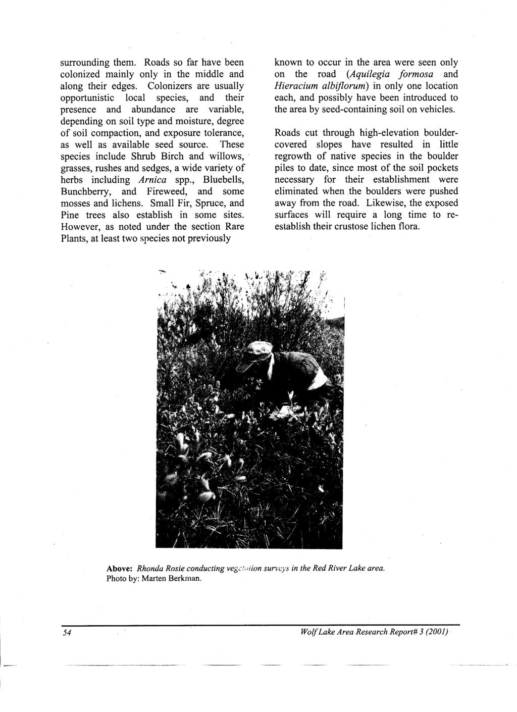
61
Hudson Bay Lowlands Proposed Protected Areas
 Hudson Bay Lowlands Proposed Protected Areas Hudson Bay Lowlands Proposed Protected Areas The Protected Areas Initiative has identified portions of the Hudson Bay Lowlands region that have significant
Colorado Life Zone Scavenger Hunt
 Colorado Life Zone Scavenger Hunt Below are worksheets created for all the habitats or life zones. They were designed with the intention of breaking the class up into small groups, and having students
Seager Wheeler Lake. Representative Area. -- Concept Management Plan --
 Seager Wheeler Lake Representative Area -- Concept Management Plan -- Saskatchewan Environment and Resource Management January, 1999 Saskatchewan s Representative Areas Network Program The Government of
Birch Point Provincial Park. Management Plan
 Birch Point Provincial Park Management Plan 2 Birch Point Provincial Park Table of Contents 1. Introduction... 3 2. Park History... 3 3. Park Attributes... 4 3.1 Natural... 4 3.2 Recreational... 4 4. Park
Lake Trout Population Assessment Wellesley Lake 1997, 2002, 2007
 Lake Trout Population Assessment Wellesley Lake Prepared by: Lars Jessup Fish and Wildlife Branch November 2009 Lake Trout Population Assessment Wellesley Lake Yukon Fish and Wildlife Branch TR-09-01 Acknowledgements
Wallace Lake Provincial Park. Management Plan
 Wallace Lake Provincial Park Management Plan 2 Wallace Lake Provincial Park Table of Contents 1. Introduction... 3 2. Park History... 3 3. Park Attributes... 4 3.1 Natural... 4 3.2 Recreational... 4 4.
Jan Lake Representative Area -- Concept Management Plan --
 Jan Lake Representative Area -- Concept Management Plan -- Saskatchewan Environment and Resource Management December, 1999 Saskatchewan s Representative Areas Network Program The government of Saskatchewan,
Whitemouth Falls Provincial Park. Draft Management Plan
 Whitemouth Falls Provincial Park Draft Management Plan Whitemouth Falls Provincial Park Draft Management Plan Table of Contents 1. Introduction... 3 2. Park History... 3 3. Park Attributes... 4 3.1 Natural...
2.1 Physical and Biological Description Matabitchuan River Watershed
 2.1 Physical and Biological Description Watershed 2.1.1 Physical Description The system watershed has a total area of about 933 km 2 and is a tributary system to Lake Temiskaming and the Ottawa River Drainage
Mackinnon Esker Ecological Reserve Draft - Management Plan
 Mackinnon Esker Ecological Reserve Draft - Management Plan May 2011 Photo Credit: This document replaces the direction provided in the Carp Lake Provincial Park and Protected Area and Mackinnon Esker Ecological
Wallace Lake Provincial Park. Draft Management Plan
 Wallace Lake Provincial Park Draft Management Plan Wallace Lake Provincial Park Draft Management Plan Table of Contents 1. Introduction... 3 2. Park History... 3 3. Park Attributes... 4 3.1 Natural...
FINGER-TATUK PROVINCIAL PARK
 FINGER-TATUK PROVINCIAL PARK PURPOSE STATEMENT AND ZONING PLAN March 2003 FINGER-TATUK PROVINCIAL PARK Purpose Statement and Zoning Plan Finger-Tatuk Provincial Park is 17,151 ha in size. It includes the
BIG ANIMALS and SMALL PARKS: Implications of Wildlife Distribution and Movements for Expansion of Nahanni National Park Reserve. John L.
 BIG ANIMALS and SMALL PARKS: Implications of Wildlife Distribution and Movements for Expansion of Nahanni National Park Reserve John L. Weaver Conservation Report No.1 July 2006 4 SUMMARY The boundaries
Kwadacha Wilderness Provincial Park and Kwadacha Addition (Kwadacha Recreation Area) Purpose Statement and Zoning Plan
 Purpose Statement and Zoning Plan") Kwadacha Wilderness Provincial Park and Kwadacha Addition (Kwadacha Recreation Area) Purpose Statement and Zoning Plan Located in a remote area of the northern interior of BC, this large park straddles
Kwadacha Wilderness Provincial Park and Kwadacha Addition (Kwadacha Recreation Area) Purpose Statement and Zoning Plan Located in a remote area of the northern interior of BC, this large park straddles
Stuart River Provincial Park Purpose Statement and Zoning Plan
 Stuart River Provincial Park Purpose Statement and Zoning Plan Stuart River Provincial Park protects three-quarters of the 110 kilometer long Stuart River corridor between Stuart Lake and the Nechako River.
Pinawa Provincial Park. Draft Management Plan
 Pinawa Provincial Park Draft Management Plan Pinawa Provincial Park Draft Management Plan Table of Contents 1. Introduction... 3 2. Park History... 3 3. Park Attributes... 4 3.1 Natural... 4 3.2 Recreational...
South Atikaki Provincial Park. Draft Management Plan
 South Atikaki Provincial Park Draft Management Plan South Atikaki Provincial Park Draft Management Plan Table of Contents 1. Introduction... 3 2. Park History... 3 3. Park Attributes... 3 3.1 Natural...
2.0 PARK VISION AND ROLES
 2.0 PARK VISION AND ROLES 2.1 Significance in the Protected Area System Marble Range and Edge Hills provincial parks protect 6.8% of the Pavillion Ranges Ecosection, which is located in the Southern Interior
1. Landforms. The Boreal Shield. Location The Boreal Shield can be found from Alberta to Newfoundland, between the Taiga Shield and the Boreal Plains.
 The Boreal Shield Location The Boreal Shield can be found from Alberta to Newfoundland, between the Taiga Shield and the Boreal Plains. 1. Landforms Rolling hills Exposed bedrock Evidence of glacial weathering
Mackinnon Esker Ecological Reserve. Management Plan
 Mackinnon Esker Ecological Reserve Management Plan March 2017 Cover Page Photo Credit: Rob Bell This document replaces the direction provided in the Carp Lake Provincial Park and Protected Area and Mackinnon
Wetlands Reservoirs of Biodiversity. Billy McCord, SCDNR
 Wetlands Reservoirs of Biodiversity Billy McCord, SCDNR Estuaries Tidal Deepwater Intertidal Salt Marsh Tidal Riverine Fresh & Brackish Deepwater Tidal Emergent Marsh Freshwater Riverine Seasonally Flooded
Marchand Provincial Park. Management Plan
 Marchand Provincial Park Management Plan 2 Marchand Provincial Park Table of Contents 1. Introduction... 3 2. Park History... 3 3. Park Attributes... 4 3.1 Natural... 4 3.2 Recreational... 4 3.3 Additional
Boatswain bay biodiversity reserve
 Boatswain bay biodiversity reserve March 2003 1 1. Plan and description 1.1. Geographic location, boundaries and dimensions The plan of the proposed Boatswain bay biodiversity reserve and its location
STONE MOUNTAIN PROVINCIAL PARK Purpose Statement and Zoning Plan
 1 STONE MOUNTAIN PROVINCIAL PARK Purpose Statement and Zoning Plan Stone Mountain Provincial Park is situated 140 km west of Fort Nelson at Kilometre 595 of the Alaska Highway. The 25 690 ha park is located
MANAGEMENT DIRECTION STATEMENT June, 1999
 Thompson River District MANAGEMENT DIRECTION STATEMENT June, 1999 for Clearwater River Corridor (Addition to Wells Gray Park) Ministry of Environment Lands and Parks BC Parks Division ii Table of Contents
Sand Lakes Provincial Park. Draft Management Plan
 Sand Lakes Provincial Park Draft Management Plan 2 Sand Lakes Provincial Park Table of Contents 1. Introduction... 3 2. Background... 3 3. Park Purpose... 5 4. Park Management Guidelines... 6 Appendix...
SUGARBOWL-GRIZZLY DEN PROVINCIAL PARK AND SUGARBOWL-GRIZZLY DEN PROTECTED AREA Purpose Statement and Zoning Plan
 SUGARBOWL-GRIZZLY DEN PROVINCIAL PARK AND SUGARBOWL-GRIZZLY DEN PROTECTED AREA Purpose Statement and Zoning Plan Located one hour east of Prince George on Highway 16, Sugarbowl-Grizzly Den Provincial Park
Rocky Lake Provincial Park. Draft Management Plan
 Rocky Lake Provincial Park Draft Management Plan Rocky Lake Provincial Park Draft Management Plan Table of Contents 1. Introduction... 3 2. Park History... 3 3. Park Attributes... 4 3.1 Location/Access...4
Bridge River Delta Park. Management Plan. Final Public Review Draft
 Bridge River Delta Park Management Plan Final Public Review Draft March 2016 Bridge River Delta Park Management Plan Approved by: Jeff Leahy Regional Director Thompson Cariboo Region BC Parks Date Brian
Numaykoos Lake Provincial Park. Management Plan
 Numaykoos Lake Provincial Park Management Plan 2 Numaykoos Lake Provincial Park Table of Contents 1. Introduction... 3 2. Background... 3 3. Park Purpose... 5 4. Park Management Guidelines... 6 Appendix...
Pembina Valley Provincial Park. Draft Management Plan
 Pembina Valley Provincial Park Draft Management Plan 2 Pembina Valley Provincial Park Table of Contents 1. Introduction... 3 2. Park History... 3 3. Park Attributes... 3 3.1 Natural... 3 3.2 Recreational...
TRAILS WHERE TO FIND TRAILS IN NOVA SCOTIA
 TRAILs SIGNAGE Know the Signs............................ 44 WHERE YOU CAN RIDE Roads and Highways........................ 46 Designated Trails........................... 47 Established Trails...........................
Pasquia-Porcupine. Representative Areas. -- Concept Management Plan --
 Pasquia-Porcupine Representative Areas -- Concept Management Plan -- Saskatchewan Environment June, 2004 Pasquia/Porcupine Integrated Forest Land Use Plan The Pasquia/Porcupine Integrated Forest Land Use
Map 1.1 Wenatchee Watershed Land Ownership
 Map 1.1 Wenatchee Watershed Land Ownership Map 1.1 Wenatchee Watershed Land Ownership The Wenatchee watershed lies in the heart of Washington state in Chelan County. Just larger than the state of Rhode
You can learn more about the trail camera project and help identify animals at WildCam Gorongosa (
 INTRODUCTION Gorongosa National Park is a 1,570-square-mile protected area in Mozambique. After several decades of war devastated Gorongosa s wildlife populations, park scientists and conservation managers
STORNETTA BROTHERS COASTAL RANCH
 STORNETTA BROTHERS COASTAL RANCH Location: Surrounding Point Arena Lighthouse and immediately south of Manchester State Park Mendocino Co., CA Acres: 1,860 Resources: Over two miles of Pacific Ocean coastline
Watchorn Provincial Park. Management Plan
 Watchorn Provincial Park Management Plan 2 Watchorn Provincial Park Table of Contents 1. Introduction... 3 2. Park History... 3 3. Park Attributes... 3 3.1 Natural... 4 3.2 Recreational... 4 3.3 Additional
South Texas Plains. Texas, Our Texas
 South Texas Plains This is a region characterized by considerable variety. Climatically, the South Texas Plains region is sub-humid to dry. The in the north part of the South Texas, erosion of the Edwards
BROUGHTON ARCHIPELAGO PROVINCIAL PARK
 BROUGHTON ARCHIPELAGO PROVINCIAL PARK PURPOSE STATEMENT AND ZONING PLAN March 2003 BROUGHTON ARCHIPELAGO PROVINCIAL PARK Purpose Statement and Zoning Plan Primary Role The primary role is to contribute
Public Lands in Alaska. 200 million acres of federal land - Over 57 Million acres of Wilderness more than half the Wilderness in the entire nation
 Public Lands in Alaska 200 million acres of federal land - Over 57 Million acres of Wilderness more than half the Wilderness in the entire nation alaskawild.org Ground Zero for Climate Change Over the
Michipicoten Island Regional Plan
 Michipicoten Island Regional Plan This is one of twenty Regional Plans that support implementation of the Lake Superior Biodiversity Conservation Strategy (Strategy). The Strategy, prepared and overseen
Level IV Ecoregions of the Northeast Glacial Lakes Watershed Project Area
 Level IV Ecoregions of the Northeast Glacial Lakes Watershed Project Area Ecoregions are areas having similar ecosystems and environmental resources including geology, physiography, vegetation, climate,
MAIN LAKE PROVINCIAL PARK
 MAIN LAKE PROVINCIAL PARK PURPOSE STATEMENT AND ZONING PLAN March 2003 MAIN LAKE PROVINCIAL PARK Purpose Statement and Zoning Plan Primary Role The primary role of Main Lake Park is to protect a biologically
FIELD UNIT(S): Methow Valley, Entiat, and Tonasket Ranger Districts
: Methow Valley, Entiat, and Tonasket Ranger Districts") Interagency Special Status Species Program Odonate Survey of Bogs, Fens, and Shallow Ponds Okanogan-Wenatchee National Forest John Rohrer December 2014 SPECIES LIST AND RANKS: ISSSP Global WA State Rank
Interagency Special Status Species Program Odonate Survey of Bogs, Fens, and Shallow Ponds Okanogan-Wenatchee National Forest John Rohrer December 2014 SPECIES LIST AND RANKS: ISSSP Global WA State Rank
The Sand Ridge - Tulare Lake Conservation Report proposes the following recommendations:
 Introduction Creighton Ranch. Pixley National Wildlife Refuge. Allensworth State Historic Park. Sand Ridge. Deer Creek. Located in the Tulare Lake Basin, the Sand-Ridge - Tulare Lake Planning Area features
Pinellas County Environmental Lands
 Pinellas County Environmental Lands In addition to traditional parks and recreation facilities, Pinellas County owns and manages a system of environmental lands that provides specialized resource-based
Photo Credit: Travel Alberta
 Located roughly three hours northeast of Edmonton, just 3 kilometres northeast of the beautiful City of, Cold Lake is situated in a transition zone between parkland to the south and true boreal forest
OMINEACA PROVINCIAL PARK
 OMINEACA PROVINCIAL PARK AND PROTECTED AREA PURPOSE STATEMENT AND ZONING PLAN March 2003 OMINECA PROVINCIAL PARK AND PROTECTED AREA Purpose Statement and Zoning Plan Omineca Park and Omineca Protected
APPENDIX G. The WAP Conservation Landscape and Focal Areas
 APPENDIX G The WAP Conservation Landscape and Focal Areas Focal areas were identified as discrete landscape units using the natural basin and range geography of the Nevada landscape. These units were prioritized
2.0 Physical Characteristics
 _ 2.0 Physical Characteristics 2.1 Existing Land Use for the Project The site is comprised of approximately 114 acres bounded by Highway 101 to the north, the existing town of Los Alamos to the east, State
Yard Creek Provincial Park. Management Plan
 Yard Creek Provincial Park Management Plan Draft January 2010 Yard Creek Provincial Park Management Plan Approved by: telàlsemkin/siyam/chief Scott Benton Bill Williams Squamish Executive Director ation
Geoscape Toronto The Oak Ridges Moraine Activity 2 - Page 1 of 10 Information Bulletin
 About 13,000 years ago as the Laurentide Ice Sheet melted, glacial meltwater accumulated between the ice sheet and the Niagara Escarpment. This formed a lake basin into which gravel and sand were deposited.
CONSERVATION PLAN FOR THE CARTER PROPERTY BEAR LAKE COUNTY, IDAHO
 CONSERVATION PLAN FOR THE CARTER PROPERTY BEAR LAKE COUNTY, IDAHO Prepared By John Carter P.O. Box 280 Mendon, Utah 84325 435-881-1232 IINTRODUCTION In 1993, I began acquiring land in Paris Canyon, Idaho
Sensitive Start Year Project Name N 2008 Central Barrens - BHP Preliminary Caribou Observation Survey (2008) N 2000 Central Barrens - Grizzly Bear
 N 2000 Central Barrens - Grizzly Bear") N 2008 Central Barrens - BHP Preliminary Caribou Observation Survey (2008) N 2000 Central Barrens - Grizzly Bear #592 GPS tracking records Lac de Gras 2000-2003 N 1988 Central Barrens - Grizzly Bear Captures
N 2008 Central Barrens - BHP Preliminary Caribou Observation Survey (2008) N 2000 Central Barrens - Grizzly Bear #592 GPS tracking records Lac de Gras 2000-2003 N 1988 Central Barrens - Grizzly Bear Captures
THE ISLANDS PROVINCIAL PARK
 THE ISLANDS PROVINCIAL PARK Situated at the mouth of the Roseway River on Nova Scotia s scenic South Shore, The Islands is located across the harbour from the historic town of Shelburne. The park s picturesque
The following criteria were used to identify Benchmark Areas:
 7.0 BENCHMARK AREAS The Churn Creek Protected Area offers a significant opportunity to learn more about how grassland ecosystems function. One of the key tools that will be used to monitor larger grassland
MANAGEMENT DIRECTION STATEMENT March 2003
 Skeena Region MAAGEMET DIRECTIO STATEMET March 2003 for Meziadin Lake Provincial Park Ministry of Water, Land and Air Protection Environmental Stewardsh Division This page left blank on purpose ii Table
Green Legacy. Securing our. Greenlands Strategy
 Greenlands Strategy Securing our Green Legacy Together we can create an interconnected network of Greenlands for the health and well-being of the environment and future generations Caring for the Credit
Section 2 North Slope Ecoregions and Climate Scenarios
 Section 2 North Slope Ecoregions and Climate Scenarios North Slope Ecoregions The geographic/ecological scope of the workshop will be freshwater and terrestrial systems of the North Slope of Alaska, with
Role of the Protected Area
 Role of the Protected Area Provincial and Regional Context Height of the Rockies and Elk Lakes provincial parks lie in southeastern British Columbia in the Rocky Mountains, about 85 km southwest of Calgary,
Aquatic insect surveys at Mount Magazine State Park and Hobbs State Park Conservation Area with implementation of an educational component
 Aquatic insect surveys at Mount Magazine State Park and Hobbs State Park Conservation Area with implementation of an educational component Arkansas is home to a relatively large number of endemic invertebrates
3.0 THE NORTH SASKATCHEWAN IN ALBERTA
 3.0 THE NORTH SASKATCHEWAN IN ALBERTA 3.1 WATERSHED OVERVIEW Wherever you are on earth, you are in a watershed. Most of the rain and snow falling outside your window will eventually find its way to a local
Yukon Wildlife Viewing Guide
 Wildlife viewing Yukon Wildlife Viewing Guide along major Highways Knowing where and how to look Tintina Trench Shakwak Trench 9 Beaver Creek River R H White Gulf of Alaska Dawson City 1 Burwash Landing
MOLLUSC RECORDS FROM
 MOLLUSC RECORDS FROM Colin-Cornwall Cornwall s Wildland Park ( ) Mollusc habitat along Creek (Photo by ) ( ) Prepared by Wayne Nordstrom Alberta Natural Heritage Information Centre November 2003 Parks
British Columbia s coastal. The Ecology of the Mountain Hemlock Zone
 The Ecology of the Mountain Hemlock Zone British Columbia s coastal subalpine lands lie within the Mountain Hemlock Zone. Dense, closed-canopy forests are characteristic of the lower part of this ecological
Evaluation of Woodland Caribou Winter Range in Mount Robson Provincial Park (Keystone Wildlife Research 1998)
") MOUNT ROBSON PROVINCIAL PARK Appendix 8. Evaluation of Woodland Caribou Winter Range in Mount Robson Provincial Park (Keystone Wildlife Research 1998) Introduction Background and Objectives The Mount Robson
MOUNT ROBSON PROVINCIAL PARK Appendix 8. Evaluation of Woodland Caribou Winter Range in Mount Robson Provincial Park (Keystone Wildlife Research 1998) Introduction Background and Objectives The Mount Robson
Summary of prescribed fires in Prince Albert National Park 2015
 Summary of prescribed fires in Prince Albert National Park 2015 Prince Albert National Park conducted four controlled fires in spring 2015, plus an additional fire in October. Fuel Management for Hazard
PROUDLY BRINGING YOU CANADA AT ITS BEST. Management Planning Program NEWSLETTER #1 OCTOBER, 2000
 PROUDLY BRINGING YOU CANADA AT ITS BEST VUNTUT NATIONAL PARK Management Planning Program NEWSLETTER #1 OCTOBER, 2000 INTRODUCTION This newsletter launches the development of the first management plan for
Chapter 7 Geography and the Early Settlement of Egypt, Kush, and Canaan
 Chapter 7 Geography and the Early Settlement of Egypt, Kush, and Canaan How did geography affect early settlement in Egypt, Kush, and Canaan? Section 7.1 - Introduction RF/NASA//Corbis This satellite photograph
Planning Wildlife Crossings in Canada's Mountain Parks SESSION: Highway Mitigation: new insights for practitioners
 Planning Wildlife Crossings in Canada's Mountain Parks ID95 SESSION: Highway Mitigation: new insights for practitioners Trevor Kinley, Project Manager Lake Louise Yoho Kootenay Field Unit, Parks Canada
Clearwater Lake Provincial Park. Draft Management Plan
 Clearwater Lake Provincial Park Draft Management Plan Clearwater Lake Provincial Park Draft Management Plan Table of Contents 1. Introduction... 3 2. Park History... 4 3. Park Attributes... 4 3.1 Location/Access...4
Bangor Land Trust & Girl Scouts
 Bangor Land Trust & Girl Scouts This collection of fact sheets will walk you through many activities for Brownie, Junior, Cadette and Senior Girl Scouts and how Bangor Land Trust can help you do them!
MANAGEMENT DIRECTION STATEMENT
 Skeena District MAAGEMET DIRECTIO STATEMET August 2000 for Driftwood Extension to Babine Mountains Park Ministry of Environment Lands and Parks BC Parks Division This management direction statement was
Bon Portage Island Conservation Campaign
 Bon Portage Island Conservation Campaign Protecting a Coastal Treasure Final Report to Nova Scotia Habitat Conservation Fund September 2012 Protection of Bon Portage Island Over the course of this two-year
26 Utah s Patchwork Parkway SCENIC BYWAY CORRIDOR MANAGEMENT PLAN (SR 143)
") Natural Natural Quality applies to those features in the visual environment that are in a relatively undisturbed state. These features predate the arrival of human populations and may include geological
Natural Natural Quality applies to those features in the visual environment that are in a relatively undisturbed state. These features predate the arrival of human populations and may include geological
Case Study: Conserving Ecological Processes in the Eastern Himalayas
 Standard 7: Select terrestrial, freshwater and marine conservation biodiversity elements (a.k.a conservation targets) across multiple biological scales to comprehensively represent the biodiversity of
The Design of Nature Reserves
 The Design of Nature Reserves Goals Maintenance of MVP s for targeted species Maintenance of intact communities Minimization of disease Considerations of reserve design 1. Disturbance regime Fire Insect
MANAGEMENT DIRECTION STATEMENT March 2003
 Skeena Region MAAGEMET DIRECTIO STATEMET March 2003 for Great Glacier Provincial Park Ministry of Water, Land an Air Protection Environmental Stewardship Division ii This management direction statement
MANAGEMENT DIRECTION STATEMENT
 Skeena District MAAGEMET DIRECTIO STATEMET July, 2000 for Driftwood Canyon Provincial Park Ministry of Environment Lands and Parks BC Parks Division i Table of Contents Driftwood Canyon Park Approvals
FIELD TRIPS PROPOSAL
 FIELD TRIPS PROPOSAL Make sure you are covered by your insurance. The Foundation for Research on Biodiversity and the Collaboration for Environmental Evidence decline any responsibility during these field
Physical Regions of the U.S.
 Physical Regions of the U.S. Quickly use this map to label the map on your paper Pacific Coast The coast from southern California to Alaska The region of the Pacific Northwest has a long history that was
Yukon Territory, June 23-July 5, 2016
 Yukon Territory, June 23-July 5, 2016 Introduction Al Harris and I had some botany-related fieldwork in the Yukon in late June, so we extended our stay to hike and hopefully see some new mammals. There
DIXIE HIGHWAY Region of Peel NAI Area # 1304, 1320, 2449, 2625, 3961
 DIXIE HIGHWAY 407 1 Region of Peel NAI Area # 1304, 1320, 2449, 2625, 3961 Toronto and Region Conservation Authority City of Brampton Size: 36 hectares Watershed: Etobicoke Creek Con 4 E, Lots 13, 14 Ownership:
SLIM CREEK PROVINCIAL PARK
 SLIM CREEK PROVINCIAL PARK PURPOSE STATEMENT AND ZONING PLAN March 2003 1 Slim Creek Provincial Park Purpose Statement and Zoning Plan Slim Creek Provincial Park is located along Highway 16, approximately
BURGES JAMES GADSDEN PROVINCIAL PARK PURPOSE STATEMENT AND ZONING PLAN
 BURGES JAMES GADSDEN PROVINCIAL PARK PURPOSE STATEMENT AND ZONING PLAN February 2003 BURGES JAMES GADSDEN PROVINCIAL PARK Purpose Statement and Zoning Plan Primary Role The primary role of Burges James
MANAGEMENT DIRECTION STATEMENT March 2003
 Skeena Region MAAGEMET DIRECTIO STATEMET March 2003 for Lava Forks Provincial Park Ministry of Water, Land and Air Protection Environmental Stewardshi Division This management direction statement was
PRIORITY HABITAT SURVEY 2017 SWALEDALE. Summary. July 2018
 PRIORITY HABITAT SURVEY 2017 SWALEDALE Summary July 2018 Conservation & Monitoring Report No: Lead Author(s): Tony Serjeant & Sue Thurley Incorporating comments from: Gary Smith & Gordon Haycock (16/07/18)
New Ramsar sites for Poland
 New Ramsar sites for Poland 31 October 2005 Poland Poland designates five new Wetlands of International Importance The Secretariat is pleased to announce that the Government of Poland has designated five
Sasagiu Rapids Provincial Park. Draft Management Plan
 Sasagiu Rapids Provincial Park Draft Management Plan 2 Sasagiu Rapids Provincial Park Table of Contents 1. Introduction... 3 2. Background and Park Attributes... 3 2.1 Park History.... 3 2.2 Natural Features...
Lierne. A living ice age landscape. Norway s national parks nature as it was meant to be
 BENNETT. Print: Trykkpartner Lade Lierne A living ice age landscape TE1188 Norway s national parks nature as it was meant to be Norway s national parks are regulated by the laws of nature. Nature decides
MANAGEMENT DIRECTION STATEMENT June, 1999
 Thompson River District MANAGEMENT DIRECTION STATEMENT June, 1999 for Roche Lake Provincial Park Ministry of Environment Lands and Parks BC Parks Division Table of Contents I. Introduction A. Setting
MCARTHUR SWAMP PLANNING UNIT Pit-McCloud River Watershed
 Existing Conditions & Uses Overview Spring-fed lake and rivers; valuable grazing lands and important waterfowl area Planning unit provides the only public access to Ahjumawi Lava Springs State Park 7,596
CRAZY HORSE TRAIL GUIDE
 CRAZY HORSE TRAIL GUIDE Abridged Version: July 2016 This is a short form of our interpretive trail guide for the Crazy Horse Trail. The full version of the guide has a more detailed description of the
3.0 EXISTING PARK & RECREATION SPACE
 3.0 EXISTING PARK & RECREATION SPACE TOWN PARK & RECREATION SPACE An inventory of current parks and recreation area in the Town of Cedarburg is shown in Table 3. These areas total roughly 381.89 acres.
CARMANAH WALBRAN PROVINCIAL PARK
 CARMANAH WALBRAN PROVINCIAL PARK PURPOSE STATEMENT AND ZONING PLAN September 2003 1 CARMANAH WALBRAN PROVINCIAL PARK Purpose Statement and Zoning Plan Carmanah Walbran Provincial Park is an expansion of
Rouge National Park. Opportunities and Challenges
 Rouge National Park Opportunities and Challenges January 2013 Rouge Park Finch Meander Rouge Beach at Lake Ontario Toronto GLWQA Area of Concern Rouge National Park Nationally Significant First Nation
Longlac North Conservation Reserve (C2207) Statement of Conservation Interest
 Statement of Conservation Interest") Longlac North Conservation Reserve (C2207) Statement of Conservation Interest April 2003 Prepared for the Ontario Ministry of Natural Resources, Northwest Region by Rebecca Zeran and Natalie Kolody OLL
Longlac North Conservation Reserve (C2207) Statement of Conservation Interest April 2003 Prepared for the Ontario Ministry of Natural Resources, Northwest Region by Rebecca Zeran and Natalie Kolody OLL
Backgrounder Plains Bison Reintroduction to Banff National Park
 Backgrounder Plains Bison Reintroduction to Banff National Park Introduction The five-year reintroduction project is a small- scale initiative that would inform future decisions regarding the feasibility
Appendix 1: Best Management Practices For Hang Gliding and Paragliding in Jasper National Parks
 Appendix 1: Best Management Practices For Hang Gliding and Paragliding in Jasper National Parks Name of Best Management Practice Best Management Practices for Hang Gliding and Paragliding in Jasper National
EXPLORING BIOMES IN GORONGOSA NATIONAL PARK
 EXPLORING BIOMES IN GORONGOSA NATIONAL PARK ABOUT THIS WORKSHEET This worksheet complements the Click and Learn Gorongosa National Park Interactive Map (http://www.hhmi.org/biointeractive/gorongosa-national-park-interactive-map),