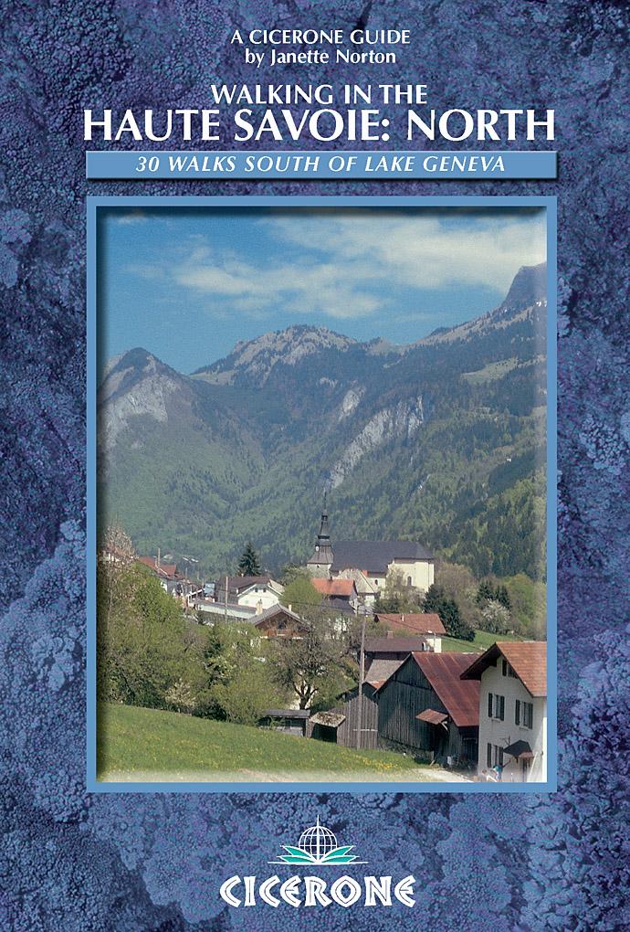
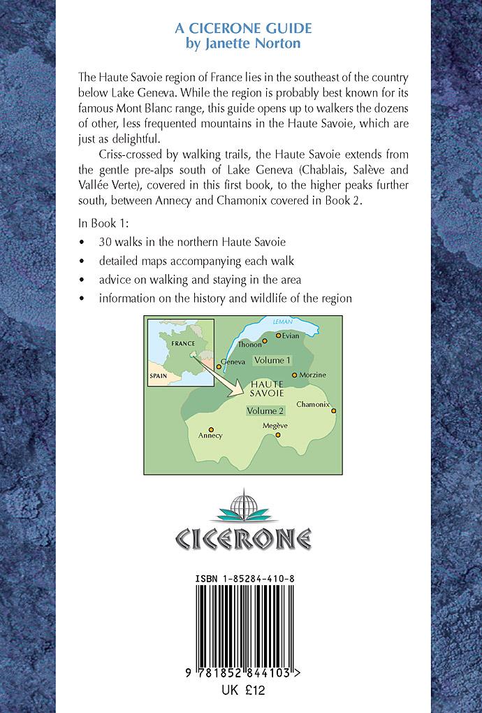
For more information and to buy this book click here ISBN: CICERONE. Guides for walkers, trekkers, mountaineers, climbers and cyclists
|
|
|
- Alberta Arnold
- 6 years ago
- Views:
Transcription
1
2 For more information and to buy this book click here ISBN: CICERONE Guides for walkers, trekkers, mountaineers, climbers and cyclists
3 SALÈVE AND VALLÉE VERTE SALÈVE WALK 1 Salève Orjobet/Grande Gorge Alt. 1285m (Salève Geneva region) Difficulty Time Height gain Maps Depart from Signposting Medium; steep up and down 4hrs 619m Editions Didier & Richard IGN No. 3 Massifs du Chablais Faucigny & Genevois 1:50,000 Cartes IGN 3430 OT Top 25 Mont Salève/St Julien-en- Genevois/Annemasse 1:25,000 Carte Touristique du Salève 1:25,000 (published by the Club Alpin Suisse Geneva Section) Le Coin 666m Could be clearer white signposts, posts with yellow arrows on green background; these have replaced the faded blue splashes and red/white GR markings, but are not very frequent, so where they are missing, follow blue splashes; at the top you are on the Balcon Paysager des Crêtes Though steep in places, this is a lovely walk up the Salève within easy reach of Geneva, and is very popular. It is better to do the walk when the leaves are off the trees as you have magnificent views on the way up and down as well as on the summit. Bear in mind, though, that you are walking up the north side, so snow may linger here in spring. The Salève is pitted with grottoes and its sheer rock faces are well-known for rock climbing and abseiling. Access (from Geneva) Go through Vernier or Troinex customs and turn right towards Collonges sous Salève. Watch for the filter on 51
4 WALKING IN THE HAUTE SAVOIE BOOK 1: NORTH Walk 1 Salève Orjobet/ Grande Gorge 7 D La Grande Gorge * 6 Alt. 1286m 1 P Le Coin Alt. 666m 2 3 Grotte d Orjobet Les Crêtes D41 4 D45 N 0 1 km 52
5 SALÈVE AND VALLÉE VERTE: SALÈVE WALK 1 the right to Bossy/Salève, which goes back left over the motorway and upwards to Le Coin (this is the better road). At Le Coin there is a junction. Go up right, signposted La Croisette/Salève, and at La Croisette park your car in the large parking area on a corner. Alternative Go through customs at Croix de Rozon and straight on across the main road, signposted Collonges sur Salève. At the crossroads take the road up the Salève signposted La Croisette which leads to Le Coin. Proceed as above. The Route (1) Take the narrow tarmac road which goes up on the left of the road to the Salève, across from the car park. There is a signpost indicating you are at Le Coin 666m and a signpost to La Corraterie and La Croisette. The road soon becomes stony and on the left-hand side there is a clearing with an orientation map which gives information about the geological and botanical terrain of the region (in French only). The path narrows and goes upwards through woods to reach a fork. (2) Go right following a wooden post with yellow arrows on a green background and then left following the sign to Orjobet. This is a well-defined sunken track, often quite steep, through woods. Take this path upwards following carefully the sporadic yellow arrows on a green background, faded blue splashes and intermittent GR signs (red/white splashes). After 20mins the path becomes rocky and you get your first superb view on the left of the Geneva countryside below, with the Jura on the horizon. Follow blue splashes to the right and do not go straight. There are some rocky steps and a lovely viewpoint to the left (25mins). Continue upwards on the rocky path which bears to the left. You are climbing around an overhanging rock face on natural rocky steps with an iron cable for security. About 5mins later there is an opening in the rock face which is the entrance to a large, impressive grotto, the Grotte d Orjobet. A plaque on the wall says Sentier d Orjobet crée 1905 par la Section Genevoise du Club Alpin Suisse. First you climb across a long wooden plank with steps and then walk up large steps cut out of the natural stone with another iron cable for safety. Looking back there is a magnificent view of the wooded slopes of the Salève and the mountains framed in the rock it takes about 5mins to climb through and out on to the other side. The path bears round to the right if you go straight you will go over the edge, but this is evident! This grotto was discovered in 1799 by the well-known Geneva scientist H B de Saussure, who named it Orjobet after his guide, a peasant from the village of Le Coin. In 1905 the Geneva section of the Swiss 53
6 WALK 2 Along the Top of the Salève Alt. 1285m (Salève Geneva region) Difficulty Time Height gain Maps Depart from Signposting An easy walk along the top of the Salève 2hrs None Editions Didier & Richard IGN No. 3 Massifs du Chablais Faucigny & Genevois 1:50,000 Cartes IGN 3430 OT Top 25 Mont Salève/St Julien-en- Genevois/Annemasse 1:25,000 Carte Touristique du Salève 1:25,000 (published by the Club Alpin Suisse Geneva Section) La Croisette 1175m Follow Sunburst signs for the Balcon Paysager des Crêtes and yellow arrows on green background plus red/white GR signs at the start. A classic, easy walk along the top of the Salève, giving magnificent views of Geneva and the surrounding countryside, with the Jura in the background on one side and the whole range of the Alps on the other. In early spring the top of the mountain is carpeted with small white and purple crocuses, followed later by a blaze of dandelions. (See Walk Number 1 and the section on Salève in the introduction for more information on this region.) Access (from Geneva) Go through Vernier or Troinex customs and turn right towards Collonges sous Salève. Watch for the filter on the right to Bossy/Salève, which goes back left over the motorway and upwards to Le Coin (this is the better road). At Le Coin there is a junction. Go up right signposted La Croisette/Salève. At La Croisette you will see the large parking area on a corner. Alternative Go through the customs at Croix de Rozon and straight across the main road, signposted La Croisette, which leads to Le Coin see above. 57
7 WALKING IN THE HAUTE SAVOIE BOOK 1: NORTH Walk 2 Along the top of the Salève La Grande Gorge * P Alt. 1286m * Grange Gaby Grotte d Orjobet D41 La Pile 8 Les Crêtes 3 2 Auberge des Montagnards N 1 La Croisette 0 1 km 58
8 SALÈVE AND VALLÉE VERTE: SALÈVE WALK 2 The Route (1) Facing the line of Alps, turn left (signpost says Télépherique 6km/ Monnetier 11km), walk by the Auberge des Montagnards and bear right up a jeep track. Go straight along this grassy track, passing a house on the left and keeping parallel to the road do not go right. To the left is a fantastic view of the valley below and the town of Geneva with the Jura mountains on the horizon. Behind is the Bellegarde Gap with the Fort Ecluse one side and the Vuache ridge (see Walk Number 6) on the other. Regain the road after 10mins (it goes all the way along the top and you meet it again later on) following the signpost Balcon Paysager des Crêtes. (2) Follow the road up for about 10 mins (up on the left is the TV aerial of Les Crêtes). After passing a wooden chalet on the left, look for a jeep track going down right and a signpost Sous les Crêtes, alt. 1220m, indicating Balcon Paysager des Crêtes (20mins). (3) The fenced jeep track initially loses height as it traverses round the mountain with the Alps on the right. You come to a large barn and house called La Pile, alt. 1230m. Follow the track in front of the farm buildings, which then becomes wide and grassy as it goes through an attractive old gnarled beech wood, passing two stagnant ponds, the second one in front of a newly renovated house called Grange Gaby. The view of the Alps and Mont Blanc along this path is considered the finest in the Geneva region, and it inspired the famous 18th-century Genevese naturalist H B de Saussure to explore the Alps further. (4) Just before Grange Gaby, turn right before a gate and follow the yellow arrows down and round, skirting the house and pond to reach the wide track again. Turn right at another signpost at Grange Gaby, alt. 1210m (45mins). (5) Go up left, following the sign Balcon Paysager des Crêtes on a track going up gently through woodland there are carpets of white crocuses all along here in springtime. Follow the posts with yellow arrows bearing up right at a fork to reach the D41 at an iron gate. You see the building of the television tower ahead (1hr). (6) Cross the road (you can also detour up the road to the TV tower where there is a wonderful view over Geneva with the Jura beyond) and go through a gap in the fence on to a grassy path. This path goes left and back along the top of the Salève parallel to the D41 on the left. There are detours to the right which are worth taking to get good views of the dramatic gorge (La Grande Gorge, see Walk Number 1) which dissects the north face of the mountain, and the lake and town of Geneva in the valley below. After a few minutes you meet the road again briefly before bearing 59
9 End of extract from Walking in the Haute Savoie: North For more information and to buy this book click here ISBN: CICERONE Guides for walkers, trekkers, mountaineers, climbers and cyclists
10
The Mendip Way. Route Directions and Maps Uphill to Wells
 The Mendip Way Route Directions and Maps Uphill to Wells Website: www.mendiphillsaonb.org.uk Email: mendip@mendiphillsaonb.org.uk Facebook & Twitter: @MendipHillsAONB Phone: 01761462338 1 Uphill to Loxton
Pontfadog. Walk A. Walk A
 Walk A A Bird s eye view of the village 2km. (1 1 /2 miles); height gain 45m. (150ft) about 45 minutes. Six minutes walk along the main road towards Glyn Ceiriog reach a signpost to Llwynmawr. Take the
Sponsored by. statestreet.com
 /STATESTREETISLANDWALK #ISLANDWALKJSY Sponsored by statestreet.com Important Information If you forget everything else PLEASE remember the following.» Remember to check OUT of every checkpoint» If you
Map: Landranger #27 Forres and Nairn and 36 Grantown and Aviemore
 THE DAVA WAY This is a newly created long distance route that runs from Forres to Grantown, mostly following the old railway line. You will need to detour around a couple of sections that are not really
Leaden Boot Challenge ROUTE INSTRUCTIONS
 Leaden Boot Challenge ROUTE INSTRUCTIONS Section 1 Alstonefield to Ilam From the village hall car park turn R then L and pass through the village keeping to the R to enter Church Street. Pass the Church
This path goes past an old tree nursery and sawmill. After 800m it crosses over a lane. Follow the bridleway fingerpost into the woods.
 FRENSHAM PONDS 11K CIRCULAR TRAIL 2½ HRS GU10 2DA This magnificent heathland trail starts in woodland and then brings you out onto the open heather of Frensham Common, with no roadwork! The route runs
Hindhead, Keffolds Copse and Gibbet Hill
 point your feet on a new path, Keffolds Copse and Gibbet Hill Distance: 6 km=4 miles Region: Surrey Author: Schwebefuss Refreshments: Punch Bowl Café moderate walking Date written: 14-apr-2015 Last update:
ID: 283 Distance: 6.2 miles Height gain: 500 Metres Map: Explore OL 19 Contributor David and Chris Stewart
 Walkingworld Wild Boar Fell ID: 283 Distance: 6.2 miles Height gain: 500 Metres Map: Explore OL 19 Contributor David and Chris Stewart Features Birds, Great Views, Hills or Fells Description: Wild Boar
Ystwyth and Rheidol Bridleway Routes. Route 2:Llanilar Circular
 Ystwyth and Rheidol Bridleway Routes Route 2:Llanilar Circular Route overview and terrain: A long circle using connecting ridges with fine views to link the Rheidol and Ystwyth river valleys. The route
UPDATED: Verdon Gorge & GR4: Europe's Grand Canyon
 UPDATED: Verdon Gorge & GR4: Europe's Grand Canyon UPDATED: Verdon Gorge & GR4: Europe's Grand Canyon UPDATED: Verdon Gorge & GR4: Europe's Grand Canyon 1295 Difficult Hike the Grand Canyon of Europe!
Trans Jura Trail. Itinerary. Trans Jura Trail Trans Jura Trail 1295 Difficult
 Trans Jura Trail Trans Jura Trail Trans Jura Trail 1295 Difficult Join us for more than just a trail run! The French Jura, famous for gastronomy, farming, stunning scenery, history and is steeped in tradition
The Bridestone Rocks from Lydgate
 Print this page Back to results The Bridestone Rocks from Lydgate Ancient tracks and gritstone outcrops, with terrific views of the steepsided Cliviger Valley. Distance 5 miles (8km) Minimum time 2hrs
CWMGIEDD FROM ABERCRAVE
 Abercrave to Cwmgiedd Walk Page 1 Starting from The Abercrave Inn. Grid Ref: SN 824128 From the Abercrave Inn, an 11.3km (7 miles) walk to the foothills of the Cribarth Mountain, then through forest to
Leaden Boot Challenge 2016 ROUTE INSTRUCTIONS
 Leaden Boot Challenge 2016 ROUTE INSTRUCTIONS Section 1 Alstonefield to Ilam (CP2) From the village hall car park turn R then L and pass through the village keeping to the R to enter Church Street. Pass
Route #2) Mt. Massive - Southwest Slopes
 Mt. Massive - Southwest Slopes") Route #2) Mt. Massive - Southwest Slopes Difficulty: Class 2 Ski: Advanced, D6 / R2 / III Exposure: Summit Elevation: Trailhead Elevation: Elevation Gain: Round-trip Length: Trailhead: County Sheriff:
Route #2) Mt. Massive - Southwest Slopes Difficulty: Class 2 Ski: Advanced, D6 / R2 / III Exposure: Summit Elevation: Trailhead Elevation: Elevation Gain: Round-trip Length: Trailhead: County Sheriff:
For more information and to buy this book click here ISBN: CICERONE. Guides for walkers, trekkers, mountaineers, climbers and cyclists
 For more information and to buy this book click here ISBN: 9781852843496 CICERONE Guides for walkers, trekkers, mountaineers, climbers and cyclists www.cicerone.co.uk HILLWALKING IN SNOWDONIA 1: CARNEDDAU
NEW: Chamonix Classic Trails
 NEW: Chamonix Classic Trails NEW: Chamonix Classic Trails NEW: Chamonix Classic Trails From: 475 Difficult Chamonix - The Trail Running Valley! In just a few years Chamonix has become a 'world class' trail
Merritts Traverse. 1928m
 Merritts Traverse 3 hrs Hard track 5.8 km Circuit 4 167m This walk starts with a scenic journey to the top of the hill on the chairlift. Starting along Merritts Nature walk, this walk soon detours down
Tour du Mont Blanc Express. 8 Days
 Tour du Mont Blanc Express 8 Days Tour du Mont Blanc Express Experience contrasts that surprise and stimulate on this express version of our classic Tour du Mont Blanc adventure. In just 8 days you'll
Baou de Quatre Ouro (576 m) and Croupatier via the caves path
 and Croupatier via the caves path") Baou de Quatre Ouro (576 m) and Croupatier via the caves path A walk proposed by MCTOUL This active route will take you through the Croupatier to the Baou de Quatre Ouro, one of the four "Toulonais brothers".
Baou de Quatre Ouro (576 m) and Croupatier via the caves path A walk proposed by MCTOUL This active route will take you through the Croupatier to the Baou de Quatre Ouro, one of the four "Toulonais brothers".
Family Tour du Mont Blanc
 Family Tour du Mont Blanc Family Tour du Mont Blanc Family Tour du Mont Blanc 1075 Difficult Explore this famous classic walk as a family! Pass through three countries and three cultures on our mini-tour
Slad over to Pitchcombe and back
 The walk climbs up from Slad over Wickridge Hill, descends to near Pitchcombe, then climbs back over Wickridge hill and round the back of Slad. Page 1 Start Point: SO 8718 0732 The Woolpack, Slad Length:
A Circular Walk from Chapel Carn Brea
 A Circular Walk from Chapel Carn Brea 4.3 Miles A Walk Visiting Five Historic Ancient Sites This circular walk offers the possibility of several alternatives, depending on the walker s available time and
Self-Guided Walk Langdale Pikes. Start & Finish: NT car park (free to members) at Sticklebarn - on the right just beyond the New Dungeon Ghyll hotel.
 at Sticklebarn - on the right just beyond the New Dungeon Ghyll hotel.") Self-Guided Walk Langdale Pikes Key Information These mountains form a collection of spires and cliffs on the north side of Langdale. This walk visits four of the main tops Pavey Ark, Harrison Stickle,
Self-Guided Walk Langdale Pikes Key Information These mountains form a collection of spires and cliffs on the north side of Langdale. This walk visits four of the main tops Pavey Ark, Harrison Stickle,
BISHOPSTONE CIRCULAR WALK
 BISHOPSTONE CIRCULAR WALK 4½ miles (7¼ km) - allow 2 hours (see maps on final pages) Introduction This walk is within the North Wessex Downs Area of Outstanding Natural Beauty and starts from the small,
Chamonix-Zermatt: The Walker's Haute Route (Mountain Walking) By Kev Reynolds READ ONLINE
 By Kev Reynolds READ ONLINE") Chamonix-Zermatt: The Walker's Haute Route (Mountain Walking) By Kev Reynolds READ ONLINE 15 Days & 14 Nights Walker's Haute Route walking Self guided trek on the Walker's Haute Route from Chamonix to
Chamonix-Zermatt: The Walker's Haute Route (Mountain Walking) By Kev Reynolds READ ONLINE 15 Days & 14 Nights Walker's Haute Route walking Self guided trek on the Walker's Haute Route from Chamonix to
Fetcham Downs and Bocketts Farm A magical teashop walk
 point your feet on a new path Fetcham Downs and Bocketts Farm A magical teashop walk Distance: 3 km=2 miles or 4 km=2½ miles Region: Surrey Author: Fusszweig Refreshments: Bocketts Farm easy walking Date
ANUMC Ski Mountaineering Expedition. Classic Haute Route ANUMC Expedition Fund Application By Andrew Gough
 ANUMC Ski Mountaineering Expedition Classic Haute Route 2010 ANUMC Expedition Fund Application By Andrew Gough Introduction: The Haute route (or High Mountaineers Route ) is one of the worlds most famous
The Rocher du Long Boyau and the Gorges du Houx
 A walk proposed by Netra From the Ermitage de Franchard, this is a very varied hike which will take you past old sandstone quarries, the Gorges du Houx and the charming Mare aux Pigeons. On the route are
COSTA BLANCA MOUNTAIN WALKERS - WALK DESCRIPTION. Visit for more walks descriptions in Spain
 Visit www.walksinspain.org for more walks descriptions in Spain Walk description originally prepared by:- Ralph Phipps Last Updated 15 th July 2016 Title of Walk Location of Start (include name of nearest
For more information and to buy this book click here ISBN: CICERONE. Guides for walkers, trekkers, mountaineers, climbers and cyclists
 For more information and to buy this book click here ISBN: 9781852845353 CICERONE Guides for walkers, trekkers, mountaineers, climbers and cyclists www.cicerone.co.uk STAGE 3 Fiastra to Garulla Time Distance
Reigate Hill and Gatton Park
 point your feet on a new path Reigate Hill and Gatton Park Distance: 11½ km=7 miles easy-to-moderate walking or 2 walks of 6½ km=4 miles and 5½ km=3½ miles Region: Surrey Author: Schwebefuss Refreshments:
Join us on a magical TOUR DE FRANCE: Paris, Fontainebleau, Ardèche, Calanques & Chamonix
 Join us on a magical TOUR DE FRANCE: Paris, Fontainebleau, Ardèche, Calanques & Chamonix on an exclusive adventure trip with the through a mix of spectacular activities: Hiking, rock- climbing, canyoning,
HARDMOORS 55 RACE ROUTE 2018 HELMSLEY - GUISBOROUGH
 HARDMOORS 55 RACE ROUTE 2018 HELMSLEY - GUISBOROUGH HELMSLEY - CHECKPOINT 1 (WHITE HORSE) 1. Leave RACE START, continue ahead on road (Baxtons Sprunt) At crossroads turn right down Canons Garth eventualy
Nature Track. 900m. 789m. 2 hrs 3.1 km Circuit. Hard track 238m. Blue Mountains National Park
 Nature Track 2 hrs 3.1 km Circuit Hard track 238m Largely following the ridges around the top edge of Wentworth Falls, this track is incredibly beautiful. After taking in the great views at Edinburgh Castle
Individual «Sporting» Offer
 Dents-du-Midi Circuit Offer Individual «Sporting» Offer Unaccompanied Hike Dents-du-Midi Association info@dentsdumidi.ch www.dentsdumidi.ch Date : Duration : Departure : From the end of June to September
Tour du Mont Blanc. 12 Days
 Tour du Mont Blanc 12 Days Tour du Mont Blanc Mont Blanc. Europe's highest and most iconic peak. Spectacular. Immense. Dazzling. And undisputedly on every serious hiker's must-do list. This 10-day trek
Eastbourne. Alfriston 3¾ 6 3¾ 6. Birling Gap. Exceat
 3.8a Alfriston to Eastbourne (footpath) Map panel 6 (page 64) Distance 10½ miles (17 km) Terrain valley walk initially, first along riverbank path then hillside paths above, including stretch through forest;
F r e n c h M o n t B l a n c
 Le Grand Balcon du Sud F r e n c h M o n t B l a n c Balcon du Sud with Mont Blanc behind A fabulous 4-night sample of the best of the French Tour du Mont Blanc Tour Highlights Fact File T h e m e Enjoy
Aston Rowant Discovery Trail
 The walk was developed by Aston Rowant Parish Council. The Trail is stile-free and fully way-marked. The circular route is 5.3m but with the extension to a pub and hotel 6.2m. Key Main Aston Rowant Discovery
DAVA WAY. Notes on multi-use access
 DAVA WAY Notes on multi-use access The Dava Way is a 24 mile (38km) waymarked long distance route based largely on the dismantled Highland Railway Line between Forres, near the Moray Coast in north-east
HIKING IN THE CANADIAN ROCKIES
 HIKING IN THE CANADIAN ROCKIES Distance Time Elevation y MORAINE LAKE TRAILS THE ROCKPILE 0.8 km (0.5 mi) 20 min 30 m (98 ft) Located adjacent to the Lodge, the short interpretive trail up the Rock Pile
Scenic Railway to Ruined Castle
 Scenic Railway to Ruined Castle 7 hrs 30 mins 12.4 km Return Hard track 4 963m This is a very popular, full day walk, in the Katoomba Area, offering great views of the valley. The walk follows the edge
Darwin s gigantic blunder
 Trail Darwin s gigantic blunder Explore how ice shaped the landscape and why Charles Darwin made a nice mess of Glen Roy Time: 1hr 10 mins Distance: 2 miles Landscape: rural At Glen Roy a curious feature
Hiking the Haute Route. 11 Days
 Hiking the Haute Route 11 Days Hiking the Haute Route Experience the Haute Route or "High Road" of the Alps on this challenging itinerary designed for serious trekkers. The Haute Route connects Mont Blanc
CHAMONIX SKI TOURING WEEK 2018 TRIP NOTES
 CHAMONIX SKI TOURING WEEK 2018 TRIP NOTES Chamonix Ski Touring Week 2018 Trip Notes All material Copyright Adventure Consultants Ltd 2017/2018 Explore the magic of the Mont Blanc Massif and all of the
Wicklow Mountains Path Survey
 Wicklow Mountains Path Survey Ballinacor Croaghanmoira Fananierin Start to Finish: T 11723 86602 to T 11175 89057 Altitude (lowest highest): 385m 664m Weather: Hot Access: Coolgarrow forest entrance Surveyed
START - UPHILL BEACH. (tidal!) The West Mendip Way is route-marked with these round blue signs
 The West Mendip Way is route-marked with these round blue signs") START - UPHILL BEACH Start Times: 10:30 11:15 12:00 Please allow sufficient time to check in with the marshals Start on the beach at the high water line (tidal!) The West Mendip Way is route-marked with
START - UPHILL BEACH Start Times: 10:30 11:15 12:00 Please allow sufficient time to check in with the marshals Start on the beach at the high water line (tidal!) The West Mendip Way is route-marked with
TREKKING IN THE ALPS HILARY SHARP SUMMER HIKING AND WINTER SNOWSHOEING
 TREKKING IN THE ALPS HILARY SHARP SUMMER HIKING AND WINTER SNOWSHOEING www.trekkinginthealps.com info@trekkinginthealps.com NO hidden costs. Small groups guaranteed. Expert guiding All levels catered for.
White mountain, green tourism
 Reading Practice White mountain, green tourism The French Alpine town of Chamonix has been a magnet for tourists since the 18th century. But today, tourism and climate change are putting pressure on the
San Miguel to Caserio de la Hoya Circular (San Miguel)
") Tenerife Sur: Short Walks Under 10 km San Miguel to Caserio de la Hoya Circular (San Miguel) Route Summary An informative and scenic walk back in time from San Miguel to below El Roque, overlooking the
Tenerife Sur: Short Walks Under 10 km San Miguel to Caserio de la Hoya Circular (San Miguel) Route Summary An informative and scenic walk back in time from San Miguel to below El Roque, overlooking the
Walks in the Alps. The easiest introduction to the TMB via the scenic Italian and Swiss Alps
 Tour Highlights Walks in the Alps The easiest introduction to the TMB via the scenic Italian and Swiss Alps Enjoy two nights in Italy & Switzerland. Start in idyllic Courmayeur, Italy [30-min. coach-ride
Tourist residence. SOLEIL de Valfréjus SAVOIE. Traditional and contemporary
 Tourist residence SOLEIL de Valfréjus SAVOIE Traditional and contemporary ALPS Valfréjus Alberville BOURG-SAINT- MAURICE ITALY Vanoise National Park A43 Direction GRENOBlE (1h30) Access to the domain Les
Tour du Mont Blanc Highlights
 Tour du Mont Blanc Highlights Tour du Mont Blanc Highlights Tour du Mont Blanc Highlights 1595 Difficult This is the 'best of' one of the most famous classic walks in the Alps, the Tour du Mont Blanc,
Girrakool to Wondabyne station
 Girrakool to Wondabyne station 4 hrs Hard track 9.5 km One way 4 438m This walk starts from the Girrakool picnic area and winds south, through the Brisbane Waters National Park. The walk crosses some long
Beautiful Walks from the Blue Ball Inn
 Walk No. 2 WINSTONS WALK Countisbury, Wind Hill, Watersmeet, Ash Bridge and Winston s path. 5 Miles approx. Walking time- Two and a half hours approx. (Not including Breaks) OS 1:25,000 Sheet 64/74 Lynton
BURGHCLERE PARISH RIGHTS OF WAY
 BURGHCLERE PARISH RIGHTS OF WAY Full descriptions compiled by Neill & Miggie Bruce All photos Miggie Bruce FP23 on Ridgemoor, looking south, with FP22 crossing by the bush FP1. From C183 Aldern Bridge
National Pass. 893m. 665m. 3 hrs 30 mins 4.6 km Circuit. Hard track 773m. Blue Mountains National Park
 National Pass 3 hrs 3 mins 4.6 km Circuit Hard track 773m 4 This walk offers fantastic views of the Jamison Valley and the surrounding cliffs. Take time to explore the historic and very scenic ledge halfway
Camping Arolla. Little guide for our hiking and mountaineering guests. First english edition 2016 Camping Arolla Sàrl
 Camping Arolla Little guide for our hiking and mountaineering guests First english edition 2016 Camping Arolla Sàrl Impression This guide can be printed on the A4 format. In order to have well readable
A chance to sample 4-nights of the Tour du Mont Blanc
 Le Grand Balcon du Sud Le Grand Balcon du Sud Taste of Hiking Mont Blanc - Switzerland to France A chance to sample 4-nights of the Tour du Mont Blanc Tour Highlights Moderately-challenging, 4-night, TMB
Adventure Travel Trip Itinerary
 s of trip: August 20 - September 4, 2019 Aug 20 (Tues) Travel to Geneva, Switzerland 1 Aug 21 (Wed) Arrival in Geneva Please plan to arrive before 2 p.m. local time, to allow enough time to get through
1.1.1 Landscape character This is the upper part of a bowl-shaped landform, extending east from the Rothiemurchus character area, contained by the
 1.1 Glen More 1.1.1 Landscape character This is the upper part of a bowl-shaped landform, extending east from the Rothiemurchus character area, contained by the arc of the high granite pluton of the Cairngorms
AMAZONIA. OVERVIEW Sleeps up to 26 guests. Chalet Amazon Creek 510 sq. m living area over 2 levels
 OVERVIEW Sleeps up to 26 guests Chalet Amazon Creek 510 sq. m living area over 2 levels Chalet Baloo 472 sq. m living area over 3 levels Chalet Baby Bear 150 sq. m living area over 3 levels AMAZONIA Amazonia
Mont Blanc hiking tour Part Two The more challenging southern half made simple
 Tour Highlights Fact File Mont Blanc hiking tour Part Two The more challenging southern half made simple Challenging, 6-night, TMB mini-tour with options to extend. Enjoy two-and-a-half days in France
Excursions opposite Monviso
 Excursions opposite Monviso Idea, texts and photos: Gerard Muecke Briccas (or Trucchet) 2426m Ski Excursion MS Briccas Mount, seen from Crissolo, is an alluring destination a hill side like a billiard
Chamonix To Zermatt: The Classic Walker's Haute Route [Digital] By Kev Reynolds
![Chamonix To Zermatt: The Classic Walker's Haute Route [Digital] By Kev Reynolds](/thumbs/90/102233048.jpg "Chamonix To Zermatt: The Classic Walker's Haute Route [Digital] By Kev Reynolds") Chamonix To Zermatt: The Classic Walker's Haute Route [Digital] By Kev Reynolds If looking for a ebook Chamonix to Zermatt: The Classic Walker's Haute Route [Digital] by Kev Reynolds in pdf format, in
Chamonix To Zermatt: The Classic Walker's Haute Route [Digital] By Kev Reynolds If looking for a ebook Chamonix to Zermatt: The Classic Walker's Haute Route [Digital] by Kev Reynolds in pdf format, in
IRON BARK and COLENSO HUTS 260 Series Map: 1:50, U21 NZ Grid GPS: Geodetic Datum 1949
 IRON BARK and COLENSO HUTS 260 Series Map: 1:50,000 260-U21 NZ Grid GPS: Geodetic Datum 1949 Topo50 Map: BK36 Taoroa Junction GPS: on WGS84 How to get to START: Exit Taupo on SH1 down the lake to Turangi
Congewai Track Head (East) to Watagan Headquarters
 to Watagan Headquarters") Congewai Track Head (East) to Watagan Headquarters 7 hrs Hard track 17.2 km One way 4 973m This full day walk starts from the Congewai valley trackhead (east) and follows the Great North Walk up into the
Congewai Track Head (East) to Watagan Headquarters 7 hrs Hard track 17.2 km One way 4 973m This full day walk starts from the Congewai valley trackhead (east) and follows the Great North Walk up into the
Classic Haute Route: Chamonix to Zermatt
 Classic Haute Route: Chamonix to Zermatt Classic Haute Route: Chamonix to Zermatt Classic Haute Route: Chamonix to Zermatt 2295 Demanding This is one of the world?s great multi-day treks, linking the famous
COSTA BLANCA MOUNTAIN WALKERS - WALK DESCRIPTION. Visit for more walks descriptions in Spain
 COSTA BLANCA MOUNTAIN WALKERS - WALK DESCRIPTION Visit www.walksinspain.org for more walks descriptions in Spain Walk description originally prepared by:- Ralph Phipps Last Updated 25th Sep 2015 Title
The Trails. Hwy. 40 Kananaskis Valley. Hwy. 1 Canmore, Bow Valley. Hwy. 40 Peter Lougheed Prov. Park. Hwy. 742 The Smith-Dorrien. Hwy.
 The Trails Hwy. 1 Canmore, Bow Valley 1 Grassi 8 2 Ha Ling Peak 13 3 Teahouse Ridge 17 4 Grotto Canyon 21 5 Raven s End 24 6 Bow Valley Provincial Park Loop 28 7 Heart Mountain Circuit 32 8 Wind Ridge
Tour du Mont Blanc. 12 Days
 Tour du Mont Blanc 12 Days Tour du Mont Blanc Mont Blanc. Europe's highest and most iconic peak. Spectacular. Immense. Dazzling. And undisputedly on every serious hiker's must-do list. This 10-day trek
Ardingly Lake, Ouse Valley, Borde Hill
 point your feet on a new path Ardingly Lake, Ouse Valley, Borde Hill Distance: 14 km=9 miles or 12½ km=8 miles Region: West Sussex Author: Hautboy Refreshments: Borde Hill Map: Explorer 135 (Ashdown Forest)
TOUR INFO GETTING THERE START CHARACTERISTICS VARIATIONS HISTORY ROADBOOK ALTITUDE
 TOUR INFO GETTING THERE START CHARACTERISTICS VARIATIONS HISTORY ALTITUDE TOUR INFO RIDING TIME Riding time at Riding time at Riding time at 14 Riding time at 16 Riding time at 18 Riding time at 20 % of
Skiing and Snowshoes on Un-groomed Fernan Saddle Terrain
 Skiing and Snowshoes on Un-groomed Fernan Saddle Terrain Three ski or snowshoe routes are available from the Fernan Saddle Parking Lot which either do not cover routes ordinarily groomed for snow machine
Victoria Falls Lookout to Blue Gum Forest
 Victoria Falls Lookout to Blue Gum Forest 8 hrs Experienced only 13.8 km One way 5 112m This long day-walk follows a remote track down from Victoria Falls lookout, passing the waterfall, and into the Grose
TOUR OF THE VANOISE GLACIERS self-guided
 Altitude Montblanc : Route du Lac Montriond 74110 Morzine - +33(0)4 50 79 09 16 - info@altitude-montblanc.com Capital 6000 - IM 074100150 - APE 7912Z - SIRET: 48156356700017 - TVA : FR67481563567 Ass.
VAL D HÉRENS HIKING TOUR VAL D HÉRENS DISCOVERY TOUR: 2, 3 OR 6 DAYS
 VAL D HÉRENS HIKING TOUR VAL D HÉRENS DISCOVERY TOUR: 2, 3 OR 6 DAYS VAL D HÉRENS HIKING TOUR WELCOME TO THE VAL D HÉRENS! Set out to explore a valley of pure natural beauty enhanced with tradition and
Tour du Mont Blanc / Guided: 11 days
 01273 256 753 info@salamanderadventures.co.uk www.salamanderadventures.co.uk Dossier: TMB/Guided/Hotels/11 days/2016 Updated 18 February 2016 Tour du Mont Blanc / Guided: 11 days Trip starts: Trip ends:
Summer Haute Route Trek 2018 TRIP NOTES
 Summer Haute Route Trek 2018 TRIP NOTES Summer Haute Route Trek 9 days (7 days trekking, 2 travel days) 2018 Trip Notes All material Copyright Adventure Consultants Ltd 2017/2018 This alpine classic follows
Grizzly Peak A - East Ridge July 15, 2012
 Grizzly Peak A - East Ridge July 15, 2012 Difficulty: Difficult Class 2/Class 3 Upper Elevation: 13,995 feet Trailhead Elevation: 11,360 feet Elevation Gain: 3,000 feet Round-trip Length: 6.0 miles Trailhead:
GREAT WALL OF CHINA TREK
 CHINA TREK CHALLENGING ABOUT THE CHALLENGE Stretching 6000km in a dotted line across China, the Great Wall was begun in the 5th Century BC. As it snakes across the mountains it conjures up a sense of history
Pen Cerrig-calch prehistoric cairns
 Walk Information: Maps: OS Explorer OL13 Distance: 8 miles / 13 kilometres Duration: Allow at least 6 hours for the circular walk Difficulty: medium. Some narrow paths, occasionally rough underfoot Start
Wicklow Mountains Path Survey
 Wicklow Mountains Path Survey Glenmacnass Tonelagee Start to Finish: O 114 030 to O 085 016 Altitude (lowest highest): 370m 817m Weather: Sunny day, hot Access: Military Road, Glenmacnass Surveyed by:
San Luis Obispo. Bishop Peak Felsman Loop Eagle Rock Maino Open Space Poly Canyon Poly P Other Areas
 San Luis Obispo Bishop Peak Felsman Loop Eagle Rock Maino Open Space Poly Canyon Poly P Other Areas 1 JCT. ELEV. 72 400 00 0 FELSMAN LOOP GATE LOOP RIDGE 600 FENCE JCT. ELEV. 860 1000 1200 BISHOP PEAK
7 Days Swiss Alpine Treks
 7 Days Swiss Alpine Treks Travel date 07 to 13 Sep 2019 TOUR INFORMATION INTRODUCTION Crisp snow-covered mountain tops would probably be the first impression spring to mind when thinking of Switzerland.
The Copper Horse Lodge, Windsor Park George III statue and view of Windsor Castle Andy Oakes Julian P Guffogg Don Cload
 Trail Activity Area Type(s) Author Distance Ascent Location : BRKSTR0008 : Walk : Windsor and the South East : Country Escape : Andy Oakes : 5 miles / 8.1 km : 239 feet / 73 metres : SU947727 / SL4 2BT
Marilla Reservoir to Chestnut Ridge via Marilla Trails and Bullis Hollow Trail east to west
 USGS topographic maps useful to this hike are the Bradford and Stickney 7.5 minute sectionals. These notes are designed to assist in identifying distance and location using geophysical and man-made characteristics
(west) onto Charleston Boulevard. Drive 16 miles on Charleston and turn right into Red Rock
 onto Charleston Boulevard. Drive 16 miles on Charleston and turn right into Red Rock") Hike: North Peak and Ice Box Overlook up and back Trailhead: 2.5 miles up the Rocky Gap Road not mark Distance: 5 miles round trip Elevation gain: 2,694 feet Elevation Peak: 7,094 feet Time: 3 to 5 hours
Hike: North Peak and Ice Box Overlook up and back Trailhead: 2.5 miles up the Rocky Gap Road not mark Distance: 5 miles round trip Elevation gain: 2,694 feet Elevation Peak: 7,094 feet Time: 3 to 5 hours
Leura Cascades to Gordon Falls Reserve
 Leura Cascades to Gordon Falls Reserve 1 hr 15 mins 1.8 km One way Moderate track 200m From Leura Park to Gordon Falls Park, this diverse walk offers fantastic views of the Jamison Valley, as well as two
Stage 2: Following the royal cattle route towards the medieval castle of the Mendozas. Tres Cantos to Manzanares el Real
 Stage 2: Following the royal cattle route towards the medieval castle of the Mendozas. Tres Cantos to Manzanares el Real 25,1 km, 6,5 hrs, é513m, ê344m, ñ661-1008m 0,0 km ñ745m Tres Cantos tvsäã 0,9 km
Chamonix Mont-Blanc. A stay at Chamonix, to enjoy the elegance of a legendary ski resort. France Haute Savoie - Chamonix Mont-Blanc.
 Chamonix Mont-Blanc France Haute Savoie - Chamonix Mont-Blanc A stay at Chamonix, to enjoy the elegance of a legendary ski resort Resort highlights Seeing your baby begin to discover nature at Baby Club
Staples Lookout to Mt Wondabyne loop
 Staples Lookout to Mt Wondabyne loop 4 hrs 3 mins 1.8 km Circuit Hard track 337m This walk starts and finishes at Staples Lookout, on Woy Woy Rd. The walk follows sections of the Great North Walk around
Tour du Mont Blanc / Guided: 11 days
 01273 256 753 info@salamanderadventures.co.uk www.salamanderadventures.co.uk Dossier: TMB/Guided/Hotels/11 days/2017 Updated 11 October 2016 Tour du Mont Blanc / Guided: 11 days Trip starts: Trip ends:
Walking tour Mont Blanc [mini-tmb] Comfort, Half the effort and most of the Highlights of the Tour du Mont Blanc Tour Highlights
![Walking tour Mont Blanc [mini-tmb] Comfort, Half the effort and most of the Highlights of the Tour du Mont Blanc Tour Highlights](/thumbs/72/67509207.jpg "Walking tour Mont Blanc [mini-tmb] Comfort, Half the effort and most of the Highlights of the Tour du Mont Blanc Tour Highlights") Walking tour Mont Blanc [mini-tmb] Comfort, Half the effort and most of the Highlights of the Tour du Mont Blanc Tour Highlights Moderately-challenging, 7-night, TMB mini-tour. Enjoy two days in France,
Walking tour Mont Blanc [mini-tmb] Comfort, Half the effort and most of the Highlights of the Tour du Mont Blanc Tour Highlights Moderately-challenging, 7-night, TMB mini-tour. Enjoy two days in France,
Chamonix To Zermatt: The Walker's Haute Route (Cicerone Guide) Of Reynolds, Kev 3rd (third) Revised Edition On 18 August 2001 READ ONLINE
 Of Reynolds, Kev 3rd (third) Revised Edition On 18 August 2001 READ ONLINE") Chamonix To Zermatt: The Walker's Haute Route (Cicerone Guide) Of Reynolds, Kev 3rd (third) Revised Edition On 18 August 2001 READ ONLINE If you are searched for the book Chamonix to Zermatt: The Walker's
Chamonix To Zermatt: The Walker's Haute Route (Cicerone Guide) Of Reynolds, Kev 3rd (third) Revised Edition On 18 August 2001 READ ONLINE If you are searched for the book Chamonix to Zermatt: The Walker's
Trans Verdon Run. Itinerary. Trans Verdon Run Trans Verdon Run 1395 Difficult
 Trans Verdon Run Trans Verdon Run Trans Verdon Run 1395 Difficult Experience running amongst the stunning landscape carved by the Verdon River which has created what is known as the 'Grand Canyon of Europe'.
Trail Phasing Plan. Note: Trails in the Clear Creek Canyon area (Segments will be finalized in the future to minimize wildlife impacts
 Note: Trails in the Clear Creek Canyon area (Segments 2 5 and a future JCOS connection) will be finalized in the future to minimize wildlife impacts Trail Phasing Plan P Parking 3 Easy Trail Intermediate
C E N T R A L C A T S K I L L S
 120 C E N T R A L C A T S K I L L S Central Catskills Once out of the southern parts of the Catskills, the Long Path enters the more well traveled and civilized regions. The trail joins the Devil s Path,
Girrakool to Wondabyne station via Pindar caves
 Girrakool to Wondabyne station via Pindar caves 7 hrs 30 mins 18.1 km One way Experienced only 5 741m This walk starts from the Girrakool picnic area and winds south, following Piles creek into the Brisbane