Henry s Fork Angler Access. Above Mesa Falls
|
|
|
- Leslie Anderson
- 5 years ago
- Views:
Transcription
1 Henry s Fork Angler Access Above Mesa Falls
2 Table of Contents 1. Frome Park 2. Henry s Lake Fish Hatchery 3. Henry s Lake State Park 4. Highway 20 Bridge 5. Flat Ranch 6. Big Springs 7. Big Springs Water Trail 8. Mack s Inn Bridge 9. Flat Rock Campground 10. Upper Coffee Pot Campground 11. Coffee Pot Rapids 12. McCrea Bridge Campground 13. Mill Creek Campground 14. West End Campground 15. Buffalo River Campground 16. Buffalo River Hydroelectric 17. Box Canyon Boat Ramp 18. Box Canyon Campground 19. Last Chance Boat Ramp 20. Angler s Parking/Log Jam 21. Mailbox 22. Railroad Ranch 23. Ranchview 23. Sage Flats 24. Osborne Bridge 25. Gravel Pit 26. FS Road 313 (Wood Road 16) 27. Riverside Campground 28. FS Road 351 (East Hatchery Ford)
 Use Boating Parking 20+ Trashcans Restroom")
3 Frome Park Back to Top Latitude Longitude Owner Fremont County Boat Ramp (Paved) Use Boating Parking 20+ Trashcans Restroom Room to Turn Trailer? Google Maps Link


4


5

6 Henry s Lake Fish Hatchery Back to Top Latitude Longitude Owner Idaho Department of Fish & Game Boat Ramp Use Wading Parking 10 Trashcans Restroom Room to Turn Trailer? Google Maps Link


7
 Use Boating Parking 200 and 5 Handicap")
8 Henry s Lake State Park Back to Top Latitude Longitude Owner Idaho Department of Parks and Recreation Boat Ramp (Paved) Use Boating Parking 200 and 5 Handicap Trashcans Restroom Room to Turn Trailer? Google Maps Link


9


10

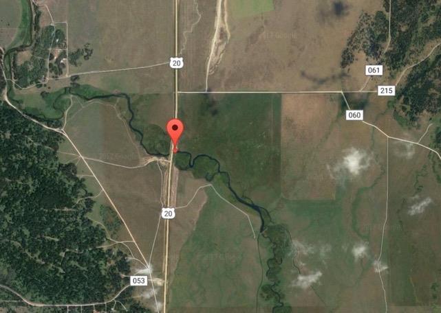
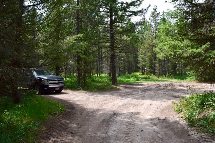
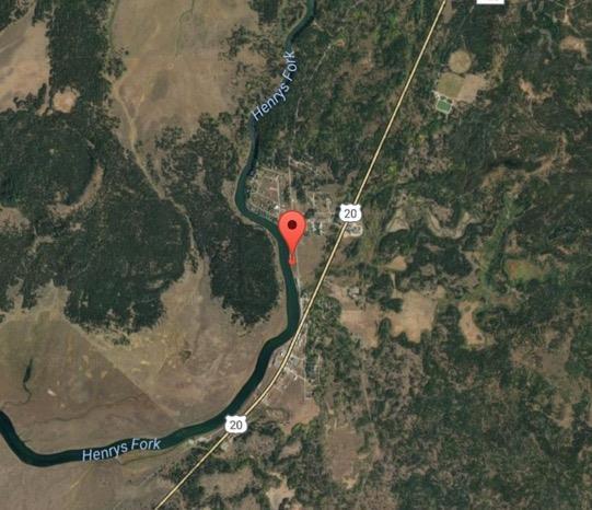
11 Highway 20 Bridge Back to Top Latitude Longitude Owner Idaho Department of Lands Boat Ramp Use Wading Parking 10 Trashcans Restroom Room to Turn Trailer? Google Maps Link

12
 Parking 10")
13 Flat Ranch Back to Top Latitude Longitude Owner Boat Ramp Use Google Maps Link The Nature Conservancy Wading (Hike-in) Parking 10 Trashcans Restroom Room to Turn Trailer?


14

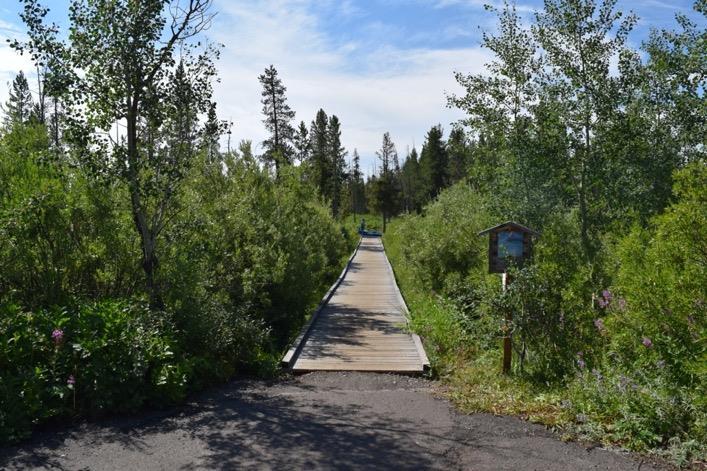
15 Big Springs ( Fishing) Back to Top Latitude Longitude Owner Caribou-Targhee National Forest Boat Ramp Use Viewing Parking 35+ Trashcans Restroom Room to Turn Trailer? Google Maps Link


16


17
 Use Boating Put-In ** Fishing Allowed Above Henry s Lake Outlet** Float Distance")
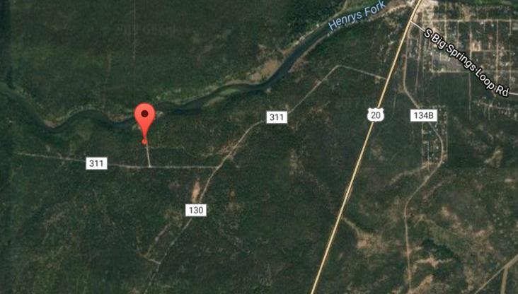
18 Big Springs Water Trail Back to Top Latitude Longitude Owner Caribou-Targhee National Forest Boat Ramp (Canoes/Kayaks/Rafts Only) Use Boating Put-In ** Fishing Allowed Above Henry s Lake Outlet** Float Distance to Mack s Inn, 4 Miles Parking 20+ Trashcans Restroom Room to Turn Trailer? Google Maps Link


19


20
 Use Boating Take-Out, Wading Parking 40+ Trashcans Restroom")
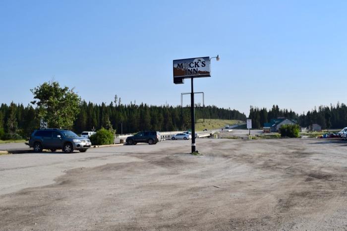
21 Mack s Inn Bridge Back to Top Latitude Longitude Owner Mack s Inn Boat Ramp (Unpaved) Use Boating Take-Out, Wading Parking 40+ Trashcans Restroom Room to Turn Trailer? Google Maps Link

22


23

24 Flat Rock Campground Back to Top Latitude Longitude Owner Caribou-Targhee National Forest Boat Ramp Use Wading Parking 10+ Trashcans For Campers Only Restroom In Campground Room to Turn Trailer? Google Maps Link


25


26
 Parking Around 10 Trashcans For Campers Only")
27 Upper Coffee Pot Campground Back to Top Latitude Longitude Owner Caribou-Targhee National Forest Boat Ramp Use Wading (Hike-In) Parking Around 10 Trashcans For Campers Only Restroom In Campground Room to Turn Trailer? Google Maps Link

28
 Parking 5 Trashcans")
29 Coffee Pot Rapids Back to Top Latitude Longitude Owner Caribou-Targhee National Forest Boat Ramp Use Wading (Hike-in) Parking 5 Trashcans Restroom Room to Turn Trailer? Google Maps Link


30
 Use Boating Parking 15+ Trashcans Campers Only")
31 McCrea Bridge Campground Back to Top Latitude Longitude Owner Caribou-Targhee National Forest Boat Ramp (Paved) Use Boating Parking 15+ Trashcans Campers Only Restroom Room to Turn Trailer? Google Maps Link


32


33
 Use Boating Parking 5+ Trashcans Campers Only")
34 Mill Creek Campground Back to Top Latitude Longitude Owner Caribou-Targhee National Forest Boat Ramp (Paved) Use Boating Parking 5+ Trashcans Campers Only Restroom Room to Turn Trailer? Google Maps Link


35
 Use Boating Parking 5+ Trashcans Restroom Room")
36 West End Campground Back to Top Latitude Longitude Owner US Forest Service Boat Ramp (Paved) Use Boating Parking 5+ Trashcans Restroom Room to Turn Trailer? Google Maps Link


37

38
 Use Wading, Floating Float Distance to Hwy 20, 1 Mile Parking")
39 Buffalo River Campground Back to Top Latitude Longitude Owner Caribou-Targhee National Forest Boat Ramp (Boardwalk only) Use Wading, Floating Float Distance to Hwy 20, 1 Mile Parking 15+ Trashcans Restroom Room to Turn Trailer? Google Maps Link


40

41
 Parking 10+ Trashcans Restroom")
42 Buffalo River Hydroelectric Back to Top Latitude Longitude Owner Caribou-Targhee National Forest Boat Ramp Use Wading (Hike-in) Parking 10+ Trashcans Restroom Room to Turn Trailer? Google Maps Link


43


44
 Use Boating Put-In, Wading Float Distance to Last Chance, 4 Miles Osborne")
45 Box Canyon Boat Ramp Back to Top Latitude Longitude Owner Caribou-Targhee National Forest Boat Ramp (Concrete Block) Use Boating Put-In, Wading Float Distance to Last Chance, 4 Miles Osborne Bridge, 7 Miles Parking 15 Trashcans Restroom Room to Turn Trailer? Google Maps Link


46


47


48
 Parking 5 Trashcans Campers Only Restroom,")
49 Box Canyon Campground Back to Top Latitude Longitude Owner Caribou-Targhee National Forest Boat Ramp Use Wading (Hike-in) Parking 5 Trashcans Campers Only Restroom, In Campsite Room to Turn Trailer? Google Maps Link

50


51
 Use Boating Put-In & Take-Out, Wading Float Distance to Osborne Bridge, 6.")
52 Last Chance Boat Ramp Back to Top Latitude Longitude Owner Caribou-Targhee National Forest Boat Ramp (Concrete Block) Use Boating Put-In & Take-Out, Wading Float Distance to Osborne Bridge, 6.5 Miles Parking 25+ Trashcans Restroom Room to Turn Trailer? Google Maps Link

53


54

55 Angler s Parking/Log Jam Back to Top Latitude Longitude Owner Caribou-Targhee National Forest Boat Ramp Use Wading Parking 35+ Trashcans Restroom Room to Turn Trailer? Google Maps Link

56


57
 Parking 15+ Trashcans")
58 Mailbox Back to Top Latitude Longitude Owner Caribou-Targhee National Forest Boat Ramp Use Wading (Hike-in) Parking 15+ Trashcans Restroom Room to Turn Trailer? Google Maps Link


59
 Parking 25+ Trashcans Restroom")
60 Railroad Ranch Back to Top Latitude Longitude Owner Harriman State Park Boat Ramp Use Wading (Hike-in) Parking 25+ Trashcans Restroom Room to Turn Trailer? Google Maps Link

61

62
 Parking 25+")
63 Ranchview Back to Top Latitude Longitude Owner Boat Ramp Use Google Maps Link Harriman State Park Wading (Hike-in) Parking 25+ Trashcans Restroom Room to Turn Trailer?


64

65
 Parking 10+ Trashcans Restroom")
66 Sage Flats Back to Top Latitude Longitude Owner Harriman State Park Boat Ramp Use Wading (Hike-in) Parking 10+ Trashcans Restroom Room to Turn Trailer? Google Maps Link


67

68
 Use Boating Put-In & Take-Out, Wading Float Distance to Wood Road, 2.")
69 Osborne Bridge Back to Top Latitude Longitude Owner Harriman State Park Boat Ramp (Concrete Block) Use Boating Put-In & Take-Out, Wading Float Distance to Wood Road, 2.5 Miles Riverside Campground, 6 Miles Parking 20+ Trashcans Restroom Room to Turn Trailer? Google Maps Link


70
71


72
 Parking 30+ Trashcans")
73 Gravel Pit Back to Top Latitude Longitude Owner Caribou-Targhee National Forest Boat Ramp Use Wading (Hike-in) Parking 30+ Trashcans Restroom Room to Turn Trailer? Google Maps Link

74
 Use Boating Put-In & Take-Out, Wading Float Distance to Riverside Campground, 3 Miles")
75 FS Road 313 (Wood Road 16) Back to Top Latitude Longitude Owner Caribou-Targhee National Forest Boat Ramp (Unpaved) Use Boating Put-In & Take-Out, Wading Float Distance to Riverside Campground, 3 Miles Hatchery Ford, 8 Miles Parking 10+ Trashcans Restroom Room to Turn Trailer? Google Maps Link


76
 Use Boating Put-In & Take-Out, Wading Float Distance to Hatchery Ford, 5 Miles")
77 Riverside Campground Back to Top Latitude Longitude Owner Caribou-Targhee National Forest Boat Ramp (Concrete Block) Use Boating Put-In & Take-Out, Wading Float Distance to Hatchery Ford, 5 Miles Parking 5+ Trashcans Campers Only Restroom At Campsite Room to Turn Trailer? Google Maps Link


78


79
 Use Boating Take-Out, Wading **This is the Last Boat Take-Out before Mesa")
80 Back to Top FS Road 351 (East Hatchery Ford) Latitude Longitude Owner Caribou-Targhee National Forest Boat Ramp (Concrete Block) Use Boating Take-Out, Wading **This is the Last Boat Take-Out before Mesa Falls** Parking 10+ Trashcans Restroom Room to Turn Trailer? Google Maps Link


81


82
Tourism Goal D - 1. Fremont County Annual Lodging Sales
 Tourism Goal D - 1 Tourism Goal Rationale and Background: Tourism is Idaho s fifth largest employer, accounting for 47,203 jobs, or 7% of all jobs, directly in 2004. The industry accounts for $2.1 billion
Natural Resources and Environmental Law Field Course August 12-19, 2017
 Professor Jerrold A. Long Office 202 Phone: (208) 885-7988 Email: jlong@uidaho.edu Natural Resources and Environmental Law Field Course August 12-19, 2017 Course Overview and Objectives One of the great
VOLUME II APPENDIX F DETAILED PHYSICAL DESCRIPTION OF PROJECT RESERVOIRS AND LANDS
 VOLUME II APPENDIX F DETAILED PHYSICAL DESCRIPTION OF PROJECT RESERVOIRS AND LANDS THE CENTRAL NEBRASKA PUBLIC POWER AND IRRIGATION DISTRICT FERC PROJECT NO. 1417 PHYSICAL DESCRIPTION OF PROJECT LANDS
AOTA ArtTrek Locations
 AOTA ArtTrek Locations ArtTrek is a summer-long Grand County, CO art adventure. Highlighted by snow-covered mountain vistas and rolling meadows threaded with sparkling streams and rivers, numerous sites
YELLOWSTONE S I G H T S E E I N G I T I N E R A R Y. follow me on
 T H E 4 - D A Y YELLOWSTONE S I G H T S E E I N G I T I N E R A R Y DAY 1 DAY SITE NAME TIME LENGTH OF HIKE/SIGHTSEEING SITE TYPE TIPS/RESOURCES Heart of The Caldera 5 Min. Pull-In Sight Tower Falls 30
Oregon Section B - Page m
 Oregon Section B - Page 1 5 35000m 5 36000m 5 37000m 5 38000m 46 57000m 46 58000m Hwy5B - Interstate Highway 5 - mi 1716.4-4271 ft RD1717 - PCT departs paved Old Highway 99 - mi 1716.8-4357 ft PL1717 -
Meadow Jamerman Sweetwater
 Meadow Jamerman Sweetwater Campground Layout Sixth Crossing North Entrance Road Meadow Camp Road to Flagg Ranch & Bus Parking Irrigation Ditch Handcart Corral Host Cabin Cattle Guards Jamerman Camp Well
Banff National Park of Canada
 Banff National Park of Canada Things you should know regarding Tunnel Mountain Village I and Tunnel Mountain Village II Campgrounds Updated July 13, 2012 Important Notices Important Notices General Campground
Bell s Travel Guides
 Bell s Travel Guides Top of the World Highway Road Log Mile by Mile Description of the Top of the World Highway so you always know what lies ahead. Dawson City, Yukon to Tetlin Junction on the Alaska Highway
Swan Valley Farms. 523 acres for sale in Bonneville County, ID JIMMY ROUMANIS. JOHN STARR
 Swan Valley Farms JOHN STARR 208 472 2838 john.starr@colliers.com 523 acres for sale in Bonneville County, ID JIMMY ROUMANIS 208 472 2840 jimmy.roumanis@colliers.com Swan Valley Farms- 523 acres for sale
Androscoggin River Trail Access Sites. North Woods. 168 miles from its source at Lake Umbagog to Merrymeeting Bay
 Androscoggin River Trail Access Sites North Woods 168 miles from its source at Lake Umbagog to Merrymeeting Bay Trail Under Construction More than 40 Public Access Sites Available Androscoggin River Watershed
Cataloochee. Fishing Species Rainbow Trout and Brook Trout. Recreation
 Cataloochee River Information The Cataloochee River is located in the historic Cataloochee Valley--a relatively remote part of Smoky Mountain National Park. The campground is a secluded setting and offers
Guide to over 600 Corps-managed campgrounds on nearly 200 lakes around the country
 Guide to over 600 Corps-managed campgrounds on nearly 200 lakes around the country Published by: Roundabout Publications PO Box 19235 Lenexa, KS 66285 800-455-2207 www.travelbooksusa.com in Corps of Engineers
PRIEST LAKE TRAILS. More information contact: Priest Lake Ranger District
 PRIEST LAKE TRAILS The varying terrain in the Priest Lake area ranges from river bottoms with an elevation of 2,600 to 7,500 ft. Valley bottoms, dense forests, meadows and occasional clearings and barren
U.S. Bicycle Route System Routes 70 and 79 Utah's Redrock Bikeway
 U.S. Bicycle Route System Routes 70 and 79 Utah's Redrock Bikeway Page Index Map Symbols US Bicycle Route City Interstate US Highway State Highway Major Local Road, Paved Major Local Road, Not Paved Railroad
Greater Minnesota Regional Parks and Trails Commission Designation Application
 Greater Minnesota Regional Parks and Trails Commission Designation Application General Section Designation Application #: 14-015D Date Submitted: 08/31/2015 Park or Trail Name: Alexander Ramsey Park District
Mississippi River Project
 Mississippi River Project Fallll on tthe Miissiissiippii As the days get shorter and the nights get cooler sitting around a campfire can be a great way to enjoy the outdoors before the snow begins to fly.
Camping (Primitive) Camping (RV) Electrical Potable Water Grill Established Fire Pit Picnic Table
 Camping (RV) Electrical Potable Water Grill Established Fire Pit Picnic Table") Alden - 9th Road River Mile 777 Map: 38.20833, -98.32031 Managing Agency: Kansas Department of Wildlife, Parks & Tourism Nearest Community: Alden, Rice County Kansas Developed Amenities Provided Parking
Alden - 9th Road River Mile 777 Map: 38.20833, -98.32031 Managing Agency: Kansas Department of Wildlife, Parks & Tourism Nearest Community: Alden, Rice County Kansas Developed Amenities Provided Parking
California Section C - Page 1
 - Page 1 5 2m 5 2m 5 0m 5 3m 37 0m These maps are provided as a free service to PCT hikers. I believe the information is accurate but they may contain errors. The maps are distributed in the hope that
Wyoming Campground Association
 Wyoming Campground Association Your Resource for Private Campgrounds in Wyoming Directory of Campground Members ALPINE Greys River Cove RV Park 307-880-2267 email: greysrivercove@silverstar.com www.greysrivercove.com
Mills Pecos River Ranch 7800 Acres Val Verde County, Texas Situated along both sides of the Pecos River
 Mills Pecos River Ranch 7800 Acres Val Verde County, Texas Situated along both sides of the Pecos River James King, Agent Office 432-426-2024 Cell 432-386-2821 James@KingLandWater.com King Land & Water
RUBY AND HORSETHIEF CANYONS - COLORADO RIVER
 RUBY AND HORSETHIEF CANYONS - COLORADO RIVER Rating: Class II CFS Range: 1,000-30,000 Length: 1-3 days Gear: Standard paddling gear, bug spray in the summer. Maps: Mack, CO; Ruby Canyon, CO; Bitter Creek
Riding Mountain National Park of Canada
 Riding Mountain National Park of Canada Things you should know regarding the otentiks and the Yurt and Equipped Camping in the Wasagaming Campground Important Notices General otentik and Yurt Information
Banff National Park of Canada Lake Louise
 Banff National Park of Canada Lake Louise Things you should know regarding Lake Louise Hard- Sided and Soft-Sided Trailer/Tent Campgrounds Updated September 12, 2017 Important Notices: Important Notices
Wildlife and Wonder. Exploring Yellowstone and Grand Teton National Parks. 6 Days / 5 Nights DEVELOPED FOR. Couples and Families HIGHLIGHTS
 6 Days / 5 Nights DEVELOPED FOR Couples and Families HIGHLIGHTS Full Day Private Guided Tour of Yellowstone National Park Jackson Lake Lodge One-hour horseback ride Private Morning Wildlife Tour of Grand
BEAVER LAKE ACCESS AREA SUMMARY 2017 Edition
 BEAVER LAKE ACCESS AREA SUMMARY 2017 Edition DEVELOPED BY THE BEAVER LAKE PROPERTY and SAFETY COMMITTEE 2 October 2017 1 NOTICE: This document supersedes and nullifies all previous versions of Beaver Lake
Prince Edward Island National Park of Canada
 Prince Edward Island National Park of Canada Things you should know regarding Cavendish and Stanhope Campgrounds Important Notices General Camping Information Fees If There is No Vacancy Require Additional
Greater Minnesota Regional Parks and Trails Commission Designation Application
 Greater Minnesota Regional Parks and Trails Commission Designation Application General Section Designation Application #: 15-023D Date Submitted: 06/30/2015 Park or Trail Name: Big Falls Campground & Horse
Summary of Recreation Sites Development Name:
 Development Name: Eau Pleine Site Number: 1 Owner: WVIC Eau Pleine Tailwater Boat Launch Lanes 1 Concrete plank landing, access to Eau Pleine tailwater & Lake DuBay. (45 planks long, 62.5') Picnic Tables
Non-motorized Trail Plan & Proposal. August 8, 2014
 Town of Star Valley Ranch, Wyoming and the Star Valley Ranch Association in partnership with the USDA Forest Service, Bridger-Teton National Forest, Greys River Ranger District Non-motorized Trail Plan
California Section K - Page 1 WGS84 Zone 10S m
 750000m 751000m 752000m California Section K - Page 1 753000m 754000m 755000m WGS84 Zone 10S 757000m 04 N. 03 N. 04 N. 02 N. 05 N. 05 N. 06 N. 06 N. 01 N. Overnight camping is prohibited for approximately
Trail Beginning Elevation: 7553 ft The Poison Creek Trailhead is located at the end of National Forest Road 646E (NF-646E).
.") West Mountain Trails Poison Creek Trail #134 Length: 2.9 miles (4.7 km) Difficulty Horseback: A good trail for the first time west mountain rider, some steep sections Hiking: Most Difficult USGS Maps:
West Mountain Trails Poison Creek Trail #134 Length: 2.9 miles (4.7 km) Difficulty Horseback: A good trail for the first time west mountain rider, some steep sections Hiking: Most Difficult USGS Maps:
2015 USA Pro Challenge (Stages 3 and 4) State Highway 82 Spectator Guide to Parking and Camping on Independence Pass
 State Highway 82 Spectator Guide to Parking and Camping on Independence Pass") 2015 USA Pro Challenge (Stages 3 and 4) State Highway 82 Spectator Guide to Parking and Camping on Independence Pass Stage 3 Copper Mountain Resort to Aspen, Wednesday, August 19 Racers will head south
2015 USA Pro Challenge (Stages 3 and 4) State Highway 82 Spectator Guide to Parking and Camping on Independence Pass Stage 3 Copper Mountain Resort to Aspen, Wednesday, August 19 Racers will head south
Rogue Gorge (Mt. Stella) Roadless Area-- T30S R3E (primarily in portions of Sections 23, 26, 33, 34 & 35)
 Roadless Area-- T30S R3E (primarily in portions of Sections 23, 26, 33, 34 & 35)") Rogue Gorge (Mt. Stella) Roadless Area-- T30S R3E (primarily in portions of Sections 23, 26, 33, 34 & 35) Rogue River-Siskiyou National Forest--High Cascades Ranger District Upper, higher elevation trail
Rogue Gorge (Mt. Stella) Roadless Area-- T30S R3E (primarily in portions of Sections 23, 26, 33, 34 & 35) Rogue River-Siskiyou National Forest--High Cascades Ranger District Upper, higher elevation trail
California Section L - Page 1
 64 N. 63 N. 62 N. 725000m 726000m 727000m California Section L - Page 1 728000m 729000m 730000m CA Section L - 38.3 miles Start - Hwy 80 [Donner Summit], mile 1157.1 End - Hwy 49 [near Sierra City], mile
December 2013 Volume 8, Issue 9
 Stan Nowak, Editor www.giantsrib.ca December 2013 Volume 8, Issue 9 The Bruce Duncan Memorial Lecture Series Rib Happenings The Literal Rib Teachers Corner will all return in January 2014 better than ever!
HAVE A GREAT HIKE AND ENJOY!
 BAKER LAKE HIKE #5634 & #234 (Moderate to Strenuous walking sticks recommended) DIRECTIONS TO TRAILHEAD: From Triple Creek s driveway, turn left on West Fork Road and drive about 1.3 miles (just past mile
Prince Edward Island National Park of Canada
 Prince Edward Island National Park of Canada Things you should know regarding Cavendish and Stanhope Campgrounds Updated October 20, 2017 Important Notices: Important Notices General Camping Information
Mojave National Preserve Visitor Study
 Mojave National Preserve Visitor Study The Visitor Services Project 2 OMB Approval 1024-0202 Expiration Date: 4-30-98 3 DIRECTIONS One adult in your group should complete the questionnaire. It should only
RECREATION ACCESS AND COMMUNITY ENRICHMENT PLAN
 Template for facilitating Siskiyou County, the City of Yreka and the State of Jefferson in a RECREATION ACCESS AND COMMUNITY ENRICHMENT PLAN Access to the Mountains CREATING ACCESS TO PUBLIC AND PRIVATE
5/4/2009 Agenda Report Page:
 1 E. COAL REVISIONS SUBMITTED Submittal Date C1980005 MR-60 Seneca II Mine Seneca Coal Company, LLC Routt 2 5 N 87 W COA 4/15/2009 C1980007 TR-116 West Elk Mine Mountain Coal Company, LLC Gunnison 16 13
Gorgeous Relay Driving Directions September 16, 2018
 2018 Gorgeous Relay Legs 1-3 Gorgeous Relay Start: Mark O. Hatfield Trailhead, Mosier Take I-84 to Exit 69, Mosier. Follow the brown signs for the Historic Columbia River Hwy State Trail. The Start Line
WARNING Due to Extensive Beetle Kill Trees, Trails are Subject to Closure or Rerouting. Please be Advised and Pay attention to On Ground Signage.
 WARNING Due to Extensive Beetle Kill Trees, Trails are Subject to Closure or Rerouting. Please be Advised and Pay attention to On Ground Signage. WYOMING RANGE WESTERN WYOMING The Wyoming Range trail system
MP : Headwaters of the Fraser River
 MP 236 237: Headwaters of the Fraser River The mile between these two mileage posts is often just referred to as the bottom switchback or the curve at the bottom of Berthoud Pass. For many locals this
Waterton Lakes National Park of Canada
 Waterton Lakes National Park of Canada Things you should know regarding Townsite Campground Updated September 11, 2017 Important Notices: Important Notices General Camping Information Fees If There is
Visitors Guide.
 Visitors Guide www.cummingforsythchamber.org Comein our &Backyard! Play Balloons Over Georgia Adventure at every altitude With convenient access to the North Georgia Mountains, pristine Lake Lanier and
(west) onto Charleston Boulevard. Drive 16 miles on Charleston and turn right into Red Rock
 onto Charleston Boulevard. Drive 16 miles on Charleston and turn right into Red Rock") Hike: North Peak and Ice Box Overlook up and back Trailhead: 2.5 miles up the Rocky Gap Road not mark Distance: 5 miles round trip Elevation gain: 2,694 feet Elevation Peak: 7,094 feet Time: 3 to 5 hours
Hike: North Peak and Ice Box Overlook up and back Trailhead: 2.5 miles up the Rocky Gap Road not mark Distance: 5 miles round trip Elevation gain: 2,694 feet Elevation Peak: 7,094 feet Time: 3 to 5 hours
BRR Leg 1 (3.9 miles, Easy)
") BRR Leg 1 (3.9 miles, Easy) Min 3901 Max 4919 Ascent +21 Descent -1031 0.0 Start (Grayson Highlands State Park Visitor Center) 3.9 Grayson Highlands State Park Office & Gate, on R (EZ 1) Leg Notes: Minimal
BRR Leg 1 (3.9 miles, Easy) Min 3901 Max 4919 Ascent +21 Descent -1031 0.0 Start (Grayson Highlands State Park Visitor Center) 3.9 Grayson Highlands State Park Office & Gate, on R (EZ 1) Leg Notes: Minimal
Lavic Jasper Field Trip
 Lavic Jasper Field Trip There are few places you can go and, once there, you park and step out of your vehicle and start collecting immediately. Lavic is one such place. In the bowl where our camping area
2017/2018 REVISED 8/1/2017 PLEASE CHECK YOUR ROUTE STOPS AND TIMES MANY ROUTES HAVE CHANGED SINCE LAST YEAR!!!
 2017/2018 REVISED 8/1/2017 PLEASE CHECK YOUR ROUTE STOPS AND TIMES MANY ROUTES HAVE CHANGED SINCE LAST YEAR!!! PLEASE HAVE YOUR CHILDREN AT THE BUS STOP AT LEAST FIVE MINUTES BEFORE THE SCHEDULED STOP
GUIDE TO THE PINHOTI TRAIL IN GEORGIA
 GUIDE TO THE PINHOTI TRAIL IN GEORGIA TENTH EDITION, MAY 2016 Covers Sections 14 through 31 Alabama State Line to Benton MacKaye Trail Conasauga Ranger District of the Chattahoochee National Forest Simms
Understanding the caring capacity of the visitor experience Provide facilities to support a high level user experience Address visual quality through
 Understanding the caring capacity of the visitor experience Provide facilities to support a high level user experience Address visual quality through recreation ecological restoration opportunities Collaboration
Trapper Trails Council Camping Guide
 East Canyon State Bear Lake State Antelope Island State 12 Miles south Morgan, UT Bear Lake on Idaho/Utah border Exit 332 off I-15, then west to Entrance Idaho State Weber Memorial south fork ogden river
The Neusiok Trail and Cedar Island MST Segment 17. THE NEUSIOK TRAIL TO CEDAR ISLAND FERRY By Kate Dixon and Jim Grode
 1 Mountains-to-Sea Trail Last Updated 1/1/2017 Hiking the Neusiok Trail Photo by Becka Walling The Neusiok Trail and Cedar Island MST Segment 17 THE NEUSIOK TRAIL TO CEDAR ISLAND FERRY By Kate Dixon and
ANGEL PEAK SCENIC AREA
 Activities: Facilities: ANGEL PEAK SCENIC AREA Hiking, photography, watchable wildlife, camping, picnicking. Note: While formal hiking trails in the area are limited, dispersed hiking opportunities abound
The Croatan MST Segment 16B
 1 Mountains-to-Sea Trail Last Updated 1/1/2017 A sandy road through longleaf pine savanna in the Croatan National Forest Photo by PJ Wetzel, www.pjwetzel.com The Croatan MST Segment 16B STELLA TO THE NEUSIOK
Accessibility Guide. Welcome to Grand Canyon National Park. Grand Canyon National Park. Table of Contents
 Grand Canyon National Park National Park Service U.S. Department of the Interior Accessibility Guide Welcome to Grand Canyon National Park Table of Contents 2 Accessibility ATMs Bookstores and Gift Shops
Matthiessen State Park Dells Area Hike
 90 Easy Hikes Close to Home At the south end of the hike, you ll climb on top of a mound left over from a former coal-mining operation in the park. Not far from Goose Lake Prairie, the town of Morris hosts
BACK COUNTRY UNIT PREFERRED ALTERNATIVE
 BACK COUNTRY UNIT PREFERRED ALTERNATIVE San Francisco (118 mi) Carmel-By-The-Sea Carmel River Carmel Valley Road State Beach Private Property Point Lobos State Reserve Point Lobos Ranch RUSTIC CAMPING
Crystal Lake Area Trails
 Lake Area Trails Welcome to the Lake area of the Big Snowy Mountains! This island mountain range in central Montana features peaks reaching to 8,600 feet and long, high ridges from which vistas of the
June 17 th John Kramer Distance miles, Elevation Gain 7500 ft, Very little traffic but there may be more as July recreation picks up.
 Preride Route Notes June 17 th John Kramer Distance 125.5 miles, Elevation Gain 7500 ft, Very little traffic but there may be more as July recreation picks up. Home Valley to Bingen The start time is early,
LINN RANCH ARCHAEOLOGY CAMP
 LINN RANCH ARCHAEOLOGY CAMP MAY 2-8, 2016 REBECCA SGOUROS (DIRECTOR OF COMMUNITY ARCHAEOLOGY AND OUTREACH) MATT STIRN (DIRECTOR OF ARCHAEOLOGICAL RESEARCH) THE LINN CANYON RANCH: The Linn Canyon Ranch,
STAR VALLEY HISTORICAL SOCIETY HISTORICAL BOOKS INVENTORY DETAILS
 STAR VALLEY HISTORICAL SOCIETY HISTORICAL BOOKS INVENTORY DETAILS 1. Overview Title: Star Valley Wyoming: Little Switzerland of America" Author: Subject: Star Valley Publisher: Star Valley Chamber of Commerce
Houston. Description: Hwy 59 Eastex Frwy WS 0.3mi S/O FM 1960 F/N - 2. TAB Panel ID: City: HUMBLE Latitude:
 001023 - Houston Description: Hwy 59 Eastex Frwy WS 0.3mi S/O FM 1960 F/N - 2 TAB Panel ID: 74698 City: HUMBLE Latitude: 29.999 Media Type: Digital State: TX Longitude: -95.271 Display Dimensions: 14'
Beaver Country Trails ATV Jamboree
 Beaver Country Trails ATV Jamboree #1 Lincoln Mine Intermediate (Open to all ATVs/UTVs) 34 Miles Highlights: This ride will highlight the historic Lincoln Mining District, the first lead mine in Utah,
Recreation Facilities Guide 2004 Shasta-Trinity National Forest abckdvjw TRINITY
 Recreation Facilities Guide 2004 Shasta-Trinity National Forest abckdvjw TRINITY SHASTA SEASON OF USE Most recreation sites within the Shasta-Trinity National Forests are open from May 15 through September
Bryce Canyon Visitor Study
 Bryce Canyon Visitor Study The Visitor Services Project 2 OMB Approval 1024-0051 United States Department of the Interior NATIONAL PARK SERVICE Bryce Canyon National Park Bryce Canyon, Utah 84717 July
1 of 6 9/20/2013 9:32 AM
 1 of 6 9/20/2013 9:32 AM 1 Illinois RV Parks and Campgrounds Hillcrest Golf & Camping Resort Brief Description: Our campgrounds offer a wide selection of spacious, level sites with picnic tables, water
U.S. National Forest Campground Guide
 U.S. National Forest Campground Guide Southwestern Region Arizona, New Mexico, Oklahoma and Texas National Forests and Grasslands in the Southwestern Region NF = National Forest NG = National Grassland
Acquisition in fee simple of approximately one-half acre of property on the shore of Spring Lake to expand the Lakeside Beach Park.
 Lakeside Beach TF00-136 $122,550.00 in fee simple of approximately one-half acre of property on the shore of Spring Lake to exp the Lakeside Beach. 2000 River Ravines TF00-150 $910,000.00 in fee simple
Whiteside Mountain Land Owned by: Location: Trails:
 Whiteside Mountain Latitude: 35 05.123 N Longitude: 083 07.933 W Elevation: 1,503m Land Owned by: US Forest Service Nantahala Ranger District 828-524-6441 Location: Jackson County, NC Turn off of US Highway
RED ROCK / SYCAMORE CANYON LOOP
 SCEIC DRIVES TO/OM SEDOA RED ROCK / SYCAMORE CAYO This drive takes you into the heart of Sedona s magnificent Red Rock Country. The route hugs to the foot of those colorful cliffs, and offers the option
5520 STEPHANIE STREET, LAS VEGAS >> ±36,019 SF OFFICE/WAREHOUSE/DISTRIBUTION, LAS VEGAS, NV 89122
 FOR SALE - FREE STANDING INDUSTRIAL BUILDING WITH LARGE FENCED YARD 5520 STEPHANIE STREET, >> ±36,019 SF /WAREHOUSE/DISTRIBUTION,, NV 89122 N DECATUR BLVD S DECATUR BLVD VALLEY VIEW ROAD SE N EASTERN AVE
San Juan Hut Systems Telluride To Moab Route Description. Adventure without the weight
 San Juan Hut Systems Telluride To Moab Route Description Due to the inaccuracies caused by varying calibrations in odometers, you may notice some inaccuracies in the mileages listed for the Standard Route
Section 7: Pick Up Where You Left Off! S-Tree Road over the Todd Road
 2018 TRACE NOTES Helpful information for your adventure on Section 7 of the Hiker Challenge. Start Point S-Tree Rd. End Point Intersection Todd Rd. / Hale Ridge Rd. WEATHER DECISION Weather Alert!!!! Potential
Oklahoma RV Parks and Campgrounds
 1 Oklahoma RV Parks and Campgrounds Rolling Stone Stables and RV Park Brief Description: Rolling Stone Stables and RV park is an 80 acre horse farm and RV park. We are located just 2 miles from I-40 for
Steer Creek Campground Corral
 Steer Creek Campground Corral Purpose and Need The purpose of this project is to increase the availability of camping experiences and services for equestrians at the Steer Creek Campground in the Samuel
MONTANA ROCKHOUNDING MONTANA: 4 DAYS. Calgary Rock and Lapidary Club - You Drive Field Trip. A Rockhounder s Dream
 Calgary Rock and Lapidary Club - You Drive Field Trip MONTANA A Rockhounder s Dream ROCKHOUNDING MONTANA: 4 DAYS Crystal Park, Calvert Mine, Argo Mine Just a few hours south of Calgary is Montana, the
Three Ball Ranch BOULDER, WYOMING. Hunting Ranching Fly Fishing Conservation
 Three Ball Ranch BOULDER, WYOMING Hunting Ranching Fly Fishing Conservation Three Ball Ranch BOULDER, WYOMING Introduction: Offered for sale for the first time ever is the historic Three Ball Ranch. Homesteaded
1. Overview of Aberdeen Township and Its Waterfront
 Aberdeen 1. Overview of Aberdeen Township and Its Waterfront 1.1 Geographic Overview Aberdeen Township is a suburban township with a land area of 5.45 square miles, with about 2 miles of shoreline along
Greater Minnesota Regional Parks and Trails Commission Designation Application
 Greater Minnesota Regional Parks and Trails Commission Designation Application General Section Designation Application #: 15-059D Date Submitted: 06/16/2015 Park or Trail Name: Mesabi Trail District #:
UTAH 2016 CANYONLANDS
 UTAH 2016 CANYONLANDS THE WHITE RIM TRAIL MAY 17, 2016 We left the cabin at 7:30 a.m. The goal was to get to Great Basin National Park that night. We took Highway 6 towards Tonopah and decided to go north
CHAPTER 5. Chapter 5 Recreation Element
 CHAPTER 5 Recreation Element Chapter 5 Recreation Element The Recreation Element of the Meyers Area Plan is a supplement to the Recreation Element of the TRPA Regional Plan and the El Dorado County General
Plaza del Rio. Rio Grande Sanctuary. Exclusive Home Sites in the San Luis Valley, Colorado
 Plaza del Rio Rio Grande Sanctuary Photography by Gary Tyson River Valley Group, LLC and Team Murphy Realty, LLC offer for sale: Exclusive Home Sites in the San Luis Valley, Colorado Plaza del Rio Exclusive
!"a$ !"a$ EMPIRE GEORGETOWN SILVER PLUME. Existing Land Use. Gateway Commercial. Regional Commercial. Mining or Historic Mining
 0 0 Rd Alvarado (306) Pass Rd (381) Guanella Existing Land Use Gateway Commercial Regional Commercial Mining or Historic Mining Mixed Use - Downtown - Historic Downtown 0 1,000 2,000,000 Feet s, Open Space,
FY19 Colorado Tourism Office Marketing Matching Grant Recipients
 $25,000 Colorado Campground and Lodging Owners Association A marketing plan centered on the Camp Colorado Guide, and expanding the use of digital marketing and social media channels in order to inspire
Rogue River Access and Management Plan Draft Alternatives
 Rogue River Access and Management Plan Draft Alternatives The Rogue River Access and Management Plan was initiated in December, 2011 and is being led by Jackson County Parks (JCP) and Oregon Department
Day 1 History & Wildlife
 Welcome to our 3 Day Newberry, MI Itinerary brought to you by America s Best Value Inn Tahquamenon Country of Newberry. Day 1 History & Wildlife The Luce County Historical Museum Drive time: 5 minutes
Jasper National Park of Canada
 Jasper National Park of Canada Things you should know regarding Wabasso, Wapiti, Whistlers and Pocahontas Campgrounds Updated January 2, 2018 Important Notices: Important Notices General Camping Information
Schedule of Events. 11:15 a.m. 11:45 a.m. Pre-Settlement and Early Settlement History presented by Mike Baughn
 Dear Attendee, Thank you so much for reserving your attendance at The Nature Conservancy in Kansas 25th Anniversary Celebration: Visitors Day at Smoky Valley Ranch, Saturday, June 7th. Please find enclosed
2016/2017 PLEASE CHECK YOUR ROUTE STOPS AND TIMES MANY ROUTES HAVE CHANGED SINCE LAST YEAR!!!
 2016/2017 PLEASE CHECK YOUR ROUTE STOPS AND TIMES MANY ROUTES HAVE CHANGED SINCE LAST YEAR!!! PLEASE HAVE YOUR CHILDREN AT THE BUS STOP AT LEAST FIVE MINUTES BEFORE THE SCHEDULED STOP TIME ROUTES AND TIMES
Oregon Section C - Page 1 WGS84 Zone 10T m
 00 N. 99 N. 98 N. 97 N. 96 N. 557000m Oregon Section C - 74.4 miles Start - Hwy 140, mile 1773.4 (near Fish Lake) End - Hwy 138, mile 1847.8 (near Cascade crest) Elevation Gain +8,111' Elevation Loss -7,145'
(N W ) sized to accommodate equestrian trailers. Tamarack Creek 9. Along the Wisconsin River. 1 $5/night
 sized to accommodate equestrian trailers. Tamarack Creek 9. Along the Wisconsin River. 1 $5/night") 06 Vilas County Public Campground Directory (Prices and facilities are subject to change without notice. GPS coordinates are provided for general information and may be for parking area or boat landing
06 Vilas County Public Campground Directory (Prices and facilities are subject to change without notice. GPS coordinates are provided for general information and may be for parking area or boat landing
Updated Ride Schedule July 27, 2013
 Updated Ride Schedule July 27, 2013 ALL RIDES ARE SUBJECT TO CHANGE NAPLES ORV PARK & BBQ LUNCH SUNDAY, APRIL 28 th, 9:00 AM ATV/UTV (EASY) PRA Naples ORV Park is north of Sandpoint on Hwy 95 near Naples,
This Passport: Revised October 20, 2017, EAM # Discovering the Trails of Penfield, NY
 This Passport: Revised October 20, 2017, EAM #161922 Discovering the Trails of Penfield, NY The Town of Penfield is fortunate to have a wide variety of natural resources which make for many unique and
PLEASE CHECK YOUR ROUTE STOPS AND TIMES THEY MAY HAVE CHANGED SINCE LAST YEAR!!!
 PLEASE CHECK YOUR ROUTE STOPS AND TIMES THEY MAY HAVE CHANGED SINCE LAST YEAR!!! PLEASE HAVE YOUR CHILDREN AT THE BUS STOP AT LEAST FIVE MINUTES BEFORE THE SCHEDULED STOP TIME ROUTES AND TIMES CAN CHANGE
Chaperone Responsibilities & FAQs Circle X camping and Camp Shalom dorm Programs
 Chaperone Responsibilities & FAQs Circle X camping and Camp Shalom dorm Programs Thank you for volunteering to be a chaperone! Your positive attitude and willingness to participate during the instructional
Trailhead Ambassadors 2018 Latourell Falls: Alternative Hikes
 Trailhead Ambassadors 2018 Latourell Falls: Alternative Hikes General Note: The Historic Highway is closed from the Bridal Veil exit to its eastern end near Wyeth i.e., the Waterfall Alley section. The
James M. Robb. Colorado River State Park. Passes And Permits. James M. Robb ENJOY YOUR STATE PARKS. cpw.state.co.us
 Passes And Permits A Colorado State Parks Pass is required on all motor vehicles entering the park. All passes must be affixed to the lower right inside of the windshield. An ANNUAL PASS is valid at any
MARYLAND RV PARKS & CAMPGROUNDS RECOMMENDED BY THE NRVOA
 2019 MARYLAND RV PARKS & CAMPGROUNDS RECOMMENDED BY THE NRVOA Maryland Maryland, one of the original 13 states of the USA, was founded by Lord Baltimore in 1634. Its Atlantic Plain, divided by Chesapeake