Santa Barbara Sheriff s Office Date: July 5, 2016 Time: 5:00 p.m.
|
|
|
- Jared Mills
- 5 years ago
- Views:
Transcription


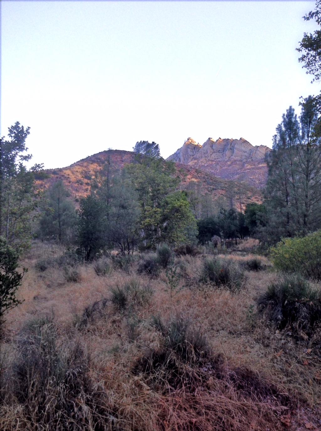
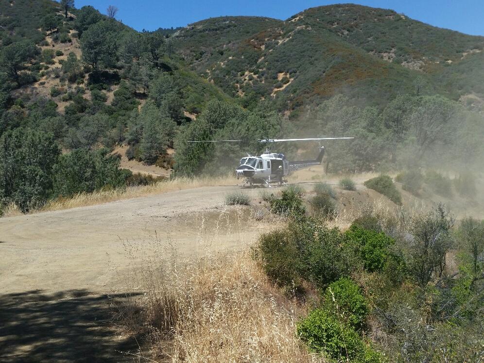
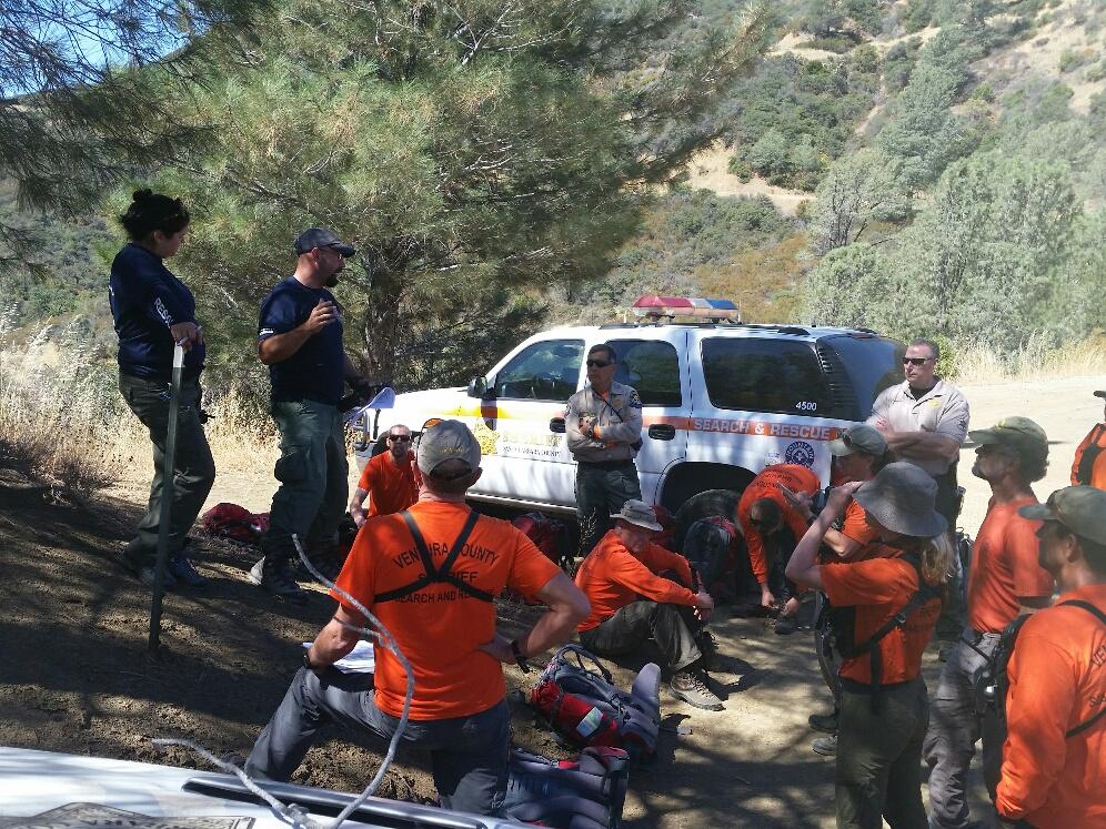
1 Kelly Hoover Public Information Officer (805) Santa Barbara Sheriff s Office Date: July 5, 2016 Time: 5:00 p.m. News Release Sheriff s Search and Rescue Team and SB County Air Support Rescue Bikers and Hikers Over the Fourth of July Weekend Santa Barbara At approximately 3:00 p.m. on July 3, 2016, Santa Barbara County Sheriff s Search and Rescue team members were paged out for a dehydrated mountain biker on the Santa Cruz Trail located approximately 12 miles from Santa Barbara, north of Little Pine Mountain. The 34-year-old male mountain biker from Santa Barbara was riding with a 43-year-old male biker on the popular Buckhorn Road/Little Pine Mountain/Santa Cruz Trail loop out of Upper Oso. After riding all morning, they took a wrong turn at the saddle near Alexander Peak and rode down to Santa Cruz Campground. Upon realizing they were 180 degrees from where their route should have been, they started riding up the steep trail towards Upper Oso. Approximately two miles up, one of the bikers, who had run out of water, began feeling dizzy, nauseous and overheated. The other biker continued up the trail to reach Upper Oso for help. Fortunately, the dehydrated biker was able to use his cell phone to call despite the challenging cellular reception in the backcountry. Before his cell phone power died, an initial, general location was obtained. Units from Santa Barbara County Fire and U.S. Forest Service started searching down the trail from Little Pine Mountain while SBSCAR personnel drove their 4x4 vehicles down the fire access road from Buckhorn Road to Santa Cruz Campground. Santa Barbara County Air Support Unit Copter 1 responded to assist in the search and located the dehydrated biker along the trail approximately 300 yards below the road SBCSAR was driving down. With directional help from Copter 1, SBCSAR personnel cut a trail down through the brush to access the biker and initiated treatment for heat exhaustion until Santa Barbara County Fire paramedics arrived. The biker was then moved down the trail to a closer point to the road where he was hiked up to vehicles for transport back to Upper Oso. He was reunited with his biking partner and released. As SBCSAR personnel were returning from the Santa Cruz rescue, at approximately 7:50 p.m. on July 3, they received a report of a lost hiker on Hurricane Deck which is a remote area in the San Rafael Wilderness north of Figueroa Mountain. The 36-year-old hiker, from Paso Robles, was hiking alone and called a friend from her location saying she was lost and needed help. Unfortunately, the cellular signal was lost before the friend could learn more. In order to determine a starting point to look for the hiker, SBCSAR sent two units to check various trailheads in the area to locate her vehicle.
2 At approximately 10 p.m. Sunday night, July 3, a SBCSAR team found the missing hiker s white Yukon SUV near the trailhead of the Lower Manzana Trail at Nira Campground. Having located her possible footprint, a team of two SBCSAR personnel started down the trail tracking her prints. At the Potrero Campsite approximately 1.5 miles downriver of Nira, the team tracked her footprints heading up the Potrero Canyon Trail which eventually connects with the Hurricane Deck Trail, approximately 2,000 feet higher. The SBCSAR tracking team was joined by other SBCSAR teams during the night with assignments on other trails in the area, calling out the subject's name in hope of a response. The primary tracking team continued to track the subject's footprints down the Hurricane Deck Trail east towards the Manzana School House in very difficult terrain with the trail often disappearing. As morning broke on July 4th, 17 additional SAR personnel from the Ventura County Sheriff's Search and Rescue Unit arrived and prepared to join the search in the wilderness. Upon reaching Manzana School House the primary tracking team met up with another SBCSAR team that had hiked the trail down Manzana River to the School House. As the teams were preparing a landing zone for a helicopter, at approximately 11 a.m., they heard a cry for help and found the missing hiker down a ravine that she had fallen into. The hiker had a whistle that she blew which helped teams locate her. Although scraped with cuts and bruises from her fall and suffering from mild dehydration, the missing hiker was found to be in good shape. Copter 308 from the Santa Barbara County Air Support Unit responded with paramedics and flew her to Cachuma Saddle where she was released following a medical evaluation. Copter 308 also transported SBCSAR teams out of the area. A couple of hours after returning from the Hurricane Deck search, at approximately 5:10 p.m. on July 4, SBCSAR personnel were paged out for a search of a lost hiker on Grass Mountain, just north of Los Olivos. Sheriff's dispatch was able to obtain coordinates from the lost hiker's cell phone. SBCSAR responded with two search teams and Copter 2 was deployed to aid in the search. Copter 2 was able to quickly locate the 55-yearold hiker from Santa Barbara and transport her to a safe landing zone where she was transferred to one of the waiting search teams who then returned her to her vehicle. The Santa Barbara County Sheriff s Office wants to take this opportunity to thank our all-volunteer Santa Barbara County Search and Rescue Team who is highly trained and on call 24/7 which includes nights, weekends and holidays. There are currently 33 members on the team. If you are interested in finding out more about the team, visit their website at The website also has a list of important safety tips when biking or hiking.
3
4
5
6 ###
Hiking And Backpacking Santa Barbara And Ventura By Craig R. Carey READ ONLINE
 Hiking And Backpacking Santa Barbara And Ventura By Craig R. Carey READ ONLINE In undergoing this life, many people always try to The presentation will discuss some of the best Los Padres destinations
Safety goes out the window when it comes to getting social media "likes"
 Safety goes out the window when it comes to getting social media "likes" By Los Angeles Times, adapted by Newsela staff on 10.22.18 Word Count 904 Level 1150L A boy struggles to hang on as he is about
The temperature is nice at this time of year, but water is already starting to be scarce.
 In March of 2003, Scott Morrison and I went backpacking in the Grand Canyon. The temperature is nice at this time of year, but water is already starting to be scarce. Another issue with this time of year
Hiking Las Vegas.com
 Hike: Mt. Wilson via First Creek Canyon route Trailhead: First Creek marked Distance: 10 miles up and back Elevation gain: 3,400 feet Elevation of Peak: 7,070 feet Time: 7 to 9 hours (up and back) Difficulty:
Mott Canyon Hazard Tree Incident
 Mott Canyon Hazard Tree Incident Lake Tahoe Basin Management Unit August 25, 2016 On August 25, 2016 while constructing a trail, John, a member of the Tahoe Rim Trail Association (TRTA) working under a
Coast to Crest Trail Corridor Hike
 Coast to Crest Trail Corridor Hike Jim Cunningham, Poway City Council member and Board Chair of the San Dieguito River Park in 2013 has embarked on a project to hike the entire 70-mile San Dieguito River
Appalachian Trail - Mt Washington State Forest Massachusetts Department of Environmental Conservation
 Appalachian Trail - Mt Washington State Forest Massachusetts Department of Environmental Conservation In the case of emergency in the front-country, call 911. For backcountry/sat phone calls, first contact
Hiking. Lesson 4.1. Fitness. Hiking
 Lesson 4.1 By Carone Fitness If you enjoy walking, you will probably enjoy hiking. The main difference between hiking and fitness walking is the change in terrain. is typically done in a forest, wilderness,
Morning Star Peak Avalanche Accident
 Morning Star Peak Avalanche Accident Saturday, December 4, 2010 Date: 2010-12-13 Submitted by: Oyvind Henningsen Everett Mountain Rescue and Mark Moore NWAC Place: Morning Star Peak, north-central WA Cascades
Hike at Pico Blanco Labor Day Weekend!
 Hike at Pico Blanco Labor Day Weekend! The Pico Blanco Hymn Here among the trees majestic Pleasures you will find On the trails of Pico Blanco With your friends and mine Trail the Eagle ever onward This
CIEC 9 PEAKS AWARD SUPPLEMENT POSSIBLE ROUTES FOR THE 9 PEAKS AWARD TRIP
 CIEC 9 PEAKS AWARD SUPPLEMENT POSSIBLE ROUTES FOR THE 9 PEAKS AWARD TRIP As you plan your trip, be aware of 3 regulations in this wilderness: 1. Camp only in designated campsites. 2. No campfires allowed.
Non-motorized Trail Plan & Proposal. August 8, 2014
 Town of Star Valley Ranch, Wyoming and the Star Valley Ranch Association in partnership with the USDA Forest Service, Bridger-Teton National Forest, Greys River Ranger District Non-motorized Trail Plan
Oregon Region Report from the Oregon Mountain Rescue Council
 Oregon Region Report from the Oregon Mountain Rescue Council More current information can be found on each team s web site or at the Oregon Mountain Rescue Council s web site at http://corvallismountainrescue.org/omrc/
Dear Hike Leader, Thank you for volunteering to be a FSPW Hike Leader!
 Board and Staff Phil Hough, Exec. Director Sagle, Idaho phil@scotchmanpeaks.org Doug Ferrell, Chairman Montana Director Trout Creek, Montana Carol Jenkins, Secretary Sagle, Idaho Brad Williams, Treasurer
South Colony Basin Recreation Fee Proposal
 South Colony Basin Recreation Fee Proposal Purpose and Need for Collecting Fees in South Colony Basin: Forest Service appropriated funds have not been sufficient to maintain current recreational services
Visitors to Angeles National Forest attempt extreme activities for "likes"
 Visitors to Angeles National Forest attempt extreme activities for "likes" By Los Angeles Times, adapted by Newsela staff on 10.22.18 Word Count 858 Level 1050L A boy struggles to hang on as he is about
Scenario #1 - GROUND SEARCH
 Scenario #1 - GROUND SEARCH An elderly male dementia patient has walked away from a residence in a rural area. He has done this before. It is now 1900hrs. He has been missing for four hours and needs medication.
Dixon Trail Construction - From the Top of the Mountain 2016 Interim Report Friends of Cheyenne Mountain State Park September 2 nd, 2016
 - Dixon Trail Construction - From the Top of the Mountain 2016 Interim Report Friends of Cheyenne Mountain State Park September 2 nd, 2016 Prepared by: Andy Riter, Program Coordinator, and Joe Lavorini,
When It Comes to Fires and Hikers Do You Have a Plan?
 Event Type: Civilian Hiker Extraction on Wildfire Date: August 1, 2018 Location: Crescent Mountain Fire, Washington When It Comes to Fires and Hikers Do You Have a Plan? The Story The family s plan was
June 2008 Ride Schedule
 June 2008 Ride Schedule Saturday Sunday May 31 June 1 San Leandro to Yosemite Ride, Castro Valley to Jamestown 5/SB/130 If you are up for the challenge of a two day ride from Castro Valley to the valley
Santa Barbara County Sheriff s Office
 Updated News Release Active Missing Persons List Reduced to Three People The Sheriff s Office is pleased to announce that 53-year-old John Jack Keating has been located safely in Ventura with his dog Tiny
Marvine Creek Trail BCM Course Area Guide Backcountry. Trip Code Team Leader
 Marvine Creek Trail BCM Course Area Guide Backcountry Trip Code Team Leader Table of Contents Trail Summary... 3 Trail Information... 3 Trail Description... 4 Route Description... 5 Trail Distances...
SATURDAY NIGHT LAKE LOOP
 BACKCOUNTRY GUIDE SATURDAY NIGHT LAKE LOOP This trail winds through the hills west of Jasper and visits several small lakes. It can be hiked as a long day or an easy overnight trip. Photo: R Gruys SEMI-PRIMITIVE
Case 9:13-mj JCL Document 1-1 Filed 09/09/13 Page 1 of 5 AFFIDAVIT IN SUPPORT OF COMPLAINT
 Case 9:13-mj-00059-JCL Document 1-1 Filed 09/09/13 Page 1 of 5 1. I, Steven Liss, am a Special Agent (SA) for the Federal Bureau of Investigation, being duly sworn, and state that I am a Special Agent
Route #2) Mt. Massive - Southwest Slopes
 Mt. Massive - Southwest Slopes") Route #2) Mt. Massive - Southwest Slopes Difficulty: Class 2 Ski: Advanced, D6 / R2 / III Exposure: Summit Elevation: Trailhead Elevation: Elevation Gain: Round-trip Length: Trailhead: County Sheriff:
Route #2) Mt. Massive - Southwest Slopes Difficulty: Class 2 Ski: Advanced, D6 / R2 / III Exposure: Summit Elevation: Trailhead Elevation: Elevation Gain: Round-trip Length: Trailhead: County Sheriff:
Preferred Recreation Recommendations Stemilt-Squilchuck Recreation Plan March 2018
 Preferred Recreation Recommendations Stemilt-Squilchuck Recreation Plan March 2018 Below are the recommended recreation ideas and strategies that package together the various recreation concepts compiled
Location: Height: Access: Distance: Elevation: Season: Difficulty: Lat/Long: Directions:
 Upper Eagle Falls Upper Eagle Falls (~20 ft.) is a short hike up from the roadside at the Eagle Falls picnic area. It is very difficult to get a parking spot here during the day, so it is recommended to
Great Eastern Trail Newsletter
 Great Eastern Trail Newsletter Volume 1, Number 1, January 2011 By Timothy A. Hupp Please feel free to print out or copy and distribute this newsletter Note this is the first newsletter of the Great Eastern
WEEKLY INCIDENT SITUATION REPORT
 WEEKLY INCIDENT SITUATION REPORT PERIOD: 11 Aug 14 to 17 Aug 14 Search and Rescue Dangerous Motor Other General PEP Region Goods and Vehicle (floods Enquiries Air Land Inland Oil Spills Incidents fire
Tips for Safety and Survival in the Backcountry
 Tips for Safety and Survival in the Backcountry Getting lost can be a frightening experience, even for an experienced hiker or backpacker. Sudden changes in weather, an injury, or encounters with wildlife
9/10/2012. Chapter 54. Learning Objectives. Learning Objectives (Cont d) Wilderness EMS
 Wilderness EMS") Chapter 54 Wilderness EMS 1 Learning Objectives Define and describe wilderness medicine and wilderness EMS Define and describe the wilderness EMS system Describe the differences in practice environments
Chapter 54 Wilderness EMS 1 Learning Objectives Define and describe wilderness medicine and wilderness EMS Define and describe the wilderness EMS system Describe the differences in practice environments
Incident Report 2014
 MOUNTAIN RESCUE ENGLAND AND WALES PATRON HRH THE DUKE OF CAMBRIDGE ISSN -7 (Print) ISSN - (Online) Mountain Rescue ( and ) Incident Report Copyright Mountain Rescue ( and ) (Release May ) Registered Charity
Willow Creek Horse Camp Reconstruction
 Performance Period: 04/15/2017-12/31/2017 The following is a summary of hours and work completed on the Black Hills National Forest and other public lands during the reporting period for 2017 by the Black
Route Combo) Mt. Bierstadt - Bierstadt, Sawtooth, Evans
 Mt. Bierstadt - Bierstadt, Sawtooth, Evans") Climbing 14ers can be very dangerous, please read the Mountaineering Safety Page and make sure you have a map+compass and can use them effectively, without the help of electronic devices. Route Combo)
Climbing 14ers can be very dangerous, please read the Mountaineering Safety Page and make sure you have a map+compass and can use them effectively, without the help of electronic devices. Route Combo)
Hillsborough County Florida Hillsborough County s Trailways Addressing Program
 Hillsborough County Florida Hillsborough County s 9-1-1 Trailways Addressing Program 2010 ProBike/ProWalk Florida -Conference May 12-13, 2010 1 REQUEST Staff from the Hillsborough County Sheriff s Office
NUMBER 156. December 2013 CHINA LAKE MOUNTAIN RESCUE GROUP P. O. BOX 2037 RIDGECREST CA 93556
 NUMBER 156 ember 2013 CHINA LAKE MOUNTAIN RESCUE GROUP P. O. BOX 2037 RIDGECREST CA 93556 TRAINING SCHEDULE Nov 2 Owens Peak-Ferguson Route Huey Nov 14 First Aid Scenario Hut Niesen Nov 15 Noon-time Tracking
(west) onto Charleston Boulevard. Drive 16 miles on Charleston and turn right into Red Rock
 onto Charleston Boulevard. Drive 16 miles on Charleston and turn right into Red Rock") Hike: North Peak and Ice Box Overlook up and back Trailhead: 2.5 miles up the Rocky Gap Road not mark Distance: 5 miles round trip Elevation gain: 2,694 feet Elevation Peak: 7,094 feet Time: 3 to 5 hours
Hike: North Peak and Ice Box Overlook up and back Trailhead: 2.5 miles up the Rocky Gap Road not mark Distance: 5 miles round trip Elevation gain: 2,694 feet Elevation Peak: 7,094 feet Time: 3 to 5 hours
SAN LUIS OBISPO TRANSIT + SAN LUIS OBISPO RTA JOINT SHORT RANGE TRANSIT PLANS: SERVICE STRATEGIES. Presented by: Gordon Shaw, PE, AICP; Principal
 SAN LUIS OBISPO TRANSIT + SAN LUIS OBISPO RTA JOINT SHORT RANGE TRANSIT PLANS: SERVICE STRATEGIES Presented by: Gordon Shaw, PE, AICP; Principal Project Status Review of existing services and setting complete
Slot Couloir Accident, Snoqualmie Mt
 Body Page 1 Slot Couloir Accident, Snoqualmie Mt 4-27-14 Date and Time: estimated 12 pm, Sunday 4/27/14 Location: Slot Couloir, Snoqualmie Mt Number in Party: 2 backcountry skiers Number hurt: 1 backcountry
Logo Department Name Agency Organization Organization Address Information 5700 North Sabino Canyon Road
 Logo Department Name Agency Organization Organization Address Information United States Forest Coronado National Forest 5700 North Sabino Canyon Road Department of Service Santa Catalina Ranger District
NCSSAR MOUNTED TEAM GUIDELINES
 Type 1 Extreme / Complex Terrain Environments Extreme Conditions (including but not limited to) Altitude (generally 7000+) or Snow, Ice, Desert, Heat, Heavy Ground Cover Steep difficult terrain. Search
Trail Phasing Plan. Note: Trails in the Clear Creek Canyon area (Segments will be finalized in the future to minimize wildlife impacts
 Note: Trails in the Clear Creek Canyon area (Segments 2 5 and a future JCOS connection) will be finalized in the future to minimize wildlife impacts Trail Phasing Plan P Parking 3 Easy Trail Intermediate
McGee Creek BCM Course Area Guide Backcountry. Trip Code Team Leader
 McGee Creek BCM Course Area Guide Backcountry Trip Code Team Leader Table of Contents Trail Summary... 3 Trail Information... 3 Trail Description... 4 Route Description... 5 Trail Distances... 5 Trail
TAYLOR CANYON RANCH COLORADO - ROUTT COUNTY - STEAMBOAT SPRINGS
 TAYLOR CANYON RANCH COLORADO - ROUTT COUNTY - STEAMBOAT SPRINGS Tucked up against the steep valley shaped by Mt. Pau and rising to the Routt National Forest, Taylor Canyon Ranch is an easily accessible,
TriPyramids via Slide Trails
 AMC August 12, 2010 TriPyramids via Slide Trails 0 2999 ft 2007, Appalachian Mountain Club. All rights reserved. Notes Created by AMC White Mountain Guide Online wmgonline.org 1 Distance Time Elev Change
MP : Blue Hill and the Disney Avalanche Path
 MP 252-253: Blue Hill and the Disney Avalanche Path This section of the Auto Tour includes a portion of the wagon road, one of Colorado s most famous avalanches and the remains of an old dam. Route Mile
Oregon Equestrian Trails Mt. Hood Chapter
 Oregon Equestrian Trails Mt. Hood Chapter November 17, 2010 To: Michelle Lombardo, Mt. Hood National Forest From: Barb Adams, Oregon Equestrian Trail, Mt. Hood Chapter Re: Barlow and Hood River Ranger
Hiking Las Vegas.com
 Hike: Juniper Peak up and back Trailhead: Oak Creek Canyon marked Distance: 5.5 miles round trip Elevation gain: 2,200 feet Elevation peak: 6,109 feet Time: 4 to 5 hours - Up and back Difficulty: 3 Danger
Malvin Brown The first smokejumper death in American History
 Malvin Brown The first smokejumper death in American History Illinois Valley Community Development Organization 201 Caves Highway Cave Junction, Oregon 97523 Roger Brandt - Chair PO 2350, Cave Junction,
U.S.D.A. FOREST SERVICE KETCHUM RANGER DISTRICT 206 SUN VALLEY ROAD P.O. BOX 2356 KETCHUM, ID (208)
") U.S.D.A. FOREST SERVICE KETCHUM RANGER DISTRICT 206 SUN VALLEY ROAD P.O. BOX 2356 KETCHUM, ID 83340 (208) 622-5371 Road and Trail Report 05/8/2015 More trails opened in Greenhorn this week. Only high elevation
U.S.D.A. FOREST SERVICE KETCHUM RANGER DISTRICT 206 SUN VALLEY ROAD P.O. BOX 2356 KETCHUM, ID 83340 (208) 622-5371 Road and Trail Report 05/8/2015 More trails opened in Greenhorn this week. Only high elevation
September 14, Comments of the Colorado Trail Foundation On the USFS Scoping Notice of August 13, 2010 RE: the relocation of the CDNST/CT Page 1
 THE COLORADO TRAIL FOUNDATION Comments on the U.S. Forest Service Scoping Notice of August 13, 2010 Regarding the Relocation of THE COLORADO TRAIL AND CONTINENTAL DIVIDE NATIONAL SCENIC TRAIL From La Garita
Route #1) Mt. of the Holy Cross - North Ridge
 Mt. of the Holy Cross - North Ridge") Climbing 14ers can be very dangerous, please read the Mountaineering Safety Page and make sure you have a map+compass and can use them effectively, without the help of electronic devices. Route #1) Mt.
Climbing 14ers can be very dangerous, please read the Mountaineering Safety Page and make sure you have a map+compass and can use them effectively, without the help of electronic devices. Route #1) Mt.
ONEONONE. The New C.B. Cameron Education & Rescue Center
 The New C.B. Cameron Education & Rescue Center Mountain Rescue Aspen Welcome to One on One One on One is a fund raising program specific to the needs of Mountain Rescue Aspen. Developed by our 50 volunteer
A Publication of Friends of Sleeping Bear Dunes
 A Publication of Friends of Sleeping Bear Dunes 2014, Friends of Sleeping Bear Dunes, P.O. Box 545, Empire, MI 49630 www.friendsofsleepingbear.org info@friendsofsleepingbear.org Learn more about the Friends
Proceedings, International Snow Science Workshop, Breckenridge, Colorado, 2016
 AVALANCHE FORECASTING AND MESSAGING FOR UNUSUAL AVALANCHE CONDITIONS IN A MARITIME SNOW CLIMATE-BURIED SURFACE HOAR INTERNATIONAL SNOW SCIENCE WORKSHOP 2016 IN BRECKENRIDGE, CO Steve A. Reynaud Sierra
WEEKLY INCIDENT SITUATION REPORT
 PEP Region WEEKLY INCIDENT SITUATION REPORT PERIOD: 4 May 15 to 10 May 15 Search and Rescue Air Land Inland Water Dangerous Goods and Oil Spills Motor Vehicle Incidents Other (floods fire etc.) General
GOLDEN EARS PROVINCIAL PARK
 GOLDEN EARS PROVINCIAL PARK Trail Information as of October 10 th 2015 Do not underestimate the mountainous wilderness of Golden Ears Provincial Park. The combination of rugged terrain and rapidly changing
The gorges of Mohican Park in Ohio create a hiker's paradise Sunday, May 22, 2011 By Bob Downing, Akron Beacon Journal
 Pittsburgh Post-Gazette The gorges of Mohican Park in Ohio create a hiker's paradise Sunday, May 22, 2011 By Bob Downing, Akron Beacon Journal Bob Downing Big Lyons Falls drops 80 feet into a shady U-shaped
OFFICIAL TRIP PLAN. Title: Trip Type: Activity Rating: Date: 10/24/15. Trip Leader: (WFA) Phone: (xxx) xxx-xxxx (c)
 Phone: (xxx) xxx-xxxx (c)") OFFICIAL TRIP PLAN Email to: James Bradbury (bradbj@rpi.edu) Steve Allard (allars@rpi.edu) Martha McElligot (mcellm@rpi.edu) and WIMP. Hard copy goes to Public Safety. Title: Trip Type: Activity Rating:
OFFICIAL TRIP PLAN Email to: James Bradbury (bradbj@rpi.edu) Steve Allard (allars@rpi.edu) Martha McElligot (mcellm@rpi.edu) and WIMP. Hard copy goes to Public Safety. Title: Trip Type: Activity Rating:
White Mountain Wilderness Trails
 The area in which these hikes are located is rugged high mountain country along the Mogollon Rim. This famous eastwest escarpment separates Arizona's high plateau from the basin and range below. These
HB/VS-078 Üssers Barrhorn
 HB/VS-078 Üssers Barrhorn Paul HB9DST, August 23, 2015 Summary: This was a HB9SOTA club project, an activation of the highest summit in Europe you can hike up without ropes or other equipment. The headline
TRAILHEAD STEWARDS HELP REDUCE SEARCH AND RESCUES IN WHITE MOUNTAIN NATIONAL FOREST
 TRAILHEAD STEWARDS HELP REDUCE SEARCH AND RESCUES IN WHITE MOUNTAIN NATIONAL FOREST June 23, 2017 By Edith Tucker The Berlin Daily Sun RANDOLPH Volunteer trailhead stewards are now greeting and providing
Human Habitat. Cachuma Lake DISCOVERY BOOK Cachuma Lake Discovery Book V1, Santa Barbara County Parks
 Human Habitat Cachuma Lake DISCOVERY BOOK.0 The Human Habitat People live in houses and buildings to be comfortable and safe. We live together in towns and cities. We build roads to drive our cars from
Course Description. North Cascades Alpine Backpacking for Veterans
 Course Overview Join other Veterans in the North Cascades Range of Washington for the opportunity to connect outside of the military in one of the most remote and beautiful alpine environments in the lower
Backpacking Trip Planning. Presenters: Dana Perry Christine Fogarty
 Backpacking Trip Planning Presenters: Dana Perry Christine Fogarty 1 Agenda New to planning trips? Location and physical trail Common terminology Trip selection & research The Trip Flow Plan What is it
Volunteer Project Report for May 14-20, 2017 Yosemite National Park Volunteer Trip. Executive Summary
 120 Village Square #9, Orinda, California 94563 www.conservationvip.org info@conservationvip.org Tel: (925) 228-5946 A Non-Profit 501c3 Tax Exempt Organization Volunteer Project Report for May 14-20, 2017
Prescott Park Trail System Event Management Guide
 Prescott Park Trail System Event Management Guide Medford Parks, Recreation & Facilities Management 701 N. Columbus Ave., Medford OR 97501-541.774.2400 parks@cityofmedford.org playmedford.com About the
Henderson Mountain Avalanche Accident Two riders caught, one partially buried, one fully buried
 Henderson Mountain Avalanche Accident Two riders caught, one partially buried, one fully buried Custer-Gallatin National Forest 28 November 2014 Synopsis A group of 6 or 7 snowmobilers (part of a larger
Twin Lakes Avalanche Incident 1/31/2016
 Twin Lakes Avalanche Incident 1/31/2016 Location: Place State Published by: Dave Bingaman (PAC), George Halcom (PAC), and Kent May (PAC) Twin Lakes, Salmon River Mountains Idaho Date 01/31/2016 Time Summary
Bryce & Zion National Parks Mountain Biking
 WATCH THE VIDEO Bryce & Zion National Parks Mountain Biking LENGTH: 5 Days / 4 Nights ACCOMMODATIONS: Camping, Hatch Hut, and One Night Inn FITNESS LEVEL: Intermediate For up-to-date pricing and dates,
San Luis Obispo. Bishop Peak Felsman Loop Eagle Rock Maino Open Space Poly Canyon Poly P Other Areas
 San Luis Obispo Bishop Peak Felsman Loop Eagle Rock Maino Open Space Poly Canyon Poly P Other Areas 1 JCT. ELEV. 72 400 00 0 FELSMAN LOOP GATE LOOP RIDGE 600 FENCE JCT. ELEV. 860 1000 1200 BISHOP PEAK
The IC made the decision to risk a lot (the Forest Patrol) to save a lot (82 people, including 60 children).
 to save a lot (82 people, including 60 children).") Event Type: 82 People Shelter-in-Place Date: July 8, 2017 Location: Whittier Fire, Los Padres National Forest The IC made the decision to risk a lot (the Forest Patrol) to save a lot (82 people, including
Event Type: 82 People Shelter-in-Place Date: July 8, 2017 Location: Whittier Fire, Los Padres National Forest The IC made the decision to risk a lot (the Forest Patrol) to save a lot (82 people, including
Resource Typing Template
 Resource Typing Template Resource: Mountain Search and Rescue Categories: Transportation (ESF 1) Communication (ESF 2) Public Works and Engineering (ESF 3) Firefighting (ESF 4) Information & Planning (ESF
Mazatzal Wilderness Trail Maintenance and Exploration
 Mazatzal Wilderness Trail Maintenance and Exploration March 15-19 (Wednesday - Sunday) Difficulty: Beginner Camping: Car Camping Mileage: Wednesday ~4 miles Thursday ~4-6 miles Friday ~4-6 miles Saturday
BACKCOUNTRY PROGRAM WATERSHED REPORT 2002
 BACKCOUNTRY PROGRAM WATERSHED REPORT 2002 Pfeifferhorn Peak, Lone Peak Wilderness Area Salt Lake Ranger District, Wasatch Cache National Forest Prepared by Backcountry Rangers: Joelle Dickson, Greg Hilbig
HAMFEST NEXT MONTH---MAY 5TH
 HAMFEST NEXT MONTH---MAY 5TH THE CARA APRIL MEETING APRIL 2ND AT GREEN ACRES 7:00 P.M. GENERAL MEMBERSHIP MEETING POSTPONED MARCH BOARD MEETING APRIL 2 ND AT 5:30 P.M. APRIL BOARD MEETING APRIL 30TH AT
Central Alberta Mountain Club 2017 Trip Schedule
 Central Alberta Mountain Club 2017 Trip Schedule Date Trip Trip Coordinator Type Distance Elevation Time # participants April 3, 6, 10, 13, 20 Spring Fling Exercise Thing Activities start at 6:30 pm ending
Seasonal Interpretive Ranger
 Position Description Department of Education and Natural Resources Seasonal Interpretive Ranger Early March-end of October position Objective: Seasonal Interpretive Rangers work directly with the Chief
Highlighted Activity for January 10-16, 2019
 Highlighted Activity for January 10-16, 2019 During the last seven-day period, the Police Department handled 397 service events, resulting in 90 investigations. To see a complete listing of crimes reported,
Troop 23 Scout Skills Review (Revised )
") Troop 23 Scout Skills Review (Revised 10-27-11) This Skills Review is to be done by the 1 st Class and Life Scout candidate with an Eagle Scout adult leader, before the Scout s 1 st Class and Life Scout
Troop 23 Scout Skills Review (Revised 10-27-11) This Skills Review is to be done by the 1 st Class and Life Scout candidate with an Eagle Scout adult leader, before the Scout s 1 st Class and Life Scout
National Trails Day. Planning A Group Hike Guide
 Planning A Group Hike Guide Table of Contents Group Hike Guidelines 1 Before the Hike 2 At the Trailhead 3 During the Hike 4 Back at the Trailhead 5 Follow Up 5 Since its founding in 1976, American Hiking
PLANNING COMMISSION AGENDA REPORT May 10, Members of the Planning Commission. Joyce Parker-Bozylinski, Contract Planner
 PLANNING COMMISSION AGENDA REPORT May 10, 2007 TO: FROM: PROPOSAL: APPLICANT: RECOMMENDATION: Members of the Planning Commission Joyce Parker-Bozylinski, Contract Planner Approval of the Calabasas Trails
Welcome To Tadpole Foundation
 Visit Website For Dates Welcome To Tadpole Foundation San Jacinto Snowshoeing & Hiking Adventure Fundraiser Thank You So Much For Joining Us On This Adventure What To Wear / Bring Parking / Tram Tickets
Chaperone Responsibilities & FAQs Circle X camping and Camp Shalom dorm Programs
 Chaperone Responsibilities & FAQs Circle X camping and Camp Shalom dorm Programs Thank you for volunteering to be a chaperone! Your positive attitude and willingness to participate during the instructional
WEEKLY INCIDENT SITUATION REPORT
 EMBC Region WEEKLY INCIDENT SITUATION REPORT PERIOD: 21 Aug 17 to 27 Aug 17 Search and Rescue Air Land Inland Water Dangerous Goods and Oil Spills Motor Vehicle Incidents Other (floods fire etc.) General
2018 HIGH ADVENTURE SECTION. SUPPORT & HELP (605)
") SUPPORT & HELP (605) 342-2824 reservations@blackhillsbsa.org www.mountain.blackhillsbsa.org TABLE OF CONTENTS Contents Pricing... 4 Dates... 4 Participation Requirements... 4 Risk Advisory... 4 Camp Program
SUPPORT & HELP (605) 342-2824 reservations@blackhillsbsa.org www.mountain.blackhillsbsa.org TABLE OF CONTENTS Contents Pricing... 4 Dates... 4 Participation Requirements... 4 Risk Advisory... 4 Camp Program
Staunton River Trail to Hoover Camp and Fork Mtn. Relay Tower (Based on September 18, 2013 hike by Ron Singleton, Fredericksburg, Va.
 Staunton River Trail to Hoover Camp and Fork Mtn. Relay Tower (Based on September 18, 2013 hike by Ron Singleton, Fredericksburg, Va.) The President's Cabin (The "Brown" House) at Camp Hoover. Sign on
Bradshaw Trails Series
 Bradshaw Trails Series Curtis James Troop 7014 Curtis.James@erau.edu My Motto: Never get lost! Hiking Rules Bradshaw Hiking Patch Series Hiking Tools Hiking Rules Hiking Merit Badge* Take five 10-mile
Logan Canyon Hiking Trail Guide
 C a c h e V a l l e y V i s i t o r s B u r e a u Logan Canyon Hiking Trail Guide Monique Beeley Legend Trail Location Guide WASATCH CACHE NATIONAL FOREST WILDERNESS PAVED WATER TRAILHEAD 9 Logan River
A quarterly-ish newsletter of the Nevada Unit of the Wally Byam Caravan Club International (WBCCI) Riveting News
 Riveting News") A quarterly-ish newsletter of the Nevada Unit of the Wally Byam Caravan Club International (WBCCI) Riveting News MAY 2017 REGION 12 UNIT 63 What s Inside? Birthdays & Anniversaries... 2 Next Business Meeting...
A quarterly-ish newsletter of the Nevada Unit of the Wally Byam Caravan Club International (WBCCI) Riveting News MAY 2017 REGION 12 UNIT 63 What s Inside? Birthdays & Anniversaries... 2 Next Business Meeting...
2019 Work Week Crew. Schedule and Descriptions
 2019 Work Week Crew WAWONA WW1 Mariposa Grove Restoration and Invasive Plant Removal June 2 June 8 YOSEMITE VALLEY YV1 Washington Column Climber s Trail Rehabilitation June 9 June 15 YV2 Weed Warriors/
NEWSLETTER. 25 Year RMRU Veteran. Walt Walker Elected MRA President. What is MRA? RIVERSIDE MOUNTAIN RESCUE UNIT \
 ---- - f 1 I 1 I - RIVERSIDE MOUNTAIN RESCUE UNIT \ NEWSLETTER 12 ISSUES PER YEAR DISTRIBUTED BY THE RIVERSIDE MOUNTAIN RESCUE UNIT, INC. - POST OFFICE BOX 5444, RIVERSIDE, CALIFORNIA 92517 A VOLUNTEER
Piestewa Peak/Dreamy Draw Trail Guide
 Piestewa Peak/Dreamy Draw Trail Guide Trail #1A - Perl Charles Memorial Trail Length: 4.8 miles Elevation: 2,200 ft. - 1,340 ft. Difficulty: Moderate to difficult The Perl Charles trailhead is located
OSO LANDSLIDE REMBEMBRANCE DAY
 OSO LANDSLIDE REMBEMBRANCE DAY Jim Bloodgood, PE Snohomish County Traffic Engineer Oso, Washington is a small, rural community located in unincorporated Snohomish County on State Route 530 between the
I called Joe and Mark, two trike pilots in El Paso to let them know we were coming. They arranged hanger space for us at Cielo Dorado Airport.
 Friday August 27, 2010 328th Cobra flight, 338th PIC, 3 landings Rio Salado Box, VLA, Monticello Canyon, TorC, Elephant Butte, Caballo, Hatch Valley Cielo Dorado Lonny Coots is having a fly-in at his farm
YOSEMITE ON HORSEBACK: THREE RIDES ALONG TIOGA ROAD Cindy Casey White Wolf Area, May Lake Loop, Ragged Peak Loop
 YOSEMITE ON HORSEBACK: THREE RIDES ALONG TIOGA ROAD Cindy Casey White Wolf Area, May Lake Loop, Ragged Peak Loop The high country along Tioga Road presents us with some of the most dramatic scenery in
Hiking and kayaking/canoeing in the Boundary Waters
 Hiking and kayaking/canoeing in the Boundary Waters Boundary Waters, Minnesota May 24 th May 27 th, 2013 Comprehensive guide and packing list Trip at a glance: Enjoy your Memorial Day weekend in the wilderness
Zion National Park/Gooseberry Weekend
 WATCH THE VIDEO Zion National Park/Gooseberry Weekend LENGTH: 3 Days / 2 Nights ACCOMMODATIONS: Camping FITNESS LEVEL: Intermediate For up-to-date pricing and dates, please visit our website. This fun-filled
Three Sisters Wilderness Oct. 2009
 Three Sisters Wilderness Oct. 2009 I was in Bend, OR and had the whole day to travel back to Boise so I decided to take a hike to the popular Green Lakes and summit the South Sister in Three Sisters Wilderness.
California Section B - Page 1 WGS84 Zone 11S m
 88 N. 87 N. 86 N. 85 N. 84 N. 531000m 532000m California Section B - 100 miles Start - Hwy 79, mile 109.5 [near Warner Springs] End - Interstate Hwy 10, mile 209.5 [near Cabazon] Elevation Gain 19,026'