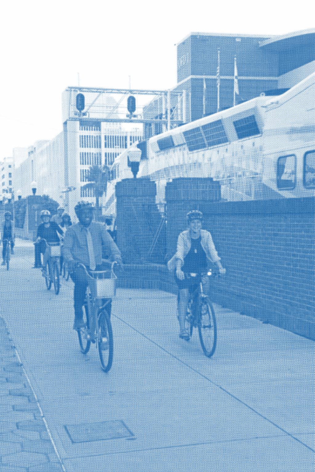
BICYCLE AND PEDESTRIAN COUNT PROGRAM 2016 Annual Report
|
|
|
- Hector Patrick
- 6 years ago
- Views:
Transcription
1 BICYCLE AND PEDESTRIAN COUNT PROGRAM 2016 Annual Report

2
3 TABLE OF CONTENTS A Message from the Mayor... 4 Data Count Reports... 5 Count Locations... 6 Count Locations Map... 7 Trail Data... 8 International Drive Count Data... 9 LOCATION COUNT SUMMARIES (ordered by date analyzed) Orlando Southeast Trail (South) Orlando Southeast Trail (North) International Drive & Oak ridge Road International Drive & Oak Ridge Road International Drive International Drive International Drive International Drive Del Verde Way Universal Boulevard Bridge Over I Orange Avenue & Central Boulevard Orange Avenue & Central Boulevard Orlando Urban Trail Gaston Edwards Park Trail Lake Baldwin Loop Trail Cady Way Trail Shingle Creek Trail Lake Underhill Path Lake Eola Lake Eola Orange Avenue & Colonial Drive Orange Avenue & Colonial Drive... 31

4 A MESSAGE FROM THE MAYOR In 2016, our residents, families, youth and visitors spent a lot of time exercising, commuting and most importantly exploring and having fun in our City on our bicycle and pedestrian network. The City of Orlando started using counter technology in 2015 to gain data to analyze and better understand how people utilize our pedestrian and biking networks. With this information, we are able to strategically plan for future investments that will continue to ensure our community is a safe place for people of all ages and abilities to get around our City by walking and bicycling. This past year in 2016, our count program focused not only on our existing trail network, but also on our International Drive area to gain more insight into areas where pedestrians and bicyclists may be visitors to our City and not as familiar with the environment in these locations. This 2016 report further details this count data in an easy to read format, including graphs and maps. Over the course of the next year we will continue to take bicycle and pedestrian counts in order to better compare year over year data to plan for future enhancements to provide everyone who walks or rides in Orlando more mobility and transportation options. I hope you enjoy learning about pedestrian and biking use in our City. Hope to see you out on our trails. Have fun and ride safe. Buddy Dyer Mayor, City of Orlando Page 4
5 DATA COUNT REPORTS The following pages are the data reports from January 2016 to January 2017, which provide a comprehensive look at the counts taken at each bicycle and pedestrian location. The data reports provide a comprehensive look at the counts taken at each bicycle and pedestrian location. The reports provide greater insight regarding the intricacies of the City s bicycle and pedestrian system, and show the following information: Total traffic Weekly profile Daily data Daily average Hourly profile during weekdays Hourly profile during weekend Distribution by direction Busiest days For more information regarding the bicycle and pedestrian count program, please contact: Ian Sikonia, AICP City of Orlando Planner III, Transportation Planning Division Ian.sikonia@cityoforlando.net Page 5
6 COUNT LOCATIONS The bicycle and pedestrian counters were rotated around the City of Orlando in order to capture data on the pedestrian and bicycle network. Counts were taken at each location for a minimum period of two weeks. LOCATIONS COUNT PERIOD Orlando Southeast Trail (Tavistock Lakes Boulevard & Sachs Avenue) 1/9/16 2/9/16 Orlando Southeast Trail (Northlake Parkway & Cypress Vine Drive) 1/9/16 2/9/16 International Drive & Oak Ridge Road (Southwest Corner) 2/18/16 3/3/16 International Drive & Oak Ridge Road (Southeast Corner) 2/18/16 3/3/ International Drive 3/14/16 3/28/ International Drive 3/14/16 3/28/ International Drive 4/1/16 4/15/ International Drive 4/1/16 4/15/ Del Verde Way 4/21/16-5/5/16 Universal Boulevard Bridge Over I-4 4/21/16 5/5/16 Orange Avenue & Central Boulevard (Northwest Corner) 5/11/16 6/11/16 Orange Avenue & Central Boulevard (Northeast Corner) 5/11/16 6/11/16 Orlando Urban Trail 7/1/16 8/1/16 Gaston Edwards Park Trail 7/1/16 8/1/16 Lake Baldwin Loop Trail 8/3/16 9/1/16 Cady Way Trail 8/3/16 9/1/16 Shingle Creek Trail 9/23/16 10/23/16 Lake Underhill Path 9/23/16 10/23/16 Lake Eola (West Side) 11/3/16 12/3/16 Lake Eola (East Entrance) 11/3/16 12/3/16 Orange Avenue & Colonial Drive (Northwest Corner) 12/15/16-1/14/17 Orange Avenue & Colonial Drive (Northeast Corner) 12/15/16-1/14/17 Page 6

7 COUNT LOCATIONS MAP Page 7
8 TRAIL DATA The following table provides the data associated with the counts taken during 2016 on the City s trail network. TRAILS AVERAGE DAILY AVERAGE MONTHLY BUSIEST DAY USERS USERS Lake Eola 4, ,141 Saturday Lake Underhill Path ,354 Sunday Lake Baldwin Loop ,062 Sunday Orlando Southeast Trail (North) ,511 Monday Cady Way Trail 305 9,277 Saturday Gaston Edwards Trail 211 6,414 Thursday Orlando Urban Trail 171 5,191 Saturday Orlando Southeast Trail (South) 107 3,252 Monday Shingle Creek Trail 68 2,063 Monday Totals: 6, ,265 Saturday Busiest Trails 1. Lake Eola 2. Lake Underhill Path 3. Lake Baldwin Loop 208,265 Busiest Days of the Week 1. Saturday 2. Sunday 3. Monday Average Daily Users: 6,844 ORLANDO URBAN TRAIL D I N K 0.75 Mile Y L I E N Page 8
9 INTERNATIONAL DRIVE COUNT DATA This year the count program was tasked with analyzing the pedestrian activity along the International Drive Tourist Corridor. Over three months, the counters were placed at eight locations for a count period of two weeks. These counts are shown in the table below. COUNTER LOCATION AVERAGE DAILY AVERAGE MONTHLY BUSIEST DAY USERS USERS 6200 International Drive ,314 Sunday 6227 International Drive ,571 Tuesday Universal Boulevard Bridge Over I ,771 Thursday 5551 Del Verde Way ,623 Saturday International Drive & Oakridge Road 269 8,178 Saturday (Southwest Corner) 5791 International Drive 222 6,757 Sunday 5656 International Drive 213 6,481 Sunday International Drive & Oakridge Road 125 3,809 Saturday (Southeast Corner) Totals: 3, ,504 Sunday Results The highest levels of pedestrian traffic occur on International Drive west of Universal Boulevard. The highest pedestrian count location was 6200 International Drive near the entrance to Wet N Wild. This sidewalk location is situated near a LYNX bus stop, I-Ride Trolley stop and the ticket office of the water park. Pedestrian traffic is assumed to be higher during the fall and winter months of the year. These counts were taken in the spring to try and establish a base line for the tourist corridor. Page 9
 2.")
 Eastbound: 53% Westbound: 47% Daily Data Weekly Profile")
10 ORLANDO SOUTHEAST TRAIL (SOUTH) (TAVISTOCK LAKES BOULEVARD & SACHS AVENUE) PERIOD ANALYZED: JANUARY 9 - FEBRUARY 9, , Monday 1. Sunday, January 31, 2016 (171) 2. Saturday, January 30, 2016 (170) 3. Monday, January 25, 2016 (162) Eastbound: 53% Westbound: 47% Daily Data Weekly Profile Hourly Profile during Weekdays Hourly Profile during the Weekend Page 10
 3.")
11 ORLANDO SOUTHEAST TRAIL (NORTH) (NORTHLAKE PARKWAY & CYPRESS VINE DRIVE) PERIOD ANALYZED: JANUARY 9 - FEBRUARY 9, , Monday 1. Monday, February 1, 2016 (641) 2. Wednesday, February 3, 2016 (573) 3. Monday, January 11, 2016 (553) Eastbound: 51% Westbound: 49% Daily Data Weekly Profile Hourly Profile during Weekdays Hourly Profile during the Weekend Page 11
12 INTERNATIONAL DRIVE & OAK RIDGE ROAD (SOUTHWEST CORNER) PERIOD ANALYZED: FEBRUARY 18 - MARCH 3, , Saturday 1. Saturday, February 20, 2016 (380) 2. Saturday, February 27, 2016 (327) 3. Friday, February 19, 2016 (321) Northbound: 60% Southbound: 40% Daily Data Weekly Profile HOURLY PROFILE Hourly Profile DURING during Weekdays WEEKDAYS HOURLY Hourly PROFILE Profile DURING during the WEEKENDS Weekend Page 12
13 INTERNATIONAL DRIVE & OAK RIDGE ROAD (SOUTHEAST CORNER) PERIOD ANALYZED: FEBRUARY 18 - MARCH 3, , Saturday 1. Saturday, February 20, 2016 (190) 2. Saturday, February 27, 2016 (159) 3. Tuesday, March 01, 2016 (150) Westbound: 57% Eastbound: 43% Daily Data Weekly Profile HOURLY PROFILE Hourly Profile DURING during Weekdays WEEKDAYS HOURLY Hourly PROFILE Profile DURING during the WEEKENDS Weekend Page 13
14 6227 INTERNATIONAL DRIVE PERIOD ANALYZED: MARCH 14-28, , Tuesday 1. Monday, March 28, 2016 (1,037) 2. Tuesday, March 22, 2016 (1,033) 3. Wednesday, March 23, 2016 (900) Southbound: 51% Northbound: 49% Daily Data Weekly Profile HOURLY PROFILE Hourly Profile DURING during Weekdays WEEKDAYS HOURLY Hourly PROFILE Profile DURING during the WEEKENDS Weekend Page 14
15 6200 INTERNATIONAL DRIVE PERIOD ANALYZED: MARCH 14-28, , Sunday 1. Sunday, March 27, 2016 (1,090) 2. Wednesday, March 23, 2016 (1,027) 3. Saturday, March 26, 2016 (987) Northbound: 55% Southbound: 45% Daily Data Page 15
16 5791 INTERNATIONAL DRIVE PERIOD ANALYZED: APRIL 1-15, , Sunday 1. Saturday, April 9, 2016 (453) 2. Sunday, April 3, 2016 (369) 3. Sunday, April 10, 2016 (240) Southbound: 55% Northbound: 45% Daily Data Weekly Profile Page 16
17 5656 INTERNATIONAL DRIVE PERIOD ANALYZED: APRIL 1-15, , Sunday 1. Friday, April 15, 2016 (253) 2. Saturday, April 9, 2016 (249) 3. Thursday, April 7, 2016 (248) Westbound: 51% Eastbound: 49% Daily Data Weekly Profile Page 17
18 5551 DEL VERDE WAY PERIOD ANALYZED: APRIL 21 - MAY 5, , Saturday 1. Saturday, April 23, 2016 (1,546) 2. Sunday, April 24, 2016 (888) 3. Saturday, April 30, 2016 (683) Southbound: 54% Northbound: 46% Weekly Profile Page 18
 2. Thursday, April 21, 2016 (703) 3.")
19 UNIVERSAL BOULEVARD BRIDGE OVER I-4 (SOUTHEAST CORNER) PERIOD ANALYZED: APRIL 21 - MAY 5, , Thursday 1. Thursday, May 5, 2016 (804) 2. Thursday, April 21, 2016 (703) 3. Monday, April 25, 2016 (676) Northbound: 54% Southbound: 46% Daily Data Weekly Profile Page 19
 2. Saturday, June 11, 2016 (4,437) 3.")
20 ORANGE AVENUE & CENTRAL BOULEVARD (NORTHWEST CORNER) PERIOD ANALYZED: MAY 11 - JUNE 11, ,259 2,637 Sunday 1. Sunday, May 15, 2016 (5,447) 2. Saturday, June 11, 2016 (4,437) 3. Saturday, May 14, 2016 (3,898) Northbound: 51% Southbound: 49% Page 20
 2. Saturday, May 14, 2016 (6,918) 3.")
21 ORANGE AVENUE & CENTRAL BOULEVARD (NORTHEAST CORNER) PERIOD ANALYZED: MAY 11 - JUNE 11, ,860 3,807 Saturday 1. Saturday, June 11, 2016 (9,280) 2. Saturday, May 14, 2016 (6,918) 3. Sunday, May 15, 2016 (6,175) Southbound: 56% Northbound: 44% Hourly Profile during the Weekend Page 21
22 ORLANDO URBAN TRAIL (VIRGINIA DRIVE) PERIOD ANALYZED: JULY 1 - AUGUST 1, , Saturday 1. Sunday, July 10, 2016 (262) 2. Sunday, July 24, 2016 (228) 3. Saturday, July 16, 2016 (224) Northbound: 55% Southbound: 45% Page 22
 2. Wednesday, July 20, 2016 (272) 3.")
23 GASTON EDWARDS PARK TRAIL (HIGHLAND AVENUE) PERIOD ANALYZED: JULY 1 - AUGUST 1, , Thursday 1. Tuesday, July 19, 2016 (300) 2. Wednesday, July 20, 2016 (272) 3. Wednesday, July 13, 2016 (268) Southbound: 53% Northbound: 47% Page 23
24 LAKE BALDWIN LOOP TRAIL (LAKE BALDWIN LANE) PERIOD ANALYZED: AUGUST 3 - SEPTEMBER 1, , Sunday 1. Sunday, August 7, 2016 (929) 2. Sunday, August 14, 2016 (837) 3. Saturday, August 6, 2016 (805) Northbound: 60% Southbound: 40% Daily Data Weekly Profile Page 24
25 CADY WAY TRAIL (BALDWIN PARK STREET) PERIOD ANALYZED: AUGUST 3 - SEPTEMBER 1, , Saturday 1. Sunday, August 21, 2016 (517) 2. Saturday, August 20, 2016 (488) 3. Saturday, August 13, 2016 (462) Northbound: 63% Southbound: 37% Daily Data Weekly Profile Page 25
 2. Tuesday, September 27, 2016 (103) 3.")
26 SHINGLE CREEK TRAIL (NORTH OF CONROY ON PRESIDENT BARACK OBAMA PARKWAY) PERIOD ANALYZED: SEPTEMBER 23 - OCTOBER 23, , Monday 1. Monday, October 10, 2016 (106) 2. Tuesday, September 27, 2016 (103) 3. Thursday, September 29, 2016 (98) Southbound: 60% Northbound: 40% Page 26
 2. Sunday, October 9, 2016 (997) 3.")
27 LAKE UNDERHILL PATH (JUST NORTH OF SPRINGVIEW DRIVE) PERIOD ANALYZED: SEPTEMBER 23 - OCTOBER 23, , Sunday 1. Sunday, September 25, 2016 (1,027) 2. Sunday, October 9, 2016 (997) 3. Monday, October 10, 2016 (899) Eastbound: 56% Westbound: 44% Hourly Profile during the Weekend Page 27
28 LAKE EOLA (WEST SIDE, NEAR RELAX GRILL) PERIOD ANALYZED: NOVEMBER 3 - DECEMBER 3, ,141 4,309 Saturday 1. Saturday, November 12, 2016 (21,470) 2. Sunday, November 6, 2016 (8,324) 3. Saturday, November 5, 2016 (7,896) Northbound: 55% Southbound: 45% Page 28
29 LAKE EOLA (EAST ENTRANCE, CORNER OF CENTRAL BOULEVARD & OSCEOLA AVENUE) PERIOD ANALYZED: NOVEMBER 3 - DECEMBER 3, , Sunday 1. Saturday, November 12, 2016 (3,003) 2. Sunday, November 20, 2016 (2,118) 3. Saturday, November 5, 2016 (1,449) Southbound: 51% Northbound: 49% Page 29
30 ORANGE AVENUE & COLONIAL DRIVE (NORTHWEST CORNER) PERIOD ANALYZED: DECEMBER 15, JANUARY 14, , Wednesday 1. Wednesday, December 28, 2016 (562) 2. Tuesday, January 10, 2017 (479) 3. Sunday, January 1, 2017 (457) Northbound: 50% Southbound: 50% Daily Data Weekly Profile Page 30
31 ORANGE AVENUE & COLONIAL DRIVE (NORTHEAST CORNER) PERIOD ANALYZED: DECEMBER 15, JANUARY 14, , Thursday 1. Sunday, January 1, 2017 (322) 2. Saturday, January 14, 2017 (312) 3. Saturday, December 31, 2016 (285) Eastbound: 53% Westbound: 47% Page 31
32
FDOT Treasure Coast Traffic Impact Report October 9 through October 16, 2015
 From: Kathleen Dempsey To: Kathleen Dempsey Subject: FDOT Treasure Coast Traffic Report 10 09 15 through 10 16 15 Date: Friday, October 09, 2015 2:10:36 PM Attachments: image003.png CR 714_Median Construction
April 4, 2014 Chuck McGinness, FDOT TREASURE COAST TRAFFIC REPORT April 4 through April 11, 2014
 April 4, 2014 Chuck McGinness, 954-777-4090 Chuck.McGinness@dot.state.fl.us FDOT TREASURE COAST TRAFFIC REPORT April 4 through April 11, 2014 TREASURE COAST Construction and maintenance-related lane closures
Site Location and Setting
 Memorandum Date: To: From: Subject: Kristy Le, Gary Black Steve Orem Santa Teresa County Park Historic Area Traffic and Parking Study Hexagon Transportation Consultants, Inc. has completed a traffic and
For Immediate Release Christine Girardin January 19, 2018 SUMTER COUNTY FLORIDA S TURNPIKE AND I-75 INTERCHANGE IMPROVEMENTS
 TRAFFIC ADVISORY For Immediate Release Christine Girardin 407-264-3069 January 19, 2018 Central and West Central Florida Weekly Lane Closures and Work Zone Advisory OCOEE Florida s Turnpike announces lane
2015 BICYCLE AND PEDESTRIAN TRAFFIC COUNT REPORT
 2015 BICYCLE AND PEDESTRIAN TRAFFIC COUNT REPORT 1 NCTCOG Public Meeting East Regional Library, Fort Worth Kevin Kokes, AICP June 13, 2016 North Central Texas Council of Governments The Importance of Active
Trail Use in the N.C. Museum of Art Park:
 Trail Use in the N.C. Museum of Art Park: New Connections, New Visitors Jacqueline MacDonald Gibson, PhD Daniel Rodriguez, PhD Taylor Dennerlein, MSEE, MCRP, EIT Jill Mead, MPH Evan Comen University of
This report recommends two new TTC transit services in southwest Toronto.
 Report for Action New TTC Services - Southwest Toronto Date: March 20, 2018 To: TTC Board From: Chief Customer Officer Summary This report recommends two new TTC transit services in southwest Toronto.
FDOT Treasure Coast Traffic Impact Report June 19 through June 26, 2015
 June 19, 2015 Chuck McGinness, 954-777-4302 chuck.mcginness@dot.state.fl.us FDOT Treasure Coast Traffic Impact Report June 19 through June 26, 2015 TREASURE COAST Construction and maintenance-related lane
5.1 Traffic and Transportation
 5.1 When it opens in 2009, the Bellevue Nickel Improvement Project will increase the number of vehicles able to travel through the study area, improve travel speeds, and improve safety by reducing the
BONITA BEACH ROAD. May 18, Ian Lockwood, PE Cindy Zerger, AICP, ASLA Ken Ray, RLA. Greg Diserio, RLA. Tara Salmieri, AICP
 BONITA BEACH ROAD May 18, 2016 Ian Lockwood, PE Cindy Zerger, AICP, ASLA Ken Ray, RLA Greg Diserio, RLA Tara Salmieri, AICP Toole Design Group Engineers Planners Landscape Architects Authors BONITA BEACH
FDOT Treasure Coast Traffic Report through
 FDOT Treasure Coast Traffic Report 02 26 16 through 03 04 16 Kathleen Dempsey Fri 2/26/2016 2:56 PM To:Kathleen Dempsey ; 1 attachment 355 KB CR 714_Median Access Modifications.pdf;
FDOT Treasure Coast Traffic Impact Report March 25 through April 1, 2016
 March 25, 2016 Chuck McGinness, 954-777-4302 chuck.mcginness@dot.state.fl.us FDOT Treasure Coast Traffic Impact Report March 25 through April 1, 2016 TREASURE COAST Construction and maintenance-related
35EXPRESS PROJECT UPDATE FOR DENTON COUNTY COMMISSIONERS
 35EXPRESS PROJECT UPDATE FOR DENTON COUNTY COMMISSIONERS 35EXPRESS PROJECT OVERVIEW 2 ABOUT THE 35EXPRESS PROJECT 3 DESIGN-BUILD TEAM 4 PROJECT PARTNERS Great partnerships make this project work Collaboration
Mainline Description
 Mainline Description The Mainline component of Florida s Turnpike extends for 320 miles and consists of five distinct sections as shown in the figure above. These sections are the SR 821 (HEFT), Southern
FDOT Treasure Coast Traffic Impact Report
 July 22, 2016 Chuck McGinness, 954-777-4302 chuck.mcginness@dot.state.fl.us FDOT Treasure Coast Traffic Impact Report July 22 through July 29, 2016 TREASURE COAST Construction and maintenance-related lane
EXISTING CONDITIONS A. INTRODUCTION. Route 107 Corridor Study Report
 II. EXISTING CONDITIONS A. INTRODUCTION The Route 107 study area extends from the south at Chestnut Street in Lynn approximately 3.7 miles to the north to Boston Street in Salem. The study area has three
Pedestrian Safety Review Spadina Avenue
 STAFF REPORT ACTION REQUIRED Pedestrian Safety Review Spadina Avenue Date: October 13, 2015 To: Toronto and East York Community Council From: Director, Transportation Services, Toronto and East York District
Lake Erie Commerce Center Traffic Analysis
 LOCATION: East of NYS Route 5 at Bayview Road Town of Hamburg Erie County, New York PREPARED BY: Wendel Companies 140 John James Audubon Parkway Suite 200 Amherst, New York 14228 January 2012 i ii Table
MEMORANDUM. Bob Zagozda, Chief Financial Officer Westside Community Schools. Mark Meisinger, PE, PTOE Felsburg Holt & Ullevig. DATE: June 11, 2018
 MEMORANDUM TO: Bob Zagozda, Chief Financial Officer Westside Community Schools FROM: Mark Meisinger, PE, PTOE Felsburg Holt & Ullevig DATE: June 11, 218 6-11-18 SUBJECT: Sunset Hills Elementary School
STUDY DESCRIPTION MEMORANDUM. DATE April 20, 2011
 DATE April 0, 0 TO FROM RE MEMORANDUM Congestion Management Program Files Ariel Godwin, CMP Manager Boston Region MPO Staff Limited-Access Highway Counts and Traffic Volumes, Summer 00 This memorandum
KING STREET TRANSIT PILOT
 KING STREET TRANSIT PILOT Update toronto.ca/kingstreetpilot #kingstreetpilot HIGHLIGHTS TRANSIT RIDERSHIP TRANSIT CAPACITY To respond to this growth in ridership, the TTC has increased the capacity of
Cabarrus County line. Overland Connector. to Newell Park. Overland Connector
 Back Creek Back Creek is a east-west trail corridor proposed within the East Park District. The corridor s endpoints are the Cabarrus County line to the east and Reedy Creek Park to the southwest. The
user s guide to Transportation Improvements in Astoria Planning Efforts outside Astoria for more information, contact:
 The Miles Crossing/ Jeffers Garden transportation plan (underway), will identify needed improvements to the Warrenton Astoria Highway and local street improvements to serve expected growth in the Miles
Springettsbury Township. Road Improvement Projects
 Springettsbury Township Road Improvement Projects 2009 2016 2016 Township Road Improvement Projects Springettsbury Township is divided into the following 4 Sectors: Northwest Sector Sherman Street Route
SAN FRANCISCO MUNICIPAL TRANSPORTATION AGENCY
 THIS PRINT COVERS CALENDAR ITEM NO.: 10.2 DIVISION: Sustainable Streets BRIEF DESCRIPTION: SAN FRANCISCO MUNICIPAL TRANSPORTATION AGENCY Approving various routine parking and traffic modifications. SUMMARY:
Wednesday, January 10 6:30-8:00 p.m. Adamsville Rec Center 3201 MLK Jr. Drive SW Atlanta, GA 30311
 YOU RE INVITED IT S YOUR TURN TO DRIVE THE CONVERSATION ABOUT BUS SERVICE CHANGES MARTA will be holding community meetings and public hearings for feedback and comments for proposed bus service modifications
EXTERNAL COMMUNICATIONS TEAM MEETING MARCH 2015
 EXTERNAL COMMUNICATIONS TEAM MEETING MARCH 2015 1 SEGMENT 1 2 THE WISHBONE Connects the TEXpress Managed Toll System to the 35Express Managed Toll System Limits: Crown Road (near Royal Lane) to Valley
KING STREET TRANSIT PILOT
 KING STREET TRANSIT PILOT Update toronto.ca/kingstreetpilot #kingstreetpilot UPDATE Average streetcar travel times in continued to show similar trends as first observed in November. The most significant
WEEKLY HIGHWAY ALERT RICHMOND DISTRICT
 CONTACT: VDOT Customer Service 1-800-367-7623 November 18, Richmondinfo@VDOT.virginia.gov WEEKLY HIGHWAY ALERT RICHMOND DISTRICT COLONIAL HEIGHTS Below is a forecast of road construction that is expected
Ocean Way at U.S. #1 (Town of Jupiter) Installation of a new traffic signal.
 Installation of a new traffic signal.") PALM BEACH COUNTY TRAFFIC DIVISION UPDATE OF ROAD AND BRIDGE CONSTRUCTION LIST DATE OF ISSUE: FEBRUARY 13, 2013 STATUS FOR FEBRUARY 18, 2013 THROUGH FEBRUARY 24, 2013 *** CONSTRUCTION WORK ZONES ADDED
PALM BEACH COUNTY TRAFFIC DIVISION UPDATE OF ROAD AND BRIDGE CONSTRUCTION LIST DATE OF ISSUE: FEBRUARY 13, 2013 STATUS FOR FEBRUARY 18, 2013 THROUGH FEBRUARY 24, 2013 *** CONSTRUCTION WORK ZONES ADDED
VDOT HOT SPOTS IN THE FREDERICKSBURG DISTRICT
 RELEASE: IMMEDIATE Aug. 10, 2018 CONTACT: Darragh Frye 540 899 4119 (office) 540 907 8409 (cell) Darragh.Frye@VDOT.Virginia.gov VDOT HOT SPOTS IN THE FREDERICKSBURG DISTRICT August 12 August 18, 2018 All
RED = CLOSED TO PUBLIC
 STREET AD 21 DAYS PRIOR TO SHOW (SUDAY, FEBRUARY 11, 2018): Close Orchid Alley from Orange Drive to Orchid Avenue from 8:00 AM to 8:00 AM on Saturday, March 10, 2018, except for emergency vehicles. HAWTHOR
Total trail movements for the period 1,569,597
 Queenstown Trail Visitation Executive Summary for Period - October 18, 2012 to January 31, 2015 trail movements for the period 1,569,597 352,718 trail journeys since opening Sunday is the busiest day of
Welcome to the Business Owners Task Force. Perry Leonard Blagg Tire and Service President/COO
 Welcome to the Business Owners Task Force Perry Leonard Blagg Tire and Service President/COO Safety: West Nile Virus Alyssa Tenorio NorthGate Constructors Public Information Manager West Nile Virus Carried
Northeast Corridor Transportation Update
 Northeast Corridor Transportation Update Presented by: Stuart Basham Division 10 Planning Engineer North Carolina Department of Transportation October 2, 2014 Today s presentation includes: I-485 Outer
 Appendix H1 Traffic Study Hill St Obispo Ave Obispo Ave Student Drop-off & Pick-up Area Parking Lot Plaza Level Hill St Fire Lane Access Service Lane Access Redondo Ave Redondo Ave Parking Lot N No
TABLE OF CONTENTS. Coral Springs Charter High School and Middle School Job No Page 2
 Job No. 15-019 Page 2 TABLE OF CONTENTS 1.0 INTRODUCTION... 4 2.0 EXISTING CONDITIONS... 5 3.0 TRAFFIC GENERATION... 7 4.0 TRIP DISTRIBUTION... 8 5.0 FUTURE CONDITIONS... 8 6.0 SITE ACCESS...13 7.0 CONCLUSION...13
TRAFALGAR PARK. 78: p.140 W 99th St FLAT ROCK CREEK PARK. W 103rd St OVERLAND PARK. Quivira Rd. College Blvd. Shared use path. Mountain bike trail
 Lenexa: overview TRAFALGAR PARK 78: p.140 As the Westport Route crosses over Lenexa's boundaries with Olathe and Overland Park several times, approximately 2.75 or 3 miles of the historic route of the
Road Construction Ahead January-April 2015 NORTHWEST REGION
 NORTHWEST REGION 1 Interstate 64 Augusta, Nelson, Albemarle counties: Installing communications conduit in median for active traffic management system on Afton Mountain. Periodic left-shoulder closures,
June 17, 2016 PUBLIC HEARING RESULTS
 The Sustainable Streets Division of the San Francisco Municipal Transportation Agency held a public hearing on Friday,, at 10:00 AM, in Room 416 (Hearing Room 4), City Hall, 1 Dr. Carlton B. Goodlett Place,
Palm Beach County Traffic Report July 13 through July 20, 2012
 For Immediate Release July 13, 2012 Meredith Cruz, (561) 641-6440 mcruz@corradino.com Palm Beach County Traffic Report July 13 through July 20, 2012 Palm Beach County Palm Beach County traffic will be
CTPS staff considered roadways that carry on average more than 1,500 weekday MBTA bus passengers in one direction as candidates for dedicated bus
 CTPS staff considered roadways that carry on average more than 1,500 weekday MBTA bus passengers in one direction as candidates for dedicated bus lanes CTPS examined the average rates of weekday bus passenger
FREDERICKSBURG DISTRICT. District Engineer Marcie Parker, P.E. May 8, 2018
 FREDERICKSBURG DISTRICT District Engineer Marcie Parker, P.E. May 8, 2018 3 Interstate 95 Projects Fredericksburg Area Fredericksburg region will see greatest degree of I-95 construction since widening
November 21, 2012 Barbara Kelleher, (954)
") November 21, 2012 Barbara Kelleher, (954) 777-4090 barbara.kelleher@dot.state.fl.us BROWARD COUNTY TRAFFIC IMPACT REPORT November 26 to November 30, 2012 FORT LAUDERDALE -- Construction and maintenance-related
November 21, 2012 Barbara Kelleher, (954) 777-4090 barbara.kelleher@dot.state.fl.us BROWARD COUNTY TRAFFIC IMPACT REPORT November 26 to November 30, 2012 FORT LAUDERDALE -- Construction and maintenance-related
TRAFFIC IMPACT STUDY REPORT FOR PROPOSED OFFICE PROJECT AT 959 SEWARD STREET IN HOLLYWOOD SNYDER PARTNERS
 DRAFT TRAFFIC IMPACT STUDY REPORT FOR PROPOSED OFFICE PROJECT AT 959 SEWARD STREET IN HOLLYWOOD Prepared for: SNYDER PARTNERS Prepared by: Crain & Associates 2007 Sawtelle Boulevard, Suite 4 Los Angeles,
Georgia 400 Tolls to End Friday, November 22 Toll collection scheduled to end after rush hour
 www.peachpass.com NOVEMBER 2013 Georgia 400 Tolls to End Friday, November 22 Toll collection scheduled to end after rush hour In This Issue GA 400 Tolls End on November 22 Lanes Closures for GA 400/I-85
Guide to. Road Construction Projects
 Guide to Road Construction Projects 2018 Spring is here and so is road construction season. This year PennDOT District 11-0 will invest an estimated $208 million on 68 projects to improve, preserve or
Albany NY Red Light Camera Locations and Activation Dates 1 Central Avenue & Colvin Avenue
 Albany NY Red Light Camera Locations and Activation Dates 1 Central Avenue & Colvin Avenue 2 Central Avenue & Henry Johnson Boulevard Eastbound 2/16/2016 1. Description of the locations where traffic control
EXTERNAL COMMUNICATIONS COMMITTEE MEETING APRIL 2015
 EXTERNAL COMMUNICATIONS COMMITTEE MEETING APRIL 2015 35EXPRESS PROJECT OVERVIEW 2 SEGMENT 1 3 SOUTH OF I-635 May Shift northbound mainlane traffic east in the southeast quadrant Miscellaneous frontage
Trail Count Report. For period: Oct March By: Mandy Kennedy for the Board of Trustees. Date: 03 April 2017
 Trail Count Report For period: Oct 18 2012 March 31 2017 By: Mandy Kennedy for the Board of Trustees Date: 03 April 2017 Executive Summary A total 1,294,144 trail journeys and 5,758,941 total trail movements
IL 390 Station. Wood Dale Open House Summary 5/18/17
 Wood Dale Open House Summary 5/18/17 The first public open house for the Wood Dale Comprehensive Plan took place on May 18 th, 2017. The program was conducted as a fun community event and there were 216
Albany NY Red Light Camera Locations and Activation Dates 1 Central Avenue & Colvin Avenue
 Albany NY Red Light Camera Locations and Activation Dates 1 Central Avenue & Colvin Avenue Westbound 8/28/2015 2 Central Avenue & Henry Johnson Boulevard Eastbound 2/16/2016 1. Description of the locations
ETS Park & Ride Report Summer 2017
 Urban Form And Corporate Strategic Development City Planning 8th Floor, Edmonton Tower 10111-104 Avenue NW Edmonton, AB T5J 0J4 Tel.: 780.496.6086 Email: varjinder.chane@edmonton,ca ETS Park & Ride Report
CONTACT: Nichole Lawrence CELL: FOR IMMEDIATE RELEASE Wednesday March 28, 2018
 FOR IMMEDIATE RELEASE Wednesday March 28, 2018 CONTACT: Nichole Lawrence CELL: 731-225-6041 West Tennessee Construction March 28-April 4, 2018 Per TDOT Specifications, there will be no temporary lane closures
Planning. Proposed Development at the Southeast Corner of Lakeshore Road West and Brookfield Road Intersection FINAL.
 Project No. 121-22908 N o v e m b e r 2 0 1 2 Traffic Impact Study Transportation Planning th GENIVAR Inc., 600 Cochrane Drive, 5 Floor, Markham, Ontario L3R 5K3 Telephone: 905.475.7270 Fax: 905.475.5994
DULLES AREA HIGHLIGHTS. Gary Garczynski Commonwealth Transportation Board Northern Virginia District. Committee for Dulles August 4, 2016
 DULLES AREA HIGHLIGHTS Gary Garczynski Commonwealth Transportation Board Northern Virginia District Committee for Dulles August 4, 2016 Smart Scale (formerly HB2) Overview Round 1 completed with the adoption
FDOT Treasure Coast Traffic Impact Report
 July 7, 2017 Chuck McGinness, 954 777 4302 chuck.mcginness@dot.state.fl.us FDOT Treasure Coast Traffic Impact Report July 7 through July 14, 2017 TREASURE COAST Construction and maintenance related lane
CONGESTION REPORT 1 st Quarter 2018
 CONGESTION REPORT 1 st Quarter 2018 A quarterly update of the National Capital Region s traffic congestion, travel time reliability, top-10 bottlenecks and featured spotlight Feburary 11, 2019 ABOUT TPB
Published Counts TrafficMetrix
 Published Counts TrafficMetrix Contents Introduction... 1 TrafficMetrix Features... 1 TrafficMetrix Benefits... 1 TrafficMetrix Data... 1 File Descriptions... 2 State Abbreviations... 3 Count Type Glossary...
Abbott Rd Rehabilitation Phase II - Elmore Rd to Birch Rd
 Abbott Rd Rehabilitation Phase II - Elmore Rd to Birch Rd Project ID SOA07003 Department State of Alaska Project Type Improvement Start Date December 2017 Location Assembly: Section 4, Seats F & G, Assembly:
Williamsburg Town Hall Meeting
 Williamsburg Town Hall Meeting DEVELOPMENT UPDATE ORANGE COUNTY PLANNING DIVISION November 30, 2017 1 AREA CONTEXT FUTURE LAND USE MAP MEADOW WOODS MEADOW WOODS GINN PROPERTY ZONING MEADOW WOODS MEADOW
Proposed Bicycle Lanes on Yonge Street from Queens Quay to Front Street
 STAFF REPORT ACTION REQUIRED Proposed Bicycle Lanes on Yonge Street from Queens Quay to Front Street Date: March 12, 2007 To: From: Toronto and East York Community Council Director, Transportation Infrastructure
Major Projects Overview
 Major Projects Overview Miami-Dade Expressway Authority February 2018 About MDX MDX operates 5 roads in Miami Dade County SR 924, SR 112, SR 836, SR 874 and SR 878 MDX Primary Source of Revenue: User Fees-Tolls
Toronto 2015 Pan Am/Parapan Am Games Temporary Traffic By-law Amendments for High Occupancy Vehicle Lanes (Supplementary Report)
") STAFF REPORT ACTION REQUIRED Toronto 2015 Pan Am/Parapan Am Games Temporary Traffic By-law Amendments for High Occupancy Vehicle Lanes (Supplementary Report) Date: March 25, 2015 To: From: Wards: Reference
STAFF REPORT ACTION REQUIRED Toronto 2015 Pan Am/Parapan Am Games Temporary Traffic By-law Amendments for High Occupancy Vehicle Lanes (Supplementary Report) Date: March 25, 2015 To: From: Wards: Reference
FOR IMMEDIATE RELEASE Fiorella Teodista January 5, 2018 SOUTH FLORIDA AND TREASURE COAST WEEKLY LANE CLOSURES AND WORK ZONE ADVISORY
 TRAFFIC ADVISORY FOR IMMEDIATE RELEASE Fiorella Teodista 954-934-1130 January 5, 2018 SOUTH FLORIDA AND TREASURE COAST WEEKLY LANE CLOSURES AND WORK ZONE ADVISORY FORT LAUDERDALE Florida s Turnpike announces
rtc transit Before and After Studies for RTC Transit Boulder highway UPWP TASK Before Conditions
 rtc transit Before and After Studies for RTC Transit UPWP TASK 3403-11-14 Before Conditions Report Boulder highway June 2011 Before and After Studies for RTC Transit BOULDER HIGHWAY BEFORE STUDY UPWP Task
MORE TIME PLACEMENT HIGH TRAFFIC LOCATIONS 10-SECOND AD SPOTS
 STATE OF THE ART BETTER TECHNOLOGY MORE TIME PLACEMENT HIGH TRAFFIC LOCATIONS 10-SECOND AD SPOTS REACH & FREQUENCY Las Vegas Billboards is dedicated to giving the reach and frequency needed for a successful
77 McDonnell-Lindbergh - Monday thru Friday NORTHBOUND Effective: March 18, Shopping Center North County. Shopping Center Washington &
 77 McDonnell- - Monday thru Friday NORTHBOUND Effective: March 18, 2019 & Valley Industries 4:53A 4:59A 5:10A 5:18A 5:27A 5:39A 5:33A 5:39A 5:50A 5:58A 6:07A 6:19A 6:13A 6:19A 6:31A 6:39A 6:49A 7:02A 6:53A
OR MISSION TRAIL ELEMENTARY
 Leawood: overview OVERLAD PARK 24: p.70 I-LA PARK 32: p.72 TOMAHAWK PARK 23: p.69 31: p.71 GEZER PARK OR MISSIO TRAIL ELEMETARY 22: p.68 W 133rd St W 135th St KASAS CITY MO - other segments Beginning/end
Daytona Beach/Melbourne
 000956 - Daytona Beach/Melbourne I-4 NS 0.95mi E/O Lake Helen Exit 116 F/NE - 1 TAB Panel ID: 333439 City: LAKE HELEN Latitude: 28.998 Media Type: Bulletin State: FL Longitude: -81.245 Display Dimensions:
If you don t Count YOU DON T COUNT
 If you don t Count YOU DON T COUNT Carl Knoch Manager of Trail Development Northeast Regional Office Methods Electro Mechanical Manual Manual Electro Mechanical Active Infrared Uses an infrared beam of
SOUTHEAST BOULEVARD Planning Study Washington, DC. Progress Drawings October 6, 2014
 Existing Conditions Site Plan CONGRESSIONAL CEMETERY SOUTHEAST BOULEVARD Planning Study Concept A (formerly A-1) Site Plan Concept A (formerly A-1) Concept A proposes an expansion of the Capitol Hill neighborhood
Cell: (408) Release MA June 25, 2012
 Release MA June 25, 2012") VTA NEWS CONTACT: Bernice Alaniz FOR IMMEDIATE RELEASE Cell: (408) 888-9983 Release MA 12 06 08 Bernice.Alaniz@vta.org June 25, 2012 Construction Activities Underway For BART Silicon Valley The Santa Clara
VTA NEWS CONTACT: Bernice Alaniz FOR IMMEDIATE RELEASE Cell: (408) 888-9983 Release MA 12 06 08 Bernice.Alaniz@vta.org June 25, 2012 Construction Activities Underway For BART Silicon Valley The Santa Clara
BRIEFING Subject: 2017 Visitation Initiatives
 BRIEFING Subject: 2017 Visitation Initiatives Presented to: Council Submitted by: Adrian Field Date: June 12, 2017 Agenda #: 7.6 This report is submitted for council s information. BACKGROUND Reason for
TRAFFIC ALERT FOR FEBRUARY 11-15, 2019 Highway Work Zones in the Staunton District
 RELEASE: IMMEDIATE February 8, 2019 CONTACT: Sandy Myers 540-332-9201 (office) STA19 027 540-292-2500 (cell) Sandy.Myers@VDOT.virginia.gov Ken Slack 540-332-9264 (office) 540-414-5670 (cell) Ken.Slack@VDOT.virginia.gov
Otay Ranch Route Alternatives 1 A SR-125 Transit and Pedestrian Bridge October Otb 2010
 Route lternatives 1 SR-125 Transit and Pedestrian ridge October Otb 2010 Calvary Christian cademy East Palomar Street Santa Cora Community Park Lomas Verdes Olympic Parkway Santa Venetia lternative 1 Town
Providing public transportation since 1999 between Washington and Milwaukee Counties
 Providing public transportation since 1999 between Washington and Milwaukee Counties Background Information Started in 1999, funded by a three-year CMAQ grant. Employers and fare revenue covered local
Confluence of Long Creek. Bellhaven Road. Approximate Corridor Length: 1.5 miles. Mecklenburg County Greenway Master Plan
 Gum Branch Gum Branch is a northwest-southeast trail corridor that is located in the Southwest Park District. This corridor s endpoints are the confluence of Long Creek in the northwest and Bellhaven Road
2006 WEEKDAY TRAFFIC PROFILE. June 15, 2007
 June 15, 2007 Mr. Gary Stobb, P.E. Director of Planning/Operations Harris County Toll Road Authority 330 Meadowfern, Suite 200 Houston, TX 77067 Re: Westpark Tollway Value Pricing Analysis Dear Mr. Stobb:
VDOT HOT SPOTS IN THE FREDERICKSBURG DISTRICT
 RELEASE: IMMEDIATE July 27, 2018 CONTACT: Tina Bundy 540 899 4560 (office) 540 907 8325 (cell) Tina.Bundy@VDOT.Virginia.gov VDOT HOT SPOTS IN THE FREDERICKSBURG DISTRICT July 29 August 4, 2018 All work
Self-Guided Tour for the Mission Park to Mission Canyon Multimodal Improvement Project
 Self-Guided Tour for the Mission Park to Mission Canyon Multimodal Improvement Project This tour can be taken by vehicle, walking, or bicycling; however, walking is the preferred method in order to stop
Bicycle Wayfinding Signage Study
 Bicycle Wayfinding Signage Study Fargo Moorhead Metropolitan Council of Governments January 2016 Version Introduction The purpose of the Bicycle Signage Study was to set forth a method of creating wayfinding
TRANSPORTATION ELEMENT
 Transportation TRANSPORTATION ELEMENT Data, Inventory, and Analysis Prepared by Contents 1.0 INTRODUCTION... 1 2.0 EXISTING CONDITIONS... 1 2.1 Roadways... 1 2.1.1 Jurisdiction... 1 2.1.2 Functional Classification...
- Countywide - Roadway Cone Zone / Lane Closure / Sidewalk Repair Schedule
 Report for Monday, September 10, 2018 through Monday, September 17, 2018 S. Perry Park Rd. (DC105) and Red Rocks Dr. Intersection Improvements Safety improvements on the S. Perry Park Road (DC 105) and
4. Safety Concerns Potential Short and Medium-Term Improvements
 NH Route 104 Access Management Study Page 19 4. Safety Concerns Potential Short and Medium-Term Improvements Potential safety improvement strategies are listed by priority based on field observations by
ORDINANCE NO. 13,972
 ORDINANCE NO. 13,972 AN ORDINANCE to amend the Municipal Code of the City of Des Moines, Iowa, 2000, adopted by Ordinance No. 13,827, passed June 5, 2000, by repealing Sections 114-306.1, 114-2156.5, 114-2640.5,
October Business Owner Task Force. Matt Sanman Public Information Coordinator
 October Business Owner Task Force Matt Sanman Public Information Coordinator Trick-or-Treating Safety Tips for Children Plan a route in advance and have emergency plan if lost. Wear reflective clothing
7-ELEVEN (Ground Lease)
") 7-ELEVEN (Ground Lease) 7525 Osceola Polk Line Rd Davenport, FL 33896 (35 miles to Downtown Orlando) TABLE OF CONTENTS TABLE OF CONTENTS I. Executive Profile Executive Summary Investment Highlights Property
7-ELEVEN (Ground Lease) 7525 Osceola Polk Line Rd Davenport, FL 33896 (35 miles to Downtown Orlando) TABLE OF CONTENTS TABLE OF CONTENTS I. Executive Profile Executive Summary Investment Highlights Property
Memorandum. To: From: cc: Date: November 7, Re: 1.0 Purpose and Organization of this Addendum. 2.0 Project Description
 Memorandum To: From: cc: Laura Prickett, Horizon Water and Environment Analette Ochoa and Wana Chiu, WRECO Parag Mehta, Kimley Horn Date: November 7, 2017 Re: Santa Cruz Route 1 Tier I and Tier II HOV
Marin County Transit District 2006 Draft Service Plan Revised: May 8 th, 2006
 Marin County Transit District 2006 Draft Service Plan Revised: May 8 th, 2006... 2... 4... 8 Marin Local Fixed Route Service... 8... 14 MCTD School Routes Operating for School Year 2006/2007...14 Other
Gardner: overview. Santa Fe, Oregon, and California National Historic Trails UNINCORPORATED JOHNSON COUNTY OLATHE UNINCORPORATED JOHNSON COUNTY
 Santa Fe, Oregon, and California ational Historic Trails : overview 99: p.134 100: p.135 GARDER JUCTIO 102: p.137 56: p.126 EDGERTO Burlington orthern Intermodal and Logistics 98: p.133 101: p.136 S Waverly
Estimating Tourism Expenditures for the Burlington Waterfront Path and the Island Line Trail
 A report by the University of Vermont Transportation Research Center Estimating Tourism Expenditures for the Burlington Waterfront Path and the Island Line Trail Report # 10-003 February 2010 Estimating
Legend: ADT= Average Daily Traffic Pk Vol= Peek Direction Traffic Volume Dir= Peek Direction Opp= Non-Peek Direction Traffic Volume WE= Weekend Count
 10/30/12 10/31/12 Alden Rd N-of S Lake Formosa 1,207 124 75 SB 49 25 Lake Formosa 1/11/12 1/12/12 Amelia St E-of Ventura Av 400 41 24 WB 17 25 Rock Lake 9/5/12 9/6/12 Cadogan Av N-of Piedmont Ct 1,394
PRIORITIES COMMITTEE MEETING
 PRIORITIES COMMITTEE MEETING Meeting Date: 05/13/14 Agenda Item #: 13.1 Northeast Anthony Henday Drive Update Report Purpose To update the Priorities Committee on the progress of the Northeast Anthony
#1. Why is the City doing this project?
 Community Workshop #2 January 2016 #1. Why is the City doing this project? Broadway and Lincoln are in constant change Broadway and Lincoln are in constant change Broadway and Lincoln are in constant change
TORONTO TRANSIT COMMISSION REPORT NO.
 Form Revised: February 2005 TORONTO TRANSIT COMMISSION REPORT NO. MEETING DATE: March 24, 2010 SUBJECT: ACTION ITEM EXTENSION TO EXHIBITION LOOP RECOMMENDATIONS It is recommended that the Commission: 1.
Why we re here: For educational purposes only
 Transportation 2050 Why we re here: For educational purposes only Transportation 2050 Bus Elements PUBLIC TRANSIT DEPARTMENT City of Phoenix Citizens Committee on the Future of Phoenix Transportation (CCFPT)
Memo. Orange City Trail Plan Becky Mendez, AICP Jamie Krzeminski, PE, PTOE Matt Wiesenfeld, PE, AICP. Development of the Existing and Proposed Network
 Memo Date: Friday, December 22, 2017 Project: To: From: Subject: Trail Plan Becky Mendez, AICP Jamie Krzeminski, PE, PTOE Matt Wiesenfeld, PE, AICP Development of the Existing and Proposed Network HDR
Wake Bus Plan. Short Range Transit Plans. Proposed Transit Service Projects and Changes. GoTriangle. Volume 2 DRAFT
 Wake Bus Plan Short Range Transit Plans Proposed Transit Service Projects and Changes Volume 2 GoTriangle DRAFT Table of Contents Information on the Wake Bus Plan Short Range Transit Plans Project Sheet
CHAPTER 1 TRANSIT MARKET AREAS AND EXISTING SERVICE
 CHAPTER 1 TRANSIT MARKET AREAS AND EXISTING SERVICE Transit Market Areas While several factors influence the propensity to use transit, the primary predictors of transit productivity are the density of