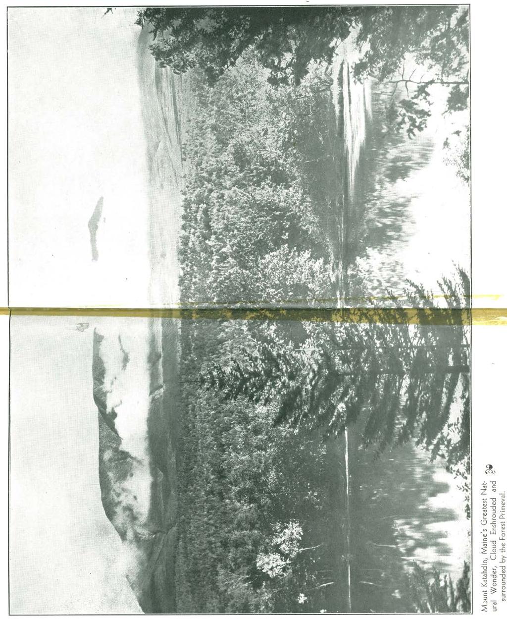
Mount Katahdin in Maine
|
|
|
- Dylan Warner
- 6 years ago
- Views:
Transcription
1 Bangor Public Library Bangor Community: Digital Books and Publications Special Collections 1930 Mount Katahdin in Maine Bangor and Aroostook Railroad Follow this and additional works at: Recommended Citation Bangor and Aroostook Railroad, "Mount Katahdin in Maine" (1930). Books and Publications This Book is brought to you for free and open access by the Special Collections at Bangor Community: Digital It has been accepted for inclusion in Books and Publications by an authorized administrator of Bangor Community: Digital For more information, please contact
2 Mount Katahdin 1 n MAINE ""'..('.. '. f ~ J I "I I' " Issued by ",,.,., "0.,, Pass e n g er~~ a'hit ~ D~~~ ~t~le r;t 1930

3 Mt. Katahdin from Kidney Pond. ew
4 Mount Katahdin M OUNT KATAHDIN is 5,273 feet above sea level. Mount Katahdin is one of the three highest mountains east of th e Rockies. Mount Katahdin is reached by the Bangor and Aroos- took ra il road from Norcross, Millinocket and Stacyville stations. Mount Katahdin also can be reached by the Bangor and Aroostook railroad to Greenville, thence overland to the Penobscot's West Branch and down the West Branch to Abol stream 12 miles below Ripogenus. Still a.oother route is from Ripogenus dam by road to Harrington Lakei across the lake to Kidney Pond and thence by the Hunt Trail to Mt. Katahdin. Mount Katahdin has attractions that provide a program for a prolonged stay by the enthusiast. The minimum trip is two days, a day in the ascent, overnight on the mountain and return th e second day. The Mt. Katahdin country, th e vast expanse over which Katahdin dominates, is one of the outstanding sections of the Maine woods for fishing and hunting and canoeing and for general vacation pleasures. Mount Katahdin offers opportunities for exceptional sport for the devotee of mountain climbing. Its variety of approaches and routes offers relatively easy traveling or some sporty scrambling, depending upon.choice of the mountaineer planning to make th e ascent. facts at a Glance [ 3]

5 The Chimney on Mt. Katahdin... one of the many famous Landmarks of Maine's ew Great Peak. [ 4 J

6 Crossing Mt. Katahdin's Knife Edge... A ~ stunt that won't appeal to the Mountaineers for whom the Knife Edge is none too easy afoot. [51
7 The Trails to Katahdin... r, r THE principal trails to Katahdin now used by the tourist, or moun- ~ tain climber, whose objective is Monument Peak, the highest point in Maine, are the Millinocket trai l, Hunt trail and Abo\ trail ) Two new trails, branching from the Millinocket trail, have been opened recently for those who care for the more sporty and sometimes hazardous proposition of reaching Monument Peak by way of Pamola Peak and the Knife Edge. One of these leaves Millinocket trail near Togue Pond Camps. The other is the Dudley trail leading up over Pamola and the Knife Edge from Chimney Pond. There is also the North Basin Trail leading up over Hamlin Ridge between the North and South Basins. The old trail from Stacyville leading by Katahdin Lake can still be used and the old Wassataquoik trail which leads up the valley and onto the north end of th e mountain is being cleared of fallen trees and obstructions at the present time. Still another trail leads from Patten west to Happy Co rn er and then to Lunkasoo on the East Branch, across this rive r and Wassataquoik Stream where it hits th e old Appalachian trail to Katahdin Lake. Also th e Gilpatrick trail which crosses the East Branch some three miles below Lunkasoo then passes along a dry ridge to Katahdin Lake; all of which it is good to be on, but th e First th ree trails are th e ones principally used at th e present tim e. Millinocket Trail... THE Millinocket tra il starts from th e interesting paper town of th e Great Northern Paper Co., M ill inocket, 81 mil es north of Bangor via the Bangor and Aroostook Railroad. The large paper mills and Fine hotel of the Company are of interest to the tourist, and the latter provides excellent accommodations for those planning a morn ing start for Katahdin Mountain,. now looming in the north 31 miles away. The stores here also furni sh opportunity to procure any needed suppli es for the trip. This trail is well marked by guide boards and, by using ca re, passabl e for autos 22 mil es, that is, 17 miles to T ogue Pond Camps, w here you ca n tarry for Fishing or dinner, and five miles beyond to Windy Pitch. Here cars should be [6]
8 parked as per sign posted until return from the mountain. This road is being continua lly improved by Millinocket's wide awake Chamber of Commerce and others interested. At Windy Pitch, if you have telephoned to the State Camp at Chimney Pond, you are met by a trusty guide, and, if you desire, w ith pack horse to accompany you to Chimney Pond, a hike of eig ht miles, where you camp for the night. In rainy weather you wi ll find nearby shelter camps, with stone fireplaces for warmth and cooking. The foot of Basin Slide is but a mi le away, or if you camp at Basin Pond it is but a little over two mi les distant. Here th e real climb begins, and although this entire trail is so well marked by painted guide boards that a stranger can go from Millinocket to Katahdin alone, the ascent should not be made without a guide on account of th e clouds that sometimes settl e on th e mountain obliterating a~\ cairns or trails to the eye of one not familiar with its peaks and tabl e lands. The Hunt Trail... THE Hunt Trail leads from the Kidney Pond Camps and Daisey Pond Camps over the southwest spur of the mountain to Abo\ table land where it unites with the Abo\ trail to Monument Peak. These camps are reached from Greenville (Moosehead Lake), 91 miles from Bangor (via Bangor and Aroostook railroad) where all kinds of camping supplies can be procured, and Ripogenus dam to Sourdnahunk Stream, the western border of Katahdin Park Game Preserve. Autos should be parked here just inside the limits of the Preserve. It is then a hike of about eight miles to either the camps at Kidney Pond, or to the Daisey Pond Camps, the latter being the only sportin g camps within the Park. Good accommodations can be had at 'either place and it is then about six miles to "Governor's Spring" on the Abo\ table land and one mile further to Monument Peak. There is also a camping place at the cave on this trail near the timber line, with excellent spring nearby. This trail should never be undertaken without a guide, or someone in the party who is familiar with it[ Whi\e the hike on this trail is somewhat long er/ from the autos to t'hetop, it is considered by many as equal to any on account of Moosehead Lake, Ripogenus and other wonderful scenery along the way. J [ 7]
 a.")
9 L - ro $: "'0 ~- 0 :J :J Q_ "' () a. 3 "0

10 ~ ~ The Abo I Trail ~. \ THIS trail, made famous by H en ry D. Thoreau/ may be reached from Norcross by steamer up through North Twin Lake, Pamadumcook and Ambajejus to the West Branch, thence by canoe to Pitman's Camps directly south of the Mountain and Abol trail which can be seen from the camps. Pitma n's Camps may also be reached from Ripogenus by going down the West Branch. Good fishing waters are found here as on the other trails to be enjoyed if not in too much haste. These Camps can be reached in one day's journey from Bangor over the Bangor and Aroostook railroad to Norcross and thence by steamer and canoe as indicated. It is then about 8 miles from th e Camps to the top of Katahdin, but a sma ll camp w ith camping grounds at the timber line where one can stay over night gives an opportunity to finish th e climb the next morning before the sun strikes th e South side of th e mounta in. A guide or someone familiar w ith th e trail should make one o f the party. ' \.J- A Photogra ph from Ka tahdin 's Summit, ~ showing some of the ma ny Lakes visible on all sides. (Photo by Col. Fred erick F. Black, U. S. A.) [9]

11 , 0 On the Summit of Mt. Katahdin. ew

12
13 View of the Great South Basin. (Copyright by Wm. F. Dawson)]
14
15 From Pdmold, showing the "Sdddle" on ~.::l Kdtdhdin. c-- (Photosr ph by-g.~herb e rt Whitney)

16 Along the Knife Edge, Katahdin (from Pamola to Monument Peak). Note the hiker in the middle distance. (Photogr ph by G. Herbert Whitney)

17

18
19

20 ,} Two familiar Mt. Katahdin Landmarks. C himney Pond and Pamola Peak. ~ [ 18]

21 At the Timber Line on the Hunt Trail up Mt. Katahdin.
22 to 0 Mt. Katahdin's Tableland from Monument Peak.

23 \ On the Knife Edge, Katahdin (Photogr.ph by G. Herbert Whitney)
24 to to Part of the Trdil from Pdmold to the Summit ~.::l of Mt. Kdtahdin vid the Knife Edge. er-' (Photosr ph by G. Herbert Whitney)

25 . ),..-{ 1-.L:.<. A ~ Some Sporty Climbing via the Knife Edge from Pamola to the Monument. (Photogroph by G. Herbert Whitney) [ 23]

26 The Knife Edge, Mt. Katahdin, wh ich provides some sporty work by Mountaineers.
27 ~ Around the Luncheon Fire at the " Cave" on the Hunt Trail up Mt. Katahdin.

28 On Katahdin looking back towards Pamela. The "Chimney" Trail comes out be- gw tween two Humps at Left. (Photogroph by G. H erbert Whitney)
 (Photogr ph by G.")
29 Trail along the Knife Edge (from Pamola to Monument Peak.) (Photogr ph by G. Herbert Whitney)
30 Wdll of Katahdin from side of Pamold. (Photogroph by G. Herbert Whitney)

31 Looking over the World from Mt. Kdtdhdin.

32 THE APPALACHIAN MOUNTAIN CLUB MAP OF MT. KATAHDIN

33 Redrawn by permission from the Appalachian Mountain Club map Copyright 1927 byappalacflian Mt~. Clu.b.
34 w to "t: "

35
A Guide to Baxter State Park and Mount Katahdin in Maine
 Maine State Library Maine State Documents Baxter Park Authority Documents Baxter Park Authority 1965 A Guide to Baxter State Park and Mount Katahdin in Maine Baxter State Park Authority Maine Department
Alpine Glacial Features along the Chimney Pond Trail, Baxter State Park, Maine
 Maine Geologic Facts and Localities September, 2009 Alpine Glacial Features along the Chimney Pond Trail, Baxter State Park, Maine 45 54 57.98 N, 68 54 41.48 W Text by Robert A. Johnston, Department of
THE INTERNATIONAL APPALACHIAN TRAIL IN MAINE
 THE INTERNATIONAL APPALACHIAN TRAIL IN MAINE INTRODUCTION The Maine section of the IAT/SIA is 130 miles (211kms) long. Heading north from the Katahdin Lake East (KLE) Access trailhead of Baxter State Park,
S H A W A N G U N K R I D G E T R A I L
 214 Shawangunk Ridge Trail The Shawangunk Ridge Trail was originally conceived as a relocation of the Long Path from Harriman State Park to Minnewaska State Park. Now part of the Long Path system, the
Take Me. Outside!!! C.R.X C.R.X. Registration Begins April 30, 2018 ~ Guarantee your spot!
 Caribou Rec. Xtreme Take Me. Outside!!! C.R.X. 2018 C.R.X. Registration Begins April 30, 2018 ~ Guarantee your spot! Allagash, Baxter State Park, Backpacking, Kayaking, Mountain Biking, Camping, Swimming
Route #1) Mt. of the Holy Cross - North Ridge
 Mt. of the Holy Cross - North Ridge") Climbing 14ers can be very dangerous, please read the Mountaineering Safety Page and make sure you have a map+compass and can use them effectively, without the help of electronic devices. Route #1) Mt.
Climbing 14ers can be very dangerous, please read the Mountaineering Safety Page and make sure you have a map+compass and can use them effectively, without the help of electronic devices. Route #1) Mt.
C E N T R A L C A T S K I L L S
 120 C E N T R A L C A T S K I L L S Central Catskills Once out of the southern parts of the Catskills, the Long Path enters the more well traveled and civilized regions. The trail joins the Devil s Path,
GOLDEN EARS PROVINCIAL PARK
 GOLDEN EARS PROVINCIAL PARK Trail Information as of October 10 th 2015 Do not underestimate the mountainous wilderness of Golden Ears Provincial Park. The combination of rugged terrain and rapidly changing
1. Waterfall Gully Mt Lofty. 5 Of the Best Hikes in Adelaide
 Adelaide is a beautiful city, and one of the most incredible things about Adelaide is the quality of bushwalking available on the suburban fringe. It is surrounded by the Mt Lofty Ranges, and much of the
Route Combo) Mt. Bierstadt - Bierstadt, Sawtooth, Evans
 Mt. Bierstadt - Bierstadt, Sawtooth, Evans") Climbing 14ers can be very dangerous, please read the Mountaineering Safety Page and make sure you have a map+compass and can use them effectively, without the help of electronic devices. Route Combo)
Climbing 14ers can be very dangerous, please read the Mountaineering Safety Page and make sure you have a map+compass and can use them effectively, without the help of electronic devices. Route Combo)
Mount Reliance: Coast Range
 Mount Reliance: Coast Range H enry S. H all, J r. A S long ago as 1864 Alfred Waddington gave names to a few features visible from the line of his projected road from Bute Inlet up the Homathko Valley
HIKING IN THE CANADIAN ROCKIES
 HIKING IN THE CANADIAN ROCKIES Distance Time Elevation y MORAINE LAKE TRAILS THE ROCKPILE 0.8 km (0.5 mi) 20 min 30 m (98 ft) Located adjacent to the Lodge, the short interpretive trail up the Rock Pile
Sunday / Monday - Osceolas
 AMC August 3, 2015 Sunday / Monday - Osceolas 0 1737 ft 2007, Appalachian Mountain Club. All rights reserved. Notes Created by AMC White Mountain Guide Online wmgonline.org 1 Distance Time Elev Change
9 December 2016 Maxwell Wolckenhauer NYS DEC State Highway 10, Suite 1 Stamford, NY Conservation.
 Conservation Education Recreation Since 1922 9 December 2016 Maxwell Wolckenhauer NYS DEC 65561 State Highway 10, Suite 1 Stamford, NY 12167 r4.ump@dec.ny.gov RE: Windham-Blackhead Range Wilderness UMP
Route #2) Mt. Massive - Southwest Slopes
 Mt. Massive - Southwest Slopes") Route #2) Mt. Massive - Southwest Slopes Difficulty: Class 2 Ski: Advanced, D6 / R2 / III Exposure: Summit Elevation: Trailhead Elevation: Elevation Gain: Round-trip Length: Trailhead: County Sheriff:
Route #2) Mt. Massive - Southwest Slopes Difficulty: Class 2 Ski: Advanced, D6 / R2 / III Exposure: Summit Elevation: Trailhead Elevation: Elevation Gain: Round-trip Length: Trailhead: County Sheriff:
Avalanche Incident on Twin Peaks Flint Creek Range December 24, 2013
 Avalanche Incident on Twin Peaks Flint Creek Range December 24, 2013 On December 24, 2013, a group of snowmobilers were riding in familiar terrain in the Flint Creek Range 8 miles southeast of Phillipsburg,
Crystal Lake Area Trails
 Lake Area Trails Welcome to the Lake area of the Big Snowy Mountains! This island mountain range in central Montana features peaks reaching to 8,600 feet and long, high ridges from which vistas of the
The Cleo s Bath North Side Hike
 The Cleo s Bath North Side Hike This hike is a cross-country hike from Pinecrest Lake to the north side of Cleo s Bath. It is quieter and much less crowded than the normal route, which goes up the south
Kit Carson-Challenger Ridge Trail Project
 Kit Carson-Challenger Ridge Trail Project Project Accomplishments Report-USFS December 15, 2015 Photo courtesy of Justin Peterson 815 South 25 th Street, Suite 101 Colorado Springs, CO 80904 Dedicated
Within Katahdin s Realm: Log Drives and Sporting Camps - Chapter 08: Fisk s Hotel at Nicatou Up the West Branch to Ripogenous Lake
 The University of Maine DigitalCommons@UMaine Maine History Documents Special Collections 1-2018 Within Katahdin s Realm: Log Drives and Sporting Camps - Chapter 08: Fisk s Hotel at Nicatou Up the West
White Mountain Wilderness Trails
 The area in which these hikes are located is rugged high mountain country along the Mogollon Rim. This famous eastwest escarpment separates Arizona's high plateau from the basin and range below. These
Maine Office of Tourism Visitor Tracking Research 2013 Calendar Year Annual Report Regional Insights: Maine Highlands
 Maine Office of Tourism Visitor Tracking Research 2013 Calendar Year Annual Report Regional Insights: Maine Highlands Prepared by May 2014 1 1 Table of Contents Research Objectives and Methodology 3 Overnight
ROAD SCHOLAR SPRING HIKING ADVENTURE Tentative Schedule April 9-14, 2017
 ROAD SCHOLAR SPRING HIKING ADVENTURE Tentative Schedule April 9-14, 2017 Sunday, April 9 PM 3:00-5:00 Arrival, registration and move in to the dorm. 6:00 Supper EVE 7:15 Welcome & Orientation, Sign Ups
County Line trail - Miller Peak to Little Navaho
 County Line trail - Miller Peak to Little Navaho 7-17-2008 This hike features a portion of the County Line trail in the Teanaway that receives extremely little use despite offering a spectacular ridge-run
" Voting Place " " Prince William County, Virginia Gainesville Election District Voting Precincts and Voting Places EVERGREEN BATTLEFIELD ALVEY
 GROVETON PAGELAN LN MOUNTAIN Prince William County, Virginia Gainesville Election istrict Voting Precincts and Voting Places EVERGREEN LOGMILL JAMES MAISON HY 15 Voting Place 401 Evergreen Precinct Evergreen
Climbing Oak and Brushy Top Mountains
 Climbing Oak and Brushy Top Mountains Story and photographs by Vann Helms www.blueridgeimpressions.org Brushy Top Mountain- February 2, 2014 Brushy top summit After a January of record breaking cold weather,
Experience Maine s Katahdin Region
 Experience Maine s Katahdin Region An easy ride up I-95 Guided moose and wildlife tours Whitewater rafting Camping, cabins, and luxury lodging Spectacular views Fine dining and light fare Fishing, hiking
Avalanches and the Mount Whitney Basin
 Avalanches and the Mount Whitney Basin 10 April 2006 by Bob Rockwell Prelude Avalanches are a fact of life in high mountains in winter, and we take courses to find out about them. We learn how to assess
Quandary Peak East Ridge
 Quandary Peak East Ridge Difficulty: Class 1 / 2 June 28,2013 Exposure: Summit Elev.: 14,265 feet Trailhead Elev.: 10,850 feet Elevation Gain: 3,450 feet Roundtrip: 6.75 miles Hikers: Shan Stuart, Rick
Hiking Las Vegas.com
 Hike: Mt. Wilson via First Creek Canyon route Trailhead: First Creek marked Distance: 10 miles up and back Elevation gain: 3,400 feet Elevation of Peak: 7,070 feet Time: 7 to 9 hours (up and back) Difficulty:
Mt. Sneffels (from Yankee Boy Basin) - A Cool Fourteener
 - A Cool Fourteener") Mt. Sneffels (from Yankee Boy Basin) - A Cool Fourteener Difficulty: Difficult Class 3 Exposure: Summit Elev.: 14,150 feet Trailhead: Yankee Boy Basin Climbers: Rick Crandall; Shan Stuart; Laura Welch
Mt. Sneffels (from Yankee Boy Basin) - A Cool Fourteener Difficulty: Difficult Class 3 Exposure: Summit Elev.: 14,150 feet Trailhead: Yankee Boy Basin Climbers: Rick Crandall; Shan Stuart; Laura Welch
Meeting Point The Wintercamp reception will be clearly sign posted. From here, you will book in, be given a site map and direction to your campsite.
 Information for Parents/Guardians WIntercamp is a busy event and this may appear daunting when you first arrive on site. The following information will help with the smooth arrival of your young person
Looking back across Emerald Lake at Wapta Mountain (on the left) and Mount Burgess (on the right):
 and Mount Burgess (on the right):") YOHO LAKE FROM EMERALD LAKE, YOHO NATIONAL PARK, BRITISH COLUMBIA, CANADA We decided to hike to Yoho Lake from Emerald Lake even though the distance is longer than the trail from Takakkaw Falls (about
YOHO LAKE FROM EMERALD LAKE, YOHO NATIONAL PARK, BRITISH COLUMBIA, CANADA We decided to hike to Yoho Lake from Emerald Lake even though the distance is longer than the trail from Takakkaw Falls (about
Bear Butte State Park Trail System NORTH
 Trail System 4426 4250 4000 3750 3500 3250 NORTH SCALE IN FEET 0 1000 2000 Summit Trail Type of trail: Hiking Length of trail: 1.85 miles Trail surface: Dirt and rock Rated: Moderate, somewhat hilly, even
Mt. Hood [Map Pack Bundle] (National Geographic Trails Illustrated Map) By National Geographic Maps - Trails Illustrated READ ONLINE
![Mt. Hood [Map Pack Bundle] (National Geographic Trails Illustrated Map) By National Geographic Maps - Trails Illustrated READ ONLINE](/thumbs/85/92056945.jpg "Mt. Hood [Map Pack Bundle] (National Geographic Trails Illustrated Map) By National Geographic Maps - Trails Illustrated READ ONLINE") Mt. Hood [Map Pack Bundle] (National Geographic Trails Illustrated Map) By National Geographic Maps - Trails Illustrated READ ONLINE If you are looking for a book by National Geographic Maps - Trails Illustrated
Mt. Hood [Map Pack Bundle] (National Geographic Trails Illustrated Map) By National Geographic Maps - Trails Illustrated READ ONLINE If you are looking for a book by National Geographic Maps - Trails Illustrated
Top Trails: Great Smoky Mountains National Park: 50 Must-Do Hikes For Everyone By Johnny Molloy
 Top Trails: Great Smoky Mountains National Park: 50 Must-Do Hikes For Everyone By Johnny Molloy Slide 43 of 51: Located in the Great Smoky Mountains, the Located in the heart of Rocky Mountain National
Kit Carson-Challenger Ridge Trail Project Annual Performance Report-2014 October 22, 2014
 1 Kit Carson-Challenger Ridge Trail Project Annual Performance Report-2014 October 22, 2014 Willow Lake and Kit Carson Peak 2 SUMMARY The Rocky Mountain Field Institute began Phase 1 of a multi-phase,
TAHOE GETAWAY. Monday, October 1 through October 4, 2012
 TAHOE GETAWAY Monday, October 1 through October 4, 2012 COORDINATORS Sue Geisler --- Hiking Dennis Ratay --- Lodging Lodging is now filled. Waiting List: Anyone else interested in participating in the
Rogue Gorge (Mt. Stella) Roadless Area-- T30S R3E (primarily in portions of Sections 23, 26, 33, 34 & 35)
 Roadless Area-- T30S R3E (primarily in portions of Sections 23, 26, 33, 34 & 35)") Rogue Gorge (Mt. Stella) Roadless Area-- T30S R3E (primarily in portions of Sections 23, 26, 33, 34 & 35) Rogue River-Siskiyou National Forest--High Cascades Ranger District Upper, higher elevation trail
Rogue Gorge (Mt. Stella) Roadless Area-- T30S R3E (primarily in portions of Sections 23, 26, 33, 34 & 35) Rogue River-Siskiyou National Forest--High Cascades Ranger District Upper, higher elevation trail
Mt. Massive Southwest Slopes
 Mt. Massive Southwest Slopes Difficulty: Class 2 Exposure: Summit Elevation: 14,421 feet Trailhead Elevation: 10,500 feet Elevation Gain: 4,050 feet Round-trip Length: 8.00 miles Trailhead: N. Halfmoon
(west) onto Charleston Boulevard. Drive 16 miles on Charleston and turn right into Red Rock
 onto Charleston Boulevard. Drive 16 miles on Charleston and turn right into Red Rock") Hike: North Peak and Ice Box Overlook up and back Trailhead: 2.5 miles up the Rocky Gap Road not mark Distance: 5 miles round trip Elevation gain: 2,694 feet Elevation Peak: 7,094 feet Time: 3 to 5 hours
Hike: North Peak and Ice Box Overlook up and back Trailhead: 2.5 miles up the Rocky Gap Road not mark Distance: 5 miles round trip Elevation gain: 2,694 feet Elevation Peak: 7,094 feet Time: 3 to 5 hours
International Appalachian Trail. Trail Guide. East Branch of the. Penobscot River. Maine. Baxter State Park to. Grand Lake Road
 International Appalachian Trail Trail Guide East Branch of the Penobscot River Maine Baxter State Park to Grand Lake Road Maine Chapter International Appalachian Trail August 1, 2012 Acknowledgments This
L U N C H C R E E K T R A I L GLACIER NATIONAL PARK
 D I R T I N M Y S H O E S L U N C H C R E E K T R A I L GLACIER NATIONAL PARK Lunch Creek "Secret" Hike This short hike on the Lunch Creek Trail will knock your socks off! It's the perfect mix of length,
ROAD SCHOLAR SPRING HIKING ADVENTURE Tentative Schedule April 8-13, 2018
 Sunday, April 8 ROAD SCHOLAR SPRING HIKING ADVENTURE Tentative Schedule April 8-13, 2018 PM 3:00-5:00 Arrival, registration and move in to the dorm. 6:00 Supper EVE 7:00 Welcome & Orientation, Sign Ups
Grindstone Scenic Byway Corridor Partnership Plan. Overview
 Grindstone Scenic Byway Corridor Partnership Plan The following text is pulled from the working CPP website. Although the Corridor Advocacy group did adopt this plan in principle in its meeting of November,
Meeting Point The Wintercamp reception will be clearly sign posted. From here, you will book in, be given a site map and direction to your campsite.
 Information for Parents/Guardians WIntercamp is a busy event and this may appear daunting when you first arrive on site. The following information will help with the smooth arrival of your young person
Tiger Mountain State Forest:
 98 60 hikes within 60 miles: SEATTLE 20 Tiger Mountain State Forest: West Tiger Mountain Three Loop i KEY AT-A-GLANCE INFORMATION Length: 5.1 miles round-trip Configuration: Loop Difficulty: Moderate difficult
13 falls to garf shelter
 AMC March 21, 2012 13 falls to garf shelter 0 7383 ft 2007, Appalachian Mountain Club. All rights reserved. Notes Created by AMC White Mountain Guide Online wmgonline.org 1 starting at Lincoln Woods Trailhead
KUSHILAND Expeditions & Tour Safaris Ltd
 KILIMANJARO TREK MACHAME ROUTE TOUR CODE KMC 02 7 DAYS MACHAME ROUTE Kilimanjaro s Machame Route, often referred to as the Whiskey route, is more scenic and is longer than Marangu. The minimum duration
Lava Mountain Trail Distance: Elevation Range: Trail Type: Difficulty: Season: Driving Distance: Driving Time: USGS Maps: Pros Cons
 Lava Mountain Trail Distance: 13.4 miles (including the side trip to North Star Lake) Elevation Range: 5900'-8330' Trail Type: singletrack Difficulty: moderate Season: late June-October Driving Distance:
A TOPOGRAPHIC FEATURE OF THE HANGING VALLEYS OF THE YOSEMITE.
 A TOPOGRAPHIC FEATURE OF THE HANGING VALLEYS OF THE YOSEMITE. THE larger hanging valleys around the Yosemite valley have topographic features in common that are interesting in themselves, and they likewise
CHALLENGE OVERVIEW. ACCOMMODATION. You will be accommodated in friendly, simple hotels and tents whilst on the mountain.
 CHALLENGE OVERVIEW Mount Kilimanjaro is one of the seven Natural Wonders of the World and for many people, standing on its summit is a life-long ambition. The snow-capped peak was first reached by German
STOK KANGRI 5490M STOK KANGRI TREK Aug 03-15, 2019
 STOK KANGRI 5490M STOK KANGRI TREK Aug 03-15, 2019 STOK KANGRI TREK: INTRODUCTION One of the most popular trekking peaks in the Indian Himalayas and on the planet, the proximity to Leh (the capital of
Suggested Day Hikes. Mount Greylock State Reservation 3, 4 1, 2. Take a Hike! Things to remember:
 Suggested Day Hikes Mount Greylock State Reservation Take a Hike! This guide offers suggested day hike routes in two parts: 1) Year-round Hikes and 2) Seasonal Hikes (late-may to Nov.1). Use this guide
Maine Office of Tourism Visitor Tracking Research 2012 Calendar Year Annual Report Regional Insights: Maine Highlands
 Maine Office of Tourism Visitor Tracking Research 2012 Calendar Year Annual Reort Regional Insights: Maine Highlands Preared by Aril 2013 1 Introduction and Methodology 2 The Maine Office of Tourism has
Mt. Eolus and North Eolus
 Mt. Eolus and North Eolus Difficulty: Class 3 Exposure: Summit Elev.: Mt. Eolus: 14,083 feet N. Eolus: 14,039 feet Camp Elev.: 11,100 feet Elevation Gain: 3,200' starting at Chicago Basin 6,300' starting
Ridgefield Crossing. Mixed-Use Development. Pricing: Site. Possible build-to-suit FOR SALE, GROUND LEASE, OR BUILT-TO-SUIT
 N 65th Ave N 10th St Pioneer St Site S 5th St S 6th Way Mixed-Use Development New mixed-use development with great freeway access. 128 housing units and 11 commercial lots planned. Drive-thru & build-to-suit
A Week on Katahdin. by Dan Styer
 A Week on Katahdin by Dan Styer On July 16, 1978, I made my first ascent of Katahdin. This was no everyday climb for me I had just spent twenty-seven days walking 300 miles clear across Maine to reach
A four-season scenic drive
 2013 A four-season scenic drive Photo by Carl Scott Welcome to the Byway! The Katahdin Woods & Waters Scenic Byway takes visitors through some of the most spectacular natural landscape that inland Maine
Munro Step Challenge Munro step Challenge
 Munro Step Challenge 2018 Munro step Challenge 2018 1 Munro Step Challenge 2018 This September, we re supporting Blood Cancer Awareness Month by inviting you to take on the Munro Step Challenge. A Munro
Great Eastern Trail Newsletter
 Great Eastern Trail Newsletter Volume 1, Number 1, January 2011 By Timothy A. Hupp Please feel free to print out or copy and distribute this newsletter Note this is the first newsletter of the Great Eastern
Simien Mountain Trek and Lalibela (ES 2017)
") Simien Mountain Trek and Lalibela (ES 2017) TRIPDURATIO 13 DAYS Tour Style: Classic Tour Type: Small Groups Trip Code: ES Accommodation Grade: Simple Trek Grade: Challenging Trip Highlights - Simien Mountain
Simien Mountain Trek and Lalibela (ES 2017) TRIPDURATIO 13 DAYS Tour Style: Classic Tour Type: Small Groups Trip Code: ES Accommodation Grade: Simple Trek Grade: Challenging Trip Highlights - Simien Mountain
DISCOVER THE KATAHDIN EGION R OF THE MAINE HIGHLANDS. est MAINE S ULTIMATE ADVENTURE RESORT for over 25 years
 DISCOVER THE KATAHDIN EGION R OF THE MAINE HIGHLANDS est. 1982 MAINE S ULTIMATE ADVENTURE RESORT for over 25 years WELCOME TO NEW ENGLAND OUTDOOR CENTER What s different about a New England Outdoor Center
MOUNT MADELINE GUIDED ASCENT 2018/2019 TRIP NOTES
 MOUNT MADELINE GUIDED ASCENT 2018/2019 TRIP NOTES Mount Madeline Trip Notes All material Copyright Adventure Consultants Ltd 2018/19 Mount Madeline (2,536m) is the second highest peak in the Darran Mountains,
The Adventures of the Appalachian Trail. Specific Purpose: To inform my audience about thru hiking the Appalachian Trail.
 1 Corrie Williams SPCM 200 Professor Darnell 1 October 1999 The Adventures of the Appalachian Trail Topic: Thru Hiking the Appalachian Trail Specific Purpose: To inform my audience about thru hiking the
Friday October 3. Lower Javelina Trail - Level D. about 3 miles, less than 500. Hike Contact: Joel Tormoen
 Friday October 3 Lower Javelina Trail - Level D. about 3 miles, less than 500 Hike Contact: Joel Tormoen joeltormoen@gmail.com Depart WB trailhead 8:00 am - return before 11:00 am This quite easy hike
Mount Fuji to be World Heritage site
 www.breaking News English.com Ready-to-Use English Lessons by Sean Banville 1,000 IDEAS & ACTIVITIES FOR LANGUAGE TEACHERS www.breakingnewsenglish.com/book.html Thousands more free lessons from Sean's
Maine Woods Consortium
 Maine Woods Consortium Network of non-profits, businesses and government agencies dedicated to advancing a triple bottom line approach to development and conservation in the Maine Woods region. Dina Jackson
REGISTRATION PURSUANT TO SECTION 6 OF THE ENVIRONMENTAL ASSESSMENT ACT. International Appalachian Trail Newfoundland & Labrador Chapter Inc.
 REGISTRATION PURSUANT TO SECTION 6 OF THE ENVIRONMENTAL ASSESSMENT ACT NAME OF UNDERTAKING: International Appalachian Trail Newfoundland & Labrador (IATNL) PROPONENT: International Appalachian Trail Newfoundland
TREK THE ROCKIES ABOUT THE CHALLENGE TREK THE ROCKIES FOR HIGHLAND HOSPICE CANADA TREK DEMANDING
 TREK THE ROCKIES CANADA TREK DEMANDING ABOUT THE CHALLENGE The Canadian Rockies are justifiably world-famous for their magnificent scenery: the combination of impressive, jagged mountains, bright turquoise
Baxter State Park Advisory Committee Meeting Minutes - February 2, 2017
 Baxter State Park Advisory Committee Meeting Minutes - February 2, 2017 Google Hangouts BSP Advisory Attendees : Steve Hutnak s office in Bangor : Steve Hutnak, Tom Bradbury, Darrell Morrow, Bob Baribeau.
Self-Guided Walk Langdale Pikes. Start & Finish: NT car park (free to members) at Sticklebarn - on the right just beyond the New Dungeon Ghyll hotel.
 at Sticklebarn - on the right just beyond the New Dungeon Ghyll hotel.") Self-Guided Walk Langdale Pikes Key Information These mountains form a collection of spires and cliffs on the north side of Langdale. This walk visits four of the main tops Pavey Ark, Harrison Stickle,
Self-Guided Walk Langdale Pikes Key Information These mountains form a collection of spires and cliffs on the north side of Langdale. This walk visits four of the main tops Pavey Ark, Harrison Stickle,
REGISTRATION PURSUANT TO SECTION 6 OF THE ENVIRONMENTAL ASSESSMENT ACT. International Appalachian Trail Newfoundland & Labrador (IATNL)
") REGISTRATION PURSUANT TO SECTION 6 OF THE ENVIRONMENTAL ASSESSMENT ACT NAME OF UNDERTAKING: International Appalachian Trail Newfoundland & Labrador (IATNL) PROPONENT: International Appalachian Trail Newfoundland
REGISTRATION PURSUANT TO SECTION 6 OF THE ENVIRONMENTAL ASSESSMENT ACT NAME OF UNDERTAKING: International Appalachian Trail Newfoundland & Labrador (IATNL) PROPONENT: International Appalachian Trail Newfoundland
River Ridge Campgrounds Cabin and RV sites
 River Ridge Campgrounds Cabin and RV sites Hooray!!! The River Ridge Campground at Sprewell Bluff Park is officially open for overnight guests! There are primitive cabins and RV sites for anyone who would
Black Hill Regional Park, Little Seneca Lake
 Black Hill Regional Park, ittle Seneca ake ittle Seneca ake, in Black Hill Regional Park, is a reservoir created after a previous drought struck the Washington area. The park is under Maryland-National
Mount Daly a Most Prominent Peak via South Ridge
 Mount Daly a Most Prominent Peak via South Ridge Difficulty: Class 3 Exposure: Exposed in places along the ridge Summit Elevation: 13,305 Elevation Gain: 4100 from trailhead; 1800 from Capitol Lake camp
Mount Kilimanjaro Climbing via Rongai Route 8 day-itinerary
 Mount Kilimanjaro Climbing via Rongai Route 8 day-itinerary Total hiking distance: Approximately 70 kms The Rongai route ascends Kilimanjaro from the north-eastern side of the mountain, along the border
CLIMBING & CAMPING. Las Vegas District NATIONAL CONSERVATION AREA UNIVERSITY OF MINNESOTA LIBRARY. GQVERNMFMT Pi^l'.CiTIOKS
 Generated on 2015-08-13 23:03 GMT / http://hdl.handle.net/2027/umn.31951d00749307j Public Domain, Google-digitized / http://www.hathitrust.org/access_use#pd-google S3, a- RED ROCK CANYON a z NATIONAL CONSERVATION
Backpacking Trip Planning. Presenters: Dana Perry Christine Fogarty
 Backpacking Trip Planning Presenters: Dana Perry Christine Fogarty 1 Agenda New to planning trips? Location and physical trail Common terminology Trip selection & research The Trip Flow Plan What is it
Maine Office of Tourism Visitor Tracking Research 2016 Calendar Year Annual Report Regional Insights: Maine Highlands. Prepared by
 Maine Office of Tourism Visitor Tracking Research 2016 Calendar Year Annual Report Regional Insights: Prepared by April 2017 Table of Contents Research Objectives and Methodology 3 Overnight Visitors:
AOTA ArtTrek Locations
 AOTA ArtTrek Locations ArtTrek is a summer-long Grand County, CO art adventure. Highlighted by snow-covered mountain vistas and rolling meadows threaded with sparkling streams and rivers, numerous sites
MT TUTOKO GUIDED ASCENT
 MT TUTOKO GUIDED ASCENT 2018/2019 TRIP NOTES Mount Tutoko Trip Notes All material Copyright Adventure Consultants Ltd 2018/19 Mount Tutoko (2,746m) is the highest peak in the Darran Mountains, located
Guide to the Emerson Shaw Photographic Slide Collection. No online items
 http://oac.cdlib.org/findaid/ark:/13030/kt0z09r5g8 No online items SJSU Special Collections & Archives Dr. Martin Luther King, Jr. Library San José State University One Washington Square San José, CA 95192-0028
Washington Section I - Page 1 WGS84 Zone 10T m
 73 N. 72 N. 71 N. 70 N. 69 N. 68 N. These maps are provided as a free service to PCT hikers. I believe the information is accurate but they may contain errors. The maps are distributed in the hope that
Anderson Mt. Proposed Wilderness Additions to the Rogue-Umpqua Divide Wilderness-- T30S R3E (mostly) Sections 4 & 9, and T29S R3E Section 33
 Sections 4 & 9, and T29S R3E Section 33") Anderson Mt. Proposed Wilderness Additions to the Rogue-Umpqua Divide Wilderness-- T30S R3E (mostly) Sections 4 & 9, and T29S R3E Section 33 When the 35,701 acre Rogue-Umpqua Divide Wilderness was designated
Anderson Mt. Proposed Wilderness Additions to the Rogue-Umpqua Divide Wilderness-- T30S R3E (mostly) Sections 4 & 9, and T29S R3E Section 33 When the 35,701 acre Rogue-Umpqua Divide Wilderness was designated
Dadder Cave and Jack Evans track
 Dadder Cave and Jack Evans track 2 Days 10.3 km Circuit Very experienced only 535m This fairly short overnight walk is a great way to explore Erskine Creek. The walking along Erskine creek is mostly off
VINSON MASSIF EXPEDITIONS 2017/2018 TRIP NOTES
 VINSON MASSIF EXPEDITIONS 2017/2018 TRIP NOTES VINSON MASSIF 2017/2018 Expedition Notes All material Copyright Adventure Consultants Ltd 2017/2018 During the southern summer of 2017/2018, Adventure Consultants
MT KILIMANJARO TREK- LEMOSHO ROUTE
 #Trekking MT KILIMANJARO TREK- LEMOSHO ROUTE 10 Days 9 Nights Overview Take the challenging and less-travelled Lemosho route up to the highest peak in Africa, considered by many to be the most beautiful
Guide to Crawford Notch State Park
 Guide to Crawford Notch State Park On US Route 302 Harts Location, NH (12 miles NW of Bartlett) This 5,775 acre park provides access to numerous hiking trails, waterfalls, fishing, wildlife viewing, and
Camp ALBANS. [picture] For Educational Use Only Copyright 2015
![Camp ALBANS. [picture] For Educational Use Only Copyright 2015](/thumbs/87/97078269.jpg "Camp ALBANS. [picture] For Educational Use Only Copyright 2015") For Educational Use Only www.mainememory.net Copyright 2015 Camp ALBANS [picture] Contributed to St. Albans Historical Society MMN # 100242 Date: around 1930 Description: Camp Albans brochure, St. Albans
For Educational Use Only www.mainememory.net Copyright 2015 Camp ALBANS [picture] Contributed to St. Albans Historical Society MMN # 100242 Date: around 1930 Description: Camp Albans brochure, St. Albans
CIEC 9 PEAKS AWARD SUPPLEMENT POSSIBLE ROUTES FOR THE 9 PEAKS AWARD TRIP
 CIEC 9 PEAKS AWARD SUPPLEMENT POSSIBLE ROUTES FOR THE 9 PEAKS AWARD TRIP As you plan your trip, be aware of 3 regulations in this wilderness: 1. Camp only in designated campsites. 2. No campfires allowed.
Mount Katahdin State Park: An Address Given
 Bangor Public Library Bangor Community: Digital Commons@bpl Books and Publications Special Collections 1921 Mount Katahdin State Park: An Address Given Percival Proctor Baxter Follow this and additional
Fort Ticonderoga Carillon Battlefield Walking Trail Guide
 Fort Ticonderoga Carillon Battlefield Walking Trail Guide Copyright Fort Ticonderoga. Photo Credit Carl Heilman II Length: Approximately 1¾ mile Welcome to Fort Ticonderoga s Walking Trail Blue markers
INTRODUCTION ITINERARY PERU - EQUESTRIAN ADVENTURE TRIP CODE PETSMLP DEPARTURE DURATION. 7 Days LOCATIONS. Peru
 INTRODUCTION The Chimu Collections range consists of boutique properties, cruises & itineraries, throughout Latin America, designed for travellers seeking unique experiences. This exclusive trip allows
Mt. Elbert East Ridge
 Mt. Elbert East Ridge Difficulty: Class 1 Exposure: None Summit Elev.: 14,440 feet Trailhead Elev.: 10,400 feet Elevation Gain: 4,100 feet Roundtrip Length: 8.5 miles Trailhead: South Elbert (near Twin
Isle Royale Info Section 5: Campgrounds
 Isle Royale Info Section 5: Campgrounds Overview: All of the campgrounds are very well marked and the sites have shelters and or tent pads. Shelters are typically available at campgrounds on Lake Superior,
Kitimat. Pacific Inland Coast. Hiking Guide Kitimat, British Columbia, Canada
 Kitimat Pacific Inland Coast Hiking Guide Kitimat, British Columbia, Canada 2010-2011 Sites and Trails Emergency Call 911 Police - Fire - Medical 2 Welcome to Kitimat This information was produced to assist
OMH Trail Data / History
 Lake Sylvia Loop Ouachita National Forest (AR) This is a five-mile loop with several variations for Saturday hikes. The basic loop starts at Lake Sylvia campground and goes south to meet the Ouachita Trail
CHAMONIX SKI TOURING WEEK 2018 TRIP NOTES
 CHAMONIX SKI TOURING WEEK 2018 TRIP NOTES Chamonix Ski Touring Week 2018 Trip Notes All material Copyright Adventure Consultants Ltd 2017/2018 Explore the magic of the Mont Blanc Massif and all of the
Three Sisters Wilderness Oct. 2009
 Three Sisters Wilderness Oct. 2009 I was in Bend, OR and had the whole day to travel back to Boise so I decided to take a hike to the popular Green Lakes and summit the South Sister in Three Sisters Wilderness.