FACILITY REQUIREMENTS CHAPTER
|
|
|
- Emmeline Fox
- 5 years ago
- Views:
Transcription
1 FACILITY REQUIREMENTS CHAPTER Introduction This chapter presents requirements for airside, landside, terminal, and support facilities to meet aviation demand at RNO over the next 20 years. Facilities are evaluated to determine adequacy for existing and future operations. The chapter identifies facilities determined to be deficient, as well as the type and size of facility required to meet future demand. These facility analyses use the preferred Master Plan forecasts presented in Chapter 2. Aviation activity levels should be monitored to check consistency with the forecasts. If levels show changes inconsistent with the timing of the activity forecasts, the recommendation is to adjust the development schedule to correspond to the demand for facilities rather than set the schedule to pre-determined dates of development. This strategy avoids over- or under-building. Components of Facility Requirements The Facility Requirements Chapter is organized in the following components: Airside Facility Requirements Fundamentals of Airfield Design Airfield Capacity Runway System Taxiway System Terminal Aircraft Aprons Landside Facility Requirements Federal Inspection Services (FIS) and Customs and Border Protection (CBP) Passenger Terminal Roadway Demand and Capacity Analysis Vehicular Parking and Rental Car Demand and Capacity Analysis Terminal Facility Requirements Fundamentals of Terminal Design Demand Factors Terminal Building Capacity Analysis Support Facility Requirements Fixed Base Operator (FBO) and Corporate Facilities General Aviation (GA) Facilities Military Air Cargo Facilities Support and Maintenance Facilities Conclusions and Recommendations 1
2 Overview of Facility Requirements This chapter provides the basis for understanding what facility improvements at RNO are likely needed to accommodate future Airport demands efficiently and safely. The facility needs, summarized here and presented in greater detail throughout the chapter, will be used to develop layout alternatives to configure future airport facilities. This chapter provides a vetting of improvement alternatives to evaluate priorities for airside, landside, terminal, and support facilities. Overall on the airside, the runway and taxiway system is in good condition and complies with FAA standards in most instances. The runway safety areas () are graded and meet obstruction clearance standards. The recommendations outlined in this chapter cover approach surface clearance, non-standard taxiway geometry as identified by the FAA, and RVZ clear areas, hold lines, and efforts to manage RPZs that are currently off RNO property. Some landside facilities should be priorities for upgrades or relocation at RNO. The Customs and Border Protection (CBP) building should be studied for improvements and possible relocation, along with increasing space for rental car facilities and storage, and public parking in response to increasing passenger demand. One of the primary sources of information used in the preparation of RNO s passenger terminal facilities is the Transportation Research Boards Airport Cooperation Research Program (ACRP) Report 25 entitled Airport Passenger Terminal Planning and Design. ACRP Report 25 serves as the industry standard for guidance in planning and developing airport passenger terminals and assists users in analyzing common issues related to airport terminal planning and design. At RNO, the passenger terminal facilities are generally adequate for existing and near-term passenger and commercial use as determined in the preferred forecasts. Long-term passenger use will cause demand to exceed capacity in certain areas, leading to the following priorities: the check-in and ticketing hall, especially in response to emerging trends and technology; the security checkpoint, also related to evolving technology; the size of the gate lounges; and concessions and public spaces. Existing and future demand suggested the following priorities for support facilities: cargo facility expansion or relocation; airfield maintenance facility relocation or consolidation into a new facility; GA hangar location, focusing on GA East in the northeast quadrant; and deicing areas, specifically at the end of Runways 16R/L and 34L/R. Recommendations for improvements in all four areas are listed in order of priority at the end of the chapter. 2
3 Airside Facility Requirements Fundamentals of Airfield Design The intent is for Airport improvement projects to meet facility needs and comply with the current FAA design standards in Advisory Circular 150/ A, Change 1, Airport Design (AC-13A). Participating in FAA funding for eligible improvement projects requires that the Airport meet FAA standards, or demonstrate why meeting such standards is impractical or unfeasible. This section summarizes the design standards that apply and identifies the conditions unique to RNO that influence airfield design recommendations. Design Standards Concepts and Terminology The FAA is responsible for the overall safety of civil aviation in the United States (U.S.); therefore, safety is what primarily drives FAA design standards. FAA standards and policy also reflect secondary goals including efficiency and utility. As the aviation industry continues to develop rapidly, changes affecting safety and efficiency constantly evolve. This means industry professionals can expect design standards will continue to evolve as well, especially with technologies and procedures. Critical Aircraft and Airport Reference Code (ARC) Use of a coding system determines FAA design standards for an airport. The coding system is shorthand for the physical and operational characteristics of the most demanding aircraft that routinely use the airport. These aircraft, called critical aircraft or design aircraft, operate, or are projected to operate, at least 500 times per year at the airport. Because of the demand they place on the infrastructure, facility design and safety setback distances depend on the critical aircraft characteristics. Characteristics of the critical aircraft used in facility planning include approach speed, wingspan, tail height, main gear width, cockpit to main gear length, aircraft weight, and takeoff and landing distances. Dimensions of airfield facilities determined by the critical aircraft include: runways, taxiways, taxilanes, aprons, and associated obstacle/obstruction setbacks and clearances. The critical aircraft, which may be a specific aircraft type or a composite of aircraft critical characteristics, determines the ARC. Runway Design Code (RDC) The RDC is a three-component code that defines the design standards that apply to a specific runway. A letter, A-E, depicts the first component and stands for the Aircraft Approach Category (AAC). The AAC relates to the approach speed of the critical aircraft. A Roman numeral, I-VI, depicts the second component, which is the Airplane Design Group (ADG). The ADG relates to the greatest wingspan or tail height of the critical aircraft. The third component relates to runway approach visibility minimums as expressed in Runway Visual Range (RVR) equipment measurements. RVR-derived values represent feet of forward visibility that have statute mile equivalents, for example, 2400 RVR is equal to one-half mile. Table 3-1 summarizes the RDC classifications. The critical aircraft and RDC will determine the scale and setbacks of airfield facilities. 3
4 Table 3-1: Runway Design Code System Aircraft Approach Category (AAC) AAC Approach Speed A Approach Speed less than 91 knots B Approach speed 91 knots or more, but less than 121 knots C Approach speed 121 knots or more, but less than 141 knots D Approach speed 141 knots or more, but less than 166 knots E Approach speed 166 knots or more Airplane Design Group (ADG) Group # Tail height (ft) Wingspan (ft) I < 20 < 49 II 20 - < < 79 III 30 - < < 118 IV 45 - < < 171 V 60 - < < 214 IV 66 - < < 262 Approach Visibility Minimums RVR 1 (feet) Flight Visibility Category (statute mile) VIS Visual approach use only 4000 Lower than 1 mile, but not lower than ¾ mile (APV 2 ¾ but<1 mile) 2400 Lower than ¾ mile but not lower than ½ mile (CAT-I PA) 1600 Lower than ½ mile but not lower than ¼ mile (CAT-II PA) 1200 Lower than ¼ mile (CAT-III PA) Source: AC-13A, Change 1, Airport Design 1. Runway Visual Range (RVR) is the approximate visibility (in feet) as measured by the RVR light transmission/reception equipment or equivalent weather observer report. RVR values are not exact equivalents. 2. APV stands for Approach with Vertical Guidance. Taxiway Design Group (TDG) The TDG takes into account the dimensions of the aircraft landing gear to determine taxiway widths and pavement fillets, which accommodate the inner wheel of the airplane as it turns at taxiway intersections. The width of the main gear and wheel base, or the distance from nose gear to main gear, determine the seven TDG classifications. Figure 3-1 presents the TDG classifications. Figure 3-1: Taxiway Design Groups Source: Figure 1-1 from AC-13a, Change 1 4
5 Wind Coverage and Weather Conditions One of the primary factors influencing runway orientation is wind. The preferred design for runways is to align them so that airplanes may take-off and land into a headwind. This minimizes the challenges associated with crosswinds. Small, light aircraft are more affected by crosswinds than larger, heavier ones. FAA runway design criteria states that runway orientation must satisfy 95 percent wind coverage based on annual wind conditions. Table 1-3 in Chapter 1 shows annual average wind coverage for each runway direction during three weather conditions: all weather, VFR, and IFR. When calculated individually, neither runway alignment by itself provides 95 percent coverage for operations during 10.5 or 13 knots in the three weather conditions. However, the combined alignment provides over 98 percent coverage during each weather condition, justifying the need for continued FAA investment in Runway 7/25 to maintain the required wind coverage. Other Airfield Design Considerations In addition to RDC and TDG, the following design considerations affect airport geometry and development patterns. Independent versus dependent operating streams: Runways that intersect or have intersecting approach and departure corridors depend on each other. During high levels of activity, these dependencies cause delay by reducing capacity. As delays increase, an independent operating stream may be necessary. However, at RNO this may not be possible due to physical limitations from terrain and safety discrepancies. Critical areas: Electronic equipment used for navigation, communication, security, and surveillance is commonly found throughout airport property. To function properly, most of these items require clear and graded areas, setbacks from certain objects and construction materials, and a clear corridor between transmitters and receivers. These areas create restrictions for development and the types of activities permitted nearby. Airfield line of sight: Intersecting runways cannot operate simultaneously without adequate safety measures. The runway visibility zone (RVZ), which is an area within which a pilot must be able to see aircraft on the intersecting runway, must be clear of obstructions. Runway grading standards also must provide line of sight between aircraft operating at opposite ends of the same runway. Approach and departure protection: Obstacle clearance determines instrument flight procedure minimum descent altitudes, glide paths, and climb gradients. Obstacle clearance protection surfaces typically travel along the extended runway centerline. Tall objects and terrain can impose restrictions on aircraft operations if they inhibit the ability for aircraft to safely arrive and depart. Airports typically work with nearby communities to adopt land use planning techniques to minimize incompatible development. Visual aids to navigation: Certain visual aids, including the airport beacon, runway approach lighting, and runway glide path indicator lights, require unobstructed line of sight with aircraft in flight. Controller line of sight: Air traffic controllers require an uninterrupted line of sight between the air traffic control tower (ATCT) and approach and departure corridors, runways, taxiways, and aprons. 5
6 Critical Aircraft and Airport Reference Code The first step in airside facility planning is to select the critical aircraft. When the airport has one common user type, one critical aircraft is appropriate. When the airport serves various user types, planning efforts will use a combination of aircraft types, or aircraft characteristics, for the critical aircraft. Operations records define the existing critical aircraft while projections from the Forecast Chapter determine the future critical aircraft. Existing (2016) Critical Aircraft Table 3-2 shows operations by scheduled commercial passenger aircraft in 2016, and Table 3-3 shows operations by cargo aircraft. Cargo and commercial aircraft are the largest civilian aircraft, by wingspan and weight, regularly operating at RNO and are evaluated first since these will determine the critical aircraft and GA operations are evaluated later in this section. Military aircraft, such as the Lockheed C130 used by the Nevada Air National Guard, use airfield facilities at RNO; however, their characteristics cannot be used to justify FAA investment in improvement projects because the Department of Defense operates those aircraft. Table 3-2: Existing (2016) Operations Commercial Passenger Carriers Aircraft Model Approach Wingspan MTOW 2016 AAC ADG TDG Speed (knots) (feet) (lbs) Operations Airbus A C III 3 166,449 3,068 Airbus A C III 3 171,961 4,022 Boeing D III 3 174,200 2,822 Boeing D III 3 174,200 13,652 CRJ-200 (Canadair) C II 3 53,000 2,122 CRJ-700 (Canadair) 140* 76.3 C II 3 77,000 1,128 CRJ-900 (Canadair) 140* 81.5 C III 3 84, CRJ (Canadair CRJ) C II 3 53, DHC (DeHavilland Q400) C III 5 65,200 7,510 Embraer E * 85.3 C III 1A 82,673 3,360 McDonnell Douglas MD C III 5 140, McDonnell Douglas MD C III 5 149, Total Operations Commercial Passenger Carriers (2016) 39,142 Source: Reno-Tahoe Airport Authority (RTAA) Detail Landing Report, 2016 MTOW= Maximum Takeoff Weight *Approach speed estimated 6
7 Table 3-3: Existing (2016) Operations Cargo Operators Aircraft Model Approach Wingspan MTOW 2016 AAC ADG TDG Speed (knots) (feet) (lbs) Operations Airbus C IV 5 375, Boeing 757/ C IV 4 255,000 1,168 FedEx MD-11/ER D IV 6 630, MD-10/ D IV 5 590, Airbus C IV 5 375, UPS Boeing 757/ C IV 4 255, Boeing 767/300ER D IV 5 412, DHL Boeing F C III 3 133, Cessna 208/B + Caravans A III 1 8, Total Operations Cargo Operators (2016) 5,040 Source: Reno-Tahoe Airport Authority (RTAA) Detail Landing Report, 2016 MTOW= Maximum Takeoff Weight For the 2016 critical aircraft and ARC: The most demanding AAC aircraft models using RNO are within category D, such as the Boeing and 800 series, which are commercial passenger carriers, and the MD-10/30 and Boeing 767/300ER, which serve cargo operations. The most demanding ADG aircraft using RNO are within group IV. These include cargo aircraft, such as the Airbus , MD-10/30, Boeing 757/200, and the Boeing 767/300ER. Aggregate operations determining the ARC for RNO is D-IV. The most demanding aircraft regularly using RNO within the D-IV category is the MD-10/30 used by FedEx. Identification of Future Critical Aircraft The master plan forecasts, found in Chapter 2, are used to determine the future critical aircraft at RNO. It is estimated that in 2036, 59 percent of scheduled commercial passenger operations will be narrow-body jets, and the other 41 percent will be regional jets. Aircraft such as the MD-80 series and the Dash-8 (Q400) turboprop are in the process of being retired, and will be removed from service over the next 20 years. Alaska Airlines has indicated the Q-400 will be replaced by a regional jet with similar range and seating capacity, such as the CRJ-700 or the E-175. Aircraft like the MD-80 will likely be replaced by the Airbus 319/320 series and the Boeing 737 series. Table 3-4 shows the estimated breakdown of aircraft types operating at RNO in the future, and separates narrow-body jets and regional jets. 7
8 Table 3-4: Future Operations Commercial Passenger Carriers Aircraft Future Operations 1 Aircraft Model AAC ADG TDG Type CRJ-200 C II 3 Regional Jets Narrow Body Jets Phased Out CRJ-700 C II 3 5,447 4,124 1,695 CRJ-900 C III 3 Embraer 175 C III 1A 8,412 15,382 20,704 Airbus 319 C III 3 Airbus 320 C III 3 7,472 7,536 8,261 Boeing D III 3 Boeing D III 3 20,205 22,142 24,438 DeHavilland Dash-8 C III 5 4, MD-80 C III Misc Aircraft ,399 32,699 Total Operations - Commercial Passenger Carriers (MP Forecast) 45,889 49,183 55,098 Sources: OAG Schedules Analyzer and Unison Consulting, Inc. 1. Matches total and splits for commercial aircraft. See Figure 2-33 in Chapter 2 for more information. While cargo volume is forecast to grow, cargo operators are expected to maintain the same relative share of cargo volume in the future. Cargo operators typically use aircraft over a longer lifespan than passenger airlines, occasionally operating aircraft more than 30 years after delivery. FedEx Fourth Quarter Fiscal 2015 Statistics indicate that operations by the MD-10 and MD-11 series will be phased out of service by 2021 to be replaced by 62 Boeing 767 from 2014 to UPS is expected to maintain the current fleet, but also expected to add cargo carriers in the shortterm, primarily for trunk routes connecting Europe to Asia, and Asia to the U.S. It is not expected these aircraft will use RNO regularly. Table 3-5 shows future cargo operations by aircraft model. 0 8
9 Table 3-5: Future Operations Cargo Operators Carrier Aircraft Model AAC ADG TDG Share of Operations Cargo Ops Airbus C IV FedEx Boeing 757/200 C IV 4 1,208 1,251 1, % Boeing 767/300ER (NEW) D IV ,116 1,197 MD-10/11/ER (phased out) D IV Airbus C IV UPS Boeing 757/200 C IV % 981 1,016 1,089 Boeing 767/300ER D IV DHL Boeing F C III % Cessna 208/B + Caravans A III Total Operations Cargo Operators (MP Forecast) 5,220 5,406 5,798 Source: Preferred Master Plan Forecasts 1. Indicates share of cargo operations only, not landed weights or market share. Operations share based on 2016 landings. Share Source: RTAA Includes RTAA Detail Landing Report, 2016 GA Operations Commercial passenger and cargo airlines operated the largest non-military aircraft at RNO in 2016, and are expected to do so throughout the planning period. These aircraft drive the ARC and RDC for each runway. However, commercial and cargo operations only makeup 65 percent of total operations at RNO. GA aircraft make up 33 percent of operations at RNO, and military aircraft, the remaining two percent. GA aircraft range from small single-engine piston aircraft, which are less than or equal to 12,500 pounds maximum take-off weight (MTOW), up to large corporate aircraft, such as the Gulfstream V. GA aircraft are smaller than the most demanding passenger and cargo aircraft; therefore, they are not used as the critical aircraft at RNO to plan and design facilities that the larger aircraft also use. GA aircraft are used as critical aircraft at RNO for facilities that the larger passenger and cargo aircraft do not use. These facilities include the GA West, Atlantic Aviation, and GA East areas. Table 3-6 presents existing and forecasted GA operations. Table 3-6 only details operations by jets, turboprops and larger propeller aircraft with more than 150 operations in A line is included for remaining GA operations that are by various aircraft types but primarily by aircraft within the B-II RDC and less than 12,500 pounds MTOW. 9
10 Table 3-6: Existing (2016) and Future Operations GA Aircraft Model Type Approach Speed (kts) Wingspan (feet) AAC ADG TDG MTOW (lbs) Operations Pilatus PC-12 Prop B II * 10,500 1,187 1,243 1,363 1,513 Cessna Citation Excel Jet C II 2 20, ,046 1,161 Beechcraft 1990 T-prop B II * 17, Super King Air 200 T-prop B II 2 12, Cessna Citation II Jet B I 2 13, Beechcraft King Air 90 Prop B II 1 10, Cessna Citation X Jet C II 2 36, Cessna Citation CJ3 Jet B II 2 13, Embraer Phenom 100 Jet B I * 10, Raytheon Hawker 800 Jet C II 3 28, Cessna Citation V Jet B II 1 16, Dassault Falcon 900 Jet B II 3 45, Dassault Falcon 2000 Jet C II 2 35, Embraer Phenom 300 Jet B II * 17, Canadair Challenger Prop C II * 47, Raytheon Premier 1 Jet * 44.0 B I 2 12, Cessna Citation Sovereign Jet B II 3 30, Gulfstream V Jet D III 3 91, Cessna Citation Mustang Jet * 43.2 B I 2 8, Cessna Citation CJ1 Jet B I 2 10, Learjet Jet D I 1 18, Gulfstream IV Jet D II 3 74, Cessna 421 Piston B I * 7, Beechcraft Beechjet Jet C I 1 16, REMAINING GA OPS Varies <121 <49.0 A to B I to II 1 <12,500 17,779 18,615 20,416 22,662 Military C-130 T-prop C IV * 155,000 2,220 2,220 2,220 2,220 Sources: OAG Schedules Analyzer and Unison Consulting, Inc. *Data is not published with aircraft specification data. Critical Aircraft and ARC For the future critical aircraft and the ARC: The most demanding AAC aircraft models expected at RNO are within the D category, such as the Boeing and 800 series, which are commercial passenger carriers, and Boeing 767/300ER, which serves cargo operations. The most demanding ADG aircraft expected to use RNO in the future are within group IV. These include cargo aircraft, such as the Airbus , Boeing 757/200, and the Boeing 767/300ER. Future aggregate operations determine the future ARC is D-IV. The most demanding aircraft expected to operate regularly at RNO within the D-IV category is the Boeing 767/300ER, which is operated by cargo operators. 10
11 The potential for activity at RNO by aircraft in larger design groups, such as the Boeing 747 or 787, is possible. However, due to limited projected demand regular scheduled operations by these aircraft are unlikely. Table 3-7 summarizes the existing and future ARC for RNO. Table 3-7: Airport Reference Code AAC ADG Approach Visibility Minimums Design Aircraft Existing D IV ½ mile (2,400 ) MD-10/30 Future No Change No Change No Change B-767/300ER Airfield Capacity The focus area of facility requirements is the RNO s annual service volume (ASV), which will be calculated using the FAA methodology contained in AC 150/5060-5, Airport Capacity and Delay (AC-5060), Airport Cooperative Research Program (ACRP) Report 79, Evaluating Airfield Capacity, and Report 104, Defining and Measuring Aircraft Delay and Airport Capacity Thresholds. The ACRP released Report 79 in 2012 and Report 104, in 2014 to provide updated guidance while the FAA continues to revise AC ACRP Report 79 states that, despite the age of AC-5060, it is still widely used in the United States and Worldwide. AC 5060 contains two model types to assess capacity. ACRP Report 79 classified these models as Level One, Table Lookup, for determining capacity based on runway configuration, and Level Two, Charts, Nomographs, and Spreadsheets, for capacity that factors in hourly peak operations and weather conditions. AC-5060 is conservative in that it was written before the FAA began the transition to global positioning system (GPS)-based navigation, which has improved traffic flow at more congested airports. GPS-based navigation technology, also known as NextGen, provides air traffic control and pilots with additional tools that help improve traffic flow and airfield capacity without requiring infrastructure improvements. AC-5060 bases maximum airfield capacity on 19 types of runway configurations. Some modern airports, such as Denver (DEN) and Chicago (ORD) are so large and complex they cannot be assessed using the methods described in AC In comparison, the airfield at RNO fits within the AC-5060 models; therefore, this method can still be applied to assess capacity. 11

12 Factors That Influence Capacity Several variables influence airfield capacity: the type of aircraft operating, the weather and visibility conditions, separation of parallel runways, traffic patterns, and location and type of taxiway exits. Increasing the number of runways adds capacity, provided new runways are oriented to support traffic flow, which generally means parallel to the primary runway. AC-13A identifies that runway separation determines whether parallel runways add additional capacity in visual conditions only, or during both instrument and visual conditions. Runways 16R/34L and 16L/34R are 700 feet apart. That distance supports simultaneous operation during visual conditions, but is too close to be considered separate runways during instrument meteorological conditions (IMC). IMC at RNO occur when cloud ceilings fall below 1,000 above ground level and visibility is less than three statue miles. Based on the airfield layouts in AC-5060, RNO is a Type 10 airfield, which is characterized with two parallel runways separated between 700 feet and 2,499 feet, plus a crosswind runway. Type 10 airports have a capacity between 260,000 and 355,000 annual operations. The percent of operations performed by Type C and D aircraft determines the range. Type C aircraft are those that weigh more than 12,500 pounds but less than 300,000 pounds, and Type D aircraft are those that weigh more than 300,000 pounds. A diverse fleet mix reduces capacity and a homogenous fleet mix (either few C and D aircraft, or many C and D aircraft) increases capacity. The airfield model is shown in Figure 3-2. Figure 3-2: RNO Airfield Capacity Model Source: FAA AC-5060 Capacity and Delay Measures Quantifying airport capacity and delay can be simplified by averaging the variables to create typical operating conditions experienced annually. FAA AC-5060 refers to an airport s annual capacity as the ASV. The ASV is the number of operations an airfield can accommodate annually. The comparison of annual demand, existing and forecast, with the ASV determines what percent of capacity the airport is operating at. This comparison also gauges the timing of airfield capacity improvements. As annual demand approaches ASV, average delays 12
13 will increase. Existing data for 2016, and the preferred Master Plan forecasts from Chapter 2 are the basis for calculating the ASV. Peak Hour Characteristics The preferred Master Plan forecasts looked at peaking characteristics for 2016 and beyond. Table 3-8 shows peak month average day (PMAD) operations, and the peak hour during the PMAD for cargo, commercial passenger and GA operations. Table 3-8: RNO Peak Operation Characteristics Passenger Airline Peak Month Average Day (PMAD) (PM Subtotal/31 days) PMAD Peak Hour (7.5% of PMAD Subtotal) Cargo PMAD (PM Subtotal/31 days) PMAD Peak Hour (14.3% of PMAD Subtotal) General Aviation PMAD (PM Subtotal/31 days) PMAD Peak Hour Totals Total PMAD Total Peak Hour Source: Unison Consulting and Selected Master Plan Forecast PMAD: Peak month average day Airfield Capacity Both ASV calculation methods in AC-5060 are applied in this analysis. The Level One method uses the chart in Figure 3-2 and the mix of C and D aircraft from operations records, which was 69 percent in The hourly capacity during visual conditions is 121 operations and the hourly capacity during instrument conditions is 56 operations. Based on this formula, the ASV for RNO is 260,000 annual operations. The Level One method provides a rough order of magnitude estimate for airfield capacity; however, it does not take into account the reduction in capacity that occurs during instrument operations, which is addressed by the Level 2 method. The Level 2 method has a formula for calculating ASV that contains three variables: weighted hourly capacity (CW); the ratio of annual demand to average daily demand in the peak month (D); and the ratio of average daily demand to average peak hour demand during the peak month (H). CW is calculated based on the amount of time RNO is operating under visual conditions (95 percent) and the amount of time it is operating under instrument conditions (5 percent). Following the formula contained in AC-5060, C W for RNO is operations per hour. The daily demand ratio (D) and Hourly Demand ratios (H) are calculated based on the percentage of activity that occurs during peak periods, as defined in Table 3-8 above. The Level Two ASV calculation is shown in Table
14 Table 3-9: RNO Peak Operation Characteristics Variable 1 Variable 2 Flight Conditions Instrument Visual AC-5060 Configuration Type 1 Type 10 Hourly Capacity (C 1 and C 2 ) Percent of Year (P 1 and P 2 ) 5% 95% Hourly Capacity/Max Capacity Weighing Factor (W 1 and W 2 ) Weighted Hourly Capacity (C W ) ((C 1 *P 1 *W 1 )+(C 2 *P 2 *W 2 ))/((P 1 *W 1 )+(P 2 *W 2 )) Weighted Hourly Capacity (C W ) Annual Demand (AD) 81,800 Peak Month Average Daily Demand (PMAD) 250 Daily Demand Ratio (AD/PMAD=D) Peak Hour Demand (PDH) Hourly Demand Ratio (PMAD/PHD=H) Annual Service Volume (C W *D*H=ASV) 299,000 (rounded) Source: AC-5060 and Mead & Hunt. Notes: Calculations based on peak hour operations as described in Forecast Chapter. Instrument versus visual condition split based on wind data over the past 10 years, acquired for wind coverage calculations. Wind data is separated based on instrument and visual conditions. Planning guidelines recommend initiating additional runway planning when actual aircraft operations reach 60 percent of ASV. Runway construction should begin when aircraft operations reach 80 percent of the ASV. Table 3-10 shows the ASVs produced by the Type One and Type Two methodologies, and compares these to 2016 operations and 2036 operations forecasted in Chapter 2. Table 3-10: RNO Capacity Assessment Method 60 Percent of Capacity ASV Level (Planning) 80 Percent of Capacity (Construction) Type One 260, , ,000 Type Two 299, , ,200 Source: AC Operations (Percent Capacity) 81,800 (31 percent) 81,800 (27 percent) 2036 Operations (Percent Capacity) 109,465 (42 percent) 109,465 (37 percent) Based on the two methods of ASV assessment, the existing runway capacity at RNO is expected to be sufficient to meet the expected level of demand throughout the forecast period. 14
15 Runway System This section identifies the various FAA design standards associated with the runway system, and analyzes how each runway at RNO complies with these standards. Runway Design Code (RDC) A pilot s request to land or depart on a specific runway is based on a number of factors including prevailing winds, runway length and width, terrain and obstructions, available instrument procedures, and navigational aids (NAVAIDs). ATCT and operations staff indicate that 99 percent of total aircraft operations occur on Runways 16R/34L and 16L/34R. Therefore, each of these runways accommodate the most demanding aircraft at RNO and are classified as RDC D-IV. Aircraft use Runway 7/25 when high winds from the east or west make operations on the primary northsouth runways difficult for smaller aircraft. ATCT and operations staff indicate that Boeing 737 aircraft do use Runway 7/25 when necessary, but this practice is not common. To accommodate the Boeing 737, Runway 7/25 is classified as RDC C-III. Table 3-11 summarizes existing and future RDC for each runway at RNO. Table 3-11: Runway Design Code Runway AAC ADG Approach Visibility Minimums Design Aircraft 16R/34L Existing D IV ½ mile (2,400 ) B-767/300ER Future No Change No Change No Change No Change 16L/34R Existing D IV >1 mile (5,000 ) B-767/300ER Future No Change No Change No Change No Change 7/25 Existing C III VIS B Future No Change No Change No Change No Change Runway 16R/34L Design Standards Table 3-12 is the design standards matrix for Runway 16R/34L based on a critical aircraft of D-IV composite, which at RNO is the Boeing 767/300ER. No change is proposed for future RDC. 15
16 Table 3-12: Runway 16R/34L Design Standards Matrix Runway 16R/34L RDC D-IV-2400 Item Existing FAA Design Meets Runway Design Conditions Standards Standards? Disposition Width 150 ft. 150 ft. Yes No Action Shoulder Width 40 ft. 25 ft. Exceeds No Action Blast Pad Width 220 ft. 200 ft. Exceeds No Action Blast Pad Length 400 ft. / 1000 ft. 200 ft. Exceeds No Action Crosswind Component 20 knots 20 knots Yes No Action Gradient (maximum) 0.1% 1.5% Yes No Action Runway Protection Runway Safety Area () Length beyond departure end 1000 ft ft. Yes No Action Length prior to threshold 600 ft. 600 ft. Yes No Action Width 500 ft. 500 ft. Yes No Action Runway Object Free Area () Length beyond departure end 1000 ft ft. Yes No Action Length prior to threshold 600 ft. 600 ft. Yes No Action Width 800 ft. 800 ft. Yes No Action Runway Obstacle Free Zone () Width 400 ft. 400 ft. Yes No Action Length beyond departure end 200 ft. 200 ft. Yes No Action Inner Approach Both Approach Ends Length prior to landing threshold 2,600 ft. 2,600 ft. Yes No Action Inner Transitional Both Approach Ends Vertical (H) above runway elevation 31.7 ft ft. Yes No Action 6:1 final segment height above runway 150 ft. 150 ft. Yes No Action Precision Obstacle Free Zone (P) Both Approach Ends Length 200 ft. 200 ft. Yes No Action Width 800 ft. 800 ft. Yes No Action Approach Runway Protection Zone (RPZ) Both Approach Ends Length 2,500 ft. 2,500 ft. Off Property: Inner Width 1,000 ft. 1,000 ft. 12 ac: 16R aprch Airport Control 1 Outer Width 1,750 ft. 1,750 ft. 3 ac: 34L aprch Departure Runway Protection Zone (RPZ) Both Departure Ends Length 1,700 ft. 1,700 ft. Off Property: Inner Width 500 ft. 500 ft. 2 ac: 16R dprt Airport Control 1 Outer Width 1,010 ft. 1,010 ft. 5 ac: 34L dprt Runway Separation From Runway Centerline to: Parallel Runway Centerline 700 ft. 700 ft. Yes No Action Hold Line ft. 294 ft. No: +1 for every 100 above sea level 2 Parallel Taxiway Centerline (Twy B) 400 ft. 400 ft. Yes No Action Aircraft Parking Area 760 ft. 500 ft. Yes No Action Source: FAA Advisory Circular 150/ A, Change 1 Airport Design (February 2014) 1. See RPZ discussion below for recommendations. 2. See Hold Line discussion below for more information. 16
17 Runway 16L/34R Design Standards Table 3-13 is the design standards matrix for Runway 16L/34R, based on a critical aircraft of D-IV composite, which at RNO is the Boeing 767/300ER. No change is proposed for future RDC. Table 3-13: Runway 16L/34R Design Standards Matrix Runway 16L/34R RDC D-IV-2400 Item Existing FAA Design Meets Runway Design Conditions Standards 1 Standards? Disposition Width 150 ft. 150 ft. Yes No Action Shoulder Width 35 ft. 25 ft. Exceeds No Action Blast Pad Width 220 ft. 200 ft. Exceeds No Action Blast Pad Length 400 ft. 200 ft. Exceeds No Action Crosswind Component 20 knots 20 knots Yes No Action Gradient (maximum) 0.1% 1.5% Yes No Action Runway Protection Runway Safety Area () Length beyond departure end 1,000 ft. 1,000 ft. Yes No Action Length prior to threshold 600 ft. 600 ft. Yes No Action Width 500 ft. 500 ft. Yes No Action Runway Object Free Area () Length beyond departure end 1,000 ft. 1,000 ft. No: Not Clear of See Length prior to threshold 600 ft. 600 ft. Service Road discussion Width 800 ft. 800 ft. Runway Obstacle Free Zone () Length prior to threshold 200 ft. 200 ft. Yes No Action Width 400 ft. 400 ft. Yes No Action Inner Approach N/A N/A N/A N/A Inner Transitional N/A N/A N/A N/A Precision Obstacle Free Zone (P) N/A N/A N/A N/A Approach Runway Protection Zone (RPZ) Length 1,700 ft. 1,700 ft. Off Property: Inner Width Outer Width 500 ft. 1,010 ft. 500 ft. 1,010 ft. 2 ac: 16L aprch 6 ac: 34R aprch Departure Runway Protection Zone (RPZ) Length 1,700 ft. 1,700 ft. Off Property: Inner Width 500 ft. 500 ft. Outer Width 1,010 ft. 1,010 ft. Runway Separation From Runway Centerline to: 6 ac: 16L dprt 2 ac: 34R dprt Airport Control 1 Airport Control 1 Parallel Runway Centerline 700 ft. 700 ft. Yes No Action Hold Line ft. 294 ft. No: +1 for every 100 above sea level 2 Parallel Taxiway Centerline (Twy C) 450 ft. / 300 ft. 400 ft. Yes No Action Aircraft Parking Area 400 ft. 500 ft. Recommendation No Action Source: FAA Advisory Circular 150/ A, Change 1 Airport Design (February 2014) 1. See RPZ discussion below for recommendations. 2. See Hold Line discussion below for more information. 17
18 Runway 7/25 Design Standards Table 3-14 is the design standards matrix for Runway 7/25, based on a critical aircraft of C-III, which at RNO is the Boeing 737/800. No change is proposed for future RDC. Table 3-14: Runway 7/25 Design Standards Matrix Runway 7/25 Design Code C-III-VIS Item Existing FAA Design Meets Runway Design Conditions Standards Standards? Disposition Width 150 ft. 150 ft. Yes No Action Shoulder Width 25 ft. 25 ft. Yes No Action Blast Pad Width 200 ft. 200 ft. Yes No Action Blast Pad Length 200 ft. 200 ft. Yes No Action Crosswind Component 16 kts 16 kts Yes No Action Gradient (maximum) 0.2% 1.5% Yes No Action Runway Protection Runway Safety Area () Length beyond departure end 1 1,000 ft. 1 1,000 ft. Yes No Action Length prior to threshold ft ft. Yes No Action Width 500 ft. 500 ft. Yes No Action Runway Object Free Area () Length beyond departure end 1 1,000 ft. 1 1,000 ft. No: Not Clear of See Length prior to threshold ft ft. Service Road discussion Width 800 ft. 800 ft. Runway Obstacle Free Zone () Length prior to threshold 200 ft. 200 ft. Yes No Action Width 400 ft. 400 ft. Yes No Action Inner Approach N/A N/A N/A N/A Inner Transitional N/A N/A N/A N/A Precision Obstacle Free Zone (P) N/A N/A N/A N/A Approach Runway Protection Zone (RPZ) Length 1,700 ft. 1,700 ft. Off Property: Inner Width 500 ft. 500 ft. 12 ac: 7 aprch Airport Control 2 Outer Width 1,010 ft. 1,010 ft. 9 ac: 25 aprch Departure Runway Protection Zone (RPZ) Length 1,700 ft. 1,700 ft. Off Property: Inner Width 500 ft. 500 ft. 9 ac: 7 dprt Airport Control 2 Outer Width 1,010 ft. 1,010 ft. 12 ac: 25 dprt Runway Separation From Runway Centerline to: Parallel Runway Centerline N/A N/A N/A N/A Hold Line ft. 294 ft. No: +1 for every 100 above sea level 3 Parallel Taxiway Centerline (Twy L) 400 ft. 400 ft. Yes No Action Aircraft Parking Area (GA West) 600 ft. 500 ft. Yes No Action Source: FAA Advisory Circular 150/ A, Change 1 Airport Design (February 2014) 1. and dimensions for operations on Runway 7 attained through declared distances. See discussion below. 2. See RPZ discussion below for recommendations. 3. See Hold Line discussion below for more information. 18
 and runway object free area () for operations on Runway 7.")
19 Runway 7/25 has FAA approved declared distances, which are distances available for an aircraft's takeoff run, takeoff distance, accelerate-stop distance, and landing distance. Declared distances are in effect on Runway 7/25 to obtain the required runway safety area () and runway object free area () for operations on Runway 7. Figure 3-3 illustrates the published declared distances on Runway 7 with the,, and runway protection zones (RPZs). Since Runway 7 has established declared distances, Runway 25 also shows published distance figures. However, and requirements are met for operations on Runway 25 based on the current runway configuration, and declared distances are not required for and. The dimensions for each declared distance on Runway 25 is equal to the physical length of the runway 6,102 feet. For operations on Runway 25, each declared distance begins at the landing threshold and ends at the opposite end of the runway. Figure 3-3: Runway 7 Declared Distances with, OFA and RPZs Runway Design Standards Compliance The matrices in Tables 3-12, 3-13 and 3-14 above detail criteria for design surfaces for each runway, as stipulated by FAA requirements in AC-13A. The design surfaces dimensions are based upon the critical aircraft and ARC plus the type of approach instrumentation. Brief explanations of each design surface follow here with references to any non-standard conditions in Tables 3-12, 3-13 and 3-14 above. Figure 3-4 illustrates all runway design surfaces and instrument landing system (ILS) critical areas, with non-standard conditions highlighted in orange. Runway Safety Area () The provides a graded, clear area for aircraft in case of a runway excursion, and gives fire-fighting and rescue equipment greater accessibility during such incidents. The must be clear of all objects and capable of supporting aircraft, maintenance vehicles, and rescue vehicles. The FAA does not grant modifications to standards, meaning that non-standard s must be corrected as when funding is in place and it can be coordinated with an airport improvement program (AIP) project.. Figure 3-4 illustrates s by a red line labeled. 19
 LCA Localizer Z RV Z Passenger Terminal VZ R N Z RV M RV RVZ")

 RV Z l St r ee t Active Airfield Pavement GCA Precision (P) GCA LCA Z Building On RNO Property RV Obstacle Free Zone () P LCA Taxiway C Runway")
 RV lvd.")
20 Rwy. 34L Glide Slope GCA Runway 16R/34L (11,001' x 150') GCA GCA RVZ P Taxiway B Taxiway A Q LCA LCA LCA A GA West Rwy. 34L MALSR 7 0 tate 58 Inters Z RV Terminal Way RVZ Line of Sight Obstruction: Airfield Maintenance (1012) LCA Localizer Z RV Z Passenger Terminal VZ R N Z RV M RV RVZ 1,000' Eas RVZ NVANG K RVZ Passenger Terminal Apron LCA LCA Cargo Facilities J H RV Z G LCA D LCA e 500' Runway 16L/34R OFA Penetration: Service Road Lan LCA N P 0' South McCarran Blvd. (659) J Runway Viability Zone (RVZ) tp eck ham RVZ 34L Localizer Critical Area (LCA) 34R Runway 7/25 (6,102' x 150') LCA GCA Mil Taxiway L Airport Service Road N F Glide Slope Critical Area (GCA) RV Z l St r ee t Active Airfield Pavement GCA Precision (P) GCA LCA Z Building On RNO Property RV Obstacle Free Zone () P LCA Taxiway C Runway 16L/34R (9,000' x 150') RNO Property Boundary GCA Taxiway C Runway Object Free Area () P RVZ RVZ P P 16R LCA D LCA Rwy 16R MALSR RVZ LCA Localizer Z Rwy 16R Glide Slope A RVZ GA East RV 16L Non-Standard RDC Condition Z C Atlantic Aviation RVZ Runway 7/25 OFA Penetration: Service Road Runway Safety Area () RV lvd. Z RV Z RV RVZ Rock B 25 Runway 16L/34R OFA Penetration: Service Road South RVZ Line of Sight Obstruction: Atlantic Aviation Apron (parked aircraft) LEGEND Runway 7/25 OFA Penetrations: Service Road Figure 3-4 Runway and ILS Design Surfaces
21 The for each runway meets FAA design standards for existing and future runway configuration. The recommendation is that RNO should continue to maintain a clear and graded area for each lateral to and beyond the runway end. RNO should promptly respond to any comments from FAA Team to inspections to help maintain required grading, if needed. Runway Object Free Area () standards require clearing of above-ground objects protruding above the nearest point of the. Objects non-essential for air navigation must not be placed in the. Except where prevented by other standards, it is acceptable for objects that need to be located in the for air navigation or aircraft ground maneuvering to protrude above the nearest point of the, and for aircraft to taxi and hold in the. Figure 3-4 illustrates the s at RNO with a purple line labeled. The perimeter service road crosses into the at each approach end of Runway 7/25, east of Runway 16L/34R near GA East, and at the approach end of Runway 34R, as shown in Figure 3-4. Although service roads and vehicles are prohibited from s, it is not recommended that these existing service roads be relocated. The existing condition is not an operational issue at RNO, because the 24-hour ATCT staff provide operational guidance to drivers on the service roads. Relocating the northeast quadrant service road would require a shift in GA East facilities (hangars and aprons). Other relocations would require significant environmental and construction costs. It is recommended that RTAA continue to coordinate with the ATCT on any operational procedures for movement inside an existing service road. Additionally, it is further recommended that the RTAA consider adding additional signage alerting vehicle operators that they are entering a and that no new service roads are constructed within s. Obstacle Free Zones () Several types of s are possible, but regardless of type, all are operational surfaces that must be kept clear during aircraft operations. The shape and size of the depends on the approach minimums for the runway end. The Runway (R) is a defined three-dimensional volume of airspace centered above the runway centerline. The R extends 200 feet beyond each end of the runway, and the size of the aircraft operating on the runway determines its width. Figure 3-4 illustrates the s at RNO with a pink line labeled. The for each runway is clear of penetrations, and therefore no improvements are necessary. Inner-Approach An inner-approach is a defined three-dimensional volume of airspace centered on the runway approach area and applies only to runways with an approach lighting system (ALS). At RNO, the inner-approach is in effect at the approach ends of Runway 16R and 34L. The inner-approach begins 200 feet from the runway threshold and extends 200 feet beyond the last light unit in the ALS. Its width is the same as the R and rises at a slope of 50:1 from its starting point. Figure 3-4 illustrates the s at RNO with a pink line labeled at the end of Runway 16R and 34L. The inner-approach is clear of penetrations at each end of Runways 16R and 34L. This includes vehicles on roads within the inner-approach : Mill Street, at the approach end of Runway 16R, and East Peckham 21
22 Lane, at the approach end of Runway 34L. The recommendation is that RTAA continue to maintain this area clear of vegetation that could penetrate the 50:1 surface. Inner-Transitional The inner-transitional is a defined volume of airspace along the sides of the, lateral the runway. This applies only to runways with lower than 3/4 statute mile approach visibility minimums, which at RNO is just Runway 16R/34L. Tails of parked and taxiing aircraft may not penetrate the inner-transitional. For runways serving large airplanes with Category I approach minimums, the inner-transitional rises a value of H vertically where the runway stops, 200 feet from the runway centerline. The H value is determined based on the critical aircraft dimensions and the airport elevation, and as a result is 32 feet at RNO. From H the inner-transitional rises at a slope of 6:1 to a point 150 feet above the airport elevation. Figure 3-5 shows the profile view of the inner-transitional and illustrates the rise of the H value. The tail height of the Boeing 767/300ER is 53 feet and is clear of the inner-transitional, and therefore no modifications are necessary. Figure 3-5: Runway 16R/34L Inner-Transitional (Profile) Precision Obstacle Free Zone (P) A P is located at the approach ends of Runways 16R and 34L. The P is defined as a volume of airspace above an area beginning at the landing threshold, at the elevation of the landing threshold, and centered on the extended runway centerline. The P is 200 feet long by 800 feet wide and illustrated on Figure 3-4 in orange. This surface is only in effect when all three of the following criteria are met: The approach includes vertical guidance; The reported ceiling is below 250 feet or visibility is less than 3/4 statute miles (or RVR is below 4,000 feet); and An aircraft is on final approach within two miles of the runway threshold When the P is in effect, the wing of an aircraft on a taxiway waiting for runway clearance may penetrate the P, but the fuselage or tail may not. The P markings and signs at RNO comply with FAA standards. 22
23 Runway Protection Zone (RPZ) The RPZ is a trapezoidal area at the end of the runway designed to enhance safety for aircraft operations and also for people and objects on the ground. The FAA recommends that incompatible land uses, objects, and activities that would compromise the RPZ be located outside it. The FAA also recommends that an airport operator take reasonable measures to control an RPZ, ideally through fee simple property acquisition. If acquisition is not feasible, then land use control measures or cooperative interagency planning is recommended to prevent the expansion of existing non-compatible development or the addition of new noncompatible development within an RPZ. Figure 3-6 shows the total acres for the RPZs located both on and off RNO property, and Tables 3-12, 3-13 and 3-14 above document RPZ land use. The figure identifies the RPZs within the existing airport property with green shading, and the portions not owned by the RTAA, in yellow. The FAA provides guidance on RPZ land use compatibility in the 2012 memorandum Interim Guidance on Land Uses within a Runway Protection Zone. Land uses and structures not inherently compatible in the RPZ include: buildings, especially those for assembly such as churches or schools, fuel facilities, hazardous material storage, recreational land uses, and transportation facilities and roads. The FAA does not have the authority to regulate local land use, so it relies on the airport sponsor to work with local jurisdictions to promote compatible development within the RPZ. Airport actions that introduce incompatible land uses into the RPZ, either by moving a runway end or increasing the size of the RPZ, require coordination with FAA headquarters. This coordination is not needed for existing incompatible land uses if the RPZ does not move or change size. Portions of RPZs at each runway end are located off airport. To the north, or the approach to Runway 16R and 16L, the majority of RPZ is owned by the RTAA with the exception of Mill Street. Mill Street bisects each RPZ and several existing developments on the west corner of the RPZ. To the south, or the approach to Runway 34L and 34R, most of the RPZ is owned by the RTAA with the exception of East Peckham Lane. East Peckham Lane bisects the RPZ to Runway 34L and a six-acre parcel within the Runway 34R RPZ, which was formerly a through-the-fence operation. To the west, about 11 acres of the RPZ to Runway 7 is located off airport, including Terminal Way, Interstate 580, and primarily residential development. To the east, about 8 acres of the RPZ to Runway 25 is located off airport, including Longley Lane and some light industrial land use. The FAA is currently grandfathering non-standard RPZ land uses, until a change to a particular RPZ size or location is required (usually triggered by an RDC change, lower instrument approach minimums, or a runway shift or extension). Since no changes to runway length, RDC, or approach minimums are initially recommended, no changes to the RPZs will occur and acquisition is not required. Although it is recommended that the RTAA study long-term RPZ acquisition, initial analysis indicates that RPZ property acquisition is not reasonable due to lengthy acquisition procedures, cost-prohibitive relocation costs, and minimal return-oninvestment as all acquired properties would require demolition with minimal potential of future revenue generation. 23


")
24 Runway 16R Approach RPZ RPZ RPZ RPZ RPZ Runway 34L Departure RPZ RPZ RPZ RPZ RPZ Runways 16R & 16L RPZs RPZ RPZ RPZ RPZ RPZ Runway 34R Departure RPZ RPZ RPZ RPZ Runway 16L Approach & RPZ RPZ RPZ RPZ RPZ RPZ RPZ RPZ RPZ RPZ RPZ Mill Street RPZ Off-Property ± 12.0 Acres RPZ Off-Property ± 0.3 Acres RPZ' On-Property ± 20.9 Acres RPZ' On-Property ± 63.8 Acres RPZ RPZ Interstate 580 Runway 7 RPZ RPZ RPZ RPZ On-Property ± 17.9 Acres Runway 7 Approach & Runway 25 Departure RPZ RPZ RPZ RPZ Off-Property ± 11.6 Acres RPZ 0' 400' 800' RPZ 0' 500' 1,000' Runway 25 RPZ RPZ RPZ RPZ RPZ Runway 34L Approach RPZ RPZ RPZ RPZ RPZ RPZ RPZ RPZ RPZ RPZ RPZ RPZ Runway 16R Departure RPZ Runways 34L & 34R RPZs RPZ RPZ RPZ RPZ RPZ RPZ RPZ RPZ RPZ RPZ RPZ RPZ RPZ Runway 34R Approach & Departure RPZ Off-Property ± 5.9 Acres On-Property ± 83.9 Acres On-Property ± 15.1 Acres East Peckham Lane RPZ RPZ RPZ RPZ Runway 7 Departure RPZ RPZ RPZ RPZ RPZ On-Property ± 26.1 Acres RPZ Off-Property ± 8.6 Acres RPZ RPZ RPZ RPZ RPZ RPZ RPZ LEGEND RPZ RPZ Runway 25 Approach RPZ Longley Lane RPZ RPZ RPZ RPZ 0' 400' 800' RNO Property Boundary Runway Protection Zone (RPZ) Departure RPZ RPZ On RTAA Property RPZ Off RTAA Property RTAA Owned Building Non-RTAA Owned Building South McCarran Blvd. (659) Off-Property ± 3.1 Acres 0' 500' 1,000' N Figure 3-6 RPZ Off Airport Control

25 Runway Visibility Zone Runway line-of-sight standards indicate intersecting runways must maintain an unobstructed line of sight from any point five feet above the runway centerline to any other point five feet above the intersecting runway centerline within the visibility zone. The runway visibility zone (RVZ) at RNO is established by points equidistant from the intersection points and the runway ends. The RVZ prohibits any fixed or movable objects that may limit line of sight between the runways. Figure 3-4 shows as a blue line and also shows the RVZ obstructions. The RVZ has line of sight obstructions in two places. The first is 525,000 square feet of the Atlantic Aviation apron where aircraft park and tie down. This section of the apron only includes aircraft parking areas, no permanent structures. RNO has taken efforts to limit permanent structures within the RVZ on the Atlantic Aviation apron. The last structures to be built was the fuel farm, and consideration was taken to purposely locate this facility outside the RVZ. However, parked aircraft are considered an obstruction to RVZ clearing standards. The airfield maintenance facility (building # 1012), south of the NVANG apron also obstructs the RVZ. The recommendation is that RNO continue to limit permanent structures within the RVZ and to consider relocating or removing the airfield maintenance facility. Another option that has merit for RNO is to look at a modification to standards for RVZ obstructions. The FAA has shown favorable response to modifying RVZ standards when airports have an ATCT. Since RNO has an ATCT, the FAA may approve such a modification. Hold Positions RDC determines the holding position distance on each connector taxiway from the runway centerline. AC-13A shows that for C-III and D-IV RDC runways, the holding position is 250 feet from the runway centerline. In addition, the required distance increases 1 foot for each 100 feet the airport is above sea level. Using this formula, at 4,400 feet mean sea level (MSL), the required distance for hold positions from all runway centerlines is 294 feet. Figure 3-7: Existing Hold Positions Currently, the hold lines for Runways 16R/34L and 16L34R are located 262 feet from the runway centerline, and for Runway 7/25 the distance is 250 feet from centerline, as Figure 3-7 illustrates. These hold lines do not meet the standard outlined in AC-13A. 25
26 Guidance in AC-13A has changed recently regarding holding positions. Hold line guidance in AC-13A was updated in RNO has updated holding positions (and associated signs and marking) based on prior guidance. Moving hold lines and requirements will be analyzed in alternatives, including looking at the impact aircraft holding further from the runway would have on taxiway movement. NAVAID Critical Areas Runway 16R/34L has a glide slope and localizer as part of the instrument landing system at each runway end. An antenna array radiates from each of these facilities. These components are explained in more detail in Chapter 1. For NAVAIDs, the FAA requires that a critical area remain clear of objects to ensure the integrity of the signal received by aircraft using the equipment. Figure 3-4 shows the glide slope critical area (GCA) in green. The dimensions of the GCA are based on a dimensions for a sideband reference and capture effect type glide slope, as defined in FAA Order D, Siting Criteria for ILS. The Order D outlines dimension for the localizer critical area (LCA), which Figure 3-4 illustrates in light blue. The LCA at the approach end of Runway 34L is divided into two sections for each localizer component, which is divided by East Peckham Lane. There are no penetrations to the GCA and LCA. The recommendation is that RNO keeps the ILS critical areas clear of objects that would cause interference to the antenna array. Vegetation in particular should not exceed 12 inches in height. Blast Pads Paved runway blast pads provide blast erosion protection beyond runway ends during jet aircraft operations. The blast pads for each runway meet or exceed design standards. The blast pad at the approach end of Runway 34L is 1,000 feet long. The blast pads at the approach ends of Runways 16R, 16L and 34R are 400 feet long, and the blast pads on Runway 7/25 are 200 feet long. A paved area beyond the runway end may be designated as a stopway for use with declared distances. A stopway increases the declared distance of the accelerate stop distance available to departure operations on a runway. No stopways are designated at RNO. Maintaining the extra pavement on the Runway 34L approach is advantageous in the event of an overrun, however, other options, such as a standard, require less maintenance and marking Runway Length This assessment is to verify that the available runway length meets the needs of existing users, and whether additional length would open the Airport to additional users. Runway 16R/34L is 11,001 feet long, Runway 16L/34R is 9,000 feet long, and Runway 7/25 is 6,102 feet long. As explained above, Runway 7/25 has declared distances, which means the full length is not usable in both directions. At their existing lengths, these runways serve the range of GA piston engine aircraft and jets, turbo-prop, regional, and narrow-body passenger jets, and narrow- and wide-body cargo aircraft that operate from RNO. RNO connects to airline 26
27 hubs across the country, putting travelers within one stop of many key cities in the U.S. and the world. Runway length is generally sufficient for aircraft serving domestic and North American destinations from RNO; however, long-haul international destinations to South America, Asia, and Europe face challenges. These challenges are due to the elevation and environment in which RNO is located. Temperature, elevation, and obstructions impact aircraft ability to perform at RNO on the existing runway length. This section summarizes these challenges, which are explored in detail in Appendix D. Several factors drive required runway length: aircraft weight; engine type; runway contamination, for example, water and ice; and density altitude, which is a product of elevation and temperature. Obstructions in the approach and departure path factor into the equation as the aircraft must be able to clear them even in the event of an engine failure. The following paragraphs explain the terminology and variables used in the runway length assessment. Elevation RNO has six runway ends from which aircraft can operate, and the elevation of these runway ends ranges from 4,400 feet above mean sea level (MSL) to 4,415 feet MSL. International Standard Atmosphere (ISA) This mathematical model describes how the earth s atmosphere, or air pressure and density, change depending on altitude. The atmosphere is less dense at higher elevations. ISA is frequently used in aircraft performance calculations because deviation from ISA will change how an aircraft performs. ISA at sea level occurs when the temperature is 59 F. ISA at 4,415 feet MSL occurs when the temperature is 43 F. Density Altitude (DA) This measurement compares air density at a point in time and specific location to ISA that is a critical component of aircraft performance calculations. DA is used to understand how aircraft performance differs from the performance that would be expected under ISA. DA is primarily influenced by elevation and air temperature, essentially the higher and hotter it is impacts aircraft performance. To examine the effect of changes to either variable, this calculation holds the other variable constant. Figure 3-8 shows the DA for RNO at the average low and average high temperatures. When elevation is constant: When air temperature increases, DA increases. When air temperature decreases, DA decreases. This comparison is often used when analyzing aircraft performance at a particular airport during different times of the day, and different days of the year. When temperature is constant: When elevation increases, DA increases. When elevation decreases, DA decreases. This comparison, which is not often used, can be employed to compare aircraft performance at different airports under identical climate conditions. As shown in Figure 3-8, DA for RNO at the average minimum temperature, which is 20.9 F, is 4,000 feet and the DA at the average maximum temperature, which is 91.7 F, is over 7,000 feet. National Oceanic and 27

28 Atmospheric Administration (NOAA) climate data from 1981 to 2010 shows the average maximum temperature at RNO exceeds ISA, or 43.2 F, every day of the year. There are 133 days where the average temperature range exceeds 43.2 F during daylight hours. The DA at RNO is generally greater than airport elevation, which reduces aircraft and engine performance, requiring additional runway length. As a result, he reduction in performance is most pronounced in the summer, when DA can be equivalent to over 7,000 feet AMSL. As DA approaches 7,000 feet AMSL, aircraft performance declines. The effect of increasing DA is compounded by a reduction in engine performance as temperatures approach 100 F. Runway length requirements increase in this situation, and may exceed the 11,001 feet available at RNO. To remedy this situation, airlines must lower takeoff weight by Figure 3-8: Density Altitude Calculation reducing the number of passengers and cargo on the flight. This disrupts the travelers and impacts the airlines financial performance on the route, as they offer compensation and alternate travel arrangements to the inconvenienced passengers. Airlines at RNO report that airline fleet modernization, such as the replacement of the MD-80 aircraft with more powerful Boeing and Airbus narrow-bodies, has reduced some of the impact of hot days on operations. Source: Federal Aviation Administration 28
29 The effect of DA on aircraft Figure 3-9: Takeoff Runway Requirements for a Boeing ER performance is shown in Figure 3-9. The blue lines represent runway length required at a given elevation at ISA. The Boeing ER was selected for this demonstration because it is the critical aircraft for primary runway 16R/34L. The Boeing ER, at a constant takeoff weight of 380,000 pounds and in ISA, requires 8,000 feet of runway at sea level, 9,500 feet of runway at 1,000 feet AMSL, and 11,000 feet of runway at 4,000 feet AMSL. These lengths increase as temperature exceeds the ISA level for that altitude. At a certain point, the aircraft is unable to takeoff due to the limits of its tires and brakes. Takeoff from RNO on a hot day, where DA is near 7,000 feet, is not possible unless payload is reduced Source: 767 Airplane Characteristics for Airport Planning, 2005 (Boeing) to a takeoff weight under 360,000 pounds, in this example. Extending a runway beyond 12,000 feet at 4,000 feet AMSL will not have much impact on the Boeing ER s ability to take on additional payload. As demonstrated in Figure 3-9, the ER cannot takeoff at MTOW, except at sea level, meaning that the aircraft must operate below its MTOW regardless of what runway length is available at RNO. The slope of the blue line is nearly vertical beyond Runway 16R/34L s length of 11,001 feet, meaning that at any given DA, adding another 1,000 feet of runway length will enable only an additional few thousand pounds of payload. Appendix D includes analysis on how DA, aircraft performance capabilities, and obstructions can be addressed to provide additional runway length. This appendix includes discussion on the benefits and drawbacks associated with extending the runway. 29
30 Pavement Strength The FAA provides guidance for classifying and reporting pavement strength in AC 150/5335-5C, Standardized Method of Reporting Airport Pavement Strength PCN. A value called the Pavement Classification Number (PCN) represents the pavement strength. The PCN is a factor of the pavement section, combined aircraft operations, and the most demanding aircraft anticipated to use the pavement. The results from a PCN evaluation for RNO performed in 2014 are shown in Tables 1-7 and 1-9 in Chapter 1. This section includes a re-calculation of the pavement strength based on existing and forecast aircraft operations. A model derived from pavement data from the 2014 report input with the operations shown above in Tables 3-2 through Table 3-6 determined the current and future PCN values. Table 3-15 presents the pavement strength results for 2016 operations and forecast operations for 2026 on each runway. The critical aircraft for PCN calculation is shown and may differ from the critical aircraft that determines airfield design standards ( ER), however, the full fleet mix is included in PCN analysis. To help streamline the PCN discussion, the taxiway PCNs are also presented here. Further taxiway analysis is provided in the following Taxiway System Section. Only data for 2016 and 2026 is presented. PCN calculation is based on most demanding aircraft in the projected fleet mix. The fleet mix is not projected to change proportionally from as much as projected between Table 3-15: PCN Analysis for 2016 and 2026 Operations Section 2016 Operations 2026 Operations PCN Critical Aircraft ACN CDF PCN Critical Aircraft ACN CDF Runway 16R/34L 89/R/B/W/T 69 (MD-11/ER) /R/B/W/T 59 (Airbus ) 0.18 Runway 16L/34R 89/R/B/W/T 69 (MD-11/ER) /R/B/W/T 59 (Airbus ) 0.09 Runway 7/25 68/R/B/W/T 52 (Boeing ) /R/B/W/T 52 (Boeing ) 0.03 Taxiway A 66/R/B/W/T 52 (Boeing ) /R/B/W/T 52 (Boeing ) 0.07 Taxiway B 71/R/B/W/T 69 (MD-11/ER) /R/B/W/T 59 (Airbus ) 1.06 Taxiway C (North) 73/R/B/W/T 15 (Falcon 900)* /R/B/W/T 15 (Falcon 900)* 0.00 Taxiway C (Central) 34/R/B/W/T 15 (Falcon 900)* /R/B/W/T 15 (Falcon 900)* 0.00 Taxiway C (South) 73/R/B/W/T 31 (Gulfstream V)* /R/B/W/T 31 (Gulfstream V)* 0.00 Taxiway D 73/R/B/W/T 69 (MD-11/ER) /R/B/W/T 59 (Airbus ) 0.88 Taxiway F 89/R/B/W/T 69 (MD-11/ER) /R/B/W/T 59 (Airbus ) 0.01 Taxiway G 89/R/B/W/T 69 (MD-11/ER) /R/B/W/T 59 (Airbus ) 0.07 Taxiway H 69/R/C/W/T 54 (Boeing ) /R/C/W/T 54 (Boeing ) 0.16 Taxiway J 77/R/B/W/T 69 (MD-11/ER) /R/B/W/T 59 (Airbus ) 0.61 Taxiway L 68/R/B/W/T 52 (Boeing ) /R/B/W/T 52 (Boeing ) 0.03 Taxiway N 89/R/B/W/T 69 (MD-11/ER) /R/B/W/T 59 (Airbus ) 0.11 Taxiway P 89/R/B/W/T 69 (MD-11/ER) /R/B/W/T 59 (Airbus ) 0.07 Taxiway Q 90/R/B/W/T 69 (MD-11/ER) /R/B/W/T 59 (Airbus ) 0.05 Terminal Aprons 87/R/B/W/T 69 (MD-11/ER) /R/B/W/T 59 (Airbus ) 0.07 Source: Mead & Hunt. Note: Critical aircraft for weight and PCN calculation is shown; however, the full fleet mix as shown in Tables 3-2 through 3-6 above are included in PCN analysis. * The Falcon 900 and the Gulfstream V were assumed to be the most demanding aircraft currently using Taxiway C, although the pavement can support heavier aircraft, as indicated by the PCN value. 30
31 The letters shown within the PCN columns represent the following: First Column (R): Indicates the pavement type: R for rigid pavement (Portland cement concrete). Second Column (B or C): Indicates the subgrade strength category. A is strongest, D is weakest. Third Column (W): Indicates allowable tire pressure. W represents unlimited tire pressure, which is typical for rigid pavement. Fourth Column (T): Indicates the analysis method used. T for technical evaluation method, which uses pavement data and the FAA program COMFAA. Also shown in the table are the Aircraft Classification Numbers (ACN) for the critical aircraft that use each pavement section, and the Cumulative Damage Factor (CDF). The CDF is an indicator of the damage done to the pavement by the fleet mix. When the CDF is less than one, the pavement section is considered to be structurally adequate to support the operations. Additionally, when the pavement section is adequate, the PCN value is higher than the critical aircraft ACN value. The results show that all runways and taxiways, as well as the terminal aprons, are able to support the existing operations. In 2026, if operations continue as projected, the pavement should still be structurally adequate, with the exception of Taxiway B, which is projected to have a CDF of This value is very close to one and operations may change from what is anticipated. If operations are fewer than expected, then the CDF may not exceed 1.0 by Pavement condition should still be monitored regularly to determine the appropriate maintenance schedule. Instrument Approaches Table 1-18 in the Inventory Chapter fully details the instrument approaches in effect at RNO. Table 3-16 shows the approaches with the lowest minimums to each runway. Table 3-16: Lowest Instrument Approach Procedures Runway Procedure Minimums Decision Height (AGL) Visibility (Statute Miles) 16R ILS X OR LOC X 200 feet ½ mile ILS Z OR LOC Z 200 feet ½ mile 16L RNAV (RNP) Z 381 feet 1-1/8 mile 34R RNAV (GPS) X 892 feet 1-1/4 mile 34L RNAV (RNP) Z 361 feet 1 mile Circle-to-Land VOR-D 1,585 feet 1-1/4 mile Source: FAA Digital Terminal Procedures (d-tpp) publication and Airport 5010 The glide slopes, localizers, and medium intensity approach lighting systems (MALSR) make up the ILS for either end of Runway 16R/34L. The ILS allows for precision instrument approaches. More discussion on these facilities is provided in the Inventory Chapter in the Airside Facilities Section. 31
32 The instrument approach and departure procedures determine the size and slope of the imaginary airspace surfaces that protect the flight corridors to and from the airport. Multiple standards apply to the runway, including those described in Title 14 of the Code of Federal Regulation (CFR), Part 77, Safe, Efficient Use, and Preservation of Navigable Airspace (Part 77), FAA Order C, United States Standard for Terminal Instrument Procedures (TERPS), and threshold siting surfaces (TSS), also known as obstacle clearance surfaces, described in AC-13A. Part 77 and TSS deal with runway location and compatible land use and are used in general airport planning. TERPS surfaces deal with instrument procedure development, and airport planning exercises do not commonly use TERPS. The TERPS instrument departure surface is cross-referenced as a TSS. The runway type and the type of instrument approach procedure, for example, visual, non-precision, and precision, determine the Part 77 surface dimensioning. Part 77 surfaces are notification surfaces designed to identify and determine obstructions to air navigation. They are advisory, not regulatory. Penetrations to Part 77 surfaces, however, can make it difficult for airports to extend or relocate runways, and to add new instrument procedures. The type of instrument approach procedure, for example, ILS, global positioning system (GPS), and VHF Omnidirectional Range (VOR), determines TERPS surface dimensions. TERPS surfaces are regulatory, and penetrations to TERPS surfaces will result in modified or cancelled instrument procedures. The type of instrument procedure, critical aircraft on each runway, and the visibility minimums of the lowest instrument approach determine TSS. TSS apply to both approach and departure ends of the runway, and determine the location of the runway thresholds. Penetration of TSS will require modification of departure climb gradient for penetrations to departure TSS, and relocation of landing thresholds or reduction in approach procedure capability for penetrations to approach TSS. Figures 3-10, 3-11 and 3-12 show the Part 77 and TSS surfaces for each runway. These figures also illustrate obstructions from the 2014 Airports Geographic Information System (AGIS) survey that penetrate these airspace surfaces. Green objects are clear of the Part 77 and TSS. Yellow objects penetrate the Part 77 approach, but are clear of the TSS. A single, red object penetrates the TSS to Runway 7. Only objects captured during the 2014 AGIS survey were analyzed here against current runways and approaches. Additional options for improving the approaches to Runways 7/25, 16L/34R and 16R/34L are addressed in the NAVAIDS and Instrumentation section below. NAVAIDS and Instrumentation Existing NAVAID facilities at RNO are documented in the Inventory Chapter in Table NAVAIDs to each runway are adequate for the type of existing instrument approach to each runway. The combination of the ASV and peak hour operations during IFR conditions do not warrant the need for installation of an ILS to Runways 34L and 34R. Total operations during IFR conditions are not significant such that an additional ILS would increase airfield capacity. However, a number of airport stakeholders have expressed interest in exploring a CAT-II ILS approach to Runway 16R and the addition of an ILS approach to Runway 16L. Both 32
33 approaches would reduce visibility minimums to their respective runways; however, a number of factors must be considered. These include the preparation of an updated aeronautical obstruction survey, coordination with FAA, and the installation of additional ILS equipment. To accommodate a CAT-II approach on Runway 16R, RNO would need additional facilities including: runway visual range sensors at touchdown, midpoint, and rollout points; increased requirements; and meet the TERPS missed approach segment. It is important to note that a CAT-II approach would not change the runway or taxiway design surface requirements, or the Part 77 and TSS for Runway 16R. In addition, a CAT-II approach would not have any significant impact on airfield capacity since RNO operates under IFR conditions approximately five percent of the time. The primary benefits of a CAT-II approach on Runway 16R are a lower decision height for the pilot in command and decreased visibility minimums for aircraft arrivals conducted during periods of inclement weather. The addition of an ILS approach to Runway 16L would also operate as a potential backup system should the Runway 16R ILS become inoperable or during times of repair. An ILS to Runway 16L would also require additional facilities including: glide slope; runway visual range sensors at touchdown; increased Part 77, threshold siting, and requirements; meeting the TERPS missed approach segment; and an increase in RPZ area north of the runway. The RPZ increase may trigger the FAA to require property acquisition. Due to the benefits associated with having a redundant ILS capability, it is recommended that an ILS on Runway 16L be considered in the alternatives analysis. With the exception of a potential CAT-II to Runway 16R and exploring the possibility of an ILS on Runway 16L, no additional NAVAIDS are proposed for the runway system. Runway 7/25 is constrained by obstructions located to the west and terrain located further east. The primary obstruction to Runway 7 appears to be a tree located in a nearby residential area. There also appear to be other trees near the Runway 7 approach surfaces. It is recommended that RNO take steps to clear vegetation west of Runway 7 near the approach surfaces, including trees or other vegetation that may have grown since the 2014 AGIS survey, depending on the species and the time of year in order to avoid impacts to natural habitat. Future improvements resulting from the FAA Next Generation Air Transportation System (NextGen) are being implemented across the Country. NextGen shifts away from on-airport navigational facilities to satellite-based aircraft guidance. In the future, NextGen may offer the possibility for lower instrument approach minimums without the need for new NAVAIDs for Runways 7/25, 16R/34L and 16L/34R. Overall, it is recommended that RNO maintain their existing NAVAIDS and consider the implementation of a CAT-II approach to Runway 16R and an ILS approach to Runway 16L. CAT II operations on Runway 16R would require the addition of these facilities: A rollout runway visual range sensor (RVR) in addition to the existing touchdown RVR sensor. When the runway is in excess of 8,000 feet long, a midpoint RVR sensor is required in addition to the touchdown and rollout sensors for CAT II operations below RVR 1,600. Touchdown zone lights. 33
34 Runway Lighting and Marking Runway lighting, signage, and markings are in generally good condition, but should be reoriented if any hold line is relocated. The changes to taxiways, as proposed in the Taxiway Section below, will also require the airport to relocate signs. Based on gradual changes in magnetic declination, Runways 16R&L/34R&L will need to be re-designated as 17R&L/35R&L. Calculations indicated the magnetic bearing will reach 166.9/346.9 degrees in It is, as a result, advised that during a runway rehab or reconstruction project scheduled for time frame include re-designation of the runways. This will require the re-painting of the runway end designators to the new numbers, plus changing the placards associated with Runways 16R/34L and 16L/34R. Coordination with FAA to updated the airports facility directory and published instrument approaches should be coordinated a year prior to implementing any physical changes to the runways. 34
 Runway 16R 34:1 Threshold Siting Surface P77 P77 P77 P77 P77 P77 P77 P77 P77 P77 P77 P77 P77 P77 P77 P77 P77 P77 P77 P77 P77 TSS TSS TSS TSS TSS TSS TSS TSS TSS TSS TSS TSS TSS TSS TSS TSS P77")
35 Runway 16R Controlling Object El. 4,491.9' (Penetrates Part 77 Surface by 23.8') Runway 16R 34:1 Threshold Siting Surface P77 P77 P77 P77 P77 P77 P77 P77 P77 P77 P77 P77 P77 P77 P77 P77 P77 P77 P77 P77 P77 TSS TSS TSS TSS TSS TSS TSS TSS TSS TSS TSS TSS TSS TSS TSS TSS P77 P77 P77 P77 P77 P77 P77 P77 P77 P77 P77 P77 TSS TSS TSS TSS TSS TSS TSS TSS TSS TSS TSS TSS TSS TSS TSS TSS Runway 16R Part 77 50:1 Approach Surface R E N O 16R 16L P77 P77 P77 P77 P77 P77 P77 P77 P77 P77 P77 P77 P77 P77 TSS TSS TSS TSS TSS TSS TSS TSS TSS TSS TSS TSS P77 P77 P77 P77 P77 P77 P77 P77 P77 P77 P77 P77 TSS TSS TSS TSS TSS TSS TSS TSS TSS TSS TSS TSS South Rock Blvd. Mill Street Runway 16L 20:1 Threshold Siting Surface S P A R K S Runway 16L Part 77 34:1 Approach Surface Runway 16L Controlling Object El. 4,456.9' (Penetrates Part 77 Surface by 19.2') LEGEND P77 TSS N RNO Property Boundary Active Airfield Pavement Part 77 Surface Interstate 80 Threshold Siting Surface Obstacle Clear of TSS and Part 77 Obstacle Penetrates Part77, but clear of TSS 0' 750' 1,500' Figure 3-10 Obstacles - Runway 16L & 16R Approaches

36 Airway Drive East Peckham Lane P77 P77 P77 P77 P77 P77 P77 P77 P77 P77 P77 P77 P77 TSS TSS TSS TSS TSS TSS TSS TSS TSS TSS TSS TSS TSS TSS TSS TSS TSS TSS TSS TSS TSS TSS TSS TSS 34L P77 P77 P77 P77 P77 P77 P77 P77 P77 P77 P77 P77 P77 P77 P77 P77 P77 P77 P77 P77 P77 P77 P77 P77 TSS TSS TSS TSS TSS TSS TSS TSS TSS TSS TSS TSS P77 P77 P77 P77 P77 P77 P77 P77 P77 P77 P77 P77 TSS TSS TSS TSS P77 P77 P77 P77 TSS TSS TSS 34R TSS TSS TSS TSS TSS TSS TSS TSS TSS TSS TSS TSS Runway 34L Controlling Object El. 4,639.2' (Penetrates Part 77 Surface by 87.6') TSS South McCarran Blvd. (659) Runway 34R 20:1 Threshold Siting Surface Runway 34R Part 77 34:1 Approach Surface Runway 34R Controlling Object El. 4,705.1' (Penetrates Part 77 Surface by 19.2') Runway 34L 34:1 Threshold Siting Surface Runway 34L Part 77 50:1 Approach Surface LEGEND P77 TSS N RNO Property Boundary Active Airfield Pavement Part 77 Surface Threshold Siting Surface Obstacle Clear of TSS and Part 77 Obstacle Penetrates Part77, but clear of TSS 0' 750' 1,500' Figure 3-11 Obstacles - Runway 34L & 34R Approaches
 P77 P77 P77 P77 P77 TSS TSS TSS TSS TSS TSS TSS TSS TSS TSS TSS TSS 7 P77 P77 P77 P77 P77 P77 TSS TSS TSS TSS TSS TSS")


 RNO Property Boundary Active Airfield Pavement Part 77 Surface Threshold Siting Surface Obstacle Clear of TSS and")
37 TSS TSS TSS TSS Aviation Way Interstate 580 Controlling Object El. 4,483.6' (Penetrates Part 77 Surface by 1.2') P77 P77 P77 P77 P77 TSS TSS TSS TSS TSS TSS TSS TSS TSS TSS TSS TSS 7 P77 P77 P77 P77 P77 P77 TSS TSS TSS TSS TSS TSS TSS TSS TSS TSS TSS TSS Runway 25 Part 77 20:1 Approach Surface Runway 25 20:1 Threshold Siting Surface TSS TSS TSS TSS TSS TSS TSS TSS TSS TSS TSS TSS TSS TSS TSS TSS South Rock Blvd. P77 P77 P77 P77 P77 P77 Longley Lane 25 P77 P77 P77 P77 P77 LEGEND P77 TSS TSS TSS TSS TSS TSS TSS TSS TSS TSS TSS TSS TSS Runway 25 20:1 Threshold Siting Surface Runway 25 Part 77 20:1 Approach Surface Runway 25 Controlling Object El. 4,441.2' (Penetrates Part 77 Surface by 7.9') South McCarran Blvd. (659) RNO Property Boundary Active Airfield Pavement Part 77 Surface Threshold Siting Surface Obstacle Clear of TSS and Part 77 Obstacle Penetrates Part77, but clear of TSS TSS Penetration N 0' 750' 1,500' Figure 3-12 Obstacles - Runway 7-25 Approach
38 Runway System Conclusions and Recommendations The previous section outlined major runway design factors and surfaces. Overall, the runway system is well designed per design standards in AC13a. The s are clear of obstructions and there are no modifications to standards on the runway design surfaces. The recommended disposition for the non-standard conditions are summarized in Table 3-17 matrix below. Table 3-17: Runway Design Standards Summary Design Surface Runway Location Issue Recommendation GA East 16L/34R Note as non-standard Runway 34R approach end Service Road within condition and mitigated with Runway 7 approach end 7/25 24-hour ATCT and signage. Runway 25 approach end RVZ GA East Atlantic Aviation Parked aircraft block Note as non-standard 16L/34R & 7/25 apron RVZ line of sight condition. Airfield maintenance Structure blocks RVZ Note as non-standard 16R/34L & 7/25 building #1012 (old ARFF) line of sight condition and/or remove. Blast Pad 16L/34R Runway 34R approach end Exceeds requirements Remove (do not rehab) excess pavement, or consider as a potential stopway. RPZ All runway No change. Study long-term Off Airport property Not Airport controlled approach ends potential acquisition. 16L/34R 262 ft. (294 ft. required) Shift hold positions (sign and Hold Positions 16R/34L Each connector taxiway 262 ft. (294 ft. required) marking) to 294 feet from 7/ ft. (294 ft. required) runway centerline. The following list contains additional recommendations for RNO for the runway system: Mitigate the obstruction to Runway 7 threshold siting surface approach, and investigate other potential obstructions, such as trees, to airspace in the Runway 7 approach. Explore the possibility of a CAT-II approach to Runway 16R. This will be completed as part of a separate study. Evaluate the implementation of ILS facilities to Runway 16L for purposes of redundancy in case of equipment failure or repair on Runway 16R ILS. Continue to maintain runways to FAA design standards, with attention to continued compliance. 38
39 Taxiway System Taxiways enable the aircraft to move between the various functional areas. The taxiway system at RNO is assessed in terms of design standards and guidelines intended to enhance safety and pilot situational awareness; the efficiency of the system and its effects on airfield capacity; and taxiway design standards that apply to setbacks. Taxiway pavement strength was evaluated in the Pavement Strength Section above. Taxiway Design Standards Similar to runways, in taxiway design the ADG determines separation between runways, taxiways, taxilanes, and objects. Unlike runways, taxiway design is also dependent on the landing gear configuration, and considers the gear type, width, length, and relation to the cockpit. Each taxiway at RNO is designated with a different ADG depending on aircraft typically using that taxiway. For the most part, taxiways at RNO are designed for ADG IV, which includes the design aircraft Boeing 767/300ER plus other air carrier aircraft and cargo operators shown previously in Tables 3-4 and 3-5. Ancillary taxiways that serve Runway 7/25 and GA East and West are designed for smaller aircraft. Like the ADG, the TDG for different taxiways varies by the aircraft using it. Tables 3-4 and 3-5, show TDG for each aircraft model. Most air carrier and cargo use is TDG 4 or 5. Other taxiways that serve GA areas and Runway 7/25 are designed for smaller TDG. GA ops are detailed in Table 3-6. Table 3-18 details the ADG and TDG for each taxiway. The ADG determines the required taxiway object free area (TOFA), which is the setback from the taxiway centerline to fixed or moveable objects. The TDG determines the taxiway width. Table 3-18 shows the required and actual TOFA and taxiway widths, with notes on limited use for some taxiways. The TDG and ADG for each taxiway is expected to remain the same throughout the planning period. This is based on the preferred Master Plan Forecast and shown in Tables 3-4 and 3-5 above and the critical aircraft at RNO remaining the Boeing 767/300ER throughout the planning period. Figure 3-13 illustrates the north airfield taxiways, and Figure 3-14 illustrates the south airfield taxiways. Both figures show each taxiway with a color-coded TDG, and the TOFAs, which are based on the ADG. Both figures also detail non-standard conditions, which are explained below. Parallel Taxiway Separation Taxiways A and B are parallel. ADG determines the separation for parallel taxiways, and Taxiway B is designated ADG IV. The required separation for an ADG-IV taxiway is 215 feet. The existing separation between Taxiway A and B is 245 feet, which exceeds ADG-IV standards. 39


40 LEGEND TOFA N RNO Property Boundary Active Airfield Pavement Taxiway Object Free Area Taxiway Design Group 2 Taxiway Design Group 4 Taxiway Design Group 5 FAA Taxiway Hot Spot Non-Standard Condition Building On-Airport 0' 400' 800' TOFA TOFA TOFA TOFA Taxiway L 93' 60' Cargo Apron Int'l Arrivals Apron Passenger Terminal Apron NVANG Apron TOFA TOFA TOFA TOFA TOFA TOFA TOFA TOFA TOFA TOFA TOFA TOFA TOFA TOFA TOFA 93' Taxiway A 75' 93' G H K D J TOFA TOFA TOFA TOFA TOFA TOFA TOFA TOFA TOFA TOFA TOFA TOFA TOFA TOFA TOFA TOFA TOFA TOFA TOFA TOFA TOFA TOFA TOFA TOFA 129.5' 75' 129.5' 75' Taxiway B 75' TOFA 129.5' 75' 129.5' A Runway 16R/34L TOFA TOFA TOFA 129.5' 75' Twy A / TOFA Breach: Service Road TOFA TOFA F 129.5' 75' 129.5' 90' J TOFA TOFA TOFA Twys D,F,Rwy: Complex Intersection FAA Hot Spot: Twy C,L, Atlantic Apron Runway 16L/34R D TOFA TOFA TOFA TOFA TOFA TOFA TOFA TOFA TOFA Taxiway C 35' TOFA TOFA TOFA TOFA TOFA TOFA TOFA TOFA TOFA TOFA TOFA 65.5' TOFA C 75' TOFA TOFA Atlantic Aviation Apron 129.5' Taxiway F: Acute Angle Exit South Rock Blvd. TOFA TOFA TOFA Figure 3-13 Taxiway Design - North Airfield
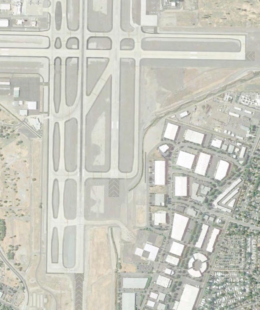
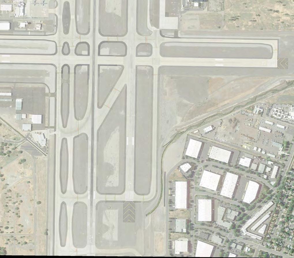
41
42 Table 3-18: Taxiway Design Standards TOFA (from CL) Width Taxiway ADG TDG Req. Actual Req. Actual 1 Parallels Notes A N of Twy L III 93 ft. 93 ft ft. 75 ft. Closed to air carrier >149 wingspan, N of Twy D A S of Twy L IV ft ft ft. 75 ft. B IV ft ft ft. 75 ft. C N of Twy D IV ft ft ft. 75 ft. C Twy L to Twy D II 65.5 ft ft ft. 35 ft. Closed to air carrier & > 60,000 lbs aircraft C S of Twy L IV ft ft ft. 75 ft. L III 93 ft. 93 ft ft. 60 ft. D IV ft ft ft. 90 ft. F IV ft ft ft. 140 ft. Acute angle exit G IV ft ft ft. 75 ft. H IV ft ft ft. 75 ft. J W of 16L/34R IV ft ft ft. 75 ft. J E of 16L/34R II 65.5 ft ft ft. 50 ft. Closed to air carrier aircraft K IV ft ft ft. 75 ft. Access to NVANG M II 65.5 ft ft ft. 40 ft. Closed to air carrier aircraft N IV ft ft ft. 140 ft. Acute angle exit P IV ft ft ft. 75 ft. Q IV ft ft ft. 75 ft. Source: RTAA GIS and record drawings for pavement edges. 1. Taxiway widths may appear larger than listed because of required turn fillets, which were defined earlier in the TDG section. Connectors Taxiway Design Method Design guidelines in AC-13A recommend taxiway layouts that enhance safety by discouraging runway incursions. Six connector and exit taxiways at RNO were found to not conform with the following design recommendations: Three-Node Concept: The three-node concept maintains simple taxiway intersections by reducing the number of taxiways intersecting at a single location. The three-node concept means a pilot is presented with no more than three choices at an intersection, ideally, left, right, and straight ahead. Complex intersections with more than three nodes increase the possibility of pilot error. The three-node concept allows for suitable placement of airfield markings, signs, and lighting. Acute Angle Exit and Increasing Visibility: Right-angle intersections between taxiways and runways provide the best visibility to the left and right for a pilot. At airports with large jet activity, acute angle, or high speed, runway exits enhance airport capacity and increase efficiency in runway use, but should not be used as runway entrance or as crossing points. A right-angle turn at the end of a parallel taxiway is a clear indication of approaching a runway. When the design peak hour is less than 30 operations, a rightangled exit taxiway in the proper location will achieve an efficient flow of traffic. As discussed in the Airfield Capacity Section, the future peak hour operations at RNO is 30 operations in
43 Complex Intersections: Taxiways must never coincide with the intersection of two runways. Taxiways configured with multiple taxiway and runway intersections in a single area create large expanses of pavement. These expanses make it difficult to provide proper signs, marking, and lighting. Squared Entrance Taxiway: The outer edge of an entrance taxiway must be curved. A squared corner may be confused for a runway end. Indirect Access: Do not design taxiways to lead directly from an apron to a runway without requiring a turn. Service Roads: TOFA clearing standards prohibit service vehicle roads, parked aircraft, and other objects, except for objects that need to be located in the OFA for air navigation or aircraft ground maneuvering. Non-Standard Taxiways Based on ADG dimensions and taxiway design methods above, the following areas are found to be nonstandard. These are highlighted on Figures 3-13 and Taxiway A TOFA Breach: The perimeter service road penetrates the TOFA north of Taxiway D. There is an FAA modification to standards for this condition. Taxiways D, F, and Runway 16R/34L: Complex intersection with more than three-nodes. Taxiway F: Acute angle taxiway exit. Taxiway N, Runway 16L/34R, and Runway 7/25: Complex intersection with more than three-nodes. Taxiway N: This has an acute angle taxiway exit. Taxiway L at Runway 25 Approach: Outer edge of the entrance taxiway is currently designed with a square corner. Taxiway A at Runway 34L Approach: Outer edge of the entrance taxiway is currently designed with a square corner. Taxiway C TOFA Breach: The perimeter service road penetrates the TOFA east of the approach end of Runway 34R near Boynton Slough. 43

44 FAA Designated Hot Spots Figure 3-15: Airport Diagram: FAA Taxiway Hot Spots The FAA has designated two taxiway hot spots at RNO. A hot spot is a location in an airport movement area with a history of potential risk of collision or runway incursion, and where heightened attention by pilots and drivers is necessary. The FAA designates hot spots, and these are published in the Airports Facility Directory for RNO. Figures 3-13 and 3-14 illustrate the hot spots, and Figure 3-15 shows the currently published FAA Airport Diagram. Hot Spot 1: Taxiways C and L intersection and Atlantic Aviation Apron. This location has been identified for the sharp turn on Taxiway C and the taxilane entrance to Atlantic Aviation, combined with the complex intersection of Taxiways C and L. The apron exit also provides direct apron to Runway 7/25 access. ATCT personal have indicated these conditions create potentially confusing environment for pilots. Hot Spot 2: Taxiway P and the approach ends of Runway 34L and 34R. Past instances have found pilots mistaking Taxiway P as the connector to the takeoff end for both Runways 34R and 34L increasing the potential for intersection departures on Runway 34L. Pilots have also mistaken landings on Runway 34R for Runway 34L. Other Taxiway Design Concerns Taxiway C is constrained to the east by existing apron and buildings, and is not designed for aircraft in ADG III with wingspans greater than 79 feet; however, some business jets that use Atlantic Aviation fit this category. As a result, the ADG III business jets that use Atlantic Aviation must cross Runway 16R/34L and 16L/34R on Taxiway L, then taxi north on Taxiway A or B to depart on Runways 16L or 16R. ATCT staff indicated that Runways 16L and 16R account for 80 percent of operations. Aircraft leaving Atlantic Aviation and crossing the runways to depart is not an FAA-recommended operating procedure. 44
45 Taxiway Design Recommendations The recommendation is for the alternatives analysis chapter to consider taxiway designs that: Explore an improved design alternative for Hot Spot 1 at the intersection of Taxiways C and L and the Atlantic Aviation Apron. Proper marking and sign locations are advised to be used to help direct traffic. Eliminate the two acute angle exit taxiways. Eliminating the acute angle taxiway exits would also correct the complex intersections at Taxiways D, F, and Runway 16R/34L, and Taxiway N, Runway 16L/34R, and Runway 7/25. Right-angle taxiway location should consider runway occupancy times, and locating rightangle taxiways within the first and last third of the runway is advised. Eliminate the squared corners on Taxiway A entrance to Runway 34L and Taxiway L entrance to Runway 25. Consider correcting the Taxiway A TOFA service road breach by relocating facilities, fence and service road to the west. Consider correcting the Taxiway C TOFA service road breach at the Runway 34R approach end by considering a culvert over Boynton Slough. Terminal Aircraft Aprons Terminal Apron Size Gate parking size is adequate for the projected fleet mix. The projected fleet mix for commercial operators is shown in Table 3-19 below. Table 3-19: Future Operations Commercial Passenger Carriers Aircraft Future Operations Aircraft Model AAC ADG TDG 1 Type CRJ-200 C II 3 Regional Jets Narrow Body Jets Phased Out CRJ-700 C II 3 5,447 4,124 1,695 CRJ-900 C III 3 Embraer 175 C III 1A 8,412 15,382 20,704 Airbus 319 C III 3 Airbus 320 C III 3 7,472 7,536 8,261 Boeing D III 3 Boeing D III 3 20,205 22,142 24,438 DeHavilland Dash-8 C III 5 4, MD-80 C III Misc Aircraft ,399 32,699 Total Operations - Commercial Passenger Carriers (MP Forecast) 45,889 49,183 55,098 Sources: OAG Schedules Analyzer and Unison Consulting, Inc. 1. Matches total and splits for commercial aircraft. See Figure 2-33 in Chapter 2 for more information. 0 45
46 The terminal apron parking positions are adequate for the current operations and selected master plan forecasts. The available gates with ADG and dimensions are shown in Figure Seven gates are designed for ADG III aircraft, and the remaining are designed for various ADG IV aircraft. The projected commercial mix shows all projected operations by ADG III aircraft. The existing layout allows for larger ADG aircraft to utilize the existing parking positions and gates. Location and Connectivity to Runway/Taxiway System The location of the airfield terminal is ideal for operations on Runway 16R/34L. This being the primary runway of use for commercial operators, aircraft do not have to cross the parallel to reach the terminal area. Three connector taxiways allow access from the terminal aprons to the parallel taxiways, which lead directly to the departure ends of Runways 16R and 34L. Multiple connectors allow for multiple aircraft to enter and leave the terminal area during peak activity. The single central taxilane between the concourses only allows for one aircraft at a time. This could become a delay issue if an aircraft is entering the central taxilane when another aircraft is being pushed back from a gate. However, based on peak activity figures, the terminal gates are not expected to be occupied at 100 percent during the planning period making this scenario unlikely. 46
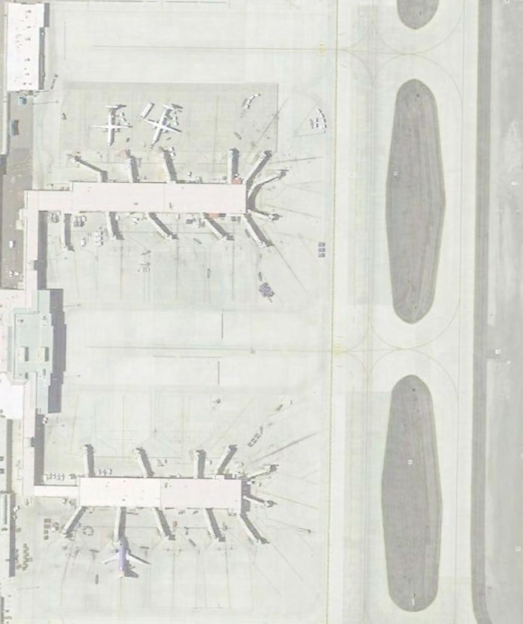
47
48 Terminal Apron Pavement Strength A Pavement Management Program was produced in 2015 that evaluated pavement condition on the aprons at RNO. The pavement within the Terminal and Cargo Apron is currently in Good to Fair condition. The Pavement Condition Index (PCI) for each section is presented in Table Table 3-20: Terminal and Cargo Apron PCI Ratings Terminal Apron PCI Central Cargo Apron 60 West Cargo Apron 80 Southwest corner of Cargo Apron 68 North C-Gate Parking 74 South C-Gate Parking 62 East B-Gate Parking 76 South Terminal Apron 66 All other areas Source: Stantec Pavement Management Program 2015 PCI is a numerical index between 0 and 100 which is used to indicate the general condition of a pavement and is detailed in Table PCI surveying processes and calculation methods have been standardized by ASTM D for airport pavements. The following table illustrates how pavements are rated based on the corresponding PCI value. The table also shows maintenance recommendations for Portland cement concrete (PCC) pavement based on the PCI value. Table 3-21: PCI Rating System PCI Pavement Condition Rating Recommendation Good Satisfactory Fair Poor Very Poor Serious 10-0 Failed Source: Stantec Pavement Management Program 2015 Crack seal every 8 years Seal joints every 8 years Reconstruct Maintenance recommendations from the 2015 report included performing a crack and joint seal every 8 years. It is advised this recommendation be followed plus regular inspections take place. Based on the selected Master Plan forecast, the terminal aircraft apron is adequate in size for the planning period. This is based on the projected commercial fleet mix expected to be using gates at the commercial terminal. The existing gate sizes accommodate ADG-III and ADG-IV aircraft. The projected design aircraft for the terminal area is the Boeing which is ADG-III. Any potential commercial passenger operations by ADG-IV aircraft can also be accommodated by existing gates, up to 145-foot wingspan. 48
49 Landside Facility Requirements With the exception of the passenger terminal building, the landside facility requirements section includes facilities having direct landside access at RNO. Landside requirements are those necessary to support airport, aircraft, and passenger operations. A review of existing conditions, capacity levels, activity demand forecasts, and airport design standards using FAA guidance and industry standards is the basis for proposed requirements. This analysis identifies landside facility requirements needed to meet future demand for the 5-, 10-, and 20-year period. The terminal facility requirements section of this chapter specifically addresses the terminal facility requirements. Federal Inspection Services (FIS) and U.S. Customs and Border Protection (CBP) All airports with international flights require FIS facilities. On March 1, 2003, the Immigration and Naturalization Service (INS), the U.S. Customs Service, and the Agricultural and Plant Health Inspection Service were consolidated to establish the CBP. CBP is responsible for inspecting all international passengers, international baggage, and international air cargo. Although the inspection process has varied over time, CBP procedures now call for all passengers to be processed through the primary inspection counters. Secondary baggage inspection is based on more selective procedures. These inspection procedures use computer-based lists of passengers, roving agents, designations of high-risk and low-risk flights, and other selection techniques. A terminal for international arrivals has the actual CBP processing area, plus these major elements: a sterile corridor system, CBP primary inspection, baggage claim, CBP secondary inspection, and processing and transfer passenger recheck. International passengers arriving at RNO currently deplane directly onto the apron and are guided towards the CBP facility. Upon entering the CBP Facility, the passengers proceed to the appropriate primary processing booth for document review, fingerprinting, photographing, and declarations, if warranted by the CBP officer. The CBP officer may direct the passenger to secondary screening due to any concerns or random selection for further interviews. Secondary screening may include the passenger s baggage. If secondary screening is not required, the passenger proceeds to baggage claim to retrieve their luggage and deliver their declaration form to the CBP exit checkpoint. 49
50 The required facility calculations shown in Table 3-22 are based on the need to process a single Volaris A320 with 179 seats at peak hour. The forecast does not project an increase in peak international service demand during the planning period. However, the CBP facility requirements were evaluated against a potential increase in aircraft size, or another similar sized aircraft using the facility at the same time. Calculations used the following assumptions for planning: Primary processing rate: 100 passengers per double booth per hour Primary processing by percent of the total CBP facility: 45 percent Secondary processing by percent of the total CBP facility: 25 percent Offices by percent of the total CBP facility: 30 percent Minimum passenger queue depth: 75 minimum Table 3-22: CBP Facility Requirements 178 seats 200 seats 400 seats Load Factor 80% 80% 80% Arriving Passengers Number of double booths required Max number of passengers in queue Average wait time in queue (minutes) Maximum wait time in queue (minutes) Minimum passenger queue area (SF) 1,190 1,380 2,160 Minimum queue depth required (ft) Total primary processing area (SF) 2,760 2,760 5,520 Secondary processing area (SF) 1,533 1,533 3,067 Primary and secondary offices (SF) 1,840 1,840 3,680 Circulation (25% of total CBP area, SF) 1,831 1,878 3,642 Total Required (SF) 7,667 7,667 15,333 Source: ACRP Spreadsheet Model SF = Square feet CBP approved the current facility for secure operations in With a current footprint of 13,850 square feet, not including the international baggage claim area, the CBP facility is of a physical size to accommodate both current and forecasted international arrivals. However, the individual components located within the facility are either undersized or organized in a manner leading to operational shortcomings. The primary process queue depth is currently only 40 feet. A minimum of 52 is required, while 75 is recommended. Baggage claim operations currently interfere with passenger flow and require additional staffing. There is not currently a dedicated sterile corridor connecting the terminal proper to the CBP facility. The inclusion of a sterile corridor would allow deplaning to take place by way of jet bridge either at a dedicated international or multi-purpose gate. 50
51 While it is also of a size to accommodate a 200 seat aircraft, it physically cannot handle a 400 seat aircraft. In addition to the spatial and organizational deficiencies noted, a lack of CBP agents currently leads to excessive processing times often exceeding 90 minutes or more. As a result, the alternatives chapter will evaluate options to address international passenger facility deficiencies. Passenger Terminal Roadway Demand and Capacity Analysis This section records the analysis of the demand and capacity for the passenger terminal roadway in terms of the number of lanes available and the length of curb available for passenger pick-up and drop-off. Terminal Curbside One curbside area adjacent to the arrival and departure areas serves RNO s terminal building. The area comprises a total of eight lanes, providing access to the terminal area to pick-up and drop-off passengers: Lane 1: This lane has direct inner curbside access next to the terminal building. Its 800 linear feet of capacity allows passenger drop-off with personal occupancy vehicles (POV), transportation network companies (TNCs), taxis, hotel shuttles, buses and airport authority vehicles. Lane 2: This lane is used for vehicle circulation. During peak hours, lane 2 can be used as a secondary curbside area for passenger drop-off. Lane 3: This lane is a vehicle through lane for those entering and exiting the inner curbside area. Lane 4: This lane is a vehicle through lane for those driving past the curb. Lane 5: This lane is adjacent to the 18-foot wide pedestrian median. Its outer curbside provides approximately 800 linear feet of capacity that allows passenger pick-up with POVs, but is currently not used for other forms of transportation. TNC, taxi, and hotel shuttle pick-up operate out of the ground transportation lot, north of the baggage claim. Lane 6: This lane is a vehicle through lane for those entering and exiting the outer curbside area. During peak hours, lane 6 can be used as a secondary curbside area for passenger pick-up. Lane 7: This lane is a vehicle through lane for those entering and exiting the outer curbside area. Lane 8: This lane is a vehicle through lane for those driving past the curb. Prior to arriving at the terminal, this lane gives access to the long-term parking surface lot, and the parking garage for short-term and long-term parking. Rental car return parking is also accessed from this lane at a point near the middle of the parking garage. Both lane 1 and lane 5 have 800 linear feet of available terminal vehicular curbside length, for a total of 1,600 linear feet. Terminal curbside needs are evaluated using industry planning criteria to determine linear frontage for the curb to meet Level of Service (LOS) standards. 51
52 Typically, this evaluation includes historical traffic data as well as the physical characteristics already described. As historical traffic data was not available beyond the one-week traffic volume report prepared by Traffic Works in April 2017, the analysis used these assumptions to reach the curbside projections shown in Table 3-23 below: Peak hour traffic growth will follow design hour passenger growth 30 percent of peak hour demand occurs during a 15 minute peak period Percent of Vehicle Type and vehicle length 85 percent Private auto, 22 feet 8 percent Hotel shuttles, 50 feet 5 percent Taxis and TNCs, 22 feet 1 percent Airport Authority Vehicles, 22 feet 0.5 percent Buses (charter and public), 50 feet 0.5 percent Other, 30 feet Multiple Stop Factor of 1.0 (for all vehicle types) Vehicle Dwell Time Private auto, 3.0 minutes Hotel shuttles, 3.0 minutes Taxis and TNCs, 1.5 minutes Airport Authority Vehicles, 2.0 minutes Buses (charter and public), 5.0 minutes Other, 1.5 minutes Table 3-23: Curbside Requirements Total Design Hour Demand (Vehicles) Peak 15 minute Demand (total linear feet) 849 1,015 1,125 1,322 Required LOS C Curbside Range (linear feet) , ,023 1,201 Source: Traffic Works Traffic Volume Report dated April 24, 2017; ACRP Spreadsheet Model Based on the existing 1,600 linear feet of available curbside, RNO maintains an excellent LOS throughout the entire planning period. If activity is properly distributed, lanes 2 and 6 should rarely be used as secondary curbside frontage. A LOS C can be maintained with the existing 1,600 linear feet of available curbside even if the total design hour demand reaches 1,250 vehicles, or approximately 7,700,000 annual passengers. 52
53 Vehicular Parking and Rental Car Demand and Capacity Analysis The automobile parking needs at a commercial service airport directly relate to the number of annual enplaned passengers. Automobile parking types include public, employee, and rental car parking (including storage). Table 3-24 below summarizes existing automobile parking supply. For planning purposes, the number of effective parking spaces assumes only 95 percent of the actual supply of spaces is available at any given time due to maintenance, snow removal or circulating parkers. The effective space count will be used for planning. Currently, there are approximately 280 short term and 3,088 long term public parking spaces at RNO. Public Parking At RNO, public parking includes short- and long-term parking inside the three-story parking structure and long-term parking in a surface lot, south of the parking structure. ACRP Report No. 25, Airport Passenger Terminal and Design, recommends that public parking supply should range from 900 to 1,400 spaces per million enplaned passengers, and 25 to 30 percent should be designated for short-term parking. Table 3-24: Public Parking Requirements Enplanements 1,823,580 2,178,486 2,416,753 2,839,346 Required Parking Range 1,641 1,960 2,174 2,555 2,520 3,049 3,382 3,975 Required Parking Range Short Term (30%) ,015 1,193 Effective Supply Short Term (Existing) Short Term Capacity (Deficiency) (476) (635) (735) (913) Required Parking Range Long Term (70%) 1,149 1,372 1,522 1,789 1,764 2,134 2,367 2,783 Effective Supply Long Term (Existing) 3,088 3,088 3,088 3,088 Long Term Capacity (Deficiency) 1, Total Capacity (Deficiency) (14) (608) Source: 2016 Inventory of Existing Conditions, Unison forecast analysis Based on this guidance, total RNO public parking (short- and long-term) exceeds the recommended range through 2021, and falls within the recommended range through However, the existing allocation between short and long-term parking is not in line with industry recommendations. The maximum recommended walking distance from parking space to terminal building is 1,000 feet, unless a shuttle service is provided. While the parking structure is in close proximity to the terminal building and never further than 435 feet away, only 86 percent of the long-term parking surface lot is within the 1,000-footradius of the south entry doors. The furthest distance from a parking space in the surface lot to the terminal entry is 1,175 feet. 53
54 Employee Parking Employee parking is available in three parking lots south of the passenger terminal and illustrated on Figure 1-25 in the Inventory Chapter. Color labels designate who uses the lots. The Green Lot has 131 spaces for staff, the Yellow Lot offers 152 spaces for supervisors of RNO staff and tenants, and the Blue Lot provides 252 spaces for tenant line employees. This is a total of 535 employee parking spots, allowing 508 effective spaces. ACRP Report 25 suggests 1 space for a range of 2.4 to 3 employees. As employment projections were not available, parking eligible employee growth is assumed to follow enplanement growth. Employee parking requirements are presented in Table Table 3-25: Employee Parking Requirements Enplanements 1,823,580 2,178,486 2,416,753 2,839,346 Parking Eligible Employees 1,120 1,338 1,484 1,744 Required Employee Parking (1 per 3 employees) Effective Supply Capacity (Deficiency) (73) Source: Gensler RNO currently employs 1,120 people eligible for employee parking, requiring a range of 373 to 467 parking spaces. Based on information provided by the Airport, the employee lots are currently utilized at less than 50 percent capacity due to either costs or convenience. Because of this, employee parking has been evaluated based on the assumption of 1 parking space for every 3 eligible employees. Unless there are changes in how employee parking is currently managed, there is physical capacity to support employee parking through the 2026 planning period. Rental Car Parking and Facilities Rental car parking needs include ready/return lots for customers, and long-term lots where the rental car fleet can be serviced and stored. Existing facilities within the parking areas include a quick turn-around (QTA) facility for rental car companies to fuel, perform cleaning and light maintenance of vehicles. Because each of the car rental concessionaires at RNO will have different facility needs, car rental facility requirements are evaluated cumulatively. Ready/Return Parking Ready/return parking needs correlate with the peak number of customer transactions rather than the total number of customers. Increased demand requires rental car staff to transport cars to and from the service/storage lot more frequently, adding costs of the operation. Currently 402 ready/return parking spaces are on the ground level of the parking structure. 54
55 As peak transaction information was unavailable, ready/return parking has been evaluated based on the following assumptions: There are currently 402 ready/return parking spaces. The existing ready/return parking spaces operate at 80 percent capacity, meaning additional demand can currently be handled by way of increased staffing and alternate operations. Peak customer transaction growth will follow enplanement growth. Table 3-26 below summarizes the enplanements, ready/return demand and the effective ready/return supply. Table 3-26: Rental Car Ready/Return Parking Requirements Deplanements 1,823,580 2,178,486 2,416,753 2,839,346 Ready / Return Spaces Required Ready / Return Supply Capacity (Deficiency) (24) (99) Source: Gensler The rental/ready parking supply, currently located in the ground level of the parking structure, adequately serves demand through the 2021 planning period. However, the 402 spaces allocated to ready/return and the potential need to grow this number are in direct conflict with the short-term parking requirement as both are ideally located in the same general area. As a result, the alternatives chapter will identify potential options for relocating rental ready/return parking to accommodate future growth in short-term parking. Rental Car Service/Storage The size of the rental car service/storage lot ties directly to the total rental car fleet. Total fleet is directly attributed to the total number of arriving passengers requiring rental cars. Information regarding the peak storage demand and projections was not available. The rental car storage evaluation is therefore based on the following assumptions and requirements are detailed in Table 3-27: There is currently space for approximately 4,350 rental car storage spaces allocated across five individual lots, plus an overflow lot controlled exclusively by Enterprise. The existing rental car storage spaces operate at 60 percent capacity/efficiency, in aggregate. Peak customer transaction growth will follow deplanement growth. 55
56 Table 3-27: Rental Car Storage Parking Requirements Deplanements 1,823,580 2,178,486 2,416,753 2,839,346 Storage Spaces Required 3,045 3,638 4,035 4,741 Storage Supply 4,350 4,350 4,350 4,350 Capacity (Deficiency) 1, (391) Source: Gensler In aggregate, rental car storage adequately serves the demand through The existing rental car storage lots are organized and leased around individual rental car companies. These storage lots include structures and unique layouts leading to unnecessary parking inefficiencies. If appropriately organized, the area currently dedicated to rental car storage is sufficient to serve the demand through the entire planning period. Quick Turn Around (QTA) QTA facilities are located within the vicinity of rental car operations and the ready/return parking area. A typical rental car QTA consists of a car wash, maintenance bays, storage, and fueling area. The existing consolidated rental car QTA is located north of the parking structure. QTA facilities are typically evaluated based on total rental car revenue. As this information was not available, the QTA facility evaluation is based on the following assumptions and QTA facility requirements are shown in Table 3-28: The existing consolidated QTA facility is 11,400 square feet. The operations that may take place within the individual rental car company facilities are not taken into consideration by this evaluation. The existing consolidated QTA facility is assumed to operate at 80 percent capacity. Total rental car revenue growth, and the associated QTA demand, will follow deplanement growth. Table 3-28: Rental Car QTA Requirements Enplanements 1,823,580 2,178,486 2,416,753 2,839,346 QTA Demand (SF) 9,120 10,895 12,087 14,200 Existing QTF Building 11,400 11,400 11,400 11,400 Capacity (Deficiency) 2, (687) (2,800) Source: Gensler SF = Square feet Assuming the majority of the cleaning, fueling, and minor maintenance demand is placed on the consolidated QTA facility, there is a deficiency in its capacity arising between the 2026 and 2036 planning periods. Excess capacity to overcome these deficiencies may be available in the individual rental car company facilities located within their individual storage lots. 56
57 Parking Facilities Analysis and Recommendations When evaluated in aggregate, parking is sufficient to support the forecasted demand levels through the 2026 planning period. However, even currently, the allocation between short-term and long-term parking leaves a short-term deficiency. This deficiency is only compounded by additional demand being placed on the structured parking by the rental ready/return spaces. Alternatives addressed in the next chapter need to be evaluated before recommendations can be made. These alternatives will evaluate an increase in efficiency before additional structured parking is recommended. 57
58 Terminal Facility Requirements The terminal area demand capacity analysis establishes metrics that indicate demand levels below capacity, approaching capacity, and exceeding existing capacity. These metrics identify the projected level of demand for the 5-, 10-, and 20-year planning periods. Currently, the passenger terminal building consists of two levels and has approximately 448,650 square feet of terminal and concourse space with 23 gates. The terminal building houses airline offices and ticket counters; rental car counters and back offices; ground transportation counters; restaurants and retail concessions and storage; food and beverage offices and storage; gaming concessions office and storage; baggage claim, handling and makeup, and baggage service offices; Transportation Security Administration (TSA) offices, TSA Pre-Check and wheelchair service offices and RTAA administrative offices. This section identifies key issues with the existing passenger terminal building and provides planning-level conceptual space requirements. The following references to FAA, TSA, ACRP, International Air Transport Association (IATA) and industry standards are the basis for the identified space requirements: FAA Advisory Circular AC 150/ A, Planning and Design Guidelines for Airport Terminal Facilities (2012) Airports Cooperative Research Program (ACRP), Report 25: Airport Passenger Terminal Planning and Design Guidebook (2010) Airports International Air Transport Association (IATA), Airport Development Reference Manual, 10 th Edition (2016) Fundamentals of Terminal Design Terminals provide passenger facilities and function to facilitate the flow of passengers between aircraft and ground transportation. Terminals must accommodate changes in the airline industry and passenger preferences. Factors that influence terminal design include: Total Passenger Volume Passenger Peaking Characteristics Passenger Preferences Airline Station Characteristics Aircraft Mix International Service Industry Trends 58
59 Level of Service (LOS) Terminal improvements are evaluated in their ability to serve passengers and provide a comfortable experience through the airport. An LOS concept uses a set of standards to measure the quality of the passenger experience in terms of the efficiency of passenger flow, space requirements, and wait time. Each LOS has a defined space planning standard to determine facility requirements. Table 3-29 shows the rating system and service levels. Table 3-29: LOS Standards LOS Service Level A Excellent Conditions of free flow; no delays; direct routes; excellent level of comfort B High Condition of stable flow; high level of comfort C Good Condition of stable flow; provides acceptable throughput; related systems in balance D Adequate Condition of unstable flow; delays for passengers; condition acceptable for short periods of time E Unacceptable Condition of unstable flow; subsystems not in balance; represents limiting capacity of the system F System Breakdown Unacceptable congestion and delays Source: ACRP Guidebook Volume 1, 147 The assumption for this master plan is to obtain LOS C with peak wait times that are 10 minutes or below. Delays and space requirements for LOS C are typically considered acceptable by passengers. LOS C is also considered a reasonable balance between ideal size and economic considerations. Demand Factors The primary function of a terminal is to provide adequate space to serve passengers, so passenger and gate demand is analyzed first. The completed analysis provides overall terminal space planning metrics. Passenger Activity Levels Table 3-30 summarizes the planning activity levels to be used for terminal building planning. These figures estimate the number of passengers to arrive, depart, and generally flow through the terminal building. Table 3-30: Terminal Passenger Activity Levels Annual Enplanements 1,823,600 2,178,500 2,416,750 2,839,350 Design Hour Departing Design Hour Arriving Design Hour Total ,099 1,291 Source: Unison forecast analysis. Values rounded 59
60 Gate Demand The minimum number of gates needed for the peak hour activity and additional contingency metrics together determine the required number of gates. One contingency gate, as shown in Table 3-31, has been added to accommodate unscheduled charter flights or long-term delayed flights. Table 3-31: Gate Demand Airplane Design Group Airlines with Preferential-use Gate Alaska/Horizon III American/Compass III Delta/SkyWest III Delta/SkyWest II United/Mesa III Southwest III United III Airlines using gates on per-turn basis Allegiant III JetBlue III Volaris III Contingency III Total Source: Unison forecast analysis. Effective space planning requires a consistent definition of the term gate. By using the forecasted fleet mix and the Equivalent Aircraft (EQA) Index, a technique which estimates the number of gates needed based on aircraft seating capacity, the equivalent number of gates are calculated based on the ADG served. Table 3-32 lists the recommended EQA by ADG for the 5, 10, and 20-year planning periods. Table 3-32: Equivalent Aircraft (EQA) Index ADG II EQA ADG III EQA Total EQA Source: EQA Index values based Transportation Research Board, ACRP Report 25 Airport Passenger Terminal Planning and Design, 2010 RNO currently has 23 gates allocated across two concourses in a double-loaded pier configuration, which is when concessions and holdrooms are on both sides of the concourse circulation. Aircraft park on both sides of each concourse. The 23 gates currently meet the forecasted requirements through the entire planning period. However, the size, condition, and remaining lifespan of the concourses serving these gates are also to 60
61 be taken into account when evaluating the gate capacity. Options for modernizing the concourses will be evaluated during the airport alternatives process. Terminal Building Capacity Analysis The manner in which individual areas of the terminal building function determines the planning-level space needs to accommodate current and future demand. Space requirements will be a major consideration when evaluating terminal building alternatives. Check-in and Ticketing The check-in lobby is historically where departing passengers check-in for a flight, drop off checked baggage, and obtain boarding passes and other information for the flight. Traditionally, check-in lobbies were designed to be grand public spaces, or the front door of an important public facility. Most check-in lobbies were long, linear spaces with large areas reserved for airline ticket counters, passenger queuing and waiting, airline ticket office space, and supporting areas such as restrooms and concessions. The way passengers use the check-in lobby today is quite different due to advances in technology and evolved security requirements. Now that self-service check-in and baggage tag kiosks are available, passengers can bypass the traditional check-in counter. These changes also allow check-in to take place anywhere inside or outside the terminal building. In addition, electronic devices allow passengers to check-in off-airport. Interactions with airline personnel are now largely reserved to drop off bags or to resolve problems. The result is a significant change in passenger and airline approaches to the check-in process and the potential for reduced space requirements in the lobby. The use of self-service equipment continues to grow and potential future trends include self-tagging stations and remote off-airport bag-drop facilities that would reduce the need to have staffed positions at the airport. The passenger check-in assumptions are important to evaluate space and facility needs, and the assumptions evolve over time as new technologies and trends emerge. These assumptions and the modes of check-in are shown in Table 3-33 below: Passengers checking bags: 80 percent Average checked bags/passenger: 1.2 Full-service processing time/passenger: 3 minutes Self-service kiosk processing time/passenger: 2 minutes Curbside processing time/passenger: 3 minutes Full-Service maximum wait time: 10 minutes Self-service kiosk maximum wait time: 2 minutes Curbside maximum wait time: 4 minutes 61
62 Table 3-33: Check-in Mode Split Full-Service 50% 50% 45% 45% Self-Service Kiosk 34% 34% 39% 39% Offsite (online/remote location) 11% 11% 11% 11% Curbside 5% 5% 5% 5% Source: InfoSearch International RTIAA Customer Survey, 2017 A total of eight airlines currently provide service at RNO. This level of service is projected to remain consistent through the entire planning period. Based on historical data, current activity, and projected gate demand, the check-in/ticketing requirements have been evaluated based on the assumption that five (United, American, Alaska, Southwest and Delta) of these eight airlines may be required to handle the peak 30-minute enplaned passenger load in its entirety. These are identified as Tier 1 airlines in Table The remaining three airlines (Volaris, Allegiant and JetBlue) are assumed to only be required to service a single flight within the design hour. These are identified as Tier 2 airlines in Table Table 3-34: Check-in/Ticketing Requirements TIER 1 TIER 2 TIER 1 TIER 2 TIER 1 TIER 2 TIER 1 TIER 2 Total Peak 30-min Enplaned Passengers Full-Service Positions Check-in counter area (SF) Active check-in area (SF) Check-in queue area (SF) Total Full-Service Area (SF) Self-Service Kiosks Bag drop positions Kiosk footprint (SF) Kiosk queue area (SF) Bag drop area (SF) Total Kiosk Area (SF) Interior Space Subtotal 1, , , , Circulation (25%, SF) Total Interior Space Required (SF) 1, , , , Tier 1 Airlines (x5) Tier 2 Airlines (x3) 8,781 2,153 10,469 2,153 10,481 2,153 12,556 2,153 Total Ticketing Area Requirements (SF) 10,934 12,621 12,634 14,709 Source: Gensler SF = Square feet The ticketing lobby at RNO currently consists of 20,500 square feet for ticket counters, active check-in, queuing, and circulation. This space is linear with 35 feet of depth available from the wall to the front of the 62
63 counter, for circulation, queuing, and active check-in. At the time of this report, RNO provides a total of 50 check-in positions across 460 linear feet of counter space. The staff occupies a width of 11 feet from the back wall to the front of the counter, with ticket counters about 3.5 feet deep. Southwest operates a single curbside check-in facility. The ticketing lobby is of sufficient size to handle the forecasted demand through the entire planning period while still providing airline specific full-service and self-check positions. During periods of low demand the perception of the ticketing lobby will be that it is oversized. It is recommended that RTAA consider migrating towards common-use facilities in order to help balance demand loads between the airlines and achieve a higher level of efficiency in the ticketing lobby. Partial or full common-use facilities would allow for the ticketing lobby to adequately serve a demand beyond the planning period or at levels higher than those forecasted, including the addition of new carriers. 63
64 Airline Space Currently about 11,000 square feet are dedicated for Airline Ticket Offices (ATO) behind the ticketing counters and house a total of 12 office suites. These suites range from 805 to 2,260 square feet. A common industry planning factor is 900 square feet per office. Calculations for the amount of space required are based on the total number of airlines serving the airport rather than the total volume of passengers. Eight airlines serve RNO at the time of this report. Based on this industry planning factor, RNO has the ability to adequately support up to 12 individual airlines through proper planning and reorganization of their existing space. Outbound Baggage Screening and Make-up Outbound baggage processing includes the area and equipment required to accommodate, sort, security screen, and process checked baggage from the check-in lobby to the aircraft. At RNO, the baggage screening facilities are directly behind the ticketing counters and airline offices. For planning, these are the baggage screening assumptions, which are shown in Table 3-35 below: Percent connecting traffic: 2 percent Percent of passengers checking bags: 80 percent Average bags/passenger: 1.2 TSA surge factor applied: yes, on a 10 minute baggage flow rate Percent of over-sized bags too large for Explosive Detection System (EDS): 8 percent Level 1 EDS screening process rate: 150 bags/hour Level 1 EDS screening unit area: 800 square feet Level 2 On-Screen Resolution Rate (OSR) rate: 120 bags/operator Level 2 OSR station area: 40 square feet Level 3 ETD screening process rate: 24 bags/hour/screener Level 3 ETD screening unit area: 100 square feet 64
65 Table 3-35: Outbound Bag Screening Design Hour Passengers Departing PMAD passengers checking in Total bags to process in peak hour Total bags through Level 1 EDS screening Number of Level 1 EDS units Level 1 EDS area (SF) 2,400 3,200 3,200 4,000 Total bags through Level 2 EDS screening Number of Level 2 OSR stations Level 2 OSR area (SF) Number of bags through Level 3 ETD screening Number of Level 3 ETD units Level 3 ETD area (SF) Conveyors and sorting matrices (SF) 2,640 3,380 3,380 4,280 Baggage screening circulation (SF) ,070 Total (SF) 3,300 4,225 4,225 5,350 Source: Gensler SF = Square feet Baggage make-up includes manual or automated make-up units, the cart/container staging areas, and baggage tug/cart, or baggage train, maneuvering lanes. The type of system selected for a terminal depends on several factors including the number of airlines, the terminal configuration, operating policies (common use, exclusive use), and size of the terminal complex. At RNO, the baggage make-up facilities are behind the airline offices. After the security screening, bags are transported to one of three matrixes where bags are sorted and placed on baggage carts to deliver to the aircraft. Larger bags are delivered through one of three central collection areas. Table 3-36 shows the space requirements projected for the baggage make-up area. Table 3-36: Baggage Makeup Gate Equivalencies (EQA) PMAD Peak Hour scheduled aircraft departures Expected number of departures per gate Baggage make-up area (SF) 8,316 9,072 9,393 10,476 Baggage train circulation allowance (SF) ,048 Total (SF) 9,148 9,979 10,336 11,524 Source: Gensler SF = Square feet 65
66 The baggage handling area at RNO currently consists of 49,917 square feet for both baggage screening and baggage makeup area. With proper equipment layout, the existing space is adequate throughout the planning period to allow for screening and up to three individual make-up matrixes, each capable of handling the full demand load. The three individual matrixes allow for redundancy in a critical system. Security Screening Checkpoint (SSCP) Security screening checkpoints are where commercial airline passengers and carry-on baggage are examined to ensure that illegal or harmful items are not carried onto aircraft. Security screening procedures are complex and constantly evolving to address new threats and requirements. The SSCP area at RNO is located directly east of the main entrance to the terminal building. Currently seven x-ray machines conduct property searches, with four walk-through metal detectors and three Advanced Image Technology (AIT) scanners for seven total lanes. According to metrics from ACRP s terminal planning guidebook, the calculated maximum current wait time in queue is 10 minutes for standard check-in, and five minutes for pre-check. The SSCP is currently located on level 1 with vertical circulation to the level 2 concourses and gates located directly after security. The current layout for the TSA Queue includes two entrances, one for known crew members and a second for passenger and employee screening. The passenger and employee entrance serves three individual queues. Each is color-coded and designated for general boarding/all passengers (green); airline priority (yellow); and TSA pre-check (blue). The TSA pre-check line is routed to a single TSA identification (ID) checker who directs them to a dedicated screening area. The general boarding and airline priority lines are kept separate until they reach a different TSA ID checker than the TSA line. At the ID checker, the security agent call individuals forward, their ID is checked, and then they are directed into a separate screening area than the TSA pre-check screening area. Queuing space from the number of passengers and estimated equipment throughput rate drives SSCP space requirements. These are the assumptions for SSCP requirements, with projections shown in Table 3-37 below: Percent of additional traffic through SSCP: 15 percent, including non-passenger, employees, and crew Regular throughput: 135 passengers/lane/hour Pre-check throughput: 250 passengers/lane/hour Regular maximum time in queue allowed: 10 minutes Pre-check maximum time in queue allowed: 5 minutes Percent of pre-check passengers for all planning periods: 50 percent Allowance for future equipment changes and development: 20 percent 66
67 Table 3-37: Security Screening Checkpoint Total Peak 30-min enplaned passengers (less connecting pax) Regular checkpoint lanes required PreCheck lanes required Total checkpoint lanes required Checkpoint screening area, 14 feet x 80 feet (SF) 1,120 1,120 1,120 1,120 Total Checkpoint Required Area (SF) 4,480 4,480 5,600 6,720 Checkpoint queue area (SF) 1,600 1,600 2,000 2,400 Allowance for future equipment changes and development (SF) ,120 1,344 Total Required SSCP Area (SF) 6,976 6,976 8,720 10,464 Existing SSCP Area (SF) 15,350 15,350 15,350 15,350 Total Capacity (SF) (Deficiency) 8,374 8,374 6,630 4,886 Source: Gensler SF = Square feet The security checkpoint at RNO currently consists of 15,350 square feet for both checkpoint screening area and passenger queuing. While this spatially meets the requirements through the planning period, its current organization has limitations. Based on current technology, the number of checkpoint lanes is adequate through the 2021 planning period. However, the length in the checkpoint screening area is not adequate to introduce innovative lanes that allow for more efficient passenger preparation for screening. These lanes require 80 feet while only 60 feet is available. Additionally, the reconciliation area directly past the screening checkpoint is inadequate, which leads to congestions and challenges in navigating the vertical circulation to level 2. The security checkpoint area is currently configured with eight lanes and enough queue area to adequately support these lanes. This configuration has the capacity to handle a total peak 30-min emplaned passenger demand of 450 passengers. Passenger Holdrooms Passenger holdrooms are designated areas in the secure concourse where passengers wait to board the aircraft at the gate. The size of the holdroom relates directly to the aircraft size at each gate. The estimated fleet mix determines holdroom sizing for each gate. The sizing of each holdroom assumes 70 percent of the total number of passengers are seated and the remaining 30 percent are standing. The required additional space for the gate podium and podium queue are also taken into account. For planning, these are the assumptions, which are shown in Table 3-38: Design aircraft: Boeing , winglets, with 175 seats Seated/standing passenger mix: 70/30 (LOS C) Seated passenger space requirement: 15 square feet/passenger 67
68 Standing passenger space requirement: 10 square feet/passenger Podiums per gate: 1, with 200 square feet of podium and queueing area Boarding/egress corridor area: 150 square feet of area/gate Holdroom circulation: 25 percent Table 3-38: Passenger Holdrooms Holdroom area for design aircraft Number of seats on design aircraft Load factor 90% 90% 90% 90% Number of design passengers Number of seats to be provided Seated and standing area (SF) 2,210 2,210 2,210 2,210 Allowance for amenities (increase) 10% 10% 10% 10% High utilization factor (increase) 0% 0% 0% 0% Holdroom sharing factor (decrease) 10% 10% 10% 10% Adjusted seated and standing area (SF) 2,190 2,180 2,180 2,180 Podium and queue area (SF) Boarding area corridor (SF) Total holdroom area for one gate(sf) 2,500 2,500 2,500 2,500 Equivalent gate Total holdroom area (SF) 38,500 42,000 43,500 48,500 Holdroom circulation (SF) 9,625 10,500 10,875 12,125 Total Required Holdroom (SF) 48,125 52,500 54,375 60,625 Existing Holdroom Area (SF) 33,260 33,260 33,260 33,260 Total Capacity (SF) (Deficiency) (14,865) (19,240) (21,115) (27,365) Source: Gensler SF = Square feet RNO has 12 leased gates and 11 non-leased gates that total 33,260 square feet in passenger holdroom space. The current concourse layout allows for 25-foot-wide gates on either side of a 22.5-foot-wide corridor. Considering a double-loaded corridor without moving walkways, a high level of service would recommend a minimum 30-foot-wide gate and 30-foot-wide concourse circulation. Although RNO has 23 gates and an equivalent aircraft need of 15.4 for 2016, when it comes to the size of the related passenger holdrooms and associated circulation, RNO is currently deficient. The size of passenger holdrooms at RNO cover a large range, allowing some gates to meet current sizing needs, but others to be significantly undersized based on design aircraft and industry standards. The amount of vacant/un-leased holdroom space currently mitigates the individual holdroom size issue due to holdroom sharing. This deficiency grows more severe throughout the planning period. The primary issue is with the overall concourse width. Maximizing the aircraft parking efficiency dictates the available passenger holdroom length. Therefore, the available space depends on the concourse width. In addition, the efficient aircraft 68
69 parking and compromised width limits opportunities for adequate services such as restrooms and concessions. Due to both the lack of appropriately allocated space and the age/condition of the existing concourse, alternatives should focus on new, appropriately proportioned concourses. Once the appropriate proportions are established, gate count will dictate the airport s ability to adequately serve future demand. Therefore, the development of the alternatives and their subsequent evaluation will take into account future expandability. Domestic Baggage Claim and Inbound Baggage Handling Baggage claim, or inbound baggage processing, includes the facilities and area required for arriving passengers to reclaim checked baggage. Baggage claim is also typically the area reserved for people meeting and greeting passengers arriving at their destination. Therefore, in addition to baggage claim devices and airline and baggage service offices, baggage claim areas traditionally include city and transportation information, rental car counters, concessions space, and support areas such as restrooms and mechanical spaces. Baggage claim devices are provided for arriving passengers to retrieve their checked bags from the aircraft. Bags are offloaded from the aircraft, placed on baggage carts, transported to a baggage handling area located within a secure area. From there, bags are then offloaded onto the baggage belts which carry baggage from the secure area into in the non-secure baggage claim retrieval area. The baggage claim area at RNO has five flat-plate baggage claim devices providing approximately 835 linear feet of presentation frontage and 4 pass-through slides for oversized baggage. Baggage claim devices are assigned for specific airline use with each claim shared between 2 or 3 airlines. As such, the baggage claim area has been evaluated assuming that a combination of any 3 claim devices will be needed to meet the full demand at peak demand. For planning, these are the assumptions, which are shown in Table 3-39 below: Percent of passengers checking bags: 80 percent Average traveling party size: 1.75 Percent additional passengers at claim: 30 percent Claim frontage per person: 1.5 linear feet Flat plate claim device + circulation area: 20.4 square feet/linear foot of required frontage Baggage Service Offices (BSO): 20 percent of baggage claim area required Meeting and greeter lobby: 15 percent of baggage claim area required Circulation: 25 percent of baggage claim area required 69
70 Table 3-39: Baggage Claim Demand Requirements Peak Hour Deplaning Passengers Percent Deplaning In Peak 20 Min 50% 50% 50% 50% Percent Terminating Passengers 98% 98% 98% 98% Percent Passengers Checking Bags 80% 80% 80% 80% Average Traveling Party Size Total Claim Frontage Required (LF) Per Claim Combination Total Baggage Claim Area Required (SF) Per Claim Combination 3,448 4,121 4,570 5,365 Baggage Service Offices (SF) (25%) 862 1,030 1,142 1,341 Meeter/Greeter Lobby (SF) (15%) Circulation (SF) (25%) 862 1,030 1,142 1,341 Total Baggage Claim Area Required (SF) Per Claim Combination 5,689 6,799 7,540 8,853 Total Baggage Claim Area Required (SF) (3 Claim Combinations) 17,066 20,398 22,620 26,558 Existing Baggage Claim Area (SF) 32,670 32,670 32,670 32,670 Total Capacity (Deficiency) 15,604 12,272 10,050 6,112 Source: Gensler LF = Linear feet SF = Square feet The airport s current baggage claim area consists of 32,670 square feet. This includes the area used for the three combined baggage claim devices, baggage service offices (BSO), the meeter/greeter lobby, and passenger circulation areas. As shown in Table 3-39, a total of 26,558 (8,853 x 3) square feet is recommended by 2036 to meet demand and continue assigned claim device service to the airlines. Capacity can be further expanded by migrating towards a common-use system. Assuming common-use, the existing 835 lf of presentation length has the capacity to handle 2,000 peak hour deplaning passengers. Passenger service counters and waiting areas are part of the BSO, as is storage for late or unclaimed bags. Full baggage offices are typically required only by airlines with sufficient activity to warrant staffing. Other airlines often will request baggage lock-up areas to store late or unclaimed baggage and will handle passenger claims at their ATO counters. The seven BSO that RNO currently provides have storage behind each one, for a total of about 2,960 square feet. In December of 2016, eight commercial service airlines served RNO, and only Volaris and Allegiant did not occupy their own BSO in the baggage claim area. The current square footage of BSO provided will allow a high LOS through Concessions One of the most important revenue-generating components in any terminal plan today is the concessions area, and thus, this program should be carefully evaluated in regards to location, massing, exposure, storage, and access. Airport industry trends demand more concessions in the secure portion of the terminal as passengers spend more time on the airside after the security checkpoint. Table 3-40 details requirements for concession space at RNO based on the selected forecasts for enplaned passengers. 70
71 Table 3-40: Concessions Space (Square Feet) Annual Enplaned Passengers 1,823,620 2,178,514 2,416,747 2,839,354 Total Square Feet of Concession Space (per 1,000 enplaned passengers) Recommended Concessions (SF) 22,613 26,142 29,000 34,072 Food & Beverage (SF) 14,407 17,210 19,092 22,430 Convenience Retail (SF) 2,006 4,575 5,075 5,963 Specialty Retail (SF) 6,200 4,357 4,833 5,679 Source: Gensler SF = Square feet RNO currently has 26,860 square feet of concessions space, exclusive of the storage and access areas. According to Table 3-40, RNO should have sufficient total square footage of concessions through Between 2021 and 2036, the concessions area should be increased by at least 7,200 square feet to meet industry standards. Presently, the concessions at RNO are split 27 percent landside and 73 percent airside, after passing through the SSCP. Just past the main entry to the terminal building, the public concessions include a retail store, a news and gift shop, a diner, and café. The concessions within the secure area include specialty retail, news and gifts, bar and grill, pub, café, and bakery. The Gateway Project, completed in 2013, consolidated the TSA Check Points and provided significant upgrades to the concessions. Now a centralized hub of concessions is located between concourse B and C, with a few concessions distributed down each concourse. Recommendations for the size and location of terminal concessions will be identified during the development of terminal alternatives. Rental Car On the west side of baggage claim in the public area, rental car counters total 140 linear feet with offices behind. The size of the offices are sufficient for existing and future operations. The active queue area for each counter is part of a 45-foot-wide circulation corridor leading to the north building exit. Airport Administration In addition to offices for airport staff, many airports have a communication/incident control center that can often double as a meeting room or for other functions that are required on a more day-to-day basis. The 2006 Terminal Facilities Requirements report prepared by PB Aviation included a recommendation for approximately 90,000 square feet of airport administration space based on an estimate of nine million total passengers.. Given the 2036 passenger enplanement forecast of 2.8 million, the same methodology may be used to determine the total square footage using the following formula FA = BYA + (1.275 x.5fe) / 1.8, where: FA is the future program requirement to be calculated, in square feet BYA is the Base Year 2016 area, in square feet FE is the future enplanement level in Million Annual Enplanements 71
72 Using this formula, RTAA administrative office space can be derived as: FA = 45,603 x ( (.5 x 2.8)) / 1.8 = 67,771 square feet. As a result, approximately 68,000 square feet of administration space is recommended by It should also be noted that the exact sizing of administrative space differs from one airport to another as each airport has different staffing requirements and management structures. Planning for these facilities should be considered early in the programming process with input from the airport operator. Some airports prefer to locate management offices within the terminal while others prefer a location in a separate building. Such location decisions depend on the size of the airport staff, availability of space in the terminal, and the cost/benefit of in-terminal vs. remote locations for a given airport management s operating philosophy. The RNO administrative offices are currently located on the second level along with critical building services. Recently required administrative offices have already been displaced to remote locations. The need for additional administrative space will be evaluated during the development of terminal alternatives. The alternatives will consider the need to expand and/or relocate the administrative offices in order to meet future demand. If relocated, alternative uses for the existing administrative space will need to be identified. Public Spaces Public spaces include non-revenue generating areas of the terminal building used for restrooms, circulation, seating, and waiting areas. Currently, a large module of restrooms is located just north of the main terminal entrance, serving both departing and arriving passengers and their guests. The concourses each have two modules of restrooms, with another module located at the High Mountain Marketplace. A summary of existing bathrooms are shown in Figure Table 3-41: Terminal and Concourse Fixtures Terminal Restrooms Male Female Family Total Main Terminal Restrooms North Baggage Claim Terminal Total 43 Concourse Restrooms High Mountain Marketplace Concourse B (2 Modules) Concourse C (2 Modules) Concourse Total 70 Total Restroom Fixtures Source: ACAD line work provided by RNO 72
73 The number of suggested restrooms is based on the peak hour passengers in the public area, and on the number of EQA within the secure area, as shown in Table The existing restrooms are evenly distributed and provide RNO with a high LOS throughout the entire planning period of Table 3-42: Restroom Requirements Terminal Restrooms Peak Hour Enplaning & Deplaning Passengers Percent Additional Passengers 30% 30% 30% 30% Total Passengers (Millions) 1,066 1,274 1,415 1,662 Total Fixtures Required (1 per 100 persons x 2) Concourse Restrooms EQA Total Restroom Modules (1 per 8 EQA) Total Fixtures Required (10-12 fixtures per module) Source: Gensler, 2017 Terminal Facility Conclusions and Recommendations The evaluation of the terminal facility areas identified spatial, organizational, and operational deficiencies are included below. Each of the deficiencies will be addressed during the development of terminal alternatives. The following current, or projected, deficiencies were noted: The size of the check-in/ticketing hall is adequate to handle the forecasted growth. Its location and critical dimensions are both appropriate. However, it is currently organized with a focus on a manual check-in process and should be evaluated with respect to current trends and technology. The size of the security checkpoint is adequate to handle the forecasted growth. While it is currently organized to efficiently accommodate current technology, the dimensions of the space limit how easily new technologies can be adopted in the future. In addition, the re-composure area and transition from security to the vertical circulation creates a less than desirable passenger experience. While gate demand is met with the existing gate count, both currently and through the planning period, the associated holdrooms are currently undersized. This discrepancy grows throughout the planning period. The fixed width of the two concourses directly conflicts with the efficiency of the aircraft parking layout. The current concessions and public spaces are appropriately sized, located, and distributed for the current layout. However, these areas should be evaluated for compatibility with future modifications. Administrative office space has already proved to be deficient with the potential for adjacent growth constrained by critical building services. 73
74 Support Facility Requirements Observations noted in the inventory of existing conditions and aviation forecast chapters will be used to identify future demand for aviation support facilities over the 5, 10 and 20-year planning period. Fixed Base Operator (FBO) and Corporate Facilities Atlantic Aviation, RNO s only full-service FBO, built a new state-of-the art hangar and office/terminal facility in 2013 and a new fuel storage facility and reconstructed apron opened in The facility provides fuel, and aircraft apron parking and storage. Atlantic is well positioned on the Airport, with a central location that provides good access to Runway 16L/34R and Runway 7/25. The transient Atlantic Aviation apron will likely need to be expanded to accommodate the projected increase in transient aircraft. When large corporate jets (Gulfstream and Global Express) utilize Atlantic, these aircraft require wing-walkers when maneuvering on the Atlantic apron and Taxiway C near the apron. Atlantic is easily accessed from South Rock Boulevard and vehicular parking is ample according to staff. Atlantic staff expressed two concerns: during peak times, the rental car agencies are not able to relocate cars from the rental car pick up area in the parking garage to Atlantic. This results in an inconvenience for corporate travelers and impacts Atlantic s ability to provide a high level of customer service. The Atlantic facility services international charters, especially during Burning Man, and having CPB staff present is required. It was noted that this is nearly impossible on days Volaris arrives, since CBP staffs the CBP Facility on those days. Atlantic coordinates with the charter to arrive on days CBP is available. As a private business, any updates to the facility are completed and paid for by Atlantic. RTAA should support Atlantic expansion as operations increase. However, as a private business, Atlantic s business model will dictate if and when expansion takes place. The current FBO is able to meet the current and projected level of demand of noncommercial aircraft activity thru While the need for an additional FBO is not required to meet future demand, other local market factors must be considered. These include the Airport s interest in expanding local competition without negatively impacting existing services, establishing niche services which specialize in corporate or recreational aircraft services, and the presence of available land which is compatible with the existing land use on the airfield. The decision to support an additional FBO should consider potential impacts to customer service, long-term financial solvency, and community support. It is recommended that the RTAA review their current policy on the future general aviation activity at RNO to determine opportunities for new entrants at RNO exits. Options for additional FBO services will be included in the alternatives analysis. GA Facilities GA facilities at RNO are divided into two areas: GA East, which includes the facilities in the northeast quadrant, and GA West, located in the southwest quadrant. Current RTAA policy is to relocate GA facilities to the northeast quadrant. The selected Master Plan forecast shows modest growth in operations by local and 74
75 itinerant aircraft. This section evaluates hangar and apron requirements associated with GA aircraft and future operations. GA Activity and Critical Aircraft A full list of operations by GA aircraft is presented in the GA operations section above in Table 3-6. Different aircraft types use different GA areas. For instance, the largest corporate jets will typically use and park on the Atlantic Aviation apron and use GA East. Smaller piston aircraft will typically use the hangar area in GA West. These are the design aircraft and ADG for particular GA areas: GA East: Atlantic Aviation apron: ADG III, typical aircraft include Gulfstream and Global Express. GA East: Reno Flying Service apron: ADG II. Typical aircraft include Super King Air tuboprops and lighter business jets, such as Cessna and LearJet. GA East: T-Hangars: ADG II, aircraft with wingspans less than 49 feet. GA West: T-hangars and apron: ADG II, aircraft with wingspans less than 49 feet. Table 3-43 shows future based aircraft separated by type for the planning period. Table 3-43: Future Based Aircraft Single Engine Multi-Engine Jet Helicopter Military Total Source: Preferred Maser Plan Forecasts for based aircraft GA East and West Aircraft storage, apron space and tie-down requirements are analyzed on a total airport need basis and RTAA policy is to direct future GA development to the east side of the airfield. Pavement strength analysis is separated by GA East and GA West sections. Hangars and Storage As of late 2016, GA hangars occupancy was 90 percent. Over the course of the planning period, the number of aircraft based at the Airport is forecasted to increase moderately as shown above. The trend of increasing GA aircraft size also plays a role in defining future development needs, with multi-engine and jet aircraft increasing share in the fleet. 75
76 There are 99 total hangars at RNO: 88 are T-hangars and 11 are small box hangars. Of the 88 T-hangars, eight on GA West are not leasable. GA West T-hangars range from 945 to 2,042 square feet and predominantly house single-engine aircraft. Hangars on GA East range from 1,050 to 2,700 square feet and store singleengine aircraft, multi-engine aircraft and some lighter jets. East Row 1: 18 small box East Row 2: 18 small box East Row 3: 21 small box West Row 1: 9 T-hangars West Row 2: 9 T-hangars West Row 3: 9 T-hangars The model that projects future hangar needs used the preferred forecast for based aircraft. This model assumes T-hangar/small box hanger and large box hangar occupancy depend on aircraft type. The model also assumes the size needed for T-hangars or small box hangers and large box hangars, based on an average size for the GA fleet. Table 3-44 below shows future hangar needs at RNO, separated by T-hangars / small box hangars and large box hangars. T-hangars and small box hangars are calculated together because these store similar sized aircraft. An example of each hangar type with an example aircraft in planview is provided in Figure Table 3-44: Hangar Requirements Existing Hangars T-Hangars or Small Box Hangars Large Hangars 82 (25 T-hangars 57 Small box hangars) None Based Single Engine Based Multi Engine Based Jet Total T-Hangars / Small Box Increase by Phase Required Square Footage 338, , , ,200 Increase by Phase 4,700 14,100 - Based Single Engine Based Multi Engine Based Jet Based Helicopter Total Large Hangars Increase by Phase Required Square Footage 297, , , ,500 Increase by Phase - 26,250 43,750 70,000 Source: Preferred Maser Plan Forecasts for future based aircraft. Formula notes and assumptions: 90 percent of SE base in T-hangars, 10 percent in large hangars 60 percent of ME base in T-hangars, 40 percent in large hangars 100 percent of jets base in large hangars 100 percent of helicopters base in large hangars Square feet per T-hangar (includes ancillary area and pavement) = 4,700 square feet per hangar Square feet per large hangar (includes ancillary area and pavement) = 8,750 square feet per hangar 76


77 Many of the hangars at RNO are T-hangars and small box hangars, with a few large corporate hangars that base multiple aircraft. These corporate hangars admittedly flaw the model above, since one aircraft may not equal one hangar in that situation. Future projections assume that all aircraft will base separately in individual hangars, so that one aircraft equals one hangar. Consideration should be given to this scenario, however, corporate hangars serving multiple aircraft will likely continue to exist. The 88 hangars on GA West and East are classified as T-hangar or small box hangars based on dimensions and the aircraft type each hangar is capable of storing. Projections in Table 3-44 are based on the preferred forecasts and show demand for 76 T-hangar or small box hangars in the planning period. Table 3-44 also shows large box hangars, which typically are executive hangars that average 60 feet by 60 feet. Very few (10) of these hangars exist at RNO. Demand based on the preferred forecasts shows a need for large box hangars throughout the planning period. Figure 3-17: Hangar Examples The recommendation is that RNO consolidate hangar expansion on the east side of the airfield, as previous RTAA guidance suggests. This will help separate uses on the airfield, so GA is located on the east and commercial and cargo in the west side. This includes replacement of GA West hangars, and potentially the existing hangars on GA East. Transient Apron Requirements The Atlantic Aviation facility is the terminal for transient aircraft using RNO. The Atlantic Aviation apron is 705,800 square feet, which includes taxilanes and a fuel farm. Of this, 117,000 square feet is designated for aircraft parking, split into two sections that measure 78,500 square feet and 38,500 square feet. This is the primary area for transient aircraft parking at RNO. 77
78 September is the busiest month for transient operations with air taxi flights to the Burning Man festival in late August and early September. The apron also experiences a surge in itinerant traffic during other special events such as the Reno Air Races in September. When the Atlantic Aviation apron reaches capacity, aircraft will park on Taxiway L near the approach end of Runway 7, or if needed, on Runway 7/25. Cable tiedowns for overflow transient aircraft are also located east of the Runway 25 approach end. These areas are not included in calculations for existing transient aprons. ACRP Report 96: Apron Planning and Design Guidebook provides recommendations for GA apron size requirements based on the number and size of aircraft anticipated to use the apron during peak periods. The report also recommends to incorporate as much flexibility in apron size and configuration as possible for the diverse fleet within GA activity. Table 3-45 shows transient apron requirements into the future, based on the preferred forecasts for peak month average day (PMAD) activity. Table 3-45: Transient Apron Requirements Number of Tie Downs Required Apron Square Footage 113, , , ,600 Increase by Phase - 4,800 10,600 13,200 Existing Apron 1 117, , , ,000 Difference from Existing (Deficiency) 4,000 (800) (11,400) (24,600) Source: Preferred Maser Plan Forecasts for future transient operations. Formula notes and assumptions: Average day of peak month (September) for itinerant ops used for operations, with a 10 percent increase for busy day. Assumes 50 percent of itinerant operations will require apron storage. Others will hangar or takeoff after unloading passengers/cargo. Assumes 60 foot by 60 foot space for parking area, which averages multi engine piston, turboprops and business jets. Area does not include area for circulation (taxilanes), which will be added during alternative layouts. 1. Existing transient apron calculated from designated parking area on Atlantic Aviation apron. Based on the formula, the existing transient apron is adequate for operations at the time of this report. As mentioned, the transient apron does exceed capacity for Burning Man in September. This is because more transient aircraft base at RNO for the week, and larger aircraft are using the apron than the model assumes. Regardless, the model shows that modest growth in the preferred forecasts will require expansion of apron space to accommodate transient operations. 78
79 Tiedown Apron Requirements According to RNO records, only eight aircraft based at RNO are stored on an apron rather than a hangar. These aircraft are located east of the GA East hangar rows. There are fourteen additional tie-downs along the west edge of the GA East ramp area. Formulas indicate that the percentage of aircraft using tie downs to base is approximately 10 percent of single engine aircraft. Single engine aircraft are only projected to increase by one aircraft over the planning period, so no additional tie downs are required, based on this model. Any consolidation of hangars and aprons on the east side of the airfield should include a designated area for based aircraft tiedowns. GA East Apron Pavement RTAA worked with a consultant to develop a Pavement Management Program (PMP) in 2015, which included an inspection of the airfield pavement and aprons, assessment of the pavement condition, and recommendations for a pavement maintenance plan maintained by RTAA. The PMP did not evaluate the Atlantic Aviation apron since this is a tenant-maintained facility. A summary of the conditions for East GA Aprons is below. The pavement within the GA East Apron is currently in poor to serious condition. The Pavement Condition Index (PCI) for each section is as follows: Main Section, south of the T-Hangars, PCI is 22; West T-Hangar Taxilane, PCI is 17; West Central T-Hangar Taxilane, PCI is 24; East Central T-Hangar Taxilane, PCI is 34; and East T-Hangar Taxilane, PCI is 45. The consultant s maintenance recommendations at the time of the report included a rehabilitation of the two east T-hangar taxilanes in 2017, and reconstruction of the remaining apron in If the pavement is not maintained, PCI values are anticipated to drop at the rate of about 3 per year. GA West Apron Pavement Below is a summary of the conditions for GA East and West Aprons, and the Aircraft Rescue and Firefighting (ARFF) facility from the 2015 PMP. 79
80 The pavement within the GA West Apron is currently in fair to serious condition. The PCI for each section is as follows: Main Section, northeast corner, PCI is 68; Southeast Section, near the ARFF, PCI is 67; North T-Hangar Taxilane, PCI is 14; Central T-Hangar Taxilane, PCI is 21; and South T-Hangar Taxilane, PCI is 32. The consultant s maintenance recommendations at the time of the report included a reconstruction of the two north-most T-hangar taxilanes in 2019, and rehabilitation of the remaining apron in If the pavement is not maintained, PCI values are anticipated to drop at the rate of about 3 per year. The pavement surrounding the ARFF facility is comprised of PCC pavement, and also includes an asphalt pavement access road and parking. The PCC pavement is currently in very poor condition, with a PCI of 40, and the access road is in good condition with a PCI of 88. Maintenance recommendations at the time of the report included reconstruction of the PCC in 2016, and rehabilitation of the access road in If the pavement is not maintained, PCI values are anticipated to drop at the rate of about 3 per year. GA West Recommendation RTAA policy is to transition all GA facilities to the east side of the airfield. This will consolidate facilities and separate uses from cargo, commercial, and military on the west side of the airfield. The apron and hangars are in generally fair to poor condition. The hangars are over 40 years old. Rehabilitating these is not recommended, while allowing for the building new apron and hangars and consolidating facilities on the east side of the airfield is preferred. GA Conclusions and Recommendations Modest growth is projected in GA operations and based aircraft. The projection of a shift away from piston aircraft to turboprops and jets for private aircraft means existing T-hangars may not be adequate for future based storage needs. Projected needs for the transient apron and hangars show expansion of these facilities, especially larger box hangars is likely needed. The recommendation is that analysis of the alternatives consider the expansion of GA facilities on the east side of the airfield, as stipulated by RTAA guidance, separating light and heavy aircraft uses on the airfield. Land is available east of the ATCT for GA expansion. Consideration should be given to consolidate hangars and potentially replace hangars that are at or beyond life cycle. Alternatives should also consider relocating GA West facilities to the east side. At an airport like RNO with diverse operations and aircraft types, the separation of uses can be beneficial for functional operations and safety. 80
81 Military The Nevada Air National Guard (NVANG) maintains its 61-acre base located south of the Terminal. Military facilities are not evaluated as part of this Master Plan. Eight C-130s are stationed at the base throughout the year, however, these aircraft may be deployed at any time. Discussion with NVANG staff indicates the U.S. Department of Defense determines the future of the base. The life and mission of the base is dependent on world events, congressional funding, and federal policies. Discussion with ATCT staff indicated that, at times, military charters will use RNO to transfer troops to and from RNO for training at the NVANG. During these times, military aircraft may use Atlantic Aviation s apron, or if needed, be parked on Taxiway L. The recommendation is that RNO continue to support NVANG operations at RNO. RNO should maintain the parallel taxiways and connector Taxiway K for use by C-130 aircraft. Any changes of improvements to landside access from Terminal Way or Interstate 580 would need to be vetted with NVANG base planners. Air Cargo Facilities This section documents analysis of the existing and future air cargo fleet mix, and the critical aircraft selection for the cargo area design standards. This section then records the analysis of future dedicated air cargo facilities based on the following characteristics: Number, type, size, and location of future dedicated air cargo buildings Future air cargo apron size, location and orientation requirements Future air cargo storage and support facilities Air cargo vehicular access and circulation Cargo Area Design Standards Similar to the commercial terminal and GA facilities, the design and size of the airside cargo facilities is dependent on the aircraft models regularly using this area. Air Cargo Fleet Mix The section on Critical Aircraft and ARC earlier in this chapter analyzed air cargo aircraft operations for 2016 and the future. Table 3-3 in that section summarized these operations by aircraft model. That table is repeated here as Table 3-46 for the reader s convenience. 81
82 Table 3-46: Cargo Operations Carrier Aircraft Model AAC ADG TDG Operations Airbus C IV FedEx Boeing 757/200 C IV 4 1,168 1,208 1,251 1,342 Boeing 767/300ER (NEW) D IV ,116 1,197 MD-10/11/ER (phased out) D IV 6 1, Airbus C IV UPS Boeing 757/200 C IV ,016 1,089 Boeing 767/300ER D IV DHL Boeing F C III Cessna 208/B + Caravans A III Total Operations Cargo Operators (MP Forecast) 5,040 5,220 5,406 5, Indicates share of cargo operations only, not landed weights or market share. Operations share based on 2016 landings. Share 2016 Source: RTAA Includes RTAA Detail Landing Report, Future operations based on preferred Master Plan forecast. For cargo operators, market share is expected to remain about the same over the forecast period. The share of operations for carrier and aircraft are assumed to also remain the same. Cargo operators typically use aircraft over a longer lifespan than passenger air carrier airlines, occasionally operating more than 30 years after delivery. However, FedEx has recently indicated that, based on Fourth Quarter Fiscal 2015 Statistics, operations by the MD 10 and 11 series will be phased out of service by FedEx is expecting delivery of 62 Boeing 767 from 2014 to 2019 to replace operations by the MD series aircraft at RNO. UPS is expected to maintain the current fleet, but also to add cargo carriers in the short-term, primarily for trunk routes connecting Europe to Asia, and Asia to the U.S. Based on projections in the Forecast Chapter, these aircraft are not expected to use RNO regularly. Table 3-46 shows future cargo operations by aircraft model. Selection of Critical Aircraft for Air Cargo Facilities As identified in the Critical Aircraft and ARC section earlier in this chapter, the design criteria for the cargo area are listed here: The existing/future design aircraft for the cargo area is the Boeing 767/300ER. The existing/future design code for the terminal area is D-IV. Air Cargo Facilities Planning Even when using industry-accepted standards, planning for air cargo facilities is an inexact science. For each type of operator, throughput capacity ratios are given a range, rather than a specific multiplier. Moreover, inferences must be made about how much cargo operators will process off-airport, rather than on-airport. At RNO, both FedEx and UPS move much of the building and breaking down of air cargo containers off-airport. One result of intensive off-airport processing can be unrealistically high ratios for the processing of shipping 82
83 on-airport. For example RNO s largest air cargo market share leader FedEx, roughly 60 percent, reported moving more than 40,000 tons through its 12,000 square foot on-airport warehouse in The remainder, roughly 40 percent, of RNO s cargo was processed through the considerably larger ProLogis multi-tenant, 56,562 square foot warehouse. While cargo carriers are not able to move their aircraft loading/unloading off-airport, they still have some flexibility in how they address variable demand. International carriers routinely truck air cargo shipments 500 miles or more to international gateways. In contrast, domestic carriers may address demand fluctuations by changes in aircraft gauge and frequencies that are determined daily with far more flexibility than passenger operations could afford. The tradeoff between additional frequencies and larger gauge aircraft may also entail the use of additional stops on cargo routes between spoke markets and hubs. This flexibility creates uncertainty when identifying the need for future air cargo facilities; therefore, it is critical to clearly document in sufficient detail the assumptions used to determine future capacity. The following sections provide a description of the recommended air cargo facilities at RNO. Future Dedicated Air Cargo Buildings As detailed in the Inventory Chapter, RNO currently has three buildings designated for commercial air cargo operations. FedEx s principal operation is in a 12,000 square foot building leased from Properties West Welby Development, LLC and located at 1350 Air Cargo Way. FedEx also leases additional space from ProLogis for Ground Service Equipment (GSE) maintenance. ProLogis has a combined 79,849 square feet of warehouse space in two buildings; however, all of its commercial cargo tenants are presently housed in a multi-tenant, 56,562 square foot facility at 1395 Air Cargo Way. Tenants in this building include UPS, Southwest Airlines, DHL, and cargo handler Worldwide Flight Services, which acquired former RNO tenant handler Consolidated Aviation Services. This building currently has two vacancies that account for 10,427 square feet of available warehouse. A third designated cargo building located at 1500 Terminal Way accounts for another 22,922 square feet of warehouse, but is used primarily for GSE storage rather than commercial cargo. As a result, the third cargo building is excluded from the cargo capacity inventory for the remainder of this analysis. For decades, airport planners casually used a metric of one ton of cargo for each square foot of air cargo warehouse. This approach made no distinction between the disparate efficiencies and functions experienced by different types of operators. Integrated carriers like FedEx and UPS derived greater automation and efficiencies from the use of shipping containers achievable on freighters. As a result, these integrated carriers often achieved much higher rates for processing cargo than domestic passenger carriers. Domestic passenger carriers had narrow-body aircraft with insufficient belly capacity for containers, and usually even for pallets. However, third-party handlers soon assumed the cargo functions for multiple air carriers. Third-party handlers had the means to achieve greater efficiencies with equipment, manpower, and space than the individual passenger carriers could when they handled their own cargo operations. 83
84 The Transportation Research Board (TRB) of the National Academy of Sciences wanted to research the rates of use in more contemporary operating environments. The TRB also wanted to provide direction more suitable for the diversity of cargo operators. As a result of these goals, the TRB sponsored completion of Airport Cooperative Research Program (ACRP) Report 143: Guidebook for Air Cargo Facility Planning & Development, last modified in October The planning metrics used in the RNO cargo facilities analysis are based on this guidebook. Although DHL has withdrawn from the domestic U.S. retail, or consumer, market, its operations are still more similar to integrated carriers FedEx and UPS than the other types of cargo operators. A warehouse use ratio of 1.6 U.S. tons of cargo per square foot, which accounts for 97 percent of RNO s 2016 air cargo tonnage, is applied to the all-cargo operators DHL, FedEx, and UPS. The lower efficiency of belly carriers results in a 0.64 U.S. tons of cargo per square foot, which accounts for the remaining 3 percent market share. The two principal cargo facilities in use at RNO provide 68,562 square feet of warehouse capacity. As Table 3-47 shows, this capacity should theoretically be adequate to serve RNO s air cargo growth through at least the 2026 forecast period in the MP Forecast, and reasonably close to the High Case, as well. The FedEx facility at RNO supplements with off-airport capacity, and is already achieving a much higher use ratio than the TRB guidelines suggest. Doing so relieves pressure on the multi-tenant building that, at the time of this report, has more than 10,000 square feet of vacancy. Table 3-47: Air Cargo Tons (Actual & Forecast) and Resultant Warehouse Demand U.S. Tons of Total Cargo SF of Cargo Warehouse Demand MP Forecast 78,200 89, , ,150 MP Forecast 51,031 58,344 65,453 79,047 All-Cargo 75,900 86,850 97, ,600 All-Cargo 47,438 54,281 60,844 73,500 Belly 2,300 2,600 2,950 3,550 Belly 3,594 4,063 4,609 5,547 LOW 78,200 85,750 92, ,500 LOW 51,031 55,938 60,469 68,875 All-Cargo 75,900 83,250 90, ,450 All-Cargo 47,438 52,031 56,250 64,031 Belly 2,300 2,500 2,700 3,100 Belly 3,594 3,906 4,219 4,844 HIGH 78,200 93, , ,500 HIGH 51,031 61,078 71,156 91,656 All-Cargo 75,900 90, , ,400 All-Cargo 47,438 56,781 66,156 85,250 Belly 2,300 2,750 3,200 4,100 Belly 3,594 4,297 5,000 6,406 Source: Webber Air Cargo, Inc. SF = Square feet 84
85 Air Cargo Vehicular Capacity, Access and Circulation Table 3-48 shows it is possible to use the forecasted demand for warehouse square footage to derive the demand for landside truck marshaling and automobile parking. For air cargo facilities up to 50,000 square feet, the TRB guidelines recommend 1.8 square feet of landside space for each 1.0 square feet of warehouse. For facilities between 50,001 and 99,999 square feet, TRB suggests the ratio could dip slightly to 1.7 square feet. RNO s larger multi-tenant facility is slightly larger than 50,000 square feet. Landside facilities appear smaller than the recommended ratio, and yet, RNO s cargo tenants did not cite truck congestion in their concerns. Options for increased air cargo vehicular capacity, access and circulation will be included in the development of support facility alternatives. Table 3-48: Air Cargo Facilities Demand (Square Feet) For Warehouse and Landside Existing MP Forecast (Total SF) 232, , , , ,331 Warehouse (SF) 68,562 51,031 58,344 65,453 79,047 Landside (SF) 1 164,000 91, , , ,284 LOW (Total SF) 232, , , , ,850 Warehouse (SF) 68,562 51,031 55,938 60,469 68,875 Landside (SF) 1 164,000 91, , , ,975 HIGH (Total SF) 232, , , , ,638 Warehouse (SF) 68,562 51,031 61,078 71,156 91,656 Landside (SF) 1 164,000 91, , , ,981 Source: Webber Air Cargo, Inc. 1. Landside area totals from RNO GIS line work. SF = Square feet Air Cargo Apron Requirements The more algorithmic emphasis on aircraft types is not the only requirement to project air cargo apron demand. Assumptions about the sequencing of freighter flight schedules are equally important but less certain than the algorithms. FedEx and UPS rarely park their aircraft at RNO for more than three hours at a time. This allows both carriers to add frequencies without necessarily imposing the need for new ramp construction. Both have morning flight operation windows: FedEx s ends by 9:00 a.m., and UPS s ends at 11:00 a.m. Both also have evening windows that begin with arrivals after 5:00 p.m., and most departures concluded by around 10:30 p.m. 1, although FedEx did have one remain overnight (RON) aircraft at RNO. DHL operates a much more modest schedule, both in terms of frequency and aircraft gauge, but leaves its main aircraft, a B , parked at RNO from about 9:00 a.m. to 6:00 p.m., as well as a second regional feeder, C208, for three hours in the evening. Figure 3-18 illustrates 2016 peak-day schedules for the three major carriers by aircraft type, and the time of day each aircraft is parked on the cargo apron. 1. Based on schedules for the week of 12/6/
86 In addition to the ability to add frequencies using existing ramp, integrated carriers may also accommodate increased tonnage by using larger aircraft. Integrated carriers can also dedicate more payload on existing flights to the RNO market, rather than to intermittent stops the carrier may have on existing routings between spoke airports and hubs. All three integrated carriers use such routings to serve RNO. The TRB planning model for aircraft apron provides options of using cargo tonnage to project the required square footage of ramp or using freighter aircraft types. This report uses aircraft types during peak hours to project square footage of actual aircraft parking positions because tonnage data ignores the role of flight schedules in apron availability. In the model, the tonnage data is still used to project capacity required for GSE, which is calculated per TRB guidelines as tons per square foot. 86
87 Figure 3-18: Peak-Day (Tuesday) All-Cargo Flight Schedules for 12/6/2016 by Carrier and Aircraft Time of Day FedEx UPS DHL 4:00 4:10 4:30 B :00 5:26 5:10 5:30 5:43 6:00 A :30 B :55 7:00 7:12 7:03 7:30 DC-10 A :00 8:15 7:37 8:30 8:41 8:53 9:00 9:00 B :11 9:30 B :00 10:01 10:30 10:43 11:00 11:30 12:00 12:30 13:00 B :30 14:00 14:30 15:00 15:30 16:00 16:21 16:30 17:00 17:11 17:25 17:30 C208 18:00 DC-10 18:00 B :10 18:30 18:57 19:00 19:05 A :15 19:30 19:14 B :00 20:16 20:30 20:33 21:00 20:31 21:30 22:00 B :30 23:00 23:30 RON 0:00 5:53 Source: Flight Aware with Compilation by Webber Air Cargo, Inc. 87
88 Table 3-49 presents the square footage required by the existing peak hour aircraft used by RNO s incumbent carriers. The table also presents a projected additional aircraft at peak hour, which could result from another air cargo provider expanding its network, or from organic growth within RNO s current tenant base. The impact on aircraft parking ramp is introduced within the first 5 years of the forecast period, while the capacity consumed by the demand for GSE grows throughout the period, according to projected tonnage. Table 3-49: Freighter Aircraft Used at Peak Hour by Carrier and Apron Required (Square Feet) AAC ADG Ramp/Aircraft (SF) FedEx C IV 51,700 51,700 51,700 51,700 51,700 D IV 58,700 58,700 58,700 58,700 58,700 UPS C IV 51,700 51,700 51,700 51,700 51,700 D IV 58,700 58,700 58,700 58,700 58,700 DHL C III 36,100 36,100 36,100 36,100 36,100 A III 14,000 14,000 14,000 14,000 14,000 Future Growth (New Entrant) D IV 58, ,700 58,700 58,700 Required Ramp Parking (SF) 270, , , ,600 Existing Ramp Parking (SF) 1 483,100 Difference (SF) 212, , , ,500 Required GSE Storage Area (SF) 138, , , ,919 Existing GSE Storage (SF) 1 151,000 Difference (SF) 12,274 (7,684) (26,843) (63,919) Total Required Ramp (Apron + GSE Storage) (SF) 409, , , ,519 Existing Ramp (Apron + GSE Storage) (SF) 634,100 Difference (SF) 224, , ,657 89,581 Source: Webber Air Cargo, Inc. 1. Apron and GSE area totals from RNO GIS line work. SF = Square feet Theoretically, RNO s current inventory of ten freighter parking positions, which total 483,100 square feet, should be adequate for the demand projected for the forecast period. Interviews with RNO s cargo tenants substantiate that, as long as schedules operate unimpaired, RNO has adequate ramp. The tenants noted that ramp positions have been lost to GSE storage. The tenants also noted their ability to operate larger aircraft to handle unexpected daily fluctuations is limited by which aircraft can be accommodated simultaneously. GSE storage noted in Table 3-49 is based on dedicated storage areas and does not include ramp areas that have been overtaken by GSE. Projected forecasts show more GSE area will be needed in five years, without counting ramp overflow. It is recommended that additional GSE area be analyzed for short-term expansion. Cargo Facility Conclusions and Recommendations The TRB released the air cargo facilities planning metrics in Applying these metrics, RNO should have sufficient warehouse and landside capacity through at least 2026 and adequate ramp capacity for the full 20- year planning horizon. Dedicated GSE storage will reach capacity in less than five years, and may already be at capacity with tenants indicating GSE is currently stored on apron ramps. Table 3-50 summarizes these elements. 88
89 Table 3-50: Summary Cargo Facilities Capacity Demand (Square Feet) For Forecast Period Existing Required Warehouse 68,562 51,031 58,344 65,453 79,047 Landside Parking 1 164,000 91, , , ,284 Airside Ramp Parking 1 483, , , , ,600 GSE 1 151, , , , ,919 TOTAL (SF) 866, , , , ,850 TOTAL (Acres) Source: Webber Air Cargo, Inc. 1. Apron, landside, and GSE area totals from RNO GIS line work. SF = Square feet However, potential anomalies exist that can be identified, and yet, cannot necessarily be calculated. RNO s market share leader, FedEx, is already achieving an unusually high facility throughput on the basis of an offairport sortation that presumably is not ideal but at least acceptable. Both FedEx and UPS cited existing operating challenges at RNO, particularly regarding GSE storage and aircraft parking. Interviews for the 2015 Air Cargo Market Study completed by Campbell-Hill identified these same concerns and recommended RTAA invest in facilities improvements to address these challenges. RTAA is already considering moving air cargo operations to the RNO s Southwest Quadrant to accommodate passenger terminal expansion toward the north. According to the Campbell-Hill Study, this 98-acre future site could accommodate 700,000 square feet of warehouse and landside operating space. The move would provide growth potential that exceeds requirements within the 20-year planning horizon exponentially. RNO s cargo capacity and forecasted demand indicate the move is as likely to be brought about by passengerrelated priorities as by pressing capacity demand by RNO s cargo operators, or the introduction of a new cargo provider. RNO s cargo tenants at the time of this report tolerate recognized challenges in existing cargo facilities rather than invest in new facilities. However, if passenger terminal expansion requires a move, the value proposition for cargo tenants changes almost entirely. Forced to invest in new facilities, FedEx may choose to move some of its off-airport operations on airport. It is doubtful that RNO s market share leader would choose to continue in similarly cramped facilities, especially after another decade of growth. Should FedEx continue in a dedicated facility at the new location, RTAA may need to retain the rest of its cargo tenants in a multi-tenant facility. If both FedEx and UPS moved into dedicated facilities, the balance of 8,480 U.S. tons projected for 2036, net of FedEx and UPS, may be less than what is needed to anchor a new multi-purpose building s debt service. 89
90 Support and Maintenance Facility Requirements Support facilities assist in day-to-day operations at an airport, such as the ATCT, emergency support services, operations, vehicle maintenance, snow removal, vegetation control and fuel farms. These facilities are evaluated below and if needed, improvements are recommended. ATCT and Line Of Sight The ATCT is located in the northeast quadrant, east of Atlantic Aviation facilities. Constructed in 2008, the ATCT meets required security directives, and is considered a state-of-the-art facility. The cab floor elevation is 195 feet above ground level. According to ATCT staff, and verified on Figure 3-19, the line of sight is clear of any obstructions from the tower to the movement area. The movement area is defined as taxiways and runways under the jurisdiction of the ATCT, and clearance is required prior to entering into the movement area. Aircraft, vehicles, and pedestrians operating in the aircraft movement area must be in communication with the ATCT at all times. The movement area is shaded light blue on Figure The non-movement area is the area on ramps and aprons outside of the movement area. The ATCT does not control the non-movement area. Aircraft taxi in these areas without clearance or communications with the control tower. There are interruptions of controller tower line of sight to various non-movement areas on the airfield. Figure 3-19 illustrates the interruptions, which include: Passenger terminal apron, north of each concourse. Atlantic Aviation apron directly west of the ATCT. Reno Flying Service apron. Taxilanes between T-Hangars, or Rows C, D1, and D2. These areas obstructed from ATCT controller line of sight are in the non-movement area where clearance is not required. However, it is an advantage for the ATCT to have visual contact with aircraft in non-movement areas, particularly near the passenger terminal gates and cargo areas. Even though there is a line of sight coverage shadow north of both passenger terminal concourses, ATCT indicated they are able to track most aircraft movement by aircraft tails. Relocating or replacing the ATCT within the 20-year planning period is not recommended. ATCT staff indicated that any future development on or near the airport should be clear of line of sight to movement areas. 90


91 Interstate 580 Passenger Terminal Apron Apron East Plumb Lane Aviation Way Terminal Way D 16L 16R F A D G H J J K Taxiway C C South Rock Blvd. Reno Flying Service Taxiway L City of Sparks T-Hangars (Rows C, D1 and D2) Atlantic Aviation Apron ACTC Cab Elevation = 195' AGL 7 M N N Taxiway C 25 Airway Drive East Peckham Lane Taxiway A Taxiway B P Q A 34L 34L 16R 34R LEGEND N RNO Property Boundary Active Airfield Pavement Movement Area ATCT Line of Sight Shadow Building On RTAA Property 0' 800' 1,600' Figure 3-19 ATCT Line of Sight
Tallahassee International Airport Master Plan. Technical Advisory Committee Meeting #2 October 19, 2016
 Tallahassee International Airport Master Plan Technical Advisory Committee Meeting #2 October 19, 2016 Agenda Welcome / Introductions Master Plan Process and Project Status Forecast of Aviation Demand
Study Committee Meeting. September 2015
 W ki P T / Working Paper Two/ Study Committee Meeting September 2015 Agenda Introductions and Opening Comments Project Overview, Process, and Schedule Review Materials from Working Paper Two Comments,
According to FAA Advisory Circular 150/5060-5, Airport Capacity and Delay, the elements that affect airfield capacity include:
 4.1 INTRODUCTION The previous chapters have described the existing facilities and provided planning guidelines as well as a forecast of demand for aviation activity at North Perry Airport. The demand/capacity
FACILITY REQUIREMENTS SUMMARY OF KEY ISSUES OVERVIEW
 FACILITY REQUIREMENTS SUMMARY OF KEY ISSUES OVERVIEW This summary is intended to provide a brief overview of the key issues associated with conformance to FAA standards at Methow Valley State Airport.
Public Information Meeting. September 2015
 W ki P O & T / Working Papers One & Two/ Public Information Meeting September 2015 Agenda Introductions and Opening Comments Project Overview, Process, and Schedule Review Materials from Working Papers
The purpose of this Demand/Capacity. The airfield configuration for SPG. Methods for determining airport AIRPORT DEMAND CAPACITY. Runway Configuration
 Chapter 4 Page 65 AIRPORT DEMAND CAPACITY The purpose of this Demand/Capacity Analysis is to examine the capability of the Albert Whitted Airport (SPG) to meet the needs of its users. In doing so, this
STUDY WORK GROUP MEETING No. 3. November 29, 2016
 STUDY WORK GROUP MEETING No. 3 November 29, 2016 Agenda Welcome and introductions Update project schedule Brief overview of previous SWG meeting Update on aviation forecasts Introduction to airfield demand/capacity
Facility Requirements
 4. This chapter presents the airside and landside facility requirements necessary to accommodate existing and forecasted demand at Erie International Airport (ERI or the Airport) in accordance with Federal
Executive Summary. MASTER PLAN UPDATE Fort Collins-Loveland Municipal Airport
 Executive Summary MASTER PLAN UPDATE Fort Collins-Loveland Municipal Airport As a general aviation and commercial service airport, Fort Collins- Loveland Municipal Airport serves as an important niche
FORT LAUDERDALE-HOLLYWOOD INTERNATIONAL AIRPORT ENVIRONMENTAL IMPACT STATEMENT DRAFT
 D.3 RUNWAY LENGTH ANALYSIS Appendix D Purpose and Need THIS PAGE INTENTIONALLY LEFT BLANK Appendix D Purpose and Need APPENDIX D.3 AIRFIELD GEOMETRIC REQUIREMENTS This information provided in this appendix
CHAPTER 3. Airside Facilities
 CHAPTER 3 Airside Facilities 3.0 AIRSIDE OVERVIEW This chapter focuses on airside facilities at Spokane International Airport (GEG or the Airport ). Airside facilities include runways, taxiways, support
DRAFT MASTER PLAN UPDATE
 DRAFT MASTER PLAN UPDATE CHAPTER VI: AIRPORT LAYOUT PLAN NARRATIVE DRAFT REPORT APRIL 2017 PREPARED BY: Table of Contents WESTCHESTER COUNTY AIRPORT 6 AIRPORT LAYOUT PLAN NARRATIVE REPORT... 6-1 6.1 AGIS
CHAPTER 3 ALTERNATIVES CONSIDERED
 CHAPTER 3 ALTERNATIVES CONSIDERED 3.0 ALTERNATIVES The 2010 Stevensville Airport Master Plan contained five (5) airside development options designed to meet projected demands. Each of the options from
Facility Requirements
 C H A P T E R T H R E E Facility Requirements 3.0 OVERVIEW Airport planning for facility requirements is based upon addressing any existing issues and accommodating the probable demand that may occur over
DRAFT FINAL REPORT AIRPORT MASTER PLAN. Rifle Garfield County Airport Revised May 15, 2014
 DRAFT FINAL REPORT AIRPORT MASTER PLAN Rifle Garfield County Airport Revised May 15, 2014 As required by Paragraph 425.B(4) of FAA Order 5100.38C, Airport Improvement Program (AIP) Handbook: The preparation
AIRSIDE CAPACITY AND FACILITY REQUIREMENTS
 AIRSIDE CAPACITY AND FACILITY REQUIREMENTS This Section investigates the capacity of the airport, its ability to meet current demand, and the facilities required to meet forecasted needs as established
Chapter 5 Facility Requirements
 Chapter 5 Facility Requirements 50 INTRODUCTION This chapter describes the airside and landside facility requirements necessary to accommodate existing and forecasted demand in accordance with Federal
C > Capacity Analysis and Facility Requirements
 Buchanan Field Buchanan Field Airport Master Planning Program C. CAPACITY ANALYSIS & FACILITY REQUIREMENTS C > Capacity Analysis and Facility Requirements INTRODUCTION. The capacity of an airfield is primarily
4.0 AIRFIELD CAPACITY & FACILITY REQUIREMENTS
 4.0 AIRFIELD CAPACITY & FACILITY REQUIREMENTS A key step in the Airport Master Plan (AMP) process is determining future requirements for airport facilities that will allow for airside and landside development
PORT OF PORTLAND. Chapter Four AVIATION FACILITY REQUIREMENTS
 PORT OF PORTLAND Chapter Four AVIATION FACILITY REQUIREMENTS CHAPTER FOUR PORT OF PORTLAND AVIATION FACILITY REQUIREMENTS In this chapter, existing components of the airport are evaluated to identify the
Table of Contents. Overview Objectives Key Issues Process...1-3
 Table of Contents Chapter One Introduction Overview...1-1 Objectives...1-1 Key Issues...1-2 Process...1-3 Chapter Two Inventory of Existing Conditions Airport Setting...2-1 Locale...2-1 Airport Surroundings...2-5
Source: Chippewa Valley Regional Airport ASOS, Period of Record
 Chapter 1 Inventory Runway wind coverage is the percentage of time a runway can be used without exceeding allowable crosswind velocities. Allowable crosswind velocities vary depending on aircraft size
Capacity Analysis & Facility Requirements
 CHAPTER C Capacity Analysis & Facility Requirements 1. Introduction This chapter considers the ability of facilities at Friedman Memorial Airport (SUN) to accommodate existing and projected activity. Current
1.0 Project Background Mission Statement and Goals Objectives of this Sustainable Master Plan
 TABLE OF CONTENTS CHAPTER 1 INTRODUCTION 10 Project Background 1-1 11 Mission Statement and Goals 1-1 12 Objectives of this Sustainable Master Plan 1-2 CHAPTER 2 INVENTORY 20 Airport Background 2-1 201
Chapter 4: Facility Requirements
 Chapter 4: Facility Requirements 1 Rapid City Regional Airport Master Plan Update Chapter 4 Facility Requirements Introduction This chapter of the Airport Master Plan analyzes the existing and anticipated
Airport Master Plan. Brookings Regional Airport. Runway Runway 17-35
 Runway 17-35 Airport Master Plan Runway 12-30 Brookings Regional Airport Table of Contents Table of Contents Chapter 1: Master Plan Goals... 1-1 1.1. Introduction... 1 1.2. Objective 1 Identify improvements
1 DRAFT. General Aviation Terminal Services Aircraft Hangars Aircraft Parking Aprons Airport Support Facilities
 To properly plan for improvements at Dallas Executive Airport, it is necessary to translate forecast aviation demand into the specific types and quantities of facilities that can adequately serve the demand.
CATCODE ] CATCODE
![CATCODE ] CATCODE](/thumbs/82/85644630.jpg "CATCODE ] CATCODE") Runways. FAC: 1111 CATCODE: 111111 OPR: AFCEC/COS OCR: AF/A3O-A 1.1. Description. The runway is the paved surface provided for normal aircraft landings and take offs. Runways are classified as either Class
Runways. FAC: 1111 CATCODE: 111111 OPR: AFCEC/COS OCR: AF/A3O-A 1.1. Description. The runway is the paved surface provided for normal aircraft landings and take offs. Runways are classified as either Class
Appendix B Ultimate Airport Capacity and Delay Simulation Modeling Analysis
 Appendix B ULTIMATE AIRPORT CAPACITY & DELAY SIMULATION MODELING ANALYSIS B TABLE OF CONTENTS EXHIBITS TABLES B.1 Introduction... 1 B.2 Simulation Modeling Assumption and Methodology... 4 B.2.1 Runway
Table of Contents. List of Tables. Cincinnati/Northern Kentucky International Airport 2035 Master Plan Update
 Table of Contents 7.1. Airport Layout Plan (Existing Conditions)... 2 7.2. Airport Layout Plan (Future Conditions)... 3 7.3. Technical Data Sheet... 5 7.4. Commercial Terminal Area Drawing... 5 7.5. East
3.1 Facility Requirements Overview Airfield Facility Requirements... 1
 Table of Contents 3.1 Overview... 1 3.2 Airfield... 1 Airspace Capacity...1 Airside Capacity... 2 Aircraft Mix Index... 3 Arrivals Percentage... 4 Touch-and-Go Percentage... 4 Taxiway Access Factors...
Chapter 5 Facility Requirements
 Chapter 5 Facility Requirements 5.0 INTRODUCTION The Facility Requirements chapter of this Sustainable Master Plan Update describes airside and landside facilities, which are needed to accommodate existing
CHAPTER 1 BACKGROUND AND PROPOSED ACTION
 CHAPTER 1 BACKGROUND AND PROPOSED ACTION 1.0 INTRODUCTION An Environmental Assessment (EA) evaluates the effects of a proposed Federal action on the surrounding environment and is prepared in compliance
Technical Advisory Committee Meeting February 29, 2016
 Technical Advisory Committee Meeting February 29, 2016 Meeting Agenda Introduction Recap of Planning Process Project Status Goals and Objectives Forecasts of Aviation Demand Overview of Facility Requirements
CHAPTER 1 EXECUTIVE SUMMARY
 CHAPTER 1 EXECUTIVE SUMMARY 1 1 EXECUTIVE SUMMARY INTRODUCTION William R. Fairchild International Airport (CLM) is located approximately three miles west of the city of Port Angeles, Washington. The airport
CHAPTER 4 DEMAND/CAPACITY ANALYSIS
 CHAPTER DEMAND/CAPACITY ANALYSIS INTRODUCTION The demand/capacity analysis examines the capability of the airfield system at Blue Grass Airport (LEX) to address existing levels of activity as well as determine
1.1.3 Taxiways. Figure 1-15: Taxiway Data. DRAFT Inventory TYPICAL PAVEMENT CROSS-SECTION LIGHTING TYPE LENGTH (FEET) WIDTH (FEET) LIGHTING CONDITION
 WIDTH (FEET) LIGHTING CONDITION") 1.1.3 Taxiways EWN has an extensive network of taxiways and taxilanes connecting the terminal, air cargo, and general aviation areas with the runways as listed in Figure 1-15. A 50-foot wide parallel taxiway
1.1.3 Taxiways EWN has an extensive network of taxiways and taxilanes connecting the terminal, air cargo, and general aviation areas with the runways as listed in Figure 1-15. A 50-foot wide parallel taxiway
Chapter Six ALP Drawings. Tacoma Narrows Airport. Master Plan Update
 Chapter Six ALP Drawings Master Plan Update The master planning process for the (Airport) has evolved through efforts in the previous chapters to analyze future aviation demand, establish airside and landside
Airport Master Plan Open House Front Range Airport February 23, 2017
 Airport Master Plan Open House Front Range Airport February 23, 2017 MASTER PLAN PROCESS AND OVERVIEW MASTER PLAN ELEMENTS The Master Plan is a 20-year plan to understand the needs of current and future
Lopez Island Airport Master Plan Update. Public Meeting June 15, 2017
 Lopez Island Airport Master Plan Update Public Meeting June 15, 2017 Master Plan Update Team Reid Middleton/Everett, WA Shannon Kinsella, Project Manager Melania Haagsma, Project Engineer Mead & Hunt/Tulsa,
Chapter 3 FACILITY REQUIREMENTS
 Chapter 3 FACILITY REQUIREMENTS Chapter Three Facility Requirements To properly plan for the future of Ryan Airfield, it is necessary to translate forecast aviation demand into the specific types and quantities
Airport Master Plan for Montgomery-Gibbs Executive Airport PAC Meeting #3
 Airport Master Plan for Montgomery-Gibbs Executive Airport PAC Meeting #3 Agenda > Introductions > Public Meetings Overview > Working Paper 3 - Facility Requirements > Working Paper 4 - Environmental Baseline
FACILITY REQUIREMENTS
 FACILITY REQUIREMENTS In order to ensure that Bradley International Airport (BDL) is capable of supporting the expected increase in passenger traffic, care must be taken to ensure that the recommendations
Hartford-Brainard Airport Potential Runway Closure White Paper
 Hartford-Brainard Airport Potential Runway 11-29 Closure White Paper June 2012 In recent years there has been discussion regarding the necessity of Runway 11-29 to the Hartford- Brainard Airport (HFD)
Chapter 4 Facility Requirements
 Chapter 4 Facility Requirements Introduction This chapter evaluates the existing airport facilities and identifies improvements needed to effectively meet the forecasted demand levels discussed in the
TECHNICAL REPORT #3 Palm Beach International Airport Demand/Capacity and Facility Requirements
 TECHNICAL REPORT #3 Palm Beach International Airport Demand/Capacity and Facility Requirements Technical Report #3 Palm Beach International Airport Demand/Capacity and Facility Requirements Palm Beach
Meeting Summary ABE Master Plan Project Advisory Group (PAG) Meeting #3 August 15, Shannon Eibert, C&S Companies
 Meeting #3 August 15, Shannon Eibert, C&S Companies") Meeting Summary ABE Master Plan Project Advisory Group (PAG) Meeting #3 August 15, 2017 Prepared by: File: Attendees: Shannon Eibert, C&S Companies N93.012.001 See Sign-In List A third meeting was held
Meeting Summary ABE Master Plan Project Advisory Group (PAG) Meeting #3 August 15, 2017 Prepared by: File: Attendees: Shannon Eibert, C&S Companies N93.012.001 See Sign-In List A third meeting was held
Prepared By: Mead & Hunt, Inc Port Lansing Road Lansing, MI 48906
 Master Plan The preparation of this document was financed in part through a planning grant from the Federal Aviation Administration (FAA) as provided under Section 505 of the Airport and Airway Improvement
CHAPTER 1 INTRODUCTION AND BACKGROUND
 CHAPTER 1 INTRODUCTION AND BACKGROUND An Environmental Assessment (EA) evaluates the effects of a proposed Federal action on the surrounding environment and is prepared in compliance with the National
4. Demand/Capacity Assessment and Facility Requirements
 4. This chapter presents an evaluation of the existing airfield facilities, buildings, and other facilities at the Airport and an assessment of their potential use under the demand scenarios defined for
Airport Master Plan for. Brown Field Municipal Airport PAC Meeting #3
 Airport Master Plan for Brown Field Municipal Airport PAC Meeting #3 Public Meeting #1 > 8/24/17 from 5:30 to 8:00 pm > 41 attendees signed-in > Comments: > EAA area > Environmental constraints > Focus
Agenda: SASP SAC Meeting 3
 Agenda: SASP SAC Meeting 3 Date: 04/12/18 Public Involvement Plan Update Defining the System Recommended Classifications Discussion Break Review current system Outreach what we heard Proposed changes Classification
Runway Length Analysis Prescott Municipal Airport
 APPENDIX 2 Runway Length Analysis Prescott Municipal Airport May 11, 2009 Version 2 (draft) Table of Contents Introduction... 1-1 Section 1 Purpose & Need... 1-2 Section 2 Design Standards...1-3 Section
Chapter 4 AIRPORT DEVELOPMENT ALTERNATIVES
 Chapter 4 AIRPORT DEVELOPMENT ALTERNATIVES Chapter Four Airport Development Alternatives Prior to formulating a development program for Ryan Airfield, it is important to consider development potential
Lake Tahoe Airport Master Plan Public Meeting March 16, 2015
 Lake Tahoe Airport Master Plan Public Meeting March 16, 2015 What is an Airport Master Plan? a comprehensive study of an airport [that] usually describes the short, medium, and long term development plans
CHAPTER D Capacity Analysis and Facility Requirements INTRODUCTION
 CHAPTER D Capacity Analysis and Facility Requirements INTRODUCTION The capacity of an airfield is primarily a function of the major aircraft operating surfaces that compose the facility and the configuration
TABLE OF CONTENTS. General Study Objectives Public Involvement Issues to Be Resolved
 TABLE OF CONTENTS Description Page Number LIST OF ACRONYMS... a CHAPTER ONE INTRODUCTION General... 1-1 Study Objectives... 1-1 Public Involvement... 1-2 Issues to Be Resolved... 1-2 CHAPTER TWO EXISTING
Table of Contents. Master Plan March 2014 TOC i Spokane International Airport
 Table of Contents Page Chapter 1 Inventory 1. Introduction... 1 1 1.1 Community Profile... 1 2 1.1.1 Location and Setting... 1 1 1.1.2 Climate... 1 2 1.1.3 Socioeconomic Conditions... 1 5 1.1.4 Area Land
Chapter 4 Airport Facility Requirements
 Chapter 4 Airport Facility Requirements Introduction CHAPTER 4 AIRPORT FACILITY REQUIREMENTS MAY 2013-1 Organization of Materials CHAPTER 4 AIRPORT FACILITY REQUIREMENTS MAY 2013-2 RPZ - ROAD RPZ - NON-AIRPORT
Addendum - Airport Development Alternatives (Chapter 6)
") Bowers Field Addendum - Airport Development Alternatives (Chapter 6) This addendum to the Airport Development Alternatives chapter includes the preferred airside development alternative and the preliminary
Bowers Field Addendum - Airport Development Alternatives (Chapter 6) This addendum to the Airport Development Alternatives chapter includes the preferred airside development alternative and the preliminary
Appendix 6.1: Hazard Worksheet
 Appendix 6.1: Appendix 6.1: Ref. Condition, real or potential; that can cause injury, illness, etc. This is a prerequisite for an Airfield Hazards 1. Taxiway Geometry Direct access to runway from ramp
Table of Contents Facility Requirements Overview Airport Capacity and Delay Analysis... 1
 Table of Contents Table of Contents... 2 3.1 Overview... 1 3.2 Airport Capacity and Delay Analysis... 1 Airspace Capacity... 1 Aircraft Mix Index... 3 Arrivals Percentage... 3 Touch-and-Go Percentage...
Washington Dulles International Airport (IAD) Aircraft Noise Contour Map Update. Ultimate Operations 5th Working Group Briefing 9/25/18
 Aircraft Noise Contour Map Update. Ultimate Operations 5th Working Group Briefing 9/25/18") Washington Dulles International Airport (IAD) Aircraft Noise Contour Map Update Ultimate Operations 5th Working Group Briefing 9/25/18 Meeting Purpose Discuss methodology of Ultimate build scenario operations
Washington Dulles International Airport (IAD) Aircraft Noise Contour Map Update Ultimate Operations 5th Working Group Briefing 9/25/18 Meeting Purpose Discuss methodology of Ultimate build scenario operations
Capacity Analysis and Facility Requirements
 Capacity Analysis and Facility Requirements Introduction The capacity analysis for Paine Field is composed of two distinct elements: the ability of airport facilities to accommodate existing and projected
Planning Horizon Activity Levels Airfield Capacity and Delay Airport Physical Planning Criteria Airfield and Landside Facility Requirements
 Proper airport planning requires the translation of forecast aviation demand into the specific types and quantities of facilities that can adequately serve the identified demand. This chapter will analyze
5. Facility Requirements
 5. Facility Requirements The purpose of this chapter is to compare existing airfield and adjacent landside facilities with the Airport operations and aircraft forecasts developed in the previous chapter
Washington Dulles International Airport (IAD) Aircraft Noise Contour Map Update
 Aircraft Noise Contour Map Update") Washington Dulles International Airport (IAD) Aircraft Noise Contour Map Update Ultimate ASV, Runway Use and Flight Tracks 4th Working Group Briefing 8/13/18 Meeting Purpose Discuss Public Workshop input
Washington Dulles International Airport (IAD) Aircraft Noise Contour Map Update Ultimate ASV, Runway Use and Flight Tracks 4th Working Group Briefing 8/13/18 Meeting Purpose Discuss Public Workshop input
Preliminary Findings of Proposed Alternative
 Preliminary Findings of Proposed Alternative The attached drawing provides a schematic layout of the proposed alternative that will be discussed on July 27, 2010. A full report will follow and should be
AIRFIELD CAPACITY AND FACILITY REQUIREMENTS
 CHAPTER FOUR: AIRFIELD CAPACITY AND FACILITY REQUIREMENTS 4.1 INTRODUCTION A key step in the Airport Master Plan Update (AMPU) process is determining future requirements for airport facilities that will
Chapter 4 Airport Capacity Assessment and Identification of Facility Needs
 Chapter 4 Airport Capacity Assessment and Identification of Facility Needs 4.1 Introduction The purpose of the airport capacity assessment and identification of facility needs is to evaluate the single
MASTER PLAN UPDATE WORKING PAPER NO. 3. Demand/Capacity Analysis and Facility Requirements. March 18, 2013
 MASTER PLAN UPDATE WORKING PAPER NO. 3 Demand/Capacity Analysis and Facility Requirements March 18, 2013 Contents 4 Demand/Capacity Analysis and Facility Requirements... 4 1 4.1 Summary of Aviation Demand
AIRPORT FACILITY REQUIREMENTS
 4.1 INTRODUCTION Chapter 4 AIRPORT FACILITY REQUIREMENTS The major elements of the Airport, which were described in Chapter 3, Existing Airport Facilities must be analyzed individually and balanced in
1) Rescind the MOD (must meet the standard); 2) Issue a new MOD which reaffirms the intent of the previous MOD; 3) Issue a new MOD with revisions.
 Rescind the MOD (must meet the standard); 2) Issue a new MOD which reaffirms the intent of the previous MOD; 3) Issue a new MOD with revisions.") ALBUQUERQUE INTERNATIONAL SUNPORT AIRCRAFT HOLD LINE LOCATION ANALYSIS WHITE PAPER JUNE 24, 2016 HOLD LINE LOCATION ISSUE The location of many of the taxiway hold lines at the Sunport do not meet current
ALBUQUERQUE INTERNATIONAL SUNPORT AIRCRAFT HOLD LINE LOCATION ANALYSIS WHITE PAPER JUNE 24, 2016 HOLD LINE LOCATION ISSUE The location of many of the taxiway hold lines at the Sunport do not meet current
CHAPTER 3 FACILITY REQUIREMENTS
 CHAPTER 3 FACILITY REQUIREMENTS 3.1 INTRODUCTION To properly plan for the future requirements of Newport News/Williamsburg International Airport, it is necessary to translate the forecasts of aviation
Lake Tahoe Airport Master Plan
 Lake Tahoe Airport Master Plan City Council Briefing October 20, 2015 What is an Airport Master Plan? a comprehensive study of an airport [that] usually describes the short, medium, and long term development
CHAPTER 5 - FACILITY REQUIREMENTS
 CHAPTER 5 - FACILITY REQUIREMENTS This chapter identifies the requirements for airfield and landside facilities to accommodate the forecast demand level. Facility requirements have been developed for the
The offers operators increased capacity while taking advantage of existing airport infrastructure. aero quarterly qtr_03 10
 The 747 8 offers operators increased capacity while taking advantage of existing airport infrastructure. 14 aero quarterly qtr_03 10 Operating the 747 8 at Existing Airports Today s major airports are
Merritt Island Airport
 TABLE OF CONTENTS CHAPTER 1 INTRODUCTION... 1-1 INTRODUCTION AND PROJECT OVERVIEW... 1-1 General Guidelines... 1-1 Prior Planning Documentation... 1-2 Key Issues... 1-2 Goals and Objectives... 1-2 Regulatory
APPENDIX X: RUNWAY LENGTH ANALYSIS
 APPENDIX X: RUNWAY LENGTH ANALYSIS Purpose For this Airport Master Plan study, the FAA has requested a runway length analysis to be completed to current FAA AC 150/5325-4B, Runway Length Requirements for
Draft Concept Alternatives Analysis for the Inaugural Airport Program September 2005
 Section 10 Preferred Inaugural Airport Concept 10.0 Introduction The Preferred Inaugural Airport Concept for SSA was developed by adding the preferred support/ancillary facilities selected in Section 9
3 INTRODUCTION. Chapter Three Facility Requirements. Facility Requirements PEAKING CHARACTERISTICS
 Chapter Three Facility Requirements 3 INTRODUCTION This chapter identifies the long-range airfield and terminal area facilities needed to satisfy the 20-year forecast of aviation demand at Monett Municipal
Las Vegas McCarran International Airport. Capacity Enhancement Plan
 Las Vegas McCarran International Airport Capacity Enhancement Plan Las Vegas McCarran International Airport Capacity Enhancement Plan September 1994 Prepared jointly by the U.S. Department of Transportation,
PROPOSED HORIZONTAL LAYOUT FILLET DESIGN FOR ENTRANCE/EXIT TAXIWAYS
 PROPOSED HORIZONTAL LAYOUT FILLET DESIGN FOR ENTRANCE/EXIT TAXIWAYS INTRODUCTION The Zelienople Airport Authority (ZAA) has commenced engineering activities for the rehabilitation of Runway 17-35 to a
MASTER PLAN CONCEPT 1 DRAFT
 The Airport Master Plan Update for Dallas Executive Airport has included the development of aviation demand forecasts, an assessment of future facility needs, and the evaluation of airport development
CEE Quick Overview of Aircraft Classifications. January 2018
 CEE 5614 Quick Overview of Aircraft Classifications Dr. Antonio A. Trani Professor Civil and Environmental Engineering January 2018 1 Material Presented The aircraft and its impact operations in the NAS
OVERVIEW BASIC DESIGN FACTORS. Demand Determinants
 3 Airfield Airfield Design Design OVERVIEW The basic configuration of the runway and taxiway system at Hanford Municipal Airport has changed moderately since the airport was constructed in 1950. These
AIRPORT MASTER PLAN UPDATE
 AIRPORT MASTER PLAN UPDATE PENSACOLA INTERNATIONAL AIRPORT Technical Advisory Committee Meeting #2 June 20, 2017 Agenda» Introduction» Facility Requirements Airside Terminal Landside General Aviation Cargo
AERONAUTICAL SURVEYS & INSTRUMENT FLIGHT PROCEDURES
 AERONAUTICAL SURVEYS & INSTRUMENT FLIGHT PROCEDURES Current as of November 2012 ALASKA AVIATION SYSTEM PLAN UPDATE Prepared for: State of Alaska Department of Transportation & Public Facilities Division
Appendix C AIRPORT LAYOUT PLANS
 Appendix C AIRPORT LAYOUT PLANS Appendix C AIRPORT LAYOUT PLANS Airport Master Plan Santa Barbara Airport As part of this Airport Master Plan, the Federal Aviation Administration (FAA) requires the development
2015 PURDUE ROAD SCHOOL March 11, 2015
 2015 PURDUE ROAD SCHOOL March 11, 2015 Runway Protection Zone (RPZ) Definition It is a trapezoidal shape formed off the end of a runway and its geometry it a function of the airport s aircraft approach
Chapter 4 Airport Facility Requirements
 Chapter 4 Airport Facility Requirements The evaluation of airport facility requirements uses the results of the inventory and forecasts contained in Chapters Two and Three, as well as established planning
Chapter 4.0 Facility Requirements
 Chapter 4.0 Facility Requirements Having inventoried the existing infrastructure and forecasted demand, determining airport facility requirements is the next essential step in the airport master planning
II. Purpose and Need. 2.1 Background
 II. 2.1 Background The Metropolitan Washington Airports Authority is preparing an Environmental Assessment of potential environmental impacts associated with proposed enhancements to the Runway 4-22 and
4.0 FACILITY REQUIREMENTS
 4.0 FACILITY REQUIREMENTS The facility requirements assesses both the aviation and non-aviation components of the New Smyrna Beach Municipal Airport (EVB) including the runways and taxiways, aircraft storage
Draft Concept Alternatives Analysis for the Inaugural Airport Program September 2005
 Draft Concept Alternatives Analysis for the Inaugural Airport Program September 2005 Section 3 - Refinement of the Ultimate Airfield Concept Using the Base Concept identified in Section 2, IDOT re-examined
Chapter 4 Airport Facility Requirements. Introduction
 Chapter 4 Airport Facility Requirements Introduction The airport facility requirements analysis combines the results of the inventory and forecasts contained in Chapters Two and Three, and the applicable
Chapter 5. Facility Requirements
 Chapter 5 Facility Requirements Chapter 5 Facility Requirements INTRODUCTION The Baseline Forecast was used to determine facility requirements. Chapter 4 produced a forecast of traffic volumes expected
CHAPTER 3 AIRPORT FACILITY REQUIREMENTS
 CHAPTER 3 AIRPORT FACILITY REQUIREMENTS 3.1 Introduction The existing runway and taxiway system at Skyhaven Airport provides more than adequate operational capacity to accommodate future peak hour and
3.1 CRITICAL AIRCRAFT
 The purpose of the demand capacity analysis is to determine an airport s capacity and its ability to support the forecasted aviation demand. Facility requirements identify development, replacement, and/or
Document prepared by MnDOT Office of Aeronautics and HNTB Corporation. MINNESOTA GO STATE AVIATION SYSTEM PLAN
 LAST UPDATE JULY 2013 Acknowledgements The preparation of this document was financed in part by a grant from the Federal Aviation Administration (Project No: 3-27-0000-07-10), with the financial support