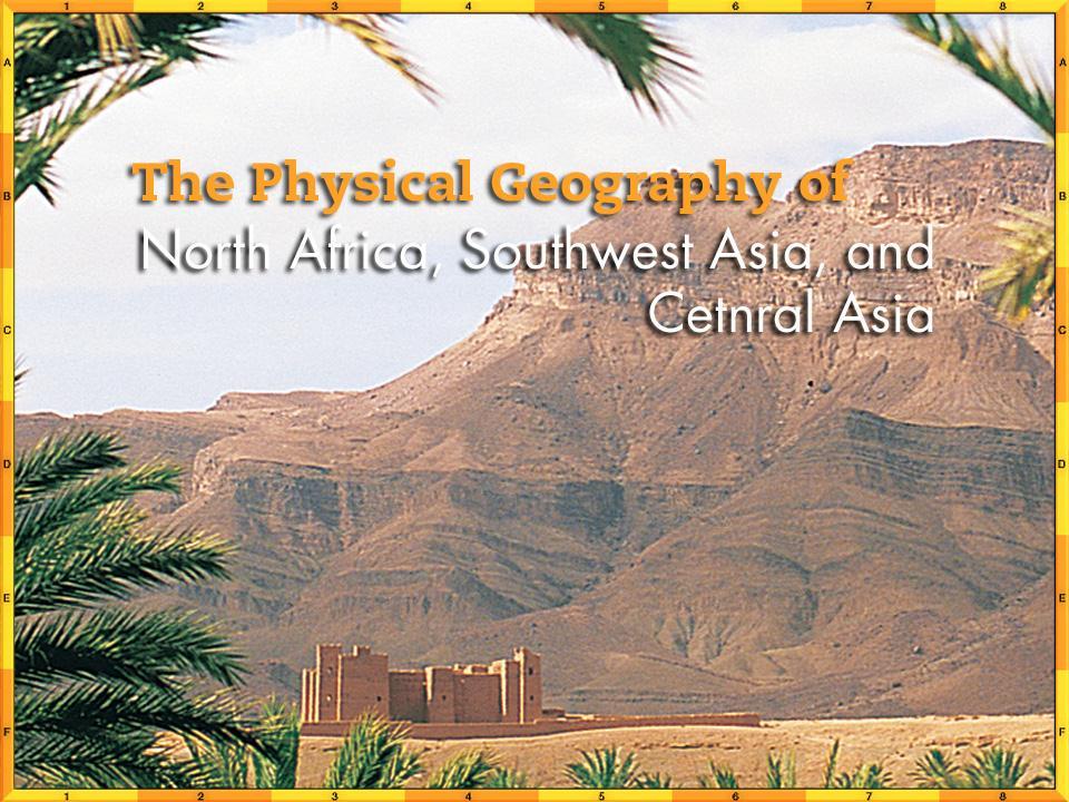
Chapter 17. North Africa, Southwest Asia and Central Asia
|
|
|
- Mervyn Henry
- 6 years ago
- Views:
Transcription
1 Chapter 17 North Africa, Southwest Asia and Central Asia
2
3 Chapter Objectives Describe the major landforms and natural resources of North Africa, Southwest Asia, and Central Asia. Discuss the climate and vegetation of North Africa, Southwest Asia, and Central Asia.
4 The Land Section 1
5 Section Objectives Identify which land and water features dominate the region. Discuss how the region s major rivers are important to its people. Explain why much of the world is economically dependent on the region.
6 Terms to Know alluvial soil wadi kum phosphate
7 A Geographic View
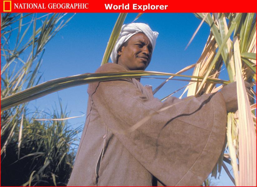
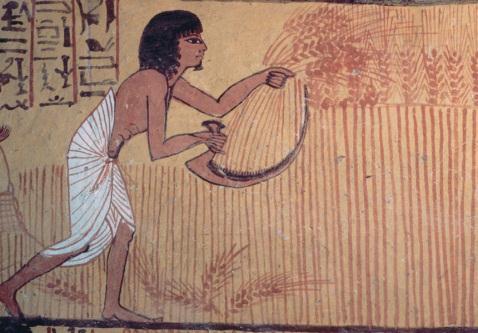
8 Geographic LIteracy The Nile River, flowing through northeastern Africa to the Mediterranean Sea, keeps Egypt from being entirely desert. For centuries, the Nile flooded its banks every summer, covering nearby fields with fertile soil. Dams, especially the Aswan High Dam, now control Nile flooding, drastically reducing sediment deposits and fertility.
9 Seas and Peninsulas North Africa, Southwest Asia, and Central Asia feature numerous seas and peninsulas. These include the Mediterranean, Red, and Black Seas as well as the Arabian and Sinai Peninsulas. The Dead Sea, the Caspian Sea, and the Aral Sea are actually landlocked bodies of salt water. The Aral Sea, which began to dry up when the Soviet Union diverted river source waters for irrigation, seems to be coming back.
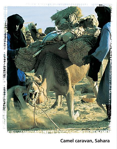
10 Rivers Major Rivers: Cradles of Civilization The Nile River Valley provides water and a lush, fertile living space for about 90 percent of Egypt s population. The Tigris and Euphrates Rivers help irrigate farms throughout Syria, Turkey, and Iraq. Streambeds Runoff from infrequent, violent rainstorms creates temporary streams in arid North Africa and Southwest Asia.
11 Rivers
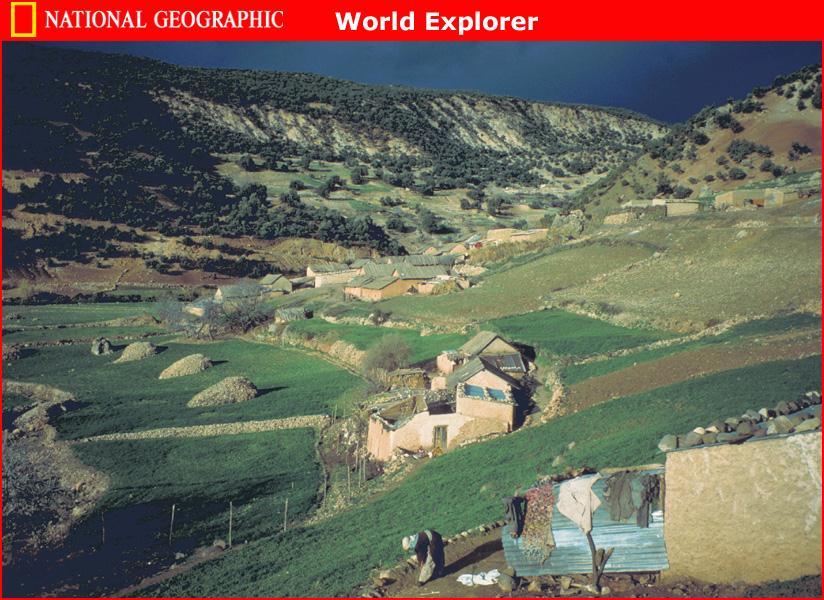
12 Plains, Plateaus and Mountains Coastal Plains Although most of the region is made up of deserts and mountains, the coastal plains along the Mediterranean provide the agricultural base of the region. Highland Enough precipitation falls on the Atlas Mountains of North Africa to make them hospitable to settlement and farming. The Asir Mountains of the Arabian Peninsula are also agriculturally productive. The Caucasus Mountains between the Black Sea and the Caspian Sea are known for their grandeur and beauty. Desert covers much of Turkmenistan and Uzbekistan.


13 Plains, Plateaus and Mountains
14 Earthquakes The shifting tectonic plates of the region have built mountains, shifted landmasses, and caused earthquakes. A 1999 earthquake in Turkey measured 7.4 on the Richter scale, toppling more than 76,000 buildings and killing nearly 20,000 people.
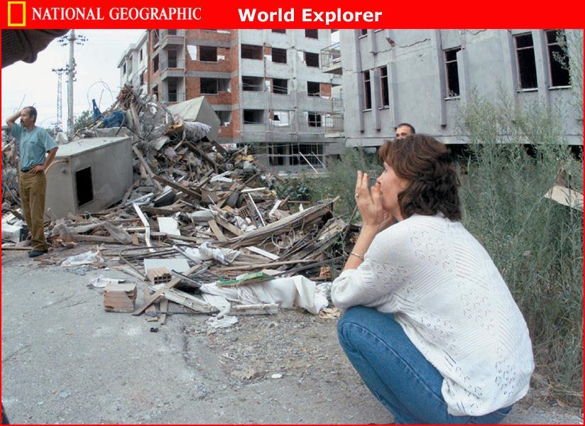
15 Earthquakes
16 Natural Resources Oil and Natural Gas About 70 percent of the world s oil reserves and 33 percent of the world s natural gas reserves are found in the region. Minerals Turkmenistan has the world s largest deposits of sulfate. Morocco ranks third in the production of phosphate. The region may contain up to 10 percent of the world s iron ore reserves. Building Diverse Economies Many countries in the region are diversifying their economies so that they are not so dependent on their oil and mineral exports.
17 Climate and Vegetation Section 2
18 Section Objectives Explain how the climates of the region differ. Describe how the needs of a growing population have affected the natural vegetation of the region.
19 Terms to Know Oasis pastoralism cereal
20 A Geographic View
21 Geographic Literacy Because the coastal city of Agadir in Morocco has 300 days of sunshine per year, its beaches are a popular tourist attraction, as are other Moroccan beaches along the Atlantic Ocean and the Mediterranean Sea.
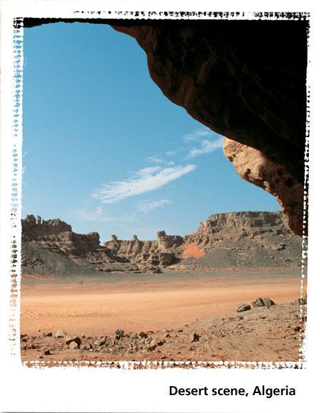
22 Water: A Precious Resource Rainfall is plentiful in some parts of North Africa, Southwest Asia, and Central Asia, but in most places water is scarce. Desert Climate Desert areas, such as North Africa s Sahara, cover almost 50 percent of the region. In the deserts, summers are long and hot, winters are cold, the land is mostly flat, and precipitation averages about 10 inches (25 cm) per year.
23 Water: A Precious Resource Steppe Climate Steppe is the second-largest climate region. Semi-arid conditions with light precipitation support short grasses that are grazed by livestock.
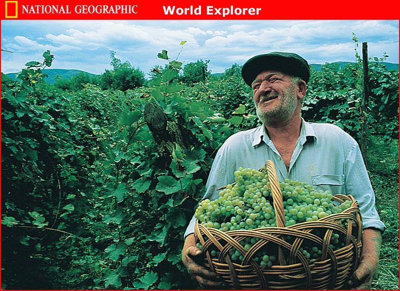
24 Climatic Variations Exports and Tourists The Mediterranean climate region features cool, rainy winters and hot, dry summers. This fertile area exports citrus fruits, olives, and grapes to Europe and the United States. Tourism is an important industry.
25 Climactic Variations
26 Climatic Variations Rainfall Receiving plenty of rainfall, highlands areas support forests and grain crops without irrigation. A Sign of Things to Come? Climate changes have turned some grassy plains in the region into deserts.
27 Climatic Variations
28 Section 1 - Summary North Africa, Southwest Asia, and Central Asia are located at the crossroads of Asia, Africa, and Europe. The region is a jigsaw puzzle of peninsulas and seas. Rivers feed the inland seas and supply irrigation to parched lands. Their alluvial soil deposits enrich the land, especially in the Nile River Valley and delta. The movement of tectonic plates forms mountains, moves landforms, and causes earthquakes in the region. The region contains much of the world s oil and natural gas reserves.
29 Section 2 - Summary Rainfall in North Africa, Southwest Asia, and Central Asia varies widely. Most of the region contains arid areas. The four climate regions in North Africa, Southwest Asia, and Central Asia are desert, steppe, Mediterranean, and highlands. Natural vegetation in the region varies widely and is closely related to rainfall and irrigation patterns.
STUDY GUIDE. The Land. Chapter 17, Section 1. There are frequent earthquakes in the region. Petroleum is a major export in the region.
 For use with textbook pages 421 426. The Land Terms to Know alluvial soil A rich soil made up of sand and mud deposited by flowing water (page 423) wadi A streambed that remains dry until a heavy rain
Unit 9 The Middle East SG 1 - Physical Geography, Population & Demographics
 Unit 9 The Middle East SG 1 - Physical Geography, Population & Demographics I. Physical Geography A. The Middle East includes southwestern Asia and North Africa. 1. The name is Eurocentric. Middle East
North Africa and Southwest Asia. Economic Geography
 North Africa and Southwest Asia Economic Geography Natural Resources Oil is the major resource in this region. Many countries in this region are members of OPEC (Organization of Petroleum Exporting Countries).
Middle East Part I Notes
 Middle East Part I Notes What do we already know about the Middle East? What do we already know about the Middle East? Pre-Test 1. T/F- The U.S. is currently fighting a war in the Middle East. 2. Which
Chapter 16 ~ Eastern Mediterranean
 Chapter 16 ~ Eastern Mediterranean Physical Geography of the Eastern Mediterranean Landforms This area is known as the Levant and includes Syria, Jordan, Lebanon, Israel, and the Palestinian territories.
Chapter 16 ~ Eastern Mediterranean
 Chapter 16 ~ Eastern Mediterranean Physical Geography of the Eastern Mediterranean Landforms This area is known as the Levant and includes Syria, Jordan, Lebanon, Israel, and the Palestinian territories.
Chapter 20. The Physical Geography of Africa South of the Sahara
 Chapter 20 The Physical Geography of Africa South of the Sahara Chapter Objectives Identify the major landforms, water systems, and natural resources of Africa south of the Sahara. Describe the relationship
Rivers. Highlights of some of the World s Most Famous Rivers!
 Rivers Highlights of some of the World s Most Famous Rivers! Directions This Power Point presentation contains information about some of the most famous rivers in the world! Students should use this presentation
6th Grade Social Studies Chapter 7: The Geography and Early Settlement of Egypt, Kush and Canaan
 I. Introduction (7.1) A. Egyptians settled along the Nile River, in the NE corner of Africa B. civilization lasted from around 3100 B.C. to 350 C. E. C. Kushites settled to the south of Egypt, along the
Ancient Egypt. Life Along the Nile River
 Ancient Egypt Life Along the Nile River 2018 Geography How Does Geography affect the way that people live? Geography- Where in the World? You are Here Streetsboro, Ohio United States of America Geography-
Chapter Objectives. Describe the dominant landforms and natural resources of Southeast Asia. Discuss Southeast Asia s climate and vegetation.
 Chapter Objectives Describe the dominant landforms and natural resources of Southeast Asia. Discuss Southeast Asia s climate and vegetation. The Land Section 1 Objectives Describe how tectonic plates and
Friday, November 10, 2017
 Friday, November 10, 2017 Andes and Midlatitude Countries Objective: Summarize the main physical features and regions of the Southern Cone. Identify and locate the urban centers and understand the pattern
Latin America and The Caribbean. A Closer Look.
 Latin America and The Caribbean A Closer Look. Mexico Capital: Mexico City The Location of Mexico Mexico is the second-largest country by size and population in Latin America.but the Largest Spanish -
Terms to Know. artesian well coral atoll krill lagoon
 Chapter Objectives Describe the diverse landforms and natural resources of Australia, Oceania, and Antarctica. Discuss the wide range of climates and vegetation throughout the region. The Land Section
Just how big is Africa?
 The United States China India The United Kingdom Portugal Spain France Belgium Germany The Netherlands Switzerland Italy Eastern Europe Japan 11.7 million sq. miles Just how big is Africa? Chapter 18 Section
Brain Wrinkles. Africa: The impact of location, climate, & physical characteristics on where people live, the type of work they do, & how they travel
 Africa: The impact of location, climate, & physical characteristics on where people live, the type of work they do, & how they travel STANDARDS: SS7G3 The student will explain the impact of location, climate,
Chapter 7 Geography and the Early Settlement of Egypt, Kush, and Canaan
 Chapter 7 Geography and the Early Settlement of Egypt, Kush, and Canaan How did geography affect early settlement in Egypt, Kush, and Canaan? Section 7.1 - Introduction RF/NASA//Corbis This satellite photograph
UNIT 5 PHYSICAL GEOGRAPHY SG 1 - PART I
 UNIT 5 PHYSICAL GEOGRAPHY SG 1 - PART I Africa is HUGE! I. LANDFORMS A. Plateaus - an area of relatively level high ground. 1. Africa s interior is dominated by series of plateaus and elevated basins such
GEOGRAPHY AND HISTORY
 GEOGRAPHY AND HISTORY YEAR 1, PART 1 www.vicensvives.es Contents 01 Our planet Earth 02 The representation of the Earth: maps 03 The Earth s relief 04 Rivers and seas 05 Weather and climate 06 Climates
CH. 1 Europe and Russia: Physical Geography. Section 1 Land and Water p Europe and Russia are part of the world s largest landmass called.
 CH. 1 Europe and Russia: Physical Geography Section 1 Land and Water p.10-16 Europe and Russia are part of the world s largest landmass called. The country of Russia stretches over both continents. About
Chapter 14. The Physical Geography of Russia
 Chapter 14 The Physical Geography of Russia Chapter Objectives Identify the physical features and natural resources of Russia. Discuss the effects of Russia s climate and vegetation on life in the region.
STUDY GUIDE. The Land. Chapter 20, Section 1. The Land of Africa South of the Sahara. Landforms Water Systems Natural Resources.
 For use with textbook pages 499 504. The Land Terms to Know escarpment A steep, often jagged slope or cliff (page 500) cataract A towering waterfall (page 500) rift valley A large crack in the earth s
Ancient Egypt and the Near East
 *O*»f ' i ft Ancient Egypt and the Near East Chapter 7 Chapter 8 Chapter 9 Geography and the Early Settlement of Egypt, Kush, and Canaan The Ancient Egyptian P h a r a o h s Daily Life in Ancient Egypt
Introduction to Africa
 Introduction to Africa Did you know? Africa has more countries than any other continent. The Sahara is a desert that is the size of the U.S. It s the world's largest desert. Most of the world s gold and
Chapter 7. Geography and the Early Settlement of Egypt, Kush, and Canaan
 Chapter 7 Geography and the Early Settlement of Egypt, Kush, and Canaan Chapter 7 Geography and the Early Settlement of Egypt, Kush, and Canaan How did geography affect early in Egypt Kush, and Canaan?
LOCATION, CLIMATE, AND NATURAL RESOURCES OF MEXICO
 SS6G3 The student will explain the impact of location, climate, distribution of natural resources, and population distribution on Latin America and the Caribbean. a. Compare how the location, climate,
AFRICAN PHYSICAL GEOGRAPHY
 AFRICAN PHYSICAL GEOGRAPHY Here are some factoids about Africa: world s second largest continent (11,700,000 miles). Home to 52 countries, 1,000 languages, 800 million people. 10% of the world s population
SS7G1 The student will locate selected features of Africa.
 Standards SS7G1 The student will locate selected features of Africa. a. Locate on a world and regional political-physical map: the Sahara, Sahel, savanna, tropical rain forest, Congo River, Niger River,
Location, Climate, & Natural Resources Brain Wrinkles
 Location, Climate, & Natural Resources Standards SS6G10 The student will explain the impact of location, climate, natural resources, and population distribution on Europe. a. Compare how the location,
North Africa. Chapter 25. Chapter 25, Section
 Chapter 25, Section World Geography Chapter 25 North Africa Copyright 2003 by Pearson Education, Inc., publishing as Prentice Hall, Upper Saddle River, NJ. All rights reserved. Chapter 25, Section World
Chapter 7: The Geography and Settlement of Egypt, Kush, and Canaan
 Chapter 7: The Geography and Settlement of Egypt, Kush, and Canaan Learning Target: I can explain how geography affected early settlement in Egypt, Kush, and Canaan. Ancient Egypt and the Middle East Can
STANDARDS: Brain Wrinkles
 STANDARDS: SS6G3 The student will explain the impact of location, climate, distribution of natural resources, and population distribution on Latin America and the Caribbean. a. Compare how the location,
Physical Geography of Europe. Chapters 13-18
 Physical Geography of Europe Chapters 13-18 The British Isles Archipelago made of 6000+ small islands Temperate climate Largest body of fresh water is Loch Ness Mostly rolling hills and large flat lands
Brain Wrinkles. Location, Climate, & Natural Resources of. Where People Live & How They Trade
 Location, Climate, & Natural Resources of Where People Live & How They Trade It s south of the US, east of the Pacific Ocean, and west of the Gulf of Mexico & Caribbean Sea. It s great that it s located
UNIT 5 AFRICA PHYSICAL GEOGRAPHY SG 1 - PART II
 UNIT 5 AFRICA PHYSICAL GEOGRAPHY SG 1 - PART II III. CLIMATE & VEGETATION A. The four main climate zones are tropical wet, tropical wet/dry (split into monsoon & savanna), semiarid, and arid. Other climate
Unit 1: Physical Geography Notes
 - How has the physical world impacted settlement patterns? o Major factors in the decision-making process of o Before the boom controlling the physical environment was not possible on a large scale - Physical
Chapter 15: RUSSIA & The REPUBLICS
 Chapter 15: RUSSIA & The REPUBLICS Ch. 15:1 Landforms & Resources The Northern European Plain stretches for over 1,000 miles between the western border of Russia & the Republics and the. Ural Mountains
Unit 6 vocabulary. Serengeti Plain
 basin Nile River rift valley Mount Kilimanjaro escarpment Sahara aquifer oasis Serengeti Plain canopy Niger delta Sahel the world s longest river, flowing more than 4,000 miles through Uganda and Sudan
STUDY GUIDE. The Land. Physical Features of Latin America. Chapter 8, Section 1. Terms to Know DRAWING FROM EXPERIENCE ORGANIZING YOUR THOUGHTS
 For use with textbook pages 193 198. The Land Terms to Know cordillera A mountain range that runs parallel to another mountain range (page 194) altiplano A high plain (page 194) escarpment A steep cliff
CHAPTER 12. South America. Section 1: Natural Environments Section 2: History and Culture Section 3: South America Today. HOLT World Geography
 CHAPTER 12 South America Section 1: Natural Environments Section 2: History and Culture Section 3: South America 1 Section 1 Natural Environments Objectives: What are the major landforms and rivers of
Brief Description of Northern the West Bank, Palestine Prepared by: Dr. Ahmed Ghodieh Department of Geography An-Najah National University Nablus,
 Brief Description of Northern the West Bank, Palestine Prepared by: Dr. Ahmed Ghodieh Department of Geography An-Najah National University Nablus, Palestine Brief Description of Northern the West Bank
Essential Questions. 1. How have historical figures and events affected South America today?
 South America Essential Questions 1. How have historical figures and events affected South America today? 2. How has location affected the development of countries in South America? 3. How has the role
absolute building land water
 Site and Situation What makes a city great? Why are some cities better than others? Cities developed for a variety of reasons. Site and situation are important geographic concepts when studying the reasons
Location, Climate, & Natural Resources
 Location, Climate, & Natural Resources UK is a country of islands off the coast of mainland Europe. It consists of England, Northern Ireland, Scotland, & Wales. UK s location makes it a HUB for trade.
Africa s. Presentation, Graphic Organizers, & Activities
 Africa s Presentation, Graphic Organizers, & Activities STANDARDS: SS7G1 Locate selected features of Africa. a. Locate on a world and regional political-physical map: Sahara, Sahel, savanna, tropical rain
Label your Map with Russia. Map Activity
 Bell Activity How many time zones does the U.S. have? How do these time zones affect life in the U.S.? Russia is so large it has 11 time zones. What difficulties might this create? Objectives Know landforms,
Brazil. Chapter 12. Chapter 12, Section
 Chapter 12, Section World Geography Chapter 12 Brazil Copyright 2003 by Pearson Education, Inc., publishing as Prentice Hall, Upper Saddle River, NJ. All rights reserved. Chapter 12, Section World Geography
Essential Standards: WH.H.2 Analyze ancient civilization and empires in terms of their development, growth and lasting impact.
 Unit: Ancient Civilizations Topic: The Nile River Valley Essential Standards: WH.H.2 Analyze ancient civilization and empires in terms of their development, growth and lasting impact. Clarifying Objectives:
Ancient Egypt, Kush, and Israel
 G e o g r a p h y C h a l l e n g e Ancient Egypt, Kush, and Israel EUROPE ASIA ATLANTIC OCEAN AFRICA INDIAN OCEAN ATLANTIC OCEAN N W E S Ancient Egypt, about 1500 B.C.E. Kingdom of Kush, about 1500 B.C.E.
STUDY GUIDE. The Land. Chapter 29, Section 1. Both. Terms to Know DRAWING FROM EXPERIENCE ORGANIZING YOUR THOUGHTS
 Chapter 29, Section 1 For use with textbook pages 719 724. The Land Terms to Know cordilleras Parallel mountain ranges and plateaus (page 719) archipelago A group of islands (page 720) insular Relating
PHYSICAL GEOGRAPHY. Unit 1
 PHYSICAL GEOGRAPHY Unit 1 HOW HAS THE PHYSICAL WORLD IMPACTED SETTLEMENT PATTERNS? Major factor in the decision-making process of settlers Before the technological boom controlling the physical environment
A funny sounding lake. South American Landforms, Climate, and Vegetation
 A funny sounding lake South American Landforms, Climate, and Vegetation 3 4 Essential Question: How have physical features and climate affected the population distribution of Latin America? 5 I. Landforms
The Geological Pacific Northwest. Wednesday February 6, 2012 Pacific Northwest History Mr. Rice
 The Geological Pacific Northwest Wednesday February 6, 2012 Pacific Northwest History Mr. Rice 1 Free Response #2 Please do not simply list the items for this response. Full sentences!!! Minimum of 3-5
Kindergarten Science Unit C: Earth Science Chapter 5: Our Land, Air, and Water Lesson 1: What makes up the Earth?
 Insert Photo or Graphic for Unit or Lesson Theme Kindergarten Science Unit C: Earth Science Chapter 5: Our Land, Air, and Water Lesson 1: What makes up the Earth? Insert Photo/Graphic Earth Insert Photo/Graphic
Monday, December 11, 2017
 Monday, December 11, 2017 Physical Geography of Russia Objective: complete Warm-Up, write outline notes and discuss the geography of Eastern Europe/mother Russia and view Geography Now: Belarus. География
Ancient Egypt, Kush, and Israel
 500 1,000 miles T ER ES D N YA LIB 1 Geography and the Early Settlement of Egypt, Kush, and Canaan AFRICA NUBIAN DESERT ed 0 500 1,000 kilometers Sinusoidal (Sanson-Flamsteed) Projection S E ARABIAN PENINSULA
South American Countries. Capital Location Population Terrain Climate
 South American Countries Capital Location Population Terrain Climate Andes Mountains Four large areas that make up the Central Plains: Llanos, the Selva, the Gran Chaco, and the Pampas Brazilian Highlands
Latin America. Physical Geography
 + Latin America Physical Geography + I. Landforms A. Caribbean & Central America 1. Mexico is dominated by two mountain chains, collectively called the Sierra Madre. A high plateau is situated in between.
Objective. Students will familiarize themselves with the physical features and climates of Latin America.
 Journal Write KWL What do you KNOW about Latin America? What do you WANT TO KNOW about Latin America? What did you LEARN today that you didn t know before? Latin America Objective Students will familiarize
THE GEOGRAPHY OF THE NILE. Section 1
 THE GEOGRAPHY OF THE NILE Section 1 The Nile River is the world s longest river. It flows north from its sources in East Africa to the Mediterranean Sea for more than 4,000 miles. THE COURSE OF THE NILE
Chapter 21: EAST AFRICA
 Chapter 21: EAST AFRICA Physical Geography of East Africa Landforms East Africa is a diverse landscape of different plains, volcanic mountains, and plateaus cut by a large valley and marked by many rivers
Latin America. Chapter 9 Physical Geography
 Latin America Chapter 9 Physical Geography Latin American Regions Middle America includes Mexico and the Central American countries The Caribbean Islands South America Mexico Landforms Sierra Madre Oriental
Module 1 Educator s Guide: Representative Discussion Points Investigation 3
 Module 1 Educator s Guide: Representative Discussion Points Investigation 3 Ethiopia and Eritrea Our combined population is 59,578,171 people. We have just emerged from a long period of civil war and famine.
Region 1 Piney Woods
 Region 1 Piney Woods Piney Woods 1. This ecoregion is found in East Texas. 2. Climate: average annual rainfall of 36 to 50 inches is fairly uniformly distributed throughout the year, and humidity and temperatures
What is meant by site?
 Site and Situation What is meant by site? Site is the actual location of a city. Example NYC is located on a large, deep water harbor, next to the Atlantic Ocean. What is meant by situation? Situation
Geographic Qualities of South America
 Geographic Qualities of South America 1. South America is the fourth largest continent in area. It is located in the Western Hemisphere, lying southwest of North America. Most of South America lies in
Appendix A Geographic and Geologic Terms Connected With Egypt
 Appendix A Geographic and Geologic Terms Connected With Egypt Egypt Official name is the Arab Republic of Egypt. Total area is 1,002,450 km 2, which makes Egypt the 29th largest country in the world. Only
Ancient Egypt. Land of the Pharaohs
 Ancient Egypt Land of the Pharaohs CHAPTER 4 EGYPT SECTION 1: GEOGRAPHY AND EARLY EGYPT BIG IDEA The water, fertile soils, and protected setting of the Nile Valley allowed a great civilization to arise
Exploring Mexico. Directions: Complete the paragraphs below. Write the correct word from the Word Bank to complete each sentence.
 Exploring Mexico Section 1 10 Directions: Complete the paragraphs below. Write the correct word from the Word Bank to complete each sentence. Word Bank United States Central Plateau irrigation isthmus
Babylon. Ancient Cities by the River Lesson 5 page 1 of 6. Code of Hammurabi monument. E u p h. T i g r i s. r a t e s. Babylon, Mesopotamia
 Ancient Cities by the iver Lesson 5 page 1 of 6 1700s BCE, and established the importance of the city for the region He was responsible for a code of laws/decrees to reestablish justice in the land His
How to play. The center aisle divides our class into 2 teams. Team members are NOT allowed to help their teammate when they are asked a question.
 Floaters & Sinkers How to play The center aisle divides our class into 2 teams. Each person will be responsible for answering a question for every round played. Team members are NOT allowed to help their
Geography (cont) Sorghum, rice, millet, rice, wheat and corn grown on savannahs. Not just one big plain though mountainous and swampy areas too
 Sorghum, rice, millet, rice, wheat and corn grown on savannahs. Not just one big plain though mountainous and swampy areas too") Geography & Society in Africa: 500 BCE-900 CE Geography Around 5000 miles wide and long Various climates, jungles, snow-capped mountains, deserts and rain-soaked areas. 40% desert - largely uninhabitable
Geography & Society in Africa: 500 BCE-900 CE Geography Around 5000 miles wide and long Various climates, jungles, snow-capped mountains, deserts and rain-soaked areas. 40% desert - largely uninhabitable
Regional Atlas: Introduction to Latin America
 Chapter 9, Section World Geography Chapter 9 Regional Atlas: Introduction to Latin America Copyright 2003 by Pearson Education, Inc., publishing as Prentice Hall, Upper Saddle River, NJ. All rights reserved.
The River Nile. Use an atlas to draw on the River Nile. Colour the countries that use the River Nile.
 The River Nile Use an atlas to draw on the River Nile. Colour the countries that use the River Nile. http://alabamamaps.ua.edu/contemporarymaps/world/africa/index.html The start of the River Nile is in
Australia. Geography
 Australia Geography Label the Map!!! New South Wales New South Wales Location: State on the east coast of Australia. Australian Capital Territory - Sydney! (5th largest, 1st most populous) Climate Types:
GASCO Abr Seina Onshore Gas Pipeline
 4.0 Existing Environment 4.1 INTRODUCTION The route of Abr Seina pipeline 32, 111 km, starts from El Tina Shark (long. 31 o 1 27.7 lat. 32 o 20 47.4 ) to El Arish, northern Sinai. A general survey was
Warm ups *What is unique about the status of Switzerland? *How Austria s history differed from that of Switzerland?
 Warm ups 12.07.2016 *What is unique about the status of Switzerland? *How Austria s history differed from that of Switzerland? Lesson Objective: *describe how Spain differs physically, economically, and
سبل تفعيل تنفيذ ا تفاقية الا راضى الرطبة فى المنطقة العربية
 CONVENTION ON WETLANDS "RAMSAR" AND THE ARAB REGION سبل تفعيل تنفيذ ا تفاقية الا راضى الرطبة فى المنطقة العربية "رامسار" National Institute of Oceanography and Fisheries WETLANDS SERVICES AND PRODUCTS
!!!!!!!!!!Mali s Geographic Makeup
 DANU Strategic Forecasting Group May 27th 2016!!!!!!!!!!Mali s Geographic Makeup By Liliana Pirlea Location: Mali is a landlocked country located in West Africa. Mali is the 8th largest country in Africa
Hydrology of Yemen. Dr. Abdulla Noaman
 Hydrology of Yemen Dr. Abdulla Noaman INTRODUCTION Location and General Topography Yemen is located on the south of the Arabian Peninsula, between latitude 12 and 20 north and longitude 41 and 54east,
Africa: Physical geography
 Africa: Physical geography By National Geographic Society, adapted by Newsela staff on 09.15.17 Word Count 1,279 Level 1040L African elephants roam the savannas, which cover almost half of the African
Sub - Saharan Africa
 Sub - Saharan Africa 4/14/2015 Countries with Relative Importance GDP South Africa Gabon Botswana Land Size Sudan Chad Mozambique Madagascar Democratic Republic of the Congo (formerly Zaire) Population
CANADA: ITS LAND, RESOURCES, & ECONOMY PRE-TEST
 PRE-TEST Name Directions: In the blank space, write a "T" if the statement is true and an "F" if the statement is false. 1. Canada has 11 geographic regions. 2. The cordillera is found in central Canada.
2.1 What is the climate like?
 José Medeiros This fact sheet allows you to see how varied the countryside is across Brazil. 2.1 What is the climate like? Most of Brazil is in the Southern Hemisphere, where the seasons are the opposite
Egypt is located in northeastern Africa and southwestern Asia. It covers 385,229 square
 Egypt Location Egypt is located in northeastern Africa and southwestern Asia. It covers 385,229 square miles. Egypt lies on the coordinates 27 N, 30 E. Libya lies on Egypt s west border, Sudan on its south,
The Land Photo Source: The Atlas of Canada, The Red River, Manatoba, Canada land/physio_red_ri
 The Land The United States and Canada An Overview of the Region The United States and Canada are the two largest countries in North America. The Rio Grande is part of the southwest border of the United
Mediterranean Europe
 Chapter 17, Section World Geography Chapter 17 Mediterranean Europe Copyright 2003 by Pearson Education, Inc., publishing as Prentice Hall, Upper Saddle River, NJ. All rights reserved. Chapter 17, Section
OUR COUNTRY INDIA L OCATIONAL SETTING
 7 India is a country of vast geographical expanse. In the north, it is bound by the lofty Himalayas. The Arabian Sea in the west, the Bay of Bengal in the east and the Indian Ocean in the south, wash the
Chapter 13 Eastern Europe & Western Russia: Recovering from war, communism, genocide, and unfortunate geography (Pg )
") Chapter 13 Eastern Europe & Western Russia: Recovering from war, communism, genocide, and unfortunate geography (Pg. 393-420) Lesson 1: Physical Geography of Eastern Europe & Western Russia Pg. 396-401
Chapter 13 Eastern Europe & Western Russia: Recovering from war, communism, genocide, and unfortunate geography (Pg. 393-420) Lesson 1: Physical Geography of Eastern Europe & Western Russia Pg. 396-401
2015 Brain Wrinkles. SS8G1b
 SS8G1b Georgia is a geographically diverse state that is divided into five regions. The first three regions (Appalachian Plateau, Valley and Ridge, and Blue Ridge) are in the mountains and foothills of
Vocabulary Words. predict inundation deity afterlife. mummy cataract nation-state dynasty
 The Gift of Nile Vocabulary Words predict inundation deity afterlife mummy cataract nation-state dynasty Predict Predict: To tell ahead of time what will happen. Inundation Inundation; Annual flooding
3rd GRADE MINIMUM CONTENTS UDI 1: LANDSCAPES (5)
") 3rd GRADE MINIMUM CONTENTS UDI 1: LANDSCAPES (5) DIFFERENT LANDSCAPES A landscape is all the things that we see in a place. There are different types of landscapes. Mountain landscapes have mountains and
3rd GRADE MINIMUM CONTENTS UDI 1: LANDSCAPES (5) DIFFERENT LANDSCAPES A landscape is all the things that we see in a place. There are different types of landscapes. Mountain landscapes have mountains and
Chapter 25 Geography and the Settlement of Greece. How did geography influence settlement and way of life in ancient Greece?
 Chapter 25 Geography and the Settlement of Greece 25.1 Introduction How did geography influence settlement and way of life in ancient Greece? Tal Naveh/Shutterstock The ancient Greeks learned to use the
Chapter 2A: The Russian Realm
 Geography: Realms, Regions, and Concepts 16 th Edition Chapter 2A: The Russian Realm The Russian Realm Two transition zones mark the margins. The Russian Realm Two transition zones mark the margins. Physical
Geography of Ancient Greece Summary Sheet for Use in Assessment
 Geography of Ancient Greece Summary Sheet for Use in Assessment 1. At the same time that the Shang dynasty was ruling much of the Huang He River valley and the Egyptian pharaohs were building the New Kingdom
Physical Regions of the U.S.
 Physical Regions of the U.S. Quickly use this map to label the map on your paper Pacific Coast The coast from southern California to Alaska The region of the Pacific Northwest has a long history that was
Europe. World Geography
 Europe World Geography Physical Geography Europe s landforms also include large plains and mountain ranges. Europe is composed of many peninsulas and islands. Always near Water Europe is a large peninsula
4th Grade Social Studies 2nd Nine Weeks Test
 4th Grade Social Studies 2nd Nine Weeks Test Multiple Choice Identify the choice that best completes the statement or answers the question. 1 Which is the largest city in the United States? A Philadelphia,
A: Pre-reading Vocabulary
 - 1 - In this text you are going to read about Egypt and the Egyptian people. There are some words in this text that you won t see very often when you are reading but are important for this text. These
HIST-WG Singleton WG 2nd 6 Weeks' Exam
 HIST-WG Singleton WG 2nd 6 Weeks' Exam [Exam ID:2NDJK9] Scan Number:253 1 In the Asian region, there have been great strides in agricultural advancements and technology which have enabled greater food