Valley of the Queens Assessment Report
|
|
|
- Hilda Logan
- 6 years ago
- Views:
Transcription


1 Project Report Valley of the Queens Assessment Report Volume 1 Conservation and Management Planning A collaborative project of the Getty Conservation Institute and the Supreme Council of Antiquities, Egypt Edited by Martha Demas and Neville Agnew Report Contributors: Neville Agnew Jonathan Bell Martha Demas Dania El-Iraqi Tomomi Fushiya Shin Maekawa David Myers William Raynolds Stephen Rickerby Thomas Roby Lorinda Wong
2
3 Valley of the Queens Assessment Report Volume 1 Conservation and Management Planning August 2012 THE GETTY CONSERVATION INSTITUTE LOS ANGELES
4 2012 J. Paul Getty Trust The Getty Conservation Institute 1200 Getty Center Drive, Suite 700 Los Angeles, CA United States Telephone Fax The Getty Conservation Institute works to advance conservation practice in the visual arts, broadly interpreted to include objects, collections, architecture, and sites. The Institute serves the conservation community through scientific research, education and training, model field projects, and the dissemination of the results of both its own work and the work of others in the field. In all its endeavors, the GCI focuses on the creation and delivery of knowledge that will benefit the professionals and organizations responsible for the conservation of the world s cultural heritage (online resource) (print)

5 VALLEY OF THE QUEENS ASSESSMENT REPORT VOLUME 1 Part I. Introduction to the Assessment Report 1 Part II. Site significance, description and history 1. Summary statement of significance and principal threats Site setting, boundaries and components Historical overview and selected tomb profiles Chronology of site use, research and interventions Bibliographies (Valley of the Queens and Site and Visitor Management in Egypt) 91 Appendix 1: Chronology of ancient Egypt 119 Appendix 2: History of mapping 125 Appendix 3: Archival photographic documentation 131 Appendix 4: SCA interventions ( ) 133 Part III. Management context 1. Introduction Legal context and authorities operating at the site Management structure and personnel Stakeholder consultation Uses of the site and associated infrastructure Emergency response Monitoring and maintenance Site records Site storage of archaeological study materials Waste management Operational plan for the site 158 Part IV. Visitor management and interpretation 1. Introduction Visitor numbers and patterns of visitation Visitor and guide surveys Observations of visitors and guides Stakeholder consultations Visitor services and infrastructure Protection and presentation of visited tombs Visitation and interpretation potential 227 Part V. Site-wide threats and considerations 1. Environmental monitoring Assessment of flash flooding Bat colonies 283 Part VI. Site elements 1. Introduction Inventory forms and condition assessment 293
6
7 Part I. Introduction to the Assessment Report The Valley of the Queens Project is a collaboration of the Supreme Council of Antiquities (SCA) and the Getty Conservation Institute (GCI) with the aim to develop and implement a comprehensive plan for the conservation and management of the Valley. Phase 1 of the project comprised research and assessment, followed by development of concept proposals for conservation and management of the site. This report records the results of the research and assessment undertaken for Phase 1 from 2006 through The assessment process The planning process being followed for the Valley of the Queens (QV) project emphasizes research and assessment before making decisions. The research component was aimed at delineating the historical elements of the site and its cultural boundaries through collection and synthesis of information and documentation from the many expeditions and excavations at QV. Research has served to lay the groundwork for the assessment and analysis and for consistent reference throughout the planning process and in the planning documents. Three types of assessment were undertaken: significance, threats and physical condition, and management context. The assessments were carried out mainly in with preliminary research and collection of information beginning in 2006 and continuing throughout the process. In undertaking and writing up the assessment, the emphasis has been placed on the main Valley and its tombs and features, its management, including visitor management, and the history, threats, current condition and visitation potential of the 19 th and 20 th Dynasty tombs. The 18 th Dynasty tombs were more difficult to assess. Some were inaccessible due to collapse or structural instability and many were inhabited by bats for perhaps decades and posed health issues. Less focus has been placed on tombs and site elements in the subsidiary valleys (Valley of Prince Ahmose, Valley of the Dolmen, Valley of the Rope, and Valley of the Three Pits), many of which are remote, and some inaccessible due to having been filled in or obscured by erosion over the years. Research and assessments were undertaken by the QV project team, which included fourteen SCA staff members who received formal and informal training (in site management and wall painting conservation) through active participation in the process. Based on the assessments, initial concept proposals were developed in 2009 and presented to the SCA for consideration, followed by revisions and further development in The assessment report The assessment report is divided into two volumes with the organization following the three main assessments: Volume 1 Part I: In addition to this introduction, Part I includes a summary table of Phase 1 project activities, the list of participants in this phase of the project, and tables of standardized names and acronyms used in the report. Part II: The significance, components, and a broad historical overview of the use and context of the site from the 18 th Dynasty through the Coptic period constitute Sections 1-3 of Part II. The historical overview includes family trees for the 19 th and 20 th Dynasties and selected profiles of tombs that are sufficiently well preserved to construct a plausible biography of the deceased for whom the tomb was constructed and to interpret the iconography. Section 4 is a table of the use, 1
8 research and interventions at the site from the earliest prehistoric evidence through the current project. Section 5 contains comprehensive bibliographies of the sources for QV research and for understanding site management practices in Egypt. Appendices 1-3 are the chronology of ancient Egypt, a history of mapping of the Valley, and a summary of archival photographic documentation. Appendix 4 is a brief record of interventions to the site undertaken by the SCA from that were not part of the GCI-SCA project. Parts III and IV: Part III is an assessment of the management context of QV, which includes the main issues that effect operations at the site such as personnel, infrastructure, storage, and waste management, as well as elements of an operational plan and considerations of financial sustainability. Part IV focuses on visitor management, an important sub-set of management. Visitor statistics at QV and in the West Bank are collated and results of visitor surveys and observations undertaken in are summarized. This section also reviews the history of visitation to QV and its current status, and assesses the potential of other tombs and site elements to be opened for public visitation. Part V: This part looks at site-wide threats and considerations. Environmental conditions prevailing at the site and within the tombs are summarized and considered in Section 1. The potential for flooding, which is the major threat to the site as a whole, is reviewed historically and assessed through computer modeling in Section 2. Finally, in Section 3, the bat colonies that inhabit many of the tombs are addressed. Part VI: The fourteen site elements (non-tomb features) in the Queens Valley and its subsidiary valleys are assessed in Part IV. The assessment includes inventory forms (name; element type; date; general description; objects recovered; table of use, events and interventions; and documentation and references), followed by condition assessments for each site element. Volume 2 The second volume of the report is the condition summary of all 18 th, 19 th, and 20 th Dynasty tombs at QV. Included are a summary of tomb architectural development, the geological and hydrological context of the tombs, and the technology of the wall paintings of the 19 th and 20 th Dynasties. For the seventy-seven 18 th Dynasty tombs, many of which were not fully accessible, owing to safety or other reasons, there is a brief condition assessment. For each of the thirty-four 19 th and 20 th Dynasty tombs, an inventory form for each tomb summarizes basic general information (naming systems, attribution, reign, typology; description of tomb; objects recovered; table of use, events and interventions; and documentation and references). These are followed by a detailed assessment of the condition of individual tombs. 2
9 Acknowledgements The report is based on research and field assessments undertaken over several years by the Queens Valley team members and consultants (see List of Participants following) and compiled by GCI team members. In undertaking the three-year assessment for the project, we acknowledge the support of colleagues in the SCA, both in Cairo and in Luxor, in advancing the work. SCA team members and staff who participated in the project are named in the List of Participants. In particular, we wish to thank the Documentation Center of the SCA (CEDAE) for allowing access and use of CEDAE documentation and for supporting new photo-documentation of the painted tombs at QV, and the Conservation Center for assisting with the assessment of the bat colonies. At all stages, the research and assessment has been informed by the knowledge and experience of archaeologist Christian Leblanc, who has been generous with sharing information, providing documentation and photographs from the time of the Franco-Egyptian investigations of the Valley, and for reviewing this report. We are especially grateful for permission to use published and unpublished photographs and plans produced by the Franco-Egyptian mission in this report. Heather McCarthy and Emily Cole contributed significantly to the historical research, especially the iconography of the19 th and 20 th Dynasty tombs. Kent Weeks provided advice on issues of mapping on the West Bank and facilitated the use of the 1981 TMP survey data of QV tombs for conversion to CAD drawings. Bibliographic searches and verification of citations were done by Valerie Greathouse, GCI Information Center. FTIR analysis was undertaken by Herant Khanjian, GCI Science Department. GCI consultant Ron Schmidtling prepared and interpreted petrological thin sections for the geological assessment. Christian Dietz, University of Tuebingen, provided information on the ecology and identification of bat species. We are grateful to Mamdouh Hamza for generously contributing time and effort of the staff of Hamza Associates to the assessment of flooding, geology, structural instability of the tombs, and visitor infrastructure, followed by development of architectural and engineering designs for implementation of these components in Phase 2 of the project. We thank Romany and Mary Helmy for their essential and always generous and helpful role in facilitating our work in Egypt over many years of collaboration and friendship. 3

 Abdel-Nasser Ahmed Abdel Azim Ahmed")
 Mohamed Ali Abu El-Yazid Mohamed Yussef Ramadan")
 Christian Leblanc (CNRS) Kent Weeks (TMP) Chief inspector Abdel Nasser")
10 Participants in the QV Project, Phase 1 ( ) Getty Conservation Institute Staff Neville Agnew Martha Demas Shin Maekawa Lorinda Wong David Myers Jonathan Bell Thomas Roby Interns Dania El-Sayed El-Iraqi Tomomi Fushiya William Raynolds Sarah Thomas Consultants Stephen Rickerby Raphael Wüst Romany Helmy Hamza Associates Hossam Mahdy Heinz Ruther Social Research Center (AUC) Supreme Council of Antiquities Wall painting conservation team Afaf Mohamed Mahmoud (Ms) Abdel-Nasser Ahmed Abdel Azim Ahmed Baghdadi Yusef Badawy Sayed Abdel Rheem Mohamed Hussein Ahmed Abdel Rahim Ramadan Mohamed Salem Bedair Saady Zaki Abdallah El Gammal Site management team Ezz el-din Kamal el-noby Faten Boshra Magharyos (Ms) Mohamed Ali Abu El-Yazid Mohamed Yussef Ramadan Ahmed Ali Sameh Mohamed Zaki Shaymaa Mahmoud Ahmed (Ms) Contributing institutions & individuals SCA-CEDAE SCA Conservation Center Egyptian Antiquities Information System (EAIS) Christian Leblanc (CNRS) Kent Weeks (TMP) Chief inspector Abdel Nasser Mohamed Ahmed 4

11 QV Project Phase 1: Summary table of activities ( ) Background research and gathering of information and photography of all tombs and site elements related to significance, history of use, and condition Condition assessment for rock structural stability of 18 th, 19 th and 20 th Dynasty tombs and development of intervention designs for stabilization and protection Risk and condition assessment and treatment planning for the 23 tombs of the 19 th and 20 th Dynasty that have surviving plaster or decoration Laser scanning of the valley to produce new topographical maps and a GIS integrating TMP and CNRS tomb drawings Geological and hydrological mapping, study, and design concepts for site-wide and tomb-specific flood protection Assessment of site and visitor management including collection of visitor data; surveys of visitors and guides; and analysis of visitation and interpretation potential Development of concept designs for site and visitor infrastructure and for presentation and interpretation of QV, based on visitor management assessment Inventory and relocation of study materials from 48 tombs into secure storage and extensive site and tomb cleanup Environmental monitoring for RH, temperature, CO 2, and dust in QV 44, 55, 66, and exterior environment (on-going) Research and trial tests by SCA Conservation Center for exclusion of bat colonies from most tombs and retention in a few selected tombs New baseline photographic documentation (digital color) by SCA CEDAE of 19 th and 20 th Dynasty tombs with paintings Training of seven SCA inspectors in site management and seven SCA conservators in wall painting conservation. Included experience at the GCI for SCA inspectors. West Bank Coordination meetings: 2006, 2007, 2008 to promote integration of site management planning efforts 5
12 Standardized spellings and usage of names and terms in QV assessment report English transliteration of royal names based principally on usage in Leblanc Queens, Princesses, Princes and elites in QV Kings (New Kingdom) Sites and Places Ahmose (Prince) Ahmose Abd el-qurna Ahmose (Princess) Akhenaten Asyut Amenherkhepshef Amenhotep El-Assasif Amenhotep Amenmeses El-Khokha Baki Ay Deir el-bahari Bentanat Hatshepsut Deir el-medina Duatentipet Horemheb Deir Esh-Shelwit Hatneferet Merenptah Dra Abu el-naga Heka-( ) Rameses / Ramesside Malkata Henuttauy Semenkhkara Qurn Henutmira Seqenenra Tao Qurnet Murai Hori Seti Ramesseum Imhotep Setnakht Other terms Isis-ta-Hemdjeret Siptah Khekheret-nesu (lady-in-waiting) Khaemwaset Tausert Kheqer frieze (decorative frieze) Merytamen Thutmosis / Thutmoside Mastaba (bench, platform) Merytra Tutankhamen Mouna (earth & straw plaster) Minefer QV site Noria (water pot) Minemhat Dam (pharaonic dam) Speos (grotto) Nebettauy Deir er-rumi Ushabti (funerary figurine) Nebiri Dolmen Nefertari Graffiti Nehesy Grotto Cascade Necropolis (s) / necropoleis (pl) Pareherunemef Hermit Shelters Stele (s) / stelae (pl) Rameses-Meryamen Italian Mission Building /Schiaparelli Kitchen Satra Kiln Sethherkhepshef Menhir Tanedjemy Observation Posts Tyti Sanctuary to Ptah & Meretseger Tuy Valley of the Queens/Queens Valley/Valley/QV Urmerutes Workmen s Huts /Tomb Workers' Structures Names and terms used in iconographical description of tombs Akhet (horizon) Herymaat Nut Amun Horus / -Iunmutef / -in-his-youth Nyny (welcoming ritual) Ankh (life) Imentet Osiris / -Wennenefer Anubis Imset Ptah/ -Soker Atum Isis Pe Ba (mobile aspect of the soul) Ka (life force of the soul) Ra / -Herakty Djed (pillar, symbol of stability) Kebehsenuef Selkis Duamutef Ma at Taweret Duat (underworld) Meretseger Thoth Geb Nebneru Uraeus (s) / uraei (pl) Hapy Nekhbet Wadjet / Wadjet eye Harsiese Nekhen Was (dominion) Hathor Hememet Neith Nephthys 6
13 Acronyms and abbreviations of organizations used in this report ARCE CEDAE American Research Center in Egypt Centre d'etude et de Documentation sur l'ancienne Egypte CNRS Centre National de la Recherche Scientifique (Archaeological expedition of the French mission led by Christiane Desroches Noblecourt and later by Christian Leblanc Antiquities Service/ EAO/SCA Antiquities Service=Department of Antiquities, founded in 1858 by Mariette; renamed Egyptian Antiquities Organization in 1971; Supreme Council of Antiquities from 1993 Franco-Egyptian mission French mission GCI IFAO IGN Italian mission KV Archaeological mission of CNRS and CEDAE which has been working at the Valley of the Queens since 1970 Archaeological expedition of the Centre National de la Recherche Scientifique (CNRS) The Getty Conservation Institute Institut Français d Archéologie Orientale Institut Geographique National Turin Museum expedition led by Ernesto Schiaparelli and Francesco Ballerini from 1903 to 1906 and by G. Farina in 1924, Valley of the Kings MAFTO QV Mission Archéologique Française de Thèbes-Ouest (Director, Christian Leblanc as of 2003) Valley of the Queens SCA TMP Turin Museum Supreme Council of Antiquities, formerly Egyptian Antiquities Organization until 1993 Theban Mapping Project (Director, Kent Weeks) Egyptian Museum of Turin / Museo Egizio di Torino 7
14 Image credits Abbreviations used in report Report pages Image sources and credits GCI & SCA Throughout report Unless indicated otherwise, images are joint copyright of the Getty Conservation Institute and the Supreme Council of Antiquities, Egypt, emanating from their collaborative projects in the 1980s (Tomb of Nefertari) or from (Valley of the Queens Project) CNRS Pages 34, 37, 50, 54, 55, 60, 150, 153, 207, 208, 209, , 262, 263, 296, 297, 298, 301, 302, 304, 305, 307, 308, 309, 312, 313, 317, 320, 321, 322, 326, 327, 334, 337, 339, 349, 350, 356, 360, 364, 376, 379, 380, 381, 382 CEDAE Pages 35, 36, 38, 41, 42, 45, 48, 51, 52 53, 54, 56 57, 58, 59, 60, 66, 68, 70, 71, 72, 74, 75, 77, 328, 329, 330, 331 Museo Egizio Pages 206, 208, 209, 216, 221, 343 Photos, maps, plans, sections and drawings. Centre National de la Recherche Scientifique, courtesy of Christian Leblanc Photos. Centre d'etude et de Documentation sur l'ancienne Egypte (CEDAE 84, etc. = CEDAE 1984, the year photo was taken) Courtesy of the Ministero per I Beni e le Attività Egizie. Archivio Soprintendenza per I Beni Archeologici del Piemonte e del Museo Antichità Egizie Schiaparelli 1923 Fondazione Museo Egizio Pages 27, 28,29 35, 69, 207, 213, 215, 219, 259, 300, 328, 375 Page 52 Schiaparelli, Ernesto, and Missione archeologica italiana in Egitto. [1923]. Relazione sui lavori della Missione archeologica italiana in Egitto, anni : Vol. 1, Explorazione delle "Valle delle Regina" nella necropoli di Tebe. Torino: R. Museo di antichità and G. Chiantore Fondazione Museo Antichità Egizie di Torino DigitalGlobe Pages 15, 16, 143, 204, 205, 242, 266, 272, 292 Satellite imagery courtesy DigitalGlobe, 2012 (satellite image taken in 2006) Prisse d Avennes Rosellini Page 73 Page 53 Prisse d'avennes, E Histoire de l'art égyptien: d'après les monuments depuis les temps les plus reculés jusqu'à la domination romaine. Courtesy Art and Architecture Collection, Miriam and Ira D. Wallach Division of Art, Prints and Photographs, The New York Public Library, Astor, Lenox and Tilden Foundations. Rosellini, Ippolito I monumenti dell'egitto e della Nubia disegnati dalla spedizione scientifico-letteraria toscana in Egitto; distribuiti in ordine di materie [Tavole]. Monumenta storici, Atlas vol. 1, pl. XXXV. Pisa: Presso Niccolo Capurro. Bruyère Pages 359, 365, 367, 368 Pages 353, 355 Bruyère, Bernard Mert Seger à Deir el Médineh. Mémoires publiés par les membres de l'institut français d'archéologie orientale du Caire, no. 58. Le Caire: L'Institut français d'archéologie orientale. Bruyère, Bernard. 1952a. Rapport sur les fouilles de Deir el Médineh (années et ). Fouilles de l'institut français d'archéologie orientale du Caire, vol. 21. Le Caire: l'institut français d'archéologie orientale. IFAO (l'institut français d'archéologie orientale) Lepsius 369, 370 Lepsius, Carl Richard Denkmaler aus Aegypten und Aethiopien, Abtheilung III, Bd. VII, Blatt 204, Pl. VI and Blatt 206, Pl.V. Leipzig: J. C. Hinrichs sche Buchhandlung. Griffith Institute Page 37 Griffith Institute, University of Oxford 8
15 II. Site Significance, Description and History 1. Summary statement of significance and principal threats 2. Site setting, boundaries and components 3. Historical overview and selected tomb profiles 4. Chronology of site use, research and interventions 5. Bibliographies (Valley of the Queens and Site Management, Egypt) Appendices Appendix 1: Chronology of ancient Egypt Appendix 2: History of mapping Appendix 3: Archival photographic documentation Appendix 4: SCA interventions ( )
16


17 Part II.1. Summary statement of significance and principal threats The Valley of the Queens (QV) is a major component of the World Heritage site of Ancient Thebes with its Necropolis. This assessment considers the need to preserve all the cultural and natural values that make it a place of significance to Egypt and the world. The historic, artistic and research values of QV, and its role as an integral part of the Theban necropolis, require that the site as a whole be managed and conserved in a way that will not degrade or diminish its significance. For over a century, the Valley has compelled the interest of scholars, film-makers, photographers, and millions of visitors and travelers worldwide. Preservation of all its values is of the highest priority in considering how the site should be conserved, managed and presented for the future. The significance of QV lies in its individual site features and elements, its natural and cultural landscape, and in its relationship to other parts of the Theban necropolis. Context statement QV's principal significance, from the 18 th Dynasty through the 20 th, is as a burial ground, first for officials, and later for royal wives, daughters, and sons. Use of the Valley for the queens is thought to relate to the presence of the sacred Grotto Cascade at the end of the valley, where depictions of Hathor occur on the rock. Often anonymous, 18 th Dynasty tombs with vertical shaft and chamber design are without inscription or decoration. Identification of the owners has only been possible in some instances through archaeological evidence and recovered artifacts. It seems that this earliest use of QV was for lower royals and members of the court. From the beginning of the 19 th Dynasty, however, with increasing royal patronage, multi-chambered tombs with entrance ramps and lavish decoration became the norm. QV as a complement to the Valley of the Kings (KV), and as part of the Theban necropolis as a whole, retains significance of the highest order despite damage to most tombs from flood, looting and re-use. It is key to understanding the changing role and status of royal women in the 19 th Dynasty. QV was also linked physically to other sites in the necropolis through workmen s paths from Deir el-medina. The Sanctuary to Ptah and Meretseger overlooking the Valley is manifest evidence of this, as are the remains of workmen s huts lying near QV 66. Later Roman and Coptic era reuse of tombs and the remains in Deir er-rumi demonstrate in a powerful way the archaeological sequence of use in the Valley spanning several thousand years. At the beginning of the twentieth century the Italian archaeologist Ernesto Schiaparelli was active in the Valley and discovered many tombs, including that of Nefertari. His kitchen building in mudbrick survives in good condition. The Valley thus reflects a history of modern Egyptological exploration through to the present time. 11


18 Landscape and setting Geologically, QV differs from other sites in the Theban mountains. During the Pleistocene rockslides occurred by slippage on the underlying Esna shale with tilting and rotation of enormous segments of the upper stratigraphy comprising marls and limestone, essentially creating the landscape we see today. Subsequent erosional runoff cut the Cascade at the head of the Valley and the main wadi along which most of the 18 th through 20 th Dynasty tombs were excavated. The slumped bedrock is poor quality marl, which has been unable to withstand flood and consequent expansion of the clay when wet. The situation in many of the tombs reflects these conditions: collapse, degraded wall paintings and continuing water infiltration. Geology has thus played a significant role in site selection and tomb construction, and subsequent abandonment and deterioration. Nonetheless, the landscape of QV represents essential attributes of its historic and natural significance and contemporary aesthetic value. It is a small and serene valley, more readily grasped by the visitor than KV. The fortunate configuration of QV, in which the entry to the site and the parking lot are hidden around the bend in the path, contributes to this sense of place. These qualities of the landscape and setting should be respected in planning for modern visitor and security infrastructure. Individual site features and elements of significance 18 th Dynasty tombs: The sixty-five tombs of this period differ from later ones both architecturally and in their absence of decoration and inscription. Typically shaft tombs have one or more chambers leading from the deep vertical shaft. They are often beautifully and precisely cut and show clearly the ancient tool marks on rock surfaces, but are inaccessible and largely invisible to visitors and require interpretation. 19 th and 20 th Dynasty tombs: These dynasties contain today s famous surviving tombs: those of Nefertari (QV 66), Tyti (QV 52), Amenherkhepshef (QV 55), and Khaemwaset (QV 44), all open to visitation and preserving extensive and vibrant painted decoration, though to greater or lesser degree damaged by flood, salt, and natural deterioration. Others have been extensively damaged by later reoccupation, fire, and bat colonies as well as failure of the rock into which they are cut. Yet these too have historic value and in some cases are of potential interest for visitation and interpretation to the public. Site elements: Important among the numerous features associated with QV is the workers' Sanctuary to Ptah and Meretseger, which reflects the intimate connection between the royal burials and the workmen who excavated and decorated the tombs. Of singular significance is the site of Deir er-rumi, an especially fragile extensive ruin encompassing a pharaonic tomb, remains of a Roman sanctuary, and ruins of a Coptic monastery with its nearby hermit cells. Other elements of historic interest are the Cascade and pharaonic dam at its outfall, remains of workmens huts, and observation posts in the subsidiary valleys. 12
 has undergone faulting and slumping;")


19 Principal threats to preservation and integrity In considering the principal threats to the Valley, it is appropriate to begin with the geology. Unlike sediments in KV and other areas of the West bank, the entire geological stratigraphy of the Queens Valley (limestones and marls underlain by Esna shale) has undergone faulting and slumping; that is, the horizontally deposited strata comprising the Theban limestone and marls were tilted during slumping in the Pliocene-Pleistocene period. Consequently, excavation of the tombs occurred at the base of a massive tilted block of the lowermost stratum of the Theban Formation. This is particularly so on the south side of the main wadi, where all the tombs are excavated into lower-strata comprising clay-rich marl. The clay minerals in the marl swell on wetting, and over the 3,000-plus years since their original excavation the tombs have been subjected to periodic flash-flooding. On drying the clays shrink, leading to rock collapse in many tombs and extensive damage has occurred with loss of original wall paintings. Because of tilting and consequent fracturing of the rock layers, veins of gypsum, anhydrite and halite, resulting from percolation of ground water, are also prevalent throughout most of the tombs. As is well known in the tomb of Nefertari, disruption, due to cycles of crystallization and dissolution of salt, has damaged the wall paintings and underlying plaster. See Part II:2 in this volume for an overview of the geology of the Valley and Volume 2 for geological context statements and condition of the tombs resulting from these geological processes. Undoubtedly, the major threat to the tombs and site elements in the past, which continues today in the absence of implementation of a comprehensive plan for control and dispersal of water from the Valley, is flood. In conjunction with the geological anomalies of the site noted above, flash flooding over the centuries and in recent times has caused the most damage to the tombs and their paintings and must be the first priority for preservation of the site. The history and extent of the flood threat to tombs and site elements are discussed in detail in Part V in this volume. Not only have most of the tombs in QV been affected by collapse and flood, but in late antiquity, during the Third Intermediate, Roman and Coptic periods, reuse of the tombs was extensive. In several tombs great damage has occurred because of fire. Soot deposits can be seen in those tombs, together with severe heat alteration of the rock, plasters and remnant wall painting. In many tombs, as well, one can see the firmly adhered residues of mud wasps that have built nests on the walls and ceiling, after wet periods. Electrical cabling and connections for lighting the four visited tombs are sub-standard and comprise a fire hazard, particularly since combustible lint from visitors clothing has settled on the electrical installations. Detailed assessment of the wall paintings of individual tombs is described in Volume 2. 13
 who venture into the tombs that are or have")


20 Bats of several species have also contributed to deterioration and defacement of paintings and many tombs are inhabited by colonies. The bats, while important for the ecology of the area, have damaged wall paintings and comprise a threat to people (histoplasmosis and possibly rabies) who venture into the tombs that are or have been colonized by bats. See Part V for assessment of the bats at QV. The absence of effective site management at QV is perhaps the second greatest threat to the long term preservation of the site. A comprehensive systematic management plan, based on assessments of condition of the antiquities and their preservation is essential for survival of the site. Drawing up a management plan is only a first step sustained implementation of the plan, with revision as needed and evaluation of its effectiveness is the means whereby beneficial change occurs. In turn, trained staff are essential. At present, SCA inspectors have little knowledge of site management and undertake site interventions on an ad hoc basis without appropriate consideration of visual and physical impacts and the importance of regular maintenance and upkeep. Trash accumulation in the tombs and in out-of-sight areas has been a problem in the recent past and, absent an implemented management plan and trained staff, it will certainly arise again. An assessment of the site s management context is detailed in Part III of this volume. In recent years, with the rise of mass tourism to Egypt, one can identify excessive visitation to the Queens Valley and its tombs as an emergent threat especially in the light of inadequate management of the site. Visitors affect the microclimate within tombs (both humidity and CO 2 ), and by touching, scratching graffiti, bumping heads on low ceilings and so forth. This has led to installation of intrusive glass barriers, which collect dust and obscure viewing. Tombs are overcrowded and uncomfortable as temperature and CO 2 rise. Thus the combined affect is a pervasive degrading of the visitor experience even when the wall paintings themselves can be protected. In the tomb of Nefertari, where visitation is strictly limited, small but cumulative mechanical damages, probably from film crews, constitute the greatest change since the conservation of the tomb was completed in See Part IV in this volume for an analysis of visitation at QV. Visually the Valley has been impacted by the construction of visitor infrastructure and more recently communication towers on the skyline and subsequently by installations for night lighting of the mountains. These threats and impacts to the site will need to be addressed in a comprehensive program of management, conservation and condition monitoring, together with appropriate visitor management strategies and plans. 14

21 Part II.2. Site setting, boundaries and components Geographic Setting In the area of ancient Thebes the Nile River valley cuts through a desert landscape that to the west is known as the Libyan Desert, or Western Desert, and to the east as the Arabian Desert. The Nile River, which flows from the southwest to the northeast at Thebes, has for millennia brought life to the area, as currently witnessed by urban development of the city of Luxor and the irrigated agricultural lands on both banks of the river. The ancient pharaonic civilization on the Nile s East Bank comprised the temples of Karnak, Mut, and Luxor, connected by a sphinx-lined avenue. The West Bank was established as Thebes necropolis. It included royal mortuary temples built in the desert on the edge of the floodplain. Further west, a series of necropoleis were established in desert valleys, known as wadis, incised into the eastern escarpment of the Theban Plateau, which represents the eastern extent of the Libyan Desert. The plateau in the area is also known as the Theban Mountain. The necropoleis include the Valley of the Queens, the Valley of the Kings, and the Tombs of the Nobles. Queens Valley is the southern most of these necropoleis, northwest of the temple of Medinet Habu. To the southwest of Queens Valley are the remains of Malkata, a palace complex established under Amenhotep III. Today, Thebes ancient monuments make the area one of the world s leading tourist destinations, drawing visitors from around the globe. Most tourist infrastructure is currently situated within the modern city of Luxor on the East Bank, including the airport, hotels and restaurants, as well as cruise ship docks. Luxor is the seat of the governorate of Upper Egypt. On the West Bank, many of its residents live in villages. Much of the land is utilized for agriculture irrigated from the Nile, to a large extent for sugar cane production. The West Bank is also scattered with a number of small-scale tourist-oriented businesses, including small hotels, donkey and camel rides, hot air balloon rides, and shops making and selling tourist goods. Satellite view of the area of ancient Thebes showing the Valley of the Queens in the context of other West Bank sites. (Satellite image: 2006 DigitalGlobe) 15

22 Climate The Luxor area is in a subtropical desert climatic zone, which is dominated year round by the subtropical anticyclone, with descending air and clear skies. These prevailing conditions inhibit precipitation, resulting in little rainfall annually. The only rainfall figures available for the area are from Luxor airport on the East Bank; searches over several years failed to yield rainfall records for the West Bank. The airport records, kept since 1941, show highly irregular rain events. In all likelihood, the West Bank receives greater rainfall during storms because of the higher elevation of the Theban Mountains. Localized torrential rains do occur occasionally, most commonly in October and November, and sometimes lead to flash floods. Hot and sunny conditions predominate most of the year, although winters are mild. Seasonal mean daily maximum temperatures in Luxor range from 23 C (73 F) in January to 41 C (106 F) in June and July. However, temperatures commonly soar above 45 C (113 F) in summer. Mean daily minimum temperatures range from 6 C (42 F) in January to 24 C (75 F) in July. Episodes of high winds often produce airborne dust and sand, with extreme conditions resulting in dust and sand storms. The most well known is the khamasin, annual periods of hot and dry winds usually occurring between March and May blowing up to 140 kilometers per hour and carrying large quantities of dust and sand from the desert. (Source: World Meteorological Organization, World Weather Information Service, climatological information is based on monthly averages for the 30-year period ) The environment at QV, as measured periodically over the past two decades by the GCI environmental monitoring station, is summarized in Part V:1 dealing with environmental threats to the site and the tombs. Satellite view of the Queens Valley area indicating the location of tombs clustered in the main Valley (green dots), location of ancillary valleys, historic feature and site elements, and modern infrastructure. (Satellite image: 2006 DigitalGlobe). 16
 in a shallow sea on a shelf of the African continent (Wüst, 2008, 5).")

23 Geologic Setting The Theban Mountains on the West Bank of Luxor consist of sedimentary limestones, marls, shales, and chalks; all are marine deposits formed during the Paleocene and early Eocene (ca. 52 million years ago) in a shallow sea on a shelf of the African continent (Wüst, 2008, 5). As East African Rifting progressively moved north, these deposits were subsequently uplifted and exposed, forming the Theban Plateau. At the same time, the Proto-Nile changed its course from a south to a north-flowing river, and began to cut progressively downwards into the present Nile River valley. Following the further retreat of the ocean, the Mediterranean Sea nearly evaporated during the Messinian Event of the late Miocene (ca. 5 million years ago). Given the relative difference of sea level at this time (i.e. much lower than at present due to evaporation from the isolated Mediterranean Sea), the Nile River incised an even deeper canyon through the formations of the Theban Plateau, carving the Nile valley from the surrounding plateau. The margins of the plateau frequently collapsed or slumped along fault lines, resulting in zones with rotated block stratigraphies. The Queens Valley, located in the southern part of the Gebel Al-Qurn, is one of these zones of slumping. Subsequent erosion during the Pliocene (ca million years ago) and Pleistocene (from 2.7 million to 10 thousand years ago) has partially obscured these underlying layers through deposition of surface fanglomerate. Higher up the mountain to the north, the stratigraphy is visible in its original, nearly horizontal orientation. The primary geologic units present in QV are Members I and II of the Thebes Formation, comprised mainly of marls and limestone, and the upper part of the Esna Formation, which consists of interbedded shales and marls. The majority of the tombs in QV were cut into the rotated block, shown below. Rotated block Above: Geological crosssection generated from surface geology (from Wüst 2009) demonstrates the rotated block stratigraphy and slumping that occurred in QV due to undercutting (erosion) when the Nile incised the substrate as a result of lowered sea level in the Mediterranean. View to the East. Left: Nearly horizontal stratigraphy of the Theban Plateau as seen at Deir el- Bahari (from Wüst 2009). View to the West. 17


24 Our understanding of the sub-surface geology in the Valley has been extrapolated from outcrops visible on the surface or within the tombs themselves and is, therefore, not precise. Nevertheless, it appears that the Esna Formation only occurs at or near the surface on the southern side of the main wadi in the area of the main concentration of tombs. The northern side of the wadi in this area, though largely obscured by cemented Pliocene/Pleistocene debris, seems to consist of Member I of the Thebes Formation, while the rotated block to the west and above the fork of the wadi is an outcrop of Members I, II, and III. Stratigraphy of the rotated block, looking west into the Queens Valley. Faults shown in red. Blue and black lines indicate geological horizons (top of formations), from Wüst Though further research may eventually improve understanding of the subsurface geology of the Valley, for the purposes of our assessment, it is sufficient to understand that tombs excavated into the Esna Formation are more prone to deterioration due to the presence of swelling clays in the shale layers. In addition, the tombs were built into a rock formation which contained a fault and joint pattern that predates the pharaonic-era tomb excavations and present weakness points. Likewise, while mapping the precise path and extent of faults in the Valley would require further investigation, it is sufficient to recognize that many tombs are prone to movement and associated damage in the event of regional seismic activity. Cross section of the Valley near its midpoint, view to the east. The presence of a large fault facilitating the slumping of the rotated block is denoted by the dashed red line. Dashed black lines denote bedding planes in the Esna Formation, exhibiting plastic deformation, from Wüst

25 19 Surface geology of the Valley of the Queens (from Wüst 2009).

26 QV rainfall catchment area QV cultural boundary Aerial view of the Queens Valley area, with the approximate cultural boundary indicated in yellow and the watershed, which defines the rainfall catchment area, indicated in red. Site Boundaries and Historic Features For the purposes of this assessment, the geographic limits of the Valley of the Queens as a cultural site are those defined by Christian Leblanc. He has defined QV as comprising the main wadi as well as several ancillary valleys, namely the Valley of Prince Ahmose, the Valley of the Rope, the Valley of the Three Pits, and the Valley of the Dolmen. The cultural boundary (indicated in yellow above) coincides with the lower portion of the topographic drainage basin (indicated in red) that flows into the main wadi as well as the parking area at the QV entrance (the drainage catchment is discussed in detail in Part V:2). The primary concentration of historic features is in the main wadi, where ninety-one pharaonic-era tombs have been numbered (see Table 1) next page. At the western end of the main wadi, during torrential rains the valley of the Grand Cascade feeds a waterfall and pools of water at the Grotto Cascade, which was held sacred during the pharaonic era, and has been suggested to be the reason for the creation of a royal necropolis at this location. Below this feature are the remnants of a pharaonic-era dam apparently built to prevent flooding of tombs. From the pharaonic era the main wadi also includes remains of structures inhabited by workmen who created the tombs. Behind a rocky spur on a slope between the Valley of the Rope and the Valley of the Three Pits are the ruins of Deir er-rumi, a small monastery of the Coptic period built on the site of a Roman sanctuary and incorporating a pharaonic tomb (QV 95). Immediately to the south, the main wadi is flanked by the small Valley of Prince Ahmose with, at its foot, two shaft tombs (QV 88, where Prince Ahmose was buried, and QV 98) dating back to the beginning of the New Kingdom and, on its heights, traces of several Coptic-era shelters of anchorites and hermits. 20
27 Table 1. Summary table of the 111 tombs of the 18 th -20 th Dynasties by location and dynasty Tomb location/ Dynasty 18 th Dynasty 19 th & 20 th Dynasties Other Total All valleys (QV, Ahmose, Three Pits, Rope) (all in QV; of which 11 are unfinished or abandoned tombs) 1 (QV 1 hermit cell; date uncertain) 111 (does not include QV 1) Queens Valley (of which 11 are unfinished or abandoned tombs) 1 (QV 1 hermit cell; date uncertain) 91 (does not include QV 1) Subsidiary valleys only (Ahmose, Three Pits, Rope) Ahmose: 2 (QV 88, 98) Three Pits: 15 (A-L, QV 89, 90, 91) Rope: 3 (QV 92, 93, 97) None None 19 Plan of 18 th -20 th Dynasty tombs in the main Valley of the Queens 21
28 The Valley of the Rope, located north of the main wadi, was named for a rope that in the past hung from a cliff at the height of the valley and is thought to have been from the Coptic era. Within this valley s upper eastern branch are tombs QV 92, QV 93, and QV 97. To the northeast of the main wadi is the Valley of the Three Pits. In its lower reaches are eleven tombs, mostly dating to the Thutmosid period, identified by the letters A through L. In the eastern branch of its upper reaches are three shaft tombs (QV 89, QV 90, QV 91) for which the valley was given its name. To the east of the main wadi is the Valley of the Dolmen. In this valley was an ancient trail that workmen from Deir el-medina traversed to construct tombs at Queens Valley. Along this path is a rock-cut sanctuary dedicated by tomb workmen to Ptah and Meretseger. In this valley s upper part is a natural rock formation named the Dolmen and a structure made of stacked and standing stones called the Menhir, both of which were inhabited during the New Kingdom. Remnants of what have been interpreted as pharaonic era observation posts for personnel providing for the security of tombs have been found on the ridge between the Valley of the Dolmen and the Valley of the Three Pits, as well as on the saddle along the ridge between the Valley of the Rope and the Valley of the Three Pits. Rock engravings and some paintings (referred in the French archaeological literature as graffiti) from the pharaonic and Coptic eras have been found in all parts of the Valley of the Queens, including the main wadi and all subsidiary valleys, except the Valley of Prince Ahmose. 22
 (Leblanc")
29 Part II.3. Historical overview and selected tomb profiles The name of the Valley The meaning of the Pharaonic name of the Valley Ta Set Neferu is subject to different interpretations. According to Leblanc, Ta Set Neferu has the meaning the Place of the Royal Children (T3 St Nfrw: nfrw in the context of msw nswt Royal Children and in a wider sense of the Royal Harîm ) (Leblanc 1999b, 833). The name is attested by a series of documents (papyrus, ostraca, stelae, etc.) of the Ramesside period, though the site was already used for burials at least from the 18th Dynasty onward. In Arabic, various toponyms have been used: Biban el Hajj Ahmed (the Doors of the Pilgrim Ahmed), Biban el-sultanat (the Doors of the Sultanas), Biban el-banat (the Doors of the Daughters), Biban el-harîm (the Doors of the Women) and, lastly, Biban el- Melekat or Wadi el-melekat (the Doors, or the Valley, of the Queens, the latter being most commonly used in recent years). Other scholars translate Ta Set Neferu as The Place of Beauty, nfrw being given the meaning of beauty or perfection, based on the documented use of the name in the Ramesside period when the Valley was used primarily for burial of royal women, many of whom were not themselves royal children. (Leblanc 1989a, 14f; McCarthy 2011, 2-3; Thomas 1966, 208). The selection of the Valley as a burial place In the New Kingdom period the Valley of the Queens was used exclusively as a place of burial. Several ideas have been put forth for the choice of the Valley as a royal burial place. Though not initially dedicated to elaborate royal burials, the location near the Valley of the Kings and the workmen s village of Deir el-medina was likely an important factor. From a practical point of view, the self-contained wadi appealed to those who were seeking to set up a formal cemetery for queens and princesses. It was not perhaps necessary to choose a secluded site, and the kings anyway seemed to have monopolized the only ones relatively easy of access and at the same time spacious (Strudwick and Strudwick 1999, 129). Valley of the Queens Deir el-medina Valley of the Queens in its larger natural setting within the Theban mountains and proximity to the workmen s village of Deir el-medina. 23
.")
 and examples of graffiti with depictions of Hathor (middle and right).")

30 From a more ideological point of view, the proximity to the Theban peak, which was also important to the Valley of the Kings, would symbolically replace the pyramid superstructure normally associated with royal burials (Leblanc 1989, 12). The peak and the Theban hills were the domain of Meretseger ( she who loves silence ) and the shrine between Deir el-medina and the Valley of the Queens was dedicated both to her and Ptah. The sacred grotto as viewed from the main Valley (left) and examples of graffiti with depictions of Hathor (middle and right). Perhaps more importantly, however, was the presence of the sacred grotto located at the end of the main wadi (Leblanc 1989, 12; Desroches Noblecourt 1990). Based on graffiti within the confines of the grotto, it is clear that the Egyptians associated it with the goddess Hathor and likely with the rejuvenation of the deceased in the Valley of the Queens. Several graffiti on a high ledge in the grotto depict cows with the headdress of Hathor and some also show the menet necklace, an object typically associated with Hathor and her cult. There is also a figurative graffito of a goddess and several hieratic inscriptions giving accounts of torrential rain fall washing down the wadi and out of the mouth of the grotto in a cascade. There are several myths associating Hathor with the flood. In the myth of the wandering eye of the sun god Ra, Hathor is the daughter of Ra, the vengeful eye of the god who flees to Nubia and must be summoned to return by Thoth. It is believed that upon her return, she brought with her the inundation. The same is true for the combined deity Hathor-Sothis, the goddess of the star known today as Sirius, whose appearance on the horizon, as that star, heralded the arrival of the inundation and the new year. It makes sense that the cascade created from the rain water pouring out of the grotto should be likened to such an event and thus the cave considered sacred to Hathor. The rebirth which physically occurred with the new inundation was likewise linked to Osiris. In her role as Mistress of the West, the female counterpart of Osiris, Hathor received the deceased into the afterlife (Desroches Noblecourt , 14). She is often depicted as emerging from the Theban Mountains in tombs (e.g. QV 40) and on votive stelae. The space may have been conceptualized as the womb of the goddess from which the deceased was reborn acting as Kamutef the bull of his mother (Desroches Noblecourt , 13; Leblanc 2001, 278). 24
31 The Valley of the Queens in the 18 th Dynasty ( B.C.) Historical context Seqenenra Tao, a ruler of the late 17 th Dynasty, was thought to have begun the war against the Hyksos and was possibly grandfather or uncle of Ahmose, first king of the 18 th Dynasty. The successor to Ahmose, Amenhotep I led the restoration of Egypt with building projects throughout the country. He founded the workmen s village of Deir el-medina where he was deified after his death and a temple was built for him. Subsequent rulers (Thutmosis II, III) led campaigns into Nubia and the Near East in a bid to strengthen the country and regain its former power (Dodson and Ikram 2008). The Valley of the Queens was first used as a cemetery at the end of the 17 th or beginning of the 18 th Dynasty of the New Kingdom (encompassing the reigns of Thutmosis I and II, Hatshepsut, Thutmosis III, and Amenhotep II-IV), although the recovery of several Palaeolithic stone tools by the Turin Museum expedition of Schiaparelli suggests that the Valley was inhabited by humans long before the time of the pharaohs (Schiaparelli 1923, 8). Fifty-seven tombs of the 18 th Dynasty have been identified and investigated in the Valley of the Queens; another twenty tombs were located in the subsidiary valleys (Valley of the Rope, Valley of the Three Pits, and Valley of the Prince Ahmose). Tombs of this period are generally characterized by simple vertical shafts excavated into the rock and leading to one or more burial chambers. Over time the shaft tombs became more complex, as additions and enlargements were made to suit burials of more than one person (e.g. QV 17 for princesses Urmerutes and Merytra I; QV 69 Anonymous; QV 78 Anonymous; and QV 82 for princes Minemhat and Amenhotep) (Leblanc 1989, 237, and 1999). Unlike the 18 th Dynasty tombs in the Valley of the Kings, which have elaborate architectural plans and are extensively decorated with funerary texts and associated images of kings and deities, those in the Valley of the Queens are without any decoration, making identification of tomb owners dependent on the finds. Remnants of standard funerary equipment found in situ occasionally included fragments of inscribed canopic jars or texts, providing archaeologists with the name and title of the occupant (Table 1 summarizes the tombs that can be attributed to a person or reign, followed by profiles of selected tombs). Many of the tombs were also reused in later periods, and in many cases later reuse obscured the date and identity of the original burial. As a result, the majority of the seventy-seven 18 th Dynasty tombs in the Valley of the Queens and its subsidiary valleys are of unknown attribution. The earliest tomb in the Valley of the Queens is believed to be QV 47, prepared for Princess Ahmose, the daughter of Seqenenra Tao, a ruler of the late 17 th Dynasty (Porter and Moss 1962, I.2, 755; Leblanc 1993, 21). Although the precise date of her death is uncertain, it is possible that the 18 th Dynasty may have been underway by the time her tomb was completed. During this period, many tombs in the Valley were created for high level elites, including Imhotep (vizier of Thutmosis I, buried in QV 46) and Nebiri (superintendent of the Royal Stables under Thutmosis III, buried in QV 30). Such use for high-level officials is not unusual at this time. Nevertheless, it is important to note that royal women gained prominence at the beginning of the 18 th Dynasty, and the royal consort held considerable influence both politically and religiously. The tombs of Ahmose-Nefertari, at Dra Abu el-naga, and Merytamun, at Deir el-bahari, are both sizable and solely dedicated to these royal women. At the same time, it was also common practice for such women to be buried with male relatives either their fathers or husbands. Though there is little consistency in the style of burials, the general trend in the location of royal burials seems to indicate movement in the Theban hills to the south, from other wadis in the north, to the Valley of the Queens (Dodson 2003,190). 25
32 A certain number of women with the title khekheret-nesu(t) (lady-in-waiting) were likely buried in the Valley of the Queens. Canopic jars with their names and titles were identified (Porter and Moss 1962), but their tomb locations remain unknown. This title was given to the wives and sometimes the daughters of high officials in the New Kingdom. Prior to the 18 th Dynasty, the title was given to the wives of middle ranking officials, while the wives of high ranking officials bore the title khekhert nesu watet (sole lady-in-waiting). From the 18 th Dynasty onwards, the simpler form of the title, khekheret nesu, became synonymous with high status (Robins 1993, ). Thus, while the actual social role of the title bearers is not clear, the presence of such inscriptions in the Valley of the Queens provides further evidence of its use as a burial ground for elite females. The names of khekheret nesu known from canopic jars which are probably from the Valley of the Queens are: Sitti, Takha at, Tuy, Tausert, Hatti, Hedjitti, Mut, Tentnet, Hatshepsut, By, Paih, Kafi, Hezti. Some of them are associated with the reigns of Amenhotep III or Akhenaten (Legrain 1903). Table 1. Numbered tombs of the 18 th Dynasty whose owners, titles or reign dates can be identified (see tomb profiles for bolded entries) Status Tomb Name Reign Notes Princess QV 8 Unknown Daughter of a king. Identified from partial inscription on a shroud. QV 17 Urmerutes Merytra I Daughter of a king. Tomb identified from lid of canopic jar. QV 47 Ahmose Thutmosis I Daughter of a king QV 72 Hatneferet Daughter of a king QV 76 Merytra II Daughter of a king Prince QV 8 Hori Son of a king QV 72 Baki Son of a king. Tomb identified from inscribed painted vases. QV 82 Minemhat Amenhotep Sons of a king. Tomb identified from inscribed painted vases. QV 88 Ahmose King s son Elites QV 8 Imenousekhet Identified from inscription on a shroud. QV 30 Nebiri Thutmosis III Superintendent of royal stables QV 46 Imhotep Thutmosis I Vizier, governor of the city, judge QV 70 Nehesy Unknown QV 81 Heka. Name is only partly preserved 9 Unknown Thutmosis I An inscribed sherd with the name of Thutmosis I was found in QV 9 (Lecuyot 2000, 46), suggesting the tomb was constructed during his reign. 12 Unknown Thutmosis II A golden cap of a scepter bearing the name of Thutmosis II was found in QV 12 (Lecuyot 2000, 46), suggesting the tomb was constructed during his reign. 22 Unknown Amenhotep III Fragments of jar stoppers with the name of Amenhotep III were found in the tomb (Shumann Antelme 1996), suggesting the tomb was used in his reign (see also Lecuyot 2000, 46). 26
 Nebiri Superintendent of the Royal Stables Nebiri was a superintendent of the royal stable")

 -")
, which helped Schiaparelli to date the tomb.")
33 18 th Dynasty tombs in the Valley of the Queens (also shown are tombs 88 and 98 in the Valley of Prince Ahmose. 18 th Dynasty Thutmosis III Nebiri (QV 30) Nebiri Superintendent of the Royal Stables Nebiri was a superintendent of the royal stable under Thutmosis III. His tomb is located on the south slope of the main Valley and is comprised of a single, rectangular-shape chamber with a vertical shaft. By the time it was discovered by Schiaparelli s mission in 1904, it had already been looted. Nevertheless, fragments of two mummies - one is believed to be Nebiri s and the other may be his servant s (Schiaparelli, 1923, 39) - faience objects, terracotta vases, and a canopic jar inscribed with the name of Nebiri and his title were recovered from the tomb. Also found amongst the burial assemblage were many vessels in an Aegean style (Cypriote), which helped Schiaparelli to date the tomb. Mummified head of Nebiri (upper right), fragment of Aegean-style vessel (lower right) and a canopic jar with the name of Nebiri (upper left), housed in the Turin Museum (Images: Schiaparelli 1923). 27


, and a canopic jar (left) found in his tomb. (Images: Schiaparelli 1923).")
34 18 th Dynasty Thutmosis I Vizier Imhotep (QV 46) Imhotep Vizier Governor of the City Judge Imhotep was the governor of the city (Thebes), judge and vizier under Thutmosis I. Inscriptions found in a temple record that he was also a tutor to the sons of the king. His tomb, QV 46, was discovered by Schiaparelli s mission ( ) and is located on the south slope of the main Valley. It is a simple shaft tomb with a single chamber. His mummy was recovered along with funerary goods including mummified ducks in boxes, wooden boxes, baskets, alabaster plaques and part of a canopic jar inscribed with his name. The objects are housed in the Turin Museum today. Ramesside ostraca were also found near the tomb entrance by CNRS-CEDAE in The mummified remains of Imhotep (above), and a canopic jar (left) found in his tomb. (Images: Schiaparelli 1923). 18 th Dynasty Thutmosis I Princess Ahmose (QV 47) Ahmose Princess/King s daughter Ahmose was a daughter of the 17 th Dynasty king, Seqenenre Tao and Sitdjehuty and sister of Queen Ahmose Nefertari and half sister of Ahmose I, the first king of the 18 th Dynasty (Dodson and Hilton 2004). She outlived her brother and sister and is thought to have been buried during the reign of Thutmosis I but the burial may have taken place under Ahmose or Amenhotep I. Names of the princess and her parents were written on an inscribed cloth found in the tomb (Schiaparelli 1923, 15). QV 47 is thought to be the first royal tomb constructed in the Valley of the Queens. It consists of a single, rectangular chamber with a shaft to provide access and is located in one of the subsidiary valleys, the Valley of Prince Ahmose. The mummy of Princess Ahmose was discovered by Schiaparelli s mission ( ) together with her funerary goods which included fragments of her coffin, fragments of twenty different chapters of the Book of the Dead written on linen (the oldest example of the Book known at the time of Schiaparelli s excavation), and leather sandals. All of the artifacts are housed in the Turin Museum. The mummified remains of Princess Ahmose (above) and fragments of Book of the Dead (left) written on linen recovered from QV 47. (Images: Schiaparelli 1923). 28


 today.")
35 18 th Dynasty Prince Ahmose (QV 88) Ahmose Prince/King s son Inscriptions found in this tomb record that Ahmose was a son of Nebesu and Ian. Schiaparelli speculates about his royal origin, although the king named Nebesu is not known in the Dynasty. Discovered by Schiaparelli s mission in 1903, the tomb of the prince is situated in one of the subsidiary valleys, the Valley of Prince Ahmose, which was named after the prince s tomb. The tomb has a vertical shaft with a single chamber. The funerary goods discovered in the tomb include fragments of mummy wrappings as well as alabaster and glass jars. Fragments of canopic jars and ushabti are inscribed with his and his parents names. Part of an ushabti (left) and fragments of a canopic jar (right) with names of the prince and his parents. (Images: Schiaparelli 1923). A mummified fetus was found in the Valley of Prince Ahmose by the Italian Mission in 1903 in the tomb of Prince Ahmose. Schiaparelli (1923) records that perfume oil was sprinkled over the mummy and it was wrapped with fine linen. It was found within a wooden box, also wrapped in linen. The fetus is on display in the tomb of Amenherkhepshef (QV 55) today. Wooden box in which the mummified fetus was found (above) (Image: Schiaparelli 1923); fetus, as found and x- rayed (above right) (Images: A. Macke, CNRS); and as currently displayed in QV 55 (below right). 29
.")
36 The Valley of the Queens in the 19 th Dynasty ( BC) Historical context The kings of the close of the 18 th Dynasty came from the military ranks, a tradition which continued into the next dynasties. Rameses I is thought to have come from a non-royal military background and, importantly, was not born in Thebes but in the Delta at Avaris (Van Dijk 2000: 272). The kings who followed were some of the most prolific builders in Egyptian history, with Seti I and Rameses II undertaking projects throughout Egypt and Nubia. Seti I built a temple complex of Osiris at Abydos as well as his own mortuary temple in Thebes, while Rameses II is famous for his beautiful temple at Abu Simbel as well as monuments at Thebes, Memphis and in the Delta. This period is the most interesting in the Valley of the Queens, for with the advent of the 19 th Dynasty, the function and exclusivity of the cemetery changes. In the 19 th Dynasty the Valley was used solely as the burial place for royal women, including high-ranking queens associated with Rameses I, Seti I and Rameses II. The royal queens and princess-queens were given their own tombs (not shared with other royal relatives) incorporating elaborate decorative programs (McCarthy 2007, 105) which mirror, on a smaller scale, the grandeur of tombs in the Valley of the Kings. Other members of the royal family continued to be buried in the Valley of the Kings, such as the famous KV 5 belonging to the sons of Rameses II (Leblanc 2001, ). Location of 19 th and 20 th Dynasty tombs. 30

.")
, and Nefertari s reliefcarved cartouche appears in the third corridor of Rameses II s tomb (KV")
37 The same craftsmen from the village of Deir el-medina (Ta Set Maat, the Place of Truth) who built the royal tombs in the Valley of the Kings were now employed in the Valley of the Queens and stylistic similarities are evident though iconographic themes show significant differences. Funeral texts that decorated the kings tombs throughout the New Kingdom have greater variety and were inspired by different funeral books. The queens tombs employed a decorative scheme largely with scenes taken from the Book of the Dead and without any depictions of their husbands (McCarthy 2007). Though there are no pictorial representations of queens in contemporary Ramesside kings tombs, they are occasionally mentioned textually in kings tomb programs. There is a relief-carved text mentioning Sat-Re on a lateral wall in Corridor G of Seti I s tomb (KV 17), and Nefertari s reliefcarved cartouche appears in the third corridor of Rameses II s tomb (KV 7) (Leblanc 1997, 53; McCarthy 2011, 623). Rameses I and Seti I ruled for a total of sixteen years, during which six tombs were built in the Valley. The tomb of Queen Satra (QV 38) is the first queen s tomb prepared, likely by Rameses I, but certainly decorated by her son, Seti I. Seti I prepared several other tombs (QV 31, 33, 34, 36 and 40) before assigning a specific person to be buried in them. Cartouches on decorated walls were left blank and later inscribed with the names of the deceased (Leblanc 2001, 281). The tombs are based on a similar plan and decorative program, grouped together in the same part of the necropolis along the southern branch of the wadi. Rameses II reigned for sixty-seven years and built a further eight tombs in the Valley (Leblanc 2001, 274-5). Rameses II chose the northern slope of the main wadi for the "houses of eternity" of his mother (wife of Seti I), Queen Tuy (QV 80), his wife Nefertari (QV 66) and some of his daughters who became his queens (QV 60, 68, 71, 73, 75). One tomb, QV 74, was prepared but not used for burial under Rameses II (it was used for Duatentipet, Great Royal Wife of Rameses IV in the 20 th Dynasty). Three 19 th dynasty tombs were not completed or abandoned. Table 2 shows the 19 th Dynasty tombs built at QV and their occupants and titles, followed by the 19 th Dynasty family tree and biographical and iconographical profiles of selected tombs. The huts built for the workmen of the royal tombs in the 19 th Dynasty (above) and two of the tombs that may have been the fruits of their labors: the largely destroyed QV 73 built for a daughter of Rameses II (top right) and the well preserved QV 66 constructed for Nefertari, the wife of Rameses. 31
38 The mortuary temples of the Ramesside kings are better preserved than those of their predecessors, from whose monuments they likely took materials to build their own (Dodson and Ikram 2008, 249). There are no remaining superstructures in the Valley of the Queens from this period, though it is likely that the royal women were venerated at the mortuary temples of the king; for example, the Ramesseum has a small temple dedicated jointly to his mother, Tuy and wife, Nefertari (Desroches Noblecourt 1991, Leblanc 1999, Willeitner 1994). Several sources reveal activities at the site besides tomb construction during the Ramesside period. A little hamlet (the Workmen s Huts ) was built in the heart of the main Valley in the Rameses II reign. Based on the artifacts found in the houses, some workmen from Deir el-medina lived in the houses while working in the royal tombs. This hamlet remained occupied through the 20 th Dynasty and was later modified and reoccupied in part for habitation and religious purposes in the Roman and Coptic periods (Kalos 1990, 32; Leblanc 2001, 282). To protect the royal tombs from occasional flash floods, a masonry dam or catchment basin was constructed in the primary drainage channel of the main Valley, in front of the Grotto Cascade. Numerous rock engravings found in the Grotto Cascade suggest the sacred nature of the Valley. Several masonry structures, known as Observation Posts, Menhir and Dolmen, which were probably used by guards or workmen as a shelter, have been found on the slopes of the side valleys. See Part VI for details of these site elements. Table th Dynasty tombs, their occupants and titles (tomb profiles exist for bolded entries) Royal status Tomb Name Reign Notes Princess-Queen QV 31 Anonymous Set i I Great Royal wife of Rameses I and mother of Seti I Princess-Queen QV 33 Tanedjemy Set i I King s wife and King s daughter Princess-Queen QV 34 Anonymous Set i I King s wife and King s daughter Princess-Queen QV 36 Anonymous Set i 1 King s daughter Queen QV 38 Satra Rameses I/ Seti I Great Royal wife; mother of Set i I Princess-Queen QV 40 Anonymous Set i I Great Royal wife and King s daughter Queen QV 58 Anonymous Rameses II Wife of Rameses II (?) Princess-Queen QV 60 Nebettauy Rameses II Wife and King s daughter Queen QV 66 Nefertari Rameses II Great Royal wife Princess-Queen QV 68 M erytamen Rameses II Wife and King s daughter Princess-Queen QV 71 Bentanat Rameses II Wife and King s daughter Princess-Queen QV 73 Henuttauy Rameses II Wife and King s daughter Princess-Queen QV 74 Anonymous Rameses II Tomb prepared; not used until Rameses IV Princess-Queen QV 75 Henutmira Rameses II Wife and King s daughter Queen QV 80 Tuy Seti I/ Rameses II Mother of Rameses II; wife of Set i I Unknown QV 49, 56, 57 Unknown Unfinished tombs 32
39 Family tree of the 19 th Dynasty Rameses I (KV 16) Satra (QV 38) Raia Ruia? Anonymous Princess (QV 36) *2 Seti I (KV 17) Tuy (QV 80) Tanedjemy (QV 33) *1 Anonymous Queen (QV 31) *2 Anonymous Queen (QV 34) *2 Anonymous Queen (QV 40) *2? Isis- Nofret Rameses II (KV 7) Nefertari (QV 66)? Anonymous Queen (QV 58) Anonymous Princess Bentanat (QV 71) Nebettauy (QV 60) *4 Merytamen (QV 68) Henuttauy (QV 73) (QV 74) *3 Princess *6 Scholarly interpretations of royal lineages differ. This family tree is based on Leblanc (1999) but other studies are also considered: Troy (1986); Leblanc (2001); Leblanc and Siliotti (2002); Grajetzki (2005); Dodson and Hilton (2004); Tyldesley (2006); Gosseline (2007). Family members who are not closely related to those buried in the Valley of the Queens are omitted. Selected tomb profiles, for which sufficient evidence exists to construct a reasonable biography and to interpret iconography are highlighted in red in the family tree. The selected profiles that follow are sequenced numerically according to their QV tomb numbers. Note: Anonymous refers to those whose cartouches were left blank in their tombs in the Valley of the Queens, while unknown means that their names are not preserved in their tombs today, because the tombs are either badly damaged or lost their original inscription when they were reused. *1 Troy (1986) suggests that Tanedjemy is a daughter-wife of Rameses II. Henutmira (QV 75) *5 *2 Their positions in the lineage are not clear. Leblanc (2001) suggests they were prepared for princessqueens in the reign of Rameses I or Seti I on the basis of tomb architectural plans and location in Valley of the Queens. *3 According to Leblanc and Abdel-Rahman (1991), the tomb was prepared for a princess in Rameses II reign but was never occupied by her. *4 It is clear that Nebettauy was either a daughter of Nefertari and Rameses II or of Isis-Nofret and Rameses II. At present, there is no conclusive evidence to prove which of these two queens bore Nebettauy. Scholars have been (and still are) somewhat divided about this (Hellinckx 1999, 113; McCarthy 2011, ). *5 Troy (1986), Dodson and Hilton (2004) and Tyldesley (2006) identify Henutmira as a daughter of Seti I and Tuy and sister-wife of Rameses II. Sourouzian 1983 argues that Henutmire was a daughter-wife of Rameses II. *6 Unnamed princess, possibly a daughter of Bentanat, is depicted in the burial chamber of QV
, although an alternative theory has proposed that she may have been a daughter-wife of Rameses II (Troy 1986, 170).")
.")
. The tomb is in poor condition with little painted decoration remaining.")
 and cartouche (below) of Tanedjemy (Portrait drawing Leblanc 1999/CNRS).")
, as evidenced by a large amount of")
40 19 th Dynasty Seti I Tanedjemy (QV 33) Tanedjemy Queen / King s Wife Princess / King s Daughter Tanedjemy ( The Sweet One ) is believed to be the wife of Seti I (Leblanc 1999), although an alternative theory has proposed that she may have been a daughter-wife of Rameses II (Troy 1986, 170). Among the royal women buried in QV, Tanedjemy is unique in being both the daughter of a king (Rameses I) and a secondary wife, rather than a Great Royal Wife (Leblanc 1980). Earlier attribution to Moutnedjemt, wife of Horemheb, based on an alternative reading of a poorly preserved cartouche (Hari 1965; Thomas 1967) is no longer accepted (Leblanc 1985, 27-28). The tomb is in poor condition with little painted decoration remaining. The queen s poorly preserved image and cartouche survive on the south wall of Chamber C. Image (above) and cartouche (below) of Tanedjemy (Portrait drawing Leblanc 1999/CNRS). Cartouches on west wall with no inscription (left) and south wall (right) noted by Lepsius in 1844 and later recorded by Thomas (1967). Later reuse The tomb was probably pillaged at the end of the 20 th Dynasty and reused during the Saite period (26 th Dynasty), as evidenced by a large amount of glazed beadwork with winged scarabs and pearls and wooden sarcophagus fragments painted with mythological scenes. A second period of Roman reuse as catacombs during the 2 nd and 3 rd centuries A.D. was revealed by the presence of 108 mummies from this period. One of the dead was linked to the corporation of gardeners and farmers for Amun, also mentioned on sarcophagi found by Schiaparelli in QV 43 and


 mistakenly identified scenes from the east wall of Chamber C and an image of a monkey on the right side of Chamber G s doorway as scenes from the Book of Caverns.")
.")
41 19 th Dynasty Rameses I/ Seti I Anonymous princess (QV 36) Anonymous princess Princess / King s Daughter Schiaparelli referred to the tomb owner as Regina Innominata because no cartouche was found on the walls of the tomb, whose paintings are poorly preserved, to identify the deceased. Only the title King s Daughter of His Body survives. Spaces were left blank throughout the tomb for insertion of the cartouche. Leblanc dates the tomb to the early 19 th Dynasty based on location and architectural form; she may have been the daughter of Seti I or Rameses I. Title block of princess:..the daughter of the king, engendered by him Iconography Construction on this tomb began in the reign of Seti I or earlier under Rameses I. It may have been halted because of collapse, leaving the relief carved in the rear chamber unfinished. The main chamber (C) has two fecundity gods with offering plates, the spirit Ka and the two barks of Ra (the day and night barks) (Loyrette and Mohammed Sayed 1993, ). Porter and Moss (1964, 751) mistakenly identified scenes from the east wall of Chamber C and an image of a monkey on the right side of Chamber G s doorway as scenes from the Book of Caverns. The east wall was actually decorated with the same deities as shown on the corresponding wall of QV 38; the monkey on the doorway is part of an offering table scene. Both scenes are part of the Satra Repertoire defined by McCarthy, which adorns the sarcophagus chamber of every queen s tomb on the south flank of the Valley (McCarthy 2011, 78-79). Chamber C, south wall, current condition (left) showing the two fecundity figures, the Ka and the barks of the day and night; and at the time of Schiaparelli s discovery when iconography is more legible showing detail of fecundity figures (middle) and detail of Ka and the barks (right, Image: Schiaparelli 1923). Chamber G, west wall (left) with seated Anubis and south wall (right) with kneeling Isis. (CEDAE 84) Rear room (G) with incised, unpainted decoration illustrates the introduction of the deceased into the realm of Osiris (Loyrette and Mohammed Sayed 1993, 129). 35
.")
.")

42 19 th Dynasty Rameses I/Seti I Satra (QV 38) Satra Queen / Great Royal Wife King s Mother Satra ( Daughter of Ra ) is believed to be the queen of Rameses I and the mother of Seti I based on evidence from a relief scene in Seti I s temple at Abydos where she bears the title of King s Mother (Leblanc 2009). In the tomb of Seti I (KV 17) the title mwt-ntr (god s mother) appears and may have described Satra (McCarthy 2011, 9, note 26). A stela from Tanis says that the mother of Seti I was actually named Tia possibly she took the name Satra after becoming queen (Dodson and Hilton 2004, 162). Although Satra was a woman of great importance, being the wife and mother of kings, she is attested in relatively few places in comparison to the women of the 18 th Dynasty. Her husband, Rameses I, was a vizier under Horemheb and came to power as an elderly man. Satra certainly outlived Rameses I and her tomb may have been commissioned by her son, Seti I, as suggested by the epithet Great Royal Mother (Thomas 1966, 213). Portrait (CEDAE 09) and cartouche of Satra. The tomb The tomb of Satra is simple with a stepped ramp entryway and two rooms cut into the rock, similar in style to QV 33 and 36 (Leblanc and Siliotti 2002, 179). The decoration of her tomb was left unfinished, perhaps due to concentration of work in the Valley of the Kings and her unforeseen death. The rear room (E) is only roughly cut while the walls of the burial chamber were plastered and the figures sketched out. The tomb of her husband, KV 16, has similarities with Satra s tomb in that both are incomplete, and are painted without carved relief, have relatively simple plans with iconographic programs limited to two chambers (KV 16 has a small decorated Osiris niche ) and a similar prioritization of design elements (i.e. the tomb architecture and decorative program are reduced to essential features-- decorated sarcophagus chamber and rear annex, likely necessitated by hasty construction) (McCarthy 2011, 107). Hornung (1990, 60) points out in reference to KV 16 the value of such a summary tomb in revealing what was essential in a tomb s decorative program. Satra is not mentioned in KV 16 but in an inscription of her son Seti I who was buried in KV 17. Burial Chamber C. North wall of Chamber E. 36


43 Magical brick niches Four niches, one on each wall, are found within the burial Chamber C. The niches would have held magical bricks inscribed with images and spells as outlined in the Book of the Dead, chapter 151. Intact examples were found in the tomb of Tutankhamen. The four directions can be associated with the four sons of Horus and thus, in turn, with protecting the four parts of the body held within the canopic jars. Likewise, they may be connected to the birthing bricks used in childbirth in Egypt which is natural for a situation where the deceased wishes to be symbolically reborn into the afterlife (Roth and Roehrig 2002, 133). QV 38 Magical brick niches in Chamber C of QV 38 and intact example with figure of Anubis from Tutankhamen s tomb (far right; Image: Griffith Institute). Painting technique In Chamber C it is possible to see the two step process of decoration with a rough draft sketched in red paint, often showing mistakes and corrections, probably applied by the chief draftsman, and a more detailed drawing later added in black. The only colored figure was on the ceiling where Nut was roughly incised, then painted in yellow and outlined in red. It is unclear why the workmen started by painting the ceiling, but it appears that they then moved to the east wall in the southern corner. There the draftsman made an error in the first draft by drawing the columns of hieroglyphs and the goddess Selkis into the row reserved for the titulary. This was corrected in the second pass over the hieroglyphs, although interestingly, the goddess remained larger than the other deities who follow. Detail of red snap line, used to lay out decoration, followed by black paint (above left, Image: CNRS); Nut on ceiling (below left); corrected east wall of Chamber C (above; Image: CNRS). 37
 and Hapy and Kebehsenuef (west wall), as well as four protective goddesses: Nephthys and Selkis (east wall) and Isis and Neith (west")


.")
; while Brand notes (2000, 177) that the decoration was")
, though the tradition of placing Nut on the underside of the")
44 QV 38 Iconography - Chamber C In the burial Chamber (C) is a procession of deities on the left and right walls who all face out toward the entrance of the tomb. These include the four sons of Horus: Imset, Duamutef (east wall) and Hapy and Kebehsenuef (west wall), as well as four protective goddesses: Nephthys and Selkis (east wall) and Isis and Neith (west wall). Anubis and a number of lesser deities, who all appear in the Book of the Dead chapter 17, are also depicted (Franco and El-Fikri 1990, 31). Each god is accompanied by columns of text describing the god s words. Preserved on the right back wall is a procession of Egyptian fertility gods bearing offerings for the deceased. On the left back wall, the queen is depicted also facing into the tomb space. Above the figures is a band for the titulary of the queen, seen for example on the west wall. At the very top is a kheqer frieze which is typical decoration in the royal tombs of the period. Before the reign of Seti I, the ceiling was most often painted in the standard sky motif with yellow stars on a blue background. QV 38 may be the first depiction of the goddess of the sky, Nut, on a burial chamber ceiling (McCarthy, pers. comm.). This depiction became common on the ceilings of royal tombs especially in the 20 th Dynasty and over time the illustrations grew to be more elaborate. Dodson and Ikram claim that placing a figure of Nut on the ceiling was first done by Seti I at his temple to Osiris at Abydos (2008, 260); while Brand notes (2000, 177) that the decoration was carved, but not completed under Seti I (the completed decoration probably belongs to Merenptah s reign), and thus Satra s ceiling may pre-date the Osireion by years. Another contemporary depiction of the goddess Nut is on the interior of the sarcophagus of Seti I (Reeves and Wilkinson 1996, 137), though the tradition of placing Nut on the underside of the sarcophagus lid began in the 18 th Dynasty. Nut is shown in the same form as the other standing goddesses, fully dressed with her name above her head, labeling her symbolically. Her body spans the width of the chamber, from east to west (north to south in the ideal, symbolic orientation). In Egyptian mythology, the sun god was thought to travel through Nut, the sky, in his solar bark during the night to be reborn each day in the eastern horizon. East wall (CEDAE 88). Left back wall (CNRS). Figure of Nut on ceiling. Right back wall. 38


45 19 th Dynasty Seti I Anonymous Queen (QV 40) Anonymous Queen Queen / Great Royal Wife Princess / King s daughter Tomb 40 was likely made for a woman of great importance, judging from the quality of the painting, but the cartouches were never filled in; nor is it known if the tomb was ever used. Titles exist above the blank cartouches and there are six images of the queen. The tomb is attributed to the reign of Seti I, or possibly Rameses I, based principally on its location within the valley. It is the first Ramesside queen s tomb that contains multiple images of the deceased and the first that depicts the queen actively making offerings to gods rather than just being the recipient of offerings as in, e.g., QV 33, 36, 38) (McCarthy 2011, ). Blank cartouche and image of the queen. The tomb and painting technique The tomb is located on the south slope near other early 19 th Dynasty tombs from the reigns of Rameses I and Seti I. It has a more complex architectural plan and decorative program than the other south flank tombs, which corresponds with an expansion of the netherworld cosmography. QV 40 is the first tomb constructed with a barrel-vaulted chamber and a pillared hall, which served as the antechamber; this is also the first use of an antechamber representing the architectural and cosmographic expansion and evolution in the conception of what a Ramesside queen s tomb should be (McCarthy 2011, 182) (the transition from Leblanc s Type I to Type II tombs built largely under the reign of Rameses II). The smaller rear room (E) of the tomb, and not the pillared chamber, was decorated as the burial chamber (Leblanc 1989, 240). Chamber C: Hathor depicted as a cow on a bark in a shrine (left); full wall with Imentet to right of door (right). The decoration in this tomb is remarkably complete with raised plaster relief, similar to Nefertari, in Chamber C and painted plaster in Chambers E and G. The most care seems to have been taken with the decoration of the pillared hall where the paint is layered for shading and texture details were added. In the side chambers, the drawing is still well done but the execution of the final painting is incomplete: colors are blocked in but the final color application and white corrections to sharpen the edges were not finished, and there are several places where paint goes outside the lines. The fine quality of the paintings has been compromised by loss and excessive cleaning. 39
. The front room has raised plaster relief on all its walls, with the gods progressing out of the tomb and the deceased into the tomb.")
, the deceased offers cones of incense and a shrine containing a recumbent Anubis protected by the goddesses Nephthys and Isis, who stand to either side of the")

46 Iconography Chamber C Chamber C contains two pillars, only one (C8) of which remains and has an image of a god on each of its four faces (Horus-Inmutef, Hathor, Anubis, Ptah/Ma at from the north face clockwise). The front room has raised plaster relief on all its walls, with the gods progressing out of the tomb and the deceased into the tomb. QV 40 Starting to the left of the entrance and moving clockwise, on wall C1 are the remains of the deceased who is worshipping Ptah, the creator god, who is in his seated mummiform depiction. Continuing onto the east wall (C2), the deceased offers cones of incense and a shrine containing a recumbent Anubis protected by the goddesses Nephthys and Isis, who stand to either side of the jackel god. Anubis is the Lord of the desert and the god of embalming and the dead. In the far corner, there is another image of the deceased who stands before an offering table for the goddess Hathor. On the text which accompanies the scene, we can see her titles: king s daughter of his body, his beloved, Osiris, king s [ ] wife, lady of the two lands, lady of the North and South, followed by a blank cartouche painted in yellow. The object of her offerings is Hathor (see image previous page) who is depicted as a cow on a bark in a shrine. The same image is found painted on small votive offerings from shrines to Hathor but very rarely on tomb walls. Also of interest are the two hieratic texts which were written onto her back in black ink during the reign of Rameses III (Leblanc 1989, pl. LXXVII). This scene works in parallel with that on the other side of the doorway (C4) which shows the god Re- Herakty as a falcon perched on top of the west standards. Imentet, goddess of the west, is depicted as a winged eye with outstretched wings protecting Re-Herakty. His image is placed over the mountain of the Theban necropolis and is framed at the bottom by the hieroglyph for horizon (akhet), where the underworld (duat) began. The two images, of Hathor and Imentet, come out from the doorway to the sarcophagus room, symbolizing movement out of the tomb by the soul of the deceased with the two gods of the Western necropolis. The deceased worships the god of the west on C5 and on C6 there is the same scene as found on the east wall (C2). The final wall of the tomb (C7) is again parallel to that on the other side of the door except that the seated god is Thoth, recorder of the gods and keeper of knowledge, with a damaged figure of Ma at standing behind. Deceased before offering table for Hathor (C2). Re-Herakty and Imentet on the Theban mountain (C4). 40
.")
 and the Ka, there are the two barks of the sun god (the bark of the day and the bark of the night) in which the god Ra travels across the sky and")

47 QV 40 Chamber E The door jambs (D) into the burial chamber (E) were decorated but little remains of the raised plaster relief. As one looks into the chamber the visitor can see the standing figure of Ka recognizable by the hieroglyph of the arms placed upon his head (E3). This wall dominates the chamber and shows the seated queen to the east before a table of offerings. Before her is a baboon with a boomerang and a doorway. Behind two Nile gods (one of them now destroyed) and the Ka, there are the two barks of the sun god (the bark of the day and the bark of the night) in which the god Ra travels across the sky and through the underworld. The final image on that wall is a shrine containing the Hememet spirits found in several Book of the Dead spells and in particular in chapters 144 to 146* where they act as guardians of the gates of the underworld (Loyrette and Sayed 1993, 128). 2 3 Burial chamber The two side walls (E2, E4) include images of the four sons of Horus: Imset, Duamutef (east wall) and Hapy and Kebehsenuef (west wall), as well as protective goddesses: Isis and Neith (east wall) and Isis and Selkis (west wall). These same dieties are depicted on the walls of Satra s burial chamber. The inspiration for the choice of these deities appears to have been Book of the Dead chapters (corner shrine groupings) and chapter 17 (gods on lateral walls). Anubis and a number of lesser deities are also depicted, all of whom appear in the Book of the Dead chapter 17** (Loyrette and Sayed 1993, 128). A depiction on E2 of the young Horus (Horus-in-his-youth) seems to be specific to QV (McCarthy 2011, 87-88). The north wall next to the door (E1) has images of the two guardians - the jackal and the lion - and seated ibis and hawk headed gods in a shrine. The decoration on the other side of the door (E5) is destroyed, but based on parallels in other tombs, it likely would have shown the divine dyad Herymaat, a form of the deceased as a solarized being, and Nebneru, a lion-headed deity whose name means Lord of Terror (see northwest wall of QV 38, 52, 74, 75) (Loyrette and Sayed 1993, 135; Abitz 1986, ) *Chapter 144 Knowing the names of the keepers of the seven approaches Chapter 145 Start of the gateways of the Field of Reeds of the domain of Osiris Chapter 146 Start of the gateways of the domain of Osiris in the Field of Reeds **Chapter 17 Formulae for elevation and transfiguration Hememet guardian spirits inside a shrine (E3). Sons of Horus, east wall (E4), (CEDAE 09). Horus-in-his-youth (depicted as a naked man with falcon head), Selkis, Isis, and other gods (E2), (CEDAE 84). 41

 on the east wall are of biers and tomb objects.")
. The west wall (G3) has two images of canopic chests with a figure of the winged goddess Ma at in between them.")
48 QV 40 Chamber G On the south wall of passageway F, there is an image of the goddess Meretseger in the form of the goddess of the West. The normal form of this goddess is as a cobra and a shrine dedicated to her is found on the pathway between the Valley of the Queens and the workman s village of Deir el- Medina. The side Chamber G or canopic room is named as such because of the depiction immediately as you enter of two canopic chests (G3) and it is likely that this was where the funerary equipment was kept. The scenes on either side of the doorway (G1, G5) on the east wall are of biers and tomb objects. The north and south walls (G2, G4) have two depictions of ibis headed gods who are personifications of the four winds found in chapter 161* of the Book of the Dead (Leblanc 1989, pl. LXXXII). The west wall (G3) has two images of canopic chests with a figure of the winged goddess Ma at in between them Canopic chamber 2 3 *Chapter 161 Formula for cleaving an opening in the sky Goddess Ma at between two canopic chests depicted on G3 (CEDAE 09). Ibis headed gods in Chamber G. Bier depicted on G1 (CEDAE 09). 42
, although others propose her as a daughter of Nefertari and Rameses II (Dodson and Hilton 2004, 172, Dewachter 1972, 22-24).")

49 19 th Dynasty Rameses II Nebettauy (QV 60) Nebettauy Queen / Great Royal Wife Princess / King s Daughter Nebettauy ( Lady of Two Lands ) may have been the daughter of Rameses II and Isis-Nofret (Leblanc 1999), although others propose her as a daughter of Nefertari and Rameses II (Dodson and Hilton 2004, 172, Dewachter 1972, 22-24). She appears fifth in the procession of daughters from Abu Simbel and with Bentanat at the foot of one of the colossi of Rameses II on the façade of this temple. Otherwise we know very little about her life. She is part of a list on a papyrus fragment (pturin 1877) where she is labeled as great royal wife along with other princess-wives of Rameses II (Gosselin 2007, 94). All of the images of Nebettauy in the tomb are damaged. Damaged portrait and the cartouche of Nebettauy. The tomb The tomb is in poor condition with numerous structural problems though it would originally have been one of the largest tombs in the Valley and with high quality painting. It was not built in line with the other tombs of the daughters of Rameses II (QV 68, 71, 73, 74, 75) and the tombs of Nefertari (QV 66) and Queen Tuy (QV 80), but it was placed in front of QV 80, near QV 58, also dating to the reign of Rameses II. Being the fifth daughter of Rameses II, it is probable that there simply was not enough room at the end of the valley to fit her tomb when she died and so it was placed down the slope closer to the Valley floor. The entrance way to QV 60 had decorations around the exterior doorway of which very little remains, and which is also an innovation from the time of Rameses II who added images of the sun god on the exterior lintel of his tomb s door (Dodson and Ikram 2008, 260). The first room (C) has a barrel vault in the front section which was first seen in a royal tomb in the burial chamber of Seti I (KV 17) and was also used in Rameses II s tomb (Reeves and Wilkinson 1996, 137). Chamber C with barrel vault (east wall) and structural collapse of ceiling and walls. 43
, or the goddess Hathor, based on")
, the deceased queen is offering Ma at to the god Ptah-Soker.")

50 QV 60 Iconography The entrance way to the tomb (B) has an image in light raised relief on the left. The image was left unfinished, having only been prepared in red paint. It is uncertain whether this represents the queen with divine headdress in the position of leaving the tomb (surviving text columns include the queen s titles), or the goddess Hathor, based on surviving text that reads Words spoken by Hathor (McCarthy 2011, ) Chamber C The first room (C) has a barrel vault in the front section. The room originally had two pillars to support the ceiling, but they are now mostly destroyed. To the left of the doorway (C1), the deceased queen is offering Ma at to the god Ptah-Soker. The god is contained within an elaborate shrine, but is not bounded by that shrine. His ornate crown surpasses the roof of the painted structure, a fairly common pictorial device in Ramesside royal tombs. The walls of this chamber were inscribed with a number of texts from the Book of the Dead including part of the well known chapter 125, the Declaration of Innocence. This text is found on the west wall of the tomb (C2) and is below a large seated figure of Isis. In the judgment before Osiris later in chapter 125, the heart of the deceased is placed on a scale against a feather which is the symbolic representation of Ma at, who is the goddess of justice and truth, and is here shown seated. The declarations which are in the form, O God X who came from Y, I did not do Z, are contained within a shrine decorated with a row of alternating uraei and Ma at feathers, similar to representations on papyri. This scene is first attested in royal tombs in the tomb of Rameses II and continues to be used in royal tombs from then onward. [It is found in KV 7 room I, which is the room directly in front of the burial chamber, as is the case in QV 60. The tombs of Merneptah (KV 8), Rameses IV (KV 2), Rameses VI (KV 9) and Rameses IX (KV 6) also contain this passage.] The winged figure of Isis can be compared to the similar representation of Ma at found in QV 40 (Dewachter 1972, 22). Above: Entrance B, figure of Hathor or queen with divine headdress. Below: Chamber C, west wall (C2) with winged figure of Isis in upper left. 44
 depicts pendant scenes showing the deceased worshiping deities; C3 depicts the queen worshiping Osiris and Hathor, while the scene on C4, though largely destroyed, showed the")

, where a kneeling, winged figure of the goddess Nephthys above BD 18 parallels the figure of Isis above BD 125 on the west wall.")

51 QV 60 Chamber C continued The scene on C3 above doorway D depicts an abbreviated version of the Book of the Dead chapter 16 vignette, in which baboons worship the sun as it rises over the horizon. The north wall (C3, C4) depicts pendant scenes showing the deceased worshiping deities; C3 depicts the queen worshiping Osiris and Hathor, while the scene on C4, though largely destroyed, showed the queen (in the north corner of C5) worshipping the god Ptah, who may have been paired with the goddess Ma at (McCarthy 2011, pp ). C6 and C5 depict Book of the Dead chapter 18, which is a series of appeals by the deceased to the god Thoth to vindicate him over his enemies before various councils of gods. The south wall (C6) depicts the queen offering a figure of Ma at to the deities who are mentioned and depicted in the BD 18 chapter on the same wall. The chapter continues on the east wall (C5), where a kneeling, winged figure of the goddess Nephthys above BD 18 parallels the figure of Isis above BD 125 on the west wall. (For a discussion of Coptic graffiti see below, Coptic re-use). Chapters 16 and 15 are largely solar-themed. BD 15 is typically a collection of solar hymns dedicated to the god Re in a variety of his forms, and BD 16 is only an image, sometimes used as an illustration for BD 15, and does not contain any text. Baboons are frequently depicted worshiping the sun god, as it is believed that they would start to shriek at sun rise and may have been kept at temples. Remains of the deceased (left) worshipping Osiris and Hathor (right) on north wall (C3) (CEDAE 09). Detail from north wall of Baboon worshiping the sun, a vignette from chapter 16 (CEDAE 09). South wall (C6) depicting deceased offering to the gods (CEDAE 09). East wall (C5) with kneeling winged Nephthys (CEDAE 09). 45

 is an image of Ra is he who rests in Osiris; Osiris is he who rests in Ra as can be determined from a similar image in the tomb of Nefertari (Leblanc 1983, 47).")
 has broken through to Chamber N-P and only a few hieroglyphs remain.")

52 Chamber G QV 60 Two small chambers are located to the north (E) and the east (G) of the entrance hall. Chamber E has no visible decoration except for a djed pillar, a typical symbol of stability, painted at the entrance way. Chamber G, on the other hand, has beautiful decoration remaining on the upper portions of its walls, which consists of a number of deities all progressing out from the chamber. To the left of the entrance (G1) is an image of Ra is he who rests in Osiris; Osiris is he who rests in Ra as can be determined from a similar image in the tomb of Nefertari (Leblanc 1983, 47). This deity is an embodiment of the fundamental principle of Egyptian funerary religion wherein the sun god Ra joins with the body of Osiris in the sixth hour of the night and can therefore be reborn at dawn. West wall, Chamber G The north wall (G2) has broken through to Chamber N-P and only a few hieroglyphs remain. The rear, east, wall (G3) has an image of the scorpion goddess Selkis though she takes on the image of the queen. Beside her are two images of the winged goddess Ma at who protect a seated Osiris whose face has been plastered over with mud. The south wall (G4) has a procession of animal-head mummified gods (Nephthys, Isis, Duamutef, Kebehsenuef, and Hapy) that concludes on the wall to the right of the entrance (Imset). These images are the four sons of Horus and the protective goddesses who are typically depicted in tombs of QV and KV. Re-Osiris in QV 66 (Nefertari) (left) and on west wall of Chamber G (right). South wall, sons of Horus, represented in mummified form. 46
 apart from the fragmentary images of gods, the deceased and the texts which accompany them.")

 which may have held a statue of the deceased, or perhaps the canopic chest, and above it is a beautifully painted winged sun disk.")
.")
53 QV 60 Chamber I The sarcophagus chamber is in poor condition as the original doorways collapsed, as did the walls around them. There is almost nothing left on some walls (I-1, I- 2) apart from the fragmentary images of gods, the deceased and the texts which accompany them. Toward the back, there is a depiction of the goddess Hathor (I-3) with a woman s body and the head of a cow. The goddess Hathor is most often illustrated as a woman, though in Western Thebes she was considered a local god and is often portrayed as a cow. The combination in the form seen here is much less common. On the fragmentary west wall are the queen offering to Osiris-Wennenefer and Isis and Thoth. On the rear north wall, there is a niche (J) which may have held a statue of the deceased, or perhaps the canopic chest, and above it is a beautifully painted winged sun disk. The decoration to the side of the niche (I-4, and if there were any remains I-5 would be the same) invokes the deceased and gives her titulary: king s daughter, king s great wife, lady of the two lands, lady of the South and the North, Nebettauy, justified in front of the great god, lord of the West (=Osiris). The east side of the tomb (6, 7, 8, 9) is not well preserved, though it is likely that it would have shown the deceased offering to the gods Ra-Herakty, Shu, Thoth and Geb (Leblanc 1983, 48) Chamber L This chamber has lost most of its decoration. The room may have served as storage for the funerary equipment due to the remains of fragmentary painting that illustrates the upper part of chests (Leblanc 1983, 49). A beautiful depiction of the uraeus and wadjet eye in combination is shown above the chest providing protection. In mythology, the eye of Ra ran away from her father to the South and so was replaced. When she returned, she was jealous and Ra placed her on his brow in the form of the cobra. West wall, Chamber I. The last room (N-P) has only three decorated relief fragments remaining: a djed-pillar on southernmost doorway, a male head on east wall, and perhaps a Ra- Osiris scene on west wall has collapsed and no decoration remains. Left: East wall with uraeus and wadjet eye in Chamber L. Above male head in Chamber N-P. 47


.")
 (CNRS mission report 1991-2; Leblanc 1984).")
54 Coptic re-use QV 60 One feature of particular interest in this tomb is its reuse in the Coptic period. The tomb was thought never to have been reused for burial from the end of the New Kingdom through the Roman Period. However, when a small Coptic community moved into the Valley of the Queens and constructed the monastery of Deir er-rumi over the Roman sanctuary, they also lived in and used several of the tombs. From the archaeological remains, it seems as though this tomb may have been converted into a small chapel and used until at least the 8 th century, based on a papyrus fragment found in the ramp (Leblanc 1985, 29). It was not uncommon for Coptic monks to reuse pagan spaces, and by neutralizing the demons of the past, they believed that they would attain enlightenment. The entrance way to the tomb was modified with pink granite blocks brought from other pharaonic monuments and fired mudbrick was used to create a new floor for the space (Lecuyot 1999, 46). A niche on the east wall was added in Chamber C. (Lecuyot 1993a, 269). Other remains of Coptic structures were found outside QV 60 including a semicircular structure, paved with fired bricks (from a nearby kiln) (CNRS mission report ; Leblanc 1984). (See Part VI for details of Coptic remains). The room most affected by Coptic use was Chamber C. Various images of the gods were covered in mud and then two crosses were added on the east wall in red paint and two prominent graffiti were added in red on the east wall (C5). Both graffiti have the abbreviations, IC XC for Jesus Christ. There was apparently also a dividing screen added between the east pillar and the south wall (C6) in order to separate the space for worship, a practice which continues today in most Coptic churches (Lecuyot 1999, 269). A number of ostraca with liturgical and lay texts were found in the tomb and at its entrance. There are a few pieces of Islamic period pottery suggesting that it may have been used as a shelter after the Coptic period in the 8 th century. East wall of Chamber C with details of Coptic crosses and graffiti (CEDAE 09). 48

55 19 th Dynasty Rameses II Nefertari (QV 66) Nefertari (QV 66) Queen / Great Royal Wife God s wife Nefertari-Meryenmut (Nfri-try mrt n Mwt Beloved of Mut ) was the first great royal wife of Rameses II. She has sometimes been connected to Ay, because an object bearing his name was found in the tomb. However, it is unlikely as she never has the title king s daughter and it is probable that she was of non-royal origin. She has a temple dedicated to her at Abu Simbel, she appears on several reliefs at Luxor Temple and numerous statues of her have been found throughout Egypt. There is also a small temple dedicated jointly to Nefertari and Tuy on the north side of the Ramesseum. She has been identified as the mother of Amenherwenemef, Paraherwenemef and Meriatum who all died prior to the end of Rameses II s reign. Nefertari played an important political role and is also attested from a letter she wrote to Queen Puduhepa of the Hittite empire. She is no longer attested by year 30 of the reign of her husband but was thought to still be alive during the construction of Abu Simbel in year 24, placing the time of her death somewhere in between (Grajetzki 2005, 68). Portrait of Nefertari with her title block and cartouche. The tomb and its iconography The tomb of Nefertari is arguably the most beautiful and well preserved tomb in the Theban necropolis. It has been extensively documented and published and the state of preservation has given scholars the unique opportunity to study the decorative scheme as a whole. Several authors have given their theories as to the distribution of the imagery and religious iconography (e.g. Goedicke and Thausing 1971; Schmidt and Willeitner 1994; McDonald 1996; Leblanc and Siliotti 2001; McCarthy 2002 and 2006). The tomb was constructed in a style similar to that of Seti I and Merenptah in the Valley of the Kings where the tomb descends by way of a long stepped corridor into a large pillared burial chamber (Goedicke and Thausing 1971, 35). In the case of Nefertari, the corridor essentially divides the tomb space into two with the antechamber and adjoining room providing one set of decoration and the burial chamber another. The conception of death for the Egyptians was linked with regeneration and rebirth, primarily in two forms, one following the rising and setting of the sun cyclically and the other linked to a rebirth in the afterlife through the body of Osiris (Hornung 1999, 27). The tomb of Nefertari illustrates both of these concepts of rebirth through the choice of deities (Osiris and Isis are often represented but so are Ra-Harakty, Atum, etc.) and her choice of texts from the Book of the Dead found inside the tomb. The queen always appears by herself in her tomb without her husband Rameses II. Likewise, her skin is almost always painted in more masculine reddish tones rather than the typical female yellow, which suggests that by adopting typically male attributes, she was able to become Osiris and complete her transformation into the afterlife (McCarthy 2006, 116). 49
.")
.")
56 QV 66 G K C Conceptual drawing of the journey of the deceased through the tomb (after Leblanc 1989, 246; Base plan: CNRS) In his article on the development of the tomb, Leblanc (1989, 245-7) proposed a model where the deceased needed first to be interred in the sarcophagus chamber (K). There she went through a stage of gestation after passing into the underworld (Egyptian duat) through the gates outlined in chapters of the Book of the Dead which are found on the room s walls. The images which appear on the wall are similar to those found in the vignette which accompanies chapter 182, Book for causing Osiris to endure (Goedicke and Thausing 1971, 37). The second step of coming forth by day was then seen as taking place in the antechamber and lateral room where the spells from the Book of the Dead reflect the emergence and regeneration of the deceased. Chapter 17 in particular identifies the deceased with Atum and is one of the most commonly used chapters from the Book of the Dead with roots in the Coffin Texts (CT 335). The text gives the deceased the power to be reborn and to pass into the land of the living as they please. In the side room, there are located chapters 94 and 148 which have the titles: Spell for obtaining water-bowl and palette from Thoth in the Necropolis and Spell for initiating the spirit into the mind of Ra (Goedicke and Thausing 1971, 44). Tomb of Nefertari (GCI) The opening lines of Chapter 17 read as follows: Formulae for elevation and transfiguration, for going out from the necropolis, for being in the following of Osiris, and being content with the food of Wennefer, going out by day, taking any form desired to be taken, playing the board-game senet, being in the pavilion, a living soul, the Osiris N among the revered before the great Ennead which is in the west, after he moors. 50
 represent the horizon (Egyptian akhet) where the sun rises and sets.")


57 QV 66 Chambers C and G Going beyond what Leblanc set out very briefly, McCarthy has created a similar but nuanced paradigm for the layout of the tomb (McCarthy 2002). For her, the antechamber and lateral side room (Chambers C and G) represent the horizon (Egyptian akhet) where the sun rises and sets. This is highlighted by the large image of the horizon painted over the entrance into the tomb. To the Egyptians, this was the liminal space between the physical world and that of the underworld through which the deceased must pass to be joined with Osiris. Image of the horizon with the sun flanked by two falcons Chamber G highlights the union of Atum and Osiris in its illustrations. The wall which one faces when entering the room depicts Osiris and Atum seated back to back, while one of the most evocative scenes is found on the east wall of Chamber G and it features a syncretism of Osiris and Ra who is being protected by Isis and Nephthys. The hieroglyphic text which lies to either side of the mummiform god says, Osiris rests in Ra and It is Ra who rests in Osiris. Staircase I Descending into the burial chamber, one follows the deceased into the duat where the body rests at night. This transition is illustrated by the seated Anubis jackals who keep watch at the entrance to the sarcophagus chamber. Osiris (left) and Atum (right) seated back to back (CEDAE 09). Seated Anubis on staircase wall (CEDAE 09). Mummiform union of Ra and Osiris being protected by the goddesses Nephthys on the left and Isis on the right (CEDAE 09). 51

 side chamber has images of the queen before Hathor, Anubis and Isis as well as a large figure of Nut on the back wall.")


58 Chamber K Once inside, the deceased passes through the gates of the underworld and arrives before Osiris, Hathor of the West and Anubis on the rear right wall. On the left side wall is a small recess with images of the mummiform sons of Horus which may have been where the canopic chest was kept. Of the two side rooms off the burial chamber, the one to the left (west) also contains images of the sons of Horus and Isis and Nephthys, while the rear wall has an image of the tomb of Osiris which is mythically located at Abydos. The right (east) side chamber has images of the queen before Hathor, Anubis and Isis as well as a large figure of Nut on the back wall. Both of these rooms were likely used as storage for the burial goods of Nefertari. The rear chamber is unfortunately in poor condition and has only a small amount of decoration remaining on the side walls. This style of decoration appears different from the rest of the tomb and may have been added later (Goedicke and Thausing 1971, 36). The center of the tomb is protected by four pillars each faced with djed column, a symbol of stability and of the god Osiris and it is there that Nefertari becomes Osiris who rests in the sleep of death (McCarthy 2002, 187-8). Objects from the tomb The tomb of Nefertari was looted in antiquity but a number of fragmentary objects were recovered by Schiaparelli and are now in the Turin Museum. These include thirty-four ushabti, the lid of a box and scepter head, both with the name of the pharaoh Ay, protective amulet, remains of the granite sarcophagos, and a pair of sandals (Leblanc 1999 and Leblanc and Siliotti 2002). During the conservation project in 1988, a fragment of embossed gold foil with Nefertari s name was found in the tomb (McDonald 1996, 38). The queen before Hathor in east side chamber (CEDAE 09). Pillars in Chamber K depicting djed columns (CEDAE 09). QV 66 Clockwise from upper left: protective amulet, remains of granite sarcophagos, box lid and scepter head with cartouche of Ay; above: Nefertari s sandals (Images: Fondazione Museo Egizio). 52
.")
.")
, indicating she achieved")


 is shown in better condition and more clearly in the drawing by Rosellini.")
59 19 th Dynasty Rameses II Merytamen (QV 68) Merytamen (QV 68) Queen / Great Royal Wife Princess / King s Daughter Merytamen was the daughter of Rameses II and Nefertari (Leblanc 2009, 226ff). She is the 4 th daughter in procession of daughters at Abu Simbel and was great royal wife after her mother s death (Dodson and Hilton 2004, 172). It is not certain whether or not she held the title of God s Wife of Amun (Gosselin 2007, contra Leblanc 1999). A colossal statue of her was found at Akhmim in 1983 (Leblanc 2009, 228; Gosselin 2007, 106-7), indicating she achieved high status in the royal court after the death of her mother. Portrait and cartouche of Merytamen. The tomb and its iconography Merytamen has a large tomb, architecturally comparable with QV 66, 71, and 80, including magical niches in the burial chamber. The poor preservation and fragmentary nature of the wall paintings makes it difficult to understand the tomb s decorative program; extant scenes are all divine, showing the queen offering to and receiving favors from the gods with short text captions, in contrast to the text-heavy Book of the Dead chapters in QV 66, 80 and 60. The north wall (C) scene of consecrating boxes of colored cloth to Osiris, and Hathor as the Western goddess (Porter and Moss 1964, 766) is shown in better condition and more clearly in the drawing by Rosellini. The west wall shows the deceased accompanied by Harsiesis and Isis. The east wall depicts the deceased in the presence of Ptah-Sokar-Osiris (Leblanc 1989a, pls CLXXV, CLXXVI). East wall Photo and drawing of north wall (drawing from Rosellini ). East wall of Chamber C, the deceased makes offerings to Ptah-Sokar-Osiris (CEDAE 09). 53

. Anat is depicted in Rameses II s temple with martial iconography, which may account for the name choice (Wilkinson 2003, 137).")

.")
 and the unnamed princess (right) on blackened wall in burial Chamber J (Image: CEDAE 1984; Drawing CNRS).")
60 19 th Dynasty Rameses II Bentanat (QV 71) Bentanat Queen / Great Royal Wife Princess / King s Daughter Bentanat was the daughter of Rameses II and Isis-Nofret, and the oldest daughter of the king. She has a foreign name meaning Daughter of Anat (a Canaanite goddess with a warlike aspect) (Leblanc 2009; Schmidt and Willeitner 1994, 30). Anat is depicted in Rameses II s temple with martial iconography, which may account for the name choice (Wilkinson 2003, 137). She may have served as the great royal wife of Rameses II after the death of her mother based on a depiction in Chamber J of her with a princess, possibly her daughter; whether the princess/daughter was also interred in the tomb is unclear. Alternatively, she was possibly married to Merenptah after the death of Rameses II because she is depicted on a statue of that king from Luxor (Schmidt and Willeitner 1994, 30; Grajetzki 2005, 69-70). A wooden ushabti of Bentanat was found in the tomb (Leblanc and Siliotti 2002). Portrait and cartouche of Bentanat (CNRS). Bentanat (left) and the unnamed princess (right) on blackened wall in burial Chamber J (Image: CEDAE 1984; Drawing CNRS). QV 71 is architecturally complex, similar in layout to QV 68 and 71. Loss and blackening of wall paintings from re-use in the Third Intermediate and possibly Coptic periods obscure the iconography, as seen left in Chamber C. 54
.")
.")

 Blank cartouche in Chamber E, cartouche with traces of black ink in Chamber C, and drawing reconstructing the cartouche of Henuttauy (Drawing: CNRS).")
 after the tomb entrance is the burial chamber with a small subsidiary chamber (G) and rear annex")

61 19 th Dynasty Rameses II Henuttauy (QV 73) Henuttauy (QV 73) Queen / Great Royal Wife Princess / King s Daughter Henuttauy was the daughter of Rameses II and Nefertari. At the grand temple of Rameses II at Abu Simbel, she is the 7 th daughter in procession of daughters (Leblanc 1986, 225; 1999, 237). At the small temple of Abu Simbel, her figure is represented alongside that of her siblings, the children of Nefertari (Leblanc 1999, 237). She can also be found in similar processions found at temples to Ramses II at Derr and Wadi as Sebou a (Leblanc 1986, 204-5). The attribution of this tomb to princess Henuttauy was initially difficult, as a number of cartouches remained blank, particularly in Chamber (E). However, at the time of the Franco-Egyptian campaign, it was possible to examine and clarify the traces of black ink on the cartouche with a yellow background found in Chamber C to make a positive identification (Leblanc 1986, 211). It is likely that the tomb was initially carved for a generic princess and then personalized at the time of Henuttauy s death. Portrait of Henuttauy (Drawing: CNRS) Blank cartouche in Chamber E, cartouche with traces of black ink in Chamber C, and drawing reconstructing the cartouche of Henuttauy (Drawing: CNRS). The Tomb The architectural plan of QV 73 is relatively simple, consisting of one main chamber (C) and two small side chambers. Unlike other contemporary tombs excavated during the reign of Rameses II, the first chamber (C) after the tomb entrance is the burial chamber with a small subsidiary chamber (G) and rear annex (E) for funerary goods, particularly canopic jars. The ceiling of Chamber C was originally supported by two columns which have since collapsed, though fragments of those supports and the painted plaster which likely covered them were discovered during the Franco-Egyptian campaign (Leblanc 1986, 213). Extant paintings are refined and from the same period and palette as Nefertari; however, the more interesting areas of the painting have suffered substantial loss from pillaging at the end of the 20 th Dynasty and later reuse in the Third Intermediate, Roman and Coptic periods, including defacing and over-plastering of faces of figures during Coptic reuse. Chamber C, looking to the east wall and door to Chamber G. 55


62 QV 73 Iconography Though the iconography in Chamber C has been obscured or damaged by later periods of reuse, several of the scenes remain legible. In the northwestern corner, the princess can be seen making an offering before Anubis and Meretseger. On the western wall, she is depicted in adoration of Isis and Nephthys, and opposite that, she is found with two of the sons of Horus, Hapy and Kebehsenuef. On the east half of the rear wall is a weighing of the heart scene from Chapter 125 of the Book of the Dead. The decorations of the side (G) and rear (E) chambers have survived intact to a greater extent. In Chamber E, the sons of Horus are depicted protecting the canopic vessels of the deceased. On the south wall, Kebehsenuef and Hapy perform this duty and on the north wall, the vessels are protected by Imset and Duamutef. On the eastern wall of the same room, the goddess Nut is shown flanked by a djed pillar and tyt knot. Immediately adjacent to the doorway (D), a mummiform Isis and Nephthys face each other. In Chamber G, Osiris is depicted sitting between Isis and Nephthys on the northern wall, while both the eastern and western aspects of the chamber are dedicated to Anubis, who is shown sitting on a stylized platform in the shape of a chapel. The princess before Hapy and Kebehsenuef on the east wall of Chamber C (CEDAE 09). Kebehsenuef and Hapy protecting canopic vessels with seated Anubis in Chamber E (CEDAE 09). Anubis seated on platform in Chamber G (CEDAE 09). Mummiform figures of Isis and Nephthys adjacent to doorway D. Goddess Nut in Chamber E (CEDAE 09). 56
![19 th & 20 th Dynasty Rameses II & IV Anonymous Princess/Queen (QV 74) Anonymous Princess (QV 74) Princess / King s Daughter [Rameses II] Queen / Great King s mother and King s wife [Duatentipet,](/docs-images/72/67472573/images/63-0.jpg "Queen in reign of Rameses IV] The tomb was constructed and decorated for a princess of Rameses II but was never occupied (Leblanc and Abdel- Rahman, 1991).")
 who was originally to be interred in the tomb survive in Chamber I but spaces for the name of the princess were left blank.")
. Duatentipet is a wife of Rameses IV and mother of Rameses V.")
 who was the superior of the royal harem of the Adoratrice Tentopet (Gosselin 2007, 189).")
. Evidence of re-painting and re-carving titles of the queen exist in Chambers C and G, when the tomb was reused in the 20 th Dynasty (Leblanc and Abdel Rahman 1991).")
63 19 th & 20 th Dynasty Rameses II & IV Anonymous Princess/Queen (QV 74) Anonymous Princess (QV 74) Princess / King s Daughter [Rameses II] Queen / Great King s mother and King s wife [Duatentipet, Queen in reign of Rameses IV] The tomb was constructed and decorated for a princess of Rameses II but was never occupied (Leblanc and Abdel- Rahman, 1991). A portrait of the original owner exists in Chambers C and I (ibid, 159). Titles of the princess (s3t nswt [King s daughter]) who was originally to be interred in the tomb survive in Chamber I but spaces for the name of the princess were left blank. The tomb was later used for Queen Duatentipet in the reign of Rameses IV in the 20 th Dynasty. The workmen s strike in Year 2 of Rameses IV reign may be the reason for re-use of earlier nonused tombs (Peden 1994, 46, note 2). Duatentipet is a wife of Rameses IV and mother of Rameses V. She is depicted in the temple of Khonsu in Karnak where she is associated with Rameses III and IV (Gosselin 2007, ). She is mentioned in the tomb of an official Amenhotep (TT 346) who was the superior of the royal harem of the Adoratrice Tentopet (Gosselin 2007, 189). She may have been the last king s wife to have the title of God s wife as well (unless Tyti was a late 20 th Dynasty queen and therefore was the last) afterward it was given to kings daughters (Grajetzki 2005, 74). Evidence of re-painting and re-carving titles of the queen exist in Chambers C and G, when the tomb was reused in the 20 th Dynasty (Leblanc and Abdel Rahman 1991). A different color scheme may have been used in the antechamber (C) and burial chamber (G) indicating some part of decoration was completed after the initial decoration in the 19 th Dynasty, but this may be due to color alteration from burning. Queen: east wall Chamber I (CEDAE 87). Cartouche: Chamber G (east pillar, west face) Duatentipet, great wife of Rameses IV. Details from Chambers C (left) and G (right) (CEDAE 09). Hathor descending from the Theban Hills, south wall of Chamber G (CEDAE 09). 57
, since the image of Henutmira is carved next to Tuy, queen of Seti I, with titles daughter of the king, King s wife, on a")
; the Vatican statue was almost certainly made during the reign of")
.")
.")
64 19 th Dynasty Rameses II Henutmira (QV 75) Henutmira (QV 75) Queen / Great Royal Wife Princess / King s Daughter Henutmira (Lady who is Like Ra) was the daughter of Rameses II and an unknown queen. However, some scholars suggest she was a daughter of Seti I and Tuy (QV 80), since the image of Henutmira is carved next to Tuy, queen of Seti I, with titles daughter of the king, King s wife, on a statue housed in the Vatican (Troy 1986, 169; Grajetzki 2005, 70-1; Dodson and Hilton 2004, 170; Tyldesley 2006). This is contrary to Sourouzian and Leblanc who believe that she is the daughter of Ramses II (Sourouzian 1983; Leblanc 1999, 2002); the Vatican statue was almost certainly made during the reign of Rameses II. Her tomb was plundered in the late 20 th Dynasty and her coffin was reused by the great priest of Amun, Harsiese, who was buried at Medinet Habu in the 22 nd Dynasty. Portrait of Henutmira (CEDAE 09). Tomb The tomb has a simple linear plan consisting of a rock-cut stairway (A) descending to a pillared entry chamber (C), followed by a further stairway and smaller chamber (E) leading down to a four-pillared burial chamber (G). Based on the archaeological material recovered by the Franco-Egyptian team, the tomb appears to have been reused during the 22 nd Dynasty and again during the Roman period (Leblanc 1988, 146). An undecorated pit (F) was excavated in Chamber E during one of these later periods of reuse. Since it is the 19 th Dynasty tomb closest to the mouth of the Valley, it may have been the last tomb in the Valley of the Queens to be completed during the reign of Rameses II (Leblanc 1988, 146). Given the relatively high frequency of the title daughter of the king amongst the remaining inscriptions, it is possible that the tomb was initially carved for a princess, but was adapted for Queen Henutmira at the time of her death (Leblanc 1988, 137). Chamber C. Chamber G. 58
.")

, the queen is depicted in adoration of several gods including Ra-Herakty and Ptah.")
, some of the decorated surfaces bear enough of their original color and form, allowing them to be recognized more easily.")

65 QV 75 Iconography Though the tomb s decorative program is poorly preserved, the iconography seems to be generally consistent with the scenes from the Book of the Dead depicted in other 19 th Dynasty tombs. In the earlier tombs on the south side of the Valley this decorative scheme is, however, used in the burial chamber (McCarthy 2011, ). In Chamber C, the pillars are decorated with deities including Anubis and Horus-Inmutef. The fragmentary reliefs on the walls of this chamber are difficult to interpret, but Herymaat and Nebneru can be found together on the southeastern wall. The western wall of Chamber C depicts a procession of deities and in the northwest, the queen can be seen in front of a table of offerings (Leblanc 1988, 142). Seated Anubis on pillar of Chamber C. On the east walls of the intermediate chamber (E), the queen is depicted in adoration of several gods including Ra-Herakty and Ptah. The rear wall depicts two heavily eroded scenes: the queen offers to Osiris and Isis (west side) and to Hathor and Anubis (east side). In the burial chamber (G), some of the decorated surfaces bear enough of their original color and form, allowing them to be recognized more easily. Such is the case with the image of the queen worshipping Ra-Herakty (Book of the Dead Chapter 16), taking the form of a falcon with prominent claws holding the heiroglyph jmntt. The east half of the south wall depicts funerary goods. The djed pillar on the east wall is part of a scene depicting the queen offering to three gods; on the west wall is a unique scene of the queen following a procession of standards. Procession of deities on west wall of Chamber C (CEDAE 84). Right:Queen in adoration of gods in Chamber E (CEDAE 84). Ra-Herakty on south wall of Chamber G (far left) and east wall of Chamber E (CEDAE 09). 59
 and possibly Henutmira (see QV 75) (Troy 1986, 168). Her cartouche in QV 80 preserves only the hieroglyph mwt[.")
![..] and the rest of the name is broken off (Leblanc 1999). The title of great royal wife was given to her posthumously (Grajetzki 2005, 66-7).](/docs-images/72/67472573/images/66-2.jpg "Her father and mother are known from a block at Medinet Habu to be Raia, a Lieutenant of Chariotry, and Ruia (Dodson and Hilton 2004, 162).")


; lid of a canopic jar in the form of the head of the queen (now in the Luxor Museum); approximately 80 ushabti")
66 19 th Dynasty Seti I / Rameses II Tuy (QV 80) Tuy Queen / Great Royal Wife Great King s Mother God s Wife God s Mother Tuy (or Mut-Tuy) (Mwt-twy) was the non-royal wife of Seti I, and mother of Rameses II (Leblanc 2009, 174ff) and possibly Henutmira (see QV 75) (Troy 1986, 168). Her cartouche in QV 80 preserves only the hieroglyph mwt[...] and the rest of the name is broken off (Leblanc 1999). The title of great royal wife was given to her posthumously (Grajetzki 2005, 66-7). Her father and mother are known from a block at Medinet Habu to be Raia, a Lieutenant of Chariotry, and Ruia (Dodson and Hilton 2004, 162). There are a number of statues with her name, she is shown in a divine birth scene at Medinet Habu, in Ramesside name lists at Abu Simbel and referenced in cuneiform letters to the Hittites. She has a small temple north of the Ramesseum dedicated jointly to Tuy and Nefertari and a cult chapel in the Ramesseum. She probably died in year 22 of her son, Rameses II, or after (Gosselin 2007, 103). Cartouche: Image (upper left) CEDAE; Drawing: CNRS. Objects recovered Although the tomb painted reliefs are very poorly preserved due to later re-use in the Third Intermediate and possibly Ptolemaic and Coptic periods, a number of objects were recovered from the tomb by the CNRS-CEDAE team. These include the shattered granite sarcophagus on the floor of the burial chamber (G); lid of a canopic jar in the form of the head of the queen (now in the Luxor Museum); approximately 80 ushabti in glass-frit paste showing the queen in her mummified aspect and with text referring to chapter 6 of the Book of the Dead (Leblanc 1999); fragments of ceramic receptacles and wine jars, one of which bears an inscription referring to a grape harvest of the year 22 providing a date for the death of the queen; and an alabaster stopper. Remains of sarcophagus in Chamber G. Above right: Lid of canopic jar of Tuy (Luxor Museum) (CEDAE 74); Below right: Ushabti of Tuy (CEDAE 74). 60
67 The Valley of the Queens in the 20 th Dynasty ( BC) Historical context The later Ramesside rulers had to face increased pressure from Libyan incursions from the Western desert as well as the attacks of the so-called Sea Peoples, attested on the walls of Rameses III s mortuary temple at Medinet Habu. Other than Rameses III s temple, the remainder of the Ramesside kings had fewer resources to undertake monumental building projects. In the South, the economy was weakened and the kings power was eroded by the local priesthood of Amun-Re who became the driving force in Thebes through the Third Intermediate Period. The Valley of the Queens continued to be extensively used during the reign of Rameses III, but its character changed once again. At this time the Valley became the burial place not only of the royal women but also for many of the princes. The tomb plan was modified to a straight axis with long narrow corridors leading to the burial chamber and side chambers, recalling the tombs of the period in the Valley of the Kings on smaller scale (Leblanc 1993, 22). Tombs of this period were located at the southern end of the SW wadi and at the far (western) end of the main Valley. Seven tombs are attributed to Rameses III, who reigned thirty-one years (see Table 3). These may include two of the Great Wives of the King (QV 51 and 52) and five princes (QV 42, 43, 44, 53 and 55). Rameses III ordered construction of at least two more tombs (QV 41 and 45) but these were left unfinished or were abandoned (Leblanc 2001, 274-5). Only one tomb can be attributed to the short, six-year reign of Rameses IV. This is QV 74, which was constructed during the reign of Rameses II, but not used at that time, and later adapted for burial by Queen Duatentipet, wife of Rameses IV. Five other tombs were probably constructed during the 20 th Dynasty but they are unfinished and cannot be attributed to a specific reign; these are: QV 54, 84, 85, 86, and 95. The Turin Papyrus records that six tombs were prepared for Rameses VI, but no evidence has been found, except that QV 51 may have been finished during his reign as Rameses VI s mother, Isis-ta-Hemdjeret, was buried here. Table th Dynasty tombs at QV and their occupants and titles (Profiles exist for tombs in bold) Royal status Tomb Name Reign Notes Prince QV 42 Pareherunemef Rameses III Possibly also occupied by Minefer, wife of Rameses III Prince QV 43 Sethherkhepshef Rameses III Prince QV 44 Khaemwaset Rameses III Buried in reign of Rameses IV Queen QV 51 Isis Rameses III Wife of Rameses III and mother of Rameses VI Queen QV 52 Tyti Rameses III Relationship of Tyti is disputed (see Family tree) Prince QV 53 Rameses M eryamen Rameses III Prince QV 55 Amenherkhepshef Rameses III Queen QV 74 Duatentipet (see also 19 th Dynasty) Rameses IV Wife of Rameses IV (Originally constructed, but not used, in Rameses II reign) Unknown QV 41 & 45 Rameses III Tomb construction never completed 61

.")
68 As was also the case for the 19 th Dynasty, there are no indications of superstructures on the 20 th Dynasty tombs, and as speculated for the 19 th Dynasty, it is likely that family members shared the mortuary temples of the king. At Medinet Habu, there is a frieze with a number of the sons of Rameses III offering to their father, which was later added to by his son Rameses IV, and suggests at least the inclusion of the royal sons in the temple cult (Leblanc ). The last known mortuary temples of the 20 th Dynasty are those of Rameses V and VI, the latter of which was left unfinished (Leblanc and Zaki 2010; Dodson and Ikram 2008: 249). The Sanctuary to Ptah and Meretseger, located on the path between the workmen s village and the Valley of the Queens, was established towards the end of 19 th Dynasty with active religious practice in the early 20 th Dynasty. The sanctuary was probably a popular place to worship two local deities: Ptah of Ta Set Neferu, the patron god of the Valley of the Queens, and of craftsmen, and Meretseger, the goddess of the Qurn and the Theban necropoleis. At the shrine, offerings could be made in front of rock-cut stelae. It was later transformed into a place of meditation for Coptic hermits. From the second half of the reign of Rameses III, economic turbulence and social disturbance led to strikes. The first strike was organized in the year 22 of his reign and interrupted construction activity in the Valley. Strikes were repeated several times, as social instability worsened towards the end of the dynasty (Leblanc 1993a, 24). This turbulent period led to repeated desecration of the royal tombs and the Valley of the Queens did not escape such sacrilege. Boards of enquiry followed by trials, as recorded in papyri such as Abbott, Meyer (A), and Ambras Papyrus, reveal that a certain number of tombs belonging to kings and queens had been looted, amongst them the tombs of Isista-Hemdjeret (QV 51) and Henutmira (QV 75) (Leblanc 1993, 25). After the violation of royal tombs, the mummies of the queens and royal children may have been reburied in a cache by the priests, as those of kings were reburied in several different locations in western Thebes. None of the pharaonic mummies, except a part of Nefertari s mummy, have been found in the Valley of the Queens (Leblanc 1993a, 24). The rock-cut sanctuary dedicated to Ptah and Meretseger (left), located on the ancient path between Queens Valley and the workmen s village at Deir el-medina, was used by the workmen of the royal tombs at QV during the 20 th Dynasty, among which was that of Queen Isis, wife of Rameses III, now largely destroyed, its smashed granite sarcophagus still in situ (right, QV 51). 62
69 20 th Dynasty royal family The genealogy of the 20 th Dynasty royal family has been debated for decades (e.g. Seele 1960; Thomas 1967; Kitchen 1972, 1982; Dodson 1983; Grist 1986; Grandet 1993; Leblanc ; Dodson and Hilton 2004; Grajetzki 2005; Gosselin 2007). Studies are largely based on interpretations of the list of princes in the temple of Rameses III at Medinet Habu (a double procession of figures, carved into the north and south walls of the doorway that leads from the Second Court of the temple into its rear room) with additional evidence from other temples, tombs and objects. However, there is insufficient information to form any consensus of the family tree of Rameses III and the later 20 th Dynasty. The list of princes and princesses at Medinet Habu was never completed. Some titles and/or names were unfilled and additions were made by Rameses IV, VI and Rameses VIII after the death of Rameses III. Furthermore, some princes of Rameses III were given identical names or titles, and it is difficult for scholars to differentiate them from each other. The absence of mothers names in princes tombs or other archaeological or epigraphic records makes it difficult to identify maternal lineage. According to Leblanc ( ), Rameses III had at least five wives, Isis-ta-Hemdjeret (QV 51), Minefer (QV 42), Tyti (QV 52), Tyyi, and Isis-Hemdjeret (II) who is a daughter of Rameses III and Isis - ta-hemdjeret (QV 51). In addition, there should be at least one more wife of the king: the queen, Tiye (Dodson and Hilton 2004), who had a son called Pentawret, who was involved in the murder of Rameses III, the so-called Harem conspiracy as recorded on papyri such as the Judicial Papyrus of Turin. Isis - ta-hemdjeret was the principal wife of Rameses III. However, the number of her children and their names are unclear. Tyti was a queen of Rameses III (Leblanc ; Grajezki 2005), or Rameses X (Dodson and Hilton 2004) or Rameses XI (Dodson 1983; Grajetzki 2005). In her tomb (QV 52), she is described as king s daughter, king s mother, king s great mother, and king s sister. She also bears the sacerdotal titles god s wife and sistrum player of Amun, but her family and marital relationships are not clear. Three sons of Rameses III, Pareherunemef (QV 42), Khaemwaset (QV 44), and Setherkhepshef (QV 43), have the title First King s Son. A few scholars (e.g. Dodson and Hilton 2004) argue that this suggests both princes were first-born to the king but from different mothers. Duatentipet (QV 74) is probably Adoratrix Tentopet who is shown with a king, probably Rameses III or IV, in the Khonsu temple in Karnak. Based on relationships with queens and their husbands/sons, the main interpretations are listed below. The family tree based on Leblanc s interpretation follows on the next page. Leblanc ( ) Isis (QV 51) mother of Rameses IV and Isis (II) Isis (II) mother of Rameses VI Tyti (QV 52) wife of Rameses III; mother of Khaemwaset (QV 44), Rameses Meryamen (QV 53), Amenherkhepshef (QV 55) Tiyyi mother of Setherkhepshef (QV 43) Minefer (QV 42) mother of Pareherunemef (QV 42) Duatentipet (QV 74) wife of Rameses IV and mother of Rameses V Grajetzki (2005) Isis (QV 51) wife of Rameses III; mother of Rameses VI Tyti (QV 52) wife of Rameses III or Rameses XI Tentopet (Duatentipet) (QV 74) - wife of Rameses IV; mother of Rameses V Gosselin (2007) Isis (QV 51) mother of Rameses IV, V or VI Duatentipet (QV 74) wife of Rameses IV Tyti (QV 52) sister-wife of Rameses III and mother of Rameses IV Kitchen (1972) Isis (QV 51) mother of Khaemwaset (QV 44), Rameses Meryamen (QV 53), Amenherkhepshef( QV 55), Rameses VI Unknown queen(s) mother of Pareherunemef (QV 42), Setherkhepshef (QV 43) Duatentipet (QV 74) wife of Rameses IV, mother of Rameses V Tyti (QV 52?) daughter of Rameses IX, wife of Rameses X, mother of Rameses XI (Kitchen 1982) Dodson and Hilton (2004) Isis (QV 51) mother of Rameses Meryamen (QV 53), later Rameses IV, and mother of Rameses VI Tyti (QV 52) wife of Rameses X Unknown queen(s) mother of Khaemwaset (QV 44), Rameses Meryamen (QV 53), Amenherkhepshef( QV 55), Pareherunemef (QV 42), and Setherkhepshef (QV 43) and Duatentipet (QV 74) Duatentipet (QV 74) wife of Rameses IV; mother of Rameses V 63
70 Family tree of the 20 th Dynasty? Hemdjeret Setnakht (KV 14) Tiye Isis-ta-Hemdjeret (QV 51) Minefer (QV 42) Rameses III (KV 11) Tyti (QV 52) *7 Tyyi Duatentipet (QV 74) (see 19 th Dynasty) Rameses IV (KV 2) Pareherunemef (QV 42) Khaemwaset (QV 44) *8 *9 Amenherkhepshef (QV 55 / KV 13) *9 Rameses-Meryamen (QV 53) *10 Sethherkhepshef (QV 43) *8 Rameses V (KV 9) The genealogy shown here is based on Leblanc ( ). Other interpretations are noted in the discussion on the previous page and the notes below. Family members who are not closely related to those who were buried in the Valley of the Queens are omitted from the family tree. Selected tomb profiles for which sufficient evidence exists to construct a reasonable biography and to interpret iconography are highlighted in red in the family tree. The selected profiles that follow are sequenced numerically according to their QV tomb numbers. *7 Kitchen (1972), Grandet (1993), Dodson and Hilton (2004) and Tyldesley (2006) identify Tyti as wife of Rameses X while Grajetzki (2005) considersher to be the wife of either Rameses III or XI. *8 Pareherunemef and Sethherkhepshef may have the same anonymous mother according to Grandet (1993). Kitchen (1972) and Dodson and Hilton (2004) suggest that mother(s) of Pareherunemef and Sethherkhepshef are unknown wife/wives of Rameses III. *9 Kitchen (1972) and Grandet (1993) suggest that Khaemwaset and Amenherkhepshef are the sons of Isis. Troy (1986) considers Isis as the mother of Amenherkhepshef and Rameses-Meryamen. Dodson and Hilton (2004) maintain that the mother of Khaemwaset and Amenherkhepshef is an unknown wife/wives of Rameses III. *10 Mother of Rameses-Meryamen is possibly Isis according to Kitchen (1972); Dodson and Hilton (2004); and Troy (1986). 64
![20 th Dynasty Rameses III Pareherunemef & Minefer (QV 42) Pareherunemef & Minefer (QV 42) King s Son / King s mother [Minefer] First One of the King Charioteer of the Stable Pareherunemef](/docs-images/72/67472573/images/71-0.jpg "(Pa-Ra-Hr-wnm-f) is the son of Rameses III by an unknown queen although it is suggested that his mother was the queen Minefer (Mi-nefr) from inscriptions on ushabtis found in a re-excavation of QV 42")
 and was possibly deceased by year 12 of the reign of Rameses III (Kitchen 1982, 119), although")

 indicating that when he died, he was the eldest living son.")
71 20 th Dynasty Rameses III Pareherunemef & Minefer (QV 42) Pareherunemef & Minefer (QV 42) King s Son / King s mother [Minefer] First One of the King Charioteer of the Stable Pareherunemef (Pa-Ra-Hr-wnm-f) is the son of Rameses III by an unknown queen although it is suggested that his mother was the queen Minefer (Mi-nefr) from inscriptions on ushabtis found in a re-excavation of QV 42 in (Leblanc , ) and in front of QV 45. He is number 5 on the list of sons at Medinet Habu (Dodson and Hilton 2004, 194; Gosselin 2007, 142) and was possibly deceased by year 12 of the reign of Rameses III (Kitchen 1982, 119), although Leblanc ( , 200) maintains that this dating put forward by Kitchen (1982, 119) and adopted by Grandet (1993, 62) is not convincing as it uses only a particular writing of the cartouches of Rameses III as evidence. However, the prince did not die as a child, as one of his titles is Charioteer of the Stable of the Great House, which is likely not simply to be an honorific but functional title. He also held the title eldest king s son of his body (s3 nswt tpi n hm=f) indicating that when he died, he was the eldest living son. Apart from his appearance as the fifth figure in the Medinet Habu prince list, he does not have any other attestations. Likewise, there are no other sources for his mother, Minefer, who was given the title king s mother (mwt nswt) on one of her ushabtis (Leblanc , 216 n.30). Portrait of Pareherunemef Portrait of an unnamed queen, possibly Minefer. The Tomb This is the only tomb of the 20 th Dynasty that has a pillared hall, with barrel vaults (the burial Chamber E). The early death of the prince may explain the few unfinished aspects of his tomb (the unpainted decoration on doorway F and lack of decoration in Chamber G) and its closer comparison with the 19 th Dynasty tombs of the wives of Rameses II with their pillared burial chambers. According to Thomas, the tomb may have originally been built for Minefer or another queen and started at the end of the 19 th Dynasty, but was clearly usurped by Pareherunemef (Thomas 1966, 219). The sunken space in the floor of the burial chamber likely held the coffin. Fragments of a granite sarcophagus found by Schiaparelli (in the Turin Museum) suggest the tomb was re-used as the cartouche was erased (Leblanc 1988a, 133, n.7). The quality of painted reliefs is high although now blackened from later re-use. A different painting technique (painted plaster) is used for the depiction of the unnamed queen. 65

.")
. Unlike other Rameses III sons tombs, QV 42 has no excerpts from the Book of Dead on its walls.")
.")

72 The iconography QV 42 demonstrates the fundamental difference between the queen s tombs and those of the princes. The tomb s decorative program focuses on the king, Rameses III, who is shown officiating in all of the offering scenes in both the corridor and the sarcophagus chamber. The prince, on the other hand, is secondary and shown as a child with the side lock, or Horus lock, of youth on the side of his wig. The prominence of the king over his son in the decorative scheme is typical and is seen in other princes tombs (QV 43, 44). Generally it has been noted that the tombs of princes are more variable in the location of their burial and that the images of the king found throughout guarantee at least a symbolic proximity to the ruler (McCarthy 2005, 114). Unlike other Rameses III sons tombs, QV 42 has no excerpts from the Book of Dead on its walls. QV 42 The entrance ramp (A) to the tomb slopes down slightly and one enters into the tomb proper through a doorway that was decorated with a winged sundisk (B). From here, there is a longer passageway decorated with painted sunken plaster relief along both sides (C). On the east side, the prince holds a single feather fan and is depicted standing behind the king, Rameses III, who worships various gods. The prince and king move into the tomb and are welcomed by the gods whom they praise, such as Anubis, Meretseger, Geb, Osiris, Thoth, Atum, etc. Hieratic graffiti was noted at the Entryway B (not located) as well in Corridor C, attesting to the later use of this tomb (Thomas 1966, 220). Prince Pareherunemef behind Rameses III (CEDAE 09), east wall Hieratic graffiti in Corridor C. 3 66


73 Chamber E The corridor leads directly to the sarcophagus chamber (E). At the entrance (D) to this chamber there is a winged solar disk above the doorway and a hymn carved into the door jambs. QV 42 The burial chamber is a four pillared room with three barrel vaults running east-west between the pillars. There is painted plaster sunken relief decoration on all of the walls and the pillars. Pillars II and IV are partially intact and have images of the king offering to various deities. The other two pillars have suffered more damage, in particular pillar III on which we cannot even recognize which deities were depicted. The walls of the chamber are decorated with offering scenes and protective deities. One of the most interesting is that directly to the east of the entrance (E1-3) which has an image of the queen offering to Osiris. She has a vulture headdress and the two ladies (vulture and cobra Nekhbet and Wadjet) on her crown. She offers uraei with the crowns of Lower and Upper Egypt and gives a water libation to Osiris who stands upon a plinth holding symbols representing life, stability and dominion (ankh, djed, was). The scene is not carved in relief but is only painted onto a plaster base on a wall constructed of mudbrick. The upper part of the queen s body is drawn with simple red lines, in contrast to her upper body which is filled in with a variety of colors. This scene is the only appearance of a queen on the walls of this tomb and is also significant as the only extant pictorial (as distinct from textual) representation of a royal woman in the tomb of a Ramesside royal male (McCarthy 2011, Behind Osiris is a seated baboon in a shrine above an image of a recumbent Anubis. Continuing to the east wall (E8-14) of the chamber the king and prince are shown offering to Anubis and the barrel vault is filled with the typical image of a winged goddess. The next scene is of the king alone offering to a shrine with a winged eye holding a shen sign and two uraei in its talons, and a seated, bull-headed deity holding two knives (Abita 1986, 88, 90, Abb.28). The final scene is again of the king and prince offering to the vulture goddess Hememet, the goddess Taweret, and a full-face anthropomorphic male deity. Wall E1-3 showing a queen offering to Osiris. Shrine with the Hememet triad on the east wall. 67
, Selket, Rameses III and the prince.")

, who is the legitimate heir of his father Osiris.")
, 52, 74, 75) (Loyrette and Sayed 1993, 135).")
 and west (right) (CEDAE 09).")
74 Chamber E cont. The rear (south) wall of the burial chamber (E36-39) is illustrated with two figures of Osiris arranged in antithetical composition in the center of the rear wall. On the west side of Osiris are Nephthys (wearing the red crown), Selket, Rameses III and the prince. On the east side, Osiris is adored by two largely destroyed goddesses (probably Isis and Neith) followed by Rameses III and the prince. Above the scene, there is a row of alternating uraei and cartouches with the names of Rameses III, while on the side walls there were only kheqer friezes. The west wall of the chamber has the image of a jackal-headed god in the south corner with a protective lion headed demon. The king and prince offer to Osiris and Harsiese, the son of Osiris and Isis (literally, Horus, son of Isis ), who is the legitimate heir of his father Osiris. The final wall (E4-7) of the chamber shows Nebneru (lion-headed deity) and Herymaat (a son of Horus) who were commonly depicted on the right (symbolic north) half of the entry wall and were protective deities welcoming the deceased into the underworld (see QV 38, 40 (scene destroyed), 52, 74, 75) (Loyrette and Sayed 1993, 135). Some scholars have suggested that Herymaat represents the deceased tomb owner as a solarized being (Leblanc 1999, 249; Bruyère 1952, 36). QV 42 Rear south wall with damaged scene of back-toback seated figures of Osiris, facing east (left) and west (right) (CEDAE 09). Entrance F and Chamber G The entranceway (F) into the side chamber is decorated in unpainted sunken plaster relief with an image of the deity of Pe on the south side and the deity of Nekhen on the north. These images represent the bas from the historical cities of Buto in Lower Egypt and Hierakonpolis in Upper Egypt which appear as early as the Pyramid Texts of the Old Kingdom. These bas are commonly connected to the kingship of Egypt and are shown in tombs of the Valley of the Kings (KV 16, KV 17) and in QV queens tombs (on pillars in QV 74 and 75; in the north lateral annex of QV 52). In these instances, the falcon-headed soul is labeled Souls of Nekhen, while the jackal-headed soul is labeled Souls of Pe (the reverse is usually true) (McCarthy 2011, ). The side annex (G) is well carved and the walls carefully straightened but no decoration was ever added. Section of west wall of Chamber E with jackalheaded god and lion headed demon (CEDAE 09). Unpainted reliefs of Pe (left) and Nekhen (right) (CEDAE 09). 68
.")


75 20 th Dynasty Rameses III Khaemwaset (QV 44) Khaemwaset (QV 44) King s Son King s First Son of his Body Priest of Ptah Prince Khaemwaset was the son of Rameses III and his mother may have been Rameses great royal wife Tyti (QV 52). He should not be confused either with his famous predecessor, Khaemwaset, son of Rameses II, or with his half-brothers Rameses IX and XI who both took the name Khaemwaset as well. Also like the son of Rameses II, he was a priest of Ptah and probably spent his life at the temple in Memphis occupied by his religious duties. The remains of his coffin are in Turin while one of his canopic jars is in the Egyptian Museum in Cairo. Otherwise, he is only mentioned as the eighth son on the prince list at Medinet Habu where he is listed as deceased. A fragment of his coffin with an inscription of Rameses IV (Leblanc and Siliotti 2002, 75) indicates that he did not die before his father but during the reign of the latter (Leblanc , 202). At some point in his life, he was the king s first son of his body but he never took the throne. The prince shown as a child with the side lock, or Horus lock, of youth. The tomb The tomb is located at the end of the side wadi where a number of the sons of Rameses III of the 20 th Dynasty were buried. When it was rediscovered by Schiaparelli, it was filled with a huge number of 22 nd to 26 th Dynasty sarcophagi from later burials. The completed decoration was executed in painted sunken relief. The quality of preservation is remarkable. The texts are written in red, green, blue and black on a yellow or white background depending on the base color of the scene. This color scheme appears to be held to throughout the tomb, the signs retaining their same color in each case they are drawn. A similar hieroglyphic style is employed in the tomb of Rameses III (KV 11) and in the tomb of Pareherunemef (QV 42). The hieroglyphs are carved deeper and do not have the same attention to detail as for example those in the tomb of Nefertari. A second phase of construction appears to have been undertaken when the main chambers were finished. The doorways at the entrance (B) and into the sarcophagus chamber (I) were widened to allow the large granite sarcophagus to be brought into the tomb. These doorways were replastered and the decoration was carved, but they were never painted. It has been assumed that the two entryways which were carved on either side of the sarcophagus chamber had been planned as full side chambers to the room and were never finished (Hassanein and Nelson 1997, 18). Contents of tomb on rediscovery by Schiaparelli (Schiaparelli 1923). Tomb as it appears today. 69
 and the sarcophagus chamber (I) the king is always placed as the dominant figure in the scene, and it is he who actually performs the offerings.")
. Chamber C The first internal corridor (C) has scenes of Rameses III and Khaemwaset offering to various deities.")


76 Iconography The prince and king move into the tomb and are welcomed by the various gods whom they praise, such as Anubis, Meretseger, etc. In the antechamber (C) and the sarcophagus chamber (I) the king is always placed as the dominant figure in the scene, and it is he who actually performs the offerings. On certain occasions, the prince is not even shown at all. When he is, the prince is secondary and shown as a child with the side lock, or Horus lock, of youth on the side of his wig. The prince appears on his own in the side chambers off the antechamber (E, G). Chamber C The first internal corridor (C) has scenes of Rameses III and Khaemwaset offering to various deities. Of note is the figure of Ptah who is standing within his shrine and is painted with his characteristic green skin on the south wall at the entrance. Opposite him is the god Ptah-Soker-Osiris, likewise with green skin but in anthropomorphic form. It is Rameses III alone who worships them and he is located to the north and south of the entrance way on the east face. As usual, the procession of gods exits the tomb while the prince and his father are directed in toward the burial chamber. The scenes are framed by a kheqer frieze at the top and a multicolored dado. The ceiling is painted blue with yellow stars as is typical by this time for royal tombs. Chambers E and G The two side chambers (E, G) contain images of the four sons of Horus as well as the protective goddesses Isis, Nephthys, Neith and Selkis. This grouping of gods was also seen in the queens tombs such as QV 40 or QV 38 and the other tombs of Rameses III s sons such as QV 42. The focal point of both rooms is the wall opposite the entrance where two back-to-back, enthroned figures of Osiris are depicted in the center of the hall being worshipped by Isis and Nephthys. The south chamber appears to be the domain of Anubis and Thoth who are in place to send the deceased forth from the next life; while to the north, it is Ptah-Soker-Osiris who links the deceased to the afterlife (Hassanein and Nelson 1997, 87). The prince and king praise Anubis on the east wall of Chamber C (CEDAE 09). Ptah-Soker-Osiris in anthropomorphic form, Chamber C (CEDAE 09). Osiris on his throne, Chamber E, east wall (CEDAE 09). QV 44 70
.")
 during the 20 th Dynasty.")

77 QV 44 Chamber I The sarcophagus chamber (I) again has both the prince and Rameses III, who are depicted offering to various guardian deities who guard a series of gates. There are eight of the mysterious gates of the domain of Osiris in the Field of Reeds which occur in chapters 145 and 146 of the Book of the Dead (gates 9-16). The same chapters are found in the tombs of the Valley of the Kings, for instance in the tomb of Tausert and Sethnakht (KV14) and the tomb of Bay (KV 13) from the 19 th Dynasty, which was later usurped by the princes Amenherkhepshef and Mentuherkhepshef (the sons of Rameses III [of QV 55] and of Rameses VI respectively) during the 20 th Dynasty. The decorative style of these chapters in QV 44 is quite similar to KV 14 and these images may connect to those found in the tomb of Amenherkhepshef (QV 55). At each encounter, the king acknowledges the deities and pronounces their name, which allows him to pass safely through the gateways into the afterlife. Rather than use the Book of the Dead, Rameses III has passages from the Book of Gates lining the walls of his own sarcophagus chamber. In QV 44, the openings of the two incomplete side chambers are used in place of gates 13 and 14. The ceiling of this chamber is painted solid black, without stars, which symbolizes placing the deceased under the earth. The Book of the Dead chapter 145 gate illustrations are distributed among the princes tombs in a particular pattern. QV 53 of Rameses-Meryamen contains gates 1 to 4, followed by Amenherkhepshef with gates 5 to 8 and Khaemwaset has 9 to 16. The final gates 17 to 21 were thought to have been intended for another, unfinished, tomb, possibly QV 45 or 53 (Leblanc 2001, 313; Yoyotte 1958, 28). The prince and the king on the east wall of Chamber I (CEDAE 09). Guardian deity at the gate (CEDAE 09). The prince and the king successfully pass through one of the gates (CEDAE 09). 71
 has a background color scheme different from that in the tomb s other chambers; the walls are painted a yellow color that imitates gold and evokes solar rebirth.")


78 QV 44 Doorway L The doorway (L) into the rear chamber is well preserved with the image of a djed pillar representing stability and protection on either side. Chamber M The rear room (M) has a background color scheme different from that in the tomb s other chambers; the walls are painted a yellow color that imitates gold and evokes solar rebirth. The heiroglyphic texts are inscribed on columns with contrasting white background. This chamber may perhaps be considered a room of rebirth (Hassanein and Nelson 1997, 76). The king alone appears in the scenes without the prince on the north and south walls of the chamber. On the west back wall, two back-to-back enthroned images of Osiris are shown being worshipped by the goddesses depicted in the side chambers: Isis, Neith, Nephthys and Selkis. To the south of the doorway on the east wall, there are protective apotropaic images of Anubis and an unnamed lion deity, each reclining on a tomb. To the north are representations of the gods Nebneru and Herymaat who are associated with the rebirth of the deceased and the young god Horus (Hassanein and Nelson 1997, 77). Anubis and lion deity in Chamber M (CEDAE 09). Re-use of the tomb The tomb was intensively re-used in the Third Intermediate Period as a family burial of low ranking local elites working as farmers and gardeners in the Temple of Amun. Some 49 wooden sarcophagi dating to the 22 nd through the 26 th Dynasties were recovered by Schiaparelli. Herymaat (left) and Nebneru (right) (CEDAE 09). Rear wall of Chamber M depicting worship of Osiris by Neith (left) and Nephthys (right) (CEDAE 09). 72

, while most recently, Gosselin has suggested that")
.")


79 20 th Dynasty Rameses III Tyti (QV 52) Tyti (QV 52) Queen / King s Great Wife /Great Royal wife King s Daughter King s Sister King s Mother King s Great Mother God s Mother Leblanc believes that Tyti is the mother of Khaemwaset, Amenherkhepshef and Rameses- Meryamen, whose tombs have similar decorative programs (Grist 1985), and that she became the Great Royal Wife of Rameses III presumably following the death of his first wife, Isis (QV 51) (Leblanc , figure 9). It has been suggested that she might have instead been the wife of Rameses X (Dodson 1983, 224, 1987, 2004), while most recently, Gosselin has suggested that she is the sister-wife of Rameses III and in fact the mother of Rameses IV though with admittedly little to back up his claim (2007, 182-3). Her tomb contained the remains of a sarcophagus which had been broken in antiquity probably when the tomb was plundered (Sayed and Sesana 1995). Portraits and reconstruction drawing of Queen Tyti (Drawing: Prisse d Avennes, Pl. II.52). The tomb All of the rooms have molded sunken plaster relief but with less vibrant colors and greater loss than QV 44 and 55. The queen is always depicted with a long white linen dress, which is largely translucent revealing her feminine form and thus associating her with fertility and rebirth. The ceiling in all of the rooms is covered with a buff/beige paint over which white stars were painted. This is different from the common blue and yellow color scheme that is generally used for the starred ceilings in these tombs. Chamber C, south wall, with typical loss, and ceiling. 73
 after a seated winged goddess Ma at, there are images of the deceased in three groups.")
, the")
, namely, the sons of Horus and Isis and Nephthys, the sisters of Osiris.")
.")
80 Iconography Chamber C The entrance corridor (A) has little decoration remaining, though the doorway (B) into the tomb has some evidence of hymns to the deceased and on the south wall, one can see the image of a vulture standing over a papyrus thicket of Lower Egypt. Within the antechamber (C) after a seated winged goddess Ma at, there are images of the deceased in three groups. Along the south side, Ptah, Ra- Herakty and Imset, Duamutef and Isis are depicted, while on the north, Thoth, Atum and Hapy, Kebehsenuef and Nephthys. At the front half of the corridor, the gods situated directly across from each other evoke the same symbolic concepts: Ptah and Thoth can both be associated with the chthonic realm (underworld), the nighttime, and the netherworld, while Ra-Herakty and Atum are solar divinities. At the rear half of the corridor, the deities depicted evoke the protection of Osiris (and by extension, the deceased queen), namely, the sons of Horus and Isis and Nephthys, the sisters of Osiris. When the queen is depicted before the solar deities, she is shown shaking the sistra, a ritual act that pleases the gods and also associates the queen with the goddess Hathor, the mother, consort, and daughter of the sun-god. Chamber E Selkis and Neith adorn the inner thickness of the sarcophagus chamber door (D). The program of the sarcophagus chamber (E) includes images of gods employed in other queens tombs. Protective deities are depicted on both halves of the east wall, flanking the sarcophagus doorway. The gods shown include the pair comprising Herymaat, who evokes the solar rebirth of the deceased tomb owners, and the god Nebneru, whose name means Lord of Terror (see also northwest wall of QV 38 and the southeast wall of QV 74 and 75) (Loyrette and Sayed 1993, 124, 135). The side walls of the doorways into annexes (I, K) room are decorated with numerous protective gate guardians, similar to Book of the Dead chapters (Loyrette and Sayed 1993, 128). The simian triad also figure on the side walls. The west wall depicts the deceased on either side of the doorway into the rear chamber offering to the sons of Horus: Imset and Duamutef on the south and Hapy and Kebehsenuef on the north. Above this scene, the two barks of the sun-god are depicted (the bark of the day and the bark of the night) in which the sungod travels across the sky and through the underworld, and evokes the queen s solar rebirth. QV 52 Queen Tyti shaking the sistra before Ra-Herakty on south side of antechamber C (CEDAE 09). Herymaat (left) and Nebneru (right) as they appear in Chamber E (CEDAE 09). Simian triad on south wall of Chamber E (CEDAE 09). 74
. In Chamber K, the side walls are adorned with images of the netherworld gods, images of canopic boxes and the souls of Pe and Nekhen (see QV 42).")
.")
 wall showed the deceased before Osiris.")

81 Chambers K, I and G While the burial chamber shows images of gateway deities and seems to be more connected to the journey of the deceased through the underworld, the side chambers are already in the underworld (Egyptian duat). In Chamber K, the side walls are adorned with images of the netherworld gods, images of canopic boxes and the souls of Pe and Nekhen (see QV 42). The rear wall shows the deceased adoring two different forms of Hathor: (1) as an anthropomorphic tree goddess who emerges from the top of a sycamore and pours cool water for the queen, and (2) as a cow emerging from the Western Mountains. QV 52 East wall of Chamber I with deceased worshipping deities of the underworld (CEDAE 09). In Chamber I, the side walls are decorated with nearly identical simply-composed, pendant scenes, each depicting the queen offering to the four sons of Horus. The deities on the focal (rear) wall showed the deceased before Osiris. In both of these chambers, the deceased is depicted on the walls directly to the left and right of the doorway as the male (Hor-) Iumutef priest giving water libations to the gods. Finally, in Chamber G, the deceased stands to the left and right of the door before numerous seated deities along the side walls. On the rear wall is an Osiris scene, which is the focal point of the room and is visually framed by all the doorways along the tomb s central axis. He is seated on a throne and surrounded by deities who assist and protect him and his regenerative capacity in the afterlife, namely: Thoth, Nephthys, Neith and Selkis (from left to right). These rooms therefore are associated more closely with the afterlife, and represent a place where the deceased is united with the resurrected Osiris. The queen depicted as a male Iumutef priest at the entrance of Chamber K (CEDAE 09). Chamber I had a large pit dug through the floor, which is thought to have been cut during the Third Intermediate Period reuse of this tomb. More than 150 fragments of funerary equipment (sarcophagi, chests, personal items, etc.) were found within this pit as well as a shallower depression which was cut into the floor of the burial chamber (E). Left: Chamber I with the large pit dug down and under the wall. Osiris surrounded by protective deities in Chamber G (CEDAE 84). 75

. He should not be confused with his predecessor, Amenherkhepshef, son of Rameses II.")
 is in the same area (Leblanc in Weeks 2001, 313).")
82 20 th Dynasty Rameses III Amenherkhepshef (QV 55) Amenherkhepshef (QV 55) King s Son King s Son of his Body Foremost of the Two Lands King s Scribe Commander of the Cavalry/Charioteers Portraits of prince with wig and side lock. Amenherkhepshef is ninth on the list of sons of Rameses III at Medinet Habu, where he is given the name of Rameses-Amenherkhepshef and is listed as having died, something which probably occurred before year 30 of the reign of Rameses III (Leblanc , 203; Dodson and Hilton 2004, 192). He should not be confused with his predecessor, Amenherkhepshef, son of Rameses II. He was given the titles of king s scribe and great commander of the cavalry as well as the more common king s son of his body whom he loves. Nowhere is he given the title king s eldest son. Judging by the location of his tomb, it is believed that he was a son of queen Tyti whose tomb (QV 52) is in the same area (Leblanc in Weeks 2001, 313). A relief from Karnak and a fragment of a stela from Deir el-medina also bear the name of this prince. He may not even have been buried in the QV but in KV 13, where excavations revealed a re-carved sarcophagus of Tawosret with his name (Leblanc , 203, 205). A partial stelae showing his image was found at the Sanctuary to Ptah and Meretseger, probably an ex-voto by craftsmen who worked on his tomb (Leblanc , 203). His image and name were also on an incomplete stelae from Deir el- Medina (Leblanc 2001, ). The Tomb Schiaparelli followed the trace of the ancient dam and found the upper part of the entrance ramp to the tomb in At its discovery part of the plastered wall, which originally sealed the entrance, remained in situ (Thomas 1966, 221). The tomb was empty except for a few funerary objects and an unfinished sarcophagus (Leblanc and Siliotti 2002, 82-83). The sarcophagus was found in Chamber G but was re-located to Chamber K to allow passage through the narrow space. The imagery, vibrant color scheme and painting technique (sunken relief) in this tomb are quite similar to that in the tomb of Khaemwaset (QV 44), though more was left unpainted (Chambers E, I and K) in QV 55. Chamber C, with view to Chamber G. Chamber K, where granite sarcophagus was relocated from its find spot in Chamber G. 76


 into the burial chamber (G) the goddesses Isis and Nephthys are depicted with the water symbol, the hieroglylph for n, in their hands and they are doing the nyny ritual (Leblanc")
83 Antechamber C The front antechamber (C) has depictions of Rameses III and the prince worshipping various deities. To the left of the doorway, the king is shown in the embrace of Isis with Thoth standing behind him. To the right, the king can be seen with another female deity, perhaps Hathor (Hassanein and Nelson 1976). Female deities are only portrayed in the side chambers and the rear chamber of QV 44 where they are always connected to the worship of Osiris. In the antechamber and the burial chamber (G) the king is always placed as the dominant figure in the scene, and it is he who actually performs the offerings. As in QV 42 and 44, the prince is secondary and shown as a child with the side lock, or Horus lock, of youth. Chamber E, Doorway F, Chamber G A side chamber (E) communicates with the antechamber; it was left unfinished, with only the plaster and a few line drawings of figures on the walls. At the doorway (F) into the burial chamber (G) the goddesses Isis and Nephthys are depicted with the water symbol, the hieroglylph for n, in their hands and they are doing the nyny ritual (Leblanc 1989, pl.cxl) to welcome the deceased into the netherworld. Chamber (G) is decorated with four gate guardians (gates 5 to 8) from Chapter 145 of the Book of the Dead (see QV 44 for more information). Again the king interacts with the deities while the prince stands behind. Above the doorway into the rear chamber, there is a winged solar disk and two uraei surrounding the cartouches of Rameses III. Chambers I, K and entrance J The side chamber (I) and the rear room (K) are undecorated though the images of Isis and Nephthys are found on the entranceway (J) into the back chamber (K). Here, the granite sarcophagus, presumably meant to be used for the prince himself, is now located. However, a sarcophagus of Tawosret with the prince s name was found in the tomb of Bay (KV 13) from the 19 th Dynasty, which was later usurped by the princes Amenherkhepshef (son of Rameses III of QV 55) and Mentuherkhepeshef (son of Rameses VI) during the 20 th Dynasty (Nelson and Hassanein 1995; Leblanc 2001b, 318). QV 55 King embraced by Isis and flanked by Thoth, with prince depicted as a child with side lock (CEDAE 09). Nephthys performing the nyny ritual in doorway F (CEDAE 09). Unfinished portrait of Nephthys in entranceway J (CEDAE 09). 77
84 The Valley of the Queens in the Third Intermediate Period (21 st 25 th Dynasties, B.C.), Late Period (26 th 30 th Dynasties, B.C.) and Second Persian Period ( B.C.) Historical Context After the end of the 20 th Dynasty the priests of Amun took on royal titles and in some cases had their names inscribed in the cartouche, which was normally reserved for royal use. The kings now ruled exclusively from the North, living in new capitals in the Delta, and the royal burials no longer took place in Thebes but at Tanis. The dynasties are not as clearly defined during this period, and there were certainly multiple ruling lines. The priests in Thebes were fairly autonomous. They continued to administer the temples of Thebes and control the land in Upper Egypt. The 25 th Dynasty in essence reunified the country under its Kushite rulers, who came from Nubia and eventually defeated the 24 th Dynasty in the Delta. Throughout this period, the position of Divine Wife of Amun-Ra became very important politically. The tombs of these royal women have been found within the temple precinct of Medinet Habu, which became particularly important during the 23 rd Dynasty (Dodson and Ikram 2008, 276-7). The role of the Valley of the Queens as a royal cemetery ceased at the end of 20 th Dynasty followed by the division of political power in the country. Tombs came under the control of priests of Thebes and they were redistributed as family concessions. Most tombs in the main Valley were extensively reused from the 22 nd Dynasty onwards to the Late Period (Leblanc 1999b; Lecuyot 2000, 51). Certain tombs (e.g. QV 11, 43, 44) were refitted to hold multiple burials and hundreds of mummies were placed within the reused tomb space (Leblanc and Siliotti 2002, 72; Aston 2003, 155). QV 3, 7-14, 16-18, 22-24, 31-34, 53, 71, and A-K were reused in the late eighth or seventh century B.C. (Loyrette 1997, 192; Aston 2003, 149). What marks this period with respect to funerary practices is essentially reuse tombs, sarcophagi, canopic jars, even the smallest ushabtis and amulets were re-appropriated from New Kingdom burials (Taylor 2000, 363). There is a change of funerary cult with a corresponding change in associated objects. Funerary goods are more modest both in quality and quantity, but are given more symbolic meaning. Elaborate decorations of funerary texts over wooden coffins and mummy wrappings, beaded nets (QV 15) and a great number of ushabtis were also common throughout the Theban necropolis of this period. While tombs in other cemeteries, such as Assasif and Dra Abu el- Naga, are known to be modified as high-rank elite tombs in the Third Intermediate Period, the QV tombs were occupied by lower-class elites who worked at local temples (low rank priests, singers and songstresses of Amun) and were engaged in other occupations such as overseers of the estate, gardeners, cultivators of flowers, florists and perfumers living in Thebes (Leblanc 2006, 3). Some tombs remained open, perhaps after looting, judging from signs of animal disturbances of mummies at the time of modern discovery. The Valley of the Queens in the Ptolemaic Period ( B.C.) Historical context Alexander the Great conquered Egypt in 332 B.C. and his general Ptolemy established the Ptolemaic Dynasty which ruled Egypt until 30 B.C. when the Romans defeated Cleopatra VII and the Roman general Marcus Antonius. The country was in some ways dramatically changed and in others remained staunchly traditional during this period. The official language became Greek and Alexandria became the most important city in the country. The priesthood of Egypt, however, retained a certain degree of control and the Ptolemies attempted to work within established systems rather than overturn existing structures. They continued to venerate Egyptian gods, who were then associated with Greek deities, and to build new temples. 78
85 Little is known about use of the Valley of the Queens in this period, but we may assume that along with the other tombs, valleys and temples of the West Bank, there continued some form of public access, which before had been part of maintaining the funerary cult. In particular, the ruined statues of Amenhotep III, known today as the Colossi of Memnon, were often viewed by curious visitors who left behind inscriptions on the statues and people may have come simply to view the Valley, as a few finds suggest. From QV 80, an ostracon dated to Ptolemy III or IV and two coins of Augustus from the Roman period were found (Lecuyot 1999, 33-34, note 5). In one tomb, though the location is unknown today, a graffito from c. 122 B.C. during the reign of Ptolemy VIII, was written by a man who hoped to benefit from the sacred nature of the Valley of the Queens: His name remains here before the protective deities of the mountain forever and eternity. Whoever destroys these writings, the protective deities of the mountain will destroy his name. Written in the year 49, third month of Peret (=winter), day 10. (translation adapted from W. Spiegelberg Demotica II, 1928, 26). The Valley of the Queens in the Roman Period (30 B.C. 337 A.D.) Historical context When Egypt was subsumed into the Roman Empire in 30 B.C., it became little more than another Roman province to the emperor who ruled from Rome, though governed by a Roman prefect in Alexandria. There is no internal dynastic succession. The ethnic diversification of the Theban population brought with it innovations in mummification and decoration, as well as burial practices. Mummification continued but with less care and less funerary equipment. The religious and cultic traditions were greatly diminished in Thebes and it was no longer a political or administrative center, but it was involved in revolts against the Romans. The place became a provincial backwater while still retaining a symbolic importance judging by the graffiti of visitors, including emperors, to the monuments. Far more intensive reuse of the necropolis occurred in the Roman period in about the second century A.D. QV came under the authority of Djem (Memnonia in Greek, a village located in the Medinet Habu precinct). The tombs, especially 18 th Dynasty shaft tombs, were systematically reoccupied and often enlarged for burials of modest people from Djem, western Thebes and nearby towns with simple funerary objects (Leblanc 2001, 284). Certain tombs contained more than a hundred mummies (QV 15-16, 34, 39). They were heaped up in corridors and chambers, reminiscent of the burial system in the catacombs. Though this popular cemetery was often reserved for human beings, some sepulchers were also used for mummified animals: ibis and falcons (in particular in tombs QV 3-4, 9-10, 11-12, 53). Family concessions were abandoned when tombs were overcrowded, and family tombs were redistributed according to village of origin (Leblanc 2001, 284). Innovations in mummification and decoration, as well as burial practices led to the body being covered in successive layers of shrouds which were often beautifully painted with scenes of rituals and protective deities. The face of the deceased was preserved in the form of a portrait or, more commonly in Thebes, in a modeled cartonage (e.g. found in QV 15, 33, 73). Mummification continued to be important but the quality decreased, and sarcophagi were made of terra cotta (e.g. found in QV 13, 53) rather than wood or stone as before. In addition to mummies, a large amount of funerary objects such as jewelry, amulets, funerary beds and ceramics were found within tombs and the main Valley. 79
86 In the second century, an epidemic of bubonic plague in the area occurred. Skeletal remains of 276 infected bodies were found encased in lime in QV 53 in front of which a lime kiln remains (Nelson and Janot 1993, 372). A sanctuary was built during the rule of Antoninus Pius ( ) against a rock-cut pharaonic tomb (QV 95) at the mouth of the main wadi, on the location known as Deir er- Rumi today. The sanctuary was dedicated to Montu-Ra, Lord of Southern Heliopolis (i.e. Armant, near Thebes). It lies on the axis and appears to have been a kind of annex to the 18 th Dynasty Mound of Djem temple at Medinet Habu (also added to by Antonius Pius) (Lecuyot 1999, 36). Another important sanctuary near the Valley of the Queens was built at Qasr el-aguz (Teephibis of Djem), south of Medinet Habu. The presence of the sanctuaries is associated with the revitalization of funeral activities at QV and other necropoleis in the Roman period (Leblanc 1999b, 836). The Valley of the Queens in the Byzantine (Coptic) Period ( A.D.) Historical context Christianity arrived in Egypt in the third century A.D. and spread fairly rapidly. What came to be regarded as pagan practices of the old Egyptian religion continued into the sixth century A.D. but were condemned by the Christian rulers. Egypt is regarded as one of the birthplaces of Christian monasticism, for the early Christians would retreat into desert caves to follow severe aesthetic practices including lengthy vigils and fasting. Apart from desert caves, early Christians seeking to particularly challenge their faith would enclose themselves in Pharaonic tombs where they were better able to fight the pagan demons, which were depicted on the walls, and overcome temptation. As Christianity became progressively more organized in Egypt from 400 A.D. on, dozens of monasteries and hermit shelters began to appear on the slopes of the western Theban mountain. Towards the second half of the fourth century A.D., the Valley of the Queens became a refuge and a place of meditation for anchorites and hermits, marking a major change in the role of the site from burial place to religious community. Tombs, cells, and natural shelters were modified and occupied for small chapels and dwellings at QV and other pharaonic cemeteries. Evidence of Coptic reuse of the site is seen most prominantly in tombs QV 60 and 73 where pharaonic wall paintings are covered in plaster with symbols of Christianity placed above in red. QV 1, which was thought to be a pharaonic tomb when first discovered and numbered as such, was probably excavated in the Coptic period for use as a hermit cell (Lecuyot 1993, 268-9). Deir er-rumi ( Monastery of the Greeks ) was constructed over the Roman sanctuary re-using its stone blocks from nearby pharaonic monuments and was largely hidden from view by the rock spur near the entrance to the Valley. The church was built on an E-W axis with the apse to the west. The monastery probably served as a gathering place for the men who lived in the tombs and caves in the Valley. Hermit shelters were created as part of the Coptic monastic community associated with Deir er-rumi in the Valley of Prince Ahmose and Valley of the Dolmen (Lecuyot 1993, 272; Leblanc 1993a, 27f). Other evidence of Coptic use is found in the graffiti and ostraca in the Grotto Cascade and the side valleys. The settlement of the Christians in the valleys of Western Thebes lasted into the 7 th century. In 641 the early Arab caliphates invaded Egypt and held control as least as far south as Elephantine. Only a very few finds attest to any use of the valley in the early centuries of the Arab (Islamic) period. 80
87 Modern excavation and intervention (1816 present) The Valley of the Queens is one of the most extensively explored sections of the Theban necropolis (Weeks 2005, 354). G. B. Belzoni is the earliest recorded modern explorer to the site. In the nineteenth century, the pioneers of Egyptology - R. Hay of Linplum (1826), J. G. Wilkinson (1828), J. F. Champollion and I. Rosellini (1829), K. R. Lepsius (1844), and H. Brugsch (1854) - explored accessible tombs of the Valley of the Queens, conducted epigraphic surveys and documented architectural tomb plans in their notebooks (Leblanc 1989a, 24-38). The Italian mission, led by E. Schiaparelli and F. Ballerini (Turin Museum), carried out the first systematic excavation at the site from 1903 to Their contribution includes discovery of the tombs of Nefertari (QV 66), of the princes of Ramesses III (QV 43, 44 and 55), clearing some 18thdynasty shaft tombs in the main wadi, Valley of the Three Pits and Valley of Prince Ahmose, and photographic documentation of the landscape, tombs and finds. They also carried out investigation of Deir er-rumi and the Sanctuary to Ptah and Meretseger in Ballerini applied a new tomb numbering system which is currently in use. The mudbrick kitchen of the Italian mission is preserved today on the slope at the entrance to the main wadi. G. Farina, the head of Turin Museum, conducted two short-term campaigns in the Valley of the Queens and Sanctuary to Ptah and Meretseger but the research by the Italian mission at the site had to be abandoned after 1937, due to events leading up to the second World War. The three-year campaigns of Schiaparelli at the Valley of the Queens led to the formation of the largest collection of QV objects at the Turin Museum, including hundreds of painted coffins of the Third Intermediate Period and Late Period, granite sarcophagi, and canopic jars. The discovery of the beautifully decorated tombs, QV 66 in particular, drew far more tourists to the site, which had been rarely visited before (Leblanc 1989a, 39-42). A comprehensive archaeological investigation began in 1970 by a French-Egyptian team (CNRS- CEDAE) under the direction of C. Desroches Noblecourt and later of C. Leblanc. Their activities were largely developed from These included epigraphic survey, architectural and photographic documentation, clearing and exploration of all numbered tombs and efforts at site presentation. The research and investigation provided a holistic understanding of the use of the Valley, the identity of many tombs and the post-pharaonic history of the site. A serious flood in 1994 damaged many tombs and emergency intervention was undertaken by SCA-CNRS (Leblanc 1989a). In 1986 the Getty Conservation Institute (GCI) in collaboration with the Egyptian Antiquities Authority (EAO) began a project for the conservation of the wall paintings of the tomb of Nefertari (Corzo 1993; McDonald 1996). The project took place from 1986 to 1992 with environmental monitoring and periodic evaluations of the condition of the wall paintings continuing until All stages of the work from emergency treatment, consolidation and cleaning were recorded in photography and video. Beginning in 2006, the GCI and the SCA initiated a new collaborative project to develop and implement a comprehensive conservation and management plan for the Valley of the Queens. The Table of Chronology of Site Use, Research and Interventions that follows in Part II:4 provides an overview by year of modern exploration, excavation and interventions at QV. 81
88
89 Part II.4. Chronology of site use, research and interventions Date Use, events, research, interventions Source and Notes Prehistory 18 th Dynasty ( B.C.) 19 th Dynasty ( B.C.) 20 th Dynasty ( B.C.) Third Intermediate Period ( B.C.) and Late Period ( B.C.) Ptolemaic Period ( B.C.) A graffito [#3010] depicting animals engraved in a rock shelter at the Grotto Cascade is interpreted as being from the prehistoric period by a few scholars. Stone tools from the site are dated to the Palaeolithic. The first use of the Valley as a burial place is the beginning of the 18 th Dynasty. The reigns of Thutmosis I, Thutmosis II, Hatshepsut, Thutmosis III, Amenhotep II, Amenhotep III and Amenhotep IV are attested by seventy-seven tombs, consisting of a shaft leading to one or more chambers, constructed in the main Valley, the Valley of Prince Ahmose, the Valley of the Rope, and the Valley of the Three Pits. In the 19 th Dynasty (reigns of Seti I, Rameses I, Rameses II), the use of the Valley of the Queens as a burial site for queens and princesses was established. Fourteen tombs are attributed to this period (plus three unfinished). Other extant features from this period are a masonry dam below the Grotto Cascade; a hamlet for the tomb workers ; the Sanctuary to Ptah and Meretseger on the path to Deir el-medina; and rock engraving and paintings at the Grotto Cascade and other locations. The 20 th Dynasty (Rameses III, and Rameses IV) marked the last period when QV was used as a royal necropolis. Nine tombs are attributed to this period for the queens and princes (plus eight unfinished or of uncertain date). In the later part of the reign of Rameses III, economic and social troubles led to strikes and to desecration of the royal tombs This period marked a transition in the history of the necropolis. Most of the plundered tombs were reused as family concessions by members of the Theban minor clergy and priestly personnel. Hundreds of bodies were interred in elaborately decorated coffins or mummy wrappings. Graffiti by scribes and workmen recorded in the main Valley and subsidiary valleys. A few finds suggest the site was visited at this period. A graffito, probably by a visitor, was left in the Year 49 of Ptolemy VIII. A few objects (coins and ostracon) dated to this period have been found. Desroches Noblecourt , 13; Sadek 1972 III-4; Sadek 1972 IV-3, 154. Leblanc 1989a, 62; Schiaparelli 1923, 8. Desroches Noblecourt , 13; Leblanc 1989a; 1993a, 21; 1999b, 834; 2001, 279; Lecuyot 1993a, 263; 2000, 46 Grist 1986, 89; Leblanc 1989a; 1993a, 20; 1999b, 834; 2001, 282; Lecuyot 2000, 51; Peden 2001, 175 Leblanc 1989a; 1993a, 25; 1999b, 834; 2001, 283; Lecuyot 2000, 51; Thomas 1966, 223, 268 Schiaparelli 1923; Leblanc 1989a; 1993, 27; 1999b, 835; Peden 2001, Desroches Noblecourt 2006, 301; Lecuyot 1999, 34; Spiegelberg 1928, 26; Strudwick 2003, 178 Roman Period (30 B.C.-337 A.D.) Byzantine (Coptic) Period (337 A.D.-641 A.D.) Arab (Islamic) Period (641 A.D.- ) Far more intensive reuse occurred in the Roman period in the 2 nd century A.D. Tombs were used for mass burials. A small sanctuary was constructed during the reign of the Roman emperor Antoninus Pius ( A.D.) in front of QV 95. A plague outbreak in the area occurred from 165 to 180 A.D.; infected bodies were covered with lime and buried in QV 53, apparently for disinfection of bodies. Towards the second half of the 4 th century A.D., QV became a refuge and a place of meditation for Coptic Christian anchorites and hermits. Tombs, cells, and natural shelters were occupied as small chapels and hermit shelters. The monastery of Deir er-rumi was established between the 6 th and the 7 th centuries. Little is known of the use of the Valley during this period although the local population may have used some of the tombs as shelters. Desroches Noblecourt 2006, 301; Leblanc 1993a, 27; 1999b, 836; 2001, 285; Lecuyot 1993a, 263f; 2000, 52; Macke and Macke-Ribet 1993, 303; Ritner 1998, 17; Strudwick 2003, 179 Leblanc 1993a, 28; 1999a, 836; 2001, 282; Lecuyot 1993a, 267, 271; 2000, 55; Lecuyot, Delattre and Thirard 2006, 2 Leblanc in Corzo and Afshar 1993, 28 83
90 Modern period J. J. Rifaud visited and recorded QV 52. Porter and Moss 1964, 758 Early 1800s 1816 G. B. Belzoni recorded the tomb of Tyti [QV 52] (but did not identify the name of the owner) and left a graffito on the sepulchral chamber door [not located] R. Hay of Linplum recorded tombs [QV 40, 41, 42, 45, 51, 52, 53, 54, 58, 60, 68, 71, 73, 74, 75, 80] and also Sanctuary to Ptah and Meretseger J. G. Wilkinson recorded 24 tombs [QV 27, 28, 29, 31, 33, 38, 40, 41, 42, 45, 49, 51, 52, 53, 54, 58, 60, 65, 68, 71, 73, 74, 75, 80] and created first map of the Valley in relation to Thebes, and assigned the first numbering system for QV tombs. He also recorded the Sanctuary to Ptah and Meretseger. Leblanc and Siliotti 2002; Mohamed Sayed and Sesana, 1995, 215 Leblanc 1989a, 25, 38; Porter and Moss 1964, 707 Leblanc 1989a, 25, 38; Porter and Moss, As a part of the Franco-Tuscan Expedition, J. F. Champollion and I. Rosellini carried out the first scientific study in the Valley and recorded the tombs [QV 31, 38, 40, 42, 45, 51, 52, 53, 54, 58, 60, 68, 71, 73, 74, 75, 80] and Sanctuary to Ptah and Meretseger and iconography, and created a new numbering system. N. l Hôte visited and recorded the Sanctuary to Ptah and Meretseger. Leblanc 1989a, 25, 29, 32, 38; Porter and Moss 1964, 707; Rosellini MSS; l Hôte MSS 1830 J. Bonomi recorded that the site was called Biban el-hagi-hamid after a man Hagi Hamid from Bairat who once lived in Deir er-rumi [when he lived is unknown]. He also visited and recorded Deir er- Rumi C. R. Lepsius conducted documentation of tombs [QV 31, 33, 38, 40, 42, 51, 52, 53, 60, 68, 71, 72, 73, 74, 75, 80] and Sanctuary to Ptah and Meretseger and created a new numbering system. Some archaeological finds of the expedition are in the Berlin Museum. He published a map of Luxor including QV in Denkmäler aus Aegypten und Aethiopien Abteilung I ( ). Bonomi, cited by Newberry 1906, 82 Leblanc 1989a, 29, 35, 38; Bruyère 1930, 39; Porter and Moss 1964, H. K. Brugsch recorded 20 tombs [QV 31, 32, 33, 38, 40, 41, 42, 49, Leblanc 1989a, 37, 38 51, 52, 53, 56, 57, 58, 60, 68, 71, 73, 74, 75], found QV 56 and 57, and assigned a new tomb numbering system. 1860s Prisse D Avennes recorded QV 60, published in Porter and Moss 1964, s G. Bénédite conducted epigraphic studies at QV 52. Dawson and Uphill, 1972, 25; Mohamed Sayed and Sesana, 1995, M.G. Daressy cleared two tombs in the Valley of the Three Pits. Daressy 1901; Leblanc 1989a, 9; Thomas 1966, 181 Early 1900s E. Baraize moved stone blocks at Deir er-rumi to their original location at Deir el-bahari. Winlock, Crum and Evelyn- White 1926, In 1903 QV became an Italian archaeological concession. E. Schiaparelli and F. Ballerini conducted annual campaigns until 1906 on behalf of the Turin Museum, leading to the discovery of new tombs, of the 19 th dynasty: QV 36 & 66, the 20 th Dynasty: QV 55, 44 & 43; and the 18 th Dynasty: QV 46, 47, 30 & 87; and QV 89, 90, 91 in the Valley of the Three Pits and QV 88 in the Valley of Prince Ahmose. They identified hermit shelters, photographed an observation post between Valley of the Rope and Valley of the Three Pits and cleared tombs known previously [QV 51, 52]. The mission assigned a new numbering system to all the known tombs in the valley, which is still in use today. In 1906 Schiaparelli excavated the Sanctuary to Ptah and Meretseger and Deir er-rumi. Carter 1905, 120; Leblanc 1989a, 39-42; Leblanc and Fekri 1993, 260; McDonald 1996, 21; Porter and Moss 1964, 707; Schiaparelli 1923 and 1927; Siliotti and Leblanc 2002, 78-80; 84
91 1904 French engineer E. Baraize mapped the Theban necropolis, including QV; the resulting topographic maps (1:500 scale) were published by the Department of Antiquities. The map shows Gufa s house west of QV 66 entrance and a shed in the center of the main Valley QV 66 opened to visitors (closed in mid 1930s or early 1940s). Baraize C. Campbell surveyed and photographically documented tombs Afshar 1993, 97; Campbell [QV 44, 55, 52, 66]. 1909, vii 1907 J. B. Stone photographed QV 66. Afshar 1993, A. Weigall and J. L. Smith planned a play near the Grotto-Cascade Bickerstaffe, 2008, but it was cancelled after the rehearsal G. Schweinfurth produced a map of Thebes (1:25,000 scale) including QV, but not showing much detail H.E. Winlock located a hermitage (the location is unknown at present) in the Valley of Prince Ahmose during a campaign of the Metropolitan Museum of Art. Leblanc 1989a, 11; Winlock, Crum and Evelyn- White s-1920s A. Gaddis and G. Seif (Oriental Institute, University of Chicago) Afshar 1993, conducted photographic documentation of QV 66 and QV R. Mond (Metropolitan Museum of Art) photographed QV 66. Ibid H. Burton (Metropolitan Museum of Art) photographed QV 66. Ibid., Tourist map (1:10,000 scale) of the West Bank of Luxor (El Qurna) including QV was published in collaboration with the Department of Antiquities and the Survey of Egypt Bruyère investigated Menhir Bruyère 1952a, G. Farina, the head of the Turin Museum, conducted surveys in the Valley of the Queens Survey of Egypt surveyed QV (as part of its mapping of archaeological areas of Luxor) and published topographic maps (1:1,000 scale) in collaboration with the Department of Antiquities, resulting in two permanent bench marks indicating elevation above sea level. 1926, 1929 B. Bruyère excavated and recorded the Sanctuary to Ptah and Meretseger. 1930s (?) B. A. Stewart took color photographs of QV 66 published in the National Geographic magazine in , 1935 Bruyère located an observation post between Valley of the Dolmen and Valley of the Three Pits. 1936, 1937 G. Farina surveyed the Sanctuary to Ptah and Meretseger and located an observation post at Valley of Dolmen and Valley of the Three Pits. Investigations by the Turin Museum at QV were abandoned in , 1947 Bruyère cleaned three tombs in the Valley of the Three Pits [location unclear]. Leblanc 1989a, 42; Leblanc and Siliotti 2002, 86 Bruyère ; Porter and Moss 1975, 707 Afshar 1993, 98 Farina 1931 Bruyère 1952a, 72f; Thomas 1966, Dolmen and Menhir investigated by Bruyère. Bruyère 1952a, C. Emmer took color photographs of QV 66. Afshar 1993, E. Thomas conducted research and documentation at QV. Thomas 1959, 101; 1966, i, 221 Early 1950s Hassia, Cairo photographer, took color photographs of QV 66. Afshar 1993, 100 Early 1950s D.S. Boyer photographed QV 66. Afshar 1993, (Mar) P. Derchain visited and photographed Deir er-rumi. Derchain
92 1956 (May & J. Yoyotte cleared and recorded the inscriptions of the tomb of Yoyotte 1958,26; Nelson Apr) prince Rameses-Meryamen [QV 53]. and Janot , 1965 CEDAE photography of tombs began with Nefertari Afshar 1993, 98 Late 1950s to E. Ritter produced color photography of QV 66 wall paintings Afshar 1993, s Thomas conducted research and documentation at QV. Thomas 1959, 101; 1966, i, (?) W. C. was built (current generator building) in the main wadi The French National Geographical Institute (IGN) carried out aerial photography in 1964 to map the topography and archaeology of the Theban Mountain, including Queens Valley; field mapping took place from October 1965 through January 1966, with maps published in tombs were known at this time and mapped E. Thomas published her research and documentation of the Theban Necropolis including the QV tombs 1968 Majority of fragmentary artifacts left by the Schiaparelli mission was cleared from some tombs (e.g. QV 51 and 60) by the Department of Antiquities Ĉerný et. al , III- IV; Leblanc 1989a, 45 Leblanc 1989, 76, note CEDAE-CNRS began survey and documentation of graffiti in the Theban Mountain, including QV, funded by UNESCO Grossmann visited Deir er-rumi and published an architectural plan in 1974 Leblanc 1989 Grossmann 1974, present Excavations in the Valley were renewed in 1970 with a Franco- Egyptian team [CNRS CEDAE] under the direction of C. Desroches Noblecourt and later of C. Leblanc. CNRS activities were most fully developed from This included systematic clearing and exploration of all the numbered tombs and efforts at site presentation. Their contribution includes rediscovery of QV 80, 34 and 97, clearance of tombs [QV 2, 3, 7-24, 30-37, 39, 46, 47, 51, 53, 56-58, 60, 61, 63, 65, 67-83, 87, 94-98] and hermit shelter [QV 1], formalization of the Italian tomb numbering system, removing debris from the wadi floor, microgravimetric survey to the west of QV 80. The team also cleared and excavated Deir er- Rumi and investigated the Roman sanctuary ( ), Grotto Cascade (1989), hermit shelters (1986,1988), tomb worker s structures (1975, ). From 1986 to 1993, A. Macke and C. Macke-Ribet studied the mummies at the site. The team continues working on publication of their work. Bougrain Dubourg 1990, 40; Delattre, Lecuyot and Thirard 2008, 124; Dunand and Lichtenberg 2006, ; Leblanc 1989a, 45-52; Leblanc and Fekri 1993, 26; Lecuyot 2000, 44-45, 48-49,52; Pezin and Lecuyot 2007, 759 Early 1970s The Department of Antiquities cleared QV 68 and QV 71 Leblanc 1989a, 49 Early 1970s QV 66 was closed to general visitors until (Mar) Finds from Ramesseum were stored in QV 38 Late 1970s/ University of Toronto team conducted environmental monitoring Corzo 1987, 37 early 1980s and pigment analysis to investigate wall painting deterioration in QV s-90s CEDAE conducted photographic documentation of tombs [QV 33, 36, 38, 40, 42, 43, 44, 51, 52, 53, 55, 60, 66, 68, 71, 73, 74, 75, 80] and Deir er-rumi in , 77-78, 80, 82, 87-89, 1993, 1995 CEDAE 1975 Kodak Pathé Fundation (France) made a life-size photographic Llagostera 2005 reproduction of Qv 66 After 1978 A building in front of QV 66 was demolished. Leblanc 1989a, Pl.1; CNRS photos; GCI photos 86
93 1980s (?) J. Grist researched and photographed the tombs in QV, slides were later donated to the slide library of the University of California, Berkeley 1980 A shelter was constructed for visitors to QV 55. Grist Entrance of QV 44 was restored by EAO. Hassanein and Nelson s CNRS began using QV 58 as a magazine for QV and Ramesseum finds and wooden shelves were installed in side chambers in c s Shoring was installed in rear chambers of QV TMP (Theban Mapping Project) surveyed 63 tombs, including interior architecture Conservation work at QV 38 and wall painting cleaning by EAO at QV Area of hermit shelters at top of western slope of Valley of Prince Ahmose cleared and studied by T. Zimmer Structural stabilization and plastering in QV 31 by EAO Getty Conservation Institute project for conservation of the wall paintings of Nefertari (QV 66), with environmental monitoring continuing until Photographic and film documentation of wall paintings and conservation work. Weeks 1981 pers.comm., Leblanc Lecuyot, 1993a, 271 Corzo 1987; Corzo and Afshar 1993; McDonald BBC filmed at QV 66. Afshar 1993, CNRS (by Y. Laurent) produced topographical map recording subterranean and interior plans of all tombs in the main wadi The kitchen of the Italian mission began to be used as a magazine Leblanc 1989a, 64 to store finds from Deir er-rumi by CNRS Two of the tomb worker s structures were restored. CNRS mission report Wall painting cleaning and plaster infill in QV 38 and rock and painting stabilization in QV 42 and QV 60 (in May 1989), plaster testing and infill and stabilization at QV 73 and 74 by CNRS, CEDAE, EAO in 1989, ; R. Bougrain Dubourg and S. Deparis conducted plaster stabilization of QV 42, 60 and 73. CNRS mission report , 51; , 71f; Bougrain Dubourg 1990, Restoration of wall painting in burial chamber of QV 51 by EAO. pers.comm., Leblanc 1989 F. El-Baz of Boston University produced a topographic map of the QV rainfall catchment area (1:5,000 scale) through balloon and aerial photos and field work by Earthwatch volunteers. El-Baz used this map to produce a drainage pattern map of the catchment area. El-Baz New parking area was constructed outside the Valley. GCI Photos; pers.comm., Leblanc 1990 (Jan) A strong downpour recorded. Leblanc 1993, Prototype and protection for shaft tombs QV 59 and 61 tested; further applied to QV 20, 21, 22, 63, 64, 65. Development of prototype protection for ramps of chamber tombs at QV 53. CNRS mission report , 70f c A trailer toilet was located in the main Valley R. E. Cameron and Associates of Norwood, Massachusetts, USA, Cameron 1991 produced a topographic map (1:200) of the area of tomb concentration of the QV main wadi Construction of side walls and steps in ramp at QV 44 by CNRS. CNRS mission report Wall painting treatment by SCA in QV 44. SCA conservator notes 87
94 1993 (Apr) Geotechnical assessment by C. Messein, H. Halal and T. Abdallah (?) (Cairo University) at QV 42 and 60. Messein, Helal and Abdallah 1994, Bazaar was constructed by the parking area. GCI photo 1993 QV 43 opened to visitors and closed around 2000 West Bank inspectorate 1993 Carpeted walkway installed in QV 66 by GCI. GCI Wall painting conservation, including consolidation of cracks and Conservators notes plaster repairs by SCA at QV (Oct) Torrential rain occurred in western Thebes. Leblanc 1995, (Nov) Serious flooding in Valley of the Queens caused by torrential rains. Access road to the Valley was destroyed and some tombs filled with water SCA-CNRS undertook emergency intervention after the flood, including pumping of water and removing mud from tombs, asphalt paved area for buses in the main wadi and footpath to QV 66 were removed; a terrace at the south side of wadi built for tourist path; a wooden footbridge installed from the path to QV 66 across the wadi. Existing walls at tomb entrance were replaced with new walls at several tombs [e.g. QV 41, 42, 43, 44, 55, 65]. Ancient dam was restored. Main wadi excavated to bedrock Mummies and wooden coffins stored in QV 60 as study materials were disturbed by flood; after the flood the tomb continued to be used as a storage for study artefacts and mummies by CNRS. Leblanc 1995 Leblanc 1995; Leblanc pers. comm. Lecuyot 2000, 45 Leblanc pers. comm Shelters for visitors near QV 44 and 66 were built by SCA. West Bank inspectorate 1995,1996 Wall painting treatment in QV 44 by SCA. Conservators notes 1995 (May) Heavy rain but no tombs flooded. Leblanc 1995, (Nov) QV 66 was re-opened to visitors by SCA after completion of GCI- GCI SCA conservation project QV 97 rediscovered by CNRS using ground penetrating radar in Côte et al. 1996, 145 the Valley of the Rope 1996 Wooden walkway, handrails and lighting installed by SCA in QV GCI A shelter for visitors was constructed near QV 52. West Bank inspectorate 1998 /2000 National Security guard post was established at the top of the West Bank inspectorate mountain. Concrete stairs up the mountain to the security station were built in QV 40 was closed to visitation by SCA (the date opened is West Bank inspectorate unknown) (?) Old W C. building was altered to a new electricity generator QV electrician building Ticket office was constructed at entrance to bazaar. West Bank inspectorate 2003 (Jan) SCA closed QV 66 to general visitors and opened to restricted groups H. L. McCarthy field research for 15 Ramesside queens tombs [QV 31, 33, 34, 36, 38, 40, 51, 52, 60, 68, 71, 73-75, 80] IFAO mission survey of southern wadis of the Theban Mountain, from Queens Valley to Wadi Sikkat el-agala, in search of remains dating from Coptic period, including a survey of Coptic graffiti in the Valley of the Rope, Valley of the Three Pits and Grotto Cascade GCI-SCA project for the conservation and management of QV initiated. SCA McCarthy 2007, 109 Lecuyot 2009 GCI 88
95 2006 Wall painting treatment in QV 44 by SCA. SCA conservators notes Phase 1 of SCA - GCI project for the conservation and GCI management of the Valley (Feb & Visitor surveys and stakeholder consultation undertaken by GCI- GCI June) SCA GCI consultant H. Rüther, the University of Cape Town, carried out GCI fieldwork at QV to produce a new, highly accurate and precise, topographic map of the Valley, using laser scanners as well as other survey equipment & 2008 Site cleaning was undertaken by GCI-SCA. GCI 2007 (Dec) - Excavations by IFAO mission led by G. Lecuyot on the west side of Lecuyot (Jan) Deir er-rumi (Jan) Environmental monitoring re-started at QV 66. GCI 2008 (Feb) R. Wüst (GCI consultant) conducted preliminary geological GCI description and assessment for the Valley and tombs [QV 33, 34, 42, 53, 60, 73, 80] (Oct) Leblanc and SCA personnel removed study materials from tombs GCI and consolidated them in QV GCI installed prototype shaft cover on tomb Unknown 1. GCI 2008 A security station at site entrance was rebuilt with air-conditioning. GCI Hamza Associates (GCI consultant) undertook geotechnical, GCI flooding and geological assessment and developed concepts for visitor infrastructure. Early 2009 Old generator building was demolished by SCA GCI 2009 (Jan) CEDAE photographic documentation of 21 chamber tombs [QV 31, 33, 34, 36, 38, 40, 42, 43, 44, 51, 53, 55, 60, 66, 68, 71, 73, 74, 75, 80] (Feb) Environmental monitoring began by GCI at QV 44, 55 and Unknown (Mar) Concept proposals for all aspects of conservation and management of QV presented by GCI and Hamza Assoc. to SCA Installation of cables for new lighting system for the Theban mountain by SCA begins; construction of new walls in area of unstable tombs in SW wadi by SCA; goose neck security lamps along the eastern main path removed by SCA (Nov) SCA banned tourists bringing cameras into the site (revoked by early 2010) (Nov) 2010 (Mar) SCA work on site: conservation treatment to wall paintings and sarcophagus, installation of glass case to sarcophagus and relocation of fetus mummy case from chamber (K) to chamber (E) in QV 55. QV 43 opened to visitors. Wall painting stabilization in 8 tombs [QV 31, 33, 34, 36, 42, 53, 2010 (Feb- Mar) 60, 73] by GCI-SCA SCA work on site: trenches and cabling for mountain lighting continued; removal of remaining tarmac on visitor/vehicle path (Jul); Sanctuary to Ptah and Meretseger (perimeter wall and shelters); conservation treatment to wall paintings in QV 44 (Apr) (Apr) Construction drawing and specifications (tender documents) for flood control, structural stabilization of tombs and visitor infrastructure prepared by Hamza Assoc. for GCI presented to SCA (Dec) Leblanc and SCA personnel completed removal of study materials from tombs, begun in Oct GCI GCI GCI GCI GCI GCI GCI GCI GCI GCI 89
96
97 Part II.5. Bibliographies 1. Valley of the Queens Bibliography The following sources are specific to or contain references relevant to research undertaken on the Valley of the Queens during the assessment phase. For references on site and visitor management in Egypt see Bibliography 2. Abitz, Friedrich Ramses III in den Gräbern seiner Söhne. Orbis biblicus et orientalis, no. 72. Freiburg, Schweiz: Universitätverlag and Göttingen: Vandenhoeck & Ruprecht. Aboudi, Mohamed Aboudi's Guide Book to the Antiquities of Upper Egypt & Nubia, Including: Cairo, Great Pyramids, Memphis, Bent Hassan, Tell El-Amarna, Assiut, Abydos, Dendera, Luxor, Karnak, Thebes, Esneh, Edfu, Kom Ombo, Assuan, Abu Simbel, and Wady Halfa: Historically Treated, With Many Illustrations. 4th ed. Cairo: C. Tsoumas & Co. Afshar, Mahasti Photographic documentation of the Nefertari wall paintings. In Art and Eternity: The Nefertari Wall Paintings Conservation Project, , ed. Miguel Angel Corzo, and Mahasti Ziai Afshar, Santa Monica, Calif.: Getty Conservation Institute and Cairo: Egyptian Antiquities Organization. Anon [Book review] Nefertari e la Valle delle Regine, LeBlanc - Siliotti. Archeologia viva 13(43): 90. The Asahi Shimbun, and Toei Company, ed Ancient Egypt in Torino: [An Exhibition of Works From the Museo egizio di Torino, held in Japan, August 2009-August 2010]. [Tokyo]: The Asahi Shimbun, Toei Company. Aston, D. A The Theban West Bank from the Twenty-fifth Dynasty to the Ptolemaic Period. In The Theban Necropolis: Past, Present and Future, ed. Nigel Strudwick, and John H. Taylor, London: British Museum. Aubry, Marie-Pierre, Christian Dupuis, Holeil Ghaly, Christopher King, Robert Knox, William A. Berggren, Christina Karlshausen, and Members of the TIGA Project Geological setting of the Theban Necropolis: Implications for the preservation of the West Bank monuments. In Under the Potter's Tree: Studies on Ancient Egypt Presented to Janine Bourriau on the Occasion of Her 70th Birthday, ed. David A. Aston, Bettina Bader, Carla Gallorini, Paul T. Nicholson, and Sarah Buckingham, Orientalia Lovaniensia analecta, no Leuven: Uitgeverij Peeters en Departement Oosterse Studies. Augé, Christian, and Guy Lecuyot Deir er-roumi: Étude du matériel numismatique. Memnonia: Bulletin édité par l'association pour la sauvegarde du Ramesseum 9: Bagnall, Roger S, and Dominic Rathbone Egypt: From Alexander to the Early Christians: An Archaeological and Historical Guide. Los Angeles: J. Paul Getty Museum. Ballerini, F Notizia sommaria degli scavi della missione archeologica italiana in Egitto, anno 1903: Valle delle regine. Torino: Museo di antichita. Baraize, E., and Service des antiquités de l'egypte Plan des nécropoles thébaines. Sheet 40 (1:500 Scale). Le Caire: General Survey Printing Office. (Note: Includes Santuary to Ptah and Meretseger). Bard, Kathryn A An Introduction to the Archaeology of Ancient Egypt. Malden, MA: Blackwell Pub. 91
98 Valley of the Queens Bibliography Baud, Marcelle, Académie des inscriptions & belles-lettres (France), and Fondation Catenacci Les dessins ébauchés de la nécropole thébaine: Au temps du nouvel empire: Ouvrage publié avec le concours de l'académie des Inscriptions et Belles Lettres, Fondation Catenacci. Mémoires publiés par les membres de l'institut français d'archéologie orientale du Caire, no. 63. Le Caire: Imprimerie de l'institut français d'archéologie orientale. Bénédite, Georges Aaron Le tombeau de la reine Thiti. In Mémoires publiés par les membres de la Mission archéologique française au Caire, Georges Aaron Bénédite, U. Bouriant, and G. Maspero, Vol. 5, fasc. 3, [381]-540. Paris: E. Leroux. Bickerstaffe, Dylan The Fury of Amen: The cursed play in the Valley of the Queens. KMT: A Modern Journal of Ancient Egypt 19(3): Boessneck, J, and A. von den Driesch Vogelknochenfunde aus dem Tal der Königinnen. Spixiana 11(3): Bougrain Dubourg, Robert Pour un sauvetage des tombes ramessides. Les Dossiers d'archéologie (149/150): Bougrain-Dubourg, Robert Les tombs de la Vallée des Reines: Propositions concernat leaur restauration. In La peinture égyptienne ancienne: Un monde de signes à préserver: Actes du Colloque international de Bruxelles, avril 1994, ed. Roland Tefnin, Monumenta Aegyptiaca. vol. 7, no. 1. Bruxelles: Fondation égyptologique reine Elisabeth. Brand, Peter James The Monuments of Seti I: Epigraphic, Historical, and Art Historical Analysis. Probleme der Ägyptologie, vol. 16. Leiden and Boston: Brill. Brochwicz, Zbigniew The structure of mural paintings in the tomb of Queen Nefertari. In The Tomb of Queen Nefertari: Problems of Conserving Wall Paintings: Diagnosing the State of Preservation and Conservator's Proposals: The Working Group of the State Ateliers for the Preservation of Historical Property: Collected Works, ed. Andrzes Michalowski, Conservator's Material. Warsaw: Conservator's Information Centre, State Ateliers for the Preservation of Historical Property. Brugsch, Heinrich Karl Reiseberichte aus Aegypten. Leipzig: F.A. Brockhaus. Brugsch, Heinrich Recueil de monuments égyptiens dessinés sur lieux et publiés sous les auspices de Son Altesse le vice-roi d'égypte Mohammed-Saïd-Pasha par le docteur Henri Brugsch. Leipzig: Hinrichs. Bruyère, Bernard Rapport sur les fouilles de Deir el Médineh ( ). Fouilles de l'institut français d'archéologie orientale du Caire, vol. 3, part 3. Le Caire: Imprimerie de l'institut français d'archéologie orientale Mert Seger à Deir el Médineh. Mémoires publiés par les membres de l'institut français d'archéologie orientale du Caire, no. 58. Le Caire: L'Institut français d'archéologie orientale Rapport sur les fouilles de Deir el Médineh: ( ): Part 3: Le village, les décharges publiques, la station de repos du col de la vallée des rois. Fouilles de l'institut français d'archéologie orientale du Caire, vol. 16. Le Caire: Impr. de l'institut français d'archéologie orientale Neb-Nerou et Hery-Mâat. Chronique d'égypte: Bulletin périodique de la Fondation égyptologique reine Élisabeth (53):
99 Valley of the Queens Bibliography. 1952a. Rapport sur les fouilles de Deir el Médineh (années et ). Fouilles de l'institut français d'archéologie orientale du Caire, vol. 21. Le Caire: l'institut français d'archéologie orientale. Budge, Ernest Alfred Wallis Cook's Handbook for Egypt and the Sűdân. 2nd ed. London: T. Cook & Son. Budge, E. A. Wallis Cook's Handbook for Egypt and the Egyptian Sűdân. 4 ed. London: Thomas Cook and Son. Burns, G., K. M. Wilson-Yang, and J. E. Smeaton Archaeological sites as physicochemical systems: Macroarchaeometry of the tomb of Nefertari, Valley. In Archaeological Chemistry IV: Developed From a Symposium Sponsored by the Division of History of Chemistry at the 193rd Meeting of the American Chemical Society, Denver, Colorado, April 5-10, 1987, ed Ralph O. Allen, Advances in Chemistry Series. vol. 220, Washington, DC: American Chemical Society. Cabrol, Agnès Les voies processionnelles de Thèbes. Orientalia Lovaniensia analecta, vol. 97. Leuven: Peeters. Campbell, Colin Two Theban Queens Nefert-Ari and Ty-Ti, and Their Tombs. London: Kegan Paul, Trench, Trübner & Co Two Theban Princes, Kha-Em-Uast & Amen-Khepeshf, Sons of Rameses III, Menna, a Land-Steward, and Their Tombs. Edinburgh and London: Oliver and Boyd. Carotti, Giulio, ed L'arte dell'antico egitto. Milano: Ulrico Hoepli. Carter, Howard Report of work done in Upper Egypt ( ). Annales du Service des antiquités de l'egypte 4: Report of work done in Upper Egypt ( ). Annales du Service des antiquités de l'egypte 6: Carter, H., and A. Gardiner The Tomb of Ramesses IV and the Turin Plan of a Royal Tomb. The Journal of Egyptian Archaeology 4: Castel, Elisa, and Laura Di Nóbile El Valle de las Reinas. Revista de arqueología (180): a. Los últimos días de Nefertari. Revista de arqueología (181): Ĉerný, Jaroslav Graffiti hiéroglyphiques et hiératiques de la nécropole Thébaine. Documents de fouilles publiés par les membres de l'institut français d'archéologie orientale, vol. 9. Le Caire: L'Institut français d'archéologie orientale Queen Ese of the Twentieth Dynasty and her mother. The Journal of Egyptian Archaeology 44: A Community of Workmen at Thebes in the Ramesside Period. 2nd ed. Bibliothèque d'étude, vol. 50; Publications de l'institut français d'archéologie orientale du Caire, 866. Le Caire: Institut français d'archéologie orientale. Ĉerný, Jaroslav, R. Coque, F. Debono, Christiane Desroches Noblecourt, and M. Kurz Graffiti de la montagne thébaine: Vol. 1, Part 2: Cartographie, topographie, géomorphologie, préhistoire: La vallée de l'ouest. Collection scientifique (Markaz Tasjil al-athar al-misriyah). Le Caire: Centre de documentation et d'études sur l'ancienne Egypte. 93
100 Ĉerný, Jaroslav, Christiane Desroches Noblecourt, and M. Kurz, ed Graffiti de la montagne thébaine: Vol.1, Part 1 Cartographie et étude topographique illustrèe. Collection scientifique (Markaz Tasjil al-athar al-misriyah). Le Caire: Centre de documentation et d'études sur l'ancienne Egypte. Champollion, Jean-François Monuments de l'egypte et de la Nubie. Vol Paris: F. Didot frères. Geneve: Editions de Belles-Lettres. CNRS mission report: Centre national de la recherche scientifique Rapport d'activite URA Nº Rapport d'activite URA Nº1064. Valley of the Queens Bibliography Rapport d'activite 1988/1989 and1989/1990 URA Nº1064. Recherches sur les Necropoles Thebaines et le Ramesseum; Publication des Temples de Nubie Rapport des activites scientifiques et administratives: Perspectives URA Nº Rapport des activites scientifiques et administratives URA Nº1064. Recherches sur les Necropoles Thebaines et le Ramesseum; Publication des Temples de Nubie Rapport des activites scientifiques et administratives URA Nº1064 Recherches sur les Necropoles Thebaines et le Ramesseum. Coque, R., F. Debono, Ch. Desroches-Noblecourt, M. Kurz, and R. Said Graffiti de la montagne thébaine: Vol. 1, Part 4: Cartographie, topographie, géomorphologie, préhistoire: Vallée des Pélerins d'espagne (E.1) et compléments aux secteurs A, B et C, nouvelles observations à la frange du Sahara thébain. Le Caire: Centre de documentation et d'études sur l'ancienne Egypte. Coque, Roger, and Rushdi Saïd Étude géomorphologique de la Vallée des Reines et de la Vallée des Pélerins d'espagne. In Graffiti de la montagne thébaine: Vol. I, Part 4: Cartographie, topographie, géomorphologie, préhistoire: [Vallée des Pélerins d'espagne (E.1) et compléments aux secteurs A, B, et C.: Nouvelles observations a la frange du Sahara Thébain], Roger Coque, Fernand Debono, Christiane Desroches-Noblecourt, Marcel Kurz, and Rushdi Said, 30-34, pl. CCLVII-CCLXII. Collection scientifique (Markaz Tasjil al-athar al-misriyah). Le Caire: Centre de documentation et d'études sur l'ancienne Égypte. Coquin, René-Georges, and S. J. Maurice Martin Dayr al-rūmī: History. In The Coptic Encyclopedia, ed. Aziz Suryal Atiya, Vol. 3, New York: Macmillan; Toronto: Collier Macmillan Canada and New York: Maxwell Macmillan International. Corzo, Miguel Angel, ed Wall Paintings of the Tomb of Nefertari: Scientific Studies for Their Conservation: First Progress Report, July, 1987: A Joint Project of the Egyptian Antiquities Organization and the Getty Conservation Institute. Le Caire: Organisation des antiquités égyptiennes and Marina del Rey, Calif.: Getty Conservation Institute. Corzo, Miguel Angel, and Mahasti Ziai Afshar, ed Art and Eternity: The Nefertari Wall Paintings Conservation Project, Santa Monica, Calif.: Getty Conservation Institute and Cairo: Egyptian Antiquities Organization. Corzo, Miguel Angel, Mahasti Ziai Afshar, and Julián Zugazagoitia, ed Nefertari, luce d'egitto. Rome: Leonardo Arte. 94
101 Côte, Philippe, Xavier Derobert, Christian Leblanc, and Angelo Sesana Prospection géophysique et archéologique dans la "Vallée de la Corde": Rapport préliminaire, campagnes Memnonia: Bulletin édité par l'association pour la sauvegarde du Ramesseum 7: , pl. XL- XLIV. Cross, Stephen W The hydrology of the Valley of the Kings. The Journal of Egyptian Archaeology 94: Curtis, Garniss H., John Romer, Marc Monaghan, Mark Ciccarello, and Joseph Esherick Theban Royal Tomb Project, Vol ed. The Brooklyn Museum Theban Expedition. Brooklyn: The Museum. Curto, S Un Egittologo comasco: Francesco Ballerini. Rivista archeologica della provincia di Como 135: Curto, Silvio The Egyptian Museum of Turin: Archaeological expeditions to Egypt from 1760 to In One Hundred Years in Egypt: Paths of Italian Archaeology, ed. Maria Casini, Milano: Electa. D'Amicone, Elvira, ed Sarcófagos del antiguo Egipto: Jardineros de Amón en el Valle de las Reinas: Expósicion presentada en el Museu Egipci de Barcelona, 13 de marzo de de abril de Barcelona: Museu Egipci de Barcelona; Fundació Arqueològica Clos. Daressy, G Un plan Égyptien d'une tombe royale. Revue archéologique 3rd ser., 32: Daressy, M. G Trois points inexplorés de la nécropole Thébaine. Annales du Service des antiquités de l'egypte 2: Delattre, A., G. Lecuyot, and C. Thirard L'occupation Chrétienne de la Montagne Thébaine: Première approche. In Etudes coptes X: Douzième journée d'études (Lyon, mai 2005), ed. Anne Boud'hors, and Catherine Louis, Etudes d'archéologie et d'histoire ancienne; Cahiers de la bibliothèque copte. no. 16. Paris: De Boccard. Derchain, Phillippe Une porte d'antonin le Pieux et l'osiris d'erment à Médinet Habou. Chronique d'égypte: Bulletin périodique de la Fondation égyptologique reine Élisabeth 34(67): Desroches Noblecourt, Christiane Les temples de la Nubie submergée et la rive gauche de Thèbes. Le Courrier du CNRS (9): Musée de site et musée du site: A propos de la Vallée de Reines. In Prospection et sauvegarde des antiquités de l Egypte: Actes de la table ronde organisée à l occasion du centenaire de l IFAO, 8-12 janvier 1981, ed. Nicolas-Christophe Grimal, 95-97, pl. VIII, B. Bibliothèque d'etude. vol. 88, Cairo, Egypt: Institut français d archéologie orientale du Caire Touy, mère de Ramsès II, la reine Tanedjmy et les reliques de l expérience amarnienne. In L'Egyptologie en 1979: Axes prioritaires de recherches, Vol. II, Colloques internationaux du Centre national de la recherche scientifique, no Paris: Editions du C.N.R.S La Vallée des Reines retrouvera t-elle sa splendeur passée? Archéologia 209: Le message de la Grotte Sacrée. Les Dossiers d'archéologie (149/150): Le mammisi de Ramsès au Ramesséum. Memnonia: Bulletin édité par l'association pour la sauvegarde du Ramesseum 1: Ramsès II: La véritable histoire. Paris: Pygmalion/G. Watelet. Valley of the Queens Bibliography 95
102 Valley of the Queens Bibliography Le secret des découvertes. Paris: Télémaque. Dewachter, Michel Thèbes Monuments en péril dans la Vallée des Reines: La tombe de la reine Nebet-Taouy. Archéologia (53): Dodson, Aidan The Takhats and some other royal ladies of the Ramesside Period. The Journal of Egyptian Archaeology 73: The tombs of the queens of the Middle Kingdom. Zeitschrift fur agyptische sprache und altertumskunde 115: Amenmesse in Kent, Liverpool, and Thebes. The Journal of Egyptian Archaeology 81: The burial of members of the royal family during the Eighteenth Dynasty. In International Congress of Egyptologists: Egyptology at the Dawn of the Twenty-First Century: Proceedings of the Eighth International Congress of Egyptologists, Cairo, 2000, ed. Zahi A Hawass, and Lyla Pinch Brock, Vol. 2, Cairo and New York: American University in Cairo Press An eternal harem: The tombs of the royal families of ancient Egypt: Part 3: The New Kingdom. KMT: A Modern Journal of Ancient Egypt 16(4): Dodson, Aidan, and Dyan Hilton The Complete Royal Families of Ancient Egypt. London: Thames & Hudson. Dodson, Aidan, and Salima Ikram The Tomb in Ancient Egypt: Royal and Private Sepulchres From the Early Dynastic Period to the Romans. London: Thames & Hudson. Donadoni Roveri, Anna Maria The Valley of the Queens. In Egyptian Civilization, ed. Anna Maria Donadoni Roveri, Vol. 2, Museo egizio di Torino. Milan: Electa. Donadoni Roveri, Anna Maria, Enrichetta Leospo, Elvira D'Amicone, Alessandro Roccati, and Sergio Donadoni Il Museo egizio di Torino: Guida alla lettura di una civiltà: Nuova edizione. Novara: Istituto geografico De Agostini. Dondelinger, Edmund Der Jenseitsweg der Nofretari: Bilder aus dem Grab einer ägyptischen Königin. Graz: Akademische Druck-u. Verlagsanstalt. Dorman, Peter, and Betsy Morrell Bryan Sacred Space and Sacred Function in Ancient Thebes. 1st ed. Studies in Ancient Oriental Civilization; Occasional Proceedings of the Theban Workshop, vol. 61. Chicago, Ill.: Oriental Institute of the University of Chicago. Dunand, Françoise, and Roger Lichtenberg Mummies and Death in Egypt. Ithaca: Cornell University Press. Dupuis, Christian, Marie-Pierre Aubry, Chris King, Robert W. O'B. Knox, William A. Berggren, Mostafa Youssef, Wael Fathi Galal, and Marc Roche Genesis and geometry of tilted blocks in the Theban Hills, near Luxor (Upper Egypt). Journal of African Earth Sciences 61(3): Dziobek, Eberhard The architectural development of Theban tombs in the early Eighteenth Dynasty. In Problems and Priorities in Egyptian Archaeology, ed. Jan Assmann, Günter Burkard, and Vivian Davies, Studies in Egyptology. London and New York: KPI and New York, NY, USA: Distributed by Methuen, Routledge & Kegan Paul. Eid, Yehia M A preliminary study about the royal tomb in the time of the New Kingdom at Thebes. Göttinger Miszellen 134:
103 Valley of the Queens Bibliography El Baz, F Hydrolologic modeling of the Tomb of Nefertari, Luxor, Egypt. Abstracts/28th International Geological Congress, Washington, D.C. USA, July 9-19, : El-Baz, Farouk. 1989a. Remote sensing of the Tomb of Nefertari [abstract]. In Advance Printing of Paper Summaries: SPSE's 42nd Annual Conference, May 14-19, 1989, Marriott Hotel, Coply Place, Boston, Massachusetts, Springfield, VA: SPSE - The Society for Imaging Science and Technology. El-Damak, Reda, Ashraf Ghanem, and Mohamad El-Gamal Protection of the Valley of the Queens From Flash Floods: Final Report. Prepared for the Getty Conservation Institute. Farina, Giulio Il Regio museo di antichità di Torino, sezione egizia. Itinerari dei musei e monumenti d'italia, n.7. Roma: Libreria dello stato, a.xe.f. Faton, Andrée, ed Egypte: Vallee des Reines: Vallee des Rois: Vallee des Nobles, Special issue, Les Dossiers d'archéologie (149/150). Fekri, Magdi Mohamed, and Anne-Marie Loyrette Vallée des Reines: La tombe VdR 34 d'une reine inconnue et le puits VdR 87. Memnonia: Bulletin édité par l'association pour la sauvegarde du Ramesseum 9: , pl. XIII-XVI. Forbes, D. C Never-before-exhibited coffins from the Valley of the Queens: On view at the Egyptian Museum, Barcelona. KMT: A Modern Journal of Ancient Egypt 19 (3): Franco, Isabelle Fragments de "Livre des Morts" sur toile: Découverts dans la Vallée des Reines. Bulletin de l'institut français d'archéologie orientale 88: Franco, Isabelle, and Magdi Mohamed Fekri La tombe de Sat-rê. Les Dossiers d'archéologie (149/150): Frankfurter, David Pilgrimage and Holy Space in Late Antique Egypt. Religions in the Graeco- Roman World, vol Leiden and Boston: Brill. Gabolde, Marc Compte rendu d'une mission dans le secteur de la Vallée des Trois Puits de la Vallée des Reines. Bulletin du cercle Lyonnais d'egyptologue Victor Loret (6): Gander, P. [1995]. Geological mapping of the Valley of the Queens, Valley of the Kings, Luxor, Egypt = Geologische Kartierung Tal der Könige und Tal der Königinnen. Gitton, Michel Les divines épouses de la 18e dynastie. Annales littéraires de l'université de Besançon no. 306; Centre de Recherches d'histoire Ancienne, no. 61. Paris: Les Belles Lettres. Gosselin, Luc Les divines épouses d'amon dans l'egypte de la XIXeme à la XXIeme dynastie. Etudes et mémoires d'égyptologie, no. 6. Paris: Cybele. Grajetzki, Wolfram, ed Ancient Egyptian Queens: A Hieroglyphic Dictionary. London: Golden House Publications. Grandet, Pierre Ramsès III: Histoire d un règne. Bibliothèque de l'egypte ancienne. Paris: Pygmalion/G. Watelet. Grist, Jehon The identity of the Ramesside Queen Tyti. The Journal of Egyptian Archaeology 71: Grist, Jehon Michael The Identity of the Ramesside Queen Tyti. Ph.D. diss., University of California, Berkeley. 97
104 Valley of the Queens Bibliography Grossmann, Peter Untersuchungen im Dair ar-rūmī bei Qurna in Oberägypten. Mitteilungen des Deutschen Archäologischen Instituts, Abteilung Kairo 30(1): 25-30, pl Dayr al-rūmī: Architecture. In The Coptic Encyclopedia, ed. Aziz Suryal Atiya, Vol. 3, 857. New York: Macmillan; Toronto: Collier Macmillan Canada and New York: Maxwell Macmillan International. Habachi, Labib Lids of the outer sarcophagi of Merytamen and Nefertari, wives of Ramesses II. In Festschrift zum 150jährigen Bestehen des Berliner Ägyptischen Museums, Ägyptisches Museum, Staatliche Museen zu Berlin, Mitteilungen aus der Ägyptischen Sammlung. vol. 8, Berlin: Akademie-Verlag. Häggman, Sofia Directing Deir el-medina: The External Administration of the Necropolis. Uppsala Studies in Egyptology, vol. 4. Uppsala: Dept. of Archaeology and Ancient History, Uppsala University. Hamza Associates Geological and Geotechnical Report on the Valley of the Queens. Report commissioned by the Getty Conservation Institute a. Geological Investigation Laboratory Test Results. Report commissioned by the Getty Conservation Institute. Hari, Robert Horemheb et la Reine Moutnedjemet: Ou, la fin d une dynastie. Genève: Editions de Belles-Lettres. Harlé, D La reconstitution de la tombe de Nefertari. In Ramsès Le Grand: Exposition, Galeries nationales du Grand Palais (France), Paris: Galeries nationales du Grand Palais. Harlé, Diane. 1976a. La tombe de la reine Nofretari, ornée de peintures aux couleurs chatoyantes (Thèbes). Archéologia (100): Hassanein, F Etude comparative de quatre tombes de princes, fils de Ramses III, de la Vallée des Reines. Thesis, Univ. de Lyon II. Hassanein, Fathy Le probléme historique du prince Seth-h.er-khopchef, fils de Ramses III: A propos de la tombe no. 43 de la Vallée des Reines. In Akten des vierten Internationalen Ägyptologen Kongresses, ed. Sylvia Schoske, Vol. 4, Studien zur Altägyptischen Kultur. vol. 1, Hamburg: Helmut Buske. Hassanein, Fathy, and Monique Nelson La tombe du prince Amon-(Her)-Khepchef. Collection scientifique; Vallée des Reines. Le Caire: Centre d'études et de documentation sur l'ancienne Egypte. Hassanein, Fathy, Monique Nelson, and Guy Lecuyot La tombe du prince Khaemouaset [VdR no 44]. Collection scientifique: Vallée des Reines: vol. 72. Le Caire: Conseil supérieur des antiquités. Hay of Linplum, Robert Hay MSS [Robert Hay of Linplum and his artists made the drawings etc. in Egypt and Nubia between ]. British Library Add. MSS , Hegazy, El Sayed Saving the Theban Necropoleis: An emergency documentation proposal. KMT: A Modern Journal of Ancient Egypt 10(1): Helck, Wolfgang Köningsgräbertal. In Lexikon der Ägyptologie, ed. Eberhard Otto, Wolfgang Helck, and Wolfhart Westendorf, Vol. 3, Wiesbaden: O. Harrassowitz.. 98
105 Valley of the Queens Bibliography Hellinckx, Bart R A new daughter of Ramesses II? Göttinger Miszellen 173: Heurtel, Chantal Nouveauz apercus de la vie anachorétique dans la montagne thébaine: Les ostraca coptes de la tombe TT29. Bulletin de l'institut français d'archéologie orientale 154: Hornung, Erik The Valley of the Kings: Horizon of Eternity. New York: Timken Publishers The Ancient Egyptian Books of the Afterlife. Ithaca, N.Y. Cornell University Press The Tomb of Thutmosis III. In The Treasures of Luxor and the Valley of the Kings, Kent R. Weeks, Art Guides. Vercelli: White Star. Institut Géographique National Carte des Vallée de la montagne occidentale de thébes (1:5,000 scale). In Graffiti de la montagne thébaine: Vol.1, Part 1 Cartographie et étude topographique illustrèe, ed. Jaroslav Černý, Christiane Desroches Noblecourt, and M. Kurz, pl. 2. Collection scientifique (Markaz Tasjil al-athar al-misriyah). Le Caire: Centre de documentation et d'études sur l'ancienne Egypte a. Vallée de Reines (1:2,000 scale). In Graffiti de la montagne thébaine: Vol.1, Part 1 Cartographie et étude topographique illustrèe, ed. Jaroslav Černý, Christiane Desroches Noblecourt, and M. Kurz, pl. 6. Collection scientifique (Markaz Tasjil al-athar al-misriyah). Le Caire: Centre de documentation et d'études sur l'ancienne Egypte. John Murray (Firm) A Handbook for Travellers in Egypt: Including Descriptions of the Course of the Nile Through Egypt and Nubia, Alexandria, Cairo, the Pyramids, and Thebes, the Suez Canal, the Peninsula of Mount Sinai, the Oases, the Fyoom &c. 5th ed. London: John Murray. Kalos, Mikaël La restauration du hameau d'artisans. Les Dossiers d'archéologie (149/150): Karl Baedeker (Firm) Egypt: Handbook for Travellers. 5th remodeled ed. Leipsig: K. Baedeker and New York: C. Scribner's Sons Egypt and the Sudân: Handbook for Travellers. 7th remodelled ed. Leipzig: K. Baedeker, London: T. Fisher Unwin and New York: C. Scribner's Sons. Keller, C. A Royal painters: Deir el-medina in Dynasty XIX. In Fragments of a Shattered Visage: The Proceedings of the International Symposium of Ramesses the Great, ed. Edward Bleiberg, and Rita Freed, Monographs of the Institute of Egyptian Art and Archaeology. no. 1. Memphis, Tenn.: Memphis State University. Kitchen, K. A Ramesses VII and the Twentieth Dynasty. The Journal of Egyptian Archaeology 58: Kitchen, Kenneth Anderson, ed The Third Intermediate Period in Egypt, B.C. Warminster, England: Aris & Phillips The Twentieth Dynasty revisited. The Journal of Egyptian Archaeology 68: Kitchen, Kenneth Anderson Pharaoh Triumphant: The Life and Times of Ramesses II, King of Egypt. 3rd corrected impression ed. Monumenta Hannah Sheen dedicata. Warminster, England: Aris & Phillips. Koenig, Yvan Nouveaux textes hiératiques de la Vallée des Reines, I. Bulletin de l'institut français d'archéologie orientale 88:
106 Valley of the Queens Bibliography Kurz, Marcel Graffiti de la montagne thébaine: Vol. 2, Part 4: Plans de position. Collection scientifique (Markaz Tasjil al-athar al-misriyah). Le Caire: Centre de documentation et d'études sur l'ancienne Egypte. Leblanc, Christian Le dégagement de la tombe de Ta-nedjemy: Une contribution à l'histoire de la Vallée des Reines [no. 33]. Bulletin de la Société française d'égyptologie 89: Une collaboration franco-égyptienne dans la Vallée des Reines pour l'enregistrement et la protection des tombeaux brûlés. In Prospection et sauvegarde des antiquités de l'egypte: Actes de la table ronde organisée à l'occasion du centenaire de l'ifao, 8-12 janvier 1981, ed. Nicolas- Christophe Grimal, Bibliothèque d'étude, no. 88. Cairo, Egypt: Institut français d'archéologie orientale du Caire La Vallée des Reines: Dégagement et publication des tombes, recherches sur l historie de la nécropole. In Recherches sur les temples de Nubie, histoire de la montagne thébaine, du Ramesseum et de la Vallée des Reines: Exposition au Centre culturel français du Caire, du 3 au 18 mai 1982, Centre culturel français du Caire, Markaz Tasjil al-athar al-misriyah, Centre national de la recherche scientifique (France), and Equipe de recherche associée no. 439, Cairo: Le Centre Les tombes n 58 [Anonyme] et n 60 [Nebet-Taouy] de la Vallée des Reines: Rapport préliminaire. Annales du Service des antiquités de l'egypte 69: pl. I-VI Les tombes n 58 [Anonyme] et n 60 [Nebet-Taouy] de la Vallée des Reines: Achèvement des dégagements et conclusions. Annales du Service des antiquités de l'egypte 70: pl. I-II Henout-Taouy et la tombe n 73 de la Vallée des Reines. Bulletin de l'institut français d'archéologie orientale (86): L'identification de la tombe de Henout-mi-rê: Fille de Ramsès II et grande épouse royale. Bulletin de l'institut français d'archéologie orientale 88: , pl. VIII-XIII a. T3 st nfrw: Une nécropole et son histoire. In Akten des vierten Internationalen Ägyptologen Kongresses: München 1985 = International Congress of Egyptologists (4th: 1985: Münich, Germany), ed. Sylvia Schoske, Vol. 2, 89-99, 2 plates (Tables 8-9). Studien zur Altägyptischen Kultur. Beihefte. vol. 1, Hamburg: Helmut Buske Architecture et évolution chronologique des tombes de la Vallée des Reines. Bulletin de l'institut français d'archéologie orientale (89): , pl. XXX-XXXI a. Ta Set Neferou: Une necropole de Thebes-Ouest et son histoire: Géographie, toponynie: Historique de l exploration scientifique du site, Vol. 1. Le Caire: Nubar Printing House L'archéologie et l'histoire de la Vallée des Reines. Les Dossiers d'archéologie (149/150): Isis-Nofret, grande épouse de Ramsès II: La reine, sa famille et Nofretari. Bulletin de l'institut français d'archéologie orientale 93: a. The Valley of the Queens and royal children: History and resurrection of an archaeological site. In Art and Eternity: The Nefertari Wall Paintings Conservation Project, , ed. Miguel Angel Corzo, and Mahasti Ziai Afshar, Santa Monica, Calif.: Getty Conservation Institute and Cairo: Egyptian Antiquities Organization
107 Thèbes et les pluies torrentielles: À propos de mw n pt. Memnonia: Bulletin édité par l'association pour la sauvegarde du Ramesseum 6: , fig. 1-3, pl. XXXVII-XXXIX Nefertari, l'aimée-de-mout: Épouses, filles et fils de Ramsès II. Champollion. Monaco: Rocher a. Reines, princesses et princes étrangers a la cour royale d'egypte, durant le Nouvel Empire. Dédale 9-10: b. Thebes: Valley of the Queens. In Encyclopedia of the Archaeology of Ancient Egypt, ed. Kathryn A. Bard, and Steven Blake Shubert, , fig London and New York: Routledge Western Thebes and the Queens of the Two Lands in the New Kingdom. In The Treasures of the Valley of the Kings: Tombs and Temples of the Theben West Bank in Luxor, ed. Kent R Weeks, Cairo, Egypt: American University in Cairo Press a. The Tomb of Nefertari. In The Treasures of the Valley of the Kings: Tombs and Temples of the Theben West Bank in Luxor, ed. Kent R Weeks, Cairo, Egypt: American University in Cairo Press b. The Tombs of the Sons of Rameses III. In The Treasures of the Valley of the Kings: Tombs and Temples of the Theben West Bank in Luxor, ed. Kent R Weeks, Cairo, Egypt: American University in Cairo Press c. La véritable identité de Pentaoueret, le prince maudit. Revue d'égyptologie 52: Une nouvelle analyse de la double theorie des princes du temple de Rameses III: A Medinet Habou. Memnonia: Bulletin édité par l'association pour la sauvegarde du Ramesseum 12/13: Anubis criocéphale: Une manifestation du soleil nocturne. In The Realm of the Pharaohs: Essays in Honor of Tohfa Handoussa, ed. Zahi A. Hawass, Khaled Abdalla Daoud, and Sawsan Abd el-fattah, Vol. 1, Supplément aux Annales du Service des antiquités de l'egypte, cahier no 37. Le Caire: Conseil Suprême des Antiquités de l'égypte Reines du Nil au Nouvel Empire. Paris: Bibliothèque des introuvables. Valley of the Queens Bibliography Leblanc, Christian, and Ibrahim Abdel Rahman Remarques relatives à la tombe de la reine Douatentipet. Revue d'égyptologie 42: pl Leblanc, Christian, and Magdi Mohamed Fekri La prospection archéologique des vallées latérales de T3 st nfrw. In Sesto Congresso internazionale di egittologia: Atti, 2nd ed., Vol. 2, Torino, Italy: International Association of Egyptologists. Leblanc, Christian, and Fathy Hassanein La Vallée des Reines: Des tombes royales enfin identifiées. Archéologia 205: Leblanc, Christian, and David M. Hawke Nefertere no. 66 = Nefertari (66). 48 slides, 1 booklet Selected Theban tombs series. Paris: Corea Editions. Leblanc, Christian, and Angelo Sesana Prospection géophysique et archéologique dans la Vallée de la Corde. Memnonia: Bulletin édité par l'association pour la sauvegarde du Ramesseum 7: Leblanc, Christian, and Alberto Siliotti Egitto: Ta Set Neferou. Archeologia viva 10(17):
108 Nefertari e la valle delle regine. 2nd ed. Firenze: Giunti. Leblanc, Christian, and Gihane Zaki, ed Les temples de millions d'années et le pouvoir royal à Thèbes au Nouvel Empire: Sciences et nouvelles technologies appliquées à l'archéologie = The Temples of Millions of Years and the Royal Power at Thebes in the New Kingdom: Science and New Technologies Applied to Archaeology: Colloque international = International Colloquium, Bibliothèque publique Moubarak, Louqsor, 3-5 janvier Memnonia: Bulletin édité par l'association pour la sauvegarde du Ramesseum, cahier supplémentaire no 2. Le Caire: Conseil suprême des antiquités de l'égypte. Lecuyot, Guy Découverte dans la Vallée des Reines. Archéologia 227: Le Deir Roumi: Monastère copte de La Vallée des Reines. Les Dossiers histoire et archéologie (136): Les tombes VdR 9 à 13 de la Vallée des Reines. Memnonia: Bulletin édité par l'association pour la sauvegarde du Ramesseum 3: ; pl. XVI-XXIII a. Un sanctuaire romain transformé en monastère: Le Deir er-roumi. In Sesto Congresso internazionale di egittologia: Atti, Vol. 1, Torino, Italy: International Association of Egyptologists b. Vallée des Reines CNRS (URA 1064). Bulletin de liaison du Groupe international d'étude de la céramique égyptienne (16): Le Deir er-roumi. Le Monde copte (21-22): Valley of the Queens Bibliography. 1993a. The Valley of the Queens in the Coptic Period. In Acts of the Fifth International Congress of Coptic Studies: Washington, August 1992, ed. Tito Orlandi, and David W. Johnson, Vol. 2/1, Roma: C.I.M La céramique de la Vallée des Reines: Bilan préliminaire. Cahiers de la céramique égyptienne (4): Étude architecturale. In La tombe du prince Khaemouaset [VdR no 44], ed. F. Hassanein, and Monique Nelson, Collection scientifique: Vallée des Reines, no. 72. Le Caire: Conseil supérieur des antiquités Une nécropole de Thèbes-Ouest à l'époque romaine et copte: La Vallée des Reines. Kyphi: Bulletin du cercle Lyonnais d'egyptologie Victor Loret (2): Ta Set Neferu: A brief history of excavations in the Valley of the Queens. KMT: A Modern Journal of Ancient Egypt 11(2): Coptic occupation of the Theban Mountain. Egyptian Archaeology 35: Lecuyot, G., and A. Delattre Ermitages de la montagne thébaine. In Travaux de l'institut français d'archéologie orientale en : ed. Laure Pantalacci, and Sylvie Denoix, Bulletin de l'institut français d'archéologie orientale. no Le Caire: l'institut français d'archéologie orientale. Lecuyot, Guy, A. Delattre, and C. Thirard Coptics remains in the Theban Hills: Mission of the French Archaeological Institute of Cairo. l'institut français d'archéologie orientale, La Caire. Lecuyot, Guy, and M. Gabolde A mysterious Dw3 dating from Roman times at the Deir er-rumi. In Proceedings of the Seventh International Congress of Egyptologists, Cambridge, 3-9 September 1995, ed. Christopher Eyre, Orientalia Lovaniensia analecta, no. 82. Leuven, Belgium: Uitgeverij Peeters. 102
109 Valley of the Queens Bibliography Legrain, G Notes d'inspection. Annales du Service des antiquités de l'egypte 5: Legrain, M. Geroges Fragments de Canopes. Annales du Service des antiquités de l'egypte 4: Lepsius, Richard Lepsius MSS: [Diary of Richard Lepsius from Oct. 30 to Dec ]. On loan to the Griffith Institute, Asmolean Museum, Oxford Denkmäler aus Aegypten und Aethiopien: Text, Vol. 3. Leipzig: J.C. Hinrich. Levin, Jeffrey, ed Site Management in Egypt, Special issue, Conservation: The GCI Newsletter 23(2). L'Hôte, Nestor , Nestor L'Hôte MSS: [Egypt in , ]. Paris, Bibliothèque Nationale, Nouvelles aqcuisitions françaises, ; 2 volumes in Louvre Museum E , a, b. Llagostera, Esteban Exhibición de la reproducción fotográfica de la tumba de la reina Nefertari (QV 66), en el Museo Arqueológico Nacional de Madrid. Boletín de la Asociación Española de Orientalistas 41: Loyrette, Anne-Marie Deux princesses sortent de l'oubil. Archéologia 228: À propos de boules en fritte glaçurée trouvées dans la Vallée des Trois Puits. In Ancient Egypt, the Aegean, and the Near East: Studies in Honour of Martha Rhoades Bell, ed. Jacke Phillips, and Lanny Bell, Vol. 2, [San Antonio]: Van Sicklen Books a. Les tombes de la Vallée des Trois Puits, á Thébes-Quest. Memnonia: Bulletin édité par l'association pour la sauvegarde du Ramesseum 8: , pl. XLIX-LI. Loyrette, Anne-Marie, and Magdi Fekri Un ensemble céramique du Nouvel Empire: Vallée des Reines: Tombe 18. Cahiers de la céramique égyptienne (2): Loyrette, Anne-Marie, and Sayed Mohamed Sayed La tombe d'une princesse anonyme (N 36) de la Vallée des Reines. Annales du Service des antiquites egyptiennes 72: , 134. Mackay, Ernest Proportion squares on tomb walls in the Theban Necropolis. The Journal of Egyptian Archaeology 4(2/3): Macke, André Les orifices d éviscération endocranienne aux basses époques: Une étude à propos de 84 crânes provenant de la "Vallée des Reines. Annales du Service des antiquites egyptiennes 72: Macke, André, and Christiane Macke-Ribet Les recherches anthropologiques (dans la Vallée des Reines). Les Dossiers d'archéologie (149/150): Palèopathologie osseuse de la population égyptienne d'époque romaine provenant de la Vallée des Reines. In Sesto Congresso internazionale di egittologia: Atti, Vol. 2, Torino, Italy: International Association of Egyptologists Pastilles dorées découvertes sur des momies provenant de la Vallée des Reines. Memnonia: Bulletin édité par l'association pour la sauvegarde du Ramesseum 4-5: , pl. XXXV-XXXVIII Étude des composés utilisés pour dessécher les momies. Memnonia: Bulletin édité par l'association pour la sauvegarde du Ramesseum 8: , pl. LII-LIV. 103
110 Valley of the Queens Bibliography Macke, André, Christiane Macke-Ribet, Christian Leblanc, and J. Connan Ta Set Neferou: Une necropole de Thebes-Ouest et son histoire: V: Momification, chimie des baumes, anthropologie, paléopathologie, Vol. 5. Le Caire: Nubar Printing House. Mahir Taha, Mahmud Queen Nefertari: The Most Beautiful of Them. Egypt: Ministry of culture. Mahmoud Soliman, Ibrahim, and Mario Tosi La tombe de la reine Isis [VdR 51], Grande Epouse de Ramsès III. Memnonia: Bulletin édité par l'association pour la sauvegarde du Ramesseum 7: , pl. LVIII-LXI. McCarthy, Heather Lee The Osiris Nefertari: A case study of decorum, gender, and regeneration. Journal of the American Research Center in Egypt 39: A study of Ramesside royal women's tombs in the Valley of the Queens. In Current Research in Egyptology 2005: Proceedings of the Sixth Annual Symposium Which Took Place at the University of Cambridge, 6-8 January 2005, ed. Rachel Mairs, and Alice Stevenson, Oxford: Oxbow Books and Oakville, CT: David Brown Book Co. [distributor] Rules of decorum and expressions of gender fluidity in Tawosret's tomb. In Sex and Gender in Ancient Egypt: "Don Your Wig for Joyful Hour, ed. Carolyn Graves-Brown, Swansea: Classical Press of Wales Queenship, Cosmography, and Regeneration: The Decorative Programs and Architecture of Ramesside Royal Women's Tombs. Ph.D diss., New York University. McDonald, John K House of Eternity: The Tomb of Nefertari. Conservation and Cultural Heritage. Los Angeles: Getty Conservation Institute and J. Paul Getty Museum. Messein, Christophe, Hany Helal, and Taha Abdallah Carte de risques de tombes dans la Vallée des Reines, Louqsor, Egypte = Zone risk map for some tombs in the Queen's Valley, Luxor, Egypt. In La conservazione dei monumenti nel bacino del Mediterraneo: Materiali lapidei e monumenti, metodologie per l analisi del degrado e la conservazione: Atti del 3 simposio internazionale, Venezia, giugno 1994 = The Conservation of Monuments in the Mediterranean Basin: Stone and Monuments: Methodologies for the Analyses of Weathering and Conservation: Proceedings of the 3rd International Symposium Venice, June 1994, ed. Vasco Fassina, Heinrich Ott, and Fulvio Zezza, Venice, Italy: Soprintendenza ai beni artistici e storici di Venezia. Mohamed Sayed, Sayed, and Angelo Sesana Les vestiges du mobilier funéraire de la reine Tyti, retrouvés dans la tombe n 52 de la Vallée des Reines. Memnonia: Bulletin édité par l'association pour la sauvegarde du Ramesseum 6: , pl. XL-XLI. Nelson, Monique, and Fathy Hassanein La sortie au jour d'un membre oublié de la famille d'ipouy. Memnonia: Bulletin édité par l'association pour la sauvegarde du Ramesseum 6: , pl. XLII- XLIII. Nelson, Monique, and Francis Janot Une gisante renaissant de ses cendres. Bulletin de l'institut français d'archéologie orientale 93: Newberry, Percy E Topographical notes on Western Thebes collected in 1830 by Joseph Bonomi. Annales du Service des antiquités de l'egypte 7: Olivier, Anette Social Status of Elite Women of the New Kingdom of Ancient Egypt. Masters thesis, University of South Africa. 104
111 Pantalacci, Laure Ermitages de la montagne thébaine. In Travaux de l'institut français d'archéologie orientale en , Bulletin de l'institut français d'archéologie orientale, no Le Caire: l'institut français d'archéologie orientale. Peden, A. J The Reign of Ramesses IV. Warminster, Eng.: Aris & Phillips The workmen of Deir el-medina and the decline of textual graffiti at West Thebes in Late Dynasty XX and Early Dynasty XXI. In Deir el-medina in the Third Millennium AD: A Tribute to Jac. J. Janssen, ed. R. J. Demarée, and A. Egberts, Egyptologische uitgaven vol. 14, Leiden: Nederlands Instituut voor het Nabije Oosten. Peden, Alexander J The Graffiti of Pharaonic Egypt: Scope and Roles of Informal Writings (c B.C.). Probleme der Ägyptologie, vol. 17. Leiden and Boston: Brill. Peet, Thomas Eric The Mayer Papyri A & B; Nos. M and M of the Free Public Museums, Liverpool. London: Egypt Exploration Society The Great Tomb-Robberies of the Twentieth Egyptian Dynasty: Being a Critical Study, With Translations and Commentaries, of the Papyri in Which These Are Recorded. Mansfield, CT: Martino Pub. Pezin, M., and G. Lecuyot Documents coptes découverts au Deir er-roumi, dans la Vallée des Reines et le Ouadi duprince Ahmès. In Actes du huitième Congrès international d études coptes: Paris, 28 juin-3 juillet 2004, ed. Nathalie Boisson, and Anne Bouvarel-Boud'hors, Orientalia Lovaniensia analecta vol. 163, Leuven: Uitgeverij Peeters en Departement Oosterse Studies. Pijoán, José Summa artis: Historia general del arte: Volume 3: El arte egipcio. Madrid: Espasa- Calpe. Pillet, Maurice L Thèbes: Palais et nécropoles. Les villes d'art célèbres. Paris: H. Laurens. Pinch Brock, Lyla The Theban Flood of 1994: Ancient antecedents and the case of KV55. Varia Aegyptiaca 11(1): Porta, Eduardo Restauration des tombes de Néfertari et de Toutankhamon. In La peinture égyptienne ancienne: Un monde de signes à préserver: Actes du Colloque international de Bruxelles, avril 1994, ed. Roland Tefnin, Monumenta Aegyptiaca 7; Série Imago No. 1. Bruxelles: Fondation égyptologique reine Elisabeth. Porter, Bertha, and Rosalind L. B. Moss Topographical Bibliography of Ancient Egyptian Hieroglyphic Texts, Reliefs, and Paintings: Theban Necropolis, Vol. 1. Oxford: Clarendon Press Topographical Bibliography of Ancient Egyptian Hieroglyphic Texts, Reliefs, and Paintings: Volume 1: The Theban Necropolis: Part 2: Royal Tombs and Smaller Cemeteries. 2nd ed. Oxford: Clarendon Press. Prisse d'avennes, E. [ ] Atlas of Egyptian Art = Atlas de l'art Égyptien Cairo: Zeitouna. Originally published as Histoire de l'art égyptien d'après les monuments depuis les temps les plus reculés jusqu'à la domination romaine, Quirke, Stephen Ancient Egyptian Religion. London: British Museum Press. Valley of the Queens Bibliography R. E. Cameron and Associates Topographic Plan: Valley of the Queens, The Theban Necropolis, Egypt (1:200 Scale). Norwood, Ma. 105
112 Racanicchi, Piero, ed Fotografi in terra d'egitto: Immagini dall'archivio storico della Soprintendenza al Museo delle Antichità Egizie di Torino. Torino: Pas Informazione. Redford, Susan Valley of the Queens. In The Oxford Encyclopedia of Ancient Egypt, ed. Donald B. Redford, Oxford and New York: Oxford University Press. Reeves, C. Nicholas Ancient Egypt: The Great Discoveries: A Year-by-Year Chronicle. London: Thames & Hudson. Reeves, C. Nicholas, and Richard H. Wilkinson The Complete Valley of the Kings: Tombs and Treasures of Egypt's Greatest Pharaohs. London: Thames and Hudson. Riggs, Christina The Egyptian funerary tradition at Thebes in the Roman Period. In The Theban Necropolis: Past, Present and Future, ed. Nigel Strudwick, and John H. Taylor, London: British Museum The Beautiful Burial in Roman Egypt: Art, Identity, and Funerary Religion. Oxford Studies in Ancient Culture and Representation. Oxford and New York: Oxford University Press. Ritner, Robert K Egypt under Roman rule: The legacy of ancient Egypt. In The Cambridge History of Egypt, ed. Carl F. Petry, Vol. 1, Cambridge and New York, NY: Cambridge University Press. Robins, Gay Women in Ancient Egypt. Cambridge, Mass.: Harvard University Press Reflections of Women in the New Kingdom: Ancient Egyptian Art From the British Museum, 4 February-14 May, Atlanta: Michael C. Carlos Museum, Emory University. Romer, John Royal Tombs of the Early Eighteenth Dynasty. Mitteilungen des Deutschen Archäologischen Instituts, Abteilung Kairo 32: Valley of the Kings. 1st ed. New York: Morrow. Valley of the Queens Bibliography Romer, John, and Elizabeth Romer Appendex 2: A history of floods in the Valley of the Kings (1979): Paper written as part of the final report of the Theban Royal Tomb Project, In The Rape of Tutankhamun, London: Michael O'Mara. Ronsecco, P La tela funebre della principessa Ahmose (Scavi nel Museo di Torino VI). Oriens antiquus 14(2): Ronsecco, Paolo, ed Due libri dei morti del principio del Nuovo Regno: Il lenzuolo funerario della principessa Ahmosi e le tele del Sa-Nesu Ahmosi. Catalogo del Museo egizio di Torino. Serie prima, Monumenti e testi, vol. 7. Torino: Ministero per i beni culturali e ambientali, Soprintendenza al Museo delle antichità egizie. Rosellini, Ippolito Rosellini MSS: [Egypt in ]. Biblioteca Universitaria, Pisa. Roth, Ann Macy The absent spouse: Patterns and taboos in Egyptian tomb decoration. Journal of the American Research Center in Egypt 36: Roth, A. M., and C. H. Roehrig Magical bricks and the bricks of birth. The Journal of Egyptian Archaeology 88: Rüther, Heinz Report on the Survey of the Valley of the Queens, Luxor, Egypt. Prepared for the Getty Conservation Institute. 106
113 Appendix: Report on the Creation of Additional GIS Data and 3D Models of Tombs for the Valley of the Queens Survey Project. Prepared for the Getty Conservation Institute. Sadek, A. F Graffiti de la montagne thébaine: Vol. 4, Part 3: Transcriptions et indices. Le Caire: Centre de documentation et d'études sur l'ancienne Egypte. Sadek, A. F., A. Cherif, M. Shimy, and H. El-Achirie Graffiti de la montagne thébaine: Vol. 3, Part 4: Fac-similés. Le Caire: Centre de documentation et d'études sur l'ancienne Egypte. Sadek, Abdel Aziz Varia Graffitica. Varia Aegyptiaca 6(3): Valley of the Queens Bibliography Schiaparelli, Ernesto, and Missione archeologica italiana in Egitto. [1923]. Relazione sui lavori della Missione archeologica italiana in Egitto, anni : Vol. 1, Explorazione delle "Valle delle Regina" nella necropoli di Tebe. Torino: R. Museo di antichità and G. Chiantore.. [1927]. Relazione sui lavori della Missione archeologica italiana in Egitto, anni : Vol. 2, La tomba intatta dell'architetto Cha: Nella necropoli di tebe. Torino: R. Museo di antichità and G. Chiantore. Schmidt, Heike. C Szenarium der trasfiguration, kulisse des mythos, das grab der Nefertari. Studien zur altägyptischen Kultur (22): Schumann Antelme, Ruth Bouchon de vase canope représentant la tête de la reine Touy. In Ramsès Le Grand: Exposition, Galeries nationales du Grand Palais, Paris: Galeries nationales du Grand Palais Une offrande funéraire d'aménophis III. Memnonia: Bulletin édité par l'association pour la sauvegarde du Ramesseum 6: , pl XLIV Un vase d'offrande de la Vallée des Reines. Memnonia: Bulletin édité par l'association pour la sauvegarde du Ramesseum 10: , pl. LIX. Seton-Williams, M. V., and Peter Stocks Egypt: Atlas, Street Atlas of Cairo, Maps, Plans and Illustrations. 1st ed. Blue Guide. London: E. Benn and New York: W.W. Norton. Sevi, Adam, Ahmed Ismail, and Richard Stephenson A geotechnical investigation of sandstone degradation in Luxor, Egypt. In Sea to Sky Geotechnique, 2006: 59th Canadian Geotechnical Conference and 7th Joint CGS/IAH-CNC Groundwater Specialty Conference: Conference Proceedings, October 1-4, Vancouver, BC, Canada, Canadian Geotechnical Society, [Alliston, Ont.]: Canadian Geotechnical Society. Shaw, Ian, ed The Oxford History of Ancient Egypt. Oxford and New York: Oxford University Press. Siliotti, Alberto, and Christian Leblanc Nefertari e la valle delle regine. 1st ed. Firenze: Giunti. Sourouzian, Hourig Henout-mi-Rê, fill de Ramsès II et grande épouse du roi. Annales du Service des antiquités de l'egypte 69: Spiegelberg, Wilhelm, ed Ägyptische und andere Graffiti (Inschriften und Zeichnungen) aus der Thebanischen Nekropolis. Heidelberg: C. Winters Universitätsbuchhandlung Demotica: II (20-34). Sitzungsberichte (Bayerische Akademie der Wissenschaften; Philosophisch Historische Klasse); Jahrg. 1928, 2. Abhandlung. München: Bayerischen Akademie der Wissenschaften in Kommission des Verlags R. Oldenbourg. 107
114 Stoppelaėre, A Dégradations et restaurations des peintures murales égyptiennes. Annales du Service des antiquités de l'egypte 40: Strelocke, Hans Egypte. 2nd ed. Guide-Poche Univers. Cairo: Lehnert & Landrock : K. Lambelet. Strudwick, Nigel Some aspects of the archaeology of the Theban Necropolis in the Ptolemaic and Roman Periods. In The Theban Necropolis: Past, Present and Future, ed. Nigel Strudwick, and John H. Taylor, London: British Museum. Strudwick, Nigel, and Helen Strudwick Thebes in Egypt: A Guide to the Tombs and Temples of Ancient Luxor. London: British Museum Press. Strudwick, Nigel, and John H. Taylor, ed The Theban Necropolis: Past, Present and Future. London: British Museum. Survey of Egypt El Qurna. Tourist ed. (1:10,000 Scale). Cairo: Survey of Egypt. Survey of Egypt, and Egypt Maslahat al-athar The Theban Necropolis. Sheets E-1 and E-2 (1:1,000 Scale). Cairo: Survey of Egypt. Taylor, J The Third Intermediate Period. In The Oxford History of Ancient Egypt, ed. Ian Shaw, Oxford and New York: Oxford University Press. Thausing, Gertrud, Hans Goedicke, and Hertha Machold Nofretari: Eine Dokumentation der Wandgemälde ihres Grabes = Nofretari: A Documentation of her Tomb and Its Decoration. Monumenta Scriptorum. Graz, Austria: Akademische Druck- u. Verlagsanstalt. Thomas, Elizabeth The Royal Necropoleis of Thebes. Princeton: Privately printed, Princeton University Library Was Queen Mutnedjmet the owner of Tomb 33 in the Valley of the Queens? The Journal of Egyptian Archaeology 53: Troy, Lana Patterns of Queenship in Ancient Egyptian Myth and History. Acta Universitatis Upsaliensis, vol. 14. Uppsala, Stockholm: Universitetet: Distributors, Almquist & Wiksell International. Tyldesley, Joyce A Chronicle of the Queens of Egypt: From Early Dynastic Times to the Death of Cleopatra. New York: Thames & Hudson. Uphill, Eric Where were the funerary temples of the New Kingdom Queens? In Sesto Congresso internazionale di egittologia: Atti, 2nd ed., Vol. 1, Torino, Italy: International Association of Egyptologists. Valbelle, Dominique Les ouvriers de la tombe: Deir el-médineh à l'époque Ramesside. Bibliothèque d'étude; 96, ed. Dominique Valbelle. Caire: Institut français d'archéologie orientale du Caire. Vassilika, Eleni Masterpieces of the Museo egizio in Turin. Firenze: Scala. Valley of the Queens Bibliography Vernus, Pascal La grotte de la Vallée des Reines dans la piété personnelle des ouvriers de la Tombe (BM 278). In Deir el-medina in the Third Millennium AD: A Tribute to Jac. J. Janssen, ed. R. J Demarée, and A. Egberts, Egyptologische uitgaven. vol. 14, Leiden: Nederlands Instituut voor het Nabije Oosten. 108
115 Valley of the Queens Bibliography Wagner, Guy, Christian Leblanc, Guy Lecuyot, and Anne-Marie Loyrette Documents grecs découverts dans la Vallée des Reines [1]. Bulletin de l'institut français d'archéologie orientale 90: pl. XXVIII. Wagner, Guy, and Guy Lecuyot Une dédicace d un néocore héraut sacré d Apollon. Bulletin de l'institut français d'archéologie orientale 93: , figs Weeks, Kent R The Berkeley Map of the Theban Necropolis: Report of the Fourth Season, Berkeley: University of California Anatomy of a concession: Interview. KMT: A Modern Journal of Ancient Egypt 1(1): 40-47, The Treasures of the Valley of the Kings: Tombs and Temples of the Theben West Bank in Luxor. Cairo: American University in Cairo Press The Illustrated Guide to Luxor: Tombs, Temples, and Museums. Cairo: The American University in Cairo Press. Weigall, Arthur Edward Pearse Brome A Guide to the Antiquities of Upper Egypt: From Abydos to the Sudan Frontier. London: Methuen & Co Ancient Egyptian Works of Art. London: T.F. Unwin, ltd. Wild, James William Wild MSS: [Architect, attached to the Lepsius Expedition in 1842]. Griffith Institute, Asmolean Museum, Oxford. Wildung, Dietrich Das Grab der Nefertari. München: Haus der Kunst München. Wilkinson, J. Gardner Wilkinson MSS: [Egypt and Nubia between and , and 1855]. Private Collection of Mrs. Godfrey Mosley, on loan to the Griffth Institute, Asmolean Museum, Oxford. Wilkinson, John Gardner Topography of Thebes, and General View of Egypt. London: John Murray Modern Egypt and Thebes: Being a Description of Egypt: Including the Information Required for Travellers in That Country. London: John Murray Topographical Survey of Thebes. Facsimile repr. of 1830 ed. Brockton, MA: John William Pye Rare Books. Wilkinson, Richard H., and Richard A. Wilkinson Symbolic location and alignment in New Kingdom royal tombs and their decoration. Journal of the American Research Center in Egypt 31: Willeiter, Joachim Ein weiterer Kultbau für Nefertari? Zur Diskussion um ihren Totentempel. In Nefertari, Gemahlin Ramses' II, Heike C. Schmidt, and Joachim Willeitner, Zaberns Bildbände zur Archäologie. no. 10. Mainz am Rhein: P. von Zabern. Wilson-Yang, K. M., T. C. Billard, and George Burns Chemistry and physics in the Tomb of Nefertari. The Journal of the Society for the Study of Egyptian Antiquities (12): Wilson-Yang, K. M., and George Burns The stability of the tomb of Nefertari Studies in Conservation (34):
116 Valley of the Queens Bibliography Winlock, Herbert Eustis The Treasure of Three Egyptian Princesses. Publications of the Metropolitan Museum of Art. Dept. of Egyptian Art, vol. 10. New York: Metropolitan Museum of Art. Winlock, Herbert Eustis, W. E. Crum, and Hugh G. Evelyn-White The Monastery of Epiphanius at Thebes., Vol. 1. Publications of the Metropolitan Museum of Art Egyptian Expedition. New York: Arno Press. Wüst, Raphael Valley of the Queens: Geological Investigations 2008 (Feb ). Report for the Getty Conservation Institute Valley of the Queens. Extended Mapping Project 2009 (June-Oct) for the Getty Conservation Institute. Geology Map and Transect Report. Yoyotte, Jean The tomb of a Prince Ramesses in the Valley of the Queens [N 53]. The Journal of Egyptian Archaeology 44: Zugazagoitia, Julian Conserving Nefertari's tomb. Egyptian Archaeology: Bulletin of the Egypt Exploration Society 3:
117 2. Site and Visitor Management in Egypt Bibliography Abraham, G Preserving Najaf's heritage. In Sustainable Tourism, ed. F. D. Pineda, and C. A. Brebbia, Southampton: WIT Press. Abt Associates Inc Comprehensive Development Plan for the City of Luxor, Egypt: Investment Project #1, Investment Portfolio for Proposed Grant of US$40 Million to the Arab Republic of Egypt for the Restoration of the Avenue of the Sphinxes : Executive Summary. Abt Associates Inc., Cambridge, MA Comprehensive Development Plan for the City of Luxor, Egypt: Investment Project #6, Investment Portfolio for the Creation of an Open Museum and Heritage District in Luxor City, Egypt. Abt Associates Inc., Cambridge, MA The Comprehensive Development of the City of Luxor Project, Egypt Final Structure Plan, Volume I - Technical Report: Executive Summary. Abt Associates, Cambridge, MA The Comprehensive Development of the City of Luxor Project, Egypt: Final Structure Plan, Volume 2: Supplementary Documents. Abt Associates Inc., Cambridge, MA. Agnew, Neville, and Martha Demas Envisioning a future for the Valley of the Queens: The GCI and SCA Collaborative Project. Conservation: The GCI Newsletter 23(2). Alcraft, Rob Valley of the Kings. Visiting the Past. Oxford: Heinemann Library. Aly, Hassan Y., and Mark C. Strazicich Terrorism and tourism: Is the impact permanent or transitory? Time series evidence from some MENA countries. In ERF Seventh Annual Conference: ERF Region, Trends and Prospects for Growth and Human Development, Inter Continental Hotel, Amman, October 2000, Cairo: Economic Research Forum for the Arab Countries, Iran and Turkey. rismo/terrorism%20and%20tourism.pdf. Amin, Naguib, and Michael Jones Site management training at Medinet Habu. Conservation: The GCI Newsletter 23(2). Awad, Mohamed Management of heritage in Egypt: Towards a strategy of organizational restructuring and operational reform. In Heritage Management Mapping: GIS and Multimedia, Cairo, Egypt: Smart Village. Berriane, Mohamed Tourism, Culture and Development in the Arab Region: Supporting Culture to Develop Tourism, Developing Tourism to Support Culture: World Decade for Cultural Development. Paris: UNESCO. Boraik, Mansour, and W. Raymond Johnson Western Thebes: History, change, and challenges. Conservation: The GCI Newsletter 23(2). Cain, Kevin and Philippe Martinez Multiple Realities: Video Projection in the Tomb of Ramsses II. Paper Presented at the Congress of Cultural Atlases: The Human Record: Beyond GIS: Mindscapes, VR and Cultural Landscapes, May 7-10, 2004, University of California, Berkeley
118 Site and Visitor Management Bibliography Chase-Harell, Pauline The use of interpretive techniques to increase visitor understanding and reduce pressure on fragile resources: The West Bank of the Nile at Luxor. In International Perspectives on Cultural Parks: Proceedings of the First World Conference, Mesa Verde National Park, Colorado, 1984, Denver: United States, National Park Service//Colorado Historical Society. Demas, Martha, and Neville Agnew Integrated planning for the Theban West Bank. Conservation: The GCI Newsletter 23(2). El-Iraqi, Dania, and Mohamed Osman Site management and application to Wadilmeluk (The Valley of the Kings). International Journal of Heritage Studies 12(3): Evans, Katie, and Lindsay Fielding The use of GIS in managing a World Heritage Site. Giza (Egypt). In Visitor Management: Case Studies From World Heritage Sites, ed. Myra Shackley, Oxford: Butterworth - Heinemann. Finneran, Niall P Protecting Egypt's Christian heritage: Themes and issues in cultural resource management. In Managing Egypt's Cultural Heritage: Proceedings of the First Egyptian Cultural Heritage Organisation Confer ence on Egyptian Cultural Heritage Management, ed. Fekri A. Hassan, L. S. Owens, and A. De Trafford, Egyptian Cultural Heritage Organisation Discourses on Heritage Management Series. London: Golden House. Fushiya, Tomomi, and Aloisia De Trafford From site to society: From a garbage dumping place to a local heritage. In Managing Egypt's Cultural Heritage: Proceedings of the First Egyptian Cultural Heritage Organisation Conference on Egyptian Cultural Heritage Management, ed. Fekri A. Hassan, L. S. Owens, and A. De Trafford, Egyptian Cultural Heritage Organisation Discourses on Heritage Management Series. London: Golden House. Gamblin, Sandrine Tourisme international: Etat et sociétés locales en Egypte: Louxor, un haut lieu disputé. Doctorat de science politique, Institut d'etudes Politiques de Paris, Ecole Doctorale de Sciences Po. Glazier, Darren, and Alistair Jones 'Not just Egyptians; not just Europeans: Different cultures, working together...' Examining the heritage of Quseir, Egypt. In Managing Egypt's Cultural Heritage: Proceedings of the First Egyptian Cultural Heritage Organisation Conference on Egyptian Cultural Heritage Management, ed. Fekri A. Hassan, L. S. Owens, and A. De Trafford, Egyptian Cultural Heritage Organisation Discourses on Heritage Management Series. London: Golden House. Hanna, Hany Abu Mena archaeological area: An Egyptian World Heritage Site in danger: A primary investigation. In Managing Egypt's Cultural Heritage: Proceedings of the First Egyptian Cultural Heritage Organisation Conference on Egyptian Cultural Heritage Management, ed. Fekri A. Hassan, L. S. Owens, and A. De Trafford, Egyptian Cultural Heritage Organisation Discourses on Heritage Management Series. London: Golden House. Hassan, Fekri A Introduction: Managing Egypt's Cultural Heritage: Issues and Prospects. In Managing Egypt's Cultural Heritage: Proceedings of the First Egyptian Cultural Heritage Organisation Conference on Egyptian Cultural Heritage Management, ed. Fekri A. Hassan, L. S. Owens, and A. De Trafford, 1-6. Egyptian Cultural Heritage Organisation Discourses on Heritage Management Series. London: Golden House. Hawass, Zahi The Egyptian monuments: Problems and solutions. International Journal of Cultural Property 4(1): Site management: The response to tourism. Museum International 50(4):
119 Site and Visitor Management Bibliography Site management at Giza Plateau: Master Plan for the conservation of the site. International Journal of Cultural Property 9(1): Site management and conservation. In Egyptology at the Dawn of the Twenty-First Century: Proceedings of the Eighth International Congress of Egyptologists, Cairo, 2000, ed. Zahi Hawass, and Lyla Pinch Brock, Vol. 3, Cairo: American University in Cairo Press A new era for museums in Egypt. Museum International 57(1-2): Conservation of Egyptian monuments: The SCA program for site management. Conservation: The GCI Newsletter 23(2). Helmy, Eman Towards integration of sustainability into tourism planning in developing countries: Egypt as a case study. Current Issues in Tourism 7(6): Helmy, Eman, and Chris Cooper An assessment of sustainable tourism planning for the archaeological heritage: The case of Egypt. Journal of Sustainable Tourism 10(6): Hetherington, Nigel J An assessment of the role of archaeological site management in the Valley of the Kings, Luxor, Egypt. In Managing Egypt's Cultural Heritage: Proceedings of the First Egyptian Cultural Heritage Organisation Conference on Egyptian Cultural Heritage Management, ed. Fekri A. Hassan, L. S. Owens, and A. De Trafford, Egyptian Cultural Heritage Organisation Discourses on Heritage Management Series. London: Golden House. Ibrahim, S. E Addressing the social context in cultural heritage management: Historic Cairo. In Historic Cities and Sacred Sites: Cultural Roots for Urban Futures, ed. Ismail Serageldin, Ephim Shluger, and Joan Martin-Brown, Washington, D.C.: World Bank. Jones, Michael Monument and site conservation. In Egyptology Today, ed. Richard H. Wilkinson, Cambridge and New York: Cambridge University Press. Kokusai Kyoryoku Jigyodan [Japan International Cooperation Agency], Pacific Consultants International, and Yachiyo Engineering Co., Ltd The Study on Tourism Development Projects in the Arab Republic of Egypt: Volume 1-4. [Tokyo]: Japan International Cooperation Agency. Lamei, Saleh Safeguarding the Cairene historical significance: Challenges, conservation and rehabilitation. In Managing Egypt's Cultural Heritage: Proceedings of the First Egyptian Cultural Heritage Organisation Conference on Egyptian Cultural Heritage Management, ed. Fekri A. Hassan, L. S. Owens, and A. De Trafford, Egyptian Cultural Heritage Organisation Discourses on Heritage Management Series. London: Golden House. Leblanc, Christian Quelques suggestions pour la protection et la conservation du patrimoine pharaonique: À Thèbes-Quest. Memnonia: Bulletin édité par l'association pour la sauvegarde du Ramesseum 11: [pl. XLII-XLVII] Response to Z. Hawass [ Site management and conservation]. In Egyptology at the Dawn of the Twenty-First Century: Proceedings of the Eighth International Congress of Egyptologists Cairo, 2000, ed. Zahi Hawass, Cairo: The American University in Cairo Press Research, development and management of heritage on the Left Bank of the Nile: Ramesseum and its environs. Museum 57(1-2):
120 Site and Visitor Management Bibliography The Ramesseum: A model for conservation and presentation of heritage. Conservation: The GCI Newsletter 23(2). Leblanc, Christian, Guy Lecuyot, and Mahmoud Maher-Taha Documentation, recherches et restauration au Ramesseum: Bilan et perspectives. In Egyptology at the Dawn of the Twenty-First Century: Proceedings of the Eighth International Congress of Egyptologists, Cairo, 2000, ed. Zahi A Hawass, and Lyla Pinch Brock, Cairo, New York: American University in Cairo Press. Levin, Jeffrey, ed Site Management in Egypt, Special issue. Conservation: The GCI Newsletter 23(2). Mansfield, Yoel, and Onn Winckler Options for viable economic development through tourism among the non-oil Arab countries: The Egyptian case. Tourism Economics 10(4): Mayer, Wolfgang Response to Z. Hawass [Site management and conservation]. In Egyptology at the Dawn of the Twenty-First Century: Proceedings of the Eighth International Congress of Egyptologists Cairo, 2000, ed. Zahi Hawass, Cairo: The American University in Cairo Press. McManamon, F. P., and J. L. Rogers Developing cultural resource management in Egypt. CRM: Bulletin 17(3): Meskell, Lynn The practice and politics of archaeology in Egypt. Annals of the New York Academy of Sciences 925: Sites of violence: Terrorism, tourism, and heritage in the archaeological present. In Embedding Ethics, English ed., ed. Lynn Meskell, and Peter Pels, Wenner-Gren International Symposium Series. Oxford, UK and New York: Berg. Mora, Paolo, Giorgio Torraca, Paul Schwartzbaum, and Elizabeth Smith Luxor West Bank Visitor Management Study: Possible Impact of Increased Tourist Numbers on the Tombs of the West Bank at Luxor. ICCROM Mission Report. Rome: ICCROM. Moser, Stephanie, Darren Glazier, James E. Phillips, Lamya Nasser el Nemr, Mohammed Saleh Mousa, Rascha Nasr Aiesh, Susan Richardson, and Andrew Seymour Michael Conner Transforming archaeology through practice: Strategies for collaborative archaeology and the Community Archaeology Project at Qusir, Egypt. World Archaeology 34(2): Nasser, Noha A historiography of tourism in Cairo: A spatial perspective. In Tourism in the Middle East: Continuity, Change, and Transformation, ed Rami Farouk Daher, Tourism and Cultural Change. vol. 9, Clevedon and Buffalo: Channel View Publications. O'Connor, A., A. Zerger, and B. Itami Geo-temporal tracking and analysis of tourist movement. Mathematics and Computers in Simulation 69: Pimpaud, Alban-Brice, and Naguib Amin Un Système d'information Géographique (SIG) pour la Sauvegarde et la valorisation du patrimoine archéologique de Thèbes-ouest. Memnonia: Bulletin édité par l'association pour la sauvegarde du Ramesseum 19: [pl. XXXII-XXXVI]. Rady, Adel Tourism and sustainable development in Egypt. In Réunion d'experts "Livre blanc: Tourisme et développement durable en Méditerranée", Sophia Antipolis, février 2002, Valbonne, France: Plan Bleu. Rivers, Jenny Thebes (Luxor, Egypt) traffic and visitor flow management in the West Bank Necropolis. In Visitor Management: Case Studies From World Heritage Sites, ed. Myra Shackley, Oxford: Butterworth - Heinemann. 114
121 Site and Visitor Management Bibliography Sakr, Mohamed Fathi, and Nada Massoud International Tourism Volatility: With Special Reference to Egypt. Working Paper, no. 83.Egyptian Center for Economic Studies. Saleh, Fathi, and Hala N. Barakat The Global Village of Heritage: The contribution of the Centre for Documentation of Cultural and Natural Heritage (CULTNAT). Museum International 57(1-2): Seymour, Michael Cultural heritage management and development in Egypt. In Managing Egypt's Cultural Heritage: Proceedings of the First Egyptian Cultural Heritage Organisation Conference on Egyptian Cultural Heritage Management, ed. Fekri A. Hassan, L. S. Owens, and A. De Trafford, Egyptian Cultural Heritage Organisation Discourses on Heritage Management Series. London: Golden House. Shaalan, Ihab Mohamed Sustainable tourism development in the Red Sea of Egypt: Threats and opportunities. Journal of Cleaner Production 13(2): Shackley, Myra, ed Visitor Management: Case Studies From World Heritage Sites. Oxford: Butterworth - Heinemann. Sigala, Marianna In Search of post-modern online authenticity: Assessing the quality of learning experiences at eternalegypt.org. In International Cultural Tourism: Management, Implications and Cases, ed. Marianna Sigala, and Leslie David, Oxford: Elsevier Butterworth-Heinemann. Sinha, P. B Threat of Islamic terrorism in Egypt. Strategic Analysis: A Monthly Journal of the IDSA 22(8): Tassie, G. J., and Fekri A. Hassan Sites and Monuments Records (SMRs) and cultural heritage management. In Managing Egypt's Cultural Heritage: Proceedings of the First Egyptian Cultural Heritage Organisation Conference on Egyptian Cultural Heritage Management, ed. Fekri A Hassan, L. S Owens, and A De Trafford, Egyptian Cultural Heritage Organisation Discourses on Heritage Management Series. London: Golden House. Tohamy, Sahar, and Adrian Swinscoe The Economic Impact of Tourism in Egypt. The Egyptian Center For Economic Studies (ECES): Working Paper, no. 40. Cairo: Egyptian Center For Economic Studies. Van der Spek, Kees Negotiating life in the city of the dead: The political economy of tourism, heritage management, academia, and the national interest in the Theban Necropolis, Luxor, Egypt. In Managing Conflict & Conservation in Historic Cities: Integrating Conservation With Tourism, Development & Politics, Washington D.C. Weeks, Kent R Response to Z. Hawass [Site management and conservation]. In Egyptology at the Dawn of the Twenty-First Century: Proceedings of the Eighth International Congress of Egyptologists Cairo, 2000, ed. Zahi Hawass, Cairo: The American University in Cairo Press The Valley of the Kings, Luxor, Egypt Site Management Masterplan. Cairo: The Theban Mapping Project Developing a management plan for Egypt's Valley of the Kings. Conservation: The GCI Newsletter 23(2):
122
123 Appendices Appendices Appendix 1: Chronology of ancient Egypt Appendix 2: History of mapping Appendix 3: Archival photographic documentation Appendix 4: SCA interventions ( )
124
125 Chronology of the 18 th Dynasty through the Arab Conquest of Egypt Appendix 1 Dates for the earlier periods are from Leblanc with additional dates taken from Kitchen. Later dates are taken from Dodson. The dates of the Roman Empire are well attested and are largely taken from Bagnall and Rathbone. The dates of the Popes of the Coptic Orthodox Church (Patriarchs of Alexandria) begin with Mark the Evangelist in 43 A.D. through to the Arab conquest of Egypt in 641, thus overlapping with the Roman and Byzantine chronologies. Bagnall, R. and Rathbone, D Egypt: From Alexander to the Early Christians. An Archaeological and Historical Guide. Los Angeles: The J. Paul Getty Museum. Dodson, Aidan After the pyramids: the Valley of the Kings and beyond. London: Rubicon. Kitchen, Kenneth The Third Intermediate Period in Egypt ( B.C.). Warminster: Aris & Phillips Ltd. Leblanc, Christian Ta Set Neferou: Une necropole de Thebes-Ouest et son histoire. Vol. 1. Géographie, toponynie: Historique de l exploration scientifique du site. Le Caire: Nubar Printing House. (Leblanc) Valley of the Queens - Egyptian Chronology 18th Dynasty Ahmose I Amenhotep I Thutmosis I Thutmosis II Thutmosis III Hatshepsut Amenhotep II Thuhutmosis IV Amenhotep III Amenhotep IV / Akhenaten Semenkhkara Tutankhamen Ay Horemheb 19th Dynasty Rameses I Seti I Rameses II Merenptah Amenmeses Seti II Siptah Tausert 20th Dynasty Setnakht Rameses III Rameses IV Rameses V Rameses VI Rameses VII Rameses VIII Rameses IX Rameses X Rameses XI 1080 Beginning of 'Renaissance Era' 119
126 Preferred Dates (Kitchen) Third Intermediate Period - 21st Dynasty Preferred Dates (Kitchen) Kings High Priests Smedes in N Pinudjem I, hp Smedes I Pinudjem I, 'kg' Amenemnisu Masaharta Psusennes I Djed-Khons-ef-ankh (?) Amenemope Menkheperre Osochor Smendes II (?) Siamun Pinudjem II (Har-)Psusennes II Psusennes 'III' Third Intermediate Period - 22nd Dynasty (Leblanc) Shoshenq I Iuput Osorkon I Shoshenq c.890 Shoshenq II Smendes Takeloth I Iuwelot Harsiese Osorkon II Nimlot Takeloth II Osorkon Shoshenq III Pimay Shoshenq V circa 730 Osorkon IV Third Intermediate Period - 23rd Dynasty (Kitchen) (Leblanc) Pedubast I Iuput I Shoshenq IV Osorkon III Takeloth III Rudamun /715 Input II 720/715 Shoshenq VI Third Intermediate Period - 24th Dynasty Tefnakht I Bocchoris (Bakenraenef) Third Intermediate Period - 25th Dynasty (Nubian) Piankhy Shabako Shabitku Taharqa Tantamani Late Period - 26th Dynasty (Saite) Necho I Psammetichus I Necho II Psammetichus II Apries Amasis Psammetichus III Late Period - 27th Dynasty (Persian) Cambyses Darius I Xerxes I Artaxerxes II 424 Xerxes II Darius II Artaxerxes II 120
127 Late Period - 28th Dynasty Amyrtaios Late Period - 29th Dynasty Nepherites I 393 Psammouthis Achoris 380 Nepherites II Late Period - 30th Dynasty Nectanebo I Teos Nectanebo II Late Period - Second Persian Period Artaxerxes III Ochus Arses Darius III Codoman Ptolemaic Period Alexander III the Great Philip Arrhidaios Alexander IV Ptolemy I Soter I Ptolemy II Philadelphos Ptolemy III Euergetes I Ptolemy IV Philopator Ptolemy V Epiphanes Ptolemy VI Philometor Ptolemy VIII Euergetes II Ptolemy VI Philometor 145 Ptolemy VII Neos Philopator Ptolemy VIII Euergetes II Ptolemy IX Soter II Ptolemy X Alexander I Ptolemy IX Soter II 80 Ptolemy XI Alexander II Ptolemy XII Neos Dionysos Berenike IV Ptolemy XII Neos Dionysos Cleopatra VII Philopator Ptolemy XIII Ptolemy XIV Ptolemy XV Caesarion Roman Period 27 BC- AD14 Augustus Tiberius Caligula Claudius Nero Galba, Otho, Vitellius Vespasian Titus Domitian 121
128 Roman Period continued Nerva Trajan Hadrian Antoninus Pius Marcus Aurelius Lucius Verus Commodus Septimius Severus Caracalla Macrinus Elagabalus Alexander Severus Maximinus the Thracian Gordian III Phillip Decius Trebonianus Gallus Valerian and Gallienus Claudius II Aurelian Tacitus Probus Diocletian Western Empire Eastern Empire Maximian Diocletian Constantius I Galerius Severus II Licinius Maxentius Maximinus Daia Constantine Maximian returned Re-United Empire Constantine II Constans II Constantius II Julian Jovian Western Empire Eastern Empire Valentinian Valens Gratian Theodosius Valentinian II Eugenius 122
129 Western Empire Byzantine Period (Formal Division of Roman Empire) Eastern Empire Honorius Arcadius John Theodosius II Valentinian III Marcian 455 Petronius Maximus Leo I Avitus 474 Leo II Majorian Zeno Severus III Basiliscus Anthemius Anastasius I 472 Alybrius Glycerius Julius Nepos Romulus Augustus Byzantine Empire Justin I Justinian I Justin II Tiberius II Constantine Maurice Phocas Heraclius 641 Constantine III Constans III 123
130


131 Appendix 2 History of mapping the Queens Valley Since the first half of the nineteenth century a number of efforts have been made to map the West Bank generally as well as the Queens Valley. The resulting maps that have documented the Queens Valley are records of the specific points in time that they were produced, both in terms of the current knowledge of the antiquities and the physical state of the Queens Valley landscape, which has been changed periodically by human intervention, particularly with respect to infrastructure built for archaeological investigation, tourism, and flood mitigation. Improvement of survey technologies has also allowed for mapping Queens Valley with better accuracy and precision over time, and particularly since the 1960s. (See Section 4 for a chronology of mapping.) The Napoleonic expedition of the 1790s did not even record QV on its maps. The earliest known map noting the location of QV in relation to the whole of ancient Thebes was produced in 1828 by J.G. Wilkinson as part of the Topographic Survey of Thebes and recorded 24 tombs. Between 1844 and 1845, C.R. Lepsius produced a map of Thebes including QV and showing the location of several of its tombs, which was subsequently published in Denkmäler aus Aegypten und Aethiopien, Abteilung I. In 1904 French engineer E. Baraize produced a series of topographic maps (1:500 scale) of much of the Theban necropolis published through the Egyptian Antiquities Department. Although Baraize planned to map the Queens Valley, this work was never undertaken. However, Baraize did produce a map of the area of the Sanctuary to Ptah and Meretseger. In 1909 G. Schweinfurth produced a map of Thebes (1: 25,000 scale) including QV, but not showing much detail (see Černý, et al , Pl. II). In 1922 the Survey of Egypt, the national mapping authority, published a 1:10,000 scale tourist map of the West Bank, which included the Queens Valley as well as other archaeological monuments. In 1926 the Survey of Egypt mapped and published two topographic map sheets of the Queens Valley area (E-1 and E-2) at 1:1,000 scale in collaboration with the Egyptian Antiquities Department as part of its broader topographic mapping of archaeological areas of the West Bank. This work utilized two permanent benchmarks indicating elevation above mean sea level, one a metal disk embedded in the brick entrance to the tomb of Nefertari and the other a metal post set vertically in the ground approximately 30 meters west of the Sanctuary to Ptah and Meretseger. Both benchmarks remain in place today. In 1964, the French Institut Geographique National (IGN) carried out aerial photography to map the topography and archaeology of the Theban Mountain, including the Queens Valley. Related field mapping (from October 1965 through January 1966) resulted in a map of the QV area published in 1969 (1:2,000 scale) with a contour interval of 2 meters. 79 tombs were known at that time and mapped. Survey benchmark at entrance to Nefertari tomb (QV 66) Survey benchmark to west of Sanctuary to Ptah and Meretseger (background) 125
132 In 1981 the Berkeley Theban Mapping Project, today known as the Theban Mapping Project (TMP), surveyed 63 QV tombs, including interior architecture, as part of its broader survey of the archaeological monuments of Thebes. Under the current GCI-SCA project, in 2007 the GCI commissioned TMP to convert the results of that survey work into digital CAD drawings. In 1988 CNRS produced a topographic map recording subterranean tomb plans and interior architecture of all tombs in the main wadi. The map, with a 2 meter contour interval, is the most complete and current record to date of the subterranean plans of QV tombs (Leblanc 1989, Pl XXXI). In 1989 F. El-Baz of Boston University produced a topographic map of the QV rainfall catchment area (1:5,000 scale) through balloon and aerial photos and field work by Earthwatch volunteers. El-Baz used this map to produce a drainage pattern map of the QV rainfall catchment area. In 1991 R. E. Cameron and Associates of Norwood, Massachusetts, USA, produced a topographic map (1:200) of the area of tomb concentration of the QV main wadi. Under the current GCI-SCA project, the GCI commissioned new topographic mapping of QV by H. Rüther of the University of Cape Town (UCT), including the locations of its tombs, other ancient features, and modern infrastructure. Importantly, all previous mapping predated the changes to the topography at the bottom of the main wadi following the 1994 flood, which included removal of the asphalt parking area (opposite the tomb of Nefertari, QV 66), the built up path that connected it to that tomb, and the creation of a drainage channel and terraces in the area. Creating a new map was essential, in particular, to preparing a flash flood protection scheme. The results of most prior QV mapping efforts mentioned are also limited in that they did not incorporate national or international coordinate systems, thereby limiting their utility. Only the maps produced by IGN and El-Baz incorporate national or world coordinate systems, both referring to the Egyptian Transverse Mercator (ETM) system. (NB: TMP mapping has utilized its own local coordinate system that uses an origin point on the monumental axis of Karnak Temple.) Before beginning fieldwork, the GCI decided to use the ETM coordinate system for the QV survey given that it is Egypt s national coordinate system. The GCI attempted to determine whether datums with known ETM coordinates exist in the Luxor area, including requests through SCA and the Egyptian Survey Authority. None were located. (No ETM coordinates could be obtained for the two datums mentioned in the QV area, although the known elevations of these datums were used to determine elevation within the new mapping.) Therefore, an approximation approach had to be adopted to georeference the new data produced to the ETM system. This was based on visual alignment of map grid intersections (with ETM coordinates shown) on the IGN 1969 map and El-Baz map with the approximate positions of the same grid intersections in the resulting QV GIS (geographic information system). These intersections were digitized from scans of paper versions of the IGN 1969 and El-Baz maps. The error introduced through this approach has resulted in a deviation of the ETM coordinates assigned in the QV GIS compared to correct ETM coordinates of the order of 2 m to 5 m. Although it was determined through various checks that the alignment is of reasonable accuracy and very close to the ETM system, it was decided to refer to the reference derived in this way as Proximate ETM. (If coordinated ETM points can be found in the QV area in the future, then the GIS data could be shifted into the correct ETM position.) The new mapping, carried out in the field in 2007, utilized long-range (Optech Ilris 3D) and shortrange (Leica HDS 3000) laser scanners, a theodolite, and a global positioning system (GPS) device to produce an accurate and detailed map (Rüther 2008). Data capture through laser scanning was carried out through 142 scans, and a few hundred higher resolution sub-scans to record details of tomb openings and other features. Scan resolutions (i.e., distance between captured points) varied from 2 cm for important details to 50 cm and less for higher elevation rock faces and talus slopes outside the main wadi. Of the entire QV rainfall catchment area (104 hectares), approximately 68 percent of topography (including the entire main wadi) was mapped through laser scanning. Due to time limitations, data from prior topographic mapping (IGN 1969 and El-Baz) was utilized for about 32 percent of the catchment area (mostly upper reaches of subsidiary valleys) to fill in gaps in the QV GIS. Initial mapping results were field checked and necessary adjustments made. 126
, tomb openings (green), and drainage lines (blue) produced through ArcHydro software.")


133 A member of the UCT survey team conducting laser scanning. Part of the topographic map produced through laser scanning showing 10cm contour lines (gray), tomb openings (green), and drainage lines (blue) produced through ArcHydro software. The data produced through this effort resulted in several products. One product is an ESRI ArcMAP 9.2 GIS data set that integrates topographic contours of 50cm interval covering the entire rainfall catchment area and of 10cm interval in the area of the main concentration of tombs, digital tomb plans produced by TMP, other digitized CNRS tomb plans, a number of existing maps of QV and the surrounding area that were scanned and geo-referenced, and geo-referenced Digital Globe Quickbird satellite imagery. All data in the QV GIS is georeferenced to the Proximate-ETM system. Topographic data in the GIS, as well as topographic cross sections of five locations along the main QV drainage channel, have been used for assessment of the threat of flash flooding, which is discussed in more detail later in this report. Other products of the most recent mapping are PLY-format 3D models of QV topography derived from laser scan point clouds, individual laser scan data in the PTX-format (ASCII), and a database containing all scans, and thus the complete point cloud, in Leica s proprietary IMP-format. All of this data is also georeferenced to the Proximate-ETM system. View of QV topograhy 3D model looking from a vantage near the top of the southern slope of the main wadi toward to the north. Gray areas represent scanned surfaces. White areas represent voids in scanning, which in most most cases are tomb openings. The model is viewed in MeshLab software. 127
.")
 showing ceilings in relation")
134 3D CAD drawings of subterranean tomb architecture were also converted to digital 3D solid models. Those tomb solid models were then integrated into their correct positions within a 3D model of the QV topography (mentioned previously). X-ray view of 3D tomb models imbedded into the 3D surface model viewed in MeshLab software. View from south, with tombs QV 41, 42, and 43 in foreground. This integration allowed for the production of a set of sectional drawings of twenty-three tombs along tomb principal axes (from tomb entrance to deepest part of tombs) showing ceilings in relation to surface topography (Rüther 2009). Sectional drawings were produced for the following tombs: QV 20, 21, 31, 33, 36, 38, 40, 41, 42, 43, 44, 51, 52, 53, 55, 60, 66, 68, 71, 73, 74, 75, 80. The sections show the depth of rock/soil overburden above tombs, which has served as input in assessing structural stability of tombs. The sections also provide the ability to compute the mass of the overburden above tombs and the related load. Top view of 3D model of QV 42 showing position of sections (I and II) and area of ceiling of each chamber (m 2 ). 128
.")
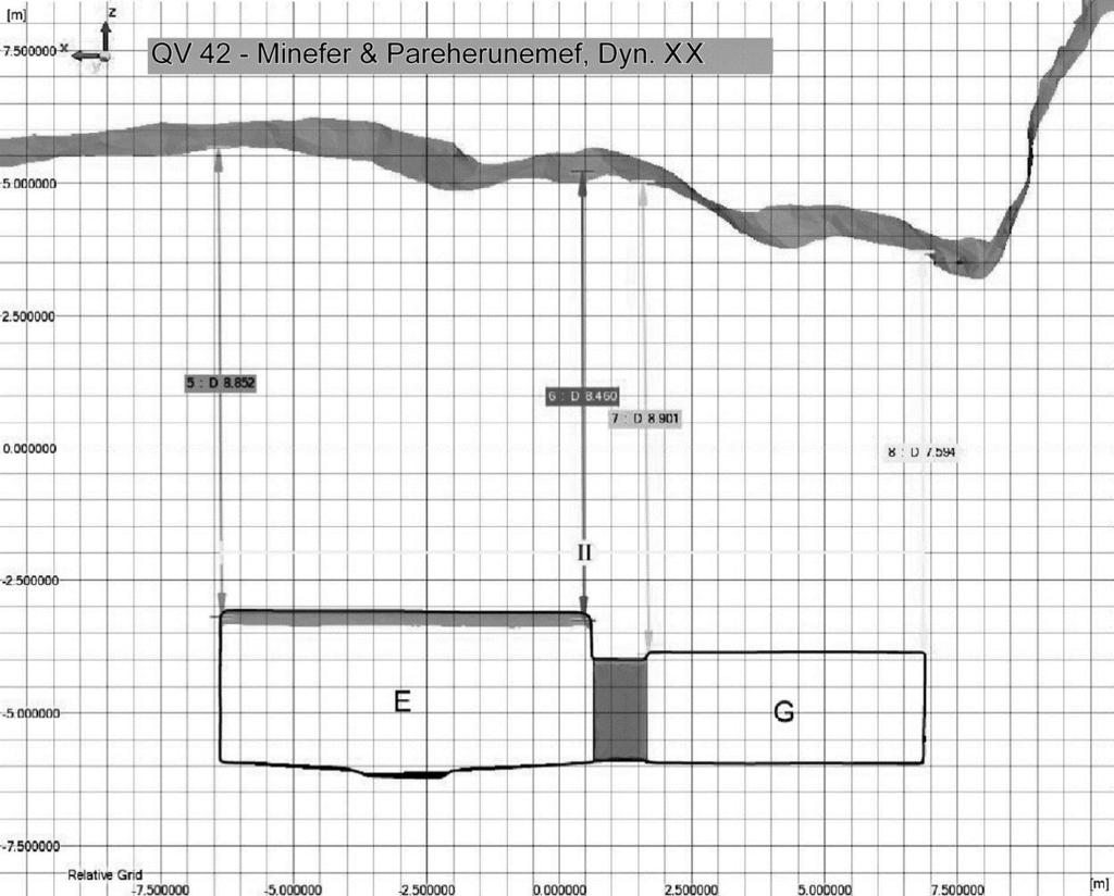
135 Longitudinal section (I) of 3D model of QV 42 and surface topography showing depth of overburden (m). Lateral section (II) of 3D model of QV 42 and surface topography showing depth of overburden (m). 129
136
137 Appendix 3 Archival photographic documentation of the Valley of the Queens Turin Museum (Museo Egizio, Torino) Turin Museum has the earliest photographs of the Valley of the Queens, taken by the Museum expedition to QV led by Earnesto Schiaparelli in The photographic collection includes 132 glass-plate negatives of Nefertari s tomb and about 20 images of the general view of the site. They also photographed wall paintings of QV 36, 38, 40, 42, 44, 51, 52, and 55; a few 18 th Dynasty tomb entrances (QV 30, 46); site elements (Deir er-rumi, Sanctuary to Ptah and Meretseger, observation posts); artefacts; Italian mission camp and Egyptian workers in the excavations. The original plates are in the photographic archives of the museum as Scavi Schiaparelli Valle delle Regine e tomba di Nefertari album 2 e 3; all photographs date from the period Francesco Ballerini and Don Michele Pizzio, who also joined the later Museum expedition at QV under the direction of Giulio Farina in 1930, were two of the photographers in the mission known today, but it is likely that other participants in the mission also documented the site. (Source: Afshar 1993; Donadoni Roveri 1991). CEDAE CEDAE is a documentation center under the SCA, responsible for recording ancient monuments in the country and maintaining their archival collection. For QV documentation, see description and inventory that follows on the next page (Source: Leblanc 1989; CEDAE). Theban Mapping Project Theban Mapping Project (University of California, Berkeley at the time, currently based at American University in Cairo) surveyed the QV tombs in 1981 and took aerial photographs of the site as a part of their project to map and document Thebes. Oriental Institute of Chicago, Chicago House, University of Chicago Twenty-five photographs of the tomb of Nefertari taken in the 1920s (photographers: A. Gaddis and G. Seif) are in the archive of the University of Chicago and nearly 1000 negatives of Gaddis and Seif s photographs of the tomb are housed at Chicago House in Luxor. Some general images of the site taken at the time of the CNRS excavations (photographer Tom Van Eynde) are currently at the Oriental Institute of Chicago. (Source: Afshar 1993). Metropolitan Museum of Art Metropolitan Museum of Art has more than 60 images of the tomb of Nefertari taken by Harry Burton in His original glass-plate negatives are stored in the museum s Egyptian Department archives. (Source: Afshar 1993). Other Institutions and archives A set of Gaddis and Seif photographs of the tomb of Nefertari is in the National Geographic Society Archives. Four of their photographs are owned by Fratelli Treves, reproduced in G. Farina (1929) La Pittura egiziana. Robert Mond produced black-and-white photographs of the interior of Nefertari s tomb, from 1914 to 1916 as a part of an Egyptian expedition of the Metropolitan Museum of Art and the images are housed at the Griffith Institute of the Ashmolean Museum, Oxford University. (Source: Oriental Institute website; Afshar 1993). Getty Conservation Institute GCI has an extensive photographic and video-documentary collection of the tomb of Nefertari, largely recording conservation issues, pre- and post-treatment conditions of wall paintings, conservation techniques and processes, established as a part of the GCI project from 1986 to 1992 (photographer: Guillermo Aldana and others). Over 7000 images are stored at the GCI visual archive. 131
138 CEDAE photographic documentation of QV and inventory CEDAE first conducted photographic documentation of the tomb of Nefertari (QV 66) in 1958 (photographer: Ghazouli) and subsequently in 1965 (photographer: Fathy Ibrahim). From 1968, in collaboration with CNRS, they surveyed and recorded the graffiti in the Theban Mountains. Major photographic documentation of CEDAE and CNRS at QV began in 1970 and continued until This includes photographs of QV tombs, Deir er-rumi (see Table) and general site images, resulting in more than 2200 photographs. The CEDAE team returned to the site in January 2009 to undertake digital color photography of the tombs with wall paintings (as listed in Table). Tomb Owner Dynasty No. of Images Inventory numbers Date of Documentation 31 Anonymous 19 th Nov Tanedjemy 19 th April Nov Anonymous 19 th Oct Anonymous 19 th Oct Satra 19 th Anonymous 19 th Pareherunemef 20 th March Nov Feb Feb Feb Nov March (1) Nov Sethherkhepshef 20 th / March Khaemwaset 20 th March Feb Dec April Isis-ta-Hemdjeret 20 th Oct Tyti 20 th March March Rameses-Meryamen 20 th Oct Amenherkhepshef 20 th Nebettauy 19 th Nefertari 19 th Merytamen 19 th Dec March March / Jan April / Dec / March Oct / March Nov April Dec Bentanat 19 th / Nov Henuttauy 19 th March Duatentipet 20 th Nov Nov Henutmira 19 th April Tuy 19 th 116 Deir er-rumi Roman- Coptic / March April Jan

.")


139 SCA interventions in the Valley of the Queens ( ) The photos on the following pages represent some of the changes that have been undertaken by the SCA in the Valley during the course of the GCI assessment and planning process ( ). They have been tracked and documented to the extent possible, but were not part of the GCI-SCA project and were often undertaken when GCI personnel were not on site and without prior discussion. Tomb Openings QV 2 Appendix 4 The opening of QV 2 was largely occluded by rubble and scree in Tomb Openings QV 4 By November 2009, the SCA had filled the entrance entirely with scree. In 2006, a roughly laid circle of boulders and a broken sign surrounded the entrance of QV4. In 2007 a low rubble masonry wall was built around the opening. As of Dec. 2009, the SCA had installed a masonry surround with a metal grate over the opening of QV 4. The masonry surround was removed and the shaft of QV 4 was filled with scree as of Feb
 and")


.")


.")
140 Shaft tomb openings In 2009, new surrounds were constructed on some shaft tombs (QV 39 above) and existing surrounds were re-painted (e.g. left). Bricks for new surrounds were placed directly on loose soil (upper left) and therefore have little structural integrity. They will need to be replaced. Chamber tomb openings In 2009, existing retaining walls on chamber tombs in the SW wadi were given new cement caps and painted (above, left and middle). A new wall built adjacent to the opening of QV 34 is precariously located above the collapsed chamber of the tomb (above, right). A retaining wall was constructed around the area of instability (above, arrow) in (Photo also shows new surrounds). In 2007, along the main wadi, access to tomb ramps was blocked with rubble masonry and new surrounds on QV


.")
.")


141 Edging walls and paving of visitor paths Rubble walls along the south side of main visitor path (left) were dismantled in New stone masonry walls were built in various stages and versions with painted, cement caps in (below). Walls edging the SW wadi path were capped with cement (bottom left). The remaining area of tarmac road that constitutes the main path in the valley (seen in photo bottom right) was removed in 2010 (from the security station to the Y-Junction). Signage and shelters Old signage at the Y-junction was dismantled in Shelters on site were painted in


 was demolished")
")

142 Interior of QV 55 In SCA technicians undertook work in QV 55, including installation of glass case over sarcophagus, treatment of ceiling cracks, and cleaning of paintings. Glass barriers were removed to undertake the work and replaced when completed. QV 43 was opened to visitors while this work was being carried out. Old generator building and new generator The old generator room (long since disused and located below the guardian s house, above left) was demolished in A new generator was installed in 2006 in the generator building (right) Site Elements Sanctuary to Ptah and Meretseger In 2010 a new perimeter wall with fencing was constructed following the line of an existing dry rubble wall along the path adjacent to the Sanctuary to Ptah and Meretseger. Shelters were then constructed to protect engraved stelae. The terrace wall within the sanctuary was also reconstructed. 136


.")


143 Communications Towers Cell phone towers were installed on the top of the southern ridge in The towers are visible from the Valley (lower left). Security station A new security building with AC (right) was built in 2009 at the entry to the Valley to replace the shed structure (left). Electrical cabling In 2010 trenching for installation of electrical cabling for lighting of the mountains was undertaken across the Valley near the generator building and continuing to the mountains. 137
144
145 III. Management Context 1. Introduction Main issues emerging from the management assessment 2. Legal context and authorities operating at the site 3. Management structure and personnel Site management Current SCA staffing at QV State of conservation training and practice 4. Stakeholder consultation 5. Uses of the site and associated infrastructure 6. Emergency response 7. Monitoring and maintenance 8. Site records 9. Site storage of archaeological study materials 10. Waste management 11. Operational plan for the site Elements of an operational plan Considerations of financial sustainability
146
147 Part III.1. Introduction The management assessment looks at a range of issues that affect daily site operations and management of site personnel and activities directed toward achieving a requisite level of protection, conservation, monitoring, maintenance, visitor satisfaction, and staff effectiveness and morale. The main issues that emerged from the management assessment are outlined in the table that follows and are further elaborated in the remainder of this section. Site management problems are significant at QV. Although most of the management weaknesses are shared across the West Bank, some problems are particularly acute at QV, which does not receive the same level of attention as KV. Underlying many of the management issues are inadequate staff training, entrenched practices within the bureaucracy, lack of incentives and, therefore, motivation, and poor wages. Management at QV is affected by policies, politics and social and economic conditions that exist well beyond the boundaries of the site. While these are touched upon in the assessment that follows (and in the Visitor Management Assessment), most fall outside the direct purview of the project and cannot be addressed more fully. It is essential to recognize, however, that site management at QV does not function in isolation from the larger social, economic and political forces that are prevalent in the country. Recognizing that we cannot affect those larger forces, considerations are put forward in Section 12 for achieving a level of financial sustainability for QV, which would go some way toward ameliorating the economic conditions that directly impact the quality and motivation of staff. An important reference document in understanding the current management situation in the West Bank and its administrative and legislative context is the Valley of the Kings, Site Management Master Plan, published by the Theban Mapping Project in 2006 (Weeks and Hetherington 2006). Most of the management issues that affect QV are exemplified at KV on a larger scale. Published articles related to site management in Egypt are listed in the Site Management Bibliography in Part II.5. The majority of these deal with issues of visitor management. In Egypt the discussion on managing sites is less well developed, reflected in the relative paucity of articles in the bibliography and a tendency to define it in terms of infrastructure development and presentation of a site for tourism (visitor centers, laying out paths, souvenir shops, etc). For a targeted discussion of the administrative, legislative and management context of the West Bank, including initiatives at KV and the Ramesseum and the ARCE site management training initiative see the compilation of articles in Levin As indicated in the introduction to this Assessment Report, there have been many physical and management changes implemented by the SCA at the site, and in the West Bank generally, since the start of the QV project in The current assessment reflects the situation mainly for the years of the assessment in ; however, where changes were made in the course of the assessment and its write-up that were deemed important to document, these are noted. The assessment of visitor management and interpretation, a sub-set of the management context, is discussed separately in Part IV, as are the results of focus groups related to visitor management conducted with guides, SCA inspectors and vendors. 141
148 Main issues emerging from the management assessment Coordination among agencies Management structure and personnel Uses of the site Emergency response Monitoring & maintenance Site records Storage of archaeological study materials Infrastructure Waste management Operational plan Insufficient communication with or cooperation from other agencies operating at the site, particularly security. There does not exist within the West Bank management a corps of professional staff with diverse expertise and an organizational identity. The day-to-day on site management structure relies on a hierarchical cadre of rotating archaeological site inspectors and site guardians whose training is insufficient to meet the complex challenges of contemporary site management. Sustained and effective training and motivation for all levels of SCA staff and personnel from other agencies is lacking. Commercial operations of bazaars in parking area and communication towers constructed on the ridge above site are a visual intrusion requiring management (former) or removal (latter). There is an absence of a preparedness and response plan and equipment for flood-related emergencies. Maintenance and monitoring regimes for all aspects of conservation and management (ancient features and modern infrastructure) are rudimentary. There are no site records, monitoring reports, or maps on site or available at the inspectorate. Study materials stored in 48 tombs at the site were consolidated in four storage areas in October 2008 and December These require a routine monitoring plan and inventory of contents. There is a lack of basic facilities for staff and management needs (toilets, office, tea room, equipment storage) and inadequate facilities for visitors (toilets, ticketing office, parking, shade shelters, etc). Disposing of trash from security station on the ridge, vendors, visitors, and toilets is inadequate in the extreme. Comprehensive clearing of trash from the site and tombs was undertaken in 2007 and 2008, but sustainable mechanisms are not in place. There exists no operational plan to ensure that the site is adequately managed, conserved and presented. 142
.")
149 Part III.2. Legal context and authorities operating at the site QV is within the legal and administrative boundaries of the Theban West Bank. No legal boundaries define QV; the boundaries are based on cultural and topographical parameters outlined in Part II:2 and shown in the satellite photo (right). The Queens Valley is part of the World Heritage Site, inscribed in 1979 as Ancient Thebes with its Necropolis, which includes the antiquities of the East and West Banks. (Satellite Image: 2006 DigitalGlobe) The SCA has legal responsibility for archaeological sites on the West Bank, which includes specific authority with regard to: personnel: inspectors, guardians and maintenance staff daily operations and management all activities and uses of a site, including archaeological excavations, conservation, and tourism activities (since Nov this includes site vendors) monitoring, maintenance and conservation of the site and its modern infrastructure coordination of work with other authorities and bodies concerned with planning, tourism, public utilities, and security Other agencies that provide services or security at QV Amun Company Luxor Municipality Traffic Police (West Bank) Tourism Police (Ministry of Interior) Central Security Forces Luxor Guide Syndicate Sub-contracted by SCA. Responsible for cleaning of parking areas and disposal of trash in bins at parking area Check names and numbers of all vehicles entering site to ensure private vehicles do not park in main parking Responsible for the safety of visitors. Uniformed officer of Tourist Police in charge of two plainclothes Tourist Police on site and two plainclothes Tourism Police at security gate Central Security Forces are an Egyptian paramilitary force which is responsible for the security of public buildings, foreign embassies and missions, and major tourist hotels and sites. Stationed at QV are an officer with 6 soldiers and security vehicle near site entrance; and officer with 8 soldiers at top of ridge Local chapter of the national tourism guide syndicate responsible for licensing and coordinating commercial guides 143
150 SCA Organizational Chart for Upper Egypt and the West Bank (as of 2010) Supreme Council of Antiquities SCA Upper Egypt (SaÏd) Departments (Cairo) Luxor and Upper Egypt Antiquities Aswan Asyut El Minya Luxor and Upper Egypt Antiquities Department General Director Offices: W est Bank Luxor Karnak Esna, Dendara, Red Sea Sohag, Qena, El Kharga Oasis West Bank Office General Director Director West Bank divided into Sout h, Middle, and North areas South Area (Valley of the Queens, M edinet Habu, Deir el-m edina, M alkata) Director of South area 2 Chief inspectors 7-8 rotating inspectors Chief of guardians for South Area Valley of the Queens Rotating site inspectors 6 guardians (4 temp, 2 permanent) 2 ticket sellers 1 gate ticket collector 2 generator/electricity technicians 1 cleaner 144


151 Part III.3. Management structure and personnel Site management Within the West Bank management structure, professionals are trained almost exclusively in archaeology, with little opportunity to develop an understanding or expertise in areas of cultural and natural resource management, architecture and engineering. Conservation expertise lies only in the team of restorers or conservators, who undertake conservation interventions on the West and East Banks and have insufficient professional standing and training consistent with international standards. Strong hierarchies and compartmentalization of responsibilities do not encourage team work of the sort that is necessary for good site management. The notion of a dedicated site manager, responsible for daily operations of individual sites within the West Bank, is only beginning to take hold. SCA archaeological inspectors, who would be the source of managers, are well versed in Egyptology, but are in need of training in modern concepts of heritage management to equip them to face the emergent problems of archaeological sites. Some of these issues, such as souvenir vendors at the site, trash collection, and security arrangements, have nothing to do with archaeology per se and may be outside the direct control of the SCA; they are nevertheless part of site management today and they require new sets of skills not taught in archaeological faculties. ARCE (American Research Center in Egypt) training of site managers in 2007 was an important step in this direction, but participants have yet to be integrated into a formal management system on the West Bank. Visitor management, an important aspect of site management, has a strong impact on the preservation of the site, the effectiveness of site personnel, and the satisfaction of visitors. There is no expertise within the SCA in this area. Staff who fulfill limited visitor management roles are the site guardians. Ticket sellers are underutilized staff who could be performing the related function of providing information to visitors. (Visitor management issues are assessed in Part IV). The site guardians are the main interface with visitors and with security (non-sca ) at QV. They perform many of the daily operational duties at the site but they lack the status, authority and training to pursue their roles effectively. The guardians job and related problems are discussed in more detail in Section 5 (Stakeholder Consultation). Site management training To address some of the weaknesses in site management at QV, the GCI project team incorporated training into the research and assessment phase of the project ( ). Seven inspector-level personnel (including one from the SCA Documentation Center in Cairo) were involved in the project and trained in integrated site management and planning. This involved regular classroom teaching and fieldwork during campaigns and bimonthly mentoring sessions between campaigns, under GCI consultant Dr Hossam Mahdy. As part of their training they have each spent one month at the GCI to work on the project and gain international experience, as well improve their English and computer skills. Lacking an organizational structure in which the inspectors can apply their learning, the effectiveness and sustainability of this training has not been demonstrated. Site management team: Ezz el-din Kamal el-noby, Faten Boshra Magharyos (Ms), Mohamed Ali Abu El-Yazid, Mohammed Yussef, Ramadan Ahmed Ali, Sameh Mohammed Zaki, Shaymaa Mahmoud Ahmed (Ms). 145
152 Current SCA Staffing at QV (as of 2009) Site management staff There is no dedicated site manager at QV. The only professional staff are at the level of inspectors who visit the site in their capacity as chief inspectors of the South Area (there are 2 chief inspectors) or as part of the rotating roster of West Bank archaeological inspectors. In March 2007 GCI-SCA team member Mohammed Yussef Mohammed was appointed as a dedicated inspector for QV but he was transferred in late Normal duties of the inspectors include registering the opening of any tombs and re-sealing them (including visits to special tombs such as Nefertari); checking the tombs for conservation related problems; writing reports on any work, research, or problems at the site; and occasionally arbitrating disputes with commercial guides. Beyond these duties, inspectors are allowed by SCA policy to work two months per year with foreign archaeological missions as a means of earning additional income. Visitor management staff There are no trained staff in Luxor in this area of expertise. Staff who fulfill limited visitor management roles at QV, in as much as they are the only personnel who communicate directly with visitors, are: six guardians (four temporary; two permanent) work 24 hour shifts (6am-6am) to manage tourists in the visited tombs during day and as site guards at night (all under supervision of the Chief of South Area guardians, Sheik Abdel Rahim Hossein Mohammed). They are rotated to other West Bank sites every so often. One guardian at the security gate checks tickets of visitors. three ticket sellers (working in two-person shifts) at the kiosk in parking area (tickets to QV are also sold at the inspectorate office; except for individual travelers, it is the tour guides who purchase tickets) SCA site security night guards (as noted above) inspectors have responsibility for keys to enter tombs and for sealing doors (Other aspects of security and policing are the responsibility of the Tourism Police, the Central Security Forces, and the Traffic Police, none of whom are SCA employees) Maintenance and facilities two electricians, working in shifts, are in charge of maintaining and operating electricity generator and lighting in the site one SCA cleaner for exterior tombs and site, permanently based at QV one cleaner (for West Bank) responsible for cleaning glass barriers. There is no regular schedule. two persons responsible for cleaning and supervising use of trailer toilets. SCA policy has been not to charge for use of toilets (but tips are requested). (Management of toilets at KV and Deir el-bahari has been contracted out to private company since 2009 and the same will apply to QV in the future). 146


153 State of conservation training and practice The training of SCA conservators falls short of international standards. Senior conservators who direct major conservation programmes will not have supplemented their formal training in many years, and may impose treatment decisions based on outmoded thinking; less senior and more recently graduated conservators have little or no opportunity for exercising alternative decisionmaking, and they do not usually have the requisite skills-set to do so anyway; and personnel who carry out the majority of treatments are usually technicians with experience but no formal training and without adequate supervision. Conservation practice is, moreover, focused on remedial treatments, mainly those that deliver conspicuous visible results, such as restoration of monuments and cleaning of paintings. Modern concepts of preventive conservation and minimal intervention are not well understood. This is partly a result of conservation training emphasis, which prioritizes remedial rather than diagnostic skills. In the wider administrative context, it is also a product of stratified responsibilities within the SCA, in which archaeological inspectors are assigned a higher standing and are the main decision-makers. These trends are self-reinforcing. Conservators are required to carry out treatment orders; they are not expected to exercise the normal range of multidisciplinary skills diagnosis, risk assessment, and prediction of the effects of conservation treatments that modern conservation practice demands. Therefore, training is not geared towards their multidisciplinary education. Exposure to training through assignment to foreign missions or participation in short courses offered by foreign institutions becomes the only link to modern conservation practice. Without strong fundamentals in place, such exposure to varied and short-term fieldwork or courses can be more confusing than enlightening. Though most conservators develop good manual skills and are eager to improve through acquisition of experience and knowledge, they suffer under severe constraints. Their renumeration is inadequate; they are not provided with access to work cameras or computers; and they are hampered by lack of documentation of prior treatments or any photographic archive of conditions on which to base decisions. As a result of these educational and administrative issues, conservators are not adequately equipped to deal with the extraordinary conservation challenges presented by the monuments of the West Bank. There is an urgent need for conservators with better-qualified, multidisciplinary competencies, which must begin at the level of university education and be fully supported within the administrative structure of the SCA. Wall painting conservation training Integral to the QV Project has been training of seven SCA wall painting conservators. The aim is to update their understanding of conservation principles and practice. Combining theoretical teaching with on-site examination and recording over a three-year period, training also focused on condition and risk assessments of the decorated QV tombs and methods for stabilization and monitoring of the tombs. Training and interaction with the site management team is periodically undertaken to promote better understanding between these two groups of professionals. Wall painting conservation team: Afaf Mohamed Mahmoud (Ms), Abdel-Nasser Ahmed Abdel Azim, Ahmed Baghdadi Yusef, Badawy Sayed Abdel Rheem, Mohammed Hussein Ahmed Abdel Rahim, Ramadan Mohammed Salem Bedair, Saady Zaki Abdallah El Gammal. 147


154 Part III.4. Stakeholder consultation In 2007 and 2008 meetings were held with SCA site personnel to explore their job responsibilities and current issues. Meetings with the site guardians, which are recorded here, were facilitated by GCI consultant Hossam Mahdy and QV-SCA team members and site inspectors Ramadan Ahmed Ali and Ezz el-din Kamal el-noby in the presence of their supervisor, Sheikh Abdul Rehim (Chief of Guardians). (For consultation held with vendors and commercial guides see Part IV: 5). It should be noted that guardians rotate within the West Bank sites; some of the comments may reflect their experiences at sites other than QV, although they were asked about their work at QV. Guardians job responsibilities The job description for guardians is formally limited to guarding the tombs. A guardian s salary starts at L.E. 130/month. Of the six staff interviewed, four were permanent staff of SCA, the other two were temporary staff, despite the long duration of their service. The site is guarded by six guardians at all times. The work shift is 24 hours on, followed by 24 hours off. At least one hour before the site is opened for visitation, the six guardians assigned for the day arrive. One of them will have passed by the Inspectorate and collected the keys for the three tombs that are accessible for visitation. A guardian starts his working day with a daily round to check all the sealed tombs, then opens the three tombs accessible for tourists. During visitation times each of the open tombs are attended by two guardians. One sits outside the tomb, checks that each visitor has a ticket marked with the day s date and ensures that tourists leave their bags and cameras outside. He also registers the tour guides according to their arrival times so that he admits their groups to the tomb on a first come, first served basis. A second guardian remains inside the tomb to ensure visitors do not touch the paintings or take photographs. Once the visitation hours are over, the three tombs are locked and one of the six guardians delivers the keys back to the Inspectorate. Another travels to buy food for all six men. After sunset, the outside lighting is switched on and the six guardians divide the remaining hours between them so that at any given time, there are two on guard: one at the gate with the police personnel and the other in the site. Work-related issues The guardians were asked to discuss problems that arise in the course of carrying out their responsibilities. Many of these problems can be traced to low wages and low status of the guardians within the management hierarchy, which can lead to their exploitation. Low salaries lead to expectations of tips from visitors. Although accepting tips is against SCA policy, the very low salaries place an undue burden on both the guardians to respect the rules and on their superiors to prosecute infringements of the rules. Guardians hut with sleeping mats on roof (left), interior of hut (right) 148


155 Working hours are strenuous, especially when compared with the 12-hour shifts of the guardians who work in sites on the East Bank. In addition to budgetary limits of the SCA, the long shifts are due to the need to check the seals in daylight. A 12 hours shift would mean that the night shift guardians would have to check seals under artificial light. In the face of these 24-hour shifts, the facilities provided for the guards are unacceptably inadequate and the following issues were raised: There are no toilets. The tourists trailer toilet is locked once the daily visitation time is over and the guardians are not allowed to use them during the day. No running water is available to the guardians. They are left to buy or bring water at their own expense. No warm place to sleep during their off hours. No lockers to keep their belongings. No phone on the site, which means that in the case of any emergency, a guard has no access to the outer world. Snakes, rats, pests and insects are present in the site, but the guardians are not given any means of dealing with them. Despite the fact that the guardians are not trained in how to deal with foreign visitors, they represent the only human interface once visitors enter the valley. Thus, guardians often feel the brunt of visitors and guides anger at insufficient shelter, long waits to enter tombs, and manipulation by guides who wish to get their groups in the tombs without waiting, as well as hostility and suspicion from tourists to guardians when asked to leave bags and cameras outside tombs. Other issues related to police personnel behaviour toward the guardians. Examples cited were: One guardian is required to be serving at the gate during the night in order to warn police personnel to wake up and pretend that they are alert and performing their duties if any sudden inspection is carried out. When a guardian brings food for himself and his colleagues, he is subject to the possible appropriation of the food by the police personnel at the gate. Although there is an unspoken agreement to allow guardians to accept tips from tourists, police personnel do sporadically body search the guardians. Any hard currency found with them will result in problems that may include imprisonment. During very cold nights the guardians find the only way to keep warm is to light a fire. Although they do their best to do that away from all archaeological features of the site, they may be subject to heavy handed police punishment if they happen to be on bad terms with one or more police personnel at the time. Guardian awaiting next group of visitors to QV 55 (left) and guardians on site (right) 149


 is dealt with more fully in Part IV (Visitor Management).")


156 Part III.5. Uses of the site and associated infrastructure The current uses of QV include research and associated storage of archaeological materials, visitation by the public, commercial activities, and security operations related to visitor and site safety. Uses that are appropriate to the site are ones that enhance or protect the site s significance and values and do not detract from them. While most named uses are appropriate to a protected and visited archaeological site, the infrastructure required for security and bazaars is unsightly and poorly managed and maintained. Wireless communication towers erected in 2008 are a visual intrusion and inappropriate for installation on the site. The majority of infrastructure at the site relates to its use for visitation. Visitor related infrastructure (shops, toilets, shelters, etc) is dealt with more fully in Part IV (Visitor Management). Management related infrastructure refers mainly to security, power and lighting installations. Archaeological research Visitation Commercial operations Communications In recent decades archaeological investigations at the site were conducted by a Franco-Egyptian cooperation (led by Christian Leblanc). These were largely completed by the early 1990s, but the archaeological concession for QV is still held by the mission, and research and occasional site work continues (most recently, small-scale investigations of stratigraphy in at Deir er-rumi). No infrastructure is associated with this use. (See Section 9 for storage of archaeological materials). (Image: CNRS) Visitation by the public (international and Egyptian) is a source of income to the local population and country and serves an important educational function. It is an appropriate use of the site, if well managed, but has great impact on the site and its historic features. Management of visitors and visitorrelated infrastructure at QV is discussed in detail in Part IV. The bazaar with shops selling tourist merchandise is a standard feature of all archaeological sites open to visitation. There are currently 32 shops located in the parking area. Local families operate the shops, which provide much needed income to the local population, although many are not open every day due to lack of business and are unsightly as presently constituted. (See also Part IV:5 for vendor consultations and stalls) A pay phone is located next to the ticket office in the parking area. Wireless communication towers were built on the ridges of the Valley in They are a visual intrusion on the landscape and are judged to be an inappropriate use of the site. 150


.")


157 Security operations Security operations by Tourism Police, the Central Security Forces, and the SCA are a requisite feature of visited archaeological sites. The infrastructure built to accommodate the various security structures and installations are, nevertheless, often unsightly and not very functional. Security buildings and features: There are several structures and features on the site that relate to security operations. These are: In the parking area is a security station with a metal detector (rebuilt in 2008 with air conditioning). Adjacent is the car port for the security vehicle. All of these structures are visually intrusive and only minimally functional. 2. A stone and cement staircase (built 2000) leads from the behind the vendor shops to the security station at the top of the ridge. Adjacent to the staircase are cables and light fixtures that are derelict. The stairs are not used since it is easier to take a natural path to the ridge. 3. At the top of the ridge is a national security building (built 1998). Much of the trash from use of this building is dumped in the valley near the Cascade. There is no toilet available to personnel The guard house is a one-room mudbrick structure built on a high point on the south side of the Valley. It is used by the SCA site guardians for making tea and sleeping during night duty. The guard house is believed to have been built on top of QV 28, which cannot be located and is shown in the vicinity on the 1989 CNRS map from Ta Set Neferou (Leblanc 1989a). The structure requires repairs and improvements. 4 Informal use A number of easily accessible tombs are used for parking motorbikes and bicycles, as well as for trash and waste disposal, all of which are inappropriate uses (seen here, QV 45 and 54). Some of these uses are the result of having no storage facilities available on site; others stem from lack of training and on-site management. 151


 at a number of points on site,")

. No map exists showing the cabling and junction boxes.")
158 Power and lighting New generator building (left) with generator (right). New generator building: The new generator building (built in 1960 as the W.C.) is a two-room mudbrick structure that has housed the new emergency generator for the site since It is located in a clearing towards the eastern end of the main path adjacent to the toilet trailer. It is a serviceable building and can be used for its current function but requires basic repairs and rehabilitation and removal or re-location of the water tank in front of the building. Old generator building (left) and mobile generator (right). Old generator building: The old generator building was a one-room mudbrick structure located north of the guard house. It was demolished by the SCA in early A large mobile generator housed in a trailer adjacent to the pay phone and ticket office has long been defunct. Clockwise: Goose neck lamps on path, spotlight, electrical junction box and exposed cabling. Electrical supply and lighting: Goose neck security lamps along eastern end of main path were removed by the SCA in Junction boxes for security night lighting are located (in the ground) at a number of points on site, and shallowly buried cabling runs along the visitor path and crosses the site at various points. Cabling is partly exposed in places and could easily be tampered with or damaged. New cabling for lighting of the mountain is being installed and trenches had been dug for this purpose as of late 2009 (see Part I:Appendix 4). No map exists showing the cabling and junction boxes. The map (lower left) shows approximate location of existing cabling (green lines) based on knowledge of local staff, areas of exposed cable and visible junction boxes. Some of these cables may have been moved during laying of new cable for mountain lighting in

 Nor are there adequate provisions for medical emergencies on site. Police have walkie-talkies.")

159 Part III.6. Emergency response The possibility of a devastating flood at the site is an everpresent danger; the last flood of consequence occurred in 1994 (see Part V:2). There is no emergency response plan for staff in the event of a flood. Nor is the necessary equipment, such as pumps or tools, available on site to cope with a flood event. Personnel have not been trained in responding to a flood, including how to deal with visitors during an emergency. Pumping water from tombs after the 1994 flood (CNRS) Nor are there adequate provisions for medical emergencies on site. Police have walkie-talkies. If required, an ambulance is called from Qurna or KV (since 2008 an ambulance has been stationed at Medinet Habu). Fire extinguishers are located in each open tomb and in the generator room. Part III.7. Monitoring and maintenance Routine monitoring and maintenance is minimal and not always carried out by those qualified to assess a problem. This is particularly the case with conservation related issues. Without monitoring records and the long-term perspective such records provide, requests by inspectors for conservation treatment to be undertaken are often ill-advised. This is exacerbated by the lower status of conservators, who undertake the work, vis-a-vis inspectors who request it. Staff is reactive rather than proactive in monitoring on a regular basis. Monitoring in tomb of Nefertari as part of GCI training No monitoring and maintenance protocols exist for historic site elements, tombs, modern infrastructure, and site storage of archaeological materials. There are no monitoring records, nor have methods been developed for collecting and using such information. Maintenance of the generator is undertaken by dedicated electricians, but wiring in tombs and junction boxes is faulty, dangerous, and poorly maintained. Junction box for electrical cables Part III.8. Site records There are no site records, maps or plans at QV. The West Bank Inspectorate keeps logs and miscellaneous reports of activities at QV, but these are far from comprehensive and difficult to access for research and conservation purposes. A list of documents on file was compiled in 2006; these included miscellaneous photos, inspector reports, and applications for permission to undertake research, take plaster samples, and visit Nefertari s tombs. They illustrate the indiscriminate and incomplete record that exists. The existing files constitute an incomplete bureaucratic record rather than documentation useful for understanding, monitoring and maintaining the site. Statistics relating to visitation to QV are kept in the inspectorate in Luxor; as indicated in Part IV: 1, this data is difficult to access and often inaccurate and inconsistent. 153


160 Part III.9. Site storage of archaeological study materials The assessment of tombs in 2007 revealed that 48 tombs in the Valley of the Queens housed archaeological study materials (potsherds, stone and wooden sarcophagi, human and animal remains and mummies, dressed and carved stone) from the Franco-Egyptian excavations at QV, and also from their excavations in the Ramesseum. Archaeological materials from many of the tombs were in a state of disorder as a result of the 1994 flood and were often mixed with trash that had accumulated over the years. The materials were inventoried in a standard form and photographed in 2007 by the GCI. In addition, two secure areas have long been used for storage of archaeological materials from QV: the Schiaparelli kitchen and tomb 58. Coarse ware potsherds, under study, were laid out on the slope above and to the east of Nefertari for many years as well. A plan was made in early 2008 with Christian Leblanc and the then SCA West Bank director Ali el Asfar to document, sort, and relocate these study materials to more secure storage. It was recommended that the materials be consolidated and moved to a secure location within the Valley of the Queens, and that Ramesseum materials be re-located to the Ramesseum storage. This was carried out in Oct and Dec by Christian Leblanc and SCA personnel; plans are being developed to move the Ramesseum material to the West Bank magazine. As the research and scientific value of most of these materials lies in their use for study of the site, it is appropriate that they remain on site at least until their publication is completed. Monitoring and security protocols for storage areas will need to be established and measures for protection from flood must be addressed. The contents of the tombs as assessed in 2007 are briefly described in Table 1 (see also individual tomb inventory forms in Volume 2). The four storage areas, as of 2010, are noted below. Fragments of fallen wall paintings or granite sarcophagi remain in the tombs where they were found pending conservation of the tombs; these are QV 31, 36, 42, 51, 53, 60, 71 and 80. QV storage areas QV 58 is furnished with shelving (red lines on plan below) in three of its chambers (D, F, H) and has secure doors leading to the tomb and to each chamber. Chamber B The QV materials stored in QV 58 (mainly Chambers B and D with small quantities in H) prior to October 2008 will remain there. Materials in Chamber B were, however, transferred to the shelves in Chamber F. Chamber F (empty shelving only) 154


 and the potsherds lying east of Nefertari s tomb were relocated to the remaining chambers")


161 QV 69 is a stable shaft tomb with large chambers. At the time of the assessment it contained well-ordered crates of human and animal bones within one of its chambers. All of the materials collected from the tombs (human remains and mummies, ceramics, wood and stone fragments, etc.) and the potsherds lying east of Nefertari s tomb were relocated to the remaining chambers of QV 69 in Oct and Dec (left and below). A metal grill in a masonry surround at the top of the tomb shaft provides security. QV 95 is an unfinished 20 th Dynasty chamber tomb located within the Deir er- Rumi complex. It contains miscellaneous materials excavated from Deir er- Rumi. Security is provided by a metal bar and mesh door with lock at the tomb entry. Schiaparelli kitchen has shelving and contains materials primarily from the ruins of Deir er- Rumi and the Roman sanctuary. These consist of 15 boxes of pottery, 23 crates of basketry, linens, pottery, painted plaster and stone fragments, 4 crates of inscribed stone fragments, and several carved stone pieces. (See Inventory Form for Italian Mission Building, Part VI) Existing shelving within the structure may need expanding for any additional materials from Deir er-rumi, and minor roof repairs are needed. Security is provided by a wood batten door with lock. 155
162 Table 1. Summary of tombs with study materials based on assessment in 2007 Tomb Study materials Tomb Study materials Tomb Study materials Tomb Study materials QV 01 QV 02 QV 03 N/A N/A N/A QV 27 QV 28 QV 29 N/A N/A N/A QV 52 QV 53 QV 54 N/A large amount of stone stacks, mudbrick, pottery fragments throughout N/A QV 75 QV 76 QV 77 pile of animal bones, potsherds N/A piles of bones, skulls; potsherds QV 04 QV 05 QV 06 QV 07 QV 08 QV 09 QV 10 QV 11 QV 12 QV 13 QV 14 QV 15 QV 16 QV 17 QV 18 QV 19 QV 20 QV 21 QV 22 QV 23 QV 24 N/A N/A N/A N/A 6 bags human bones; 1 bag wood 1 crate & 1 bag of pottery; 1 bag of wood, linen; 1 sack, 1 bag of bones number of large jars; 1 bag linen and bird bones; 1 bag linen and wood; 1 bag pottery crates of potsherds, plaster and wood fragments; pottery 2 crates bones and linen wrappings; 3 large pottery jars human and animal bones; 1 restored ceramic vessel 3 baskets, 3 boxes pottery; 1 small bag bones crates and stacks of mummies, animal bones, pottery bags and crates of mummy parts, bones, wood fragments stacks of mummified human remains; 5 bags bones; 3 baskets pottery; 2 bags wood 5 bags, 2 crates pottery; 2 bags, 2 crates bones several bones N/A 12 boxes pottery, 22 bags pottery and bones, 2 crates pottery 11 bags, 1 basket bones; 10 bags linen; 1 box wood; 3 bags pottery; 1 mummy 1 large pile mummy remains; 9 sacks linen; 7 sacks pottery; 1 sack wood; 1 bag straw; 1 basket of fragments N/A QV 30 QV 31 QV 32 QV 33 QV 34 QV 35 QV 36 QV 37 QV 38 QV 39 QV 40 QV 41 QV 42 QV 43 QV 44 QV 45 N/A potsherds, dressed stone fragment; mudbrick stack small amount of potsherds N/A side chamber with pile of wood fragments, mummy wrappings, some potsherds N/A pottery, stone fragments baskets of potsherds crate of potsherds, carved stone fragments, Schiaparelli plaque, wood fragments 2 piles mummies, 2 bags pottery and wood, piles of pottery and wood Wood fragments(?) 2 mummies in rear pit basket of finds; potsherds; plaster fragements, some with linen facing N/A N/A N/A QV 46? QV 47 QV 48 QV 49 QV 50 1 piece mummy wood fragments N/A N/A QV 55 QV 56 QV 57 QV 58 QV 59 QV 60 QV 61 QV 62 QV 63 QV 64 QV 65 QV 66 QV 67 QV 68 QV 69 QV 70 QV 71 granite sarcophagus and mummified fetus (on display) N/A N/A used as magazine partial mummy and skull large amount of mummies (without wrappings) - 2 wrapped from QV 51, sarcophagi, potsherds N/A N/A N/A small bundle of linen wrappings; 1 bone fragment; 1 partial skull N/A N/A wooden fragments and 1 bone two baskets of potsherds, one of stamped mudbrick, labeled as being from Ramesseum; stone statue face fragment Used as magazine for bones:56 crates, 19 boxes, 11 bags, 7 baskets N/A carved stone capital (?), partial unwrapped mummy, 8 wooden boxes of fragments, basket with bones, potsherds QV 72? QV 73 N/A QV 78 QV 79 QV 80 QV 81 QV 82 QV 83 QV 84 QV 85 QV 86 QV 87 small amount of bones piles of bones, skulls; small amount pottery, wood fragments; 11 bags of mixed materials over 100 baskets of potsherds, bones, skull fragments, mud bricks; large area of carved and painted granite fragment (from sarcophagus) 3 bags pottery; 8 bags animal bones; 1 bag wood fragments N/A N/A N/A N/A N/A N/A QV 88? QV 89? QV90? QV 91? QV 92? QV 93? QV 94? QV 95 QV crates of bones, linen, plaster fragments, wood, pottery partial skull; 2 large ceramic vessels; wood fragments QV 25 QV 26 Portion of mummified body fragment of skull QV 51 central sarcophagus fragments; 2 mummies; stone fragments QV74 mummies, potsherds, wood, plaster and skull fragments QV97? QV98? QV 15 Tombs were cleared in Oct 2008 QV 26 Tombs were cleared in Dec


163 Part III.10. Waste management An assessment of the trash situation at QV was undertaken in February This comprised a visual examination of the main Valley, subsidiary valleys, and the tombs. SCA team members also conducted an assessment of the mechanisms in place for disposal of trash. Concentrations of trash on site were documented in the area of the Cascade, in the Valley of Prince Ahmose (near the tombs and behind the vendor stalls) and west of the toilets. The extent and depth of trash encountered in the watershed from the base of the Cascade up the mountain to the security station was particularly notable. It is estimated that this river of trash has been accumulating since 1998 when the guard post was established at the top of the ridge. Trash consisted mainly of water bottles, plastic bins, plastic bags, paper, glass, and human waste. The origin of the trash seems to be primarily the guard house at the top of the ridge, although some of the trash near the valley floor may be secondary deposition from the site. The trash in the Valley of Prince Ahmose was widespread but more shallowly deposited. It consisted mainly of soda cans, water bottles, large quantities of size D batteries, QV tickets, and human waste. It is believed to come primarily from the vendors and the site. The batteries are from guardian and guard use of flashlights; these pose an environmental hazard from heavy metals leaching into the soil. The trash west of the toilets is concentrated in a large pit (tomb 94) and consists of waste from the toilets. Other smaller pockets of trash were noted throughout the Valley. Trash was also assessed in the 92 tombs in the main Valley. Most of the tombs without proper doors or closures contained concentrations of trash and excrement. A site-wide cleaning of trash was undertaken in February 2007, focusing on the Cascade valley and the Valley of Ahmose. Since then, additional trash from the National Security guard house accumulated in the Cascade valley and in the Valley of Ahmose from the site and vendors, and was cleaned again in February The cause of this situation can be attributed to the absence of adequate trash receptacles and a functional mechanism for trash disposal, as well as lack of clear responsibility and accountability, including insufficient inspection of the site by archaeological inspectors. The situation has improved since late It should be noted that there are no places for safe disposal of batteries in the Luxor area and their disposal presents a long-term problem for the West Bank. 157 Top left: Trash, including dozens of D-size batteries, in the Valley of Prince Ahmose Bottom left: Trash accumulation in the Cascade valley Above: Example of trash accumulation in a tomb (QV 16)
164 Part III.11. Operational plan for the site Elements of an operational plan There is no operational plan that guides daily activities and responsibilities at QV. Such a plan needs to be developed, but must be integrated with a plan for the whole West Bank if it is to be operationally feasible. The plan must also be done in conjunction with the development of job profiles and training for site personnel (both professional and unskilled). There must also be a willingness to implement the plan and periodically audit its effectiveness. Essential elements of an operational plan would include the following: Components Management structure and personnel Considerations Roles and responsibilities of personnel. This requires: Development of the number and job profile of additional staff to operate new visitor facilities, manage visitors, guard the site, and possibly to lead specialized tours to tombs or parts of the site that are currently closed to the public. Professional training for site manager inspectors in personnel supervision, basic principles of conservation, visitor management, working effectively with outside agencies, and a thorough understanding of the ancient and modern history of the site. On-going training program for guardians, vendors and other site personnel in their responsibilities and in dealing with visitors to the sit. Specialized training would be required for potential SCA-led guided visits to currently closed tombs and site elements (see Part IV: 8). Policies Financial/business plan Monitoring and maintenance plan Policies and guidelines are required for: Visitation to the site (conditions under which tombs are to be opened; limits on visitor numbers to the site and tombs; checking bags before entering tombs; restricted access tombs such as Nefertari). Ticketing (including a system of reservations and timed tickets, which is best coordinated with other sites). Guiding (policies related to commercial tour guides and potential SCA-led tours). Role of inspectors who accompany special groups to Nefertari. Policies on photography on site and in tombs, and taking personal belongings into the tombs. A plan for sustainable self-financing for basic conservation, management and maintenance of historic elements derived from ticket pricing for special tours to Nefertari and potentially to other tombs (see Considerations of Financial Sustainability). A plan for monitoring and maintenance of: Historic elements Modern infrastructure On-site storage of study materials Trash disposal, including hazardous materials. 158
165 Considerations of financial sustainability In any assessment of a site s management context, a source of reliable income is a critical component. QV is funded from the SCA, which pays salaries of staff and minimal maintenance. As indicated in the assessment of personnel and in focus groups, staff are underpaid, maintenance and monitoring is inadequate and funds for significant conservation and protection of the site are lacking. Trying to solve these problems, which are systemic and originate with the central authority, is beyond the scope and capabilities of the current project. However, there exists real potential for QV to be self-funding, with adequate income to provide good salaries, routine and adequate maintenance and monitoring, and even to fund significant outlays for major conservation interventions, while still providing income for the general SCA coffers. The key to such financial sustainability is the tomb of Nefertari, in the short term, with other tombs contributing after site stabilization and tomb conservation and presentation is undertaken. Tables 1 and 2 and the graph that follows show estimated income (based on ticket prices) from visitation to Nefertari under the changing visitation policies in period, when entry fees were L.E 100, and period when pre-purchased entry fees were raised significantly to L.E. 20,000 per group of 20 persons (see Part IV.6 for changes in ticketing). The new policy does not change the conditions under which the tomb is visited (10 minutes for a group of 20 persons), but it is elitist in that it is based on charging a very high fee which only a minority of tour groups can manage, and is outside the range of individual travelers. This is problematic from the perspective of fairness, but is undoubtedly beneficial for the long-term protection and preservation of the tomb since the total number of visitors drops significantly. Doubling the 2008 visitation (the latest statistics available) would garner an income greater than the 2002 income at one-tenth the number of visitors. Environmental monitoring of the tomb is on-going and will be the basis for determining safe visitor loads to all the tombs, but on present understandings, visitation could be increased significantly from 2008 levels without impacting the tomb, assuming continued limits on group sizes and time spent in the tomb. This analysis does not take into consideration fees charged for photography and filming, which is significant but is also the primary cause of mechanical damage in the tomb and requires increased supervision. The current high-price system has advantages as a potential business model for self-generating income and financial sustainability for the site as a whole, if revenue from ticket sales were used to manage, monitor and maintain the site, and to pay reasonable compensation to staff (who would need to be dedicated to QV, rather than rotating among sites, as is currently practiced). Ideally, a similar self-sustaining model could be applied to the whole West Bank, thus allowing for the development and retention of a corps of professional managerial staff and well trained maintenance and security staff who could work across site boundaries : 150 persons per day limit (numbers rounded) ,000 L.E. 4.1m : limited by high ticket price (numbers rounded) ,000 L.E. 1.2m ,900 L.E. 5.8m ,300 L.E. 2.5m ,500 L.E. 4.0m ,400 L.E. 2.8m Table 1. Visitor numbers and income with ticket prices at L.E 100 Table 2. Visitor numbers and income with ticket prices at L.E 20,000 per group of 20 persons 159

166 NUMBER OF VISITORS Note: All numbers rounded. Income data is approximate, derived from ticket pricing under different visitation policies (1995-Jan and 2005-Present); 2008 represents the latest figures available. (see Part IV.6 for policies). INCOME FROM VISITORS 160
167 IV. Visitor Management and Interpretation 1. Introduction 2. Visitor numbers and patterns of visitation Collection of visitor statistics Impacts on visitation to the Luxor area Summary of visitor numbers and patterns 3. Visitor and guide surveys Introduction Characteristics and travel patterns of visitors and guides Perceptions of the visit to the Valley of the Queens Planning for the future 4. Observations of visitors and guides Observations during Winter 2007 Observations during Summer 2007 Observations during Winter Stakeholder consultations Focus groups (tour guides and guide syndicate, inspectors) Vendors and bazaar Appendix 1. Inventory of vendors merchandise 6. Visitor services and infrastructure Ticketing and access Visitor paths and circulation on site Inventory and assessment of visitor-related infrastructure and services 7. Protection and presentation of visited tombs Exterior entries and interior installations for QV 44, 52, 55 Exterior entry and interior installations for QV Visitation and interpretation potential History of visitation at QV Current and potential visitation to tombs Current and potential visitation to site elements Programs for young Egyptians
168
169 Part IV.1. Introduction The visitor management and interpretation assessment for the Valley of the Queens gathered information on visitor services and infrastructure, site presentation and interpretation, and the visitors themselves. The findings have been used to develop a plan that will provide a better visitor experience, promote good practice, and contribute to preserving the site s significance. The assessment incorporates the following components: Visitor numbers and patterns of visitation: Visitor numbers are key to understanding past and current visitation trends to QV, specifically seasonal, monthly, and weekly patterns. Statistics on visitors were gathered for a 10-year period ( ), not only for QV but also for the Luxor area to better place QV in its larger context. Visitor and guide surveys: Surveys of visitors and guides were undertaken in the winter and summer periods of 2007 in order to establish baseline information on visitation to the Valley of the Queens and explore visitors perceptions of their experience at the site and specific issues such as the closure of the tomb of Nefertari to general visitation. Egyptian visitors were targeted in a separate survey during the Egyptian holiday period. Observations of visitors and guides: Over a two-year period ( ) the visitor management team spent time observing and recording visitor behavior at the site and inside the tombs. The purpose was to gather a general idea of visitor flow inside the tombs as well as areas of visitor concentration and congestion on site during specific days and times of day. Different types of tour groups were also observed throughout their visit to the Valley in order to understand current interpretive and educational practices used by tour guides. Stakeholder consultations: In addition to surveys of visitors and guides, focus groups were held with QV vendors, West Bank inspectors and tour guides and meetings convened with the Luxor Tourism Syndicate to solicit opinions and provide a mechanism for key stakeholders to have input to the planning process. Additional assessment and inventory of vendors and their merchandise were also undertaken. Visitor services and infrastructure: The services and infrastructure for visitors affect not only the visitor experience but also the setting of the tombs and site. Services and infrastructure relating to visitation at the QV includes access and ticketing, seating and shelters, circulation on site, signage, restrooms, parking, and souvenir shopping, as well as installations for presentation and protection of the tombs. Visitation and interpretation potential: With only three tombs open for general visitation and no interpretation of site features, it was important to assess whether there was opportunity for additional tombs and site features to be visited and interpreted without endangering the integrity of the resource. Potential was assessed using criteria such as accessibility, safety, and educational value, as well as the ability to contribute to telling the whole story of Queens Valley. Educational opportunities for young Egyptians within an interpretation plan were also evaluated. Review of literature and other initiatives: In undertaking the visitor management assessment, other related studies from the literature were consulted, as were the planning and proposals for the King s Valley (Site Management Master Plan for the Valley of the Kings, 2006) and the Abt study (Comprehensive Development Plan for the City of Luxor, Egypt, Dec 1999). These and other sources from the literature are cited in the Site and Visitor Management Bibliography in Part II

, which includes people coming for reasons other than visiting cultural sites.")
170 Part IV.2. Visitor numbers and patterns of visitation Collection of visitor statistics During the assessment at QV, statistics were collected on visitors to QV and the Luxor area for the 10-year period in order to analyze the number of visitors and patterns of visitation to QV in the context of other sites on the East and West Bank. Specifically, data was collected and compiled as follows: Visitors to Egypt: These statistics represent all foreign tourist arrivals to Egypt (i.e. those arriving on a tourist visa), which includes people coming for reasons other than visiting cultural sites. International visitors to the Luxor area: Based on international visitor numbers to the sites drawing the greatest number of visitors, namely Karnak temple (representing East Bank visitation) and Valley of the Kings (representing West Bank visitation); these data use the highest number of visitors from either site for each month to approximate the total number of visitors to the Luxor area (there are no obtainable independent data for visitors to Luxor; data on hotel residents are problematic). Karnak Temple: based on international visitors and students, assumed to represent total East Bank visitors Valley of the Kings: based on international visitors and students, assumed to represent total West Bank visitors QV visitors: international visitors and students to the three tombs open to general visitation (excluding Nefertari) Tomb of Nefertari: visitor numbers for the two periods of special ticketing from Egyptian visitors to Luxor: these data were often statistically problematic and inconsistent and can only be used to provide a general picture. Source of data: For visitors to Egypt: Central Agency for Public Mobilisation and Statistics (CAPMAS). All Luxor area visitor data are based on ticket sales and were obtained from the Luxor SCA Office (East Bank), which compiles visitor data from all the Luxor area sites Limitations on data: All visitor data (daily, monthly, etc.) compiled at site ticket offices and again at the SCA Luxor office are manually entered (in Eastern Arabic numerals), which inevitably results in cumulative errors over time. All of the data sets contained missing numbers or anomalies. These were checked with the SCA office and corrected when possible (original daily records were checked to correct monthly figures). Where corrections could not be made, the statistical technique of interpolation was used to smooth the inconsistencies (e.g. for Karnak Temple a total of 42 figures from 9 years were interpolated), or by taking the percentage increase or decrease of good data during the particular time period as the basis for correcting suspect data. The data collected by the QV team have been entered into Excel spread sheets and two SCA team members were trained in basic data entry. 164
171 Impacts on visitation to the Luxor area One of the principal factors affecting visitation to the Luxor region over the past 20 years has been security issues arising from a number of terrorist attacks. A related factor has been wars in the Middle East and events well beyond those borders that have affected the stability of the region. Heightened security impacts both annual visitor numbers and patterns of visitation as tour groups must travel in police-escorted convoys at set times (the convoy system was stopped in December 2008). The table summarizes the main events that have affected visitation in the Luxor region beginning with the Gulf War in The global economic downturn beginning in 2008 may well have consequences for visitor numbers in 2009 and beyond. Date Events ( ) 1991 Gulf war (1) 1992 Numerous small terrorist incidents, mainly in the Qena region Wave of terrorism in Egypt, mainly Cairo in 1993 and Asyut in 1994, caused annual number of visitors to drop from 3.3m to 2.5m (1) 1996 (Apr 18) 1996 (Aug) (Oct) Attack by al-gamaa al-islamiya on foreign tourists; opened gunfire on group of Greek tourists near Giza, killing 17 tourists Eleven reported terrorist attacks, most in El-Minya; 7 German tourists were among those killed (1) 1997 (Nov17) Attack by al-gamaa al-islamiya at Hatshepsut Temple (Deir el- Bahari); 62/68 killed, mainly foreign tourists. (1, 3) 2001 (Sept 11) Attacks on World Trade Center and other US targets 2003 (Mar) Invasion of Iraq 2004 (Oct 7) Truck with explosives rammed into Hilton Taba resort, Sinai, targeting holiday makers (2, 3) ( there was an immediate downturn in tourism but the rebound was almost as fast ) 2005 (April) 2005 (July) 3 related attacks in Cairo (Khan al-khalili; tour bus; and behind the Egyptian Museum) (3,4) Series of attacks on hotel and market in Sharm el-sheikh; 80 killed (2, 3) 2006 (April) 3 bombs exploded in resort city of Dahab; 23 killed (2, 3) Sources 1. P.B. Sinha, Strategic analysis: a monthly journal of the Institute for Defense Studies and Analyses (Nov 1998; vol XXII, no 8) 2. Killian Clarke, Tourism trumps terrorism in Sinai (CDNN-Cyber Diver News Network) 3. Wikipedia.or/wiki/Terrorism_in_Egypt 4. Chronology of Attacks on Tourists in Egypt: a detailed history for 1992 to the present (Reuters Limited and US Dive Travel Network ( [Note: there are some inconsistencies in numbers of victims among sources] 165
172 Summary of visitor numbers and patterns of visitation Annual Visitors to Egypt Annual visitors to Egypt over the ten-year period have shown a steady increase; 2007 figures (11m) indicate a growth of approximately 180% since 1997 (4m). European visitors (7.6m) constitute the largest share, while North American visitors are comparatively few (344K). Visitors 12,000,000 11,000,000 10,000,000 9,000,000 8,000,000 7,000,000 6,000,000 5,000,000 4,000,000 3,000,000 2,000,000 1,000,000 0 Annual International Annual Visitors Visitors Egypt to Egypt Total Visitors Europe A sia Africa North America Year Annual Visitors to Luxor area Based on the highest visitor numbers to the major monuments of East and West Bank, the data from 2007 indicate just under 2m tourists in the Luxor area, approximately one-fifth of tourist arrivals in Egypt. International visitors show a repeated pattern of downward turns during periods of crisis such as after the terrorist attacks at Hatshepsut in 1997, when international visitors fell precipitously. Less dramatic drops occurred after the World Trade Center and Pentagon attacks in 2001 and the Sinai attacks in The 1999 Abt study (Comprehensive Development Plan for the City of Luxor, Egypt), based on 1997 data, projected tourism growth would reach 4m in 20 years (p 128), a prediction that seems unlikely to be met, possibly as a result of continuing instability in the region. Since current visitor numbers at peak periods are unsustainable, it is fortunate that such growth has been somewhat slowed. Annual International Visitors Visitors Luxor to Area Luxor 1997 area ,000,000 1,577,269 1,776,880 1,828,781 Visitors 1,500,000 1,000, ,330 1,219,727 1,220,114 1,136,284 1,223,118 1,709,350 1,525, , , Year 166
173 Visitors to the East and West Banks Comparison of data from the East and West Bank indicate that almost all visitors to Luxor visit the major monuments on the East Bank (i.e. Karnak Temple) and the West Bank (i.e. Valley of the Kings). With only three tombs open for general visitation, QV receives far fewer visitors than KV. All three sites, however, show a similar pattern of visitation over the decade with peaks in 2000, 2004, and 2007 and troughs presumably representing impact of terrorist events. Annual International Visitors Visitors Karnak to Karnak Temple (East Temple Bank) (East Bank) ,000,000 1,757,447 1,823,743 Visitors 1,500,000 1,000, ,484 1,181,962 1,531,062 1,190,705 1,119,482 1,206,018 1,709,114 1,510, , , Year Annual International Visitors the to Valley the Valley of the Kings of the (West Kings Bank) (West Bank) Visitors 2,000,000 1,809,243 1,762,083 1,572,561 1,684,400 1,500,000 1,219,272 1,216,703 1,493,350 1,000, ,836 1,218,606 c 1,133, , , Year Visitors 2,000,000 1,500,000 1,000,000 Comparison of International Visitors to the Valleys of the Kings and Queens Annual International Visitors to the Valleys of the Kings and Queens ,836 1,219,272 1,572,561 1,218,606 1,133,134 KV 1,762,083 1,809,243 1,684,400 1,216,703 1,493, , , , , ,266 QV 243, , , , , , , , Year 167
174 Visitors to the Valley of the Queens There are only three tombs open to general visitation at QV (Nefertari is restricted and dealt with separately). While international visitor numbers have increased over the 10-year period, growth has been much slower (approximately 40% increase) than at other Luxor sites and QV has been slower to recover from the 2004 peak visitor year (KV recovered and surpassed its 2004 peak). Annual International Visitors to the Valley of the Queens Annual International Visitors to the Valley of the Queens Visitors 500, , , , , , , , , , , , , , , , Monthly visitation patterns for peak years 2004 and 2007 at QV M onthly International Visit ors to t he Valley of t he Queens 2004 and 2007 Visitors 60,000 50,000 40,000 30,000 20,000 10,000 53, ,091 36,375 31,690 30,630 30, ,117 36,059 36,565 22,974 20,283 19,786 13,205 16,072 33,107 18,833 49,924 34,785 37,147 24,404 48,759 36,793 37,425 33,289 0 January February March April May June Month July August September October November December Monthly visitation during the peak years of visitation at QV in 2004 and 2007 show typical seasonal patterns of visitation. High visitor months at QV are October through April with the hottest summer months of June and July having the lowest numbers. Weekly patterns of visitation were also tracked. These fluctuate fairly consistently with the convoy system in place from the red Sea; even without the convoy system in place, patterns of visitation fluctuate with the arrival and departure of river cruises. Typically, Thursday is the quietest day and Sunday the busiest. Patterns remain the same in summer although total visitor numbers are much lower. 168
175 Visitors to the tomb of Nefertari Period of limited visitation (Nov 1995 Jan 2003) With the completion of the GCI-EAO project to conserve the tomb of Nefertari in 1992, the SCA subsequently made a decision to open the tomb to limited visitation. Based only in part on environmental monitoring in the tomb undertaken by the GCI, the SCA established a policy of selling a maximum of 150 tickets per day. Only the year 2000 exceeded the theoretical maximum annual total of 54,750 visitors. Period of special visitation (2005 Present) In January 2003, the SCA policy for Nefertari was changed to open the tomb only to special tour groups, and film and television crews, and photographers. Only tour groups are reflected below. The policy did not go into effect until Year International Visitors Year International Visitors , , , , , , None [tomb closed] , , , , [Jan only] The graph shows clearly the deep reduction in the number of visitors to the tomb of Nefertari as a result of the new SCA policy instituted in 2003 and in effect as of It remains to be determined the ideal visitor capacity of the tomb for its long-term preservation, but the financial implications of the new policy are discussed in Part III:11, Management Assessment; see Part IV:6 for ticket pricing related to change of policy. Visitors to the Tomb of Nefertari Visitors 80,000 61,026 60,000 43,712 43,365 40,000 46,380 c 41,480 20,000 28, ,048 1,908 2, Year 169
176 Egyptian visitors to Luxor Annual Egypt ian Visit ors t o Luxor Area, Karnak Templ e, t he Val l ey of t he and the Valley of the Queens Kings and t he Val l ey of t he Queens Annual Egyptian Visitors to Luxor Area, Karnak Temple, the Valley of the Kings Visitors 140, , ,000 80,000 60,000 91,640 81,338 80, , ,308 97,509 88,670 75,084 74, ,223 80,036 74,417 40,000 20,000 11,805 10,721 8,983 9, Year Egyptian Visitors to Luxor Egyptian Visitors to Karnak Egyptian Visitors to KV Egyptian Visitors to QV The 1997 Abt study data indicated that Egyptian visitors constituted only 7% of total visitors to Luxor; in 2007 Egyptian visitors were 6% of the total. Thus over this 10-year period there has been no growth and an evident decline since a peak in Visitation to QV is far less than other sites but shows a similar pattern of decrease from a high in ; Egyptian nationals constitute only 3-4% of total visitors to QV. The results of visitor surveys (see Section 3, Visitor and Guide Surveys) suggest some of the reasons for low Egyptian visitation to pharaonic cultural sites in the Luxor region. Egyptian visitors who do come are most attracted to the monuments (on the East Bank), rather than the necropoleis (on the West Bank) and this is reflected in the visitor statistics. A further reason for the larger numbers at Karnak Temple is that this monument, unlike the West Bank sites, receives thousands of school children each year. School groups in general are not allowed to visit the tombs. There are good reasons for this policy large groups of school-age children in small fragile tombs but there is a clear need to encourage greater understanding and interest in the ancient past of Egypt among its young people (see also Part IV:8 on school programs for young Egyptians). 170
 has been an assessment of visitor management")
177 Part IV.3. Visitor and guide surveys Introduction An important component of the GCI and SCA conservation and management planning for the Valley of the Queens (QV) has been an assessment of visitor management and site interpretation. This includes establishing baseline information on visitation to the Valley through visitor surveys, focus groups with relevant stakeholders, and observations of visitor behavior in order to assess the impact of visitation and develop strategies for the future. Through the assessment process, we are also exploring visitors perceptions of the closure of the tomb of Nefertari to general visitation and their response to possible alternative methods of visiting or interpreting the tomb. The ultimate purpose is to factor these findings into the visitor management, presentation, and interpretation component of the GCI-SCA collaborative project. The visitor and guide questionnaires were developed by the GCI and SCA; field surveys, focus groups and data processing were carried out under the direction of Dr Ramadan Hamed Mohamed of the Social Research Center (SRC), American University in Cairo. In addition to the English version, the visitor questionnaire was translated into Arabic, French, German, Russian and Japanese for the February survey; Italian and Spanish were added for the June survey. A QV postcard (above) was designed with photos and information about QV and given to all participants in the survey. Two surveys were undertaken as follows: February 5-16, 2007: survey of 748 international visitors and 100 guides; survey and interviews of 294 Egyptian visitors. June 23-30, 2007: survey of 748 international visitors and 132 guides. The methodology and questionnaires developed for the surveys are detailed in the final report of the surveys (Valley of the Queens. Visitor and Guide Surveys and Focus Groups. February and June Final Report. December 2007). In developing the approach and survey instruments, and in the summary of findings that follows, the 2004 visitor survey at the Valley of the Kings (KV), undertaken by the Theban Mapping Project and the SRC, were taken into consideration. Characteristics and travel patterns of visitors and guides to QV Characteristics of visitors A total of 748 foreign visitors and 294 Egyptian visitors were surveyed during the winter (February); the same number of international visitors (748) were surveyed in the summer (June). The Valley of the Kings survey, conducted in June 2004, involved 610 visitors. Postcard given to visitors who participated in survey. 171
.")
178 Country of origin: The majority of international visitors in February and June were from Europe, but distribution differed as shown in Table 1. Great Britain provided the largest number in both seasons but by a far larger percentage in the summer (34% vs 19% in winter). The greater number of Italians and Spanish in the summer survey are likely the result of having the questionnaires translated in those languages. The overall decrease in European travelers in the summer suggests that Continental Europeans are less likely to travel to Egypt in the summer and this may also apply to Russian and Japanese visitors, who constituted far fewer numbers in the summer. By comparison, the greatest number of visitors to KV in the summer were from Germany (17%) and Great Britain (14%) followed by Italy (12%) and France (11%) with the USA representing only 4%. Visitors answering survey questions. Table 1: Characteristics of international visitors to QV Country of Origin Winter (%) Summer (%) Age Category Winter (%) Summer (%) Great Britain < France USA Russia Germany Japan Belgium Over Netherlands Australia Gender Spain Male Italy Female Other Most Egyptian visitors, who represented about 2.5% of the total number of visitors (not the survey sample), were residents of Lower Egypt, with Cairo and Alexandria forming the bulk of visitors. This is likely attributed to the larger population, greater cultural awareness and/or better financial situation of the residents of Egypt s principal cities. Gender and age: Both winter and summer samples of international visitors were fairly evenly distributed by gender, with slightly more female visitors in both periods. The percentage of older visitors is greater in winter than in summer (only 18% are above 54 years of age compared to 43% in winter). This is most likely due to avoidance of the summer heat by older visitors. Education: A generally high level of education is an attribute of international visitors, with the majority having at least an undergraduate degree. The KV survey gave a similar educational profile. 172
179 Characteristics of tour guides In addition to the 232 guides surveyed (winter and summer surveys), a focus group was conducted with seven active members of Luxor s Tour Guide Syndicate. The KV survey encompassed 208 tour guides. License area: More than half the guides have licenses issued to work in Luxor, indicating that they are local residents; while most of the others have their license issued in Cairo. A noticeable number of KV tour guides (approximately 13%) have licenses issued to work in the Red Sea Governorate pointing to the large number of convoy tours and visitors. At QV many of the convoy groups from the Red Sea could not (or would not) participate in the survey due to time limitations and are therefore underrepresented. Gender, age and education: The majority of tour guides are male, are in their 30s (followed closely by younger guides in their 20s), and hold a degree in Hotel Management and Tourism (67%); only 12% indicated archaeology as their degree. The KV survey also showed just over half the guides with degrees in Hotel Management and Tourism or Tour Guiding and only 9% in Archaeology. Language of guides: More than two-thirds of surveyed guides speak English in their work with tourists, followed by (winter/summer survey) French (21/16%); Italian (12/11%), German (10/4%), Japanese (2/2%) and Russian (3/2%). Travel and visitation patterns Time of visit: Contrary to the survey sample, most visitors to the Valley of the Queens come during the beginning of the week (Sunday-Tuesday) with the highest concentration of visitors, both national (Egyptian) and international, coming on Sunday (see Section 2 for visitor patterns at QV). The difference is due mainly to the convey tours that come to the West Bank at the beginning of the week, many of whom did not participate in the survey. Group size: The group size in summer is smaller (average 9.3) than in winter (average 13.7). In summer, three quarters of the groups have 10 or fewer tourists and only 3% have over 30 tourists. It is important to note, however, the underrepresentation of the larger Red Sea convoy groups. Frequency and duration of visit: Although the majority of international visitors were first-time visitors to both Egypt and QV, approximately 17% of foreign visitors and nearly 14% of Egyptian visitors had come to Egypt or Luxor (in the case of Egyptians) previously without visiting QV. This compares with only about 7% of KV visitors who had visited Egypt previously without touring KV. Guides reported more frequent visits to QV during the winter than during the summer. Nearly half of Egyptian visitors said they made repeat visits to cultural heritage sites in their hometown, with 15% repeating visits to sites outside their hometown. Both the QV and KV surveys show that the majority (69%) of international visitors stay less than two weeks in Egypt and less than one week in Luxor. The duration of their QV visit is one hour or less, which was confirmed by the tour guides during their focus group. In the focus group tour guides stated that the duration of the visit depends in part on the nationality of the visitors, their culture and knowledge, the number of groups already present at the Valley, as well as the scheduled time available for them to spend in Luxor in general and the West Bank in particular. Mode of travel: Since the majority of QV international visitors organized their tour with a travel agency and were accompanied by a tour guide, the mode of transportation to and from the Valley was mostly by coach or van. On the other hand, almost 40% of Egyptian visitors traveled independently and half that number organized their tours via a travel agency. Many Egyptians expressed difficulty in locating or being able to afford a tour guide. 173

180 Source city: Almost 50% of the international groups were coming directly from either Cairo or Aswan, with 15% coming from Hurghada on the convoys; however, this may not reflect an accurate picture since most convoy tours did not take part in this study. Site visits and preferences: As shown in Table 2, the vast majority of surveyed visitors and guides go to the Valley of Kings (90% of visitors and 93% of guides), Karnak temple (88% of visitors and 95% of guides) and Luxor temple (82% of visitors and 91% of guides). Relatively few visitors or guides go to the Mummification Museum (13% of visitors and 12% of guides) and the Ramesseum (14% of visitors and 22% of guides). Differences between visitors and guides responses (e.g. only 15% of visitors go to Medinet Habu vs 50% of the guides) may suggest different preferences among independent travelers and guide-led groups or the fact that visitors are not well versed in their itinerary and the names of some sites. The main difference between national and international visitors is that more Egyptian visitors went to the temples in Luxor while more foreign visitors went to the Valley of the Kings on the West Bank. Table 2: Percentages of visitors and guides by sites visited Sites visited in Luxor and West Bank Visitors (%) Guides (%) - Valley of the Kings Karnak Temple Luxor Temple Temple of Hatshepsut (Deir el-bahari) Colossi of Memnon Luxor Museum Tombs of the Nobles Sound and light show (Karnak Temple ) Deir el-medina Medinet Habu Ramesseum Mummification Museum Perceptions of the visit to the valley of the Queens Visitors were asked a series of questions concerning the reasons for their visit to the Valley of the Queens, and their overall assessment of the level of conservation and maintenance and specific services and amenities. Reasons for visiting: More than 50% of the visitors came to QV as part of their tour program or at the suggestion of their guides, as confirmed by 85% of the tour guides, indicating little intentionality on the part of visitors in the choice of sites visited. Group of visitor listening to a guide on site. 174
181 More than 70% of Egyptian visitors preferred visiting Luxor over recreational winter resorts for reasons indicating an interest in cultural heritage and education (it may also reflect a disparity in disposable income). Most Egyptian visitors felt awed by the grandeur of ancient Egyptian civilization, yet only 10% expressed an interest in their ancestors way of life and none knew about the ancient workers village at Deir el-medina. When asked why they thought most visitors to archaeological heritage sites were non-egyptians, the majority (67%) attributed it to the Egyptians lack of cultural knowledge and awareness. Aspects of visit most liked: The majority of QV visitors favored the artistic quality of the wall paintings as opposed to other aspects, such as iconography, tomb history and tomb architecture. In the summer survey, visitors were asked two open-ended questions about what they enjoyed most and least. The majority of those who responded (approximately one quarter) enjoyed most the information and history of the Valley and tombs (36%), the paintings (30%) and the place itself (12%); visitors disliked most the harassment of vendors and guards (41.5%) and the hot weather (36.6%). In general, Egyptians favored monuments over tombs. More than 40% preferred Karnak temple, compared to less than 15% who were impressed by the Valley of the Kings and the Tombs of the Nobles. Almost 40% of Egyptians thought that their visit to Luxor satisfied their curiosity about their ancestors and another 30% thought that it somewhat answered their questions about ancient Egypt. Conservation and maintenance Most QV visitors, whether national or international, appreciate the need to protect the tombs wall paintings. However, not all were happy with the glass barriers currently in use. Some (30% Egyptians and 10% other nationalities) felt that it lessens the visitor s experience, while others (5% Egyptians and 4% other nationalities) expressed a desire for cleaner glass. Despite the fact that most QV visitors seem to have a fair understanding of the principal threats to the tombs wall paintings, such as weathering, erosion, touching, and graffiti, the majority has no clear idea about the role of conservation. When asked to rate the level of conservation and maintenance at the site generally, 62% of international visitors found it to be good. This compares with only 24% of guides, who are in a better position to assess QV against other sites over a much longer period of time. The attitude of Egyptians was explored in more depth through interviews. When asked what conservation means to them, all those who answered (33%) defined it in terms of restoring what has been destroyed to its original condition. In addition to this basic misunderstanding of the meaning of conservation, 40% of Egyptian visitors thought that the work of preserving a site is mainly concerned with the provision of facilities and developing it for tourism purposes. On the other hand, an interesting 19% expressed their dislike of any kind of intervention on historic sites as it would diminish the site s authenticity. Visitors assessment of services and amenities To explore expectations of specific services and amenities commonly found at cultural sites and how they assessed these at the Valley of the Queens, visitors were asked to rate the importance of specific items. As shown in Table 3, on a 1-10 scale, well trained guides, cleanliness, and security ranked highest in importance in both the winter and summer surveys (more than 8), with shelters for shade ranking highest in the summer and less highly valued in the winter. These were followed by toilets, interpretive signs, and limited impact of modern construction on the landscape, with an average score of more than 7. Visitors considered short distance from parking, handicapped access, first aid station and refreshment kiosk moderately important ( ) in the winter but these items jumped a full point in the summer. On-site interpretive center (5.4/5.4) and self-guided audio tour (5.1/4.4) were less important and least important was a souvenir shop (2.7/2.5). 175
182 Table 3. Visitors perceptions of specific services and amenities How important to you are the following Importance when you visit sites? Mean Winter Mean Summer Mean Winter QV rating Mean Summer - Cleanliness (lack of litter) Shelter / shade Security Short walking distance from parking area Handicapped access First aid station Refreshment kiosk / café Toilets Limited impact of modern construction on the landscape Shops to buy souvenirs Interpretive signs Well trained guides Self guided audio tour On- site interpretive center Visitors rated the Valley of the Queens high (greater than 7) for cleanliness, security, and limited impact on landscape, although mean scores did not attain the highest rating. Well trained guides were rated higher (7.5) in the summer than winter (only 6.1). The rating for QV regarding distance from parking differed markedly between winter, when the distance seemed reasonable (7.5), and summer, when the same distance clearly seemed longer (5.9). The greatest discrepancy between high value placed on an item (8.1) and its rating at QV (5.8) was in shelters for shade during the summer. The rating of QV was also notably lower than expectations for toilets, and interpretive signs. Only the souvenir shop rated higher at QV than the importance visitors assigned to having such shops at the sites they visited. Most Egyptian visitors, who came with no or little prior knowledge about QV, were passive about or unsatisfied with their tour guide. The desire for good interpretation was made clear from the number of requests by Egyptian visitors for well-trained Arabic speaking guides and better interpretative signage. Improving the visitor experience Visitors were asked to select from a list of enhancements that would have made their visit to QV a better experience. Table 4 summarizes the findings from the winter and summer surveys. Seeing more tombs and better ventilation were ranked highest in both seasons but were particularly emphasized in the summer. These were followed by better signs (27% in winter; 21% in summer), more information beforehand (24% in winter; 17% in summer), better lighting (24% in winter; 12% in summer), fewer people in the tombs (23% in winter; 14% in summer) and a longer time in the tomb (21% in winter; but falling significantly in summer to 10%). Although the relative ranking remained somewhat constant between summer and winter, the percentages varied markedly on some items and there was generally less enthusiasm for all options in the summer, plausibly a result of fatigue and discomfort due to heat. A similar percentage of visitors in both seasons felt the tour was perfect (17/19%). Ventilation showed a significant discrepancy between winter and summer, which is likely the result of the heat in the summer and resulting uncomfortable conditions in the tombs. 176
183 Table 4. Items that would have made the visit better Item Winter survey (%) Summer survey (%) Seeing more tombs Better ventilation Better signs More information beforehand Better lighting Fewer people in the tombs Longer time in the tombs Nothing, the tour was perfect More opportunity to ask questions 16 6 Less waiting time 11 5 Less noise 9 3 Extended visitation hours 6 6 Other 4 3 Seeing fewer tombs 2 1 Shorter time in the tombs 1 1 From the requests of Egyptian visitors, it was clear that they placed the highest importance on well trained Arabic speaking guides (29%), good interpretive signs (19%), access and navigation within the site (33%), and respectful treatment of Egyptian visitors (19%). Planning for the Future Information and site features Table 5 shows visitors and guides responses on enhancing a visit to the Valley (respondents could check as many options as applied) for the winter and summer surveys. Both guides and visitors responded most favorably to more information as a means of enhancing their visit, although only a third of visitors selected conservation as something they wished to know more about. This may in part be attributed to a lack of understanding of conservation. The desire for an information brochure about the site ranked highest among both international visitors and guides. The majority of Egyptian visitors, however, preferred having a tour guide or interpretive panels (both 48%), or an on-site documentary (38%), over receiving information booklets (33%). Only 0.5% of KV visitors wanted to have an information booklet. This may reflect the greater availability of information about the Valley of the Kings. While not as popular as the desire for more information, the options for visiting other features at the site appealed to many visitors and guides. The feature most requested by QV international visitors as well as guides (38% and 30% respectively) is that they be able to visit the ruins of the Coptic monastery in the Valley. Only 25% of international visitors (and 28% of guides) expressed interest in visiting tombs with no decoration or less well-preserved wall paintings. This compares with 57% of Egyptian visitors who expressed an interest in visiting tombs with other features of interest. 177
184 Table 5. Visitor and guides opinions on enhancing a visit to the Valley of the Queens What would enhance your visit? Winter Summer More information about the site and its history including the re-use of tombs in post-pharaonic times. Visitors Guides Visitors Guides More information about the occupants of the tomb More information about the methods of tomb construction and decoration. More information about the conservation of the site and its tombs. A brochure with information and a map of the site Visits to other site features or areas Self guided walks to vista points overlooking the Valley of the Queens Visits to tombs with no decoration or less preserved wall paintings, but with other features of interest Visit to the ancient workers sanctuary to Ptah and Meretseger on the path to Deir el-medina. Visit to ruins of the Coptic monastery in the Valley of the Queens A third of international visitors (and only 21% of guides) thought that a visit to the ancient workers sanctuary to Ptah and Meretseger on the path to Deir el-medina would enhance the QV visit. This was closely followed by the interest of both international visitors and Egyptian visitors in self-guided walks to vista points overlooking QV, while only 22% of guides were interested in this option. The overall low rating by guides, as compared to visitors, for more information or opportunity to see other sites or features is not surprising. The guides are expected to be the conveyors of information, and the areas where they expressed interest in having more information re-use of the site and occupants of the tombs probably reflects the lack of accessible information that exists about these subjects. The guides lack of enthusiasm for other features to visit likely links with their restrictive tour programs and the fact that any self-guided tours would effectively eliminate the need for guides. Suggestions for tombs closed to visitation The questionnaires provided two solutions to solve the problem of tombs that are closed to general visitation for their protection, with Nefertari being the cited example. The first option was to restrict number of visitors either by using a reservation booking system, charging a very high price for tickets, or using a lottery system that would randomly select a limited number of groups each day. The second option was to prohibit any visitation and either make a replica of the tomb off-site, create a 3D computer simulation, or provide on-site information and visual displays. 178
185 Table 6 shows that guides clearly prefer the first option to restrict the number of visitors (67/56%); visitors were less consistent, with summer visitors preferring this option (52%) and winter visitors preferring to prohibit any visitation (44%). Among those who selected restricting the number of visitors, the majority of both guides and visitors preferred to do this using a reservation system (although guides in the summer were less inclined to favor reservations). Guides were significantly more in favor than visitors of a high ticket price for entry. Least acceptable to both visitors and guides was the use of a lottery system. Of interest was the preference of winter visitors for not allowing any visitation to fragile tombs. Both visitors and guides who favored this option showed a preference for creating a replica of the tomb off site. Table 6. Visitor and guide opinions on visitation to fragile tombs Options Winter survey Summer survey Visitors Guides Visitors Guides Restrict number of visitors using... 44% 67% 52% 56% - A reservation booking system Charging a very high price for tickets Using a lottery system Prohibit any visitation and... 56% 33% 48% 44% - Create replica of the tomb off-site Create 3D computer simulation - Provide on site information and visual displays


186 Sample visitor survey, Summer

187 Part IV.4. Observations of visitors and guides Observations during Winter 2007 Observations of visitors were undertaken by the SRC and QV team members during the February visitor survey at the following points in the Valley. Inside the tomb of Amenherkhepshef, QV 55, and under the shelter near the tomb. Inside the tomb of Tyti, QV 52, and under the shelter near the tomb. Inside the tomb of Khaemwaset, QV 44, and under the shelter near the tomb. Observations are summarized in Tables 1.1 and 1.2. Tomb Shelter Observation Sequence of visit Shelter s capacity Waiting time to enter tomb Table 1.1 Observations under tomb shelters Winter 2007 Amenherkhepshef (QV 55) Tyti (QV 52) Khaemwaset (QV 44) 90% of the groups started QV visit at this tomb most crowded -guide made reservations with guard for his group s entrance into the tomb -visitors waited at the tomb entrance or near Tyti s tomb -a few visitors took photos while waiting to visit the tomb -individual visitors or small groups entered the tomb without waiting at the shelter unless the tomb was already occupied by a large group -less crowded -usually used when the shelter at tomb 55 was too crowded -since this is the first shelter after the entrance, groups with seniors and children usually stop here to rest -not all groups visited Tyti -when already occupied by group, guide takes his group to the tomb s entrance (rather than waiting under shelter) -when too crowded, guide leads group to tomb 55 and most of those never visit other tombs some seniors declined to visit the tomb or complete the visit and waited at the shelter for the rest of the group to finish their visit when other tombs are too crowded this is the first and only stop of their visit -least crowded -usually visited only by small groups or individual visitors -when group size exceeds 15 visitors the space becomes insufficient to hold all visitors -not all groups visited the tomb, usually only when the other tombs were too crowded and were directly lead by their guides up to this tomb -since some guides give their talk at the bottom of the hill, their groups do not stop at the shelter -guides with German groups gave a longer talk -some visitors took photos of the site around the tomb 181
188 Tomb Shelter Observation Average duration of guide s talk Content of guide s talk Interaction with tour guide Attention to Signage Other actions or remarks Table 1.1 Observations under tomb shelters Winter 2007 cont. Amenherkhepshef (QV 55) Tyti (QV 52) Khaemwaset (QV 44) -construction of tomb -mummified fetus 5 min 5 min 5 min -sometimes also Nefertari s tomb -photography inside tombs is prohibited (some guides took cameras from visitors) -questions raised about why Nefertari could not be visited -some visitors took notes while guide gave his talk -guides waited at the shelter for their groups to finish their visit inside the tomb -most visitors did not notice the tomb s signage -QV in general and all three open tombs -a little about the mummified fetus (3 different stories were told) -a little about Nefertari -most guides referred to tomb 44, but did not suggest visiting it; some advised the seniors in their groups not to visit -guides direct their groups to first visit tomb 55 -photography inside tombs is prohibited (some guides took cameras from visitors) few questions were raised -most visitors did not notice the tomb s signage few questions were raised majority of visitors read sign if unaccompanied by guide -even visitors who noticed the -guides complained about the sign, read it very quickly sign being old and needing replacement -some took photos of sign -visitors who toured Nefertari did not visit any other tomb -one guide remarked: German visitors read about the places they visit and are keen to know more so they ask and want to see everything they read about. Whereas the Spanish do not read (as much) and want to enjoy everything they are seeing, so they don t ask any questions. -some visitors looked at other nearby closed tombs and shafts Observations inside tombs Observation Time spent inside Peak time Atmosphere inside Tomb Table 1.2 Observations inside tombs Winter 2007 Amenherkhepshef (QV 55) Tyti (QV 52) Khaemwaset (QV 44) Average Min* Max** Average Average 6 min 3 min 9 min 3 min 6 min From 10:30 am to 2:00 pm some visitors took off jackets or sweaters and others fanned themselves comments on the humidity inside the tomb 182
 Tyti (QV 52) Khaemwaset (QV 44) -mummified fetus -sarcophagus -wall paintings were mostly looked at very quickly -few people touched the walls -visitors touched the")
189 Observation Points of interest Touching Photography Tomb Interaction with tour guide Interaction with guard Lighting Glass barriers Other remarks Table 1.2 Observations inside tombs Winter 2007 cont. Amenherkhepshef (QV 55) Tyti (QV 52) Khaemwaset (QV 44) -mummified fetus -sarcophagus -wall paintings were mostly looked at very quickly -few people touched the walls -visitors touched the sarcophagus when guard was not looking visitors did not try to take any photos inside although prohibited, on rare occasions, guides accompanied groups inside tomb -guard followed groups and offered information about mummy and sarcophagus -guard used flashlight to illuminate the mummy and sarcophagus -visitors gave guard tips although he did not request any -guard clapped hands to indicate that visitors need to leave the tomb for others to visit complaints about poor lighting -ceiling -pit some visitors tried to take photos, but guard did not allow it -ceiling -the prince s hair and clothing -color of wall paintings some visitors touched the wall paintings on the low ceiling and where glass was broken some visitors took photographs complaints about poor complaints about poor lighting lighting comments on glass comments on glass barriers (not clean enough) barriers (broken and not clean enough) comments on the bad state of preservation of tomb a few visitors returned to visit on the same day; tomb less crowded than others, so small groups took more time *Usually for large or medium groups. **Usually with smaller groups or individual travelers who spend more time at the site Observations during Summer 2007 Observations of visitors were undertaken during the June visitor survey at the same points as observed during the winter (inside the tombs and under the associated shelters). Observations were undertaken for one hour every day; after three days of observations with no groups visiting Khaemwaset (QV 44), this tomb was dropped as an observation point. These observations are summarized in Tables 2.1 and
190 Observation Sequence of visit Shelter s capacity Waiting time to enter tomb Content of guide s talk Average duration of guide s talk Interaction with tour guide Table 2.1 Observations under tomb shelters Summer 2007 Tomb Shelter Amenherkhepshef (QV 55) Tyti (QV 52) Almost all groups started their visit here -most crowded -usually used when the shelter at tomb 52 was too crowded individual visitors or small groups immediately entered the tomb without waiting at the shelter unless the tomb was already occupied by a large group -construction of tomb -mummified fetus -sometimes also the Nefertari tomb -photography inside tombs is prohibited (some guides took cameras from visitors) but some guards encouraged visitors to take photos -less crowded -always used in summer since this is the first shelter after the entrance -groups with seniors and children usually rest here -when group size exceeds 25 visitors the space becomes insufficient to hold all visitors groups -when already occupied by group, guide of the other group takes them to the tomb s entrance some seniors declined to visit the tomb or complete the visit and waited at the shelter for the rest of the group to finish their visit -Valley of the Queens in general and all three open tombs -a little about the mummified fetus in tomb 44 (3 different stories were told) -almost all guides mentioned Nefertari tomb -very few guides mentioned QV 44, and when they did, advised their groups not to visit -all guides directed their groups to first visit QV 55 -photography inside tombs is prohibited (some guides took cameras from visitors) 7 min 5 min -questions raised about why Nefertari could not be visited -questions raised about why Nefertari could not be visited -guides waited at the shelter for their groups to -guides waited at the shelter for their groups to finish their visit inside the tomb finish their visit inside the tomb QV 55 and QV 52 Other actions or remarks - Most of the tomb s signage had been removed [by SCA] - Most of the visitors did not notice the available signage and those who did read it quickly - Some visitors noted with disapproval that the guards told them they could take photos - Few visitors looked at other nearby closed tombs and shafts - Some visitors took photos of the site around the tomb. - Guides with French groups gave a longer talk. - Most of the tourist guides have books with them and used them during the explanation. - Most of the time the Valley very quiet. - Most of the visiting groups are small. - Very few groups visited the Valley on Thursday - 6:00 AM 7:30 am and 10:00 am 12:00 pm were the most crowded times in the valley - It was noted that a cart with donkey entered the Valley three times during the field work week. This cart is used to deliver water for the guards. All the way from the main entrance to Amenherkhepshef s tomb (55) there is donkey excrement on the path. 184
191 Table 2.2 Observations Inside Tombs Summer 2007 Observation Tomb Amenherkhepshef (QV 55) Tyti (QV 52) Time spent Average Min* Max** Average Min* Max** inside 5 min 3 min 8 min 4 min 3 min 5 min Peak time from 10:00 am 12:30 pm from 10:00 am 12:30 pm Atmosphere inside it was very hot and most visitors fanned themselves it was very hot and most visitors fanned themselves Points of interest -mummified fetus and sarcophagus -wall paintings mostly looked at quickly -ceiling -pit Touching a few people touched the walls and some visitors touched the sarcophagus some visitors touched the wall paintings on the low ceiling Photography Interaction with guard some visitors took photos after the guard informed them they could - guard followed groups and offered information about mummy and sarcophagus - guard used flashlight to illuminate the mummy and sarcophagus -visitors gave guard tips although he did not request any visitors gave guard tips although he did not request any Lighting complaints about poor lighting complaints about poor lighting comments on the state of the glass barriers (not clean enough) Glass barriers Other remarks comments on the state of the glass barriers (not clean enough) Time in the tomb depends on the number of visitors inside it. If the number is large the visiting time decreased to 3 minutes and this always happened at peak time. Some visitors complained to the guards and they allowed them to take photos inside the tomb. * Usually for large or medium groups. **Usually with smaller groups or individual travelers who spend more time Observations of visitor groups (2008) Following on the initial observations undertaken in 2007, more focused tracking of groups visiting the Valley of the Queens were carried out in February The objective was to discern visitor, guide and vendor behavior, both in the parking area and inside the QV site, and to record comments by visitors and guides overheard while following the groups. The observation team consisted of the two SCA trainees, Fatin Bushra and Shaymaa Mahmud, and GCI consultant Dania El-Iraqi. In the parking area, all vehicles arriving and departing QV were recorded and everything each group did from the moment of arrival until its departure, including the time spent in vendor area, was observed. In the Valley, at least four groups each day over a week were observed, during slow periods and at times when the site was quite crowded, for a total of 48 groups. The groups were categorized as follows: unguided groups of individual visitors small guided groups (1-10) medium guided groups (10-20), and large guided groups (>20). Observations took place during the winter period when temperatures are relatively mild but when visitation is at its peak and which also coincided with the 2-week Egyptian holiday period. 185
192 Observations in Parking and Vendor Area Visitor Numbers The highest number of QV visitors during the week of observations was on Sunday, February 3 rd : 1,977 (1,781 international visitors, 196 Egyptian visitors), the third highest recorded number of visitors during February Vehicle and Group Numbers The daily average number of vehicles and groups that visit QV is 140 each. On peak days the number of vehicles and groups may reach 155 and 150 respectively, while on slow days these numbers may reach 110 and 130 respectively. Group Classification and Distribution Most groups are small, averaging 100 groups per day. Medium groups (11-20 visitors) average 10 per day regardless of busy or slow days. Large groups (>20 visitors) average between 20 to 30 per day, barely exceeding 10 groups on slow days. Vehicle Classification and Distribution Most vehicles bringing visitors to QV are vans, between 60 to 70 per day. Cars range between 35 to 40 per day, reaching 20 on slow days. Coaches vary greatly between slow and busy days, ranging from 15 to 60 respectively and averaging 30 per day. Bikes may reach up to 20 per day, regardless of whether it is a slow or busy day. There are occasionally groups on any day that use other modes of transportation such as horse, donkey and even camel. Additionally, there are hikers who come over the mountain from other nearby sites as well as those who simply walk to QV. Patterns of Vehicle Use Vehicles with a special tourism license park in the main parking area, unlike taxis and private cars which use the side parking area. Due to a shortage of coaches (according to guides), most groups are distributed over a number of smaller vans, sometimes with a separate guide for each subgroup. Coaches usually drop off visitors in front of the main parking area entrance or in front of the ticket office. Some vehicles, especially taxis and a few vans, just drop off their visitors and come back later to pick them up. Taxis that drop off individuals rarely wait, while taxis that drop off groups with a tour guide wait in the side parking area. To save time, some drivers or tour leaders leave during their group's visit to buy tickets to other sites at the ticket office behind the inspectorate. Since the QV ticket office closes at 16:30, some drivers or tour leaders buy QV tickets in advance while their groups are visiting elsewhere so that they can visit QV on the same day. Most coaches leave the motor running during visitors' boarding and dismounting of vehicle, with an average of up to 5 minutes each time. Some coaches and a very small percentage of vans leave the motor running during all or most of their group's visit to QV. Coaches usually arrange themselves so that those whose turn it is to leave the parking area are first in line facing the road. Drivers get their vehicles ready for pickup and departure at the entrance of the main parking area or in front of ticket office either when they see their group leaving QV entrance or when the guide informs them via a mobile call. When the main parking area is busy coaches park in a line on the side of the road or in the side parking area. This causes bottlenecks and the road blocks with no space for buses to leave or enter. 186
193 11:00 am to 1:00 pm is usually the busiest time of day: The average number of vehicle arrivals and departures is 30 per hour, reaching 40 per hour on busy days and dropping to 20 per hour on slow days. The number of vehicles parked in the main parking area is 30 per hour on average and may drop to 10 per hour on very slow days during the busiest time of day. Group Behavior and Patterns It takes guides less than 3 minutes to buy tickets while their groups gather at the vendor area entrance where vendors try to sell them their products; guides then gather their groups and move towards QV entrance, thereby preventing bottlenecks at the ticket office. Sometimes visitors accompany their guide to the ticket office, especially with small groups. Sometimes a few members of a group do not visit QV and prefer to wait in their vehicles until the end of their group's visit. On average, one group per day departed without visiting QV. Visitors waiting for pick-up have no place to wait in the main parking area so they stand and sit on the side of the road near ticket office. There is no toilet for visitors outside the site, which can present problems (for example, a visitor waiting inside a van in the parking area needed a toilet and after finding that it was too far inside QV for her to walk there, the driver decided to take her in the van to the nearest accessible toilet) Vendor Behavior and Patterns Vendors generally do not target small or individual travelers to buy their products, focusing on medium or large groups. Vendors rarely bother with Egyptian visitors and when they do, they usually entice them to buy inexpensive products with a more practical use like hats and scarves. Vendors are not allowed within the boundaries of the main parking area, which makes them resort to calling to customers in loud voices, in addition to tagging along with visitors up to the QV entrance. Some vendors are assertive in approaching visitors, sometimes touching or pulling them to look at their merchandise. When groups leave, vendors try to sell their products more aggressively, accompanying visitors during their exit and sometimes even boarding their vehicles to finish a sale. Some guides help vendors, allowing them to board their vehicles or waiting for them to complete a sale. The following products are of highest demand among visitors: books, shawls and statues. On most days vendors start closing their shops at ~16:00 hours and on slow days not all vendors open their shops and those that do start closing at ~15:00, with most shops closed by ~15:30. Visitor Interest in Products from QV Vendors More small and medium groups than individual travelers and large groups showed an interest in the products sold by QV vendors. Approximately half of the small and medium groups stopped to buy from vendors, usually on their way out from their QV visit. Although only 3 of the observed large groups stopped to buy from QV vendors, the number of buying visitors from large groups is greater than that of other groups. However, only two groups of individual visitors bought products from QV vendors, one being a family of Arabs spending approximately 30 minutes. Individual and small groups spent an average of 5 minutes in the vendor area, while medium and large groups stayed there for an average of 7 minutes. Observations of Groups on Site A total of 48 groups were observed during the week as follows: 16 groups of individual travelers; 7 small groups; 10 medium groups; and 15 large groups. 187
194 Duration of Visit Most groups (~65%) stayed between 30 to 60 minutes at QV; 15-20% stayed less than 30 minutes (the shortest time was 19 minutes including time spent in the parking lot); and a similar number (15-20%) spent more than 60 minutes (the longest time was 97 minutes including time spent in the parking lot). Up to 60% of those groups that spend over an hour at QV are groups of individual visitors. Groups of individual visitors typically spent more time at QV than did the other groups. On average, individual visitors spent 40 minutes inside QV with the duration of the whole visit reaching 50 minutes, including time spent in the parking and vendor area. Surprisingly, medium groups came next, with an average of 36 minutes spent inside QV and 47 minutes for the whole duration of their visit. The difference between small and large groups is negligible. Small and large groups spent an average of 35 and 34 minutes, respectively, inside QV, while the total duration of their visit reached an average of 43 and 44 minutes respectively. Following the Main Path Almost all visitors were curious about the shaft tombs on the sides of the main path near QV gate and many wandered off the path to look inside them. Most guided groups did not have the time to wander around, exploring the site. Visitors from only 2 medium and 2 large groups have been observed doing that. On the other hand, half of the groups of individual visitors roamed around the site, climbing rocks and the mountain slopes, exploring the workers huts and the kiln, as well as the area near the Cascade. Tombs Visited and Sequence of Visit QV 44 is the least visited tomb. However, when the site is very busy and crowded, it was at times the only tomb visited. When QV 55 is too crowded, guides head towards less crowded tombs first. All individual groups, with one exception, visited all three tombs. The sequence of visit would equally be either QV 55, QV 52, QV 44, respectively, or QV 52, QV 55, QV 44, respectively. Half of the small groups visited all open tombs and the other half excluded QV 44 from their visit. The usual sequence was QV 55, QV 52, QV 44. Most medium groups visited all open tombs and those that did not excluded QV 44. The predominant sequence was QV 55, QV 52, QV 44. Large groups followed the same sequences and preferences, except, sometimes, extra-large groups were subdivided into smaller subgroups that visited QV 55 and 52. Unlike medium groups, however, most large groups excluded QV 44 from their visit. Visitation Time Inside Tombs The average visiting time in QV 55 and 52 was 5 and 3 minutes. The visitation time for QV 44, however, varied between different types of groups: individual and medium groups stayed the least amount of time, an average of 6 minutes, small and large groups stayed an average of 8 and 7 minutes, respectively. Waiting Time Most groups, especially individual travelers did not have to wait to enter any of the tombs, even during the busiest time of the day at QV. Sometimes, however, when QV was quite busy, large groups had to wait an average of 8 minutes to access QV 55 and an average of 3 minutes to enter QV 52 although waiting was more common for QV
195 Use of Shelters Most individual visitors only used the shelter of QV 55; none used that of 52 and only a few that of 44. All small and medium groups, while only half of the large groups, used the shelter of QV 55. All medium and only half the small groups used the shelter of tomb 52. Large groups, however, only used this shelter during noon and the busy times at QV. Neither medium nor small groups usually sat under the shelter of QV 44. Half of the large groups, however, sat under this shelter. Generally, when QV and tombs are crowded, groups do not wait under shelter, but wait in lines in front of the entrance and the guide makes a reservation with guards to enter the tomb. At certain times of the day the shelters do not provide shade for the seated areas; at such time visitors often preferred standing under the shade that these shelters threw, rather than sitting in the sun. Additionally, guides do not like to share shelters with other guided groups lest the voices of the guides narrations interfere with each others. Some individual visitors visit all tombs first and then take a (long) rest under the shelter of the last tomb visited. Use of Information Panels Half of small and individual groups read or took photos of the panel of QV55. None of the visitors of large groups and only a few visitors of medium groups made use of this panel. The panel of QV52 was not paid any attention by any group. And only a few visitors from all types of groups read or took photos of the panel of QV44. Rarely do guides use QV signage in their explanation of the site or its tombs. However, some guides do use illustrations and drawings from guide books during their narration, which are sometimes provided to them by vendors during the group s entrance as a promotion for their merchandise. Many individual visitors bring their own guide books and sit under shelters to read them before visiting the tombs. Guide s Narration Not all guides give their narration under the shelter; some gather in the open space at the Y-junction of the wadis or in front of the tomb s entrance to provide their narration about QV and its tombs. Sometimes, when it is seen that a tomb is becoming crowded, guides let their groups visit the tomb first and then explain it under the shelter. A few guides provided explanation to their groups only once during their visit. Most guides, however, stopped more than once to explain different aspects of the site. Guides of small and medium groups spent more time explaining to their groups about QV and its tombs. The average time spent on their narration was 8.5 and 10 minutes respectively. The average narration time of large group guides was 4.5 minutes. Some guides left their groups after explanation to wait for them in their vehicles in the parking area. Observations Related to Nefertari On the days when Nefertari s tomb was opened for special visitation, the guards removed the rope that closes off the path to the tomb. This induced individual visitors to take the path to Nefertari s tomb. Groups with permission to visit Nefertari rarely visit other QV tombs; only when the group is too large and must be divided into smaller groups are the other tombs visited. Groups express interest in the conservation of the tomb and guides generally inform them of aspects of the conservation. Frequently, however, information is incorrect or misleading. Among guides who are not leading groups to Nefertari, the reason given for its closure is generally that the tomb is closed for conservation. 189
196 General Observations During mornings, when QV is the first stop and when the day's program is not too full, large groups are more relaxed, like smaller groups, taking their time during visitation. Late afternoons are usually very relaxed with visitors taking their time to explore the site, climb rocks and parts of the mountain, sit on walls and take photos of the general landscape as well as personal photos. During busy times, gathering of groups at tomb entrances and stairs does not permit easy entrance or exit, creating bottlenecks. Sometimes guards allow extra-large groups (exceeding 45 visitors) entry to a tomb together, which might be the reason why the average visiting time inside tombs was greater for larger groups. To prevent excessive crowding inside tombs and to ensure a better visit for their groups, some large group guides request guards not to allow entrance of other groups into tombs while their groups are visiting. Some elderly and handicapped visitors cannot easily walk up the path to QV 44 so they prefer waiting for their groups, sitting at the bottom of the wall that leads up to the tomb or under the shelter of QV 52. However, an equal number make the extra (although strenuous) effort to visit QV
197 Part IV.5. Stakeholder consultations Focus groups In 2007 three focus groups were conducted with selected stakeholders who have an interest in visitor related issues: QV vendors, tour guides, and SCA archaeological inspectors. The discussions were wide ranging but the main insights that emerged are summarized below; a full account of the focus groups are detailed in the final report of the surveys and focus groups (Valley of the Queens. Visitor and Guide Surveys and Focus Groups. February and June Final Report. December 2007). Tour guides The focus group with tour guides involved seven members of Luxor s Tour Guide Syndicate working with Japanese, French, Italian, Spanish and British groups. Most of the guides said they visit the Valley of the Queens only once a week or once every two weeks, preferring to visit Deir el-medina or Medinet Habu instead. Their reasons included closure of the tomb of Nefertari; the desire to introduce different aspects of ancient Egyptian life (the royal and affluent way of life versus that of the workmen); the paucity of tombs open at QV; the absence of mummies; and harassment of visitors by vendors. All guides mentioned that Amenherkhepshef s tomb (55) is the most interesting because of the fetus mummy. Because they are visiting the Valley of the Queens they must also show the visitor a queen s tomb, so they take them to QV 52 (Tyti). The third tomb (Khaemwaset, QV 44) is often neglected because of its location at the end of the side wadi. The guides in the focus group all graduated from faculties of Archaeology (whereas the guide surveys indicated that most guides had graduated from the Hotel Management school). They get their information about the sites from books and scientific magazines published in Egypt or outside. They urged the Supreme Council of Antiquities and Ministry of Culture to publish good quality books at a suitable price for the guides and were especially interested in an Arabic-language book, written by an Egyptian Egyptologist. They wished these books could be available at their syndicate in Luxor or at the Suzanne Mubarak Library in Luxor where they could access them. They also pointed out the importance of having books that introduce the information in an easy way, not theoretical and scientific. For this reason they like the writing style of Dr. Zahi Hawass. On the question of Nefertari s tomb, the guides had no consensus. Some suggested opening it in summer to increase visitors to the Valley of the Queens; others suggested building a replica of Nefertari s tomb, or reopening the tomb for two hours daily. One of the guides was totally against reopening the tomb, whether following a new system or the previous one. Meetings with Luxor tour guide syndicate In addition to formal focus groups, the GCI team met with representatives of the tourist syndicate in Luxor in 2006 and Recommendations below from the 2006 meeting were summarized by El Tayeb Abd Allah, Vice President of the Luxor Tour Guide Syndicate. Tour Guide Syndicate Official Recommendations for the West Bank area 1. Increase signage in various sites, specifically around hiking trails. 2. Place interpretive signage at the beginning of the trail from the Valley of Kings to Hatshepsut, and the Valley of the Queens to Deir el-medina. 3. Repair and maintain WC facilities in all the sites at the West Bank especially the Tombs of the Nobles, Deir el-medina, and placement of WC at the Ramesseum. 191
198 4. Focus on tourism at Temple of Seti I through the increase of advertising in order to attract tourists and visitors 5. Speed the process of opening Carter House for visitation. 6. Place New Qurna on tourism maps. 7. Speed the renovation process of the Qurna Hospital in order to better deal with medical emergencies in town instead of transferring serious cases to Luxor hospital, with consequent delays for ambulances. In addition, the Syndicate asks for an increase in the number of ambulances in front of highly visited archaeological sites. One ambulance should be stationed in front of each site. 8. Ban bazaar vendors from selling merchandise inside the boundaries of the sites, especially in the Valley of the Kings. 9. Open important archaeological sites for evening visitation in the West Bank during the summertime, especially the Valley of the Kings and Hatshepsut Temple. 10. Change the appearance and shape of the visitation ticket, as well as how the guards at the Valley of the Kings and the Valley of the Queens mark it. Many tourists prefer to keep their ticket undamaged as a keepsake. 11. Place a large interpretive sign at the entrance of Qurna village near the inspectorate office that clearly shows all archaeological sites in the area. 12. Build two entrance gates at the Valley of the Kings instead of one in order to relieve congestion at entrance. Recommendations specifically for the Valley of the Queens: 1. Increase number of shelters on site, especially near the Valley entrance. 2. Potentially open Nefertari or create an educational/interpretive program in the desert area behind the Valley. 3. Increase the number of open tombs in the Valley 4. Improve the WC situation at QV Archaeological inspectors Eight archaeological inspectors attended a focus group discussion, which took place on the West Bank. A summary of those discussions follows. When asked about management related issues, the inspectors noted the problems of visitors behavior, especially Egyptian students. Some participants opposed visits of Egyptian student groups to the tombs and proposed to limit their visits to the museums, which are less affected by great numbers of visitors. Other participants stated that it is impossible to stop Egyptians from visiting historic sites; the answer is to increase the cultural awareness of youth about the importance of preserving their monuments instead of hindering them from visiting the sites. It was furthermore noted that security men in these sites are unaware of the importance of the monuments and unintentionally cause problems. Security men are unwilling to help archaeological inspectors in stopping the deterioration of monuments by visitors. Participants stated that although they are on good terms with security personnel and local officials, security men sometimes break the rules and interfere in the work of the site, for instance causing problems when vehicles with work materials arrive at the site. Also raised was the inadequate and decreased number of tomb guards, due to the absence of new recruitment to replace those who leave. In addition, most guards work on a seasonal basis and earn very low salaries. As a result they allow visitors to take photos inside the tombs and take tips from them to increase their income. 192
199 When asked about Nefertari s tomb, all attendees rejected the system for limiting the number of visitors by using a reservation booking system or by a lottery or even by charging a very high price for tickets. They preferred the option that would allow visitors to see the tomb on a display screen and hear information on the tomb, as well as watching a film of work in the tomb. Vendors and bazaar (2007) Six vendors attended the focus group discussion, which took place in the parking area of the Valley of the Queens adjacent to their shops. All the vendors indicated that they had been very satisfied with their business when their total number was small (only 16), but an increase in their numbers to 32 after moving vendors from Deir el-bahari to the Valley of the Queens created problems. Furthermore, the rent for the bazaar shops was increased from L.E.55 to L.E.110 per month, which put pressure on the vendors to have partners to share the rent. As a result, the number of vendors (including partners) has increased to 64. There are no toilets for the vendors (the only available one is for tourists); so when they need to use the toilet they go to the mountain. Furthermore, there is no shelter near their shops. The vendors felt especially strongly about what they characterized as mistreatment by the tour guides, who advise the tourists only to buy from those factories or shops whose owners have a relationship with the guides. The vendors also acknowledged, however, that they have difficulty dealing with the tourists because they (and others who deal with tourists, such as tourist police) do not have a tourism culture. They suggested that the Supreme Council of Antiquities should organize training courses to teach the vendors how to deal with tourists. When asked why they are so persistent with tourists when trying to sell them something, the vendors said it was because they have no other source of income, visitors are relatively few, and competition is fierce. It was acknowledged that all vendors sell the same goods and it would be better for all if they organized themselves to sell different types of merchandise. When the discussion moderator asked why this idea was not applied, they answered that it would have to be by official regulation otherwise some vendors would not agree to do it. When asked whether they would welcome more Egyptian visitors, most of vendors said they would, in part because Egyptians and Arabs are often without a guide and thus no one can dissuade them from dealing with vendors; even when there is a tour guide it was felt the Egyptians always make their own decision. They also noted that Egyptians know that the prices are cheaper at the sites than other places so they will buy from the vendors, but they will also seek the lowest prices, leaving little profit for the vendors. Vendors and bazaar (2010) In order to assess the circumstances of the vendors and the bazaar, the GCI conducted interviews and surveyed the inventory of individual vendor s stalls on Sunday, December 13, 2009 and Sunday and Monday, March 7 and 8, There are 32 vendor stalls in the bazaar building, each of which has been assigned a number, starting from the northwestern end of bazaar building, closest to the security station, and running consecutively to the southeast end closest to the ticket office. Vendors currently pay L.E. 250/month to rent one of these numbered stalls. They must pay an additional, annual fee of L.E. 150 to renew the lease on a given stall. As of November 2008, the SCA is the authority responsible for maintaining 193
, though there are no fixed hours of operation. Apparently, not all of the shops are open everyday (e.g. 14 were open out of 32 shops on Friday, December 4; 30 were open on Sunday, December.")


200 the site and collecting rent, though previously it was administered by the Luxor City Council. Each stall is generally open from 7:30 am to 4 pm (winter hours), though there are no fixed hours of operation. Apparently, not all of the shops are open everyday (e.g. 14 were open out of 32 shops on Friday, December 4; 30 were open on Sunday, December. 13; 28 were open on Monday, March 8). There is little product differentiation amongst the stalls (see Appendix 1: Inventory of merchandise). Vendors at each stall sell goods that are similar to the goods available at other stalls in Queens Valley, other sites on the West Bank, and other shops in Luxor bazaar. Some of these items are manufactured in local workshops whereas others are produced as far away as China, and profit margins vary accordingly. Vendors claim that average daily sales are about L.E , though on the whole, vendors with better language skills appear to have better business. Most of the vendors live in nearby communities on the West Bank, such as Sheikh Abd el-qurna. Given the relatively modest sales at Queens Valley, many of them also have additional sources of income like farming or producing curios in their own workshops and they choose to staff their QV stall with young family members, finding that other income sources are more important priorities. Currently, visitors to Queens Valley must pass through the bazaar area twice, once as they enter the site and again as they leave. Most of the vendors stand in the middle of this passage with products in hand, trying to convince visitors to buy. In this way, visitors feel like they are running a gauntlet and vendors must jostle with each other to try to secure a sale; all parties involved are often left dissatisfied by this interaction. Nevertheless, the prevailing concern expressed by the vendors was that any change to their current business model would fatally cripple their ability to earn an income. According to the vendors, if the QV parking area was changed to be like that of KV and Deir el-bahari so that visitors passed by the bazaar only once, income would drop precipitously. Furthermore, they claimed that after renovation of the bazaar area at these two sites, stall rental fees at both of these sites increased considerably. In any case, it is clear that rental fees have also increased at QV since the time of the focus group discussion conducted by SCA inspectors in June 2007, at which time rent was L.E. 110/month (it has since climbed to L.E. 250/month). General view of bazaars on a quiet day (upper left); visitors emerging from buses are led directly into the bazaar area (upper right), and must pass through the bazaars again on their return (lower left). 194
201 At the same time, vendors complained about a general decline in business. Citing the global economic crisis beginning in 2008, vendors claim that there have been fewer visitors to the Queens Valley, and that the visitors who do come have been less interested in buying merchandise. Moreover, since the tomb of Amenherkhepshef was closed for conservation treatment from November 2009 to March 2010, vendors claim that there has been less interest in visiting Queens Valley, and they strongly advocated reopening that tomb as quickly as possible, as well as opening the tomb of Nefertari to a greater number of visitors, to increase interest in the site. Given these pressures, some vendors were wary of the interview and occasionally refused to show the contents of their shops or allow photographs. According to the vendors, their apprehension stemmed from concerns that the survey might incite difficulties with local authorities, leading to the loss of their shops. Indeed, at the time of these interviews, there was an ongoing confrontation between the bazaar vendors and the local government. Two documents, a petition by the vendors and a related news item documenting their threat to go on hunger strike to fight for lower rental fees for their shops, are included below (translated from the Arabic by W. Raynolds): Petition To: President of the Council of Ministers President of the Policy Committee of the National Party President of the Luxor City Council From: The Owners of 32 Bazaars in the vicinity of Queens Valley on the West Bank of Luxor We appeal to you, sirs, concerning the rise in the price of rent for our bazaars near the Valley of the Queens. Contrary to the instructions of President Mubarak who understands that sovereignty rests on the shoulders of those with low-income, our rents have increased by 150%. Therefore, we ask you to maintain rents at their current level, particularly because the number of visitors to the Valley of the Queens has diminished along with our incomes. We, the owners of the bazaars, all have big families to support and children at various stages of their education. We are among the first to feel the effects of the economic crisis currently gripping the world and we remind you that we have no other means of income besides our bazaars. Therefore, we kindly request that you show us compassion and mercy and implement the instructions of President Mubarak, President of All Egyptians. [Signatures of bazaar merchants] Proprietors of Luxor bazaar threaten hunger strike March 6, 2010 Al youm as Saba The owners of bazaar stalls in Queen s Valley on the West Bank of Luxor threatened to go on a hunger strike following the increase in rent by 100%, a decision which they claim runs contrary to the instructions of President Mubarak, who is always keen to support low-income families. Mohamed Hasan Ibrahim Hassan, the owner of one of the stalls explained that the physical conditions of the bazaar were inadequate, and most vendors sold items while walking on foot rather than renting a shop space. During a visit by President Mubarak to the Valley of the Queens, he ordered the establishment of stalls for the vendors, to be paid for by the City Council of Luxor. The rent was originally 50 L.E. a month. Then the rent was increased to 100 L.E./ month to be paid directly to the SCA rather than the municipality of Luxor, following a disagreement between these two entities over jurisdiction at the site. 195
202 Roughly a year and a half ago, a local resolution increased the rent again, this time by 150%, so that vendors must now pay 250 L.E. a month. Given that the global financial crisis has led to a decrease in tourism in Luxor, vendors in the Valley of the Queens are more burdened than ever before by this rent increase. Mr. Mohamd Abbas, another vendor at QV, says that there have always been fewer visitors to QV as compared to Valley of the Kings and Deir el Bahri, but added that visitor numbers in QV had been particularly low since the onset of the finical crisis. He emphasized that most vendors have no other source of income besides the bazaar and that most of them have not completed their educations. The bazaar owners hoped that officials and the President would consider their case with compassion. Accessed April 13,


; tomb of Ameherkhepshef; KV in different languages (English, French, Italian etc.")

203 Inventory of merchandise carried by vendors at QV (March 2010) Appendix 1 Special Stall (no number) Vendor and Business -Vendor uses wooden display shelf located at the eastern end of the barrier between the bazaar and parking areas -This stall is called the special shop by the bazaar owners Merchandise - Stone statues; heads of queen - Plastic statues of gods, made in China Stall 1 Vendor and Business - The vendor also owns shops in the East Bank Luxor and Sharm el-sheikh - Has worked at QV for about 20 years as a vendor - Sales L.E.20-25/ day in average - Statues are L.E They are hard to sell. Visitors only buy cheap things, like postcards (L.E. 10) Merchandise - Stone products: vases, jars; statues of ancient gods and pharaohs; painted tablets; obelisk; ushabti; canopic jars; necklaces with scarabs; scarabs -Plastic sculptures of ancient gods and pharaohs - Books: QV; tomb of Nefertari (House of Eternity, L.E. 40); tomb of Ameherkhepshef; KV in different languages (English, French, Italian etc.) - Sets of post cards - Clothing: hats; bags; scarves; galabayya - Stuffed animal (camel) - Baskets - Wooden model of ancient boat - Potteries, Papyrus, Sheesha Stall 2 Vendor and Business Merchandise - Vendor from Qurna, also has a farm - Usully working with his son, - Sales L.E /day - Shop does not stock many products because there is not much business here - Stone products: canopic jars; carved and painted tablets; obelisks; scarabs; statues and heads of ancient gods, queens and pharaohs - Sets of post cards of Luxor and West bank Luxor - Book about tomb of Nefertari - Papyrus Stall 3 Vendor and Business - Same owner as Stall 1 - Owner of shop also worked as a social worker at a local school Merchandise - Stone products: painted and carved stone tablets; obelisk; statues of Thoth; scarabs - Painted wooden models of ancient boat - Clothing: scarves; a galabayya Stall 4 Vendors and Business Merchandise - Quality of products are relatively high compared to other QV shops - Stone products: statues of gods, pharaohs and scribes; variety in size and colors of scarabs; ushabti; obelisks; alabaster jars, vases and sets of wine; necklaces of stone beads - plastic sculptures of ancient goddess, made in China - A wooden, painted statue of ancient god - Batteries, disposable cameras - Hats 197


204 Stall 5 Vendor and Business Merchandise - Stall itself is empty - Portable step shelf opens up in front of the stall is used to display products - Stone products: painted limestone jars; painted carved stone tablets; statues of pharaohs, ancient gods and scribe; canopic jars; ushabti; small obelisk - plastic statues of ancient gods and pharaohs, made in China - Sets of post cards of West bank Luxor and East Bank of Luxor Stall 6 Vendor and Business Merchandise Closed on December 13, 2009 & March 7-8, 2010 N/A No photo Stall 7 Vendor and Business - Shop itself was relatively empty and shutter was kept half-closed to provide more shade in the interior Merchandise - 7 carved and painted limestone tablets Stall 8 Vendor and Business Merchandise No information available. - Stone products: pyramids; pots; scarabs; ushabti; painted stelae; painted statues of pharaohs and ancient gods; ancient amulets; alabaster jars, pyramids and pots with a lid - Clothing: hats; scarves; bags; beads-work of belly dance costumes - Necklaces of stone or glass beads - plastic statues of ancient gods, made in China Stall 9 Vendor and Business Merchandise - Vendor expressed disapproval of any changes to the parking-bazaar area - Stone products: statues of ancient gods, pharaohs and scribes; variety in size and colors of scarabs; ushabti; obelisk; painted jars; alabaster jars and bowls - painted plastic sculptures of ancient gods, made in China - Scarves and bags Stall 10 Vendor and Business Merchandise - Shop has many glass shelves inside - Closed on March 7, No photo available - Stone products: pyramids; sphinxes; scarabs; ushabti; carved stone tablets; statues of ancient gods; painted statues of pharaohs; alabaster jars - Metal products: plates, amulets - Clothing: hats; scarves; gralayya; bead work headdresses - Plastic statues of ancient gods, made in China No photo Stall 11 Vendor and Business Merchandise - Vendor was not communicative - Stone products: statues of gods, pharaohs and scribes; variety of scarbs; ushabti; canopic jars; obelisk; painted carved stone tablets; necklaces of stone beads; alabaster jars, wine cup and plates - Plastic sculpture of ancient gods, made in China 198


 Stall 17 Vendor and Business Merchandise - Sales L.E.")


205 Stall 12 Vendor and Business Merchandise - According to other vendors, this vendor has the greatest sales in the QV bazaar - The interior of the shop is empty - Stone products: statues of gods, pharaohs and scribes; pyramids; scarabs; ushabti; obelisk; painted jars - Painted plastic sculptures of ancient gods, made in China Stall 13 Vendor and Business Merchandise - Shutter of the shop was kept half closed to create shade - Stone products: statues of gods and pharaohs; ushabti; painted carved stone tablets; alabaster jars and plates - Painted plastic sculptures of ancient gods, made in China Stall 14 Vendor and Business Merchandise - Closed Dec 13, Stone products: statues of gods; pharaohs; scarabs; ushabti; obelisk; painted canopic jars; alabaster jars - Painted plastic sculptures of ancient gods, made in China - Sets of postcards of Luxor Stall 15 Vendor and Business - Small amount of merchandise inside shop, though relatively good comparing to the material on display in front of the shop Merchandise - Stone products: statues of gods, pharaohs and scribes, pyramids; scarabs; ushabti; obelisk; painted carved stone tablets; alabaster jars - Plastic sculptures of ancient gods, made in China Stall 16 Vendor and Business Merchandise - Shop shutter remained entirely closed - Stone products: painted and unpainted heads of pharaohs - Books about KV in different languages - Ushabti (not on display) Stall 17 Vendor and Business Merchandise - Sales L.E. 5-10/day - Vendor does not speak much English - Vendor s son helps on occasion - Stone products: canopic jars; painted and curved stone tablets; obelisk; scarabs; statues and heads of ancient gods and pharaohs - Sets of postcards: Luxor and West Bank Luxor - Book on QV 66 - Papyrus Stall 18 Vendor and Business Merchandise No information available - Stone products: canopic jars; painted and curved stone tablets; obelisk; scarabs; pyramids; statues and heads of ancient gods and pharaoh; alabaster jars and bowls - Statues of ancient Egyptian gods and goddesses, made in China - Books: about QV, KV and Egypt in different languages - Clothing: scarves; shirts; hats; cotton bags 199


206 Stall 19 Vendor and Business Merchandise - The vendor has additional income source other than QV business; manufactures stone curios - Vendor s English is relatively good - Stone products: hand and machine-made alabaster jars; miniature canopic jars; painted and curved stone tablets; obelisk; scarabs; statues and heads of ancient gods and pharaohs; chess pieces - Statues of ancient Egyptian gods and goddesses, made in China - Scarves; cotton bags Stall 20 Vendor and Business - Vendor was one of the shop owners who sent the petition to government officials in March 2010, and was interviewed by the TV station - Sales about L.E. 35/ day - Vendor s English is relatively poor Merchandise - Stone products: hand and machine-made alabaster jars; miniature canopic jars; ushabtis; painted and curved stone tablets; obelisk; scpharaohs; chess pieces - Plastic statues of ancient Egyptian gods and goddesses, made in China - Hats, beads-work headdresses - Books about QV; tomb of Nefertari; KV; Luxor; - Maps of Egypt and Luxor in different languages (English, Russian, Arabic, Japanese) Stall 21 Vendor and Business - A step shelf posted outside the stall - Closed on March 7-8 Merchandise - Stone products: alabaster jars; limestone stelae and scarabs - Clothing: galabayya; scarves; shirts, children s T-shirts Stall 22 Vendor and Business Merchandise No information available - Stone products: painted statues of pharaohs and goddesses; unpainted statues; painted and curved stone tablets; two alabaster jars; canopic jars; obelisk - Scarves; a shirt Stall 23 Vendor and Business Merchandise No information available. - Stone products: statues of pharaohs and goddesses; painted and curved stone tablets; jars; miniature canopic jars; ushabtis; obelisk and scarabs - Clothing: shirts (for adults and children); bags and hats - A stuffed camel made of leather Stall 24 Vendor and Business Merchandise - Relatively small amount of merchandise - Closed on March 7-8, Stone products: statues; painted and curved stone tablets; scarabs 200
 - Cans of Coca Cola, Fanta orange, Sprite, Pepsi - A few bags of chips (13 Dec.")


207 Stall 25 Vendor and Business - Two fridges in front of the shop - Only shop selling drinks and snacks in the QV bazaar - No other merchandise inside of shop Merchandise - Bottles of water (500ml and 1.5L.) - Cans of Coca Cola, Fanta orange, Sprite, Pepsi - A few bags of chips (13 Dec., 2009) Stall 26 Vendor and Business - Vendor has no other source of income but from the QV shop and claims he cannot marry due to poor business. - In the two weeks prior to survey, vendor had only sold two sets of postcards, each worth 5 L.E. Merchandise - Stone products: alabaster jars, bowls, ashtrays, statues, sphinxes, obelisks, balance scales and bowls with lids; stone statues of pharaohs, queens, scribes, ancient gods and cobras; painted statues of ancient gods; obelisks; scarabs; stelae; camels; painted and curved stone tablets depicting queens and a scene of the Book of the Dead - Wooden statues of camels - Papyrus - Books: QV; Luxor (3 types); Egypt - Sets of postcards Stall 27 Vendor and Business - Vendor originally from Qurna, moved to new el-taref ten years ago - Many products in the shop continue to be made in Qurna - No sales in the 20 days prior to March 8, Until 5 years ago, business was better, sometimes 20 to 40 L.E. sales per day Merchandise - Stone products: painted and unpainted statues of ancient gods, pharaohs and queens; heads of queen and pharaohs; canopic jars; painted jars; obelisks; scarabs; painted and curved stone tablets; pyramids; alabaster jars, bowls, bowls with lids, wine cups - Clothing: large and small scarves; huts; caps - Books: about QV and KV in different languages Stall 28 Vendor and Business Merchandise - No products inside the shop - Closed (March 7-8, 2010) - No photo available - Modest stone products displayed on an exterior shelf : statues and scarabs No photo Stall 29 Vendor and Business - Interior display space sometimes supplemented with a wooden shelf in front of the shop (not in photo) Merchandise - Stone products: candle stand; statues of pharaohs, ancient gods and scribes; miniature canopic jars; obelisk; alabaster cups and ashtrays; painted and curved stone tablets - Plastic painted head of pharaoh, made in China - Scarves 201


; KV (three kinds); Luxor; Egypt (two kinds) in different languages (English, Russian, Italian, Japanese, French etc.")
208 Stall 30 Vendor and Business Merchandise No information available - Stone products: statues of pharaoh, scribe a model of bread-making women, ancient gods; heads of pharaohs; painted and curved stone tablets; obelisks; a pyramid - Wooden model boat with wooden figurines; painted/unpainted wooden sculptures in shape of ibis - Plastic statues of heads of pharaohs and queens, statues of ancient goddess, scarabs, made in China - Books: QV - Necklaces of stone beads Stall 31 Vendor and Business Merchandise No information available - Stone products: statues of ancient gods and goddesses; heads of pharaohs and queens; jars; painted and curved stone tablets; scarabs; pyramids; canopic jars; alabaster jars, cups, plates; a mortar and pestle - Plastic statues of ancient gods, made in China - Clothing: shirts; scarves; hats; caps; bead-made head dress; knitted hats; bags with ancient Egyptian-theme print; a Boston bag - Stuffed-camels; leather-made camel figurines - Books: QV, House of Eternity; Nefertari (two kinds); KV (three kinds); Luxor; Egypt (two kinds) in different languages (English, Russian, Italian, Japanese, French etc.) - Maps - Sets of postcards - Necklaces of stone beads Stall 32 Vendor and Business Merchandise No information available - Stone products: statues of ancient gods and goddesses; heads of pharaohs and queens; jars; painted and curved stone tablets; scarabs; pyramids; canppic jars; a coffee pot and cups; small stone cups and jars - Clothing: galabayya; belly-dance costume; scarves 202
 Hours of visitation Summer: 6:00am 6:00 pm Winter: 6:00am - 5:00pm Ticket pricing for QV 44, 52 and 55 Ticket pricing prior to")
; Egyptian students (L.E.1) Ticket pricing as of Nov. 2008: Foreign visitors (L.E.35); Foreign students (L.E.20) Egyptian visitors (L.E.2); Egyptian students (L.E.1) New souvenir tickets with a picture of Nefertari were issued with the increased price.")

 Sign restricting visitor numbers to tombs Ticket pricing for Tomb of Nefertari (QV 66) The tomb of Nefertari has been subject to special tickets and limited")
209 Part IV.6. Visitor services and infrastructure Ticketing and access (as of 2008) Hours of visitation Summer: 6:00am 6:00 pm Winter: 6:00am - 5:00pm Ticket pricing for QV 44, 52 and 55 Ticket pricing prior to Nov. 2006: Foreign visitors (L.E.20); Foreign students (L.E.10) Egyptian visitors (L.E.2); Egyptian students (L.E.1) Ticket pricing as of Nov. 2006: Foreign visitors (L.E.25); Foreign students (L.E.15) Egyptian visitors (L.E.2); Egyptian students (L.E.1) Ticket pricing as of Nov. 2008: Foreign visitors (L.E.35); Foreign students (L.E.20) Egyptian visitors (L.E.2); Egyptian students (L.E.1) New souvenir tickets with a picture of Nefertari were issued with the increased price. Restrictions on visitation and guiding There are no restrictions on the number of visitors to QV. SCA policy is to allow a maximum of 12 persons in the tombs for 10 minutes. The number of visitors inside the tombs is routinely higher; the duration of the visits rarely exceed 10 minutes. Guides have not been allowed to provide narration inside the tombs since 2002 (this is done under the shelters). Ticket office General ticket (Nov 08) Sign restricting visitor numbers to tombs Ticket pricing for Tomb of Nefertari (QV 66) The tomb of Nefertari has been subject to special tickets and limited visitation since its conservation and environmental monitoring was completed and the tomb re-opened by the SCA in Period of limited visitation (Nov Jan. 2003) From late 1995 until Jan. 2003, the SCA set a maximum of 150 tickets per day at a price of L.E.100 for adults and L.E. 50 for students. At an unknown time during that period the price of adult tickets was increased to L.E.150. Visits were restricted to 10 minutes. Period of special visitation (2005 Present) In January 2003, the SCA policy for Nefertari was changed to open the tomb only to special tour groups and film and television crews, and photographers (the visitor policy did not go into effect until 2005). Special tour groups currently pay L.E. 20,000 for up to 20 visitors for 10 minutes, in addition to L.E.100 per person ticket fee. There is no daily limit on the number of visitors. Film crews pay L.E. 5,000 per hour in the tomb. Tickets must be purchased and film crews must receive permission in advance from the SCA in Cairo. An SCA inspector accompanies all groups into the tomb. 203

 and Nefertari (QV 66).")
210 Visitor paths and circulation Existing paths Path to Nefertari Parking 4 Y-Junction 2 1 Main wadi with current routing and shelters 3 Currently, visitors enter the Valley on the tarmac road from the parking area and make their way to the Y- shaped junction where they can continue along the main wadi to tombs 52 and 55 or take the side wadi to tomb 44. There is an unpaved pathway from the main path to the tomb of Nefertari that is normally roped off to prevent access to general visitors. Thus, the routing is one way in and out. Along this route are 4 shelters, one for each of the open tombs (QV 44, QV 52, QV 55) and Nefertari (QV 66). QV 55 QV 44 QV66 QV 52 Remaining tarmac Path (removed 2010) Through early 2010, the main visitor path was still partially paved with tarmac, having been removed from the area of the Y-junction after the 1994 flood; the remaining tarmac was removed after February (Satellite Image: 2006 DigitalGlobe) 204

211 Visitation infrastructure Visitor infrastructure constitutes the greatest modern intervention to the Valley. The assessment therefore begins with a brief overview of the development of the site for visitors, in order to better understand how the Valley has changed over time as a result of these interventions starting in the early 20 th century. This is followed by an inventory and assessment of current infrastructure and facilities relating to visitation, which was conducted in 2007 and Changes to some of the infrastructure undertaken by the SCA after 2008 are noted (see also Part II, Appendix 4). Current visitor infrastructure consists of the following (shown on satellite image below): 1. Parking areas for coaches 2. Parking area for private vehicles 3. Ticket office 4. Shops for souvenirs 5. Toilet trailer Four shelters providing shade near tombs open to the public 10. Signage and interpretive panels (not shown on satellite image), and 11. Miscellaneous furnishings, such as benches, bag checks, and trash receptacles (not shown on satellite image) (Security related infrastructure is covered under Management Assessment, Part III) Most of this infrastructure was built in the late 1980s and early 1990s. As the inventory and assessment makes clear, all categories of visitor infrastructure are inadequate to meet visitor requirements, are poorly maintained, and often unsightly. This is especially the case for the infrastructure in the parking area Plan of QV with major visitor infrastructure numbered (Satellite Image: 2006 DigitalGlobe) 205


 (Image: Museo")
")

212 Historical development of infrastructure at QV The Italian mission of E. Schiaparelli laid out the first pathways and signage to the tombs in , although the Valley was visited by travelers well before then (see History of Visitation in Section 8). The paths followed the natural course of the main wadi and SW side wadi of the Valley. Infrastructure development in the form of parking lots, bazaars, shelters and so on did not begin until the mid 1980s with the excavations of the Franco-Egyptian mission at QV, followed by efforts at site presentation in the 1990s. The photos below show the development of the site from Schiaparelli s time to the present. c General view of the Valley with paths at the time of Schiaparelli s expedition (left) (Image: Museo Egizio) and today (right), as seen from the trail to the Sanctuary to Ptah, looking west. c General view of the road leading to the Valley at the time of Schiaparelli s expedition (left) (Image: Museo Egizio) and today (right) with parking, security and bazaars, looking north with Schiaparelli camp and Deir er-rumi at center of photo (arrow). c General view of the road leading to the Valley at the time of Schiaparelli s expedition (left) (Image: Museo Egizio) and today (right) with rear wall of bazaars in center, looking east. 206


 was used for parking and")
 after")

.")
213 Parking and bazaars c pre-1989 c View over the span of a century of the road to QV with agricultural fields in the distance to the south. The main impact has been the parking area and shops at the bottom of the Valley, which began to be used in (lower left) while vehicles were still allowed in the Valley. (1905 image: Schiaparelli 1923; pre-1989 image: CNRS) Tarmac in Y-junction within the Valley (left, foreground) was used for parking and bazaars until the early 1990s. The tarmac was removed from the Y-junction area (right; Image: CNRS) after the 1994 flood. c In the 1980s the bazaars consisted of a motley assemblage of metal containers where items were stored and used for display during the day (left; Image: CNRS). These were located in the Y-junction in the Valley, along with pedestrian and vehicle traffic and parking. The vendors were moved to their current location in the parking area in the early 1990s, first in a temporary situation and by 1992 in the existing structures (right). 207


 recording the Italian")
.")
 during the CNRS mission (plaque no")

214 Roads and paths in the Valley c General view of vehicle road into QV c.1988 (left; Image: CNRS) and as it looks today (right). The tarmac road has been removed in 2 stages: around the Y-junction after the 1994 flood and the remainder in July c c Path to the SW wadi with marble plaque set up by Schiaparelli (upper left; Image: Museo Egizio) recording the Italian Archaeological Mission s work at QV (The sign reads: La Missione Arch. Italiana Esploro Questa Necropoli Negli Anni ) The same path and rock is visible in the photo from c.1985 (upper right; Image: CNRS) during the CNRS mission (plaque no longer in situ) and as seen today (left), after renewal of the paths with edging walls in the late 1980s and again in c The paths at the Y-junction of the main wadi and SW wadi as laid out by Schiaparelli (left; Image: Museo Egizio) and current view (right). 208

 (Image: CNRS).")


215 The main wadi QV 66 QV 66 c c The main wadi with paths at the time of Schiaparelli s excavations (left, Image: Museo Egizio) and during CNRS excavations c.1988 (right) (Image: CNRS). In the 1980s vehicles were allowed to drive into the Valley and park at the Y-junction; preparations for a parking area outside the Valley can be seen in the 1988 photo (arrow). Panoramic views of the main wadi from the mountains during CNRS excavations c Above, looking south; below, looking southeast. (Images: CNRS). 209
 from the vehicle parking at the Y-junction (Image: CNRS).")
. c.")

216 Visitor paths and edging walls in the main wadi QV 66 Top left: General view of the north sector before clearing for excavation (late 1970s or early 1980s) showing circular visitor routing along the main wadi and to QV 66 (Nefertari) from the vehicle parking at the Y-junction (Image: CNRS). QV 66 QV s-80s QV66 The middle photo shows the same QV66 area during the CNRS excavations in c The path from QV 66 to the end of the wadi has been removed to allow for excavation (Image: CNRS). c QV After the 1994 flood, the wadi was lowered and expanded, the parking removed permanently to its current location, and the path to Nefertari (QV 66) established farther to the east, closer to where it was during Schiaparelli s time. The tarmac in the parking area was also removed at this time. New retaining walls and paths were built along the wadi and additional shade shelters were constructed (near QV 44 and 55). These developments characterize the site as seen today (left), with the exception of changes made in by the SCA (see Part II, Appendix 4, for these changes). 210


217 Inventory and assessment of current visitor-related infrastructure and facilities 1. Paved parking area Date of construction: c Constructed by: SCA Description/function: Intended for coaches and vans Condition/operability: Too small and constricted for size and number of coaches, causing congestion and chaos during peak periods 2. Unpaved parking area Date of construction: Ad hoc addition to paved parking Description/function: For private vehicles and taxis Condition/operability: Provides adequate space for private vehicles, which are relatively few in number 3. Ticket office Date of construction: 2004 Constructed by: SCA Description/function: Located at the beginning of the bazaar, tickets are purchased here, mainly by guides. Money from late afternoon sales is left in the office, thus requiring some level of security. Condition/operability: Inadequate in terms of location, function and security 4. Shops/bazaar Date of construction: 1993 Constructed by: Luxor city Description/function: There are 32 shops, which carry similar, low quality goods. The area in front of the shops functions as entrance to and exit from site, thus requiring visitors to run the gauntlet of persistent vendors twice during their brief visit. Condition/operability: The shops are poorly constructed and present a shabby appearance 211


 on site where visitors wait for entry to the open tombs.")
. 6.")

218 5. Toilets Date of construction: Installed c.1990 Constructed by: SCA Description/function: Trailer with 3 toilets for men and 3 for women; this is the only toilet facility on the site. Condition/operability: Reasonably adequate in terms of number of stalls; queues are rare. Constitutes a visual intrusion. 6 7 Sheltered areas are essential at the site because of the sun and heat, even during the winter months. Visitor and guide surveys have shown that lack of adequate sheltered places is one of the major complaints. There are currently 4 shelters (wood frame construction with flat roofs and stone floor paving) on site where visitors wait for entry to the open tombs. The shelters are insufficient in size to handle more than one large group of visitors. The space available to build larger shelters is, however, constrained by the wadi and topography. (All shelters were repainted by SCA in 2009). 6. Shelter for Tomb 44 Date of construction: 1995 Constructed by: SCA Condition/operability: Serviceable but space is severely constrained. Used more by guardian and tourist police than visitors. 7. Shelter for Tomb 52 Date of construction: 1997 Constructed by: SCA Condition/operability: Serviceable but too small and distant from tomb 52; however, there is no available space closer to the tomb Shelter for Tomb 55 Date of construction: 1980 Constructed by: EAO Condition/operability: Serviceable but too small and provides inadequate shade. 9. Shelter for Tomb 66 Date of construction: original shelter c. 1986; existing shelter c Constructed by: SCA Condition/operability: Serviceable but too small. Area available is adequate in size with space for enlargement. 212


 set up")

.")

.")
.")
219 10. Signage and interpretation panels The earliest site and tomb signage was installed by Schiaparelli in the first attempts to present the site. In the late 1980/early 1990s Interpretation panels and miscellaneous signage were placed as part of the more comprehensive efforts to present the site. The existing interpretation and visitor information signage under or adjacent to current shelters dates from that period. It is uniformly in poor condition, and often illegible (some of these panels were removed by the SCA in 2007). The GCI installed temporary panels during the assessment to provide visitors with some information about the site and the current initiatives for planning and conservation. The path of the SW wadi with marble plaque (left) set up by Schiaparelli recording the Italian Archaeological Mission s work at QV ( La Missione Arch. Italiana Esploro Questa Necropoli Negli Anni ) (Image: Schiaparelli 1923). The rock remains in situ today but the sign has long been removed. Sign at Y-junction installed in 1990s (since removed in 2007 by SCA). One of three temporary panels installed near Y-junction in 2009 for GCI-SCA project (right). QV 55 sign QV 55 visitor capacity sign QV 55 Schiaparelli marble plaque QV 44 sign at shelter QV 44 sign near shelter QV 44 modern sign above door and Schiaparelli plaque in wall to right QV 66 (Nefertari): Graphic representation of tomb under shelter; conservation sign; and interpretation sign 213


 shelter QV 44 shelter Bag check: Furnishings for checking bags exist at")

 are an obstacle")


220 11. Furnishings Furnishings on site are minimal and located under shelters. These consist of moveable and built-in benches for visitors and guards, shelving for visitors to deposit bags before entering tombs, and receptacles for trash. All of the furnishings are in poor condition and have little design coherence, nor are they adequate to their purpose. QV 55 entry QV 66 (Nefertari) shelter QV 44 shelter Bag check: Furnishings for checking bags exist at shelters or tomb entries for QV 55, 44 and 66. They are inadequate, untidy and their location is intrusive. Only the bag check at Nefertari is fairly consistently used. Their location is problematic since those located within the entry areas of tombs (QV 55) are an obstacle to traffic flow, while those located under shelters (QV 44) are lacking security such that visitors feel comfortable leaving their belongings. These issues will not be easy to address due to lack of space, but need to be framed within a coherent and consistently applied policy on bringing bags and cameras into the tombs. QV 52 shelter QV 66 under shelter Benches/seats: Moveable wooden benches and built-in plastered masonry seats provide seating under shelters. These are used as much by tourist police as visitors. Seating is important since visitors must often wait in fierce heat to enter tombs and listen to guides give their narration. While the moveable benches are useful for guides to consolidate their groups and can be moved into the shade, they are also an obstacle within the shelters. Trash receptacles under or adjacent to shelters or tomb entries Trash and cigarette receptacles: These are varied, unsightly and randomly located. A special receptacle for batteries is also needed. Clay pots with sand were placed under shelters in 2008 at the initiative of the site inspector to reduce the number of cigarette butts thrown on the ground. 214
 are variable in terms of their")
 and constructed an arch to protect the stepped ramp and entrance of QV 55.")
. QV 44.")
 with door installed by Schiaparelli and masonry retaining walls built on the ramp cutting and above the door lintel in 1991.")
221 Part IV.7. Protection and presentation of visited tombs Exterior entries for QV 44, 52, 55 The exteriors of the three tombs open to the general public (QV 44, 52 and 55) are variable in terms of their protection of the tombs and presentation of the entry to the public (Nefertari is considered separately). All three tombs were investigated by Schiaparelli who provided massive iron doors for security (see Interior installations) and constructed an arch to protect the stepped ramp and entrance of QV 55. Retaining walls built in the early 1990s were intended to protect the tombs but they have also obscured original features and workmanship in the ramp areas, as have the Schiaparelli doors at the entrance openings. The retaining walls are inadequate to protect the tombs from flood (see Part V:2 for flood threats). QV 44. The entrance to the tomb during the time of its discovery by Schiaparelli (left) (Image: Schiaparelli 1923) before installation of door (1903-4). At right, the entry as it looks today (2005) with door installed by Schiaparelli and masonry retaining walls built on the ramp cutting and above the door lintel in There is no arched cover to protect the tomb from flood debris flow from the slope above the door. QV 44. Retaining walls and steps in the ramp were built in the 1990s to protect the tomb and provide easier access to visitors. The entry area and adjacent shelter become highly congested as groups jostle to exit and enter the tomb. The space available for extension of the shelter is, however, highly restricted. Upslope flood debris flow through the shelter must be retained so as to prevent flow into the down slope of the ramp toward the tomb. 215


 (Image: Museo Egizio); entry with door and plaque installed")


222 QV 52. Schiaparelli era door protects the tomb (left). There are no retaining walls or arched cover to protect the tomb from debris flow from slope above entrance; nor is there protection from flooding from the adjacent wadi. Visitors congregating in front of the tomb awaiting access put undue pressure on the entry as they attempt to gain access and seek shade. QV 55. Retaining walls and brick arched cover as built by Schiaparelli c.1905 (top left) (Image: Museo Egizio); entry with door and plaque installed by Schiaparelli as it looks today (2005) (top right). The retaining walls and brick arched cover built by Schiaparelli (the walls extended and entry created at a later date) provide some, though insufficient, protection against flooding from the wadi, as seen bottom left). The platform at the top of the steps (bottom right) becomes easily congested as groups attempt to enter and exit the ramp. 216
 all have similar installations and furnishings for protection")
 were put in place in the 1980s or 1990s and are now outdated, inadequate or unsightly")

.")


223 Interior installations for presentation and protection of QV 44, 52, 55 The. three tombs open to the general public (QV 44, 52, 55) all have similar installations and furnishings for protection and presentation (Nefertari is considered separately). Most installations (e.g. lighting and glass barriers) were put in place in the 1980s or 1990s and are now outdated, inadequate or unsightly and need to be repaired, refurbished or replaced. QV44 QV55. Exterior QV52 QV55. Interior Doors: Heavy metal doors with elaborate locking mechanisms protect the three visited tombs and date to Schiaparelli s time (apparently designed by H. Carter, Director of Upper Egypt in the Service des Antiquities at the time; Carter 1905, 120). QV 44 has a solid door and frame; QV 52 and 55 have ventilation holes in the side and transom panels. These are inadequately screened to prevent entry of small animals. (QV 43, not currently open to visitors, also has a Schiaparelli period solid door with ventilation holes). Entry of dust is also problematic and filters should be considered. The existing metal doors can and should be retained but require refurbishing (new paint and fittings). Doors that have ventilation holes need to be provided with a method of preventing entry of bats and rodents. Since 2009 the GCI has been undertaking environmental monitoring of these tombs, which will provide information about the impact and utility of the ventilation holes. Lighting: Fluorescent lights are placed on the floor behind the glass barriers and used to illuminate the wall paintings and tomb features. They are long-lasting, but focus the light at base of walls, are difficult to access behind the barriers for maintenance, and have poor quality housing. Lighting of wall paintings, QV 55 Lighting of shaft, QV 52 Typical lighting set-up, QV 44 Lighting of side chamber, QV

; lost glass panel above doorway (right) Some form of barrier is")


 Floors: Wooden walkways in the open tombs are sound, but in need of")
224 Protective barriers: Existing glass barriers set in aluminum frames are intrusive, difficult to clean and see through due to reflection and adherent dust. QV 44: general view of glass barriers and missing large glass panel in the corridor (right) QV 55: wall painting soiled by touching (left); lost glass panel above doorway (right) Some form of barrier is necessary to protect paintings from visitors, especially in the confined spaces of the axial corridors and small side chambers. This is illustrated where barriers are missing in the entrance to the rear chamber of QV 55. The heavy glass panel above the low entry to Chamber K of QV 55, was dislodged and removed in 2008 after being impacted one too many times by the heads of visitors. One of the large glass panes in QV 44 has been missing for several years, offering better viewing but endangering the wall painting (this was replaced in 2009). A large panel in QV 52 was shattered when removed for SCA photodocumentation in November In QV 52 a make-shift barrier to the side chamber and shaft between glass panels of unequal height and different construction further degrades the presentation of the tomb architecture and paintings. QV 52: narrow corridors of tomb (left); make-shift barrier and glass panels of unequal height and different construction (right) Floors: Wooden walkways in the open tombs are sound, but in need of refinishing, if they are retained. The walkways will need to be replaced, however, if sub-floor ventilation systems are introduced or new barrier systems installed. Accumulation of dust behind the barriers intrudes below flooring and is impossible to remove. 218


 (Image: Schiaparelli 1923); the fetus in the Valley of Prince Ahmose).")


225 Ventilation: As indicated in visitor surveys, the air quality in the tombs can be quite poor, especially in the summer when CO 2 levels, and heat and body odors create a toxic mix. A fan in QV 55 attempts to ameliorate these conditions to little avail. GCI began monitoring humidity, temperature and air quality in the tombs in February Protection of in situ objects: QV 55 Chamber K has a very low ceiling and two features of great interest to visitors: the intact sarcophagus and the mummified fetus. Neither object is in its original location (the sarcophagus was found in Chamber G (as seen in Schiaparelli photo, near left) (Image: Schiaparelli 1923); the fetus in the Valley of Prince Ahmose). Problems arising from the display of these objects are: congestion in the small room; visitors heads hit low ceilings; lack of a respectful viewing of the mummified fetus; and visitors touching the sarcophagus and throwing trash inside (the lid is partially open). There is no barrier to prevent touching the sarcophagus. (Mummified fetus moved to Chamber E doorway in 2009). Fire extinguishers: Fire extinguishers are available in the open tombs; while easily accessible, they are also visually intrusive. Seat for guardians: Guardians require a place to sit within sight of tomb entrances. Currently these are ad hoc arrangements, such as moveable wooden benches situated near the entry. Wheelchair accessibility: None of the tombs are wheelchair accessible. QV 52 does not have stairs and might be adapted for wheelchair accessibility (and for other mobility challenged visitors), although the stone threshold poses difficulties. Electrical wiring: All the visited tombs are wired. Electrical connections are not up to safety code and constitute a fire hazard. Wires are not enclosed in conduits. The junction box outside QV 44 is dilapidated and missing its cover. 219


226 Circulation and access within visited tombs The three open tombs have a similar layout with long, narrow axial corridors, small side and end chambers. Circulation is severely constrained by this layout. Low ceilings and narrow door openings present additional challenges. Doorways currently closed off to access are indicated in red below. Chamber I QV 44. The side chambers E and G are open to visitors, with glass barriers protecting the paintings. Low ceilings in these chambers are problematic, especially E which has ceiling loss. Access to small side Chambers K and J is blocked. Shaft to lower chamber Chamber E Chamber E - C Chamber E - K QV 52. Chamber H with shaft is blocked with a wooden rail. Chambers G and K are open and protected with glass; they are very small and have low ceilings. It would be preferable to close these chambers off to visitors but allow the wall paintings to be viewed. Sarcophagus Chamber C Mummy fetus Chamber K QV 55. Chamber K with sarcophagus and fetus mummy has a low ceiling and door lintel, and limited space to maneuver. Consideration should be given to closing off Chamber K. Side chambers E and I are not accessible to visitors. (Fetus mummy display was moved in 2009 by SCA to doorway of Chamber E. 220


 QV 80 QV")


227 Exterior entry of QV 66 - Nefertari QV 80 QV 66 c c The topography and built features surrounding the tomb of Nefertari have been altered significantly since the discovery of the tomb in 1903; however, the protective arched brick entrance to the tomb entrance built by Schiaparelli has survived little changed. (1905 Image: Museo Egizio; 1986 image: CNRS) QV 80 QV Retaining walls adjacent to the entrance, a new path system and paving were constructed beginning in 1992 (left) Plaster coating on arched cover is now deteriorating. Tops of the lateral retaining walls on either side of entrance lack a stable capping and there is no drainage to prevent rain or flood water infiltration behind these walls. 221


 Metal door (open), installed in 1904-1905, with 50 ventilation holes (each approx.")
.")


228 Interior installations for presentation and protection of QV 66 Nefertari Visitor installations for presentation and protection date to 1995 when the tomb was first open to limited visitation, with the exception of the door, which dates to the time of Schiaparelli. Installations include lighting, wooden walkways, and stanchions and rope barriers. Tomb of Nefertari, axonometric view Wooden staircase and handrail constructed on the original stepped ramp (A) Metal door (open), installed in , with 50 ventilation holes (each approx. 6cm diam.) and air extraction pipes cut through side panel at door. Impact of heavy metal door opening onto the wall of the stepped ramp (left and detail right). A method of preventing the door from hitting the wall is required. Screen over vent holes is torn and sand-clogged. Door is left open during visitation allowing air-borne particulates to enter tomb. Electrical wiring Electrical wiring is untidy and unsafe. As recommended by GCI in 1996, all electrical wires should be enclosed in metal conduits and electrical connections in metal enclosures to prevent fire and shock and prevent mice from eating wires. These recommendations have not been implemented, but provisional measures were put in place during the assessment. Voltage requirements for any new lighting system need to be considered in relation to potential fire hazard. 222


, and on")

 leading to")

229 Lighting, walkways and barriers Lighting, stanchions and wooden platform in Chamber K. Note platform ends approx. 30cm from wall. Stanchions and platform function more as psychological than physical barriers. This system is viable because of the restricted number of visitors allowed at any one time in the tomb, but stanchions are unstable and potentially dangerous. Recommendations were made in the past to anchor the stanchions, which are at risk of being knocked over, to the walkways. Housing for fluorescent lights on ledge in Chamber K (left), and on floor and ledge in Chamber C (right). Illumination is strong at source and falls off on upper parts of walls. Wooden walkways and platform in Chamber K (foreground) leading to rear Chamber Q. The wooden walkways are in generally good condition, but are not of modular construction making it impossible to remove them to clean dust and lint below them. Wooden platform and stanchions in Chamber C, viewed from stepped entry ramp. Walkway barriers are low and too close to wall paintings at doorways. Barrier to Chamber Q (above) is not stable. 223


.")


230 Ventilation and fire safety systems An air extraction system was installed in the tomb of Nefertari in 1995 (see Part V:1, Environmental Monitoring). The extraction pipes have been in disrepair for several years (see next page for provisional measures to rectify system). The fans only function to circulate the air in the tomb and do not assist with air exchange with the outside. Air extraction pump outside entry to tomb. The pipe exits at the front of the tomb and is a significant visual intrusion. Extraction pipe was broken in several places, occasionally repaired with tape. Fire extinguisher and air extraction pipes in upper chamber. Contact of pipes with wall causes abrasion. Broken extraction pipe at top of stairs. Large extraction pipe from lower chamber. Fire extinguisher and fan for air circulation in lower chambers. Fan in upper Chamber C. 224


231 Provisional changes to extraction system and electrical wiring implemented in February 2009 In order to temporarily rectify the most egregious problems with the air extraction system and electrical wiring, the following changes were made in February These are intended as temporary measures, pending final design and approval of a new plan for ventilation, wiring, lighting and walkways. The broken ducts were replaced by new ducting throughout the tomb (yellow ducting in photos above). Electrical wiring from the junction box into Chamber C was encased in conduits. In addition to repairs noted above, a sensor to measure RH and T was installed in Chamber K (left) and an automated visitor counter was installed at the entrance to Chamber C (right). 225

232 226 The schematic shows the location of walkways, ventilation ducts, environmental monitoring station and sensors, fans and visitor counter in QV 66 as of February 2009.

233 Part IV.8. Visitation and interpretation potential History of visitation at QV Visitation to QV by travelers is well documented from the mid-19th century onward, principally from guidebooks of the era. Tombs that can be identified in common, mainly English-language, guidebooks from 1843 to 1983 are noted in Table 1, along with excerpts from the guidebooks. These were collated in order to better understand what visitors have seen in the past century at QV and how the tombs were described, interpreted, and experienced. From the earliest guidebooks up to the present day, the most consistently visited tombs have been QV 44, 52, 55 and, after its discovery in 1904, QV 66 (Nefertari). Schiaparelli s work in the Valley from resulted in the first attempt to present the site and protect the tombs with installation of substantial steel doors at the entries (see Section 6 on historical development of infrastructure). The doors were installed on QV 43, 44, 52, 55, and 66 and visitation required their opening by the local guardian. It is not known when lighting was first installed in the tombs. A 1914 guidebook mentions electric lighting in seven KV tombs but indicated that visitors should take their own lights to QV; a 1945 guidebook indicates there was still no electric lighting in the QV tombs. In addition to the principal tombs of significance (QV 44, 52, 55, and 66), special mention is often made of QV 51 and 43 (always described as completely blackened) and less frequently QV 42. Other tombs (QV 36, 38, 39, 40, 60, 68 and 71) are given a cursory mention at best. Beginning in the early 1980s the guidebooks indicate that QV 66 (Nefertari) requires special permission, followed by reference to the tomb being closed to the public as a result of its deteriorating condition. Nefertari was re-opened for limited visitation in 1995, with visitation further restricted in 2003 (see Section 6 on ticketing for further details) Following attempts to clean the blackened walls of QV 43 in the mid-1980s, this tomb was opened to the public around 1993, with provisions for lighting and an interpretive sign. The tomb remained accessible until around 2000 when it was closed; however, it is intermittently opened for visitation when one of the other tombs is closed for restoration. QV 40 was also opened intermittently and provided with lighting until around 2000 when it was closed for restoration. 227
234 Table 1. References to QV visited tombs in guidebooks from the mid-19 th century to 1983 Date Guidebook Descriptions and excerpts from guidebooks 1843 G. Wilkinson Modern Egypt and Thebes: A Description of Egypt Pages: Five tomb owners mentioned: Amun-meit or Amun-tmei; Queen Taia (QV 52); daughter of Amenhotep I; the favorite daughter of Rameses II; the consort of Rameses V The five queens tombs have suffered from the effects of fire, and little can be satisfactorily traced of their sculptures, except in that of queen Taia (QV 52) (p.188) John Murray (Firm) Handbook for travelers in Egypt Pages: Karl Baedeker (Firm) Egypt and Sudan: Handbook for travelers (5 th edition) Pages: QV has few attractions for those who are not interested in hieroglyphics (p. 436) The edition is a revised version of Wilkinson s Handbook for Egypt QV does not demand a visit except from travelers who have abundant leisure (p. 296); upwards 20 [tombs] have been discovered, many unfinished and entirely without decoration ; the condition is rough and blackened, resembling mere caves in the rocks (p. 296). QV 52: the most interesting tomb lies on the S. side of the valley Tomb of Queen Titi ; In this as in most of the better preserved tombs the freshness of the colour is extraordinary (p. 296). QV 51: very similar to QV 52, tomb of Queen Eset, mother of Ramses VI, difficult to access, scarcely repays a visit (p. 297). Other tombs mentioned: QV 38: tomb of Sat-Re (wife of Sethos I) QV 60: tomb of Nebt-tewe (daughter of Rameses II) QV 68: tomb of Merit-Amon (daughter of Rameses II) QV 71:tomb of Bent-Anat (daughter of Rameses II) QV 40: tomb of unknown queen, representation of beds, chairs, boxes, and other furniture of the dead (p. 297) E. A. W. Budge Cook s Handbook for Egypt and Sudan (2 nd edition) Page: 661 Karl Baedeker (Firm) Egypt and Sudan: Handbook for travelers (6 th edition) Pages: QV 52: the most important sepulchre; the colouring of the scenes is very good, and the paintings are comparatively well preserved (p. 661) QV 51: opened by Schiaparelli and Ballerini QV 46 [18 th Dyn]: opened by Schiaparelli and Ballerini; tomb of a person without name (p.661) QV 66, QV 55, QV 42: discovered by Schiaparelli The tombs of the Queens... also deserve a visit from those travellers who can afford the time ; [b]oth routes [from Medinet Habu and from Deir el- Medineh] end in an enclosed Valley, which is of great beauty, though not so imposing as that of Biban el-muluk ; the more important tombs are designated by tablets with Italian inscriptions and the best-preserved ones, which alone are worth visiting, must be opened by the keeper (p. 314) QV 43: [t]he reliefs, which were formerly coloured but are now smokeblackened (p. 315) QV 44: with coloured reliefs in excellent preservation (p. 315) QV 52: [t]he freshness of the colour is extraordinary (with a plan, section, and descriptions of architecture and relief) (p. 315) We now come to the finest tombs (p. 316)... QV 55: [t]he scenes in this tomb are remarkably fresh in colour ; [t]he following Corridor (3) [Chamber G], containing the rough granite coffin... (p. 316) QV 66: [i]ts beautiful pictures take the form of the finest painted stucco reliefs, which, however, suffered in places from the infiltration of water; the reliefs in the smaller rooms [Chambers M, Q] are much damaged 228
235 Date Guidebook Descriptions and excerpts from guidebooks QV is decidedly worth a visit ; The tombs are lit only by candles, and visitors are earnestly requested to see that these are not held too close to the paintings (p.280); Arriving at the valley, the visitor alights from his donkey at the donkey-stand (p. 281) (based on the description in the guidebook, the donkey-stand was located at the Y-junction of the main wadi) 1910 A.E.P. Weigall Guide to the antiquities of Upper Egypt: from Abydos to the Sudan Frontier Pages: QV 66: it has a brick entrance; beautiful and interesting tomb (p.281);... first tomb to visit; The scenes upon the walls [Chamber K, after descending three steps] are now much damaged by moisture, the rain of many winters having penetrated into these lower rooms; the wall paintings on the rear wall in Chamber K are too damaged to be of interest (p. 284) (with plan and detailed description of wall painting and architecture plan) QV 55: tomb of Amenkhepeshef; It is one of the four tombs which the visitor to this valley should not fail to see (p. 284); [t]he visitor should particularly notice the elaborate costumes worn by the royal figures, and should compare them in his mind with the simpler dresses of earlier days (p. 286); [t]he granite sarcophagus, in which the prince was buried, lies empty in Chamber G (with plan and description of wall decoration) QV 52: Tomb of Thyti; not very impressive and may be omitted by those who are pressed for time, the first corridor is much damaged (p. 286) (with description of wall painting) QV 51: tomb of Queen Ast (or Isis); much damaged; only a few scenes of a conventional kind remain; [t]he fragments of a once fine sarcophagus are strewn over floor (p. 287) QV 43: tomb of Setyherkhepeshef ; blackened by smoke; not of particular interest (p. 287) (brief description of wall decoration) QV 42: tomb of Paraheremef; the reliefs [of the pillared chamber] are so much damaged that they are of little interest (p. 288) QV 44: tomb of Khaemuast; [t]his tomb should certainly be visited; [i]t is situated at the end of the pathway which leads off to the left from the donkeystand to the south-east corner of the valley; [t]he paintings are partly unfinished, and one may see the uncoloured white plaster here and there (p.288) (with plan and description of wall painting) There are only two other tombs which call for remark QV 38, the burial-place of Queen Setra...a few figures drawn in outline only. QV 36: the tomb of unknown princess; [t]he paintings are much damaged, but have once been good (p. 290) Other queens buried in QV mentioned: Bantantha, Meretamen, Nebtaui First guidebook to use the current QV numbering system Karl Baedeker (Firm) Egypt and Sudan: Handbook for Travelers (7 th edition) Page: E. A. W. Budge Cook s Handbook for Egypt and Sudan (4 th edition) lights should be taken (p.319) [note: seven KV tombs were electrically lighted from Nov to March at this time] Splendid view from the farther end of the valley; [a]ltogether upwards 70 tombs have been discovered by the Italian archaeological mission ; [w]e proceed along the e. wall of the valley, passing a tablet commemorating the Italian excavations (p. 319) QV 43, 44, 52, 55: short description of architecture and the wall paintings) (p ) QV 66: tomb of Nefret-ere Mi-em-Mut; (p. 321) Tombs mentioned: QV 36 (unknown princess), 39 ( Sitre ), 40 (unknown princess), 42 ( Preher-wnam ), 51 ( Queen Eset, p.320). [note: the same descriptions and comments from the older edition (6 th ed.) are omitted] Same description as the 2 nd edition 229
236 Date Guidebook Descriptions and excerpts from guidebooks E. A. W. Budge Cook s Handbook for Egypt and Sudan (4 th edition) The latest pocket guidebook to Luxor & environments (6 th edition) Pages: M. Aboudi Aboudi s Guidebook to the Antiquities of Upper Egypt and Nubia (4 th edition) Pages: Baud, M. Les guides bleus: Égypte Pages: Guide poche univers Marcus: Egypte (2 nd edition) Pages : Same description as the 2 nd edition A wooden barrier marks the entrance, and here the donkeys are left (p.113); There being no electric light installation, candles or electric torches are necessary when visiting the tombs (p.114) Visitors come to QV with their donkeys, cars or carriages QV 66: most important tomb to visit (p.132) QV 55: a fine coloured scene (p. 132) QV 52: beautifully decorated (p. 132) QV 44: remarkable colouring (p. 135) The tombs do not present the same interest: many tombs are unfinished, others are very damaged and blackened walls having traces of fire. But the completed and preserved tombs show fresh color and very carefully laid-out details of the conventional art of the New Kingdom (p.539) (trans. TF) QV 39: very damaged (p. 539) QV 42: description of wall decoration QV 43: the paintings are very dirty (p.540) QV 44: short description of architectural plan and paintings QV 51: almost completely destroyed (p.540) QV 52: the tomb is moderately conserved QV 55: very well maintained since discovery; remarkable intensity of color QV 66: the most beautiful in this necropolis; the ceiling, well preserved, is a sky of stars ; QV 60; 68; 71 and 74 [?]: they all are very damaged Other tombs mentioned: QV 36 and 40 QV 66: Visiting the tomb is difficult, for a special authorization from the Antiquities Service is required due to progressive deterioration in color QV 55, 52, 44: short description of wall painting QV 43: notes that the paintings are mostly blackened and are similar to QV Nagel s encyclopediaguide Pages: Since the very friable limestone did not lend itself to sculpture few of the tombs have any carved decoration; more usually they are covered with paintings executed on a coating of clay applied to the walls (p.569); Visitors can see Nos. 43, 44, 52, and 55 (p.569) QV 43, 44: short notes (p. 569) QV 52: a more interesting tomb; some of the paintings have preserved their original freshness (p. 569); [o]ne of Bonaparte s soldiers who visited the tomb left an inscription which can still be read: Girard, an VII (p.570) QV 55: The best preserved and most accessible of the tombs in the Valley of Queens; [t]he rear chamber still has the granite sarcophagus which contained the mummy of a child (p.570) QV 66: It is unfortunate the tomb... is closed to the public ; [r]egrettably, landslips in the area are causing the plaster coating to flake off the walls, resulting in the destruction of the very beautiful paintings (with description of wall painting decoration) (p. 570) On the N. side of the valley are the tombs of three of Ramesses II s daughters, but these are of no particular interest (p. 570) Note: the tomb numbers and chamber names in this table are the modern standard numbering. When tomb numbers or chambes are not indicated in guidebooks, they are identified based on the names of tomb owners and description of architectural plan and/or wall decoration. Spellings are as they appear in the guidebooks. There is no description of QV in A. Mariette (1890) The Monuments of Upper Egypt and E. A. W. Budge (1898) The Nile: Notes for Travelers in Egypt (6th edition) 230
 since the earliest exploration of the Valley by R.")

; visitation to QV 66 (Nefertari) is restricted.")
237 Current and potential visitation to the tombs There are 111 tombs that have been identified and documented in QV and its subsidiary valleys (Valley of the Ropes, Valley of the Three Pits, Valley of Prince Ahmose) since the earliest exploration of the Valley by R. Hay in 1826 through the first modern investigations and excavations undertaken by Schiaparelli in and the comprehensive investigation and clearing of the tombs and Valley by the CNRS led by Christiane Desroches Noblecourt and Christian Leblanc in the 1970s and 1980s. Of these 111 recorded tombs, seventy-seven are 18 th dynasty shaft tombs (fifty-seven within the Queens Valley), none of which have ever been open to public viewing. There are 34 tombs attributed to the 19th and 20th dynasties at QV, three of which are open to the general public (QV 44, 52, 55); visitation to QV 66 (Nefertari) is restricted. (One numbered tomb QV 1 is of uncertain date and was later identified as a hermit cell; it is excluded from the count of recorded tombs). The historical review of guidebooks for the last 100 years indicates that four tombs (QV 44, 52, 55, 66) have been the only tombs consistently visited, with QV 55 and 66 being singled out for particular attention. QV 40 and 43 were open for several years in the 1980s and 90s and QV 43 is still occasionally open when other tombs are temporarily closed for conservation work. The reason for this consistent visitation is that these are the best preserved tombs in the Valley. They do not, however, provide dynastic representation (except for Nefertari, all are 20 th Dynasty, even those occasionally open). Current guiding system There is no SCA system of guiding visitors to any of the monuments in Egypt. Tour guiding is the prerogative of guide syndicates and only licensed guides can undertake this activity. Since 2002 SCA policy has not allowed tour guides to provide narration inside the tombs in order to reduce noise, congestion, and time spent in the tombs. Guides normally wait outside the tomb for their groups, who are accompanied inside by SCA guardians. Only in the tomb of Nefertari are groups required to be accompanied by an SCA inspector (although the inspectors rarely go inside the tomb with the visitors; this is still left to the site guardian). The time spent on site is determined by the tight schedules of the guide companies and frequently only two of the three open tombs are visited (see Section 3 for details on visitors and guides). Audience and methods of communication As described in previous sections in more detail, packaged tours of large groups account for the majority of tourists at the site, but there are nevertheless significant numbers of individual independent travelers who arrive in small groups and spend considerably more time at the site. Interpretation of the site is provided only by guides or in guidebook. The few remaining interpretive panels at QV contain minimal information and are almost illegible. None of the tombs are currently accessible to handicapped visitors, although QV 52 can be managed, with assistance, in a wheelchair. Large packaged tour group Independent travelers Visitors listening to guide 231
238 Criteria for determining visitation potential As part of a tourism development plan for Luxor, the Abt 1997 study proposed a gradual increase in the number of tombs to be opened to the public at QV. In order to substantially increase tourism to the site they recommended starting with an initial seven tombs and culminating with 17 tombs open for visitation. These proposals were clearly not based on an assessment of the tombs, their potential for visitation, nor the consequent implications for preservation of the resource and requisite management systems. The GCI assessment process to determine whether any additional QV tombs could be open in the future to visitation was based on certain realities that cannot be ignored in a planning process. Factors taken into consideration were: significant features and associations and representative examples of the 18 th, 19 th Dynasties, legibility of the wall paintings, safety and risks for visitors, interpretive and educational potential, and tomb condition and stability and 20 th The potential for providing an understanding of conservation issues, the techniques of tomb construction and painting, and later re-use of the Valley in antiquity were of particular interest in assessing educational potential. These themes are not currently part of the experience of any sites in the West Bank Taking the various considerations into account, four categories of visitation to tombs emerged from the assessments. The table below indicates the categories and the applicable tombs: Category of tomb Applicable tombs 18 th Dynasty shaft tombs whose shafts can be viewed from ground level (no entry to the tombs will be allowed) QV 20, 72 and 82 are likely candidates for viewing from above since they are located alongside visitor paths and have well-cut deep shafts Chamber tombs open to general visitation from large tour groups The tombs currently open for general visitation (QV 44, 52 and 55) are the only ones capable of fulfilling this role Chamber tombs open to restricted visitation by supervised groups QV 66 (Nefertari) is currently restricted and should remain so to ensure its preservation Chamber tombs open to small, specialized tours QV 38, 40, 42 and 60 have the best potential for visitation by small specialized groups. This would require limiting numbers of tickets per day; small groups of not more than 12 persons, limited use of presentation installations and barriers to allow visitors to experience the tombs more directly, and specialized interpretation and guiding by SCA personnel (not commercial guides) 232

239 18 th Dynasty tombs The 18 th Dynasty marks the first use of the site as a royal cemetery. The tombs consist of a deep pit or shaft carved into the rock, leading to one or several chambers with finished but undecorated walls. Lacking inscriptions, only a few of the burials of this period have been identified for princes, princesses, and courtiers or dignitaries. 18 th Dynasty There are 57 shaft tombs (the original date of QV 1 is uncertain) recorded at QV and an additional 20 in its subsidiary valleys, indicated in the tables below. Tomb Name Title D ynasty Reign Tomb Name Title D ynasty Reign Tomb Name Title D ynasty Reign QV 01 Hermit cell QV 02 QV 22 QV 23 QV 67 QV 69 Anonymous Anonymous 18th 18th QV 03 QV 25 QV 70 Nehesy 18th QV 04 QV 05 QV 06 QV 07 Anonymous 18th QV 26 QV 27 QV 28 QV 29 Anonymous 18th QV 72 QV 76 QV 77 QV 78 Baki and Hatneferet Prince and Princess Merytra (II) Princess Anonymous 18th 18th 18th QV 08 QV 09 QV 10 Prince Hori and Anonymous Princess and Imenousekhet 18th QV 30 QV 32 QV 35 Nebiry Anonymous Anonymous 18th Thut mosis III 18th 18th QV 79 QV 81 QV 82 QV 83 Heka... Minemhat and Amenhotep Prince Anonymous 18th 18th 18th QV 11 QV 37 Anonymous 18th QV 87 Anonymous 18th QV 12 QV 13 QV 14 QV 15 QV 16 QV 17 QV 18 QV 19 QV 20 QV 21 Anonymous M erytra (I) and Urmerutes Princesses Anonymous 18th 18th 18th QV 39 QV 46 QV 47 QV 48 QV 59 QV 61 QV 62 QV 63 QV 64 QV 65 Anonymous Imhotep Governor of the City, judge and vizier Ahmose Princess Anonymous Anonymous Anonymous 18th 18th Thut mosis I 18th 18th 18th 18th QV 88 QV 89 QV 90 QV 91 QV 92 QV 93 QV 94 QV 96 QV 97 QV 98 Ahmose Prince Anonymous Anonymous Anonymous 18th 18th 18th 18th Anonymous 18th? 18th? Unknown Anonymous 1 18th Unknown 2 A-L 18th Valley of the Queens Valley of Prince Ahmose Valley of the Three Pits Valley of the Rope 233


240 18 th Dynasty tombs The 18 th Dynasty tombs at QV are accessible only by way of a ladder in the deep shafts and many are structurally unsound. Currently and historically, none of these tombs have been opened to visitation of any sort, since they are very difficult to access. There is no interpretation on site about the 18 th Dynasty tombs and guides rarely mention them. There is, however, great curiosity among individual travelers, in particular, to examine these tombs, and a clear need to interpret them for the visitors. Two or three shafts along the visitor paths should be considered for viewing from ground level, allowing visitors to peer into the shaft. This will require a metal grid barrier and a higher surround both to protect visitors and protect the tombs from flooding. Lighting within the shaft should also be considered to enhance viewing. The selection of shaft tombs below illustrates the difficulties of access and dangers associated with these tombs. Examples of typical shaft tombs QV 11 QV 62 QV 69 QV 82 QV 72 QV 20 Visitors looking into shaft tombs 234
241 19 th and 20 th Dynasty tombs There are 34 chamber tombs attributed to the 19th and 20th Dynasties. Eleven of these tombs were either unfinished or abandoned (QV 24, 45, 49, 50, 54, 56, 57, 84, 85, 86, and 95). QV 95, around which the Roman sanctuary and Coptic monastery were built, is now used for storage of materials excavated from the monastery. Twenty-three tombs have completed or largely completed chambers with extant wall paintings or plaster. Four of these tombs are open to the public (QV 44, 52, 55, 66); QV 58 has been used to store study materials from the site. The remaining 18 tombs were surveyed to determine whether there is potential to open them to visitation. The table summarizes the status of the tombs and their visitation potential. Assessment by dynasty follows. Tomb Name/Title Dynasty Reign Tomb Name/Title Dynasty Reign QV 24 Anonymous 20th QV 31 QV 33 QV 34 QV 36 QV 38 QV 40 Anonymous Princess-Queen, Great Royal Wife Tanedjemy Princess-Queen Anonymous Princess-Queen Anonymous Princess-Queen Satra Queen (Great Royal wife of Rameses I); mother of Seti I Anonymous Princess-Queen early 19th early 19th early 19th early 19th early 19th early 19th Seti I Seti I Seti I Seti I Rameses I Seti I QV 41 Anonymous 20th Rameses III QV 55 OPEN QV 56 QV 57 Amenherkhepshef Prince (Son of Rameses III) Anonymous 20th 19th QV 58 Anonymous 19th QV 60 QV 66 restricted QV 68 Nebettauy Princess, Queen (daughter-wife of Rameses II) Nefertari Queen (Great Royal wife of Rameses II) Merytamen Princess, Queen (daughter-wife of Rameses II) 19th 19th 19th Rameses III Rameses II Rameses II Rameses II QV 42 Pareherunemef and Minefer Prince (son of Rameses III); Wife of Rameses III 20th Rameses III QV 71 Bentanat Princess, Queen (daughter-wife of Rameses II) 19th Rameses II QV 43 QV 44 OPEN Sethherkhepshef Prince (son of Rameses III) Khaemwaset Prince (son of Rameses III), priest of Ptah 20th 20th Rameses III Rameses III QV 45 Anonymous 20th Rameses III QV 49 QV 50 QV 51 QV 52 OPEN QV 53 Anonymous Isis-ta-Hemdjeret Queen, (Great Royal wife of Rameses III, mother of Rameses IV) Tyti Queen, (Great Royal wife of Rameses III) Rameses Meryamen Prince (Son of Rameses III) 19th-20th 20th 20th 20th QV 54 Anonymous 20th Rameses III Rameses III Rameses III QV 73 QV 74 QV 75 QV 80 QV 84 QV 85 QV 86 Henuttauy Princess, Queen (daughter-wife of Rameses II) Duatentipet Queen (Great Royal wife of Rameses IV) Henutmira Princess, Queen (daughter-wife of Rameses II) Tuy Queen (Great Royal wife of Seti I); mother of Rameses II Unfinished 19th 19th and 20th 19th 19th 20th QV 95 Anonymous 20th Rameses II Rameses II and Rameses IV Rameses II Rameses II Unfinished Tombs Storage Tombs Open Tombs Tombs surveyed for visitation potential QV 38 Tombs with visitation potential 235
242 19 th Dynasty tombs in the reigns of Rameses I and Seti I 19 th Dynasty Beginning in the 19 th Dynasty chamber tombs, accessed from graded or stepped ramps, were constructed in the Valley. The tombs were large complexes with several rooms and decorated walls; the iconographical themes and texts are mainly from the Book of the Dead. Rameses I built a tomb for his wife Satra (QV 38); Seti I had several tombs prepared for his wives and daughters (QV 31, 33, 34, 36, 40). All the tombs were conceived on a similar plan and are grouped together in the southwest part of the Valley. These tombs are located in a geologically unstable area and most have serious structural problems with on-going rock loss and damage or loss of painted decoration. (See Volume 2 for condition of tombs). None of the tombs from the reigns of Rameses I or Seti I are currently open to the public. Tombs with visitation potential: QV 38 and 40 are potential candidates for small specialized, SCA-led tours, but not for general visitation. QV 38, never completed, shows prepatory painting and offers a unique opportunity to explain painting techniques. QV 40 is among the earliest tombs, with extensive painting remaining and barrel vaulted ceiling. Tombs with no visitation potential: QV 31, 33, 34,


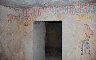
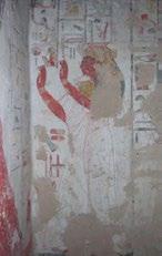
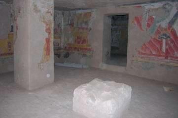
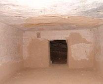
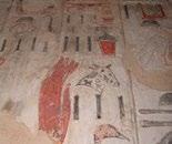
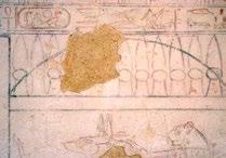
243 19 th Dynasty tombs in the reigns of Rameses I and Seti I QV 40 Anonymous Potential for specialized tours QV 38 Satra Potential for specialized tours QV 36 Anonymous Queen QV 33 Tanedjemy QV 34 Anonymous Queen QV 31 Anonymous Queen 237
, wife of Rameses II, as well that of his mother, Queen Tuy (QV 80), and some of his daughters: Nebettawy (QV 60); Merytamen")
244 19 th Dynasty tombs in the reign of Rameses II th Dynasty The tombs built during the reign of Rameses II were located on the northern slope of the main wadi. These include the most significant tomb at QV, that of Nefertari (QV 66), wife of Rameses II, as well that of his mother, Queen Tuy (QV 80), and some of his daughters: Nebettawy (QV 60); Merytamen (QV 68); Bentanat (QV 71); Henuttauy (QV 73); and Henutmira (QV 75). QV 74 belongs to an anonymous princess, later converted as a burial for Duatentipet, Great Royal Wife of Rameses IV in the 20 th Dynasty. With the exception of Nefertari s burial place, all these tombs have suffered structural instability, loss and blackening of painted decoration due to past flooding and re-use. (See Volume 2 for condition of tombs). QV 66 is open only to very restricted visitation. Tombs with potential for visitation: The only other tomb among this group that has potential for visitation for specialized tours is QV 60. It would require substantial structural intervention and could not be open for general visitation, but has very high interpretation potential, including later Coptic re-use and conservation issues. Tombs with no visitation potential: QV 68, 71, 73, 74, 75,


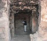
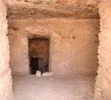
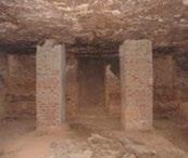
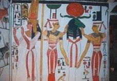
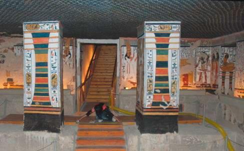
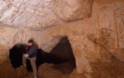
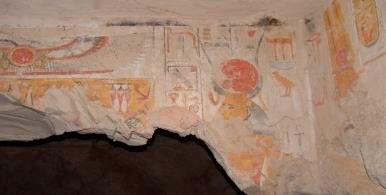
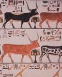
245 19 th Dynasty tombs in the reign of Rameses II QV 66 Nefertari Restricted visitation QV 60 Nebettauy Potential for specialized tour QV 68 Merytamen QV 71 Bentanat QV 80 Tuy QV 75 Henutmira QV 74 Anonymous QV 73 Henuttauy 239

246 20 th Dynasty tombs in the reign of Rameses III 20 th Dynasty During the reign of Rameses III several tombs of queens and princes were constructed at the end of the SW wadi and along the southern slope of the main wadi. These tombs were for five of his sons (Pareherunemef (QV 42); Sethherkhepshef (QV 43); Khaemwaset (QV 44); Rameses Meryamen (QV 53); and Amenherkhepshef (QV 55) and for two of his great wives (Isis, QV 51 and Tyti QV 52). QV 41 has no attribution. Several tombs were extensively damaged with loss of painted decoration and blackened by later re-use, fire and flood, or compromised by abrasive modern cleaning (QV 43). (See Volume 2 for condition of tombs). The three tombs open to the public (Amenherkhepshef QV 55, Khaemwaset QV 44, and Tyti QV 52) are from this period. Tomb 42 has potential for visitation by small specialized tour groups. Although it has suffered structural damage and staining and blackening of wall paintings, it has architectural interest, and extensive extant painted decoration, which has not been subject to modern interventions. Tombs with no visitation potential: QV 41, 43, 51,


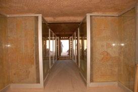
247 20 th Dynasty tombs in the reign of Rameses III QV 55 Amenherkhepshef Currently open to visitation QV 42 Parehernemef Potential for specialized tour QV 44 Khaemwaset Currently open to visitation QV 52 Tyti Currently open to visitation QV 41 Anonymous QV 43 Setherkhepshef QV 51 Isis-ta-Hemdjeret QV 53 Ram. Meryamen 241

248 Current and potential visitation to site elements Twelve site elements (ancient features and structures) are identified in QV and the subsidiary valleys. Compared to the tombs, early travelers and scholars paid less attention to these historic structures and features but various teams including Schiaparelli, CEDAE, Bruyère and CNRS noted or documented them (see Part VI for description and condition assessment of site elements). Current visitation Site elements are not actively visited at present for various reasons including time constraints of tour groups, visitors interest and knowledge, their remote location and safety issues. No active efforts to present them have been made in the past. The Sanctuary to Ptah and Meretseger is mentioned in historic guidebooks in relation to the nearby site, Deir el-medina, but it is visited mostly by individuals who walk the path between QV and Deir el-medina. Criteria for determining visitation potential Visitation potential to QV site elements was assessed with consideration of safety, location, interpretive potential, significance and association. All of the 12 site elements have significant points of interest as well as obstacles to direct visitation. Deir er-rumi, with the most visually impressive remains is also among the most fragile. The Grotto Cascade contains rock paintings and engravings, which are inaccessible except by ladder. The workmen s hut, ancient dam and kiln have significant association with QV history and are located sufficiently close to existing or proposed visitor paths. QV 1 and the Hermit Shelters can be viewed from the path and, along with Deir er- Rumi, are important elements in the Coptic history of the site. The Sanctuary to Ptah and Meretseger is accessible from the path to Deir el-medina but needs protection from direct contact by visitors, who have left their graffiti on the monument over the years (for recent changes to the Sanctuary made by the SCA see Part II, Appendix 4). The remaining site elements are located in the subsidiary valleys and not suitable for visitation. Location of site elements in the main and subsidiary valleys (Satellite Image: 2006 DigitalGlobe). 242
.")

, the fragility of the site and danger posed by the surrounding topography dictate that ruins be")

249 View of Deir er-rumi from above looking east, with remains of Coptic monastery and Roman sanctuary. View of Deir er-rumi from above looking southwest, with remains of Hermit Shelters on hillside (arrow). QV 1 hermit shelter Deir er-rumi Period: 20 th Dynasty tomb (QV 95); Roman sanctuary (2 nd -4 th C) and Coptic monastery (5 th 7 th C) Safety concerns: Site is quite fragile and easily damaged by large groups. There are severe problems of structural instability of the rock slope behind ruins. Noteworthy: Highly significant and visually interesting remains of Coptic and Roman use of QV. Visitation potential: The site is not visited and most visitors are unaware of its existence since it is well shielded behind a rock outcropping as one enters the site. While there is a great potential for interpretation through special tours (viewed from a high point), the fragility of the site and danger posed by the surrounding topography dictate that ruins be partly reburied and that visitation is not a sustainable option in the current and near-term visitor management context at QV and in the West Bank. The site requires off-site interpretation for visitors in the context of both Roman and Coptic re-use of the Valley. Related site elements Hermit shelters Two smaller site elements contribute to an understanding of the Coptic use of the site. QV 1, originally thought to be a tomb and numbered as such, is now thought to be a hermit shelter associated with the use of Deir er-rumi. On the ridge of the hill above QV 1 are the Hermit Shelters, a series of 3 cavities with architectural features on the terraced hillside. Both elements are visible to the south of the visitor path, as one rounds the bend from the parking area, and in visual range of Deir er-rumi to the north. Their remains are too fragile to allow visitation. These three associated elements should be interpreted in a brochure and site panels in conjunction with Coptic re-use of many of the tombs, in particular QV 60. Hermit shelters on hillside 243
, Coptic period Safety concerns: Rock carvings and graffiti are")


 in front of the Cascade and detail of painted image of Hathor (right) View of the Italian Mission Building from the hillside")
250 View of the Grotto Cascade from the Valley. View of the Valley from within the Grotto Cascade (left) and detail of graffiti on rock walls. Grotto Cascade with rock paintings and engravings Period: Prehistory, New Kingdom (19 th Dynasty), Coptic period Safety concerns: Rock carvings and graffiti are difficult to access - on a high ledge - and are themselves very vulnerable if they were to be visited. Noteworthy: The grotto is a significant topographical feature in the landscape at the head of the Valley created over millenia by the water that falls from above. Culturally, it is relevant to the choice of the Valley as a burial place, with representations of Hathor engraved on the rock, and possibly a place of worship. Rock carvings and graffiti from prehistoric, New Kingdom, and Coptic periods have been recorded. Visitation potential: Rock paintings and engravings can only be interpreted in panels and brochures. The Cascade can be easily viewed and interpreted from the visitor trail. Related site element - Dam At the outfall of the Grotto Cascade is a Ramesside period dam built to protect the tombs from floodwaters or collect rain water. Although not associated with the sacred aspects of the Cascade, the dam is in visual range and relates to the Cascade as a major source of flood water to the main valley. Flood protection dam (left, foreground) in front of the Cascade and detail of painted image of Hathor (right) View of the Italian Mission Building from the hillside above, looking down on the visitor path below. Italian Mission Building Period: Early 20 th century Safety concerns: Steep access and use as storage of study materials from Deir er- Rumi. Noteworthy: The building was used as a kitchen by the Italian mission led by Schiaparelli. Visitation potential: Visitation is not possible, nor necessary. The building can be viewed from the visitor path below and interpreted in the context of the modern history of excavation at the site in site panels. 244


251 View of workmens huts looking east down the Valley View of Sancturary of Ptah from the path between QV and Deir el-medina. Workmen s huts Period: 19 th and 20 th Dynasty Safety concerns: No safety concerns to visitors, but walls are fragile. Noteworthy: Remains of the huts where tomb workers lived. Visitation potential: No direct access should be allowed, but remains of structures are easily viewed from visitor paths. Finds from the site such as ostraca, and the relationship to the worker s village at Deir el-medina can be interpreted. Sanctuary to Ptah and Meretseger Period: 19 th 20 th Dynasty; mainly 20 th Dynasty (Rameses III) Safety concerns: Rock instability. Noteworthy: On the path from Deir el-medina to QV. Place of worship for workmen of the royal tombs Visitation potential: The potential for visitation is high but direct access to chapels needs to be restricted or monitored to prevent vandalism. The site should be interpreted in relation to Deir el-medina and the QV workmen s huts in a brochure. Requires sign-posting near entry to QV to direct visitors. (SCA has undertaken extensive interventions at the site since 2009, eliminating any access) Ancient kiln in the wadi looking northeast toward the workmens huts and tomb of Nefertari. Kiln Period: Roman or Coptic Period Safety concerns: None. Noteworthy: May be related to cremations in QV 53. Visitation potential:. The significance of the kiln and its relation to the cremation of bodies in QV 53, if verified, can be interpreted to visitors in site panels. Its location in the flood path may warrant its relocation further north and if this is done the interpretation must reflect this. 245


252 Programs for young Egyptians As described in Section 2, Egyptian visitors to ancient sites constitute a tiny minority of visitors. Finding better ways to communicate the values of ancient sites and the message of conservation to young Egyptians is important for the long-term preservation of Egypt s monuments. There are, however, many constraints to encouraging greater participation of young Egyptians in the enjoyment of their monuments. These include lack of interpretation in Arabic, difficulty in accommodating large school groups in fragile sites, and lack of a strong identity with ancient Egyptian culture. In order to understand the information currently existing for young Egyptians and the potential for greater engagement of Egyptian students, the QV team undertook a brief assessment of existing programs that might provide such an opportunity. The absence of interpretive material in Arabic is one identified constraint in communicating effectively to Egyptian visitors, whether adults or young people. At KV the new interpretation signage is only in English, with Arabic translations published in a small booklet separately (and not readily available). With respect to young people, the recent efforts made by archaeologist Christian Leblanc to disseminate information in Arabic (and French) is an important contribution. This is the publication of a small guide about QV intended for school teachers (La vallée des reines et des enfants royaux). Similar booklets have been published for the Ramesseum, KV and other West Bank sites. Introducing Young People to Heritage Site Management and Protection. A Practical Guide for Secondary School Teachers in the Arab Region. ICCROM 2006 (revised edition) A 2006 publication by ICCROM, in English and Arabic, is aimed at teaching young people about heritage management and protection. It is designed as a practical manual for secondary school teachers in the Arab region. In Egypt the program has worked with the Associated Schools Project Network (ASPNet). Contact was made by the GCI-SCA team in Egypt with the point person for the UNESCO ASPNet in the Arab region. To date there has not been extensive development or follow-up of the program in Egypt, but it remains an important source of information for educational outreach. 246

253 Field trips to cultural sites Field trips for schools, colleges and other youth groups generally take place throughout Egypt in April. In February, schools are out for the mid-year holidays and this is a time when families tend to visit cultural sites. School groups are not allowed to visit the necropoleis (KV, QV and Nobles) because of the fragility and confined spaces in the tombs and the exuberant behavior of the students. They are, however, issued a general permit to visit all other cultural heritage sites including the temples and museum in Luxor. Numerous school age groups have field trips; these include the Youth Trains (organized by the Ministry of Youth and Sports) which only tour East Bank sites, and cultural field trips organized by the Coptic Church and university-level activity clubs. Cultural exchange program for outstanding students The most promising program, Cultural exchange program for outstanding students, (also referred to informally as the Excellence Program ) targets outstanding students from all Egyptian governorates and provides an opportunity for students to participate in cultural camps through exchanges among the governorates. The program is aimed at preparatory, secondary-level students. For those visiting Luxor, the following is a brief description of their activities: Luxor hosts approximately 900 students annually (winter) Each trip consists of a maximum of 10 students from five to seven different governorates, with one supervisor from each governorate (i.e. one supervisor for every 10 students). Additionally, five supervisors from the host governorate participate. Students are accommodated at student lodgings ( camps ) in each governorate. There they have a few introductory meetings before beginning their trip. The trip schedule in Luxor is as follows: Trips take place from the beginning of February till the end of March. Day 1: East Bank visit. Day 2: West Bank visit (or visa versa) Day 3: Travel to Aswan, where they spend one day and depart for their home governorates Student or youth groups on field trip to QV during winter break. 247
254
255 V. Site-wide Threats and Considerations 1. Environmental monitoring Introduction Climate of the Queens Valley Microclimate of QV 66 Microclimate of QV 44 and QV 55 Summary conclusions 2. Assessment of flash flooding Introduction, History and evidence of flash flooding in the Queens Valley and on the West Bank 1994 flash flood Response to the 1994 flash flood New site mapping Identification of key areas of concern Hydrologic analysis and hydraulic modeling Hydraulic modeling of flood risk under present conditions General recommendations emerging from the assessment Table 5. QV tombs with reports or evidence of flooding or infiltration 3. Bat colonies Distribution and concentration in tombs Identification Protection Survey and re-location efforts References
256


257 Part V.1. Environmental monitoring Introduction Of the many factors that cause deterioration of archaeological sites and monuments, climate is critical. Knowledge of climatic conditions is thus fundamental to efforts to protect and preserve a site. Extraordinary as it may seem, there appears to be no quantitative climatic data for the Theban necropolis nor any permanent meteorological station on the West Bank; and this after more than a century of archaeological investigation of the many hundreds of pharaonic tombs and temples by longestablished archaeological missions as well as the national antiquities authority itself. That the area is excessively arid throughout the year and extremely hot in summer is the extent of anecdotal information on climate. Yet there is quite extensive comment in the literature on the archaeological evidence for flash floods that have devastated the tombs of the Kings and Queens Valleys. Most recently, in 1994, damaging floods occurred on the West Bank but no rainfall data exists. It is surprising, therefore, that an institutionalized meteorological station has not been established in the archaeological areas of the West Bank. The only nearby station is at Luxor airport, where rainfall patterns are different than in the Theban mountains (as discussed in Section 2 dealing with flood control in the Queens Valley). When considering microclimate within tombs the situation is similar. Previous measurements of humidity and temperature have typically been made using hand-held instruments over short time periods. These provide little more than a snapshot view of conditions which change with season, natural ventilation, and due to the influence of visitors to tombs. It was clear that the need existed in the Queens Valley project to acquire comprehensive external and internal environmental data in order to understand the real climatic threats to the antiquities and to be able to design and implement measures to counter or mitigate both natural and human impacts. Limited climatic monitoring in the Valley began in connection with the GCI s project ( ) for the conservation of the tomb of Nefertari (QV 66). An autonomous monitoring station was installed at the entrance to QV 66 in August 1991 to record air temperature, wall temperature, relative humidity, carbon dioxide concentration inside the tomb, and visitor entry/exit count; and for the exterior temperature, relative humidity, rainfall, and solar radiation. Wind direction and wind speed sensors were added to the station in May The effects of visitation on the tomb s microenvironment were also studied through six controlled experiments involving people in the burial chamber, conducted over a year to evaluate seasonal variations. The findings are summarized below. The environmental monitoring station installed at the tomb of Nefertari (QV 66) in August Left image shows a solar panel and sensors installed on a tripod just outside the entrance arch. Right image shows station s datalogger in the burial chamber. 251
258 Climate of the Queens Valley Climatologically, the year can be divided into winter and summer. November through March may be considered winter, with the daily average air temperature recorded by the GCI s station between the low 20s and high 10s C. The lowest air temperature drops to 5 C. The winter average humidity is higher than in summer and ranges between 30-40% RH. It can reach as high as the mid 80s% RH in early mornings as well as during drizzling rain, and drops to 5% RH in the afternoon on hot, dry days. Daily swings of humidity are larger in winter than in summer. As stated, it seldom rains in the area. But, rain, whose amount is highly variable, mostly occurs between October and May. The summer, from April to October, has daily average air temperature ranges from the high 20s to the mid 30s C. Peak temperatures can reach the mid 40s C. The humidity averages between the high 10s % and the low 20s % with the daily swing between about 10 and 35% RH. The daily maximum seldom reached 50% RH in summer, but the minimum often drops below 10% RH on sunny afternoons. Although the relative humidity is lower in summer than in winter as described above, the absolute moisture content (as distinct from RH which is temperature dependent) in the air is 30-40% more in summer due to higher temperatures. Wind blows from the southwest and northeast with speed averaging 6-7 km/hr throughout the year. Occasional strong winds, over 30 km/hr, blow from the southwest in summer. Microclimate of QV 66 Toward the end of the project for the conservation of Nefertari s tomb, environmental monitoring was undertaken in order to understand the microclimate within the tomb and its relationship to deterioration, including the effects of exterior climate and visitation. At that time it was expected that the tomb would not be opened to tourism because of concerns that visitation might accelerate deterioration, though this expectation subsequently proved likely to be wrong based on condition monitoring of the paintings over a number of years. Below is a summary of the findings of the first period of monitoring, followed by further monitoring in when the SCA opened the tomb to daily visitation, and of the current monitoring results undertaken for the Queens Valley project. August September 1993: Monitoring concluded in September 1993 with the following findings and recommendations: The natural (stable) condition of QV 66 was around 29 C and 45-50% RH with the entrance door vent holes in the bulkhead sealed; that is without natural ventilation via the door. Natural ventilation through the entrance and its bulkhead was identified as the source of the seasonal variation of humidity which ranged from 18% RH in winter to 40% RH in summer. Therefore, it was recommended, in order to maintain a more stable microclimate, the tomb s entrance should be better sealed by means of plugging the ventilation holes in the bulkhead. The microenvironment of the tomb was sensitive to the effects of visitation, as well as to the site climate. Visitors produced humidity and carbon dioxide (CO 2 ) increases of 0.5% RH/hour/person and 50 ppm/hour/person, respectively, in the burial chamber. After visitors exited the tomb, temperature recovered almost immediately, but the recovery of relative humidity and carbon dioxide levels were much more protracted. Natural ventilation through the tomb s entrance removed moisture from the tomb generated by visitors, but the rate depended on seasonally varying ventilation rates. With the door open, a natural ventilation rate of less than one air change in 7 hours (which means it takes up to 28 hours to dissipate 94% of any visitor effects) was found in winter months, and more than 24 hours (which means it would take more than 4 days to dissipate 94% of visitor effects) in the summer. 252
259 Therefore, if the natural stable environment of the tomb is to be maintained, in the absence of mechanical ventilation, only limited numbers of visitors can be allowed in the tomb at any one time and then only in winter months, and no visitors should be allowed in the tomb in summer months. February February 1997: In 1995, policy changed with respect to visitors to the tomb. The SCA installed a wooden viewing platform, lighting, and a mechanical air extraction system (probably effective up to one air change per hour) for ventilating QV 66, which was officially opened to visitors on November 4, Although the SCA limited visitors to 150 per day, year-round visitation was permitted. Environmental monitoring was resumed by the GCI in February1996 for a period of one year to evaluate the impact of daily visitation with mechanical ventilation in operation. Unfortunately, the monitoring had missed the 1994 rain that resulted in flash flooding in the Valley (QV66 was not affected) since the event fell between the two monitoring periods. Results were as follows: Most visitors arrived before noon resulting in continuous visitation of groups in mornings. Greater effects of visitation on the tomb environment were observed in the funerary chamber and a side chamber connected to it (Chambers C and G) than the burial chamber (Chamber K). In February the baseline temperature dropped by 1.5 C from the undisturbed tomb temperature of 29 C, and daily minimums were as low as 27.2 C. In October the baseline temperature rose by 1 C and reached 30 C with daily peaks reaching 31 C. Relative humidity was approximately 38% in August to 20% in February; however, RH values as low as 14% occurred in winter. Daily variations were less than 10% for most of the period. Overnight values of carbon dioxide were about 700 and 1200 ppm in winter and summer, respectively. The natural carbon dioxide concentration in the atmosphere is 350 ppm. In the burial chamber the concentration of carbon dioxide mostly remained at less than 1500 ppm; however daily peaks due to visitors were 1500 to 3000 ppm in side Chamber G. These observations lead to the following concerns: The rate of mechanical ventilation was minimal but adequate for the visitation load, with the exception of Chamber G; however, the distribution of air extraction points within the tomb was poorly designed. Ventilation was effective in limiting humidity to less than 55% in summer; however, the ventilation caused a drop to 14% in winter which may result in desiccation of the wall paintings, with unknown effects, but possible micro-cracking of the surface if any gypsum in the plaster were to change into anhydrite. Another concern was the significantly increased daily and annual temperature variations. If the ventilation rate is increased to prevent CO 2 exceeding ppm, which would be an acceptable level of carbon dioxide, the temperature will increase by a few degrees because of the influx of warm outside air. Impacts of the larger temperature variations on the wall paintings should be investigated. Since February 2009: The environmental monitoring station for the site climate was re-installed near the entrance of QV 66 in February The principal purpose of the resumption of site monitoring was to obtain quantitative data in the event of rainfall. A year later, in February 2009, a temperature and relative humidity sensor and a visitor counter were placed in the tomb to resume monitoring the tomb s microenvironment and to analyze impacts of the current visitation pattern. Prior to this time SCA policy had changed again with significantly higher ticket prices and commensurately fewer visitors. CO 2 concentration is not monitored since visitor numbers are small and an extraction ventilator operates whenever visitors are in the tomb. Data from February to November 2009 are as follows: 253
260 Temperature: Monthly average ranged from 29.1 C in March to 29.6 C in September, October, and November. Daily variations were less than 0.5 C. The highest was 30.1 C in October and November and the lowest was 29.0 C in March and April. Relative humidity: Monthly average ranged between 17% (February and March) and 31% (September and October). The highest was 37% in October and the lowest was 15% in March. Daily variations have been less than 10% and mostly less than 5%. Visitation: The visitor counter at the entrance to the tomb recorded less than 2600 visitors between February and November 2009 (fewer than 10 visitors/day on average). The majority was less than 20 visitors in a group. (30-50 visitors were counted on four occasions; however, the sensors may have been interfered with on those visits.) In summary, the conserved wall paintings in QV 66 were exposed to large daily variations of temperature and humidity for several years during the period of visitation from November Currently variations of both the temperature and humidity are significantly less than previously. This is due to the changed policy of the SCA in which the tomb is closed to visitors with the exception of prebooked tour groups. Therefore, we expect no additional impact on the wall paintings due to the current sporadic and light visitation load. However, the existing air extraction ventilation system will need to be redesigned to effectively dilute the impacts of visitors with the least volume of ventilating air. A supply air ventilator with a dust filter should be added to improve the air quality of the make-up air. A large amount of dust and lint from visitors clothes has accumulated on the floor throughout the tomb. The dust becomes airborne when visitors enter the tomb (air motion generated by visitor movements), therefore, dust and lint should be removed (vacuumed) from the tomb to improve the air quality and because of fire danger. Microclimate of QV 44 and QV 55 Environmental monitoring in QV 44 and 55 also started in February 2009 using self-contained temperature and relative humidity data loggers in the burial chamber of each tomb. These tombs receive heavy visitation. Data was downloaded to a personal computer during each campaign for analysis. Dust deposition was measured at the same locations. In addition, a portable station with temperature, humidity, and CO 2 monitoring capabilities was used in these tombs to record detailed daily environmental changes during some of the campaigns. Rates of natural ventilation of the tombs were also measured in mid-summer and early winter. Data from February 2009 to November 2010 are as follows. Temperature: Monthly averages ranged from 27.4 C in March to 31.8 C in October. Daily variations were 4-5 C in winter to about 2 C in summer. The highest temperature was 33.7 C in October and November, and the lowest was 23.5 C in February. Humidity: Monthly averages ranged between 24% RH in March and 33% RH in October. Daily variations have been 10-25% RH throughout the year. The highest humidity was 70% RH in March, and the lowest was 14% RH also in March. Natural ventilation: Natural ventilation rates ranged from 1.2 to 4 air changes per hour during summer and winter (late November), respectively. These smaller and flatter tombs (in comparison to QV 66 whose open-door natural ventilation rates ranged from 0.1 to 1.3 air changes per hour for summer and winter, respectively) have faster responses to the outside climate generally resulting in much higher rates of natural ventilation in both seasons. CO 2 concentration: The CO 2 concentration reached 3000 ppm during a number of measurements performed in the tombs in winter. The high CO 2 concentrations are attributable to high visitor loads in the small tombs. However, in summer it remained below 1500 ppm due to significantly lower visitor numbers. Both tombs CO 2 levels returned to ambient concentration (350 ppm) by the following morning in both seasons. 254
261 Dust (particulate deposition): The calculated deposition rates over one year on horizontal surfaces ranged from 175g/m 2 in QV 55 to 50 g/ m 2 in QV 44. Particle size ranged from 0.3 to 100 µm. About 30% of the particles were less than 2.5 µm, and 60% less than 10 µm in size. Mineralogically the dust was mainly clay and calcite. In summary, large daily variations were recorded in both the temperature and humidity in QV 44 and 55 throughout the year. These result from high visitation in these small tombs. Therefore, it will be necessary to operate adequate mechanical ventilation systems to reduce the effects of visitors during operational hours for both protection of wall paintings and visitor comfort. The systems should have both an extraction fan and a supply fan with a dust filter to limit transport of dust into the tombs. However, it was found that the moisture, heat, and CO 2 dissipated overnight and did not accumulate in the tombs. This is attributable to a relatively high natural ventilation rate of these tombs during the night. As noted in QV 66, a large amount of dust is found on the floor throughout the tombs. This should be removed to reduce airborne dusts resulting from disturbance by visitors. Summary Conclusions The climate of the Queens Valley and interior climates in QV 44, 55, and 66 have been recorded, analyzed and compared. The tombs interior climates are greatly affected by both the site climate and visitors. In QV 66, due to the current small number of visitors, relatively large tomb size, and the use of a mechanical ventilation system, effects of visitors have been smaller than those recorded during the monitoring period. However, the existing ventilation system will need to be re-designed for improved efficiency. A large amount of dust has accumulated on the floor throughout the tombs; therefore dust should be removed periodically. Dust also deposits on the wall paintings and protective glass screens which then require cleaning. This operation, carried out sporadically by unskilled workers, is hazardous to the wall paintings as mechanical damage is inevitable. Microclimates in QV 44 and 55 are rapidly affected by the large numbers of visitors and the lack of mechanical ventilation. The effects have been documented as high levels of temperature, humidity, and CO 2 as well as their large daily variations. It is necessary to limit the number of visitors and install a filtered ventilation system to mitigate the effects. Due to the large seasonal variation of the site climate and small tomb sizes, careful consideration is needed to design a safe (for both wall paintings and visitors) and efficient ventilation system for each tomb. It is essential to establish acceptable target ranges of temperature, humidity, CO 2 and dust levels for preserving the wall paintings as well as ensuring visitor safety and comfort in the tombs in order to design a suitable environmental management strategy. Through monitoring, we have documented ranges of microclimate conditions to which the wall paintings have already been exposed in the tombs. Fortunately, exposure to extreme conditions has been brief. Determination of a target range of climate may require a set of laboratory experiments to provide understanding of the thermo-hygrometric responses of the wall painting materials. Laboratory analysis should include thermal and hygric dilatation measurements of the limestone, plaster, and wall painting layers. Based on data for QV 66, prior to the tomb having been opened to visitation, that is in the stable, or slow seasonally changing, conditions of relative humidity and temperature, initial environmental requirements could serve as the baseline for such laboratory investigations. Once the target range has been established, the number of visitors and a ventilation rate could be balanced to maintain preservation conditions for a variety of outside conditions. 255
262

263 Part V.2. Assessment of Flash Flooding Introduction History has shown that, like at the Valley of the Kings, no other threat at the Queens Valley is more devastating than flash flooding. Although occurring infrequently, a single episode of torrential rains in the QV watershed, such as happened in November 1994, produces runoff of the magnitude of tens of thousands of cubic meters and transports tons of mud and rock debris from the slopes into unprotected tombs impacting ancient features and site infrastructure. The future will bring more floods. When such floods occur cannot be known, but the ancient monuments can and must be protected in preparation for inevitable flood events. The aim of this assessment is to provide an informed basis for planning for protecting tombs, historic site elements, and modern infrastructure from flash flood. Factors to be considered are: precipitation records and characteristics of the area; evidence and records of past flooding at QV and on the West Bank; site topography, including the rainfall catchment area, subcatchments, and their drainage characteristics; in this relation, one must also consider changes to the site s topography over time as a result of archaeological investigations, as well as existing and planned infrastructure and previous site interventions intended to afford flood protection; site geology and petrology and susceptibility of the rock to damage as a result of floods; the location of individual tombs and their flood risk before and after protective measures have been implemented. During the assessment phase of the QV project, these factors were considered with the aim of determining the magnitude and extent of flash flood risk. After the assessment phase, the intent is to apply this information in the design of interventions and management recommendations to protect both historic and modern structures. QV rainfall catchment area QV cultural boundaries Aerial view of the Valley of the Queens showing cultural boundaries and rainfall catchment area that threatens the cultural resources 257
264 Key findings The following are key findings that were determined through the flood protection assessment: Flash flood is the greatest threat to preservation of tombs and other historic features. Periodic flash flooding of QV is inevitable. In the past flood water and sediment have repeatedly flowed into tombs resulting in extensive and immediate damage. The clay-rich rock into which tombs are constructed (comprised of marls and shales) swells when wetted, resulting in severe rock damage and, in cases, collapse. The shaley rock of tombs on the south side of the main wadi is particularly susceptible to such impacts, although marls are susceptible to such deterioration as well (as evidenced by QV 60). In decorated tombs, mobilization of salts by water leads to salt crystallization in plasters and on wall paintings and extensive damage over time. Flooded tombs act as sumps for migration of water through rock fissures to nearby tombs. Therefore, protection of the openings of decorated tombs is not sufficient for their protection. They are also at risk from the flooding of shaft tombs. The combined rainfall catchment coverage at the south end of the site parking area is 104 hectares. Five major subcatchments contribute runoff to this confluence point. The most dangerous subcatchment to the main concentration of tombs flows through the Cascade at the head of the Valley and into the main drainage channel. This subcatchment has a substantial area (approximately 20 hectares or 50 acres) and a very steep grade (about 30 percent). Restrictions to the flow of water and sediment occur near QV 55, at the bridge to QV 66, and at the site entrance. Without comprehensive control measures, future floods will result in back-up of water, mud and rock at these areas. Damage to tombs and entrance infrastructure will be severe. In the pages that follow these findings are elaborated upon, with the aim of identifying specific, significant problems or constraints that should be addressed. The explanation of these issues is followed by proposed measures for their remedy. 258
 (Penden 2001, 178, 225).")

265 History and evidence of flash flooding in the Queens Valley and on the West Bank The earliest records of rain events in the Queens Valley, rock engravings in the Grotto Cascade, date to the 19 th Dynasty of the New Kingdom. These inscriptions record rain during the reigns of Rameses II, Merenptah, and during the late 20 th Dynasty (either Ramesses IV, V, or VI) (Penden 2001, 178, 225). Since the end of the eighteenth century, there have been several written accounts of substantial rain events or flash floods in the Luxor area and on the West Bank, particularly in Kings Valley. These accounts provide an indication of the frequency of substantial storms in the area over the past two centuries. The dates of the most significant events recorded with any specificity are: Date Source Date Source 1799, 1818, 1820s, 1883, 1898, 1905, 1910 Cross 2008, 305, n March Romer Cross 2008, 305, n July Winlock 1948, ,1917, October Cross 2008, 305, n , May 3 Romer 1993, 152, n , 1976, 1980, 1989, 1991, 1993 Weeks 1995, October 8 Brock 1996, November 3-4 Leblanc 1995, May 26 Leblanc 1995, 214 Looking again specifically at the Queens Valley, records of early explorers and, later, archaeologists mention sediment in several QV tombs before they were cleared, presumably coming from flash flooding. For example, more than one meter of sediment was found in tomb QV 60, including stratigraphic evidence of at least six to seven major flood events (Messein et al., 1994, ). A number of tombs show significant damage from past flooding or moisture infiltration. These range from damage to wall paintings by the moisture-activated growth of salt crystals, to the loss of painted plasters at the base of walls from flooding and ingress of moisture-saturated debris, to severe structural damage and collapse, particularly within tombs cut into high-clay content shale, and to a lesser extent marl. The Franco-Egyptian mission left intact a section of historic alluvial stratigraphy in the wadi s southwest branch to provide a tangible record of historic deposition. Leblanc has noted that this stratigraphic section indicates the occurrence of twelve major depositional events (C. Leblanc, 2007, pers. comm.). C. Leblanc s brief published descriptions of the November 1994 flash flood and another storm in May 1995 are given in the following pages. Section of alluvial stratigraphy left intact by the Franco-Egyptian mission. View of Valley at the time of Schiaparelli s mission, looking west from near QV 66 (Nefertari), showing build-up of flood debris. (Image: Schiaparelli 1923) 259


 presumably due to historic flooding.")
266 Between 2006 and 2008 the present assessment systematically recorded physical evidence of apparent flooding and water infiltration in tombs. This included characteristic types of flood-related deterioration that occurred over millennia. It also included recording characteristically cracked clay and silt deposits on tomb floors and adhering to tomb walls, ceilings, and shafts. This latter evidence in most cases presumably indicates flooding or water infiltration since the time of the clearing of these tombs between 1984 and 1988 by the Franco Egyptian mission. The map on the next page specifies the tombs where flooding was observed in November 1994, or in which flood or infiltration evidence has been found. Table 5 at the end of this section compiles more detailed information concerning each of these types of evidence of flood or water infiltration. Loss of painted plaster at the wall base of tomb QV 44 (Khaemwaset), presumably due to historic flooding. The tomb is open to general visitation. Loss of painted plaster at the wall base of tomb QV 52 (Tyti) presumably due to historic flooding. The tomb, open to general visitation, is in a vulnerable position near the main drainage channel. Rock collapse, deterioration, and loss of painted plaster in the lower walls of tomb QV 60 (Nebettauy) due to repeated flooding, including in View of roof collapse of tomb QV 34, which is in an area where most tombs contain shale susceptible to water damage. 260
 has been found.")
267 261 Tombs with recent flood or infiltration evidence (since 1980s), or in which older flood or infiltration evidence (prior to the 1980s) has been found. Evidence is specified in Table 5.

268 1994 flash flood The largest flood in the Valley of the Queens in recent times was on 2 November This is also the only instance of flooding at the site for which detailed direct observations have been recorded. Leblanc indicates that rain lasted for approximately one hour. The Luxor airport meteorological station recorded 1.02mm of rain on November 2 and 0.51mm on November 3. As already noted, from written and oral accounts of flooding on the West Bank, the amount of rainfall there was substantially more than at the airport. Leblanc wrote the following regarding the situation in the Valley of the Queens during that episode: The clearing of the bottom of the necropolis which had been done between 1986 and 1990, thanks to the Ford-de-Maria donation, allowed the restoration of a portion of the ancient topography of the site but the work had not been pursued beyond the tombs [QV 49]-[QV 50] because of the presence of the asphalted parking [in the main wadi]. When the rain fell, the water, instead of continuing its own path, had been blocked by this modern pavement raised multiple times and which formed an artificial dike. As soon as the section of the ancient bed which had been cleared by the CNRS and CEDAE team was full, the overflow poured into the tombs located on the side. (Leblanc 1995, 213; translation from the French by GCI) The flow of the floodwaters was further impeded by a raised footpath that followed north from the current parking area in the heart of the wadi to the tomb of Nefertari, which acted like a dam but broke from the force of the floodwaters. Thirty-two tombs have been identified that were presumably flooded during that episode (indicated in the preceding map). No record exists of the amount of rainfall that fell in QV during the 1994 flood. Water standing in the wadi after the 1994 flood. QV 55, one of the three tombs open to general visitation, is indicated by arrow. In the foreground are the foundations of Rameside-era and Coptic-era structures and tomb QV 58, now a magazine, on the right. (Image: CNRS) 262

269 Response to the1994 flash flood Immediately following the November 1994 flood, CNRS and SCA intervened to protect the Queens Valley tombs. The first action taken was pumping of water and removal of mud from flooded tombs. Leblanc has recounted that during the pumping of water from certain shaft tombs rock could be heard collapsing as a consequence of swelling due to the clay content of the marl (C. Leblanc, 2009, per. comm.). Following these actions, CNRS and SCA worked for approximately two weeks to improve the situation in the valley (C. Leblanc 1995, 213). This work included removing the asphalt road and parking area in the heart of the Valley (opposite QV 66) and lowering the level of the Valley floor, in some areas up to one meter and to bedrock, to further reduce the threat of flooding. The parking area was removed to also eliminate vibrations caused by vehicles, particularly tour buses. The work was carried out using heavy equipment of the SCA s architectural department. A path from the site entrance was built on the south side of the main wadi to the former parking area. The remains of the existing footpath between the former parking area and Nefertari s tomb were also removed to free the main drainage path in the wadi. In its place a new path for tourists to access Nefertari s tomb was created by installing a small wooden footbridge across the wadi and from there utilizing a terrace in front of the tombs of Ramses II s daughter-wives (QV 70, QV 72, QV 75, QV 82, QV 83). The CNRS and SCA also replaced existing low walls around a number of tombs with new, higher stone walls with the intention of diverting flood waters. This work included walls around the entrances to QV 41, QV 42, QV 43, QV 44, and walls built around the four sides of the opening to QV 65. A low protection wall was also built next to the path in front of QV 55. In the southwest branch of the main wadi existing low walls along the visitor path were replaced with rough stone walls to better channel water in the direction of the main wadi. Leblanc has stated, regarding the effectiveness of these interventions, that [t]he heavy rain which fell on 26 May 1995 showed that all of these installations have been very efficient, since no infiltrations, this time, penetrated the tombs of the necropolis (Leblanc 1995, 214; translation from the French by GCI). However, Leblanc has since warned that the Valley s shaft tombs still need protection (C. Leblanc, 2007, pers. comm.). Although these measures substantially improved the situation, the present assessment has identified several significant deficiencies that remain. The former parking area was removed after the flood (Image: CNRS). Workmen pumping water from the main wadi immediately after the 1994 flood. The former parking area, which blocked the flow of flood water and debris, is indicated by the arrow (Image: CNRS). 263
, in 2007 the GCI commissioned a new topographic map of the site to include the locations of the tombs, other ancient features, and modern")
270 New site mapping The topographic characteristics of a rainfall catchment determine the hydraulic behavior of runoff during rainfall. As noted elsewhere in this report (see Part II: Appendix 2), in 2007 the GCI commissioned a new topographic map of the site to include the locations of the tombs, other ancient features, and modern infrastructure. Before this new mapping, the most precise map covering the majority of the QV catchment area had been produced by the French Institut Geographique National in the mid 1960s with a topographic contour interval of 2 meters. Importantly, this map predated the 1994 changes to the topography in the heart of the main wadi, which included removal of both the asphalt parking area and the built up path that connected it to the tomb of Nefertari, and the creation of a drainage channel and terraces in the area and construction of a new asphalt parking area at its current location at the site entrance. The 2007 GCI mapping utilized long-range and short-range laser scanning instruments and other survey equipment to produce an accurate and detailed map with a 50cm contour interval covering the entire rainfall catchment area, and with a 10cm contour interval in the area of the main concentration of tombs. Part of the topographic map produced through laser scanning of an area of the southwest branch of the main wadi showing 10cm contour lines (gray), tomb openings (green lines), and drainage lines (blue) generated through ArcHydro 2.1 hydrologic analysis software. Software generated drainage lines suffice to show an approximate picture of flow, but require correction in some instances by in situ inspection, particularly around tombs. 264


271 Identification of key areas of concern Through on-site assessment, a number of key issues were identified that require attention in order to protect the Valley s antiquities and infrastructure from flood. Issue 1: Obstruction of channel by ancient Kiln The ancient Roman or Coptic kiln is in the path of the main drainage flow near tombs QV 55 and 53. The direction of flow is indicated on the map and image by arrows. A wall was constructed in 2007 along the north side of the visitor path next to the kiln, which almost completely constricts the channel on the kiln s south side. Location where the kiln obstructs the main drainage channel. Issue 2: Constraint of main drainage channel At present the main drainage channel increasingly narrows toward its east (downstream) end. The elevated asphalt visitor path downstream of the bridge to QV 66 reduces the flood channel from its original more than 10 meter width to less than 2 meters. This narrowing and the bridge create a severe obstruction to the flow of water and debris. The depth of the entire channel has also decreased over time as debris has accumulated in it. Many significant tombs and other historic site elements densely situated close to the channel are at risk if the channel fills or overflows either because its capacity is exceeded or it becomes blocked and backed up. Map of area of constriction of main drainage channel by bridge (indicated by arrow) and paved visitor path. View of main drainage channel looking downstream showing channel narrowing and point of constriction at bridge (arrow). 265

 with their convergence at the site entrance (indicated by arrow). (Satellite image: 2006 DigitalGlobe).")
 are in a vulnerable position on the south side of the channel.")

272 Issue 3: Convergence of subcatchments at site entrance The convergence of flows from the six main sub-catchments threatens infrastructure at the site entrance. Blockage at this point would result in back-up of water, mud and rock and affect the entire site. Above: View of the convergence of drainage subcatchments at the site entrance. Left: Drainage lines for entire catchment (104 hectares) with their convergence at the site entrance (indicated by arrow). (Satellite image: 2006 DigitalGlobe). Issue 4: Threat to tombs from main drainage channel Tombs are immediately threatened by overflow of the main drainage channel in two areas that will be fed by a catchment exceeding 22 hectares: Area 1: Two of the tombs open to general visitation, QV 52 and QV 55, and other significant tombs (e.g. QV 53 flooded in 1994) are in a vulnerable position on the south side of the channel. Area 2: Tombs QV 58, 59, 60 and 61 on the north side of the channel are under threat from flow through the main channel. QV 58 is a magazine used to store archaeological materials and QV 60 has been affected by repeated flooding including in Left: Map of tombs in Areas 1 and 2 vulnerable to flooding from the main drainage channel. 1 Below: View of Area 1 (left) and Area 2 (right). Note location of QV 53, which flooded in


273 Issue 5: Threat to tombs from upslope runoff Tombs are threatened by upslope runoff in three general areas that require area-wide control: Area 3: QV and tomb workers structures; Area 4: QV 71 75; Area 5: QV 27 44, Area 3 : QV and tomb workers structures Tombs QV include QV 66 (Nefertari) and QV 68 (Queen Merytamen). Tombs QV 58, 60, and 68 flooded in Hydrologic analysis shows substantial runoff down slope through the western part of this area. General view of Area 3 tombs and features that are vulnerable to runoff from the slope above. 267
. General view of Area 4 showing the Valley of the Rope outflow in the background.")

274 Area 4: QV If a substantial flood event occurs, tombs QV are vulnerable from upslope overflow from the Valley of the Rope drainage path to the north. The chief of the SCA site guardians indicated that QV 71 and 73 flooded in 1994 (2009 pers. comm.). General view of Area 4 showing the Valley of the Rope outflow in the background. Area 5: QV 27 44, Many of the tombs in Area 5 contain expansive shale and in some areas this rock is exposed at the ground surface. This area also includes the collapsed roof of QV 34, which is highly susceptible to water infiltration and further damage. The SCA built a wall around this unstable area in General view of Area 5, with arrow indicating QV 34 with collapsed roof. 268
275 Hydrologic analysis and hydraulic modeling After the GCI carried out an in-depth field assessment, GCI consultant Hamza Associates conducted hydrologic analysis and hydraulic modeling to assess the magnitude and extent of the flash flood threat under the existing conditions. The following were the steps carried out in this process: Hydrologic Analysis 1. Rainfall analysis of the study area 2. Sub-catchment delineation 3. Rainfall-runoff analysis to determine the expected peak discharge and flow volume corresponding to a 200 year return period 4. Analysis of sediment yield from the catchments Hydraulic Modeling 1. Simulation of the present situation (without the introduction of flood protection measures) and evaluation of flood risk. A summary of this work follows directly after a discussion of sources of historical rainfall data for the Luxor area. Sources of rainfall data Apparently no meteorological station has been established on the West Bank and thus, after several years of searching exhaustively, it appears that rainfall records do not exist. A station on the West Bank is needed to accurately determine the entire Theban necropolis needs for flash flood protection. However, a meteorological station at the Luxor airport on the East Bank is operated by the Egyptian Meteorological Authority, and rainfall records exist from that station back to the early 1940s. This apparently is the only source of long term rainfall data in the Luxor area. The convectional type of storms that predominate in the area are typically highly localized, with rain falling heavily in one location while a nearby area may be dry. In cases, substantial rain events have occurred on the West Bank when at the same time little or no rain was recorded at Luxor airport. For example, at the time of the November 1994 flash flood on the West Bank little rainfall was recorded at the airport. In addition, the topographic position of the airport is relatively flat and low lying (elevation 93 meters) with no nearby mountains. In contrast, the Queens Valley watershed, approximately 12 kilometers to the northwest, includes the south-facing slope of the Theban Mountain with elevations at its top exceeding 460 meters. When moisture-containing air masses are forced higher as they rise up the Theban Mountain in the Queens Valley watershed, the resulting adiabatic cooling can be expected to lead to more intense rainfall than occurs in the lower, flatter area of Luxor airport. Rain storms in the area of Thebes in recent times also have tended to have a distinct seasonality. K. Weeks states that virtually all of the recent heavy storms at Thebes in the 20 th century (or at least those for which we have records) occurred in the months of October, November, or early December (Weeks 1995, 125). These factors together mean that precipitation records from the airport meteorological station may not be an accurate indicator of the frequency, and magnitude, of historical rainfall events at the Queens Valley. However, they are the only available local records. West Bank environmental monitoring has been conducted in two known instances. During the 1990s the GCI maintained an environmental monitoring station at the Queens Valley as part of its project to conserve the wall paintings of the tomb of Nefertari. This station recorded precipitation 269
276 for the following two periods: (1) January September 1993: no precipitation recorded; (2) January May 1997: 0.5 mm (Aug 23-24, 1996) and 1.75 mm (Nov 14-15, 1996). Unfortunately, this station was not installed at the time of the 1994 and 1995 storms. K. Weeks notes that a station operated in Kings Valley briefly in but that its records have not been located (TMP 2006, 59). For the purposes of the current project, the GCI again installed an environmental monitoring station at Queens Valley in late January Rainfall analysis In order to assess the magnitude and extent of risk of flash flooding at Queens Valley, data had to be analyzed for peak rainfall events over a short duration. The analysis that follows was undertaken in conjunction with Dr. Reda El-Damak, Dr. Ashraf Ghanem, and Dr. Mohamad El-Gamal under contract to Hamza Associates (El-Damak, Ghanem, and El-Gamal, 2010). This analysis utilized hourly data from Luxor airport published by K. Weeks showing the occurrence each year between 1940 and 1994 of the storm that dropped the greatest amount of rainfall at least 1 mm of rainfall in a one-hour-long period. If several storms occurred during a year the graph only records the occurrence that dropped the most precipitation over one hour. (Weeks, 1995, 123). Table 1 Mean Temperature o C Daily Daily Mean Mean Total Number Month Minimum Maximum Rainfall (mm) of Rain Days Jan Feb Mar Apr May Jun Jul Aug Sep Oct Nov Dec Table 1 presents general climatological information for Luxor airport meteorological station compiled from the World Meteorological Organization (WMO) website based on monthly averages for the 30-year period The mean number of rain days accounts for days with at least 0.01 mm of rain (World Meteorological Organization, 1f.htm#climate accessed 11 October 2010). The graph plots storms of one-hour duration with heaviest rainfall by year, , with trend line (revised from Weeks 1995, 123). It shows that the maximum rainfall events took place in 1980 and 1994, with each having a rainfall intensity of 16mm/hr. As Weeks noted, most significant storms seem to come in roughly three- or four-year clusters once every decade or so. In addition, there is a positive increasing trend of the intensity of significant storms (as indicated by the trend line) and there is a greater number of heavy storms in more recent decades than in earlier ones, which might indicate that there is also a longer-term cyclical pattern of storms (Weeks, 1995, 125). 270
277 As a next step, a time series analysis was conducted over the period of simulated storms for return periods ranging from 50 to 500 years and storm durations of up to 2 hours. Based on the daily rainfall data recorded at Luxor airport station, the graph below (Intensity-Duration-Frequency curves) shows the extreme value plots of maximum daily rainfall. This plotting confirms that peak storm events in the Luxor area are typically of short duration, and begin with heavy rainfall that rapidly lessens in intensity IDF Design (Intensity-Duration- IDF Curves for the Frequency) Valley of Curves Queens 50 Years 100 Years 200 Years 500 Years Rainfall Intensituy (mm/hr) Storm Durations (hr) A return period represents the probability of a storm of a given intensity occurring in the future based upon available statistics of past rainfall events. For the return period chosen for Queens Valley (200 years), the probability of a storm of this magnitude occurring in any given year is 1/200 or 0.5%. The rainfall projections produced through the modeling are not a prediction of actual storms in the future, but are solely based on statistical analysis of historical data from Luxor airport and the projection of probabilities into the future based on those statistics. Those probabilities will inevitably change as new rainfall data is collected in the future. As noted before, this data from the East Bank does not accurately reflect past rainfall events on the West Bank. Table 2 Maximum Daily Rainfall (mm) Return Maximum Rainfall Intensity (mm/hr) Periods Daily Rainfall Storm Duration (hr) (years) (mm) Table 2 presents the maximum rainfall data for return periods ranging from 30 years to 500 years and storms lasting from one-quarter hour to two hours. The projected maximum rainfall for the modeled storm (200 year return period, one hour duration) is 81 mm

278 Rainfall runoff modeling and sediment analysis The Watershed Modeling System (WMS), a leading software package for graphical watershed computer simulations, was used for hydrologic modeling to delineate the rainfall catchment area and to analyze rainfall runoff. The new topographic mapping data was imported into the WMS package to develop a Digital Elevation Model (DEM) of the QV catchment area. Within WMS, the DEM was used to automatically delineate the overall catchment and sub-catchment boundaries, identify flow lines, as well as calculate flood hydrographs and water volumes for different sub-catchments. This analysis concluded by estimating sediment yields for peak rainfall events. The QV rainfall catchment area, which extends to the top of the Theban Mountain, covers 104 hectares (more than 1 km square). The concentration of tombs at the base of the mountain is indicated by the arrow. Satellite view of the QV rainfall catchment area with superimposition of drainage lines generated through ArcHydro software from new topographic mapping. The arrow indicates the area of tomb concentration. All runoff converges at the entrance to the site and parking area, creating high risk for the tombs and site infrastructure. (Satellite image: 2006 DigitalGlobe ). 272

279 The analysis using WMS software confirmed that the total QV rainfall catchment area is about 1.04 km 2 (104 hectares). This modeling divided the QV catchment into five major sub-catchments, as shown in the figure below. The characteristics of each major sub-catchment are contained in Table 3 that follows. The analysis also identified two other minor sub-catchments, each with areas of approximately 0.02 km 2, that are not included in the table. These minor sub-catchments, labeled 6 and 7 on the map below, include what is referred to in this report as the southwest branch of the QV main wadi (identified as no. 6). The background color of the figure below indicates relative elevation above sea level of the QV topography, with orange and red indicating the lowest elevations and green and blue indicating the highest Table 3. Characteristics of Queens Valley Major Rainfall Sub-Catchments Sub-catchment No Common Name Valley of the Three Pits Valley of the Rope Valley of the Grand Cascade Valley of the Dolmen Valley of Prince Ahmose Area (km 2 ) Length (m) Maximum Stream Slope (m/m) Average Elevation (amsl) Sinuosity (msl/l)
280 Land cover and rainfall runoff The watershed modeling also necessarily took into account the type of land cover, which greatly determines the runoff to rainfall ratio. First, it should be noted that the catchment area is in a desert environment with essentially no vegetative cover to retain water runoff. Based on surface sampling in various parts of the catchment area by Hamza Associates, it was noted that the Queens Valley land cover consists of sedimentary rocks that comprise the highlands, with sedimentary soil, gravel, and boulders on the surface of the slopes to the wadis. It was further determined that the catchment has generally low infiltration rates due to the composition of the ground surface and absence of vegetation. Accordingly, a high runoff coefficient is expected resulting in flash floods. Based on land cover characteristics, particularly soil type, a quantitative estimation of water runoff was calculated to derive a runoff curve number (also called a curve number or simply CN). The CN is an empirical parameter used in hydrology for predicting direct runoff or infiltration. The CN is widely used as an efficient method for determining the approximate amount of direct runoff from a rainfall event in a particular area. The runoff curve number is based specifically on an area's hydrologic soil group, land use, treatment and hydrologic condition. CN has a range from 30 to 100; smaller numbers indicate low runoff potential while larger numbers are for increasing runoff potential. Based on the characterization of Queens Valley land cover conditions, the CN of the catchment area is expected to range from 80 to 85. However a more conservative value of CN=90 was used in this study. HEC-HMS model and peak runoff flow The HEC-HMS (Hydrologic Engineering Center - Hydrologic Modeling System) software package was used to calculate the runoff flow hydrograph for each sub-catchment in addition to the routed total hydrograph at the outlet point at the south end of the QV parking area. The generated sub-catchment data were exported from the WMS package to the HEC-HMS package. Peak flow data was calculated for a 200 year return period storm event and for a CN value of 90. The projected total peak runoff flow at the wadi outlet at the south end of the QV parking area is approximately 17 m 3 /s. Estimated sediment yield As noted previously, a flash flood at Queens Valley will not only produce rainfall runoff, but a flow of water mixed with mud and rock debris. This has been evidenced by the substantial amounts of floodcarried sediment found in many of the QV tombs when they were cleared through archaeological investigation. Therefore, the flash flood assessment is needed to also calculate the expected sediment yield of the modeled storm event. Sediment yield is a hydrologic term for the volume of sediment passing a cross-section during a specified period of time, and may be estimated for a single rainfall event. Several different equations are typically used to estimate sediment yield and their results can vary significantly. Therefore, the QV hydrologic analysis utilized the following four such formulas: Laursen (1958); Yalin (1963); Yang (1974); James Rankl (2004). The values produced by each of these four formulas were then averaged to derive an expected sediment yield projection for the modeled storm event (200 year). These are shown in Table 4. Table 4. Average Sediment Yield Calculations Q 200 (m 3 /s) Sediment (m 3 ) At the wadi outlet at the south end of the parking area, the peak rainfall runoff flow (Q 200 ), as noted previously, was calculated to be approximately 17 m 3 /s. For peak flow of this magnitude, the projected total sediment yield is 5,614 m 3 (highlighted in yellow). 274

 based on a 200 year flood under the present situation.")
281 Hydraulic modeling of flood risk under present conditions Hydraulic modeling was carried out based on peak discharge values obtained from the previously discussed hydrologic modeling. Hydraulic simulation of the peak flows from the main sub-catchments running through the main wadi channel was used to assess the capacity of the channel to carry such flows and therefore identify areas of flood risk. The following three graphics show computed water surface elevations, depth, and velocities, respectively, for the 1 in 200 year flood event. Computed water surface elevations (meters above mean sea level) based on a 200 year flood under the present situation. Computed depth values (meters) based on a 200 year flood under the present situation. 275

282 Computed velocity values (meters/sec) based on a 200 year flood under the present situation. Arrows are velocity vectors, which indicate the local direction of flow and the length of the arrow is proportional to the velocity at that location. The following are significant points from the graphical results of the modeling in the area of the main wadi: tomb openings shown with water over them or very close to them are: QV 2, 3, 4, 7, 8, 49, 60, 61, 76, 77, 78, 79, 83, and 94. historic site elements shown being impacted by flood water are the Kiln and Structure II of the Coptic remains located near the main drainage channel between tombs QV 51 and 69. modern infrastructure shown being impacted by flood water include the bridge to the tomb of Nefertari, the New Generator Building, the WC trailer, the security structures at the site entrance including the one where the metal detector is housed, the Bazaar, the parking area, and a number of areas of retaining walls. Due to the absence of a drainage channel to the downstream side of the bridge to the tomb of Nefertari, flows beyond that point spread in an uncontrolled manner. This condition directly contributes to the projected flooding of a number of ancient and modern features mentioned above. 276
283 General recommendations emerging from the assessment Priorities for interventions and their design are based on the significance of individual historic features, and in two tombs (QV 58 and 69) the archaeological materials stored in them. Most tombs on the south side of the main wadi also contain shale, which swells when it absorbs water. These tombs therefore also need priority for protection. The primary approach advocated is prevention of floodwater and debris from entering by facilitation of rapid flow and evacuation of water and debris out of the Valley, and beyond the new orientation hall and new parking area (yet to be constructed) for safe dispersion in an area without archaeological remains. Recommendations follow the general principle of minimal intervention. In this respect, the height of diversion and protection walls should be minimized while still providing sufficient protection, and will be designed to visually blend into the landscape. Priority is also given to diversion of runoff to existing natural drainage channels rather than creating artificial channels. The following are a number of general proposals for flash flood protection: Deepen existing main drainage channel: The existing drainage channel should be deepened to provide greater capacity for water runoff and sediment flow. Extend main drainage channel to east and out of site: The main drainage channel should be extended to the east, beyond the location of the bridge to the tomb of Nefertari (which will have to be removed), to transport water runoff and debris out of the site and east of the parking area. Maintain main drainage channel: After construction of the new channel, regular cleaning of the entire length of the main channel must be carried out. If the channel is not maintained continually, its capacity to carry flood runoff and debris will diminish over time leading to flooding of the main wadi, including the new proposed orientation hall at the entrance to the site. Divert upslope runoff: Upslope runoff should be diverted away from at risk tombs on the north and south sides of the wadi and into the main drainage channel. Protect tomb entrances: A number of interventions are also proposed for the entrances of individual tombs to keep water and sediment out. Protect Deir er-rumi: The ruins of the Coptic monastery, Romany sanctuary, and QV 95 at the site of Deir er-rumi should be protected from upslope runoff. Dispose of flood water and debris beyond the Queens Valley: The main flood channel within the site will need to be extended beyond the parking area as a terminal discharge channel to safely dispose of the total flow outside the site. Emergency preparedness and response plan Past flash floods on the West Bank have been sudden occurrences resulting in the flow of enormous volumes of water and debris over short time periods. Based on the severity of the challenges faced by SCA personnel and other workers at Kings Valley in responding to the November 1994 flood, including the lack of essential emergency supplies and equipment close at hand, the 2001 flood protection study for Kings Valley prepared by the California Academy of Sciences and the Valley of the Kings Research Group recommended that the SCA have an emergency preparedness and response plan for future flooding. The SCA also should have such a plan for the southern sector of the West Bank, including QV, with the following measures: Emergency procedures: Procedures for specifying flood response actions and measures to avert or minimize damage by future floods. SCA personnel at Queens Valley and working in the southern sector should have annual training in procedures for implementing the plan. Emergency supplies and equipment: Equipment that is accessible in the southern sector of the West Bank for future flood response, including gasoline-powered water pumps and air driers, hand tools, and a vehicle to transport such equipment. 277
284 Table 5. QV tombs with reports or evidence of flooding or infiltration Table 5 compiles evidence or reports of flooding or infiltration found within specific QV tombs. This evidence is classified into two categories: (1) recent evidence since the majority of QV tombs were cleared by CNRS in the 1980s, including from the last major flood event in November 1994; and (2) older evidence, which in most cases is in the form of tomb deterioration or damage that appears to be related to flooding or water infiltration. This evidence is displayed geographically in the map earlier in this section. The table also indicates which tombs appear to be vulnerable to flood from the main drainage channel, which tomb openings are in close proximity of drainage lines produced through GIS analysis with ArcHydro software, which tombs appear to have been affected by water infiltration through geologic faults or fractures, and in which tombs shale rock was observed. 19 th and 20 th Dynasty chamber tombs are indicated by shading. Tomb QV 3 Reports or evidence of flooding/ Infiltration since clearing of tombs by Franco-Egyptian mission in 1980s Cracked, dried mud in Chamber B floor and ceiling (cleared ) Evidence of flooding/infiltration prior to 1980s Vulnerable from main drainage channel X Direct flow from drainage lines (ArcHydro) Possible infiltration through fault / fracture Shale observed X QV 4 Cracked, dried mud and debris in Chamber B on floor (cleared 1980s) X X QV 7 Thick cracked, dried mud in Chamber B on floor and ceiling (cleared ) X X QV 12 Thin cover of mud/silt on tomb floor (cleared ) X X QV 20 Flooded in November 1994 (Leblanc, 2009, pers. comm.); collapsed massive rock on top of dried, cracked mud X QV 22 Thin cracked, dried mud at bottom of shaft and Chamber C entrance (cleared ) X QV 30 Thin cracked, dried mud in Chamber B on floor (cleared 1986) X QV 31 Loss of rock and decoration at the lower two-thirds of walls and around doors; horizontal staining and debris on walls of main chamber X X QV 32 Cracked, dried mud on tomb floor (cleared 1985) X QV 34 Mud drip marks from earthen wall plasters throughout the tomb; in niche G, based on visual evidence, it appears that water entered adjacent tomb QV 35 and poured into the connected south Chamber G of QV 34 through a hole, causing complete loss of decoration in that area. Given that most of tomb's roof is collapsed, it presumably experienced water infiltration during November 1994 flood X X 278
285 Tomb QV 35 Reports or evidence of flooding/ Infiltration since clearing of tombs by Franco-Egyptian mission in 1980s As noted with respect to QV 34, it appears that flood water entered QV 35 and poured into the south Chamber G of QV 34, causing loss of decoration in that area. (cleared 1987) Evidence of flooding/infiltration prior to 1980s Vulnerable from main drainage channel Direct flow from drainage lines (ArcHydro) X Possible infiltration through fault / fracture Shale observed QV 36 QV 37 Cracked, dried mud on floors in Chamber C (cleared 1985) On north wall of Chamber G, pitting of surface on lower half of wall may indicate salt and moisture-related deterioration, pointing to possible water infiltration. X X X X QV 38 QV 39 Dried mud on floor of Chamber C to the west of entrance indicates past water infiltration in front part of tomb, which may have caused loss of repair plaster along base of wall to east of Doorway B. Cracked, dried mud on floors in Chambers C, D, E (cleared ) X X QV 41 Large amount of upslope runoff flowed into tomb in November 1994 flood (Leblanc, 2009, pers. comm.) Basal erosion of walls in Corridors C and F and Doorway E indicates likelihood of past flood damage. X QV 42 Upslope runoff flowed into tomb in November 1994 flood (Leblanc, 1995, 212; Leblanc, 2009, pers. comm.) Deterioration of pillars likely has been exacerbated by rock swelling and shrinking related to moisture from flooding events, and subsequent changes in lithostatic pressure. X QV 43 Upslope runoff flowed into tomb in November 1994 flood (Leblanc, 1995, 212; Leblanc, 2009, pers. comm.) Decoration and rock surface is uniformly lost along lower third of walls (approx. 0.5m high) in all chambers and along a diagonal slope in Corridor C, indicating level of debris or sediment fill that may have been associated with past flooding. X 279
286 Tomb QV 44 OPEN Reports or evidence of flooding/ Infiltration since clearing of tombs by Franco-Egyptian mission in 1980s Small amount of water entered tomb in November 1994 flood (Leblanc, 2009, pers. comm.) Evidence of flooding/infiltration prior to 1980s Loss of painted plaster at base of walls toward tomb entrance may indicate past flooding episodes. Vulnerable from main drainage channel Direct flow from drainage lines (ArcHydro) X Possible infiltration through fault / fracture Shale observed QV 47 QV 51 Accumulations of silt and debris suggest possible past flood events that have contributed to the deterioration of the tomb (cleared 1984) Complete loss of decoration at base of walls indicates a strong possibility of flooding. X QV 53 Flood water and debris up to the midlevel of the tomb walls at time of 1994 flood (Leblanc, 1995, 212). Localized fallen rock present in multiple places on top of dried mud, indicating occurrence since 1994 event. X QV 55 OPEN Cracking and detachment of plaster on exterior ramp walls may be due to previous flooding or infiltration. X QV58 Apparent water line about 0.5m high on its walls X QV 60 Tomb flooded in November 1994 (Leblanc 1995, 212) 1m of sediment found in tomb by CNRS indicating 6 to 7 major floods (Messein et al., 1994, ); sediment infill has caused deterioration of bedrock and wall decoration and floodwater has weakened bedrock up to 40 cm above sediment fill level. X QV 61 Tomb flooded in November 1994 (Leblanc, 2008, pers. comm.) X QV 62 Tomb flooded in November 1994 (Leblanc, 2008, pers. comm.) X QV 63 QV 64 Tomb flooded in November 1994 (Leblanc, 2007, pers. comm.).dried mud on floor and ceiling. Tomb flooded in November 1994 (Leblanc, 2008, pers. comm.); Dried mud on floor. X X 280
287 Tomb QV 65 Reports or evidence of flooding/ Infiltration since clearing of tombs by Franco-Egyptian mission in 1980s Water reached the ceiling from November 1994 flood, requiring that 6 water tanks be extracted (Lebanc 1995, 213) Evidence of flooding/infiltration prior to 1980s Vulnerable from main drainage channel X Direct flow from drainage lines (ArcHydro) Possible infiltration through fault / fracture Shale observed QV 66 Schiaparelli reported the following about state of tomb in 1904 (translated from original Italian by GCI): [t]he rubble, which had fallen upon [it] and had filled the stairs, had also entered in the first chamber [chamber (C)], where it piled up near the entrance, near the left wall and near the one in the back, almost touching the ceiling. The other chambers were almost empty; but their floor was evenly coated with a thick layer of soil, brought in by rain waters, which must have infiltrated the tomb repeatedly (Schiaparelli , 53-55). Fracture in rock of burial chamber ceiling and walls infilled with salt deposits QV 67 Dried mud on floor and ceiling (cleared ) QV 68 SCA chief guardian recalls removing water with buckets during November 1994 flood (2009, pers. comm.); Leblanc does not recall flooding. Complete loss of painting at base of walls in upper chambers indicates likely flood damage, although survival of paintings in Chamber G relatively low to the ground suggests a low water level. Fracture in rock of burial chamber ceiling and walls infilled with salt deposits QV 69 QV 70 QV 71 Cracked, dried mud on large area of floor of Chamber G and small area of floor of Chamber C (cleared ) Dried mud adhered to walls from floor to almost level of ceiling (cleared 1984) SCA chief guardian recalls removing water with buckets during November 1994 flood (2009, pers. comm.); Leblanc does not recall flooding. QV 73 SCA chief guardian recalls removing water with buckets during November 1994 flood (2009, pers. comm.); Leblanc does not recall flooding. X 281
288 Tomb Reports or evidence of flooding/ Infiltration since clearing of tombs by Franco-Egyptian mission in 1980s Evidence of flooding/infiltration prior to 1980s Vulnerable from main drainage channel Direct flow from drainage lines (ArcHydro) Possible infiltration through fault / fracture Shale observed QV 74 Loss of rock above entrance doorway (B) appears to be associated with exposure to rain water infiltration. QV s CNRS photos before clearing show extensive debris; sediment line and loss of decoration in lower chambers visible in GCI assessment Fracture in rock of burial chamber ceiling and walls infilled with salt deposits QV 81 Cracked, dried mud on floor in Chambers B and C; entrance at top of hill, so apparently flooded from QV 3 via connection between tombs (QV 3 cleared ; QV 81 cleared ) QV 82 Thin cracked, dried mud in floor of Chamber B (cleared 1986) QV 94 QV 96 Alluvial debris in tomb shaft (cleared 1987) Cracked, dried mud on floor (cleared 1987) X X U1 U2 Cracked, dried mud on floor (cleared 1980s) Cracked, dried mud on floor (cleared 1980s) 282
.")
289 Part V.3. Bat Colonies The presence of bats is a vital part of the ecology of the West Bank, and the tombs of the Valley of the Queens provide good habitat for roosting colonies. At the same time, bats in tombs stain rock and decorated surfaces with their excrement and urine, and the deposits damage paint and plaster layers (Paine, 1993). Investigation by the GCI s Analytical Section of samples of white crystalline material from the walls of QV 75 showed (by FTIR) it to be mainly urea, with minor amounts of uric acid, organophosphate and a trace of possibly protein. This is consistent with the material being bat urine with admixed excreta. Evidence of bat induced mechanical damage has also been noted during the course of this assessment. Furthermore, pathogens borne both by bats and their feces are a potential health hazard (histoplasmosis and possibly rabies) for humans entering tombs. For these reasons, it is recommended that bats should be excluded from all except a few tombs in the Valley. Distribution and concentration in tombs Evidence of bats, either current or past, has been observed in forty-seven tombs. In nine tombs, bats were observed roosting in colonies of ten or more individuals. In an additional fourteen tombs, the bat concentration was less significant, but at least one individual was observed roosting or flying. In all other instances, the evidence of bat activity consists only of feces and urine deposits, and it is difficult to ascertain at what point bats were last active in the tomb and in what numbers. Generally, bat colonies appear to be particularly well established in tombs with deep internal shafts (QV 15, 23, 41, 75, 78), which are both darker and more secluded. Due to the relative inaccessibility of these internal shafts, the size of these colonies has been deduced by GCI team members from bat calls emanating from within as well as observation of bats flying in and out of the shaft entrances. Map indicating the location of tombs where bats have been sighted from (brown) as well as tombs where the presence of bats has been inferred from urine stains and feces (yellow). (Note: QV 55, 52, and 44 are lit and open to visitors; occupation by bats must pre-date visitation.) 283

.")


290 Identification Several different species of bat inhabit tombs in the Valley. Nevertheless, it can be difficult to visually identify the species of a particular bat solely on the basis of external characteristics. Christian Dietz, a bat ecologist at the University of Tuebingen, cautions in the introduction to his Illustrated Identification Key to the Bats of Egypt that variation amongst individuals of the same species can be considerable, and may not match descriptions in his guide (Dietz, 2005). Furthermore, the taxonomy of bats in Egypt has yet to be established with precision, and it remains possible that new species will be identified. Given these stipulations, Dietz was able to positively identify the presence of one species, Rhinopoma hardwickii, from a photograph taken in QV 36. The photographs below illustrate some of the different kinds of bats observed in the Valley, with possible species identification based on the criteria of the Illustrated Identification Key. Dietz suggests that all of these species and more may be found roosting together in the tombs. QV 36. Bat in rear chamber, identified by Dietz as Rhinopoma hardwickii. QV 08. Possibly in Pteropodidae family. QV 18. Possibly Rhinolophus clivosus QV 80. Possibly Taphozous perforatus, known as the Egyptian tomb bat. 284
291 Protection According to the IUCN (International Union for the Conservation of Nature), Rhinolophus clivosus, Taphozous perforatus, and Rhinopoma hardwickii are all classified as species of least concern, the least threatened designation on a seven-tiered scale used for evaluating the relative threat of extinction faced by a particular species ( It is regrettable that the essential role of bats in ecosystems as insectivores and pollinators is not widely appreciated, nor do bats enjoy any special protection under the provisions of Egyptian law. Even so, in keeping with international practices for interventions in historical structures with active bat colonies (Hutson, 1995; Howard, 2009), it is recommended that provisions be made to accommodate some of the bat colonies in the Valley by designating three tombs, presently occupied by bats, as their roosts. Survey and relocation efforts During the course of the assessment ( ), members of the GCI-SCA project team as well as representatives from the SCA Conservation Centre in Cairo surveyed the tombs for bat activity, recording the presence of bats and evidence of habitation. On the basis of these cumulative observations, it was recommended in the GCI s proposal to the SCA of March 2009 that the majority of tombs be closed in such a way as to prevent the ingress of bats. The SCA s Conservation Centre also undertook the role of study and eventual relocation of bats from decorated tombs to three selected shaft tombs. This was to have involved input and guidance from the GCI. The Conservation Centre s role in the project was one of contributing to the inspection of tombs for sighting or evidence of bats, identification of bats to genus level and tentatively, species level. The Centre also carried out observations on breeding season including weaning (mid-march to early September) and dormancy or hibernation (December to early March). The Conservation Center advised that relocation should occur either from mid-march to July, the season when females are mating or pregnant, or from September to December, when they have weaned their young. Tests were undertaken using spotlights at the entrance to tombs and ultrasonic emitters (details not available) in order to deter bats from re-entering their roosting tombs. These tests were apparently successful and tombs QV 33, 41, 71, 75, and 80 were sealed in May 2009 with plastic sheeting on the entrance doors. As reported by the SCA Conservation Centre, these tombs were simultaneously disinfected, by using formaldehyde (whether in aqueous solution or gaseous is unknown). Prior to the eviction of bats in May 2009, swabs and air samples had been taken in April 2008 from the tombs. Laboratory culture by the Centre identified five species of fungi: Aspergillus (fumigatus, flavus, niger, parasticus, sulphureus), Penicillium chrysogenum, Rhizopus species, and Altenaria species. It is not reported whether the fungus responsible for histoplasmosis (Histoplasma capsulatum) was tested for; if so, it was apparently not found. At first, these measures successfully prevented bat reentry. However, due to wind and intense sunlight in the Valley, many of the plastic sheets had been torn or come loose by November 2009 and all of them were removed by the GCI at that time, having been deemed insufficient to exclude the bats due to the uncertainty of the period prior to the installation of new doors and shaft tomb covers. Tombs identified a being suitable for permanent bat roosts are the 18 th Dynasty tombs QV 15, QV 48, and QV 78 which have no decoration and no potential for visitation, and also host large colonies of bats. Since the bat colonies are well established in these tombs and they have already inflicted their damage, bat access will be permitted. Shaft surrounds for these tombs will be raised as necessary to prevent floodwater and debris entry; a metal grate with minimum 20cm openings will be installed to allow exit of bats and provide protection for visitors. It is recommended that species identification and behavioral information continue to be collected through the time of implementation. Success of the continued occupation of these tombs should be rigorously evaluated and this information and the approach to bat exclusion should be integrated into the site records for the Valley and made available as a reference for site management on the West Bank and elsewhere in Egypt. 285
292 In any case, bat eviction should occur immediately prior to the start of the planned tomb stabilization works in the Valley. The process should be guided by a phased and sensitive approach in which the impact on the colonies may be minimized. Finally, it should be mentioned that the impact of the new (2010) lighting of the West Bank mountains on the bat population is unknown and was not considered in any environmental impact study. References Dietz, Christian. Illustrated Identification Key to the Bats of Egypt. Accessed Dec Howard, Jonathan. Bats and Historic Buildings: the Importance of Making Informed Decisions. Journal of Architectural Conservation. November, pp Hutson, A.M. Conservation of Bats in the Management of Ancient Monuments. Managing Ancient Monuments: An Integrated Approach. Clwyd County Council, 1995, pp IUCN Redlist. Accessed Dec. 10, Paine, Stephen. The Effects of Bat Excreta on Wall Paintings. The Conservator. No. 17, 1993, pp
293 Summary Table of Bat Evidence Tomb Bat Evidence Tomb Bat Evidence Tomb Bat Evidence QV 08 Possible Pteropodidae observed Jan 2008 QV 42 QV 44 OPEN extensive staining from urine signs of previous activity QV 72 QV 73 Droppings and urine staining signs of previous activity QV 09 1 observed Jan 2008 QV 46 droppings QV 74 Signs of previous activity QV 10 QV 15 droppings approx. 100 possible Rhinopoma noted in rear shaft in Jan 2008, Dec 2009 QV 47 QV 48 3 observed in Jan 2008 at least 15 bats observed, possible Rhinopoma hardwickii and microphyllum, Jan 2008 QV 75 QV 77 Several bats observed in Jan 2008, more in deep central shaft 1 bat observed in Nov 2007 QV 16 QV 18 QV 21 QV 23 droppings Possible Rhinolophus clivosus observed Jan 2008 droppings Many bats heard in lower shaft QV 51 QV 52 OPEN QV 53 urine staining in rear of tomb signs of previous activity signs of previous activity QV 78 QV observed in main chamber, many more seen and heard in rear shaft in Jan bats, possibly all Rhinopoma hardwickii seen in Jan 2008 QV 30 1 seen Jan 2008 QV 31 QV 32 Possible Rhinopoma seen in side shaft, Jan 2008 One bat seen Jan 2008 QV 55 OPEN QV 59 QV 60 QV 61 signs of previous activity droppings and urine staining localized areas of urine staining Urine staining QV 80 QV 81 A large number observed in 2007 and 2008, possibly some Taphozous perforatus At least one bat observed in Jan 2008 QV seen in main chamber in 2006, 2007, 2008; possibly more in side shaft QV 62 QV 64 Droppings and staining Urine staining QV 96 QV Unknown 1 droppings Droppings and urine staining QV 36 1 Rhinopoma hardwickii (identified in photograph by Christian Dietz) seen in 2007 QV bats, possibly Rhinopoma, observed in Jan 2008; more than 10 bats observed in Dec 2009 Decorated Tomb QV 38 bats observed in April 2008 QV 67 droppings QV 39 large number observed in Feb 2008 QV 68 Signs of previous activity QV 40 QV 41 urine staining Large number in two interior shafts, seen in 2006, 2007, 2008 QV 70 QV 71 droppings Several bats observed in 2006 and 2007; extensive staining and droppings 287
294
295 VI. Site Elements 1. Introduction 2. Inventory forms and condition assessments Grotto Cascade Dam Tomb workers structures Kiln Deir er-rumi QV 1 Coptic remains near QV60 Italian mission building Hermit shelters Dolmen Menhir Sanctuary to Ptah and Meretseger Observation posts Graffiti
296
297 VI. Assessment of Site Elements Introduction The Valley of the Queens, including its subsidiary valleys, contains a number of historic structures and features that are not tombs, which for the purposes of this project are called site elements. These elements date from various periods, including pharaonic, Roman, Coptic, and to the early 20 th century, and they require management and conservation just as the tombs do. The elements assessed during the GCI-SCA project are as follows: Site Element Periods Location Grotto Cascade Pharaonic Valley of the Queens Dam Tomb workers structures Kiln Deir er-rumi QV 1 Coptic remains near QV60 Italian mission building Pharaonic Pharaonic Roman, Coptic Pharaonic (QV 95), Roman, Coptic Coptic Coptic 20 th century Hermit shelters Coptic Valley of Prince Ahmose Dolmen Pharaonic Valley of the Dolmen Menhir Sanctuary to Ptah and Meretseger Pharaonic Pharaonic Observation posts Pharaonic Valleys of the Rope, Three Pits and Dolmen Graffiti Pharaonic, Coptic All Valleys During the assessment phase of this project the objectives have been to identify all historic site elements and to gather documentation in order to understand significance and change over time, and to record and assess current condition and threats for the purpose of developing proposals for their conservation, management, and interpretation. Gathering documentation has been an on-going process and has been aided by Christian Leblanc, Guy Lecuyot, and CEDAE. In the 2006 and 2007 field seasons, the project team documented and began to assess condition. Most of the site elements were mapped as part of the new topographic mapping carried out in September In the 2008 and 2009 field seasons the team finalized its collection of information and condition assessments and examined potential options for conservation, protection, and interpretation. On the pages that follow are an inventory form with basic information and references and a condition assessment for each site element. The condition assessment of a few elements is rudimentary due to either the limited availability of prior documentation or, in the case of some elements located in subsidiary valleys, their remoteness from the Valley of the Queens and from the impacts that affect and need to be managed within the scope of the QV project. 291

298 292 Location of the site elements in the Valley of the Queens and subsidiary valleys (Satellite image: 2006 DigitalGlobe).
299 General Site Information SITE ELEM EN T INVENTORY GROTTO CASCADE Name of Site Element Grotto Cascade Location At the west end of the main valley, at the foot of the Valley of the Grand Cascade Other Names Sacred Grotto (Ĉerný, Desroches Noblecourt, and Kurz , plan 22) Element Type Dating -Natural geologic and hydrologic formation -Barrages and drainage basins -Graffiti or rock art (paintings, drawings and engravings) Prehistoric period, New Kingdom Description General Description At this location rain waters occasionally fall through a narrow passage, or gorge, and over a natural cliff, forming a water fall, which is referred to as the Cascade. Its association with Hathor and the rejuvenation of the deceased may be one reason for selection of the Valley as a royal necropolis. Within this complex of features, the place known as the Grotto, a sheltered recess at the top of a natural rock platform, Hathor is depicted as a cow in rock paintings, drawings and engravings. Other engravings dating from the 19th dynasty record occasions of torrential rains (Leblanc 1995, ; Penden 2001, 225). CEDAE has identified the entire group of graffiti in the Grotto as CEDAE Section 26, and numbered the individual graffiti as The ancient Egyptians created two basins at the foot of the Cascade with constructed rubble barrages that apparently dammed or collected rain water in conjunction with the Dam further downstream (Desrouches Noblecourt , 10, 18). At the bottom of Grotto Cascade complex is a foot path that was apparently used to aid access to the Grotto. Rock paving stones may have served as steps on the path leading from the lower to the upper basin. Objects O bjects recovered Fragments of ceramic vessels, red and yellow ochre (Desroches Noblecourt , 16-17) History of Use, Events, Research and Interventions Date Use, Events, Research and Interventions Source and Comments Prehistoric Figures of a giraffe and cow were inscribed Desroches Noblecourt , period th Dyn. A female figure was drawn Ibid. Rameses II reign Merhenptah reign Rameses IV reign Late 20 th Dyn. Unknown Ramesside period A record of water of the sky in the Year 62 of the king Graffito #3013 records water of sky in the Year 4 of the king Ibid., 12 Desroches Noblecourt , 12; Leblanc 1995, ; Peden 2001, 178; Sadek 1972, 154; Sadek 1990, Leblanc 1995, 201; Sadek 1990, Desroches Noblecourt , 13; Peden 2001, 225 Graffito #3013 records water of the sky, which Sadek suggests occurred in the reign of Rameses IV A record of fall of water of the sky in the Year 2 of unknown king Two figures depicting Hatr were drawn Desroches Noblecourt ,
300 Inventory form Grotto Cascade 1968 CEDAE discovered, recorded, numbered and researched the graffiti in the Grotto Ĉerný, Desroches Noblecourt and Kurz , vii 1989 Investigation by Desroches Noblecourt (CNRS) Desroches Noblecourt , 10 Documentation and References Historic Photographs Ĉerný, Deroches Noblecout, and Kurz , pl. LXIX-LXXIII, LXXV-LXXVII Desroches Noblecourt , 4-5, 10-13, Leblanc 1989a, pl. XII-XIII References - Ĉerný, Desroches-Noblecourt, and Kurz , 32, 34, plan 22 - Desroches Noblecourt , Leblanc 1989a, 4-5, 12 - Leblanc 1995, Lelanc and Siliotti 2002, 24 -Peden 2001, 177, Sadek 1972, Sadek 1972a, pl. CLXXXIV- CLXXXVI - Sadek 1990, Vernus 2000, Weeks 2005,


301 Grotto Cascade General description and history The Grotto Cascade is located at the west end of main Valley, at the foot of the Valley of the Grand Cascade. At this location rain waters occasionally fall through a narrow passage, or gorge, and over a natural cliff, forming a water fall, which is referred to as the Cascade. Archaeologists have interpreted it as a sacred place during the New Kingdom that led to the selection of the Valley as a royal necropolis. CEDAE investigated and documented the site, including its graffiti, in the 1960s, as did the French- Egyptian mission in Within this complex of features, the place known as the Grotto, a sheltered recess at the top of a natural rock platform, has been interpreted as representing the womb of Hathor, the pharaonic deity who is depicted there as a cow in rock paintings and engravings. Other engravings dating from the 19 th dynasty record occasions of torrential rains (Penden 2001, 225). Flowing water represented fertility, apparently imbuing burial at the Valley with a tangible symbol of rebirth in the afterlife (Weeks 2005, 354, 553). The Grotto also contains numerous other rock engravings interpreted to be from the prehistoric period (including engravings of cows and a giraffe), the New Kingdom (including those mentioned), and the Coptic period. The entire group of graffiti in the Grotto has been numbered by CEDAE, with their locations shown on the plan that follows and designated by CEDAE as Section 26. The ancient Egyptians created two basins at the foot of the Cascade with constructed rubble barrages (2 and 4 on plan) that apparently dammed or collected rain water in conjunction with the Dam further downstream (Desrouches Noblecourt 1990, 10). Within the upper basin (6 on plan), investigations have revealed traces of pharaonic-era broken ceramic pots and scattered red ochre pigment. Desroches Noblecourt has interpreted these remains as evidence of ancient ceremonial activities at the site. At the bottom of the Grotto Cascade complex has been found a foot path (1 on plan) that was apparently used to aid access to the Grotto. What may be rock paving stones that served as steps (5 on plan) have been found as well on the path leading from the lower to the upper basin. General location of the Grotto-Cascade. Accessing the Grotto platform (arrow) by ladder. 295
302 Grotto Cascade Plan and section of the Grotto Cascade as recorded in (Plan: CNRS) 296


.")

 in red ochre with")
, apparently in")
303 Grotto Cascade Team members standing at the bottom of the cliff where water falls, at the top of the upper basin. View looking down from the Grotto to the Cascade, with arrow indicating what CNRS has identified as the first barrage (2 on plan). Rock paving steps (5 on plan), as excavated, on the path leading from the lower to the upper basin (Image: CNRS). Rock painting of Hathor (3002) in red ochre with a sun disk and two ostrich plumes atop its head. Depiction of Hathor (3005), apparently in charcoal. Rock painting (3007) in red ochre of a goddess holding a papyriform cane. 297
 Recording of hieratic inscription (3013) from year 2 of an unnamed 20 th Dynasty king that mentions water of the sky, perhaps indicating a rain shower or waterfall (Sadek, 1972, pl.")
304 Grotto Cascade Recording of engravings of a cow and giraffe (3010) interpreted to be from the prehistoric period (Sadek, 1972, pl. CLXXXV). (Drawing: CNRS) Recording of hieratic inscription (3013) from year 2 of an unnamed 20 th Dynasty king that mentions water of the sky, perhaps indicating a rain shower or waterfall (Sadek, 1972, pl. CLXXXV). (Drawing: CNRS) Condition summary The Grotto, barrages, and rubble-paved path generally appear in stable condition. The rock substrate within the Grotto in the area of rock art accessed during this assessment appears in good condition. The two red paintings appear as if they may have degraded since photographs taken by CNRS were published in 1989 given that they now appear less visually prominent. However, without access to high resolution color photographic documentation taken in the 1980s it is not possible to determine whether they have actually lost pigment. Rock art was not accessed for assessment. Deterioration factors and threats Graffiti in the Grotto, particularly rock paintings, are susceptible to weathering but are generally well protected in the rock shelter. The rubble barrages within the Cascade are at risk of disruption by flooding. General recommendations Alluvial debris should be removed from the two basins as a general site maintenance activity. The Grotto Cascade should not be actively visited by tourists. However, its high significance may be presented to visitors. The Cascade should be inspected periodically to check for trash building up from the security station on the hill top above and, if necessary, provide for disposal outside Queens Valley. Past documentation of the rock paintings within the Grotto, and particularly color photographs, should be obtained to determine whether their condition has worsened within the past four decades. For future monitoring it is recommended that the rock paintings be documented with high resolution color photography using an IFRAO (International Federation of Rock Art Organizations) color scale. 298
305 SITE ELEM EN T INVENTORY - DAM General Site Information Name of Site Element Other Names Dam Barrage [French] Location In primary drainage channel of main wadi of Queens Valley, located between tombs 55 and the Grotto Cascade. Element Type Rubble stone dam or weir Dating Description General Description Ramesside period; Leblanc notes that the Dam was presumably built during the reign of Rameses III to protect tombs created during his reign at a lower elevation along the main wadi (Leblanc, 1995, 210) Dam consisting of substantial rubble walls, two courses of stone, approximately one meter high, one meter wide, and 18 meters long. The structure has been interpreted to have been built, in conjunction with the two barrages within the Cascade, to retain flood waters in order to protect tombs (Desroche Noblecourt ,10). The dam s presence suggests efforts to protect tombs from flooding as early as the Ramesside period. Objects O bjects recovered None identified through literature review History of Use, Events, Research and Interventions Date Use, Events, Research and Interventions Source and Comments Ramesside Dam constructed, possibly during reign of Rameses period III ca Area of Dam cleared of alluvial debris by French- Egyptian mission 1994 Dam disrupted by flood in November 1994 and subsequently reassembled to prior state by French- Egyptian mission Documentation and References Leblanc 1995, 210 (n. 36). Comparison of CNRS photos from late 1980s Leblanc 2007, per. comm. Historic Photographs Schiaparelli , 206; Ĉerný, Desroches Noblecourt, Kurz , pl. LXXIV; Desroches Noblecourt 1990, 4-5, 12; Leblanc 1989a, pl. XIV [A-B], XV [A]. References - Ĉerný, Desroches Noblecourt, Kurz , Desroches Noblecourt , Leblanc 1989, Leblanc 1995, 203, Peden 2001,

. Most of the stones are missing in a small section in its northeast side.")
 View from upstream side of Dam within context of drainage channel and in relation to QV 55, the adjacent visitor path, and the kiln.")

306 Dam General description and history The remnants of a Ramesside-era dam are located in the drainage channel of the main wadi, between the Grotto Cascade and QV 55. Leblanc notes that the Dam dates from the Ramesside period, possibly during the reign of Rameses III, and that it was constructed in conjunction with two barrages within the Cascade to retain water in order to protect tombs from floodwaters flowing from the Valley of the Grand Cascade (Leblanc 1995, 210). The Dam consists of two faces of large dry-laid stones with a core of small rubble. The structure is approximately one meter high, one meter wide, and 18 meters long (see plan and section that follow). Most of the stones are missing in a small section in its northeast side. Area of the Dam in the early 20 th century showing workmen of the Schiaparelli mission (Schiaparelli ca ). (Image: Schiaparelli 1923) View from upstream side of Dam within context of drainage channel and in relation to QV 55, the adjacent visitor path, and the kiln. Comparison of CNRS photographs from the late 1980s with current conditions shows that extensive debris was removed from around the Dam in the late 1980s, particularly from its east (downstream) side. Although removal of the debris exposed the entire structure to investigation and made it more visible from the visitor trail, these changes have also made the Dam more susceptible to disturbance by flood. Leblanc has stated (2007 pers. comm.) that the Dam was largely disrupted during the November 1994 flood and that the CNRS-SCA mission afterward reassembled affected parts of it to its prior state. Although the Dam is not currently actively visited by or interpreted to tourists, it is located in close proximity to and visible from the visitor trail near QV 55. Dam looking from the downstream side, with the opening to the Grotto Cascade in the background. Dam from a lateral view. 300

 1987 view of Dam (indicated")
.")
307 Dam A A A A Plan (left) and section (below) of the Dam from 1989, showing the area of missing stones (circled) near eastern end. (Plan and section: CNRS) 1987 view of Dam (indicated by arrow) before clearance of debris on its downstream side (Image: CNRS) view showing Dam (indicated by arrow) after debris clearance. 301

308 Dam View of Dam ca. late 1980s (Leblanc 1989a, Pl. XIV-B) (Image: CNRS) view of Dam in Condition summary The faces of the structure made of large rubble are generally stable, although some of the stones are undercut from erosion, with only debris underneath them. The smaller rubble pieces in the core of the structure are in some cases loose. Deterioration factors and threats The primary threat to the Dam today continues to be disruption from flooding. It appears that the removal of debris from its downstream side has made it susceptible to further erosion and loss or displacement of stones. The structure is also susceptible to disruption if people are allowed to stand or walk on it. General recommendations The Dam should be protected from disruption by flood as part of the overall flood protection plan for the Valley. This could include placing gabions directly behind (up wadi) the original part of the Dam. The site will not be actively visited by tourists. It will, however, be included in visitor interpretive materials related to the history of the site and the continuing threat of flooding. 302
309 General Site Information SITE ELEM EN T INVENTORY - TOM B W ORKERS STRUCTURES Name of Site Element Other Names Element Type Dating Description General Description Objects O bjects recovered Tomb Workers Structures Location North of main wadi, to the west and southwest of the shelter in front of Nefertari s tomb and near tombs QV whjt (Leblanc and Fekri 1993, 263; Leblanc 2001, 282) or whyt (Lecuyot 1993a, 271) (ancient Egyptian); Ramesside Hamlet; Ramesside Village; Artisans Hamlet Complex of masonry structures 19 th and 20 th Dynasties, according to Leblanc established during reign of Ramses II (Leblanc 1989a, 5; Leblanc and Fekri 1993, 263) A complex of structures was constructed during the reign of Rameses II for a few masons and craftsmen from Deir el-medina during the 19 th and 20 th Dynasties while constructing tombs in Queens Valley (Leblanc 2001, 282). The complex covered an area of about 700 m. CNRS identified two of the structures as House 1 and House 2 (Kalos 1990, 32). House 1 is located between QV 57 and 58. House 2 is just upslope (north) from the entrance to QV 57. The complex included other similar structures, east of House 1, designated as the East Sector. During the Roman era, some of the structures were dismantled to re-use their materials and some re-use also occurred during the Coptic period (Lecuyot 1993, 271). Ost raca with hieratic writing, fine quality decorations, and drawings of daily activities; small ceramic dishes, many with pigments (blue, yellow, red ochre, and black) used in decoration of tombs; a small stela showing one craftsman, Pa-neb-akou, paying homage to a falcon-headed god and the deified Amenhotep I (Leblanc 1989a, 5; Leblanc 1993a, 24; Leblanc 2001, 282). History of Use, Events, Research and Interventions Date Use, Events, Research and Interventions Source and Comments 19 th & 20 th Dyn (established by Ramses II) Roman- Coptic periods Hamlet inhabited by tomb masons and craftsmen working in tomb construction at Queens Valley Some structures were dismantled (to reuse masonry elsewhere), reused, or remodeled for other domestic or religious uses 1975 Structures discovered by CNRS Kalos 1990, Structures excavated by Franco-Egyptian mission Ibid. Leblanc 1990, 24, 26; Leblanc 1993a, 24-25; Leblanc 2001, 282; Leblanc and Fekri 1993, 263; Strudwick and Strudwick 1999, 132 Kalos 1990, 32; Leblanc 2001, 282; Lecuyot 1993a, Conservation and restoration of Houses 1 and 2 and structures in the East Sector by CNRS 1990 CNRS revised the approach to presentation of this sector of the site taking into account rediscovered ancient paths through the area Documentation and References Ibid., Ibid., 33 Historic Photographs Leblanc 1989a. pl. XVI XVII; Kalos 1990, 32-33; Leblanc 1993a, 24; Leblanc and Fekri 1993, 268. References - Ĉerný 1973, 89, Kalos 1990, Leblanc 1989a, 5. - Leblanc 1990, 24, Leblanc 1993a, Leblanc 2001, Leblanc and Fekri 1993, 263, Leblanc and Siliotti 2002, Lecuyot 1993a, Lecuyot 2000,


310 General description and history Tomb Workers Structures The remains of a complex of structures referred to as the Tomb Workers Structures are located adjacent to the main wadi, to the west and southwest of the shelter in front of Nefertari s tomb and near QV 57 QV 62. CNRS has referred to the complex in published sources as the Ramesside Hamlet, the Ramesside Village, and the Artisans Hamlet. In pharaonic-era texts this collection of structures is referred to as whjt or whyt. The Franco-Egyptian mission discovered the structures remains in 1975 and excavated them in Leblanc notes that they were constructed during the reign of Rameses II and inhabited by a few masons and craftsmen from Deir el-medina during the 19th and 20th dynasties while constructing tombs in Queens Valley (Leblanc, 2001, p. 282). At the time of its origin, the complex of structures is believed to have covered an area of about 700 m 2. Pharaonic period archaeological materials found in association with the structures include ostraca with fine quality decorations and small ceramic dishes, many still containing pigments (blue, yellow, red ochre, and black) used in decoration of tombs (Leblanc 2001, 282). According to documents from the Ramesside era, it seems that these houses were considered real estate that were owned and could be disposed of by the craftsmen who occupied them (Leblanc 1993a, 24). The structures likely degraded seriously after the Ramesside period. During the Roman era, some of the structures were dismantled to re-use their materials elsewhere in the Valley. The discovery of a large jar deeply embedded in the floor as well as other evidence has led archaeologists to believe that Coptic hermits reused some of the structures as residential spaces (Lecuyot 1993, 271). The structures appearance immediately after excavation is recorded in the CNRS photographs and plans that follow. Their remnants as excavated consisted of little more than rubble foundations and partially intact wall bases built of dry-laid limestone, with some extant earthen plaster on both interior and exterior sides. CNRS has identified two of the structures as House 1 and House 2 (Kalos 1990, 32). House 1 is located between the entrances to QV 57 and QV 58, and just south of what has been identified as an ancient path through QV. House 2 is located just upslope (north) from the entrance to QV 57. The complex included other similar structures, particularly to the east of House 1, designated by CNRS as the East Sector. CNRS also identified three features in this area (to the north, south, and southwest of the entrance to QV 60) as Structure I, Structure II, and Structure III. Lecuyot indicates that these features were constructed during the Coptic period and were therefore not part of the Tomb Workers Structures (Lecuyot, 1993, 271). These features are discussed in the section of this report entitled Other Coptic Remains Near QV 60 and are indicated in red in the GIS-derived map that follows. Two views from the late 1980s of the site of the Tomb Workers Structures following excavation by the Franco- Egyptian mission (Images: CNRS). The photo to the left is a view of the area of Houses 1 and 2 from the southwest, behind QV 58 at the bottom right. The photo to the right from 1985 is of the remains of House 1 from the west, with QV 66 in the background indicated by the arrow. 304
311 Tomb Workers Structures QV80 QV57 House 1 East Sector Structures QV plan of House 1, House 2, and the remains of structures in the East Sector following excavation and before restoration (Plan: CNRS) 305
.")

312 Tomb Workers Structures In 1988 the Franco-Egyptian mission stabilized the structures remains and partially restored their walls to make their plans legible to visitors. The restoration approach was inspired by the ancient construction technique used with similar structures at Deir el-medina (Kalos 1990, 32). Local clay was first used to repair the ancient wall remains. Limestone fragments were then added to the exterior with the addition of mud mortar to fill voids to give the walls a regular appearance. A layer of mud and limestone chips was applied to the tops of restored walls and mastabas to stabilize and protect them. The structures interior floors were also leveled with mud. In some areas this was underlain by a gravel preparatory layer. The restored structures heights is generally 40cm to 70cm, and in exceptional cases reaches 1m. The current extent of the structures remains (as they appear following their restoration by CNRS in 1988) was recorded by the GCI on the GIS-derived map below. House 2 East Sector Structures House 1 GIS plan of Tomb Workers Structures restored by CNRS (blue) as recorded in The other Coptic remains near QV 60 appear in red (with the exception of Structure I at the front of the ramp to QV 60, which was not mapped). House 2 East Sector Structures House photo from the south of the Tomb Workers Structures. 306


313 Tomb Workers Structures House CNRS plan and sections of House 1 following excavation and before restoration. (Plan: CNRS) CNRS has identified five rooms within House 1, which it designated A through E, and a threshold providing entry on the house s east side (into room A). Comparison of House 1, from the southeast, following excavation in 1987 (left, Image: CNRS) and in 2008, after restoration by CNRS (right). The barrel arch over the entrance to QV 58 is at the bottom left of both images photo of House 1 from northwest photo of House 1 from north. 307


 and in")
314 House 2 Tomb Workers Structures 1988 CNRS plan of House 2, shown northeast of QV 57 entrance, following excavation and before restoration. House 2 has several enclosed spaces. One room includes a threshold on its northeast side leading into what has been interpreted as a foyer, and a pit was found within another room. (Plan: CNRS) Comparison of northwestern part of House 2, from the southeast, in 1985 following excavation (left, Image: CNRS) and in 2008 (right) view of House 2 from the northwest view of House 2 from the east. 308


315 East Sector Structures Tomb Workers Structures 1988 plan of the remains of the East Sector structures following excavation and before restoration. The CNRS identified a small number of structures located within the East Sector as belonging to the pharaonic-era complex. (Plan: CNRS) 2007 view from southwest showing three East Sector structures restored by the Franco-Egyptian mission view of structures in the East Sector restored by the Franco-Egyptian mission, which are directly down slope from the entrance to QV view of one of the structures in the East Sector restored by the Franco-Egyptian mission. 309


316 Condition summary Tomb Workers Structures As noted previously, remains of the Tomb Workers Structures after excavation mainly consisted of rubble foundations and lower courses of dry-laid masonry walls, with some remnants of interior and exterior earthen plaster. In 1988 the Franco-Egyptian mission stabilized the structures remains and partially restored their walls to make the structures plans legible to visitors. What is visible today is primarily new materials covering ancient wall remains. The restored structures appear stable and in good condition, with the exception of one area of House 2 where limestone blocks have been displaced from the mortar in which they had been imbedded during CNRS restoration work in the late 1980s. Deterioration factors and threats Visitor and site personnel impacts: Due to the structures close proximity to the visitor trails along the main wadi and in front of the tomb of Nefertari, they are susceptible to damage by visitors who leave the trail and climb onto them, or by security personnel who use the informal path between QV 80 and QV 55. Flooding: Although it is not known how they were affected by the 1994 flood, the structures appear to be risk from flooding, generally due to water runoff washing down from the hill slope to the north. Exposure to the elements: The structures earthen plasters are susceptible to weathering and erosion from rainfall, water runoff, and wind. Damage to House 2 where limestone blocks have been displaced from the mortar in which they had been imbedded through CNRS restoration work in the late 1980s. Tourists (arrow) who have left the authorized visitor path and are walking through the area of the Tomb Workers Structures. General recommendations Stabilize walls: Some of the reconstructed walls have loose stones, which should be stabilized with mortar. Protect from visitor impacts: If visitor circulation is routed nearby, create unobstrusive barriers to prevent visitors from being able to stand or sit on the structures. SCA inspectors and guardians should prevent visitors or other individuals from standing or sitting on the structures. Protect from flood: The primary means for protecting the structures from flood will be through constructing a flood diversion wall on the upslope side of the structures to divert water runoff to the main drainage channel. 310
317 SITE ELEM EN T INVENTORY - KILN General Site Information Name of Site Element Other Names Element Type Kiln None Lime kiln Location In main wadi just north of the tourist path and to the northwest of tomb QV 53. Dating Two different theories prevail about the original construction and use of the Kiln: Roman period: Leblanc dates the Kiln to the Roman period (2nd century AD), as the means to produce lime for disposing of human remains in tomb QV 53 associated with the outbreak of bubonic plague in Egypt between 165 AD and 180 AD. Coptic period: Lecuyot suggests that the Kiln was constructed during the first phase of Coptic modifications to QV 60 between the end of the 5th and end of the 6th centuries, and that some bricks from it were purportedly used in those modifications (Lecuyot 1993, 271) Description General Description The Kiln is approximately one meter high and 2.3 meters in diameter, constructed of unfired mudbrick, although the inner bricks are fired, apparently from the Kiln s use. A low stone retaining wall, which Lebanc indicates may be ancient, sits just to the south and southwest of the Kiln s base, and could be part of its foundations. Following its discovery during excavations in 1985, CNRS stabilized the Kiln (Leblanc 2007 pers.comm). Objects O bjects recovered None identified through literature review History of Use, Events, Research and Interventions Date Use, Events, Research and Interventions Source and Comments Mid-2 nd century AD end of 5 th C- end of 6 th C AD Leblanc interpretation: Kiln constructed and used to produce lime for disposing of human cadavers infected by bubonic plague Lecuyot interpretation: Kiln constructed and bricks from it reused in pavement of Structure I Leblanc 2007, pers. comm.; Ritner 1998, 17 Lecuyot 1993, Kiln rediscovered during French-Egyptian Leblanc 1989a, pl. CXXXII [A] excavations Early 1990s Research and documentation by CNRS Unpublished CNRS plan from December 1990 Unknown CNRS added a few bricks at top and consolidated Kiln Leblanc, pers. comm., 2007 Documentation and References Historic Photographs CN RS unpublished photos dating from 1990, 1992, 1995 Leblanc 1989a, pl. CXXXII [A-B] References - Lecuyot 1993a. pp Lecuyot 2000, 55 - Ritner 1998,
, used to produce lime for disposing of human cadavers in tomb QV 53 associated with the outbreak of bubonic plague in Egypt between 165 AD and")

.")

318 Kiln General description and history The Kiln is located in the main wadi just beyond the tourist path to the northwest of tomb QV 53. Leblanc dates it to the Roman period (2nd century AD), used to produce lime for disposing of human cadavers in tomb QV 53 associated with the outbreak of bubonic plague in Egypt between 165 AD and 180 AD (Leblanc 2007 pers.comm.; Ritner 1998, 17). However, Lecuyot suggests that it was constructed during the Coptic period between the end of the 5th and end of the 6th centuries, and that bricks from it were used in modifications to tomb QV 60 (Lecuyot 1993, 271). The structure is approximately one meter high and 2.3 meters in diameter, constructed of unfired mudbrick, although the inner bricks are fired, apparently from the Kiln s use. The upper approximately two-thirds of the structure is one brick thick while in the lower third of the Kiln is two bricks thick (see CNRS plan and section that follow). The structure s wall is highest on its north side. The wall becomes progressively lower toward its south side, where there is an opening in the structure. A low stone retaining wall, which may be ancient, according to Leblanc, sits just to the south and southwest of the Kiln s base, and could be part of its foundations. Following its discovery during excavations in 1985, CNRS stabilized the Kiln (Leblanc 2007 pers.comm.). Modern mudbricks and fired bricks have been added to its top as wall capping, and the walls were repointed, especially on the exterior face, with mud mortar and limestone chips. The lowest course is made of fired bricks (perhaps originally mudbricks fired through the kiln s use) bonded with a cementitious mortar, an intervention that may date also to the initial stabilization or to after the 1994 flood. The low stone wall below the Kiln has been repointed with a cementitious mortar containing stone chips. Kiln at the time of its discovery in 1985 (Leblanc 1989a, pl. CXXXII-A). (Image: CNRS) Kiln following excavation and before stabilization (Leblanc 1989a, pl. CXXXII-B). (Image: CNRS) Workmen clearing debris from around the Kiln following the 1994 flood. (Image: CNRS) Kiln in Note bricks that have fallen within the Kiln s interior (arrow). 312


319 Kiln Kiln and stabilized ancient masonry wall (arrow) below it as seen from the visitor trail. The location of the Kiln (red arrow) within the main QV drainage channel, with the direction of flow coming from the Valley of the Grand Cascade indicated by the blue arrow. Kiln as viewed from the south. Kiln as viewed from the north. Plan and section of the Kiln as recorded in 1990 by the French-Egyptian mission (Plan and section: CNRS). 313
320 Kiln Condition summary The Kiln is generally stable. However, several bricks that once formed part of it have fallen within the structure, and two additional bricks were found just outside it; a few loose bricks also rest on top of its wall, and many loose fragments of brick are present in the interior face (some of these loose or fallen bricks may be from the restoration). A few of the lowest course of bricks on the southern, lower side of the structure are undercut. Cracks are present, presumably due to shrinkage, between the mudbricks and the re-pointing mortar. The low masonry wall just below the Kiln also appears stable. Deterioration factors and threats An potential threat to the survival of the Kiln is flash flooding. It is located in the direct path of drainage from a rainfall catchment area exceeding 19 hectares. It impedes floodwater flow in the main wadi and would likely be destroyed or else severely damaged by a large-scale flood event. This threat is compounded by the construction in 2007 by the SCA of a low wall along the visitor trail next to the Kiln, which will further constrict the flow of drainage around the Kiln. Due to the Kiln s close proximity to the visitor trail, another less significant threat is the potential for damage caused by visitors who leave the trail and who may lean against or climb onto the structure. It is also vulnerable to damage by site or security personnel who have not been informed of the structure s significance and fragility. The preservation of the kiln is at risk due to a lack of maintenance of loose and falling bricks. General recommendations Protect from flood: To protect the Kiln from flood, it is recommended to relocate it further away from the base of the wadi on higher ground nearby. If the Kiln is moved as a structure then it should be stabilized with mortar repairs beforehand. If it is moved brick by brick then prior stabilization is not required, and fallen bricks and fragments can be replaced after the structure is moved. Monitoring and maintenance: The condition of the Kiln should be monitored regularly and loose bricks should be stabilized and fallen bricks re-instated in their original location. 314
321 SITE ELEM EN T IN VEN TORY DEIR ER-RUM I General Site Information Name of Site Element Other Names Element Type Deir er-rumi Location Next to a rocky spur in the main wadi at the entrance to the Valley of the Queens, directly north of the security gate and parking lot, and between the Valley of the Rope and the Valley of the Three Pits. Bab el-hagi Hamid (Bonomi, cited by Newberry 1906, 82), Monastery of the Greeks (Coquin and Martin 1991, 857), Deir des Byzantins (Leblanc 1989a, 6) Coptic monastery, Roman sanctuary, and undecorated pharaonic tomb Dating 20 th Dynasty: QV 95 constructed Roman period (2 nd century AD (first half) 4 th century AD): Roman sanctuary Coptic period (5 th 7 th centuries AD): Christian monastery Description General Description The site of Deir er-rumi consists of ruins of a Coptic monastery built on the site of a former Roman sanctuary, some elements of which remain, and 20 th dynasty undecorated tomb. The Roman sanctuary appears to have been a kind of annex to the 18 th Dynasty (Thutmoside period) Mound of Djeme temple at Medinet Habu and is located on the axis of this temple (Lecuyot 1999, 34). The monastery was the center of the Coptic laura that existed around Queens Valley between the 5 th and 7 th centuries AD. It included a church, a baptistery, a small granary, a vestibule, and arcaded hall, and other rooms. The impressive ruins include high mudbrick walls with stone foundations and door lintels and fired brick foundations and flooring. Objects Recovered - pottery (some Roman but mostly Coptic), including many fragments of ringed amphoras in brown baked clay, household dishes, fine tableware, decorated vases, and stamped bottle tops (Lecuyot 1993a, ) - ostraca with inscriptions in Demotic, Greek, and Coptic (Lecuyot 1999, 46; Pezin and Lecuyot 2007, ; Wagner et al. 1990, ) - fragments of a wooden frieze (Lecuyot 1993, 275) - wooden lathwork; jar stand; head of lion with a cross (Lecuyot 1993, ) - coins and sculpted figures, including fragments of falcon-headed sphinxes, an altar with a Greek dedication, stelae, and stone basin fragments (Augé and Lecuyot 1998; Lecuyot 1999, 36; Lecuyot and Gabolde 1998, 664). - fragments of lintels, and three stelae fragments inscribed with Greek writing (Lecuyot 1999, 36) History of Use, Events, Research and Interventions Date Use, Events, Research and Interventions Source and Comments 20 th dynasty Tomb QV 95 constructed Lecuyot 1993a, 263; Lecuyot 2000, 52 2 nd century AD (first half) 4 th century AD End of 4 th century AD Roman sanctuary constructed during time of Emperor Antoninus Pius and in use Possible destruction of Roman sanctuary, as evidenced by traces of fire damage Lecuyot 1993a, 263; Lecuyot 2000, 52 Lecuyot 1999, 37; Lecuyot 2000,
322 Inventory form Deir er-rumi 5 th 7 th Coptic monastery built over Roman sanctuary and in use centuries AD 1838 Bonomi visited and noted the abode of a man from Bairat who lived in the building called Dêr er-rumi and that the place was called Bab el-hagi-hamid Lecuyot 1993a, 267; Lecuyot 1999, 37; Lecuyot 2000, 55 Bonomi, cited by Newberry 1906, 82 Early 20 th E. Baraize found blocks belonging to the temple of Deir el- Winlock and Crum 1926, 8 century Bahari at the site and transported them back to that site 1906 Italian mission investigated the site Lecuyot 1993a, 264; Leblanc 1989a, 40; Leblanc and Siliotti 2002, 86; Schiaparelli , Derchain investigated the site Derchain 1959; Lecuyot 1999, CNRS-CEDAE team investigated site of monastery (including excavations). The Roman sanctuary remains were identified in Lecuyot 1993a; Lecuyot 2000, 55; Pezin and Lecuyot 2007, (July) Photographic documentation by CEDAE CEDAE, pers. comm., (December) 2008 (January) Lecuyot and Delattre carried out excavations on the west side of Deir er-rumi resulting in the discovery of thirty-six economic-related ostraca Lecuyot 2009, 20; Lecuyot and Delattre 2008 Documentation and References Historic Photographs CEDAE photos: (July 1995); Ĉerný et al pl. LXXVIII-LXXX; Derchain 1959, 22; Leblanc 1989a, pl. XXIV [B] XXVII [A-B]; Lecuyot 1989, 60-62; Lecuyot 1993a, ; Lecuyot 1999, 48, 60; Lecuyot and Gabolde 1998, 662, 664; Schiaparelli , 126 (fig. 91) References - Augé and Lecuyot 1998, Ballerini 1903, 38 - Ĉerný et al , 36, 38 - Coquin and Martin 1991, Derchain Grossmann 1974, 25-30, pl Grossmann 1991, Leblanc 1989a, 6 - Leblanc 1993a, 27 - Leblanc 2001, Lelanc and Siliotti 2002, Lecuyot 1989, Lecuyot 1992a, Lecuyot 1993, Lecuyot 1993a, Lecuyot 1999, Lecuyot 2000, 52-53, 55 - Lecuyot 2009, 20 - Lecuyot and Delattre Lecuyot and Gabolde 1998, Pezin and Lecuyot 2007, Newberry 1906, 82 - Schiaparelli , Thomas 1966, 181, Wagner et al Winlock and Crum 1926,

323 General description and history Deir er-rumi Deir er-rumi is located next to a rocky spur in the main wadi at the entrance to the Valley of the Queens. It is located directly north of the site security gate and parking lot, above the meeting point of the Valley of the Rope and the Valley of the Three Pits. The site is comprised of remains of a Coptic monastery built on the site of a former Roman sanctuary, some elements of which remain. Dug into the hill face at the site s northerly extreme is a pharaonic-era tomb (QV 95). Deir er-rumi was constructed in and dug out of a weak shale layer of bedrock running east-west that belongs, according to geologist R. Wüst, to a basal section of a rotated block of Theban Member II. To the north, the hill slopes steeply up. At the south side of the site is the rocky spur, a higher outcropping of Member I marl that obscures the view of the site from the entrance to the Valley. QV 95, at the north side of the monastery complex, is an unfinished tomb initially constructed in the 20 th Dynasty. Lecuyot, however, has raised the possibility that it may have been a speos, or grotto temple or tomb, cut out of the hillslope during the Roman period (Lecuyot, pers. comm., 2010). During the Roman era, and specifically the time of Roman emperor Antoninus Pius ( AD), the location was chosen for a sanctuary. It appears to have been a kind of annex to the Mound of Djeme at Medinet Habu, which dates to the 18 th Dynasty (Thutmoside period), and is located on the axis of this temple (Lecuyot 1999, 34). Lecuyot remarks that the presence of a mysterious dw3t, with its holy mound, sanctified in a very particular manner the nearby graves of the necropolis of the Valley of the Queens. The dead thus benefited from the liturgy and the rites offered to the ancestral gods.... the Deir er-rumi sanctuary was the natural extension of the Medinet Habu temple This monument, which is the main burial place of the gods awaiting their rebirth, is no doubt the reason why the necropolis was massively reused in the Roman era between the second and fourth centuries AD; and, at the end of the pagan era, this sanctuary must have still been the reflection of the ancient beliefs, as it was burned down, destroyed and replaced by the Coptic monastery. (Lecuyot and Gabolde 1998, 666). It is believed that the sanctuary was initially created with a long, rectangular chapel within QV 95 with small offering niches to either side. A sandstone gate was at its entrance with an inscription dedicating it to emperor Antoninus Pius, the jambs of which remain partially intact today The iat mentioned above was to the south and consisted of a low sandstone circle (4.5m in diameter) with a holy mound at its center thought to have been planted with trees (see 10 on site plan). It is believed that the site was later amended by adding between the chapel and iat a rectangular offering room. The ruins of Deir er-rumi in the late 1980s before investigation and clearance of the site by CNRS (Image:CNRS). 317
324 Deir er-rumi As noted previously, when Christianity arrived in Thebes at the end of 4 th century AD, the Roman sanctuary appears to have been intentionally destroyed, probably by fire. In the 5 th century the Coptic monastery of Deir er-rumi was built over the sanctuary. During an initial construction phase the Roman sanctuary s offering room was transformed into a church [12] with an apse added along the east wall, and conversion of the Roman-era courtyard to rooms 10 and 11 (believed to have been a baptistry). Stone blocks from the sanctuary s circular structure were reused to construct the church s facade. In a second construction phase, Deir er-rumi was extended to the south through the creation of a hall or vestibule [2] and five rooms [4 to 8]. Another structure [1A] was created to the east of the monastery s main entrance. After both phases of construction were completed, the monastery s primary entrance [1] on the south of the complex led to the vestibule [2]. The vestibule was paved with red bricks (some fragments remain) and benches were built along the northern and southern walls. Another room [8] was built to the vestibule s west. On the vestibule s north wall, a doorway led to a courtyard [3] where a small mudbrick granary was covered with a dome. To the south of the vestibule, four rooms [4 to 7] built along the rocky spur appear to have been multiple stories high and to have served as residential quarters for monks. Patches of mortar-like floor plaster remain in room 6. The first of these rooms [4] contains remains of a bench along the western wall and two arched niches on both the east and west walls. In the western room [7], traces have been found of a circular oven and a niche on the west wall surface. Three rooms [9 to 11] sit to the west of the courtyard. Room 9 appears to have been vaulted and connected to a small compartment [9A] by a door on the north. Room 10 provided access to the church [12] and an upper floor. An alcove in the west of room 10 is believed to have contained a staircase to the monastery s upper floor. A large jar decorated with a cross was embedded in the floor at the eastern wall in room 11. It may have been used as a baptismal font. The church space [12] appears to have been surmounted by a dome, which later collapsed. At the eastern end of the church was an apse, with columns at each side. Remains of wall plaster in the church also show that the church walls and apse were all plastered. At least three plaster layers are visible in some areas, as are scant remains of painted decorative motifs, particularly on the north wall between QV 95 and the apse. The church floor was finished with plaster, and benches, made of fired brick with a plastered exterior, were constructed along the church s north, south and west walls. Both of these features are partially intact. The church appears to have had two annexes, one being QV 95 and the other a cavity dug into bedrock to the west [12A]. The opening of the north annex [QV 95] is on the same axis as the entrance of the church. In QV 95, eight niches remain. To the west of the monastery was another courtyard [13]. Structures 1A to 8 and the western wall of room 9 were largely built with mudbricks, while 10, 11 and 12 with fired bricks. The southern wall of the church [12] is formed with pharaonic-era stones which were brought from nearby sites, such as Deir el-medina and Deir el-bahari. Since the time of the monastery s abandonment in the 7 th century, the earliest written record of the site was made by Bonomi in The Italian mission under Schiaparelli conducted the first archaeological investigation in More recently a CNRS-CEDAE mission carried out comprehensive investigations, including excavation, between 1988 and Subsequently, CNRS carried out limited conservation interventions in various locations around the site. Areas of wall loss were in-filled in the west walls of rooms 7 and 8 around their niches after the June 1995 CEDAE photographs. CNRS infilled areas of loss at the base of walls in a number of locations using dry-laid fired bricks. Lecuyot has noted that CNRS consolidated the high part of the church s north wall (east of the opening to QV 95), and partially reburied the southeast corner of the floor of room 5 with rock debris. In early 2008, Lecuyot of CNRS also excavated in the courtyard area [13] to the west of the site (Lecuyot, pers. comm., 2010). 318


.")


325 Deir er-rumi General view of Deir er-rumi from the northeast. General view of Deir er-rumi from the southwest, with the northerly hill slope in the background. Circular stone remains of the Roman sanctuary. The church and entrance to tomb QV 95 (arrow). The church apse with remains of white finish plaster on its wall. The Vestibule. Mudbrick walls of the Arcaded Hall. 319
326 Deir er-rumi Plan of Deir er-rumi with room numbering assigned by Lecuyot (adapted from Augé and Lecuyot 1998, 108). (Plan: CNRS) 320
327 Deir er-rumi Plan of remains interpreted by Lecuyot to be from the Roman period (Plan: CNRS, courtesy G. Lecuyot) Plan of remains interpreted by Lecuyot to be from the Coptic period (Plan: CNRS, courtesy G. Lecuyot) 321

328 Deir er-rumi Indication of primary building materials of walls and other architectural features [plan from Augé and Lecuyot 1998, 108, adapted by GCI for condition assessment]. (Base plan: CNRS) 322
329 Deir er-rumi Condition summary The following sections summarize the condition of the various parts of Deir er-rumi. Floors Room 6: Like the floor of the church, Room 6 contains large areas of original floor plaster, apparently made of the same material as the church floor. Although partially obscured by sediment, the visible areas of the floor plaster are extensively cracked. Room 10: CEDAE photographs from 1995 and CNRS plans show that part of room 10 (west of the circular iat structure) contains a flagstone floor. The flagstones have been covered by fine rock debris that has been deposited by hillslope erosion from above and their condition was not assessed. Church (12): CEDAE photographs from 1995 show significant areas of plastered floor surfaces intact in the church. The church floor, made of a pinkish colored layer of mortar-like plaster, is partially visible today, but to a large extent has been covered by fine rock debris that has been deposited by hillslope erosion from above. Two large boulders rest on the church floor, having fallen from the hill slope to the north since CEDAE photographed the site in Some visible areas of floor surface exhibit significant cracking. The rock fall mentioned appears to have cracked the church floor in the area where the boulders fell. The low, fired brick bench is visible and preserved to a large extent along the eastern section of the south wall and the southern part of the east wall. Along the south wall, a surface plaster layer is primarily only preserved on the side but not on the top of the bench. Along the west wall, the bench was only partially visible in 1995 due to much of it being covered with rock debris, but the photos show a significant portion of the surface plaster on the top of the bench was preserved. At present this area is mostly obscured by rock debris so current plaster conditions were not assessed. In addition, rooms 2 and 11 have numerous broken fired bricks on their floors. Walls and Foundations Vestibule (2): A large gap in the east wall appears to be at a location where water runoff may enter from the hill slope to north. Shale bedrock under this east wall has eroded significantly since 1995, leading to loss of support and causing structural cracks to appear in the remaining mudbrick wall to both sides of this gap. One mudbrick section of the north wall (directly south of room 3) is leaning inward, apparently due to the lateral pressure caused by the soil present at a higher level against the outside of the wall. One section of the south wall has been incised with Arabic graffiti (north of room 5). This space s far western wall has lost original material at its base. This area of loss has been filled with dry-laid fired bricks. Arcaded hall (4): The height of the westerly wall and south section of the easterly wall make them susceptible to collapse, particularly given that they are essentially free standing. The westerly wall has some contact with the rocky spur outcropping on its south end. The westerly wall also has a vertical crack running essentially through its entire vertical height; this crack is located approximately above the division between where masonry blocks are underlying the wall and where there is no masonry foundation. This differential in support may have contributed to the crack s formation. Both walls have relatively small holes in them, with some appearing to be inhabited by birds. Of immediate concern to the southerly section of the easterly wall is the ongoing erosion of soil immediately to the south and supporting it. This undercutting of the wall is the result of the large excavation trench dug by the CNRS and the subsequent erosion of the northern baulk. This wall segment also has lost original material at its base on its north and south ends; these areas of loss have been filled with dry-laid fired bricks. The south end of the northerly segment of the eastern wall has also lost support at its base. 323
330 Deir er-rumi Southwest rooms (5, 6, 7, 8): The northerly walls of rooms 5, 6, and 7 all appear stable. The west walls of rooms 7 and 8 were partially restored with mudbrick infills after the 1995 CEDAE photography. The infill materials are harder than the original mudbrick; there is cracking at the interface between the infill and original mudbrick in the walls of both rooms, which may have been caused by the difference in the hardness of the materials. The foundations of the same wall, on the west side of rooms 7 and 8, have also been exposed due to recent excavation to their west and are now susceptible to erosion and being undermined. Rooms adjacent to and south of church (9, 10): The mudbrick (9) and fired brick (10) walls and their foundations appear stable. Soil in room 13 is causing lateral pressure against the west wall of room 9. Baptistry (11): At the southeast corner of what has been interpreted to be the baptistry, the loss of parts of the masonry foundation puts the wall above at risk of collapse. Church (12): The fired brick and mudbrick wall sections to both sides of QV 95, particularly the high section to the east side, appear to lack adequate structural support. A high brick wall segment at the northwest corner of the church has also lost supporting structural materials and appears to be at risk of further loss. The other stone church walls appear stable. Special Features Granary (3): Remains of the granary storage receptacle are in fragile condition due to the decay of their earthen materials, and susceptible to damage from rock fall and water runoff from the hill slope to the north; most of the upper south side has been lost since 1988 (based on comparison with photo by Lecuyot that follows); a section of the fired brick top of the wall protruding to the northwest from the granary has been lost since February 2005; this loss appears to have been caused by rock fall, as a few large rocks are lying immediately to either side of the loss. Oven (7): Room 7 has a circular mark on its floor that has been interpreted to possibly have been an oven. Baptismal font (11): Comparison of GCI photos shows that part of the font was in place in the baptistry in January 2005, whereas in February 2007 it was completely knocked over. Lecuyot has noted that it was damaged in 2007 by vandals (Lecuyot, pers. comm., 2010). Apse (12): The structural remains of the apse appear to be stable (comments on plaster on apse walls are in Wall Finish Conditions section that follows). Church Annex (12A): The west annex to the church is dug into weak shale and marl rock layers that are unstable. A natural drainage channel upslope from 12A appears to contribute to the erosion of this feature. Lecuyot indicates that a substantial amount of rock collapse from the ceiling of this feature directly following the heavy rains of 1994 (Lecuyot, pers. comm., 2010). It has continued to erode extensively since 1995 CEDAE photography. Wall Finishes Church (12): Fragments of undecorated white plaster remain on the church walls. They are generally in a fragile condition. On the west wall, a few large areas have been lost since 1995 (note CEDAE photo 32320), and one area of plaster is now partially detached and at high risk of loss. A small area of plaster loss on the east wall adjacent to the apse has occurred since 1995 (see CEDAE photo 32325), as has substantial areas of loss inside the apse (see CEDAE photo 32326), with remaining plaster in areas cracked and partially detached from the wall. Areas of the north wall west of the entrance to QV 95 contain red, and to a lesser extent yellow, pigments. 324
331 Excavation Baulks The fragile nature of the archaeological strata surrounding the architectural remains of the site on two sides is evident from the condition of the excavation baulks left by the CNRS in recent years. At the western edge of the site, excavated only two years ago in 2008, the several meter-high baulks have already suffered from erosion and partial collapse of soil and archaeological remains. Continued erosion of the baulks could threaten the stability of the adjacent mudbrick wall of southwest rooms 7 and 8. At the south end of the site a much deeper archaeological trench from the 1990s has eroded more significantly, and the sliding down of soil and archaeological material has begun to undermine the foundations at the end of the adjacent east wall of the Arcaded Hall [4]. Similarly, the fragile nature of the shale present on the eastern and western edges of the excavated site makes it susceptible to erosion and loss which in turn threatens the stability of the adjacent architectural remains. Deterioration factors and threats The primary causes of deterioration and threats to the site are: Deir er-rumi Erosion from water runoff: The site and its architectural remains are exposed to water runoff from the steep hill slope to the north. Natural drainage channels lead into the site from the slope above at two distinct locations: (1) the area of the church s west annex [12A], leading into the northwest part of the ruins; and (2) just northeast of the granary. Runoff has contributed to the loss of the middle section of the east wall of the vestibule [2], where shale bedrock under this wall has eroded significantly since 1995 (see CEDAE photo 32311), leading to loss of support and causing structural cracks to appear in mudbrick to both sides of this loss, and with the potential for further loss. Rock fall: Since 1995 CEDAE photography, two rock boulders (present today) have fallen onto the church floor (west side) from the hill slope to north, likely causing damage. A section of the fired brick top of the wall protruding from the granary to the northwest has been lost since February 2005; this loss also appears to have been caused by rock fall, as a few large rocks lie immediately to either side of the loss. The slope above is extensively covered with rock debris, including a large boulder on the slope to the northeast above the site, which continues to put the site at risk of further damage. Exposure to the elements: The entire site is exposed to the wind, rain, and sun, environmental factors which, in addition to leading to the significant indirect threats listed above, also act directly to deteriorate the fragile site and its architectural remains. The mudbrick construction of a large part of the remains makes them particularly susceptible to deterioration and damage from rain and wind. The thin decorative plaster on the church walls is also easily subject to deterioration and loss if left exposed to the elements. In addition, both the shale bedrock under and around the site and the marl adjacent to it are very susceptible to deterioration from exposure to rain; while the site s archaeological stratigraphy, if exposed, is easily eroded by the wind and rain. Both rock and baulk erosion at the site threaten the stability of the excavated structures. Nesting birds are a minor source of deterioration at the site, both inside tomb QV 95 and in mudbrick walls, particularly in the high western wall of the Arcaded Hall [4]. Archaeological excavations: At the south end of the site, erosion of a deep excavation baulk has begun to undermine the foundations of the adjacent east wall of the Arcaded Hall [4] and further erosion could undermine the Arcaded Hall s stability. On the western edge of the site, continued erosion of excavation baulks threaten the stability of the adjacent mudbrick wall of rooms 7 and 8. Vandalism: Vandalism is another possible cause of significant damage of the site. In recent years the remains of the baptismal font in room 11 have been shattered. Lecuyot believes the cause was vandalism (Lecuyot, Pers. Comm, 2010). In addition, one section of the south wall of the Vestibule [2] has been incised with Arabic graffiti. 325


332 Deir er-rumi Flow lines generated using ArcHydro show significant drainage channels running to Deir er-rumi from the hill slopes to the northwest and northeast (base plan from Augé and Lecuyot 1998, 108; CNRS). Hill slope to the north of Deir er-rumi, which puts the site at risk of further deterioration from water runoff and rock fall. 326

333 Deir er-rumi Selected conditions at Deir er-rumi [base plan adapted from Augé and Lecuyot 1998, 108]. (Base plan: CNRS) 327


.")


334 Deir er-rumi Comparison of conditions between the time of the Schiaparelli mission work (ca. 1906) (Image: Schiaparelli 1923) and 2007, view from the east end of the vestibule toward the west, generally shows standing structures remaining intact and localized significant areas of loss (arrows). Comparison of conditions between 1988 (left, Image: CNRS) and 2008 showing the extent to which CNRS cleared the site of loose materials, and significant loss to the mudbrick granary (arrows). Comparison of 1995 view of east wall of vestibule (left, Image: CEDAE 95) and 2007 view demonstrating loss of sediment supporting mudbrick walls, which exhibit cracking. 328


 and")


335 Locations of significant impact, loss and repair since the mid-1990s Deir er-rumi Boulders (right) that have fallen on the church floor since June 1995 (left, Image: CEDAE 95). Comparison of March 2006 (left) and February 2008 (right) views of the granary showing loss of section of fired brick wall projecting to northwest, apparently due to rock fall. February 2008 image showing large rock leaning against lost wall section of granary. Massive boulder on slope above Deir er-rumi that threatens the fragile ruins. 329

 since June 1995")
 is harder than the original")
336 Deir er-rumi Locations of significant impact, loss and repair since the mid-1990s Example of infill of lost foundation stones at wall base with loose fired bricks. Area of modern mudbrick infill (right) since June 1995 (left, Image: CEDAE 95) on the west wall of room 7. The repair material (arrow) is harder than the original material. 330
")


 and in February 2007 destroyed, presumably by")
337 Locations of significant impact, loss and repair since the mid-1990s Deir er-rumi Comparison of 1995 (left, Image: CEDAE 95) to 2007 (right) of west wall of church, showing loss of large fragments of wall plaster in two areas. Some of the remaining fragments are partially detached and at risk of loss. The stratigraphic material in the annex above and to the rear of the wall apparently eroded due to rainfall drainage. Comparison of February 2005 view of baptismal font partially intact (left) and in February 2007 destroyed, presumably by vandalism. The vertical crack (indicated by arrows) running through the westerly wall of the arcaded hall (4). 331
338 Deir er-rumi General treatment recommendations Protect the site from water runoff from the hill slope to north, including protecting tomb QV 95 from water infiltration. Protect the site from rock fall from the hill slope to the north, including localized removal of rock scree and disposal of the large boulder above the site to the northeast. Stabilize walls, special features, and decorated surfaces where needed. Reassembly and consolidation of the baptismal font. Partially rebury the site, which will provide protection from a range of threats, including safeguarding ancient floors from weathering, rock fall, and human foot traffic, and improving the stability of some walls and baulks. CNRS archaeologists should be consulted before this is undertaken in order to accommodate their plans for further investigation at the site in the near future. All loose architectural fragments and other excavated finds placed around the site should be documented, if this has not already occurred, and moved to proper storage. This work should be carried out in conjunction with CNRS archaeologists. The site should be interpreted to visitors in panels and by other means but should not be open to visitors due to its vulnerability to damage. SCA inspectors and guardians should prevent visitors or other individuals from visiting the site unless they are authorized and accompanied. 332
339 SITE ELEM EN T INVENTORY QV 1 General Site Information Name of Site Element Other Names Element Type QV 1 None Rock-cut hermit shelter Location On the south side of the visitor path as one enters the site from the parking area, and south-southwest of the Italian mission building and Deir er-rumi Dating Description General Description Coptic period. Archaeologists originally assigned the site a tomb number (QV 1) believing it to be a pharaonic tomb; however, no evidence of its funerary use exists. Its ancient use has been interpreted with more certainty to have been as a Coptic hermit shelter associated with Deir er- Rumi. QV 1 is one of the hermit shelters associated with the Coptic laura centered at Deir er-rumi. It consists of a single rectangular cavity within the mixed marl and shale rock of a north-facing hill slope, as well as the remains of an exterior courtyard to the north. Inside the cavity, patches of rough earthen plaster containing straw (known locally as mouna) survive. Photos from the time of its clearance in 1985 by the Franco-Egyptian mission show that a few stone steps existed at the site s north entrance. A low wall built with rubble stones and dried mud is present outside the cavity on the west side of the courtyard entrance. Objects O bjects recovered None identified through literature review History of Use, Events, Research and Interventions Date Use, Events, Research and Interventions Source and Comments Unknown Construction/enlargement of the cavity Coptic period Used as hermit shelter Lecuyot 2000, Research and documentation by Thomas Thomas Recorded through metric survey by TM P Weeks Archaeological clearance by CNRS - CEDAE Leblanc 1989a, 53 Documentation and References Historic Photographs Leblanc 1989a, pl. XXXVIII - XXXIX References - Thomas 1966, 185-6, 201, Leblanc 1989a - Lecuyot 1993a, Lecuyot 2000,


340 QV 1 General description and history The site element known as QV 1 is located on the south side of the visitor path as one enters the site from the parking area, and south-southwest of the Italian mission building and Deir er-rumi. It consists of a single rectangular cavity within the mixed marl and shale rock of a north-facing hill slope, as well as the remains of an exterior courtyard to the north. Immediately above the level of the cavity ceiling is a thick layer of Pleistocene fanglomerate debris that forms the hilltop above. Inside the cavity, patches of rough earthen plaster containing straw (known locally as mouna) exist on its walls (upper and lower parts) and ceiling. Photos from the time of its clearance in 1985 by the Franco Egyptian mission show that a few stone steps existed at the site s north entrance. A low wall built with rubble stones and dried mud is present outside the cavity on the west side of the courtyard entrance. Archaeologists originally assigned the site a tomb number (QV 1) believing that it had been a pharaonic tomb; however, no evidence of its funerary use exists. Its ancient use has been interpreted with more certainty to have been as a Coptic hermit shelter associated with Deir er-rumi. It is not certain whether the cavity was in part naturally occurring or was dug out by humans, or some combination of the two. QV 1 entrance at the time of its clearance by CNRS in (Image: CRNS) Plan and section of QV 1 produced by TMP (surveyed 1981, drawing produced 2007). QV 1 viewed from the northwest after its excavation in 1985 showing a low masonry wall at the west side of its entrance. (Image: CNRS) A similar view of QV 1 in 2006 showing loss of stones in the upper part of the masonry wall (indicated by arrow) and around the shelter s opening. 334


341 Condition summary QV 1 The stone steps and other stone features shown inside the shelter in 1985 photos are currently not visible and have either been covered by earthen debris or are no longer present. Comparison of 1985 and 2006 photos also shows the loss of stones in the upper part of the masonry wall on the west side of the shelter s opening, as well as other stones at its entrance. Boulders within the Pleistocene fanglomerate immediately above the cavity s entrance appear to be at risk of falling. Deterioration factors and threats QV 1 has been observed to be occasionally used by site personnel for the temporary storage of bicycles and work materials, including wheel barrows, and also to be where trash is dumped. These activities put the site, and particularly its fragile plaster, at risk of damage and loss. Overhanging boulders are susceptible to collapse due to rainwater erosion. General recommendations QV 1 should not be visited by tourists. It should also not be used by site personnel for storage or for dumping trash. Convey the significance of QV 1 to site personnel and stress the importance of not using it. QV 1 entrance in 2006, with stone steps evident in 1985 image no longer visible. Earthen plaster within QV 1. Use of QV 1 in 2007 by site personnel for the temporary storage of bicycles and work materials. 335
342 General Site Information SITE ELEM EN T INVENTORY COPTIC REM AINS NEAR QV 60 Name of Site Element Other Names Coptic Remains near QV 60 Structures I, II and III Location In main wadi of Queens Valley, located between tombs QV 80 and QV 57 Element Type Dating Structure I: possible paved courtyard; Structure II: masonry structure; Structure III: mudbrick structure Coptic period Description General Description Objects O bjects recovered Three features near QV 60 and QV 58 are dated to the Coptic period (Lecuyot, 1993a, 270), and designated as Structure I, Structure II, and Structure III. The remains of Structure I, just south of the entrance of QV 60, consist of a series of paving layers that are today mostly buried under soil. The top layer, consisting of fired brick paving with a few mud bricks, has been interpreted to be no older than the end of the 6 th century. Below is a layer of small stone pavers from an earlier period of use. Lecuyot notes that the remains may have served as a courtyard. Structure II is located directly south of the QV 58 entrance and consists of a suite of two rooms constructed of dry laid limestone. Structure III, located just north of the QV 60 entrance, consists of mudbrick remains two to three courses high that have been interpreted as the corner of a building of unknown use or size. A water pot or noria overlain by a plate (Lecuyot 1993a, 270) and a small hoard of coins from the late 6 th century AD (Lecuyot 1999, 46-47; Lecuyot 2000, 55) were found embedded in the floor of Structure I; ostraca; fragments of ringed amphoras in brown baked clay, cooking pots; upper part of a vase perhaps dating from 7 th century AD (Lecuyot 1993a, 270). History of Use, Events, Research and Interventions Date Use, Events, Research and Interventions Source and Comments Coptic period Structures I, II, and III constructed and used Lecuyot 1993a, Structures discovered by CNRS Kalos 1990, This sector of QV excavated by French-Egyptian mission 1988 Franco-Egyptian mission stabilized the remains of Structure II and partially reconstructed the bases of its walls to present its plan. ca. late 1980s Low wall built to protect Structure II from drainage through main drainage channel Documentation and References Ibid. Ibid. Historic Photographs Lecuyot 1993a, 275 (pl. IVb) References - Kalos 1990, Leblanc 1989a, 5 - Leblanc 2001, Leblanc and Siliotti 2002, 28 - Lecuyot 1993a, Lecuyot 1999, Lecuyot 2000,
343 General description and history Coptic Remains Near QV60 CNRS has identified three features near QV 60 and QV 58 as being from the Coptic period (Lecuyot, 1993a, 270), and designated them as Structure I, Structure II, and Structure III. The remains of Structure I, just south of the entrance of QV 60, consist of a series of paving layers that are today mostly buried under soil. The top layer, consisting of fired brick paving with a few mud bricks, has been interpreted to be no older than the end of the 6 th century. Below is a layer of small stone pavers from an earlier period of use. Lecuyot notes that the remains may have served as a courtyard. A water pot or noria overlain by a plate was found just under the brick paving, as well as a hoard of coins from the end of the 6 th century. Structure II, located directly south of the QV 58 entrance, consists of a suite of two rooms constructed of dry laid limestone; according to Leblanc (pers. comm.) these may have been built originally as Tomb Workers Structures, whose walls were later re-used. Structure III, located just north of the QV 60 entrance, consists of mudbrick remains two to three courses high thought to be the corner of a building of unknown use or size plan of Structures I, II, and III following excavation. (Plan: CNRS) The extent of Structure I is obscured by soil and it was therefore not recorded in the GCI-SCA project. There is no record of restoration being undertaken on Structures I and III. In 1988 the Franco-Egyptian mission stabilized the remains of Structure II and partially reconstructed the bases of its walls to present its plan. The restoration approach was similar to that applied to the Tomb Workers Structures. Local mud was first used to repair ancient remains, including to fill voids. Limestone fragments were then added as a facing to the exterior with the addition of mud mortar to give the walls a regular appearance. A layer of mud and limestone chips was applied to the tops of restored walls and mastabas [i.e., benches] to stabilize and protect them. The restored structure s height is less than 1m. Down slope from the structure a low wall was built to protect it from drainage flowing through the main drainage channel. 337
 as recorded in 2007.")

344 Coptic remains near QV 60 Structure III Structure II GIS map of Structure II and Structure III (appearing in red) as recorded in Structure I is largely covered by soil and not visible today and not recorded on the GIS map. The low wall built to protect Structure II from flood water is shown in brown. Structure III Structure II Location of Structure I 2007 view of the Coptic era remains. 338

 1990 section through")
345 Coptic remains near QV 60 Structure I 1987 plan of Structure I showing paving layers of brick and stone. (Plan: CNRS) 1990 section through Structure I. (Section: CNRS) 339


346 Coptic remains near QV view of Structure II from the southwest, with low masonry wall (arrow) constructed by CNRS to protect it from flood waters flowing through the main drainage channel view of Structure III viewed from the northeast. Condition summary The remains of Structure I are mostly covered by soil and their condition was not assessed. What is visible today of Structure II is primarily new materials covering ancient remains. It appears stable and in good condition. The remnants of Structure III appear stable but susceptible to deterioration due to the fragility of the mudbrick. Deterioration factors and threats Flooding: Structure II is at serious risk from flooding due to its location within the main drainage channel. The low wall built to protect it is insufficient for this purpose. Visitor and site personnel impacts: Due to the close proximity of Structures II and III to the visitor trails, they are susceptible to damage by visitors who leave the trail and climb onto them. The structures are also vulnerable to damage by site or security personnel who have not been informed of the their significance. Exposure to the elements: The mudbrick of Structure III and earthen plaster of Structure II are susceptible to weathering and erosion from wind and rainfall. General recommendations Protect from flood: Protection for all three structures will derive from main site flood mitigation measures. One option for protecting Structure II, in particular, may be to raise the height of the low protection wall around it. Protect from visitor impacts: If visitor circulation is routed nearby, create barriers to prevent direct contact with remains. SCA inspectors and guardians should prevent visitors or other individuals from standing or sitting on the structures. Interpret structures: The significance of the structures should be presented to visitors through interpretive material. 340
347 General Site Information SITE ELEM EN T INVENTORY ITALIAN MISSION BUILDING Name of Site Element Other Names Element Type Italian Mission Building Schiaparelli s kitchen Mudbrick building Location On rocky spur above (to northwest of) entrance gate to Queens Valley, near Deir er- Rumi. Dating Constructed by the Italian Mission ca Description General Description The rectangular structure is made of mudbrick with a few intermixed fired bricks and a stone foundation. Its split-level roof with wooden planks is covered with earth and supported by wooden beams. The building is accessed by two wooden doors, one on its south and the other on its east side. The structure also has two small windows closed by wooden shutters, one on its west side and one on its east. Its interior is divided into three rooms, with its west half composed of one room, and its east half divided into northeast and southeast rooms. The historic use of the building as a kitchen is evidenced by a large oven constructed of mudbrick still present in the west room. Since 1988 the building has been used as a magazine to store artifacts related to CNRS work at Queens Valley, particularly from Deir er-rumi. Early 20 th century photographs also show a structure on the rocky spur to the south of the building, which was apparently rectangular with vertical turret-like features located at its four corners. The lower parts of its east and west walls, as well as a few bricks of its south wall, remain today. Objects and Current Contents The following is a general inventory carried out in February 2007 by the GCI-SCA team of study materials contained within the building. The west room contains modern, large wooden shelves used to store archaeological materials (see also Part III:9). To the east side of the building s exterior, granite fragments scattered on the ground have been identified by Leblanc as being from the Ramesside period (Leblanc 1989a, 9), some of which are decorated. Type Quantity Location Pottery, ostraca, and other objects from Deir er-rumi 15 boxes West room (with oven) Basketry, linen, limestone pieces, pottery, painted plaster fragments, wood 23 crates West room (with oven) Limestone statue torso; 2 sandstone sphinx statues; stone wine press (?); inscribed sandstone fragments; stone column capital Many stone pieces, including sandstone cornice fragment (phaoronic), stele fragment (phaoronic) Many pieces stacked in room Many pieces stacked on floor West room (with oven) Northeast room Inscribed sandstone and limestone fragments 4 crates Southeast room Sandstone and limestone fragments, base of palm tree (including roots) Many stone pieces on floor Southeast room 341
348 Inventory form - Italian Mission Building History of Use, Events, Research and Interventions Date Use, Events, Research and Interventions Source and Comments ca Used by Italian mission as kitchen Leblanc 1989a, 9; Lecuyot 1992, Used by Italian mission Lelanc and Siliotti 2002, Used by Italian mission Lelanc and Siliotti 2002, The building has been used as a magazine to store present artifacts from Deir er-rumi Documentation and References Leblanc 1989a, 64 (n. 27) Historic Photographs Schiaparelli, , 5 (fig. 5); Leblanc 1989a, pl. XXIV [A]; Leblanc 1993a, ii; Leblanc and Siliotti 2002, 67; D Amicone 2009, 33 (fig. 10), 51 (figs. 27, 28), 92 (figs. 2.7a, 2.7b, 2.8), 93 (fig. 2.9) References - Leblanc 1989a, 9, 39 - Lelanc and Siliotti 2002,


349 General description and history Italian Mission Building The Italian Mission Building ( Schiaparelli s kitchen ) is located on a rocky spur near Deir er-rumi, overlooking and to the northwest of the entrance gate to Queens Valley. It was constructed ca and used as a kitchen by the Schiaparelli mission in the early 20 th century. Since 1988 the building has been used as a magazine to store study materials related to Franco-Egyptian mission work at Queens Valley, particularly from Deir er-rumi. It contains numerous wooden crates and cardboard boxes holding such materials. The rectangular structure is constructed of mudbrick with a few intermixed fired bricks and a stone foundation. Its split-level roof is covered with earth and supported by wooden beams. The western half of the roof is flat, while the eastern one slopes gently towards the east. Its interior ceiling is made of wooden planks. Early 20 th century photographs show a temporary roof projecting from the building s east side (D Amicone 2009, 33, fig. 10; 51, figs. 27, 28; 92, figs. 2.7a). The building is accessed by two wooden doors, one on its south and the other on its east side, each secured by padlocks. The structure also has two small windows closed by wooden shutters, one on its west side and one on its east. Its interior is divided into three rooms, with its west half composed of one room, and its east half divided into northeast and southeast rooms. The lintels above each of the three interior doorways are missing. The historic use of the building as a kitchen is evidenced by a large oven constructed of mudbrick still present in the west room. The west room also contains modern, large wooden shelves used to store archaeological materials (see Part III:9). To the east side of the building s exterior, granite fragments scattered on the ground have been identified by Leblanc as being from the Ramesside period (Leblanc 1989a, 9), some of which are decorated The early 20 th century photograph below also shows another rectangular structure, on the rocky spur south of the building, with vertical turret-like features located at its four corners. The function of this structure is unknown, but perhaps it was a guard shelter given its strategic position above the entrance of the Valley. The lower parts of its east and west walls, as well as a few bricks of its south wall, remain today. These are primarily of mudbrick, but also include some fired bricks. Remnants of a mudbrick structure shown in the early 20 th century photo, located on the rocky spur to the south of the building. The building (left arrow) in the context of the Italian mission s camp, with a second structure to the right (right arrow). (Image: Museo Egizio). West elevation with window (same facades as seen in Schiaparelli photo to left). 343


, with mud drip lines")


350 Italian Mission Building Left: North elevation with site entrance and parking area in background. Upper right: Detail of the hole in the building s roof at the juncture between the two levels. Lower right: Interior view of the hole in roof (arrow), with mud drip lines below providing evidence of water infiltration. East elevation with door and window. South elevation with door. Side (left) and front (right) views of Italian mission s mudbrick oven on the interior of building. Archaeological study materials are stacked on and around the oven. 344


351 Italian Mission Building Wooden shelves holding archaeological materials in west room. Granite fragments from the Ramesside period scattered on ground on the east side of the building. Interior view of water stains on the wooden ceiling adjacent to the hole in the roof (arrow). Crack in the middle of the beam supporting the roof in the southeast room. The roof sags in this area. View of missing lintel (arrow) in doorway between the northeast room and the west room. View of missing lintel (arrow) and bricks above it in doorway between the northwest and northeast rooms. 345
352 Italian Mission Building Condition summary The building is largely in sound condition. The noticeable conservation issues with the building and its surroundings are: a relatively small hole in the roof at the juncture of its split level, with evidence of water infiltration in the form of drip marks down the wall below the hole and water staining of adjacent wooden ceiling planks; the roof sags over the southeast room due to the beam supporting the roof in this area being cracked in its middle; missing wooden lintels above interior doorways, which were apparently removed, causing some loss of bricks above; parts of the west wall of the remains of the structure on the rocky spur to the south of the kitchen consist of stacked mud bricks that appear unstable. Deterioration factors and threats The leaking roof has so far caused only minor damage but this problem will worsen if not repaired, as rainwater infiltration will eventually endanger the building s structural integrity as well as the archaeological materials contained in it; Cracked beam in southeast room could threaten the roof s stability; Loss of interior doorway lintels threatens collapse of bricks above; The granite, Ramesside-period archaeological materials located to the east of the building are at risk of theft. General recommendations The following is recommended to improve the general condition of the building: fill hole in roof; replace cracked beam supporting roof over southeast room; replace missing wooden lintels above interior doorways; the granite, Ramesside-period archaeological materials located to the east of the building should be properly stored elsewhere; and the remains of the structure to the south of the Italian mission building should be stabilized or reburied. 346
353 General Site Information SITE ELEM EN T INVENTORY HERM IT SHELTERS Name of Site Element Other Names Hermit shelters None Location At the top of Valley of Prince Ahmose. Element Type Rock-cut hermit shelters Dating Description General Description Coptic period (Note: Leblanc suggests that the shelters may be the site of a pharaonic tomb (Leblanc 1989a, 6)) The hermit shelters were created as part of the Coptic monastic settlement associated with Deir er-rumi (Lecuyot 1993a, 272). A series of four cavities in a layer of shale were adapted into living quarters. The floors and walls of all cavities were covered with earth plaster mixed with straw (mouna) (Leblanc 1989a, 11). Only the two middle cavities, which are connected to each other, were adapted additionally to a significant extent. The northerly of these middle rooms was topped by a mudbrick dome (now collapsed) that sat on four mud-plastered, mudbrick arches (Lecuyot 1993a, 272). This cavity also has a small hole in its natural limestone ceiling. Modern mudbrick walls have been built to close the two openings to this cavity. The southerly of these middle cavities opens directly to the terrace. It has remnants of a mastaba, or low mudbrick bench, along its north wall. Leblanc and Fekri speculate that additional Coptic-era cells may be located in this area, possibly buried under rock debris found on the same slope of the Valley of Prince Ahmose (Leblanc and Fekri 1993, 260). Objects O bjects recovered Ostraca found in rubbish below the terrace (Lecuyot 1993a, 272); a fragment of painted and inscribed wooden sarcophagus from the entrance of the shelter that contained the dome (Leblanc 1989a, 65 (f.n. 38)) History of Use, Events, Research and Interventions Date Use, Events, Research and Interventions Source and Comments end of 5 th C AD end of 6 th C AD Shelters constructed and occupied by Christian anchorites and hermits Lecuyot, 1993a 1903 Shelters discovered by Italian mission Leblanc, 1989a, , 1988 Archaeological investigation by CNRS Ibid., 65 (f.n. 38); Leblanc and Fekri 1993, 260 Documentation and References Historic Photographs Leblanc. 1989a. pl. XXXV XXXVII; Lecuyot. 1993a. pl. IVb. References - Ballerini 1903, 32 - Leblanc 1989a, Leblanc 1993a, 28 - Leblanc 2001, Leblanc and Fekri 1993, Lelanc and Siliotti 2002, 22 - Lecuyot 1993a, Schiaparelli 1923,


.")
, which are connected to each other, were constructed more elaborately than shelters 1 and 4.")
354 Hermit shelters General description and history The remains of a series of Coptic era hermit shelters are located on a terrace at the top of the Valley of Prince Ahmose. They were created as part of the monastic settlement associated with Deir er-rumi. Lecuyot dates their origin to the period between the end of the 5th and end of the 6th centuries AD (Lecuyot 1993, 272). The shelters were discovered by the Schiaparelli mission in 1903 and cleared by the Franco-Egyptian mission in They are comprised of a series of four cavities dug out of a layer of weak shale and were used as living quarters. They run in a north-south line along a terrace, with their entrances facing east. The floors and walls of all cavities were apparently covered with earth plaster mixed with straw, known as mouna (Leblanc 1989, 11). The northern shelter (1 on plan) has no roof and no plaster remaining. The two middle shelters (2 and 3 on plan), which are connected to each other, were constructed more elaborately than shelters 1 and 4. The northerly of these two middle shelters (2) is square and connected to the terrace by a narrow passage in its eastern wall. It was topped by a mudbrick dome that rested on four mud-plastered, mudbrick arches (Lecuyot 1993, 272). The dome has collapsed and only three of its supporting arches remain. This cavity also has a small hole in its marl bedrock ceiling that connects to the ground surface above. Modern mudbrick walls were built by the French-Egyptian mission to close the two openings to this cavity in order to protect it. The southerly of these two middle cavities (3) opens directly to the terrace. It has remnants of a mastaba, a low mudbrick bench, along its north wall. Like the northerly cavity, the most southerly (4 on plan) has no roof and no plaster remaining, and is essentially a simple cavity in the rock. View of the hermit shelters at the top of the Valley of Prince Ahmose cut into a dark, shale rock layer (arrow). South-facing context view of hermit shelters on terrace. The shelters are dug into the hill slope to the right. North-facing view of geologic context showing dark, friable shale overlain by fractured marl. Hermit Shelter view of remains. 348
 Hermit Shelter 2.")
.")


355 Hermit shelters Plan and sections of the cavities; numbers 1-4 added to plan for this report. (Plan and section: CNRS) Hermit Shelter 2. View of the north entrance after clearance by Franco-Egyptian mission in 1986, with exposed mud plaster remains (arrow). (Image: CNRS) Hermit Shelter 2. View of the blocked, north entrance at the time of the assessment (2006), with mud plaster remains (arrow) largely covered by talus debris. Hermit Shelter 2. Interior view (2007) showing parts of three of four remaining mudbrick arches that supported a dome. 349
 of hole in the marl rock ceiling (arrow) of shelter 2,")
 of hole in the ceiling (arrow). Hermit Shelter 3.")
 was exposed at that time, and the entrance to")
 of shelter at the time of this assessment showing the mudbrick")

 of shelter showing extant mud plaster attached to vertical")
356 Hermit shelters Hermit Shelter 2. Interior view (2006) of hole in the marl rock ceiling (arrow) of shelter 2, with part of mudbrick arch to lower right. Hermit Shelter 2. Exterior view (2006) of hole in the ceiling (arrow). Hermit Shelter 3. View of shelter 3 after clearing by the Franco-Egyptian mission in The low mudbrick bench (arrow) was exposed at that time, and the entrance to the northerly middle shelter (2) was open. (Image: CNRS) Hermit Shelter 3. View (2007) of shelter at the time of this assessment showing the mudbrick bench and shelter floor covered, and hence protected, by talus debris, and the south entrance to the northerly middle shelter blocked by a modern mudbrick wall. Hermit Shelter 3. View (2007) of shelter showing extant mud plaster attached to vertical surfaces and remnants of a low mudbrick bench, or mastaba (arrow). Hermit Shelter 3. Detail view (2007) of exposed mud plaster on the wall of shelter. 350
357 Hermit shelters Condition summary Most of the shelter cavities are in poor condition due to extensive loss of surrounding structural rock, as the shelters were dug into a hill slope that is in an ongoing state of erosion. The shelters were cut into a weak and friable shale layer, which is overlain by a highly fractured marl layer. The aggressive erosion of the hill slope is evidenced by extensive shale and marl talus strewn on the terrace and down the slope below, much of which was not visible in the 1980s CNRS photos. The shelter containing the mudbrick arches (2) is in the best condition of all due to it having been dug deepest into the hillslope, and therefore being both more protected from the elements and away from the eroding edge of the slope located along the terrace. Although this cavity could not be entered for inspection due to the modern walls blocking both entrances, it appears from viewing over the top of the wall that the remaining mudbrick arches and mud plaster around them are in stable condition. This cavity has a hole in its roof, which exposes the arches to the elements. In the southerly of the middle cavities (3), the mudbrick bench on the north wall is largely buried under shale talus, which helps protect it from erosion. Mud plaster on the wall above the bench is in a fragile condition with areas of severe detachment, and the shale substrate to which it is attached is highly fractured and disaggregating. On the lower east wall next to the bench, the mud plaster attached to the low wall is more intact and in a more stable condition, but on the western wall the shale is very friable and the mud plaster is severely detached and fragments have fallen off. Large pieces of marl have fallen into the shelter from above and some are located on the top of the modern mudbrick wall. On the exterior wall of the cavity, a small area of mud plaster attached to the lower wall appears stable. The most southerly shelter s (4) ceiling has largely collapsed, and some of the fractured marl still overhanging it appears as if it will collapse imminently. Deterioration factors and threats The most serious cause of deterioration and continuous threat to the shelters is the active deterioration of the hill slope into which they were constructed. The continuing fall of small fragments of rock, both shale and marl, from the surface of the hillslope threatens to damage more extant wall plaster and the bench. The hole within the roof of the shelter containing mudbrick arches (2) exposes those significant and fragile features to rain water. An even more serious threat to the features within that shelter is the apparent ongoing collapse of its fractured rock ceiling. Occasional visitors to the site are also a possible source of damage, which would explain the decision in the past to block the openings to Shelter 2. General recommendations Protect arches and plaster in Hermit Shelter 2: To protect the shelter containing mudbrick arches from the elements, dry-laid stones should be stacked on the hilltop over the hole in its roof. Mortar should be applied locally to the fractured rock ceiling to stabilize it and prevent fragments from falling on the mudbrick arches and plaster. Stabilize and protect ancient plasters: Mud plaster should generally be stabilized with localized mortar repairs, and exterior mud plaster protected through reburial due to the extremely fragile nature of the shale substrate. No visitation but interpretation: The site should not be actively visited by tourists. A non-intrusive barrier should be considered for placement at the north end of the terrace to let wandering visitors know that the site is off limits. The significance of the site should be interpreted off site. 351
358 SITE ELEM EN T INVENTORY - DOLM EN General Site Information Name of Site Element Other Names Element Type Dolmen None Rough hewn rock shelter Location Located on the slope of the Valley of the Dolmen to the north of the Sanctuary to Ptah and Meretseger and south of the Menhir Dating New Kingdom, Late Period, Greco-Roman Period Description General Description The Dolmen is formed by several large slabs of bedrock stacked upon one another to form a shelter with space enough to accommodate one person. (NB: dolmen is a French-derived term for standing stones capped by a large horizontal rock slab.) Its interior shelter space may be entered through openings on its north and south sides. The interior of the Dolmen has been interpreted to have been used during the New Kingdom as a shelter for workers from Deir el- Medina or as a place of short rest prior to ritual performances. 2m north of the Dolmen is a shallow rock shelter (referred to as a grotto ) which contains graffiti from workmen from Deir el-medina. This graffiti cluster has been identified as CEDAE Section 28. Objects O bjects recovered Late period pottery; flints (possibly knives); small green glass bottle with narrow neck (0.48m tall) from Greco-Roman period (Bruyère 1952, 75) History of Use, Events, Research and Interventions Date Use, Events, Research and Interventions Source and Comments New Kingdom Use of the Dolmen as a shelter by tomb workers; Bruyère 1952a, 73 graffiti inscribed in the adjacent rock shelter ( grotto ) Late Period Unknown use of Dolmen (artifact from this period Ibid. 74 recovered) Greco-Roman Unknown use of Dolmen (artifacts from this period Ibid. Period recovered) Bruyère investigated Dolmen Ibid. Documentation and References Historic Photographs - Bruyère 1952a, 73 (fig. 57). - Ĉerný, Desroches Noblecourt and Kurz, , pl. LXXXII. - Leblanc and Siliotti 2002, 20. References - Bruyère 1952a, Ĉerný 1956, Ĉerný, Desroches Noblecourt and Kurz , 35 - Leblanc and Siliotti 2002,


. The grotto with New Kingdom graffiti located View of the Dolmen from above. just north of the Dolmen.")

359 General description and history Dolmen The Dolmen is situated within the Valley of the Dolmen to the north of the Sanctuary to Ptah and Meretseger and south of the Menhir. It is formed by several large slabs of bedrock stacked upon one another to form a shelter with space to accommodate one person. Its interior space may be entered through openings on its north and south sides. The history of use of the Dolmen as a shelter is not entirely clear. Investigations revealed remains of pottery within it from the Late Period, as well as some flints and a small green glass bottle with narrow neck from the Greco-Roman period. Approximately 2 meters north of the Dolmen is a natural grotto, possibly used by workmen from Deir el-medina. It contains graffiti dating from the New Kingdom, recording the names of Nebnefer and Sdm-ash from Deir el-medina. Archaeological investigations were conducted by Bruyère in View of the Dolmen in from the north (Image: Bruyère 1952a, 73). View of the Dolmen in 2007 from the north showing entrance (arrow). The grotto with New Kingdom graffiti located View of the Dolmen from above. just north of the Dolmen. Condition summary Based on the few earlier photos available to assess change (Bruyère ; Ĉerný et al ), there appears to have been little change. Deterioration factors and threats The only threat noted was the presence of modern trash, which indicates that the Dolmen may have been used as a shelter by local workers or inhabitants. General recommendations The Dolmen should not be interpreted to or visited by tourists. Interior view of the Dolmen, with trash present. Convey the significance of the Dolmen to personnel at the nearby security building. Stress the importance of not using the structure. 353
360 SITE ELEM EN T INVENTORY - M EN HIR General Site Information Name of Site Element Other Names Element Type Menhir None Rough hewn rock shelter/structure Location In the Valley of Dolmen, near the path between Deir el-medina and Kings Valley. It marks the eastern-most limit of Queens Valley Dating Ramesside peirod (Bruyère 1952, 74; Leblanc 1989a, 6); Coptic period (Bruyère 1952a, 75) Description General Description Objects O bjects recovered The Menhir was constructed in the Ramesside period and its remains include a large standing stone (from which the name M enhir originates, which is a French-derived term for prehistoric monuments consisting of a large standing stone) that forms a north wall. The standing stone is attached to low rubble walls, which together form a rectangular plan. The structure has been interpreted to originally consist of three to four rooms with possibly higher walls. Archaeologists have proposed three possible ancient functions: (1) a shelter or station for guardians of nearby pharaonic tombs; (2) a shelter for workmen from Deir el-medina; or (3) a worship space. It is also speculated that the structure may have been reused in the Coptic period. Ramesside and Coptic pottery sherds; fragments of a carved limestone offering table (including a libation basin) with inscriptions, some of which were illegible (Bruyère 1952a, 75) History of Use, Events, Research and Interventions Date Use, Events, Research and Interventions Source and Comments Ramesside Menhir constructed Bruyère 1952a, 74; Leblanc 1989a, 6 Period Coptic Period Menhir possibly still in use Bruyère 1952a, Bruyère excavated and documented the M enhir Ibid., and discovered artifacts Bruyère restored parts of walls overturned by 1923 Ibid., 75 excavations and discovered additional artifacts 1991 CNRS documented the Menhir CNRS mission report, season (unpublished) Documentation and References Historic Photographs References - Bruyère 1952a, 74 (fig. 58; taken during season). - Ĉerný, Desroches Noblecourt and Kurz , GM T I/ 1, pl. LXXXI. - Leblanc 1989a, pl. XXX - XXXI. - Ĉerný, Desroches Noblecourt and Kurz, , 35 - Bruyère 1952a, Leblanc 1989a, Leblanc and Fekri 1993, Leblanc and Siliotti 2002,

 a worship space. It is also speculated that the structure may have been reused in the Coptic period.")
.")
361 Menhir General description and history The Menhir is situated in the Valley of the Dolmen along the path leading from Queens Valley and Deir el-medina over the Theban Mountain to Kings Valley. The structure is located near a modern security building where security personnel are continuously stationed. The Menhir was constructed in the Ramesside period and archaeologists have proposed three possible ancient functions: (1) a shelter or station for guardians of nearby pharaonic tombs; (2) a shelter for workmen from Deir el-medina; or (3) a worship space. It is also speculated that the structure may have been reused in the Coptic period. Its remains include a large standing stone (from which the name Menhir originates) that forms a north wall. The standing stone is attached to low stone wall remains that together form a rectangular plan (see CNRS plan and section that follow). The structure has been interpreted to originally consist of three to four rooms with possibly higher walls. Archaeological investigations of the site were conducted by Bruyère in 1923 and and CNRS in the 1990s. View of the Menhir from the east in (Image: Bruyère 1952a, 74), noting area of displaced stones (arrow) in 2007 photo below. Views of the Menhir from the east in the 1960s (left, Ĉerný, Desroches Noblecourt and Kurz , GMT I/1, pl. LXXXI, CNRS) and in 2007 (right). 355
 Condition summary Comparison of photos of the Menhir from the 1940s, 1960s, and 2007 shows that some stones have been displaced from the structure s eastern wall.")

362 Menhir View of the Menhir from the west. View of the Menhir from the south. Plan (left) and section (right) of the Menhir from (Plan and section: CNRS) Condition summary Comparison of photos of the Menhir from the 1940s, 1960s, and 2007 shows that some stones have been displaced from the structure s eastern wall. It contains extensive evidence of being used as a toilet, apparently by personnel from the nearby security building. Deterioration factors and threats The use of the Menhir by security personnel threatens the disruption of the structure s rubble walls as the structure can easily be displaced when walked on. General recommendations The Menhir should not be interpreted to or visited by tourists. Convey the significance of the Menhir to personnel at the nearby security building and stress the importance of not entering the structure. Examine options for toilet facilities for the security personnel. 356
363 SITE ELEM EN T INVENTORY - SANCTUARY TO PTAH AND M ERETSEGER General Site Information Name of Site Element Sanctuary to Ptah and M eretseger Location On hill slope in the Valley of the Dolmen to the south of the ancient trail between Queens Valley and Deir el- Medina. Other Names Sanctuary of Ptah of the Valley of the Queens and Meretseger (Porter and Moss 1964, 706); Sanctuary of Ptah of Ta Set Neferou (Leblanc 1989a, 4); Ptah of the Place of Beauty (Ĉerný 1973, 89) Element Type Rock-cut sanctuary Dating Two theories have been proposed for the date of origin of the sanctuary: (1) Leblanc suggests that the sanctuary originated in the 18 th Dynasty (Leblanc 1989a, 6; Leblanc and Siliotti 2002, 21); (2) Peden indicates that the sanctuary was established at the end of the 19 th Dynasty during the reign of Amenmeses (2001, 175). Scholars agree that the period of most active construction at the sanctuary was in the 20 th Dynasty during the reign of Rameses III. Evidence has been found that parts of the site were later used as a hermitage during the Coptic period (Bruyère , 42; Leblanc 1989a, 6; Leblanc and Siliotti 2002, 21). Description General Description The site consists of a rock-cut sanctuary dedicated to Ptah (patron of craftsmen) and M eretseger (protector of the holy peaks of Thebes and the dead). The sanctuary, located on the ancient path between Queens Valley and the workmen s village at Deir el-m edina, was a place of popular worship by the workmen of the royal tombs. The sanctuary complex extends in an arc approximately 23 meters long and has been interpreted by Bruyère to be comprised of seven chapels, which he identified alphabetically by the letters A through G. Workers from Deir el-medina also left graffiti in two locations on either end of the sanctuary, including workmen s names and titles from the 19th and 20th dynasties (Bruyère , 18-20; Peden 2001, 221, 289). CEDAE has identified the two graffiti clusters as Sections 18 and 19 and their locations are shown in the section of this report on Graffiti. Objects O bjects recovered -Offering table from pit in front of Chapel G (Turin Museum, sup.#6037) (Bruyère , 46; Porter and Moss 1964, 708 ) -Fragments of stelae from Chapel D (Turin Museum, sup.#5987-8, ) -19th Dyn. stele (Turin Museum, sup. #1521), Ramesside stele (British Museum #278) and stele (Royal Scotland Museum # ) -Fragments of statue base (Turin Museum, sup.#9493) -Libation basin (Turin Museum, sup.#9493) (Porter and Moss 1964, ) History of Use, Events, Research and Interventions Date Use, Events, Research and Interventions Source and Comments 18th Dyn. 19th Dyn. Leblanc suggests the sanctuary was established in the 18 th Dynasty Dodson suggests the sanctuary was established during the reign of Amenmeses during the latter 19 th Dynasty. A graffito from the 19 th Dynasty recording the name of a tomb worker was inscribed near Chapel A. Leblanc 1989a, 6; Leblanc and Siliotti 2002, 21 Dodson 1995, 121; Peden 2001,
364 Inventory form - Ptah and Meretseger 20th Dyn Active construction work in the Setnakht and Rameses III reigns, including creation of a number of rock-cut stelae in the Ramses III reign. Graffiti from this period naming tomb workers were also created in CEDAE Sections to either side of the sanctuary. Parts of the sanctuary were transformed into a place of meditation for Coptic hermits Dodson 1995, ; Leblanc 1989a, 6; Leblanc and Siliotti 2002, 21; Peden 2001, 221 Coptic period Bruyère , 42; Leblanc 1989a 6; Leblanc and Siliotti 2002, Hay of Linplum visited and recorded the sanctuary Hay MSS; Porter and Moss 1964, Wilkinson visited and recorded the sanctuary Porter and Moss 1964, 707; Wilkinson MSS ca Champollion, Rosellini, and l'hôte visited and recorded the sanctuary Champollion et al ; l'hôte MSS; Porter and Moss 1964, ; Rosellini MSS ca Lepsius visited and recorded the sanctuary Lepsius ; Porter and Moss 1964, The Italian mission investigated the sanctuary and removed a number of small limestone stelae imbedded in its walls and took them to the Turin M useum Bruyère , 6; Leblanc 1989a, 40; Leblanc and Siliotti 2002, 86; Porter and Moss 1964, , Farina investigated the area of the sanctuary Leblanc and Siliotti 2002, Bruyère investigated and recorded the area of the sanctuary Documentation and References Bruyère ; Porter and Moss 1964, 706 Historic Photographs Bruyère , figs. 3-5, 7, 13, 17-18, 20, 27; Ĉerný et al , pl. LXXXIII- LXXV; Dodson 1995, pl. VIII-2, IX-1, IX-2; Leblanc 1989a, pl. XXXII [A-B], XXXIII [A-B]; Leblanc 1990, 25; Leblanc 1993, 20; Leblanc and Siliotti 2002, 18-19, 21; Schiaparelli 1923, 72 References - Aubry et al. 2011, 92-96, Bruyère , Bruyère 1952a - Ĉerný 1973, 89 - Ĉerný et al , 35 - Dodson 1995, Hay M SS l'hôte M SS Leblanc 1989a, 4, Leblanc Leblanc Leblanc 2001, Leblanc and Fekri 1993, Leblanc and Siliotti 2002, 20-21, 86 - Lepsius Peden 2000, Peden 2001, 175, Porter and Moss 1964, Rosellini MSS Schiaparelli 1923, 27 - Spiegelberg Wilkinson MSS 358
. The sanctuary, located on the ancient path between Queens Valley and the workmen s village at Deir el-medina, was a place of popular worship by the workmen of the royal tombs.")

365 General description and history Sanctuary to Ptah and Meretseger The site consists of a rock-cut sanctuary dedicated to Ptah (patron of craftsmen) and Meretseger (protector of the holy peaks of Thebes and the dead). The sanctuary, located on the ancient path between Queens Valley and the workmen s village at Deir el-medina, was a place of popular worship by the workmen of the royal tombs. The sanctuary complex extends in an arc approximately 23 meters long. It has been interpreted by Bruyère to be comprised of seven chapels, which he identified alphabetically by the letters A through G. The sanctuary is believed to have been established at the end of the 19 th Dynasty and active construction work and religious activities took place during the reigns of Setnakht and Rameses III in the 20 th Dynasty. In the Coptic period, it was reused as a meditation space by hermits. From the early nineteenth century, the site was recorded by visitors and archaeologists such as Hay, Wilkinson, Rosellini and Lepsius. Schiaparelli and Farina and then Bruyère excavated the site in the early twentieth century. In the 1920s Bruyère constructed two rubble walls at the front of the sanctuary, which have in large part collapsed. The sanctuary in 1926 (Image: Bruyère ) The sanctuary in
366 Ptah and Meretseger A B C G D E F General view of Chapels A through G in F C D E G B Plan (after Leblanc 1989a, 7) of Chapels B through G. (Plan: CNRS) 360


367 A detailed geologic study by Aubry et al. 2011, notes the complexity of the site s geology and that it is situated within the western edge of the Meretseger tilted distal block. The study has interpreted the geologic makeup of the site as being comprised of the following four lithologic units (p. 93): The northeastern walls of chapels A, B, C, D and E were cut into massive limestone with flint inclusions. In these five chapels, the limestone is overlain by a compact calcareous breccia with an unstratified light gray shaley marl at its base (NB: Aubry et al. use the term shaley marl in their study of the sanctuary, whereas this the GCI does not use this term to describe geology in other areas of the site). The main chamber of Chapel F was cut into soft gray shale. Ptah and Meretseger The northwestern wall of Chapel G was cut into a heterolithic breccia consisting of a limestone with highly deformed nodules and flints that passes transitionally into a typical breccia. It indicates that the succession of gray shales limestone bed purple shales massive limestone found at the site is in the local area at the bottom of Member 2 of the Thebes Formation. The study notes that the breccias are of a younger age (younger than the Eocene). Structurally, Aubry et al., note the presence of two major faults (F1, F2) and numerous fractures (f) within the site. The locations of these structural features are indicated in the two figures below. The study indicates the geologic characteristics of the site attracted the pharaonic-era tomb workers to construct the sanctuary there. However, it also meant that the sanctuary complex was structurally precarious given the presence of mixed lithologies, their weaknesses (which both relate to rock types and structural faults and fractures), and the construction of chapels at different heights in the cliff. These circumstances led to collapse of the breccia rock roofs that are believed to have originally existed above many of the chapels. Breccia f f f f f F2 Limestone f F2 F1 The location of faults (F) and fractures (f) identified by Aubry et al. 361

 and published by Spiegelberg, which are dated to the 20th Dynasty (Porter and Moss 1964, 707). Chapel B: The chapel is located 5.")

368 Chapel-by-chapel description: Ptah and Meretseger Chapel A: This chapel is located at a significantly higher position than the others, and 5.50m above adjacent Chapel B. Most parts of the structure are lost. It originally contained four stelae. Two cavities were carved out of the rock outcropping to receive stelae, which are no longer present. Two more stelae (arrows) engraved on the rock surface survive today and show the images of Meretseger, Ptah, and the vizier To and the cartouche of Rameses III. Chapel A also contains graffiti recorded by Ĉerný (# ) and published by Spiegelberg, which are dated to the 20th Dynasty (Porter and Moss 1964, 707). Chapel B: The chapel is located 5.50 meters below Chapel A and to the west. It originally consisted of two rooms. The outer room functioned as a vestibule and measured 4m long, 1.87m wide and 2.80m high. Its south and east walls were carved out of bedrock while its north and west walls were constructed with stone and mud plaster. Both sides of the wall are largely lost but some parts of the foundation are preserved. On the west wall a large entrance (2.62m width, 0.18m above the floor level) to the second room opened but the entrance and dividing wall do not remain. In the inner room a large stele (1.82m H, 1.092m W) cut into limestone bedrock, with a large hole (0.70m deep) in its middle, remains at the eastern (rear) wall. It is decorated with incised inscriptions and iconography, including the name and images of Rameses III, and images of Meretseger and Ptah. The corners of the north and south walls nearest the stele include extant incised decorations. Extant decorative pigments on the stele and side walls show they were originally painted. Pigments (mostly red and yellow, with traces of blue) are most intact in protected locations under projecting stone, and in the upper half of the stele. They are lost in the stele s lower half. On the north side of the chapel are remnants of a low, partially extant masonry block wall. Chapel C: Chapel C (5m L, 2.10 W, 2.40 H), located southwest of Chapel B, is carved from the bedrock, as is a 1m thick wall that separates it from Chapel B. Its southwest wall contains traces of inscriptions and drawings, including a vizier standing before Meretseger with offerings (Bruyère 1930, 34; Porter and Moss 1964, 707) and a large stele carved into the east wall of the first room with the name of Rameses III. The presence of decorative pigments (mostly red and yellow, with traces of blue) on the stele and side wall surfaces shows they were originally painted. The top part of the stele has been eroded from behind due to the shaley marl layer and a fissure running behind it. Fractures run diagonally through the top part of the stele and through its southwest wall, continuing in two locations through the wall dividing it from Chapel B. Between Chapels B and C are remnants of a low, partially extant masonry wall. Chapel A Chapel B Chapel C The stele of Chapel E. 362
. Above the niche, painted relief incised both into rock and plaster partially remains.")


. The chapel originally had side-walls but they are lost today.")
369 Chapel D: Only the southeast part (rear wall) of the chapel survives, 4.70m wide and 2.10 high. In the center of the limestone rock wall, is a finely carved niche with no decoration (0.90m deep, 0.79 wide, 1.05m high). Above the niche, painted relief incised both into rock and plaster partially remains. This stele contains more ancient decorative paint (red, yellow, blue, and brown) than any other stele at the site, with the exception of the naos of Chapel F. Almost all extant paint is at the top of the stele. Bruyère and Porter and Moss describe the decorated wall surfaces on each side of the niche. This decoration is today substantially damaged and difficult to recognize. On its western return wall, raised relief represents Ptah; the eastern return wall depicts Hathor. The stele with niche of Chapel D Ptah and Meretseger Chapel E: The chapel contains an extant stele carved into the rock of the cliff face and with incised decoration. It is badly eroded, except for its upper part. It is located 0.80m west of Chapel D, and measures 1.08m wide and 1.77m high. Its decoration was published by Lepsius. The cartouche was re-carved indicating re-use of the stele and chapel in different reigns (Dodson 1995, 121). The chapel originally had side-walls but they are lost today. Bruyère states that there was previously another stele at the chapel representing Bay, originally a royal scribe of Seti II and later chancellor under Siptah (Bruyère 1930, 38). Chapel F: The chapel consists of an exterior vestibule, which is poorly preserved, and two chambers dug into shale rock. Dodson notes that it is likely that Chapels F and G were parts of a natural cave transformed into two separate chapels (Dodson 1995, 122), although they could have been easily excavated because they are both part of a large shale layer. The chapel s interior consists of an outer offering chamber (6.5m L, 4.85m W and 2.65m H), which includes a small lower cavity accessed through a pitlike entrance, and an inner naos (shrine). The entrance to the interior opens to the north, and two holes penetrate the wall of the outer chamber to the entry s east side. Burnt materials which may have been funerary objects were found in the chapel. Bruyère suggests Chapel F may have been reused as a tomb after its original cultic use (Bruyère 1930, 42, 46). The offering room has a flat ceiling and a pit in the floor at the east corner (1.70m depth), which Bruyère interpreted as belonging to the pharaonic period, with later reuse as a meditation space during the Coptic period (Bruyère 1930, 42). Remains of offering niches are carved into wall surfaces, most in the shape of stelae. Three niches are found on the north wall, one on the east, and ten on the west wall. Localized areas of gray plaster overlying mud plaster painted red, blue, and brown remain on the south wall and the ceiling near the south and east walls, indicating the room was previously plastered and painted. The stele of Chapel E Entry to Chapel F, as seen from exterior Chapel F offering room 363

 and appears to have been transformed from a natural cave.")

, blue, and white in color.")
370 At the back (or southeast) wall of the offering room is the entrance to the rear chamber, or naos, with its opening 0.60 meters above the floor of the front chamber. The naos is 3.30m long, 2.08m wide and 1.78m high with a flat ceiling. Like the offering room, the naos has extant painted plaster on its walls, with mainly red but also traces of blue pigment remaining. Bruyère recorded that all walls were decorated, depicting Hathor, Osiris, Min and other deities. The decoration is now largely lost, although traces are still visible on the south and west walls. Chapel G: The chapel is rectangular in shape (3.50m L, 2.70m W, 1.40m H) and appears to have been transformed from a natural cave. The workmen who created the sanctuary seem to have incorporated a fault plane of fault F2 in the chapel s wall surfaces. The chapel appears to have been comprised of two rooms, one above ground and one below, with niches for votive stelae on the west walls. On the west wall, gypsum or lime plaster was applied over poor quality breccia stone to serve as a smooth surface for decoration. Some niches appear to have earth plaster as a base layer. Votive stelae to Amun, Ptah, Isis, Osiris, and other deities were engraved and painted there. The small amount of paint remaining is red (or possibly brown), blue, and white in color. All decoration is today badly damaged and only partially visible. To the southwest, the second room had a flat ceiling that was partially vaulted and may have been a shrine. In the 1920s a pit was evident in the ground (shown on the Bruyère plan) leading down to a subterranean chamber (0.9m L, 0.97m W, 3.80m D) within the chapel. The pit and chamber are today buried. In the chapel, a fragment of a limestone offering table was found. Bruyère suggests that it may have been reused as a tomb after the pharaonic period. Bruyère noted regarding Chapel G that The Copts lived there and left corpses and some traces of a long stay. (Bruyère 1930, 46, 48). Chapel F naos Ptah and Meretseger Above: Chapel G showing both west wall (right) and southwest area; below: detail of west wall with carved niches. Ancient Graffiti: Workmen from Deir el- Medina left graffiti in two locations on either end of the sanctuary, including adjacent to stelae within Chapel A, which have been identified as sectors 18 and 19 by Ĉerný, et al. This graffiti includes tomb workmen s names and titles, and in most cases dates from the 19 th and 20 th Dynasties. Significant graffiti examples include #1111, which dates from the Year 16 of the reign of Rameses III and notes the appointment of a senior scribe by the Vizier To (Penden 2001, 221), and #1218, which contains an image of Meretseger in the form of a sphinx. Map sectors 18 and 19 located to either end of the Sanctuary in the Valley of the Dolmen (IGN, 1969). (Map: CNRS) 364
371 Condition summary Ptah and Meretseger The integrity of ancient rock cut features, including decoration, to a large extent has been determined by the quality of rock into which they were cut. The rock face into which the site was constructed also contains significant geologic faults and fractures affecting all the different geological strata. Architectural features of the sanctuary cut into poorer quality rock and in the area of faults and fractures have deteriorated more severely, and in cases been entirely lost, while features cut into higher quality rock, particularly limestone, have generally survived more intact. Some site features were removed, such as stelae imbedded into rock faces, and some dry-laid masonry walls between chapels have disappeared. The plan below indicates areas of significant change since the time the plan was created by Bruyère in wall mostly lost two stelae removed pit reburied wall lost stele lost (Base plan: Bruyère , Pl. II). Some limestone decorated surfaces have also begun to deteriorate badly, likely due to exposure to moisture and resulting wetting/drying cycles, except those more recessed, protected surfaces. This deterioration may have also been caused by wind-blown dust and sand. Decorated surfaces across the whole site show extensive signs of modern graffiti and vandalism. The sanctuary is located along the trail between Queens Valley, Deir el-medina, as well as Kings Valley and Deir el-bahari. There are neither guards posted nearby nor a barrier or signs preventing entry to the site. Tourists on donkey tours and on foot stop at the sanctuary, and some have been observed touching the stele surfaces. Donkeys are also allowed by tour guides to rest there in the shade and sometimes stay overnight which may contribute to the abrasion of rock surfaces. Donkey dung at the site also appears to attract birds that rest in the rock clefts. Note: Interventions by the SCA that took place at the site after the GCI assessment are described in Part II, Appendix 5 of this report. 365


372 Ptah and Meretseger The following is a chapel-by-chapel description of the site s condition: Chapel A: Chapel A was constructed into both the breccia rock that overlays a shaley marl layer, and into limestone below. Two embedded stelae were removed and only the cavities where they were situated remain. Of the two remaining stelae, the one to the upper right has been severely affected by vandalism, exhibiting extensive white scratch marks that appear to be relatively recent given their lack of patina. The lower left stele has the name Hassan scratched onto it in Arabic script. The bottom of this stele has been partially lost through rock deterioration as it is located directly above the heavily eroded shaley marl layer which has undercut the breccia above. Breccia rock outcrop above chapels A and B undercut by preferential erosion of the shaley marl layer underlying it. The breccia outcrop s lack of structural support, particularly in the area of Chapel A (indicated by arrow), puts it at risk of collapse. Lower left stele showing rock erosion at its bottom. Upper right stele exhibiting extensive damage by scratching. 366
.")


373 Ptah and Meretseger Chapel B: The large hole in the middle of the stele was present at the time of the first known photograph of the site by the Schiaparelli mission (ca. 1906). Bruyère interprets it to be an ancient niche rather than damage. The degraded and whitish appearance and lack of patina of the remnants of the side walls of the stele appear to indicate active rock deterioration, presumably due to surface moisture and wet-dry cycles. The chapel has been damaged by modern graffiti in scattered areas, but to a lesser extent than other chapels at the site. The carved threshold at the base of the stele shows signs of cracking and crumbling. Stele in (Image: Bruyère , 20) Stele in Left jamb of stele, with area of active rock deterioration indicated by arrow. Right jamb of stele. 367


 jamb. Below: grafitti on stele iconography.")
374 Ptah and Meretseger Chapel C: The extant decoration of Chapel C is less exposed to the elements than Chapel B, with the southern part of the chapel more sheltered than the northern. Given the apparent continuing rock erosion and flaking behind the upper part of the stele, the top of the stele may eventually collapse if it is not protected and stabilized. The southwest and northeast walls of the chapel are intersected by substantial geologic fracture. These walls appear to have experienced significant losses. A fragment of the far right part of the molding at the upper right of the stele was lost between February 2007 and February The cause is not known. The decorated surfaces of Chapel C have also been extensively damaged by modern graffiti. Left: Grafitti scratched onto the south (right) jamb. Below: grafitti on stele iconography. Erosion and surface flaking at the top and behind the stele (left arrow) and fracture running through the middle of the chapel (right arrow). Comparison of Chapel C in 1926 (left, Image: Bruyère , 32) and 2008 (right). Arrow to right indicates location of loss of a fragment of the stele molding between February 2007 and February


375 Ptah and Meretseger Chapel D: The lower part of the stele has suffered surface loss from erosion, flaking and delamination along limestone bedding planes more than in the upper part. The relatively higher degree of preservation of painted decoration on the stele under the projecting rock cornice is likely due in part to its better protection from rain water and greater distance from the ground, where water may collect. Abrasion from contact with donkeys which are brought to the site to rest may also be contributing to rock loss. There is fairly widespread damage to extant decoration from modern, incised graffiti. In the stele s niche, the plaster on the top has been severely damaged by modern, inscribed graffiti. Decorated surfaces of the stele of Chapel D below the white line have been lost, apparently due to rock deterioration. Lepsius s 1844 drawing shows that much more of the lower part of the stele s decorated surfaces were apparently intact at that time. (Drawing: Lepsius). Left jamb of the stele of Chapel D. Right jamb of the stele of Chapel D, showing modern graffiti damage. 369


 under which is a large shale outcrop, the erosion of which is undermining the base of")
376 Ptah and Meretseger Chapel D continued Graffiti damage to the decorated surfaces of the stele of Chapel D. Graffiti damage to the plaster at the top of the niche of Chapel D. Chapel E: Only the upper part of the stele s top register remains intact with carved decoration on the rock surface, aside from a few small scattered patches within the lower register. The lower part exhibits a whiter color resulting from recent loss and friable, flaking condition of the limestone. There is a very small, extant area of ancient decorative paint at the very top of the stele under the soffit, in a location protected from the elements. Above the stele is a thin layer of weaker shale that is relatively more eroded than its surroundings, and below is fault (F2) under which is a large shale outcrop, the erosion of which is undermining the base of the stele. Comparison of areas with decorated surfaces of Chapel E recorded (left) by Lepsius (top register 1844) and Bruyère (bottom register 1926) and areas intact in 2005 (right). (Drawings: Lepsius; Bruyère , Pl VI). 370


377 Ptah and Meretseger Chapel F: The shale rock into which the outer chamber was cut contains several major structural cracks, particularly in the ceiling. A large area of rock loss in the ceiling is associated with one crack running through the middle of the room. Geotechnical assessment by Hamza Assoc. has determined that the ceiling of the outer chamber is at risk of collapse and that, therefore, the area is hazardous to entry. In the naos, or rear chamber, the west wall has lost extensive areas of rock. Decorated earthen plasters in the naos have been damaged extensively by apparently modern incised graffiti. The south wall also exhibits signs of charcoal graffiti. There are also extensive remains of wasp nests on the walls and ceiling, although no recent wasp activity was observed. Area of extant red painted plaster on the ceiling of the southwest corner of the outer chamber. Outer chamber of Chapel F, with red lines indicating locations of structural racks in the ceiling, and arrow indicating area of substantial rock loss. Area of red painted plaster on the west wall of the noas that is substantially degraded, in areas by scratching. Red painted plaster on the northwest wall of the noas, which has been lost in its lower part. 371
 and marks the interface of the breccia rock to the west and the shale rock to the east.")


378 Ptah and Meretseger Chapel G: A substantial vertical opening runs directly through the southwest room of the chapel, which coincides with a geologic fault (F1) and marks the interface of the breccia rock to the west and the shale rock to the east. On the western wall, the lower register of the stele has been severely damaged by graffiti, which has been incised deeply into the plaster. The better preserved decoration on the western wall is on the upper half of the upper register, out of reach from graffiti damage and better sheltered from the elements. The remaining plaster and paint on the western wall generally appears stable, and the entire chapel is well sheltered from the elements. The eastern wall and rock cut arch leading to the rear chamber is no longer preserved as it is cut out of the weaker shale rock. Fault (F1) running vertically through the southwest room of Chapel G. Western wall of Chapel G, which has been extensively damaged by graffiti. Examples of incised graffiti damage to the western wall of Chapel G. 372


379 Ptah and Meretseger Causes of Deterioration and Threats Rock erosion and instability: The most significant long term factor affecting the integrity of the sanctuary s ancient features, including decoration, has been rock erosion and collapse. The sanctuary s rock appears to have deteriorated naturally over time due to a convergence of factors: rock quality as well as geologic faults and fractures, which together have been the most serious factors, as well as exposure to moisture and wetting/drying cycles, and possibly abrasion by wind-blown dust and sand. Graffiti, vandalism, and tourism-related impacts: The most aggressive cause of recent damage to the decorated surfaces of the site has been modern graffiti and vandalism. The sanctuary is located along a regularly traversed tourist trail between Queens Valley, Deir el-medina, as well as Kings Valley and Deir el-bahari, and the site is not guarded, nor are there barriers or signs preventing entry. Tourists have been observed touching the stele surfaces. Donkeys allowed by tour guides to rest there may contribute to the abrasion of rock surfaces. (See Part II, Appendix 5 for recent interventions by SCA to address this problem) Donkeys in the shade of the sanctuary. Unsupervised tourists visiting the sanctuary. General recommendations The site should not be open to visitors, unless a guard is permanently stationed there, due to its vulnerability to damage, particularly from graffiti. Visitors with special permission should only visit the site with an SCA inspector or guardian. A wall and fence should be constructed in front of the site to prevent anyone from entering and using the site without being accompanied by SCA staff. An informational panel should also be erected at the site so that visitors passing by can learn about the site and its fragility. The entrance to Chapel F should be blocked to prevent human injury due to rock collapse. The entire space cut into the floor of the outer chamber, which extends to the east and then under the naos should be reburied to prevent risk of rock collapse above. The ceiling of the outer chamber in the area of loss associated with the fault running through the chamber should be propped to prevent further collapse. Limiting the visual prominence of existing graffiti damage has been shown to reduce occurrences of new graffiti. Where possible, deep graffiti incisions should be visually reintegrated with surrounding decoration to lessen the visual prominence of this type of graffiti damage. Further assessment of need and methods for support of rock overhang above Chapels A and B. 373
380 General Site Information SITE ELEMENT INVENTORY - OBSERVATION POSTS Name of Site Element Other Names Observation Posts None Location Two locations: (Group 1) top of the ridge between the Valley of Dolmen and the Valley of the Three Pits (southwest of tombs QV 92, 93, and 97), and (Group 2) on the ridge between the Valley of the Rope and the Valley of the Three Pits (to the west of and overlooking the Dolmen) Element Type Dating Shelters for guardians in charge of security for the QV necropolis during the New Kingdom (Leblanc 1989a, 5); Group 2 may have been used as shelters for workmen from Deir el-medina (Leblanc and Fekri 1993, 261; Leblanc 1989a, 6) Ramesside era Description General Description Groups of low rubble structures found at two hilltop locations have been interpreted to be observation posts for guardians (md3jw) who watched over the Queens Valley during the pharaonic era. At the beginning of the twentieth century, the Schiaparelli mission found a group of approximately 10 to 12 shelters on top of the ridge between the Valley of the Rope and the Valley of the Three Pits (for the purposes of the GCI-SCA project, referred to as Group 1). Bruyère in located and investigated (Bruyère 1939, 240), and Farina in 1936 investigated, another group of three structures, to the east, on the ridge between the Valley of Dolmen and Valley of the Three Pits (for the purposes of the GCI- SCA project, referred to as Group 2). In 1991 CNRS recorded and numbered these structures 1 through 3. Objects Objects None identified in literature review recovered History of Use, Events, Research and Interventions Date Use, Events, Research and Interventions Source and Comments Ramesside era Construction and use of the structures Leblanc 1989a, 6; Leblanc and Frekri 1993, 261 ca Schiaparelli located Group 1 on the ridge between the Valley of the Rope and Valley of the Three Pits Schiaparelli , 43, 46; Leblanc 1989a, 6, 64 (n. 20) Bruyère located Group 2 at the top of ridge between the Valley of Dolmen and the Valley of the Three Pits Bruyère 1939, 240; Leblanc and Fekri 1993, Farina excavated at Group 2, but did not publish the results Leblanc 1989a, 64 (n. 20); Leblanc and Fekri 1993, CNRS documented Group 2 Plans and section in unpublished CNRS 1991/1992 field report, Documentation and References Historic Photographs Group 1: Schiaparelli, , 43 (fig. 41); Leblanc, 1989a, pl. XXXI [A] Group 2: Leblanc, 1989a, pl. XXXI [B] References - Bruyère 1939, CNRS. n.d. 1991/1992 CNRS Field Report (unpublished), [plans and section of Group 2] - Leblanc 1989a, Leblanc and Fekri 1993, Schiaparelli , 43,


.")

381 Observation posts Description and History Groups of low rubble shelters found at two hilltop locations have been interpreted to be observation posts for pharaonic-era guardians who watched over Queens Valley. Both locations offer views of the heart of the QV necropolis. Similar shelters have been located elsewhere on the Theban Mountain, such as those overlooking Deir el-bahari. The shelters generally consist of only a single course of piled stone, interpreted as providing shelter from the wind to guardians while sleeping. At the beginning of the twentieth century, the Schiaparelli mission found one group of shelters - approximately 10 to 12 in number - on top of the ridge between the Valley of the Rope and the Valley of the Three Pits (southwest of tombs QV 92, 93, and 97). (For the purposes of this report these are referred to as Group 1; see satellite image at the beginning of the Site Elements section of this report for location). Early twentieth century view by Schiaparelli mission (left) (Image: Schiaparelli 1923) and 2007 view (right) of the remains of Group 1 shelters on the ridge between the Valley of the Rope and Valley of the Three Pits. Bruyère in located and investigated (Bruyère 1939, 240), and Farina in 1936 investigated, the second group of these shelters, three in number and to the east, on the ridge between the Valley of Dolmen and Valley of the Three Pits (southwest of tomb QV 89). (For the purposes of this report these are referred to as Group 2; see satellite image at the beginning of the Site Elements section of this report for location). In 1991 CNRS recorded and numbered these structures 1 through 3 (see photos and plan that follow). Two shelters (2, 3) located close together are on the upper slope to the north, while the other (1) is slightly lower on the slope. Structure 2 appears to have had two rooms and the others a single room. The floors of the structures appear to have been cut into the hill slope. Two possible uses have been suggested: (1) Based on the Ramesside archives of Deir el-medina, it is known that officers assigned to monitor the necropolis lived outside Deir el-medina (Leblanc and Frekri 1993, 261), thus the remains may have been stations or shelters for pharaonic-era guardians in charge of security in Western Thebes; (2) In the case of the eastern group of remains, they may have been shelters for workmen from Deir el-medina, given the group s close proximity to the trail between Deir el-medina and QV (Leblanc and Fekri 1993, 261; Leblanc 1989, 6). Leblanc has noted that the Menhir may have served a similar purpose Remains of Group 2 shelters [numbered 1, 2 and 3] located at the top of the ridge between the Valley of the Dolmen and the Valley of the Three Pits. 375
.")

382 Observation posts View of shelter 2 (Group 2) from the east. View of shelter 3 (Group 2) from the west. Plan of the shelters located at the top of the ridge between the Valley of the Dolmen and the Valley of the Three Pits (from the CNRS mission s unpublished field report). (Plan: CNRS) Condition summary Insufficient prior documentation of the Group 1 shelters was available to assess whether they have been disturbed substantially. Only one prior photo was available from the time of the Schiaparelli mission. The Group 2 shelters appear stable based on comparison with CNRS plans from the early 1990s. Deterioration factors and threats No serious deterioration factors or threats were observed, although the stones can easily be displaced if walked on. Both groups of shelters are distant from modern guard stations. General recommendations The Observation Posts should not be accessible to visitors. The Group 1 shelters should be better documented. The condition of all shelters should be monitored annually. 376
383 SITE INVENTORY FORM GRAFFITI General Site Information Name of Site Element Other Names Graffiti None Location Multiple locations throughout QV Element Type Dating Engravings, paintings, and drawings on exterior rock surfaces (i.e., not in tombs) Prehistoric period; Ramesside period; Third Intermediate Period; Coptic period Description General Description Ancient graffiti, including engraved and painted writing and drawings, has been found throughout the broader Theban Mountain. Included are nearly four thousand pharaonic-era hieratic and hieroglyphic texts, which are deemed to be of great value for the written information that they contain (Peden 2001, xxii). In the Queens Valley, much graffiti has been recorded and interpreted, including from the prehistoric, pharaonic, and Coptic periods. Locations of graffiti clusters within the broader QV area have been mapped by Egyptologists and identified by CEDAE according to section numbers in the maps of QV contained in various volumes of Graffiti de la Montagne Thébaine. Most graffiti recorded to date in the Queens Valley is located in the side valleys outside the main wadi, although it has been found in some instances within the main wadi, particularly in the Grotto Cascade. Most QV graffiti date from the Ramesside era, and appear to have been created primarily by the royal scribes, foremen, draftsmen, and tomb workmen, as indicated by inscriptions recording their names and titles and the appointment of responsible personnel at QV and Deir el-medina. History of Use, Events, Research and Interventions Date Use, Events, Research and Interventions Source and Comments Prehistoric Engravings of cows and a giraffe were produced in Desroches Noblecourt ; period the Grotto Sadek 1972, pl. CLXXXV; Sadek Ramesside period Third Intermediate period Coptic period Hieratic and hieroglyphic inscriptions, including names of royal tomb scribes and workmen, and figurative drawings were left on rock surfaces throughout QV A few graffiti from the 21 st Dynasty of the Third Intermediate Period were created in various locations within Queens Valley Rock engravings were created in the Valley of the Three Pits, the Valley of the Rope, and around a hermit cell referred to by Lecuyot as C 7 located at the foot of the cliff above the upper reaches of the Valley of the Grand Cascade 1903 Ballerini recorded an inscription in black (ca. 20 th Dyn.) on a stone block in the main valley 1926 Ĉerný began recording and interpreting inscriptions in the Queens Valley as part of the IFAO mission based at Deir el-medina ca Bruyère recorded inscriptions in the Valley of the Dolmen 1956 Ĉerný published an extensive documentation of inscriptions of the Theban necropolis, which included a large number of QV inscriptions, compiled since his work published in Bruyère a, 154 Bruyère 1952a; Ĉerný 1956; Ĉerný et al ; Peden 2001; Coque et al. 1973; Porter and Moss 1964; Sadek 1973; Sadek 1973a; Peden 2001, Ĉerný et al , pl. XCIII-XCIV; Lecuyot 2009, 20; Lecuyot, Delattre and Thirard 2007 Peden 2001, 225 Bruyère 1929, Bruyère 1952, Ĉerný
384 Inventory form - Graffiti , 1972 CEDAE-CNRS surveyed, recorded, and mapped graffiti throughout the Theban Mountain, including QV, through UNESCO funding Ĉerný et al , v-viii, 6; Coque et al. 1973, 6-9; Sadek 1973; Sadek 1973a 2007 Lecuyot, Delattre, and Thirard surveyed Coptic graffiti, including in the Valley of the Rope, the Valley of the Three Pits, the Grotto Cascade, and CEDAE Section 187 Lecuyot 2009, 20; Lecuyot, Delattre and Thirard 2007 Documentation and References Historic Photographs Ĉerný et al , pl. LXX-LXXI (Sections 20-21, 23, 26), pl. LXXXVII-LXXXVIII (Sections 29-33), pl. LXXXIX-XC (Sections 34-39), pl. XCII b XCIV (Sections 35, 36, 39), pl. XCV-XCVI (Sections 55-60), pl. XCVIII (Section 56), pl. XCIX (Section 25) References - Ballerini 1903, 31 - Bruyère 1952a, Ĉerný 1956, 4-19, 23-24, 27-28, various plates - Ĉerný et al , 32-39, various plates - Coque et al. 1973, 6-9, pl. CCXLIII - Ĉerný 1956, 4-19, 21-24, various plates - Desroches Noblecourt Leblanc and Fekri 1993, Leblanc 1995, Lecuyot 2009, 20 - Peden 2001, , , , Lecuyot, Delattre, and Thirard Porter and Moss 1964, 593, Sadek Sadek
385 Graffiti General description and history Ancient graffiti (the common term used by Egyptologists), including engraved and painted writing and drawings, has been found throughout the broader Theban Mountain. Included are nearly four thousand pharaonic-era hieratic and hieroglyphic texts, which are deemed to be of great value for the written information that they contain (Peden 2001, xxii). In the Queens Valley, including subsidiary valleys, graffiti has been recorded and interpreted from the prehistoric, pharaonic, and Coptic periods. Locations of graffiti clusters within the broader QV area have been mapped by Egyptologists and identified according to what are referred to as sectors numbered in the map of Queens Valley contained in Graffiti de la Montagne Thébaine (Ĉerný et al., ). As the map excerpts from this source appearing later in this document illustrate, most QV graffiti recorded to date is located in the side valleys outside the main wadi, although it has been found in some instances within the main wadi. In terms of dating, Egyptologists have interpreted engravings of cows and a giraffe in the Grotto to be prehistoric, as mentioned in this report s section about the Grotto Cascade. The graffiti found there is considered to be particularly significant, and has led to the interpretation of that location as having represented the womb of Hathor during the Ramesside period, and resulted in the establishment of a royal necropolis at Queens Valley. Most Queens Valley graffiti dates from the Ramesside era, and appears to have been created primarily by the royal scribes, foremen, draftsmen, and tomb workmen, as indicated by inscriptions recording their names and titles and the appointment of responsible personnel at QV and Deir el-medina. Many inscriptions are dated to the reigns of Rameses II and III when tomb construction at Queens Valley was most active (Peden 2001, , ). From the Coptic-era, a number of rock engravings have been found in the Valley of the Three Pits and nearby section 187, in the Valley of the Rope, and in the Valley of the Grand Cascade, which include the name of a Coptic clergyman who was part of the local laura (Lecuyot, Delattre and Thirard 2007). Recording of graffito #1221 located in the Valley of the Three Pits, which includes a representation of a ram s head with a solar disk (Ĉerný 1956, pl. 28). (Drawing: CNRS) 379


386 Locations of QV graffiti clusters recorded as CEDAE sections in Graffiti de la Montagne Thébaine (Note: map excerpts not to scale) (Maps: CNRS) Graffiti Section 25 located to the northwest of Deir er-rumi in the Valley of the Rope. Sections 20-24, 27, and up the slopes west of the main wadi of QV and section 26 in the Grotto Cascade. Section Location Dating Notes and Sources Sections 20- Ramesside 24, 27 period On the slopes south of the main wadi and on the hilltop above the southwest branch of the main wadi Section 25 Valley of the Rope Ramesside period Section 26 Grotto Cascade Prehistoric and Ramesside periods Section 28 adjacent to the Dolmen in the Valley of the Dolmen. Inscriptions by workers and officials involved with tomb construction and administration (Ĉerný et al , 34; Peden 2001, , 224) Ĉerný et al , 39, pl. XCIX; Peden 2001, 176 For details see section on Grotto Cascade Section 28 Valley of the Dolmen, immediately north of the Dolmen Early mid 20 th and 21 st dyn. Inscriptions with names of workmen and scribes of Deir el-medina (Ĉerný et al , 35; Peden 2001, 222, 257) 380


387 Locations of QV graffiti clusters recorded as CEDAE sections in Graffiti de la Montagne Thébaine (Note: map excerpts not to scale) (Maps: CNRS) Graffiti Sections in the Valley of the Dolmen near tombs QV 90 and QV 91. Sections at the top of the first escarpment in the Valley of the Three Pits, and Sections in the Valley of the Rope, also mostly at the top of the lowest escarpment and in the vicinity of tombs QV 92, QV 93, and QV 97, as well as sections Section Location Dating Notes and Sources Sections 29- Ramesside 33 period Overlooking the two small branches of the Valley of the Three Pits and tombs QV 90 and 91 Inscriptions by workers and officials involved with tomb construction and administration (Bruyère 1952, 72; Ĉerný et al , 37, pl. LXXXVII-LXXXVIII; Coque et al. 1973, 7; Peden 2001, 176, 180, 227) Sections Sections At the top of the first escarpment in the Valley of the Three Pits Valley of the Rope Ramesside and Coptic periods Ramesside and Third Intermediate periods Inscriptions by workers and officials involved with tomb construction and administration (Ĉerný et al , 37, pl. LXXXIX-XC (Section 34-39), XCII b XCIV (Sections 35, 36, 39); Coque et al. 1973, 7; Peden 2001, 176, 180, 227) and engraved designs from the Coptic period (Ĉerný et al , pl. XCIII- XCIV) Inscriptions by workers and officials involved with tomb construction and administration, including in (Ĉerný et al , 38-39, pl. XCV-XCVII; Coque et al. 1973, 7-8; Peden 2001, 176, 180; Sadek 1972a, 3) Section 180 Valley of the Three Pits Ramesside period Inscriptions by workers and officials involved with tomb construction and administration (Coque et al. 1973, 7, pl. CCXLIII; Peden 2001, 176, 180, 227) Sections Valley of the Rope Coptic period Coque et al. 1973, 8-9, pl. CCXLIII 381
388 Graffiti Recording of graffito #1218 located in the Valley of the Three Pits, which depicts Meretseger in the form of a sphinx with a serpent on its head (Ĉerný 1956, pl. 27). (Drawing: CNRS) Recording of graffito #1239 located in the Valley of the Three Pits, which depicts a man saluting the cartouche of Rameses IV (Ĉerný 1956, pl. 31). (Drawing: CNRS) Condition summary The current GCI-SCA project did not attempt to assess the condition of the QV graffiti, which is widely dispersed and can be difficult to identify even using mapped locations. Therefore, no general statement is made about its condition. However, graffiti were inspected in the Grotto, at the Sanctuary to Ptah and Meretseger, and near the Dolmen. As is mentioned in the assessment of the Grotto Cascade, rock paintings or drawings in the Grotto did seem less visible compared to photos published in 1970, but that is difficult to ascertain without high resolution imagery and with no knowledge of the conditions under which the photos were taken. And as noted in the assessment of the Sanctuary to Ptah and Meretseger, it was noticed that one instance of graffiti at the site has been vandalized through scratching, a phenomenon that is common throughout the sanctuary site. No deterioration or loss was noted with the graffiti near the Dolmen. Causes of Deterioration Deterioration of rock substrates through rainwater erosion and wetting-drying cycles. The rock paintings and engravings may be particularly susceptible to deterioration if exposed to moisture. Vandalism General recommendations The QV graffiti sites should not be actively visited by tourists. It is recommended that the locations of the QV graffiti be recorded more precisely using global position system (GPS) technology. 382
389

390 The Valley of the Queens Project is a collaboration of the Supreme Council of Antiquities and the Getty Conservation Institute. The project resulted in the development of a comprehensive plan for the conservation and management of the Valley. Volume 1 records the research and assessment undertaken for the main components of the project from 2006 through Volume 1 consists of six parts comprising the significance, site components and historical context of QV from the 18th Dynasty through the Coptic period, with selected historical and iconographical profiles of tombs, and assessment of the site and visitor management and infrastructure, site-wide threats such as flooding, and nontomb site elements. Volume 2 of the report covers the condition assessments of individual tombs.
Gebel Barkal (Sudan) No 1073
 No 1073") Gebel Barkal (Sudan) No 1073 1. BASIC DATA State Party : Republic of Sudan Name of property: Gebel Barkal and the Sites of the Napatan Region Location: Northern state, province of Meroe Date received:
Gebel Barkal (Sudan) No 1073 1. BASIC DATA State Party : Republic of Sudan Name of property: Gebel Barkal and the Sites of the Napatan Region Location: Northern state, province of Meroe Date received:
Cairo Pyramids Hotel MS Royal Princess
 HELLO, I m here in duty for Mr. NOUR / Mr. SALAH General Manager Budget Oasis Pyramids Hotel Superior MS Princess Sara Cairo Pyramids Hotel MS Royal Princess Superior Le Passage Heliopolis MS Semeramis
Cairo Pyramids Hotel MS Royal Princess
 HELLO, I m here in duty for Mr. NOUR / Mr. SALAH General Manager Budget Oasis Pyramids Hotel Superior MS Princess Sara Cairo Pyramids Hotel MS Royal Princess Superior Le Passage Heliopolis MS Semeramis
The Steam Ship Sudan, an authentic steamship built at the dawn of the 20th century, brings turn-of-the-century travel to life again.
 The Steam Ship Sudan, an authentic steamship built at the dawn of the 20th century, brings turn-of-the-century travel to life again. THE DYNASTIC Luxor to Aswan 6 days 5 nights D1 LUXOR TO QENA Transfer
The Steam Ship Sudan, an authentic steamship built at the dawn of the 20th century, brings turn-of-thecentury travel to life again.
 The Steam Ship Sudan, an authentic steamship built at the dawn of the 20th century, brings turn-of-thecentury travel to life again. THE DYNASTIC Luxor to Aswan 6 days 5 nights. D1 LUXOR TO QENA Transfer
Recording the C Graffiti of Western Thebes
 Recording the C Graffiti of Western Thebes Richard Jasnow One of the great attractions of working on the Epigraphic Survey is the ample opportunity thus provided to explore the West Bank, the ne- cropolis
The Mortuary Temple of Merenptah on the West Bank at Luxor In Egypt by Mark Andrews
 The Mortuary Temple of Merenptah on the West Bank at Luxor In Egypt by Mark Andrews The mortuary temple of Merenptah (Merneptah), Ramesses II 's thirteenth son and successor, was mostly destroyed long
We have compared the way a historian works to the way a detective
 2.8 Primary and Secondary Sources We have compared the way a historian works to the way a detective works. The main difference between detectives and historians is the evidence they work with. Detectives
As both one of the few substantially preserved pharaonic Egyptian. expulsion, the site of Deir el-ballas is of great archaeological and historic
 The 2017 Season at Deir el-ballas Peter Lacovara As both one of the few substantially preserved pharaonic Egyptian settlements as well as the forward capital for the Theban kings during the Hyksos expulsion,
Ancient and Egyptian Architecture
 Ancient and Egyptian Architecture Topics Egyptian Civilization Egyptian Architectural Characteristics Mastabas Saqqara Pyramid at Medum Khufu s Pyramid at Giza Additional Giza Structures Characteristics
Name of the Competition. The objective of the Competition
 Name of the Competition Target Group The objective of the Competition The Description International Competition: Luxor Civilization The participants of this competition are from age group under 35 years
MarshallHigh School. Marshall High School
 Marshall High School MarshallHigh School Mr. Cline Mr. Cline Western Civilization I: Ancient Foundations Western Civilization I: Ancient Foundations Unit Two FC Unit Two FC Houses were usually made out
Egyptian Pyramids. Ancient Egyptian Art: Day 2
 Egyptian Pyramids Ancient Egyptian Art: Day 2 The Old Kingdom: Most people associate pyramids with the great Old Kingdom pyramids at Giza. The gigantic stone pyramids were actually built over the course
How Does Ancient Egyptian Civilization Develop?
 Write About It... You have read about Egypt s geography for home work. Which two features of Egypt s geography had the greatest impact on Egyptian society? How did Egypt s geography impact the development
Chapter 4 : Ancient Egypt and Kush
 Chapter 4 : Ancient Egypt and Kush Chapter 4 Section 1 Geography and Ancient Egypt The Nile River is the most important thing in Egypt. The Nile is the longest river in the world. It stretches about 4000
Shaded relief map of Egypt
 PHYSICAL LANDSCAPES OF ANCIENT EGYPT EGYPT: GIFT OF THE NILE - HERODOTUS MODIS (Moderate Resolution Imaging Spectroradiometer) image of the Nile River Valley, from NASA. Dr. John Paul Stimac Honors College
Module 1 Educator s Guide: Representative Discussion Points Investigation 3
 Module 1 Educator s Guide: Representative Discussion Points Investigation 3 Ethiopia and Eritrea Our combined population is 59,578,171 people. We have just emerged from a long period of civil war and famine.
EGYPT HIGHLIGHTS TOUR ITINERARY. February 20 - February 27, 2020
 EGYPT HIGHLIGHTS TOUR ITINERARY February 20 - February 27, 2020 Day 1 We arrive in Cairo, where a host will meet us and transfer our group from the airport to the Ramses Hilton Hotel, overlooking the Nile
13 day / night Cairo / Alexandria / Abu Simbel / Aswan - Luxor / Cairo
 13 day / night Cairo / Alexandria / Abu Simbel / Aswan - Luxor / Cairo Day 01 Arrival Arrive in Cairo and be greeted at the airport by a Tour Representative. Transfer to Hotel for check-in. Meet and greet
HUT POINT, ROSS ISLAND
 Measure 2 (2005) Annex K Management Plan for Antarctic Specially Protected Area No. 158 HUT POINT, ROSS ISLAND (including Historic Site and Monument No. 18, the historic Discovery hut of Captain R F Scott)
Egypt: The Nubia Museum, Aswan, Egypt. The Nubia Museum. Location: Aswan, Egypt. How to get there: 1 / 5
 The Nubia Museum Location: Aswan, Egypt How to get there: 1 / 5 International flights direct to Aswan, or via many European and Eastern European cities. Also package tours and charter flights. Contact
The early Ramesside occupants of tomb MIDAN.05
 The early Ramesside occupants of tomb MIDAN.05 Marilina Betrò and Gianluca Miniaci continue the exploration of tomb MIDAN.05 in the Theban Necropolis. Discovered in 2004 by the archaeological expedition
TH E 1977/78 SEASON marked the fiftyfourth
 THE EPIGRAPHIC SURVEY Lanny Bell TH E 1977/78 SEASON marked the fiftyfourth year of the Epigraphic Survey at Luxor. Since its founding by Breasted in 1924, the Epigraphic Survey has been engaged in making
Tomb raiders: Eight ancient mummies found near Luxor, Egypt
 Tomb raiders: Eight ancient mummies found near Luxor, Egypt By Agence France-Presse, adapted by Newsela staff on 04.24.17 Word Count 646 Level 1180L An expert inspects a sarcophagus found with mummies
Egypt and the Nile River Valley System. SC Standards 6-1.3, 1.4, 1.5
 Egypt and the Nile River Valley System SC Standards 6-1.3, 1.4, 1.5 Where is Egypt? Egypt is on the continent of Africa. The River Nile runs through Egypt The capital of Egypt is Cairo Where is Egypt?
TH E FIRST SEASON of investigations at the
 QUSEIR AL-QADIM Janet H. Johnson & Donald Whitcomb TH E FIRST SEASON of investigations at the ancient port of Quseir al-qadim on the Red Sea in Egypt took place in winter, 1978; the investigations were
No. 42 Spring 2013 Price 5.95 EGYPTIAN ARCHAEOLOGY
 No. 42 Spring 2013 Price 5.95 EGYPTIAN The Bulletin of The Egypt Exploration Society The Book of the Dead in Djehuty s burial chamber A Spanish-Egyptian mission has been working in the central area of
Egyptian Achievements
 N4 SECTION Egyptian Achievements What You Will Learn Main Ideas 1. The Egyptians developed a writing system using hieroglyphics. 2. The Egyptians created magnificent temples, tombs, and works of art. The
Ancient Egypt. Written by Rebecca Stark Educational Books n Bingo
 Ancient Egypt Create-A-Center Written by Rebecca Stark Educational Books n Bingo DIRECTIONS FOR CREATING A LEARNING CENTER MATERIALS: 4 pieces of oak tag or heavy poster board, 28 x 22 Scissors Plastic
Egyptian Civilization (3100 B.C-332 B.C.)
") Egyptian Civilization (3100 B.C-332 B.C.) Ancient Egypt -a land of mysteries. No other civilization has so captured the imagination of scholars and public in general. Mystery surrounds its origins, its
Egyptian Civilization (3100 B.C-332 B.C.) Ancient Egypt -a land of mysteries. No other civilization has so captured the imagination of scholars and public in general. Mystery surrounds its origins, its
Old Kingdom. Ancient Egypt
 Old Kingdom Ancient Egypt 1 Development of the Pyramid 2 #17 Great Pyramids, Gizeh, Egypt, Dynasty IV. From left: Pyramids of Menkaure, ca. 2490 2472 BCE; Khafre, ca. 2520 2494 BCE; and Khufu, ca. 2551
Egypt Land of the Pharaohs 11 Days/10 Nights 27 Sites and Tours All Meals Included All Gratuities Included
 Egypt Land of the Pharaohs 11 Days/10 Nights 27 Sites and Tours All Meals Included All Gratuities Included Featuring: -Giza Pyramids and the Sphinx. -Valley of the Kings. -Abu Simbel. -Egyptian Museum.
EGYPT AND THE BIBLE. A Nile Conference Cruise. March 11 25, 2019
 EGYPT AND THE BIBLE A Nile Conference Cruise March 11 25, 2019 S T. J O HN THE D IVI N E E GYPT AN D T H E BI BL E Plan now to join the Rev. Charlie Holt and guest lecturers/tour leaders David Rohl and
FRIENDS OF EGYPT. Egyptian Museum
 FRIENDS OF EGYPT DAY 01: Arrival at Cairo airport, meet and assist through formalities transfer to the hotel for overnight. DAY 02 :Breakfast, visiting the Egyptian Museum, famous for its antiquities from
CHAPTER I INTRODUCTION 1. THE ROYAL CEMETERY AT GIZA
 MYCERINUS CHAPTER I INTRODUCTION 1. THE ROYAL CEMETERY AT GIZA THE pyramids of the Fourth Egyptian Dynasty stand on an isolated plateau of coarse nummulitic limestone, on the edge of the desert, about
Archaeologists unearth tombs in ancient Nubia
 Archaeologists unearth tombs in ancient Nubia Mon, Mar 05, 2018 Tombs, steles, and lintels have just been unearthed by an international team, with largest collection of Meroitic inscriptions, the oldest
Cairo, Abu Simbel & Dahabiya Cruise
 Cairo, Abu Simbel & Dahabiya Cruise Day/ 01 Cairo Arrival at Cairo International Airport, meeting with our tour Manager, who will assist you through your immigration and customs formalities, then he will
1. THE DISCOVERY OF TUTANKHAMUN S TOMB
 COMPACT MATERIAL 2 1. THE DISCOVERY OF TUTANKHAMUN S TOMB Text A The Valley of the Kings The Valley of the Kings lies in the city of the dead (necropolis) on the west bank of the Nile opposite Thebes (modern
HIGHLIGHTS: TOUR INCLUDES: +44 (0)
") +44 (0)20 8741 7390 Egypt can boast a cultural legacy that is amongst the oldest and most fascinating on earth. Its iconic monuments were built by a civilisation whose influence still reverberates across
+44 (0)20 8741 7390 Egypt can boast a cultural legacy that is amongst the oldest and most fascinating on earth. Its iconic monuments were built by a civilisation whose influence still reverberates across
Typical avalanche problems
 Typical avalanche problems The European Avalanche Warning Services (EAWS) describes five typical avalanche problems or situations as they occur in avalanche terrain. The Utah Avalanche Center (UAC) has
STUDENTS WILL BE ABLE TO IDENTIFY THE MAJOR GEOGRAPHIC FEATURES OF EGYPT AND THE SURROUNDING REGION
 SOUTHWESTERN CHRISTIAN SCHOOL WORLD HISTORY STUDY GUIDE # 7 : ANCIENT EGYPT 3,000 BC 200 BC LEARNING OBJECTIVES STUDENTS WILL BE ABLE TO IDENTIFY THE MAJOR GEOGRAPHIC FEATURES OF EGYPT AND THE SURROUNDING
Egyptian Civilization. World History Maria E. Ortiz Castillo
 Egyptian Civilization World History Maria E. Ortiz Castillo Egypt 5000 B.C. Villages with its own rituals, gods and chieftain 3200 B.C. Two Kingdoms Lower Egypt Upper Egypt 3000 B.C. Unification of Egypt
Intro to the gods. SYMBOLISM - East West North South. 18 th century re-discovery Egypt:
 Intro to the gods SYMBOLISM - East West North South 18 th century re-discovery Egypt: Location, location, location Tigris & Euphrates flood irregularly Nile floods regularly Nile Valley Nile brings silt
Day 1: Arrival to Cairo International Airport Day 2: Tour to Visit Giza Pyramids, Memphis, and Sakkara
 Day 1: Arrival to Cairo International Airport White Sky representative will be waiting for you at the airport with your name on a sign, he will help to finish the arrival procedures then will escort you
Amarna Workers Village
 Amarna Workers Village The Egyptian city of Amarna was the pet building project of the pharaoh Akhenaten, who oversaw construction of his new capital between 1346 and 1341 BCE. The city was largely abandoned
The Ministry s achievements in 2013
 Arab Republic of Egypt Ministry of State for Antiquities Affaires The Minister s Office The Ministry s achievements in 2013 Despite all the political, security, economical and stability difficulties witnessed
2019 JUNIOR DIVISION SOCIAL STUDIES STUDY GUIDE
 2019 JUNIOR DIVISION SOCIAL STUDIES STUDY GUIDE GEOGRAPHY Students and Coaches should be aware of the following aspects of Egypt and the Nile Valley: Areas comprising Upper and Lower Egypt Directional
Cairo, Alexandria, Luxor, Edfu, Kom Ombo, Aswan, Abu Simbel
 TOUR OVERVIEW DAYS 12 DATES 05/01/2019-16/01/2019 S Cairo, Alexandria, Luxor, Edfu, Kom Ombo, Aswan, Abu Simbel SUSTENANCE Vegetarian food ( All days Full Board* ) Breakfast - Lots & lots of fruit Lunch
Name: Period: Date: Mediterranean Sea , '13"N 18 48'30"E. Nile River , '14.06"N 31 26'27.
 Name: : Date: Directions: Label the items in this column on the map. Mediterranean Sea 35.603719, 18.808594 35 36'13"N 18 48'30"E Nile River 26.853906, 3440919 26 51'14.06"N 31 26'27.31"E River Current
Deir al Qilt Locality Profile
 Deir al Qilt Locality Profile Prepared by The Applied Research Institute Jerusalem Funded by Spanish Cooperation 2012 Acknowledgments ARIJ hereby expresses its deep gratitude to the Spanish agency for
EGYPT Academic Tour 2019
 Telephone: +230 2638321 Landline +27 11 660 7414 Mobile: +230 5 727 8426 Mobile 2: +27 76 628 8342 Email: info@visionsportmauritius.com Address: Riverland, La Croisette, Grand Baie, Mauritius Hoërskool
Day 02 Cairo Giza - Alexandria (B/L/D)
") Day 01- Colombo Cairo (D) Leaving from Katunayake Bandaranayake international airport & arrive to the land of the pharos, Upon arrival Cairo international airport you will be welcomed by World Travel Centre
Day 01- Colombo Cairo (D) Leaving from Katunayake Bandaranayake international airport & arrive to the land of the pharos, Upon arrival Cairo international airport you will be welcomed by World Travel Centre
Remote Sensing into the Study of Ancient Beiting City in North-Western China
 Dingwall, L., S. Exon, V. Gaffney, S. Laflin and M. van Leusen (eds.) 1999. Archaeology in the Age of the Internet. CAA97. Computer Applications and Quantitative Methods in Archaeology. Proceedings of
158 HUT POINT, ROSS ISLAND
 Measure 13 (2015) Management Plan For Antarctic Specially Protected Area No. 158 HUT POINT, ROSS ISLAND (including Historic Site and Monument No. 18, the historic Discovery hut of Captain Robert Falcon
The Rosetta Stone. Writing in Ancient Egyptian
 Writing in Ancient Egyptian The Rosetta Stone The hieroglyphic writing system used more than 600 symbols, mostly pictures of objects. Each symbol represented one or more sounds in the Egyptian language.
The Ancient Egyptians
 The Ancient Egyptians Geography of Ancient Egypt Religion In Ancient Egypt Ancient Egyptian Society The Geography of Ancient Egypt Nile River Giver of Life Longest river in the world @ 4200 miles Protected
Babylon. Ancient Cities by the River Lesson 5 page 1 of 6. Code of Hammurabi monument. E u p h. T i g r i s. r a t e s. Babylon, Mesopotamia
 Ancient Cities by the iver Lesson 5 page 1 of 6 1700s BCE, and established the importance of the city for the region He was responsible for a code of laws/decrees to reestablish justice in the land His
Day 1: Arrival to Cairo International Airport Day 2: Tour to Visit Giza Pyramids, Memphis, and Sakkara
 Day 1: Arrival to Cairo International Airport White Sky representative will be waiting for you at the airport with your name on a sign, he will help to finish the arrival procedures then will escort you
Egypt. shall no longer be a prince from the land of Egypt.
 Egypt The Evidence You decide When Egypt is mentioned, most of us will think of the pyramids. Tourists visit Egypt to look at ruins of magnificent temples found there. These monuments are all reminders
FOUNDATIONS OF ARCHAEOLOGY A WALK IN VERNDITCH CHASE
 FOUNDATIONS OF ARCHAEOLOGY A WALK IN VERNDITCH CHASE 1. A Tale of two Long Barrows Long barrows were constructed as earthen or drystone mounds with flanking ditches and acted as funerary monuments during
SUMMARY OF THE REPORT ON THE DOCUMENTATION AND STUDY CENTRE FOR THE HISTORY OF ART AND CIVILIZATION OF ANCIENT EGYPT. by '
 JIU/REP/72/8 (Summary) SUMMARY OF THE REPORT ON THE DOCUMENTATION AND STUDY CENTRE FOR THE HISTORY OF ART AND CIVILIZATION OF ANCIENT EGYPT by ' Joseph A. Sawe Joint Inspection Unit Geneva GE.74-4046 March
LECTURE: EGYPT THE GIFT OF THE NILE
 THE GIFT OF THE NILE I) The Nile River a. I know the Nile. When he is introduced in the fields, his introduction gives life to every nostril. Temple inscription b. Longest river in the world c. Runs south
Lidar Imagery Reveals Maine's Land Surface in Unprecedented Detail
 Maine Geologic Facts and Localities December, 2011 Lidar Imagery Reveals Maine's Land Surface in Unprecedented Detail Text by Woodrow Thompson, Department of Agriculture, Conservation & Forestry 1 Introduction
Merowe Dam Archaeological Salvage Project (MDASP)
") Merowe Dam Archaeological Salvage Project (MDASP) Salah Mohamed Ahmed Introduction The idea of building a dam at the 4 th Cataract of the Nile dates to the period of the Anglo-Egyptian administration in
Merowe Dam Archaeological Salvage Project (MDASP) Salah Mohamed Ahmed Introduction The idea of building a dam at the 4 th Cataract of the Nile dates to the period of the Anglo-Egyptian administration in
HIGHLIGHTS: TOUR INCLUDES:
 1-877-725-6674 Egypt can boast a cultural legacy that is amongst the oldest and most fascinating on earth. Its iconic monuments were built by a civilisation whose influence still reverberates across some
JOURNEY TO ANCIENT EGYPT
 JOURNEY TO ANCIENT EGYPT WITH PYRAMID EXPERT DR. SAM OSMANAGICH 12 DAYS/11 NIGHTS: DECEMBER 9-20, 2017 EXPERIENCE IT ALL: ABU SIMBEL, ASWAN, LUXOR, KARNAK, VALLEY OF KINGS, ABYDOS, DENDERA, GIZA, SAKKARA
Valley Of The Kings: The 18th Dynasty (Volume 1) By Terrance Coffey READ ONLINE
 By Terrance Coffey READ ONLINE") Valley Of The Kings: The 18th Dynasty (Volume 1) By Terrance Coffey READ ONLINE If looking for a ebook Valley Of The Kings: The 18th Dynasty (Volume 1) by Terrance Coffey in pdf format, then you've come
Valley Of The Kings: The 18th Dynasty (Volume 1) By Terrance Coffey READ ONLINE If looking for a ebook Valley Of The Kings: The 18th Dynasty (Volume 1) by Terrance Coffey in pdf format, then you've come
Girls On Tour Egypt October 2009
 Girls On Tour Egypt October 2009 October 2009 As we make our way slowly down the Nile towards Aswan I thought it was time I filled you all in on our trip so far. We have been away 1 week today but it seems
Includes Nile River Cruise
 Includes Nile River Cruise Highlights: ITINERARY 11 Days 9 Nights, 20 Meals, 4 Days/ 3 Nights Deluxe Nile cruise Millennia-old treasures in Cairo s Egyptian Museum The Great Pyramids of Khufu, Khafre and
The Semna South Project
 The Semna South Project Louis V. Zabkar For those who have never visited the area of southern Egypt and northern Sudan submerged by the waters of the new Assuan High Dam, and who perhaps find it difficult
Observation of cryosphere
 Observation of cryosphere By Sagar Ratna Bajracharya (email: sagar.bajracharya@icimod.org) Samjwal Ratna Bajracharya Arun Bhakta Shrestha International Centre for Integrated Mountain Development Kathmandu,
EGYPT. NOVEMBER 1 to 11, DAYS. ! 979 West Painted Clouds Place, Oro Valley, AZ
 ! 979 West Painted Clouds Place, Oro Valley, AZ 85755 www.handson.travel hot@handson.travel 520-720-0886 EGYPT NOVEMBER 1 to 11, 2020 11 DAYS Be dazzled by the majestic Pyramids of Giza. See the modern
REAL EGYPT 8 Days Including 3 nights Cruise
 REAL EGYPT 8 Days Including 3 nights Cruise Egypt is a country of myths and mysteries, the cradle of ancient civilizations with some of the most awesome monuments to be seen in the world. Known as the
The Pyramids of Ancient Egypt
 The Pyramids of Ancient Egypt By History.com, adapted by Newsela staff on 08.01.17 Word Count 901 Level 1060L The Great Pyramid of Giza, also called the Pyramid of Khufu or Cheops, is the oldest and largest
Lemurian Awakening and Quest Travel present The Full Return of the Divine Feminine Grid, Winter Solstice Journey to Egypt December 11-22, 2012
 Let your heart navigate you. Lemurian Awakening and Quest Travel present The Full Return of the Divine Feminine Grid, Winter Solstice Journey to Egypt December 11-22, 2012 Day 01, Tues, Dec 11 th : Arrive
THE DEVELOPMENT OF LUXOR OPEN AIR MUSUEM AND ITS SOCIAL IMPACTS AN ASSESSMENT USING GEOGRAPHIC INFORMATION SYSTEMS. Thesis submitted for the degree of
 THE DEVELOPMENT OF LUXOR OPEN AIR MUSUEM AND ITS SOCIAL IMPACTS AN ASSESSMENT USING GEOGRAPHIC INFORMATION SYSTEMS Thesis submitted for the degree of Doctor of Philosophy at the University of Leicester
Behind the Scenes in. Egypt's Valley of the Kings. Highlights. January 15-30, Special access to royal tombs that are closed to the public.
 Behind the Scenes in Egypt's Valley of the Kings Highlights Special access to royal tombs that are closed to the public. "Seeing all those tombs was unforgettable!" Spend nine days in Luxor, visiting the
Ancient Egypt OBJECTIVE: TO UNDERSTAND THE IMPORTANCE OF THE NILE RIVER TO THE ANCIENT EGYPTIANS.
 Ancient Egypt OBJECTIVE: TO UNDERSTAND THE IMPORTANCE OF THE NILE RIVER TO THE ANCIENT EGYPTIANS. Early Kingdom Around 3100 BC, King Menes, the ruler of Upper Egypt, conquered the Nile Delta and Lower
Chapter 20. The Physical Geography of Africa South of the Sahara
 Chapter 20 The Physical Geography of Africa South of the Sahara Chapter Objectives Identify the major landforms, water systems, and natural resources of Africa south of the Sahara. Describe the relationship
International Snow Science Workshop
 A PRACTICAL USE OF HISTORIC DATA TO MITIGATE WORKER EXPOSURE TO AVALANCHE HAZARD Jake Elkins Jackson Hole Mountain Resort, Teton Village, Wyoming Bob Comey* Jackson Hole Mountain Resort, Teton Village,
Documentation of Mosaic Tangible Heritage in Jordan Jarash Governorate
 Documentation of Mosaic Tangible Heritage in Jordan Jarash Governorate Catreena Hamarneh, Abdel Majeed Mjalli, Mohamed al-balawneh Introduction In the year 2005 a project was launched to build up a data
Day 1: Arrival to Cairo International Airport Day 2: Tour to Visit Giza Pyramids, Memphis, and Sakkara
 Day 1: Arrival to Cairo International Airport White Sky representative will be waiting for you at the airport with your name on a sign, he will help to finish the arrival procedures then will escort you
Architectural Analysis in Western Palenque
 Architectural Analysis in Western Palenque James Eckhardt and Heather Hurst During the 1999 season of the Palenque Mapping Project the team mapped the western portion of the site of Palenque. This paper
A: Pre-reading Vocabulary
 - 1 - In this text you are going to read about Egypt and the Egyptian people. There are some words in this text that you won t see very often when you are reading but are important for this text. These
MEMPHIS AND ITS NECROPOLIS THE PYRAMID FIELDS FROM GIZA TO DAHSHUR WORLD HERITAGE SITE, EGYPT
 MEMPHIS AND ITS NECROPOLIS THE PYRAMID FIELDS FROM GIZA TO DAHSHUR WORLD HERITAGE SITE, EGYPT Designated a World Heritage Site in 1979 WHY IS THIS A WORLD HERITAGE SITE? Memphis was the capital of the
Egypt. the Exodus Journeys with a Nile and Lake Nasser Cruise. An archaeological journey following the ancient Hebrews - from bondage to freedom.
 Egypt the Exodus Journeys with a Nile and Lake Nasser Cruise An archaeological journey following the ancient Hebrews - from bondage to freedom. Lecturer : Dr. James Fleming Teacher: Hannaniah Pinto Feb
ARDESTIE EARTH HOUSE HISTORIC ENVIRONMENT SCOTLAND STATEMENT OF SIGNIFICANCE. Property in Care no: 24
 Property in Care no: 24 Designations: Scheduled Monument (SM90021) Taken into State care: 1953 (Guardianship) Last reviewed: 2004 HISTORIC ENVIRONMENT SCOTLAND STATEMENT OF SIGNIFICANCE ARDESTIE EARTH
2/26/2012. Lecture 14: Egypt s 18 th Dynasty
 Lecture 14: Egypt s 18 th Dynasty HIST 213 Spring 2012 New Kingdom (1550-1079 BCE) (18-20 th dynasties) aggressive foreign policy Thutmose I forge a new form of Egyptian Imperialism Conquers Nubia and
Region 1 Piney Woods
 Region 1 Piney Woods Piney Woods 1. This ecoregion is found in East Texas. 2. Climate: average annual rainfall of 36 to 50 inches is fairly uniformly distributed throughout the year, and humidity and temperatures
Egypt Premium Tour 10 Days
 VAYUDOOT HOLIDAYS PVT. LTD. A-101, Devgiri Apt. above Sawai Hotel,Ganeshmala, Sinhagad Rd. Pune 411030 Maharashtra India Tel Ph. -: 020-24250071/72 E-mail -: info@vayudootholidays.com Egypt Premium Tour
Consideration will be given to other methods of compliance which may be presented to the Authority.
 Advisory Circular AC 139-10 Revision 1 Control of Obstacles 27 April 2007 General Civil Aviation Authority advisory circulars (AC) contain information about standards, practices and procedures that the
Cairo, Dahshur, 7 Nights Dahabiya Cruise, Denderah & Abidos
 Cairo, Dahshur, 7 Nights Dahabiya Cruise, Denderah & Abidos Day/ 01 Cairo Arrival at Cairo International Airport, meeting with our tour Manager, who will assist you through your immigration and customs
Egyptian Civilization. The Gift of the Nile
 Egyptian Civilization The Gift of the Nile Ancient Egyptian Civilization - Location Ancient Egyptian Kingdom - Evolution People lived in relative security. Scattered tribes that shared the river merged
Ancient Egypt & Judaism
 Ancient Egypt & Judaism OUTCOME: GEOGRAPHY, CULTURE, & THE OLD KINGDOM 1 CONSTRUCTIVE RESPONSE QUESTIONS 1. Summarize the geography of Egypt and its surrounding lands: 2. Describe Egyptian culture including
Port Said, Egypt - Middle East Cruises
 Port Said, Egypt - Middle East Cruises Witness the impressive sight of an abundant vast ships waiting to enter the Suez Canal as you cruise lazily along the fabled Nile. Visit the fascinating National
Splendors of Egypt 12Days/11Nights 26 Sites and Tours All Meals Included All Gratuities Included
 Splendors of Egypt 12Days/11Nights 26 Sites and Tours All Meals Included All Gratuities Included Featuring: -Giza Pyramids and the Sphinx. -Abu Simbel. -Valley of the Kings. -Egyptian Museum. -Mummies
Cairo, Alexandria, Denderah, Abydos, Dahabiya Cruise & Abu Simbel
 Cairo, Alexandria, Denderah, Abydos, Dahabiya Cruise & Abu Simbel Day/ 01 Cairo Arrival at Cairo International Airport, meeting with our tour Manager, who will assist you through your immigration and customs
The Nile is the world s longest river. It is 4,160 miles long. It flows north and empties into the Mediterranean Sea
 The Nile is the world s longest river. It is 4,160 miles long It flows north and empties into the Mediterranean Sea Lower Egypt is at the Nile s mouth near the Mediterranean Sea. It is in Northern Egypt
Catalogue of the papers of F.T. Beckinsale. Date range of material: early 20th century
 Catalogue of the papers of F.T. Beckinsale Date range of material: early 20th century Durham University Library November 2016 Contents Preface... 1 Introduction... 2 Catalogue of material: 1. Photographic
EGYPT & THE ETERNAL NILE
 EGYPT & THE ETERNAL NILE JANUARY 21 FEBRUARY 4, 2020 Accompanied by an expert Egyptian guide, this singular small group journey through antiquity travels from vibrant Cairo and the Great Pyramids to Abu