Water resource situation of the Republic of Djibouti
|
|
|
- Christine Hicks
- 5 years ago
- Views:
Transcription
1 Water resource situation of the Republic of Djibouti Omar ASSOWE DABAR Integrating Groundwater Management within River Basins January 2019 Nairobi, Kenya Regional Training Workshop on

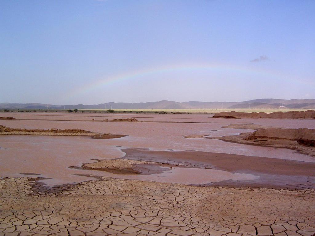
2 Introduction The Republic of Djibouti ( km 2 ) is localized in the Horn Africa. 70% of the population live in urban areas, 58% live in the capital (Djibouti city). Djibouti is an arid country which receives, on average, 150 mm of rain annually and has no permanent source of surface water. Access to water in Djibouti is a major challenge for the development of socioeconomic activities. Harnessing surface and groundwater to improve access to drinking water for vulnerable populations is a Government priority 2


3 Geological situations Geological Setting The republic of Djibouti is one of several African countries located on the East African Rift System (EARS). About 90% of the geological formations are volcanic rocks and 10% are sedimentary formations. The groundwater in Djibouti is controlled by volcanic and sedimentary aquifers. Volcanic aquifers systems are mainly represented by the Dalha basalts, the stratoid basalts and the Mabla rhyolites. Dalha basalts sequence Coastal plain sediments 3
 from October to April (20 C and 30 C ) - Hot season (summer) from May to September (30 C and 45 C) with high rate of Evapotranspiration amounting to")
4 Climatological conditions Précipitation (mm) The Republic of Djibouti is characterized by arid to semiarid climate. Two seasons predominate : - Cool season (winter) from October to April (20 C and 30 C ) - Hot season (summer) from May to September (30 C and 45 C) with high rate of Evapotranspiration amounting to 2000 mm per year Précipitation trends ( ) 350 HOLL HOLL DIKHIL Decrease in rainfall can be observed in different location. This could strongly impact groundwater recharge conditions and deteriorate the quantity and quality. 4
5 Volume annuel. Million m Groundwater situation Water resources demands Annual pumping rate millions m3/an à à à 1 1 à 2 plus de 10 TADJOURAH!( OBOCK!( The extreme climate condition explains the lack of permanent rivers, and has led the country to exploit the only available water resources, which are represented by groundwater in the basaltic aquifer. The population of Djibouti relies heavily on groundwater resources for drinking water and irrigation purposes. 60 ARTA!( DJIBOUTI!( Rural (population+bétail) Urbain Agriculture 40 Total DIKHIL!( ALI SABIEH!(

6 Water level m Cl- (mmol/l) Groundwater situation Groundwater degradations The continuous and severe increase of water demands, due to the rapid population growth, have led to overexploitation of groundwater, and have severely depleted its quantity and quality Mouloud Djibouti


7 Groundwater monitoring Surface water mobilisation : Surface water hydrology monitoring-early warning system-ambouli With the arid climatic regime, most watercourses in the Republic of Djibouti are temporary and run for only a few days after any rain event (wadis). Limnigraph 7
.")
8 Geochemical characterization of the Bara volcano-sedimentary aquifer (Republic of Djibouti) : Case study The UNDP is financial supported a program for developing agro-pastoral as a climate change adaptation strategy for poor rural communities in the south-eastern part of the republic of Djibouti (Bara area). The context of this project is based on the settlement of a hundred families in this area. All boreholes are used for drinking purpose. The study area is located in the south-eastern part of the country. The Petit Bara and Grand Bara zones correspond to sedimentary basins limited to the East by the Dalha basalts ( Ma) and to thewest by the Stratoid basalts (3 1 Ma). Twenty two borehole waters were collected in this area and analysed. 8
9 Geochemical characterization of the Bara volcano-sedimentary aquifer (Republic of Djibouti) : Case study Groundwater Classification The groundwater have moderate to high EC values (from 957 to 4846 S/cm), temperature values between 27 and 43 C, and moderately alkaline ph ranging from 7.31 to The Depth of the boreholes in this area ranges between 80 and 200 m Most of sampled groundwaters are brackish (10 g/l TDS 1 g/l) with the exception of several fresh waters (TDS 1 g/l) from North of Petit Bara (#1 #4), Grand Bara (Hambocto F1) and Dadin3. Samples Petit Bara Zone T ( C) Depth (m) ph EC (µs/cm) TDS PK PK PK Didjander Omar Jakka Naheel Kourtimaley Hydrochemical types Na-HCO 3 -Cl Na-HCO 3 -Cl Na-HCO 3 -Cl Na-Cl Na-Cl Na-Cl-Ca Na-Cl-Ca Grand Bara Zone Awraoussa Na-Cl-Mg-Ca-SO 4 Iskoutir Na-Cl-Ca-SO 4 Gabla-galan Na-Cl-HCO 3 -SO 4 Hambocto F Na-Cl-Mg-Ca-HCO 3 Hambocto F Na-Cl-Mg-Ca-HCO 3 Doudoub Bololé F Na-Cl-Mg-SO 4 Doudoub Bololé F Na-Cl-Mg-SO 4 Dagandalol Na-Cl-SO 4 Dagaah-damere Na-Cl-Mg-Ca-SO 4 Mouloud-Dadin Zone Mindil Mouloud C Mouloud Dadin Na-Cl-Mg-SO 4 Na-Cl-Mg-SO 4 Na-Cl-Mg-SO 4 Na-Cl-HCO 3 9
10 Geochemical characterization of the Bara volcano-sedimentary aquifer (Republic of Djibouti) : Case study Groundwater Classification Using statistical method (PCA and HCA) The geochemical data were classified into distinct groups according to the common variables they share using 13 variables (ph, EC, TDS, Ca 2 +, Mg 2 +, Na +, K +, HCO 3-, Cl -, SO 4-, F -, NO 3-, Br - ). Ca Mg Na K Li NH 4 HCO 3 Cl SO 4 NO 3 F Br NO 2 Site Petit Bara Zone PK PK DL DL PK DL Didjander Omar Jakka DL Naheel Kourtimaley DL DL Cluster 1 Cluster 1 contains six samples that characterize waters with low mineralization (805 EC (μs / cm) 1464). This group corresponds to Na- Cl-HCO 3 water type. (South petit Bara and Dadin) Grand Bara Zone Awraoussa DL DL Iskoutir DL Gabla-galan DL Hambocto F DL DL Hambocto F DL DL Doudoub Bololeh F DL DL Doudoub Bololeh F DL DL Dagandalol DL DL Daagah-damere DL Mouloud Zone Mindil DL DL Mouloud C DL DL Mouloud DL DL Dadin DL Cluster 2 Cluster 2 contains twelve different water samples characterized by moderate mineralization. (Grand Bara-Mouloud) Cluster 3 Cluster 3 contains four different water samples characterized by very high mineralization (4143 EC (μs / cm) 7731). This group correspond to Na-Mg- Cl-SO 4 water type (between GB and PB). 10
11 Geochemical characterization of the Bara volcano-sedimentary aquifer (Republic of Djibouti) : Case study Groundwater Contaminations Some of the groundwater analyzed present high nitrate concentration (up to 50 ppm ; WHO). The lowest values are found in Petit Bara and Dadin, while the highest values are found in Grand Bara (up to 250mg/L in alluvium groundwaters from boreholes #13 and #18; up to 150 mg/l in basalt groundwaters from #11 and #12) and in the central area (up to 120 ppm in #7 and #8). It should be noted that people living in the Republic of Djibouti are mostly nomad, and hence have no agricultural tradition. The local nomads, who raise goats and cheeps, do not have a fixed settlement, hence not septic tanks. Therefore, in many cases, natural soil might contribute mainly for nitrate concentrations in the study area as observed in some semi-arid or arid regions over the world. 11
12 Thank you
Paso Robles Groundwater Basin: Effects of Geothermal Waters on Water Quality and Availability
 Paso Robles Groundwater Basin: Effects of Geothermal Waters on Water Quality and Availability Jim Rytuba and Daniel Goldstein U.S. Geological Survey, Menlo Park, CA Paso Robles Intake from Lake Nacimiento
J.M. Marques a, C. Matos b, P.M. Carreira c and M.O. Neves a
 GEOCHEMICAL AND ISOTOPIC TOOLS TO ASSESS CALDAS DA RAINHA THERMOMINERAL WATER SYSTEM ASCRIBED TO A KARST/FISSURED-POROUS ENVIRONMENT (PORTUGAL): A REVIEW J.M. Marques a, C. Matos b, P.M. Carreira c and
Intermediate report. Letter of agreement FAO - GCB/RAB/013/ITA
 Treated waste water for sustainable production of valuable biomass, soil and water quality improvement and combating desertification in Algeria and Tunisia Letter of agreement FAO - GCB/RAB/013/ITA Intermediate
UNIT 5 AFRICA PHYSICAL GEOGRAPHY SG 1 - PART II
 UNIT 5 AFRICA PHYSICAL GEOGRAPHY SG 1 - PART II III. CLIMATE & VEGETATION A. The four main climate zones are tropical wet, tropical wet/dry (split into monsoon & savanna), semiarid, and arid. Other climate
Cau River. Map of River. Table of Basic Data. Vietnam 5
 Cau River Map of River Table of Basic Data Name: Cau River Location: Thai Nguyen, Province, Viet Nam Area: 6,030 km 2 Origin: Mt. Phia Deng 1,527 m Outlet: Pha Lai Note: * Indicates missing data in some
Chapter 17. North Africa, Southwest Asia and Central Asia
 Chapter 17 North Africa, Southwest Asia and Central Asia Chapter Objectives Describe the major landforms and natural resources of North Africa, Southwest Asia, and Central Asia. Discuss the climate and
COUNTRY CASE STUDIES: OVERVIEW
 APPENDIX C: COUNTRY CASE STUDIES: OVERVIEW The countries selected as cases for this evaluation include some of the Bank Group s oldest (Brazil and India) and largest clients in terms of both territory
PPCR/SC.4/5 October 9, Meeting of the PPCR Sub-Committee Washington, D.C. October 28, REVIEW OF ON-GOING WORK OF THE MDBs IN DJIBOUTI
 PPCR/SC.4/5 October 9, 2009 Meeting of the PPCR Sub-Committee Washington, D.C. October 28, 2009 REVIEW OF ON-GOING WORK OF THE MDBs IN DJIBOUTI Proposed Sub-Committee Decision The Sub-Committee reviewed
Just how big is Africa?
 The United States China India The United Kingdom Portugal Spain France Belgium Germany The Netherlands Switzerland Italy Eastern Europe Japan 11.7 million sq. miles Just how big is Africa? Chapter 18 Section
Bacterial Quality of Crystalline Rock and Glacial Aquifers in New England
 Bacterial Quality of Crystalline Rock and Glacial Aquifers in New England By Sarah Flanagan and Charles Culbertson, U.S. Geological Survey 2012 New Hampshire Water and Watershed Conference Plymouth State
Chapter 20. The Physical Geography of Africa South of the Sahara
 Chapter 20 The Physical Geography of Africa South of the Sahara Chapter Objectives Identify the major landforms, water systems, and natural resources of Africa south of the Sahara. Describe the relationship
IRRIGATION IN AGRICULTURE AND CLIMATE CHANGE. Agrotech, 2017
 IRRIGATION IN AGRICULTURE AND CLIMATE CHANGE Agrotech, 217 Legislation Current situation Needs, possibilities, existing and potential problems Irrigation is regulated with the Water Law, and when it comes
Land Figures & Spatial Data Infrastructure in KOSOVO
 Land Figures & Spatial Data Infrastructure in KOSOVO Idriz SHALA idriz.shala@gmail.com GIS -expert Afrim SHARKU afrim.sharku@gmail.com Land Management - Expert Kick-off meeting of the Regional Expert Advisory
Origin and Extraction of Andean Salars
 Think Simulation! Adventures in Electrolytes Origin and Extraction of Andean Salars Lithium and Boron Recovery from Salt brines and Salt flats in Chile and Bolivia http://tunari.tripod.com/landscapes.html
ICPAC. IGAD Climate Prediction and Applications Centre Monthly Bulletin, February 2017
 IGAD CLIMATE PREDICTION AND APPLICATIONS CENTRE ICPAC Bulletin Issue March 2017 Issue Number: ICPAC/02/299 IGAD Climate Prediction and Applications Centre Monthly Bulletin, February 2017 For referencing
Integrated remote and in situ analysis of a playa lake groundwater system in northern Chile. Katherine H. Markovich The University of Texas at Austin
 Integrated remote and in situ analysis of a playa lake groundwater system in northern Chile Katherine H. Markovich The University of Texas at Austin Hydrogeology of Arid Environments March 15 th, 2012
The Isonzo/Soca river basin
 Geneva September 8 th 2014 The Isonzo/Soca river basin Status and perspective on the possible Alpine river basin to be assessed The Alpine Convention Water management, risk management and adaptation to
Unit 9 The Middle East SG 1 - Physical Geography, Population & Demographics
 Unit 9 The Middle East SG 1 - Physical Geography, Population & Demographics I. Physical Geography A. The Middle East includes southwestern Asia and North Africa. 1. The name is Eurocentric. Middle East
SS7G1 The student will locate selected features of Africa.
 Standards SS7G1 The student will locate selected features of Africa. a. Locate on a world and regional political-physical map: the Sahara, Sahel, savanna, tropical rain forest, Congo River, Niger River,
Microbiological quality of water for human consumption in Port-au-Prince after January 2010 earthquake
 Water, Innovation, Climate Change and Natural Disasters: Impacts and Prospects for the Bio Bio Region November 15-16, 2010 Concepción, Chile Microbiological quality of water for human consumption in Port-au-Prince
SUTTER COUNTY. General Plan Update Technical Background Report
 SUTTER COUNTY General Plan Update Technical Background Report February 2008 SUTTER COUNTY GENERAL PLAN UPDATE TECHNICAL BACKGROUND REPORT PREPARED FOR: SUTTER COUNTY PREPARED BY: PBS&J IN PARTNERSHIP
The Geological Pacific Northwest. Wednesday February 6, 2012 Pacific Northwest History Mr. Rice
 The Geological Pacific Northwest Wednesday February 6, 2012 Pacific Northwest History Mr. Rice 1 Free Response #2 Please do not simply list the items for this response. Full sentences!!! Minimum of 3-5
EXPLORING BIOMES IN GORONGOSA NATIONAL PARK
 EXPLORING BIOMES IN GORONGOSA NATIONAL PARK ABOUT THIS WORKSHEET This worksheet complements the Click and Learn Gorongosa National Park Interactive Map (http://www.hhmi.org/biointeractive/gorongosa-national-park-interactive-map),
UNIT 5 PHYSICAL GEOGRAPHY SG 1 - PART I
 UNIT 5 PHYSICAL GEOGRAPHY SG 1 - PART I Africa is HUGE! I. LANDFORMS A. Plateaus - an area of relatively level high ground. 1. Africa s interior is dominated by series of plateaus and elevated basins such
3.0 OVERVIEW OF HUECO BOLSON
 3.0 OVERVIEW OF HUECO BOLSON The Hueco Bolson covers about 2,500 square miles, or 1.6 million acres in New Mexico, Texas, and Chihuahua (Figure 3-1). In Texas, the Hueco overlies portions of El Paso and
Public Works Research Institute
 Public Works Research Institute INTERNATIONAL WORKSHOP ON WATER HAZARD AND RISK MANAGEMENT SOME EXPERIENCES OF FLOOD MANAGEMENT IN ARGENTINA VÍCTOR POCHAT National Director for Water Policies,Coordination
Brain Wrinkles. Africa: The impact of location, climate, & physical characteristics on where people live, the type of work they do, & how they travel
 Africa: The impact of location, climate, & physical characteristics on where people live, the type of work they do, & how they travel STANDARDS: SS7G3 The student will explain the impact of location, climate,
Brief Description of Northern the West Bank, Palestine Prepared by: Dr. Ahmed Ghodieh Department of Geography An-Najah National University Nablus,
 Brief Description of Northern the West Bank, Palestine Prepared by: Dr. Ahmed Ghodieh Department of Geography An-Najah National University Nablus, Palestine Brief Description of Northern the West Bank
Hydrology of Yemen. Dr. Abdulla Noaman
 Hydrology of Yemen Dr. Abdulla Noaman INTRODUCTION Location and General Topography Yemen is located on the south of the Arabian Peninsula, between latitude 12 and 20 north and longitude 41 and 54east,
Adapting water resource management in coastal areas A case study in Hai Phong, Vietnam
 Adapting water resource management in coastal areas A case study in Hai Phong, Vietnam Thuc Phan, James Smart, Samantha Capon, Wade Hadwen Australian Rivers Institute, Griffith University Presentation
The Problem.. SuDS: Controlling the Flow. LANDF RM Technical delivery of SuDS 15/10/2013. Bridget Woods Ballard HR Wallingford 1.
 SuDS: Controlling the Flow 15th October 2013 Bridget Woods Ballard The Problem.. Page 2 Bridget Woods Ballard HR Wallingford 1 15th October 2013 Landform Event Page 3 HR Wallingford 2013 The Aim of SuDS.
GASCO Abr Seina Onshore Gas Pipeline
 4.0 Existing Environment 4.1 INTRODUCTION The route of Abr Seina pipeline 32, 111 km, starts from El Tina Shark (long. 31 o 1 27.7 lat. 32 o 20 47.4 ) to El Arish, northern Sinai. A general survey was
Seasonal Variability of the Groundwater Regime for Several Aquifers in Bulgaria Tatiana Orehova 1
 Seasonal Variability of the Groundwater Regime for Several Aquifers in Bulgaria Tatiana Orehova 1 The purpose of the paper is to analyse the seasonal variability of the groundwater regime for several aquifers
Blocking Sea Intrusion in Brackish Karstic Springs
 European Water 1/2: 17-23, 3. 3 E.W. Publications Blocking Sea Intrusion in Brackish Karstic Springs The Case of Almiros Spring at Heraklion Crete, Greece A. Maramathas, Z. Maroulis, D. Marinos-Kouris
Thailand 12. Pasak River. Map of River
 Pasak River Map of River 232 Table of Basic Data Name: Pasak river Serial No. : Thailand-12 Location: Central part of Thailand N 14 21' 44" ~ 17 06' 02" E 100 34' 40" ~ 101 32' 56" Area: 15,779 km 2 Length
Introduction to Africa
 Introduction to Africa Did you know? Africa has more countries than any other continent. The Sahara is a desert that is the size of the U.S. It s the world's largest desert. Most of the world s gold and
ARTIFICIAL RECHARGE OF THE UNDERGROUND KARSTIC AQUIFER OF FARSALA AREA (THESSALY, CENTRAL GREECE) 1
 1") ARTIFICIAL RECHARGE OF THE UNDERGROUND KARSTIC AQUIFER OF FARSALA AREA (THESSALY, CENTRAL GREECE) 1 MARIOLAKOS, I. 2, FOUNTOULIS, I., SPYRIDONOS, E., MARIOLAKOS, D., ANDREADAKIS, EM. ABSTRACT The area
ARTIFICIAL RECHARGE OF THE UNDERGROUND KARSTIC AQUIFER OF FARSALA AREA (THESSALY, CENTRAL GREECE) 1 MARIOLAKOS, I. 2, FOUNTOULIS, I., SPYRIDONOS, E., MARIOLAKOS, D., ANDREADAKIS, EM. ABSTRACT The area
CHAPTER IV OVERVIEW. Indonesia. The capital is Dompu. Dompu Regency has an area of 2, km².
 CHAPTER IV OVERVIEW A. General Description of the Research Sites Dompu Regency, is a district in West Nusa Tenggara Province, Indonesia. The capital is Dompu. Dompu Regency has an area of 2,321.55 km².
CYPRUS Country Report
 CONFERENCE OF THE WATER DIRECTORS OF THE EURO-MEDITERRANEAN AND SOUTHEASTERN EUROPEAN COUNTRIES CYPRUS Country Report by Christodoulos Artemis Director Water Development Department Athens, 6 & 7 November
THE IMPLEMENTATION OF EWFD/WFD IN THE REGION OF VOJVODINA WITHIN JOINT SLOVAK-SERBIA SERBIA PROJECTS
 Towards Integrated River Basin Management The 55 th Anniversary of the Founding of the Water Research Institute THE IMPLEMENTATION OF EWFD/WFD IN THE REGION OF VOJVODINA WITHIN JOINT SLOVAK-SERBIA SERBIA
STUDY OF ALAQI SECONDARY CHANNEL IN LAKE NASSER
 ABSTRACT STUDY OF ALAQI SECONDARY CHANNEL IN LAKE NASSER GamalSallam 1, Mohamed Ihab 2, and Waleed Emary 3 Associate Professor, National Water Research Center, Email: gasallam@yahoo.com Civil Engineer,
Climate change impacts on stand production and survival, and adaptation strategies to build resilience
 Climate change impacts on stand production and survival, and adaptation strategies to build resilience Jody Bruce, Michael Battaglia and Libby Pinkard July 14 CSIRO LAND AND WATER Potential impact Exposure
7/27/2010. Regions of Subsaharan Africa. SUBSAHARAN AFRICA II (Chapter 6, pages ) Southern Africa. South Africa: Peaceful Change from Apartheid
 Southern Africa. South Africa: Peaceful Change from Apartheid") SUBSAHARAN AFRICA II (Chapter 6, pages 209-227) Regions of Subsaharan Africa Southern Africa 10 countries, 6 of them landlocked Congo Basin marks northern limit Plateau country Rich in natural resources
SUBSAHARAN AFRICA II (Chapter 6, pages 209-227) Regions of Subsaharan Africa Southern Africa 10 countries, 6 of them landlocked Congo Basin marks northern limit Plateau country Rich in natural resources
DETECTION OF WATER LEAKS IN FOUM EL-GHERZA DAM (ALGERIA)
") Ninth International Water Technology Conference, IWTC9 2005, Sharm El-Sheikh, Egypt 581 DETECTION OF WATER LEAKS IN FOUM EL-GHERZA DAM (ALGERIA) N. Hocini and A.S. Moulla Applied Hydrology and Sedimentology
Ninth International Water Technology Conference, IWTC9 2005, Sharm El-Sheikh, Egypt 581 DETECTION OF WATER LEAKS IN FOUM EL-GHERZA DAM (ALGERIA) N. Hocini and A.S. Moulla Applied Hydrology and Sedimentology
One World Lithium Inc. (OWL) is a lithium exploration company that is a compelling investment opportunity with its Salar del Diablo lithium property:
 is a lithium exploration company that is a compelling investment opportunity with its Salar del Diablo lithium property:") One World Lithium Inc. (OWL) is a lithium exploration company that is a compelling investment opportunity with its Salar del Diablo lithium property: The Salar del Diablo is a 75,000 hectare lithium property
One World Lithium Inc. (OWL) is a lithium exploration company that is a compelling investment opportunity with its Salar del Diablo lithium property: The Salar del Diablo is a 75,000 hectare lithium property
Actual Climatic Conditions in ERB. Online Resource 1 corresponding to:
 Actual Climatic Conditions in ERB. Online Resource 1 corresponding to: Article Title: Climatic Trends and Impact of Climate Change on Agriculture in an Arid Andean Valley. Journal Name: CLIMATIC CHANGE
Managing Hypochlorite to Reduce Chlorate Formation: A Utility Case Study
 Managing Hypochlorite to Reduce Chlorate Formation: A Utility Case Study KIMBERLY GUPTA, PE PORTLAND WATER BUREAU CO- AUTHOR: YONE AKAGI, PE AWWA PNWS KENNEWICK, MAY 5, 2017 Presentation Outline Background
Annex III: Statistics
 Annex III: Statistics Table A.3.1 Physical characteristics of Arab countries Country Area, 2011 (thousand square kilometres) Length of coast, 2005 (kilometres) Rainfall, 2002 (millimetres per year) Total
"ST. KLIMENT OHRIDSKI FACULTY OF GEOLOGY AND GEOGRAPHY
 SOFIA UNIVERSITY "ST. KLIMENT OHRIDSKI FACULTY OF GEOLOGY AND GEOGRAPHY APPLICATION OF THE MODEL "DRIVING FORCES PRESSURE STATE - RESPONSE FOR ASSESSMENT OF FLOOD RISK RADOSTINA BORISOVA DOCHEVA Bachelor
A Comparison of the Salar de Atacama and Clayton Valley Lithium Ore Deposits: Groundwater Mining in the some of the Driest Places on Earth
 A Comparison of the Salar de Atacama and Clayton Valley Lithium Ore Deposits: Groundwater Mining in the some of the Driest Places on Earth Melissa Jennings Geologist & Environmental Engineer This presentation
Indian Ocean Small Island States: Indicators of Dangerous Anthropogenic Influences of Climate Change?
 Indian Ocean Small Island States: Indicators of Dangerous Anthropogenic Influences of Climate Change? Prepared for: AGU Fall Meeting San Francisco CA December 5, 2005 Prepared by: Bill Mills Chih-Fang
CO-OPERATION IN DANUBE RIVER BASIN - THE ROLE OF SHMI SLOVENSKÝ HYDROMETEOROLOGICKÝ ÚSTAV
 CO-OPERATION IN DANUBE RIVER BASIN - THE ROLE OF SHMI WMO RAVI Hydrological Forum 2016 Oslo, 1 Danube, the 2nd longest in Europe. 2857 km Flows across 10 European states River basin - 817 000 km2 1/11
ANALYSIS OF INADEAUTE WATER QUALITY OD THE RESERVOIR VONARJE/SUTLA LAKE AND POSSIBILITY OF RESTORATION AND UTILIZATION
 EC project on Integration of Natural Water Retention Measures in river basin management The 1 st Danube Region Workshop ANALYSIS OF INADEAUTE WATER QUALITY OD THE RESERVOIR VONARJE/SUTLA LAKE AND POSSIBILITY
Physical characteristics and biomes:
 Physical characteristics and biomes: Sahel region, bordering Sahara Characteristics Area suffers from lack of rainfall, over grazing, which causes loss of vegetation and loss of inhabitable areas causing
PERMANENT MISSION OF BELIZE TO THE UNITED NATIONS
 PERMANENT MISSION OF BELIZE TO THE UNITED NATIONS 675 Third Ave. Suite 1911 New York, New York 10017 Tel: (212) 986-1240/(212) 593-0999 Fax: (212) 593-0932 E-mail: blzun@belizemission.com STATEMENT DELIVERED
Southern Africa. Countries, Geography, & Climate
 Countries, Geography, & Climate The Southern African region consists of the following countries: Angola Zambia Malawi Mozambique Zimbabwe Botswana Namibia Swaziland Lesotho South Africa Comoros Madagascar
MANAGING FRESHWATER INFLOWS TO ESTUARIES
 MANAGING FRESHWATER INFLOWS TO ESTUARIES Yuna River Hydrologic Characterization A. Warner Warner, A. (2005). Yuna River Hydrologic Characterization. University Park, Pennsylvania: The Nature Conservancy.
What Is An Ecoregion?
 Ecoregions of Texas What Is An Ecoregion? Ecoregion a major ecosystem with distinctive geography, characteristic plants and animals, and ecosystems that receives uniform solar radiation and moisture Sometimes
Federal Hydrometeorological Institute of Bosnia and Herzegovina S A R A J E V O
 Federal Hydrometeorological Institute of Bosnia and Herzegovina S A R A J E V O Department of Agrometeorology, Agrometeorology in Bosnia and Herzegovina, current status and activities Hydrometeorological
Mark West Creek Flow Study Report
 Mark West Creek Flow Study Report Biology and Geology of Mark West Creek The headwaters of Mark West Creek are located in the Mayacamas Mountain range, which border Napa and Sonoma County, where it then
July 2014 Volume 6. Figure 1: Main Staple Food Commodities Informally Traded Across Selected Borders in Eastern Africa Between January and June 2014
 July 2014 Volume 6 Figure 1: Main Staple Food Commodities Informally Traded Across Selected Borders in Eastern Africa Between January and June 2014 The Market Analysis Sub-group of the Food Security and
North Africa. Chapter 25. Chapter 25, Section
 Chapter 25, Section World Geography Chapter 25 North Africa Copyright 2003 by Pearson Education, Inc., publishing as Prentice Hall, Upper Saddle River, NJ. All rights reserved. Chapter 25, Section World
Hydrological study for the operation of Aposelemis reservoir Extended abstract
 Hydrological study for the operation of Aposelemis Extended abstract Scope and contents of the study The scope of the study was the analytic and systematic approach of the Aposelemis operation, based on
PHILIPPINES FAC. Iloilo
 PHILIPPINES FAC Iloilo 55 PD/A CRSP SITE DESCRIPTIONS FAC The FAC has over 100 earthen ponds, some up to 2,500 m 2. CLSUs College of Fisheries shares FACs technical staff, facilities, and research responsibilities
Ministry of Communications and Transport
 more than 100,000 houses and other buildings in Bosnia and Herzegovina (May 2014) were no longer fit to use and that over a million people had been cut off from clean water supplies. Ministry of Communications
An NPS Wetland of International Significance!
 An NPS Wetland of International Significance! A World Class Tourism Destination Linda Friar Chief of Public Affairs 305-242-7714 Linda_Friar@nps.gov The Everglades - International Recognition as a special
Crete Study Site Description
 Crete Study Site Description 1. Location Crete (the largest island of Greece) is located in the south part of Greece covering an area of 8.335 km 2 or 6.3% of the Greek territory, including the surrounding
Successful Experiences in Rio Grande/Rio Bravo Watershed Management
 Successful Experiences in Rio Grande/Rio Bravo Watershed Management 5 th th World Water Forum Istanbul, Turkey March 22-23, 23, 2009 Introduction A watershed with many voices a medley of cultures, customs,
Silvia Giulietti ETIS Conference Brussels An EEA reporting mechanism on tourism and environment and ETIS
 Silvia Giulietti ETIS Conference Brussels 28.01.2016 An EEA reporting mechanism on tourism and environment and ETIS Main content Why tourism and environment? Why a reporting mechanism on tourism and environment
GEOGRAPHY AND HISTORY
 GEOGRAPHY AND HISTORY YEAR 1, PART 1 www.vicensvives.es Contents 01 Our planet Earth 02 The representation of the Earth: maps 03 The Earth s relief 04 Rivers and seas 05 Weather and climate 06 Climates
Danube Academies Scientific Support to the EUROPEAN DANUBE STRATEGY
 Danube Academies Scientific Support to the EUROPEAN DANUBE STRATEGY Cristian HERA Vice President of the Romanian Academy Bucharest, June 26, 2013 First Danube Academies Conference 11 September 2011, Vienna
Procedia Earth and Planetary Science 13 ( 2015 ) th Applied Isotope Geochemistry Conference, AIG-11 BRGM
 th Applied Isotope Geochemistry Conference, AIG-11 BRGM") Available online at www.sciencedirect.com ScienceDirect Procedia Earth and Planetary Science 13 ( 2015 ) 256 260 11th Applied Isotope Geochemistry Conference, AIG-11 BRGM Investigating the Origin and Interaction
Available online at www.sciencedirect.com ScienceDirect Procedia Earth and Planetary Science 13 ( 2015 ) 256 260 11th Applied Isotope Geochemistry Conference, AIG-11 BRGM Investigating the Origin and Interaction
THE GREAT MAN-MADE RIVER PROJECT
 WATER RESOURCES IN LIBYA Only 5% of the entire area of Libya exceeds 100 mm GROUND WATER 95.6% (4 in) annually. Evaporation rates are also high ranging SURFACE from WATER 700 mm (28 in) 2.3% in the north
Tectonic Lakes-Climatic and Anthropogenic Impacts
 European Geosciences Union General Assembly 2011 Vienna Austria 03-08 April 2011 Session: Lakes and Inland Seas Tectonic Lakes-Climatic and Anthropogenic Impacts Cvetanka Popovska University of Ss Cyril
Small Island States in Indian and Atlantic Oceans: Vulnerability of Water Resources to Climate Change and other Stresses
 Small Island States in Indian and Atlantic Oceans: Vulnerability of Water Resources to Climate Change and other Stresses Prepared for: EWRI 05 World Water and Environmental Resources Congress Anchorage
Community resources management implications of HKH hydrological response to climate variability
 Community resources management implications of HKH hydrological response to climate variability -- presented by N. Forsythe on behalf of: H.J. Fowler, C.G. Kilsby, S. Blenkinsop, G.M. O Donnell (Newcastle
THE TWENTY FIRST ANNUAL SOUTHERN AFRICA REGIONAL CLIMATE OUTLOOK FORUM
 STATEMENT FROM THE TWENTY FIRST ANNUAL SOUTHERN AFRICAN REGIONAL CLIMATE OUTLOOK FORUM (SARCOF-21), MASA CONFERENCE CENTRE, GABORONE, BOTSWANA, 23 25 AUGUST 2017. SUMMARY The bulk of Southern African Development
ORTHOLOGICAL MANAGEMENT OF HYDROLOGICAL RUNOFF BASINS OF THE PREFECTURE OF DRAMA (CURRENT SITUATION PROTECTIVE ACTIONS PERSPECTIVES)
") ORTHOLOGICAL MANAGEMENT OF HYDROLOGICAL RUNOFF BASINS OF THE PREFECTURE OF DRAMA (CURRENT SITUATION PROTECTIVE ACTIONS PERSPECTIVES) This paper presents the torrential environment of the torrents of the
ORTHOLOGICAL MANAGEMENT OF HYDROLOGICAL RUNOFF BASINS OF THE PREFECTURE OF DRAMA (CURRENT SITUATION PROTECTIVE ACTIONS PERSPECTIVES) This paper presents the torrential environment of the torrents of the
CHANGES IN GLACIATION OF THE BALKHASH-ALAKOL BASIN OVER THE PAST 60 YEARS
 CHANGES IN GLACIATION OF THE BALKHASH-ALAKOL BASIN OVER THE PAST 60 YEARS I. Severskiy Слайд 1 Glacier Systems of the Balkhash-Alakol basin Research Results Monitoring the Mass Balance of the Tuyuksu Glacier
!!!!!!!!!!Mali s Geographic Makeup
 DANU Strategic Forecasting Group May 27th 2016!!!!!!!!!!Mali s Geographic Makeup By Liliana Pirlea Location: Mali is a landlocked country located in West Africa. Mali is the 8th largest country in Africa
Jeneberang River. Serial No. : Indonesia-10 Location: South Sulawesi Area: 727 km 2 Origin: Mt. Bawakaraeng (2,833 MSL) Outlet: Makassar Strait
 Outlet: Makassar Strait") Jeneberang River Map of River Table of Basic Data Name: Jeneberang River Serial No. : Indonesia-10 Location: South Sulawesi S 5 10' 00" - 5 26' 00" E 119 23' 50" - 119 56' 10" Area: 727 km 2 Origin: Mt.
Jeneberang River Map of River Table of Basic Data Name: Jeneberang River Serial No. : Indonesia-10 Location: South Sulawesi S 5 10' 00" - 5 26' 00" E 119 23' 50" - 119 56' 10" Area: 727 km 2 Origin: Mt.
Vision for Development of Georgia's High Mountainous Regions adapted to the Climate and Landscape Changes
 Vision for Development of Georgia's High Mountainous Regions adapted to the Climate and Landscape Changes George Gotsiridze 3rd EURO-ASIAN MOUNTAIN RESORTS CONFERENCE 4-7 April, 2017, Tbilisi, Georgia
EL PASO S DESALINATION EFFORTS
 El Paso s Desalination Efforts WATER DESALINATION AND REUSE STRATEGIES FOR NEW MEXICO SEPTEMBER NEW MEXICO WATER RESOURCES RESEARCH INSTITUTE 2004 Bill Hutchison has more than 20 years of experience as
CITY OF WINDHOEK DEPARTMENT OF PLANNING, URBANIZATION AND ENVIRONMENT
 CITY OF WINDHOEK DEPARTMENT OF PLANNING, URBANIZATION AND ENVIRONMENT Geographical Location Namibia is a developing country located on the south-western coast of Africa. It is an immensely semi-arid and
HYDRO-CHEMICAL CHARACTERIZATION OF WHITE MOUNTAIN KARSTIC WATER AT KOILIARIS RIVER CZO
 Proceedings of the 13 th International Conference on Environmental Science and Technology Athens, Greece, 5-7 September 2013 HYDRO-CHEMICAL CHARACTERIZATION OF WHITE MOUNTAIN KARSTIC WATER AT KOILIARIS
THE STATUS OF DORCAS GAZELLE IN ETHIOPIA
 THE STATUS OF DORCAS GAZELLE IN ETHIOPIA Paper presented in the second workshop on the conservation and restoration of Sahelo-Saharan Antelopes. 1-5 May 2003 by Mohammed Ali and Ababu Ange Zeleke May /
SUPPORT TO WATER RESOURCES MANAGEMENT IN THE DRINA RIVER BASIN DRAFT ROOF REPORT INTRODUCTION AND GENERAL APPROACH
 SUPPORT TO WATER RESOURCES MANAGEMENT IN THE DRINA RIVER BASIN DRAFT ROOF REPORT INTRODUCTION AND GENERAL APPROACH Nadja Zeleznik, REC Public Concultation Beograd, Serbia, 4 July 2017 1 1. Introduction
THE TWENTY FIRST ANNUAL SOUTHERN AFRICA REGIONAL CLIMATE OUTLOOK FORUM MID-SEASON REVIEW AND UPDATE
 STATEMENT FROM THE TWENTY FIRST ANNUAL SOUTHERN AFRICA REGIONAL CLIMATE OUTLOOK FORUM (SARCOF-21) MID-SEASON REVIEW AND UPDATE, SADC HEADQUARTERS, GABORONE, BOTSWANA, 5 8 DECEMBER 2017. SUMMARY The bulk
PRIMA Open Online Public Consultation
 PRIMA Open Online Public Consultation Short Summary Report Published on 1 June 2016 Research and Introduction Objective of the consultation: to collect views and opinions on the scope, objectives, and
Region 1 Piney Woods
 Region 1 Piney Woods Piney Woods 1. This ecoregion is found in East Texas. 2. Climate: average annual rainfall of 36 to 50 inches is fairly uniformly distributed throughout the year, and humidity and temperatures
SECTION 3 GENERAL DESCRIPTION OF THE RIVER BASIN
 SECTION 3 GENERAL DESCRIPTION OF THE RIVER BASIN SECTION 3 GENERAL DESCRIPTION OF THE RIVER BASIN River basin description. A general description of the river basin or subbasin, as appropriate, in which
CITY OF LYNDEN STORMWATER MANAGEMENT PROGRAM REPORT MARCH 1, 2016
 CITY OF LYNDEN STORMWATER MANAGEMENT PROGRAM 2015 WATER QUALITY MONITORING REPORT CITY OF LYNDEN 300 4 TH STREET LYNDEN, WASHINGTON 98264 PHONE (360) 354-3446 MARCH 1, 2016 This document serves as an attachment
THE TWENTIETH ANNUAL SOUTHERN AFRICA REGIONAL CLIMATE OUTLOOK FORUM
 STATEMENT FROM THE TWENTIENT ANNUAL SOUTHERN AFRICA REGIONAL CLIMATE OUTLOOK FORUM (SARCOF-20), HARARE INTERNATIONAL CONFERENCE CENTRE, HARARE, ZIMBABWE, 24 26 AUGUST 2016. SUMMARY The bulk of Southern
Strategic Location DJIBOUTI
 Strategic Location DJIBOUTI Infrastructures & Investments in Ports, Free Zones and Maritime related Business Activities Aboubaker Omar Hadi Chairman of Djibouti Ports and Free Zones Authority 1. Djibouti
D2. Islands and tourism
 5 th European Conference on Sustainable Urban Mobility Plans 14-15 MAY 2018 NICOSIA, CYPRUS D2. Islands and tourism S I M P Year-round Sustainable Island Mobility Planning Alexia Spyridonidou Kosmas Anagnostopoulos
WHITE MAIZE: The markets below represent the major producer and consumer markets in countries where white maize is heavily consumed as the staple.
 KES/9 kg KES/9 kg November 211 The Famine Early Warning Systems Network (FEWS NET) monitors trends in staple food prices in countries vulnerable to food insecurity. For each FEWS NET country and region,
Chapter 16 ~ Eastern Mediterranean
 Chapter 16 ~ Eastern Mediterranean Physical Geography of the Eastern Mediterranean Landforms This area is known as the Levant and includes Syria, Jordan, Lebanon, Israel, and the Palestinian territories.
Africa s. Presentation, Graphic Organizers, & Activities
 Africa s Presentation, Graphic Organizers, & Activities STANDARDS: SS7G1 Locate selected features of Africa. a. Locate on a world and regional political-physical map: Sahara, Sahel, savanna, tropical rain
ADDRESSING ENVIRONMENTAL AND CLIMATE CHANGE CHALLENGES FACED BY CARIBBEAN SIDS THROUGH A SUSTAINABLE DEVELOPMENT LENS
 ADDRESSING ENVIRONMENTAL AND CLIMATE CHANGE CHALLENGES FACED BY CARIBBEAN SIDS THROUGH A SUSTAINABLE DEVELOPMENT LENS Marlene Attzs, PhD Deputy Coordinator, Sustainable Economic Development Unit (SEDU)
Climate Change Impacts on Glacial Lakes and Glacierized Basins in Nepal and Implications for Water Resources
 Climate Change Impacts on Glacial Lakes and Glacierized Basins in Nepal and Implications for Water Resources Suresh R. Chalise 1, Madan Lall Shrestha 2, Om Ratna Bajracharya 2 & Arun Bhakta Shrestha 2