American Avalanche Association Forest Service National Avalanche Center Avalanche Incident Report: Short Form
|
|
|
- Victor Freeman
- 5 years ago
- Views:
Transcription

1 American Avalanche Association Forest Service National Avalanche Center Avalanche Incident Report: Short Form Occurrence Date (YYYYMMDD): and Time (HHMM): 1100 Comments: Most avalanche characterists and all rescue details were provided by the reporting party to NWAC on Feb. 9 th, We estimate the avalanche as either D1.5 or D2, but list D2 since the victim was unable to self-extricate. The slab, weak layer and bed surface were all identified as precipitation particles due to widespread storm slab activity reported throughout the west slopes of the Cascades that morning. Based on elevation only the start zone would generally be classified in the Below Treeline elevation band in the Crystal Mt area, but for this particular slope Near Treeline is more representative. Reporting Party Name and Address: Avalanche Characteristics: Type: SS (Soft slab) Aspect: West Trigger: AS (skier) Slope Angle: Size: R \ D 2 Elevation: 5100 m / ft Sliding surface (check one): In new New/old In old Ground Group Number of Depth to People Time Duration Face Caught 1 recovered of burial m / ft Partially 1 10 min Buried Not critical Partially Buried-- Critical Completely Buried Number of people injured: 1 Number of people killed: Location: State: WA County: Pierce Forest: Mt Baker - Snoqualmie NF Peak, Mtn Pass, or Drainage: Bullion Basin, Crystal Mt area Site Name: Below Ted's Buttress Lat/Lon or UTM: 1 Dimensions m / ft Average Maximum Height of Crown Face 25" Width of Fracture 100' Vertical Fall 100' Snow Hardness Grain Type Grain Size (mm) Slab PP Weak PP Layer Bed Surface PP Thickness of weak layer: mm / cm / in Burial involved a terrain trap? no yes type: Number of people that crossed start zone before the avalanche: 0 Location of group in relation to start zone during avalanche: high middle low below all unknown Avalanche occurred during ascent descent Subject Name Age Gender Address Phone Activity 1 50 M skiing 2 M skiing 3 M skiing 4 5 Equipment Carried Transceiver Shovel Probe Experience at Activity Unknown Novice Intermediate Advanced Expert Avalanche Training Unknown None Some Advanced Expert
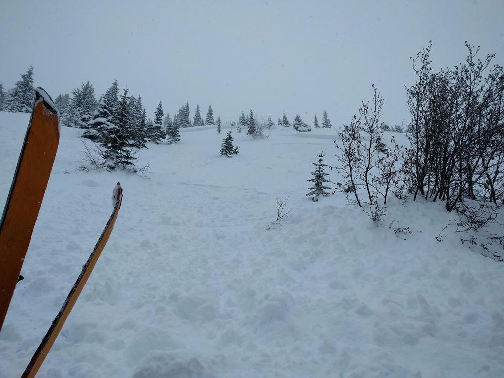
2 Signs of Instability Noted by Group Unknown None Recent avalanches Shooting cracks Collapse or whumphing Low test scores Damage Injuries Sustained None First Aid Doctor s care Hospital Stay Fatal Extent of Injuries or Cause of Death Asphyxiation Head Trauma Spinal Injury Chest Trauma Skeletal Fractures Other: Bruises, tweaked elbow, black eye, 7 stiches on my temple Number of Vehicles Caught:0 Number Structures Destroyed: 0 Estimated Loss: $2000. Emergency room, set of poles, airbag pack. Accident Summary Include: events leading to accident, group s familiarity with location, objectives, route, hazard evaluation, etc. The day of the incident we considererd Yodelin first (lower angled terrain in the Stevens Pass area), but thought we could mitigate the avalanche danger in Bullion Basin even though we knew there was about 25" of new snow since Friday. We have skied in Bullion Basin numerous times over many years and personally I have never seen a slide there beyond a couple of surface inches of sluff. We started up the basin and headed off the normal uptrack at the first switchback at about 5000 feet to skin under Ted's Buttress and also reach a more protected area. Approx 15 minutes later I was breaking trail and was in an open, steep section when the snow above me gave way. I pulled my airbag and was pushed down the slope by a storm slab avalance and into a tree. I suffered some bruising and a cut on my face from the impact. I could breathe and my head was above the snow but my left arm was trapped (in my pack straps I found out later). I would have had difficulty digging myself out. Our poor choice to cross under Ted's Buttress was one of the main causes of the accident; thinking that the risk was worth getting to the protected zone. Our rationale was that even further up the basin, you'd still encounter some exposure as you worked toward the summit. I was too comfortable partly due to my experience with that terrain and the fact that the NWAC forecast went from High on Saturday to Considerable on Sunday. Early on in the tour the untracked snow gave no indication of instability (no shooting cracks, no sluffing even when putting in a switchback). In retrospect that amount of new snow allowed no safe travel in open avalanche terrain. Rescue Summary Include: description of initial search, report of accident, organized rescue, etc. After yelling to my friends, they were able to reach me within 5 minutes and preceded to dig me out. Rescue Method Attach additional pages as needed. Include weather history, snow profiles, reports from other agencies, diagram of site, photographs, and any other supporting information Self rescue Transceiver Spot probe Probe line Rescue dog Voice Object Digging Other: Please send to: CAIC; 325 Broadway WS1; Boulder CO 80305; caic@state.co.us and to the nearest Avalanche Center. 2
3
4 West Slopes South - South of I-90 to Columbia River Issued: 7:36 PM PST Saturday, February 4, 2017 by Dennis D'Amico NWAC avalanche forecasts apply to backcountry avalanche terrain in the Olympics, Washington Cascades and Mt Hood area. These forecasts do not apply to developed ski areas, avalanche terrain affecting highways and higher terrain on the volcanic peaks above the Cascade crest level. The Bottom Line: Despite a cooling trend, recently formed storm slabs should still be sensitive Sunday. Colder temperatures will help preserve wind slab instabilities near and above treeline. Enjoy the new snow but choose conservative terrain and allow storm related instabilities time to heal. Elevation Sunday Outlook for Monday Above Treeline Considerable Near Treeline Considerable Below Treeline Considerable Dangerous avalanche conditions. Careful snowpack evaluation, cautious route-finding and conservative decision-making essential. Considerable Dangerous avalanche conditions. Careful snowpack evaluation, cautious route-finding and conservative decision-making essential. Moderate Dangerous avalanche conditions. Careful snowpack evaluation, cautious route-finding and conservative decision-making essential. Moderate Avalanche Problems for Sunday Storm Slabs Storm slabs usually stabilize within a few days, and release at or below the trigger point. They exist throughout the terrain, and can be avoided by waiting for the storm snow to stabilize. Avalanche Problem Aspect/Elevation Likelihood Size Wind Slab Wind slabs can take up to a week to stabilize. They are confined to lee and cross-loaded terrain features and can be avoided by sticking to sheltered or wind scoured areas. Avalanche Problem Aspect/Elevation Likelihood Size
5 Snowpack Analysis Weather and Snowpack Strong NE-E winds were seen this past Wednesday and Thursday with very cold temperatures. Fresh, touchy wind slabs formed with large plumes of snow visibly transporting loose snow from exposed terrain. A storm cycle began Friday with generally 1-2 feet of snow accumulating along the west slopes, with slightly lower totals at White Pass and a whopping 30 inches at Mt. Baker through 5 pm Saturday. A slow warming trend affected all areas Saturday with rain reaching feet in the south Cascades. Easterly flow kept temperatures locally cooler at Pass level at Stevens and Snoqualmie Pass through the day. Recent Observations North Mt. Baker pro-patrol reported easily triggered storm slabs with ski cuts and explosives on all aspects averaging 12-18" and releasing within the new storm snow Saturday morning. Central NWAC pro-observer Ian Nicholson was out on the lower slopes of Jim Hill east of Stevens Pass Saturday and found sensitive storm slab on short test slopes and in column tests averaging cm down and failing within storm layers. Stevens Pass ski patrol reported widespread shallow storm and wind slab during morning control work. Alpental pro-patrol reported similar results mid-day Saturday with storm or soft wind slabs running well during control with ski cuts and explosives. NWAC received a report of a natural 6-12" storm slab, 150' wide, that released at 4300 ft on a SE aspect in the Kendall trees. Warming above the inversion was causing natural pinwheeling. NWAC pro-observer Jeremy Allyn was in the Alpental Valley Saturday and in the area he traveled below treeline found new storm snow generally lacking a cohesive slab structure with the new storm snow bonding well. Wind transported snow was not observed below treeline. South Crystal mountain patrol reported sensitive but shallow wind slab on lee slopes below ridgelines Saturday. Pockets of sensitive storm slab could be found mid-slope up to 12" deep. Detailed Avalanche Forecast for Sunday More snow is on the way Saturday night and Sunday with a cooling trend forecast. W-SW transport winds should also decrease during the day. Despite a cooling trend, recently formed storm slabs should still be sensitive Sunday. While storm slabs are most likely to release within the most recent storm layers, various sun and rain crusts throughout the region are capable of providing bed surfaces for larger avalanches in isolated terrain. If precipitation rates become more intense than predicted in the south Cascades Sunday, be prepared for the possibility for new storm slab instabilities. Colder temperatures will help preserve wind slab instabilities near and above treeline. We've highlighted more traditional lee easterly aspects on the elevation/aspect diagram, but be aware of cross-loaded slopes and that easterly winds earlier in the week loaded westerly aspects. Feel for firmer wind transported snow as you climb higher in the terrain. Enjoy the new snow but choose conservative terrain and allow storm related instabilities time to heal. Mountain Weather Synopsis for Sunday & Monday The upper low off of Vancouver Island will continue to help steer southern stream moisture into our area today in the form of steady light to moderate snow. Showers on the northern periphery of the steady snow should continue to affect the Olympics and northwest Cascades this morning. An upper level shortwave approaching the California coast today will begin to stand the frontal boundary up, orienting the precipitation shield a bit more N-S oriented than forecast models indicated yesterday. This translates toward slightly higher precipitation forecasts for the south and central Washington Cascades with a bit more light snow reaching the Olympics and north Cascades. As this frontal band reorients, a relative lull in precipitation may occur for the Mt. Hood area later this afternoon and evening along with some warming. Alpine winds are forecast to be very strong in the Mt. Hood area today and tonight. A brief period of E-NE winds is possible for the central-west and northwest Cascades tonight before the flow turns westerly on Monday. The frontal band should push eastward early Monday morning as steady light to moderate snow for both the east and west slopes of the Cascades is replaced by showers in westerly flow that should favor the west slopes of the Cascades as a broad cold upper trough moves over the PNW.
6 24 Hour Quantitative Precipitation ending at 4 am Snow Level/Freezing Level in feet Location Mon Tue Hurricane Ridge Mt Baker Ski Area Washington Pass.50 lt.25 Stevens Pass Snoqualmie Pass Mission Ridge Crystal Mt Paradise White Pass Mt Hood Meadows Timberline LT = less than; WE or Water equivalent is the liquid water equivalent of melted snow in hundredths of inches. As a rough approximation 1 inch of snow = about.10 inches WE, or 10 inches of snow = about 1 inch WE. Day Northwest Northeast Central South Olympics Cascades Cascades Cascades Cascades Sunday Morning 1500' 1500' 1500' 2000' 3500' Sunday Afternoon - Sunday Evening Sunday Night - Monday Morning Monday Afternoon - Monday Night Easterly Flow in Passes 1000' 1000' 1000' 1500' 5000' * 0' 0' 0' 500' 2500' 0' 0' 0' 500' 1500' Cascade Snow / Freezing Levels noted above refer to the north (approximately Mt Baker and Washington Pass), central (approximately Stevens to White Pass) and south (near Mt Hood). Freezing Level is when no precipitation is forecast. * Note that surface snow levels are common near the passes during easterly pass flow and may result in multiple snow / freezing levels.
7 West Slopes South - South of I-90 to Columbia River Issued: 9:09 AM PST Sunday, February 5, 2017 by Dennis D'Amico NWAC avalanche forecasts apply to backcountry avalanche terrain in the Olympics, Washington Cascades and Mt Hood area. These forecasts do not apply to developed ski areas, avalanche terrain affecting highways and higher terrain on the volcanic peaks above the Cascade crest level. 9 AM Update: Avalanche control performed mainly with explosives this morning are triggering large storm slab avalanches at Stevens Pass, Snoqualmie Pass and Mt. Baker. These slides are propagating easily and running well. In areas lacking a slab structure, initially small loose dry avalanches are entraining deeper snow layers. The danger has been raised to High near and above treeline with human triggered avalanches very likely on steeper slopes. 730 AM Update Olympics: Raised below tree-line to Considerable for increased likelihood of storm slabs. East Slopes of the Cascade: Increased storm slab size range from small to large to account for more new snow overnight near the Cascade crest. The Bottom Line: Avalanche control performed mainly with explosives this morning are triggering large storm slab avalanches at Stevens Pass, Snoqualmie Pass and Mt. Baker. These slides are propagating easily and running well. In areas lacking a slab structure, initially small loose dry avalanches are entraining deeper snow layers. The danger has been raised to High near and above treeline with human triggered avalanches very likely on steeper slopes. Choose conservative terrain and allow storm related instabilities time to heal. Elevation Sunday Outlook for Monday Above Treeline High Near Treeline High Below Treeline Considerable Very dangerous avalanche conditions. Travel in avalanche terrain not recommended. Considerable Very dangerous avalanche conditions. Travel in avalanche terrain not recommended. Considerable Dangerous avalanche conditions. Careful snowpack evaluation, cautious route-finding and conservative decision-making essential. Moderate Avalanche Problems for Sunday Storm Slabs Storm slabs usually stabilize within a few days, and release at or below the trigger point. They exist throughout the terrain, and can be avoided by waiting for the storm snow to stabilize. Avalanche Problem Aspect/Elevation Likelihood Size Wind Slab Wind slabs can take up to a week to stabilize. They are confined to lee and cross-loaded terrain features and can be avoided by sticking to sheltered or wind scoured areas. Avalanche Problem Aspect/Elevation Likelihood Size
8 Snowpack Analysis Weather and Snowpack Strong NE-E winds were seen this past Wednesday and Thursday with very cold temperatures. Fresh, touchy wind slabs formed with large plumes of snow visibly transporting loose snow from exposed terrain. A storm cycle began Friday with generally 1-2 feet of snow accumulating along the west slopes, with slightly lower totals at White Pass and a whopping 30 inches at Mt. Baker through 5 pm Saturday. A slow warming trend affected all areas Saturday with rain reaching feet in the south Cascades. Easterly flow kept temperatures locally cooler at Pass level at Stevens and Snoqualmie Pass through the day. Recent Observations North Mt. Baker pro-patrol reported easily triggered storm slabs with ski cuts and explosives on all aspects averaging 12-18" and releasing within the new storm snow Saturday morning. Central NWAC pro-observer Ian Nicholson was out on the lower slopes of Jim Hill east of Stevens Pass Saturday and found sensitive storm slab on short test slopes and in column tests averaging cm down and failing within storm layers. Stevens Pass ski patrol reported widespread shallow storm and wind slab during morning control work. Alpental pro-patrol reported similar results mid-day Saturday with storm or soft wind slabs running well during control with ski cuts and explosives. NWAC received a report of a natural 6-12" storm slab, 150' wide, that released at 4300 ft on a SE aspect in the Kendall trees. Warming above the inversion was causing natural pinwheeling. NWAC pro-observer Jeremy Allyn was in the Alpental Valley Saturday and in the area he traveled below treeline found new storm snow generally lacking a cohesive slab structure with the new storm snow bonding well. Wind transported snow was not observed below treeline. South Crystal mountain patrol reported sensitive but shallow wind slab on lee slopes below ridgelines Saturday. Pockets of sensitive storm slab could be found mid-slope up to 12" deep. Detailed Avalanche Forecast for Sunday 9 AM Update: Avalanche control performed mainly with explosives this morning are triggering large storm slab avalanches at Stevens Pass, Snoqualmie Pass and Mt. Baker. These slides are propagating easily and running well. In areas lacking a slab structure, initially small loose dry avalanches are entraining deeper snow layers. The danger has been raised to High near and above treeline with human triggered avalanches very likely on steeper slopes. Previous Discussion: More snow is on the way Saturday night and Sunday with a cooling trend forecast. W-SW transport winds should also decrease during the day. Despite a cooling trend, recently formed storm slabs should still be sensitive Sunday. While storm slabs are most likely to release within the most recent storm layers, various sun and rain crusts throughout the region are capable of providing bed surfaces for larger avalanches in isolated terrain. If precipitation rates become more intense than predicted in the south Cascades Sunday, be prepared for the possibility for new storm slab instabilities. Colder temperatures will help preserve wind slab instabilities near and above treeline. We've highlighted more traditional lee easterly aspects on the elevation/aspect diagram, but be aware of cross-loaded slopes and that easterly winds earlier in the week loaded westerly aspects. Feel for firmer wind transported snow as you climb higher in the terrain. Enjoy the new snow but choose conservative terrain and allow storm related instabilities time to heal. Mountain Weather Synopsis for Sunday & Monday The upper low off of Vancouver Island will continue to help steer southern stream moisture into our area today in the form of steady light to moderate snow. Showers on the northern periphery of the steady snow should continue to affect the Olympics and northwest Cascades this morning. An upper level shortwave approaching the California coast today will begin to stand the frontal boundary up, orienting the precipitation shield a bit more N-S oriented than forecast models indicated yesterday. This translates toward slightly higher precipitation forecasts for the south and central Washington Cascades with a bit more light snow reaching the Olympics and north Cascades. As this frontal band reorients, a relative lull in precipitation may occur for the Mt. Hood area later this afternoon and evening along with some warming. Alpine winds are forecast to be very strong in the Mt. Hood area today and tonight. A brief period of E-NE winds is possible for the central-west and northwest Cascades tonight before the flow turns westerly on Monday. The frontal band should push eastward early Monday morning as steady light to moderate snow for both the east and west slopes of the Cascades is replaced by showers in westerly flow that should favor the west slopes of
9 the Cascades as a broad cold upper trough moves over the PNW. 24 Hour Quantitative Precipitation ending at 4 am Snow Level/Freezing Level in feet Location Mon Tue Hurricane Ridge Mt Baker Ski Area Washington Pass.50 lt.25 Stevens Pass Snoqualmie Pass Mission Ridge Crystal Mt Paradise White Pass Mt Hood Meadows Timberline LT = less than; WE or Water equivalent is the liquid water equivalent of melted snow in hundredths of inches. As a rough approximation 1 inch of snow = about.10 inches WE, or 10 inches of snow = about 1 inch WE. Day Northwest Northeast Central South Olympics Cascades Cascades Cascades Cascades Sunday Morning 1500' 1500' 1500' 2000' 3500' Sunday Afternoon - Sunday Evening Sunday Night - Monday Morning Monday Afternoon - Monday Night Easterly Flow in Passes 1000' 1000' 1000' 1500' 5000' * 0' 0' 0' 500' 2500' 0' 0' 0' 500' 1500' Cascade Snow / Freezing Levels noted above refer to the north (approximately Mt Baker and Washington Pass), central (approximately Stevens to White Pass) and south (near Mt Hood). Freezing Level is when no precipitation is forecast. * Note that surface snow levels are common near the passes during easterly pass flow and may result in multiple snow / freezing levels.
10
American Avalanche Association Forest Service National Avalanche Center Avalanche Incident Report: Long Form
 American Avalanche Association Forest Service National Avalanche Center Avalanche Incident Report: Long Form Please send to: CAIC; 325 Broadway WS1; Boulder CO 80305; caic@qwest.net; Fax (303) 499-9618
Avalanche Mountain Incident March 4 th, 2017
 Avalanche Mountain Incident March 4 th, 2017 Report by Dennis D Amico, Robert Hahn and Jeremy Allyn Incident snapshot Occurrence Time and Date: Approximately 3 pm on March 4th, 2017 Time First Reported
Corona Bowl Avalanche Incident, December 6th, 2015
 Corona Bowl Avalanche Incident, December 6th, 2015 Report prepared by NWAC and Stevens Pass Pro Patrol Incident snapshot Time and Date: 11:48 AM, December 6 th, 2015 Location: Corona Bowl, Chief Mountain,
Avalanche danger high in parts of NCW
 3/23/2017 Avalanche danger high in parts of NCW THURSDAY, MARCH 23, 2017 Avalanche danger high in parts of NCW by Christine Pratt Public Safety Feb. 9, 2017, 4:52 p.m. Photo provided An avalanche hit the
Morning Star Peak Avalanche Accident
 Morning Star Peak Avalanche Accident Saturday, December 4, 2010 Date: 2010-12-13 Submitted by: Oyvind Henningsen Everett Mountain Rescue and Mark Moore NWAC Place: Morning Star Peak, north-central WA Cascades
Park Butte Avalanche Fatality March 10 th, 2018
 Park Butte Avalanche Fatality March 10 th, 2018 Report by Lee Lazzara and Dennis D Amico, Northwest Avalanche Center Recovery details provided by Whatcom County Sheriff s Office Incident snapshot Occurrence
Excelsior Pass Avalanche Accident January 1, 2008
 Excelsior Pass Avalanche Accident January 1, 2008 Accident Summary Time: 1 January 2008, approximately 13:00 hrs Location: Near Excelsior Pass to east of Church Mt, Northern Washington Cascades WA Activity:
Slot Couloir Accident, Snoqualmie Mt
 Body Page 1 Slot Couloir Accident, Snoqualmie Mt 4-27-14 Date and Time: estimated 12 pm, Sunday 4/27/14 Location: Slot Couloir, Snoqualmie Mt Number in Party: 2 backcountry skiers Number hurt: 1 backcountry
Cottonwood Lake Avalanche Fatality February, 25th 2018
 Cottonwood Lake Avalanche Fatality February, 25th 2018 Report by Josh Hirshberg and Dennis D Amico, Northwest Avalanche Center Incident snapshot Occurrence Time and Date: Approximately 12:00pm Feb 25,
Snow Lake Divide Avalanche Fatality February 25th, 2018
 Snow Lake Divide Avalanche Fatality February 25th, 2018 Report by Jeremy Allyn and Dennis D Amico, Northwest Avalanche Center Incident snapshot: Occurrence Time and Date: February 25, 2018 (estimated time:
Lane Peak, Fly Couloir Avalanche 2/25/2017
 Lane Peak, Fly Couloir Avalanche 2/25/2017 NWAC Report by Jeremy Allyn and Dennis D Amico Incident snapshot: Occurrence Time and Date: 1234 pm, February 25, 2017 Lat/Lon: 46.7581, -121.7531 (estimated,
Granite Mountain Avalanche Fatality, December 31st, 2015 Report prepared by NWAC
 Granite Mountain Avalanche Fatality, December 31st, 2015 Report prepared by NWAC Incident snapshot (All avalanche fields estimated from interview with Seattle Mountain Rescue) Time and Date: Mid-day or
SYNOPSIS WEATHER AND SNOWPACK
 Peak 6996 Avalanche Fatality Incident Report Glacier National Park, MT Date of Avalanche: 31 March 2010 Date of Investigation: 2 April 2010 Investigation Team: Erich Peitzsch (USGS), Ted Steiner (Chugach
Typical avalanche problems
 Typical avalanche problems The European Avalanche Warning Services (EAWS) describes five typical avalanche problems or situations as they occur in avalanche terrain. The Utah Avalanche Center (UAC) has
Henderson Mountain Avalanche Accident Two riders caught, one partially buried, one fully buried
 Henderson Mountain Avalanche Accident Two riders caught, one partially buried, one fully buried Custer-Gallatin National Forest 28 November 2014 Synopsis A group of 6 or 7 snowmobilers (part of a larger
Swede Creek Avalanche Incident Report Swede Creek, Whitefish Range, MT Date of Avalanche: 23 January 2016 Date of Site Visit: 24 January 2016
 Swede Creek Avalanche Incident Report Swede Creek, Whitefish Range, MT Date of Avalanche: 23 January 2016 Date of Site Visit: 24 January 2016 INCIDENT SYNOPSIS On Saturday, January 23, 2016, three snowmobilers
Twin Lakes Avalanche Incident 1/31/2016
 Twin Lakes Avalanche Incident 1/31/2016 Location: Place State Published by: Dave Bingaman (PAC), George Halcom (PAC), and Kent May (PAC) Twin Lakes, Salmon River Mountains Idaho Date 01/31/2016 Time Summary
Avalanche Awareness and Leading a Companion Rescue
 Avalanche Awareness and Leading a Companion Rescue Introduction: Traveling in the backcountry is a great way to enjoy the outdoors and friends. It s important that when we travel in the backcountry we
Avalanche Accident Report
 Hatcher Pass Avalanche Center POB 1223 Chickaloon, AK 99674 907-746-4566 info@hatcherpassavalanchecenter.org Avalanche Accident Report January 2, 2016 Avalanche Accident in Grubstake Gulch, Talkeetna Mountains,
Crystal Mountain Snow Safety Union Creek Avalanche Accident Report December 2, 2007
 Crystal Mountain Snow Safety Union Creek Avalanche Accident Report December 2, 2007 Prepared by Paul Baugher, Chris Morin, Crystal Mt Ski Patrol/ Snow Safety and Mark Moore, NWAC Accident Summary Time:
NWAC Blog. Cornices - don't walk the line! Written by Robert Hahn on March 14, Last update on May 15, 2017.
 NWAC Blog Cornices - don't walk the line! Written by Robert Hahn on March 14, 2017. Last update on May 15, 2017. Human-triggered cornice fall avalanche from March 10th, 2017. The crown release exposed
Part 1: Introduction to Decision Making
 Part 1: Introduction to Decision Making 1.1 - Anatomy of a Decision ABOUT AIARE Learning Outcomes Identify that backcountry decision making involves five key components: Plan, Observe, Teamwork, Choose
Avalanche Safety Guidelines
 Introduction Avalanche Safety Guidelines Worldwide, avalanches kill more than 150 people annually and thousands more are partly buried or injured. Although highway motorists and others can be involved
Twin Peaks Near Miss Report Turnagain Pass, Kenai Mountains, Alaska
 Twin Peaks Near Miss Report Turnagain Pass, Kenai Mountains, Alaska Location: East Face, Twin Peaks Lat/Lon: 60.71343N, -149.38205E Date: February 3, 2018, Time: 3:50 pm Report by: Chugach National Forest
International Snow Science Workshop
 A PRACTICAL USE OF HISTORIC DATA TO MITIGATE WORKER EXPOSURE TO AVALANCHE HAZARD Jake Elkins Jackson Hole Mountain Resort, Teton Village, Wyoming Bob Comey* Jackson Hole Mountain Resort, Teton Village,
2/16/2014 Idaho Frenchman Creek Published by Scott Savage, SAC
 Location: Place Frenchman Creek drainage, Smoky Mountains State Idaho Date 2/16/2014 Time 2:00pm Summary 4 snowmobilers buried, 1 killed, 1 injured Number: Caught 4 Fully Buried 4 Injured 1 Killed 1 Avalanche
Avalanche Safety Guidelines This guideline is intended as a general introduction to this topic.
 Introduction Worldwide, avalanches kill more than 150 people annually and thousands more are partly buried or injured. Although highway motorists and others can be involved in an avalanche, climbers, backcountry
Twin Wildcat Lakes Avalanche Wednesday, February 1, 2012 Incident Report
 Twin Wildcat Lakes Avalanche Wednesday, February 1, 2012 Incident Report February 17, 2012 Location: (See Appendix A-1 Maps) Hungry Horse Ranger District Flathead National Forest -Region One Flathead County
Number Caught: 2 Partially Buried, Non-Critical: 1 Partially Buried, Critical: 0 Fully Buried: 1 Injured: 1 Killed: 1
 South Waldron Creek Avalanche Fatality 2 snowmobilers caught, 1 carried and injured, 1 fully buried and killed. Teton River, MT Helena-Lewis and Clark National Forest January 5 th, 2019 Avalanche Details
Proceedings, International Snow Science Workshop, Breckenridge, Colorado, 2016
 AVALANCHE FORECASTING AND MESSAGING FOR UNUSUAL AVALANCHE CONDITIONS IN A MARITIME SNOW CLIMATE-BURIED SURFACE HOAR INTERNATIONAL SNOW SCIENCE WORKSHOP 2016 IN BRECKENRIDGE, CO Steve A. Reynaud Sierra
Elevation Bands Description of terrain characteristics to which the avalanche danger ratings apply.
 1 Definition of Terms used in Daily Trip Forms This document is part of Decision Making in Avalanche Terrain: a fieldbook for winter backcountry users by Pascal Haegeli, Roger Atkins and Karl Klassen and
Proceedings, International Snow Science Workshop, Breckenridge, Colorado, 2016 ANALYSIS OF UTAH AVALANCHE FATALITIES IN THE MODERN ERA
 ANALYSIS OF UTAH AVALANCHE FATALITIES IN THE MODERN ERA Drew Hardesty 1 * 1 Utah Avalanche Center ABSTRACT: The Utah Avalanche Center (UAC) has records of Utah avalanche fatalities for the modern era,
ENVIRONMENTAL HAZARDS OF AVALANCHES: PRELIMINARY RESEARCH IN GLACIER NATIONAL PARK
 ENVIRONMENTAL HAZARDS OF AVALANCHES: PRELIMINARY RESEARCH IN GLACIER NATIONAL PARK Site Focus: Balu Pass, Glacier National Park, B.C. Avalanche path near Balu Pass. (Photo Courtesy of: www.leelau.net/2007/rogerspass/day1/1)
The Kendall Trap. Charlie Hagedorn
 This photo-essay is neither a route-description nor a guide; it is intended to raise, among skiers already familiar with the area, awareness of hazards, to suggest not doing something. Take accredited
In southern Upper Valais a very high avalanche danger will be encountered in some regions Edition: , 08:00 / Next update: 9.1.
 Page 1/6 In southern Upper Valais a very high avalanche danger will be encountered in some regions Edition: 9.1.2018, 08:00 / Next update: 9.1.2018, 17:00 Avalanche danger updated on 9.1.2018, 08:00 region
Avalanche accident case study: Persistent buried weak layer in the Central Idaho Mountains
 Avalanche accident case study: Persistent buried weak layer in the Central Idaho Mountains Doug Abromeit* Forest Service National Avalanche Center Bozo Cardozo Sun Valley Helicopter Ski Guides Ketchum,
Example of the layout of a Fieldwork Atlas
 Example of the layout of a Fieldwork Atlas Example of a Worksite with multiple facilities and work goals in one area: Map Center 49 3 46 N 117 3 11 W Noname Area with typical travel route marked. Avalanche
International Snow Science Workshop
 Chinook Pass: 25 Years On John Stimberis*, Washington State Department of Transportation, Snoqualmie Pass, Washington, USA ABSTRACT: Washington State Route 410 over Chinook Pass (1656 m) is generally closed
NivoTest : a personal assistant for avalanche risk assessment
 NivoTest : a personal assistant for avalanche risk assessment R.Bolognesi METEISK, CP 993, CH-1951 SION. www.meteorisk.com Introduction About avalanche risk Every mountaineer knows that avalanche hazard
New Motorized Level I Avalanche Class!
 New Motorized Level I Avalanche Class! New guidelines by American Avalanche Association. Fast paced 24 hour class with minimum of 60% of hours on snow. This is a snowmobile/snow bike specific class and
2010 International Snow Science Workshop
 200 International Snow Science Workshop TEN YEARS OF AVALANCHE DEATHS IN THE UNITED STATES, 999/00 TO 2008/09 Dale Atkins* RECCO AB ABSTRACT: After reaching a twenty-year low in the late 980s avalanche
FRANCE : HOW TO IMPROVE THE AVALANCHE KNOWLEDGE OF MOUNTAIN GUIDES? THE ANSWER OF THE FRENCH MOUNTAIN GUIDES ASSOCIATION. Alain Duclos 1 TRANSMONTAGNE
 FRANCE : HOW TO IMPROVE THE AVALANCHE KNOWLEDGE OF MOUNTAIN GUIDES? THE ANSWER OF THE FRENCH MOUNTAIN GUIDES ASSOCIATION ABSTRACT : Alain Duclos 1 TRANSMONTAGNE Claude Rey 2 SNGM The French Mountain Guides
Avalanche Observations
 Avalanche Observations Avalanche Observations 3.1 Introduction Observations of past and present avalanche activity are of the utmost importance for any avalanche forecasting operation. These data should
Ski / Sled tracks as an expression of avalanche risk Jordy Hendrikx 1 & Jerry Johnson 2,1 1.
 Ski / Sled tracks as an expression of avalanche risk Jordy Hendrikx 1 & Jerry Johnson 2,1 1 Snow and Avalanche Laboratory, Montana State University, Bozeman, Montana, USA 2 Political Science, Montana State
Avalanche Incident on Twin Peaks Flint Creek Range December 24, 2013
 Avalanche Incident on Twin Peaks Flint Creek Range December 24, 2013 On December 24, 2013, a group of snowmobilers were riding in familiar terrain in the Flint Creek Range 8 miles southeast of Phillipsburg,
Washington Explorer Search and Rescue Pierce County Unit February 2013
 Washington Explorer Search and Rescue Pierce County Unit February 2013 Part I Winter Training Logistics Gear for Winter Training Building Snow Caves & Other Snow Shelters Winter Training Logistics - 2013
AVALANCHE INSTRUCTOR S MANUAL TAB: TEST BANK CHAPTER 9. UPDATED VERSION AVALANCHE TEST BANK (without answers) January 1999
 January 1999") AVALANCHE INSTRUCTOR S MANUAL TAB: TEST BANK CHAPTER 9 UPDATED VERSION AVALANCHE TEST BANK (without answers) January 1999 This document replaces the October 1995 version in Chapter 9 of your Avalanche
AVALANCHE INSTRUCTOR S MANUAL TAB: TEST BANK CHAPTER 9 UPDATED VERSION AVALANCHE TEST BANK (without answers) January 1999 This document replaces the October 1995 version in Chapter 9 of your Avalanche
Skyland Avalanche Saturday, February 25, 2012 Incident Report
 Skyland Avalanche Saturday, February 25, 2012 Incident Report April 12, 2012 Location: (See Appendix A-1 Maps) Hungry Horse Ranger District Flathead National Forest - Region One Flathead County, Montana
Route #2) Mt. Massive - Southwest Slopes
 Mt. Massive - Southwest Slopes") Route #2) Mt. Massive - Southwest Slopes Difficulty: Class 2 Ski: Advanced, D6 / R2 / III Exposure: Summit Elevation: Trailhead Elevation: Elevation Gain: Round-trip Length: Trailhead: County Sheriff:
Route #2) Mt. Massive - Southwest Slopes Difficulty: Class 2 Ski: Advanced, D6 / R2 / III Exposure: Summit Elevation: Trailhead Elevation: Elevation Gain: Round-trip Length: Trailhead: County Sheriff:
Avalanche Safety Basics By Sandy K. Ott
 Avalanche Safety Basics By Sandy K. Ott For Mountain Riders, or Those Going Into the Mountains to Ride There is one common theme when the avalanche experts go investigate avy incidents. The responses they
MP : the top of the bottom switchback
 MP 237 238: the top of the bottom switchback For reference this section of U S Highway 40 has been called the top of the bottom switchback on the Grand County side of the Pass. It is here that the proposed
Draft II - Trip Report by Kurt Wibbenmeyer
 Draft II - Trip Report by Kurt Wibbenmeyer COLORADO MOUNTAIN CLUB FAIRWEATHER MOUNTAIN EXPEDITION 2010 TEAM Rich McAdams Leader Mike Butyn Wayne Herrick Gerry Roach Bill Blazek Dave Covill Jim Rickard
AVALANCHE TERRAIN. Bill Glude Alaska Avalanche Specialists All photos and graphics Bill Glude unless otherwise noted.
 Bill Glude Alaska Avalanche Specialists 20111202 All photos and graphics Bill Glude unless otherwise noted. AVALANCHE TERRAIN The Key Questions 1.) Could the terrain produce an avalanche?! a.) Where you
LEVEL 1 - AVALANCHE OVERVIEW HANDOUT
 Bill Glude Alaska Avalanche Specialists 20111202 All photos and graphics Bill Glude unless otherwise noted. LEVEL 1 - AVALANCHE OVERVIEW HANDOUT Summary of Key Points Statistics 1 2 3 Urban Avalanches
Self-Guided Group Organization - Recommendations
 Self-Guided Group Organization - Recommendations Introduction The purpose of this document is to offer a template to self-guided groups with respect to pre-trip and on-trip planning. The ultimate goal
THE SME AVALANCHE TRAGEDY OF JANUARY 20, 2003: A SUMMARY OF THE DATA. Dick Penniman* Snowbridge Associates Frank Baumann Baumann Engineering
 THE SME AVALANCHE TRAGEDY OF JANUARY 20, 2003: A SUMMARY OF THE DATA Dick Penniman* Snowbridge Associates Frank Baumann Baumann Engineering ABSTRACT: On January 20, 2003 guided skiers and snowboarders
AVALANCHE FLOTATION DEVICES
 AVALANCHE FLOTATION DEVICES 1. ISSUE In the Coroner s Report into the deaths of Ms. Kimberly Anne Manchip and Mr. Daisuke Matsui, both of whom were caught in an avalanche and died from asphyxiation, the
10 YEARS OF AVALANCHE DEATHS IN THE UNITED STATES. 2003/04 to 2012/13. Part I. Dale Atkins RECCO AB Avon, Colorado USA
 LEARNING OBJECTIVES 2003/04 to 2012/13 Part I Dale Atkins RECCO AB Avon, Colorado USA Lecture At the conclusion of this lecture students will be able to: I. Describe recent trends in US avalanche accidents
Proceedings, 2012 International Snow Science Workshop, Anchorage, Alaska
 I-90 SNOQUALMIE PASS: OPERATING A HIGHWAY AVALANCHE PROGRAM DURING A MAJOR CONSTRUCTION PROJECT John Stimberis, Washington State Department of Transportation ABSTRACT: Snoqualmie Pass, WA (921m) receives
Risk Management Plan
 Risk Management Plan Revised June 14, 2011 by Bela G. Vadasz Technical Director Alpine Skills International 11400 Donner Pass Rd. Truckee, CA 96161 (530) 582-9170 w w w. a l p i n e s k i l l s. c o m
THRESHOLD GUIDELINES FOR AVALANCHE SAFETY MEASURES
 BRITISH COLUMBIA MINISTRY OF TRANSPORTATION & INFRASTRUCTURE AVALANCHE & WEATHER PROGRAMS THRESHOLD GUIDELINES FOR AVALANCHE SAFETY MEASURES British Columbia Ministry of Transportation & Infrastructure
Introduction to Safety on Glaciers in Svalbard
 Introduction to Safety on Glaciers in Svalbard Content Basic info on Svalbard glaciers Risk aspects when travelling on glaciers Safe travel on glaciers UNIS safety & rescue equipment Companion rescue in
TUPPER DESIGNATED ACCESS ROUTE
 TUPPER DESIGNATED ACCESS ROUTE 1 FOR ACCESS/EGRESS TO CONNAUGHT, LOOKOUT, STONE ARCH, PORTAL PATHS AND TUPPER TRAVERSE EGRESS Length: 2.6km Vertical Gain: +162m / -83m (Values are for access. For egress,
NORTH CASCADE SLACIER CLIMATE PROJECT Director: Dr. Mauri S. Pelto Department of Environmental Science Nichols College, Dudley MA 01571
 NORTH CASCADE SLACIER CLIMATE PROJECT Director: Dr. Mauri S. Pelto Department of Environmental Science Nichols College, Dudley MA 01571 INTRODUCTION The North Cascade Glacier-Climate Project was founded
Three Sisters Wilderness Oct. 2009
 Three Sisters Wilderness Oct. 2009 I was in Bend, OR and had the whole day to travel back to Boise so I decided to take a hike to the popular Green Lakes and summit the South Sister in Three Sisters Wilderness.
Mt. Thielsen Trip Report: April 29, 2012
 Mt. Thielsen Trip Report: April 29, 2012 Outing Organizer: Geoff Hance, with Brent McGregor Elevation Gain: 3,800 feet, over warming snow, with an exposed summit block Distance: About 9 miles round trip
Scenario #1 - GROUND SEARCH
 Scenario #1 - GROUND SEARCH An elderly male dementia patient has walked away from a residence in a rural area. He has done this before. It is now 1900hrs. He has been missing for four hours and needs medication.
23 rd National Avalanche School Snowbird Ski and Summer Resort, UT October 27-31,2013. Student Prework
 23 rd National Avalanche School Snowbird Ski and Summer Resort, UT October 27-31,2013 Student Prework MOUNTAIN SNOWPACK PRE-WORK (Ethan Greene) NOTE: For an introduction to the material to be covered read
Avalanche Agencies in the Tyrol
 Avalanche Agencies in the Tyrol Prevention in highly frequented public Spaces 38 Victims Galtür/Valzur 1999 Harald Riedl und Walter Wuertl, Zivil- und Katastrophenschutz, Lawinenkommissionen Land Tirol
Proceedings, 2012 International Snow Science Workshop, Anchorage, Alaska
 HISTORICAL ANALYSIS OF AVALANCHE FATALITIES IN DENALI NATIONAL PARK Kevin Wright 1,2 and Tucker Chenoweth 1,3 1 Denali National Park Mountaineering Program, Talkeetna, AK, USA 2 Chugach National Forest
Alaska Avalanche Information Center (AAIC) Season Summary Statewide AAIC Outreach Stats: ANCHORAGE (AAC)
 Season Summary Statewide AAIC Outreach Stats: ANCHORAGE (AAC)") Alaska Avalanche Information Center (AAIC) 2015-16 Season Summary Alaska experienced another unseasonably warm winter with heightened avalanche activity across many parts of the state in late November
Alaska Avalanche Information Center (AAIC) 2015-16 Season Summary Alaska experienced another unseasonably warm winter with heightened avalanche activity across many parts of the state in late November
Chasing Skylines in Kyrgyzstan BMC Reference: 15/ 02
 Chasing Skylines in Kyrgyzstan 2015 BMC Reference: 15/ 02 21/02/2015 to 15/03/2015 Contact: Sophie Nunn Email: Sophienunn@gmail.com, Phone: 07540454054 Address: 7 Richmond Lodge, 6 Victoria Avenue, Swanage,
Avalanches and the Mount Whitney Basin
 Avalanches and the Mount Whitney Basin 10 April 2006 by Bob Rockwell Prelude Avalanches are a fact of life in high mountains in winter, and we take courses to find out about them. We learn how to assess
AN AVALANCHE CHARACTERIZATION CHECKLIST FOR BACKCOUNTRY TRAVEL DECISIONS. Roger Atkins* Canadian Mountain Holidays
 AN AVALANCHE CHARACTERIZATION CHECKLIST FOR BACKCOUNTRY TRAVEL DECISIONS Roger Atkins* Canadian Mountain Holidays ABSTRACT: This paper presents a checklist to assess the character of likely avalanche activity
Proceedings, International Snow Science Workshop, Banff, 2014
 TRAVEL ADVICE FOR THE AVALANCHE PROBLEMS: A PUBLIC FORECASTING TOOL Wendy Wagner 1 * and Drew Hardesty 2 1 Chugach National Forest Avalanche Center, Girdwood, Alaska 2 Utah Avalanche Center, Salt Lake
Mountain Goats and Winter Recreation November 17, 2011
 Mountain Goats and Winter Recreation November 17, 2011 Summary Mountain goats need protection from disruption and displacement in their winter feeding areas by motorized and non-motorized recreationists
Route #1) Mt. of the Holy Cross - North Ridge
 Mt. of the Holy Cross - North Ridge") Climbing 14ers can be very dangerous, please read the Mountaineering Safety Page and make sure you have a map+compass and can use them effectively, without the help of electronic devices. Route #1) Mt.
Climbing 14ers can be very dangerous, please read the Mountaineering Safety Page and make sure you have a map+compass and can use them effectively, without the help of electronic devices. Route #1) Mt.
Guthega to Mt Twynam. 2183m. 1583m. 6 hrs 45 mins 14.8 km Return. Experienced only. 913m
 Guthega to Mt Twynam 6 hrs 45 mins 14.8 km Return Experienced only 5 913m This walk starts from Guthega and makes its way along the Snowy River to the Illawong Lodge, via the Blue Cow Creek flying fox.
AVALANCHE SKILLS TRAINING 1 MOUNT CAIN
 Thank you for choosing Island Alpine Guides for your Avalanche Skills Training. This package contains some background information to help you prepare, including meeting times and places, and a complete
Going-to-the-Sun Road, Glacier National Park, MT, USA Avalanche Path Atlas
 Going-to-the-Sun Road, Glacier National Park, MT, USA Avalanche Path Atlas Erich H. Peitzsch Daniel B. Fagre USGS Northern Rocky Mountain Science Center West Glacier, MT, USA Introduction... 2 Overview
Snow camping: Once you try building an ice shelter, you just may dig it
 Snow camping: Once you try building an ice shelter, you just may dig it By KAREN SYKES SPECIAL TO THE POST-INTELLIGENCER From http://seattlepi.nwsource.com/getaways/121897/snow18.html If you've never spent
2016 Snowcraft Course Information
 2016 Snowcraft Course Information Dates Beginner 21 st 23 rd July, 28 th 30 th July, 18 th 20 th August Intermediate 18 th 20 th August, 25 th 27 th August Advanced 25 th 27 th August Beginner Course Information
Shrubs and alpine meadows represent the only vegetation cover.
 Saldur river General description The study area is the upper Saldur basin (Eastern Italian Alps), whose elevations range from 2150 m a.s.l. (location of the main monitoring site, LSG) and 3738 m a.s.l.
Avalanche Forecasting for Transportation Corridor and Backcountry in Glacier National Park (BC, Canada)
") Avalanche Forecasting for Transportation Corridor and Backcountry in Glacier National Park (BC, Canada) Jürg Schweizer and J. Bruce Jamieson Department of Civil Engineering, University of Calgary, 5 University
Avalanche Forecasting for Transportation Corridor and Backcountry in Glacier National Park (BC, Canada) Jürg Schweizer and J. Bruce Jamieson Department of Civil Engineering, University of Calgary, 5 University
Report from Marcel Meier Dog-handler sub-commission regarding the dog-handler gathering that be held by Marcel last winter.
 Avalanche commission report Killarney Ireland 2015 Oct. Practical day : Presence of the President of the avalanche commission. Assembly of Delegates of the Avalanche Rescue Commission: Welcome / Meeting
GRAPHIC AVALANCHE INFORMATION FOR THE NEW MEDIA. Bruce Tremper and Jim Conway * Utah Avalanche Center
 GRAPHIC AVALANCHE INFORMATION FOR THE NEW MEDIA Bruce Tremper and Jim Conway * Utah Avalanche Center ABSTRACT: As recently as ten years ago, the only way to deliver avalanche information to the public
AST Plus Pre-course Information Package
 Thank you for choosing Island Alpine Guides for your AST Plus course. This package contains some information about your course and information to help you prepare for the day including a complete equipment
AVIATION INVESTIGATION REPORT A05P0032 SETTLING WITH POWER ROLL-OVER
 Transportation Safety Board of Canada Bureau de la sécurité des transports du Canada AVIATION INVESTIGATION REPORT A05P0032 SETTLING WITH POWER ROLL-OVER TASMAN HELICOPTERS LTD. BELL 212 (HELICOPTER) C-GEEC
A study of 4 avalanche accidents in Japan during '99-'00 season. Shinji Ikeda, Toru Maehara, Ryuzo Nitta*, David Enright**
 A study of 4 accidents in Japan during '99-'00 season Shinji Ikeda, Toru Maehara, Ryuzo Nitta*, David Enright** ABSTRACT: During the '99-00 season, 4 fatal accidents occurred in Japan. 7 people were killed
Mountain Rescue Council England & Wales. Incident Report 2003
 Mountain Rescue Council Charity No. Mountain Rescue Council & Incident Report Copyright Mountain Rescue Council (First Revision -Jun-) All enquiries please direct to: - Ged Feeney MRC Statistics Officer
Lava Mountain Trail Distance: Elevation Range: Trail Type: Difficulty: Season: Driving Distance: Driving Time: USGS Maps: Pros Cons
 Lava Mountain Trail Distance: 13.4 miles (including the side trip to North Star Lake) Elevation Range: 5900'-8330' Trail Type: singletrack Difficulty: moderate Season: late June-October Driving Distance:
Guide Book Excerpts From Colorado Hut to Hut, Volume 1 Northern & Central Regions, by Brian Litz
 Guide Book Excerpts From Colorado Hut to Hut, Volume 1 Northern & Central Regions, by Brian Litz Sangree M. Froelicher Hut HUT 11,630 ELEVATION DATE BUILT 1998 SEASONS Thanksgiving through April 30 (winter);
INFLUENCES ON BACKCOUNTRY RECREATIONISTS RISK OF EXPOSURE TO SNOW AVALANCHE HAZARDS. Jessica E. Tase. B.S. St. Lawrence University, 1999
 INFLUENCES ON BACKCOUNTRY RECREATIONISTS RISK OF EXPOSURE TO SNOW AVALANCHE HAZARDS By Jessica E. Tase B.S. St. Lawrence University, 1999 presented in partial fulfillment of the requirements for the degree
Waterproof Debris Shelter
 Bushcraft Video Series: David Styles, creator of 'Deep Nature Mentoring' presents Waterproof Debris Shelter Transcript Of Video 1. How Do We Make A Debris Shelter? Today we are going to learn about how
Mount Daly a Most Prominent Peak via South Ridge
 Mount Daly a Most Prominent Peak via South Ridge Difficulty: Class 3 Exposure: Exposed in places along the ridge Summit Elevation: 13,305 Elevation Gain: 4100 from trailhead; 1800 from Capitol Lake camp
Oregon Region Report from the Oregon Mountain Rescue Council
 Oregon Region Report from the Oregon Mountain Rescue Council More current information can be found on each team s web site or at the Oregon Mountain Rescue Council s web site at http://corvallismountainrescue.org/omrc/
Trail Phasing Plan. Note: Trails in the Clear Creek Canyon area (Segments will be finalized in the future to minimize wildlife impacts
 Note: Trails in the Clear Creek Canyon area (Segments 2 5 and a future JCOS connection) will be finalized in the future to minimize wildlife impacts Trail Phasing Plan P Parking 3 Easy Trail Intermediate
GOLDEN EARS PROVINCIAL PARK
 GOLDEN EARS PROVINCIAL PARK Trail Information as of October 10 th 2015 Do not underestimate the mountainous wilderness of Golden Ears Provincial Park. The combination of rugged terrain and rapidly changing
I. Types of Glaciers 11/22/2011. I. Types of Glaciers. Glaciers and Glaciation. Chapter 11 Temp. B. Types of glaciers
 Why should I care about glaciers? Look closely at this graph to understand why we should care? and Glaciation Chapter 11 Temp I. Types of A. Glacier a thick mass of ice that originates on land from the
MP : Blue Hill and the Disney Avalanche Path
 MP 252-253: Blue Hill and the Disney Avalanche Path This section of the Auto Tour includes a portion of the wagon road, one of Colorado s most famous avalanches and the remains of an old dam. Route Mile